

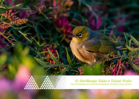
THE CHANGING OF OUR ENVIRONMENT WITHIN TAINUI WAKA
Te Hurihanga Taiao o Tainui Waka
Ka maatakitaki iho au ki te riu o Waikato
Anoo nei hei kapo kau ake maaku ki te kapu o taku ringa,
Ka whakamiri noa i toona aratau
E tia nei he tupu pua hou.
Kia hiwa ake au i te tihi o Pirongia, Inaa, hei toronga whakaruruhau moona ki tooku tauawhirotanga
Anaa! Te ngoto o toona ngawhaa i oona uma kiihai i aarikarika
a Maungatautari, a Maungakawa, ooku puke maunga, ngaa taonga tuku iho.
Hoki ake nei au ki tooku awa koiora me ngoona pikonga
He kura tangihia o te maataamuri
E whakawhiti atu ai i te koopuu maania o Kirikiriroa,
Me oona maara kai, te ngaawhaa whakatupu ake o te whenua moomona,
Hei kawe ki Ngaaruawaahia, te huinga o te tangata
Araa, te pae haumako, hei okiokinga moo taku upoko, Hei tirohanga atu maa raro i ngaa huuhaa o Taupiri
Kei reira raa, kei te oroko hanganga o te tangata, Waahia te tuungaroa o te whare, te whakaputanga moo te Kiingi
I look down on the valley of Waikato, as though to hold it in the hollow of my hand and caress its beauty, like some tender verdant thing.
I reach out from the top of Pirongia, as though to cover and protect its substance with my own
See how it bursts through the full bosoms of Maungatautari and Maungakawa, hills of my inheritance: The river of life, each curve more beautiful than the last
Across the smooth belly of Kirikiriroa, its gardens bursting with the fullness of good things, towards the meeting place at Ngaaruawaahia
There on the fertile mound I would rest my head , and look through the thighs of Taupiri
There at the place of all creation... let the King come forth
Kia hiwa raa, Kia hiwa raa
Kia hiwa raa, ki teenei tuku
Kia hiwa raa, ki teenaa tuku
Kei whakapurua koe ki te toto
Whakapuru tonu, whakapuru tonu
Kia hiwa raa, kia hiwa raa
Kia hiiritia a Kiingi Tuuheitia Pootatau Te Wherowhero Te Tuawhitu.
Te pou herenga waka
Te pou herenga taangata
Paimaarire
Kia poroporoakingia ngaa mate taaruuruu nui o runga i ngaa
marae maha
Haere, haere, haere atu raa
Kei ngaa marae maha o Waikato-Tainui
Teenaa matika, maranga mai ki ngaa tohu o te Taiao.
He tainui, he tairoa, he taiope
Ngunguru te poo
Ngunguru te ao
Ka hau ngaa tai ki uta
Ore ao
Ko tuu te winiwini
Ko tuu te wanawana
Ko tuu whakaputaina ki te whei ao
Ki te ao maarama.

Climate change is already transforming the world around us altering our rivers, wetlands, forests, coastlines, and urban environments These changes affect not only the natural world but also our ability to harvest kai, conduct tikanga and kawa, and uphold our obligations as kaitiaki of the whenua and wai For Waikato-Tainui, and for every marae across the rohe, the signs of climate change are no longer distant they are being seen, felt, and lived every day.
This booklet is a practical guide to support Te Whakakitenga o Waikato marae and whaanau in monitoring the health of our ecosystems using both maatauranga Maaori and Western science It offers a toolkit for observing, recording, and understanding changes in the taiao, drawing on ancestral knowledge, tohu (cultural signs), and marae experience complemented by modern tools where helpful.
You will find structured templates, real-life examples, and potential innovative tools for each major ecosystem:
Ngaa Awa (Rivers)
Ngaa Repo (Wetlands)
Ngaa ngahere (Forests)
Ngaa Takutai Moana (Coastal Areas)
Ngaa Puuahatanga (Estuaries)
Ngaa Taiao Taaone (Urban Environments)
Each section outlines what to monitor (indicators and tohu), how to monitor it (methodologies grounded in tikanga), and what tools can be adapted or created by marae whether that’s using a drone, a Mauri-o-Meter, a taonga tracking app, or through waananga and koorero tuku iho. Often, some of these tools haven’t been created, which provides a chance for ngaa marae to develop them to your needs
How can this help our Marae?
Reconnect whaanau with the taiao through meaningful observations and shared learning
Restore intergenerational knowledge through maramataka, puuraakau, and place-based monitoring.
Enable marae to track change over time, respond to climate pressures, and advocate for action
Strengthen Mana Motuhake by ensuring that monitoring is defined by our values, priorities, and understanding our wairua not just scientific checklists
Whether your marae is coastal or inland, urban or rural, this resource is designed to help you create a living record of your relationship with the taiao and a strategy to protect it
Te Hurihanga Taiao o Tainui Waka | Page 1
He Kupu Whakataki moo Ngaa Repo Introduction to Wetland Monitoring
Wetlands our repo are sacred taonga They are home to tuna, manu, harakeke, koorepo, and many other taonga They clean our waters, protect us from floods, store carbon, and provide rongoaa, weaving resources, and kai. For generations, repo have been woven into our identity, our whakapapa, and our wellbeing Our wetlands are our spiritual landscape with whakapapa connections They are our tribal repositories of taonga – our tribal archival area both biological, cultural and spiritual– the peat holds stories, layers, and memories of the iwi
Yet, across the Waikato rohe, wetlands are under serious threat Over 90% have been drained or degraded. Now, with climate change intensifying floods, droughts, wildfire and invasive species, the remaining wetlands must be protected and restored guided by the values, tikanga, and maatauranga of those who whakapapa to them.
This section of the booklet provides marae whaanau with practical, culturally grounded tools to monitor, assess, and protect their local repo using maatauranga Maaori, tohu, and community-led methods alongside complementary Western science where useful
The following table are examples to monitor repo but are not limited to those and indicators, methodologies and potential tools
Tohu and Indicators and Methodology Monitor
INDICATOR:
Mauri & Wairua Assessments
METHODOLOGY:
Group-based immersion on the repo using waananga and guided karakia to sense shifts in:
Wairua presence; Energetic vitality; Emotional resonance of the place.
POTENTIAL TOOLS:
Mauri-o-Meter: A five-point cultural wellbeing index rating the mauri of a site from maauiui to ora
EXAMPLE:
At a monitored wetland mode, rangatahi expressed “te kore” where spiritual presence was once strong; corroborated by water analysis showing toxic algal buildup
INDICATOR:
Ngaa Tohu o te Taiao
METHODOLOGY:
Derived from centuries of observation encoded in maramataka (lunar calendars) and huringa tau (seasonal changes)
Can Includes signs such as:
First appearance of tuna heke (migrating eels) + repo vitality or hydrology; Blooming of koowhai or harakeke + signal for nesting or water quality conditions; Return of specific manu (e g , matuku, kootuku) = water, levels, insects’ populations.
POTENTIAL TOOLS:
Create a Marae-observed Tohu Tracker App that maps these seasonal changes spatially and temporarily e g, Rongo - Kaitiaki Observational Tool Rongo)
Existing Indigenous Trackers (e g , Cyber Trackers (Cybertrack)
EXAMPLE:
In Whangamarino repo, kaumaatua observed a three-week delay in tuna heke post -2018 due to disrupted hydrological cues, providing early warning ahead of formal warning quality alerts.
INDICATOR:
Koorero tuku iho
METHODOLOGY:
Structured oral interviews and puuraakau with kaumaatua, focused on:
Species once abundant; Sound, smell, or silences a sign of ecosystem shifts; Rongoaa species decline or relocation
POTENTIAL TOOLS:
Create a Digitally archived Koorero Atlas with geotagged marae narratives and intergenerational scoring systems (see example: Mapping Intergenerational Memories (Part I): Proving the Contemporary Truth of the Indigenous Past
EXAMPLE:
One kaumaatua described the absence of the ‘ rere o ngaa wai’ (natural burbling of clean repo waters) as an indication of silent water – a sign that the wetland no longer “breathes”)
INDICATOR:
Mahinga kai Resilience Index
METHODOLOGY:
Assesses availability of mahinga kai species; access rights and practices; quality and quantity thresholds for harvest
POTENTIAL TOOLS:
Create a Kai scorecard reviewed annually by local marae based on: Species abundance; Ease of harvest; intergenerational use. See: Wai Ora Wai Maaori - a kaupapa Maaori assessment tool for Ngaati Tahu-Ngaati Whaoa
EXAMPLE:
Kaakahi populations dropped below viable thresholds in 2022 due to sedimentation and water abstraction, first recorded by youth during repo waananga rather than in formal DOC surveys
Mahinga kia connects food security to ecological indicators Unlike lab tests, this method shows when a wetland is no longer culturally or nutritionally sustaining
INDICATOR:
Whakapapa Connectivity Indicators
METHODOLOGY:
Measure the integrity of genealogical links between places and species, such as:
Movement of tuna between repo and awa
Maintenance of traditional water pathways
Presence of ancestral markers (e g , urupaa, paa, sites near wetlands)
POTENTIAL TOOLS:
Create a Whakapapa Web Mapper showing ecological ancestral linkages as living systems (See: Free course. Introducing the environment: Ecology and ecosystems
EXAMPLE:
Restoration that reconnected repo to ancestral awa sections also revitalised kooura populations, confirming whakapapa restoration as ecosystem healing
While wester science undertake numerical biodiversity counts, whakapapa mapping can reveal functional and spiritual relationships It can explain why the loss matters – not just how many are gone
INDICATOR:
Tikanga compliance Mapping
METHODOLOGY:
Monitoring whether environmental management actions respect cultural protocols and customs.
Consent from mana whenua Karakia prior to intervention Avoidance of waahi tapu.
POTENTIAL TOOLS:
Create a Tikanga Audit matrix co-created with marae committees. (see example: Ngaati Tuwharetoa Cultural Protocols )
EXAMPLE:
A contracted government weeding team was redirected after tikanga monitors identified unnotified activity near waahi tapu, reinforcing cultural protection protocols
Further Reading:
Wetland Handbook Series was published by Manaaki Whenua – Landcare Research is a compilation of three handbooks promoting wetland restoration stories throughout Aotearoa These handbooks highlight restoration approaches through showcasing the relationships between people and their wetlands, and the interpersonal relationships among these communities You can find all three books here: Manaaki Whenua Wetland Handbook Series
Tai Tumu Tai Pari Tai Ao Waikato-Tainui Environmental Plan vision is taken from a maimai aroha of the second Maaori King, Taawhiao, where he laments with a heavy heart his longing for and adoration of the taonga; natural resources of his homeland The maimai aroha is the key driver and indicator of environmental health and wellbeing in this Plan. Waikato-Tainui aspires to the restoration of the environment to the state that Kiingi Taawhiao observed when he composed his maimai aroha You can download the Waikato-Tainui Environmental Plan here: Tai Tumu Tai Pari Tai Ao Waikato-Tainui Environmental Plan
The ’Taku Taioretanga’ series is a video project that takes its name from the prophetic words of Te Puea in the waiata, Ngaa Raa o Hune. Her words are a reminder and a call to action to remember and be who we are especially in contemporary times Taku Taioretanga focuses on sights and ancestors of significance through interviews with a range of exponents from across the iwi. The team hope that the series is a chance to delve into the ‘ way we were ’ , our histories of old, so that they can continue to be passed down from one generation to the next You can view Taku Taioretanga Series here: Taku Taioretanga
Te Ao Maaori: Values-based research and wetland health are essential considerations when developing research strategies and priorities in Aotearoa As tangata whenua and hoa tiriti (treaty partners), iwi and hapuu have important rights, through leadership, and contributions when it comes to our natural environment, and progressing collaborative governance and management alongside government agencies Through collaboration, we can achieve the desired environmental, social, cultural and economic outcome for iwi, Regional Councils and other communities You can view te Ao Maaori: Values-based research and wetland health can be viewed here: Te Ao Maaori: Values-based research and wetland health
The Takutai Moana our coastal areas are deeply woven into the lives, identity, and wellbeing of whaanau and hapuu. From gathering kaimoana, weaving with sea grasses, performing karakia near the shore, or holding tangihanga near the water’s edge, our connection to the moana is spiritual, cultural, and practical
The coast is not just where the land meets the sea it is where our story begins. It is the resting place of Tainui waka, the sacred anchor that bound our journey from Hawaiki to Aotearoa Every ripple of the tide carries the breath of our tuupuna, every grain of sand has been pressed by the footsteps of those who first named this land The coastal ecosystem is our living whakapapa it holds the memory of oceanic navigation, the rhythm of karakia and wailing karanga performed at first landfall, and the lifeblood that links us not just to Waikato but to all Te Moana-nui-a-Kiwa When the dunes shift, when the tides rise, when the kaimoana vanish these are not just environmental signs They are tohu of disconnection, warnings from our ancestors that the mauri of our coastal taonga is under threat Monitoring these changes is not a technical task it is a sacred duty, a reclaiming of our relationship with Tangaroa and a promise to those who came before us to protect what they entrusted us with.
But our coasts are changing Rising seas, coastal erosion, storm surges, pollution, and declining marine life are threatening many traditional practices and sacred spaces Tangaroa is out of balance The time for whaanau, hapuu, and marae to stand as kaitiaki is now
This section of the booklet is designed to support marae-led monitoring of coastal ecosystems, combining maatauranga Maaori, cultural tohu (indicators), and innovative tools to help track the health of the takutai moana. It encourages marae and their whaanau to reconnect with their local shoreline and create their own systems of observation, action, and restoration
Key indicators to monitor, such as kaimoana abundance, water quality, shoreline stability, presence of seabirds, seaweed condition, and tidal behaviour
Examples of maatauranga Maaori monitoring methods, including seasonal shellfish checks, soundscape listening, wairua observation, and mapping change through koorero tuku iho
Tools and ideas for innovation, such as tidal tracking journals, marae whaanau shellfish mapping kits, seaweed monitoring apps, and drone shoreline photography
Insights into climate change risks and how marae can prepare and respond through monitoring, planning, and advocacy
Rebuilds whaanau connection with their takutai moana through observation, puuraakau, and action
Supports kaitiakitanga grounded in tikanga and intergenerational knowledge
Provides tools and knowledge to respond to coastal erosion, sea-level rise, and ecosystem shifts
Enables marae to develop evidence of environmental change that supports funding, restoration, and council engagement
Whether your marae is on the open coast, near an estuary, or beside a sheltered bay, this part of the booklet equips you to observe and protect your part of the moana. It recognises that coastal ecosystems are not just scientific zones they are ancestral homelands, food baskets, and spiritual taonga
Te Hurihanga Taiao o Tainui
The following table are examples but are not limited to those tohu and indicators for Takutai Moana.
INDICATOR:
Mauri of the Moana
METHODOLOGY:
Regular karakia, marae-based observation, listening to the feeling/energy of the moana, linking to seasons and ancestral stories
POTENTIAL TOOLS:
Mauri-o-metre:Customisable dial/tool with sliders for mood, sound Bird activity, colour, smell, kaumatua feeling etc.
Create a Mauri Journal: A marae/whanau logbook where daily reflections and observations, dreams and feelings of the moana are recorded
EXAMPLE:
Mauri assessment based on what is significant to marae. Marae waananga to discuss collective feeling about the health of the moana
INDICATOR:
Abundance and Health of taonga (e.g., kina, pipi, paaua).
METHODOLOGY:
Seasonal collection notes, maramataka harvesting rules, oral tracking of taonga, and knowledge of ideal taonga health states; Taonga movements due to climate change.
POTENTIAL TOOLS:
Create Taonga Survey Kits – determined by marae based on what they want observed see: https://monitoring coastalrestorationtrust org n z/
Create a Kaimoana Abundance App: A Mobile tool to input shellfish counts and sizes during whiikoi or diving This can alert marae whaanau on over-harvesting (See example: Kaimoana Survey Guidelines for hapuu and Iwi ).
EXAMPLE:
Marine Cultural Health Index (MCHI), iwi divers, local harvesting logs
INDICATOR:
Maramataka Observations
METHODOLOGY:
Aligning observations and activities (e g , fishing, planting, raahui) with specific lunar phases. Tohunga and kaumatua observations inform seasonal understanding
POTENTIAL TOOLS:
Utilise localised Digital Maramataka Tools e g , Rongo – a Kaitiaki Observation Tool Rongo - a kaitiaki observation tool :
Create Marae Seasonal Calendar Posters: Visual aids for marae that show tohu for each marama (see example: Te Wai Pounamu Weather and Climate Forecasting ).
EXAMPLE:
Once sufficient data is gathered by marae, it can have the potential to provide daily prompts showing best days for kai gathering, observation tohu
INDICATOR:
Wairua of the Coastal Environment.
METHODOLOGY:
Practiced through karakia, the presence of manu, the energy of the waves, sounds and even dreams. Group reflection sessions
POTENTIAL TOOLS:
Create Wairua Assessment cards: A guide set of reflection prompts – are waves unsettled? Are seabirds absent? Are people uneasy? (While there is no assessment for wairua, there is an assessment for “eco-emotions” that could assist to creating marae wairua assessment cards. see: Eco-emotions: validation of the multi-dimensional inventory of climate emotions in an Australian sample )
Create Wairua Reflection Journal: Shared communal notebook for kaitiaki or Tamariki to reflect on their coastal visit.
EXAMPLE:
Ngaa Tohu o te Ao: Maramataka and marine management – a project that localised maramataka adapted to region
Integrates human intuition and connection with natural systems – especially when data is missing or unclear
INDICATOR:
Changes in Coastal Landscapes and Seascapes
METHODOLOGY:
Intergenerational memory, naming and puuraakau about dunes, sands, waves, weather patterns and their movements Use of ancestral puuraakau, waiata tawhito, and place names
POTENTIAL TOOLS:
Create a Tohu Mapping Kit:Marae-led mapping using GPS and story points – overlay past knowledge with present photos (see: Tohu Mapping Kit GPS mapping )
Create a Photo-Point Diary Place markers for photo comparisons over time Use cheap camera or mobile phone for monthly documentation (see: Conservation Monitoring Photo Points )
EXAMPLE:
Re-mapping original whenua names, waananga on changing tides and coastal movements.
Te Hurihanga Taiao o Tainui Waka | Page 9
Further Reading:
Tohu Taiao Journal - Project Kaitiaki, alongside Natalya Gibson (Waitiaki – Environmental Coordinator), has created the Waitiaki Tohu Taiao Journal – a practical tool to support whaanau in monitoring the health of our awa, wai, and taiao This journal weaves together maatauranga Maaori observation and scientific monitoring, helping you track changes in your local environment over a full year By combining kaitiakitanga practices with data, we can build a clearer, shared understanding of the wellbeing of our taiao. https://www.tuwharetoa.co.nz/app/uploads/2025/04/Tohu-Taiao-Journal.pdf
Reclaiming indigenous knowledge for marine management – This impact study describes incorporating maatauranga Maaori into marine management strategies to improve coastal indicators. Due to climate change, many marine and coastal environments in Aotearoa have gone through a rapid transformation in recent years. To better understand these changes and their impact on a social, cultural and economic scale, a project is underway that explores how we can approach marine and coastal management through a maramataka lens to develop cultural and coastal indicators https://www sustainableseaschallenge co nz/tools-andresources/reclaiming-indigenous-knowledge-for-marine-management/
Te Tiaki Mahinga Kai (MCHI) - The Marine Cultural Health Index (MCHI) monitoring toolkit enables Ngaai Tahu to establish restoration targets and sustainable mahinga kai (the practice of customary food-gathering) harvest strategies within their taiaapure, maataitai, and other coastal protection areas. The toolkit, incorporates a range of environmental indicators, based on local and traditional knowledge It may be used to assess and record:
the current ecological state of Ngaai Tahu’s rohe moana (coastal marine area over which Ngaai Tahu exercises its kaitiakitanga changes in marine ecosystem health over time, and effectiveness of local fishing rules and reseeding strategies https://www mahingakai org nz/community-tools/marine-cultural-health-index/
Predicting the impacts of climate change on New Zealand’s seaweed-based ecosystems - Given recent increases in sea surface temperatures and the increasing frequency of extreme weather events in some regions of New Zealand, predicting the impacts of climate change on seaweeds and the important communities they support is becoming increasingly important for conserving resilient seaweed ecosystems in the future. https://www tandfonline com/doi/full/10 1080/0028825X 2023 2245786#d1e347
Monitoring Ngahere:
Strengthening Forest Kaitiakitanga through Marae-led Practices
The Ngahere is more than a forest it is our ancestor, our healer, our storyteller Within its embrace, we find rongoa to soothe the body, kai to nourish the soul, and the voices of the birds that gift us our waiata. The trees that stand are not just timber; they are the very poupou of the whare that are blueprints for survival, drawn from the roots of our identity.
But now, the forest is growing quiet The manu have withdrawn their songs The raakau no longer flower in season The earth beneath is drier, thinner, unfamiliar
This silence is not peaceful it is grief. And when the forest falls silent, so too do the people. The loss of one is the loss of the other.
To monitor the ngahere is not simply to record data It is to listen to the language of the land before it disappears It is to notice when the song of the tuuii no longer echoes through the canopy, when the scent of flowering rongoaa fades from the wind, when the maramataka no longer matches the cycles of the bush. It is to honour every tohu as a whisper from our ancestors urging us to awaken, to act, to protect Monitoring the ngahere is our modern karakia a ritual of care, of connection, and of resistance For if we do not hear the forest, who will hear us?
But today, the ngahere faces immense pressure Climate change, pest invasion, fire risk, and land development are accelerating the decline of native biodiversity, undermining our ability to harvest, heal, and maintain balance and this section
This section of the booklet is dedicated to helping marae whaanau to monitor the health of their ngahere using the strength of maatauranga Maaori, intergenerational puuraakau, and cultural indicators while offering complementary scientific tools where useful Monitoring the ngahere helps us to listen, understand, and respond through reconnecting, and ensuring its mauri remains intact for the generations to come.
Encourages deep connection and familiarity with the local ngahere through cultural observation
Revives the use of the forest for rongoaa, tikanga and kawa, weaving, and puuraakau
Enables marae to track visible and invisible changes in mauri, pests, canopy, and water sources.
Supports climate resilience planning, planting strategies, and advocacy with evidence grounded in maatauranga
Strengthens whakapapa to place and restores the roles of tamariki and kaumaatua as kaitiaki and knowledge holders
Whether your ngahere is vast or small, remnant or recovering, this section is your guide to reawakening the relationship between marae and ngahere We do not monitor just to gather data we monitor to restore connection, protect whakapapa, and pass on the wisdom of the ngahere to those yet to come
The following table are examples but are not limited to those tohu and indicators. You can also utilise the wetland potential tools for Ngahere as well.
INDICATOR:
Mauri of the Ngahere.
METHODOLOGY:
Assessing the spiritual and physical wellbeing of the Ngahere through karakia, observing the vitality of flora and fauna and marae narratives
Empowers marae to make informed decisions on forest management Strengthens cultural connections and responsibilities towards the Taiao.
POTENTIAL TOOLS:
Mauri Assessment framework: A tool combining qualitative measures to evaluate the mauri of the forest
Marae workshops: facilitated sessions to gather collective insights on what make a forest healthy
EXAMPLE:
Marae-led karakia and whiikoi into the ngahere followed by workshops reflections on signs of life and wairua presence
INDICATOR:
Presence and Abundance of Taonga.
METHODOLOGY:
Monitoring traditional taonga (e g , rongoaa plants, ngaangara, manu) through seasonal observations and harvesting practices Supports the preservation of biodiversity
Enhances intergenerational knowledge transfer
POTENTIAL TOOLS:
Create a Taonga Inventory A mobile app to record sightings and conditions of taonga. (Utilise the resources from I naturalist )
EXAMPLE:
Tamariki and kaumaatua use mobile apps during waananga to track rongoaa plant growth, ngaangara presence, manu and compare it to traditional seasons
INDICATOR:
Phenological Changes (Seasonal Indicators).
METHODOLOGY:
Observing changes in flowering, fruiting, and animal behaviours to indicate environmental shifts This aids in predicting ecological changes caused by climatic (e g , heat and water stress)
Integrates traditional knowledge with contemporary data analysis
POTENTIAL TOOLS:
Create Seasonal Calendars:Visual tools aligning taonga activities with maramataka.
Create Phenology Tracking Charts: Templates for recording seasonal events.
Create/Find a Digital platform: Online database to compile and analyse long-term data (see: inaturalist)
EXAMPLE:
Marae charts used to record the flowering of rongoa, arrival of migratory manu, presence/absence of ngaangara and interactions of ngaangara with different taonga, and changes to forest calls across seasons
INDICATOR:
Impact of invasive species and diseases.
METHODOLOGY:
Utilising traditional knowledge to detect and respond to threats like myrtle rust and kauri dieback - Enhances early detection and response capabilities
Promotes marae/community-led conservation efforts
POTENTIAL TOOLS:
Create Surveillance Frameworks: Guidelines incorporating maatauranga Maaori for monitoring forest health threats and treatments
Provide Educational Materials: Resources to raise awareness and response strategies
EXAMPLE:
Marae-led patrols, identify and mark trees with signs of illness.
Marae waananga are held to create a rongoaabased response plan.
INDICATOR:
Changes in Ngahere structure and composition.
METHODOLOGY:
Documenting alterations in ngahere density, canopy cover, taonga composition through oral histories and land use practices
Provides a holistic understanding of environmental changes
Informs sustainable land management practices
POTENTIAL TOOLS:
Create Mapping Tools: GIS-based applications, or drone mapping with oral history overlay to visualize changes over time.
Invest in Puuraakau Sessions: Platforms for sharing and recording marae observations e.g., ngahere memory wall (digital archive) where marae upload ngahere photos and stories across generations. This can also include waiata, puuraakau, carvings etc
EXAMPLE:
Kaumaatua share oral histories and compare old maps with current GIS layers to discuss canopy loss and taonga migration.
Further Reading:
An Indigenous community-based monitoring system for assessing forest Zealand The objective of this study was to identify community-based ind metrics used by Maaori of Tuawhenua Trust from Tuuhoe to monitor fore community wellbeing. The Tuawhenua group identified forest health indic associated gradient of metrics to assess each indicator that were groupe relevant themes You can access via the following link: https://link.springer.com/article/10.1007/s10531-016-1142-6
A Maatauranga Maaori Framework for Surveillance (MMFS) of forest pat in Forests and Global Change - Introduces a co-developed model that inte maatauranga and science in surveillance, with example applications in ka myrtle rust, and emphasizes data sovereignty through tools like “proof of absence.” You can access the document via: https://www.frontiersin.org/ and-global-change/articles/10 3389/ffgc 2024 1392083/full
Me ora te Ngahere: Visioning Forest health through an Indigenous biocult Conservation Biology - Details app-based tools co-designed with Ngaati R health monitoring via community workshops, including sensory indicator moss ” reflecting dryness. You can access the document via: https://www publish csiro au/PC/PC22028
Waitiaki Tohu Taiao Journal Ngaati Tuuwharetoa. The main purpose of th encourage and facilitate connection to taiao[LW1] by recording observati paatai in the Waitiaki Framework to help you observe https://www.tuwharetoa.co.nz/app/uploads/2025/04/Tohu-Taiao-Journ
Native Forest Monitoring – A guide for forest owners and managers This to provide information so forest owners, managers, community groups a effectively monitor New Zealand’s native forests https://groundtruth co n content/uploads/2019/09/Native-Forest-Monitoring-Guide pdf
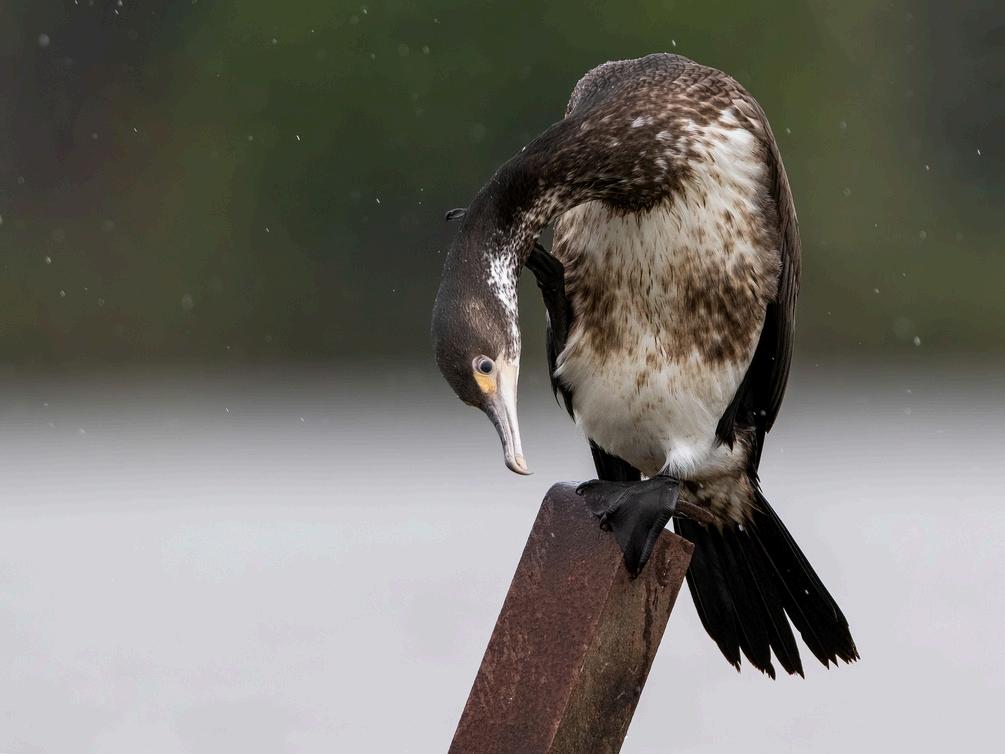
Image credit - Enzo Giordani
Strengthening Kaitiakitanga through Marae-led Practices
Ngaa Puuahatanga – our estuaries – are dynamic, living systems where the awa meets the moana. They are the heartbeat of ecological exchange and wairua transition where saltwater and freshwater merge, where sediment settles, where our whakapapa flows both inward and outward and life bursts forth For many coastal marae, estuaries have long been kai baskets, waananga spaces, bird havens, and ceremonial gateways - it is a connector, a sacred hinge that binds Ki Uta Ki Tai It is where iinanga dance between tides, where kawau skim the surface, and where the songs of the awa merge with the voice of Tangaroa
But the tides are shifting, and estuaries are among the most vulnerable ecosystems in Aotearoa Sedimentation, pollution, overharvesting, sea-level rise, and climate-driven flooding are rapidly degrading their mauri. In many places, shellfish beds have declined, birdlife has disappeared, and the balance between land, river, and sea has been lost Monitoring the estuary is not just about science it is about honouring the places where life begins again and again. It is a practice of aroha, of vigilance, and of remembering that what happens at the mouth of the river tells us everything about the health from the maunga, repo, ngahere, and the moana. If we do not monitor the estuary, we lose the language of connection and sever the thread that binds our world together
This section of the booklet provides examples of indicators, methods, and potential tools for maatauranga Maaori to support marae-led estuary monitoring By connecting whaanau to the tohu of their estuary its smells, sounds, species, and flows they can take informed action to protect it and pass on that knowledge across generations
Key tohu (cultural indicators) to monitor estuary health, including shellfish abundance, estuarine beds, tidal rhythm, smell and colour of the water, and presence of wading birds and other taonga
Practical maatauranga-based monitoring methods such as seasonal kai harvesting assessments, visual sediment checks, Mauri-o-Meter scoring, and soundscape listening
Innovative tools like drone sediment mapping, estuary cultural use logs, koorero tuku iho mapping apps, and whaanau catch diaries
Recording templates and story-driven observation sheets to engage rangatahi, pakeke, and kaumaatua in shared kaitiakitanga.
Insight into how climate change is affecting estuarine dynamics including warmer waters, rising tides, and biodiversity shifts
Reconnects whaanau with their estuarine taonga through observation, discussion, and cultural memory
Tracks visible and invisible changes in kai moana beds, flow patterns, water quality, and taonga species.
Supports strategic responses to sea-level rise, sedimentation, and customary harvest restoration
Enables marae to collect and present evidence for restoration, adaptation funding, and engagement with councils
Upholds mana whakahaere and strengthens the intergenerational roles of whaanau as kaitiaki and kaikoorero of the estuary.
Whether your estuary is expansive or tucked into a tidal cove, this part of the booklet will help you to observe, understand, and act guided by maatauranga Maaori, scientific insights, and the lived wisdom of whaanau who are connected by the awa and the moana
Te Hurihanga Taiao
The following table are examples but are not limited to those tohu and indicators. You can also utilise the coastal potential tools for estuaries as well.
INDICATOR:
Mauri of the Estuary.
METHODOLOGY:
Assessment via tikanga-led observations, tikanga and kawa, and puuraakau relating to estuarine condition, bird life, and kai moana.
This localises monitoring for marae Encourages intergenerational participation and tikanga enhancement.
POTENTIAL TOOLS:
Create a Mauri Monitoring Mobile App: Culturally guided data input, scoring estuary health. (see example: Mauri Model Monitoring App )
Create a Tohu based Sensor Kits: Sensors that align with tohu indicators such as water clarity, sediment depth, and fish and shellfish presence (e g ,Cultural Health Index )
Create a taonga diary App: Tracks changes in taonga quality and availability. A good resource for evidence over time
Create a portable salinity and sediment testing toolkit: Aligned with traditional tohu of pipi taste, texture, iinanga migration, native plant blooming, and other ocean taonga that are arriving into the estuary and river system , Ngaati Tuwharetoa Tohu Taiao Journal
INDICATOR:
Abundance of Taonga.
METHODOLOGY:
Monitoring pipi, tuatua, cockles, iinanga, fish, native plants via traditional gathering spots, moon cycles, and other tohu (e g, Poohutukawa blooming)
Protects harvesting knowledge and sustainability practices
Enables early warning of declining mahinga kai
Observes new taonga entering into the estuary and river system.
POTENTIAL TOOLS:
Create a Colour turbidity Comparison Card. A paper or digital versions that compare current conditions with healthy estuarine tohu
Create a drone imagery Tool(s): Used to observe sediment plumes from storm runoff
EXAMPLE:
EXAMPLE:
Whaanau walk the estuary and use the app to log traditional signs of mauri, linking GPS data with tikanga-based indicators
A Marae Cultural Health Index to assess cultural and taonga health within an estuary.
INDICATOR:
Changes in Estuarine Water Quality and Clarity
METHODOLOGY:
Tohu such as changes in colour, turbidity, smell, and visibility of river mouths and tidal zones.
Enables visual teaching tools
Enhances cultural interpretation alongside science
POTENTIAL TOOLS:
Create a Digital Taonga Diary with traditional use Database: Includes traditional use of taonga and indicators of ecosystem stress
Create a Marae/Community Mapping Tool: Tags taonga sites for restoration or monitoring
EXAMPLE:
Marae log kai harvest data in diaries that record taonga size, frequency of catch.
Tools test sediment intrusion and salinity changes onsite. However, diaries can also include tohu for when to fish for certain taonga
INDICATOR: Health of taonga
METHODOLOGY:
Observation of vitality, colour, and bird association with specific estuarine taonga, especially those used for traditional use (e g , weaving, carving, medicine)
Protects taonga
Connects traditional usage with ecological change.
POTENTIAL TOOLS:
Create Access and Pathway tracker App: Maps traditional paths and seasonal blockages.
EXAMPLE:
Kaumaatua guide tamariki using tohu cards during field trips; drone captures estuary transitions after rain
INDICATOR:
Cultural harvesting Practices and Access
METHODOLOGY:
Monitoring through access pathways, sedimentation levels, and seasonal availability using traditional harvesting protocols
Helps to restore access and respect protocols
Supports sustainable practices and rights reaffirmation.
POTENTIAL TOOLS:
Mahinga kai Pressure Index Tool: Measures harvesting pressure over time with cultural metrics
EXAMPLE:
Marae whanau tag sites on maps with photos and record use/stress signs; data reviewed during waananga.
Marae document blocked paths or inaccessible zones in app, triggering marae/community discussions and restoration planning
Further Reading:
tuarine monitoring toolkit – has been developed to tools to measure environmental changes in their anga Iho is based in sound science principles, it also ua values. See the following website for further asts/estuaries/nga-waihotanga-iho-estuary-
lds and values – Assessing the interactions between ants from freshwater on the health and functioning of iwi partners, Our Land and Water National Science the Environment See the following website for sustainableseaschallenge co nz/our-research/ki-uta-
roa - collates data from monitored estuaries across explore and download monitoring data from and see national summaries of the available data here: https://www lawa org nz/explore-
Ngaati Tuuwharetoa) The main purpose of the cilitate connection to taiao using the paatai in the oject Kaitiaki | Tuwharetoa Maori Trust Board to how to fill pout each session You can view the uwharetoa.co.nz/app/uploads/2025/04/Tohu-Taiao-
Monitoring Ngaa Awa: Strengthening Kaitiakitanga through Marae-led Practices
The awa holds the memory of our tupuna It flows through our whakapapa, nourishes our whenua, and sustains the mauri of our marae. Our river is a living ancestor, she fed, clothed and healed us. We built our koorero from her currents soaked into waiata, carried in karakia The awa gave us more than life She gave us identity We learned to listen to her moods, to her silences, to her floods and whispers. From its origins in the maunga to its merging with the moana, the river is more than a body of water it is a living, breathing taonga that binds generations together
In recent decades, our rivers have been heavily impacted by human activity and climate change We are seeing changes in flow, more extreme flooding and droughts, declining water quality, loss of native taonga like tuna and kooura, and shifting sediment and erosion patterns These disruptions are affecting our ability to maintain customary practices, uphold tikanga, and protect the life force of the awa.
Our way of monitoring is not a form, a graph, or a report It is karakia with our hands in the water. It is kaumaatua telling us when the river smells wrong. It is tamariki noticing that tuna no longer play in the shallows It is puuraakau guiding us toward balance It is our obligation, not just to measure, but to feel to know when the river weeps.
This section of the booklet provides a marae-led framework for monitoring awa health, grounded in maatauranga Maaori and supported by accessible tools and templates It invites whaanau to use traditional knowledge, lived experience, and cultural indicators (tohu) to build a long-term understanding of the river and its changing state.
What this section includes:
Key tohu (indicators) of river health: including tuna migration, flow strength, clarity and sediment, riparian vegetation, wairua of the awa, and human health impacts
Maatauranga Maaori-based methods for observing and recording river conditions such as seasonal observation logs, waananga-based koorero tuku iho, and the use of the Mauri-o-Meter
Examples of practical tools: such as tuna monitoring stations, soundscape recordings, riparian health trackers, and community mapping apps
Templates for data recording, awa mapping, seasonal calendars, and community reflection sessions.
Integration of river health insights into broader climate change responses and restoration planning for marae and their hapuu
Supports Marae to restore, protect, and strengthen the mauri of the awa using tikanga-based methods
Encourages whaanau across generations to participate in observation, learning, and action.
Provides a localised evidence base to support restoration, advocacy, and partnerships with councils and funders
Helps marae understand and prepare for the climate-driven changes affecting the river and its ecosystems
Strengthens mana whakahaere and ensures monitoring is defined by Maaori values not imposed frameworks.
To monitor the awa is to honour it Through this part of the booklet, marae can reawaken the old practices, adapt them to modern tools, and ensure that our awa remains vibrant, healthy, and connected to the people who carry its name in their veins
Te Hurihanga Taiao o Tainui Waka | Page 19
The following table are examples but are not limited to those tohu and indicators. You can also utilise potential tools for wetlands as well.
INDICATOR:
Mauri of the Awa.
METHODOLOGY:
Group waananga on sight, sound, smell and feeling emotional scoring
POTENTIAL TOOLS:
Digital mauri Diary, Mauri-oMetre toolkit
EXAMPLE:
Marae whaanau meet monthly to log awa wairua shifts using a mobile app This can be used leading up to river events, or with tohu assessment.
INDICATOR:
Mapping Past vs Present to realise Marae future aspirations.
METHODOLOGY:
Mapping across generations, marae whanau uncover cultural indicators -such as declines in taonga numbers, changes in birdlife, or shifts in water clarity that signal deeper ecological shifts.
POTENTIAL TOOLS:
Ake Ake Model: a pictorial, participatory mapping tool
EXAMPLE:
By embedding past and present indicators into river monitoring, it becomes co-designed, culturally meaningful indicators that fosters collective action and strengthen kaitiakitanga through visual, emotional, and spiritual data that sit alongside western science.
INDICATOR:
Water Clarity & Sedimentation
METHODOLOGY:
Waiwhakaata observation, photographic documentation, drone overflights Using a traditional reflective method, look into the water under consistent conditions (e.g., same time of day) Rate water based on how much reflection can be seen – clear, murky, or cloudy Complement with a Secchi disk if available
POTENTIAL TOOLS:
Awa Observational Journal:
Daily or monitor notes about flow, clarity, and wairua (e g , Ngaati Tuwharetoa Tohu Taiao Journal )
EXAMPLE:
Marae and river users photograph sediment increases after upstream disturbance work.
INDICATOR:
Riparian Vegetation Health
METHODOLOGY:
Walk along a designated section of the riverbank monthly Document the health of native vegetation (leaf loss, pest damage, regeneration).Observe and photograph any sediment movement, bank collapse, or invasive weed encroachment.
POTENTIAL TOOLS:
Taawharau Tracker cards, QR coded Flora tags (e g , https://business esa int/project s/urban-green-quality-tracker )
EXAMPLE:
Whaanau map plantings and log health of different native plants each season
INDICATOR: Flooding & Flow Irregularity.
METHODOLOGY:
Riparian Trach Survey Monthly walk-throughs, photos, and restoration logs
Flood marker tracking, puuraakau and intergenerational interviews
INDICATOR: River Health METHODOL
Marae recor irritation, or contact with track pattern kaumatua a about any av due to unsa
POTENTIAL TOOLS:
GPS Flood Mapping App, Oral History Recorder.
EXAMPLE:
Marae uses tablets to mark water levels and record kaumaatua flood memories
POTENTIAL
Create a Ma monitoring a and environm
EXAMPLE: Promotes aw awa degrad directly.
Further Reading:
Can I swim here? – Discover New Zealand best swimming spots with LAWA, featuring water quality information for around 980 beaches, rivers and lakes
Water quality is regularly tested from November to March in most regions, while predicted water quality results are available year-round for Northland, Auckland and Wellington to help you decide where and when to swim You can select a site to see its water quality information, nearby facilities, how to get there, and the science behind the data. Desktop users can use the interactive map to find the perfect spot via this website: https://www lawa org nz/explore-data/swimming
Also, you can read the latest LAWA national River Water Quality Summary results in the national Picture tab here: https://www.lawa.org.nz/explore-data/riverquality
Wai Connection - Taatai Ki Te Wai is a Mountains to Sea Conservation Trust (MTSCT) community catchment group engagement project, co-funded through the Essential Freshwater Fund (EFF) until June 2025 It supports the Government’s Essential Freshwater (EF) package, a national initiative to protect and restore our rivers, streams, lakes, and wetlands The project aims to empower community catchment groups by providing knowledge, tools and expert support to help identify issues in their local catchment area. We want to connect people with their waterway and enable collaboration between local catchment groups, NGOs, iwi, hapuu, regional councils, central government agencies, landowners and primary industry working in the catchment.
MTSCT has a twenty-year track record of supporting communities to achieve marine and freshwater conservation through science-based experiential programmes, tailored resources, and community engagement We'll work with local Provider Organisations in 15 regions to ensure we are resourcing local people to understand local issues and helping to find local solutions that connect all stakeholders in each catchment area Check out the resources on this website to explore further:https://www waiconnection nz/
Make Your Stream Monitoring Data Count! – This guidance document and the overarching national quality assurance framework for Community Based Monitoring (CBM) in Aotearoa New Zealand, are designed to provide all the information that a community or catchment group needs to make sure their data will be of value to them, and to national efforts to improve water quality You can access the guidance document here: https://ourlandandwater nz/wpcontent/uploads/2024/07/NIWA-CBM-Guidance-Manual-FINAL low-res.pdf
Cultural health Index - This guide explains how to apply the Cultural Health Index (CHI) for streams and waterways, from selecting sites and setting up a monitoring team, to calculating the CHI scores for the sites It provides resources such as forms, recommended interview questions, and data collection worksheets. You can access the download guidance document here: https://environment govt nz/publications/using-the-cultural-health-index-how-toassess-the-health-of-streams-and-waterways/ https://www.tuwharetoa.co.nz/app/uploads/2025/04/Tohu-Taiao-Journal.pdf
Waikato River Independent Scoping report - This document outlines the vision for a future where a healthy Waikato River sustains abundant life and prosperous communities who, in turn, are all responsible for restoring and protecting the health and wellbeing of the Waikato River, and all it embraces, for generations to come. https://waikatoriver.org.nz/funding-round-related-documents/
Waikato-Tainui Deed of Settlement: https://www.govt.nz/assets/Documents/OTS/Waikato-Tainui-Raupatu/WaikatoTainui-Deed-of-Settlement-22-May-1995 pdf
Waikato-Tainui Raupatu Claims (Waikato River) Settlement Act 2010 https://www legislation govt nz/act/public/2010/0024/latest/DLM1630004 html
Strengthening kaitiakitanga through Marae-led Practices
Beneath the tar seal and steel, beneath the cul-de-sacs and overpasses, the whenua still remembers This land was never empty Our footprints, our urupaa, our sacred waterways they are all still here, pressed into the bones of Papatuanuku, though they are now buried beneath concrete and shadow. The city has risen, fast and loud, but in doing so, it has smothered the breath of our taiao, our stories, our ahi kaa. Our whenua was not meant to be squared into parcels and priced it was meant to be touched, to be sung to, to be fed and held But we are being squeezed Waahi tapu are paved over Awa are straightened and named drains Whenua where tuupuna once gathered kai and rongoaa is now called ‘development opportunity ’ Our whakapapa is still here – but we have to fight for our existence
Our way of monitoring in the urban environment is not a luxury – it is survival It is our right to name what was here before the road, the mall, and the subdivision It is walking with kaumaatua who remember the puna that once bubbled near the bus stop It is looking for the migratory patterns of ngaa manu that no longer flock over from the west to east coast and listening to them within suburban areas. It is making the cracks in the concrete where harakeke still fights to grow and honouring the korero that lie just beneath the surface and refusing to let them be forgotten
Though we are pushed to the edges, we are not gone.Our presence us not defined by how visible we are in urban plans – it is defined by how connected we remain to place Cultural monitoring ensures that the whenua still breathes beneath the city It ensures that our whakakapapa to place is not erased, but remembered –named, mapped, sung, and spoken – by us
While many of the potential tools provided in each ecosystem can be adapted for urban environments, urban settings have unique challenges and opportunities that require tailored tools, especially around infrastructure, heat, energy and wellbeing
The benefits for Iwi-Led Monitoring in urban ecosystems are:
Maatauranga Maaori provides a deeper understanding of the interconnectedness between humans, the Taiao, and broader social and cultural systems; Iwi often have long-term observations of their Taiao enabling them to detect changes and trends that might be missed by short-term scientific studies; Involving marae in monitoring and decision-making processes can empower them to promote well-being
to Monitor (Tohu and Indicators) and How to
The following table are examples urban marae monitoring opportunities and tools. Please use other Indicators from other Ecosystems to assist you if you wish.
OPPORTUNITY:
Cultural Stormwater monitoring
POTENTIAL TOOL FOR MARAE:
Paataka Wai Sensor & Observation Journal – A whaanau-led tool using basic water sensors and logbooks to track overflows, drain blockages, and localised flooding near sacred sites
Urban heat monitoring & shade mapping. Mauri Heat Mapping with Satellite/Drone – Uses Google Earth Engine or Sentinel Hub to identify urban heat islands
HOW IT HELPS MARAE, WHAANAU AND TAIAO:
Reclaims knowledge of hidden awa, moana, protects waahi tapu from runoff pollution, and can influence council infrastructure upgrades.
Urban greenery & tree loss/gain
Green View Index (GVI) Monitoring – AI-based tool using street imagery to assess tree canopy cover over time Example: IIASA Global Green View Index model for Auckland and Hamilton – open data available at https://iiasa ac at/ GVI Explorer
Energy alternatives for marae / whaanau. Solar Marae Audit Tool – A community-designed checklist to evaluate marae energy usage, solar viability, and insulation needs
Create a maatauranga-based heat mauri Index. Western heat maps miss wairua and cultural indicators A “mauri heat index” reflects how heat affects land, people, and life-force.
Helps marae and whaanau track local tree loss and identify areas for replanting or restoration Supports biodiversity and mental wellbeing.
Water conservation and access
Maramataka- aligned water use – Provides insight into waterrelated activities and energy cycles It guides when to fish, plant and manage water resources based on lunar phases offering a framework for environmental awareness
Identifies homes or marae needing better insulation, energy-efficient solutions, and maatauranga aligned power savings This helps supports resilience and offers rangatahi opportunities in clean energy jobs
Supports low-cost water harvesting, greywater reuse, and traditional water-saving practices It also Builds independence from council supply and promotes maramataka-aligned water use
(Tohu and Indicators) and
(Methods)
The following table are examples urban marae monitoring opportunities and tools. Please use other Indicators from other Ecosystems to assist you if you wish.
OPPORTUNITY:
Mauri of urban biodiversity
POTENTIAL TOOL FOR MARAE:
Mauri Manu Sound Recorder & Observation Journal –
Portable devices used to monitor native bird calls or insects in urban bush patches
Waste & pollution reduction
Cultural safety in development zones
Waahi Tapu Litter Mapper – Whaanau use digital maps or photos to log waste hotspots near waahi tapu sites, community gardens, or marae
HOW IT HELPS MARAE, WHAANAU AND TAIAO:
Supports marae-based biodiversity restoration, tracks wairua and ecological health based on manu and insect activity; reconnects city life with atua e g , Taane Mahuta
Identifies pollution pressure points and builds tikanga-based urban waste reduction practices.
Climate change readiness in cities
Urban Development Tikanga Register – Whaanau document tikanga and waahi tapu risks in areas subject to zoning or council works
Helps marae advocate for protection of waahi tapu and cultural values in council zoning decisions
Te Hurihanga Taiao o Tainui Waka | Page 25
Urban Climate Whaanau Dashboard – A low-tech or digital resource that tracks household preparedness for floods, heatwaves, food access Example: Taamaki Regeneration worked with kaumaatua to create wellbeing indicators and resilience maps. [Auckland Council, 2021]
Assesses readiness of whaanau homes for flooding, food shortages, or heat waves grounded in tikanga and whakapapa
Further Reading:
The Ookahu Catchment Ecological Restoration Plan – This plan has been developed in order to implement the Whenua Rangatira Reserves Management Plan and the Ngaati Whaatua Ooraakei Heritage and Resource Management Kaupapa, Strategy and Policy 2010‐2011. It looks to promote, develop and enhance Ookahu Bay as the public face or gateway to the whenua rangatira while respecting its existing cultural and spiritual value to the Tangata Whenua and enhancing its relationship with the Waitemataa. https://ref coastalrestorationtrust org nz/site/assets/files/8851/the-okahucatchment-ecological-restoration-plan5 pdf
Auckland urban heat assessment Technical report In a first for New Zealand, Auckland Council has released a report, Auckland Urban Heat Assessment, that highlights the impact of land cover on temperatures across the region, particularly within city areas where high-density buildings and infrastructure trap heat https://www knowledgeauckland org nz/publications/auckland-urban-heatassessment-technical-report/
Te Haumanu Taiao – restoring the natural environment in TaamakimakaurauAuckland Council’s environmental services team and Ngaa Iwi Mana Whenua o Taamakimakaurau (the many tribes of the Auckland region) have in partnership, created a guide in to empower anyone undertaking ecological restoration mahi in Taamakimakaurau. This restoration guide complements the Indigenous terrestrial and wetland ecosystems of Auckland that describe the ecosystems occurring in the region It provides best practice guidance on restoring each of these ecosystems plus information on how to begin, plan and monitor a project. https://www tiakitamakimakaurau nz/protect-and-restore-our-environment/tehaumanu-taiao/
Shade Map App – A Free Global Sun simulation app where it will provide you shaded areas anytime any where in the globe https://shademap.app/@-36.84853,174.76349,15z,1750042637422t,0b,0p,0m
Daily Climate Maps – Managed and developed by NIWA, these climate maps are updated daily and are based on data from the National Climate Database All historical averages are based on the 30-year period 1991-2020 Maps of some variables, for example sunshine hours, are based on fewer recording sites than others, for example rainfall For more information on these maps, and the data used to produce them, please contact the National Climate Centre https://niwa.co.nz/climate-and-weather/daily-climate-maps
Auckland Council’s first urban heat assessment reveals “heat islands” in the city
In a first for New Zealand, Auckland Council has released a report, Auckland Urban Heat Assessment, that highlights the impact of land cover on temperatures across the region, particularly within city areas where high-density buildings and infrastructure trap heat. The report is now available on Knowledge Auckland. This initiative is part of Auckland Council’s commitment to protecting the health and wellbeing of Auckland’s communities today and into the future By understanding and addressing the urban heat island effect, the council and its partners are working to ensure all Aucklanders can thrive in a warmer region Read the Auckland Urban Heat Assessment report summary here https://ourauckland.aucklandcouncil.govt.nz/news/2024/12/heat-assessmentreport/
Kai Ika Project – The project utilises fish heads, frames and offal which were previously going to waste Since first established in September 2016 over 385,000 kg of previously discarded fish parts have been collected from various sources and redistributed to needy families and community groups all over Taamakimakaurau https://kaiika co nz/who-are-we/
Urban Forage Map NZ - https://www.urbanforaging.co.nz/ Urban foraging Map
NZ is a free easy to use map for finding fruit and nut trees To see what’s growing near you, just open the map to view your local area & add your own markers if you find a fruit or nut tree.
References
Wetland References:
Awatere, S , Robb, M , Taura, Y , Reihana, K , Harmsworth, G , Te Maru, J , & Watene-Rawiri, E (n d ) Wai Ora Wai Māori – A kaupapa Māori assessment tool for Ngāti Tahu–Ngāti Whaoa. Manaaki Whenua – Landcare Research. Also available via: Wai Ora Wai Maori - a kaupapa Maaori assessment tool for Ngaati Tahu-Ngaati Whaoa
CyberTraacker Conservation (2021) CyberTracker Online provides a free* software service for indigenous communities, simplified for nontechnical users who cannot afford expensive technical support. CyberTracker is being used worldwide by indigenous communities, in protected areas etc Also available via: https://cybertracker org/
Hershey R, McCormack J, Newell G (2014) Mapping Intergenerational memories (Part 1): Proving the Contemporary Truth of Indigenous Past Arizona Legal Studies Discussion Paper No. 14-01. Also available via: Mapping Intergenerational Memories (Part I): Proving the Contemporary Truth of the Indigenous Past by Robert Hershey, Jennifer McCormack, Gillian Newell :: SSRN
Manaaki Whenua – Landcare Research (n d ) The Wetland handbook Series published by Manaaki Whenua – Landcare Research is a compilation of three handbooks promoting wetland restoration stories throughout Aotearoa New Zealand Also available via: https://www landcareresearch co nz/publications/wetland-handbook-series/
Rainforth, H J & Harmsworth, G R (2019) Kaupapa Māori Freshwater Assessments: A summary of iwi and hapū-based tools, frameworks and methods for assessing freshwater environments. Perception Planning Ltd. 115 pp (Also available via:https://www nrc govt nz/media/n0ip2ksp/kaupapa-maoriassessments-final-jan-2019 pdf )
The Open University (2020) Introducing the environment: Ecology and ecosystems OpenLearn Also available via: Free course Introducing the environment: Ecology and ecosystems.
Tūwharetoa Māori Trust Board (2025) Cultural protocols for lake Taupo Kawa Tikanga o Taupoo Moana. (TMTB Cultural Protocols 2025). Also available via: https://www tuwharetoa co nz/app/uploads/2025/04/TMTB-Cultural-Protocols2025 pdf )
Waikato-Tainui (n d) The ‘Taku Taioretanga’ series For more information on Taku Taioretanga, please contact Mahana Toka in the Heritage & Identity Team on mahana.toka@tainui.co.nz Also available via: https://waikatotainui com/kaupapa/taku-taioretanga/
Waikato-Tainui Te Kauhanganui Incorporated (2013). Tai Tumu Tai Pari Tai Ao Waikato-Tainui Environmental Plan https://waikatotainui com/wpcontent/uploads/2020/11/Tai-Tumu-Tai-Pari-Tai-Ao-PLAN-ENGLISH pd
Whetu Consultancy (n d) Rongo - Kaitiaki Observation Tool Also available via: https://www thestream nz/rongo/
Wilcox M, Taura Y (2021) Te Ao Maaori values based research and wetland health Manaaki Whenua – Landcare Research Available via: https://www.youtube.com/watch?v=Di2KnbD62dY
Te Hurihanga Taiao o Tainui Waka | Page 27
Coastal References:
Coastal Restoration Trust of New Zealand (2025) Coastal Monitoring Database Available via: https://monitoring coastalrestorationtrust org nz/
Cornwall, C E , Nelson, W A , Aguirre, J D , Blain, C O , Coyle, L , D’Archino, R , Thomsen, M S (2023) Predicting the impacts of climate change on New Zealand’s seaweed-based ecosystems. New Zealand Journal of Botany, 63(1), 1–27 https://doi org/10 1080/0028825X 2023 2245786 https://www tandfonline com/doi/full/10 1080/0028825X 2023 2245786#d1e34
7
Gibson N (n d) Project Kaitiaki; Waitiaki Tohu Taiao Journal Ngaati Tuuwharetoa– a practical tool to support whanau in monitoring the health of their awa, wai, and Taiao Available via: https://www tuwharetoa co nz/projectkaitiaki/tohu-taiao-journal/
Kaimoana Survey Guidelines for hapuu and Iwi ) Otaraua hapuu (2003) Kaimoana Survey Guidelines for hapuu and Iwi Ministry for the Environment Manutuu Moo Te Taiao. ISBN: 0-478-18911-7 ME number: 490
New Zealand Plant Conservation Network (n d) Photo Points Guidelines for establishing photo points. Also available via: https://www nzpcn org nz/conservation/monitoring/photo-points/
Ngaa Poutama Matawhenua – Practical Maaori GIS Mapping Waananga webinar series Toitu Te Whenua Land Information New Zealand https://www linz govt nz/our-work/location-information/geospatialcapability/nga-poutama-matawhenua-practical-maori-gis-mapping-wananga
Rameka W; Taiapa C (2023) Ngā Tohu o te Ao: Maramataka and marine management - Sustainable Seas National Science Challenge
Rice K, usher K, Schutte N; Austin E; Paatrick R; fatema S; Kabir H; Rock A; Jones R; Davies R (2025) Eco-emotions: validation of the multi-dimensional inventory of climate emotions in an Australian sample.Frontiers in Climate. Climate and Health Vol 7 https://doi org/10 3389/fclim 2025 1560820 ISSN=2624-9553
Skipper A; Home F; Maataamua R; Smith K (2017). Te Wai Pounamu Weather and Climate Forecasting poster NIWA Taihoro Nukurangi National Science Challenges https://deepsouthchallenge co nz/resource/te-wai-pounamu-weatherand-climate-posters/
The Marine Cultural Health Programme The Ahuriri Marine Environment Also available via: https://marineculturalhealth.co.nz/
Forestry References:
Hanford P. (2000). Native Forest Monitoring: A guide for forest owners and managers Forme Consulkting Group Ltd ISBN 0-473-06891-5 https://groundtruth co nz/wp-content/uploads/2019/09/Native-ForestMonitoring-Guide.pdf
iNaturalist NZ – Mātaki Taiao (n d ) iNaturalist NZ https://inaturalist nz
Ki uta ki tai (Mountains to the Sea), A Maaori concept for sustainable land management emphasising on the interconnectedness of land and water systems, is a key focus of the Sustainable Seas National Science Challenge https://www sustainableseaschallenge co nz/our-research/ki-uta-ki-tai/ LAWA (n d) Monitoring estuaries Land, Air, Water (LAWA) Retrieved from https://www.lawa.org.nz/explore-data/estuaries#/tb-data (2025)
Te Hurihanga Taiao o Tainui Waka | Page 28
Forestry References:
Lyver, P.O.B., Timoti, P., Jones, C.J. et al. An indigenous community-based monitoring system for assessing forest health in New Zealand Biodivers Conserv 26, 3183–3212 (2017) https://doi org/10 1007/s10531-016-1142-6 Available via: https://link.springer.com/article/10.1007/s10531-016-1142-6
Mahi Maioro Professionals (2022) Mauri Monitoring App launched with Tapauika Iwi, Waitaha Iwi and Ngaati Whakaue ki Maketu https://www.maurimodel.nz/post/mauri-monitoring-app-launched-with-tapuikaiwi-waitaha-iwi-and-ng%C4%81ti-whakaue-ki-maketu
Reihana Kiri R., Lyver Phil O’B., Gormley Andrew, Younger Megan, Harcourt Nicola, Cox Morgan, Wilcox Mahuru, Innes John (2024) Me ora te Ngāhere: visioning forest health through an Indigenous biocultural lens Pacific Conservation Biology 30, PC22028. https://doi.org/10.1071/PC22028 https://www publish csiro au/PC/PC22028
Rickard, D., & Swales, A. (n.d.). Ngā Waihotanga Iho: The Estuary Monitoring Toolkit New Zealand: NIWA https://niwa co nz/coasts/estuaries/ngawaihotanga-iho-estuary-monitoring-toolkit
Tipa G, Teirney L (2006) Using the Cultural health Index: How to assess the health of streams and waterways Te whakamahi I te Kuputohu Hauora Ahurea: Me peehea te arotake I te Hauora o ngaa puukaki me ngaa awa wai. Ministry for the Environment Manatuu Mo Te Taiao ISBN 0-478-25949-2 ME number 711 Also available via website: https://webstatic.niwa.co.nz/library/0478259492.pdf
Wood, W, Lustig A, Lathan MC, Anderson DP (2024) Maatauranga Maaori framework for surveillance of plant pathogens. Forntiers in Forest and Global Change Wai Communications Ltd , Auckland, New Zealand Wildlife Ecology and Management, Manaaki Whenua – Landcare Research, Lincoln, New Zealand https://www.frontiersin.org/journals/forests-and-globalchange/articles/10 3389/ffgc 2024 1392083/full
Te Hurihanga Taiao o Tainui Waka | Page 29
River References:
Howden-Chapman, P., Crane, J., Keall, M., Pierse, N., Baker, M. G., Cunningham, C., Zhang, W (2023) He Kāinga Oranga: reflections on 25 years of measuring the improved health, wellbeing and sustainability of healthier housing Journal of the Royal Society of New Zealand, 54(3), 290–315. https://doi org/10 1080/03036758 2023 2170427
European Space Agency (n d) Urban green quality tracker ESA Business Applications. Retrieved from https://business.esa.int/projects/urban-greenquality-tracker (2025)
LAWA (n.d) Can I swim here? Retrieved from https://www.lawa.org.nz/exploredata/swimming (2025)
LAWA (n.d).River Quality Retrieved from https://www.lawa.org.nz/exploredata/river-quality (2025)
Milne, J., Valois, A., & Robbins, J. (2023). Make your stream monitoring data count! A national quality assurance framework for community-based monitoring in Aotearoa New Zealand: Part 1 – Guidance for community and catchment group coordinators (NIWA Report No. 2023346WN, Version 1.0). National Institute of Water and Atmospheric Research (NIWA) Also available via: https://ourlandandwater nz/wp-content/uploads/2024/07/NIWA-CBM-GuidanceManual-FINAL low-res.pdf
River References:
Ministry for the Environment. (2006). Using the Cultural Health Index: How to assess the health of streams and waterways (ME number: 711) Also available via: https://environment govt nz/publications/using-the-cultural-health-index-how-toassess-the-health-of-streams-and-waterways/
Mountains to the Sea Conservation Trust (n d) Wai Connection Available via: https://www waiconnection nz/
National Institute of Water and Atmospheric Research (2010) Waikato River Independent Scoping Study (WRISS): Final report (NIWA Client Report No HAM2010-032). Ministry for the Environment. Also available via: https://environment govt nz/assets/Publications/Files/wriss-final-report pdf
New Zealand Government. (2010). Waikato-Tainui Raupatu Claims (Waikato River) Settlement Act 2010 Also available via: https://www legislation govt nz/act/public/2010/0024/latest/DLM1630004 html
Taura Y, Dixon L, Turner M (2017). The Ake Ake model – forever and ever. In:
Taura Y, van Schravendijk-Goodman C, Clarkson B eds 2017 Te reo o te repo –the voice of the wetland: connections, understandings and learnings for the restoration of our wetlands Hamilton, New Zealand: Manaaki Whenua –Landcare Research and Waikato Raupatu River Trust 23–39 Pp
Urban References:
Auckland Council. (2024). Auckland Council’s first urban heat assessment reveals “heat islands” in the city Knowledge Auckland Also available via: https://ourauckland aucklandcouncil govt nz/news/2024/12/heat-assessmentreport/
The Kai Ika Project (n d ) Who are we? Also available via: https://kaiika co nz/who-are-we/
T P Piotrowski (n d ) ShadeMap Also available via: https://shademap app/@-36 84853,174 76349,15z,1750042637422t,0b,0p,0m
Urban Foraging Aotearoa (n d ) Urban Foraging Also available via: https://www urbanforaging co nz/
QR Code to links for further readings.
