150 YEARS OF


 U.S. Army Corps of Engineers Vicksburg District


The Vicksburg District encompasses a vast geographical area, covering approximately 68,000 square miles across Mississippi, Arkansas, and Louisiana. Its headquarters are located in Vicksburg, Mississippi, strategically positioned near the confluence of the Mississippi and Yazoo rivers.
In August 2023, the U.S. Army Corps of Engineers Vicksburg District will celebrate its 150th anniversary of service to the region and the nation. As the district commemorates this milestone, it celebrates the achievements of the past and looks toward a bright future.

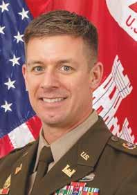
Led by District Commander Col. Christopher D. Klein, the district delivers vital engineering solutions in collaboration with its partners to secure the nation, energize the economy, and reduce disaster risk. Founded in 1873, the Vicksburg District began working to tame the Mississippi River and its tributaries as the country’s need for reliable navigation and flood risk management increased. Today, the Vicksburg District’s mission has grown and diversified to include flood control, navigation, ecosystem preservation and restoration, recreation, emergency response, modeling, and more.
Generations of dedicated professionals are at the heart of the Vicksburg District’s success. Today’s workforce numbers more than 1,100 professionals who fulfill a wide range of duties including vessel captains, deckhands, program analysts, environmental specialists, biologists, revetment equipment operators, archeologists, engineers, rangers, cooks, hydrologists, budget technicians, economists, cartologists, project managers, attorneys, accountants, and more. Regardless of their role within the Vicksburg District, each team member plays a vital part in providing world-class service and delivering solutions to the nation’s toughest challenges.
1700s and early 1800s:
Settlement of much of the lower Mississippi River Valley is sparse and there is little agricultural development of the land. Protection of those lands which were developed was provided by primitive levees constructed piecemeal and at private expense.
1798-1820:
Mississippi territory (including portions of Mississippi and Alabama) population increased from 9,000 to 220,000. The population of what would become the state of Mississippi grew from 7,600 to 75,448.
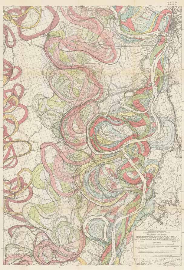
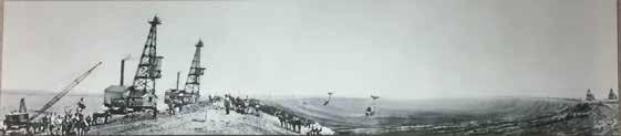
A portion of the Mississippi River meander belt maps that accompanied Dr. Harold N. Fisk’s report to the Office of the President of the Mississippi River Commission (MRC), December 1, 1944. This section shows how the river has changed course over time, in particular from Tallulah, Louisiana, to approximately Alcorn, Mississippi.
Ervin Brown was a longtime Revetment Section worker on the Mat Sinking Unit (MSU). He served as a leaderman and an anchor driver leader. He sadly passed in July 2023 and is survived by his siblings and children.
1719:
The first Europeans to settle in the area that would become Vicksburg arrived. These French settlers built Fort Saint Pierre on the high bluffs overlooking the Yazoo River at present-day Redwood.


1798:
Americans took possession of a Spanish military outpost called Fort Nogales. The Americans changed the name to Walnut Hills. This site would eventually be incorporated as the Village of Vicksburg.
1803-1803:
In 1803, the Louisiana Purchase made lands west of the Mississippi part of the U.S. These lands included the portions of Arkansas and Louisiana that would become part of the Vicksburg District. The Mississippi Territory, which included what would become the states of Mississippi and Alabama, remained a territory until 1817.
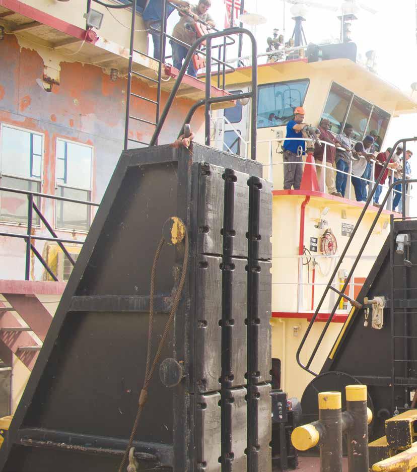
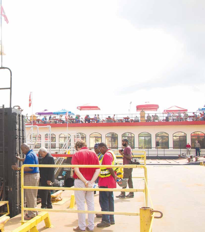
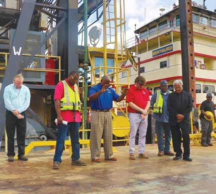
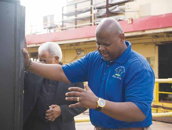
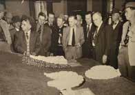
Atradition that dates to medieval times, the Blessing of the Fleet was a time when priests and pastors would bless fishermen and their boats as they left families and loved ones behind to ensure they embarked on a safe and bountiful season.
In keeping with this time-honored tradition, the U.S. Army Corps of Engineers Vicksburg District conducts an annual Blessing of the Fleet for its vessels and crewmembers. Pastors of different denominations bless each vessel and crewmembers to ensure a safe and productive season while out on the river. It is also a time to show support for all the team members who depart during the revetment and dredging season and to express gratitude for the families and
1811:
The arrival of the first steamboat, the New Orleans, on the lower Mississippi River heralded a commercial revolution that transformed the Mississippi Valley and ushered in a golden age for the city of New Orleans. A little more than a decade later, 75 steamboats worked the Mississippi River Valley; by mid century, there were 187. This explosion of River commerce facilitated the settlement and growth of numerous towns along the River, one of which was at the site of what would become Vicksburg. In the decades to come, Vicksburg would become an important trading center.
ANDERSONCONTRACTINGMS.COM

1817: Mississippi Territory, which included portions of Alabama and Mississippi, was separated and the state of Mississippi was created on December 10, 1817.
1820: A scientific expedition led by Maj. Stephen Long of the Army Corps of Engineers mapped the river system that would eventually become the Vicksburg district.
1825: Village of Vicksburg was incorporated.
friends of the crewmembers.


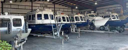
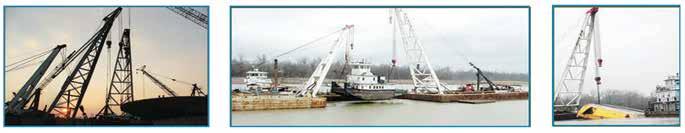
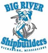
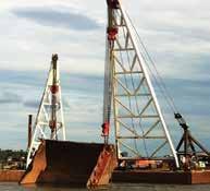
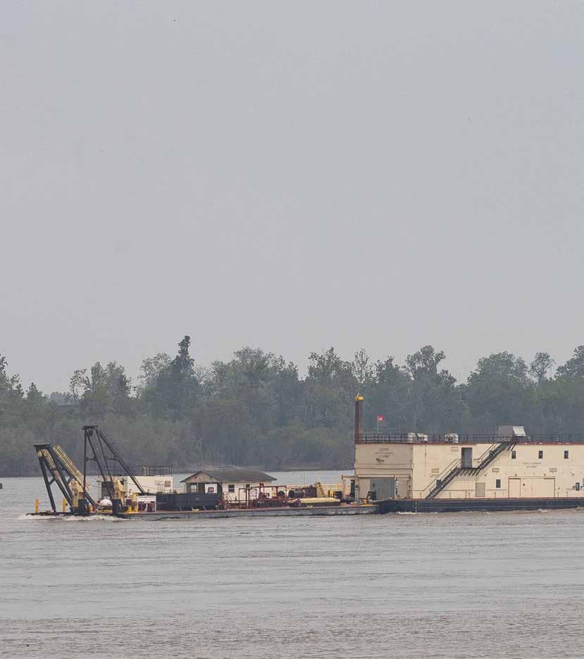
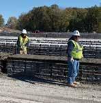
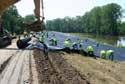
Each year, the district’s fleet of towboats, tender vessels, quarter boats, the Mat Sinking Unit (MSU), crew boats, a cleaning and snagging unit, a bank grading unit, a mat loading unit and dredges prepare for another challenging season dedicated to delivering safe and reliable navigation and flood control to the nation.


Every crewmember that operates and maintains these vessels is critical to solving the annual struggle of maintaining safe channels for commercial traffic to navigate on the mighty Mississippi River and armoring riverbanks for levee protection. The crew’s laborious work often involves treacherous environments, but the nation’s economy and security depend on their operation.
1850:
Swamp acts passed, allowing for the drainage of the lower Mississippi River Valley swamps and conversion of these swamp lands to agricultural lands.
1861-1865:

During the Civil War, Vicksburg was vitally needed as a transportation route for Union troops. The Confederate Army controlled the city and guns perched atop the city’s high bluffs prevented Union boats from using the Mississippi River below Vicksburg for nearly two years. The Army Engineers developed a plan to circumvent the Confederate guns by changing the River’s course or through the construction of a canal.

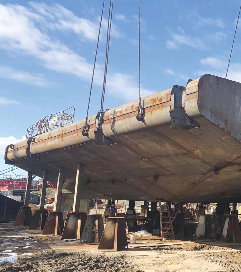

The ever-flowing Mississippi River will see a new vessel in 2024, but its mission isn’t as far from a 150-year-old legacy as one would think. ARMOR 1, the U.S. Army Corps of Engineers Vicksburg District’s forthcoming
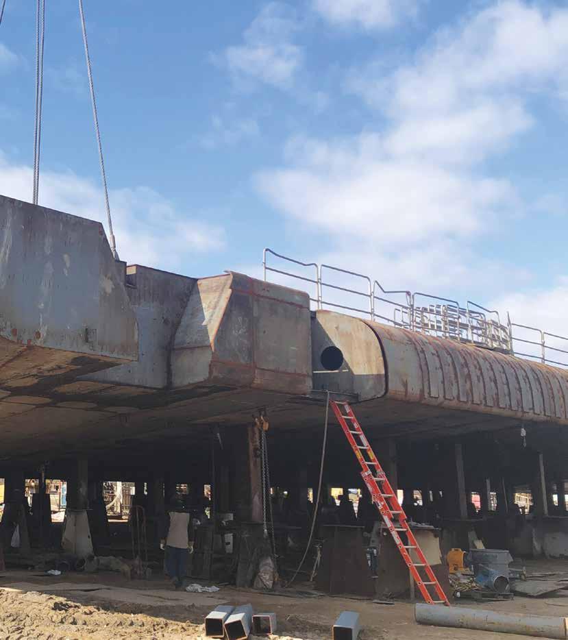
automated boat, will strengthen the river through a process called revetment.
The history of revetment can be traced to nineteenth century settlers who wove willow saplings together to form flexible “mattresses” and
sank them with stones. Though primitive, this endeavor mitigated erosion caused by friction between the river’s water and its soft banks and bottom. The Mississippi River is also prone to meandering, or forging its own serpentine path, which
1876:
A Mississippi River flood cuts off the large meander flowing past Vicksburg, leaving limited access to the new channel. The city's economy suffered greatly.
1878: On June 18, 1878, Congress approved $84,000 for the completion of the first stage of a four-stage project to restore access to the River channel that flowed past Vicksburg. The final stage of the project diverted the Yazoo River into the newly-formed Lake Centennial at a point in front of Vicksburg. However, the Yazoo Diversion Canal was not completed until 1903.
1879:
On June 28, 1879, an act of congress created MRC to direct all work on the Mississippi River.
can cut off established ports or cities over time.
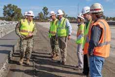
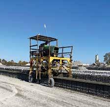
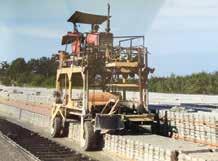
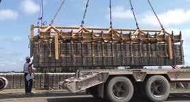
The district officially entered the revetment business in 1948 with the launch of the Mat Sinking Unit, or MSU, a floating plant operation that endures today. The fleet includes a mat deck, where crew members use pneumatic, jackhammer-like tie tools to join custom concrete squares. After nearly 80 years of service to the Mississippi River, the MSU and her crew need an upgrade for a new era. ARMOR 1, the first vessel of its kind in the world, will slash the time needed for repairs, increase productivity, and revolutionize the revetment mission.

Designed in partnership with the National Robotics Engineering Center (NREC) of

1882:
As a result of the 1882 Rivers and Harbors Act, the Corps of Engineers became responsible for implementing the Mississippi River Commission's plans. The Commission divided the Mississippi below Cairo, Illinois into four administrative districts: The first MRC district at Cairo, the second MRC district at Memphis, the third MRC district at Vicksburg, and the fourth MRC district at New Orleans.
1882-1884:
The region that would become the Vicksburg District experienced major floods for three consecutive years.
1884:
On August 1, 1884, capt. Eric Bergland established the first permanent Engineer office in Vicksburg. However, this office had no responsibility for work on the Mississippi River.
Carnegie Mellon University in Pittsburgh, Pennsylvania, ARMOR 1 features a 60% automated mat deck. Unlike decades past, this means a robotic gantry crane will lift and place each load of mat on the vessel, where an automated tie tool will join each square with copper wire.
However, there is no substitute for human expertise. The district partnered with Hinds Community College in Vicksburg, Mississippi, in July 2022 for a custom robotics course designed by ARMOR 1 Senior Project Manager John Cross to train crew members for their new duties. After ARMOR 1 launches, crew members will use their knowledge to maintain the robotics components, as well as inform their fellow employees about how the technology functions.
In the interim, the MSU will serve as assistance for the 2024 season. Afterward, ARMOR 1 will receive the torch and continue the district’s legacy toward faster, safer revetment efforts for decades to come.
1888:
The Corps of Engineers restructured its organization along the division-district plan, divided the United States into five engineer divisions with each of these further divided into districts.The Corps of Engineers placed the Vicksburg office in the Southwest Division. It was not until this time that the Vicksburg office became a formally organized geographical unit of the Corps of Engineers. Vicksburg District was later transferred to the Gulf Division headquartered in New Orleans.
1892:

The Vicksburg District received its first appropriation for levee work. The Vicksburg District used this $57,000 to construct 75 miles of levee along the Red River.
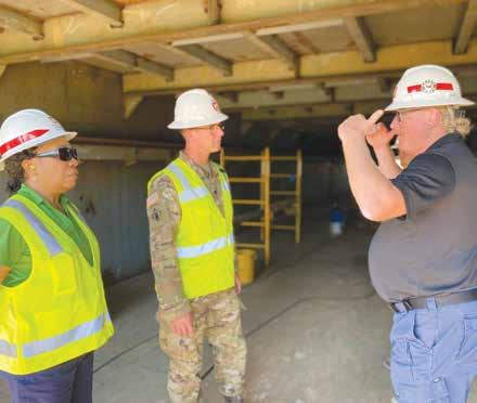
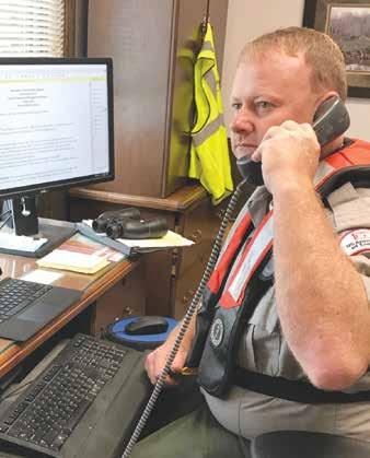
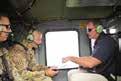
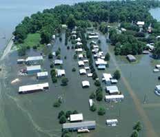
Emergency Management teams serve community

Whether it be hurricanes, power outages, or any host of other natural disasters, the U.S. Army Corps of Engineers Vicksburg District’s Emergency Management team remains ready to step into action.
1900: At the turn of the 19th century, the Vicksburg Engineer Office assumed a major portion of the responsibility for construction of the Vicksburg National Military Park, commemorating the Siege of the historic hill city.
1902:
Congress authorized the construction of a six-and-a-half-foot, year-round navigation project on the Ouachita River that would consist of a system of six locks and dams. From the mouth of Black River to Camden, AR, a distance of 360 miles, the Black-Ouachita system would be navigable year-round.
After receiving assignments from the Federal Emergency Management Agency (FEMA), the team quickly moves manpower and equipment to the disaster scene as authorized.
In any disaster, USACE’s top priorities are: saving lives and protecting property; supporting immediate emergency response priorities for USACE, the Department of Defense (DoD), FEMA and the federal government.
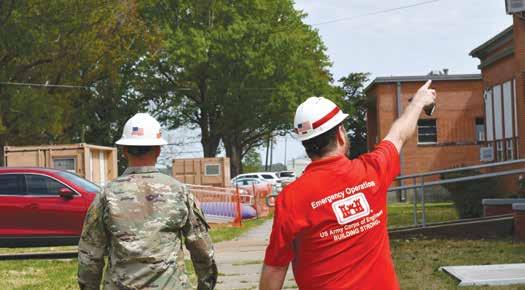

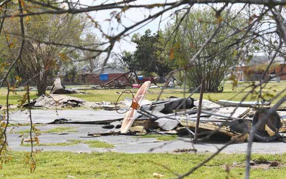
In the wake of the destructive tornadoes in the Mississippi Delta in March 2023, personnel set up shop at the active Mississippi Fire Academy in Rolling Fork, which served as a Joint Field Office (JFO) for all activities.
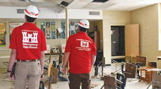
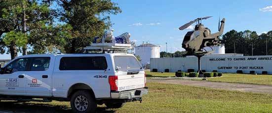
Likewise, the aftermath of Hurricane Ian saw personnel deployed to Immokalee, Florida, to support a temporary power mission assignment that would aid rural areas. The district’s Deployable Tactical Operations System (DTOS) team used an emergency command and control vehicle, or more simply, a 47-foot box truck, as a mobile operations center. Day to day emergency management efforts also included personnel who volunteered to deploy, and Deputy District Commander Lt. Col. Rocky Streif, who served as the Recovery
1903:
On January 7, 1903, the Vicksburg District completed its project to divert the Yazoo River into the old,shallow channel to rejuvenate the waterfront. The Great Flood of 1903 was the most severe that the Vicksburg District had experienced. The flood breached the levees and, according to the Mississippi River Commission, all crevasses in the line resulted from the "unfinished nature of the levees as regards both grade and section." The commission pushed for the construction of higher levees.
1908:
The Western Division was established with headquarters in St. Louis, and district offices at St. Paul, Kansas City, St. Louis, Memphis, and Vicksburg. The Western Division had jurisdiction over specific work on the Mississippi River from its headwaters to Baton Rouge.
Field Office commander in Tampa, Florida, throughout the mission.
Situations that require more monitoring or consulting work than actual boots on the ground are no less important.
For instance, the Emergency Operations Center (EOC) office mimics a presidential situation room with half a dozen analog clocks bearing various time zones in red digits. During an ongoing emergency, the briefing room has all necessary maps and
1909: Vicksburg District transferred to the Western Division headquartered in St. Louis.
action plans on display for both personnel and additional leadership involved in the crisis management team. Coordination calls occur at least once daily, regardless of holidays or weekends, to ensure everyone is aware of the latest developments and next steps. It’s this level of preparedness that ensures all team members can complete the assigned missions and mitigate any possible risks to human health and safety.
1912-1913:
Collaborating with federal, state, and local agencies is an additional planning challenge as all entities must often race against the clock during situations with rapid changes.
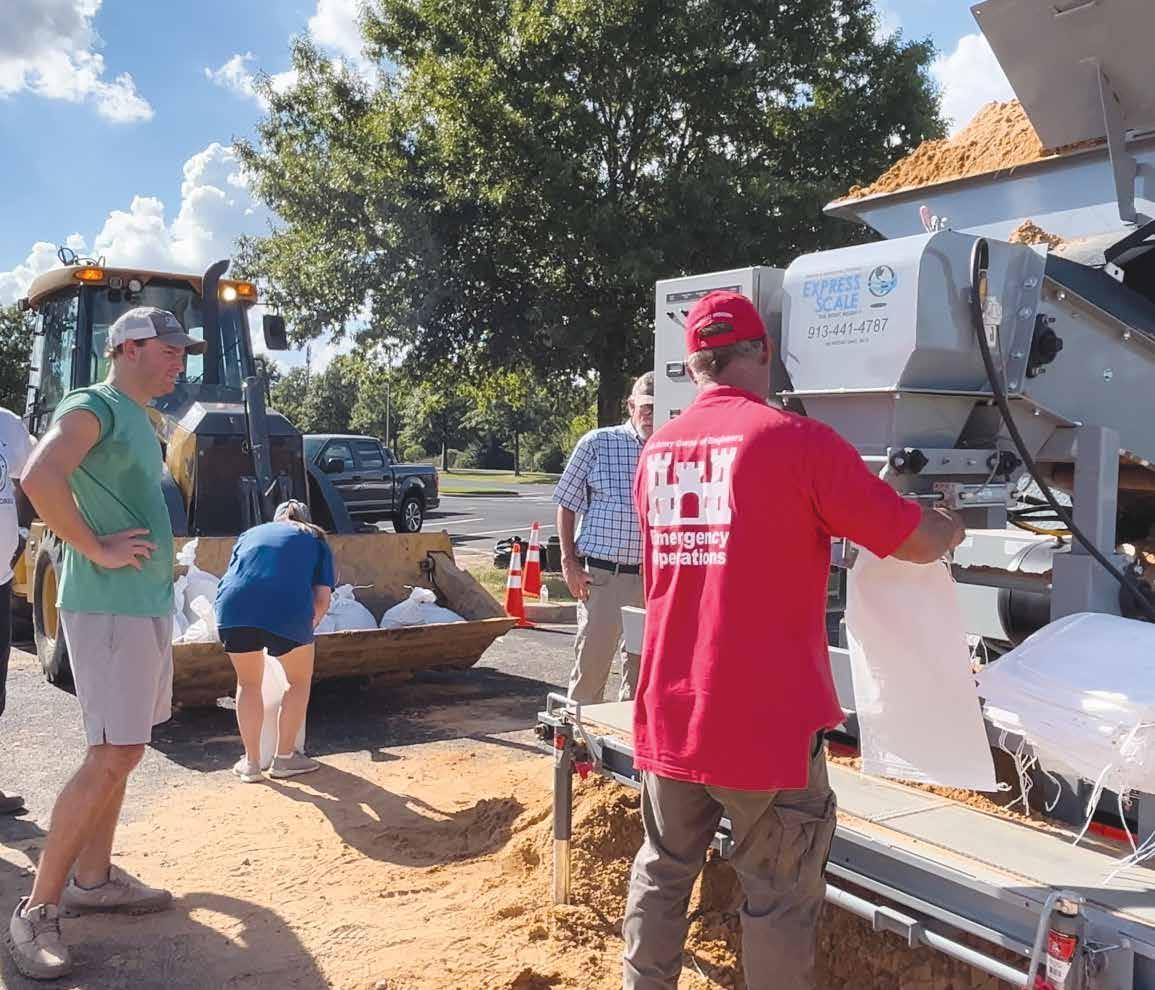
The City of Jackson’s water crisis in 2022, for example, included a major water treatment plant running on temporary backup pumps after flooding on the Pearl River destroyed the originals. In that situation, district engineers embedded on

In these years the Mississippi Valley experienced successive record-breaking floods which precipitated a crisis in the reclamation program. The tremendous expense incurred as a result of the regular inundation of the Valley, combined with the cost of building, maintaining, and repairing the levee system, was becoming prohibitive. Thousands of people were left homeless and many of the plantation owners bankrupted by the flood. Out of self-preservation, landowners in the Valley launched a massive campaign directed at obtaining greater federal commitment.
1917:


The landmark Ransdell-Humphreys Act (first federal flood control act) committed the federal government, for the first time, to flood control for the Mississippi Valley. The act authorized $45 million to be expended by the Mississippi River Commission on flood control work at a rate of $10 million per year. It also required local interests to pay half of the cost for such improvements and to provide right-of-way for all levees.
the response team inspected O.B. Curtis and J.H. Fewell water treatment plants to recommend overall improvements. On another front, team members worked double duty to fill hundreds of pounds of sandbags in 90-degree heat for Jackson residents as the Pearl River threatened to remain at a treacherous level.
Outside of annual hurricane and tornado seasons, the Emergency Management team stays abreast of all potential crises. Depending on the governing authority over each emergency’s location and mission assignments, the team could gear up to provide relief in their own backyard or thousands of miles away. Whatever the case may be, they remain flexible and prepared to deliver aid efforts as soon as they’re needed.

1921:


In 1919, the MRC consented to the southeast Arkansas levee district request to close the Cypress Creek Gap. The final closure of the Cypress Creek Gap in 1921 denied the Mississippi River its final natural overflow outlet, with the exception of the Atchafalaya.


1922:
The 1922 flood quickly surpassed all previous record stages below the mouth of the White River despite having a discharge considerably less than the floods of 1912 and 1916. Within the Vicksburg District, there were no crevasses in the levees along the Yazoo River or along the east bank levee of the Mississippi between Memphis and Vicksburg despite record flood stages. The flood actually increased the confidence of Vicksburg district engineers and the Mississippi River Commission in the levee system.
1924:
Ouachita River Navigation Project completed at a total cost of $4.5 million, making it the cheapest canalized waterway in the nation. The project consisted of six locks and dams providing a minimum six-and-a-half-foot deep and 100-foot wide navigation channel to accommodate barge traffic from the Red River north to Camden, AR.
1927:
The great 1927 Flood, which proved to be the greatest flood disaster in the nation’s history, struck the lower Mississippi River Valley. At the time of the flood, the Vicksburg District included 420 miles of these levees which were the only things protecting the lands behind them from inundation. To protect against levee failure, district engineer Maj. John C. H. Lee brought in navy seaplanes to patrol the levees for signs of weakness. Despite all efforts, levees along the Arkansas and Mississippi Rivers broke, flooding large areas of Arkansas, Mississippi, and Louisiana. Losses from the flood in the Vicksburg District were estimated at about $104 million.
1928:
In order to avoid a repeat of the devastating 1927 Flood, congress authorized a comprehensive flood control project in the 1928 Flood Control Act. The project was based on the plan approved by Lt. Gen. Edgar Jadwin, the Chief of Engineers, and would eventually evolve into the modern Mississippi River and Tributaries Project.
Within the Vicksburg District, the plan called for setting back and raising levees, progressive revetment of caving banks, channel improvements, and a floodway in the Tensas Basin of Louisiana.
1929:
The Corps of Engineers abolished the Western Division and established the Lower Mississippi Valley Division (LMVD), with headquarters in Vicksburg,

and the Upper Mississippi Valley Division (UMVD), with headquarters in St. Louis. The Memphis, Vicksburg, and New Orleans districts comprised LMVD; while the St. Louis, Rock Island, and St. Paul districts comprised UMVD. As a part of the reorganization, the MRC president would also serve as the division engineer for LMVD, prompting the MRC to relocate its headquarters from St. Louis to Vicksburg. The Corps also established a hydraulics laboratory, designated the waterways experiment station (WES), at Vicksburg.
1932:
Studies carried out at the newly created Waterways Experiment Station convinced the MRC to initiate a series of cutoffs in the middle reaches of the Mississippi River. Within nine years, sixteen such cutoffs had shortened the distance from Memphis to Vicksburg by 170 miles and reduced flood heights along the main channel considerably. The successful development of these cutoffs marked a new phase in the evolution of flood-control engineering.
levee and channel improvements accelerated discharges and lowered peak stages by as much as five feet.
1935:
Construction was complete on the flood walls for the twin cities of Monroe/West Monroe, however, a 1750-foot gap still existed in the flood wall because of difficulty in acquiring rights-of-way and the gap would not be closed until the 1970s.
1936:
In accordance with the modifications to the Jadwin Plan as recommended in the Mississippi River Commission’s 1935 report, the 1936 Flood Control Act authorized the Yazoo Headwater Project, which would eventually result in the construction of Arkabutla, Sardis, Enid, and Grenada Lakes. The act also eliminated the fuse plug-governed Boeuf Floodway in favor of a smaller Eudora Floodway regulated by a controlled spillway. Construction began on Sardis Lake in 1936.
1937:
Between January and February of 1937, a massive Flood struck the upper Mississippi and Ohio Rivers. near Cairo, Illinois, where the Ohio River flows into the Mississippi, record stages occurred and the birds point-new Madrid floodway had to be activated for the first time. However, below Helena, Arkansas, the 11 cutoffs that had been completed between the Arkansas and Red Rivers, combined with recent
1940:
Construction of Sardis Lake is completed and the dam is operational. Construction of Arkabutla Lake on the Coldwater River, which would control the runoff from 1,000 square miles of surrounding hill country, begins.
1941:
In the face of heavy opposition to the Eudora Floodway and because it was felt that it was no longer necessary given the success of the cutoffs and levee and channel improvements, Congress authorized the elimination of the floodway in the 1941 Flood Control Act. Congress also expanded the 1936 Flood Control Act’s authorization to include the Yazoo, Tensas-Cocodrie and Red River backwater areas. The 1941 act authorized a plan that provided for protection of 634,000 acres of the Yazoo backwater area from all but the project design flood on the Mississippi River. This was to be accomplished by the construction of a backwater levee extending from the existing Mississippi River levee along the west bank of the Yazoo River to Yazoo City, where the levee would connect with a levee authorized under the 1936 Overton Act to control headwater floods. Recognizing that such a levee would impound runoff from the tributaries that traversed the backwater area, the Mississippi River Commission recommended the evacuation of the impounded water, when river conditions permitted, by a drainage structure at the Little Sunflower River and a combination of structures and pumping plants at the mouths of the Big Sunflower River, Deer Creek, and Steele Bayou. When stages on the Mississippi and Yazoo Rivers were too high to allow for gravity drainage, the water could be pumped out by pumping stations at three locations with a total discharge capacity of 14,000 CFS--Big Sunflower River (11,000 CFS), Deer Creek (700 CFS) and Steele Bayou (2,300 CFS).
1943:
Construction of Arkabutla Lake is complete.
1944:
The 1944 Flood Control Act authorized the construction of major drainage outlets for the Tensas Basin.
1945:
Major flood strikes the Vicksburg District.
1946:
Construction began on Ouachita Lake on the Ouachita River as part of a flood control, hydropower and navigation project. The lake was one of three to be built in the headwaters of the Ouachita River Basin in southwest Arkansas.
1947:
Construction of Enid and Grenada Lakes in the Yazoo Basin began. Construction began on Lake Greeson on the little Missouri River in the Ouachita River Basin as part of a flood control and hydropower project.
and state governments could request these studies which would aid them in municipal flood control planning. Once a state or local government requested help for flood control planning, the district’s flood plain management services program would identify flood problems and inform local agencies of the nature and extent of the problem. Local governments could then use this information to make municipal flood planning decisions.
First ever Potamology section on the lower Mississippi was established in the Vicksburg District. The expertise of Potamologists was badly needed as their expertise exceeded basic hydraulics and included the coordination of hydraulic engineering and geology with other earth sciences.
1962:
The Will M. Whittington auxiliary channel was completed to help lower the Yazoo River stages several feet in the Yazoo and Belzoni areas.
1963:
Construction began on Degray Lake on the Caddo River in the Ouachita River Basin.
1965:
1950:
Construction completed on Lake Greeson. Congress authorized the Vicksburg District to deepen the Ouachita River channel to nine feet. The district proposed to accomplish this through increased dredging, straightening the river and a series of fourlocks and dams (Calion, Felsenthal, Columbia and Jonesville locks and dams) to replace the existing six locks and dams.
1952:
Construction is completed on Enid Lake on Yocona River, which provides headwater flood protection for the Yazoo basin.
Work begins on a replacement flood wall for the city of Vicksburg. The new flood wall was designed six feet higher and of much greater strength than its predecessor.
1954:
Construction is completed on Grenada Lake on the Yalobusha River in the Ouachita River basin and it is open for operation.
1955:
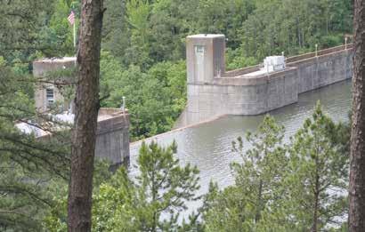
Blakely Mountain Dam completed.
1959:
Vicksburg flood wall complete.
1960:
The 1960 Flood Control Act authorized the Vicksburg District to broaden its responsibilities to include the preparation of flood plain information studies. Local
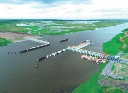
The 1965 Flood Control Act authorized the modifications to the Yazoo Backwater Project proposed by the MRC in 1959. The plan called for replacing the previously-authorized pumping stations at the Big Sunflower River, Deer Creek, and Steele Bayou with improved gravity drainage structures and a 20-mile long and 200-foot wide channel connecting the Sunflower River and Steel Bayou ponding areas to the outlets at the Little Sunflower and Steele Bayou floodgates.
1968:
Congress authorized the construction of the Red River Waterway, a navigation system that would extend from Denison Dam in Oklahoma to the Mississippi River, with an additional segment running from Shreveport, Louisiana, to Daingerfield, Texas.
1969:
The Steele Bayou Drainage Structure, which has a capacity to discharge 19,000 CFS from the ponding area to the Yazoo River, was completed
1972:
Construction completed on Degray Lake, the last of three reservoirs that the Corps of Engineers constructed in the Ouachita River Basin. Construction completed at the Jonesville and Columbia locks and dams on the Ouachita River. Construction completed on the drainage channel and control structure built for Catahoula Lake.
1973:
The 1973 flood strikes the Vicksburg District. Flood fighting labor and emergency funds expended by the district during the flood were greater than the 1927,1937
and 1945 floods combined. The flood caused an estimated $335 million in damages but losses prevented in the district were estimated to be $4.4 Billion.
1975:
The drainage structure at Little Sunflower River capable of discharging 8,000 CFS was completed.
1975:
Vicksburg District Regulatory Branch created. It would later be organized into its own division within the Vicksburg District.
1978:
The Yazoo Backwater Levees completed. The Yazoo backwater levee begins at the end of the mainline Mississippi River levee and proceeds upstream along the Yazoo River on the west bank to the west guide levee of the Will Whittington Auxiliary Channel near Spanishfort, MS. During high water, when overflow water from the Mississippi River backs-up the Yazoo River, the Yazoo Backwater Levee, along with the closed drainage structures, prevents the backwater from entering the south Delta.
Yazoo Backwater connecting channel that connected the ponding areas was completed. All features of the Yazoo Backwater Project completed except for the pumping stations.
1979:
Easter Flood along Pearl River, including in Jackson, Mississippi.
1981:
The portion of the Red River Basin in Arkansas and Louisiana transferred from New Orleans District to Vicksburg District.
With the transfer of the Red River Basin came the transfer of the Red River Waterway Navigation Project, which was to include the construction of five locks and dams (New Orleans District completed Lock and Dam no. 1—Later renamed Lindy Claiborne Boggs Lock and Dam— in 1984).
Bayou Bodcau Reservoir and the Pearl River basin transferred to the Vicksburg District. 1982-1983:
Flood along Mississippi River and tributaries; mainline levees along the Mississippi hold. Vicksburg District assisted with flood fight along the Pearl River.
She may be old, but she is still delivering the mission.
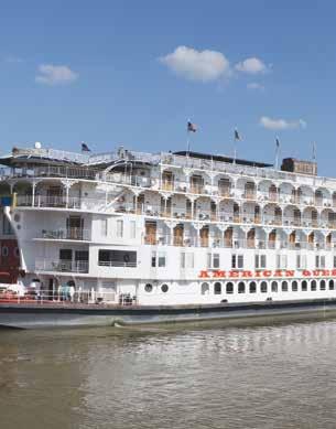
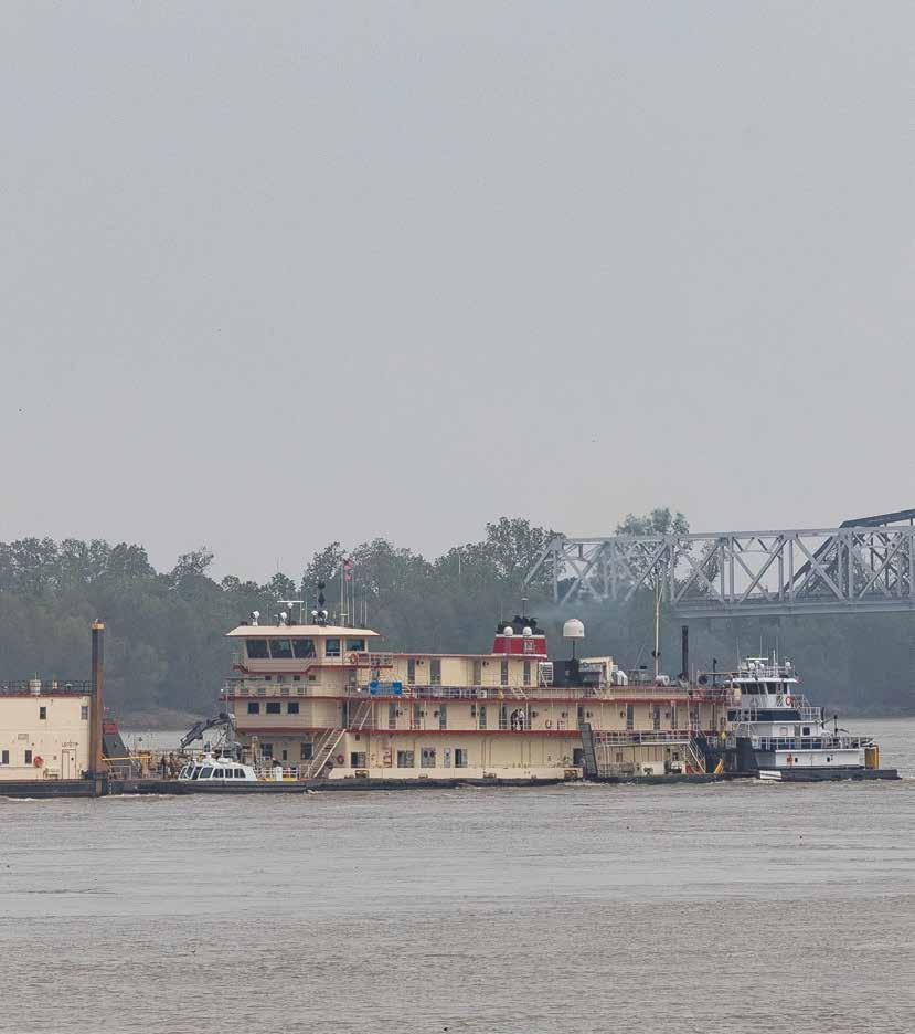
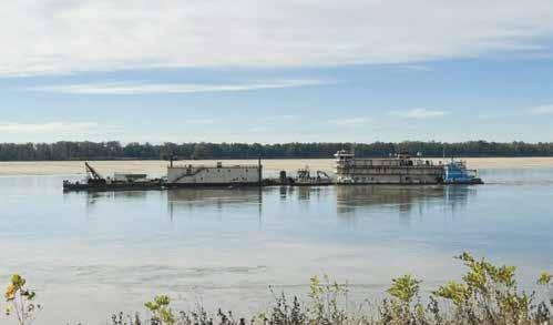
The U.S. Army Corps of Engineer Vicksburg District’s Dredge Jadwin, one of only four dustpan type dredges in the world, has a unique mission. The 274-foot, 2,400 horse-power vessel is a vital part of keeping ports and harbors open across the country.
Areas with slow currents on the Mississippi River, which is the Jadwin’s primary focus, experience sediment fallout. If left untreated, that excess material buildup can squeeze the channel tighter and create a bottleneck effect for the thousands of vessels that depend on the river to move goods. Luckily, the 90-year-old Jadwin is up for the
challenge.
Capable of dredging as deep as 68 feet, the Jadwin departs the Vicksburg Harbor approximately each May until November for the Mississippi River and its surrounding ports. The annual season depends on factors such as water levels, weather, and overall needs. She is old enough to have been
1984:
Her work process involves specialized marine mechanics. The Dredge Jadwin’s dustpan-shaped appendage lowers to a specific depth on the river bottom. The water jets agitate the sediment, and the dustpan vacuums up the agitated material and pumps it through the dredge and pipeline, where it is typically placed in swift water and resuspended as it continues its journey down river. The material can also be placed in a deep location if the current is not strong enough to wash it down river.
1984-1986:
Vicksburg District assists with a muti-year study to help west African nations learn to better harness the resources of the Niger River. The State Department phased out the project in 1986 prior to completion as funding diminished.
1986: Much of the structure for Tensas Cocodrie Pumping Plant completed.
1987: John H. Overton Lock and Dam (Lock and Dam No. 2 of the Red River Waterway) is opened. When the Lock and Dam opened, it opened up 88 miles of navigable channel from Alexandria, Louisiana to the Mississippi River.
1988: Project Management Division at Vicksburg District created.
1988: The Vicksburg District began to move out of Walnut Towers in downtown Vicksburg.
1988-1989: A major drought on the lower Mississippi River required the U.S. Coast Guard to place restrictions on barges by limiting drafts to less than nine feet.
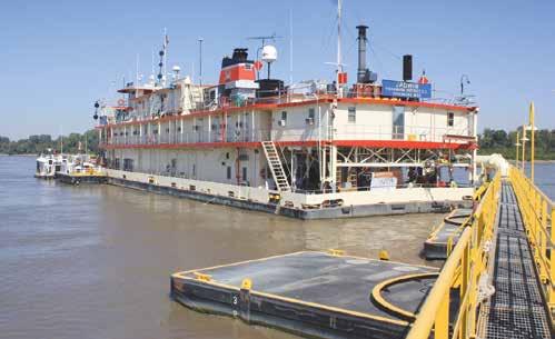
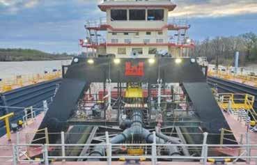
constructed with rivets rather than welds but has been updated and can handle the big jobs. A refitting came about in 1985 when the decision was made to remodel as parts became increasingly difficult to obtain. The steam engines were converted to diesel electric, the living quarters remodeled, and the dredge refitted.
The new, more powerful engines reduced travel time between jobs by 25 percent with additional savings realized from fuel costs. Down and repair time were reduced from an average 5 ½ hours per day to 50 minutes per day after the refitting.
In addition to the boat power system, the dredging capabilities of the Jadwin also changed. An increase in discharge capacity (how much material the Jadwin can dredge) increased 30 percent for a total of 90,000 cubic yards of sand per moving capacity. In a day’s time, this is enough river sand to fill a football field to a depth of 60 feet.
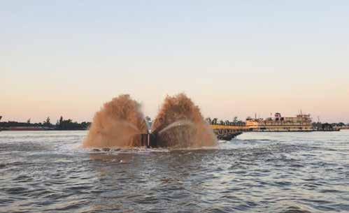
Her work process involves specialized marine mechanics. The Dredge Jadwin’s dustpan-shaped appendage lowers to a specific depth on the river bottom. The water jets agitate the sediment, and the dustpan vacuums up the agitated material and pumps it through the dredge and pipeline, where it is typically placed in swift water and resuspended as it continues its journey down river. The material can also be placed in a deep location if the current is not strong enough to wash it down river.
To dredge a specific location, the Jadwin uses two 5,000-foot cables which are crisscrossed and sunk by anchors weighing 6,000 pounds each. The cables help the Jadwin to maneuver while dredging. Winches pull against the anchors to advance. A dredge tender, or towboat, is also used to assist in moving from left and right.
Still, the Jadwin does much more. She has been vital in special missions. The vessel was used to retrieve civilians and livestock in Missouri’s Great Flood of 1937; cleared river blockage at Greenville, MS during record low water of 1988; dredged Atlantic Sailor, a grain ship, off ground in 1989; and served as Venice substations during Hurricane Katrina and Hurricane Gutav.
At nearly 90-years-old, the Jadwin works
1990: Construction complete on Lock and Dam No. 3 of the Red River Waterway Navigation project.
1991:
Major flooding in the Vicksburg District is area of operations. More than 4 million acres flooded within the district, but flood control projects were estimated to have prevented a further $1.12 billion in damages.
harder today than ever before and allows her crew to speak with admiration and pride when her name comes up. She feels like home to her steadfast crew of approximately 50 people.


Work on the Jadwin is labor intensive. When the workers leave Vicksburg on the quarter boats, compared by some to a large floating hotel, their work season consists of 10-hour shifts for 12 consec-


utive days with two days off. Around 50 full-time employees and 200 seasonal workers live and dine on the quarter boats. The gallery cooks provide exceptional meals to feed a crew of over 250.

The crew was recently recognized by the U.S. Army Corps of Engineers Headquarters for their work that went above and beyond normal operations during the most recent record-setting

low water event on the Mississippi River. The Jadwin crew serve as excellent representatives of USACE values throughout each dredging season.
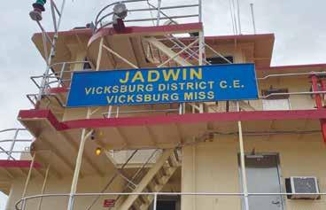
The Jadwin launched in 1933 and named for Lt. Gen. Edgar Jadwin, the Spanish-American War veteran who pushed the federal plan for Mississippi River flood control after the Great Flood of 1927.


When people think of the U.S. Army Corps of Engineers Vicksburg District, they likely think of the work done on the Mississippi River or its tributaries such as dredging millions of cubic yards of material to maintain the depth of the channel or the heavy concrete mats the District lays on the banks and bottom of the river each year to prevent erosion. For others, the work to build and maintain levees may come to mind, or perhaps the emergency response missions.
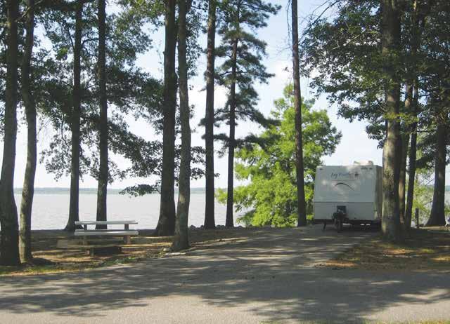
Many are surprised, though, when they learn the Vicksburg District owns and operates more than 100 recreation areas across Mississippi, Arkansas, and Louisiana where millions of visitors enjoy fishing, camping, hunting, boat-
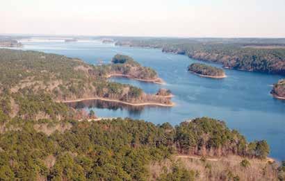
2005:
ing, hiking, swimming, geocaching, and more every year. The district’s flood-risk management reservoirs provide numerous benefits to the region, including flood risk management, hydropower, environmental stewardship, water supply, wildlife management, and recreation. Lakes created by the construction of dams in Mississippi and Arkansas have been wildly popular recreation destinations since their completions from 1940 through 1970. A team of rangers at each lake works diligently to keep visitors safe and protect the property.
With the Flood Control Act of 1928, the district became involved in a comprehensive
On August 29, Hurricane Katrina makes landfall on the Louisiana and Mississippi Gulf Coast. The Vicksburg District hosted over 100 displaced New Orleans district personnel and participated in one of the largest government emergency responses in recorded history.
2011:
The 2011 flood sets records or near-records for stages and discharges throughout the lower Mississippi River. The Vicksburg District saw record stages at the Natchez and Vicksburg gages and severe flooding in backwater areas.
flood risk management program, which eventually included lakes, levees, and other measures. A plan developed by Lt. Gen. Edgar Jadwin called for floodways, spillways, levee improvements, channel stabilization, mapping, and a navigation channel, a system capable of safely passing the worst possible flood in the valley.
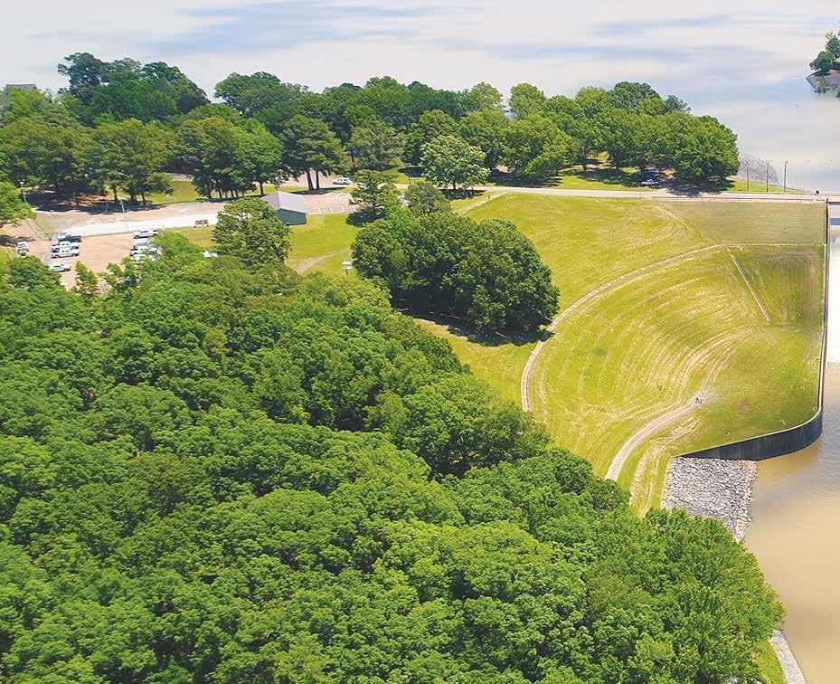
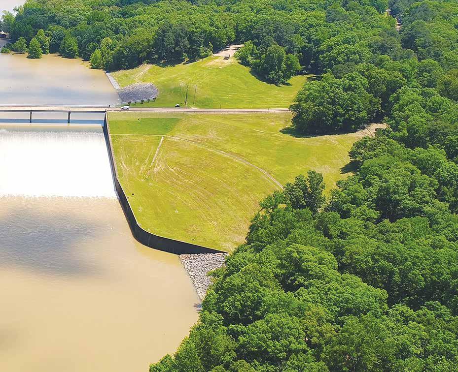
Jadwin’s plan was not written in stone and allowed modifications to accommodate the developing river over the years. The plan ruled out flood control reservoirs on the Mississippi’s main stem, however, he advocated studying them for the tributaries as part of the comprehensive plan for developing all water resources. In 1936, the Yazoo Headwater Project, pushed by Congressman Will M. Whittington of Greenwood, Mississippi, became a reality and resulted in Arkabutla, Sardis, Enid, and Grenada Lakes.
Construction was begun on Sardis Dam in 1936 and, in 1940, the project became operational, resulting in the creation of Sardis Lake. Work began on Arkabutla Lake on the Coldwater River immediately after completion of Sardis. The dam was built between 1940 and 1943 to control the runoff from 1,000 square miles of surrounding hill country. Arkabutla was followed by construction of Grenada and Enid dams, but completion of these two structures was delayed by World War II.
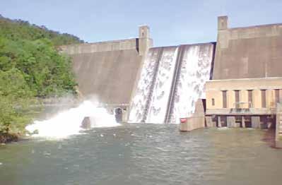
Three similar lakes were built about the same time on the headwaters of the Ouachita River in Arkansas-Ouachita, DeGray, and Greeson. In addition to flood risk management, the three Arkansas lakes were designed for hydropower production. In the early 1950’s, work began on the first of the three Ouachita River Lakes. Narrows Dam at Lake Greeson on the Little Missouri River was the first of three multipurpose flood control dams built in Arkansas. Narrows was followed by Blakely Mountain on Lake Ouachita in 1955 and by DeGray on the Caddo River in 1970.
Arkabutla Lake - Located in both Tate
FOR MORE INFORMATION ON THE VICKSBURG DISTRICT’S RECREATION OPPORTUNITIES, VISIT https://www.mvk.usace.army.mil/ Missions/Recreation/
and DeSoto counties in north Mississippi, Arkabutla Lake’s remote location is an ideal setting for a serene retreat. Located just 30 minutes from Memphis, TN and Tunica, MS, Arkabutla Lake offers more than 30,000 acres of land open for public hunting and other recreation.
Enid Lake Dam - Located approximately 1 mile off U.S. Interstate-55, 72 miles south of Memphis, TN and 140 miles north of Jackson, MS, the Enid Project encompasses over 44,000 acres and provides runoff and precipitation control in the Yocona River drainage basin. Outdoor enthusiast’s flock to this area time and again.
Grenada Lake - Located in the gently rolling hills of pine and hardwood forests at the entrance to the Mississippi Delta, Grenada Lake is an inland paradise. This 90,427-acre project has something to offer almost every outdoor enthusiast from
hiking, boating, fishing, hunting, skiing, and bird watching, to camping, picnicking, golfing, swimming, and much more.
Sardis Lake – Stretching over 98,000 acres through Panola, Lafayette and Marshall counties in beautiful Northwest Mississippi, Sardis Lake is easily accessible from I-55. Visitors to Sardis Lake can camp, picnic, swim, rent a pavilion, boar, hunt, fish, hike and much more.
DeGray Lake – Nestled in the foothills of the Ouachita Mountains and located adjacent to the National Scenic 7 Byway, just north of Arkadelphia, Arkansas, lies the sparkling treasure of DeGray Lake. Spanning 208 miles of shoreline and 13,800 acres of water surface, DeGray Lake offers a myriad of recreational opportunities. This important flood control reservoir backs up the waters of the Caddo River.
Lake Greeson - Located on the beautiful Little Missouri River in Pike County, Arkansas, this lake was created by a concrete dam as part of a flood control and hydropower project. Authorized purposes now include recreation, water quality, water supply, conservation and forestry,
2020: A new Emergency Command and Control Vehicle (ECCV) arrives at the Vicksburg District. One of 15 scattered across the country, the vehicle can be deployed and operational within 15 minutes of arrival and comes equipped with radio, satellite and cellular communication capabilities that can be delivered over and outside the USACE network.
fish, and wildlife management. The lake is approximately 12 miles long and is surrounded by 15,842 acres of federally administered public lands.

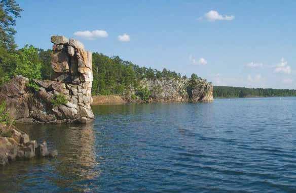
Lake Ouachita - Nestled in the Ouachita Mountains just 10 miles west of Hot Springs Arkansas, this pristine property attracts approximately 4 million visitors each year. With 40,000 acres of water dotted with over 200 islands, and 20,000 acres of public land, Ouachita offers an abundance of recreational opportunities.
LOUISIANA
Bayou Bodcau Dam and Reservoir - One of the largest remaining expanses of bottomland hardwoods in northwest Louisiana, this recreation area encompasses 33,500 acres of land open to the public for recreational
purposes. Outdoor enthusiasts can enjoy hunting, fishing, boating, hiking, biking, and horseback riding to name a few.
Caddo Lake - Caddo Lake is a 25,400 acre lake and wetland located on the border between Texas and Louisiana. It is an internationally protected wetland under the RAMSAR treaty and is the largest natural fresh water lake in the South. It has the largest Cypress forest in the world.
Wallace Lake - Wallace Lake Dam is managed by the U. S. Army Corps of Engineers. It is located fourteen miles southeast of Shreveport on picturesque Cypress Bayou. It is a wooded lake containing beautiful moss draped cypress trees and is considered to be one of the best crappie fishing lakes in the area.
2021:
The Vicksburg District announces its first district flag,. a red field bordered by silver fringe. A white banner across the top of the flag contains “U.S. Army Corps of Engineers” and a white banner across the bottom of the flag contains “Vicksburg District” framing a white Corps castle with silver stitching.
2023: The Vicksburg District celebrates 150 years of service to the nation.
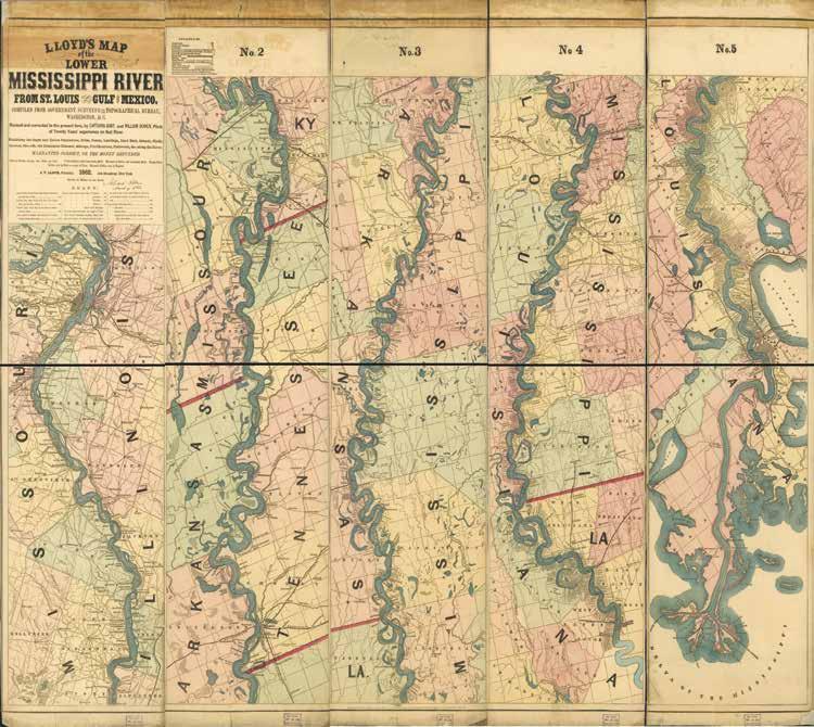
ABOVE: Published by J.T. Lloyd in 1862, this map shows the length of the Mississippi River from St. Louis to the Gulf of Mexico across five panels. The legend includes cities, towns, and landings, plus navigational features like sand bars, islands, bayous, steamboat channels, and more. Vicksburg can be seen in panel 4 near the first “I” in the “Mississippi marking.”
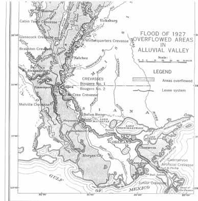
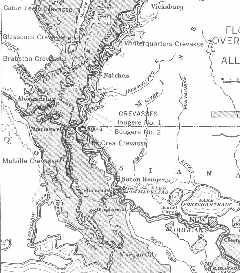
LEFT: Shows the areas that were inundated by the Flood of 1927 from Monroe, LA to the Head of Passes. The thick solid lines running along and near the Mississippi River are the levee systems of the period. The flood caused $104 million worth of damage in the Vicksburg District’s area of responsibility alone, or about $1.8 billion in today’s purchasing power. The subsequent Flood Control Act of 1928 looped the district into a comprehensive flood risk management program that later expanded to include the Mississippi and Arkansas flood risk management reservoirs. (i.e. Sardis, Arkabutla, Enid, and Grenada lakes; Lake Greeson, Lake Ouachita, and DeGray Lake).


From your proud partner the Mississippi Levee Board! Working closely together to vastly improve our Levee and successfully fighting floods since 1928!
GIS Engineering, LLC, a subsidiary of GIS Holdings, LLC, has been dedicated to providing high-quality, responsive professional services that clients need to achieve success. The company is deeply rooted in a safe familylike workplace culture, committed to teamwork and accountability, while driven to deliver on fun, challenging and meaningful projects to the customers, markets and communities they serve. GISEng is a multi-discipline engineering, surveying, and construction management firm providing services to customers in the Energy, Industrial, Power, and Public Works sectors.
Chustz Surveying (CSI), a division of GIS Engineering, LLC, has been a premier surveying firm across Louisiana and the South for over 27 years. Through hard work and client satisfaction, we have maintained a steady growth in both resources and personnel.