HANG GLIDING + PARAGLIDING + SPEEDFLYING


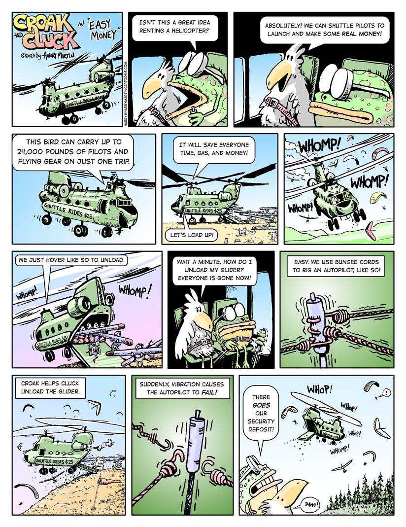
Croak & Cluck by Harry Martin
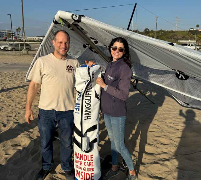
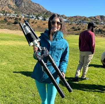
Shortpack HG by Erika Klein
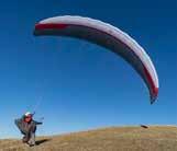
How to grow hang gliding? Design a small packing glider
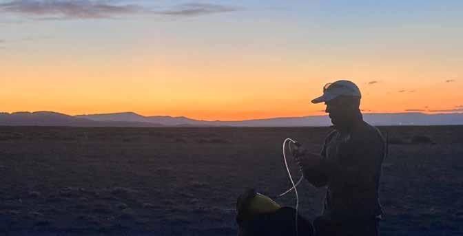
Satellite Communication by Riley Ferré
Managing device complications while abroad
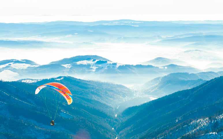
The Quiet Summiteer by Jack Sheard Solo athlete completes 100-peak climb-and-fly in New Zealand
Walking the Line by Mitch Riley and Bill Belcourt Utah paragliding record flight report | July 6, 2025
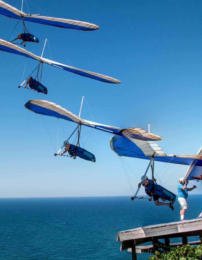
2025 Hang Gliding Nationals by Paul Brooke A retrieve driver's experience at Paradise Airsports
Chelan Competitions by Jonathan Hutton; photos by Patrick Penoyar A volunteer's perspective
Thunderstorm Warning by Dennis Pagen Survival of the fastest
X-Alps Rookie by Jared Scheid First time out at the World's Toughest Adventure Race
Armchair SIV by Calef Letorney Modern Collapse Response
HANG GLIDING, PARAGLIDING, AND SPEEDFLYING ARE DANGEROUS ACTIVITES
USHPA recommends new or advancing pilots complete a pilot training program under the direct supervision of a USHPA-certified instructor, using equipment suitable for their level of experience. Many of the articles and photographs in the magazine depict advanced maneuvers being performed by expert pilots. No maneuver should be attempted without appropriate and progressive instruction and experience.
The Elise is a light and compact EN A paraglider, suitable as a first wing after school or for leisure pilots. Offering the highest levels of passive safety with agile and fun handling, it can be your faithful long-term companion to take on your trips, hikes and even cross country flights.

Do you have questions about USHPA policies or programs? Are there topics you’d like to hear more about?
EMAIL US AT: info@ushpa.org
Interested in taking a more active role supporting our national organization? USHPA needs your skills and interest.
VOLUNTEER AT: ushpa.org/volunteer
For other USHPA business +1 719-632-8300 info@ushpa.org
James Bradley, Executive Director
: I'm excited to welcome Point of the Mountain in Utah and Crestline in Southern California back into the fold as USHPA chapters insured by Recreation RRG. These are two of our most important clubs, with large memberships, many visitors, and busy skies. I want to acknowledge the heroic volunteer work of USHPA members involved with the two chapters. Luke Berger and Jamie Sheldon at Crestline, and Chris Santacroce, Bob Janzen, and Bob Black at the Point, have proactively created positive cultural change inside their clubs and improved practices to make them insurable again. Across the table, Tim Sullivan, Tim Herr, Randy Leggett, and Steve Rohrbaugh at Recreation RRG stayed with them until Recreation could approve them for USHPA chapter insurance policies. Both clubs should be able to renew this winter with only ordinary effort. Well done!
ing a new set of rules for drones operating beyond visual line of sight (BVLOS). I’m ensuring that our interests are represented and heard, alongside those of skydivers, powered paragliders, balloonists, the Experimental Aircraft Association, and other airsports groups. I hope we’ll arrive at a requirement for these drones to include “detect and avoid” technology that will be able to “see” all of us. It's helpful that the large commercial interests understand that accidents would be a bad look for them. Even if the drones can see us, I expect to be unnerved when one flies by.
At USHPA, we’ve completed a fouryear strategic plan, starting in 2026, that has been approved by the board. Please have a look at ushpa.org/strategy and share your thoughts and comments with me.
The United States Hang Gliding & Paragliding Association, Inc. (USHPA) is an air sports organization affiliated with the National Aeronautic Association (NAA). The NAA is the official representative of the Fédération Aeronautique Internationale (FAI), which is the world governing body for sport aviation. The NAA represents the United States at FAI meetings.
The NAA has delegated to USHPA the supervision of FAIrelated hang gliding and paragliding activities, such as record attempts and competition sanctions.
An Amazon delivery drone being piloted remotely using an onboard camera narrowly missed the basket of a hot air balloon in Arizona a couple of months ago. These drones weigh 88 lbs empty and fly at 60 mph. The FAA is develop-
If you know something I need to know, please visit USHPA.org/meetwithjames to book a Zoom with me.

REGION 1 NORTHWEST
REGION 2 CENTRAL WEST Northern
REGION 3 SOUTHWEST
REGION 4 SOUTHEAST
REGION 5 NORTHEAST and INTERNATIONAL
To deliver programs and services that support all our members, foster a community of skilled and knowledgeable pilots, and promote and protect the freedom to fly.
A vibrant free flight community across the United States.
Core values & guiding principles
Celebrate the spirit of discovery and the joy of being in the outdoors.
Support ongoing education, development of skills, and acquiring of the judgment that comes from experience and attention.
Be stewards of our natural places, our flying sites, and the future of our sport.
Act ethically, take 100% ownership, communicate clearly, respond effectively.
Foster a considerate community free from harassment and abuse.

James Bradley Executive Director james@ushpa.org
Charles Allen President president@ushpa.org
Kirby Ryan Vice President vicepresident@ushpa.org
Olga Grunskaya Secretary secretary@ushpa.org
Pam Kinnaird Treasurer treasurer@ushpa.org
Galen Anderson Operations Manager office@ushpa.org
Chris Webster Information Services Manager tech@ushpa.org
Anna Mack Program Manager programs@ushpa.org
Maddie Campbell Membership & Communications Coordinator membership@ushpa.org
BOARD MEMBERS (Terms End in 2025)
Kirby Ryan (region 3)
Nelissa Milfeld (region 3)
Pamela Kinnaird (region 2)
Olga Grunskaya (region 5)
Bob Ferris (region 3)
BOARD MEMBERS (Terms End in 2026)
Van Spurgeon (region 3)
Charles Allen (region 5)
Nick Greece (region 2)
Stephan Mentler (region 4)
BGD DUAL 3
BGD’s all-new DUAL 3 brings a clean-sheet redesign to its popular pro tandem series, delivering next-level performance, precision, and fun. Three sizes, effortless launch, new trimmers and a smooth relaxed feel, the DUAL 3 performs in harmony with pilot and co-pilot. Lighter than the Dual 2, the glide is better, the climb rate is impressive, and the overall experience is just a joy. Re-engineered trimmers, narrower webbing, with a full 16 cm of direct travel, the DUAL 3 launches effortlessly, climbs in weak thermals, and handles with playful precision. New brake geometry gives just the right amount of feedback and response so it’s intuitive and fun for the pilot while remaining super smooth and relaxing. Schedule a test flight or meet your nearest dealer by visiting flybigskypg.com, exclusive USA importer.
BGD CURE 3 The CURE 3 is the newest cutting-edge, high-performance 2-liner EN-C from BGD. It shares family traits and a design philosophy with the DIVA 2, BASE 3 and BREEZE, which means top-of-class performance combined with excellent passive safety and feeling. It is pure performance and a joy to fly! Fewer lines means less line drag, and the rear-riser steering is light, precise, and direct. The CURE 3 is an unbeatable 2-liner with a high arc, raked wingtips, reflex profile and best of all, winglets! Schedule a test flight or meet your nearest dealer by visiting flybigskypg.com, exclusive USA importer.
BGD BASE 3
Top-of-B-class performance and low-B comfort and stability, this wing is a new design sporting 2.5-line design with a reflex profile, unsheathed aramid lines and winglets! Designed for cross-country pilots who have started flying XC on a low-B and are looking for more performance to push their distances. BASE 3 has some secret ninja skills: it’s slow-speed handling make top-landing a breeze and its super easy to launch in strong winds because it is so pitch stable and does not surge. A responsive and talkative glider, the BASE 3 gives the pilot good feedback at all times. And something new for BGD, the BASE 3 has winglets: a safety feature helping the glider exit smoothly from steep spiral dives. The BASE 3 is a real feel-good glider with excellent glide performance, the tool for pilots to break their personal XC bests while feeling at ease. Schedule a test flight or meet your nearest dealer by visiting flybigskypg.com, exclusive USA importer.
FLYTEC LIVE WIND
SeeYou Navigator just got a major upgrade. Live Wind Measurements are now integrated directly on the moving map. Windspeed is shown numerically adjacent to colored arrows showing direction. The arrow colors also show wind strength categories: GREEN (light), YELLOW (moderate), RED (strong), BLACK (dangerous). Tap any displayed wind arrow for details like gusts, temperature, humidity, and pressure. Wind measurements are automatically merged from various sources, giving you a unified and seamless view, with no manual setup needed. Let the wind work for you with SeeYou Navigator, Oudie N, and Omni. SIM card or cellphone pairing required. For more information: info@flytec.com, +1 800-662-2449.
GIN GTO 3
The new Gin Gliders GTO 3 is an EN-C 2-liner with best in class performance. It comes in six sizes from 60 kg to 130 kg and weighs around 4.4 kg. The aspect ratio is 6.5. It features Gin Wave Leading Edge Technology which increases performance at high angles of attack. This paraglider is available through Super Fly, Inc., www.superflyinc.com, +1 801-255-9595, or your local dealer.
GIN EASINESS 4 The Advance Easiness 4 is a lightweight (2.15 kg) split leg, reversible harness that comes with Edelrid Aura carabiners. It very comfortable and has helmet suspension on the top of the backpack along with velcro on the shoulders for a vario and hook knife. This harness is available through Super Fly, Inc., www.superflyinc.com, +1 801-255-9595, or your local dealer.
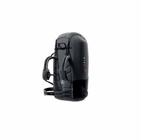
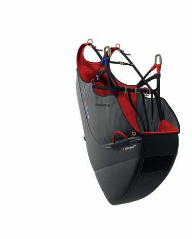
GIN VERSO 4 The Gin Gliders Verso 4 is a reversible airbag harness with seat board that comes in five sizes and weighs 3 kg in the medium size. The backpack (70L) is removable and replaceable. The backpack features bottle holders and zippered pockets and the harness is a two buckle arrangement. The Gin Verso 4 is available through Super Fly, Inc., www.superflyinc.com, +1 801-255-9595, or your local dealer.
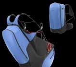
OZONE ATAK 2 (size L now available) The Ozone Atak 2 was designed for precision speedflying, in the air and on the snow. An innovative leg strap design implements what Ozone refers to as an anti-ball-crusher system, and transitions from seated to standing have never been easier. The harness folds down to a thin and compact wafer for storage in your wingbag or hiking backpack, and in the air the harness has enhanced weight-shift sensitivity for fast turns and snappy barrel rolls. It has an optional lightweight and low pack volume airbag protector, which can be easily installed or removed. www.flyozone.com
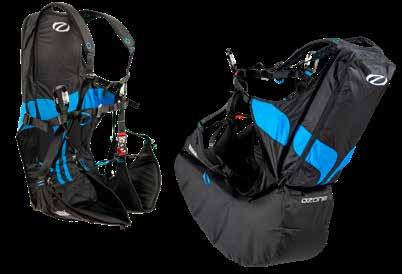
OZONE F*RACE 2 (now available in all sizes) The Ozone F*Race 2 is an ultra-lite hike-and-fly competition harness that was designed for the Red Bull X-Alps and tested by Ozone’s most demanding vol-biv adventure pilots. It features an anatomically designed dyneema support structure, low profile inflatable protection with an integrated micro-pump for inflation, an ergonomic front mount reserve, and tons of pockets and storage options for inflight access and vol-biv missions. www.flyozone.com
: Photography, writing, and illustrations are the lifeblood of our publication, as are the contributors who dedicate their time to submitting them. I would like to offer my sincerest apologies to Cherise Tuttle, who was the photographer of our wonderful cover shot for the Summer 2025 issue. Cherise was with John Bartholomew and Kari Castle that day and her photo accidentally got mixed into John's personal shots. Entirely by accident, John submitted it as his own. Cherise, thank you so much for reaching out to let us know about the error.
Mistakes like this may seem small, but miscrediting a piece of work can carry consequences. To overlook a contribution, even inadvertently, risks diminishing both the artist and the trust our community places in this publication.
The reality is that in a world where digital files are quickly transferred from SD cards or phones to shared drives, confusion can occur. This doesn’t excuse the error, but it does highlight the need for better organizational systems to protect everyone involved. In an effort to avoid such situations in the future, I suggest that contributors take a few steps to ensure the integrity of our pages.
• Label your work clearly: Before sharing photos in a group folder, consider changing the file name(s) or updating the metadata to include your name as the photographer.
• Secure permission first: To submit photos that are not your own to accompany a story you wrote, you must have explicit permission from the photographer. This protects you, the publication, and most importantly, the creator whose work you want to feature.
• Ask questions early: When in doubt of ownership, just ask the potential owner(s). Chances are, they will recognize it as theirs.
• Pause when uncertain: If you are still unsure of the ownership of a photo, please do not submit it. The risk of misattribution is too great. These may seem like extra steps when creating and submitting a story, but they are essential to the integrity of our work. At the end of the day, this magazine is a collective effort: writers, photographers, illustrators, designers, and readers all play a role in shaping it. That’s why it is so important that every voice and every image is treated with respect. Cherise, once again, thank you for your grace in bringing this to our attention. And to all our contributors: thank you for entrusting us with your work, issue after issue.
For decades, this magazine has provided the free flight community with a space to share content with fellow pilots, and we look forward to keeping up this tradition with a continued focus on accuracy.

©2024 US HANG GLIDING & PARAGLIDING ASSOC., INC. All rights reserved. No part of this publication may be reproduced, stored in a retrieval system, or transmitted in any form or by any means, electronic, mechanical, photocopying, recording, or otherwise without prior written permission of USHPA.
POSTMASTER USHPA Pilot ISSN 2689-6052 (USPS 17970) is published quarterly by the United States Hang Gliding and Paragliding Association, Inc., 1685 W. Uintah St., Colorado Springs, CO, 80904 Phone: 719-632-8300 Fax: 719-632-6417 Periodicals Postage Paid in Colorado Springs and additional mailing offices. Send change of address to: USHPA, PO Box 1330, Colorado Springs, CO, 80901-1330. Canadian Return Address: DP Global Mail, 4960-2 Walker Road, Windsor, ON N9A 6J3.
Liz
Dengler
Managing Editor editor@ushpa.org
Julia Knowles
Copy Editor
Greg Gillam
Art Director
WRITERS
Dennis Pagen
Lisa Verzella
Erika Klein
Calef Letorney
Do you have a story idea you would like to pitch? We are always looking for stories.
EMAIL LIZ AT: editor@ushpa.org
Are you ready to contribute a complete story? We are always looking for articles, photography and news.
GET STARTED AT: ushpa.org/contributors
All articles, artwork, photographs as well as ideas for articles, artwork and photographs are submitted pursuant to and are subject to the USHPA Contributor's Agreement , which can be reviewed on the USHPA website or obtained by emailing Liz.
Would you like to run an advertisement ? Great!
CONTACT US AT: advertising@ushpa.org
Klein
: When students arrive for their first hang gliding lesson at our Los Angeles beach site, their first question might be: “Is this dangerous?” (Or, “Where’s the bathroom?”) After a few runs down the hill, they may jump to another puzzling question: “How do you transport one of these?”
We explain they’ll need to mount a rack on their car
to carry their glider. Actually, they’ll probably have to build the rack first, or find a friend who can weld. And don’t forget they’ll need space to store a 17-foot-long glider. (Fingers crossed they have a car. And a garage.)
Navigating these hurdles is more than worth it for the experience of hang gliding, and it’s entirely possible to achieve or to find ways around each of them.
“Hang gliding may never be quite as convenient as paragliding, but what if we had a glider that packed to 5 feet or less to fit easily in a car or plane; SET up in less than 15 minutes?”
social media views that have sparked conversations with pilots and non-pilots around the world, I’m increasingly confident that this would be the most achievable way to help hang gliding thrive.
Everyone has their own thoughts about growing the sport of hang gliding. Ask five hang glider pilots and you’ll get 20 opinions on ways to reverse the sport’s decline, often including reducing insurance and other costs, gaining or regaining site access, and increasing instructor numbers. Though these goals are worth pursuing, they’re extremely difficult (and in some cases impossible) to achieve. They also largely ignore the low student retention rates in the sport.
Creating an efficient small-packing hang glider isn’t easy, but one prominent hang glider designer has assured me that the technology now exists to do it. The main thing we need is a design.
Still, glider transport and storage are notable barriers to entry for new pilots. It can also continue to frustrate experienced pilots trying to figure out rental or transport logistics to fly in other states or countries.
This leads to my main idea for growing the sport: I believe we should create a convenient and effective small-packing hang glider. After 18 years as a hang glider pilot, including as an instructor, former USHPA employee, and content creator with over half a billion
The growth of paragliding has already highlighted the attractiveness of portability and convenience. Hang gliding may never be quite as convenient as paragliding, but what if we had a glider that packed to 5 feet or less to fit easily in a car or plane; set up in less than 15 minutes; had easy handling and similar performance to current recreational wings—and was still a hang glider so had no risk of deflations? Many pilots (both hang glider and paraglider) around the world have told me they’d be interested. I know all of our students would be, too.
Small-packing hang gliders already exist, but I don’t
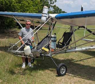
think they’ve become convenient enough to gain widespread popularity. Hang gliders from German manufacturer Finsterwalder come the closest. However, their 6-foot breakdown size is still relatively large, and many pilots report taking an inconvenient 40 minutes to set them up from the shortpack configuration (compared to around 10-15 minutes for standard hang gliders).
Major hang glider manufacturer Wills Wing also introduced shortpacking on its Falcon 3 beginner/recreational glider, which remains an option on the Falcon 4. I own a shortpack-capable Falcon 4 and love it, but the gliders’ similarly large shortpack size and hourplus shortpacking time make the feature primarily only useful for international travel, with regular/long-packing for everyday use.
In progress: New small-packing glider designs
Fortunately, some people share my belief that a convenient, smaller-packing glider is the future of hang gliding and are actively working to make it a reality.
Swiss pilot Florian Kohli began hang gliding in 2023. Living in an apartment and not owning a car at the time, he sought a smaller option than the gliders currently available on the market. After purchasing tubing from Finsterwalder, he created his first model, the TPHG 4.6, which measured just 4.6 feet long when packed. Kohli took the glider to California for its first test flights in November 2024, drawing a crowd of hang glider pilots as well as attracting emails from interested pilots around the world asking about buying the glider.
While the TPHG 4.6 received some criticism online for its not-yet-airworthy design, many praised Kohli’s efforts and willingness to innovate and refine his design. Despite having no formal engineering training, Kohli was excited to apply his inventor’s mind to the process. “Every single thing you think is difficult, someone will find the answer,” he said. “Why won’t you
do the same?”
Ultimately, Kohli’s goal is to develop a DHV-certified version of the TPHG that measures less than 5.7 feet when packed, weighs less than 44 pounds, packs down to a narrow width, and can be set up in under 20 minutes. On his way toward that objective, Kohli hopes to complete the second version of his glider and return to Los Angeles to test it this November (you can find updates on his website: hangglifter.com).
“I would just love to hear people say, ‘I would like to try hang gliding,’” Kohli said.
Australian instructor, top pilot, and hang glider developer Rohan Holtkamp is also working on a new glider design, the Dynamic Soarer, based on the ATOS C rigid wing glider. He has several even more ambitious goals, including: a packing time of under three minutes, a pack length of 5 feet 3 inches, a weight of 36 pounds, L/D of 16:1 or better, stall speed at maximum load less than 20 knots, and instant roll response.
“If you can’t offer compelling sink rate, L/D, stall speed, top speed, landing, handling, glide slope control, or safety improvements over the competition, then the market will not be swayed by a heavier and slower to rig option to a paraglider,” he said.
Holtkamp, who retired from instructing in 2023 to focus on designing the hang glider (as well as manu-
facturing a folding kayak), plans to load test the glider this year. “Hang gliding could blossom with uptake of a wing like the Dynamic Soarer,” he said, “as it addresses most previous barriers and will be very easy for paraglider pilots to adapt to.”
I’m thrilled to see pilots working on designs (if I had any engineering background, I’d join them) and hope more people recognize the potential and continue to drive innovation. So far, most hang glider manufacturers I’ve spoken to remain focused mainly on performance increases. They’re hesitant to commit resources to a new small-packing design because, they say, the market is too small to guarantee a return on their investment. However, this is a self-fulfilling prophecy.
: I encourage you to follow and support the development of new small-packing hang gliders, push for the changes you want to see, and vote with your wallet by contributing to development efforts when available and, ultimately, buying the finished product. Yes, some new designs will be lower-performance recreational gliders, but remember that they can pave the way for higher-performance gliders if they’re successful. Rather than lamenting insurance costs and other issues we likely can’t change, it’s critical to focus on areas we can for the best chance of growing the sport.
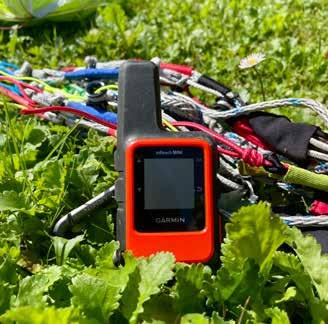
: Satellite communication devices have become an essential tool for backcountry expeditions and adventures in remote locations. It is common to see Garmin’s InReach Mini dangling from various pilots’ harnesses as they prepare to launch.
A standard cellphone GPS uses signals from multiple satellites in orbit, calculating the user’s approximate position first based on the time it takes for the GPS receiver to detect the signal from a satellite. The process is then repeated with usually three more satellites, using the intersection of each coverage area to calculate a precise location. Garmin’s GPS devices and other satellite phones are equipped with technology to actively transfer data to satellites in orbit, making them efficient sources of communication in isolated areas. However, their ability to bypass local telecom networks has led many national governments to regard them as security threats.
Out of concern that satellite communication devices could be used for insurgency, espionage, or to bypass censorship, many countries ban or heavily restrict satellite phones and GPS communication devices. Traveling without being aware of such restrictions could result in significant legal penalties and device confiscation.
Anti-terrorism efforts and national security are significant motivating factors in creating bans on satellite devices. For example, Nigeria prohibited the use of satphones in regions prone to conflict after Boko Haram fighters were found using them. Unauthorized sharing of information is also a threat. Satphones operating using the Thuraya network were banned in Libya during the 2011 civil war, and users were arrested as suspected spies. Mobile phones are much easier for government and national security organizations to track, leading to regulatory control requirements and specific licensing for the use of satellite communication devices. In Russia, individuals must pre-register their SIM cards and obtain approval from the communications regulator to enable call tracking and support counter-terrorism efforts.
India is a very popular flying destination, offering the potential for big flights and vol-biv adventures in the Himalayas. It is also one of the countries possessing strict bans and restrictions on GPS devices and satellite communicators, implemented after the 2008 terrorist attacks in Mumbai. Throughout the entire country, it is forbidden to use any device connected to the Iridium (what Garmin uses) and Thuraya networks.
The Indian Wireless Telegraphy Act was passed in 1933, originally referring to radio transmissions. It reads, “Whoever possesses any [wireless telegraphy apparatus, other than a wireless transmitter,] in contravention of the provisions of section 3 shall be punished, in the case of the first offence, with fine which may extend to one hundred rupees, and, in the case of a second or subsequent offence, with fine which may extend to two hundred and fifty rupees.”
Most recently amended by the 2023 Telecommunications Act, all versions prohibit the use of satellite transmission devices without permission from the Department of Communications, which is a significantly difficult task to achieve. An InReach device
uses SMS to connect users to the “outside world,” which is precisely what violates the Telegraphy Act.
The only way to legally use a satellite communication device in India is as a registered expedition company based in the country. A license from the Department of Communication and the Ministry of War is still required, and the complexity of the application process means that only a few large operators can obtain it. Smartwatches and smartphones are allowed since the two-way satellite messaging available in the new iPhones currently only functions in the USA, Mexico, and Canada. According to an article on the topic by ExplorersWeb, a local mountain guide, Sunil Nataraj, "explained that groups such as India’s Mountaineering Federation are trying to make their case. But he believes that mountaineering is not yet powerful enough to change such a well-entrenched policy.”
India is not the only country where such restrictions exist. The accompanying table summarizes all countries where satellite devices are either banned or heavily restricted. Entering any of these countries without being aware of the local laws regarding satellite communication could result in a variety of consequences. You could face monetary fines and significant prison sentences, your device could be confiscated, and you may attract unwanted attention from security services as a suspected unauthorized actor or spy.
Alternative solutions when traveling in such countries include renting a local, licensed satphone within the country or contacting a local guide who possesses a registered device that could be used for emergencies. In countries with less severe restrictions, it may also be possible to use one-way emergency beacons, GPS messengers, HAM radios, or mesh networking devices.
The main takeaway is that it is critical to diligently prepare and research before traveling to any unfamiliar location. If necessary, declare your device at customs to avoid suspicions of smuggling, and have contact information for the appropriate embassy or legal counsel readily available. The proper training of individuals employed by businesses or guiding agencies that operate in such countries is imperative to avoid conflicts in countries with significant risk.
Bangladesh† Banned. No permits or possession
Chad†* Banned. No permits or possession
China* De facto ban unless obtained via state providers
Cuba† Permit required from Ministry of Communications
India†*§ Restricted. License (NOC) required from DoT for Inmarsat only
Libya* Authorities often confiscate devices despite no explicit ban
Myanmar (Burma)* Effectively banned. Only allowed with rarely granted permit
Nigeria¤ Banned in Borno. Legal status unclear nationally and possession risky
North Korea* Banned. No permits or possession.
Pakistan¤ Banned in parts of NW. Use elsewhere may require military approval
Russia* Pre-approval & SIM registration allowed with Roskomnadzor. Foreigners can register for up to 6 months
Sri Lanka* Permit required. License from telecom regulator (TRCSL).
Sudan* Strictly controlled. Approval & license from telecom authority. Must declare device on visa application
South Sudan* Permit and device registration with government required. Prior coordination advised
Ethiopia* Permit required. Written permission from Ministry of Communication/IT before import
Turkmenistan* Banned. No legal use. Strict enforcement and search are common
Mauritius* Restricted. License required from ICT Authority
Thailand* Restricted. Personal radio/sat devices need NBTC license
Vietnam¤ Restricted. Government permission required to import/use. Zero tolerance
Iran* No explicit ban but high risk. Devices often confiscated
Syria¤ War conditions. Likely treated as illegal for civilians
Oman¤ Requires import permits for radio devices
Nicaragua¤ Reports of ban due to regime security
* Confiscation
† Arrest/imprisonment § Fines
¤ Variable or unknown
1,600 kilometers travelled on foot
145,000 meters climbed
84 flights (including 60 from summits) 5 top landings on summits
solo adventure (and doesn't care whether you know about it or not)
: If it’s not on social media, did it really happen?
The modern adventure industry emphasizes personal branding and visibility, so why would any outdoor adventurer so much as swing their ice-axe without a “content strategy?” Or, worse, forget to take their camera out?
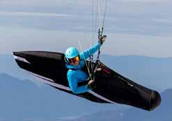
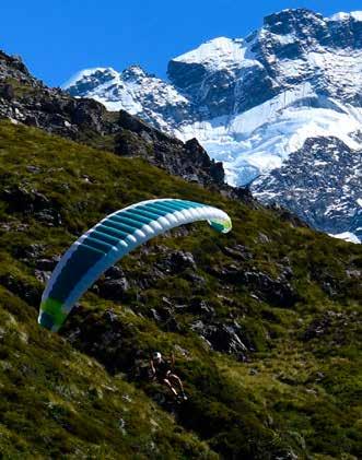
Nathan Longhurst, 24, completed a four-month campaign in the austral summer of 2024-2025 to summit every peak on The New Zealand Alpine Club’s 100 Greatest Peaks list. His feat was quicker than the only other completion time by 29 years and 8 months. Behind his long blond hair, beard, and weathered cheeks, Nathan comes across as a quiet, contemplative person who would rather be out on his next trip than talking about the last one.
“[Making content] is not my forte. My forte is running around by myself in the mountains,” he says. “It’s difficult for me to be out there, capturing content, while staying immersed in that personal experience,” he continues. “For a long time, it was quite hard for me to turn the camera on and not have it pull me out of this flow state.”
Nathan is an experienced trail runner, rock climber, ice climber, skier, and alpinist. He set the record for being the youngest person at 21 years old to complete the Bulger List (the highest 100 peaks in Washington), and he was the first person to bag all 247 peaks in the Sierra Peaks Section List within a calendar year.
But he has only recently added “pilot” to his list of
abilities. He started paragliding only 15 months before his trip to New Zealand, forming the idea and planning just two months before summiting the first peak. Adding flight to his skill set opened up new possibilities. One of his supporters, Jason Hardrath, described his use of a paraglider in this adventure climb-and-fly setting as “game-changing.” Nathan didn’t wait long to put his new skill to use: “I pretty much started the first peak straight from the airport,” he said.
The New Zealand Alpine Club’s list of 100 Great Peaks includes everything from Aoraki (Mount Cook) to remote technical summits like Jagged Peak in the Arrowsmith Range. The list was compiled in 1991 to celebrate the club’s 100th anniversary and aimed to encourage climbers to try a range of peaks of varying difficulty. New Zealand climber Don French became the first person to complete the list in February 2021 in a pursuit that spanned three decades. Nathan would attempt to link all these peaks throughout a four-month campaign. And he saw paragliding as a way to make that happen.
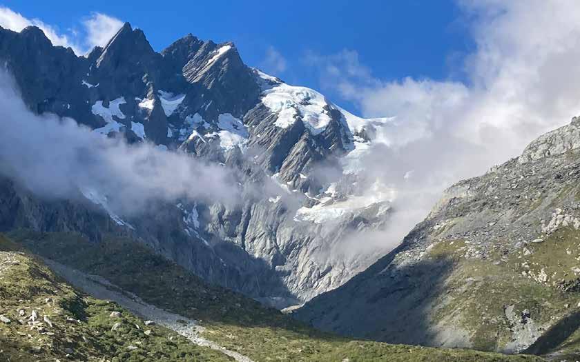
Nathan visited New Zealand for the first time in March 2024. “I just absolutely fell in love with the mountains,” Nathan said. “I was super impressed by the combination of relatively easy access, but big mountain feel with remote and rugged mountain terrain.” This was a combination he hadn’t really experienced much in the lower 48.
“The terrain is incredible for flying,” he said. “It’s true alpine terrain with big glaciers and ice falls; really
complex, interesting, and steep terrain.” Many summits are technically challenging from all approaches and lack easy routes to the summit. In Nathan’s eyes, this made them appealing for both pure alpinism and paragliding.
“From the climb-and-fly perspective, I think it’s some of the best terrain in the world,” he said. “Many of the approaches didn’t even have trails; they were either just bushwhacking or scrambling up a river bed.”
Nathan made it clear his achievement won’t officially count as a record* for completing the list, but that was never the point for him.
*Technically, Nathan didn't adhere to the rules over where each ascent should start. His use of a paraglider meant he could launch from one peak and land some way up on the next one. There was also at least one peak where he tagged the highest point, but the list states a sub-peak as the official summit. Though this aspect was frustrating, he still considers himself to have reached all 100 summits.
The 100 Peaks would be a serious undertaking for any experienced pilot, so it was surprising to hear that Nathan took up flying only 15 months before attempting the first peak on the list. “I will say there is no substitute for experience,” he said. “But in terms of having flown for a year, I’m quite proud of the amount of time and the number of flights that I put in.”
In his first year of flying, Nathan did almost 1,000 flights and “probably around 300 hours” of flying time.
“I was basically living in my van at the flight park near the local soaring site in Salt Lake City, Utah, and flying there just about every day,” he said. The nomadic lifestyle and seasonal work as a trail-running guide allowed him to chase flyable conditions.
It’s important to have equipment you can rely on, and for Nathan, simplicity is important—as is weight. He opted to use trail running shoes as much as possible, adding microspikes when he had to scramble up a glacier. His wing choice also called for something lightweight, but still had to be fun.
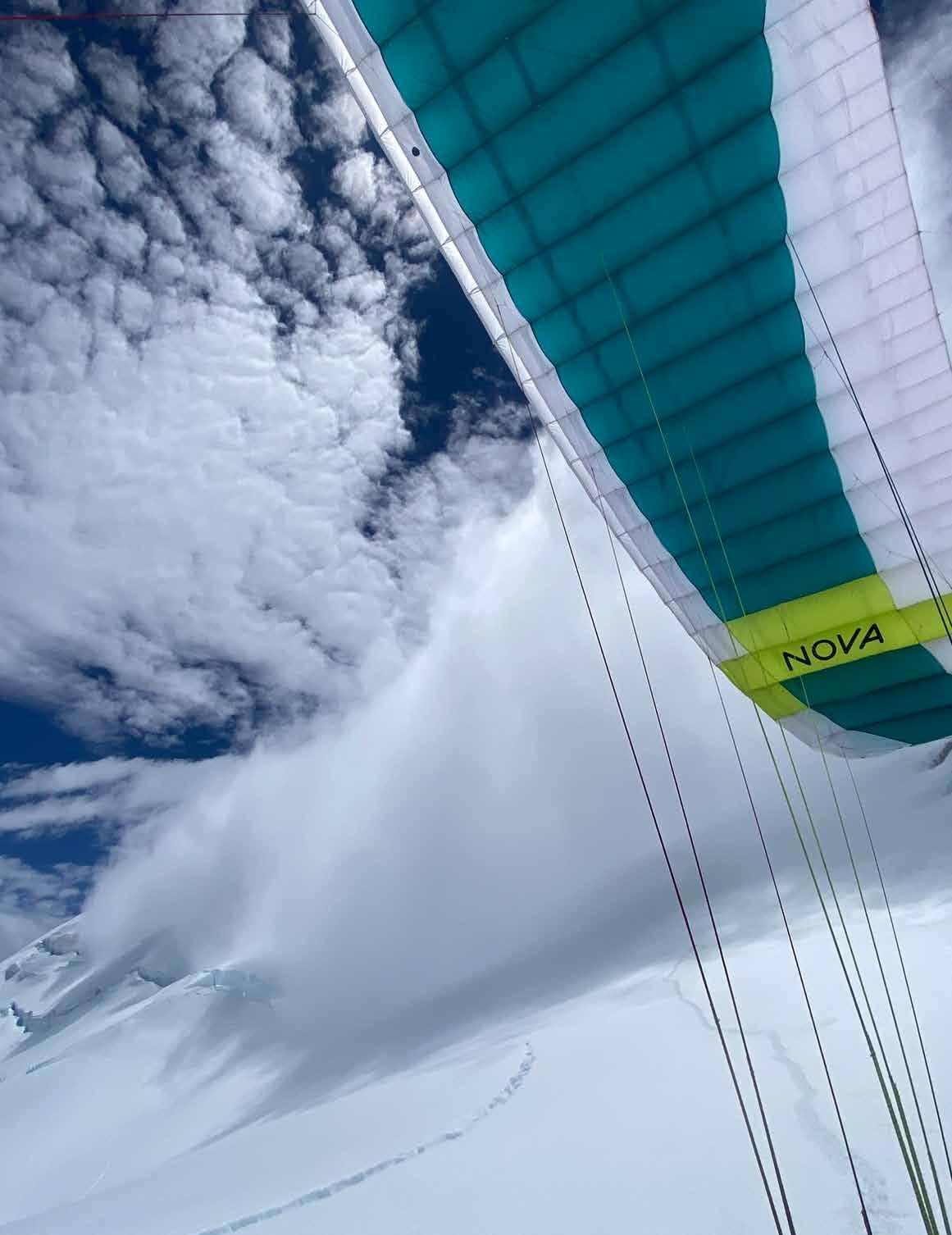
“I’ve mostly been flying my Nova Bantam,” he said. “I enjoy it quite a lot. It’s a really fun and dynamic wing to fly while still coming in a really lightweight package. It’s easy to launch even in higher winds.”
Unfortunately, midway through the trip, he snagged some lines during a launch from a rocky site, and the resulting damage put the Bantam out of commission. His aim to complete the whole project before the winter snow arrived appeared to be in jeopardy. It took the generosity of a local pilot to get the project
His progression included a month in Lauterbrunnen, Switzerland, “just doing a ton of laps” and time in the eastern Sierra doing technical climb-and-fly work. Even so, Nathan didn’t undergo any specific training in preparation for this project. “A lot of the flying I was doing before New Zealand did prepare me quite well,” he said. “But it wasn’t deliberate training.”
back on track, and it wasn’t long before Nathan had the ultralight Dudek Run-and-Fly as a replacement.
The technical challenges of New Zealand’s conditions became apparent immediately. Nathan described starting a crucial climb at 2 a.m. to catch optimal flying conditions, including a 2,500-meter vertical route on Sefton with “pretty sustained technical climbing for that whole length,” followed by a flight off the summit.
“My window for optimal flying conditions off the top of Sefton over to Footstool, and then off Footstool back down to the valley, was relatively short,” Nathan said. “I was expecting some stronger wind from behind by the middle of the day—similar to the Foehn in the Alps.” But he was able to make the flights before the wind took over for the day.
Nathan’s longest continuous link-up covered 23 peaks over 11 days and required helicopter resupply drops at mountain huts. “I planned this link-up and it felt like a total pipe dream,” he said. All the conditions would have to come together for him to have a chance. Which wasn’t exactly how it happened. “I did have four storm days,” Nathan said. “Sitting in huts, listening to the weather shake the walls.” He credited the New Zealand hut system as being an integral part of making this project possible.
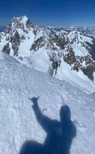
In between storms, there was beautiful weather and clear skies. “I was able to do this really incredible, aesthetic movement through the central part of the range; through the highest peaks there, flying off these beautiful, technical summits. In a couple of cases, actually landing directly on some of these summits, which was spectacular,” he said.
Flying added a layer of complexity to Nathan’s decision-making. “My options are I can either downclimb this mountain, which can have its own hazards, be really complex, and take hours, or I can fly off,” he says. “If I’m able to safely launch, I’ll be back in my car in 10 minutes—but that has its own set of risks, especially if the conditions are anything less than ideal.”
Carrying a wing also fundamentally changed Na-
than’s experience of the summits. “Another by-product of having the wing is, as you arrive on a summit, it’s hard to just look at the views,” he said. He became “instantly hyper-aware” of everything related to flying—wind direction, wind speed, possible launch direction, and cloud development. “I’d try to take a moment to look around, but for the most part, on any day I was considering flying, as soon as I was on top, I was immediately in the mode of analyzing flying conditions.”
Being pulled out of the experience had been Nathan’s main reason for shunning the use of cameras while on a trip. Now, the very thing that would open up new experiences was threatening his engagement, too. But he found another way: “The moments of seeing and appreciating the natural beauty around me were actually while I was moving up. While I was climbing,” he said. “I like to set big goals and dedicate myself to them,” he said. “I find a lot of flow and a lot of gratification in solo travel. I’m much more centered and in tune with the mountains when I am by myself.”
Don French, 66, is the only other person known to have completed the 100 Peaks list. He has been an avid climber for most of his life. Nathan had a meal with Don, and the two shared adventure stories, with Don giving the benefit of his years of experience. Don became impressed by Nathan’s strategic use of flight.
“I think everybody is in awe,” Don said. “I’m seeing the cunning that he’s using.” He described how New Zealand is “famous” for its loose rock, making for “scary climbs” and dangerous river crossings. “[Nathan] climbed a subsidiary mountain, flew into the head of the glacier, then did his climb out!” Don said with admiration, explaining how this approach avoided dangerous climbing sections. “There’s a very big river called the Landsborough, which is really, really remote,” Don said, “and he flew across the river to do the river crossing. So, if you’re by yourself and flying with a wing, it just eliminates that risk issue. So, yeah: in awe of his cunning.”
Nathan is a climber, trail runner, and ultra-runner who has also become a pilot. His rapid progression
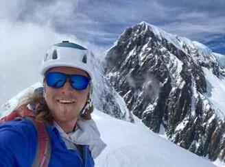
on the summit of Mt.
after
BOTTOM Nathan on the summit of Mt. Tasman, after a traverse from Mt. Haast, moments before flying off and top landing on Torres Peak. Aoraki/Mt. Cook in the background.
by Nathan Longhurst
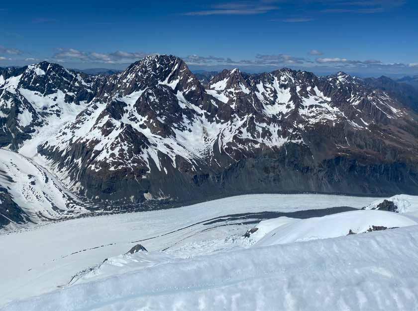
from zero to flying from technical peaks in extreme terrain demonstrates both the accessibility of our sport and its game-changing potential for mountain athletes.
“It’s ridiculously, absurdly fun,” Nathan said. “Flying introduces this whole new dynamic element into my movement through the mountains. It has created a whole new layer of looking at terrain. You’re climbing mountains, but how do you move between these mountains efficiently, using a wing? Where can you launch and where can you land? And how can you maybe bypass difficult sections of travel, difficult glacier crossings, or river crossings, or avoid really long and dangerous descents? This climb-and-fly style has presented this whole new dimension and challenge,” he concluded.
Coming into the landing field from his 100th peak, Nathan was met by elated supporters, friends, and family. Since that moment, he has been asked to share his story with many people. The attention was alien and overwhelming. A culture shock. His reality had been so solitary for so long.
“NATHAN's rapid progression from zero to flying from technical peaks in extreme terrain demonstrates both the accessibility of our sport and its game-changing potential for mountain athletes.”
During our interview, it often felt like he always had one eye looking out the window. The end of the project was the end of it. With an eye drawn to the outdoors, Nathan seemed to have already moved on and was probably planning his next big project.

by Mitch Riley and Bill Belcourt
Utah paragliding record flight report | July 6, 2025
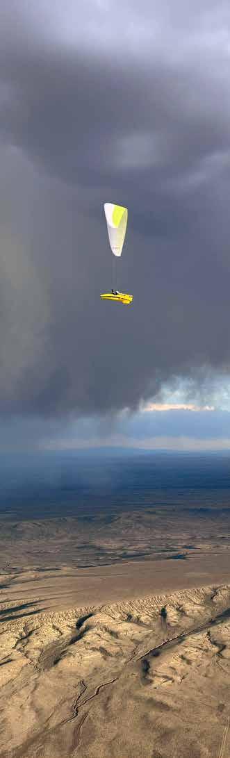
At the time of writing, this flight secured the Utah free flight record. Flights like this are variable and require the full skill set of very advanced pilots. Their decisions and conditions encountered are not to be taken lightly.
[BILL] Big XC flights in the Mountain West can be complicated. Wind direction and strength can vary significantly along the route. You can traverse multiple mountain ranges with different magnitudes of cloud development and turbulence. You might fly days and/or parts of the route that are “on the margins.” Essentially, “on the margins” means the edge of what
is reasonable and relatively safe. There can be magic on the edge, but slipping off to the wrong side is a real possibility.
To play the edge, you need to understand the risks and be at peace with all possible outcomes. This was one of those days. We had to adapt and improvise, unless it became obvious that we had to land to avoid a gust front. Fortunately, that point never came. We got to play the edge, following that shifting line until
the sun set. It was glorious. We weren’t out there just flying distance; we were exploring a line through the sky, fueled by different factors at different points in the day. Some clouds we ran from; others we ran towards. We refined our position, and we walked the line. I am sure we made plenty of mistakes en route and had to draw on a lot of past experiences, but ultimately, we got to where we needed to be in the sky to fly the length of the day.
[MITCH] On the evening of July 5, I met Bill at his house to refill my oxygen bottle and discuss the forecast and flight plan. The forecast was for top of lift to be well above our 18,000-foot limit, with patchy overdevelopment on the route, plenty of west wind up high, and reasonable winds on the surface. Bill pointed out the areas with potential “outflow” and how we might fly around it if the overdevelopment got as bad as forecasted. We planned a flight with two waypoints: Jupiter Peak as our starting point, and Laramie, Wyoming, as our goal. A 500 km flight center-punching the Uintah Mountains on a day with proper wind and a chance of overdevelopment—it was a classic Belcourt plan, and I was happy to be along for the ride. After getting an above-the-green fill on my O2 bottle, I went home, had a good dinner, and went to sleep early. I woke up bright and early and made a coffee as I prepared an ice bath. Starting the day with a cold plunge forces my mind to get used to persevering through hardship, my metabolism to fire up, and my energy reserves to stay higher throughout the day. A long day of cross-country paragliding is a test of endurance as much as it is a test of skill. Many pilots can fly well for a couple of hours; keeping a comp wing efficiently flying throughout an entire day in big conditions is a whole different ballgame. In the ice bath, I calmed my breathing and focused on my goal for the day. My goal was not to break the Utah free flight record, or to fly 500 km. My goal was to land at sunset with Bill Belcourt. Bill has been a legend of free flight since well before I started flying. He has been a mentor, friend, and confidant of mine for over a decade. At 61 years old, Bill is charging harder than any U.S. long-distance or competition pilot. I was quite
sure that if I flew with Bill all day long, we would have an incredible experience and fly pretty darn far.
On takeoff, we found light wind, cycles coming up the hill, and a clear blue sky in all directions. Jupiter Peak sits at 9,950 feet ASL, on the east (typically lee) side of the Wasatch. Nearby is a convergence of three of the main Wasatch Canyons: Big Cottonwood, Little Cottonwood, and American Fork. Oftentimes, the first cloud of the day in the Wasatch forms somewhere above this convergence of the canyons.
Eventually, the SLC crew made it up to join us. Bill mentioned that the morning forecast was showing more overdevelopment and, therefore, a higher likelihood of outflow. The general feeling was, “Let’s see what the day gives us.”
11:00 a.m. Jupiter Peak
[MITCH] A visiting P3 launched, marking some lift as the first cloud formed above the meeting of the canyons. Soon, I was suited up and launched into a sturdy cycle and a great climb. As I rode the thermal up through 12,000 feet, I saw Bill launch. I quickly made it to cloudbase at 14,000 feet, more than 2,000 feet lower than we had forecasted.
The air was smooth as I waited up there for Bill. Arash, Matt, Ben, Lisa, and others were also climbing up. Soon enough, Bill and I were gliding over my home of Park City. The Park City area is convergence central. The Weber River flows north out of the northwest side of the Uintas towards Morgan, then through the Wasatch to Ogden. The Provo River flows south from the southwest side of the Uintas toward Heber, then through the Wasatch to Provo. Additionally, west of Park City is the densest part of
the Wasatch Mountains, featuring large west-facing slopes that heat up and block any west wind until late in the afternoon.
The trick for our first move was to find that convergence, and I think we did. The glide was great, with occasional light lift. At times, it felt like the best lift line occupied just seven cells of my glider. When I felt it move left or right on my glider, I would adjust my heading to get it back to the middle. Bill came on the radio with multiple “radio checks,” all of which I responded to—it was obvious he could not hear me. We needed to arrive as high as possible for our next climb, and we were gliding to lower terrain—and likely into a more stable airmass—so we flew at trim speed, occasionally slowing our gliders with brakes when in light lift.
[BILL] I radio checked on launch and could hear my transmission on the radios around me. I assumed it was all good. What I didn’t realize was that I could not hear anyone through my speaker mic. I eventually figured that out after Mitch flew close to me and yelled over that he could hear me on the radio. I unplugged the mic and could then monitor trans-
missions, but the radio, being inside the Submarine harness, made it too difficult to transmit unless absolutely necessary. Turns out we didn’t need to discuss much.
12:03 p.m. 18 km from Jupiter
[MITCH] We found a climb over the hills to the north of the Browns Canyon Road. It was a weak, snakey climb that we desperately needed to cross Rockport Reservoir and progress into the Uintas. Next, we were on a typical line for entering the Unitas: Big Piney Ridge. As we reached higher terrain, the thermals remained challenging and weak. Soon, Bill and I were down in the upper Weber Canyon, frisbeeing downwind in crappy, stable thermals, working hard to find the right climb to get us back in the game. My mind was awash with thoughts about how the Uintas were too stable and windy, that we would need a whole lot more altitude to ensure that we wouldn’t land in a high, rocky pine forest miles away from any roads.
[BILL] I was hoping we would see more clouds popping earlier along a more direct line towards I-80 and Fort Bridger, but it was just blue. That, combined
with scrappy weak climbs that didn’t even go to 13,000 feet, made me want to keep to the terrain. Weber Canyon was the most conservative route choice, as it leads directly to the north slope of the Uinta Mountains. The Uintas were forecasted to overdevelop (OD), and conditions were clearly heading that way. Weber Canyon should have been cracking. It wasn’t—climbs were weak, wind-shredded, and didn’t go very high. The few clouds that were starting to pop around us dissipated. It felt stable, while a few miles to our east, it was booming. I couldn’t imagine it was better further north, where the terrain was lower and flatter. I felt we were in the best place, but it was still tough. Matt marked a good climb that at least allowed us to move along and be low in the wind somewhere else.
1:44 p.m. 50 km from Jupiter
[MITCH] I looked at our progress: 2 hours 40 minutes flown and only 50 km from takeoff—this was not a big day. As we slowly soared mountain faces and drifted back in weak, punchy thermals, Matt Weiseth came in underneath us and eventually found a ripping strong thermal out in the valley. He alerted us to it on the radio, and we were able to climb up to 14,000 feet and dive into the Uintas.
The next couple of climbs and glides in the Uintas were ferocious. It took constant attention to keep the glider open. Matt came on the radio, saying he had had enough and flew out to a landing. The clouds on our side of the crest were joining together and starting to fall out. Outflow was imminent, and we needed to do something. We started running to the north, trying to maintain as much altitude as possible while also getting as far away from the potential outflow as possible.
All of our communication was sublingual; when I saw Bill point towards a forming cloud, I joined him. When he saw my choice of a more northerly line to escape the overdevelopment, he would join me. Arash came on the radio saying, “I’m coming down under reserve, my glider went absolutely nuts.” I remember thinking, “That makes sense, this air is crazy.” I relayed the message to our driver and asked Arash to check in when he had landed safely, and he eventually did. This part of the day was powerful to say the least.
[BILL] It felt to me that we were on the edge of two
air masses: the more stable one, which was crushing the lift and compressing the wind, and the airmass going big over the Unitas. It was no surprise that it was turbulent in this zone. You know it’s bad when you don’t even want to turn in the lift—I was flying squares in the worst of it. Once we got through that area, the lift became more organized, and I tried to relax as I climbed to base, looking at the OD to the south for half of every turn. I told myself not to worry: we’d be mashing bar to the north soon.
3:30 p.m. 127 km from Jupiter
[MITCH] Bill and I got separated. We were both at cloudbase, I led out, and the OD was still raging behind us. I fell into a horrendous sink line and found myself low, hot, and struggling to control the glider in an edgy little ripper. Then I saw Bill at cloud base, passing 7,000 feet over me, heading further north and running further away from the development. Half of every circle, I was staring at this black mass of rain and wondering when the outflow was going to show itself. I wanted to leave the climb and run, but I knew I had to concentrate on gaining altitude and therefore increasing my options.
For the next hour, the stress got to me. Fatigue from the turbulence, running from the possible outflow, and getting low and hot had me climbing badly, gliding badly, and considering landing. Eventually, I found myself in a nice, smooth 3 m/s climb to cloudbase and noticed that the rain was too far away to worry about. Just like that, the stress lifted, and I was mentally back in the game. My next mission was to find Bill, and I was quite certain he was in front of me. I’d have to fly fast, and fly well, to meet back up.
Eric Konold, our retrieve driver, came on the radio to check in. I told him Bill’s radio was not working, and asked him where Bill’s last inReach message was. “East of Green River,” came Erik’s reply. “Excellent, I am almost at Green River,” I said. Five minutes later, I saw Bill about 3 km in front of me and at my altitude. “I have Bill in sight,” I said on the radio. After a couple of thermals, Bill and I were reunited.
[BILL] I heard that transmission and Mitch’s next one saying he had me in sight. I couldn’t see him, but I

slowed down to make it easier for him to catch up with me. It didn’t take long. We were back together at Rock Springs, in a much better place in the sky after battling for the last 4.5 hours to get there.
5:30 p.m. 221 km from Jupiter
[MITCH] My previous fatigue and stress vanished. I was back to flying well, thinking clearly, and having a blast. Bill and I shared big, strong, and relatively smooth thermals with spectacular views of the Flaming Gorge and the desert plain of Wyoming. Our glides became buoyant with a great tailwind. At onethird speed bar, we were traveling 80 km/h over the ground. Ahead, we could see the Jim Bridger power station, evaporation pond, and dry lake bed. Occasionally, a massive dust devil would rise off the dry lake bed, composed of white dust and minerals.
6:10 p.m. 256 km from Jupiter
[MITCH] We were on one such buoyant glide, with a blue hole ahead, when I got a great line and Bill got a terrible one. He couldn’t find my lift seam and was quickly thousands of feet below. I made three turns in a strong climb, and he didn’t find it. Suddenly, Bill made an abrupt north turn, towards clouds and the Jim Bridger dry lake. I elected to continue on course, and keep an eye on Bill. I turned in every piece of light lift, keeping it nice and slow so that Bill could join once he got up. I saw Bill get lower and lower, flying further and further north. His yellow glider and harness were lit up in the evening sun, and I eventually saw him catch a strong climb.
[BILL] I got a bad line and we were headed into a blue hole, so I took a hard left and headed north to
the closest cloud near the Jim Bridger power station. It was pretty sinky until I was properly under the cloud, and I still didn’t find lift. I headed downwind to the massive smokestack and black coal fields adjacent to the plant, figuring it was bound to work. I found a strong, narrow ripper that sucked in a cloud of dry lakebed dust that got me back in the game. I ended up on a parallel line to the north of Mitch at a similar altitude. We met in the middle, and this was the last time we would be separated.
7:00 p.m. 290 km from Jupiter
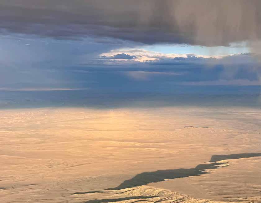
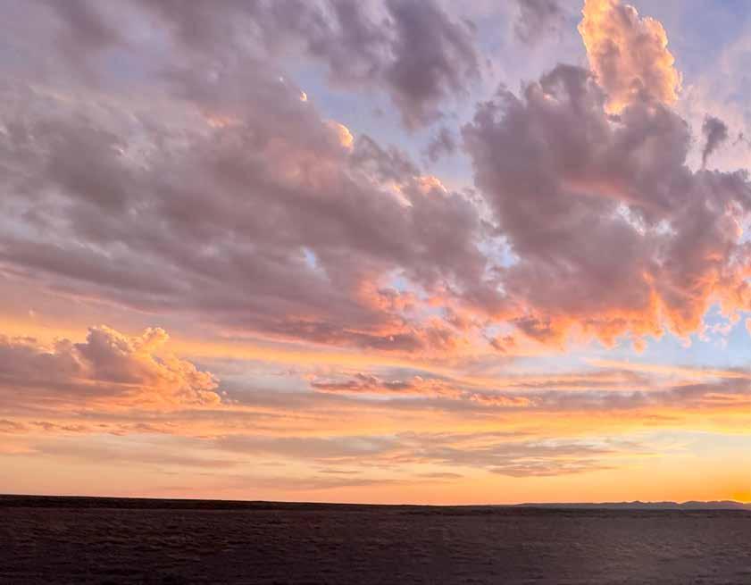
[MITCH] The blue hole we had previously worried about turned into a sky of glass-off cumulus, with rain and virga to our south, and its associated cold outflow, providing enough instability to give us big areas of 1.5 m/s lift. After eight hours of full-on fero-
cious flying, the battle of the day was over; we were now flying in the reward part of the day. Smooth air, incredible scenery, and a great friend to share it all with—it doesn’t get much better. I got out my camera and started taking photos and video; it was too beautiful not to. At this point in a long day, you never know which thermal is going to be your last, so speed to fly is all about maintaining as much altitude as possible. We still had a tailwind of over 30 km/h, and were making great progress. I wasn’t thinking about any record or even the distance from takeoff; my main goal was still to land at sunset with Bill.
8:15 p.m. 350 km from Jupiter
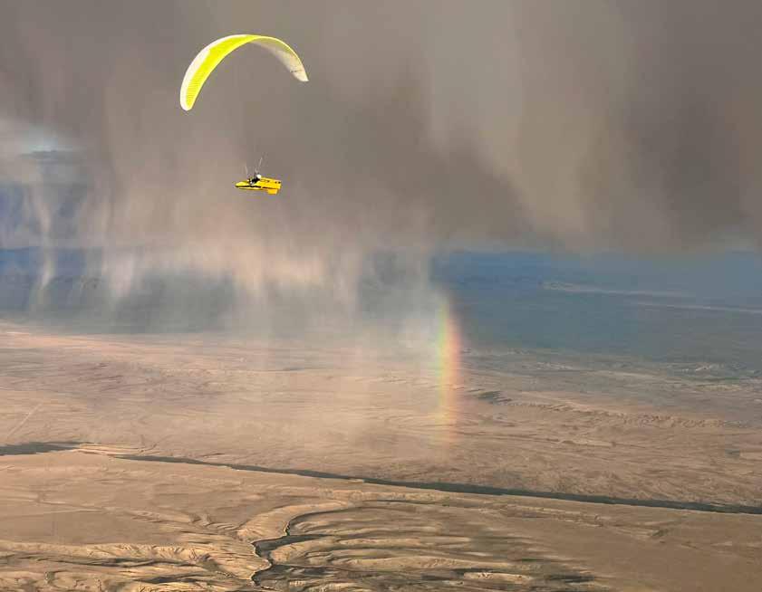
[BILL] We had found the perfect seam of buoyant air
“Let’s see what the day gives us.”
for what seemed like the final glide of the day. But, as luck would have it, we got one more climb to nearly cloudbase after 8 p.m. As we climbed, the light and our position were unreal. The gliders and harnesses were glowing like they had lights inside them. The sky was as dramatic as can be, with clouds dropping out and a rainbow as we turned on the edge of the line. Mitch was right there, and we were hooting and hollering at each other. I would say it was unbelievable, but Mitch took pictures!
8:20 p.m. 362 km from Jupiter
[BILL] It was looking like a storybook ending for the day, but Mother Nature gave us one last reminder of the forces we had been playing with for most of the day. We got a little too south of the ideal line and into the downflow from the clouds dropping out. The clouds looked just as good as the ones that produced our last climb and great glides. Our ground speed didn’t change much, but the sink and turbulence were bad for a good few minutes until we adjusted our line to the north. We got back on the better line for the final glide and a smooth landing.
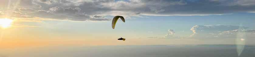
[MITCH] We went on a glorious final glide: smooth buoyant air, jaw-dropping views, and success on the horizon. I followed Bill so that I could continue to take photos and video. We were gliding at trim, making 70 km/h over the ground when suddenly I saw
Bill’s yellow Enzo start to buckle, pitch, and shake. I quickly put my phone (camera) down and prepared for the beating. It was just that—I had to use full brake authority to prevent collapses, while dealing with unpreventable dramatic yaw movements. After a few minutes of Kung Fu fighting and a lot of altitude loss, we were back on our magnificent, buoyant sunset glide. We were gliding over the first paved road we had seen in hours. Branching off from this paved road was a wide gravel road that pointed directly downwind.
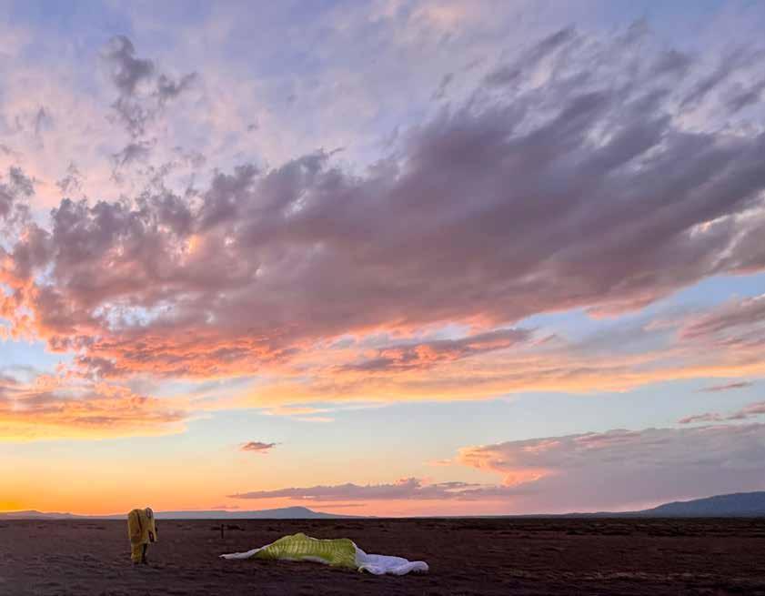
8:48 p.m. 387 km from Jupiter
[MITCH] We followed this gravel road until 20 feet above the ground, then simultaneously turned base to final and landed together after spending over nine and a half hours in the air. It was three minutes after sunset, the sky was ablaze in yellows, reds, and oranges, and Bill and I shared a heartfelt hug. I don’t have words to describe the joy, satisfaction, and camaraderie I felt at that moment. We packed up our gliders, and Erik soon appeared in Bill’s truck to take us home. [BILL] Landing right next to Mitch after nearly 10 hours of high-drama flying where we worked together, stuck with each other, and shared in those amazing moments in the final hours was incredible. This one is going to be hard to beat!
Get the gear that fuels your passion at discounted prices.

Your Pilot or Instructor USHPA membership automatically qualifies you to join. Simply scan the code to get started.
Unlock up to 60% o on top outdoor brands

: Are you familiar with the concept of naïveté? Years ago, when I saw a documentary about Tiki Mashy visiting Wallaby Ranch. I remember thinking, “Wallabies? Why go all the way to Australia?” Really.
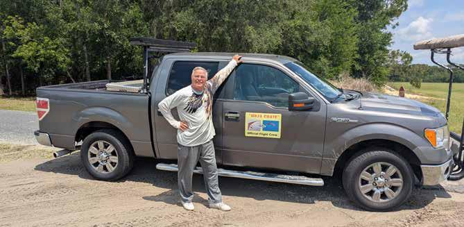
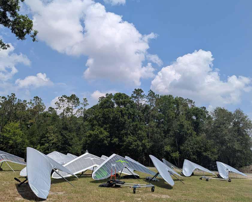
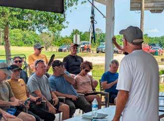
These days, as an H2 novice, I assumed that a flatland national hang gliding competition would be a straightforward undertaking. That was another grand example of naïveté. I spent a week as a volunteer retrieval driver to determine what is essential to host an event like the 2025 Hang Gliding Nationals—my time there quickly dispelled my misconceptions.
Paradise Airsports at Wilotree Park in Groveland, Florida, has north-south and east-west grass runways, a layout that can accommodate any wind shifts that occur on any given day. The convivial clubhouse offers a large-screen TV, comfortable, air-conditioned rooms for rent, and shared bathroom and kitchen facilities. The office is located on the ground floor, under a porch roof where pilot briefings (and potluck suppers!) are held.
I learned that organizing these events requires a significant amount of personal time away from one’s family. I began to realize that a common thread among the leaders in the hang gliding community is ongoing generosity. I saw examples of this generosity repeated throughout my week.
Victoria Nelson supervises and manages all aspects of the air sports. She schedules the aerotows for visitors who want to experience free flight in a hang glider and collects and records all the registration fees. She is also part of the launch crew that ensures all pilots are safely in the air within the launch window. She seems to do three or four things all at once.
Eric Williams is one of the co-owners of Wilotree Park, which encompasses Paradise Airsports. He is the event host, safety director, rescue coordinator, and medical coordinator. Additionally, he is a long-time instructor and often pilots tandem discovery flights. One of his many jobs is community relations. Though central Florida seems to be under assault by massive development, Wilotree Park is still surrounded by fields full of cows and horses (expensive animals owned by
sensitive ranchers). As is common in competitions, not all pilots will make goal for the day, instead making unplanned landings in these same fields. Pilots receive a “Do Not Land” list at the very first briefing. In the event of a rancher getting ruffled, Williams makes every attempt to see that nothing was damaged and no animals were traumatized. He takes his job as a good neighbor very seriously.
All of our endeavors require organization. Stephan Mentler is a co-organizer of the meet along with Eric Williams. Mentler, a long-time pilot who has been flying since 2004, is also USHPA director of Region 4, which encompasses fifteen states and the District of Columbia. He has organized four events and competed in several dozen, including the 2014 World Hang Gliding Championship in Annecy, France. As the organizer, before the competition, he sent a message to all the pilots asking them to download the Volandoo app so that they could keep a record of their tracks. He also plans and manages the budget.
The Meet Director, Jamie Shelden, is an experienced pilot who has competed internationally. Her administrative work for the Commission Internationale de Vol Libre (CIVL) spans seven years, including roles as a steward, jury member, and lecturer at a jury and steward training seminar in Budva, Montenegro—and now as a Meet Director.
The Director’s job involves a multitude of responsibilities. She coordinates with all committees, including safety, scoring, launch, and weather updates. She is integral to determining daily tasks and ensuring adherence to the FAI’s rules and regulations. Shelden was also part of the launch crew that staged launch carts, alerted pilots in the queue, and even brought water to waiting pilots who were sweltering in their pod harnesses in the 90° Florida heat. Shelden came to Florida from her home in Watsonville, California, to direct both this and the Bobby Bailey Memorial. She took time away from her law practice to do so—again, I see a demonstration of an unselfish love of the sport. A good day of flying starts with being dropped into a nice thermal, and a good tug pilot will do precisely that. Jim Prahl, Derreck Turner, and Mick Howard are all tug pilots and hang glider pilots. Turner and Howard also competed in this National event. The three of them were integral to the event’s success, as they successfully got all competing pilots airborne within the launch window.
Davis Straub is a competitive pilot, maintains and edits “The Oz Report,” and has served as a Meet Director for the 2013 World Championship in Forbes, Australia. During Nationals, he prepared and delivered the morning weather briefings, posting screenshots from the NOAA website on WhatsApp to give pilots a glimpse of the flying conditions they could expect. Because of Straub’s briefings, I began to see the im-

portance of micrometeorology and started correlating the weather abstract with what I was seeing in the sky. Although I was still learning about various aspects of weather to understand his briefings, it seemed that the task finishers had an excellent and almost visceral knowledge of thermaling and weather.
The first task was cancelled due to thunderstorms that were forecast to develop while pilots were in the air. All parties were set up and ready to launch, but the members of the safety committee had to make a decision that was sure to disappoint. However, as always, safety was the determining factor.
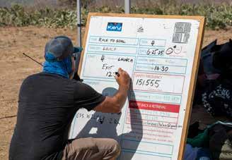
On the second day, the pilot briefing was scheduled for 11 a.m. Tasks for Open Class and Sports Class were posted, along with the day’s launch order, and Straub provided the weather brief. As a retrieve driver, I had the Life360 app loaded onto my phone and Volandoo on my iPad. With Life360, I could create a group with only the pilots for whom I was driving. Tap the pilot’s picture and then tap “get directions”, and it would lead me to the pilot’s location—it was an essential tool to find and retrieve the pilot.
Volandoo helped me keep track of all pilots while they were in the air. If any of the pilots in my group showed a constant loss of altitude, I assumed that they were preparing to land, and I got ready to mark the location. Volandoo displays task cylinders, and if you tap
one of the hang glider icons, it will display the pilot’s name and track. Below the graphics, the text displays the name, altitude, speed, vario up or down, distance covered, distance to goal, time in the air, and type of hang glider flown.
As a pretty new H2, before this competition, I had no idea what CAPE stood for, what a task cylinder is, what either Life360 or Volandoo were, or what the phrase “made goal” meant. Each day brought an avalanche of information that I tried to absorb. It was a fun ride!
Days three, four, and five continued with flyable weather. The launches were high-charged, choreographed, and brought non-stop action. For a brief moment, Paradise became the world’s busiest airport. As the launch window approached, pilots brought
their gliders to a staging area. There would be three or four pilots lined up on launch carts, ready to be towed. The launch crew checked over every pilot and glider. When the pilot was ready, the signal was given, and the tug pilot applied full power. Almost as soon as the pilot released the cart, someone would drive out with a gas-powered Gator to retrieve it. At the same time, the launch crew would move the next pilot into position while the next tug taxied out to its spot. If a pilot landed and needed a “relight”, there was someone in another Gator ready with a launch cart to tow them back to position. The launch crew was well-practiced, and the event depended heavily on these dedicated volunteers for success.
On the third day, neither of my pilots made goal. I tracked them via Volandoo and then used the Life360 app to locate them on the ground. They were both a short drive south of Wilotree and within minutes of each other. They had wisely landed inside fenced fields, without cattle, close to the road. Radios, WhatsApp, and cell phone messaging made communication and
pick-up a breeze.
The final day of the event was not flyable, and pilots were alerted via WhatsApp. An awards dinner was held that night, but unfortunately, I was unable to attend. A pilot from Portland, Oregon, had asked for a ride to Orlando airport, and we had to leave Paradise by 11 a.m.; departure from Paradise was necessary.
: The week left me astonished at the depth and breadth of the experience and knowledge of all of the people involved in producing the 2025 Nationals at Paradise Airsports. If you’re a novice pilot and want to see firsthand what’s possible in this sport, find an event and volunteer. You will see an array of gliders, harnesses, equipment, and styles that you wouldn’t usually see as a student, and you’ll witness world-class pilots competing with one another. Listening to the informal post-flight commentary in itself is worth its weight in gold. The experience boosted my desire to be part of this small but generous community tremendously, and I’m happy that I did it.


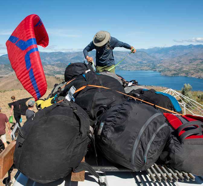
by Jonathan Hutton
photos by Patrick Penoyar
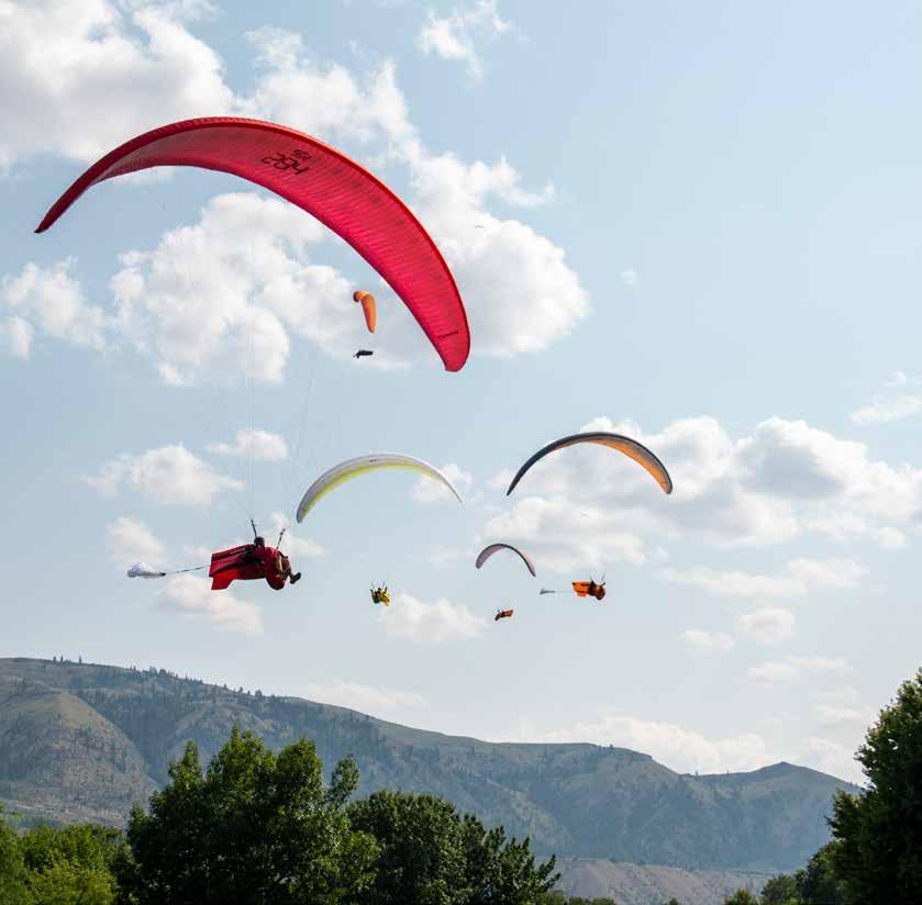
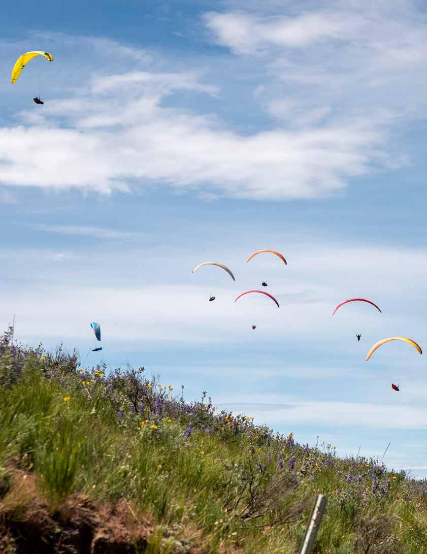
: The state of Washington is divided by mountains. The route to Chelan from the west requires crossing the Cascades, transitioning from lush lowlands and coasts to the sharp, arid desert. The town is a popular destination for tourists, with vineyards and campgrounds scattered throughout the landscape surrounding a deep-water lake. Unlike tourists, pilots come primarily for the Butte and the energetic lift of midday thermals, which fuels two paragliding competitions: the Ozone
Chelan Open and the U.S. Open of Paragliding. Word has traveled far about the Chelan comps and the experience of volunteering at them. There is lore and mythology: stories of mishaps and mixups, ill-conceived meal plans, and hijinks with ambitiously inexperienced pilots. Wise volunteers know this is not a vacation. We go to work, but we know there will be rewards too: flying, learning, and reveling in this improbable sport. The roster of volunteers this year included a mix
Out of the starting gates pilots work their way to the first turnpoint.
of first-timers and veterans, brand-new and experienced pilots, couples, individuals with white-collar jobs, and free-spirited adventurers who live in vans.
I arrived at camp in the afternoon, days before the main event, in a rental van stuffed with camping gear, my flying kit, and a small PA system. A triad of pine trees near the property’s edge was my living room for the two weeks of competitions, shading me from the midday sun. My coffee station was primitive but more than adequate—packets of Starbucks instant and a butane camp stove. As a volunteer, I began each morning the same way: coffee, yoga, work assignments, meeting prep, and then breakfast.
“Do you think…today…we’ll get a chance to fly?” a volunteer asked me. I couldn’t make any promises, but I knew that yes, we would fly. Sled rides from the Butte to the park, as well as early morning ridge soaring, could be possible for volunteers. However, this was not our primary purpose: we were there to support and enable others to fly, making the event possible through our effort and focus.
This year, we implemented changes for volunteers based on lessons learned from 2024, including an upgraded shower, rules on charging personal devices, an application process, and a volunteer guidebook. Start to finish, our circus of activity is a DIY effort, built on donated time and talent.
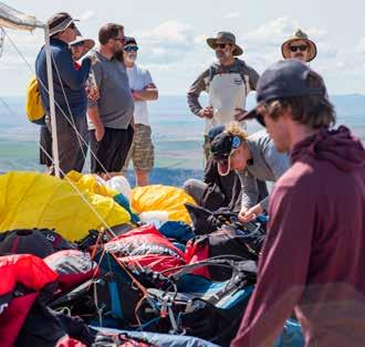
Our first comp day was a bit rocky, which isn’t a surprise. The rhythm and feel for what needs to happen and when is not yet reflexive, but we expected the next day to be easier. Matty Senior, the event director, reminded everyone why they were there: flying the Butte is a perk, but not a guarantee. Our attention and priority must be on supporting our competitors. As the morning meeting continued and I welcomed the newly-arriving volunteers, the next cascade began. Vans departed, with comp pilots piling in to head up the craggy, pitted path to launch (calling it a road is too generous a term). Two vehicles had already made it up the Butte early, where volunteers had set up tents, tables, flags, and water stations.
As vans departed to load up with pilots and climb the Butte, the task committee met to brainstorm around the picnic table. I watched the vans move on my laptop
screen, each one equipped with a GPS tracker. I only half-listened to the task discussion because several people have messaged me about a van that inexplicably went up to launch with no passengers. Mistakes like this will happen, and we plan around them in real-time, gracefully. We laughed about it later.
For the first-time volunteer, being at Chalan is an initiation and a trial: your bandwidth will be tested, as will your ability to take instruction. All around is material for overwhelm—vans full of people, chatter, an ever-evolving list of to-dos, and narrow windows of time to complete them. At launch, a gaggle will coalesce overhead; but we, the vol-
teers, must redirect our focus to the wing on the ground in front of us.
On a typical morning, I arrive at launch around 9:45 with the safety team and a few other volunteers and free-fliers. Volunteers readied themselves for morning sled rides to the riverside Chelan Falls Park, and I was their retrieve driver. In first gear, I drove down the Butte, rewarded with a moment alone. The volunteers packed their wings in haste under a row of shade trees before we returned just in time for the launch window, as wind techs showed everyone where lift could be found. Competitors began moving faster than a shuffle, readied kits, and pulled buffs over their faces. It’s tough to know how they are feeling when their eyes are the only clue.
Clipboard in hand, I made note of where my retrieve drivers were. Some of them would need to depart asap; others would leave later on, once the line of pilots in the queue had reduced by half. Glid-
ers launched in a panoramic vista, one after the other, with intention and usually without incident, although a few wings needed to be carefully excised from sagebrush. Several comp pilots thanked us directly as we laid out their wings across tarp or dusty gravel. You are so welcome. Helping in this way was a joy; witnessing this scene and being part of an event of this scale was a privilege.
A friend of mine once told me that paragliding saved his life. I wonder how many of these pilots, competitors, and volunteers feel this same reverence for the sky, for our ability to fly in it, and for the ways that you cannot
help but change once you begin.
Once all of the drivers had departed, only a few free flyers remained, preparing themselves for launch in stronger winds. A small team of volunteers worked together to clean up the launch before departing for the day. Back at camp, a few drivers waited on standby, while some had already departed, en route to staging areas to pick up pilots who had sunk out. With the morning chaos handled, I could sometimes take a brief rest in a hammock before lunch.
In the afternoon, our drivers returned, full of stories, effervescent. They told us about challenging retrieves,
working in concert with pilots who became their navigators, sweaty celebrations, and detours. Like the comp pilots, they accomplished something important. The pride was tangible: we all contributed what we could to make this work, supporting each other with acts of service each day that felt necessary, because they were.
The next day, we found ourselves back at launch, but the wind was cold, whipping across our faces. Of course, I forgot my puffy. The comp was nearly over, and I found myself wishing for a rest day to pause the constant, unrelenting movement. The task was canceled, and I was overwhelmed with relief. Several volunteers organized a trip to a nearby beachfront park. A slackline was strung up between two trees, and paddle boards were inflated with wheezy hand pumps. I rested on my back, above the water, staring at the wisps of cotton cloud. I am so fortunate to be here.
As we neared the end of the second comp, morale was high. The team knew what was expected and sprang into action unprompted. We had practiced this routine every day, rotating people into different roles, balancing the workload, and maintaining our little village in
the grass. Of course, there were snafus and outbursts, disappointments, and miscommunications—but we navigated them, adjusted, and learned.
The closing ceremony was its own event within an event, but my capacity to plan and delegate had been worn down by sun, dust, and uneven ground. Doing this was its own form of endurance race, and I was not sure how much further I could go. Matty asked me for the list of people returning rental vans, which I produced after leafing through stacks of dog-eared notes.
I skipped the dance party; my energy was gone. I’d run as far as I could, and besides, there was a rental van to drive to the airport the next day. Volunteers had already departed, wishing us well in our group chat and expressing their gratitude for the experience and the time we spent together. We did something remarkable, and next year will be even better.
This story is adapted from a chapter in the author's new book, Unflappable: Soaring Beyond a Diagnosis, available now. Find out more at unflappable.blog

Dennis Pagen
: After 50 years of writing for this publication, attempting not to repeat myself, I have come to realize that some topics need repeating and some dead equines must be beaten. One such topic is thunderstorm lore—judging, avoiding, and escaping these aerial beasts. At least two recent events where pilots were sucked up to over 24,000 feet in thunderstorms have prompted this revisit for safety’s sake. Fortunately, both pilots survived with harrowing tales to tell; however, we are aware of other incidents that didn’t end so well.
In 1906, the British launched a battleship they named “Dreadnought.” It was so formidable that it rendered all other military ships of the time obsolete. Well, thunderstorms aren’t quite as exclusive—other somewhat local deadly aerial entities, such as tornadoes or hurricanes, can ruin your day. But I’ve never heard of anyone flying in or around the latter two. So why are thunderstorms a threat? Why not avoid them altogether? Ahh, the million-dollar question.
The simple answer is that good thermal-soaring days sometimes develop thunderstorms. Occasionally, this development can be rapid and unexpected. Additionally, when flying cross-country, we can sometimes venture into an area with more thunderstorm potential than where we started. Competitions and fly-ins have placed us in the threat zone in the past. Better weather analysis at meets has vastly reduced such occurrences, but even now, there are sometimes warnings to “be aware.”
With a bit of understanding and access to weather data, most pilots can get a good idea of thunderstorm potential before flying. However, such an approach is not infallible and requires some time to learn. Yet it is easy enough to see if the general weather forecast suggests thunderstorms, and then to be vigilant both before and during flight. The final defense is to have well-understood and well-practiced techniques for recognizing imminent danger and escaping in a timely fashion.
We can all use a refresher course. I have presented talks on thunderstorm lore in seminars and competitions. It’s always surprising to me how many of the world’s top pilots attend these talks—it’s clear we all need to learn more and more. Speaking of more and more, it appears that atmospheric changes may bring us more frequent, larger, and more dangerous thunderstorms. We must all become more aware.
I have written about thunderstorms several times in this magazine, and also have expanded the thunderstorm section in the new edition of “Understanding the Sky,” so be sure to check out past issues and the new chapter in the book. Here, we will only summarize the nature and dangers of thunderstorms.
Although thunderstorms require humidity in the air to develop, I have seen many severe ones in arid regions such as the Owens Valley in California, Albuquerque in New Mexico, Greece, and Turkey. In these cases, thunderstorms usually build up more slowly, but the vast supply of warm air keeps feeding the thunderstorm to eventually burst into a mature storm. The most serious ones I’ve encountered in flight have been in these areas during meets, and unfortunately I have
Multiple vertical streams of rain fall from a storm. The pilot is still too close to land safely and should fly away from the storm to avoid the gust front.
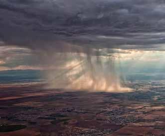
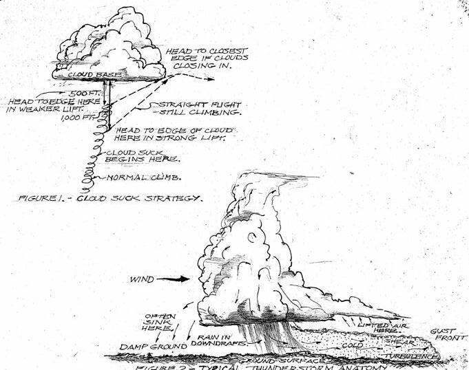
witnessed multiple injuries and three fatalities in the above-named areas.
In short:
• Moist, humid areas are more likely to produce thunderstorms than dry areas. Dry areas tend to produce slower-growing, but more towering and far-reaching thunderstorms.
• The downdrafts from a thunderstorm can hit the ground and spread out as far as thirty miles from the edge of the storm.
• Spreading air from the storm is usually much colder than the ambient ground air mass, and plows under it. This cold air can be quite strong in its midst, and extremely turbulent at its forward edge where it pushes under the warmer air. This interface is called a gust front.
• Valleys and canyons can channel the fast-moving surface cold air and increase its potency, just as knolls or
rolling terrain along a riverbank can produce dangerous venturies and currents during a flood.
• A gust front pushing under the surrounding air can produce more lift in a wide area, resulting in the thunderstorm spreading very rapidly.
• A benign cumulus thermal cloud can rapidly develop into a booming thunderstorm if the cloud reaches an unstable layer, or a good supply of surface warm air allows the thermal to keep pumping upwards. In this manner, cloud suck and a dangerous storm can appear almost out of the blue.
• The air can be very turbulent within a thunderstorm, especially when the storm reaches maturity and downdrafts begin. It can be very disorienting in the cloud to the point that control and even consciousness may be lost.
• Lightning and hail often accompany a thunderstorm— both of which can be deadly.
• Usually, the darker a thunderstorm cloud is, the more
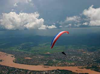
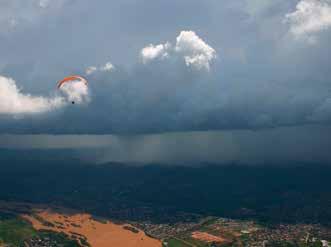
mature the storm. That’s because the thicker the cloud and the more water droplets it contains, the closer it is to blast away with downdrafts, lightning, hail, high wind, rain, and all the other factors that make the situation dangerous.
• Finally, the extreme updrafts in a large storm can make it impossible to avoid a climb, often to heights where it is impossible to breathe. Several pilots have gone unconscious from hypoxia in such a case. Only some of them have survived.
Speaking of inescapable updrafts, not long ago, a hailstone the size of a cantaloupe was found in Texas. It was calculated that a vertical flow of at least 110 mph was required to hold it aloft as ice layers were added. Here’s the math: that’s 9,680 feet per minute, 161.33 feet per second, or 49.2 m/s. Even if you disconnected from your dragging gear and glider, you would have to be pointed head down to drop faster than this rising air. Good luck!
Now we dive into what are perhaps the most important safety factors in flying, other than takeoff and landing skills. We’ll break it down into three aspects: looking, analyzing, and acting.
LOOKING—Throughout our flying, observation plays a crucial role. Certainly, by the time we become intermediate pilots, we understand the importance of
monitoring the wind during takeoff and landing, as well as being aware of potential wind changes during flight and at varying altitudes. So most of us are already prepared to watch what’s going on during flight. But we must also be aware of what the clouds are doing. Even before we launch, we should be watching to see if clouds are building, if their tops are roiling, and if they are spreading sideways. In the air, it’s often difficult to watch a cloud because we are busy watching for traffic, signs of lift, and positioning with respect to thermals and the landing field. Also, as we climb higher, the ability to see a cloud’s vertical development is greatly reduced, especially if we are getting close to the bottom of a cloud.
With all of the above in mind, we can map out a strategy. Before launching, when preparing equipment, keep an eye on cloud development. The main thing to look for is the rate of build-up. When flying straight to a destination, watch any cloud you are approaching (assuming other gliders aren’t nearby). Note any excessive vertical change or sideways expansion. If you are thermaling, every time you complete a circle, get a view of the closer clouds. Each time you come around to the same point, you will get a time-lapse shot of the cloud’s progress. This same procedure is also an important practice when cross-country flying, in order to discern where to go next (for best thermal possibilities) as well as for safety. In sum, look for changes in size, darkness, speed of buildup, and wind effects on top of clouds.
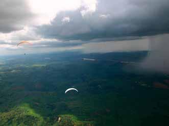
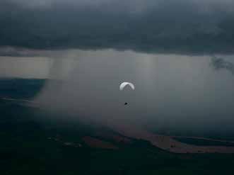
4: The fallout (downburst) from the storm can clearly be seen. Note, the storm has progressed to the river visible in previous photos. This storm moved about 10 mph and the rain that hit us in the landing field was a blinding deluge.
ANALYZING—Here, we delve into more specific details of what to pay attention to and feel for. If clouds are strung out (streets) or scattered across the sky, there is less chance that a thunderstorm will develop. That’s because the downdrafts between the clouds keep the lower levels mixed, reducing the total volume of warm surface area ready to feed a thunderstorm. I don’t believe I have ever seen a very well-defined cloud street day blow up into a thunderstorm. However, I have seen nice fair-weather cumulus slowly link up and eventually build to storm proportions. In this case, the increased heating of the day’s sun made the air mass less stable and the clouds spread out. This effect is more common in humid areas (i.e., Eastern U.S., tropical Brazil, Costa Rica, etc.).
Another factor to be aware of is the presence and location of mountains. As we know from soaring experience, mountains and even hills can give some upward impetus to the rising air, because of both the rising terrain and the possibility of additional heating of higher points. In both cases I alluded to in the first paragraph, the pilots were flying in high mountains. One was in India, having launched nearly 3,000 feet above the valley, with higher mountains around it. Warm, humid air from the south climbs up these mountains. The second one was in China with the mountains at least 4,000 feet above the valley floor. In both cases, the surrounding mountains made it impossible to go downwind from the storm or even to the side.
Photo by Bruce Goldsmith
I have spent time on mountainous tropical islands where the humid air from the sea rises up the mountains every day, builds up to storm proportions, and rains daily at nearly the same time. You can practically set your watch by the arrival of the first drops. An example of this process is the Haleakala volcano on Maui, Hawaii. Hang glider pilots flying from its 10,000+ foot top would have to launch before noon to avoid the clouds that socked in the top almost every day.
Another factor that leads to fast and frequent thunderstorm development is flows of humid air moving over hot ground. A perfect example of this effect is warm air that moves up from the Gulf of Mexico across Texas, up through Oklahoma, to Kansas and beyond. This flow is often studded with vicious thunderstorms and tornadoes, as most of us recognize. When I flew in meets in Texas and Oklahoma, we were always on the lookout for storms.
Finally, I’ll mention flows that come together from different directions and well up (convergence). Such areas can display fast-forming thunderstorms. Two examples are convergence lines in central Florida and the Delmarva Peninsula. We would occasionally encounter fast build-up when flying cross-country in those areas. A tragic case occurred in Greece, a bit west of Athens, when flow from east and west came together on our course line and formed a massive dark cloud that
“Normally, if we were flying at home, we would get down to the ground or head the other way if a thunderstorm showed up. But competition lowers our IQ a bit and induces the go-for-its.”
sucked up two pilots who didn’t survive. I had passed through the same area about half an hour earlier and could see the clouds getting serious. Radio communication wasn’t as good as it is today, so I could only warn a few pilots on my channel.
I refer to competitions often in these reviews. That is because we travel long distances in competitions and often encounter storm formation along the way. Normally, if we were flying at home, we would get down to the ground or head the other way if a thunderstorm showed up. But competition lowers our IQ a bit and induces the go-for-its. Since that is the case, more knowledge and more caution must be exercised in comps, on the part of both pilots and officials. We have learned this with better weather processing after many years of dangerous practices and a few accidents.
ACTING—While thunderstorms come in many flavors and varied behaviors, there is a general way to fly in their vicinity to assure safety (as much as possible). The first step is to recognize and deal with cloud suck. This term is our description of strong, widespread lift that can arise below a cumulus cloud and can be a sign of thunderstorm development. In my experience, every building thunderstorm exhibits a certain degree of cloud suck. Cloud suck occurs when the air is unstable enough and humid enough, and an ample supply of warm surface air is available to continuously feed the thermal cloud.
Cloud suck can carry you up into a cloud—even if it is not yet, or is not destined to become, a thunderstorm. Some pilots have intentionally flown into clouds, but this behavior is reckless, dangerous, and illegal in the United States. When you are in a cloud, there is no way to assure orientation, and no way to tell if it is suddenly growing to thunderstorm stage. So our game plan should always be to recognize cloud suck early on and take steps to dispel its threat. The way to handle cloud suck is first to be aware of what it is and what it feels like. Whenever you are flying below a cloud and feel the lift get smoother and more widespread, and often stronger, you are probably feeling cloud suck. That bears repeating: smoother and stronger lift developing in the same thermal climb is
almost a certain sign of cloud suck. Inexperienced pilots may be overjoyed at such a gift of lift, not knowing that a hidden trap can lurk in the shadows.
When cloud suck is expected or detected, my policy is to move from the center of the lift toward the cloud edge 500 feet below cloudbase in weaker lift (say 300 fpm or less) or 1,000 feet below in stronger lift. The wider the cloud, the sooner I will move. Usually, by the time I have climbed a few hundred feet in a thermal, I know how wide the lift extends and if additional cores are moving up nearby. As we approach the cloud, these cores will often consolidate and increase lift strength. At any rate, my goal is to reach the edge of the cloud just as I nearly reach cloudbase. The whole procedure is illustrated in Figure 1. Be careful to move towards an area that is not getting filled in with cloud.
From the extensive report, the pilot in India waited way too long. Another pilot flying in the same air mass said he recognized the buildup and spread of the cloud and moved to the edge. He didn’t get as high, but he didn’t suffer the dire consequences either. So I repeat: identify cloud suck early, plan an escape route, and follow it in a timely fashion. If we enter the cloud, we did it wrong. It is wise to practice this flying strategy in weaker thermals that allow you to get to cloudbase before you need it in an emergency situation.
Escaping a thunderstorm threat essentially means flying away from it. However, where you go makes a big difference. To begin, the best direction to escape or fly away from a thunderstorm is to the side of its drift direction (assuming there is some base wind). The reason for this general rule is that heading upwind over the area where a thunderstorm has passed puts you in cool, sinking air which may drop you to the ground fairly close to the storm and within the possible reach of a gust front. If you go downwind (the direction the storm is heading), you are more at risk for the cloud to quickly expand in that direction, and the gust front typically extends furthest in the downwind direction. Hopefully, you would be well away from the thunderstorm before it is mature, raining, and dropping downdrafts, which then blast out as gust fronts when they hit the ground. Figure 2 illustrates some of these ideas.
One of the important matters when escaping a storm is to use your altitude to get as far away from the storm as possible. Some pilots have a tendency to panic and try to spiral down to land before the storm effects catch them. However, such a strategy can lead to accidents when the rowdy wind overtakes you. In the past 50 years, the number of pilots who had landing injuries trying to set down before a storm arrives has been much higher than the number of those sucked aloft by the storm. Don’t try to auger down near a storm; use all your height to fly as far as you can from the storm before landing.
If we are in terrain that does not allow us to escape in all directions from a storm, we must leave sooner and exercise more caution. The pilots in the opening paragraph had no escape plan and no possibilities. Narrow valleys can amplify the gust front flow and sometimes only permit a downwind escape path. In the worst-case scenario, you can sometimes use the lift in front of the storm (above the gust front) to stay high and continue away as shown in Figure 1. I had this experience in a World Meet in Brazil when
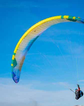
a sudden thunderstorm cropped up along the course line. About twenty pilots attempted to land before the storm arrived, but all encountered poor landing conditions, and some were taken to the hospital. I didn’t want to land in such a situation, so I used the lift under the storm’s “bench” to continue along for 20 miles and landed in light winds. The storm arrived just as I got my glider safe with heavy rain and strong winds that changed the wind direction by 180 degrees.
: We could spend days analyzing thunderstorm processes and behavior because they are complex and vary greatly in all their physical factors. But with a well-considered game plan and a bit of caution, we should be able to avoid serious consequences. One bit of advice is to watch thunderstorm development from its first wisps to the mature, full-blown, raging stage while sitting comfortably and safely sheltered. We can learn a lot from observation. Would you rather be at 24,000 feet freezing, scared to death, gasping for breath with a dubious future, or safely on the ground sipping a BOYC and watching the impressive aerial spectacle?


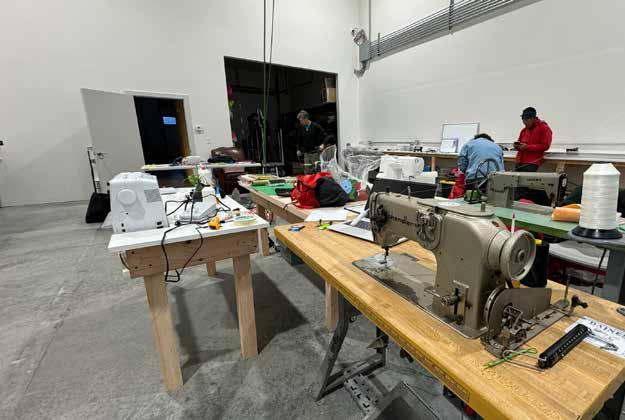

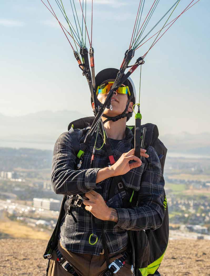
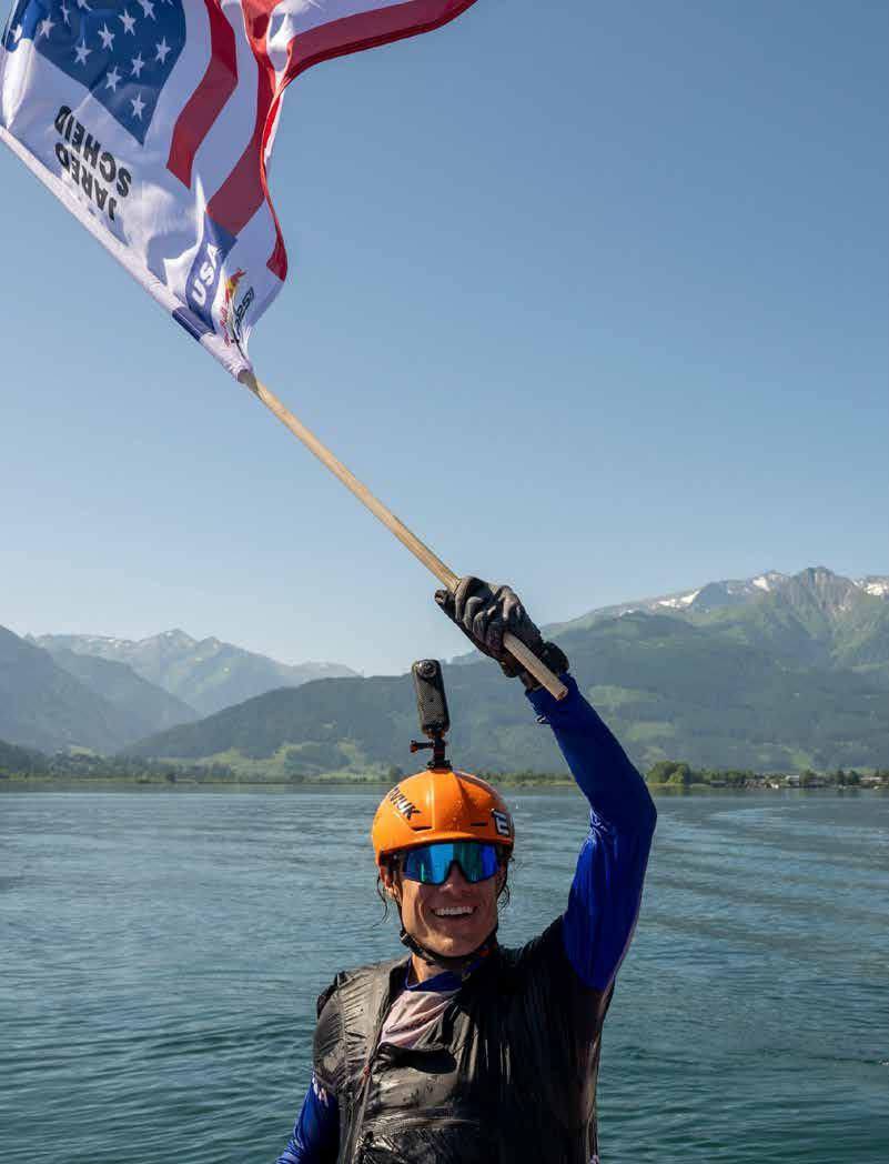
by Jared Scheid
: Each step forward was harder than the last. It was around 4 p.m. on day three, only a quarter of the way into the race. So far that day, I had hiked over 30 km and 3,000 meters of vert. I had just trudged through the glitzy town of St. Moritz, Switzerland, and up a ski run to a launch from which many other athletes had climbed out mere hours earlier. The sun was no longer heating the east face, and wind had started to blow down the slope. Jean de Biolley (BEL2) launched just ahead of me and had a hard landing due to the tricky conditions. Physically and mentally exhausted, simply facing the decision to hike more versus trying to launch felt like more than I could handle.
While flying earlier that day, I had struggled to navigate the complex maze of valleys and ridges that crisscross the Alps. The thermals were never where I thought they would be; if they were, they were barely enough to help me limp along to the next ridge. My competitors, many with a lifetime of experience flying the Alps, were soaring over my head with ease while I struggled to stay up. I was wondering if I even belonged here.
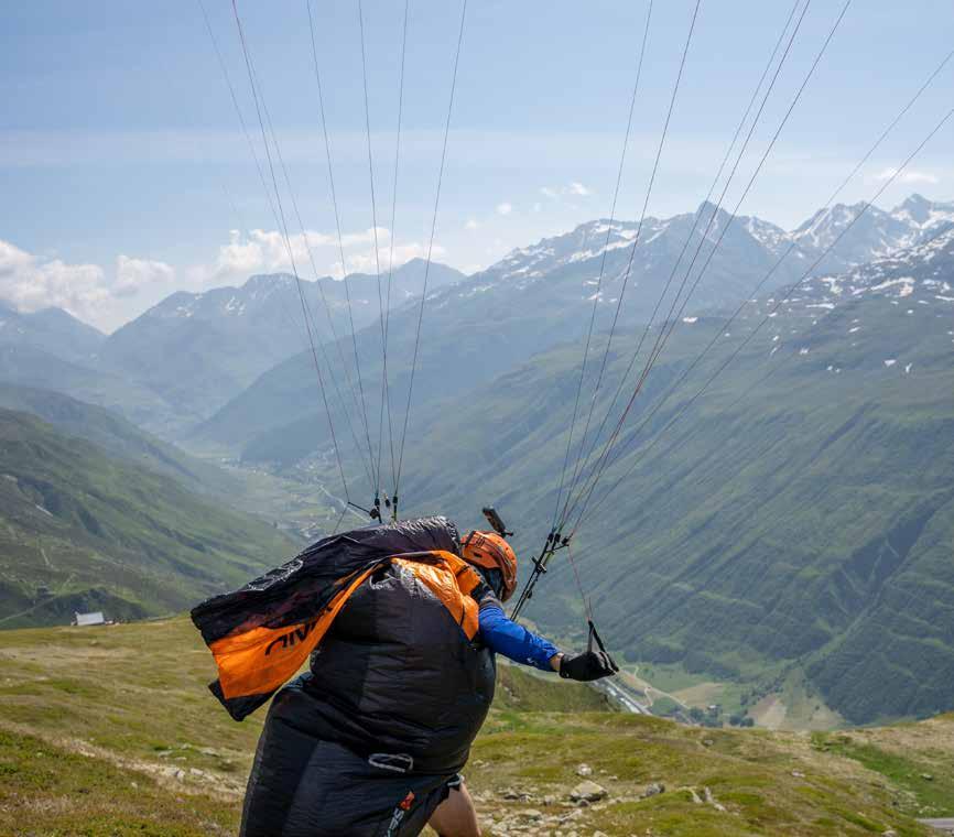
Let’s rewind a bit, and I’ll tell you how I came to be at the 2025 Red Bull X-Alps, “The World’s Toughest Adventure Race.” I don’t remember how I first found out about the race, but once I did, I was instantly addicted to watching the live tracking. It
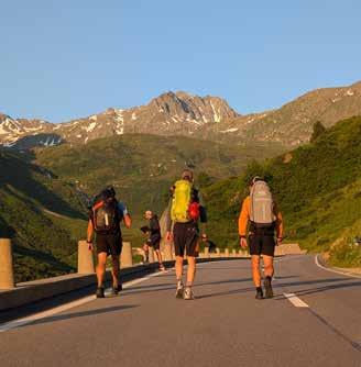
was fascinating to watch how the athletes navigated the mountains and pick apart their strategies. I had been flying for less than one year at that point, but after watching that race in 2019, I was hooked and decided I wanted to do it myself someday.
At the time, I flew a low EN-B and an open harness, and my longest XC flight was 24 km. Competing in the X-Alps was a fantasy completely out of reach for someone like me. However, as I became increasingly involved in paragliding (some might say obsessed), the path ahead grew more clear. My flights got longer and longer, I stepped up to hotter wings, and I entered some smaller hike-and-fly competitions. Soon enough, I felt ready to head to the Alps.
During my first vol-biv in the Alps, I flew the Rhone valley in Foehn winds (strong downslope winds in the lee of a mountain range), nearly landing backwards once I dropped into the valley after a mostly uneventful 150 km flight up high in the mountains. On my second trip, I flew a personal best, covering a previously unthinkable amount of terrain from Davos, Switzerland, to Zell am See, Austria. That just scratched the surface of what the X-Alps would demand, but it was a start.
Back home in Boulder, CO, I had a community around me that was stoked about flying, and we flew whenever the weather was good. We took flying trips together and pushed each other to fly farther and explore new lines in the Colorado Rockies. Fly-
ing was its own reward, but the goal of making it to the X-Alps stayed in the back of my mind. When I completed X-Pyr in 2024, X-Alps no longer seemed to be a distant dream, but rather something within reach. I just needed a team.
Two of my closest friends, Isaac Lammers and Carl Marvin, were perfect for the job. We competed in our first hike-and-fly race together, the 2021 X-Red Rocks, in Monroe, Utah, where Gavin McClurg dubbed us the “Colorado Crushers.” Not only did I know I could count on them during the race, but I knew we’d have fun the whole time.
The very first night of the race, due to a severe thunderstorm closing the via ferrata leading to turnpoint three, I found myself squeezed into a very small bivacco with three other teams. We all agreed that the four athletes would sleep on the two bunk beds, while the supporters filled the remaining floor space with their sleeping pads. Spirits were high, with team Slovakia sharing hot tea as we sheltered from the storm, recounting our first day of the race.
Although I didn’t expect it beforehand, one of the highlights of the race turned out to be the camaraderie with the other teams. Sure, we are all there to compete, but we’re also on this incredible adventure through the Alps that we spent years training for.
So, naturally, we all got along great! We would hike together, help each other on tricky launches, team fly, and even share a bit of strategy.
Fast forward to day ten. With over 1,000 km of the 1,283 km course behind me, my body was feeling the effects of the exertion. I stubbornly wanted to keep pushing forward on the ground, not letting the pack ahead of me pull farther ahead. Carl, knowing that this race isn’t won on the ground, had to convince me that we could make better progress in the air if we put ourselves in the right place at the right time.
We positioned ourselves to have only one morning hike to a perfect mountain to start flying XC early the next day. Even better, it was only a 3-hour hike, so we could sleep in and get there right when we thought it would turn on. Sure enough, little wispy
cumies started popping at 8 a.m. By the time we were at our chosen launch, a cloud we had been watching had dissipated and reappeared in the same spot, like clockwork. It was a tricky launch with a bit of a swirling crosswind, but I got off in the west wind, immediately dove around to the sunny east face under the cloud, and was soon at cloudbase at 9 a.m. The day was on! Meanwhile, 20 km ahead, the rest of my nearby competitors hadn’t even gotten to a launch yet.
The meteo winds were forecasted to be strong(ish) and west, a forecast familiar to anyone who flies in the Rockies. This was the day I was trained for; it was going to be like flying back home—sort of. The flying resembled surfing the barrel of a wave crashing over the ridgeline, but it was working—and it was fast! The move was to ride the tailwind to the next mountain, tuck into the sunny southeast face, catch a surprisingly smooth leeside thermal, then, rinse and repeat. Instead of following what everyone else ahead of me was doing, I was finally flying with my intuition. I no longer felt like a stranger in a faraway land. The next morning, I found myself on the float at the finish in Zell am See, celebrating an adventure I’ll never forget.

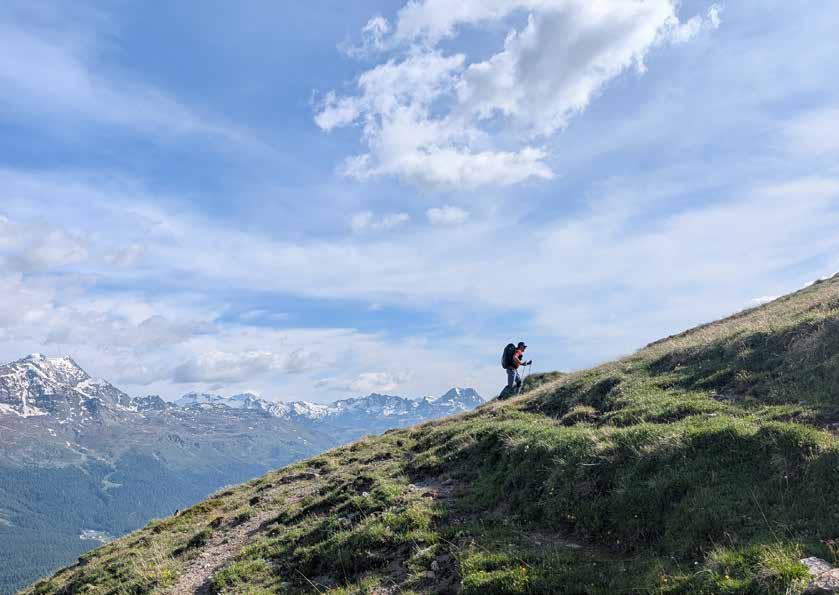
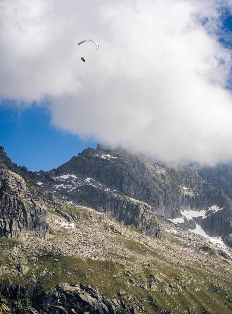

Welcome to Recreation Risk Retention Group. Recreation isn’t just an insurance company, it’s YOUR insurance company. You and your fellow insuredsownthecompany.WesucceedwhenRecreationanditspolicyholders committodothehardworkofriskmanagement.Thiscommitmentincludes:
• To work to provide a long- term market with stable pricing
• To provide coverages that support policyholders’ operations and risks
• To insist each policyholder implements required risk management, making every policyholder an even better insurance risk
• To reward those who do the work to be better risks by providing a long-term insurance program not available to those unwilling to so
• To do ongoing risk management, actively improving their risk profile
• To embrace a long term relationship as a shareholder, a policyholder, and a trusted risk manager through hard and soft insurance markets
• To demonstrate a commitment to risk management success
• To do the hard work of risk management to lower the risk faced by our group
• Maintain a long term perspective, knowing that Recreation supports your industry for the long term and will not capitalize on your industry for short term profits
• To demonstrate a commitment to shared success
To find out more about Recreation RRG, contact info@recreationrrg.com
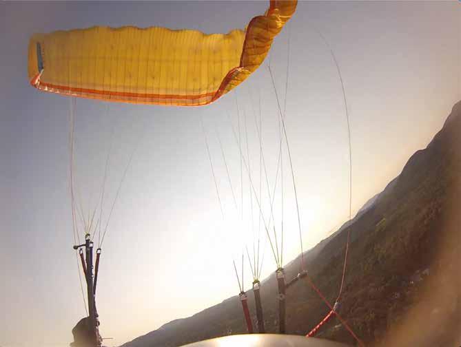
by Calef Letorney
: On occasion, I’ll ask my hang glider friends if they’ve ever tried paragliding. Many have. Those who have never touched a paraglider often respond with, “I don’t want to fly a wing that’s likely to collapse and fall out of the sky!” Fair enough. This piece isn’t an argument for the safety of one air vehicle over the other, but they’re right that a lot of “bad times” have begun after a paraglider collapsed. Conversely, there’s an argument that the collapse is a safety feature. When paragliders dive forward, a collapse stops the glider from flying below the pilot, which could “gift-wrap” or tangle the pilot in fabric and lines. Modern paragliders benefit from generations of development that have reduced
the drama of a collapse. So while collapses can be traumatic, they’re usually recoverable, unlike being gift-wrapped in fabric.
A paraglider collapses when its angle of attack (AoA) gets too low and the glider folds under itself. The reduction in AoA is easily visualized when our gliders dive forward. However, collapses can also happen without the glider pitching forward. How is this possible? AoA isn’t something we can directly observe, as it’s the invisible angle at which the air contacts the wing. In turbulence, our glider is abruptly exposed to new wind vectors that instantly change our AoA until this new air movement overcomes our inertia. This explains how we can suffer
The author demonstrates an asymmetric collapse.
a collapse seemingly out of nowhere, without the paraglider pitching forward.
Fortunately, paragliders rarely suffer large collapses if you’re actively piloting. Active piloting is the process of continually adjusting the brake handle position to maintain constant wing pressurization and prevent unwanted pitch movements. The active piloting skills that you need to keep a glider open change with the air conditions and the glider you’re flying.
We can generally avoid collapses by choosing to fly in reasonably smooth air, avoiding strong midday thermals until our skills are sufficient, and by staying out of bad spots, such as those with rotor. Often, the mistake that leads to a collapse is a pilot’s decision to launch into turbulent air that exceeds their ability. However, we all know that it may not be possible to prevent all collapses in the strong thermal conditions that produce the best cross-country flights. Even the best pilots experience collapses. Poor energy management, such as a bad spiral exit, can also create a dramatic collapse. Whatever the cause, big collapses provide cause for reflection later.
Not all collapses are the same. We are not talking about little ruffles of the wingtip. Outside tip collapses while thermaling are nothing to fear. This Armchair SIV is devoted to big collapses. If you’ve ever felt your glider “explode” and have looked up to discover a majority of your air-vehicle “inside-out”, you know what I’m talking about. If you haven’t, and you fly thermals, you will likely know eventually.
For brevity, we’ll refer to full-frontal collapses as “frontals” and partial or asymmetrical collapses as “collapses.” Cravats and riser twists have their own recovery techniques, which are worthy of a deep discussion for another time. Finally, we’re talking here about normal paragliders, not para-kites, speedwings, or reflex paragliders, which may require different recovery techniques.
Whether on the brakes or the rear risers, we should
always actively pilot, feeling the glider by hanging the weight of our arms to maintain some tension. When this tension goes away, we should immediately add brakes to the side(s) that lose tension to increase the AoA and prevent a collapse. From here on, I’ll refer to “brakes,” but actively piloting on the rear risers works similarly. I like to think of the rear riser control and brake control as different dialects of the same language, so when I say “apply the brakes,” a rear riser input will also work.
Our goal should be to mirror the air. If the air whispers, whisper back with small, timely brake inputs. If the air punches you in the nose, punch back: a giant application of brake may be needed to keep the wing open. In many situations, the faster we can respond, the smaller our input can be, thus minimizing unwanted pendular motions. For this initial jab, you want to pull as much brake as needed to find line tension again. It might be a one-inch movement or a full arm extension below your butt. As soon as you find tension again, bring your hand up quickly. You won’t risk spinning or stalling if you don’t hold deep brake inputs, so make it quick.
Do this first brake pump even if the glider has already collapsed, as it will mitigate the damage. Without pilot intervention, a collapse that starts small may quickly become much larger; so, if you do nothing, a small 30% tip collapse could quickly become a 70% explosion. When the line tension
This entire discussion assumes you’re experiencing a low AoA issue (a collapse, or anticipation of one). It should be noted that if you’re having a high AoA problem (a stall or spin), the brake line tension is will also drop sharply. Here, we need to rely on our ongoing situational awareness to distinguish between the two scenarios, because adding brakes to a high AoA problem will quickly exacerbate the problem.
goes away due to a sudden drop in AoA, don’t think: just bang on the brakes.
When using the speedbar, we should always actively pilot with the rear risers and never with the brakes. Using brakes while on the speedbar is not only inefficient; on some wings, it can provoke a significant collapse. Just as with the brakes, if the tension drops sharply while on speedbar, we immediately apply the rear risers. If a collapse materializes, we should immediately release the speedbar and then sharply apply the rear riser (or move to the brakes) to increase the angle of attack.
Some frontals are tame, recovering before you can look up (let alone react). In more extreme situations, especially when flying on speedbar, frontals can be violent; here, it’s particularly important to perform a quick brake pump to minimize the damage. This initial brake input also helps prevent the dreaded “frontal horseshoe,” where the tips come together in the front and sometimes stick together. Fortunately, this is almost exclusively a concern on high aspect-ratio wings.
After the initial brake input, frontal recovery should involve recognition, going hands-up, and patience. Let the glider dive, regain airspeed, and recover. We need to give the glider time to “think” and dive. Generally, the bigger the frontal and the hotter the paraglider, the longer the glider may need to “think” while the pilot patiently waits with hands up. It may take several seconds for the glider to dive and regain airspeed. It may feel like an eternity, but it’s crucial not to brake too early, as our gliders are particularly prone to accidental stalls while recovering from a frontal. If the glider is out of trim, wet, or otherwise compromised, it may “think” for even longer before it flies; in these cases, it’s especially important to wait patiently with hands up.
Once the glider is flying forward energetically, you may control the dive with brakes if you’re afraid it could collapse again. But don’t overdo the correcting brake input, as the glider must dive to regain airspeed and return to normal flight. Braking
At one point, I ended up above the glider and doggy-paddled through the lines to avoid entanglement.
enough to keep it overhead may stall the glider and lead to a memorable rodeo, where the worst potential outcomes become much more likely. If you do choose to arrest the dive with brakes, release the brakes fully as soon as the glider stops moving down in your field of view to swing underneath the wing and return to normal flight.
In the moment of surprise, pilots often mistake a massive frontal collapse for a full stall, which proves problematic as the recovery techniques differ. I learned this lesson the exciting way on March 27, 2006, which was the start of my second paragliding season and the day before my twenty-second birthday. New and eager to soar, I was blissfully unaware that the windy, grey midday conditions exceeded my abilities. After gaining a few thousand feet in a strong and turbulent thermal… WHAM! I was on my back, looking up at a wad of trash instead of a paraglider.
“How did I full-stall?” I thought. I remembered from the P3 test that “hands up” is the worst response immediately after a stall (as the glider could shoot hard, pitching the pilot over and into the canopy), and so I intentionally did nothing. Of course, I’d misdiagnosed a massive frontal collapse, and holding 6” of brakes was enough to prevent the glider from returning to normal flight. The ensuing rodeo got properly violent as I brake-checked each dive, repeatedly preventing the glider from flying again. At one point, I ended up above the glider and doggy-paddled through the lines to avoid entanglement. I was about to toss my reserve when my observer said over the radio, “It’s not flying! Hands up and count to five.” That was the feedback I needed! I landed without injury, aside from a fear of turbulence that lasted for several years.
My story is all too common, so let’s avoid this mistake by planning ahead. We should always be flying with sufficient airspeed, far from stalling. While active piloting, we need to regularly return our hands to the home-base position (hanging the weight of
our arms on the brake lines, hands about ear height if you’re using a brake wrap). Avoid the tendency to creep deeper and deeper into the brakes: the extra tension only provides a false sense of security as we approach a spin or stall. If we’re not flying slowly (and we shouldn’t be) when the glider explodes, our first theory ought to be a frontal collapse.
STEER AND CLEAR This is the most widely-taught collapse recovery technique because collapses can cause the glider to dive and turn, and bad things happen when that movement abruptly ends in a collision with something hard. Therefore, steer and clear is the go-to technique if we’re close to hazards. To steer and clear, look at your good flying wingtip (so you can observe your heading while seeing how close you are to spinning), lean towards that flying side, and apply brake on the flying side of the wing. Use all the available weight shift and as little brake as necessary to maintain your desired heading.
Big collapses burn time and altitude while the glider “thinks,” dives, and then recovers. This process can’t be rushed or expedited, but nervous pilots often try to force it and pull too much correcting brake. The resulting spin often precedes a cascading series of mistakes. So if we’re going to use the steer-and-clear method, it’s important to continuously watch our flying wingtip for signs of a spin while using peripheral vision to observe our heading, ensuring we continue to fly away from the terrain and other hazards. You’ll know the glider is about to spin when its cupped shape looks more exaggerated; as the tip peels back and begins to fly backward, it will spin (practice spin recognition and recovery at SIV). The larger the collapse, the more easily a glider will spin. To contextualize this risk, I theorize that the percentage of our wing that is flying is roughly equivalent to the percentage of our brake range that is available for use. If you’ve suffered an 80% collapse and have 20% of the glider flying, then you might only have 20% of your nor-
mal brake range available to maintain your heading. Yikes! So, if you’re going to overcome the collapse to fly straight, use the correcting brake sparingly as you watch that wingtip for signs of spin.
The dangers of over-controlling a glider while using the steer-and-clear method are so significant that I recommend we don’t default to this strategy. Paraglider reopening behavior is finely tuned and then certified. Barring a cravat or twist, we can trust that it will reopen. But that certified reopening behavior assumes no pilot response: hands up. You are the wild card here! If you don’t need to make it fly straight to avoid collision, then don’t force it.
We must make a split-second decision to pick the appropriate recovery technique. I prepare in advance by imagining a PROXIMITY alarm in the flight deck of my mind. When there are hazards (terrain, other pilots, etc.) within about 300 feet, my imaginary blinking red PROXIMITY alarm is flashing at the front of my mind. Be extra alert when your PROXIMITY alarm is active, especially in conditions known to produce large collapses, such as strong thermals and wind, mechanical turbulence, etc. Better yet, avoid PROXIMITY in these conditions.
If your PROXIMITY alarm is not active, you might be better served by one of the following recovery techniques.
DO NOTHING Before using the “do nothing” technique, we must double-check that we have ample altitude. Then sit flat, put your hands up, and be patient while the glider fixes itself. This is how our gliders are tested and certified to recover from collapses. It takes a bit of trust in the paraglider, but if there’s plenty of altitude and nothing to hit (and no cravat or riser twist), our primary focus can be to avoid pulling too much corrective brake. We just need to be patient while the glider fixes itself.
LEAN IN AND TAKE A RIDE This collapse response is all about trusting your glider. Again, only let the glider turn toward the collapse if you have ample ground clearance and no cravat or riser
Calef, I just finished reading your excellent article in the summer issue of the USHPA Pilot magazine. I’m wondering if you encourage your SIV folks who want to learn to practice flapping right off tow, high up, so there is plenty of room for recovery if things go sideways? -Bill
Great question, Bill! As you pointed out, high over the water, with a flotation device, and a coach on the radio, does logically appear to be a good environment for practicing flapping. I suspect most SIV students would be fine, but I avoided making that recommendation due to the diverse experience and skill set of the readership and the potential for negative outcomes. During a stall, the glider falls back as the pilot swings forward. With the glider far behind the pilot, the worst thing we could do is go hands up to restart the glider with a long runway to shoot forward as the pilot swings back underneath the glider. The combination of these forces can yield a surge of shocking speed and power (even on beginner wings, but especially on performance wings) that may toss the pilot above the glider to get tangled in fabric and lines (AKA getting “gift-wrapped”).
While practicing flapping, some students will inevitably accidentally stall. Pilots who accidentally stall are likely to forget to keep the paraglider stalled (until the body is again underneath the wing), and even less likely to smash brakes at the correct time to arrest the massive surge that follows. When considering that the flapping exercise is composed of deep brake inputs followed by hands up, I worry that this exercise gives students all the ingredients necessary to have a really bad time. Even high over the water, you really don’t want to get gift-wrapped, so I suggested only practicing at heights we are okay to fall from.
While not something I’d recommend to the average reader, if you’re well-practiced at full stalls and comfortable catching the strong surge that results from an early restart, then this could be a meaningful exercise at your next SIV clinic. I recommend discussing this with your SIV instructor, as there’s nobody better positioned to judge your readiness or perhaps refute my subjective opinion on the matter. -Calef
twist. Leaning into the collapse helps reload the collapsed side and creates the energy for a lovely recovery, which you can bleed off like a spiral exit. Leaning into a collapse helps prevent riser-twists as we move with the wing and shift our weight to the collapsed side. This is especially beneficial with higher aspect ratio gliders, which are more prone to riser twists when leaning away from the collapse. You don’t have to use full weight shift towards the collapsed side; it’s often sufficient to just “roll your hips with the dips,” gently loading the collapsed side while the paraglider recovers.
I encourage pilots to practice various collapse responses at an SIV clinic over water. SIV isn’t a perfect simulation for what the sky can throw at you, but it’s the safest and most effective training available. SIV isn’t a one-and-done thing. Most pilots need annual SIV for a handful of seasons before they can reliably perform the same maneuvers under pressure.
: I'd love to conclude with confidence and bravado that “collapses are nothing to fear,” but I’m definitely still afraid of collapses, especially those featuring cravats and twists. Better pilots than I have taken a collapse and pounded in, so fear of collapses appears quite rational. But fear can be a useful tool. Rather than an unfocused anxiety, I put my fear to work to observe the PROXIMITY alarm and avoid the conditions known to produce big collapses. Take a moment to visualize potential collapse responses, including a timely reserve throw. After checking in with our fear and confirming ample safety margins, we are free to make the best decisions, and that’s all that matters, as paragliding is just a mind game.
Happy flights and soft landings.
Publications with periodical mailing privileges are required by the United States Postal Service to publish a Statement of Ownership each autumn. This annual filing verifies circulation figures and confirms that the magazine remains eligible for periodical mailing privileges under USPS standards.
Average No. Copies Each Issue During Preceding 12 Months 7,538 PS Form 3541 (Include paid distribution above nominal Form 3541 (Include paid distribution above nominal Through Dealers and Carriers, Street Vendors, Counter
d. Free or Nominal Rate Outside-County Copies Included on PS Form 3541
Free or Nominal In-County Copies Included on PS Form 3541 Free or Nominal Rate Copies Mailed at Other Classes Through the USPS (e.g. First-Class Mail) Free or Nominal Rate Distribution Outside the Mail (Carriers or other means)
H1
CA Jeremy Spiegel
H2 3 Orrin Kigner CA Erika J. Klein
H2 3 Stephane Verdier CA Dan DeWeese
H2 4 Dean Bales FL Scott Schneider
H2 4 Canyon Barry FL Scott Schneider
H2 4 Daniel Berg GA Scott Schneider
H2 4 Tristan Erickson-Wallace GA Gordon Cayce
H2 4 Nehemiah Erickson-Wallace GA Gordon Cayce
H2 4 Annette Gulick GA Scott Schneider
H2 4 James Johnson GA Scott Schneider
H2 4 Hadyson Pena FL Derreck Turner
H2 5 Andrew Hammond NY Christopher M. Toomey
H2 5 William Moore NY Rick Brown
H3 1 Ian Clark OR Neil Clark
H3 2 Christopher Cooley CA Richard Sibley
H3 2 Winter Saeedi CA Bob Steven Bendetson
H3 3 Sean Hilleary NM Mel Glantz
H3 4 Stephen Treibs TX Tiki Mashy
H3 5 Kelvin Hill IL Jordan Stratton
H4 2 Jeremy Spiegel CA Anthony Tagliaferro
H4 3 Douglas P. Hale AZ Lj Omara
H4 3 Joshua Meyer AZ Dan DeWeese
P1 1 Emily Abrams OR Maren Ludwig
P1 1 Stephen Butts OR Joshua Ogborn
P1 1 Taj DeVries AK Jay Whiteaker
P1 1 Alicia Diaz OR Samuel Crocker
P1 1 Joey Gabianelli OR Randolph Ruffin
P1 1 Thomas Owens OR Kelly A. Kellar
P1 2 Jiayu He CA Jeffrey J. Greenbaum
P1 2 Artem Sementsov CA Jeffrey J. Greenbaum
P1 2 Jake Strahm CA Jeffrey J. Greenbaum
P1 2 Feng Zhang CA Jeffrey J. Greenbaum
P1 3 Christopher Aughinbaugh CA Jordan Neidinger
P1 3 Alec Dahle CA Jordan Neidinger
P1 3 Jeff Hemmen CA Jay Whiteaker
P1 3 Trevor Madsen AZ Charles (Chuck) Woods
P1 3 Lance Mansfield CA Jay Whiteaker
P1 3 Clint Morgan CA Jay Whiteaker
P1 3 Joe Schorsch CO Joe Louis Cary
P1 3 Peter Thompson CA Jay Whiteaker
P1 3 Michael Zakariaie CA Jay Whiteaker
P1 5 Michael Coimbra NJ Thomas McCormick
P1 5 Catarina Coimbra NJ Thomas McCormick
P1 5 Greggory Smushkin NH William H. Gottling
P2 1 Daniela Anguita ID Brian Petersen
P2 1 BRAYDEN BECKER MN Andrew Karnowski
P2 1 Braam Beresford OR Kelly A. Kellar
P2 1 Cliff Berger WA Austin Cox
P2 1 Alexandria Bielecki MT Nathan Alex Taylor
P2 1 Gregg Brauch MT Joshua Winstead
P2 1 Matthew Britt OR Samuel Crocker
P2 1 Benjamin Carr MT Nathan Alex Taylor
P2 1 Jenelyn Castillo HI David Dexter Binder
P2 1 Kevin Connor WA Todd Higley
P2 1 Daniel Dyck WA Luc Lachapelle
P2 1 Evan Eidal WA Luc Lachapelle
P2 1 Andrew Fitter WA Austin Cox
P2 1 Jeff Hashimoto WA Chad Uchino
P2 1 Felix Haydock WA Chad Uchino
P2 1 Douglas Heimer WA Brad Hill
P2 1 Adam Hoke OR Austin Cox
P2 1 Mark Johnson ID Randall Shane
P2 1 Ben Landis WA Luc Lachapelle
P2 1 Vitaly Li OR Robert Black
P2 1 Alejandro Lopez Arce HI Paul Gurrieri
P2 1 Sean Mahaney CA Peter Fay
P2 1 David mathes ID Nathan Alex Taylor
P2 1 Maverick Robbins HI Ian Cherteiny
P2 2 Andrew Rastetter
Robert Black P2 2 Jack Ryan
Jeffrey J. Greenbaum P2 2 Trevor Sadler
Jonathan Jefferies
P2
P2 4 Scott Maine
P2 4 Randal Ruhs VA Alejandro Albornoz
P2 4 Chase Sasser FL Chris W. Santacroce
P2 4 Aman Shah GA Alejandro Albornoz
P2 4 Joseph Smith FL David W. Prentice
P2 4 Sarah Spring LA Chris W. Santacroce
P2 4 Kurtis Strigl FL Cynthia Currie
P2 4 Alexander Warner TN Alejandro Albornoz
P2 5 Marissa Atkins WI Jesse L. Meyer
P2 5 Jesse Bland NY Thomas McCormick
P2 5 Jason Buehrle WI Mariyan Radev Ivanov
P2 5 Ivana Buning MI Christopher Grantham
P2 5 Phouthasone Chansouk MA Salvatore Scaringe
P2 5 Jac Clark WI Jonathan Jefferies
P2 5 Kapil Deep NJ Thomas McCormick
P2 5 Hunter Delashmutt CT Noah Rasheta
P2 5 Michael Guk PA Thomas McCormick
P2 5 Daniel Higgins MA David Hanning
P2 5 Jeremy Howe MI Noah Rasheta
P2 5 Hari Joshi CT Chris W. Santacroce
P2 5 Muath Juady IL Stephen J. Mayer
P2 5 Christopher Kiener MA Patrick Kelly
P2 5 Eaden Marti MA Jesse L. Meyer
P2 5 Arielle Mckenzie AE Chris W. Santacroce
P2 5 William Odonnell CT William H. Gottling
P2 5 Stephen Page VT Harry Sandoval
P2 5 Matthew Philips PA Alejandro Albornoz
P2 5 William Schaefer NY William H. Gottling
P2 5 Jude Schauer OH Nathan Alex Taylor
P2 5 Kevin Schvaneveldt AE Jonathan Jefferies
P2 5 Piotr Tenderenda WI Jaro Krupa
P2 5 Kunsang Tenzin NY William H. Gottling
P2 5 Joel Usansky NJ Thomas McCormick
P2 5 Sili Yan IL Xing Lin
P3 1 Julius Biedermann WA Matt Senior
P3 1 Chris Cashion WA Michael Kim Smith
P3 1 Nicholas Heffron Neuhold HI Cynthia Currie
P3 1 Scout Jordan WA Levi Jordan
P3 1 Caroline Knoche OR Kelly A. Kellar
P3 1 Sean Murray MT Jennifer Arwine
P3 1 Joshua Paddock OR Samuel Crocker
P3 1 Sanjeev Thallikar WA Matt Senior
P3 1 Gaoying Vigoa OR Kelly A. Kellar
P3 2 Shiqi Ai CA Jeffrey J. Greenbaum
P3 2 Todd Bartlow CA Jesse L. Meyer
P3 2 Jessica Brown CA Jesse L. Meyer
P3 2 Jaime Day CA Rob Sporrer
P3 2 Jack Ellingson CA Mike Fifield
P3 2 YYen Gallup CA Jesse L. Meyer
P3 2 Andrew Gilligan CA Jeffrey J. Greenbaum
P3 2 John J. Graham II NV Nathan Alex Taylor
P3 2 Soham Uday Mehta CA Robert Black
P3 2 Kyle Meyer CA Cynthia Currie
P3 2 Juan Mosquera CA Cynthia Currie
P3 2 Stephan OBrien NV Chris W. Santacroce
P3 2 Carlos Roca CA Jeffrey J. Greenbaum
P3 2 Nick Romney UT Chris W. Santacroce
P3 2 Brandon Savage CA Jeffrey J. Greenbaum
P3 2 Jeffrey G. Sealy NV Robert Black
P3 2 Todd Statt CA Chandler Papas
P3 2 Zoe Thompson UT Arias Anderson
P3 2 Ryan Tippetts UT Emily Wallace
P3 2 Paul Winterton UT Chris W. Santacroce
P3 3 Stefano Ben CA Jordan Neidinger
P3 3 Benjamin Buren CO Misha Banks
P3 3 Jimmy Capra CO Gregory Kelley
P3 3 Chris Clemenson CA Stephen Nowak
P3 3 Nicolas de Pontaud CA Rob Sporrer
P3 3 Kelsey DeDea CA Christopher Grantham
P3 3 Nathan DeVader CA Jay Whiteaker
P3 3 Benjamin Eddlemon CA Cynthia Currie
P3 3 Ulrike Egerer CO Johannes Rath
P3 3 Wesley Fisher NM Chris W. Santacroce
P3 3 Caleb Foster CA Cynthia Currie
P3 3 Nicholas Gilbert AZ Chandler Papas
P3 3 Cathryn Henning CA Max Leonard Marien
P3 3 Adam Karch CO Brian Doub
P3 3 Ethan Lamothe CA John E. Cady III
P3 3 Phillip Mott CO John E. Cady III
P3 3 Harrison Murdock CA Max Leonard Marien
P3 3 Matthew Reilly CO Arias Anderson
P3 3 Behzad Sanikhatam CA Hadi Golian
P3 3 Jessi Scrivner CO Cynthia Currie
P3 3 Sky Sequoia NM Charles (Chuck) Woods
P3 3 Preston Tiff AZ Chandler Papas
P3 3 Margo Vriesinga CA Joe Louis Cary
P3 3 Dylan Walczyk CO Nathan Alex Taylor
P3 4 Miguel Brinon TN David Hanning
P3 4 Kevin Dickey TN Rob Sporrer
P3 4 Stivens Fernandez GA Juan David Ochoa Pena
P3 4 Matthew Greenawalt TX Max Leonard Marien
P3 4 Connor Iseli TX Max Leonard Marien
P3 4 Shane Jacobeen GA Alejandro Albornoz
P3 4 John M Heady VA Christopher Garcia
P3 4 Paulo Henrique Maial Prezoutto FL David W. Prentice
P3 4 Brett McVean TX William Purden-Jr
P3 4 Daniel ochoa parra GA Juan David Ochoa Pena
P3 4 Roman Pelepei FL David W. Prentice
Take your ratings and expiration date everywhere you fly. View from the Members Area section of the USHPA website. Print, trim, and store in your wallet. Great for areas without cell coverage. Save the PDF on your mobile device for easy reference. Available at www.USHPA.org
P3 4 Jayme Stabel TN David Hanning
P3 4 Faolan Sugarman-Lash FL William H. Gottling
P3 4 Bruce Trout TN Joshua Winstead
P3 4 Steven Vromant TX Rob Sporrer
P3 5 Zachary Boccella PA Nathan Alex Taylor
P3 5 Matthew Bolarinho ME Calef Letorney
P3 5 Maxwell Brand IL Brian Doub
P3 5 James Louis Donovan NY Esau Diaz Guerrero
P3 5 Ward Halverson NY Mark Dunn
P3 5 Chris Marianetti NY Christopher Garcia
P3 5 Ruslan nikan PA Thomas McCormick
P3 5 Deivid Oliveira MA Davidson Da-Silva
P3 5 Carlos Paulino De Almeida Junior NJ Thomas McCormick
P3 5 Gabriel Porter-Henry MA Calef Letorney
P3 5 Juan Rivera RI William H. Gottling
P3 5 Matthew Todriff NY William H. Gottling
P3 5 Gary A. Venning OH Austin Kasserman
P3 5 Benjamin Wilcox IL Rob Sporrer
P4 1 Francois Appere WA Christopher Garcia
P4 1 Christopher Bond WA Rob Sporrer
P4 1 Olivier Deiss WA Matt Henzi
P4 1 Matthew Glass OR Kelly A. Kellar
P4 1 Joshua Wiseman WA Nicholas Greece
P4 2 Jeremy Bernstein CA Robert Black
P4 2 Olivia Bettaglio CA Robert Black
P4 2 Christian Black UT Christopher Garcia
P4 2 Christian Carron UT Matt Senior
P4 2 Lucien DeLacluyse UT Kristen Zuraski
P4 2 Austin Harris UT Chris W. Santacroce
P4 2 Anthony Massie CA Robert Black
P4 2 Curtis Moradkhani CA Jesse L. Meyer
P4 2 Scott OBrien CA Jesse L. Meyer
P4 2 Douglas B. Patrick UT Chris W. Santacroce
P4 2 John Boudin Stoa CA Steven Marangi
P4 2 Aniruth Udomlak CA Jesse L. Meyer
P4 2 Le Zhang CA Brian Kerr
P4 3 Mike Bannister CO Johannes Rath
P4 3 Amelia Christensen CO Brian Doub
P4 3 Michael Ecoff CA William Purden-Jr
P4 3 Babak Hosseini Balaei CA Sam Pasha
P4 3 Jeremie Juillard CO Gregory Kelley
P4 3 Albert Nazander CO Charles Martin
P4 3 Amir Poost Pardaz CA Hadi Golian
P4 3 Rebeca Perren CA Jc Perren
P4 3 Chris Puga CO Maren Ludwig
P4 3 Julieta Rivosecchi CO Gregory Kelley
P4 3 Kevin Sweeney CA Juan E. Silva
P4 3 Nathaniel Thompson CO William H. Stites
P4 3 M Cory Young CA Jerome Daoust
P4 4 Corbin Petersen TN Austin Kasserman
P4 4 Emily Petersen TN Austin Kasserman
P4 4 Derek Schujahn TN Austin Kasserman
P4 5 Jamieson Hall NY Brian Engleheart
P4 5 Scott H. Settlemier MA Zoe Sheehan Saldana
P4 5 Daniel F. Wyatt NH Andrey Kuznetsov
S1 5 Michael Terry NY Duane Hall
S2 1 Jaron Coombs AK Arias Anderson
S2 1 Jake Long AK Arias Anderson
S2 1 Joshua Ogborn ID Todd Higley
S2 2 Jack Tedrow UT Ian Cherteiny
S2 3 Ethan Lamothe CA John E. Cady III
S2 3 Phillip Mott CO John E. Cady III
S2 3 Jack Wcislo CA Duane Hall
S2 3 Logan Westgard CO Jeff Katz
S2 4 Thomas Smith VA Ian Cherteiny
S2 4 Milo Steimle TX Jeff Katz
S2 4 Paul Textor FL Jeff Katz
S2 5 Chloe Fillettaz NY Jeremy Bishop
S2 5 Michael Yogumyan NY Jeff Katz
S3 5 Lesia Witkowsky IL Carl Weiseth
BAS INST PG 1 Summer Barham OR Kari L. Castle
BAS INST PG 3 Paul Markham CA Max Leonard Marien
BAS INST PG 1 Chad Uchino WA Kari L. Castle
BAS INST PG 1 Kaviyaan Khalil OR Brad Hill
BAS INST PG 2 James MacDonald CA Max Leonard Marien
BAS INST PG 1 Chris Reynolds AK Chris W. Santacroce
BAS INST HG 4 Jason Thomasson GA Matthew Taber
BAS INST PG 1 Teague Block WA Brad Hill
BAS INST PG 1 Forrest Cox OR Matt Senior
BAS INST PG 1 David Gridley OR Brad Hill
BAS INST PG 1 Paul B. Smith HI Paul Gurrieri
BAS INST PG 1 Todd Higley WA Brad Hill
BAS INST PG 1 Joshua Ogborn ID Brad Hill
BAS INST SF 1 John E. Cady III OR Carl Weiseth
BAS INST PG 2 Jeff Katz UT Chris W. Santacroce
ADV INST PG 1 Lisa Dickinson MT Chris W. Santacroce
ADV INST PG 1 John E. Cady III OR Kari L. Castle
ADV INST SF 1 Todd Higley WA Carl Weiseth
ADV INST PG 1 Ranyon D Arge WY Scott C. Harris
ADV INST PG 1 Todd Joseph Weigand OR Kari L. Castle
ADV INST PG 1 Jennifer Arwine MT Dale Covington
ADV INST PG 3 Hadi Golian CA Max Leonard Marien
ADV INST PG 1 Joshua Winstead MT Chris W. Santacroce
TECH1 PG 1 Ranyon D Arge WY Scott C. Harris
TECH1 PG 3 David Van Wyke CO David W. Prentice
TECH2 PG 4 Matthew Greenawalt TX Chris Kennedy
TECH2 PG 5 Michael Graef IL Jaro Krupa
TECH2 PG 5 Andrey Kuznetsov MA Jaro Krupa
NAA Encourages pilots of all levels of experience to set records. Dozens of records are established each year. Know the rules before you fly.
Your FAI Sporting license must be valid.
Your Official Observer must not only be a member of USHPA, they must be independent and not be perceived to have a conflict of interest.
Initial notification of a record claim must be filed via the NAA web site within 72 hours of the attempt.
Learn more at naa.aero/records