HOUSING AND BLOCK STUDY
PRELIMINARY PROJECT REPORT
AUGUST 2019
PRINCIPAL INVESTIGATOR:
CATHI HO SCHAR
PROJECT STAFF: MARK LOMBAWA
REBECCA OGI GLENN GRANDE
STUDENT PROJECT ASSISTANTS: SHANE MATSUNAGA GLADYS RAZOS
IVY TEJADA SHO TETSUTANI
KRISTYN YAMAMOTOYA KENNETH GUILEN
HOUSING BLOCK STUDY
REPORT
SUMMER 2019
INVESTIGATOR
CATHI HO SCHAR
PROJECT STAFF MARK LOMBAWA REBECCA OGI GLENN GRANDE
STUDENT PROJECT ASSISTANTS SHANE MATSUNAGA
GLADYS RAZOS
IVY TEJADA SHO TETSUTANI
KRISTYN YAMAMOTOYA KENNETH GUILEN
PROJECT
PRINCIPAL
TABLE OF CONTENTS
1.0 BACKGROUND
1.1 PLANNING REFERENCE
2.0 BLOCK STUDY
2.1 EXISTING CITY AND STATE PROPERTY
PARKS & HISTORICAL TOWN
2.3 WALKABLE BLOCKS
WALKSHED
WALKABLE BLOCKS BY SIZE
2.6 PARCELS AFFECT BY SEA LEVEL RISE
FLOOD RESILIENCE BLOCK STRATEGIES
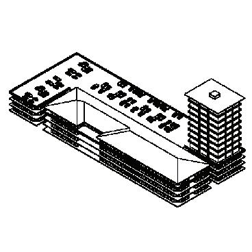
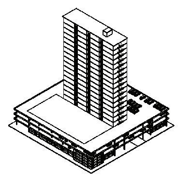
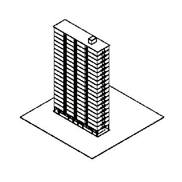
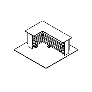
3.0 HOUSING TYPOLOGIES IN HAWAI
HOUSING TYPES ASSESSMENT
4.0 STATE PARCELS
5.0 SITE CONSIDERATIONS - AREAS OF INTEREST
COMMUNITY PROGRAMMING
EXISTING PARKING AND CIRCULATION
PEDESTRIAN AND CYCLIST CIRCULATION AND SAFETY
FLOOD MITIGATION RECOMMENDATIONS
TREE CANOPY STUDY OVERLAY
TREE CANOPY ESTIMATES
6.0 DESIGN OPTIONS
TOD DESIGN CONSIDERATIONS
APPENDIX A: STATE-LED DESIGN CONSIDERATIONS:
APPENDIX B: PROOF OF CONCEPT COST ESTIMATE
APPENDIX C: RFP TEMPLATE
STATION
J.UNO & ASSOCIATES
05
DOCUMENTS
06
2.2
2.4
2.5
2.7
ʻI 26 3.1
37
41 5.1
5.2
5.3
5.4
5.5
5.6
50 6.1
POUHALA
#5
BY
HOUSING AND BLOCK STUDY 3
4 WAIPAHU TOD COLLABORATION
1.0 INTRODUCTION
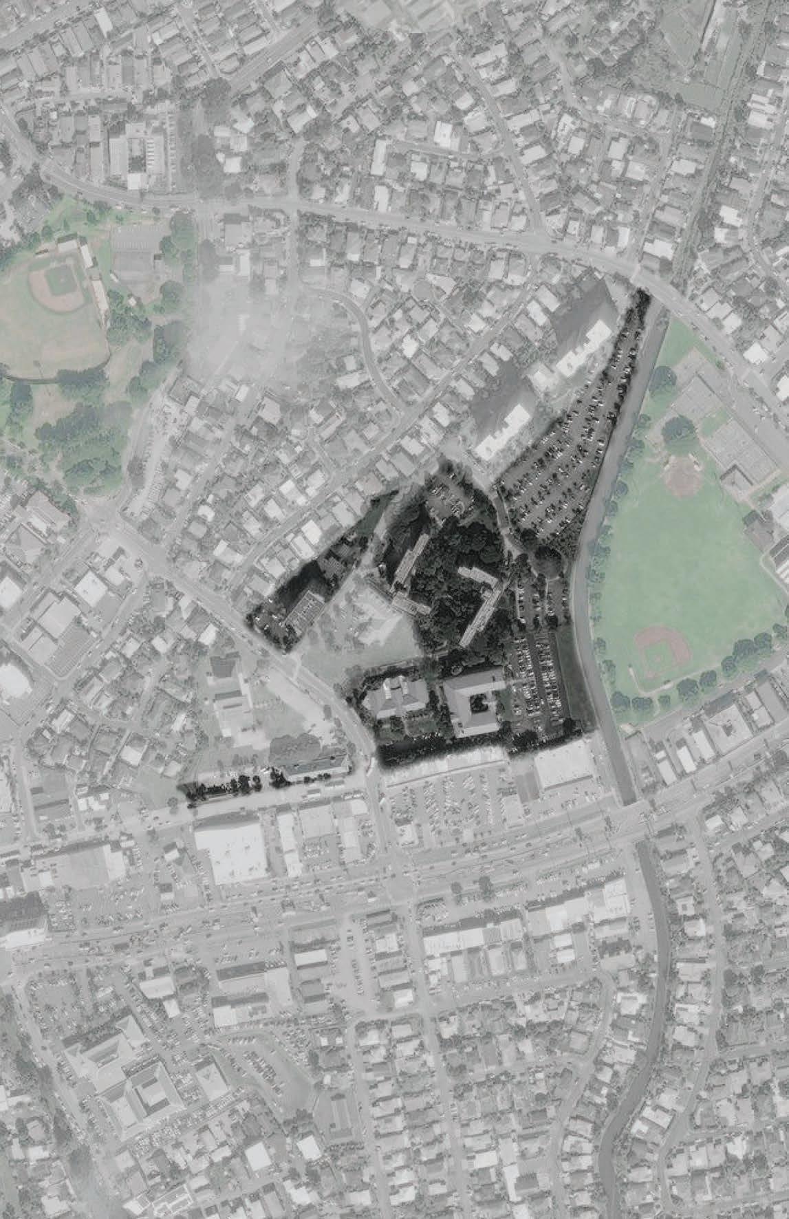
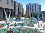
This study looks at housing and block typologies in Hawaiʻi and in the Waipahu transit-oriented development (TOD) area to develop a baseline understanding of the context for both housing, and block design and best practices. This study also integrates findings and recommendations from the outreach, engagement, and research developed in each individual study within this larger project, into a series of design scenarios that visualize possible outcomes. These visualizations aim at representing discussions, feedback, and possibilities rather than any one fixed design proposal. They act as studies within a proof of concept planning and design process. This proof of concept process represents a trial run for future planning or development efforts for the area, which informs the framework included in the overview of this report. The framework ultimately aims at optimizing this process for Pouhala and other station areas.
Six state-owned parcels west of Waipahu District Park are the focus areas for this study. These six parcels are owned by multiple state agencies including HHFDC, HPHA, DLNR and DAGS. The site analysis for these parcels were supported by the information developed in the project reports by our partners: Assessment for Transit-Oriented Design in Waipahu Hawaiʻi, Waipahu TOD Collaboration Study Interim Report, Infrastructure Study, Ecological Asset and Strategies, Flood Mitigation Study, and Strategic Planning Study. The study also integrates the recommendation from existing planning documents, primarily the: Waipahu Town Action Plan, Waipahu TOD Neighborhood Plan, TOD Design Guidelines, TOD zoning overlay, Office of Planning Strategic Planning Report.
Four design scenarios were developed to represent different approaches to development:
Option 1 — an initial first phase infrastructure approach to readying the area
Option 2 — new civic center and vertical school on the DLNR/ DAGS site - assuming a cleared site
Option 3 — affordable rental housing on the HHFDC sites combined.
Option 4 — mixed use market rate and affordable housing utilizing HHFDC sites for housing and assuming HPHA and DAGS joint use retail/parking structures.
The design scenarios were vetted and revised multiple times based on feedback from the Office of Planning, TOD Interagency Council, AIA Housing Committee, and City &
County TOD group which included individuals such as Harrison Rue, Andrew Tang, Renee Espiau. The feedback from these stakeholders on this project was critical to understanding points of interest and intersections with others, which is critical to the study of effective collaboration on TOD.
HOUSING AND BLOCK STUDY 5
An early evaluation of the existing conditions
Analysing the potential for community growth around TOD
A report on the potential market growth surrounding TOD.
What fiscal opportunities are possible for Waipahu


How will the new TOD effect the surrounding community

WAIPAHU MARKET ANALYSIS
TOD Plan
Waipahu

Creating goals for the future of the community
Analyze market condition solutions

Starting a plan of action around the Waipahu area
NEIGHBORHOOD T.O.D. PLAN
After identifying existing conditions, planning for improvement
Creating goals for the future of the community
Anylizing solutions to the market conditions outlined


Starting a plan of action around the Waipahu area
After identifying existing conditions, planning for improvement
1.1 PLANNING REFERENCE DOCUMENTS
A timeline that identifies all the documents referenced for the production of this housing report.
An action plan to complete goals set in the TOD
Specific solutions required complete set goals
WAIPAHU TOWN ACTION PLAN
An action plan to complete goals set in the T.O.D. plan
Specific solutions required complete set goals
Waipahu Neighborhood TraNsiT-orieNTed developmeNT plaN Existing Conditions REpoRt sEptEmbER 27, 2007 Van mEtER Williams pollaCk llp. WEslin dECisions analysts HaWaii nC bills EnginEERing A report on the potential market growth surounding T.O.D. What fiscal opportunities are possible for Waipahu How will the new T.O.D. effect the surrounding community WAIPAHU EXISTING CONDITIONS An early evaluation of the existing conditions Analysing the potential for community growth around T.O.D. SEPTEMBER 2007 TRANSIT-ORIENTED DEVELOPMENT,WAIPAHU OVERVIEW OF MARKET ANALYSIS AND ECONOMIC IMPACTS Decision Analysts Hawai'i, Inc. June 2008 1.LOCATIONAL AND O DVANTAGES FOR EVELOPMENT IN AIPAHU a.Central Location and Access to Other Communities •Waipahu is centrally located within the urbanized portion of O'ahu (i.e., East Honolulu to 'Ewa and Central O'ahu). Waipahu businesses and residents have goodaccess to Honolulu, 'Ewa, Central O'ahu and Windward O'ahu via H-1, H-2, H-3, Farrington Hwy, Kamehameha Hwy, Fort Weaver Rd, and Kunia Rd. •The transit system will improve access to communities between the City of Kapolei and downtown Honolulu, and to Honolulu International Airport. •Waipahu is an excellent location for: Residents who work in Waipahu and who commute to jobs in 'Ewa, Honolulu, and other urban areas in Central O'ahu. Students who commute to UH West O'ahu, Leeward Community College, and other schools. Companies that serve Waipahu and surrounding communities (e.g., vehicle sales and servicing). Light-industry serving island-wide markets (e.g., construction, manufacturing, and warehousing companies at Mill Town Center and the industrial areas below Farrington Hwy). b.Low Value of Existing Buildings Most of the buildings along Farrington Hwy are good candidates for replacement, since most occupy only fraction of their lots, are onestory, and currently are nearly 20 years old or older. c.Other Advantages for Development Near the Leoku Station Bus service to the station will draw commuters from Royal Kunia, Village Park, West Loch Estates, 'Ewa Villages, 'Ewa Gentry, Ocean Pointe, 'Ewa Beach, and Iroquois Point. These commuters will also become potential customers for businesses near the station. Three organizations own most of the land near the station and fronting Farrington Hwy, and lots are relatively large. This will simplify the effort to assemble land for development. 1
Waipahu Transit Oriented Development (T.O.D.) Timeline WAIPAHU TOWN ACTION PLAN September 2017 CITY AND COUNTY OF HONOLULU
Neighborhood
Final Plan April 2014 Prepared for: City and County of Honolulu Department of Planning and Permitting Prepared by: Van Meter Williams Pollack JUNE 2008 APRIL 2014 SEPTEMBER 2017
6 WAIPAHU TOD COLLABORATION SEPTEMBER 2007 JUNE 2008 APRIL 2014 SEPTEMBER 2017
complete the TOD plan
required to
OCTOBER 2017 DECEMBER 2017 AUGUST 2018
AIEA-PEARL CITY
An approval of the TOD plan of action in Waipahu
State strategic plan for the upcoming elevated rail
A plan of action for the State of Hawai ʻ i ’ s new TOD plan
Guidelines on how to best achieve TOD. goals
State-wide development of the upcoming TOD design language
Rules of thumb to maintain design language across the TOD
WAIPAHU T.O.D. BILL ORDINANCES
STATE STRATEGIC PLAN: FULL T.O.D.
TOWN DESIGN GUIDELINES
the
An approval of the T.O.D. plan of action in Waipahu
Statewide strategic plan for the upcoming elevated rail
A plan of action for the State of Hawaii’s new T.O.D. plan
Guidelines on how to best achieve T.O.D. goals to Statewide development of the upcoming T.O.D. design language
Rules of thumb to maintain design language across the T.O.D.
PLAN HONOLULU TRANSIT-ORIENTED DEVELOPMENT SPECIAL DISTRICT DESIGN GUIDELINES COMMUNITY WORKSHOP 4 The Transit-Oriented Development Plan is moving ahead! At the first three Workshops, issues and opportunities concerning the Leeward Community College, Pearl Highlands and Pearlridge station areas were identified, Draft Station Area Alternatives were studied, and Preferred Station Area Plans were developed based on community input. Workshop 4 will present the Public Review Draft Plan and will include illustrations showing proposed land uses, development opportunities, parks and open spaces. The presentation will also include zoning recommendations and phasing strategies for each of the stations. Community involvement the sharing of your ideas and perspectives is key to the success of the Plan. Please join us! WEDNESDAY, NOVEMBER 17, 2010 6:30 - 9:00 PM Pearl Ridge Elementary School Need more info? Visit: www.honoluludpp.org/planning Contact: Adam Rosa (Van Meter Williams Pollack) (303) 298-1480 17 adam@vmwp.com Renee Espiau (Dept. of Planning and Permitting) (808) 768-8050 respiau@honolulu.gov
TRANSIT-ORIENTED DEVELOPMENT PLAN NEIGHBORHOOD Three Rail Transit stations are planned in the Aiea and Pearl City areas, bringing exciting opportunities for TransitOriented Development (TOD). The TOD plan will focus on the Leeward Community College, Pearl Highlands, and Pearlridge station areas as unique destinations while improving the overall Needs Community Involvement to integrate transportation with land use and community design your ideas and perspectives remain key to the success of this new TOD plan. A series of workshops will provide opportunities to learn about TOD, share ideas and comment community task force has also been created to advise and assist with the planning process. Its members represent various organizations and interests of the surrounding communities. Planning Team Contact the following for more information: City and County Honolulu Department of Planning and Permitting Van Meter Williams Pollack 1626 WazeeStreet, Suite 2A Phone: (303) 298-1480 ext 17 Fax: (303) _______ To get on the mailing list: Phone: (808) 768-8036 We encourage you to... Community Workshop Wednesday, October 21 2009, _-9 p.m. College Pearl Highlands Leeward Community College CITY & COUNTY OF HONOLULU JUNE 2018
SEPTEMBER OCTOBER 2017 DECEMBER 2017 AUGUST 2018 HOUSING AND BLOCK STUDY 7
BACKGROUND
XISTING CONDITIONS NEW TOD PLANS COMPOSITE
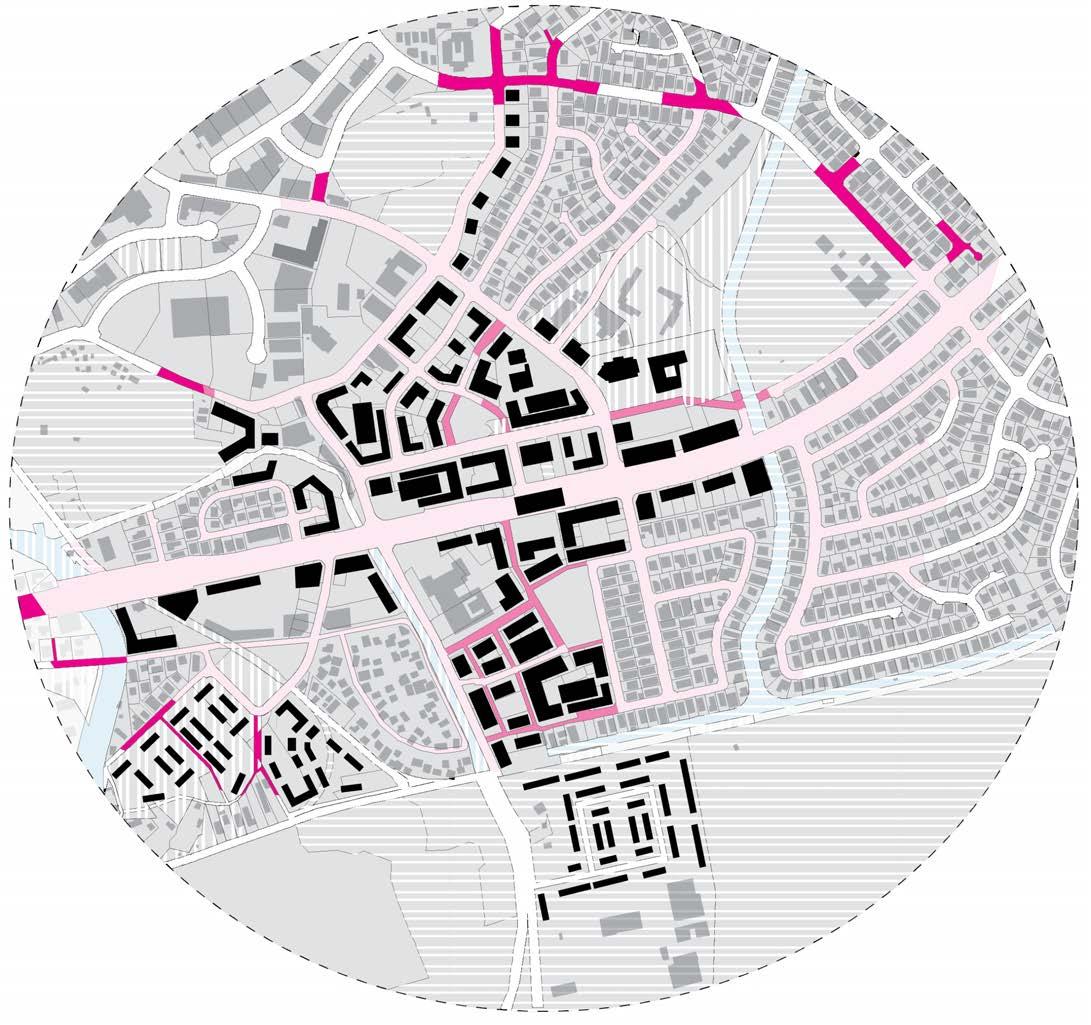
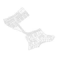
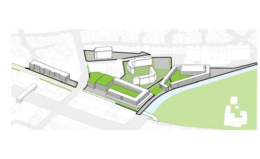
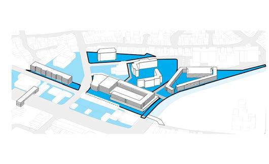
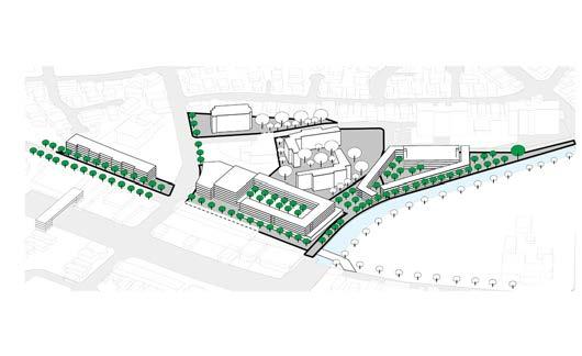
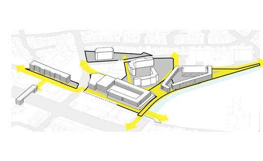
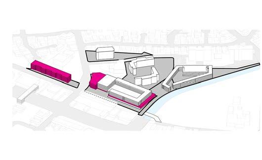
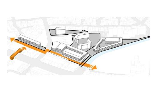
2.0 BLOCK STUDY TOD PLAN: STREETS, BLOCKS, BUILDINGS
The diagram above separates the future TOD plan into urban planning elements to identify changes between the old and new neighborhood plans.
1) Streets
When comparing the existing and new TOD plan, the new plan creates shorter streets to provide more accessibility to new development and minimizes overall walking distance especially to the transit station.
BLOCKS
2) Blocks
Block size affects the walkability of a neighborhood. The proposed plan reduces block sizes to encourage walking.
3) Buildings
In the new TOD plan, larger building footprints surround the new transit core. The building coverage to block area ratio is also much larger compared to the existing conditions.
STREETS E
8 WAIPAHU TOD COLLABORATION
BUILDINGS COMPOSITE HOUSING AND BLOCK STUDY 9
Orange Park
Waipahu District Park
Hawai
Plantation Village
Pouhala Marsh
City-owned parcels
State-owned parcels
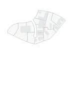
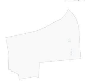
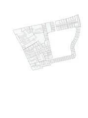
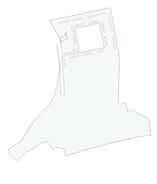
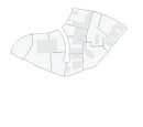
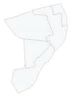
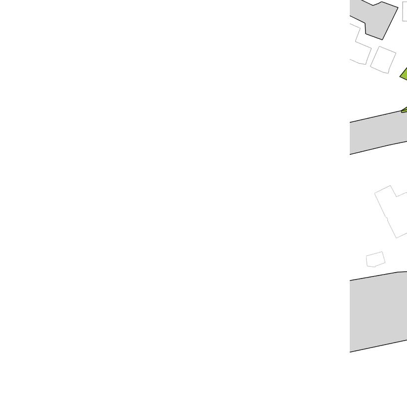
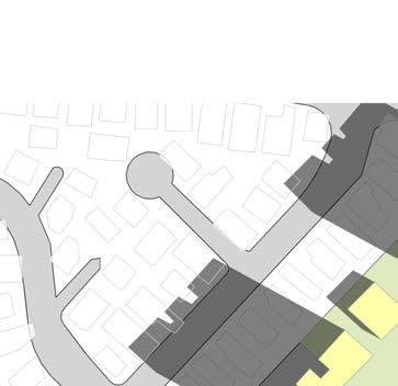
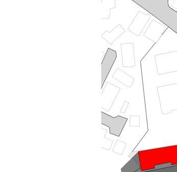
2.1 EXISTING CITY AND STATE PROPERTY OWNERSHIP


State and city parcels make up a large portion of the study area. These parcels are ideal spaces for implementing new concepts for TOD. Each parcel is managed by different entities.
 Hans L
’
ʻi
Ted Makalena Golf Course
10 WAIPAHU TOD COLLABORATION
Waipahu District Park
Waipahu Depot Street
Old Town Commercial Area
Parks
2.2 PARKS & HISTORICAL TOWN
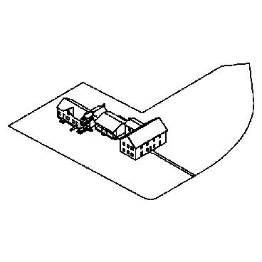
Much of Waipahu’s cultural and historic character is retained along Waipahu Depot street. The street connects the historic Pearl Harbor bike path with the Oʻahu Sugar Company which is marked by the iconic smoke stack. The old town commercial area begins south of Farrington Highway and follows Waipahu Depot street toward Hans L’Orange Park. Development should be sensitive to these historic landmarks and their accompanying historic contexts. TOD offers opportunities to celebrate this character.
 Hans L
’
Orange Park
Hawaiʻi Plantation
Village
Ted Makalena Golf Course
Pouhala Marsh
HOUSING AND BLOCK STUDY 11
Ideal walkable blocks
Walkable blocks
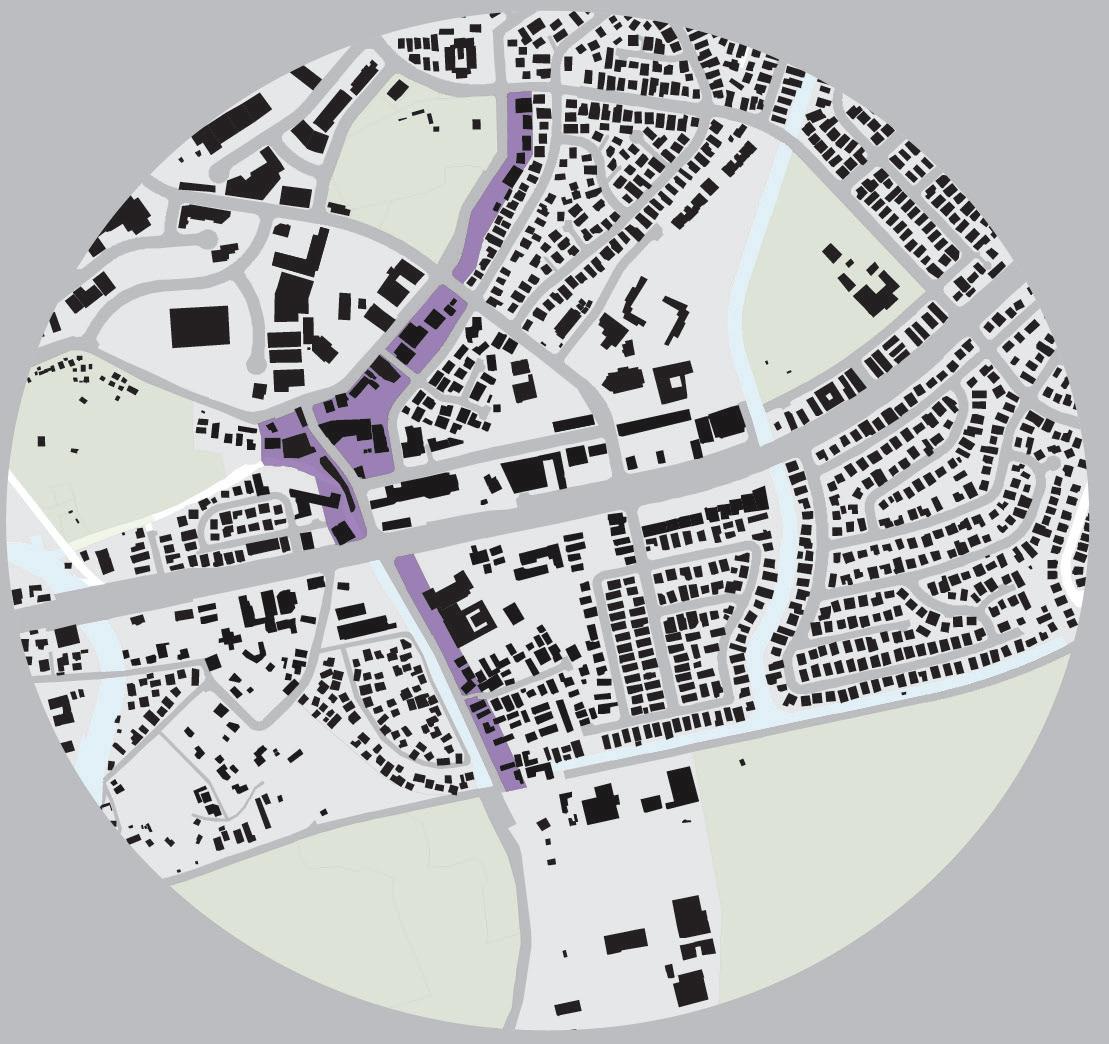
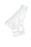
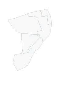
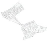
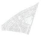
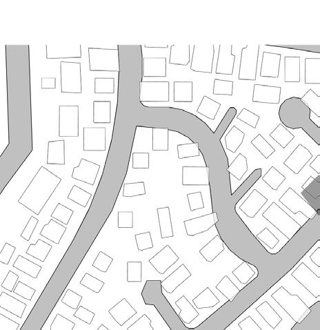
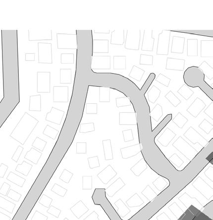
2.3 WALKABLE BLOCKS - EXISTING CONDITIONS
Ideal walkable blocks are measured 300’ x 400’ (apprx. 3 acres). However, walkable blocks can still be achieved up to 7 acres. In the map above, walkable blocks are highlighted in blue. The majority of walkable blocks exist in the periphery of the urban core highlighting a need for walkability measures immediately around the Pouhala station.
 Hans L’Orange Park
Waipahu District Park
Hans L’Orange Park
Waipahu District Park
Hawaiʻi Plantation Village
Ted Makalena Golf Course
Pouhala Marsh
12 WAIPAHU TOD COLLABORATION
Ideal walkable blocks
Walkable blocks
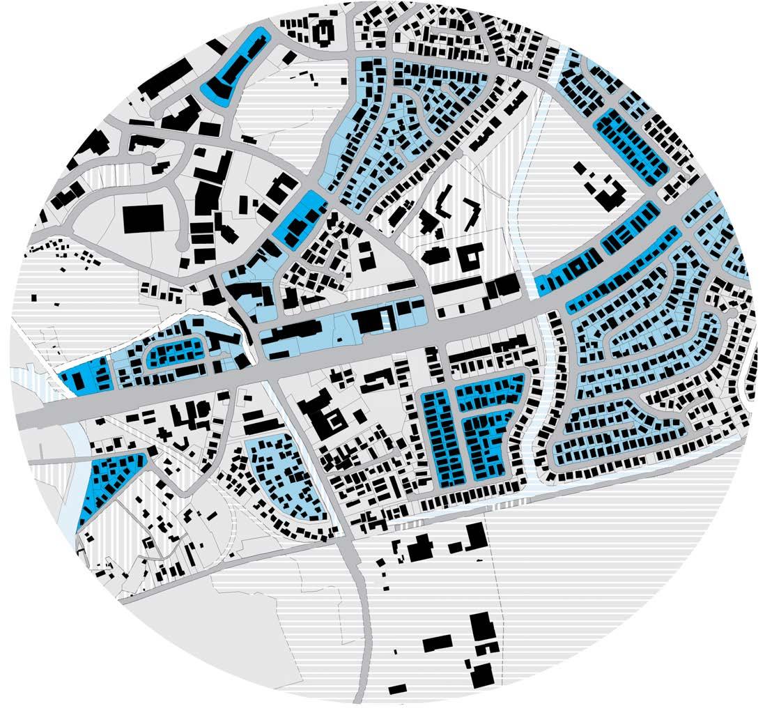
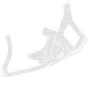
WALKABLE BLOCKS - PROPOSED TOD PLAN
The 2016 Waipahu Neighborhood Plan divides many of the larger blocks into smaller more walkable blocks. The state parcels should likewise address walkability in the design of all access roads and pedestrian paths that define neighborhood blocks.
Hans
L’
Orange Park
Waipahu
District Park
Hawaiʻi Plantation Village Pouhala Station
Ted Makalena Golf Course
Pouhala Marsh HOUSING AND BLOCK STUDY 13
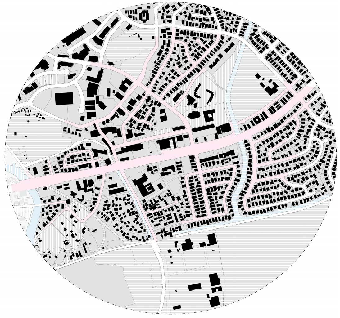
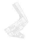
2.4 WALKSHED - EXISTING CONDITIONS
The walkshed diagram (above) indicates walkable paths within a half mile from the transit station. A comfortable walking distance is typically a half mile, or about 15 minutes (represented in pink). Large blocks prevent pedestrians from using the most efficient path to and from the station and therefore increases their total travel time.
Parcels within half-mile of transit center: 622
Existing walkshed
Hans
L’Orange Park Waipahu District Park Hawaiʻi Plantation Village Ted Makalena Golf Course
Pouhala
Marsh 14 WAIPAHU TOD COLLABORATION
Additional walkshed
Existing walkshed
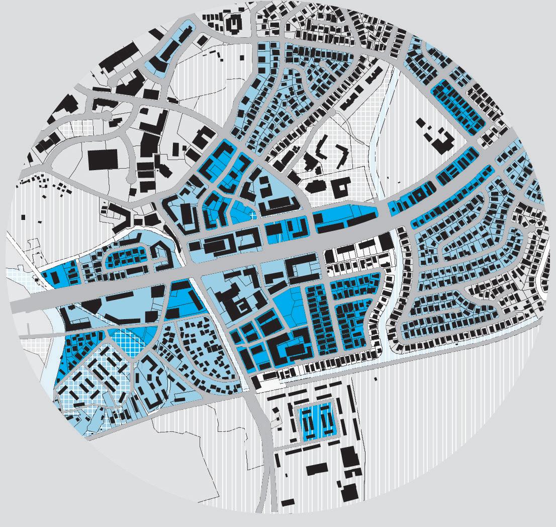
WALKSHED - TOD PLAN
Minimizing the size of parcels allows for greater pedestrian accessibility to all parts of the Waipahu urban core. Residents along Paiwa street are especially affected by the addition of a pedestrian bridge across Waipahu Drainage Canal.
Increased walksheds not only directly affect residents living within a half-mile radius of the rail station. Bus stops may act as similar central points of transportation. Smaller blocks increase accessibility to bus stops which may connect to the rail station and increase general use of public transportation.
Parcels within half-mile of transit center: 715
Hans
L’
Orange Park
Waipahu
District Park
Hawaiʻi Plantation Village
Ted Makalena Golf Course
Pouhala
Marsh
Pouhala Station
HOUSING AND BLOCK STUDY 15
61,547 ft2 68,580
77,770
ft258,241 ft2 64,561
94,349 ft2 119,272 ft289,923 ft2 105,512 ft2
202,991 ft2 209,622 ft2204,282 ft2 258,527 ft2225,760 ft2223,776
ft2 868,115
252,008 ft2225,713 ft2214,639
MEDIAN
1,243,054 ft2 1,271,447 ft2
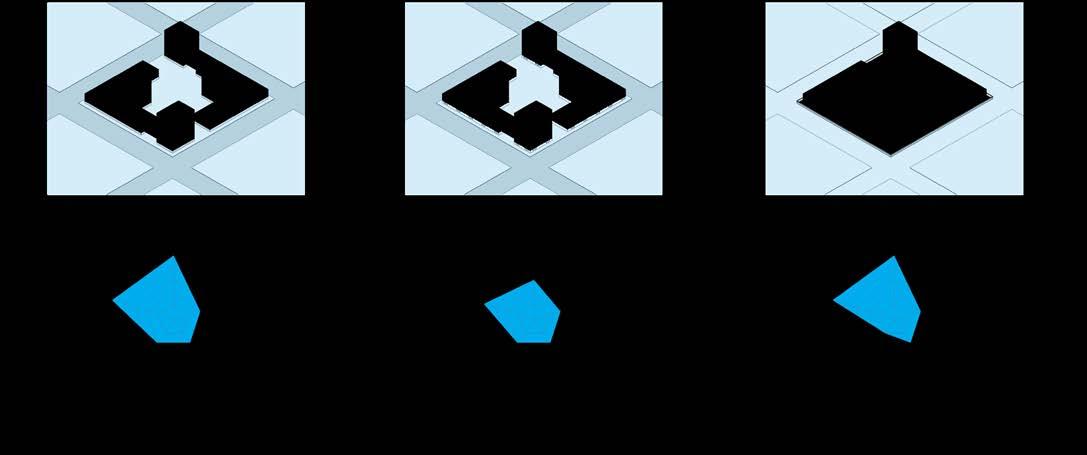
2.5 WALKABLE BLOCKS BY SIZE - EXISTING CONDITIONS
The diagram above organizes all 48 parcels within the study area by smallest to largest total area. By isolating each parcel, each shape can be individually assessed for walkability without taking into account its location and neighboring parcels.

Number of blocks: 48
Minimum parcel area: 58,241 sq ft
Maximum parcel area: 6,415,167 sq ft Mean (average): 524,034 sq ft Mode: 100,00-200,00 sq ft Median: 225,713 sq ft


• Of the existing 48 blocks, only 25% (12 blocks) are considered “ideal-walkable” blocks at around 3 acres of area or less.

• 35% (17 blocks) are considered “walkable” blocks between 3 to 7 acres in area.


• Therefore, 40% of all existing parcels are considered “notwalkable”.


ft2 88,920
ft2
ft2
ft2
ft2 826,469
ft2 903,868 ft2 1,078,572 ft2
IDEAL WALKABLE AREA 130,680 ft2 (3 acres) MAX WALKABLE AREA 304,902 ft2 (7 acres)
16 WAIPAHU TOD COLLABORATION
145,904 ft2141,153 ft2 159,804 ft2128,950 ft2 193,498 ft2 196,186 ft2168,962 ft2 183,245 ft2159,804 ft2
563,204 ft2487,767 ft2464,046 ft2398,250 ft2380,108 ft2332,890 ft2303,394 ft2 586,064 ft2 799,391 ft2


MEAN 524,034 ft2
1,596,280 ft2 2,453,028 ft2 2,915,628 ft2 6,415,467 ft21,283,543 ft2


HOUSING AND BLOCK STUDY 17
24,116 ft2 60,935 ft238,897 ft2 48,261 ft2 58,241 ft226,260 ft2 36,458 ft213,337 ft2 61,547 ft2 68,580 ft2 64,561 ft2
IDEAL WALKABLE AREA 130,680 ft2 (3 acres)


119,272 ft2 126,457 ft2120,019 ft2 128,950 ft2123,473 ft2 142,701 ft2 145,904 ft2141,153 ft2 157,422 ft2150,337 ft2 159,804 ft2 223,776 ft2213,143 ft2 214,639 ft2 225,713 ft2 299,597 ft2244,155 ft2 252,008 ft2225,760 ft2 903,868 ft2 2,197,243 ft21,596,280 ft21,271,447 ft21,243,054 ft2914,482 ft2
MAX WALKABLE AREA 304,902 ft2 (7 acres)


WALKABLE BLOCKS BY SIZE - PROPOSED TOD PLAN
In contrast to the existing condition parcel diagram, with the new proposed TOD plan, more parcels are considered “walkable”. The blue highlight identifies parcels affected by the new plan.
Number of blocks: 68
Minimum parcel area: 13,337 sq ft


Maximum parcel area: 6,415,167 sq ft
Mean (average): 444,571 sq ft
Mode: 100,00-200,00 sq ft
Median: 202,991 sq ft
• As compared to the 25% of existing parcels deemed “idealwalkable”, new TOD plans reflect 40% (an additional 16%) of “ideal-walkable” blocks.
• 38% of TOD plan blocks fall between 3-7 acres and are deemed “walkable”.
• All together, 53 of the total 68 blocks are “ideal-walkable” or “walkable”. This reflects as 78% total walkable blocks within the study area.
• The average parcel size drops from 524,034 sq ft to 444,571 sq ft. (A difference of 79,463 sq ft)


18 WAIPAHU TOD COLLABORATION
MEDIAN
MEAN 444,571 ft2


88,920 ft2 89,823 ft282,936 ft275,820 ft2 94,349 ft284,521 ft2 87,707 ft277,770 ft2 103,525 ft2 105,512 ft2 117,191 ft2 176,107 ft2176,040 ft2 176,040 ft2168,962 ft2 209,622 ft2202,991 ft2193,498 ft2 212,832 ft2204,282 ft2196,186 ft2183,245 ft2 419,623 ft2303,394 ft2 586,064 ft2563,204 ft2487,767 ft2464,046 ft2 868,115 ft2826,469 ft2 6,145,167 ft22,915,628 ft2


HOUSING AND BLOCK STUDY 19
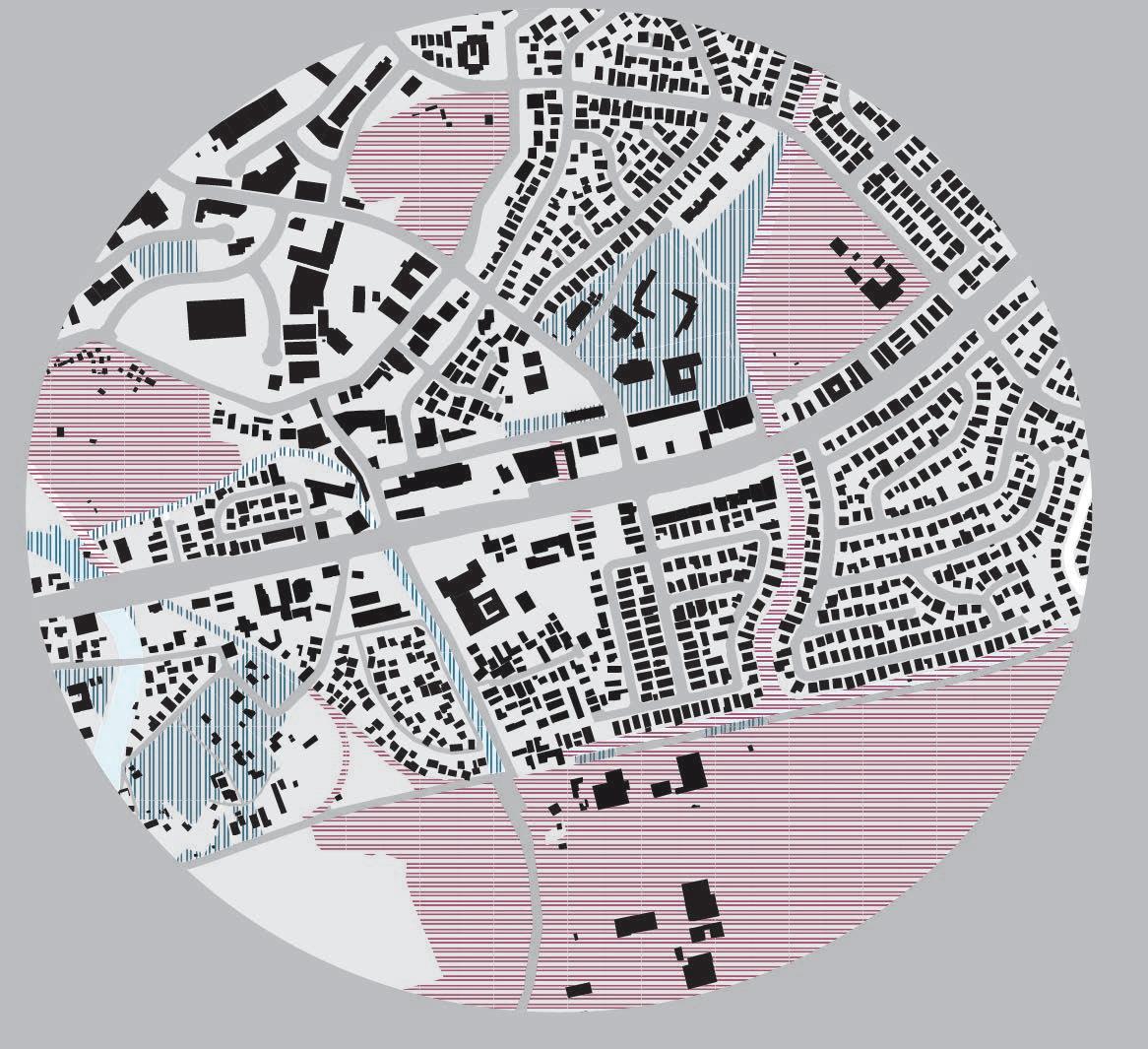
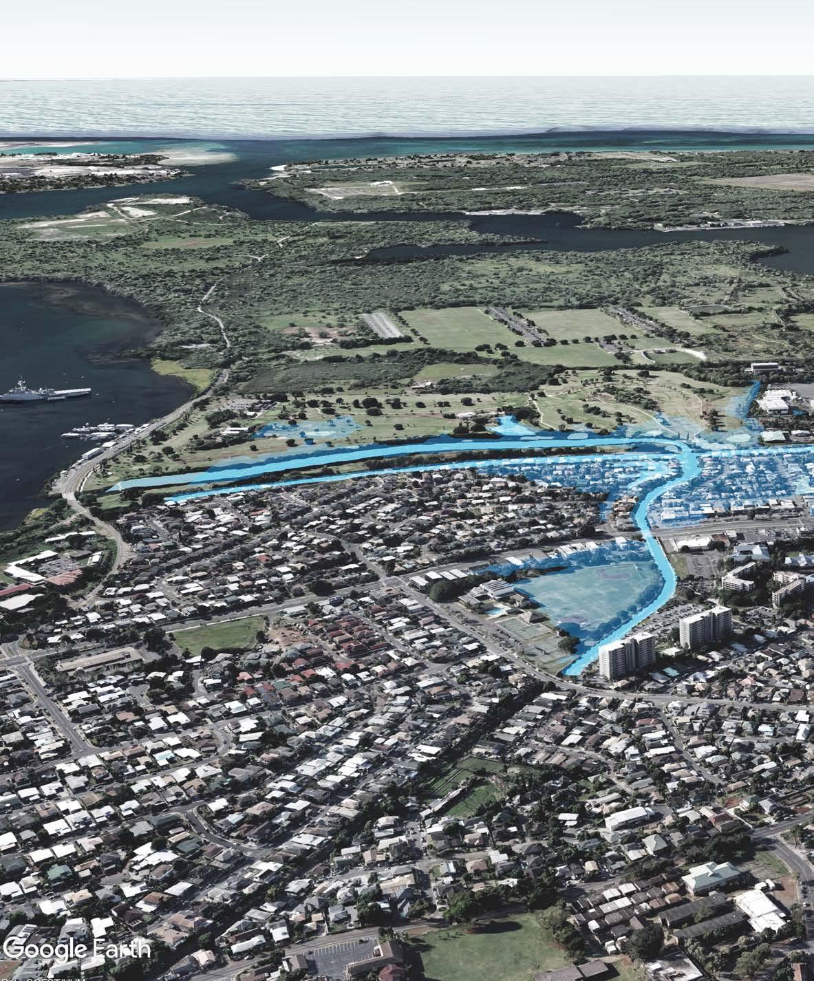
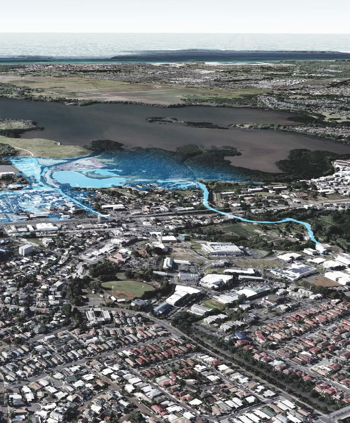
2.6 PARCELS AFFECTED BY SEA LEVEL RISE - EXISTING
Hans L
’
Orange Park
Waipahu District Park
Hawaiʻi Plantation
Village
Ted Makalena Golf Course
Pouhala
Marsh
20 WAIPAHU TOD COLLABORATION
ft sea level rise (PacIOOS)
ft sea level rise (NOAA)
PARCELS AFFECTED BY SEA LEVEL RISE - TOD PLAN
Parcels adjacent to waterways or water bodies are susceptible to flooding as diagramed above. The 3.2 ft sea level rise (SLR) projections are provided by PacIOOS and takes into account king tides, coastal erosion, and passive flooding. 6 ft SLR projections are provided by NOAA and reflects only passive flooding models.
New TOD plans and existing residential parcels south of Farrington highway are vulnerable to riverine and sea level rise flooding. The proposed transit station is located at the extents of 6 ft SLR and should be prepared for a potential increase of flooding events and intensity in the future.
3.2
6
City-owned State-owned
Hans L
’
Orange Park
Waipahu District Park
Hawaiʻi
Plantation Village
Ted Makalena Golf Course
Pouhala Marsh
Pouhala Station
HOUSING AND BLOCK STUDY 21
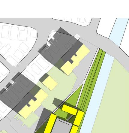
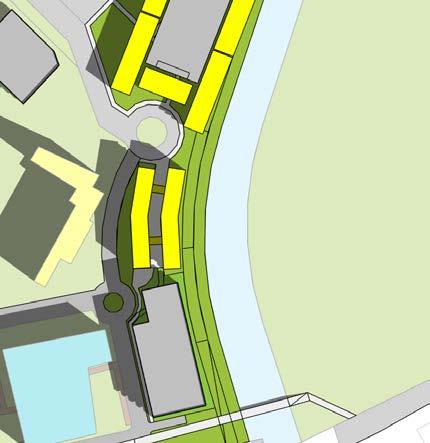
2.7 FLOOD RESILIENCE BLOCK STRATEGIES
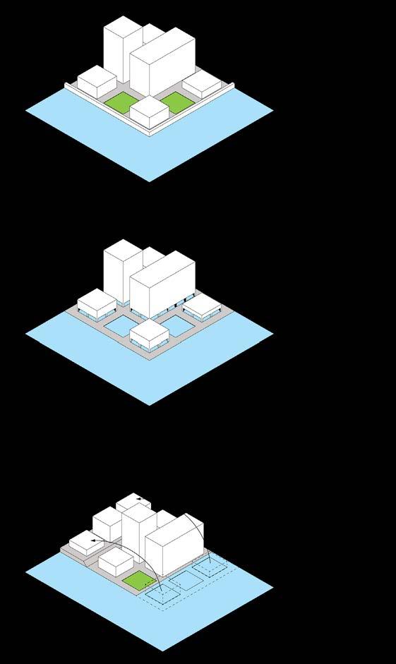
Flood resilience strategies may be simplified into three general categories: fortify, adapt, or retreat. Fortifying strategies implement barriers that prevent impeding flood waters from affecting a building or collective of buildings. Adaptive strategies accommodate chronic flooding instead of defending against it. Retreat forces buildings and infrastructure to pull back inland and to allow sea level rise to continue its course.
Resilience strategies for each parcel should be required in any request for proposals for development on state land.
22 WAIPAHU TOD COLLABORATION
Six resilience options are represented. Each strategy is evaluated on five factors: 1) lowest construction cost, 2) longest lifespan, 3) highest sea level rise effectiveness, 4) highest storm surge protection, and 5) shortest install time.
1. Sasaki Associates. Sea Change Boston. 2014. http://www.sasaki.com/ project/360/sea-change-boston/.

HOUSING AND BLOCK STUDY 23
WAIPAHU TOD COLLABORATION 024
HOUSING AND BLOCK STUDY
KAUHALE
HALE
SINGLE-FAMILY
3.0 HOUSING TYPOLOGIES IN HAWAI
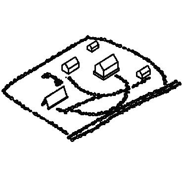
diagram above is a timeline of housing typologies in Hawai
from indigenous practices to today
multi-story apartment buildings and mixed-use blocks. Certain typologies reflect a responsiveness to natural resources (hale buildings), climate (single-loaded high-rises), lot restrictions (walkup apartments, monster homes), and contemporary urban development (mixed-use podium high-rises). They represent a chronology of problem solving in Hawai
i related to dwelling and housing.
The
ʻi
’s
ʻ
ʻI
PLANTATION HOUSE 1850
MISSIONARY HOUSES 1820 HAWAII POPULATION: 192,000 1910 HAWAII KINGDOM EST. 1795 1800 1850 1900 26 WAIPAHU TOD COLLABORATION
POPULATION: 192,000 1910
WALK-UP APARTMENT 1950
MONSTER HOUSE 2017 MID-RISE WORLD WAR II 1945
TOWNHOUSE
HAWAII ANNEXATION 1959
OHANA UNIT 1987 ACCESSORY DWELLING UNIT 2015
1950 2000
POPULATION: 965,000 1980
HAWAII POPULATION: 1.4 MILLION 2017
SINGLE-LOADED CORRIDOR 1960
DOUBLE-LOADED CORRIDOR 1960
SKIP-STOP 1962
SHOPPING CENTER 2016
TOWER+TOWNHOUSE 2017
KAKA`AKO PODIUM 2015

HAWAI
HOUSING AND BLOCK STUDY 27
DWELLING
3.1 HOUSING TYPES - ASSESSMENT
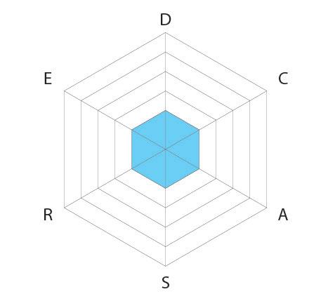
The housing typologies are assessed and evaluated by 6 criteria: 1) density, 2) cost to build (affordability), 3) parking availability, 4) security, 5) resilience, and 6) social exposure. Each criteria offers a quick analysis of each typology with regard to these 6 factors. The evaluation offers a framework for measuring the suitability of different housing typologies.
E D S A R P KUAHALE E D S A R P KAKA’AKO PODIUM E D S A R P MID-RISE APARTMENT E D S A R P ACCESSORY DWELLING UNIT E D S A R P MISSIONARY HOUSE E D S A R P WALK-UP APARTMENT E D S A R P SINGLE-FAMILY E D S A R P DOUBLE-LOADED KUAHALE MISSIONARY HOUSE WALK-UP APARTMENT SINGLE-FAMILY DOUBLE-LOADED MID-RISE KAKAʻAKO PODIUM ACCESSORY
UNIT
28 WAIPAHU TOD COLLABORATION
E D S A R P TOWNHOUSE E D S A R P SKIP-STOP D S A P KAKA’AKO PODIUM D S A P APARTMENT E D S A R P SINGLE-LOADED D S A P DWELLING UNIT E D S A R P MONSTER HOUSE D S A P MISSIONARY HOUSE E D S A R P SHOPPING CENTER HYBRID E D S A R P PLANTATION HOUSE E D S A R P OHANA UNIT E D S A R P TOWER+TOWNHOUSE TOWNHOUSE SKIP-STOP SHOPPING CENTER HYBRID PLANTATION HOUSE SINGLE-LOADED ’’ohana UNIT MONSTER HOUSE DENSITY SECURITY RESILIENCE SOCIAL EXPOSURE AFFORDABILITY PARKING TOWER + TOWNHOUSE HOUSING AND BLOCK STUDY 29
SITE


DENSITY AFFORDABILITY - COST TO BUILD
SHOPPING CENTER HYBRID 2016
MISSIONARY HOUSE 1820 MID-RISE APARTMENT
OHANA UNIT 1987 ACCESSORY DWELLING UNIT 2015
KAKAʻAKO PODIUM 2015 TOWER+ TOWNHOUSE 2017
KAUHALE/HALESINGLE-FAMILY TOWNHOUSEPLANTATION HOUSE 1850 MONSTER HOUSE 2017 WALK-UP APARTMENT 1950

3.2 HOUSING TYPES - DENSITY & AFFORDABILITY
Housing typologies are ordered by density and cost to construct.
SKIP-STOP 1960 DOUBLE-LOADED CORRIDOR 1960
SINGLE-LOADED CORRIDOR 1960
ANALYSIS
’
30 WAIPAHU TOD COLLABORATION
WALK-UP APARTMENT
MONSTER HOUSE
MID-RISE APARTMENT MISSIONARY HOUSE
CORRIDOR
CORRIDOR
SHOPPING CENTER HYBRID
PODIUM
TOWER+ TOWNHOUSE 2017
TOWNHOUSE PLANTATION HOUSE
UNIT
ACCESSORY DWELLING UNIT
KAUHALE/HALE
’OHANA
1987
1820
2015
SINGLE-FAMILY
1850
2017
1950 SINGLE-LOADED
1960 SKIP-STOP 1960 DOUBLE-LOADED
1960
2016 KAKAʻAKO
2015
HOUSING AND BLOCK STUDY 31
SINGLE-FAMILY
ACCESSORY DWELLING UNIT 2015
SECURITY PARKING AVAILABILITY
KAUHALE/HALE
MONSTER HOUSE 2017 MONSTER HOUSE 2017
OHANA UNIT 1987 ACCESSORY DWELLING UNIT 2015
OHANA UNIT 1987
3.3 HOUSING TYPES - SECURITY & AVAILABILITY OF PARKING
Security looks at the ability to control access and encouragement of the concept of “neighborhood watch”. Availability of parking generalizes the availability of street and on site parking to accommodate residents.
SINGLE-FAMILY
MISSIONARY HOUSE 1820
WALK-UP APARTMENT 1950
TOWNHOUSE TOWNHOUSE
WALK-UP APARTMENT 1950
PLANTATION HOUSE 1850 PLANTATION HOUSE 1850
’
’
32 WAIPAHU TOD COLLABORATION
KAUHALE/HALE
MISSIONARY HOUSE 1820
MID-RISE APARTMENT MID-RISE APARTMENT
SKIP-STOP 1960 SKIP-STOP 1960
SINGLE-LOADED CORRIDOR 1960
DOUBLE-LOADED CORRIDOR 1960
PODIUM
SHOPPING CENTER HYBRID 2016
TOWER+ TOWNHOUSE 2017
SINGLE-LOADED CORRIDOR 1960
DOUBLE-LOADED CORRIDOR 1960
TOWER+ TOWNHOUSE 2017
KAKA
AKO PODIUM 2015
SHOPPING CENTER HYBRID 2016
KAKAʻAKO
2015
ʻ
HOUSING AND BLOCK STUDY 33
KAUHALE/HALE
FLOOD RESILIENCE SOCIAL EXPOSURE
MISSIONARY HOUSE 1820
TOWNHOUSE
MONSTER HOUSE 2017 MONSTER HOUSE 2017 DOUBLE-LOADED CORRIDOR 1960
OHANA UNIT 1987
ACCESSORY DWELLING UNIT 2015
TOWNHOUSE
SINGLE-FAMILY
MID-RISE APARTMENT
MISSIONARY HOUSE 1820
SINGLE-FAMILY
PLANTATION HOUSE 1850 PLANTATION HOUSE 1850
ACCESSORY DWELLING UNIT 2015
3.4 HOUSING TYPES - ENVIRONMENTAL RESILIENCE & SOCIAL EXPOSURE
Flood resilience looks at the ability to fortify again, adapt to, and endure flooding events. Social exposure looks at opportunities for social exchange and interaction.
’
34 WAIPAHU TOD COLLABORATION
CORRIDOR
PODIUM
CORRIDOR
TOWER+ TOWNHOUSE
PODIUM
TOWER+ TOWNHOUSE
SHOPPING CENTER
SHOPPING CENTER HYBRID
’OHANA UNIT 1987 MID-RISE APARTMENT KAUHALE/HALE WALK-UP APARTMENT 1950 WALK-UP APARTMENT 1950 SINGLE-LOADED CORRIDOR 1960 SINGLE-LOADED
1960 SKIP-STOP 1960 SKIP-STOP 1960 DOUBLE-LOADED
1960
HYBRID 2016
2016 KAKAʻAKO
2015 KAKAʻAKO
2015
2017
2017 HOUSING AND BLOCK STUDY 35
36 WAIPAHU TOD COLLABORATION
Pouhala Transit Station
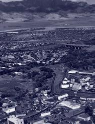
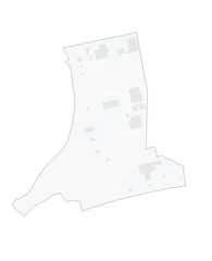
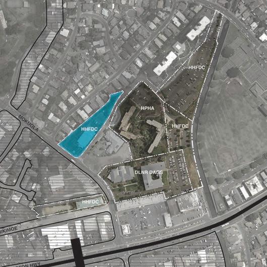
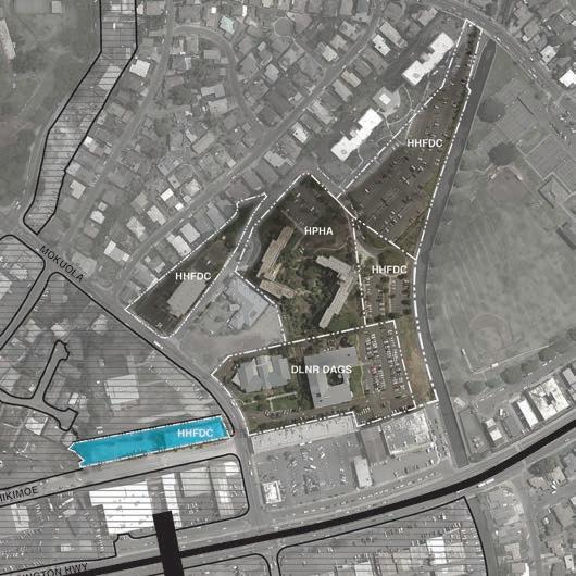
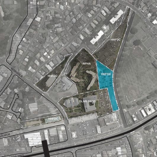
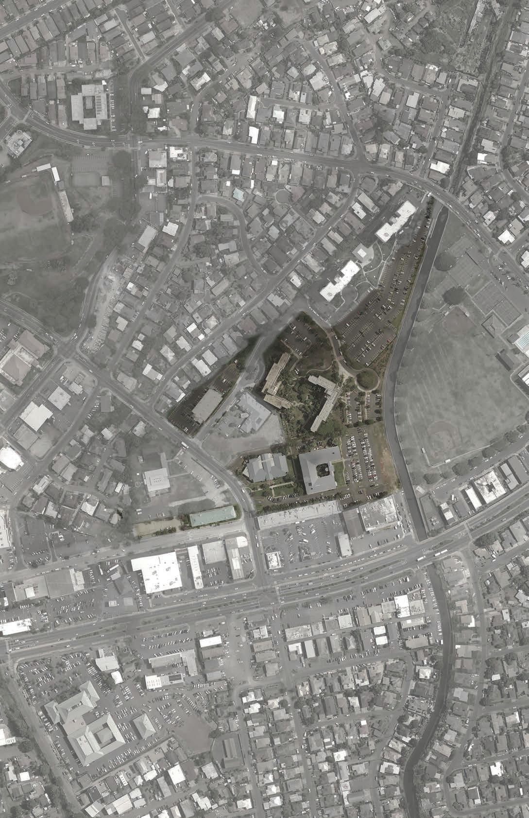
4.0 STATE PARCELS
The study gathered information on the six state parcels indicated in the aerial above. These parcels are owned by different agencies including HHFDC, DLNR/DAGS and HPHA. Regulatory information for each parcel reflects the current TOD zoning overlay passed by the City & County earlier in 2018. Existing uses were verified with each agency. Future uses reflect ideas shared by agency representatives in interviews conducted by Professor Colin Moore’s team. Considerations reflect ideas shared by other stakeholders in other project exchanges.
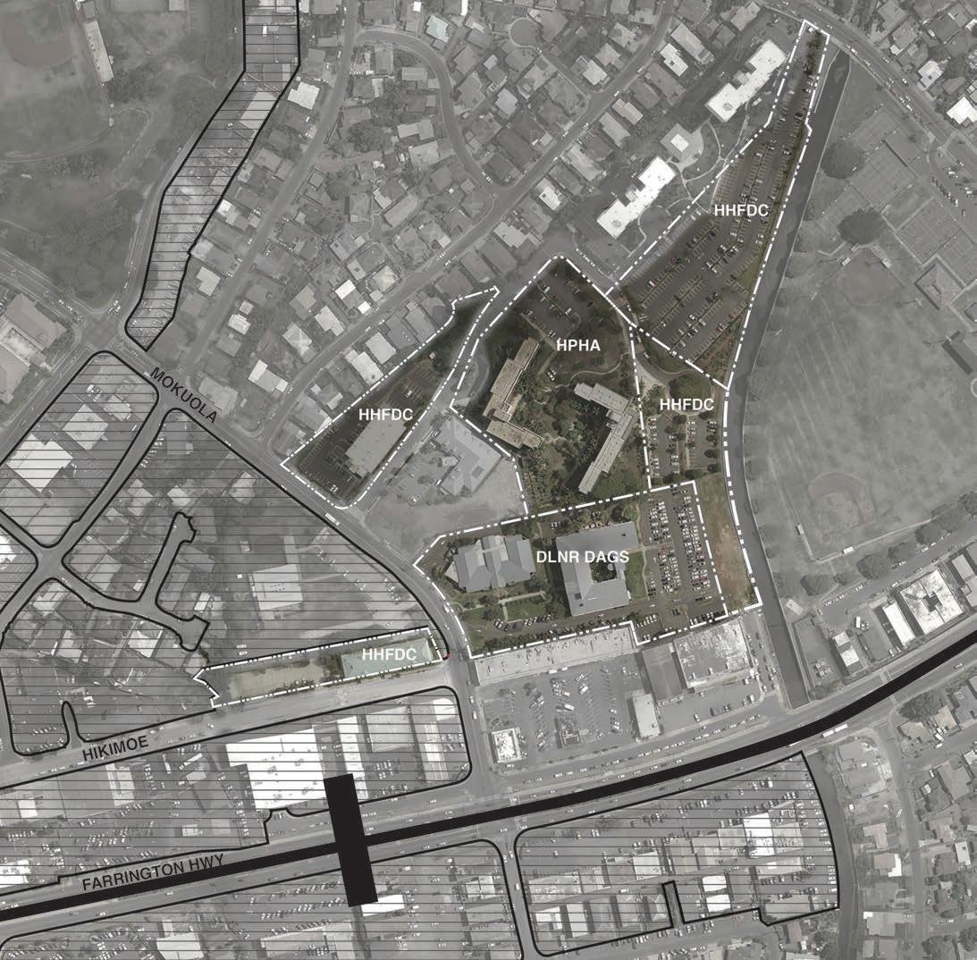
HOUSING AND BLOCK STUDY 37
Waipahu District Park
0 0 08 0 016 04 Mi es STATE PROPOSED TOD BOUNDARY
WAIPAHU TRANSIT CENTER
STATION AREA RAIL LINE TRANSIT STATION CENTROID
PARCEL 1
1 AGENCY HHFDC
STREET ADDRESS 94 830 HIKIMOE ST
TMK 9-4-017:051
LAND AREA (SF) 35,343
FEE OWNER HAWAIʻI HOUSING FINANCE AND DEV. CORP.
LESSEE WAIPAHU COMM ADULT/DAY CARE CENTER
ZONING BMX-3
BUILDING HEIGHT LIMIT (FEET) 60
MAX FAR 3.5
CURRENT USES COMMUNITY DAY CARE
11 FUTURE PLANS
PARCEL 2
1 AGENCY HHFDC
2 STREET ADDRESS 94 333 MOKUOLA ST
TMK 9-4-017:062
4 LAND AREA (SF) 60,723
5 FEE OWNER HAWAIʻI HOUSING FINANCE AND DEV. CORP.
LESSEE MOKUOLA VISTA LP
ZONING R-5
8 BUILDING HEIGHT LIMIT (FEET) N/A
MAX FAR N/A
10 CURRENT USES MID-RISE RESIDENTIAL
11 FUTURE PLANS NO NEW DEVELOPMENT PLANS. BUILDING IS YOUNGER THAN 60 YEARS OLD.
PARCEL 1
This parcel connects rail transportation to bus routes and serves as the public connection to the remaining state parcels. The building on this parcel has changed programs over the years and is current to this report, a day care facility. Considerations: development of the parcel might explore an elevated connection to the station concourse and a commercial use/connection to the street, given the limited footprint of the station itself.
PARCEL 2
Current use of the existing building on site is an affordable midrise residential building owned by HHFDC. Because the building is less that 60 years old, there are currently no new plans for redevelopment.
38 WAIPAHU TOD COLLABORATION
2
3
4
5
6
7
8
9
10
3
6
7
9
PARCEL 3
1 AGENCY HPHA
ADDRESS 94 941 KAUOLU PL
TMK 9-4-017:001
LAND AREA (SF) 164,787
5 FEE OWNER HAWAIʻI PUBLIC HOUSING AU THORITY
LESSEE N/A
ZONING R-5
BLDG HEIGHT LIMIT (FEET) N/A
MAX FAR N/A
10 CURRENT USES ELDERLY HOUSING
11 FUTURE PLANS NO REDEVELOPMENT PLANS. BUILDING IS YOUNGER THAN 60 YEARS OLD.
PARCEL 4
1 AGENCY HHFDC
STREET ADDRESS Undefined
TMK 9-4-017:065
LAND AREA (SF) 132,335
5 FEE OWNER HAWAIʻI HOUSING FINANCE AND DEV. CORP. FKA HOUSING & COMM DEV CORP OF HAWAIʻI
6 LESSEE AOAO OF PLANTATION TOWN APTS
7 ZONING AMX-3
8 BLDG HEIGHT LIMIT (FEET) 45
MAX FAR 3.36
CURRENT USES SURFACE PARKING
11 FUTURE PLANS POSSIBLE HOUSING FOR 300 UNITS
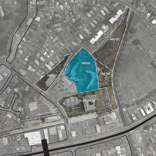
PARCEL 3
The two elderly housing mid-rise buildings (Kamalu and Hoʻolulu) are owned by Hawaiʻi Public Housing Authority. The building is under 60 years old. While this building is not a high priority for future development, HPHA is open to redevelopment ideas.
PARCEL 4
The current parcel is leased to the adjoining Plantation Town Apartments high-rise residential buildings. Surface parking on this parcel provides the majority of the required parking for Plantation Town Apartments. However, HHFDC looks to add additional housing on the existing surface parking. This parcel has a building height limit of 45 feet.
HOUSING AND BLOCK STUDY 39
2
3
4
6
7
8
9
2
3
4
9
10
PARCEL 5
1 AGENCY HHFDC
STREET ADDRESS Undefined
TMK 9-4-017:051
LAND AREA (SF) 57,151
5 FEE OWNER HAWAIʻI HOUSING FINANCE AND DEV. CORP.
LESSEE N/A
ZONING BMX-3
BUILDING HEIGHT LIMIT (FEET) 60
MAX FAR 3.5
10 CURRENT USES SURFACE PARKING
11 FUTURE PLANS COORDINATE WITH DAGS AND DOE
PARCEL 6
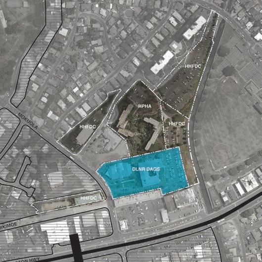
1 AGENCY DLNR/DAGS
2 STREET ADDRESS 94 275 MOKUOLA ST
TMK 9-4-017:052
LAND AREA (SF) 196,511
FEE OWNER STATE OF HAWAIʻI
LESSEE N/A
ZONING BMX-3
BUILDING HEIGHT LIMIT (FEET) 60
MAX FAR 3.5
10 CURRENT USES LIBRARY AND SOCIAL SERVICECIVIC CENTER
11 FUTURE PLANS DOE - WAIPAHU IS NOT A HIGH PRIORITY DAGS - OPEN FOR DISCUSSION
PARCEL 5
Kamalu and Hoʻolulu elderly housing buildings use this lot to fulfill its parking requirements. Currently the elderly housing parking lots are not fully utilized due to the reduced number of drivers among elderly residents. HHFDC would like to add an additional 300 dwelling units between in parcels 4 and 5.
PARCEL 6
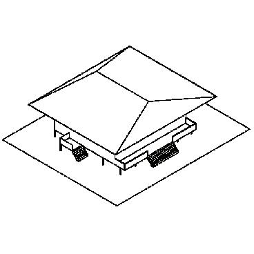
This parcel includes the Waipahu Library and Civic Center, both well utilized and well loved by the community. Considerations: there have been some discussions about locating a vertical elementary school on this property because of its adjacency to the district park. However, DOE is focused on the Pohukaina vertical school project as its pilot, and will not be initiating a vertical school project in Waipahu in the near term.
40 WAIPAHU TOD COLLABORATION
2
3
4
6
7
8
9
3
4
5
6
7
8
9

41 MOKUOLA FARRINGTON HWY HIKIMOE PAIWA HHFDC HHFDCHHFDC HHFDC HPHA DLNR DAGS (E)CIVIC CENTER (E)LIBRARY (E) KEEP *BUT REDEVELOP COMMUNITY HUB (E) HNL KITCHEN (E) TANIOKA’S (E) ARBY’S (E) JACK N’ BOX 5.0 SITE CONSIDERATIONS - AREAS OF INTEREST Waipahu District Park Pouhala Transit Station
Food
Common Eating Area Hangout Spot Riverwalk Restaurant Restaurants
Coffee
Boba Cafe Ice Cream Parlor Bakery Pub/Sports Bar
Retail/Commercial Shopping Center Shoe Store Convenience Bike Shop Gym/Boxing/MMA Yoga/Dance Studio Office Space Entertainment Stage Drive-In Theater Arena
Exploratorium Recreational Soccer field Stadium Park Playground Basketball Court Square/Plaza Film Maker Space Multi-Use Community
Plaza
Splash Pad
5.1 SITE CONSIDERATIONS - PROGRAMMING
This list of desired programs was compiled from a series of community engagement exercises led by from the PLAN 678 Site Planning course taught by Professor Priyam Das.
Public Service/ Community Police Substation Bike Lane Better Transit Restrooms
Community Hub Community Garden Public Library
Adaptable Parking Garage Bank/Insurance Medical Services Free Parking on State
Land for Kids+Ride Afterschool Programs Adult/Child Daycare Parking Housing Mixed-Use Studio Apartments Affordable Housing Senior Housing Improvements Increased Security Shade
Crosswalks Updated Street Lighting Park to Core Bridge Floodable Spaces
Floodable Fountain Greenery Shade Wider Sidewalks
42 WAIPAHU TOD COLLABORATION
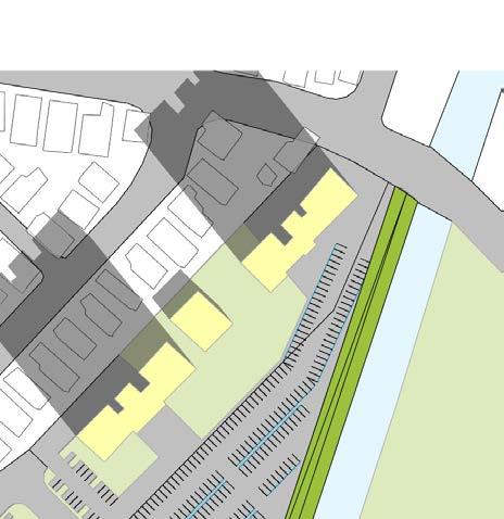
COMMUNITY PROGRAMMING


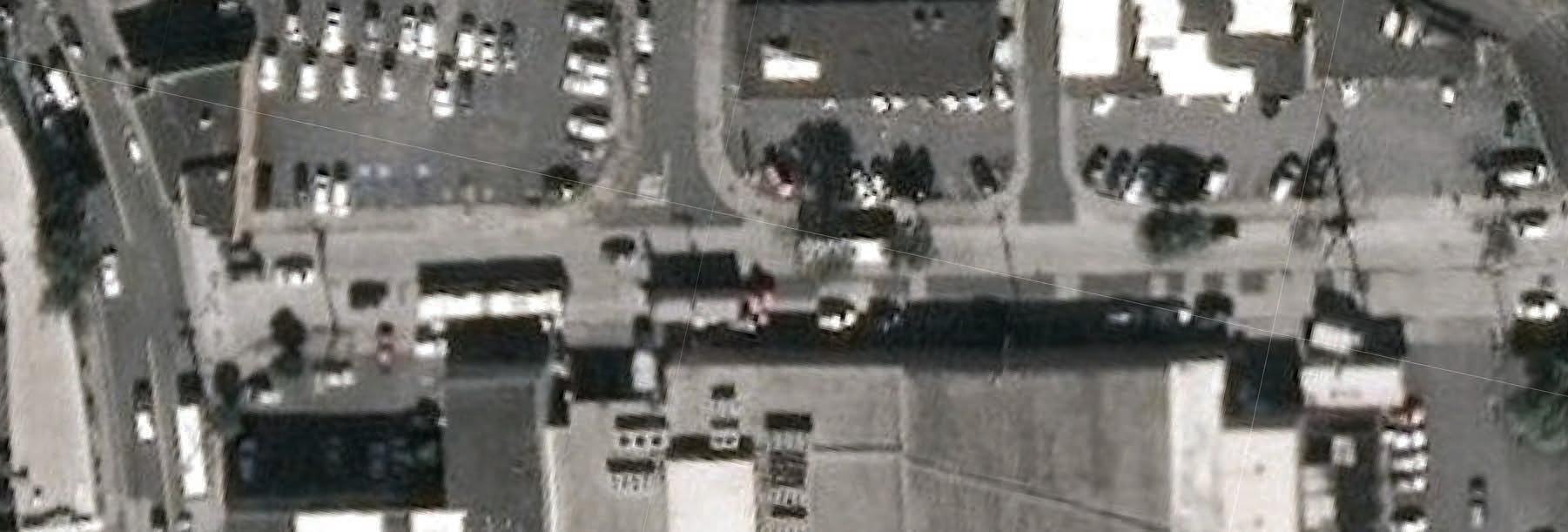
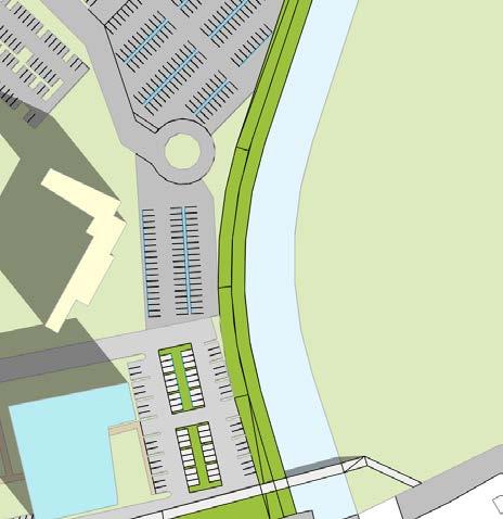
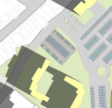
The diagram above depicts the current flow of vehicles (orange dashed line) versus pedestrian (blue dashed line) and areas of off-street surface parking. The surface parking directly across the rail station and district park highlights the underutilized desirable lands. HOUSING AND BLOCK STUDY 43 MOKUOLA FARRINGTON HWY HIKIMOE PAIWA 105,000 sf 16,000 sf 6,000 sf 50,000 sf 3,000 sf 10,000 sf 27,000sf 18,000 sf HHFDC HHFDC HHFDC HHFDC HPHA DLNR DAGS1 2 3 4 5 6 Pouhala Transit Station PARCEL No. PARKING AREA (SF) PARKING STALLS 1 10,000 33 2 27,000 90 3 18,000 60 4 105,000 350 5 16,000 53 6 59,000 196 TOTAL 235,000 782 PARKING COUNT PEDESTRIAN CIRCULATION VEHICLE CIRCULATION SURFACE PARKING LOT
The diagram above reflects the community related to pedestrian circulation. Hikimoe street will need to support increased functions for both rail and bus transit. The community proposed the following Hikimoe improvementssome of which are underway at the city.
Neighborhood plans also propose expanded pedestrian paths
directly connecting Waipahu District Park
Hikimoe Street
DLNR/DAGS parcel. Also noted are additional bicycle lanes, updated and increased
a bridge and

by
to
via
promenade on the
street 44 MOKUOLA FARRINGTON HWY HIKIMOE HHFDC HHFDC HHFDC PAIWA HPHA DLNR DAGS HHFDC A SHARED STREET PROMENADE PROMENADE BRIDGE BIKE LANE CROSSWALK LIGHTING PEDESTRIAN PATHWAY 1 2 3 4 5 6 7 5.3 PEDESTRIAN + CYCLIST CIRCULATION AND SAFETY RECOMMENDATIONS Waipahu District Park Pouhala Transit Station

Highway increase driver awareness of cyclists MOKUOLA FARRINGTON HWY HIKIMOE HHFDC PAIWA DLNR DAGS A SHARED STREET WIDEN THE MAKAI SIDEWALK ON HIKIMOE STREET FROM 10 FEET TO 15 FEET ALONG THE ENTIRE LENGTH FROM WAIPAHU DEPOT STREET TO MOKUOLA STREET RE-STRIPE THE DIAMOND HEAD HALF OF HIKIMOE STREET FOR BUS OPERATIONS RE-STRIPE THE EWA HALF OF HIKIMOE STREET TO A DEDICATED BUS LAYOVER SPACE INSTALL SHARROWS IN BOTH DIRECTIONS ON HIKIMOE STREET TO INCREASE DRIVER AWARENESS OF CYCLISTS INSTALL SIGNAGE TO DISCOURAGE THROUGH TRAFFIC FROM USING EWA-BOUND HIKIMOE STREET 1 1 2 2 3 3 4 4 5 5 1in = 60mA MAKAI MAUKA MOKUOLA FARRINGTON HWY HIKIMOE PAIWA HIKIMOE STREET A WIDEN THE MAKAI SIDEWALK ON HIKIMOE STREET FROM WAIPAHU DEPOT STREET TO MOKUOLA STREET RE-STRIPE THE DIAMOND HEAD HALF OF HIKIMOE STREET RE-STRIPE THE EWA HALF OF HIKIMOE STREET TO A DEDICATED INSTALL SHARROWS IN BOTH DIRECTIONS ON HIKIMOE INSTALL SIGNAGE TO DISCOURAGE THROUGH TRAFFIC 1 1 2 2 3 3 4 4 5 5 1in = 60mA MAKAI MAUKA N N 0’ 60’ 1 2 3 4 5 HIKIMOE ST 7 6 HIKIMOE DETAIL PLAN A
46 MOKUOLA FARRINGTON HWY HIKIMOE HHFDC HHFDC HHFDC HPHA DLNR DAGS WET FLOOD PROOF FLOODABLE DRY FLOOD PROOF DRY FLOOD PROOF WIDEN CANAL *REFER TO SECTION MULTI-USE RAISED BERM FLOODABLE FLOODABLE UNDERGROUND CISTERN A C D B HHFDC 5.4 FLOOD MITIGATION ANALYSIS Waipahu District Park Pouhala Transit Station FLOODABLE VEGETATED SURFACE FLOODABLE VEGETATED SURFACE FLOODABLE VEGETATED SURFACE POTENTIAL UNDERGROUND CISTERNS OR FLOODABLE SURFACE WET FLOOD-PROOF WET FLOOD-PROOF DRY FLOOD-PROOF
FLOOD MITIGATION KEY
A Elderly Housing Buildings
Must maintain operations during flooding
— Provide alternate access (if ground floor is flooded)
— Elevate critical functions and equipment above the ground floor
— Dr y flood-proof elevator underground portion of elevator shaft
B Elderly Housing Complex (Garden)
— Flood water storage strategies include floodable vegetated parks or underground cisterns
C Waipahu Public Library
Operations will cease during flooding
— Elevate shelving (If possible. Dr y flood-proofing may be required)
—Elevate equipment and machiner y
D Waipahu Civic Center
Operations may continue during flooding
— Elevate critical functions and equipment off the ground floor
— Wet flood-proof ground floor
ZONE D AREAS IN WHICH FLOOD HAZARDS ARE
UNDETERMINED BUT POSSIBLE
ZONE AEF FLOODWAY DISTRICT
ZONE AE FLOODWAY FRINGE DISTRICT
ZONE X (Shaded) (MODERATE FLOOD HAZARD)
ZONE X (Un-shaded) MINIMAL FLOOD HAZARD
HOUSING AND BLOCK STUDY 47


conflict. 48 MOKUOLA FARRINGTON HWY HIKIMOE PAIWA TREE CANOPY COVERAGE 0 0.08 00.16 .04 Miles STATE PROPOSED TOD BOUNDARY WAIPAHU TRANSIT CENTER STATION AREA RAIL LINE TRANSIT STATION CENTROID HHFDC HHFDCHHFDC 1 2 4 5 3 6 HPHA DLNR DAGS HHFDC PARCELEXISTING (SF) EXISTING TC (%) EXISTING TC (SF) 35% TC Goal (SF) 35% TC Remaining (SF) 35,343A B C D E F 25.79,08312,3703,287 60,72210.716,50321,253 14,750 103,6298.969,28545,72036,435 57,19426.7915,32220,0184,696 164,78737.6662,05957,675196,51118.9137,16068,77931,619 LARGE TREE CT. MEDIUM TREE CT. SMALL TREE CT. TC AREA TOTAL (SF) 0 2 1 1,615 2 2 2 11,868 3 6 13 21,933 0 1 6 1,913 0 0 0 0 3 6 13 21,933 25.70% 35,343sf 1 x0x8x0 10.71% 60,722sf x0x12x10 2 8.96% 130,629sf x2x12x10 4 26.79% 57,194sf x1x12x8 5 37.66% 164,787sf x0x0x0 3 18.91% 196,511sf x3x12x10 6 TC COVERAGE (%) LOT SIZE LMS X 5.5 TREE CANOPY OVERLAY
TREE CANOPY REQUIREMENTS TO MEET 35% COVERAGE
EXISTING TREE CANOPY COVERAGE
PARCEL LOT SIZE TC COVERAGE (%)
TC COVERAGE (SF)
TREES REQUIRED TO REACH 35% COVERAGE
35% (SF) NEEDED COVERAGE (SF)
LARGE MEDIUM SMALL TREE AREA
1 35,343 25.7 9,083 10,603 1,520 0 8 0 4,242
2 60,722 10.7 6,503 18,217 11,713 0 12 10 5,448
3 164,787 37.7 62,059 49,436 0 0 0 0 12,094
4 132,335 9.0 9,285 31,089 21,804 2 12 12 6,2520
5 57,194 26.8 15,322 17,158 1,836 1 12 8 0
6 196,511 18.9 37,160 58,953 21,793 3 12 10 17,718
Total 618,186 21.5 139,413 58,953 46,043 6 56 38 46,754
5.6 TREE CANOPY ESTIMATES
As described in further detail in Professor Simon Bussiere’s report, tree types are simplified into small, medium, and large categories and are used to achieve desired canopy coverage along streets or large areas. Small trees (8’ radius canopy) are typically ornamental and may be used for wayfinding and general vegetation. Medium trees (15’ radius canopy) act as sidewalk infrastructure - primarily as street trees to provide shade for pedestrians. Medium trees are also good candidates for parking lots. Large trees (40’ radius canopy) may be placed in large vegetated and recreational spaces. In total, by analyzing each parcel’s needs, an additional 100 trees would be required
to achieve 35% tree canopy coverage, or roughly 46,754 square feet of tree canopy area.
Please refer to the Ecological Conditions study for property value, carbon sequestration, and energy saving estimates related to this provision of trees.
HOUSING AND BLOCK STUDY 49
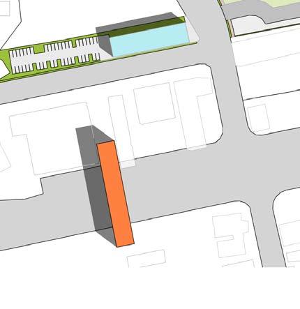
6.0 DESIGN OPTIONS
The research and input gathered was applied to the development of a handful of development scenarios. The scenarios reflect different programmatic desires and needs such as housing, retail, education, civic services keeping in mind accessibility to and from the Pouhala station.
option 1 option 4option 3 option 2 option 5 option 6 50 WAIPAHU TOD COLLABORATION
pedestrian to rail connectivity
public plaza
tree canopyurban connectivity
block size green space
6.1 TOD DESIGN CONSIDERATIONS
Fundamental TOD considerations were analyzed over the state parcels to create informative design decisions among the 4 following design options.
HOUSING AND BLOCK STUDY 51
DESIGN OPTION 1


1
IMPROVEMENTS
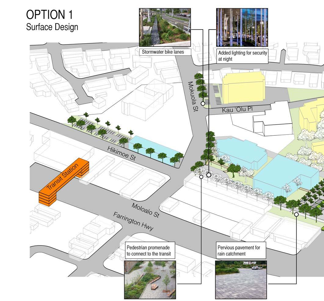
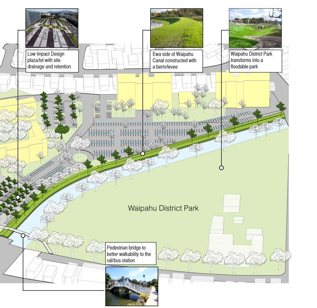
OPTION 1
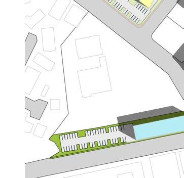
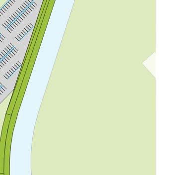
Option 1 looks at publicly funded site improvements as a first step toward readying the area for future development.


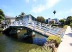
The Option 1 scope would include: sewer upgrades, Hikimoe Street upgrades, lighting upgrades, a pedestrian promenade from Pouhala station to the civic center area, coordination of a pedestrian bridge, and natural berm along the canal.
PROPOSED TOD BOUNDARY
WAIPAHU TRANSIT CENTER STATION AREA
TRANSIT STATION CENTROID
Natural Berm Promenade
Bridge
LID parking/plaza
PHASE
- INFRASTRUCTURE
52 WAIPAHU TOD COLLABORATION
OPTION 1 - AREA
DLNR/DAGS
EXISTING AREA NEW AREA
OPTION 1 -COORDINATION
CIVIC 68,000 SF PROMENADE 22,000 SF LID PARKING/PLAZA 33,000 SF
CALCULATIONS
HOUSING AND BLOCK STUDY 53
COMMUNITY OUTREACH
TREE CANOPY STUDY
new crosswalk
a new raised
makai
• Widen Makai Sidewalk on Hikimoe Street • Re-Stripe the Diamond-Head half of Hikimoe St for bus layover • Install sharrows in both directions on Hikimoe St • Install signage to discourage traffic from ’Ewabound • Delineate a
on the
side of the Hikimoe St/Mokoula St intersection • Install
crosswalk on Moloala St for future Hart Rail • Lighting on Hikimoe and Moloalu intersection • Pedestrian access through Waiphau District Park • Promenade along ’Ewa Side of Canal • Promenade on Civic Center parcel
• Medium trees along pedestrian pathways to increase walkability • Small trees planted at dry pond parking stalls • Added trees along Mokuola St, a main street, to connect to Han L’Orange Park • Trees along proposed bike lane • 30% tree canopy coverage for all six parcels • 30% tree canopy coverage for Parcel 1 • 30% tree canopy coverage for Parcel 2 • 30% tree canopy coverage for Parcel 3 • 30% tree canopy coverage for Parcel 4 • 30% tree canopy coverage for Parcel 5 • 30% tree canopy coverage for Parcel 6
DESIGN OPTION 1 PHASE 1 - INFRASTRUCTURE IMPROVEMENTS 54 WAIPAHU TOD COLLABORATION
AND STORM
WAIPAHU ACTION PLAN
• Widen Canal • Natural Berm/Levee on ’Ewa side of Waipahu Canal • Underground cistern on HPHA elderly housing and HHFCDC surface parking lots • Dry flood proofing for the Elderly housing and Library • Wet flood proofing for the civic center • Dry pond on civic center surface parking • Permeable pavement on pedestrian walkway FLOOD
MITIGATION • Implement a connected bicycle facility • Upgrade Waipahu Transit Center • Redesign Moloalo Street • Upgrade Street Lighting • Connect Hawaiʻi’s Plantation Village to Waipahu Town Core • Implement Placemaking Strategies • Connect Waipahu District Park to Waipahu Town Core • Develop a Master Plan for Han L’Orange Park • Address Area wide Flooding • Establish Area wide Wayfinding • Develop Pouhala Marsh Educational Signage
HOUSING AND BLOCK STUDY 55
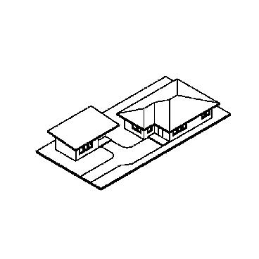
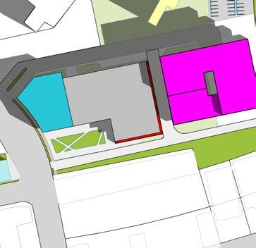
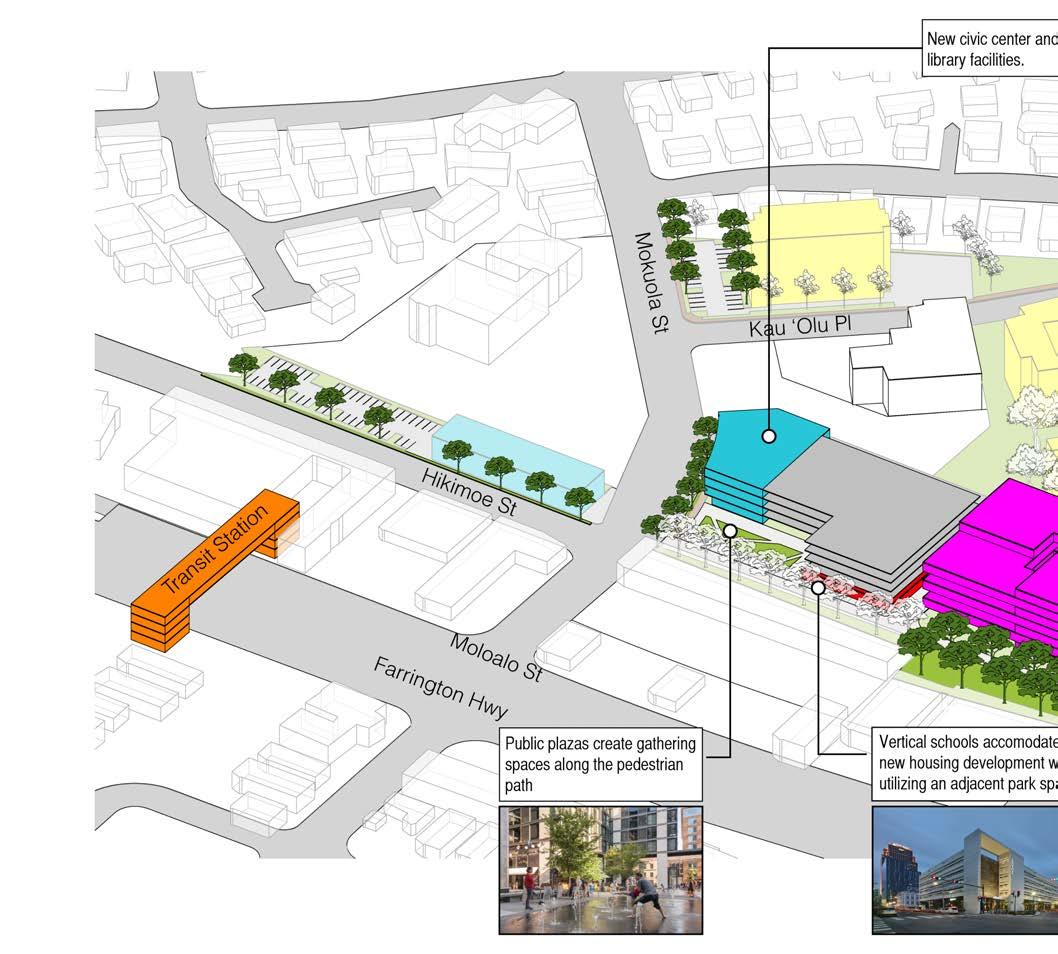
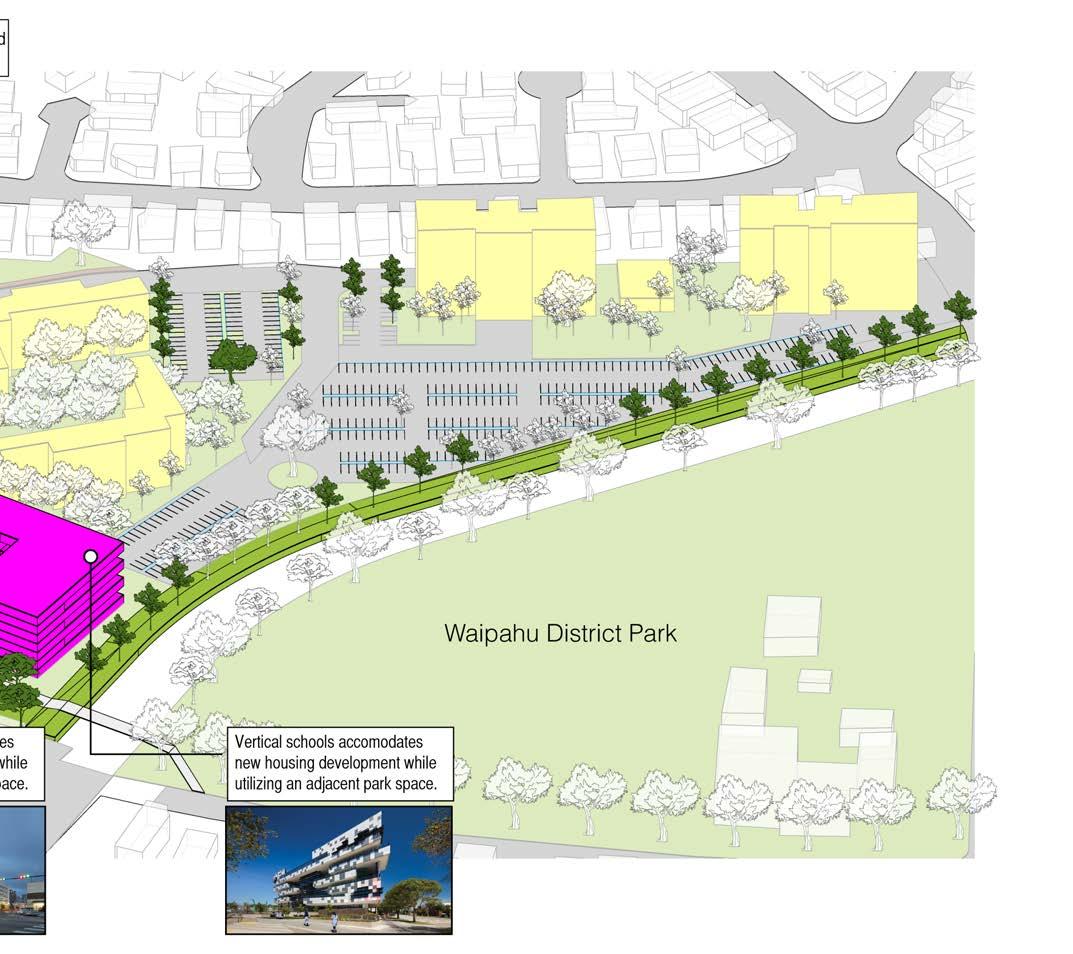
OPTION 2 - NEW CIVIC CENTER AND VERTICAL SCHOOL

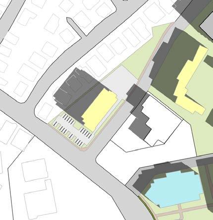
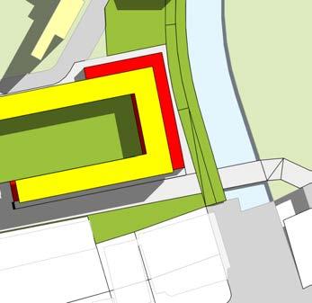
Option 2 looks at the redevelopment of two HPHA properties to provide affordable housing. The existing library and civic center remains with an improved LID parking lot that acts both as a parking lot as well as an outdoor event space. All parking structures in this option are able to provide green roofs.
A

0 0 08 0 016 04 M les STATE PROPOSED TOD BOUNDARY WAIPAHU TRANSIT CENTER STATION AREA RAIL LINE TRANSIT STATION CENTROID
Wrapped Parking Parking Structure
Mid-Rise Housing
A DESIGN OPTION 2
AFFORDABLE RENTALS
56 WAIPAHU TOD COLLABORATION
OPTION 2 - AREA CALCULATIONS
DLNR/DAGS
AFFORDABLE RENTALS
EXISTING AREA NEW AREA
CIVIC 68,000 SF
PROMENADE 22,000 SF
LID PARKING/PLAZA 33,000 SF
HPHA (OPTIONAL)
EXISTING AREA NEW AREA
PARKING 11,200 SF (32 PARKING STALLS)
81,600 SF (233 PARKING STALLS)
OPTION 2 -COORDINATION
JOINT AGREEMENTS
ID FUNCTION OWNING AGENCY JOINT AGENCY
A PARKING HPHA HHFDC, Plantation Town Apartment Condo Master
HHFDC
EXISTING AREA NEW AREA
MID-RISE HOUSING 58,500 SF (78 DU @ 750 SF/unit)
LOW-RISE HOUSING 95,000 SF (116 DU @ 750 SF/unit)
TOTAL HOUSING 153,500 SF (205 DU)
PARKING 223,300 SF (600 PARKING STALLS)
HOUSING AND BLOCK STUDY 57
OPTION 2
OPTION 2 House and Park
TransitStation
Community Outreach/Survey
COMMUNITY OUTREACH SURVEY
• Widen Makai Sidewalk on Hikimoe Street
• Re-Stripe the Diamond-Head half of Hikimoe St for bus layover
HikimoeSt
FarringtonHwy
MoloaloSt
Mokuola St Kau ʻOlu Pl
Tree Canopy Study
TREE CANOPY STUDY
- Widen Makai Sidewalk on Hikimoe Street - Re-Stripe the Diamond Head Half of Hikimoe St for bus layover - Install sharrows in both directions on Hikimore St
• Medium trees along pedestrian pathways to increase walkability
• Install sharrows in both directions on Hikimoe St
- Install signage to discourage traffic from Ewa-bound - Delineate a new crosswalk on the makai side of the Hikimoe St/Mokoula St intersection
• Install signage to discourage traffic from ’Ewabound
• Delineate a new crosswalk on the makai side of the Hikimoe St/Mokoula St intersection
• Install a new raised crosswalk on Moloala St for future Hart Rail
• Small trees planted at dry pond parking stalls
-Medium trees along pedestrian pathways to increase walkability -Small trees planted at drypond parking stalls -Added trees along Mokuola St, a main street, to connect to Han L’Orange Park
• Added trees along Mokuola St, a main street, to connect to Han L’Orange Park
- Install a new raised crosswalk on Moloala St for future Hart Rail - Lighting on Hikimoe and Moloalu intersection - Pedestrian access through Waiphau District Park - Promenode along Ewa Side of Canal - Promenade on civic center parcel
• Lighting on Hikimoe and Moloalu intersection
• Pedestrian access through Waiphau District Park
• Promenade along ’Ewa Side of Canal
• Promenade on Civic Center parcel

• Trees along proposed bike lane
• 30% tree canopy coverage for all six parcels
• 30% tree canopy coverage for Parcel 1
• 30% tree canopy coverage for Parcel 2
• 30% tree canopy coverage for Parcel 3
-Trees along proposed bike lane - 30% tree canopy coverage for all six parcels - 30% tree canopy coverage for Parcel 1 - 30% tree canopy coverage for Parcel 2 - 30% tree canopy coverage for Parcel 3 - 30% tree canopy coverage for Parcel 4 - 30% tree canopy coverage for Parcel 5 - 30% tree canopy coverage for Parcel 6
• 30% tree canopy coverage for Parcel 4
• 30% tree canopy coverage for Parcel 5
• 30% tree canopy coverage for Parcel 6
DESIGN
AFFORDABLE RENTALS
PARKING
58 WAIPAHU TOD COLLABORATION
Flood and Storm Mitigation
PARKING LOT FOR HOUSING
PARKING LOT FOR HOUSING
STORY WALK-UP APARTMENT
Waipahu District Park
Public green space throughout housing development
MULTI-STORY HOUSING
Waipahu Action Plan
FLOOD AND STORM MITIGATION
-Widen Canal
WAIPAHU ACTION PLAN
- Natural Berm/Levee on Ewa side of Waipahu Canal - Underground cistern on HPHA elderly housing and HHFCDC surface parking lots
• Widen Canal
• Natural Berm/Levee on ’Ewa side of Waipahu Canal
- Dry flood proofing for the Elderly housing and Library - Wet flood proofing for the civic center - Dry pond on civic center surface parking - Pervious pavement on pedestrian walkway
• Underground cistern on HPHA elderly housing and HHFCDC surface parking lots
• Dry flood proofing for the Elderly housing and Library
• Wet flood proofing for the civic center
• Dry pond on civic center surface parking
• Permeable pavement on pedestrian walkway
• Implement a connected bicycle facility
• Upgrade Waipahu Transit Center
• Redesign Moloalo Street
• Upgrade Street Lighting
• Connect Hawai
- Implement a connected bicycle facility - upgrade Waipahu Transit Center - Redesign Moloalo Street - Upgrade Street Lighting - Connect Hawaii’s Plantation Village to Waipahu Town Core - Implement Placemaking Strategies - Connect Waipahu District Park to Waipahu Town Core - Develop a Master Plan for Han L’Orange Park - Address Areawide Flooding - Establish Areawide Wayfinding - Develop Pouhala Marsh Educational Signage
s Plantation Village to Waipahu Town Core
• Implement Placemaking Strategies
• Connect Waipahu District Park to Waipahu Town Core
• Develop a Master Plan for Han L
• Address Area wide Flooding
• Establish Area wide Wayfinding
Orange Park
• Develop Pouhala Marsh Educational Signage
3-4
ʻi’
’
HOUSING AND BLOCK STUDY 59
DESIGN OPTION 3
NEW CIVIC CENTER AND VERTICAL SCHOOL

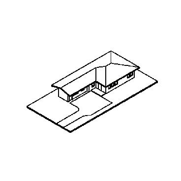
OPTION 3 - NEW CIVIC CENTER AND VERTICAL SCHOOL


Option 3 looks at the redevelopment of the DLNR/DAGS property to include a new civic center, library, parking structure, and vertical elementary school. The new elementary school would have access to the park and library. The vertical school was sized to meet the square footage requirements for the Pohukaina School in Kaka’ako.
B0 0 08 0 016 04 M les STATE PROPOSED TOD BOUNDARY WAIPAHU TRANSIT CENTER STATION AREA RAIL LINE TRANSIT STATION CENTROID
Parking Structure
Vertical School
Urban Plaza
Civic Center
60 WAIPAHU TOD COLLABORATION
OPTION 3 - AREA CALCULATIONS
DLNR/DAGS/DOE
VERTICAL SCHOOL AND CIVIC CENTER
EXISTING AREA NEW AREA
VERTICAL SCHOOL 213,000 SF COMMERCIAL 14,000 SF
CIVIC 68,000 SF
URBAN PLAZA 12,400 SF
PROMENADE 22,000 SF PARKING 150,200 SF 429 PARKING STALLS 70 NEW JOBS (200 SF/ FOOD SERVICE WORKER)
OPTION 3 -COORDINATION
JOINT AGREEMENTS
ID FUNCTION OWNING AGENCY JOINT AGENCY B VERTICAL SCHOOL DLNR/DAGS DOE
HOUSING AND BLOCK STUDY 61
NEW CIVIC CENTER AND VERTICAL SCHOOL
COMMUNITY OUTREACH SURVEY
Widen Makai Sidewalk
Re-Stripe
Diamond-Head
layover
sharrows
of Hikimoe
TREE CANOPY STUDY
Medium trees along pedestrian pathways
Small trees planted at
trees along Mokuola St, a main
Ewabound
signage to discourage traffic from
Delineate a new crosswalk on the makai side of the Hikimoe St/Mokoula St
a new raised crosswalk on Moloala St for future Hart
on Hikimoe and Moloalu
Pedestrian access through Waiphau District
Promenade along
Ewa Side of Canal
Promenade on Civic Center
Trees along proposed
tree canopy
tree canopy
tree canopy
canopy
DESIGN OPTION 3
•
on Hikimoe Street •
the
half
St for bus
• Install
in both directions on Hikimoe St • Install
’
•
intersection • Install
Rail • Lighting
intersection •
Park •
’
•
parcel
•
to increase walkability •
dry pond parking stalls • Added
street, to connect to Han L’Orange Park •
bike lane • 30%
coverage for all six parcels • 30% tree canopy coverage for Parcel 1 • 30% tree canopy coverage for Parcel 2 • 30% tree canopy coverage for Parcel 3 • 30%
coverage for Parcel 4 • 30%
coverage for Parcel 5 • 30% tree
coverage for Parcel 6
62 WAIPAHU TOD COLLABORATION
FLOOD AND STORM
WAIPAHU ACTION PLAN
• Widen Canal • Natural Berm/Levee on ’Ewa side of Waipahu Canal • Underground cistern on HPHA elderly housing and HHFCDC surface parking lots • Dry flood proofing for the Elderly housing and Library • Wet flood proofing for the civic center • Dry pond on civic center surface parking • Permeable pavement on pedestrian walkway
MITIGATION • Implement a connected bicycle facility • Upgrade Waipahu Transit Center • Redesign Moloalo Street • Upgrade Street Lighting • Connect Hawaiʻi’s Plantation Village to Waipahu Town Core • Implement Placemaking Strategies • Connect Waipahu District Park to Waipahu Town Core • Develop a Master Plan for Han L’Orange Park • Address Area wide Flooding • Establish Area wide Wayfinding • Develop Pouhala Marsh Educational Signage
HOUSING AND BLOCK STUDY 63
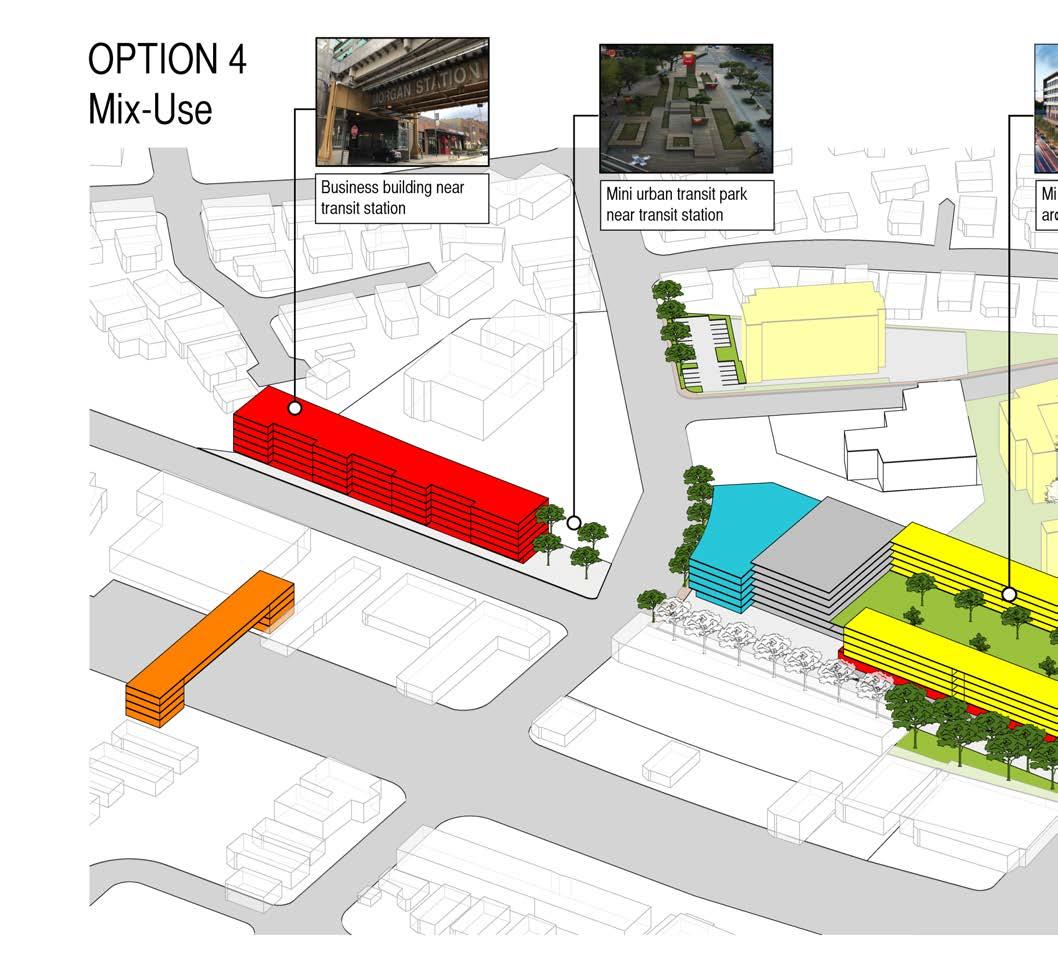
DESIGN OPTION 4

USE -
AND
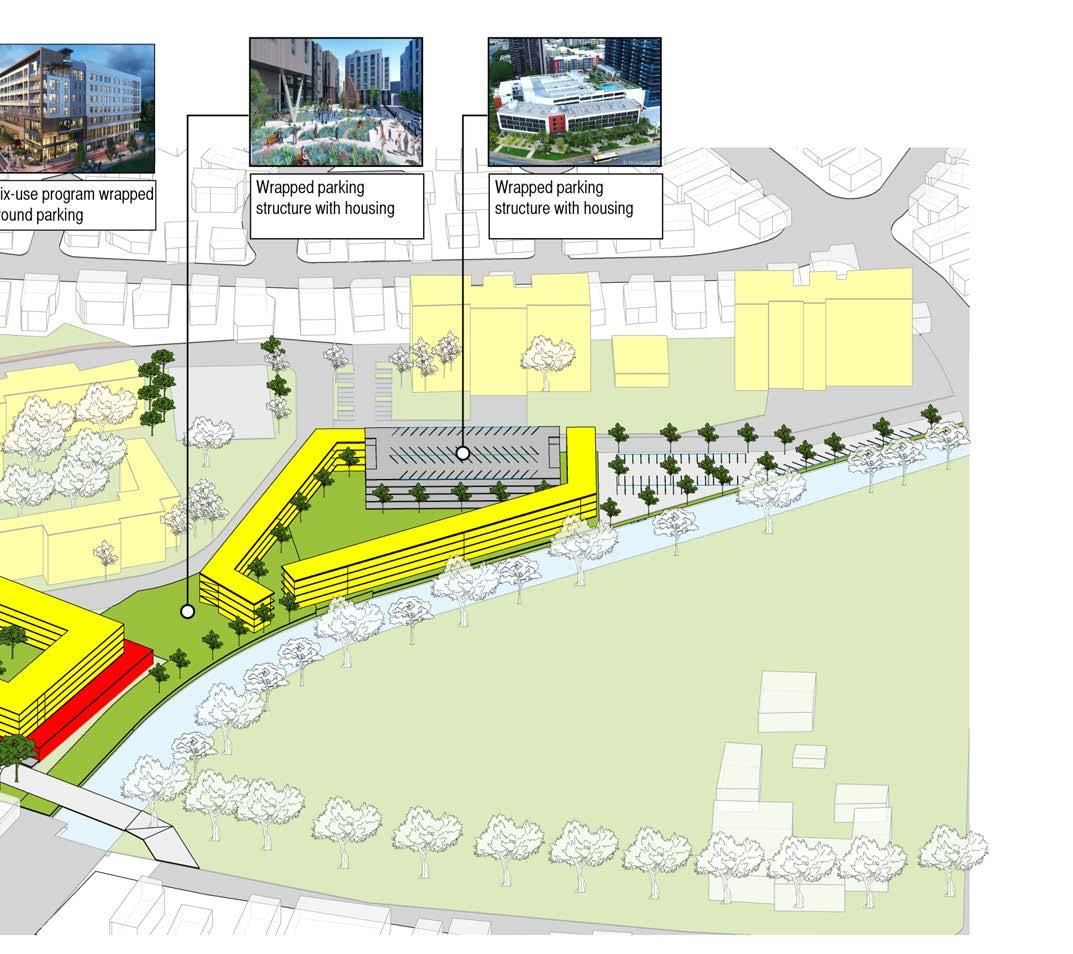
OPTION 2 -MIXED USE - MARKET RATE AND AFFORDABLE
Option 4 looks at redeveloping the DLNR/DAGS property to include a mixed-use civic and market rate housing and the HHFDC property into affordable rental units. Both housing projects provide wrap-around parking. The market rate housing includes interior courtyard/community spaces on the third floor above parking. The parking on HHFDC is placed in between the Plantation Town Apartments and with the new housing project.
A0 0 08 0 016 04 M les STATE PROPOSED TOD BOUNDARY WAIPAHU TRANSIT CENTER STATION AREA RAIL LINE TRANSIT STATION CENTROID
Parking Structure
Green Space Urban Plaza
Mixed-Use Block
MIXED
MARKET RATE
AFFORDABLE
64 WAIPAHU TOD COLLABORATION
OPTION 4 - AREA CALCULATIONS
DLNR/DAGS
MIXED USE - MARKET AND AFFORDABLE
EXISTING AREA NEW AREA
HOUSING 110,330 SF (134 DU @ 750 SF/unit)
COMMERCIAL 37,000 SF
CIVIC 52,600 SF
URBAN PLAZA 12,400 SF
PROMENADE 33,000 SF
PARKING 178,000 SF 509 PARKING STALLS
170 NEW JOBS (200 SF/ FOOD SERVICE WORKER)
HPHA
EXISTING AREA NEW AREA
PARKING 81,600 SF (272 PARKING STALLS)

HHFDC
EXISTING AREA NEW AREA
LOW-RISE HOUSING 92,565 SF (112 DU @ 750 SF/unit)
PARKING 101,500 SF (290 PARKING STALLS)
PUBLIC PARK 12,000 SF
OPTION 4 -COORDINATION
JOINT AGREEMENTS
ID FUNCTION OWNING AGENCY JOINT AGENCY A PARKING HPHA HHFDC, Plantation Town Apartment Condo Master
build street edge
connecting green space
HOUSING AND BLOCK STUDY 65
MIXED USE - MARKET RATE AND AFFORDABLE
COMMUNITY OUTREACH SURVEY
Widen Makai Sidewalk
Re-Stripe the Diamond-Head half of
bus layover
sharrows
bound
both
signage to discourage traffic from
Delineate a new crosswalk on the makai side of the Hikimoe St/Mokoula St
Install a new raised crosswalk on Moloala St for future Hart
Lighting on Hikimoe and Moloalu
Pedestrian access through Waiphau District
Promenade along
Ewa Side of
Promenade on Civic Center
TREE CANOPY STUDY
Medium trees along pedestrian pathways
walkability
Small trees planted at dry pond parking
Added trees along Mokuola St, a main street, to
to Han
Orange
Trees along proposed bike
tree canopy coverage
tree canopy
tree canopy
tree canopy
tree canopy coverage
tree canopy coverage
tree canopy coverage
DESIGN OPTION 4
•
on Hikimoe Street •
Hikimoe St for
• Install
in
directions on Hikimoe St • Install
’Ewa-
•
intersection •
Rail •
intersection •
Park •
’
Canal •
parcel
•
to increase
•
stalls •
connect
L’
Park •
lane • 30%
for all six parcels • 30%
coverage for Parcel 1 • 30%
coverage for Parcel 2 • 30%
coverage for Parcel 3 • 30%
for Parcel 4 • 30%
for Parcel 5 • 30%
for Parcel 6
66 WAIPAHU TOD COLLABORATION
FLOOD AND STORM MITIGATION
WAIPAHU ACTION PLAN
• Widen Canal • Natural Berm/Levee on ’Ewa side of Waipahu Canal • Underground cistern on HPHA elderly housing and HHFCDC surface parking lots • Dry flood proofing for the Elderly housing and Library • Wet flood proofing for the civic center • Dry pond on civic center surface parking • Permeable pavement on pedestrian walkway
• Implement a connected bicycle facility • Upgrade Waipahu Transit Center • Redesign Moloalo Street • Upgrade Street Lighting • Connect Hawaiʻi’s Plantation Village to Waipahu Town Core • Implement Placemaking Strategies • Connect Waipahu District Park to Waipahu Town Core • Develop a Master Plan for Han L’Orange Park • Address Area wide Flooding • Establish Area wide Wayfinding • Develop Pouhala Marsh Educational Signage
HOUSING AND BLOCK STUDY 67
