Department of Architecture and Planning, Faculty of Architecture
Norwegian University of Science and Technology (NTNU), Trondheim, Norway
Course Coordinator: Mrudhula Koshy, Assistant Professor
Main Supervisor: Mrudhula Koshy, Assistant Professor
Co-supervisor: Lina Naoroz Bråten, Assistant Professor
Supervision Team: Sladjana Lazarevic, Associate Professor Bhuvana Nanaiah, Research Associate and Doctoral Candidate
Booklet Layout: Mrudhula Koshy, Assistant Professor
From Neglect to Ownership
Strengthening Community Relationships through Diverse Communal Spaces in Cissie Gool House’s Transition to Formal Housing
Cape Town, South Africa
Authors
Clémence Gavel France
Sophia Laubrock Germany
Karin Raniay Norway
Sara Uran Norway
This project report presents the exploratory fieldwork and ensuing socio-spatial interventions as part of the International Master’s Program Urban Ecological Planning at the Norwegian University of Science and Technology (NTNU), Trondheim. Students from diverse educational backgrounds and nationalities carried out a six-week intensive fieldwork in Cape Town, South Africa, a rapidly urbanising Global South city with a history of decades of spatial apartheid influenced by centuries of historical oppression of marginalised communities. Current planning trajectories in Cape Town continue to be influenced by these contested planning legacies and spatial injustices.
The students worked closely with our long-standing collaborators at the African Centre of Cities (ACC) - University of Cape Town (UCT), Ndifuna Ukwazi (NU) and the School of Planning and Architecture (SPA), Delhi. Through diverse participatory methodologies, the student groups engaged deeply with local communities in two occupied housing sites, Cissie Gool House and Ahmed Kathrada House, gathering data and insights into complex challenges in housing, governance, livelihoods, social mobility, equitable access, informality, intersectionality, and power dynamics to name a few.
We want to extend our heartfelt appreciation to all our collaborators at ACC, UCT, NU, and SPA, the community leaders and residents at the two occupations, and other stakeholders in Cape Town. This report would not have materialised without their valuable insights and concerted engagement. We hope this report presents a fresh and alternative perspective on how integrated, multiscalar, strategic and participatory urban planning can serve as a valuable pathway for just urban transitions in complex Global South contexts. We hope you enjoy reading this as much as we enjoyed engaging with a fantastic bunch of hardworking, passionate and inspiring students!
To begin this report, we would like to express our sincere gratitude to all the remarkable people, groups, and organisations whose support made the completion of this report possible.
First and foremost, we express our deepest appreciation to our home institution, the Norwegian University of Science and Technology (NTNU), for enabling us to conduct this fieldwork. We are particularly grateful to the Urban Ecological Planning (UEP) program, including coordinators and professors, with special thanks to Mrudhula Koshy, Lina Naoroz Bråten, Sladjana Lazarevic, Bhuvana Nanaiah, Peter Andreas Gotsch and the entire UEP team for their feedback, guidance and support throughout the semester.
During our time in Cape Town, we received invaluable assistance from several key local associations. We extend our sincere thanks to Ndifuna Ukwazi (NU), especially Aphiwe, Buhle and Zandile, for providing essential data and facilitating site access. We are also deeply grateful to Rosca van Rooyen for her guidance, enthusiasm, and informative lectures, which enriched our understanding during our stay in Cape Town.
Collaboration with the local community was at the heart of our fieldwork. We are thankful to all the leaders, monitors, activists and residents of CGH who warmly welcomed us and shared their time and insights, especially Bevil, Faghmeeda and Faldilah. Without them this report would not have been possible. Additionally, we extend our warmest thanks to all the inspiring and welcoming people we had the privilege to meet along the way.
We also wish to acknowledge Ian MacMahon, Axolile Notywala and Chrispian Swarbreck for generously offering their time for interviews, enriching our understanding and providing diverse perspectives.
Finally, we want to thank the University of Cape Town (UCT) students, Aiden and Tshepo, who supported our preparations in the weeks before our fieldtrip as well as the students from the School of Planning and Architecture in New Delhi, India, who collaborated with us during our workshops in Cape Town
Acronyms and Abbreviations
ANC
BNG
CBD
CAHF
CCG
CITP
CoCT
HPOZ
HWC
IPTN
NHRA
NU
RDP
RTC
UDZ
UISP
WRA
African National Congress
Breaking New Ground
Central Business District
Centre for Affordable Housing Finance in Africa
Cissie Gool House
Comprehensive integrated transport plan
City of Cape Town
Heritage Protection Overlay Zone
Heritage Western Cape
Integrated Public Transport Network
National Heritage Resources Act
Ndifuna Ukwazi
Reconstruction and Development Programme
Reclaim the City
Urban Development Zone
Upgrading of Informal Settlements Programme
Woodstock Residents’ Association
From Neglect to Ownership
Cissie Gool House, Cape Town, South Africa
1. Introduction
2. Methods
2.1 Literature Review
2.2 Desktop Research
2.3 Spatial analysis
2.4 Non-participatory Observation
2.5 Transect Walk
2.6 Action Research
2.7 Discussion Group with NU
2.8 Surveys
2.9 Stakeholder Mapping
2.10 Semi-structured Interviews
2.11 Reflection on Methods
3. Theory & Positionality
3.1 Ethical Considerations
3.2 The Right to the City & The Just City Framework
3.3 Participation
3.4 Urban Informality
3.5 Invited & Invented Spaces of Participation
3.6 Gender Planning & Intersectionality
3.7 Applying the Theoretical Framework in Our Research
4. Context
4.1 Stakeholders
4.2 Cape Town
4.3 Woodstock
4.4 Woodstock Hospital & Cissie Gool House
5. Analysis
5.1 Key Issues
5.2 Wishes for Future Development
6. Interventions & Proposals for Socio-Spatial Solutions
6.1 Cissie Gool House
6.2 Neighbourhood Level
6.3
7.
1. Introduction
The rapid pace of global urbanisation has made housing shortages a critical challenge worldwide. In the Global South, this issue is deeply entangled with other systemic challenges, such as inequality, chronic vulnerabilities, weak institutional mechanisms, and inadequate critical infrastructure. Cape Town, the setting for this research, is a highly segregated city where the lasting impacts of colonialism and apartheid remain visible today. Here, the struggle for housing is also a fight for the right to the city (Mitchell, 2003) and a struggle for access to well-located, affordable housing close to jobs and livelihoods.
In 2017, activists occupied Woodstock Hospital and renamed it Cissie Gool House (CGH). It was an act of protest against the City of Cape Town (CoCT) that in their view did not provide sufficient “access to housing” as guaranteed by the Constitution. Until today, the occupation has persisted, providing a home for almost 1.000 people. Many residents have grown up in the Woodstock neighbourhood but were displaced due to gentrification and eviction.
Through this research, exploratory fieldwork, and socio-spatial proposals, we aim to contribute to the struggle for a just and inclusive city. We seek to propose long-term, impactful interventions that offer citizens, NGOs, community actors and city official new perspectives and sustainable solutions to address Cape Town’s ongoing housing crisis.
During our six weeks of fieldwork in Cape Town, we engaged directly with CGH residents, using various data collection methods and participatory design approaches to better understand their lived experiences and co-create potential solutions. Our findings form the foundation of this report.
Our participatory workshops revealed several insights into the current dynamics at CGH. While the existing leadership structure functions reasonably well given the limited resources, it struggles to engage all residents inclusively. Furthermore, the communal spaces within CGH are often underused, neglected, or lack programming.
We believe that diversifying these communal spaces with varying levels of publicness and establishing effective maintenance structures can enhance social cohesion and inclusion. Such improvements could foster a sense of ownership, enhance relationships with the surrounding neighbourhood, and provide a viable future for complementing formal state-subsidised housing – both during and after the transformation process. We argue that the learnings from CGH could potentially contribute to a new model for social housing projects. This model could be replicated on a larger scale within the Woodstock neighbourhood, helping to address Cape Town’s housing crisis.
As we conducted fieldwork, our research questions became more specific and shifted in focus according to the complex problems we discovered:
How can diverse communal spaces foster community relationships and support a just and inclusive transition of Cissie Gool House to formal housing, serving as a model for the neighbourhood and city?
What lessons can the neighbourhood and city draw from this transformation, and how can integrated and participatory design be implemented effectively?
Our findings and proposals are organised using a multi-scale socio-spatial strategy, structured as an hourglass. Starting with the broader context of Cape Town, we zoom in on the neighbourhood level of Woodstock and then further to the local level of CGH. From here, we present targeted local interventions before zooming back out to propose neighbourhood strategy and city-level policy recommendations.
In detail, this report is organised into several sections. Following this introduction, we briefly introduce the group members and outline our methodological approach, which includes desktop research, semi-structured interviews, and co-design workshops. We then reflect on limitations and ethical considerations. Next, we present our theoretical framework, drawing on concepts such as the Just City, Participation and Urban Informality. We then describe the context of our research, starting with the key stakeholders who have an impact on our research. Following the hourglass structure, we present the broader context of Cape Town, then narrow our focus to the Woodstock neighbourhood and finally to our research site, Cissie Gool House.
In the analysis section, we provide a detailed site analysis and highlight the residents’ aspirations for future development. In the subsequent interventions chapter, we outline our proposed short- and long-term interventions at the CGH level. Building on this, we present an integrated neighbourhood strategy and propose policy recommendations on city-level. The report concludes with reflections on the challenges we encountered and the limitations of our study, as well as a summary of the strategic interventions we propose.
Who was Cissie Gool?
Zainunnisa ‘Cissie’ Gool was born in 1897 as daughter of an important political leader. She became an anti-apartheid political and civil rights leader in Cape Town herself. She was a founding member of the multiracial National Liberation League and a passionate advocate for social justice.
Cissie Gool fought for decent housing & sanitation, better health care for the poor, open spaces for children, the abolition of slums, and an end to residential racial segregation. In 1938, she was elected to the Cape Town City Council to represent District Six, a position she held until her death in 1963. (Long March to Freedom, n.d.; South African History Online n.d.)
Figure 1.1: Cissie Gool, photograph taken at District Six Museum unknown
Figure 1.2: Impression of the entrance hall in CGH.
Sara Uran, 23 – Norway
This semester I started the Master’s programme in Urban Ecological Planning at NTNU. With my background in geography, I have developed a strong interest in understanding people’s perspectives and looking at cities through a human-centered lens. I find it particularly fascinating to explore how individuals interact with urban spaces and look forward to developing my ability to contribute to sustainable and inclusive urban development.
Sophia Laubrock, 26 – Germany
I am an Urban Planning student at RWTH Aachen University who is currently on exchange to the Urban Ecological Planning Master’s programme at NTNU. With a background in architecture, my interests have increasingly shifted towards urban social dynamics and planning processes.
Karin Raniay, 23 – Norway
I am an exchange student in the Master’s programme in Urban Ecological Planning at NTNU and I have a background in architecture from Bergen School of Architecture. I am born and raised in Norway but I am also of Kurdish descent, a part of my identity which I feel like has fueled my curiousity for other cultures as well. In architecture, I am especially interested in generosity and care through spatial solutions..
Clémence Gavel, 24 – France
I am an architect graduated from the Strasbourg National School of Architecture (ENSAS) and currently pursuing a master’s degree in Urban Ecological Planning (UEP) at NTNU. I started studying urban planning and design during my previous degree, with a focus on transportation, renewable energy, and integrating nature into cities, driven by a strong curiosity for new topics.
Figure 1.3: The authors of this report, Clémence, Sophia, Sara and Karin.
2. Methods
We were working with a site in a different continent, one that was completely different from our own, we benefited from using a variety of different tools and methods to become more familiar with the history, context and the lived experiences in the area. In order to gain this knowledge, we used several methods such as observation, interviews and spatial analysis. The purpose of this chapter is to describe which methods and tool was used in this project and in our fieldwork.
Before traveling to Cape Town, we began our data collection and preliminary exploration with desktop research and spatial analysis on the country, the city and CGH to get an idea of the complexity. During our six weeks with fieldwork in Cape Town, we conducted some of the research exercises in a collaboration with another student group who were also doing the study in CGH.
Exploratory research is often used in a study of a problem that is not clearly defined, and the approach allows researchers to uncover patterns, generate questions, and develop a nuanced understanding of their focus area (Indeed, 2024). Exploratory research was therefore our main research choice during our six weeks of fieldwork in Cape Town. We utilised a variety of primary methods under this umbrella, including observations, interviews, and spatial analysis. This approach enabled us to engage deeply with the local environment and community, fostering
flexibility to adapt our methods as new insights and challenges emerged. Exploratory fieldwork not only allowed us to explore our research questions but also provided the foundation for deeper analysis and interpretation of the socio-spatial dynamics at play in Cape Town.
In order to get in touch with the leaders and residents in CGH, we collaborated with the NGO Ndifuna Ukwazi (NU). NU has been working with CGH for the past few years, and they introduced us to the leadership in the CGH. Without this partnership, we would have struggled to gain the trust of the residents and the leaders. We also noticed after looking into the results from the first explorative survey, that a lot of the residents expressed and marked on our paper that their felt safe in the occupation, while in our anonymous box they expressed the opposite. The anonymous box become an important tool in our research as we gained a lot of information that may be hard to say out loud, or since the leaders were nearby, perhaps some of the residents did not want them to know their real answer.
This study used a mixed methods approach for data collection and analysis to gain a comprehensive understanding of the community and perceptions in the Cissie Gool House precinct. This approach combined qualitative and quantitative methods to investigate the community of Cissie Gool House and its surrounding areas.
Figure 2.1: Timeline of Methods
During our fieldwork, we were assisted by international students from the University of Cape Town, who provided us with a variety of articles and websites. We also collaborated with four Indian students from the School of Planning and Architecture in New Delhi, India, who helped us observe a leadership meeting and had a station in one of the workshops.
Data collection methods included desktop research, non-participatory observation, transect walks, co-design workshops, discussion groups, surveys, stakeholder mapping, and interviews as we want to further explain in this chapter. Throughout our research process, participation and co-creation were emphasised, ensuring that community voices shaped the findings.
Figure 2.2: Overview of the methods applied on different levels.
2.1. Literature Review
This semester, along with the project course, we had a theory course and a methods course. The theory course provided us with papers on theories related to the project course and our fieldwork. In the course, we read several literature papers and wrote significant literature reviews, and this work formed our theoretical framework in this project. The methods course gave us inspiration for different data collection methods we could use and provided us with knowledge on how to behave ethically as researchers in an unfamiliar context.
2.2. Desktop Research
The process started in August with desktop research as a secondary data collection. The purpose of the desktop research was to get an understanding of the history in South Africa, and to investigate our study area – Cissie Gool House. In this period, we collected demographic data of the CoCT and Woodstock as the neighbourhood of Cissie Gool House (Census, 2011). We investigated general issues in Cape Town, such as the history of apartheid, safety, crime, gender and age distributions. This desktop research was mainly focused on the city and neighbourhood level, and we looked into factors such as mobility and made different illustrations using the concept of the “15-minute city”. Based on the impression we received from the different areas; we made an atmospheric map. In architecture and spatial design, atmosphere often refers to the mood of a space (Gandy, 2017, p. 357). This map highlighted the feeling of different spaces, rather than tangible spatiality. We also did desktop research on the existing co-design workshops that have been conducted at the CGH site.
2.3. Spatial Analysis
Along with the desktop analysis, we began the spatial analysis in August before we travelled to Cape Town. To gather secondary spatial data, we used sources such as OpenStreetMap (2024) data and the Open Data Portal of Cape Town (CoCT, 2024f) that we analysed using QGIS. We mapped and presented the data in different diagrams and illustrations, overlapping different results, to gain a deeper understanding.
2.4. Non-participatory Observation
Non-participatory observation is a research technique where researchers observe the subjects or the area of the study, with their knowledge, but without being an active part in the situation (Scott & Marshall, 2015).
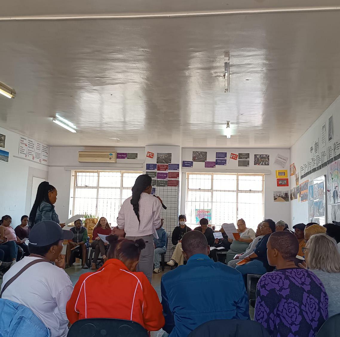
Non-participatory observations were conducted during two different meetings. In the beginning phase of the project, we observed a leader and monitor meeting in CGH. In a later phase of the project, we observed a community meeting with the Ward Councilor’s that was held in Salt River. We attended these meetings to observe the decision-making processes and power dynamics between the various stakeholders.
2.5. Transect Walk
A transect walk is a tool to gain an understanding of the research area and are often conducted in the initial phase of the fieldwork (LND, n.d). Our first meeting with CGH were through a site visit. A transect walk is a systematic walk through the project area together with local people (LND, n.d). As aspiring urban planners, this helped us to gain crucial insights into some of the issues that the community is experiencing.
Later on, we went on a tour around Woodstock together with some of the leaders in CGH. They told us personal stories while we went to areas where their earlier homes and playgrounds were located. During the transect walk, we were informed and shown that many of these homes have either been destroyed or are now being used as privately owned Airbnb rentals.
2.6. Action Research
Together with the other student group who were also undertaking research at CGH, we organised a co-creation workshop to gather information about how residents view and experience CGH. We had five stations with different activities in every station to get an overview of their experience of everyday life and struggles. In this action research, we were also collaborating with four students from the School of Planning and Architecture in New Delhi, India. They provided us with opinions, thoughts and suggestions from their point of view and that was very helpful and inspirating. They supported us during the workshop and played a key role in one of the stations, “model mapping”, which will be described in detail along with the other stations.
Our intention was to have two rounds of the same workshop. The first one with mostly children and teenagers, and the second with adults and the elderly. In the first round, we got a lot of insights from the youth of CGH, and the second-round workshop was not executed as no participants showed up.
Figure 2.3: Impression of the transect walk through Woodstock.
Mind-mapping
In the mind-mapping station, we made two different mind maps on big papers, each with one guiding question in the middle. In the first one we had: CGH is ... and in the second one we had: CGH could be ... as guiding questions and the purpose of the exercise was to collect information on what CGH is for the residents and what the residents thought CGH could be. Based on the responses from the residents, we were able to gain an insight into how they view CGH and how they envision CGH to be like in the future.
Route-mapping
Our focus in the route-mapping station was to get residents to plot different places on a map of Woodstock and a map of CGH. In these maps, we wanted the residents to place the places they use for different things, such as where they go to school, where they shop, where they spend their free time, and where they work. This exercise gave us insight into which places were used most and what they were used for.
Drawing
In the drawing station, the purpose was to make the participants draw their dream vision of CGH. We brought paper, pens and markers to give the residents an opportunity to visually show how they wished for CGH to look like or things they wanted CGH to contain. Sometimes it may be hard to put things into words, so we wanted one station where they could use their creativity and draw instead of talking or writing. This station gave a glimpse of what they wanted, such as swimming pools, play areas, bigger rooms or castles/ giant houses.
Figure 2.4: Impressions from the Action Research Workshop.
Model-mapping
The last station was a model-mapping exercise. Some earlier researchers in CGH had already made a model of the building. In this building was it possible to see the different sections and floors. We used post-it notes to make “hats” and with these the residents could place the “hats” in different places. The red hats were for places the residents disliked and the green was for places they liked. In this exercise we got an overview over which places the residents liked or disliked.
Line game
A line game is a physical activity and the purpose in this station was to physically engage residents in CGH while they ranked the social quality of their lived experience in the sections and hallways. We made lines on the ground and divided the lines into five different categories where one was agreeing a lot, the one in the middle was neutral, and the fifth was don’t agree at all. When we asked a question, the residents moved to the category fitting them the most. We asked question such as “I feel at home in CGH”, “I have a good relationship with my neighbours?” and “I have space for my free time activities”.
Anonymous thought box
Participation was emphasised throughout the project, with the purpose of involving residents at every stage of the data collection and design process. Since some of our topics in the workshops might be difficult to answer, we brought an anonymous suggestion box to all our workshops. In the box, we encouraged the residents to write down some thoughts they may find difficult to talk about or if they just wanted to stay anonymous.
2.7. Discussion Group with NU
A discussion group with NU was organised to have a dialogue on shared challenges and aspirations regarding the future of Cissi Gool House. In the discussion group, NU had three representatives, all the members of our group participated together with the other group who also did research in CGH. The semi-structured group discussion was guided by themes such as housing insecurity, community governance, and the future of CGH.
2.8. Surveys
We had an explorative survey on general topics as our first activity in CGH. The purpose of the survey was to make the residents familiar with us and gain their trust, and to collect data based on residents’ experiences including perceptions of safety, levels of involvement in the occupation movement, and duration on the housing waiting list. We used a combined qualitative and quantitative approach and got 119 responses from the residents.
In the second survey, the purpose was to get residents thoughts about CGH as social housing, which income group should live in a formalised CGH and if the residents were willing to share communal spaces. In the second survey we received 48 answers, and with serval of the participants we had deeper conversations while they filled out the survey.
Figure 2.5 Explorative survey posters and workshop invitation at CGH.
2.9. Stakeholder Mapping
Freeman (1984), as cited in Bryson (2004), defines stakeholders as any group or individual who can affect or be affected by the achievement of an organisation’s objectives. Stakeholder mapping is a valuable method for identifying and analysing the influence, interests, and relationships of different stakeholders within a system. In this process, the group created and analysed various stakeholder maps to better understand the interests, power, and interrelationships of the identified stakeholders. In the context of CGH, mapping stakeholders is particularly important to clarify their roles, interests, and potential impact on decisionmaking processes. Stakeholder mapping serves as a critical tool to uncover power dynamics, ensure inclusivity, and provide a transparent framework for engagement. By understanding who the key stakeholders are and how they interact, it becomes easier to navigate complex relationships, address conflicting interests, and work toward equitable and informed decisions.
2.10. Semi-structured Interviews
We used semi-structured interviews as a method to collect data on strategic chosen topics regarding CGH. After observing the site and obtained information through our workshop, we noticed several key topics we wanted to take further and gain a deeper understanding of. In total, we conducted five interviews with the purpose to gain deeper insights from various stakeholders. We conducted two semi-structured interviews with two different leaders in CGH to gain an understanding of the leadership structure and the garden, as it is one of their only programmed spaces. We also conducted semi-structured interviews with the Ward Councillor and the PR Councillor of Woodstock to gain insight into governmental processes and the relationship between the Cissie Gool House and the CoCT. Lastly, we had one interview with a representative of the Woodstock Residents’ Association (WRA) to understand the dynamics between the neighbourhood and the residents in CGH.
The advantage of using a semi-structured approach is that you only have a few questions written down, giving the interviewer room to control the conversation. Questions included in our interviews were among others: “In a formal CGH, what income groups should be accommodated?”, “In your opinion, which group would benefit most from having their own communal space?” and “Are you thinking about alternatives to current models of social or affordable housing?”.
We also had a conversation with a Mayoral Commitee member for Human Settlements. This conversation was not structured or formally planned, but we got an insight into how the higher level of city government viewed the occupation in CGH.
Figure 2.6: Semi-structured interview with the WRA.
2.11.2. Limitations
2.11.1. Informed Consent
In the role of researchers, is it important to collect informed consent from the participants. Informed consent is one of the funding principles of research ethics (University of Oxford, 2021) and can be given from the participants when they have understood the purpose of the research and are aware of their choice to withdraw the consent at any time. Engaging with local residents involves requesting their time, knowledge, and personal histories. It is crucial that participants understand the purpose of their involvement, how their information will be used, and for what goals. Transparency is essential to protect their dignity, privacy, and safety of them (Scheyvens, Nowak & Scheyvens, 2003). We ensure this by obtaining consent form that clearly explains the fieldwork and its purpose through a written or oral form when collecting video recordings or personal information. If any participant chooses to withdraw, their data will be removed from our records.
Conducting a diverse range of methods during our fieldtrip provided valuable insights though some methods were less successful teaching us to adapt to practical realities rather than relying solely on theorical methods. For example, the co-creation workshop, presented in the part 3. Methods D. Action Research was effective in understanding the children’s perspectives of CGH but had some limitations. Some children were too young to fully grasp certain stations, and our plan for two separate sessions, one for children and youths and another for adults and the elderly, failed, as no adults attended. Many residents had already participated in earlier studies since 2017, leading to disengagement due to a lack of visible results or improvements in their lives.
Another limitation was the ethical consideration regarding informed consent. Even though we tried our best to collect informed consent, a lot of the residents in CGH wasn’t concerned about the consent. Many of the residents didn’t want to write and not everyone was able to read in English. A language barrier together with a limited knowledge of the local culture also raises concerns about if the residents have understood the purpose of the research.
Having representatives from NU, CGH leaders and monitors present was helpful for encouraging survey participation, but at times, leaders responded on behalf of residents or influenced their answers. This was particularly evident in the survey on safety and community contributions, where many participants claimed to feel very safe in CGH. However, after reviewing the “Anonymous Thoughts Box,” we found concerns about drug-related issues and bullying and other issues supporting the unsafe feeling in CGH.
Similarly, while most survey participants indicated high involvement in CGH activities, discussions among leaders revealed concerns about low resident participation. These discrepancies suggest that surveys may not always reflect the true dynamics of the community, especially when external
factors influence responses. Lastly, it is important to mention a limitation of the trust building. We didn’t communicate with a lot of the residents, and the data collection were formed because of help from NU. If we haven’t had NU working as gatekeepers, we would have struggled even more to gain trust from the residents in CGH. The six-week fieldtrip felt too short to conduct all the planned co-design workshops. This time constraint often led to frustration when workshops failed to gather meaningful data, leaving us with a sense of wasted effort.
2.11.3. Reflection on Methods
As students, experimenting with various participation methods during our fieldwork has been a valuable learning experience. This approach allowed us to learn by doing, followed by reflective discussions after each workshop to identify areas for improvement and refine our methods for gathering precise information. Combining our initial workshops with the other group doing their research in CGH was particularly useful for introducing ourselves to residents and combining our resources to organise the workshop effectively. However, we quickly noticed the limitations by conducting the same workshop together, as they often led to similar conclusions and focus. To address this, we decided to split up and conduct workshop on our project focus to allow us to be more efficient in data research linked to our topic. While this approach improved the efficiency of data collection related to our individual topics, it also introduced challenges in executing the workshops effectively due to lack of participation. Due to lack of participation and engagement, our main data collection method became semi-structured interviews.
Figure 2.7: Informed consent poster.
Figure 2.8: Gated entrance to the former car park of Woodstock Hospital.
3. Theory & Positionality
Coming from the Global North and going to the Global South as researchers and planners is only possible because of our privileges and linked to current global power dynamics. For this reason, we carefully considered ethical dimensions before going to Cape Town and reflected on them continuously.
In addition, our fieldwork is based on various theories and concepts that we discovered through our literature review, supported by the courses Methods for Participatory Planning, Co-Design & Localising SDGs and Theories of Urban Ecological Planning. In this chapter, the main theoretical foundations are described through which we also illustrate our positionality for the research process.
3.1. Ethical considerations
Ethical fieldwork, especially in the Global South, requires respectful, mutually beneficial relationships with communities (Scheyvens et al., 2003). It involves continuous reflection and adaptation to address challenges such as power imbalances, inclusivity, and accountability. According to Scheyvens et al. (2003) ethics in fieldwork include various factors: Fieldwork often highlights disparities in resources and perceived authority between planners and participants. Researchers must be aware of these imbalances and avoid reinforcing them by promoting mutual respect.
Access to communities is often facilitated by local leaders, who may consciously or subconsciously exclude marginalised groups. Planners should actively seek out diverse voices, ensuring that hierarchies within communities do not silence vulnerable groups.
Ethical fieldwork also means contributing to long-term community benefits, such as capacity building. Clear communication about project objectives and limitations is vital to manage expectations and build trust.Participants must understand their rights and the purpose of the research. Challenges such as language barriers and literacy require adapting methods in accessible formats for obtaining informed consent and include oral explanations. In conclusion, ethical fieldwork requires navigating power dynamics, fostering inclusivity, and ensuring reciprocity and informed consent. By doing so, planners can build equitable partnerships and align with participatory principles grounded in respect and justice.
3.2. The Right to the City & The Just City framework
The Right to the City is a concept that was first introduced by Henri Lefebvre in 1968. It advocates for the citizens’ democratic right to urban spaces, stating that all who live in the city, especially marginalised communities, should have the right to shape the city. This challenges privatisation of public spaces and the exclusion of certain groups. (Lefebvre, 1968; Mitchell 2003)
The Just City Framework was developed by Susan Fainstein (2009). Its core values are equity, diversity and democracy. It states that urban planners and policymakers play an important role in achieving spatial justice: By considering how planning decisions affect marginalised and vulnerable groups, planners have the power to shape spaces in ways that either maintain or reduce social inequalities. While the Right to the City focuses on the collective right of people to shape their cities, the Just City Framework offers practical approaches to make cities more just and inclusive. Together, the concepts provide a vision for cities that work for everyone, especially for those who are often left out.
Positionality
As researchers and future planners, we acknowledge that every experience during our fieldwork is seen and understood through a specific lens. We are aware that our positionality is based on the notion that public participation is an inherently good quality in planning, which is again based on politic views that acknowledge democracy as an ideal form of governance. Much of our theoretical standpoint is inspired and based on writings such as “The Right to the City” by Henri Lefebvre and socialist ideas. This means arguing for urban space to be shaped and governed by the citizens who inhabit it, instead of them simply being left to market forces such as commodification, gentrification and capitalism. Lefebvre was for reshaping the power structures who control the city and recreating the city in the image of community, inclusivity and democracy.
We believe that the right to the city is a collective right who can only be realised through active public participation. When citizens are engaged in urban processes, they contribute to a more democratic and just city with opportunities for different groups of society, and a chance to shape their future. Public participation methods and tools are pathways to re-democratise the city from current power holders, and therefore a necessary practice and a concrete fulfilment of a more idealistic and just society.
3.3. Participation
Sherry Arnstein describes participation as a “cornerstone for democracy” (1969, p. 216). According to her, participation is the sharing of decision-making power of the powerful with the excluded. Participation without power-sharing is meaningless. To illustrate the different steps of participation, Arnstein introduces a Ladder of Citizen Participation (Figure 3.1) to describe the degree of power sharing in a participatory process. The ladder includes 8 steps, ranging from Nonparticipation on the bottom, where citizens are not included but the powerful try to impose their opinion, to Tokenism on the middle steps, where citizens are informed and may consult but the decision power remains with the powerful, to Citizen Power at the top, where the power is shared in various degrees.
Nabeel Hamdi deepens this definition of participation, describing it as “responsibility with authority in partnership with other stakeholders” (UN-Habitat Worldwide, 2014). He states that with having certain rights come responsibilities which are essential for efficient work. Authority is needed to set a strategic agenda for power-sharing. According to Hamdi, participation without partnership is meaningless, it requires the involvement of other stakeholders who share an interest in benefits and risks of a project.
3.4. Urban Informality
Informality is defined as the absence of formality, implying that formal structures and regulations must exist first for informality to take place outside their boundaries. Informality can be understood as a continuum, ranging from fully legal activities to those operating in grey zones, and to illegal practices (Carrizosa, 2021).
Urban informality can include many sectors of urban life, such as housing, employment, commerce, services and infrastructure, and transportation (Sliwa, 2024). When it comes to housing, urban informality often refers to slums. According to UN-Habitat (2022), slums are settlements that lack at least one of the following:
Access to clean water
Access to infrastructure such as sanitation and electricity
Sufficient living area (no overcrowding)
Durable building structure
Secure tenure
Figure 3.1: Arnstein’s Ladder of Participation (1969).
Different approaches are followed when planning for the urban poor in informal settlements, including demolition and resettlement, slum upgrading, as well as mid-way solutions such as support of self-building and market-driven formalisation. However, according to Turner (1972) the varied needs of the urban poor must be considered further. Successful solutions require a deeper understanding of their realities to create inclusive and sustainable plans. It is important to work with the people rather than for them.
As figure 3.2. illustrates, people’s housing priorities may shift depending on their income. While middle- and upper-class earners might prioritise a modern, high-standard housing, lowerand middle-class people are more likely to aspire to freehold ownership. In contrast, lower-income groups tend to prioritise housing in proximity to unskilled jobs.
3.5. Invented & Invited Spaces of Participation
Ntwana and Naidoo (2024) emphasise that public participation is essential for democracy and the provision of essential services, yet they show how the residents of informal settlements in South Africa are often excluded from these processes. They describe that there are two types of participation spaces: invited spaces, that are created by government structures to involve citizens, and invented spaces, that are self-organised by marginalised and often informal communities. Despite legal frameworks supporting inclusive public participation in South Africa, residents of informal settlements are often excluded from invited spaces of participation and therefor form their own spaces. Invented spaces allow these communities to advocate for their needs but are often further excluded by governmental structures for their lack of formality.
Figure 3.3: NU workshop: selforganisation of CGH residents.
Figure 3.2: Priorities of the poor vs. priorities of the rich (Turner, 1972).
3.6. Gender Planning & Intersectionality
Cities often reflect traditional gender roles and reinforce a gendered division of labour, creating environments that tend to work better for heterosexual, able-bodied, cisgender men than for women, girls, sexual and gender minorities, and people with disabilities (Terraza et al., 2020).
This inequality highlights the need for gender-sensitive planning to support the vision of a Just City that addresses systemic inequalities and promotes inclusivity.
Key areas of gender-inclusive urban planning are accessibility of public space, affordable mobility, freedom from violence in both public and private spaces, health, climate resilience and security of tenure (Terraza et al., 2020).
The concept of intersectionality was introduced by Black and postcolonial feminist scholars. It provides a framework for analysing how different systems of oppression, such as those based on gender, class and race, overlap and shape individual experiences (Sultana, 2020).
Intersectionality also has a spatial dimension, influencing how justice is distributed within cities. By recognising and addressing these interlinked systems of inequality, urban planners can move towards transformative justice, fostering inclusive urban environments that align with the principles of the Just City.
3.7 Applying the theoretical framwork in our research
The theories and concepts described in this chapter have accompanied and influenced us in the research we conducted in Cape Town. The insights we have gained and the interventions we suggest are influenced by our theoretical foundations.
Figure 3.5: #I am an CGH Occupier – Stop Eviction, banner at CGH.
4. Context
4.1. Stakeholders
During our fieldwork we came across various stakeholders. For a better understanding of their relationships, interests and power relations, we created a stakeholder diagram. In this chapter, the different stakeholders and their relations will be described in depth. This illustration presents the stakeholder map our group developed during our fieldwork. While there are many stakeholders involved in Cissie Gool House, Woodstock and the CoCT, we focused primarily on those directly connected to our problem statement. The map was created after several weeks of investigation to better understand the roles, power dynamics, and influence among the various stakeholders.
4.1.1. Cissie Gool House
The residents of CGH have organised themselves as an informal occupation. Next to the elected house leaders, every section of the building has a chapter leader. The leaders are supported in their work by monitors, who take care that people follow the house rules and organise cleaning and maintenance. The leaders and monitors come together in weekly meetings to discuss important issues. They are communicating with the other residents via a messenger service but are not always able to reach everyone who is living in the house.
4.1.2. Political Engagement Organisations
Ndifuna Ukwazi, established in 2011, is an activist organisation and legal centre that works on securing access to well-located land and affordable housing for poor and working-class families, communities, and social movements. Reclaim the City (RTC) started 2016 as one of their campaigns to oppose spatial segregation and apartheid planning in Cape Town. It was the RTC activists who first occupied CGH. Until today, both RTC and NU support the occupation and are in close contact with the CGH residents. (Ndifuna Ukwazi, 2021; Reclaim the City, 2023)
4.1.3. Neighbourhood
CGH residents have had a long relationship with the Woodstock neighbourhood, as many have lived in the area their entire lives. This enduring relationship has built a sense of belonging and community within Woodstock. The neighbourhood itself is represented and organised by the Woodstock Residents’ Association (WRA), which serves as a platform for addressing local issues and promoting collective interests (Interview, WRA) CGH residents were once active participants in the association, even serving as board members, underlining their commitment to and integration into the wider neighbourhood. However, the situation is not without challenges. Some of the immediate neighbours of CGH have raised concerns about issues such as noise and other disturbances emanating from the building. (Interview, WRA)
Figure 4.1 An empty yard in the evening at CGH.
4.1.4. Government
The governmental and political stakeholders involved in Woodstock range from the National Government of South Africa and the Province of Western Cape to the CoCT, including its Council, Subcouncils, and Wards.
At the national and provincial levels, these bodies provide the legal framework e.g. for housing provision. They are also responsible for allocating the financial resources necessary for the CoCT to implement these laws. On the provincial level, the Heritage Western Cape (HWC) Authority plays a crucial role, particularly in deciding whether projects can proceed within designated heritage zones. (HWC, 2024)
At the city level, housing provision, including the planned development of the Woodstock Hospital, falls under the jurisdiction of the Human Settlements Portfolio Committee. Cape Town itself is divided into 116 wards, each representing a specific neighbourhood area. Woodstock is part of Ward 115, which it shares with the Central Business District (CBD). Each ward is represented by an elected Ward Councillor, who serves on both the City Council and the Subcouncil. Ward Councillors are tasked with representing the interests of their ward’s residents while also balancing the priorities of the city and their political party.
As the Ward Councillor for Ward 115 described it as “the job with three mothers, because you are elected by the community or the residents to represent their interests. You also have the interest of the city to look after and you also have interests of the political party that you’ve got” (Interview Ward Councillor, 00:04:29).
Each Ward Councillor is given an annual budget of 1 million Rand to allocate to projects within their ward. Suggestions from the public are welcomed, and final decisions on budget allocation are made by the subcouncil (Interview Ward Councillor, 00:38:16).
In addition to directly elected Ward Councillors, the City Council includes 115 proportional representation (PR) seats, distributed among political parties based on their percentage of the vote. PR Councillors are assigned to wards and subcouncils by their respective political parties. One of Woodstock’s PR Councillors represents the opposition party GOOD and has an activist background, actively supporting the fight for affordable housing (CoCT, 2024h).
Figure 4.2 Stakeholder Power-Interest and Relations Diagram.
4.1.5.
Private Investors
National and provincial government funding is insufficient to meet Cape Town’s housing needs, making private investment a key player in development. While private developers contribute necessary resources, their profit-driven motives often conflict with the need for affordable housing, potentially leading to gentrification and displacement of low-income residents (Jackson, 2024).
Informal occupants
4.3:
In urban studies, “informal occupation” describes the act of individuals or groups claiming and occupying land or buildings without the legal permission of the owner. Occupations play an important role in urban development and placemaking, particularly in cities with colonial histories. They are increasingly recognised as key drivers of new spatial formations and urban imaginaries. The occupation of Cissie Gool House is unusual in that it takes place in Cape Town, a city with one of the most unaffordable property markets, but nevertheless such “hijacked” buildings are not common. (Cirolia, et al. 2021)
Figure
Different stakeholders voicing their opinions.
4.2.1. History
Cape Town is the second largest city in South Africa. Located on the west coast, it has a long history with human dwelling there for over 1000 years (Davies, 1981). However, much of its recent history continues to be influenced by historical oppression due to colonialism and state mandated apartheid.
The Dutch East India Company established a trade station in today’s Cape Town in 1652. This quickly developed into an extensive occupation and the native population was expelled into the outskirts of the city. In the centuries to come, South Africa became a desirable context of occupation between mainly the Dutch and English, but also the French and German colonial powers. However, this occupation was not met passively, and the European population had prolonged wars with, for example the Zulu kingdom in the southeastern parts of South Africa. (Gordon and Lowe, 2024)
The South African Union was established in 1910 after the Boer Wars between the English and Boer Republic (descendants of the Dutch, as well as the German and French). In 1948, the Afrikaans National Party won the election with their programme for an amplified divisive segregation policy. ANC, the African National Congress political party, was exiled for resisting the current regime, but continued to organise the South African resistance, which eventually led to the collapse of Apartheid, and the implementation of South Africa’s first democratically elected president, Nelson Mandela, in 1994. (Gordon and Lowe, 2024)
Even before the constitutionalising of Apartheid, the population of South Africa was segregated through several policies, including the Group Areas Act, which was formulated for the first time in 1950 (Davies, 1981).
Along with the Population Registration Act, which categorised people based on skin colour into White, Coloured, White, and later Asian/Indian, it also designated different racial and ethnic groups to specific areas. It restricted ownership rights in these areas to the racial group designated to reside there, although this in reality seemed to only apply to Black South Africans as the Whites could continue to own land and do business in Black areas.
The Group Areas Act did also not take shelter and relocation costs into account when the maps were redrawn. The police began the process of mass evictions and displacement during the mid 1950s to relocate people into their new racially designated zones (Gordon and Lowe, 2024). This resulted in a large percentage of people being torn away from the community and environment they had grown up with little notice, and often quite brutally. As many South Africans lost their assets and dwelling in the relocation process, they had to make do with makeshift housing, which contributed to a larger misdistribution of resources and marginalisation of Black South Africans. (Gordon and Lowe, 2024)
Figure 4.4: “Apartheid Still Lives”: Drawing based on an activist banner and demonstration.
Although the Group Areas Act was repealed in 1991 as part of the end to Apartheid, its testament lingers in current spatial configurations. Nelson Mandela’s new government and his successors inherited a complex urban landscape and collective trauma, and while there have been significant attempts at turning the narrative, people still largely live in their former segregated group areas. (Tjønneland, 2024)
In 1996, the South African Constitution implemented the right to have access to adequate housing (Section 26). Since then, several policies have added on to the development of national housing programmes provided by the government. Between 1994 and 2019, 3,3 million various of houses/units have been built. However, the problem lies in where these housing opportunities are located, and their connections to the city, and job market and livelihood opportunities. (Gordon and Lowe, 2024)
Most of these units were built in the peripheries of large cities such as Cape Town, far away from all opportunities to better one’s living situation and less opportunity for social mobility. Without either jobs or infrastructure support, many choose to rather live in informal settlements closer to the city, where most jobs are. Many Black South Africans feel a deep sense of injustice, and these latter years there has been an uproar for affordable housing in the inner city and the general right to the city.
Figure 4.5: Topography map: The city’s development has been heavily influenced by its topography. Around the city centre, Table Mountain and its surrounding ranges restrict the areas available for residential expansion.
4.2.2. Continuous segregation
The effects of apartheid segregation are still clearly visible in Cape Town today. Figure 4.6 shows that racial segregation across the city remains persistent. Predominantly white neighbourhoods are located closer to the city centre, while Coloured communities are further out, and Black communities are concentrated in the outskirts. This segregation is closely linked to other inequalities. Average monthly income is significantly higher in predominantly white neighbourhoods compared to the Black communities (Figure 4.7.) At the same time, informal dwellings are much more common in Black areas and far less so in white areas (Figure 4.8).
The city’s population density is unusual compared to most cities. It is not highest in the city centre but in the Cape Flats, areas that were assigned to Black people during apartheid (Figure 4.9)
The maps are based on data from the 2011 Census, the last detailed census available. Since then, Cape Town’s population has grown by a degree of 27.6% as of the 2022 Census. While the newer census does not include neighbourhood- specific data, it confirms that inequality and segregation still persist. Black people are more likely to live in informal settlements and lack basic services like electricity, water, and internet. (CoCT, 2023a)
Figure 4.6: Demographic map of Cape Town:
Predominant race per ward, data based on Census
Figure 4.8: Demographic map of Cape Town:
Percentage of informal dwellings per ward, data based on Census 2011.
Figure 4.7: Demographic map of Cape Town: Average monthly household income per ward, data based on
Figure 4.9: Demographic map of Cape Town:
Population density per ward: Population per km2, data based on Census 2011.
In this chapter, we aim to explore several policies that impact integrated urban planning, particularly those relevant to our problem statement. We focus on policies related to statesubsidised housing, participation, public space, and mobility. These areas are critical to understanding how urban planning can address social and spatial inequalities. Finally, this section highlights the intersections and interconnections between these policies, illustrating how they complement and influence one another in the broader context of urban development.
4.2.3.1. State-Subsidised Housing
After the end of apartheid, the right to adequate housing was established as a constitutional right, placing the responsibility on the state to provide housing through legislative measures. The Housing White Paper of 1994 marked the start of this transformation under the Reconstruction and Development Programme (RDP). Within the RDP, the government constructed small houses to accommodate people, often on the outskirts of cities, where access to economic opportunities and services remains limited. (Ngwenya, 2024). In 2004, the Breaking New Ground (BNG) policy updated the RDP by introducing measures for upgrading informal settlements and offering rental housing options. This marked the beginning of further diversification in housing policies to better address the needs of South Africa’s urban population. (Ngwenya, 2024). In the following, some of the most common kinds of subsidised housing will be explained. To qualify for most of the options, applicants must meet several criteria (CoCT, 2024e; Ndifuna Ukwazi, 2024):
Be 18 years or older and have the legal capacity to sign a contract, be a South African citizen or hold a permanent residence permit, have never previously owned property or received a housing subsidy, be married, cohabiting with a partner, or single with financial dependents who can prove their dependency, earn a household income within the designated range for the specific subsidy.
The Human Settlement Strategy 2021
Cape Town’s Human Settlements Strategy from 2021 seeks to address the city’s housing crisis, which is rooted in historical segregation and inequality. With more than 270,000 households living in informal settlements, the city faces a significant shortage of affordable housing (CoCT, 2021). The strategy focuses on increasing the supply of affordable housing, tackling informality, and supporting community-driven development. It aims to create integrated, sustainable communities with improved access to economic opportunities. By engaging both the public and private sectors, the strategy promotes diverse housing options, improves infrastructure, and incorporates environmental resilience. Ultimately, it aims to transform Cape Town’s housing landscape, ensuring affordability, inclusivity and sustainability (CoCT, 2021).
Owning
BNG or former RDP houses are designed for individuals earning between R0 and R3,500 per month. These houses are provided for ownership, ensuring strong tenure security. However, owners are responsible for maintenance costs, as well as utilities such as electricity, water, and sanitation. Despite their affordability, these houses are often located far from city centres, limiting access to jobs and essential services. (CoCT, 2024e; Ndifuna Ukwazi, 2024)
Transitional
Transitional housing provides temporary accommodation for individuals or families displaced by evictions. These facilities are typically well-located to allow access to jobs and services. Currently, Cape Town has only one transitional housing development, but the city has plans to expand this programme in the future. (CoCT, 2024e; Ndifuna Ukwazi, 2024)
Renting
Social housing caters to households earning between R 1,850 and R 15,000 per month. Subsidised apartments, managed by Social Housing Institutions, offer secure tenure while remaining affordable. Unlike BNG houses, these units are often located closer to urban centres, improving access to livelihoods and public amenities. However, tenure security is tied to the tenant’s ability to consistently pay rent. (CoCT, 2024e; Ndifuna Ukwazi, 2024)
Upgrading Informal Settlements
Under the Upgrading of Informal Settlements Programme (UISP), municipalities can receive funding from provincial governments to develop infrastructure and provide basic services in informal settlements. This approach focuses on improving living conditions while recognising the residents’ tenure rights. (CoCT, 2024e; Ndifuna Ukwazi, 2024)
4.2.3.2. Mobility
The CoCT’s Urban Mobility Department focuses on improving accessibility and opportunities for all road users through sustainable, affordable, and reliable integrated transport systems (CoCT, 2024i). Responsibilities include managing public transport services like MyCiTi and Diala-Ride, maintaining road and stormwater infrastructure, implementing new transport projects, and planning networks such as the Integrated Public Transport Network (IPTN). The department also oversees traffic management, non-motorised transport, park-and-ride facilities, and shared services, ensuring efficient mobility, enhanced safety, and connectivity to support economic growth and urban development (CoCT, 2024i).
Comprehensive Integrated Transport Plan 2023-2028
The Comprehensive Integrated Transport plan (CITP) identifies that the city needs to work towards making it safer and cheaper for all people to travel, increasing their freedom to enjoy all that our city has to offer (CoCT, 2023b). The plan acknowledges that achieving this goal requires addressing a dysfunctional, nationally managed passenger rail system. Cape Town envisions a future where it plays a more significant role in running an efficient rail system. The city’s 2050 vision states: “All people have efficient access to a range of opportunities in a manner that is sustainable and provides dignity” (CoCT, 2023b).
Figure 4.10: Atmospheric section through Victoria Road 156.
Figure 4.11: Atmospheric section through Victoria Road 182 and Fairview Road Park.
4.2.3.3. Public Space
Cape Town, like many South African cities, has a shortage of quality public spaces, many of which are considered unsafe due to crime and violence (SACN, 2020). The legacy of apartheid and the earlier history of segregation still has an impact on Cape Town’s public space, restricting access for non-white citizens and neglecting quality public spaces, particularly in townships and informal settlements (SACN, 2020). Many public spaces remain unsafe and underutilised, contributing to perceptions of insecurity. However, new initiatives such as the Braamfontein Regeneration Project and Open Streets Cape Town aim to reclaim and revitalise these spaces (SACN, 2020). By improving safety and engaging communities, such efforts promote interaction, social cohesion, and safer, more inclusive environments. The SA Cities Urban Safety Reference Group (2020) highlights the need to reimagine public spaces in South Africa to address inequality and enhance their transformative potential. It emphasises deep and ongoing engagement between local government, stakeholders and communities to ensure inclusivity, safety and resilience.
Urban design focuses on placemaking, transforming spaces to give them purpose and meaning. It applies to urban, rural, and natural landscapes, addressing both large-scale city structure and the finer details of individual buildings. This creative process enhances the public environment, balancing public and private spaces, while adding economic, social, and environmental value. Urban design tackles issues like mobility, sustainability, density, and equitable access to services. It is a collaborative and dynamic process, involving multiple stakeholders to create context-sensitive solutions (CoCT, 2024b).
Urban Space Strategy 2024
This strategy provides guidance, and its aim is to foster better collaboration and planning across sectors to create more cohesive urban spaces (CoCT, 2024b). The quality of cities, towns, neighbourhoods, streets, and public spaces significantly impacts daily life, contributing to the economy, sustainability, and overall livability. Good design enhances the environment, promotes business growth, and supports physical and mental well-being. The policy provides guidance for city-making initiatives and introduces mandatory policy triggers for consistent outcomes while facilitating business processes and prioritising strategic public spaces (CoCT, 2024b).
Figure 4.12: Public Space in Woodstock: the newly installed netball field next to CGH.
The CoCT does not currently have a formal Public Participation Policy. Recently, the GOOD party released a press statement urging the City to develop such a policy (Little, 2024). The statement highlights concern that citizen voices are not adequately represented, which undermines their fundamental rights. The GOOD party emphasises the need for a clear, participatory process with structured guidelines to ensure that all citizens, regardless of their community or background, can actively participate in decision-making and have their voices heard (Little, 2024).
Although the CoCT does not have a formal public participation policy, it has implemented various processes to involve the public and include citizens in decision-making. This section examines how the CoCT facilitates public participation. One example of a public participation and approval process we want to mention is shown in the CITP from 2023-2028 (explained in chapter 4.2.3.2).
The Public Participation and Approval Process for the CITP involves a structured, two-stage approach to ensure stakeholder and public input. They invite key stakeholders to shape the initial direction of the draft plan in an early stage. The public participation phase includes not only the key stakeholders, but everyone interested in participating, and they have the opportunity to participate online through the website “Have Your Say” and other press releases, videos and social media (CoCT, 2023b).
After analysing the information presented in this sub-chapter on public participation, we believe that public participation in the CoCT can be placed at the “tokenism” level, as illustrated by Arnstein’s Ladder of Participation (1969). This is because the participation methods appear to focus more on informing residents rather than actively involving them in the decisionmaking process.
Public Participation Department:
The CoCT has a Public Participation Department that focuses on promoting community engagement and public participation across Cape Town (CoCT, 2024g). It facilitates communication between residents, local authorities, and stakeholders, creating platforms for meaningful interaction. The department coordinates public participation efforts, advises on best practices, and ensures feedback from communities is integrated into projects. It also builds partnerships, raises awareness on service delivery issues, and educates communities on their role in governance. Ultimately, the department aims to strengthen civic participation, improve service delivery, and ensure that community needs and priorities are addressed. They communicate with the communities through Ward committee meetings, sessions with
Platforms:
One of the platforms the CoCT are using to get feedback, and comments are “Have your Say”. This platform publishes items for public comment, and residents have the opportunity to give feedback on initiatives and project that affects them (CoCT, 2024c).
Figure 4.14: Participation in Cape Town on Arnstein’s Ladder of Participation (1969)
Figure 4.13: Public participation and approval process as described in the CITP (CoCT, 2023b).
Interconnections and Gaps in Urban Policies: A Practical Perspective
This chapter have introduced the topics state-subsisted housing, mobility, public space and participation and looked further into a various of policies within the chosen topics and highlighting the interconnections and cross-references between them. It is observed that these policies often mention common influencing factors, such as participation, maintenance, and finance.
In addition, the CoCT is also offering a well organised five-year Integrated Development Plan 2022-2027 (IDP) who communicates the city’s long-term visions to residents and other stakeholders and shows how the city is going to achieve it (CoCT, 2022).
The IDP is made up of two parts including a strategic plan and an implementation plan and work as an overall plan informed by community needs (CoCT, 2022).
The various of policies and strategies offer plans, suggestions and concrete solutions for practical importance such as maintenance, participation and budgeting. In Chapter 6.3 we will explore further how these policies are implemented in practice and share our experiences with their real-world application. 4.2.3.5.
4.3.1. History & Gentrification
Woodstock is one of the oldest neighbourhoods in Cape Town, with a rich cultural history. Its beginning is rooted in a farming and fishing village. Woodstock was shaped by industrialisation in the 19th century due to the railway development and became a mix of residential and industrial areas. (Rolls, 2016)
As a working-class neighbourhood, Woodstock had mixed racial and religious communities. It was declared a “White Area” by the Group Areas Act in 1966, however, the Group Areas Act was never enforced in Woodstock and until today it remains a mixed neighbourhood.
After the end of apartheid, private developers invested in the urban regeneration of Woodstock by attracting creative industries. Woodstock became known as ‘Cape Town’s art district’ (Malcomess, 2008), which contributed to the gentrification of the neighbourhood. The process was further aggravated by the CoCT’s decision to designate Woodstock as an Urban Development Zone (UDZ) in 2003. This is a tax incentive strategy aiming to encourage private sector property construction and building renovation. (Lemanski, 2007; Andersen 2021)
Property and rental prices rose to the point where local people could no longer afford to live in their own neighbourhood. In the long term, gentrification had disastrous consequences for many Woodstock residents, who faced eviction. Many were offered relocation to an undesirable area in the peripheral Temporary Relocation Area, 30 km from the city centre. (Wenz, 2012)
Gentrification
Gentrification is a multifaceted urban phenomenon that can be understood in different ways. Bourne (1993) provides two key definitions: the first describes gentrification as the invasion of a neighbourhood by higher-income individuals, leading to the displacement of lower-income, often marginalised residents, resulting in significant social and economic change. The second definition refers to a socio-spatial transformation of the neighbourhood that does not involve the displacement of local residents (Kotze and Van der Merwe, 2000).
The case of Woodstock is consistent with Bourne’s first definition, where the neighbourhood experiences changes driven by the arrival of wealthier residents who displace the existing low-income community.
4.16: Urban Development Zones in Woodstock, data based on Open Data Portal (CoCT, 2024f).
Figure
Figure 4.15: Drawing: Gentrification, eviction and homelessness in relation to CGH.
4.3.2. Morphology & Demography
Along Victoria Road, Woodstock can be divided into Upper and Lower Woodstock. In the 2011 Census, demographic differences are visible between the two neighbourhoods. The density in Lower Woodstock which lies on the north of Victoria Road is higher than the density of Upper Woodstock in the South (Figure 4.17).
In the denser areas, more Coloured people are living compared to the less dense parts with a higher proportion of Whites. North of the train tracks in the industrial zone mainly male Black people are living (Figure 4.18)
The demographics indicate the ongoing socio-economic and racial segregation.
Figure 4.17: Demographic map of Woodstock: Population density per area: Population per km2, data based on Census 2011.
4.18: Demographic map of Woodstock: Predominant race per area, data based on Census 2011.
4.3.3. Heritage
As Woodstock is part of the old Victorian Cape Town, both individual buildings and the urban appearance are protected by heritage laws. The National Heritage Resources Act (NHRA) acts as the framing law. In this chapter Heritage Zones and the heritage grading system for heritage resources are described.
4.3.3.1 Heritage Zones
The CoCT started to think about protection zones in the 70s. In the 90s, they established Urban Conservation Areas in the historic city centre and suburbs like Woodstock. After changes in national laws for spatial planning, the city transformed the former urban conservation areas to Heritage Protection Overlay Zones (HPOZ) in 2015. (CoCT 2020)
As areas with “high quality, or concentration or extent of groupings of cultural heritage resources” (CoCT, 2024d) may be protected by a HPOZ, some areas of Woodstock are declared HPOZ. The neighbourhoods are significant for different variations of Victorian, 19th and early 20th century buildings and streetscapes. The dimensions and specific features are visible in figure 4.20. The surrounding parts of Woodstock are proposed HPOZ.
The CoCT provides guidelines for how to build in heritage areas to maintain the historic character of an area. These guidelines include which materials may be used, how high walls may be built, where visual relation should be considered and what shapes the roofs may take on. (CoCT, 2005)
4.19: Section through Woodstock and CGH: from Victoria Road to Nelson Mandela Boulevard.
Figure 4.20: Heritage Protection Overlay Zones in Woodstock, data based on Open Data Portal (CoCT, 2024f).
Figure 4.21: Section through Woodstock: from Nelson Mandela Boulevard to Victoria Road.
Figure
4.3.3.2 Heritage Resources
The NHRA describes a grading system for heritage resources in three steps. It is important to note, that though a building or space may be graded, this only allows for formal protection to take place as a next step (CoCT, 2020).
Grading system:
1 – National significance, managed by SAHRA
2 – Significant in Province, managed by HWC
3 –Significant to environmental quality or cultural significance of a larger area, currently managed by HWC
3A – High significance, significant in Area
3B – Medium significance, significant in Townscape, Neighbourhood
3C – Low significance, significant in Streetscape, direct Neighbourhood
While in Woodstock, few buildings and spaces are formally protected by national or provincial heritage significance, many are falling into 3rd degree significance, ranging from area via townscape to streetscape significance as figure 4.22 shows. The site of the former Woodstock Hospital is described to have “some heritage significance evident”. (CoCT, 2024f)
In 2023, the HWC Authority authorised that social housing will be allowed on the site and would not oppose the heritage status (Hirsch, 2023). The CoCT had plans to further develop parts of the empty field to the west of CGH, but the Woodstock Residents’ Association challenged these plans and was successful in stopping the development as the field contains some heritage significance. In its heritage assessment, the HWC Authority instead compels the CoCT to improve the site “as an urban park for public recreational use to benefit the existing residents of Woodstock and the future residents of the Woodstock Hospital site.” (Heritage Appeal Tribunal, 2024, p. 3f.), with the exception that “civic uses in a retained or new building can be considered.”. (Heritage Appeal Tribunal, 2024, p. 11)
Figure 4.22: Heritage Grading in Woodstock, data based on Open Data Portal (CoCT, 2024f).
4.4.1. History
Woodstock Hospital was built in the 1960s. In the beginning of the 1990s the hospital was closed and became mostly vacant. Only the Woodstock Community Day Centre continued to work until 2014. Until 2018, a Men’s Clinic continued to use parts of the building (Scheba and Millington 2023). The hospital was previously earmarked for social housing, in early 2017 (Hogg, 2017). The Province as owner of health care building sold the building to the city for a symbolic amount (Interview Ward Councillor).
In 2017, the CoCT decided to sell the Tafelberg site to private investors instead of using the opportunity to build social housing in the inner city for the first time. As a political protest against that decision, Reclaim the City (RTC) activists occupied the vacant Woodstock Hospital. Formerly homeless or evicted people stayed and transformed the occupation into a home for nearly 1,000 people.
In 2019, the city conducted a pre-feasibility study. It found the building was structurally sound and could be upgraded to provide social and transitional housing. Instead of working on this together with the occupiers, the city applied to evict the occupiers in February 2021.
The city hired a management body, Take Note SA, to work with the occupiers on security, cleaning, and tenant management. However, there are concerns that Take Note SA lacks the experience to do this effectively.
Figure 4.23: Collage of the history of Woodstock Hospital.
Since 2020, the Cape Town Commoners Project has been helping the occupiers explore long-term solutions through a CO-Design process. The results are presented later in this chapter. In 2023, the HWC Authority allowed social housing to be built on the site (Hirsch, 2023).
Currently, the CoCT has initiated a public participation process for the redevelopment of the Woodstock Hospital site, aiming to revitalise the area through regeneration and investment (CoCT, 2024a). Originally set to run from September 27 to November 27, the participation period has been extended until January 2025 in response to concerns raised by local residents (Hirsch, 2024).
The city envisions a mixed-use development, with a focus on affordable housing, which it believes will not only address the area’s housing needs but also provide a significant economic boost. The project is expected to deliver around 500 housing units, with an estimated value of R87 million for the site’s redevelopment. (CoCT, 2024a)
While some residents support the sale and development, hoping it will increase property values, others are worried that the sale will result in the displacement of current occupiers, who have lived at the site since 2017. The City has committed to further engaging with both residents and occupiers to explore options that address these concerns and ensure fair solutions for all parties involved (Hirsch, 2024).
4.4.2. Demographics
As part of the Co-Design Process by the Cape Town Commoners, a household survey was conducted. The data shows that more than a third of all inhabitants are under 17 years old. Also, more than one third of households has a single parent. Most households have a female head of household. Further, more than three quarters of all households are registered on the housing waiting list. When it comes to employment, a third of the household heads are unemployed. More than half of the households are earning less than 3.500 R per month. (Cape Town Commoners, 2021)
Figure 4.24: Average household income in CGH, survey 2021 (Cape Town Commoners, 2022).
Figure 4.27: Housing waiting list status of households in CGH, survey 2021 (Cape Town Commoners, 2022).
Figure 4.25: Age distribution in CGH, survey 2021 (Cape Town Commoners, 2022).
Figure 4.28: Employment status of household heads in CGH, survey 2021 (Cape Town Commoners,
Figure 4.26: Amount of single parent households in CGH, survey 2021 (Cape Town
Figure 4.29: Gender of household heads in CGH, survey 2021 (Cape Town Commoners, 2022).
4.4.3. Co-Design
The Co-Design Process by the Cape Town Commoners and partners also mapped out current floorplans and conducted redesign processes to redevelop CGH as social housing. This was conducted from 2021 to 2022 and is an ongoing process. It is important to note that CoCT had at this point already appointed consultants to produce redevelopment plans for social housing, but without consulting the current residents. (Cape Town Commoners, 2022)
The first floorplan shows the units how they were in 2022 when Cape Town Commoners surveyed the floors (changes may have occurred since then).
The second floorplan shows a rationalised plan, also made by Cape Town Commoners with partners. With minor changes, one could achieve a large number of two-bed units while retaining the current structure. The two–bed units provided would have their own bathroom or share with one other unit. One could also fit in several single units with shared ablution facilities.
We have therefore, later in the Interventions chapter, focused mostly on spatial design regarding the outside spaces of CGH. We regard the co-design already conducted as valuable pieces of information that should be implemented in the case of a formalised CGH, however revisited and revised in the future with the participation of current residents in CGH.
Figure 4.30: First floor of CGH: how families are currently housed (left) vs. how the floor plan can be rationalised to accommodate more people with minor interventions (right) (Cape Town Commoners, 2022).
5. Analysis
This chapter focuses on the analysis we conducted during our fieldwork. Firstly, the key issues that were identified will be explained in order to, secondly, continue with the wishes of the residents of the CGH.
5.1. Key Issues
5.1.1
Built Structure
During our observations we learned that the built structure needs maintenance. Parts of the building are currently not inhabitable, e.g. as they were damaged during a fire outbreak. The residents fear that if the reparation does not begin soon, it will become more difficult to maintain the building.
The building is also lacking in terms of inclusive design. Many elderly and disabled have to climb the stairs even when it is beyond their capability.
Figure 5.1: Key Issues in CGH that were identified during our fieldwork and will be explained in this chapter, 5. Analysis.
Figure 5.2: The built structure in CGH lacks maintenance and is in parts broken.
5.1.2 Safety
In our first conversations with CGH residents, the topic of safety always reemerged which is why we decided to conduct a survey on how safe people feel inside and outside of Cissie Gool House. Even though the perceived safety is quite high, some people mentioned issues of drug abuse, gender-based violence and also the threat of raids that made them feel uncomfortable in CGH. The discussion we observed during the leaders meeting mirrors these perceptions. The leaders and monitors talked about how worried they are looking towards the following months as they were expecting more raids. They further discussed how
to approach drug and alcohol abuse in the building, e.g. by organising educational workshops. Due to gang-related violence, the residents did not always feel safe in the neighbourhood. Children told us how they are afraid of being kidnapped when they leave the CGH site.
Figure 5.3: Explorative survey results: Perceived safety on daily routes.
Figure 5.5: Explorative survey results: Perceived engagement of CGH
During the fieldwork we learned about multiple perspectives on the governance structure of CGH. From the outside, the community seems to be well organised as there are elected leaders and monitors to support them (see chapter 4.1 stakeholder). However, the leadership structure was referred to as “corrupt” by participants of the secret box, indicating some frustration with the current governance structure. From the other perspective, the leadership talked about how they are not reaching everyone in the building and the leadership structure is not working as effective as it maybe could. There are many social media groups that they assume, many people have muted. A linked topic is the engagement of the community.
In a first interactive survey we asked people how engaged they are in CGH by asking how much they help. As figure 5.5 indicates, most people, especially from 31 years, say they help a lot. Only few people stated, they do not help at all. While we talked to the residents about their engagement, leaders also relevated the results, stating that even though a person might say they are helping, they really don’t do as much.
In the leaders’ meeting we observed how e.g. the person who is responsible for the garden struggles to find support. Further, it was said that mostly women organise the community, go to meetings and take care of the spaces. They wish for more men to get involved.
“It’s the lack of participation or the challenge to get people to see that it’s for yourself, it’s for you. It’s your space where you live”
-
Bevil Lucas, 2024
5.1.4. Communal Spaces
In the workshops we found that the public spaces are not programmed. For example, there are no designated areas where children are allowed to play. Through our survey we tried to find more information about how the different spaces are used.
The results show that the communal spaces are used for a mix of household related activities and free time activities. Figure 5.7 shows that the most common activities are washing and looking after children, followed by social activities.
As there are various indoor and outdoor communal spaces, we also asked about which spaces the residents like to use. While the women named their indoor hallway and the outdoor yard as their favourites, the men mainly named the indoor spot at the shop as well as the outdoor yard.
Figure 5.7: Survey results: What do you use communal spaces for?
Figure 5.8: Survey results: Which type of communal space do you like the most?
Figure 5.6: The terrace in front of the hall at K-Walk, CGH.
5.1.5. Housing & Tenure Security
Most people we conducted our survey with moved to CGH in the beginning of the occupation. They were living in Woodstock before, less than a quarter of participants came from different areas.
In our first general explorative survey, we found that out of 77 participants, only 12 people were not on the housing waiting list, 5 of them being under 18. We are not certain, if you are allowed to be on the housing waiting list if you are under 18 since you can only get subsidised housing if you are 18 or above.
Fugure 5.11 shows the relation between age and duration of being on the waiting list, displaying that people above 40 have been on the waiting list for much longer than younger people.
In our talk with the Mayoral Committee Member for Human Settlements we were told that the CoCT has urged the people living inside CGH to enter the housing waiting list. Since the occupation has started 8 years ago, this can only partly explain the peak of people being on the waiting list for 6-8 years.
Figure 5.11: Explorative survey results: How long have you been on the housing waiting list?
Figure 5.10: When did you move to CGH?
Figure 5.9: Where did you stay before you moved to
5.1.6. Relationship with City: participation & transformation to formal housing
Through observations and interviews, it became clear that many residents face significant challenges due to a lack of basic resources such as electricity, internet, and devices like phones or computers, hindering their ability to participate in online platforms. For instance, a government official encouraged residents of CGH to engage with the city’s “Have Your Say platform”. However, we noted that the issue for comment was never uploaded, effectively excluding residents from participation, regardless of whether they had access to resources or not.
Residents expressed willingness to collaborate with the CoCT without displacement, advocating through statements like “Nothing about us, without us” and “Development yes, displacement no” (CGH leaders, 2024). They feel excluded and frustrated by the city’s labeling of them as “hijackers” and “illegal occupants,” which disregards their role in decision-making processes that affect them.
Through conversations and workshops, residents emphasised their desire to see CGH transformed into formal housing without eviction or relocation outside the neighbourhood. Similarly, governmental representatives also support formalising the site as social housing but resist engaging with “illegal occupants.” This reveals a shared end goal—transformation into social housing, but also a significant tension due to a lack of trust, communication, and collaboration between the stakeholders.
5.2. Wishes
for Future Development
5.2.1. Physical Space & Functions
During our workshops and surveys residents voiced that they wished for an overall upgrade of the space. As mentioned earlier, the building lack maintenance and inclusive design. Also, based on the participatory workshops, the transect walk and the dialogue with different stakeholders, it was apparent that there was a lack of resources in terms of space. Quality public space is an important aspect and can make sense of community. In CGH we experienced a lot of unprogrammed community spaces with unfulfilled potential, and both in workshops and survey, participants voiced for programmed spaces for community. This could include functions such as sports, play, braai (barbeque), general recreation, or gardening. This wish was again apparent during the interactive survey we conducted in Darling Gardens, where children wished for more programmed spaces, and had the opportunity to programme the inner courtyard in Darling Gardens. However, some of the residents, especially children, wished for it in the form of more extravagant features, such as for example a pool in the courtyard. Overall, there was an impression of wanting more specific spaces for different activities. For children, this mainly included spaces where one could be physically engaged. In another workshop, children and youth also expressed a desire to have bigger and better rooms, implying what we already suspected: that the building needs maintenance and redesign of the inside.
In an interview we did with Bevel Lucas, CGH leader, we also realised the importance of not only having communal spaces, but spaces with varying degrees of publicness.
Figure 5.12: Political messages in the design of the CGH hallways.
Figure 5.13: Survey results: Would it be okay for you to open up one of the yards for the neighbourhood?
The future governance and maintenance of the communal spaces is a topic we approached with our survey. Most residents agreed that someone needs to take responsibility for these spaces, and many expressed a willingness to contribute themselves. The primary ways residents envisioned participating included tasks such as collecting rubbish, sweeping, and repairing broken items, as figure 5.14 shows.
In our interview with a garden monitor at CGH, we gained further insight into the current challenges of governance and maintenance. The few spaces that are actively programmed are often subject to littering and vandalism. The ultimate goal should be to ensure that these spaces are accessible to everyone while fostering a shared sense of responsibility among users to maintain them. Interestingly, the garden monitor emphasised that they do not wish to be perceived as a “boss” of the space. Instead, they aspire to share their knowledge, collaborate with others, and engage with both residents and external visitors on equal terms. This approach underlines the importance of creating a governance model that promotes collective responsibility and mutual respect.
Figure 5.14: How can you imagine taking care of communal space in CGH?
Figure 5.15: Survey results: Do you think that someone should be responsible for communal space?
Figure 5.16: Survey results: Are you willing to take care of the communal spaces?
5.2.3. Formalisation
During our exhibition presentation in Cape Town, we presented the option of incremental development in the process of formalisation of CGH. Residents of CGH, as well as NU, agreed that the best development plan would be incremental as to avoid any large mass eviction or displacement. When speaking to government officials such as the MCM of Human Settlements, we were told the same thing, as they wished to avoid a mass eviction of this size post-apartheid. However, it is important to note that many residents also expressed that there would have to be alternative housing close to the site for them to be willing to support the incremental development of CGH.
Residents also expressed that tenure should not be depending on having a job, as Cape Town has a long-standing problem of not having enough long term, stable contracts for work. Social
housing as it works today, is only accessible for citizens who have permanent jobs. Residents expressed former experiences and stories of being evicted once they were left jobless, leaving them even more vulnerable.
Overall, residents voiced that social housing as it is today does not really work for the most vulnerable groups, which is generally the group who needs it the most. Many seemed to be stuck in the presumption that the available housing models today were the only choices for them to navigate between, with them having to just accept the way things are. However, representatives from NU as well as CGH leaders reminded the group that they are currently constricted by the alternatives and that there is a need to think innovatively. There was the implication that it was time to invent a new, more inclusive housing model.
Figure 5.17: Survey results: Are you open to living next door to a household with a different income
Figure 5.19: Do you want CGH to be transformed into affordable housing?
Figure 5.18: Survey results: Are you willing to move to a temporal structure within Woodstock while
Figure 5.20: What income groups should live inside a formalised CGH?
6. Interventions & Proposals for Socio-Spatial Solutions
In the analysis chapter we made the residents voices heard and gained an understanding of their wishes and needs. Based on the interactions with various stakeholders we suggest interventions based on the result from the data collected during our fieldwork in Cape Town.
Our interventions deal with the overall problem statement as well; by offering potential solutions to the questions posed in the introduction part, which are:
Problem Statement
How can diverse communal spaces foster community relationships and support a just and inclusive transition of Cissie Gool House to formal housing, serving as a model for the neighbourhood and city? What lessons can the neighbourhood and city draw from this transformation, and how can integrated and participatory design be implemented effectively?
We begin with presenting short- and long-term interventions in CGH, followed by our proposed neighbourhood strategy and conclude with policy recommendations for the CoCT.
6.1. Cissie Gool House
6.1.1 Short term: Upgrade of Outdoor Communal Spaces
We eventually identified from our findings from our workshops, surveys, interviews and general interactions with the residents of CGH that the outdoor communal spaces were deeply significant to the community and should be the starting point for our interventions. The communal spaces are not only spaces for connection and activity, but also spaces that potentially could break down barriers between different groups.
Continuing in this chapter, we will show examples of potential upgrades of the communal spaces on the site, with varying degrees of publicness. We decided to focus on the spaces surrounding K-walk and to programme these spaces, as the lack of different functions had been brought up as a problem by residents.
Figure 6. 1: The corner green on the CGH site has become a dumping ground for bulky waste and rubbish.
6.1.1.1 Transforming Neglected Areas
Communal Spaces
Communal spaces are organised spaces shared by a group in an area that is available for common ownership and common use (Cambridge, 2024). In architecture, communal spaces are sometimes differentiated from public spaces as they are generally more regulated by terms of access or perception of access.
Increase functional diversity
All of our small-scale interventions share a common goal: to enhance the functional diversity of spaces. These interventions not only introduce new functions, such as shopping facilities, but also extend and enrich the ways in which existing spaces are used. By encouraging activities such as playing, resting, socialising (e.g. through a communal braai area) or hosting formal and informal meetings, our designs invite people to interact with their surroundings in more meaningful and varied ways. In addition, our interventions aim to support everyday household tasks like looking after children or washing. By addressing these practical needs, we hope to ease the burden of domestic work while fostering a sense of community and belonging.
Market space
Currently, the courtyard in front of K-walk is not programmed or furnitured, but is still a popular space as a meeting place. Therefore, it was natural to look to this space as the very first space to design.
There are several shops inside CGH, and these are businesses that contribute to the life of CGH. By bringing them to this open courtyard, and opening this courtyard up to the neighbourhood, there will be a greater social cohesion between CGH and the neighbourhood. Instead of a fenced in courtyard, one could have a market space with tables and sitting areas for enjoyment of food, talks, and interactions across borders. This space would have a high degree of publicness, as it has no thresholds in the form of fences etc. In reality, this space would work as both a communal space and public space.
Terrace’s front
The front terrace used to be part of the garden but is now neglected. By doing simple interventions as adding a staircase to the terrace, adding greenery and a path, as well as a space for having a braai, one
could upgrade the space to become more active as a communal space. This space would have a fence, but an open door from to access it from the market space during daytime. This way, it will still be accessible to the wider neighbourhood but have a higher degree of privateness compared to the market, as well as closed during nighttime for non-residents.
Figure 6.3: Communal Space Intervention: Terrace’s front
Figure 6.2: Communal Space Intervention: Market space
Playground
This space used to have a pool but had to be filled up with dirt for safety reasons. Now, this green space is highly polluted with trash. During our fieldwork, we noticed especially a lack of programmed spaces for children. This space, right
Garden
The garden is one of the few spaces that was already programmed, and we were told that it was an important space, not only for gardening, but also as an important space for the women and the accumulation of skills.
Strengthening this space through better maintenance and simple garden boxes, it can become a more established space in CGH, and encourage more to try out gardening, both as a way to engage with other residents, as well as make a livelihood. beside the front terrace, is perfect as a play space for children, as well as parents who wish to overlook, or residents who simply want to stay in a lush and lively green space.
Figure 6.4: Communal Space Intervention: Playground
Figure 6.5: Communal Space Intervention: Garden
6.1.1.2. Ownership & Maintenance
As people use the communal spaces more frequently, a sense of ownership can begin to develop. This is an important first step in fostering collective responsibility for the maintenance and upkeep of these areas. However, for this to succeed, an effective and inclusive maintenance structure is essential.
To ensure the longevity and equity of these spaces, it is crucial to involve diverse groups of residents in maintenance activities. These efforts must be governed democratically, ensuring transparent decision-making processes and encouraging equal participation from all residents, regardless of how long they’ve been part of the community.
The current system of employing CGH residents to care for communal spaces could be expanded to include additional roles, responsibilities and even training programmes to equip them with the skills to manage spaces effectively and sustainably. Moreover, the maintenance structure should include clear mechanisms for conflict resolution and collaboration. Regular community meetings could be used to discuss any challenges, gather feedback, and collectively decide on improvements for the spaces.
By creating an inclusive and equitable maintenance system, these communal spaces can thrive as hubs of interaction and cohesion, benefiting both the residents of CGH and providing a role model for the broader community.
Figure 6.6: A woman working in the CGH communal garden.
6.1.2. Long Term Formalisation Process
To address the challenges of the current formalisation and participation process, we have developed a four-phase plan to transform CGH into formal housing. The steps are shown in Figure 6.7, next page.
As many of the CGH residents do not qualify for social housing and the CoCT does not currently have a clear plan for formalising CGH without evicting anyone, we propose an alternative approach. A critical prerequisite for this plan is to build trust between all stakeholders. This includes the city and the current residents of CGH, with a common willingness to come together and recognise that decision-making power must be shared and not solely controlled by the city.
Once this trust is established, the next phase of planning can begin. This phase will focus on design considerations, where we recommend a diversified social housing model. This model should include a variety of building structures and tenure options, not only to accommodate all current CGH residents, but also to allow for expansion as the feasibility study indicates that more units are possible. In detail it is necessary that all income groups will get access to the rental units, starting with households that have no income, but also households that might earn 15.000 Rand and more.
The co-design process by the CGH residents has already laid a strong foundation for the internal organisation of the building’s floors. Our proposed upgrades of the outdoor spaces can further add functional diversity and ensure that the community remains intact even in a formalised CGH. In addition, the integration of social functions such as childcare facilities on the ground floor can contribute to the vibrancy of the development.
The planning process needs to be incremental. Vacant land around CGH can be used for Transitional Housing, allowing residents to move out while others remain in the building until their sections are ready for redevelopment. This incremental approach ensures that there will not be one large-scale project that runs the risk of being derailed by lack of funding or other challenges. Throughout the process, ongoing engagement with residents, neighbours and other stakeholders is essential to ensure a smooth transition. This lays the groundwork for the rehabilitation phase, allowing residents to move back into the refurbished hospital building when it is ready.
After completion, reflection on the project will be crucial. The city can use the experience and lessons learned from CGH to explore similar models in other neighbourhoods, adapting the approach to provide inclusive social housing in different contexts. Detailed plans for this are set out in the Neighbourhood Strategy and City Policies.
Figure 6.7: A Pathway to a new housing model.
6.2. Neighbourhood Level
As we are aspiring urban planners, it was important to connect CGH to the larger context of Woodstock as well as implement our learnings from the fieldwork to a larger scale. Many of the issues mapped out in CGH are not only unique to the site, as residents of Woodstock are also suffering from gentrification and a lack of affordable housing as well as other facilities. This chapter shows the different interventions we apply at neighbourhood level to create social cohesion.
6.2.1. Neighbourhood Strategy
6.2.1.1. Existing Facilities
The existing facilities in Woodstock are mainly concentrated in Lower Woodstock, and especially along the hectic Victoria Road. This street has wide variety of shops and restaurants but also clinics and religious spaces. A particularity of Victoria Road is that its ground floor is mostly occupied by commercial and service-oriented facilities. In contrast, Upper Woodstock has fewer facilities but still includes essential facilities such as schools, coffee shops and restaurants. To develop this neighbourhood, it is crucial to reinforce the existing facilities while strategically introducing new ones. Key areas for development include Victoria Road, where additional shops and restaurants could enhance the quality of the environment and upper Woodstock, where targeted facility expansion would fix the current service gaps while increasing the functionality and appeal.
Figure 6.8: Existing facilities in Woodstock.
6.2.1.2. Under-used Plots
Following the development of CGH, it is crucial to go deeper into under-used areas within the neighbourhood to promote diversity and social cohesion. Several plots in this area are abandoned or have deteriorated due to insufficient maintenance. Some of these spaces have already been identified by the CoCT as potential development sites (Hendricks, 2017). We propose to keep their list while extending it to include other under-used areas to develop an overall neighbourhood plan.
Development of these plots could involve constructing housing, or establishing communityfocused areas, allowing the residents to engage in local activities and create a deeper sense of community. During our transect walks, we noticed that public spaces are often neglected, with a huge amount of trash due to lack of maintenance. Cleaning these parks and partially transforming them into urban gardens could create shared spaces where residents can come together, encouraging a sense of ownership and collective responsibility. Involving residents in maintaining these spaces would contribute to the long-term sustainability of the improvements.
Simple enhancements can significantly improve the neighbourhood environment and safety. For instance, installing new streetlights would increase public safety, while providing more trash cans would help the maintenance of the neighbourhood.
Figure 6.9: Under-used plots in Woodstock and their potential.
6.2.1.3.
Our transect walks revealed that mobility is a significant challenge in the neighbourhood. Roads, especially the Victoria Road, are dangerous and crowded. The Woodstock and Esplanade train station is underutilised due to less frequency of passages post-Covid and general feelings of unsafety due to theft and crime occurring both on the train as well as on the train station, as told by residents.
As we previously mentioned in the section 4.2.3.2.Mobility, the CoCT aims to develop the rail system through the Integrated development plan. Following those statements and observations, reactivating the Woodstock train station is necessary for a sustainable development of Woodstock.
The Woodstock train station has a suitable proximity, within a 15-minute walk for most residents and could facilitate travel throughout the city, especially for working. We believe that by strengthening the train stations for travel, residents of CGH, new developments and current residents of Woodstock in general have greater possibilities to upgrade their living standard by having wider access to work. Social cohesion for us not merely the spatial changes that are implemented, but the changes they bring about.
Additionally, improving the current road infrastructure is necessary. For that, we want to make the current road system safer for pedestrians and car users by slowing down the traffic thanks to speed bump with the implementation of new pedestrian crossings. On the Victoria Road, establishing traffic islands would provide safer pedestrian crossings and improve overall traffic management.
Figure 6.11: The Esplanade train station, Google Street View, 2024.
Figure 6.12: Mobility in Woodstock. The circle indicates the range of a 15 minute
Figure 6.10: Entrance to the Woodstock train station, Google Street View, 2024.
6.2.1.4.
Integrated Strategy
The integrated strategy shows the development of the under-used plots, combined with street strategies to create a safer environment to travel in, as well as creating stronger connections. The urban pathway, along with the public spaces surrounding it, integrates CGH more in the neighbourhood, no longer deeming it as a “isolated island” as some residents have said during our fieldwork, but rather as a cornerstone in the neighbourhood.
To activate the streets, as shown in the integrated strategy map, one can through the implementation of simple measures such as adding colour, greenery, crosswalks, and sitting spaces, activate a space. By activating it and making these streets spaces where people can stay rather than hurry along, we hope to create a safer environment for a range of different people. Using colors and adding functions for both elderly and children can also impact the perception of safety, which quickly can correlate to reality.
Figure 6.13: Collage of an activated route in Woodstock.. Figure 6.14: Integrated neighbourhood strategy map.
This axonometry shows the neighbourhood strategy, including the development of our site CGH with local interventions, as well as the development of plot 2,3 and 11.
Plot 3 was especially of importance to us, as it has heritage protection under the assessment of the HWC Authority, as mentioned in 4.3.3. , the Heritage chapter, which specified that the park should be improved as an urban park for public recreational use. It is also one of few large spaces that offer a breath of fresh air in an otherwise dense neighbourhood.
We have therefore naturally decided to keep the field as an open space, functioning as a green outside space offering different sports facilities. We have also added a low-rise community hall that can be rented for different purposes, which functions as an exemption to the heritage protection laws against new building as it offers civic purposes.
6.16: Axonometric overview of public, semi-public and private spaces around CGH.
Figure 6.15: Axonometry of the neighbourhood strategy in relation to CGH.
Figure
6.17:
the neighbourhood including proposals for the development of the empty plots.
Figure
Axonometry of
6.2.2. Housing Catalogue
The Housing Catalogue regroup our proposed solutions for the previously selected empty plot. With four distinct solution types, our objective is to develop the Woodstock neighbourhood by transforming the vacant plot into new vibrant spaces. Furthermore, the housing catalogue offers flexible solutions that can be expanded and applied across the entire city and surrounding territories.
The proposed housing types align with the recommendations of the Centre for Affordable Housing Finance in Africa (CHAF) with unit’s size range between 42.5m2 and 80m2 (CAHF, n.d.).
Affordable Housing
Designed to accommodate a large number of residents through buildings with two to four floors. This solution is used in the largest available plots to maximise housing capacity.
Mixed-use Housing
Strategically located buildings in hectic and dynamic areas. To integrate well with the surrounding area, these buildings are not higher than fourth floors, with the ground floor mainly dedicated to various services such as shops, coffee shops and restaurants. This housing type is designed to welcome residents from all income levels.
Low-Rise Transitional Housing
Small rise buildings limited to two floors, intended as temporary accommodation for people who wait for a relocation to permanent homes. This is a temporary solution that prevents homelessness during the time of the construction or building renovation phases.
Green spaces improvement
While not directly related to housing, this improvement is crucial for the neighbourhood life. Most of the green spaces in the Woodstock neighbourhood are currently unpracticable due to insufficient maintenance and investment from the city. The objective is to rehabilitate these areas into welcoming public spaces with clean environments, playground and open gardens where residents from the neighbourhood can use to grow vegetables, building a stronger community.
Plot 5. Pine Road.
Figure 6.18: Axonometry of the affordable housing at Pine Road, Plot 5.
Figure 6.19: Diagram of the units with size at Pine Road, Plot 5.
Figure 6.20: Collage with interventions of Plot 5, Affordable Housing.
Plot 6: Douglas Place
Figure 6.21: Axonometry of the ffordable housing at Douglas Place, Plot 6.
Figure 6.22: Diagram of the units with size at Douglas Place, Plot 6.
Figure 6.23: Collage with interventions of Douglas Place, Plot 6.
Figure 6.24: Axonometry of the mixed-used housing at 82 Victoria Walk, Plot 7.
Figure 6.25: Diagram of the units with size at 82 Victoria Walk, Plot 7.
Figure 6.26: Collage with interventions of 82 Victoria Walk, Plot 7.
82 VIctoria Road
Figure 6.27: Axonometry of the mixed-used housing at Hay Road, Plot 4.
Figure 6.28: Diagram of the units with size at Hay Road, Plot 4.
Figure 6.29: Collage with interventions of Hay Road, Plot 4.
Plot 4: Hay Road
Figure 6.30: Axonometry of the low rise transitional housing at 17 Victoria Walk, Plot 11.
Figure 6.31: Diagram of the units with size at 17 Victoria Walk, Plot 11.
Figure 6.32: Collage with interventions of 17 Victoria Walk, Plot 11.
Plot 12: Beyers Road
Figure 6.33: Axonometry of the green space improvement at Beyers Road Park, Plot 12.
Figure 6.34: Collage with interventions of Beyers Road Park, Plot 12.
Town, South
6.3.1. Policies in Practice
This illustration aims to show how the different policies described in the context chapter (4) are inherently interrelated and address overlapping issues such as housing, transportation, and public spaces, but they often fail to fully consider or integrate one another in practice even though the integrated development plan aims to set an overall vison for all of the strategies and plans within the city.
Each policy may recognise the importance of related factors such as the need for affordable transportation alongside housing development, or the role of public spaces in fostering community well-being, but they typically treat these issues in isolation in practice.
The policies outline ambitious goals and a clear desire for improvement, but their implementation faces several challenges, which we explored during our fieldwork through discussions with stakeholders and direct observation. One key challenge we identified is the lack of concrete action. Although the policies are well-intentioned, their execution often falls short, preventing their full potential from being realised. As we observed, while the policies propose a variety of solutions, little concrete action follows. For example, both the city and private sector express interest in building affordable housing, yet they still fail to deliver it to citizens.
Figure 6.35: Current Policies of the CoCT interconnect and suggest that the city is following integrated strategies for the development of housing, transport and the design of public space.
Another significant issue is integration in implementation. Social housing discussions rarely incorporate considerations for affordable, accessible transportation, nor do they connect to broader livelihood opportunities. The policies tend to treat each issue in isolation, with little regard for how they might work together. Social housing institutions (SHIs), for instance, often fail to provide affordable housing in a timely manner, and the public spaces near new urban developments are often inadequately addressed. Even though various policies and strategies acknowledge each other’s factors, there is little effort to integrate them in practice.
We also identified a problem with lack of maintenance. Through interviews and observations, we found that neglected public spaces are a common result of inadequate upkeep. For example, although the comprehensive transport plan advocates for affordable and accessible mobility, the effectivenes s of the plan is undermined when critical infrastructure, like the train network, is broken or in disrepair. Another issue is regarding maintenance in the parks and playgrounds, as we found many of them destroyed, broken or full of rubbish.
Finally, we observed that the planning policies often lack sufficient resources, particularly financial and human resources, which may contribute to the failure to implement concrete actions. Without the necessary capacity and funding, even the best-laid plans cannot be effectively executed.
6.3.2.
Policy Recommendations
The city’s current policies demonstrate strong potential, especially in their recognition of interconnected challenges. However, to enhance their impact, we recommend incorporating a participation policy to address the lack of public involvement in all stages of the planning process.
Proposed Participation Policy
Participation in Cape Town’s planning processes often remains at a tokenism level, as described in Arnstein’s Ladder of Citizen Participation. To progress toward meaningful citizen involvement, we propose fostering citizen power by:
6.3.3. Steps Toward Implementation
- Expanding participatory planning to ensure public spaces, housing, and transportation reflect local community needs.
- Including input from residents, NGOs, and stakeholders at every planning and design stage.
- Co-creating public spaces to foster a sense of ownership and align projects with local cultural identities.
- Implement realistic, low threshold and do-able projects with inputs from the citizens in an incremental manner to and see what they actually needs/wants
Bradlow et al. (2011) have written a paper addressing the need for a stronger connection between policy theory and practice in the housing challenge in South Africa. The paper has designed three principles to address the structural barriers that prevent meaningful change, ensuring that the voices of residents are heard, and that funding is directed toward solutions that genuinely benefit communities. We have taken inspiration from the principles by Bradlow et al. (2011), and to support the implementation of a participation policy, we suggest the following three changes:
1. Adjusting Workflow
First, we recommend refining the workflow of the various strategies and policies. While the strategies outlined in this report present a well-structured overarching master plan, we believe they lack attention to the smaller, incremental steps needed to achieve the final goal. We suggest incorporating more opportunities for participation and feedback throughout the process, breaking the workflow into smaller, actionable steps rather than relying solely on a broad master plan without clear consideration of the intermediate stages required to reach the desired outcomes. In that way it may be more naturally for the CoCT to collaborate with residents to develop solutions, and the citizen may become a part of the decision-making process.
2. Institutional Changes
Second, we suggest incremental institutional changes and redefine the roles of Ward Councillors and Ward Committees. The reason for that is to be able to prioritise inclusive, communitydriven, decision-making in a more effective way. The Ward Councillors and committees should represent the citizens living in their ward, rather than representing the CoCT.
3. Reforming Financial Flows
Third, we suggest reforming the financial flows within the CoCT. We have observed, heard and noticed that the social housing institutes is not building enough houses, and that it takes too much time. We therefore suggest limiting the number of intermediaries to simplify the process and suggest that the CoCT should directly manage the projects instead of supporting housing developments financed by the private sector. Regarding the financial flow, we also suggest implementing participatory budgeting at both city and neighbourhood levels to give residents greater influence over resource allocation. Participatory budgeting could be piloted in Woodstock through the Ward Councillor. For example, the Woodstock community, in collaboration with the Ward Councillor, could explore how to allocate 1 million rand. This initiative would serve as a short-term solution, allowing the ward to gain insight into the community’s spending priorities, while also helping residents better understand the budgeting process and the allocation of funds. Integrating a participation policy into Cape Town’s planning framework will strengthen the city’s ability to deliver housing, transportation, and public spaces that truly serve its residents. This policy, coupled with institutional and financial reforms, will ensure more equitable and sustainable urban development while fostering a stronger sense of community ownership and collaboration. This illustration aims to demonstrate our vision of implementing a participatory policy, and how we want to achieve a more delegated power and citizen control and get participation on a higher stage of Arnsteins ladder (1969).
Figure 6.36: Where participation in Cape Town will be located in the future on Arnstein’s Ladder of Participation (1969).transport and the design of public space.
6.3.4. The New Housing Model
As described in our long-term interventions, we suggest addressing housing challenges by recommending a Diversified Housing Model that promotes socio-economic integration and flexibility for those with fluctuating incomes. Mixed-income developments with adaptable tenancy terms can reduce segregation and ensure housing security. Additionally, incorporating community amenities like parks, playgrounds, and shared spaces, along with proximity to public transportation, can enhance quality of life and foster a sense of community. These features, currently underutilised, are essential for creating inclusive and accessible housing solutions.
We propose starting with Cissie Gool House as a pilot project, using its learning to other areas across Cape Town. Our fieldwork revealed recurring issues citywide, such as neglected open spaces and lack of maintenance, communication and participation. By implementing the Diversified Housing Model in one area first, we can showcase small, practical steps that address these challenges. Successful strategies can then be scaled to other neighbourhoods facing similar obstacles and opportunities, promoting long-term, citywide transformation in Cape Town.
Figure 6.37: Situational drawing of CGH.
7. Conclusion
Throughout our report we have worked tightly with our problem statement and justified our suggestion to transfer Cissie Gool House from a neglected building to an ownership structure. During our fieldwork in CGH, we encountered limitations and problems that we will reflect on in this chapter. Lastly, we will reflect on our interventions but first we will mention some thoughts on engagement.
7.1. Engagement vs. Dis-Engagement
Reflecting on the dynamics of engagement versus disengagement, our experience with the residents in CGH highlights a significant challenge in fostering meaningful participation, particularly among adults. During our time engaging with the residents, it became evident that many had already participated in other research and didn’t see the point in engaging with us, especially since the NGO, NU already are working tightly with the residents in CGH. Participatory activities, such as community workshops and collaborative planning sessions, were met with limited enthusiasm, as few residents chose to participate. In contrast, interviews emerged as a more effective tool for gaining insight into the community’s needs and perspectives. The structured nature of interviews allowed for a focused, individual approach, enabling us to bypass barriers to engagement and gather valuable, candid feedback.
This contrast between the limited success of participatory activities and the more fruitful outcomes of semi-structured interviews underscores the complexities of community engagement. It suggests that while participatory methods hold potential, they must be carefully designed to address the specific challenges of engaging a population that may have previously been excluded or disillusioned by unfulfilled promises and unmet expectations. Effective engagement requires not just open invitation but a thoughtful approach that considers past experiences, trust issues, and the broader context of community dynamics.
7.2. Reflection on Problems and Litations Encountered
During the semester, several limitations impacted our research process due to our status as international students. Our time in Cape Town was restricted to just six weeks, leaving us to navigate the complexities of the city and country with little foundational knowledge. As unfamiliar outsiders, accessing certain data, information, and contacts proved challenging. Local support was crucial, and NU played a key role as gatekeepers, introducing us to CGH and its community. Entering the site required coordination with CGH leaders due to the presence of security guards. However, while NU’s assistance was invaluable, it also came with constraints, as they directed our fieldwork toward specific priorities and emphasized certain stakeholders over others.
Another significant challenge was the uneven distribution of our contacts during the research. We established strong connections with CGH leaders and residents, enabling us to explore the site and organize workshops with residents. However, we had minimal engagement with representatives from the CoCT, which left us without one of the key stakeholders’ perspectives. Their insights and feedback could have enriched our understanding of the subject. This lack of interaction raised questions about CoCT’s stance and interest in CGH. While the city communicates publicly about CGH through media, it appears less willing to engage directly with individuals involved in or studying the site.
7.3. Reflection on Strategic Interventions & Transferability of Solutions
In this report, we proposed several design and policy recommendations to enhance the neighbourhood and CGH while developing a new sense of ownership. These proposals are based on our lectures, desktop research and fieldtrip, focusing on the Woodstock neighbourhood but with potential applicability to the entire city. While our suggestions may seem limited due to our status as students learning through research and practice, our intention was not to solve Cape Town’s issues such as informal settlements, housing crisis and social housings. Rather, we aimed to provide an expertise as an outside perspective and offer potential solutions that could inspire reflection and action by relevant stakeholders.
References and Bibliography
Arnstein, S. (1969) A Ladder Of Citizen Participation, Journal of the American Institute of Planners, 35(4), pp. 216–224. doi: 10.1080/01944366908977225.
Bourne, L.S. (1993) The demise of gentrification? A commentary and prospective view. Urban Geography, 14(1), pp. 95-107. doi: 10.2747/0272-3638.14.1.95.
Bradlow et al. (2011). Housing, Institutions, Money: The Failures and Promise of Human Settlements Policy and Practice in South Africa. Environment and Urbanization. 23, pp. 267-275. doi: 10.1177/0956247810392272.
Bryson, J.M, (2004) What to do when Stakeholders matter. Public management review, 6(1), pp. 2-53.
Cambridge Dictionary (2024) Communal space. Available at: https://dictionary.cambridge.org/us/example/english/ communal-space, (Accessed: 18 December 2024).
Cape Town Commoners (2022) Visioning 1: changed environment…(2) Available at: https://www. capetowncommoners.org.za/cissie-gool-house-co-designexhibition-6/ (Accessed: 16 December 2024).
Centre for Affordable Housing Finance in Africa (2023) Housing Finance In South Africa. Available at: https:// housingfinanceafrica.org/countries/south-africa/ (Accessed: 15 Oktober 2024).
Cirolia, L. R., Ngwenya, N., Christianson, B. and Scheba, S. (2021). Retrofitting, repurposing and re-placing: A multi-media exploration of occupation in Cape Town, South Africa. plaNext –next generation planning. 11, pp. 144-165. doi: 10.24306/plnxt/69.
Cape Town, South Africa | From Neglect to Ownership
City of Cape Town (2005) City of Cape Town Heritage Advice Pamphlet.
City of Cape Town (2011) Census 2011: Suburb ProfileWoodstock.
City of Cape Town (2020) Heritage Resources Management. Heritage Advice Guideline series.
City of Cape Town (2021) Human Settlements Strategy. Council, May 2021.
City of Cape Town (2022) Five-Year Integrated Development Plan, 2022-2027.
City of Cape Town (2023a) Census 2022: Cape Town Profile. Policy and Strategy Department.
City of Cape Town (2023b) Comprehensive Integrated Transport Plan.
City of Cape Town (2024a) Boost for Woodstock, affordable housing as City starts public engagement on plans for Woodstock Hospital site. Available at: https://www.capetown. gov.za/Media-and-news/Boost%20for%20Woodstock,%20 affordable%20housing%20as%20City%20starts%20public%20 engagement%20on%20plans%20for%20Woodstock%20 Hospital%20site (Accessed: 21 November 2024).
City of Cape Town (2024b) City of Cape Town’s designing quality places: Urban Design Policy. Approved by Council: 22 August 2024.
References and Bibliography
City of Cape Town (2024c) Have Your Say. Available at: https:// www.capetown.gov.za/Family%20and%20home/be-an-activeresident/take-part/have-your-say (Accessed: 22 November 2024).
City of Cape Town (2024d) Heritage Information and Resources. Available at: https://www.capetown.gov.za/Explore%20and%20 enjoy/cape-towns-history-and-heritage/Heritage-resources/ Heritage-information-and-resources (Accessed: 12 December 2024).
City of Cape Town (2024e) Housing opportunities. Available at: https://www.capetown.gov.za/Family%20and%20home/ residential-property-and-houses/city-housing-opportunities/ housing-opportunities (Accessed: 17 December 2024).
City of Cape Town (2024f) Open Data Portal. Available at: https:// odp-cctegis.opendata.arcgis.com (Accessed: 12 December 2024).
City of Cape Town (2024g) Public Participation Department. Available at: https://www.capetown.gov.za/Departments/ Public%20Participation%20Department (Accessed: 22 November 2024).
City of Cape Town (2024h) The City Council. Available at: https:// www.capetown.gov.za/Family%20and%20home/Meet-the-City/ City-Council/The-City-Council (Accessed: 21 November 2024).
City of Cape Town (2024i) Urban Mobility. Available at: https:// www.capetown.gov.za/Departments/Urban%20Mobility (Accessed: 2 December 2024).
Davies, R, J. (1981) The Spatial Formation of the South African City. GeoJournal, Supplementary Issue 2 (1981) pp. 59-72.
Fainstein, S. (2009) Spatial Justice and Planning. Justice Spatiale / Spatial Justice, 1/2009.
Gandy, M. (2017). Urban atmospheres. Available at: https:// journals.sagepub.com/doi/10.1177/1474474017712995 (Accessed: 13 December 2024)
Hendricks, A. (2017) In photos: Cape Town’s affordable housing sites, GroundUp News. Available at: https://groundup.org. za/article/photos-cape-towns-affordable-housing-sites/ (Accessed: 21 November 2024).
Henri Lefebvre (1968) Le Droit à la Ville.
Heritage Appeal Tribunal (2024) Before the independent tribunal constituted by the MEC of Cultural Affairs and Sport, Western Cape, in terms of section 49(2) of the NHRA 25 of 1999.
Heritage Western Cape (HWC) (2024) Legislation. Available at: https://www.hwc.org.za/node/777 (Accessed: 18 December 2024).
Hirsch, M. (2023) Heritage approval granted for social housing development at old Woodstock hospital, GroundUp News. Available at: https://groundup.org.za/article/heritage-approvalgranted-for-social-housing-development-at-old-woodstockhospital/ (Accessed: 21 November 2024).
References and Bibliography
Hirsch, M. (2024) City extends public comment on sale of old Woodstock Hospital. GroundUp. Available at: https://groundup. org.za/article/city-extends-public- comments-on-sale-of-oldwoodstock-hospital/ (Accessed: 28 November 2024).
Hogg, C. (2017) City promises social housing in Woodstock. GroundUp. Available at: https://groundup.org.za/article/citycommits-social-housing-woodstock-clinic-site/ (Accessed: 16 December 2024).
Indeed Editorial Team (2024) Exploratory research: what it is and how to conduct a study. Available at: https://www.indeed. com/career-advice/career-development/exploratory-study (Accessed: 12 December 2024).
Jackson, P. (2024) Addressing the urgent need to combat SA’s urban sprawl. BizCommunity. Available at: https://www. bizcommunity.com/article/addressing-the-urgent-need-tocombat-sas-urban-sprawl-144096a#: :text=Addressing%20 urban%20sprawl%20requires%20a,environment%20for%20 inclusive%20economic%20growth (Accessed: 16 December).
Kotze, N.J. and Van der Merwe, I.J. (2000) Neighbourhood renewal in Cape Town’s inner city: Is it gentrification? Journal of Family Ecology and Consumer Sciences, Vol 28, 2000.
LDN (n.d) Transect Walk. Available at: https://geo-ldn.org/ldntoolbox/transect-walks/ (Accessed: 28. November 2024).
Little, S. (2024) The city of Cape Town needs an inclusive, legally binding public participation policy. Available at: https://forgood. org.za/the-city-of-cape-town-needs-an-inclusive-legallybinding-public-participation-policy/ (Accessed: 21 November 2024).
Long March to Freedom (n.d.) Zainunnisa Cissie Gool. Available at: https://www.longmarchtofreedom.co.za/BronzeStatues/ Statue/618aa9f1faf6d2fddee410ab (Accessed: 18 December 2024).
Mitchell, D. (2003) The Fight for Public Space: What has changed?, in Mitchell, D. (ed.) The Right to the City: Social Justice and the Fight for Public Space. Guilford Publications.
Ndifuna Ukwazi (2021) About Us. Available at: https://nu.org.za/ who-we-are/ (Accessed: 2 December 2024).
Ndifuna Ukwazi (2024) A people’s guide to housing: South African Housing Models & Programmes. Budlender, N. (Ed.).
Ngwenya, N. (2024) South Africa’s Housing Policies & Programmes. Lecture at NTNU, 27 August 2024.
OpenStreetMap contributors (2024). OpenStreetMap. Available at: https://www.openstreetmap.org/#map=15/-33.92999/18.44248 (Accessed: 3 September 2024).
Reclaim the City (2023) Our Movement. Available at: https:// reclaimthecity.org.za/our-movement/ (Accessed: 12 December 2024).
Scheba, S. and Millington, N. (2023) Occupations as reparative urban infrastructure: thinking with Cissie Gool House. City: Analysis of Urban Change, Theory, Action. https://doi.org/10.1080 /13604813.2023.2266192.
Scheyvens, R., Nowak, B., and Scheyvens, H. (2003) Ethical issues, in Scheyvens R. and Storey D. (eds.) Development Fieldwork. SAGE Publications Ltd, pp. 139-166.
References and Bibliography
Scheyvens, R., Scheyvens, H. and Murray, W. (2003) Working with Marginalised, Vulnerable or Privileged Groups, in Scheyvens R. and Storey D. (eds.) Development Fieldwork. SAGE Publications Ltd, pp. 167-193.
Scott, J. and Marshall, G. (2015) A dictionary of sociology. 3 ed. Oxford university press.
Sliwa, M. (2024) Urban informality and informal planning. Lecture at NTNU, 17 October 2024.
South African Cities Network (2020) Urban Safety Policy Brief, No.1 of 2020.
South African History Online (n.d.) Zainunnisa “Cissie” Gool. Available at: https://www.sahistory.org.za/people/zainunnisacissie-gool (Accessed: 18 December 2024).
Tjønneland, E. (2024) Sør-Afrikas historie. Store norske leksikon. Available at: https://snl.no/S%C3%B8r-Afrikas historie (Accessed: 21 November 2024).
Turner, J. (1972) Housing as a Verb, in Turner, J. and Fichter, R. (eds.) Freedom to Build: Dweller control of the housing process. The Macmillan Company.
University of Oxford (2021) Informed consent. Available at: https://researchsupport.admin.ox.ac.uk/governance/ethics/ resources/consent (Accessed: 26 November 2024).
Wenz, L. (2012) Changing tune in Woodstock: Creative industries and local urban development in Cape Town, South Africa. Gateways. https://doi.org/10.5130/ijcre.v5i0.2010.
| Cape Town, South Africa | From Neglect to Ownership
List of Figures
Cover page: View into a yard at CGH.
Figure A: View of the garden at CGH.
Figure B: Where People Live Matter, photograph taken in the K-Walk hall at CGH.
Figure C: Hourglass showing the structure of our report.
Figure 1.1: Cissie Gool, photograph taken at District Six Museum, unknown author.
Figure 1.2: Impression of the entrance hall in CGH.
Figure 1.3: The authors of this report, Clémence, Sophia, Sara and Karin.
Figure 2.1: Timeline of methods.
Figure 2.2: Overview of the methods applied on different levels.
Figure 2.3: Impression of the transect walk through Woodstock.
Figure 2.4: Impressions from the Action Research Workshop.
Figure 2.5: Explorative survey posters and workshop invitation at CGH.
Figure 2.6: Semi-structured interview with the WRA.
Figure 2.7: Informed consent poster.
Figure 2.8: Gated entrance to the former car park of Woodstock Hospital.
Figure 3.1: Arnstein’s Ladder of Participation (1969).
Figure 3.2: Priorities of the poor vs. priorities of the rich (Turner, 1972).
Figure 3.3: NU workshop: self-organisation of CGH residents.
Figure 3.4: #I am an CGH Occupier – Stop Eviction, banner at CGH.
Figure 4.1: An empty yard in the evening at CGH.
Figure 4.2: Stakeholder Power-Interest and Relations Diagram.
Figure 4.3: Different stakeholders voicing their opinions.
Figure 4.4: “Apartheid Still Lives”: Drawing based on an activist banner and demonstration.
Figure 4.6: Demographic map of Cape Town: Predominant race per ward, data based on Census 2011.
Figure 4.7: Demographic map of Cape Town: Average monthly household income per ward, data based on Census 2011.
Figure 4.8: Demographic map of Cape Town: Percentage of informal dwellings per ward, data based on Census 2011.
Figure 4.9: Demographic map of Cape Town: Population density per ward: Population per km2, data based on Census 2011.
Figure 4.10: Atmospheric section through Victoria Road 156.
Figure 4.11: Atmospheric section through Victoria Road 182 and Fairview Road Park.
Figure 4.12: Public Space in Woodstock: the newly installed netball field next to CGH.
Figure 4.13: Public participation and approval process as described in the CITP (CoCT, 2023b).
Figure 4.14: Participation in Cape Town on Arnstein’s Ladder of Participation (1969).
Figure 4.15: Drawing: Gentrification, eviction and homelessness in relation to CGH.
Figure 4.16: Urban Development Zones in Woodstock, data based on Open Data Portal (CoCT, 2024f).
Figure 4.17: Demographic map of Woodstock: Population density per area: Population per km2, data based on Census 2011.
Figure 4.18: Demographic map of Woodstock: Predominant race per area, data based on Census 2011.
Figure 4.19: Section through Woodstock and CGH: from Victoria Road to Nelson Mandela Boulevard.
Figure 4.20: Heritage Protection Overlay Zones in Woodstock, data based on Open Data Portal (CoCT, 2024f).
Figure 4.21: Section through Woodstock: from Nelson Mandela Boulevard to Victoria Road.
Figure 4.22: Heritage Grading in Woodstock, data based on Open Data Portal (CoCT, 2024f).
Figure 4.23: Collage of the history of Woodstock Hospital.
Figure 4.24: Average household income in CGH, survey 2021 (Cape Town Commoners, 2022).
Figure 4.25: Age distribution in CGH, survey 2021 (Cape Town Commoners, 2022).
Figure 4.26: Amount of single parent households in CGH, survey 2021 (Cape Town Commoners, 2022).
Figure 4.27: Housing waiting list status of households in CGH, survey 2021 (Cape Town Commoners, 2022).
Figure 4.28: Employment status of household heads in CGH, survey 2021 (Cape Town Commoners, 2022).
Figure 4.29: Gender of household heads in CGH, survey 2021 (Cape Town Commoners, 2022).
Figure 4.30: First floor of CGH: how families are currently housed (left) vs. how the floor plan can be rationalised to accommodate more people with minor interventions (right) (Cape Town Commoners, 2022).
Figure 5.1: Key Issues in CGH that were identified during our fieldwork and will be explained in this chapter, 5. Analysis.
Figure 5.2: The built structure in CGH lacks maintenance and is in parts broken.
Figure 5.3: Explorative survey results: Perceived safety on daily routes.
Figure 6.15: Axonometry of the neighbourhood strategy in relation to CGH.
Figure 6.16: Axonometric overview of public, semi-public and private spaces around CGH.
Figure 6.17: Axonometry of the neighbourhood including proposals for the development of the empty plots.
Figure 6.18: Axonometry of the affordable housing at Pine Road, Plot 5.
Figure 6.19: Diagram of the units with size at Pine Road, Plot 5.
Figure 6.20: Collage with interventions of Plot 5, Affordable Housing.
Figure 6.21: Axonometry of the affordable housing at Douglas Place, Plot 6.
Figure 6.22: Diagram of the units with size at Douglas Place, Plot 6.
Figure 6.23: Collage with interventions of Douglas Place, Plot 6.
Figure 6.24: Axonometry of the mixed-used housing at 82 Victoria Walk, Plot 7.
Figure 6.25: Diagram of the units with size at 82 Victoria Walk, Plot 7.
Figure 6.26: Collage with interventions of 82 Victoria Walk, Plot 7.
Figure 6.27: Axonometry of the mixed-used housing at Hay Road, Plot 4.
Figure 6.28: Diagram of the units with size at Hay Road, Plot 4.
Figure 6.29: Collage with interventions of Hay Road, Plot 4.
Figure 6.30: Axonometry of the low-rise transitional housing at 17 Victoria Walk, Plot 11.
Figure 6.31: Diagram of the units with size at 17 Victoria Walk, Plot 11.
Figure 6.32: Collage with interventions of 17 Victoria Walk, Plot 11.
Figure 6.33: Axonometry of the green space improvement at Beyers Road Park, Plot 12.
Figure 6.34: Collage with interventions of Beyers Road Park, Plot 12.
Figure 6.35: Current Policies of the CoCT interconnect and suggest that the city is following integrated strategies for the development of housing, transport and the design of public space.
Figure 6.36: Where participation in Cape Town will be located in the future on Arnstein’s Ladder of Participation (1969).
Figure 6.37: Situational drawing of CGH.
Figure 6.36: Where participation in Cape Town will be located in the future on Arnstein’s Ladder of Participation (1969).