

Acknowledgements
SPECIAL THANKS TO THE FOLLOWING LEADERS AND STAFF:
MAYOR
Justin Brooks
TOWN COUNCIL
Sara Loflin, Mayor Pro Tem
Emily Baer
Brandon Bell
Dan Hoback
Ari Harrison
Andrew Sawusch
PLANNING COMMISSION
Tim Burns, Chair
Martin Laws, Vice Chair
Kiley Baham
Sherri Booth
Robert Braudes
Delaney Dreckman
Ben Hemphill
TOWN MANAGEMENT
Malcolm Fleming
Melissa Wiley
Patrick Hammer
TECHNICAL ADVISORY COMMITTEE
MJ Adams
Miguel Aguilar
Jarod Ballentine
Luke Bolinger
Scott Brown
Bruce Chameroy
Jon Coyle
Todd Fessenden
David Frank
Patrick Hammer
Sara Hancock
Julian Jacquin
Dylan King
Kathy Kron
Lee Mathis
Levi Moser
David Pasic
Stephanie Pitts-Noggle
Gabi Rae
Eryka Thorley
Rachel Wysuph
PLANNING ADVISORY COMMITTEE
Sherri Booth
Phil Brink
Justin Brooks
Ari Harrison
Rose Murphy
Patricia O’Donnell
Mili Vazquez Pereira
David Tazik
Lindsey Terranova
Leanne Vielehr
CONSULTANT TEAM
Economic & Planning Systems, Inc. (EPS)
Trestle Strategy Group
Verdunity
STAFF
Chad Alexander
Deborah Bachelder
Aly Burkhalter
Harry Brennan
Josh Campbell
Carly Croft
Kelly Driscoll
John Firouzi
Keiley Gaston
Jack Hill
Chris LaRue
Eric Leveridge
Emma Marino
Sarah Nurmela
Lisa Ritchie
Victoria Runkle


Introduction
Purpose of the Comprehensive Plan
The Town of Erie Comprehensive Plan is an officially adopted policy document that outlines the community’s vision and goals for the future. The Comprehensive Plan provides guidance for Town leadership, residents, and staff in making choices regarding Erie’s future, quality of life, and experience. The written goals and policies of the Comprehensive Plan, along with the Future Land Use map, provide guidance for decisions affecting growth and annexation, the use and development of land, preservation of open space, and the expansion of public facilities and services. The policy recommendations, maps and graphics contained in this Plan are interrelated and should be used in context of each other.
Amendment Procedures
For the plan to function over time, it must be able to be periodically reviewed and updated, in order to respond to significant trends or changes in the economic, physical, social, or political conditions of the area. Amendment procedures and criteria are described in the Unified Development Code (§10-7-21). Planning staff will routinely update the Future Land Use Map and plan document as is necessary to capture relevant changes. These updates will follow the procedures outlined in the Unified Development Code, including Public Hearings before Planning Commission and Town Council.
Community & Stakeholder Engagement
The Plan is more than a policy document for the Town; rather, it is a guide for the whole community, and therefore public engagement in developing the Plan is key. From the start of the planning process, staff created opportunities for the public to engage and have conversations about Erie’s future. The update to the 2015 Comprehensive Plan began in late 2022, with four windows of work and engagement:
Phase 1: Setting the Stage (December 2022 – April 2023)
Phase 2: Defining the Direction (May 2023 – December 2023)
Phase 3: Scenario Planning (January – June 2024)
Phase 4: Policy Framework & Realizing the Plan (July – October 2024)
During each phase, staff held pop-up events at local community hubs like the Erie Community Center and interacted with interested people at scheduled events throughout the Town including the Farmer’s Market, Arbor Day, Town Fair, Strider Derby, and more. Each phase also included an online survey, distributed through newsletters, flyers, and social media. A detailed engagement summary is in the Appendix.
Stakeholders involved in the update process include the Town Council, Planning Commission, the Plan Advisory Committee (PAC), and the Technical Advisory Committee (TAC). The TAC and PAC met regularly throughout the planning process to provide feedback on interim work products, identify and develop a deep understanding of issues and opportunities, coordinate with other Town initiatives, and provide input on policies. The PAC is made up of representatives from each of the Town’s advisory boards and task forces as well as the Town Council and Planning Commission. The TAC consists of staff from the Town’s departments and divisions. Additional stakeholders involved in the planning process included Boulder Valley and St. Vrain school districts, Mountain View Fire Protection District, power companies, large property holders, and local businesses.
Project Timeline


Brief History & Context
The 2015 Plan maintained much of the content from the previous large update completed in 2005. Erie has grown exponentially since 2005, when there were just 12,500 residents, and from 2015 with just 22,500 residents. More information on how Erie has grown and developed is in the Appendix: Existing Conditions Report.


Figure 1. Town of Erie Historical Growth Map
Planning Boundary & Influence Area
The Future Land Use Plan Map guides land uses within the Planning Area Boundary. The Planning Area Boundary identifies land use decisions and asks other jurisdictions to recognize Erie’s rights. The map on the next page illustrates the relationship between Erie’s incorporated boundary and its Planning Area Boundary. Urban-scale development in existing unincorporated county sites is expected to require annexation into the Town.
Erie’s Planning Area Boundary is responsive to growth patterns and annexation trends in neighboring jurisdictions. Additionally, the boundary recognizes infrastructure capacity and constraints that may challenge feasibility of annexation and development into the Town. For example, areas west of 287 will be difficult to connect to Town sanitary sewer and water infrastructure. The Planning Boundary includes Erie’s North Water Reclamation Facility and reflects the Town’s wastewater utility service area boundary.
Erie’s influence extends beyond the Planning Area Boundary. As annexation and development proposals occur in adjacent jurisdictions, Erie will work with each community to have the opportunity to review and respond. The Town uses Intergovernmental Agreements (IGAs) to further solidify the Planning Area, specific influence areas, annexation boundaries, transportation and trail connections. For example, the 2019 IGA between Lafayette and Erie established ‘areas of influence’ for each jurisdiction, defining annexation areas for unincorporated properties at the shared boundaries.


Use the interactive map to see the Planning Area
Boundary more closely: Interactive Map

Figure 2. Town of Erie Planning Area
Vision & Values
The Vision, Key Principle, and Core Values define the overall direction of the plan and are a result of extensive research and analysis (Existing Conditions Report in Appendix A) and public outreach (Engagement Summary Appendix B).
Vision
The Town’s Vision informs and shapes Erie’s policies and actions moving forward.
Erie is a sustainable, livable, and connected community that creates positive, memorable, and lasting impressions for its residents and visitors. The Town is committed to collaboratively managing our diverse natural, cultural, fiscal, social, and capital resources.
Key Principle
Equity is a foundational theme that informs and directs policies and actions throughout the plan.
Embracing and celebrating our differences, the Town recognizes the power of open dialogue in addressing challenging topics and making informed decisions that create an equitable community. Erie is committed to the creation of space, accessibility, and opportunity that leads to equal human experiences.
Core Values
Core Values are the root beliefs that guide Erie when making decisions, solving problems, and navigating challenges and opportunities. Sustainability, livability, and connectivity are woven into the Plan’s policies.


Sustainability: Erie is resilient and adaptable.
Through visionary leadership and innovation, Erie can balance economic growth, social equity, and environmental stewardship. A balanced approach creates opportunities for all, safeguards the needs of vulnerable community members and groups, and proactively mitigates our environmental footprint, ensuring a resilient future for generations to come.
Livability: Erie is tailored to the community’s needs.
Erie strives to provide a positive lived experience through the built environment, diverse array of housing and transportation choices, exceptional community services, and leisure and recreational experiences that are accessible to all.
Connectivity: Erie is connected physically and socially.
The health and identity of our community is tied to the social infrastructure that is created by all members of the community. The connections between people and places help facilitate social support networks and meaningful relationships that collectively contribute to the wellbeing and vitality of the community.
How to Use the Plan
Erie’s Comprehensive Plan contains goals and policies that provide guidance pertaining to essential aspects of life in Erie — from growth and housing to services like water and streets. The Comprehensive Plan sets the overall vision for the Town of Erie, supported by additional Strategic Plans for specific topic areas. Capital investments, programs and services should align with the Plan goals and policies.
Chapter 1: Introduction
Comprehensive Planning purpose and process; Vision & Values.
Chapter 2: Future Land Use Plan
Future Land Use Map and land use classifications, providing guidance for development patterns within the Town’s Planning Area.
Chapter 3: Community Building Blocks
Goals and policies for Erie’s community building blocks for neighborhoods, destinations, public realm, rural character, and growth management, complementing the Future Land Use Plan.
Chapter 4: Public Facilities, Services & Infrastructure
Goals and policies for utilities, water conservation, flood control, wastewater and stormwater management, and public facilities.
Chapter 5: Natural Resources, Conservation & Resilience
Goals and policies for climate change and sustainability, air quality, resiliency against climate change disruptions, and protection of nature.
Chapter 6: Livability & Community Design
Goals and policies for parks, recreation, open space, and trails; schools and libraries; public health and safety; neighborhoods; culture, arts, and entertainment; and historic preservation.
Chapter 7: Housing
Goals and policies for thriving neighborhoods, affordable housing.
Chapter 8: Economic Vitality
Goals and policies for fiscal sustainability, local workforce development, business retention and growth, entrepreneurship, and community programming.
Chapter 9: Transportation & Mobility
Goals and policies for multimodal transportation, connectivity, safety, and sustainability.
Chapter 10: Implementation
Policies for the Town’s implementation of the Comprehensive Plan and its government performance .
Appendix
Supporting documents, such as the Existing Conditions Report and Engagement Summary.
How to Use the Plan
Chapters 3 - 9 are structured to include introductory content, numbered goals, supporting policies and additional policy details. Many of the chapters will contain supporting policies found in other chapters.
Policy Goal
X1 Connect neighborhoods with parks, open space & trails.
Goal Description
Residents will have access to different active and passive recreational opportunities.
X.3.3. DEVELOP AREA PLANS THAT WILL WORK IN CONJUNCTION WITH THE COMPREHENSIVE PLAN AND HISTORIC PRESERVATION MASTER PLAN.
Policy Details
Core Values

Comp Plan Goals – Success & Progress:
A completed Town project that helps advance Comprehensive Plan goals
Create an area plan for Historic Old Town to document existing resources, identify opportunities, and develop policies to address threats to historic assets and character. Comprehensive Plan.


Comp Plan Goals – Planning in Progress: A Town project underway in 2024 that will support Comprehensive Plan goals
Intentionally left blank
Future Land Use Plan
The Future Land Use Plan creates a vision for development throughout the Town and Planning Area. The Future Land Use Map and classifications were formulated through public input, technical analysis and reports, and stakeholder feedback.
Future Land Use Map: Every parcel within the Town and the Planning Area is designated with a use classification that indicates what the primary use is currently or what it could be in the future. The Future Land Use Map should be used in connection with the policies found within the chapters of the Comprehensive Plan.
Land Use Classifications: Each land use identified on the Future Land Use Map corresponds with guidance on the range of size of density, primary and secondary uses, location of use, and defining characteristics. These classifications provide guidance for property owners, elected and appointed community leaders, and Town staff and administrators in making decisions regarding the location and design of development within the Planning Area.
Basis of Future Land Use Map: The methodology for updating the Future Land Use Map included community engagement, fiscal and market analysis, and technical advisory reviews. Anticipated growth includes the potential build-out in terms of residential units, population, commercial square footage, and jobs.
Future Land Use Map
The Future Land Use Map is a visionary document the helps show what future uses can be found within the Planning Area. Every parcel within the Town and Planning Area is designated with a use classification that indicates what the primary use is currently or what it could be in the future.
Since much of Erie’s growth occurred in the last 20 years, the Future Land Use Map generally retains existing uses with some adjustments. For example, if a new neighborhood is built with single-family detached housing, the Future Land Use Map designates it as Residential – Low and if it is built with a three-story multifamily development, the Future Land Use Map designates it as Residential – High. The Future Land Use Map also assigns designations to sites that are not developed or are currently underutilized1, identified as “opportunity sites.” Opportunity sites are a crucial aspect of the Future Land Use Plan, as the Town uses them to align potential future development with community priorities.
When reviewing the Future Land Use Map, it is important to keep a few things in mind:
A use designation on an undeveloped parcel does not mean that the parcel will be developed. The use assigned to the property only indicates the vision for the site if the land were to be developed.
A use designation, such as Mixed Use, does not mean that the whole parcel will be developed. The site may contain supporting uses such as dedicated parks and open spaces, trails, and other potential amenities such as community centers and schools. The location of these uses will not be known until a development proposal is approved. The planning process will ensure these elements are identified in the ultimate plan for the site.
Every parcel within the Town’s Planning Area is assigned a particular land use. This includes properties outside of the current Town boundary. This does not mean that the properties will be annexed into the Town.
1 Underutilized parcels are those that have land values that exceed the value of the existing improvements or structure.

You can review the Draft Future Land Use Map at the following link to zoom in more closely on specific neighborhoods and parcels: Interactive Map


Figure 3. Future Land Use Map
Land Use Classifications
The Land Use Classifications provide for more specific information on allowed uses and densities for each land use. See the Land Use Classifications Summary Table for a brief description of each use, or the following individual pages for each use with more detailed information.
Primary Use: Primary uses are the main use of a property.
Location: Provides guidance on where these uses tend to or should be located.
Secondary Uses: Secondary uses are complementary to the character of the primary use and are determined on a case-by-case basis. A secondary use must be a limited use on the site.
Intensity: Establishes density and intensity expectations for each land use classification.
▷ Density (Dwelling Units per Acre): For residential uses, density is shown as the number of units per gross acre.
▷ Floor Area Ratio: For commercial uses, including within Mixed Use Village and Mixed Use Neighborhood, intensities are shown as a minimum floor area ratio (FAR). FAR is the ratio of the gross building square footage to the land square footage of the gross site.
Land Use Terms

GROSS SITE AREA
The gross site area encompasses the entire site, including roadways and natural features, and is used in calculations of density and flood area ratio.
DENSITY
Dwelling Units/Acre
Example: 4 Dwelling Units (DU) per 1 acre parcel is a density of 4.0 DU/AC.
FLOOR AREA RATIO (FAR)
Total Building Area/Total Site Area
Example: 50% of lot with two stories and 100% of lot with one story are both FAR of 1.0.
Land Use Classifications
DESIGNATIONSUMMARY OF PRIMARY USE AND LOCATION
RESIDENTIALRURAL
RESIDENTIALLOW
Residential – Rural designation provides a rural setting for larger lot housing. Typically seen as a transition between residential neighborhoods and natural features and/or existing rural or agricultural development.
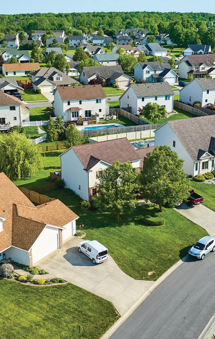
Residential - Low areas are primarily suburbanstyle developments with a range of single-family detached and attached homes, townhomes, and patio homes. Typically seen as a transition between lower density and higher density neighborhoods or commercial uses.
INTENSITYSECONDARY LAND USES
Dwelling Units per Acre: 0 to 2 Agriculture
Minimum FAR: N/A
Minimum FAR: 0.30
Dwelling Units per Acre: 2 to 8 Public/ Quasi-Public; Neighborhood Commercial; Parks, Open Space, and Protected Lands
RESIDENTIALMEDIUM
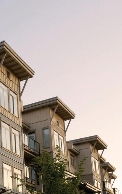
RESIDENTIALHIGH
Residential - Medium accommodates a mix of housing types, from small lot single family developments and duplexes to townhouses and garden apartments. Typically seen as a transition between lower density and higher density neighborhoods or commercial uses.
Residential – High accommodates a mix of housing types including townhomes, condominiums, apartments, and stacked flats. Typically located along transit lines and arterial roads and near activity centers and Employment uses.
Minimum FAR: 0.30
Dwelling Units per Acre: 8 to 18 Public/ Quasi-Public; Neighborhood Commercial; Parks, Open Space, and Protected Lands
MIXED USE
NEIGHBORHOOD
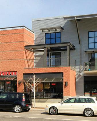
MIXED USE VILLAGE
NEIGHBORHOOD COMMERCIAL
Mixed Use Neighborhood combines shopping, residences, entertainment, and services within a walkable block system. The housing within this designation can range from single-family detached to duplexes, townhomes, rowhomes, and condominiums. Typically located along or near major transportation corridors.
Mixed Use Village accommodates a primarily vertical mix of residential, commercial, retail, and office uses in a compact, pedestrianoriented environment. Typically located along or near major transportation corridors and transit opportunities.
Neighborhood Commercial consists of smallscale retail, office and services in locations that serve as neighborhood hubs, where residents can meet their daily needs. Vehicle-oriented uses are discouraged.
Minimum FAR: .30
Dwelling Units per Acre: 18 to 30 Public/ Quasi-Public; Neighborhood Commercial; Parks, Open Space, and Protected Lands
Dwelling Units per Acre: 6 to 12
Parks, Open Space, and Protected Lands; Public/ Quasi-Public Minimum
FAR: 0.45
Dwelling Units per Acre: 12 to 30
Parks, Open Space, and Protected Lands; Public/ Quasi-Public Minimum
FAR: 0.45
Dwelling Units per Acre: N/A
Minimum
FAR: 0.30
Parks, Open Space, and Protected Lands
Land Use Classifications
DESIGNATIONSUMMARY OF PRIMARY USE AND LOCATION
CORRIDOR
COMMERCIAL
EMPLOYMENT
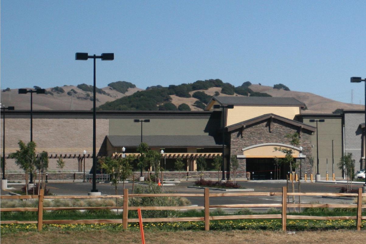
Corridor Commercial accommodates autooriented commercial businesses that draw people from the region, along highways and arterial roads. Big-box stores, and other national or regional commercial and retail uses tend to locate in these areas.
Employment provides flexibility to support a variety of employment opportunities, such as business parks, research and development facilities, business incubators, light industrial/ manufacturing, and higher education and technical schools.
INTENSITYSECONDARY LAND USES
Dwelling Units per Acre: N/A
Minimum FAR: 0.25
Dwelling Units per Acre: N/A
Minimum FAR: 0.25
Parks, Open Space, and Protected Lands
HEAVY INDUSTRIAL
Heavy Industrial is meant for existing industrial uses that are difficult to integrate with less intense uses due to their negative impacts of traffic, noise, pollutants, or odors. Existing Oil and Gas sites are assigned the Heavy Industrial use when they are the majority use of the site.
PUBLIC / QUASIPUBLIC
PARKS, OPEN SPACE, AND PROTECTED LANDS
AGRICULTURE
Public/Quasi-Public includes uses related to general community services, such as public safety facilities, schools, places of worship, community centers, municipal facilities, and/or public utilities.
Parks, Open Space, and Protected Lands include public and private recreation activities and wildlife habitat. This designation also includes properties protected by conservation easements or similar legal means.
This designation is primarily for agricultural purposes and can include farms and other agricultural operations, mixed with large lot residential.
Table 1. Land Use Classifications Summary
Parks, Open Space, and Protected Lands; Complementary commercial uses like breweries or distilleries and with tasting rooms, retail, restaurant, entertainment. Limited storage facilities, warehouse, and distribution
Dwelling Units per Acre: N/A
Minimum FAR: 0.15
Dwelling Units per Acre: N/A
Minimum
FAR: N/A
Dwelling Units per Acre: N/A
Minimum FAR: N/A
Dwelling Units per Acre: < 0.5
Minimum
FAR: N/A
Parks, Neighborhood Commercial
Agriculture
Residential - Rural
Residential - Rural
Residential-Rural includes larger lot (half-acre and up) residential developments with typical densities up to two Dwelling Units per Acre. This development type tends to be located near Agricultural or open spaces, on the outskirts of town.
PRIMARY USE
Residential-Rural designation provides a rural setting for large-lot, very low-density housing. Lot sizes and layouts will be dependent upon topographical constraints.
LOCATION
Residential-Rural developments can be located as a transition between denser residential neighborhoods and natural features and/or existing rural or agricultural development.
Residential-Rural developments tend to be located at the edges of Town boundaries.
These developments are either located off county roads , or within smaller rural subdivisions served by private roads.
SECONDARY USES
Allow Agriculture uses in Residential-Rural areas, such as keeping of large animals, growing crops, and homesteading while ensuring compatibility with Residential and adjacent uses.
Allow clustering of residential development in the Residential-Rural designation to accommodate greater flexibility in housing options on rural and agricultural sites while not exceeding the maximum gross density for the site.


Residential - Low
Residential-Low includes a variety of housing styles and types with typical densities of 2 to 8 dwellings per acre. Many different lot sizes, architectural styles, and housing types are found within this land use category. In addition to residential uses, parks and open spaces provide important amenities and gathering spaces for residents and visitors.
PRIMARY USE
Residential-Low areas are primarily suburban-style developments with a range of single-family detached and attached homes, townhomes, and patio homes.
LOCATION
Residential-Low is appropriate in locations outside of activity centers and where development characteristics are suburban.
Main access points for Residential-Low developments should occur off collector or minor arterial roads.
Residential-Low can be a transition between rural and medium or higher density neighborhoods or commercial uses.
Single family detached housing can be clustered in Residential-Low to provide open space and preserve natural features, while maintaining the overall gross density of the designation.
SECONDARY USES
Incorporate Parks, Open Space, and Protected Lands within the residential neighborhood in alignment with code requirements.
Allow limited Neighborhood Commercial uses in Residential-Low to integrate day-to-day services and amenities into existing neighborhoods.
Allow limited Public/Quasi-Public uses. Dwelling Units per Acre: 2-8

Residential - Medium
Residential-Medium contains attached and detached housing types of 8 to 18 dwelling units per acre. Access to transit and/or proximity to the Employment designation can lead to an increase in densities. Parks and open spaces provide integral gathering spaces within the Residential – Medium category.
PRIMARY USE
Residential-Medium accommodates a mix of housing types, from small-lot single family developments and duplexes to townhouses and garden apartments.
LOCATION
Residential-Medium can be a transition between lower-density and higher-density residential types and non-residential uses.
Access to Residential-Medium developments can occur off many street types, depending on the scale of the project, capacity, and design of the road.
Housing in Residential-Medium can be clustered to provide open space and preserve natural features, while maintaining the overall gross density of the designation.
SECONDARY USES
Incorporate Parks, Open Space, and Protected Lands within the residential neighborhood in alignment with code requirements.
Allow limited Neighborhood Commercial uses in Residential-Medium to integrate services and amenities into existing neighborhoods.
Allow limited Public/Quasi-Public uses.


Residential - High
Residential-High accommodates 18 to 30 dwellings per acre in the form of townhomes, condominiums, apartments, and stacked flats. These areas are located along transit lines and arterial roads and near activity centers and employment areas.
PRIMARY USE
Residential-High designation accommodates attached homes, two-to four-plexes, condominiums, and apartment buildings.
LOCATION
Residential-High is appropriate near intersections of ar terials and collector streets, along existing or planned transit, and near existing or planned amenities and infrastructure.
Residential-High can provide a transition between commercial or employment areas and lower density neighborhoods.
SECONDARY USES
Incorporate Parks, Open Space, and Protected Lands within the residential neighborhood in alignment with code requirements.
Allow limited Neighborhood Commercial uses in Residential-High to integrate services and amenities into existing neighborhoods.
Allow limited Public/Quasi-Public uses.


Mixed Use Neighborhood
Dwelling Units per Acre: 6-12 Minimum FAR: 0.45
Mixed Use Neighborhood includes shopping, residences, entertainment, and services within a walkable block system. Housing can range from single-family detached to duplexes, townhomes, rowhomes, and condominiums with gross densities of 6 to 12 units per acre.
PRIMARY USE
Mixed Use Neighborhood accommodates a mix of residential, commercial, retail, and office uses in a compact, pedestrian-oriented environment.
LOCATION
Mixed Use Neighborhood should be located along or near major transportation corridors to maximize access to transit, employment, amenities, and services.
Mixed Use Neighborhood is appropriate along collector streets to promote vibrant, successful commercial uses. Mixed Use Neighborhood may be appropriate along local street types as long as the built environment is appropriately scaled.
Mixed Use Neighborhood areas may also be used to provide a transition between commercial or employment centers and residential neighborhoods.
Both vertical (stacked) and horizontal (side-by-side) mixed use development is encouraged provided it is well-connected to surrounding neighborhoods.
SECONDARY USES
Incorporate Parks, Open Space, and Protected Lands within Mixed Use Neighborhood.
Allow limited Public/Quasi-Public uses.


Mixed Use Village
Mixed Use Village includes shopping, residences, entertainment, and services. Densities in this designation go from 12 units to 30 units per acre and can include apartments and stacked flat housing types.
PRIMARY USE
Mixed Use Village accommodates a primarily vertical mix of residential, commercial, retail, and office uses in a compact, pedestrian-oriented environment.
LOCATION
Mixed Use Village should be located along or near major transportation corridors to maximize access to transit, employment, amenities, and services.
Mixed Use Village is appropriate along arterials or collector streets to promote vibrant, successful neighborhood centers.
Mixed Use Village areas may also provide a transition between commercial or employment centers and residential neighborhoods.
Both vertical (stacked) and horizontal (side-by-side) mixed use development is encouraged provided it is well-connected to surrounding neighborhoods.
SECONDARY USES
Incorporate Parks, Open Space, and Protected Lands within Mixed Use Village areas.
Allow limited Public/Quasi-Public uses.


Dwelling Units per Acre: N/A
Neighborhood Commercial
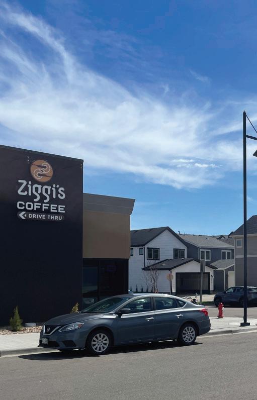
Neighborhood Commercial includes small-scale retail, office and services in locations that serve as neighborhood hubs, where residents can meet their daily needs.
PRIMARY USE
Neighborhood Commercial accommodates a mix of retail, restaurants/cafes, small-scale professional office, childcare centers and other daily convenience shopping and services in a pedestrian-oriented environment.
Limit development and redevelopment to non-vehicular oriented land uses. Vehicular-oriented land uses include drive-throughs, gas stations, oil change facilities, and similar service uses.
LOCATION
Neighborhood Commercial can be located at the intersection of two arterial streets, a collector and arterial street, or collector and local street.
SECONDARY USES
Incorporate Parks, Open Space, and Protected Lands

Corridor Commercial
Dwelling Units per Acre: N/A Minimum FAR: 0.25
Corridor Commercial includes commercial businesses that draw people from the region, along highways and arterial roads. Big-box stores, and other national or regional commercial and retail uses tend to locate in these areas.
PRIMARY USE
Corridor Commercial accommodates a mix of retail, commercial, office, entertainment, and auto-oriented commercial uses that serve the region and are inappropriate in neighborhoods or pedestrian-oriented areas.
Development adjacent to the airport should be of compatible airport-related use.
LOCATION
Corridor Commercial is appropriate only along arterial and highway corridors, near the edges of Town boundaries.
SECONDARY USES
Incorporate Parks, Open Space, and Protected Lands


Dwelling Units per Acre: N/A
Employment
Employment includes uses that generate employment such as industrial/flex space, light manufacturing, medical/technical facilities, aeronautical, and incubator spaces.
PRIMARY USE
Employment provides flexibility to support a variety of employment opportunities, such as business parks, research and development facilities, business incubators, light industrial/manufacturing, and higher education and technical schools.
LOCATION
Employment is appropriate in areas in proximity to existing or planned transit services, and/or along major transportation corridors.
SECONDARY USES
Allow complementary commercial uses like breweries or distilleries with tasting rooms, retail, restaurant, entertainment.
Limit storage facilities, warehouse, and distribution.
Ensure that development adjacent to the airport is of compatible airport-related use.
Allow limited Residential in Employment designations to foster a mix of uses and walkable environments, if compatible and not negatively impactful to the primary Employment uses.
Incorporate Parks, Open Space, and Protected Lands within Employment areas in alignment with code requirements. Ensure that development supports multimodal connections to adjacent trails, parks, and open space.
Allow limited Public/Quasi-Public uses.


Heavy Industrial
Heavy Industrial includes encompasses industrial uses that are difficult to integrate with less intense uses due to their negative impacts of traffic, noise, pollutants, and/or odors. When Heavy Industrial uses cease and mitigation is complete with environmental analysis and clearances, a new land use designation may be applied to the area as part of regular updates to the Future Land Use Map.
PRIMARY USE
Heavy Industrial is intended to accommodate existing heavy manufacturing, oil and gas, and landfill operations.
LOCATION
Heavy Industrial uses should not be expanded, and new designations should not be mapped.
Heavy Industrial uses should be located away from population centers due to their potential environmental impacts.
Heavy Industrial uses should have buffering and screening in place to limit visual and operational impacts to the surrounding uses. Operational traffic generated should not pass through residential areas.


Dwelling Units per Acre: N/A
Minimum FAR: N/A
Public/Quasi-Public includes uses related to general community services, such as public safety facilities, schools, places of worship, community centers, municipal facilities and/or public utilities.
PRIMARY USE
Public/Quasi-Public includes uses related to general community services, such as public safety facilities, schools, places of worship, community centers, municipal facilities and/or public utilities.
LOCATION
Public/Quasi-Public uses should be located in close proximity to neighborhoods.
SECONDARY USES
Allow Parks, Open Space, and Protected Lands to be incorporated within Public/Quasi-Public areas. Ensure that development supports multimodal connections to adjacent trails, parks, and open space.
Allow limited commercial uses to integrate services and amenities.


Parks, Open Space, & Protected Lands
Dwelling Units per Acre: N/A Minimum FAR: N/A
Parks, Open Space, and Protected Lands includes public and private recreation activities and wildlife habitat as well as properties protected by conservation easements or similar instruments.
PRIMARY USE
Parks, Open Space, and Protected Lands includes wildlife Wildlife habitat, recreational facilities, agricultural operations, trails, playgrounds, and community gathering spaces.
LOCATION
Parks, Open Space, and Protected Lands are located throughout Erie’s Planning Area aligned with existing trails, parks, open space, natural features, and view corridors.
SECONDARY USES
Allow limited Agriculture uses where not negatively impactful to surrounding uses and/or habitat.


Agriculture
Agriculture includes existing large-scale sites used primarily for agricultural purposes as well as areas within the floodplain. Agricultural areas are expected to remain unchanged for long periods of time.
PRIMARY USE
This designation is primarily for agricultural purposes and can include farms and other agricultural operations, mixed with large lot residential.
LOCATION
Agriculture uses tend to be located at the edges of Town boundaries, particularly to the north, off county roads.
SECONDARY USES
Cluster limited residential development where the maximum gross density is not exceeded, and agricultural uses are not negatively impacted to accommodate greater flexibility in housing options on rural and agricultural sites. Dwelling Units per Acre: 0-0.5


Basis of Future Land Use Map
The Future Land Use Map prioritizes the Comprehensive Plan’s core values of sustainability, livability, and connectivity, and reflects analysis and guidance from multiple sources:
Community Engagement: Three windows of community engagement informed the creation of the Future Land Use Map. See the Appendix for a community engagement summary.
▷ Windows 1 & 2: These engagements provided insight on the community’s vision and values. The results of the two engagements indicated the community’s desire for increased access to daily needs and jobs within Town, while still prioritizing Erie’s small-town character, open space, and identity.
▷ Window 3: Using the results from windows 1 & 2, the planning team drafted three different buildout scenarios reflecting potential futures for Erie. The updated Future Land Use Map reflects aspects from each scenario based on community voting and feedback.
Fiscal Analysis: The Land Use Fiscal Analysis studied Erie’s current fiscal revenues and costs and projected how different land use patterns will impact Erie’s fiscal sustainability in the future as it grows. The analysis emphasized the need for a greater diversity of housing types in Erie, such as adding some higher density housing and smaller unit sizes, and for more commercial opportunities, like local neighborhood services.
Market Analysis: The Economic Market Analysis evaluated Erie’s office, industrial, retail, and hospitality uses in relation to the broader region to understand drivers for future employment and demand for commercial and employment space in the next 20 to 30 years.
Internal & Advisory Committee Review: The Technical Advisory Committee (TAC) and Plan Advisory Committee (PAC) participated extensively in the Comprehensive Plan process, including the development and review of the Future Land Use Map. The TAC includes representatives from Town staff and provided technical review of the FLUM from different perspective such as Housing, Transportation, and Public Works. The PAC represented diverse community interests in its review of the Future Land Use Map with representatives from the Town’s boards and commissions including Town Council, Planning Commission, Sustainability Advisory Board, and the Open Space & Trails Advisory Board.
Buildout
Evaluation of the Future Land Use Map includes a projections of new potential build-out in terms of residential units, population, jobs, and commercial and employment square footage. The buildout reflects existing, planned, entitled, and potential future development. A majority of the buildout is already existing, entitled, or planned. The planning team measured potential future development within Erie based on the vacant and underutilized parcels (“opportunity sites”) in the Planning Area. This potential buildout is planned for and accommodated in the policies in other chapters, like Public Services, Infrastructure & Facilities; Transportation & Mobility; and Livability & Social Health.
DescriptionAlready built Approved development In development review process; not approved Potential development in vacant1 and underutilized 2 parcels in the Planning Area
1 Vacant parcels consist of land without a primary use or structure. Underutilized parcels have land values that exceed the value of existing improvements or structures. 2 Underutilized parcels are those that have land values that exceed the value of the existing improvements or structure.
Note: Housing units, population, and jobs rounded to the nearest thousand. Commercial square footage rounded to the nearest hundred thousand. Existing housing units and population are sourced from Planning & Development estimates in 2023. Existing Commercial & Industrial Square Footage and Employment are sourced from the Economic Market Analysis data collected in 2023.
Table 2. Estimated Build Out Projections

4 Future Land Use Map - Opportunity Sites


Figure.
Future Opportunity Sites
The Future Opportunity Sites map includes areas within Erie’s Planning Area boundary that have been approved for future development, are in the development review process, or are otherwise vacant or underutilized that could be developed in the future. These areas include a larger focus on Mixed Use Neighborhood and Employment uses compared to the existing development in Erie. Input from community engagement demonstrated the desire for concentrations of commercial activity and walkable neighborhoods with a variety of housing types and amenities for people to more easily access daily needs and jobs. Guidance from fiscal and market analysis further emphasized the need for these types of uses to support Erie’s fiscal sustainability in the future.


The Future Land Use Plan is supported through the policies found in all of the Chapters of the Comprehensive Plan.


Figure 5. Existing vs. Opportunity Site Land Area
Community Building Blocks
INTRODUCTION
Erie is experienced through its neighborhoods, open spaces, and destinations. These places—the mix of uses and opportunities to connect within them—are what cultivates Erie’s identity and sense of belonging for residents, workers, and visitors. As Erie grows, community building blocks help to preserve the small town experience of living in Erie while providing essential amenities and services. Policies throughout the Comprehensive Plan around neighborhoods, transportation, parks and open space, economic development, and much more complement the community building blocks to support and enhance the experience of living in Erie.
Neighborhoods. Neighborhoods are the backbone of an Erie resident’s experiences, sense of belonging, and connection to their environment, neighbors, and daily life. They provide accessibility and connectivity to parks, commercial centers, schools, and other services that support the social and economic health of the town.
Destinations. The Town supports vital commercial activity centers where residents and visitors can create community. Expanding opportunities for employment and commercial development reduces the need for residents to travel to neighboring communities to work, shop, and meet other daily needs. The Town continues to support and expand three major local destinations in Erie: Historic Old Town, Erie Town Center, and Erie Gateway, as well as regional commercial centers like Nine Mile Corner and Vista Ridge/ CO-7 and smaller walkable commercial areas in neighbohroods.
Public Realm. By creating memorable and distinct experiences along streets and in public spaces, Erie will be a gathering place for people of all ages to enjoy. Ensuring the use of high-quality materials and building design, preserving key vistas and views within public space, and incorporating public art will lead to a visually engaging and distinctively built community.
Rural Character. Erie’s rural character—one of the many benefits of its agricultural heritage and its setting in the northern Front Range—is highly valued by the community. Natural and environmentally sensitive areas should be protected, contributing to the health of ecosystems and quality of life of residents and visitors.
Growth Management. As Erie grows, sustainable development patterns are critical to preserve the highquality experience of living in Erie and ensure fiscal responsibility into the future. The Town uses criteria to consider annexation, development phasing and form thoughtfully and in concert with available resources and services.

Corridors & Areas of Special Consideration
The Corridors and Areas of Special Consideration Map identifies five corridors and three areas of Special Consideration.
Erie Parkway
Arapahoe Road
Highway 7
County Line Road
Highway 52
Historic Old Town
Erie Town Center
I-25 Erie Gateway
Development proposals within these areas should meet the following design guidelines:
Corridors should have enhanced landscape and steetscape design.
▷In areas that are walkable, urban, or with limited space, landscape setbacks maybe substituted with street trees and amenity zones. Amenity zones are paved areas for pedestrians that may include outdoor dining, benches, bike racks and similar uses.
Fencing should be open (split rail, picket, etc.) and under 4 feet in height. Low brick or masonry walls can be used to screen or define areas, depending on the context.
Screen parking areas from view with landscaping, berms, and/or architectural elements.
Limit view obstructions from signs.
Specific guidelines, unique to each of the identified Corridors and Areas of Special Consideration can be found on the following pages.


I would love to see more centers of vibrancy in Erie. We have a rural-esque charm but if planned appropriately I believe we can add some bike lanes and some mixed-use areas that will work with the existing charms to improve our quality of life and decouple us from our cars.

- Scenarios Survey Respondent


6. Corridors and Areas of Special Consideration Map

Figure
Corridors & Areas of Special Consideration (Continued)
ERIE PARKWAY
Erie Parkway functions as the primary gateway into and through the Town of Erie. The corridor affords sweeping views of the mountains and town.
HIGHWAY 7 (BASELINE)
The Highway 7 Corridor serves as a secondary gateway to Erie, providing access to County Line Road from the south. Much of the corridor lies within the cities of Broomfield and Lafayette.
COUNTY LINE ROAD
The County Line Road corridor serves as the primary north- south gateway through the town. The corridor ranges in character from rural to developed.

HIGHWAY 52
The Highway 52 Corridor serves as a secondary gateway to Erie, providing access from I-25 to County Line Road from the north. The corridor today remains largely agricultural in character, although some residential development exists along with commercial closer to I-25.
ARAPAHOE ROAD
The Arapahoe Road corridor serves as a secondary gateway from the west. Portions of this corridor fall within Boulder County and the City of Lafayette’s jurisdictions.

HISTORIC OLD TOWN
Erie was first platted in 1871 and incorporated in 1874. Historic Old Town is the heart of Erie. This area encompasses the historic downtown district along Briggs Street and contains a variety of commercial uses such as shops and restaurants. Downtown is surrounded by the historic Old Town neighborhood. Historic Old Town is home to many historic sites and buildings, particularly within the commercial Downtown core centered on Briggs Street. The surrounding Old Town residential neighborhood has rich architectural fabric. There are limited connections to the north, west, and south of Historic Old Town. While some multimodal pathways connect, Old Town is buffered by Coal Creek to the east, an abandoned railroad on the south, Sullivan Ditch to the North, and County Line Road on the west. Refer to policy C.2.1 for more details.


Figure 7. Historic Old Town
ERIE TOWN CENTER
Found at the intersection of County Line Road and Erie Parkway, Erie Town Center is a major node and is expected to be the primary commercial area in the center of the Town. In 2019, the Town and community stakeholders identified five key sites totaling 145 acres of developable land within a 390acre footprint at the convergence of Erie Parkway and County Line Road. Currently the northeast corner is occupied by a community park and community center and the southeast corner is occupied by commercial and service uses. The southwest and northwest corners are currently undeveloped but are planned as mixed-use developments with a mix of housing types. Refer to policy C.2.2 for more details.


Source: Erie Town Center PD Zoning Map
Erie Parkway County Line Road
ErieParkway
Figure 8. Town Center Planned Development
I-25 ERIE GATEWAY
The I-25 Erie Gateway encompasses the 1,280 acres of land located and the northwest corner of I-25 and Erie Parkway. The area will be a regionally-scaled retail and employment center at Erie’s eastern gateway with integrated open space and parks, and diverse housing types. The vision for the development future of the Plan area is one that maximizes the site’s revenue generating potential while employing sound land use and high quality design principles.
Refer to policy C.2.3 for more details.


Chapter Goals
C1
Design connected neighborhoods.
Encourage diverse housing types, open space, amenities, connected street grids and distinct identities.
C2 Cultivate destinations.unique
Foster destinations that serve as commercial activity centers and community gathering spaces.
C3
Create a high-quality, visually environment.engaging
Design gateways, corridors, public spaces, and parks that emphasize Erie’s identity and high quality of life.
C5
C4
Preserve areas of rural & agricultural character.
Protect natural and environmentally sensitive areas.
Promote a sustainable development pattern.
Ensure a fair share approach to the cost of growth and consider annexation, development phasing and form thoughtfully and in concert with available resources and services.
ALL GOALS AND POLICIES ARE TIED TO ALL THREE CORE VALUES


Design connected
neighborhoods.
C.1.1 MIX OF HOUSING TYPES: ENCOURAGE A VARIETY OF HOUSING TYPES IN NEIGHBORHOODS TO PROVIDE A MORE DIVERSE SELECTION OF LIFESTYLES AND HOUSING PRICING FOR ERIE RESIDENTS.
Address the needs and desires of the community by providing a mix of housing types such as single-family detached, single-family attached, townhomes, and mixed-use developments containing apartments and condominiums.
Design future developments in relation with adjacent uses, densities, orientation and amenities to ensure that neighborhood cohesion while still maintaining a distinctive sense of place.
C.1.2 CONNECTIVITY: FACILITATE STRAIGHTFORWARD NAVIGATION IN ERIE WITHIN OR BETWEEN NEIGHBORHOODS, KEY DESTINATIONS, SERVICES, AND AMENITIES.
Support moving people, goods, and services through the community through direct connections, from local neighborhood street networks to a larger, easily navigable network of roadways, sidewalk and trail connections, and bikeways.
Design neighborhood street networks for all modes of transportation with short block lengths on a grid, minimal dead ends or culde-sacs, effective signage and wayfinding, and connections to neighboring developments including commercial and employment uses, parks and amenities.
C.1.3 PARKS & OPEN SPACE: ENSURE NEIGHBORHOODS INCLUDE OR ARE EASILY ACCESSIBLE TO A RANGE OF PARKS AND OPEN SPACE AMENITIES TO APPEAL TO RESIDENTS OF ALL AGES AND ABILITIES.
Maintain an adequate availability and dispersal of park and open space designations to serve the need of the immediate area.
Ensure that existing parks and open spaces near
new developments are prioritized for expansions and connections.
For denser developments including mixed use or commercial uses, refer to the Mixed-Use Development Parks and Open Space Vision Guide to ensure adequate parks and open space typologies are provided.
C.1.4 ACTIVITY CENTERS: ENSURE EACH NEIGHBORHOOD INCLUDES AN ACTIVITY CENTER FOR ITS RESIDENTS.
Design activity centers to include a mix of commercial development, parks, open space, and other community facilities, where appropriate, to serve the needs of neighborhood residents. Larger, commercially-oriented activity centers may serve more than one neighborhood.
Evaluate integrating small-scale retail uses into existing single use neighborhoods to help reinforce availability of services and amenities.
C.1.5 PRESERVATION OF NATURAL FEATURES: PLAN NEIGHBORHOODS TO MAXIMIZE THE PRESERVATION AND ENHANCEMENT OF NATURAL FEATURES.
Preserve and incorporate natural features, such as drainages, significant trees and views, and topography into required open spaces, required setbacks, and park sites.
C.1.6 DISTINCT IDENTITY: INCORPORATE UNIQUE CHARACTERISTICS INTO NEIGHBORHOODS THAT SERVE AS IDENTIFIERS FOR RESIDENTS, SUCH AS DISTINCT STREETSCAPE ELEMENTS, ARCHITECTURAL STYLES, AND NEIGHBORHOOD CENTER FEATURES.
Incorporate features that visually and physically link neighborhoods to the Town while maintaining a distinct individuality. Unique characteristics can include branding and wayfinding, trail connections, public art, architectural style, or other features that serve to create a distinct and identifiable place.
C2 Cultivate unique destinations.
C.2.1 PRESERVE HISTORIC OLD TOWN AS A PRIMARY DESTINATION THAT CELEBRATES ERIE’S HISTORY AND FOSTERS A THRIVING SMALL BUSINESS ENVIRONMENT.
Encourage a mixed-use pattern of development along Briggs, Wells, and Cheesman Streets with active retail uses at the ground floor.
Preserve existing historic commercial structures and promote adaptive reuse for new retail and restaurant uses.
Promote arts, programming and events along Briggs Street and in Coal Creek Park to serve as an entertainment hub, celebrate Erie’s history and identity, and attract visitors to small businesses.
Increase connections within and to/from Historic Old Town through multiple transportation methods (walking, biking, e-micromobility, auto, and transit).
Explore creative parking solutions to manage existing supply and consider additional opportunities as needed to support business demands. Limit unnecessary surface parking to preserve the historic downtown feel.
C.2.2 ESTABLISH ERIE TOWN CENTER AS A WALKABLE, MIXED-USE NEIGHBORHOOD THAT SERVES AS A COMMERCIAL AND ENTERTAINMENT HUB.
Integrate residential, retail, office, hotel, entertainment, civic, and park and open space uses within the Town Center site.
Include a diversity of housing types, with affordable housing options.
Serve unmet retail demand within Town Center, including food, beverage, and grocery uses.
Provide affordable commercial spaces for small and local businesses.
Create a vibrant civic and entertainment space for the community.
Encourage creative parking solutions to reduce overall parking while meeting retail and business demand.
Implement clear connections to other important amenities and destinations, including Historic Old Town, schools, and parks and open space.
C.2.3
FACILITATE
THE
DEVELOPMENT
OF I-25 ERIE GATEWAY TO PROVIDE A WALKABLE, TRANSIT-READY, MIXED-USE NEIGHBORHOOD ENVIRONMENT AND GROW ERIE AS A HUB FOR INNOVATION AND ECONOMIC GROWTH.
Include a diversity of housing types, with affordable housing options.
Prioritize transit-oriented development, including convenient access for residents and workers to bus and rail transit.
Establish a new employment center along I-25 to increase Erie’s daytime workforce, allow residents to work closer to home, and support local retail. Attract commercial spaces tailored to science and technology entrepreneurship based on market analysis findings.
Promote a safe and walkable environment.
Connect the neighborhood internally and externally with trails and bike paths and establish unique parks and open spaces.
Activate public spaces and retail destinations.

I see a future with Erie having local hot spots that pull other residents outside Erie to come to. Unique and full of quality. Leave the box stores to a minimum. - Vision & Values Survey Respondent
C3 Create a high-quality, visually
C.3.1 FOSTER VIBRANT PUBLIC SPACES AND MAIN STREETS THROUGH ACTIVATION AND BUILDING DESIGN.
Locate retail and active uses along main streets and the periphery of public spaces.
Encourage sidewalk or parklet seating to bring business activity out into the public realm.
Ensure design of buildings fronting onto active streets and spaces is visually engaging with entrances, ample windows, durable materials, and varied massing and articulation.
C.3.2 CREATE A BUILT ENVIRONMENT THAT IS ACCESSIBLE, USABLE, AND OF HIGH QUALITY DESIGN.
Accessible: Develop design standards that incorporate universal design principles (stepfree entrances, rest areas along pedestrian routes, smaller curb radii, etc.).
Usable: Provide safe, protected pedestrian connections through development and parking areas to maximize connectivity within and between developments and amenities.
High Quality Design: Emphasize pedestrian scaled design and ensure all building elevations are designed to achieve high quality design with durable materials, articulation and variation in massing.
C.3.3 ENSURE EXISTING AND NEW STREETS ARE DESIGNED TO ACCOMMODATE MULTIPLE MODES SAFELY AND IN RELATION TO DEVELOPMENT CONTEXT.
Refer to the Transportation Mobility Plan and Engineering Standards and Specifications to ensure that street segments are accessible for all current or future forms of transportation.
C.3.4 REINFORCE ERIE PARKWAY THROUGH STREETSCAPE AND BUILDING DESIGN.
Maintain key view corridors and vistas of the mountains to the west, especially between Weld County Road 5 and 7, through strategic plantings and building setback, height, and orientation.
Development should be oriented to front the Parkway; backs of buildings should not line the Parkway.
Ensure building design that fronts to Erie Parkway utilizes high quality and durable materials. Maintain active frontages that address the street through entries, ample windows, and outdoor seating areas.
Provide for enhanced multimodal connectivity, with emphasis on safe pedestrian crossings and bicycle facilities between and along residential neighborhoods and commercial areas.
C.3.5. REINFORCE COUNTY LINE ROAD THROUGH STREETSCAPE AND BUILDING DESIGN.
Provide transitions between more intense uses and less intense uses. Transitions can include:
▷Stepping down of building scale (footprint, height, total bulk)
▷Breaking up large building masses
▷Increased setbacks
▷Design features that complement lower intensity uses
▷Increased landscaping
Ensure building design that fronts to County Line Road utilizes high quality and durable materials. Maintain active frontages that address the street through entries, ample windows, and outdoor seating areas.
Provide for enhanced multimodal connectivity, with emphasis on safe pedestrian crossings and bicycle facilities between and along residential neighborhood, recreation uses, and commercial areas.
C.3.6 REINFORCE HIGHWAY 52 THROUGH STREETSCAPE AND BUILDING DESIGN.
Activate key intersections at Weld County Road 3 and 7 with commercial or mixed-use development.
Work collaboratively with the Town of Frederick and Colorado Department of Transportation (CDOT) to address transportation, connectivity, streetscape design, and infrastructure needs within the corridor.
C.3.7
REINFORCE ARAPAHOE ROAD THROUGH STREETSCAPE AND BUILDING DESIGN.
Provide transitions between more intense uses and less intense uses. Transitions can include:
▷Stepping down of building scale (footprint, height, total bulk)
▷Breaking up large building masses
▷Increased setbacks
▷Design features that complement lower intensity uses
▷Increased landscaping
Collaboratively work with the City of Lafayette to address transportation, connectivity, streetscape design and infrastructure needs within the corridor.
C.3.8 REINFORCE HIGHWAY 7 (BASELINE) THROUGH STREETSCAPE AND BUILDING DESIGN.
Orient and locate non-residential development towards the highway.
Enhance connectivity between residential neighborhoods to the north and between commercial uses to provide access to commercial amenities, trails, and transit connections.
Ensure infill development adjacent to residential areas utilizes transitions in height and massing to better integrate with existing development.
Work collaboratively work with the cities of Broomfield and Lafayette to address transportation, connectivity, and streetscape design within the corridor.
It’s the small and local businesses that form the homey feel for this town. We also and enjoy the open space and the view of the front range. These are the reasons we decided to settle in Erie.
- Vision & Values Survey Respondent
C4 Preserve areas of rural & agricultural character.
C.4.1 PROTECT NATURAL AND ENVIRONMENTALLY SENSITIVE AREAS, CONTRIBUTING TO THE HEALTH OF ECOSYSTEMS AND QUALITY OF LIFE OF RESIDENTS.
Ensure that new developments retain natural features and environments as part of their open space, parks, and trail systems.
Plan for connections of the natural environment that accommodate wildlife.
Integrate natural features like wetlands, creeks, and historic agricultural or mining properties into new development as unique features and markers.
C.4.2 ENSURE ERIE RETAINS A MIX OF BUILT AND RURAL ENVIRONMENTS THAT REFLECT THE TOWN’S HISTORY AND GEOGRAPHY.
Work with neighboring communities and counties to identify areas to preserve as rural and agricultural in character and use. Approaches may include intergovernmental agreements conservation easements, acquisitions, or incentives to maintain rural and agriculture uses.

C5 Promote a sustainable development pattern.
C.5.1 ENSURE NEW DEVELOPMENT MEETS COMPREHENSIVE PLAN VISION, PRIORITIES, AND RESOURCE MANAGEMENT.
Ensure new development reflects the goals and policies established throughout the Comprehensive Plan, including:
Comprehensive Plan Vision: Aligns with the Comprehensive Plan values of Sustainability, Livability, and Connectivity.
Land Use Designation: Is consistent with the land use classification found in the Future Land Use Map.
Fiscal Sustainability: Generates tax and other revenues greater than the fiscal impacts of providing Town services for the life of the development.
Water Resources and Utility Capacity: Is considered in the context of remaining current water rights, actual water supply, and wastewater treatment capacity.
Employment Base Expansion: Creates quality new jobs, especially on major transportation/ transit corridors.
Unique Open Space or Recreational Amenities: Connects existing trails and provides new open space or recreational amenities for residents.
Variety of Housing Opportunities: Creates housing opportunities that align with Erie’s Housing Needs Assessment, including housing for the elderly or other special populations, smaller unit sizes, affordable homeownership units, and/or workforce rental units (or provides financial or land contributions towards affordable housing in lieu of providing on site).
C.5.2 CONSIDER COSTS AND BENEFITS OF ANNEXATIONS ON A CASE-BY-CASE BASIS.
Ensure annexations have a demonstrated significant benefit to the Town. Tangible and intangible benefits to consider include:
Sales tax generation,
Employment base expansion,
Surplus water rights acquisition,
Unique open space or recreational amenities for the Town,
Housing opportunities for the elderly or other special populations, and
Utility or service upgrades or benefit to other areas of the Town.
The annexed property can be integrated into the Town’s existing or planned utility, transportation, public safety, and general services system in a financially responsible manner. Necessary infrastructure improvements should not be planned, constructed, or funded in such a manner as to impose an unreasonable level of public or private debt relative to realistic build-out as based upon sound demographic and growth projections annually estimated by the Town.
C.5.3 REQUIRE NEW DEVELOPMENT TO PAY FOR INFRASTRUCTURE AND SERVICES FOR ALL UTILITIES NECESSARY TO SERVE THE PROJECT.
The Town should not extend services and infrastructure unless new development or redevelopment pays for the full cost. The developer should pay for all water, sewer, drainage, roads, and parks/recreation infrastructure to serve new development.
C.5.4 REQUIRE NEW DEVELOPMENT TO PROVIDE ADEQUATE PUBLIC FACILITIES AT THE TIME OF DEVELOPMENT.
Adequate public facilities (or corresponding land dedication and/or fee-in-lieu) should be in place or planned for within a reasonable time of the start of new development.
Additional supporting policies can be found in every chapter.


Public Facilities, Services, & Infrastructure
INTRODUCTION
The availability and quality of water, wastewater and stormwater management, and other utilities and services affect the safety and quality of life for residents and the economic stability of the Town. As Erie continues to grow rapidly, the Town is responding quickly to keep pace with the necessary infrastructure and utilities. Ultimately, the capacity to provide these essential services determines the growth potential and fiscal wellbeing of the Town. The Town must continue to maximize sustainability and long term environmental and fiscal resilience in the provision, operation, and maintenance of utilities over time.
The Town’s greatest infrastructure and service cost priorities are water supply and conservation, wastewater treatment, and street maintenance. The Town conducts continuous financial planning for maintenance of these services in order to keep down larger replacement costs in the long term. The Town promotes a development pattern that maximizes sustainability and fiscal responsibility and provide cost-effective infrastructure and public facilities.
The Town’s state-of-theart microfiltration Water Treatment Facility treats nearly 17 million gallons of water per day.
Sustainability is a driver in all public facilities, service, and infrastructure decisions and this chapter is closely tied with the Natural Resources, Conservation & Resilience Chapter. The Town of Erie is committed to reducing reliance on natural gas and focusing on more green energy sources. Erie strives to be a model for residents and businesses with energy efficient design of its public facilities and a shift to an electric vehicle fleet and applicable equipment. To this end, the Town is already operating Class-A Biosolids systems, hydro-turbines at its water treatment facilities, and solar systems at Town facilities.
This chapter includes policies for the following:
Electricity, Natural Gas & Telecommunications: The Town will pursue innovative technologies and work closely with utility providers to ensure reliable, quality service. The Town has made a commitment to being carbon neutral by 2050 and will continue to pursue solar and other renewable energy sources.
Water Supply and Conservation: Erie’s water management strategies center on maintaining a long-term reliable, reusable, diversified, and sustainable water supply as the Town grows. The Town will enhance and protect its water supply and quality.
Stormwater Management, Drainage, Flood Control, & Wastewater Management: Utilizing green infrastructure in new development and capital improvements is a stormwater management priority for the Town to balance out more dense land uses and mediate floodplain impacts.
Public Facilities & Street Maintenance: The Town continues to prioritize street maintenance, street safety, and high-quality public facilities for all residents. Public facilities are well-maintained, employ back-up power sources, and use renewable energy practices.
Chapter Goals
P1
Provide efficient & reliable utility service.
Maintain efficient, reliable and affordable service as Erie grows.
P2 Encourage conservation.water
Conserve water resources through education and efficient practices.
P3
Pursue sustainable stormwater management & flood control.
Employ sustainable infrastructure best practices and ensure the Town’s resources are utilized to their highest and best use.
P4
Maintain inclusive & effective public facilities.
Provide equitable access to Erie’s high standard of public facilities and utilities.


P.1.1 CONTINUALLY PLAN FOR UTILITY INFRASTRUCTURE NEEDS, INCLUDING SHORT AND LONG-TERM FINANCIAL AND SUSTAINABILITY PLANNING.
Review and update utility plans at least once every 5 years to ensure utility infrastructure is planned in concert with growth. Incorporate use of the Sustainability Strategic Plan in Public Works decisions.
P.1.2. REDUCE RELIANCE ON NATURAL GAS IN ERIE, INCLUDING MOVING TOWARDS SOLAR AND OTHER RENEWABLE ENERGY SOURCES.
Use Erie public facilities as a model for residents and employees in Erie to move from natural gas and towards electrification (e.g. Town Hall construction, Town’s transition of fleet to EV). Refer to the Town’s Sustainability Strategic Plan for strategies to use renewable resources and engage in programs such as Community Solar Gardens and green energy programs.
P.1.3 EXPLORE TRASH, RECYCLING, AND COMPOST SERVICE PROVISION OPTIONS TO MEET RESIDENT NEEDS.
The Town currently has a Recycling Center that is free of charge for residents to use. Continue to evaluate the viability of a “communitywide hauler” for trash, recycling, and compost service for all residents. Continue education and enforcement of the Town’s Pay-As-You-Throw waste ordinance.
P.1.4 PARTICIPATE IN REGIONAL UTILITY PLANNING EFFORTS AND EXPLORE THE JOINT USE OF REGIONAL INFRASTRUCTURE TO PROVIDE COST SAVINGS TO ERIE.
Continue to work closely with utility providers and regional partners to ensure reliable service and opportunities for partnership.
P.1.5 EXPLORE INNOVATIVE TECHNOLOGIES FOR TELECOMMUNICATIONS AND UTILITY INFRASTRUCTURE AND SERVICE DELIVERY.
Continue to evaluate the advantages of Smart Cities and similar technologies to add efficiency to the Town’s infrastructure systems. Explore opportunities like transportation smart signaling for local and state facilities.
P2 Encourage water conservation.
P.2.1 CONTINUE TO CONSERVE WATER RESOURCES THROUGH MORE EFFICIENT PRACTICES IN CODES AND STANDARDS.
Continue to plan for water resources and potential climate impacts. Refer to the Drought and Water Supply Shortage Plan. Update the Unified Development Code (UDC) to promote water conservation for vegetation and landscape requirements. Regularly update water wise landscape and irrigation design standards and specifications as applicable.
P.2.2 CONTINUE COMMUNITY EDUCATION EFFORTS AROUND HOUSEHOLD WATER CONSERVATION.
The Town currently offers an array of rebate programs to encourage water conservation and the replacement of traditional turf grass in yards. Continue to implement innovative ways of increasing public awareness of water conservation techniques including encouraging and rewarding water conservation efforts.
P.2.3 EXPLORE A LANDSCAPING ORDINANCE FOR LOW-WATER-USE PLANT MATERIALS AND OUTDOOR WATERING SCHEDULES.
Develop a water conservation landscaping ordinance, which may include guidance on selecting lowwater-use plant materials, enforcement of water use regulations like an outdoor water use schedule, and requirements or incentives to replace non-functional turf in residential and commercial developments. Eliminate all non-functional turf from Town properties and work with homeowner associations (HOAs) to do the same.
P.2.4 CONTINUE TO PURSUE LOCAL WATER SOURCES DEVELOPED IN LINE WITH THE COLORADO WATER PLAN.
Continue to review the Town’s water sources and pressures on water supplies due to climate change.


Water Efficiency Rebates & Programs
The Environmental Services Division has several tools, tips, programs, and rebates to encourage residents to conserve water. Offerings range from water efficiency rebates, tips for watering lawns, Garden In A Box (a xeric plant program), outdoor sprinkler consultations, and the yearly Turf Replacement Rebate Program.
P.3.1 PROMOTE GREEN INFRASTRUCTURE TO REDUCE IMPERMEABLE AREAS AND DIVERSIFY WATER QUALITY TREATMENT STRATEGIES BEYOND EXTENDED DETENTION BASINS AND UNDERGROUND DETENTION SYSTEMS.
Explore opportunities for rain gardens, permeable pavers, bioswales, runoff reduction measures, and other treatment options for water quality. Update the Unified Development Code (UDC) with green infrastructure requirements for new construction to balance the impacts of more dense land uses, such as permeable pavements for parking lots and green roofs. Refer to and update as necessary the Town’s two strategic Outfall Systems Plans for east and west of Coal Creek. Additional stormwater quality management measures may include:
Storm sewer replacements.
Opportunities for joint use facilities that promote water quality treatment.
Reduced use of non-native turfgrass and vegetation that requires high water use.
Best practices for nonpoint source pollution in agricultural areas and from lawns in residential areas.
P.3.2 PURSUE A WATERSHED APPROACH TO WATER QUALITY AND AQUATIC ECOSYSTEM PROTECTION.
Work with communities within the Town’s watershed to implement coordinated water, stormwater, and wastewater management plans. A coordinated watershed approach serves to address water quality with efficient and cost-effective methods.
P.3.3 ENHANCE DESIGN STANDARDS TO ALLOW FOR PUBLIC ART AND INNOVATIVE DESIGN SOLUTIONS REGARDING STORMWATER MANAGEMENT.
Explore ways to enhance stormwater facilities as public amenities, such as incorporating murals and other public art. Continue to coordinate with Parks & Recreation Department to use Coal Creek and other stormwater management improvements as a resource and amenity.
P.3.4 PRIORITIZE CREEK RESTORATION, WATER QUALITY PROJECTS AND OTHER FLOOD ALLEVIATION AND PREPAREDNESS MEASURES WHERE FLOODPLAINS IMPACT RESIDENTS AND ENVIRONMENT THE MOST.
Maintain continuous review and updates of flood control capacity, design, and preparedness in relation to flood risk. Continue creek restoration projects along Coal Creek over the long term to promote greenway connectivity, fish and wildlife habitat, and water quality.
P.3.5 USE STREET DESIGN TO PREVENT CONCENTRATED FLOW AND REDUCE FLOODING RISKS.
Use slotted curbs to prevent concentrated flow and grass buffers to reduce flooding risks, in alignment with the Transportation Mobility Plan and Engineering Standards & Specifications.


Coal Creek Restoration
In 2023, the Town spearheaded the Coal Creek Expansion Project in partnership with Mile High Flood District to enhance the community’s safety and aesthetic appeal of the creek corridor. The objective of this project extends beyond immediate infrastructural improvements; it is a strategic initiative to ensure that no negative floodplain impacts affect adjacent residences. By redefining the floodplain’s boundaries, the project will effectively diminish potential flooding concerns, bringing a newfound peace of mind to our community members.
The Town carefully designed an extensive landscaping plan to restore and enrich the local ecosystem once the creek realignment is complete to result in a beautiful and ecologically robust environment. Moreover, the project proudly includes the introduction of pedestrian bridges that will enhance trail connectivity. These bridges are not merely functional but a stride towards uniting the community, providing effortless access to the Coal Creek trail and enriching our network of paths in the area.
P.3.6 UPDATE THE TOWN’S MUNICIPAL STORMWATER MEASURES TO ADHERE TO BEST PRACTICES AND CRITERIA IN STORMWATER MAINTENANCE.
Follow standards and guidelines from the Mile High Flood District and other best practices like the Denver Green Continuum.
P.3.7 CONTINUE TO PURSUE SUSTAINABLE WASTEWATER MANAGEMENT PRACTICES.
Follow best practices for use of high-quality Class A Biosolids on turf, shrubs, and native areas (and not in gardens for edible plants). Continue to use treated effluent in the Town’s re-use water system, which allows better utilization of Erie’s water rights and lower cost for outdoor irrigation for use in common spaces of developments and Town parks. Encourage gray water systems, where allowed and beneficial.
P.4.1 PRIORITIZE STREET MAINTENANCE TO AVOID MORE EXPONENTIAL REPLACEMENT COSTS.
Follow and align budget planning with the Transportation Mobility Plan and the Town’s 5-year plan for pavement improvements, re-striping, and concrete programs to ensure the Town avoids an exponential rise in costs to replace roads. Maintain a minimum pavement condition index (PCI) score of 70. Periodically review the Town’s Engineering Standards & Specifications to adhere to best practices and strive for continuous improvement.
P.4.2 CONTINUE TO MAINTAIN AND CREATE PUBLIC FACILITIES AT A HIGH STANDARD TO ENSURE ERIE MEETS THE NEEDS OF CURRENT AND FUTURE RESIDENTS.
Follow the Facilities Strategic Plan for all new and existing public facilities to allow Erie to inclusively and effectively serve the community, including: sustainable and energy efficient design, ADA compatibility, best practices in safety, efficiency, and adaptability for growth, and responsible financial stewardship.
P.4.3 COORDINATE WITH SCHOOL DISTRICTS ON LOCATIONS FOR FUTURE SCHOOLS, TRAFFIC IMPACTS AND SAFETY, TELECOMMUNICATION INFRASTRUCTURE, AND SUSTAINABILITY EDUCATION.
Work closely with the Boulder Valley and St. Vrain Valley school districts to ensure that general locations of future school sites are refined as more detailed neighborhood level planning occurs for the future growth areas identified in the Comprehensive Plan. Consider the capacity of existing schools, traffic and circulation impacts, telecommunication infrastructure, and student safety as part of future development proposal reviews and approvals.
Continue to collaborate, share data and information, and refer development proposals to the school districts. In concert with the Sustainability Advisory Board and Sustainability Division, coordinate with the School Districts on promoting sustainability education in schools.
P.4.4 UPDATE AND IMPLEMENT THE AIRPORT MASTER PLAN AS NEEDED.
Ensure the airport’s influence area is updated as runways and operations change. Work with the FAA to transition to unleaded gas at the airport as soon as possible, dependent on FAA processes.


Additional supporting policies can be found in the Transportation & Mobility and Natural Resources, Conservation, & Resilience Chapters.


Figure 10. Public Facilities Map
Natural Resources, Conservation, & Resilience
INTRODUCTION
The Town prioritizes an environmentally secure, equitable and resilient future. Erie’s growth must be balanced with preservation, protection, and restoration of valuable environmental and natural resources. This will be accomplished through watershed-scale land use planning, strategic open space acquisitions and greenway development, greenhouse gas emission reduction, and nature based solutions for flood and climate hazard mitigation planning. While sustainable and resilient practices can be found in every chapter of the Comprehensive Plan, the following topics will be prioritized within this chapter.
Climate Change & Sustainability: The Town of Erie will continue its efforts to plan and mitigate the likely impact of regional climate change by ensuring a secure, sustainable, and resilient environmental future for Erie residents. Routine, broad-based policies and planning efforts that direct and guide the Town, developers, and residents will be established in partnership with state and regional planning efforts.
Air Quality: As the Town of Erie and the surrounding communities continue to experience poor air quality, Erie will continue to push forward in establishing measures to reduce contributions and offset and reverse impacts. Through direct action from the Town and development community, Erie will be a place known for improving the quality of life and health indicators through many areas including air quality.
Climate Disruptions & Resiliency: As climate change alters weather patterns and creates a greater frequency and distribution of natural hazards, ensuring resiliency including preparedness and adaptability is an important priority for the Town. By planning for the future and being able to adapt to the changing environment, Erie can ensure that the community feels prepared, educated, and equipped to respond to future potential events.
The Town adopted an EV Procurement Policy in May 2024 that requires electric vehicles to be the first option for the Town’s vehicle procurement.
Nature Based Solutions: Erie residents value connection to the natural environment and the Town of Erie is committed to increasing the use of nature based solutions within new development and infrastructure projects. Developing and maintaining green infrastructure that meets the needs of the community is crucial to ensure that the community has a sustainable and resilient future for years to come.


Chapter Goals
N1
Plan for a sustainable future. Guide Erie to continual sustainable decisions.
N3 Prepare for & increase community resiliency to climate change.
Quickly and effectively respond to and recover from climate change related events.
N2 Reduce air pollution. Remain committed to net zero emissions from the Town and future developments.
N4 Protect, prioritize & enhance nature. Utilize nature based solutions to support the physical and social health of the community.
N1 Plan for a sustainable future.
N.1.1 ESTABLISH A CLIMATE ACTION PLAN FOR THE TOWN.
Working with Town staff and supporting organizations, create a Climate Action Plan based on the Green House Gas inventories that are collected and updated every two years.
N.1.2 REVIEW AND UPDATE THE SUSTAINABILITY PLAN FOR THE TOWN.
Update the Sustainability Plan every five years to ensure goals and policies reflect the community’s desires and address current environmental issues. Work with the development community to educate and increase sustainable development measures and building design..
N.1.3 ADVOCATE FOR AND ALIGN WITH CLIMATE STATE AND NATIONAL POLICIES.
Support and continue to foster relationships with membership organizations that can advocate on behalf of the Town for climate related State policy.
N.1.4 PROMOTE BROWNFIELD REMEDIATION OF VACANT OR UNDERUTILIZED INDUSTRIAL PROPERTIES.
Work with developers to remediate current and/ or previous vacant and underutilized industrial and commercial properties to ensure that they are environmentally safe and prepared for less invasive and damaging uses.
N.1.5 INTEGRATE GREEN BUILDING PRACTICES INTO THE DESIGN OF NEW BUILDINGS AND THE RETROFITTING OF EXISTING BUILDINGS.
Prioritize timely building code amendments that strengthen and advance green building practices and requirements. Support the adoption of creative new technologies such as green roofs and low carbon building techniques and materials.
N.1.6 MAINTAIN A NATURAL RESOURCES INVENTORY.
Routinely assess and inventory natural resources that are found within the Town and Planning area
N.7. ENSURE AN ENVIRONMENTALLY JUST AND EQUITABLE PLANNING PROCESS.
Integrate equity and environmental justice considerations into plans and implement methods to reduce inequalities as part of the planning process.
Erie’s Town Hall will be all electric once expansion is complete in 2025.
Reduce air pollution.
N.2.1
MITIGATE
SOURCES
OF POLLUTION CREATED FROM VEHICLES AND AUTO FOCUSED DEVELOPMENT.
Align with the priorities in Erie’s Transportation and Mobility Plan (TMP), especially those that emphasize multimodal transportation and reduce vehicle miles traveled with privately owned vehicles.
N.2.2 RETIRE FOSSIL-FUEL BASED TRANSPORTATION FROM THE TOWN’S FLEET.
Encourage the use of non-fossil-fuel based transportation by continuing to install electric vehicle (EV) charging stations throughout the community. Continue to transition current and future Town fleet vehicles to EV following the EV Procurement Policy.


Town of Erie Greenhouse Gas Inventory
In 2021, the Town of Erie completed its first Town wide greenhouse gas (GHG) inventory at the municipal and community level. A GHG inventory tracks emissions across multiple sources, including building energy, oil and gas wells, waste, and transportation. The inventory and trends over time help the Town identify opportunities for reducing emissions and track progress on reduction initiatives.
According to Erie’s 2021 and 2023 GHG inventory, landfilled waste is the single largest source of emissions, largely from the Front Range Landfill. Building electricity is a close second, largely due to residential electricity, residential natural gas, and commercial electricity. The Denver Regional Council of Governments (DRCOG) and the State of Colorado were recently both awarded the Environmental Protection Agency’s Climate Pollution Reduction Grant to directly combat these emissions through building electrification, workforce development, and other efforts.
The Town is committed to updating its GHG inventory every two years. These inventories will inform concrete next steps for the Town through a Climate Action Plan and updated Sustainability Plan as well as tangible data to track programming impacts over time.
N.3.1 MINIMIZE IMPERVIOUS SURFACE AREAS THROUGHOUT THE COMMUNITY.
Promote and incentivize the use of pervious paving, bioswales, rain gardens, and infiltration basins to mitigate stormwater runoff and flooding through changes to guidelines, codes, standards, and specifications.
N.3.2 WORK TO REDUCE RISK OF FLOOD IMPACTS.
Consider raising the baseline flood elevation standards to 5 feet.
N.3.3 EXPLORE THE CREATION OF RESILIENCE HUBS IN ERIE.
Resilience Hubs are community-serving facilities augmented to support residents during extreme events. They are most often sites served by microgrids unaffected by blackout events that serve as hubs to coordinate communication, distribute resources, reduce carbon pollution, and enhance the quality of life for residents.
N.3.4 CONSIDER THE ADOPTION OF A COMMUNITY WILDFIRE PROTECTION PLAN (CWPP) SPECIFICALLY FOR THE TOWN.
Continue to partner with Boulder and Weld County CWPPs and explore the potential benefits of establishing an Erie-specific CWPP. CWPPs outline specific resilience interventions that can be taken by local governments and households/neighborhoods and guide future land use decision-making regarding evolving fire risks.
Utilize strategies from Colorado’s Planning for Hazards Guide to strengthen disaster preparedness.
N.3.5 EXPLORE THE CREATION OF AN EXTREME HEAT PLANNING AND RESPONSE PLAN.
Work with Town departments and supporting organizations to address the impacts of extreme heat conditions.
N4 Protect, prioritize & enhance nature.
N.4.1 PROTECT AND EXPAND ERIE’S TREE CANOPY ON BOTH PUBLIC AND PRIVATE PROPERTY.
Work with private property owners to encourage and continue to incentivize the planting of water-wise trees on private property and the replacement of dead or dying trees.
Require that all future developments and Town capital projects preserve and protect the existing tree canopy through Best Management Practices (BMPs) or provide fee-in-lieu to supplement the Tree Impact Fund.
N.4.2 INTEGRATE NATURE BASED SOLUTIONS INTO PLANNING DOCUMENTS AND DEVELOPMENT STANDARDS.
Include nature based solutions in proposed capital projects, Erie’s Hazard Mitigation Plan long-term goals and actions, and Erie’s stormwater management program.
N.4.3 PRESERVE AND ESTABLISH WETLAND AREAS AND OTHER NATURAL LOW-LYING AREAS TO REDUCE FLOODING IMPACTS AND ENHANCE BIOLOGICAL DIVERSITY AND OTHER ECOSYSTEM SERVICES.
Limit development in areas that are current or former wetland or natural floodplain areas to preserve their function as storage for stormwater. Establish nodevelopment buffer zones and other protections around waterways, wetlands, riparian areas, and floodplains.
Prioritize acquisition of wetland areas for preservation and creative water slowing techniques to reduce flooding impacts, such as rain gardens.
Consider development of constructed wetlands to help enhance water quality within the Coal Creek watershed.
Nature Based Solutions leverage nature and the powers of healthy ecosystems to protect people, optimize infrastructure and safeguard a stable and biodiverse future.
Additional supporting policies can be found in the Public Facilities, Services & Infrastructure, Transportation & Mobility, and Livability & Social Health Chapters.


Livability & Social Health
INTRODUCTION
A highly livable and socially connected community is the result of creating spaces that connect to one’s physical or psychological wellbeing; providing consistent and reliable community amenities; providing opportunities for the community to express themselves; and preserving the history and culture of the area. To ensure that the Town of Erie is maintaining or enhancing the quality of life and experience of its residents, the following topics are included within this chapter.
Parks, Recreation, Open Space, & Trails: The Town of Erie is a community dedicated to providing parks, open spaces, recreational opportunities, and trails that contribute to a high quality of life for all residents, employees, and visitors to Erie. As the Town grows, continued equitable access to these opportunities throughout the community is a priority.
Schools & Libraries: Through partnerships with the area school districts and libraries, Erie is committed to creating an environment for educational growth, lifelong learning, and social connection for its residents. The Town of Erie will continue to assist the school districts in ongoing planning efforts to ensure the number, size, and location of school lands and facilities adequately meet the needs of the growing population.
Erie residents enjoy approximately 1,500 total acres of parks and open space. Over 99% of residents have access to at least one park within one mile of their home.

Public Health & Safety: The health and safety of Erie’s residents will continue to be a priority as the community grows. Through continued community interaction and alignment of the built environment with the public’s needs and wants, Erie can assure that its residents are healthy and safe within their home and within the community. This outcome will be achieved through continual partnership and assistance from the local safety and enforcement teams and Town staff.
Neighborhoods: Like the broader Front Range region and State, Erie is projected to see a shift in its demographic makeup and average household size through the year 2050. In aligning with this projected shift, the Town is committed to promoting neighborhoods that can serve the needs of all current and future residents. Through the focus of creating adaptable and mixed-use neighborhoods, Erie can ensure that everyone feels they have a place to call home.
Culture, Arts, & Entertainment: The availability of arts and entertainment can play a significant role in enhancing the identity of Erie and ensuring that everyone feels welcome and celebrated. By partnering with public and private entities, Erie will preserve and create atmospheres that enhance the community experience and sense of belonging through public art and entertainment.
Historic Preservation: Understanding, preserving and celebrating Erie’s history will continue to be an important element of the Town’s identity and experience. Historic preservation will assure that generations to come will be able to recognize and know the influential people and buildings that helped create Erie and set the stage for the Erie of today and tomorrow.
Chapter Goals
L1
Connect neighborhoods with parks, open space & trails. Provide access to different active and passive recreational opportunities.
L2 Support partners in Erie’s education, health & safety. The community will be well educated, healthy and safe within the Town.
L3 Foster supported and adaptable neighborhoods. Neighborhoods will meet the wants and needs of their residents.
L4 Celebrate Erie’s identity. Visitors and residents of Erie will feel welcome and celebrated.
L5 Preserve Erie’s history. Recognize, preserve, enhance, and celebrate the history of the town.
L1 Connect neighborhoods with parks, open space & trails.
L.1.1 UPDATE AND IMPLEMENT THE PARKS, RECREATION, OPEN SPACE, AND TRAILS (PROST) PLAN FOR THE TOWN OF ERIE.
Update the PROST Plan every 5 to 10 years or when the goals and strategies are no longer relevant for the Town of Erie and its residents.
L.1.2 CONNECT THE COMMUNITY THROUGH A NETWORK OF PUBLIC AND PRIVATE PARKS, OPEN SPACE, GREENWAYS, AND TRAILS.
When considering the development of future parks and trails facilities, prioritize residential areas that are currently not served within a 5-minute walk. Connections and access should also be considered for areas with Commercial and Employment uses.
Codify the Mixed-Use Parks and Open Space Vision Guide to provide for greater flexibility and design solutions for mixed-use developments, while meeting parks, trails, and open space goals.
L.1.3 ENCOURAGE THE CREATION AND USAGE OF TRAILS TO DECREASE AUTOMOBILE TRIPS AND CREATE RECREATIONAL OPPORTUNITIES.
Ensure the trail system is designed to serve both recreational users as well as commuters. Align with the priorities of the Transportation and Mobility Plan. Work with developers to connect the trail system to future development sites and the existing trail network.
L.1.4 UPDATE AND IMPLEMENT THE ERIE TRAILS AND OPEN SPACE WAYFINDING MASTER PLAN AS NEEDED.
Ensure that existing and future trails, greenways, parks, and open spaces are identifiable through the usage of signage, wayfinding, and markers. Key destinations, such as Downtown, Erie Community Center, the library, schools, and other locations should be prioritized.
L.1.5 PROTECT, MAINTAIN, AND MANAGE OPEN SPACE THAT HAS SIGNIFICANT VALUE.
Work with developers to ensure that open space is adequate and positively impactful to the community. In cases where open space acreage requirements cannot be met, use fee-in-lieu to acquire land of higher significant value.
Prioritize the protection, maintenance, restoration, and management of current and future opens spaces utilizing site-specific land management strategies. Work with the Open Space Trails Advisory Board to help identify future open space potential.


Figure 11. Parks and Open Space Map
L2 Support partners in Erie’s education, health & safety.
L.2.1 CONTINUE PROACTIVE PLANNING AND COORDINATION WITH THE BOULDER VALLEY AND ST. VRAIN VALLEY SCHOOL DISTRICTS.
Provide opportunities for the area school districts to continually review and voice their feedback towards future development sites as they impact school capacities.
Ensure that all future school facilities are designed in coordination with Town staff to maximize safety and access opportunities.
L.2.2 PARTNER WITH HIGH PLAINS LIBRARY SYSTEM AND SCHOOL DISTRICTS TO ADDRESS THE NEEDS OF YOUTH.
Identify programming and partnership opportunities to lift the voice of Erie’s youth through public engagement and community events.
L.2.3 CONTINUE TO PARTNER WITH MOUNTAIN VIEW FIRE RESCUE DISTRICT (MVFRD) FOR DEVELOPMENT REVIEW AND EMERGENCY PLANNING.
Continue to coordinate with MVFRD on development review feedback for future developments and understand hazards and concerns as Erie continues to grow. Provide support and technical advice for new-urbanist and mixed-use design.
L.2.4 ALIGN WITH AND UPDATE THE ERIE POLICE STRATEGIC FIVE-YEAR PLAN AS NEEDED.
Work with the Erie Police Department to ensure that the current strategic plan implementation is meeting the goals of the department. As the community continues to grow and specific milestones and goals are met, begin the engagement and research into future needs and opportunities that could exist with an update to the strategic plan.
L.2.5 ENCOURAGE THE USE OF GRASSROOT AND COMMUNITY SAFETY TECHNIQUES WITHIN CURRENT AND FUTURE DEVELOPMENTS.
When evaluating current and future development, ensure that community safety practices and design are included. Consider pedestrian scale design and amenities that contribute to one’s physical and psychological interaction with an area and fellow individuals. These tactics should not only be taken into consideration for current and future development but also within the parks, trails, and open spaces throughout the community.
Explore the potential of updating the Unified Development Code to include additional language that aligns with the principals of Crime Prevention Through Environmental Design (CPTED).
Crime Prevention Through Environmental Design : Strategies aiming to reduce and deter criminal acts, and build a sense of community amongst residents so that actual and perceived acts of crime are minimized.
L3 Foster supported and adaptable neighborhoods.
L.3.1 PROMOTE THE ADAPTABILITY OF NEIGHBORHOODS TO MEET THE NEEDS OF THE CHANGING COMMUNITY.
As the community continues to grow and demographics begin to shift, ensure that neighborhoods can adapt to the change in needs and desires. This could include introducing housing unit styles such as adding accessory dwelling units (ADUs) or live/work developments, housing cooperatives, community farming and gardening, keeping of farm animals, and use of emerging green infrastructure. Routine engagement with the community is crucial to ensure that the Town is well-versed and aware of evolving demographic trends and needs.
L.3.2 EXPLORE THE EXPANSION AND ESTABLISHMENT OF COMMUNITY-BASED BEAUTIFICATION AND SAFETY PROGRAMS.
Examine the need to revise, expand, or create programming or grant opportunities, such as the Erie Neighborhood Improvement Program, that can assist with the needs of the community in both residential and commercial areas.
L.3.3 DEVELOP AREA PLANS THAT WILL WORK IN CONJUNCTION WITH THE COMPREHENSIVE PLAN AND HISTORIC PRESERVATION MASTER PLAN.
Create an area plan for Historic Old Town to document existing resources, identify opportunities, and develop strategies to address threats to historic assets and character.
L.3.4 FOSTER A STABLE AND ATTRACTIVE DOWNTOWN THROUGH INFILL AND GOOD DESIGN.
Work with developers to ensure that future commercial development and redevelopment within Historic Old Town is consistent with and complementary to the historic development patterns and scale.
Consider the historic character of the neighborhood in housing development and redevelopment within Historic Old Town, while allowing increased density. ADUs may be an opportunity to increase housing available in Historic Old Town while preserving existing structures.
I support that Erie is mostly a family town, but there are quite a few people who plan to stay as empty nesters and retirees. Please consider all phases of life when planning. - Vision & Values Survey Respondent
L4 Celebrate Erie’s identity.
L.4.1 ESTABLISH A PUBLIC ART PROGRAM TO ENSURE FUNDING IS SET ASIDE TO INCORPORATE PUBLIC ART IN PROJECTS.
Evaluate the creation of an impact fee applicable to all development and/or a percent of total project value.
L.4.2 ENCOURAGE AND ALLOW THE USE OF UNDERUTILIZED SPACES AS EXHIBITION SPACE FOR LOCAL ARTISTS.
Work with property owners to explore the possibilities of using underutilized spaces to showcase different forms of arts like murals, sculptures, performances, and placemaking. Pieces and exhibitions should contribute to the identity and/or history of the area. Incorporate public art into infrastructure improvements like underpasses, medians, and bridges.
L.4.3 CONTINUE AND EXPAND PLACEMAKING PROGRAMMING FOR EVENTS, AMENITIES, AND ACTIVITIES.
Promote placemaking and arts and culture efforts that contribute to creating a greater emphasis on Erie’s identity.
L.4.4 EVALUATE THE NEED FOR THE CREATION OF AN ARTS AND ENTERTAINMENT FACILITY.
Conduct an Arts and Entertainment facility analysis to determine space needs, market demands, community needs and partnership opportunities for cultural and unique recreational and entertainment uses.
L.4.5 ALIGN WITH AND IMPLEMENT THE PUBLIC ART AND PLACEMAKING PLAN.
Utilize the Public Art and Placemaking plan in current and future developments to help establish unifying experiences for the community. Ensure that Erie will be a unique place to live and visit, with its own sense of place.
L5 Preserve Erie’s history.
L.5.1 UPDATE AND IMPLEMENT THE HISTORIC PRESERVATION MASTER PLAN.
Review the current goals and policies of the Historic Preservation Master Plan to determine implementation status and applicability to the current time. Ensure that updates to the plan align with community engagement, the Historic Preservation Advisory Board, and the Comprehensive Plan.
Additional supporting policies can be found in the Housing, Economic Vitality, and Transportation & Mobility Chapters


Coal Creek Park
In 2023, the Town of Erie celebrated the re-opening of Coal Creek Park after a complete renovation. Coal Creek Park is the oldest park in the Town’s system, nestled in the heart of Historic Old Town. Starting in 2017, the community began creating their vision for the park renovation with goals of creating a dynamic outdoor gathering space that would provide amenities not currently accessible to residents. The park now boasts 163 new trees, over 1,700 water-wise shrubs, grasses, and perennials, a multiuse event lawn, an event promenade, a community building, an inclusive playground with multiple levels, varying play surfaces, a loop trail with interactive music elements, a recirculating splash pad that transforms into an ice rink in the winter, and spaces for farmers markets and concerts in the park.

Housing
INTRODUCTION
Erie’s significant population and housing growth over the last two decades has outpaced many of the surrounding municipalities along the Front Range, with families choosing Erie for its small-town feel, open space amenities, commuting distance to major employment centers, and much more. Looking to the future, Erie will continue to offer a close-knit community feel with an expanded variety of housing options available to current and new residents. Future mixed-use neighborhoods will provide spaces for people to live, work, shop, and dine with safe and easy connectivity.
The Town’s Affordable Housing program prioritizes the development and preservation of affordable housing in Erie in coordination with regional initiatives and guided by the Town’s identified housing needs.
The 2023 Housing Needs Assessment identified market conditions and affordability challenges in Erie, emphasizing the prevalence of large single-family detached housing - the most expensive type of housing to build. In Erie and across the Denver Metro region, housing cost increases have significantly outpaced wage increases, aggravating the mismatch in the market between what is available and what is affordable and leading to more households paying a higher percentage of their income in housing costs. The Assessment found gaps in housing for the following populations:
According to the Housing Needs Assessment, in 2022, the median home price in Erie required a household income of well over $200,000 to afford.
Workforce: Essential workers who strengthen the community fabric of Erie struggle to live in the town, including teachers, librarians, health care workers, first responders, and municipal employees. As residents seek more services and amenities, these establishments will need employees who may want the option to live in Erie as well.
Young Adults & Families: Erie is missing smaller, more attainable starter homes for younger adults and families looking for their first homeownership opportunity.
Aging Adults: Erie needs a wider variety of housing types to support older adults aging in their community, including homes that accommodate downsizing, provide greater ADA accessibility, are affordable to people or households with fixed incomes, and allow access to services with less reliance on cars.
The Assessment outlined strategies for the Town to act through land use policy and regulation, financial subsidies, and land purchases and disposition. While these actions require time and resource investments from the Town, a diverse housing stock is crucial to supporting goals in many other chapters of the Comprehensive

Plan, including:
Economic Vitality: Elevate Erie highlighted resident interest in more employment, businesses, and local retail options. A variety of housing types is key to attracting these uses by making it easier for employees to live and work in the same community.
Livability & Social Health: With the shift to more remote and hybrid work available to more workers, the opportunity to access services within or close to your neighborhood is now much more important to many residents.
Natural Resources, Conservation & Resilience: Reduced housing unit sizes helps reduce greenhouse gas emissions in Erie, as smaller units require lower energy use from utilities like heating and cooling.
Transportation and & Mobility: By creating pockets of more dense neighborhoods, Erie will increase connectivity via bike, walk, and transit connections.
Community Building Blocks: Growth requires investment in utilities and infrastructure in the long term. Focusing on building first where infrastructure already exists and building more dense housing types can lower those costs and improve the Town’s fiscal sustainability. At the same time, an increase in commercial activity can generate more property and sales tax to offset these costs
H1 Chapter Goals
Increase the diversity of housing types. Meet the community’s needs with multiple housing types available to households at different income levels.
H3
Foster thriving, accessible neighborhoods. Facilitate programs and resources for seniors to age in Erie and make housing accessible for individuals with disabilities.
H2 Reach 12% affordable housing stock.
Strive to have 12% of the Town’s housing stock as affordable by 2035.
H4 Reduce housing costs. Reduce long term housing costs through sustainability initiatives for new construction and existing homes.

H1 Increase the diversity of housing types.
H.1.1 LOCATE HIGHER-DENSITY HOUSING AND MIXED-USE DEVELOPMENT IN AREAS THAT ARE CURRENTLY SERVED OR WILL BE SERVED BY BUS TRANSIT AND NEIGHBORHOODS CENTERS.
Establish higher density housing and mixed-use neighborhoods in areas that are connected to major transportation and transit corridors, located near amenities and services, and walkable to key employment destinations. Encourage a range of residential densities and housing options for all income levels in these locations.
H.1.2 INCREASE HOUSING OPTIONS THROUGH DEVELOPMENT CODE CHANGES
Allow the use of innovative housing types such as clustering, co-housing, Single Room Occupancy buildings (SROs), mixed-use developments, and accessory dwelling units (ADUs) to increase housing options. Encourage condominiums and co-ops as a way for younger families to access their first homeownership opportunity and for seniors to downsize.
Monitor/advocate for important state legislation to improve conditions for new diverse housing options, including privately-owned condominiums and attached ownership products.


Cheesman Street
PUBLIC PRIVATE PARTNERSHIP
In 2023, the Town of Erie purchased land (755765 Cheesman Street) as a first step in Erie’s efforts to create affordable housing options. The Cheesman Affordable Homeownership Development will have 35 for-sale deedrestricted affordable homes.
Construction for the Cheesman development began in Summer 2024 with move-in planned for mid-2025. Five different unit types will help meet different needs, including a range of 2and 3-bedroom homes, single or two-story, and detached or attached homes. Each home will have access to open space through private side yards, a garden court and amenity space.
H.2.1 IMPLEMENT AN INCLUSIONARY HOUSING PROGRAM.
Implement a policy requiring a percentage of affordable units for every residential development. The inclusionary housing program should also have a fee-in-lieu option for developers. Revenue from fees-in-lieu should be placed in the Town’s affordable housing fund and used for future affordable housing development and programs.
H.2.2. FACILITATE THE CREATION OF AFFORDABLE HOUSING THROUGH LAND ACQUISITION AND PUBLIC/PRIVATE PARTNERSHIPS.
Use the fee-in-lieu from the inclusionary housing program to fund land acquisition and gap financing, in addition to General Funds or external funding sources like State or federal grants, depending on the project. Partner with private and non-profit organizations to increase impact.
H.2.3 PURSUE NEW AND INNOVATIVE APPROACHES TO REDUCE THE COST OF AFFORDABLE HOUSING DEVELOPMENT.
Consider approaches like:
Economic incentives such as rebates or credits for development-related fees and taxes, either Town-wide or in specific areas to incentivize infill affordable development.
Changes to expedite the development review process and reduce upfront development costs.
H.2.4 ACTIVELY COLLABORATE WITH THE BOULDER COUNTY REGIONAL HOUSING PARTNERSHIP TO ADVANCE EFFORTS TO ACHIEVE THE REGION’S GOAL OF 12% AFFORDABLE HOUSING BY 2035.
Coordinate with jurisdictions on the expedited review process for affordable developments to encourage regional alignment.
Collaborate on spending recommendations to support affordable housing).
Continue to explore housing partnership opportunities with Weld County.
H.2.5 PURSUE GRANTS AND OTHER RESOURCES TO SUPPORT AND SUBSIDIZE THE PRESERVATION OF AFFORDABLE HOUSING.
Preserve existing affordable housing (incomerestricted and naturally occurring) that serves renters and homeowners across a broad income spectrum. Resources may include a home repair program for lower income households.
H3 Foster thriving, accessible neighborhoods.
H.3.1 CREATE HOUSING ACROSS A BROAD INCOME SPECTRUM IN EXISTING DEVELOPED AREAS OF TOWN.
The Town of Erie encourages infill development through allowance for an increase in density, no minimum lot sizes, reductions in setbacks and more flexibility in other development requirements. Explore other policy changes to encourage affordable infill development, including more flexibility in codes while still meeting important safety and design standards.
H.3.2 EXPLORE OPPORTUNITIES TO INCREASE FEASIBILITY OF BUILDING ACCESSORY DWELLING UNITS (ADU).
Establish and identify partnership and grant opportunities for innovative financing programs to encourage production of ADUs
Evaluate reduced permit fees for affordable ADUs.
Minimize requirement of new water tap and dedication fees for ADUs.
Consider developing pre-approved standard plans for ADUs and duplexes, with “Stock Plan” code compliance review by the Building Division.
H.3.3 EXPLORE RESOURCES TO MAKE HOUSING ACCESSIBLE FOR INDIVIDUALS WITH DISABILITIES.
Support development of housing in compliance with the Fair Housing Act. Explore opportunities to partner with local service providers to ensure adequate levels of housing services and resources for individuals with disabilities.
H.3.4 FACILITATE PROGRAMS AND RESOURCES FOR SENIORS TO AGE IN ERIE.
Explore programs and resources for seniors to age in the Erie community, which may include incentivizing housing units that are affordable, accessible, safe, and manageable and connecting this housing to amenities and support services.

As a senior of this community, I want the ability to stay here and that means we need access to smaller and more dense housing.


- Active Adult Lunch Attendee
H4 Reduce housing costs.
H.4.1. REDUCE LONG-TERM HOUSING COSTS THROUGH SUSTAINABILITY MEASURES
Sustainability measures may include energy-efficient appliance installations, weatherization services, and solar incentives for qualifying low and moderateincome households. Maximize use of existing local, regional, and state resources, including:
Energy Outreach Colorado
State Weatherization Program
Boulder County EnergySmart Initiative
Town of Erie Energy Efficiency Incentive Program
H.4.2. PURSUE GRANTS AND OTHER RESOURCES TO INCREASE ACCESS TO
AFFORDABLE RENTALS AND HOMEOWNERSHIP.
Leverage existing and future resources at the local and State level. New programs may include down payment assistance, closing cost assistance, and homeownership training and education to help expand affordability in areas highlighted by the Housing Needs Assessment.
Additional supporting policies can be found in the Natural Resources, Conservation & Resilience Chapter.

Economic Vitality
INTRODUCTION
The Town’s economic development base continues to thrive and grow alongside exponential residential growth with increasing employment opportunities and commercial services within Erie. Looking to the future, the Town’s updated land uses align with economic development priorities, identifying key employment growth areas and prioritizing infill and mixed-use development that will help to attract new employers and amenities. Economic development efforts will continue to focus on strategies in the following areas:
Fiscal Sustainability & Economic Resilience: Expanding opportunities for employment and commercial development is vital to enhance tax revenues generated in the Town and to limit traveling to neighboring communities to work, shop, and meet other daily needs. The local economy must be diverse in industry and size in order to withstand shifts in the broader economy.
Economic development efforts, including incentives, focus on attracting a diverse mix of targeted industries, like energy and natural resources, biosciences, aerospace, electronics, quantum technology, food and agriculture, health and wellness, and recreation. The Town will grow more employment centers to add high-wage jobs, increase private investment in the community, and create a larger daytime population to support the growing retail and service industry.
Erie welcomed 32 new businesses in 2023, and has averaged 30 new businesses per year from 2020-2024.
Local Workforce Development: Building and supporting a local workforce is a key priority for residents and the Town. The Town must be an active partner with the school districts, technical and community colleges, higher education institutions, and local businesses to prepare the future workforce for an evolving employment landscape. Participation in regional sector partnerships will be key to bridging the gap between workforce and employers.
Over the next decade, the new updated Future Land Use Map will increase opportunities for more employment centers, which may increase the number of residents who can work in Erie and reduce commutes. A diverse housing stock, affordable housing options, and increased connectivity must be paired with new commercial investments to support workers.
Business Retention, Growth, & Attraction: Ensuring the sustainability and growth of locally owned, unique, and creative businesses is essential for Erie’s economic future. The Town will provide targeted support for retention and expansion, building strong relationships with the business community, and cultivating favorable conditions for such enterprises to succeed. The Town aims to enhance the community’s profile within the region, attract visitors, and stimulate economic growth all while preserving Erie’s smalltown feel and unique identity. As Erie’s population continues to grow, the Town will be proactive to attract diverse retail and entertainment opportunities. Unique business environments accessible through multiple transportation modes (walking, biking, transit, vehicles) will encourage residents and visitors to spend retail dollars locally before looking elsewhere for goods and services.
Entrepreneurship: The Town aims to cultivate a robust entrepreneurial ecosystem that supports an array of new business ventures at every stage of the startup journey. Existing initiatives offer invaluable resources to new businesses, and the Town seeks to provide additional lower-cost commercial space. The Town’s vision includes establishing an incubator with the private sector to cultivate diverse food-based businesses and provide a site for ongoing, comprehensive startup support, including classes, one-on-one coaching, and access to invaluable business resources. Future commercial hubs are envisioned to include spaces tailored to
science and technology entrepreneurship, solidifying Erie’s position as a hub for innovation and growth.
Programming & Activation: The Town is committed to preserving Erie’s cherished small-town feel by filling Erie with vibrant, engaging spaces that improve residents’ quality of life and draw visitors to the community. Placemaking initiatives include public art, strategic wayfinding signage, and the cultivation of lively business districts in Historic Old Town and beyond. The Town supports creating areas that are vibrant and walkable, encourage community interaction, promote local businesses, and stimulate tourism.


Chapter Goals
E1
Foster a diverse economy & tax base.
Support an economy that is responsive to market challenges and emerging trends.
E3
Support & attract small businesses.
Champion a diverse range of businesses to better meet resident’s consumer needs and add to overall quality-of-life.
E2
Increase Erie’s local workforce.
Provide access to job opportunities, training, and diverse housing options.
E4 Support entrepreneurship. Increase gateways to entrepreneurship, reducing barriers to entry for new Erie businesses.
E5 Create vibrant spaces & events.
Expand opportunities for business districts that attract community members to support local businesses.
Figure 12. In-Flow and Out-Flow of Jobs
E1 Foster a diverse economy & tax base.
E.1.1. CONTINUE TO PROMOTE, ADAPT, AND CREATE ECONOMIC DEVELOPMENT INCENTIVES IN RESPONSE TO MARKET CHALLENGES AND OPPORTUNITIES.
Promote existing incentives like Town of Erie Urban Renewal Authority (TOEURA), Tax Increment Financing (TIF), Downtown Revitalization Incentive Grant Program, and Enhanced Sales Tax Incentive Program (ESTIP).
Use data, best practices, and innovation to update and create additional new incentives as needed based on changes to the market, business environment, and community needs.
E.1.2. ENCOURAGE INFILL DEVELOPMENT AND ADAPTIVE REUSE OF EXISTING STRUCTURES AND PROPERTIES.
Use and promote incentives to encourage infill development (both in Historic Old Town and other existing neighborhoods). Focus on infill and adaptive reuse in areas already served by infrastructure to achieve many other goals in the Comprehensive Plan, including increasing housing diversity, promoting connectivity between homes and jobs, and reducing greenhouse gas emissions.
E.1.3. PROACTIVELY FACILITATE DEVELOPMENT THROUGH ACQUISITION, VISIONING, AND PUBLIC-PRIVATE PARTNERSHIPS.
Facilitate development that provides new and unique experiences to the community and further strengthens commercial and retail districts.
E.1.4. DEVELOP COST BENEFIT ANALYSIS FOR FUTURE DEVELOPMENTS.
Emphasize the retention and recruitment of unique independent retailers or development projects that have a positive impact on sales-tax generation. Explore cost benefit analyses for future developments, including tax revenue received compared to incentive investments and operating costs.
E.1.5. PRIORITIZE EMPLOYMENT OPPORTUNITIES IN TARGETED, EMERGING INDUSTRIES.
Focus economic development efforts on target industries highlighted by regional and state industry studies: energy and natural resources, biosciences, aerospace, electronics, quantum technology, food and agriculture, health and wellness, and outdoor recreation. The Future Land Use Plan encourages employment uses to locate along major transportation corridors and near the airport.
E.2.1 PROMOTE MIXED-USE NEIGHBORHOODS AND DIVERSE HOUSING OPPORTUNITIES NEAR EMPLOYMENT.
Create, promote, and adapt incentives and flexibility for commercial and employment uses within mixed-use developments that have diverse housing opportunities. Identify opportunities for increased affordable housing options near key employment areas.
E.2.2 EXPLORE OPPORTUNITIES TO INCREASE ACCESS TO CHILDCARE FOR RESIDENTS AND EMPLOYEES.
Conduct analysis of childcare availability and needs, best practices, and options for increasing attainable childcare options.
E.2.3 PARTNER WITH LOCAL INSTITUTIONS TO ADVANCE WORKFORCE DEVELOPMENT.
Continue, build, and expand partnerships with Erie High School’s Academy of Engineering and Aerospace, Erie Municipal Airport, local community colleges (Aims and Front Range), CU Boulder, and Innovation Center of St. Vrain Valley School District (SVVSD). Explore work-based learning opportunities with Boulder Valley School District and St. Vrain Valley School District.


E3 Support & attract small businesses.
E.3.1 BUILD STRONG RELATIONSHIPS WITH ERIE’S EXISTING BUSINESS OWNERS AND OPERATORS.
Continue building trusting relationships with business owners both in person and across various media to understand the needs of the business community, share necessary resources, and provide timely support. Approaches should include:
Engaging in regular business walks and conduct annual business satisfaction survey;
Providing access to supportive resources through the monthly economic development newsletter, the Economic Development website, social media, and other channels as necessary; and
Investing in the success of partner organizations such as the Erie Chamber of Commerce and Erie Economic Development Council.
E.3.2 CONTINUE SUPPORTING RETENTION AND EXPANSION OF THE HISTORIC OLD TOWN SMALL BUSINESS ENVIRONMENT.
Encourage continued redevelopment and investment in Historic Old Town Erie, while preserving its small-town feel.
Promote placemaking like public art, wayfinding, and temporary activation and events to support vacant lots becoming drivers for the community.
Strengthen Historic Old Town as a restaurant destination, including working with businesses to develop and program special events utilizing Briggs St. and Coal Creek Park.
Connect businesses to relevant local, State and County funding opportunities.
E.3.3
CULTIVATE A MIX OF LOCAL, UNIQUE, AND CREATIVE BUSINESSES.
Focus proactive attraction, retention, and expansion efforts on locally- owned, unique, and creative businesses in Erie’s various business districts, using incentives and supportive resources. A sustainable and diverse industry mix can help generate tourism and contribute to the distinctive character of the community.
Strengthen relationships and create programs with lenders who can provide a range of financing options for businesses. Promote Erie’s business community through tools such as the Town website, social media, and the Erie Business Map.
E.3.4
ENSURE PERMITTING AND LICENSING PROCESSES ARE CLEAR AND EFFICIENT FOR BUSINESSES.
Continue engaging with local businesses to understand challenges in the permitting and licensing processes and identify areas for process improvements. Consider new tools and simplified development approval processes, reducing the barriers to entry for business.
E4 Support entrepreneurship.
E.4.1 FACILITATE SPACES FOR ENTREPRENEURIAL GROWTH THAT TAPS INTO ERIE’S LOCAL ASSETS
Continue building and expanding opportunities to shared spaces or turnkey commercial space for all stages of entrepreneurship, starting from the Erie Coworking Space and the Erie Makerspace and working with local companies and universities.
Identify action steps and resources needed for a food-related small business incubator and a science and technology incubator.
E.4.2 CREATE A HOLISTIC, NO-WRONGDOOR ENTREPRENEURIAL ECOSYSTEM THAT SUPPORTS BUSINESS FOUNDERS THROUGHOUT THEIR ENTREPRENEURIAL LIFECYCLE.
Establish an entrepreneurship network with a coordinated approach across providers that supports entrepreneurs at all stages. This model allows entrepreneurs to find support including with initial inception and connection to Small Business Development Center resources. Maximize existing regional and State resources, like the Northern Colorado Innovation Hub .

E5 Create vibrant spaces & events.
E.5.1 CONTINUE AND EXPAND PROGRAMMING FOR EVENTS, AMENITIES, AND ACTIVITIES THAT PROMOTE SMALL BUSINESSES.
Expand opportunities for events and entertainment in business districts that attract residents and nonresidents to shop at local businesses. Support the existing events in Historic Old Town and pursue additional commercial and entertainment destination areas at Erie Town Center and Erie Gateway.
Organize outdoor food truck related events, startup competitions, and commercial kitchens as a nearterm strategy to develop Erie as a restaurant market. Identify incentives that could specifically attract restaurants and other neighborhood retail.
E.5.2 EXPAND USE OF THE ERIE MUNICIPAL AIRPORT TO BE MORE OF A COMMUNITY RESOURCE AND AMENITY.
Advance opportunities for the Erie Municipal Airport to be a community resource, retail and employment center, and economic driver for the Town, as recommended in the 2023 Erie Community Survey. Implement findings in the Erie Airport Economic Development Study Update and Erie Airport Crosswind Runway Evaluation to consider new development and employment opportunities at Erie Airport, maximizing use of this Town asset and making the airport a true benefit to the entire Town.
Explore connections with Boulder Valley School District, St. Vrain Valley School District, Front Range Community College, and Aims Community College for experiential learning as well as connections with Mountain View Fire Protection District for shared resources and facilities for emergency services.


Erie Town Center
In 2019, the Town and community stakeholders identified five key sites at the convergence of Erie Parkway and County Line Road as a candidate for a community driven plan. Town of Erie staff, public officials, residents, and stakeholders came together to capture this oncein-a-lifetime opportunity to create something unique and outstanding in the community. Community visioning exercises and market analysis for the 390-acre footprint lay the foundation for a shared vision of a new Town Center.
Today, this community vision is now becoming reality. Erie Commons, the first site to be developed, includes seven commercial pads meeting local retail needs and 151 residential units offering smaller unit sizes. The remaining Town Center sites will offer complementary residential, employment, retail, cultural and recreation uses with a focus on walkability and community connections.
Additional supporting policies can be found in the Housing and Transportation & Mobility Chapters.


Transportation & Mobility
INTRODUCTION
Transportation infrastructure, programs, and services are critical to advancing connectivity, livability, and sustainability within Erie. Erie’s roads play a significant role in the experience of many residents, employees, and visitors traveling between their neighborhoods, schools, jobs, services, and recreation. As Erie grows, its transportation networks and options are growing in tandem. Roadway design reflects the various modes of transportation available in Erie, providing access to the natural environment and Erie’s amenities.
This chapter provides goals and policies to shape Erie’s transportation network within the framework of land use and community design. Land use and travel demand are closely linked and have a reciprocal relationship, as development patterns impact travel behaviors in terms of number of trips taken and type of transportation mode used. Likewise, community design features impact the functionality of streets and the prioritization of modes.
A more detailed analysis of existing and future transportation networks, including the roadway system plan and roadway function classifications, can be found in the Transportation Mobility Plan (TMP). The following transportation themes emerged from engagement efforts from December 2022 to June 2024:
Erie has more than 158 miles of streets. And manages all striping, signage, repairs, plowing, and clean-up of those roadways.
Multimodal Options: Hand in hand with changes to the Future Land Use Map, Erie is focusing on transit improvements to effectively serve existing neighborhoods and more dense, mixeduse development in the future. Expanding multimodal options to increase walking, rolling, biking, or taking transit can have a large impact on reducing the Town’s carbon emissions and meeting its sustainability goals.

Connectivity: In order to be most effective, Erie’s multimodal transportation network will be wellconnected and direct. Erie designs its neighborhoods, streets, intersections, trails, and transit to reduce outof-direction travel and provide mobility options for vulnerable populations. The Town prioritizes safe and convenient pedestrian and bike access to school sites.
Safety and Comfort: The Town prioritizes continuous maintenance and safety improvements on the roadway network as traffic volumes increase. A Vision Zero Plan and continued thoughtful street, trail, and facility designs will help minimize crashes. Erie envisions a safe, comfortable transportation network that reinforces its small town experience.
Sustainable and Innovative: The Town is invested in the future of transportation, including innovative solutions to help plan for the future.
Erie continues to work closely with the Colorado Department of Transportation (CDOT), Weld County, Boulder County, Denver Regional Council of Governments (DRCOG), Regional Transportation District (RTD), and other regional partnerships to pursue best practices, connections, and resource opportunities.
Chapter Goals
T1
Promote multimodal transportation options. Provide a comprehensive set of transportation options that are convenient, reliable, connected, intuitive, and accessible for all.
T3
Provide safe & comfortable travel around Town.
Design and maintain Erie’s transportation system with safety and comfort as a leading factor.
T2 Ensure seamless & accessible connections.transportation
Improve connectivity between neighborhoods, schools, jobs, services, and recreation.
T4
Embrace sustainable & innovative transportation. Reduce carbon emissions and vehicle miles traveled while promoting health and sustainability.
Promote multimodal transportation options.
T.1.1. EXPLORE WAYS TO MAXIMIZE THE CONNECTION BETWEEN LAND USES AND TRANSPORTATION TO PROMOTE TRANSITORIENTED DEVELOPMENT.
Locate higher density residential, mixed use neighborhood and village, and commercial uses around transit bus stops and align future transit towards these uses.
T.1.2. MINIMIZE THE PROVISION OF NEW PARKING THROUGH PARKING MANAGEMENT AT POPULAR DESTINATIONS LIKE HISTORIC OLD TOWN.
Develop a parking strategy for the Town that encourages creative parking solutions while meeting retail and business demand.
T.1.3. INCORPORATE TRANSPORTATION DEMAND MANAGEMENT AND OTHER PROGRAMS WITHIN NEW DEVELOPMENT TO IMPROVE MULTIMODAL TRANSPORTATION EFFICIENCY AND OPTIONS AND REDUCE VEHICLE TRIPS.
Develop Transportation Demand Management (TDM) measures to apply to new development to encourage multimodal access (bike, pedestrian, transit, and auto). New development near transit stops should incorporate strategic crossings and more bike and pedestrian connections that make it easier and safer to access the transit stop. Development on a transit corridor should consider transit stops and contribute towards stop amenities. Connect development to nearby amenities and neighborhoods via walking and biking paths.
T.1.4.ESTABLISH AND UPDATE TRANSPORTATION IMPROVEMENT AND DESIGN PRIORITIES.
Consider tradeoffs in decisions about transportation investments, balancing vehicle travel with the needs and experience of people walking, biking, and taking transit.
Prioritize equity in the geographic distribution of transportation investments, including both capital improvements and maintenance.
T.1.5. SUPPORT MULTIMODAL TRANSPORTATION OPTIONS TO ADDRESS THE FIRST/LAST MILE GAPS TO TRANSIT STOPS.
Work with current and future partners to expand transit services including microtransit, car shares, and mobility hubs. Prioritize trails and sidewalks that connect transit stops with areas of demand, such as commercial and residential areas. Prioritize construction of multimodal facilities that improve connectivity and eliminate gaps in the network.
T.1.6. CONTINUE COLLABORATION WITH RTD AND OTHER REGIONAL PARTNERS IN IMPROVING AND EXPANDING TRANSIT SERVICES.
Continue to participate in discussions with the RTD, CDOT, DRCOG, and surrounding jurisdictions to ensure the Town’s plans and standards are compatible and to ensure that future locations for transit facilities can be identified and set aside in conjunction with future development.


JUMP Bus Route Extension
The Town of Erie is working with RTD to make two route adjustments to Erie’s bus JUMP route. The first adjustment is rerouting the north-south portion in Erie to travel on 111th Street/Flatiron Meadows Blvd. The second adjustment is extending the route from the Community Center towards Erie High School along Erie Parkway. In total there will be 9 new bus stops and a terminal.
Before the route adjustments can be made, the bus stops must be in place. Bus stop updates will include improving existing stops to ADA compliance. Design of the bus stops will begin in Fall 2024 with anticipation of construction in 2025 or early 2026. The JUMP route adjustment and extension will bring transit closer to more residents and is only the first of many adjustments Erie and RTD are making to expand transit service to Erie.
T.2.1. DESIGN ROADWAY AND TRAIL ALIGNMENTS TO IMPROVE CONNECTIVITY BETWEEN NEIGHBORHOODS AND OTHER DEVELOPMENTS.
Increase connections between uses to improve safety, choice, and efficiency. Prioritize connectivity to important amenities and services, including school sites. Revise development regulations to require connectivity for all modes of travel. Create a connected network of low volume roadways and crossings for people walking and biking.
T.2.2. INTEGRATE LAND USE PLANNING AND TRAFFIC MANAGEMENT.
Ensure intersections and access points are safely and efficiently distributed in neighborhoods and on arterial roads to increase route options and reduce out of direction travel. Establish access management requirements that limit driveways on arterials and collectors. Reduce traffic reliance on arterial streets by providing internal circulation and connections between developments using collector street systems in and around large neighborhood and commercial areas.


Figure 13. Future Street Classifications Map
T3 Provide safe & comfortable travel around Town.
T.3.1. ADOPT A VISION ZERO POLICY AND DEVELOP A VISION ZERO ACTION PLAN.
Follow TMP guidance to advance Vision Zero, the Neighborhood Speed Management Program, and Pedestrian Crossing Treatment Policy for existing and new streets. Set the Town up for success in applying for federal funding for implementation projects. Apply the Federal Highway Administration’s Safe Systems Approach to prevent crashes and minimize the harm caused by crashes.
Apply for Safe Streets 4 All (SS4A) Action Plan funding.
Develop a Vision Zero Action Plan that is SS4A eligible.
Apply for SS4A Implementation Grant funding.
T.3.2. ENSURE THAT ROADWAY DESIGN MEETS SAFETY GUIDELINES AND THE NEEDS OF USERS.
Work with partners such as Mountain View Fire Rescue during the capital improvement planning and design process. Adopt and comply with local and national standards, guidelines, and policies that prioritize safety and include emergency planning.
T.3.3. UPDATE STREET STANDARDS AS NEEDED BASED ON DATA AND BEST PRACTICES.
Consider the following for the Town’s Street Standards:
Include best practices and data driven analysis based on land use, crash history, designated multimodal network, trip generation, non-motorized activity, and sustainability opportunities.
Incorporate green infrastructure and permeable surfaces into transportation infrastructure standards and design.
Deploy universal and sustainable travel design using national guidance and best practice such as National Association of City Transportation Officials (NACTO).
Evaluate reducing roadway design and speeds to maximize safety and comfort on Erie’s road network.
T4 Embrace sustainable & innovative transportation.
T.4.1. REDUCE VEHICLE MILES TRAVELED THROUGH LAND USE, DESIGN, POLICIES, AND PROGRAMS.
Reduce vehicle trips through mixed-use and walkable developments that encourage and safely accommodate alternative modes of travel.
Design commercial destinations to maximize connectivity to adjacent and surrounding development and minimize pedestrian and bicyclist conflicts with vehicles.
T.4.2. SUPPORT ADVANCED TRANSPORTATION TECHNOLOGY THAT EFFICIENTLY USES RESOURCES.
Explore technology to lower vehicle emissions.
Additional supporting policies can be found in the Natural Resources, Conservation, and Resilience Chapter.


Implementation Plan
INTRODUCTION
The utility of a plan is realized in its use and relevance in the daily activities and functions of the Town. Town staff will use the Comprehensive Plan to guide decision-making, priorities, programs and capital improvements. Additionally, implementing the Comprehensive Plan requires tracking progress on actionable strategies, engaging with the community in an inclusive and transparent manner, and supporting a fiscally sustainable and well-supported Town organization. The following are critical themes to implementing the Comprehensive Plan:
Performance Measurement: Implementation and tracking of Comprehensive Plan goals and policies is essential to making the Plan an impactful document for the community. The Town will connect future projects to Comprehensive Plan values, goals, and policies and track over time how goals are being met. Annual reviews of the Implementation Plan will allow Town departments to update priorities and timelines.
Inclusive Community Engagement & Transparency: A well-informed community will help shape the future of Erie. The Town is committed to continually evaluating and improving its communication platforms, engagement processes, and resource accessibility.
Town Organization Practices: Strong organization practices within the Town contribute to more effective government performance. The Town prioritizes hiring and supporting high-quality talent, collaborating across departments, and pursuing regional, state, and federal funding sources to be responsible financial stewards.
Chapter Goals
I1I2 Inclusive Community Engagement & Transparency

Town Organization Practices Performance Measurement
I1 Performance Measurement
I.1.1 PRIORITIZE ALIGNMENT WITH THE COMPREHENSIVE PLAN WHEN PRODUCING AND PROMOTING PROJECTS, PLANS, AND DEVELOPMENTS WITHIN THE TOWN.
Ensure that all projects are linked back to the Comprehensive Plan by mentioning specific goals and policies in which they align. This connection should be shown at all phases of a project including inception, production/construction, completion, and promotion.
I.1.2 TRACK AND REPORT PROGRESS ON THE COMPREHENSIVE PLAN GOALS AND STRATEGIES.
Establish a process for tracking and reporting progress, in alignment with accreditation programs and performance measures as established by each department.
I.1.3 REVIEW THE IMPLEMENTATION PLAN ON AN ANNUAL BASIS AND UPDATE AS NEEDED.
Departments will review and update action steps, priorities, implementation timelines, and resources needed as projects progress.

My family has lived in unincorporated Boulder County with Erie as “our town” since 1967. With the elders now deceased I find myself most likely having to move as I will be unable to stay in the community I love because of the lack of diverse affordable housing and options to age in place. I am hoping to explore creative solutions.

- Vision & Values Survey Respondent

I2 Community Engagement & Transparency
I.2.1 EVALUATE CURRENT PROGRAMS AND PRACTICES FOR OPPORTUNITIES TO IMPROVE THE COMMUNITY’S SERVICE EXPERIENCE WITH THE TOWN.
Implement national best practices and local community feedback to ensure service provision meets quality expectations of residents.
I.2.2 EDUCATE THE COMMUNITY THROUGH STRATEGIC AND ROUTINE UPDATES ON DEVELOPMENTS AND PROGRAMS WITHIN THE TOWN.
Use social media and other outreach platforms to provide the community with relevant and routine status updates on ongoing projects and initiatives. A well-informed community will help shape the future of Erie in alignment with community needs and wants.
I.2.3 STRIVE TO REFLECT THE ERIE COMMUNITY IN TOWN BOARDS, COMMITTEES, AND COMMISSIONS.
Promote community involvement in boards, committees, and commissions from a diversity of residents.
I.2.4 INCREASE ACCESS TO RESOURCES AND INFORMATION FOR RESIDENTS WITH DISABILITIES.
Partner with local organizations and ensure that documents are in alignment with State and federal accessibility standards.
I.2.5 CONTINUE IMPROVING PROCEDURES AND STANDARDS TO MAXIMIZE ENGAGEMENT AND UNDERSTANDING FROM THE COMMUNITY IN PLANNING AND DEVELOPMENT PROCESSES.
Continue working to ensure that engagement processes are routine and cohesive across Town departments. This should include tracking existing and future engagement items and the techniques used to maximize engagement potential from the community.
I3 Town Organization Practices
I.3.1 ALIGN BUDGET DECISIONS TO IMPLEMENT THE COMPREHENSIVE PLAN.
Ensure adequate resources are allocated for Comprehensive Plan strategies. Incorporate checklist items into budget review that reflect what specific Comprehensive Plan element the budget request supports.
I.3.2 PURSUE EXTERNAL FUNDING OPPORTUNITIES.
Pursue local, regional, state, and federal funding sources. Participate in local, regional, and state partnerships to keep Erie “at the table” for future funding opportunities. Ensure staff capacity is available for grant management when searching for and pursuing future grants.
I.3.3 FOSTER COLLABORATION ACROSS DEPARTMENTS TO ENSURE ALL DEPARTMENTS ARE ABLE TO IMPLEMENT AND SUPPORT THE COMPREHENSIVE PLAN.
Continue coordination with multidisciplinary teams for projects, plans, and developments. When kicking off new initiatives, staff will identify relevant departments to keep informed and engaged.
I.3.4 HIRE HIGH-QUALITY TALENT AND PROVIDE OPPORTUNITIES TO DEVELOP THE CAPABILITIES AND CAPACITY OF TOWN EMPLOYEES.
Continue proactive recruiting efforts, including sourcing candidates on LinkedIn, advertising on a variety of jobs boards and associations, attending local career fairs, and partnering with local Weld County and Boulder County workforce centers. Update onboarding and recruiting experience as needed based on new employee feedback. Strive for high employee engagement scores.
Continue to develop and offer learning opportunities rooted in the Town’s needs. Learning opportunities include equity, diversity, and inclusion training, leadership training, risk and safety training, and position specific training.
I.3.5 PROMOTE VOLUNTEER OPPORTUNITIES WITHIN TOWN STAFF.
Continue to provide staff time for volunteering and connect staff to volunteer opportunities within the community.
I.3.6 ALIGN WITH THE TOWN’S VISION & VALUES.
Continue to use the Town’s Vision & Values during recruitment, onboarding, and employee performance reviews.
Implementation Matrix
The Implementation Matrix assigns a responsible department and estimated timeline for the Comprehensive Plan policies.
Main Department: Town Department overseeing implementation of the policy.
Division (if applicable): Team within the Department leading implementation of the policy.
Supporting Department or Division(s): Additional Department(s) or Division(s) providing technical expertise or resources to support implementation of the policy.
Ongoing or New Policy: Indicates whether a policy is a continuation of existing work or is a new workstream for the Town.
Implementation Timeline (if New Policy): Indicates a policy is a continuation or existing work or is a new workstream for the Town.
Near Term: Implementation to begin in the next 1-3 years.
Long Term: Implementation to begin in 3 years or later.
Implementation terms are subject to change due staffing capacity and funding. Status updates, including term adjustments, will be reported annually.
Some goals are marked with a symbol for “Highest-Voted Community Goal,” which represents the results of community engagement from July 2024 – August 2024. Community members voted for their top two priority goals per chapter for Chapters 4 through 8.

Public Facilities, Services, & Infrastructure
POLICYRESPONSIBILITYTIMELINECORE VALUES
Goal P1: Provide efficient and reliable utility service.
P.1.1 Continually plan for utility infrastructure needs, including short and long-term financial and sustainability planning.
P.1.2 Reduce reliance on natural gas in Erie, including moving towards solar and other renewable energy sources.
P.1.3 Explore trash, recycling, and compost service provision options to meet resident needs.
P.1.4 Participate in regional utility planning efforts and explore the joint use of regional infrastructure to provide cost savings to Erie.
P.1.5 Explore innovative technologies for telecommunications and utility infrastructure and service delivery.
Main: Utilities
Ongoing Supporting: Strategic Planning
Main: Utilities
Ongoing Supporting: Sustainability
Main: Environmental Services Division: Sustainability
Main: Utilities
New Long Term
New Long Term Supporting: Public Works
Main: Utilities
Goal P2: Encourage water conservation.
P.2.1 Continue to conserve water resources through more efficient practices in codes and standards.
P.2.2 Continue community education efforts around household water conservation.
P.2.3 Explore a landscaping ordinance for low-water-use plant materials and outdoor watering schedules.
Main: Utilities
Supporting Partners: Public Works, Sustainability
Main: Environmental Services Division: Sustainability
New Long Term


Ongoing


P.2.4 Continue to pursue local water sources developed in line with the Colorado Water Plan.
Ongoing Supporting: Utilities
Main: Environmental Services Division: Sustainability
New Near Term Supporting Partners: Development & Neighborhood Services, Utilities
Main: Utilities
Division: Water & Wastewater
Supporting: Public Works

Ongoing
POLICYRESPONSIBILITYTIMELINECORE VALUES
Goal P3: Pursue sustainable stormwater management and flood control.
P.3.1 Promote green infrastructure to reduce impermeable areas and diversify water quality treatment strategies beyond extended detention basins and underground detention systems.
P.3.2 Pursue a watershed approach to water quality and aquatic ecosystem protection.
P.3.3 Enhance design standards to allow for public art and innovative design solutions regarding stormwater management.
P.3.4 Prioritize creek restoration, water quality projects and other flood alleviation and preparedness measures where floodplains impact residents and environment the most.
P.3.5 Use street design to prevent concentrated flow and reduce flooding risks.
P.3.6 Update the Town’s municipal stormwater measures to adhere to best practices and criteria in stormwater maintenance.
P.3.7 Continue to pursue sustainable wastewater management practices.
Main: Public Works
Division: Engineering
Supporting Partners: Sustainability, Planning & Development
Main: Public Works
New Long Term


Division: Engineering New Near Term
Supporting: Utilities
Main: Public Works
Supporting Partners: Parks & Recreation, Planning & Development
Main: Public Works
Division: Engineering
Supporting Partners: Utilities, Planning & Development
Main: Public Works
New Long Term


Ongoing


Division: Engineering Ongoing
Supporting: Transportation
Main: Utilities
Division: Operations & Maintenance New Near Term
Supporting: Public Works
Main: Utilities
Division: Water & Wastewater Ongoing
Supporting: Engineering


POLICYRESPONSIBILITYTIMELINECORE VALUES
Goal P4: Maintain inclusive and effective public facilities.
P.4.1 Prioritize street maintenance to avoid exponential replacement costs.
P.4.2 Continue to maintain and create public facilities at a high standard to ensure Erie meets the needs of current and future residents.
P.4.3 Coordinate with School Districts on locations for future schools, traffic impacts and safety, telecommunication infrastructure, and sustainability education.
P.4.4 Update the Airport Master Plan as needed.
Main: Public Works Division: Transportation Ongoing
Supporting: Operations & Maintenance
Main: Public Works Division: Facilities
Main: Public Works
Ongoing
Ongoing
Main: Public Works
Supporting: Planning & Development
New Near Term


Natural Resources, Conservation, & Resilience
POLICYRESPONSIBILITYTIMELINECORE VALUES
Goal N1: Plan for a sustainable future.
N.1.1 Establish a Climate Action Plan for the Town.
N.1.2 Review and update the Sustainability Plan for the Town.
N.1.3 Advocate for and align with climate-responsive state and national policies.
N.1.4 Promote brownfield remediation of vacant or underutilized industrial properties.
Main: Environmental Services
Division: Sustainability New Long Term
Main: Environmental Services Division: Sustainability Ongoing
Main: Environmental Services
Division: Sustainability Ongoing
Main: Environmental Services
Division: Sustainability Ongoing
Supporting: Economic Development


N.1.5 Integrate green building practices into the design of new buildings and the retrofitting of existing buildings.
N.1.6 Maintain a natural resources inventory.
N.1.7 Ensure an environmentally just and equitable planning process.
Goal N2: Reduce air pollution.
N.2.1 Mitigate sources of pollution created from vehicular dependency and auto focused development.
Main: Environmental Services
Division: Sustainability Ongoing
Supporting: Building
Main: Environmental Services
Division: Sustainability
Supporting: Sustainability
Main: Environmental Services
Supporting: Planning & Development
Main: Environmental Services
Division: Sustainability Ongoing
Supporting: Transportation
N.2.2 Retire fossil-fuel based transportation from the Town’s fleet.
Main: Environmental Services
Division: Sustainability Ongoing
Supporting: Transportation
POLICYRESPONSIBILITYTIMELINECORE VALUES
Goal N3: Prepare for & increase community resiliency to climate change.
N.3.1 Minimize impervious surface areas throughout the community.
Main: Environmental Services
Division: Sustainability Ongoing Supporting: Public Works
N.3.2 Work to reduce risk of flood impacts.
Main: Environmental Services
Division: Sustainability
Ongoing Supporting: Public Works
N.3.3 Explore the creation of Resilience Hubs in Erie.
Main: Environmental Services
Division: Sustainability
New Long Term Supporting: Facilities
N.3.4 Consider the adoption of a Community Wildfire Protection Plan (CWPP ) specifically for the Town.
N.3.5 Explore the creation of an Extreme Heat Planning and Response Plan.
Main: Environmental Services Division: Sustainability
Main: Environmental Services
Division: Sustainability
Goal N4: Protect, prioritize & enhance nature.
N.4.1 Protect and expand Erie’s tree canopy on both public and private property.
Main: Environmental Services
Division: Sustainability
New Near Term
New Long Term
Ongoing Supporting Partners: Parks & Recreation, Current Planning


N.4.2 Integrate nature based solutions into planning documents and development standards.
N.4.3 Preserve wetland areas and other natural low-lying areas to reduce flooding impacts on the town.
Main: Environmental Services
Division: Sustainability
New Near Term Supporting: Public Works
Main: Environmental Services
Division: Sustainability Ongoing Supporting: Public Works
Livability & Social Health
POLICYRESPONSIBILITYTIMELINECORE VALUES
Goal L1: Connect neighborhoods with parks, open space & trails.
L.1.1 Update the Parks, Recreation, Open Space, and Trails (PROST) Plan for the Town.
L.1.2 Connect the community through a network of public and private parks, open space, greenways, and trails.
Main: Parks & Recreation
New Near Term Supporting Partners: Administration, Planning & Development
Main: Parks & Recreation Division: Development & Neighborhood Services Ongoing
Supporting Partners: Planning & Development, Transportation


L.1.3 Encourage the creation and usage of trails to decrease automobile trips and create recreational opportunities.
Main: Parks & Recreation Division: Development & Neighborhood Services Ongoing Supporting Partners: Transportation, Engineering
L.1.4 Update and implement the Erie Trails and Open Space Wayfinding Master Plan as needed.
L.1.5 Protect, maintain, and manage open space that has significant value.
Main: Parks & Recreation
Division: Development & Neighborhood Services
Supporting: Parks & Open Space
Main: Parks & Recreation
New Near Term
Division: Parks & Open Space Ongoing
Goal L2: Support partners in Erie’s education, health & safety.
L.2.1 Continue proactive planning and coordination with the Boulder Valley and St. Vrain School Districts.
L.2.2 Partner with High Plains Library system and school districts to address the needs of youth.
L.2.3 Continue to partner with Mountain View Fire Rescue District (MVFRD) for development review and emergency planning.
Main: Planning & Development
Division: Current Planning Ongoing
Main: Administration Ongoing
Main: Administration Ongoing
POLICYRESPONSIBILITYTIMELINECORE VALUES
L.2.4 Align with and update the Erie Police Strategic Five-Year Plan as needed.
L.2.5 Encourage the use of grassroots and community safety techniques within current and future developments.
Main: Administration
Main: Planning & Development
Division: Current Planning
Goal L3: Foster supported and adaptable neighborhoods.
L.3.1 Promote the adaptability of neighborhoods to meet the needs of the changing community.
L.3.2 Explore the expansion and establishment of community based beautification and safety programs.
Main: Planning & Development
Division: Current Planning
Supporting Partners: Economic Development, Affordable Housing
Main: Planning & Development
Division: Strategic Planning
Supporting: Parks & Recreation
New Long Term
New Long Term
Ongoing
New Near Term
L.3.3 Develop area plans that will work in conjunction with the Comprehensive Plan and Historic Preservation Master Plan.
L.3.4 Foster stable, attractive neighborhood and downtown through infill and good design.
Main: Planning & Development
Division: Strategic Planning
Supporting: Administration
Main: Planning & Development
Division: Current Planning
Supporting Partners: Economic Development, Affordable Housing
New Near Term
Ongoing
POLICYRESPONSIBILITYTIMELINECORE VALUES
Goal
L4:
Celebrate Erie’s identity with arts, culture, & entertainment.
L.4.1 Establish a public art program to ensure funding is set aside to incorporate public art in projects.
L.4.2 Encourage and allow the use of underutilized spaces as exhibition space for local artists.
L.4.3 Continue and expand placemaking programming for events, amenities, and activities.
Main: Parks & Recreation
Division: Recreation New Near Term
Supporting: Administration
Main: Parks & Recreation
Division: Recreation New Near Term
Supporting: Economic Development
Main: Parks & Recreation
Division: Recreation
Supporting Partners: Economic Development, Development & Neighborhood Services
Ongoing
L.4.4 Evaluate the need for the creation of an Arts and Entertainment Facility.
L.4.5 Align with and implement the Public Art and Placemaking Plan.
Goal L5: Preserve Erie’s history.
L.5.1 Update and implement the Historic Preservation Master Plan.
Main: Parks & Recreation New Near Term
Supporting: Administration
Main: Parks & Recreation
Division: Recreation New Near Term
Supporting: Administration
Main: Planning & Development
Division: Strategic Planning New Long Term
Supporting: Administration
Housing
POLICYRESPONSIBILITYTIMELINECORE VALUES
Goal H1: Increase the Diversity of Housing Types.
H.1.1 Locate higher-density housing and mixed-use development in areas that are currently served or will be served by bus transit and neighborhood centers
H.1.2 Increase housing options through development code changes.
Main: Planning & Development
Division: Strategic Planning
Supporting: Current Planning
Main: Planning & Development
Division: Affordable Housing
Supporting: Strategic Planning
Goal H2: Reach 12% Affordable Housing Stock.
H.2.1 Implement an inclusionary housing program.
Main: Planning & Development
Division: Affordable Housing
Supporting: Current Planning
New Near Term
New Near Term
New Near Term
H.2.2 Facilitate the creation of affordable housing through land acquisition and public/private partnerships.
H.2.3 Pursue new and innovative approaches to reduce the cost of affordable housing development.
H.2.4 Actively collaborate with the Boulder County Regional Housing Partnership to advance efforts to achieve the region’s goal of 12% affordable housing by 2035.
H.2.5 Pursue grants and other resources to support and subsidize the preservation of affordable housing.
Main: Planning & Development
Division: Affordable Housing Ongoing
Main: Planning & Development
Division: Affordable Housing Ongoing
Main: Planning & Development
Division: Affordable Housing Ongoing
Main: Planning & Development
Division: Affordable Housing
New Near Term
POLICYRESPONSIBILITYTIMELINECORE VALUES
Goal H3: Foster Thriving Neighborhoods.
H.3.1 Explore opportunities to create housing across a broad income spectrum in existing developed areas of Town.
H.3.2 Explore opportunities to increase feasibility of building ADUs.
Main: Planning & Development
Division: Affordable Housing New Long Term
Supporting: Strategic Planning
Main: Planning & Development
Division: Affordable Housing New Long Term
Supporting: Building


H.3.3 Explore resources to make housing accessible for people with disabilities.
Main: Planning & Development
Division: Affordable Housing Ongoing
Supporting Partners: Transportation, Current Planning
H.3.4 Facilitate programs and resources for seniors to age in Erie.
Main: Planning & Development
Division: Affordable Housing New Near Term
Supporting Partners: Transportation, Current Planning
Goal H4: Reduce Housing Costs.
H.4.1 Reduce long-term housing costs through sustainability measures.
Main: Planning & Development
Division: Affordable Housing New Long Term
Supporting: Sustainability
H.4.2 Pursue grants and other resources to increase access to affordable rentals and homeownership.
Main: Planning & Development
Division: Affordable Housing New Near Term
Economic Vitality
POLICYRESPONSIBILITYTIMELINECORE VALUES
Goal E1: Foster a Diverse Economy and Tax Base.
E.1.1 Continue to promote, adapt, and create economic development incentives in response to market challenges and opportunities.
E.1.2 Encourage infill development and adaptive reuse of existing structures and properties.
E.1.3 Proactively facilitate development through acquisition, visioning, and public-private partnerships.
E.1.4 Develop cost benefit analysis for future developments.
Main: Economic Development
Supporting Partners: Planning & Development, Finance
Main: Economic Development
Supporting: Planning & Development
Main: Economic Development
Supporting Partners: Planning & Development, Finance
Main: Economic Development
Supporting Partners: Finance, Strategic Planning
Ongoing
Ongoing
Ongoing
Ongoing
E.1.5 Prioritize employment opportunities in targeted, emerging industries.
Goal E2: Increase Local Workforce.
E.2.1 Promote mixed-use neighborhoods and diverse housing opportunities near employment.
Main: Economic Development
E.2.2 Explore opportunities to increase access to childcare for residents and employees.
E.2.3 Facilitate partnerships with local institutions to advance workforce development.
Ongoing
Main: Economic Development New Near Term
Supporting Partners: Planning & Development, Finance
Main: Economic Development New Long Term
Supporting Partners: Administration, HR
Main: Economic Development New Long Term
POLICYRESPONSIBILITYTIMELINECORE VALUES
Goal E3: Support and Attract Small Businesses.
E.3.1 Build strong relationships with Erie’s existing business owners and operators.
E.3.2 Continue supporting retention and expansion of the Historic Old Town small business environment.
E.3.3 Cultivate a mix of local, unique, and creative businesses.
E.3.4 Ensure permitting and licensing processes are clear and efficient for businesses.
Goal E4: Support Entrepreneurship.
E.4.1 Facilitate entrepreneurial growth that taps into Erie’s local assets.
E.4.2 Create a holistic, no-wrongdoor entrepreneurial ecosystem that supports founders throughout their entrepreneurial lifecycle.
Main: Economic Development Ongoing
Main: Economic Development Ongoing
Main: Economic Development Ongoing
Main: Economic Development Ongoing
Supporting: Planning & Development
Main: Economic Development
New Near Term
Main: Economic DevelopmentNew Long Term
Goal E5: Create Vibrant Spaces and Events.
E.5.1 Continue and expand programming for events, amenities, and activities that promote small businesses.
E.5.2 Expand use of the Erie Municipal Airport to be more of a community resource and amenity.
Main: Economic Development Ongoing Supporting: Parks & Recreation
Main: Economic Development
Supporting Partners: Public Works, Parks & Recreation


New Long Term
Transportation & Mobility
POLICYRESPONSIBILITYTIMELINECORE VALUES
Goal T1: Promote multimodal transportation options.
T.1.1 Explore ways to maximize the connection between land uses and transportation to promote transitoriented development.
T.1.2 Minimize the provision of new parking through parking management at popular destinations like Historic Old Town.
T.1.3 Incorporate Transportation Demand Management and other programs within new development to improve multimodal transportation efficiency and options and reduce vehicle trips
T.1.4 Establish and update transportation improvement and design priorities.
Main: Public Works Division: Transportation Ongoing Supporting: Strategic Planning
Main: Public Works Division: Transportation New Long Term
Supporting Partners: Strategic Planning, Economic Development
Main: Public Works Division: Transportation Ongoing
Supporting Partners: Current Planning, Development & Neighborhood Services
Main: Public Works Division: Transportation New Long Term
Supporting Partners: Engineering, Current Planning
T.1.5 Support multimodal transportation options to address the first/last mile gaps to transit stops.
Main: Public Works Division: Transportation Ongoing
Supporting Partners: Parks & Recreation, Sustainability
T.1.6 Continue collaboration with RTD and other regional partners in improving and expanding transit services.
Main: Public Works Division: Transportation Ongoing
POLICYRESPONSIBILITYTIMELINECORE VALUES
Goal T2: Ensure seamless and accessible transportation connections.
T.2.1 Design roadway and trail alignments to improve connectivity between neighborhoods and other developments.
T.2.2 Integrate land use planning and traffic management.
Goal T3: Provide safe and
comfortable
T.3.1 Adopt a Vision Zero Policy and develop a Vision Zero Action Plan.
T.3.2 Ensure that roadway design meets safety guidelines and the needs of users
T.3.3 Update Street Standards as needed based on data and best practices.
Main: Public Works
Division: Transportation Ongoing Supporting: Parks & Recreation
Main: Public Works
Division: Transportation
Supporting Partners: Strategic Planning, Economic Development
travel around Town.
Main: Public Works
Division: Transportation
Supporting: Engineering
Main: Public Works
New Near Term
New Near Term
Division: Transportation Supporting: Engineering Ongoing
Main: Public Works
Division: Transportation Supporting: Engineering
Goal T4: Embrace sustainable and innovative transportation.
T.4.1 Reduce vehicle miles traveled through land use, design, policies, and programs.
T.4.2 Support advanced transportation technology that efficiently uses resources.
Main: Public Works
Division: Transportation Supporting: Sustainability
Main: Public Works
Division: Transportation
Supporting Partners: Engineering, Information Technology (IT)
New Near Term
New Near Term
New Long Term
ACCESS MANAGEMENT
The planning, design and implementation of strategies to maintain safe movement of traffic while accommodating the access needs of a development. This may consist of regulating driveway spacing, median crossings, signal location, and shared entries. Generally used on roadways that carry high numbers of vehicles at high speeds.
ACCESSORY DWELLING UNIT (ADU)
A secondary dwelling unit located on the same lot as a single-family home. An ADU has its own living facilities and can be attached or detached from the main dwelling unit.
ADAPTIVE REUSE
Changing a building or structure’s original use to a new use that adapts to the building or structure instead of replacing the building or structure.
AFFORDABLE HOUSING
A dwelling unit is considered to be affordable when a household spends no more than 30 percent of its gross income on housing costs. Rental housing costs include contract rent and utilities. Owner occupied housing costs include mortgage principal and interest, property taxes, insurance, and where applicable, homeowner’s association fees. Occasionally, the term “affordable housing” is used interchangeably with the term “workforce housing.”
AMERICANS WITH DISABILITIES ACT OF 1990 (ADA)
The law passed by Congress in 1990 which makes it illegal to discriminate against people with disabilities in employment, services provided by state and local governments, public and private transportation, public accommodations and telecommunications.
BEST MANAGEMENT PRACTICES
(BMP)
A practice or combination of practices that is an effective, practicable means of preventing or reducing environmental impacts.
BROWNFIELD
An abandoned, idled, or underused industrial and commercial facility/site where expansion or redevelopment is complicated by real or perceived environmental contamination.
BUFFER
The use of vegetation or open space for the purposes of limiting the effects of development on natural systems or the recreational value of natural features, or the effects of more intensive development on less intensive development.
BUS STOP
A place on a bus route, usually marked with a sign, at which buses stop to discharge and take on passengers.
COMMERCIAL USES
Activities within land areas which are predominantly connected with the sale, rental and distribution of products, or performance of services.
COMPREHENSIVE PLAN
A policy document used by Town leaders, developers, business owners and citizens to make decisions about future growth and development. This document provides long range policy direction for land use, transportation, economic development, housing, public services, and natural resources. It serves as a guide for elected and public officials by providing the framework for evaluating development proposals. It lays out a community vision and priorities and describes, where, how, and in some cases when development should occur.
CONSERVATION USES
Activities within land areas designated for the purpose of conserving or protecting natural resources or environmental quality and includes areas designated for such purposes as flood control, protection of quality or quantity of groundwater or surface water, floodplain management, fisheries management, or protection of vegetative communities or wildlife habitats.
CRIME PREVENTION THROUGH
ENVIRONMENTAL DESIGN (CPTED)
A concept which seeks to minimize opportunities for criminal activity through appropriate and innovative site designs that enhances public safety.
DEMOGRAPHICS
The characteristics of human populations including, but not limited to, such factors as income, gender, age, race, educational attainment, etc.
DENSITY
The number of residential units per acre.
DEVELOPMENT PATTERNS
The geographic model by which cities and towns have been built over time.
ELEVATE ERIE
A planning process launched in 2022 to update the Comprehensive Plan and the Transportation Mobility Plan (TMP). The updated plans will provide a foundation for Erie to continue to thrive, while elevating the Town’s quality of life into the future. Elevate Erie provides longer term guidance for the community around growth, land use, multimodal transportation, housing, design and community character, parks and open spaces, tourism and recreation, sustainability and resilience, and economic development, among other topics.
ENVIRONMENTALLY SENSITIVE AREAS
An area which needs preservation or special protections because of its landscape, wildlife, or habitat value. Environmentally sensitive areas perform a variety of important functions including stormwater drainage, flood water storage, pollutant entrapment and removal, provisions for wildlife, and desirable open space in urban areas.
FLOOR TO AREA RATIO (FAR)
A measure of land use intensity. Calculated by dividing the number of built square feet by the total area of the site.
FLOODPLAIN
Any land area susceptible to being inundated by floodwaters from any source.
GREEN BUILDING
The practice of creating structures and using processes that are environmentally responsible and resource–efficient throughout a building’s life cycle: from siting to design, construction, operation, maintenance, renovation, and deconstruction.
GREEN INFRASTRUCTURE
An interconnected network of natural areas and other open space that conserves natural ecosystem values and functions, sustains clean air and water, and provides a wide array of benefits to people and wildlife.
HABITAT
The natural abode of a plant, animal, reptile or bird. The kind of environment in which a plant, animal, reptile or bird normally lives, as opposed to the range or spatial distribution.
IMPERVIOUS SURFACE
Any hard surfaced areas which prevent or slow the percolation of water into the soil under natural conditions, or where water is caused to run off the surface in greater quantities or at an increased rate than was present under natural conditions. Examples of impervious surfaces are rooftops, sidewalks, paving, driveways, parking lots, asphalt, and concrete.
INDUSTRIAL USES
The activities within land areas predominantly connected with manufacturing, assembly, processing, or storage of products.
INFILL OR INFILL DEVELOPMENT
Development of vacant or abandoned parcels in an otherwise built–up area.
INFRASTRUCTURE
Those man–made structures which serve the common needs of the population, such as: sewage disposal systems; potable water systems; potable water wells serving a system; solid waste disposal sites or retention areas; stormwater systems; utilities; bridges; and roadways.
MULTI–MODAL TRANSPORTATION SYSTEM
The systematic movement of people, goods, and services by more than one mode of transportation i.e., land (automobile, bus, train, bike and pedestrian), air, and water.
MULTI–USE TRAILS
Any road, path or way which is open to bicycle travel and pedestrian traffic, and from which motor vehicles are excluded.
NATURE BASED SOLUTIONS
Sustainable planning, design, environmental management and engineering practices that weave natural features or processes into the built environment to promote adaptation and resilience.
NEIGHBORHOOD
A defined and compact geographic area consisting of residences which may include uses to serve the daily needs of the residents, such as shops, workplaces, recreational areas and civic uses (schools, places of worship), that are accessible by interconnecting streets.
NEIGHBORHOOD PARK
Places for informal recreation and gathering places within walking distance of most residences. Neighborhood parks may include multi-use lawn areas, picnic areas, playground equipment, small court games, community gardens, and playing fields and facilities as appropriate.
NET ZERO
Net zero carbon emissions mean reducing all greenhouse gas emissions to zero through balancing the amount of emissions released with the amount of carbon removed. This can be accomplished through a combination of efficiency efforts, on site renewable energy generation, and Renewable Energy Credits or offsets.
OPEN SPACE
Protected lands of significant value conserved in their natural state, restored, improved with appropriate native landscaping to retain a natural or naturalappearing condition, or conserved in quality agriculture.
PARK
A site that provides the public an opportunity to partake in a variety of recreational activities that may be active, passive, or special in nature in a safe and convenient manner that is compatible with its environs.
PARKING MANAGEMENT
The process of planning, designing, operating, and maintaining parking facilities to improve their efficiency and quality of service. It can involve establishing policies to address charging for parking, offering preferential parking for ridesharers, and providing an employee transportation allowance for use on a variety of transportation alternatives, either to pay for a parking space or for use towards alternative transportation modes.
PLACEMAKING
An iterative, collaborative process for creating public spaces that people feel connected to and love.
POLLUTION
The presence in the outdoor atmosphere, ground or water of any substances, contaminants, noise, or man-made or man-induced alteration of the chemical, physical, biological, or radiological integrity of air or water, in quantities or at levels which are or may be potentially harmful or injurious to human health or welfare, animal or plant life, or property, or unreasonably interfere with the enjoyment of life or property.
PRESERVATION
The continuous maintenance of sites, buildings, structures or objects in their original state.
PROTECTED
Refers to official federal, state or international treaty lists which provide legal protection for rare and endangered species.
PUBLIC FACILITIES
Facilities provided by a governing body for public use or to serve a common need such as transportation systems or facilities, sewer systems or facilities, solid waste system or facilities, drainage systems or facilities, potable water systems or facilities, educational systems or facilities, parks and recreation systems or facilities and public health systems or facilities which provide general government functions, jails and courthouses.
RIGHT–OF–WAY
Land in which the state, a county or a municipality owns the fee simple title or has an easement dedicated or required for a transportation or utility use.
RUNOFF
The precipitation discharge into stream channels from an area. The water that flows off the surface of the land without sinking into the soil is called surface runoff. Water that enters the soil before reaching surface streams is called groundwater runoff or seepage flow from groundwater.
STORMWATER
The flow of water which results from a rainfall event.
STORMWATER MANAGEMENT
Comprehensive strategies for dealing with stormwater quantity and quality issues in an economically and environmentally sound manner, within limits imposed by existing receiving water conditions.
SUBURBAN
An area characterized by low to medium densities, lying outside of the urban area. A suburban area is typically characterized by a high segregation of uses (e.g. stores and residential) and various design features that encourage car dependency.
SUSTAINABILITY
In Planning terms, sustainability means the ability to meet the needs of the present generation without compromising the ability of future generations to meet their needs by working toward a healthy environment, community, and economy.
TRANSIT
Passenger services provided by public, private or non–profit entities such as the following surface transit modes: commuter rail, rail rapid transit, light rail transit, light guideway transit, express bus, and local fixed route bus.
TRANSIT-ORIENTED DEVELOPMENT
A compact, mixed use form of development located along transit corridors or at transit nodes which concentrate housing, employment, services and retail activities to be more effectively served by transit.
TURF
Grasses that are intended to be mowed and kept less than 4 inches in height.
UNIFIED DEVELOPMENT CODE (UDC)
The UDC contains the Town’s subdivision and zoning regulations and the land use application processes that are required for new development within the Town of Erie.
UTILITIES
Services provided to the public via public or private entities, such as water, sanitary sewer, storm sewer, natural gas, electric, phone, and cable.
WETLANDS
An area of land whose soil is saturated with moisture either permanently or seasonally. Such areas may also be covered partially or completely by shallow pools of water. Wetlands include swamps, marshes and bogs.
XERISCAPING
A concept in landscape design that substantially reduces irrigation demands and maintenance by proper plant selection.
ZONING
The specific land use requirements and building and development standards prescribed for each property in the Town. The Planning Commission recommends the zoning for property and the Town Council approves zoning.
Intentionally left blank
Appendix
INTRODUCTION
Within the Comprehensive Plan document, multiple other supporting documents were researched and referenced. The full documents and data sets are included in this Appendix. Many of the documents are robust and have been linked below for easier opening and reading. One such document, the Scenario Methodology, is included within this Appendix in its entirety. The documents below are listed in alphabetical order.
Anyone reading this document in a physical format can use www.erieco.gov/CompPlan to find the links to all long-form documents in one, easy location. Anyone reading this document in a digital version can click each individual document title below to open the file.
Economic Market Analysis
The Town partnered with Economic & Planning Systems, Inc. (EPS) to provide land demand projections for the Plan. The analysis has a focus on employment drivers that in turn underpin the demand for office, industrial, retail, and hospitality uses. The report includes an analysis on Erie’s office, industrial, retail, and residential markets and a set of land demand projections for office, industrial, retail, and hospitality uses.
Engagement Scrapbook
This document is a visual presentation of the engagement that was completed in the course of the Elevate Erie Comprehensive Plan updated process. The collection includes descriptions of the phasing for the engagement opportunities, lists of the key stakeholders who were regular partners in the project, examples of the surveys and other materials shared, and numbers of informed people from each phase.
Existing Conditions Report
The Existing Conditions Report includes a deep dive into each of the chapter areas of this plan and how each of those topics is represented and the trends for those areas in 2024. The document identifies any existing policies or plans which influence each topic area and then outlines the areas with opportunities for improvement in the future. Planning for a successful future requires understanding the conditions of the present.


Land Use Fiscal Analysis
Where, when, and how a city adds new development and infrastructure has a direct impact on the longterm fiscal health and affordability of the community. This study helps quantify and communicate the fiscal performance of the current development and service model, identifies opportunities to improve current policies to encourage fiscally sustainable development patterns, and informs discussions about ways the Town can improve long-term fiscal health.
Land Use Scenario Assumptions & Methodology
For Engagement Window 3, staff used the results of engagement windows 1 and 2 to draft three different buildout scenarios reflecting potential futures for Erie. Each scenario included a map of land uses on future opportunity sites and the associated unit, population, and job buildout. Staff shared these scenarios over a 6-week engagement period to educate the community about land uses and seek input on the direction for Erie’s future.
Review the full document beginning on the following page or click the title above to open the document in a new window.


We moved here not for what Erie is but what it can be- we have a lot of hope for the growth and development of Erie.

- Vision & Values Survey Respondent

Land Use Scenario Assumptions & Methodology
Introduction
For Engagement Window 3, staff used the results of engagement windows 1 and 2 to dra three different buildout scenarios reflec ng poten al futures for Erie. Each scenario included a map of land uses on future opportunity sites (defined on page 3) and the associated unit, popula on, and job buildout. Staff shared these scenarios over a 6-week engagement period to educate the community about land uses and seek input on the direc on for Erie’s future. The community voted on the following three direc ons:
• Scenario A: Status Quo
o This scenario con nues Erie’s development pa erns over the last 20 years. No new annexa ons are modeled. The auto-oriented development pa ern will con nue with most new housing located in single family subdivisions, with commercial uses located along major arterials.
• Scenario B: Commercial & Employment
o This scenario emphasizes more jobs and regional commercial ac vity, along with a variety of housing types to support these uses. Commercial land uses are physically separated, but new mixed-use neighborhoods will bring more walk and bike connec vity for residents to reach their daily needs. Scenario B includes an addi onal 1,000 acres of unannexed land within the Planning Area.
• Scenario C: Neighborhood Centers
o This scenario emphasizes a tapestry of complete mixed-use neighborhood centers, which include homes, jobs, parks, stores, and other daily needs. People can bike or walk to mul ple places. Scenario C includes an addi onal 1,000 acres of unannexed land within the Planning Area, the same as Scenario B.
The results of the community engagement, combined with market and fiscal analysis and stakeholder technical review, resulted in final land use designa ons and a final future land use map. The land use designa ons for the future opportunity sites are shown in the map below.


