


2025-26 THE COASTLAND TIMES


For
or more information, call us at 252-473-2105, email news@thecoastlandtimes.com or contact us by mail at PO Box 400, Manteo, NC 27954.


2025-26 THE COASTLAND TIMES
For
or more information, call us at 252-473-2105, email news@thecoastlandtimes.com or contact us by mail at PO Box 400, Manteo, NC 27954.


Causeway crew: Dare County workers tackle the challenging task of building a new roadway over the water. Images appear courtesy of the Outer Banks History Center, State Archives of North Carolina
Stretching like a ribbon along the edge of the Atlantic, the Outer Banks of North Carolina are both remote and remarkably accessible, thanks to a trio of vital roadways: U.S. Route 158, N.C. Highway 12 and U.S. Route 64. These roads are more than just lines on a map—they are lifelines that connect the barrier islands’ scattered communities, guide millions of visitors
by Danielle Puleo
each year through coastal beauty and storm-swept landscapes, and shape the region’s identity and economy. From the wide, busy lanes of Route 158 leading into the barrier islands, to the scenic and often precarious path of NC 12 threading through sand dunes and wildlife refuges, each highway tells a unique story of resilience, adaptation and the ongoing balance between development and preservation.
U.S. Route 158:
The Gateway to the Banks
Before there were ferry lines or sprawling causeways, there was U.S. Route 158—the first modern thread of pavement that made the Outer Banks more than just a remote stretch of sand.
Completed in 1931 and officially designated a U.S. highway in 1932, Route 158 transformed accessibility to the barrier islands, particularly through its path from the North Carolina mainland across the Currituck Sound to Kitty Hawk. For generations of travelers, this road has been the essential entry point—earning it the informal title of The Gateway to the Banks.
Spanning the Wright Memorial Bridge, which links Point Harbor to Kitty Hawk, U.S. 158 is the route most visitors first experience when entering the Outer Banks. This bridge, named for the Wright brothers who achieved their first powered flight just miles away, is not just symbolic—it’s vital. In 2018, the North Carolina Department of Transportation (NCDOT) undertook a significant rehabilitation project on the bridge, along with repaving much of the bypass road
stretching between it and the Virginia Dare Bridge. These improvements modernized the corridor and ensured safer, smoother travel for the high volumes of seasonal traffic that pour in each year.
While much of Route 158’s historical routing traces across the state—linking towns from Mocksville in the west to Elizabeth City in the east—its most crucial stretch lies in its final miles. At Whalebone Junction on Bodie Island, where it meets N.C. 12 and U.S. 64, the highway reaches its eastern terminus, funneling vehicles toward the remote communities of Hatteras Island or inland toward Manteo and Wanchese. Before being truncated here in 1951, U.S. 158 even extended across Roanoke Island, a reminder of how transportation in this region constantly adapts to shifting geographies and growing needs.
For the Outer Banks, U.S. Route 158
has become more than infrastructure. It’s the first impression and the last goodbye. It carries beachgoers, workers, emergency vehicles and delivery trucks—serving as the artery through which much of the region’s economic and social life flows. As the only four-lane highway feeding directly into the northern beaches, it remains under constant pressure, particularly in the summer months when traffic swells and bottlenecks near Kitty Hawk and Kill Devil Hills become routine.
Yet through it all, the highway endures. With regular maintenance, strategic upgrades and its iconic placement bridging water and sky, U.S. Route 158 continues to fulfill its role not just as a means of arrival, but as a symbol of connection—between mainland and island, history and modernity, and nature and community.


Winding like a fragile thread through dunes, marshlands and oceanfront villages, North Carolina Highway 12 is the Outer Banks’ most iconic and unpredictable road. More than any other route in the region, N.C. 12 embodies the tenuous relationship between infrastructure and nature. It is not just a highway—it’s a lifeline, the only continuous land route connecting the scattered communities of Hatteras and Ocracoke Islands to the mainland. And yet, it is perpetually at the mercy of wind, tide and time.
The history of N.C. 12 is as layered as the sands it traverses. Though officially designated in 1963, the road’s origins stretch back over a century. The first real steps toward coastal connection came in the 1930s and 1940s, when bridges like the Wright Memorial and Roanoke Sound were constructed and later pur-
chased by the state. By the 1950s, efforts to pave the patchwork of dirt paths and ferry links began in earnest. In 1953, with paving through the Pea Island National Wildlife Refuge and down to the Hatteras Inlet ferry dock, Hatteras Island finally had a continuous road— albeit one constantly threatened by its surroundings.
Over the decades, N.C. 12 has weathered some of the Atlantic’s worst, including the Ash Wednesday Storm of 1962, Hurricane Isabel in 2003 and Hurricane Dorian in 2019. These events frequently split the islands, turning a drive into an ordeal of detours and ferry waits. Perhaps no location has symbolized this fragility more than the infamous “S-curve” north of Rodanthe, a chronic victim of ocean overwash. To solve this, the NCDOT completed the “jug handle” bridge in 2022—a sweeping bypass designed to rise above the surf zone and preserve both access and shoreline.
These modern engineering feats have become crucial to NC 12’s survival. In 2017, the short but significant Richard Etheridge Bridge opened over what was once New Inlet, formed by Hurricane Irene in 2011. Replacing the makeshift “Lego Bridge,” the structure honors the legacy of the Pea Island Lifesaving Station’s first Black commanding officer while ensuring reliable passage across a historically volatile stretch. Two years later, the aging Bonner Bridge was retired and replaced by the Marc Basnight Bridge over Oregon Inlet—an architectural and engineering marvel named after the longtime North Carolina senator and Dare County native. Today, the road remains in a constant state of repair and vigilance. From emergency sandbag placements near the Pea Island Visitor Center to bridge replacements in Hatteras Village and ongoing reinforcements near the Ocracoke ferry


terminal, maintaining N.C. 12 is both a logistical and symbolic effort. It is the only road on and off Hatteras Island— and for the residents and businesses that depend on it, any closure means more than just inconvenience; it means isolation.
N.C. 12 is more than just scenic—it is elemental. Driving it offers not just access to lighthouses and beaches, but a visceral sense of impermanence. The sea is never far, and the road’s future depends on our ability to adapt to rising tides and shifting sands. In every mile, N.C. 12 tells the story of a coastline in flux—and of the ingenuity required to keep a road alive on the edge of the continent.
While N.C. 12 may define the character of the Outer Banks, U.S. Route 64 defines its reach. As the longest numbered highway in North Carolina, U.S. 64 stretches more than 600 miles from the Tennessee border to the dunes of Nags Head—making it the true east-west spine of the state. From the mountains to the sea, it links rural communities, major cities and natural landmarks across the state, culminating at Whalebone Junction, where it meets U.S. 158 and serves as a final on-ramp to the Outer Banks.
Conceived alongside the famed Route 66 in the creation of the U.S. Highway System in 1926, U.S. 64 has endured where many historic highways have not.
Its national run totals more than 2,300 miles—ending in the desert outpost of Teec Nos Pos, Arizona—but it’s the easternmost stretch that plays a pivotal role in the life of the Outer Banks. Here, in Dare and Tyrrell counties, the highway transitions from inland thoroughfare to coastal corridor, skimming over wetlands, estuaries and sounds via a series of increasingly essential bridges. One of the most significant of these is the Virginia Dare Memorial Bridge, a graceful four-lane span over Croatan Sound completed in 2002. It provides a faster, storm-resilient route on and off of Roanoke Island, bypassing the northern part of the island and the two lane Umstead Bridge connecting it to the mainland. Just west, the Alligator River Bridge has long been a chokepoint and
a concern. Built nearly 70 years ago, its aging drawbridge mechanics have proven unreliable—prompting a full replacement project now underway. By 2029, a fixedspan, high-rise bridge will replace it, eliminating delays and opening a safer, more dependable route for travelers and freight alike.
Bridge work defines this part of U.S. 64, where the terrain demands constant engineering creativity. The Washington Baum Bridge just completed a rehabilitation effort this spring, while the Umstead (Old Manns Harbor) Bridge, one of the oldest spans in the area, is undergoing a long-term preservation project scheduled for completion in 2026. Together, these crossings serve not just commuters but also emergency responders and delivery networks vital to Outer Banks communities—especially when storms make other roads impassable.
Beyond its physical importance, U.S. 64 serves as a symbolic entryway to the Outer Banks. While U.S. 158 delivers volume, U.S. 64 delivers continuity. Travelers driving east from Raleigh pass seamlessly from cityscapes to coastal plains, with the road itself expanding and contracting—from tight Appalachian curves to broad, four-lane freeways. The highway has been upgraded steadily over the years: a freeway bypass around Asheboro, express corridors near Rocky Mount, and a designation as Future I-87 from Raleigh to Williamston. Yet its eastern terminus at the coast retains a kind of timeless calm, where asphalt gives way to salt air and horizon.
Along the wind-swept edge of North Carolina, the Outer Banks offer a stark lesson in the limits of infrastructure and the power of nature. Here, roads are not just laid—they are engineered with vigilance, defended constantly and, sometimes, rebuilt entirely. For the North Carolina Department of Transportation (NCDOT), maintaining the region’s highway network means navigating not only
In the end, U.S. 64 is more than a route—it’s a journey. It carries with it the full geography of North Carolina, from Smoky Mountain overlooks to the windswept reaches of Nags Head. For the Outer Banks, it represents a vital conduit to the interior and beyond, bringing both connection and resilience in an age when coastal access must be continually reimagined.

the forces of erosion and sea-level rise, but also legal, environmental and logistical challenges that can span decades.
N.C. Highway 12, in particular, has been the epicenter of this ongoing battle. With portions running directly through wildlife refuges and barrier island terrain, even routine maintenance can become an environmental negotiation. In the early 2010s, replacing the aging Herbert C. Bonner Bridge over Oregon Inlet became a flashpoint. Lawsuits initially delayed progress, with environmental groups arguing the replacement project would further destabilize the sensitive Pea Island ecosystem. Ultimately, a 2015 settlement between the NCDOT and the Southern Environmental Law Center—brokered under the McCrory administration—cleared the way for construction. The resulting Marc Basnight Bridge, opened in 2019, was not only a structural upgrade, but also a symbol of compromise, resilience and long-term planning.
Tim Hass, communications officer (Ferry Div. 1) with NCDOT, recalls the urgency in those years. “We were getting reports of scouring issues under the Bonner Bridge in late 2013—it made things kind of scary for a while,” he says. The aging bridge had long exceeded its expected lifespan. Once the legal hurdles were cleared, construction moved swiftly to avoid a worst-case scenario.
Alongside the Basnight Bridge, the department pursued the “Jug Handle” bridge north of Rodanthe, designed to bypass the notorious “S-curve” where NC 12 frequently washed out. That project, too, faced setbacks—this time from COVID-19, which delayed its opening. But in 2022, the sweeping bridge was finally completed, lifting the highway above the reach of storm tides and overwash. Both the Basnight and Rodanthe

bridges are engineered for a projected 100-year lifespan, thanks to new technologies that better withstand the corrosive effects of salt air and shifting sands.
Yet even with long-term engineering in place, N.C. 12 remains a daily struggle in spots. Emergency sandbags were recently installed near the Pea Island Visitor Center to fend off undermining, and active projects continue in Hatteras Village and on Ocracoke to shore up bridge approaches and vulnerable road segments. These fixes are vital, but often temporary—stopgaps in a place where nature is always reclaiming its ground.
On U.S. 64, the challenges are more about scale than frequency. The Lindsay C. Warren Bridge over the Alligator River—a drawbridge more than 70 years old—is undergoing a full replacement that began recently. The new span will be a fixed high-rise bridge, eliminating mechanical issues and improving reliability for both drivers and maritime traffic. Elsewhere, preservation and rehabilitation work continues on key structures like the Old Manns Harbor Bridge, which is expected to see completion in 2026.
These efforts reflect a broader evolution in how the state approaches trans-
portation along its vulnerable coast. No longer focused solely on patching washed-out roads or replacing structures in kind, the NCDOT is now building with climate projections in mind. The goal isn’t just to endure the next storm—it’s to outlast the next century.
That kind of foresight will be critical. Rising seas, more frequent storms and changing federal funding priorities mean that each project must balance engineering with economics, legal compliance with environmental stewardship. On the Outer Banks, building a road is rarely just about asphalt—it’s about strategy, sustainability and surviving what comes next.

As storms intensify, seas rise and tourism continues to grow, the future of transportation on the Outer Banks hinges on one essential question: how do you build permanence in a place defined by impermanence? For the North Carolina Department of Transportation, the answer lies in forward-thinking design, strategic


adaptation and a commitment to preserving both access and ecology in one of the state’s most delicate landscapes.
One of the clearest trends shaping the Outer Banks’ transportation future is a shift away from traditional road-building in favor of elevated infrastructure. Projects like the Basnight and Rodanthe bridges represent the leading edge of this philosophy—constructing above the threat, rather than trying to fight against it. These bridges are more than solutions to present problems; they are templates for future design, offering higher clearances, corrosion-resistant materials and foundations placed well away from the surf zone. Their projected 100-year lifespans demonstrate a serious investment in longevity in a region where asphalt has often been seen as temporary.
The coming years will likely bring more projects of this kind. The replacement of the Alligator River Bridge—underway now with a planned completion in 2029—is expected to improve access not just for everyday drivers, but for emergency response and commercial supply chains. Its fixedspan design eliminates drawbridge delays and reduces maintenance risks in a saltwater environment. Elsewhere, aging spans like the Old Manns Harbor Bridge are receiving critical preservation work, helping extend their usefulness in a cost-effective, sustainable way.
Meanwhile, N.C. 12 will continue to be the states most closely watched—and most frequently repaired—road. Even with large bridge bypasses in place, lower sections near Pea Island, Ocracoke and Hatteras remain susceptible to overwash and flooding. In response, the NCDOT has begun experimenting with new shoreline stabilization strategies, such as layered sandbag installations and strategic dune restoration, while exploring whether additional bridges or partial relocations will be needed in the decades to come.
Beyond structural changes, the conversation around Outer Banks transportation is also shifting toward technology and sustainability. Smarter storm modeling is already informing construction planning, while drone inspections are increasingly used to monitor bridge conditions in hard-
to-reach areas. In the longer term, electrification and clean energy could play a role, particularly in ferry systems that serve as critical links when roads go down. Upgrades to the HatterasOcracoke ferry fleet, including hybrid or electric-powered vessels, are being discussed as part of broader efforts to reduce the environmental footprint of coastal access.
Still, the road ahead is not just about concrete and steel—it’s also about policy, funding and political will. Future transportation investments will need to account for rising construction costs, fluctuating federal funding and the complex jurisdictional partnerships required to manage projects across federal parks, state highways and environmentally sensitive areas. Community input will be increasingly vital, as residents and business owners weigh in on how much to build, where to relocate, and when to retreat.
What remains clear is this: the Outer Banks will not stop moving, and neither can the systems that support them. The roads, bridges and ferries of tomorrow will need to be smarter, stronger and more adaptable than ever before. The future of Outer Banks transportation isn’t just about getting from one place to another—it’s about preserving the way of life on a fragile, beautiful, ever-changing edge of the continent.


From graceful high-rises to humble swing spans, the bridges that connect the Outer Banks to the rest of North Carolina are as much a part of the region’s identity as its windswept dunes and lighthouses. Each bridge tells a story—not only of engineering, but of history, politics, resilience and innovation in the face of nature’s shifting moods. Together, they form the backbone of a transportation
network that’s constantly being reimagined to meet the challenges of a dynamic coast.
Spanning 2.8 miles across Currituck Sound, the twin spans of the Wright Memorial Bridge are the most heavily
by Danielle Puleo
traveled gateway to the Outer Banks. Completed in 1966 (eastbound) and 1995 (westbound), they link Point Harbor on the mainland with Kitty Hawk and are notorious for summer weekend backups— caused less by the bridge itself than by the bottleneck in Kitty Hawk. The original bridge opened in 1930 as a rickety wooden toll structure that left travelers at the mercy of high winds and rough waters.


Opened in 2019, this 2.8-mile span replaced the aging Bonner Bridge and represents the Outer Banks’ most ambitious modern engineering project. With seven navigation spans and a design life of 100 years, it was built using state-of-the-art materials to withstand salt air and hurricane-force winds. The bridge honors Marc Basnight, a longtime North Carolina senator and Outer Banks native, who championed coastal infrastructure during his political career.
Though no longer in service for vehicles, the Bonner Bridge deserves mention as a historic lifeline. Linking Hatteras Island with the northern Outer Banks, it served well past its planned 40-year lifespan. Scouring issues and safety concerns led to its eventual replacement by the Basnight Bridge after years of legal delays and environmental reviews. Its legacy is one of vital connection during decades of change. A truncated portion of the bridge was saved as a pedestrian and fishing pier.

Completed in 2022, this $154 million, 2.4-mile elevated bypass routes traffic away from the vulnerable “S-curves” north of Rodanthe—once the most floodprone stretch on N.C. 12. Engineered to last a century, the bridge offers a sweeping view of Pamlico Sound and the leadup to its southern end features one of the only roundabouts on the Outer Banks. It has already proven essential in maintaining access during storm conditions.
Opened in 2018, this 1,100-foot structure crosses the former site of New Inlet, formed by Hurricane Irene in 2011. Named for the heroic former slave and U.S. Life-Saving Service station keeper Richard Etheridge, the bridge honors African American maritime history. Though designed with a 25-year life expectancy, it remains a critical connector along the Pea Island stretch of NC 12.
At 5.2 miles long, this is North Carolina’s longest bridge. Completed in 2002, it provides a faster, safer bypass around Manteo and complements the older Umstead Bridge to the north. Named for the first English child born in the New World, the bridge merges symbolic heritage with 21st-century design.
The oldest bridge still in use on the Outer Banks, the Umstead Bridge was


completed in 1955 and spans 2.7 miles across Croatan Sound. In spring and summer, speed limits are reduced to protect a seasonal colony of purple martins that nest under the bridge—an unusual, but celebrated, example of wildlife coexistence.
This striking arched span connects Manteo to Nags Head across Roanoke Sound. The original bridge at this site opened in 1928, championed by Dare County commissioner Washington Baum. The current 1994 bridge provides the elevation needed for boat traffic and has become a visual landmark—especially either loved or dreaded by runners during the Outer Banks Marathon for its steep climb.


Also known as the Alligator River Bridge, this swing-span drawbridge was built in 1960 and connects Tyrrell and Dare counties. Though not technically on the Outer Banks, it’s a vital link for travelers from the west. Its namesake, Congressman Lindsay Warren, helped establish Cape Hatteras National Seashore. A replacement high-rise bridge is now in the early stages of construction, with completion expected by 2029. These bridges do more than span water—they span eras, connecting the past to the future and the mainland to the most remote parts of the North Carolina coast. In their concrete and steel, they carry not just traffic, but legacy, resilience and the enduring spirit of the Outer Banks


Operated by the North Carolina Department of Transportation (NCDOT), the Outer Banks ferry system forms a maritime highway that connects isolated communities, supports tourism, delivers supplies, and provides emergency access when roadways like NC 12 wash out. Image appears courtesy of the Outer Banks History Center, State Archives of North Carolina
On the Outer Banks, where shifting sands and seasonal storms routinely test the limits of asphalt, ferries aren’t just convenient—they’re essential. Operated by the North Carolina Department of Transportation (NCDOT), the Outer Banks’ ferry system forms a maritime highway that connects isolated communities, supports tourism, delivers sup-
plies and provides emergency access when roadways like NC 12 wash out. In many ways, the ferries are the unsung heroes of coastal transportation, quietly maintaining mobility where pavement alone can’t be trusted.
Hatteras–Ocracoke Ferry
Ocracoke–Cedar Island Ferry
Ocracoke–Swan Quarter Ferry
Currituck–Knotts Island Ferry
The Outer Banks ferries are part of the second-largest state-run ferry system in the United States, consisting of seven routes across eastern North Carolina. Of those, four routes serve the Outer Banks directly:
The most heavily used, the Hatteras–


Ocracoke route, functions like a floating extension of N.C. 12. It carries both vehicles and passengers across Hatteras Inlet, which cannot be bridged due to constantly shifting sandbars. The ferry makes dozens of trips each day during peak seasons and the ride is about an hour, depending on conditions.
The Cedar Island and Swan Quarter ferries, by contrast, are longer, reservation-required routes that connect Ocracoke to the mainland. These 2.5-hour crossings are critical for residents and businesses, particularly when storms damage or close N.C. 12. In those situations, the ferries become the only reliable way on or off the island.
Also in place in recent years has been a seasonal passenger ferry from Hatteras to Ocracoke.
When Roads Fail, Ferries Step In
Recent years have shown how quickly the ferry system becomes indispensable during weather emergencies. After Hurricane Dorian in 2019, ferry service became the primary supply and rescue link to Ocracoke Island for weeks. Trucks carrying fuel, food, medicine and building materials all depended on the Swan Quarter and Cedar Island ferries, while residents and emergency personnel were shuttled back and forth during a time of extreme vulnerability.
Storm damage isn’t the only challenge. Shoaling in Hatteras Inlet often forces temporary changes in ferry routes. NCDOT regularly works with the U.S. Army Corps of Engineers to dredge new channels and maintain safe passage, a task made more complex by tides, shifting sandbars and environmental regulations.


The NCDOT Ferry Division manages a fleet of 21 vessels, several of which are dedicated to Outer Banks routes. In recent years, the state has begun modernizing the fleet with new boats, hybrid propulsion systems and dock improvements. Plans are underway to introduce more electric or hybrid-powered vessels, both to reduce emissions and to lower long-term operating costs.
The system also has its eyes on infrastructure upgrades. Terminal improvements, better digital reservation systems and expanded service hours are being considered to meet growing demand, especially during tourist season.
For many, riding a ferry is more than just a means to an end—it’s part of the Outer Banks experience. Watching dolphins play in the wake, chatting with locals on deck, or catching the breeze as the mainland fades into the horizon—all of it adds to the sense of crossing into somewhere a little different. It’s transportation with a sense of rhythm and perspective, a pace that contrasts the hurried movement of the world beyond.
The ferry system, like every-
thing on the coast, is vulnerable to rising sea levels, aging infrastructure and unpredictable funding cycles. It takes a fine balance of maintenance, investment and policy to keep boats running safely and reliably. Ferry operations must also align with environmental stewardship, especially when routes pass through wildlife refuges and protected waters.
Still, as roadways erode and bridges age, the ferry system stands as one of the most adaptable—and enduring— elements of the Outer Banks transportation network. It’s a system built for water, in a region where water always has the final say.


We make the vacation experience the best it can be for our customers. If you are looking for that perfect home to rent or are interested in investing in your own Outer Banks property, contact Joe Lamb, Jr. today!

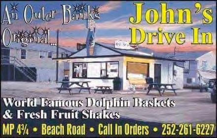
Through hurricanes, development booms and changing food trends, John’s Drive-In stayed grounded in its original mission: serve good food with personal care. Courtesy John Tice Jr

Tucked along the Beach Road in Kitty Hawk, just a few sandy steps from the Atlantic, John’s Drive-In doesn’t shout for attention. There’s no flashy signage or neon buzz—just a steady line of barefoot locals, sunburned tourists and salty dogs waiting for a milkshake, a dolphin boat or a taste of something that hasn’t changed in decades. And that’s exactly the point.
by Danielle Puleo
For generations, John’s Drive-In has been a rite of passage, a summer ritual and a beloved taste of the “real” Outer Banks. In an area that’s evolved from quiet coastal outpost to major vacation
destination, John’s remains gloriously unchanged—a testament to simplicity, consistency and family-run charm.
John’s was started by John Tice Sr. and his wife, Ms. Pat, in the early 1970s. At the time, there wasn’t much else around. “No place to get a sandwich back then,” recalls John Tice Jr., who took over the business and ran it until 2020. “Other than Newby’s sub shop, it was just us. We were serving fish, burgers, subs—ham, Italian, even three-piece chicken dinners. Open from 11 to 11 every day.”
All the Tice kids went to Manteo schools, but home was the drive-in. “We’d come home from school and work. That’s how we grew the business.” It wasn’t just a family operation—it was an evolving community hub. “We came up with all the recipes on our own,” Tice says. “Fish batter,
sauces—we experimented and had fun with it.”
Customer input played a huge

role in those early years. “We were new to the Outer Banks, and a lot of locals would tell us what to do—and we listened. A lot of what we ended up making came from those suggestions.”
Ms. Pat was the heart of the place.
“The milkshakes were her creation,” Tice remembers. “She’d come up with new flavors and take customer suggestions, always trying new things.” But more than recipes, Ms. Pat brought a sense of warmth that made John’s special. “She treated everyone like they were her kids. She’d know their names, have their food ready when they pulled in. My dad always said that was an art—not everyone has that.”
Originally a no-frills, counter-service walk-up, John’s quickly became famous for its dolphin boats (don’t worry, it’s locally caught mahi-mahi), hand-cut fries, and legendary thick milkshakes.
In those early days, the connection to the ocean was literal. “We used to go across the street and catch fish right out of the ocean,” says Tice. “Cut it up, filet it, grill or fry it, and serve it. When the blues were running, we’d send someone over with a fishing pole while people waited for their food. It was crazy back then.”
There are stories of pickup trucks full of strawberries, too. “Strawberry pickers would come by and drop off fresh strawberries. That’s just the kind of place it was.”
Through hurricanes, development
booms, and changing food trends, John’s Drive-In stayed grounded in its original mission: serve good food with personal care. There are no online orders, no glossy rebrands and no gimmicks—just a screen window, a chalkboard menu and picnic tables in the side yard.
That consistency is exactly why people love it. Families return year after year, sometimes across generations, to the same counter where their parents once ordered a cone after a day at the beach.
“People have been able to create generational memories,” Tice says. “And we’re

still in touch with a lot of our customers. Everyone became like family.”
On summer evenings, the parking lot hums with laughter, flip-flops slap on pavement, and dogs happily wait under picnic tables. It’s a place where locals and tourists meet on equal footing, where beach chairs and surfboards are as common as car keys.
Even as new restaurants and chains pop up around the Outer Banks, John’s stays true to a quieter, more personal kind of hospitality—one built on history, heart and a love of the coast. As John Jr. puts it, “If my father were still alive, he’d say the reason John’s became what it is today is because of my mom. She made sure everyone felt taken care of.”
In an age of fast-casual dining and food apps, John’s DriveIn is a nostalgic breath of sea air. It doesn’t need reinvention— it just needs hungry people with sand on their feet and a love of tradition. Whether it’s your first visit or your 50th, grabbing lunch at John’s isn’t just about food—it’s about stepping into a piece of the Outer Banks that feels like home.


Each spring, the shoreline of North Carolina’s Outer Banks is transformed into a rumbling, chrome-plated celebration of custom cars, community and charitable spirit. What began as a dream in 2019 has quickly become a must-attend event for automotive enthusiasts across the east coast: the OBX Rod Custom Festival.
The idea was born from local car fanatic Michael Tillett, who first envisioned a “car week” on the Outer Banks while traveling the show circuit with his
by Danielle Puleo
beloved OBX SS Monte Carlo. After years of building credibility within the car community, Tillett teamed up with Richard Quidley, owner of American Classic Garage (ACG), and ACG store manager Sara Hole to turn the vision into reality. Together, they formed Garage Band Charities, Inc., and with the support of local volunteers, the Outer Banks Visitors Bureau, and countless community businesses, the inaugural festival rolled out in May 2019 with more than 300 hot rods glistening at the Soundside Event Site in
Nags Head.
“The way we planned out the OBX Rod and Custom Festival broke away from the normal template of sitting in a field or convention center all day,” says Quidley. “Our attendees were encouraged to get out and explore during organized cruise activities, and among smaller groups of friends. But the biggest feedback we got was that everyone felt welcomed, wherever they went. Welcome was the big buzzword.” That first year featured a police-led cruise down NC-12, discount admissions to area attractions, and even a nostalgic outdoor screening of Smokey and the Bandit. The community’s response? Overwhelmingly positive.
Behind the scenes, the effort was all heart. “This was our big shot to put the Outer Banks on the map with the custom car community,” Hole said. “We are just a few locals with a passion for the community. I think the attendees were surprised that the main organizers were out there handing out welcome bags and name tags along with volunteers. It’s just how we do on the Outer Banks.”
The event's growth has been nothing short of extraordinary. Even when the COVID-19 pandemic hit in 2020, forcing the team to pivot to a hybrid format spread across 17 locations, the OBX Rod Custom Festival didn’t stall. Instead, they attracted more than 400 vehicles and raised $22,000 for local children’s charities. In 2021, with venue challenges persisting, the team executed another plan B with the help of locals like Brian Mervine and Kelly Midgett—resulting in more than 700 registered vehicles and another successful donation drive.
By 2022, the festival triumphantly returned to its home at the Soundside Event Site, and participation exploded. From 722 cars in 2022 to 916 in 2023, and a record-breaking 1,073 in 2024, the OBX Rod Custom Festival now attracts national attention. Each event features organized cruises, curated vendor zones, local food trucks, and a stunning variety of custom builds—from classic restorations and rat rods to one of the largest Pro Street gatherings in the region.
More than just an automotive event, the festival is rooted in community purpose. More than $181,000 has been donated so far to local causes, including the Children and Youth Partnership of Dare County and the Dare County Motorsports Charity Group, supporting families and youth in need.


Experience the Resort Realty di erence and receive OwnerCentric™, dedicated sta , in local o ces. Resort homes are assigned to individual property managers so you get a more personal touch from people who know you and your home! We o er no cost in-house maintenance, a housekeeping department that truly cares, accompanied by unsurpassed inhouse marketing. Call us now at 800.458.3830 to learn more.

by Danielle Puleo
At the northernmost reaches of North Carolina’s Outer Banks, the asphalt of NC-12 runs out — quite literally — and gives way to sand. Here, the "highway" becomes a memory as drivers shift into four-wheel drive and navigate a wild, windswept shoreline where surf meets tire track. This stretch, known as the 4WD area of Corolla and Carova Beach, is at once a road, a beach and a living habitat: a rare convergence that invites admiration, caution and care.
The transition is abrupt but iconic. At the end of the paved NC-12 near Corolla, a wide sand ramp serves as the on-ramp to the 4WD area, a roughly 11-mile stretch of open beachfront that serves
as the only “road” access to hundreds of homes in Carova, North Swan Beach and other unincorporated communities to the north. There are no stores, no gas stations and no public utilities. To live or vacation here means adapting to the rhythms of the tide and the limitations of your vehicle.
In bad weather, these realities become more than quirks — they become challenges.
When nor’easters or tropical storms roll through, the beach can become completely impassable due to flooding, erosion or shifting sand. Residents, visitors and emergency services alike must time their travel around high tide and
track conditions. In winter, freezing spray can harden tire ruts into frozen troughs. In summer, traffic surges with curious tourists, beachgoers and rental turnover. It’s not uncommon to see lifeguards or sheriff’s deputies towing vehicles that didn’t heed the “4WD only” warnings.
Because the beach is both a transportation route and a recreational haven, balancing vehicle access with environmental stewardship is a constant negotiation. Currituck County manages this dual-use system through a seasonal permitting program. Between Memorial Day and Labor Day, any non-resident parking on the beach requires a coun-
ty-issued permit, designed to limit overcrowding and reduce impacts on sensitive dune ecosystems.
Speed limits vary, but are typically posted at 15 mph when within 300 feet of pedestrians or horses. Enforcement is serious: sheriff's deputies regularly patrol, and reckless drivers risk hefty fines, license points or being banned from beach driving altogether.
Still, accessibility remains a draw. The 4WD beach is a gateway to solitude. Whether you’re surf fishing at sunrise, scanning the horizon from a porch in Carova, or simply pulling over for a spontaneous beach day with the ocean as your backyard.
Perhaps no aspect of this unique geography draws more attention (or reverence) than the wild horses. Known as the Banker horses, these feral descendants of Colonial Spanish mustangs have roamed the northern Outer Banks for centuries. Genetic testing and oral history suggest they were brought here by Spanish explorers in the 1500s, either by shipwreck or deliberate release. Over time, they adapted to the harsh coastal environment, developing smaller frames, strong hooves and a hardy temperament well-suited to life on sand, marsh and scrub.
Today, an estimated 100 horses live north of the paved road in a 7,500-acre area that includes the Currituck National Wildlife Refuge, residential dunes, and open beach. Protected by the Corolla Wild Horse Fund (CWHF) and local ordinances, they are a symbol of the region’s untamed spirit and a living piece of American history.
But their presence comes with rules. By law, humans must stay at least 50 feet away from any wild horse — roughly the length of a school bus. Feeding, petting or attempting to lure them closer is strictly prohibited and punishable by fines up

to $500 or more.
The rule exists not only for human safety, but to protect the horses from becoming habituated to people or suffering fatal consequences from human food.
The horses are also vulnerable to vehicle strikes, especially when they graze near the tire ruts left in the sand. Summer brings more traffic and less visibility, with SUVs and pickup trucks weaving around families, coolers and beach tents. Despite posted speed limits and educational efforts, the occasional tragic collision serves as a reminder of the delicate balance between tourism and preservation.
In recent years, CWHF has intensified its outreach, offering tours and educational programs aimed at fostering deeper respect for the herd. The fund also oversees veterinary care, manages genetics and occasionally removes horses when population pressure or injury warrants it. Removed horses are placed in sanctuary or adopted through a rigorous screening process, ensuring their legacy continues off the sand as well.
As coastal development and visitor
numbers rise, the survival of the Corolla wild horses increasingly depends on community buy-in and personal responsibility. Seeing one in the wild — mane whipping in the wind, hooves kicking up spray — is an unforgettable moment. And protecting that moment for future generations is part of the unspoken contract between land, people and history on this fragile edge of the world.
The 4WD area of Corolla and Carova is more than an unusual way to get from point A to point B. It’s a layered and living example of how humans and nature coexist, often uneasily, at the edge of the continent. This is a place where the road is the beach, the residents share space with wild horses, and the very notion of access comes with caveats written by tides, wind and history.
It’s not for everyone, and that’s part of its charm. For those who embrace its quirks, the 4WD zone is a slice of freedom wrapped in sand and salt. But with that freedom comes responsibility: to tread lightly, drive wisely and respect the past and present forces that shape this extraordinary place.


To know the Outer Banks is to know its waterways—and the enduring, dynamic relationship between people and the waters they call home. Image appears courtesy of the Outer Banks History Center, State Archives of North Carolina


by Danielle Puleo
Along the shifting sands and sweeping shores of North Carolina’s Outer Banks, the story of the islands isn’t just written on the land—it’s carried in the waters that surround, separate and sustain them. The sounds, inlets, rivers and creeks of the Outer Banks form a vast, intricate system that has shaped life here for centuries, from the earliest Native American settlements to the fishermen, sailors and adventurers of today.
To know the Outer Banks is to know its waterways—and the enduring, dynamic relationship between people and the waters they call home.
Behind the slender barrier islands lies a watery world nearly as vast as the ocean itself. The Pamlico Sound, stretching more than 80 miles long and up to 30 miles wide, is the largest lagoon along the U.S. East Coast. It is so broad in places that it often feels like open ocean, especially when summer squalls whip across its surface. But beneath its deceptively shallow depths—rarely deeper than 20 feet—thrives a complex ecosystem teeming with fish, shellfish and waterfowl.
North of Pamlico lies the Albemarle
Sound, a broad estuary that collects freshwater from rivers like the Chowan and Roanoke before blending slowly into saltier currents. The Albemarle was a major thoroughfare for Native American tribes and later for colonial settlers, forming one of the earliest centers of European trade in the New World. Further north still is the Currituck Sound, shallower and more marshy, famous for its duck hunting heritage and still dotted with historic hunt clubs and wildlife refuges.
These sounds are more than just beautiful backdrops—they are economic engines. Commercial fishing, recreation-
al boating and tourism all rely on healthy sound waters. They're also ecological powerhouses, nurturing vital seagrass beds, oyster reefs and countless species of fish and birds.
The inlets of the Outer Banks are the critical openings between the Atlantic Ocean and the sound waters, allowing tides, fish and commerce to flow between the two worlds.
But they are not permanent features— they shift, open, and close over time with storms and natural processes.
• Oregon Inlet, one of the most important, was created by a hurricane in 1846 and remains a key navigation route for offshore fishermen and charter boats.
• Hatteras Inlet, also opened by the same 1846 storm, is a critical link for


and Ocracoke.
• Drum Inlet, Ocracoke Inlet and New Inlet have all opened, closed and reopened in different eras, sometimes isolating communities and demanding new ferries, bridges or even relocations. These dynamic waterways are a source of opportunity—and challenge. Oregon Inlet, for example, is notorious


for its fast-moving sands and treacherous navigation. Maintaining safe passage requires constant dredging and monitoring, a battle against nature that’s been ongoing for generations.
While the grander features grab the headlines, the waterways of the Outer Banks are full of hidden gems:
• The Alligator River winds inland through cypress swamps and wildlife refuges, rich with history and natural beauty.
• Currituck Sound to the north is riddled with marshes and creeks, once plied by moonshiners, fishermen and the famous "mosquito fleet" of small sail-
boats that kept communities supplied.
Many of these smaller waterways have a long history as smuggling routes, supply lines and natural corridors, shaping the cultural identity of isolated villages. Today, they offer some of the best paddling, bird-watching and nature touring anywhere on the East Coast.
The Outer Banks' waterways have long been arteries of movement and trade. Native Americans plied the sounds in dugout canoes, trading goods across great distances. European settlers used the same routes to move crops, timber, and seafood to mainland markets.
During the Civil War, control of the waterways was a strategic priority. The Battle of Roanoke Island in 1862 gave Union forces a critical foothold along the coast, allowing them to cut off Confederate supply lines through the sounds.
Later, in the 19th and early 20th centuries, small steamboats and schooners kept remote island communities connected. Before the advent of highways and bridges, everything from groceries to mail arrived by water.
Because the Outer Banks are so fragmented by water, transportation here has always been defined by the waterways. Ferries have long been a lifeline—still operating vital routes between Hatteras and Ocracoke, or Ocracoke and Swan Quarter and Cedar Island.
The bridges, from the early wooden trestles to modern marvels like the
Marc Basnight Bridge and Virginia Dare Memorial Bridge, are engineering responses to the shifting, storm-tossed waters.
Meanwhile, private boating is part of daily life. Sailboats ply the Albemarle Sound; fishing skiffs head out at first light across Pamlico Sound. From a kayak slipping through a reedy creek to a commercial fishing trawler battling a nor’easter, the vessels of the Outer Banks are as varied as the waterways themselves.
Today, the Outer Banks’ waterways support a booming recreation economy. Charter fishing boats head through Oregon and Hatteras inlets in search of
tuna, mahi and marlin. Kayakers explore winding salt marshes, paddling among snowy egrets and oyster reefs. Sailboats skim the sounds, while kiteboarders and windsurfers take advantage of the Outer Banks’ famously steady breezes.
The region’s wildlife refuges—like Pea Island, Alligator River and Currituck— preserve critical habitats and offer unparalleled birdwatching and eco-tourism opportunities. Here, the waterways nurture species ranging from brown pelicans to bottlenose dolphins.
Yet these same waters remain vulnerable. Rising seas, pollution and habitat loss threaten the delicate balance. Efforts to restore oyster beds, protect seagrass meadows and reduce runoff are ongoing, highlighting the region’s growing commitment to conservation.
For the Outer Banks, the waterways are more than scenery—they are identity, economy and lifeline. They have carried pirates and colonists, fishermen and ferry captains, explorers and tourists. They have written and rewritten the map, washed away old stories, and brought new ones to the shore. To paddle into a salt marsh, sail across the sound, or ferry over an inlet is to step into a living, breathing landscape where history flows with the tides and the future waits just over the horizon.
In the end, the waterways of the Outer Banks remind us that this place has always belonged as much to the water as to the land—and that understanding the Banks means understanding the beautiful, ever-moving waters that shape them.


by Danielle Puleo
Long before highways stitched the Outer Banks to the mainland, before bridges arched over inlets and ferries traced watery corridors, the people of these barrier islands relied on something far more ancient to move through their world: boats. For centuries, boat-building was not just a trade on the Outer Banks—it was a way of life, passed down through generations, shaped by necessity, geography and the ever-present sea.
The Outer Banks have always been
remote. Early settlers in the 17th and 18th centuries found themselves cut off from inland North Carolina by dense swamps and vast sounds. To survive, they turned to the waters around them—not just for food, but for travel, commerce and communication. With forests of sturdy juniper, cypress and pine at their disposal, these early watermen became boat-builders, crafting shallow-draft vessels perfectly suited to the Banks’ shifting shoals and shallow sounds.
The most iconic of these was the shad boat, developed in the late 1800s and recognized today as North Carolina’s official state historic boat. Built first in Roanoke Island’s Wanchese village by local craftsman George Washington Creef, the shad boat was nimble, fast and ideal for navigating narrow marshy creeks and wide-open sound waters. Its round-bottom hull allowed it to ride over shallows, while its wide beam gave it stability under sail. By the early 20th century, boat-build-
ing had become a serious industry on the Outer Banks. Communities like Wanchese, Hatteras and Manteo became hubs of small-scale shipbuilding. Builders adapted traditional designs to new technologies—adding motors, refining hull shapes and creating vessels that could handle both the demands of fishing and the increasingly unpredictable Atlantic.
In the mid-20th century, the rise of sportfishing tourism sparked a new chapter. Builders in places like Wanchese and Harkers Island began to specialize in sleek, fast boats designed for offshore fishing charters. These custom sportfishing boats—often featuring deep-V hulls and towering flybridges—became synonymous with the
Outer Banks' reputation as a worldclass angling destination.
Names like Buddy Davis, Sheldon Midgett and Omie Tillett became legendary among boat aficionados. The designs these men pioneered, often referred to as Carolina flare hulls, featured a dramatic bow flare and sharp entry, allowing boats to cut cleanly through chop while staying dry on deck—a necessity in the rough, shallow coastal waters offshore.
While many villages have boat-building roots, Wanchese remains the cultural and practical center of the craft. Located on the southern tip of Roanoke Island, the village evolved from a working watermen’s community into a major hub for commercial fishing


and boat construction. The Wanchese Seafood Industrial Park, established in the 1980s, helped formalize the area’s maritime economy, attracting boat builders, marine suppliers and repair yards.
Even today, builders in Wanchese carry on the tradition, with shops crafting both fiberglass and wood vessels— custom workboats, charter yachts and personal skiffs. Though fewer in number, the remaining builders uphold a standard of excellence rooted in generations of experience.
Boat building on the Outer Banks has weathered change: the decline of commercial fishing, the rise of mass-produced boats, and even natural disasters like hurricanes that have
devastated boatyards. But the tradition endures, not just through active shops, but also through museums, educational programs and heritage preservation.
The George Washington Creef Boathouse in Manteo serves as a living museum where visitors can see traditional boat designs and learn how craftsmen once hand-shaped hulls with nothing but hand tools and local timber. Programs by organizations like the Roanoke Island Maritime Museum
and the North Carolina Maritime Museum in Hatteras help teach the next generation about the skills, tools and stories behind the boats that built the Outer Banks.
Boat building here is about more than utility—it’s about identity. Every line carved into a hull, every sail rigged, every frame laid tells a story about a people who have always looked to the water first. These vessels weren’t just built to fish or ferry—they were
built to survive, to adapt and to thrive in one of the most challenging marine environments on the East Coast.
In a place constantly reshaped by wind and tide, the craft of boat building offers a rare through-line of continuity. Whether it's a wooden shad boat or a custom sportfisher slicing through Oregon Inlet, the legacy of Outer Banks boat-builders rides the waves—and remains anchored in the culture of this remarkable coast.

by Danielle Puleo
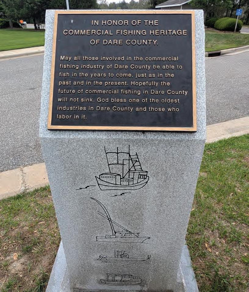
Long before the Outer Banks became a tourist haven or a national seashore, they were working islands—rugged, remote and fiercely dependent on the bounty of the sea. For generations, commercial fishing sustained life here, shaping the economy, building tight-knit communities and forging a unique coastal identity that still endures despite mounting challenges. This is the story of how the waters around the Outer Banks fed not only families, but an entire way of life.
The early settlers of the Outer Banks turned naturally to the water for survival. Cut off from inland agriculture and commerce, they fished the inlets, sounds and nearshore Atlantic for sustenance and trade. By the 18th and 19th centuries, small-scale commercial fishing had emerged as a livelihood—mainly for shad, striped bass, oysters and blue crabs. With boats built locally and nets woven by hand, entire families worked
together to make a living from the sea. Villages like Wanchese, Hatteras, Stumpy Point and Ocracoke became fishing powerhouses—not through volume, but through resilience. Weather, tides and fish migration dictated life; fishermen followed the seasons and adapted to the environment with an intimate understanding of the waters they worked
By the mid-20th century, the com-
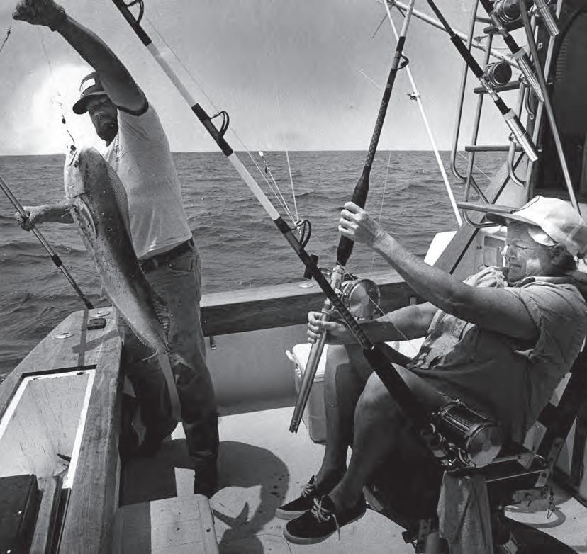
mercial fishing industry was thriving, particularly in Wanchese. The village developed into a major seafood landing point, thanks in part to its strategic location on Roanoke Island and easy access to both the Pamlico Sound and the Atlantic. In the 1980s, the state invested in the Wanchese Seafood Industrial Park, helping modernize the processing, shipping and support infrastructure for local fishers and boatbuilders. At the same time, Hatteras fishermen specialized in offshore catches, including tuna, mahi and swordfish. The prox-

imity to the Gulf Stream gave them access to warm, deepwater species not commonly found elsewhere on the East Coast. Longlining and trawling became more prevalent, and catches were increasingly destined for national and international markets.
The diversity of Outer Banks seafood reflects the region’s unique geography. From the shallow, brackish sounds to the open ocean, fishermen targeted everything from shrimp and clams to cobia and floun-


der. In particular:
• Blue crab became a staple export and cultural icon.
• Menhaden, harvested for oil and fish meal, supported large processing operations.
• Oysters and clams were pulled from local beds, though habitat loss later threatened their populations.
• Striped bass and red drum attracted both commercial and recreational interest, sometimes sparking conflict between user groups.
In many communities, fishing wasn't just a job—it was a birthright. Children learned to work nets and clean fish before they were tall enough to see over the gunwale, and fishing families formed the backbone of coastal society.
Despite its deep roots, commercial fishing on the Outer Banks faces growing challenges. Regulation, designed to protect fish stocks, has become more complex and, at times, controversial. Quotas, licensing, gear restrictions and closed seasons—while critical to sustainability—have made it harder for small operators to remain profitable.
Environmental change also looms large. Rising sea levels and shifting salinity patterns are altering fish migration routes and affecting spawning grounds. More intense storms disrupt both harvests and infrastructure, while inlet
shoaling can limit access to offshore fishing grounds.
Market pressure from imported seafood, often cheaper and more abundant, further squeezes local fishermen, many of whom now operate on thin margins and supplement their incomes through tourism or charter work.
Yet the spirit of commercial fishing persists. Fishermen continue to work the waters of Pamlico and Albemarle sounds, and a handful of docks still bustle with activity in Wanchese, Hatteras and Engelhard. Organizations like the North Carolina Fisheries Association and Ocracoke Working Watermen’s Association advocate for policies that balance conservation with livelihood. Local markets and restaurants increasingly highlight “boat-to-table” menus, supporting local catches and keeping the heritage alive.
Educational outreach and museums, such as the Graveyard of the Atlantic Museum in Hatteras and the North Carolina Maritime Museum in Beaufort, document the tools, boats and stories of Outer Banks fishers. In some schools, programs teach net-making and water navigation, ensuring that the skills and stories don’t vanish with
the older generations.
Commercial fishing may no longer dominate the Outer Banks economy, but it still defines its soul. Each net cast and crab pot hauled echoes


centuries of tradition, hard work and adaptation. The future will require new solutions and evolving practices, but as long as there are fish in the water and hands willing to work the lines, the Outer Banks will remain a place shaped—and sustained—by the sea.


by Danielle Puleo
Long before tourists discovered the wind-swept dunes and quiet beauty of the Outer Banks, another group of travelers came to these shores with less peaceful intentions. Drawn by shifting sands, hidden inlets, and relative lawlessness, pirates once ruled the waters off North Carolina's coast. From infamous figures like Blackbeard to less-
er-known rogues, the Outer Banks played a central role in what has become one of the most storied eras in maritime history.
Stretching like a string of fragile pearls between the Atlantic Ocean and the North Carolina mainland, the Outer Banks were tailor-made for piracy. The narrow barrier islands offered conceal-
ment, the shallow waters confounded large naval vessels, and inlets like Ocracoke, Hatteras, and Drum provided hidden entrances and exits to the open sea. These features made it difficult for authorities to enforce the law—and easy for pirates to evade them.
Beyond geography, the Outer Banks sat near key shipping routes where mer-

chant vessels laden with goods from the Caribbean and Europe passed regularly. It wasn’t just about hiding—it was about striking where the goods were rich and the risks, minimal.
No discussion of piracy on the Outer Banks is complete without Edward Teach, better known as Blackbeard. Fierce, theatrical and endlessly mythologized, Blackbeard made the inlets around Ocracoke and Bath his base of operations in the early 1710s. It was here, in the sheltered coves near Ocracoke Inlet, that he anchored his infamous ship, Queen Anne’s Revenge, and where he met his violent end.
After receiving a pardon from North Carolina’s colonial governor (a reflection of the blurred lines between pirate and politician), Blackbeard continued his plundering lifestyle. His actions eventually drew the attention of Virginia Governor Alexander Spotswood, who sent Lieutenant Robert Maynard to end his reign. In November 1718, Maynard’s men ambushed Blackbeard off Ocracoke Island in a brutal hand-to-hand fight. According to legend, it took five gunshots and 20 sword wounds to bring him down. His severed head was hung from Maynard’s


bowsprit as a warning to other pirates. Today, Blackbeard’s legacy remains inseparable from Outer Banks lore, with numerous sites, reenactments and festivals commemorating his presence. Divers even located the wreck of Queen Anne’s Revenge near Beaufort Inlet in 1996, confirming long-held rumors of his watery grave.
Blackbeard may have been the most famous, but he was far from alone. During the so-called "Golden Age of Piracy" (roughly 1650–1730), dozens of pirates used the Outer Banks as a base or refuge:
• Stede Bonnet , known as the "Gentleman Pirate," is believed to have sailed these waters with Blackbeard before their falling out.


• Anne Bonny and Mary Read , two of the most notorious female pirates in history, were said to have cruised the Carolinas while allied with pirate captain Calico Jack.
• Charles Vane , known for his cruelty and defiance, may have used hidden coves along the Banks to avoid capture.
Even Spanish treasure ships wrecked by storms or captured by pirates added to the legend. Some tales speak of buried treasure near Hatteras and Ocracoke, though no definitive hoards have ever been found—fueling speculation and local lore to this day. By the 1730s, piracy in the Outer Banks had all but vanished—swept away by increased naval patrols, shift-


ing trade routes, and the tightening grip of colonial governments. But the legends never left. Pirate folklore became part of the fabric of island life, woven into songs, place names, and even family stories.
Ocracoke Island in particular remains steeped in pirate mythos. The annual Blackbeard’s Pirate Jamboree, hosted in the fall, features ship battles, costumed
reenactors, and historical exhibits that draw visitors from across the region. The British Cemetery on the island also commemorates sailors killed in later naval engagements, underscoring the area's continued maritime significance.
Whether or not you believe the tales of phantom ships or spectral pirates wandering the dunes at night, one thing is certain: the spirit of piracy still lin-
gers in the Outer Banks. It’s there in the wind-whipped surf of Ocracoke, in the place names like Teach’s Hole and Devil Shoals, and in the dark romance of a time when lawless men ruled the seas. What was once a refuge for outlaws has become a living museum of their stories—and a reminder that these waters, while beautiful, were once dangerously free.


In 1975, when Whalebone Surf Shop first opened its doors in Nags Head, surfing on the Outer Banks was still a niche subculture—barefoot locals chasing hurricane swells and shaping boards in backyard sheds. Fast-forward 50 years, and Whalebone isn’t just a surf shop. It’s a landmark, a legacy, and the beating heart of a coastal lifestyle that defines the Outer Banks.
This year, as Whalebone Surf Shop celebrates its 50th anniversary, the milestone isn’t just about years in business—it’s about five decades of shaping the culture, riding the waves of change, and staying true to a surf-rooted iden-

by Danielle Puleo
tity in a place where the ocean is everything.
Whalebone began as a passion project. Jim Vaughn, one of the shop’s most pivotal figures, remembers it as a time of experimentation and community. “When I first moved here in 1975, there were no mile markers, no street signs, no traffic lights, no lawns, no pools, and no place to eat after 9,” he wrote. “Also, you had to go through an operator to place a long-distance phone call.”
It was the Wild West of surf retail. They carried brands like Sundek, Katin, Hang Ten and Birdwell, while rubbing shoulders with surf legends.
Vaughn recalled spending a winter in California, where he became close with Tom Morey—the inventor of the boogie board. “We would talk surfboard design and theory—and did he have some crazy-looking surfboards,” Vaughn wrote. “On a number of occasions, he told me he would someday design something that would allow the masses to experience surfing—yep, that was the Morey Boogie Board.”
The culture of Whalebone was always rooted in community. “One of the reasons I love the Outer Banks so much is in the early days it was a parody of a college town in reverse,” Vaughn wrote.
“The beach closed down for the winter and in the spring, everyone was getting ready for the season. It was the time to trade stories of winter surf trips vs. summer vacation. The shop was the perfect place to ‘talk story.’”
By 1977, Vaughn bought out his Jupiter partners and renamed the shop. Inspired by their location at the literal Whalebone Junction— where three roads converge and surfers head south to Hatteras—the name stuck. The original logo? A black skull-and-crossbones made of crossed surfboards, inspired by Jimmy Buffett’s “A Pirate Looks at Forty.” Local artist Glenn Eure drew the skull, while visiting artist Michael Grey painted surfboards by hand.
Whalebone evolved with the times while keeping its core intact. Vaughn carried surfboards from the “best manufacturers that were available in the world.” He “wanted to show people the surfboards that they would read about, and already have them in stock.”
Vaughn shared that he couldn’t have done it without the help of his family. His wife and business partner, April, ran everything behind the scenes. While Jim was downstairs, she took care of “cleaning up after” him and all of the paperwork.
Vaughn’s children, Stevi and Max have been a big part
of the story of Whalebone, too. Stevi became the ladies buyer when she was young, and “the shop excelled in her ladies swimwear discoveries.”
Vaughn shared that women would drive from hours away just to buy from Stevi.
“They [Stevi and Max] literally grew up in the surf shop business, cardboard boxes in the dressing rooms are we checked in new inventory pre-season until daycare came along.” He added, “my children and my wife have been integral in this story none of this would be possible without them.”
Eventually, Vaughn began thinking about the shop’s next chapter. “In my early 70s, I really started to question my validity,” he said. “One of our employees’ fathers, Jon Black, asked if I had thought about selling. He wrote me a letter that hit all the right points— plus he surfed—so we agreed to sell.”
Today, Whalebone Surf Shop remains a family-run business—still local, still surf-first, and still deeply connected to its roots. The shop is now helmed by Jon and Christie Black, who took the reins in 2021 with a deep respect for the legacy built by the Vaughns.
“For us, with Whalebone being one of the core surf shops on the east coast and having the lineage it does, it's been important that we carry that on and maintain a
‘surf first’ culture,” said Jon. “Honoring what the Vaughns built has been huge—trying to maintain that legacy while also doing things in the way we see fit. We call it Whalebone 2.0.”
Jon’s path to ownership began with a leap of faith— literally working in the shop for free during the summer of 2021 to learn the ropes and observe the culture firsthand.
“It was sort of a tryout at the time,” he said.
Whalebone’s impact extends far beyond Nags Head. “The fandom is something else,” Jon added. “It’s so recognizable, noticed around the world in the surf community.”
Christie sees it from both sides—the hardcore local surfers and the longtime vacationers who return year after year. “It’s been really neat to see that there is a following,” she said. “You’ve got your local surf community who definitely regard Whalebone as having core surf products, and then you have your tourists who just love the Whalebone name.”
Fifty years in, Whalebone Surf Shop isn’t just surviving—it’s thriving. A surf shop built on stoke, shaped by hand, and passed on with heart. From the early days of shaping boards with legends to the Instagram era of storytelling, it remains what it’s always been: a place where surf lives.


by Daryl Law

Immerse yourself in the sights, sounds and sweet smells of nature by hiking one of the fabulous trails found along the Outer Banks. There’s everything from challenging terrain hikes in the woods to simple waterfront strolls along boardwalks.
From Currituck to Ocracoke Island, you can find numerous established trails that provide hiking enthusiasts multiple places to enjoy the wooded world of these sandy barrier islands. These tracks feature mature hardwood
trees, vegetated sand dunes and swales as well as small ponds and views of expansive soundside waters.
These paths weave their way through the lush maritime forests and dunes located in Kitty Hawk, Nags Head and Buxton. In Ocracoke, Springer's Point also offers a splendid adventure that leads to pirate Blackbeard’s hideout, Teach's Hole on the island's southern inlet.
The most centrally located trails can be found in Nags Head Woods
Preserve. They offer different levels of difficulty, from easy walks to steep terrain hikes created by large sand dunes and deep swales.
Managed by The Nature Conservancy, this preserve boasts and protects incredible biodiversity. There are more than eight miles of trails that trek along well established paths that have steep climbs over wooded sand dunes and pass by ponds teeming with life just listen to the bullfrogs or breathe in the sweet perfume of hon-

Le : A number of Jockey’s Ridge State Park o cials, Friends of Jockey’s Ridge State Park, Roanoke Island Woman’s Club and the Outer Banks Woman’s Club and others involved with making the Mountains-to-Sea Trail Eastern Terminus Monument possible stand at the monument a er the 2023 ribbon cutting event. Philip S. Ruckle file photo Right: Jessica, le , and Beata Faulkner say they love hiking in Nags Head Woods and make it out on the trails daily. They also live in Nags Head. Daryl Law photo


eysuckle.
Brackish marshes provide places for plants and animals to thrive. All along the way, there are numerous trees beech, hickory, oak and pine, some of which are hundreds of years old.
marooned mariners to hardened fishermen and farmers, these beautiful, wild pockets of forests were central to the settling of the Outer Banks over the centuries. Now, only a few families still reside in Nags Head Woods.
For day hikers, there's just a soothing, relaxing feeling that comes with time spent in these magical woods where one may hear an osprey cry overhead or see a lizard scurrying across the path.
There are woodpeckers, squirrels and turtles. A few cottonmouth and rattle snakes are also around so watch your steps.
For these reasons and more, Nags Head Woods gets plenty of walkers, hikers, runners and bikers daily on the trails and gravel roads.
"I come out here every single day," said Beata Faulkner. "I love nature, I love hiking."
Faulkner and her daughter Jessica, both of Nags Head, take their daily walks along trails such as Sweetgum Swamp and Blueberry Ridge. The Roanoke takes them out to the sound and back.
They said they’d prefer not to encounter snakes, but they don’t let it impact their daily outings in Nags Head Woods.
Historically, these forests have provided protection from the harsh, cold northeast winter winds and salt-spray making them ideal places for people to live, work, survive and, perhaps, thrive.
From Native Americans to
The variety of trails with different distances and levels of difficulty attract a wide variety of hikers according to Lora Eddy, conservation coordinator for The Nature Conservancy. In fact, some 60,000 visitors make it out to hike each year, she reports.
"We have trail counters across all our trails and we get from 100 to 150 people on each trail per month."
As for the eight miles of trails, Eddy said they've made a lot of improve-
ments recently and all the signage is consistent now, too.
"There are boardwalks on the trails and infrastructure," she said. The ADA trail features a pier at the fishing pond where yellow-bellied turtles swim over quickly to investigate the visitors.
The non-profit conservancy enjoys generous support from the community in the form of grants from groups such as the Outer Banks Community Foundation and the Outer Banks Visitors Bureau, Eddy said.
"We love the tourism board supporting us," Eddy noted. She's also pleased that conservancy has brought on Kevin Zorc as the preserve assistant. He's best known as the town's retired fire chief but has embraced this new role with a big smile.
Zorc, a happy go lucky type, seems at ease in his new environment as he struck out for a hike the other day and found his zen.
“Just relax and think of nothing,” he said.
"Hear those bullfrogs?" he asks. "The leopard frogs are the first indicators of spring!" They made their debut in early March.
“In general, there are about 50 reptiles and amphibians,” he said.
“There’s different types of snakes, turtles, salamander and lizards.”
While striding down the gravel West Ocean Acres Road towards the half mile ADA "easy" trail, Zorc names off trees that live in these woods loblolly pines, longleaf pines, southern wax myrtle, eastern red cedar, red maple, swamp bay, sweet gum, hickories and southern red oak.
Again, the sensational, sweet, spring smell of honeysuckle vine permeates the air. Nearby there's also American holly and flowering dogwoods, which are North Carolina's state flower; pines are the state tree.

Hikers should be on the lookout for poison ivy, which is also present.
"Hiking is great, just great!" Zorc said. "The great thing is, when I'm out here, everybody is always happy, always happy.
"There's such a dynamic and robust community of hikers here." A group of them like to meet after work to hit the trails, he added.
Like Eddy, Zorc is also proud of the large number of improvements that have been made to the preserve. The ADA walk features a concrete path and stretches of boardwalk making it an easy one for people of all ages and abilities to enjoy.
For example, Lilly, a 100-year-old woman hits this trail every day and sometimes even offers him advice.
On a recent springtime walk, Zorc said Lilly gave him some sound advice: “Kevin, just don't worry, don't worry about anything!”

Hikers can enjoy several different types of trails along these barrier islands and some of the most awe-inspiring ones are in the expanses of maritime forests. Listed below are the main trails from north to south. Be sure to bring water and keep dogs on their leashes.
• Currituck Banks Boardwalk and Maritime Forest Trail Features a boardwalk with sound views and a three-quarter mile Maritime Forest Trail loop, which is in the Currituck Banks Reserve.
• Pine Island Audubon Center Nature Trail Offers a two and half mile, one-way path through numerous maritime forest habitats. This trail is located at the Audubon Pine Island Sanctuary and Center.
• Corolla to Kitty Hawk Trail This paved trail stretches for nearly 28 miles and offers a moderate hike or bike ride.
• Duck Town Park Boardwalk Spans nearly a mile with soundfront views.
• Kitty Hawk Woods Reserve Trails A beautiful maritime forest with three designated trails. Sandy Run Park features an easy half-mile loop. Kitty Hawk Woods Preserve is a two-mile trail and features plenty of sights to see. Also found in this track of woods is the Covered Bridge Loop, an easy two plus mile trek.
• Nags Head Woods Preserve Trails Centrally located, Nags Head Woods offers multiple hiking trails and a gravel road for cycling. The Center Trail features an easy quarter mile loop with


wooden bridges over a pond. Sweetgum Swamp offers a two-mile, out and back trek. Blueberry Ridge is a 3-mile, out-andback. Both have steep terrain. The half mile Discovery loop is an easy to moder-
ate hike. The Roanoke goes to the sound and back. It’s a moderate hike, designed for adventurous hikers. The Preserve’s ADA Trail is an easy, half mile loop. And finally, the Town of Nags Head offers a
great workout as the path wanders out and back for just over a mile and a half offering a moderate hike.
• Jockey’s Ridge State Park Trails These large sand dunes feature two trails for paths hikes. Just over one mile, Tracks in the Sand is a moderate loop walk from the main access of park on the north end. The Soundside Nature Trail leaves from the sound access for an easy half mile loop.
• The Mountains-toSea Trail Ending at Jockey’s Ridge, this is North Carolina’s state hiking trail.


It stretches 1,175 miles from the Great Smoky Mountains to the Outer Banks, stopping at many of the state’s most beautiful places along the way. It officially opened with the unveiling of the eastern terminus monument on Sept. 29, 2023, with a ceremony at Jockey's Ridge State Park.
• Bodie Island Trail
Off Island is a quarter-mile long trail that begins at the Bodie Island Lighthouse and follows along a gravel road providing an opportunity to explore the marsh ecosystem from the ground and visit the Roanoke Sound.


• The Marshall and Gussie Collins Walkway This public path extends approximately two miles from the Dare County Government Complex in Manteo to the Coastal Studies Institute in Skyco, meandering through scenic woodlands and along the marsh. It is a wonderful way for families to discover a beautiful part of Roanoke Island.
• The Manteo Waterfront Boardwalk A wonderful place to take a relaxing walk, this walkway wraps around the waterfront of this picturesque downtown.
• Roanoke Island Marshes This conservation project and birding trail takes hikers from the trailhead just off N.C. 345 on a four-mile loop walk with great views of the marsh, birds and water
• Pea Island Trails The Pea Island National Wildlife Refuge presents three trails, North Pond Wildlife, Salt Flats Wildlife and The North Pond Levee connects the two wildlife trails to offer a longer hike.
• Buxton Woods Part of the N.C. Coastal Reserve and a Designated Nature Preserve, Buxton Woods contains the largest remaining contiguous tract of Maritime Evergreen Forest on the entire Atlantic coast. The Buxton Woods Trail offers a scenic path through the maritime forest. Open Ponds offers an easy nine-mile hike, and the Cape Hatteras Lighthouse is an easy six-mile hike.
• Hammock Hills Nature Trail
This three-quarter mile loop will have you traversing through a rolling and beautiful pine-laden forest, offering an up-close experience with a diverse collection of coastal plants and wildlife. Located across from the National Park Ocracoke Campground. Keep dogs on leashes and bring bug spray.
• Springer’s Point Preserve
This tranquil preserve opened to the public in 2006 and encompasses more than 132 acres of maritime forest, tidal red cedar forest, salt marsh, wet grasslands and soundfront beach. Hikers pass ancient, gnarled live oaks as they make their way along winding trails to the sandy beach overlooking the infamous pirate Blackbeard’s hideout, Teach’s Hole.


by Daryl Law
Dare County is the land of beginnings and the home of first flight.
The world of aviation has developed dramatically since the Wright brothers recorded their historic flight on Kill Devil Hill back on Dec. 17, 1903.
Today, aviation along this collection of slender barrier islands known as the Outer Banks can be witnessed overhead in a variety of ways.
The National Park Service's Wright Brothers National Memorial beckons pilots of every type of aircraft from small, single-engine, fixed wing planes to the most advanced military flying machines. They all want to pay tribute to the home of the first flight with a flyby of their own.
Along the beaches, armed services aircraft can be seen daily paralleling the coastline, usually at high rates speed, at times so fast they rattle windows with their thundering jet engine roars. The Navy's F-18s and Airforce F-15s and -16s are some of the fastest ones.
It’s also exciting to see Army Ospreys with tilt-wing technology take off verti-


cally like a helicopter before transforming a fixed wing plane and flying away.
Numerous bases are located south in the lower part of coastal Carolina as well as up north in the Hampton Roads region of Virginia.
Jumbo Coast Guard C-130s and rescue helicopters with their distinctive white and orange paint designs also fly routes over the beaches either searching
for mariners in distress or performing training flights often from their nearby base in Elizabeth City.
Dare County maintains its own helicopter for emergency medical transport to hospitals in Greenville, Norfolk and beyond. Dare MedFlight offers a critical link for those with time sensitive need of advanced care, sometimes in life or death situations.
While governmental flying machines seem to fill the skies, there are plenty of other aircraft flying overhead, too. Over at the Dare County Regional Airport on Roanoke Island, there’s a wide variety of airplanes and helicopters all year round.
You might even see Michael Jordan's $70 million Gulfstream 650 from time to time when he's on Roanoke Island. The NBA and Tar Heel star who wore No. 23 jersey recently upgraded his sport fishing vessel with a 82-foot-long custom Bayliss Boatworks vessel, Catch 23.
Daily, both UPS and FedEx cargo craft fly in and out of the Dare airport and recently four Army Blackhawk helicopters were on the tarmac ready for training missions, according to aviation enthusiast Tony Bruno.
"The Army stages them here periodically when they're doing maneuvers," he said.
Bruno, an experienced pilot, serves as the curator of the Dare County Airport Museum, which carries the slogan "Preserving aviation history where aviation began."
He has his own thoughts about the relationship many pilots have with the Wright brothers and Dare County in general.
"Pilots love to fly by the Wright Brothers National Monument," he said. "Why? It's just a tradition now, they just want to connect to the Wright brothers wherever they're from and whatever they're flying."
As the museum curator and an experienced pilot, he's certainly passionate about aviation’s past, but what he seemed most excited to talk about was the present and the future.
Bruno explained that there's an exciting new course, the First Flight High

School Aviation Program, that involves students building an aircraft with their nearby partners, the National Park Service over at the Wright Brothers


National Memorial.
"It's a two-year program for juniors and seniors," he said. "The end of the second year is coming up."
In its two classes a week, the 22 students are split into two groups with one doing hands on work and the other embracing STEM program curriculum such as aerodynamics, math and physics with some aviation history in the mix.
"I'm a mentor in that program," Bruno added. "We're getting there!"
He displays a photo of the aircraft project, and it looks like there's a lot work left. Bruno said because they're building the first one in the program, they've had to add one more semester to this normally 30-hour program.
The First Flight High School Aviation Program was the first in the state to launch the national program and plane builds typically take longer than two years, he said.
Bruno makes a joke that could also easily be applied to boat building.
"We're 90 percent finished and there's 90 percent left to go!" he said with a grin.
Speaking of boats, across the bridge at Manteo Middle and High schools, Bruno said they are building boats and using STEM skills, too. Dare County Schools Superintendent Steve Basnight noted at Cape Hatteras School, they’re building a tiny home, a “Schoolie” bus.
These three Career and Technical Education (CTE) programs are having a powerful impact on the students, Bruno said. After graduation last year at First Flight, four out of seven seniors in the program went into aviation careers.
The aviation classes are led by retired naval aviator Admiral Joey "J.T." Tynch, Bruno noted. A half dozen volunteers assist him. So far, it's been highly rewarding.
"Just the satisfaction of seeing these students ... get in there, riveting, it's all about the riveting," he said.
If you’d like to see Dare County from the air and perhaps buzz the pylon at the Wright Brothers National Memorial monument, head over to the Dare airport and check out what they have to offer.
There’s tandem sky-diving with an instructor, airplane tours, flight lessons and helicopter rides. Over on the beaches, you can find hang gliding lessons and parasailing joy rides.
Speaking of hang gliding, Bruno was pleased to mention that there’s a new exhibit at the Dare airport museum that features Francis Rogallo, the father of the flexible wing. There’s also a documentary about Rogallo in the works Wingman, The Francis Rogallo Story.
The fiscal sponsor, the First Flight Society, said donations are needed and funding options are available. Email


them at dec17@firstflight.org.
On August 19, the First Flight Society will host the annual National Aviation Day Celebration at Dare County Regional Airport. The event runs from 10 a.m. to p.m. and consists of airplane displays, exhibitors, speakers and food trucks.
The mission of the celebration is to provide fun and educational experiences promoting, honoring and celebrating the accomplishments of the Wright Brothers and helping educate the world about aviation the Wright way.


by Danielle Puleo
Few places on the east coast hold the kind of storied connection to the sky that the Outer Banks does. Known for its ever-shifting winds, wide-open landscapes, and role in aviation history, this thin strip of barrier islands has long drawn those who dream of flight. Hang gliding, in particular, has found a natural home here, where the dunes rise just enough to launch a flight and the breezes coming off the Atlantic provide ideal lift.
The Outer Banks' relationship with flight stretches back over a century. On December 17, 1903, the Wright brothers achieved the first controlled, powered flight on the windswept dunes of Kitty Hawk. But long before engines entered the picture, those dunes were being tested as launch pads for gliders. Wilbur and Orville Wright honed their flying skills by piloting unpowered craft from the sandy slopes, making the Outer Banks the birthplace of American aviation and, by extension, the spiritual home of modern hang gliding.
That legacy is carried forward today by schools like Kitty Hawk Kites, founded in 1974 and now one of the largest hang gliding schools in the world. Teaching thousands of new fliers each year, the organization continues to celebrate the region’s role in human flight while training the next generation of sky-bound adventurers.


The so sands and gentle slopes of Jockey's Ridge State Park in Nags Head allow new hang gliding students to learn in a safe environment, with ample room for takeo , flight and landing. Image appears courtesy of the Outer Banks History Center, State Archives of North Carolina
Jockey's Ridge State Park in Nags Head is the heart of hang gliding on the Outer Banks. Home to the tallest natural sand dune system in the eastern United States, it offers a forgiving landscape for beginners and spectacular vistas for experienced gliders. The soft sands and gentle slopes allow new students to learn in a safe environment, with ample room for
takeoff, flight and landing. Meanwhile, the consistent coastal winds—often coming in steady from the southeast—make for ideal flying conditions nearly yearround.
Instructors here often speak of the "magic" of Jockey’s Ridge: a place where first-timers can experience several seconds of flight within their first lesson, a
rare thing in other parts of the country. The weathered landscape, shifting with the wind, feels alive—a natural runway sculpted by the very forces that allow flight.
For newcomers, hang gliding on the Outer Banks starts on foot. Training begins with basic ground school, equipment orientation and safety instruction. Students are then strapped into a harness, connected to a glider, and guided down the dunes by certified instructors. Each short flight builds confidence and hones instinct, allowing fliers to gradually gain altitude and control.
For more advanced pilots, the experience broadens with opportunities to launch from higher dunes or go tandem with instructors in tow launches from Currituck County or further inland. These longer, higher flights offer breathtaking views of the sound, sea and
shifting sandbars that define the Outer Banks. It is not uncommon for fliers to spot dolphins off the coast or ospreys riding thermals overhead.
As the popularity of hang gliding grows, local organizations and park services work closely to ensure the activity remains in harmony with the fragile dune ecosystems and migratory patterns of birds. Regulations govern when and where flights can occur, and continued emphasis on low-impact activity keeps Jockey’s Ridge and other natural sites accessible for future generations.
Hang gliding on the Outer Banks is more than a sport. It’s a continuation of a legacy—a personal connection to the forces of wind and lift that first carried humankind into the sky. For those who step off the sand and into the air, it is both a nod to history and a soaring, joyful moment all their own.


OBAR’sannualSurfFishing,Golf,andBowling Tournaments,whichareopentotheentire community,supportScholarshipandDisasterRelief FundsattheOuterBanksCommunityFoundation. Everycast,swing,andstrikehelpslocalstudents reachtheirgoalsandaidsneighborsrecoveringfrom suddenandnaturaldisasters.ScantheQRcodeor visitwww.outerbanksrealtors.comtoregisterateam, purchaseasponsorship,ordonateanauctionitem.


Francis Rogallo, American aeronautical engineer inventor credited with the invention of the Rogallo wing, or "flexible wing", tests a kite for NASA. Image appears courtesy of the Outer Banks History Center, State Archives of North Carolina


• Billy Mitchell Airport A public-use airport on Cape Hatteras National Seashore, only open during daylight hours.
• Dare County Regional Airport (MQI) A public airport located on Roanoke Island near Manteo, with two runways.
• First Flight Airstrip (FFA) Located adjacent to the Wright Brothers National Memorial in Kill Devil Hills.
• Ocracoke Airstrip A public-use airport on Cape Hatteras National Seashore with a 3,000-foot runway and a helipad.
• Pine Island Airstrip Airstrip near Corolla.