Hobart City Council has endorsed this neighbourhood plan.
Accessibility
This document is located on yoursay.hobartcity.com.au where it is also available as a Word, accessible PDF, etc. On request it can be provided in another accessible format such as enlarged print or audio version. We can also describe the information contained in the illustrations.
Contact
Customer Service Centre
16 Elizabeth Street, Hobart 03 6238 2711 coh@hobartcity.com.au
Disclaimer
This document is provided for information and for public engagement. While every effort has been made to ensure accuracy and completeness, the City of Hobart does not claim the document to be free of errors or omissions, and disclaims any and all liability for any harm or damage to any person or entity through action or omission based on its contents.
Copyright
Unless otherwise stated the photos and illustrations in this document have been supplied by the City of Hobart or MGS Architects.
Acknowledgement of Country
In recognition of the deep history and culture of our city, we acknowledge Tasmanian Aboriginal people as the Traditional Custodians of this land. We acknowledge the determination and resilience of the Palawa people who have survived invasion and dispossession and continue to maintain their identity, culture and rights.
We recognise that we have much to learn from Aboriginal people today, who represent the world’s oldest continuing culture. We pay our sincere respects to Elders past and present and to all Aboriginal people living in and around nipaluna/Hobart.
Climate ready Hobart
A zero emissions and climate resilient community will build a thriving neighbourhood.
This Plan recognises that we live in a changed climate reality and Hobart is experiencing the impacts now.
Extreme weather events, such as heatwaves, floods and bushfires, are becoming more frequent and intense due to climate change. The floods in May 2018 left 12,000 homes and businesses without power and at least $45 million worth of insurance claims were lodged in the months that followed.
We are all adding to the problem of climate change in how we travel, live, work and play: using fossil fuels, generating and disposing of waste, demolishing buildings, and destroying and degrading natural systems.
What we do now matters. Everyone needs to act.
Locally and globally, there are an abundance of solutions. Our capital city benefits from Tasmania’s significant renewable electricity generation but we must do more to make sure that everyone in our community can benefit from the reduced cost of energy bills, health benefits and improved standards of living that come from transforming to a zero emissions and climate resilient future.
To respond to the global climate and biodiversity emergency for current and future generations, the City of Hobart is committed to collaborating with the community to build a compact, well-designed and climate ready Hobart. Together we need to:
Move toward zero emissions by choosing to ride, walk or use public transport. We could use electric vehicles. We can use all electrical appliances in our homes and businesses, retrofit homes and buildings to be thermally efficient and try to avoid demolition. We can reduce waste and use our Food and Organic Waste bins!
Build climate resilience across the city by understanding possible future scenarios, planning and preparing for extreme weather events, restoring and regenerating natural systems, and building capacity to adapt through increased knowledge, connection, security and wellbeing.
Enable equal access to climate solutions by supporting jobs and livelihoods in the low emissions economy and ensure that no one is left behind.
Mobilise community action through each doing what we can to build a climate ready Hobart.
The City has been a leader in climate action for more than two decades, first committing to climate action in 1999. In June 2019, the City became the first Australian capital city to declare a climate and biodiversity emergency by affirming our commitment to future generations in addressing catastrophic climate change and biodiversity loss through our on-going policies, strategies and leadership.
Foreword
The North Hobart Neighbourhood Plan (the Plan) aims to guide the area's growth over the next 20 years while strengthening its vibrant, diverse character. The Plan serves as a framework for future development, investment and infrastructure, balancing progress with preservation.
One of the key priorities of the Plan is increasing affordable housing options. Hobart as a whole has been experiencing a significant housing shortage, driven by increasing demand and rising property prices, which has made it more difficult for many individuals and families to find suitable housing options within the City. The Plan addresses this issue, setting out our aims to provide more diverse housing options in North Hobart while still maintaining the area's unique character.
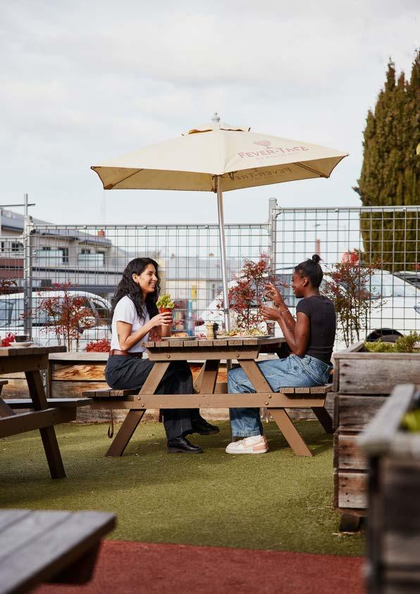
Another top priority of the Plan is supporting the established dining and entertainment scene on Elizabeth Street, as well as continuing to nurture North Hobart’s creative culture by encouraging its diversity with multicultural festivals, live music and creative events that attract both locals and visitors. Fostering growth in the arts, as well as new industries and jobs, will provide future employment for residents and further enhance North Hobart as a commercial and cultural hub of the City.
Importantly, the Plan identifies locations for new public open spaces with views to Kunanyi/Mount Wellington and the Queens Domain. These green space initiatives will provide more opportunities for the North Hobart community to connect to nature and allow both residents and visitors to enjoy the outdoors.
The Plan was developed through an extensive community consultation process and therefore reflects the insights, concerns and aspirations of those who participated. We thank the community for their input and enthusiasm and look forward to implementing the Plan, making sure that North Hobart remains a vibrant, sustainable and appealing place to live and visit for decades to come.
Anna Reynolds Lord Mayor, City of Hobart
North Hobart Neighbourhood Plan snapshot
Vision
The North Hobart Neighbourhood Plan vision reflects the community aspirations for North Hobart as a welcoming and green urban village, with a flourishing high street at the core of community life.
Culture and place
The Plan identifies opportunities to engage and integrate Palawa culture and heritage as an important part of the neighbourhood’s rich community and sense of place. The Plan recognises North Hobart as an important destination within greater Hobart for shopping, dining, entertainment and festivals. It considers existing and potential places and spaces for the cultural and creative communities and events for which North Hobart is known.
Design excellence and heritage
Design quality is a key community concern. The Plan provides built form guidelines to clarify how new development can respond sensitively to North Hobart’s local character and achieve appropriate outcomes, such as sunlight access, for adjacent properties. Space for front and rear gardens will enhance residential areas. Maximum building heights provide greater certainty on built form including where taller buildings can be located to provide space for housing and commercial uses.
Open space and greening
To address North Hobart’s lack of open space, the plan identifies new opportunities for small urban plazas and pocket parks, as well as how to improve connections to nearby spaces including the Queens Domain. Improving everyday experiences of greener spaces including street trees and landscaping will support the community's wellbeing and sense of place.
Transport
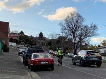
Improving access to, from and through North Hobart for walking, bike riding, micromobility and public transport will mean people have more opportunities to connect with each other within North Hobart and beyond.
Providing managed parking in the right locations will ensure those needing to use private vehicles will continue to be able to visit North Hobart for work, shopping, entertainment and other services.
Housing
In line with community aspirations, the Plan addresses the need for more safe and accessible housing with good access to public transport and active travel networks. Housing growth will focus along key corridors and within walking distance of everyday services and destinations.
Economy and jobs
North Hobart is celebrated as a diverse neighbourhood offering a variety of spaces for a range of business types to thrive. Providing priority areas for businesses will ensure future jobs growth can be accommodated and in locations that are easy to get to.
Sustainability and climate change
North Hobart can lead the transformation to a zero emissions and climate ready community by implementing actions which will reduce greenhouse gas emissions.
Medium density, infill housing and adaptive re-use of buildings will help to build a compact and well-designed neighbourhood where people choose walking, riding and public transport as their preferred way to move around.
We will build resilience by adapting to climate change, by being prepared for disasters such as, floods and urban heat. Information on urban flood risks informs implementation of water sensitive urban design, as well as which streets should be prioritised for managing water during flood events. Green streets will increase the urban tree canopy to help with urban cooling.
Making it happen
The Plan contains a list of proposed actions and the main mechanisms for delivering them to establish a clear blueprint of how the vision will be delivered (see Part 4).
Celebrating North Hobart's character and identity with well designed, attractive and safe spaces and places, for locals and visitors.
Part one: Introduction
Part one: Introduction
In Part One, you'll find the vision, a summary of key drivers of change, and a brief overview of the strategic context supporting the Neighbourhood Plan and its development. A summary of community and stakeholder engagement is included, highlighting the key findings we have heard so far from the community.
Introducing the North Hobart area
North Hobart is located within the traditional country of the southeast nation of the Tasmanian Aboriginal people. The southeast nation territory covered around 3,000 square kilometres and around 500 kilometres of shoreline along the western banks of Timtumili minanya (River Derwent). This country was cared for and carefully managed by the muwinina band of the southeast nation for thousands of generations.
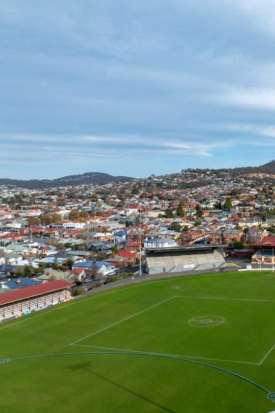
In the late 1800s, North Hobart developed into a compact, working class neighbourhood, featuring narrow streets with workers' cottages and bustling industries. The iconic North Hobart Oval, established in 1921, played a central role in Australian football in Tasmania.
Post-World War II European migration brought changes, fostering businesses including eateries. The City of Hobart Plan in 1945 marked a shift, envisioning the replacement of old dwellings with modern factories. Trams traversed Elizabeth Street until the mid-1900s, to be replaced by an increasing reliance on private vehicles.
The Wilbur Smith Transportation Study of 1964 envisioned wider streets to accommodate the rising demand for vehicular traffic. The study faced challenges and modifications in the subsequent decades, influencing the visual landscape of North Hobart.
The North Hobart Residents' Group (NHRG), founded in 1977, played a crucial role in preserving residential areas amidst urban development plans. Over the years, Elizabeth Street's retail strip evolved into a vibrant entertainment and dining precinct.
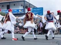
While gentrification has occurred, North Hobart maintains social diversity through public housing and a mix of housing stock. Active cultural clubs and annual festivals, like those hosted by the Greek and Italian clubs on Federal Street, contribute to the area's lively community. Today, North Hobart's retail strip stands as a vibrant entertainment and dining precinct.
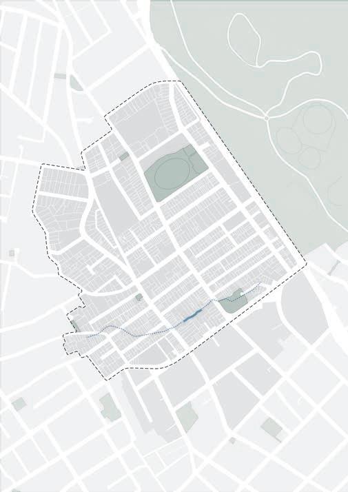
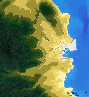
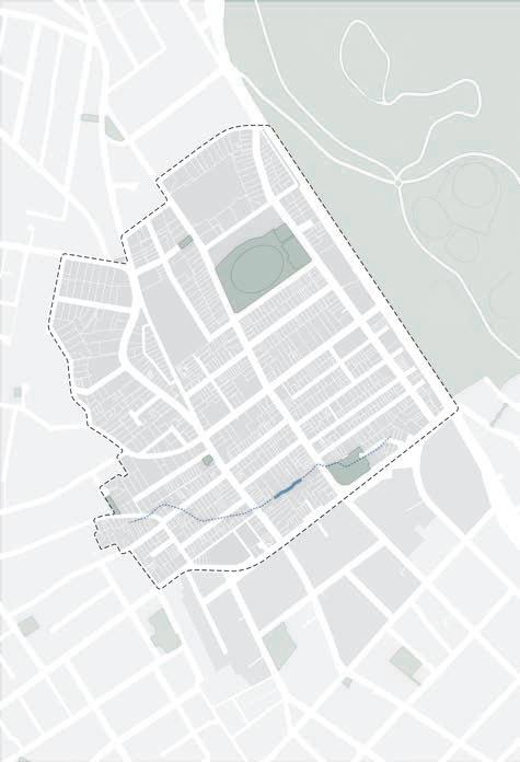
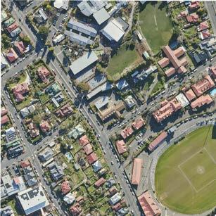
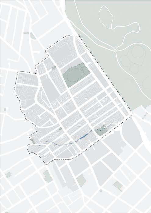
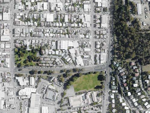
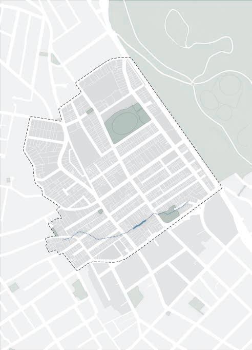
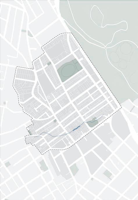
The Neighbourhood Plan study area
The study area for the Neighbourhood Plan is shown opposite (see Figure 1). This area does not align with the North Hobart suburb boundary for several reasons:
• The area south of Burnett Street is included in the Central Hobart Plan 2023. (Available on City of Hobart website.)
• Areas west of Elizabeth Street are included to capture both sides of Elizabeth Street. This includes land zoned Urban Mixed Use, General Residential, and Inner Residential.
• Beyond the study area is a broader investigation area that extends into the surrounding localities. The broader investigation area is not defined by a boundary. The characteristics and features of the investigation area, such as open space and movement, have informed the development of the Neighbourhood Plan. This will ensure the study area is well connected to the surrounding areas.
Neighbourhood Plan area
North Hobart suburb boundary (ABS)
Central Hobart Plan area
Suburb boundary (ABS)
Figure 1. The North Hobart Neighbourhood Plan area
Neighbourhood Plan area
North Hobart suburb boundary (ABS)
Central Hobart Plan area
Suburb boundary (ABS)
Mount Stuart Glebe
Hobart
Midtown
North Hobart Oval
Soundy Park
How the Neighbourhood Plan was formed
2019–2021
North Hobart Place Vision Project 2022
30-year Greater Hobart Plan
2023
Central Hobart Plan endorsed
August 2023
North Hobart Neighbourhood Plan Discussion Paper released
September 2023
Community Consultation + Stakeholder Engagement
July 2024
Draft Neighbourhood Plan released
July - August 2024
Community Consultation + Stakeholder Engagement
We are here
North Hobart Neighbourhood Plan finalised
The North Hobart Neighbourhood Plan builds on the work of the North Hobart Retail and Entertainment Precinct, Place Vision Project (2019-2021). This process involved consultation with residents, traders, and other key stakeholders alongside broad community engagement.
A shared vision for North Hobart was developed through this consultation with the community.
informed and guided the development of the Neighbourhood Plan.
• North Hobart Retail and Entertainment Precinct: Part A – Place Vision Framework, Village Well July 2020.
• North Hobart Retail and Entertainment Precinct: Part B – Access and Parking Plan, MRCagney, March 2021.
• North Hobart Retail and Entertainment Precinct: Condell Place Recommendations, MRCagney, March 2021.
• North Hobart Retail and Entertainment Precinct: Engagement Report, Village Well, July 2020.
The process to develop the Neighbourhood Plan
The project resulted in a number of background reports which have both The North Hobart Neighbourhood Plan responds to and aligns with relevant strategic planning and policy, as well as feedback received from the community.
Figure 2. The process of developing the Neighbourhood Plan
Final North Hobart Neighbourhood Plan
Community engagement - Stage 1
Stage 1 Community Engagement
• 30 day engagement period
• 2 pop-up events
• 3 portfolio committee presentations
• 2 community workshops
• 1 Council workshop
• 125 survey responses
• 1,218 Visits to the Your Say page
• 79,000 views on social media
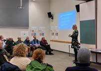
The first stage of community engagement was held during the month of September 2023 to gauge the community and key stakeholders support for the Directions, Ideas and Opportunities raised in the Discussion Paper. Feedback received during the engagement process was then used to develop the Plan.
Community engagement activities included two community workshops in North Hobart, one during the day and a second in the evening.
Members of the community, as well as staff from Homes Tasmania and the Department of State Growth, attended the workshops.
Pop-ups, presentations to Council portfolio committee meetings, and separate
stakeholder meetings were also held.
Feedback from the community and key stakeholders was collated under the following themes:
Palawa Community Engagement
• Explore opportunities to continue connecting with the Palawa community to ensure their voices are heard.
• Explore opportunities to connect with Palawa culture and heritage in North Hobart, including the rivulet, scenic views, artistic expressions, historic buildings, and public spaces.
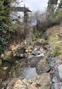
• Promote genuine celebration of Palawa culture, potentially using Providence Valley Rivulet as a vibrant meeting space with strong Palawa influences.
Housing and Short-term Accommodation
• Support diverse housing options, including affordable housing within walking distance of essential services.
• Address concerns regarding the quality, maintenance, and character of social housing.
• Address potential community impacts of short-term accommodations like Airbnb.
• Support for medium-density, affordable, social, and infill housing, with a focus on sensitive design and provision of public open spaces.
Built Form, Heritage, and Design Quality
• Strong support for preserving and protecting heritage.
• Emphasise high design quality for all buildings, including their relationship to heritage and parking considerations.
• Advocate for well-designed buildings that enhance amenity, sustainability, liveability, and accessibility.
Figure 3. Community workshops
Open Space and Public Realm
• Strongly support additional high-quality open spaces, including pocket parks.
• Balance stormwater management with redevelopment opportunities and street enhancements, such as cycleways and water sensitive urban design.
• Improve access to the Domain.
• Support medium-density housing, conditional on specific locations, sensitive design, and increased public open spaces.
Movement and Parking
• Improve pedestrian safety and connectivity between retail, entertainment, and open spaces.
• Expand cycling networks and infrastructure to enhance cyclist safety.
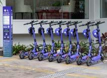
• Provide clarity on micro-mobility usage and parking to improve safety for all users.
• Continue to provide parking for accessing local businesses and services.
• Investigate consolidated parking options to serve the area.
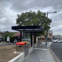
• Improve public transport infrastructure, including bus stops.
Economic Growth
• Support local services and retail for everyday needs.
• Create additional space for local business, including developments on Federal Street.
• Consider how overnight visitors to the area can contribute to economic growth.
• Consider how additional short term accommodation can be provided in the area without impacting upon existing long term rental housing stock.
Culture and Innovation
• Explore opportunities for creative spaces, including support for existing initiatives like live music, community groups, and organisations in North Hobart.
• Consider a community arts space, with potential location flexibility.
Condell Place
• Support open spaces and opportunities to activate the site for community use.
• Consider potential affordable and social housing options.
• Explore the inclusion of some parking, with careful analysis of traffic implications and congestion management.
Elizabeth Street (high street)
• Recognise Elizabeth Street as a vital northsouth corridor.
• Encourage diversity and expand offerings along the street.
• Support existing community festivals and improve pedestrian safety.
• Review parking arrangements to enhance wider footpaths, bike lanes and parklets.
• Balance hospitality uses with other uses, making Elizabeth Street a prominent destination on the northern bus network.
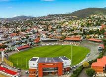
North Hobart Oval
• Address the disconnection of North Hobart Oval and Bowls Club from the broader North Hobart area.
• Identify underutilised potential for community use of space.
• Explore various other use possibilities for this location.
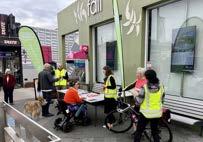
Figure 4. Pop-ups on Elizabeth Street
Community engagement - Stage 2
Survey feedback
Stage 2 Community Engagement
• 6 week engagement period
• 4 pop-up events
• 6 Portfolio committee presentations
• Presentation to the Urban Design Advisory Panel
• 5 meetings with key stakeholder groups
• 14 submissions from key stakeholder groups
• 1 Council workshop
• 107 survey responses
• 1,616 Visits to the Your Say page
• 712 downloads of the draft Plan
Stage 2 - Community Engagement
The second stage of Community and Stakeholder Engagement was undertaken for six weeks across the months of July and August 2024 to gauge the community and key stakeholders support for the Goals, Objectives, Strategies and Actions raised in the draft Plan.
Community engagement activities included pop-ups, presentations to Council portfolio committees, meetings with community groups and sports clubs, and an online survey.
Council staff provided opportunities for key stakeholders including staff from Homes Tasmania and the Department of State Growth (DSG) to meet and provide feedback.
Feedback received during the community and stakeholder engagement process has been used to help develop this final version of the Neighbourhood Plan.
A detailed Engagement Report for the project was prepared and made available to the public in December 2024.
The Stage 2 survey was structured to enable respondents to consider Goals, Objectives, Strategies and Actions in the context of specific locations, which are proposed to have a variety of Actions which will enable change. Fact sheets which included the relevant information for each of the survey questions were provided alongside the survey.
The topics investigated in the survey questions are listed below, along with key insights from the survey responses.
Urban Design Principles
Urban design principles are proposed to guide development within the entire study area.
• 80% support increasing the amount of greenery including street tree planting and urban greening.
• 72% support council advocating for and supporting better public transport.
• 71% support ensuring buildings respond to context, including local character, streetscape, scale, heritage, landform, views, and solar access.
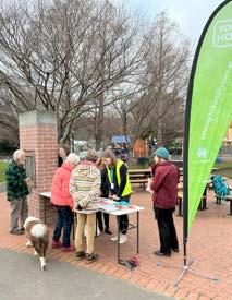
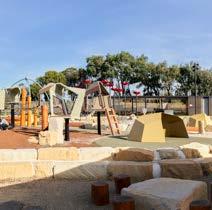
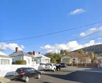
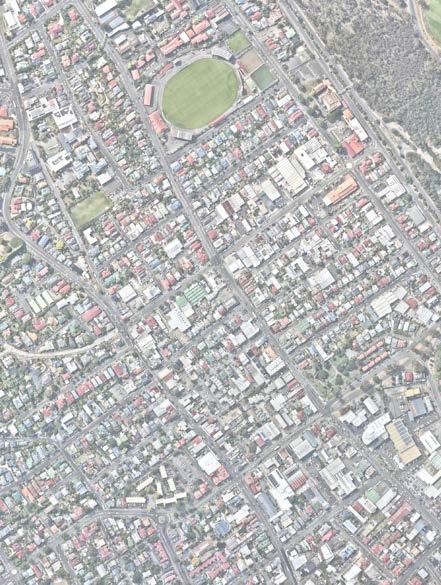
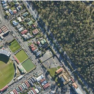
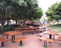
5. Pop-up in Soundy Park
Figure
Renewal on wide streets
Renewal of wide streets, (Argyle, Burnett, Federal and Letitia Streets) including mixeduse and medium density housing.
• 66% support community facilities (sporting facilities, arts centre, performance rehearsal space, community centre).
• 56% would like a community centre.
• 51% would like a community arts centre.
• 60% support mixed use development (business and housing).
• 60% support commercial floor space for business .
• 58% would like hospitality services, cafes, restaurants, and bars.
• 57% would like consulting room business, such as doctors and physiotherapists.
• 57% would like retail business, including shops.
Improvements on wide streets
• 60% of respondents support planting trees on these streets.
• 59% of respondents support providing footpaths with shade in summer and sun in winter.
• 55% of respondents support providing seats on these streets.
Condell Place
Redevelopment of the Condell Place car park site provides opportunities for public open space, a community centre, car parking and medium density, affordable housing.
• 58% support public open spaces, such as a park or a plaza.
• 41% support public car parking on the lower ground level.
• 38% support a community centre.
• 29% support affordable housing.
Elizabeth Street
Elizabeth Street - high street precinct renewal is proposed to revitalise the area and attract more community members.
• 64% support greening such as street trees, green walls, and low planting in Elizabeth Street.
• 62% support outdoor dining space for restaurants in Elizabeth Street.
• 61% support street furniture such as seating, lighting, rubbish bins, water bubblers, and bollards in Elizabeth Street.
• 58% support events, festivals and markets.
Providence Valley Rivulet
A masterplan is proposed to further investigate opportunities to redevelop the Providence Valley Rivulet area (bound by Elizabeth, Burnett, Argyle and Lefroy Streets) with assets such as public open space, mixed use development and medium density housing.
• 64% support a masterplan to investigate public open space and greening.
• 62% support a masterplan to investigate pathways and lanes through the site.
• 58% support a masterplan to investigate improvements to rivulet water quality.
• 58% support a masterplan to investigate flood management.
North Hobart Oval Sports Precinct
A masterplan is proposed to further investigate opportunities to redevelop the North Hobart Oval Masterplan sports and community precinct.
• 71% support public open space and greening in the Sports Precinct.
• 57% support an all ages community centre in the Sports Precinct.
• 55% support retention and renewal of the Bowls Club.
A vision for North Hobart
North Hobart is a welcoming, green urban village, with a flourishing high street at the core of community life.
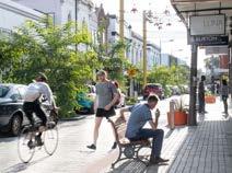
An everyday meeting place for locals, Elizabeth Street attracts visitors from far and wide to its bustling eateries and shops and its year-round calendar of events and festivals, all in a beautiful heritage setting.
The vision statement encapsulates where we want North Hobart to be in 20 years. This vision was developed through the North Hobart Retail and Entertainment Precinct, Place Vision Project (2019-2021).
Neighbourhood shaping goals
The Structure Plan is framed around delivering on four neighbourhood shaping goals. These goals are referenced throughout the document and are key to the understanding of the Plan.
Goal one: North Hobart is a welcoming and inclusive neighbourhood to live and work in.
Goal two: North Hobart is a creative and diverse neighbourhood on Palawa Country.
Goal three: North Hobart is a resilient and sustainable neighbourhood.
Goal four: North Hobart is an accessible and walkable neighbourhood.
City of Hobart
North Hobart – the next 20 years
North Hobart’s reputation as an attractive and unique place to live, work, and play has grown. Anchored by its highly valued heritage buildings and streetscapes, new developments have added creative and sensitive responses to heritage while meeting the need for growth in strategic locations. Investments in places such as Elizabeth Street, Condell Place, Providence Valley Rivulet and the North Hobart Oval precinct have successfully captured what makes North Hobart special.
A diverse range of people from the community, as well as visitors, continue to enjoy gathering, socialising, and celebrating at a wide variety of cultural, entertainment and hospitality spaces and venues.
Elizabeth Street is a safe and comfortable high street in which to spend time and access daily needs. This area supports a variety of community events celebrating the diversity of North Hobart.
Retail and hospitality venues have expanded to Argyle Street and Burnett Street through mixed-use developments that deliver a range of benefits including affordable and social medium density housing, improvements to the public realm, an expanded and inviting laneway network, and increasing activity and safety at the ground level.
Infill housing has been built throughout North Hobart, with medium density housing of an appropriate scale located between existing buildings enriching the character of the area. More people can now live in North Hobart and take advantage of the nearby schools, jobs and services in the area.
The commercial and retail activity in North Hobart has consolidated along key transport corridors. Upgraded and extended walking, cycling, and micro-mobility paths encourage many to choose active transport and access improved public transport services. Parking is provided to ensure those who need it can access it easily.
A number of streets will integrate water-sensitive urban design to mitigate flooding risks and add urban greening.
New spaces, including community facilities, urban plazas, shared laneways, and pocket parks, are designed for all, creating opportunities for creative expression and inclusion. Palawa heritage and culture is shared in these spaces, fostering a deeper meaning of place at key points such as along the rivulet, as well as an appreciation of North Hobart’s location within the broader landscape of nipaluna. Links to the Domain have created easy access to enjoy this significant open space with views across North Hobart to Kunanyi.
Drivers of change in North Hobart
The Neighbourhood Plan is shaped by strategic drivers of change in North Hobart. Each of these drivers presents specific challenges and opportunities.
Aboriginal culture
There is a need to protect Aboriginal heritage and support Aboriginal cultural expression, enriching the community experience in North Hobart while acknowledging the deep and ongoing connection of Palawa people with their cultural landscape.
Resilience & sustainability
In the face of a changing climate, we need to work together to build a resilient community. This includes enabling medium density, infill housing, mixed use development and adaptive re-use of existing buildings, which will help to build a compact and welldesigned neighbourhood where people choose walking, riding and public transport as their preferred way to move around.
Community & diversity
Diversity and inclusion are strong values of the community of North Hobart. As North Hobart grows, it is important to provide enough inclusive and welcoming spaces for the community to celebrate its diversity.
Adapting to a changing climate presents transformative opportunities for North Hobart. Being able to rapidly and effectively adapt to and recover from increasing hazards such as extreme heat, and floods is increasingly important.
To leverage opportunities, there is a need to consider how to reduce greenhouse gas emissions to zero across our homes, businesses and communities. This includes supporting active travel, sustainable buildings, managing flood risks and greening to create great streets and public places.
Placemaking & open space
Connections to nearby open space need to be improved, and locations for additional open space identified, to meet the needs of the community.
Culture & entertainment
A vibrant Elizabeth Street serves as a destination for locals and visitors alike. Upgrades to streets and laneways are integral to sustaining and enhancing its vitality. This will ensure that the daytime and night-time economy continues to flourish.
Jobs & economy
Strengthening North Hobart’s economic role as a location for business investment and employment will complement and leverage on its proximity to central Hobart.
As an important suburban high street, Elizabeth Street should continue to provide retail products and services for the local community’s daily needs.
Design quality & character
Future design outcomes should enhance and celebrate the character of North Hobart. The design of new development should respond to its context.
New development should make a positive contribution to the identity of North Hobart. It should strive for design excellence and provide community benefits.
Transport
Planning is required for more sustainable transport options that connect people with jobs, education, events, local business, and industry within North Hobart and beyond.
Housing
There is a need to plan for North Hobart’s residential growth and to identify areas for change where new housing, including affordable, social and key worker housing, is well connected to public transport,education, services and jobs.
Parking
Better management of parking is required to ensure those needing it will continue to be able to park near their destination.
The streets need to support business including retail and hospitality along Elizabeth Street and other destinations in North Hobart in a variety of ways.
Strategic context
Southern Tasmania Regional Land Use Strategy 2010-2035
The regional strategy outlines a 25-year vision for land use in the area. It covers various themes, such as the environment, hazards, cultural values, recreation, infrastructure, economy, essential resources, and residential growth.
The North Hobart Study area is identified within a densification area, which are existing urban areas where additional dwellings can be provided, referred to as infill development. The city has been allocated the goal of 3,312 new dwellings by 2035, with a target net density of 25 dwellings per hectare within 400-800m of transit corridors. North Hobart had a net density of 13.3 dwellings per hectare in 2021 (ABS, 2021). The strategy encourages urban expansion in well-connected areas with efficient transportation systems, promoting the use of public and active transport.
Since the STRLUS was first created, our region has grown and changed. New developments and the introduction of updated planning rules mean it's time to review and update the strategy.
It is anticipated that the Draft STRLUS 2050 will be placed on public exhibition mid-2025.
Southern Tasmania Industrial Land Strategy 2012
The aim of this strategy is to plan for sufficient industrial land in Southern Tasmania to accommodate future economic growth and to allow for sustainable urban growth patterns, for the next 15 to 30 years.
North Hobart currently has the City of Hobart’s only land zoned Light Industrial. However this land is overlaid with a Specific Area Plan which restricts some use classes.
A new statewide industrial land study is currently being developed by the Tasmanian Government, (see page 28).
Tasmanian Housing Strategy, 2023-2043
The Tasmanian Housing Strategy sets out a vision to end homelessness in Tasmania, by delivering a well-functioning housing system that provides safe, appropriate and affordable housing for all Tasmanians, with the intention to reduce demand for social housing and crisis accommodation.
The Strategy builds on existing initiatives and reinforces the Tasmanian Government's commitment to a net increase of 10,000 social and affordable homes across Tasmania by 2032.
The four key desired outcomes are for Tasmanians to:
• live in quality, sustainable and durable homes that meet their needs
• have access to housing regardless of their circumstances
• have access to affordable housing options, and
• have a greater choice of homes where they want to live.
People should be at the centre of housing policy considerations because housing is the platform for individuals, communities, and the economy to prosper.
30-Year Greater Hobart Plan
The 30-Year Greater Hobart Plan was jointly endorsed in 2022 by the Tasmanian Government, the City of Hobart, and Glenorchy City, Clarence City and Kingborough Councils.
The 30-Year Greater Hobart Plan identified that population growth is best placed in areas with high amenity and good services, in a way that maintains the key attributes that make these areas liveable and attractive.
The 30-Year Greater Hobart Plan seeks to:
• ensure growth complements the city’s natural setting
• implement a coordinated land release program that ensures sufficient land supply
• promote and incentivise a more diverse and affordable housing mix
• encourage urban renewal of underutilised land for residential development
• support innovative design solutions to meet a diverse range of community needs
• prioritise urban consolidation to create a more walkable and accessible compact city
• enable well designed mediumdensity developments within existing neighbourhoods and higher density dwellings in appropriate locations.
Also critical will be the timely upgrading of infrastructure including public transport, open space and community facilities, and ensuring adequate utilities and services to support the growth.
2050 Vision for Greater Hobart:
We will live in the world’s best small capital city, a city built for people, that is connected, friendly and safe. Greater Hobart is a thriving and inspiring place to live, where we all work together to make a positive contribution to our extraordinary environment.
Hobart City Deal and Implementation Plan 2019
This plan offers a comprehensive framework to steer and promote future investments in our city. This initiative fosters collaboration and financial contributions from various government levels. By embracing growth prospects and addressing vital strategic and infrastructure challenges like transportation and affordable housing, the deal aims to stimulate investments in Hobart.
The key focus areas are:
• Supporting the development of a direct international gateway at the Hobart Airport
• Establishing an Antarctic and Science Precinct at Macquarie Point 3
• Implementing the Greater Hobart Transport Vision
• Driving urban renewal and delivering affordable housing
• Activating the Northern Suburbs Transit Corridor
Strategic context
• Being a smart, liveable and investment ready City
• Collaborating and providing strategic governance by establishing and implementing a Greater Hobart Act
Capital City Strategic Plan 2023 and Hobart: A Community Vision for our Island Capital 2018
The Capital City Strategic Plan 2023 is a review of the City of Hobart's primary planning document, the Capital City Strategic Plan 2019 -2029. This plan forms the foundation for all other planning and reporting frameworks. It is based on the community vision for Hobart and serves as a comprehensive roadmap for the city's future. The Community Vision is: Hobart breathes.
Connections between nature, history, culture, businesses and each other are the heart of our city.
We are brave and caring.
We resist mediocrity and sameness.
As we grow, we remember what makes this place special.
We walk in the fresh air between all the best things in life.
This strategic plan outlines the City of Hobart's key priorities for the next decade, ensuring a well-informed and forward-thinking approach to address the community's needs.
Climate Ready Hobart Strategy
The Climate Ready Hobart Strategy is a guide to what the City of Hobart and the community can do together to respond to the climate and biodiversity emergency as we move towards 2040.
The strategy embraces the City of Hobart's responsibility as a municipal organisation to provide for the health, safety and welfare of the community. It sets a clear direction for the City to lead by example across its core business and services, and to enable the community to act responding to climate change requires everyone to act.
Strategic context
Sustainable Hobart Action Plan 2020-2025
The sustainability plan for the City of Hobart encompasses fifty specific actions addressing six key areas: leadership, mobility, energy, resilience, waste, and governance. This comprehensive plan aims to achieve sustainable outcomes for our city, including a clear path towards zero emissions. Additionally, it focuses on enhancing our city's resilience, ensuring we are prepared to face natural hazards like floods.
In June 2019, the City of Hobart declared a climate and biodiversity emergency. The City is committed to addressing the risks and opportunities presented by a changing climate in our policies, strategies and leadership.
Hobart Transport Strategy 2024
The City of Hobart Transport Strategy 2024 adopts a movement and place framework, recognising the critical role our streets play in movement, connectivity and creating great places.
The Strategy aligns with Pillar 5, Movement and Connectivity, from our community vision: We are a city where everyone has effective, safe, healthy and environmentally-friendly ways to move and connect, with people, information and goods, and to and through spaces and the natural environment.
The vision is action-orientated and identifies the City’s goals for the future transport network of Hobart. The themes of the transport strategy respond to this vision, focusing on transport choice.
Inner Hobart Transport Network Operations Plan
The Inner Hobart Transport Network Operations Plan, is an operational document developed by the Department of State Growth and the City of Hobart for managing and enhancing Hobart's transport network efficiency, safety, and liveability. It balances the needs of various road users through a framework that aligns road network operations with the city's strategic objectives.
The plan employs road user hierarchies, place values, and target levels of service to prioritise and optimise the movement of people and goods, accommodating competing demands and promoting a healthier, connected, and sustainable Greater Hobart.
Keeping Hobart Moving, Tasmanian Government
Prepared by the Department of State Growth, Keeping Hobart Moving: Transport Solutions for Our Future plan addresses Hobart's growing population, high car dependency, and concentrated peak-period traffic congestion. It outlines a comprehensive plan to enhance Greater Hobart's transport network for growth, accessibility, and sustainable travel through public transport upgrades, active transport promotion, and ferry service expansion. These initiatives aim to support urban development, improve liveability, and direct economic growth, showcasing a commitment to adaptable, sustainable transportation solutions tailored for Hobart's future needs.
Northern Suburbs Local Area Mobility Plan 2023
The Northern Suburbs Local Area Mobility Plan prepared by the City of Hobart, identifies a network of connected, safe and convenient walking and bike riding routes to and from common destinations within Lenah Valley, Mount Stuart and New Town. The Plan identifies key streets to be included in major works planning and delivery over the next 10 years, ensuring investment supports walking and bike riding.
Strategic context
Street Tree Strategy 2017, City of Hobart
The City of Hobart Street Tree Strategy 2017 proposed a canopy target across urban areas of the municipality of 40% by 2046. Tree canopy cover for the suburb of North Hobart is 9%.
The vision is as follows: Hobart is a City where tree-lined streets are a valued component of our quality of life – achieved through excellence in planning, design, installation and care by the City’s workers and our community.
Queens Domain Masterplan 2013, City of Hobart
The Queens Domain provides recreation and leisure options for Greater Hobart.
Located in close proximity to North Hobart, the Domain provides an opportunity for residents to access public open space now and into the future. A common strategy in the Masterplan and the study area is to develop new pedestrian linkages to the Domain and coordinated transport and connectivity.
Central North Hobart Design Guidelines 1998
The 'Central North Hobart Design Guidelines' were developed to consolidate the recommendations of the North Hobart Townscape Project, and to prepare Desired Future Character Statements for the City of Hobart Planning Scheme, with aspects of this work being included in the Hobart Interim Planning Scheme 2015 and Draft Local Provisions Schedule.
North Hobart Townscape Project 1992
The aim of the North Hobart Townscape Project, prepared by Leigh Woolley, James Jones, Jerry de Gryse, and Sean Kelly, was to transform Elizabeth Street into a vibrant and pedestrian-friendly space, referred to as the 'People's Street.'
The project contains a number of recommendations that are relevant to the North Hobart Neighbourhood Plan, including:
• recognising and protecting the substantial heritage of North Hobart
• recognising the impact of North Hobart’s increasing popularity on its traditional service functions and its public space
• consolidating existing residential and commercial precincts
• increasing amenity, usefulness and character of public space.
Central Hobart Plan, 2023
The City of Hobart, in partnership with the Tasmanian Government, developed the Central Hobart Plan to create a shared vision and framework for guiding the development of our central city area.
The Central Hobart Plan (CHP) is a particularly important and relevant strategic document, to the North Hobart Neighbourhood Plan, as it has a shared project boundary. The area of North Hobart, south of Burnett Street, has not been included in the North Hobart Neighbourhood Plan, as it is covered by the CHP.
The CHP includes five goals, each with objectives, strategies and actions to achieve their intent:
• a captivating and dynamic capital city
• public Spaces that engage and create joy
• sustainable buildings with character
• integrated and accessible movement networks
• an investment ready and innovative city.
Strategic context
Medium Density Design Guidelines
The Medium Density Design Guidelines is a non-statutory document, developed as part of the implementation of the Greater Hobart Plan.
The 30-Year Greater Hobart Plan aims to deliver a compact city that caters for a growing population by providing the right development in the right places. It aims for improved liveability, and affordable and diverse housing.
Delivering affordable, well-located housing is an aspiration for all Tasmania’s cities. To achieve this, increased density in urban areas will be necessary, particularly in areas close to activity centres and key transport corridors.
The project was led by ERA Planning & Environment for the Tasmanian Governments Department of State Growth.
Development of the guidelines was led by and included engagement with stakeholders and experts from across industry and government.
The guidelines are intended to provide bestpractice guidance to planners, designers and developers in the preparation and assessment of medium density development proposals from the earliest stages. They also provide the community with insight into what quality medium density housing looks like and how such developments can occur within existing built-up areas without adversely impacting on local heritage and character.
These guidelines are intended to facilitate a higher standard of medium density residential development in Greater Hobart.
Draft guidelines/projects
The following current projects are relevant to the future of North Hobart. The Appendix provides a complete list of the studies that informed this Structure Plan, (see page 148).
Draft Improving Residential Standards Project in Tasmania
The State Planning Office is reviewing planning controls for urban housing and residential development in Tasmania. The project aims to increase housing supply, affordability and diversity of housing types. The project will develop recommendations that will inform future amendments to the State Planning Provisions (SPPs).
The draft recommendations propose changes to Tasmania’s residential standards including building height, setbacks, and density in residential zones.
The project identified that improvements need to be made to the provision of housing choice, including affordability, diversity and density, design quality, subdivision layout and liveability, and zones that allow more density and diversity of housing in the right locations.
The Tasmanian Government released the independent review of the Tasmanian Planning Scheme’s residential standards, on 1 March 2025. Stating that they intend to implement the new requirements into the Tasmanian Planning Scheme in 2025.
Draft Statewide Industrial Land Study
The Department of State Growth is currently undertaking a statewide industrial land study to better understand demand and supply for industrial land across Tasmania.
Ensuring there is a sufficient supply of industrial zoned land across the State is key to ensuring businesses can operate in locations that minimise or remove conflict with adjacent land uses, and that businesses have choice in the context of their overall supply chain (for example, to locate near a key market, supplier or export port).
Strategic context
Draft Heritage Design Guidelines, City of Hobart
The City of Hobart is in the process of preparing Heritage Design Guidelines.
Once completed and endorsed, the Heritage Design Guidelines will help inform development on sites that are listed across the Hobart Local Government Area, including heritage places and in heritage precincts in North Hobart.
The Value of Heritage in Hobart
Hobart is Australia’s second oldest city, and it has some of the country’s best-conserved architectural heritage. Hobart contains a rich and diverse range of buildings, neighbourhoods, and streetscapes with a character and scale that are special and appreciated by many. It is important that we continue to recognise and celebrate Hobart’s heritage and its rich and embedded history and conserve it for present and future generations.
Heritage sites contribute to a sense of place through their instilling character and charm, and once destroyed, we cannot replace them.
Hobart’s heritage buildings shape the city and are a tangible way to understand the history and development of Hobart. Our heritage is irreplaceable and precious.
The aim of heritage protection is to ensure that new development is designed to respectfully interact with elements of heritage significance. Considered and thoughtful changes to heritage places are possible.
Heritage Design Guide Objectives
The aim of the Heritage Design Guideline is to:
• Help protect Hobart’s unique historic characteristics by conserving, protecting, and enhancing the heritage places.
• Promote the retention of fabric that contributes to the historic cultural heritage significance of heritage places and precincts.
• Encourage design choices that consider heritage features and settings with sympathetic new phases of development.
• Encourage high-quality new development that responds to the heritage context without mimicking historical forms and details
• Encourage adaptive reuse rather than demolition.
• Ensure that new development aligns with heritage best practice and is consistent with the conservation principles, processes, and practices of the Australia ICOMOS Burra Charter 2013.
• Encourage the reconstruction of original or contributory fabric where evidence exists.
The Burra Charter is a formative document in Australian heritage practice that provides a helpful guideline. It establishes good heritage practice and promotes intergenerational equity through conserving heritage places for present and future generations. Access the Burra Charter through the Australia ICOMOS website here: https://australia.icomos.org/ publications/burra-charter- practicenotes/
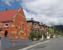
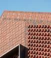
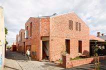
brick Federation Free Gothic ecclesiastical Swan Street Uniting Church and Federation-style houses on Swan Street, North Hobart.
Strategic context
Draft Open Space Strategy
The City of Hobart is in the process of preparing an Open Space Strategy.
Hobart’s open spaces contribute greatly to the quality of life enjoyed by our residents, the Greater Hobart population and the many people who visit our city from interstate and across the world.
The Open Space Strategy will plan for the challenges of population growth, changing demographics and lifestyles, increasing demand, climate change and its associated impacts on our natural world, our precious native plants and animals, and seek out opportunities to ensure our open spaces are future ready.
This strategy focuses on the City of Hobart’s green spaces that cater for a wide range of passive and active recreation and leisure activities. These open spaces are important for the health and wellbeing of our community and the environment.
The six principles for open space in Hobart include:
1. Accessible and Inclusive
2. Nature Positive
3. Connected
4. Cultural
5. Health and Wellbeing
6. Quality and Quantity
Soundy Park North Hobart.
Draft Hobart Design Guidelines, City of Hobart
The City of Hobart is in the process of preparing a placed-based guide outlining urban and building design principles and guidance that will apply equally to the public realm and private development across Hobart to help shape better places for all.
The Guidelines build on Hobart: A Community Vision, professional best practice, and a deeper understanding of Country to articulate a path between the city we are today, and the city we want to become.
The Guidelines are about capturing what makes Hobart distinct, then applying proven architectural and urban design principles and lessons so we can continue to successfully adapt to new challenges, such as climate change, while retaining what we love a sense of “connection to nature, history, culture, businesses and each other” (Community Vision, page 23).
The Hobart Design Guidelines will help inform development on sites across the Hobart Local Government Area, including North Hobart.
Regulatory framework
The Plan sits within Tasmania’s legislative land use planning framework, which includes:
• the Resource Management and Planning System of Tasmania is the State’s integrated environmental and planning system, linked by objectives focused on sustainable development
• the Land Use Planning and Approvals Act 1993 (LUPA Act) is the state's core planning legislation
• the Local Government Act 1993, which requires municipal-level strategic and annual planning, such as the Capital City Strategic Plan 2019–29
• the Environmental Management and Pollution Control Act 1994
• the Historic Cultural Heritage Act 1995
• the Greater Hobart Act 2019 which provides a framework for collaborative decision making between the Clarence, Glenorchy, Hobart and Kingborough Councils and the Tasmanian Government
• The Southern Tasmania Regional Land Use Strategy 2010-2035, is the primary strategic planning document for the region and a statutory document under the LUPA Act.
Land use strategies
Land use strategies vary in scale and scope. Some are broad and cover large areas – like the Southern Tasmanian Regional Land Use Strategy; while others are more localised and detailed – like the North Hobart Neighbourhood Plan.
Structure plans
The Neighbourhood Plan is a type of structure plan.
Structure plans provide a specific strategy to implement a regional land use strategy and municipal strategies and help guide the detailed application of a planning scheme to a local defined area.
Structure plans can inform the application of the zoning and overlays in the Local Provisions Schedule (LPS) of the planning scheme, and the preparation of specific area plans (SAPs), particular purpose zones (PPZs), or site specific qualifications (SSQs), where a more unique integration of use and development is required. Changes are implemented through a planning scheme amendment.
Structure plans can also deliver community aspirations for urban design guidelines, environmental objectives, and recommendations for civic upgrades etc.
Planning schemes
Planning schemes are created under the LUPA Act. However, a scheme is not a policy document in its own right, but rather implements adopted policy through regulations controlling the use and development of land. New planning scheme provisions will be a key mechanism that will be used to implement the Plan. Planning scheme amendments will be required to implement some of the actions set out in this plan.
Regulatory framework
Figure 6. Regulatory framework
Planning in North Hobart: issues and opportunities
Tasmanian Planning Scheme
The Hobart Interim Planning Scheme 2015 (HIPS) currently applies to the study area but will be replaced by the Tasmanian Planning Scheme (TPS) in 2025.
The TPS presents potential new opportunities and some challenges.
The new zones and codes within the Tasmanian State Planning Scheme are not a like-for-like translation from the HIPS, for example the Light Industrial Zone in the HIPS has different rules than the Light Industrial Zone in the TPS.
Zones
North Hobart has a blended pattern of zoning, there are eight zones in the study area.
Zones provide a list of allowable uses, such as Business and Professional Services, General retail and hire, and Residential, in addition to rules for the operation of these uses and controls for the development of buildings, such as height and setbacks.
The study area has the following zones: Inner Residential, General Residential, General Business, Urban Mixed Use, Light Industrial, Recreation, Open Space and Utilities. There is also currently an area zoned Commercial in the part of North Hobart south of the study area boundary of Burnett Street.
The number of zones within the study area contribute to the celebrated mixed-use character of North Hobart. With this comes the need to manage activities and uses to minimise conflicts, for example, to ensure that North Hobart’s much loved live music, outdoor dining and the night-time economy are recognised and protected despite their close proximity to residential use.
The ability to accommodate a range of activities will take North Hobart into the next chapter of being a vibrant mixed-use inner city area.
Planning Scheme Codes and Overlays
Planning scheme codes and overlays cover areas or sites that either hold a specific value, such as heritage, or they may be at risk from a hazard, such as flooding.
The overlays are important for protecting people, places and assets, and influence how land is used, developed and managed. As a result, where there are fewer overlays, there are likely to be fewer values or hazards to consider, which generally means that redevelopment can be more straightforward.
The study area is subject to several code overlays. Local Heritage Precincts and the Flood-Prone Hazard Areas Code cover a large portion of the study area.
These overlays have effects on the type of built form and use that can be achieved, for example, the scale of new buildings in a heritage precinct will be informed by the scale of buildings surrounding it, and certain vulnerable uses like aged care may not be appropriate in areas with high risk of flooding.
Attenuation Code
The Attenuation Code regulates some uses that emit noises, vibration, dust, smells, smoke or other kind of emissions that can impact sensitive uses like residential, it also protects any existing attenuating uses from encroachment by sensitive uses, so that any conflicts are minimised. Under the TPS, examples of attenuating uses include large breweries or distilleries, joinery workshops and motor bodyworks, but do not include live music venues.
Key opportunity:
To champion and embrace the vibrant range of uses and activities in North Hobart.
Key opportunity:
To identify and manage land use conflicts that may fall outside of the scope of the Attenuation Code.
Planning in North Hobart: issues and opportunities
Specific Area Plans and Site-Specific Qualifications
The draft Hobart Local Provisions Schedule, includes the zone and overlay maps as well as Specific Area Plans (SAPs) and Site-Specific Qualifications (SSQs). There are two SAPs and one site-specific qualification proposed in the LPS:
• Hobart Light Industrial SAP
• North Hobart SAP
• 321-323A and 325 Elizabeth Street and 16A Lefroy Street SSQs —provide for vehicles parking
Both SAPs have essentially been carried forward from the current Hobart Interim Planning Scheme 2015, with some minor changes to the Hobart Light Industrial SAP.
Key opportunities:
• To shape the Local Provisions Schedule of the planning scheme, by proposing a new Specific Area Plan to embrace North Hobart's unique vision, addressing challenges, and maximising potential.
• To review the purpose of any specific area plans and site specific qualifications, and ensure their contemporary application.
Hobart Light Industrial Specific Area Plan
The Light Industrial zone covers an area of 4.7 hectares dispersed along Argyle Street, Burnett and Federal Streets.
The area zoned Light Industrial is overlaid with the Hobart Light Industrial Zone Specific Area Plan.
The purpose of this SAP is:
• to provide for uses that are compatible with the unique, existing pattern of use in the area
• to provide for uses that minimise land use conflict in order to protect industrial viability and the safety and the amenity of sensitive land uses in adjacent zones.
This Specific Area Plan overrides the use table in the Light Industrial zone to prohibit several uses which would otherwise be permitted or discretionary in this zone.
North Hobart Specific Area Plan
The North Hobart Specific Area Plan was created with the aim of preserving and enhancing the unique streetscape and character of North Hobart along Elizabeth Street.
This SAP considered the Central North Hobart Design Guidelines which were developed to ensure the preservation and enhancement of North Hobart.
Planning in North Hobart: issues and opportunities
Part two: Urban Design Principles
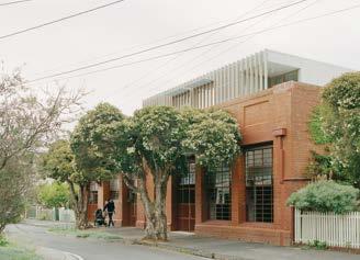
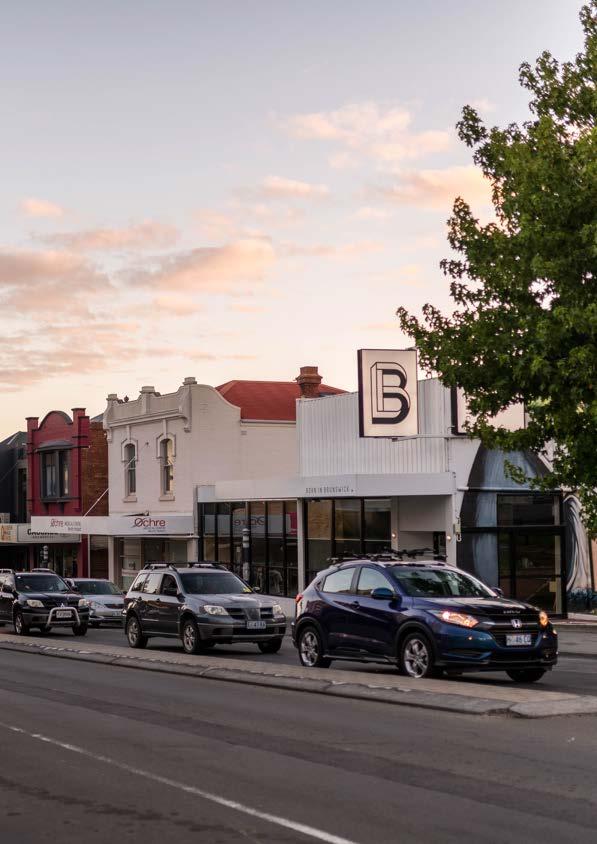
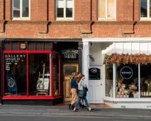
Elizabeth Street and Burnett Street, North Hobart
Photograph by Alastair Bett
City of Hobart
Part two: Urban Design Principles
In Part two, we've outlined North Hobart's Urban Design Principles (UDP) and defining elements. The UDP promotes best practice development to deliver the community's vision for North Hobart. They have been informed by North Hobart's existing local character, identity and heritage.
The UDPs are applied throughout the objectives, strategies, and actions for North Hobart which are detailed in Part Three: Neighbourhood Framework. The Neighbourhood Framework builds upon the UDP providing supporting information and guidance on the future outcomes relating to built form, public realm and open space, and movement and access.
Part two: Urban Design Principles
Urban Design Principles
The Urban Design Principles (UDP) for North Hobart are organised under the themes of:
• Built form and design
• Public realm and open space
• Movement and access.
These principles are informed by best practice in urban design and the specific place context of North Hobart, such as Palawa identity, land form, character, heritage and solar access.
Good urban design goes beyond a welldesigned building. It seeks to enhance the quality of the spaces between buildings, such as the landscape, streets, and parks that are central to the liveability of North Hobart.
The North Hobart UDPs will provide clarity for the community and developers about the priorities for North Hobart. This will support the decision-making process and promote best practice development to deliver on outcomes towards realising the community's vision for North Hobart.
The City of Hobart Urban Design Advisory Panel (UDAP) will continue to play an important role through the independent design review process.
Built form and design
1. Promote well designed medium density housing, mixed use renewal and future employment.
2. Support medium density development on wide green streets and strategic sites.
Implementation
The proposed UDP will be delivered through the actions outlined in the Neighbourhood Framework.
An amendment to the Tasmanian Planning Scheme's Local Provisions Schedule will implement some of the actions outlined.
Improvements to the public realm and open space, as well as delivery of new transport infrastructure will be achieved through public projects. A mechanism for obtaining developer contributions for community benefit will also be investigated.
3. Ensure buildings respond to context, including land form, views, streetscape, local character, scale, heritage and solar access.
4. Engage with streets and spaces to increase the sense of safety and add to the vibrancy of the public realm.
These principles will primarily be delivered through actions outlined in Goal One.
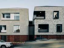
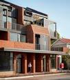
Clifton and Central, Mt Lawley, Western Australia by MJA Studio
Part two: Urban Design Principles
Public realm and open space
1. Create a network of open spaces that connect people to Country.
2. Ensure sunlight access to open spaces and streets for people.
3. Increase the amount of greenery with street canopy planting and urban greening.
4. Build resilience to flooding risk.
Movement and access
1. Create streets for people.
2. Make cycling and micromobility a convenient and comfortable way to move around North Hobart.
3. Advocate for and support better public transport services.
4. Manage vehicle access and car parking, prioritising pedestrian safety and consolidated car parking.
These principles will primarily be delivered through actions outlined in Goal Three.
These principles will primarily be delivered through actions outlined in Goal Four.
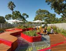
Legacy Park, Queens Domain by Field Labs
Malop Street Green Spine, Geelong, Victoria by Outlines
Part two: Urban Design Principles
North Hobart's defining elements
Palawa culture and connection
North Hobart is located in the traditional country of the southeast nation of the Tasmanian Aboriginal people. The southeast nation territory covered around 3,000 square kilometres and around 500 kilometres of shoreline along the western banks of Timtumili minanya (the Derwent River). This country has been cared for and carefully managed by the muwinina band of the southeast nation for thousands of generations.
North Hobart was once a rich cultural landscape providing resources of both the land and the sea. The area provided access to the mountains, fresh water and to many travel routes through well maintained cultural pathways. These pathways led inward into tribal country and outward to the tribal country boundaries for seasonal contact with other nations. These cultural pathways were managed for ease of movement to access cultural resources, providing access to ceremonial lands and led to traditional hunting grounds. The cultural history of this area is reflected in physical Aboriginal heritage material.
Aboriginal heritage sites recorded within this region provide evidence of many thousands of years of Aboriginal occupation. Traditional knowledge maintained by Tasmanian Aboriginal people indicates a much greater length of occupation. Aboriginal people believe they are part of the creation of this island and therefore have always been the carers of the land, sea, and sky.
North Hobart is well used and collectively considered an important space by the Palawa of today. This connection to place and expression of Aboriginal culture is not readily evident in the built form and open spaces of North Hobart.
The Neighbourhood Plan aims to foster Palawa engagement and expression as a core priority to enrich the city's character and identity.
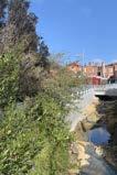
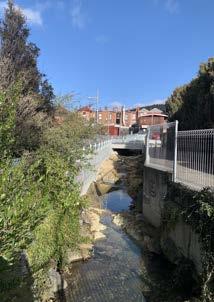
Above: Providence Valley Rivulet. Photograph by Sharnie Read (2023)
Part two: Urban Design Principles
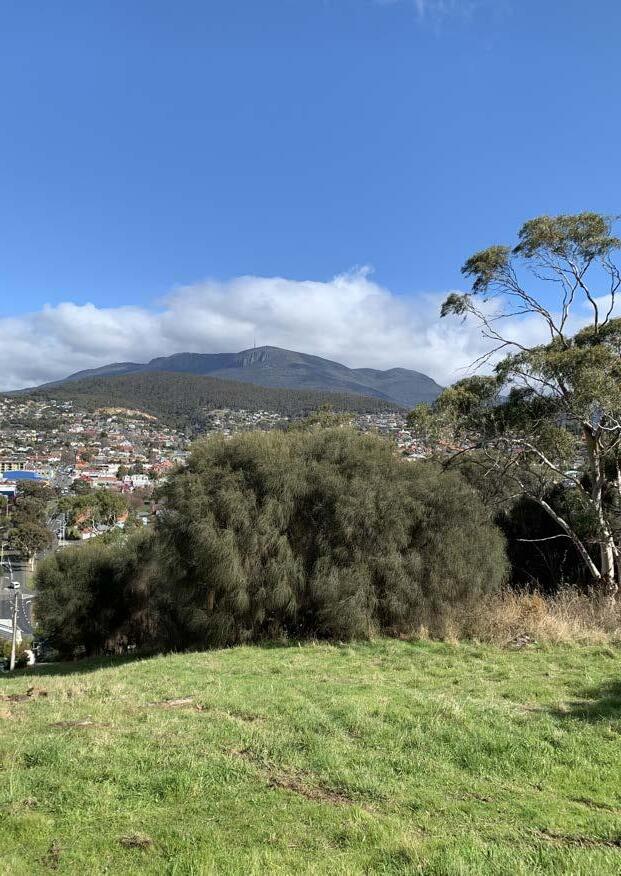
Views to Kunanyi/Mount Wellington from the Domain.
Photograph by Joanne Hickman (2023)
North Hobart
Part two: Urban Design Principles
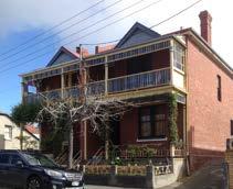
Built form heritage
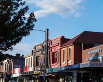
The distinctive character and heritage of North Hobart is highly valued by the local community and contributes to its appeal as a destination to visitors.
This value is reflected in the Local Provisions Schedule of the Tasmanian Planning Scheme with a number of areas identified as Local Heritage Precincts and individual lots identified as Local Heritage Places. In addition, a range of other properties are identified on the Tasmanian Heritage Register.
No changes are proposed to the Local Heritage Precincts or Local Heritage Places.
The following precinct descriptions are an overview of some of the key characteristics of the built form heritage and refer to the City of Hobart document City of Hobart Local Heritage Precincts, Description, Statement of Local Historic Heritage Significance and Design Criteria / Conservation Policy, January 2019.
Development within Local Heritage Precincts and Local Heritage Places will continue to be assessed against the standards set out in the Heritage Code, to protect the integrity of these heritage values.
Part two: Urban Design Principles
Study Area
North Hobart area
included in Central Hobart Plan 2023
Open space
Rivulet (open)
Rivulet (closed)
Potential areas of change
Medium density housing
Potential for mixed-use
Strategic opportunity (large sites)
Heritage considerations
Local heritage place (Draft LPS)
Tasmanian Heritage Register
Heritage Precinct (Draft LPS)
1.Providence Valley Rivulet block
2. Medium density infill housing on sites that preserve the character of the area.
3.Medium density housing and mixed-use renewal along wide streets.
4.Council-owned car park
5.Homes Tasmania sites with long term renewal potential
6.North Hobart Oval precinct
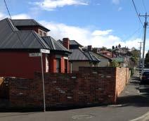
Local Heritage Precincts
1.Elizabeth Street
2.Lefroy Street
3.Smith & George Street
4.Yardley & Wignall Street
5.Letitia and Park
Local Heritage Place
Tasmanian Heritage Register (State)
8.Swan Street
9.Carr Street 10.Burnett Street
11.Newdegate & Arthur Streets
12.Stoke Street
13.Rupert & Mortimer Avenues
Part two: Urban Design Principles
storey brick Victorian terraces on George
Local heritage precincts
Part two: Urban Design Principles
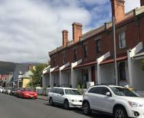
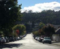
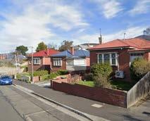
The Yardley and Wignall Streets Precinct contributes to an understanding of residential growth patterns and architectural heritage influenced by the introduction of the tram
The Letitia and Park Street precinct contributes to an understanding of residential growth and development patterns in North Hobart, notably influenced by the introduction of tram services in 1916. The precinct’s appeal is characterised by a consistent streetscape, with weatherboard and brick houses, and cottagestyle gardens, reinforcing its residential character. Furthermore, it underscores the representation of architectural styles, particularly late Victorian, Federation, and Inter-War period houses.
5. Letitia and Park Street (HOB-C6.2.22)
4. Yardley and Wignall Streets (HOB-C6.2.25)
Street trees on Wignall Street, North Hobart.
Houses with corrugated iron roofs and brick chimneys, situated on Park Street, North Hobart.
Part two: Urban Design Principles
Local heritage precincts
The Letitia Street Precinct contributes to understanding development patterns and architectural heritage in North Hobart. The precinct showcases a distinctive early twentieth-century subdivision pattern and well-maintained front gardens, enhancing its residential character. Aesthetic features include a consistent streetscape of singlestorey weatherboard and brick houses, contributing to a uniformity of form and scale. The late Victorian, Federation, and Inter-War period houses reflect a distinct era of urban expansion, notably linked to tram services.
McTavish Avenue and Commercial Lanes
6. Letitia Street (HOB-C6.2.33)
7. McTavish Avenue and Commercial Lane (HOB-C6.2.24)
The
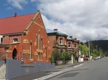
Detached, single-storey brick houses on Letitia Street in North Hobart. Source: Google Map Streetview 2024
Historic stone masonry buildings along Elizabeth Street, North Hobart. Source: Google Map Streetview 2024
Local heritage precincts
Part two: Urban Design Principles
The Carr Street Precinct contributes to the understanding of development patterns and architectural heritage in North Hobart through the late Victorian and Federation period houses, indicative of suburban expansion phases. Other features include gardens, street trees, and original architectural features,
Single-storey homes bordered by picket fences
Part two: Urban Design Principles
Local heritage precincts
Part two: Urban Design Principles
12. Stoke Street
The Stoke Street precinct contributes to an understanding of the local historic significance of New Town, notably its early subdivisions and connections with prominent estates. It emphasises the area's appeal as a residential area, featuring substantial houses set back from the street and provided with large front gardens, built by and heavily associated with many influential citizens across different eras. Aesthetically, the precinct boasts intact, architecturally diverse buildings and mature plantings associated with its historic estates. It represents a range of building styles
13. Rupert and Mortimer Avenues
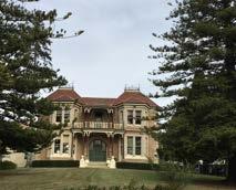
The Rupert and Mortimer Avenues precinct contributes to understanding the development patterns and early estate subdivisions within Mount Stuart. Aesthetically, the area is characterised by well-preserved early to mid-twentieth century houses, forming a cohesive streetscape that showcases various design features and styles. The response to topography is evident in building placement and split-level street formation, enhanced by significant stone walling. Front and rear gardens contribute to the residential character. Mount Stuart's significance also lies in its oldest residence, Beaulieu, and the visible subdivision patterns that evolved from it, highlighting the changing development trends and architectural styles over time.
Red brick Federation-style houses on Stoke Street, New Town with foothills of Kunanyi in the background. Source: Google Map Streetview 2024
Historic red brick house on Rupert Avenue, Mount Stuart. Source: Google Map Streetview 2024
Part three: Neighbourhood Framework
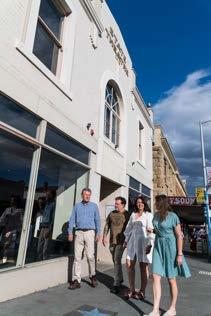
Elizabeth Street, North Hobart
Photograph by Alastair Bett
50 City of Hobart
Part three: Neighbourhood Framework
Part three, sets out the neighbourhood shaping goals, objectives, strategies and actions that support the North Hobart Vision.
Feedback received on the directions, ideas and opportunities, raised in the community engagement process for the Discussion Paper, helped to inform the neighbourhood shaping goals and associated strategies and actions.
The Urban Design Principles described in Part two, have been applied throughout the objectives, strategies, and actions. The Neighbourhood Framework builds upon the UDPs providing supporting information, maps and guidance on the future outcomes relating to built form, public realm and open space, and movement and access.
Four neighbourhood shaping goals
The four goals
Goal one:
North Hobart is a welcoming and inclusive neighbourhood to live and work.
Goal two:
North Hobart is a creative and diverse neighbourhood on Palawa Country.
Goal three:
North Hobart is a resilient and sustainable neighbourhood.
Goal four:
North Hobart is an accessible and walkable neighbourhood.
How each goal is delivered
Each goal has associated objectives, strategies and actions to achieve its intent.
The responsibility of the proposed actions have been classified as deliver, partner or advocate.
A summary of all proposed actions are included in Part 4: Making It Happen.
Goals
Objectives
Strategies
Actions
Implementation
Evaluation
Goal one: North Hobart is a welcoming and inclusive neighbourhood to live and work
Over the next 20 years, growth in housing and employment will be encouraged along North Hobart's wider streets and near Elizabeth Street. This will make it easier for residents to access nearby services, jobs and Central Hobart. Supporting a greater mix of uses close to Elizabeth Street will offer more opportunities for local businesses and workers to remain in North Hobart.
Well-designed and sustainable buildings and spaces, including medium density housing, will respond to North Hobart’s rich heritage. This will involve managing off site impacts and making a positive contribution to the public realm. By managing this growth well, North Hobart will remain a welcoming and inclusive place for everyone.
Urban design principles: Built form and design
1. Promote well designed medium density housing, mixed use renewal and future employment.
2. Support medium density development on wide green streets and strategic sites.
3. Ensure buildings respond to context, including land form, views, streetscape, local character, scale, heritage and solar access.
4. Engage with streets and spaces to increase the sense of safety and add to the vibrancy of the public realm.
Goal one: North Hobart is a welcoming and inclusive neighbourhood to live and work
Objective 1: More diverse housing options including affordable and social housing
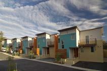
North Hobart will continue to be an inclusive and welcoming place to live. A greater range of housing options for different needs and incomes will be available and affordable for more residents.
Medium density housing, such as terrace houses, townhouses and low-rise apartments will provide a range of housing options for different needs and incomes, including social, affordable, and key worker housing.
North Hobart's beautiful heritage will be preserved. Well-designed medium density housing that is respectful of the character of the area will be supported in the right locations (see Figure 8).
Housing growth will be located close to jobs, services, transport, and open space.
Renewing strategic sites such as the Condell Place car park and the Providence Valley Rivulet block has the potential to unlock other benefits to the community, such as:
• safe and accessible public open spaces and greening
• best practice in 'density done well'
• more services and transport options within walking distance.
Adaptive re-use of non-residential buildings can provide opportunities for medium density housing in Feltham, George, Wellington, and Smith Streets.
Conversion of non-residential buildings and underutilised sites along the wider streets, including Argyle, Burnett, Federal, and Letitia Streets, will provide opportunities for mixeduse developments with medium density housing, such as 'shop-top' apartment living above commercial uses.
There is potential for appropriately designed medium density infill housing within the Smith and George Street Local Heritage Precinct.
Measures of success
• Increase in affordable, medium density housing to buy and rent.
• Greater supply of key worker housing close to their place of employment.
• Increase in mixed use development.
• Decrease in dwelling conversions to short stay visitor accommodation.
Smith Street warehouse conversion designed by Terroir, photograph by Jonathon Wherrett
City of Hobart
Goal one: North Hobart is a welcoming and inclusive neighbourhood to live and work
Objective 1: More diverse housing options including affordable and social housing
Figure 8. Supporting medium density housing and mixed use renewal along wider and greener streets of North Hobart and near Elizabeth Street.
Study Area
North Hobart area
included in Central Hobart Plan 2023
Open space
Rivulet (open)
Rivulet (closed)
Potential areas of change
Medium density housing
Potential for mixed-use
Strategic opportunity (large sites)
Heritage considerations
Local heritage place (Draft LPS)
Tasmanian Heritage Register
Heritage Precinct (Draft LPS)
1.Providence Valley Rivulet block
2. Medium density infill housing on sites that preserve the character of the area.
3.Medium density housing and mixed-use renewal along wide streets.
4.Council-owned car park
5.Homes Tasmania sites with long term renewal potential
6.North Hobart Oval precinct
Goal one: North Hobart is a welcoming and inclusive neighbourhood to live and work
Objective 1: More diverse housing options including affordable and social housing
What type of housing?
Medium density housing
The Tasmanian Government has developed design guidelines for medium density residential development as part of the Greater Hobart Plan.
A proposed definition for medium density housing:
Multiple dwellings on a site that can range from single storey to up to six storeys in height. Typical typologies include single-storey villa developments, duplexes and co-joined dwellings, terrace housing, townhouses, apartment buildings up to six storeys, shop top housing and mixed-use residential developments with commercial ground floor tenancies.
Medium Density Design Guidelines, August 2023.
Mixed-use renewal
Mixed-use renewal means the redevelopment of land that blends multiple uses, either within buildings and/or across multiple buildings on larger sites. Uses can include, housing, retail, hospitality, office, community or cultural uses.
Adaptive reuse
Adaptive reuse is the process of repurposing an existing building for a new function. This not only preserves the history of a site, but also makes use of a previous carbon investment in the building stock, thereby reducing embodied carbon. Adaptive reuse can be appropriate for buildings protected by the Tasmanian Planning Scheme's Heritage Code or listed on the Tasmanian Heritage Register as well as unlisted buildings with heritage values.
The modification of a heritage place to a new use that conserves its heritage values.
Adaptive reuse, Department of the Environment and Heritage, 2004
Social housing
Social housing is affordable housing provided by the government and community sectors to assist people who are unable to afford or access suitable accommodation in the private rental market. It includes public housing, state owned and managed Indigenous housing and community housing. Rents are set as a proportion of household income.
Affordable housing
Affordable housing refers to housing for purchase and rental, that is appropriate for the needs of very low to moderate-income households. This is generally understood to mean housing that costs no more than 30 per cent of a household’s gross income.
Affordable rental housing
Affordable rental housing refers to properties that are made available at rents below market rates, and are affordable for low to moderate income households. Typically, this means rents are set at or below 80 per cent of market rates and not more than 30 per cent of a household’s gross income. This includes key worker housing and social housing.
Medium density social housing in Hobart. Photograph by Adam Gibson.
Goal one: North Hobart is a welcoming and inclusive neighbourhood to live and work
Objective 1: More diverse housing options including affordable and social housing
Condell Place LITTLEARTHURST
Concept design principles
1 Provide public car parking (to the equivalent or more than existing) and charging in a lower ground parking facility, and secure bike and scooter parking with passive surveillance. Wrap lower ground frontage to Burnett Place with active uses.
2 Identify opportunities for new public open space and greening fronting onto Tony Haigh Walk and Little Arthur St; design for high amenity and high-quality spaces that are safe and welcoming.
3 Encourage active frontages for retail/hospitality uses on the upper ground floor of privately owned land facing onto Burnett Place, through placemaking and street trees.
4 Increase site activation with ground floor community use fronting onto public open space. Investigate upper level for affordable housing. Ensure buildings are sensitively designed with natural surveillance, appropriate setbacks, and height.
5 Renew pedestrian connections along Burnett Place and Condell Place and consider improving connections through to Burnett Street.
Legend
Site boundary
Indicative new public open green space/square
Underground car park below
Potential site for medium
density housing development
Renewed public space
Street canopy trees
Sensitive interface
Active street frontage
Existing pedestrian route
Potential new pedestrian route
Indicative access to car park
Signalised intersection (new)
Signalised inersection (upgrade)
Figure 9. Condell Place site analysis and concept design diagram
Goal one: North Hobart is a welcoming and inclusive neighbourhood to live and work
Objective
Strategy 1.1
Support well-designed medium density housing in the right locations through mechanisms in the planning scheme.
Proposed actions
Deliver
A1.1.1 Prepare a planning scheme amendment to:
• Rezone land from the Light Industrial Zone to the Urban Mixed Use Zone and to the General Business Zone.
• Rezone land from the Inner Residential Zone to the Urban Mixed Use Zone.
A1.1.2 Investigate mechanisms to require delivery of developer contributions for community benefit.
Strategy 1.2
Renew strategic opportunity sites to deliver affordable and/or social, medium density housing.
Proposed actions
Deliver
A1.2.1 Undertake a feasibility study to investigate the potential for the councilowned car park at Condell Place to deliver affordable and/or social, medium density housing, community uses and a public car park.
Advocate
A1.2.2 Engage with Homes Tasmania to support the long term renewal of Homes Tasmania assets to deliver more affordable and social, medium density housing.
Deliver, Partner, Advocate
A1.2.3 Engage with landowners and other stakeholders, to prepare a Providence Valley Rivulet Masterplan, which plans for the coordinated renewal of land bound by Elizabeth, Argyle, Burnett and Lefroy Streets, for the delivery of mixed-use and residential development.
Condell Place car park
Hobart
Goal one: North Hobart is a welcoming and inclusive neighbourhood to live and work
Objective 1: More diverse housing options including affordable and social housing
Visitor Accommodation
North Hobart is an attractive destination for visitors. Providing for short-stay visitor accommodation which does not negatively impact on the amount of long term rental and affordable housing is essential.
Strategic opportunities for renewal of existing, underutilised visitor accommodation sites, which can provide additional capacity, can be supported by rezoning these sites to the Urban Mixed Use Zone. (See A1.1.1)
The effectiveness of changes to council rates, intended to discourage the full conversion of a dwelling to visitor accommodation in residential zones, will continue to be monitored, as will the conversion of existing visitor accommodation to a dwelling. Analysis of whether rates increases are covered through accommodation cost increases should also be considered.
The City are likely to pursue a planning scheme amendment to the LPS which proposes a Specific Area Plan (SAP) to prohibit the full conversion of dwellings in residential zones to visitor accommodation use across the LGA. The success of this PSA will determine whether the proposed action A1.3.1 is necessary.
Depending upon the success of the listed actions, council staff will continue to investigate mechanisms, used in other areas, to discourage the permanent conversion of dwellings to visitor accommodation use, and their suitability for application in North Hobart.
Strategy 1.3
Create a sustainable balance between short stay visitor accommodation and housing for residents.
Proposed actions
Deliver
A1.3.1 Prepare a planning scheme amendment to apply a Specific Area Plan to prohibit the conversion of whole dwelling residential use to visitor accommodation use in the Inner Residential and General Residential zones of North Hobart.
A1.3.2 Prepare a planning scheme amendment to rezone land to the Urban Mixed Use Zone to enable larger scale visitor accommodation in appropriate locations.
North Hobart Oval Sports and Community Precinct and the adjacent Rydges Hotel, to the north
Rydges Hotel, North Hobart
Goal one: North Hobart is a welcoming and inclusive neighbourhood to live and work
Objective 2: Jobs, services, and everyday convenience within walking distance
North Hobart will continue to be a vibrant and diverse neighbourhood. It's mixed-use character will be celebrated.
Existing employment corridors will be strengthened and mixed use renewal supported in the right locations (see Figure 10).
A diverse range of employment types and industries such as retail and hospitality will be provided.
Land will be rezoned to provide new spaces for:
• established businesses that are currently located in residential zones in more appropriate zones
• new small business, such as daily retail and services
• visitor accommodation on land zoned Urban Mixed Use or General Business to reduce the demand for visitor accommodation on residentially zoned land
• a small supermarket or grocer on land zoned General Business in a preferred location.
A Providence Valley Rivulet Masterplan, which delivers mixed use and residential development plans for the coordinated renewal of land bound by Elizabeth, Argyle, Burnett and Lefroy Streets, will be prepared in consultation with stakeholders and landowners.
Measures of success
• Increase in commercial floor space
• Increase in retail diversity to meet daily needs
• Supermarket or grocer to provide fresh food
Strategy 2.1
Support existing and future employment needs with new and renovated buildings that offer different sized tenancies at varying price points to support a range of business and employment needs.
Proposed actions
Deliver
A2.1.1 Prepare a planning scheme amendment to:
• Rezone land from the Light Industrial Zone to the Urban Mixed Use Zone and to the General Business Zone.
• Rezone land from the Inner Residential Zone to the Urban Mixed Use Zone.
Advocate, Partner
A2.1.2 Engage with landowners and other stakeholders, to prepare a Providence Valley Rivulet Masterplan, which plans for the coordinated renewal of this land for the delivery of mixed-use and residential development.
The Rox residential and visitor accommodation apartments with ground floor commercial tenancy, Hobart
City of Hobart
Goal one: North Hobart is a welcoming and inclusive neighbourhood to live and work
Objective 2: Jobs, services, and
North Hobart area included in Central Hobart Plan 2023
Open space
Rivulet (open)
Rivulet (closed)
Open
Rivulet (open)
Rivulet (closed)
Existing
Objective 3: Well designed and sustainable buildings that respond to heritage Goal one: North Hobart is a welcoming and inclusive neighbourhood to live and work
North Hobart will maintain its rich and diverse heritage and character. It is important that buildings are designed to protect heritage places and precincts.
The Urban Design Principles set out in this Neighbourhood Plan will guide future development to align with the vision for North Hobart.
The Built Form and Design Guidelines set out in this Neighbourhood Plan consider factors like the local character, scale, land form, heritage, and sunlight access of North Hobart and includes specific controls, such as maximum building heights, and minimum boundary setbacks.
Community benefits, such as new open spaces and pedestrian links, will be delivered as part of new development.
These guidelines will be implemented through a planning scheme amendment to the Hobart Local Provisions Schedule of the Tasmanian Planning Scheme.
The City continues to develop strategies, plans, policies and guidelines which support best practice design.
The Heritage Design Guidelines will help inform development on sites that are listed across Hobart including development of heritage places and in heritage precincts in North Hobart.
The Hobart Design Guidelines are a placedbased guide outlining urban and building design principles that will apply to the public realm and private development across Hobart to help shape better places for all.
The Medium Density Design Guidelines are being developed by the Tasmanian Governments Department of State Growth. These guidelines are intended to facilitate a higher standard of medium density residential development in Greater Hobart.
The City will continue to support events and programs which showcase exemplar design, sustainability and innovation such as the Architecture Awards and Open House Hobart.
Strategy 3.1
Support design quality and excellence in new development.
Proposed actions
Deliver
A3.1.1 Prepare a planning scheme amendment to implement the Built form and design guidelines set out in this Neighbourhood Plan.
A3.1.2 Design buildings and infrastructure on Council owned land to be zero emissions; include 100% renewable energy generation and storage with consolidated off-street, car parking facilities; provide electric micromobility and car charging; and incorporate water sensitive urban design.
Advocate
A3.1.3 Advocate to the Tasmanian Government for changes to the National Construction Code (NCC) to increase the NatHERs star rating requirement to a minimum of 7 stars for new dwellings.
A3.1.4 Encourage development which is easily accessible by public transport, taxi, carshare and bike, provide car parking with electric car charging (underground where possible).
Measure of success
• Industry-recognised design excellence, sustainability and innovation.
Goal one: North Hobart is a welcoming and inclusive neighbourhood to live and work
Objective 3: Well designed and sustainable buildings that respond to heritage
Adaptive re-use and setback above existing building 388 Barkly Street, Brunswick by DREAMER with Breathe Architecture
Materials palette: red brick Clifton and Central, Mt Lawley, Western Australia by MJA Studio
Letitia Street medium density housing in North Hobart by Preston Lane Architects North Hobart
Goal one: North Hobart is a welcoming and inclusive neighbourhood
to live and work
Built form and design guidelines
Urban design principles: Built form and design
1. Promote well designed medium density housing, mixed use renewal and future employment.
2. Support medium density development on wide green streets and strategic sites.
3. Ensure buildings respond to context, including land form, views, streetscape, local character, scale, heritage and solar access.
4. Engage with streets and spaces to increase the sense of safety and add to the vibrancy of the public realm.
The Built form and design guidelines for North Hobart are informed by best practice and the specific place context of North Hobart, such as Palawa identity, land form, character, heritage and solar access. They seek to enhance the quality of the buildings, as well as the spaces between buildings.
Planning scheme amendments to implement the guidelines will provide clarity for the community and developers about the requirements for North Hobart.
The City of Hobart Urban Design Advisory Panel (UDAP) will continue to play an important role through the independent design review process.
Promote well-designed medium density housing, mixed use renewal and future employment
Overview
North Hobart has a unique character and identity that is highly valued by both locals and visitors.
Heritage places and precincts combine with a mix of more recent built form, such as small to mid-scaled retail and offices, this results in an attractive and identifiable character, despite the variation.
Streetscapes vary in size and qualities, connecting residential areas with key destinations in North Hobart and beyond.
New development within North Hobart must enhance, not detract from the values of place. Creative, innovative and sustainable design is essential to makes a positive contribution to the built form, public realm and amenity of North Hobart.
The following guidelines are currently being developed and will be relevant to future development in the area:
• Heritage Design Guidelines, City of Hobart
• Hobart Design Guidelines, City of Hobart
• Medium Density Design Guidelines, Department of State Growth.
The following pages showcase examples of medium-density development typologies, illustrating the diverse potential for housing, mixed use renewal, and business spaces that respond to North Hobart's context.
Goal one: North Hobart is a welcoming and inclusive neighbourhood to live and work
Built form and design guidelines
Character and identity
• New development should be articulated to reinforce the human-scale streetscape of North Hobart, breaking down singular long elevations into a series of facades.
• Continue the streetscape rhythm and materiality of the street wall down to the ground level forming part of the built form expression at street level.
• Celebrate the diversity of built form, including small office and warehouse building typologies as part of the character of North Hobart.
• Continue architectural expression through upper levels and roof lines reflecting the building use and complementing adjoining roofscapes.
• Respond to the colour and material palette of North Hobart, consider complementary and contrasting colours and materials.
• Requirements set out in the Heritage Code and North Hobart SAP take precedence over above requirements, to protect the integrity of heritage values.
Landscape, greening and flooding
• Incorporate additional greening including in front and rear garden setbacks, terraces and green walls.
• Consider on-site water retention to support landscapes and vegetation.
• Mitigate flood risks and manage flood waters through innovative design solutions including WSUD elements such as swales and water retention that accommodate pedestrian movement and safety.
Building performance
• Ensure the orientation, design and layout of development makes appropriate use of daylight and solar energy, to reduce fossil fuel energy use.
• Dwellings should be designed to achieve adequate thermal efficiency. Advocate for 7 star NatHERs requirements in the NCC for Tasmania.
• Minimise the environmental impacts of development, and consider the carbon footprint of building materials, systems, and ongoing building management.
• Prioritise adaptive re-use of buildings, over demolition and rebuilding.
• Ensure that new development allows for future adaptation to a different use over time, by providing adequate floor to floor heights. The street wall and surrounding context should be considered.
• Locate waste and recycling facilities where they are accessible, at basement level or spaces with and rear access. Design with elements such as screening and recessed spaces, to minimise the visual impact on streets and lanes.
The distinct streetscape character of Elizabeth Street. Photograph by Alastair Bett
Green roof terrace, Burnley VIC by Hassell
North Hobart
Goal one: North Hobart is a welcoming and inclusive neighbourhood to live and work
Built form and design guidelines
Reverse amenity
There is a need to ensure that existing land uses that are central to North Hobart’s cultural identity, such as its live music, dining and entertainment scene, are not compromised by development with sensitive new uses such as residential or visitor accommodation.
The Neighbourhood Plan proposes reverse amenity requirements to protect hospitality uses. These have the potential to be implemented through an action for a planning scheme amendment to the LPS.
Reverse amenity controls
Provisions in the planning scheme should consider the extent to which a new use or development minimises the potential for off site impacts to affect the amenity of future users of the proposed development, including from noise, fumes, odour or vibrations, ensuring that:
• existing uses are not compromised by a new use or development
• a new use or development is designed to address amenity impacts from, and to, existing uses.
A standard to consider how the layout and design of a new development with a sensitive use minimises the potential for off site impacts should be included in the SAP which is proposed through the preparation of a planning scheme amendment. See Action A.3.1.1 and A5.1.1.
Hospitality uses in 'backyard' spaces off Elizabeth Street Photograph of Boodle Beasley beer garden by Alastair Bett
Hospitality uses in Elizabeth Street Photograph of Willing Bros by Sam Shelley
Goal one: North Hobart is a welcoming and inclusive neighbourhood to live and work
Built form and design guidelines
Townhouse (laneway/corner)
Location: Davison Street, Brunswick (VIC)
Architect: Archier
Dwellings: 3 (83 dwellings/ha)
Site area: 360m2
Site type: corner
Townhouse (courtyard)
Location: Barkly Street, Brunswick (VIC)
Architect: Breathe Architecture + DREAMER
Dwellings: 11 (107 dwellings/ha)
Site area: 925m2 (approx)
Site type: inside
Apartment building (large site)
Location: Goulburn Street, Hobart (TAS)
Architect: Cumulus
Dwellings: 25 (177 dwellings/ha)
Site area: 1415m2 (approx)
Site type: inside-through
Apartment building (small site)
Location: Napier Street, Fitzroy (VIC)
Architect: Freadman White
Dwellings: 14 (347 dwellings/ha)
Site area: 400m2 (approx)
Site type: inside
A redevelopment of a former commercial site, located in close proximity to Brunswick Street, a high street context in Fitzroy that is similar to Elizabeth Street in North Hobart.
City of Hobart
Goal one: North Hobart is a welcoming and inclusive neighbourhood to live and work
Built form and design guidelines
Mixed use development
Mixed use (high street)
Location: Sydney Road, Melbourne
Architect: Austin Maynard Architects
Dwellings: 20 apartments (182 dwellings/ha)
Business uses: Homewares and clothing stores
Heritage: Adjacent heritage
Site area: 1100m2
Site type: 2 high street lots with rear laneway access
Mixed use apartment building (corner)
Location: Elizabeth Street, Hobart
Architect: Core Collective Architects
Dwellings: 15 (176 dwellings/ha)
Business uses: Visitor accommodation, car show room and restaurant.
Heritage: Adjacent heritage place
Site area: 850m2
Site type: Corner
Mixed use apartment building (corner)
Location: Mt Lawley, WA
Architect: MJA Studio with CAPA Studio
Dwellings: 15
Business uses: 7 tenancies (yoga studio, cafe, restaurant, barber and wine bar)
Heritage: Adaptive re-use of existing corner building
Site area: N/A
Site type: Corner
Goal one: North Hobart is a welcoming and inclusive neighbourhood to live and work
Built form and design guidelines
Business development and adaptive reuse
Renewal of former industrial site
Location: Milledge Lane, Launceston
Architect: LXN Architecture
Business uses: Office and retail
Heritage: Adjacent heritage
Site area: N/A
Site type: Corner
Adaptive reuse of heritage
Location: Argyle Street, Hobart
Architect: Core Collective
Business uses: Art gallery, bakery, restaurant
Heritage: Heritage place
Site area: N/A
Site type: Corner
Adaptive reuse of disused warehouse
Location: Tasma Street, North Hobart
Architect: 1+2 Architecture
Business use: Head office
Heritage: N/A
Site area: N/A
Site type: N/A
Adaptive reuse of disused warehouse
Location: Smith Street, North Hobart
Architect: Terroir
Dwellings: 2
Heritage: Located in a Heritage Precinct
Site area: Approx. 680m2 (approx)
Site type: inside
City of Hobart
Goal one: North Hobart is a welcoming and inclusive neighbourhood to live and work
Built form and design guidelines
Support medium density development on wide green streets and strategic sites
A key built form strategy is to encourage increased height and density on wider streets such as Argyle Burnett, Federal and Letitia, Streets, as well as the Providence Valley Rivulet block.
The width of these streets, along with larger lot configuration, provides opportunities for development at taller scales, as they can better manage off-site impacts such as overshadowing, and provide a greater contribution to landscaping to support the role of these streets as Primary Green Streets. (See objective 6).
These wide streets:
• can accommodate a greater concentration of activity and variety of uses
• are identified as primary pedestrian streets and have opportunities for footpath upgrades and greening
• are identified as primary cycle and micromobility routes and have opportunities for improvements
• are currently used for existing bus routes and Letitia Street is identified as a potential route for proposed bus rapid transit.
Sites containing existing warehouse and light industry buildings provide opportunities for adaptive reuse that demonstrates environmental sustainability.
Federal Street with Kunanyi/Mount Wellington in the distant background.
Letitia Street with the heritage listed Former High School site to the right in the background.
Hobart
Goal one: North Hobart is a welcoming and inclusive neighbourhood to live and work
Goal one: North Hobart is a welcoming and inclusive neighbourhood to live and work
Built form and design guidelines
Goal one: North Hobart is a welcoming and inclusive neighbourhood to live and work
Built form and design guidelines
This puts Hobart in the enviable role as a city with identifiable natural limits, at the southern margin of the urbanised world, that can advance a specific understanding and appreciation of settlement values. These include a custodial role to wilderness landscapes within the Tasmanian jurisdiction and beyond.
Ensure buildings respond to context, including land form, views, streetscape, local character, scale, heritage and solar access.
The natural topography and landform of North Hobart plays a central role shaping the perception of building heights and determining logical locations for taller structures while managing the impacts of perceived scale.
Other key principles that have informed proposed maximum building heights are: the context, scale, local character, heritage places and precincts.
The shared cultural and natural heritage that ascribes to peoples surroundings, of which landscapes are an essential component, are recognized as a foundation to cultural identity.15 Attachment to place
15 Council of Europe, European
Article
‘Each
Development heights should align with the layered landform of North Hobart, ascending from the 'hill' to the 'basin' area near Letitia Street.
Identifies landform features as a sequence of ‘lifts’, including city centre slopes, city centre fringe, Inner hills, mid ground hills. Also includes city ridges.
constitutes one of the most vital elements of human and landscape aesthetics, all the more so when applied to the complexity of the city, the location where the experience of change is expected, if not constant, 16 being both ‘natural object and a thing to be cultivated’. 17
Settlement expansion
Specific considerations include preserving the prominence of the heritage listed former Hobart High School buildings as a landmark in the area, including when viewed from uphill. Heights are restricted to 4 storeys or 15 metres in the surrounding area, including the 'basin' where the Black Buffalo Hotel is located.
This puts Hobart in the enviable role as a city with identifiable natural limits, at the southern margin of the urbanised world, that can advance a specific understanding and appreciation of settlement values. These include a custodial role to wilderness landscapes within the Tasmanian jurisdiction and beyond.
Notwithstanding the terrain, the form of Tasmanian settlements was determined not by grand plans, but by expansion along main roads. Even Hobart’s initial town plan (Meehan 1811) provided an
and a foundation of their identity.’
This approach involves situating increased heights within the basin and at the core of the Providence Valley Rivulet block, capitalising on the fall from Elizabeth Street to Letitia Street and then up to the Domain (see Figure 14).
Figure 13. North Hobart within the broader Central Hobart land form structure, noting the fall from high ground towards the City Centre. (Image source: Building Height Standards Review, 2018, Leigh Woolley Architect)
extended framework, beyond Sullivans Cove.
Identifies landform features as a sequence of
Taller built forms are proposed for the Providence Valley Rivulet block and Condell Place car park sites, where the surrounding context allows for minimal impact, and where developer contributions have the potential to provide the greatest community benefit.
The shared cultural and natural heritage that ascribes to peoples surroundings, of which landscapes are an essential component, are recognized as a foundation to cultural identity.15 Attachment to place 15
constitutes one of the most vital elements of human and landscape aesthetics, all the more so when applied to the complexity of the city, the location where the experience of change is expected, if not constant, 16 being both ‘natural object and a thing to be cultivated’. 17
Settlement expansion
Lower heights are recommended through building envelopes proposed for lots to the north of Providence Valley Rivulet (and the potential park) to prevent overshadowing. (See Section E).
Notwithstanding the terrain, the form of Tasmanian settlements was determined not by grand plans, but by expansion along main roads. Even Hobart’s initial town plan (Meehan 1811) provided an
Leigh Woolley Architect + Urban Design Consultant
Right : Central Hobart landform structure as an extended framework, beyond Sullivans Cove.
Goal one: North Hobart is a welcoming and inclusive neighbourhood to live and work
Built form and design guidelines
Section A — Federal Street
• Retaining the prominence of the former Hobart High School building as a landmark, especially when viewed from uphill
• Allowing taller built form in the ‘basin’ on the Black Buffalo Hotel site.
Section B — Burnett Street
• Allowing taller built form in the middle of the Providence Valley Rivulet block.
• Lower heights to the north of the Providence Valley Rivulet (and potential park) to protect it from overshadowing.
Aerial photograph showing locations of sections taken through lots adjacent to Federal and Burnett Streets.
Figure 14. Proposed maximum building heights and landform (Note: Applications for development would still be subject to the Heritage Code)
Goal one: North Hobart is a welcoming and inclusive neighbourhood to live and work
Built form and design guidelines
Goal one: North Hobart is a welcoming and inclusive neighbourhood to live and work
Built form and design guidelines
Section C — Condell Place: Burnett Street to Little Arthur Street (southwest facing)
Section D — Wignall to Feltham Street (northeast facing)
Section E — Lefroy to Burnett Street (northeast facing)
Figure 15. Proposed maximum building heights and landform sections
Goal one: North Hobart is a welcoming and inclusive neighbourhood to live and work
Built form and design guidelines
Locations of sections shown in Figure 15.
Goal one: North Hobart is a welcoming and inclusive neighbourhood to live and work
Built form and design guidelines
The proposed maximum building heights seek to support diverse medium density housing typologies and mixed use developments that reinforce and enrich North Hobart’s distinct built form character and identity.
Residential infill and mixed use renewal
Varied maximum building heights across the study area have the potential to support multiple dwellings that range from single storey to up to five storeys in height.
Medium density dwelling typologies that are appropriate to include in this area are double storey villa developments, duplexes and cojoined dwellings, terrace housing, townhouses, apartment buildings up to five storeys, shop top housing and mixed-use residential developments with commercial ground floor tenancies.
Improving Residential Standards Project
The State Government's State Planning Office is reviewing planning controls for urban housing and residential development in Tasmania. The project aims to increase housing supply, affordability and diversity of housing types. The project will develop recommendations that will inform future amendments to the State Planning Provisions (SPPs).
At this stage it seems likely that there will be changes made to the permitted height and setback standards of buildings in the Inner Residential Zone and potentially the General Residential Zone. Therefore this Plan does not propose any specific recommendations for development standards in these zones.
Future employment uses
Carefully considered maximum building heights, in conjunction with other guidelines outlined in the UDP, aim to promote diverse and innovative commercial building typologies.
A range of contemporary workspaces at varying scales, which can respond to the evolving needs of enterprises and workers, including the preference for environments rich in amenity, will be encouraged to support new business opportunities.
New development and use along Federal Street should complement the character of the area, and provide higher levels of visual and physical engagement with the street using crime prevention through environmental design (CPTED) principles, placemaking and urban greening.
Development that is adjacent to a sensitive residential use should address overshadowing and visual bulk impacts. See rear boundary setbacks and landscaping diagrams.
Courtyard house and rental flat with dual frontage to George and Smith Streets designed by Morrison & Breytenbach Architects, photograph by Peter Whyte
Medium density housing on Murray Street, North Hobart designed by Morrison & Breytenbach Architects, photograph by Jonathon Wherrett City
Goal one: North Hobart is a welcoming and inclusive neighbourhood to live and work
Built form and design guidelines
Planning mechanisms to introduce maximum building heights
The height of buildings significantly influences the overall scale, form, and desired character of North Hobart’s streets and spaces.
Maximum building heights are proposed to support North Hobart’s evolution over the next 20 years, these heights respond to the land form, views, heritage, and streetscapes.
A planning scheme amendment for a Specific Area Plan in the LPS will be used to implement maximum heights.
Development standards in the State Planning Provisions of the Tasmanian Planning Scheme currently have maximum building heights under the Acceptable Solution of the relevant standard. However, in some instances these heights can potentially be exceeded under assessment against the Performance Criteria. We are proposing performance criteria with maximum building heights as well as other performance based criteria.
It is important to understand that inclusion of a maximum building height in the Performance Criteria does not mean that a development can automatically achieve this height, as other standards may prevent this.
Developments aspiring to reach the maximum height will need to meet the relevant standards set out in the maximum building heights plan, which are proposed to be implemented through a Specific Area Plan in the LPS.
Lot size and configuration, and the standards set out in code overlays, such as the Heritage Code, will also play an integral role in determining the appropriate height for each site.
Developer contributions for community benefit are proposed for developments of four and five storeys.
The Urban Design Advisory Panel provide independent and professional urban design advice on proposed projects within the city. The panel promotes good design and a quality urban environment.
The panel provides both pre-application advice to developers on significant developments, as well as providing advice to the Council for lodged applications.
This panel plays an integral role in the success the City has in creating itself as a place that people will want to visit, work and recreate in.
The Rox mixed use development on Elizabeth Street, Hobart, designed by Core Collective
Medium density housing on Margaret Street, Launceston designed by Loop Architects, photograph by Tassie Visuals
Hobart
Goal one: North Hobart is a welcoming and inclusive neighbourhood to live and work
Built form and design
guidelines
INCLUDED IN CENTRAL HOBART
Figure 16. Existing maximum building heights plan as determined by the Acceptable Solution for building height in the relevant zone or SAP in the Tasmanian Planning Scheme.
Study Area
North Hobart area included in Central Hobart Plan
Open space
Rivulet (open)
Rivulet (pipe)
North Hobart Specific Area Plan (SAP)
General Residential Zone height TBC by State Government Improving Residential Standards Project (see page 80 for more detail)
Inner Residential Zone height TBC by State Government Improving Residential Standards Project (see page 80 for more detail)
General Business Zone +North Hobart SAP 9m above NGL (2 storeys)
Urban Mixed use, Light Industrial, Community Purpose + Recreation Zone 10m above NGL (3 storeys mixed use development)
General Business Zone 12m above NGL (3-4 storeys mixed use development)
*Natural Ground Level (NGL)
Goal one: North Hobart is a welcoming and inclusive neighbourhood to live and work
Built form and design guidelines
Figure 17. Maximum building heights analysis plan
North Hobart area
Open space
Rivulet (open)
Rivulet (pipe)
North Hobart Specific Area Plan (SAP)
General Residential Zone height TBC by State Government Improving Residential Standards Project (see page 80 for more detail)
Inner Residential Zone height TBC by State Government Improving Residential Standards Project (see page 80 for more detail)
General Business Zone +North Hobart SAP 9m above NGL (2 storeys)
10m above NGL (3 storeys mixed use development)
12m above NGL (3-4 storeys mixed use development)
15m above NGL (4 storeys, subject to community benefits)
18m above NGL (5 storeys, subject to community benefits)
Goal one: North Hobart is a welcoming and inclusive neighbourhood to live and work
Built form and design guidelines
Existing street wall
A street wall refers to any part of a building that is built on the boundary fronting the street. Street walls are a common feature of high streets and areas with a high mix of uses.
The street wall height refers to the vertical distance between the footpath and the highest point of the building at the street edge. The prevailing street wall height of Elizabeth Street in North Hobart is 2 storeys (9m approx.).
Street wall extension encouraged
The street wall extension of retail, hospitality and entertainment uses on the western side of Argyle, northern side of Burnett and southern side of Federal Streets will reinforce an ‘urban’ character by forming a defined street edge with a 0m front setback at lower levels with upper levels over 10m high set back 6m from the property boundary. The proposed street wall and upper level setbacks are intended to:
• create a sense of enclosure
• retain the human scale of the streetscape
• retain existing street character whilst enabling adaptive use of underutilised land behind existing buildings
• provide views to the sky
• maintain sunlight access to footpaths.
The proposed street wall of 10m is not applied to Elizabeth Street, where the North Hobart SAP includes a 9m building height, nor is it applied to the northern side of Federal Street to retain the prominence of heritage places with differing front setbacks, nor the eastern side of Argyle Street, which is located within a Heritage Precinct.
Development applications would still be assessed against the Heritage Code.
Street corners
Buildings with a street wall should be designed to provide emphasis and definition of the street corner. This can be achieved by chamfering or filleting the corners and/or by building setbacks, to create more space and to increase pedestrian visibility, amenity and safety (See Figure 19).
Prevailing 2 storey street wall on Elizabeth Street. Photograph by Alastair Bett
Figure 18. Upper level setbacks encouraged above the street wall.
Figure 19. Street corner chamfer
Goal
one: North Hobart is
a
welcoming and inclusive neighbourhood to live and work Built form and design guidelines
Study Area
North Hobart area included in Central Hobart Plan 2023
Open space
Rivulet (open)
Rivulet (pipe)
Maximum street wall height (9m) North Hobart SAP
Proposed street wall height (10m)
Landscape interface
Sensitive residential interface (commercial)
Rivulet interface
INCLUDED IN CENTRAL HOBART PLAN 2023
Sensitive residential interface (solar access)
Figure 20. Proposed building street wall and setbacks plan
Goal one: North Hobart is a welcoming and inclusive neighbourhood to live and work
Built form and design guidelines
Landscaped front setback between Condell Place car park and Little Arthur Street
The northern edge of the Condell Place car park site fronting onto Little Arthur Street is capable of a more significant landscape contribution than the standard 3m frontage setback normally required for the Inner Residential Zone. Therefore, a 12m landscaped front boundary setback for buildings other than underground car parking should be provided for landscaping including:
• greening and street trees
• a buffer to larger scale buildings
• Water Sensitive Urban Design (WSUD)
• placemaking and open space opportunities (See Figures 9 and 35).
Proposed Acceptable Solution
Development, excluding underground car parking, must have a setback from a frontage that is not less than 12m.
Development must be contained within a building envelope projecting a line at an angle of 45 degrees from the horizontal at a height of 6m above existing ground level and 12m from the front boundary to the maximum building height.
Other streets in the Inner Residential and Urban Mixed Use Zones will require a 3m front setback for landscaping as per the relevant setback standards in the SPPs.
General Business Zone and Urban Mixed Use Zone rear boundary setback
Overshadowing is a consideration on development of areas that abut very shallow (short) sites.
Future development in the General Business and Urban Mixed Use Zones should seek to provide a 3m rear boundary setback to lots zoned Urban Mixed Use for:
• a reasonable level of solar access to dwellings and their private open space on the subject lot and on neighbouring residences
• landscaping
• a buffer between residential use and new larger scale development.
Proposed Acceptable Solution for the General Business and Urban Mixed Use Zones
Development must be contained within a building envelope projecting a line at an angle of 45 degrees from the horizontal at a height of 6m above existing ground level and 3m from the rear boundary to the maximum building height.
Development in the Urban Mixed Use Zone and adjacent to the General or Inner Residential Zones must meet the relevant setback standards in the SPPs.
Figure 21. Landscaped front setback between Condell Place car park and Little Arthur Street
Figure 22. General Business and Urban Mixed Use Zone rear boundary setback
Goal one: North Hobart is a welcoming and inclusive neighbourhood to live and work
Built form and design guidelines
Rivulet setback
Setbacks to the Providence Valley Rivulet are a key consideration for the future development of the area. Development should enable:
• placemaking and open space opportunities solar access to the Providence Valley Rivulet between 11am and 2pm at the Spring Equinox
• solar access to adjacent buildings
• greening including trees
• Water Sensitive Urban Design (WSUD)
• placemaking and open space opportunities (See Figure 35).
Future development should enable passive surveillance of the rivulet and adjacent public open space by 'turning' towards the rivulet and orienting ground floor uses and habitable rooms towards the rivulet.
The proposed 9m setback has the potential to facilitate the creation of a shared zone providing access along the rivulet to adjacent development sites over time.
Proposed Acceptable Solution
Development must be contained within a building envelope projecting a line at an angle of 45 degrees from the horizontal at a height of 6m above existing ground level and 9m from the rear boundary to the maximum building height.
Landscaped rear setback on Federal Street
Setbacks to the Inner Residential Zone are a key consideration for:
• the rezoning of Light Industrial Zoned land to the Urban Mixed use Zone and
• future development of the area.
Future development for mixed use on the northern side of Federal Street, between Argyle and Letitia Streets, should provide a minimum 6m landscaped rear boundary setback to provide:
• greening including trees
• a visual buffer to larger scale buildings
• Water Sensitive Urban Design (WSUD)
• a buffer between residential use and new larger scale development.
Proposed Acceptable Solution
Development must be contained within a building envelope projecting a line at an angle of 45 degrees from the horizontal at a height of 6m above existing ground level and 6m from the rear boundary to the maximum building height.
Figure 23. Providence Valley Rivulet setback
Figure 24. Landscaped rear setback between Federal and Wignall Streets
Goal
one: North Hobart is a welcoming and inclusive neighbourhood to live and work
Built form and design guidelines
Engage with streets and spaces to increase the sense of safety and add to the vibrancy of the public realm.
Street activation and CPTED
Activation and crime prevention through environmental design (CPTED) plays an important role in the design of urban spaces.
Activation should be specifically encouraged in areas with retail and hospitality including Elizabeth, Argyle, Burnett and Federal Streets.
The following should be considered in the design of new development:
• Non-residential uses should include active frontages, to enable activity to spill out onto streets, public open spaces and pedestrian connections and provide passive surveillance.
• Provide balconies and openable windows within the street wall and orient habitable rooms towards streets and laneways to increase passive surveillance.
• Provide landscaping and greenery around thresholds that enables passive surveillance.
• Ensure that building indents are set at a depth that remains visible from the street to avoid creating unsafe entrapment spaces.
• Incorporate opportunities for integrated art along laneways to encourage foot traffic and create interest with colour, materials and lighting.
• Locate bicycle parking on the ground floor in a safe and well-lit space with active frontages to the street. Complementary uses, such as bicycle repairs or a cafe can provide opportunities for passive surveillance and showcasing.
Retail and hospitality
(e.g. shops, food and drink premises)
Provide structures, canopies or awnings that offer continuous and functional weather protection where retail and hospitality uses are proposed. These should not encroach into space designated for trees.
Provide clear entries and appropriate levels of clear glazing to the front facade of buildings, to increase the level of permeability and visibility from the street.
Avoid broad tenancies along the street frontage and wrap large floorplate tenancies with smaller, fine-grain tenancies.
Avoid external steps or level changes that visually and physically separate the frontage from the street.
Residential
Provide direct individual entries to dwellings or home offices:
• to the street frontage at ground level
• to open space.
Locate community spaces and common indoor spaces and facilities for residents at the ground floor level.
Provide a sense of transition between public and private space and ensure adequate privacy for users.
Open space
Orientate habitable rooms towards the neighbouring open space to provide passive surveillance.
Institutional (e.g. education)
Institutional buildings should, where practicable, create activated façades to increase the degree of visual and physical interaction between people in the street and those within.
Heritage
Respect the characteristics and dominant pattern of building frontages.
Requirements set out in the Heritage Code and North Hobart SAP take precedence over other requirements in this table, to protect heritage values.
Goal one: North Hobart is a welcoming and inclusive neighbourhood to live and work
Built form and design guidelines
Glazing
The extent of glazing at the ground level increases the level of visual engagement and interest between retail and hospitality uses and pedestrians in the street, adding to the vibrancy of these streets and enabling passive surveillance.
Controls will be proposed to:
• Maximise the level of glazing at ground floor level in non-residential developments to support higher levels of activation.
• The incorporation of plinths and bases are encouraged to replicate the traditional character of retail shopfronts.
• Prohibit vinyl wrap advertising over ground floor facade glazing to enable passive surveillance.
• Maximise the amount of glazing when there is a new development or use adjacent to laneways, take into consideration the existing use and service role of back of house areas of adjacent buildings.
Proposed Acceptable Solution
New buildings or alterations to an existing ground floor level façade facing public space must have not less than 40% of the total surface area consisting of transparent windows or doorways.
Building services and loading
The design and configuration of building services, including waste, vehicular access, car parking and loading, is a key consideration towards creating high-quality, safe spaces between the building and streets, laneways and open spaces.
Controls will be proposed to minimise the visual impact of services at ground level by:
• Distributing separate service elements along the street frontage to reduce the creation of large blank walls.
• Exposing service elements and reducing the height of cabinets.
Vehicular movement
Controls will be proposed to:
• Design vehicle entries to prioritise pedestrian safety including visibility, lighting and signage.
• Consolidate vehicular access entries for parking and loading.
• Use high quality and attractive materials and finishes to vehicle entries, gates and fencing.
• Design car parking to have active frontages sleeved around them.
Traditional retail shopfronts on Elizabeth Street
Photograph by Alastair Bett
Car parking is sleeved with active uses
Goal one: North Hobart is
a
welcoming and inclusive neighbourhood to live and work
Built form and design guidelines
Overshadowing
Overshadowing controls are proposed to protect North Hobart’s streets and public spaces from excessive overshadowing during the middle of the day in cooler months of the year, when the sun is lower in the sky.
Controls will be implemented to:
• improve the amenity of footpaths, making them appealing and comfortable for travel, outdoor dining and other activities
• make public open space more appealing and comfortable for outdoor dining, events and other activities.
Overshadowing controls
It is proposed to include standards to assess overshadowing in the planning scheme. The following could be included as Acceptable Solutions and discretion could be applied through assessment against relevant Performance Criteria to allow for some flexibility in the assessment of development.
Existing public open space. (See Figure 25).
No additional overshadowing of existing public open space between 11.00am and 2.00pm at the Winter Solstice.
New public open space (See Figure 25).
Proposed Acceptable Solution
A new development must not cause new public open space to receive less than 2 hours of sunlight between 11.00am and 2.00pm at the Winter Solstice.
Primary pedestrian streets (See Figure 26).
Proposed Acceptable Solution
New development must not cause overshadowing on at least one footpath of primary pedestrian streets between 11:00am and 2:00pm at the Spring Equinox.
New urban plazas and forecourts will be encouraged within new development, and in some instances it will be desirable for them to face the street. Therefore, the drafting and subsequent assessment of performance criteria for overshadowing standards will need to be mindful of this.
Public open space northeast –southwest
Figure 25. Height controls to prevent overshadowing of public open space
Primary northeast –southwest street
Primary northwest–southeast street
Figure 26. Building setbacks to prevent overshadowing of footpaths
Goal one: North Hobart is a welcoming and inclusive neighbourhood to live and work
Built form and design guidelines
27. Primary pedestrian streets protected from overshadowing
Figure
Goal two: North Hobart is a creative and diverse neighbourhood on Palawa Country
Building on North Hobart’s reputation as a destination for culture, events, food and entertainment, the aim is to support both daytime and night-time activities for locals and visitors. This includes identifying areas where creative and cultural uses are encouraged and identifying where new laneways can reinforce the fine-grain character of North Hobart, particularly near Elizabeth Street. (See Figure 28).
Diversity and inclusion are important values of the North Hobart community. It is important to create spaces that are safe and welcoming for all and offer more opportunities for the expression and sharing of culture and creativity, including the Palawa community.
Objective 4: A welcoming and diverse place of creativity and culture
It is important to ensure North Hobart continues to be a place where cultural knowledge and traditions are experienced through events, festivals and artistic expression.
New creative and community spaces will be needed in places that can be easily accessed and that can accommodate a range of activities and uses, meeting the future needs of North Hobart's diverse and creative community.
The establishment of a creative space, such as an arts house facility or rehearsal facilities would meet gaps identified in the Greater Hobart Cultural Venues Study, 2020 and could provide significant benefit to the area.
Rezoning land to Urban Mixed Use will provide opportunity for spaces which can be developed for a Community Meeting and Entertainment use such as an art and craft centre, community centre, function centre, public art gallery, public hall and theatre, or neighbourhood centre, or a General Retail and hire use such as a commercial art gallery, or market, to support creative, cultural and community uses.
Engagement with North Hobart’s Palawa community, including those that live in or visit North Hobart will guide the development of unique opportunities for embedding in North Hobart's places and spaces the sharing of history, knowledge or practices.
Note: Actions to provide public art and interpretation of local historic heritage in North Hobart should be supported by Council through:
• a long-term program for commissioning local artists, including members of the Palawa community
• an assets maintenance program for public art to ensure it is appropriately maintained
• a mechanism to deliver developer contributions for community benefits, including initiatives that incorporate public art into private and commercial developments.
Measures of success
• A new cultural venue and/or creative space on Council owned land.
• A new community space for connection and socialisation for varying age groups.
• Visibility of Palawa living culture and heritage in North Hobart.
• Permanent and temporary public art and arts-based street activation.
• Interpretation and storytelling of local heritage, history and personalities, such as industrial heritage, or retail history, and personalities from the area, such as sporting heroes.
Goal two: North Hobart is a creative and diverse neighbourhood on Palawa Country
Objective 4: A welcoming and diverse place of creativity and culture
Open
Rivulet (open)
Rivulet (pipe)
Figure 28. North Hobart’s creative heart provides welcoming spaces and places to innovate, experiment and connect with others.
Study Area
North Hobart area included in Central Hobart Plan 2023
Open space
Rivulet (open)
Rivulet (closed)
Existing laneways
Future pathway
Goal two: North Hobart is a creative and diverse neighbourhood on Palawa Country
Objective 4: A welcoming and diverse place of creativity and culture
Strategy 4.1
Cultivate North Hobart’s creative heart and provide welcoming spaces and places to innovate, experiment and connect with others.
Proposed actions
Deliver
A4.1.1 Identify suitable locations for:
• specific places within the public realm for ongoing activation by artists
• public art, including both permanent elements and temporary work.
A4.1.2 Prepare a planning scheme amendment to rezone land to Urban Mixed Use where Community Meeting and Entertainment and General Retail and Hire are permitted uses.
A4.1.3 Investigate the establishment of a space on Council owned land in North Hobart to support creative, cultural and community uses including:
• an arts house facility; and/or rehearsal facilities, as identified in the Greater Hobart Venues Study,
• multigenerational community spaces, to encourage connection and socialisation for a variety of people.
Strategy 4.2
Provide streetscapes that allow for both traditional and contemporary Aboriginal history and truth-telling.
Proposed actions
Deliver, Partner
A4.2.1 Engage with the Palawa community, on the Elizabeth Street Vision Plan to develop cultural education and immersion spaces on Elizabeth Street, where they feel contemporary historic events hold strong links to their post - colonisation history.
Tony Haigh Walk Photograph by Alastair Bett
State Cinema, Elizabeth Street Photograph by Alastair Bett
City of Hobart
Goal two: North Hobart is a creative and diverse neighbourhood on Palawa Country
Objective 4: A welcoming and diverse place of creativity and culture
For Palawa, the Tasmanian Aboriginal people, cultural expression through art is a fundamental aspect of sharing culture and knowledge.
Cultural expression through art can provide a method of informing and educating the wider public on the traditional, historical, and contemporary community values and stories. Palawa consider this is a priority for future planning and development.
Developing new and vibrant ways to welcome people to the district that highlights the deep cultural history associated with the region is considered a priority and can be achieved through cultural expression.
The North Hobart area is well used and collectively considered an important space by the Palawa of today. Future planning projects should seek input from both the local Palawa residents and from the broader southern lutruwita Palawa community.
Council initiatives and projects that include Aboriginal elements should be driven by an Aboriginal engagement officer or well-known Palawa community member. Providing additional support for broader Palawa engagement will assist council staff to understand the Palawa perspective and enhance the success of future initiatives and projects.
Strategy 4.3
Provide opportunities for Palawa cultural expression, including connection to Country, throughout North Hobart.
Proposed actions
Deliver, Partner
A4.3.1 Engage with North Hobart’s Palawa community to identify:
• culturally appropriate ways to recognise song lines and pathways in North Hobart
• places within the public realm for acknowledgement of the traditional owners and the contemporary Palawa community
• places with important links to traditional cultural landscapes, and provide processes for strengthening and supporting Palawa culture
• places and processes for cultural expression and cultural practices as determined and led by the Palawa community.
A4.3.2 Identify suitable locations for interpretation and storytelling of local heritage, history and personalities.
Kunanyi/Mt Wellington
Parramatta Square Songlines interpretation, New South Wales
Goal two: North Hobart is a creative and diverse neighbourhood on Palawa Country
Objective 5: A lively and flourishing high street precinct
The heart of North Hobart, from Elizabeth Street, stretching east to Condell Place and west to Argyle Street, will continue to be a lively and flourishing high street precinct with a growing and eclectic variety of eateries, retail, services, live music, and entertainment venues.
New and renovated buildings, and public realm improvements in these areas will support local businesses and venues and contribute to North Hobart’s identity and character.
Ground floor tenancies with active shopfronts, can provide for retail, hospitality, arts and entertainment uses.
Traders provide multilayered experiences, including outdoor dining and lounges, and low-key entertainment and recreation in backyard and courtyard areas of their tenancies.
Laneways and footpath areas are activated for events, music and temporary artworks.
Strategy 5.1
Support retail, services, food, live music and entertainment between Elizabeth and Argyle Streets.
Proposed actions
Deliver
A5.1.1 Prepare a planning scheme amendment to:
• rezone land between Elizabeth Street and Argyle Street to Urban Mixed Use and General Business Zone, where Food Services and General Retail and Hire are permitted uses
• implement reverse amenity standards to protect hospitality uses.
A5.1.2 Prepare an extension to the Elizabeth Street Vision Plan to guide a program of initiatives and upgrades to enhance the streetscape and its accessibility for pedestrians. (See Strategy 9.2).
Measures of success
• Meet the demand for retail space.
• Increase in the number and diversity of retail, hospitality, live music & entertainment venues.
• Increase in visibility of Palawa heritage culture expression in the high street and around Providence Valley Rivulet.
Outdoor dining on Elizabeth Street. Photograph by Sam Shelley
City of Hobart
Objective 5: A lively and flourishing high street precinct
High Street (active ground floor)
Figure 29. Supporting retail, food, arts and entertainment between Elizabeth and Argyle Streets
Support extension of retail, hospitality and entertainment uses
High Street (active ground floor)
High Street (active ground floor)
Support extension of retail, hospitality and entertainment uses
Support extension of retail, hospitality and entertainment uses
Support mixed-uses in Providence Valley Rivulet block
Support mixed-uses in Providence Valley Rivulet block
Cultural facilities
Cultural facilities
Live music and entertainment venues
Live music and entertainment venues
Support mixed-uses in Providence
Live
Goal two: North Hobart is a creative and diverse neighbourhood on Palawa Country
Objective 5: A lively and flourishing high street precinct
A masterplan for the Providence Valley Rivulet area is considered the most appropriate action to further investigate how opportunities can be realised and challenges can be managed over the next 20 years.
This masterplan will look at a range of issues including opportunities for housing, employment, placemaking, urban design, connection to country, pathways, open space, and challenges such as potential flooding. There are numerous opportunities to acknowledge the cultural aspects that Palawa today feel are still important links to the traditional cultural landscapes and provide avenues to strengthen and support Palawa culture, with these links remaining intact despite the substantial urbanisation of the area, including Elizabeth Street and its surroundings.
Strategy 5.2
Reimagine Providence Valley Rivulet.
Proposed actions
Deliver, Partner, Advocate
A5.2.1 Engage with the local community, Palawa and other stakeholders to prepare a Providence Valley Rivulet Masterplan to:
• support landowners with property boundaries adjacent to the Rivulet to develop interfaces which support movement and activity and increase visual connections around and to the Rivulet.
• investigate the development of a network of public paths including a new public path along the Rivulet, and refurbishment of existing connecting laneways and paths
• investigate the development of public open space along the Rivulet
• encourage activation and passive surveillance of laneways leading to the Rivulet
• ensure Crime Prevention through Environmental Design (CPTED) principles are considered
• monitor, protect and celebrate the fresh water of the Providence Valley Rivulet and potential rehabilitation of indigenous vegetation, and places for knowledge sharing
• investigate appropriate ways to reduce sediment and pollutant loads on the Rivulet.
Measures of success
• Improvements to the water quality in the Providence Valley Rivulet.
• Increased public open space around Providence Valley Rivulet, where people feel safe and want to spend time.
Providence Valley Rivulet.
Goal two: North Hobart is a creative and diverse neighbourhood on Palawa Country
Objective 5: A lively and flourishing high street precinct
ST
FEDERALST
FEDERALST
Swan St Park
Swan St Park
SWANST
PITTST NEWDEGATEST
PITTST NEWDEGATEST
Swan St Park
Uniting Church
LEFROYST STRAHANST
Condell Place
Condell Place
GEORGESTSMITHST
GEORGESTSMITHST
Soundy Park
Soundy Park
Condell Place
BURNETTST
BURNETTST
Midtown
GEORGESTSMITHST
Soundy Park
Figure 30. Reimagine Providence Valley Rivulet
Potential future green space
Potential future green space
Improve edge to rivulet
Improve edge to rivulet
Existing pathway (upgrade)
Existing pathway (upgrade)
New link to and from rivulet
New link to and from rivulet
High Street (active ground floor)
Support extension of retail, hospitality and entertainment uses
Support mixed-uses in Providence Valley Rivulet block
Cultural facilities
Live music and entertainment venues
Midtown
Midtown
Goal two: North Hobart is a creative and diverse neighbourhood on Palawa Country
Objective 5: A lively and flourishing high street precinct
Strategy 5.3
Boost high street festivals, events and street activation.
Proposed actions
Deliver, Partner
A5.3.1 Engage with the local community, Palawa and other stakeholders to prepare an extension to the Elizabeth Street Vision Plan to consider how placemaking projects can enhance North Hobart’s high street precinct for festivals, events, markets, onstreet trading and entertainment.
Partner, Advocate
A5.3.2 Investigate opportunities for regular events and street activity which will attract more people to the area, such as:
• a fresh food market
• a makers market
• food vans
• arts-based activations, pop up performances and public art projects.
Support annual events such as:
• World Park(ing) Day
• Pedal Pallooza
Events in North Hobart should be supported by Council through:
• engagement with event organisers to adapt their programs to become more accessible for all, to attract more diverse audiences, and expand their market to improve their resilience
• engagement with Palawa to enhance inclusion in festivals and events
• marketing and promotion support for events through the city's online communication 'Hello Hobart' and street advertising.
Participation in annual events can support other actions in the plan and show the positive impacts of activation.
• World Park(ing) Day, activates car spaces with placemaking and outdoor seating in September in collaboration with the Planning Institute.
• Pedal Pallooza encourages the community to ride their bikes to a specific destination as a group.
Measures of success
• Increase in the number of festivals, events, and markets.
• Activation of streets leading to increase in business in the area.
Estia Greek Festival on Federal Street, North Hobart. Photograph by Andrew McMaster.
Beaker Street Festival, Hobart.
City of Hobart
Goal two: North Hobart is a creative and diverse neighbourhood on Palawa Country
Objective 5: A lively and flourishing high street precinct
FEDERALST
BURNETTST
Figure 31. Spaces for high street festivals, events and street activation
Existing civic focus at the top end
Existing civic focus at the top end
Existing civic focus at the top end
Investigation area for events and markets
Key cultural facilities
Investigation area to enable compliant
pedestrian access
Palawa cultural connection site
Investigation area for events and markets
Key cultural facilities
Investigation area for events and markets
Key cultural facilities
Investigation area to enable compliant
Investigation area to enable compliant pedestrian access
access Palawa
Palawa cultural connection site
connection site
Goal two: North Hobart is a creative and diverse
neighbourhood on Palawa Country
Objective 5: A lively and flourishing high street precinct
Strategy 5.4
Create enticing laneways and streets.
Proposed actions
Deliver, Advocate, Partner
A5.4.1 Implement a program of laneway initiatives and upgrades connecting through to the streets beyond to:
• introduce new signage and names for laneways
• encourage and enable the introduction and orientation of windows towards laneways and public spaces
• introduce greening including canopy trees where appropriate
• implement Crime Prevention Through Environment Design (CPTED)
• consider new public art installations and upgrades of existing works, using local materials, employing local artists, and involving local community members
• work with landowners to install soft upward lighting above awnings to highlight the heritage character
• install outdoor lighting that is low-key and contemporary, soft and warm, and meets dark sky requirements
• enable traders and local residents to apply for partial, time-based, temporary or permanent laneway closures, except for authorised vehicles.
Partner
A5.4.2 Investigate opportunities to provide greening and/or a landscaped seating and viewing area overlooking Swan Street Park on Post Office lot with Australia Post.
Greville Street, Prahran, Melbourne
Collins Court, Hobart by Playstreet Photograph by Fred&Hannah
Little Malop Street, Geelong
City of Hobart
Goal two: North Hobart is a creative and diverse neighbourhood on Palawa Country
Objective 5: A lively and flourishing high street precinct
FEDERALST
FEDERALST
Swan St Park
Swan St Park
PITTST NEWDEGATEST
PITTST NEWDEGATEST
Swan St Park
GEORGESTSMITHST
GEORGESTSMITHST
Soundy Park
Soundy Park
BURNETTST
BURNETTST
Condell Place
Place
Midtown
Figure 32. Create enticing laneways and streets.
Street upgrades and initiatives
Street upgrades and initiatives
Enticing laneways — existing
Enticing laneways — existing
Enticing laneways — future
Enticing laneways — future
Street upgrades and initiatives
Enticing laneways — existing
Enticing laneways — future
Investigation area for future green space
Potential placemaking/urban space
Improved pedestrian crossing
Investigation area for future green space
Increased greenery / street planting FEDERALST BURNETTST
Investigation area for future green space
Potential placemaking/urban space
Potential placemaking/urban space
Improved pedestrian crossing
Improved pedestrian crossing
Increased greenery / street planting
Increased greenery / street planting
Midtown
Condell
Midtown
Soundy Park
Condell Place
Goal three: North Hobart is a resilient and sustainable neighbourhood
To respond to the global climate and biodiversity emergency, we will lead the transformation to a zero emissions and climate ready future as a Council and with the community. Embedding design principles of sustainability and climate resilience in built form, open space and street networks will create a more comfortable, attractive and resilient neighbourhood.
Increased greening including important canopy trees will improve qualities such as comfort in summer and urban biodiversity throughout North Hobart.
Responding to flooding risks by incorporating Water Sensitive Urban Design (WSUD) and other measures in strategic infrastructure planning will minimise negative impacts during events, creating a safer neighbourhood. Wellbeing will be supported as the community grows with increased access to open space and a network of parks and plazas in which social connections are fostered and stories, culture and knowledge is shared and celebrated.
Urban design principles: Public realm and open space
1. Create a network of open spaces that connect people to Country.
2. Ensure sunlight access to open spaces and streets for people.
3. Increase the amount of greenery with street canopy planting and urban greening.
4. Build resilience to flooding risk.
The Public realm and open space principles for North Hobart are informed by best practice and the specific place context of North Hobart, such as Palawa identity, land form, character, heritage and solar access. They seek to enhance the quality of the spaces between buildings, such as the landscape, streets, and parks that are central to the liveability of North Hobart.
Actions will provide clarity for the community and developers about the priorities for North Hobart. This will support the decisionmaking process and promote best practice development to deliver on outcomes towards realising the community's vision for North Hobart.
Measures of success
• Annual increase in street tree canopy cover.
• Increased WSUD systems in urban planning, design and management.
• Increased greening in developments on privately owned land.
Legacy Park, Queens Domain by Field Labs
City of Hobart
Goal three: North Hobart is a resilient and sustainable neighbourhood
Objective 6: Greener, more resilient, and attractive
Objective 6: Greener, more resilient, and attractive
North Hobart has the second lowest tree canopy cover of any suburb in City of Hobart LGA, as well has having significant areas identified as having a risk of flooding.
Creating a greener and more attractive place to live, work and visit is important to promote community wellbeing, improve biodiversity, and provide urban cooling in summer.
Street tree plantings will provide shading for footpaths, bus stops and bike routes.
Managing flooding risks will help protect both privately owned and public land.
WSUD aims to integrate natural water management and ecological systems into urban planning, design and management.
The risk of flooding flags the need for collaborative design solutions to minimise and manage flooding risks.
Strategy 6.1
Create a network of green streets to increase urban cooling in summer and to provide attractive streetscapes for everyday movement and life.
Proposed actions
Deliver
A6.1.1 Prepare a Street Tree Masterplan for North Hobart which defines and references ‘Green Streets’ for increased tree planting.
Strategy 6.2
Incorporate flood responsive design along streets and in areas that are most likely impacted by flooding.
Proposed actions
Deliver
A6.2.1 Co-ordinate implementation of WSUD and flood responsive design measures (e.g. stormwater upgrades) with road upgrades.
A6.2.2 Investigate opportunities to guide how future development can respond to flood risk, and achieve good design and equitable access outcomes, around the Providence Valley Rivulet area and low-lying land.
A6.2.3 Prepare a planning scheme amendment to apply a Specific Area Plan to implement requirements for deep soil planting and water sensitive urban design.
Malop Street Green Spine, Geelong, Outlines
Goal three: North Hobart is a resilient and sustainable neighbourhood
Objective 6: Greener, more resilient, and attractive
Hobart's urban forest
The Street Tree Strategy describes street trees as part of a larger entity, the urban forest. The urban forest includes all of the trees in the city: in its bushland, parks, private gardens and street reserves, as well as the soil and water.
The suburb of North Hobart has comparatively low tree canopy cover, at only 9%, and significant gaps in the street tree network. There are isolated areas of high-quality, established trees, but many streets are deficient in trees and greening. There is a desire among the community to increase trees and other vegetation in North Hobart.
Some aspects of street environments, such as awnings, narrow footpaths and underground services, present challenges to street plantings. However, over time, these can be overcome.
Green streets
A ‘green street’ is a street with significant greenery and landscaping. The design elements typically consist of street trees and landscaping including:
• deciduous trees to allow for sunlight to shine through in winter and to provide shade in summer for an inviting cooler landscape
• evergreen street trees
• low planting.
Primary green street
A primary green street is a street that is:
• a primary pedestrian street
• a primary cycle route;
• a wide street, offering greater opportunities for greening
• in an area identified for change with potential for additional medium density housing, mixed use renewal and business uses.
Secondary green street
A secondary green street is a street that is:
• a secondary pedestrian street
• narrower than primary green streets, offering fewer opportunities for greening (such as street trees) and/or
• in an area identified for change with potential for additional medium density housing, mixed use renewal and business uses.
Development on green streets
New development with a frontage to a green street should contribute to urban greening by:
• protecting current street trees or if necessary replacing them
Co-ordination with upgrades to the walking and micromobility network
Upgrades to green streets should be delivered in conjunction with upgrades to primary and secondary pedestrian streets (Objective 9) and cycle routes (Objective 10).
Footpath widening or removal of on-street car parking can potentially support planting of street trees, seating and/or landscaping.
Overshadowing controls (see Built Form and Design Guidelines) apply to all primary green streets, ensuring that sunlight access is provided to footpaths.
Planting more street trees will help to meet the Hobart canopy cover target of 40% across urban areas by 2046.
Goal three: North Hobart is a resilient and
33. Green streets plan
Rivulet (pipe)
Figure
Goal three: North Hobart is a resilient and sustainable neighbourhood
Objective 6: Greener, more resilient, and attractive
Blue streets and spaces
Blue streets
Blue streets are streets designed to help with managing flood water. Water sensitive urban design (WSUD) and other features will contribute to the quality of the public realm.
Blue spaces
Blue spaces refer to the areas where future redevelopment should incorporate design approaches that respond to heightened flooding risk.
The purpose of the Tasmanian Planning Scheme's Flood-Prone Hazard Areas Code is to ensure that use or development subject to risk from flood is appropriately located and managed, so that:
• people, property and infrastructure are not exposed to an unacceptable level of risk;
• future costs associated with options for adaptation, protection, retreat or abandonment of property and infrastructure are minimised; and
• it does not increase the risk from flood to other land or public infrastructure and to preclude development on land that will unreasonably affect flood flow or be affected by permanent or periodic flood.
The flood mapping illustrated is that which is proposed in the draft LPS and is subject to change until it is approved by the Tasmanian Planning Commission.
It is important to note that flood risk can change over time, for instance, it could be managed as a result of upgrades to the broader stormwater drainage system.
Work is progressing on the Disaster Ready Funding - Vulnerability Assessment in Hobart.
Council’s statutory planning department would assess any application for a planning permit in accordance with the relevant planning scheme and the most appropriate flood modelling available at the time.
Council encourages developers to meet with council staff for pre-application discussions concerning areas identified as flood prone.
Open space and landscape design elements that incorporate WSUD measures are encouraged.
Street side raingarden, Brunswick Civic and Cultural Precinct, Victoria by Enclous
Edinburgh Gardens Raingarden, Melbourne, Victoria GHD Pty Ltd
Goal three: North Hobart is a resilient and sustainable neighbourhood
Objective 6: Greener, more resilient, and attractive
Study Area
North Hobart area included in Central Hobart Plan
Open space
Rivulet (open)
Rivulet (pipe)
North Hobart Specific Area Plan (SAP)
General Residential Zone height TBC by State Government Improving
Residential Standards Project (see page 80 for more detail)
Inner Residential Zone height TBC by State Government Improving
Residential Standards Project (see page 80 for more detail)
General Business Zone +North Hobart SAP 9m above NGL (2 storeys)
Urban Mixed use, Light Industrial, Community Purpose + Recreation Zone 10m above NGL (3 storeys mixed use development)
General Business Zone 12m above NGL (3-4 storeys mixed use development)
*Natural Ground Level (NGL)
Study Area
North Hobart area included in Central Hobart Plan
Open space
Rivulet (open)
Rivulet (pipe)
Overpass (existing)
Underpass (existing)
Proposed Flood Prone Hazard Areas (Draft LPS)
Blue Streets
Blue Spaces
Goal three: North Hobart is a resilient and sustainable neighbourhood
Objective 7: A strong public open space network that enriches life
Open space network
As North Hobart grows, there is a greater need for more public open spaces for the community.
To meet this need, pocket parks, small plazas, forecourts and other opportunities for public realm upgrades have been identified creating a network of varied, high quality spaces in which to relax, socialise and enjoy North Hobart’s offerings.
Spaces are designed to accommodate North Hobart's wide range of residents and visitors.
Spaces offer a place to share Palawa culture and knowledge, such as celebrating the visual connections to Kunanyi, the Domain or the Providence Valley Rivulet.
The North Hobart Oval and Bowls Club Precinct has the potential to provide additional community open space, in the northern part of the neighbourhood.
Open space
Public open space refers to land owned or managed by the City that is set aside primarily for leisure, active or passive recreation, nature conservation, other public enjoyment or gathering. This includes beaches, bushland, civic squares, public parks, and sportsgrounds.
Open space can be publicly or privately owned. It includes parks, gardens, playing fields and plazas. School grounds are considered ancillary open space that can contribute to the community network of public open space.
Existing open space hierarchy
Large parks
• Soundy Park 7000m2
• Legacy Park on the nearby Queens Domain 4500m2 approx.
Small local open space
• Swan Street Park 300m2 approx.
• Una St / Lower Jordan Hill Rd Park 900m2 approx.
• Wilson St Park 700m2 approx.
Richmond Terrace, Melbourne
Murri Totems, Latrobe University, Victoria
City of Hobart
Goal three: North Hobart is a resilient and sustainable neighbourhood
Objective 7: A strong public open space network that enriches life
New open space opportunities
To meet a growing demand for open space, and to enhance the well-being of North Hobart's residents, workers, and visitors, there is a need to provide new and improved open space over time and better access to nearby existing open space.
This can be achieved by integrating small and/ or local ancillary open spaces, such as plazas, parks or parklets, into new development.
It is important that spaces are well-designed, and respond to greening, sunlight, orientation and the surrounding built form.
The inclusion of new open space in future developments should provide both community and environmental benefits.
Local open space investigation areas include:
• North Hobart Oval Precinct
• Providence Valley Rivulet block
• Condell Place
• Black Buffalo Hotel site
Ancillary (placemaking) open space investigation areas include:
• North Hobart Oval Precinct
• Post Office
• Burnett Street
• Condell Place car park site
Potential upgrades to existing open space
Investigation areas include:
• Soundy Park
• Wilson Street Pocket Park
Potential public access to restricted or privately owned open space
Investigation areas include:
• The Friends' School
• Campbell Street Primary School
• Former Hobart High School site, Letitia Street
Measure of success
• Open space can be reached within a 10-minute walk from anywhere in North Hobart.
• The community have adequate and convenient public open space to use, where they feel comfortable and safe.
North Hobart Oval
North Hobart Neighbourhood
Goal three: North Hobart is a resilient and sustainable neighbourhood
Objective 7: A strong public open space network that enriches life
Strategy 7.1
Provide new open spaces, including pocket parks, plazas and forecourts, and upgrade existing open spaces.
Proposed actions
Deliver, Partner
A7.1.1 Consider the provision of open space in North Hobart as part of the City's Open Space Strategy
• Investigate new open space opportunities to complement the existing spaces
• Consider how existing open spaces can feel safer and more inclusive. Retain, assess and, if necessary, upgrade infrastructure, such as lights and seating, in existing open spaces to ensure it is adequate
• Engage with the Palawa community to investigate ways to reintroduce cultural resources into natural spaces where possible
• Identify locations, in existing or proposed open spaces, that provide unbroken visual links to the mountainscapes, to assist in maintaining and enhancing cultural links for cultural knowledge sharing.
A7.1.2 Investigate for greening as part of the extension to the Elizabeth Street Vision Plan
A7.1.3 Integrate opportunities for new open space and greening as part of the Providence Valley Rivulet Masterplan
A7.1.4 Integrate opportunities for new open space and greening as part of the development of the Council-owned Condell Place car park site.
Strategy 7.2
Investigate the future role of North Hobart Oval and Bowls Club to meet future demand for open space.
Proposed actions
Deliver, Partner, Advocate
A7.2.1 Engage with sports clubs, local residents, Palawa and other stakeholders to prepare a North Hobart Oval Sports and Community Precinct Masterplan to investigate the potential capacity of the precinct to deliver additional benefits for the community, including:
• improved pedestrian connections to Argyle, and Letitia Streets
• new public open space with high amenity and quality spaces that are safe, welcoming and complement the surrounding context and use
• ways to manage flood risk through water sensitive urban design
• space for community and/or arts use on council owned land
• site activation with ground floor design to support passive surveillance
• partial rezoning to Urban Mixed Use zone which allows for a wider variety of uses
• sensitively designed buildings in regards to setbacks, height and heritage.
Goal three: North Hobart is a resilient and sustainable neighbourhood
Objective 7: A strong public open space network that enriches life
Figure 35. Open space plan
Study Area
Open space
Rivulet (open)
Rivulet (pipe)
Overpass (existing)
Underpass (existing)
Park
Sports and recreation
Queens Domain
Investigation area for new local park or greening
Investigate upgrade to existing park
Investigate public access to sports and recreation
Urban plaza / ancillary open space opportunity
Investigate new bridge to Queens Domain
Investigate new bridge to Queens Domain (alternative location)
Upgrade signalised intersection for pedestrian access
Queens Domain Legacy Park
Memorial Oval
North Hobart Oval Bowls Club
Goal three: North Hobart is a resilient and sustainable neighbourhood
Objective 7: A strong public open space network that enriches life
North Hobart Oval Sports and Community Precinct Masterplan
A North Hobart Oval Sports and Community Precinct Masterplan is proposed to investigate the future role of the North Hobart Oval and bowls club to meet future demand for open space.
The North Hobart Oval and adjacent bowls club is an important community precinct supporting community wellbeing.
Investment in new open space and facilities at the precinct edges has the potential to support an increased range of uses on site, while protecting its current core use for football and bowls. New community facilities such as meeting rooms, small events spaces, a pocket park and gateway plaza will be connected by improved pedestrian and cycling links to the adjacent accommodation and streets network.
As North Hobart’s community grows, the need for places to socialise and for recreation within walking distances will increase. Existing amenities will require investment to ensure they are accessible and provide for all ages and backgrounds. Renewal is an opportunity to manage challenges such as flooding risks and to increase the range of benefits provided to the community supporting North Hobart as a resilient and inclusive neighbourhood.
1. Celebrate gateway corner creating a welcoming entry with a renewed plaza; consider new community facilities and amenities.
2. Improve quality of pedestrian links, advocate for new links along interface with adjacent accommodation. Provide clear wayfinding to encourage access and active frontages for improved passive surveillance.
3. Opportunities for renewal of sporting infrastructure, to provide. Built form design should respond to and enhance the heritage values of the precinct.
4. Investigate long term renewal of the Bowls Club site with potential for open space, multipurpose community facilities such as spaces for rehearsal, training and exercise, meetings or bookable rooms for community access, spaces for events and socialising, in addition to indoor bowling greens.
5. Investigate opportunities for affordable housing and/or additional visitor accommodation, on privately owned land within the precinct, to leverage nearby facilities and potential future transport services.
6. Encourage renewal of visitor accommodation adjacent to the precinct through rezoning.
7. Explore the future role of Ryde and Letitia Street and their capacity for increased greening and water sensitive urban design (WSUD).
8. Investigate ways in which the precinct could support greater sport and recreation use such as a running circuit or half courts to increase levels of activation day and night.
Include innovative play spaces to create a family friendly destination on events days and nonevent days.
9. Retain existing football oval for training and games.
10. Provide a welcoming, green pocket park for the community to connect. Include deep soil planting, shade trees and amenities.
St Leonards Park, Gallagher Studio in collaboration with North Sydney Council. Photograph by Florian Groehn
Goal three: North Hobart is a resilient and sustainable neighbourhood
Objective 7: A strong public open space network that enriches life
Strategic renewal site
Opportunity for open space
Existing open space
investigation renewal site for open space space
Existing pedestrian links
Investigate pedestrian connections
Primary green/blue street
Secondary green/blue street
Investigate rivulet access
Gateway opportunity
Investigate pedestrian connections
Primary green/blue street
Secondary green/blue street
1 Celebrate gateway and upgrade existing open space and amenities 2 Improve existing and provide new pedestrian
Investigate rivulet access
Gateway opportunity
Design Principles
existing open space and amenities
2.Improve pedestrian links and advocate for new links
3.Renew and expand existing facilities, create new spaces for community
1.Celebrate gateway and upgrade existing open space and amenities
Opportunity to redevelop/renew existing amenities
View cone
2.Improve pedestrian links and advocate for new links
3 Renew and expand existing facilities, create new spaces for community 4 Investigate renewal of bowls club
Investigation area for new local park or greening
Opportunity to redevelop/renew existing amenities
View cone
Investigation area for new local park or greening
4.Investigate renewal of bowls club
5.Investigare locations for affordable housing in the precinct
6.Advocate for renewal
3.Renew and expand existing facilities, create new spaces for community
4.Investigate renewal of bowls club
5 Investigate locations for medium density housing or visitor accommodation in the precinct
7.Improve streetscape
8.Explore additional active recreation opportunities
5.Investigare locations for affordable housing in the precinct
6 Advocate for renewal
6.Advocate for renewal
9.Preserve oval for current use
7 Improve streetscape with trees and WSUD
7.Improve streetscape
8 Explore additional active recreation opportunities
10.Investigation area for placemaking (pocket park) north of the Bowls Club
8.Explore additional active recreation opportunities
9.Preserve oval for current use
9 Preserve oval for current use
10.Investigation area for placemaking (pocket park) north of the Bowls Club
10 Investigation area for pocket park north of the bowls club
Figure 36. North Hobart Oval Sports and Community Precinct Plan
Goal three: North Hobart is a resilient and sustainable neighbourhood
Objective 8: Easy access to the Queens Domain
The Queens Domain provides a variety of quality public open spaces and community facilities within a short distance of North Hobart.
New and upgraded crossings, connections and bridges across the Brooker Highway will provide improved access from North Hobart to the Queens Domain.
Access for people walking, wheeling, cycling and using other micromobility will be provided. People with prams and dogs will more easily take advantage of open space, tracks and trails.
Signage will clearly indicate existing and proposed pathways across North Hobart to the Queens Domain.
As an important Palawa landscape, story telling and knowledge sharing can inform and celebrate connection to country.
Measure of success
• People in North Hobart can safely walk, wheel or cycle to the Queens Domain within 10 to 20 minutes.
• At least one new connection between North Hobart and the Queens Domain.
Strategy 8.1
Improve access to the Queens Domain for pedestrians and micro mobility users.
Proposed actions
Deliver
A8.1.1 Develop wayfinding and signage that clearly indicates existing and proposed links to the Domain.
Partner
A8.1.2 Engage with Palawa to explore access from North Hobart to the Domain that allows for storytelling including Palawa cultural and heritage links to place.
Partner, Advocate
A8.1.3 Engage with the Tasmanian Government to identify ways to improve the safety and ease of access of existing links from North Hobart to the Domain, as upgrades to the Brooker Highway and intersections with surrounding streets occur. eg. Burnett Street and/or Park Street and Clearys Gates.
A8.1.4 Investigate funding opportunities for potential new pedestrian and micromobility link to the Queens Domain as identified in the Neighbourhood Plan and/or the Queens Domain Masterplan 2013
Tanderrum Bridge, Melbourne
View to Kunanyi/Mt Wellington from the Queens Domain
Goal four: North Hobart is an accessible and walkable neighbourhood
North Hobart will continue to thrive as a destination and a neighbourhood that is easy for people to get around, offering multiple ways for locals, workers, and visitors to travel.
A clear, accessible, and well-designed pedestrian network will encourage walking for short distances to nearby destinations.
Improved bicycle and micromobility access and facilities will support more choice in how people access and move through North Hobart.
Parking will be consolidated in locations that are accessible, and easy to find. This will support the long-term success of Elizabeth Street and other areas of activity, supporting residents, local businesses, and visitors.
Improvements to public transport infrastructure such as bus stops, will make public transport more appealing.
Urban design principles: Movement and access
1. Create streets for people.
2. Make cycling and micromobility a convenient and comfortable way to move around North Hobart.
3. Advocate for and support better public transport services.
4. Manage vehicle access and car parking, prioritising pedestrian safety and consolidated car parking.
Objective 9: High quality walkways, footpaths, lanes, and streets, including new connections
Making it easier for everyone to move around is central to the success of North Hobart as a vibrant neighbourhood.
Create a safe, legible, accessible and attractive network of paths for people of different abilities and ages. Paths will be connected to key destinations in North Hobart, such as Elizabeth Street, shops, services, transport, parking, and jobs, as well as paths beyond the study area.
The amenity of this network will be improved to encourage more people to walk, particularly for short trips. Improvements include footpath widening, kerb ramps, lighting, seating, wayfinding, and new bridges and crossings.
An increase in people choosing to walk comes with numerous benefits, including wellbeing and social connection, better access to open space, and reduced local street traffic.
Elizabeth Street will be upgraded to be a pedestrian-friendly street which supports local businesses.
Further strategies for Elizabeth Street are contained under ' Objective 5: A lively and flourishing high street precinct'.
Goal four: North Hobart is an accessible and walkable neighbourhood
Objective 9: High quality walkways, footpaths, lanes, and streets.
Strategy 9.1
Define a walking network hierarchy of primary and secondary streets and laneways, and upgrade existing footpaths, lanes, streets and pedestrian crossings, and identify potential locations for new links, bridges, and pedestrian crossings.
Proposed actions
Deliver
A9.1.1 Conduct a footpath and walkability audit to identify projects and upgrades to facilitate better walking access to and from key locations in the area. Improve pedestrian facilities, greening and amenities on key streets identified in the walking network hierarchy.
Identify locations where footpath condition, gradient or width reduces mobility choices for pedestrians and users with impaired mobility and assess whether reallocation and reprioritisation of road space could improve access.
Partner
A9.1.2 Expand future editions of the Inner Hobart Transport Network Operations Plan to include key routes in North Hobart in partnership with the Tasmanian Government.
Advocate
A9.1.3 Advocate for funding for:
• pedestrian infrastructure upgrades on streets under state jurisdiction,
• a new universally accessible pedestrian/ micromobility bridge over the Brooker Highway to provide a connection from North Hobart/New Town to the Queens Domain.
Strategy 9.2
Strengthen Elizabeth Street’s role as pedestrian-friendly commuter spine with landscape and urban design upgrades.
Proposed actions
Deliver
A9.2.1 Prepare an extension to the Elizabeth Street Vision Plan to guide a program of initiatives and upgrades to enhance the Elizabeth Street streetscape and its accessibility for pedestrians.
• Provide appropriate footpath widths on Elizabeth Street to ensure a safe and equitable, clear path of travel for pedestrians, in a configuration which meets the guidelines for universal access.
• Ensure car access is maintained within the area. Provide on-street car parking spaces for people with an Australian Disability Parking Permit, short term parking for deliveries, pick up and drop off, and public transport.
A9.2.2 Investigate potential for a planning scheme amendment to introduce a pedestrian priority street overlay on Elizabeth Street under the Parking and Sustainable Transport Code.
Measures of success
• Increase in pedestrian activity and numbers on Elizabeth Street, the high street shopping precinct and throughout North Hobart.
• Improvements to the pedestrian network.
Goal four: North Hobart is an accessible and walkable neighbourhood
Objective 9: High quality walkways, footpaths, lanes, and streets.
A hierarchy of great walks
The high street
Elizabeth Street is a safe and comfortable high street in which to spend time and access daily needs. Its activated shopfronts and outdoor dining attracts customers to North Hobart to get their retail products and services and supports a variety of community festivals.
The extension of the Elizabeth Street Vision Plan identifies the need for upgrades such as widened footpaths for improved access and outdoor dining, greenery, street furniture and warm street lighting.
Primary pedestrian streets
Primary pedestrian streets serve as key connections between Elizabeth Street, mixed use and business areas, Soundy Park and other key community and sports facilities. These streets are identified for upgrades such as widened footpaths, greenery, street furniture and warm street lighting.
Secondary pedestrian streets
Secondary pedestrian streets serve as key connections between schools, smaller retail activity areas, side streets off Elizabeth Street and future infill housing growth areas to ensure these streets are well-designed to support greater street activity.
Laneways
Laneways are narrow streets (typically 6m or less). Extensions to existing laneways and new links will make crossing between blocks easier.
New and improved crossings and intersections
Existing signalised crossings and intersections should be upgraded to improve safety and accessibility for pedestrians.
The provision of new crossings and intersections should be investigated in these locations:
• Letitia Street and Burnett Street
• Pitt Street.
Laneway character and identity
New laneways should be designed to accommodate spaces for urban greening such as trees, green walls and landscaped spaces along with opportunities for bike parking and seating to foster a sense of place and support nearby ground floor uses such as hospitality and retail.
Passive surveillance should be encouraged through the design of windows and doors at ground level (see section on Street activation and interfaces) and windows and balconies at upper levels.
A
new connection to the Queens Domain
We will improve connectivity to the Queens Domain by providing a new bridge and ensuring pedestrian crossings are at signalised intersections.
Universal accessibility
Council is committed to ensuring universal access for people to move along footpaths. Council's street furniture and infrastructure must also be located to maintain this clear path.
Tony Haigh Walk, North Hobart
City of Hobart
Objective 9: High quality walkways, footpaths, lanes, and streets.
37. Pedestrian plan Goal four: North Hobart is an accessible and walkable neighbourhood
Figure
Goal four: North Hobart is an accessible and walkable neighbourhood
Objective 9: High quality walkways, footpaths, lanes, and streets.
New connections delivered through renewal
On large sites, such as the Providence Valley Rivulet block and the North Hobart Oval precinct, creating new streets and laneways will support pedestrian movement throughout North Hobart. Mid-block links will complement primary streets and should align with other laneways and thoroughfares, where logical, to create a ‘joined-up’ network.
New pedestrian links should be located to minimise ground-level changes and include ramps/vertical transportation for universal access outcomes.
Developers should design new laneways in consultation with the City as a potential community benefit contribution.
Development on strategic sites should seek to extend the existing network of lanes and provide new links. (See Figure 38).
Doggett Park
Figure 38. Connecting John Doggett Park through to Soundy Park and the Domain.
City of Hobart
Goal four: North Hobart is an accessible and walkable neighbourhood
Objective 10: An integrated network of safe cycle and micromobility
Cycling and micromobility will continue to be a desirable transport choice for those living in or visiting North Hobart.
North Hobart is well-located for short bike rides to central Hobart, the Domain, regional cycling paths and surrounding suburbs.
Research has shown that up to 60% of the population would ride more if traffic stress was reduced. This can be achieved through separation between bikes and other transport modes, lower traffic speeds and other street upgrades.
Infrastructure to support cycling and micromobility use, such as bike racks, secure storage and a charging station should be visible, convenient to shops and services, and easy to use.
Measures of success
• Increase in the number of people choosing to cycle or ride micromobility.
• Improvements to the cycling and micromobility network.
• Speed limit of 30km/hr and traffic volumes of less than 400 per hour on Elizabeth Street to achieve an All Ages and Abilities Route.
• Improved micromobility safety practices and infrastructure.
Creating a connected cycling and micromobility network
Improvements to the cycling and micromobility network and infrastructure will encourage those living in, working in or visiting North Hobart to choose to ride to local destinations, as well as places outside the neighbourhood.
A network of cycle routes includes:
• Primary routes are the most direct routes connecting between major centres. These trunk routes form the main backbone of the cycling network and are suitable for faster riding.
• Secondary routes connect to primary routes and provide access to key destinations, including schools, employment areas, shops, local services, and facilities as well as notable tourist destinations.
• Neighbourhood routes allow people to comfortably ride from their homes and connect to at least one higher-order route or a local destination.
• High street route is the preferred cycle route along Elizabeth Street it is intended to be an All ages and abilities route through a reduced speed limit and a reduction in traffic volume.
Greville Street, Prahran, Victoria
Separated cycling lanes, St Kilda Road, Melbourne, Victoria
Goal four: North Hobart is an accessible and walkable neighbourhood
Objective 10: An integrated network of safe cycle and micromobility
Cycle routes will link up seamlessly with the neighbouring networks and upgrades identified in the Greater Hobart Cycling Plan, Hobart Local Area Mobility Plan: Northern Suburbs and the Transport Network Operations Plan — Inner Hobar t.
We will connect existing routes and establish new connections to local key destinations such as schools, businesses, retail, hospitality, and public open space, such as the Domain.
Upgrades such as bicycle priority phases at signalised intersections will ensure smooth, safe, and intuitive routes for bicycle riders and other micromobility users.
The following upgrades are proposed:
• a slow speed environment of 30km/hr in the shared road space along Elizabeth Street, which is the preferred cycle route through the high street precinct
• a primary cycle route down Elizabeth Street from the intersection of Augusta and New Town Roads to Federal Street, then onto Argyle Street and Campbell Street
• new connections over the Brooker Highway to provide cycle/wheel access from North Hobart/New Town to the Queens Domain via a new grade-separated bridge/overpass and/or upgraded signalised intersection (locations to be determined).
• Consistent and prominent directional signage will be strategically placed to enhance legibility and network navigation.
Increasing bicycle facilities
Bolstering North Hobart's cycling infrastructure is imperative. The expansion of bicycle facilities, including more hoops along Elizabeth Street, and secure storage and charging facilities are necessary to encourage cycling and contribute to the precinct's vibrancy and sustainability.
Designated zones for micromobility
The growing trend of micromobility, observed through recent e-scooter trials and increased private ownership, necessitates careful planning.
As part of a broader sustainable transport mode shift, e-scooters will play a role for residents, workers, and visitors to North Hobart.
Key locations will be identified within the pedestrian network for incorporation of micromobility parking, and bicycle hoops as part of streetscape upgrades. Co-location of car park facilities with micromobility parking will be explored.
Bike hub, RMIT, Melbourne, Victoria
Micromobility parking bay
Goal four: North Hobart is an accessible and walkable neighbourhood
Objective 10: An integrated network of safe cycle and micromobility
Strategy 10.1
Define a micromobility network of primary and secondary cycle routes and facilities that is integrated with the surrounding cycle network and provides connections to key destinations.
Proposed actions
Deliver
A10.1.1 Progressively connect the cycle network within North Hobart as identified in the Greater Hobart Cycling Plan and the Micromobility Plan, including:
• integration of key routes with additional links to key local destinations such as schools, retail and commercial centres, recreational facilities and public transport
• directional signage to improve legibility and network navigation
• investigating the road space allocation required for contiguous protected bicycle lanes along primary routes such as Argyle, Burnett, Elizabeth, and Federal Streets.
Partner
A10.1.2 In partnership with the Tasmanian Government, identify the function of key cycling routes and include these in updated versions of the Inner Hobart Transport Network Operations Plan. Advocate
A10.1.3 Advocate to the Tasmanian Government for:
• cycling infrastructure upgrades on streets under state jurisdiction
• new connections over the Brooker Highway to provide micromobility access from North Hobart and/or New Town to the Queens Domain via a bridge and/or upgraded signalised intersection.
Strategy 10.2
Increase cycle and micromobility parking and facilities on Elizabeth Street and at key destinations.
Proposed actions
Deliver
A10.2.1 Identify suitable locations for secure microbility parking zones on primary cycle routes to facilitate a safe and equitable, clear path of travel for pedestrians.
Deliver, Partner, Advocate
A10.2.2 Identify suitable locations for microbility parking, storage and electric charging infrastructure in mixed use development, medium density housing and consolidated off street car parking facilities with good passive surveillance.
Cyclist on Letitia Street, North Hobart
City of Hobart
Goal four: North Hobart is an accessible and walkable neighbourhood
Objective 10: An integrated network of safe cycle and micromobility
Study
North Hobart area included in
Open space
Rivulet (open)
Rivulet (pipe)
Overpass (existing)
Underpass (existing)
Potential BRT station (indicative location only)
Primary cycle route
Secondary cycle route (subject to BRT)
Secondary cycle route
Neighbourhood cycle route
High Street cycle route (30km/hr)
Cycle route (outside study area)
Investigate new shared/cycle route
Investigate new bicycle-friendly bridge to Queens Domain
New or upgraded signalised intersection (bicycle priority)
Speed limit 30km/hr
Figure 39. Micromobility plan
Goal four: North Hobart is an accessible and walkable neighbourhood
Objective 11: Moving and parking cars better, making streets safer for all
The streets and laneways in North Hobart play a crucial role in providing access for local businesses.
The focus is on improving how vehicles move around to make the Elizabeth Street Precinct more pedestrian-friendly. This will help make North Hobart's streets livelier, safer, and more enjoyable for everyone.
Pedestrian friendly streets will help support local businesses by making North Hobart a great place for events and festivals.
Smarter car parking management and technologies will make car spaces easier to find for those who need them. Car parking will continue to be provided at locations near Elizabeth Street and key destinations.
Paths for pedestrians will link these car parks to nearby streets and destinations.
Vehicles
The location of car parking and vehicle access must support the function and servicing of North Hobart, and particularly Elizabeth Street, as a vibrant destination. This includes planning for consolidated and publicly accessible parking hubs that serve as precinct solutions to create a pedestrian-friendly public realm while maintaining high levels of access.
Laneways
Laneways provide access for pedestrians traversing between blocks and can be attractive spaces. Laneways that serve a vehicular access role should be designed as shared spaces with slow movement and incorporate greening. Separated pedestrian footpaths should be provided on wider laneways.
There are numerous existing laneways and rights of way in North Hobart which are largely accessed on side streets off Elizabeth and Argyle Streets. These laneways serve an important function to properties for servicing, deliveries and occasionally access to car parking which reduces the need for crossovers on main streets.
Measures of success
• An increase in vehicular traffic choosing to drive through North Hobart via Argyle Street rather than Elizabeth Street.
• Traffic volumes of less than 400 per hour on Elizabeth Street.
• More efficient car parking in convenient locations close to the high street shopping precinct.
Dynamic parking signage, Queen Victoria Market
Goal four: North Hobart is an accessible and walkable neighbourhood
Objective 11: Moving and parking cars better, making streets safer for all
Car parking
• Car parking should be sleeved/wrapped by other uses to activate the street frontage.
• Car park structures should be designed with visually attractive façades facing laneways. They should provide points where natural surveillance can occur and be designed to mitigate risks of noise, vibrations or emissions impacting nearby residential uses.
• Car park structures should be consolidated to minimise the number of access points and provide flexible use to optimise occupation throughout the day and night e.g. publicly available car spaces along with commercial spaces.
Vehicle access
Vehicle entries to car parks should be designed to minimise their location along primary and secondary pedestrian streets to protect streetscape amenity and pedestrian safety.
New vehicle entries and crossovers should be designed to maintain or enhance pedestrian amenity, including through the design of surfaces and kerbs, and the visual amenity of vehicle entrances and doors. Where possible, crossovers should be removed and relocated to preferred access points. (See Table 2).
Removal of existing crossovers, no new crossovers. Service and delivery access outside business hours (i.e. 5pm –8am).
Removal of existing crossovers strongly encouraged. No new vehicular crossovers unless an existing access point is removed. Include performance criteria.
Number of vehicular access points for each frontage must be no more than 1 or the existing number whichever is greater.
Include performance criteria.
Development should locate vehicular access along secondary street frontages (e.g. side streets) or laneways.
Figure 40. Car parking should be sleeved with active uses
Goal four: North Hobart is an accessible and walkable neighbourhood.
Objective 11: Moving and parking cars better, making streets safer for all
Strategy 11.1
Encourage vehicles to use Argyle Street or the Brooker Highway when travelling through or to North Hobart to reduce traffic congestion on Elizabeth Street.
Proposed actions
Deliver
A11.1.1 Install prominent signage directing drivers to take a more direct route through North Hobart via Argyle Street, instead of Elizabeth Street.
A11.1.2 Install dynamic parking availability signage for car parks to reduce vehicle circulation on Elizabeth Street.
Advocate, Partner
A11.1.3 Advocate and partner with the Tasmanian Government to reduce the Elizabeth Street speed limit to 30km/h, and upgrade streetscape design to reflect and communicate to drivers and pedestrians the low speed environment.
A11.1.4 Advocate and partner with the Tasmanian Government for a redesign of the Argyle Street and New Town Road intersection to encourage drivers to use Argyle Street and reduce through vehicle movements on Elizabeth Street.
Advocate
A11.1.5 Advocate to the Tasmanian Government for an additional intersection on the Brooker Highway (with full signalised access in all directions) at the northern edge of the precinct to provide an alternative route for the residential catchment to the north-west and alleviate some of the traffic pressures on Elizabeth Street.
Strategy 11.2
Make parking smarter, easier, and more reliable.
Proposed actions
Deliver
A11.2.1 Investigate parking management in North Hobart as part of the wider City of Hobart Parking Plan, to include the following:
• Consider the consolidation of parking to the most in-demand locations, and ensure that the routes used for parking access are compatible with other objectives (including reducing traffic through Elizabeth Street).
• Identify locations to provide consolidated parking at the periphery of the Elizabeth Street, high street precinct, to help to reduce unnecessary vehicle movements and traffic congestion.
Provide:
• clear directional signage
• adequate car parking spaces
• electric car charging infrastructure
• car share parking
• microbility parking and electric charging infrastructure.
A11.2.2 Investigate locating communitybased 100% renewable energy generation and storage in consolidated car parks.
A11.2.3 Include publicly accessible underground car parking as part of the feasibility study for the future development of the Condell Place car park site.
Goal four: North Hobart is an accessible and walkable neighbourhood.
Objective 12: A simpler and more reliable public transport network
Improvements to North Hobart’s public transport system will encourage increased use of buses and improve connections to Central Hobart and Greater Hobart.
Bus routes through North Hobart will be reviewed as part of the Greater Hobart Bus Network Review to provide a more legible, simpler and direct network.
Temporary street closures on Federal Street will be possible during cultural festivals.
Events held in the high street precinct will make use of public open space surrounding the Providence Valley Rivulet and make use of Elizabeth Street only when necessary.
New and upgraded bus stop infrastructure, such as a weather-protected shelter, signage and real-time travel information, and street trees to provide shade, can improve comfort and convenience for commuters.
Bus routes
The potential alignment of a bus rapid transit route (BRT) along Letitia and Park Streets will provide quicker and easier access to North Hobart and destinations along the northern transit corridor.
An opportunity to further rationalise bus routes throughout North Hobart may be realised to create a more legible network.
A robust corridor with a simplified and direct route, bus priority lanes at traffic lights, universally accessible stops, may potentially be established on Argyle, or Elizabeth Streets.
Active travel as the ‘last mile’
Walking, cycling and other forms of micromobility are the final part of almost every journey. Improving the quality of the active travel experience, in particular walking, will benefit the greater adoption of public transport.
Measures of success
• Increase in the number of people choosing to travel to and from North Hobart on public transport.
• Increase in the number of bus shelters.
Bus shelter, New Town
Goal four: North Hobart is an accessible and walkable neighbourhood.
Objective 12: A simpler and more reliable public transport network
Strategy 12.1
Advocate for improvements to the public transport network to support strong public transport corridors with simpler and direct routes, bus priority lanes and traffic lights, and upgraded accessible bus stops.
Proposed actions
Deliver
A12.1.1 Identify priority bus stop improvements and apply to the Tasmanian Government for funding through the All Access All Weather Bus Stop Upgrade Program. Include:
• comfortable seating
• weather protection
• lighting.
Partner
A12.1.2 In partnership with the Tasmanian Government, identify the function of key bus routes and include these in updated versions of the Inner Hobart Transport Network Operations Plan
A12.1.3 Partner with the Tasmanian Government to incorporate bus priority measures at key intersections along public transport corridors, including bus prioritisation approaching signals at Augusta Road, New Town and Burnett Street, North Hobart.
Advocate
A12.1.4 Advocate to the Tasmanian Government for the review of the bus network to and through North Hobart to provide more frequent buses on simpler, direct routes.
Strategy 12.2
Advocate for alternative routes and bus stop locations to support temporary road closures for events.
Proposed actions
Deliver
A12.2.1 Identify potential alternative bus stop locations which maintain access to North Hobart’s high street precinct and allows reliable bus service operation, during events which require road closures.
A12.2.2 Promote public transport as an attractive way to access North Hobart, especially for events.
Partner
A12.2.3 Work with Metro Tas and the Tasmanian Government to establish alternate ‘event mode’ routes, services, and bus stop infrastructure as appropriate.
Study Area
Open
Rivulet (open)
Rivulet (pipe)
Overpass (existing)
Underpass (existing)
Potential BRT station (indicative location only)
plan
High frequency public transport route
Potential BRT route
Elizabeth Street, high street closure for events and festivals
Alternative
Part four: Making it happen
Part four: Making it happen
There are several mechanisms that exist to deliver on the goals, strategies and actions included in the North Hobart Neighbourhood Plan. These include planning scheme amendments, capital works, business and property owner investment, state government policy changes, strategy and infrastructure delivery programs and the like.
Following endorsement of the Neighbourhood Plan, an Implementation Plan will be developed and will identify the actions, timeframe and responsibility for delivering them. This will consist of regulatory and non-regulatory actions. Included in the Plan is a list of proposed actions which will be reviewed and developed further in the Implementation Plan.
The plan will be reviewed within the next five to ten years, to help ensure it is delivering on its Vision and Goals and remains accurate and relevant as North Hobart evolves.
Implementation methods
Deliver
Actions marked ‘Deliver’ refer to projects that Council will administer and deliver directly. Each action may require further investigation, community input, planning and financing.
Each project will require an implementation program which will be linked to the Council Plan, Annual Plans and budget process to ensure a whole of Council approach.
Funding may come from a variety of sources including but not limited to government grants.
Partner
Actions marked ‘Partner’ refer to projects that Council will deliver in conjunction with either state agencies, community groups, land owners or the development industry. Funding may come from a variety of sources including government grants and through partnerships with the community and development industry.
Advocate
Actions marked ‘Advocate’ involve private land that can deliver public amenity benefits, community services and/or precinct ‘activation’. Council will work with government departments, land owners, the development industry and wider community to assist in the delivery of these projects.
Timing
Timing is categorised to align with organisational timeframes such as the Capital Works Program and Strategic Plan:
• Short term: 0-4 years
• Medium-term: 4-10 years
• Long-term: >10 years
• Ongoing Timeframes are only provided as a guide and will be further refined as an implementation program is developed for each action.
Mechanisms
There are several complementary mechanisms to implement the North Hobart Neighbourhood Plan. Planning scheme amendments will ensure that the Plan has a statutory role, and capital works, business and property owner investment can act as catalysts for positive change.
4.4 Proposed actions
Action Description Timeframe
Goal 1: North Hobart is a welcoming and inclusive neighbourhood to live and work
Objective 1: More diverse housing options including affordable and social housing
Strategy 1.1: Support well-designed medium density housing in the right locations through mechanisms in the planning scheme.
1.1.1 Prepare a planning scheme amendment to:
• Rezone land from the Light Industrial Zone to the Urban Mixed Use Zone and to the General Business Zone.
• Rezone land from the Inner residential Zone to the Urban Mixed Use Zone.
1.1.2 Investigate mechanisms to require delivery of developer contributions for community benefit.
Deliver
Deliver
Strategy 1.2: Renew strategic opportunity sites to deliver affordable and/or social, medium density housing.
1.2.1 Undertake a feasibility study to investigate the potential for the council-owned car park at Condell Place to deliver affordable housing, medium density housing, community uses and a public car park (to the equivalent or more than existing). Short Deliver
1.2.2 Engage with Homes Tasmania to support the long term renewal of Homes Tasmania assets to deliver more affordable and social, medium density housing. Ongoing Advocate
1.2.3 Engage with landowners and other stakeholders, to prepare a Providence Valley Rivulet Master Plan, which plans for the coordinated renewal of land bound by Elizabeth, Argyle, Burnett and Lefroy Streets, for the delivery of mixed-use and residential development.
Medium Deliver, Advocate, Partner
Strategy 1.3: Create a sustainable balance between short stay visitor accommodation and housing for residents.
1.3.1 Prepare a planning scheme amendment to apply a Specific Area Plan to prohibit the conversion of whole dwelling residential use to visitor accommodation use in the Inner Residential and General Residential zones of North Hobart.
1.3.2 Prepare a planning scheme amendment to rezone land to the Urban Mixed Use Zone to enable larger scale visitor accommodation in appropriate locations.
Objective 2: Jobs, services, and everyday convenience within walking distance
Short Deliver
Short Deliver
Strategy 2.1: Support existing and future employment needs with new and renovated buildings that offer different sized tenancies at varying price points to support a range of business and employment needs.
2.1.1 Prepare a planning scheme amendment to :
• Rezone land from the Light Industrial Zone to the Urban Mixed Use Zone and to the General Business Zone
• Rezone land from the Inner residential Zone to the Urban Mixed Use Zone;
2.1.2 Engage with landowners and other stakeholders, to prepare a Providence Valley Rivulet Masterplan, which plans for the coordinated renewal of this land for the delivery of mixed-use and residential development.
Short Deliver
Medium Deliver, Advocate, Partner
Action Description
Objective 3: Well-designed and sustainable buildings that respond to heritage
Strategy 3.1: Support design quality and excellence in new buildings.
3.1.1 Prepare a planning scheme amendment to implement the Built form and design guidelines set out in this Neighbourhood Plan.
3.1.2 Design buildings and infrastructure on Council owned land to be zero emissions; include 100% renewable energy generation and storage; provide electric micromobility and car charging with consolidated off-street, car parking facilities; and incorporate water sensitive urban design.
3.1.3 Advocate to the Tasmanian Government for changes to the National Construction Code (NCC) to increase the NatHERs star rating requirement to a minimum of 7 stars for new dwellings.
3.1.4 Encourage development which is easily accessible by public transport, taxi, carshare and bike, provide car parking with electric car charging for private vehicles (underground where possible).
Timeframe Method
Short Deliver
Ongoing Deliver
Short Advocate
Ongoing Advocate, Partner
Action Description
Goal 2: North Hobart is a creative and diverse neighbourhood on Palawa Country
Objective 4: A welcoming and diverse place of creativity and culture
Strategy 4.1: Cultivate North Hobart’s creative heart and provide welcoming spaces and places to innovate, experiment and connect with others.
4.1.1 Identify suitable locations for:
• specific places within the public realm for ongoing activation by artists
• public art, including both permanent elements and temporary work. Ongoing Deliver
4.1.2 Prepare a planning scheme amendment to rezone land to Urban Mixed Use where Community Meeting and Entertainment and General Retail and Hire are permitted uses.
4.1.3 Investigate the establishment of a creative space on Council owned land in North Hoabrt to support creative, cultural and community uses including:
• an arts house facility; and/or rehearsal facilities, as identified in the Greater Hobart Venues Study,
• multigenerational community spaces, to encourage connection and socialisation for a variety of people.
Strategy 4.2: Provide streetscapes that allow for both traditional and contemporary Aboriginal history and truth-telling.
4.2.1 Engage with the Palawa community on the Elizabeth Street Vision Plan to develop cultural education and immersion spaces on Elizabeth Street, where the Palawa community feel contemporary historic events hold strong links to their postcolonisation history.
Medium Deliver Partner
Strategy 4.3: Provide opportunities for cultural expression, including connection to Country, throughout North Hobart.
4.3.1 Engage with North Hobart’s Palawa community to identify:
• culturally appropriate ways to recognise song lines and pathways in North Hobart
• places within the public realm for acknowledgement of the traditional owners and the contemporary Palawa community
• places with important links to the traditional cultural landscapes, and provide processes for strengthening and supporting Palawa culture
• places and processes for cultural expression and cultural practices as determined and led by the Palawa community.
4.3.2 Identify suitable locations for interpretation and storytelling of local heritage, history and personalities.
Ongoing Deliver, Partner
Ongoing Deliver Partner
Action Description
Objective 5: A lively and flourishing high street precinct
Timeframe Method
Strategy 5.1: Support retail, services, food, live music and entertainment between Elizabeth and Argyle Streets.
5.1.1 Prepare a planning scheme amendment to:
• rezone land between Elizabeth Street and Argyle Street to Urban Mixed Use and General Business Zone, where Food Services and General Retail and Hire are permitted uses
• implement reverse amenity standards to protect hospitality uses.
5.1.2 Prepare an extension to the Elizabeth Street Vision Plan to guide a program of initiatives and upgrades to enhance the streetscape and its accessibility for pedestrians. See Strategy 9.2 for detail.
Strategy 5.2: Reimagine Providence Valley Rivulet.
5.2.1 Engage with the local community, Palawa and other stakeholders to prepare a Providence Valley Rivulet Masterplan to:
• Support landowners with property boundaries adjacent to the Rivulet to develop interfaces which support movement and activity and increase visual connections around and to the Rivulet.
• Investigate the development of a network of public paths including a new public path along the Rivulet, and refurbishment of existing connecting laneways and paths.
• Investigate the development of public open space along the Rivulet
• Encourage activation and passive surveillance of laneways leading to the Rivulet.
• Ensure Crime Prevention through Environmental Design (CPTED) principles are considered.
• Monitor, protect and celebrate the fresh water of the Providence Valley Rivulet and potential rehabilitation of indigenous vegetation, and places for knowledge sharing.
• Investigate appropriate ways to reduce sediment and pollutant loads on the Rivulet.
Strategy 5.3: Boost high street festivals, events and street activation.
5.3.1 Engage with the local community, Palawa and stakeholders to prepare an extension to the Elizabeth Street Vision Plan to consider how placemaking projects can enhance North Hobart’s high street precinct for festivals, events, markets, on-street trading, and entertainment.
5.3.2 Investigate opportunities for regular events and street activity which will attract more people to the area, such as:
• a fresh food market
• a makers market
• food vans
• arts-based activations, pop up performances and public art projects. Support annual events such as:
• World Park(ing) Day
• Pedal Pallooza
Short Deliver
Medium Deliver
Medium Deliver, Advocate, Partner
Medium Deliver, Partner
Ongoing Partner, Advocate
Action Description
Strategy 5.4: Create enticing laneways and streets.
5.4.1 Implement a program of laneway initiatives and upgrades connecting through to the streets beyond to:
• entroduce new signage and names for laneways
• encourage and enable the introduction and orientation of windows towards laneways and public spaces
• introduce greening including canopy trees where appropriate
• implement Crime Prevention Through Environment Design (CPTED)
• consider new public art installations and upgrades of existing works, using local materials, employing local artists, and involving local community members
• work with landowners to install soft upward lighting above awnings to highlight the heritage character
• install outdoor lighting that is low-key and contemporary, soft and warm, and meets dark sky requirements
Timeframe Method
• enable traders and local residents to apply for partial, time-based, temporary or permanent laneway closures, except for authorised vehicles. Medium Deliver, Partner, Advocate
5.4.2 Investigate opportunties to provide greening and/or a landscaped seating and viewing area overlooking Swan Street Park on Post Office lot with Australia Post.
Short Partner
Action
Goal 3: North Hobart is a resilient and sustainable neighbourhood
Objective 6: Greener, more resilient, and attractive
Timeframe Method
Strategy 6.1: Create a network of green streets to increase urban cooling in summer and to provide attractive streetscapes for everyday movement and life.
6.1.1 Prepare a Street Tree Masterplan for North Hobart which defines and references ‘Green Streets’ for increased tree planting.
Short Deliver
Strategy 6.2: Incorporate flood responsive design along streets and in areas that are most likely impacted by flooding.
6.2.1 Co-ordinate implementation of WSUD and flood responsive design measures (e.g. stormwater upgrades) with road upgrades.
6.2.2 Investigate opportunities to guide how future development can respond to flood risk, and achieve good design and equitable access outcomes, around the Providence Valley Rivulet area and low-lying land.
6.2.3 Prepare a planning scheme amendment to apply a Specific Area Plan to implement requirements for deep soil planting and WSUD. *Note: WSUD is water sensitive urban design
Ongoing Deliver
Ongoing Deliver
Short Deliver
Action
Description Timeframe Method
Objective 7: A strong public open space network that enriches life
Strategy 7.1: Provide new open spaces, including pocket parks, plazas and forecourts, and upgrade existing open spaces.
7.1.1 Consider the provision of open space in North Hobart as part of the City of Hobart Open Space Strategy
• Investigate new open space opportunities to complement the existing spaces
• Consider how existing open spaces can feel safer and more inclusive. Retain, assess and, if necessary, upgrade infrastructure in existing open spaces to ensure it is adequate. Eg. Lights and seating
• Engage with Palawa community to investigate ways to reintroduce cultural resources into natural spaces where possible
• Identify locations, in existing or proposed open spaces, that provide unbroken visual links to the mountain-scapes, to assist in maintaining and enhancing cultural links for cultural knowledge sharing.
7.1.2 Investigate opportunities for greening as part of the extension to the Elizabeth Street Vision Plan
7.1.3 Integrate opportunities for new open space and greening as part of the Providence Valley Rivulet Masterplan
7.1.4 Integrate opportunities for new open space and greening as part of the development of the Council owned Condell Place car park site.
Short Deliver
Medium Deliver
Medium Deliver
Short Deliver
Strategy 7.2: Investigate the future role of North Hobart Oval and Bowls Club to meet future demand for open space.
7.2.1 Engage with sports clubs, local residents, Palawa and other stakeholdersto prepare a North Hobart Oval Sports and Community Precinct Masterplan to investigate the potential capacity of the precinct to deliver additional benefits for the community, including:
• Improved pedestrian connections to Argyle, and Letitia Streets
• New public open space with high amenity and quality spaces that are safe, welcoming and complement surronding context and use
• Ways to manage flood risk through WSUD
• Space for community and/or arts use on council owned land
• Site activation with ground floor design to support natural surveillance
• Partial rezoning to Urban Mixed Use Zone which allows for a wider variety of uses
• Sensitively designed buildings in regards to setbacks, height and heritage.
Objective 8: Easy access to the Queens Domain
Short Deliver Partner
Strategy 8.1: Improve access to the Queens Domain for pedestrians and micro mobility users.
8.1.1 Develop wayfinding and signage that clearly indicates existing and proposed links to the Domain. Ongoing Deliver
8.1.2 Engage with Palawa to explore access from North Hobart to the Domain that allows for storytelling including Palawa cultural and heritage links to place.
8.1.3 Engage with the Tasmanian Government to identify ways to improve the safety and ease of access of existing links from North Hobart to the Domain, as upgrades to the Brooker Highway and intersections with surrounding streets occur. eg. Burnett Street and/or Park Street and Clearys Gates.
8.1.4 Investigate funding opportunities for potential new pedestrian and micromobility links to the Queens Domain as identified in the Neighbourhood Plan and/or the Queens Domain Masterplan 2013
Ongoing Partner
Ongoing Partner, Advocate
Ongoing Partner, Advocate
Goal 4: North Hobart is an accessible and walkable neighbourhood.
Objective 9: High-quality walkways, footpaths, lanes, and streets.
Strategy 9.1: Define a walking network hierarchy of primary and secondary streets and laneways, and upgrade existing footpaths, lanes, streets and pedestrian crossings, and identify potential locations for new links, bridges, and pedestrian crossings.
9.1.1 Conduct a footpath and walkability audit to identify projects and upgrades to facilitate better walking access to and from key locations in the area. Improve pedestrian facilities, greening and amenities on key streets identified in the walking network hierarchy. Identify locations where footpath condition, gradient or width reduces mobility choices for pedestrians and users with impaired mobility, and assess whether road space allocation and priority could improve access.
9.1.2 Expand future editions of the Inner Hobart Transport Network Operations Plan to include key routes in North Hobart in partnership with the Tasmanian Government.
9.1.3 Advocate for funding for:
• pedestrian infrastructure upgrades on streets under State jurisdiction
• a new universally accessible bridge over the Brooker Highway to provide a connection from North Hobart/New Town to the Queens Domain.
Short and Ongoing Deliver
Short Partner
Ongoing Advocate
Strategy 9.2: Strengthen Elizabeth Street’s role as pedestrian-friendly commuter spine with landscape and urban design upgrades.
9.2.1 Prepare an extension to the Elizabeth Street Vision Plan to guide a program of initiatives and upgrades to enhance the Elizabeth Street streetscape and its accessibility for pedestrians to:
• Provide appropriate footpath widths on Elizabeth Street to ensure a safe and equitable, clear path of travel for pedestrians.
• Ensure car access is maintained within the area. Provide on street, car parking spaces for people with an Australian Disability Parking Permit, short term parking for deliveries, pick up and drop off, and public transport.
9.2.2 Investigate potential for a planning scheme amendment to introduce a pedestrian priority street overlay on Elizabeth Street under the Parking and Sustainable Transport Code.
Medium Deliver
Short Deliver
Objective 10: An integrated network of safe cycle and micromobility
Strategy 10.1: Define a micromobility network of primary (protected) and secondary cycle routes and facilities that is integrated with the surrounding cycle network and provides connections to key destinations.
10.1.1 Progressively connect the cycle network within North Hobart as identified in the Greater Hobart Cycling Plan and the Micromobility Plan, including:
• Integration of key routes with additional links to key local destinations such as schools, retail and commercial centres, recreational facilities and public transport
• Directional signage to improve legibility and network navigation
• Investigating the road space allocation required for contiguous protected bicycle lanes along primary routes such as Argyle, Burnett, Elizabeth, and Federal Streets.
10.1.2 In partnership with the Tasmanian Government, identify the function of key cycling routes and include these in updated versions of the Inner Hobart Transport Network Operations Plan.
10.1.3 Advocate to Tasmanian Government for:
• cycling infrastructure upgrades on streets under State jurisdiction
• new connections over the Brooker Highway to provide micromobility access from North Hobart and/or New Town to the Queens Domain via a bridge and/ or upgraded signalised intersection.
Short Deliver
Short Partner
Ongoing Advocate
Strategy 10.2: Increase cycle and micromobility parking and facilities on Elizabeth Street and at key destinations.
10.2.1 Identify suitable locations for secure microbility parking zones on primary cycle routes to facilitate a safe and equitable, clear path of travel for pedestrians.
10.2.2 Identify suitable locations for microbility parking, storage and electric charging infrastructure in mixed use development, medium density housing and consolidated off street car parking facilities with good passive surveillance.
Short Deliver
Medium Deliver, Partner, Advocate
Action Description
Objective 11: Moving and parking cars better, making streets safer for all
Timeframe Method
Strategy 11.1: Encourage vehicles to use Argyle Street or the Brooker Highway when travelling through or to North Hobart to reduce traffic congestion on Elizabeth Street.
11.1.1 Install prominent signage directing drivers to take a more direct route through North Hobart, via Argyle Street, instead of Elizabeth Street.
11.1.2 Install dynamic parking availability signage for car parks to reduce vehicle circulation on Elizabeth Street.
11.1.3 Advocate and partner with the Tasmanian Government to reduce Elizabeth Street speed limit to 30km/h, and upgrade streetscape design to reflect and communicate to drivers and pedestrians the low speed environment.
11.1.4 Advocate and partner with the Tasmanian Government for a redesign of the Argyle Street and New Town Road intersection to encourage drivers to use Argyle Street and reduce through vehicle movements on Elizabeth Street.
11.1.5 Advocate to the Tasmanian Government for an additional intersection on the Brooker Highway (with full signalised access in all directions) at the northern edge of the precinct to provide an alternative route for the residential catchment to the north-west and alleviate some of the traffic pressures on Elizabeth Street.
Strategy 11.2: Make parking smarter, easier, and more reliable.
11.2.1 Investigate parking management in North Hobart as part of a wider City of Hobart parking plan, to include the following:
• Consider the consolidation of parking to the most in-demand locations, and ensure that the routes used for parking access are compatible with other objectives (including reducing vehicle volumes on Elizabeth Street).
• Identify locations to provide consolidated parking at the periphery of the Elizabeth Street Precinct, to help to reduce unecessary vehicle movements and traffic congestion. Provide:
• clear directional signage
• adequate car parking spaces
• electric car charging infrastructure
• car share parking
• microbility parking and electric charging infrastructure.
11.2.2 Investigate locating community-based 100% renewable energy generation and storage in consolidated car parks.
11.2.3 Include publicly accessible underground car parking as part of the feasibility study for the future development of the Condell Place car park site.
Short Deliver
Short Partner
Short Advocate, Partner
Short Advocate, Partner
Short Advocate
Short Deliver
Short Deliver
Short Deliver
Objective 12: A simpler and more reliable public transport network
Strategy 12.1: Advocate for improvements to the public transport network to support strong public transport corridors with simpler and direct routes, bus priority lanes and traffic lights, and upgraded accessible bus stops.
12.1.1 Identify priority bus stop improvements and apply to the Tasmanian Government for funding through the All Access All Weather Bus Stop Upgrade Program. Include: • comfortable seating • weather protection • lighting.
12.1.2 In partnership with the Tasmanian Government, identify the function of key bus routes and include these in updated versions of the Inner Hobart Transport Network Operations Plan.
12.1.3 Partner with the Tasmanian Government to incorporate bus priority measures at key intersections along public transport corridors, including bus prioritisation approaching signals at Augusta Road, New Town and Burnett Street, North Hobart.
12.1.4 Advocate to the Tasmanian Government for the review of the bus network to and through North Hobart to provide more frequent buses on simpler, direct routes.
Short Deliver
Short Partner
Short Partner
Ongoing Advocate
Strategy 12.2: Advocate for alternative routes and bus stop locations to support temporary road closures for events.
12.2.1 Identify potential alternative bus stop locations which maintain access to North Hobart's high street precinct and allows reliable bus service operation, during events which require road closures.
Short Deliver
12.2.2 Promote public transport as an attractive way to access North Hobart, especially for events. Ongoing Deliver
12.2.3 Work with Metro Tas and the Tasmanian Government to establish alternate ‘event mode’ routes, services, and bus stop infrastructure as appropriate.
Ongoing Partner
Appendix
Appendix
Contributing authors, references and project background documents
Contributing Authors
MGS Architects Development of the Neighbourhood Plan.
References
Greater Hobart Committee
30-Year Greater Hobart Plan, 2022
City of Hobart A plan for Hobart's local retail precincts, 2015
City of Hobart Affordable Housing and Homelessness Commitment 2021-23, City of Hobart Capital City Strategic Plan 2023
City of Hobart Central Hobart Plan, 2023
City of Hobart Central North Hobart Design Guidelines
City of Hobart City of Hobart Street Tree Strategy, 2017
Cook, F. C. City of Hobart Plan 1945
City of Hobart Civic and Cultural Precinct Project, 2022
City of Hobart
Condell Place Recommendations, North Hobart Retail and Entertainment Precinct, March 2021.
City of Hobart Draft Hobart Transport Strategy 2018-2030
ERA Draft Medium Density Guidelines, 2024
City of Hobart Elizabeth Street (Midtown) Streetscape Project 2020
City of Hobart
AHURI
DSG, Local Councils
Engagement Report, North Hobart Retail and Entertainment Precinct, July 2020
North Hobart Heritage Areas: A detailed assessment 2005
Vincent R.
City of Hobart
City of Hobart
City of Hobart
City of Hobart
City of Hobart
North Hobart Residents Action. Remaking Cities Conference Proceedings (pp. 1-6).2018
North Hobart Retail & Entertainment Precinct: Part A – Place Vision Framework March 2020
North Hobart Retail and Entertainment Precinct: Condell place recommendations March 2021
North Hobart Retail and Entertainment Precinct: Engagement Report July 2020
North Hobart Retail and Entertainment Precinct: Part B - Access & Parking Plan March 2021
North Hobart Townscape Project 1992.
City of Hobart Northern Suburbs Local Area Mobility Plan
City of Hobart
City of Hobart
Part A – Place Vision Framework: North Hobart Retail and Entertainment Precinct, 2020.
Part B – Access and Parking Plan: North Hobart Retail and Entertainment Precinct, 2021
City of Hobart Queens Domain Master Plan, 2013
Australian Bureau of Statistics QuickStats: North Hobart
SGS
Southern Tasmania Industrial Land Strategy 2012
Tasmanian Government Southern Tasmania Regional Land Use Strategy 2010-2035
Stubbs, B.
Sporting heartland of North Hobart Oval rises from dusty pages of history to return to limelight to host AFLW game. 2019
City of Hobart Sustainable Hobart Action Plan 2020-2025
Tasmanian Government Tasmanian Housing Strategy, March 2023.
Centre for Tasmanian Historical Studies
Tramways 2006
Glossary
activation
affordable housing
affordable rental housing
Place activation is a goal and outcome of placemaking and place management. Active or activated spaces are those that have people passing through, interacting and staying for periods, creating a lively atmosphere, enhancing social cohesion and sense of place.
Housing for purchase and rental, including social housing, that is appropriate for the needs of very low, low, and moderate-income households. This is generally understood to mean housing that costs no more than 30 per cent of a household’s gross income.
Properties that are made available at rents that are below market rates, and are affordable for low to moderate income households. Typically, this means rents are set at or below 80 per cent of market rates and not more than 30 per cent of a household’s gross income. This includes key worker housing and social housing.
amenity
blue and green infrastructure
building height controls
cityscape
development contributions
fine grain, fine-grained
flood-responsive design
In relation to an area, place or building, amenity means any quality, condition or factor that makes or contributes to making the area, place or building harmonious, pleasant or enjoyable.
Refers to waterways, rain gardens, trees and green spaces, which are natural urban assets that provide ecological and amenity value associated with urban greening and also contribute to stormwater management. When planned together, blue-green infrastructure can achieve multiple objectives.
These are standards under a planning scheme that set the rules for height of buildings.
Means the urban form of the city and the visual quality of its appearance. It includes the urban landscape and visual environment of the city. As a concept, it strives to give order to the form of the city, the pattern of landscape and development of the urban landscape.
Development contributions are monetary or in-kind contributions taken as part of a planning approval and are used to fund public infrastructure. They are used across many Australian jurisdictions to invest in or co-fund public infrastructure.
The detailed network of small-scale spaces where diverse, lower cost, specialised and innovative activities can occur within a city. Fine gain emerges from the activities of the people in the city, supported by mixed uses on small blocks, narrow building frontages, older buildings for character, and a concentration for critical mass.
Flood-responsive design is about how design responds to flooding. It involves designing buildings, public realm and infrastructure to manage the risks of flooding and making sure that they are resilient to the impacts of floods on property, life, health, and safety.
green spaces
impervious surfaces
knowledge economy
Land that is partly or completely covered with vegetation such as gardens (including roof gardens), parks and civic spaces. It may be publicly or privately owned.
Hard surfaces that water cannot penetrate. They include roofs and paved areas, such as roads, driveways, cycle or pedestrian pathways, plazas, decks or outdoor display areas for car yards.
An economy in which growth depends on the quantity, quality and accessibility of the information available, rather than the means of production. Knowledge-economy jobs require specialist knowledge and skills such as creativity, interpretation and analysis.
micromobility
mixed-use renewal
night-time economy
open space
planning scheme
The transportation over short distances by lightweight, usually singleperson vehicles such as bicycles and scooters.
Redevelopment of land that blends multiple uses, either within buildings and/or across multiple buildings on larger sites. Uses can include, housing, retail and hospitality, office, community or cultural uses.
Economic activity occurring between 6pm and 6am.16
The range of public spaces that are open to the sky and provide landscape and/or urban design features that are set aside primarily for rest, recreation, nature conservation, passive outdoor enjoyment and/or public gatherings. It includes sportsgrounds, streetscapes, nature strips, community food gardens, urban plazas, parklets, and overlapping uses of space with schools, public asset providers and other institutions.
Set out policies and requirements for the use, development, protection and conservation of land in the municipality (e.g. City of Hobart). Planning schemes include, among other matters, zones and overlays. Examples of planning schemes are the 2015 Hobart Interim Planning Scheme (HIPS) and the Tasmanian Planning Scheme that will replace it.
Social housing
structure plan
Social housing is affordable housing provided by the government and community sectors to assist people who are unable to afford or access suitable accommodation in the private rental market. It includes public housing, state owned and managed Indigenous housing and community housing. Rents are set as a proportion of household income.
A structure plan sets out a framework to help manage, influence and facilitate change in an area over a period of time, in a way that aligns with a community’s vision. It guides development, investment and infrastructure, and gives effect to state and local planning policy, integrating land use, built form, transport, open space, streetscapes and infrastructure. It considers the economic, social and environmental context. Recommendations are made for policies, planning scheme controls and projects to bring the vision to life.
pedestrian priority street
planning scheme provisions
means a road shown on an overlay map in the relevant Local Provisions Schedule, as having active street frontages where pedestrian movement and activity take priority over vehicle parking and access.
These are standards in a planning scheme that set the rules for use and development of land, buildings and other structures such as signs.
public infrastructure Facilities, systems, and structures that are developed, owned, and operated by the government.
public realm
Specific Area Plans (SAP)
street wall
streetscape
Urban Design Principles
urban forest
urban plaza
WSUD (watersensitive urban design)
wayfinding
The publicly owned places and spaces that belong to and are accessible by everyone.
Provisions under the Tasmanian Planning Scheme that can be applied to a specific area.
Means a wall, or more commonly a building façade, built on a street frontage and forming a continuous or near continuous line with the adjoining buildings.
Means the visual quality of a street depicted by road width, street planting, characteristics and features, public utilities constructed within the road reserve, the setbacks of buildings and structures from the lot boundaries, the quality, scale, bulk and design of buildings and structures fronting the road reserve.
The North Hobart Neighbourhood Plan Urban Design Principles provides concrete built form, movement, in particular active travel (i.e. walking and cycling), and public realm guidance for the Plan area.
All of the trees in the city: in bushland, parks, private gardens and street reserves.
An open space for public use defined by surrounding buildings or streets.
An approach to urban stormwater management that integrates natural hydrological and ecological systems into urban planning, design and management. Water-sensitive urban design can be implemented at any scale from single projects on individual lots, to interconnected waterway projects at a regional or landscape scale.
The process or activity of determining one’s position and planning and following a route. Urban wayfinding systems are designed to orient people and help them navigate around a city, and typically include a range of devices from physical signage to digital applications.
Accessibility
This document is located on yoursay.hobartcity.com.au where it is also available as a Word, accessible PDF, etc.
Please contact the City of Hobart if you need this document in another accessible format such as enlarged print or audio version.
In addition, due to the important information contained in the graphics of the document, please also contact us if you would like these to be explained at: Customer Service Centre 16 Elizabeth Street, Hobart t 03 6238 2711 e coh@hobartcity.com.au