of placemaking and making meaning
Virginia Tech
College of Architecture, Arts, and Design
Bachelor of Architecture
Undergraduate thesis
Thesis Advisor: Jim Bassett
Fall 2022 - Spring 2023

All living things are the same living thing, a branching tree spreading from a shared past. This unified creature grows in four dimensions, and the illusion of separation we see here on the budding branch-tips appears because we can't view time the way we see our own vital hands.
I wish I could know the whole, so I could love it more completely.
‘The
Whole’ adapted from Jarod K. Anderson

to mom and dad, my pillars of wisdom, support, and love
to my brother, my comrade who always has my back
to Jim Bassett, for teaching me to pursue questions and your priceless words
to my friends and mentors, who have shaped me in unimaginable


Abstract
How does architecture create a place, a place for opportunities to know yourself, a place for accidental discovery of oneself? Architecture gives order to limitless space. An understanding of where we are reinforces our place in space. This bodily experience of space initiates dialogue with our mind to discover meaning in our environment and thus ourselves.
Architecture makes a particular way of seeing a particular world. To observe the natural landscape through an augmented lens, to engage with it in an intensified way, and to be woven into the fabric of texture that is the earth. The exchange between these constructs and nature’s elements provide a structure of experiencing the land, opening up new ways of seeing and revealing relationships previously overlooked.
FIELD STUDY revealing what lies beneath the surface


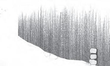
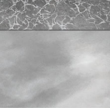
We begin with a place defined as “Heritage Community Park and Natural Area”. This site characterized by rolling hills, plush fields, and charming views was previously a dairy farm. It was vacated in 1978 and bought by the town in the 1990’s which transformed it into a passive recreational park. It is located between Meadowbrook Dr and Glade Rd, at the foot of the Jefferson National Forest, in Blacksburg, in Montgomery County, in the state of Virginia close to the border to West Virginia, on the East coast of the United States. Or, 37°14’18.6”N 80°27’36.7”W


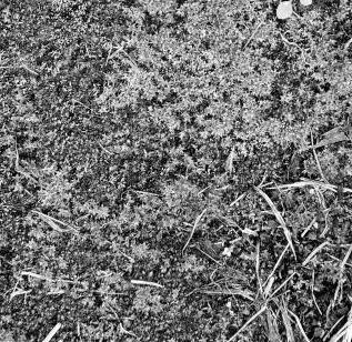
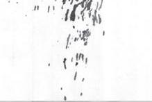
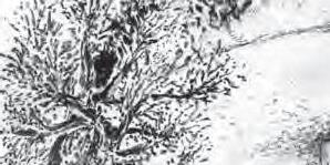
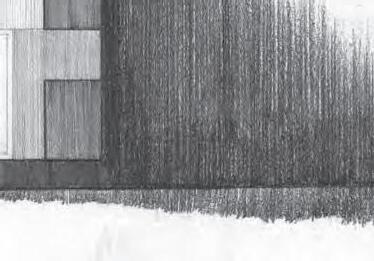
One may label this place as such however, that is not how we naturally encounter places. The author discovered the site while on a journey following the Huckleberry Trail. In search of relief in nature, stride by stride, continuing to walk northwards until the soles of the feet decided it was a place to pause, for the eyes to comprehend, weary body to rest, and lungs to inhale. This thesis began with a heuristic study of this landscape, a journey of seeking and discovering, encouraging an encounter similar to the author’s. Photographic survey of the site shows a few of the types of landscape found here. (above and left)


Mappings of Place
Examining the larger scale context of the site. As aforementioned, the site is located on the southern side of the Blue Ridge mountains at the foot of this crinkle of the ground. Understanding that the formation of land on the site is part of a larger framework and system of tectonic plates that form the Earth’s crust. Figure of topographic model in trace paper and cardboard (above).
What are the forces manifested here? What are its elements? What is it bound by? A map examining the components that make up the framework of understanding and navigating this place (right).


A line is drawn perpendicularly from each topographic line, marking a 100’ change in a darker line weight. The movement in the field of lines reveals the crests and valleys of the mountain, the flow of water, and the ‘rings’ of lines reveal the layered structure of the earth beneath our feet. A composite map of topography and watershed movement (left).


Traces of Place
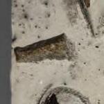
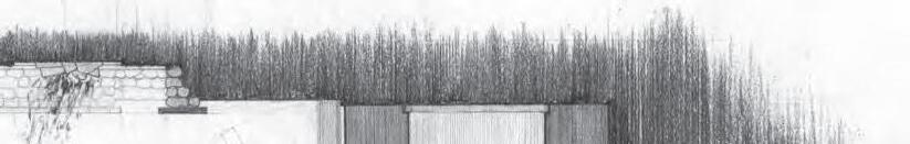
The site was formerly a dairy farm, there are abandoned milking stations and structures to be found here. Time reveals an interaction between the natural and man made, the living and the dead.
The tree with its roots buried in the ground and its trunk green coursing with water inches closer to the board, curious. The board was once a strong oak long before the formation of the young tree seedling. It grew with even grain, soaking in the sun, and shading the earth. It grew with such majesty that the lumberjack decided to cut it down. Its bark was stripped and trimmed uniform. Its strong base of roots that withstood storms were replaced by a stone foundation. The shed is built.
Years after the lumberjack is gone, the board chips from wind and cracks from rain. As the young tree grows, its winnowy roots split the thick stone base. With the passing of many suns, the shed will collapse and the board will return to the earth. It can’t wait. Longing to fall into the arms of life. To be enveloped by beetles, worms, and moss again.”

Textures of Place
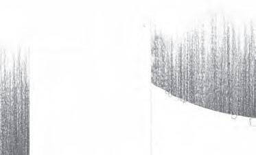
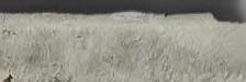
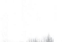
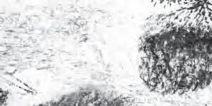
A photographic study of the different surface formations available at this section of the earth. Uncovering the fractal, scalable, analogous character of natural elements. The bark of a tree, moss on the earth, grass, ripples of the steam, coils of hay bales, and a tuft of grass. All these textures woven together compose the fabric of the landscape. Braiding a tapestry of depth, dynamism, and beauty.


Patterns of Place
What do these patterns of the tree reveal about the larger context? A cycle of interconnected natural forces.
The bark is reminiscent of stone, bricks, and concrete.
The striations of the tree trunk echo land formations or ripples in water. The leaf structure is similar to veins and wrinkles in your palm.


Perceptions of Place
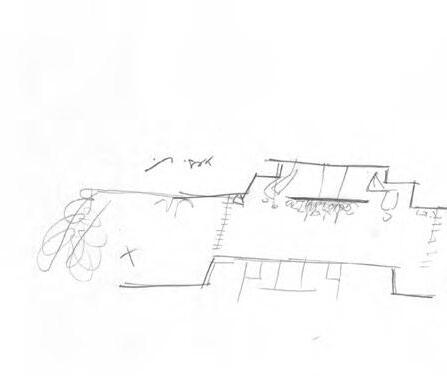
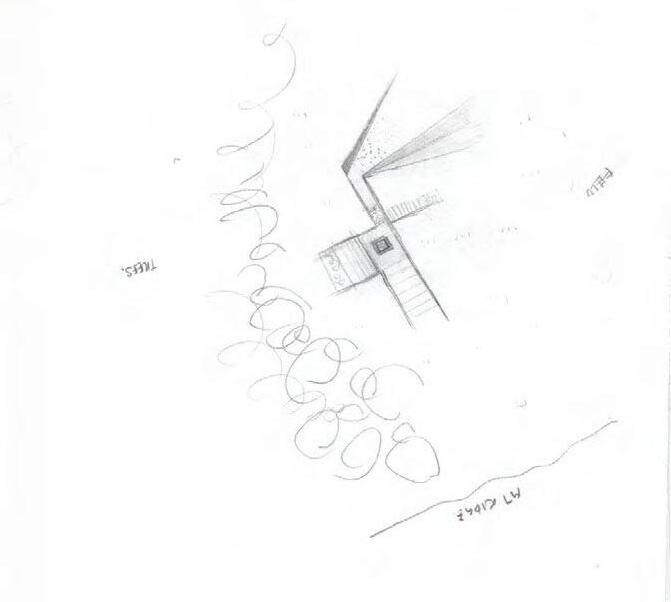
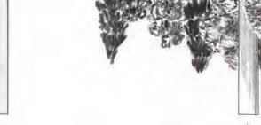
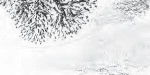
A series of site sketches revealing unnoticed relationships in the landscape discovered heuristically over multiple visits. Uncovering texture and movement in the seemingly stoic landscape. Each location is correlated to the interventions introduced later.
The valley, cascading hills, and texture of the earth. Sketched under a tree.


A PATH
a set of 4 provisional interventions


Foreword
This thesis presents a thread of architectural interventions at varying elevations with unique spatial conditions unbound to an order or occasion. They are places to inhabit, to engage with the landscape, and to discover. This proposal provides a framework for one to come to recognize their place in space more intimately.


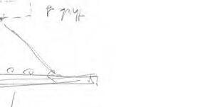
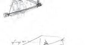
Measuring Landscape
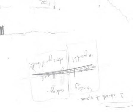
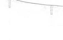
Located on facing sides of a valley, this intervention comes in two parts, the ‘elevation post’ and ‘elevation marker’. This narrative explores how man measures landscape and experiences the slope, to understand what it means to travel down in elevation at the pace of our feet and the scale of the mountains.
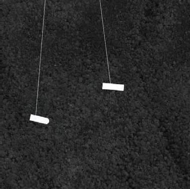

At the trail in Heritage Park, the ‘elevation marker’ (above) and ‘elevation post’ (below) announces every 20’ drop in elevation. Each pair denotes two points in space occurring at the same elevation. The ‘post’ and its corresponding ‘marker’ are constructs aligned to a shared angle existing parallel with each other. As the sun rises and sets, the interaction between daylight and these interventions create visually connection and reveal their topographic relationship in this valley.
The ‘elevation post’ is a bent metal plane. Its polished metal surface is activated against the sunlight reflecting at its brightest in union with its parallel ‘marker’.


elevation of the ‘markers’ along the valley (above)


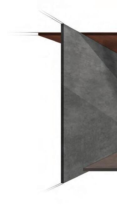
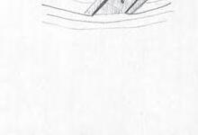
At the elevation ‘marker’, it’s parallel mirror-like surface ties back to the ‘post’. This half of the pair is an observation deck seeking to connect the visitor to the horizon. This structure re-contextualizes the reflective metal plane of the ‘post’ to provide two ways of seeing: horizontal and vertical, for one to discover what lies within this plane of earth at this topographical elevation.


The metal plane is reconsidered as an array of fins. Placed 1 foot apart beginning with its thinest member closest to the entrance and ending with its widest wall bounding the cantilevered platform. Each divider narrows one’s perspective to focus on the slope and allows one to experience the landscape vertically foot by foot.


At the edge of the observation deck, the polished metal ‘post’ becomes a horizontal plane. A mirror to the sky, the surface engages with nature to reflect the atmosphere. Dividing the crown of the valley from its base. It frames and bounds a 4’ high view of the landscape to understand topography as layers perpendicular to gravity bounded by earth and sky. The nature of this ‘architectural horizon’ is ephemeral, shifting and fluctuating, steered by the weather.


a pouring of rain ripples through the puddle . . .


. . . reflecting blue skies when the storm is past.


Transition
Man-made and natural exist at different scales of time. The seemingly unmoving mountain is made of it’s rolling hills, winding streams, and grass that flows as the wind blows. This intervention explores the ephemeral landscape and man’s attempt to delineate it. Thus, this construct is not only a transition space between destinations along the path but also of time.


The water in your body is just visiting. It was a thunderstorm a week ago. It will be an ocean soon enough. Most of your cells come and go like morning dew. We are more weather pattern than stone monument. Sunlight on mist. Summer lightning.
‘Naming the River’ adapted from Jarod K. Anderson


Rocks gathered from Tom’s Creek are brought uphill to build retaining walls that conform to topography, delineating the landscape as man conventionally understands it.
Exposed to the south and cast crudely, nature begins to break down these walls. Each bead of rain and grain of snow seeps through its pores as blood flows through veins. The meadow and soil sway to the tides of gravity, the gathered rocks drift downhill, returning back to the creek at the end of its season.


Creek
Located at the lowest elevation on site, the creek invites one to gaze downward and bathe in it. To understand that stream and valley correspond. With every step leading up to the flowing water, the ears are made aware to hear what lies beneath your feet to the crashing ripples of water against rock. This shelter composes the sound and light of the creek in architecture.


The trail begins with stone and wood boards between 4 to 2 feet apart, subtly spaced to encourage one to hop and hear the sounds of the ground. Stone. Wood. Stone. Wood. Reaching the shelter, the elevated metal deck echoes and rings while the wood floor dampens. Metal. Wood. Metal. Wood. At the end of the platform, the visitor hears the creek more clearly and loudly than before. Composite drawing of site plan and floor finish plan to describe textures a visitor encounters by their feet and weight (left).


Across a field of earth, what does the unassuming plain reveal to you? How does one become a part of the ground? This place is intended as a conclusive and eventual destination of the path, where elements from previous constructs are incorporated to recall past experiences and reinvent new relationships at this spatial condition.


Gather. A space to meet, cook, and eat together. To connect with one another and to the land through shared stories and plates. Centered around the fire pit as the locus for these events.


At the modest field, what is found is the greatest expanse of sky & ground.
Between this diptych of vastness, lies another that is even more so The Horizon.
An enigmatic, cryptic, element of nature shifting to where your feet are placed, and where your eye is gazed.
In a valley the horizon is a container building a well around your world.
Atop a mountain it tightens over the earth pushing you farther into the sky.
Along the coast, it is tenuous yet persistent bounding the surface of the raging seas.
To inhabit the field is to build at the horizon, What do you uncover?
‘The
Horizon’


I seek the wide wilderness to find solidarity in its expanse to be away from the scrutiny of others. Yet in this meadow I lay exposed to the witness of the land sleeping on earth’s bareback painted by the shadows of clouds bathed in the spring rain. Here is where I am found.
‘Vastness and Comfort’
APPENDIX A preliminary studies

1 : 100
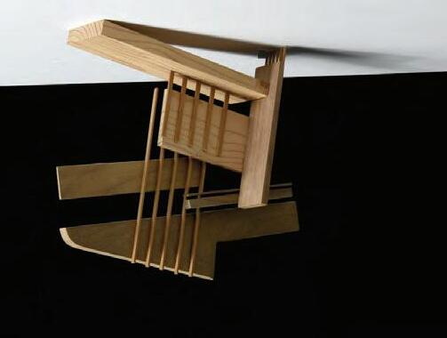
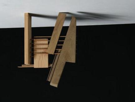
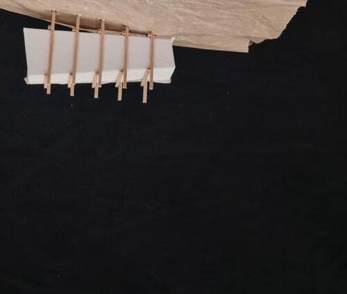
These compositions explore the relationship of one to many, part to whole, and connection to the hand. This model was used as an activator of space, an exercise of prepositions. By drafting and measuring this freehand model, the working drawing reveals relationships and proportions created subconsciously within the model in three-dimensional space. Thus, beginning an element of mind to body connection and phenomenal understanding of space through the senses and immediate experience in the thesis.


Shadow Studies
Shadow is created between two planes. Using that rule for configuration and composition, these models began an exercise for creating the conditions for light and darkness. It was photographed to discover the dependent relationships between the two. Light is revealed in shadow. Light is a promise of space that is yet to be seen.


An exercise to return to a physical model based on the selected shadows on page 085.


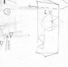
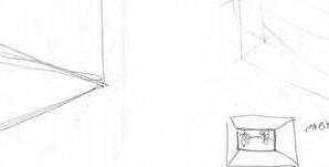
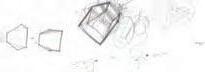
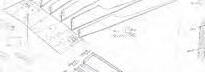
Tower Study
Upon visiting the site, its rolling hills are apparent. Whether traveling by foot, bike, or car, the cascading ground and its crests and valleys creates a cycle of down to up, and up to down. To make the visitor aware of this and to view panoramic views of the beautiful landscape, an observation tower informed by abandoned grain silos nearby was proposed at the highest point on the open fields. Its vertical circulation includes a crucial additional step down to go up and step up to go down.


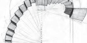


This construct comes in two parts: the tower and the foundation. The cylindrical cold-formed sheet metal above ground figuratively symbolizes the ‘rolling’ of the earth in form and manufacturing process. The inaccessible cavity below ground is formed by schist rock foundation. Its stacked layers, material, and out of reach space is a metaphor for the hidden metamorphic processes of intense pressure and infinite layers occurring below our feet that allow us to stand where we are.

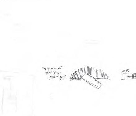
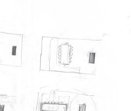
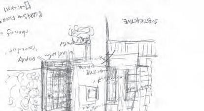
Shelter Study
An exercise in occupying the landscape, beginning a thought process of how man delineates landscape versus the ephemeral nature of the earth. Beginning to orient architectural constructs within the framework of the site: mountains, creek, sun, trees, and slope.


APPENDIX B documentation for intervention 01 through 04