MaritiMe MuseuM of san Diego Board of Directors 2023
Kenneth Stipanov, Chair
Laura Kyle, Vice Chair
David O’Brien, Secretary
Kenneth Andersen
Bill Bartsch
Brian Bilbray
Greg Cox
William Dysart
Dr. Iris Engstrand
Michael Garmon
Gary Gould
Al Love
Greg Murphy Manish Parikh
Douglas Sharp
Pamela Werner
Thomas P. Workman
Ex Officio
Raymond E. Ashley, President/CEO
Sharon Cloward, Port Tenants Association Representative
Margaret Clark, Docent Chair
Pete Sharp, Ships’ Maintenance Crew Representative
MAINS’L HAUL EDITORIAL BOARD
Raymond E. Ashley, Ph.D. President/CEO
Jim Cassidy, Ph.D.
U.S. Navy Civilian (Retired)
Stephen Colston, Ph.D.
San Diego State University, Emeritus
Iris H.W. Engstrand, Ph.D.
University of San Diego, Emerita
Kale B. Fajardo, Ph.D. University of Minnesota
Mark G. Hanna, Ph.D.
University of California, San Diego
Carla Rahn Phillips, Ph.D. University of Minnesota, Emerita
Alex Roland, Ph.D. Duke University , Emeritus
Timothy Runyan, Ph.D. East Carolina University
Paula De Vos, Ph.D. San Diego State University
MAINS’L


editor@sdmaritime.org, or write to Mains’l Haul, Maritime Museum of San Diego, 1492 N. Harbor Dr., San Diego, CA 92101-3309 Phone: 619-234-9153 Our mission is to engage members and the public in the study of maritime history, while promoting scholarly research. Articles are indexed for researchers worldwide at sdmaritime.org - Mains’l Haul, and in America: History & Life and Historical Abstracts. ISSN# 1540-3386 Editor Kevin Sheehan, Ph.D. Contributing Editor Paula De Vos, Ph.D. Editorial Assistant Nancy Matthews Research Assistants: Eric Frawley; Natalie Van Heukelem Art Director Tony Enyedy Printer: Neyenesch Printers Inc. ISBN 0-944580-45-9
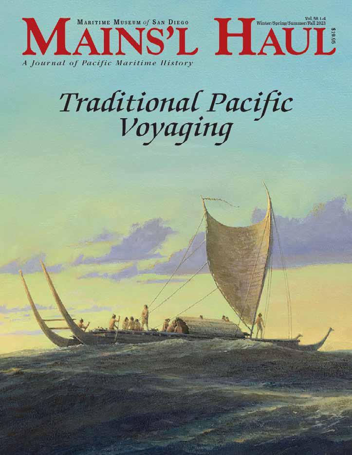
Pacific Voyaging Mains’l Haul A Journal of Pacific Maritime History Vol. 58 1-4 Winter/Spring/Summer/Fall 2023
email:
Traditional
HAUL is published by the Maritime Museum of San Diego, wind and weather permitting, aboard the ferryboat Berkeley
HAUL—An order in tacking ship bidding,“Swing the main yards.”
MAINSAIL
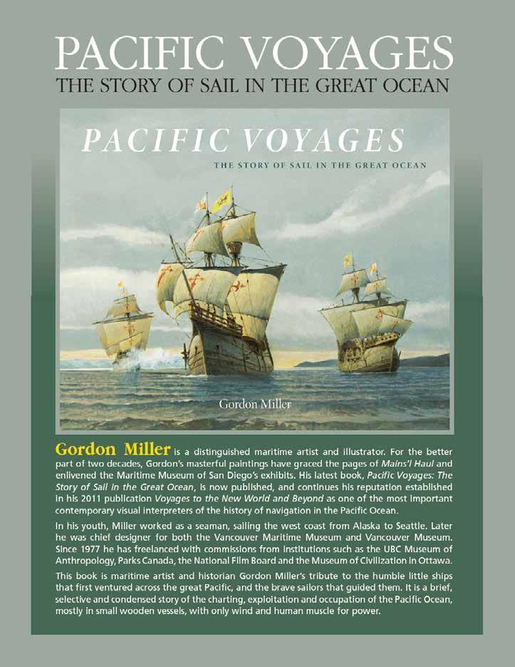
M ariti M e M useu M of s an D iego Mains’l Haul is produced with financial support from the Bob and Laura Kyle Endowed Chair in Maritime History Jon M. Erlandson, Ph.D. A Deeper History for Pacific Seafaring and the First Americas 4 28
L. McClenahan, Ph.D. The Alutiit: Maritime People of the Dynamic North Pacific Coast of North America
Guassac, Kumeyaay Historian, Mesa Grande Band of Mission Indians Kumeyaay and the Ocean
Kawaharada The Settlement of Polynesia
Tamagyongfal, Jerolynn Myazoe, Joseph Genz University of Hawai’i at Hilo Post-settlement Voyaging Networks of Yap and the Marshall Islands 48 10 Herb Kawainui Kane “A People Who Do Not Search for What They Have Lost Will Become a Lost People” 57 Stars Align Mark Albertazzi Photo Essay 20 Julie Cordero-Lamb The Crossing 90 Herb Kawainui Kane In Search of the Ancient Polynesian Voyaging Canoe 2 Raymond Ashley, Ph.D., K.C.I. Ben Finney Reviving Hawaiian Voyaging 64
Sam Low Voyages of Awakening 100 Nainoa Thompson Voyaging 102 Nainoa Thompson On Wayfinding 111 Elisa Yadao Daily Life Aboard Hōkūleʻa 36 74
Patricia
Louis
Dennis
Shania
80
On April 13, 1769, after a voyage of eight months, the modest British vessel Endeavour, commanded by Lieutenant James Cook, dropped anchor in Matavai Bay, Tahiti. The purpose of this visit was to conduct astronomical observations of the transit of Venus across the sun’s face.
Scientists of the day hoped these observations might help define the size and proportions of the solar system and even the universe beyond. The orders directing Cook to this island, hitherto unknown to Europeans, constituted the first time in history that the location of a far distant destination had been defined in precise terms of latitude and longitude. Indeed, Cook navigated his way there with unprecedented precision by means of astronomical lunar observations, also the first time in history that such a thing had happened.1
But then something strange happened that could not be so easily rationalized.
FROM THE HELM
by Dr. Raymond Ashley, Ph.D., KCI . President and CEO Maritime Museum of San Diego
Astronomy was not the only purpose of this voyage. Endeavour was also charged with exploring vast stretches of ocean, surveying any new lands encountered, and collecting specimens of flora and fauna such lands might contain in contribution to a vast project of cataloging all life on Earth in accordance with an evolving organizational scheme. But even that was not all. Endeavour’s voyage was also intended to establish contact with as many indigenous societies as possible, document their practices, beliefs, language, and material culture for similar purposes of comparison and systemizing.
Riding peacefully to her anchor, however modest a work of naval architecture, Endeavour was the furthest and most spectacular projection of the European enlightenment, embodying in microcosm thousands of years of western cultural and technological achievement in exploration and science. She was the perfect instrument to render everything she encountered into a rational hierarchical scheme of natural and human history with herself, at least momentarily, securely positioned at its apex, guided along her path by a master seaman who has come in years since to be thought of by some as the greatest and most rational navigator who ever lived.
After departing Tahiti, almost everywhere Endeavour sailed, she encountered among a galaxy of islands, people speaking a common language, possessing a common material culture and professing a common understanding of their ancient origins in a distant place far to the east, and that they had come to their present homes in a series of deliberate voyages over the course of generations, guided by navigators. Among the anthropological assets employed in collecting this information, Endeavour had even been able to enlist one navigator to join her company. His name was Tupaia – a high navigator-priest (arioi) from the Society Island of Raiatea who could not only converse freely with the island peoples they encountered, but even knew the names and courses to many of the islands Endeavour visited, most of them not from his own experience but from oral memory of voyage accounts generations old.
There was one problem, however: Tupaia was unable to render his understanding of geography and navigation into terms that the Europeans could understand because the way they navigated made no sensed to him. Cook persuaded him to try anyway, producing a chart that turned out to be one of the most peculiar and enigmatic documents in the history of geography. The positions of more than seventy islands were represented, but no European navigator could use the chart to find any of them because in Tupaia’s ocean, the islands moved. 2
Though Cook himself accepted the stories and capabilities of island navigators like Tupaia as valid, over the decades and centuries which followed the entire notion became difficult for historians to credit. The peoples Cook encountered, later categorized by ethnologists as Polynesians, had no written language (other than on remote Rapa Nui), no metallurgy, no instruments, no mathematical system, not even a system of geographical reference that rendered the very space they moved within into rational and absolute terms. If they did get there, hundreds or thousands of years earlier, and
Tupaia’s enigmatic chart of 1769 was the first attempt by any Polynesian to make a representation of the ocean on paper. The original map drawn by Tupaia has been lost, and this copy was likely made by James Cook (according to a marginal note). This particular chart was identified in 1955 among Sir Joseph Banks’s papers that had been consigned to the British Museum. British Library Add MS 21593C.
Maritime Museum of San Diego
2
evidently against the prevailing winds and currents if their stories were to be believed, how did they do it? This posed a stubborn quandary because the idea that human beings could find their way with precision across thousands of miles of empty ocean without any of the tools European navigators relied upon seemed unthinkably difficult and unexplainable. The quandary was compounded by the fact that by the time Cook arrived in Polynesia, there were no great ocean-going watercraft and for some reason the practice of heroic voyages had mostly ended generations earlier, though the memory of it still remained. The one supporting document Cook’s Endeavour produced was itself unhelpful because to western eyes it made no sense –the islands marked and named on Tupaia’s chart did not align with their absolute positions on western charts.
Various alternate explanations for the populating of the Pacific arose: the islands had been inhabited by accident, when fisherman or inter-island voyagers were blown out to sea and drifted to random landfalls, or the islanders drifted down wind and down current in a cultural barrage of rafts departing from South America, or even that the Polynesians were descendants of the lost tribes of Israel, guided across the ocean by God and by sophisticated biblical techniques lost in Mediterranean antiquity. No matter how absurd these notions, all of them in turn seemed more plausible than the proposition that it had been done deliberately and repeatably by indigenous navigators.
But, after more than two centuries of such speculations something else happened that no one expected. In a few very remote places, anthropologists documenting indigenous Pacific island cultures that had experienced European contact much later than central Polynesia, began to describe encounters with systems of non-instrumental navigation still being used to sail traditional voyaging canoes across great distances. Suddenly the old stories began to seem somehow possible, and if they were possible, then perhaps they might also be repeatable by modernday canoes sailing the ancient routes. And if this could happen, it might also bring forth a renaissance of navigation as well as an inspirational triumph of human intellect and capability.
We are accustomed to identifying cultural achievements as physical forms, such as the monumental architectural works of UNESCO World Heritage sites. But in doing so, I suspect we have slipped into confusing the process of cultural achievement with its product, that the true achievement lies in the melding of methodology and intellect to the purpose of problem solving, and the monuments we gaze in worder at are simply the result. If then, cultural achievement is not the pyramids, great walls,
temples, cathedrals, and fortifications themselves, but rather the process of bringing them into being, then perhaps the greatest monument of all lies lurking in the mysteries of Tupaia’s chart. I am suggesting that possibly the greatest intellectual achievement in the entire human record may well be the sophisticated and incredibly demanding system of oceanic wayfinding that made possible the regular navigation among Pacific islands and the population of virtually every inhabitable speck of land over the largest area of the earth ever occupied by a single culture, a system passing from one generation to the next through language and memory alone, and culminating more than a thousand years ago before disappearing … almost
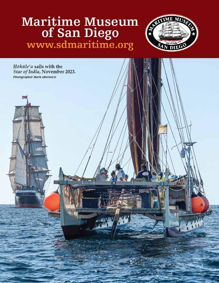
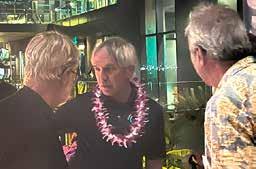
IRay Ashley, navigator for the Star of India, Nainoa Thompson, Pwo navigator and CEO of the Polynesian Voyaging Society, and Mark Albertazzi, raised on the Hawaiian island of Molokai and photographic chronicler of Hōkūleʻa’s visit to San Diego, share their insights on the art of navigation at a reception in honor of Hōkūleʻa, her crew and supporters, San Diego, November 13 2023.
n the two and a half centuries since Endeavour dropped anchor in Matavai Bay, humanity has more or less been following the course she set, shaping our concept of the world and everything in it in accordance with her system of rational order. In following that course, though, we have sailed into some pretty dark places. Sometimes it seems that when we look beyond the horizon to the bright landfall that we all hope to bring to our children and grandchildren, that the distance seems so vast, and dark, and foreboding, and our methods for coping with it so self-defeating, that navigation to it appears all but impossible for us. Indeed, perhaps Endeavour won’t be sufficient to get us there and perhaps she never was. Perhaps we all need to relearn how to make the islands move. That would certainly be a tricky bit of navigation, but of all the skills that a million years of evolution has conditioned the human mind to perform, problem solving as wayfinding is foremost among them. Indeed, it’s the thing we have always been best at, and from problem solving in wayfinding perhaps all other problems may surrender to the awesome power of it. If the world is a canoe, then navigation is ever and foremost the foundation of hope, as the stories within attest.
Ray Ashley, Navigator, Bark Star of India
1 Cook’s predecessor Samuel Wallis of HMS Dolphin had established Tahiti’s longitude by means of solar eclipse in July 1767. During his first circumnavigation, Cook determined Endeavour’s longitude only by the lunar distance method as no chronometers were yet available.
2 Clarification is in order. Pacific non-instrumental navigation techniques utilize a relative reference system somewhat similar to, but a vast extension of, the European form of piloting then and still in common use. In this system, location is defined in perspective from the ship rather than in absolute reference to all objects in the field. Pilots are said to “raise” an island or “let the mark pass to starboard,” not unlike when the sun is said to rise and set in the sky when its actually the earth’s motion that produces the impression. In long-distance non-instrumental navigation, such systems grow increasingly complex because the water the ship is sailing through is itself moving with currents. The currents are changing, the ship is perhaps making leeway, and this combined motion is not directly detectable when no fixed reference points are visible. Memorizing all the possible star path courses required to cope with such variation requires an immense and constant effort in memory and mental computation, unnecessary with an absolute reference system where observations with instruments can fix position and the variables can be reduced mathematically to vectors. An unspoken objective of the Enlightenment was to eradicate all intellectual systems of relative reference and replace them with interlinked structures of absolute reference, bringing nature within a unified rational order.
3
Traditional Pacific Voyaging
Photographer Carlynn Ashley.
A Deeper History for Pacific Seafaring and the First Americas
by Jon M. Erlandson, Ph.D.
Introduction
The Pacific Basin has an extraordinary maritime history spanning the past 500 years, ranging from the epic voyages of Ferdinand Magellan, Juan Rodríguez Cabrillo, and Sir Francis Drake in the 16th century to the extraordinary naval battles of World War II, and much more. Much less is known, however, about a much deeper history of maritime exploration, discovery, and colonization that carried early humans throughout the Pacific millennia ago, including the initial colonization of Island Southeast Asia, Greater Australia, and Near Oceania as much as 65,000 to 45,000 years ago, the peopling of the Americas at least 20,000 years ago, and the colonization of thousands of islands in Micronesia and Polynesia between about 4,000 and 1,000 years ago.
For those of us fortunate enough to live near North America’s west coast, the deep history of Pacific seafaring and coastal settlement should be of great interest. Most Pacific coast residents probably have some idea that maritime people plied these waters for millennia past. Some may remember bits and pieces from grade school or local museums about Pacific coast Native American tribes, Cabrillo’s famous voyage of exploration in 1542-1543, or the local history of whaling, fishing, and shipbuilding industries. Others may have read books or magazine articles about such topics or seen recent documentaries that hint at major changes in our understanding of the antiquity of seafaring and human settlement in the Pacific. For too many, however, a deeper history of seafaring in the vast expanse we now call the Pacific Ocean is largely lost in the rush of modern living.
Oddly, for most of the twentieth century, boats, seafaring, and maritime societies in the Pacific (and around the world) were thought to be very late developments in human history, limited to the last 10,000 years or so (see Bass 1972; Binford 1968; Greenhill 1976; Johnstone 1980; Osborn 1977). This is just four-tenths of one percent of the 2.5 million years our genus (Homo) has existed and less than five percent of the time we (Homo sapiens sapiens) have graced the earth. If our ancestors didn’t fish or forage along coastlines, cross water barriers, or colonize islands for 2.49 million years, how did they spread around the world? How and when did humans colonize the coastlines and islands of the Pacific, including the western coasts of North and South America?
Maritime Museum of San Diego 4
Chumash tomol. Photographer Robert Schwemmer
Editor’s note: An earlier version of this article was first published in Mains’l Haul 47 (nos. 1 & 2, Winter/Spring, 2011): 8-13. Erlandson revised and updated his work for this volume of Mains’l Haul.
Jon Erlandson recently retired after serving for thirty-three years as a professor and museum director at the University of Oregon. An archaeologist who has done fieldwork in California, Oregon, Alaska, and Iceland, Jon has written or edited thirty books and published more than 400 scholarly articles. His research interests include the development of maritime and seafaring societies, historical ecology in island and coastal ecosystems, human evolution and dispersals, the peopling of the Americas, and collaborative research with indigenous communities. In 2013, he was elected to the American Academy of Arts and Sciences, and in 2021 to the American Association for the Advancement of Science. Most of his publications can be read or downloaded free-of-charge on ResearchGate (researchgate.net).
The answers to these questions have changed in recent decades, and much of what I learned about the initial peopling of the Americas and the archaeology of seafaring as a college student in the 1970s and 1980s now appears to have been wrong. More recent summaries by archaeologists and maritime historians now recognize a deeper history for coastal adaptations, human seafaring, and maritime migrations (Anderson et al. 2010; Bailey 2004; Erlandson 2001; McGrail 2001). Why did scholars misinterpret the antiquity of maritime peoples for so long? The answer lies in the fundamental problem that humans evolved and spread around the world during the Pleistocene (~1.8 million to 11,700 years ago), a period dominated by a series of glacial epochs and dramatic changes in global sea-level and coastal geography. Bailey et al. (2007) estimated that sea-levels were 50 meters (164 feet) or lower than present during 90 percent of the Pleistocene. Unfortunately for those of us currently interested in the deep history of seafaring, we live in an interglacial period when sea levels are relatively high (and still rising!), leaving most ancient coastlines deeply submerged and far offshore

Origins of Seafaring
In this brief essay, I provide some archaeological background to the maritime history of the Pacific. I show that seafaring and coastal economies have much deeper histories than once believed, that the Indo-Pacific may be the primary hearth for long-distance voyaging, and that the Pacific was the scene of some of the most amazing maritime migrations in human history. I have written extensively about these and related topics elsewhere (see Erlandson 2001, 2010), where a wider range of original sources are available for interested readers. As you will see if you compare what follows to my 2013 summary in Mains’l Haul, much has changed even within the past decade.
The oldest archaeological examples of boats are no more than 10,000 years old, but a growing body of evidence now documents a much earlier development of seafaring in the Pacific (see Anderson 2010; Gaffney 2020). In Island Southeast Asia, it now appears that Homo erectus (or another early hominin) reached the Indonesian island of Flores as much as a million years ago, after saltwater crossings of roughly 20-30 km. By at least 700,000 years ago, early hominins also reached Luzon in the Philippines and the Indonesian island of Sulawesi between roughly 200,000 and perhaps as early as 780,000 years ago (Gaffney 2020). All these dispersals required short voyages and may have been accomplished on relatively simple rafts. The fact that these early hominins never successfully colonized Greater Australia – although the elusive Denisovans contributed ancient DNA to indigenous peoples of Sahul, just as Neandertals contributed genes to modern people of European ancestry – suggests to me that longer
Traditional Pacific Voyaging
5
marine voyaging capabilities were probably limited until the appearance of anatomically modern humans (AMH).
Evidence for early seafaring by AMH is far more compelling and widespread, with evidence that humans made numerous significantly longer water crossings, especially in Eastern Asia, Australia, New Guinea, and Melanesia. During glacial periods, the geography of Southeast Asia, New Guinea, and Australia was transformed as lower sea levels exposed broad expanses of now submerged continental shelves and connected many modern islands into larger land masses. Even in full glacial times the larger landmasses known as Sunda (continental Southeast Asia) and Sahul (also known as Greater Australia, including Australia, Tasmania, and New Guinea) were separated by a series of deep straits, with strong currents creating major biogeographic barriers. Crossing from Sunda to Sahul through the islands of Southeast Asia was a formidable journey that sometimes took early seafarers over the horizon and beyond the sight of land.
Until the 1970s, it was largely accepted that humans did not reach Australia until near the end of the Pleistocene. Since then, archaeologists have extended the antiquity of human settlement in Sahul to 33,000 years ago, 40,000 years ago, and now ~60,000 ± 5,000 years ago (see Anderson 2010; Clarkson et al. 2017). Crossing from Sunda to Sahul required multiple voyages, some of them at least 80-90 km long (~43 nmi or more). For a decade or two, some scholars clung to the idea that the peopling of Australia might have been accidental, but the discovery of Pleistocene shell middens in Near Oceania (western Melanesia) dispatched any reasonable doubts about the deliberate nature of such voyaging. Human
settlement of the Bismarck and Solomon archipelagos between about 43,000 to 30,000 years ago involved several additional voyages beyond those required to reach Sahul. Colonization of the Solomons required voyages of at least 140 km and possibly 175 km. By about 20,000 years ago, Melanesian seafarers also reached the Admiralty Islands, a sea voyage of 200-220 km, 6090 km of which would have been completely out of sight of land. These early Melanesian sites, located along shorelines with very steep bathymetry, remained near the coast even during the Last Glacial Maximum (LGM) when sea levels were ~125 meters (~410 ft.) lower than today. Recent research on the islands between Sunda and Sahul is also providing evidence for Pleistocene seafaring in the islands of Wallacea including a 42,000-year-old shell midden in Jeramalai Cave in East Timor that produced numerous tuna bones (O’Connor et al. 2011).
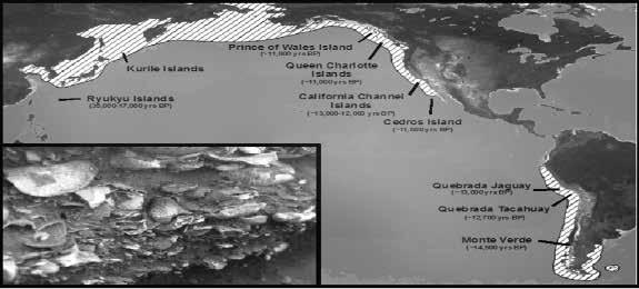
Further evidence for Pleistocene seafaring by AMH comes from Okinawa and other Ryukyu Islands off the East Asian Coast. Located between Taiwan and Japan, which were both connected to the Asian mainland during LGM, the Ryukyu Archipelago is separated from Asia’s continental shelf by deep oceanic straits. Human bones from Yamashita, Minatogawa, Sakatiri, and other caves on Okinawa and Miyako islands have been dated between 32,000 and 18,000 years ago. The deeply stratified sequence at Sakatiri Cave – dating between about 36,000 and 13,000 years ago – also produced evidence for the use of freshwater fish and shellfish, marine shellfish, and marine shell tools and ornaments, including a shell fishhook dated to ~22,500 years ago (Fujita et al. 2016). Colonizing Okinawa and Miyako required voyages up to 75 km and 150 km long, respectively.
Maritime Museum of San Diego 6
The “kelp highway” shows the modern distribution of kelp forest ecosystems around the Pacific Rim and the location and age (in calendar years) of early archaeological sites. Adapted from Erlandson et al. 2007; original drafted by M. Graham; inset shows mussel, abalone, and sea urchin shells from a shell midden on San Miguel Island. Courtesy of the Author
In Japan, evidence for Pleistocene seafaring also comes from obsidian artifacts originating from a volcanic flow on Kozushima Island—located ~25-30 km off the Honshu Coast during the LGM—found in sites 38,000 years old (Ikeya 2015). This places competent mariners in relatively cool waters of the North Pacific early enough to have contributed to the initial colonization of the Americas (Erlandson 2010).
From northern Japan the Kurile Islands stretch to the northeast like steppingstones to Kamchatka and the southern shores of Beringia. Currently, the earliest well-documented archaeological site in the Kuriles is on Iturup and dates between 13,000 and 12,000 years ago (Grishchenko et al. 2022). No systematic search for older sites has yet taken place, however, and I suspect that earlier sites will eventually be discovered on the Kuriles. Whether those who later became known as the First Americans followed this route remains to be seen and the evidence that could resolve the issue – like so many questions related to the deep history of maritime adaptations in general – may lie submerged (and largely unstudied) on the continental shelves of the North Pacific.
Recent research on the islands between Sunda and Sahul is also providing additional evidence for Pleistocene seafaring in the islands of Wallacea including a shell midden with numerous tuna bones from Jeramalai Cave on East Timor dated to about 42,000 years ago.
Coasting into the Americas: Was there a Kelp or Sea Ice Highway?
Thirty years ago, most scholars thought Native Americans were descended from terrestrial hunters who marched from northeast Asia across the frigid plains of Beringia, then down a 1,500 km long “ice-free corridor” connecting Alaska and the Yukon to the heartland of North America. These hunting groups were thought to have reached the Great Plains about 13,500 years ago, spreading rapidly through the continental interior in search of mammoths and other large mammals, leaving a trail of Clovis points, kill sites, and campsites behind them. In this ‘Clovis-first’ scenario the Pacific Coast was irrelevant to the initial human colonization of the Americas as it was only thought to have been settled several millennia after the megafauna were hunted to extinction and people were forced to rely on ‘inferior’ coastal resources such as fish and shellfish. Geological research now suggests that the ice-free corridor only became a viable migration route about 14,000 years ago, but a Pacific Coast route opened several millennia earlier.
An alternative coastal migration theory (CMT; see Fladmark 1979) lurked in the shadows of American archaeology for decades until the documentation of a ~14,000-year-old pre-Clovis occupation at the Monte Verde II site near the central coast of Chile. Monte Verde II was a rare saturated “wet” site that produced the remnants of
wooden structures, one of which contained the remains of eight different seaweed species, including giant kelp (Macrocystis pyrifera, see Dillehay et al. 2007). By the 2000s, my colleagues and I defined an ecological corollary of the CMT known as the kelp highway hypothesis (or KHH; see Erlandson et al. 2007, 2015), which proposed that a discontinuous network of nearshore kelp forests extending from Japan to Baja California may have facilitated a maritime migration from northeast Asia into the Americas. We proposed that Pacific Rim coastlines would have provided maritime peoples with a linear migration route, entirely at sea level, without major geographic barriers, and rich in a diverse array of similar shellfish, fish, birds, marine mammals, and seaweed species, as well as terrestrial plants and animals from adjacent landscapes.
The CMT and KHH gained credibility as a growing number of North American pre-Clovis sites between about 16,000 and 14,000 years old were documented in British Columbia, Washington, Idaho, Oregon, Texas, and Florida. On California’s Northern Channel Islands, a dozen or so Paleocoastal sites (e.g., Arlington Springs, Daisy Cave, Cardwell Bluffs) dated between 13,000 and 11,000 years ago (see Erlandson et al. 2011; Gusick and Erlandson 2019; Rick et al. 2013). These Channel Island sites currently provide some of the earliest evidence for seafaring, island colonization, and marine hunting, fishing, and shellfish collecting in the New World, including the harvest of kelpforest species such as red abalone and wavy top turbans by Pleistocene peoples.
The CMT and KHH were both developed to help explain a human migration into the Americas between about 14,000 and 18,000 years ago. Recently, however, two new sites appear to provide evidence for even earlier occupations of North America: the extraordinarily wellpreserved human and megafaunal footprints at White Sands, New Mexico, that appear to be securely dated to about 21,000 ± 2,000 years ago (Pigati et al. 2023); and artifact-bearing hearths created during ephemeral occupations of Daisy Cave on California’s Tuqan (San Miguel) Island about 19,000 years ago (Erlandson and Braje 2022). At that time Tuqan Island was the western end of the much larger Santarosae (a.k.a Shamalama) Island and separated from the mainland by as little as 6-8 km, roughly 75% of which was submerged by rising post-glacial seas. Both sites place humans in Beringia and western North America – including the Pacific Coast – during the last glacial maximum (~23,000-18,000 years ago), before the Pacific Northwest coastal route had completely deglaciated. This supports a recent paper by Praetorius et al. (2023) which
7
Pacific Voyaging
Traditional
proposed that in the far northern Pacific, early coastal people would have had to adapt to a seasonal mix of summer kelp forests and other marine habitats as well as extended winter sea ice conditions. The latter potentially allowed people to travel along coastal margins and between islands over winter sea ice, rather than water.
Like most archaeologists interested in the peopling of the Americas – a topic long dominated by Clovis-first – I am still digesting the full implications of these recent findings, which place Native Americans along (and off) the Pacific Coast 6,000 years or more longer than once believed.
Polynesians in the Pacific
As impressive as these Pleistocene maritime migrations were, they appear to have been limited to coastal waters or islands that could be reached via sea crossings of roughly 200 km or less. Significantly longer voyages, such as those involved in the settlement of the remote islands of the Indo-Pacific, appear to have been limited to the past 4,000 years or so. These longer oceanic voyages may have posed technological and logistical challenges that could not be overcome until more sophisticated boats with long-distance sailing capabilities were developed, along with the agricultural products needed to survive on remote and biologically depauperate islands.
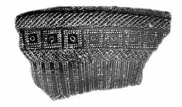
Below: A decorated Lapita potsherd, diagnostic of Lapita archaeological sites in New Guinea, Melanesia, and western Polynesia dated between about 3,500 and 3,000 years ago.
Photo adapted from Te Ara: The Encyclopedia of New Zealand: http://www.teara.govt.nz/
winds and currents. Sailing still further east, Lapita peoples also settled Tonga, Samoa, and nearby islands. A millennium or so later, between about 500 and 1200 CE, fully Polynesian peoples resulted in the settlement of virtually every habitable island of remote Oceania. This rapid migration of Polynesian peoples included voyages of up to 2,000 km and the human colonization of some of the most isolated islands on earth, including Hawai’i, Aetoroa (New Zealand), and Rapa Nui. Archaeological and genetic (DNA) evidence suggests that Polynesians also made contact with Native American peoples along the Pacific Coast of South America ~3,500 km east of Rapa Nui, transmitting the Polynesian chicken to the Americas and carrying American sweet potatoes and gourds back to Polynesia
Conclusions
One of the best examples of such fully oceanic dispersals occurred when Austronesian-speaking peoples from Southeast Asia colonized remote island archipelagoes scattered through the vast expanses of the Indian and Pacific oceans. In an area spanning nearly half the globe – from Madagascar to Rapa Nui (Easter Island), Hawai’i, and beyond – archaeological, linguistic and genetic data illuminate one of the most amazing migrations in human history (Kirch 2017). The origin of Austronesian peoples is still debated, but probably involved maritime agriculturalists moving out of Taiwan between 5,000 and 6,000 years ago. One branch of Austronesians sailed westward along the south coast of Asia and the east coast of Africa, traveling as far as Madagascar by about 2,000 years ago. Between about 3,500-4,000 years ago another group of Austronesians settled hundreds of Micronesian islands including the Palau, Mariana, Caroline, Marshall, Kiribati, and Tuvalu islands (Kirch 1997).
A third branch, marked by a trail of distinctive decorated ceramics, is known as the Lapita dispersal. Lapita sites in New Guinea, the Bismarck Archipelago, and the Solomon Islands date between ~3,500 and 3,200 years ago. Shortly thereafter, Lapita peoples began to colonize more distant island groups in Melanesia, reaching the Santa Cruz Islands after a voyage of nearly 400 km (~216 nmi), then the Vanuatu Islands and New Caledonia. By roughly 3,000 years ago, they reached Fiji after sailing 850 km against the prevailing
rchaeological evidence for the deep history of seafaring in the Pacific has expanded dramatically in the past 20 years, extending the antiquity of the earliest sea crossings to as much as one million years. Between 60,000 and 35,000 years ago, seafaring appears to have expanded significantly in scope and sophistication with the appearance of AMH in Island Southeast Asia, leading to the first human colonization of Australia, New Guinea, western Melanesia, and the Ryukyu Islands. These Pleistocene seafarers may have continued moving along the shores of the Pacific Rim, reaching North America more than 20,000 years ago and South America at least 16,000 years ago. Seafaring took another great leap forward after about 4,000 years ago, when maritime agricultural peoples piloted large sailing catamarans loaded with domesticated plants and animals into the remote Pacific to settle thousands of previously uninhabited islands of Micronesia, Melanesia, and Polynesia. These ancient maritime migrations to Australia, the Americas, and the Pacific, accomplished with Stone Age technologies but great courage and human ingenuity, represent three of the most significant migrations in human history.
Unfortunately, with global warming, the archaeological records of these amazing maritime cultures and migrations are endangered by rising sea levels and accelerating coastal erosion (Erlandson 2012). I can only hope that research discoveries in years to come will continue to be as exciting as those of the last three decades.
Maritime Museum of San Diego 8
References Cited
Anderson, A.
2010 The Origins and Development of Seafaring: Towards a Global Approach. In Global Origins and Development of Seafaring, edited by A. Anderson, J. Barrett, & K. Boyle, pp. 3-16. McDonald Institute for Archaeological Research, Cambridge University, Cambridge, UK.
Bailey, G.N.
2004 World Prehistory from the Margins: The Role of Coastlines in Human Evolution. Journal of Interdisciplinary Studies in History and Archaeology 1(1):39-50.
Bailey, G. N., N. C. Flemming, G. C. P. King, K. Lambeck, G. Momber, L. J. Moran, A. Al-Sharekh, and C. Vita-Finzi
2007 Coastlines, Submerged Landscapes, and Human Evolution: The Red Sea Basin and the Farasan Islands. Journal of Island and Coastal Archaeology 2:127-160.
Bass, G. F.
1972 Introduction. In A History of Seafaring, edited by G. F. Bass. Walker and Co., New York, pp. 9-10.
Binford, L. R.
1968. Post-Pleistocene Adaptations. In New Perspectives in Archeology, edited by L. R. Binford and S. R. Binford, (eds.), pp. 313–341. Aldine, Chicago.
Clarkson, C., Jacobs, Z., Marwick, B. et al.
2017 Human Occupation of Northern Australia by 65,000 Years Ago. Nature 547:306-310 (doi.org/10.1038/nature22968).
Dillehay, T. D., C. Ramírez, M. Pino, M. B. Collins, J. Rossen, and J. D. Pino-Navarro
2008 Monte Verde: Seaweed, Food, Medicine, and the Peopling of South America. Science 320:784–786.
Erlandson, J. M.
2001 The Archaeology of Aquatic Adaptations: Paradigms for a New Millennium. Journal of Archaeological Research 9.287.350
2010 Neptune’s Children: The Origins and Evolution of Seafaring. In The Global Origins and Development of Seafaring, edited by A. Anderson, J. Barrett, and K. Boyle. McDonald Institute for Archaeological Research, Cambridge University (UK).
2012 As the World Warms: Rising Seas, Coastal Archaeology, and the Erosion of Maritime History. Journal of Coastal Conservation 16:137-142.
Erlandson, J. M and T. J. Braje.
2022 Boats, Seafaring and the Colonization of the Americas and California Channel Islands: A Response to Cassidy 2021. California Archaeology 14(2):159-167.
Erlandson, J. M., T. J. Braje, K. M. Gill, and M. Graham
2015 Ecology of the Kelp Highway: Did Marine Resources Facilitate Human Dispersal from Northeast Asia to the Americas? Journal of Island and Coastal Archaeology 10:392-411
Erlandson, J. M., M. H. Graham, B. J. Bourque, D. Corbett, J. A. Estes, and R. S. Steneck
2007 The Kelp Highway Hypothesis: Marine Ecology, the Coastal Migration Theory, and the Peopling of the Americas. Journal of Island and Coastal Archaeology 2:161-174.
Fladmark, K. R.
1979 Routes: Alternative Migration Corridors for Early Man in North America. American Antiquity 44(1):55-69.
Fujita, M., S. Yamasaki, C. Katagiri et al.
2016 Advanced Maritime Adaptation in the Western Pacific Coastal Region Extends back to 35,000-30,000 Years Before Present. Proceedings of the National Academy of Sciences USA 113:11184-11189.
Gaffney, D.
2020. Pleistocene Water Crossings and Adaptive Flexibility Within the Homo Genus. Journal of Archaeological Research doi: 10.1007/s10814-020-09149-7.
Greenhill, B.
1976 Archaeology of the Boat, Wesleyan University Press, Middletown, CT.
Grishchenko, V. A., P. A. Pashentsev, and A. A. Vasilevski
2022 The Incipient Neolithic of the Kurile Islands: The Culture of Long Barrows. Archaeology, Ethnology & Anthropology of Eurasia 50(2):3-12.
Gusick, A. E. and J. M. Erlandson
2019 Paleocoastal Landscapes, Marginality, and Early Human Settlement of the California Islands. In An Archaeology of Abundance: Reevaluating the Marginality of California’s Islands, edited by K. M. Gill, M. Fauvelle, and J. M. Erlandson, pp.59-97. University Press of Florida, Gainesville.
Ikeya, N.
2015 Maritime Transport of Obsidian in Japan during the Upper Paleolithic. In Emergence and Diversity of Modern Human Behavior in Paleolithic Asia, edited by Y. Kaifu, M. Izuho, T. Goebel, H. Sato, and A. Ono, pp. 362-375. Texas A&M University Press, College Station.
Johnson, J. R., T. W. Stafford, Jr., H. O. Ajie, and D. P. Morris
2002 Arlington Springs Revisited. In Proceedings of the Fifth California Islands Symposium, edited by D. R. Browne, K. L. Mitchell, and H. W. Chaney, pp. 541-545. Santa Barbara Museum of Natural History, Santa Barbara.
Johnstone, P.
1980 The Sea-craft of Prehistory, Harvard University Press, Cambridge, MA.
Kirch, P. V.
1997 The Lapita Peoples: Ancestors of the Oceanic World Blackwell, Cambridge, MA.
Kirch, P. V.
2017 On the Road of the Winds: An Archaeological History of the Pacific Islands before European Contact (2nd Edition). University of California Press, Berkeley.
McGrail, S.
2001 Boats of the World: From the Stone Age to Medieval Times, Oxford University Press, Oxford.
O’Connor, S., R. Ono, and C. Clarkson
2011 Pelagic Fishing at 42,000 Years Before the Present and the Maritime Skills of Modern Humans. Science. 334 (6059):11171121. (doi:10.1126/science.1207703)
Osborn, A. J.
1977 Strandloopers, Mermaids, and other Fairy Tales: Ecological Determinants of Resource Utilization— the Peruvian Case. In For Theory Building in Archaeology, edited by L R. Binford, pp. 157-205. Academic Press: New York.
Pigati, J. S., K. B. Springer, J. S. Honke. D. Wahl, M. R. Champagne, S. R. H. Zimmerman, H. J. Gray, V. L. Santucci, D. Odess, D. Bustos, and M. R. Bennett
2023 Independent Age Estimates Resolve the Controversy of Ancient Human Footprints at White Sands. Science 382:73-75.
Praetorius, S., J. Alder, A. Condron, A.C. Mix, M. Walczak, B. Cassie, and J.M. Erlandson.
2023 Ice and Ocean Constraints on Early Human Migrations into North America along the Pacific Coast. Proceedings of the National Academy of Sciences USA 120(7): e2208738120 (doi.org/10.1073/pnas.2208738120).
Rick, T. C., J. M. Erlandson, N. P. Jew, and L. A. Reeder-Myers
2013 Archaeological Survey and the Search for Paleocoastal Peoples of Santa Rosa Island, California, USA. Journal of Field Archaeology 38:324-331.
9 Traditional Pacific Voyaging
Kumeyaay and the Ocean
By Louis Guassac, Kumeyaay Historian, Mesa Grande Band of Mission Indians
Editor’s note: This article was first published in Mains’l Haul 47
(1&2, 2011).
Introduction
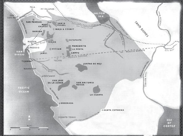
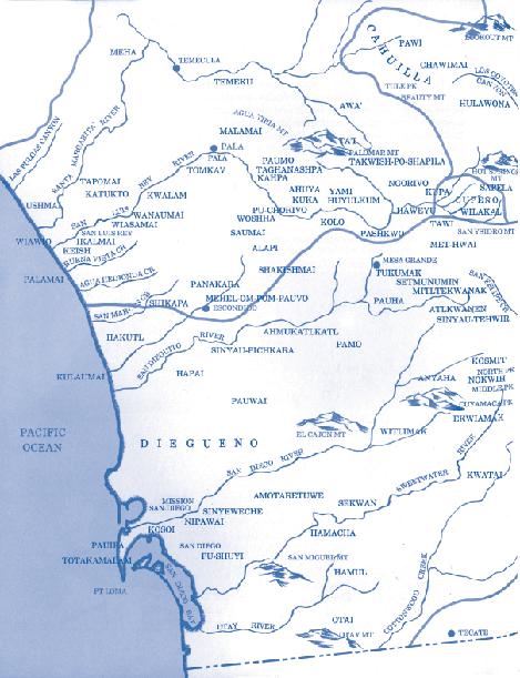
The shaded land area designates the ancestral territory of the Kumeyaay Diegueño Nation (Prior to 1769)
For thousands of years the Kumeyaay have occupied an area approximately seventy-five miles north and south of the current international border separating the United States and Mexico. Prior to the arrival of Shoshone speakers, Kumeyaay and Chumash people shared areas north of the San Luis Rey River.
Maritime Museum of San Diego 10
Courtesy of the Author
Maritime Museum of San Diego 10
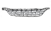
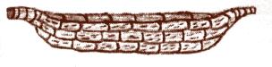
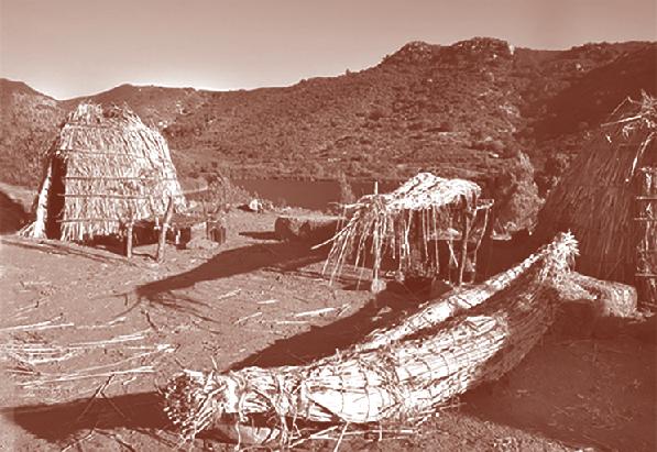
tule canoe
Louis Guassac is a member of the Mesa Grande Band of Mission Indians. The Mesa Grande Band is one of eighteen federally recognized Bands in San Diego County. Of the eighteen Bands, twelve are known as Kumeyaay/ Diegueño Indians. Mr. Guassac has worked with the tribal communities for over twenty years and has been elected by the Mesa Grande Band of Mission Indians to the position of Kumeyaay Historian. In this capacity, Guassac has worked closely with the late Dr. Florence Shipek, whose landmark work researching the Kumeyaay has significantly expanded our modern-day understanding of the prehistory and history of the Kumeyaay.
Mr. Guassac has been an independent consultant to the Sycuan Band of Kumeyaay advocating for Tribal Government self-sufficiency. He has also served as Executive Director of the Base Realignment & Closure Act (BRAC), constructing the Master Plan for community reuse and evaluating environmental issues, ultimately framing a 500 million dollar proposal for the reuse of the San Diego Naval Training Center (now the thriving community of Liberty Station).
Mr. Guassac has also served as the tribal coordinator for the Kumeyaay Border Task Force. Among his ongoing special projects, Guassac works in several areas of Kumeyaay/Diegueño Unity, and he has established the first Kumeyaay/Diegueño Land Conservancy as a 501(c)(3) nonprofit organization.
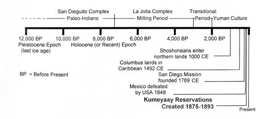
Kumeyaay use of the Ocean areas was both permanent and seasonal during the early periods (12,000 - 9000 BP). Kumeyaay relied on the Ocean areas for sustenance and living. During this period of time, I understand the land went out several miles from where the sea level is today and would have provided an abundance of food resources, as well as a warmer climate during these periods.
Kumeyaay oral history speaks of these times and is embedded in the songs used by Kumeyaay today. [Guassac is a Bird Singer and therefore continues to pass on the oral history and traditions.] It is our desire to share from our perspective our use of the Ocean, in addition to the coastal research conducted by Dr. Florence Shipek and Dr. Patricia Masters.
Cobble Mortars/Bowls have been found extensively off the coast from Tijuana to Point Conception. Approximately 100 sites have been found and identified with a variety of characteristics. The areas that exist today along the coast are actually the inland areas of the earlier period. It is the desire of Kumeyaay Bands, who have for generations shared the Ocean areas, until the time of contact, to remember this period of time, before the imposition of the foreign lifestyle, to remember the Kumeyaay and their traditional Ocean lifestyle that was conditioned by the environment. Winter for Kumeyaay was the time to leave the high mountain areas and travel by following their water resource to the Ocean from the mountains. Summer and Fall were the times when Kumeyaay/Luiseño families stayed at the Ocean areas. It was traditional that Kumeyaay never made claim to Ocean front areas and they were always shared by the Kumeyaay clan.
By the time contact arrived to the shores of Alta California (Point Conception to Tijuana), Indian people had use of the Ocean areas for thousands of years, primarily the Luiseño Indians and the Juaneño. According to Kumeyaay traditional oral history, the Luiseño were aggressive people. But they did not battle over use of areas, rather an effort was made by Luiseño men to marry Kumeyaay women, moving Luiseño families into a new clan. These types of inter-relations were repeated over time and this effort moved into Kumeyaay and Chumash areas. Today we share our aboriginal territory with Luiseño people, and in regards to ancient remains or artifacts, Kumeyaay have a standing agreement that if objects or remains are older than two thousand years, Luiseño will advise Kumeyaay about the find.
11 Traditional Pacific Voyaging
Ocean lifestyle for Kumeyaay was practical and a learning experience, perfecting the use of resources from the Ocean, as well as the ceremonial use of creatures from the Ocean that were abalone, of which there were an abundance. Abalone was used in an important ceremony for Kumeyaay. It was also noted that certain shells were worked on by Kumeyaay and were used as a form of currency among themselves, and also for trading purposes. Kumeyaay/ Luiseño used the Ocean resources and actually made trips to the islands just west of the mainland, now known as the Los Coronados Islands. Kumeyaay/ Luiseño use of the Ocean was active during the contact with the first Europeans [Spanish accounts from the first contact period tell of Kumeyaay use of their tule reed canoes, going far offshore, out of sight of land (Carrico 2008)].
It is also important to acknowledge Dr. Patricia Masters and her work with the Scripps Institution of Oceanography. Dr. Masters’ interest was studying the ancient shorelines, so her work involved diving in kelp beds and rocky reefs along the San Diego and Santa Monica coast where prehistoric artifacts had been reported. She began mapping the sites and her inquiries led her to [ethnographer] Dr. Florence Shipek, a trusted person working with the Kumeyaay people. Dr. Shipek provided insight into researching possible Kumeyaay uses of these maritime artifacts.
Kumeyaay Use of San Diego Bay and Point Loma
The Kumeyaay occupied Southern California and Northern Baja California for more than 10,000 years before the arrival of the Spaniards in 1769.
The Kumeyaay northern boundary began at the coast, extended along the crest south of the San Luis Rey River, then inland to Rodriguez Mountain. From there it turned north across the river (slightly below Henshaw Dam), up Palomar Mountain’s southern slope to the peak, then down the eastern slope to the low divide crossing Warner’s Valley and to the drainage divide north of the San Felipe Valley. The boundary followed this divide across the southern end of Salton Sea to the sand dunes west of the Colorado River, then south to meet the river below the present Mexican border. The boundary then ran southwest to the Pacific along the mountain divide south of Santo Tomas Mission.
Several early observations recorded by the Spanish Missionaries, circa 1769, noted that the natives fished far out to sea in rafts made of tule.
Today, many anthropologists interpret the Kumeyaay use of areas by dissecting our growth stages into years of materials found and then by depicting our growing stages, telling us we are all different people. This argument about classification will continue, but for the Kumeyaay/Luiseño, we know our history and roots. We do not live without growth of the use of Ocean resources, and our history tells us of the changes that occurred with the Ocean, and how we were forced to use new resources for survival. Our oral history also tells us that we were and still are the same people – the Kumeyaay/Luiseño.
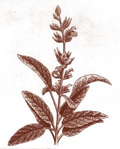
Right: In Her Autobiography – An Account of
Last Years and Her Ethnobotanic Contributions, Delfina Cuero identified many plants used by the Kumeyaay. Among them was Sage, commonly found along the coast today. Called “Kuchash,” Delfina explained: Grind leaves and use fresh as poultice on ant bites or boil and use for tea when ill; boil and bathe in it for measles. It was dried and used as a tobacco for smoking also (Shipek, Cuero 1991).
San Diego Bay, the largest bay, was on the north central coast of the Kumeyaay nation. It was heavily used for fishing, both by the local bands with permanent homes around the bay, and by visiting Kumeyaay from inland, and it was occasionally visited by traders from the Colorado River and beyond (Quechan, Cocopa, Mohave, O’o’Tam, Paipai) and whoever Kumeyaay married. Traders from northern neighbors also came – Cupa, Cahuilla, Kawhaay (Luiseño), among others. Kumeyaay deemed it “national (federal lands)”: [The areas now called] Point Loma, Mission Beach, the Strand and Silver Strand (including Coronado and North Island). This meant that all Kumeyaay bands - coastal, mountain and desert - came regularly for fishing, shellfish harvesting, salt and salt marsh plant harvesting. They participated in the harvest of foods and medicinal plants above and on the tidelands,
Maritime Museum of San Diego 12
Her
Maritime Museum of San Diego
Sage
Map showing where Kumeyaay villages were once located in San Diego County. Many of the place-names survive today.
From the MMSD Copley Collection, illustrations from Richard Pourade’s The History of San Diego – The Explorer. The Union-Tribune Publishing Co., San Diego, CA, 1960.
and offshore of Point Loma. All participated in the harvest, therefore all participated in the controlled burning of land along the Point to increase food supplies for humans and animals. They also experimented by planting desert and mountain food and medicinal plants at the coast and on Point Loma.
Spanish and American records, and testimony from Kumeyaay who fished the bay between 1850 and 1910 (Shipek, Cuero 1991), and whose grandparents had fished the bay and Ocean, indicate that Kumeyaay fished from dugout canoes or reed balsa canoes, and from the shore. In the bay, they speared dolphins, seals, very large seabass and other large fish. They went by canoe to the Coronado Islands for seals, sea otters, and bird eggs. They also regularly fished in the offshore kelp areas. Depending on the fish they sought, the Kumeyaay used spears, lines and hooks, dip nets, fish traps and large seines that took several men to manage. Spanish records state that the men fished both in the bay and far out to sea in the small tule craft (Carrico 2008). Fish remains in the surviving portion of the Ballast Point archaeological sites confirm that Kumeyaay regularly fished the kelp beds and nearshore Ocean and in San Diego Bay (Gallegos and Kyle 1998).
According to the Kumeyaay elders, some fish they had formerly caught in the bay were between forty and 200 pounds. They caught grunion by hand on the beaches, and used nets and weirs for small fish. They fished
13 Traditional Pacific Voyaging
Traditional Pacific Voyaging
the bay and harvested plants and shellfish from the mudflats between Point Loma and Old Town until about 1910. They also speared seals both for their meat and for their fur. A seal skin was the preferred rear apron of the socalled double apron type of skirt worn by the Kumeyaay women and girls.
The Kumeyaay always gathered shellfish from bay shores: as mud flats grew near shore, they dug in the mudflats at low tide for shellfish and a “mudworm” as they called it (Shipek, Cuero 1991). In the mud tidal area between Cosoy (Presidio and Old Town) and the edge of Point Loma that graded into land, various salt marsh plants were regularly gathered for food, medicine and for salt. Many root plants were dug, some taken, the clumps were divided and reset so all would grow more prolifically (Ibid.). Spanish records also note the digging of shellfish for food. They describe the coastal houses as made of the marsh reeds. The Spaniards also noted the abundance of game birds in the marsh areas which were used by the Kumeyaay: migratory ducks and geese, as well as local species were in the marsh; at the marsh edges were doves and quail.
In fact, the cemetery and refuse excavation at Mission San Diego revealed that during the early Mission period, the people depended upon rabbits, fish and other local game for food. Cattle and sheep bones are nonexistent until the end of the Mission period (Carrico, 2008).
Each reed area was spot-burned from yearly to every three years, depending upon the species wanted in each area. Nesting, shelter and food plants for local and migratory birds were burned before the birds arrived to use them. Thus fresh food and nesting areas were managed for birds. The same management on the shore and Point was used to create food and denning areas for other game. According to the Spanish records, the area around Cosoy (Presidio) teemed with game, rabbits, small animals, as well as numerous deer and antelope herds, and mountain sheep were in the near-coastal mountains (Ibid.)
Before 10,000 years ago, the bay was dry land crossed by several rivers leading to a much lower ocean (see Dr. Masters illustrations pg. 54). There are undoubtedly sites now under baywater and silt. A choice location was below the heights of the western hill [Point Loma] and beside the river, which drained across to the southwest (what is now the edge of the bay and under the fill area of the Naval Training Center). Kumeyaay ancestors watched the ocean rise as the climate warmed, and saw the original coastal land disappear under ocean water. They watched the alongshore currents Maritime
Maritime Museum of San Diego 14
Museum of San Diego
develop the sandbar, Silver Strand, from the sand and silt brought by the Tijuana and Otay Rivers. The end of the Pleistocene and melting ice caused the ocean to rise over 400 feet between 12,600 and 7,000 years ago. Most living sites earlier than 7,000 years ago are under the Ocean, along the bay edge, or below valley fills developed as the Ocean rose and shortened the rivers drop to Ocean level. Slower flowing rivers dropped their silt loads in the valleys. “Surface surveys” by archaeologists do no locate such buried material. At the Naval Training Center, for example, all pre-7000 BP cultural material is well below the filled land and lawns, while the 17th through 20th century material is just below the fill and lawns (Carrico, Pigniolo 1995).
By 7,000 years ago the bay existed with marshes forming near the river mouths. The Kumeyaay lived on or near the present shoreline, with sites on Point Loma and around the bay. Due to the early development of San Diego City and lack of archaeological research until recently, almost nothing is known about the coastal sites from 9000 BP to 1700 CE. Later sites, such as many large towns seen by the Spaniards, have been totally destroyed with no recovery of archaeological data (in contrast to documentary data).
Development of the now extinct grain probably started early in what archaeologists term the “La Jollan” culture period. Basin metates (for grinding hard oily seeds) are a prominent feature of all sites by 7,000 years ago. By 1769, this grain was almost the size of a grain of wheat. It became extinct when seed was no longer saved and broadcast by the Kumeyaay. After 7000 BP remains of Kumeyaay use are also under the lawns and pavement of the western portion of NTC, because very little was bulldozed when the older buildings were originally erected (Ibid).
NTC
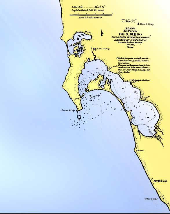
In Juan Pantoja’s 1782 Spanish map of San Diego Bay, Kumeyaay would still have occupied many of the bay sites. Note the location of the Presidio in relation to the bay. The area referred to as the “Naval Training Center,” or NTC, has been overlaid to identify its approximate modern location.
From Richard Pourade’s Time of the Bells, published by the Union-Tribune Publishing Co., San Diego, 1961.
Traditional Pacific Voyaging
Pacific Voyaging
Traditional
15
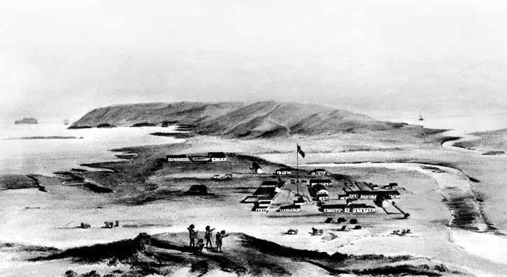
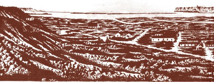
Two distinct time periods are captured in these illustrations of San Diego and the Bay: the Mexican Period 1822-1846 (below), followed by the arrival of the Americans in 1846 (above).
From the MMSD Copley Collection
Between 4,000 and 2,000 years ago, the Kumeyaay learned to process acorns for food. It is a complex process because nuts must be dried, ground, and the flour leached to remove tannic acid. As oily nuts, they are pounded in a mortar with a pestle rather than ground with metate and mano [different tools].
By 2,000 years ago, the Kumeyaay had begun experimenting by planting acorns in every environment. They continued their use of fish and shellfish. Also they were using tar, collected from the San Diego beaches, as an adhesive [and for waterproofing]; some have been dated to 7000 BP and
16
Maritime Museum of San Diego
1850
Maritime Museum of San Diego
1826 By F. H. Whaley
identified as from an offshore San Diego seep (Carrico pers. com.).
The early Spaniards described Point Loma as covered by large oaks. The trees were cut by the Spaniards and early Americans for processing cowhides and also for fuel for cooking and processing whale blubber for oil. Louis Rose, of Roseville and Rose Canyon, had a large tanning factory located where he had plenty of oaks for his factory. The oak pollen in the Ballast Point site excavated by Westec (Gallegos and Kyle 1998) matches the Spanish description of Point Loma. The Spaniards also described the Point as “pasture” [that is, the native grain and annuals dotted with trees or shrubs (the chaparral plants)]. They were all part of the plant husbandryfishing-hunting economy of the Kumeyaay (with corn agriculture limited to the mountains and desert).
During the Spanish period, the Kumeyaay were forced to become the labor force for the Spanish Missions, soldiers and settlers. They performed all the labor of the colony, and built all the structures. During the Mexican period [1822-1846], except for those whose original land was in the immediate vicinity of the Presidio and Old Town, the Kumeyaay were free. Only those directly at the Mexican pueblo were laboring for the Mexicans (Shipek 1987)
After the Americans arrived, the Kumeyaay were forced to labor for the newly arrived settlers and were the only labor force for San Diego. The majority of the Kumeyaay land resources continued to be destroyed by both the Spaniards and the Americans. The antelope disappeared entirely; the deer disappeared from coastal areas. As the Kumeyaay were no longer able to control-burn each area as needed, the plant food, bird and small game resources became scarce and surface erosion increased as chaparral grew larger. Emergency foods that grew in drought years were eaten by sheep and cattle. Cattle, sheep and horses overgrazed the land and plows exposed many valley lands to erosion of the good soil. Post-1850 records indicate that, in addition to working for Louis Rose, Kumeyaay men were stevedores, road builders, Derby Dyke construction workers, railroad construction crews and performed all the labor of pre-1920 San Diego starting with the arrival of the Spaniards. They made and carried the adobe’s
17 Traditional Pacific Voyaging
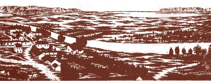
Traditional Pacific Voyaging
Old San Diego - 1826
foundation boulders and roof beams. Kumeyaay did all the unloading and loading of ships at Ballast point and later at Horton’s Wharf in New Town. The whaling industry used Kumeyaay as seamen and whalers, and ashore to dry out the blubber (Carrico 2008). A large permanent Kumeyaay community remained on Point Loma in the marshland edges until about 1910. By 1930, the Kumeyaay had slowly been replaced by other laborers in the city, but many still lived on the undeveloped mud flats of both bays. The Kumeyaay used the food of the mudflats and reed edge of Naval Training Center portion of San Diego Bay, until it was filled in sometime after 1910. The Kumeyaay used the mudflats, salt marsh and wet meadow of Mission Bay through the 1930’s according to Kumeyaay whose families walked from mountain reservations to dig for shellfish in the mudflats and fish in the bay, while living around the edge among the reeds (Shipek, Cuero 1991).
The plant communities that the Spaniards described were the result of several thousand years of plant husbandry – planting acorns for oaks, and moving desert and mountain plants to coastal environments. Desired marsh plants were increased by seeds or root divisions and cultivated around roots. Early descriptions indicate that the San Diego River Valley was managed by controlled burning, broadcasting seed of the grain and leafy annuals combined with spaced planting of managed grape vines. Spanish descriptions of mesas and slopes indicate the same managed environment. The Kumeyaay planted seeds or cuttings, as appropriate, for the particular trees and shrubs wanted.
The Kumeyaay skillfully utilized natural resources for the construction of dwellings and watercraft.
Maritime Museum of San Diego 18
Maritime Museum of San Diego
The plant husbandry system covered Point Loma, the marshes, mudflats and the rest of their territory. Under oaks, Kumeyaay broadcast the annual grain and greens after yearly burning. They managed rivers opening to the bay as the fresh water marshes led to salt marshes and mudflats. Over the slopes they spaced a variety of shrubs among the grain. These included medicinal, food and technological material resources.
Conclusion
The arrival of the Spaniards and active mission control system along the coast was followed by the Mexican period in which the Kumeyaay regained control of their resources and held Mexicans to the small pueblo, now known as Old Town. However, in 1846, the Americans led by General Stephen Watts Kearny entered through San Pasqual Valley where they were attacked by Mexican cavalry. The Kumeyaay of that valley aided Kearny by harassing the edge of the Mexican forces. After the battle, they guided Kearny to San Diego where he met the American fleet. For their aid, Kearny promised the Kumeyaay that their land would always be safe – a promise that was never kept. Instead, most of their land and resources were taken from them (Shipek 1987; Miskwish 2007). For more than eighty years, the Kumeyaay and other San Diego County Indians provided the only labor force for this county, but many still starved to death because only the workmen were fed and their families starved.
In addition to their land, the Americans slowly cut the Kumeyaay away from another major resource, San Diego Bay, with its salt marshes, food resources, beaches, naturally occurring oil tar, and Ocean. This ended the Kumeyaay’s careful management of fish and shellfish resources and of food and nesting areas of the entire native bird and animal populations, and it signaled the end of the Kumeyaay’s traditional Ocean lifestyle.

References Cited
Carrico, R.
2008 Strangers in a Stolen Land: Indians of San Diego County from Prehistory to the New Deal. Sunbelt Publications, San Diego, CA.
Carrico, R. and A. Pigniolo
1995 Draft Historic Properties Inventory of the Naval Training Center San Diego Archaeological Survey and Assessment
Gallegos, D. and C. Kyle
1998 Five Thousand Years of Maritime Subsistence at Ca-SDI-48, on Ballast Point, San Diego County, California. Archives of California Prehistory, n. 40, Coyote Press, Salinas, CA.
Masters, P.M. and J.S. Schneider
2000 Cobble Mortars/Bowls: Evidence of Prehistoric Fisheries in the Southern California Bight. Proceedings of the Fifth California Islands Symposium, U.S. Department of the Interior, Minerals Management Service and Santa Barbara Museum of Natural History, Santa Barbara, CA.
Miskwish, M.C.
2007 Kumeyaay – A History Textbook. Vol. 1, Precontact to 1893 Sycuan Press, El Cajon, CA.
Shipek, F.
1987 Pushed Into the Rocks. Viejas Band of Kumeyaay Indians, Alpine, CA.
1991 Delfina Cuero: Her Autobiography- An Account of Her Last Years and Her Ethnobotanic Contributions. Balena Press, Menlo Park, CA
Pacific Voyaging
Traditional
Voyaging
Traditional
The Crossing
By Julie Cordero-Lamb Editor’s note: this article was first
in Mains’l Haul 41 (2&3, 2011).
“The first man in this world said that all the world is a canoe, for we are all one, and what we are finishing now is a canoe. When the first canoe was finished, the first man who made it called the others to pay close attention to his canoe-making. Later this maker and his contemporaries died. The next generation remembered how the first man had made a canoe so they too made one. There was always a little difference in their work, so their canoe was a little different from the first one. This generation died and another followed. They always did as the first man in making their canoes, and so it continued.
Kitsepawit (Fernando Librado), 1913; photo courtesy Robert Schwemmer, Channel Islands National Marine Sanctuary, NOAA
The first part of the story of the recent revitalization of Chumash maritime traditions begins with Helek and her family of builders, supporters, and seafarers. In 1975, during the establishment of the Brown Power and Native Pride movements, members of the Chumash community participated in building a new tomol and named her Helek, the Barbareño Chumash word for peregrine falcon, guardian bird of ocean canoe voyages. Helek’s construction was based on directions given in 1913 by Kitsepawit (Fernando Librado), and was guided by master boatbuilder Peter Howorth. She was the first seaworthy tomol built in nearly one hundred years, and the modern-day Brotherhood of the Tomol performed one of the more eloquent expressions of the Native Pride movement in taking her to sea. In 1976, the crew of Helek made the dangerous crossing between Santa Rosa and Santa Cruz Islands, rough waters known as “the potato patch,” for their frequent frothing.
Maritime Museum of San Diego 20
published
Helek was paddled only by this very small crew of experienced seafarers, and community participation was limited by financial constraints and safety issues. The Santa Barbara Museum of Natural History sponsored this project, and it was a time remembered by Chumash families as a flowering of a maritime tradition too long buried by oppression and despair. The Brotherhood’s efforts will forever remain in a place of honor in the story of Chumash tomol and maritime revitalization.
More recently, beginning in 1997 an alliance of Chumash communities have, against all odds, brought back a once-dying tradition. We are a small but significant part of a much larger movement among Indigenous Canoe Nations. Inspired by the renewed spiritual and physical health demonstrated by Northwest Coast Nations and the First Nations of Canada—especially among the youth and elders—members of what was to become the non-profit Chumash Maritime Association rallied other Chumash community members to build a new tomol, which many families had desired since the days of Helek. That craft had been lost as a living vessel, put on permanent museum display after disagreements and misunderstandings that left lasting enmity behind. In 1997, however, representatives from each of the Chumash tribal territories—Malibu, Ventura, Santa Barbara, Santa Ynez, Santa Maria, San Luis Obispo, plus Inland Chumash people now living mainly in Bakersfield—came together to recognize and bring about a new reconnection of a maritime people with the sea.
With financial support from Channel Islands National Marine Sanctuary, eight members of the Chumash communities (including a Huichol man and a Filipino man who are relatives by marriage) came together every weekend for nine months to build our tomol. Other members of the community lent a hand during the more complicated construction steps. During the weeks-long process of detailing the finished hull, the tomol builders were joined by many willing and able members of the larger Native American Community in the area. Their experience and high spirits were gifts much appreciated by the tomol builders, who were showing signs of weariness after many months of volunteered weekends. Guided through every step by Peter Howorth, who had assisted in building Helek, the eight apprentices used power tools and commercially available materials. During each step, the builders constantly discussed which traditional tools and materials would be used for each step of the next canoe our community will build—as well as how those natural tools and materials could be acquired sustainably by the coming generations. The Chumash Maritime Association’s use of power tools was somewhat controversial, mostly among non-Indian anthropologists and archaeologists who felt that we had lost “traditional” knowledge.
“Canoebuilders have a sort of net in which they keep, rolled up, all the things which are necessary for canoemaking. Also kept in this net is a piece of stone shaped in the form of a tomol; it is about six or eight inches long….These little boats serve as a charm, so that they will always have good luck in fishing.”
Kitsepawit (Fernando Librado)
1913; photo of tomol effigy found on the Channel Islands courtesy San Diego Museum of Man
21 Traditional Pacific Voyaging
While holding in our minds and hearts the importance of interacting with locally-gathered natural materials for building our next canoe, our employment of power tools, milled lumber, nylon cordage, shipbuilder’s epoxy, and some rather unorthodox measuring tools (a Kentucky Fried Chicken bucket) reflected Kitsepawit’s observation that succeeding generations’ canoes were “a little different from the first one.” We knew our time to build the canoes had come, and, with our adopted tools at hand, “so it continued.”
The builders began each day of work with prayers for balance, goodwill, and the support of the larger Chumash community. Strict rules of conduct were adhered to during the entire process. It was imperative that builders take care of themselves by not abusing drugs or alcohol, and no fighting or abusive comments about others were allowed. Menstruating women, in accordance with a practice widespread throughout Native North America, stayed away from the building area and the builders. The canoe builders took care of themselves and each other, creating a bond that grows stronger with time.
Over breakfast at Denny’s, the tomol-building crew discovered another place our bond was apparent: nearly all of us involved had thought about, dreamed, or otherwise pondered the name “Swordfish” for the nearly finished tomol. Unanimously, and with very little fuss or ceremony, we named the tomol ‘Elye’wun (pronounced “el-YEH-woon”), the Barbareño Chumash word for swordfish.
‘Elye’wun’s ceremonial launching took place on Thanksgiving weekend, 1997, and was attended by over a hundred Native American and Chumash community members. It was a time of great pride in who we are, and in what we are gaining the strength to do together as a community. Chumash teenagers, in their spotless Nikes and baggy jeans, looked on, as yet not quite knowing what to think.
From 1997 to 2001, the Chumash Maritime Association worked alongside several local community and governmental organizations to bring to fruition our visions of a permanent place to build our canoes using traditional and modern techniques and materials, of a place where we can come together and provide programs to mentor Chumash young
22
Maritime Museum of San Diego
people, and of an avenue through which to educate the public regarding our people’s past and present maritime activities. As we worked with the people of the local nonprofit Community Environmental Council to accomplish the first two goals, the Chumash Maritime Association became partners in the new Watershed Education Center at Arroyo Burro Beach in Santa Barbara. We continued our six-year partnership with the fledgling Santa Barbara Maritime Museum in order to accomplish our mutual goal of educating the public. All our eyes, however, were on the one goal that would weave them all together. All eyes looked across the Santa Barbara Channel to the ancestral home of the Chumash people, Santa Cruz Island, known to the Chumash as Limuw s we prepared for the first paddle from the Chumash mainland to Limuw in over a hundred and fifty years, our focus on ‘Elye’wun became sharper than ever as we realized how many aspects of our maritime traditions are taught to us by our contact with her. The members of the paddling crew, which grew larger with each passing month,
were taught to condition their bodies and minds through attention to nutrition, exercise, and the mental balance necessary to paddle safely as a team on the open ocean. The members of the ground crew learned leadership skills in organizing staging areas and performing the strenuous yet awesomely delicate, heavy-surf landing of our people’s one and only 1,500-pound, fully ballasted and manned, handsewn plank tomol. (Helek, drilled with holes and mounted as a museum display, can no longer put to sea.) And, as part of a tradition now in deep practice throughout Indian Country, the members of the Chumash Maritime Association learned to work in the context of strong alliances with our primary supporters, both moral and financial, in organizing a gathering of Chumash people, an event which would take place on Limuw on the second weekend of September, 2001. Funded by the Channel Islands National Marine Sanctuary and by The Seventh Generation Fund, an organization devoted to the interests of Native peoples throughout the Americas, we organizers spent ten months working as a team to make our collective dream a reality.
23 Traditional Pacific Voyaging
Courtesy Frank Magallanes and Althea Edwards
“The word replica can be galling to many Native people, when used to refer to items from traditional material culture that were recently created anew. It is an inaccurate term, in that it implies that we are somehow interacting with our traditions merely as weekend recreation, or as commodities—and particularly galling when these traditions were not put aside primarily through our choice to do so, but often by force. The reality that Indian people personify vibrant traditions in the present tense is often met with great resistance from the mainstream cultures. Words like ‘replica,’ which imply that our traditions are as past-tense as the California Gold Rush, more deeply entrench the false idea that Native peoples are extinct. A copy of William Wallace’s sword is indeed a replica. Even Kitsepawit seems to have called his tomol, which made our revival possible, a replica; it was never intended to touch salt water and holds an honored place in the Santa Barbara Museum of Natural History. But Helek, nearby, like the working watercraft ‘Elye’wun, is herself a historic vessel, as are the Hawaiian canoes Hokule’a and Hawai’iloa, and as the tomols currently under construction will soon be.”
Julie Cordero-Lamb, 2005
There is perhaps no communal skill learned by contemporary urban Indian people as complex and necessary as organizing a major cultural gathering. As moderns accustomed to e-mail and cell phones, we were confronted with the reality that these modern tools were limited, if we were going to perform our duties “in a good way”—as this crucially important sense of “old-school” courtesy is rather cryptically referred to throughout Indian Country. We would need to put aside our high-tech tools and set out, offerings in hand, to talk about our plans to the heads of each family personally. This invitation protocol was not a special set of rules our parents or grandparents handed down to us. As far as anyone knew, there had never been a return of 150-plus Chumash people to Limuw, camping together for days in order to witness the first tomol crossing since the Mission period. Miss Manners, we joked, could not help us with this one. Our decision to issue the invitations personally was common sense in a land where people still know each other. There was no book to refer to, no paper to quote from, no archaeological evidence to guide us, no anthropologist who could offer expert advice, solicited or otherwise, on how to invite Chumash families from violently divided communities to a historic gathering during which their relatives would quite literally risk their lives for love of their traditions. The tomol spoke to each one of us of a time when people’s intimacy with each other, with the land, with the ocean, and with the ancestors, was all there was in the world.
After ten months of excruciatingly difficult and complex organization, white sage was carefully gathered and tied into gift bundles, and invitations were made. Inter-organizational alliances were initiated and strengthened, travel arrangements were negotiated and paid for, the Park Service campground at Limuw was generously donated, and we were given excellent deals on “luxury” tent accommodations for the elders, thanks to the support of sporting goods stores in Santa Barbara. Safety issues were addressed, crew training was stepped up, and RSVP’s poured in.
The gifts from the larger community just kept coming. Ed Cassano, director of the Santa Barbara Maritime Museum, arranged for the Museum’s boat, Just Love, to accompany the canoe as a support vessel across the channel. In an uncanny coincidence, Just Love had also been the support vessel for Helek when the Brotherhood of the Tomol paddled her between the islands in 1976. Cassano had also been responsible, in his previous job as manager of Channel Islands National Marine Sanctuary, for securing the grant that paid for building ‘Elye’wun. He has worked tirelessly with the Chumash Maritime Association to bring about this canoe renaissance.
The food was hunted, gathered, purchased in supermarkets, and packed in coolers, and our relatives’ pickups were ready to take us to the harbor. At the last minute, word ran through the community that an amazing gift was being sent to the Chumash people. The Nisqually Indian Nation of Washington State had caught, packed on ice, and shipped to Santa Barbara over a hundred and fifty pounds of king salmon for our enjoyment at the feast the night of the crossing. It was a gift, the Nisqually elders said, from another Canoe Nation who understood the importance of what we were doing.
On September 8, 2001, when the crews of Just Love and ‘Elye’wun left Channel Islands Harbor in Oxnard, it was 3:00 a.m. Twenty-seven miles across the dark and windy channel, at the site of the Chumash
Maritime Museum of San Diego 24
village Swaxil, many of the waiting families, including mine, had roused ourselves from our tents and assembled on the beach, singing songs of protection and healing, praying for the safety of loved ones about to face the waters that had taken so many of our ancestors before us. We prepared for a day like no other.
The paddlers, too, threw themselves into their day with energy and prayer. Michael Cruz, a member of the tomol crew, recalled in News from Native California that “I can remember when it was my turn to paddle, around 6:00 a.m.”
I climbed into ‘Elye’wun and the sun was coming up—you know, the beautiful oranges and pinks—and all the people on the Just Love were singing the sunrise song. I could see my sister singing to me, and the islands so close in the fog. It was just so beautiful, I cried; but it was a good cry because I knew that we had connection to everything and that we were going home.
Michael and twenty-one other Chumash and Native American crewmembers took turns paddling for nearly twelve hours over seas that were challenging even for powerboats that day.
Back in the island encampment, two of the younger boys spent the morning on the dock with three of the men, learning to fish with jury-rigged hooks, and lines wrapped
around soda cans instead of mechanical reels. When the boys swaggered into camp in mid-morning, loaded down with perch and striped bass, they puffed up their chests and declared themselves men. No one argued with them—their catch was our breakfast. Meanwhile, at the big log by the kitchen tent, several children had gravitated to where I was pounding acorns in a mortar and pestle, preparing acorn flour for the traditional meal of acorn mush, to be served at breakfast the following day. The satisfying thump of the pestle in the acorn flour proved irresistible, and before long all the children had taken a turn learning the technique that had been practiced daily by our ancestors to make this primary staple food. The sound also attracted Park Service rangers, on hand to assist us. None of them, who spent most of their time here on this ancient island home of the Chumash, had ever heard or seen acorn flour prepared in the old way. We agreed that it had been several generations since the hills around Swaxil village had resounded with this rhythmic pounding of everyday life. The kids were thrilled to be the first; the adults reflected on the days when it had last been heard.
Elders, young adults, teenagers, and small children set up chairs, beach towels and mats to spend the day on the beach, waiting under gray skies for news of ‘Elye’wun and her crew.
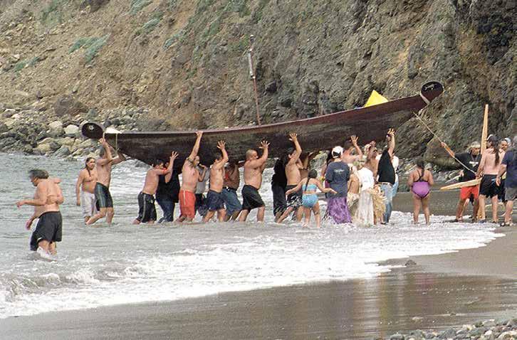
25 Traditional Pacific Voyaging
Courtesy Frank Magallanes and Althea Edwards
“Here, many very good canoes— in each of which there is room for twelve or thirteen Indians—came to the ships.”
Juan Rodríguez Cabrillo, Santa Barbara Channel, October 9, 1542
Several of the men applied their considerable barbecue skills to roasting rabbit, quail, and the Nisqually Nation’s salmon over open fires fueled with chopped wood from downed trees, courtesy of the strong backs and chainsaws of the Park Service staff. The smell of the roasting meat warmed the beach, keeping a smile on everyone’s face. No matter what the outcome, we would clearly eat well. The rangers, to their delight, were invited to join the feast.
Relying on Park Service radios for news from Just Love, we anxiously prepared for an emergency, having received reports that ‘Elye’wun had sustained a huge crack, and was taking on water almost faster than the crew could bail. Though they were within a few miles of the village, the crew was not at all certain they would make it to land without the assistance of the support boats. The tomol captain, Perry Cabugos, after consulting with the crew, made the call to heave some ballast overboard, and to relieve the heaviest crewmember. This left four in the tomol, with the other nineteen watching from the deck of Just Love, most of them having already put in their time paddling across the rough channel. Only Perry had stayed in for the duration—twelve hours of paddling through the heavy swell. “Every paddle is a prayer,” crewmembers were told numerous times throughout their training. On this day, those prayers performed the crossing, and each stroke of the paddles was heartfelt.
Paddlers pass Arch Rock at Anacapa Island (and other landmarks), 2001. Courtesy Frank Magallanes and Althea Edwards
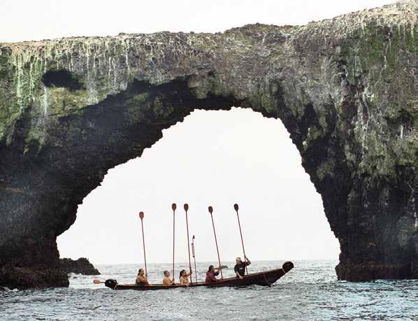
Maritime
26
Museum of San Diego
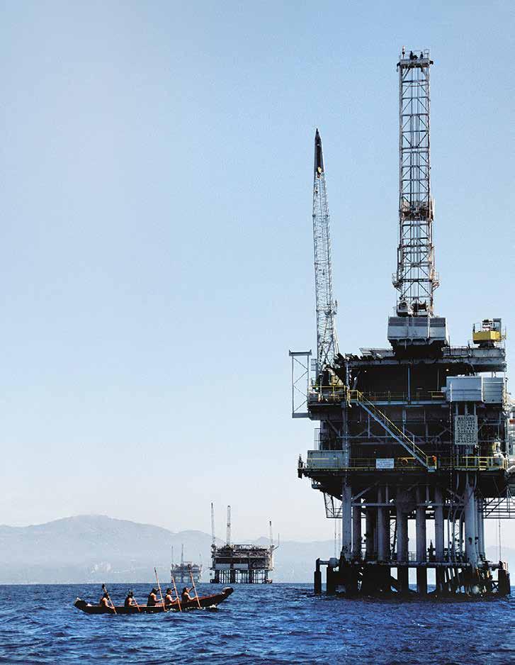
On the beach at Swaxil, Michael Sanchez, the teenage boy who sat for hours at the top of the hill as the official lookout, ran breathlessly into the village. “The tomol is here! They’re just around the corner!” This was Michael’s first glimpse of any tomol, and it was a moment full of pride. The people jumped to their feet and, while assisting the elders to stand and watch, prepared to land ‘Elye’wun and her exhausted crew on the rocky beach. The landing crew stood at surf’s edge, while the ceremonial leaders conferred with each other on how best to proceed. Here, we faced another one of those powerful cultural moments for which nothing the books had reported, nothing the anthropologists had constructed, nothing at all in written or living memory had prepared us. What do Chumash ceremonial leaders do when faced with the first community canoe landing ceremony on Limuw since the beginning of the colonial period? What those beloved family leaders did was to once again follow the commonsense instincts of protocol—their practiced ability to do things respectfully, “in a good way.” Ancient songs appropriate to the occasion were sung, scores of voices joined in while several of the small children wearing their traditional regalia danced in the cool spray of the waves. When the ‘Elye’wun and her four crew members appeared around the rocky bend of the island, everyone fell to pieces and wept and laughed and hugged each other and wept some more. The eldest among us were solemn, some trying to hide the tears streaming down their faces under their sunglasses, others openly weeping.
We had always heard that our ancestors ceremonially wept whenever a tomol would depart or land. We had not planned or prepared to enact such a ritual. But now, as we watched while the four paddlers—brothers, husbands, fathers, uncles, cousins, and friends—lifted their eleven-foot redwood paddles straight to the sky in a salute to the village assembled there, we understood the full emotional impact behind our ancestors’ ritual expression. Truly, the tomol and her crew were as beautiful “as a flower on the water,” as Kitsepawit had said. Kitsepawit was there at Swaxil that day, weeping with us. They all were.
Home at last, the Chumash and our many guests did what came naturally to all peoples on such an occasion: we ate until we nearly burst, we danced, we sang, we told wild tales under the stars, and we remembered.
Substantial parts of the preceding were abridged by the author from her article “The Gathering of Traditions: The Reciprocal Alliance of History, Ecology, Health, and Community among the Contemporary Chumash” in Linda L. Barnes and Susan S. Sered, eds., Religion and Healing in America (Oxford: Oxford University Press, 2005).
27

The Alutiit: Maritime People of the Dynamic North Pacific Coast of North America
By Patricia L. McClenahan, Ph.D. Editor’s
note: this article was first published in Mains’l
Haul 47 (1&2, 2011).
Introduction
Northern Pacific Ocean waters are among the most dynamic, productive, and dangerous in the world. Inhabitants of the north Pacific coast of North America are a maritime people, and have been from prehistoric times. The northernmost Pacific people of Alaska, the Alutiiq or Sugpiaq speakers, live in parts of the Kenai Peninsula, Cook Inlet, the Kodiak islands and the Alaska Peninsula, at the southernmost extent of the Arctic ecosystem (Damas 1984; CAFF 2001). In this region, prehistoric and historic-era aboriginal people used a variety of particular adaptations to cope with their extreme environment. Keen subsistence hunting, fishing, and foraging skills, an abundance of specialized tools and strategies, and specialized methods of transportation and trade are required to live and subsist here. Those plying the north Pacific waters today, even with their modern equipment and sophisticated technology, find it a dangerous and challenging place.
The North Pacific Coast Central Alaska Peninsula Region
The north Pacific coast of the central Alaska Peninsula and the Alutiiq people who lived there prehistorically and historically have not received as much in-depth study as the other Alutiiq regions, probably due to the remoteness and difficulties in access. Many Alutiit live in the same areas today as their prehistoric and historic ancestors, for example, the Kenai Peninsula, the Kodiak Island group, and the Chignik villages of the lower Alaska Peninsula, Alaska. However, today much of the north Pacific Coast of Shelikof Strait is uninhabited because it is remote, and people moved to communities where transportation, schools and other services were available, and where the richest subsistence opportunities presented themselves.
For example, the Chignik River is large enough and long enough to sustain substantial salmon runs, whereas the Kanataq River is short
Maritime Museum of San Diego 28
Pat McClenahan (1941-2016) was an anthropologist specializing in archaeology and environmental science. She began her career in Alaska Native studies after completing a Master’s Degree in Anthropology at the University of Oregon. A National Science Foundation-sponsored field project on the Alaska Peninsula culminated in a Ph.D. from the University of Arkansas Fayetteville. Published works include “Historic Kanataq: One Central Alaska Peninsula Community’s Use of Subsistence Resources and Places,” Arctic Anthropology (2004), and “Cultural Remains in Local and Regional Context on the Central Alaska Peninsula: Housepits, Language, and Cultural Affinities at Marraatuq after 1000 BP,” Arctic Anthropology (2010) .
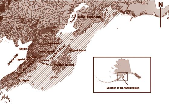
Alaska
Map of Alutiiq Region of Alaska showing locations discussed in the text. The hatched area approximates the historic Alutiiq (Sugpiaq) linguistic region, based on the author’s field research notes. (McClenahan n.d.).
and in some years it is shallow. Only a few salmon run in the Kanataq River, although other fish such as Dolly Varden are present year-round. Chignik villagers, who still live in a viable community, have been able to fish adjacent to their village in the summer and dry and store salmon for the winter. It was economically more feasible for Kanataq folk to travel inland to Marraatuq, Lake Becharof, or Egegik for salmon fishing and drying, where stocks were much more plentiful. Today, Kanataq is deserted.
29
Pacific Voyaging
Traditional
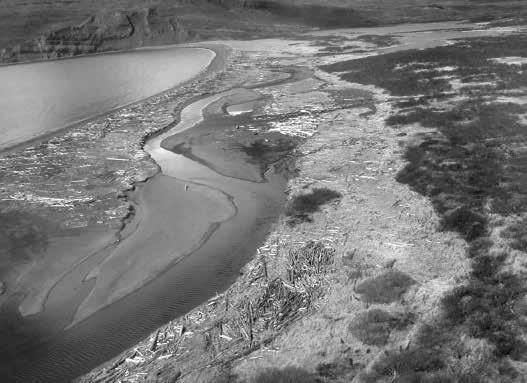
The Regional Setting
The Alaska Peninsula Pacific coast is fjorded to some degree in certain locations. Protective bays and inlets are scattered intermittently along the coast. They are remnants of a glacial past and subsequent sea level rise at the close of the last glacial period. Portage Bay and Chignik Bay are two examples of locations that provide all of the necessary physical elements to favor human habitation.
The historic and prehistoric village of Kanataq in Portage Bay is situated at one such location. The village was located on both sides of the Kanataq River where it drains the lake. The beach at Portage Bay is a “catcher beach”. Large amounts of driftwood collect on the beaches. Violent storms have deposited storm-driven materials to the north banks of the river and beyond
Maritime Museum of San Diego 30
(above)
Above: Portage Bay, Central Alaska Peninsula Pacific Coast. In the background is Kanataq Lake (Central Alaska Peninsula Archaeological Project 2001 NSF OPP-0102687).
long
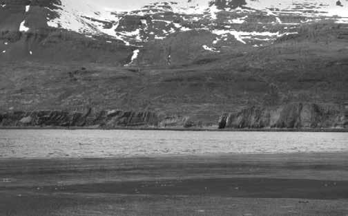
In the summer, the lowland interior of the Alaska Peninsula is a maze of meandering rivers, streams, tundra bogs and marshes. Travel on land here during the warm months requires the use of a series of trails and boat portages.
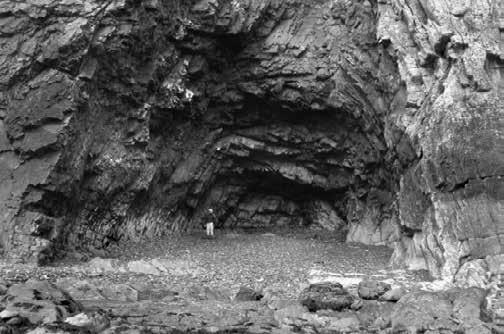
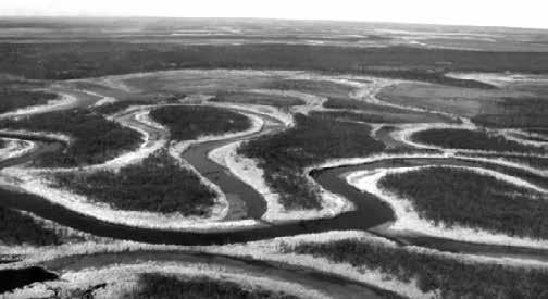 much of the coast, cliffs abut the ocean. Where there are beaches, it is only a short distance from the water to the abruptly-rising spine of the volcanically active Aleutian Range of mountains that separates coastal lowlands from the Bristol Bay Coastal Plain.
Right: Bristol Bay Coastal Plain (Central Alaska Peninsula Archaeological Project 2001 NSF OPP-0102687).
Middle: This rock cliff and water-worn grotto along the western Portage Bay shoreline dwarf the author (Central Alaska Peninsula Archaeological Project 2001 NSF OPP-0102687).
much of the coast, cliffs abut the ocean. Where there are beaches, it is only a short distance from the water to the abruptly-rising spine of the volcanically active Aleutian Range of mountains that separates coastal lowlands from the Bristol Bay Coastal Plain.
Right: Bristol Bay Coastal Plain (Central Alaska Peninsula Archaeological Project 2001 NSF OPP-0102687).
Middle: This rock cliff and water-worn grotto along the western Portage Bay shoreline dwarf the author (Central Alaska Peninsula Archaeological Project 2001 NSF OPP-0102687).
31 Traditional Pacific Voyaging
Right: Western Portage Bay (Central Alaska Peninsula Archaeological Project 2001 NSF OPP-0102687).
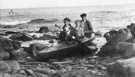
Prehistoric and Historic Methods of Transportation
During prehistoric times, coastal and inland dwelling people depended heavily on expertly and cleverly crafted boats for transportation and for obtaining many of their subsistence resources. Boats were key to life at sea and on land.
A great deal has been written about historic Alaskan boats. Those in the Alutiiq area were constructed in a similar manner as those of people of other areas of Alaska, with some distinctive features that made them readily recognizable. Alutiiq bidarkas (kayaks), which may date back to as much as 5,000 years ago, were constructed with one, two, or three hatches for passengers to sit (Zimmerly 2000:3 and 31). They were slender craft made of wooden ribs and stitched hide covers. The prow was distinctive in its prominent upswept forked form, which apparently has two specific functions. The lower part of the prow cuts the water, and the upper part is a flotation device that helps maneuver the boat under rough ocean conditions. This type of boat could even land on the rocks on the beach without being destroyed
(Steinbright, ed. 2001). The remarkable prows were obviously utilitarian, but they probably were also a way to identify friend or foe from a distance.
Construction materials were specific to this region. According to Zimmerly, kayaks of this region were more heavily built, had a greater beam and the gunwales came together in a point at the stern…. Ribs were let into the underside of the gunwales, carefully avoiding any location where there was a deck beam (2000:29-30).
The type of wood used in the kayak frame and the animal skins used for boat covers varied from ecosystem to ecosystem, depending on what was available. It was reported that Chugach kayaks had frames of hemlock, with stem, stern, and cross pieces made of spruce. Hemlock is a stronger wood than spruce (Zimmerly 2000: 35-36). The central Alaska Peninsula Pacific coast has a tundra vegetation regime rather than the spruce forests of the Kenai Peninsula and the Kodiak islands. A wide variety of wood was available as driftwood, some of which may have been useable for boat parts. Otherwise, people may
Maritime Museum of San Diego 32
Above: Alutiiq bidarka or qayaq (kayak). Peter Kewan’s bidarka on the beach in Afognak, Alaska, ca. 1910. Helen J. Simeonoff Photographs. Courtesy of the Alaska State Library Historical Collections.
have had to trade for wood or travel to areas that had forests.
In the instance of one Kodiak kayak, whale baleen was used to lash the ribs to the stringers. Seal skins were seamed together with a specialized waterless stitch so as to be completely waterproof at sea (Zimmerly 2000: 32). The craft were required to be sufficiently seaworthy to conduct sea mammal hunting and fishing activities in the North Pacific Ocean and the Shelikof Strait, some of the most dangerous waters in the world. They had to be able to travel along the coastlines from village to village, and make the crossing between the Kodiak Islands and the Pacific coast of the Alaska Peninsula, a distance across open ocean of approximately 30 miles. Additionally, boats had to be able to navigate shallow rivers and streams for inland travel, fishing, terrestrial mammal hunting, and gathering terrestrial resources such as bird eggs and berries.
Prehistoric and Historic Village Site Selection
It is fascinating how historic and prehistoric people on the North Pacific coast selected sites for houses and boat haulouts, particularly with respect to the environmental and subsistence factors that were involved. Additionally, during late prehistoric and historic times there were issues of warfare and competition to take into consideration (Moss and Erlandson 1992:73; Dumond and VanStone 1995: 97-99).
When people selected habitation sites, they
considered many of the factors we do today. At the same time, they had to contend with other issues that we might find surprising, viewing them as we do from our insulated modern lives.
A major concern of inhabitants of the Alaska Peninsula Pacific coast was the safe storage, launching, and landing of their oceangoing watercraft. The type of beach, whether it was rocky or sandy, was a factor taken under consideration. In this region beaches are dynamic, quickly removed by a major storm and subsequently re-deposited by another. While sandy beaches might be preferred for landing kayaks, they were not always available. Prevailing winds are from a different direction at different times of the year, and so a site that had more than one option for safe boat launching was preferred.
Tides and wave activity both affect the ability of a craft to land safely. Some secretive little sites were located on islands behind rock arches that could only be accessed by boat during particular tides. Sites that were shielded from the view of an enemy approaching from the sea were favored, as were those offering quick access to a variety of options for escape in times of emergency.
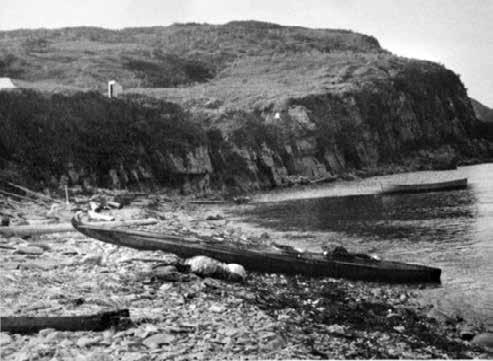
33
Pacific
Traditional
Voyaging
Right: Bidarka on the beach at Chignik, Alaska, 1909. Flamen Ball Photograph Collection. Courtesy of the Alaska State Library Historical Collection.
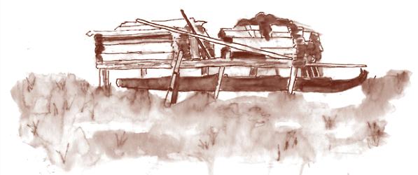
The Alutiit stored dried salmon and other food caches on stilts to discourage bears and other scavengers from stealing winter supplies. The time period of this scene was 1913 or earlier. In this instance an Alutiiq kayak was stored beneath the caches (McClenahan n.d.).
nother primary concern of Pacific coastal residents was proximity to subsistence resources. The term “subsistence resources” refers to food, water, and other vital non-food resources obtained by hunting, fishing, gathering, and trading. Food resources people sought first were those which would provide the greatest nourishment among the resources available. They were the most plentiful, allowing for an opportunity to store surplus items for the winter. They required the least amount of effort for the greatest energy return. They were valued for providing variety in the diet, and they allowed the opportunity for enough people to live together to help one another. On the central Alaska Peninsula, salmon, caribou, and sea mammals are and were primary resources. Historically, people turned to secondary resources such as bears when primary resources failed. A wide variety of ocean and tundra resources, including cod, shellfish, a variety of seaweeds, herbs, berries, rabbits, ptarmigan, sea bird eggs, and migratory waterfowl are among the foods available seasonally on the north Pacific coasts.Trade flourished in prehistoric times; however, prehistorically and historically until the American Period the Alutiiq people did not participate in a cash economy but they had a subsistence economy. Flexibility was key to this kind of economy. This direct relationship with the animal and plant resources they sought was a primary factor in deciding where to live. Abundance or scarcity of primary resources was a determining factor in how many people could live together in one location. It also required that people be ready to relocate if necessary when primary and
secondary subsistence resources failed. A delicate balance was maintained between not over-stressing the resources upon which people depended, while being close enough to other villages to make visiting possible. Here at the southern edge of the Arctic ecosystem, resources are more plentiful and less scattered than they are farther north. Fewer acres of territory are required in which to hunt, fish, and gather than are necessary in the Northern Alaska regions. In the case of the villagers of historic Kanataq, they spent late fall, winter, and early spring in the village, where stored food, driftwood for fires, warmer winter temperatures, and an ice-free bay sustained them. In the spring and fall, village members hunted inland for caribou and gathered spring birds’ eggs. In the summer months many dispersed to join friends, other family members, and hunting or trading partners in locations such as Kodiak, Maarratuq, Egegik and Ugashik to fish for all five species of salmon and to take a variety of inland resources. Huge amounts of salmon were dried and stored in pits, in side rooms in multi-roomed houses, and in above-ground wooden caches on stilts away from predators for use throughout the winter months. A third set of factors in habitation site selection was the ready availability of fresh water. Houses tended to be situated adjacent to freshwater streams, often at the confluence of a lake and a stream. It was observed at Portage Bay and inland at sites on Lake Becharof that fresh water seeps can often be found just outside the walls of semi-subterranean houses. Water from the seeps did not appear to have intruded into the houses themselves, which were situated in well-drained
Maritime Museum of San Diego 34
sediments. This type of house, much of it located beneath the ground surface, comprised of one to several rooms constructed of wood and/or sod with an arctic entryway to trap cold air, was easily heated. It often had a low rounded profile that withstood wind, and even the occasional tsunami, very well. On the coast, the house was situated where it provided a view of the ocean and the surrounding terrain. While cooking may have taken place outdoors during the summer, it appears from archaeological evidence and observation of environmental factors that these houses were inhabited year-round in the central Alaska Peninsula region. Tents and other light above-ground structures are not practical in the central Alaska Peninsula environment. Not only do powerful storms roll in from the sea, but katabatic winds arise in the Aleutian Range and thunder down both its northern and southern flanks in forceful gusts that can reach 60 miles per hour or more.
Conclusion
TAcknowledgements
This study has taken place over the past 25 years with the assistance and sponsorship of a number of entities. I give grateful acknowledgement to the National Park Service, U.S. Fish and Wildlife Service, Bureau of Indian Affairs, the Alutiiq Heritage Foundation, the Becharof Corporation, the Council of Katmai Descendents, the King Salmon Traditional Village Council, the Paul Boskoffsky family, many Alaska Peninsula residents and friends, Professors
Brown (grizzly) bear (Ursus arctos horribilis) on Kanataq beach (Central Alaska Peninsula Archaeological Project 2001 NSF OPP-0102687).
oday the Alutiit generally live in larger villages and cities, and take part in either the cash economy or in a mixed cash and subsistence economy. Many of the traditional types of equipment and gear have been replaced by modern counterparts. Kayaks were used into the 1930s in the Alutiiq region and perhaps later; however, the traditional kayak has been replaced by a variety of modern watercraft.
In spite of these changes, today members of the Alutiiq communities are recording stories about their past, and Alutiiq artisans are studying museum specimens while working to reconstruct replicas of these wonderful boats that served the Alutiiq people so well for thousands of years
Allen McCartney, John Dixon and Kenneth Kvamme in the University of Arkansas
Fayetteville Environmental Dynamics program, Professor Emeritus Don Dumond at the University of Oregon, and the National Science Foundation Office of Polar Programs Grant OPP-0102687.
References Cited
Dumond, Don E. and James W. Vanstone. 1995. Paugvik: A NineteenthCentury Native Village on Bristol Bay, Alaska. Fieldiana, Anthropology, n.s. 24. Chicago: Field Museum of Natural History. McClenahan, Pat. n.d. Unpublished field notes. Eagle River.
Moss, Madonna L. and Jon M. Erlandson. 1992. Forts, Refuge Rocks, and Defensive Sites: The Antiquity of Warfare Along the North Pacific Coast of North America. Arctic Anthropology Vol. 29, No. 2.
Steinbright, Jan, Editor. 2001. Quayaqs and Canoes: Native Ways of Knowing. Alaska Native Heritage Center. Anchorage.
Zimmerly, David W. 2000. Qayaq: Kayaks of Alaska and Siberia University of Alaska Press. Fairbanks.
For Further Reading
McClenahan, Pat. n.d. Prehistoric and Historic Subsistence-Settlement Patterns on the Central Alaska Peninsula, Alaska. Unpublished Doctoral Dissertation. University of Arkansas, Fayetteville, 2004.
2004 Historic Kanataq: One Central Alaska Peninsula Community’s Use of Subsistence Resources and Places. Arctic Anthropology Vol 41, No. 2.(55-69).
2010 Cultural Remains in Local and Regional Context on the Central Alaska Peninsula: Housepits, Language, and Cultural Affinities at Marraatuq after 1000 BP Arctic Anthropology Vol. 47, No. 2 (97-103).
35
Pacific Voyaging
Traditional
The Settlement of Polynesia
By Dennis Kawaharada
An online version of this article is available at: https://archive.hokulea.com/migrationspart1.html
This article was edited and republished with the permission of the author and the Polynesian Voyaging Society.
Exploration and Discovery
In the nineteenth century, Hawaiian scholars Kamakau and Kepelino attributed the discovery of Hawai‘i to a fisherman named Hawai‘iloa. He is said to have discovered the islands during a long fishing trip from a homeland in the west called Ka ‘Aina kai melemelea Kane (“Land of the yellow sea of Kane”); the Big Island was named after him while Kaua‘i, O‘ahu, and Maui were named after his children. Hawai‘iloa’s navigator, Makali‘i, steered in the direction of Iao, the Eastern Star, and hoku‘ula, the red star (perhaps the rising Aldebaran in the constellation of Taurus). After replenishing his supplies, Hawai‘iloa returned home and brought his wife and his children back to Hawai‘i, again using the fixed stars as guides. The Hawaiian people are all descended from him.
Some scholars have questioned the authenticity of the tradition of Hawai‘iloa because of similarities between biblical stories and stories in the tradition of Kumuhonua, of which the story of
Hawai‘iloa is a part. These scholars believe that parts of the tradition of Kumuhonua were invented in the 19th century to conform to Biblical traditions. However, Randie Kamuela Fong of Kamehameha Schools writes, “…after careful review of Fornander’s version of the Kumuhonua tradition, the Hawai‘iloa portion bears no resemblance to any biblical account. The names, places, and basic settings and plots give us no reason to question their age and authenticity. Further, Patience Bacon of the Bishop Museum remembers kupuna (elders) being interviewed in the 1920’s and 1930’s by Tutu Puku‘i. These kupuna spoke of Hawai‘iloa as their ‘reality.’”
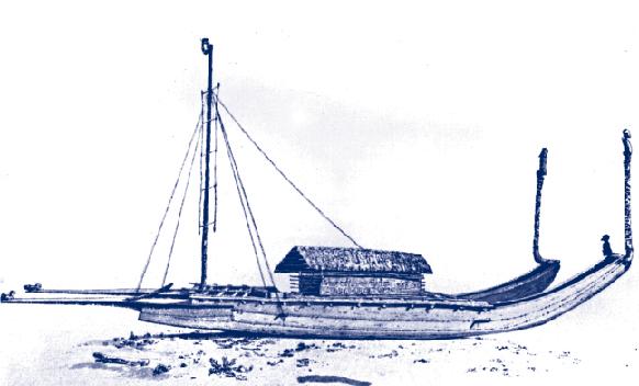
A tradition published in Teuira Henry’s Ancient Tahiti attributes the discovery of Hawai‘i to a voyaging hero named Tafa‘i (Hawaiian Kaha‘i), son of Hema and an underworld goddess named Hina-tahutahu (Hina, the magician). Tafa‘i “cut the sinews” of the islands of Tahiti (i.e., fixed them in their places), fished up the islands of the Tuamotu Archipelago and then “went exploring the trackless ocean northward.”
A Tahitian tipairua, recorded by John Webber, official artist on James Cook’s third voyage (1776-1780)
Maritime Museum of San Diego 36
Dennis Kawaharada was born in Agana, Guam, in 1951, to nisei parents Makita and Matsuko, who had come to Guam from Hawaiʻi that year for work. In 1953, the family moved back to Hawai‘i and settled in rural Kāneʻohe. Dennis holds a Ph.D. in English from the University of Washington, and has taught at the University of Hawai‘i, the University of Washington, UC Berkeley, City College of San Francisco and Kapi‘olani Community College. He has published extensively on Hawaiian and Japanese linguistic and cultural traditions. Dennis has documented various Hōkūleʻa voyages, and assisted with making these available to a broad audience through what is now known as the Hawaiian Voyaging Traditions website.
He found a chain of islands beneath the sea and fished it up, naming the first island “Aihi” (“Bit-in-fishing,” now called “Hawai‘i”). “Next he drew up Maui and all the other islands of our archipelago. Then those intrepid navigators went south and returned with people to dwell on the beautiful new land, bringing with them their gods, their chiefs, and breadfruit and other plants.” Later, Tafa‘i tried to pull the Hawaiian Islands south, closer to the Tahitian islands, but failed when the kapu forbidding the crew to speak or look back from the canoe was broken.
The connection between discovery and fishing is part of pan-Polynesian tradition of islands being fished out of the sea. A fisherman named Huku is said to have found Rakahanga island while on an aku fishing voyage from Rarotonga; later the three Maui brothers came to the same area and began fishing. Maui-mua caught a shark; Maui-roto an ulua; and Maui-muri the island of Manihiki.1 Maui is also said to have fished up, among other islands, Tonga, Mangaia in the Cook Islands, and Aotearoa (New Zealand).2
This traditional association between fishing and the discovery islands suggests that fishermen, of whatever identities, were perhaps the
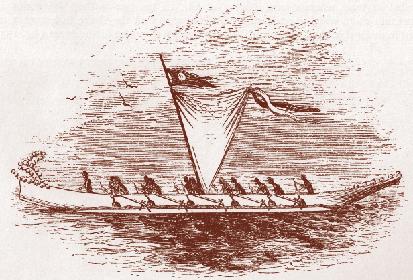
Above: Sketch of a Samoan ‘iatolima published by George Turner in his account Nineteen Years in Polynesia: Missionary Life, Travels, and Researces in the Islands of the Pacific (London: John Snow, 1861), p. 266.
Below: A Tongan outrigger recorded by Dutch navigator Abel Tasman in 1643.
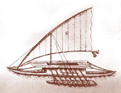
37
Traditional Pacific Voyaging
most frequent discoverers of islands in ancient times, either while they roamed the ocean looking for new fishing grounds or chasing schools of pelagic fish, or after they were driven off course by storms on their way to known fishing grounds. A poetic way of describing their discoveries would be to say that the fishermen caught islands, not fish. Perhaps the name of Maui was given to anyone who discovered an island, in honor of some ancestral fisherman-explorer noted for finding islands.
Another intriguing possibility is proposed in Geoffrey Irwin’s The Prehistoric Exploration and Colonization of the Pacific.3 Irwin suggests that those who settled Polynesia may have used a deliberate strategy of exploration that allowed them to find islands without an inordinate risk to their lives and with a high rate of survival. Other scholars have assumed that the exploration of the Pacific was full of danger and involved high casualties at sea. This deliberate strategy of exploration, according to Irwin, involved waiting for a reversal in wind direction and sailing in the direction that is normally upwind (i.e. eastward in the Pacific) for as far as it was safe to go given the supplies that were carried on the canoe. The return home (westward) would be made easy when the wind shifted back to its normal easterly direction. Irwin believes that this strategy is supported by the west to east settlement of the Pacific, from the islands of southeast Asia and Melanesia to Samoa, Tonga, the Cook Islands, the Society Islands, the Tuamotus, and Hiva (the Marquesas). Although no factual evidence would prove that this strategy of exploration was
actually employed by Polynesian navigators, the strategy would have been obvious to anyone familiar with sailing. The tradition of ‘imi fenua (Hawaiian: ‘imi honua), or “searching for lands,” reported from Hiva and other Polynesian islands, supports such a notion of deliberate exploration. Teuira Henry gives exploration and discovery as the motivation for the voyages of Ru and Hina, a brother and sister who circumnavigated the earth in their canoe Te-apori to locate islands: “After exploring the earth, Hina’s love of discovery did not cease. So one evening when the full moon was shining invitingly, being large and half visible at the horizon, she set off in her canoe to make it a visit.” She decided to stay there and remains today as the figure seen in the moon.4
Whatever the motives and methods of exploration and discovery, once the location of an island was known, it became open to settlement.
The Polynesian Settlement of the Pacific
The Polynesian migration to Hawai‘i was part of one of the most remarkable achievements of humanity: the discovery and settlement of the remote, widely scattered islands of the central Pacific. The migration began before the Common Era. While Europeans were sailing close to the coastlines of continents before developing navigational instruments that would allow them to venture onto the open ocean, voyagers from Fiji, Tonga, and Samoa began to settle islands in an ocean area of over ten million square miles. The settlement took a thousand years to complete and involved finding and fixing in mind the position of islands, sometimes less than a mile in diameter on
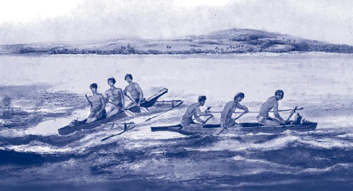 Canoes of the Friendly Islands (Tonga) by the artist John Webber, ca 1777. Courtesy of the National Library of Australia.
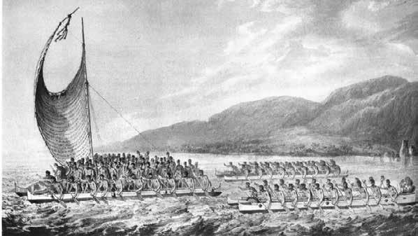
which the highest landmark was a coconut tree. By the time European explorers entered the Pacific Ocean in the sixteenth century almost all the habitable islands had been settled for hundreds of years.
The voyaging was all the more remarkable in that it was done in canoes built with tools of stone, bone, and coral. The canoes were navigated without instruments by expert seafarers who depended on their observations of the ocean and sky and traditional knowledge of the patterns of nature for clues to the direction and location of islands. The canoe hulls were dug out from tree trunks with adzes or made from planks sewn together with a cordage of coconut fiber twisted into strands and braided for strength. Cracks and seams were sealed with coconut fibers and sap from breadfruit or other trees. An outrigger was attached to a single hull for greater stability on the ocean; two hulls were lashed together with crossbeams and a deck added between the hulls to create double canoes capable of voyaging long distances.
The canoes were paddled when there was no wind and sailed when there was; the sails were woven from coconut or pandanus leaves. These vessels were seaworthy enough to make voyages of over 2,000 miles along the longest sea roads of Polynesia, such as the one between Hawai‘i and Tahiti. Although these
double-hulled canoes had less carrying capacity than the broad-beamed ships of the European explorers, the Polynesian canoes were faster: one of Captain Cook’s crew estimated a Tongan canoe could sail “three miles to our two.”
After a visit to the Society Islands in 1774, Andía y Varela described the canoes he saw:
It would give the most skillful [European] builder a shock to see craft having no more breadth of beam than three [arm] spans carrying a spread of sail so large as to befit one of ours with a beam of eight or ten spans, and which, though without means of lowering or furling the sail, make sport of the winds and waves during a gale, their safety depending wholly on two light poles a couple of varas or so long (about eight feet), which, being placed athwartships, the one forward and the other aft, are fitted to another spar of soft wood placed fore and aft wise in the manner of an outrigger. These canoes are as fine forward as the edge of a knife, so that they travel faster than the swiftest of our vessels; and they are marvelous, not only in this respect, but for their smartness in shifting from one tack to the other.”5
The voyaging was by no means easy. There was always a danger of swamping or capsizing in heavy seas, of having sails ripped apart or masts
Traditional Pacific Voyaging
39
Hawaiian canoes on Kealakeua Bay bearing gifts for James Cook. This scene was observed and recorded by the artist John Webber in 1779.
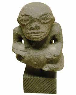
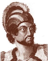
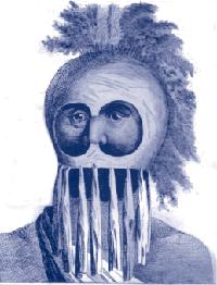
and booms broken by fierce winds, of smashing the hulls against unseen rocks or reefs; and while there were grass or leaf shelters on the decks of voyaging canoes, the voyagers were often exposed to the wind, rain, and sun, with only capes of leaves or barkcloth wrappings for protection. A stormy night at sea, even in the tropics, can be brutally chilling. If supplies ran short during a long voyage, and no fish or rainwater replenished them, then starvation became a possibility. As a tradition about a voyage from Hiva (the Marquesas) to Rarotonga puts it: “The voyage was so long; food and water ran out. One hundred of the paddlers died; forty men remained.” long voyage was not just a physical, but a mental challenge as well, particularly for a navigator without compass or chart. To navigate miles of open ocean required an extensive and intimate knowledge of the ocean and sky. Captain Cook noted that Polynesian navigators used the rising and setting points of celestial bodies for directions. Andía y Varela was told how Tahitians also used the winds and swells to hold a course:
There are many sailing-masters among the people, the term for whom is in their language fa‘atere (Hawaiian: ho‘okele). The fa‘atere are competent to make long voyages like that from Otahiti to Oriayatea [Ra‘iatea] (about 150 miles) and others farther afield. One of these sailing masters named Puhoro came to Lima on this occasion in the frigate; and from him and others I was able to find out the method by which they navigate on the high seas.
They have no mariner’s compass, but divide the horizon into sixteen parts, taking for the cardinal points those at which the sun rises and sets.
When setting out from port the helmsman partitions the horizon, counting from E, or the point where the sun rises; he knows the direction in which his destination bears. He observes, also, whether he has the wind aft, or on one or the other beam, or on the quarter, or is close-hauled. He notes, further, whether there is a following sea, a head sea, a beam sea, or if the sea is on the bow or the quarter. He proceeds out of port with a knowledge of these [conditions], heads his vessel according to his calculation, and aided by the signs the sea and wind afford him, does his best to keep steadily on his course.
The task becomes more difficult if the day is cloudy, because the sailing-master has no mark to count from for dividing the horizon. Should the night be cloudy as well, the sailing-master
Maritime Museum of San Diego 40
Left: Portrait of a man of the Sandwich Islands and his helmet. Artist John Webber, ca 1784. Formerly of the Kelton Collection
Right: Portrait of a man of the Sandwich Islands and his helmet. Artist John Webber, ca 1784. Formerly of the Kelton Collection
Tiki figure from the Marquesas. Formerly of the Kelton Collection
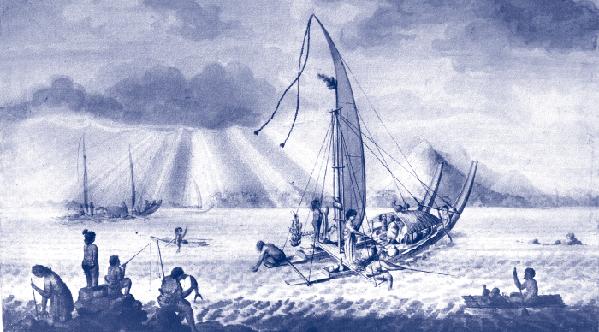
regulates his course by the wind and swells; and, since the wind is apt to vary in direction more than the swell does, he has his pennant, made of feathers and palmetto bark, by which to watch changes in the wind, and he trims his sails accordingly, always taking his cue for holding his course from the indications the sea affords. When the night is clear, he steers by the stars; and this is the easiest navigation for him because he knows the stars which rise and set over not only the islands he is familiar with, but also the harbors in the islands, so that he makes straight for the entrance by following the rhumb of the particular star that rises or sets over it. These sailing masters hit their destinations with as much precision as the most expert navigators of civilized nations could achieve.6
To keep track of their position at sea during long sea voyages, the navigators used a system of dead reckoning, memorizing the distance and direction traveled until the destination was reached. Finding islands before they could actually be seen was also part of the art of navigation. Voyagers followed the flight of land-dwelling birds that fished at sea as these birds flew from the direction of islands in the morning or returned in the evenings. The navigators also
watched for changes in swell patterns, cloud piled up over land, reflections on clouds from lagoons, and drifting land vegetation.
When European explorers found the islands of Polynesia, the common ancestry of the Polynesians was evident. The inhabitants of widely separated islands looked alike, spoke alike, and had similar cultural practices. Their manufactured products such as fishhooks, trolling lures, adzes, and ornaments also revealed similarities. And they had the same basic stock of domesticated plants and animals.
The peoples of Polynesia came from a common
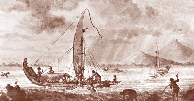
41 Traditional Pacific Voyaging
Top and Bottom: Double canoes of the Society Islands, depicted by Sydney Parkinson, artist on James Cook’s first Pacific voyage, 1768-1771
ancestral group that developed a distinctive fishing and farming culture in the islands of Tonga and Samoa.
While dates constantly change with new archaeological discoveries, the general sequence for the settlement of Polynesia has been relatively well established (Dates represent earliest archaeological finds; they almost certainly do not represent the earliest presence of human beings.):
Hunters and gatherers inhabited Australia and New Guinea by 50,000 years ago.
Around 1600-1200 BCE, a cultural complex called Lapita (identified by a distinctive pottery and named after a site in New Caledonia) spread from New Guinea in Melanesia as far east as Fiji, Samoa, and Tonga. Polynesian culture developed at the eastern edge of this region (i.e., in Samoa and Tonga).
Around 300 BCE or earlier, seafarers from Samoa and Tonga discovered and settled islands to the east: the Cook Islands, Tahiti-nui, Tuamotus, and Hiva (Marquesas Islands).
Around 300 CE or earlier, voyagers from central or eastern Polynesia, possibly from Hiva, discovered and settled Easter Island.
Around 400 CE or earlier, voyagers from the Cook Islands, Tahiti-nui, and /or Hiva settled Hawai‘i. Around 1000 CE or earlier, voyagers from the Society and/or the Cook Islands settled Aotearoa (New Zealand).
A Tahitian vaʻa motu in William Ellis Polynesian Researches, during a residence of nearly six years in the South sea Islands... (London: Fisher, Son, & Jackson, 1829).
The ethnobotanical evidence reflects this progression of settlement from the Western Pacific islands, through central Polynesia (the Cook Islands, Society Islands, and Hiva), and then to Hawai‘i. Of the seventy-two plants identified as having been transported to Polynesia by people, forty-one to forty-five are found in the Cook Islands, the Society Islands, and Hiva; twenty-nine are found in Hawai‘i, including taro, breadfruit, sugar cane, bamboo, ti, yam, banana, ‘awa, paper mulberry, kukui, coconut, gourd, sweet potato, and mountain apple. The settlers also brought the pig, dogs, chicken, and rats along with them. The transport of plants and domesticated animals on voyaging canoes suggests that the early settlers planned to colonize Hawai‘i, after having discovered its location.
The Settlement of Hawai‘i
Hawai‘i, which contains the largest islands in Polynesia outside of Aotearoa, must have appeared particularly rich in land and resources to its discoverers. The tradition of Hawai‘iloa records the event as follows: “[The voyagers] went ashore and found the land fertile and pleasant, filled with ‘awa, coconut trees, and so on, and Hawai‘iloa, the chief, gave that land his name. Here they dwelt a long time and when their canoe was filled with vegetable food and fish, they returned to their native country with the intention of returning to Hawai‘i-nei, which they preferred to their own country.”7 Other traditions suggest that ‘awa and coconut were brought by those who settle Hawai‘i.
Scholars believe that early settlers of Hawai‘i came predominantly from Hiva (Marquesas). The argument for a Hivan homeland is based in part
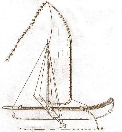
Maritime Museum of San Diego 42
on linguistic and biological evidence: “Indeed, the close relationship between the Hawaiian and Marquesan languages as well as between the physical populations constitutes strong and mutually corroborative evidence that the early Hawaiians came from the Marquesas” 8
The Marquesan language has been grouped under the category Proto Central Eastern Polynesian, along with Hawaiian, Tahitian, Tuamotuan, Rarotongan, and Maori. Vocabulary comparisons seem to indicate that the dialect of the Southern Marquesan Islands (Hiva Oa, Tahuata, Fatu Hiva), is the closest relative of Hawaiian language.9
Hawaiian / Southern Marquesan / Northern Marquesan / English
inoa / inoa / ikoa / name
mano / mano / mako / shark
moena / moena / moeka / mat
one / one / oke / hunger10
About 56% of basic words in the two languages are the same or similar. For example:
Hawaiian / Marquesan / English
mahina / mahina /moon, month
po / po / darkness
pu / pu / conch
kino / tino / body
kahuna / tuhuna / expert
imu / umu / oven
i‘a / ika / fish
lawai‘a / awaika / fisherman
wa‘a / vaka / canoe
hoe / hoe / paddle11
Hawaiian and Marquesan also share words that are not found in other Polynesians languages:
Hawaiian / Marquesan / English
elele / ke’e‘e / messenger makali / mata‘i / tie bait to hook (Haw.); string to tie bait to a hook (Marq.)
pa‘akai / pa‘atai / salt12
The two languages also share unique phonological changes from Proto Central Eastern Polynesian (the hypothetical original language). Elbert concludes that the linguistic evidence supports the hypothesis that the Hawaiian language derives from Marquesan.13
Another argument to support the proposition that the primary migration to Hawai‘i came from Hiva is that the islands of Hiva are the best departure point for sailing to Hawai‘i from the South Pacific. They are closer to Hawai‘i and farther east than the Society Islands, the Tuamotus, or the Cook Islands. A canoe heading north in the easterly tradewinds is better off starting from a point as far east of Hawai‘i as possible. In computer simulation of voyages from the Marquesas to Hawai‘i, over 80 percent of the canoes that headed in the right direction (NNW to NW by N) reached Hawai‘i.14
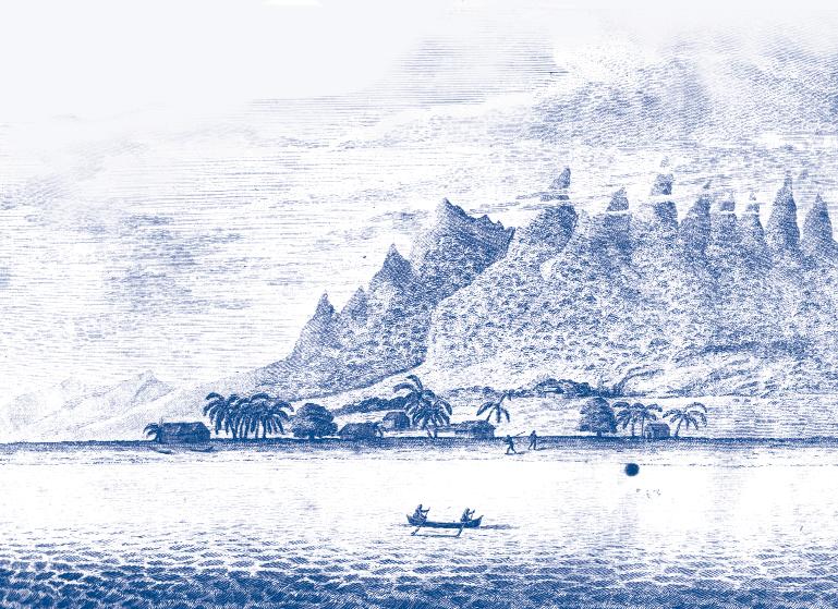
rchaeological evidence also connects early settlers of Hawai‘i with Hiva – adzes, fishhooks, and pendants found at an early settlement site at Ka Lae on the Big Island of Hawai‘i are similar to those found in Hiva. Of course, the archaeology of the Pacific is still in its infancy. As comparative work progresses in the Pacific, similarities are emerging among artifacts of all the Polynesian islands, suggesting that perhaps widespread contact and trading were more frequent than previously thought.
It is probably too simplistic to attribute the settlement of any island group to a single migration from another single island group. The voyages of the Polynesian Voyaging Society’s Hōkūleʻa and computer-simulated voyages have shown that Polynesians could have sailed in traditional canoes all the north-south and east-west routes among their islands. Kenneth Emory has noted that some words in the Hawaiian language (such as the names of some days in the lunar month) are shared uniquely with the Tahitian language, suggesting settlers to Hawai‘i came from Tahiti as well as the Marquesas.15 More archaeological evidence is needed from Hawai‘i, Hiva and other islands of Polynesia before any definitive statements can be made about the relationship among the island groups during the period of the early settlement of Hawai‘i.
his father Hema, who had sailed to Kahiki to get the apo’ula, or sacred red girdle, as a birth gift for Kaha‘i. Hema originally came to Hawai‘i from Kahiki.18
The voyages of the Polynesian Voyaging Society’s Hōkūleʻa and computer-simulated voyages have shown that Polynesians could have sailed in traditional canoes all the north-south and east-west routes among their islands.
2. Marriage: Hawai‘iloa voyaged from Hawai‘i to Tahiti to search for husbands or wives for his children. He brought back his brother Ki‘s first born son Tu-nui-ai-a-te-Atua as a husband for his daughter O’ahu. 19 Keanini (whose mother was from Hawai‘i) sailed from Kahiki to Hawai‘i to marry Ha‘inakolo; he and Ha‘inakolo returned to Kahiki. After they had a child called Leimakani, Ha‘inakolo and Leimakani returned to Hawai‘i. 20 Lu‘ukia went from Hawai‘i to Kahiki where she married ‘Olopana; Kaupe‘a, the daughter of ‘Olopana, went from Kahiki to Hawai‘i to marry Kauma‘ili‘ula (Lu‘ukia’s brother); Kaupe‘a returned to Kahiki to be with her parents and to give birth to a child, who later returned to Hawai‘i, becoming an ancestor of chiefs. 21
Two-Way Voyaging after Settlement
According to Hawaiian oral traditions collected in the 19th century, voyaging continued between Hawai‘i and the South Pacific after the original settlement of Hawai‘i. The motives given for voyaging are various:
1. Maintaining Family Connections: The earliest traveler mentioned in oral tradition is the goddess Papa, or Walinu’u; according to tradition she returned to Kahiki because her parents were from there; in Kahiki she became a young woman again; after her rejuvenation, she returned to Hawai‘i (Kamakau 92).16 Mo‘ikeha is said to have sent his son Kila to Tahiti to bring his grandson La‘amaikahiki to Hawai‘i.17 Kaha‘i-a-Hema is said to have gone to Kahiki to find
3. Family Quarrels and Unhappy Love Affairs: Pele, the volcano goddess, quarreled with her sister Namakaokaha‘i, a sea goddess, and left her homeland (the mystical land of Kuaihelani) to come to Hawai‘i (Emerson ix-xvi). Pa‘ao feuded with his brother Lonopele. After each killed the other’s son, Pa‘ao migrated to Hawai‘i.22 According to one tradition, ‘Olopana grew jealous of his brother Mo‘ikeha, so Mo‘ikeha left for Hawai‘i.23 Another version of the Mo‘ikeha tradition says he left Tahiti for Hawai‘i after being rejected by his brother’s wife Lu‘ukia.24
4. Burial in Homeland: La‘amaikahiki took Mo‘ikeha’s bones back to Tahiti for burial.25
5. Acquiring Mana from the Homeland: Pa‘ao, who brought the war god Kukailimoku to Hawai‘i, returned to Tahiti to bring back a chief of pure blood.26
6. Escaping Flood and Famine: Pupu-hulu-ana left Kaua‘i during a famine and searched for islands to the east (Kamakau 103). ‘Olopana left Waipi‘o for Kahiki after a flood brought on a famine (Kalakaua 115-135).
7. Maka‘ika‘i: Sightseeing and Adventure: Kaulu “traveled throughout Kahiki, saw all the kingdoms of the world” (Kamakau 92). Paumaukua “was a chief who traveled around Kahiki and brought back with him
Maritime Museum of San Diego 44
several foreigners” (Kamakau 95). Mo‘ikeha‘s grandson Kaha‘i-a-Ho‘okamali‘i went sightseeing to Tahiti and brought back with him a breadfruit tree from ‘Upolu (Taha‘a in the Society Islands) and planted it at Pu‘uloa, ‘Ewa district, O‘ahu.27
Similar motivations and motifs appear in the voyaging traditions of other Pacific islands. Another motivation for voyaging, not represented in this list, was to obtain materials or plants not available on one’s home island. The tradition of Aka describes a voyage from Hiva (Marquesas) to Rarotonga to obtain highly prized red feathers; the story of Pepe-iu describes a voyage made to bring the breadfruit plant from Hiva to Rarotonga.
The End of Voyaging
By the time
Europeans arrived in Hawai‘i in the eighteenth century, voyaging between Hawai‘i and the rest of Polynesia had ceased for more than 400 years, perhaps the last voyager being Pa‘ao or Mo‘ikeha in the fourteenth century. The reason for the cessation of voyaging is not known. However, after the fourteenth century, the archaeological evidence reveals a dramatic expansion of population and food production in Hawai‘i 28 Perhaps the resources and energies of the Hawaiian people went into developing their ‘aina; and ties with families and gods on the islands to the south weakened
of the Pacific. The motivation for the exploration was probably universal: the search for new lands for settlement and new resources for survival.
HBy the time Europeans arrived in Hawai‘i in the eighteenth century, voyaging between Hawai‘i and the rest of Polynesia had ceased for more than 400 years, perhaps the last voyager being Pa‘ao or Mo‘ikeha in the fourteenth century.
Voyaging and Human Survival
As Ben Finney suggests, the history of humanity is a history of migrations.29 Human beings originated in Africa perhaps 200,000 years ago, spread through Europe and Asia, walked across a once-existent land bridge (or paddled along the coastline) to the Americas, then traversed short sea distances to the once-unified land mass of New Guinea-Australia. The human movement into Polynesia was the final phase of the human settlement of the globe, into the most isolated, most difficult to reach habitable land. The particular genius and contribution of the Polynesians was the development of seafaring and navigation skills and canoe technology that enabled them to voyage back and forth across the long sea distances among islands
uman beings have been one of the most successful species on earth, adapting technology and culture for survival in new environments. Human population has flourished in many different places and times. The Polynesians, with their expertise in fishing and farming, were able to develop healthy, stable communities on islands with limited resources. Resource management and conservation were essential on such islands, since overexploitation could result in damage to or permanent loss of resources. Malama ‘aina, caring for the land, was a key value for survival. At their best, Polynesian societies found a balance between human needs and limited resources. Extended families, or ‘ohana, worked the land and sea; those near the coast supplied the products of the sea to those living inland, who in turn supplied land products. The division of labor and sharing is embodied in the tradition of two brothers and their wives, Ku‘ula-uka, a farmer of the uplands, and his wife Hina-ulu-‘ohia, a goddess of the forest; and Ku ‘ula-kai, a fisherman, and his wife Hina-puku-i‘a, who gathered products of the reef and seashore. As part of an ‘ohana, everyone worked together and received a share of the produce. Stinginess and hoarding were criticized, as was laziness, sponging, and gluttony. Hospitality to malihini (persons from outside of the community) was also a strong tradition.
Yet establishing such a stable community on one island did not eliminate the need for exploration and migration. There was always the possibility of finding and settling a better island with more resources and space. And no human society is stable and secure forever. Natural disasters occur: tsunamis, rising sea levels or sinking islands, typhoons and hurricanes, floods, and droughts could bring on famine. Even if no natural disaster occurred, population generally increases in favorable environments, and the maximum carrying capacity of islands were eventually reached.
45 Traditional Pacific Voyaging
Successful food production, unless combined with birth control, results in overcrowding. One solution to overcrowding was migration to marginal areas of the inhabited island, or to a new island. The tradition of Ru tells how this Ra‘iatean migrated to the uninhabited Aitutaki with a group of settlers because of over population on Ra‘iatea following a long period of peace and prosperity.30
Without the safety valve of migration, over population could lead to over exploitation of resources, environmental degradation, food shortages, and conflicts over the remaining resources.
Patrick C. McCoy argues that such was the case on Rapa Nui (Easter Island): “In sharp contrast to the first millennium of progressive development that produced Easter Island’s world-renowned statuary and megalithic architecture, the final 200 years of prehistory were a period of general decadence. Cultural instability is attested to in a wealth of traditions on tribal warfare, which is known to have resulted in famines, the emergence of cannibalism, and the widespread destruction of image ahu...Ecological and archaeological data suggest maninduced environmental change as an explanation for cultural decadence. The long-term cumulative effects of population growth on land and flora are identified with an irreversible process of environmental degradation.”31
Owere trapped on the island because now all the trees had died out and there were none left to build canoes to search for new islands, the conflicts described in oral traditions could have occurred.
Whether the limits on resources were due to population growth and overexploitation of resources or to natural disasters, the oral traditions of Polynesia describe competing chiefs – often two brothers or relatives – fighting over land and power, with the winner taking control of the land, and the loser being killed or forced to leave. The cousins Tangiia and Tutapu fought over the right to rule in Tahiti. Tutapu won and Tangiia left, eventually settling in Rarotonga. Tutapu, known as “the relentless one,” continued to pursue Tangiia, until they met again on Rarotonga, and Tangiia slew Tutapu (Te Ariki-Tara-are).
Without the safety valve of migration, over population could lead to over exploitation of resources, environmental degradation, food shortages, and conflicts over the remaining resources.
f course, McCoy’s conclusions, commonplace now in Euro-American Rapa Nui scholarship, are speculative. From the Polynesian point of view, why would the people have destroyed their own island or themselves, when it was against their traditional values to do so? The land and sea are their parents, which nurture and sustain their well-being and which in turn must be taken care of and protected. Another explanation of the devastation of Rapa Nui could be that some natural disaster – say a long drought – could have caused it. A small island does not have the same ability to recover from such a disaster as a large island or continent might. Once the ecology of the island had been disrupted by natural disaster – not by the activities of native people – the island could no longer sustain the population or activities that were once carried on. And if the people
The brothers Pa‘ao and Lonopele feuded over some stolen fruits in Ra‘iatea, and after each had killed the other’s son, Pa‘ao left his homeland to settle in Hawai‘i.
Today the world’s inhabitable lands have been claimed, and the boundaries of nations drawn. While technological advances continue to increase the carrying capacity of island earth and there is still room left for more people, environmental degradation is already apparent in the destruction of the rainforests, the erosion of farmlands, the overexploitation of ocean fisheries, industrial and agricultural pollution, the growing volume of toxic waste products and sewage, and the loss of biodiversity and human diversity. A monocultural human system for exploiting resources to increase individual profits has expanded over the globe. Individuals and groups still migrate, but if we look at the earth as an island in space (size is relative to the balance between resources and population), then people are just moving from one part of the island to another. There are no new islands to discover and inhabit on the planet. One could adopt the vision of Ben Finney in “One Species, or a Million?” – human beings could board spaceships (as Polynesian boarded canoes) and colonize the solar system.32 But the cost would be enormous, and perhaps our resources would be better spent learning how to conserve resources and control population growth within the limits of the island Earth.
Maritime Museum of San Diego 46
Endnotes
1 Tairi. “The Origin of the Island Manihiki”/ “Extracts from Dr. Wyatt Gills’s Papers, No. 29.” Journal of Polynesian Society, 24 (1915): 146-147.
2 Peter Buck, Vikings of the Sunrise (New York: Stokes, 1938), 53.
3 Geoffrey Irwin. The Prehistoric Exploration and Colonization of the Pacific. Cambridge, UK: Cambridge University Press, 1992.
4 Teuira Henry. Ancient Tahiti. Honolulu: Bishop Musuem Press, 1928.
5 The Journal of Don Jose de Andía y Varela while in command of the bark the Júpiter, in which are related the events of a voyage to the Island of Amat and others adjacent thereto under convoy of the frigate Aguila, commanded by Captain Don Domingo de Boenechea, 17741775 in The Quest and Occupation of Tahiti by Emissaries of Spain during the years 1772-1776, vol. II, translated and compiled by Bolton Glanvill Corney (London: The Hakluyt Society, 1915), 282
12 For a longer list of words, see Samuel H. Elbert’s “Lexical Diffusion in Polynesia and the MarquesanHawaiian Relationship,” Journal of the Polynesian Society 91 (no. 4, December 1982): 510-511.
13 See: Elbert “Lexical Diffusion, 511.
14 Geoffrey Irwin, The Prehistoric Exploration and Colonization of the Pacific (Cambridge, UK: Cambridge University Press, 1992), 164-166.
15 Kirch, Feathered Gods, 66.
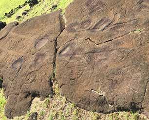
6 Journal of Don Jose de Andía y Varela, 284-6.
7 Abraham Fornander, Hawaiian antiquities and folklore. Bishop Museum Memoirs (Honolulu: Bishop Museum Press, 1916-1920), VI, 278
8 Patrick Vinton Kirch, Feathered Gods and Fishhooks: An Introduction to Hawaiian Archaeology and Prehistory (Honolulu: UH Press, 1987), 64
9 R.C. Green, “Linguistic Subgrouping within Polynesia: the implications for prehistoric settlement,” Journal of Polynesian Society 75 (1966): 6-38.
10 Samuel H. Elbert, “Lexical Diffusion in Polynesia and the Marquesan-Hawaiian Relationship,” Journal of the Polynesian Society 91 (no. 4, December 1982): 505
11 E.S. Craighill Handy, “Glossary of Marquesan Native Terms,” in The Native Culture in the Marquesas Honolulu: Bishop Museum, 1923.
16 Samuel Manaiakalani Kamakau, Tales and Traditions of the People of Old / Na Mo‘olelo a ka Po‘e Kahiko (Hnolulu: Bishop Museum, 1993), 92.
17 Fornander, Hawaiian antiquities, IV, 112-128.
18 David Kalakaua, The Legends and Myths of Hawaii (Rutland, Vermont: Tuttle, 1972), 94.
19 Fornander, Hawaiian antiquities, VI, 279.
20 Kamakau, Tales and Traditions, 103-4
21 Kamakau, Tales and Traditions, 102
22 Kamakau, Tales and Traditions, 3-5, 97-100.
23 Kalakaua, Tales and Traditions, 115-135
24 Fornander, Hawaiian antiquities, IV, 112-114
25 Fornander, Hawaiian antiquities, IV, 152-154.
26 Kamakau, Tales and Traditions 3-5, 97-100.
27 Kamakau, Tales and Traditions, 110.
28 Kirch, Feathered Gods, 303-306.
29 Ben Finney, “One Species, or a Million?” in From Sea to Space, The MacMillan Brown Lectures, 1989 (Palmerston North: Massey University, 1992).
30 Timi Koro and Drury Low, trans., “The Story of Ru’s Canoe and the Discovery and Settlement of Aitutaki; The Story of Te Erui Ariki; The Story of Ruatapu.” Journal of the Polynesian Society 43 (1934): 17-24
31 Patrick C. McCoy, “Easter Island Settlement Patterns in the Late Prehistoric and Protohistoric Periods,” Doctoral Dissertation, Washington State University, 1973, 159-160
32 Ben Finney, “One Species, or a Million?”
47
Pacific Voyaging
Traditional
A A canoe petroglyph, Papa Vaka on the northern coast of Rapa Nui (Easter Island) provides evidence of the craft used by the early inhabitants of the island.
Post-settlement Voyaging Networks of Yap and the Marshall Islands:
Examples of Ancestral Adaptive Capacity in Response to Environmental Changes and Disasters
Shania Tamagyongfal, Jerolynn Myazoe, Joseph Genz University of Hawaiʻi at Hilo
t the Opening Ceremony of the UN SecretaryGeneral’s Climate Summit in 2014 (and published in 2017), Marshallese poet Kathy Jetñil-Kijiner summoned the urgency of climate change into view, describing the unimaginable consequences of global warming for her home islands and for islands across Oceania facing rising sea levels. Of particular concern is the increased risk of extreme sea level events–created through a combination of storm-generated waves, storm surges, king tides, and El Niño-Southern Oscillation (ENSO)-induced sea level changes–that are conceived of as “a clear threat to communities’ existence” (Keener et al. 2018:1272). One possible adaptive pathway is resettlement; however, migration for many island communities is not viewed as a viable long-term solution due to the unquantifiable loss of place-attachment, cultural and social integrity and practice, and livelihood. Rejecting resettlement increases the necessity of developing adaptive pathways and community resilience by drawing from ancestral knowledge and practices.
“Mobilizing for Change”
“men say that one day that lagoon will devour you, they say it will gnaw at the shoreline, chew at the roots of your breadfruit trees gulp down rows of your seawalls and crunch your island’s shattered bones”
(from Dear Matafele Peinem by Kathy Jetñil-Kijiner 2017)
Voyaging in the Pacific may be among the most important regional reservoirs of expertise, flexibility, and perceived agency to “mobilize for change” (Wongbusarakum et al. 2021:104508) to address climate risks and meet the challenge of navigating towards a sustainable future that supports adaptation and resilience building through
increasing the economic, social, cultural, and spiritual well-being of islands and their communities. In particular, in June 2023 the Polynesian Voyaging Society launched Moananuiākea, a 4-year circumnavigation of the Pacific where crew members of the double-hulled voyaging canoes Hōkūle‘a and Hikianalia will aim to “ignite a movement of 10 million ‘planetary navigators’ by developing young leaders and engaging communities around the world to take part in navigating the earth towards a healthy, thriving future” (Polynesian Voyaging Society 2023). Intra- and inter-archipelago aid networks also play a crucial role in adaptive capacity with respect to local resource deficiencies and resilience in the face of past climatic and environmental risks and disasters (Campbell and Bedford 2022; Jacka and Posner 2022). In this paper we focus on two regions of the Pacific–the Marshall Islands and the Outer Islands of Yap in the Federated States of Micronesia (Figure 1)–to explore the adaptive capacity of post-settlement inter-island voyaging networks. Established and rapidly developing archaeological evidence and historical records of inter-island exchange networks from across the Pacific provide an understanding of the distribution of resources across vast expanses of ocean (Irwin et al. 2022; Molle et al. 2018; Sheppard 2022). Drawing from archaeological evidence, historical observations, and ethnographic studies, we draw attention to interaction spheres centered on Remathau1 (inhabitants of the Outer Islands of Yap) who voyaged as
Maritime Museum of San Diego 48
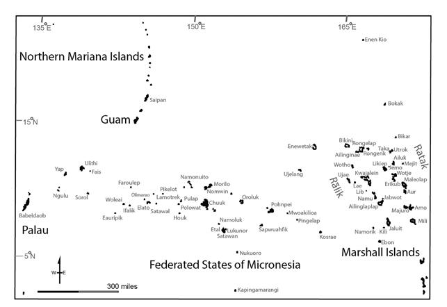
far east as the islands of Chuuk, south to Palau, and north to Saipan, and Marshallese voyaging networks within and between the Ratak and Rālik chains as well as resource extraction at distant Enen-kio (Wake Island) in the north to understand ancestral alliances for environmental change and disaster responsiveness, with the ultimate aim of working with communities to re-activate this Indigenous knowledge to confront the existential threat of climate change.
Adaptation during Settlement
In the wake of an imposed colonial view of the Pacific as isolated islands in an expansive, unforgiving ocean, Tongan anthropologist Epeli Huaʻofa (1994) profoundly re-envisioned Oceania as a “sea of islands” connected in the past and present by shared genealogies, kinship, and culture. Systems of seafaring established and maintained these connections. Pioneering mariners designed and built canoe hulls and outriggers, wove sail forms, observed the cosmos and local weather for strategies and seasonal timings of voyages, developed social hierarchies for division of labor, and developed navigational methods. The material manifestation of these integrated bodies of knowledge was
the voyaging canoe. The climate-induced lower sea levels of the Pleistocene that occurred between 40,000-60,000 years ago presented a different insular geography from today that afforded movement between closely-spaced, inter-visible islands, and some form of watercraft is implied by that initial settlement of Oceania (see Cassidy 2022 for a separate history of settlement of the Ryukyu Islands between 30,000-40,000 years ago and implications for early watercraft transport). With the rising seas of the Holocene, a much more recent series of migrations ensued that resulted in the exploration, discovery, and settlement of virtually every inhabitable island of the Pacific Ocean. While the earliest watercraft likely centered on dugout canoes that were paddled or poled in protected lagoons or on reef flats with calm and shallow water, the long-distance ocean voyages were accomplished with the development of the single outrigger sailing canoe and later with the advancement of the double-hulled voyaging canoe (Kirch 2017).
n archaeological history of settlement, taking into account linguistic reconstruction and historical relationships through genetic sequencing, indicates multiple migration routes during the Austronesian expansion that started about 3,500 years ago and resulted in the settlement of the Marshall Islands and Yap and its Outer
Traditional Pacific Voyaging
49
1
Figure 1. Map of the northwest Pacific, including the Marshall Islands and the Federated States of Micronesia
Islands—an area commonly referred to as Micronesia (Figure 2). One of the earliest Austronesian maritime cultures to be identified archaeologically is Lapita, characterized by a distinctive pottery with a decorative motif made by dentatestamping. Lapita mariners established multiple settlements in the Bismarck Archipelago of New Guinea as early as 3,500 years ago. The movement by Lapita seafarers expanded out of the Bismarck Archipelago, with one migration route moving to the eastern Solomon Islands and then northward, ultimately reaching the low-lying coral atolls of the Marshall Islands 2,000 years ago. The descendants of the Lapita mariners continued westward to reach Yap, but nonLapita ancestors also reached Yap from a western route in Palau as well as a northern route from the Bismarcks (Kirch 2017). Pre-settlement “seeding events” would have likely taken place in order for atolls to flourish and be colonized by early settlers (Kirch 2017:158). During the early Holocene, around 10,000 years ago, sea levels quickly increased (from 100 meters below present level) until sea levels stabilized at the modern position 2,000 years ago. The pre-colonization “seeding” events may have helped to prepare the newly emergent atolls for settlement (Rainbird 2004:95-96). A reconnaissance group could locate such an island with limited flora and fauna and prepare it for future occupation by seeding it with crops that require little maintenance once established, such as coconut, banana, and breadfruit.
Innovations in canoe technology in the region of the Marshall Islands and the Outer Islands of Yap led to the design of a canoe that was well suited for inter-and intra-lagoon travel— the lateen-rigged outrigger sailing canoe
toward the new “bow.” The shunting lateen-rigged canoe always retains the outrigger to the windward side of the vessel. The outrigger complex, with its outrigger float working as a toggle mechanism, provides roll stability by counteracting the force of the wind on the sail. Another innovation was the design of the V-shaped hull, which slices through the water rather than slowly riding over the waves as characteristic of more rounded hulls. The deep hull redirects the force of the wind on the sail, allowing the canoe to propagate in a forward direction (Figure 4). The hull is also asymmetrical from side to side, with a flattened lee side of the hull. Water flows past the more curved windward edge faster than the straighter leeward edge, inducing a hydrodynamic pull to windward. In effect, this minimizes the leeway drift induced by the lateral force of the wind that typifies most sailing vessels, and the outrigger float also realigns movement for a straight course. A lee platform also enables a large amount of cargo to be transported (Alessio and Kelen 2004).
Interaction Spheres
TThe inhabitants of the Marshall Islands and the Outer Islands of Yap–like other communities of Oceania–remained highly mobile after settlement, regularly circulating among islands and island groups for a variety of reasons. Ocean crossings were critical for access to seasonal resources on nearby and distant islands, the maintenance of long-distance trade networks, and supplying relief aid in the wake of typhoons. Innovations in canoe technology in the region of the Marshall Islands and the Outer Islands of Yap led to the design of a canoe that was well suited for inter-and intra-lagoon travel—the lateen-rigged outrigger sailing canoe (Figure 3). One of the most striking features of this new design was the development of a triangular shaped lateen sail that is shunted along the symmetrical long axis of the hull. When sailing, the triangular sail is suspended from a halyard from a mid-hull mast, which is canted downward toward the “bow” and the upper boom is stepped at the extreme end of the hull. In order to change directions, or shunt, when sailing upwind, the mast is repositioned in the center of the canoe, the upper boom is unstepped and moved to the other end of the hull, and the mast is canted downward
he various innovations in canoe design fostered the formation and maintenance of regional networks loosely designated as “native seas” by Pacific historian Damon Salesa (2018). The voyaging networks were historically meaningful and thus challenge and transcend Europeanimposed demarcations of Polynesia, Melanesia, and Micronesia. These regional sea routes are demonstrated through the movement of material items uncovered as archaeological artifacts, remembered in oral traditions, documented historically, encoded linguistically in place names and local seas, and mapped through navigational teaching devices (Figure 5). Understanding the complexity of meanings and motivations of the Yapese and Remathau interaction spheres and the Marshallese voyaging networks provides a glimpse into the adaptive capacity of these island communities in the historic era and remote past.
Yapese and Remathau interaction spheres
A number of named interaction spheres characterized Yap and the Outer Islands of Yap during the post-settlement period, ranging from intra-atoll, inter-island, and interarchipelago voyaging routes. These included the intra-atoll network of Woleai (chulifeimag), regional networks (hu and gau), and inter-archipelago voyaging exchanges between
Maritime
50
Museum of San Diego
Yap and Palau to the south (rai), between Yap and a continuum of islands extending eastward to Satawal (sawei), and northward between the Outer Islands of Yap and Saipan (metawal wool). In addition to differences in the geographic areas enveloped by the interaction spheres, the time depth of the voyaging routes also varied based on current archaeological and ethnohistoric evidence. And while some of the voyaging routes were based on reciprocal exchanges, others were structured to provide disaster recovery in response to environmental changes.
Some of the earliest archaeological evidence for long-distance communication between Yap and islands in other archipelagoes centers on the circulation of symbolic wealth, including rai (stone money disks) and gau (Spondylus shell), and these trading networks likely contributed to the establishment of the hierarchical sawei system (described below). Rai, large disks composed of carbonate rock, were quarried on Palau and then transported
to Yap in an exchange relationship with Palauan clans and villages. Although there is no data that provides conclusive dates for when the Yapese might have first visited the Rock Islands of Palau, the main period of megalithic construction and ocean transportation of rai was A.D. 500–1000. The quarrying flourished between A.D. 1000–1400, during which time Yapese performed labor and other services in return for the right to quarry Palau’s aragonite (Berg 1992:154). The sphere of communication between Yap and Palau is reinforced by historical linguistics. Despite Palau belonging to the Western Austronesian language and Yap belonging to Oceanic Austronesian, the presence of cognate terms attests to deep cultural exchange relationships (Nero 2011:128).
The gau shells were collected from Etal Atoll, Eauripik, and Udot Island in Chuuk Lagoon. These shell valuables were highly circulated, reaching the main island of Yap. Over time, the gau became devalued with the appreciation of rai (also referred to as fei) (Berg 1992:155). In addition, Yapese trading networks with Palau and Chuuk are suggested by the discovery of Yapese potsherds (Berg 1992:158). Taking the range of these distances into consideration, the networks
Traditional Pacific Voyaging
51
2
2
Figure 2. Map of Oceania (Winkel II projection), showing the likely canoe migration routes to the Marshall Islands and Yap (base map by Nathan Stephenson of the University of Hawaiʻi at Hilo’s Spatial Data Analysis and Visualization Lab).
of exchanging monetary valuables was important to political development, especially of chiefly hierarchies that contributed to the establishment of the sawei network and the vast Yapese political economy (Nero 2011:141).
ccording to ethnographic research conducted in the mid-twentieth century by William Lessa and William Alkire, Remathau engaged in three types of exchange networks: chulifeimag, hu, and sawei. The chulifeimag was an intra-atoll exchange system of the seven islands that were inhabited in the atoll of Woleai. Two groups of islands were separated by Woleai’s lagoon, but they were linked by the chulifeimag such that each island has its counterpart on the opposite side of the lagoon. With this particular intra-atoll system, individual districts were linked, allowing the system to serve “as a means to redistribute goods which are locally and periodically plentiful in a manner that reinforces solidarity between distant parts of the atoll” (Alkire 1978:119). Through the chulifeimag, the participating islands were able to maintain a stable relationship that worked together to ensure a sense of balance throughout the seasons.
Although there is no data that provides conclusive dates for when the Yapese might have first visited the Rock Islands of Palau, the main period of megalithic construction and ocean transportation of rai was A.D. 500–1000.
Another inter-island exchange system that had a similar principle to the chulifeimang was the hu, centered on Lamotrek, Elato, and Satawal. The term hu refers to a “fish hook,” and describes the close relationship between these three islands as reflected in their own exchange system (Alkire 1978:157). In this group of islands, Lamotrek had the higher status amongst its neighbors; the people of Elato and Satawal submitted (through their chiefs) semi-annual tribute to the paramount chief of Lamotrek (Alkire 1978:120). With the submission of the tribute payments, the two islands had the right to request assistance from Lamotrek in times of food scarcity and could freely exploit areas of key resources normally claimed by the chiefs of Lamotrek (Alkire 1978:120, 122). The hu linked these island communities during times of food shortages and ensured the continuation of the relationships within this exchange system.
The Yapese exchange system with the greatest extent was the sawei. At the height of its operation, the sawei linked all the atolls from Namonuito in the east to Ulithi and specific villages on Yap in the west (Alkire 1978:122). Within the sawei system, the ranking of each island group and its chiefs were outlined in their relative positions of the voyaging route; voyagers brought tribute westward from the eastern islands to ultimately reach the island of Yap. To emphasize the extent
of this network, the distance between the main island of Yap and Satawal, the last outer island to the east, covers roughly 600 miles. In addition, there are also outer islands of Chuuk that historically interacted closely with Satawal, which is approximately another 700 miles eastward (Lessa 1950:39). According to Alkire, the initial fleet of canoes carrying the tribute would begin from the islands in what is now the state of Chuuk–Namonuito, Pulap, Pulusuk, and Polowat–and sail to Satawal and Lamotrek, before heading to the district of Olimara on the islet of Wottogai on the atoll of Woleai, and then finally sailing to the island of Mogmog in Ulithi to meet with the highest ranking chief. Alkire noted that while the chief of Ulithi is the principal person in the Caroline Islands to interact directly with the paramount chief of Gachpar on Yap, there were two other high-ranking chiefs from Lamotrek and Wottagai island under the influence of the chief of Ulithi (Alkire 1978:123). With Ulithi’s high status in social ranking and key position in the sawei as the central point of the outer island’s relations to the main island of Yap, Ulithi not only served as a facilitator for the general sawei, but also for Ulithi’s own sawei and for Woleai’s own sawei with Yap (Lessa 1950:39–41). A common organizing principle was the dualistic “halving” and “balancing of oppositions” that allowed for reliable support during times of need (Alkire 1978:130). The idea with halving was to ensure balance in power dynamics and political affairs with most island districts being split into two. However, when there are more than two districts or sociopolitical entities, then the idea in balancing of oppositions would call for the solution to either give the middle district the power in its functionality to serve as a mediator or to establish a fourth district with paramount authority over the others. Thus, this helped to ensure the centralization of power and enabled the opportunity to extend the boundaries of those islands in maintaining contact as needed or desired.
There were a range of cultural meanings and values associated with sawei documented in the midtwentieth century. Lessa (1950) observed that the term sawei translated as “gift” and referred to a basket or the gifts of tribute carried in the basket. Those gifts of tribute were collected and gathered at each of the main islands in key positions of the sawei route until they reach Ulithi to complete the journey to Yap. The term sawei was also reflected in the gift-exchange relationships and reciprocal hospitality between the particular kinship groups of Ulithi and their corresponding family group in Gagil. This has been
Maritime Museum of San Diego 52
described as a like a parent-child relationship, where lineages can be traced through the sawei (Lessa 1950:32).
The sawei voyages involved the transportation of three types of tribute to Yap. Portions of the tribute were exchanged between the sawei ties of each island group at each of the major stops until Ulithi, where the rest of the tribute gifts were given to the Yapese chief of the village of Gachpar upon their arrival. The tribute ranged from pearl shells, turtle and coconut shell belts, lavalava, and banana fiber loincloths (Hunter-Anderson 1996:2). Other associated tribute items included sennit rope, pandanus sails, tobacco, canoes, coconut oil, pandanus mats, and machi, which was a sacred textile made by the women of Fais (Lessa 1950:42–43). After providing these tribute items, residents
53 Traditional Pacific Voyaging
Figure 3. Lateen-rigged outrigger sailing canoe of the Marshall Islands, Jitdam Kapeel (2015)
(Photograph by Joseph Genz)
Figure 4. Outrigger sailing canoe of Yap, Mathaumeram (2013)
3 4
(Photograph by Karen Tu, courtesy of Waa’gey)
from the other islands would then visit their specific sawei partners to receive their land tribute, as their relationship was defined by the “Yapese lineage heads who claimed ownership of the islands or districts from which the representatives came” (Alkire 1978:124). For the land tributes, these referred to the gifts the main island Yapese had to offer to their sawei which generally consisted of staple food crops such as taro and bananas, along with gifts of turmeric and bamboo. These goods later included imported items available on Yap but less common in the Outer Islands, such as steel knives, iron pots, mirrors, and cloth (HunterAnderson 1996:4). The idea of land tribute essentially symbolized the connections to the land of their sawei relationships, and gift offerings of goods produced from the land strengthened the relationship. The sawei lineages were also represented through ties to matrilineal and patrilineal lineages (Lessa 1950:29, 32).
The term sawei is also reflected in the gift-exchange relationships and reciprocal hospitality between the particular kinship groups of Ulithi and their corresponding family group in Gagil.
These sawei lineages were significant for the Remathau to have knowledge of, so when they would visit Yap, they knew where to stay in the village of Gachpar in the municipality of Gagil. The Ulithians would stay with their sawei lineage and be taken care of during their stay, but they did have social and food restrictions to abide by along with political and religious protocols to maintain their healthy relationships (Lessa 1950:43-46). Along with the protocols to be followed while staying in Yap, there were also the protocols of the sawei to be followed through its order in the outer islands. particular pattern of communication was invoked with the seasonal timing of activating the sawei . Because the hierarchy in chiefly ranking in each island group decreased farther east of Yap, the order to initiate the sawei was sent from the paramount chief of Gagil to the paramount chief of Ulithi, and then the message moved internally first through the Ulithian kinship groups from high to low ranking and then moved externally to the next island group and so on until the end of the rank line. Once the sawei order reached the end, the canoes returned in that ranking order with each of the island groups gathering their share of the tribute order to be collected. As they move through each group towards Yap, the number of canoes that were sent out from the main outer island groups of Ulithi, Woleai, and Satawal accumulated. Certain islands had a particular amount of canoes to join the growing sawei fleet. For example, Woleai and Ulithi would each send eight canoes with each canoe representing one of the main islands that makes up their island group. The rest of the remaining atolls and islands would each send one
canoe in their place, with the exception of Fais having a canoe and navigators from Ulithi come to gather them to join the fleet (Lessa 1950:42). Once everyone was gathered on Ulithi, a navigator from Ulithi would then lead the entire canoe fleet towards Gagil as he was the highest ranking navigator among the other navigators that voyaged their section of the sawei route. This status of ranking and a navigator’s authority represented the concept that “those likely to be the most knowledgeable of the route being traveled were the ones accorded the highest authority” (Hunter-Anderson 1996:38).
The reciprocity of the sawei for the residents of the outer islands included receiving critical resources and assistance in response to long-term environmental changes such as drought or acute disasters such as typhoons and other storm events (D’Arcy 2006:53). The Outer Islands of Yap are especially vulnerable to typhoons. Particularly damaging, typhoons can generate sustained wind speeds of at least seventy miles per hour and wave heights of up to thirty feet. Typhoon waves can inundate entire islets, disrupting the fresh water lens and suspending the vital topsoil. Having “joined together in a supra-island-level sociopolitical network that tended to minimize conflict and encourage cooperation and exchange,” the ranking system of chiefs and clans with respect to one’s lineages that was developed helped to enforce “definite channels of communication and decision making in island-level affairs to maintain peace” (Alkire 1978:116, 117). This was especially crucial when typhoons hit the area, particularly the regions of Lamotrek, Woleai, and Ifalik, as the established inter-island networks worked to “guarantee survival for the residents of the various islands during those times of stress” with the development of tribute payments and assistance in return (Alkire 1978:119).
Finally, another voyaging interaction sphere once connected the Remathau and Chamorro that worked to provide disaster relief not by sending canoes with supplies to the affected island, but rather by providing access to other islands. McCoy (1976:129) drew from historical accounts written in the early 1700s to identify a sailing route between the Outer Islands of Yap and the Marianas Islands, referred to as metawal wool. While the metawal wool route was discontinued for many generations, the sailing directions were remembered and passed on in such a way that the route was reactivated in the early 1800s in the wake of an environmental disaster–in response to the devastation wrought by a typhoon, several canoes from the Caroline Islands voyaged to Saipan (McCoy 1976:129).
Maritime Museum of San Diego 54
Figure 5. Interaction Spheres of Yap and the Outer Islands (left) and the Marshall Islands (right). The Remathau networks include sawei, gau, hu, metawal wool, and rai (not pictured due to the scale is the chulifeimag of Woleai). The Marshallese networks include interaction in the Ratak chain with specific areas of Ratak En (north) and Ratak Rak (south) and in the Rālik chain with specific areas of En in Meto (north) and Rak in Meto (south); also shown are the unnamed interaction spheres between Jaluit and Ebon, between Arno and Mili, centered on Utrok, and extending north to Enen-kio.
MARSHALLESE INTERACTION SPHERES
The clearest indication for extensive communication networks in the Marshall Islands is language. Linguistic homogeneity in the Marshall Islands extends farther than anywhere else in Oceania. Regular social interaction among the inhabitants of the atolls, which are generally separated by single overnight voyages of less than one hundred miles, helped to maintain mutual linguistic intelligibility, and slightly longer distances with lesser degrees of communication worked to forge regional dialects (Marck 1986; Rehg 1995). The eastern chain, from Mili in the south to Bokak in the north, is called Ratak or “sunrise,” and the western chain, from Ebon in the south to Bikini in the north, is named Rālik, or “sunset.” The islanders of the Ratak and Rālik chains speak with different dialects. Some dialect differences also occur within each chain such as Mejit in the far eastern quadrant of the Ratak chain, and beyond the main two chains, including distant Ujelang and Enewetak. According
to ethnographic research by Krämer and Nevermann (1938), the region of atolls and ocean north of Majuro within the eastern chain was called Ratak En (northern Ratak), and from Majuro southward was Ratak Rak (southern Ratak). Similarly, the region of atolls and corresponding sea north of Ailinglaplap in the Rãlikchain was En in Meto (northern ocean), and south of Ailinglaplap was termed Rak in Meto (southern ocean). An atoll located 600 miles to the north–Enen-kio2–has strong cultural and archaeological ties to the Marshallese, with voyages undertaken to obtain the shorttailed albatross, which was prized for its large diameter wing bone that produced a very straight chisel for tattooing (Spennemann 1993:50–63,70).
Weisler (2001) conducted excavations on Utrok, which lies at the most marginal edge of permanently inhabited atolls in the northern Ratak chain, to begin to characterize post-settlement voyaging networks. The Marshall Islands encounter an extreme rainfall gradient, running from about 900 millimeters of rain per
55
Pacific Voyaging
Traditional
5
year in the arid north to about 4,000 millimeters of rain in the wet south. In the dry north, Utrok is subject to long-term inter-annual variability of rainfall and drought, and distant, uninhabited Bikar is so dry that it cannot sustain coconuts. This, in combination with typhoon damage and seasonal inundation of salt water, led to environmental buffering mechanisms that alleviated the impact of variability in periodic food shortages, such as drawing from the freshwater lens for cultivation of giant swamp taro and the use of subterranean pits of storage of breadfruit paste. In historic times, the dry northern atolls exchanged finished goods and some food, such as pearl fishhook, woven pandanus mats, turmeric, and arrowroot, for food in the wet southern atolls, including breadfruit and various fruits (Finsch 1893). Weisler suggests that Utrok may have been linked in a voyaging network with surrounding atolls and islands (Taka, Ailuk, Mejit, Jemo, and Likiep) and perhaps an atoll even more distant in the Rālik chain (Kwajalein).
pandanus mats, and dried pandanus paste (Eisenhart 1888).
The islanders of the Ratak and Rālik chains speak with different dialects. Some dialect differences also occur within each chain such as Mejit in the far eastern quadrant of the Ratak chain, and beyond the main two chains, including distant Ujelang and Enewetak.
lthough not as culturally elaborated as the Yapese sawei, inter-atoll alliances provided some relief for environmental catastrophes such as typhoons in the Marshall Islands. Historic observations indicate, for example, that about 800 people of Ebon’s 1,300 inhabitants temporarily moved to Jaluit after massive damage sustained by a typhoon in 1857 (Spennemann 2005:44). One possible exchange within this Ebon-Jaluit alliance with this particular environmental disaster was land, with the chief of Ebon providing land allotments (Erdland 1914:99). In 1905, another typhoon struck the southern Ratak chain, and the residents of Mili moved to Arno while supplies of coconuts, pandanus, and breadfruit were sent from neighboring Arno and Majuro to Mili (Krämer and Nevermann 1938:30).
Central to these two instances of relief and likely common to broader alliances were the traditional commitments between chiefs and commoners. High-ranking chiefs maintained control of their island networks by collecting obligatory payments. Patterns of this redistribution of wealth come from the early contact period and early German colonial period. The German sailor Otto Eisenhardt became shipwrecked on Ailuk in 1871, for example, and wrote that the people of Ailuk voyaged once a year to an atoll 150 miles distant–possibly Aur to the south–and this was likely for providing annual tribute of arrowroot starch,
Patterns of inter-island movement can also be discerned through remembered and mapped navigational information. Navigational teaching devices commonly referred to as “stick charts” were first observed and collected by missionaries and ethnographers in the late nineteenth century. In one class of stick charts, navigators mapped the relative locations of atolls in relation to wave patterns in an intricate latticework of lashed splines of pandanus or midribs of palm fronds. The meddo (Figure 6) represents the ocean environment of a few atolls within one island chain, while the rebbelib (Figure 7) depicts most of an entire chain or both chains (Genz 2018; Schück 1902). German ethnographers based on Jaluit collected many of the stick charts from this time period, which likely skews attempts to discern archipelago-wide voyaging patterns. But of those collected, most provide the locations of atolls in the southern portion of the Rālik chain, the northern Rālik chain, or along the entire corridor of the Rālik chain (Spennemann 2005:35). In addition, sailing courses were also remembered through the observations of seamarks–particular features of the seascape that afforded navigational information–and various waves, seas, coral heads, and other environmental phenomena near specific islands inform about patterns of voyaging. Enewetakese navigators, for instance, recount the seamarks when sailing to Ujelang, Bikini, and distant Enen-kio (Carucci 1995:25). And a navigational chant remembered today among Rongelapese navigators chronicles navigational seamarks discovered by an ancestor as he had voyaged throughout and beyond the archipelago (Tobin 2002).
Decline and Revitalization
D’Arcy (2006) argues that the fragility of seafaring institutions, exacerbated during times of catastrophe, contributed to a decline of voyaging during the time period between 1770 and 1880 rather than a gradual erosion of seafaring ability in the wake of Western influence. D’Arcy (2006, 94–97) notes that historically throughout Oceania the sharing of navigation, astronomy, weather forecasting, and to a lesser extent that of canoe building was restricted and tightly controlled by particular chiefs. Island societies could draw from a wide pool of sailors to handle the canoes, but there were relatively few trained navigators,
Continued on page 61
Maritime
56
Museum of San Diego
Stars Align
Mark Albertazzi biography: With his family roots deeply entrenched on the Hawaiian island of Molokai, Mark’s take on the world is informed by the sea. He’s as comfortable at the helm of a 70’ schooner as he is dropping anchor at a remote surf break. Over more than thirty years as an advertising Creative Director, he crafted campaigns for BMW North America, Callaway Golf, and Sony. Mark is a contributing photographer and writer for boating publications, covers major regattas, and creates content for nautical brands and travel destinations. His photographs have been showcased in the Maritime Museum of San Diego’s exhibit, “Wind & Water”.
On November 11 and 12, 2023 Star of India sailed for the first time since 2018. She was joined by another “star” - Hōkūle‘a - a name that translates from Hawaiian as “Star of Gladness”. Euterpe – the vessel we know today as Star of India – was built in 1863 by an island people, the shipbuilders of Ramsey on the Isle of Man. She is not only the oldest active merchant vessel in world. She also represents the aspirations of generations of enthusiasts who saw in her the opportunity to restore a decaying ship, but through her, to revitalize traditions of shipbuilding and sailing that were nearing extinction. She represents, then, far more than iron, canvas and lumber. She is the embodiment of stories and
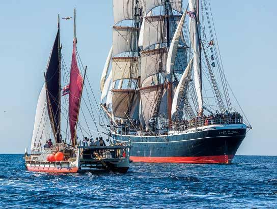
57 Traditional Pacific Voyaging
Stars Align
traditions that linked once distant peoples and lands. When she sails, memory lives.
Hōkūle‘a , built in 1973, also represents the hopes and aspirations of an island and its people –Hawai ‘i. At a time when Polynesian sailing traditions and memory were on the verge of extinction, the inspiration of a few key individuals – a number of whom are authors in this edition of Mains’l Haul –s ucceeded in not only reconstructing a traditional double-hulled deep-sea voyaging canoe, but also in revitalizing the sailing traditions Hōkūle‘a would come to embody. The memory of ancestral voyages, conveyed from generation to generation through song and story, were now given new life through the efforts of the Polynesian Voyaging Society. Today when Hōkūle‘a sails, memory lives.
Hōkūle‘a ’s visit to San Diego in 2023 is part of a multi-year Pacific voyage. This is Moananuiākea – “a voyage for the earth”. As described by its organizers, Moananuiākea is a conscious deepening of community values and a movement “...from exploration and understanding to mālama , or caring, and kuleana , or taking responsibility. With those values, we must move discovery toward choices and actions that we believe will help build a future good enough for our children. This is our most difficult voyage yet because the destination is not ours. It will be the most difficult island yet to find, because it is the future of island earth.” For more information visit: https://hokulea. com/moananuiakea/
This photo essay records the meeting of these two sailing vessels, so different in design, and yet in many respects both representative of the desire to save, preserve and educate. Our special thanks to Hawaiian photographer Mark Albertazzi for sharing these images with us. To find out more about Mark’s photography, visit: https://www.markalbertazzi.com/
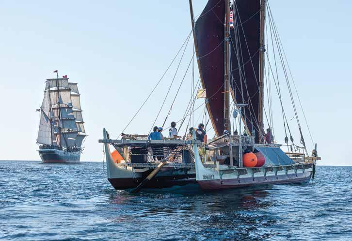
58
Maritime
Museum of San Diego
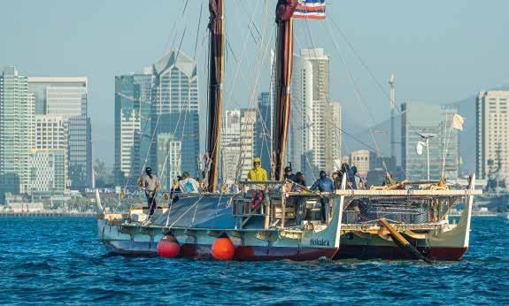
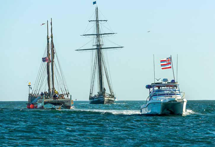
59
Traditional Pacific Voyaging
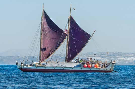
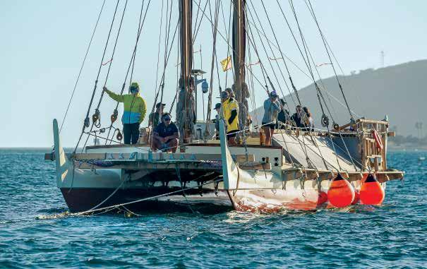
Post-settlement
Voyaging
Networks of Yap and the Marshall Islands: Examples of Ancestral Adaptive Capacity in Response to Environmental Changes and Disasters
Continued from page 56
Figure 6. A meddo, constructed by Isocker Anwell (2016), based on a diagram by Schück (1902, Figure 31) of a stick chart collected by Gulick and acquired by the Bernice Pauahi Bishop Museum in Honolulu, depicting the southern region of the western Rālik chain of the Marshall Islands. Figure 7. A rebbelib, constructed by Isocker Anwell (2016), based on a diagram by Krämer and Nevermann (1938, Figure 66) of a stick chart acquired in 1910 by the Museum für Völkerkunde in Hamburg, Germany, depicting both the Ratak and Rālik chains of the Marshall Islands. Photographs by Joseph Genz.
astronomers, weather forecasters, and canoe builders, partly as a result of the chiefly authority and control of the specialized knowledge systems. Natural disasters coupled with introduced Western epidemics could very quickly annihilate a community’s seafaring expertise. Oral traditions recorded by ethnographers such as Alkire and Lessa indicate that the sawei exchange system had thrived prior to the early twentieth century. Over time there was less participation with the Outer Islands of Yap, the ceremonies to confer the title of navigators (pwo) declined, and less tribute materials were circulated. Documented oral histories do not indicate any memories of voyaging during the first half of the twentieth century (Flood 2002:48). One of the reasons for the decline was the prohibition of voyaging under the Japanese colonial administration. Another factor was the rapid conversion to Christianity and the disconnection to the sacredness of the pwo ceremonies, a critical sacred rite to pass on the more esoteric-related aspects of traditional navigation (Metzgar 2006:297). In the Marshall Islands, the US government’s testing of atomic and thermonuclear bombs on Bikini and Enewetak between 1946 and 1958 essentially stopped the formal teaching of navigation that had been taking place on Rongelap, where the residents suffered from radioactive fallout, contamination of terrestrial and marine resources, and forced relocation (Barker 2013; Genz 2018).
Voyaging has persisted and even experienced a resurgence in the mid-twentieth century in certain island groups across the region. Metzgar (2006:295) attributes this to a combination of relative geographic isolation, economic necessity, cultural identity, and regional competition. Due to the infrequent inter-island government transportation between newly formed districts of the Trust Territory of the Pacific Islands after World War II, for instance, the residents of Satawal and Polowat relied on canoes to maintain connections. Flood (2002) describes recent metawal wool voyages, such as from Polowat to Guam and from Satawal to Saipan in the 1980s, and a flotilla of six canoes that voyaged from Polowat and Satawal to Saipan in 2000. This metawal wool voyage relied on an alliance of organizations that encouraged the continued practice of navigation–the Saipan Arts Council in sponsorship of the Northern Marianas Canoe Federation and the Traditional Seafaring Society, composed of University of Guam students (Metzgar 2006:296). In the Marshall Islands a recent voyage in 2015 between Majuro and Aur was supported by the non-profit Waan Aelon in Majol (Canoes of the Marshall Islands) (Genz 2018). With growing interest and pride, local efforts are reflected in establishing cultural and educational spaces for the teachings of navigation and practices of voyaging.
Traditional Pacific Voyaging
61
6 7
Emerging efforts at Waan Aelon in Majol and other canoe organizations like Waaʻgey on Yap are exploring how these forms of traditional knowledge can be used to confront what they perceive as the existential threat of rising seas and other impacts of climate change.
Conclusion
There is an increasing recognition that some solutions to climate change may reside with Indigenous peoples through their lived experiences and ancestral memories of developing resilience strategies to cope with environmental hazards historically (Granderson 2017). The ability to “mobilize for change” solidly rests on the voyaging and navigation systems (Wongbusarakum et al. 2021:104508). Specifically, there is a growing movement in the Pacific to transition to low carbon shipping including both innovative technologies that rest on the transfer of technology to the Pacific Islands (Nuttall et al. 2016) and a return to the use of traditional canoes as an Indigenous response for climate change adaptation (Nuttall 2012). Increasing the number of voyaging canoes that harness the power of the wind for intra-atoll and inter-island transport means lessening dependence on fossil fuels, and this would reduce socioeconomic vulnerability to external rises in oil prices and lower carbon emissions (Nuttall 2013). Research on historic-era voyaging canoes (drua) from the Lau islands of Fiji indicates sailing vessels of 100 feet in length with great load-carrying capacity (such as transporting over 200 passengers) at high speeds of around 15 knots (Nuttall et al. 2014), and current research affiliated with the Micronesian Center for Sustainable Transport is assessing what percentage of cargo capacity could be absorbed with traditional voyaging canoes (see Newell and Bola 2015 for a case study of sea transport in a coastal village on Kadavu, Fiji). With potential periodic global breakdowns in transport of fuel due to pandemics, political instability, and necessary phasing out of fossil fuels, restoring expertise from traditional voyaging is necessary for developing sustainable ocean transport policy. But, systems of seafaring offer more than wind-powered transportation–voyaging knowledge enables the reactivation of older inter-island networks based on kinship and customary forms of resource management.
Due to the infrequent inter-island government transportation between newly formed districts of the Trust Territory of the Pacific Islands after World War II, for instance, the residents of Satawal and Polowat relied on canoes to maintain connections.
long-term environmental changes (e.g., drought) and damages wrought by acute disasters (e.g., typhoons). Woven into the structure of the intra-atoll chulifeimag of Woleai was the redistribution of goods to reinforce solidarity. The hu relationships among Lamotrek, Elato, and Satawal are more formalized with the offering of tribute with the expectation of receiving relief supplies from nearby kin groups. The long-distance tributary relationship of the sawei, centered on Yap and reaching Namonuito, worked at a regional scale through hierarchies and chiefly administrative control and power. Another response to disasters, representative of the metawal wool between the Outer Islands of Yap and Saipan, was to relocate. In the Marshall Islands, specific instances of interisland voyages in the early historic era echo the named interaction spheres of Yap. Temporary relocation and sending of relief supply after typhoons were coordinated by chiefs between such groups as Ebon and Jaluit in the southern Rālik chain and between Mili and Arno in the southern Ratak chain. In addition, voyaging regularly took place within, and to a lesser extent between, the two island chains, including the voyaging exchange system that sustained Utrok in the dry north of the Ratak chain. Finally, other voyaging networks centered on research extraction, such as the Yapese collection of gau (Spondylus shell), and the Marshallese obtaining short-tailed albatross wing bones.
In this paper we have drawn from archaeological, historic, and ethnographic evidence to sketch some of the post-settlement voyaging interaction spheres in the regions of the Outer Islands of Yap and the Marshall Islands, especially those that were once activated to send relief supplies after
Underlying these systems of mobilizing collective responses in times of uncertainty were the social dynamics that had been established and maintained through cultural expressions of reciprocity tied to responsibilities and commitments within chiefly hierarchies. The archival sources provide key insights into the social dynamics, but what is needed to enhance this understanding are lived and remembered experiences of surviving navigation practitioners. It is the traditional forms of community engagement–especially those practiced within living memory–that have the potential to be re-activated today. In other parts of the Pacific, regional aid networks have leveraged land, food and other resources to support reconstruction of affected communities after volcanic eruptions (Niroa and Nakamura 2022; Pfalzgraf 2021) and other disasters (Jacka and Posner 2022). Similarly, the adaptive capacity of ancient and historic interaction voyaging spheres may not only impact the ability of communities to implement sustainable sea transport with traditional canoe technology, but the re-activation of these intra- and interarchipelago aid networks may provide a critical edge in Pacific Islanders’ resiliency in the face of climate change.
Maritime
of
62
Museum
San Diego
Notes
1. The term Micronesia is conventionally used to identify this region of Oceania. Recognizing that this colonial construct does not reflect the migrations, histories, and cultures of diverse speech communities (Hanlon 2009), and acknowledging the potentially racializing impact of the continued use of the term, we employ more locally meaningful terms in this paper. Much of what is now the Federated States of Micronesia was referred to as the Caroline Islands, but self-identification today is reflected in local terminology. The term Remathau and various cognates translates as “people of the ocean” in the languages of the Outer Islands of the state of Yap in the Federated States of Micronesia. These Outer Islands include Ulithi, Woleai, Satawal, Ngulu, Lamotrek, Ifalik, Faraulep, Fais, Elato, and Eauripik. In this paper we refer to these islands as the Outer Islands of Yap, and their inhabitants as Remathau.
2. Enen-kio is connected culturally and through archaeological evidence to the Marshall Islands. Enen-kio, also known as Wake Island, is currently a territory of the United States managed by the U.S. Air Force
Acknowledgements
Funding to support this project comes from the U.S. Geological Survey Pacific Islands Climate Adaptation Science Center under Cooperative Agreement #G22AC00349, and from the National Science Foundation (NSF), Louis Stokes Alliances for Minority Participations (LSAMP), Award #1826864. The authors would like to thank Larry Raigetal, Alson Kelen, and Alex Mawyer for their reviews of the manuscript.
References
Alessio, Dennis, and Alson Kelen. 2004. Waan Aelōn̄̄ in Majōl: Canoes of the Marshall Islands. In Life in the Republic of the Marshall Islands, edited by Anono L. Loeak, Veronica C. Kiluwe and Linda Crowl, pp. 192–225. Majuro and Suva: Institute of Pacific Studies.
Alkire, William H. 1978. Coral Islanders. Arlington Heights, Illinois: AHM Publishing.
Barker, Holly M. 2013. Bravo for the Marshallese: Regaining Control in a Post-Nuclear, Post-Colonial World. Second Edition. Case Studies on Contemporary Social Issues. Belmont, California: Thomson Wadsworth (Original: 2004).
Berg, M.L. 1992. Yapese Politics, Yapese Money, and the Sawei Tribute Network Before World War I. The Journal of Pacific History 27(2):150–164.
Campbell, John R. and Bedford, Richard D. 2022. Climate Change and Migration: Lessons from Oceania. In Routledge Handbook of Immigration and Refugee Studies, edited by Anna Triandafyllidou. London: Routledge.
Carucci, Laurence M. 1995. Symbolic Imagery of Enewetak Sailing Canoes. In Seafaring in the Contemporary Pacific Islands: Studies in Continuity and Change, edited by Richard Feinberg, pp. 16–33. DeKalb: Northern Illinois University Press.
Cassidy, Jim. 2022. The Peopling of Northeast Asia’s Maritime Region and Implications of Early Watercraft Transport. In Maritime Prehistory of Northeast Asia, edited by Jim Cassidy, Irina Ponkratova and Ben Fitzhugh, pp. 1–28. Singapore: Springer Press.
D’Arcy, Paul. 2006. The People of the Sea: Environment, Identity, and History in Oceania. Honolulu: University of Hawai`i Press. Eisenhart, Otto. 1888. Acht Monate unter den Eingeborenen auf Ailu (Marshall-Gruppe). Aus allen Welttheilen 19:207–208, 223–226, 250–252.
Erdland, August P. 1914. Die Marshallinsulaner: Leben und Sitte, Sinn und Religion eines Südsee-Volkes. Anthropos Ethnologische Bibliothek 2. Münster: Aschendorffsche Verlagsbuchhandlung.
Finsch, Otto. 1893. Ethnographische Erfahrungen und Belegstücke aus der Südsee. Annalen des K. & K. Naturhistorischen Hofmuseums 8 (2):375-438. Vienna: K. & K. Naturhistoriches Hofmuseum.
Flood, William. 2002. Carolinian-Marianas Voyaging: Continuing the Tradition. Micronesian Journal of the Humanities and Social Sciences 1(1-2):48–56.
Genz, Joseph H. 2018. Breaking the Shell: Voyaging from Nuclear Refugees to People of the Sea in the Marshall Islands. Honolulu: University of Hawai`i Press. Granderson, Ainka A. 2017. The Role of Traditional Knowledge in Building Adaptive Capacity for Climate Change: Perspectives from Vanuatu. Weather, Climate, and Society 9(3):545–561.
Hanlon, David.2009. The ‘Sea of Little Islands’: Examining Micronesia’s Place in ‘Our Sea of Islands’. The Contemporary Pacific 21(1):91–110.
Hauʻofa, Epeli. 1994. Our Sea of Islands. The Contemporary Pacific 6(1):148–161.
Hunter-Anderson, Rosalind L., and Yigal (Go’opsan) Zan. 1996. Demystifying the Sawei, A Traditional Interisland Exchange System. ISLA: A Journal of Micronesian Studies 4(1):1–45.
Irwin, G., Flay, R.G., Dudley, L. and Johns, D. 2022. The Sailing Performance of Ancient Polynesian Canoes and the Early Settlement of East Polynesia. Archaeology in Oceania (0):1–17.
Jacka, J.K. and Posner, S. 2022. How the Enga Cope with Frost in the 21st Century: Food Insecurity, Migration, and Development in the Papua New Guinea Highlands. Human Ecology 50(2):273–286. Jetñil-Kijiner, Kathy. 2017. Iep Jaltok: Poems from a Marshallese Daughter. Tucson: University of Arizona Press.
Keener, V.W., Helweg, D.A., Asam, S., Balwani, S., Burkett, M., Fletcher, C., Giambelluca, T., Grecni, Z., Nobrega-Olivera, M., Polovina, J., Tribble, G. 2018.
Ch. 27: Hawai`i and U.S. Affiliated Pacific Islands: The Fourth National Climate Assessment. U.S. Global Change Research Program, Washington, DC.
Kirch, Patrick V. 2017. On the Road of the Winds: An Archaeological History of the Pacific Islands Before European Contact. Second Edition. Berkeley: University of California Press.
Krämer, Augustin, and Hans Nevermann. 1938. Ralik-Ratak (Marshall-Inseln). In Ergebnisse der SüdseeExpedition, 1908–1910 II. Ethnographie, B: Mikronesien, Volume 11, edited by Georg Thilenius, pp. 215–232. Hamburg: Friedrichsen, de Gruyter & Co.
Lessa, William A. 1950. Ulithi and the Outer Native World. American Anthropologist 52(1):27–52.
Marck, Jeffrey C. 1986. Micronesian Dialects and the Overnight Voyage. Journal of the Polynesian Society 95:253–258.
McCoy, Michael. 1976. A Renaissance in CarolinianMarianas Voyaging. Polynesian Society Memoir No. 39, Wellington, NZ.
Metzgar, Eric. 2006. Carolinian Voyaging in the New Millennium. Micronesian Journal of the Humanities and Social Sciences 5(1/2):293–305.
Molle, G. and A. Hermann. 2018. Pitcairn Before the Mutineers: Revisiting the Isolation of a Polynesian Island. In The Bounty from the beach: Cross-cultural and Cross-disciplinary Essays, edited by S. Largeaud-Ortega, pp. 67–94. Canberra: ANU Press.
Nero, Karen L. 2011. Paths to Knowledge: Connecting Experts in Oral Histories and Archaeology. In Pacific Island Heritage: Archaeology, Identity & Community, edited by Jolie Liston et al., vol. 35, pp. 127–154. Canberra: Australian National University Press.
Newell, Alison P. and Amelia R.T. Bola. 2015. The Solodamu Surveys: Determining Fossil Fuel Use and Sea Transport Need in a Coastal Village in Fiji. Frontiers in Marine Science 2:1–11
Niroa, J.J., and N. Nakamura. 2022. Volcanic Disaster Risk Reduction in Indigenous Communities on Tanna Island, Vanuatu. International Journal of Disaster Risk Reduction 74:1–10.
Nuttal, Peter. 2013. Sailing for Sustainability: The Potential of Sail Technology as an Adaptation Tool for Oceania. PhD Thesis, Victoria University of Wellington.
Nuttal, Peter. 2012. Steering a Canoe For the Future with Sticks, Stones, Grass and a Little Sharkskin: The Case for Revitalization of Sail Technology and Sailing Culture as a Practical Sea-transport Response to Climate Change and Fossil Fuel Dependence/supply Issues in Fiji. Journal of Pacific Studies 32:163–175.
Nuttall, Peter, Paul D’Arcy, and Colin Philp. 2014. Waqa Tabu–Sacred Ships: The Fijian drua The International Journal of Maritime History 26(3):427–450.
Nuttal, P., Vahs, M., Morshead, J., and Newell, A. 2016. The Case for Field Trialing and Technology/knowledge Transfer of Emerging Low Carbon Maritime Technologies to Pacific Island Countries. In Renewable Energy: Sources, Applications and Emerging Technologies, edited by V. Burton. New York: Nova Science Publishers.
Pfalzgraf, Foley C. 2021. Maintaining Land and Life in Vanuatu: Indigenous Alter-Natives of Recovery Following the Manaro Eruption on Ambae, Vanuatu. The Journal of Environmental Media 2(1):5.1–5.13.
Polynesian Voyaging Society. 2023. Moananuiākea: A Voyage for Earth. Electronic Resource, https://www.hokulea.com/ pvs-to-launch-moananuiakea-voyage/, accessed April 1, 2023.
Rainbird, Paul. 2004. The Archaeology of Micronesia Cambridge, UK: University of Cambridge.
Rehg, K. 1995. The Significance of Linguistic Interaction Spheres in Reconstructing Micronesian Prehistory. Oceanic Linguistics 34(2):305–326.
Salesa, Damon. 2018. Native Seas and Native Seaways: The Pacific Ocean and New Zealand. In New Zealand and the Sea: Historical Perspectives, edited by Frances Steel, pp. 24–41. Wellington, New Zealand: Bridge Williams Books
Schück, Albert. 1902. Die Stabkarten der Marshall-Insulaner Hamburg: Kommissionsverlag von H.O. Persiehl.
Sheppard, P.J. 2022. Southeast Solomon Islands in Regional Perspective: Settlement History, Interaction Spheres, Polynesian Outliers and Eastward Dispersals. The Journal of the Polynesian Society 131(2):113–184.
Spennemann, Dirk H. R.1993. Ennannin Etto: A Collection of Essays of the Marshallese Past. Marshall Islands Culture and History. Series F: Technical Studies and Miscellaneous. Vol 1. Majuro: Historic Preservation Office.
Tobin, Jack A. 2002. Stories from the Marshall Islands: Bwebwenato Jān Aelōn̄ Kein. Honolulu: University of Hawaiʻi Press.
Weisler, Marshall I. 2001. On the Margins of Sustainability: Prehistoric Settlement of Utrok Atoll, Northern Marshall Islands. Oxford: Archaeopress.
Wongbusarakum, S., M. Gorstein, R. Pomeroy, C.L. Anderson, and A. Mawyer. 2021. Mobilizing for Change: Assessing Social Adaptive Capacity in Micronesian Fishing Communities. Marine Policy 129(1):104508.
63
Traditional Pacific Voyaging
RevivingVoyagingHawaiian
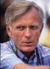
Ben Finney (1933-2017), professor emeritus of the University of Hawai’i, anthropologist, author, and one of the founders of the Polynesian Voyaging Society. As a youth in San Diego, the author read Thor Heyerdahl’s Kon Tiki. Like most scholars he rejects Heyerdahl’s notion that Polynesia was settled by voyagers drifting from South America, but he found the adventure of making modern-day “research” voyages appealing.
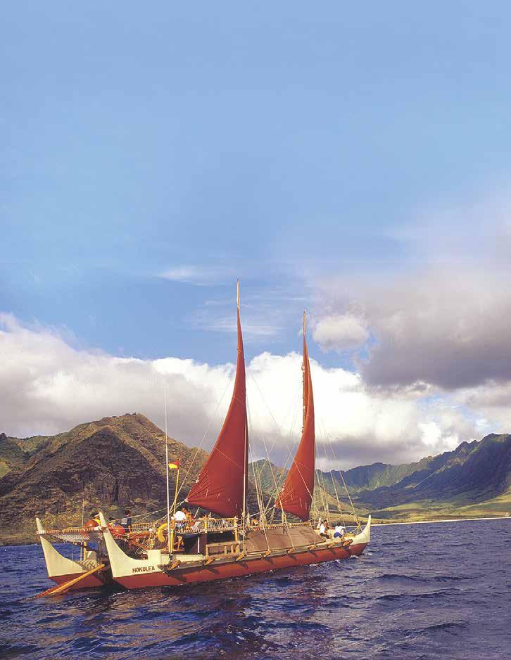 By Ben Finney
lthough Hawaiians had given up long distance voyaging by the time Captain Cook arrived in 1778, they were still sailing outrigger and double canoes around and between the islands of this most isolated of Polynesian archipelagoes. By the time of the American takeover
in 1898, however, inter-island sailing was a thing of the past. The new regime attempted to “Americanize” Hawaiians, suppressing their language and culture while trying to make them into obedient citizens. Traditional Hawaiian pastimes of ocean swimming, surfing, and canoe racing recovered nevertheless, and were thriving by the 1910s and 1920s, particularly at Honolulu’s Waikiki Beach. While having fun, Hawaiians could express their cultural identity and demonstrate their skills in the sea that surrounds them.
Off Oahu, 2005; courtesy Monte Costa
In water sports, Hawaiians instead “Hawaiianized” many Americans, including me. When I was a teenager growing up in San Diego during the late 1940s and early 1950s, I took up surfing just as the heavy redwood “planks” descended from ancient Hawaiian alaia boards were being superseded by light “chips” made from South American balsa wood covered with fiberglass. That surfing was an ancient Hawaiian pastime particularly intrigued me. While on vacation from the University of California at Berkeley in the summer of 1953, I made a pilgrimage to Hawai’i to surf in the sport’s home waters. Thanks to Kawika Kapahulehua, a young Hawaiian surfer who befriended me, I had my first chance to sail on one of the fast new beach catamarans that had been developed in Hawai’i a few years earlier. (Many years later, Kawika became Captain of Hōkūleʻa , the first of the new big double canoes.) At summer’s end, I got my first taste of ocean cruising by crewing back to California on a racing yacht.
B ack in Berkeley, these experiences tumbled around in my mind as I started taking anthropology courses, including one on Pacific Island cultures. I found that I much preferred anthropology to the economics and history courses I had been taking, and upon receiving my degree I took up graduate studies in the field. But soon after starting classes I realized that I was too restless to tolerate the graduate school grind. After working in industry for a while, I signed up to be a naval aviator, but had to wait eight months to get into the training program. During that unexpected “time out” I spent more time on blue water: on a freighter to Tahiti, on an old trading schooner through the Tuamotus, and on another schooner to the Marquesas. Back in the U.S., I completed basic training and had just begun learning how to fly when the Navy’s budget was slashed and the program was cancelled. I soon found myself in the Naval reserve and back in my old job, assembling F-106 interceptors to shoot down Russian bombers that never came.
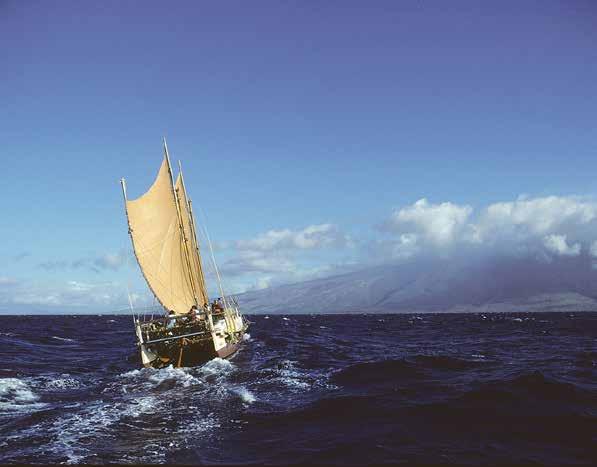
65 Traditional Pacific Voyaging
Off Molokai, 1998; courtesy Monte Costa
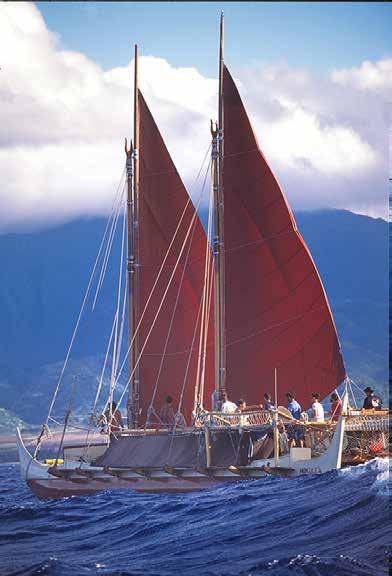
Yet I couldn’t get canoes, sailing and Polynesia out of my mind, and again enrolled in graduate studies in anthropology, this time at the University of Hawai ‘i, where I could better study Polynesians and the sea. Upon flying to Hawai ‘i in the spring of 1958, I met with my advisor, the distinguished folklorist Katherine Luomala. After talking about the anthropology program, she handed me a copy of Andrew Sharp’s recently published book Ancient Voyagers in the Pacific , which argues that Polynesians had been incapable of making long navigated voyages, and that therefore Polynesia had been
Hōkūleʻa off Haleiwa, Oahu, 2003. The author’s first canoe, Nalehia, was lost to gradual deterioration in Tahiti.
Courtesy Monte Costa
settled accidentally by castaways. Professor Luomala warned me that I would not like the book, and she was right. As I read it that night I felt as though the author was telling me that Polynesians had never been great seafarers, and that I should go back to California, as there was nothing to learn in Hawai ‘i. But Sharp’s thesis that Polynesians had been involuntarily scattered over the ocean by wind and current didn’t make any sailing sense to me. Studying the written sources, I soon realized that the information available on long-distance canoe sailing and navigation was so spotty and contradictory that the debate over accidental and intentional settlement could go on forever without a satisfactory conclusion. It seemed obvious that to make any progress, we needed to reconstruct the old canoes and relearn the old wayfinding methods, and then test these over legendary voyaging routes. Later, as I began to learn something about ancient Hawai ‘i, the legendary seaway between Hawai ‘i and Tahiti came to mind.
H owever, before building a voyaging canoe, I wanted to become an anthropologist so that my efforts would be more informed and relevant— and so that I would have a way to make an interesting living. After earning graduate degrees at the University of Hawai ‘i and Harvard, I landed a job teaching at the Santa Barbara branch of the University of California. In 1965 and 1966 my students (including one Hawaiian) and I built a forty-foot-long replica of a Hawaiian double canoe. Thanks to a grant from the National Science Foundation I was able to conduct instrumented sea trials off Santa Barbara, and then in Hawaiian waters. There, renowned Hawaiian scholar Mary Kawena Pukui named the canoe Nalehia —which means “The Skilled Ones,” after the way her hulls rode so gracefully over the swells. These trials provided
Maritime Museum of San Diego 66
the hard data on sailing and paddling a double canoe that I would need, if my dream of building a deepsea voyaging canoe and sailing her from Hawai’i to Tahiti and back was ever to materialize. A few years later I managed to get a job teaching anthropology in my old department at the University of Hawai ‘i, which brought the project another step closer to reality.
In 1973 Herb Kane, Tommy Holmes and I founded the Polynesian Voyaging Society in order to develop an institutional base for the project. Herb had first contacted me to consult about Polynesian canoes in relation to tide charts he was illustrating for a Hawaiian corporation. He soon went to work designing the canoe that we would later call Hōkūleʻa , and painted her sailing at sea, a stunning image that we reproduced on posters to announce the project and ask for public support. These popular posters launched Hōkūleʻa into the public imagination.
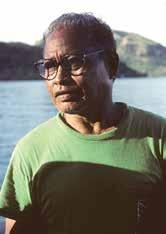
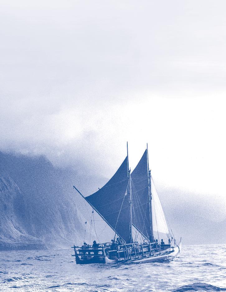
We had brashly promised to build a voyaging canoe and make the voyage to Tahiti within three years, and somehow managed to do just that. In 1974 we began raising funds and were so successful that we started work within a few months. In 1975 we launched Hōkūleʻa and began learning how to sail her. In mid-1976, we sailed Hōkūleʻa to Tahiti and back, a voyage that undercut the nay-saying of those who denied the ability of Polynesians to have settled the region intentionally. Also, we could not know it at the time, but our troubled passage to Tahiti kicked off the revival of canoe voyaging that has now spread throughout Polynesia.
Trouble Along the Way
After seeing how the Hawaiians who had helped build, paddle and sail Nalehia had become so excited and proud to be actively learning about canoe sailing,
Now almost fifty years old, Hōkūleʻa sails off Molokai. Courtesy Monte Costa
67 Traditional Pacific Voyaging
Mau Pialug in Tahiti, 1995. Courtesy Monte Costa
I had hoped Hawaiians would play key roles in the new project and, after Hōkūleʻa returned from Tahiti, that they would take over the canoe as a “floating classroom” to teach about Hawai ʻ i ʻ s maritime heritage. While Herb was busy creating Hōkūleʻa and Tommy was handling a wide variety of chores, I ran the project, planned the voyage, raised funds, and refined the research plan. I also recruited and obtained funding for several highly experienced and talented island sailors to fill critical roles on the canoe. The most crucial was Satawal’s Mau Pialug who, we hoped, would navigate the canoe almost 3,000 miles to Tahiti and back—without reference to charts or other Western navigational tools.
s we approached our departure date, however, a number of Hawaiians started protesting. They felt cheated when they realized that Hōkūleʻa would sail on a research as well as cultural voyage, and that not everyone on board would be Hawaiian. Whereas we were proud that ten of our fifteen crewmembers,
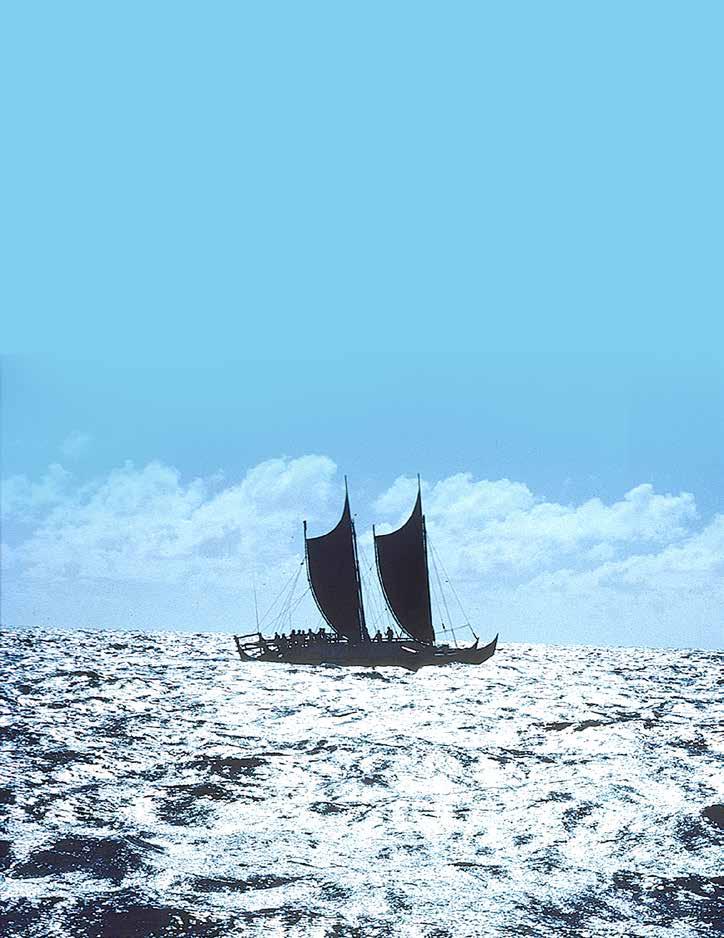
including Captain Kawika Kapahulehu, were Hawaiian, the protesters focused on the fact that three of us were haole —white foreigners. They were also upset that Mau, a Micronesian, would guide Hōkūleʻa to Tahiti. The more radical among them demanded that we cancel the voyage and turn the canoe over to them, so that they could sail her for their own political and recreational purposes.
In part, I agreed with them. The growing emphasis on cultural revival had obscured the research purpose of the voyage, and the argument that the five foreigners on board were trespassing in Hawaiian space was, in a sense, valid. Yet the protestors weren’t sailors, and cared nothing about the goals of the project. We were not about to give up, drop all we had worked for, and disappoint those who had supported us, including so many Hawaiians. Despite threats and dockside protests, on May 1, 1976 we set sail for distant Tahiti.
The Kaʻ iwi Channel, on a calm day. Surfer Eddie Aikau’s rescue attempt here is still commemorated in the slogan of Oahu’s Quicksilver Classic surfing competition: “Eddie Would Go.”
Courtesy Monte Costa
U nfortunately, it was not a happy voyage. We had hoped that once at sea everyone would settle down and work together toward the common goal of reaching Tahiti. But the troubles sailed with us. Halfway to Tahiti six of the novice Hawaiian crewmembers staged a protest to complain that they were being overworked and underfed, that the canoe was lost and that the “leaders” did not know what they were doing. They refused to stand watch, or do anything else they didn’t like. The rest of us went about our task of sailing to Tahiti, although within sight of the island the strikers staged a final confrontation that left blood on the deck. As a consummate navigator and crew captain, Mau Piailug was not used to having novice sailors go on strike and assault their canoemates. By June 4, when we landed on Tahiti, Mau was so disgusted that he flew home to Micronesia. Mau’s departure scrubbed the second half of the research plan to sail back to Hawai’i using only traditional navigation, and cast a pall over the entire voyage. Captain Kapahulehua and some other stalwarts from the first leg did a fine job of sailing Hōkūleʻa swiftly home, with help from new Hawaiian crewmembers who flew in from Hawai ʻ i, but the damage had been done
turned on) floating somewhere in darkness, there was no way to send a distress signal. The next day, world champion surfer Eddie Aikau courageously tried to get help by paddling his surfboard to Lana’i, the nearest island. He soon disappeared over the huge swells, and was never seen again. At dusk the capsized canoe was finally spotted by a passing airliner, and that night a helicopter plucked the remaining crewmembers off the overturned hulls. The following day a Coast Guard cutter towed battered Hōkūleʻa back to Honolulu.
With the shortwave radio drowned and the unsecured emergency locator beacon (which had to be manually turned on) floating somewhere in darkness, there was no way to send a distress signal.
Rebuilding and Retraining
For a while it looked like the project would collapse. Selfappointed realists argued that the first voyage had been a lucky fluke, that canoe voyaging was just too dangerous and that the Polynesian Voyaging Society should give Hōkūleʻa to a museum. Others countered that the capsize had just been an unlucky accident, and that the crew should just patch up the canoe and set sail for Tahiti before they lost their nerve. Fortunately, a nucleus of crew and board members insisted that the tragically interrupted voyage be completed, but only after rebuilding the canoe and training the crew in seamanship and safety.
A Tragic Second Attempt
New Hawaiian leaders then took over the Polynesian Voyaging Society to fulfill the canoe’s educational mission. However, despite their efforts to calm the waters, bitterness over the 1976 voyage continued to simmer. They decided to clear the air by having an all-Hawaiian crew sail Hōkūleʻa back to Tahiti in 1978. Unfortunately, they didn’t include the most experienced island mariners from the first voyage. Despite storm warnings for the infamous Kaʻ iwi Channel between Oʻ ahu and Molokaʻ i, the new crew set sail at dusk on a windy March evening. They recklessly drove Hōkūleʻa hard into blustery winds and steep breaking seas, until around midnight, when boarding seas swamped the lee hull and the ceaseless wind pushed the listing canoe over, dumping everyone into the ocean.
With the shortwave radio drowned and the unsecured emergency locator beacon (which had to be manually
Behind them was Myron “Pinky” Thompson, a savvy social worker and distinguished Hawaiian patriot. After being elected president of the Society, he set about applying lessons he had learned in working with Hawaiians and their institutions. Rather than complaining about past wrongs and invoking Hawaiian exclusiveness, Pinky urged crewmembers and directors of the Society to go back to cultural basics. He had them study such positive Hawaiian values as ʻimiʻike (seeking knowledge), aʻo (learning, teaching), lokahi (unity), and malama (to care for), and then think about how central these were to carrying out the tasks that went into the discovery and settlement of the islands and the development of Hawaiian civilization. Although a few participants thought these exercises were artificial, everyone eventually came around and found it exhilarating to work toward rebuilding the canoe and the Society, and then carrying out the voyage, within a framework defined by Hawaiian values and informed by a new sense of mission.
69
Pacific Voyaging
Traditional
Thompson also made sure that the group worked closely with the Coast Guard and other relevant institutions and individuals in repairing the canoe, planning the voyage, and undertaking training in seamanship and safety. He saw to it that Kawika Kapahulehua and other veterans of the 1976 voyage were consulted, and that Mau Piailug was brought back to Hawaiʻ i to give Pinky’s son Nainoa Thompson, who had been trying to study non-instrument navigaton on his own, a crash course in traditional wayfinding so that he could navigate Hōkūleʻa to Tahiti and back. In 1980 a well-trained crew immersed in Hawaiian values sailed Hōkūleʻa to Tahiti and back to Hawaiʻ i, without any significant problems. In so doing they earned back their pride, and in guiding the canoe both ways Nainoa emerged as a modern culture hero and role model for Hawaiian youths.
Although the elder Thompson stressed Hawaiian values and pride, he felt that Hawaiians would suffer if they turned totally inward and worked only amongst themselves. He believed instead that they should lead organizations devoted to traditional activities and Hawaiian welfare, but insisted that their staff not be restricted to Hawaiians.
that the canoe was made for long-distance voyaging, and that they should sail her to the South Pacific again, this time traveling beyond Tahiti to other Polynesian islands and archipelagoes.
fter some debate, the Polynesian Voyaging Society chose Aotearoa (New Zealand) as the destination of a two-year cruise that would also take the canoe through six other Polynesian archipelagoes—the Tuamotus, Leeward Societies, Cook Islands, Tonga, Samoa and Te Henua ‘Enana (Marquesas Islands). It was billed as a “Voyage of Rediscovery;” while the Hawaiians were learning about new routes, islands and cultures, their hosts along the way would have a chance to meet their long-separated northern cousins, sail on Hōkūleʻa , and learn about voyaging.
Thompson also made sure that the group worked closely with the Coast Guard and other relevant institutions and individuals in repairing the canoe, planning the voyage, and undertaking training in seamanship and safety.
“Voyage of Rediscovery”
1985-1987
fter Hōkūleʻa returned from her second voyage to Tahiti in the summer of 1980 the crew went back to their families, jobs and schools, immensely proud of what they had accomplished. Some months later Hōkūleʻa was sailing again, this time around the Hawaiian chain on educational cruises. Because the Coast Guard classifies her as an experimental vessel, however, schoolchildren could not sail on Hōkūleʻa . Nonetheless, when in port or anchored they could come aboard to get some “feel” for what a voyaging canoe is like, and interact with crewmembers sharing sailing experiences and explaining the principles of canoe voyaging. However, as satisfying as these cruises and shore sessions were, the younger members of Hōkūleʻaʻ s crew particularly started saying
After leaving Rarotonga and heading southwest, the Hawaiians were lucky in getting easterly winds from three successive highpressure systems that enabled Hōkūleʻa to reach Aotearoa’s Bay of Islands in just seventeen days. After the successful voyage, which he had worked long and hard to make a reality, Pinky Thompson talked to me about how Hōkūleʻa was helping Hawaiians gain respect from their fellow Polynesians. Before Hōkūleʻa , he told me, Polynesians from the South Pacific looked down on Hawaiians for having virtually lost their language and become too American. Now, however, Hawaiians could demonstrate old skills their South Pacific cousins have forgotten—and are willing and able to share them
Hōkūleʻaʻs Child: Hawaiʻiloa
After returning to Hawai ʻ i in mid-1987, the Hawaiians resolved to take the voyaging revival a step farther by building a totally “native materials” canoe. Hōkūleʻa had been expediently built mostly from modern materials. Now they wanted to build a voyaging canoe in the old way. Federal funding was obtained through the newly created Native Hawaiian Culture and the Arts Program, and the search started for a pair of tall and straight koa trees. To everyone’s dismay, after months of tramping through the uplands of Hawai ʻ i Island and Maui no suitable trees could be found. Indiscriminate logging,
Maritime Museum of San Diego 70
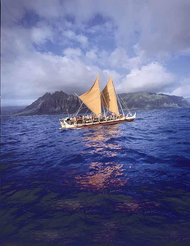
The
windward side of Oahu is home to many native Hawaiian people. The loss of big native koa trees, however, frustrated the canoe builders.
71 Traditional Pacific Voyaging
Courtesy Monte Costa
land-clearing for cattle, and introduced diseases and pests had devastated the old koa forests.
At this time a group of Native Alaskans associated with Sealaska, a native timber corporation owned by the Tlingit, Haida and Tshimsian people of Southeast Alaska, were in Hawaiʻ i. When they heard of the Hawaiians’ plight they offered to send them a couple of big trees from their vast forest holdings. When Herb Kane asked if the Polynesian Voyaging Society could purchase the trees, Sealaska’s CEO Byron Mallott unhesitatingly replied “Hell, no—we’ll give them to you!” He wanted not make a onetime sale, but to establish a relationship between peoples. Initial hesitancy about using Alaskan logs to build Hawaiʻiloa was overcome when it was realized that Hawaiians living on Kaua’i and other islands without tall koa trees formerly carved canoes out of logs that had drifted upon their shores all the way from the Northwest Coast. Nainoa Thompson selected a pair of 220-foot, four-century-old spruce trees. After prayers to the forest gods uttered by both Tlingit and Hawaiian shamans, Sealaska felled the old giants and shipped the lower seventy feet of each log to Hawaiʻ i—all gratis. The Alaskans’ generous gift not only made it possible to build Hawaiʻiloa , but, as Byron Mallott had foreseen, initiated a continuing relationship between native peoples from Hawaiʻ i and Southeast Alaska.
EFor her maiden voyage, Hawai ʻiloa had originally been scheduled to sail to Te Henua ‘Enana (The Marquesas), thought to have been the Hawaiian people’s homeland, and then sail back to Hawai’i to commemorate the islands’ original discovery by Polynesians.
for months adzing out as much wood as they dared from the hull interiors, and removing one of the heavy forward crossbeams. Although this lightened Hawaiʻiloa significantly, her weather helm was still too strong. Then someone remembered that the outrigger surfing canoes used for sailing off Waikiki in the 1920s and 1930s had the same problem, which was remedied by placing their single mast at the fulsome stern instead of at the slim bow. The same was tried on Hawaiʻiloa , and she sailed so well that soon everybody forgot that she was really sailing backwards!
Fven using steel tools, it took over three years to hollow out and shape the logs, but despite problems, in mid-1993 the 57-foot Hawai’iloa was launched with great ceremony, and sea trials began. Then came a huge disappointment, demonstrating how much remained to be learned about building and sailing voyaging canoes: Hawai’iloa rode so low in the water that she didn’t have enough buoyancy to carry a full crew and provisions. She also sailed “bow down” because her forward sections were too slim and shallow to support the mainmast, boom and driving sail, plus the heavy forward crossbeams linking the hulls. This gave her a terrible “weather helm;” she automatically headed into the wind until the sails luffed and the canoe stopped sailing. This could only be partially corrected by plunging three long steering paddles deep into the sea. So out of the water she came, and her builders worked
or her maiden voyage, Hawaiʻiloa had originally been scheduled to sail to Te Henua ‘Enana (The Marquesas), thought to have been the Hawaiian people’s homeland, and then sail back to Hawai ʻ i to commemorate the islands’ original discovery by Polynesians. However, by the time she was ready to go in 1995, the voyaging renaissance spawned by Hōkūleʻa had reached the point that there were several other new double canoes from around Polynesia whose crews wanted to join the voyage. After Hawaiʻiloa rendezvoused with voyaging canoes from Aotearoa, the Cook Islands and Tahiti (plus others from Hawai ʻ i) at the temple of Taputapuatea near Tahiti, they all proceeded to Te Henua ‘Enana. From there they broad-reached across the southeast trades, then worked their way through the doldrums, after which they close-reached through the northeast trades to make landfall on Hawai ʻ i’s Big Island after just a little over two weeks at sea.
O ver the last seventy-five years, canoes, rafts and junks have been built outside of Polynesia to sail there on one-way voyages in efforts to “prove” one migration theory or another. Hōkūleʻa , on the other hand, and the canoes she has inspired— Hawaiʻiloa, Makaliʻi, Hoku Alakaʻi, Hawaikinui, Tahiti Nui, Takitumu, Te Au o Tonga, Te Aurere —continue sailing back and forth among the islands of the Pacific, giving island youths the chance to experience the technology that enabled their ancestors to explore and settle lands scattered across this mightiest of oceans .
Kia ora te waka!
Maritime Museum of San Diego 72
Long live the canoes!
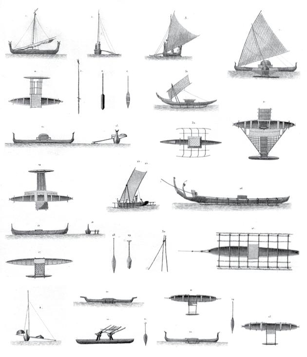
Images of traditional watercraft found in Voyage around the World of Baron de Bougainville, 1824, 1835, 1826 with the frigate a Thetis and the corvette l’Esperance.
V. 76; No. 50 Drawings by M. Berard. Engraving by Antoine Tardieu. Maritime Museum of San Diego Collection 2009.033.001
73
Traditional Pacific Voyaging
“A People Who Do Not Search for What They Have Lost Will Become a Lost People”
By Herb Kawainui Kane
Polynesia began with the voyaging canoe. More than three thousand years ago, the uninhabited islands of Samoa and Tonga were discovered by an ancient people. With them were plants, animals, and a language with origins in Southeast Asia. Along the way, they became great seafarers.
Hōkūleʻa I
Artist Herb Kawainui Kane
Copyright Herbert K. Kane, LLC
More than two thousand years ago, Polynesians exploring eastward discovered the Tahitian and Marquesas Islands. From these “centers of diffusion” explorers reached outward as far as Hawai’i to the north, to the east, and New Zealand to the southwest. Before European open-ocean exploration began, Eastern Polynesia had been explored and settled.
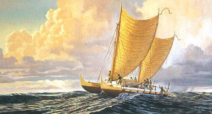
Maritime Museum of San Diego 74
This article by Herb Kane (1928-2011), one of the main figures in the rebirth of Hawaiian culture in the 1970s, was originally published in Mains’l Haul 41 (2&3, 2005)
Dreaming up a Modern Voyaging Canoe
Iwas born in Minnesota, which my parents were passing through en route to their home in Hawaiʻi. You might say that I was raised both in my father’s Hawaiʻi and my mother’s Wisconsin. My interests in art, architecture, Polynesian traditions, and sailing found a common focus in the Polynesian voyaging canoe. I had become an illustrator, working in Chicago, but always longed to return to Hawaiʻi. As an avid sailor, curious about the construction and performance of these sailing canoes, I began researching what was known about them and expressing my findings in drawings and a series of paintings, some of which became calendar illustrations inHawaiʻi . Anthropologist Kenneth Emory of Honolulu’s Bishop Museum went through the evidence with me, sifting out those features of hull design and sail plan which by their wide distribution may be taken to be most ancient. These I applied to a conceptual design. From my own experience with the Pacific swell and in consultation with others, a waterline length of fifty-five to sixty feet seemed one that could surmount swells and recover easily in the troughs, and was an average length for canoes known to have been used for long distance voyaging in the Tuamotus and Tahitian islands.
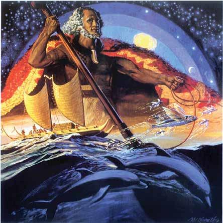
The author, an accomplished artist, created the image of Hōkūleʻa I at left. His painting of King Moiʻkeha, above, hints at how central he believes the voyaging canoe is to a Hawaiian sense of identity.
Copyright Herbert K. Kane, LLC.
Dr. Ben Finney, a University of Hawaiʻi anthropologist, Tommy Holmes, a well-known water sports enthusiast, and I incorporated the non-profit Polynesian Voyaging Society and began recruiting members. Each of us brought a different dimension, and attracted a different public, to the project. Ben was most interested in deriving information from voyaging
75 Traditional Pacific Voyaging
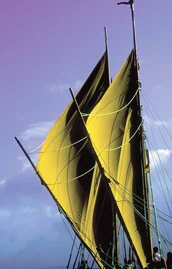
After he imagined voyaging canoes in his paintings, the author helped bring one into existence.
experiments that could answer scientific questions. Tommy saw the project as a great adventure. I took a cultural view, believing that the ancient voyaging canoe was the central object of Polynesian culture, and knowing that when such objects are lost, the use and the memory of them fades away, becomes distorted, and cultural disintegration results. By reviving the sailing canoe I hoped that we could stimulate revival of other areas of Hawaiian culture.
Learning how the canoes had been built was one thing, but the question of how they actually performed was quite another. It was a question generating some heat among sailors and anthropologists. In discussion with others, the idea emerged to build a performance-accurate canoe and put it to a hard test: sailing round-trip between Hawaiʻi and Tahiti, without instruments. The idea was not necessarily to build the canoe of traditional materials, but to replicate those features that affect performance, including hull design, sail plan, and assembly of the parts by flexible lashings.
Instead of carving the hulls from logs, which would have been vastly beyond our means, we decided to build them up with laminations of narrow marine plywood strips glued up diagonally over longitudinal stringers, each layer in the opposite direction from the layer underneath. It was a method ideally suited to replicating the compound, convex curvature of Polynesian hulls. To protect the wooden hull from scraping and water penetration, a thin skin of fiberglass was applied before it was painted.
Working within parameters established by my general drawing, naval draftsman Vince Bartelone of Newport Beach did the critical lines drawing for the hulls. We hired two boatwrights and three carpenters, and work commenced in a donated rusty storage shed at Honolulu Harbor, assisted by a host of volunteers.
Maritime Museum of San Diego 76
Photos courtesy Sam Low
Naming Hōkūleʻa
When the parts of the canoe were close to being completed, one of the boatwrights chalked “Da Boat” on the side of one of the hulls—a hint that it was time to come up with a name. We tossed the question around at a board meeting a few days later. Several names were suggested, but none seemed to be what everyone was looking for.
One exceptionally clear night I stayed up quite late, star chart in hand, locating and memorizing stars and their positions. After turning in, I dreamed of stars. Arcturus, Hōkūleʻa in Hawaiian, seemed to grow larger and brighter and I awoke—whether due to the brightness or to my bladder I couldn’t say—but I jotted “ Hōkūleʻa ” on a notepad on my nightstand.
The next morning, I saw the notation and recognized it as a fitting name for the canoe; it means “star of gladness.” As a zenith star for Hawaiʻi it would indeed be a star of gladness if it led to landfall. I phoned a few friends, including the staff at our office, and asked them to call others, and at the next meeting the name was adopted.
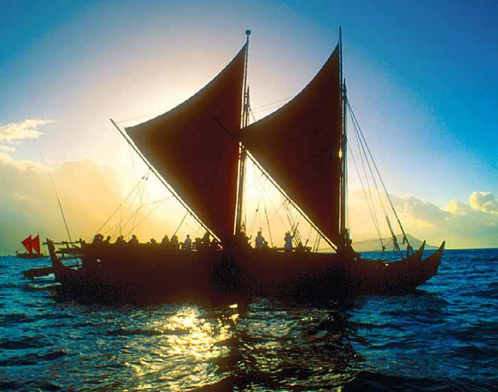
77 Traditional Pacific Voyaging
Sailing an Ancient Design in Modern Seas
The idea of steering a sixty-foot multi-hull sailing canoe without a rudder always intrigues conventional yachtsmen on their first sails aboard Hōkūleʻa . A sailing vessel makes leeway as the wind pushes her sideways against the water. To counteract this, we hold a steering paddle against the lee side of the hull near the stern, where it controls the amount of lateral resistance to the water. Raising the paddle reduces lateral resistance, allowing the stern to swing off the wind, and turning the bow into the wind. Lowering the broad blade increases lateral resistance at the stern, and the canoe turns off the wind. We found that the pressure of the water against the blade holds it firmly against the hull with little effort from the steersman. A slight twisting pressure to hold the leading edge of the blade firmly against the hull prevents the flow of water from getting under the blade and kicking it away.
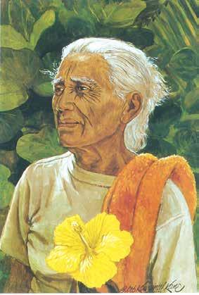
As I discovered while sailing Hōkūleʻa , even the pieces at either end of the hulls have a practical function. Eastern Polynesian end pieces typically rise higher at the stern than at the bow. The stern piece appears to break the crest of following waves that might otherwise board the canoe. And when the canoe surfs on a following wave, plunging forward, the bowpiece, in a burst of spray, helps prevent the bow from “bone-yarding” into the back of the wave ahead.
The flashing speed of modern catamarans results from their wide beam and rigidity of construction,
made possible by steel fastenings. Hōkūleʻa is a slower sailer. Assembled with lashings of cordage, she lacks the rigidity of modern multi-hulls, for her hulls must be closer together to reduce stress on the crossbeams. Assembly by lashings, however, seems to offer one advantage: they absorb much of the shock of waves that beat against the hulls, a pounding that is transmitted throughout a modern vessel.
Goodbye to Hōkūleʻa
I“Aunty Clara.. lived at Honaunau Bay in South Kona. When we anchored Hōkūleʻa there on its first training and shakedown cruise, she insisted on sailing with us when we left. I could not refuse her. She became the beloved elder of our crew.”
Copyright Herbert K. Kane, LLC
sailed Hōkūleʻa on her training and shakedown cruise among the Hawaiian Islands in 1975; because of his job, Ben couldn’t be along on much of it. I knew then that the canoe could make it to Tahiti, since the waters between the Islands are often rougher than the open sea. What really spoke to me, however, was the outpouring of affection for the canoe from Hawaiians at every stop. People by the hundreds would appear along the shore, bringing picnic dinners, sitting quietly and staring at the canoe, and quietly leaving after dark. There was also a vocal minority who wanted to take over the canoe for their own agenda, but a silent and vastly larger majority took the canoe to heart.
When we landed at Hanalei, Kauai, the last stop on our shakedown cruise, the people held
Maritime Museum of San Diego 78
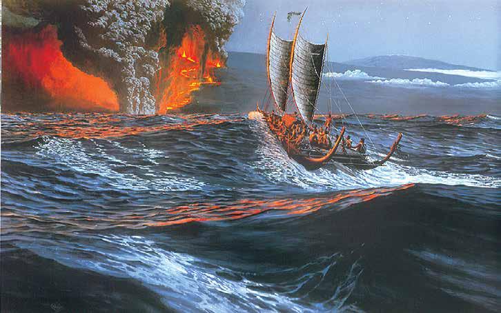
a feast with singing and dancing. One of the dancers was a pretty Hawaiian with long wavy hair. One night, the anchor watch, Roger Kaawaloa, saw a small canoe approaching, paddled by the same girl—but she looked very different. She handed him a paper bag, said “this is for the canoe,” and paddled away. He looked in the bag and understood why she looked different: it held her long hair. In the old times in Hawai’i, to give something of oneself to another was an act of great trust and aloha, beyond words, because in the old thinking the recipient could use such a gift to work harmful magic against the giver.
By this time, however, I had spent too much time and money on the canoe project. Recently divorced, I had an opportunity to obtain custody of my two kids, but it would not be cheap. A major commission to paint murals at a new hotel in Kona was offered, and I took it. Sadly, I could not sail on her maiden voyage to Tahiti.
While the canoe was at sea, however, I somehow found time to take over the project’s administration, do some fundraising, help train crewmen for the return
voyage, escort them to Tahiti, arrange for the canoe’s support and her itinerary through the Tahitian islands, and hurry home to do more fundraising.
After the return voyage was concluded and debts paid, I was able to make a long-desired move from bustling Honolulu to the far more relaxing Kona district of my home island, Hawaiʻ i, and retire from active involvement with the Polynesian Voyaging Society. I am gratified that they have continued to make successful cruises, attracting the enthusiasm and leadership of a new generation, and I am content to be one of the “old dinosaurs” of what is now a very vibrant movement across Polynesia.
Many years ago now, a friend told me a phrase spoken by an elder on the island of Huahine, near Tahiti, after Hōkūleʻa had voyaged there. “A people who do not search for what they have lost will become a lost people,” he had said. Hōkūleʻa is one of the products of this ongoing search, and I am proud to have been part of the way she has become an ambassador across Polynesia and Native America.
79 Traditional Pacific Voyaging
Discovery of Hawaiʻi. Artist Herb Kawainui Kane Copyright Herbert K. Kane, LLC
Voyages of Awakening
By Sam Low
Since she was first launched on March 8, 1975, the voyaging canoe Hōkūleʻa, her dedicated crews and the multitude of others who have contributed to her success have proved the incredible prowess of the Polynesian seafaring heritage many times over. But even more importantly, they have helped to revive an ancient culture and reunite a diverse and widespread people. Over the years since her launching, a vision has evolved among the canoe’s vast family - one that finds in the traditions of Polynesia universal lessons that may guide us all in the new millennium. This is the story of that family and that vision.
From Captain Cook’s Quandary, a Dream is Born
In 1778, when Captain James Cook discerned that the people of Hawaiʻi were of the same race as those he had encountered throughout Polynesia, he asked: “How shall we account for
this Nation having spread itself to so many detached islands?” How indeed could a stone-age people have navigated and explored a third of the earth’s surface without instruments or charts? How could they have built powerful sailing vessels without metal nails or canvas sails?
Some early scholars suggested that South American Indians could possibly have settled the Polynesian islands simply by drifting westward on crude rafts, riding the prevailing currents and winds. In 1947, Norwegian explorer Thor Heyerdahl set out from Peru to test this theory aboard his famous balsa-wood raft, Kon Tiki. Despite many dire predictions that the simple raft would surely be smashed to pieces in the open ocean, Heyerdahl and his crew eventually
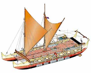
Maritime Museum of San Diego 80
Sam Low holds a Ph.D. in Anthropology from Harvard University. Since the late 1970s, he has written, directed and produced documentaries for PBS, with particular attention to the navigation and maritime culture of Polynesia. Sam has sailed over 5,000 miles as a crew member aboard Hōkūleʻa . His research also extends to underwater archaeology, participating in dives and excavations in Greece and Turkey. He has also taught at Hunter College and Bowdoin College.
Article reproduced with the author’s permission.
All photographs are by the author. An online version can be found at: http://www.samlow.com/sail-nav/awakening.html
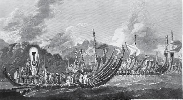
managed to make landfall in the Tuamotu Islands, just east of Tahiti, indicating to some that at least part of Polynesia could have been settled this way. But by the late 1960s, mounting scientific evidence began to point toward a much different source of origin for the ancient Polynesians. Increasingly, archaeological and linguistic studies indicated that the true Polynesian homeland lay to the west - in the area of Southeast Asia. This meant that to settle the islands they must have sailed against the powerful prevailing trade winds and currents, which in turn suggested that they
possessed highly efficient oceangoing vessels and a vast cultural storehouse of navigational knowledge.
Some scholars at the time continued to maintain that any such settlement must have occurred purely by chance, perhaps by fishing canoes that had been accidentally blown to sea. But this hardly seemed to explain the incredible dispersal of the Polynesian people over immense distances of the Pacific. And furthermore, ancient Polynesian chants and myths told clearly
81
Pacific Voyaging
Traditional
Tahitian canoes sketched in 1774 by William Hodges, one of the artists on James Cook’s voyage. Cook and his companions were deeply impressed by Polynesian seafaring expertise.
of powerful canoes and great navigators. Could the myths be true? In the early 1970s, three men decided to find out.
Hōkūleʻa came from the dream of three people,” recalls Polynesian Voyaging Society CEO and pwo navigator Nainoa Thompson. “Dr. Ben Finney, an anthropologist from Santa Barbara; Herb Kawainui Kane, an artist of Hawaiian descent; and writer and community leader Tommy Holmes, a man who truly loved the s ettled, and the only way to do that is to get out of the four walls of the academic world and build a voyaging canoe and sail it to Tahiti.’ ”
Finney, Kane and Holmes founded the Polynesian Voyaging Society in 1973. “We made a great team,” says Kane, “because we approached the Hōkūleʻa project from different points of view. Ben was the scientist, Tommy was the waterman and adventurer, and I approached it from the cultural point of view.”
TOn March 8th, 1975, Hōkūle ‘a was launched. Its mission was to test the theory that the ancient Polynesians were brilliant seafarers who intentionally explored the Pacific, but how would the vessel be navigated in the ancient way - without charts or instruments?
lthough the PVS founders wanted to use traditional materials and tools to construct the canoe, they realized that the process would become too time-consuming as the builders tried to relearn the arts of working with materials such as koa-wood hulls, woven lauhala sails and sennit lashing. Instead, the hulls were constructed out of plywood and fiberglass; the sails were made from canvas; and the lashings were done with synthetic cordage. However, Hōkūleʻa creators strove to approximate the shape and weight of a traditional canoe to create a “performance-accurate” replica that handled as much like the ancient Polynesian voyaging canoes as was considered possible.
he canoe was named Hōkūleʻa , or “Star of Gladness,” after the Hawaiian name for the star Arcturus, which reaches its zenith directly over Hawaiʻi and was likely to have been used as a prime navigational marker by ancient wayfinders seeking to locate the Islands. Kane recalls how the name first came to him: “One exceptionally clear night I stayed up quite late, star chart in hand, memorizing stars and their relative positions. When I finally went to sleep, I dreamed of stars, and my attention was attracted to Arcturus. It appeared to grow larger and brighter, so brilliant that I awoke. I turned on my reading light and wrote ‘ Hōkūleʻa .’ The next morning, I saw the notation and immediately recognized it as a fitting name for the canoe. As a zenith star for Hawai’i, it would indeed be a star of gladness if it led to landfall. The name was proposed at the next board meeting and adopted.”
On March 8th, 1975, Hōkūleʻa was launched. Its mission was to test the theory that the ancient Polynesians were brilliant seafarers who intentionally explored the Pacific, but how would the vessel be navigated in the ancient way - without charts or instruments? Although the traditional arts of navigating had been lost in Polynesia, a handful of seafarers in the remote islands of Micronesia still found their way across trackless ocean expanses using only the arc of stars, the wave patterns and the flight of birds. One of them, Mau Piailug from the tiny island of Satawal, agreed to guide Hōkūleʻa to Tahiti.
Maritime Museum of San Diego 82
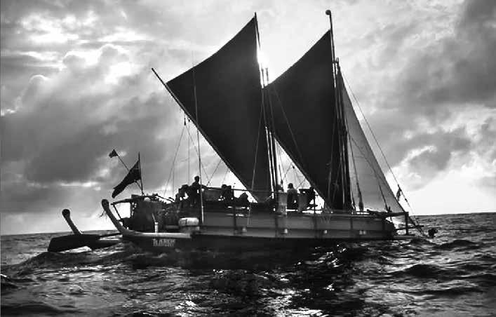
On May 1, 1976, Hōkūleʻa left Hawaiʻi on her maiden voyage. Nainoa, who flew to Tahiti to serve as a crew member on the return trip, remembers the moment of arrival when Hōkūleʻa reached Papeʻete thirty-three days later: “I watched the canoe enter Papeʻete Harbor. Seventeen thousand people came down - over half the population of the island. The canoe got to the black-sand beach, and so many children got on that it sank the stern. People couldn’t see, so they climbed into the trees. It was a spontaneous, innate reaction by a people who had maintained their language and their genealogy, who understood who their great navigators were. They knew about the great canoes, but they did not have such a canoe. So when Hōkūleʻa entered the bay she was a powerful symbol that reminded them of the greatness of their culture and their heritage - and therefore themselves. It was the beginning, I think, of cultural revival and the renewal of the Polynesian people.”
Lost at Sea: A Crisis and a Turning Point
In 1978 - with insufficient preparation and without Mau on board - Hōkūleʻa again left for Tahiti. But the voyage had hardly begun when disaster struck: During rough weather in the middle of the night, the canoe capsized between O’ahu and Lana’i. In a heroic effort, lifeguard and big-wave surfer Eddie Aikau, one of Hawaiʻi’s most experienced watermen, tried to paddle to shore on a surfboard to get help. He was never seen again .
Eddie’s loss was a devastating blow. For many, he represented the best of what it meant to be Hawaiian. “Eddie’s death split the community,” Nainoa remembers. “Some of us wanted to stop voyaging, but some of us thought that if we did his death would have no value. I believed that voyaging inspired our Hawaiian community and gave us all pride. I believed we had to continue. It was Eddie’s inspiration that kept us together during those hard times.”
83 Traditional Pacific Voyaging
Hōkūleʻa off Diamond Head. Photographer Sam Low
Eventually, the PVS reorganized and recommitted itself to the renewal of culture through voyaging, but only if it could be done safely. The Society turned to Mau and asked him to share his sacred knowledge of sailing and navigation, and for the next two years Mau helped prepare a crew for another voyage to Tahiti. But this time, the canoe would be guided by a Hawaiian - Nainoa.
“Mau trained us like his grandfather trained him,” Nainoa recalls. “He took us on the ocean like children, becoming our father and mother at sea. We had very few formal lessons; the learning really came by being close to him - looking at the things he looks at, feeling the things he feels. Even though I’m now able to guide the canoe on my own, I’m still his student. He is the only master navigator.”
In 1980, Nainoa successfully guided Hōkūleʻa to landfall in Tahiti. By this time, the canoe had become a powerful symbol of Polynesian renewal. Rediscovering the ancient arts of seafaring helped stimulate a similar renaissance in language, dance,
poetry, architecture, spirituality, traditional medicine - all the core cultural values of a native island people.
“The canoe brought back our traditions of the sea,” says navigator Bruce Blankenfeld. “There were people who knew about canoe making, but they had gone underground after the Western influence came in. But once we began to sail, we began to rediscover it all.”
The Voyage of Rediscovery
In 1985, Hōkūleʻa embarked on a new mission. Her crew would traverse most of Polynesia - a twoyear, 16,000 mile odyssey - to carry the message of cultural revival throughout the great Polynesian Triangle. The canoe followed ancient migratory routes - from Hawaiʻi to the Society Islands, the Cooks, New Zealand, Tonga, Samoa and back home via Aitutaki, Tahiti and Rangiroa in the Tuamotu Archipelago. The voyage eastward from Samoa to Tahiti retraced the first great migratory steps
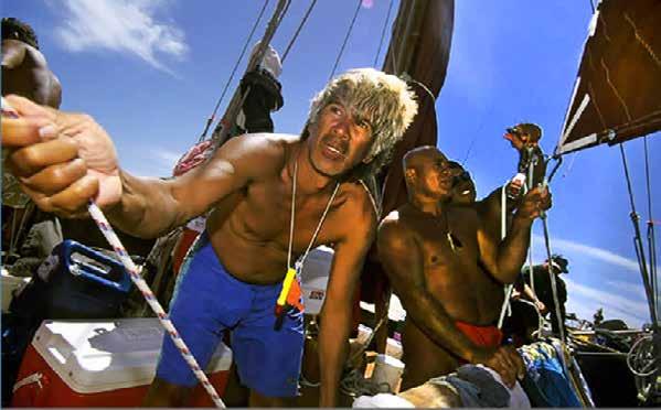
Maritime Museum of San Diego 84
Sailing Hōkūleʻa . Photographer Sam Low
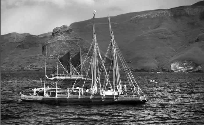
believed to be have been taken by Polynesians at about the time of Christ. It was also, once again, an opportunity to prove the mettle of the Pacific’s traditional seafarers.
“Thor Heyerdahl had said that it was impossible to get from western Polynesia to Tahiti because of the easterly trade winds,” says Nainoa. “He thought that the old canoes could not tack against them. We set out to prove him wrong. We trained for two years, we cut down our crew and we cut down our rations of food and water. We made the canoe light so that it would perform better, then we went to Samoa and waited for the weather.”
Heyerdahl and other scholars who thought it impossible for Polynesians to sail against the winds and currents failed to consider that every summer westerly winds blow with some regularity across the western Pacific, and episodically extend into the eastern Pacific. Furthermore, during El Niño events, the trade winds falter and more prolonged westerlies blow across Polynesian waters.
Hōkūleʻa waited for one of these westerlies and blazed across the distance from Samoa to Tahiti.
“We had planned for a thirty-five-day voyage, the longest ever,” Nainoa recalls. “And we did it in seven days.”
A New Canoe - Hawaiʻiloa
Hōkūleʻa had been built as a “performance replica” - shaped like an ancient canoe but crafted from modern materials. Now that she had proved her abilities beyond a doubt, the question became: How would a canoe built from traditional materials perform? In 1990, the PVS, in partnership with Bishop Museum’s federally funded Native Hawaiian Culture and Arts Program, decided to find out by building a new voyaging canoe entirely of natural materials. She would be named Hawaiʻiloa after the mythic fisherman who, according to chants and legends, was the first discoverer of the Islands. The original intention was to fashion Hawaiʻiloa’s hulls from koa, a Hawaiian native hardwood that was believed to have been used in building the Islands’ ancient voyaging canoes. But PVS teams explored Hawaiʻi’s forests for nine months without finding a single tree that was big enough to use.
85
Pacific Voyaging
Traditional
Hawaiʻiloa and Te Aurere in the Marquesas.
Photographer Sam Low
“The failure to find a koa log was a turning point for all of us,” remembers Myron “Pinky” Thompson, Nainoa’s father and president of the PVS. “For a decade and a half we had focused our attention on the sea. Now it was time to care for our land. We realized that our culture and our planet cannot thrive unless our environment is healthy.”
Since that moment, the PVS has focused a major effort on reforestation and environmental education. Fortunately, there was another historical source of wood for canoes: logs that drifted to Hawaiʻi from the Pacific Northwest. In an extraordinary act of kindness, the native people of southeast Alaska gave two 400year old spruce logs to the Society to build Hawaiʻiloa The gift was arranged by a friend of Herb Kane’s, a Native Alaskan leader named Judson Brown.
“Judson taught us so much,” Nainoa remembers. “The Alaskan people care for their environment
because they understand that the resources of the natural world are sacred gifts. When he presented us with the trees, he said, ‘Our trees are part of our family, they are cherished like our children. We will give you two of our children to build a canoe that will carry your culture.’“
Building Hawaiʻiloa provided a way for an even larger Hawaiian community to join in reviving the ancient traditions. Under the watchful eye of master canoe builder Wright Bowman Jr., volunteer shipbuilders, lashers, sailmakers, painters, caulkers and others labored more than 500,000 man-hours to breathe new life into the two giant spruce logs.
“Wright stepped forward to guide us and care for us with great aloha,” says Bruce Blankenfeld. “Under his tutelage a new family of the canoe was born.” In 1993, after three years of arduous labor, Hawaiʻiloa took to the sea. But even before she ever set sail, she
 Cook Island canoe off Honolulu. Photographer Sam Low
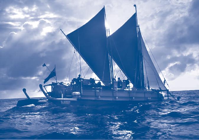
had already represented a new level of community involvement; she had played an essential role in sharpening the Voyaging Society’s appreciation for the fragility of Hawaiʻi’s environment; and she had cemented a deep friendship between Hawaiians and the native peoples of southeast Alaska.
Canoes Across the Pacific
In 1992, stimulated partly by Hōkūleʻa’s epic voyages, the Sixth Pacific Arts Festival in Rarotonga was dedicated to Polynesia’s great voyaging heritage. An invitation went out to islanders throughout the Pacific to sail to the festival aboard replicas of their own ancestral canoes.
“That challenged everybody,” Nainoa remembers, “so different island groups each decided to buildtheir own canoes. When they called Hawaiʻi to ask for
assistance, it was a great opportunity for us to pay back, in a small way, the kindness that had been shown to us all through the South Pacific. It also gave us the opportunity to move into a new area - education.”
Hōkūleʻa sailed to Rarotonga for the festival, where she was joined by sixteen other canoes from islands spread throughout the Pacific. Now fully committed to a mission of education, the PVS created a unique program called “The Voyage for Education” to accompany Hōkūleʻa’s return from Rarotonga.
Daily live reports broadcast on KCCN Hawaiian Radio gave information about the canoe’s position, weather conditions, sailing strategy, navigational techniques and life on board. There were also interactive links with a state-wide educational television program and with students at the University of Hawaiʻi to Mānoa.
87
Pacific Voyaging
Traditional
Hōkūleʻa at sea. Photographer Sam Low
Two days after leaving Rarotonga, Hōkūleʻa established a historic, three-way satellite link with the space shuttle Columbia, which was orbiting the earth, and a panel of schoolchildren in a TV studio at the University of Hawai’i. The students posed questions alternately to the crew of the canoe and the shuttle. One student asked, “What are the similarities and differences between canoe and space travel?” Astronaut Charles Lacy Veach, who grew up in Honolulu, answered: “Both are voyages of exploration. Hōkūleʻa is in the past, Columbia is in the future.” Nainoa added from the canoe: “We feel both are trying to make a contribution to mankind. Theirs is in science and technology. Ours is in culture and history. Columbia is the highest achievement of modern technology today, just as the voyaging canoe was the highest achievement of technology in its day.”
at the marae removed that kapu and brought about a blessing once again for a united voyaging community of all Polynesians.
SThe profoundly emotional ceremony at the marae removed that kapu and brought about a blessing once again for a united voyaging community of all Polynesians.
Na ʻOhana Holo Moana: “The Voyaging Family of the Vast Ocean”
The pace of Polynesian cultural revitalization continued as new voyaging canoes were built - the Makaliʻi in Hawaiʻi, two in Tahiti, two in the Cook Islands and one in Aotearoa (New Zealand). In 1995, all three of the Hawaiian canoes met with others from around Polynesia at the island of Raʻiatea, near Tahiti, for a ceremony to reopen an ancient marae (temple) of navigation called Taputapuatea. This was particularly significant since the temple, which lies at the symbolic center of the Polynesian Triangle, was historically a great gathering place for the canoes and navigators of many islands. More than 600 years before, however, a powerful kapu (religious taboo) had been placed on the marae after a Maori chief was killed there. The profoundly emotional ceremony
oon after the ceremony, six canoes - Hōkūleʻa, Hawaiʻiloa and Makaliʻi; Te Au o Tonga and Takitumu from Rarotonga; and Te Aurere from Aotearoa - left the Marquesas Islands for Hawaiʻi, following a traditional voyaging route. It was the first time in hundreds of years that a fleet of Polynesian sailing canoes had journeyed together - a new ʻohana (family) of the ocean star paths. Almost immediately after arriving home in Hawai’i, Hōkūleʻa and Hawaiʻiloa were shipped to Seattle for a “Voyage of Thanksgiving” along the Pacific coast of the North American continent. Hōkūleʻa sailed south along the West Coast, reaching thousands of Hawaiians who no longer lived in the Islands, but longed to share in the canoe’s legacy. Hawaiʻiloa sailed north to thank the native peoples of Southeast Alaska for their gift of trees for her hulls. This was an opportunity for the PVS to give back to them, but at each stop the canoe and crew were overwhelmed with gifts and kindness.
“When we arrived in Alaska, the people there realized instinctively that the canoe was a symbol of renewing a culture,” Nainoa remembers. “We went there to thank them, but instead they thanked us. I will never forget the words spoken by Judson Brown: “We gave you wood for your canoe, but you gave us a dream.” I realized then that the native people of Alaska and the people of Hawaiʻi may be culturally different, but we are also very similar. We both respect our natural world, and we’re both struggling to survive in a modern world and yet maintain our traditions, the foundation of who we are.”
Maritime Museum of San Diego 88
Forty-Eight Years of Achievement
By now, it has become abundantly clear that the voyaging process is much more than a way of finding landfall or sailing a canoe. It is a method for achieving success that embodies universal human valuesvision, planning, discipline, courage and aloha. What began as a scientific experiment to build a replica of a traditional canoe for a one-time sail to Tahiti has become a catalyst for a generation of cultural renewal.
“When I look at Hōkūleʻa I see a community,” says Nainoa. “I see visions of Eddie Aikau - of sacrifice. I see great joy in children. I see it pulling a people together. I see sheer beauty in its lines and images. I see it being a part of this new vision for Hawai’i. I see the canoe teaching us deep lessons.”
Hōkūleʻa, Hawaiʻiloa, Makali’i and the other canoes throughout Polynesia have joined men and women of all races and ethnic groups in a common endeavor to revive a profound and ancient tradition. Over the last forty-five years, the family of the voyaging canoe has grown to more than half a million men, women and children who have participated in PVS programs of education, training, research and dialogue.
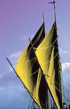
journey, during which more than 25,000 schoolchildren and community members visited or sailed aboard the canoe. “The message of the voyage,” said PVS President Pinky Thompson, “was that we cannot have a healthy culture unless we improve the physical health of our people. Taking responsibility for our own health - and, ultimately, the health of our planet - is not just a problem for Hawaiians but a problem for all of us.”
TAnd the incredible voyage continues. In 1996, PVS joined with The Queen’s Health Systems in a program to improve Native Hawaiian health. For ten months, Hōkūleʻa sailed throughout the Islands - a 2,000-mile
he PVS’s vision for a healthy Island future has since evolved into a far-reaching educational program called Mālama Hawaiʻi, or “Caring for Hawaiʻi.” And, as the new millennium dawns, Hōkūleʻa has only just returned from what many consider to be her most daring adventure: the epic upwind voyage to the isolated island of Rapa Nui at the extreme eastern end of the Polynesian Triangle. For those of us whose lives have been touched and transformed by the majesty of Hōkūleʻa , her ultimate lesson has been this: that humankind’s future survival on planet Earth requires that we all care for each other and our natural environment. As navigator Chad Baybayan puts it: “The land and the sea and all life on our planet are interconnected. So if we take care of even the smallest portion of land, or ocean or the smallest creature, we take care of ourselves.”
The framework of this article was based on the research of Dennis Kawaharada, and his timeline of Polynesian maritime expansion.
89 Traditional Pacific Voyaging
Hōkūleʻa’s sails harnessing the power of the winds. Photographer Sam Low
In Search of the Ancient Polynesian Voyaging Canoe
By Herb Kawainui Kāne
Article reproduced courtesy of the Polynesian Voyaging Society. The online version of this article may be found at: https://archive.hokulea.com/ike/kalai_waa/kane_search_voyaging_canoe.html
Polynesia began with the voyaging canoe. More than three thousand years ago, the uninhabited islands of Samoa and Tonga were discovered by an ancient people. With them were plants, animals, and a language with origins in Southeast Asia; and along the way they had become a seafaring people. Arriving in probably a few small groups, and living in isolation for centuries, they evolved distinctive physical and cultural traits. Samoa and Tonga became the cradle of Polynesia, and the center of what is now Western Polynesia.
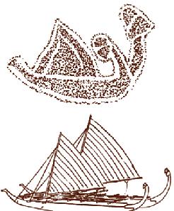
diffusion” explorers reached outward as far as Hawai’i to the north, Easter Island to the east, and New Zealand to the southwest. Before European open ocean exploration began, Eastern Polynesia had been explored and settled.
Canoe Design Evolution
More than two thousand years ago, Polynesians exploring eastward, during times when winds shifted away from the prevailing easterlies, discovered the Tahitian and Marquesas Islands. From these “centers of
Because the exploration and settlement of Eastern Polynesia originated from the same centers, the design of the canoes must have been much the same throughout. But that design disappeared. Ships are as mortal as their makers. Except for fragments of ancient canoes excavated on New Zealand and pieces of a large canoe recently unearthed from a bog on Huahine, there is no hard evidence.1 Except for a petroglyph on Easter Island, and passing references in the old legends, there is no descriptive record.
Over the following centuries, this “archaic” form
Maritime Museum of San Diego 90
The Easter Island canoe petroglyph found at Orongo and Herb’s rendition of what the original canoe may have looked like.
Tongan tongiaki recorded during the voyage of Abel Tasman in 1743. Abel Janszoon Tasman, Journal, ed. J.E. Heeres, Amsterdam: F. Muller & Co., 1898.
evolved into designs which became “classical” to each island groupspecialized to meet the challenges of local winds and seas and timber resources. When Europeans arrived, they found pronounced differences in canoe designs from one island group to another.
One such design change was witnessed by Europeans. Schouten in 1619 saw only the tongiaki double canoe in Tongan waters. When the Cook expedition arrived in 1773, the drawings of double canoes by the artist Hodges depicted a transition from the tongiaki to the swift kalia – a borrowing of the Micronesian “doubleender” concept. When Cook visited again five years later, the artist Webber’s drawings suggest that he saw only the new kalia 2

Design Strategy for Hōkūleʻa3
What were the design features of the ancient double-hulled voyaging canoes ( vaka taurua )?
Applying the “age-distribution” method, we assume that similarities in hull shape, sail shape, and construction
Below: Possibly the first visual record by Europeans of double-hulled canoes in the Pacific. These were observed by Schouten during his voyage through the northern Tongan islands. Journael... Amsterdam: Willem Jansz, 1618.

91 Traditional Pacific Voyaging
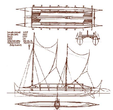
techniques which were widely distributed when Europeans arrived must have been carried outward from the centers of cultural diffusion during ancient eras of exploration and settlement, and may be accepted as features of the ancient canoes. By limiting the design of a voyaging canoe to these features, a performance-accurate replication of the ancient canoe is possible. Such features formed the design vocabulary of the replica Hōkūleʻa
Kenneth Emory and I went through all designs of canoes recorded in early drawings and in other evidence and sifted out those features of hull design and sail plan which by their wide distribution may be taken to be most ancient. These I applied to the conceptual design. From my own experience with the Pacific swell and in consultation with more experienced sailors, I arrived at a waterline
length of fifty-five to sixty feet as one that could handle the swells yet recover easily in the troughs, and Emory found that this could be taken as an average for the length of canoes used in the eighteenth and nineteenth centuries for long distance voyaging in the Tuamotus and Tahitian islands. Canoes of far greater length would put great stress on the lashings. The doubleended ndrua of Fiji and kalia of Tonga were of greater length, but these carried a smaller hull to windward involving less stress on lashings than two hulls of equal length, and were generally used on shorter voyages, which means during periods of predictable weather.
Some classical Hawaiian features were included which did not affect performance, such as the styling of the bow and stern pieces (manu) and the arched cross-beams (not really ancient, invented by Kanuha several centuries ago).
Kino (hull)
Hulls were carved from logs wherever timber of sufficient size was found. The depth of a hull might be increased by adding one or two courses of boards (strakes) fitted and lashed above the hull’s upper edges (gunwales). On atolls where large timber was not available for dugout hulls, the use of gunwale strakes was transformed into a method of building entire hulls “plank-built” over a dugout keel piece, with ribs and thwarts inserted to strengthen the planking.
All hull and sail design features must be compromises. Where paddling was the primary power mode with sail as auxiliary power, round-bottomed
Maritime Museum of San Diego 92
Construction Drawings for Hōkūleʻa
hulls were favored for their maneuverability; but where sailing was the primary purpose, hulls were deeper or had a greater amount of “V” shape along the keel for better tracking through the water. Such hulls are less maneuverable but offer lateral resistance to the water, reducing leeway (the sideways skidding of a boat hull away from the wind when sailing against or across the wind). Because the great distances covered by some ancient voyages could not have been accomplished by paddling, we may assume that the voyaging canoes were primarily sailing machines, with paddling being auxiliary. These were not the flat-sided “V” hulls of modern catamarans, but a rounded “V” by which the maximum floatation capacity could be carved from the natural shape of a log. A rounded “V” hull, with
the sides swelling outward in convex curvature, is also stronger than a flat-sided “V” hull because it adds the strength of an arch against the impact of waves.
Because the great distances covered by some ancient voyages could not have been accomplished by paddling, we may assume that the voyaging canoes were primarily sailing machines, with paddling being auxiliary.
Where hulls were of unequal length, the smaller hull was carried on the left, and called the amathe same term for the float outrigged from the left side of single-hull “outrigger” canoes. The one exception is the island of Tubuai in the Australs, where the ama is carried on the right; but today no canoe maker on Tubuai can explain why.
Below the waterline the curvature of all Polynesian hulls is convex, both in length and in section, with no cavities. Longitudinal curves below the waterline are smooth-flowing from bow to stern, creating a gentle entry at the bow and
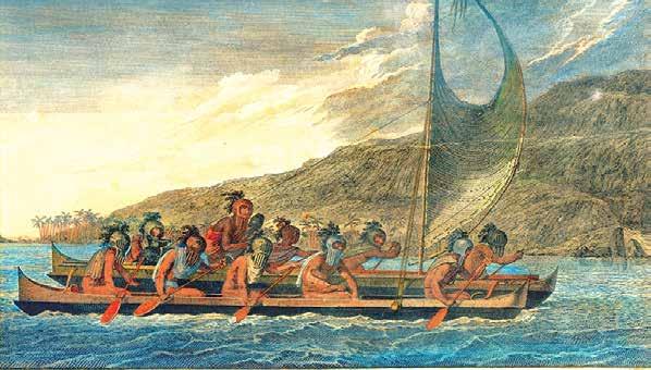
93 Traditional Pacific Voyaging
John Webber, Sandwich Island Canoe with Paddlers in Gourd Masks, c. 1784. Formerly in the Kelton Foundation Collection.
an equally gentle departure at the stern-features necessary for a “soft” ride and maximum hull speed. In these curves there are no abrupt breaks-no “chisel” bows to snag the water and make steering difficult, no abrupt departure at the stern which creates turbulence. For best speed the hull curves are faired out as much as possible (canoe builders knew how to use a flexible fairing strip to check their hull curves), with no hollows or flat areas to cause turbulence. The volume of Polynesian hulls aft of the midsection is slightly greater than the volume forward of the midsection. This extra floatation aft offsets the tendency of canoes to “squat” at the stern when under a hard press of sail.
BPeʻa (sails)
MMy first preliminary drawing for Hōkūleʻa (1973) featured triangular sails carried with the peak of the triangle downward and mounted on straight spars, a design which
by its simplicity and wide distribution seemed to be the most ancient form.
y first preliminary drawing for Hōkūleʻa (1973) featured triangular sails carried with the peak of the triangle downward and mounted on straight spars, a design which by its simplicity and wide distribution seemed to be the most ancient form. This sail plan was modified later in 1975 and again in 1976 with a curved boom to more closely resemble the Hawaiian sails at the time of European contact. However, experiments in 1991 and subsequent voyages
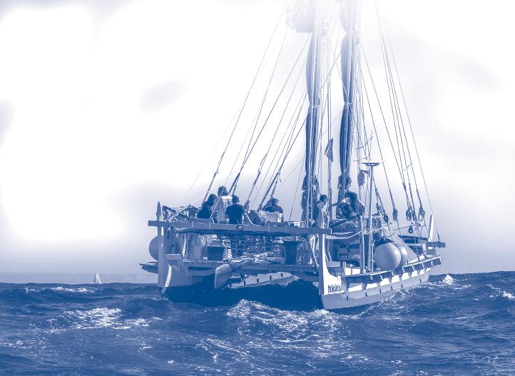
ecause double canoes are held together by rope lashings, the hulls must be assembled closer together than the hulls of modern catamarans. This narrows the space through which water must pass between the hulls. To avoid excessive turbulence between the hulls, the greater volume aft of the midsection should be obtained by greater hull depth, rather than increasing hull width.
Hōkūleʻa off San Diego, November 2023.
Photographer Mark Albertazzi
Maritime Museum of San Diego 94
have demonstrated that the simple triangular sail carried on straight spars is no less efficient; moreover, it is easier to furl and handle on deck when the rig is dropped to ride out bad weather.
Sails were of pandanus matting except in New Zealand, where pandanus could not be naturalized and flax was substituted. Sails were cut from long rolls of matting seldom more than 18” wide, double plaited of strips 3/16” to 3/8” wide in a twill pattern, changing to a check pattern along the edges for strength.
The sail was built up by overlapping the edges of these strips and sewing them with a running stitch. The outer edges of the sail were hemmed over a rope. A line was fastened with a running hitch at intervals along the outer edges. This line was then tied to the spars with a spiral lashing or with many short lengths of line.
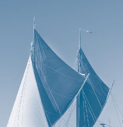
ʻIako (connecting cross-beams)
Curved booms, if desired, could be scarfed up from shorter poles to achieve the desired overall curvature and length. The long scarf joints were strengthened with splints and seized up with small line. Spars could also be strengthened at those places where sheets and stays were attached by seizing splints to them.
For a large voyaging canoe having no labor-saving winches, two sails are easier to handle than one large sail. The foresail should be the larger. By distributing the effort over two sails, the moment of capsize is lowered, imparting greater stability to a vessel which, being held together by lashings, is necessarily narrower than a modern multi-hull. If the vessel appears to be overpowered while sailing off the wind, sail area can be quickly reduced by dropping the aftersail.
A true replication of an ancient canoe should have crossbeams shaped from straight polesthe method most widely distributed. The arched crossbeam is a feature of the classical Hawaiian double canoe, invented only four centuries ago by the designer Kanuha in the time of Keawe. 4
In a quartering sea the hulls of a double canoe will work against each other. By inter-connecting the crossbeams with diagonal bracings of strong rope, this motion can be restrained, adding very little weight to the vessel.
While most cross-beams were lashed to the gunwales, the connection of the two hulls could be strengthened by two or more lower crossbeams let through the hulls, as seen in the drawing of a beached Tahitian double hulled sailing canoe by Webber, with Cook.5
95 Traditional Pacific Voyaging
Hōkūleʻa’s twin sails. Photographer Mark Albertazzi
The flashing speed of modern catamarans results from their wide beam and rigidity of construction, made possible by steel fastenings. The vaka taurua is a slower sailer. Assembled with cordage, it lacks the rigidity of modern multihulls, and the hulls must be closer together to reduce stress on the cross-beams.
Assembly by lashings seems to offer one advantage. As noted on the replica Hōkūleʻa , the cross-beam lashings absorb much of the shock of waves that beat against the hulls, a pounding that is transmitted throughout a modern vessel.
Pola (decking)
DManu (bow and stern pieces)
As I discovered while sailing Hōkūleʻa , end pieces have a practical function. Eastern Polynesian end pieces typically rise higher at the stern than at the bow. The sternpiece appears to break a following wave crest that might otherwise board the canoe. When the canoe surfs on a following wave, plunging forward, the bowpiece, in a burst of spray, helps prevent the bow from “boneyarding” into the back of the wave ahead.
When the canoe surfs on a following wave, plunging forward, the bowpiece, in a burst of spray, helps prevent the bow from “boneyarding” into the back of the wave ahead.
ecking may be of light planks if these are supported by webbing stretched between the crossbeams. Lighter planking means less weight. Deck planks should be spaced with gaps through which heaping waves can rise. Without such gaps to relieve wave pressure, strong surges can break the decking. In this compromise, it’s better to be safe than dry. Planks can be added over certain areas of the windward hull on long tacks, even out to the ends of the crossbeams, where they will deflect the splash of waves, and serve as hiking boards for the crew during gusts of wind.
Mast steps
Wind pressure on the sail drives the mast downward. Such pressure should not be borne by only one crossbeam. The masts may be stepped upon strong longitudinal beams ( kua ), each distributing the downward thrust over a least three crossbeams. Once the optimum center of effort is found by experimentally moving the masts forward or aft over these steps, additional crossbeams may be added under those points.
96
As expressed in the carving of end pieces, symbolism associated with birds or bird-man ( manaia ) forms was widely distributed. The term manu for the abstract shape of the classical Hawaiian end piece suggests that the archaic form may have represented birds. A pre-classical Maori bowpiece unearthed on New Zealand has a long neck and the head of a bird-man figure. European drawings of some Marquesan canoes, and old Marquesan canoe models, have bird-like shapes when viewed in profile, with the head at the bow, the gunwale strakes resembling wings, and the stern-piece appearing as the tail. Feathers were widely used as pennants flown from the end of a spar (Tahiti, Hawaiʻi), or black feathers hung from the stern piece (New Zealand); as bunches of feathers at the stern (Marquesas); and as feathers worked into the gunwale lashings (New Zealand, Marquesas).
Hale (deck shelter, pronounced “ha-lay”)
This may be a construction of light poles and purlins covered by thatching and/or tightly plaited matting. The shelter should be easily moved. On
Maritime Museum of San Diego
long reaches or tacks it should be positioned over the windward hull.
Sailing the Vaka Taurua Steering
The idea of steering a sixty-foot multihull without a rudder has intrigued conventional yachtsmen on their first sails aboard Hōkūleʻa . On a downwind course the steering paddle is handled in the manner of a rudder, and long sweeps were used on some Polynesian canoes. On any other tack, however, the steering paddle is held against the lee side of the hull near the stern. The pressure of the water against the blade helps hold it fast, and very little effort is required to hold a heavy steering paddle in place. A slight twisting pressure to
hold the leading edge of the blade firmly against the hull prevents the flow of water from getting under the blade and kicking it away. For this reason, steering paddles were often carved flat on the side held against the hull, and concave on the other. 6
At a canoe’s first sea trials, the masts should be experimentally shifted forward or aft until the center of effort is balanced with a slight weather helm, so that when the paddle is raised, decreasing its lateral resistance to the water at the stern, the stern will fall off the wind, turning the vessel into the wind. When the paddle is lowered, creating more lateral resistance at the stern than exists at the bow, the canoe will turn off the wind. The Polynesian paddle creates less drag than the modern rudder, and is put in the water only when needed.
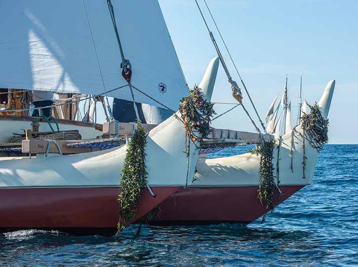
97 Traditional Pacific Voyaging
Hōkūleʻa’s twin manu. Photographer Mark Albertazzi
Steering with the Sails
On long reaches, steering paddles may not be needed at all; the canoe can be rigged to steer itself by sails alone. The aftersail is eased out slightly more than the foresail. As the canoe rounds up into the wind, the aftersail luffs and loses power. Pressure on the foresail now causes the vessel to turn off the wind a few degrees. The aftersail is again presented to the wind; it fills, and the vessel begins another slight turn to windward. Sawing slightly into the wind and off the wind, the canoe will steer itself on a close reach for hours.
Tacking
IIn light or moderate winds the double canoe will come about (turn into and through the eye of the wind) without stalling if the crew backs the foresail, harnessing the wind to push the bows over.
n light or moderate winds the double canoe will come about (turn into and through the eye of the wind) without stalling if the crew backs the foresail, harnessing the wind to push the bows over. In a strong breeze, however, it’s difficult to come about without sailing. Then it is better to jibe (make the turn with the wind astern) by luffing the aftersail until the foresail powers the vessel well off the wind, then close-hauling both sails as the stern passes through the eye of the wind. Here, the blades of the steering paddles are held at full depth to grip the stern in the water. A double hulled vessel is slow to turn because its two hulls give it twice the waterline length of a sailboat of the same length.
Shortening the Sails
Sails and booms were brailed up to the mast while temporarily not in use. In the path of a dangerous squall, the prudent act would be to release stays and drop spars and sails, lowering the
center of capsize as much as possible. The canoe is brought into the wind, and the forestay (a running line) is eased out, lowering the mast aft. The shrouds will hold the mast in fore-and-aft alignment with the canoe as it comes down. Lacing between sections of sail matting might be quickly removed to shorten sail. Storm sails may be simple, small, strongly made sails lashed to short straight spars with stays and shrouds already attached. Rolled up and stored away, these can be raised to power a canoe in moderate gales.
Leeboards
The use of leeboards to diminish leeway and help a vessel without a keel go to windward was a Chinese invention which never got to Polynesia, but the same effect was accomplished, when required, by a row of men holding paddles against the lee side of a hull. This takes practice, but it can add ten degrees to a canoe’s windward performance.
Storm Survival
An approaching storm meant getting down sails and spars, even jettisoning the deck shelter if necessary to reduce windage, and laying out a sea anchor on a very long line. Strong baskets are said to have been used in Hawaiʻi. If necessary, the next step would be to deliberately swamp the canoe, a technique that modern minds find incomprehensible, but which is still commonly practiced in Micronesia. Wooden hulls provide sufficient floatation so that the crew can ride within the hulls with their heads and shoulders above water. Being mostly under water, the canoe will not be buffeted about. Most importantly for navigation, it will not skate downwind, but will hold position fairly well.
Maritime Museum of San Diego 98
After the storm has passed, the hulls can be bailed out and the voyage resumed. It’s helpful to have additional positive flotation to raise the gunwales with enough freeboard to facilitate the bailing. On the old canoes, coconuts served as positive floatation as well as providing food and drink. These, and other cargo, were held down in the bottoms of the hulls under netting. Today, any inflatable devices secured under netting can be inflated to give the hulls more freeboard. Rigid foam or empty containers packed under the bow and stern covers will also add floatation.
Endnotes
1 “The main evidence that we have of what the voyaging canoes were like came from an island called Huahine, which is about 110 miles west of Tahiti. In an area called Maeva, a hotel called the Bali Hai was being built and when they were digging up the ground, they found some canoe bailers. They called Dr. Sinoto from the Bishop Museum and he went down and conducted an excavation. He thinks that six hundred to a thousand years ago there was a canoe under construction here and the work place was hit by a tsunami which buried the canoe under mud and sand and preserved it by cutting off the oxygen that causes wood to rot. “Sinoto unearthed planks of the canoe with coconut fiber ( aha ) still holding them together. There was a knot in the plank and what the builders did was to put wood in from behind and lashed the two pieces of wood together to make a sandwich. Dr. Sinoto guesses that this canoe was 72 feet long, ten feet longer than Hōkūleʻa ”. Nainoa Thompson, Speech at Kamehameha Schools, April 1998.
2 Haddon and Hornell explain, “The principal features wherein the t ongiaki differed from the kalia were: (1) in the approximate equality of the two hulls; (2) in sailing, the same ends were always directed forward and in consequence the manipulation of the sail was entirely different; (3) the mast was much shorter and had a forked head in which the yard rested, with the tack of the sail confined by ropes between the prows and not stepped at the fore end of one hull; (4) the presence of an outrigger balance spar; (5) the deck platform was relatively larger and extended considerably farther aft than in the kalia ; (6) the deck shelter was a tunnel-shaped hut without a platform above the roof. A.C. Haddon and James Hornell, Canoes of Oceania , vol I, (Honolulu: Bishop Museum, 1936) 271-272.
3 Kane lists the following people as important contributors to the design and building of Hōkūleʻa: Kenneth Emory: consultation on ancient design features. Herb Kawainui Kane: conceptual design and establishing design parameters in a general drawing. Rudy Choy: consultation and advice on hull design. Vince Bartelone: the hull-lines drawing Kim Thompson: the lines drawings for the end pieces (manu)
Warren Seaman: lofting the hulls and laying up sections and stringers on the strongbacks. Curt Ashford and Malcolm Waldron: chief shipwrights.Jim Ebersold, Calvin Coito, and others: boat carpenters. Wright Bowman, Sr. and Wright Bowman, Jr.: crossbeam construction. Keola Sequeira: carver of the koa mast heads (he donated the koa). Bob Fortier: protective fiber-glassing of the wooden hulls. Kane recalls: “These were most of the hands-on guys. Additionally there were part-time carpenters and a host of volunteers. Most of the board members donated some time. Publisher Carl Lindquist brought his family down to help with the disagreeable task of poisoning the interiors of the hulls to prevent rot. Kawika Kapahulehua facilitated air transportation for materials and supplies. Slim’s Power Tools donated the use of power tools. Many merchants helped procure supplies and materials at cost. Dillingham Corporation donated the use of the building premises. I don’t remember the name of the trucking company that gave us a price break to haul the completed parts over the island to Kualoa Park (how I obtained that launching site from mayor Frank Fasi after the State gave me the run around for months on San Souci beach is another story). The US Marines at Kaneʻohe brought equipment to lift and set the hulls in perfect position for the lashing up, which was done over five weekends by many volunteers.
4 David Malo, Hawaiian Antiquities, 2nd ed., (Honolulu: Bishop Museum Press, 1971), 130.
5 J.C. Beaglehole, The Voyage of the Resolution and Discovery (Cambridge: Cambridge University Press, 1967) plate 25-b.
6 “In the earliest days of Hōkūleʻa, when she was going through sea trials, the steering mechanism was like the kind we use on a six man canoe but the problem was that a six-man canoe weighs 600 pounds and Hōkūleʻa weighs – fully loaded – about 24,000 pounds and guys who were trying to steer her were getting knocked out, ending up in the hospital, and it wasn’t working and I was looking at that thing and saying, ‘Oh, man, it is really going to be a long trip.’ And so some of the beach boys said, ‘We are not going to do it this way anymore. We have got to come up with a steering sweep.’ And so they designed a steering sweep that would work – from their experience at Waikîkî – and it solved the steering problem. And the steering sweep that they pulled out of that swamp in Huahine (see note 1) – it was discovered after the beach boys figured out how to design a sweep for Hōkūleʻa – and this sweep (excavated in Huahine) is very similar in design and only two feet shorter than the ones we use to steer Hōkūleʻa ”. Nainoa Thompson, Speech at Kamehameha Schools, April 1998.
99
Pacific
Traditional
Voyaging
Voyaging
By Nainoa Thompson
The following material was edited and reproduced with the permission of the Hawaiian Voyaging Society. These collected articles are found in the online archive of the Polynesian Voyaging Society at: https://archive.hokulea.com/index.html
Why We Voyage
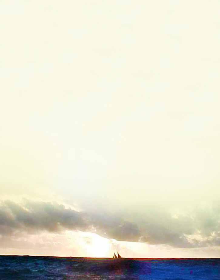
The following reflection by Nainoa Thompson places the 19992000 voyage from Hawaiʻi to Rapa Nui and back within the broader context of Polynesian voyaging traditions and the role played by Hókúle’a as means of searching for some of the most compelling questions related to the first human exploration and colonization of the Pacific.
The Polynesian Voyaging Society was founded for the purpose of scientific inquiry into our Polynesian history and heritage. For decades the society has sought answers to some of the vital questions concerning the peopling of the Pacific. How did the Polynesians discover and settle small islands in ten million square miles of ocean, geographically the largest “nation” on earth? How did they build canoes from limited resources on small
islands? How did communities come together to combine resources, material, and human labor, to build and sail these voyaging canoes? How did they navigate without instruments, guiding themselves across ocean distances of 2,500 miles? And how did they transport the food necessary for societies to survive, then flourish on previously uninhabited islands?
Since 1975 the Polynesian Voyaging Society has built two voyaging canoes, Hōkūleʻa and Hawaiʻiloa , and conducted an ongoing series of major oceanic voyages as part of a search for answers to questions posed above. The voyage to Rapa Nui in 1999 sought answers to fundamental questions regarding human interaction with that island. How did the Polynesians find Rapa Nui, a remote, isolated island smaller
Nainoa.
Photograph by Sam Low
Nainoa Thompson, navigator for the Polynesian Voyaging Society, has inspired and led a revival of traditional voyaging arts in Hawaiʻi and Polynesia-arts which have been lost for centuries due to the cessation of such voyaging and the colonization and Westernization of the Polynesian archipelagos. In 1980, Thompson became the first Hawaiian and the first Polynesian to practice the art of wayfinding on long distance ocean voyages since voyaging ended in Polynesia around the fourteenth century. Thompson has developed a system of wayfinding, or non-instrument navigation, synthesizing traditional principles of ancient Pacific navigation and modern scientific knowledge. This system of wayfinding is being taught in schools throughout Hawaiʻi and the Pacific. In addition to being a navigator, Thompson is a leader with a vision, and a charismatic, spell-binding storyteller. A more extensive biography can be found at: https://archive.hokulea.com/index/founder_and_teachers/nainoa_thompson.html
than Niʻihau, the smallest major island in the Hawaiian Archipelago? How did they get there 1400 miles against the wind from Mangareva, where the settlers are believed to have originated? Once again, we were challenged and excited about the opportunity to look for answers. There was no guarantee that we would find the island, but we were excited about learning, about discovering something new.
One of the important themes of the 1999 voyage to Rapa Nui is why we explore, and in the process of exploring, envisioning something that’s important in our lives, recognizing that we need to do research and plan out the details. We understand that we need to build a community to support this kind of effort, that we have to prepare and train, and that we need to take risks somewhere along the line to achieve things that are of great importance. We hope that through the process of exploring that we will continue to inspire young people to visualize and pursue their own dreams.
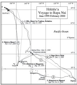
In modern times we’ve been exploring physically outward for decades into the Pacific, and certain themes have emerged as important to us – education and protecting and preserving our beautiful environment, our rich heritage and culture, and our kinship with other Pacific Island nations who are really our ancestral families.
When we add all these themes up, we find they are really about relationships – among all of us as members of this community and between all of us and this beautiful place – Hawaiʻi – in which we live. Our work may be in history and culture, but it’s really about finding ways in which we can all participate in trying to envision and shape the kind of future that we want not just for us, but for generations to come.
The Voyage Home from Rapa Nui in 2000 was in many ways more important for us than actually getting to Rapa Nui. The Voyage Home allowed us to articulate what home is and how we want to envision it. There are a million people here in Hawai’i and they could choose to live elsewhere; but for most of us, we choose to live here because Hawai’i is an incredibly special, rare, unique place on earth. Its beauty, its mana, its relatively peaceful multi-ethnic community – we all have our definition of why it’s special. During the Voyage Home from Rapa Nui, we began a dialogue in the community about what makes Hawaiʻi special and how we can protect its unique character.
During this voyage, Hōkūleʻa carried the hopes, aspirations, and dreams of the many people who cared for her and touched her. This voyage inspired us and created opportunities for us to be a community that’s defined not by geographical or racial issues, but by the values which make it special.
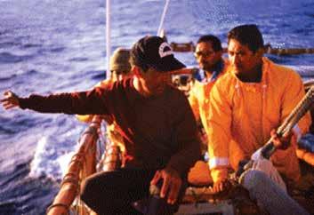
101 Traditional Pacific Voyaging
On Wayfinding
By Nainoa Thompson
The star compass is the basic mental construct for navigation. We have Hawaiian names for the houses of the stars – the place where they come out of the ocean and go back into the ocean. If you can identify the stars as they rise and set, and if you have memorized where they rise and set, you can find your direction.
The star compass also reads the flight path of birds and the direction of waves.
It does everything. It is a mental construct to help you memorize what you need to know to navigate.
You cannot look up at the stars and tell where you are. You only know where you are in this kind of navigation by memorizing where you sailed from. That means constant observation. You have to constantly remember your speed, your direction and time. You don’t have a speedometer. You don’t have a compass. You don’t have a watch. It all has to be done in your head. It is easy-in principle-but it’s hard to do. The memorization process is very difficult. Consider that you have to remember those three things for a month-every time you change course, every time you slow down. This mental construct of the star compass with its Hawaiian names is from Mau. The genius of this construct is that it compacts a lot information and enables you to make decisions based on that information.
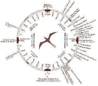
How do we tell direction? We use the best clues that we have. We use the sun when it is low down on the horizon. Mau has names for the different widths and the different colors of the sun’s path on the water. When the sun is low, the path is narrow, and as the sun rises the path gets wider and wider. When the sun gets too high you cannot tell where it has risen. You have to use other clues.
Sunrise is the most important part of the day. At sunrise you start to look at the shape of the ocean-the character of the sea. You memorize where the wind is coming from. The wind generates the waves. You analyze the character of the waves. When the sun gets too high, you steer by the waves. And then at sunset you repeat the process. The sun goes down-you look at the shape of the waves. Did the wind direction change? Did the swell pattern change? At night we use the stars. We use about 220, memorizing where they come up, where they go down.
When it gets cloudy and you can’t use the sun or the stars all you can do is rely on the ocean waves. That’s why Mau told me once, “If you can read the ocean you will never be lost.” One of the problems is that when the sky gets black at night under heavy clouds you cannot see the waves. You cannot even see the bow of the canoe. This is
Maritime Museum of San Diego 102
where traditional navigators like Mau are so skilled. Lying inside the hull of the canoe, he can feel the different wave patterns as they come to the canoe, and from them tell the canoe’s direction. I can’t do that. I think that’s what he started learning when he was a child with his grandfather, when he was placed in tide pools to feel the ocean.
In 1979, when Mau was confident that I could guide the canoe by myself, he said, “Now I am going to go to sleep; you follow this star path.” And like an overly eager student, I wanted to try sailing in a different direction to experience what the wave patterns felt like when I changed directions. I thought he wouldn’t notice because he was sleeping inside the hull. When morning dawned, he came up and said, “Okay, what course did you sail last night? What star bearing did you hold?” He knew I had changed course. Lying in the hull, he actually knew the course I had steered; he challenged me to tell him in order to make sure that I knew where we had gone.
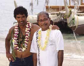
our course line plotted for the trip. We try to stay on this course and end up in what I call a box. This box is large enough to compensate for any errors in our navigation. In this box there are many islands. All we have to do is to find one of them, and from that island we can find the others. For example, the target when we sail to Tahiti is a box four hundred miles wide, from Manihi in the Tuamotu islands to Maupiti in the leeward Tahitian islands. The first part of the journey to Tahiti is not trying to get to Tahiti but to make sure that we sail into this box and find an island. On different voyages, we have found Matahiva, Tikehau, and Rangiroa-all islands in the box. Since these are coral atolls it is very difficult to tell one from the other, so sometimes we have to land and ask the people what island it is that we’ve found. From any of these islands, we know Tahiti is only about 170-180 miles away and our navigation system is accurate enough to find it from that distance.
Tahiti is smaller than Maui and it is a hard target to hit from 2500 miles away. Even hitting a target as large as the Big Island from that distance is outside of the accuracy of our navigation. When we go down to Tahiti, we have a mental image of
Now consider another navigational problem –finding Hawaiʻi from Tahiti. The Hawaiian islands are 315 miles wide, from Niʻihau to Kumukahi on the Big Island, but if you approach them from the southeast they are a narrow target because they are aligned southeast to northwest. The technique we
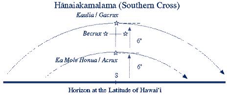
103 Traditional Pacific Voyaging
Nainoa Thompson stands with his mento, Mau Pialug, in 1998.
use is to sail up to the latitude of Hawaiʻi on the east side of the islands, using the stars to tell our latitude. When we determine we are at the mid-latitude of Hawaiʻi, 20.5 degrees N, we turn west and try to sail into the islands on this side, 240 miles wide-the sight distance from South Point on the Big Island [18.5 degrees N] to the sight distance from Hanalei on Kauaʻi [22.5 degrees N]. Again, our navigation system is accurate enough to hit this target.
The Southern Cross is really important to us in determining latitude. It looks like a kite. The top and bottom stars in the kite always point south – Gacrux on top and Acrux on the bottom. If you are traveling in a canoe and going south, these southern stars are going to appear to be moving higher and higher in the sky. If you went down to the South Pole, these stars are going to be way overhead. If you are sailing from Tahiti north to Hawai ʻ i, the Southern Cross gets lower and lower
the farther north you go. At the latitude of Hawaiʻi, the distance from the top star to the bottom star is the same distance from that bottom star to the horizon – about 6 degrees. This configuration only occurs at the latitude of Hawaiʻi.
If you are in Nukuhiva in the Marquesas Islands and looking at the Southern Cross, the distance between the bottom star in the Southern Cross and the horizon is about nine times the distance between the two stars.
Finding atolls, which are very low, is extremely difficult, but there are a lot of clues to the presence of islands. The wave patterns change when an island is near. The behavior of animals in the sea, such as dolphins, will change. Mau can read these clues. The main guide is sea birds. There are two general types of seabirds that Mau taught us about. There are the pelagic seabirds-after the young are hatched and learn to fly, they go to sea and stay there, normally
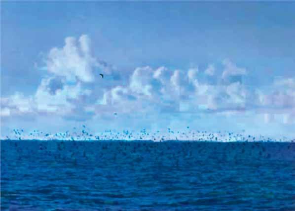
Maritime
104
Museum of San Diego
A large bird pile near Rangiroa Atoll in the Tuamotu Archipelago. Photograph by Na‘alehu Anthony
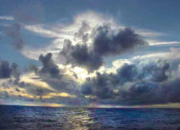
sleeping on the water or in the air and fishing until they become adults; then they come back to land to nest. The ʻiwa bird is pelagic and we see it all the way across the ocean. Following these birds will not help you find land. The other type of birds are those that sleep on islands at night and at dawn go out to sea to fish. These land-based birds include the manu o ku (white tern) and noio (brown tern). Noio go about forty miles out; the manu o ku go about 120 miles out. The Tuamotus are filled with these birds.
After we sail about twenty-nine days down from Hawai’i and staring seeing these birds, we know the islands are close even though we can’t see them. When the manu o ku is fishing, it flutters above the ocean surface, but when the sun starts to go down, it will rise up from the water so it can see farther, and it will head straight back to land. When we see these birds in the day we keep track of them and
wait for the sun to get low and watch the bird; the flight path of the bird is the bearing of the island. Then we turn on that bearing, sail as fast as we can, and at sunset we climb the mast to see if we can find the island. And if we can’t see it, we heave to until the morning.
On my first voyage in 1980, we saw two birds after the twenty-ninth day and I was extremely relieved. At least we were in the ball park. I did everything that I was taught to do and the birds did everything that they were supposed to do. They went up high and they flew away and we sailed in that direction. We couldn’t see the island at sunset, so we took the sails down at night and we waited. The next morning we looked for the birds to see what direction they were coming from. In the morning they go back out to
105 Traditional Pacific Voyaging
Sunrise, February 11, 2000; six days out of Tahiti View from Hōkūleʻa’s beam – towering cumulus clouds.
the fishing ground, so the direction they are coming from is the direction to the island. We had a great crew of fourteen and we made a ring around the canoe before dawn. We waited for the first bird. All hands on deck. Not a single bird. I was in near trauma. It was my first voyage, in my early twenties. Mau was very calm and didn’t say anything. We waited and waited. The canoe was just sitting dead in the water, facing south.
One of the canoe members was in the back of the canoe and a bird flew right over his head. The night before we saw the birds flying south so how could it be that late in the morning with the sun very high, this bird was also flying south? That would suggest that we passed the island during the night and now the island was back to the north. In my panic, I told
the crew we should turn the canoe around and go north-to look for the island the bird was coming from. They turned the canoe around-and now we are sailing north, back toward Hawaiʻi. Now Mau has always said that his greatest honor would not be as a navigator but as a teacher – that he would come with us to make sure that the voyage to Tahiti would be safe, but if he didn’t have to tell me anything, the honor as a teacher would be his. But after I started to sail north he came to me and said, “No.” It was the first time that he interrupted the trip. He said, “Turn the canoe around and follow the bird.” I was really puzzled. I didn’t know why. He didn’t tell me why, but we turned the canoe around and now we saw other birds flying south. Mau said, “You wait one hour and you will find an island.”
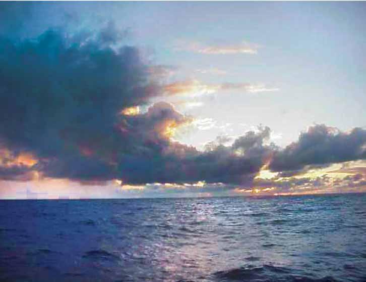
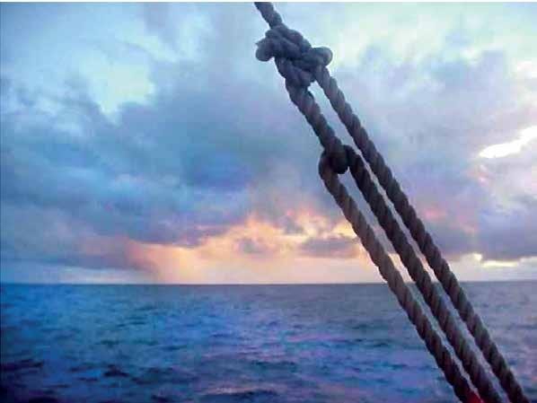
fter about an hour, Mau, who is about twenty years older than me – my eyes were physically much more powerful than his – got up on the rail of the canoe and said, “The island is right there.” We all started looking, and we couldn’t see it. Vision is not so much about just looking, but knowing what to look for. It’s experience. Mau had seen in the beak of the bird a little fish, and he knew that the birds were nesting, so they had flown out earlier that morning and were taking food back to their young before they fed themselves. He just did not tell me that in our training program.
Not everybody can navigate. We have some great navigators in Hawaiʻi – Shorty Bertelmann from the Big Island; my brother-in-law, Bruce Blankenfeld from Oʻahu; and Chad Baybayan from
Maui. We base our projected course line before the voyage on average winds and sea conditions for twenty-four hours, but these are never average. The majority of navigation is observation and adjusting to the natural environment. The rougher the weather, the more the navigator needs to be awake and the less he can leave the crew on their own. We estimate that our navigators stay up between twenty-one and twenty-two hours a day, sleeping in a series of catnaps.
Mau says the mind doesn’t need much rest. But the physical body does. When the navigator is on the canoe, the crew does the physical work. When he is tired, he closes your eyes. Mau told me that for him maybe his eyes are closed but inside here, inside his heart, he is always awake.
107
Pacific Voyaging
Traditional
Feb. 15, 2000; 10 days out of Tahiti. Nainoa’s view of the sea at sunrise, and what he sees in the shape of the clouds.
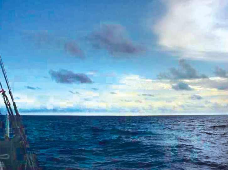
The navigator sleeps whenever his mind needs to rest. You work until you can’t think, basically, then you lie down. I close my eyes and go to sleep. I have no dreams in the beginning. My first dreams are fire. I see reds and oranges. Then I get up when my mind is awake again. I do a series of those catnaps. The main thing is to make sure that your physical body doesn’t do any work because then you get sick. Initially, I depended on geometry and analytic mathematics to help me in my quest to navigate the ancient way. However as my ocean time and my time with Mau have grown, I have internalized this knowledge. I rely less on mathematics and come closer and closer to navigating the way the ancients did.
Predicting Weather: Reading Clouds and Sea States
During Hōkūleʻa’s voyage from Tahiti to Hawai’i in Fe bruary 2000, documenter Sam Low photographed clouds and sea states and recorded navigator Nainoa Thompson’s readings of them.
“A Navigator always looks for signs of weather at sunset and sunrise,” Nainoa says. “Generally, at sunrise and sunset you try to predict the weather for the next twelve hours. Today I see strong evidence in the clouds of a change in the weather from what we have experienced in the last two to three days. Looking to the east – off the beam of the canoe I see various complicated towering high cloud masses, which are the remnants of the squalls that we went through last night. Yesterday and the day before I looked out and saw actual squalls there – today there are no squalls evident.
Maritime Museum of San Diego 108
View towards the bow of the canoe from roughly dead ahead to 45 degrees off the bow.
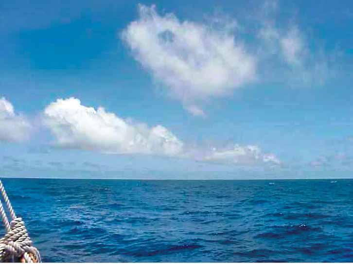
February
Y2000;
ou can’t really predict the weather, as Mau taught me, from a single snapshot like this. You have to observe changes over time. In this case, I see a change from seeing squalls off the starboard yesterday to this view today where there are no active squalls. The wind definitely feels stronger today and I can see wind wavelets on the surface of the ocean. The wind is also coming from the normal direction of the SE trades, so I can presume that the trades are reasserting themselves.”
“I see a lot of low level cumulus clouds ahead of us in the direction we are moving. There are no indications of any squalls in those clouds so I think I can predict we are approaching an area of clean flowing wind – trades from the SE – which will be steady. That is quite different than the variable winds we have been experiencing. So, for the next twelve
hours, I believe that the wind will remain steady from the SE at a fairly constant speed, maybe 10 knots, so we will be able to sail N today.”
“Every time I attempt to predict the weather or sail on this canoe I am constantly reminded of how smart our ancestors were. My understanding of nature is feeble compared to theirs. We can have today only a glimpse into their world – into the strength and courage that made them the greatest navigators and explorers on earth. We sail in comfort with foul weather gear to protect us on a canoe partly made of modern materials, with all kinds of safety devices on board. They had none of that. They were attuned intimately to nature in a way that we cannot be. At best, our voyages are just beginning to give us a glimpse into their world.”
109 Traditional Pacific Voyaging
14,
9 days out of Tahiti. “Mau taught me to call clouds that look like this “the road to the wind.”
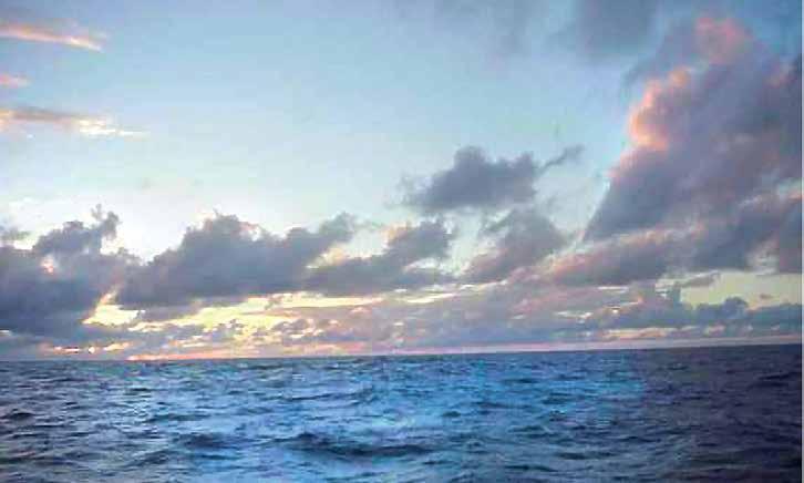
Imagine at the far horizon there is a factory producing the clouds and, like smoke from a haystack, they follow the wind. This road indicates the wind is coming from the horizon. and because the road is straight, the wind is steady. If you see the road curve, it means that the wind direction will change and the way it curves will tell you the new direction. It is interesting to me that meteorologists call this kind of phenomenon “cloud streets’, pretty close to Mau’s term “Road of the Wind.”
“The sky where the sun is rising is very clear – I don’t see any smoke (which is caused by strong winds stirring salt into the atmosphere) – so I think the winds will be relatively light today.
“Ahead of us, I see two squalls, but there are no squalls beyond them so we should have good weather once we pass through them.”
“On the horizon you see what we call zone-based trade wind cumulus clouds. There is little vertical development, meaning no high clouds, and no squalls are visible. These clouds suggest to me a stable weather pattern. The wind is clean and predictable, blowing 20-25 knots. I judge the wind speed by the feel of the wind against my body, also by the fact there are a lot of white caps and wind streaks along the ocean surface, also the size of the swells which are about ten feet high. (On Feb. 20 the wind blew from the NE, forcing us to steer too far to the west; since then the wind has shifted more easterly allowing us to head north.)
Maritime Museum of San Diego 110
Feb. 20, 2000; 15 days out of Tahiti
Daily Life AboardHōkūleʻa
By Elisa Yadao
“Once you go on the canoe, because it’s so small, you try to make it like one family.” -That is the sailing philosophy of Snake Ah Hee, a sixteen-year veteran crew member of the Hōkūleʻa For a dozen plus people to live happily and harmoniously in tight living quarters and over thousands of miles, he and other crew members know the right mental and emotional attitude is key.
Living space is tight - the deck is about forty feet long and 10 feet wide, totaling 400 square feet.
Sleeping quarters are even more cramped and less than comfortable. The sleeping compartments run the length of both sides of the deck and are covered with canvas. Individual spaces measure about six feet in length and three feet across, usually with two crew members assigned to each space. One person sleeps while the other stands watch. Personal belongings are stowed here, with each crew member allowed one forty-eight-quart cooler. Beds consist of a board placed over the coolers, covered by a sleeping pad.
Bathroom facilities, located on either side of the canoe, take things right down to basics.
Going to the bathroom involves strapping a safety
harness on, hooking the harness to a railing or safety line, and then relieving yourself overboard while standing or sitting on the running board on the outside of the hull. The flushing action depends on how fast the canoe is going and how rough the seas are. In calmer conditions, a bucket of water is used.
Bathing is done either forward or aft on the canoe. Forward, you sit in a net slung between the two canoe hulls. Aft, you bathe in an open compartment, pulling salt water up in a five-gallon bucket. You use a special sea soap, which makes bathing in salt water actually refreshing.
Because the canoe is so small, privacy is limited at best, but all crew members respect the needs of others. Generally, when someone is bathing or going to the bathroom, the rest of the crew moves away out of courtesy. When women are sailing, certain accommodations are made, such as hanging a curtain over the aft bathing area.
Cooking is done in the center of the canoe. The galley, or kitchen, is a two-burner propane gas stove housed in a metal box. By necessity, most of the food
Article reproduced with permission of the Polynesian Voyaging Society. The online version can be found at: https://archive.hokulea.com/ike/canoe_living/daily_life.html
111 Traditional Pacific Voyaging
Kawika Crivello looking out from the sleeping quarters.
Inside the sleeping quarters.
on board comes out of a box or can, supplemented by whatever fresh fish the crew can catch. Each voyage has a designated fisherman, who puts his trolling lines out off the back of the canoe every morning.
On long trips, food is much more than a source of nutrition and sustenance. Mealtime is one of the few times during the day that the entire crew is together on deck. On long monotonous days, meals are a highlight. When the weather is cold and rainy, a hot meal can do wonders for morale.
The canoe carries bottled fresh water for cooking and drinking. On an estimated thirty-day voyage the canoe will carry enough water for forty days at sea. If water supplies become too low, the captain can order that water
be rationed. Crew members also store rai n water for cooking and bathing.
It takes a lot of work to sail Hōkūleʻa and everyone is assigned a job. Crew members are divided into watches, teams of people who work specific shifts. On the normal three-team watch system, each person works a four hour shift twice a
Maritime Museum of San Diego 112
day, with eight hours off in between. If you are on the 2 to 6 watch, you’ll work from 2:00 AM to 6:00 AM in the morning and then again from 2:00 PM to 6:00 PM in the afternoon. In bad weather, the crew may go to a twoteam watch system.
The watch on duty is responsible for maintaining the canoe, working the steering paddles, handling the sails and keeping water out of the compartments. At the start of watch the crew runs through a safety checklist to ensure that Hōkūleʻa is in optimum sailing condition. Each watch has a captain responsible for supervising the others on his or her team.
When crew members are off watch, they rest, read, write in their journals, wash laundry, make music or simply relax and enjoy being out at sea. Time can pass slowly although this is the exception rather than the rule. Being away from home for extended periods of time, the crew does experience ups and downs and homesickness is not uncommon, especially for the new crew members.
Older crew members have the responsibility to make sure that everyone gets through these low points.

113 Traditional Pacific Voyaging
Right: Pancakes and eggs for breakfast.
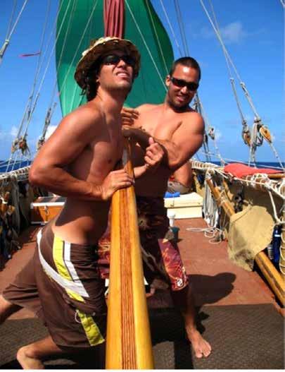
Roles and Duties of Hōkūle‘a Crew Members
Sailing Hōkūle‘a is a rigorous job, and it requires the participation of all crew members on board. To ensure that the canoe sails safely and efficiently, each person fills a specific role. Jobs vary from that of the navigator, to those crew members whose primary responsibility is documentation of the voyage for historical purposes. Providing they fill the job requirements, both men and women can hold the various positions described below.
T he person who carries the overall responsibility for the canoe and crew is the sailmaster. While he serves primarily in an advisory capacity, it is the sailmaster who
Steering is one of the main jobs of the crew. Hawaiʻi to Majuro 2007.
has the final say on the canoe’s sailing strategy and course and on all other operations of the canoe. He works in consultation with the navigators and captain.
The navigator, who is usually the same person as the sailmaster, determines the canoe’s course, sets the sailing strategy, and determines the direction in which the crew will sail Hōkūleʻa. He must stay oriented at all times, and this means that generally he is assigned no other duties aboard the canoe. To keep track of the canoe’s direction, the navigator stays awake 20 hours a day, seated on a platform at the aft of the canoe. The navigator gives direction to the crew through the captain. The crew on watch steers the canoe under the direction of the navigator and captain, working the steering sweep and paddles and trimming the sails to stay on course while maintaining the maximum speed.
The captain’s primary responsibility is the safe sailing of Hōkūle‘a and this encompasses everything from ensuring that a capable well-trained crew is on board to the physical maintenance of the canoe. Much preparation is done before the crew and canoe ever leave shore and this is done under the captain’s direction. In consultation with the other officers, the captain schedules work parties for preparing the canoe to sail. Re-lashing canoe parts, mending sails, cleaning and painting Hōkūle‘a hulls are just some examples of the kinds of work done before sailing.
Another big job is loading the canoe with food, water, and safety gear required on voyages. Again, it is the captain’s responsibility to ensure that this is done properly.
At sea, the captain executes all decisions relative to sailing. Once the navigator sets the sailing strategy, it is the captain who directs the crew to hoist, drop or change sails and he determines which steering paddles to use.
Maritime Museum of San Diego 114
He is responsible for coordinating activities with the escort vessel and providing a daily work schedule for the watch captains. The captain holds overall responsibility for maintaining the canoe’s inventory, and he decides when and if to ration food and water. When approaching land, the captain handles most administrative matters, such as dealing with customs officials and maintaining the canoe’s security while it is moored.
The watch captains direct those crew members assigned to their watch or work shifts, carrying out instructions relayed by the captain. The watch captain is responsible for ensuring that his crew is up and on duty in a timely fashion, assigning specific steering positions to his crew and directing rotations through the various positions, going through the safety check list, and maintaining his watch log. He is responsible for maintenance of the canoe during his watch, including cleaning up after meals. Additionally, the watch captain is responsible for monitoring the safety, health and morale of his crew.
Other tasks are assigned to crew members and carried out in addition to standing watch. The medical officer, usually a certified doctor, is aboard Hōkūleʻa for each long
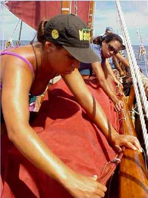
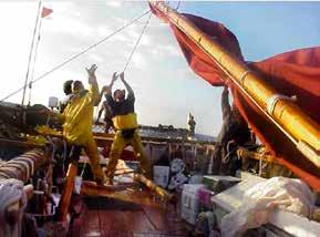
voyage. His primary responsibility is the health of the crew. It is the medical officer’s responsibility to ensure that the canoe is equipped with all medications and medical supplies needed for a long journey. When the canoe is in foreign ports, the medical officer is also responsible for attending to the crew’s health and medical needs on shore.
The radio operator handles all radio transmissions between Hōkūleʻa, and the escort vessel and between the canoe and land. He maintains an accurate log of all radio traffic, and is responsible for the upkeep of the radio equipment.
A designated carpenter oversees all repairs done on the canoe. He also maintains the tool inventory. An assigned electrician maintains all electrical systems.
The cook plans the canoe’s menus, maintains inventory of food supplies, and does most of the cooking. While this may not seem like an important job, the ability of the cook is directly related to the morale of the crew as
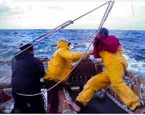
115
Traditional Pacific Voyaging
Changing Sails. Tahiti-Hawai‘i 2000.
Lowering the rig to prepare for a squall. Tahiti-Hawaiʻi 2000.
Tightening sheets in stormy weather. Tahiti-Hawai‘i 2000.
meals are the highlight of each da y. Good nutrition is also an important factor in maintaining the health of the crew.
The quartermaster is responsible for provisioning the canoe - loading food, water and all needed supplies, and for maintaining Hōkūleʻa inventory. While this is not an on-board job, it is critical to the safe and efficient sailing of the canoe. Weight must be evenly distributed for optimum sailing
Fishing off of the canoe is not a leisure time activity, but an actual designated job, and one crew member is responsible for setting and bringing in fishing lines each day and for landing all catches. Fresh fish provide an important food source at sea.
examples of the gear the canoe carries. In addition, all crew members must be trained in man overboard and fire procedures.
Crew responsibilities are exactly the same as the watch captain, with the exception of the administrative duties. Off watch, crew members’ main obligation is to keep out of the way of those on duty.
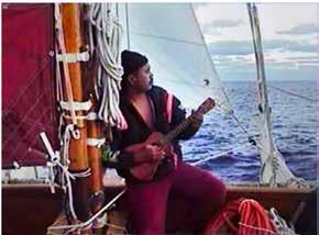
Documenters keep historical records of the voyage by various means including writing, video and audio taping.
The safety officer is responsible for all safety and emergency systems and equipment. Life jackets, life preservers, flares and fire extinguishers are just some
Leisure time is spent in a variety of ways including resting, reading, writing, and taking care of personal chores (laundry, cleaning out compartments etc.). In the event of bad weather or an emergency and an all-hands-on-deck call, all of the crew members are expected to work.
All jobs on the canoe, no matter how routine they may seem, are important to the overall safe sailing of Hōkūleʻa . A crew member’s most critical responsibility is to realize that his crewmates depend upon him to carry out his assigned duties, and to work well as part of a team.

Maritime
116
Museum of San Diego
Mona Shintani on his uke. Hiva Oa to Pitcairn, 1999.