EYFS
Concept
Enquiry
Vocabulary
RECEPTION
Communication and Language
Where did dinosaurs used to live?
Hambleton, dinosaur names, grass, trees, water, houses, park, features of Hambleton then and now
Reception Age Related Communication and Language
● Learn and use new vocabulary in new contexts
● Ask questions to find out more and to check they understand what has been said to them.
● Articulate their thoughts and ideas in well formed sentences
● Engage in non-fiction books
Key skills and knowledge
-Use
● Listen to and talk about selected non-fiction to develop a deep familiarity with new knowledge and vocabulary
RECEPTION RECEPTION
Communication and Language
Understanding the world
Communication and Language
Understanding the world
What can you see on the pirate map? Where and when is the story taking place? (using pictures in story books)
Map, globe, sea, land, island, bigger, smaller, hot, day, night, different, same, animal names, England, Australia
Reception Age Related Communication and Language
● Learn and use new vocabulary in new contexts
● Ask questions to find out more and to check they understand what has been said to them.
● Articulate their thoughts and ideas in well formed sentences
● Engage in non-fiction books
● Listen to and talk about selected non-fiction to develop a deep familiarity with new knowledge and vocabulary
Reception Age Related
Understanding the World
● Draw information from a simple map.
● Recognise some similarities and differences between life in this country and life in other countries
● Explore the natural world around them.
● Recognise some environments that are different to the one in which they live
setting, weather, summer, autumn, winter, spring, England, Australia, place names from stories
Early Learning Goal
Communication and Language
● Listen attentively and respond to what they hear with relevant questions, comments and actions when being read to and during whole class discussions and small group interactions.
● Make comments about what they have heard and ask questions to clarify their understanding
● Participate in small group, class and one-to-one discussions, offering their own ideas, using recently introduced vocabulary.
● Offer explanations for why things might happen, making use of recently introduced vocabulary from stories and non-fiction, texts when appropriate.

Early Learning Goal
Understanding the World
● Know some similarities and differences between the natural world around them and contrasting environments, drawing on their experiences and what has been read in class.
● Understand some important processes and changes in the natural world around them, including the seasons.
-Name
-Understand
-Name,
Year One: National Curriculum
Local Geography - My School in Hambleton National Geography- Weather
Global Geography- East Asia
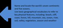
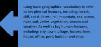
-Use basic geographica vocabu ary to refer to: key physical features, nclud ng: beach, cl ff, coast forest, hil , mountain, sea, ocean, river, soil, valley, vegetat on season and weather
basic geographica vocabu ary to refer to:key human features, including: c ty, town, vi lage, factory farm, house, office, port, harbour and shop
-Identify seasonal and da ly weather patterns in the United Kingdom and the location of hot and cold areas of the world in relat on to the Equator and the North and South Po es
locate and identify characterist cs of the four countries and capital c ties of the United Kingdom and its surround ng seas
and ocate the world’s 7 continents and 5 oceans
geograph cal s m lar ties and differences through studying the human and physical geography of a smal area of the United Kingdom, and of a small area in a contrasting non-European country
Geographical Skills & Fieldwork: -use world maps, atlases and globes to identify the United Kingdom and its countries, as well as the countries, continents and oceans studied at this key stage
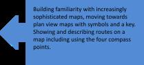
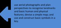
-use simple compass directions (north, south, east and west) and locational and directional language [for example, near and far, left and right], to describe the location of features and routes on a map -use aerial photographs and plan perspectives to recognise landmarks and basic human and physical features; devise a simple map; and use and construct basic symbols in a key
-use simple fieldwork and observational skills to study the geography of their school and its grounds and the key human and physical features of its surrounding environment
AUTUMN TERM
Local
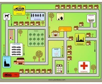
YEAR 1 My School in Hambleton
Investigate Places - Locational Knowledge, Place Knowledge
Concepts
Enquiry
Vocabulary
Investigate Patterns – Human and Physical Features
Communicate Geographically - Geographical Skills & Fieldwork
What is it like here?
Aerial photograph, city, distance, improve, location, north, south, east, west, compass, messy map, features, England, United Kingdom, Hambleton, left, right, backwards, forwards, near, far, up, down, direction, symbol, globe, atlas.
Flashback Exploring maps
Key skills and knowledge
1. Skill: To locate the school on an aerial photograph
Knowledge: To know what aerial means from above. To know the name of the country I live in (In England, The United Kingdom). To know the name of the village I live in (Hambleton), to identify the park, the river wyre and my school field on an aerial photograph. To locate the country I live in on a map (England as part of the United Kingdom).
2. Skill: To create a map of the classroom
Knowledge: To know a map is a picture of a place from above. To use a map to find out information about my school in Hambleton. To represent the outdoor area, the carpet area, the workspace (tables) and the reading corner on a messy map (a map using creative materials). To use directional language to describe the location of features (forwards, backwards, left and right).
SPRING TERM
National
The Weather in the UK
Investigate Places - Locational Knowledge, Place Knowledge
Investigate Patterns – Human and Physical Features
Communicate Geographically - Geographical Skills & Fieldwork
What is the weather like in the UK?
Atlas, compass, direction, location, season, weather, capital city, continent, land, map, temperature, weather vane, climate, country, locate, rain gauge, thermometer, wind streamer, autumn, spring, summer, winter, north, south, east, west, England, Northern Ireland, Scotland, Wales, London, Cardiff, Edinburgh, Belfast.
Maps, seasons, different weather, compasses/ directional language (NSEW)
1. Skill: To locate the four countries of the UK (England, Northern Ireland, Scotland, Wales).
Knowledge: To locate Europe on a world map. To locate the UK on a world map. To locate the four countries (England, Wales, Scotland, Northern Ireland) of the UK on a map. To recall which of the four UK countries I live in (England).
2. Skill: To identify seasonal changes in the UK. Knowledge: To name the four seasons (Autumn, Spring, Summer, Winter). To identify the current season. To describe some of the changes in each season.
3. Skill: To identify the four compass directions.
Knowledge: To know the four compass directions are north, east, south and west. To describe the location of features in the classroom using simple compass directions (N, S, E, W). To know the arrow on a compass always points North.
4. Skill: To investigate daily weather patterns.
Knowledge: To describe different types of weather (rain, snow, fog, wind, sun, hail, thunder and lightning, humid). To measure different types of weather over a week in different ways (thermometer, rain gauge, wind streamer, weather vane, shadows, puddles). To represent weather
SUMMER TERM
Global
The Wonders of East Asia
Investigate Places - Locational Knowledge, Place Knowledge
Investigate Patterns – Human and Physical Features
Communicate Geographically - Geographical Skills & Fieldwork
What is it like to live in Shanghai?
Continent, country, different, directional language e g near, far, next to, behind, key, human feature, map, physical feature, similar, symbol
Human and Physical features, exploring maps and creating maps
1. Skill: To recognise physical and human features on a walk around Hambleton. FIELDWORK
Knowledge: To give a definition and example of a physical feature. To give a definition and an example of a human feature. To identify physical (field, trees) or human features (school, park, church, houses on the main street outside the school, construction) on a walk around Hambleton. To record my observations by sketching the features I see on my walk (park, school, church, houses, construction, field, trees).
2. Skill: To draw a sketch map.
Knowledge: To use an aerial photograph to draw a simple sketch map of the area around school. To use symbols and colours to represent features around our school in Hambleton. To draw physical (trees/field) and human features (park, houses, school, church) on
3. Skill: Locate the mugger, the climbing frame, climbing wall and forest school on our playground. FIELDWORK
Knowledge: To find all four features in the school grounds (mugger, climbing wall, climbing frame and forest school). To use digi-maps to follow a simple map to identify the places listed above. To begin to use directional language to locate direction and location (left, right, backwards, forwards, near, far, up, down).
4. Skill: To draw a simple map of the playground including a simple key which shows where to locate the mugger, forest school, the climbing frame and the climbing wall. Knowledge: To draw forest school, the mugger and the climbing frame on a map. To use simple shapes or symbols to represent them. To use directional language to describe the location of features (left, right, backwards, forwards, near, far, up, down).
5. Skill: To know what human and physical features are and to locate them in our school grounds. FIELDWORK
Knowledge: To find human features in our school grounds. To find physical features in our school grounds. To locate human and physical features on my map (previously made) using a symbol to represent them. To use directional language to describe the location of human and physical features (left, right, backwards, forwards, near, far, up, down).
Double Page Spread: What is it like here?
Bird's eye view/aerial
How something looks from above.
Compass An object that uses a magnet to show directions.
Map A drawing of a particular area showing its main features.
Human feature
Physical feature
Made or built by humans.
Created by nature on the Earth.
Scale The size of things on a map compared to real life.
Symbol A picture that represents something.
Geographical skills and fieldwork
–
using weather symbols. To use compass directions (N, E, S, W) to describe the weather in forest school, mugger, reception CP, sinks and the climbing wall (Is it different depending on where you stand?) FIELDWORK
5. Skill: To identify daily weather patterns in the UK. Knowledge: To locate the country I live in (England) on a map. To locate the capital city of the country I live in (London) on a map of the UK. To begin to locate Edinburgh - Scotland, CardiffWales, Belfast - Northern Ireland and LondonEngland on a map of the UK. To know that the weather is not the same everywhere in the UK.
6. Skill: To understand how the weather changes with each season.
Knowledge: To describe the weather in each season. To suggest what people might wear in each season. To suggest activities people might do in each season.
Double Page Spread - What is the weather like in the UK?
Climate The long-term pattern of weather in a given area.
Season Four different times of the year are marked by weather patterns and hours in the day
Weather The state of the atmosphere at a particular place or time.
ThermometerIt measures temperature.
Rain gauge Captures and collects rainwater.
Weather vane Measures the direction of the wind.
a map.
3. Skill: To name and locate Asia, Africa, North and South America, Antarctica, Europe, Australia on a world map/digi-maps.
Knowledge: To name the continent I live in (Europe). To use an atlas to locate Europe on a world map/digi-maps. I can use an atlas to locate Asia on a world map/digi-maps. To use an atlas to locate China on a world map/digi-maps.
4. Skill: To identify the physical and human features of Shanghai, China.
Knowledge: To name some physical (mountain, river, desert, beach) and human features (The Great Wall of China, towns, cities, shops, farms, villages) of China. To sort photographs of China into physical and human features.
5. Skill: To describe what it is like in Shanghai, China.
FIELDWORK - DIGITAL
Knowledge: To label physical features on photographs of Shanghai. To label human features on photographs of Shanghai. To describe what I like about Hambleton and what I like about Shanghai.
6. Skill: To compare Shanghai to Hambleton.
Knowledge: To describe how Shanghai is different from Hambleton. To describe how Shanghai is similar to Hambleton. To compare the physical and human features of Shanghai and Hambleton.
Double Page Spread - What is it like to live in Shanghai?
Observations The action or process of carefully watching someone or something.
Definition To determine the meaning of something.
Compare To consider that something is similar or of equal quality
Continent A large continuous mass of land.
Europe England resides here.
Asia China resides here.
Atlas A book of maps.
▪ use simple compass directions (North, South, East and West) and locational and directional language – near and far; left and right. to describe the location of features and routes on a map.
▪ use world maps, atlases and globes to identify the United Kingdom and its countries, as well as the countries, continents and oceans.
▪ use aerial photographs and plan perspectives to recognise landmarks and basic human and physical features; devise a simple map; and use and construct basic symbols in a key
▪ use simple fieldwork and observational skills to study the geography of their school and its grounds and the key human and physical features of its surrounding environment
Map Key Skills and knowledge: Understand that a map can tell you where to go.
● Use a simple picture map to move around the school
● Use directional language such as near and far, up and down, left and right, forwards and backwards
Year Two: National Curriculum
Local Geography - Blackpool Coastline
-Use basic geographica vocabu ary to refer to: key physical features, nclud ng: beach, cl ff, coast forest, hil , mountain, sea, ocean, river, soil, valley, vegetat on season and weather
-Key human features, inc uding: city, town, vil age factory, farm, house, office, port, harbour and shop
-Name and locate the wor d’s seven continents and five oceans
-Name, locate and identify characteristics of the 4 countries and cap ta cities of the Un ted Kingdom and its surround ng seas
National Geography- The UK
-Name, locate and identify characterist cs of the 4 countries and capital c ties of the Un ted Kingdom and its surrounding seas
-Name and ocate the wor d s seven continents and five oceans
-Understand geographical s m larities and differences through studying the human and physica geography of a small area of the United Kingdom, and of a sma l area in a contrasting non-European country
-Use basic geographical vocabu ary to refer to: key physical features, including: beach, cl ff coast, forest, hil , mounta n, sea, ocean, r ver soil, va ley, vegetation, season and weather
-Key human features, nc ud ng: city, town, village, factory, farm, house, office, port, harbour and shop
Global Geography- Hot and Cold Climates
-Understand geograph cal s m lar ties and differences through studying the human and physical geography of a small area of the Un ted Kingdom, and of a smal area n a contrasting non-European country
--Name and locate the world’s seven continents and five oceans
-Use basic geographical vocabulary to refer to: key physical features, including: beach, cliff, coast, forest hill mounta n, sea, ocean, r ver, soil, va ley, vegetation, season and weather
-Key human features, nclud ng: city, town, village, factory, farm, house, office, port, harbour and shop
Geographical Skills & Fieldwork: -use world maps, atlases and globes to identify the United Kingdom and its countries, as well as the countries, continents and oceans studied at this key stage
-use simple compass directions (north, south, east and west) and locational and directional language [for example, near and far, left and right], to describe the location of features and routes on a map
-use aerial photographs and plan perspectives to recognise landmarks and basic human and physical features; devise a simple map; and use and construct basic symbols in a key
-use simple fieldwork and observational skills to study the geography of their school and its grounds and the key human and physical features of its surrounding environment
AUTUMN TERM
Local
Our Coastline in Blackpool
YEAR 2
Concepts
Investigate Places - Locational Knowledge, Place Knowledge
Investigate Patterns – Human and Physical Features
Communicate Geographically - Geographical Skills & Fieldwork
What is it like to live by the coast?
Enquiry
Vocabulary
English channel, Irish sea, Atlantic ocean, North sea, north, south, east, west, compass, preference, key, capital city, country, island, locate, location, ocean, sea, cliff, coastline, sand dune, island, coast, arch, bay, mudflat, human feature, physical feature, data collection, fieldwork, tourist, pier, harbour, locate, tally chart, city, location, digi-map.
Continents, oceans, UK countries/cities, maps, directional
Flashback
Key skills and knowledge
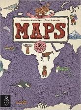
books: Maps and Martha Maps it Out.
1. Skill: To locate the seas and oceans surrounding the UK (English channel, Irish Sea, Atlantic ocean and North Sea).
Knowledge: To name the seas and oceans surrounding the UK (English channel, Irish Sea, Atlantic ocean and North Sea). To label the seas and oceans on a map of the UK (English channel, Irish Sea, Atlantic ocean and North Sea). To describe the location of different seas and oceans (English channel, Irish Sea, Atlantic ocean and North Sea) using compass directions (North, South, East, West) FIELDWORK (compass directions)
2. Skill: To explain what the coast is.
SPRING TERM
National
The Four Nations
Investigate Places - Locational Knowledge, Place Knowledge
Investigate Patterns – Human and Physical Features
Communicate Geographically - Geographical Skills & Fieldwork
Why is our world wonderful?
Country, data collection, fieldwork, human feature, key, lake, land, landmark, locate, location, map, north, south, east, west, physical feature, ocean, digi-maps, river, sample, sea, scale, symbol, tally chart, vegetation, animals, England, London, Northern Ireland, Belfast, Scotland, Edinburgh, Wales, Cardiff, city, characteristic, Pacific, Atlantic, Indian, Southern, Arctic, sketch map.


Global
The Climates of the Globe
Investigate Places - Locational Knowledge, Place Knowledge
Investigate Patterns – Human and Physical Features
Communicate Geographically - Geographical Skills & Fieldwork
Would you prefer to live in a hot or cold place?
Arid, climate, compass, continent, country, desert, Equator, globe Grasslands, human feature, ice sheet, land, locate, map, mild, ocean, pack ice, physical feature, polar, rain gauge, rainforest, rural, savannah, sea, temperate, temperature, thermometer, tropical, urban, vegetation.
eans, countries, cities, maps Continents, oceans, weather (hot/cold)
1. Skill: To identify geographical characteristics of the UK (Capital cities: Cardiff, Edinburgh, Belfast, London. Countries: England, Northern Ireland, Scotland, Wales).
Knowledge: To locate the four capital cities on a map of the UK (Belfast, Cardiff, London, Edinburgh). To locate the four countries of the UK (Scotland, Wales, Northern Ireland, England) To identify the characteristics of the four countries and capital cities of the UK. To identify human and physical features on an aerial photograph in London, Belfast, Edinburgh and Cardiff. To use locational language and the compass points (N, S, E, W) to describe the location of Big Ben, Edinburgh Castle, Millennium Centre and the
1. Skill: To locate the North and South Poles and the Equator on a world map.
Knowledge: To name the seven continents (Asia, Africa, North and South America, Antarctica, Europe, Australia). To locate the seven continents in an atlas (Asia, Africa, North and South America, Antarctica, Europe, Australia). To locate the North and South Poles on a world map. To name some features of the poles (temperature, position, daylight).
2. Skill: To locate the equator on a world map.
Knowledge: To know the Equator is an imaginary line around the middle of the Earth. To identify two countries located on the Equator (Brazil, Kenya). To know some of the features found on the Equator.
3. Skill: To compare Nuuk, Greenland and Nairobi, Kenya. Knowledge: To locate Nairobi, Kenya on a world map/digi-maps. To describe some human and physical features of Nairobi, Kenya. To locate Nuuk, Greenland on digi-maps. To describe some human and physical features of Nuuk, Greenland. To describe some key similarities and differences between Nuuk, Greenland
SUMMER TERM
Knowledge: To define the coast as a piece of land along the sea or ocean. To understand that there are many coastlines in the UK and to locate Blackpool coast and the Jurassic coast. To identify the harbour, beach, sea, pier, cliffs, promenade, shops, cave, lighthouse, rock pools and bay on Blackpool coast. To sort the features above into human and physical.
3. Skill: To identify the physical features of the Jurassic coast. FIELDWORK - DIGITAL
Knowledge: To recall what a physical feature is. To name physical features in photographs of the Jurassic coast (including digi-maps).
4. Skill: To identify human features of the Brighton coast.
Knowledge: To recall what a human feature is. To name human features in the coast. To describe how people use the coast (including the Jurassic and Brighton coast).
5. Skill: To create a simple map with a key of a desired coastline based on my findings covered over this unit of work.
Knowledge: To discuss how people use different coastlines. To have a preference for a particular style of coastline. To create a map which includes some human and physical features of a coastline. To use a simple key to identify the features of my coastline.
Double page spread - To use the map created in step 5 for the foundation of the double page spread.
Compass directions It tells us which way is North and where to find East, South, and West.
Key A list of symbols that appear on a map.
Physical features Created by nature on the Earth.
City A largely built up area, highly populated and bigger than a town.
Human features Built or made by humans.
Coastline The area where land meets the ocean.
Coastal A part of the land near the sea.
Preference A greater liking to one thing than another.
Titanic Museum on a map/digi-maps.
2. Skill: To locate some of the world’s most amazing places.
Knowledge: To locate the seven continents on a world map (Asia, Africa, North/South America, Antarctica, Europe, Australia). To identify and sort human and physical features of the continents (Mount Etna, Great wall of China, Great Barrier Reef, The Great Pyramid of Giza, Statue of Liberty, Mount Erebus, Amazon Rainforest, Christ the Redeemer). To locate some human and physical features on digi-maps/Google Earth of the seven continents (Mount Etna, Great wall of China, Great Barrier Reef, The Great Pyramid of Giza, Statue of Liberty, Mount Erebus, Amazon Rainforest, Christ the Redeemer).
3. Skill: To know the names of the five oceans and locate them on a map (Pacific, Atlantic, Indian, Southern, Arctic).
Knowledge: To understand the difference between oceans and seas. To name the five oceans (Pacific, Atlantic, Indian, Southern, Arctic). To locate the five oceans on a world map (Pacific, Atlantic, Indian, Southern, Arctic).
4. Skill: To understand how to draw human and physical features on a sketch map.
Knowledge: To use an aerial photograph of a snapshot of London to draw a simple sketch map. To use symbols to represent human and physical features of London. To use a key to identify the features. To begin to draw objects to scale.
5. Skill: To investigate local habitats and record findings. FIELDWORK
Knowledge: To make observations of physical features in Bob Williamson Park, Hambleton. To follow a predetermined route to and in Bob Williamson Park. To sketch vegetation and animal findings on a map. To complete a tally chart of vegetation/animals that are found in Bob Williamson Park.
6. Skill: To understand how to present findings in a bar chart.
Knowledge: To present my tally findings in a bar chart. To evaluate my findings. To explain why some areas of vegetation had more plants and animals than others in Bob Williamson Park. To suggest ways to look after natural habitats.
and Nairobi, Kenya. FIELDWORK - DIGITAL
4. Skill: To investigate the local weather conditions of Hambleton and the climate of Nuuk and Nairobi in comparison. FIELDWORK
Knowledge: To measure and record local weather conditions in Hambleton (rain gauge, wind steamer, weather vane). To know that ‘weather’ means short-term conditions and ‘climate’ means long-term conditions. To recognise different types of climate on a world map including, England, Greenland and Kenya (mild, temperate, cold, hot, tropical, desert, polar).
5. Skill: To identify the key features of hot and cold places.
Knowledge: To recognise three features of a hot place and three features of a cold place. To locate one hot country (Kenya) and one cold country (Greenland) on a world map. To know why some countries are hotter or colder than others.
Double Page Spread - Links in with step 5. Would you prefer to live in a hot or cold place?
Climate The weather conditions in an area over a long period of time.
Temperate Neither very hot nor very cold.
Tropical Regions of Earth that lie roughly in the middle of the globe
Desert A landscape that experiences little rain.
Polar The climate usually has a temperature below freezing, is icy, and is covered with snow most of the time.
Equator An imaginary line around the middle of a planet.
Double Page Spread - Why is our world wonderful?
Data collection Gathering and measuring information.
Physical Features
River A big, natural stream of water flowing to the sea
Mountain A very high and steep area of land
Valley A low area of land between hills or mountains
Forest A big area of land covered with trees
Beach A sandy or pebbly strip of land by the sea
Vegetation A collection of plants in a habitat.
Habitat The natural home or environment of an animal, plant, or other organism.
Human Features:
City A big place where lots of people live closely together
Village A group of houses, usually in the countryside, smaller than a town
Port A town or city with a harbour where ships load or unload
Farm An area of land where people grow crops or keep animals for food
Transport The different ways that people can move from one place to another, such as by car, bus, train, or boat.
Geographical skills and fieldwork –
● use simple compass directions (North, South, East and West) and locational and directional language – near and far; left and right. to describe the location of features and routes on a map.
● use aerial photographs and plan perspectives to recognise landmarks and basic human and physical features; devise a simple map; and use and construct basic symbols in a key
● use simple fieldwork and observational skills to study the geography of Blackpool and the key human and physical features of its surrounding environment – locate Lifeboat Station (Linking back to History)
● use world maps, atlases and globes to identify the United Kingdom and its countries.
● use aerial photographs and plan perspectives to recognise landmarks and basic human and physical feature Map Key Skills and knowledge: Understand that a map is a 2D representation of the real, 3D world. Know that a picture on a map represents a place or feature in the real world.
Year Three: National Curriculum
Local Geography - Settlements
-Name and locate counties and cit es of the United Kingdom, geographica regions and their identifying human and physica character stics, key topographical features (including h lls, mounta ns, coasts and r vers), and and-use patterns; and understand how some of these aspects have changed over time
-Understand geographical similarit es and d fferences through the study of human and physical geography of a region of the United Kingdom, a region in a European country, and a region with n North or South America
-Describe and understand key aspects of: human geography, including: types of settlement and land use, econom c activity including trade links, and the distribut on of natural resources including energy, food, minerals and water
Geographical Skills & Fieldwork:
National Geography - Trade
-Human geography, including types of settlement and land use econom c activity nclud ng trade links, and the distr bution of natural resources including energy, food, minerals and water
-Locate the world’s countries, using maps to focus on Europe (including the location of Russ a) and North and South America, concentrating on their environmental reg ons key physica and human characteristics, countries, and ma or cit es
-Describe and understand key aspects of: phys cal geography, nclud ng: climate zones, biomes and vegetation belts, rivers, mountains, volcanoes and earthquakes, and the water cycle
Global Geography - Rivers
-Describe and understand key aspects of: physical geography, including: climate zones, biomes and vegetation belts, r vers, mountains, volcanoes and earthquakes, and the water cycle
-Describe and understand key aspects of: human geography, including: types of settlement and and use, economic activity including trade inks, and the distribution of natural resources nc ud ng energy, food, m nerals and water
-Name and ocate counties and cities of the Un ted Kingdom, geographical regions and their identifying human and physica character stics, key topographica features (including hil s, mounta ns, coasts and r vers), and land-use patterns; and understand how some of these aspects have changed over time
-Use maps, atlases, globes and digital/computer mapping to locate countries and describe features studied
-Use maps, atlases, globes and digital/computer mapping to locate countries and describe features studied
-Use fieldwork to observe, measure record and present the human and physical features in the local area using a range of methods, including sketch maps, plans and graphs, and digital technologies
AUTUMN TERM
Local
Our Settlements in Fylde
YEAR 3
Investigate Places - Locational Knowledge, Place Knowledge
Investigate Patterns – Human and Physical Features
SPRING TERM
National
The Trade Empire in Europe
Investigate Places - Locational Knowledge, Place Knowledge
Investigate Patterns – Human and Physical Features
SUMMER TERM
National/Global
The Journey of the River Concepts
Communicate Geographically - Geographical Skills & Fieldwork
Are all settlements the same?
Enquiry
Vocabulary
Agricultural land, capital city, commercial land, compare, country border, county, dispersed, facilities, land use, legend, linear, local, memorial, metro, monument, nucleated, place of worship, recreational land, region, residential land, settlement, transportation, village, town, city, coastal, locate, human features, physical features.
UK countries and cities, human and physical features, NSEW
Flashback
Key skills and knowledge
1. Skill: To describe different types of settlements and their patterns (village, town, city, urban, rural, coastal, county/linear, dispersed, nucleated).
Knowledge: To locate London, Cardiff, Edinburgh, Liverpool, Newcastle, Plymouth, Blackpool and Belfast on digi-maps. To locate the counties Lancashire, Northumberland, Greater London, Devon and Antrim. To list the different types of settlements (villages, towns, cities, rural and urban). To identify villages, towns, cities, rural and urban settlements and counties on aerial photographs and digi-maps, focusing on Lancashire.
2. Skill: To identify the human and physical features of Hambleton.
Knowledge: To recognise human and physical features
Communicate Geographically - Geographical Skills & Fieldwork
Where does our food come from?
Air freight, carbon footprint, consumption, distribution, export, fertiliser, food bank, food miles, grant, import, pesticides,
produce, qualitative, quantitative, reliability, responsible trade, sample size, scale bar, seasonal food, source, sustainability, trade, trend.
Investigate Places - Locational Knowledge, Place Knowledge
Investigate Patterns – Human and Physical Features
Communicate Geographically - Geographical Skills & Fieldwork
What are rivers and how are they used?
Condensation, delta, estuary, evaporation, flooding, floodplain, groundwater, irrigation, leisure, meander, oxbow lake, percolation, precipitation, river mouth, source, transpiration, tributary, valley, water cycle, waterfall.
Climates (hot and cold), maps, oceans, continents Land use, trade
1. Skill: To explain the impact of food choices on the environment.
Knowledge: To state why certain foods grow in different biomes (savannah, desert, temperate deciduous forests, tropical rainforests, boreal rainforests, tundra)/tropics). To explain ways in which food choices can harm the environment. To describe how to make small changes to a diet to help fight climate change.
2. Skill: To understand the importance of trading responsibly, looking at both Côte d’Ivoire and the United Kingdom.
Knowledge: To know what trading responsibly means. To explain how responsible trading supports equality. To discuss some of the advantages and disadvantages of importing food.
3. Skill: To describe the journey of a cocoa bean.
Knowledge: To understand there are different opinions on importing products. To recall the locations a cocoa bean travels through to reach the
1. Skill: To describe how the water cycle works.
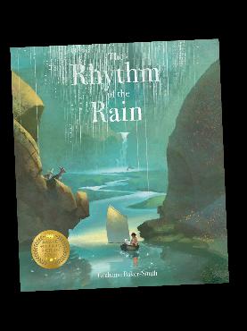
Knowledge: To identify the different ways water is stored (ocean, air, clouds, precipitation, glaciers, the ground, rivers, lakes). To explain the different ways water moves (it evaporates into the air; condenses into clouds; falls as precipitation; absorbs into the ground; moves to the sea via rivers). To explain how water is recycled.
2. Skill: To recognise the features and courses of a river
Knowledge: To state where a river starts (lake, bog, spring, rainfall) and ends (river mouth, meets the sea). To describe the three courses of a river (upper, middle, lower). To name the features of a river (sources, tributary, valley, waterfall, meander, oxbow
of Hambleton on digi-maps. To identify different land uses in Hambleton (recreational, transport, agricultural, residential and commercial) on digi-maps. To create a simple key to represent the different land uses in Hambleton (recreational, transport, agricultural, residential and commercial). To use compass directions (North, North West, North East, South, South West, South East, West, Eeast) to describe the location of the land uses in Hambleton.
3. Skill: To discuss why human and physical features are in particular locations. FIELDWORK
Knowledge: To follow a predetermined route on a map around Hambleton. To take photos of human and physical features of Hambleton and check them off my map as I find them. To suggest reasons for the locations of 5 features on my map (petrol station, school, park, place of worship, hairdressers).
4. Skill: To describe how land use in Hambleton has changed over time using historical maps from digi-maps and the resources that were collected in step 3.
Knowledge: To identify how land use in Hambleton has changed over time using digi-maps. To discuss why land use may have changed over time.
5. Skill: To identify land use in New York City, North America.
Knowledge: To describe New York City's locational position in the world. To recognise human and physical features of New York City To discuss how land is used in Washington DC (recreational, transport, agricultural, residential and commercial). To locate Central Park, the Statue of Liberty, Times Square and the Hudson River.
6. Skill: To compare the land uses in New York City and Hambleton.
Knowledge:To state some similarities between New York City and Hambleton. To state some differences between New York City and Hambleton. I can describe how the land uses and settlements differ between New York City and Hambleton.
UK from Côte d’Ivoire. To describe the process from cocoa bean to chocolate.
4. Skill: To map and calculate the distance food has travelled.
Knowledge: To label countries and their cities on a world map using an atlas including Paris, Rome, London, Berlin, Moscow, Amsterdam, Munich, Madrid, Milan, Washington DC, Côte d’Ivoire and Buenos Aires. To use the scale bar on a map to calculate approximate food mileage from 3 of the above cities and their countries. To ask questions about where the food I eat comes from.
5. Skill: To design and use data collection methods to find where our school food comes from at Hambleton Primary. FIELDWORK (Interview)
Knowledge: To describe the features of a questionnaire. To collect data from an interview To analyse information from an interview
6. Skill: To discuss the advantages and disadvantages of buying both locally in the UK and imported food.
Knowledge: To describe the limitations of questionnaires. To create a balanced argument about where to buy food from. To present the answers to an enquiry question.
Double Page Spread - Where does our food come from?
Qualitative Descriptive information.
Quantitative Numerical information that can be used in graphs.
Distribution Sharing something out amongst many recipients. Export Send goods to another country.
Import To bring goods from another country.
Consumption The action of using up a resource.
Trade Buying and Selling goods and services.
lake, mouth, floodplain, delta, estuary).
3. Skill: To name and locate the River Nile, Amazon River, Yangtze River and the Danube River
Knowledge: To locate the River Thames, River Severn, River Wyre and the River Trent on a uk map/digi-maps. To locate the River Nile, Amazon River, Yangtze River and the Danube River on a world map/digi-maps. To create a key of the above rivers on a map. To name which continents the River Thames, River Nile, Amazon River, Yangtze River and the Danube River are in.
4. Skill: To describe how rivers are used.
Knowledge: To explain the ways rivers are used (energy source, irrigation, housing, settlements, leisure, transport, crops, food/drink, water cycle, habitats). To describe how rivers are important to the natural environment. To list the challenges that can occur with rivers (pollution, drought, flooding).
5. Skill: To identify and locate human and physical features of the River Nile on a map.
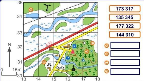
Knowledge: To state where the river starts and ends. To use grid references to describe the location of features. To predict what features I expect to see on my field work to the River Wyre.
6. Skill: To collect data on the features of the River Wyre. FIELDWORK
Knowledge: To identify the features of part of the River Wyre. To judge the quality of the environment using a Likert scale. To make suggestions about how to improve the river environment.
Double Page Spread - What are rivers and how are they used?
Source Where a river begins.
Tributary A freshwater stream that feeds into a larger stream or river
Valley Long, low areas that can typically be found between hills and mountains.
Waterfall An area where water flows over a vertical drop or a series of steep drops in the course of a stream or river.
Meander When water flows in a curvy, bendy path, like a snake.
Oxbow Lake The remains of the bend in the river.
Mouth The place where a river enters a lake, larger river, or the ocean.
Double Page Spread - Are all settlements the same?
Settlement A place where people establish a community City A large town. Town Larger than villages but smaller than towns. Village Smaller than cities and towns.
Land use To describe the human use of the land.
Dispersed Spread over a large area.
Nucleated Buildings that are closely grouped together.
Floodplain An area of flat land alongside a river.
Delta A wetland area that forms as river waters empty into a larger body of water.
Estuary An area where a freshwater river or stream meets the ocean.
Likert scale Often used to rank the level of agreement with a statement on a scale from 1) Strongly disagree to 5) Strongly agree.
Irrigation The artificial watering of vegetation through infrastructures of pipes, sprinklers, canals, or other man-made infrastructure.
Geographical skills and fieldwork
● use maps, atlases, globes and digital/computer mapping to locate countries and describe features studied.
● symbols and key to build their knowledge of the United Kingdom and the wider world
Map Key knowledge:
● Know that a symbol on a map, just like a picture, represents a place or feature in the real world
● Know that when reading coordinates, you read across the x-axis and up/down the y-axis
● Know that when reading coordinates the point at which the lines or row/columns intersect is the location of the place/feature
● Follow a route on a map with symbols
● Describe and follow a journey between two places/features using 4 figure compasses (NSEW). E.g. Move north two steps, then west three steps.
● Describe and follow a journey between two places/features using letter/number coordinates as the start and finish.
Year Four: National Curriculum
 Local Geography- Hambleton and Antarctica
National Geography - Volcanoes
Global Geography - Amazon Biome
Local Geography- Hambleton and Antarctica
National Geography - Volcanoes
Global Geography - Amazon Biome
-Locate the world’s countr es, using maps to focus on Europe (includ ng the location of Russia) and North and South America, concentrating on their environmental reg ons, key physical and human characteristics, countries, and ma or cities
-Identify the pos tion and sign f cance of latitude, longitude, Equator, Northern Hem sphere, Southern Hemisphere, the Tropics of Cancer and Capr corn, Arctic and Antarctic Circle, the Prime/Greenwich Meridian and t me zones (including day and n ght)
-Describe and understand key aspects of: phys cal geography, nc ud ng: climate zones, b omes and vegetation be ts, rivers, mountains, volcanoes and earthquakes, and the water cycle
-Describe and understand key aspects of: human geography, including: types of settlement and land use, econom c activity including trade links, and the distribut on of natural resources including energy, food, minerals and water
Geographical Skills & Fieldwork:
-Describe and understand key aspects of: phys cal geography, nclud ng: climate zones, biomes and vegetation belts, rivers, mountains, volcanoes and earthquakes, and the water cycle
-Describe and understand key aspects of: human geography, including: types of settlement and and use, economic activity including trade inks and the distribut on of natural resources nc uding energy food, minerals and water -Understand geographical s m larities and differences through the study of human and physica geography of a region of the United Kingdom, a region in a European country, and a region within North or South America
-Locate the world’s countries, using maps to focus on Europe (including the location of Russ a) and North and South America, concentrating on their environmental reg ons key physica and human characteristics, countries, and ma or cit es
-Locate the world’s countries using maps to focus on Europe (including the locat on of Russ a) and North and South Amer ca, concentrat ng on their env ronmental regions, key physica and human characteristics, countr es, and major cit es
-Identify the position and significance of at tude, ongitude, Equator, Northern Hemisphere, Southern Hemisphere, the Tropics of Cancer and Capricorn, Arctic and Antarct c Circle, the Prime/Greenw ch Mer dian and time zones (including day and night)
-Describe and understand key aspects of: physical geography, including: climate zones, biomes and vegetation belts, r vers, mountains, volcanoes and earthquakes, and the water cycle
-Describe and understand key aspects of: human geography, including: types of settlement and and use, economic activity including trade inks, and the distribution of natural resources nc ud ng energy, food, m nerals and water
-Use maps, atlases, globes and digital/computer mapping to locate countries and describe features studied
-Use maps, atlases, globes and digital/computer mapping to locate countries and describe features studied
-Use fieldwork to observe, measure record and present the human and physical features in the local area using a range of methods, including sketch maps, plans and graphs, and digital technologies
Our place in Hambleton
YEAR 4
Concepts
Enquiry
Vocabulary
Investigate Places - Locational Knowledge, Place Knowledge
Investigate Patterns – Human and Physical Features
Communicate Geographically - Geographical Skills & Fieldwork
Who lives in Antarctica?
Climate, climate zone, compass points, direction, drifting ice, hemisphere, ice sheet, ice shelf, iceberg, lines of latitude, lines of longitude, treaty, prime meridian, tropics.
The Extreme Earth
Investigate Places - Locational Knowledge, Place Knowledge
Investigate Patterns – Human and Physical Features
Communicate Geographically - Geographical Skills & Fieldwork
Why do people live near Volcanoes?
Active volcano, climate change, composite volcano, crust, dormant volcano, earthquake, epicentre, extinct volcano, fault line, fault-block mountain, fertile soil, fold mountain, geothermal energy, igneous rock, index, inner core, outer core, magma, magma chamber, man-made rock, mantle, metamorphic rock, natural rock, negative effects, plate boundary, positive effects, pyroclastic flow, sedimentary rock, seismic waves, shield volcano, tectonic plate, tsunami, vent, volcanic mountain, volcanic springs.
Flashback
Key skills and knowledge
Climates, weather, biomes, compasses (N, S, E, W, NE, NW, SE, SW), continents, oceans

1. Skill: To understand the position and significance of lines of latitude and longitude.
Knowledge: To identify significant lines of latitude (Arctic circle, Antarctic circle, Tropic of Cancer, Tropic of Capricorn, Equator) and where Hambleton sits. To identify the Prime Meridian. To use longitude to identify the timezones of Hambleton, Antarctica and South America.
2. Skill: To identify and describe physical features of Antarctica.
Knowledge: To locate Antarctica on digi-maps, atlases and globes. To describe the global climate zone (tropical, polar, mountains, temperate, arid) including seasons (summer, winter, spring and autumn) of Antarctica. To describe the weather and landscape in Antarctica. To describe some physical features of Antarctica (glacier, iceberg, ice shelf, Western ice sheet, Eastern ice sheet, drifting ice, land rock).
Climate, mountains
1. Skill: To name and describe the layers of the earth.
Knowledge: To name and order the four layers of the earth including the inner core, mantle, crust and outer core . To state a fact about each layer of the Earth. To know what a tectonic plate is.
2. Skill: To explain how and where mountains are formed.
Knowledge: To explain that a mountain is formed by tectonic plates. To know that most mountains are found on or near plate boundaries. To name the Andes, Himalayas, Alps and Rockies mountain ranges and state which continents they are in (Europe, South America, Asia, North America)
National/Global
The Amazon Biome
Investigate Places - Locational Knowledge, Place Knowledge
Investigate Patterns – Human and Physical Features
Communicate Geographically - Geographical Skills & Fieldwork
Why are rainforests important to us?
Analyse, biome, buttress roots, canopy layer, community, data, deforestation, drought, emergent layer, enquiry, Equator, forest floor, global warming, greenhouse gas, indigenous peoples, interpret, lianas, lines of latitude, logging, method, mining, present, questionnaire, quote, risk, route, summarise, Tropic of Capricorn, Tropic of Cancer, understory layer, vegetation, vegetation belts.
Biomes, climate, hemispheres, tropics, latitude, rivers, land use
1. Skill: To describe and give examples of a biome and find the location and some features of the Amazon rainforest.
Knowledge: To describe a biome (to include: savannah, tropical, desert, temperate deciduous, boreal, tundra) and give some examples. To use an atlas to find the location of the Amazon rainforest. To use photographs and digi-maps to list some features of the Amazon rainforest.
2. Skill: To describe the characteristics of each layer of the Amazon rainforest (emergent layer, canopy layer, understory layer, forest floor). FIELDWORK - DIGITAL
AUTUMN TERM Local
SPRING TERM
National SUMMER TERM
3. Skill: To describe the human features of Antarctica.
FIELDWORK - DIGITAL
Knowledge: To state who visits and lives in Antarctica. To explain how people adapt to life in a polar climate. To describe what research is done in Antarctica.
4. Skill: To use four-figure grid references to plot Shakleton’s route to Antarctica.
Knowledge: To describe who Shakleton was and why he is significant to Antarctica. To follow Shackleton's route to Antarctica using four-figure grid references on a map (South Georgia Island, to South America, to Antarctica where the boat was destroyed, back to South Georgia after being rescued).
5. Skill: To plan a simple expedition route on a map using compass points (North, North East, North West, South, South West, South East, West, East) in Hambleton.
Knowledge: To zoom in and out on digi-maps. To give instructions using compass points (North, North East, North West, South, South West, South East, West, East) To identify human and physical features on your route on your map using a key
6. Skill: To follow instructions using compass points and map a simple route. FIELDWORK
Knowledge: To evaluate your expedition and make comparisons between your expedition and Shackleton's expedition.
Double
page spread - Antarctica and who lives there.
Hemisphere A half of the earth is divided by an equator. The hemisphere is north or south of this divide.
Longitude It measures distance east or west of the prime meridian
Latitude It measures the distance north or south of the equator
Arctic A region around the north pole.
Antarctica A region around the south pole.
Tropics Regions that lie around the middle of Earth.
Prime Meridian The starting point for measuring distance around the Earth.
Time zone A region where the same standard time is used.
Climate The weather conditions in an area over a long period of time.
3. Skill: To explain why volcanoes happen and where they occur.
Knowledge: To explain how volcanoes form and describe their features including shield and composite volcanoes. To describe where to find volcanoes globally (‘ring of fire’). To list the three ways volcanoes can be classified (active, dormant, extinct).
4. Skill: To recognise the negative and positive effects of living near a volcano.
Knowledge: To describe the negative and positive effects of living near a volcano, looking specifically at Mount Etna and Mount Vesuvius (Italy). To summarise why people live near Mount Etna and Mount Vesuvius (Italy).
5. Skill: To explain what earthquakes are and where they occur.
Knowledge: To state what an earthquake is. To describe where earthquakes happen. To describe the negative effects of earthquakes.
6. Skill: To observe and record the location of rocks around the school grounds and discuss findings. FIELDWORK
Knowledge: To observe different rocks and record them digitally (man-made/natural). To use a symbol on a map to show where I found the rocks. To identify the types of rocks (igneous, sedimentary and metamorphic) and discuss where they have come from.
Double page spread - Why do people live near volcanoes?
Rock The solid mineral material forms part of the surface of the earth.
Mountain A large natural elevation of the earth's surface rising abruptly from the surrounding level.
Rupture A rupture is the result of a sudden break or tear To rupture is to suddenly break, burst or tear.
Eruption To erupt is to break or burst out suddenly or violently, commonly used to describe lava bursting from a volcano.
(N.B. you could take this opportunity to explore the Latin root ‘rupt’ and its associated words to foster ‘word
Knowledge: To name the four layers of the Amazon rainforest (emergent layer, canopy layer, understory layer, forest floor). To describe the characteristics of each layer of the Amazon rainforest. To describe how vegetation has adapted to living in the Amazon Rainforest.
3. Skill: To understand the lives of indigenous peoples living in the Amazon rainforest.
Knowledge: To define the word indigenous. To give examples of how indigenous peoples use the Amazon’s resources. To begin to discuss how the Amazon rainforest changes over time.
4. Skill: To describe why tropical rainforests are important and understand the threats to the Amazon.
Knowledge: To list why tropical rainforests are important. To describe how humans harm the Amazon rainforest. To discuss what we can do to make positive environmental changes to the Amazon rainforest.
5. Skill: To understand how local woodland in Bob Williamson Park (Hambleton) is used using a variety of data collection methods. FIELDWORK
Knowledge: To assess and avoid risks when out of the school grounds. To collect data through sketching, questioning and recording information on a tally chart. To map the route I am taking on digi-maps.
6. Skill: To analyse and present findings on how local woodland in Bob Williamson Park (Hambleton) is used. Knowledge: To draw a bar chart representing how people use the woodland in Bob Williamson Park. To summarise how often and when people visit the woodland in Bob Williamson Park. To discuss what people like and would change about the woodland in Bob Williamson Park. To compare how people here use the woodland in Bob Williamsons park compared to how the indigenous peoples use the Amazon rainforest. To compare the feelings we have towards our woodland in Bob Williamsons park compared to how the indigenous peoples feel about the Amazon.
Double Page Spread - Why are rainforests important to us?
Rainforest A dense forest rich in biodiversity
Biodiversity The variety of plant and animal life.
Climate The weather conditions that continue for a long period of time.
Vegetation The plant life as a whole within a certain area.
consciousness).
Seismic waves A wave of energy generated by an earthquake. .
Magma Molten rock that is formed in very hot conditions inside the earth.
Earth’s layers Crust, mantle, outer core, inner core.
Lithosphere The rigid outer layer of the earth, comprising the earth's crust and the solid part of the mantle.
Tectonic plate boundaries
Convergent: plates that come closer together.
Divergent: plates that pull away from each other.
Transform: plates that slide past each other.
Classifications of volcanoes
Extinct volcanoes have not erupted for many thousands of years and are unlikely to ever do so again.
Dormant volcanoes have seen past activity but are currently quiet.
Active volcanoes have regular activity (although not necessarily big eruptions).
Lava Very hot liquid rock that comes out of a volcano.
Atmosphere (In geography, science) the envelope of gases surrounding the earth or another planet.
Fertile Land or soil that is fertile can support the growth of a large number of strong healthy plants.
Evacuate To evacuate someone means to send them to a place of safety, away from a dangerous building, town, or area.
belt
Deforestation The action of clearing a large area of trees.
Indigenous People living in an area whose ancestors were the first groups of people to live there.
Geographical skills and fieldwork
● use maps, atlases, globes and digital/computer mapping to locate countries and describe features studied
● use the eight points of a compass, four and six-figure grid references, symbols and key (including the use of Ordnance Survey maps) to build their knowledge of the United Kingdom and the wider world
● use fieldwork to observe, measure, record and present the human and physical features in the local area using a range of methods, including sketch maps, plans and graphs, and digital technologies.
Map Key Skills and Knowledge
–
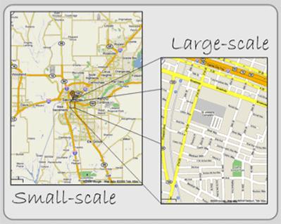
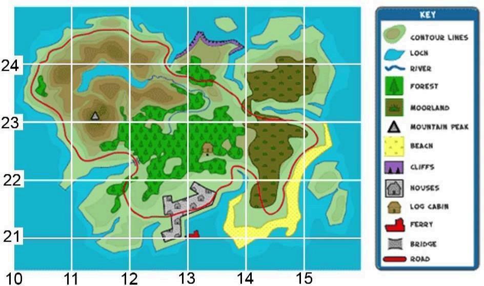
● Know that a large scale map is one that shows lots of detail, normally over a smaller area
● Know that when reading four-figure grid references the first two number represent the x-axis and the second two number the y-axis
● Know that four-figure grid references take you to a box within the grid, not just a specific point like a coordinate
● Begin to use 8 figure compass directions to describe a route.
● Use four-figure grid references to describe a location on a map, including the use of a key
Follow a route on a large scale map
Year Five: National Curriculum
Local Geography - Population
-Name and locate counties and cit es of the United Kingdom, geographica regions and their identifying human and physical characterist cs, key topographical features ( nclud ng hi ls, mountains, coasts and rivers), and land-use patterns; and understand how some of these aspects have changed over t me
-Understand geographical similarit es and d fferences through the study of human and physical geography of a region of the United Kingdom, a region in a European country, and a region with n North or South America
-Describe and understand key aspects of: human geography, including: types of settlement and and use, economic activity including trade inks, and the distribut on of natural resources including energy, food, minerals and water
National Geography - The Alps
-Describe and understand key aspects of: phys cal geography, nclud ng: climate zones, biomes and vegetation belts, rivers, mountains, volcanoes and earthquakes and the water cyc e
-Describe and understand key aspects of: human geography, including: types of settlement and and use, economic activ ty including trade inks, and the distribut on of natural resources nc uding energy food, minerals and water
-Locate the world’s countries, using maps to focus on Europe (including the location of Russ a) and North and South America, concentrating on their environmental reg ons key physica and human characteristics, countries, and ma or cit es
-Identify ng human and phys cal characteristics key topographica features (including hil s, mountains, coasts and rivers), and land-use patterns; and understand how some of these aspects have changed over time
-Identify the pos tion and sign ficance of at tude, longitude, Equator, Northern Hem sphere, Southern Hemisphere, the Tropics of Cancer and Capricorn Arctic and Antarctic Circle the Prime/Greenwich Meridian and time zones (including day and night)
-Understand geographical s m larities and differences through the study of human and physica geography of a region of the United Kingdom, a region in a European country, and a region within North or South America
Global Geography - North America
-Locate the world’s countries using maps to focus on North and South America, concentrating on their environmental regions, key phys cal and human character stics, countries, & major cities.
-Understand geograph cal s m lar ties and differences through the study of human and physica geography of a reg on of the Un ted Kingdom and a region within North or south America
-Identify the position and significance of at tude, ongitude, Equator, Northern Hemisphere, Southern Hemisphere, the Tropics of Cancer and Capricorn, Arctic and Antarct c Circle, the Prime/Greenw ch Mer dian and time zones (including day and night)
-Describe and understand key aspects of: physical geography, including: c imate zones, b omes and vegetation be ts, rivers, mountains, volcanoes and earthquakes, and the water cycle
-Describe and understand key aspects of: human geography, including: types of settlement and land use, economic activ ty including trade l nks, and the distribution of natural resources nc ud ng energy, food, m nerals and water Geographical Skills & Fieldwork: -Use maps, atlases, globes and digital/computer mapping to locate countries and describe features studied
-Use maps, atlases, globes and digital/computer mapping to locate countries and describe features studied
-Use fieldwork to observe, measure record and present the human and physical features in the local area using a range of methods, including sketch maps, plans and graphs, and digital technologies
AUTUMN TERM Local SPRING TERM National SUMMER TERM Global YEAR 5 Our Population in Hambleton The European Countries of the Alps The Mojave Desert Concepts Investigate Places - Locational Knowledge, Place Knowledge Investigate Places - Locational Knowledge, Place Knowledge Investigate Places - Locational Knowledge, Place Knowledge Investigate Patterns – Human and Physical Features Investigate Patterns – Human and Physical Features Investigate Patterns – Human and Physical Features Communicate Geographically - Geographical Skills & Fieldwork Communicate Geographically - Geograph cal Skills & F e dwork Communicate Geographically - Geographical Skills & Fieldwork Enquiry Why does the population change? What is life like in the Alps? Would you like to live in the desert?
Vocabulary
Air pollution, birth rate, cartogram, climate, climate change, conclusions, death rate, deforestation, densely populated, digital technologies, fossil fuels, greenhouse gases, impact, improvements, involuntary, Likert scale, migrants, migration, natural increase, noise pollution, population, population, density, population distribution, pull factors, push factors, qualitative, quantitative, refugee, region, sparsely populated, voluntary.
Atlas, climate, climate change, coniferous trees, data, deciduous trees, enquiry, fold mountain, glacier, hemisphere, human feature, land height, latitude, leisure, longitude, method, mountain climate, mountain range, digi-maps, OS map, physical feature, population, questionnaire, sea level, recreational land use, risk, route, scale, temperate, temperate forest, tourism, tourist, vegetation.
Flashback Land use, climate, weather
Key skills and knowledge
1. Skill: To understand the change and distribution of the global population.
Knowledge: To define global population distribution in the UK/ Blackpool and Canada (densely, sparsely populated). To describe how and why the global population has changed over time from 1500-2000. To explain why people choose to live in certain environments (climate, landscape, politics, travel).
2. Skill: To define birth and death rates and how they change.
Knowledge: To define birth and death rate. To describe what influences birth and death rates. To identify the natural increase of population globally on a graph.
3. Skill: To recognise the push and pull factors influencing migration.
Knowledge: To define migration. To describe push and pull factors (including natural disasters, conflict, climate, culture, crop failure, transport, education, health care, poverty, quality of life) which influence migration. To explain why some migration can be involuntary.
4. Skill: To begin to understand the impact climate change can have on the global
Hemispheres, latitude, climate, mountains, land use, continents, oceans
1. Skill:To locate the Alps on digi-maps, globes and atlases. Knowledge: To locate and label the seven continents and their largest major cities (Asia: Tokyo Japan, Africa: Lagos, Nigeria, North: Mexico City, Mexico and South America: São Paulo:Brazil, Antarctica, Europe (Istanbul, Turkey and Australia: Sydney, including Moscow, Russia). To locate the Alps on a world map. To locate the Alps on a map of Europe. To locate the eight countries the Alps are in (France, Monaco, Italy, Switzerland, Liechtenstein. Austria, Germany, Slovenia).
2. Skill: To locate the key physical and human characteristics of the Alps. FIELDWORK - DIGITAL
Knowledge: To locate the countries that the Alps spread through (France, Monaco, Italy, Switzerland, Liechtenstein. Austria, Germany, Slovenia). To locate some of the key physical features of the Alps (Mont Blanc, Lake Worthersee and Pasterze Glacier). To locate some of the key human features of the Alps (Innsbruck cable car, Hohensalzburg Fortress and Chamonix ski resort). To use an atlas and digi-maps to locate and describe the features.
3. Skill: To describe the physical and human features of Innsbruck.
Knowledge: To research the human and physical geography of Innsbruck. To identify Innsbruck’s climate zone, biome and vegetation. To describe land use in Innsbruck.
4. Skill: To investigate what there is to do in Blackpool using data collection.
Knowledge: To use digi-maps to recognise the key
Agriculture, airstrip, arid, barren, biome, climate, desert, desertification, drought, flash flood, mesa, mining, mushroom rock, national park, natural arch, nature reserve, rainfall, ranching, renewable energy, salt flat, sand dune, sparse, time zone, tourist attraction, vegetation, weather.
continents , biomes, climate, land use, climate change, environment impact
1 Skills: To summarise the characteristics of a desert biome.
Knowledge: To identify the latitude of the Mojave Desert. To describe the climate and weather in the Mojave Desert. To give examples of plants and animals in the Mojave Desert biome.
2. Skill: To locate and explore features of deserts.
Knowledge: To identify the largest desert in each continent (Asia, Africa, North and South America, Antarctica, Europe, Australia). To locate and identify features in the Mojave Desert using digi-maps. To use data to compare the temperatures in the Mojave Desert (spans Utah, Nevada, California, Arizona) and Atacama Desert (Chile).
3. Skill: To describe the physical features of a Mojave Desert environment. FIELDWORKDIGITAL
Knowledge: To describe the origins of Death Valley in the Mojave Desert. To name the physical features of the Mojave Desert. To describe how the physical features, sand dunes, mushroom rocks,
population.
Knowledge:To give reasons why climate change is happening. To describe the impact of climate change on the population. To suggest ways to fight climate change on a local level (in Hambleton/Blackpool).
5. Skill: To collect data showing how population impacts the amount of traffic and litter in Hambleton. FIELDWORK
Knowledge: To follow a route on digi-maps around Hambleton. To use data collection methods (tally charts, likert scales, voice recording). To collect both quantitative and qualitative data about traffic and litter difference in two separate locations in Hambleton with varying population density.
6. Skill:To write a report on the fieldwork process, analyse findings and make suggestions to improve the traffic and litter situation in Hambleton.
Knowledge: To use digital technology (e.g. microsoft word) to map collected data into a report. To analyse and compare two different data sets from the two locations in Hambleton. To suggest improvements from data conclusions.
Double page spread - Why does population change?
physical and human features of Blackpool. To draw symbols to map recreational land use in Blackpool (parks, trails, green spaces, rivers, sports fields/courts, museums, beaches). To say how I would like to improve the things to do in Blackpool. FIELDWORK - DIGITAL
5. Skill: To understand similarities and differences between Blackpool and Innsbruck.
Knowledge: To compare the human geography of Blackpool with Innsbruck. To compare the physical geography of Blackpool with Innsbruck. To identify similarities and differences between the two areas.
6. Skill: To understand the human and physical geography of the Alps.
Knowledge: To describe two key aspects of the Alps’ human geography from previous steps. To describe two key aspects of the Alps’ physical geography from previous steps. To use geographical vocabulary when describing the geography of the Alps.
Double Page Spread - What is it like in the alps? This can link into step 6. Climate The weather conditions in an area over a long period of time.
Biome The community of plants and animals that occur naturally in an area, often sharing common characteristics specific to that area.
Vegetation A collection of plants in a habitat.
Migration Movement of people or animals from one place to another.
Geopolitical The study of the effects of Earth's Geography on politics.
Citizenship Being a person who belongs to a specific place.
Sustainability Maintaining the needs of our world now whilst helping the needs of the world in the future.
Carbon footprint The measure of the amount of carbon dioxide released into the atmosphere.
Recreational Any pursuit, activity (or even inactivity) which is undertaken voluntarily during leisure time primarily for the purposes of pleasure, enjoyment and satisfaction.
Land use To describe the human use of the land.
Mesa, natural arches and salt flats are formed in the Mojave Desert.
4. Skill: To explain the different ways humans can use the Mojave Desert.
Knowledge: To recognise that different locations may be in different time zones. To give examples of how humans use the Mojave Desert. To recall that land use can change over time.
5. Skill: To describe some of the threats facing the Mojave Desert.
Knowledge: To list some of the environmental threats to the Mojave Desert. To describe how human activity may negatively impact the Mojave Desert. To weigh up the benefits and drawbacks of living in the Mojave Desert.
6. Skill: To explore the similarities and differences between the Mojave Desert and Blackpool.
Knowledge: To identify the differences between two biomes (Blackpool and the Mojave Desert). To compare land use in Blackpool and the Mojave Desert. To justify why one place may be more hospitable than another.
Double Page Spread - Would you like to live in a desert?
Locational study
Comparative study
Finding out information about a particular place.
Compare information about two different places.
Biomes An area named according to what lives there. Desert A landscape where little rain occurs throughout the year
Geographical skills and fieldwork
● use maps, atlases, globes and digital/computer mapping to locate countries and describe features studied
● use the eight points of a compass, four and six-figure grid references, symbols and key (including the use of Ordnance Survey maps) to build their knowledge of the United Kingdom and the wider world
● use fieldwork to observe, measure, record and present the human and physical features in the local area using a range of methods, including sketch maps, plans and graphs, and digital technologies.
Map Key Skills and Knowledge –
● Know that six-figure grid references are split into two groups of three digits
● Know that the first two digits of the first group represent the numbers on the x-axis
● Know that the first two digits of the second group represent the numbers on the y-axis
● Know that the last digit of each group of three represents going across/up the box as if it were split equally into ten columns and rows
● Use six-figure grid references to describe a location on a map, including the use of a key
Year Six: National Curriculum
Local Geography - Blackpool Oceans
-Describe and understand key aspects of: phys cal geography, nc ud ng: climate zones, biomes and vegetation belts, rivers, mounta ns vo canoes and earthquakes, and the water cyc e
-Describe and understand key aspects of: human geography, including: types of settlement and and use, economic activity including trade inks, and the distribut on of natural resources including energy, food, minerals and water
-Locate the world’s countr es, using maps to focus on Europe (includ ng the location of Russia) and North and South America, concentrating on their environmental reg ons, key physical and human characteristics, countries, and ma or cities
-Name and locate counties and cit es of the United Kingdom, geographica regions and their identifying human and physical characterist cs, key topographical features ( nclud ng hi ls, mountains, coasts and rivers), and land-use patterns; and understand how some of these aspects have changed over t me
National Geography - Energy
-Locate the world’s countries, using maps to focus on Europe (including the location of Russ a) and North and South America, concentrating on their environmental reg ons key physica and human characteristics, countries, and ma or cit es
-Name and ocate counties and cit es of the United Kingdom, geographica regions and their identifying human and physica character stics, key topographica features (including hil s, mountains, coasts and rivers), and land-use patterns; and understand how some of these aspects have changed over time
-Identify the pos tion and sign ficance of at tude, longitude, Equator, Northern Hem sphere, Southern Hemisphere, the Tropics of Cancer and Capricorn Arctic and Antarctic Circle the Prime/Greenwich Meridian and time zones (including day and night)
-Understand geographical s m larities and differences through the study of human and physica geography of a region of the United Kingdom, a region in a European country, and a region within North or South America
Global Geography - Enquiry
-Describe and understand key aspects of: human geography, including: types of settlement and land use, economic activ ty including trade l nks, and the distribution of natural resources nc ud ng energy, food, m nerals and water -name and locate counties and c ties of the Un ted K ngdom, geographical regions and their identifying human and physica character stics, key topographica features (including hil s, mounta ns, coasts and r vers), and land-use patterns; and understand how some of these aspects have changed over time
Geographical Skills & Fieldwork:
-Use maps, atlases, globes and digital/computer mapping to locate countries and describe features studied
-Use maps, atlases, globes and digital/computer mapping to locate countries and describe features studied
-Use fieldwork to observe, measure record and present the human and physical features in the local area using a range of methods, including sketch maps, plans and graphs, and digital technologies
Concepts
Enquiry
Vocabulary
Our Ocean in Blackpool The Energy of America
Why do oceans matter?
Atmosphere, biodegradable, buffer, coral bleaching, coral reef, decompose, digital map, disposable, ecology, ecosystem, erosion, geology, habitat, human footprint, marine, microplastics, natural disaster, ocean current, policy, renewable energy, single use plastic, species, water cycle.
Flashback Oceans, rivers, climate change, pollution, habitat, climate
Where does our energy come from?
Biofuel, coal, consumption, contour line, crude oil, dam, emissions, energy source, hydropower, natural gas, non-renewable, nuclear power, Prime Meridian, producer, regenerate, renewable, replenish, sea level, solar power, time zone, urban planner, windpower, six-figure grid reference.
Prime meridian, renewable energy, climate change, land use, trade
The Issue Enquiry
Key skills and knowledge
1. Skill: To explain the importance of our oceans.
Knowledge: To name the 5 oceans (Atlantic, Pacific, Indian, Southern, Arctic) and to locate the sea closest to Blackpool (Irish sea) To describe the ocean’s place in the water cycle. To describe why the ocean is important to our planet. To map the route of the main countries that use the oceans to trade with Australia (China, Japan, USA, Thailand, Germany).
2. Skill: To locate and describe the significance of The Great Barrier Reef.
Knowledge: To identify the location of The Great Barrier Reef. To discuss the benefits of coral reefs (shelter, survival, food, jobs, barrier for storms and
1. Skill: To know why energy sources are important. Knowledge: To describe what we use energy for. To name different sources of energy (hydropower, wind power, geothermal energy, solar, nuclear, biofuel, fossil fuels). To map significant energy trading routes including The United States and Norway trading to the United Kingdom.
2. Skill: To understand the benefits and drawbacks of coal, natural gas, crude oil, hydropower, wind power, geothermal energy, solar, nuclear and bio-fuel. Knowledge: To state the difference between renewable and non-renewable energy sources. To describe the benefits and drawbacks of 3 energy sources. To discuss what to consider when deciding which energy source to use.
3. Skill: To understand how energy is generated in the United States.
Knowledge: To explain the significance of the Prime Meridian and time zones focusing on the United States, specifically Midland,Texas. To discuss how the United States generates its energy. To use digi-maps or Google maps to identify energy production in Midland, Texas and how it has changed over time.
What are the changes and issues concerning my local area?
Analyse, audience, city, data, data collection methods, enquiry, evidence, impact, improvement, issue, justify, plot, presenting, process, recommendation, region, risk, route, subjective, viewpoint.
Climate, local environmental/human threats, data collection
1. Skill: To develop an enquiry question about any changes or issues occurring in Hambleton.
Knowledge: To explore changes and issues occurring in Hambleton. To determine my initial understanding of a local issue in Hambleton. (Ideas: traffic, closing shops, construction, litter, footpaths/cycling, recycling in school or around the area, leisure). To identify what I want to find out about a local issue in Hambleton.
2. Skill: To determine the most effective data collection methods to answer my enquiry question.
Knowledge: To identify what data needs collecting to answer the enquiry question. To justify why I have chosen a data collection method. To design a data collection method.
3. Skill: To plan a route for my fieldwork trip around Hambleton.
Knowledge: To select the start and end of the route on digi-maps. To plot the points on the route where data will be collected. To identify any risks that may be encountered on the route.
4. Skill: To collect the data to answer the enquiry question. FIELDWORK
Knowledge: To manage risks during fieldwork. To follow
AUTUMN TERM Local SPRING TERM National SUMMER TERM Global YEAR 6
Investigate
Investigate
Investigate
Investigate
Investigate Places - Locational Knowledge, Place Knowledge
Places - Locational Knowledge, Place Knowledge
Places - Locational Knowledge, Place Knowledge Investigate Patterns – Human and Physical Features
Patterns – Human and Physical Features
Patterns – Human and Physical Features Communicate Geographically - Geographical Skills & Fieldwork Communicate Geographically - Geographical Skills & Fieldwork Communicate Geographically - Geographical Skills &Fieldwork
erosions, medicines). To begin to understand the threats to coral reefs.
3. Skill: To explain the impact humans have on coral reefs and oceans.
Knowledge:To interpret thematic maps on coral reefs and the 5 oceans (Atlantic, Pacific, Indian, Southern, Arctic). To explain the ways human activity is changing our marine environments (pollution, oil mining leading to global warming, coral bleaching, overfishing). To describe how humans will be impacted by changing ocean conditions (loss of jobs, extinction of animals, microplastics in fish which are consumed by humans, sea levels, coral protection).
4. Skill: To understand ways to keep our ocean healthy and to begin planning a fieldwork enquiry.
Knowledge: To explain ways to support our oceans. To plan a fieldwork visit looking at how littered marine life is in Blackpool. To choose a suitable method of data collection for our fieldwork (tally chart, photographs, sketch maps).
5. Skill: To collect data on the types of litter polluting marine environments in Fylde. FIELDWORK
Knowledge: To collect quantitative data using fieldwork methods (sketch map). To mark on a sketch map where data has been collected. To assess and avoid potential risks on my fieldwork trip in Blackpool.
6. Skill: To present, analyse and evaluate collected data from our fieldwork.
Knowledge: To analyse data in a pie chart. To plot data on a digital map using digi-maps. To suggest how to improve the marine environment in Blackpool.
- Why do oceans matter?
Atmosphere It is made of the layers of gases surrounding a planet.
Erosion Earthen materials are worn away and transported by natural forces such as wind or water.
Quantitative Numerical information that can be used in graphs.
Human footprint
4. Skill: To know how energy sources are distributed in the Port of Blyth..
Knowledge: To locate London, Glasgow, Liverpool, Bristol, Edinburgh, Cardiff, Belfast, Newcastle, Plymouth, Southampton and Leeds on digi-maps. To use grid references on an OS map to locate energy sources (wind turbines, electricity transmission, mining/colliery, pipelines, dams) looking at the Port of Blyth specifically To describe similarities and differences between where energy comes from in Midland, Texas and Port of Blyth.
5. Skill: To choose an appropriate way to generate energy for a new development and justify it.
Knowledge: To discuss the benefits and drawbacks of energy sources. To justify the location of an energy source. To make considerations when planning new energy source facilities.
6. Skill: To collect and present data on where to position a solar panel on the school grounds. FIELDWORK
Knowledge: To use interview questions to collect qualitative data. To draw a sketch map using contours where needed. To use data collected to justify a proposed location for a solar panel.
Double page spread - Where does our energy come from?
Biofuel Liquid fuels produced from renewable biological sources, including plants and algae.
Emissions Substances released into the air and are measured by their concentrations.
Consumption The action of using up a resource.
Renewable Energy Energy derived from natural sources that are replenished at a higher rate than they are consumed.
Replenish The artificial placement of sand on an eroded shore to maintain the amount of sand present in the foundation of the coast.
Energy source Renewable or nonrenewable.
Contour line A line drawn on a topographic map to indicate ground elevation or depression.
Regenerate Strategies to improve an area.
Measures energy quantities, resources, and products consumed by a human during his/her lifetime
my route around Hambleton that I plotted on digi-maps. To record data using 2 different collection methods.
5. Skill: To determine an answer to the enquiry question. Knowledge: To examine the two sets of data I collected on my fieldwork trip. To add the data I collected to a digital map/digi-map. To come to a conclusion about what my two sets of data show concerning my enquiry question.
6. Skill: To present my enquiry findings to my peers as a double page spread.
Knowledge: To select appropriate data to include in a presentation about my enquiry findings. To present data using my chosen method (double-page spread, poster, powerpoint, video, speech ) To discuss the process of developing my enquiry question and collecting my enquiry data.
Double Page Spread - Links with step 6. Enquiry: What are the changes and issues concerning my local area?
Enquiry A question you set out to prove or disprove.
Subjective Is based on personal opinions and feelings rather than on facts.
Audience A group of spectators at an event.
Impact To have a strong effect or influence on a situation or person.
Data Collected to inform a question. Qualitative is descriptive data methods and Quantitative is numerical data.
Evidence The available body of facts or information indicating whether a belief or proposition is true or valid.
Double Page Spread
Biodegradable The material naturally breaks down into smaller components, such as sugars and gasses.
Geology The science that deals with the earth's physical structure and substance.
Ecology The study of organisms and how they interact with the environment around them.
Water cycle The continuous movement of water within the Earth and atmosphere.
Renewable energy Energy derived from natural sources that are replenished at a higher rate than they are consumed.

Geographical skills and fieldwork
● use maps, atlases, globes and digital/computer mapping to locate countries and describe features studied
● use the eight points of a compass, four and six-figure grid references, symbols and key (including the use of Ordnance Survey maps) to build their knowledge of the United Kingdom and the wider world
● use fieldwork to observe, measure, record and present the human and physical features in the local area using a range of methods, including sketch maps, plans and graphs, and digital technologies.
Map Key Skills and Knowledge
–
• Know that an Ordnance Survey map is a detailed map produced by the British government map-making organisation
● Follow a short route on an OS map, using symbols and a key
● Follow a short route on a variety of scaled maps