Pilgrim 1600 Acre Area Plan
November, 2025


Pilgrim 1600 Acre Area Plan
November, 2025
The Pilgrim 1600 Acre Area, or Pilgrim 1600 is the approximately 1600 acres of land between Plymouth Town Center and Manomet and the site of the Pilgrim Power Station, the only nuclear power plant in Massachusetts. The Pilgrim Power Station ceased operations in 2019. The Station and its surrounding 1600 acres were subsequently purchased by Holtec International, the entity responsible for performing the plant’s decommissioning.
The closure of the Pilgrim Power Station has presented a challenge to local economic and fiscal health. The Pilgrim Power Station once employed more than 600 highly paid professionals, and spent millions every year on local goods and services. During its peak operations, the Station contributed between $10-15 million a year to the Town of Plymouth’s general revenue.
The closure of the Pilgrim Power Station has also presented an opportunity. With the plant’s closure, there exists a possibility to put the Pilgrim 1600 to new uses, both private and public, that support the Town of Plymouth’s goals for responsible growth, fiscal health and a high quality of life.
The Pilgrim 1600 Acre Area Master Plan represents the results of a robust conversation with the Plymouth community, local non-profits, business partners and Town agencies to define together a future for this land. The plan identifies the current goals of the Plymouth community and provides recommendations to help the Town of Plymouth and its partners prepare to seize future opportunities to acquire, adapt, redevelop and conserve the Pilgrim 1600 according to these goals.
In November of 2024, the Town of Plymouth, MA hired the planning consultant team to facilitate a communitycentered process of envisioning the future of the Pilgrim 1600 site. This team consists of:
• Sasaki Associates, a planning, landscape architecture, architecture, and urban design firm based in Boston, MA.
• Landwise Advisors, a real-estate and market consultancy based in Watertown, MA.
• Vanasse Hangen Brustlin (VHB), a multidisciplinary engineering, planning, and design consulting firm that provides services across multiple sectors including transportation, energy, and environmental planning.
This project was completed under the direction of the Town of Plymouth Department of Planning and Development. Additional organizational support was provided by the Plymouth Foundation and the Old Colony Planning Council.
Throughout the process, the planning consultant team coordinated its efforts with Town of Plymouth staff and the Plymouth Foundation. The planning consultant team presented progress and findings to members of the Plymouth Select Board, Plymouth Foundation and Plymouth Planning Board in public meetings.
This project was financed with a grant from the U.S. Economic Development Administration and contributions by the landowner, Holtec International.

Holtec International, Landowner


The planning consultant team was engaged to begin the Pilgrim 1600 planning process in November of 2024. The process lasted 10 months and consisted of three phases. The following report documents the findings and conclusions of this planning process for the benefit of the Town of Plymouth.
The planning consultant team developed familiarity with the study site and its context. The team performed market and site analysis with a lens toward measuring the suitability of this property for future alternative uses. The team launched a community survey and performed stakeholder interviews to begin understanding the needs of the local community and their aspirations for the future of this site.
The planning consultant team synthesized the findings of data collection and analysis to identify feasible opportunities for the Pilgrim 1600’s future. The team prepared three master plan concepts to showcase a range of possibilities that aligned with site constraints, market feasibility, and the sentiments expressed by community members.

The planning consultant team gathered and documented feedback on master plan concepts and developed a series of recommendations to guide future decisionmaking about the Pilgrim 1600.
The planning consultant team has prepared the Pilgrim 1600 Project concurrent to the update of the Town of Plymouth’s Town Master Plan. The Pilgrim 1600 Project will conclude prior to the completion of the Town Master Plan and be used to inform the final recommendations of that plan for a coordinated vision of the Town’s future land use, infrastructure and community development investments.
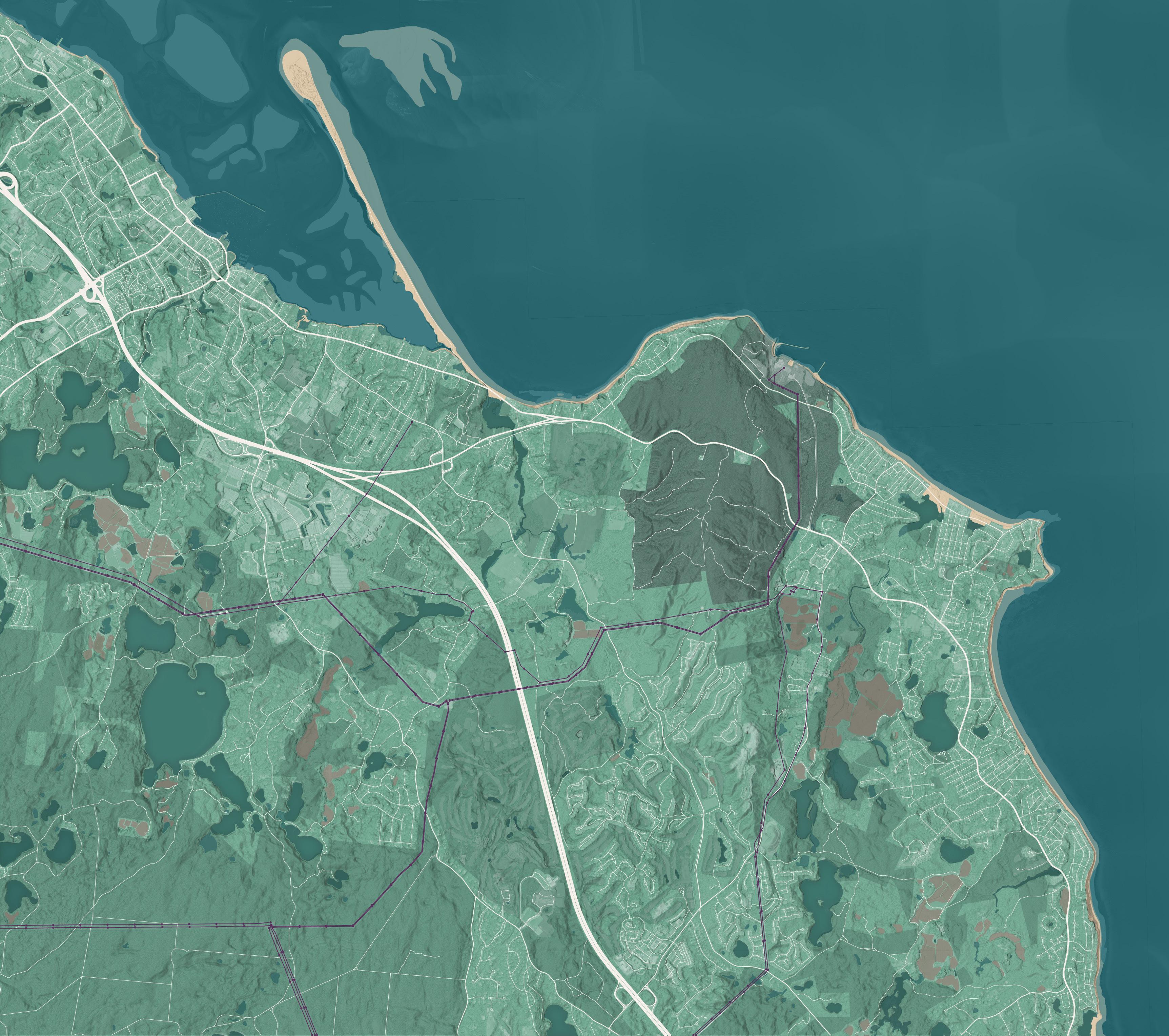
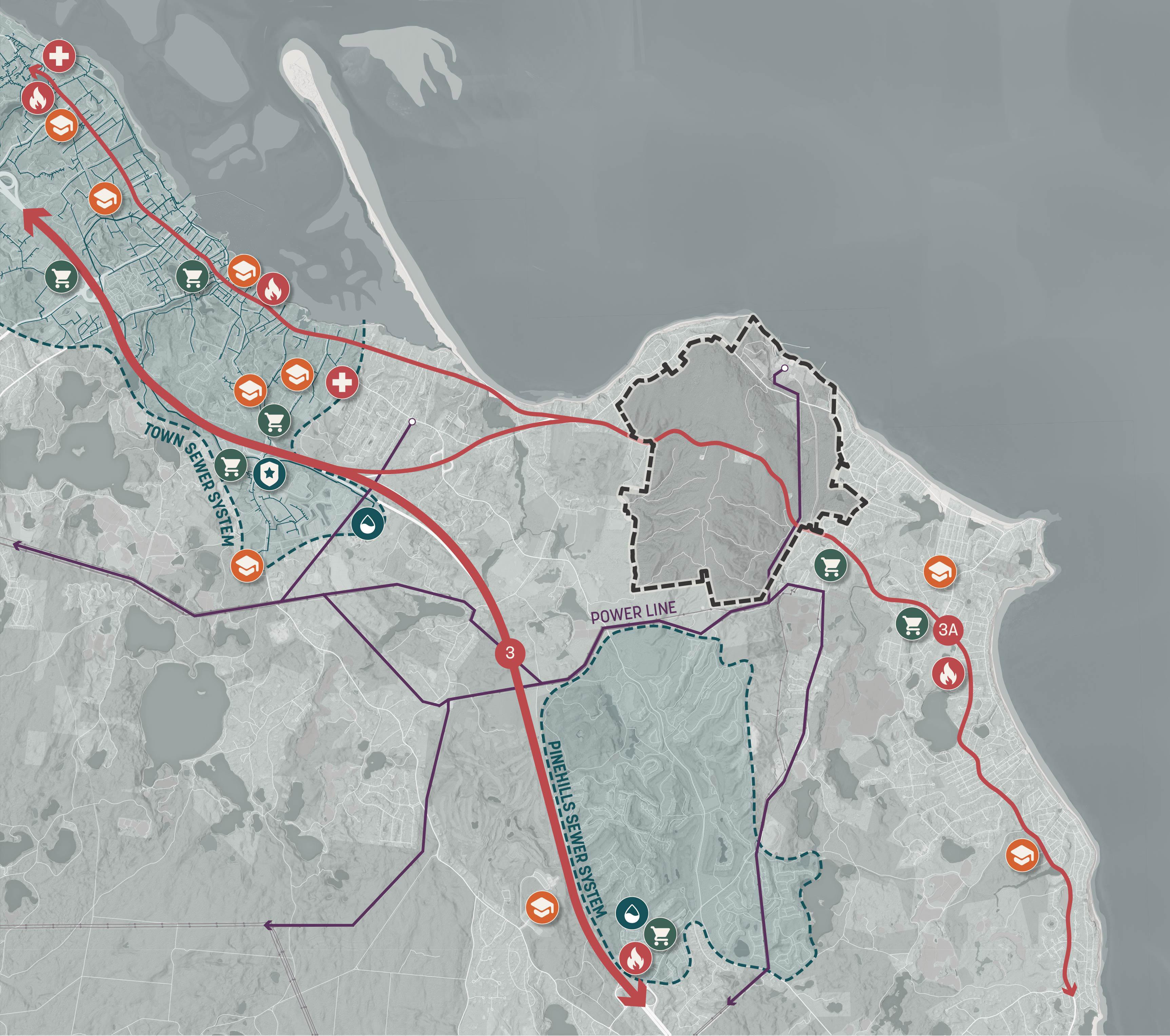
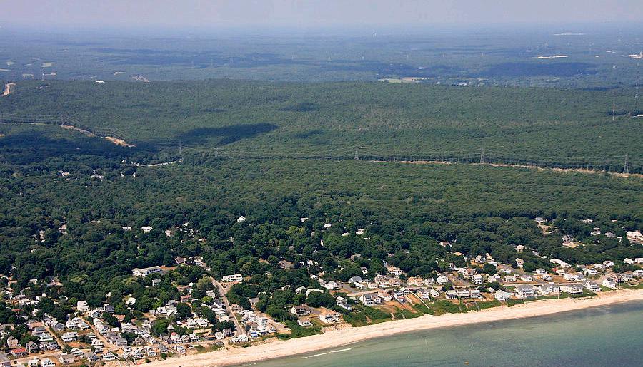
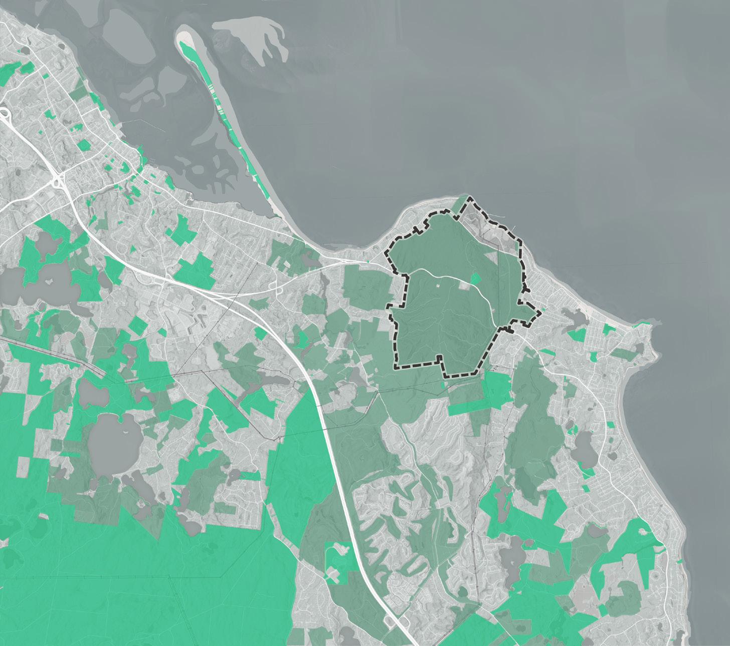
The Pilgrim 1600 is located between Plymouth Town Center and Manomet, along Route 3A. The site is abutted to the north by the Cape Cod Bay and is characterized by an elevated rocky coastline. To the east, the site abuts single-family housing neighborhoods in Manomet. To the south the site adjoins undeveloped conservation lands belonging to public, non-profit, and private owners. South of these conservation lands is the Pinehills, a large cluster housing development that will have more than 3,000 homes at full build-out1. To the west the site abuts agricultural and forested lands mixed with areas of low density housing.
The Pilgrim 1600 is surrounded mostly by low density residential land uses. Some nearby areas along White Horse Beach, Pinehills and Plymouth Town Center have clusters of moderate density housing such as townhomes, duplexes and small multiplexes. Nearby commercial areas are located at Manomet center, Plymouth Town Center and in shopping centers and industrial parks along Pilgrims Highway.
1 https://www.pinehills.com/about
The Pilgrim 1600 and its surroundings are in an area of low density development that has limited direct proximity to existing infrastructure and services. Health, education, public safety and retail services in Plymouth are concentrated in Plymouth Town Center. The Plymouth Town Sewer System’s service area ends about 2.5 miles west of the Pilgrim 1600. Recent development at the Pinehills to the south is served by a privately owned and operated sewer system.
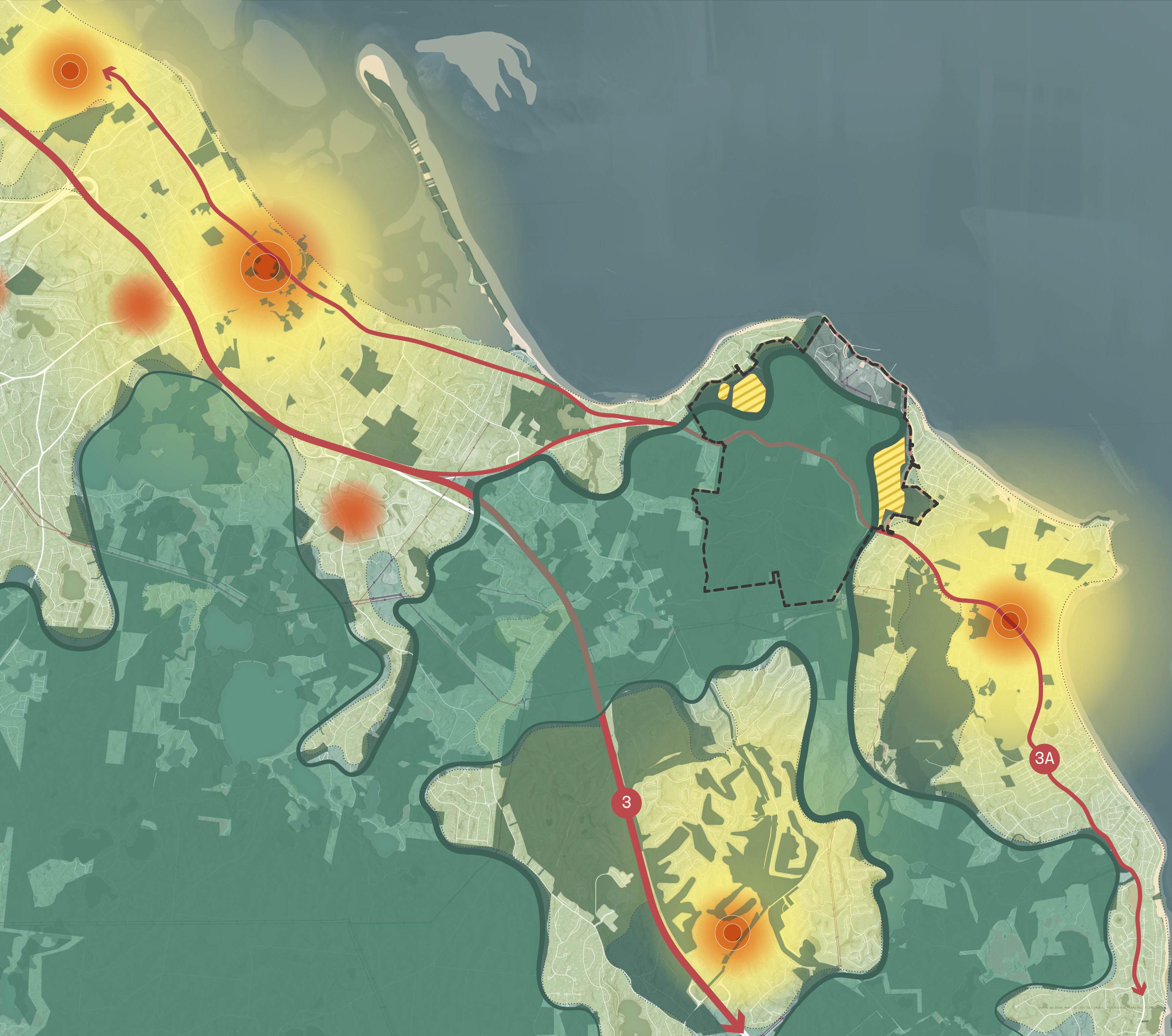
The Pilgrim 1600 is connected to State Road 3A which links to State Route 3, also known as Pilgrims Highway. The site is a 4 minute drive from State Route 3, a 10 minute drive from Plymouth Town Center, and a 4 minute drive from the center of Manomet.
As part of its past use for energy generation, the Pilgrim 1600 site is connected to high voltage power lines which once distributed the electricity generated at the Pilgrim Power Station to the region’s energy consumers.
Services and Infrastructure
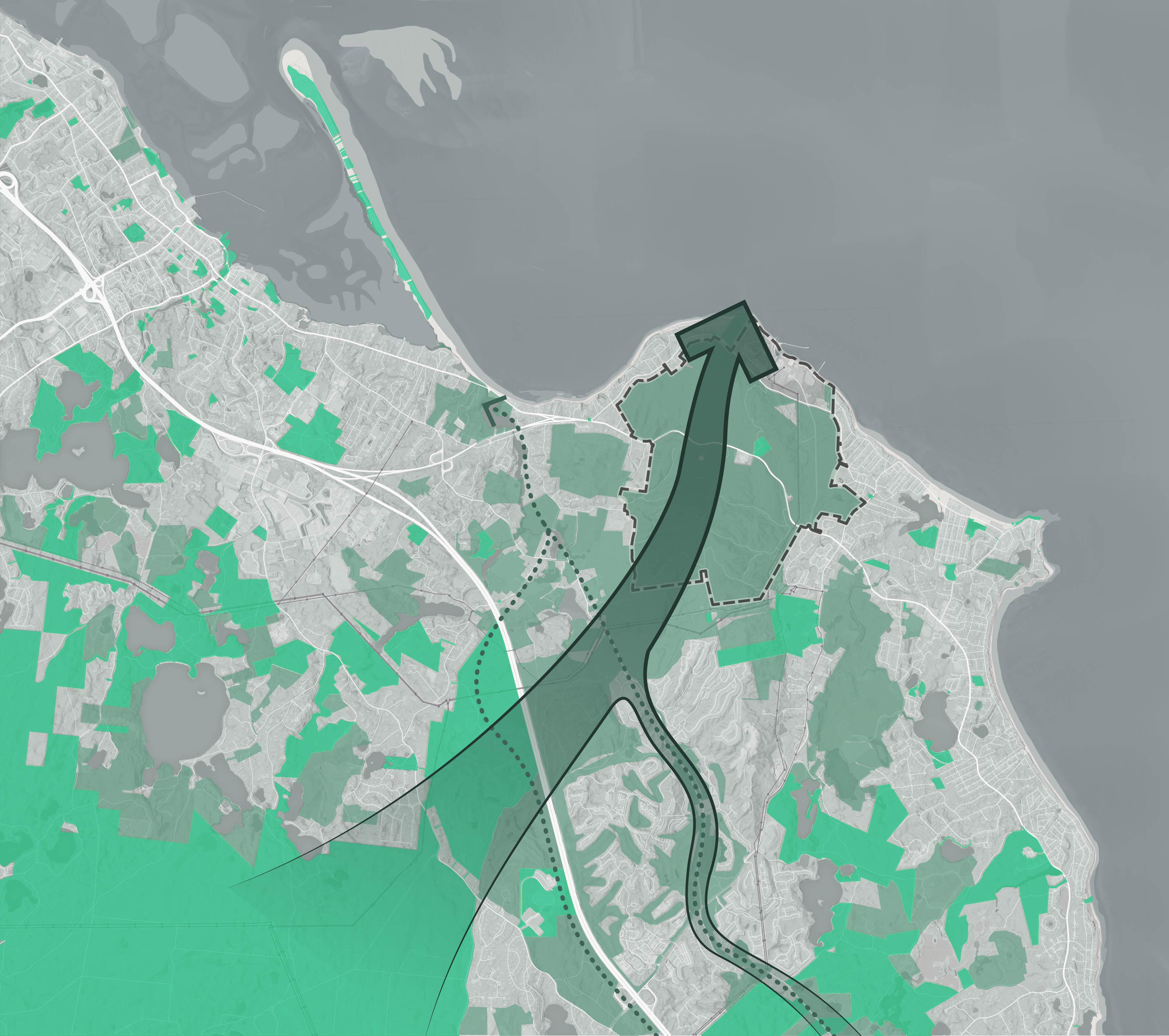
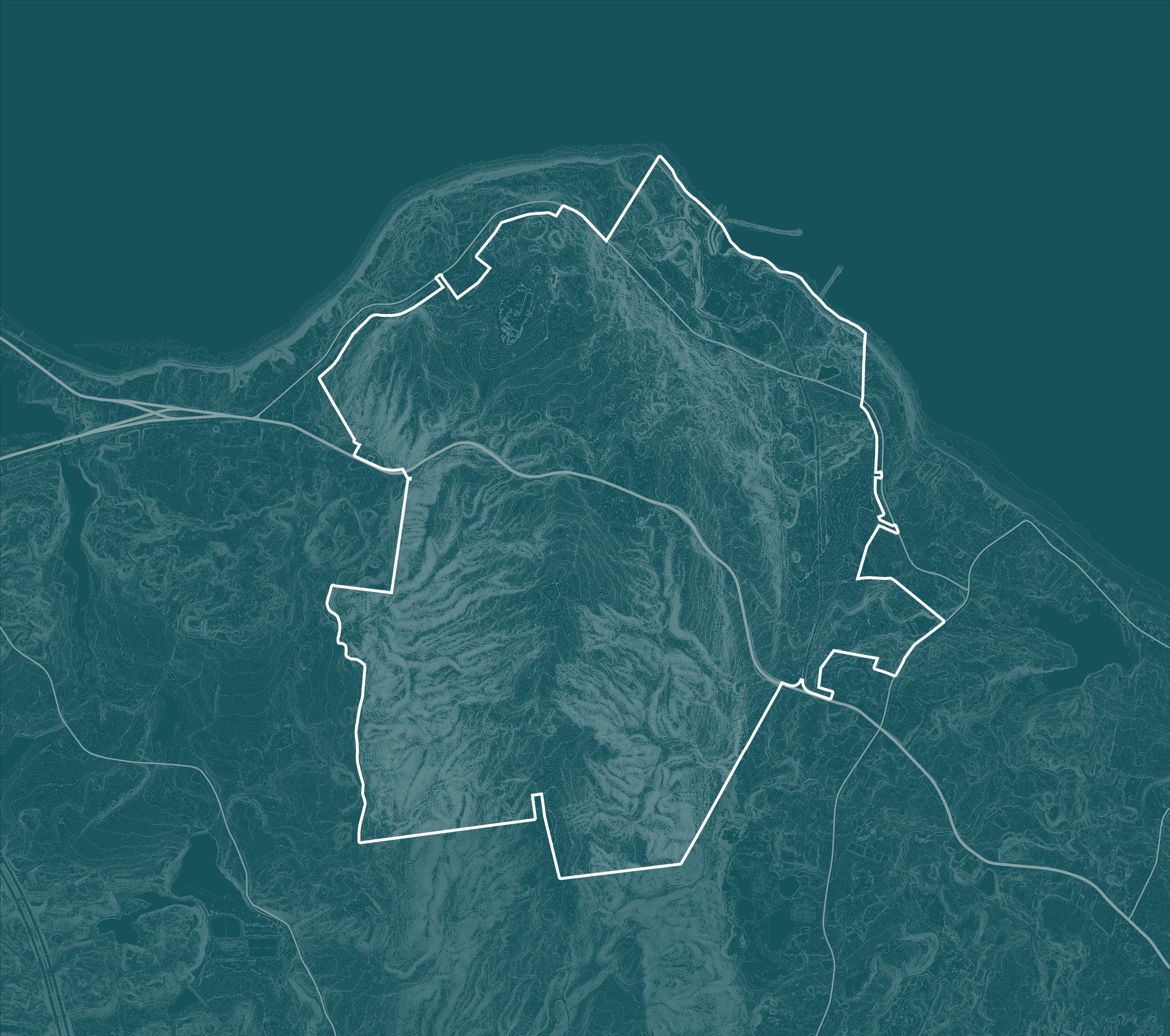
The Pilgrim 1600 is mostly undeveloped land. Only its waterfront portion has been cleared and developed as the site of the Pilgrim Power Station. Most of the remainder of the Pilgrim 1600 is in temporary conservation under the Massachusetts Chapter 61 Forest Tax Program. This conserved land connects to a larger regional network of both publicly and privately owned open space.
In previous planning work, including Plymouth’s 1999 Open Space Corridor Plan, the Pilgrim 1600 has been identified as a potential keystone in the establishment of a more contiguous network of open spaces that connects to Myles Standish State Forest and Ellisville Harbor. This idea was referred to as the “Wishbone Plan.”
Open Space Corridor: The Wishbone Plan*
Space Corridor Plan, Plymouth, MA, November 1999
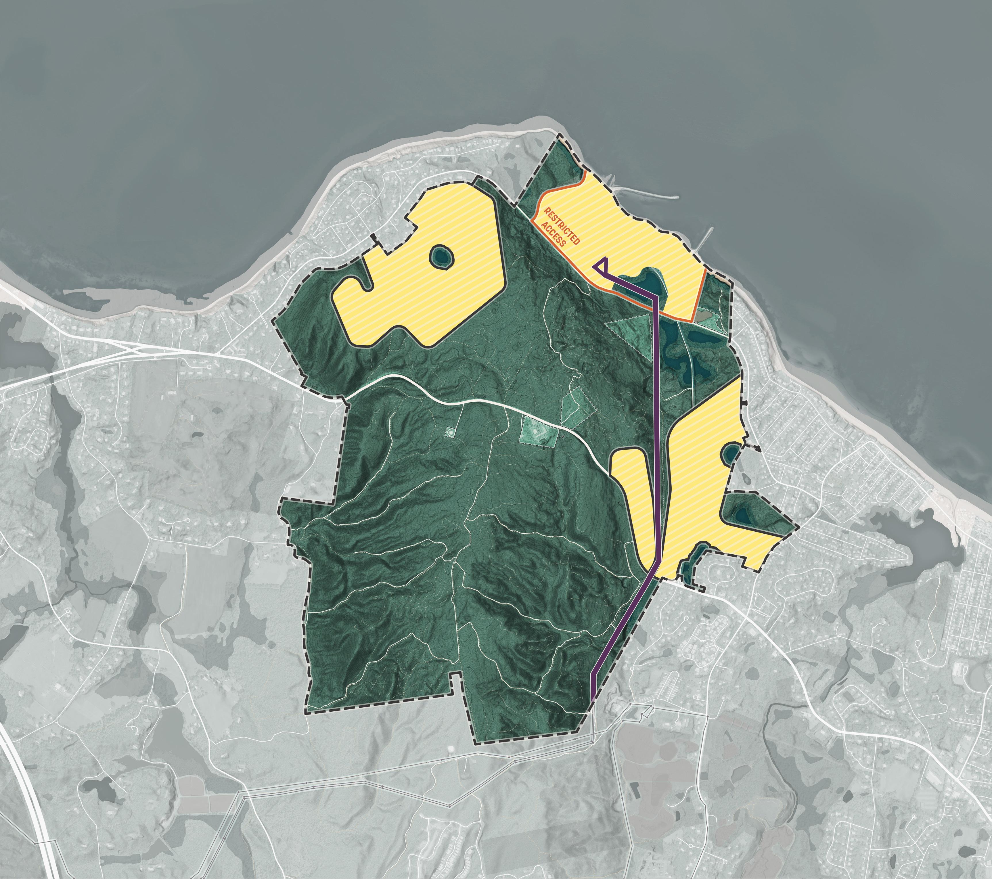
The Pilgrim 1600 is entirely owned by Holtec International. It surrounds several enclave parcels which are owned by other parties, including the Town of Plymouth (Parcel A and Parcel B) and a private commercial land owner (Parcel C).
The Town of Plymouth holds a right of first refusal on the purchase of roughly 1,527 acres of the Pilgrim 1600 site that are found south of Rocky Hill Road. This right expires at the end of 2031. The right would enable the Town of Plymouth to purchase this land before it reaches the general market should Holtec elect to sell. The Town may also enter into third-party agreements with developers or private non-profits and convey land to them utilizing this right of first refusal. The right of first refusal does not apply to the land north of Rocky Hill Road currently occupied by the Pilgrim Power Station, nor to Power House Road, which is a private road owned by Holtec.
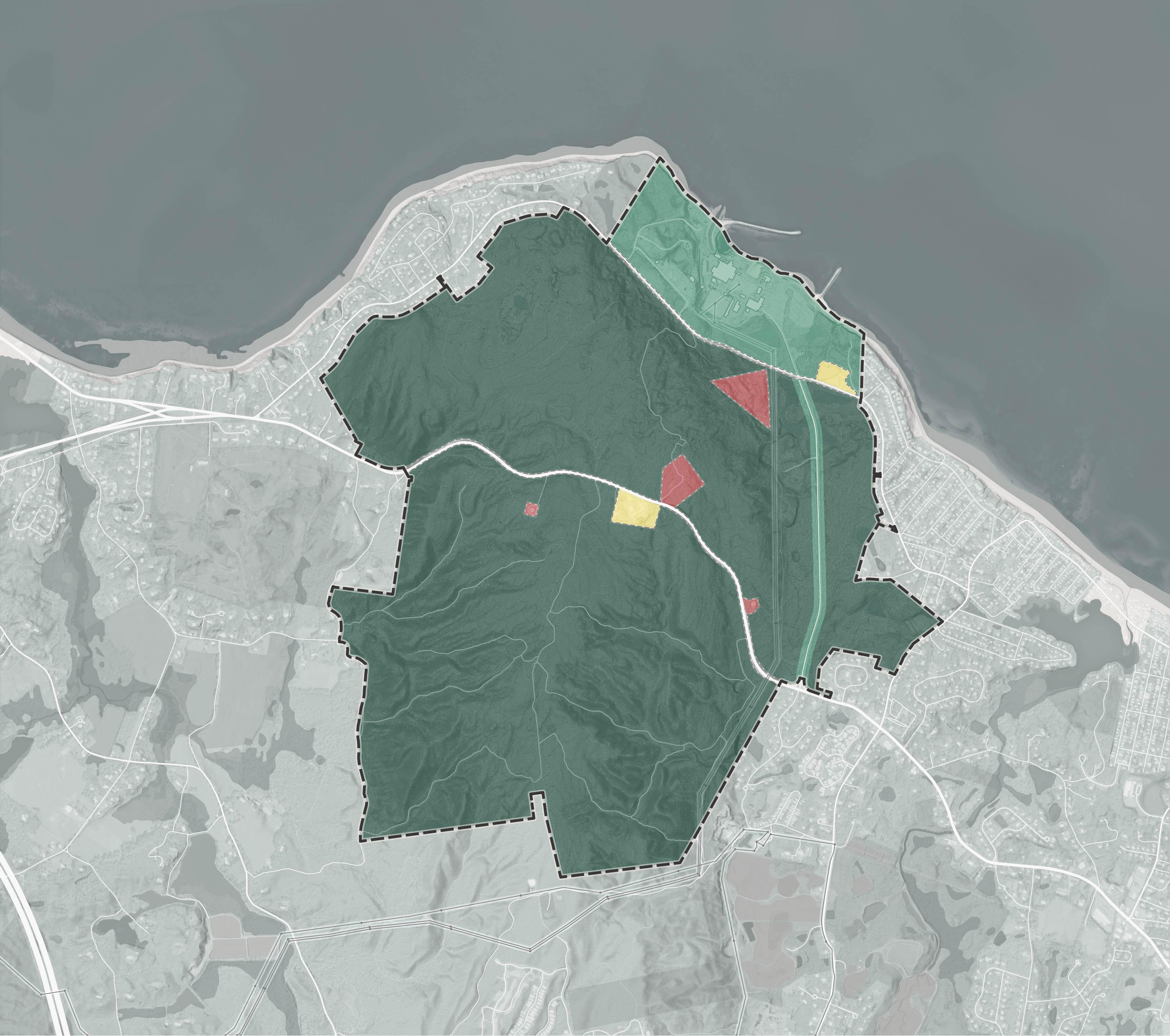
Owned Holtec Owned (Town holds a right of first refusal)
Holtec Owned (Town holds a right of first refusal)
The Pilgrim 1600 Master Plan explores long term opportunities that may emerge if the land’s current owner, Holtec International, sells part or all of their land holdings. The availability of this land for public, private, and/or non-profit investment, development, and conservation, can address several of the objectives of the Town of Plymouth and its residents. The purpose of the Pilgrim 1600 Master Plan is to evaluate the capacity of this land to address these objectives in a technically feasible, fiscally responsible, and publicly supported way.
The Pilgrim Power Station once provided more than half of the Town of Plymouth’s tax revenues via a paymentin-lieu of taxes (PILOT) agreement. In the years since its opening in 1972, the Town of Plymouth has expanded its revenue sources and at time of closure in 2019, the Pilgrim PILOT represented a much more modest 5% of Town revenues. Since 2019, Pilgrim PILOT payments have decreased gradually and will cease once decommissioning is complete. While the gap this creates in the Town’s revenue is substantial, the void has been filled by residential growth. A potential vulnerability is that now more than 85% of Town revenues come from residential property taxes.
The proportion of total Town revenues fulfilled by the residential tax base is high among comparably sized Massachusetts communities like Taunton (63%), Chicopee (65%) and Weymouth (80%). These communities have a larger manufacturing, technology and logistics sector that contributes to a more diverse tax base
Lack of tax base diversity puts the Town of Plymouth at risk of fiscal gaps if there are abrupt declines in residential property values, places a larger burden on residents in the event of future levy increases and makes it more challenging for residents on fixed incomes like retirees to make residential tax payments. An objective of the Pilgrim 1600 Master Plan is to evaluate whether the Pilgrim 1600 site can become part of a larger Town effort to diversify the tax base by attracting more industrial and commercial tax payers.
1 https://dls-gw.dor.state.ma.us/reports/rdpage.aspx?rdreport=dashboard. trendanalysisreports.taxlevybyclass
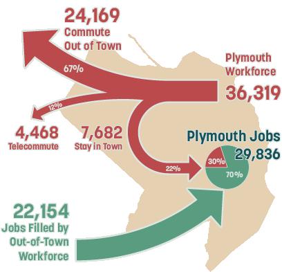
During typical operations, the Pilgrim Power Station employed about 600 full time employees. During refueling outages, that number increased to about 1,200, including specialized contractors. The closure of the Pilgrim Power Station represents a significant loss of high-paying, high-skill positions within the Town of Plymouth. Meanwhile, housing costs in the Town of Plymouth continue to rise as levels of housing production fail to keep up with increasing demand.
The result is that while Plymouth has a healthy job market, with over 29,000 positions, many of these positions do not provide workers with incomes high enough to afford to live within Town limits. 70% of jobs within Plymouth are filled by workers who live in other communities. Conversely, many of those who can afford to live in Plymouth must commute out of the Town to find high paying employment.
The present jobs/housing imbalance in Plymouth suggests two unmet needs. One is for increased housing production to help to generate a steady supply of affordable housing accessible to those who do essential work in Plymouth’s health care, social services, retail services, hospitality and other industries. The second is for increased employment opportunities that provide opportunities for more residents to work within the Town. An objective of the Pilgrim 1600 Master Plan is to evaluate the capacity of the Pilgrim 1600 site to both generate affordable housing and generate sustained, high-paying employment opportunities.
15 % increase in residents commuting out of Plymouth
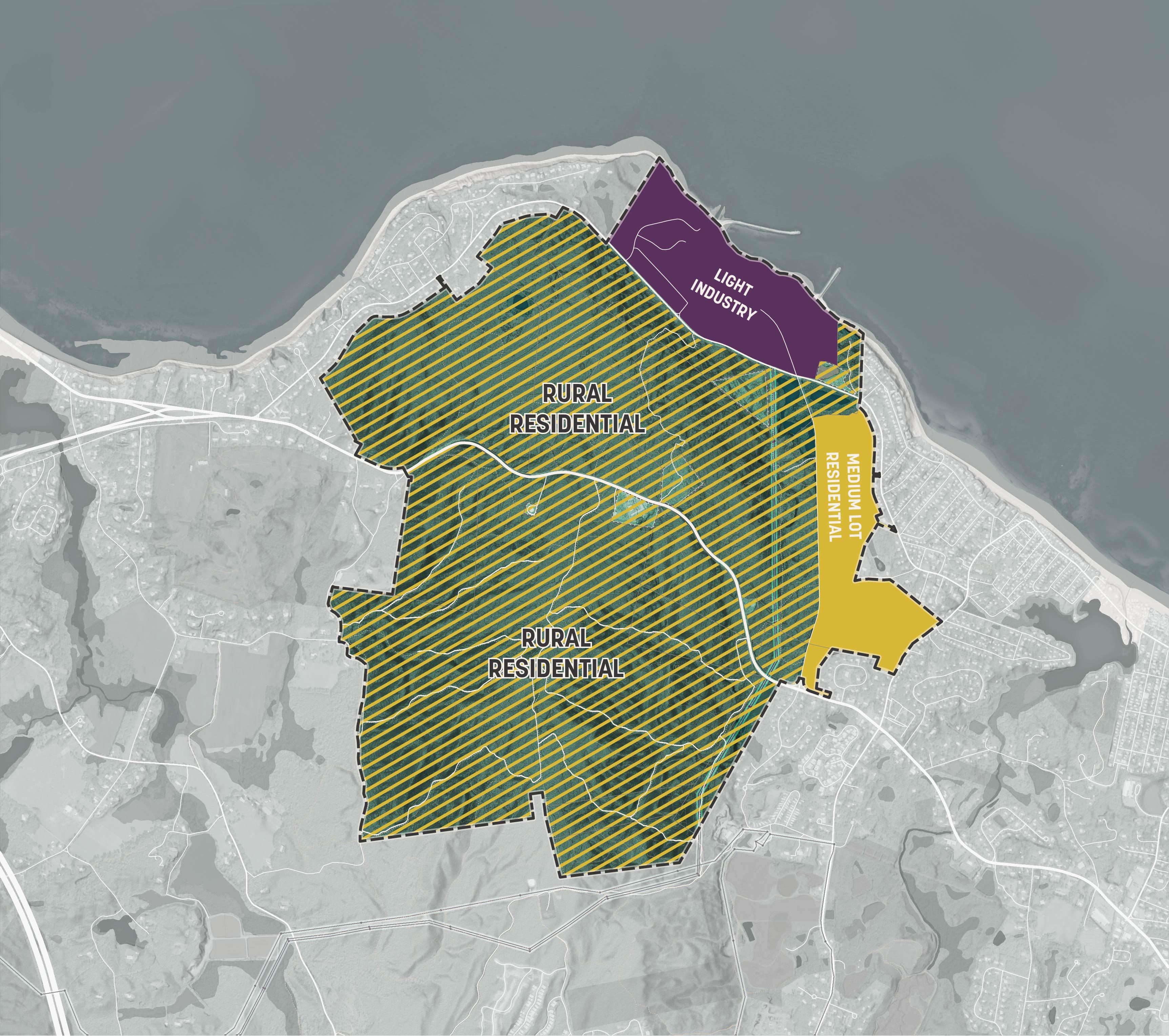
The Pilgrim 1600 is privately owned land. The majority of the Pilgrim 1600 is forested land currently conserved under the State’s Chapter 61 Forest Tax Program. This program is temporary, renewed every ten years. Were current or future landowners to withdraw the land from this program, it could be cleared and developed according to the provisions of the Zoning Bylaw of the Town of Plymouth. As presently zoned, about 1,430 acres of the Pilgrim 1600 could be developed as rural residential (RR) properties (about 1 unit per 2.75 acres), and 109 acres along Power House Road could be developed as medium lot residential (R-25) properties (about 2 units per acre).
Were the current land owner to sell the Pilgrim 1600 to a developer to develop the land according to its as-ofright zoning, this would have negative consequences for the efficient operations of the Town and would be contrary to the growth management objectives of the Town. Low density development increases the cost to deliver public services, represents a large infrastructure expenditure for relatively few housing units, and erodes the scenic quality of Plymouth’s rural and forested context.
An objective of the Pilgrim 1600 Master Plan is to determine how the Pilgrim 1600 might be rezoned or placed into permanent conservation in order to prevent inefficient land development patterns.
Existing Zoning - Town of Plymouth Zoning Bylaw 2025
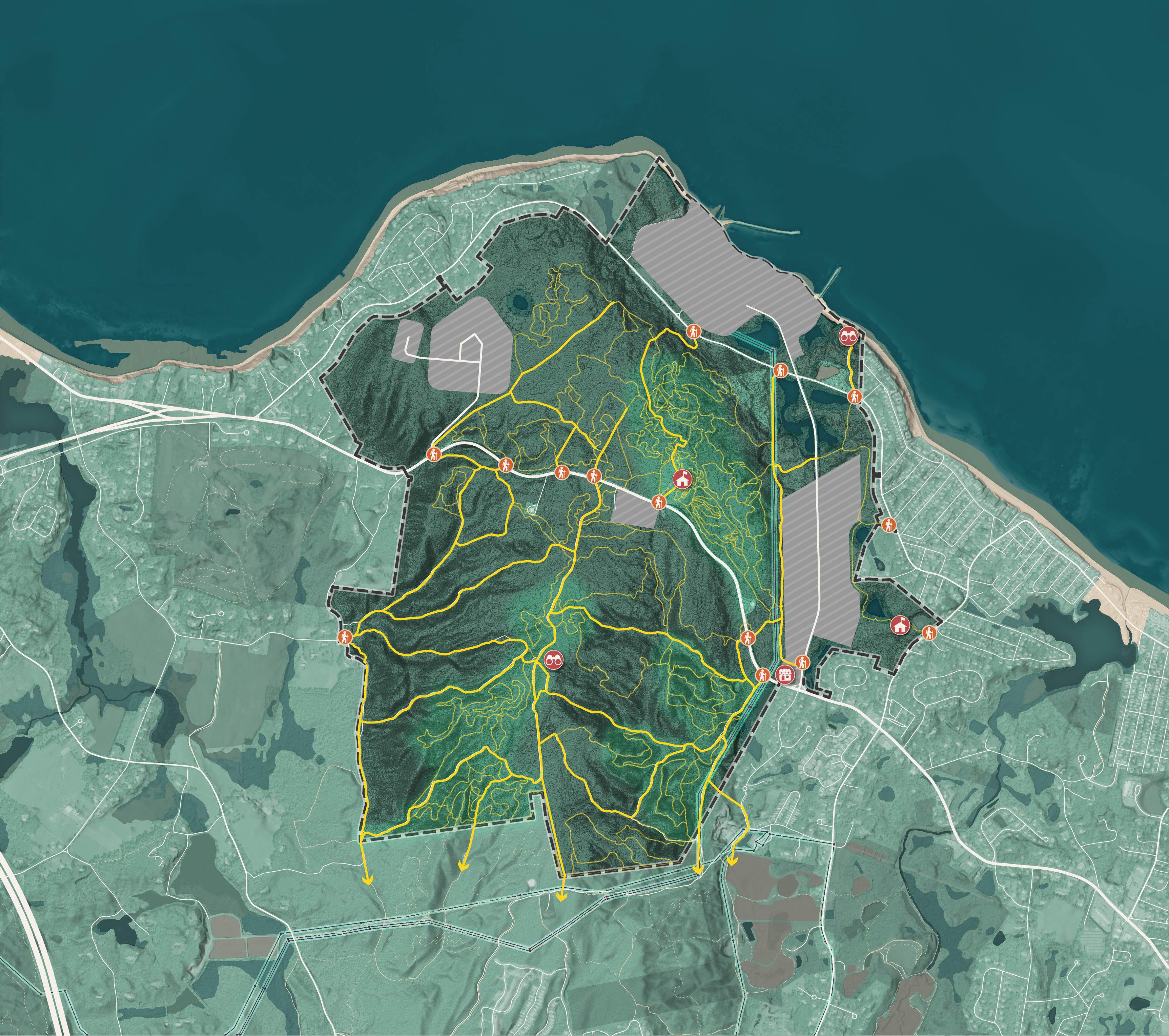
Much of the Pilgrim 1600 is currently forested land which provides value to the Town of Plymouth. This site has significant recreational value with an extensive network of informal, unsanctioned mountain biking and hiking trails estimated to total 47 miles in length. In addition to recreation, the forest has important functions for habitat provisioning, protection of local water quality, erosion prevention and scenic beauty. Many in the Town of Plymouth value these forested lands and have become used to their presence as a scenic backdrop to the Town.
However, the permanent conservation of this land is not guaranteed. Chapter 61 conservation is temporary, requiring renewal every ten years. The land’s private ownership means that it could be developed according to the Plymouth Zoning Bylaws.
Understanding that total development and privatization of this land is not in the interest of the vast majority of the Plymouth community, an objective of the Pilgrim 1600 Master Plan is to determine what parts of the site should be conserved, and if conserved, what financial and governance strategies should be employed to ensure permanent conservation.
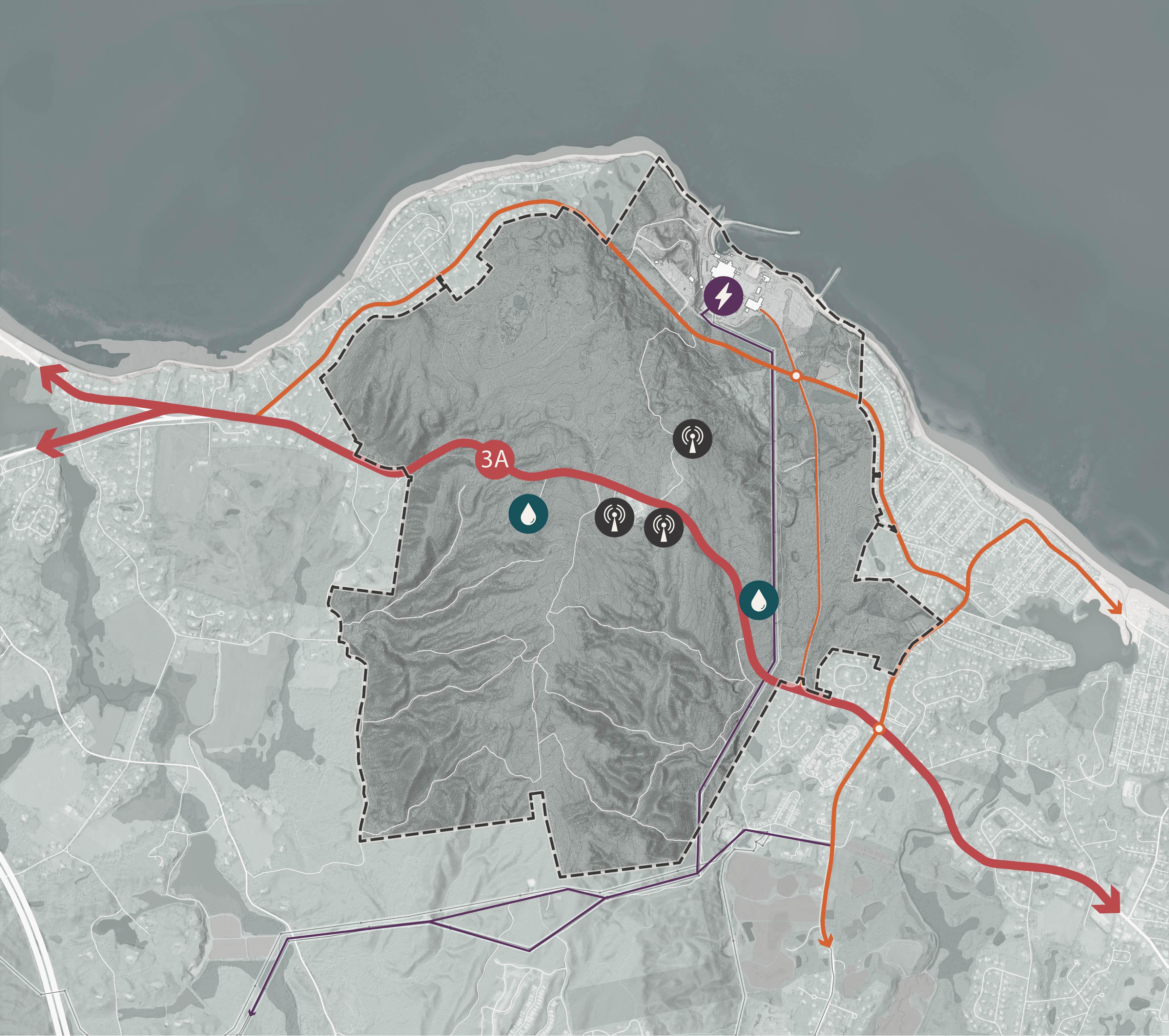
The Pilgrim 1600 is located on State Road 3A between Manomet and Plymouth Town Center. The site’s immediate context is characterized by low density residential development, agricultural land, farmland, and recreational open space. The former Pilgrim Power Station, currently undergoing decommissioning, is located along the waterfront of the site. Other significant features of the site include high voltage power lines and an associated switchyard, Power House Road, Rocky Hill Road, and an extensive network of hiking and mountain biking trails.
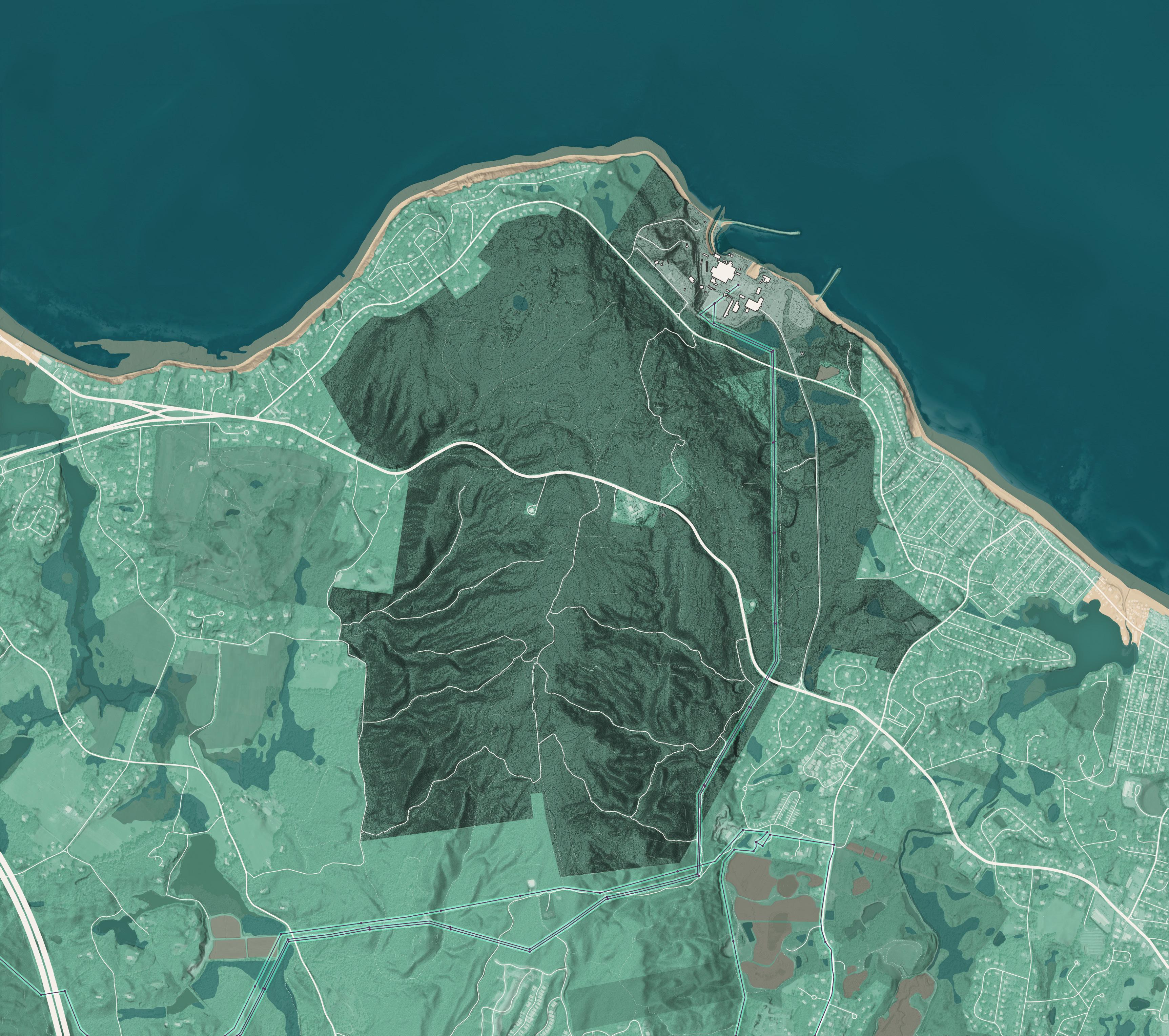
The Pilgrim 1600 is located on a hill with a peak elevation of 397 feet. This landform is sometimes referred to as “Manomet Hill.” The hill is one of the tallest points on the coastline of Massachusetts1. The change in elevation between the Pilgrim 1600’s highest and lowest points provides suitable terrain for mountain biking and moderately challenging hikes.
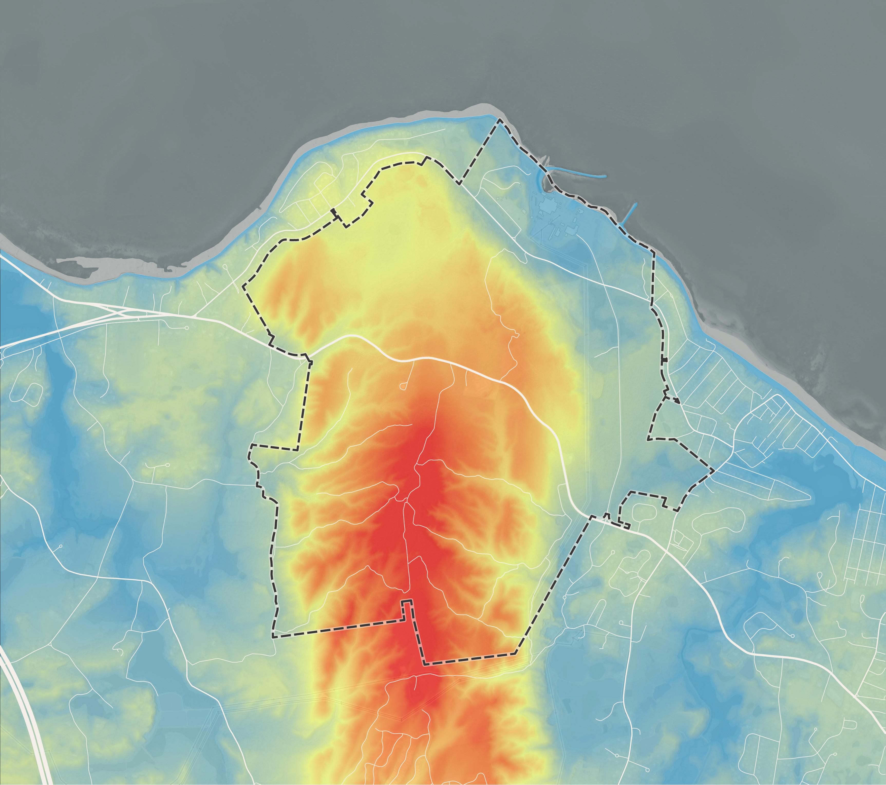
The Pilgrim 1600 is characterized by a rugged contour. On the west and east slopes of the hill, the landscape is carved by a series of small ravines. The northwestfacing slope of the hill is a minor bluff overlooking a flatter area occupied by the Pilgrim Power Station and Power House Road.
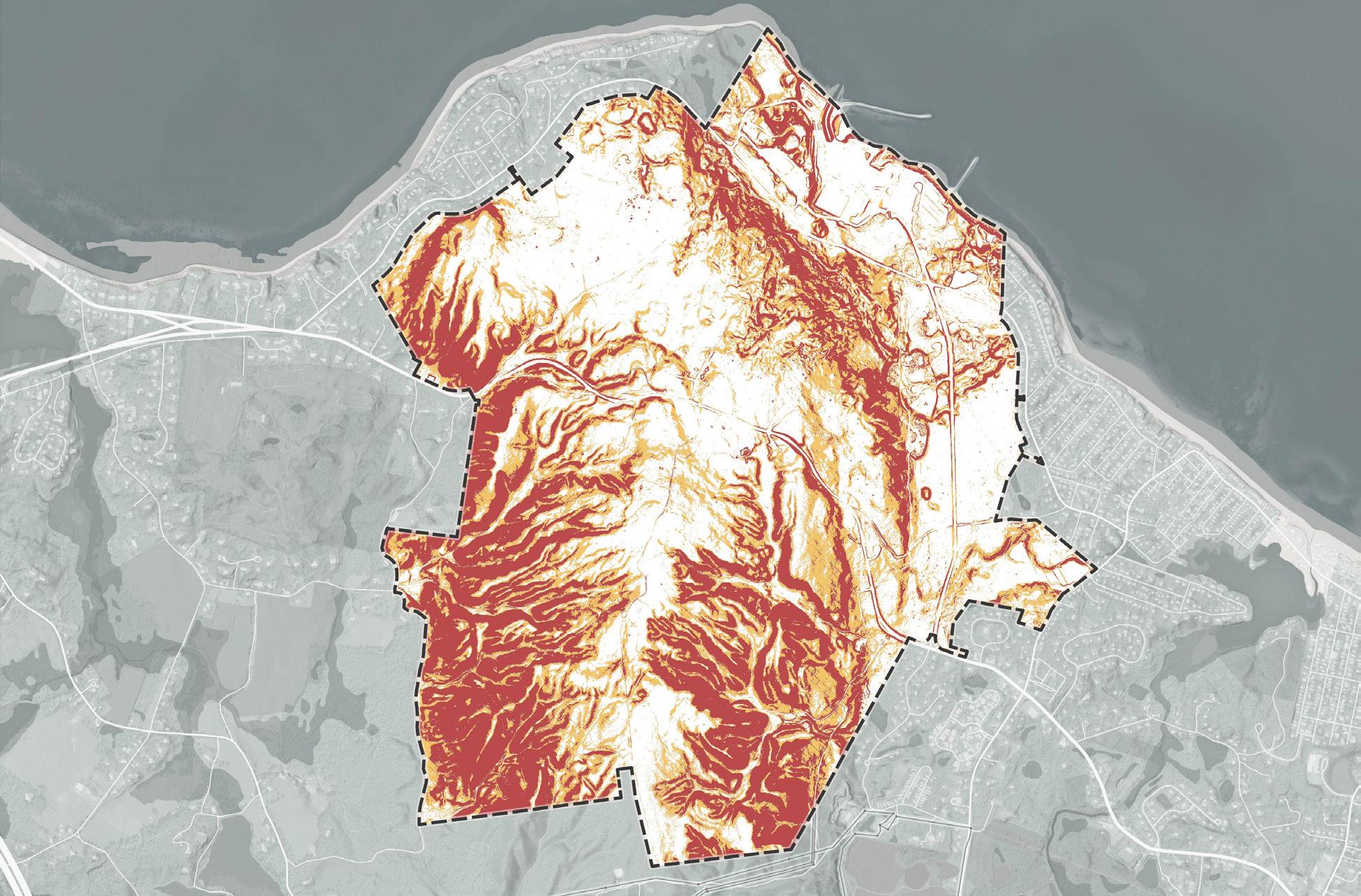
The Pilgrim 1600 is characterized by many areas of steep terrain. Steep terrain reduces the ability to develop land in a manner that is profitable and environmentally responsible. This analysis segments the site into three slope ranges:
<10% slope: These areas are optimal for development, particularly for larger buildings, parking lots, and emergency access. Grades below 10% are also conducive to road construction.
10%–20% slope: Development is possible but constrained. Roads will need to switch back or follow less direct alignments to maintain acceptable grades for access. Building footprints may need to be smaller or require regrading.
>20% slope: These areas present substantial challenges. The cost and complexity of constructing roads and buildings in these zones typically render development financially infeasible. To protect water quality and prevent erosion, the Town of Plymouth’s Zoning Bylaws advise against development on steep slopes1
1 https://www.plymouth-ma.gov/DocumentCenter/View/7334/ZoningBylaw-10-2024
The Pilgrim 1600 consists of several different areas which are potentially suitable wildlife habitats with conservation value.
The Pilgrim 1600 is mostly forested. Several large areas of the Pilgrim 1600 consist of interior forest, or forest which is relatively un-fragmented by human development and offers a suitable habitat for wildlife species adverse to human disruption (noise, light, pollutants). The Massachusetts Division of Fisheries and Wildlife defines an interior forest as a continuous area of forested land more than 1,000 meters (3,281 feet) from highways, more than 300 meters (984 feet) from arterial roads and more than 100 meters (328 feet) from minor roads . There have not been recent surveys of vegetation communities on the Pilgrim 1600. According to historic data published in 2003 by the Massachusetts Natural Heritage and Endangered Species Program, it is possible that some parts of the Pilgrim 1600 contain pine barrens, a globally rare vegetation community2. However, vegetation communities can change rapidly and an updated survey is recommended.
1 https://www.mass.gov/info-details/massgis-data-interior-forest
2 https://www.mass.gov/info-details/massgis-data-priority-naturalvegetation-communities
The planning consultant team did not perform a wetlands delineation survey as part of this report and has relied on the Mass Department of Environmental Protection’s 2005 wetlands map to estimate the location of wetlands1. The State of Massachusetts Wetlands Protection Program regulates development activity that can occur within 100 feet of the edge of a wetland2.
Under the Massachusetts Public Waterfront Act, or Chapter 91, activities which disturb tidelands by adding, filling, or removing structures are heavily restricted3 The coastline of the Pilgrim 1600 is mostly characterized by rocky revetments and two breakwaters. These features have likely become habitat for aquatic species and would require further surveying should the Town or landowner want to explore options for their modification or removal.
Wetland Features
Wetland
Wetland Buffer (100ft)
Potential Vernal Pools
1 https://www.mass.gov/info-details/massgis-data-massdep-wetlands-2005
2 https://www.mass.gov/info-details/protecting-wetlands-in-massachusetts
3 https://www.mass.gov/guides/chapter-91-the-massachusetts-publicwaterfront-act
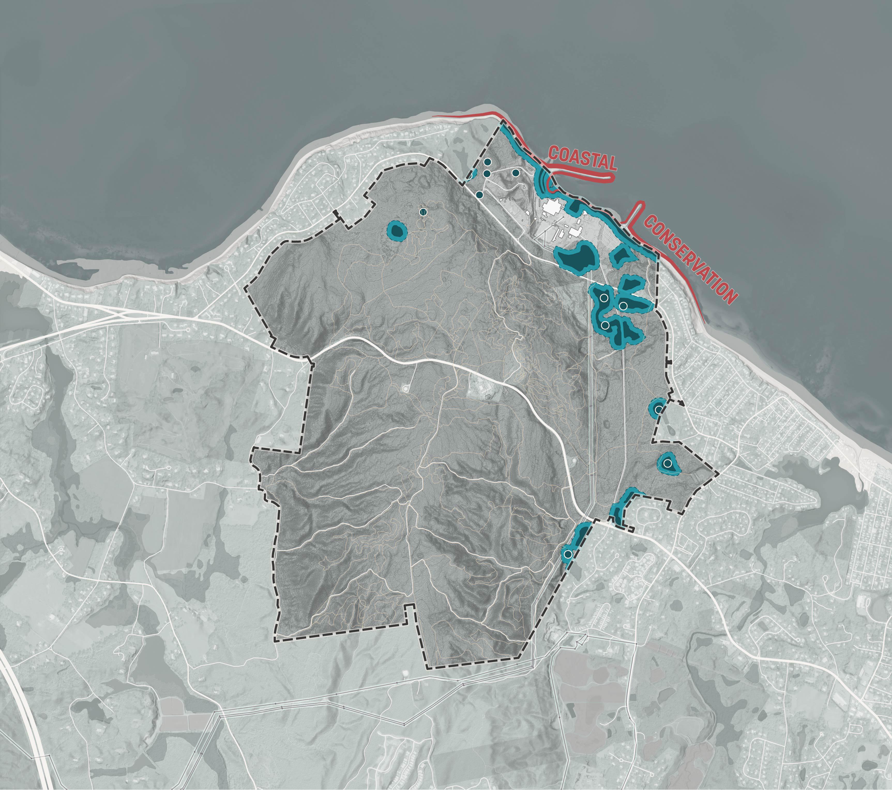
EXISTING BREAKWATERS
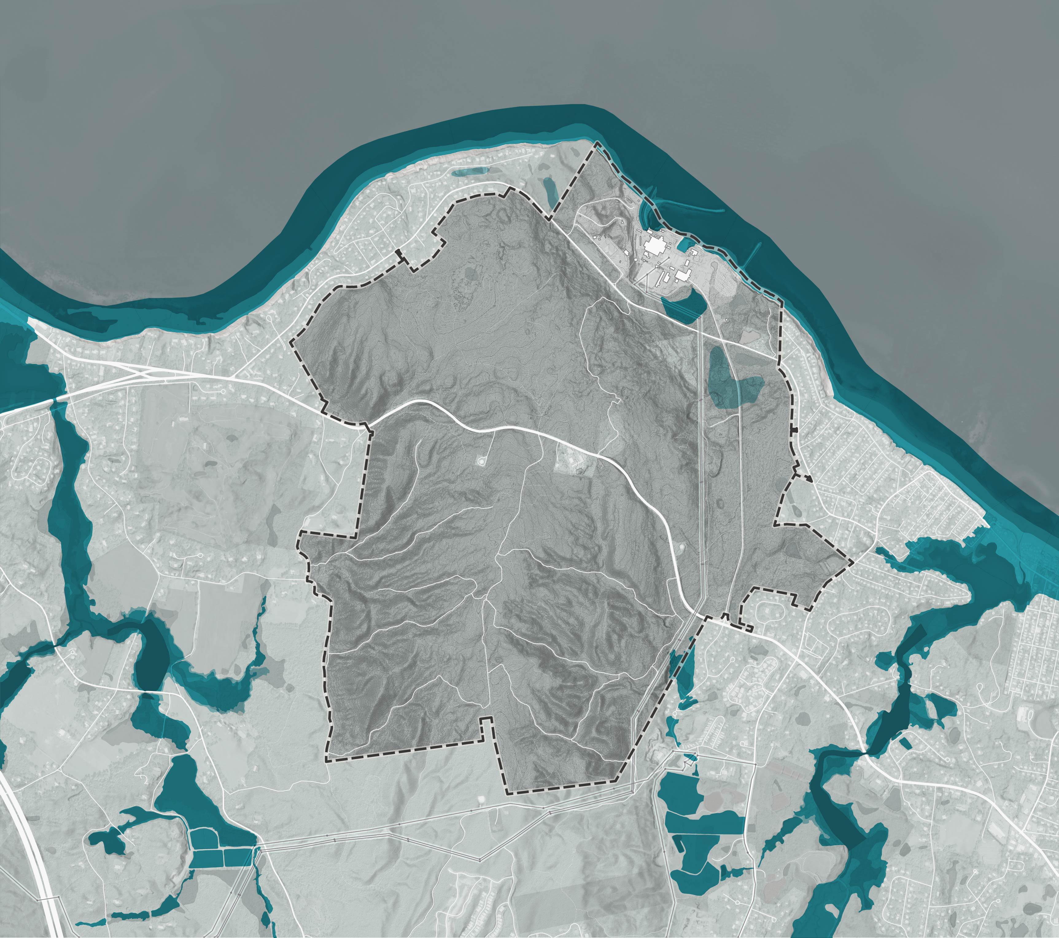
According to FEMA’s National Flood Hazard Layer1, areas of the Pilgrim 1600 are considered at elevated risk of flooding. However, these areas are relatively small and correspond with tidelands and wetlands that would already be excluded from development activities.
The Pilgrim 1600 drains to the Eel River and Beaver Dam Brook. Development activities on the Pilgrim 1600 have the potential to change the rate and quality of stormwater flows to these watercourses and should incorporate appropriate stormwater management infrastructure.
1 https://www.mass.gov/info-details/massgis-data-fema-national-floodhazard-layer
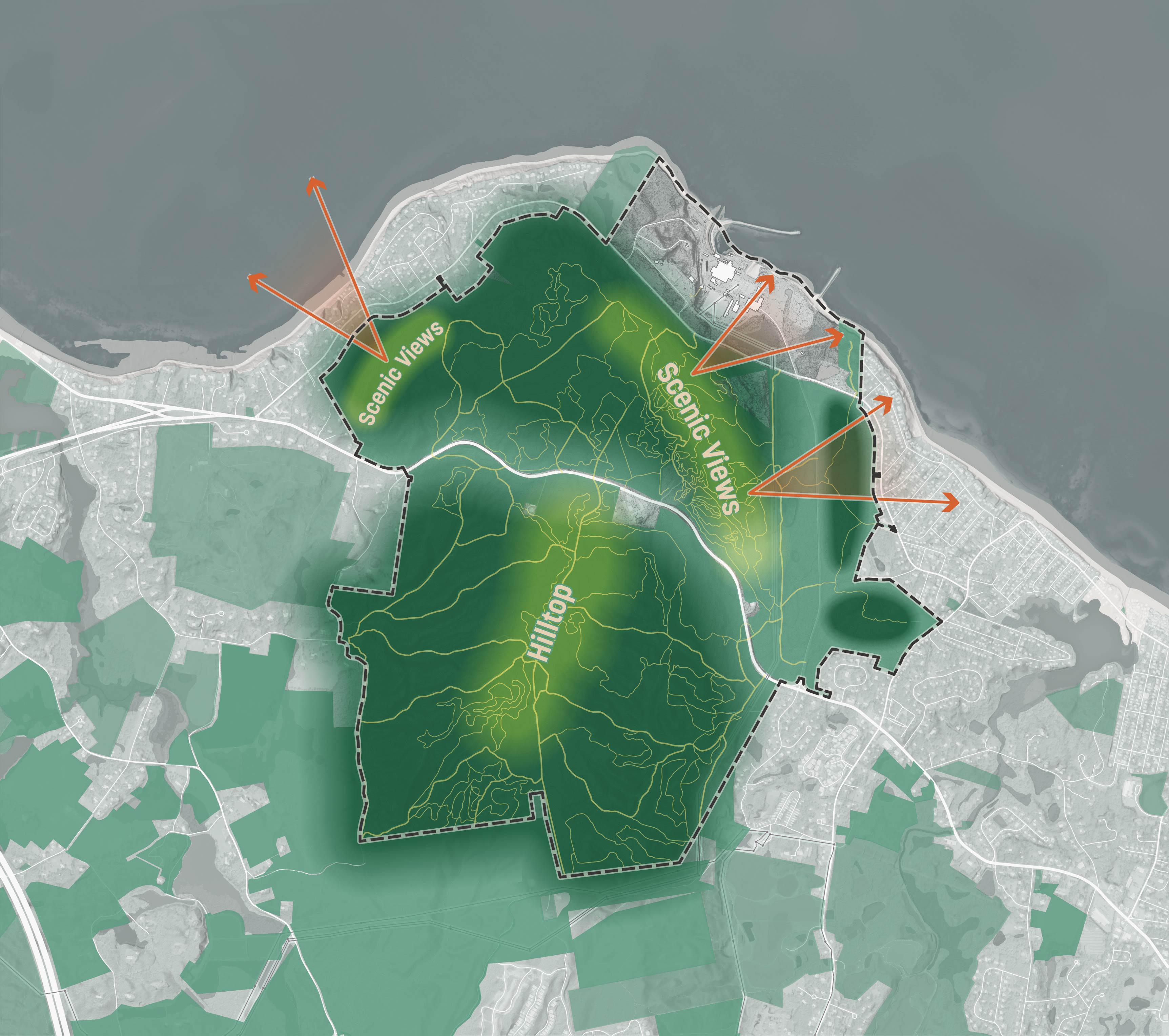
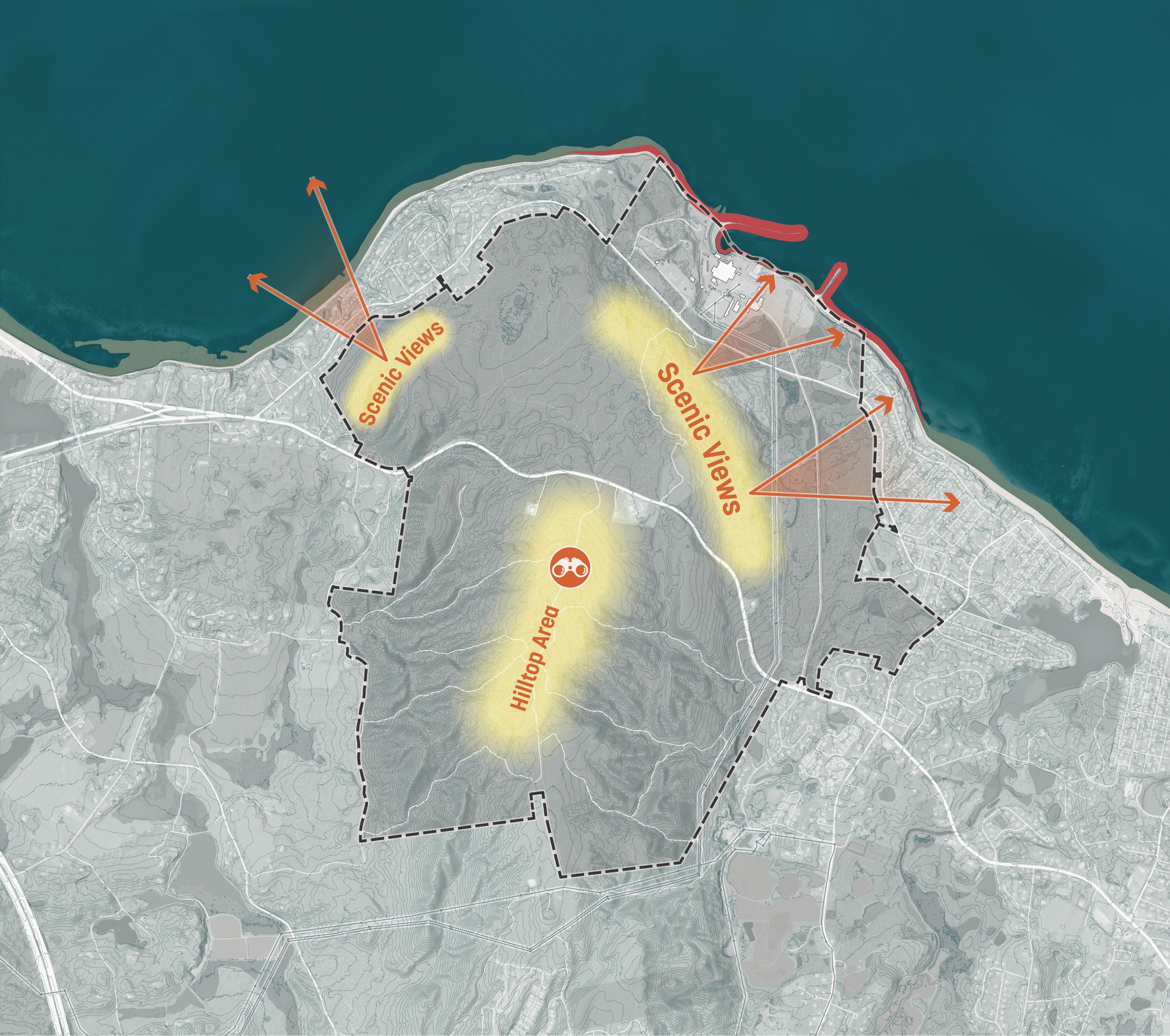
The Pilgrim 1600 is part of a promontory that juts out into the Cape Cod Bay and is prominently visible from the Bay, Plymouth Harbor, and Plymouth Town Center. From Plymouth Town Center in particular, the hill appears as a large green backdrop to the Town. From the summit of the hill, visitors report panoramic views reaching as far as the Boston skyline and Provincetown in good weather. Based on the site’s topography, scenic views are also likely available from the bluffs on the northwest and northeast sides of the site.
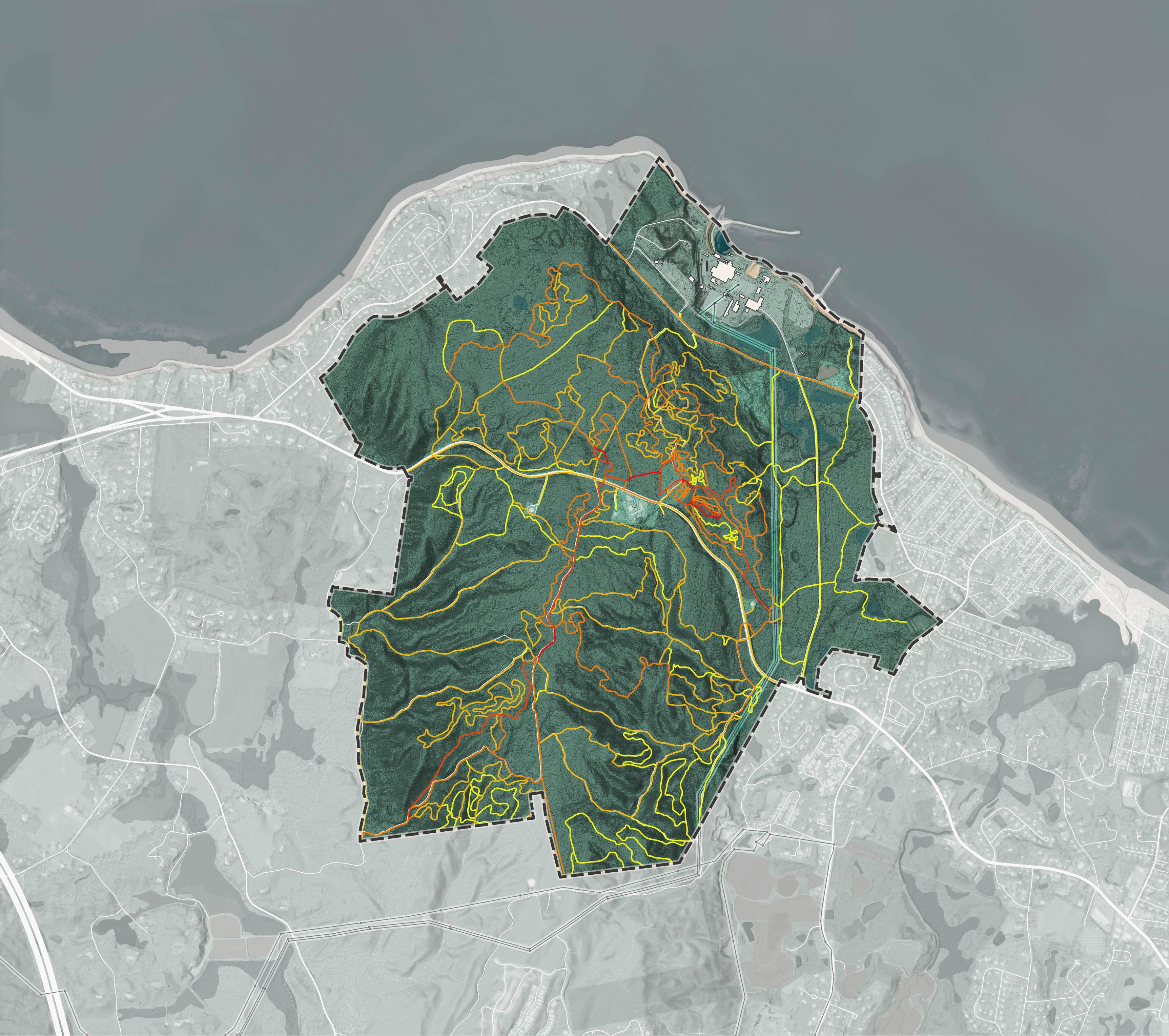
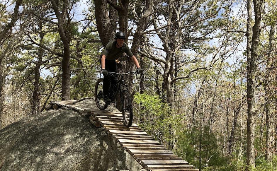
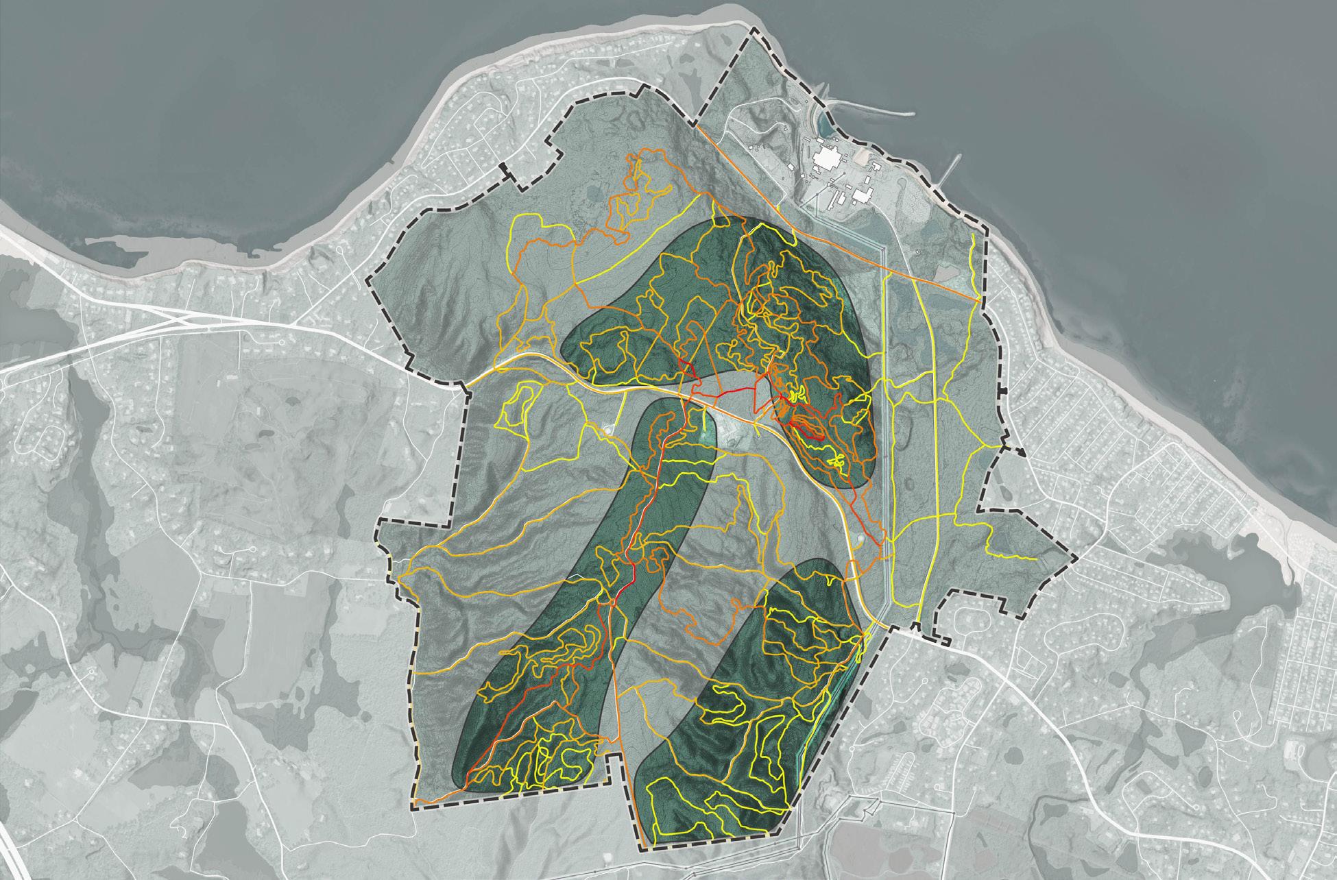
The Pilgrim 1600 has an estimated 47 miles of informal mountain biking and hiking trails. Some of these trails are modified dirt forest access roads, informally used by recreational visitors to the site. Many others have been developed over the past several decades by mountain biking community groups without the authorization of the land owner. Many of these trails include obstacles, switchbacks, berms and jumps which introduce challenges for mountain bikers. While these trails are unsanctioned, their presence is widely known.
Total Bike Trips Reported on the Strava App (2020-2025)
Source: Strava
The Pilgrim 1600 has some existing infrastructure, but relative to Plymouth Town Center, lacks many of the systems required to sustain a significant residential population or commercial activities. The site is 2.5 miles away from the nearest publicly owned sewer system. Current sewage generated by the Pilgrim Power Station is treated with an on-site package plant that will be removed as part of plant decommissioning. Nearby residential communities rely on septic systems for sewage treatment. There are existing wells on the Pilgrim 1600 site which provide municipal fresh water. The site is also home to 3 telecommunications towers which serve the region. The most significant infrastructural feature of the Pilgrim 1600 site is its high voltage electrical transmission lines which terminate at a switchyard located adjacent to the power station. This switchyard is operated by Eversource under a long-term lease from the land owner.
2.5MilestoMunicipalSewer
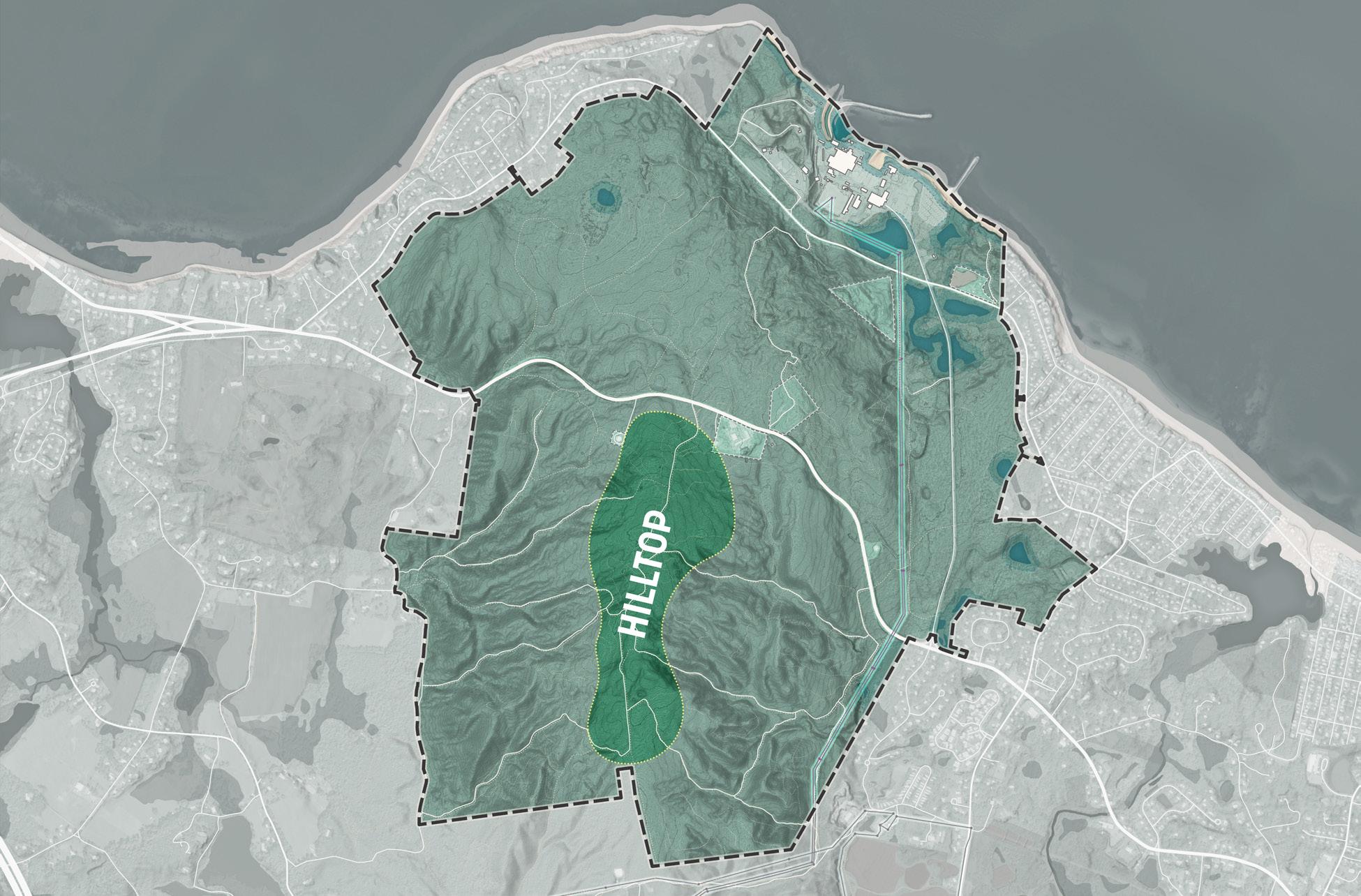
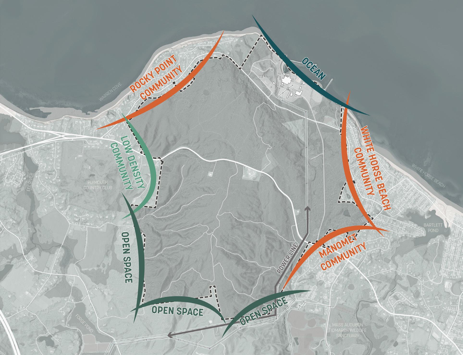
For the purposes of this study the large area of the Pilgrim 1600 has been further subdivided into distinct character areas, each of which will require a unique planning approach.
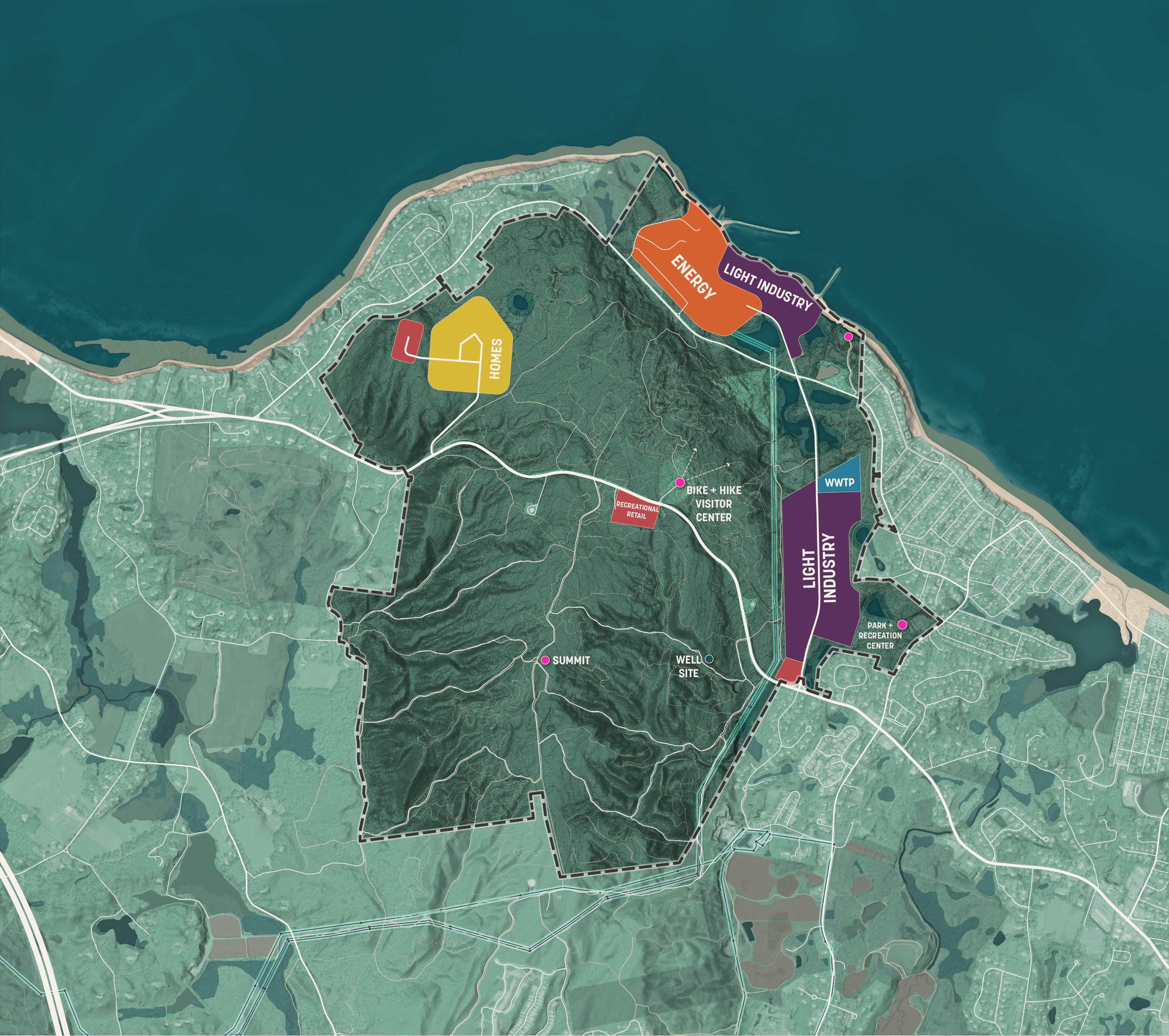
Warren Cove is the northeast area of the site that faces Plymouth Harbor.
The Hilltop includes all land south of State Road 3A, characterized by high elevation, steep slopes and continuous forestry.
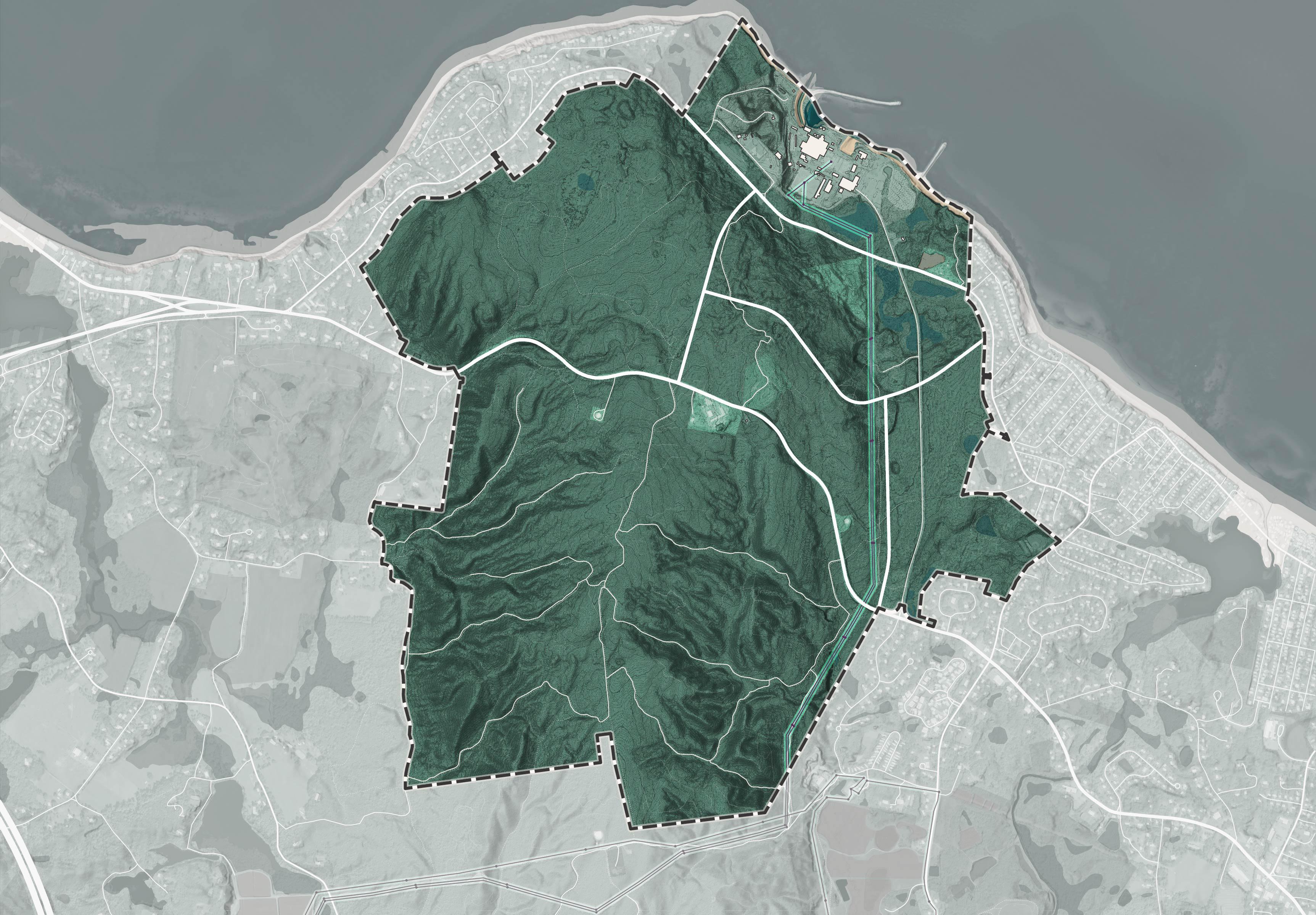
The Waterfront is the area north of Rocky Hill Road currently occupied by the Pilgrim Power Station.
East Slope is the steep bluff along the northwest face of the hill that faces Cape Cod Bay.
Power House Road refers to the corridor of land to either side of Power House Road between Rocky Hill Road and State Road 3A.
Cleft Rock Ridge is the area that includes Cleft Rock Park, a publicly owned enclave parcel in the center of the site, and adjacent areas between State Road 3A and the high voltage power lines.
To understand what the site can support in the future, it is important to first conduct a market analysis to understand demand for development. The analysis showed that there is demand for a mix of uses on this site over the next 10 years, with current market dynamics favoring residential, hospitality and recreation tourism, flexible industrial space, and energy generation.
Strengths & Weaknesses
Housing is in demand. While the Town has experienced significant household growth from large master planned communities like Pinehills and Redbrook, the market is still ripe for an increased variety and supply of housing, especially at lower price points.
The energy market is strong. Massachusetts consumes more electricity than it produces and rising costs are a growing concern. Technology is evolving and the State will need to build more infrastructure to achieve ambitious clean energy and grid resilience objectives.
Many of Plymouth’s top growing industries require flexible industrial space and there is unmet demand for mid-sized space in the local market.
Situated along Cape Cod Bay proximate to recreational opportunities, historic sites, Manomet, and Plymouth’s downtown - the property would be a desirable place to live. However, physical site constraints including steep slopes, lack of infrastructure, and traffic capacity greatly limits development potential.
Existing energy infrastructure at the Pilgrim 1600 site, including a 345 kV transmission line and switchyard, is a high value asset that should continue to be utilized. This could be accomplished with new energy generation, interconnection to undersea cables delivering offshore electricity, or on-site energy storage infrastructure.
Given the site does not have immediate highway access, industrial desirability will come from proximity to the Cape Cod Bay and future energy generation. Waterfront access is not gauranteed due to security constraints surrounding spent fuel storage. Future energy generation may attract industries seeking a reliable, clean energy supply.

Site
Strengths & Weaknesses
Plymouth’s office market is active and focused on small scale businesses. Regionally absorption is slow, net rents are declining, and office space development is slow. Office development that is occuring is built-to-suit specific end users, rather than speculatively built to attract new tenants.
Plymouth has several distinct retail nodes including the Town Center, village centers, and shopping centers along Route 3. Manomet has more potential in enhancing a neighborhood village retail concept than other areas in Town.
Indicators including current occupancy data, transactions and investment in Plymouth hotels, and previous hotel market studies suggest additional lodging options are in demand.
Recreation and eco tourism has potential. Local economic development strategies include showcasing natural resources and scenic beauty, growing active tourism venues, and expanding diversity of activities with goal of boosting length of stay.
Lack of a transit connection, existing services, and highway proximity mean office uses are unlikely on the Pilgrim 1600. If developed, new office in the area would more likely be in support of other uses, like industry and energy.
While State Road (3A) is not a retail corridor, a privately owned commercial out-parcel exists at 265 State Road within the site. This commercial area opposite the Cleft Rock trailhead creates a logical activity node for retail and services that support recreational use of the property.

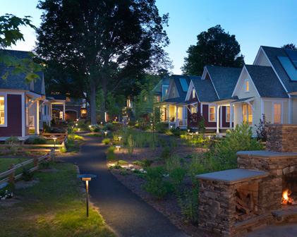
New on-site lodging and dining could compliment recreation use of the site, and turn the Pine Hills Area Trail System into a destination. A small inn, lodge or village of cabins could be designed to take advantage of the site’s natural features. Opportunities for events like retreats, and weddings could be important revenue generating activities.
Tourism and recreation-based economic development activity could be accommodated at Pilgrim 1600 as adjacency to Cape Cod Bay and the site’s trail system are amongst the site’s greatest assets.
The purpose of the Pilgrim 1600 Master Plan is to document the interests and concerns of the Plymouth Community, and reflect back how these interests may or may not align with future opportunities to acquire, adapt, and invest in the Pilgrim 1600 site.
To achieve this purpose the planning consultant team and Town of Plymouth collaborated to develop a robust community engagement process that empowered participants to play an active role in decision making with accessible interactive surveys, planning exercises, and productive dialogue.
The Pilgrim 1600 Master Plan began with a series of conversations with subject matter experts and stakeholders representing a breadth of public, private and non-profit interests in the Pilgrim 1600 site. The planning consultant team met with the following groups in December of 2024:
• Town Manager’s Office
• Holtec International, current land owner
• Recreation Department
• Department of Energy and Environment
• Parks and Forestry
• Plymouth Police Department
• Habormaster
• Public Works
• Emergency Management
• Plymouth Chamber of Commerce
• Plymouth Foundation
• Manomet Conservation Sciences
• Wildlands Trust
• Pine Hills Area Trail System (PHATS)
• Mass Audubon
These meetings provided the team with foundational knowledge to begin site analysis and develop targeted questions for broader community engagement.
Throughout the planning process, the planning consultant team periodically reported progress to a Town officials including members of the Plymouth Select Board, Plymouth Foundation and Plymouth Planning Board. Sessions were hosted at Plymouth Town Hall, open to the public, and streamed online. Each session included a presentation of the planning consultant team, followed by a Q&A with Town officials.
The planning consultant team launched the Pilgrim 1600 Master Plan’s public engagement website, pilgrim1600.engage.sasaki.com, on January 8, 2025. The website served as a forum for sharing information about the planning process and for periodic updates about the progress of the planning work. Members of the community could submit comments via the public website at any time. These comments were periodically reviewed by the planning consultant team.
The Pilgrim 1600 online survey ran from January 8 to February 2, 2025. The survey was promoted widely with the Plymouth community via emails, social media, and printed flyers. Respondents accessed the survey through the project’s website.
The survey received 3,814 responses, 46% or 1,754 were complete responses. The survey included both short-answer written responses and multiple choice questions providing respondents with a variety of ways of providing insight into their current relationship to the Pilgrim 1600 and the aspirations for its future.

The full results for the Pilgrim 1600 survey are included in appendix A of this report. These key findings provide a summary of the survey responses:
Residents highly value Plymouth’s natural areas. The majority of survey respondents expressed support for significant conservation of the Pilgrim 1600 and its use for public outdoor recreation.
Respondents want future uses of the land to be focused on green/blue economies, ecotourism, sustainability and natural sciences
Many respondents showed interest in creative adaptation of parts of the site, especially the waterfront site for sustainable industries, ecological research, aquaculture and ecotourism. There was a low level of interest in industry, manufacturing, housing, or conventional hospitality uses.
Respondents recognize the challenges of financing conservation
Survey respondents expressed an understanding that there may be some need for development on the Pilgrim 1600 site in order to generate the financial resources to support permanent conservation of the remainder of the land.
Many respondents expressed a concern about recent housing growth in Plymouth and a desire to prevent any future population growth in the Town. A smaller percentage expressed interest in housing, especially affordable housing, but did not necessarily agree that it should be located on the Pilgrim 1600 site.
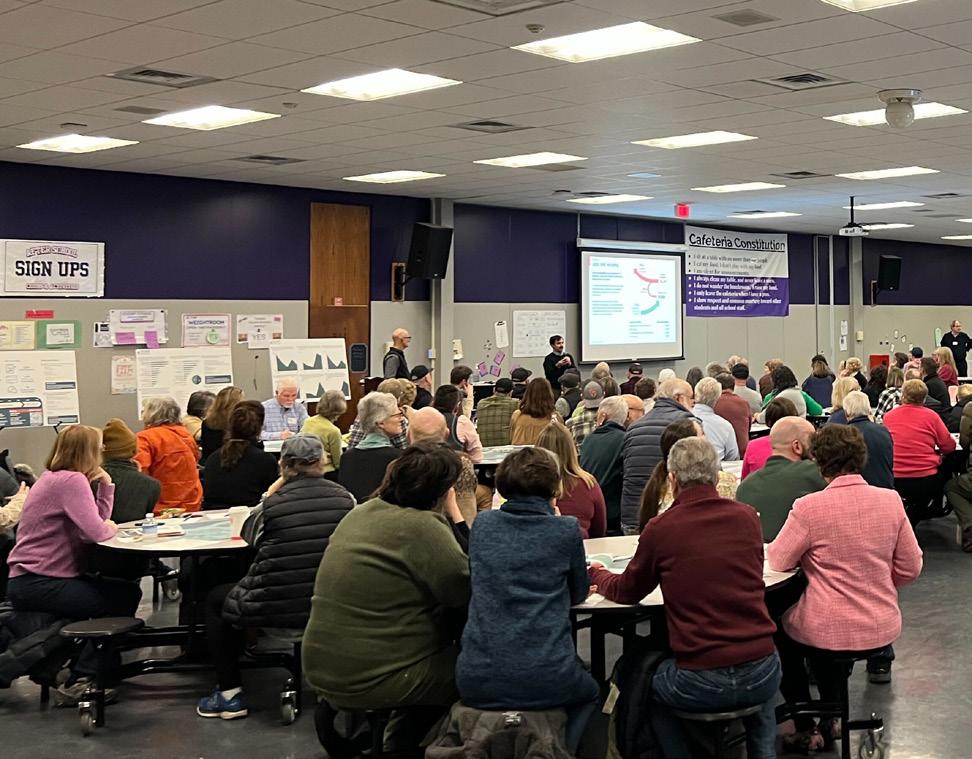
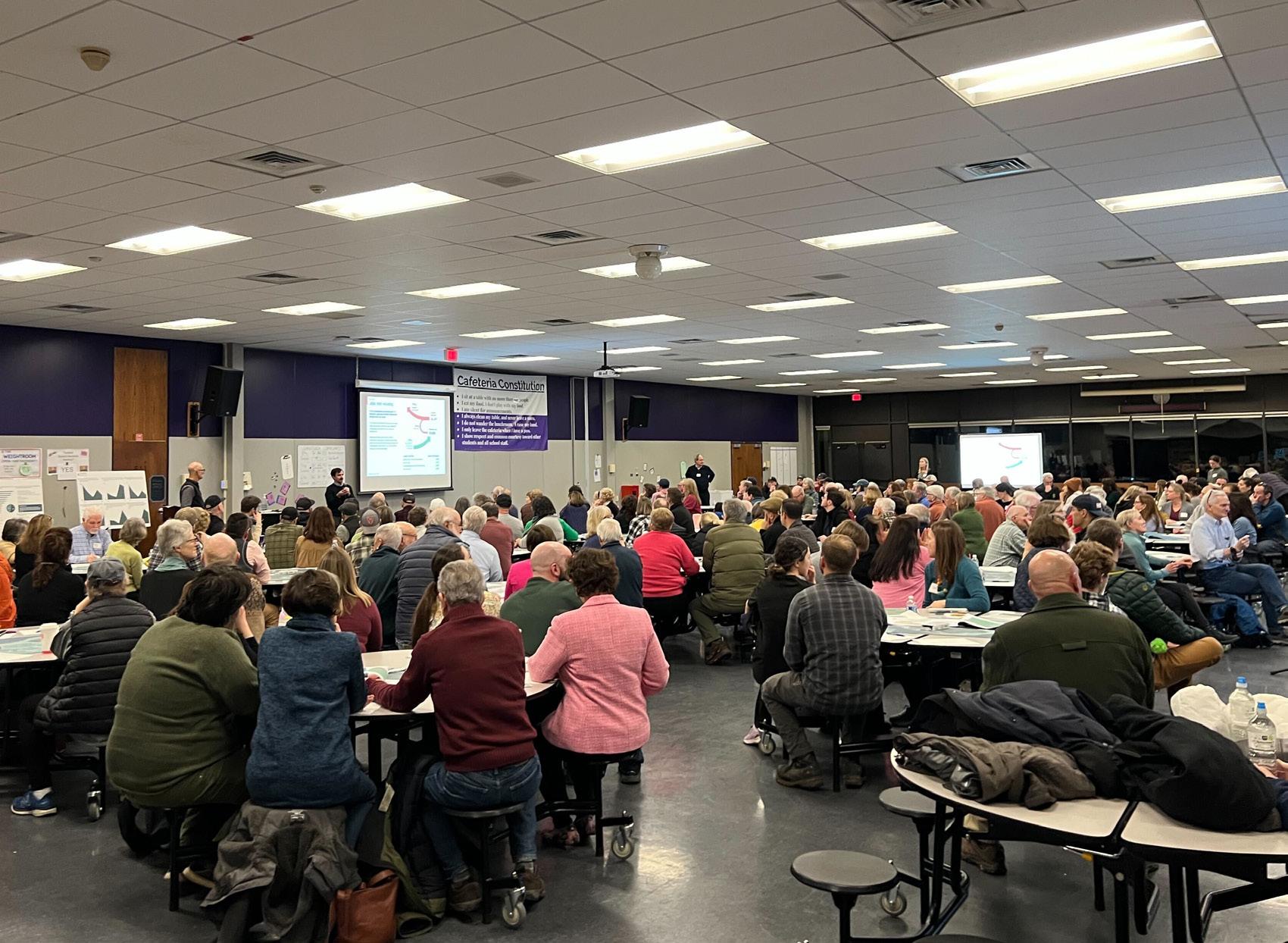
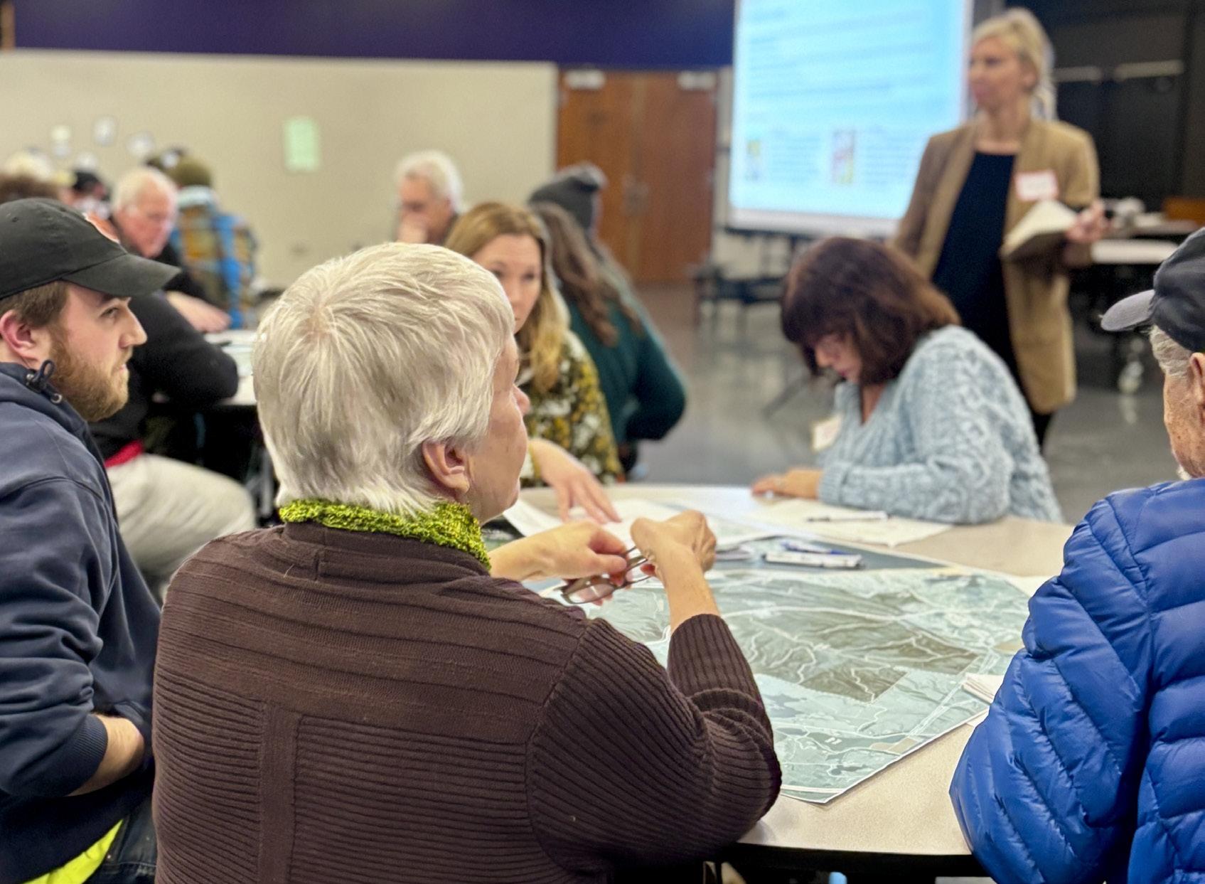
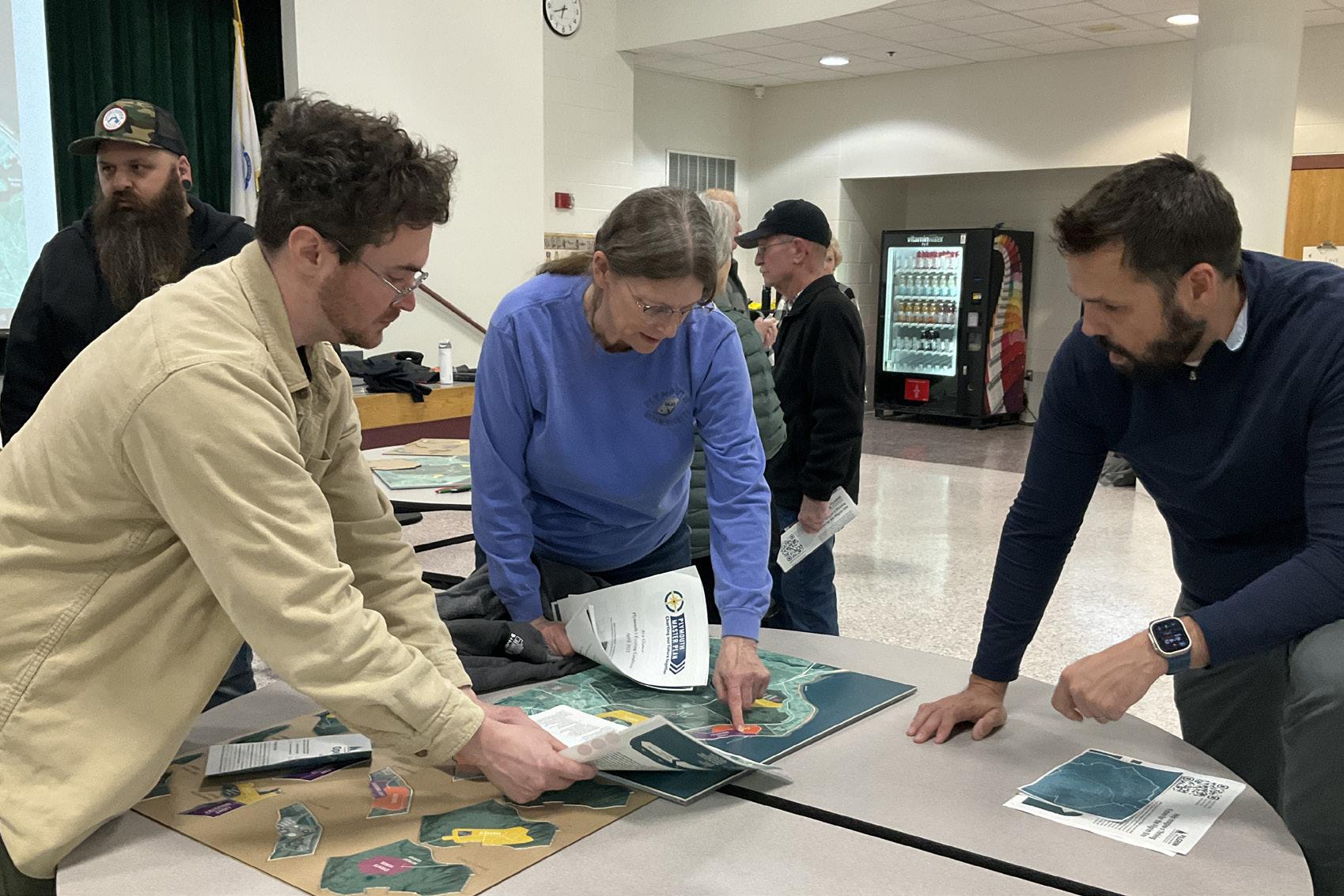
On February 13, 2025, the planning consultant team facilitated Public Forum 1: Visioning Session at the Plymouth Community Intermediate School. 175 people participated in the public forum. The forum began by asking participants to sit at round tables, each with capacity for 8 people. The planning consultant team gave a brief presentation about their analysis and market research findings about the site. This was followed by a series of prompts. Participants were asked to discuss each prompt at their table and record their conversations on handouts provided. Facilitators from the planning consultant team rotated between round tables, answering questions and documenting the conversations.
The conversations that happened at Public Forum 1 added depth and nuance to the findings of the initial online survey. While initial online survey results suggested a low tolerance use of the Pilgrim 1600 site other than open space and recreation, a more in-depth conversation allowed participants to acknowledge that the site is very large, and potentially suitable for a diversity of uses. While conservation of the majority of the Pilgrim 1600 remained a near unanimous goal of all round tables at the Public Forum, many groups also discussed creative visions for partial redevelopment of the site into hospitality, cultural tourism, research institutions, energy generation, innovative industry and other uses.
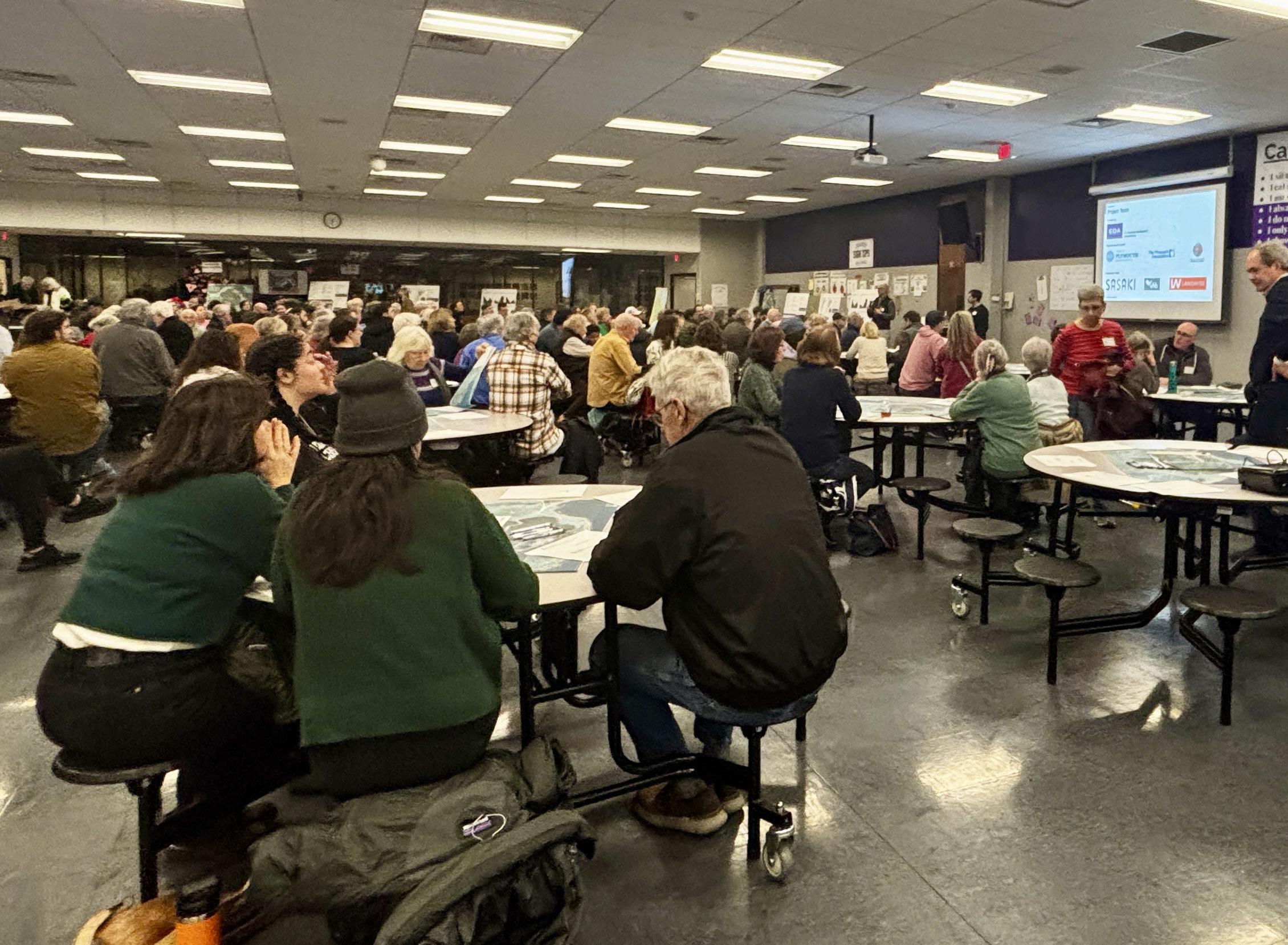

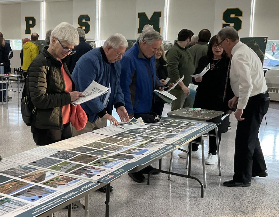
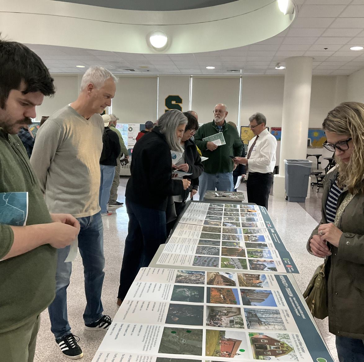
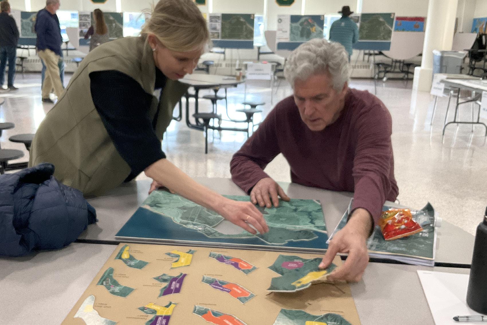
On April 10, 2025, the planning consultant team facilitated Public Forum 2: Open House at the Plymouth South Middle School. 128 people participated in the Public Forum. This event was organized as an open house that invited participants to drop by the event venue within a three hour period and engage with the planning consultant team at four different stations:
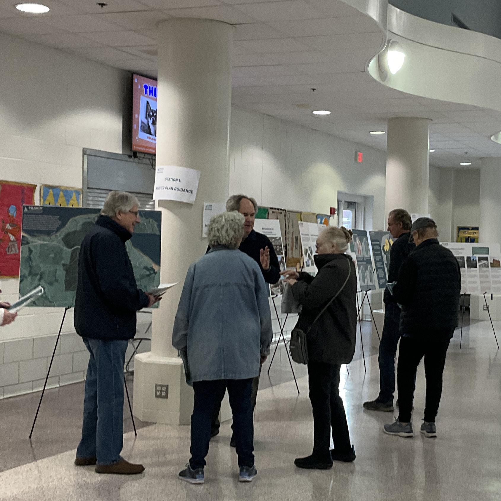
provided participants with an overview of the findings of the planning consultant team’s site analysis, community engagement and market analysis findings to-date and how this analysis was used to inform the development of alternative concepts for the future of the Pilgrim 1600 site.

presented participants with three different land use concepts for the future of the Pilgrim 1600 to showcase tradeoffs between different scenarios of development and conservation and the impact that these scenarios would likely have on Town fiscal health. Participants commented directly on the three concepts using post it notes and engaged in conversation with planning consultant team members.
presented participants with images of different potential uses that could be sited on the Pilgrim 1600, including housing, hospitality, open space recreation, energy generation, industry, and research. Images demonstrated of a range of potential densities and intensities to these uses. Participants expressed support or opposition to different uses using red and green stickers.
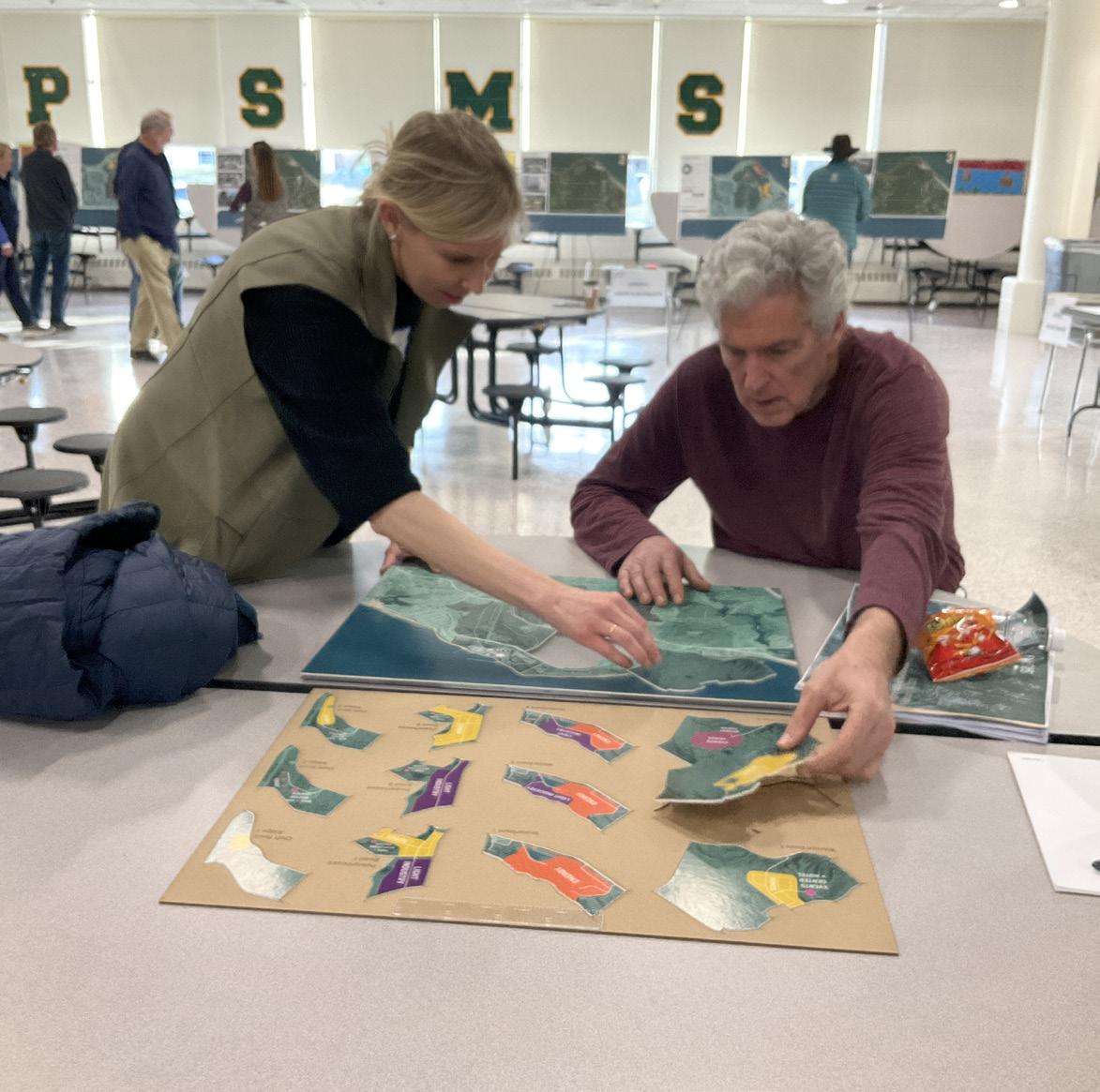
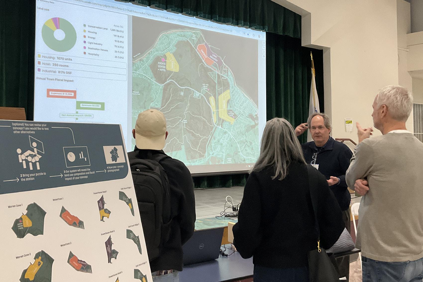
allowed participants to build their own concept for the future of the Pilgrim 1600 using a series of puzzle pieces which they could arrange into unique combinations. After participants completed their puzzle they could bring it to a scanner to measure the fiscal impact of their unique land use mix. The activity provided participants an opportunity to imagine the tradeoffs between Town fiscal health and conservation of land and find land use mixes that they felt balanced both needs.
Public Forum 2 affirmed the findings of previous community engagement, but added increased depth and buy-in for the diversity of uses that might be possible on the Pilgrim 1600 site. While many participants expressed a preference for total conservation of the Pilgrim 1600 site, the ability to visualize fiscal analysis metrics led many to recognize the challenges the Town would face to finance conservation and seek low-impact proposals for economic development. A large shift in community sentiment compared to previous engagement activities was increased support for light industry, especially high tech industries with low traffic, noise or pollution impacts. See appendix B: public forum 2 results to learn more.
Among all potential sites for residential, Warren Cove was the most popular with Public Forum participants, however many participants expressed concerns over the traffic capacity of Rocky Hill Road and asked that any future residential be directed solely to State Road 3A. Many participants were skeptical about the need for additional hotels, feeling that there were already enough in the Town.
Public Forum participants leaned toward proposals which showed adaptive reuse of the Waterfront Site. Many thought that because the Waterfront Site was previously developed, future development here would be the least impactful to ecological assets. The nature of the reuse of the Waterfront Site was a matter of debate. Some participants preferred to see new energy uses, while others gravitated toward innovative concepts tailored toward the marine economy and sustainable technology.
Many Public Forum participants showed a preference for light industry in the Power House Road corridor. Some participants highlighted the need to provide a buffer between this industry and nearby residential areas in order to mitigate noise, aesthetic, and light impacts.

From very early engagement, conservation of the site has clearly been a priority of the community for a variety of reasons:
• Scenic value
• Recreational uses
• Environmental health
• Growth Management
For most, development was viewed as an acceptable compromise, that should be a means to the ends of accomplishing long-term conservation of the majority of the Pilgrim 1600.
Many survey respondents agreed or strongly agreed with the statement “I would support some economic development on the Pilgrim 1600 site if it meant creating a reliable revenue source to purchase and conserve forested land”
Community members want an outcome that is fiscally positive. This means they would like to see development capable of covering its own infrastructure costs and that produces tax revenue and conservation set-asides for the benefit of the larger Town.
4. “Housing and Population Growth should be Managed at the Town Scale”
Plymouth has seen some of the highest housing growth rates in the region over the last 15 years. We have encountered negative sentiments around housing growth and concerns about overdevelopment and stress on public infrastructure and open space.
5. “Housing Development Should be in Keeping with Town Character”
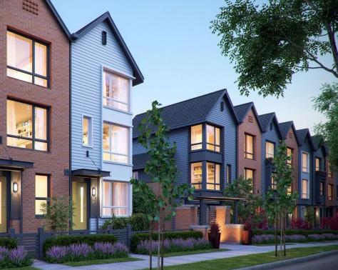
When community members agreed with housing development for its potential to lead to conservation set-asides, they indicated a preference for moderately scaled, yet compact development typologies like cottage clusters.
Cluster housing allows developers to achieve a level of density that pencils-out while increasing the amount of land that can be set aside for conservation.
Participants were much more likely to support innovative industrial uses of the site over conventional industrial parks.
There was more positive reactions to industrial ideas that leveraged sustainability, energy, science and research as opposed to manufacturing or logistics uses.
Because the Waterfront site has already been developed, it is viewed by many as being the most suitable site for more intensive economic development activity.
While there is some interest in recreational waterfront and marina uses, the presence of spent fuel on the site creates long term security concerns that render that outcome unlikely.


A primary goal of this study is to identify the development suitability of the Pilgrim 1600 and if parts of this site could be dedicated to economic development, housing, and energy production uses. The following sequence of maps shows a subtractive process of eliminating land from consideration for development activities based on its technical characteristics and the feedback of the Plymouth community. The result is a map of areas potentially suitable for development.
Steeply Sloped
Terrain: >20%
Sloped
Terrain: 10-20%
The greatest technical constraint on the development of the Pilgrim 1600 is the many areas of steep terrain on its hill slopes. Areas dominated by slopes greater than 20% are eliminated from consideration for development. While this land could be developed, it would require extensive regrading of land and expensive drainage solutions. Development of steep slopes is contrary to the recommendations of the Town of Plymouth Zoning Bylaws and can create erosion and water quality challenges.
For regulatory compliance and habitat protection, wetland areas should not be developed. An extensive wetland system is believed to exist in the northeast portion of the site, connecting hydrologically through streams and culverts. The presence of wetlands will necessitate a formal delineation to establish boundaries and regulatory buffers. For any activity taking place within 100’ of a wetland resource that involves removal, fill, dredge, or alteration, Massachusetts Department of Environmental Protection (MassDEP) requires the filing of a Notice of Intent with the local Conservation Commission. Additionally, the Plymouth Wetlands Bylaw establishes a 35-foot “no-touch” zone and requires a permit for any alterations within 100 feet.
Some areas may also contain potential vernal pools, as indicated by MassGIS data. However, a 2017 assessment conducted by BSC Group did not confirm vernal activity, suggesting that further field verification may be required.
(2020-2025)
13,000 - 28,000
7,000 - 13,000
3,000 - 7,000
900 - 3,000 < 900
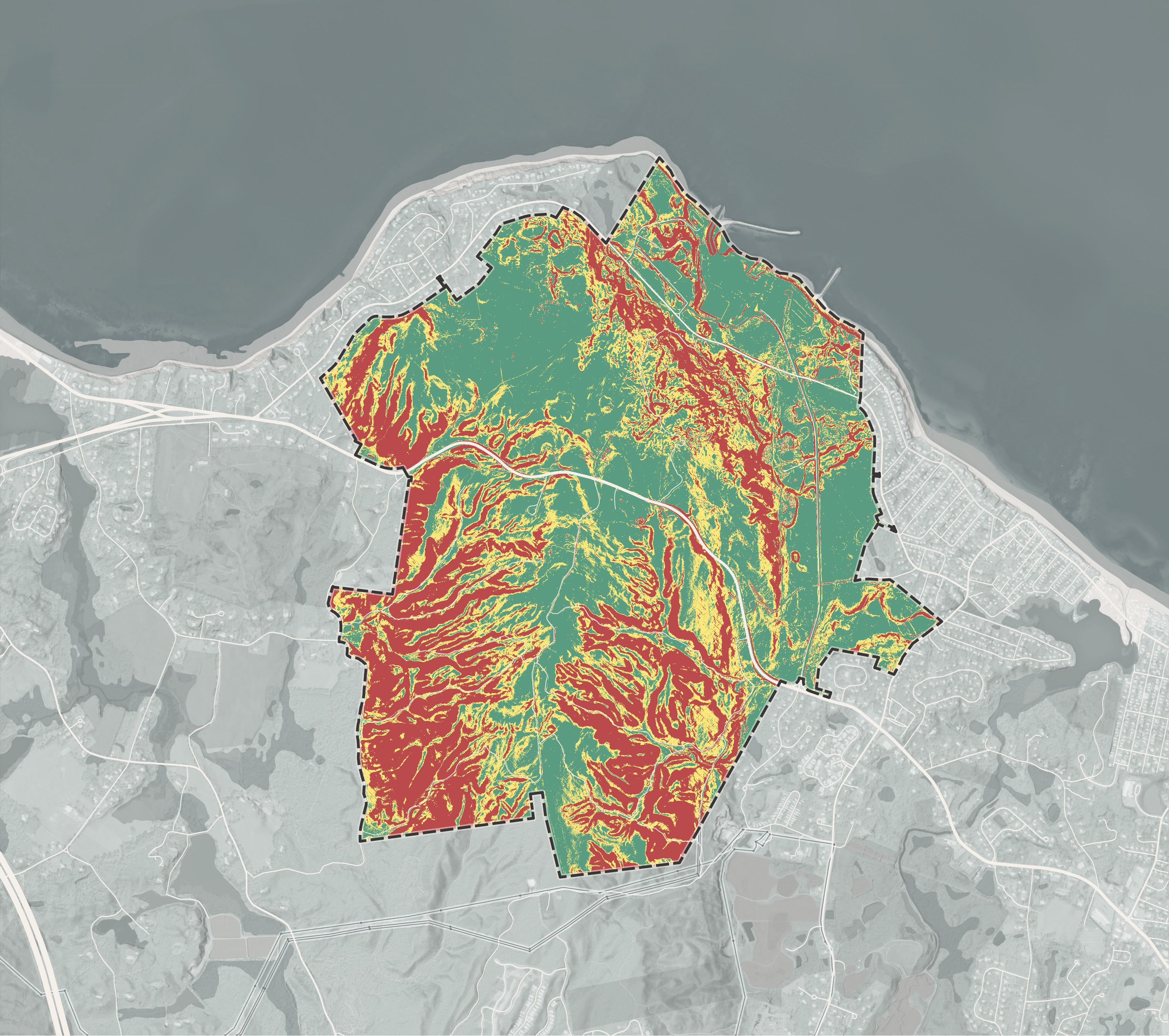
The Plymouth community, as well as many individuals in the wider region, informally utilize the Pilgrim 1600 site for outdoor recreation. This is especially true of the mountain biking community, which over decades has constructed an informal network of mountain biking trails that include berms, jumps, obstacles and switchbacks. There are an estimated 47 miles of trails on the Pilgrim 1600 site, the majority of which are used by mountain bikers. Strava data shows the areas of most intensive mountain biking use. While the construction of these trails was never authorized by the land owner, they represent a large investment of time and resources by members of the mountain biking community and an existing outdoor tourism asset for Plymouth (see appendix D: Recreation Economic Impacts Report to learn more). Based on existing trail utilization, and the feedback of community members, it is the recommendation of this plan to conserve the site’s most highly utilized mountain biking areas.
The hilltop of the Pilgrim 1600 site, is a rare landform feature in the region. At 400 feet in elevation it is one of the highest points along the Massachusetts coastline. It is visible from much of the surrounding region and provides a verdant backdrop to the Town of Plymouth. It is also a site from which recreational users are able to access panoramic views of the scenic Plymouth coast. Development of the hilltop would be a net loss to the Town’s aesthetic quality and does not align with the values and interests presented by community members in this engagement process.
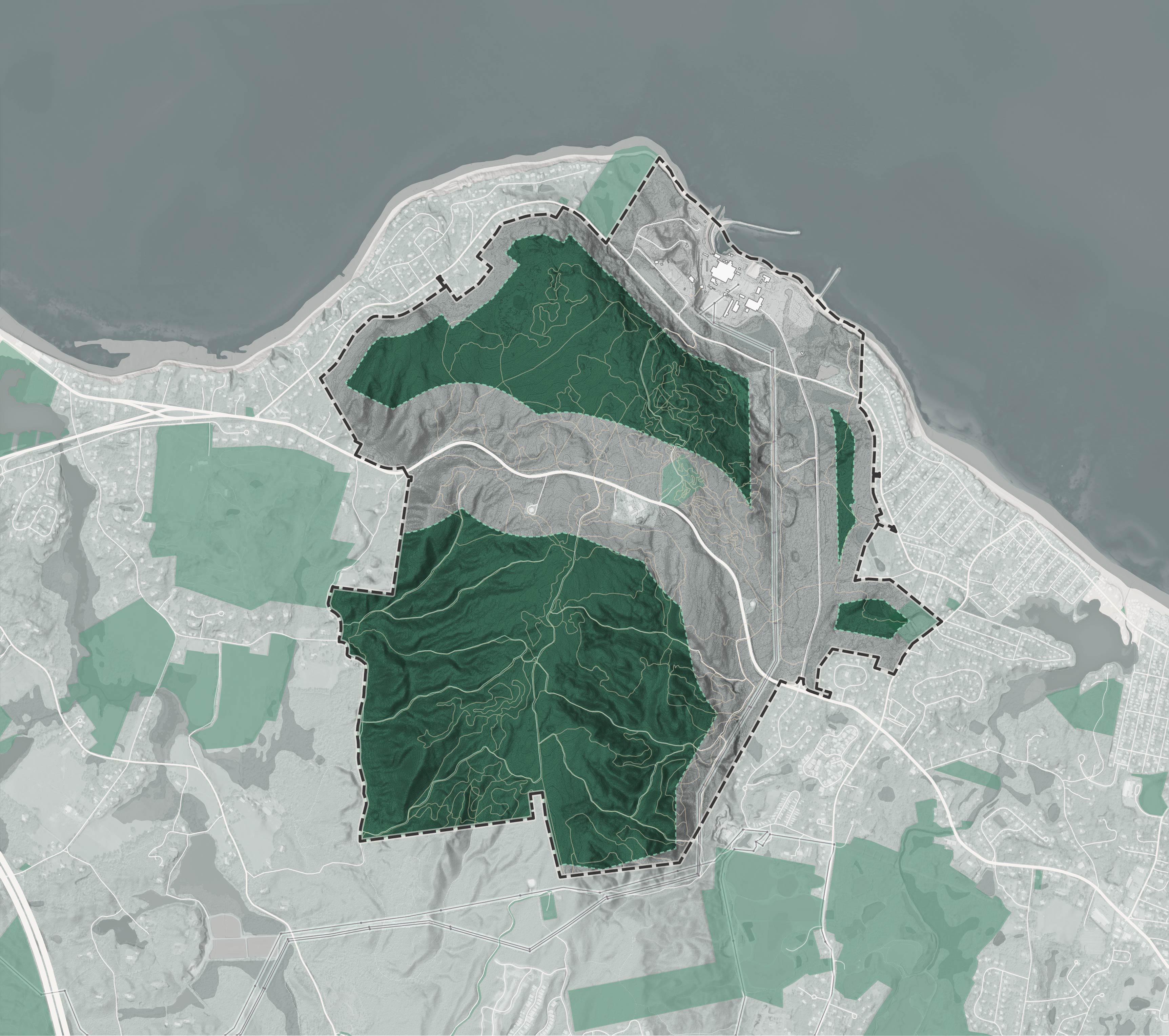
After considering the technical and regulatory constraints of the site’s natural features, namely its steep topography and wetland areas, and the recreational and scenic value community-members expressed for significant areas of this site, there remains about 370 acres which the planning consultant team considers potentially suitable for development.
The feasible development area map shows which areas could be considered for redevelopment. While development could occur in additional areas beyond those shown, it would come with additional regulatory, technical or public-opinion challenges that greatly reduce the likelihood of a successful and financially feasible development project.
The land use explorations that follow all fit into the general boundaries established by this feasible development area map and explore variations and tradeoffs between different mixes of land use within those boundaries.
The availability of infrastructure, unique features of the Pilgrim 1600 site, and its adjacency to existing uses mean that some areas may be more limited in the types of activities that they could support in the near future. These are some additional considerations that must be made when considering the suitability of the site for different uses.
For safety and security reasons, the Pilgrim Power Station site will be off limits to the public at least until decommissioning is complete. Even after decommissioning is complete, access restrictions will be in place due to the independent spent fuel storage installation (ISFSI) located west of the power station site. Federal regulations require that spent fuel storage sites be secured for national security, and health and safety reasons.
The ISFSI is intended to be a temporary solution to spent fuel storage, until the Federal Government identifies and provides long term consolidated storage facilities. However, there currently is no short term plan to relocate spent fuel. Without relocation of spent fuel, much of the waterfront site can not feasibly be made accessible to the general public.
The decommissioning of the Pilgrim Power Station is a multi-decade process that began in 2019. Decommissioning timelines are subject to change. Current projections place the completion of decommissioning and restoration of the waterfront site to a greenfield condition between 2035 and 2040. The waterfront site would only become available for redevelopment after decommissioning is complete. Long term visioning for the waterfront site should continue, but nearer term objectives for economic development, diversification of the tax base, and recreational uses should rely on land south of Rocky Hill Road which is more immediately available for use and development.
Regardless of the type or scale of development at the Pilgrim 1600 site, a new water source may be necessary. The Town’s 2019 Water System Master Plan identifies existing supply deficiencies and highlights five potential well locations within the site, including a preferred site near its southern boundary. Prior to any redevelopment of the Pilgrim 1600, long-term well sites should be identified. Development regulations should ensure that potential sources of contamination like septic tanks, petroleum tanks, and industrial activities are sufficiently far away from these well sites.
The Pilgrim 1600 site is located two miles from the nearest sewer line, creating a decision point for future development.
The type and scale of development that can be placed on the Pilgrim 1600 site is limited by the availability of sewer infrastructure.
Without additional investments, development capacity will be very low. Septic systems could support low density residential development, as they do today in Manomet and nearby rural residential areas. Septic systems limit residential density to about 4-8 units per acre, depending on the percolation rate of subsoils and depth of groundwater. Septic systems may not be appropriate for industrial uses which have high water use demands.
Development on the Pilgrim 1600 could be enabled by a package plant, a small plant intended for private onsite wastewater treatment. This solution was utilized at the Pinehills development. However, package plants require a minimum number of users to be financially viable.
Extending the existing Town sewer system to the Pilgrim 1600 site or constructing a new waste water treatment district in this area would offer the greatest flexibility for future development.
The existing configuration of roadways on the Pilgrim 1600 informs the areas that will be most suitable for future development. Community members have expressed concern about placing new traffic on Rocky Hill Road, a quiet residential street. There is a strong public preference that any future traffic loads be directed toward State Road 3A. Development that loads directly on to 3A, through curb cuts, should be avoided to maintain a high level of service. New development will likely require signalized intersections on 3A. Power House Road provides existing roadway infrastructure that can be leveraged by future development to avoid use of local roads. Additional development in the Warren Cove area would require a new spur road off of 3A with a signalized intersection.
The Pilgrim 1600 site’s existing high-capacity electrical transmission infrastructure — originally developed to serve the Pilgrim Power Station — provides an extraordinary advantage for redevelopment into a modern energy and innovation hub. This infrastructure includes switchyards, substations, and direct access to regional transmission lines capable of managing large-scale loads – and possibly as an offshore wind import terminal. Its presence not only significantly reduces the capital cost and permitting hurdles for interconnection but also enables immediate readiness for energy-intensive operations, making the site uniquely attractive for uses such as data centers, advanced manufacturing, and large-scale battery energy storage systems (BESS).
Proximity to this infrastructure also supports strategic zoning across the site: areas nearest the switchyard and transmission corridors are ideal for grid-connected technologies and high-load industrial facilities.
While the site has just under a mile of shoreline, security requirements around new energy uses are likely to limit opportunities for public access. While Plymouth Harbor is protected by barrier beaches, the coastline of the site is more exposed in Cape Cod Bay and at-risk to northeasters. If desired public access is attainable - it is likely to focus around the existing boat ramp. Recreational moorings may be more feasible than a marina which would require substantial expense and modifications to the existing breakwater.
At the location of the former Pilgrim Power Station, coastal protection infrastructure is centered around the plant’s once-through cooling system for reactor operations. This includes intake and discharge structures that allowed the plant to draw millions of gallons daily from Cape Cod Bay via a cooling water intake structure formed by two rock breakwaters.
These breakwaters shielded the intake and discharge canals, but were not designed to protect against flood events or storm surge. Future upgrades to this infrastructure may require extensive local, state, and federal permitting such as an Order of Conditions from the local Conservation Commission, a Chapter 91 license from MassDEP, review under the Massachusetts Environmental Policy Act, and Federal Consistency Review from the Office of Coastal Zone Management.
One benefit of the site’s location within the coastal zone is potential access to the Coastal Resilience Grant Program, which offers funding for vulnerability and risk assessment, public outreach, planning, infrastructure retrofit/relocation, and shoreline restoration.
The Pilgrim 1600 is abutted by residential development to the east and northwest. To maintain appropriate land use adjacencies, light industrial uses should not directly abut residential areas. An open space buffer between future light industry and residential areas is recommended.
The planning consultant team generated land use plan recommendations in a process that wove together technical, fiscal, and community constraints.
The feasible development area map and additional site suitability considerations generated through site analysis and community engagement were used to develop three master plan concepts. These concepts were intended to demonstrate alternative land use configurations that fit within the boundaries established by the feasible development area map.
Each master plan concept was evaluated for its infrastructural requirements, potential expenses, and ability to generate new tax revenues. Fiscal analysis is described in greater detail in appendix E.
Community members were then asked to evaluate these three master plan concepts, and generate their own through Public Forum 2 and Guidance Meeting 2. Through the use of the planning consultant team’s interactive puzzle tool, participants in these engagement events were able to visualize in real-time the fiscal implications of different land use configurations. Many community members came to nuance a stance of full conservation, and better understood the need to offset the expenditures of conservation with revenue generating development proposals. Community members could compare the relative fiscal impacts of different land use mixes and make data-informed choices about the future of the Pilgrim 1600.
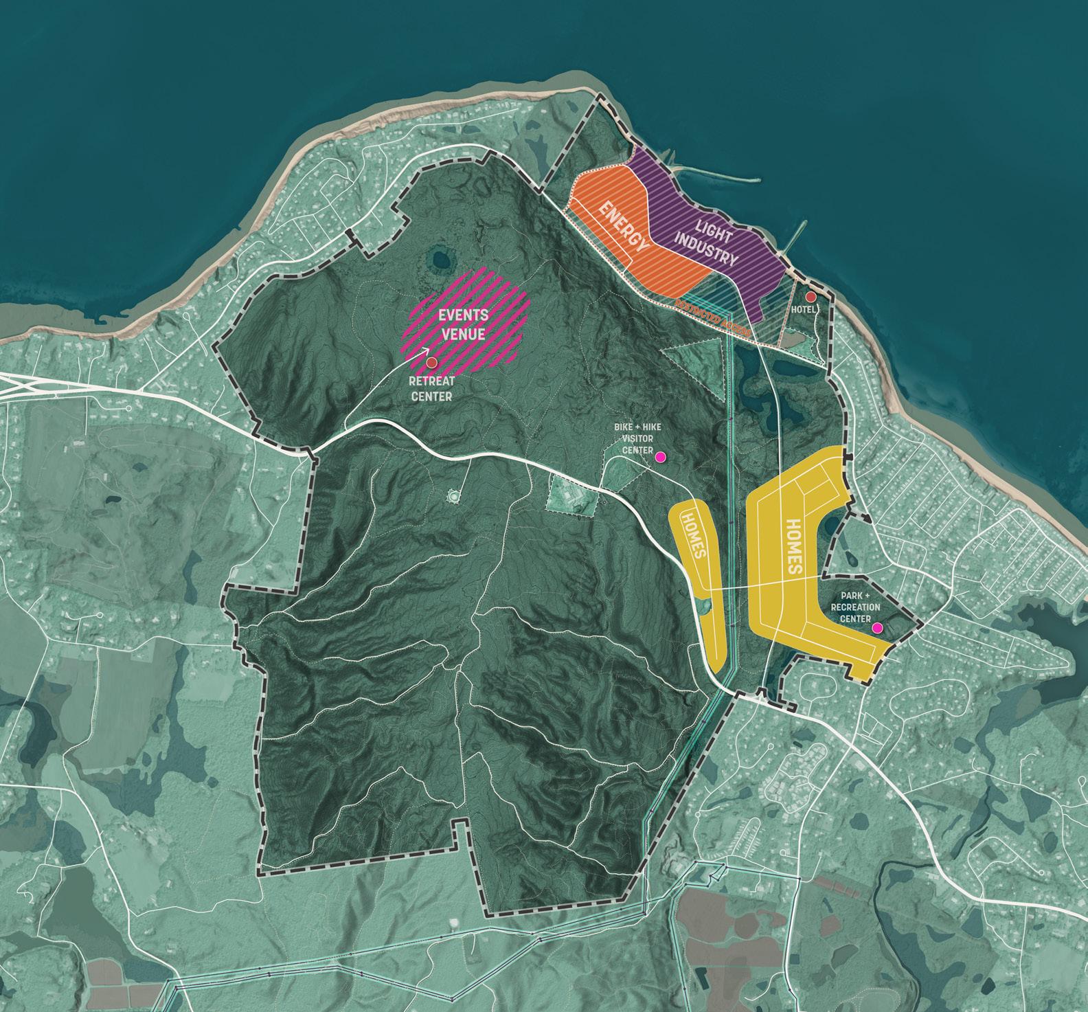
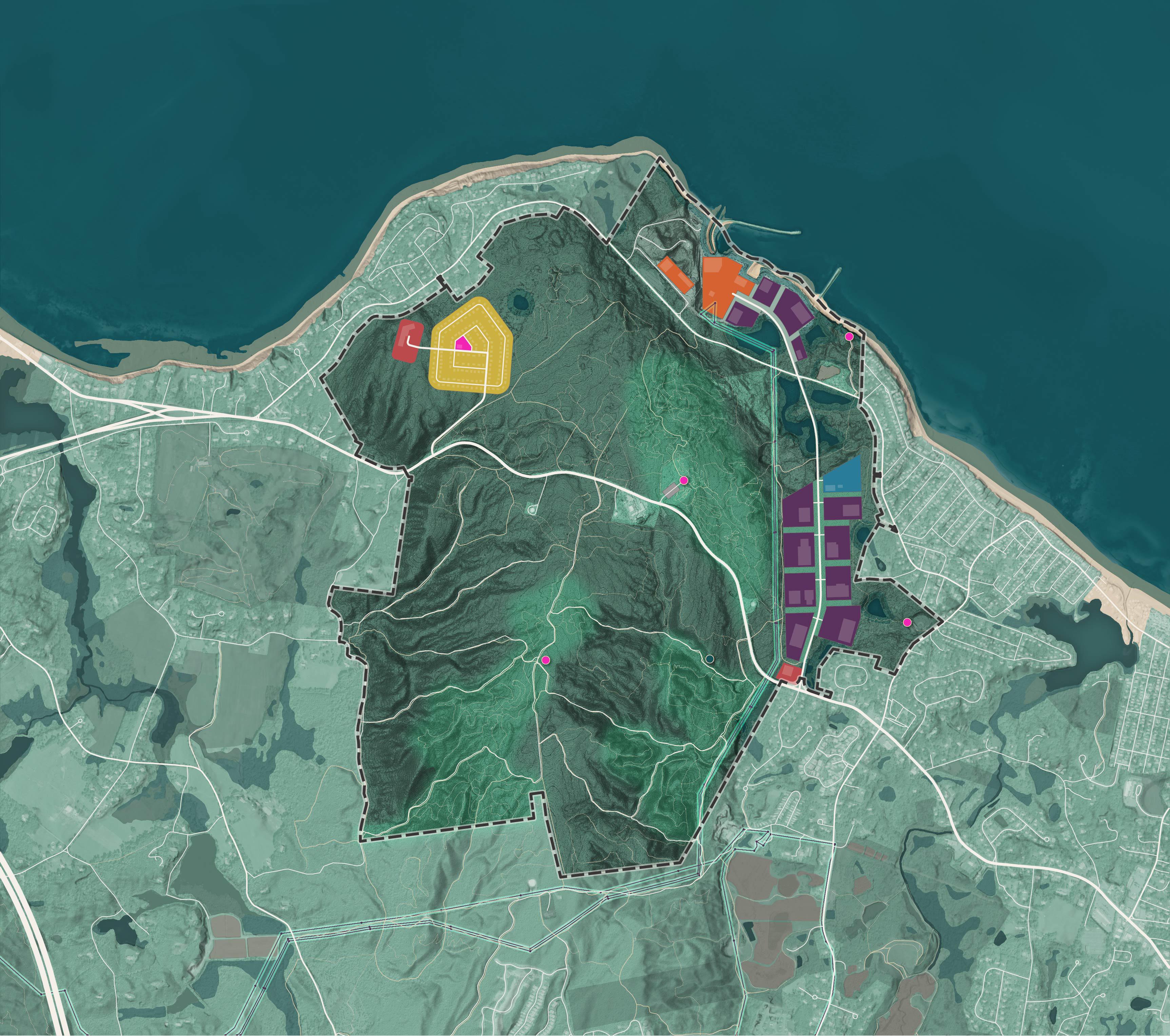
The planning consultant team then synthesized community feedback into a single land use opportunities map.
This land use opportunities map represents the synthesis of community engagement, site analysis, and market analysis.
The waterfront site’s existing energy and roadway infrastructure, flat topography, coastal access, and prior industrial use suggests it is well suited for future industrial and energy generation uses. While there were members of the community that expressed support for restoring the land to a predevelopment condition and permitting public access to the waterfront, many recognized that this was not a near-term possibility due to the storage of spent fuel on the site for the indefinite future. Many community members supported development on the waterfront site because they viewed it as the area where development would have the least impact on existing recreational open space. If the site is redeveloped for industrial uses, public support would likely be contingent on appropriate measures to mitigate noise, light and traffic nuisances and a high level of care for the preservation and improvement of water quality and coastal resources.
Warren Cove is a suitable site for residential development because it is relatively flat and adjacent to existing residences. However, this area lacks existing infrastructure and development would have high first costs. Community members communicated a strong preference that new development at Warren Cove be accessed off of State Road 3A, rather than Rocky Hill Road. Warren Cove may also be a highly suitable location for hospitality and tourism uses like a hotel or small event center that can benefit from views of the Plymouth Harbor.

There was generally strong support for light industrial uses of an innovative and low-impact nature along Power House Road. This site is suitable for industrial uses due to existing roadway infrastructure and direct access to Route 3A. The connection of this corridor to the waterfront parcel may generate value for maritime industries in the future. Public support for industrial development in this area is contingent on appropriate measures to mitigate noise, light and traffic impacts. An open space buffer between light industry and adjacent residential neighborhoods would be required.
The site is also well suited for residential development, with access to Route 3A and proximity to existing residences, community services, and retail in Manomet. However, community members expressed limited support for new housing development in this area citing concerns over traffic generation, overcrowding of nearby beaches and the capacity of existing schools.
The land use opportunities map in the preceding chapter demonstrates the range of site development outcomes that could align with the findings of this study. This is important to establish future flexibility to respond to market forces and seize opportunities when they arise. Because this land is owned by Holtec International, how it is developed and conserved will be the result of a continued partnership between Holtec and the Town that seeks to balance financial feasibility with the community’s conservation goals.
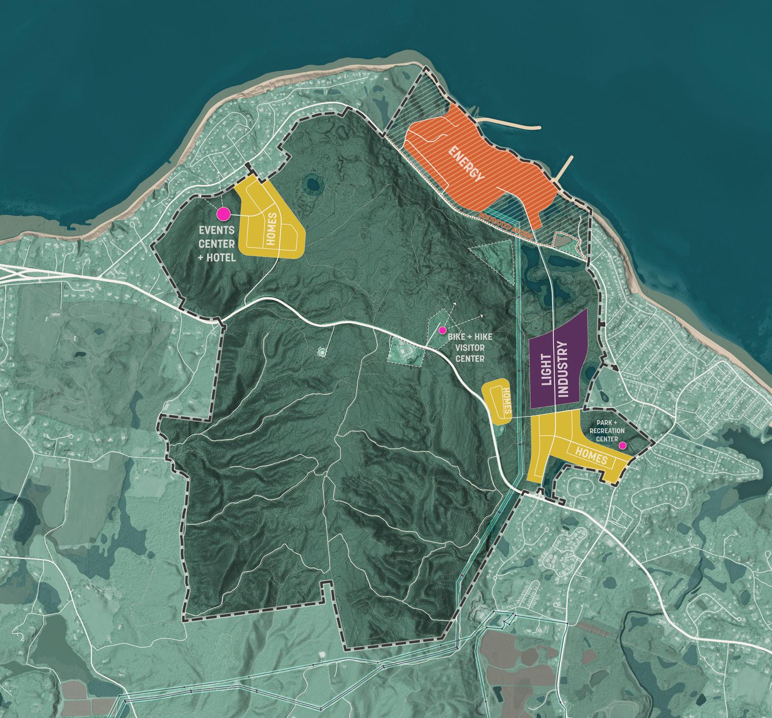
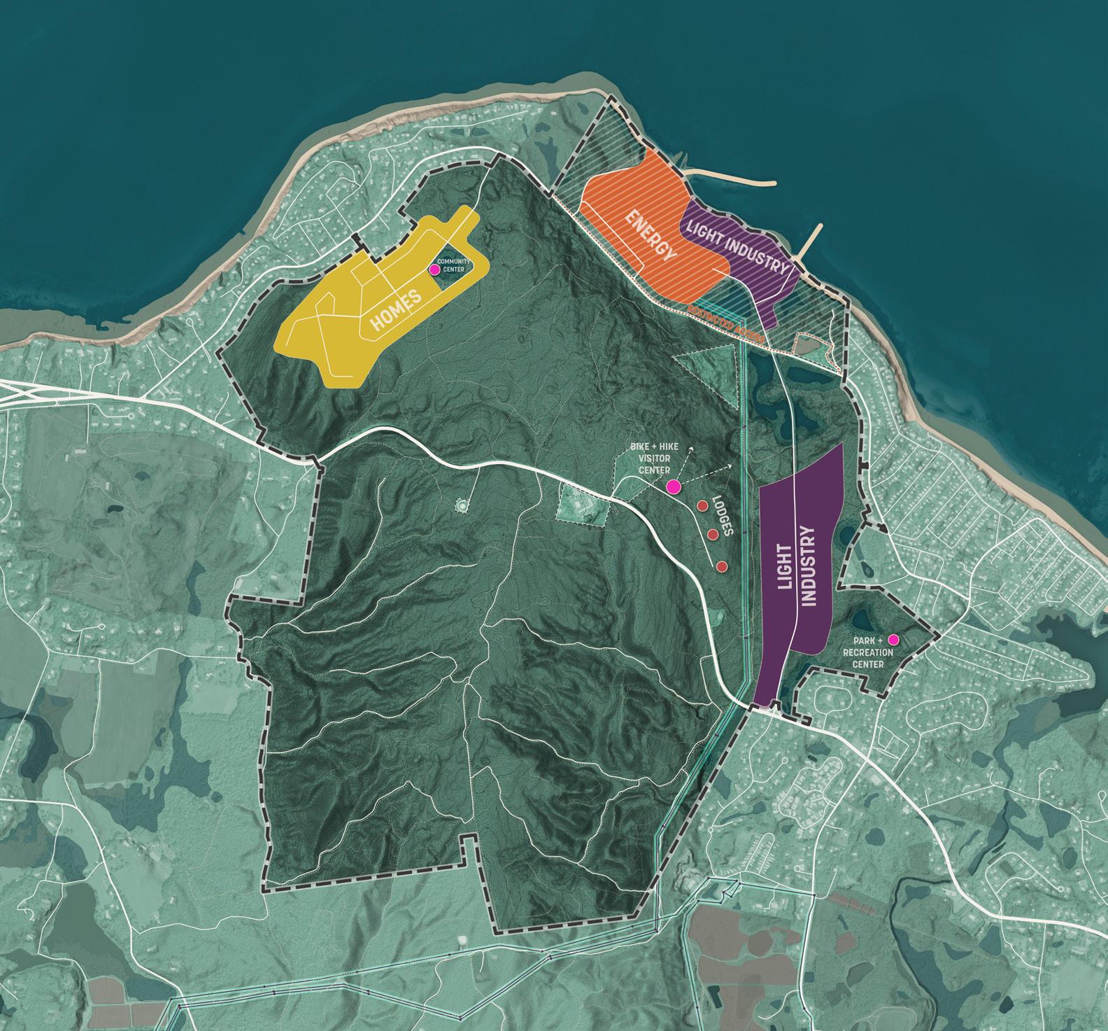
The example land use plan is just one of many possible outcomes for the future of the Pilgrim 1600. It is used to demonstrate how the constraints of the site and the feedback of the Plymouth community may translate to a specific configuration of land uses, recreational activities and community amenities. It takes the most popular elements of each of the three master plan concepts and further refines them to best align with what we have learned in this planning process.
The example land use plan imagines that energy generation activities will continue to occur on the Waterfront site but that they can be designed to occupy a more compact footprint, freeing up land for related industries like data centers or energy R&D facilities. Light industrial uses continue down Power House Road to create an innovation corridor that could have a thematic focus on green energy. The proposal includes a limited amount of housing development associated with a hotel that can generate revenue and promote the conservation of the majority of the Warren Cove area. On the pages that follow the potential benefits and impacts of this vision for the future of the Pilgrim 1600 will be described in greater detail.
A primary measure of the success of any development proposal for the Pilgrim 1600 will be its fiscal impact. As described in the planning objectives chapter, the Town of Plymouth is interested in diversifying its sources of tax revenue for greater fiscal resilience and reduced burdens on residential tax payers. A predominantly industrial development plan helps to achieve this goal. Housing, while important to maintaining a vibrant and accessible community, typically has higher expenses in the form of education and social services which largely offset any tax revenue gains.
The redevelopment of the Waterfront will most likely occur through a payment in lieu-of-taxes (PILOT) process that falls outside the conventional tax levy. The revenue potential of the future PILOT is hard to predict and has been excluded from fiscal impact analysis. Between 1991 and 2008 PILOTs for the Pilgrim Power Station have ranged between $10 - $15 million annually.
*Consists of property tax, CPA surcharge, local options meals tax and motor vehicle excises. Does not include indirect revenues, such as spending by visitors, increased economic activity generated in the Town, and the off-site impact of increased land values.
**See Appendix D for more information on the fiscal impacts of conservation and recreation areas.
Development of the Pilgrim 1600 has potential economic development benefits to address the shortage of affordable housing and high paying jobs in Plymouth.
Jobs: Industry-focused development has the greatest potential to generate jobs. The employment generated by this development has been estimated using the U.S. Energy Information Administration median square feet per worker benchmarks . An estimate of 600 jobs for future energy generation is a placeholder based on historic employment of the Pilgrim Power Station. Combined, an estimated 1,200 permanent jobs could be generated by the proposed development. In addition to these on-site jobs, spending by these new employers on off-site goods and services could generate secondary economic activity within the town. Population increases generated by housing will also have a secondary impact, increasing local demand for workers in healthcare, education, retail and other services.
Housing: Housing affordability continues to be a challenge in Plymouth. New employment opportunities will attract more residents to Plymouth and affordable housing production should keep pace with employment growth. This plan identifies a suitable opportunity site for housing at Warren Cove that can be associated with a hospitality component to offset negative fiscal impacts. This may not be the best possible location in the Town of Plymouth for new affordable housing, but it should remain as an opportunity site for future study.
The Town of Plymouth consists of multiple village centers, each with a distinct character. Over the past few decades, automobile oriented sprawl has led to a blurring of boundaries between these different centers and a gradual fragmentation of the rural and forested lands on the Town periphery.
For the health of regional ecology, preservation of scenic beauty and needs of outdoor recreation, further fragmentation of open space should be prevented. The plan for the Pilgrim 1600 should be seen as part of a larger strategy to establish clear growth boundaries and prioritize development in or near existing village centers rather than as new, disconnected islands of development. The areas proposed for additional development in this proposal are directly adjacent to existing developed areas.
POTENTIAL GROWTH BOUNDARY
This proposal for the Pilgrim 1600 represents the strong value that community members placed in the site’s existing recreational assets. Today, as estimated 47 miles of unauthorized trails provide the regional community with informal hiking and mountain biking opportunities. Development activity on the Pilgrim 1600 should be accompanied by a commitment to permanent conservation of the site’s recreation features and their long-term improvement and maintenance. This existing infrastructure can be leveraged to generate tourism and indirect revenues through local retail and food and beverage concessions. Considerations should be made to connect these trails into larger existing or potential recreational networks.
The vision described for the potential future land uses of the Pilgrim 1600 is contingent on successful collaboration between private, public and non-profit entities. The following actions would need to be pursued in order to realize this vision.
2.1
2.5
2.6
Currently the Pilgrim 1600 is zoned entirely for residential uses south of Rocky Hill Road. It currently has light industrial zoning on the Pilgrim Power Station site north of Rocky Hill Road.
To enable and attract light industry uses, land will need to be rezoned. Through engagement, community members expressed a preference for industrial uses that were innovative, high-value, and had low environmental impacts. To enable only these kinds of uses, and prevent unfavored uses, the Town of Plymouth should consider creating an overlay zone or more specialized industrial zone expressly for the Power House Road corridor.
A zoning designation of “Climate Technology Corridor” or “Blue/Green Innovation Zone” would help to advance a vision for an innovative industry cluster on the site. Uses allowed in a new zoning district should focus on fostering a dynamic environment for innovative businesses, emerging technologies, research and development activities, and maker, craftspeople, or trade space. The bylaw should favor uses that can leverage energy proximity, offer high-paying employment and minimize negative environmental impacts. Language may need to be crafted in a way that expressly excludes uses like automotive repair, self-storage, warehousing, or e-commerce distribution centers which will have disproportionately high traffic impacts and land use intensity inappropriate for this context.
Rezoning alone is unlikely to be enough to attract the desired innovative industrial tenants to the Pilgrim 1600 site. The site is not an immediately obvious choice for most industrial tenants. It lacks water and wastewater infrastructure and direct proximity to a highway. Within the larger region, is not optimally positioned for access to metropolitan markets when compared to communities like Taunton or Mansfield.
Attracting tenants to the site, especially innovative industries, will require a new entity or a consortium of existing entities that can coordinate planning, generate partnerships, secure state and federal incentives, and promote the development opportunity directly to relevant businesses.
The Devens Regional Enterprise Zone is a successful example of an innovation-focused industrial area in Massachusetts. The project was organized by MassDevelopment, who acted as the zone’s master developer. MassDevelopment helped facilitate the redevelopment process and coordinate applications for federal and state funding to invest in early infrastructural improvements. MassDevelopment was also instrumental in branding the project, directly marketing the district to businesses, fast-tracking development permits, and securing incentives for targeted industries like green technology and life sciences.
Development incentives will likely be necessary to offset first costs and improve the attractiveness of the site for target industries. Incentives can be funded through partnerships with the U.S. Economic Development Administration and State agencies like the Massachusetts Economic Development Incentive Program, the Massachusetts Clean Energy Center, Regional Ocean Tech Hub consortium, Massachusetts Blue Economy initiatives, Massachusetts Technology Collaborative, and others. Incentives can also be locally funded with tax abatements but these may counteract the positive fiscal impacts desired from new development.
There are existing entities in Plymouth which potentially have the organizational capacity to initiate the creation of a Pilgrim 1600 innovation corridor. For example, the Plymouth Foundation could initiate building a wide-reaching network of partners from local, state, and federal levels to maximize the probability of project success.
This Waterfront site is currently home to a robust high-voltage 345kV capacity transmission line and switchyard facility. This is a rare, high-value asset that should continue to be utilized to its fullest potential. While some members of the community expressed a desire to restore the Waterfront site to its predevelopment condition, many others recognized the site as a brownfield and were content to see it adapted to new productive uses. Because of the long term uncertainties of spent fuel storage, past site disturbance, and the presence of existing high value infrastructural assets, it is the consultant planning team’s recommendation that the Plymouth community strongly consider a new energy use for the Waterfront site. However, the exact nature of that use should be the subject of a continued and robust conversation with the community and other key stakeholders:
The Pilgrim 1600 is well-positioned for landfall of undersea cables delivering offshore wind from the Gulf of Maine or clean energy imports from Canada via submarine HVDC lines. The site’s geographic and electrical characteristics align well with future phases of floating offshore wind, particularly as projects in the Gulf of Maine move closer to commercial deployment.
There have been companies interested in establishing an undersea cable interconnection at the Pilgrim 1600 switchyard and this is an energy use that could be pursued in the near term, potentially even prior to the 100% decommissioning of the Pilgrim Power Station. However, once an off-site user takes up transmission capacity, there may not be enough capacity remaining in the transmission line to support other on-site generation activities.
Utility-scale BESS are large battery arrays that can be used to store surplus electricity during periods of high productivity and distribute it to consumers during periods of high demand. This load balancing function mitigates imbalances that can occur when renewable sources of energy like wind and solar have inconsistent levels of productivity over the course of the day (intermittent generation). A BESS can also help make a grid more resilient by addressing peaks in daily demand by storing energy offpeak for later deployment. As renewables proliferate across the Northeast, and natural disaster events become more frequent and unpredictable, the need for such regionalscale buffering and load balancing assets will intensify.
With ample land, heavy-load interconnection capacity, and existing industrial zoning, the Pilgrim 1600 Waterfront Site could host multihundred-MW BESS installation.
SMRs are pre-fabricated, deployable nuclear fission reactors that are substantially easier to construct and operate than historic nuclear reactor technologies. SMRs are gaining global interest as a potential component of a decarbonized energy mix, offering compact design, enhanced safety, and compatibility with remote or industrial energy loads. However, despite significant R&D momentum, no SMR technology has yet achieved large-scale commercial deployment in the U.S., and many questions around cost, licensing, fuel supply, and public acceptance remain unresolved.
During community engagement, community members communicated both strong support and strong opposition to the use of SMRs in Plymouth. The planning consultant team recommends further research to fully understand the risks and benefits of SMR technologies and an inclusive community engagement process to address concerns and questions.
Solar energy is a low-cost way to generate electricity with no direct emissions. Solar arrays could be an appropriate supplemental energy generation feature of the Pilgrim 1600. All future building roof tops should have solar arrays or be required to meet solar-ready building code requirements. New parking areas should strongly consider solar canopies in their design. However, these small scale installations are unlikely to generate enough electricity for significant off-site export, and would be more valuable as a source of resilience and efficiency for the Pilgrim 1600’s future energy users than as a utility-scale source of electricity. An economical utility scale solar installation requires hundreds of acres of low cost, unobstructed, flat land which the Pilgrim 1600 does not have.
Regardless of what energy use or uses are identified for the future of the Waterfront Site, the land owner will need to apply for new energy use permits with the State of Massachusetts and establish a new PILOT agreement with the Town of Plymouth. These regulatory processes are opportunities to negotiate favorable fiscal outcomes for the Town of Plymouth and permanently secure conservation lands, recreational facilities and infrastructure for public use.
A near-term action of the Town of Plymouth should be to retain the services of experienced attorneys well-versed in new energy use permitting to act as negotiators on behalf of the public interest with energy use proponents.
Permitting is anticipated to be under jurisdiction of the MA Energy Facilities Siting Board (EFSB), and likely to require additional permits at various levels of government. The Town of Plymouth should engage with the EFSB early on in new energy use permitting discussions to understand the potential for permitting to include concessions by the energy use proponent to the Town in the form of land dedications, funding for on-site public recreational features, and/or commitments for permanent conservation easements on the Pilgrim 1600. One way that an essential nexus between this permit and land conservation could be established is by designating a buffer requirement around future energy uses which the energy proponent would be required to maintain in perpetuity as open space.
As part of new permitting, the Town of Plymouth may consider negotiating a host community rate for electricity to secure lower energy costs on behalf of the residents and business of Plymouth as a benefit of hosting the energy generating facility.
Since 2003, Town revenues from the Pilgrim Power Station site have been based on payment in lieu of tax (PILOT) agreements. The current agreement with Holtec includes an annually declining payment schedule through fiscal year 2031, as the site is decommissioned. If Holtec or a future owner were to establish a new energy use on the site, this would likely trigger a renegotiation of PILOT agreements.
In addition to requesting financial compensation, new PILOT agreements could include nonmonetary commitments such as dedications of land to the Town of Plymouth or financial commitments earmarked explicitly for on-site investment in conservation, recreation and infrastructure.
The prospect of new energy generation, storage and transmission uses on the Waterfront Site, and availability of a direct connection to a high voltage switchyard are likely to be attractive to a range of industrial tenants and help to differentiate the Pilgrim 1600’s innovation corridor from other industrial parks in the region. The innovation corridor proposed by this plan could become thematically focused on energy and attract users that would benefit from shared access to energy infrastructure, a local pool of highly specialized energy talent, and the productive synergy of proximity to an energy ecosystem of interrelated industries and partners.
Proximity to a high-capacity switchyard offers unparalleled value for energy reliability, positioning the Pilgrim 1600 site as a destination for power-dependent industries. To further cement this attractiveness, the landowner, utility company, Town and State should consider investing in dedicated substations, redundant grid feeds, robust broadband connectivity, and on-site backup systems such as batteries or low-emission generators to offer a robust, layered energy resilience hub. There are two types of users that would benefit from proximity to this hub:
• Mission-critical users are industries who have low risk tolerance for energy interruptions. These include data centers, cold storage, life science labs, and emergency response facilities that stand to lose valuable assets and customers if operations are interrupted. Close proximity to a switchyard offers these users increased energy reliability, reduces the potential of energy interruption from transmission outages and decreases the investment required in transmission infrastructure like intermediary substations.
• High-volume users are industries that require a lot of electricity and benefit from being able to directly source it from a generator with a minimum of transmission losses and transmission infrastructure. This category of users would also include things like data centers, but also high-energy industrial processes like aluminum production, hydrogen fuel production and glass production. Proximity to a zero-carbon energy source would further allow these industries to advertise their products as emissions-free alternatives to those of conventional producers reliant on fossil-fuel energy sources.
The history of the Pilgrim Power Station in Plymouth means there is a legacy of highly-specialized energy industry professionals in the region. However, after the Pilgrim Power Station ceased primary energy operations, approximately 260 employees relocated to other Holtec sites, and only about 150 employees remain on-site for safety and decommissioning operations. Many of the most senior employees of the Pilgrim Power Station have retired.
A new energy generation activity on the Waterfront Site would attract new energy talent to Plymouth. Community members have voiced concern that future energy jobs are highly specialized and not likely to employ local people without workforce training programs. To ensure that the benefits of economic development on the Pilgrim 1600 are open to all, a new energy innovation corridor should include sites for and investment in workforce training. Such a workforce training program should consider how to build partnerships between private industry, regional higher education institutions, State clean energy programs, and Federal agencies.
Much of what has been discussed here, like BESS, SMRs and highly resilient energy hubs may involve nascent technologies for which there is a very small existing labor pool to draw from. Workforce training not only provides local economic benefits, it is essential to build the talent that will eventually enable these technologies to scale up and reach commercial viability. To start, many of these technologies may start as low-risk pilot projects or testbeds where private industry can develop proofof-concept, government agencies can formulate regulatory frameworks for new technologies, universities can perform highly specialized research projects, and an emerging workforce can develop important real-world skills.
The activities occurring in the Pilgrim 1600’s innovation corridor can become an ecosystem of related industries all focused on energy. This ecosystem could bring together energy producers, utility providers, energy consumers, researchers, public agencies, universities, and non-profits.
Through this vision, the Pilgrim 1600 site could become a model for zero-carbon, ultra-reliable energy campuses. It has the potential to host an advanced microgrid platform, demonstrating grid-interactive technologies, AI-optimized power electronics, and distributed storage systems that provide both resilience and grid services. With strategic co-location of clean energy generation, data infrastructure, and advanced manufacturing, this site could serve as a living testbed for the future of resilient, electrified economies.
and maintain conservation lands.
The conservation of the majority of the Pilgrim 1600’s forested lands, and the continued recreational use of its mountain biking and hiking trails is a high priority of the Plymouth community. More than 1,300 acres have been identified for conservation in this plan. The management and maintenance of a conservation area of this size is a large task. The Town of Plymouth’s Parks and Recreation department is currently well-tooled for the management of smaller, recreation-focused park facilities, but has limited capacity for large scale forestry, ecological restoration and trails management projects.
The planning consultant team recommends that in the nearterm, the Town and its partners form a governance structure appropriate to finance, manage and maintain this new conservation area. This could take the form of a joint venture of many existing non-profits and government entities.
There are many existing partners who would be appropriate to participate in envisioning and participating in the formation of this new entity including the Wildlands Trust, Mass Audubon, Pine Hills Area Trail System (PHATS), and New England Mountain Bike Association (NEMBA).
The primary value of this governance structure would be the capacity to mobilize resources for the acquisition and stewardship of the Pilgrim 1600 and reduce the cost burden experienced by local taxpayers. The partners should be capable of securing State and Federal grants, gathering private donations, securing sponsorships from private industry partners, and mobilizing volunteers to work on projects like trail maintenance and habitat restoration. A non-profit partner could either be the outright holder of deeds to conservation lands, and/or create conservation restrictions (CR) on lands officially held in deed by others like the Town of Plymouth, Holtec or future developers.
The entirety of the Pilgrim 1600 is at present privately owned land. The long-term conservation of this land is not guaranteed. In order to ensure permanent conservation of the 1,300 acres of land which has been identified as a priority in this plan, a deal agreeable to the landowner, the Town, and its non profit partners will need to be achieved.
In order to structure this deal, the planning consultant team recommends additional due diligence. This includes obtaining an updated appraisal which takes into account findings of this master plan, retaining outside expertise about new permitting processes and community benefits that could come from permits for future energy uses, and continuing discussions with Holtec about potential timing of new energy uses on site. These discussions could inform the parcelization and phasing of conservation efforts, clarity around the amount of capital that is likely to be required, and extension of the Town’s right of first refusal if deemed necessary.
Substantial financial resources will be required to acquire the land or its development rights from its current owner. The cost of land acquisition has been estimated at $50-90 million. An additional $8-26 million of investment is anticipated in order to restore existing habitat, formalize trails, and provide on-site services. The following are some of the known sources of funding which could be leveraged to finance this vision:
• Town of Plymouth
• State and Federal Funding
• Non-Profit Partners
• Nuclear Mitigation Stabilization Fund - This fund was created to help offset the loss of economic activity and revenue that has followed the closure of the Pilgrim Power Station. Town stakeholders have discussed that some or all of the $10 million currently in this fund could be dedicated to the acquisition of land for conservation and public use.
• Community Preservation Act (CPA) - The Town of Plymouth has a CPA surcharge of 1.5% of the real estate tax levy on real property; these funds are matched by the State with proceeds from the Registry of Deeds. CPA funds can be used to acquire and protect open space, preserve historic buildings and landscapes, and create and maintain affordable housing. Annually, at least 10 percent of the funds must be used for each of these purposes, while the remaining 70 percent may be allocated among the three areas or be set aside for future spending as the community decides. Funds are administered through the Community Preservation Committee (CPC).
• Debt or Bond Issue - Bonds are a form of longterm borrowing that must be approved by voters. Towns can use funds acquired from bonds for conservation of open space, often partnering with local non-profit entities like land trusts for specific projects. The Town currently has over $200M in long-term debt and an AA+ -Stable / Strong Outlook rating from Standard & Poor’s.
• Grant Programs - Funding from higher levels of government is likely to come in the form of grants. Grant programs are tied to specific conservation and recreation values and outcomes. The State of Massachusetts offers many grants that would be relevant to this project. Grant programs are temporal in nature and may change before the project is ready to apply for funding. A list of current grant opportunities are included in the governance chapter of Appendix D: Economic Impact Analysis.
• Acquisition - At this time the planning consultant team does not believe that there would be substantial interest from State or Federal governments in acquiring the Pilgrim 1600 outright as a State Park, National Wildlife Refuge, State or National Forest, or Historic Landmark. State and Federal adjacencies prioritize acquisition of land that supports nationally or globally rare habitat and species, has significant heritage assets, or high scenic value. Agencies also prioritize acquisition of lands that add to existing conservation areas or help to complete latent habitat networks. While there remains a possibility of direct acquisition of the Pilgrim 1600 at the State or Federal level, support is more likely to come in the form of grants administered by local entities.
• Wildlands Trust - This regional land trust works throughout Southeastern Massachusetts to permanently protect native habitats, farmland, and lands of high ecologic and scenic value. Wildlands Trust acquires conservation lands by combining State and Federal grant monies with private sources of funding from local landowners, businesses and philanthropy. The Wildlands does not have to own conservation lands outright but can place a conservation restriction (CR) on property even if deeds remain with other owners like the Town of Plymouth or Holtec.
• Mass Audubon - Mass Audubon owns several properties in Plymouth which are priority bird habitats. This includes the Tidmarsh Wildlife Sanctuary which is a half-mile from but not contiguous with the site. MA Audubon’s mission more closely aligns with wildlife conservation than active recreation, but they share the goal of seeing the property preserved and could potentially be a co-holder of a CR or holder on a portion of the property.
• Mountain Biking Interest Groups - There are many mountain biking interest groups in the region, such as the New England Mountain Biking Association (NEMBA), which has emerged to steward mountain biking trails and help grow enthusiasm for the sport. While NEMBA would not be an outright owner of any conservation lands, they could help to mobilize private donations, and be a significant source of volunteer labor for trail construction and maintenance. An additional interest group, the Pine Hills Area Trail System or PHATS is a grassroots organization created to promote a vision for the conservation of the Pilgrim 1600 site specifically. This organization should be engaged as part of the formation of the governance structure for this conservation area, and could further tap into volunteer and philanthropic resources.
The financial burden placed on public and non-profit stakeholders to conserve the Pilgrim 1600 can be offset in part by the use of development agreements and zoning language that requires future development activity to be associated with a commitment to place some quantity of land in permanent conservation. This can be achieved through multiple mechanisms:
Requirements can be written into zoning bylaws which establish that future development activities include open space accessible to the public. For example, if the master industrial developer of the Power House Road innovation corridor wants to develop this area, bylaws could stipulate that a certain percentage of the land they develop is placed in conservation easement. The developer would then be required to purchase more land than is needed for the project, and set aside a part of it for public use. The Town should exercise caution when devising these requirements. If zoning places too much of a burden on future developers, they will be disincentivized from relocating to the site and this could counteract many of the efforts discussed in the previous sections to attract innovative enterprises to the site.
The Town of Plymouth has the opportunity to negotiate a planned development area to incentivize future residential developers to set aside large amounts of land for conservation. Under current zoning a developer of the area of land referred to in this plan as Warren Cove can build only 1 unit per 2.25 acres. This density is insufficient for a developer to construct a profitable development so developers are likely to seek increased development rights. To enable development, the Town of Plymouth could negotiate a custom bylaw which allows the developer to build units compactly at higher densities, such as 1 unit per 0.25 acres, in exchange for setting aside land surrounding the development for conservation. This was the model used for the Pinehills development.
Similar to a planned development area, TDR allows developers to increase the density of their developments in one location (receiving site) in exchange for setting aside conservation land in another location (sending site). Through TDR it becomes possible to envision that no development need occur on the Pilgrim 1600 site itself for developers to participate financially in its conservation. Much of the Pilgrim 1600 is zoned as rural residential (RR) and already eligible to act as a sending site under Plymouth’s zoning bylaw.
The program is often utilized by large land owners who have the ability to move development rights between parcels in a common portfolio. TDR was the mechanism that enabled much of Redbrook to be developed. The developer of Redbrook, AD Makepeace, assembled a series of parcels adjacent to the Myles Standish State Forest. They then entered those sites into conservation and took the eligible units that they could have developed on that land and constructed them in Redbrook, enabling Redbrook to be developed more densely than would have otherwise been allowed by underlying zoning. The developer gains the efficiency of a more compact development, while the public benefits from expanded conservation lands.
The Town of Plymouth currently leases Emerson Park, a community recreational facility with a baseball field, from Holtec International. Lack of direct ownership in the facility means the Town has been reluctant to invest in the facility. If the park can be acquired, Town Parks stakeholders have expressed interest in expanding it into Manomet’s primary recreational facility to include features like a small recreation center, pickleball and tennis courts, a small playground, multipurpose trails, and skate park. Further engagement with the Manomet community should be conducted to identify recreational needs.
A dedication of Emerson Park to the Town of Plymouth may be considered as part of negotiations around future energy use permits or PILOTS.
An assessment of the Pilgrim 1600’s existing habitat has not been conducted as part of the planning process and should be prioritized in the near term. Since the site’s current and historical owners have primarily been focused on energy generation, it can be assumed that habitat conservation and ecological health has not been a priority of past stewardship efforts. Reinvestment in the health and diversity of ecological systems will likely be required soon after the site’s acquisition. Following a habitat assessment, one or more of the following measures may be recommended:
• Invasive species removal
• Reseeding or reforestation of disturbed sites
• Replanting of wetland areas
• Investment in erosion prevention features along trails, water courses and wetlands
• Selective clearing to establish grasslands or successional meadows where appropriate for species diversity
• Selective cutting and forest fuel removal
• Daylighting of culverted streams or rivulets
• Development of stormwater treatment features, sediment control, and mitigation of runoff into wetlands
• Litter and waste removal
• Identification and remediation of contaminated sites
Additional reinvestment in the site’s existing trail network is recommended to formalize the trail system, improve wayfinding, mitigate erosion, reduce safety conflicts between mountain bikers and hikers and improve recreational diversity. The attractiveness of the site for mountain biking and hiking users could be improved by offering a wide range of trails with varied levels of difficulty. Mountain biking trail design specialists should be engaged to design a challenging, interesting and safe trail network building off the substantial network of existing trails already on site. Additional trails may be required that are dedicated to providing a range of challenges for hikers. Habitat restoration projects may also warrant investment in trails focused on wildlife viewing and interpretation. For example, wetland restoration could include investment in boardwalks or overlooks for the viewing of wetland wildlife.
2.6. Establish a network of recreation and ecotourism destinations
Conserving 1300 acres of the Pilgrim 1600 will likely require large investments by public entities. It will also require funding for long-term stewardship of recreational and ecological assets. The planning consultant team has estimated that annual maintenance costs could be between $1-2 million for trail repair, forestry, invasive species management, waste removal, public safety, and other needs. One way to offset these costs is to ensure that conservation lands are fully leveraged for their capacity to generate revenue and improve local quality of life, and thus, residential land values.
To realize this vision, the future of the Pilgrim 1600 should be conceived of as a rich network of recreational and ecotourism destinations which attract visitors from across the region and provide an exciting local amenity that helps to attract and retain residents of Plymouth itself.
This vision identifies several opportunities to generate new destinations that build off the features of the existing site:
• Bike and Hike Visitor Center
• Bay View Hotel
• Coastal Overlook
• Wetlands Trail
• Summit Overlook
The example land use plan for the Pilgrim 1600 includes a small hotel. A hotel, while not essential to the operations of this future conservation area, could be one way to convert more visits into revenue which can be enjoyed by the Town through room taxes, and local tourism spending. This hotel can also act as a venue to host small events, mountain biking competitions, weddings, reunions, corporate retreats, etc.
The estimated 47 miles of hiking and biking trails on the Pilgrim 1600 already attract an estimated 11,000 visits every year. The formalization of this trail network and its branding and promotion as part of a new conservation area is likely to attract many more visitors. A new visitor center would be essential to helping attract and manage higher visitor volumes. This visitor center could be located at the current primary trailhead of the Pilgrim 1600, Cleft Rock, for optimal access to the area of greatest trail density. The visitor center should include a formalized parking area, restrooms, food and beverage vending, bike repair stations, recreational equipment retail and rentals, staff offices and visitor information. Some mountain bike trails near the visitor center could be made suitable to host competitions and youth summer programs, and have associated areas for spectators. It may also include interpretive exhibits about the Pilgrim 1600’s natural history, indigenous and colonial settlement, and current ecology.
The majority of the Waterfront Site will need to remain off limits to public visitors for the foreseeable future due to security concerns surrounding spent fuel storage. However, it is possible that a small area on the far eastern end of the site could be accessed as an overlook for visitors. This site is already connected to a small dirt road. In addition to offering visitors views of the Cape Cod Bay, it could be a place for interpretive signage about the history of the Pilgrim Power Station site itself.
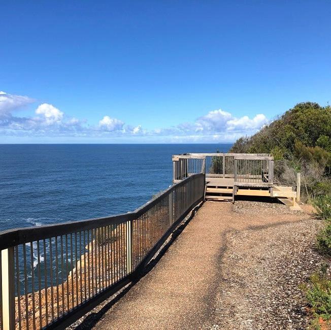
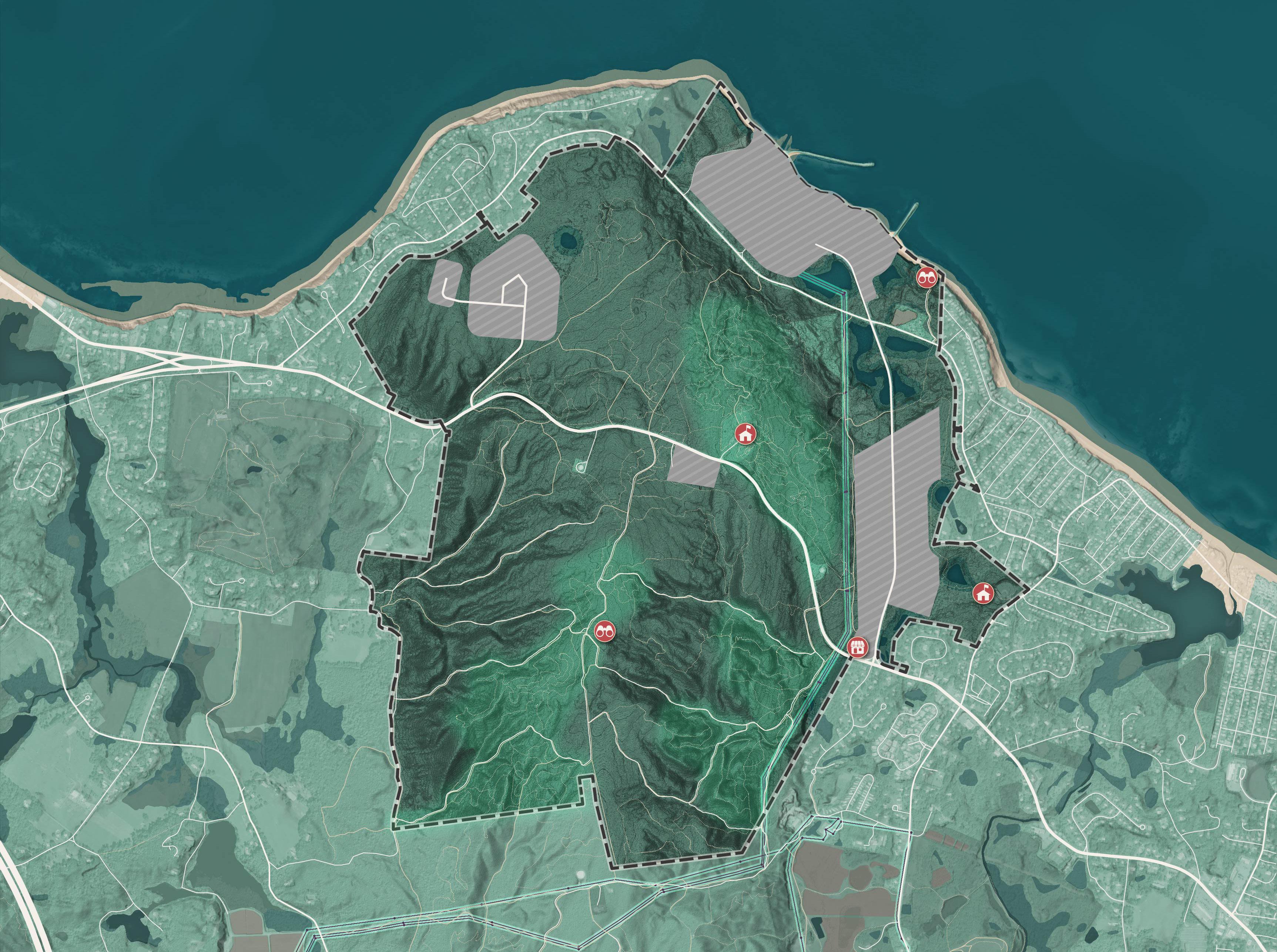
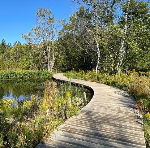
The wetlands at the northeast side of the Pilgrim 1600 are an opportunity for ecological restoration projects and wildlife viewing. Boardwalks, overlooks and trails could be created to enable birdwatchers and other visitors to enjoy these natural features.
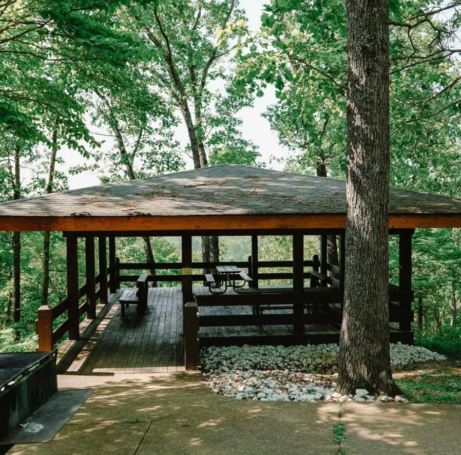
The hilltop of the Pilgrim 1600 is one of the highest elevation points in the nearby region and the tallest on the Massachusetts coast. To accentuate the views available from here, the Town may consider investment in small overlook platforms or a viewing tower.
The most recent Town of Plymouth Water System Master Plan, published in 2019, indicated that municipal water supplies were falling short of demand, prompting the Town to explore potential well sites on the Pilgrim 1600. The Town is not actively pursuing a new well at any of these locations but having viable sites available for future use is important to help accommodate growth and maintain water supply resilience. As governance of the Pilgrim 1600 transforms to enable redevelopment and recreational uses according to this plan, the Town of Plymouth should proactively ensure that well sites are preserved and, preferably, transferred to Town ownership for long term use. Future development should be carefully coordinated to ensure that appropriate wellhead protection zones are preserved around eligible sites.
Proposed industrial development and new energy uses may also significantly increase water demands and require investment in new wells. The Town should investigate the potential to have new uses with high water needs, like data centers or power plants, contribute to the construction of new wells and distribution infrastructure. New development could be served by an on-site closed-loop pipe system built, owned, and maintained by the developer, or a municipally integrated system built by the developer but owned and operated by the Town.
New development would also require verifying the existing pressure and capacity of public water services on the Pilgrim 1600. Much of the site is at a high elevation that may fall outside established pressure zones. Central portions of the site may require supplemental infrastructure (e.g., booster stations) to provide consistent water pressure. Fire flow is a key factor in evaluating water capacity. Increased demand will strain the system during peak periods and reduce fire protection reliability.
Several existing roadways are located within or near the Pilgrim 1600 site, including State Road 3A, the Town-owned Rocky Hill Road, and the privately-owned Power House Road. Route 3A crosses the site east to west and is under MassDOT jurisdiction, meaning any new curb cuts or traffic signals will require State approval. Given existing congestion and peak-hour volumes exceeding 1,200 vehicles in each direction, upgrades to Route 3A are likely necessary if major development proceeds on the Pilgrim 1600. Further analysis will be needed to assess how development will affect traffic volumes and the performance of local and regional roadways and intersections.
New internal roadways will also be needed to support development, with associated costs for grading, paving, stormwater management, landscaping, and lighting. The Town and community have expressed a preference to minimize new traffic on Rocky Hill Road, a quiet residential street so streets should be designed to direct traffic onto State Road 3A.
The Town should work with developers to ensure proper internal roadway design and designate rights of way that include appropriate public amenities like bike lanes, sidewalks and street trees. Power House Road, the central spine of the proposed Power House Road Innovation Corridor, is privately owned by Holtec. As part of development planning the Town should consider whether the road should be transferred to public jurisdiction or that of the master developer.
If the Pilgrim 1600 sees significant new industrial development, the large number of jobs generated on the site will create demand for parking. To avoid the wasteful use of land for parking, and allow development to occur in a compact, walkable pattern, as many commuter trips as possible should be shifted to transit modes. Transit mode share can be improved by working with the Greater Attleboro Taunton Regional Transit Authority (GATRA) to expand service and include new routes and stops in the Power House Road innovation corridor. The Town may also consider requiring large employers to provide their own shuttle services to bring employees from key areas like Plymouth Town Center and the Kingston Commuter Rail Station.
The Pilgrim 1600 is located more than 2 miles away from the Town of Plymouth’s existing municipal wastewater system. Nearby communities utilize on-site septic for wastewater treatment but septic systems greatly limit the yield of potential of development, have environmental risks when not properly maintained, and are most likely not suitable to serve the large volumes of water consumption that comes along with new industrial or energy uses proposed in the Power House Road innovation corridor. To address future wastewater needs on the Pilgrim 1600, the Town should conduct a more detailed study to explore three possible options:
A private, standalone WWTP is a viable and established strategy with regional precedent. While not connected to the town’s municipal sewer system, it would serve as a centralized solution within the Pilgrim 1600, distinct from individual septic systems. Pinehills, a nearby master-planned community, successfully operates its own WWTP on 16 acres of land with five rapid infiltration basins, serving approximately 3,000 homes. Other local examples include Redbrook and Sawmill Woods. While onsite wastewater treatment may pose contamination risks if the site also relies on private wells, the presence of public water infrastructure along Route 3A may mitigate this concern. However, siting, permitting, and operating a WWTP involves significant capital and long-term maintenance responsibilities which may be beyond the capacity of the private developers of the Pilgrim 1600 site.
Connecting to Plymouth’s municipal sewer system could provide longterm reliability and serve both future occupants of the Pilgrim 1600 site and existing communities in Manomet. However, the closest connection point is roughly two miles from the Pilgrim 1600. The new pipe would have to pass through a long stretch of a low-density residential area, which reduces the potential for cost-sharing through linkage with new users. The required investment in pipe infrastructure and possible pump stations would be significant and may prove cost prohibitive.
If the distance from the Plymouth’s existing sewer system proves cost prohibitive to pipe, the Town could consider establishing a new public sewer district entirely distinct from that serving Plymouth Village Center. This option would involve constructing a new WWTP plan on the Pilgrim 1600 site or another eligible site in Manomet, that serves not only the future industrial and residential development on the Pilgrim 1600, but is progressively connected to existing properties. The cost of the WWTP would be covered by sewer connection fees that are levied on homeowners when their sewage is disconnected from septic systems and connected to centralized sewer pipes. In the short term, property owners may oppose having to cover these initial infrastructure costs, but in the long term, they benefit from not having to buy, maintain and replace increasingly costly on-site septic systems. The land area currently occupied by septic leechfields also becomes newly available for use by owners. Establishing a sewer district in Manomet would enable the Town to be developed more compactly, opening up infill sites for residential and hotel developments of higher density than that currently possible with septic systems.
New development could generate needs for additional public safety facilities on the Pilgrim 1600 and also be part of addressing a strategy for existing gaps in public safety services.
Existing maritime public safety facilities in Plymouth are located within Plymouth Harbor. The time it takes for vessels to leave Plymouth Harbor and enter the Cape Cod Bay hinders the capacity of public safety personnel to respond to emergencies in the Bay. Coverage by U.S. Coast Guard patrols has also been reduced by recent station closures. Public safety personnel in the Town recommend that future development proposals for the Waterfront site include a maritime public safety facility to provide first responders with direct access to the Cape Cod Bay.
A large amount of industrial activity in the Power House Road corridor may warrant investment in a dedicated police and fire emergency response substation. Future study is required to determine the capacity and response time of existing stations. Future planning should designate potential sites for these facilities within development areas.
The vision for the Pilgrim 1600 described in this report is just one of many possible future outcomes that could unfold over the next 5-30 years. There are a number of present uncertainties which will impact how and if this vision is feasible. The Town should develop contingency plans to prepare for these uncertainties.
The Town of Plymouth holds a right of first refusal to the Holtec-owned land south of Rocky Hill Road. This grants the Town the right to say to whom land is sold if it is ever placed on the market. However, this right does not obligate Holtec to sell any land. If Holtec does not agree to sell any of the Pilgrim 1600, the vision described in this master plan cannot be realized. Contingency planning for this outcome should involve figuring out how to formalize recreational use of the Pilgrim 1600. This may mean working with the landowner to allow third-party operators like NEMBA or PHATS to maintain trails and construct visitor amenities, while Holtec remains the holder of the deed. The right of first refusal expires in 2031. If it is not renewed, Holtec could then sell land within the Pilgrim 1600 to the highest bidder without requiring Town approval. This would enable land to be developed according to existing zoning which would be contrary to the Plymouth community’s clearly stated goal of conservation for the vast majority of the Pilgrim 1600. As a contingency for this outcome, the Town can consider the use of growth management ordinances to partially eliminate the ability to develop high priority conservation areas of the Pilgrim 1600 like Cleft Rock Ridge and the Hilltop. Stakeholder engagement has clearly indicated a legitimate public interest in conservation of the Pilgrim 1600’s central forested lands as part of a broader network of open spaces. As described in Land Use Recommendations: Growth
Management, this network of open spaces is a potential tool to establish urban growth boundaries that reinforce the development pattern of the Town of Plymouth as a series of distinct walkable villages, and help to prevent sprawllike patterns of development which fragment open space, increase vehicle miles traveled, and reduce the Town’s scenic quality. With this strong public interest in mind, the Town of Plymouth should consider establishing this growth boundary as part of its next comprehensive plan and rely on this as a secondary measure to ensure conservation even if direct acquisition of land by the Town is not feasible.
This plan has already considered that long term storage of spent nuclear fuel on the Pilgrim 1600 will mean that public uses of the Waterfront Site is an infeasible near-term goal. However, public perceptions of risk associated both with the spent nuclear fuel storage installation and with any potential future nuclear energy generation activity on the Waterfront Site, may suppress the viability of other proposals in this plan. While State and Federal permitting for any new nuclear energy generation activity on the Waterfront site is likely to be stringent, this may not fully ease the larger public’s perception of risk and the stigma that may be associated with living or staying in close proximity to nuclear power facilities. There is a high probability that these perceptions would deter would-be investors in residential and hospitality development proposed for the Pilgrim 1600. It may further reduce the potential of the Pilgrim 1600 to act as a higher-volume destination for tourism revenue generation.
While today there is a healthy demand for industrial space in the regional market, there are also many innovation corridors and industrial parks competing for new tenants. Innovative industries especially will be hard to attract to the Pilgrim 1600. Even with investments in energy infrastructure, tax incentives, workforce training, and effective branding and marketing, there are many reasons why innovative industries might prefer to locate elsewhere. Massachusetts is, in general, an expensive market. Labor, electricity, and construction costs are very high so companies will need to see significant competitive advantages to locate here. For many, those competitive advantages come from access to highly skilled workers and proximity to research institutions like MIT, BU, Harvard, and Northeastern. Plymouth’s lack of a commuter rail station means that its access to the regional labor market is more limited than other transit-rich locations in the region. Plymouth also lacks proximity to a major research university. While these challenges could be addressed with infrastructural investments and institutional partnerships, they are additional barriers to the Pilgrim 1600’s market competitiveness.
A large part of the Power House Road Innovation Corridor’s attractiveness to innovative industries will be the ability to colocate with efficient, resilient, zero-carbon energy producers. The viability of specific technologies like SMR for this site is uncertain. SMR technologies have not been permitted in the State of Massachusetts yet and in the entirety of the United States there are only a few active SMR proposals . Permitting an SMR on the Pilgrim 1600 will require support of the public. The planning consultant team has heard both strong support and strong opposition to SMR technology during the community engagement process. If SMR generation is not pursued, other uses could be attracted to the site to make the most use of existing electrical transmission infrastructure like undersea cables, a utility scale BESS, however these alone may not prove sufficiently attractive to many industrial tenants.
Current public opinion in Plymouth is largely not supportive of new housing development. The planning consultant team heard a consistent concern from existing residents that new housing was introducing excess traffic, placing stresses on schools, hospitals and public safety services, eroding the Town’s scenic quality, and otherwise changing the character of Plymouth. Because the Pilgrim 1600 is already a challenging location for new housing development, and large scale redevelopment would be contrary to the conservation and growth management goals of the Town, the planning consultant team has recommended, modest, if any, housing development on this site. While the planning consultant team sees viability for some housing on the Pilgrim 1600, we do not believe that this is the best possible site for new housing in the entire Town of Plymouth. Growth in Plymouth should remain focused on infill development around existing Town and Village Centers to increase efficiency of service delivery to residents. Housing should be associated as much as possible with transit services, proximity to schools, and walkability to retail conveniences.
In order to address the State’s 10% affordable housing target, and prevent developers from implementing 40B developments, Plymouth will need to continue to identify and permit affordable and workforce housing projects. The conversation of where those projects should occur is a Townwide conversation that is central to the ongoing Town Master Plan. Pilgrim 1600 may play a role in this housing production as either a site for modest housing growth, or as part of a transfer of development rights (TDR) agreement which allows developers to increase development density in other locations in exchange for conservation of the Pilgrim 1600’s land. This can help to direct growth to more appropriate sites in the Town while addressing the community’s conservation goals.
The availability of state and federal funding for conservation lands is subject to rapid change with changes in political leadership. Conservation of land may rely heavily on these funding sources, but in their absence greater contingencies for non-profit and developer contributions to conservation goals should be identified.
The future of the Pilgrim 1600 Acre Area is uncertain. This Master Plan does not define a static or singular outcome for the reuse of this land. Instead, it is designed to be a tool for the Town of Plymouth and its partners to begin building the capacity to flexibly and proactively respond to an uncertain future with the confidence that their actions fit the needs of the Plymouth community. When opportunities to acquire parts of the Pilgrim 1600 arise, the Town should refer to this plan to guide its decisions to forge strategic partnerships, craft zoning language, negotiate developer agreements, and invest in infrastructure. If opportunities to purchase the Pilgrim 1600 do not arise, the Town may still use this plan to understand how to enact land use controls that align with the public interest and nudge private owners towards environmentally responsible and fiscally balanced development activity.
As a record of thoughtful and data-informed community conversations this plan can help to set an agenda for future Town actions, but it is also not the last planning effort that needs to happen regarding the Pilgrim 1600. Over the coming years, the needs and interests of the Plymouth community may change. As investments are made in new development opportunities or the conservation of recreation lands, community members need to be further engaged in defining details of design, programming and public use for each piece of this land.
This plan is also not an isolated document. Its recommendations should fit into those of the larger and more comprehensive Plymouth Town Master Plan. Many of the ideas this plan presents for the use of the Pilgrim 1600 could be explored elsewhere within the Town. The Town will need to consider the Pilgrim 1600 as just one of many possible places where new housing, industry, and tourism opportunities could be fostered. Prior to pursuing future development projects, the Pilgrim 1600 should be compared to other opportunity sites using a site suitability matrix that considers access to infrastructure, attractiveness to development, existing abutters, and environmental impacts.
The Pilgrim 1600 Acre Area Master Plan identifies a strategy for the future of this important and beloved piece of land. That strategy should be used to empower thoughtful and intentional decision-making for years to come.
A. Online Survey Results
B. Public Forum 2 Results
C. Market Analysis
D. Conservation and Recreation: Economic Impact Analysis
E. Feasibility and Fiscal Impact Methodology
F. Public Comment
B. Public Forum 2 Results
C. Market Analysis
D. Conservation and Recreation: Economic Impact Analysis
E. Feasibility and Fiscal Impact Methodology
F. Public Comment
The Pilgrim1600 Acre Area Plan Survey ran from January 8 - February 2, 2025. It was shared with residents of Plymouth via emails, social media and printed flyers at Town gathering places. Respondents accessed the survey through the project’s website.
46% of respondents answered every question, 54% submitted an incomplete survey
95% of respondents identified as White/European
29% were residents of Manomet, the largest group. Cedarville had the second largest representation at 11%
Respondents skewed higher income with 61% reporting a household income above $100,000 per year.
In your opinion, what most differentiates Plymouth from other Towns in the region?
1. NATURAL RESOURCES
• Coastline and beaches
• Forests, ponds, and rural lands
• Pine barrens ecosystem
2. HISTORICAL SIGNIFICANCE
• History-based tourism
• “America’s Hometown” Identity
• Historical landmarks and museums
3. SIZE AND DIVERSITY
• Multiple town and village centers, each with its own character
• Largest town by land area
• Diversity of places in short distance of each other: from a working waterfront, to cranberry bogs, to a vibrant main street
Plymouth’s natural spaces, historical importance and vibrant downtown are important to residents. Many respondents emphasized the need to preserve these characteristics, particularly open spaces and natural areas, while managing growth and development.
What do you think are the most significant challenges facing Plymouth today?
• Need for long-term planning and transparency in future development
• Concerns about losing Plymouth’s small town charm
• Concerns that tourism needs are being prioritized over long-term residents
• Increasing property tax burden on residents
• Housing affordability
• Limited high-paying job opportunities in town
• Water/sewer infrastructure needs
• Limited public transit
• Traffic congestion, especially in tourist season with over-parking at beach access areas
• Strain on roads, hospitals, schools and water due to population growth
• Loss of open space
• Coastal erosion
• Protection of aquifers and water quality
The Plymouth Community is grappling with rapid growth and change. Locals who have lived in the town for a long time are worried that their concerns are being ignored in favor of the needs of tourism and new growth. Many feel that growth has created a strain on Town services like open space, hospitals, schools and roads.
Which of the following do you believe would contribute most to improving quality of life in Plymouth? Choose your three top priorities.
access to the coastline and harbors
job opportunities for working families More walkable town centers and neighborhoods More recreational programs / facilities
More culture and entertainment opportunities Increased Town transit services More activities for children More year-round residents
Have you visited the Pilgrim1600 site before? If so, what have you done there?
In your opinion, what features or characteristics make the Pilgrim1600 special?
• High elevation hilltop offering scenic views
• Unique mountain biking destination for the entire region
• Unique geological formations, like Cleft Rock
• Potential for Native American and early colonial archaeological discoveries
• Existing jetty/breakwaters
• Potential for public boat access
• Views of Cape Cod Bay
• Central location between Plymouth and Manomet
• Proximity to Route 3
A common thread throughout many responses was concern about preservation - many residents emphasized that the land’s “untouched” or “undeveloped” nature is what makes it special, expressing worry about potential overdevelopment and desire to maintain open space for future generations.
Evaluate this list of potential uses that members of the Plymouth community have shared with us for the Pilgrim1600. Click all images that you would like to see considered for the Pilgrim1600.
Evaluate this list of potential uses that members of the Plymouth community have shared with us for the Pilgrim1600. Click all images that you would like to see considered for the Pilgrim1600.
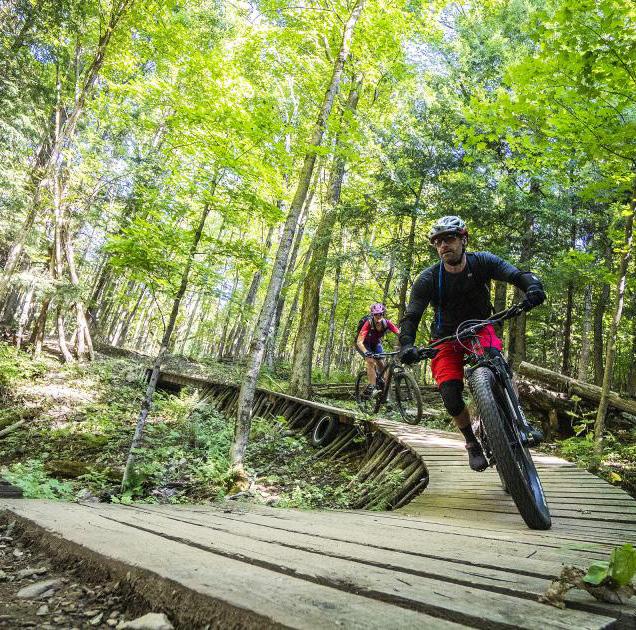


By percent of respondents who selected the option
Tell us any other ideas you have for the Pilgrim1600 site.
Responses indicated strong support for conservation of existing open spaces. Some common specific use ideas included:
• Public beach and boat ramp access
• Dog park / dog beach
• Continued use of hiking / biking trails
A number of respondents suggested the site continued to be used, in part, for energy projects. Specific ideas included:
• Nuclear power generation
• Blue/green hydrogen production facility
• Tidal and wave power facility
Many respondents saw the combination of energy infrastructure, coastal access and Plymouth’s tourism as an opportunity for unique science and education uses like:
• Marine conservation research and education facilities
• Blue economy and aquaculture education and demonstration projects
• A nuclear energy museum and training facility
• Vocational training center for energy, maritime and sustainability professions
• Summer outdoor learning facilities for youth
• Coastal erosion mitigation and resilience pilot projects
A reasonable amount of development on the Pilgrim1600 is desirable to support Plymouth’s economic resilience.
More
Responses
Fewer Responses Strongly Disagree Strongly Agree Disagree Agree Neutral
Areas of the Pilgrim1600 which have already been disturbed should be redeveloped into economically beneficial uses.
More
Responses
Fewer
Responses
Strongly Disagree
Strongly Agree Disagree Agree Neutral
It is okay if small amounts of forested land are redeveloped for uses that will benefit the Town. More
Responses
Fewer
Responses
Existing forested land should be purchased and conserved at the taxpayer’s expense.
More Responses
Fewer Responses
Strongly Disagree
Strongly Agree Disagree Agree Neutral
Existing forested land should be purchased and conserved only if it can be done through private donations.
More
Responses
Fewer
Responses
Strongly Disagree
Strongly Agree Disagree Agree Neutral
I would support some economic development on the Pilgrim1600 site if it meant creating a reliable revenue source to purchase and conserve forested land.
Responses
Fewer Responses
Strongly Disagree
Strongly Agree Disagree Agree Neutral
The previously disturbed lands of the Pilgrim Power Station Site should be restored to natural habitat at the taxpayer’s expense.
More Responses
Fewer Responses
The previously disturbed lands of the Pilgrim Power Station Site should be restored to natural habitat only if it can be done through private donations.
Responses
Fewer
Responses
Strongly Disagree
Strongly Agree Disagree Agree Neutral
I am in support of redevelopment of the Pilgrim1600 site as long as the highest priority recreational and ecological resources are conserved.
More Responses
Fewer Responses
Strongly Disagree
Strongly Agree Disagree Agree Neutral
A. Online Survey Results
B. Public Forum 2 Results
C. Market Analysis
D. Conservation and Recreation: Economic Impact Analysis
E. Feasibility and Fiscal Impact Methodology
F. Public Comment
There were 128 participants in the open house.
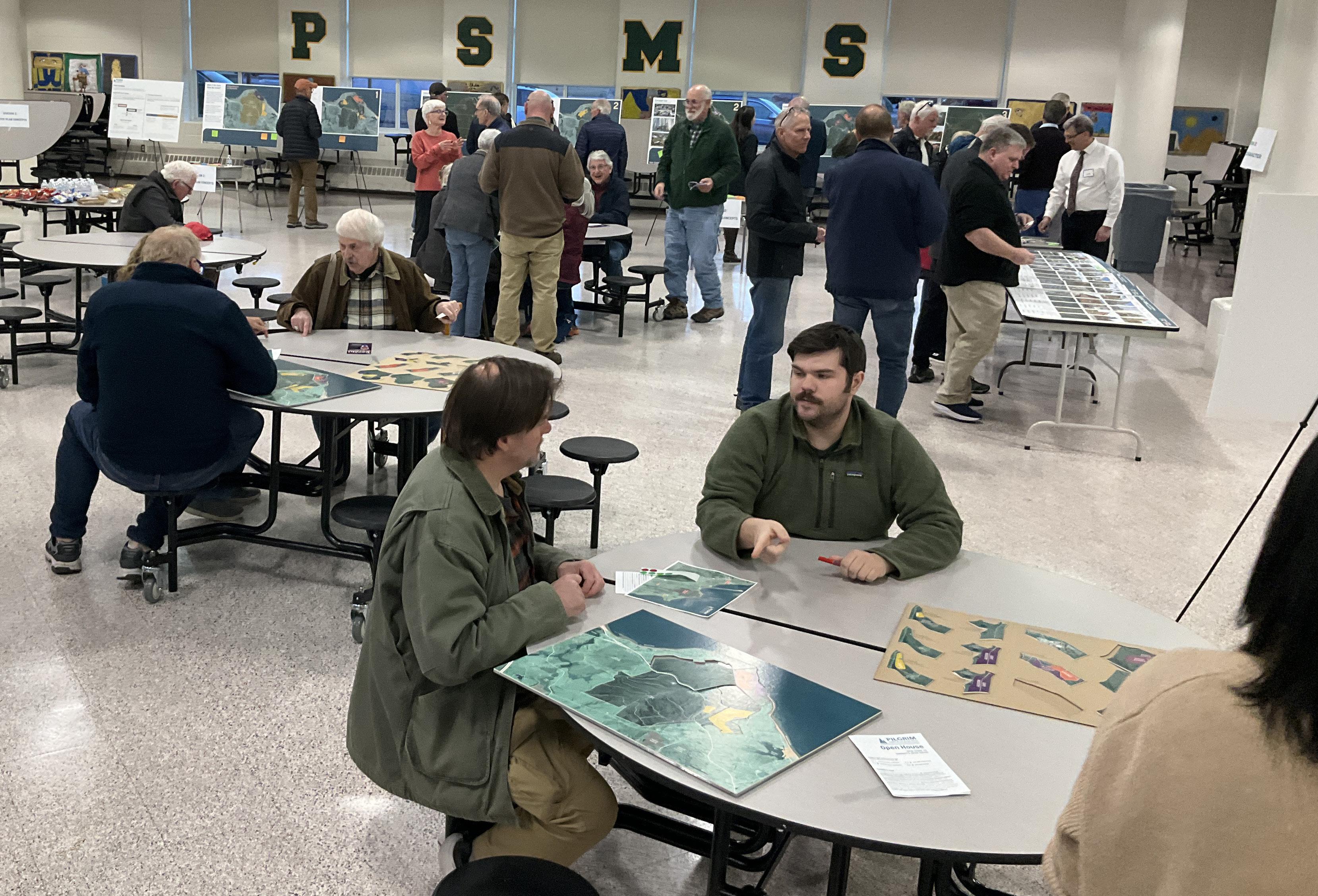
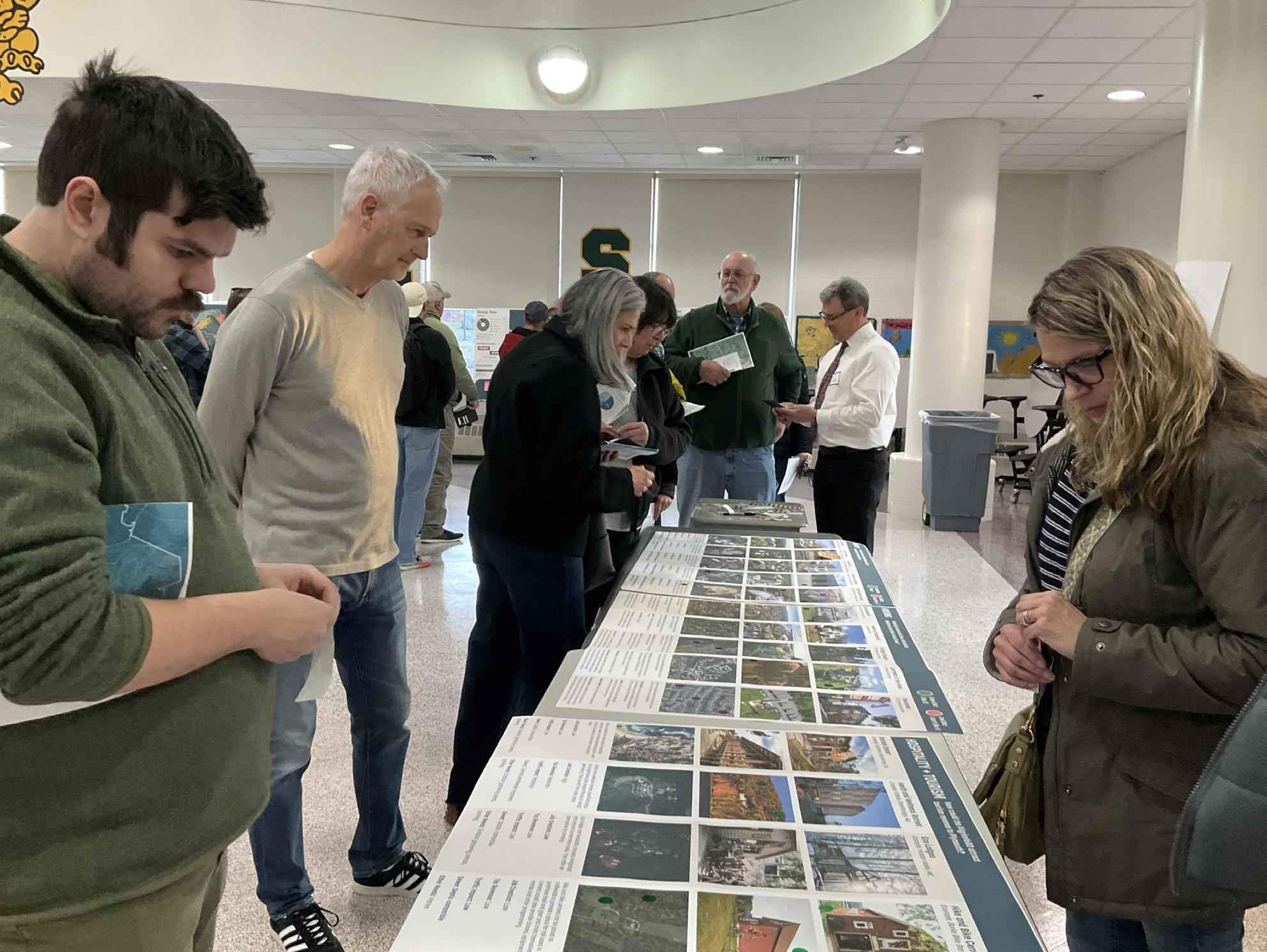
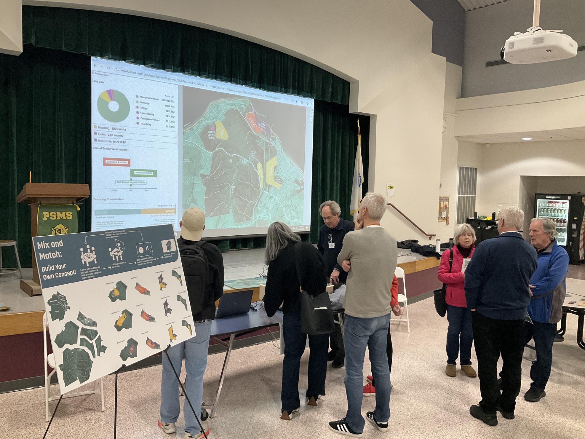
There is widespread concern about growth pressures on Plymouth and many narratives shared about hospitals, schools, roads, etc. being over-capacity.
Many thought we might be undervaluing open space because we have not included potential revenue from tourism spending and hotel stays. Likewise, we have not included the local spending impact of new workers employed by industrial uses.
Some questioned why the conservation price was so high and many felt that there is sufficient public money to cover conservation (State and Federal, not local).
Generally participants were open to development only if required as a means to finance conservation.
• Appreciation that a diversity of land uses may be an economically resilient development strategy
• Concerns about traffic, noise and light pollution from industry near homes
• Suggestion that even more housing could be accommodated at Warren Cove
• Concern about a new road connecting to Rocky Hill Road
• Traffic concerns
• Skepticism that the market can accommodate a new hotel
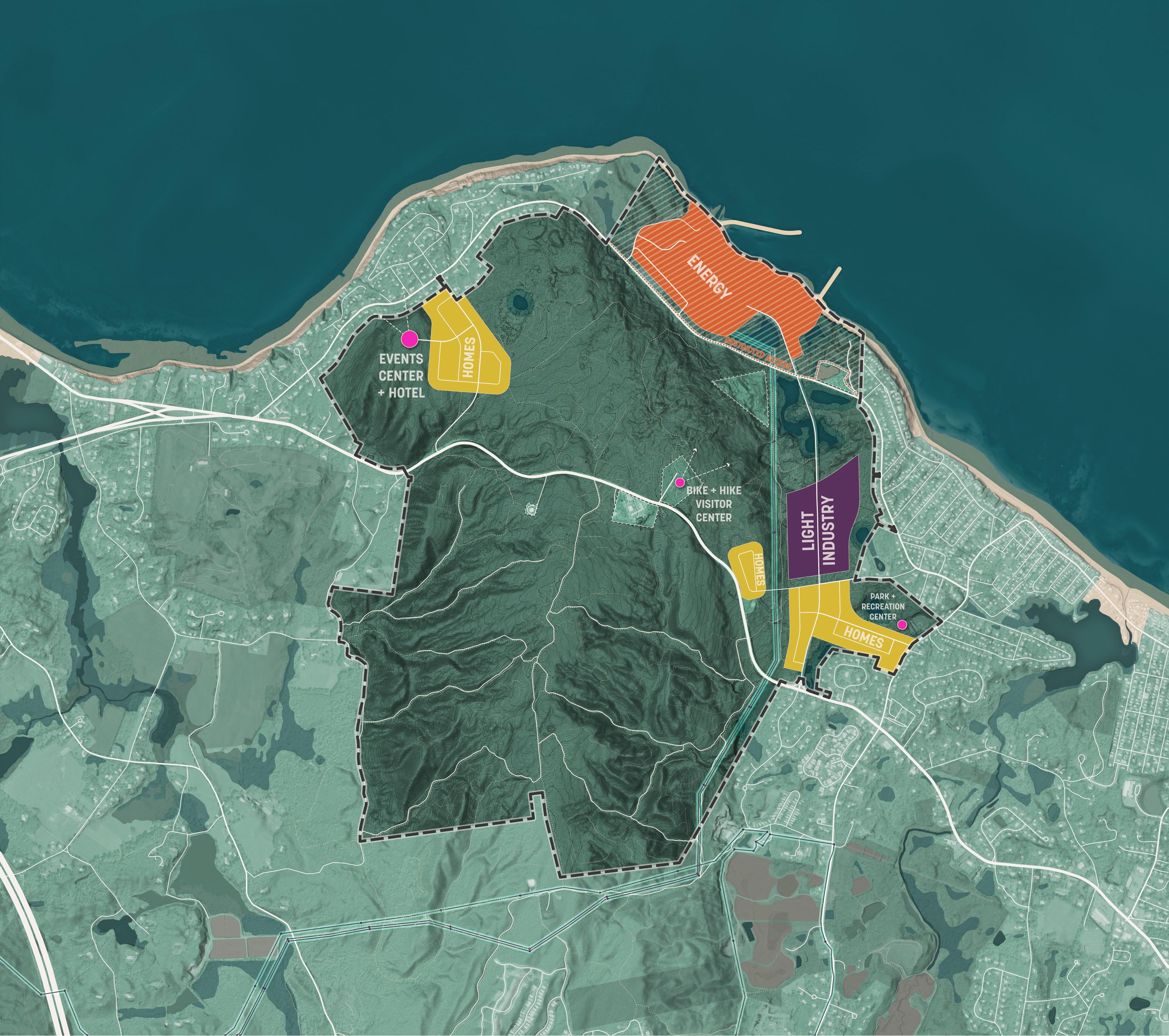
• Appreciation that a diversity of land uses may be an economically resilient development strategy
• Concerns about traffic, noise and light pollution from industry near homes
• Interest in restoring recreation and conservation on the waterfront rather than bringing in new industries
• Concerns that the housing shown would be too expensive for average families
• Concerns about a new road connecting to Rocky Hill Road
• Traffic concerns
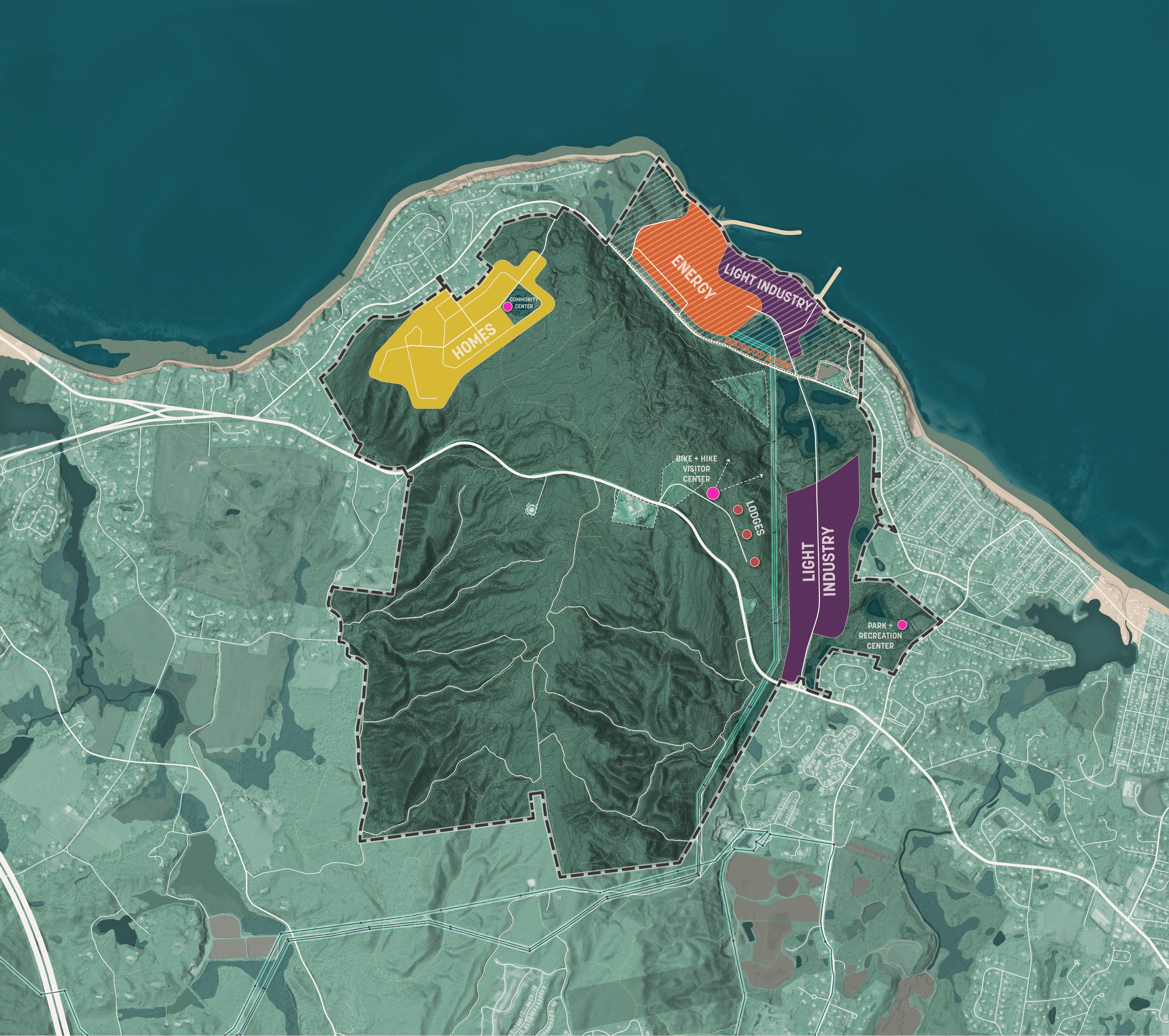
• Many preferred housing over industry on Powerhouse Road because of concerns over the adjacency of industry with existing homes
• High opposition to the number of housing units proposed due to concerns over traffic, overcrowding and stress on public services
• “No More Pinehills”
• Confusion and skepticism about the value of the event venue and retreat center and what kind of demand it would really generate
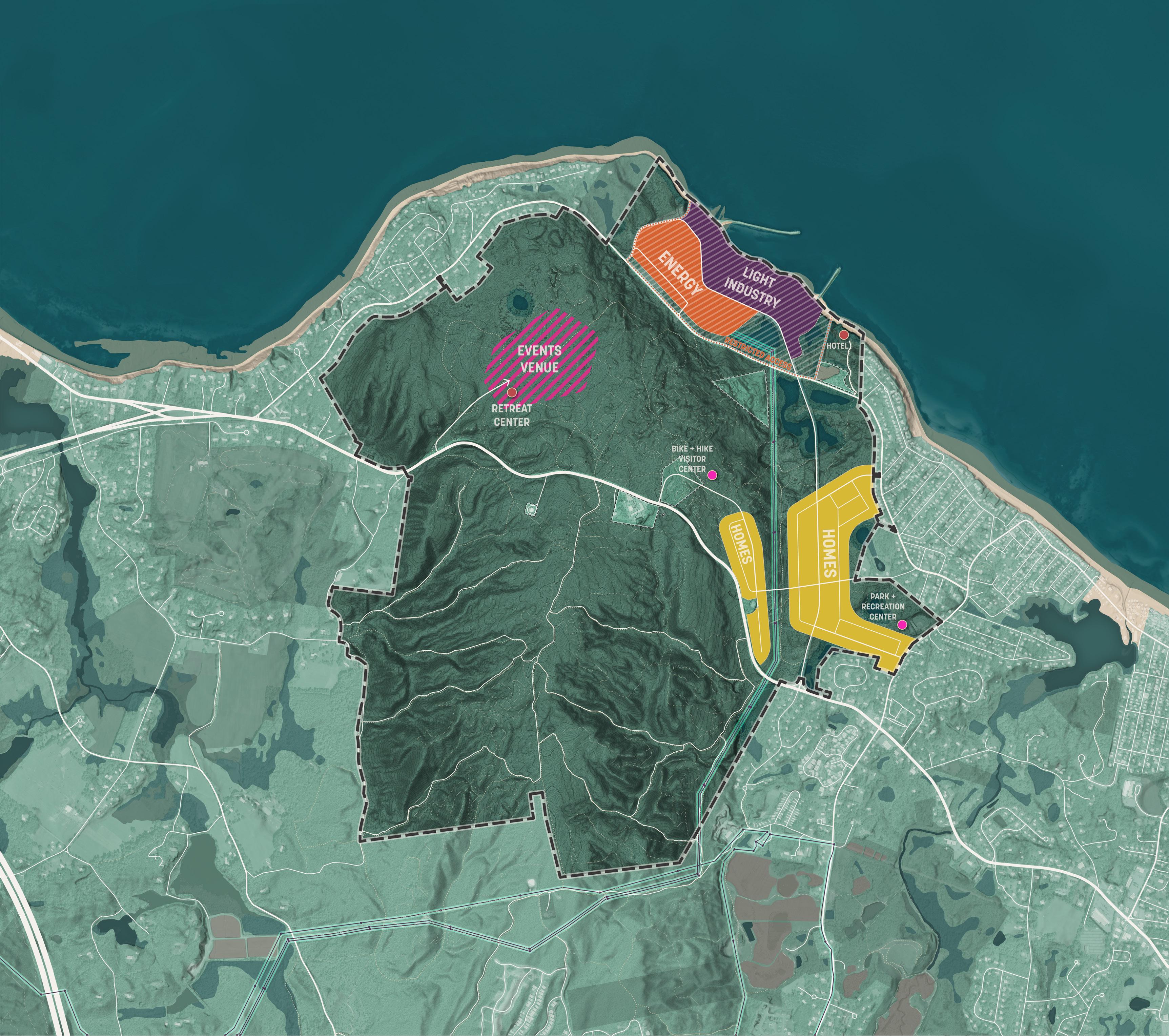

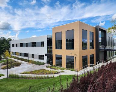

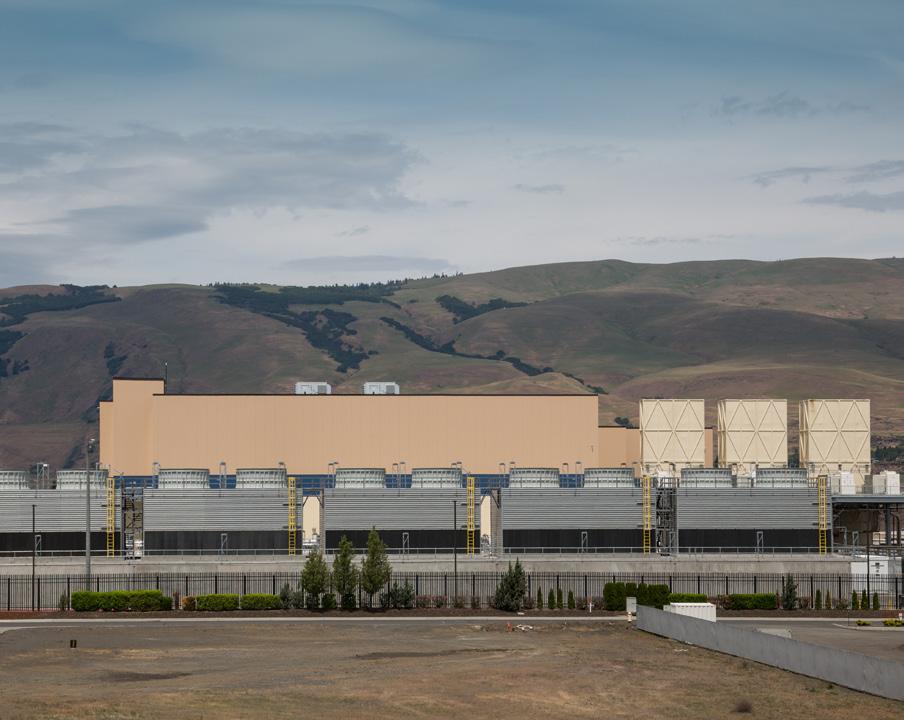

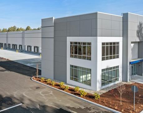

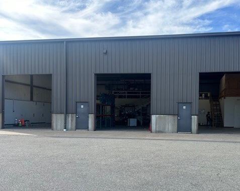


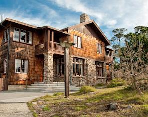


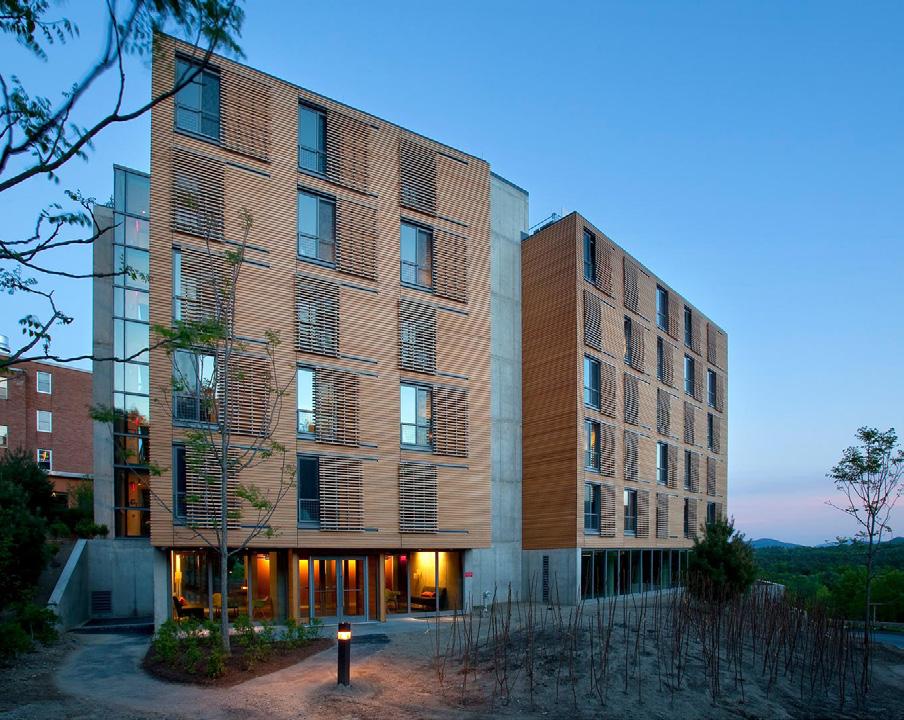


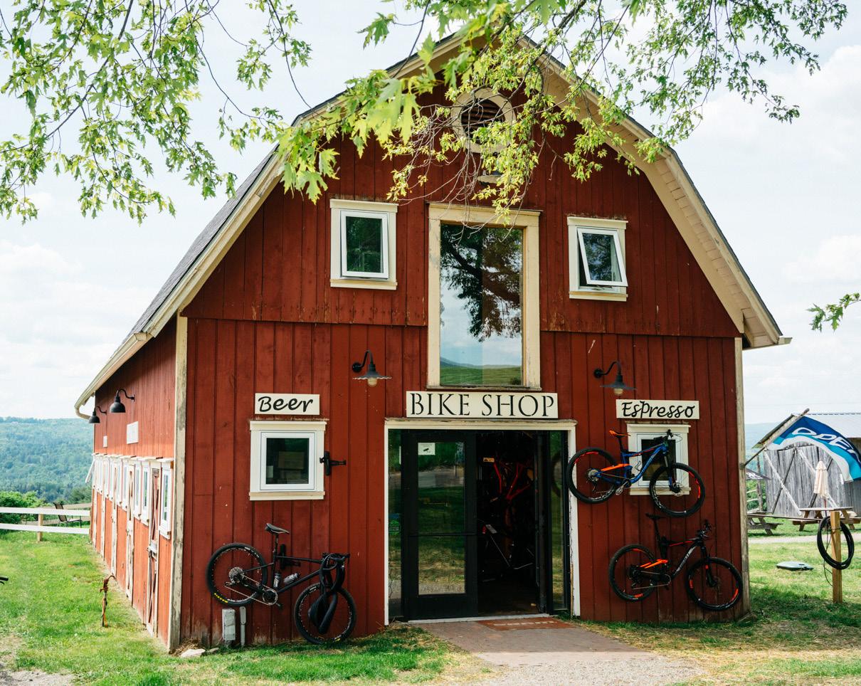

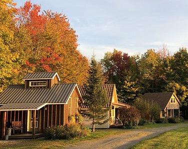
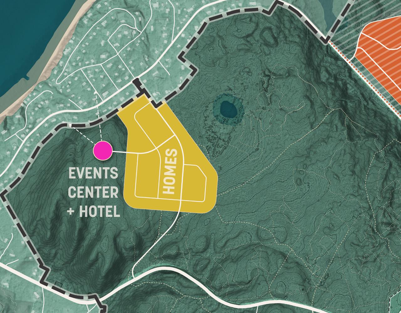
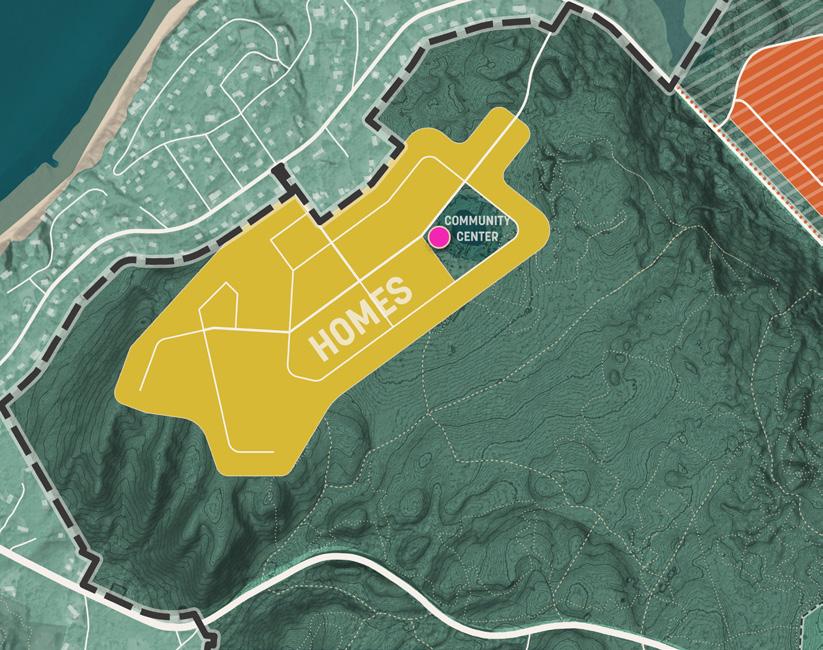
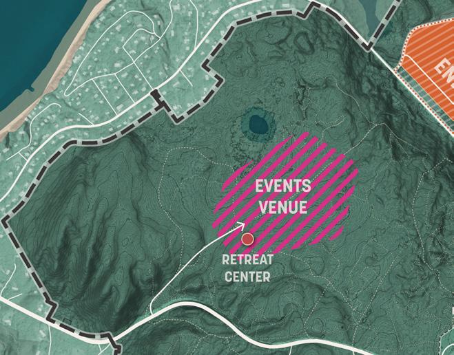
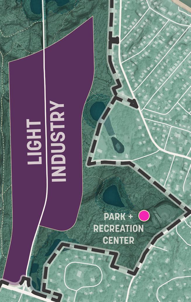
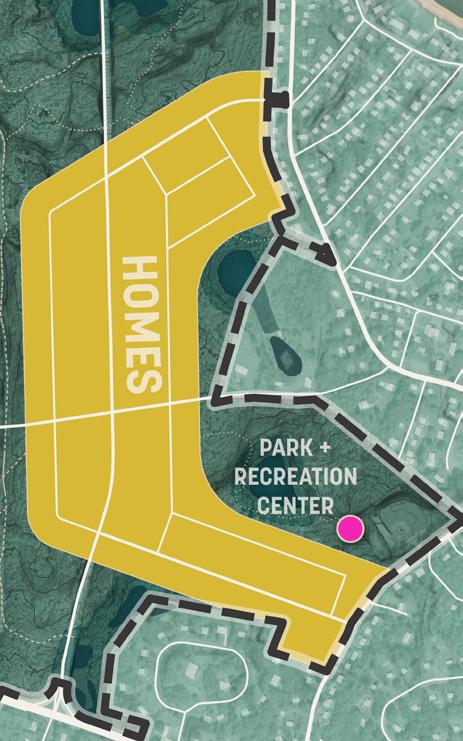
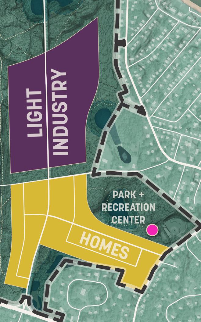
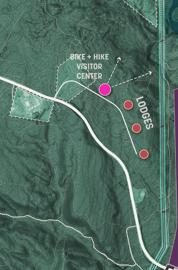
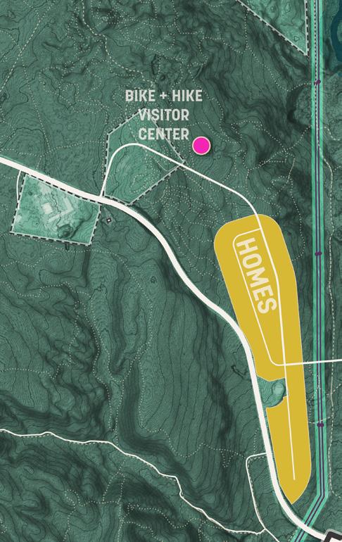

x 15 x 9 x 6 x 9 x 10 x 17 x 8 x 3 x 8 x 7 x 2 x 6 x 4 x 4
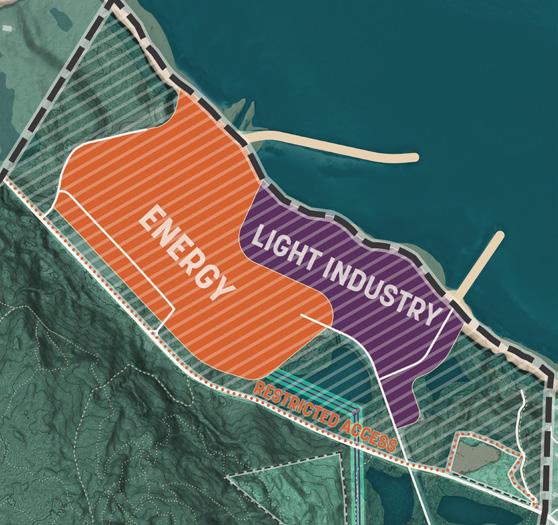
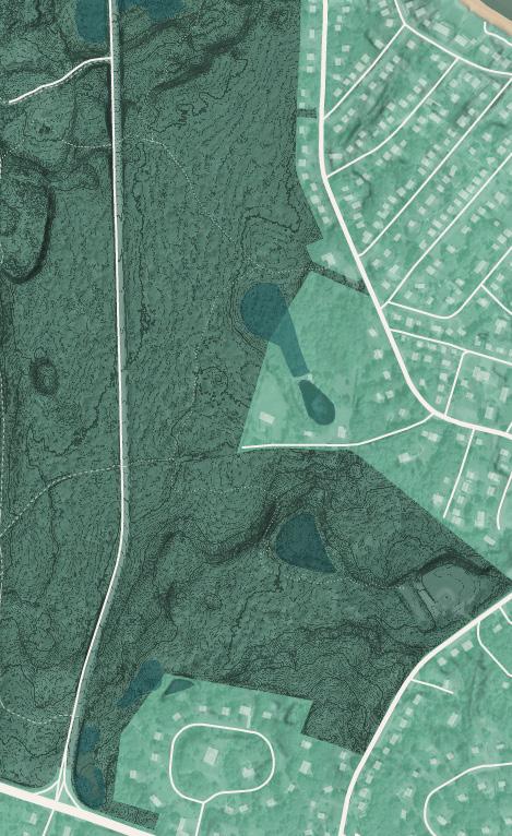
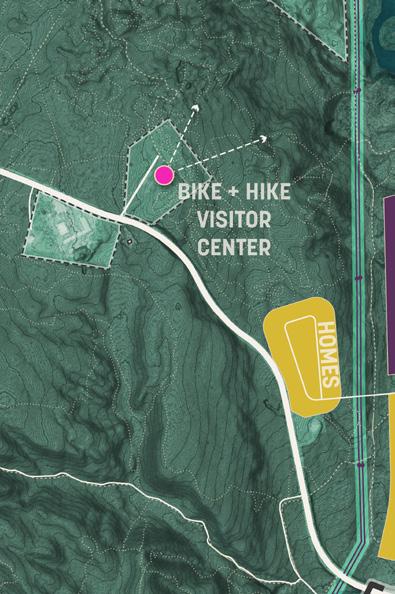
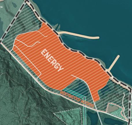
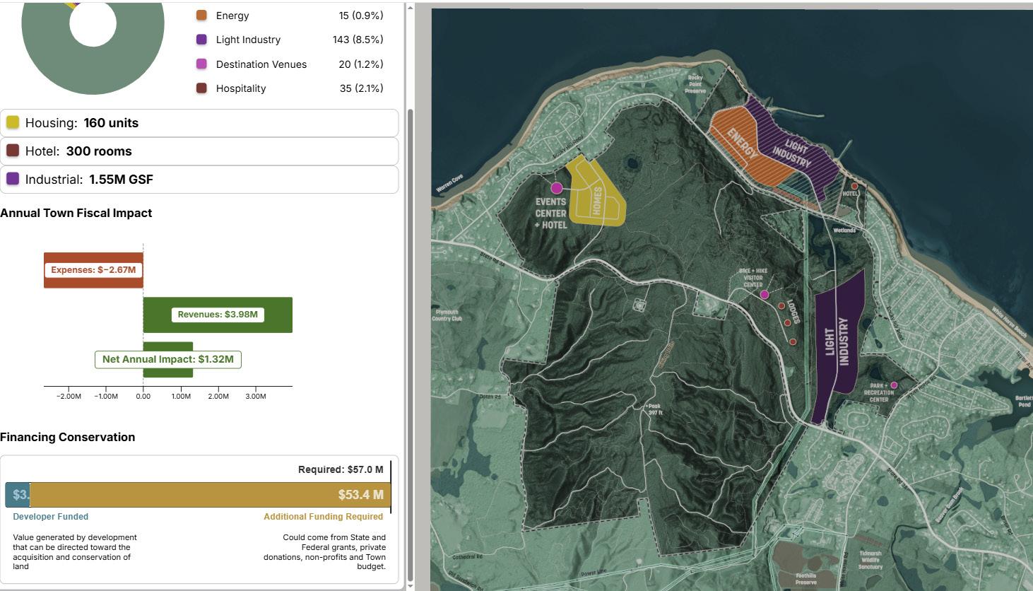
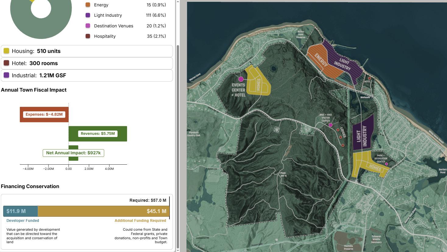
Participants largely felt that the Town should not allow the site to be developed according to existing zoning and agreed with the premise that the Public should acquire as much land as possible to ensure its conservation and limited development.
There was a strong sense that any development was a compromise, a means to an end of financing conservation, and not a goal in and of itself.
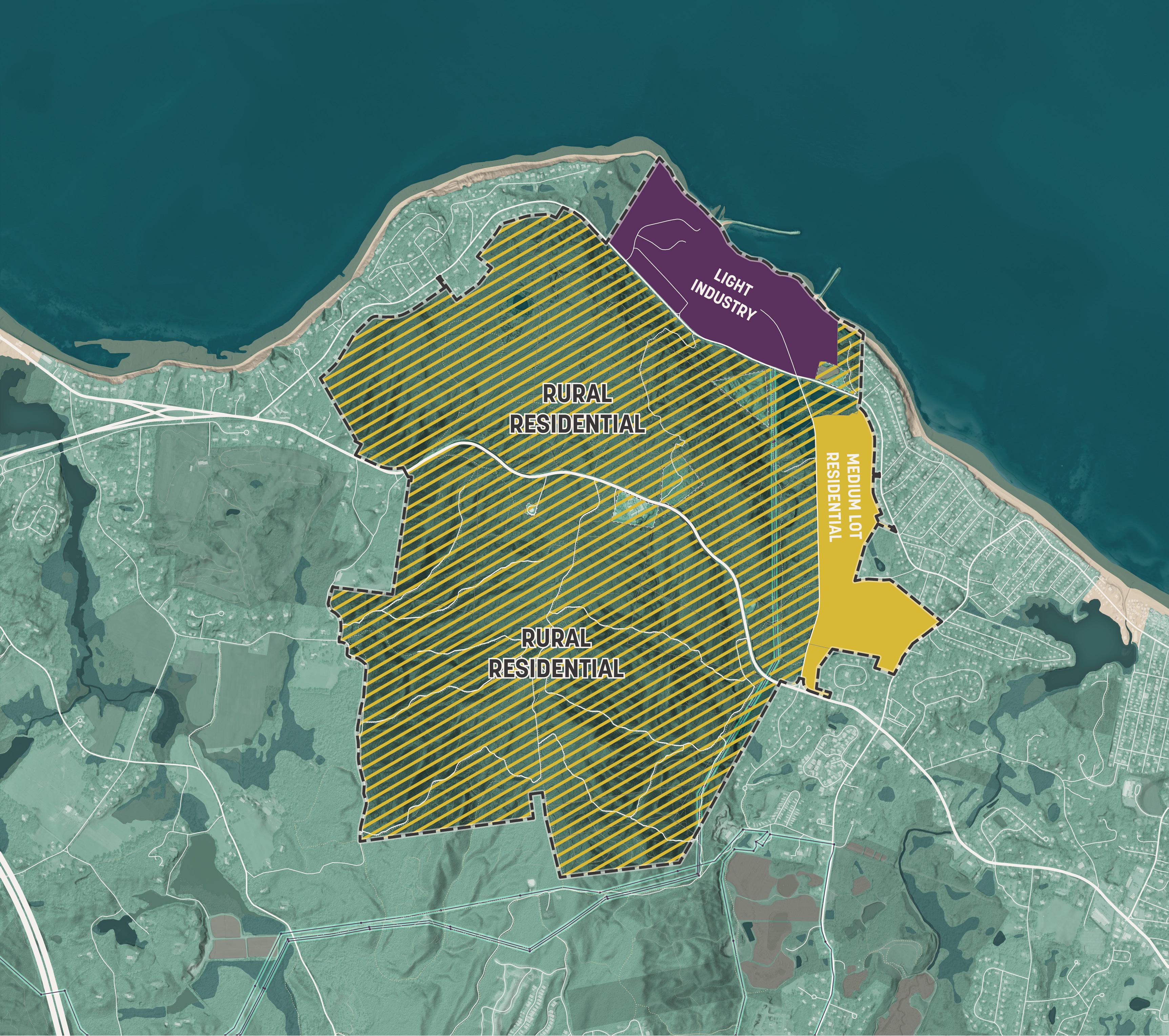
The Waterfront is largely perceived as a brownfield site so participants were most open to seeing continued light industrial and energy use on this parcel as opposed to incursion of these uses onto existing forested spaces. They also expressed they would be open to seeing a higher intensity of use here than on other sites.
The Waterfront was not included in the fiscal model because of the uncertainty of its future use. But it still has a potential role to play in generating the revenue required to conserve and maintain much of the remainder of the site.

Higher density housing was generally negatively received. Even moderately scaled townhouse and 3-story walkup typologies were often rejected. This is a challenge because the density of housing is driving the fiscally positive proposals we shared at the Open House. At lower densities, housing will be fiscally neutral or negative. This opposition was often coming from concerns about:
• Traffic
• Stress on public services
• Neighborhood character
• Visibility of taller structures
Industry was popular perhaps mostly because people appreciated the need for the site to generate revenue, but don’t want to see the population growth in Plymouth that housing suggests.
However, those who lived adjacent to the proposed industrial areas voiced valid concerns over environmental, traffic, noise and light nuisances.
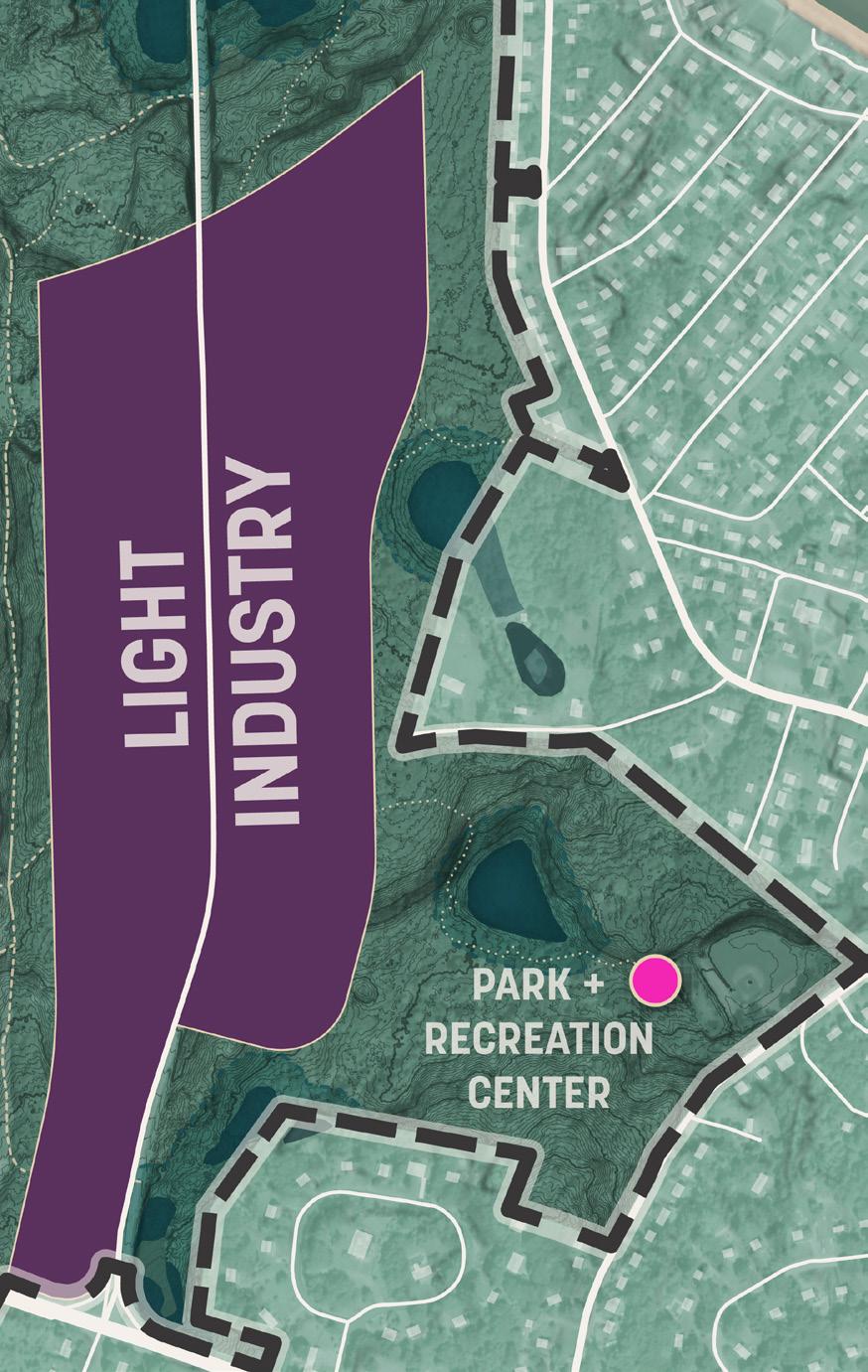
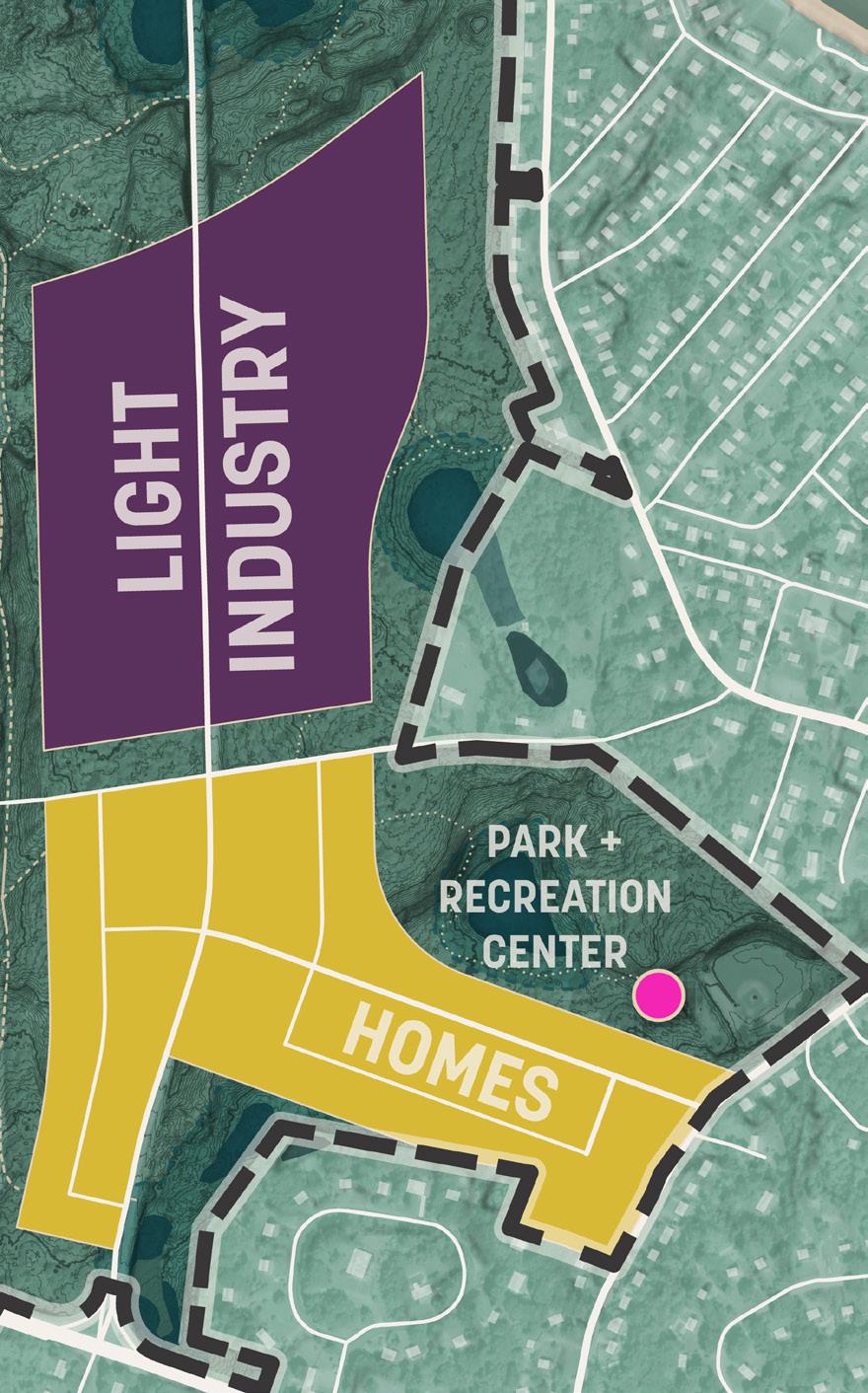
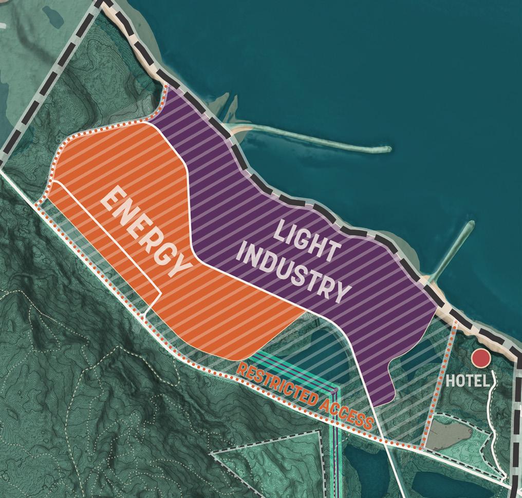

Among industrial uses, participants leaned heavily toward innovation districts, data centers and water-dependent industry. Each of these uses comes with a high degree of uncertainty.
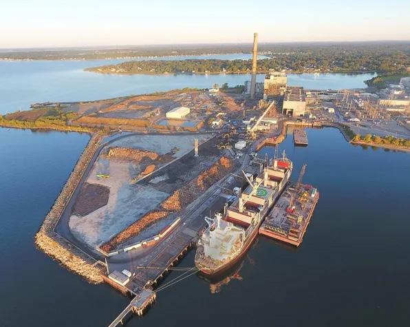
Creating an innovation district at this site will be challenging. Generally innovation districts correspond with an institutional anchor that attracts the talent shed required to staff highly specialized jobs.
At Devens, the innovation district is highly supported by incentives from MassDevelopment and depends on its commuter rail connection to access the greater Boston talent-shed.
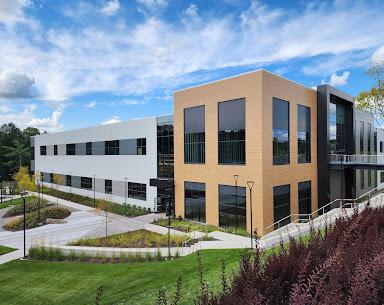
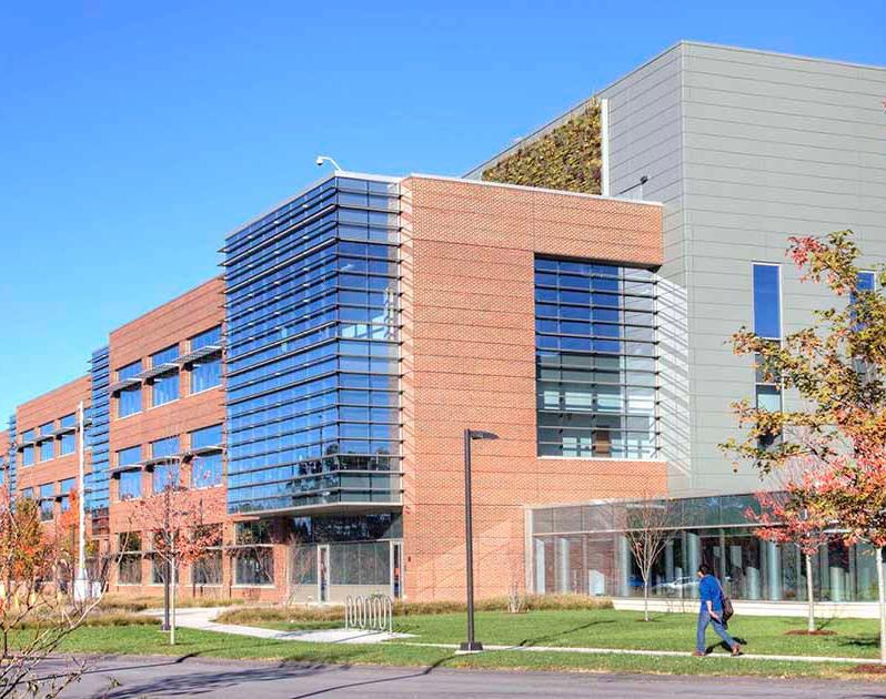
An innovation district could synergize with the energy generation activities of the waterfront site.
The availability of lower cost energy and resilience of a more direct energy source could be another way to attract innovation industries here.
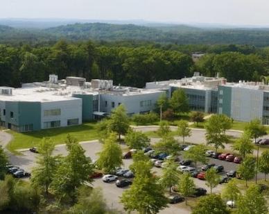
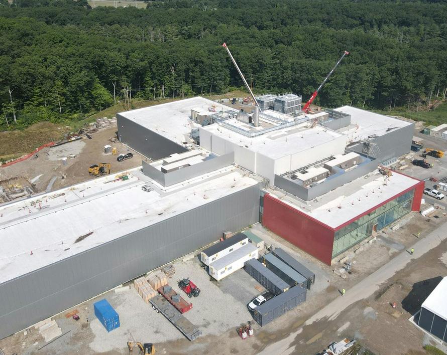
Data centers were a common topic of conversation. Opinions were split on data centers but slightly more positive than negative.
The viability of a data center on this site remains uncertain.
Large (hyperscale) data centers like Google, Amazon, etc. are seeking low cost energy. Massachusetts does not have a particularly low energy cost. These tenants could be attracted by a guaranteed energy price with future generators on the site.
Smaller server farms allow other companies to lease rack space and will endure higher energy costs to gain proximity to their clients. The nearest is in Rockland, MA.
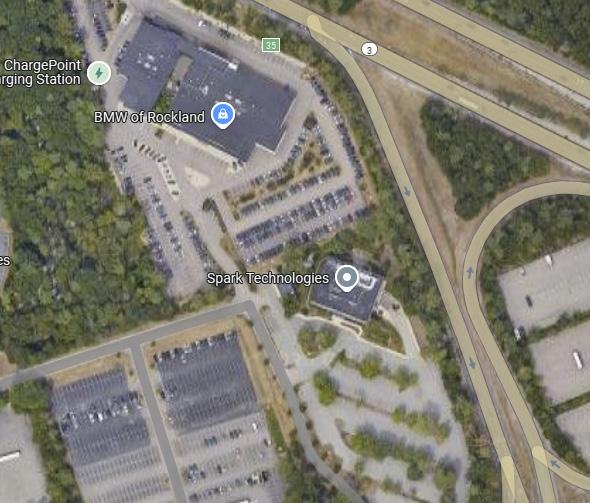

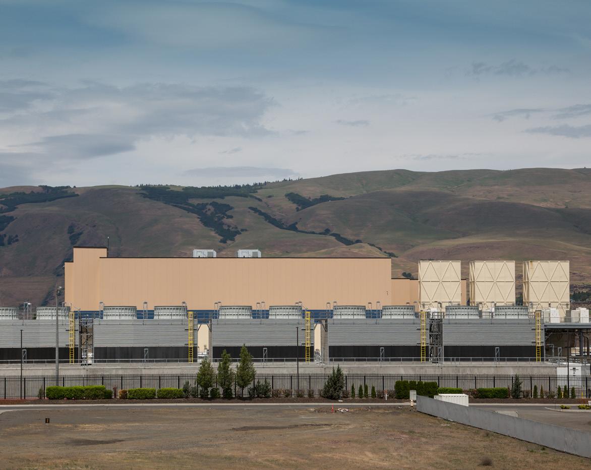
Water-dependent industry and use of the waterfront in general was popular because it does not impact existing forested land.
The waterfront is a potential differentiator that creates the value required to attract industrial tenants to this site which is otherwise poor in its access to major transportation infrastructure.
However it remains a big uncertainty, with no right of first refusal and longterm encumbrances on its use.
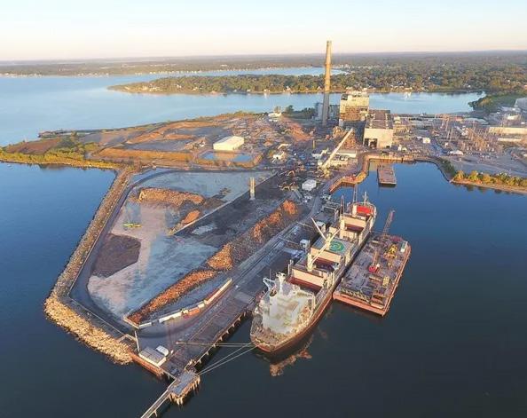
A. Online Survey Results
B. Public Forum 2 Results
C. Market Analysis
D. Conservation and Recreation: Economic Impact Analysis
E. Feasibility and Fiscal Impact Methodology
F. Public Comment
Housing is in demand.
While the Town has experienced significant recent housing growth from large master planned communities like Pinehills and Redbrook, the market is still ripe for an increased variety and supply of housing.
Two recent large developments continue to supply housing in the near term. Pinehills, directly south of the Pilgrim 1600, has constructed more than half of its permitted 3,065 units and is continuing to grow. Redbrook, near Cedarville, is at near 100 percent build out, with 1,000 of its 1,175 permitted units completed. Using the 3-year average annual sales figure of 240 homes - remaining development in those communities might be absorbed in the next 6-7 years. The Pilgrim 1600 property could support additional demand beyond this timeframe.
Nationwide, home prices are increasing faster than incomes. This is especially true in desirable coastal locations like Plymouth. Median income in Plymouth is $72,6391, while median home values are $545,5001 (7.5x that of median income). Data shows median sales prices have escalated significantly since the pandemic with the median sales prices for new residential product reaching $747,5002 (10.2x that of median income).
Affordable housing is a growing concern as many who fill the Town’s healthcare, education, retail and services jobs are faced with high housing costs and increasingly must live out of Town where housing is more affordable. Approximately 1,000 multifamily rental units were constructed in Plymouth in 2023. Several more projects are in permitting or planning. Plymouth’s subsidized housing inventory (SHI) is below the 10% threshold and the Town has recent 40B applications3
Site constraints limit the type and quantity of housing that can be built.
Situated along Cape Cod Bay proximate to recreational opportunities, historic sites, Manomet, and Plymouth Town Center - the Pilgrim 1600 property would be a desirable place to live. However, physical site constraints including steep slopes, lack of transit, and the limited traffic capacity of existing two-lane roads, greatly limits development potential.
Recent developments in Plymouth have followed a “pay your way” model for infrastructure costs. Developers of Pinehills and Redbrook constructed almost all infrastructure using private funds and absorbed that cost into the price of new homes. The Pilgrim 1600 has very little existing infrastructure and new development would require the construction of new l roads, electrical, telecommunications, water, and sewage facilities. In order to cover the costs of these investments and achieve economies of scale, a developer would need a high volume of new units which may not be feasible within the physical limitations of this site. Smaller pockets of housing might feasibly be developed ranging in density from single family homes to compact cluster developments but it remains uncertain if future developers will be able to absorb the infrastructure costs to support these developments.
While Plymouth has a great deal of residentially zoned land, a continued pattern of large-lot development is unsustainable for the Town for both fiscal and environmental reasons. Maximizing value and use of existing developed areas before undertaking development in areas not presently used for economic development would be a smart growth strategy.
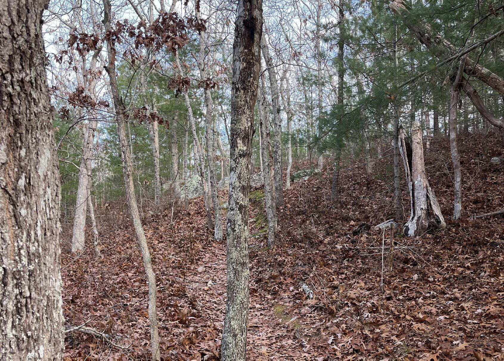
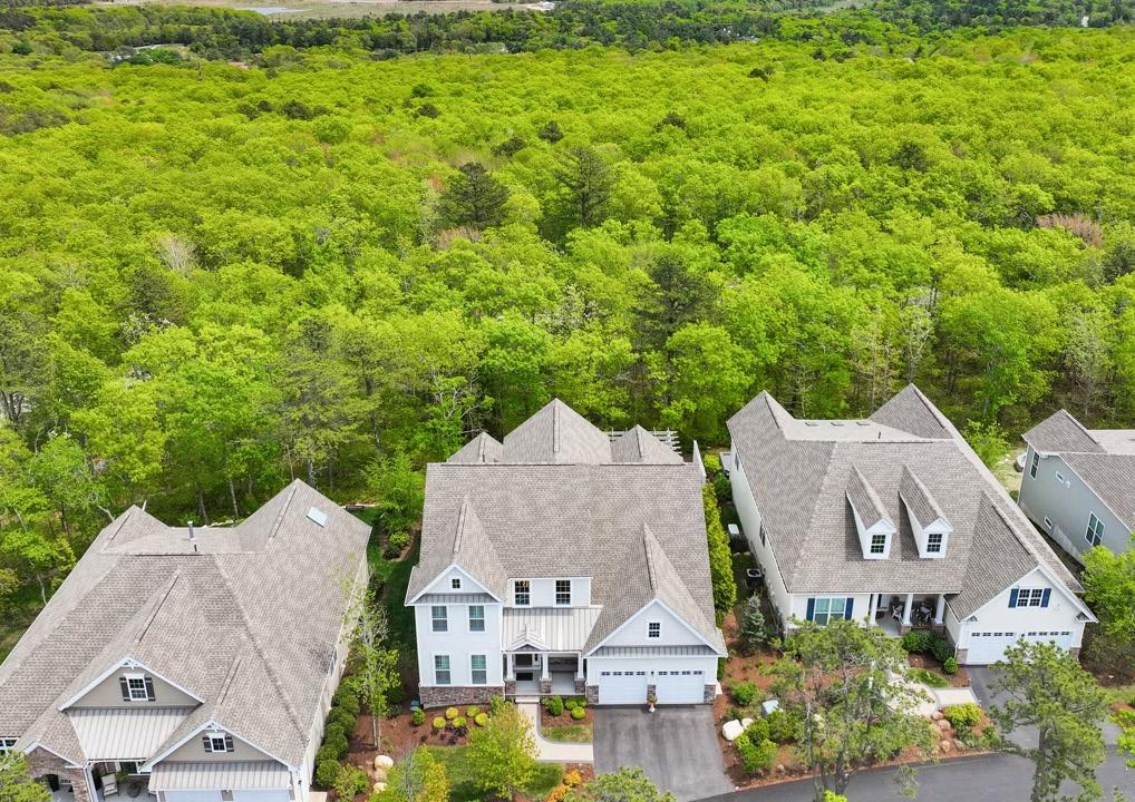
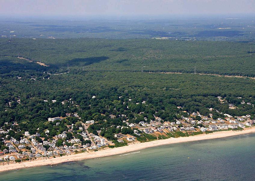
There is a growing market for mid-sized and flexible industrial space.
Plymouth’s fastest growing industries between 2017 and 2022 by total change in jobs were (1) Construction, (2) Accommodation and Food Service, (3) Administrative, Support, and Waste Services, (4) Agriculture and (5) Transportation and Warehousing. Many of these require flexible industrial space. The greatest loss of jobs has been in the utilities sector, demonstrating the impact of the Pilgrim Power Station’s closure in 2019.
Plymouth’s population is concentrated in older cohorts rather than in persons of prime working age . Employment growth figures reflect the Town’s aging population. Annual percentage change for all employment (2017-2022) in Town was 0.2%, trailing Plymouth County 0.3%, and the Boston-CambridgeNewton Metropolitan Statistical Area 0.4%.
Plymouth has a significant production economy. Most industrial development is in the Plymouth Industrial Park located near Route 44 and Route 3, with some smaller concentrations south in the Camelot Industrial Park, along the coastline, and near the airport and Exit 2. Plymouth is part of the Route 3 South Industrial Submarket. At the submarket level, Industrial vacancy is elevated (15.9%), though broker interviews indicate Town industrial vacancy rates are in the single digits and there is a need to create mid-sized industrial spaces for companies to grow.
Desirability will come from proximity to Cape Cod Bay and future energy generation.
Unlike other industrial sites in the area, this site is not directly connected to a highway, which could reduce its desirability. The site’s coastal location accessible by Route 3A will attract industrial subsectors that do not have high demands for transportation and distribution. Light industrial uses that might be attracted here include small-scale manufacturing, biomanufacturing, local contractor bays, machine-shops, and marine-industry businesses. With new energy production or imported wind and solar power connected directly to the existing switchyard this site could increase in attractiveness for industrial tenants seeking high volumes of reliable and clean energy, like data centers and advanced manufacturing.
Recent State legislation aims to bolster the blue economy and uses that rely on the ocean could be part of this site’s future. For example, the site would be attractive to boat builders requiring space for fabrication, warehousing, storage, and close proximity to Cape Cod Bay for sea trials. However, such a use would be contingent on permitting use of the waterfront which is heavily restricted by security concerns surrounding the Pilgrim Power Station and its spent nuclear fuel.
While most new businesses seek smaller (under 25,000 square feet) spaces, supporting expansion of growing business could be an essential part of Plymouth’s economic development strategy. Growth potential into mid-sized or larger buildings is something that could be accommodated on the Pilgrim 1600 site along Power House Road.

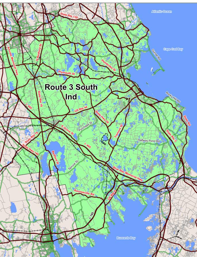


The market for office remains weak. Demand is from smaller companies.
Around the region the absorption of office space is slow, net rents are declining, and development of office space has ground to a halt. There has been a flight to quality where companies right-sizing space for hybrid work models are moving to high-end, amenity rich, prime urban locations with access to workforce. For some time, office development will be build-to-suit and not speculative. While an executive with strong local ties could be drawn to the area, outward growth office-demand is not likely with the pandemic weakened office market and oversupply of commercial and lab space impacting the Boston Metro.
At the submarket level, Route 3 South office vacancy is 4%, which is lower than the Boston Metro 17%. In Plymouth, brokers suggest vacancy is more like 10-12%. While Plymouth’s many small homegrown companies, professional service firms, and modest inventory of space mean vacancies are less than the Metro, new office demand is not foreseen at this time due to prevailing market conditions.
The Town of Plymouth has fewer and fewer high paying jobs. Analysis of in-flow out-flow data shows that working-age residents increasingly commute out of town for employment. Growth in high paying employment in Massachusetts and the United States more generally has been focused on metropolitan centers, especially those with large educational and medical institutions. The strength of the so called “Eds and Meds” economy of Boston, has led many to speculate about the possibility of attracting such employment to Plymouth. The concept of establishing a research institution as an anchor to draw innovative industries to Plymouth has found some support locally but the current political and economic climate suggest this is an unlikely outcome. Funding cuts and increased competition are leading small colleges to close and larger universities to consolidate assets. Cuts in federal funding for research grants could have lasting effects on the region and job market, and a period of contraction may occur.
New office in the area would be more likely infused as part of mixed-use development.
Plymouth’s office market is active and focused on small scale businesses. Economic development strategies foster entrepreneurship and start-ups. There is an articulated need for an Entrepreneurship Center with coworkspace, though this type of use is often seen in renovated space in central business districts or colocated with partners in higher-education or commerce.
While the site presents an opportunity for larger office floor plates along Power House Road, speculative offices are not being built in the region and new office is more likely to be built in mixed-use contexts with access to existing retail, food services, and amenities. If constructed, office space at the Pilgrim 1600 would likely be ancillary and supportive of other industrial, marine-industrial, or energy uses on site.
Retail is evolving and future opportunities exist at key nodes.
Nationwide trends include:
• retailers blending e-commerce, social media, and brick-and-mortar;
• a shift in focus from in-person retailers to delivering experiences and becoming destinations;
• pop-up shops allowing brands to reach consumers and test markets;
• tenanting becoming more food-focused, with food halls emerging to give consumers choices and eliminate barriers for new concepts;
• increasing expenditures on food and drink and decreasing expenditures on general merchandise;
• remote and hybrid work increasing vacancies in the downtowns of major metros and reducing footfall at previously prime retail properties;
• improved performance of suburban and neighborhood scale retail centers.
Plymouth has several distinct retail nodes including the Town’s center, various villages, and strip centers near Route 3. Manomet has more potential in enhancing a neighborhood village retail concept than other overbuilt areas in Town. Gaps exist between consumer expenditures and retail sales for specific sectors (i.e. grocery and department stores).

Source: Landwise
Retail opportunities are limited on-site and should reinforce recreation.
While State Road (3A) is not a retail corridor, a single seven acre commercial out-parcel exists at 265 State Road within the Pilgrim 1600 acre site. It is privately owned and currently houses recreation focused businesses including a bicycle shop and marine service and storage. Just opposite is the Cleft Rock access road and parking lot. Together, this commercial area and trailhead creates a logical activity node to support recreational use of the property.
Small scale retail and service offerings are mainly clustered east of the site in Manomet Village, or west of the site in Plymouth Town Center. Major retail centers are northwest of the site along Route 3 which sees annual average daily traffic (AADT) in excess of 60,000 vehicles. By comparison State Road (3A) sees an AADT of 13,500 - 16,500 vehicles and Rocky Hill Road sees an AADT of 2,250 - 2,500 vehicles. Lack of vehicular traffic and storefront visibility present a significant barrier to attracting retail to the Pilgrim 1600 site.
While retail spaces have been introduced in nearby low-traffic sites like the Pinehills and Redbrook, these are enabled by the large number of residents housed in these neighborhoods. Retail spaces tend to be focused on serving local populations rather than attracting off-site customers.
Existing retail tenants in Plymouth Town Center have not fully recovered from losses experienced during the COVID-19 Pandemic. While retail vacancy rates in the Town Center are very low, the Town will need to continue to work to attract customers back to existing retail corridors and counteract the influence of e-retail. Constructing new retail nodes may draw traffic away from the Town Center and counteract these efforts. The Town should focus on expanding its existing mixed-use, walkable, retail inventory in the Town Center that includes entertainment, food and beverage, hospitality, general merchandise, and health and wellness offerings.
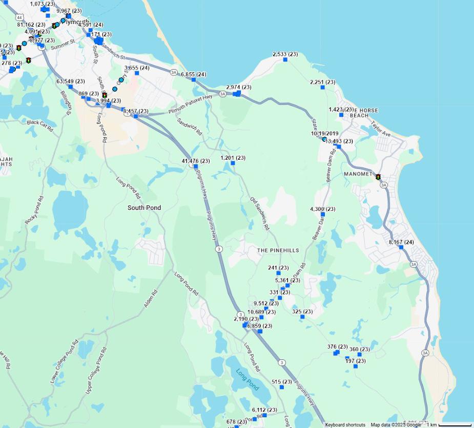
Market indicators suggest additional lodging options are in demand.
Plymouth saw approximately 1.5M visitors in 20241 The number of overall visitors has been relatively stable. The Town’s tourism industry targets value-oriented visitors emphasizing cost advantages over Boston and Cape Cod. These visitors are slightly lower income, staying a shorter time, and spending less. Historic sites attract education travel groups. Attractions are generally passive or observational, not active or experiential. Prior studies recommended expanding active tourism venues and diversity of activity with the goal of boosting length of stay. Similar to many other New England coastal destinations, Plymouth has been working to expand its year-round visitation.
Plymouth is part of the Boston Southshore Submarket which has a healthy 12-month occupancy at 70.7%. Post pandemic, positive performance has been driven by leisure segments.
The Waterfront Business and Development Plan (2002) described a need for 1,000 additional hotel rooms in Plymouth County. In Town, one new hotel property, the Cambria Hotel with 107 rooms, was completed in the past year. Additional hotel properties have transacted demonstrating market interest in Plymouth’s tourism economy. The Convention Center Study proposes a convention center with a 200 room hotel. These demand and occupancy numbers suggest additional accommodations can be supported by the local market.


New on-site lodging could complement recreational use of the site.
Recreation opportunities on-site provide the potential to grow the tourism base. This might be further supported with lodging opportunities like an inn, lodge, cabins, or high-end camping/glamping concept. Accommodations might be geared toward groups and families, with expandable unit typologies and recreation activity packages. Opportunities for events like retreats, and weddings are often important revenue generating activities for lodging properties like this.
While the Town has contemplated a Convention Center with a 200 room hotel, local economic development and tourism experts feel it would best benefit the Town on other sites under consideration which are more proximate to the Town Center and can help drive traffic toward existing local retail, hospitality, and leisure businesses.
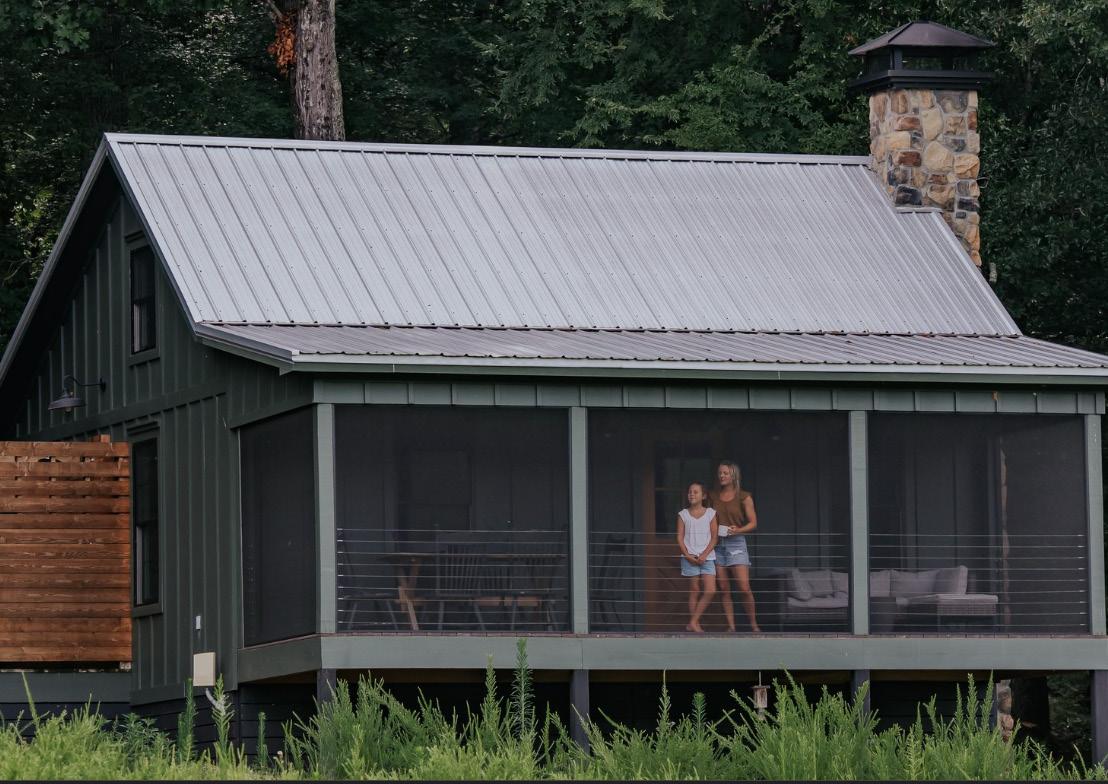

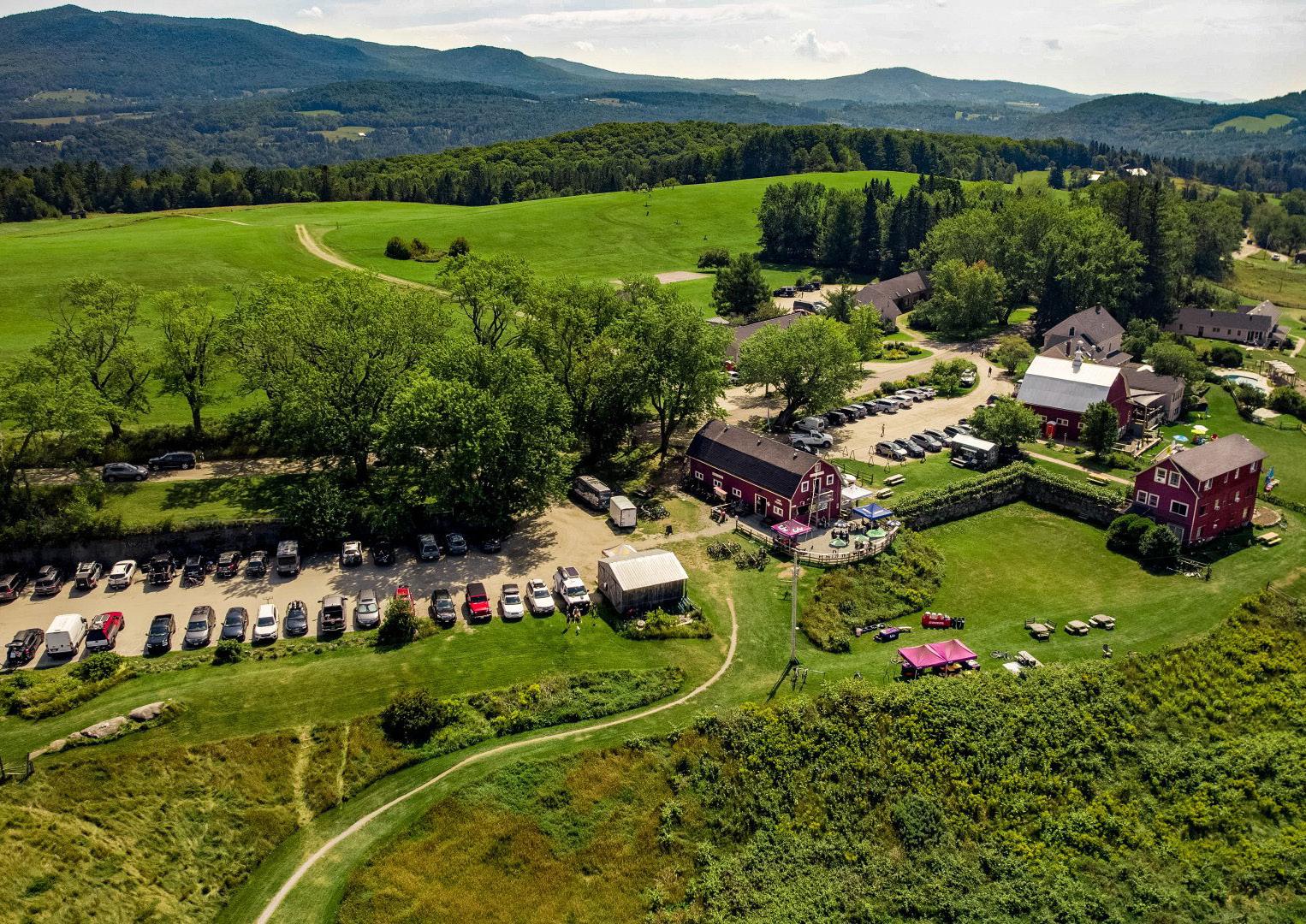
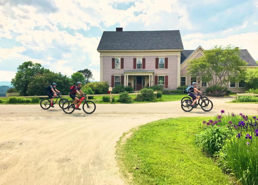
The energy market is strong. Technology is evolving and the state is moving toward ambitious clean energy goals.
Massachusetts consumes more electricity than it produces and needs to build new renewable energy infrastructure to stay on track with its ambitious clean energy goals. Based on Massachusetts regulations, 60% of total electricity sales in the State should come from renewable sources by 2030 and increase by 1% every year thereafter. The rising cost of electricity is a concern for homeowners, renters, and business owners across the state. Massachusetts is going through a rapid energy transition towards renewable energy, but is challenged by aging generating assets, uncertain fuel prices, and increasing energy demand from the electrification of vehicles, heating, and industrial processes. To meet demands, the state relies on imports, largely of hydropower from Canada. Increasingly it is also importing energy from offshore wind producers.
Grid resilience and electricity reliability challenges are also increasing as a result of increased reliance on intermittent sources of energy generation (wind and solar), and demand peaks generated by electrification of building heating and cooling loads. This is creating a demand for investments in emissions-free base load power, that is electricity that is generated continuously regardless of weather conditions, and a more robust and resilient grid supported by energy storage and integrated energy users.
This context creates an opportunity for the Pilgrim 1600 to become part of a resilient and sustainable energy future for the State of Massachusetts. It suggests that energy projects would enjoy State political and financial support.

Source: Massachusetts 2050 Decarbonization Roadmap, December 2020
The Pilgrim 1600’s high voltage transmission lines and switchyards are an asset that should be leveraged, but how to do so is a topic of continued discussion.
The main strength of the Pilgrim 1600 is its existing 345 kV transmission lines and switchyard. These facilities connect the Pilgrim 1600 directly to the regional grid. This provides a multitude of opportunities for the Pilgrim 1600 to host energy production and resilience infrastructure that together would make it a resilient energy hub.
A resilient energy hub is a cluster of technologies that improve the reliability of energy, including direct connections to energy generation, utility scale battery energy storage systems and smart grid technologies. Such a hub would be a differentiator capable of attracting industrial tenants with a demand for high volumes of reliable, clean energy such as data centers and advanced manufacturing facilities.
A resilient energy hub at the Pilgrim 1600 could include energy generation technologies, such as small modular reactors (SMRs), or serve as an interconnection point for off-shore wind and solar installations seeking a way to deliver energy into the regional grid.
SMRs are a nascent technology. Their suitability for the Pilgrim 1600 is a topic worthy of continued conversation. Plymouth has long been a nuclear host community, and local residents and public safety officials are familiar with the risks and benefits of hosting a nuclear power station. However, there may be more suitable sites in the State with less proximity to scenic resources and population centers where new power stations are a more appropriate land use. SMRs, while currently enjoying rapid technological advance, are still in a pilot phase. Holtec International, the owner of the Pilgrim 1600 is pursuing a demonstration project with SMR technologies located alongside a refurbished conventional nuclear power
station at Palisades, Michigan. There is likely to be a long timeline of regulatory change, technological improvements, testing, workforce development, and political discussions before SMR technology is ready for full grid integration and scalable production. For that reason, SMRs should be viewed as merely one of many possible energy generation solutions for the future of the Pilgrim 1600.
Energy generation and resilience improvements surrounding the Pilgrim 1600’s switchyards may serve to attract high energy consumers like data centers and specialized manufacturers, for whom a consistent and resilient energy supply is essential for economic success. However, even with these improvements, the Pilgrim 1600 has several disadvantages which reduce its competitiveness for these industries. As a site in Massachusetts, the Pilgrim 1600 is subject to high electricity costs experienced in the region. Small scale data centers that market their services directly to local businesses might be able to pass these costs on to their clients, but large data centers for multi-national businesses, also known as hyperscale data centers, would seek out the cheapest possible electricity rates. They are much more likely to locate in the Southern or Western states where electricity rates are lowest and wind, solar and hydro power sources can be mixed together for a diverse energy portfolio.
Industries like data centers and specialized manufacturing are also land intensive. The Pilgrim 1600 is a coastal site in a region with high land values. To purchase land here, industries would need to see major advantages to their business. It may prove more profitable for these types of industries to seek sites further inland, or, again, in regions of the Western and Southern U.S. West where land is more abundant and lower cost.
For these reasons, to differentiate itself the Pilgrim 1600 may need to appeal to more than the bottom line. It could still prove an attractive site for research and demonstrations of new technologies that enjoys close proximity to the major academic institutions and innovative industries of the Boston Metro, while offering employees the high quality of life that Plymouth enjoys.

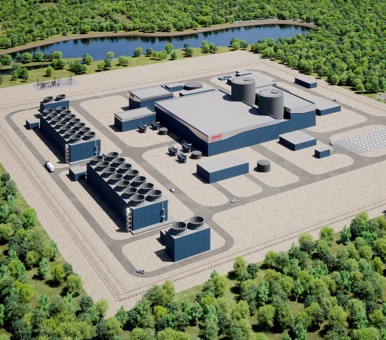
Recreation and eco tourism has potential.
Parks, preserves, and other open spaces in Plymouth offer opportunities for many outdoor activities, including hiking, boating, birdwatching, fishing, beach access, and golf. Though unsanctioned, the Pilgrim site is Plymouth’s largest and most popular mountain biking area. Some more limited biking trails are available at other areas.
Access to Cape Cod Bay is one of Plymouth’s greatest recreation assets. Boat slips at Plymouth Safe Harbor Marina and surrounding facilities are 100% sold out. There is substantial demand in the southeast MA market for boat docking and storage.
Plymouth’s tourism industry has focused on “star attractions” rather than natural resources and scenic beauty. The Cape and Islands are more successful at attracting this type of tourism. Plymouth could expand active tourism venues and diversity of activity with goal of boosting length of stay.
Nationally, trends in recreation planning include multi-use trail networks for active transportation and recreation, a shift away from golf and adventure to more native and less manicured environments, and the blending of recreation with retail/food and beverage, and entertainment.
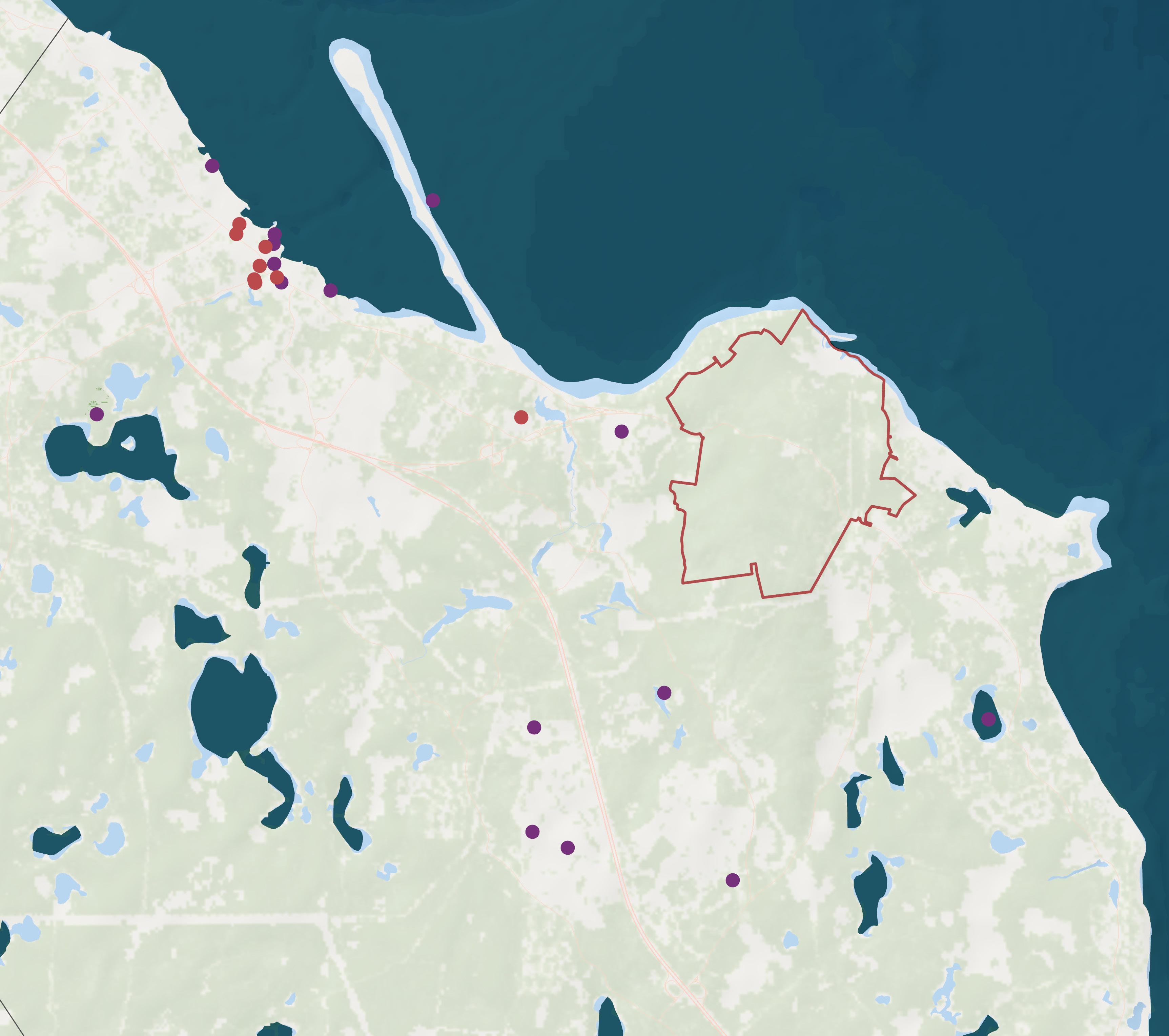
Access to Cape Cod Bay and the site’s trail system are great assets.
While the site has just under a mile of shoreline, access might be challenged by new energy use security requirements. Unlike Plymouth Harbor which is protected by barrier beaches, the coastline of the site is in a part of the Bay exposed to northeasters and at-risk to damage, especially in winter months. The existing breakwater wouldn’t be sufficient for a marina without extensive investment, which could be difficult to permit. Review of historic Google Earth imagery shows the breakwater rocks have shifted overtime. Conversations with a marina engineer confirm the site would be most attractive for land-based dry stack storage facilities with a boat ramp and accompanied by marine repair. A small number of moorings in the most protected area of the basin would be more feasible than slips.
Physical aspects of the site which make it difficult to develop make it attractive for hiking and mountain biking. The site has 48 miles of trails, and the summit of Manomet Hill at 394 feet is the highest point in Plymouth County. The site’s mountain biking trails already attract visitors due to their unique appeal. Hikers are likely to be drawn more locally. The forested land is different from prime bird watching destinations along shorelines, marshes, and ponds but has important conservation and habitat values as well.
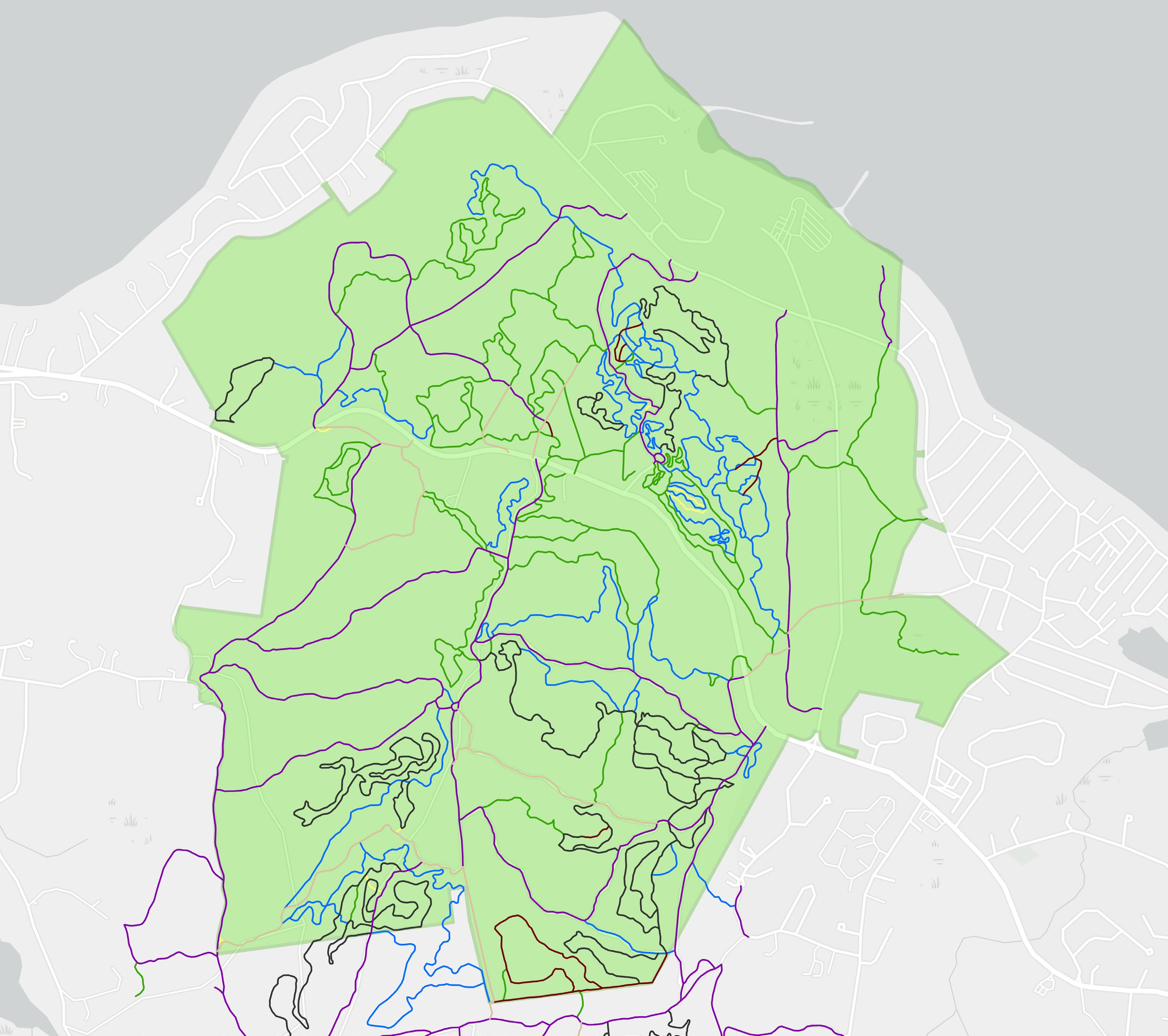
A. Online Survey Results
B. Public Forum 2 Results
C. Market Analysis
D. Conservation and Recreation: Economic Impact Analysis
E. Feasibility and Fiscal Impact Methodology

Au ust 7, 2025

Purpose
Existing Conditions
Recreation & Tourism Trends
Projected Economic Impact
Governance & Funding
Appendix
National Case Studies
Local Comparables
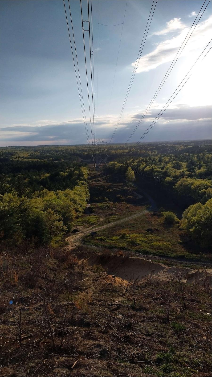
conducted
1600
Area Plan concluded that conservation of a large portion of the land is a community priority.
Our fiscal impact analysis looked at how different land uses could impact the Town’s net revenues (revenues from local taxes - expenses for services). Understanding more broadly the economic value of recreation tourism could be key to demonstrating the anticipated return on investment in conserving the land.
Takeaway: The trail system is a unique aspect of the site, and its potential to generate economic benefits warrants further study.
Our feasibility assessments tested whether conservation could be funded by developing portions of the site and concluded that at the scales contemplated, substantial additional funding is likely required. We have identified a range of potential additional funding sources.
Takeaway: Strategizing how governance and funding could come together to realize community goals warrants further study.
There are many benefits to open space conservation.
Strong Local Economy
Climate Change
Adaptation & Mitigation
Abundant & Diverse Wildlife
Thriving Local Communities
Clean Water & Air
Healthy & Happy People
and next steps.
How is the site being used today for outdoor recreation?
● Examine the physical characteristics of the site and existing trail networks
● Estimate current visitation from activity tracking apps and stakeholder conversations
What can we learn from other recreational areas?
● Understand spending patterns of visitors, especially mountain bikers by reviewing economic impact studies done for areas around the country
● Compare the site to other mountain biking areas in New England, understanding its unique advantages


What would be the economic impact of trail formalization?
● Envision future scenarios for the site and evaluate their feasibility
● Estimate the visitation, spending, and tax revenue gains from infrastructure investments
How might the property be stewarded and improved?
● Examine case studies of ownership and governance at other recreation areas
● Explore models of governance for the site


Parks, preserves, and other open spaces in Plymouth offer opportunities for many outdoor activities, including hiking, boating, birdwatching, fishing, and beach access.
The Pilgrim site is Plymouth’s largest and most popular mountain biking area, although some more limited biking trails are available at other areas.


The Pilgrim 1600 site is densely forested and overlooks Plymouth Bay. It is a 10 minute drive from downtown Plymouth and a 45 minute drive from Boston.
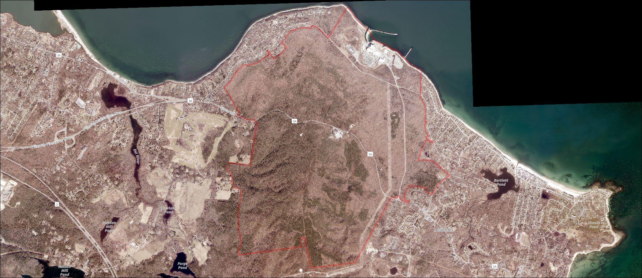
Source: Mass Mapper GIS, ESRI
In the southern portion of the site sits Manomet Hill, better known as Pine Hills. At 394 feet it is the highest point in Plymouth County. Elevated land in close proximity to the ocean is a unique and valuable attribute.


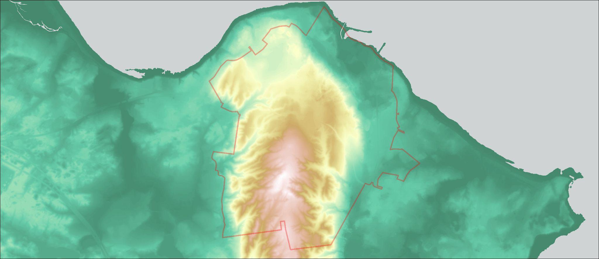
~48 miles of trails are on the Pilgrim 1600 / Holtec Site.
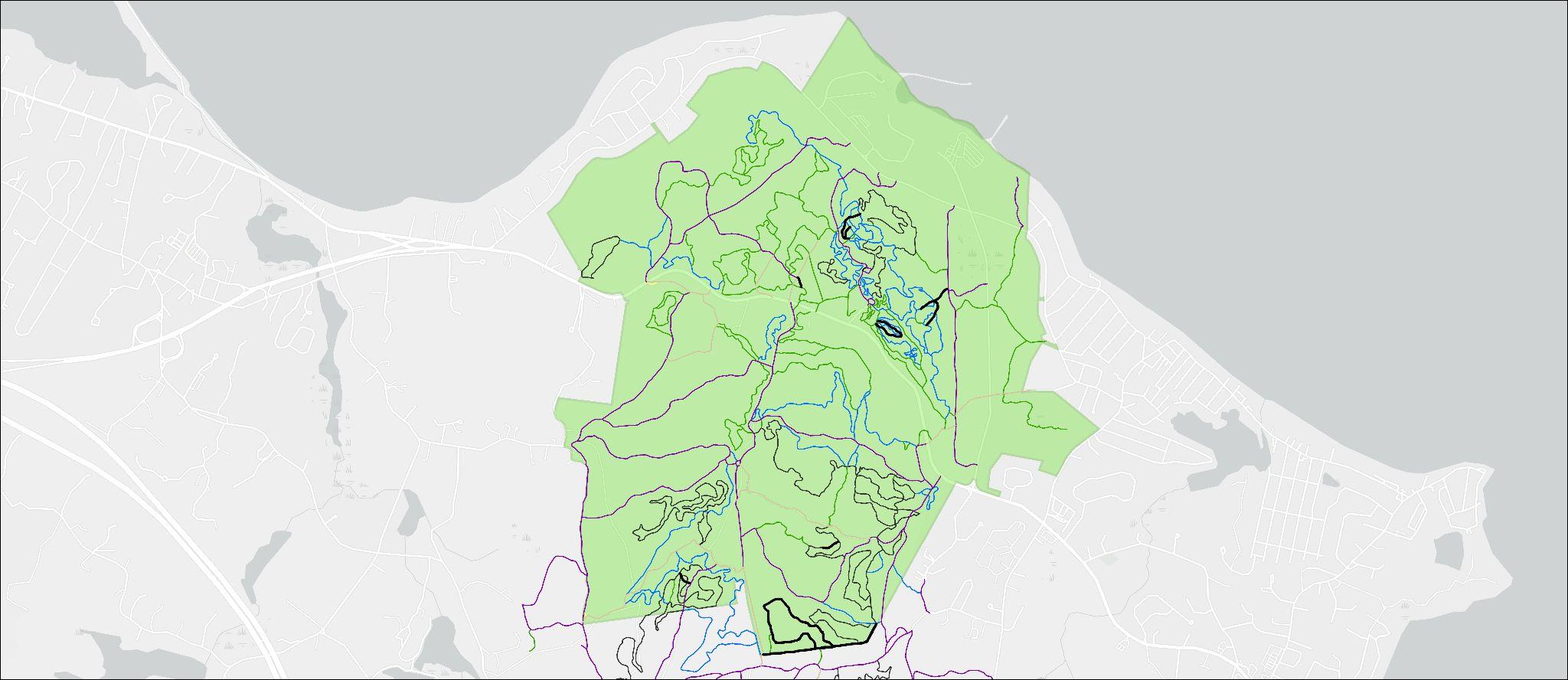
Currently the Pine Hills trails are on private property and access is unsanctioned, but they are regularly used by mountain bikers and hikers.
Mountain biking trails range from easy to expert, though the majority are challenging and attractive to experienced riders.


~25 miles extend further south onto properties owned by the Town Pinehills, and Mass Audubon for a total of 73 miles of connected trails.
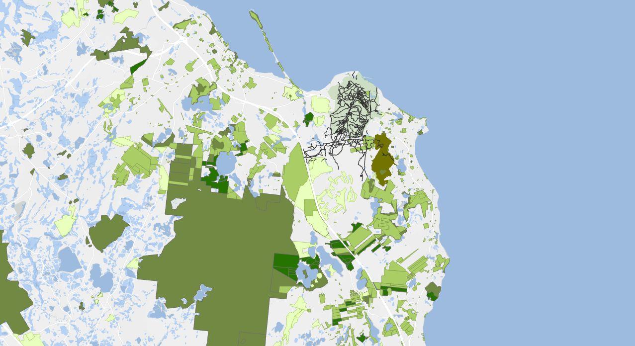
Pine Hills Trails
Pine Hills Trails
Pil rim 1600 Site Owned by Holtec
Privately Owned
Parcels Owned by Town o Plymouth
Town o Plymouth
Tidmarsh Wildli e Sanctuary Owned by Mass Audubon
State o Massachusetts
Privately Owned Openspace
Wildlands Trust MA Audubon
A longer trail loop connecting the Pilgrim site to Plymouth’s other open spaces can be a unique draw for visitors.


Known as the Pine Hills riding area in the mountain biking community, the area is well-known for its technical features and challenging trails.
While the trails are unsanctioned and may not be regularly maintained, name recognition is high, and the area has potential to be an even more attractive mountain biking area.
Trail Statistics
Current Visitation
Source: Landwise Advisors, Trail orks
Landwise integrated several data sources to estimate current outdoor recreation activity at the Pilgrim 1600 site.
3,814 Plymouth residents responded to the Pilgrim 1600 survey in early 2025. The survey measures respondents’ current previous use of the site, as well as their vision for the future of the site.

Strava social platform for exercise and activity tracking. Users record paths of their outdoor activities and post them. Data is aggregated for transportation planning.

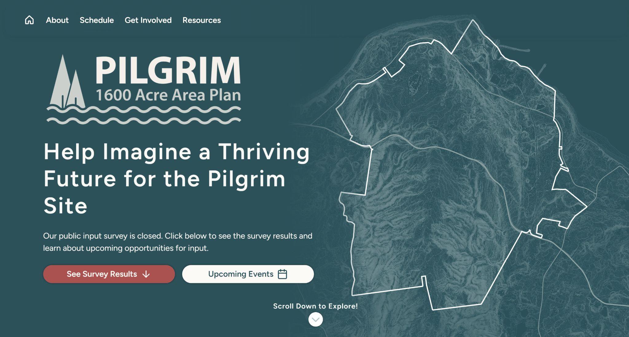


Trailforks crowdsourced trail data and activity tracking geared to mountain biking. Users write trail reviews, provide updates on conditions, and record activities. AllTrails trail info and tracking app for hiking. Users can discover and review hiking trails, and can record their own activities. eBird database of bird observations providing researchers and amateur naturalists with data about bird distribution and abundance. Project of Cornell Lab of Ornithology.
● Pine Hills Area Trail System (PHATS)
Mark Withington, Director
● New England Mountain Biking Association (NEMBA)
Nicole Freeman, Executive Director
Bill Boles, Community Engagement
George Lester, Southeast MA Chapter
● International Mountain Biking Association (IMBA)
Phil Milburn
● Serious Cycles
Seth Lawrence, Owner
Dennis Sullivan, Manager
3,814 respondents in early 2025
● 55% of respondents report having visited the site at least once before
● 546 respondents have hiked or explored by foot at the site
● 253 respondents have mountain biked at the site
The most highly supported use of the site is mountain biking trails, with 63% of respondents in favor.
Other popular potential uses include nature center (59%), recreational harbor (42%), and outdoor museum (40%).
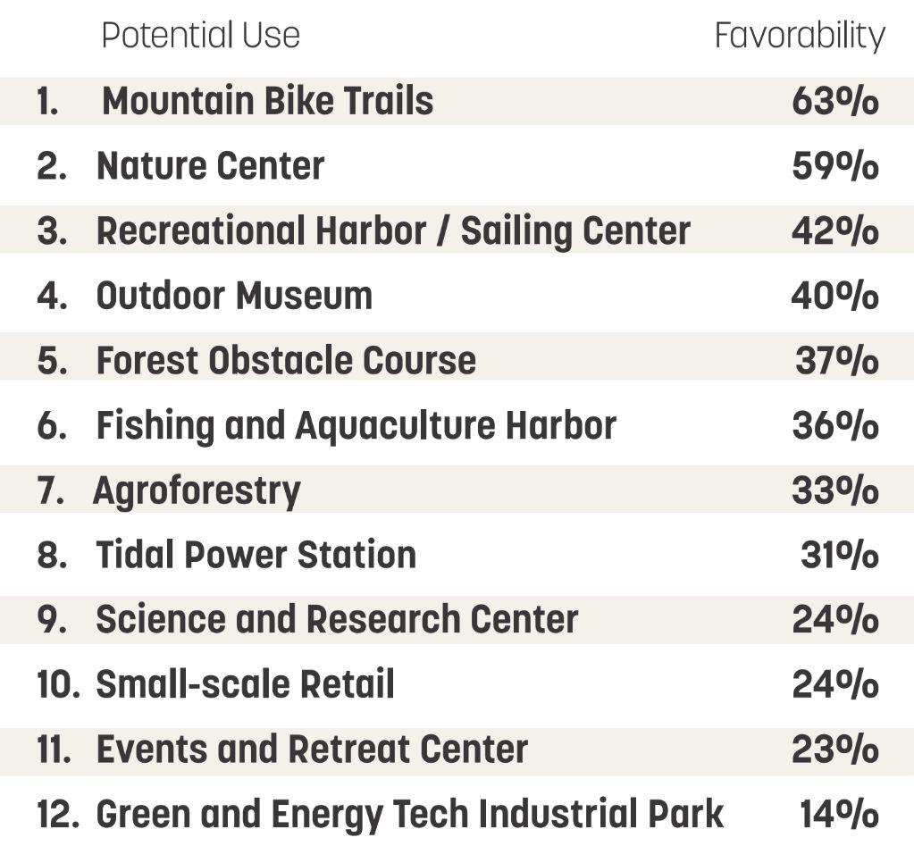
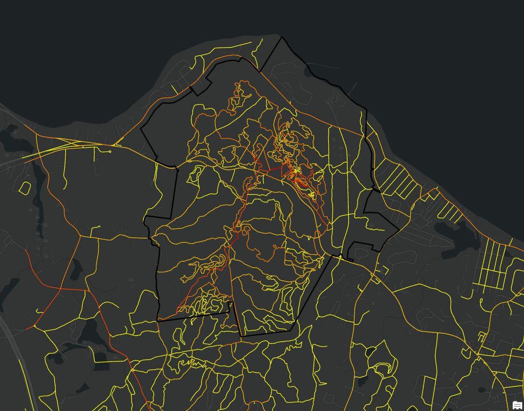
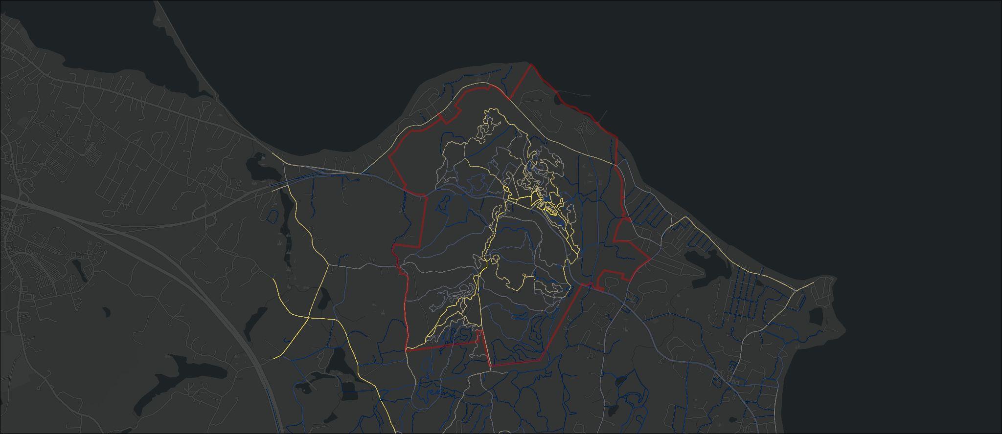
Source: Strava
Strava data shows high mountain biking activity throughout the site, especially in the portion north of State Road nicknamed the “nuclear trails.” There is also high activity along the southern ridge leading to Manomet Hill. The southwest portion of the site may offer opportunities for new trail construction. There also appears to be significant road cycling in the area, particularly along scenic Old Sandwich Rd and Clifford Rd. Future investments at the Pilgrim site could also cater to road cyclists along Rocky Hill Rd and State Rd.
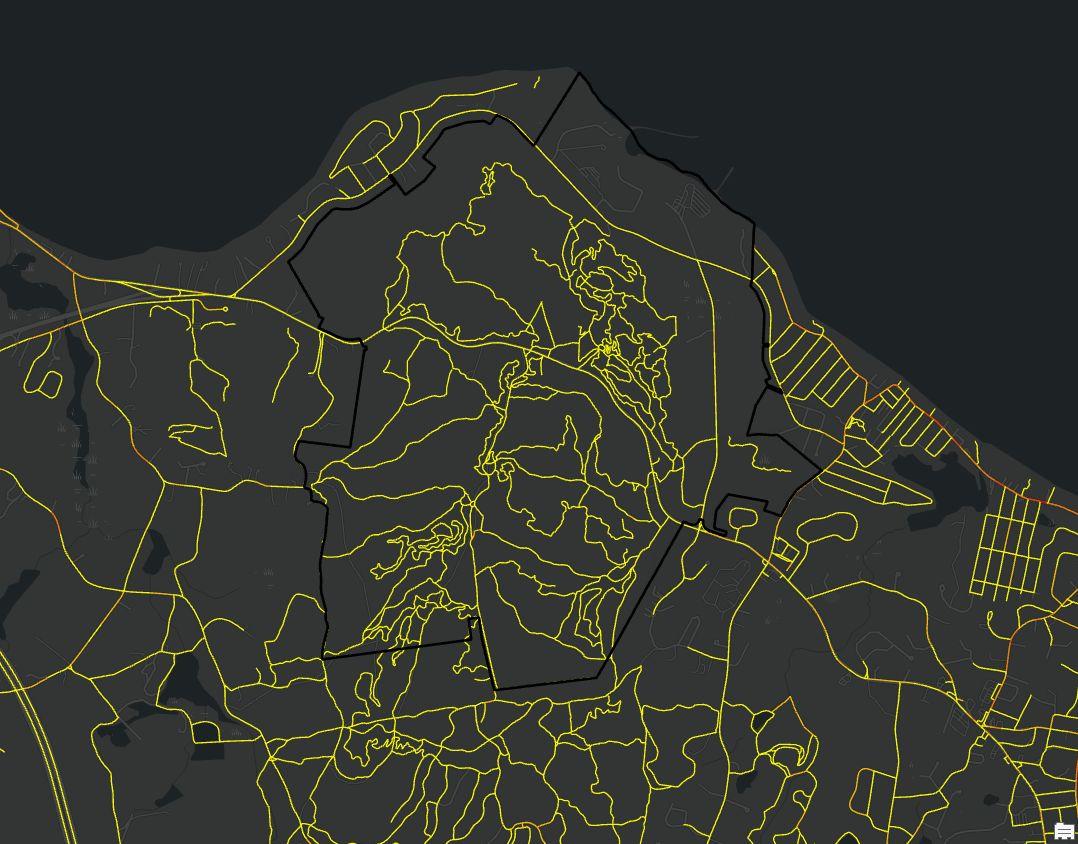
Source: Strava
Compared to cycling, the number of recorded hiking, running, and walking trips is low at the site. These activities are concentrated near beaches away from the site.
The data suggest that either a disproportionately small number of visitors who explore the site on foot record their activities on Strava and/or that mountain biking is by far the site’s dominant use.
Walk/Run/Hike
The Pilgrim site is one of only two mountain biking hotspots in the area. Formalizing it could take pressure off of unauthorized mountain biking elsewhere.
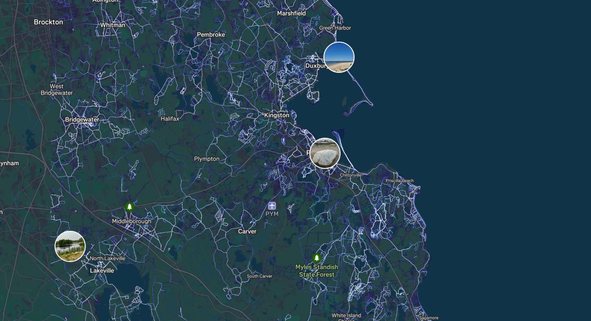
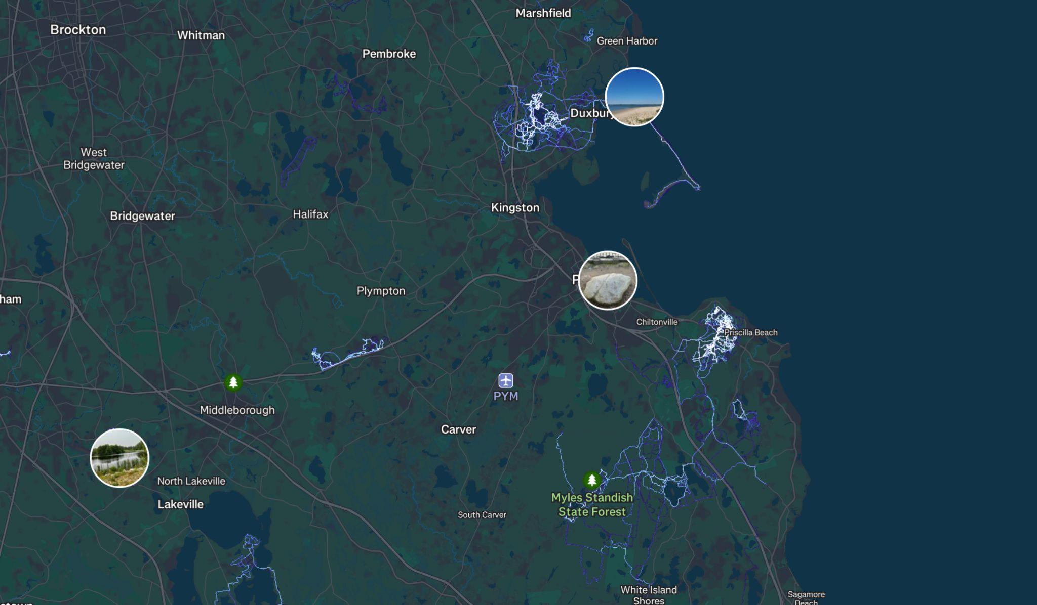
Source: Strava


Source: eBird database of bird observations providing researchers and amateur naturalists with data about bird distribution and abundance. Project of Cornell Lab of Ornithology.
Wildlife Observation, Bird Watching
● Site has not recently been surveyed for habitat.
● Ecotopes of conservation concern may include:
○ Pine barrens (moths, beetles and whippoorwill)
○ Coastal ponds and vernal pools (salamanders, turtles, dragonflies, damselflies)
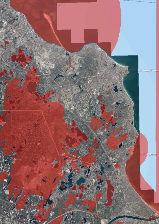
Source: MassMapper, eBird
NHESP Priority Habitats of Rare Species
● Most hikers are local and enter from the south end of the site, near the Pinehills community
● Hiking visitation is high at nearby conservation areas, like Tidmarsh, creating trail network opportunities
● Current hiking trails do not have direct access to the beach
● Equestrian activity exists in the greater Plymouth area (i.e. carriage tours, riding lessons).
● Portions of the site which have steep slopes may not be suitable for riding.
● Site is already one of the top mountain biking areas in the region despite being unsanctioned.
● Unsanctioned status puts a limit on trail quality which is maintained by volunteers. Equipment and professional help would be welcome.
● Marketing of mountain biking alongside traditional attractions can encourage visitors to add recreation to Plymouth trip.
● Regional networking could be a big draw, allowing for longer rides and better access. Trends in e-mountain bikes.
● Mountain biking education focuses on diversifying the sport with skills clinics and beginner rides.
● Sport has a social element with group rides and congregating after.
● Local breweries have partnered with mountain bikers, supporting trail development efforts.
Reflects “visitor contacts” actual visitation on open sites is likely higher.
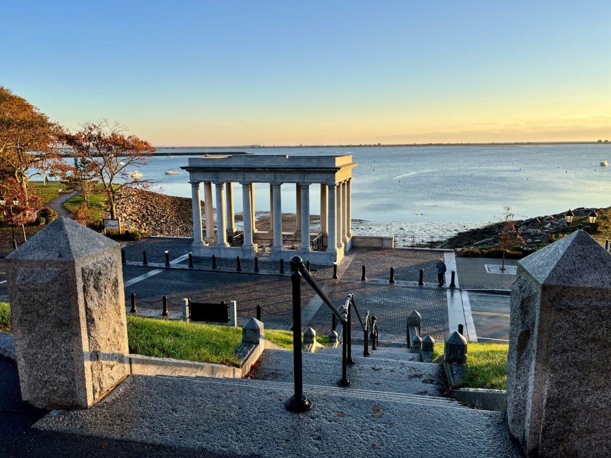
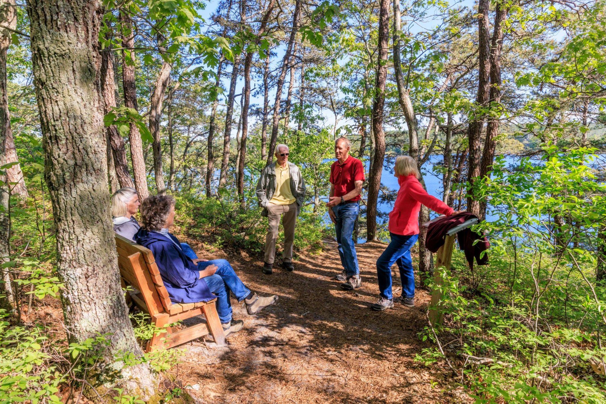
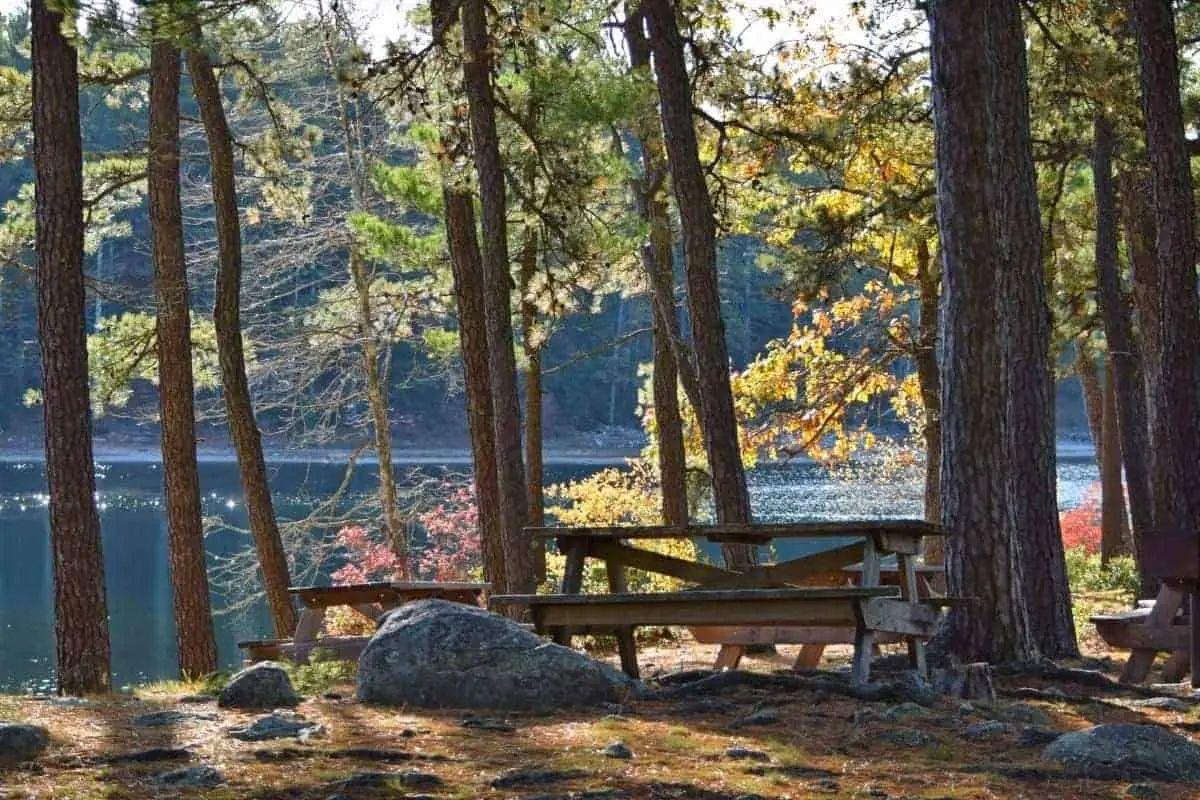
20,000 - 25,000 visitors Myles Standish Monument State Reservation 1,000 visitor contacts
Source: Interviews and ollow up data rom DCR, Mass Audubon, and Wildlands Trust. Visitor contacts at State-owned sites are people on a tour or with direct interaction with a ran er. Open sites like Pil rim Memorial have a lot more people walkin throu h who never interact with DCR. Pil rim Memorial State Park pro ram attendance includes rock talks, trade table, and monument tours. Myles Standish State Forest data rom Reserve America or the 2023 Campin Season multiple-ni ht visitors are counted accordin to daily visits. Wildlands Trust visitor estimates based on a sample o daily counts.
Number of tourists has been stable.Attractions are generally passive or observational, not active or experiential.
Recommendations:
○ Accommodate tourism and recreation-based economic development activity at Holtec site.
○ Enhance tourism and destination visitorship through strategic marketing, new asset development, and partnerships.
○ Expand active tourism venues and diversity of activity with goal of boosting length of stay.
Focus is on "star attractions" rather than natural resources and scenic beauty. The Cape and Islands are more successful at attracting this type of tourism.
Attracts value-oriented visitors – emphasizing cost advantages over Boston & Cape Cod. Slightly lower income, staying shorter time, spending less.Attendance and occupancy data indicates summer decline, winter and fall growth.
More is spent on food and drink, less is spent on merchandise.
While overall tourism expenditures have grown, they have grown less in Plymouth than the State or nearby regions.

● Multi-use trail networks for active transportation and recreation;
● A shift away from golf to more native and less manicured environments;
● The blending of recreation with retail/food and beverage, and entertainment.
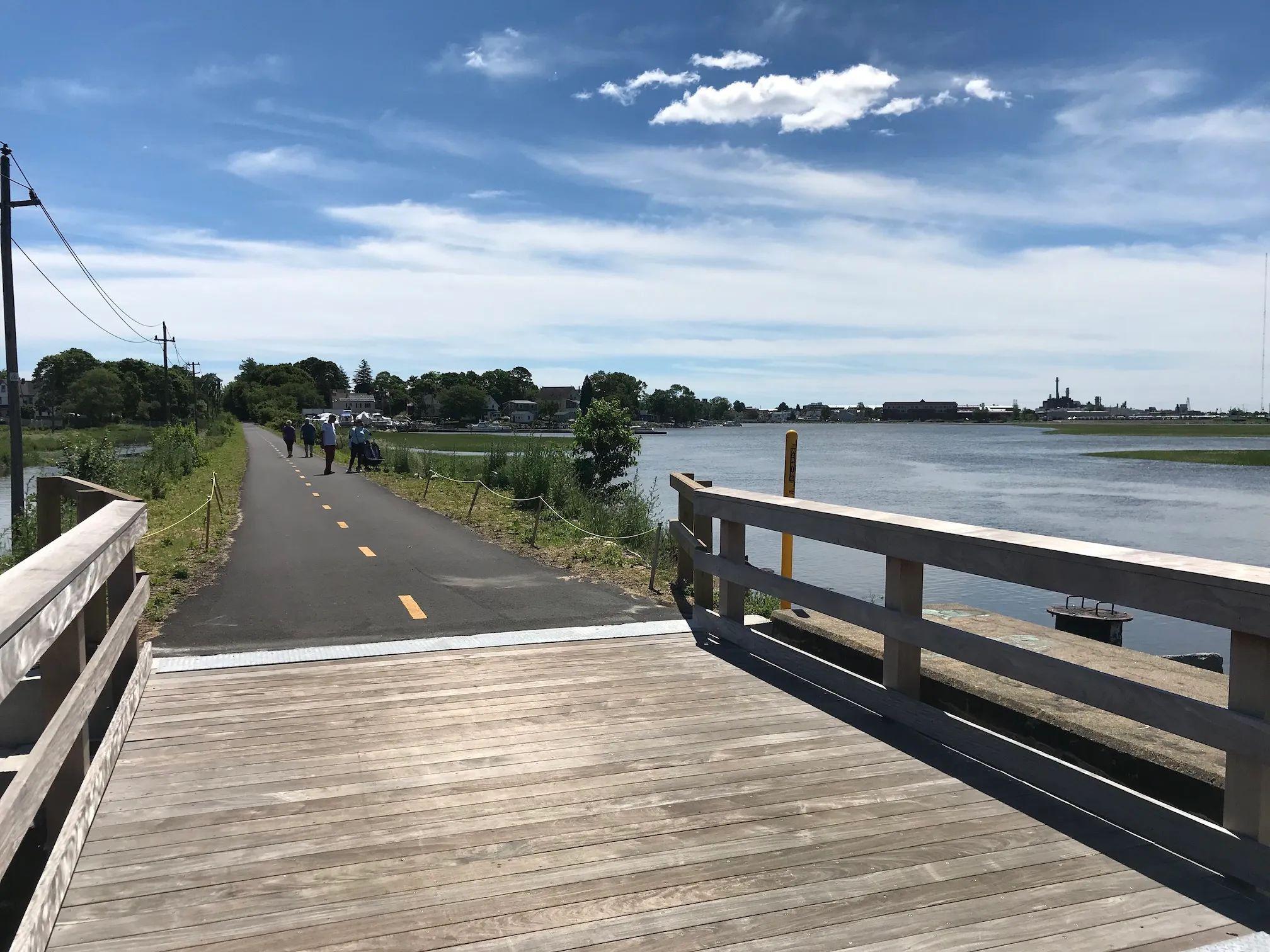
Source: Outdoor Foundation “2024 Outdoor Participation Trends Report”
As of 2023, almost 57% of Americans (age 6 and older) participated in outdoor recreation.
Top five activities by participation rate: 1. Hiking (20%) 2. Fishing (18.2%)
3. Running, Jogging & Trail Running (17.9%)
4. Camping (17.7%)
5. Bicycling - Road & Mountain (17.2%)
Source: Outdoor Foundation “2024 Outdoor Participation Trends Report”
Nationally - Biking maintains a core-audience, foot activities are growing.
Mountain biking and road biking maintain a steady core audience.
Source: Outdoor Foundation “2022 Outdoor Participation Trends Report”


Foot activities like hiking and trail running have seen significant growth in recent years.
8.7 Million Mountain bikers nationwide as of 2021
Share of core mountain bikers, participating 13+ times per year


Average number of trips away from home per year for mountain biking
85% Consider mountain biking to be part of their identity
Mountain biking in the US is primarily affluent, white, male, and middle-aged. However, the sport is gradually diversifying.
Most mountain bikers are highly engaged with the sport, riding more than a dozen times per year and traveling on multi-day trips to seek out the best trails.
Participation in mountain biking grew dramatically during COVID, but has since stabilized and slightly declined.
Mountain biking usage of the Pilgrim 1600 site saw a big increase during the pandemic, but has tapered off some.
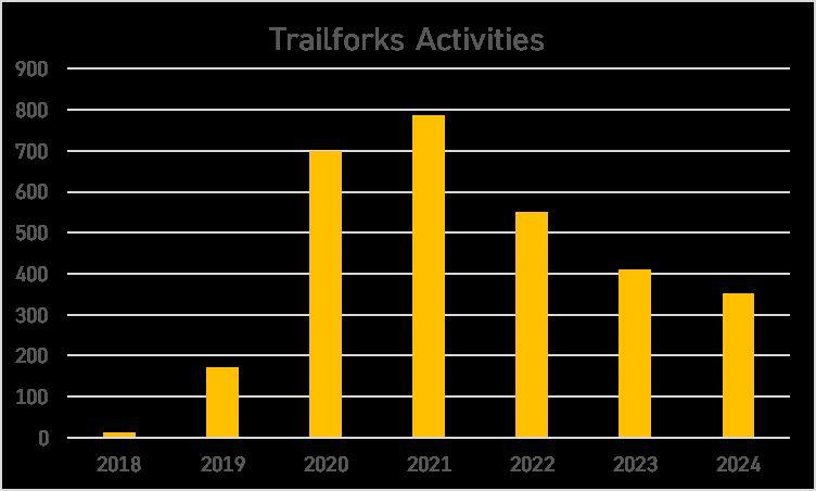
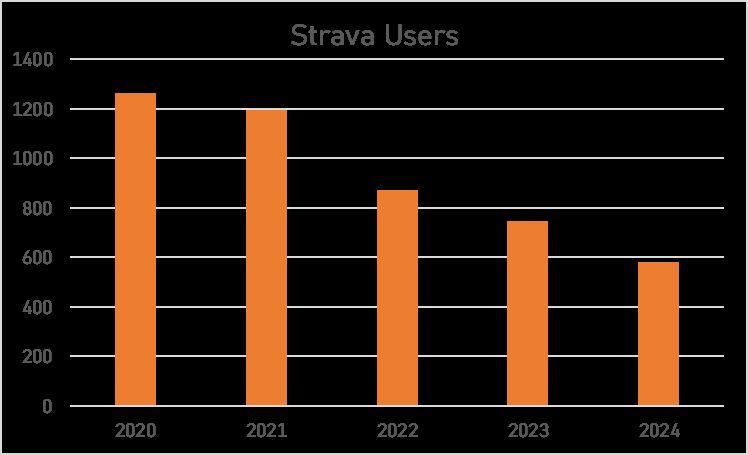
● Mountain bikers traveling further from home to more appealing destinations after the pandemic
● Destruction of mountain biking features and infrastructure at Pine Hills, reported in 2024
● Decline from a pandemic-era spike in mountain biking
Source: Trailforks, Strava
How can we quantify the economic impact of formalizing the trails at Pilgrim 1600?
Direct Economic Impact = Forecasted visitation x Forecasted spend per visit
Data Sources
Landwise examined eight riding areas in New England which may compete with the Pilgrim 1600 site for mountain biking visitation, analyzing how riding area characteristics relate to visitation.
By positioning the Pilgrim 1600 site in the New England mountain biking landscape, we can understand the necessary investments and forecast future visitation after trail formalization.
Landwise reviewed seven economic impact studies of mountain biking at riding areas across the country. The case studies span a wide range of riding area types, from national destination resorts and regional destinations to trails serving the local community.
These studies estimate the spend per mountain biking visit depending on the characteristics of the riding area.
We discount current visitation to zero in an economic impact calculation
● Mountain biking on the site is not sanctioned and may be banned at any time
● Trail formalization could ensure the sustainability of current visitation as well as attract additional visitation
While the site is used for a variety of outdoor activities, we first focus here on expanding mountain biking, a major existing use which the site is uniquely suited.
● Trails for hiking and running may have a larger target audience, but the selection of hiking trails in the Boston area is already vast. In contrast, quality mountain biking trails are much scarcer.
● The site does not necessarily have a unique draw as a hiking destination. Meanwhile, the site’s mountain biking trails already attract visitors from throughout the region due to their unique appeal.
● Mountain bikers are drawn to well-designed, well-maintained trails with interesting built features. This means that investment in mountain biking infrastructure can yield a significant bump in visitation. The appeal of hiking trails, on the other hand, is primarily determined by the inherent quality of the landscape and topography.
● Survey results show that Plymouth residents strongly support mountain biking trails on the site.
Hiking, running, mountain biking, and other outdoor activities should continue to coexist on the site. However, mountain biking likely holds the most economic development potential.
Landwise conducted a literature review of eight economic impact studies of mountain biking at riding areas across the country.
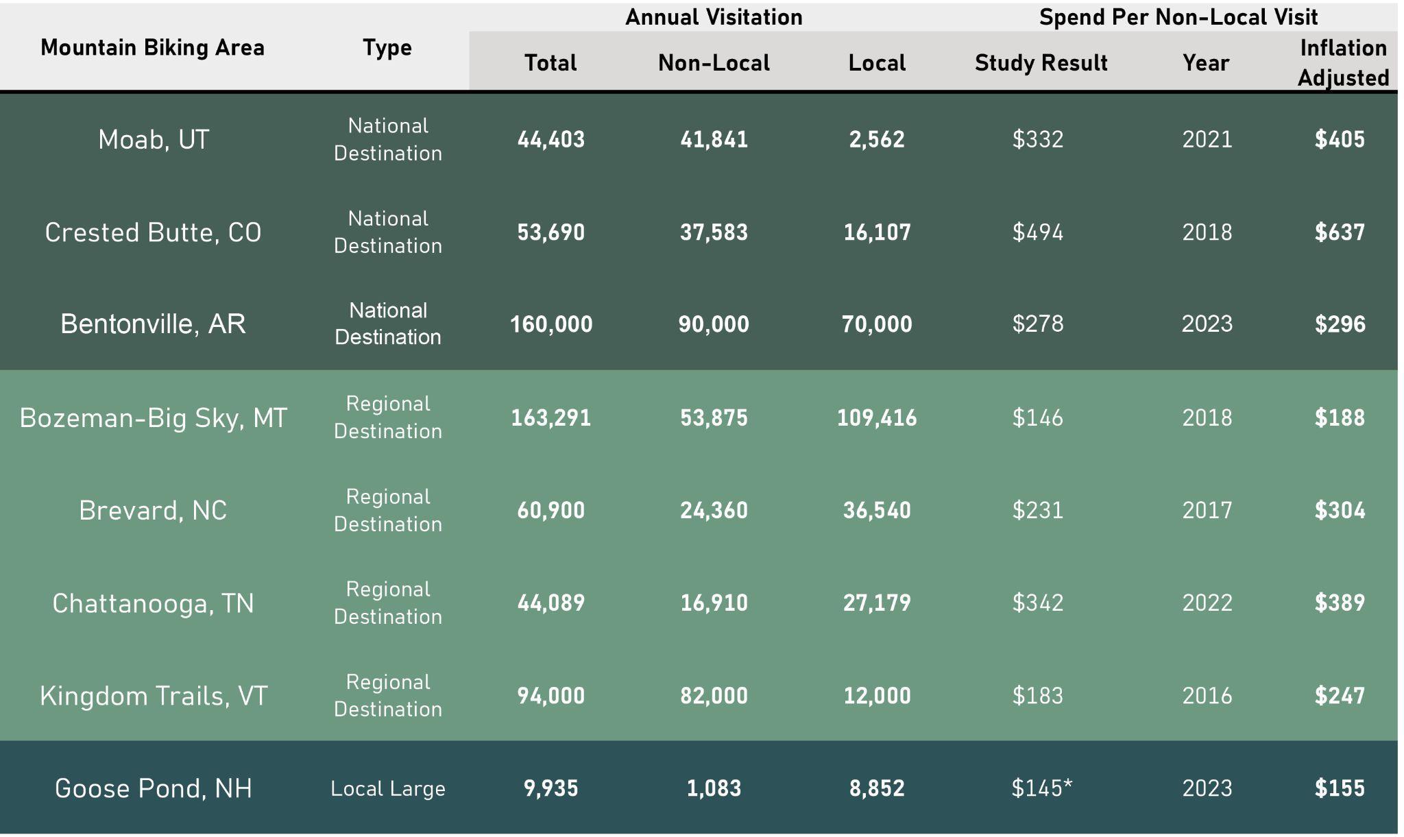
*Figure includes both local and non-local mountain bikers and includes local spending on mountain biking equipment
We estimate that current spend per visit at the Pilgrim site is around $145. This is figure is in line with the inflation adjusted number for Goose Pond in Keene.
It is unlikely that the Pine Hills’ trail network will be extensive enough to attract many multi-day mountain biking trips. However, by leveraging Plymouth’s other attractions such as coastal access and historic sites, visitors might be enticed to spend more, stay longer, and incorporate mountain biking as part of a multi-activity trip.
Landwise identified nine comparable local riding areas which may be in competition with the PIlgrim 1600 site. The two economic impact case studies in New England, Kingdom Trails and Goose Pond, are also included.
Landwise identified nine comparable local riding areas which may be in competition with the PIlgrim 1600 site. The two economic impact case studies in New England, Kingdom Trails and Goose Pond, are also included.
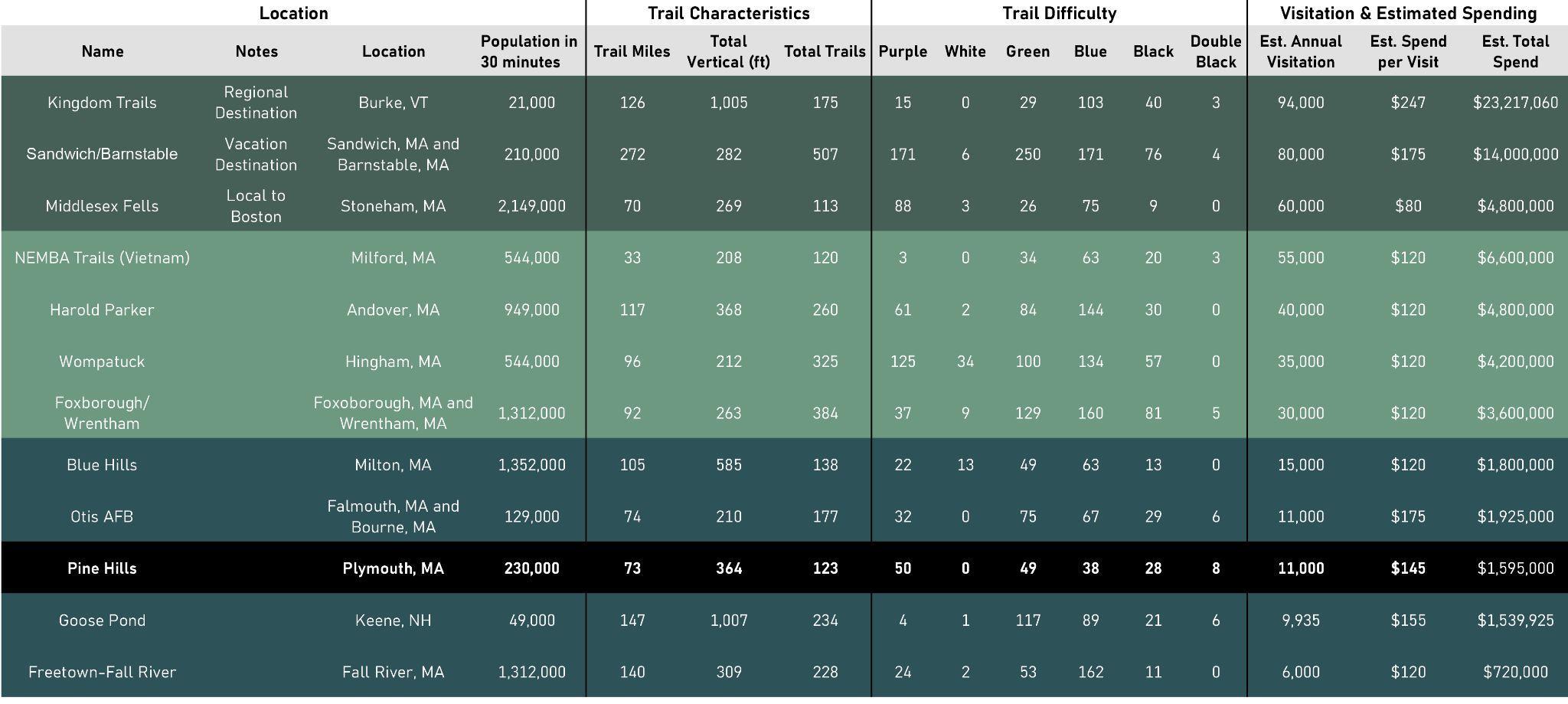
Estimated annual mountain biking visits per thousand local residents (living within a 30 minute drive)
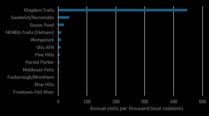
Source: Trail orks, ESRI, Landwise Advisors
Note: Visitation estimates are or mountain bikin only and are scaled up rom Trail orks activity records. Population is rom the 2020 census. 30-minute driveshed calculated usin ESRI network analyst.
Estimated annual mountain biking visits per thousand local residents (living within a 30 minute drive)
[Excluding Kingdom Trails]
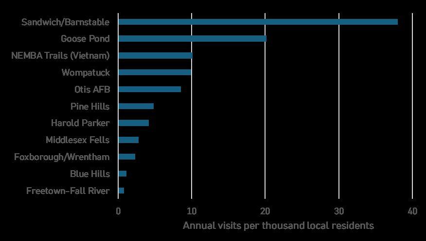
Source: Trail orks, ESRI, Landwise Advisors
Note: Visitation estimates
or
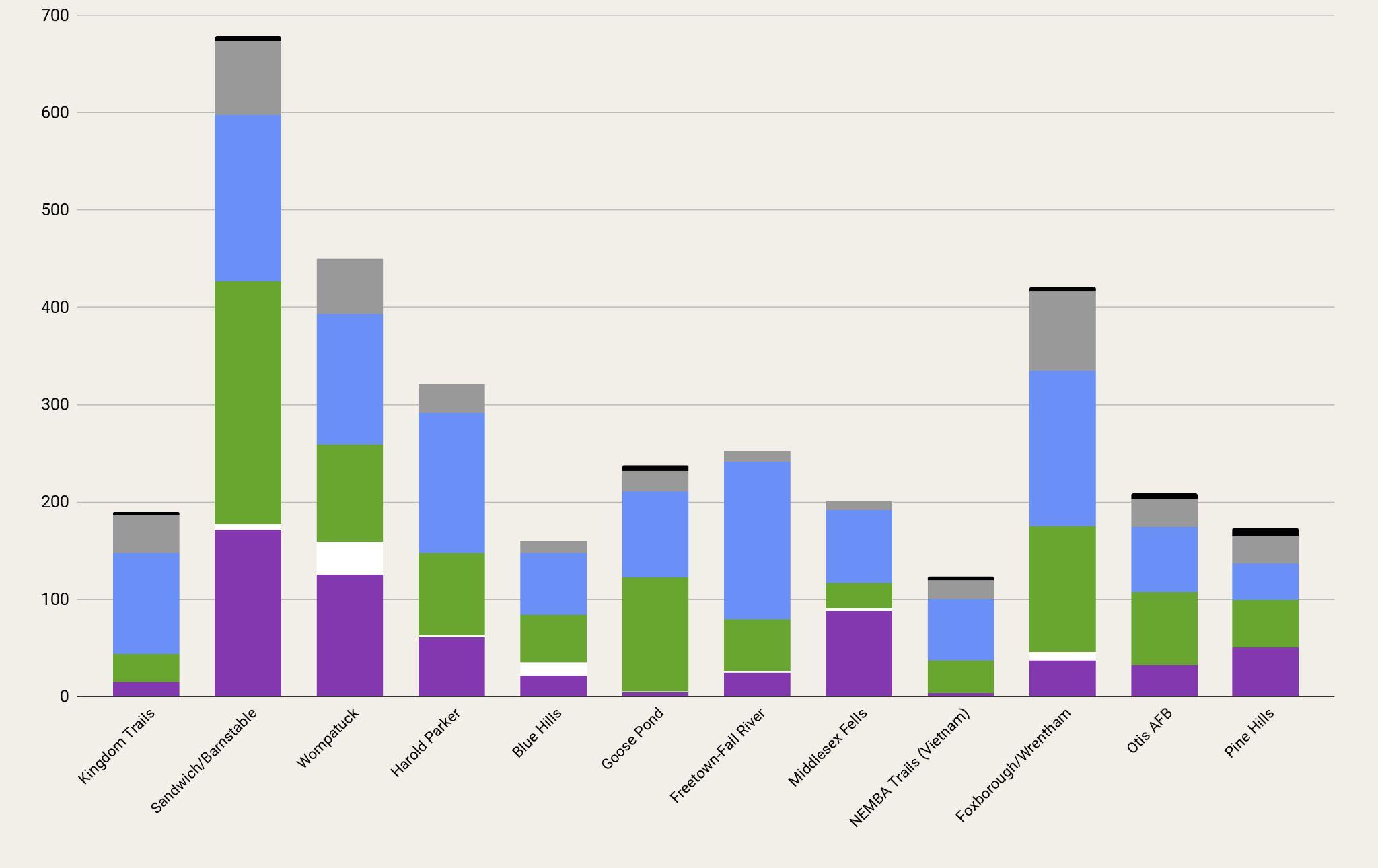
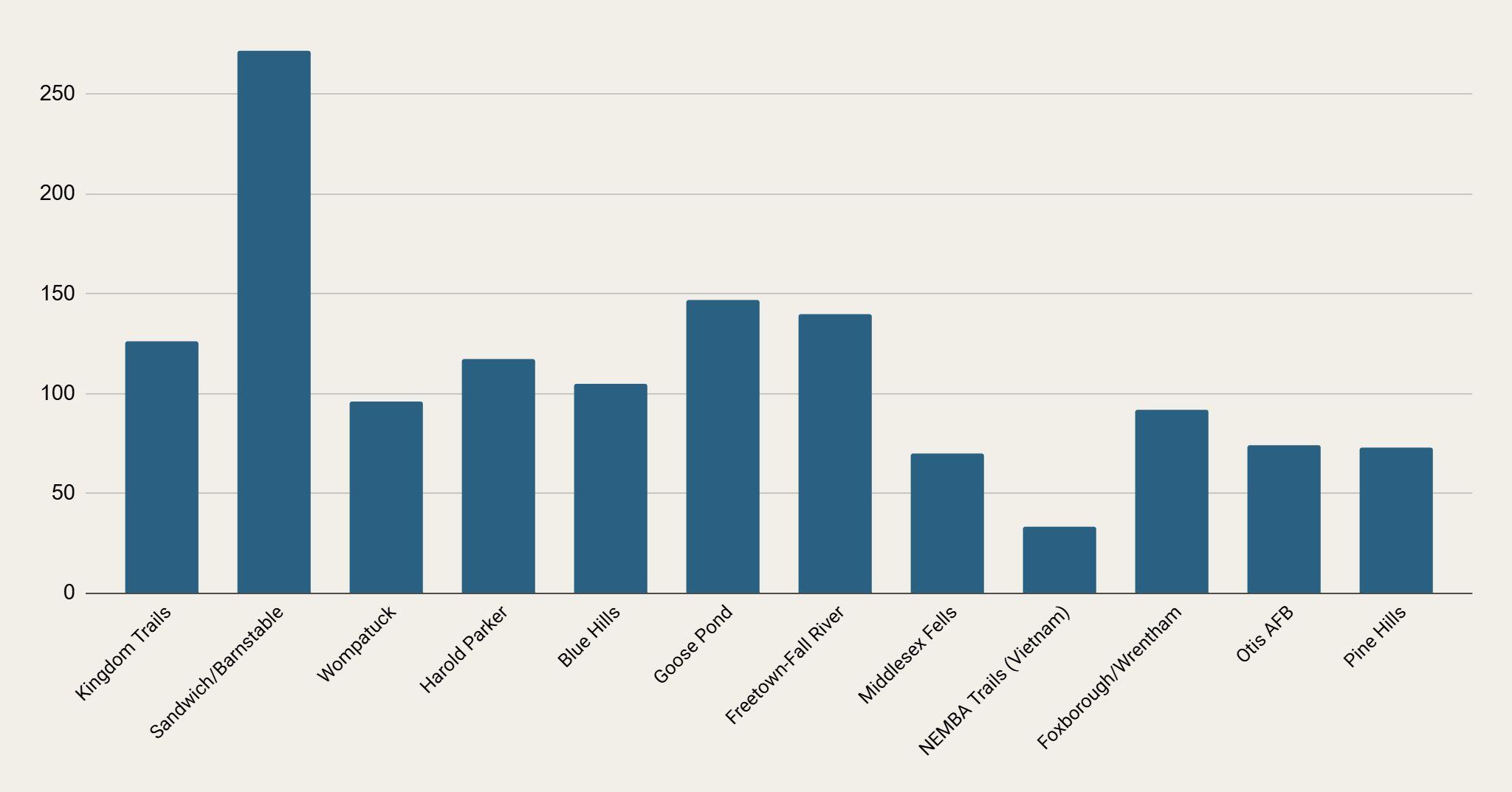
Visitation was estimated by scoring Pine Hills relative to local case studies. Note:
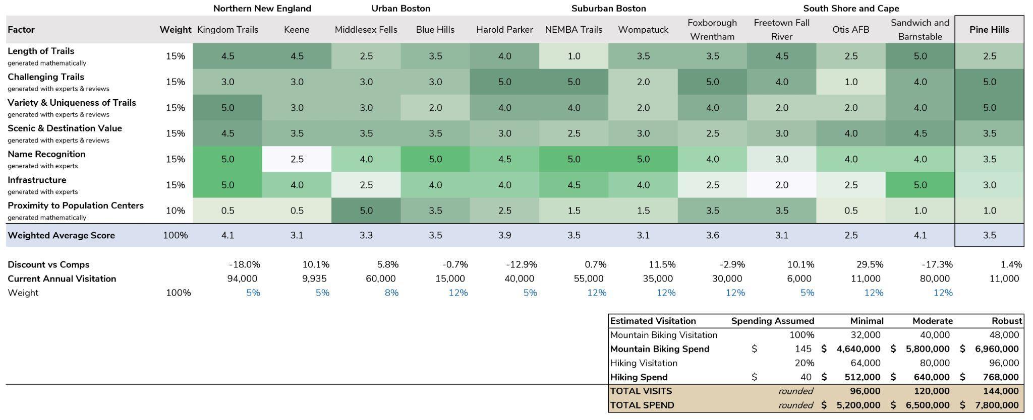
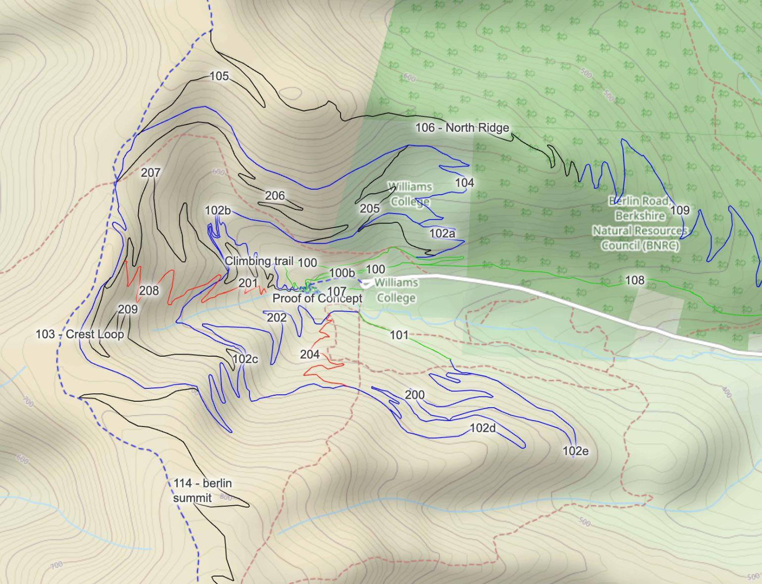
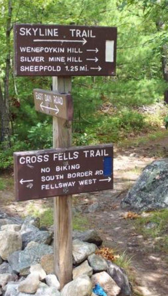
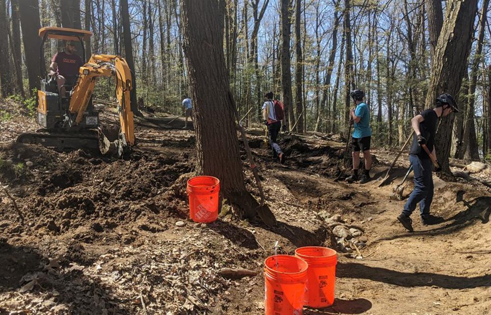
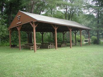
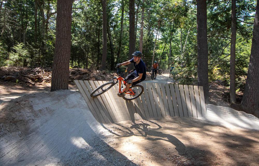
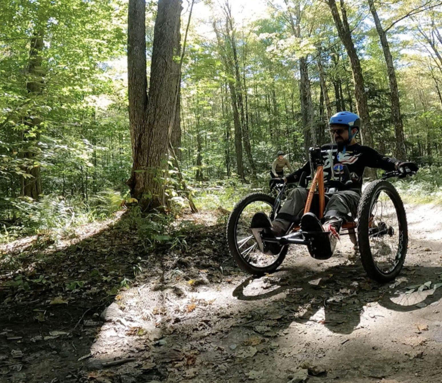

What upgrades might be needed to improve a multi-use trail experience?
The site’s existing informal trail network could be improved and expanded through professional master planning and trail design.
Conflict mitigation through purpose built trails that are clearly named and marked, allowing riders to more easily navigate the area and pick routes of appropriate difficulty.
Currently, trails on site are informally maintained by volunteers. Additional equipment, resources, and professional expertise could add to volunteer efforts.
A variety of well-designed built features can greatly enhance the mountain biking experience. Adding a skills park or pump track can also make riding in the Pine Hills more interesting and fun. An observation tower could provide above tree-line views of Cape Cod bay.
Trails on site are not built with three-wheeled adaptive mountain bikes (aMTB) in mind. Updating trails to be aMTB-friendly will help make the trail network more accessible to those with disabilities.
What upgrades might be needed to improve the overall attractiveness of the site as a destination?
Parking is available on the Town’s Cleft Rock parcel. Visibility, maintenance, and lot capacity can be improved. Additional trail connections to neighboring areas can also help increase access.
State Road bifurcates the site, a future overpass or underpass could help cross wildlife, hikers and bikes.
A visitor center with restrooms, water bottle fill station, bike fix-it station, trail maps and guides, and interpretive exhibits could improve the experience. The visitor center could also house first aid supplies.
Pavilions, grills, and other event facilities are a useful complement to outdoor activities and can help attract groups to the site.
Much of the per-visit spend for mountain bikers and other recreational visitors comes in the form of dining and beverages. Locating a restaurant or brewery with trails can help capture additional visitor spending.
Adding camping and RV sites, as well as offering additional hotel options, could entice out-of-town visitors to stay longer in the Plymouth area.
The following measures of economic impact are anticipated to occur. Values are unique and do not sum.
The following tax benefits are anticipated. Local + State = Fiscal Impact Total
Tax benefits were calculated using the following inputs
Minimal Amenities

Source: Spending percentages methodology based on Kingdom Trails.
Moderate Amenities Robust Amenities
If $12.4 million was invested in restoration, trail formalization and moderate amenities. Payback would be..

Direct spending more than covers annual maintenance costs but local tax revenues do not.
Note: Natural Areas estimates from Sasaki, Amenities estimates from Landwise / discussion with Town.
● Outdoor recreation amenities have potential to attract like-minded companies, labor force, and residents.
Example: Adirondack Mountains, NY - tourists considering permanently moving to the region view access to nearby outdoor recreation and affordability of housing the two most important factors (64% of respondents).
Example: Brevard, NC - mountain biking shifted the region’s economy from manufacturing to tourism, bringing in bicycle shops, restaurants, lodging, and even a Colorado-based brewery. Outdoor recreation has played a significant role in the growth of Brevard, supporting 366 full-time jobs and $9 million in job income.
● Property owners with easy access to the trail system could see increases in property values.
Example: Razorback Greenway, Bentonville, AR, houses within 0.25 miles of the Razorback Greenway, a walking/biking path that connects Bentonville to nearby cities, sell for an average of $14,800 more than those two miles from the trail.
Example: Sakonnet Greenway Trail, Portsmouth, RI offers outdoor recreation like walking and horseback riding. The median sale price of houses in Portsmouth is $700,000; adjacent to the Sakonnet Greenway Trail itself, the median sale price is $827,500, an 18% increase.
● “Growing pains” and negative impacts that come with additional visitation may need management and mitigation.
Example: Kingdom Trail Association (KTA) spread across properties of private landowners who allow access, has faced challenges and tension points around traffic, congestion and pedestrian safety of residents and visitors alike. Property owners at critical junctions have informed KTA of intentions to discontinue mountain biking access, and the strain of visitors on rural infrastructure has necessitated KTA to seek additional funding to amend and solve issues.
Harvesting expertise, building a network of supporters.
● Town of Plymouth
○ Lynne Barrett, Director of Finance
○ Anne Slusser, Recreation Director
○ David Gould, Director Energy & Environment
○ Bill Coyle, Public Works: Parks & Forestry
● State of Massachusetts
○ Shaun Provencher, Land Protection Planner, Department of Conservation & Recreation (DCR)
○ Christy Edwards, Director of Land Protection & Capital Planning, MA Department of Fish and Game (DFG)
○ Paul Jahnige, Director, MA Office of Outdoor Recreation (MOOR)
● See Plymouth - Lea Filson, President/CEO
● Wildlands Trust - Karen Gray, President and Executive Director
● Massachusetts Audubon Society - David Santomenna, Senior Director of Land Conservation
● Trustees of Reservations - Jennifer Dubois, Vice President, Land Conservation Trustees of Reservations
● Trust for Public Land - Jody Valenta, MA Program Director
Other Potentials
● Nature Conservancy - requested interview
Likely to include multiple steps and partners.
Acquire
Owners with capital and mission aligned with site’s conservation and recreation potentials.
Professionalize the system.
Steward & Maintain
Steward and maintain the system long-term.
Examples Town Non-Profit Partners
Examples IMBA Trail Solutions Master Plan
Examples Additional Town Staff Non-Profit Partners
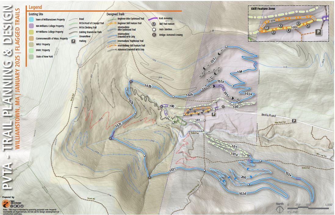
Plan to open 7 miles of trail by end of the year
Partnered with Backslope trails, builders of the Lake Placid World Cup XC course.
For formal permission to build and manage trails on their 800 Acre parcel at Berlin Mountain.
For formal permission to build and manage trails on their 800 Acre parcel at Berlin Mountain.
To design 10-20-mile trail system for mountain biking, with provisions for pedestrians, horsemen, and adaptive equipment users
Purple Valley NEMBA Chapter
Multiple approaches could be undertaken
Long-term new permitting and development processes will occur which could yield community benefits.
Near-term the Town has right of first refusal on a purchase offer (270-days through 2031)
Permitting & Negotiations around Future Energy Use
State Permitting for Energy Use
Town PILOT Negotiations
Partial Development
Public Funding
Potential Partnerships
PRO Minimize capital outlay $
CON Longer time horizon
Zoning Requirements
Transfer of Development Rights
Exactions
Town Financing
Federal or State Grants
Wildlands Trust
MA Audubon Society
Trustees of Reservations
PRO Not reliant on future energy use or market factors.
CON Capital outlay required $$$
Making a deal in the permitting of new energy facilities could allow the Town to achieve goals while limiting public spending. Exact timing depends on Holtec, timeline could be further out than desired.
● Likely to require additional permits at various levels of government including the Energy Facilities Siting Board (EFSB) within the Executive Office of Energy and Environmental Affairs (EEA).
● 2024 Climate Act contains comprehensive siting and permitting reforms for clean energy infrastructure and charges the EFSB with issuing a single consolidated permit, accelerating the deployment of clean energy infrastructure, ensuring communities are meaningfully engaged, and requiring that benefits of the clean energy transition are shared equitably in the Commonwealth.
● EFSB is required to promulgate regulations and guidance to implement these reforms by March 1, 2026. Recommendations report (2024) does not include nuclear, though several public comments say it should.
● Current PILOT agreement with Holtec includes annually declining payment schedule through fiscal year 2031.
● Approaching 2031, the future tax status of the site will need to be determined.
● A new PILOT agreement or amendment is likely to be negotiated depending on the status of decommissioning and future energy uses on the site.
● Gifting land in lieu of tax payments, or a corresponding purchase and sale agreement which corresponds with the payment schedule - could be something that would be mutually beneficial to Holtec and the Town in achieving community priorities.
● Legal
○ Opportunity at hand requires specialized expertise outside day-to-day municipal capacity.
○ Town should consult with an attorney well-versed on the MA EFSB process and anticipated reforms, as well as large scale land conservation that can negotiate on the Town’s behalf.
● Appraisal
○ An updated appraisal which considers findings of the market and site analysis aspects of the Pilgrim 1600 Master Plan should also be undertaken.
At the scale contemplated, feasibility tests illustrated that development of portions of the site will not on their own pay for conservation of the larger whole. Development regulations could be part of the toolkit.
● Pilgrim 1600 Master Plan looked at feasibility of supporting conservation acquisition and restoration through development.
● Given scale of development and densities contemplated, infrastructure needs of the site, and high asking price assumed - a significant shortfall remains.
● Zoning requirements like maximum lot coverage, setbacks, requirements for usable open space, provision of tree canopy and clustering of development are all ways in which buffer areas could be preserved around areas of the site considered for development.
● TDR program designed to protect sensitive resources by transferring development rights between sending and receiving sites.
● Sending sites must be within Rural Residential (RR) (which much of the Pilgrim 1600 site is).
● Receiving sites must be located in the Rural Residential (RR) zone, the R-40 zone, or the Rural Residential Receiving Area (RRRA).
● Program is often utilized by large owners who move rights between parcels in common portfolio.
● Exactions like donation of conservation acreage might be negotiated during the development approval process.
● The goal would be to offset the impacts of growth on the Town’s natural environment and recreation assets.
A range of public funding sources could be combined to acquire the property or portions of the property that could not be acquired through other means.
Town - Nuclear Mitigation Stabilization Fund
● Approximately $10M that can be utilized to bring economic value to the Town.
Town - CPA
● Community Preservation Act (CPA) Surcharge of 1.5% can be used to acquire and protect open space, preserve historic buildings and landscapes, and create and maintain affordable housing.
Town - Municipal Bonds
● Long-term debt. Borrowing must be approved by voters and is paid off through tax revenue.
● Towns can use funds acquired from bonds for conservation of open space, often partnering with local non-profit entities.
Federal or State Grant Programs
● Tied to specific conservation and recreation values and outcomes.
● Priorities are constantly changing and federal funding programs are in flux.
● When time to make a deal funding programs and opportunities will be different than they are today.
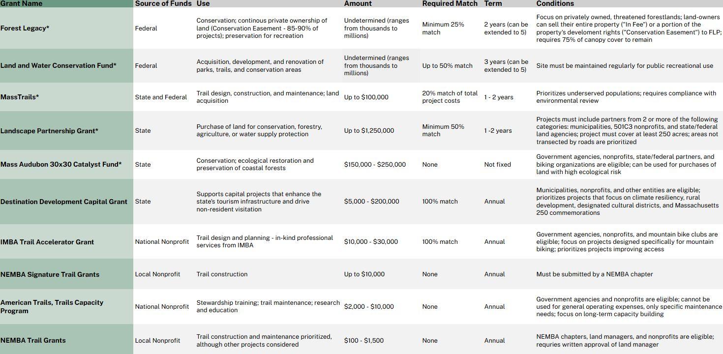
programs that can be used for acquisition
Non-profit partners can help to fundraise, acquire grants, and ensure long-term protection of a property through a conservation restriction. Are not likely to assume ownership.
● Works throughout Southeastern Massachusetts to permanently protect native habitats, farmland, and lands of high ecologic and scenic value that serve to keep our communities healthy and our residents connected to the natural world.
● Owns 2,500 acres in Town of Plymouth including Shifting Lots Preserve, Halfway Pond.
● Has had conversations with Holtec about conservation of property in past and worked successfully with Town of Plymouth.
● Capacity to organize funding from multiple sources to place conservation restriction on property with deed going to Town.
● Owns several properties in Plymouth which are priority habitats including the Tidmarsh Wildlife Sanctuary which is a half-mile from but not contiguous with the site.
● Mission more closely aligns with passive recreation than active, but they share the goal of seeing the property preserved and could potentially be a co-holder of a conservation restriction (CR) or holder on a portion of the property.
● Active in MA protecting and sharing places people love. Undertaking strategic plan, continually evaluating a variety of opportunities.
● Experience with active recreation including an active project with NEMBA in western MA.
● Thought leader / research (i.e. Economic Benefits of Mountain Biking). Focus in MA is policy and capacity building. No land protection staff capacity in MA to support acquisition. Fundraise only when TPL is involved in the land transfer.
The Town would seek to partner with a property manager with a proven track record.
Management Mitigating Risks
● The Town of Plymouth has used third-party managers to manage Town-owned properties through lease agreements. Golf course is an example of this.
Details for the Conservation Restriction
● Agreements with 501c3 organizations (i.e. NEMBA for trail maintenance) brings some liability and risk concerns as leadership changes can impact the longevity of organizations.
● A conservation easement or conservation restriction (CR) will be a legal agreement between the landowner and land trust designed to permanently protect the conservation values of a property.
● This agreement will define allowed uses and often time built features are not allowedspecifics relating to mountain biking features would need to be determined.
● CR stewardship on an extensive trail system can be challenging.
Many parties could contribute to the acquisition of conservation lands, distributing the cost between public, private and non-profit partners.
Source: Sasaki
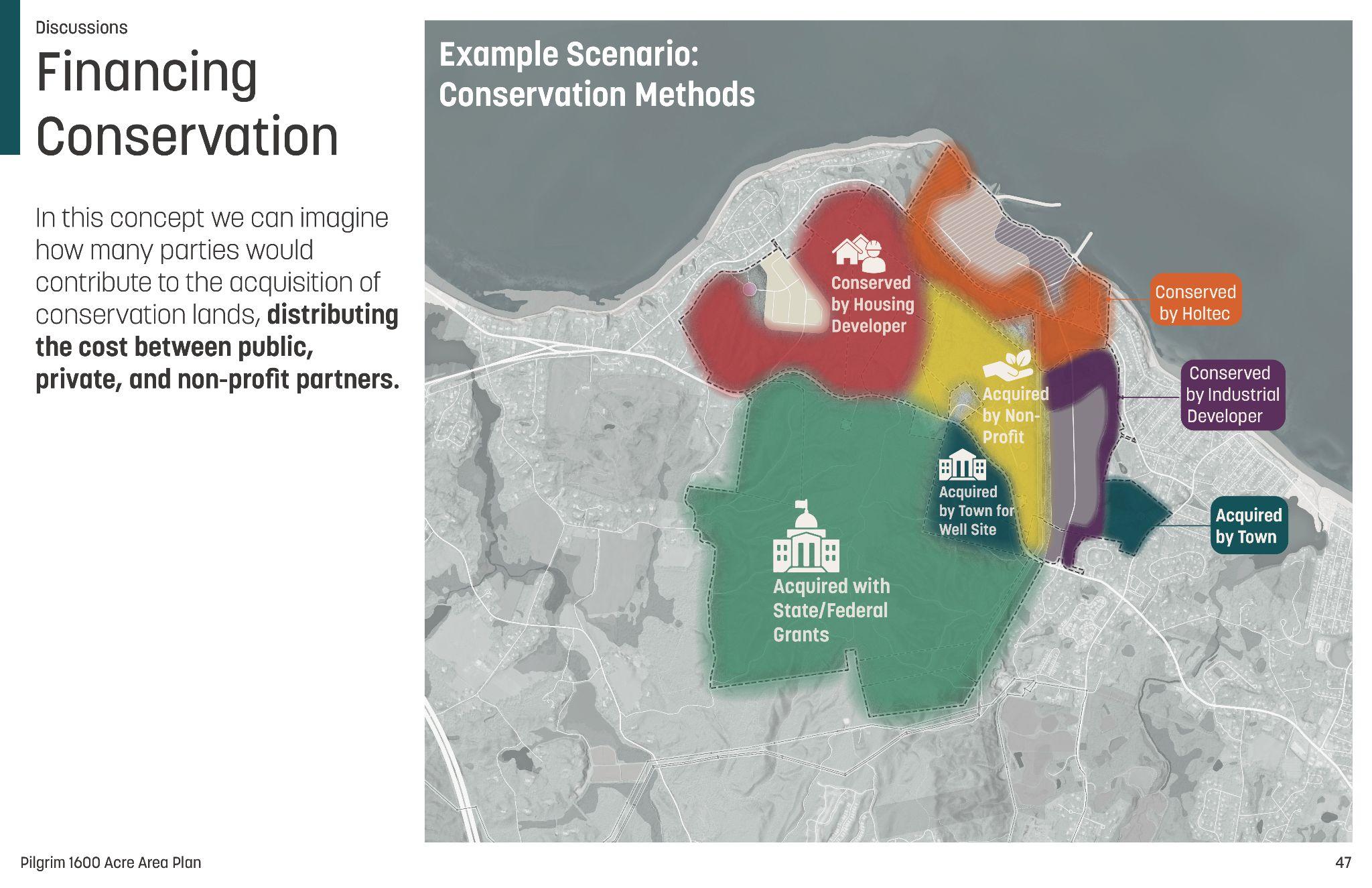
Revenue generating activities could help support maintenance and staffing.
Source: Sasaki
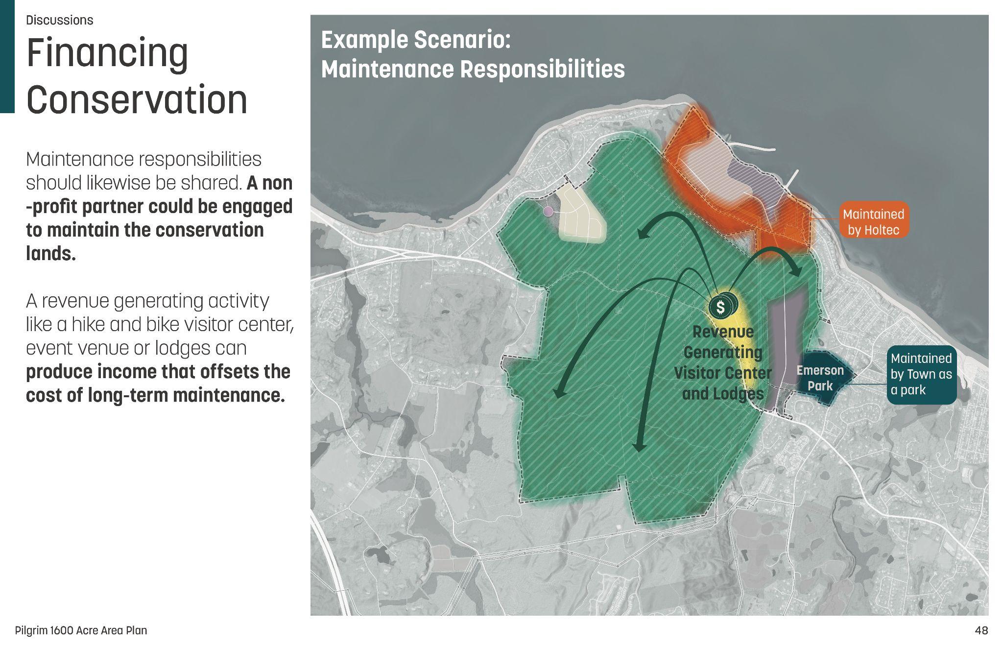
1 BBC Research & Consulting. (2016). Economic and health benefits of bicycling and walking: State of Colorado. Colorado Office of Economic Development and International Trade.
2 Buning, R. J., Cole, Z. D., & Lamont, M. (2016). A case study of the US mountain bike tourism market. Tourism Management, 57, 120–129.
3 Casey, T., Castaneda, C., & Perry, N. (2018). Grand Valley Public Trail Systems Socio-Economic Study: Mesa County, Colorado. Colorado Mesa University, Natural Resource Center, Dept of Social and Behavioral Science.
4 Clinton, J. (2025). Economic benefits of mountain biking. Trust for Public Land.
5 International Mountain Bicycling Association - Trail Solutions Program. (2018). Grand Valley Strategic Trails Plan. Prepared for Grand Junction Economic Partnership and Powderhorn Resort.
6 Outdoor Foundation & Outdoor Industry Association (2024). Outdoor Participation Trends Report.
7 Pine Hills Area Trail System. (2025). PHATS Economic Model.
8 Multiple Town of Plymouth & State of Massachusetts Planning Documents including Open Space & Rec Plans
Landwise conducted a literature review of eight economic impact studies of mountain biking at riding areas across the country.
National Destination Resort
Crested Butte is a well-known all-season resort town offering mountain biking in summer and snowsports in winter.

Most mountain bikers in Crested Butte come from outside the local area. Visiting mountain bikers spend $493.77 per visit on average as of 2018, largely on accommodation and restaurant dining, creating $10.8M per year in economic activity.


Local Riding Area, Large
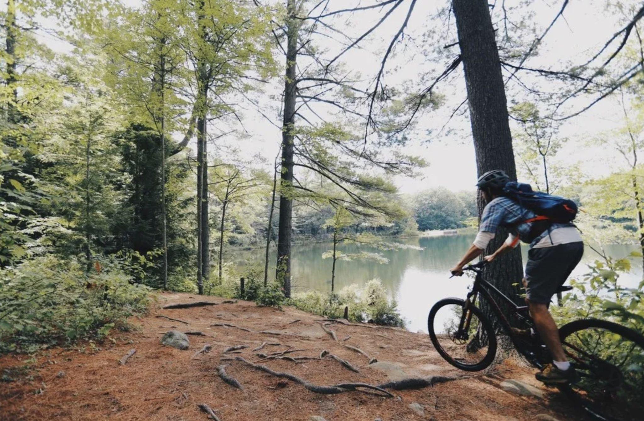
Goose Pond is the main mountain biking area in Keene, New Hampshire. Most bikers at Goose Pond are local residents.
On average, mountain bikers at Goose Pond spend $145 per visit including equipment purchases ($106 per visit without equipment purchases). Mountain biking contributes $1-1.4M to the local economy in Keene.
City-owned park
Miles
*Includes local spendin on mountain bikin equipment
Regional Destination
Kingdom Trails in East Burke, Vermont is often considered the top mountain biking destination in New England, with more than 1,000 ft of vertical and an array of challenging trails.

Most mountain bikers at Kingdom Trails visit from outside the immediate local area, spending $182.98 per visit as of 2016. 78% present of visitors stay overnight, while 22% visit as a day trip.
Trail Statistics
Miles
Ownership
Privately owned by Kingdom Trails / VT Land Trust and other landowners Other Activities
Visitation
Source: Camoin Associates, Trail orks, Kin dom Trails
Moab is nationally known as a world-class destination for mountain biking with an impressive array of challenging trails.
National Destination Resort

Trail Statistics
Most mountain bikers in Moab visit from outside the local area. The average mountain biker spent an estimated $331.56 per visit. Mountain biking generates an estimated $12.3M in economic activity in the Moab area. Ownership
National Forest land
Vertical
Source: Outdoor Alliance, Trail orks, Discover Moab
The Bozeman-Big Sky area has an extensive network of mountain biking trails in the Custer-Gallatin National Forest.
Visitation numbers are impressive: more than 160,000 mountain bikers per year as of 2018. Most visitors are local residents, but many visit from outside the area as well. The average visiting mountain biker spends $146.01 per visit.

Miles
Source: Outdoor Alliance, Trail orks, Visit Bozeman
Brevard and and Pisgah National Forest draw mountain bikers from across Western North Carolina and the Southeast.

The average visiting mountain biker from outside Western NC spends $231.21 per visit as of 2017 in the Brevard and Asheville area. Mountain biking generates $12.4M in economic activity.
Primarily National Forest land
The Chattanooga area features more than 200 miles of mountain biking trails in close proximity to the city.

Most mountain bikers are local, but some 16,000 travel to visit. The average visiting mountain biker spends $342.33 per visit, with an average visit length of 3.8 nights. Mountain biking contributes $6.9M to the local economy each year.
Vertical
Mix of state, city, county, nonprofit, and private land
Source: SORBA Chattanoo a, Trail orks, Tennessee River Gor e Trust
Widely considered the “Mountain Biking Capital of the World,” Bentonville offers a unique blend of trails that seamlessly connect the city to Northwest Arkansas.


Offering a diverse range of trail difficulty, Bentonville’s visitation numbers are impressive: around 160,000 mountain bikers per year with 55% of visitation coming from riders outside of the region. On average, visiting mountain bikers spend $277.78 per visit.
Vertical
Landwise identified nine comparable local riding areas which may be in competition with the PIlgrim 1600 site. The two economic impact case studies in New England, Kingdom Trails and Goose Pond, are also included.
Foxborough/Wrentham
Milford, MA

Jointly owned by NEMBA and town conservation commissions, the “Vietnam” Trails are purpose-built for mountain biking. Trails are well-designed, featuring challenging natural and artificial technical features as well as more beginner-friendly routes.
Although its trail network and topography are modest compared to other mountain biking areas, mountain bikers flock to Vietnam Trails in large numbers due to its high quality trails.
Sandwich, MA and Barnstable, MA
At the western end of Cape Cod, lies a series of interconnected mountain biking areas: West Barnstable Conservation Area, Maple Swamp Conservation Area, Oak Ridge, and Discovery Hill.
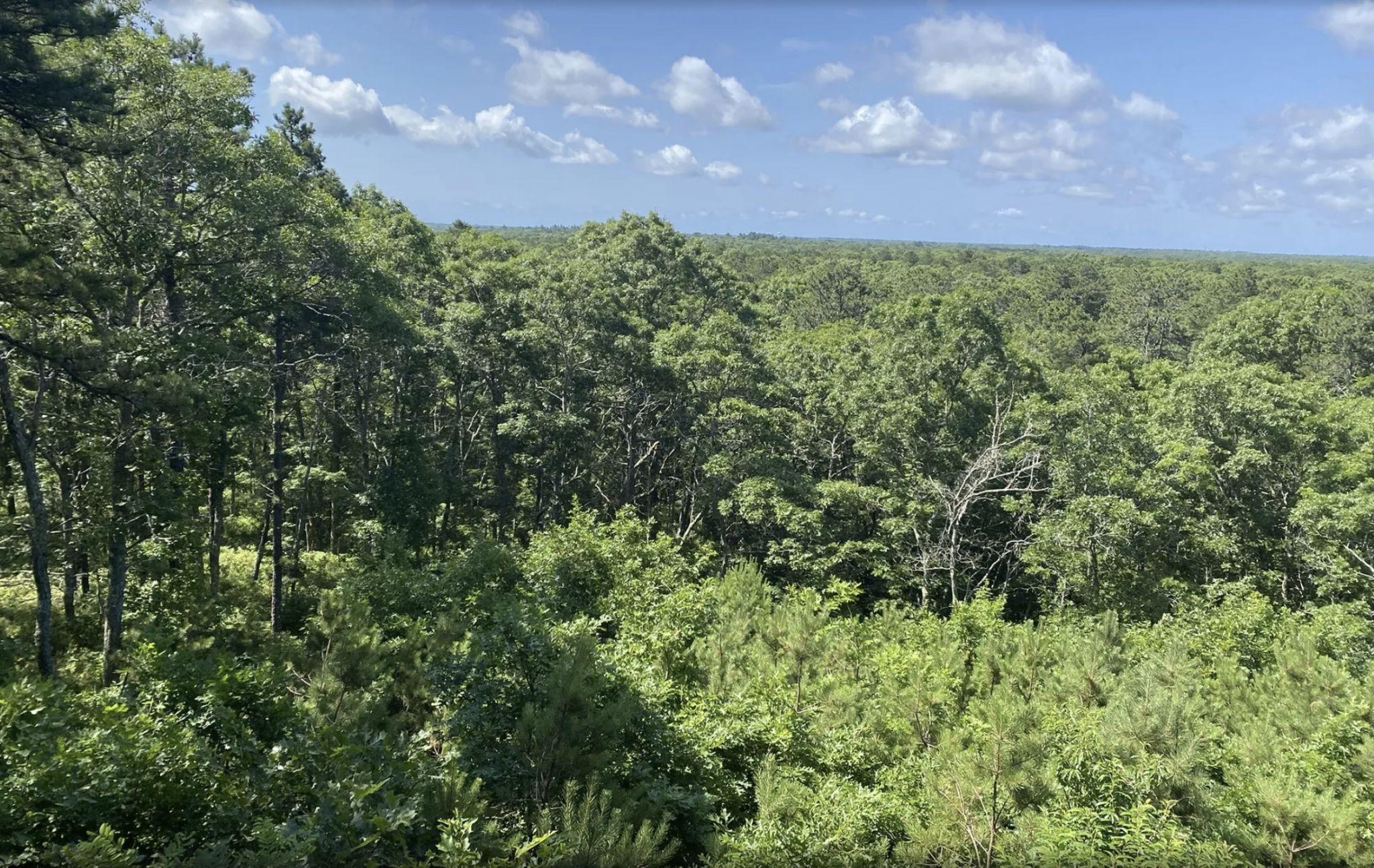
Trails are well-maintained by the local NEMBA chapter and the towns of Sandwich and Barnstable. A significant share of mountain bike visitors are assumed to stay in the Cape overnight, justifying a higher estimated spend per visit.
Source: Landwise Advisors, Trail orks, Alltrails
Falmouth, MA
The Otis trails, located adjacent to the Otis air national guard base in the southwest corner of Cape Cod, features challenging trails through pine forest and coastline views from the ridge.

Trails are maintained by Cape Cod NEMBA volunteers. Although most trails are sanctioned and are located on conservation land, some trails unofficially cross into restricted base property.
Ownership Town, State (MassWildlife), and Federal (Air National Guard)
from
Source: Landwise Advisors, Trail orks
Milton, MA
Located just south of Boston’s city limits, the Blue Hills reservation boasts skyline views and easy access from I-95/128. Mountain biking trails in the Blue Hills are especially suitable for beginner and intermediate riders.
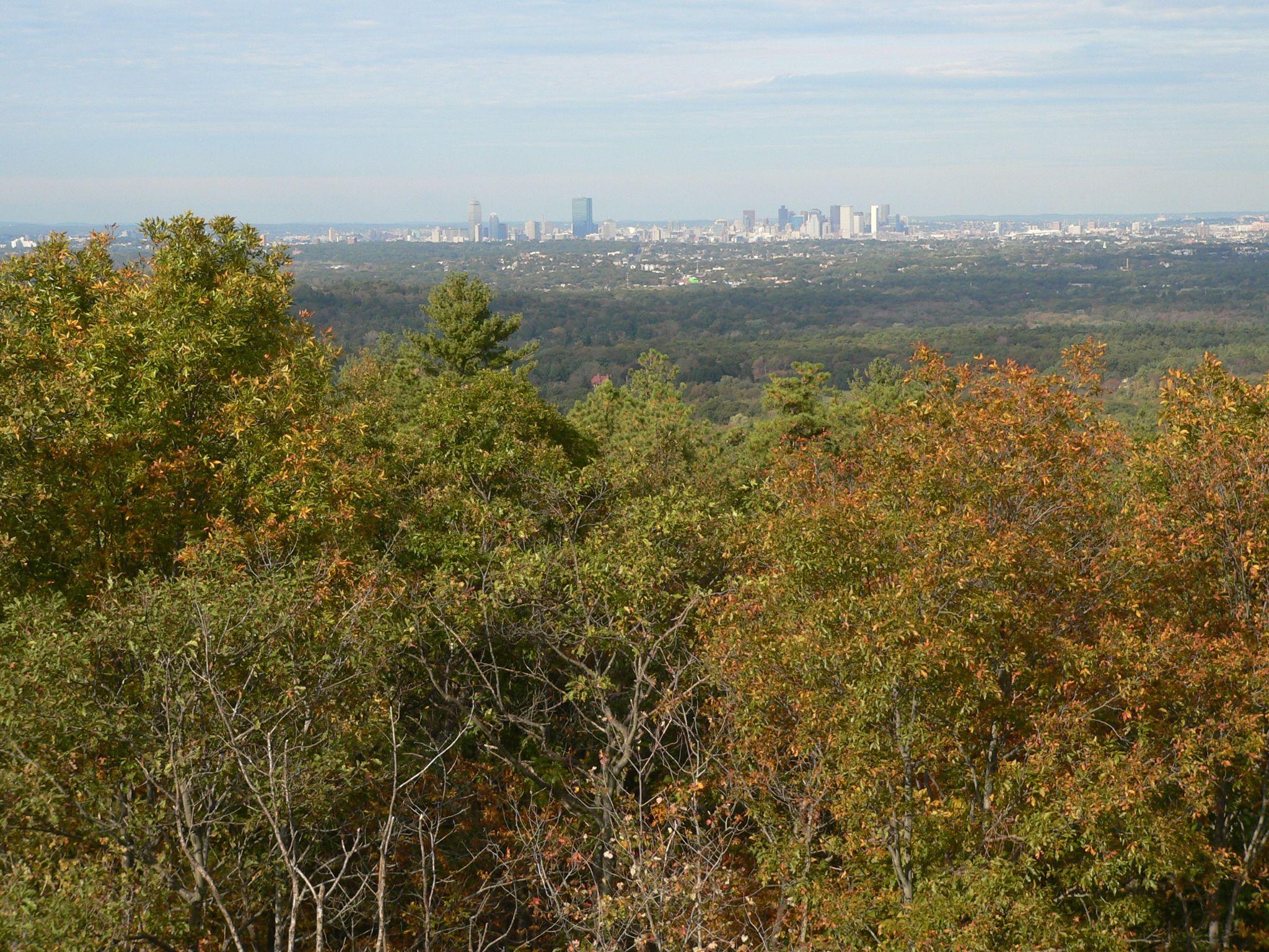
Trails are well-marked and well-maintained, although they are often shared with hikers and runners.
Source: Landwise Advisors, Trail orks, Wikipedia
Andover, MA
Harold Parker State Forest and the neighboring Ward Reservation host one of the most extensive mountain biking trail networks in the Boston area. Trails are maintained jointly by NEMBA, Friends of Harold Parker, and the Massachusetts DCR.
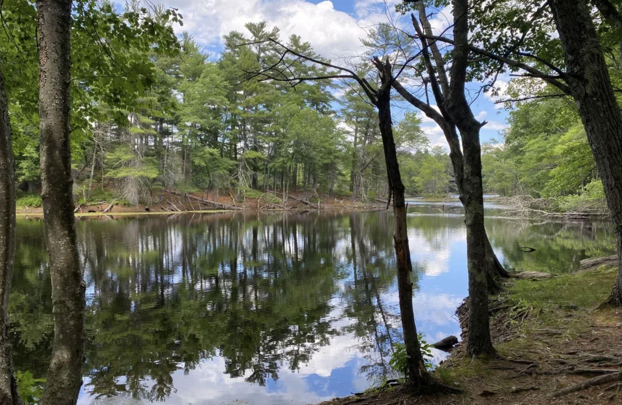
Local mountain bikers mention how fully exploring the trails there can fill up several full days. Each year, NEMBA hosts one of its marquee events, “Wicked Ride of the East,” at Harold Parker.
State and nonprofit (Trustees of Reservation)
Source: Landwise Advisors, Trail orks, Wikipedia
Freetown, MA
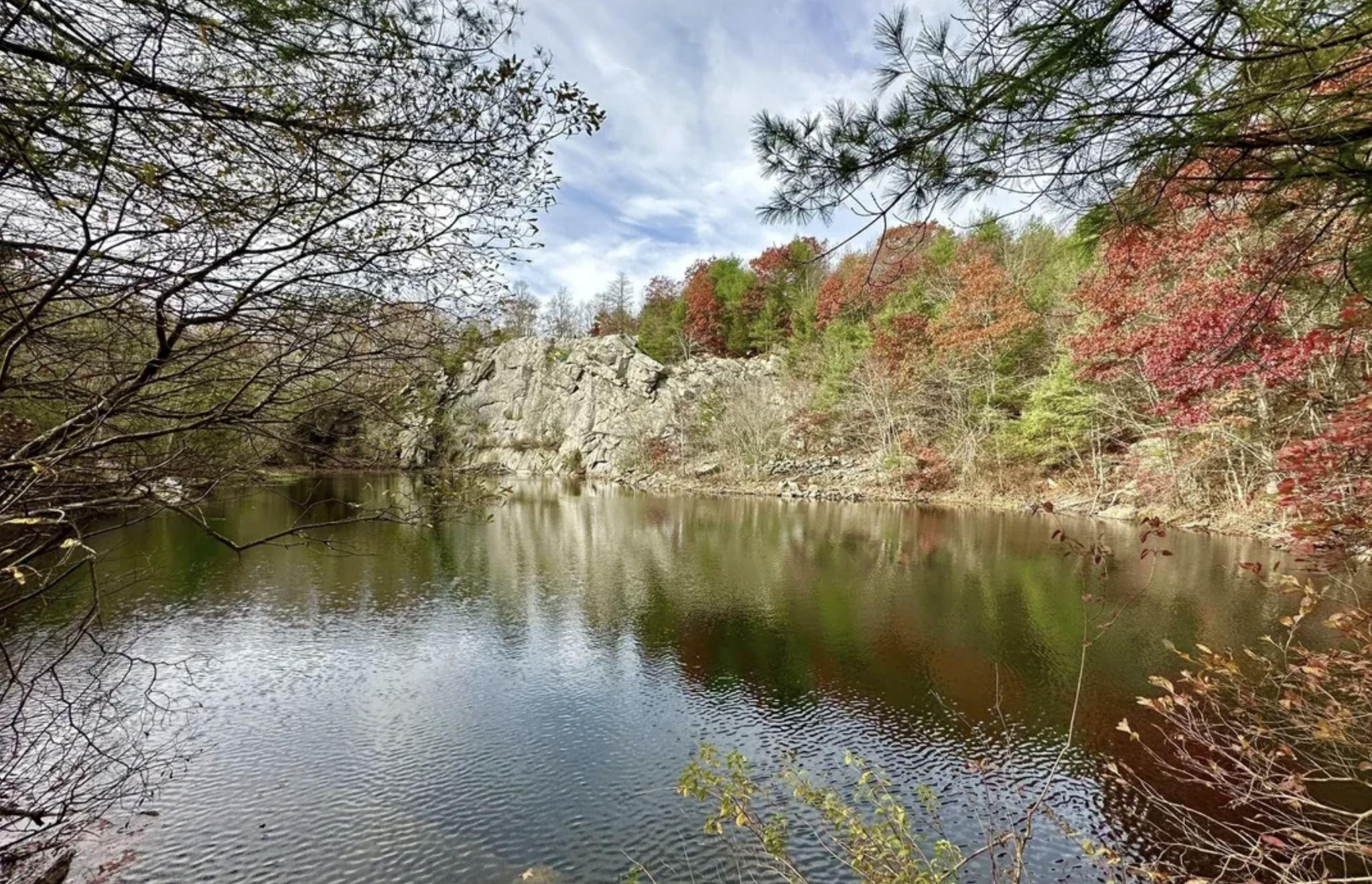
Freetown-Fall River State Forest and the adjoining SE Massachusetts Bioreserve are a large conservation area near the Rhode Island state line. The area is known for rocky, technical trails, especially in its northern half.
The state forest is officially open for dirt biking during the warmer months, so trails are often shared with motorcyclists. This may account for relatively low mountain biking visitation numbers.
Source: Landwise Advisors, Trail orks, Alltrails

Stoneham, MA
Middlesex Fells is one of the most urban and accessible riding areas in greater Boston. Visitors can easily arrive at the park on public transit.
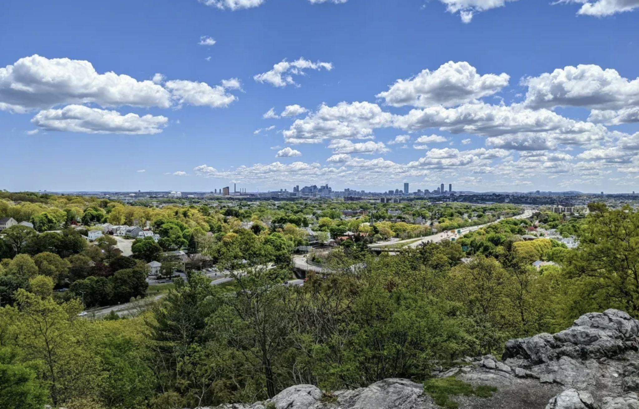
The park is often recommended as a good option for beginners, although more advanced trails are also on offer. High points in the park provide views of downtown Boston.
Time from Boston
Source: Landwise Advisors, Trail orks, Alltrails
Hingham, MA
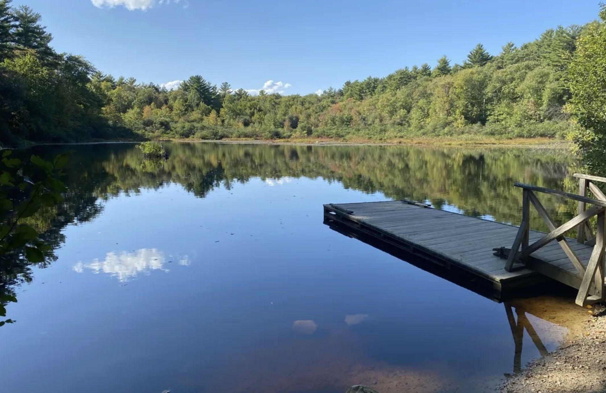
Wompatuck State Park, referred to as “Wompy” by locals, is considered the most extensive mountain biking area on the South Shore. The park’s largest hill, Prospect Hill, features the longest switchback trail in Massachusetts.
Park staff, NEMBA, and other volunteers maintain the trails and have been busy expanding the network in recent years.
Foxborough, MA and Wrentham, MA
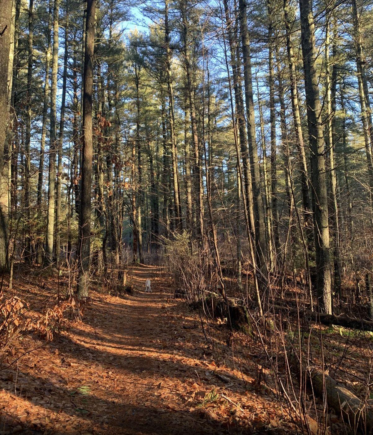
F. Gilbert Hills and Wrentham state forests, along with nearby Knuckup Hills, is a popular area for both mountain biking and motorized sports like dirt biking.
Although the area still contains many good mountain biking trails, many trails in Wrentham state forest have been damaged by and dirt bike activity. Motorized off-roading is officially sanctioned during the summer months.
Source: Landwise Advisors, Trail orks, Alltrails
A. Online Survey Results
B. Public Forum 2 Results
C. Market Analysis
D. Conservation and Recreation: Economic Impact Analysis
E. Feasibility and Fiscal Impact Methodology
F. Public Comment
Landwise modeled the financial feasibility of each proposed redevelopment scenario for the Pilgrim 1600 site using a land development model which assumes a master developer prepares the site and sells “finished” development parcels that are served by infrastructure. Inputs to financial modeling were developed by:
• estimating order of magnitude costs for site development (scenario-specific costs for new infrastructure);
• estimating annual absorption of the land by product type (leveraging the market analysis work);
• looking at cash flows over a 10-15 year period to determine return on investment.
Based on site constraints and priorities for conservation expressed by the community, the study identified four distinct areas of the site for development and focused on how development could be leveraged to finance conservation of the larger whole. For each concept the team estimated how much a developer could reasonably be asked to contribute to conservation associated with development, as well as the amount of additional funding that would be required. Based on a potential asking price from Holtec, materials prepared for the second public forum assumed acquisition at $57 million or $35,000 per acre. These figures might be further negotiated with the support of an appraisal. New infrastructure costs were assumed at $1,500 per linear foot of roadway. Feasibility tests included potential upfront costs for restoring the conservation land (estimated by Sasaki) including habitat restoration, trail renewal, signage, and safety features required for public access.
Conservation Cost Estimate
Landwise projected the annual fiscal impact of each proposed redevelopment scenario was likely to have on the Town of Plymouth. This was done by projecting both revenues and costs, and subtracting out costs to understand total net revenue. Revenues come from locally collected taxes. Costs focused on major buckets that could be impacted by new residents (schools, public safety, new open space/recreation). Fee-forservice items (inspections, utilities) were not included given they are intended to cover costs and beyond the level of detail required for a master planning effort.
Annual Town Fiscal impact represents an estimate of each concept’s impact on Town finances each year. While all new development represents increased expenses for the Town, fiscally balanced development should generate more in tax revenue than in costs in infrastructure and services.
Development rights for this land can come with requirements for provision of open space and other public goods. For each concept we have estimated how much a developer could reasonably be asked to contribute to conservation associated with development.
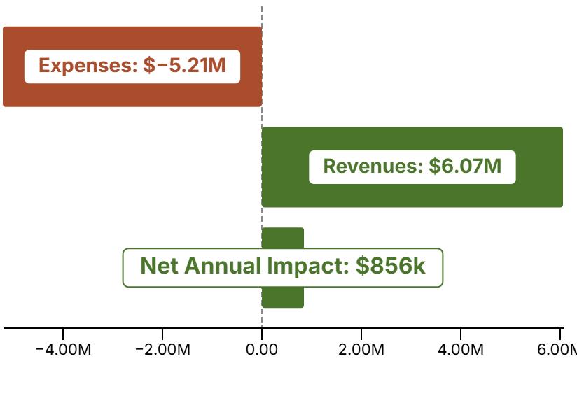
A. Online Survey Results
B. Public Forum 2 Results
C. Market Analysis
D. Conservation and Recreation: Economic Impact Analysis
E. Feasibility and Fiscal Impact Methodology
F. Public Comment
These comments were received via the Pilgrim 1600 Acre Area Plan project website or Town of Plymouth comment form between January 13, 2025 and November 14, 2025. Requests for information and comments unrelated to the project outcome have been removed. Identifying information has been removed.
2025-01-13 17:49
Long overdue, but at the same time, a bit rushed. And there is no mention of Holtec’s involvement, but it should be made clear what their priorities and requirements are. We should not be dependent on Holtec’s goals, but should be able to pursue this independently.
2025-01-13 19:32
Given the wide diversity (in terms of work-related skillset, educational background and work experience) of the existing Plymouth workforce, the “powers that be” should be very careful in selecting what, if any, commercial development to be included in the P1600AAP. What we don’t need is an influx of commuters clogging the limited local roads at rush hours and leaving to spend their salaries elsewhere. That helps no one in town but the developers. Also, the timeline between this initial announcement and Master Plan finalization appears to be be very short to be able to adequately poll the citizenry and reflect same in the Plan; I wonder what the current ”preliminary” Plan looks like?”
2025-01-13 20:15
I have walked, rucked, and mountain biked in those woods with my husband, kids and dogs for decades. I am very interested in what the use will be and to have my voice heard.
2025-01-13 20:44
“1. The area where the nuclear plant is could be developed as an alternate green energy source, such as wave energy.
2. The forested land sections should be left untouched, to provide green cover, protection for the aquifer, and cleansing of the air. “
2025-01-13 22:07
Please keep traffic down whatever you decide
2025-01-13 22:19
Keep it undeveloped
2025-01-13 23:16
Incredible site to build a surf park! See examples from “Kelly Slater Surf Park” or “Waco Surf”- a new alternative to soccer and gymnastics for kids, and much safer than ocean surfing with sharks and drownings.
2025-01-14 19:04
I’d like to stay informed on the progress of what will happen to this very special parcel of land. I grew up in Plymouth and learned how to mountain bike on this land. It’s something I hope that my kids will get to enjoy the way I did.
2025-01-15 0:33
I forgot to add in my survey that I am absolutely against windmills on the property. I had low frequency humming from windmills that sounded like a band was playing next door while living in South Plymouth. They emanated from windmills installed off of Head of the Bay Road in Bourne.
2025-01-15 15:32
I love that area and hope that most of it stays green space.
2025-01-15 20:01
I would hate to see this land developed.
2025-01-16 14:39
The town is definitely lacking in sidewalks and bike paths in well developed areas such as Beaver Dam & Rocky Hill Roads were cars have to swerve to avoid pedestrians.
2025-01-17 13:54
I DO NOT want to see any sort of high density housing of any kind built there. I would love to see more conservation land set aside similar to the state forest. Possibly with access to the shoreline. Maybe another resident town beach.
2025-01-17 14:11
Check out the NYTimes in today’s issue. There’s an article about Ms Packard, a marine biologist who was at the helm of the Monterey CA acquarium. Her family funded the development (HP) and she is stepping down as an active leader to remain on the board. Wouldn’t it be great if Plymouth 1600 could pay her to consult sometime on our space to discuss feasibility of building an east coast aquarium--not to compete with Boston but to supplement. Afterall on the shores of Plymouth England, theres an acquarium.
2025-01-17 15:43
I am concerned about the results of development on Manomet community ,traffic, road cuts from the property on to state road
2025-01-17 20:55
Get control of that parcel or parcels at ANY cost! If any housing is built there, it should be subsidized (i.e., BELOW supposedly ‘affordable’) housing exclusively for current Town residents who are being priced out . Monthly rent of $1800+ for a one bedroom apartment is NOT affordable!
2025-01-17 23:24
No more housing developments, shopping or hotels. I feel that ariel adventure park or mountain biking only serves a very small percentage of the population. We need something new that will entice visitors and residents, something good for the environment and our future generations.
2025-01-18 12:29
I do not want to see more reckless development in a pointless attempt to recoup the loss of shutting down the nuclear plant.
2025-01-18 13:50
Marina with dock space, Plymouth Way behind other shore front towns, Will bring jobs and $ into community
2025-01-18 23:21
this parcel is unique in so many ways and can offer options for Plymouth and can accommodate conservation, housing and also what we really need - additional areas for good quality commercial , and light industrial space, to create business and good jobs for local people. We absolutely need more light industrial areas, which this parcel is zoned for - we have run out of room in existing light industrial areas, and we need to spread them out around town. This parcel offers those opportunities, also for green and blue economic development that we need to take advantage of. People and politicians say we need more commercial growth to help the residential tax base but we need more places to do that, while also preserving and providing housint
2025-01-19 03:53
We have a beautiful town and this parcel presents an opportunity to preserve what precious land we have left. I hope the preservation of land is a major consideration in whatever is decided for this land. Thank you.
2025-01-19 19:03
Although I am not a resident of Plymouth, as a Duxbury resident how this site is redeveloped will have an impact on the south shore and our coastline.
2025-01-20 01:15
I am concerned that too much housing will affect the quality of life in town. The resources are already stretched.
2025-01-20 01:26
I am passionate about the landback movement and would like to discuss the possibility of rematriating this land to the Herring Pond Tribe or the Native Land Conservancy based in Mashpee. This is their land. Continuing to colonize land that was stolen through genocide is the morally wrong thing to do.
2025-01-22 14:35
This is an exciting project. I wish I had more idea about exactly how the land should be used in a balanced way (Development of small business/ retail - preserved open space, Hiking, mountain biking......
2025-01-22 16:18
Has a comprehensive inventory of natural resources and wildlife been conducted for the entire property? This is critical if good decisions are to be made regarding what should be preserved vs. made available for development.
2025-01-23 19:47
This land should be saved so we have green space in this town. The way the town is expensing and building on every spot the of open space they can this town will be a city in no time. We will have to get more fire and police to keep control of the town and buildin more schools for the kids. Please look to the future of Plymouth and not just the now.
2025-01-23 21:03
Leave it alone, if it’s privately owned the town should buy it and leave it as conservation property. This town is over populated as it is. With all the unaffordable housing that already exists I’m surprised that the taxes already collected from the residents doesn’t cover what the old power plant paid but I would have to see the numbers which should be readily available to fact check my statement , but in any case im against any more building. Just my opinion
2025-01-26 18:45
We deserve something beautiful for all of us, not just rich people.
2025-01-28 03:07
Please do not develop the area. The area is beautiful, and from a distance, i.e. the waterfront, it is too. The area should become conservation land that people can enjoy walking through.
2025-02-03 00:00
Some portion of the land under consideration qualifies for Area of Critical Environmental Concern Status under 301 CMR 12.
2025-02-04 14:51
I think it’s critically important to consider both conservation opportunities and RESPONSIBLE development opportunities that don’t disrupt wildlife or the residents nearby. Taxes are rising in Plymouth, and I love the idea of creating more job opportunities for residents, but I also worry about destroying what little conservation land we have left. Keeping development at a minimum, gives the coastline an opportunity to heal itself after being subjected to the powerplant for so many years. There has to be a good balance between what’s doing best for the residents here and ensuring we are not destroying our beautiful town in the process. I would love to see some kind of space that everyone can enjoy and that brings funds to the town versus including condos that only a small portion of taxpayers can benefit from.
2025-02-05 20:08
Since this is the last large parcel of undeveloped, largely forested land remaining in Plymouth, I believe we must try to preserve as much land as possible. We definitely should not allow development that would cut down forest land for solar farms or remove quantities of sand for any reason. Such usage will negatively impact our environment, water and quality of life for all Plymouth residents.
2025-02-07 22:46
I would love to see the area that once were walking trials, with a boardwalk ending at the ocean reopened, with possible beach access as well. This was an exciting and beautiful area for families at one time. Plymouth has so much of its coastline inaccessible to the public.
2025-02-08 04:06
Thank you for doing the survey. I was pleased. I was able to voice my opinion, hoping to keep as much undeveloped land as possible in Plymouth looking forward to see what happens to this land, but hoping it remains with nature as much as possible. Your local Plymouth Plimothian and Plymouth Foodie :)
2025-02-08 15:24
In 2020, Plymouth was poised to celebrate 400 years as the first permanent settlement in the New World. Many projects had taken place to prepare to showcase our beautiful town. Unfortunately, along came COVID-19, which curtailed the celebration and further ideas to enhance the communities character. Whatever your stance on the Pilgrim/Holtec site, we hope that you view this as an opportunity to utilize nearly 3 square miles to make Plymouth a premier community here in Massachusetts. It will be a delicate balancing act with lots passionate input. It’s not about “YOU”, it’s about the community!
2025-02-09 13:24
Sportsman’s Paradise outdoor activities campus 1600. Mountain Bike trails established. Sporting Clay Course. Olympic ocean pool like Waikiki Natatorium war memorial from 1927. Frisbee disc golf course. Motorbike track. Community food gardens. Central Gathering area, open field, BBQ stations with huts, picnic tables, Fire pit. Equestrian trails. Drone flight location. Public restrooms. Outdoor showers.Food vendors. Would be an amazing Master Plan attracting family fun for all ages!
2025-02-12 16:27
Plymouth’s future is bright and there are no other parcels like this on the South Shore and perhaps Eastern MA. This is a great opportunity to compliment a great Town.
2025-02-13 20:00
I am adamantly against any development on this land.
2025-02-19 14:10
No more housing, the town cannot handle the population growth, water will become an issue for residents and the roads cannot sustain the growth we have now.
2025-02-21 21:59
I was at the brainstorming session and previously cultured the survey. Maybe there were other as wee, but was one who submitted the idea to install SMR Nuclear Modular Reactor at the site. I know nuclear is not broadly popular, but it is CO2 free and part of the future. I have attached an article which talks about the economic impact. Take this with a little grain of salt since the article was written by NuScale. One of the leaders in the technology and the only one too have NRC approval for their design. The plant size the mention, 12-Module produce >900 MWe which is a little larger than the old Pilgrim Plant (690 MWe).
2025-03-02 18:00
I know that the Town of Plymouth is soliciting ideas for use of the old nuclear powerplant site. I also see on Facebook that everyone is complaining about the high cost of electricity. The Town should seriously consider using the site for an electric company. The towns of Norwood and North Attleboro have their own electric company, and the town reaps many benefits from it. Not only do the town residents rarely lose electricity or cable, but the electric company provides the area with great paying jobs.
2025-04-02 01:52
I’m interested in the preservation of Pilgrim 1600.
2025-04-02 12:23
The most viable options for the best use of the Pilgrim land when decommissioning is complete, that will benefit Plymouth the most.
2025-04-07 12:24
Existing boat ramp should be opened to all residents of Plymouth to take pressure off of harbor ramp.
2025-04-08 11:12
we have enough building Pine hills development never did what they said they would do
2025-04-08 23:17
Leave the parcel of land to nature for the animals to enjoy.
2025-04-08 23:28
So many vacant buildings that need to be utilized before building new construction. Some areas look like a ghost town
2025-04-10 17:14
Open space, Parking and more
2025-04-11 0:30
I would hate to see all of the nature become displaced. Walking trails would be a much better choice for that area.
2025-05-12 13:16
Maybe there could be mountain bike trails and off-road vehicle trails in the area so everyone gets to have fun
2025-05-22 15:51
I’m interested to learn more about the proposed bike/pedestrian paths and connections across the site. As a local resident, Route 3A is impossible/ extremely unsafe for bicycles and pedestrians and the redevelopment of this site offers real opportunities for recreation and to help connect Manomet to Plymouth center.
2025-06-04 14:32
I have heard that you are trying to use the 1,600 acres of land at the pilgrim power lines for the liking of the citizens in Plymouth. There are not many places to ride off road vehicles in Plymouth because they are all mostly mountain bike trails, which people do not enjoy having off road vehicles on. The 1600 acre land has lots of space in it and I believe that if it is split up right everyone can have a share of it, there are plenty of mountain bike trails in Plymouth and people have to go far to find a good off road riding trail. I have been at the powerlines trail with my off road vehicle and according to the survey many others have been too. I would like to ask that Plymouth could add in more off-road vehicle trails for ATVs and Dirt bikes and consider using the 1600 acre land as one.
2025-06-24 20:02
I would like to share an idea with you regarding the re-purposing of the land formerly owned by the Pilgrim Nuclear Power Plant and now controlled by Holtec. I am among those who consider climate change to be the greatest challenge facing the human race. As citizens of the United States me consume, per capita, more energy than any other country and with it generate the greatest amount of greenhouse gasses into the atmosphere. Sadly, although solar generated electricity has made great advances in the last ten years we see towns in Massachusetts using the permitting process to block efforts to create solar farms at the scale necessary to allow us to transition to a carbon free future. NIMBYism can’t be allowed to stand in the way of this necessary transition. Here is my modest proposal. The land surrounding the former power plant is not occupied. On that land is a high tension power line running from the power plant site. It is approximately 200’ wide and runs for several miles. It is oriented in a north south direction. The power line pylons are there and the power lines are in place. Imagine if on the ground below, in the path of this power line were solar panels, running for miles and feeding the power they generate directly into the grid through the existing power line infrastructure. It could not only make a significant impact on the high cost of electricity in Plymouth but it would also make a significant statement about renewable, clean energy and its ability to replace dangerous nuclear power. Town government could incentivize this by zoning this land for renewable energy generation. I believe this a great opportunity for Plymouth to make a significant contribution to a clean fossil fuel free future.
2025-09-30 16:19
I see one proposal where a waste water treatment plant is proposed and I’m concerned about the location of the plant. I’m trying to figure out why the proposed plant would be located directly behind houses, when there seems to be plenty of other areas within the “light industrial” plot that are further away from housing. I understand this is just a proposal at this point, but nevertheless, I’m concerned about how this plan could potentially affect my property value going forward.