
Canvey Concept 03 05 09 11 13 15 19 21 25 31 33 43
Project Background Topic research Deconstruction + Edge Conditions Desalination Project Realisation Site Typologies Reuse Adapt Protect Appendix
+ References contents
Project Summary Research Statement
Bibliography
Project Statement
What is the reality of radical climate adaptation? On one extreme, Qatar is shipping seeds of grass into the desert from the United States to create 144 football pitches for the World Cup. (Ralston, 2022) Conversely, small island villages are turning to digital mapping to save their culture once they are buried by water due to rising sea levels. (The First Digital Nation, 2022)

How can we expect people to join the climate change team in a world where the World Cup can claim carbon neutrality and Tuvalu is trying to save its culture by digitally replicating itself in the metaverse?

If climate change complacency continues, the reality that our world will lose places people call “home” is inevitable. Sea levels are expected to rise by an eighth of an inch each year, and extreme weather events will become stronger and more frequent. (Newman & Qiao, 2022) “Livable” places will soon become uncomfortable for people unwilling to adapt.
As sea levels rise, cities will also increase in population. By 2050, it is expected that seven out of ten people will live in cities compared to today, with 56% living in cities. (The World Bank, 2022)
Cities will have a high demand for innovative strategies against climate change, housing costs, social equity, and more, but what happens to the places people leave behind? As cities become more populated, what if rural and suburban communities could use predicted vacant properties and sitespecific strategies to combat climate change and create a new kind of future for their communities?
This project speculates how rural and suburban communities could deconstruct themselves and use the materials to build new infrastructure that embraces high water and prepares them for smaller populations. Communities at risk could use postindustrial and remediation techniques to create livable places for the future. Their “home” may look different but will still be recognisable due to saving unique landmarks and materials.
3
1 2
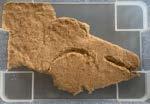
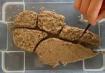
(Image 1) Turf being planted and managed for the 2022 World Cup. (Image 2) Website built to highlight Tuvalu’s journey online.
Project Introduction
Canvey Island sits on the easternmost edge of the Thames Estuary. Most of its land mass sits at or below sea level, with one “high point” that consists of an old landfill site. The island was devastated by a surge flood in 1953, where much of the outer edge was covered by water. The island only has one way in and one way out. As people evacuated, 58 lost their lives in the rush off the island. (BBC, 2013) After the flood, measures were taken to protect the island from future surge floods by forming a concrete flood wall around the island.
Canvey faces a formidable future in a world with potentially two meters in sea level rise by 2100. (NOAA, 2022) This makes it an interesting place to set up different hypotheses on what strategies could work to prevent, slow down, or embrace high levels of water.


Canvey Concept
(Figure 2) Area in and around Canvey Island that sits below 1m.
GLOBAL MEAN SEA LEVEL RISE (METERS) 0.0 1900 HIGHEST INTERMEDIATE HIGH INTERMEDIATE LOW LOWEST 1950 2000 2050 2100 1.0 2.0 -0.5 1.5 0.5
(Figure 1) Canvey Island map showing relationship to water.
(Figure 3) Sea level is projected to rise potentially 2m by 2100.
3 FIGURE 1 FIGURE 3 FIGURE 2 CANVEY ISLAND
(Image 3) Top image is Canvey Island on 2 February 1953, and the bottom is the same street today. This shows how little has changed and that the town is still primarily made up of hard surfaces, which leaves nowhere for the water to go other than up.
Island Research
Looking at the historical maps of Canvey Island, it is interesting that the hand-drawn maps show the island is not one land mass but a series of smaller islands clustered together. A Dutch engineer connected these smaller islands in the 17th century to create a place for people to live.


The island existed for most of its contemporary life as an escape for Londoners looking to get away, but today functions more as a suburban retirement community.
As seen through demographic research, there is a high population of people over the age of 65, and of that population, nearly half live alone. It is also where people depend on cars to get around, and almost the entire island lives in single-family residences.
When thinking about the global climate crisis, it is difficult not to wonder whether the island’s imminent threat of being washed away by floods and rising sea levels do not resonate with the population of Canvey Island because of their age. If the average age of death is 80 (World Bank, 2022), then the reality is that a third of the population of Canvey Island will not see these significant climate threats as they will have passed on by the time anything happens.
5
Census 2021 (2021) Census 2021. Office for National Statistics. Available at: https://census.gov.uk/. unemployed students retired employed home/family sick/disabled other own at least one car live in a detached house, semi-detached house, or terraced house 93% 79% population is 65+ 32% Single parent households 65+ live alone 15% 11%
1594 1896 1903 1923
A Changing Canvey


There are several components contributing to a transformed Canvey Island. Even if nothing is done, sea level rise, urbanisation, and an ageing population will force change upon the island. The question is, will the citizens do anything about it? These scenarios can be seen as problems but are invitations to rebuild and create a new story for an island destined to be taken back by the sea.
SEA LEVEL RISE
In Landscape Architecture for Sea Level Rise, Newman and Qiao outline different case studies worldwide leading to climate remediation through landscape solutions. They break up strategies within each case study into structural, non-structural, and hybrid solutions. Every case study has many solutions that combine to create an overall plan. The book lays out a menu of options for places like Canvey and backs them up with many case studies.
AGEING POPULATION
The world is going through a social transformation as well as a climate transformation. The baby boomers, defined as children born after World War II between 1946 -1964, make up the largest age group of the world’s population. As this generation gets older and passes on, coupled with growing urbanisation, suburban and rural communities will become much smaller.
There are slightly larger communities of ageing populations in suburban and rural areas (21%) compared to urban areas (16%). (Defra, 2020) 80% of older people also want to stay in their homes as they age (Moore, 2014), leading to excessive empty rooms in single-family homes in these neighbourhoods. This trend will lead to many abandoned homes when people pass away due to several factors, including lower demand for single-family housing, housing that is not attractive to younger generations, and housing that has not been built to last.
These trends are only beginning to add strain to real estate markets and the built environment and will continue to change slowly for the next 20-30 years. After 2050, the changes will become more immediate and intense as most of the population declines.
46% people will be 65+ in 20 years
of adults aged 65 and older are considered to be socially isolated 25%
80%
of people 75+ are classified as inactive
of older people want to stay living in their current home
Canvey Concept
1 in 4 deaths/year 2015 deaths/year 2050 2.6m 4m people in cities, 2016 people in cities, 2050 54% 68%
URBAN + RURAL POPULATION PROJECTIONS 2B 1900 URBAN RURAL 1950 2000 2050 6B 8B 0 4B
(Figure 4_Author’s Own) Total urban and rural population based on the UN World Urbanization Prospects.
4 5
(Image 4 + 5) Canvey Island uses structural mechanisms to separate itself from the sea. The concrete wall surrounding the entire island is so big that the water is not visible. To view the ocean, people must be on the wall’s seaside.
FIGURE 4
ARCHITECTURE BECOMES LANDSCAPE


As stated previously, urbanisation shows that more people are choosing to live in cities while suburban and rural communities are getting smaller. The ageing population and young people moving to cities leave Canvey Island with many abandoned properties. If houses cannot be filled with new families coming at the same rate as people passing away, what happens to those structures?
Detroit, Michigan, in the USA, is one of the most visible examples of large numbers of abandoned properties left for nature to appropriate. These properties have become a massive issue for local governments as they see significant anti-social behaviour. Some properties have been left so long that books have been written showing trees and ivy taking over whole neighbourhood blocks. (Brooky, 2019)

7
(Image 6) Shows the potential beauty of allowing nature to come back into spaces it has been expelled from. (Image 7) Plants have taken over an abandoned house in Detroit.
6 7 FIGURE 5
(Figure 5) In Landscape Architecture for Sea Level Rise, Newman and Qiao break down solutions into structural, hybrid, and non-structural mechanisms.

Canvey Concept 0 8
TOPIC RESEARCH
Deconstruct to Reconstruct

9
Topic Research Deconstruct to Reconstruct
The Canvey Concept uses a proactive strategy to combat the changes that this island will go through in the next 50 to 100 years. Orchestrating a set of options now will allow the island to take control of its future rather than have it decided for it. To understand what is possible, it will be helpful to look at (1) how to deconstruct a home and what materials might be valuable to use, (2) how to treat edge conditions between land and water to protect what is on the inside, (3) solutions to mending the relationship the citizens have with water and being able to use it as a resource.
Demolishing a home is an expensive and resourceheavy process. According to Design for Deconstruction and Materials Reuse, Bradley Guy says that 85-95% of a home can be either reused or recycled (Guy & Shell, 2006), but most of the time, buildings are torn down, and the majority of materials end up in a landfill. In order to salvage that much material from a home, it has to be surgically taken apart, which costs more upfront. In the long run, it is better for the environment and keeps materials in a more circular lifecycle.
How to deconstruct a house (HomeServe, 2021) and what

materials are useable?
Shingles and underlayment on the roof Shingles are sometimes reusable, but roof underlayment is not
Skip sheathing and plywood
Wood can be reused
Interior fixtures (plumbing, electrical, doors, windows, cabinetry and flooring)
Plumbing and electricity cannot be salvaged, but doors, windows, cabinets, and flooring can be
Drywall and plaster
Drywall can be recycled, but plaster cannot be recycled


Brick and exterior siding
Bricks can be recycled if taken apart carefully


Load-bearing structure
Usually made of wood or steel, which can both be reused
It can be broken up and reused or stay in place for new uses
Canvey Concept 0
FIGURE 6 9 10 11 12 13
Foundation
1 3 5 2 4 6 7 Author’s Own
Edge Conditions
Island communities have unique ways of treating their edges. Canvey Island has chosen to fortify its edge by adding a concrete barrier between the town and the sea. When walking through town, people cannot even see the water as much of the land is below or at sea level, and the sea wall measures approximately 4 to 6 meters when coupled with the accompanying hill constructed on the town side.
There are many more interesting and aesthetically pleasing examples of sea walls throughout the world. Most notably, the way the Netherlands and Denmark negotiate their relationship with the sea is beautiful and functional at the same time.
Some places are even using filter banks to embrace the water surrounding their land and use it. In a world that will witness rising sea levels, bringing more water into the land, these types of systems could be helpful for more self-sustainable communities.

A bank filter naturally filters water through layers of soil. The fresh groundwater is then extracted from the earth using a large well.

NORDHAVN, COPENHAGEN,
Hard edge with added recreational value, including swimming infrastructure and places for people to sit


Gentle hills and diverse lawn meadows allow people to get close to the water.

silt + clay sand + gravel bedrock river channel
Rocky edges made of rubble create excellent conditions for wildflowers and also make good foundations for linear pathways

ARKADIEN
Houses back right up to the water and have little decks for people to get their feet wet
local flowpaths through porous sand + gravel
well well screen ground water dilution
regional flowpaths
11
FIGURE 7
15
FIGURE 8
14
16 17
COBE
NATURE ISLAND, TIENGEMETEN SIGRUN LOBST
QINHUANGDAO BEACH, CHINA, TURENSCAPE
WINNENDEN, GERMANY, RAMBOLL STUDIO DREISEITL
Author’s Own
Author’s Own
Desalination Natural Water Treatment Study
As waters rise and the sea creeps inland, many countries are considering conditioning ocean water for their communities. However, the process has a high economic and environmental cost, as traditional desalination usually involves large industrial plants that use energy resources and take up space. Communities like Canvey Island could adopt some of these strategies to become more self-sustainable, but this would require a significant initial investment. Below outlines the general process that water has to go through to become usable:
Abstraction
seawater enters into an pipe underwater
In a study about wastewater treatment, wetland plants were tested alongside different layered soils to filter water naturally. The following diagrams show a few tests that used gravel, sand and a mixture of the two and their outcomes. (Sosthene, et al. 2018)


5mm Gravel
10mm Gravel
25mm Gravel
Porous cloth
Outgoing water Salinity
Pre-treatment in order to filter solid material out, chemicals are added that cause them to stick together
Desalination to remove impurities the water is pushed through a membrane with tiny holes in it


Treated water conditioning
essential minerals are returned to the water and treated to meet water quality standards
Waste handling
unused water is cleaned and returned to the ocean. Any solid waste is sent to a landfill
Brine release
since the waste water has high levels of salt, they are discharged deep at sea for better dilution
0.15mm Sand
0.35mm Sand
0.60mm Sand
Porous cloth
Outgoing water
Salinity
0.15mm Sand
0.35mm Sand
0.60mm Sand
5mm Gravel
10mm Gravel
25mm Gravel
Porous cloth
Outgoing water
Salinity
Canvey Concept 0
1 2 3 4
6
5
IN IN IN OUT OUT OUT
FIGURE 9
FIGURE 10
Author’s Own
Author’s Own
Accumulation – halophytes have the ability to extract soil sodium and chlorine in their vacuoles

Salt excretion – some plants have salt glands to secrete excess salt out of the cell in the form of salt crystal
3 Exclusion – some plants have an ultra-filtration mechanism to avoid sodium uptake

2 1
COCHLEARIA OFFICINALIS 18
FIGURE 11
Author’s Own

Canvey Concept 19
PROJECT REALISATION
Unmaking Canvey Island

15
CARE + PROTECT
abandoned properties go through landscape strategies


connect landscape strategies
ADAPT
move people make mounds


EMBRACE
let water in life + landscape balanced

Canvey Concept 2025 2055 2100 2075 2090 2095 2065 2045 2085 2115 2035 2025 2075 2105 2055 2095 2125
12
FIGURE
This is the progression of breaking up the island along the waterways and opening up new arteries.
This is also a buried waterway that will be daylit to connect the north marshland to town. The islands are beginning to shape up.
Shaping the islands to the west and giving more land back to the marshland.
The first move would be to open up an area already mounded up and could withstand water coming back.
FIGURE 13 Author’s Own
Masterplan Scale


The land and water strategy for Canvey Island is to open back up the waterways and create a series of smaller islands, similar to what it looked like before the Dutch connected all the land. There is evidence of where the water would naturally go based on drainage pipes, water outlets that lead to the sea, and a central lake area.


The social strategy for the island is to take care of the elderly population while also preparing the next generation of Canvey Islanders for the future. Since so many older residents want to live out their days in their homes and there is little access to medical care, this proposal looks at bringing in-home nurses to care for people. This creates a younger generation of people that would be able to live on the island and create new communities as the current one shifts.
Over the next 30 years, the island would stay mostly the same. The ageing residents would be given several options for their homes and get to decide the fate of their property while also curating new public amenities for future generations. The choices each resident gets depend on their property type and are outlined in the following pages.

17
2085 2085 2080 2105 2110 2115
Daylighting the smaller buried waterways to create more water arteries through the island.
(Figure 12_Author’s Own) There are watercourses hidden under Canvey Island that were covered so that the residential areas could be built. There is a lake in the middle of the Island that is cut off from the ocean, but other than that, there is no evidence of water within the walls of the Island.
The final formation of the islands follows the waterways and frees the water to begin incorporating it back into the islanders’ lives.
This opens Canvey Lake up to the sea, creating a water corridor through the island.
This waterway is buried beneath the town but would be daylit and connect the marshland to the west of Canvey Island with the centre of town.
Strategies of Unmaking

There are three different strategies for different property types: general residential plots, plots along or above hidden waterways, and historically significant plots. Each property type will be reused, adapted, or protected depending on the plot’s conditions and contents. These strategies work for residential and commercial plots, but the examples shown are residential for this report.
The following pages outline a few possibilities for the different plot types and walk through the realisation of the new relationship between land and water through the lens of the adapt strategy.
REUSE
Most houses will fall into this category since it includes any property on the island’s interior that does not touch a waterway. The current residents of these houses would get to choose what happens to their homes.

The properties that will adapt are primarily along or above any hidden waterway. These houses would become the new front line between the land and the sea.
As more and more of these plots are transformed, they would create a series of connected public spaces and bring new habitats for plants and animals that do not exist today, boosting the island’s biodiversity.
Burying abandoned houses in hills creates new opportunities for play and recreation on top of the mounds, creating a more organic relationship between people and water.
Canvey Concept
TODAY FUTURE STATE
ADAPT
16 FIGURE 14
FIGURE
(Figure 14_Author’s Own) This map shows the distribution of the three plot types around the island.
Author’s Own
Existing water areas like Canvey Lake would open up to the sea, creating a more dynamic landscape around the rise and fall of the tides.
A handful of buildings considered “historically significant” would be protected from rising sea levels in unique ways.


PROTECT
Allowing these waterways to become tidal also welcomes new areas for marine wildlife and richer, more diverse ecosystems.
The protected buildings would become special moments on the island, celebrating its quirks and unique personality.
19
protect adapt reuse FIGURE 15
(Figure 15_Author’s Own) This map shows the basic island structure once the waterways open up and the adapted properties become the new island edge.
Reuse Plot Choices


The majority of property plots will fall under this category. In order to keep the houses of Canvey Island from becoming abandoned, each resident that lives in one of these plots will be given different options for the fate of their home. This gives the power of design to the residents of the island. Since they are the experts on what their neighbours would enjoy the most, they will be able to pick the best option for their home’s transformation.
Once the resident passes on, the house would go into a deconstruction phase, which would be carefully taken apart and inventoried for use in the next phase or stored in a material warehouse on Canvey Island. The strategies below would unlock new public spaces for the community while also adding to the island’s biodiversity. Selling the house would be a last resort but an option if new residents were interested in some properties.


FIGURE 17

 Author’s Own
Canvey Concept
Use the house’s foundation for tennis, basketball, and football courts
Some leftover materials from the house, like wooden supports, could make vegetable or flower beds, creating community gardens
Similar to the community garden, the leftover materials from the home could be used to create pocket parks
A tiny urban woodland would add environmental and economic value to Canvey Island.
Rubble creates an excellent medium for wildflower meadows which would stimulate pollinators and add to the island’s biodiversity.
The foundation could be broken up, and parts dug out to create small ponds and wetlands
Some properties could be taken apart and given back to nature to decide what happens to them.
Inevitably, some people would still want to sell their houses. In this case, a new tax called the “Climate Complacency Tax” would be used to supplement creating the other strategies.
As the woodland gets older, some trees will succeed in taking over other trees based on exposure to the sun, water, wind, and foot traffic.
(Sub)Urban Woodland


As more and more homes choose this option, Canvey Island would turn into a series of these tiny woodlands, creating a rich ecology of new species prepared for a changing climate. Forest Research has been studying what species of trees can cope with generally higher temperatures, heavy rainfall during the colder seasons, and dryer conditions in the warmer months. The following page goes through some details of these reused plots.


The UK is going to experience dryer summers and wetter winters. These maps and colours show the percentage of precipitation change in 2020, 2050, and 2080.


Due to melting icebergs, the world is slowly heating up. These diagrams show the temperature change distribution through the UK (degrees in Celsius) in 2020, 2050, and 2080.


21
reuse 5 4.5 30 35 2020 2050
3 0 1.5 -30 4 20 25 15 2.5 -10 1 -40 3.5 10 2 -20 0.5 -50 0 -60 FIGURE 18
2080
FIGURE 19
20 21
FIGURE 20
The strategy for the tiny woodlands incorporates Michele Desvigne’s grided formula. This allows for natural succession and a dynamically changing landscape.
(Images 20 + 21) Show the types of houses that fall under the “reuse” plot.
Once the site is cleared, the trees will be planted in a tight grid pattern with some pathways built into them.
The resulting woodland would be a series of strong trees and a rich understory habitat, creating a new ecosystem for the island.
Author’s Own
Author’s Own
Author’s Own
Hantz Woodlands
Detroit, USA
A tree farmer in Detroit, USA, paid the city to allow him to plant woodlands on abandoned properties. Instead of letting houses rot, his team comes in and clears the lot, and then he organises volunteer events to bring the community in to help create the new woodland together. These plots bring nature back into underserved communities and keep abandoned lots beautiful.
Weather Resistant Membrane

Gypsum board
Author’s Own
Tree Species
Wood studs
Insulation Sheathing

Break up concrete to create new tree pits
Selected tree species are pulled from Forest Research’s climate change adaptation projects. The trees selected suit the UK’s changing climate, including wetter winters, dryer summers, and higher temperatures overall.

Canvey Concept
21
FIGURE 22
FIGURE
FIGURE 23
The house would be surgically taken apart so that as many materials could be saved as possible.
To create the tiny woodland, the concrete foundations of the houses could need to be broken up.
102mm
Author’s Own
Recycled bricks used to duplicate wall to create planting pocket and wider seat
Plants
Existing brick wall

Since the house is being taken apart carefully, it allows for creative ways to use specific elements.

Wooden slats affixed to brick for more comfortable seating

New soil used to fill in gap in between brick walls
The brick walls could come down and thicken to create unique seating areas for any reuse options.
By widening the wall to make seats, the space could be used for planting and softening areas around the site.

Platforms left from demolition could be used for new site furnishings
Concrete rubble created and can be recycled


Once broken, the rubble could be recycled into new wildflower meadows or broken up even smaller and used for drainage for trees instead of mulch.
Root ball should sit on undisturbed soil
Once the rubble is removed, new tree pits must be prepped, and the soil dug out of the ground could be reused in the above brick seats.
NORWAY MAPLE PEDUNCULATE OAK SWEET CHESNUT


New top soil added
After the tree is put in place, new topsoil would come in, and mulch or rubble could be used immediately around the tree.


ASH CORSICAN PINE


23 22 23
Hole 2-3x diameter of the root ball
5-8cm mulch on top of backfill
placed in gap to soften the brick wall
306mm 590mm 24 25 26 27 28
Adapt Plot Choices
The plots along existing waterways, near or on top of hidden rivers, or along the island’s edge would have to be adapted to create new barriers that protect the resulting smaller islands. These properties must be carefully designed and managed to connect seamlessly to create separation between land and water.


The below strategies echo those in the Landscape Architecture for Sea Level Rise book by looking at structural, nonstructural, and hybrid solutions. While these strategies probably work, they still sustain a relationship with water centred around fear, not acceptance.


FIGURE 24

Canvey Concept
The house could be stripped, and the frame could be left to create a small pavilion. In this case, a wall could keep the water out.
If a wall were installed, the house could stay in place and not transform.
The house could be buried under a berm, creating a hill between the water and the town.
The house could be covered by a berm with just the chimney exposed, and a bike/walk pathway could be installed atop the hill.
A mixture of a hill and a wall could be implemented, saving the ability to live in the house and adding additional safety against rising water levels.
In this case, the house could be sold and kept the same but would face rising waters and flooding without intervention.
Some properties could be taken apart so the materials could be reused but then left to flood.
Houses could be used to store water for use throughout the island, either for irrigation, recreation, or household use.
Author’s Own
In order to embrace water, the island would need to develop a relationship with it. This relationship would need to be one of dependence and trust, but salt water is not necessarily a friendly element.

Returning to the Topic Research, what if the borders between water and land filtered the water? The solution would combine several factors and mend the relationship between people and water, provide protection from rising sea levels, and make Canvey Island more self-sustainable.


25 COMMUNITY RECREATION SEA LEVEL RISE ADAPTATION FRESH WATER CREATION
50+ PPT AVERAGE SEA: 34.7 PPT IRRIGATION LIMIT: 2 PPT DRINKING WATER: 1 PPT PPT: PARTS PER THOUSAND BRINY WATER 30-50 PPT SALINE WATER 0.5-30 PPT BRACKISH WATER adapt 0-0.5 PPT FRESH FIGURE 25 FIGURE 26 29 30
(Image 29 + 30) Show the types of houses that fall under the “adapt” plot.
Author’s Own
(Figure 26_Author’s Own) The water surrounding Canvey Island is right on the border of saline and brackish water. Since it is on the estuary’s edge, it has some freshwater but is primarily seawater.
sloping hill to allow access to roof and protect from water infiltration


house becomes fresh water tank
high tide line (almost 7m above low tide)
steel wall separating filtering system and saline soil
concrete footing for steel wall
berm planted with brackish-friendly species
Canvey Lake, currently disconnected from the sea (not tidal)
low tide line
Canvey Concept
FIGURE 27 6m 6m 6m 6m 13m 2m 8m Author’s Own
The hill along the water would turn into a filter, creating fresh water that could be stored in the abandoned house. The new border would consist of recycled materials from the houses, create public recreational space, encourage new biodiversity along the water edges, and mend the relationship between people and water, using it as a resource rather than something to fear.
The houses would become water tanks that could be used for swimming pools, fresh drinking water wells, sources of irrigation, and more.
water well remnants of the house
little roof from house could become a bench accessible pathway up
Phytodesalination
The top layer of the filter consists of a mixture of marsh plants but includes a high density of halophyte plants that filter the salt out of the ocean water.


Slow sand filter
The sand layer consists of crushed glass and concrete recycled from the other buildings coming down.
Gravel layer


The gravel filter consists of crushed rubble from concrete and bricks. This layer has slightly larger chunks of rubble than the above layer.

Perforated Pipe House Tank


The water then comes out of the gravel layer and into a perforated pipe at the base of the filter into the house tank.
When the water enters the house tank, it can be used for irrigation and recreation. If used for drinking, essential minerals are put into the water to meet water quality standards.
27
FIGURE 28
FIGURE 29
swimming pool at the top of the new mound
31 32 33 34 35
Author’s Own
steps built into the hill
Author’s Own
SEA
GRASSWORTS Salicornia europaea
Less dense planting along lower bank, non-filter area

SEA
SEA
SEA


Tidal wetland planting


Filter line starts here

Canvey Concept
CORD GRASS Sporobolus anglicus
ASTER Tripolium pannonicum
MEADOW BUTTERCUP Ranunculus acris
PLANTAIN Plantago maritima
MILKWORT Lysimachia maritima
SEA ARROW GRASS Triglochin maritima
FIGURE 32 FIGURE 30
THRIFT Armeria maritima
7.5m Low tide 0m -1m -2m -3m -4m -5m 1m 2m 3m 4m 5m
(Figure 30) A mixture of marsh-friendly plants with a few halotype superstars to filter salt out and add linear swaths of greenery along the edge of the island. 2.5m
Author’s Own Author’s Own
The water only enters the filter when the water comes up to high tide. The Thames rises and falls nearly seven meters twice every day. This allows large amounts of water to come into each filter. The perforated pipe would be able to be shut to avoid the tanks overflowing and causing flooding.


29
33
31
FIGURE
FIGURE
High tide
Sand layer
Phytodesalination
Gravel layer
Some water that is not caught in the filter will seep back into the ground.
Water output 0m -1m -2m -3m -4m -5m 1m 2m 3m 4m 5m
Water input
20% 40% 40% Author’s Own Author’s Own
The tide rises and falls almost 7m twice everyday
Protect Plot Choices


In order to sustain the personality and unique character of Canvey Island, certain buildings, structures, sculptures, and land would be dedicated to preservation. A few of these include the Oysterfleet Hotel, a Dutch-style building at the heart of Canvey Island, the Dutch Cottage Museum, The Lobster Smack Pub, and The Labworth Cafe, a circular cafe right on the water’s edge with panoramic views of the sea. These properties will each be encased by some protective measure, whether a solid wall, a bubble that turns the plot into a life-size snow globe, or lifted and put on its own little mini island.


Canvey Concept
34
FIGURE
The building could be encased like a life-size snow globe in a glass bubble
Corrugated steel walls around the building would create a recessed area protected as water levels rose.
The structure could be taken off the ground and put on a floating raft
If none of the protection strategies works in situ, the building could be lifted and moved somewhere safe
The building could be moved temporarily, and the earth underneath it could be raised to create its own little island
If the community felt that the building was not worth protecting, it could be left to flood
Similarly to other strategies, the building could be surrounded by mounds to protect it.
Part of the structure could be buried and create a tiny island that could be planted, or birdhouses could be installed.
Author’s Own
Since only a handful of properties would be protected, these strategies would use more structural solutions to keep water out.


31 protect FIGURE 35 36 37 38
(Images 36 + 37 +38) Show the unique properties that fall under the “protect” plot.
39
(Image _) COBE used large corrugated steel sheets to build Nordhavn.
36 6m 2m Author’s Own
FIGURE
Own
Author’s
Canvey Concept appendix 0
33
Initial Reuse Sketches
These drawings resulted in the first iteration of taking the houses away to give more space to nature.


Canvey Concept
A_FIGURE 1 Author’s Own
Initial Adapt Sketches
Some initial sketches of the “adapt” plots show buried houses turned into public spaces.


Initial Protect Sketches
These explorations helped develop the strategies for the “protect” plots.

35
A_FIGURE 2 A_FIGURE 3 Author’s Own Author’s Own A_FIGURE 4 A_FIGURE 5 Author’s Own Author’s Own A_FIGURE 6 A_FIGURE 7 Author’s Own Author’s Own
Masterplan Case Studies


Throughout the project, looking at large masterplans for islands and places threatened by rising sea levels has been helpful. These examples use innovative and radical approaches to design to solve similar environmental threats.
Canvey Island Studies
Based on the above case studies, here are a few masterplan studies done to see what might work for Canvey Island. These are still in the works and will develop in the coming months.

Canvey Concept
Chengdu Future City is a car-free masterplan for the capital of China’s Sichuan province designed by architecture studio OMA.
Nordhavn masterplan by Cobe in Copenhagen, Denmark.
A_FIGURE 8 A_FIGURE 9 A_FIGURE 12 Author’s Own
Masterplan for the Los Angeles River, which include platform parks on stilts bridging the waterway by Frank Gehry. Landscape architect: Laurie Olin Engineering firm: Geosyntec Consultants.


Waugh Thistleton designed Trenezia in a bid to create a carbon neutral residential and cultural hub for the city that would attract locals to remain within central Bergen, Norway.


37
public transport cycleways
islands
A_FIGURE 10 A_FIGURE 11
greenspace structures heritage
Walk 1


Walk 1’s purpose was to explore the edge of the island. Since Canvey Island has a sea wall that wraps around it, what better way to circumnavigate the island than to follow the wall? Starting at the bus station, I walked over the bridge and along the high-speed motorway to get to Canvey Wick Nature Reserve, which spits you out at the edge of the island’s southwest corner.
The walk further solidified assumptions about the island being car-centric, comprising of an elderly population, and being in love with hardscapes. The wall itself was the most aggressive form of “safety”, but it seemed that concrete, asphalt, and freshly cut grass were the material palette of the island. Even in the “wild” places, there was some form of control and always space for ample parking.
Walk 2
Walk 2 was more of a surprise. The purpose of this walk was to see the interior of the island. The walk started the same way as the first one, but instead of heading to the Nature Reserve, I walked along the golf course towards the town centre. I was pleasantly surprised that there were pedestrian paths that skirted behind the residences that ended at a trail along Canvey Lake, which is more like a small strip of wetland.
The wetland was neatly maintained and very beautiful. Once you get to the end of the wetland, it dead ends into the one high street on the island, which consists of the usual shops, a giant Sainsbury’s, a motor scooter store, and one pub. As I walked through the high street south towards the water, many storefronts were empty, or shops were not open during the week.
Canvey Concept
A_FIGURE 13 Author’s Own
Space Syntax Simulations
During the development of the masterplans, alongside site research, simulations were done to figure out the primary, secondary, and tertiary routes through the island. The island is so isolated, only having one way in and one way out.


Choice (2km) - the likelihood that movement will pass through any particular street


39
Integration (2km) the relative ease with which any location can be moved to from all other locations.
A_FIGURE 14 Author’s Own
Circular Economy
ARUP is looking at applying more circular practices for architects, designers, and engineers. They mapped a project’s timeline for “business as usual” and compared it to a more circular approach.

The circular approach is also layered with the RIBA Stages to show the complicated nature of material reuse further. It is no wonder that projects follow the “business as usual” approach because the circular system is quite a headache to even break down on paper. (ARUP, 2023)
International Databases
Countries are beginning to ease the process by creating databases connecting key players with reusable materials and demolition sites.

An organization called ReLondon is starting to build these types of resources but has yet to develop something at the scale of Berlin and Copenhagen. Some isolated projects are beginning the process, such as the Meridian Water project and an app called Enviromate, but there is still a long way to go to make it easy for people to build circular projects.

Case Study: Resource Row
The Resource Rows used recycled brick walls, concrete beams, old windows, and leftover wood to create a housing development that feels like a giant collage of pre-loved materials.

They engaged the tenants through active and social life at the outdoor green rooftops and gardening.
Canvey Concept
Oerestad, Copenhagen Lendager, 2020
Curcuit, Copenhagen
A_FIGURE 15
Circular, Berlin
A_FIGURE 16 A_FIGURE 17


41 A_FIGURE 18
Atelier Partero (2021) Garden of the future by atelier Partero, Landezine. Landezine. Available at: https://landezine. com/garden-of-the-future-by-atelier-partero/.
ARUP (2023) Evaluating re-use potential: Material Profiles and vision for project workflow, ARUP. Available at: https://www.arup.com/perspectives/publications/research/section/evaluating-re-use-potential-materials-profiles.
BBC (2013) Memories of 1953 flood live on in Canvey Island, BBC News. BBC. Available at: https://www.bbc. co.uk/news/uk-england-essex-21233959.
Birkland, T.A. et al. (2003) “River Ecology and Flood Hazard Mitigation,” Natural Hazards Review, 4(1), pp. 46–54. Available at: https://doi.org/10.1061/(asce)1527-6988(2003)4:1(46).
Bordas, D.B. (2018) Umnutzung Alter Flugplatz Maurice Rose Airfield, PublicSpace. Centre de Cultura Contemprania de Barcelona. Available at: https://www.publicspace.org/works/-/project/d079-umnutzung-alter-flugplatz-maurice-roseairfield.
Bourgeois, B. et al. (2016) “Threshold dynamics in plant succession after tree planting in agricultural riparian zones,” Journal of Applied Ecology, 53(6), pp. 1704–1713. Available at: https://doi.org/10.1111/1365-2664.12675.
Brick Industry Association (2018) “Technical Notes on Brick Construction,” Brick Veneer/Concrete Masonry Walls. Available at: https://www.gobrick.com/docs/default-source/read-research-documents/technicalnotes/tn28d.pdf?sfvrsn=46.
Brooky, K. (2019) Abandoned Detroit. Mt. Pleasant, SC: America Through Time.
Budds, D. (2016) The Other High Line Effect: How N.Y.C.’s Glitziest Park Spread Extreme Inequality, Fast Company. Mansueto Ventures, LLC. Available at: https://www.fastcompany.com/3064876/the-other-high-line-effect-how-nycs-glitziest-park-spreadextreme-inequality.
Census 2021 (2021) Census 2021. Office for National Statistics. Available at: https://census.gov.uk/.
Cheonggyecheon Stream Restoration Project (2020) Landscape Performance Series. Landscape Performance Series. Available at: https://www.landscapeperformance.org/case-study-briefs/cheonggyecheon-stream-restoration.
Décamps, H., Naiman, R.J. and McClain, M.E. (2009) “Riparian Zones H.DécampsR.J.NaimanM.E.McClain,” Encyclopedia of Inland Waters. Edited by G.E. Likens, pp. 396–403. Available at: https://doi.org/10.1016/b978-012370626-3.00001-6.
Desvigne , M. (1997) Greenwich Peninsula, MDP, Michel Desvigne Paysagiste. Available at: http://micheldesvignepaysagiste.com/en/ greenwich-peninsula.
de Vos, A.C. et al. (2013) “Developing and testing new halophyte crops: A case study of salt tolerance of two species of the Brassicaceae, diplotaxis tenuifolia and Cochlearia officinalis,” Environmental and Experimental Botany, 92, pp. 154–164. Available at: https://doi. org/10.1016/j.envexpbot.2012.08.003.
The First Digital Nation (2022) Tuvalu. Accenture. Available at: https://www.tuvalu.tv/.
Forest Research (2022) Climate Change Adaptation, Forest Research. Available at: https://www.forestresearch.gov.uk/research/climatechange-adaptation/adapting-forests-and-woodlands-in-wales-to-a-future-climate/projected-warmth-and-droughtiness-changes-in-theclimate-of-wales/.
Grischek, T. et al. (2002) “Bank filtration in Europe — An overview of aquifer conditions and hydraulic controls,” in Management of Aquifer Recharge for sustainability: Proceedings of the 4th International Symposium on Artificial Recharge of groundwater, Adelaide, September 2002. Boca Raton: CRC Press.
Guy, B. and Shell, S. (2006) “Design for Deconstruction and Materials Reuse,” Proceedings of the CIB Task Group, pp. 189–209. Available at: https://citeseerx.ist.psu.edu/ document?repid=rep1&type=pdf&doi=d513696ffa4b805e42e67b3fabfee8dadc9c78b8.
Hantz Woodlands. Available at: https://www.hantzfarmsdetroit.com/.
Canvey Concept
bibliography
HomeServe (2021) Tear the house down: A guide to house demolition, House Demolition: How to Demolish a House | HomeServe USA. HOMESERVE. Available at: https://www.homeserve.com/en-us/blog/how-to/house-demolition/.
Islam, M.S., Hosen, M.M. and Uddin, M.N. (2018) “Phytodesalination of saline water using Ipomoea aquatica, Alternanthera philoxeroides and Ludwigia Adscendens,” International Journal of Environmental Science and Technology, 16(2), pp. 965–972. Available at: https://doi.org/10.1007/s13762-018-1705-z.
Kingsbury, N. and Takacs, C. (2022) Wild: The naturalistic garden. London: Phaidon.
Local Works Studio (2021) Closed-loop construction, Local Works Studio. Local Works Studio. Available at: https://localworksstudio.com/projects/closed-loop-construction/.
Moore, M. (2014, December 20). Aging in Place an idea whose time has come. Winnipeg Free Press, G.4.
National Oceanic and Atmospheric Administration (2022) 2022 Sea Level Rise Technical Report. tech.
Newman, G.D. and Qiao, Z. (2022) Landscape Architecture for sea level rise: Innovative Global Solutions. New York, NY: Routledge, Taylor & Francis Group.
Norden, J. (1594). Map of Essex, 1594. UCLA Library Digital Collections. Retrieved from https://digital.library.ucla. edu/catalog/ark:/21198/zz002cf5wb
Ralston, W. (2022) No, Qatar’s World Cup can’t be classed as carbon-neutral, WIRED UK. Available at: https:// www.wired.co.uk/article/qatar-2022-world-cup-emissions#:~:text=It’s%20no%20surprise%2C%20then%2C%20that,countries%20 produce%20in%20a%20year.
Ritchie, H. and Roser, M. (2018) Urbanization, Our World in Data. Available at: https://ourworldindata.org/urbanization.
Sarath, N.G. et al. (2021) “Halophytes as effective tool for phytodesalination and land reclamation,” Frontiers in Plant-Soil Interaction, pp. 459–494. Available at: https://doi.org/10.1016/b978-0-323-90943-3.00020-1.
SEPA (2009) “Riparian Vegetation Management.” East Kilbride: Scottish Environment Protection Agency.
Singh, R., Tiwari, A.K. and Singh, G.S. (2021) “Managing riparian zones for River Health Improvement: An integrated approach,” Landscape and Ecological Engineering, 17(2), pp. 195–223. Available at: https://doi.org/10.1007/s11355-020-00436-5.
Sosthene, K.M., Kaluli, J.W., Mburu, N. and Gahi, N. (2018) Low Cost Filtration of Domestic Wastewater for Irrigation Purpose. World Journal of Engineering and Technology, 6, 585-602. https://doi.org/10.4236/wjet.2018.63036
Southern Water, Desalination, Southern Water: Water for life, Water and wastewater services for Kent, Sussex, Hampshire and the Isle of Wight. Available at: https://www.southernwater.co.uk/our-story/our-plans/water-for-life-hampshire/our-strategic-solutions/desalination.
Trice, A. (2016) Daylighting Streams: Breathing Life into Urban Streams and Communities, American Rivers. Washington, D.C.: Anthony A. Lapham Conservation Fellowship. Available at: https://www.americanrivers.org/wp-content/ uploads/2016/05/AmericanRivers_daylighting-streams-report.pdf.
Turenscape (2012) The Qinhuangdao Beach Restoration , Landezine. Landezine. Available at: https://landezine. com/the-qinhuangdao-beach-restoration-by-turenscape/.
Volkov, V. (2015) “Salinity tolerance in plants. quantitative approach to ion transport starting from halophytes and stepping to genetic and protein engineering for manipulating Ion Fluxes,” Frontiers in Plant Science, 6. Available at: https://doi.org/10.3389/fpls.2015.00873.
World Bank Group (2022) Urban Development, World Bank. World Bank Group. Available at: https://www.worldbank. org/en/topic/urbandevelopment/overview#:~:text=Today%2C%20some%2056%25%20of%20the,people%20will%20live%20in%20cities.
Zimmermann, A. and Birgelen, A.von (2015) Constructing landscape materials, techniques, structural components. 3rd edn. Basel: Birkhäuser.
43
image reference


Image 1_World Cup Turf
Keh, A. (2018) The 2022 World Cup Plants Some Trees and Prepares to Step Into the Spotlight, New York Times. Available at: https://www.nytimes.com/2018/07/12/sports/soccer/qatar-world-cup.html
Image 2_Tuvalu Screenshot

The First Digital Nation (2022) Tuvalu. Accenture. Available at: https://www.tuvalu.tv/.

Image 3_Canvey Floods
BBC (2013) Memories of 1953 flood live on in Canvey Island, BBC News. BBC. Available at: https://www.bbc.co.uk/news/uk-england-essex-21233959.
Image 4-5_Canvey Walk


Author’s Own
Image 6_Alter Flugplatz Bonames
Kasten, S. (2006). Alter Flugplatz Bonames, Renaturierung.jpg. photograph. Retrieved from https://commons.wikimedia.org/wiki/File:Alter_Flugplatz_Bonames,_Renaturierung.jpg.
Image 7_Qinhuangdao Beach Restoration
Turenscape (2012) The Qinhuangdao Beach Restoration , Landezine. Landezine. Available at: https://landezine.com/the-qinhuangdao-beach-restoration-by-turenscape/.
Image 8_Canvey Sea Wall
Author’s Own
Image 9_Reclaimed Roof Tiles


Authentic Reclamation. (n.d.). Weathered Clay All Over Nibs. Authentic Reclamation. photograph, East Sussex. Retrieved from https://authentic-reclamation.co.uk/stock-categories/reclaimed-roof-tiles-slates/handmade-nibtiles/.
Image 10_Recycled Wood Panels
Unilin. Recycled Wood Panels. Unilin Panels. photograph. Retrieved from https://www.unilinpanels.com/en/aboutunilin-panels/sustainability/circularity/recycled-wood.
Image 11_Reclaimed Bricks
Common Imperial Bricks, Reclaimed Brick Company. Available at: https://reclaimedbrickcompany.co.uk/products/smoothcommon-imperial-reclaimed-bricks-pack-of-250-bricks.

Image 12_Recycled Steel
Miller, M., Recycled steel tubing, Marli Miller Photo. Available at: https://www.marlimillerphoto.com/recycling.html.
Image 13_Piles of Recycled Concrete

Recycled Concrete, Tigard Sand & Gravel LLC. . Available at: https://www.tigardsandandgravel.com/what-arethe-benefits-of-recycled-concrete/.
Image 14_Kids Jumping into Water Nordhavn, COBE. Available at: https://cobe.dk/place/nordhavn.

Image 15_Soft Meadow Hill Along Water’s Edge Lobst, S. (2012) Natuureiland Tiengemeten, Aardrijk Sigrun Lobst. Available at: http://aardrijk-sigrunlobst.nl/?page_ id=28.
Image 7_Qinhuangdao Beach Restoration
Turenscape (2012) The Qinhuangdao Beach Restoration , Landezine. Landezine. Available at: https://landezine.com/the-qinhuangdao-beach-restoration-by-turenscape/.
Image 17_Arkadien Winnenden
Dreiseitl (2013) Arkadien Winnenden by Ramboll Studio Dreiseitl, Landezine. Landezine. Available at: https://landezine.com/arkadien-winnenden-by-atelier-dreiseitl/.
Canvey Concept
Image 18_Cochlearia Officinalis

Xaver, F. (1990) Cochlearia excelsa. Available at: https://commons.wikimedia.org/wiki/File:Cochlearia_excelsa.jpg.
Image 19_Abandoned Oil Rig

Author’s Own
Image 20_Canvey Houses
Zoopla, New Home, 4 bed detached house for sale, Zoopla Limited. Available at: https://www.zoopla.co.uk/new-homes/details/64103758/.


Image 21_Residential House
Author’s Own
Image 22-23_Woodland Case Study
Hantz Woodlands. Available at: https://www.hantzfarmsdetroit.com/.
Image 24, 25, 26_Nordic Maple, Pedunculate Oak, Sweet Chesnut


Tree and shrub specialist: Van den Berk Nurseries, Van den Berk Nurseries. Available at: https://www.vdberk.co.uk/.


Image 27_Ash Fraxinus excelsior ash European (2015) Pixabay. Available at: https://pixabay.com/photos/fraxinus-excelsior-asheuropean-ash-844653/.
Image 28_Corsican Pine
Corsican Pine, Pinus nigra ssp. laricio (2008) Corsican pine. Wanstead Wildlife. Available at: https://www. wansteadwildlife.org.uk/WILDLIFE/plants_City_Of_London_Cemetery/plant_Corsican_Pine_col.htm.
Image 29-30_Canvey Island Homes

Author’s Own
Image 31_Halophytes

Volkov, V. (2015) “Salinity tolerance in plants...” Frontiers in Plant Science, 6. Available at: https://doi.org/10.3389/fpls.2015.00873.
Image 32_Glass Turns to Sand
Prajapati, M. (2018) Can you turn glass back into sand?, Times Knowledge. Available at: https://www. timesknowledge.in/science/discoveries-and-technology/can-you-turn-glass-back-into-sand-926.html.
Image 33_Crushed Brick Gardenscape, Drainage Aggregate Crushed brick, Gardenscape Direct. Available at: https://www.gardenscapedirect. co.uk/product/brick-crushed-2-6mm.


Image 34_500MM SN 4 Perforated Drainage Corrugated Pipe

Perforated Drainage Pipe List, Kuzey Boru Group. Available at: https://www.kuzeyborugroup.com/500mm-sn-4perforated-drainage-corrugated-pipe.
Image 35_Open Air Water Tank

Ghag, P., Photo Gallery, Visapur Fort. Available at: https://pratik18p.wordpress.com/know-me/.
Image 36_Dutch Museum
Author’s Own
Image 37_Lobster Smack
Wass, N. (2013) The Lobster Smack Inn, Canvey Island as it is today., Pinterest. Available at: https://www.pinterest.co.uk/pin/22377329371426511/.
Image 38_Oysterfleet Hotel
(2022) Oysterfleet Hotel. Available at: https://www.oysterfleethotel.com/contact/.
Image 39_Construction of Nordhavn Nordhavn, COBE. Available at: https://cobe.dk/place/nordhavn.
45
figure reference
Figure 1_Canvey Island Map
Author’s Own, Reference: https://digimap.edina.ac.uk/


Figure 2_Canvey Island Map Below 1m


Author’s Own, Reference: https://digimap.edina.ac.uk/ Reference: https://coastal.climatecentral.org/map/
Figure 3_Sea Level Rise Chart
Author’s Own, Reference: National Oceanic and Atmospheric Administration (NOAA) 2022 Sea Level Rise Technical Report, Reference: Newman, G.D. and Qiao, Z. (2022) Landscape Architecture for sea level rise: Innovative Global Solutions.
Figure 4_Urbanization Chart


Author’s Own, Reference: Ritchie, H. and Roser, M. (2018) Urbanization, Our World in Data. Available at: https://ourworldindata.org/urbanization.
Figure 5_Sea Level Rise Strategies
National Oceanic and Atmospheric Administration (NOAA) 2022 Sea Level Rise Technical Report, Reference: Newman, G.D. and Qiao, Z. (2022) Landscape Architecture for sea level rise: Innovative Global Solutions.

Figure 6_House Deconstruction
Author’s Own, Based on Stewart Brand’s Six Layers Concept
Figure 7_Edge Conditions
Author’s Own
Figure 8_Bank Filtration
Author’s Own, Reference: Grischek, T. et al. (2002) “Bank filtration in Europe — An overview of aquifer conditions and hydraulic controls,” in Management of Aquifer Recharge for sustainability: Proceedings of the 4th International Symposium on Artificial Recharge of groundwater, Adelaide, September 2002. Boca Raton: CRC Press.
Figure 9_Desalination Process
Author’s Own, Reference: Desalination, Southern Water: Water for life, Water and wastewater services for Kent, Sussex, Hampshire and the Isle of Wight. Available at: https://www.southernwater.co.uk/our-story/our-plans/waterfor-life-hampshire/our-strategic-solutions/desalination.
Figure 10_Natural Water Filters


Author’s Own, Reference: Sosthene, K.M., Kaluli, J.W., Mburu, N. and Gahi, N. (2018) Low Cost Filtration of Domestic Wastewater for Irrigation Purpose. World Journal of Engineering and Technology, 6, 585-602. https://doi.org/10.4236/wjet.2018.63036
Figure 11_Phytodesalination
Author’s Own, Reference: de Vos, A.C. et al. (2013) “Developing and testing new halophyte crops: A case study of salt tolerance of two species of the Brassicaceae, diplotaxis tenuifolia and Cochlearia officinalis,” Environmental and Experimental Botany, 92, pp. 154–164. Available at: https://doi.org/10.1016/j.envexpbot.2012.08.003.
Figure 12_Waterways Map with Site Photos
Author’s Own
Figure 13_Daylighting Waterways Sand Simulation


Author’s Own
Figure 14-15_Strategy Distribution Map, Daylit Waterways Map
Author’s Own
Figure 16_Long Section Showing Three Different Plot Typologies
Author’s Own
Figure 17 , 24, 34_Reuse, Adapt, Protect Options
Author’s Own
Canvey Concept
Figure 18, 25, 35_Reuse, Adapt, Protect Distribution Isolated

Author’s Own
Figure 19_Woodland Succession Model
Author’s Own, Reference: Desvigne , M. (1997) Greenwich Peninsula, MDP, Michel Desvigne Paysagiste. Available at: http://micheldesvignepaysagiste.com/en/greenwich-peninsula.
Figure 20_Forest Research Climate Change Maps
Forest Research (2022) Climate Change Adaptation, Forest Research. Available at: https://www.forestresearch.gov. uk/research/climate-change-adaptation/adapting-forests-and-woodlands-in-wales-to-a-future-climate/projectedwarmth-and-droughtiness-changes-in-the-climate-of-wales/.
Figure 21_Residential House Deconstruction
Author’s Own
Figure 22_Brick Wall > Bench
Author’s Own, Reference: Brick Industry Association (2018) “Technical Notes on Brick Construction,” Brick Veneer/ Concrete Masonry Walls. Available at: https://www.gobrick.com/docs/default-source/read-research-documents/ technicalnotes/tn28d.pdf?sfvrsn=46.


Figure 23_Breaking Foundation for New Woodland
Author’s Own, Reference: Zimmermann, A. and Birgelen, A.von (2015) Constructing landscape materials, techniques, structural components. 3rd edn. Basel: Birkhäuser, p.371-376
Figure 26_Water Salinity Breakdown
Author’s Own, Reference: Summerlin, P. (2011) Water salinity diagram.
Figure 27_Section, Existing Adapt House
Author’s Own
Figure 28_Fresh Water Options

Author’s Own
Figure 29_Section, Desalination Berm Filter


Author’s Own
Figure 30_Flower Illustrations

Author’s Own
Figure 31_Detail of Desalination Filter Layers


Author’s Own
Figure 32_Low Tide
Author’s Own
Figure 33_High Tide

Author’s Own
Figure 36_Oysterfleet Hotel Details
Author’s Own, Excavator Reference: Excavators, Caterpillar Products, Available at: https://www.cat.com/en_GB/ products/new/equipment/excavators.html.

47
appendix reference
A_Figure 1_Initial Reuse Sketch
Author’s Own
A_Figure 2, 3_Initial Adapt Sketches
Author’s Own
A_Figure 4, 5_Protect Rhino Sketches
Author’s Own
A_Figure 6, 7_Protect Section Sketches
Author’s Own
A_Figure 8_Chengdu Future City Crook, L. (2021) OMA designs Chengdu Future City as “alternative to the typical masterplan”, Dezeen. Available at: https://www.dezeen.com/2021/02/04/oma-gmp-design-chengdu-future-city-china-masterplans/.
A_Figure 9_Nordhavn Masterplan Nordhavn, COBE. Available at: https://cobe.dk/place/nordhavn.


A_Figure 10_Los Angeles River Masterplan Stevens , P. (2021) LA river master plan reveals proposals from Frank Gehry and Olin, designboom. Available at: https://www.designboom.com/architecture/la-river-master-plan-frank-gehry-olin-01-28-2021/.
A_Figure 11_Trenezia Masterplan Waugh Thistleton (2019) Trenezia Masterplan, Waugh Thistleton. Available at: https://waughthistleton.com/trenezia/.
A_Figure 12_Canvey Island Masterplan Concept Sketch


Author’s Own
A_Figure 13_Canvey Island Walking Maps


Author’s Own
A_Figure 14_Canvey Island Choice and Integration Maps

Author’s Own
A_Figure 15_Circuit Copenhagen CIRCuIT (no date) Circularity Atlas, SPATIALMAP 4.4.0. Available at: https://kbhkort.kk.dk/spatialmap?profile=circuit.
A_Figure 16_Berlin’s Circular Ecosystem Map Circular Berlin (2022) Berlin ecosystem, Circular Berlin. Available at: https://circular.berlin/community/ecosystem/.
A_Figure 17_Resource Rows Lendager (2022) Resource Rows, Lendager. Available at: https://lendager.com/project/resource-rows/.


A_Figure 18_ARUP Circular Economy and RIBA Stages ARUP (2023) Evaluating re-use potential: Material Profiles and vision for project workflow, ARUP. Available at: https://www.arup.com/perspectives/publications/research/section/evaluating-re-usepotential-materials-profiles.

Canvey Concept
49
canvey concept
creating harmony with site-specific strategies to embrace a flooded world
Ruby Zielinski
BARC0111: Landscape, Ecology and Urban Environments


