
OUTCROP
Newsletter of the Rocky Mountain Association of Geologists









OUTCROP
Newsletter
of the Rocky Mountain Association of Geologists
730 17th Street, B1, Denver, CO 80202 • 720-672-9898
The Rocky Mountain Association of Geologists (RMAG) is a nonprofit organization whose purposes are to promote interest in geology and allied sciences and their practical application, to foster scientific research and to encourage fellowship and cooperation among its members. The Outcrop is a monthly publication of the RMAG.
2025 OFFICERS
PRESIDENT
AND BOARD OF DIRECTORS RMAG STAFF
Matthew Bauer matthew.w.bauer.pg@gmail.com
PRESIDENT-ELECT Sandra Labrum slabrum@slb.com
1st VICE PRESIDENT
Nate La Fontaine nlafontaine@sm-energy.com
1st VICE PRESIDENT-ELECT Rachael Czechowskyj sea2stars@gmail.com
2nd VICE PRESIDENT Ali Sloan ali@sloanmail.com
2nd VICE PRESIDENT-ELECT Lisa Wolff lwolff@bayless-cos.com
SECRETARY Drew Scherer latirongeo@gmail.com
TREASURER
Astrid Makowitz astridmakowitz@gmail.com
TREASURER-ELECT
Walter Nelson wnelson@integratedenergyresources.com
COUNSELOR
John Benton jbenton@haitechinc.com
ADVERTISING INFORMATION
Rates and sizes can be found on page 46. Advertising rates apply to either black and white or color ads. Submit color ads in RGB color to be compatible with web format. Borders are recommended for advertisements that comprise less than one half page. Digital files must be PC compatible submitted in png, jpg, tif, pdf or eps formats at a minimum of 300 dpi. If you have any questions, please call the RMAG office at 720-672-9898.
Ad copy, signed contract and payment must be received before advertising insertion. Contact the RMAG office for details.
DEADLINES: Ad submissions are the 1st of every month for the following month’s publication.
The Outcrop is a monthly publication of the Rocky Mountain Association of Geologists
DESIGN/LAYOUT: Nate Silva | n8silva.com
EXECUTIVE DIRECTOR
Bridget Crowther bcrowther@rmag.org
LEAD EDITOR
Danielle Robinson danielle.robinson@dvn.com
CONTRIBUTING EDITORS
Elijah Adeniyi eadeniyi@slb.com
Nate LaFontaine nlafontaine@sm-energy.com
RMAG CODE OF CONDUCT
RMAG promotes, provides, and expects professional behavior in every engagement that members and non-members have with the organization and each other. This includes respectful and inclusive interactions free of harassment, intimidation, and discrimination during both online and in-person events, as well as any content delivered by invited speakers and instructors. Oral, written or electronic communications that contain offensive comments or demeaning images related to race, color, religion, sex, national origin, age, disability, or appearance are not appropriate in any venue or media. RMAG reminds members of the diversity and mission statements found on our website. Please direct any questions to staff@rmag.org


OUTCROP

FEATURES
2025 RMAG Summit Sponsorship Packet
Lead Story: Landslides in Western Wyoming, Part 1—100 Years Since the Gros Ventre Slide
RMAG On the Rocks: USGS Core Research Center and NSF Ice Core Facility
Mineral Of The Quarter: Benitoite
ASSOCIATION NEWS
RMAG Summit Sponsors
RMAG Networking Events
RMAG Coffee Hour
2025 On-The-Rocks Field Trips
RMAG Golf Tournament
RMAG Short Course: Advances And Caveats In Oil-Prone
Source Rock Geochemistry Based On Pyrolysis
RMAG Happy Hour
RMAG Awards
RMS APPG Annual Meeting: Technical Program, Field Trips
27 Rocky Mountain Rendevous at the RMS-AAPG Annual Meeting
34 Celebrating 50 Years at the RMAG Foundation
DEPARTMENTS
RMAG August 2025 Board Of Directors Meeting

Hybrid Lunch Talk: Rachel Williams
Hybrid Lunch Talk: Ronald S. Bell
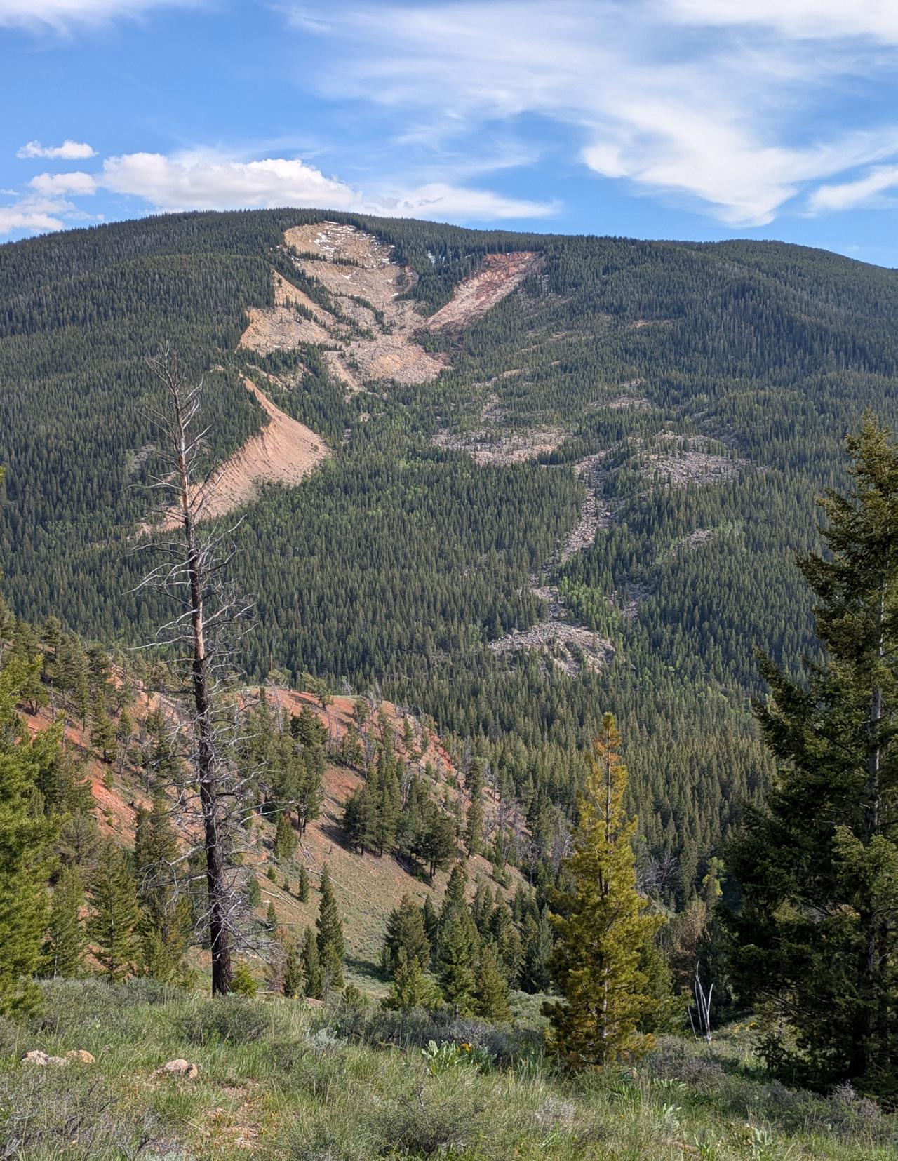
Photograph of the Gros Ventre Slide in June 2025, 100 years after it occurred. View is to the south from the north side of the Gros Ventre River Valley. Photo by James Mauch, Wyoming State Geological Survey. Read more on 14.

MEMBERS
EVENT ATTENDEES
WEBSITE VISITORS
OUTCROP READERS
EMAIL SUBSCRIBERS
NETWORKING EVENTS
CONTINUING EDUCATION EVENTS
FIELD TRIPS
COMMUNITY CONTACTS IN 2024YOUR SUMMIT SPONSORSHIP DOLLARS SUPPORTED: 1,200 1,200 8,000 8,000 5,000 4,000 23 13 10

October 30, 2024
Geoscience Community:
We sincerely appreciate the support every Summit Sponsor and Event Sponsor provided over the past year. Your contributions are vital to the success of the Rocky Mountain Association of Geologists (RMAG).
In 2024, the RMAG was proud to host a dynamic lineup of events, including the CCS Workshop, which provided an in-depth look at advancements in carbon capture and storage. Members explored the beauty and geological wonders of the Colorado Rockies with ten diverse field trips and shared our passion for geoscience with students across the region through classroom visits and community festivals. Additionally, we fostered connections among members through monthly lunches, coffees, happy hours, and our annual Golf Tournament.
Looking ahead to 2025, we are excited about new opportunities for RMAG. Your sponsorship will help RMAG realize a robust calendar of continuing education opportunities, an exciting season of field trips, high-impact short courses, and a dynamic lineup of luncheon speakers. In April 2025, we look forward to the North American Helium & Hydrogen Conference, building on the success of our 2023 North American Helium Conference. Your sponsorship empowers RMAG members to impact the next generation at outreach events throughout the community and provides invaluable networking opportunities for the geoscience community. Furthermore, your financial support plays a crucial role in our publication efforts, which include the monthly Outcrop newsletter and the quarterly Mountain Geologist journal.
In recognition of your financial commitment to supporting geoscience in the region we recognize our sponsors through in-person signage, advertising on our website, publications, and social media promotions leading up to each event. With a LinkedIn group of almost 3,000 members, we ensure our sponsors are visible to the geoscience community for both virtual and in-person events.
Thank you to our current Summit Sponsors; we look forward to your continued support in 2025. For those considering sponsoring, we encourage you to explore the many benefits included at each sponsorship level and consider how you can promote geoscience in the Rockies. If an annual sponsorship doesn’t suit your company’s needs or if you wish to sponsor a specific event, please inquire about our single-event sponsorship opportunities. Feel free to reach out to our staff with any questions about sponsorship at bcrowther@rmag.org or by phone at 720- 672-9898 ext. 102.
On behalf of the RMAG staff, volunteers, and myself thank you all for your continued support, and we look forward to connecting with you in 2025.
Sincerely,
Matthew Bauer
Bridget Crowther 2025 RMAG President RMAG Executive Director


RMAG 2025 SUMMIT SPONSORSHIP
All sponsor benefits event tickets follow RMAG event registration deadlines. All benefits end 12 months after registration.
RMAG 2024 ANNUAL SUMMIT SPONSOR OPPORTUNITIES
Platinum Sponsor
Gold Sponsor
Silver Sponsor
Summit Sponsorship benefit term is for 12 months! Specify type of payment on signed form, and send logo and advertisements to staff@rmag.org
Company:
Company Representative:
Address:
City: State: Zip Code:
Phone: Email:
Payment Method: Credit Card ACH Check
Credit Card Information:
Select Card: AMEX Mastercard VISA Discover
Name as it appears on Credit Card:
Credit Card #:
Expiration Date:
Signature:
Security Code:
ACH: contact the RMAG office at staff@rmag.org for directions.
Mail Checks payable to RMAG:
Rocky Mountain Association of Geologists (RMAG)
730 17th Street, B1 Denver, CO 80202
RMAG events are subject to change. Cancellation or rescheduling of events does not give the sponsor the right to refund. Summit Sponsors will receive benefits at any new events added into the RMAG schedule.
Thank you for your generous support!
P: (720)672- 9898 staff@rmag.org www.rmag.org

730 17th Street, B1 Denver, CO 80202
RMAG AUGUST 2025 BOARD OF DIRECTORS MEETING
By Drew Scherer, Secretary flatirongeo@gmail.com
The RMAG Board met on August 20th at 4pm via Zoom, with all members present saving four. As summer break has come to a close and school is back in session we saw positive indicators in good turnouts for our end of summer coffee and happy hours, as well as the family hike to the Florissant Fossil Beds, membership has been steadily increasing lately and the Golf Tournament was a large success.
With continued gains in the stock market offsetting a net operating loss for July, our net revenue is up substantially. As we continue to grow our organizational funds, the Finance committee and Board of Directors are evaluating alternative investment strategies that allow us to continue growth while being more conservative with our investments to ensure the long-term sustainability of RMAG.
The Continuing Education Committee has luncheons and events scheduled through the end of the
year and is beginning to look at scheduling events for the beginning of 2026. The CEC has also continued to collaborate with the Membership committee and oth er local geo groups to plan the Energy in the Rock ies career fair preceding the RMS-AAPG Conference in October.
Speaking of the Membership committee, we have had a great summer season with numerous fami ly events and activities that have been well attended like our summer family-friendly hiking series. The Golf Tournament was the biggest since covid with 132 play ers, and likely was thus the most financially impact ful tournament we have hosted to date. The Pedals & Peaks Mountain Bike field trip has been rescheduled to September 27th at 11am due to road and trail clo sures related to the Lee fire near Rifle and Meeker early last month, we hope you can join us for that exhilarating event.


The Publications committee has a full slate of articles in the pipeline for the end of the year into early 2026, including a number of Outcrop articles related to the RMS-AAPG section meeting and recent OTR trips. The Mountain Geologist has four articles to be released soon in the next edition as well as an additional 4 articles planned for the winter issue. The Geoscience Outreach committee recently hosted a field trip for the Center on Colfax which was well received and has a couple outreach events scheduled for the fall including Parker Science Night, Girl Scout Day at Dinosaur Ridge, and the Colorado Science Conference.
As the weather begins to cool the OTR committee has a couple more field trips scheduled before first frost including the (rescheduled) Dotsero Volcano, the OuraySan Juan Mountains, Picketwire Dinosaur Trackway, and Pueblo field trips.
Thank you for joining this rendition of The Outcrop, we look forward to seeing you at some of our events later this year!


PRESIDENT’S LETTER
By Matthew Bauer
September: National Suicide Prevention Month
Dear Fellow Members,
As September approaches—National Suicide Prevention Month—I’d like to speak openly, honestly, and from the heart about something that touches all of us: mental health.
Geology, like many scientific fields, can be both exhilarating and demanding. The work we do often requires long hours, time away from loved ones, and the mental rigor of problem-solving in complex, uncertain, and challenging working environments. These pressures, compounded by personal or global challenges, can take a quiet toll on our well-being.
This issue is personal for me. My sister, a geologist and a bright, enthusiastic member of our professional community, died by suicide. She was passionate about her work, loved the outdoors, and had so much to offer the world. Her passing is a heartbreaking reminder that mental health struggles are not always visible, and individuals may be silently suffering.
September is an opportunity to acknowledge that mental health is just as vital as physical health. It’s a time to reaffirm that seeking help is not a sign
of weakness — it is a courageous, proactive step toward healing and strength. It’s also a time to look out for each other: to check in on your friends, take time to listen, and to be a source of support within our community.
If you or someone you know is struggling with mental health…
…please know that help is available:
• National Suicide Prevention Lifeline (24/7): 988
• Crisis Text Line: Text HOME to 741741
• Employee Assistance Programs (EAPs): Many workplaces offer confidential support
• Local mental health services: Reach out to providers in your area
Together, we can help break the stigma surrounding mental health and create a community where everyone feels safe, seen, and supported — not only as professionals, but as human beings.
Thank you for being part of this conversation, and take care of yourselves and each other.
Stay Curious & Be Good to Each Other, —Matthew W. Bauer

6
SEPTEMBER
19-21
SEPTEMBER

PENNSYLVANIAN-PERMIAN EOLIAN/FLUVIAL SYSTEM ALONG THE NORTHERN COLORADO FRONT RANGE: PART II
Part II will explore the northern reaches of the Permian system along the northern Colorado Front Range See where the Ingleside formation meets the sea,the Lyons meets its end , and the Lykins gets salty Lots to see from high frequency climate-eustatic induced cyclicity, excellent reservoir and seal rocks, and plenty of fluvial , eolian and marine clastics and carbonates..
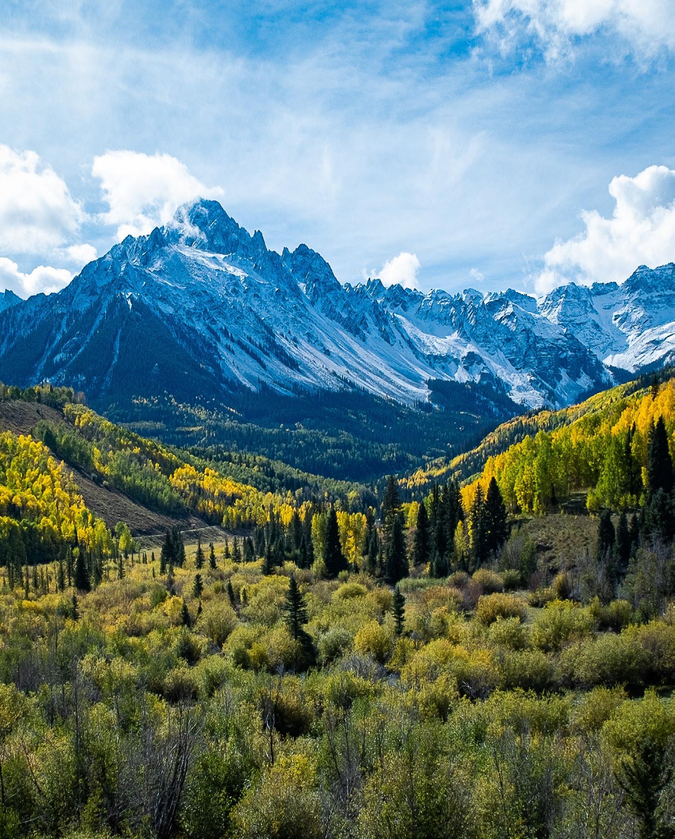
OURAY - SAN JUAN MOUNTAINS
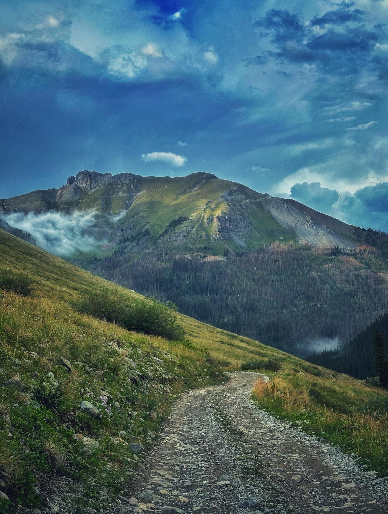
Examine the region’s fascinating geologic history, covering everything from Paleozoic to Cenozoic stratigraphy, Laramide to Oligocene volcanism, striking unconformities, and Pleistocene glaciation to its famous hot springs all set against the stunning backdrop of late September’s vibrant fall foliage
27
SEPTEMBER PEDALS
& PEAKS
This moderate to challenging mountain biking trail will take you through stunning terrain nestled against the Grand Hogback, offering a unique opportunity to explore the region's fascinating sedimentary geology As you ride, we'll discuss key formations such as the Wasatch, Williams Fork, Mancos, and Morrison-Entrada, along with the structural features and basin history of the area.
4-5 OCTOBER
PICKETWIRE DINOSAUR TRACKWAY
Located in the Comanche Grasslands along the Purgatoire River, this tracksite ("Dinosaur Lake") is considered the largest continuously mapped dinosaur fossil footprint assemblage known in the Jurassic Morrison formation and contains some of the world's longest trackways.
18 OCTOBER
PUEBLO CRETACEOUS FIELD TRIP
This field trip will examine classic exposures of Middle to Upper Cretaceous strata west of Pueblo, Colorado. We will investigate outstanding outcrops of the Graneros, Greenhorn, Carlile, and Niobrara formations.


LANDSLIDES IN WESTERN WYOMING PART 1
100 YEARS SINCE THE GROS VENTRE SLIDE
BY JAMES MAUCH Wyoming State Geological Survey
LANDSLIDES ARE A FACT OF LIFE
in western Wyoming. Residents of this area have a long history of contending with unstable slopes, a history that has been punctuated in recent years by several costly events. The Double Draw debris flow in 2011 closed U.S. Highway 26/89 through the Snake River Canyon for two weeks, and the 2014 Budge Drive landslide destroyed residential and commercial property in the town of Jackson. In the summer of 2024, the Big Fill landslide closed Wyoming Highway 22 between the towns of Wilson, Wyoming and Victor, Idaho for 20 days, forcing residents and visitors on a heavily trafficked 60mile detour that added two hours of travel time between the mountain communities. The final repairs to the highway were completed a year later at a total cost of approximately 43 million dollars (S.J. Wittke, Wyoming Department of Transportation, written commun., 2025).
But perhaps the most notable landslide to hit this region in recorded history is the Gros Ventre Slide, which occurred 100 years ago in 1925. Between its staggering size, the way it reshaped the landscape, and its impact on local communities, the Gros Ventre Slide tops the list for historic and geologic significance. This summer, the centennial anniversary offers an opportunity to reflect on this important event and to shed light on the landslide’s causes and consequences. This article is the first of a two-part series on landslides in western Wyoming, and it focuses on the Gros Ventre Slide. Next month’s article will provide an overview of a recent publication that explores where future landslides are likely to occur in this region.
THE GROS VENTRE SLIDE
The summer of 2025 marks the hundredth anniversary of the Gros Ventre Slide, one of the largest landslides to occur in the Rocky Mountains in recorded
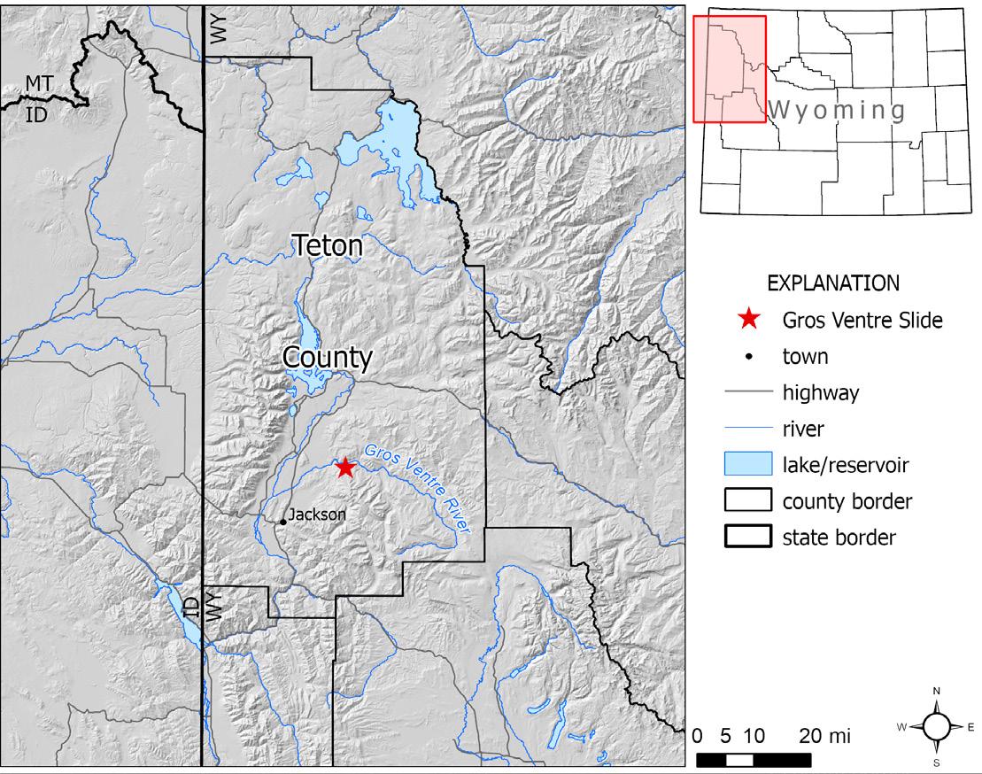
history. At approximately 4 PM on June 23, 1925, an estimated 50 million cubic yards of rock and debris rushed down the north side of Sheep Mountain—14 miles northeast of the town of Jackson (Fig. 1)—and into the valley of the Gros Ventre River, 2,100 feet below (Alden, 1928). The dramatic event was over within a few minutes, and as the dust settled, it revealed a landscape that was fundamentally changed (Fig. 2).
The channel of the Gros Ventre River was buried beneath 225 feet of landslide debris, which extended up the opposite (northern) valley wall to a depth of 350 feet. With the river blocked by the landslide debris,
water began filling the upstream valley to form what is today known as Lower Slide Lake. Within three weeks, Lower Slide Lake had reached a depth of 200 feet and inundated about 11,000 acres of the valley bottom (Alden, 1928). Remarkably, the 1925 landslide resulted in no fatalities. Rancher Guil Huff, whose firsthand account remains invaluable in piecing together the sequence of events, narrowly escaped the surging debris with his horse at a full gallop. However, tragedy struck nearly two years later on May 18, 1927, when the snowmelt-swollen Gros Ventre River breached the landslide dam and unleashed a devastating flood,
FIGURE 1: Regional map showing the location of the Gros Ventre Slide in Teton County, Wyoming.
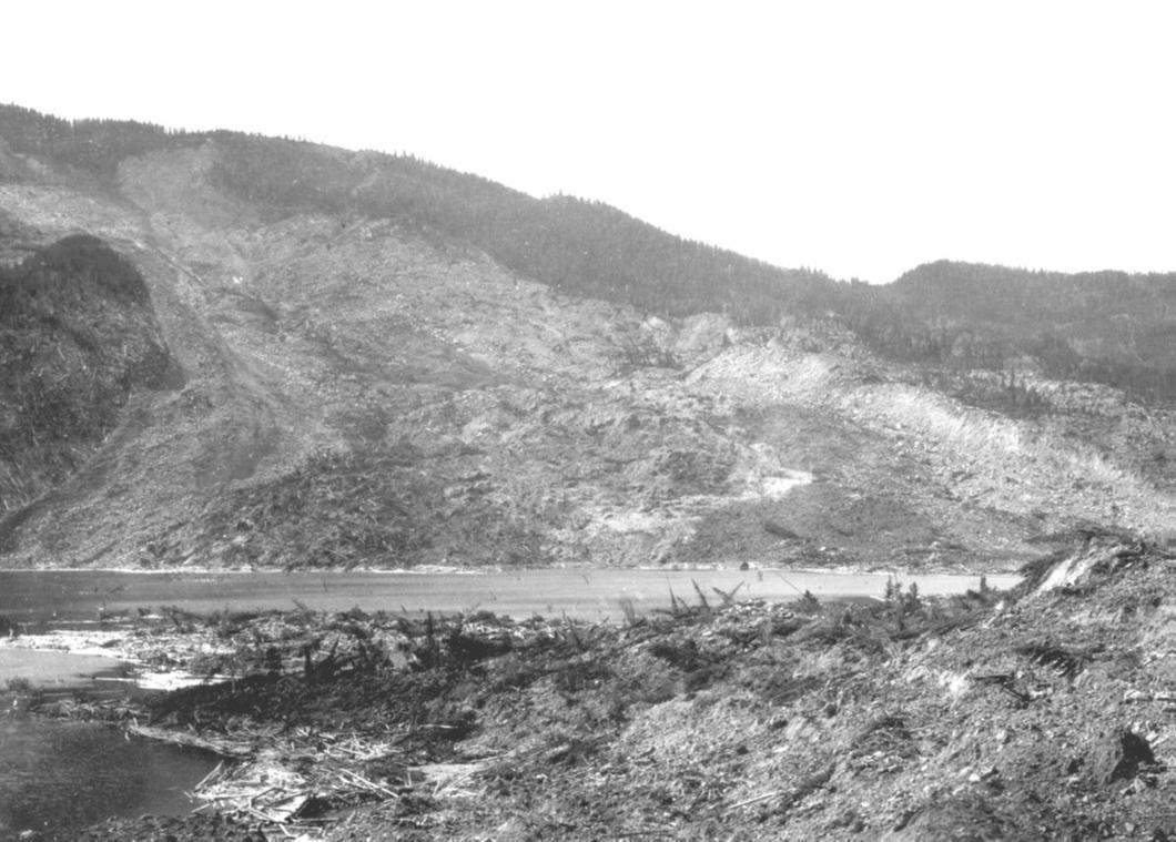
FIGURE 2: Photograph taken several months after the Gros Ventre Slide in 1925, showing the slide path (background), debris at the toe (foreground), and the waters of Lower Slide Lake. View is to the south. Photo by William C. Alden, U.S. Geological Survey.
FIGURE 3: Oblique lidar shaded relief map looking east up the Gros Ventre River valley. The Gros Ventre Slide is outlined in black, and it moved from the high ridge on the south (right side of image) into the valley below. North-dipping sedimentary rock units are labeled in white, separated by white dashed lines. The slope failed near the contact of the Tensleep Sandstone and the underlying Amsden Formation. Other landslides are visible in the lidar image, including the prehistoric Devils Elbow Slide and the Red Slide, which occurred six days after the Gros Ventre Slide on June 29, 1925 (Bailey, 1971).

claiming six lives and destroying the town of Kelly, 4 miles downstream.
GEOLOGIC TEMPLATE, TRIGGERS, AND MOVEMENT MECHANICS
The Gros Ventre Slide occurred along the northern flank of the Gros Ventre Range, an asymmetric basement-cored Laramide uplift. Whereas the southern margin of the Gros Ventre Range is fault-bound by the Cache Creek thrust, the northern flank is characterized by more gently dipping Paleozoic and Mesozoic sedimentary rocks (Nelson and Church, 1943; Simons and others, 1988). In the vicinity of the Gros Ventre Slide, these sedimentary units dip roughly 20 degrees northeast (Love, 2001a, b), and their bedding planes form the forested valley wall on the south side of the Gros Ventre River (Fig. 3). Given the 2,100 feet of topographic relief between the crest of Sheep Mountain and the valley bottom, the slope-parallel bedding within the sedimentary units, and the undercut toe of the slope from erosion by the Gros Ventre River, this hillside was primed for failure.
The landslide involved rock from the Amsden Formation (Pennsylvanian and Upper Mississippian) and Tensleep Sandstone (Pennsylvanian). The Amsden Formation is characterized by shale and siltstone with dolomite and limestone interbeds, and it is conformably overlain by limestone and dolomite beds of the basal Tensleep that transition upward into a well-indurated, fine-grained sandstone (Love, 2001a, b). The contrast between the weak, impermeable shales of the Amsden Formation and the overlying hard, heavily jointed Tensleep Sandstone was a key element in the development of the landslide. This condition allowed for groundwater to penetrate through the Tensleep Sandstone and saturate deeply weathered horizons above the impermeable Amsden Formation shales, which increased the pore fluid pressure and decreased the frictional strength of these layers, leaving them susceptible to failure (Voight, 1978).
Furthermore, the spring of 1925 was unusually warm and wet, and higher-than-normal runoff and meltwater infiltration undoubtedly contributed to the saturated soil conditions that preceded the Gros Ventre Slide (Voight, 1978). The ultimate trigger of slope failure may have been an earthquake. While there was no instrumental seismic monitoring in Jackson Hole
in the 1920’s, local residents reported feeling multiple earthquakes in the weeks leading up to June 23, including an earthquake of estimated magnitude 3–4 that occurred at 8 PM on June 22—20 hours prior to the landslide (Smith and others, 1976). It’s likely that the ground shaking from this earthquake kicked off a chain of events that began with liquefaction of the saturated, weathered horizons at the base of the Tensleep Sandstone and culminated hours later with the total failure of the slope (Voight, 1978).
In the past, the Gros Ventre Slide has been cited as a classic example of a rockslide, where a detached mass of rock slips along a discrete failure plane and slides intact down a slope before subsequently breaking apart (e.g., Alden, 1928; Sharpe, 1938; Zaruba and Mencl, 1969). However, it is likely that this mass movement was much more complex and involved a component of flow, where the detached material deformed internally. This interpretation is supported by the prevalence of fine-grained sediment and the matrix-supported architecture of the deposit, which is best seen in exposures along the channel that was cut through the landslide dam from the 1927 flood (Bennett and Knight, 1960). The presence of a spill-over lobe on the east flank of the slide path that exhibits prominent lateral levees, and a bottleneck constriction in the slide path through which an intact mass of sliding rock could not have passed, provide further evidence (Voight, 1978). Moreover, these observations are consistent with eyewitness accounts that described the front of the mass as rolling downslope rapidly, like a wave of water (Emerson, 1925).
TODAY AND BEYOND
One hundred years later, the Gros Ventre Slide remains an unmistakable part of the landscape and human history of western Wyoming. While much of the deposit and slide path are now vegetated, the headscarp, minor internal scarps, and eastern flank still expose the underlying architecture of bedrock and slide-displaced debris, forming prominent scars on the otherwise forested hillside south of the Gros Ventre River (Fig. 4). Today, Lower Slide Lake is a fixture in the Gros Ventre River valley, drawing recreationalists to its waters and wildlife to its unique mix of habitats. Geologically, the Gros Ventre Slide is still in a youthful stage, and parts of the complex have not yet
reached equilibrium. A timely reminder of this fact occurred in late May of 2025—mere weeks before the centennial date—when a minor retrogressive failure occurred along the southwestern headscarp, which toppled trees and sent debris several hundred feet downslope (visible as the reddish material in the upper right scar in this issue’s cover photo).
While much has changed in the century since the Gros Ventre Slide, the underlying geologic factors that contributed to the event remain the same. The Gros Ventre River valley, like many of the mountainous regions in western Wyoming, is characterized by steep slopes and relatively weak rocks, meaning that landslides will continue to occur. The Gros Ventre Slide leaves a legacy that motivates modern work to map and characterize landslides, so that communities in the future are better prepared to mitigate and respond to these inevitable geologic hazards.
REFERENCES
Alden, W.C., 1928, Landslide and flood at Gros Ventre, Wyoming: Transactions of the American Institute of Mining and Metallurgical Engineers, v. 76, p. 347–360.
Bailey, R.G., 1971, Landslide hazards related to land use planning in Teton National Forest, northwest Wyoming: U.S. Department of Agriculture, Forest Service Intermountain Region, 131 p., 2 pls.
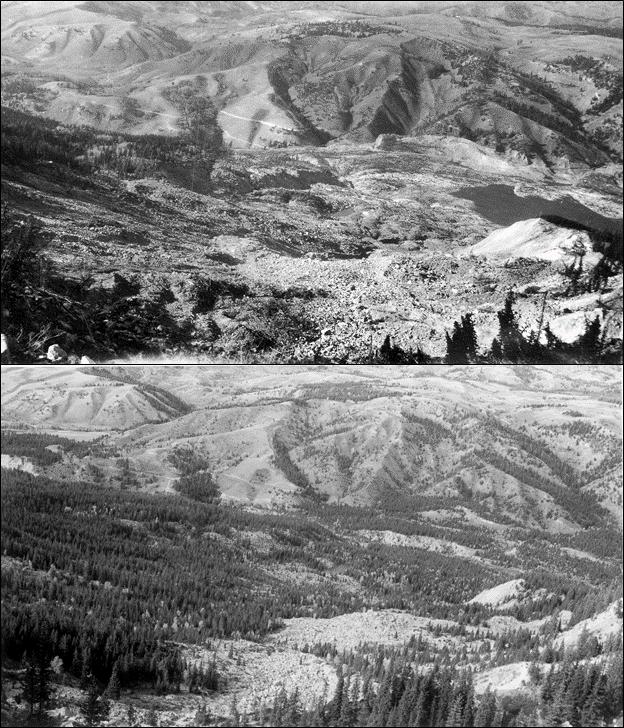
FIGURE 4: Repeat photo match set looking north, down the track of the Gros Ventre Slide, from near the landslide headscarp. Top photo taken on September 25, 1926, by William C. Alden, U.S. Geological Survey. Bottom photo taken on October 1, 2020, by Michael F. Merigliano. Note the higher level of Lower Slide Lake (at right) in the 1926 photo, prior to the 1927 Kelly Flood that lowered the outlet of the lake, and the revegetation of much of the deposit since the landslide.
Bennett, P.T., and Knight, D.K., 1960, Inspection of lower slide, Gros Ventre River, in U.S. Army Corps of Engineers, Report on flood emergency, Madison River Slide, Montana, Appendix VII: Omaha, Neb., U.S. Army Engineers District, 5 p. Emerson, F.B., 1925, 180 ft. dam formed by landslide in Gros Ventre Canyon: Engineering News-Record, v. 95, p. 467–468.
Love, J.D., 2001a, Geologic map of the Blue Miner Lake quadrangle, Teton County, Wyoming: Wyoming State Geological Survey Love Map Series 6, scale 1:24,000.
Love, J.D., 2001b, Geologic map of the Shadow Mountain quadrangle, Teton County, Wyoming: Wyoming State Geological Survey Love Map Series 7, scale 1:24,000.
Nelson, V.E., and Church, Victor, 1943, Critical structures of the Gros Ventre and northern Hoback ranges, Wyoming: The Journal of Geology, v. 51, no. 3, p. 143–166.
Sharpe, C.F.S., 1938, Landslides and related phenomena: New York, N.Y., Columbia Univ. Press, 137 p.
Simons, F.S., Love, J.D., Keefer, W.R., Harwood, D.S., Kulik, D.M., and Bieniewski, C.L., 1988, Mineral resources of the Gros Ventre Wilderness Study Area, Teton and Sublette counties, Wyoming: U.S. Geological Survey Bulletin 1591, 65 p., 4 pls., scale 1:48,000.
Smith, R.B., Pelton, J.R., and Love, J.D., 1976, Seismicity and the possibility of earthquake related landslides in the Teton-Gros Ventre-Jackson Hole area, Wyoming: Contributions to Geology, University of Wyoming, v. 14, no. 2, p. 57–64.
Voight, Barry, 1978, Lower Gros Ventre Slide, Wyoming, U.S.A., in Voight, Barry, ed., Rockslides and Avalanches, 1—Natural Phenomena, Developments in Geotechnical Engineering, v. 14A: Amsterdam, Elsevier, p. 113–162.
Zaruba, Quido, and Mencl, Vojtech, 1969, Landslides and their control: Amsterdam, Elsevier, 205 p.

U R N A M E N T Thanks Thanks Thanks For For For Coming! Coming! Coming!
TO OUR








1ST FLIGHT WINING TEAM
Daniel Baker, Scott Hampton, Julian Michaels, Travis Pitcher
2ND FLIGHT WINING TEAM
Kat Goodman, Nathan Corbin, Seth Johnson, Michele Wiechman
MEN’S LONG DRIVE
Matt Ramero
WOMEN’S LONG DRIVE
Laura Johnson
CLOSEST TO THE PIN
Breann Cook
LONG PUTT
Bobby Schoen
CLOSEST TO THE PRIZE
Ali Sloan
Meghan Kuhn CONGRATULATIONS TO OUR WINNERS!
PUTTING CONTEST
Mallory Tuco
HYBRID LUNCH TALK
Speaker: Rachel Williams
Date: September 10, 2025 | 12:00 pm - 1:00 pm

Constraining fracture stratigraphy in grain-rich mixed carbonate slope deposits for subsurface applications
Presenter: Rachel Williams, Colorado School of Mines
Outcrop studies are essential for characterizing fractured carbonate systems, as they provide the most comprehensive understanding of how vertical and lateral facies variability and associated diagenetic processes affect fracture size and fracture network geometry (and thus fluid flow) at multiple scales.
The Pinery Member of the Permian-aged Bell Canyon Formation, located on the toe-of-slope of the Capitan Reef system in the Guadalupe Mountains of West Texas, contains various architectural elements that are well exposed for fracture-stratigraphy characterization. While published studies have linked burial


SHORT COURSE:
Update your thinking, interpretations, and modeling of oil-prone source rocks in your petroleum system, play, or prospect.
In this class explore updated interpretations, encourage open discussion, and highlight the evolving understanding of oil generation and expulsion.
September 22 and 23, 2025
8am to 4pm
diagenesis to fracture network enhancement, the original depositional controls on burial-fracture-network development remain poorly constrained. This study describes the fracture stratigraphy along depositional strike and dip in the grainstone and rudstone-dominated Pinery Member. In the proximal toe-of-slope setting, upslope-shingling carbonate debris-flow deposits exhibit compensational stacking with downslope-dipping carbonate turbidite complexes, while the distal toe-of-slope is organized into a poorly-confined interbedded grainstone debrite and turbidite complex.
Most fractures are interpreted as Mode I open fractures that form orthogonal sets and are oriented with regional tectonic trends. Mineralized fractures are rarely observed in the heavily weathered outcrop faces and follow the same orientation trends as Mode I fractures. Fracture heights range from 0.01 m to 12 m, are characterized by an exponential distribution, and are constrained by a combination of bed thickness and stratal architecture, vertical facies stacking patterns, and tectonic overprint. Bed-bound and intra-bed fractures are more evident in thin to medium-bedded grainstone turbidites on the distal toe-of-slope, and increasing fracture heights exhibit a weak positive correlation with increasing bed thickness. Fracture heights also exhibit a weak positive correlation with increasing grain content (Dunham texture). The smallest fracture heights (up to 0.6 m) are associated with mud-rich turbidite caps
and debrites, and larger fracture heights (up to 6.0 m) are associated with stacked and backfilling medium to very thick-bedded grainstone and rudstone debrites and turbidites. The largest fracture heights (> 6.0 m) are associated with tectonic overprint from Basin and Range extension and are more prevalent in the thicker proximal toe-of-slope rudstone complexes. There is no correlation between fracture height and grain size.
From sedimentological and fracture observations in the field, we postulate that (i) mud-rich carbonate facies at the caps of grain-rich turbidites or in off-axis deposits are mechanical boundaries, (ii) tabular turbidite and debrite architectures promote the development of shorter bed-bound fractures, particularly in the distal toe-of-slope setting, (iii) thick, massive debrite complexes promote taller bed-bound fractures in the proximal toe-of-slope setting, and (iv) thick, vertically stacked geometries with similar grain content promote taller throughgoing fractures through the processes of burial and/or tectonic activity. Geomechanical testing on these toe-of-slope facies is the focus of future efforts to constrain the depositional controls on rock strength.
Results of this study have implications for predicting facies- and tectonics-controlled fracture network geometry in subsurface applications for oil and gas reservoirs, carbon storage, enhanced geothermal, and groundwater reservoir characterization.
RACHEL AISNER WILLIAMS is currently a Geology Ph.D Candidate at the Colorado School of Mines, working on an integrated sed/strat, geomechanics, fracture (fracture stratigraphy) and data analytics thesis in Permian-aged mixed carbonate and siliciclastic slope deposits in the Guadalupe Mountains, USA. The goal of this research is to determine if depositional stratal geometries on the slope affect fracture size, spacing, and intensity for subsurface characterization applications. Williams' career goal is to apply her interdisciplinary technical background to subsurface characterization projects in an industry, consulting, or research role in the low carbon energy space or oil and gas upon graduation in 2026.

Speaker: Ronald S. Bell
Date: October 1, 2025 | 12:00 pm - 1:00 pm

Autonomous Mapping Applied to Geology and Infrastructure
Presenter: Ronald S. Bell, Senior GeoDRONEologist
In 2025, the deployment of an autonomously operated aerial vehicle (UAV) fitted with a specialized sensor or sensor package to map the surface of the earth is widespread, though not quite so prevalent to be considered routine for mapping geology. A UAV (aka “drone”) configured with a magnetometer to map spatial variations in the Earth’s magnetic field is routine when the objective is to detect and
delineate pipelines and O&G wells made of steel or iron and it is a common tool for mineral exploration. Drone enabled electromagnetic methods for mapping near-surface geology and delineate buried metallic objects are gaining acceptance in several market sectors. The recent Notice of Proposed Rule Making (NPRM) announcement by FAA pertaining to the beyond visual line of sight (BVLOS) flight operations will


Honorary Member
Michael S. Johnson Outstanding Explorer
Outstanding Scientist


Distinguished Service to RMAG
Distinguished Public Service to Earth Science
Geosciences in the Media
General Chairs
Preston Kerr & Josh Sigler
Technical Program Chair
Justin E. Birdwell
Learn More
Technical Program Technical Program
This year’s technical sessions are packed with the latest research on: Geologic Aspects of Carbon Storage
Rocky Mountain Petroleum Systems: Data Integration and Modeling Issues Around Orphaned & Abandoned Wells
Lower Green River / Uinta Basin: Geology and Resources
Geothermal & Critical Minerals
Resources
Field T
Helium Resources in the Rockies
The Mowry Shale: Play Developments, Resource Recovery, Geochemistry, Geomechanical Properties
Recent Developments in the Williston Basin Stratigraphy & Sedimentology
The Mancos Shale in the San Juan Basin and Beyond
rips Field Trips
Pre-Conference (Sunday October 5)
"Cretaceous Stratigraphy of the Niobrara Formation in Colorado's Middle Park Basin: Implications for Exploration and Development Across the Rockies."
Post-Conference (Wednesday October 8)
“The Structural Evolution of the Laramide Foreland: Case Studies for Subsurface Mapping and Exploration in the Middle Park and Eagle Basins of Colorado.”
We’ve secured room blocks at Keystone Lodge & Spa and Hyatt Place Keystone.
Use the code BKRAPG25 when booking. Reserve soon to secure your lodging at the conference rate!
no doubt lead to a dramatic increase in the utilization of drones for geoscience mapping and assessing the status of buried infrastructure. The Age of Geoscience Autonomy has arrived.
Resource explorationists, environmental geoscientists, and civil engineers are increasingly “on board” with the concept of deploying drones to collect a multitude of geoscience data, including LiDAR, color photo-imagery, multi- and hyper- spectral data, and thermal imagery. For many investigations, the surface geoscience data complimented surface geoscience data including magnetic, electromagnetic, and gamma ray spectrometry geophysics data. The primary reasons are low cost per data point, increased data volume, and diminished risk.
Nevertheless, there are limitations to deploying an airborne robot. Poor weather conditions are the number one deterrent to collecting geoscience data via a drone. As a result, autonomously operated terrestrial or marine vehicles will be deployed to collect geoscience data.
I will begin my presentation by reviewing the benefits and issues of geoscience mapping using drones including a review of the state of the art of UAVs and sensors. This will be followed by the presentation of drone geoscience data from several use cases including applications to groundwater and mineral resource exploration, locating legacy oil and gas wells, and mapping of subsurface infrastructure.
RONALD S. BELL is a globally recognized advocate for the application of airborne robots, aka “drones”, to collect geophysical and remote sensing data, primarily to explore for earth resources and environmental site characterization. He began his career as a mineral exploration geophysicist where he collected, processed, visualized, and interpreted ground, borehole, and airborne geophysical data for base and precious metal exploration. His has worked on resource exploration projects in North and South America, Europe, Africa, Australia, and Far East Russia. In addition, he has performed numerous geophysical surveys for environmental and engineering subsurface site characterization.
In 1986 to 1991, he help found and served as the marketing specialist for a geophysical software company. From 1991 through 2006, he focused on ground and airborne geophysics ( i.e. magnetic and EM) applied to mineral, hydrocarbon, and groundwater exploration. From 2006 through 2009, he worked for hydroGEOPHYSICS, Inc. to build the market for a novel electrical technology for monitoring fluid flow within geologic materials. In 2009, he returned to geophysical services and consulting.
In 2016, Ron conducted a number of drone magnetic surveys map subsurface geology and precisely locate oil and gas infrastructure using the prototype of the MagArrow, an innovative drone magnetometer. In 2022, he deployed the EM61Lite, drone drone-enabled deep-looking EM metal detector to map buried pipelines and locate metallic objects. Also in 2022, he did his first survey using the GEM2 UAV, a drone enabled EMI conductivity meter to map shallow soil and rock.
In 2024, he formed Drone Geoscience, LLC, a geophysical and remote sensing service provider located in the Denver, CO area with office in Houston, TX. Ron holds a BSc in Applied Physics from Michigan Technological University in 1976. In the early 80’s, he completed non-degree geologic course work at the University of Colorado Denver.

John C. Webb Consulting Geologist
Stratigraphy, Sedimentology and Petrography of Clastic and Carbonate Systems
Louisville, Colorado
Reservoir Characterization
Petroleum, SWD, CCUS, Geothermal
Johnwebb20@comcast.net
303.917.0644
WRITE FOR THE OUTCROP
The Outcrop is the monthly online newsletter of the Rocky Mountain Association of Geologists. The Outcrop circulates to the 1900-plus members of the RMAG and about 200 university libraries and industry associates. It's a great opportunity for young professionals to get their name out to other geologists in the community. It provides articles for the benefit and edification of its readers and gives authors a chance to reach local geologists on subjects that interest or concern them. Learn more here.
RMAG ON THE ROCKS
USGS CORE RESEARCH CENTER AND NSF ICE CORE FACILITY
AUGUST 15, 2025
By Ralf Topper, Trip Leader
Fourteen participants along with field trip coordinator, Ralf Topper, attended the RMAG On-theRocks field trip to the United States Geological Survey’s (USGS) Core Research Center and the National Science Foundation’s (NSF) Ice Core Facility at the Federal Center on the morning of Friday, August 15th. Both facilities have been significantly impacted by federal budget cuts, reducing permanent staff to two full-time employees from five originally. Consequently, both available tour schedules and lengths have been reduced.
In 1974 the U.S. Geological Survey, in cooperation with the Rocky Mountain Association of Geologists, established a permanent free-access core repository in Denver. Terry Huber of the USGS started her tour of the Core Research Center in the core examination room (Figure 1). This large, well-lit, climate-controlled room provides large, long tables to examine up to 1,700 feet of slabbed core at one time. Researchers have access to binocular microscopes, ultraviolet lights, and hydrochloric acid for their analysis. During our visit, there were core sections from the Green River formation and Mowry Shale laid out for inspection.
The 80,000 ft2 facility currently houses 9,800 rock cores and 54,000 cuttings from wells, most of which are in the Rocky Mountain region. The majority of the cores were provided by oil & gas operators.
Consequently, most of the research is related to natural resource characterization, but the collection also contains cores obtained from Cajon Pass, CA drilled to determine fault motions; Enewetak Atoll to understand the effects of nuclear bursts on geologic structures; Yellowstone National Park to understand the chemistry of geothermal fluids; Green River Formation to understand ancient lake systems and the Paleocene-Eocene Thermal Maximum; and the Castle Pines and Kiowa cores to characterize aquifer properties in the Denver Basin.
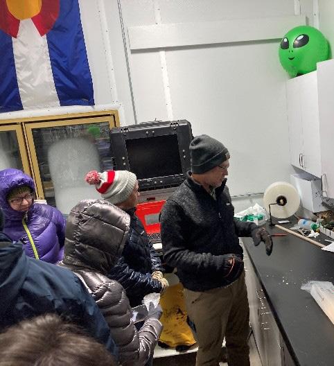
The group’s favorite stop on the tour was the core sample preparation room that housed diamond coated circular saws and hole drills to cut and slab core samples and obtain plugs from the cores for analysis (Figure 3). Terry had a variety of small core disks and cut core sections of salt from the Paradox Basin in Utah laid out on a table for participants to take home. The classroom next to the preparation area displayed slabbed cores of various rock types, cores from geologic areas of research (faults, geothermal, meteoric impacts, etc.), and educational posters for tour groups to examine (Figure 4).
The group then grabbed their winter jackets, hats, and gloves and met acting technical director and curator Curt LaBombard in the National Science Foundation’s Ice Core Facility (Figure 5). Formerly known as the U.S. National Ice Core Laboratory,
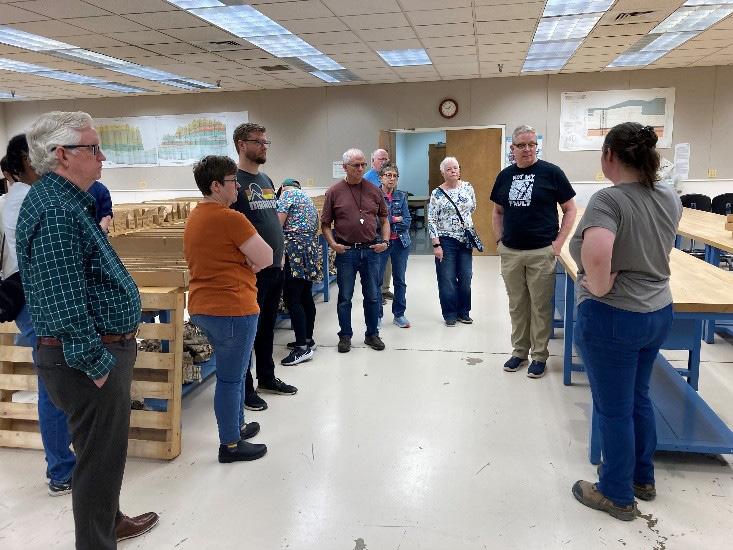
FIGURE 1:
Terry Huber with the group in the core examination room
FIGURE 2:
Terry Huber in front of a fraction of the core facility storage shelving explaining the collection and warehouse operations
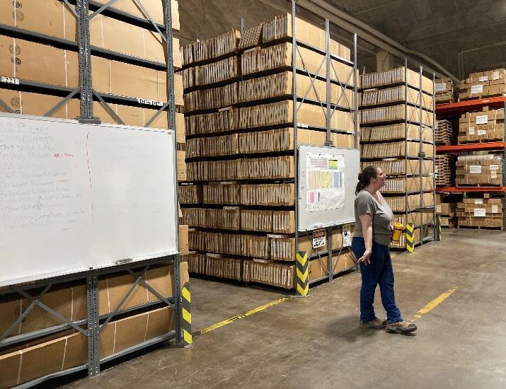
FIGURE 1
FIGURE 2
RMAG ON THE ROCKS: CORE RESEARCH CENTER
it was established in 1993 and renamed in 2018 to the NSF Ice Core Facility. This facility is also housed in building 810 on the Denver Federal Center, funded by the National Science Foundation and covers an area of approximately 55,000 ft2. Curt indicated that federal budget cuts not only resulted in staff cuts but put the facility’s future funding in jeopardy.
The Ice Core Facility is a facility for storing, curating, and studying meteoric ice cores recovered from the glaciated regions of the world, mostly Greenland and Antarctica. Staff and researchers characterize gases in the cores with hyperspectral cameras and photographic images for documentation. The research focuses on measuring carbon dioxide content of the gas bubbles in the ice to document changes in concentration over time. The main archive freezer, which is nearing capacity, is held at a temperature of -36°C. A second room for examination of ice cores, held at -24°C, is 12,000 cubic feet in size and is contiguous with the archive area.
Curt took us into the examination room to show us the core preparation area (Figure 7), examine
a section of ice core, and acclimate us to the freezing temperatures (brrrr) before entering the main archive freezer. The archive freezer holds a total of 30,000 meters of ice core, the oldest of which is 6.7 million years old from Antarctica.
The National Science Foundation is in the process of building a new facility including a 6.000 ft2 freezer and scientist support space in the same building. The facility is being designed to minimize environmental impacts, using trans-critical CO2 for cooling, while maximizing ice core curation and science support. The new facility cost is $12 million and has come in under budget.
If you are interested in learning more or planning your own trip to the facilities, please contact them directly.
Information about the USGS Core Facility can be found at https://www.usgs.gov/core-research-center, and you can contact them at CRC@USGS.GOV. Information on the National Science Foundation Ice Core Facility can be found at icecores.org, and you can contact them at nicl@usgs.gov
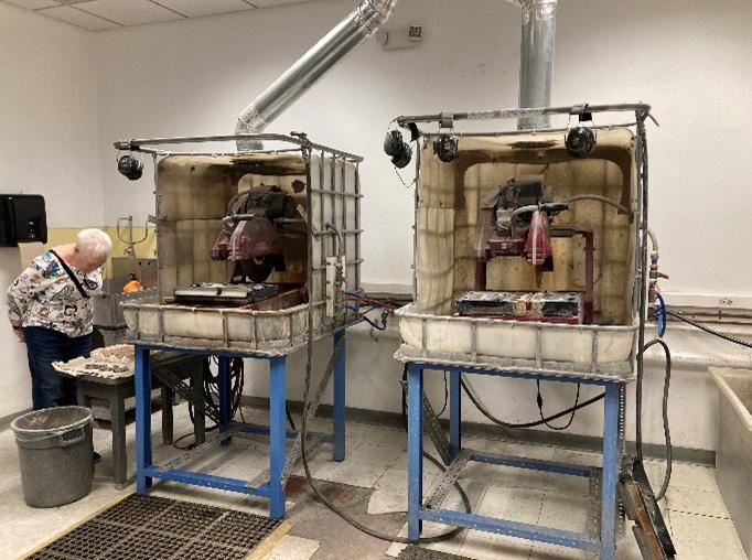
FIGURE 3: Diamond coated circular saws.
RMAG ON THE ROCKS: CORE RESEARCH CENTER
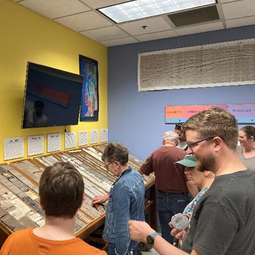
FIGURE 4
5
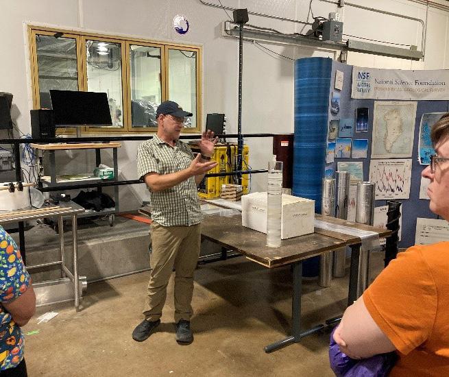
FIGURE 4: Sample cores in the classroom.
FIGURE 5: NSF Acting Director and Curator Curt LaBombard introducing the group the operation and purpose of the National Science Foundation’s Ice Core Facility.
FIGURE 6: Door to the Ice Core Facility.
FIGURE 7: LaBombard showing the core preparation area.
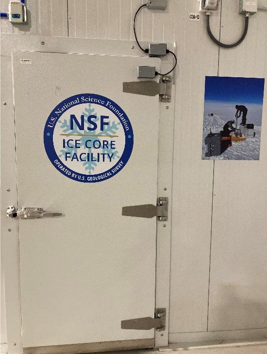
FIGURE 6
7
FIGURE
FIGURE
RMAG ON THE ROCKS: CORE RESEARCH CENTER
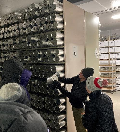
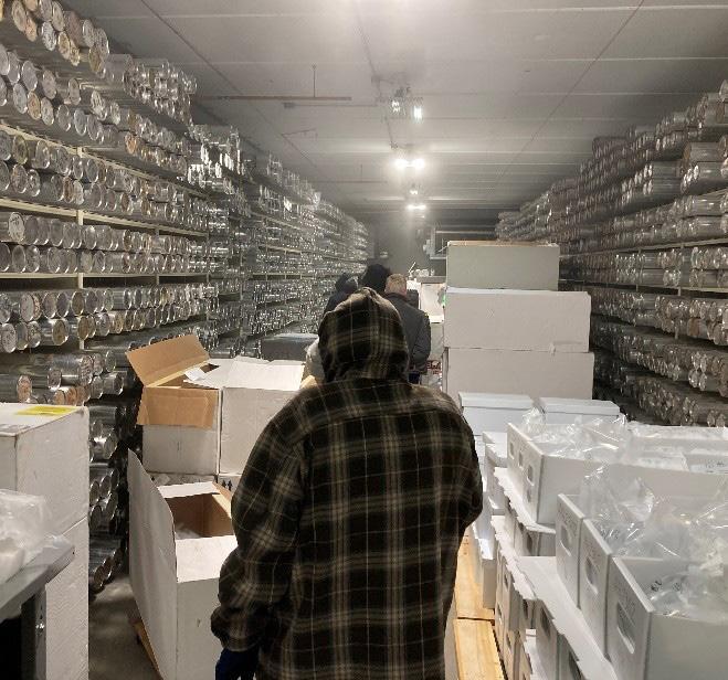
FIGURE 8: LaBombard explaining the storage notation in the archive freezer.
FIGURE 9: Group touring through the archive freezer.
FIGURE 10: Stickers used on coolers used for transportation.
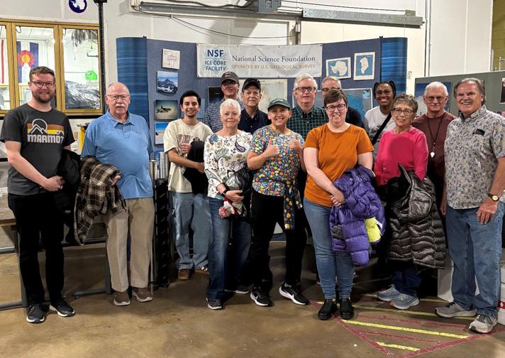
FIGURE 11: RMAG Tour Group.

FIELD TRIPS
From Canada to trinidad, these trips will rock your brain!
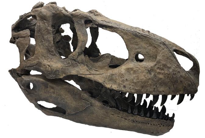
April 25 - Day Trip Through Colorado's Collections. A day behind the scenes at Dinosaur Ridge, Morrison Natural History Museum, and the Denver Museum of Nature and Science.
May 17 - Day Trip to Red Rock Canyon. A geology-focused hike through Red Rock Canyon in Colorado Springs. Trip will be led by Dr. Louis Taylor.
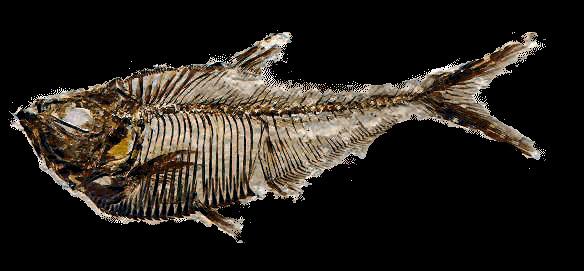
June 6-8 - Green River Fish Dig. We partner with Fossil Lake Safari in Kemmerer for a full day dig, and exploration & guest speaker at Fossil Butte National Monument.
September 9-14 - Alberta Badlands. Dr. Robert Raynolds will lead this exploration of Alberta's dinosaur badlands! Only a couple of spots remain, sign up TODAY!
October 11-12 - A Trip to the End of an Era. We'll travel south to the Paint Mines and Trinidad, Colorado to see the K/Pg boundary, the dinosaur extinction line. Led by Dr. Louis Taylor. register today! member discounts available!

Celebrating 50 Years at the RMAG Foundation
On December 31st, 1975, the RMAG Foundation was established and approved by the Rocky Mountain Association of Geologists as a separate non-profit to fund scientific activities. At the time, RMAG recognized the need for a philanthropic partner to provide support for educational, charitable and scientific activities related to the geosciences. Three prominent members of the geoscience community at the time, John P. Lockridge, John W. Rold and Robert J. Weimer, were the founding Trustees and guided the Foundation through its formative first decade. These three gentleman provided the first donated funding that formed the investment body of the Foundation. Today, the Foundation has nine Trustees who oversee the investments and have the sole fiduciary responsibility for determining which projects receive financial support, and award grants and scholarships. The Foundation funds these activities from earnings on investments coupled with generous donations from RMAG members and the geosciences community at large. Additionally, the Foundation manages eight named scholarships that provide self-supporting funds for undergraduate and graduate scholarships. General donations form an unrestricted investment body that provides funds for publications, scholarships, grants and award to many students and other earth science organizations.
The mission of the Foundation is to inspire and educate current and future geoscientists. To fulfill this mission, the Foundation has supported many earth science-related activities and organizations. One of the first publications funded by the Foundation was the RMAG “Big Red Book”, familiar to and used by many geoscientists working the Front Ranges of Colorado, Wyoming, and New Mexico. Since 1975, the Foundation has grown our community outreach to include nine graduate student scholarships, two Colorado College undergraduate scholarships, the Neal J Harr hammers awarded to the outstanding Geology student
at 10 Colorado colleges and universities, support for field camps through the Brown awards, Teacher of the Year awards and many other community based STEM events. In 2025, the Foundation awarded $84,000 of scholarships and $29,000 for community programs.
Early on, the Foundation supported continuing education courses and earth science publications that disseminated technical information for professional geologists, as well as helped establish the Denver Earth Resources Library. K-12 educational support was and is promoted by an annual earth science teaching excellence award for Front Range schools and support of local Science Fairs. The Foundation also supports organizations with active K-12 STEM programs in the Front Range, such as the Friends of Dinosaur Ridge. Recently, the Foundation has added outreach activities supporting the DMNS Girls and Science evening, Parker Science Night, Cinco de Mayo, and PrideFest. As it evolved, the initial purpose has grown into a broader appreciation of geology as earth science, yet the mission still emphasizes education at all levels.
RMAG Foundation is a well funded entity in great part due to the wonderful support of the geoscience community and our hope is to continue supporting geoscience education for another 50 years. Thank you to all that have donated in the past. We would not be able to fulfill our mission without your donations.
— The RMAG Foundation Board
Bob Tucker, Ginny Gent, David Taylor, Tanya Inks, JoDana Swanson, Danielle Ebnother, Nate Rogers, Shawna, Gilbertson, Daniel Spaulding
Information sourced from several articles on the History of the Foundation.
D eta ile d a nd ac c ura te g eo lo gy at yo u r fin g ertip s in Pe tra , Ge o Grap h ix, A rc GIS , A cc u Map , ge o S C OU T an d o th er d ig ital ma p pin g a p plica tion s
We ste rn USA
Geol ogi cal Edge Set
Ene rgy Al te rnati ve s & Cri ti cal Mine ral s - USA
We ste rn Cana da Geol ogi cal Edge Set
Ene rgy Al te rnati ve s & Cri ti cal Mine ral s - Ca nada
Ea ste rn USA & Ea st ern Ca nada
Geol ogi cal Edge Set
Cent ral USA
Geol ogi cal Edge Set
Me xi co
Geol ogi cal Edge Set
Map la ye rs p rov ided in s ha pe file fo rma t fo r ea sy impor t into a ll ma ppin g app lic at ions .
De liv er ab le s inc lude : f orma tion limits , o utc ro ps, su bc rop e dge s , O &G fie ld s, st ruc tu ra l eleme nt s, re ef s, sh ore lin es , c ha nne ls, pro duc tion f airw a ys , s ha le ga s tr en ds, st ru ct ure con tou rs , iso pa chs , g en era l cult ure , r ene w able & no n-r en ew ab le ene rg y pr ojec ts , min era l dep os it s, mine s, Pet ra T he mat ic Ma p pro je ct s, G eoG ra phix G e oA tla s pro je c ts , Ar cG IS M XD a nd La y er f ile s, re giona l c ro ss -s ec tion s, an d full te ch nica l s upp ort .
For mo re inf orma tio n: Joe l H a rding at + 1 4 03 87 0 8 12 2 joe lha rding@ g eoe dg es .c om ww w.ge oe dge s.c om
SEPTEMBER 6, 2025
IN THE PIPELINE
RMAG On the Rocks Field Trip. Trip Leaders: Marshall Deacon, John Webb, Steve Fryberger, Ginny Gent. “Pennsylvania-Permian Eolian/Fluvial System Along the Northern Colorado Front Range: Part II.” Northern Front Range, CO.
SEPTEMBER 10, 2025
RMAG Luncheon.
Speaker: Rachel Williams. “Constraining Fracture Stratigraphy in Grain-Rich Mixed Carbonate Slope Deposits for Subsurface Applications.”
WOGA Technical Lunch.
Speaker: Mark Mersman. “Asset Retirement Obligations: The Liability and Opportunity in Orphan, Idled, and Marginal Wells.” In Person or virtual. 11:00AM-12:30PM.
SEPTEMBER 11, 2025
WOGA Wellhead Wake-Up (Virtual Monthly Coffee Chat) Virtual. 8 AM.
SEPTEMBER 14, 2025
RMAG On the Rocks Field Trip. “Field Trip to the Dotsero Crater.
SEPTEMBER 18, 2025
WOGA Lean- In.
Speaker: Camille Romero. “Navigating Change-Embracing Transitions.” CANUSA, 600 17th Street, #1400n, Denver. 11:00 AM12:30 PM.
SEPTEMBER 19-21, 2025
RMAG On the Rocks Field Trip. “Geologic Wonders of Ouray: Exploring the Switzerland of America.”
SEPTEMBER 22-23, 2025
RMAG Short Course.
“Advances and Caveats in Oil-Prone Source Rock Geochemistry Based on Pyrolysis"
SEPTEMBER 23, 2025
DPC Golf Tournament.
SEPTEMBER 27, 2025
RMAG On the Rocks "Pedals & Peaks," Grand Hogback Trail System, Rifle, CO.
OCTOBER 9, 2025
COGA’s Annual Energy Summit.


By Ronald L. Parker
Senior Geologist, Borehole Image Specialists, Centennial, CO 80111 ron@bhigeo.com

BENITOITE
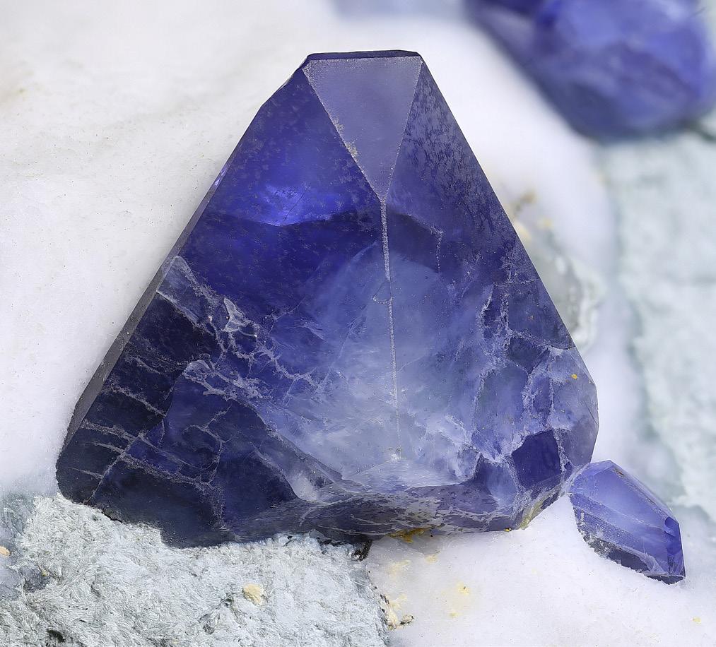
A stunning gem-quality triangular pyramidal benitoite crystal on a natrolite matrix from the California State Gem Mine, Santa Rita Peak, San Benito County, California, USA. This specimen is approximately 8 mm in height. The crystal form perfectly illustrates features of the ditrigonal-dipyramidal crystal class (bar6m2). Photo used with permission from Diego Savard of PHD Minerals.
Benitoite (BaTiSi₃O₉) is an extremely rare barium titanium cyclosilicate that forms stunning blue triangular crystals, making it highly prized among gem collectors. While non-gem quality benitoite is found in a few locations around the world, gem-quality euhedral crystals are exclusively from one locality: the New Idria District in San Benito County, California. Gem-quality benitoite is typically seen as flattened ditrigonal dipyramidal crystals. This crystal structure, classified under the bar6m2 system, has very few members, and benitoite was the first representative discovered. It is commonly associated with minerals such as neptunite and joaquinite, often found nestled among the zeolite natrolite. The formation of gem-quality benitoite occurs under very unusual geological conditions that are unlikely to be reproduced elsewhere. These include incorporation of tectonic blocks in an ascending serpentinite diapir that is subjected to thermal metamorphism by a triple junction migrating along a nearby strike-slip transform. Due to its rarity and value, California designated benitoite as the state gemstone
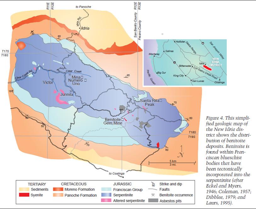
Map of the footprintshaped serpentinite diapir hosting the benitoite occurrences, San Benito County, California. Figure 4 from Laurs et. al., 1997.
(https://www.gia. edu/doc/benitoitefrom-the-new-idriadistrict.pdf)
in 1985.
In 1906, James Marshall Couch was sent into the San Benito Mountains near New Idria, California, on a mission to explore the area for minerals. He was grubstaked by Coalinga oilman Roderick W. Dallas, specifically to look for cinnabar (mercury ore) in the San Benito Mountains. Cinnabar (Hg ore) was first discovered in the New Idria region in 1851 (Van Balen, 2004). When Couch awoke from his campsite high in the headwaters of the San Benito River, he spied a patch of white ground on a hill nearby. Investigating, he discovered that the white material was flecked with odd blue crystals that looked, for all the world, like sapphires. In 1909, Couch sent a sample to mineralogist Dr. George Louderbeck at the University of California, Berkeley. Louderbeck determined that this strange blue mineral was a new species and he named it benitoite because “…it occurs near the head waters of the San Benito River in San Benito County.” (Louderback, 1907, p. 149). A finely detailed account of this history is provided in an 18-minute video on YouTube,
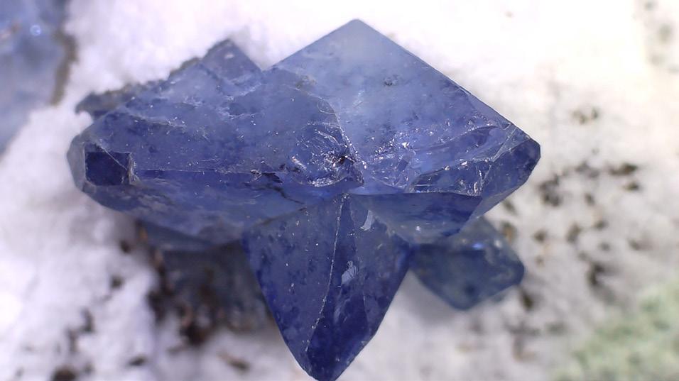
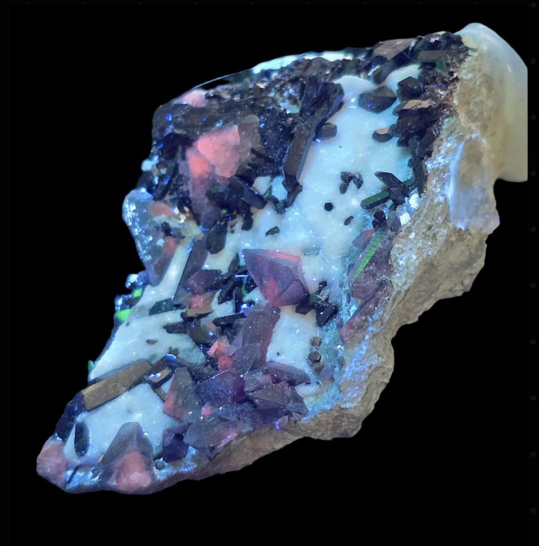
Above: Light blue benitoite crystals on a matrix of natrolite from San Benito County, California. Photo used with permission from Mathias Tonnaer, crystals2collect
Left: Benitoite and neptunite crystals on a natrolite matrix. Under long-wave UV light, benitoite crystals fluoresce orange. They fluoresce skyblue under short-wave UV light. From San Benito County, California. Photo used with permission from Mathias Tonnaer, crystals2collect
entitled “History of the Benitoite Mine,” available here
Benitoite has a hardness of 6 to 6.5, a vitreous luster, and a specific gravity of 3.6 to 3.7. Benitoite is mostly light to dark blue, but can also be purple, white, yellow, pink, or colorless (Bonewitz, 2013). Benitoite crystals typically exhibit color zonation, characterized by a notable darkening of the crystal outward from a lighter center (Jones, 2018). Benitoite has unique optical properties that make it particularly attractive as a gemstone. The usual deep blue color is attended by strong dichroism, whereby the color and color intensity change from different perspectives relative to the crystallographic axes. The richest color effects are noted perpendicular to the c-axis (parallel to the flattening). Benitoite has very high refractive indices. In cut gems, this characteristic causes the crystal to spread out the visible spectrum of light to create a play of colors – the “fire” – similar to that of diamond (Bonewitz, 2013). Benitoite displays strong sky-blue fluorescence in short-wave UV, and long-wave UV yields strong orange fluorescence. This blend of unique optical qualities is pleasing to the human eye. Amplified by a rarity far greater than diamond, its beauty has conspired to make benitoite one of the most treasured of all gem minerals.
Benitoite is rare in another sense. Benitoite crystallizes as a special variety of the hexagonal crystal system, displayed by only a few minerals. Very few. The most striking crystals of benitoite appear as tabular pyramidal crystals, showing a triangular or hexagonal profile flattened along the c-axis. The crystal at the start of this article is a great example. Before benitoite was discovered, the crystal symmetry it displays was postulated to exist, but was unknown in any other known mineral. Then, for decades, benitoite was the only living representative of the ditrigonal-dipyramidal crystal class (Laird and Albee, 1972). The symmetry elements of the ditrigonal-dipyramidal (bar6m2) crystal class are: the c-axis is a 6-fold axis of rotoinversion (bar6) with one mirror plane (m) perpendicular to the c-axis, 3 mirror planes that are parallel to the c-axis and are also aligned with the 3 2-fold rotational axes. My head hurts trying to imagine manipulating the wooden block model of this symmetry in mineralogy class. Only a few other ditrigonal-dipyramidal minerals have subsequently been discovered, currently boasting 25 members on Webmineral
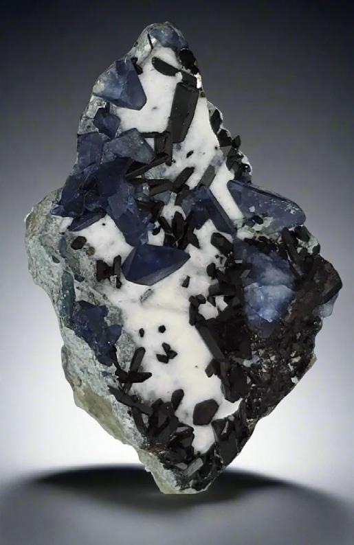
Blue trigonal benitoite crystals and elongate neptunite crystals on a matrix of natrolite from San Benito County, California. Photo used with permission from Mathias Tonnaer, crystals2collect.
The rarity of benitoite has long been attributed to the notion that it is found in only one locality. This notion, however, is flawed. The “one locality only” concept refers explicitly to the nearly perfect, gem-quality crystals that typify the type locality in the New Idria District of San Benito County, California. No other location boasts the spectacular gem benitoite known from New Idria, California. Although still vanishingly rare, benitoite has been discovered elsewhere. California boasts other benitoite occurrences in Fresno, Kern, Tulare, and Mariposa Counties (Jones, 2018). Gordon Butte in Meagher County, Montana, has benitoite. Magnet Cove, Arkansas, has benitoite. Sources indicate that
benitoite occurrence – in small deposits, from unusual geological circumstances and without gem quality material – are found in Australia (Broken Hill, NSW), Canada (Lac Brisson Complex), Czechia (Vysocina Region), Japan (Niigata and Oita Prefectures), Belgium (Esneux), Romania (Bistrita-Nasaud County), and Russia, (Murmansk and Karelia) (Bonewitz, 2008 and 2013; Mindat, 2025a). It is the singularity of the New Idria benitoite that so captivates the imagination – and the eyes – of mineral collectors.
Why is the benitoite from New Idria so different? The New Idria District has been a source of mineral prospecting and exploitation since 1853, yielding mercury, chromium, gold, asbestos, and other minerals (Laurs et al., 1997). The mineral inventory of the New Idria District, as listed on Mindat, comprises 165 minerals, including 20 for which New Idria is their type locality (Mindat, 2025b). These minerals include benitoite, of course, as well as other rare and highly unusual barium and titanium silicate minerals. Benitoite is frequently found in association with some of these, including neptunite, KNa2Li(Fe2+, Mg, Mn)2Ti2(Si4O12)2, joaquinite, Ba2NaCe2Fe(Ti,Nb)2Si8O26(OH,F)*H2O, and jonesite Ba4(K,Na)2Ti4Al2(Si3O9)2(SiO4)4O2*6H2O, among others. Almost every matrix specimen of benitoite is nested in the sodium zeolite natrolite. Natrolite commonly obscures underlying benitoite (and neptunite, and joaquinite) and is chemically removed by hydrochloric acid digestion. Why is natrolite a part of the petrogenesis of these weird barium-titanium silicates?
It all boils down to the highly unusual geology that comprises the New Idria serpentinite. The footprint-shaped New Idria serpentinite, depicted in the map from Laurs et al. (1997), was intruded as a diapir. It is bounded by faults on all sides that display an upward sense of shear against the country rock. Tectonic blocks comprised of a variety of lithologies are entrained within the serpentinite diapir. Some of these tectonic blocks are composed of blueschist, while others are composed of greenschist. Earlier models regarding the geological origins of benitoite and associated Ba, Ti silicates suggest that hydrothermal (metasomatic) alteration of the serpentinite is the cause. The serpentinite, however, does not possess minerals containing Ba or Ti. This is where the tectonic fragments entrained within the serpentinite come
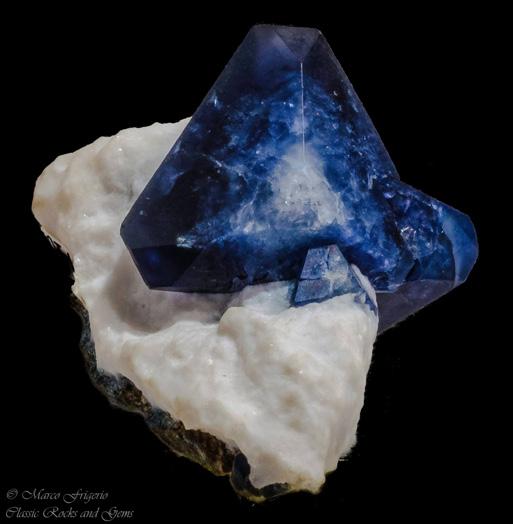
Beautifully color-zoned trigonal crystal of benitoite on a natrolite matrix from the California State Gem Mine, San Benito County, California. This crystal displays almost perfect ditrigonal-dipyramidal (bar6m2) symmetry. The specimen is ~8 cm in height. Photo used with permission from Marco Frigerio, Classic Rocks and Gems
into the picture. Van Baalen (2004) makes a strong case that metasomatic alteration of the serpentinite could not be the origin of benitoite due to the low aqueous solubility of Ti (and other elements required for the mineral components, including Al, Nb, Zr, V, and Ce). Instead, Van Baalen (2004) persuasively argues that blocks of blueschist and greenschist and veins of disarticulated pyroxenite in the benitoite mineralization zone provided the barite and titanite source material for this unusual mineral assemblage. The catalyst that drove the mineralization reactions was heat supplied by the migration of the Mendocino Triple Junction along the San Andreas fault, approximately 10 miles to the west of the New Idria serpentinite, 12 Million Years Ago. This combination of geological materials, processes and events is so unique that it is not likely to have happened before New Idria. It is, also, not likely to happen again. Thus, the New Idria gem benitoite locality will probably remain the only one.
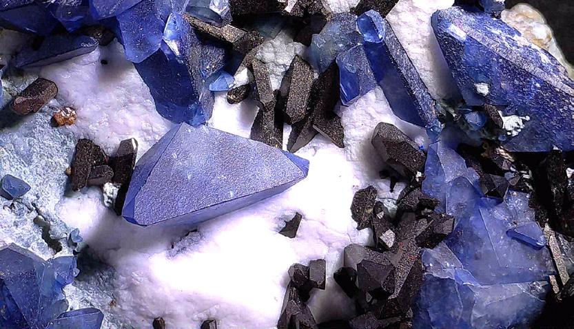
Blue trigonal benitoite crystals intermixed with dark brown and black neptunite crystals on a matrix of natrolite. A small, orange-brown crystal of joaquinite is visible in the upper left. From San Benito County, California. Photo used with permission from Mathias Tonnaer, crystals2collect
ACKNOWLEDGEMENTS
I would like to thank several people who permitted me to use their excellent photographs of benitoite. Although I have started photographing minerals myself, I have not yet acquired a specimen of benitoite. (Considering how highly treasured it is, I might remain in this state for some time). Looking on the internet, I discovered many fine photographs of benitoite on Facebook. I asked several photographers if I could use their pictures, and three responded positively. Special thanks go to:
Mathias Tonnear - Crystals2Collect
Marco Frigerio - Classic Rocks and Gems
Diego Savard - PHD Minerals
ONLINE REFERENCES
• https://en.wikipedia.org/wiki/Benitoite
• https://www.mindat.org/min-624.html
• https://www.mindat.org/loc-6418.html
• https://webmineral.com/data/Benitoite.shtml
• https://www.handbookofmineralogy.org/pdfs/ benitoite.pdf
• http://www.benitoite.com/benitoite/benitoit. shtml
• https://benitoitemining.com/
• http://www.benitoite.com/benitoite/index.shtml
• https://www.youtube.com/ watch?v=OimWELCxMyA
• https://www.irocks.com/
• https://www.youtube.com/watch?v=Th6ZdFgvggQ
REFERENCES
Bonewitz, Ronald Louis, 2008, Rock and Gem: The Definitive Guide to Rocks, Minerals, Gems and Fossils, New York, New York: Dorling-Kindersley Limited, 360 pp. _______________, 2013, Smithsonian Nature Guide: Gems, New York, New York: Dorling-Kindersley Limited, 224 pp. Jones, Bob, 2018, True Blue Benitoite, Rock & Gem, https://www.rockngem.com/benitoite/ accessed 8/26/2025.
Laird, Jo, and Arden L. Albee, 1972, Chemical Composition and Physical, Optical, and Structural Properties of Benitoite, Neptunite, and Joaquinite, American Mineralogist, 57:85-102.
Laurs, Brendan M., William R. Rohtert, and Michael Gray, 1997, Benitoite from the New Idria District, San Benito County, California, Gems and Gemology, Fall 1997, 166-187.
Louderbeck, George Davis, 1907, Benitoite, a New California Gem Mineral, Bulletin of the Geology Department, University of California, 5(9):149-153. https://rruff.info/uploads/UCPCDG5_1907_149.pdf Accessed 8/27/25
Mindat, 2025a, Benitoite, https://www.mindat.org/min-624.html Accessed 8/27/2025.
Mindat, 2025b, New Idria Mining District, San Benito County, California, USA, https://www.mindat.org/loc-6418.html Accessed 2/27/2025.
Van Baalen, M. R., 2004, Migration of the Mendocino Triple Junction and the Origin of Titanium-Rich Mineral Suites at New Idria, California, International Geology Review, 40: 671-692.
WELCOME NEW RMAG MEMBERS!
Jessica Boardman with Pathway Geologic Consulting, LLC from Oklahoma City, Oklahoma
Janus Rosborough with SAExploration Seismic Services (US), LLC from Katy, Texas
Cathy Enzo with Morning Gun Exploration, from Lakewood, Colorado
Alexander Greenfield from Wellington, Florida
Eliana Gutierrez from Denver, Colorado
Mel Klinger from Littleton, Colorado
Rachel Mosch from Idaho Springs, Colorado
Samuel Cantor with Seequent, from Arvada, Colorado
Casey Reid with Burns & McDonnell from Centennial, Colorado
Thomas Schumacher with Midcon Resource Group, LLC from Bismark, North Dakota
John Hohman from Houston, Texas
Sydney Crockett from Denver, Colorado
Jim Holik from Denver, Colorado
Alyssa Charsky with Anschutz Exploration Corportation from Golden, Colorado
Cole Jimerson with Quantum Water & Enviroment from Lakewood, Colorado
Rebecca Pendleton with Red Willow Production Company from Durango, Colorado
Jack Rosenthal with Scale Geo LLC from Denver, Colorado
Tatjana Scherschel with SLB from Lone Tree, Colorado
Anthony Kratochvil from Houston, Texas
Chris Perfili with WEM from Santaquin, Utah


Publish with…

Expanded geologic focus:
• Entire greater Rocky Mountain area of North America
• West Texas and New Mexico to northern British Columbia
• Great Plains and Mid-Continent region
Why contribute?
• Reach a broad industry and academic audience
• Quarterly peer-reviewed journal
• Permanent archiving includes AAPG Datapages
• Quick turn-around time
• Every subdiscipline in the geosciences
Email: mgeditor@rmag.org
https://www.rmag.org/publications/the-mountain-geologist/

CALENDAR – SEPTEMBER 2025
WOGA Wellhead Wake-Up
WOGA Lean- In.
On the Rocks: Northern Front Range On the Rocks: Dotsero Crater
On the Rocks: "Pedals & Peaks"
On the Rocks: Geologic Wonders of Ouray
RMAG Short Course. “Oil-Prone Source Rock Geochemistry"
