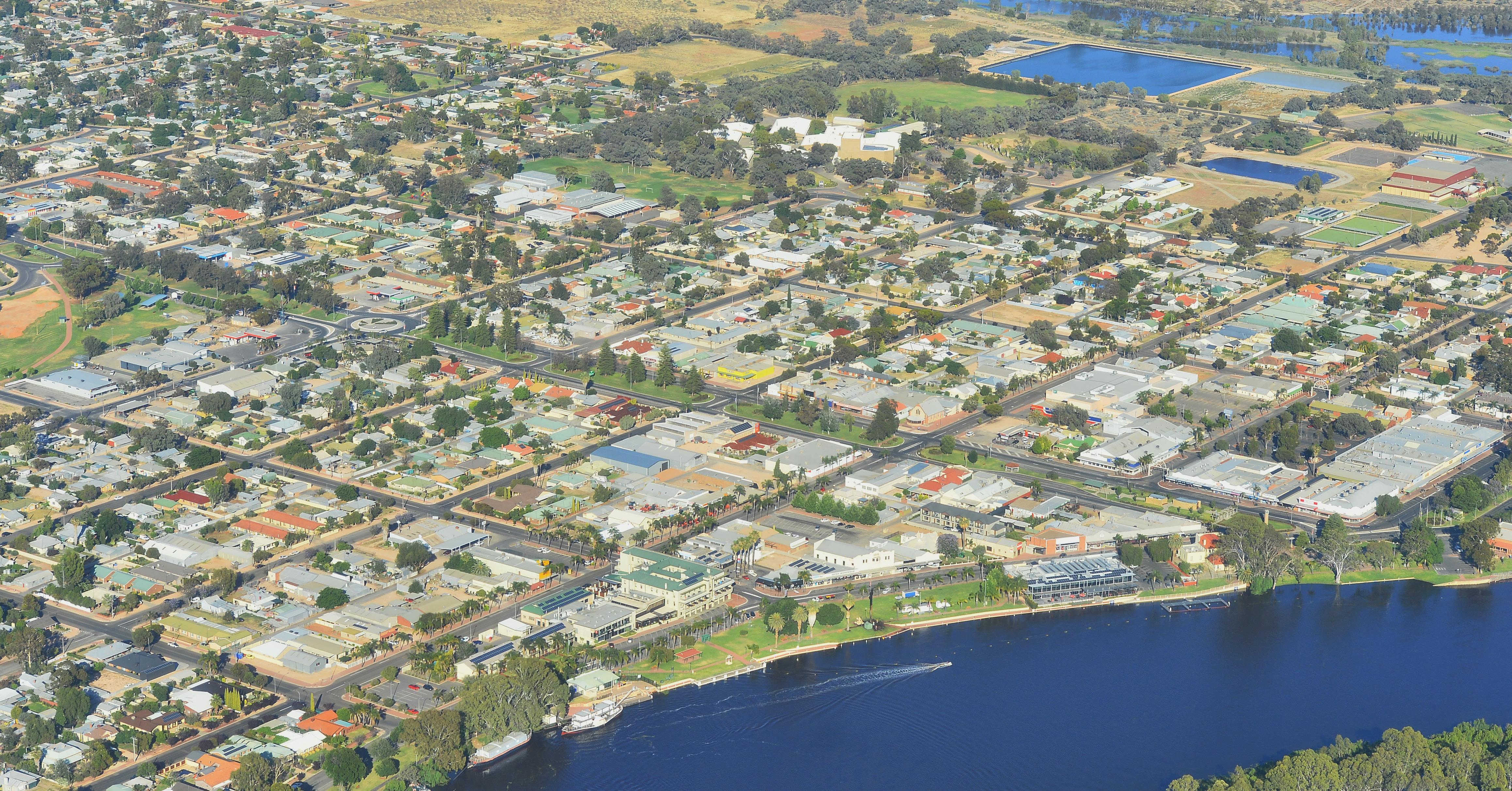
The Renmark Paringa Council Township Growth Strategy identifies the current supply of residential, employment and commercial land and identifies how our townships can grow over the next 15 to 30 years.
The Growth Strategy sets clear Growth Objectives and Strategies to guide growth and achieve our shared vision, as expressed by the CommunityPlan2024-2034:
In order to plan for growth, we must also plan for infrastructure. The Growth Strategy provides a plan for infrastructure provision and associated responsibilities, ensuring there is a clear road map for the Council and developers.
Purpose
The Growth Strategy will be used to inform:
• Council decision making and investment regarding future rezoning proposals;
• infrastructure investment decisions;
• decisions around the use of community land and assets;
• sending a clear message to the community and private sector about priorities for the region; and
• assisting the State Planning Commission and the South Australian Government who are updating the Murray and Mallee Regional Plan.
The Growth Strategy will provide a clear plan that can be adapted over time. Like all plans, it will need to evolve to respond to changes at the local, state, national and global level, and therefore is intended to be regularly updated as circumstances change.
Alignment with our Community Plan
Our community vision for Renmark Paringa is to leverage our unique attributes and address our challenges, supported by these four aspirations.
Community Aspirations
Environment
A place that is resilient to the effects of extreme weather, protects its river, is green and limits its impact on the natural environment.
Leadership
A Council that is a trusted partner that delivers what it promises in an efficient and effective way.
A safe and welcoming place to live a healthy and active lifestyle.
A place that attracts, retains and supports talented people, underpinned by diverse regional industry, tourism and access to housing.
The Growth Strategy responds to the following Areas of Focus in the 2024-2034CommunityPlan.
Prosperous
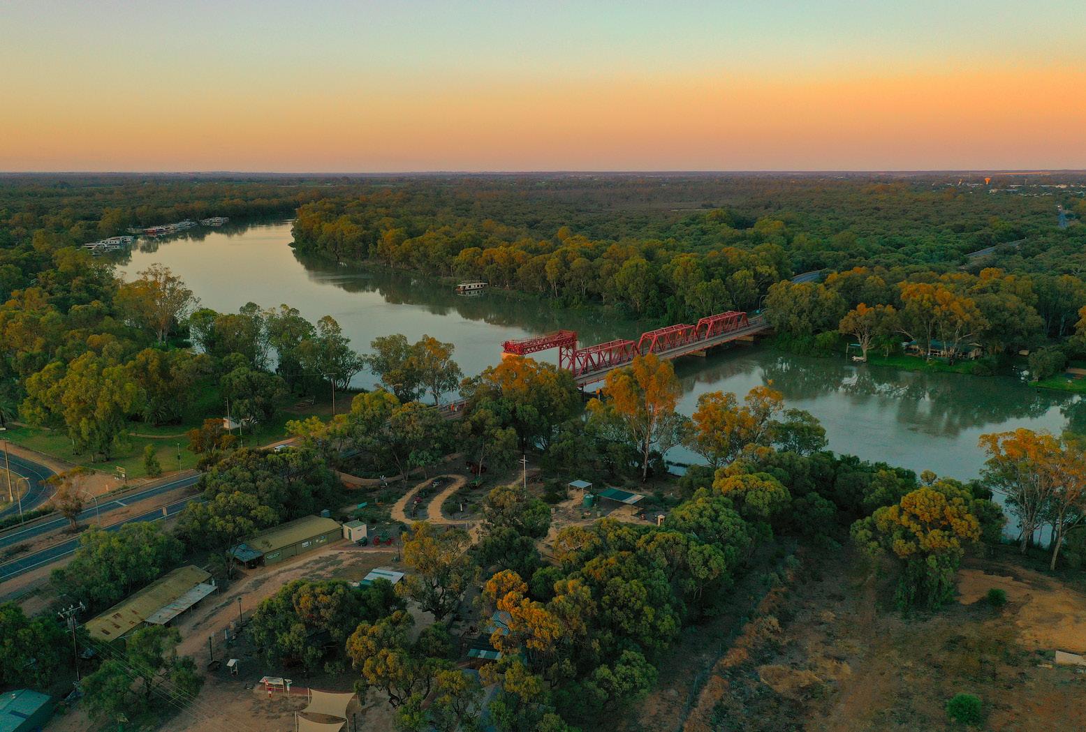
Murray River E3
E3.3
Partner to deliver riverbank stabilisation and flood mitigation.
Greening E6
E6.1
Deliver the Greening Renmark Paringa Plan, which includes tree planting schedules and priorities.
Recreation L4
L4.1
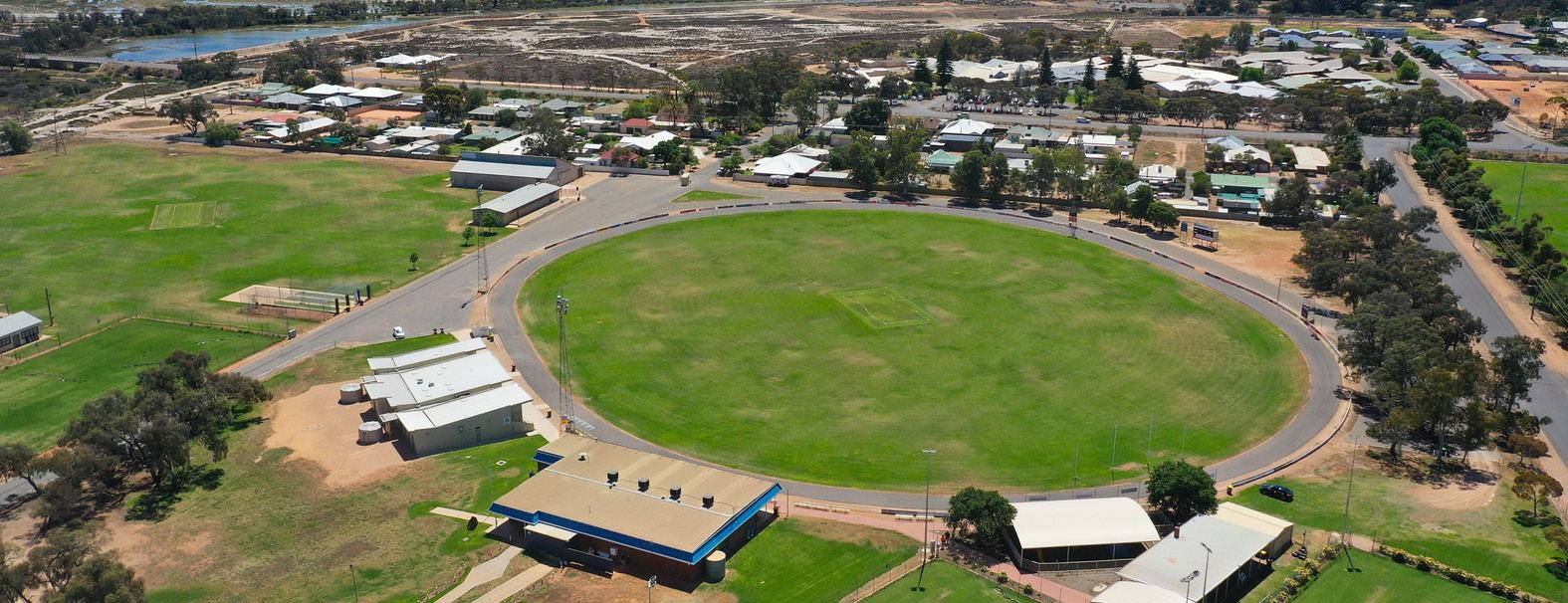
Deliver a review of sporting facilities, working collaboratively to create a long- term plan for redevelopment of key facilities.
Growth P1
Deliver growth strategy outcomes to unlock potential through investment in infrastructure and supporting land use policy.
Explore initiatives that can help to attract and retain young workers in the region.
Housing P4
L4.2
Deliver a review of open spaces to create a long-term plan for redevelopment to provide recreation opportunities for all ages.
Lifelong Learning L6
L6.2
Advocate for expansion of the tertiary education offering within the region and partner with educational institutions to ensure we attract and retain youth.
Partner with state government to explore opportunities to address the housing crisis .
Support and help to facilitate the development of diverse and affordable housing.
Town Centre P6
Industry P2 Infrastructure P5
Partner with state and federal government and advocate for the needs of our primary producers, supporting resilience, diversification and sustainable outcomes.
Remove barriers and actively seek to attract new industries to the region that can complement primary production.
Ensure key transport routes enable movement between new growth areas and the township.
Advocate for enhanced transport connections between the Riverland and other areas (including freight movement).
Advocate for infrastructure investment that will unlock capacity for new development (e.g. water and wastewater). Deliver future phases of the Urban Design Framework to support the activation of the township.
Tourism and Events P7
Proactively
Partner to progress recommendations from the Retail Report Card and work with local business owners to achieve improved retail outcomes.
Support and encourage new tourism experiences and product development to attract new and returning visitors.
Investigate opportunities to enhance tourism services and facilities that meet current and emerging needs.
How the Growth Strategy was prepared
Preparation of the Growth Strategy has occurred over a 12-month period and has been informed by:
• a land supply report;
• development rates, trends and demands;
• population and economic trends;
• the Infrastructure and Asset Management Plan;
• various other Council plans and strategies (refer to page 8);
• changes in legislation and policies;
• environmental considerations and opportunities;
• engagement with industry;
• early input from the community;
• infrastructure upgrades occurring within the Council area and region;
• regional planning occurring at State Government level; and
• current issues influencing:
» Australia (i.e. interest rates);
» the State (i.e. the housing Crisis);
» the Region (i.e. floods);
» the Council (i.e. ageing population); and
» local areas (i.e. infrastructure capacity).
Initial consultation was undertaken for a period of 21 days, from 8 May 2024 until 29 May 2024 to seek the community’s early input into the preparation of the Growth Strategy.
Consultation was undertaken in the form of an online survey which was distributed and promoted through various methods, including:
• e-Newsletter and direct mail;
• social media channels;
• media (print and radio);
• website and engage RPC website;
• staff; and
• Elected Members.
A total of 67 survey responses and two emailed submissions were received during the consultation period. The majority of respondents (79%) were owner occupiers within the Renmark Paringa Council area.
What We Heard
- Initial Consultation
Challenges/roadblocks to development:
• length of time it takes to get necessary approvals or planning information;
• the cost to develop, including the provision of infrastructure;
• confusion over the planning system, development application process and development requirements; and
• the inability to develop within the existing planning controls/ zoning.
Infrastructure and public space upgrades:
• upgrading public facilities;
• child care facilities;
• attracting tertiary education providers like universities;
• retail upgrades and expansion;
• sealed roads and safe footpaths;
• parking spaces around shopping precincts;
• more public spaces and modern playgrounds;
• indoor swimming centre; and
• bike and walking trails.
Opportunities for growth:
• encourage retail stores to establish in Renmark;
• promote more businesses to open up in the empty shops;
• more residential and country living allotments, including larger blocks for families
• unique tourism attractions;
• more spaces and moorings for house boats; and
• industry diversity.
What
We Heard - Draft Growth Strategy Consultation
This section will be completed following consultation on the Draft Growth Strategy.
Strategic Framework
COMMUNITY PLAN
Other Strategic and Legislated Plans
Resourcing Plans
LTFP (10 years)
IAMP (10 years)
Liveable
Disability Access & Inclusion Plan
Volunteer Strategy
Urban Design Framework
Paringa Place Plan
Darnley Taylor Park Master Plan
Prosperous
Long Term Strategic Directions
Community Plan
Infrastructure & Asset Management Plan
Long Term Financial Management Plan
Corporate Plan
Economic Development Strategy
Flood Recovery Strategy
Growth Strategy
Environment
Open Space Strategy
Animal Management Plan
Renmark Aerodrome Masterplan
Tracks and Trails Strategy
The Growth Strategy is a key strategic document that supports our Community Plan and will be instrumental in us achieving our Prosperous Community Aspiration.
Whilst the Economic Development Strategy seeks to deliver a strong and sustainable economy built on diversifying our established industries and attracting new industries and investment, the Growth Strategy seeks to plan for our expected growth from a land use and infrastructure provision perspective.
It is important to recognise that the strategies and actions contained in the Growth Strategy do not stand alone from broader policy and strategic considerations and themes. There are a range of strategic documents and plans that influence this strategy.
Houseboat Management Pla
Boat Ramp Strategy
Achievements
Council’s shared vision and strategies have directly contributed to the following projects and achievements:
• Residential Land Expansion Incentive
• Renmark Wastewater Treatment Plant
• 180 Murray Avenue Redevelopment
• Paringa Town Centre Revitalisation
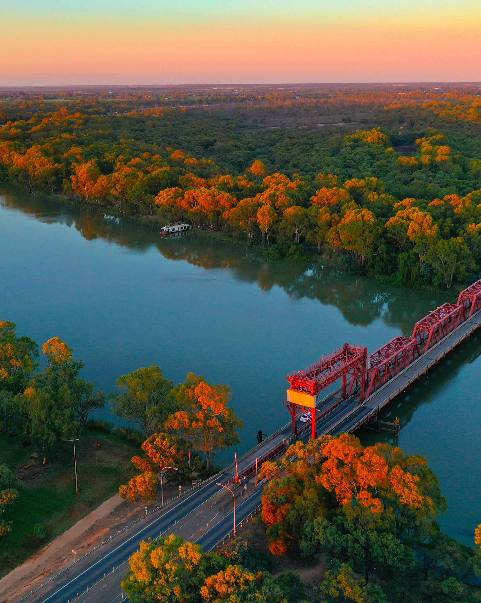
• Twenty First Street Bridge Replacement
• Renmark Riverfront Wharf Upgrade
• Playground Replacement Project
Strategic Documents Regional Context
The Renmark Paringa Council is one of three Councils within the Riverland of South Australia. The other Riverland Councils, Berri Barmera Council and the District Council of Loxton Waikerie have both prepared their own Growth Strategies. All three Councils promote economic development and seek to grow their respective communities across the Riverland.
The Growth Strategy complements the other Councils’ Growth Strategies, and they will all inform the development of a new Regional Plan, being prepared by the State Government.
What is a Regional Plan?
The State Planning Commission is currently preparing regional plans for South Australia.
These plans include:
• a long-term vision (over a 15-to-30-year period) for the region including provisions about the integration of land use, transport, infrastructure, and the public realm.
• maps and plans that relate to the long-term vision.
• contextual information about the region or area, including forward projections and statistical data and analysis.
• recommendations about the application and operation of the Planning and Design Code; and
• a framework for the public realm or infrastructure within the region or area.
The preparation of the Growth Strategy also has regard for other relevant regional, state and national plans including: State Planning Policies
These State Planning Policies (SPPs) are the highest order policy document in South Australia’s planning system. They outline matters of importance to the state in land use planning and development and provide a policy environment aimed at enhancing our livability, sustainability and prosperity.
The Growth Strategy seeks to achieve many of the SPPs. The following policies are of particular relevance:
• an adequate supply of land (well serviced by infrastructure) is available that can accommodate housing and employment growth over the relevant forecast period;
• provide an orderly sequence of land development that enables the cost-effective and timely delivery of infrastructure investment commensurate with the rate of future population growth;
• a well-designed, diverse and affordable housing supply that responds to population growth and projections and the evolving demographic, social, cultural and lifestyle needs of our current and future communities;
• the growth of regional centres and towns within the existing footprint or outside towns where there is demonstrated demand, and the land is serviced with infrastructure; and
• enable opportunities for employment and encourage development of underutilised lands connected to, and integrated with, housing, infrastructure, transport, and essential services.
Strategic Documents
The Murray and Mallee Regional Plan
The existing Murray and Mallee Region Plan identifies Renmark as an important regional centre. The Regional Plan is currently being updated and will spatially map the South Australian Government’s long-term vision for growth in the Murray and Mallee Region. Regional plans play a significant role in identifying land and long-term infrastructure needs to support sustainable growth within the region. It will highlight how these important changes can be accommodated over a 15 to 30-year period, by investigating and guiding:
• where houses and employment land will go;
• how housing and population will be serviced;
• what infrastructure is needed and how it will be provided; and
• different growth scenarios (and implications for these scenarios).
The new Regional Plan is expected to reinforce Renmark’s role as a regional centre. It is important that the Growth Strategy identifies housing and employment growth over a 15-30 year period and the infrastructure needed to support this growth.
This information will be used to inform the new Regional Plan which is being prepared by the State Government.
Infrastructure SA 20-Year State Infrastructure Strategy
Infrastructure SA provides independent advice to government to enable informed and evidence-based decisions on infrastructure planning, investment, delivery and optimisation.
The inaugural 20-Year Strategy set out a statewide, long-term strategic direction and initial priorities for infrastructure development in South Australia, to be built upon in future iterations.
Infrastructure SA is now preparing the next 20-Year State Infrastructure Strategy. The new strategy will look at state-wide infrastructure needs to 2045, with a focus on infrastructure planning and investments that drive a growing economy aligned to the State’s economic vision of a smart, sustainable and inclusive economy.
The Growth Strategy sets a long-term growth vision which is used to inform infrastructure investment driven by the State Government. Identification of growth plays a key role in determining the need for large infrastructure projects.
Regional Development
Australia
The Regional Blueprint 2023
This state-wide regional investment pipeline is published annually by RDSA and compiles the investment intentions of the public and private sectors over the next five-year period. The 2023 Blueprint outlines $62.56 billion investment pipeline across regional South Australia. The Blueprint contains several Regional Priorities specific to the Murraylands & Riverland Region.
The Growth Strategy aims to facilitate delivery of the Regional Priorities, particularly in relation to taking a long-term strategic view to planning and being prepared and proactive. Being proactive about growth leads to better planned outcomes and ensures infrastructure provision aligns with development happening on the ground.
Regional Development South Australia
Infrastructure Prioritisation 2023-2024
The primary purpose of this Infrastructure prioritisation is to provide a summary of priority projects, their likely impacts on South Australia and what resources are required to deliver these projects. By conducting this prioritisation process, RDSA aims to encourage public and private investment in those projects that will yield real and lasting benefits for the State. Projects are selected which have demonstrated strong performance in terms of their strategic fit, their expected economic, social and environmental impacts and their deliverability.
The Growth Strategy details projected and future growth which is used in identifying and justifying required infrastructure projects to support future population and industries.
Code Amendments
A Code Amendment (or ‘rezoning’) is a proposal to change the policies or spatial mapping within the Planning and Design Code, which changes the way future developments are assessed. Code Amendments must be prepared according to certain processes set out by legislation.
A Code Amendment may be sought by various entities, including Councils. A person with an interest in the land (i.e. a landowner) may also seek to rezone land. This is commonly referred to as a privately-led Code Amendment.
Any rezoning proposal within the Council area must align with the Growth Strategy and the Murray Mallee Regional Plan. The Growth Strategy provides a good indication about which rezoning proposals will be supported by Council and which rezonings will not through the Growth Strategies and mapping.
The Murray and Mallee Regional Plan is being updated by the South Australian Government and is intended to be reviewed every five years. The Regional Plan will be delivered via a fully digital, interactive platform and will identify land earmarked for future rezonings.
This Growth Strategy identifies land for future rezonings and the intent is for these sites to be identified in the Regional Plan. The Growth Strategy is therefore an important document for guiding growth and future Code Amendments within our Council area.
Key Influences
Population and Housing
Population Growth
2011
2021 9,245 9,783 an increase of 5.8% or 0.6% annually
ABS Estimated Resident Population 2023 10,107
State Government Population Projections
In March 2024, the State Government released population projections that predict the Council will grow by 980 people (high series) between 2021 and 2041 (increase to 10,987 people).
An annual growth rate of 49people / 0.5% per annum.
Ageing population
School leavers
44 median a ge
In 2021 there were:
Economy
Dwellings
What it means for the Growth Strategy:
• Strong demand for housing is having an impact on housing affordability.
• An ageing population will require tailored housing and services.
• Historical growth is exceeding the high growth scenario set by the State Government. Future growth may therefore exceed the high growth scenario population projections, increasing risk that Council and other stakeholders are not adequately planning for growth.
• There is a continued loss of young adults moving away from the Council area.
Economy
Gross Regional Product
$0.62 billion
(the year ending June 2023) 5.9% since the previous year (2022/23)
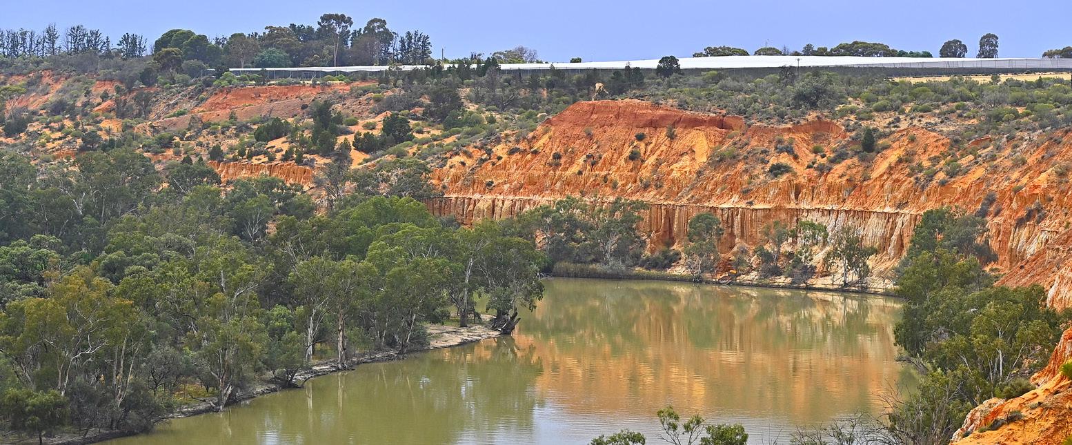
The 2022-23 Murray River Flood
has had significant impacts on the Murraylands and Riverland economy and people. Unsurprisingly, the agriculture and tourism industries were the worst impacted.
Murraylands and Riverland economy and people + Agriculture Tourism
A number of initiatives were launched to assist in the flood recovery including:
• On-farm Emergency Water Infrastructure Rebate Scheme
• River Murray Flood Primary Producer Recovery Grants
• River Murray Floods Primary Production Irrigation Grants
• River Murray Flood Resilience Code Amendment
• Rise Up for our River marketing campaign and the River Revival Voucher program.
Recent local projects of significance to the economy include:
St Francis of Assisi College ($6 million investment); Almondco Processing Facility ($28 million investment); 23rd Street Distillery ($6.6 million investment); Renmark Riverfront Precinct revitalisation ($14 million investment); Renmark Village retail renewal ($10.5 million investment); and Jane Eliza Development (forecasted $141 million investment).
• Low levels of Bachelor Degrees are reflective of the high level of school leavers heading elsewhere to study and a comparatively small number of higher skill jobs in the local economy. 30 June2022
What it means for the Growth Strategy:
• There is a heavy reliance on the agriculture and tourism industries.
• Income to housing cost ratios are low, meaning the Council area has a high degree of affordable housing, however, affordability is decreasing.
Hard Infrastructure
Hard Infrastructure within the Council area is managed by a range of authorities. These are summarised below.
Wastewater – A Community Wastewater Management System (CWMS) exists within Renmark and Paringa. This is managed by the Council. Where a CWMS does not exist, wastewater is managed by on-site wastewater management systems.
Stormwater – A formal stormwater drain network exists within Renmark, Paringa and Lyrup. This is managed by the Council.
Roads – All public roads are managed by the Council, with the exception of Sturt Highway, Ral Ral Avenue and Renmark Avenue which are State maintained roads.
Potable Water – SA Water mains exist in Renmark and Paringa. Where water mains do not exist, private rainwater tanks are used.
Electricity – SA Power Networks supply and manage underground and overhead electricity infrastructure within the Council area.
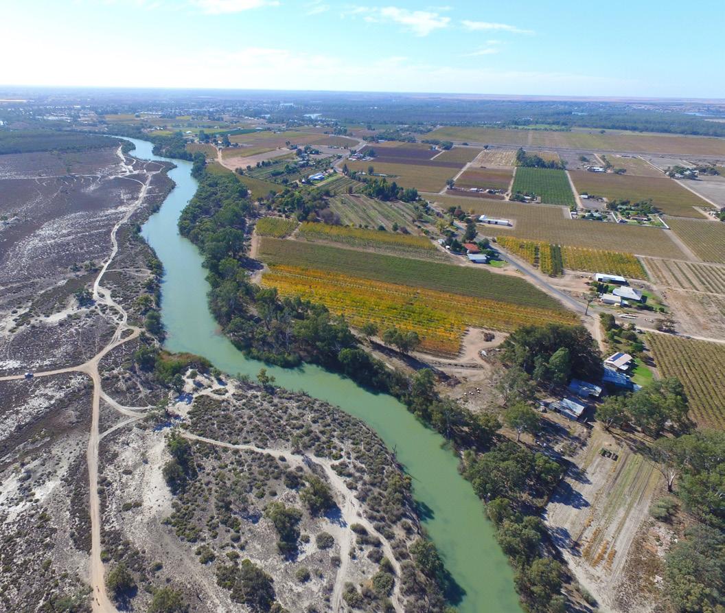
Having appropriate infrastructure to provide potable water, wastewater disposal, stormwater management, communications and electricity is essential to support the local economy, residential development and future growth. The integration of land use, transport and infrastructure is a key consideration for this Growth Strategy and is both a challenge and opportunity for us to deliver our vision for the community.
Irrigation Water – The Renmark Irrigation Trust owns a network of irrigation supply lines within Renmark and Paringa. Council also owns some recycled wastewater mains which are largely used to irrigate public open space.
NBN – Has coverage across the Council area.
Capacity of existing infrastructure is discussed in the Growth Management section of the Growth Strategy.
Hard Infrastructure
The following infrastructure projects influence our Growth Strategy and will also assist in achieving our vision.
Regional Transport Projects
Sturt Highway upgrade between Renmark and Gawler, as part of the Roads of Strategic Importance (ROSI) program. The Australian and South Australian governments have committed $87.5 million to improve this section of the transport network through the region and improve connection with neighbouring regions. The Sturt Highway is a major road freight route through our region and is our most critical transport route.
Truro Freight Route - a freight route to ensure heavy vehicles can bypass the Truro township along with a new alignment of Sturt Highway over Accommodation Hill which will improve travel to and from the region. This project is currently on hold.
Investigation of the South Australian Highway High Productivity Vehicle Freight Network Access will improve connectivity and support economic development. Our most important industry is agriculture, namely growing citrus fruits and wine grapes, and having an appropriate freight network is essential as it relies on the ability of heavy vehicles to access our region.
Government Road Upgrade
Government Road represents a strategic freight route from Airport Road to Ral Ral Avenue which links to the Calperum Industrial Estate and builds on our objective of removing heavy transport from the Renmark town centre. The upgrade of Government Road caters for future traffic demands and to support the safe transportation of heavy freight vehicles.
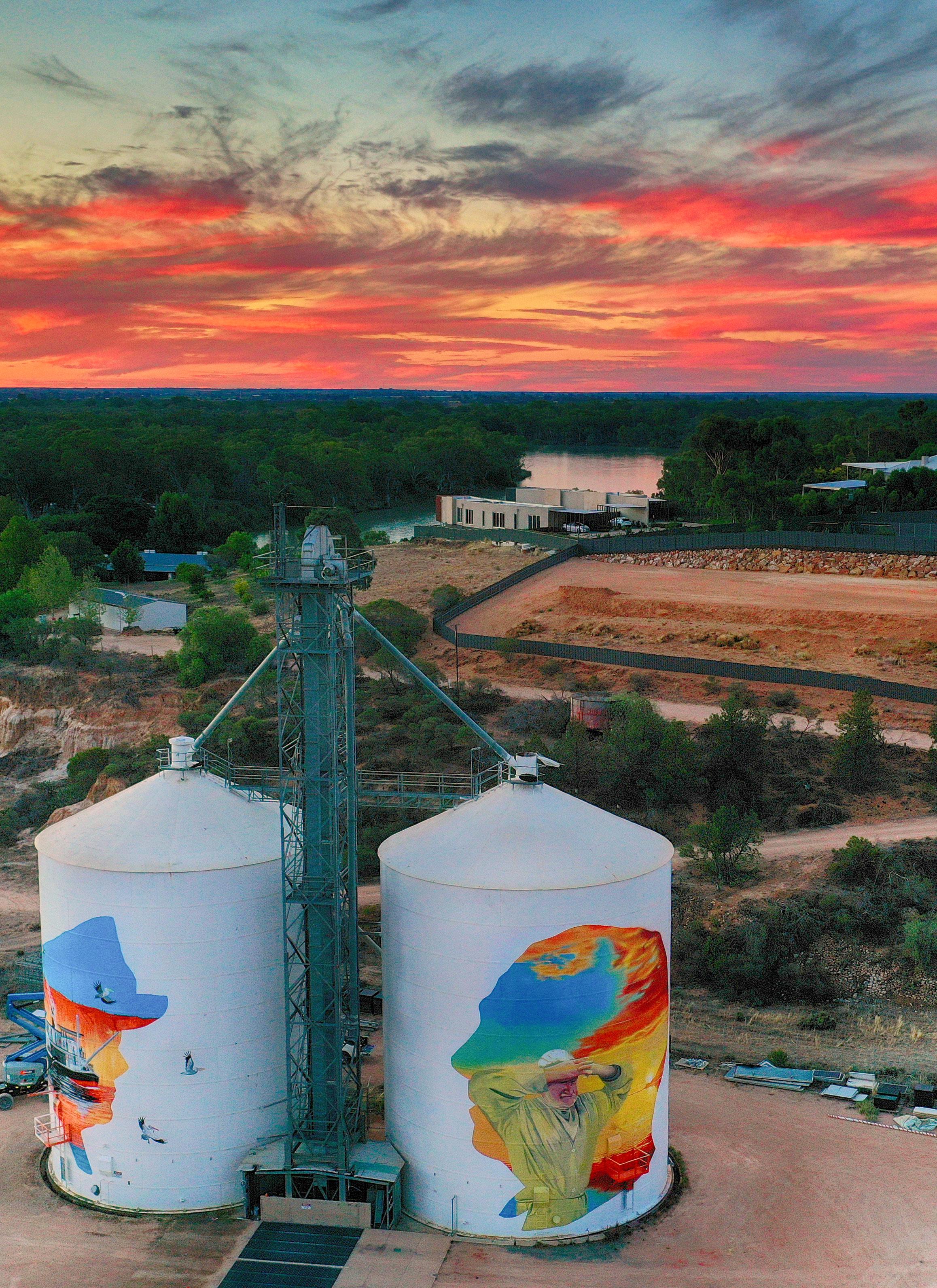
Renmark Wastewater Treatment Plant
An upgrade of the Renmark Wastewater Treatment Plant will enable the system to run more efficiently and will also increase the capacity of the system, enabling the future population growth of our community
Legend
Subtransmission and High Voltage Overhead Line
Subtransmission and High Voltage Underground Cable
Community Wastewater Management Systems
RAL RAL AVE ARUMPO
BOOKMARK AVE
TWENTYTHIRDST
MURRAY RIVER
RAL RAL AVE
BOOKMARK AVE
MURRAY RIVER TWENTYTHIRDST
Irrigation
RAL RAL AVE ARUMPO
BOOKMARK AVE
MURRAY RIVER
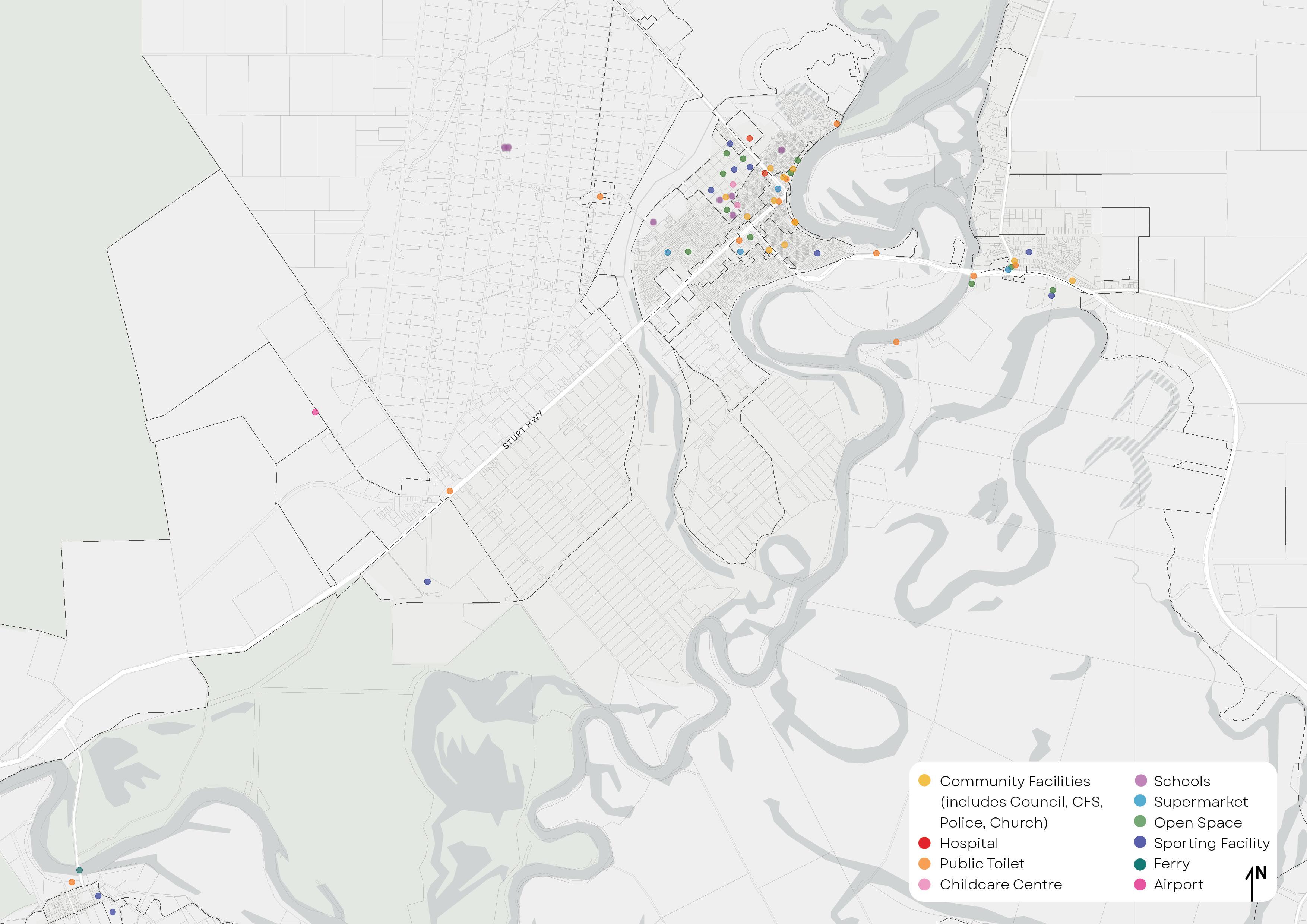
Community Facilities and Social Infrastructure
Infrastructure Australia defines social and community infrastructure as follows:
“Social infrastructure is comprised of the facilities, spaces, services and networks that support the quality of life and wellbeing of our communities. It helps us to be happy, safe and healthy, to learn, and to enjoy life. The network of social infrastructure contributes to social identity, inclusion and cohesion and is used by all Australians at some point in their lives, often on a daily basis. Access to high-quality, affordabl e social services has a direct impact on the social and economic wellbeing of all Australians.”
There are many benchmarks that have been formulated which aim to determine if a community has enough social and community infrastructure. Regional towns will often not align with standard benchmarks as certain community infrastructure may not be viable for a smaller community. However, the following benchmarks are provided as a rough guide to determine where services may be needed.
Community infrastructure which is the responsibility of Council is highlighted in grey. Other community infrastructure and services are generally provided by the State Government or private organisations. Council can advocate for new facilities and services through incentives and lobbying.
A room generally able to be hired or used by the public for meetings and functions.
A building containing collections of books and other items for borrowing by the public.
Centre for the care of children in early stage of growth/ development.
An educational program delivered to children in the year before they start fulltime school.
Provides care before and/or after school and/or during vacation time.
Educational facilities for students between ages 12 and 18. Year 7 to year 12 schooling.
Educational facilities for students between ages 5 and 12. Reception to year 6 schooling.
or
1:4,000 -6,000
6,500 1: 10,000- 20,000 1:4,000 -6,000
Community Facilities and Social Infrastructure
Benchmark Met with Current Population Future
Education for people above school age, including college, university, and vocational courses.
1:over 150,000 Regional campus 1: 30,000 -100,000
A health care institution that provides patient, emergency and inpatient clinical care for people who are unwell or injured.
A doctor based in the community who treats patients with minor or chronic illnesses.
Land set aside for the purpose of public enjoyment. Usually refers to green space.
A toilet available for use by the general public.
A space or facility used for sport and recreation. Includes ovals, courts, swimming pools, etc.
*Some sporting facilities are privately owned and operated.
4.8 beds per 1000 is metro hospital guideline
Yes (Flinders University
Renmark with limited courses)
Berri (TAFE)
Renmark (17 beds)
Berri (38 beds) and Barmera (20 beds) also have hospitals.
Youth Centre
Aged Care
A community centre specialising in meeting the needs of young people.
A facility which provides an operational base for services targeted at older and elderly people.
Approximately 1 for every 1,000 people N/A Indoor facility 1:30,000-50,000 Swimming 1:30,000 (neighbourhood level)
Neighbourhood park 1:5,000
Community Transport Police and emergency services
Public and privately run transportation services servicing the local community.
Police, fire and emergency services station. 1:20,000 –
Limited public/ community bus services. Taxis available.
On track Advocate for new and expanded services On track Benchmark Met with Current Population
Community Facilities and Social Infrastructure
Public Realm
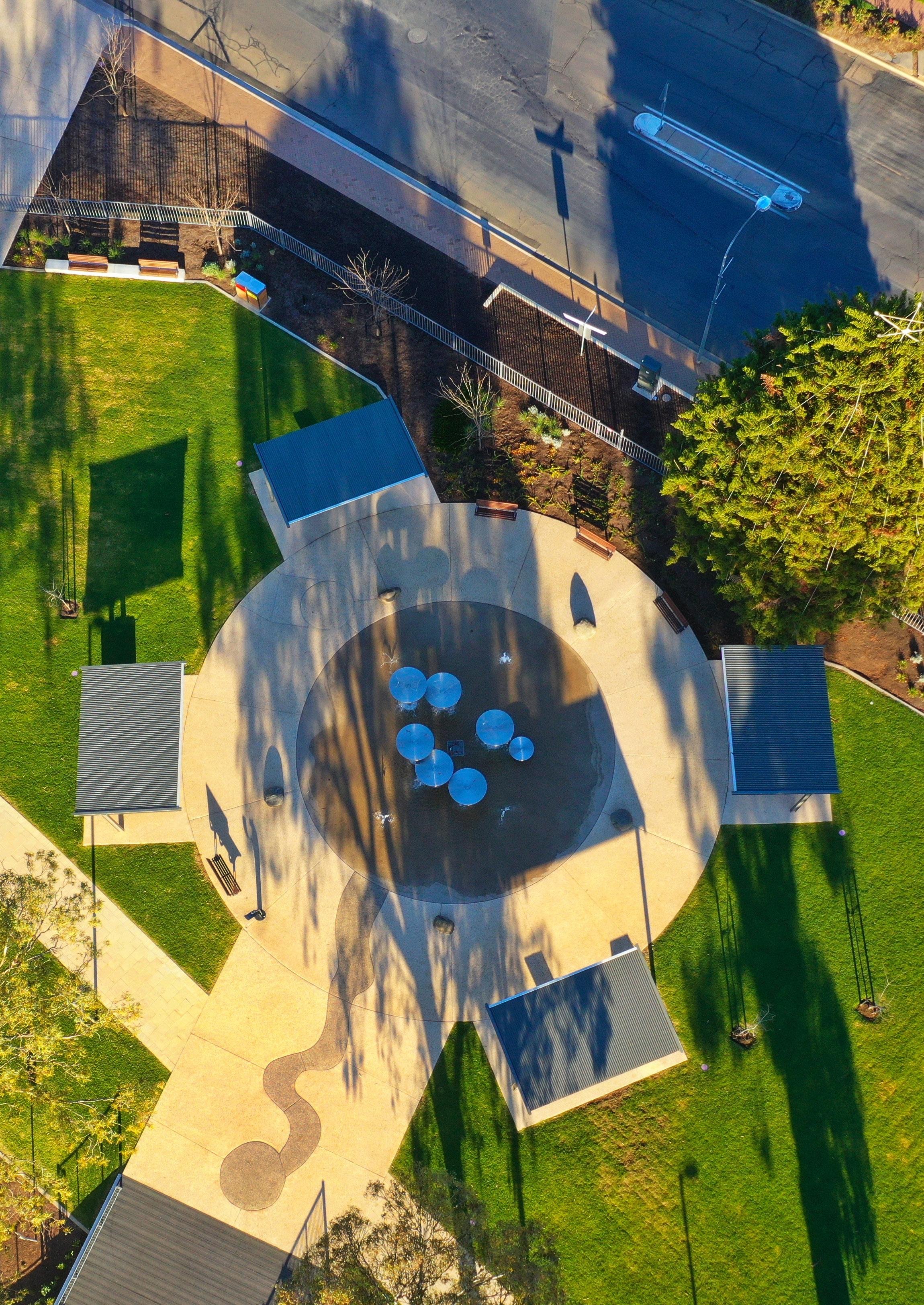
The public realm provides a setting for community life and includes the everyday spaces that are used by people to socialise, play, work, shop, travel and use for activities such as exercise.
High quality public realms can increase the use of public space and support associated business, encourage greater participation in community activities and encourage personal safety. High quality public realm also attracts visitors and new residents to a town or district.
The Riverland is renowned for the quality of its public spaces and the exemplary way in which townships are presented. This is a source of pride for both our workforce and the community.
Our commitment to improving the amenity of our public realm is highlighted by the following projects.
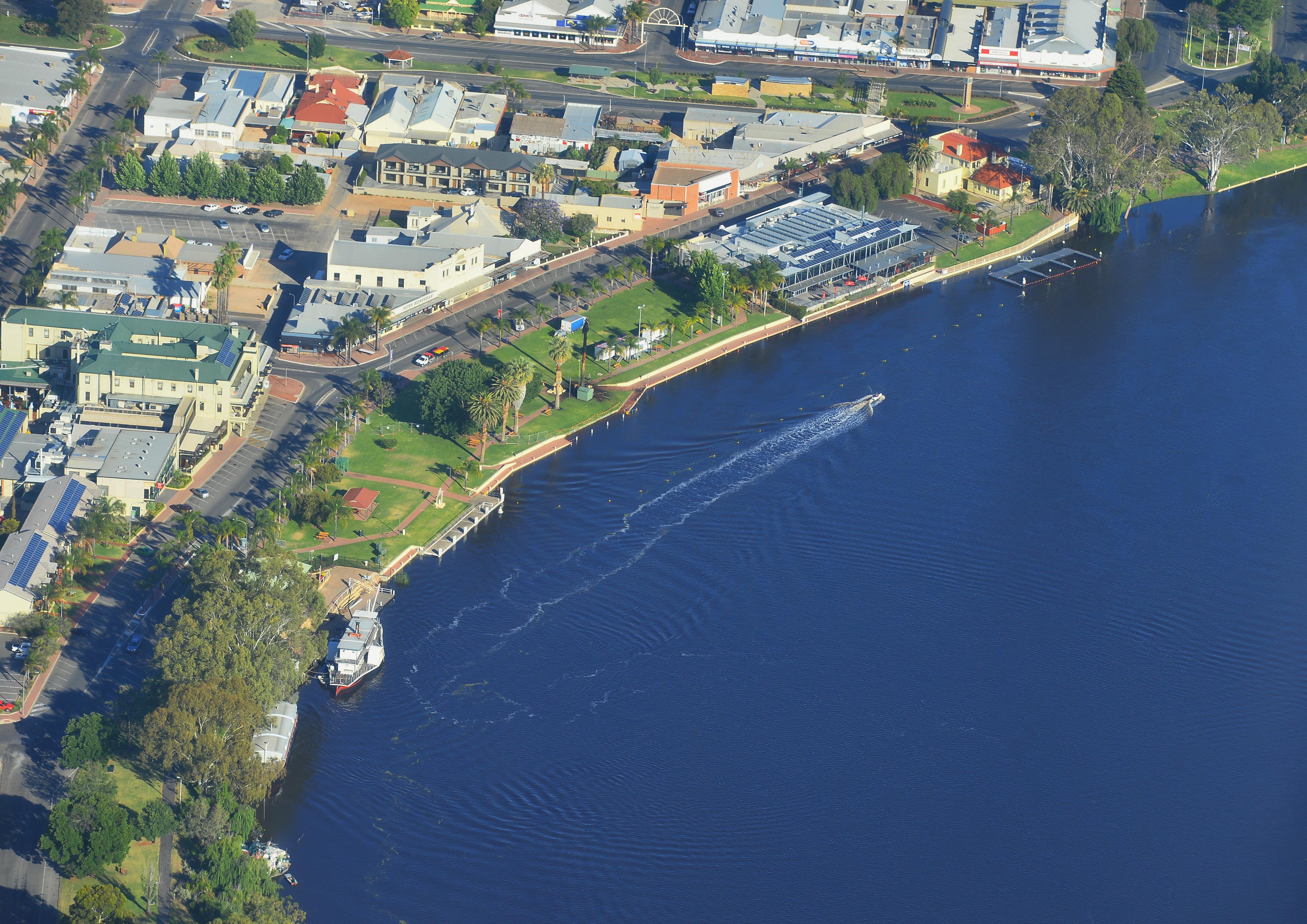
Urban Design Framework - Renmark CBD
The Urban Design Framework (UDF) was commissioned by Council in 2016. It was developed based on a comprehensive community engagement process culminating in the UDF being adopted by Council in June 2017.
The UDF establishes an overarching vision for Renmark’s town centre and nearby areas. It is designed to help facilitate high-quality, innovative, and sustainable urban design and to address future challenges while enhancing the community’s quality of life and economic prosperity.
Aside from creating a vibrant place for people to congregate, the UDF will deliver tangible economic and social benefits to the region.
The following stages have already been implemented/commenced:
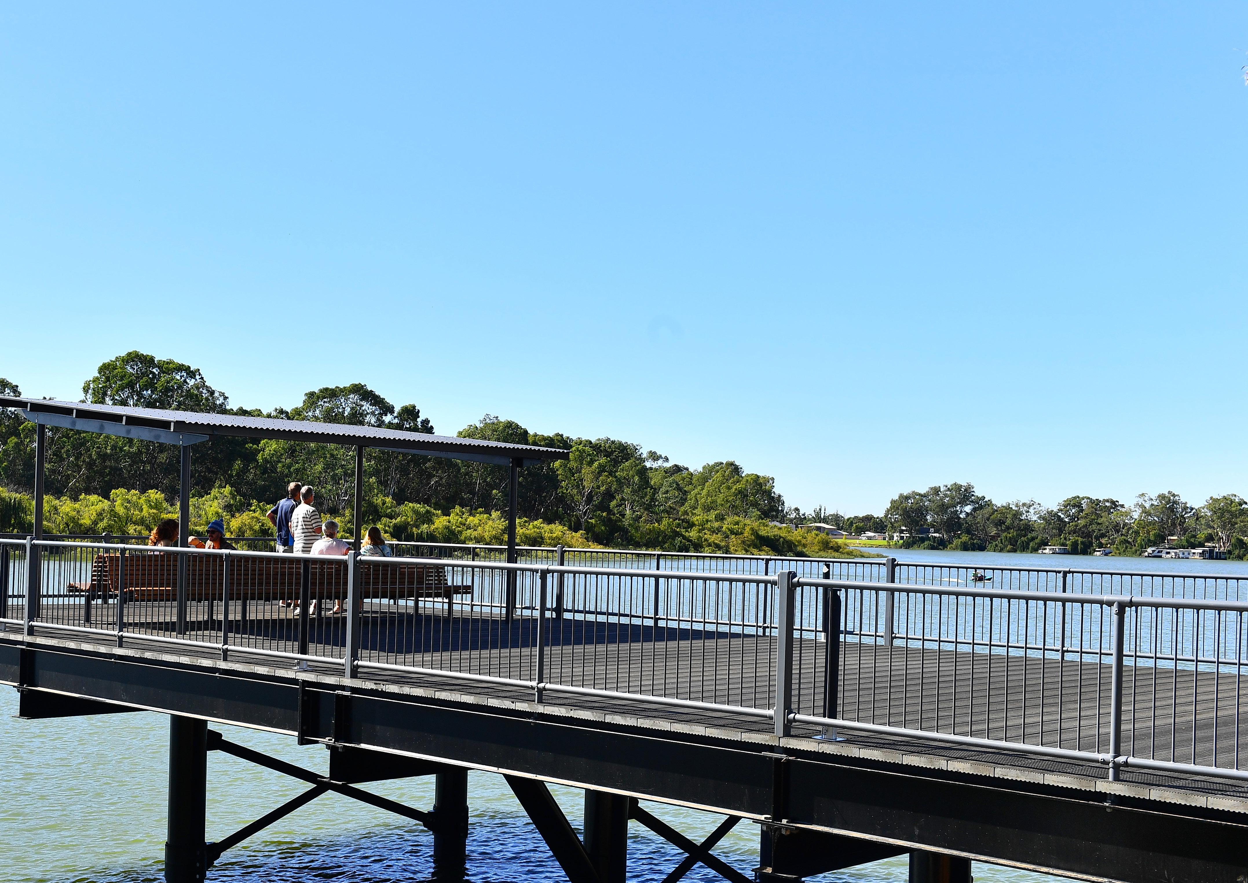
• Taylor Riverfront Precinct;
• Fifteenth Street Car Park;
• Renmark Wharf Upgrade; and
• 180 Murray Street (old Westpac site).
Paringa Place Plan
The Paringa Place Plan aims to beautify and upgrade the main street precinct in Paringa. The project will be completed in stages and Council have sought feedback from the community on multiple occasions to inform the final designs. The first stage of construction began in mid2024.
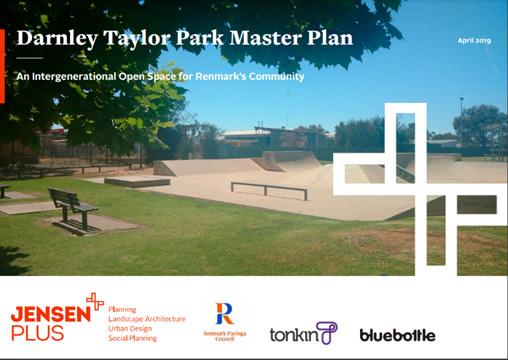
Darnley Taylor Park Master Plan
Darnley Taylor Park is an important and large open space on the direct route into the heart of Renmark that includes strong historical ties for the community as well as a focus for youth recreation and as such displays a definable ‘sense of place’ for the region.
A Master Plan has been prepared for Darnley Taylor Park which proposes high level concepts and develops the ideas into considered designs. Council has implemented parts of the Master Plan and will look to incorporate future upgrades into the long-term financial plan.
Greening Renmark Paringa
The Greening Renmark Paringa document proposes a methodology for making successful tree species selection. This document is the first stage to creating a methodology that forms a coherent link between design considerations and implementation by setting out the optimum characteristics of street and open space trees, options for layout within streets, critical considerations in the selection process and best practice techniques for implementation. The plan also includes a multi year planting program that details where additional trees will be planted each year, demonstrating Council’s commitment to maintaining and improving canopy cover for its urban areas.
Zoning
The Planning and Design Code (the Code) is the single source of planning policy in South Australia. An overview of the zones and policies that apply within the Council area are provided below.
Residential
Residential land is the land zoned for residential use. The following zones allow for residential uses:
• Neighbourhood Zone;
• Rural Neighbourhood Zone;
• Golf Course Estate Zone; and
• Township Zone.
The Township Zone is a multi-use zone which facilitates residential, commercial and employment type uses.
Each Zone contains guiding policies about the types of dwellings and densities anticipated in the Zone. These are summarised in the following table.
Renmark Neighbourhood Zone (outer areas)
Renmark Neighbourhood Zone (inner areas)
Detached 400sqm
Semi-Detached 300sqm
Row Dwelling 300sqm
Group Dwelling 300sqm
Residential Flat Building 250sqm
Detached 12m
Semi-Detached 10m
Row Dwelling 9m
Renmark West Rural Neighbourhood Zone
Detached 270sqm
Semi-Detached 220sqm
Row Dwelling 180sqm
Group Dwelling 250sqm
Residential Flat Building 200sqm
Detached 10m
Semi-Detached 8m
Row Dwelling 8m
2000sqm where connected to CWMS – however no CWMS exists in this area and therefore no land division can occur to the Bookmark Creek Subzone. N/A Old Calperum Golf Course Estate Zone
Detached 400sqm
Semi-Detached 300sqm
Paringa Neighbourhood Zone
Row Dwelling 300sqm
Group Dwelling 300sqm
Residential Flat Building 250sqm
Rural Neighbourhood Zone
Detached 12m
Semi-Detached 10m
Row Dwelling 9m
Paringa
Employment / Commercial
Employment land is the land that is zoned to allow for employment uses. Employment uses typically include the following:
• Shops, including bulky goods outlet;
• Retail fuel outlet;
• Industry (Strategic Employment Zone);
• Light industry;
• Motor repair station;
• Service Trade Premises;
• Store; and
• Warehouse.
The following zones allow for employment uses:
• Employment Zone;
• Strategic Employment Zone; and
• Employment (Bulk Handling) Zone.
Commercial land is the land that is zoned to allow for business, retail and entertainment uses. Commercial uses typically include the following:
• Shops;
• Retail fuel outlet;
• Consulting room/office;
• Hotel;
• Health facility; and
• Service trade premises.
The following zones allow for commercial uses:
• Suburban Activity Centre Zone;
• Suburban Main Street Zone;
• Township Activity Centre; and
• Township Zone.
Residential and Employment Land Supply
Council has undertaken a Land Supply and Demand Analysis to inform the Growth Strategy.
Land supply relates to land which is zoned but is currently vacant or underutilised, meaning it is not currently used in accordance with its zoned use
Overview
Approved 137 residential allotments
Jane Eliza Development 700 allotments
174 hectares of residentially zoned land
138 hectares of underutilised Strategic Employment Land
8 hectares underutilised Employment Land
Development application numbers range from 143 to 232 per annum
Residential
Total Underutilised
Zoned Land Areas (hectares)
per annum
The 5-year average dwelling approvals are 45 per annum. Over 80% of these are in Renmark.
The highest number of dwelling approvals in a single year was 55. The number of dwelling approvals may increase pending the delivery of the Jane Eliza development.
Despite the minimum site area sizes that exist within the Code, the average size allotments being created in Renmark and Paringa Neighbourhood Zones are approximately 700 square metres and the larger estates are approximately 9 dwellings per hectare (gross).
Residential land capacity has been estimated by calculating the amount of underutilised or vacant land by the expected dwelling density, while factoring in discounts for open space and infrastructure, this is summarised in the following table:
Deduct Open Space
Provision (12.5%)
Area (hectares)
Balance Area (hectares)
Divide Assumed
Average Lot Size (square metres)
Approved Lots
Jane Eliza Estate
Deduct Roads and Stormwater Area (20%) (hectares) Total Lots
A further 500+ allotments could be accommodated within the Renmark West Rural Neighbourhood Zone if the CWMS was extended to this area.
Accordingly, the existing zoned residential land supply has the capacity to accommodate a further 1,781 allotments. 45% of this supply is attributed to the Jane Eliza Estate. If all land was made available to develop, this would equate to approximately 32 years supply.
Residential and Employment Land Supply
Employment
The employment land supply can be broken down into the following areas:
• 8 hectares in the Employment Zone in Renmark; and
• 138 hectares in the Strategic Employment Zone in Old Calperum.
There have been less than 5 applications between 2019 and 2023 for employment type uses such as motor repair stations and warehousing. In summary, there is approximately 146 hectares of underutilised Strategic Employment and Employment Zoned land within the Council area.
What it means for the Growth Strategy
While there is theoretically sufficient zoned land supply for the short to medium term, the actual availability of this land is uncertain as:
• there is no requirement for a land owner to release land for development;
• land owners may have no intention to sell or develop their land; and
• even if released to market, zoned land may not be development ready due to lack of infrastructure provision.
Therefore, the identified “land supply” may not necessarily be an accurate reflection of available and developable land. The Growth Strategy provides a detailed roadmap of required infrastructure and identify actions for the Council to unlock land for development, which will assist in removing the roadblocks currently faced by developers.
Council must ensure there is adequate land supply with consideration that some landowners may not wish to develop or release their land. This may require identification of land beyond the current zoned supply.
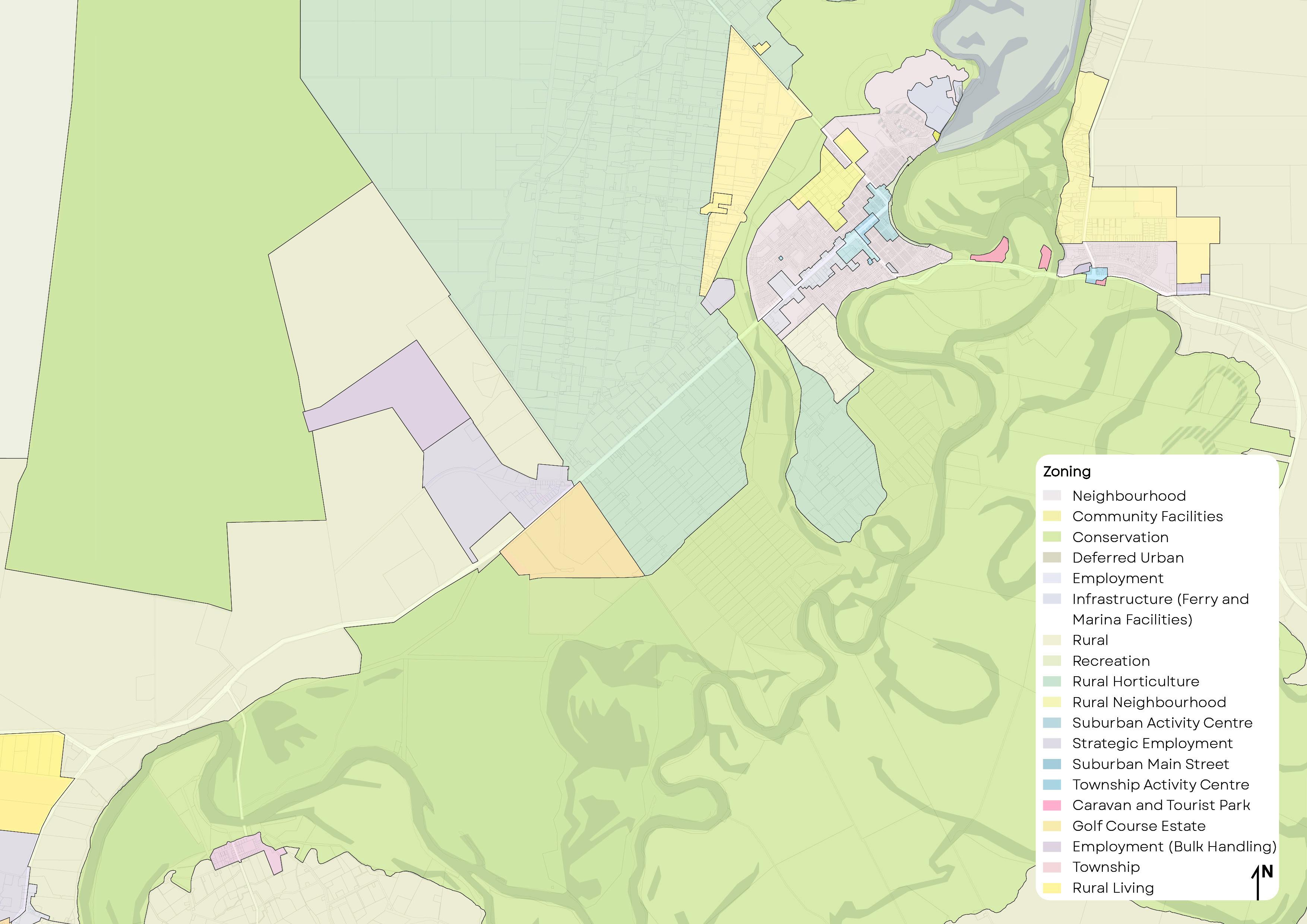
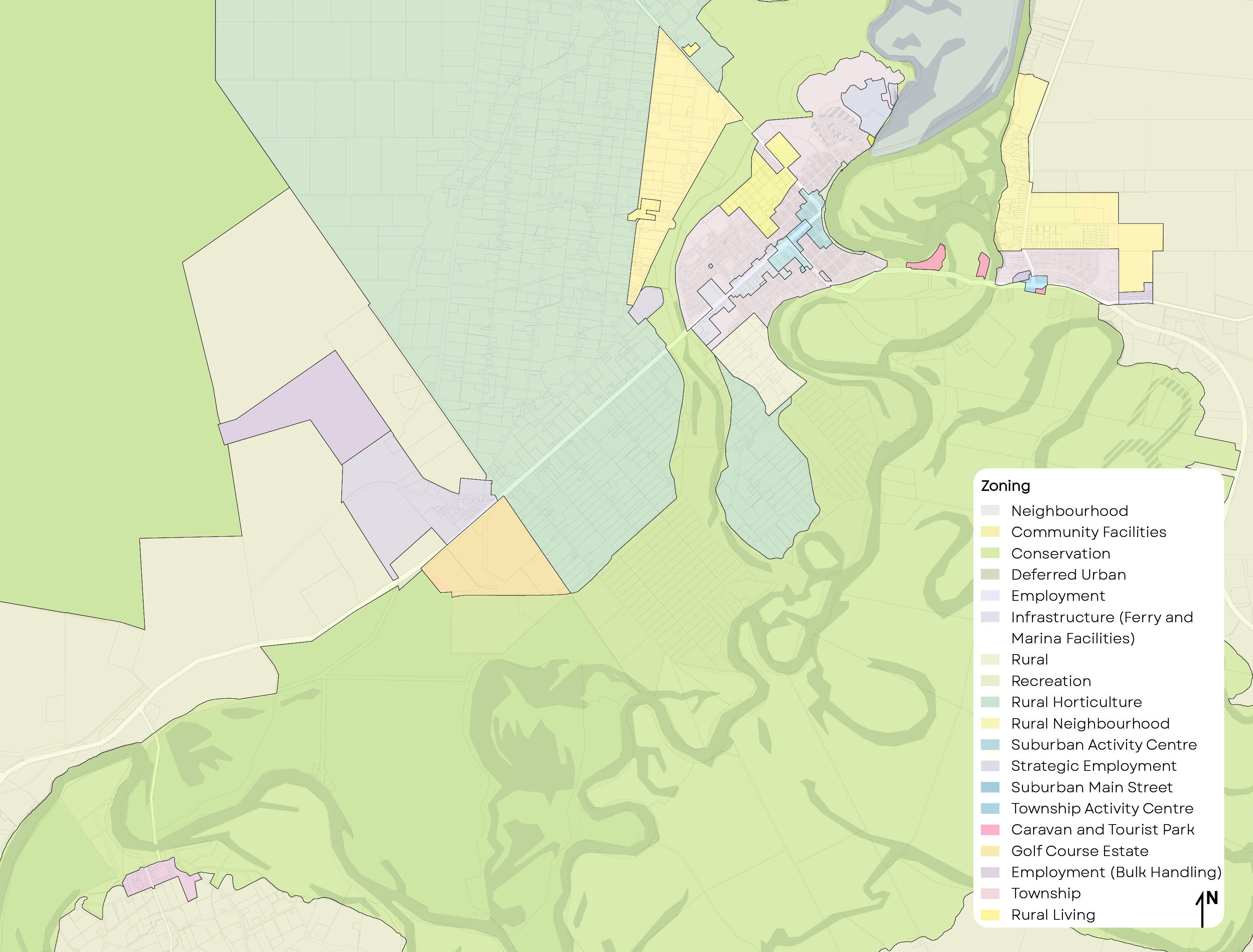
Existing Supply Map –Renmark
RAL
Caravan and Tourist Park
Community Facilities
Conservation Deferred Urban Employment
Infrastructure (Ferry and Marina Facilities)
Neighbourhood
Recreation
Rural Horticulture
Rural Neighbourhood
Suburban Activity Centre
Strategic Employment
Suburban Main Street
Township Activity Centre
Tourism Development
Zone boundary
Legend Jane Eliza Code Amendment
Affected area
Potential development site
Vacant employment land
MURRAY RIVER
Existing Supply Map –Paringa
Vacant employment land
Existing Supply Map –
Old Calperum
Existing Supply Map
RUPETT CT THAYNE TERRACE BEAMES RD
Growth Principles
Growth Scenario Planning
9,783
We encourage and support growth which is well-planned and have set targets to facilitate population and economic growth. While the following targets are a stretch from our current situation, we believe they are achievable given the amount of growth expected to occur as a result of infrastructure upgrades and the Jane Eliza development.
To achieve our stretch growth scenario, we must also increase the number of jobs comparative to population growth. On this basis, we have set the following targets.
65 Dwelling Approvals Per Year
These targets can be achieved through delivery of our Growth Objectives, Strategies and Actions.
We will monitor development activity and actions and ensure the Growth Strategy remains current. We will seek to review the Growth Strategy every two years and make adjustments where necessary.
Growth Principles
Growth Objectives
Our Growth Objectives are what we are striving to achieve and will help guide decision making.
• GO1: There is adequate land supply for residential, employment and commercial purposes to cater for the next 15 to 30 years
• GO2: Our population continues to grow.
• GO3: We build upon and diversify our economic base.
• GO4: We encourage and support development which aligns with our Growth Strategy.
• GO5: We plan for and provide good community infrastructure and services.
• GO6: We provide sound governance and work in collaboration with our residents and businesses.
Growth Strategies
Our Growth Strategies underpin development within the Council area and support our Growth Objectives and Community Plan. For this reason, each Strategies is aligned to our Community Plan Areas of Focus.
Undertake annual land supply, target and action monitoring.
Support privately-led Code Amendments which align with our growth principles.
Establish initiatives to promote development of underutilised, well serviced areas.
Maintain and protect land within the Rural Horticulture Zone to ensure primary production activities are not compromised by incompatible land uses.
Investigate ways to diversify and value-add in the agricultural sector.
Source funding for infrastructure upgrades in accordance with the priority identified in Growth Management Plan.
Support unique tourism opportunities and development which strengthens the tourism sector.
Identify opportunities to improve community facilities and the public realm.
Seek to enable development proposals which align with our growth principles.
GO1, GO2 P1.1, LE2.1
GO4, GO6 P1.1, P4.2
GO2, GO4, GO5, GO6 P1.1, P4.2
GO3, GO6 P1.1, P2.1, P2.2
Advocate for the Riverland as a regional base for tertiary education providers.
Advocate for state and federal government investment into enabling infrastructure.
Prepare fact sheets and guides to reduce confusion about the planning system.
Create opportunities for more social infrastructure and community facilities to ensure standards and benchmarks for these facilities are met.
GO3, GO6 P2.1, P2.2
GO4, GO5, GO6 P5.1, P5.3, LE1.2
Support development which strengthens the lifestyle benefits of living in the region.
Each identified growth area is associated with a series of actions to guide growth and the provision of infrastructure. The actions have been assigned a timeframe for completion. The basis for the timeframes is explained further below.
Short Term – 0-5 years – Service infrastructure is largely in place or will be funded by external sources, the growth area is being actively developed, or unlocking the area is a priority project.
Medium Term 5-15 years – Unlocking the growth area requires infrastructure investment from the Council which will need to be planned for in future budgets or seek external funding sources.
Long Term 16-30 years - Unlocking the growth area requires significant infrastructure investment from the Council which will need to be planned for in future long-term budgets or seek external funding sources.
Identified Growth Areas
Renmark Identified Growth Areas
Remove barriers to growth in Renmark West by expansion of the CWMS.
Caravan and Tourist Park
Community Facilities
Conservation Deferred Urban Employment
Infrastructure (Ferry and Marina Facilities)
Neighbourhood
Recreation
Rural Horticulture
Rural Neighbourhood
Suburban Activity Centre
Strategic Employment
Suburban Main Street
Township Activity Centre
Tourism Development
Zone boundary
Legend Jane Eliza Code Amendment
Affected area
Future growth (Residential)
Potential intensification
Support the Jane Eliza Code Amendment and subsequent development.
Consider rezoning of the Tourism Development Zone to facilitate residential uses.
Opportunity to review zoning to facilitate other uses.
Monitor land supply to determine when the Deferred Urban Zone should be targeted for rezoning.
MURRAY RIVER
Renmark Deferred Urban Structure Plan
Land supply within Renmark will be monitored to determine when the rezoning of the Deferred Urban Zone should occur. Council will seek to rezone this land when it is identified that there is less than 30 years of land supply. Any privately-led code amendments sought before this time should be undertaken in an orderly manner, contiguous to the Neighbourhood Zone. Privately-led code amendments should not result in patchy, incontiguous zoning and should generally be in accordance with the Structure Plan.
The River Murray Flood Plain Protection Area currently applies over the Deferred Urban land. A review of its application will be required for any rezoning of this land.
Legend
Zone boundary
Primary Access Route
River Murray 1956 Flood Level
Interface Management
Neighbourhood Zone
Rural Neighbourhood Zone
Paringa Identified Growth Area
Opportunity to review Employment (Bulk Handling) Zone to facilitate other uses
Encourage intensification within the Paringa Rural Neighbourhood Zone.
Encourage residential development within the Golf Course Estate Zone
Lyrup Identified Growth Area
BEAMES RD BOLLENHAGEN
PL Increase the supply of land for both residential and commercial development
RUPERT CT THAYNE TERRACE
DOWNER AVE
NOLAN RD
Future growth (Township)
Growth Management
Growth Management
The Growth Strategy will be monitored and delivered through a series of Actions
The following actions apply generally across the Council.
Growth Management Council Wide Actions
CW1 Undertake annual land supply, target and action monitoring.
CW2
Review the Growth Strategy every two years and make adjustments where necessary.
CW3
Review sporting facilities and open spaces to create a longterm plan for redevelopment and provision of recreational facilities
Growth Management
This section identifies the infrastructure required for each of the growth areas to enable development. Actions relate to Council responsibilities and considerations for budgeting and forward planning. Growth areas are divided into existing supply and future supply.
Responsibilities
The following guidance is provided in relation to roles and responsibilities for the funding of infrastructure.
Service Provider Funding
Wastewater - CWMS A community wastewater management system (CWMS) exists within Renmark and Paringa. This is managed by the Council.
Wastewater - On-site Where a CWMS does not exist, wastewater is managed by onsite wastewater management systems.
Stormwater A formal stormwater drain network exists within Renmark, Paringa and Lyrup. This is managed by the Council.
Council where land is already zoned.
Any new infrastructure or upgrades required to facilitate development as a result of a privately-led Code Amendment may require an infrastructure agreement to fund upgrades.
Private landowners are required to install and maintain on-site wastewater management systems.
Council where land is already zoned.
Developers are required to pay for new infrastructure as part of any internal development works, i.e. when land is divided.
Any new infrastructure or upgrades required to facilitate development as a result of a privately-led Code Amendment may require an infrastructure agreement to fund upgrades.
Local Roads Local public roads are managed by Council.
State Maintained Roads Sturt Highway, Ral Ral Avenue and Renmark Avenue which are State maintained roads.
Council is responsible for upgrades and maintenance.
Developers are required to pay for new roads as part of any internal development works or if the development will require new intersections or intersection upgrades, i.e. when land is divided.
The Department for Infrastructure and Transport is responsible for upgrades and maintenance.
Developers may be required to pay for any new intersections or intersection upgrades if required to facilitate the development.
Potable Water Mains SA Water mains exist in Renmark and Paringa. SA Water is responsible for upgrades and maintenance. Developers may be required to pay for new infrastructure as part of any internal development works or if the development will require upgrades to mains, i.e. when land is divided.
Potable Water – No Mains Where water mains do not exist, private rainwater tanks are used.
Private landowners are required to install and maintain rainwater tanks.
Service Provider
Irrigation Water The Renmark Irrigation Trust owns a network of irrigation supply lines within Renmark and Paringa. Council also owns some recycled wastewater mains which are largely used to irrigate public open space.
Mains Electricity SA Power Networks (SAPN) supply and manage underground and overhead electricity infrastructure within the Council area.
NBN NBNCo, supply and manage the new NBN network within the Council area.
Funding Responsibility
The provider is responsible for maintenance and upgrades.
SAPN is responsible for upgrades and maintenance.
Developers are required to pay for new infrastructure as part of any internal development works or if the development will require upgrades to mains, i.e. when land is divided.
NBNCo for any network upgrades.
Developers are required to pay for connections to new developments.
Growth Management - Existing Supply
More information on detailed infrastructure for each growth area can be found in Appendix 1.
New CWMS infrastructure required.
Potable water supply available.
Neighbourhood Zone (Code Amendment will increase existing residential supply) Residential
Neighbourhood Zone
Telecommunications infrastructure available.
Electricity infrastructure available.
Main road access will be via Jane Eliza Avenue. A new road connection required to create an alternative access to the growth area.
Future development should include a stormwater management system designed to mitigate peak flows and manage the rate and duration of stormwater discharges from the site to ensure that the development does not increase the peak flows in downstream systems.
New CWMS pump station required.
The existing Hospital pump station will need to be upgraded after 100 new dwellings have been constructed in this new area.
Water main upgrade will be required.
Telecommunications infrastructure available.
Electricity infrastructure available. New intersection with Ral Ral Avenue may be required.
Stormwater should be managed to ensure that the development does not increase the peak flows in downstream systems.
Ensure an infrastructure agreement is in place that requires CWMS infrastructure and a new road connection prior to development.
Investigate funding options for a new pump station for Riverside Estate.
Investigate funding options to upgrade the Hospital pump station when 100 new dwellings have been approved within Riverside Estate.
Ensure water main upgrade is identified at land division stage for development within the Riverside Estate.
1. Renmark - Jane Eliza Estate
2. Renmark - Riverside Estate
Location Category Infrastructure Actions
Residential Neighbourhood Zone
Residential Neighbourhood Zone
Minor CWMS pump stations will need to be installed to aid transfer. Pump station 13 (Korinthos St) will need to be upgraded to suit additional flows.
Existing water mains will require minor extensions.
A 300m extension of Telstra infrastructure is required to connect Nineteenth Street and Twentieth Street.
Growth area off Rod Thomas Drive will need an additional electricity transformer to be installed.
Stormwater should be managed to ensure that the development does not increase the peak flows in downstream systems.
Minor CWMS pump stations will need to be installed to aid transfer. Pump station 16 (Howie Dr) will need to be upgraded to receive additional flows.
Possible upgrade of water main required pending yield and use of irrigation water.
Telecommunications infrastructure available nearby.
Electricity infrastructure available. New transformers will need to be installed at approximately every 50 residential lots.
Investigation required when designing access due to the proximity of Sturt Highway and Bookmark Creek Bridge. Access should be via Pyap Street.
Stormwater should be managed to ensure that the development does not increase the peak flows in downstream systems.
Investigate funding options for an upgrade to pump station 13 (Korinthos St).
Promote development of the residential land between Pyap Street and Renmark Avenue.
3. North Nineteenth Street to Twentyfirst Street
4. Renmark Avenue/ Sturt Highway and Pyap Street
Location Category Infrastructure Actions
There currently is no community wastewater infrastructure within the area.
Bookmark Creek Subzone
CWMS infrastructure and a centrally located pump station is required.
Potable water main requires connection to existing unused infrastructure.
Additional irrigation water supply lines will need to be installed on Bookmark Avenue and Tapalin St to provide full coverage.
Telecommunications infrastructure available nearby.
Electricity infrastructure available.
Road upgrades unlikely to be required.
Stormwater should be managed to ensure that the development does not increase the peak flows in downstream systems.
A new CWMS pump station will be required when the land adjacent to Olivewood is developed. Pump station 16 (Howie Dr) is likely to require upgrade to receive additional input.
Potable water available.
Telecommunications infrastructure available.
Electricity infrastructure available.
Traffic investigations will be required when the land adjacent to Olivewood is developed. Access via Renmark Ave is encouraged.
Stormwater should be managed to ensure that the development does not increase the peak flows in downstream systems.
Investigate a funding strategy to deliver required infrastructure to the Renmark West Rural Neighbourhood Zone to unlock potential. Promote development of the employment land adjacent to Renmark Avenue.
5. Bookmark Avenue Street
7. Renmark Avenue Employment
Location Category Infrastructure Actions
Residential Neighbourhood Zone
CWMS infrastructure sufficient to cater for future growth.
Potable water available.
Telecommunications infrastructure available.
Electricity infrastructure available. New transformers will need to be installed at approximately every 50 residential lots.
Road upgrades unlikely to be required.
Stormwater should be managed to ensure that the development does not increase the peak flows in downstream systems.
Residential
Rural Neighbourhood
On-site wastewater systems will be required for any development north of Thompson Road.
CWMS infrastructure available south of Thompson Road.
Potable water mains available.
Telecommunications infrastructure available.
Main electricity lines will need to be installed along Thompson Road, with infrastructure extensions required for Birds Road. New transformers will need to be installed at approximately every 50 residential lots.
Road upgrades unlikely to be required.
Stormwater should be managed to ensure that the development does not increase the peak flows in downstream systems.
Promote development of the residential land in Paringa.
Promote development of the rural residential land in Paringa.
8. Paringa - Neighbourhood Zone Street
9. Paringa - Rural Neighbourhood
Employment (Bulk Handling) Zone and Strategic Employment Zone
CWMS infrastructure available.
Potable water mains available.
Telecommunications infrastructure available.
Electricity infrastructure available.
Road upgrades unlikely to be required.
Stormwater should be managed to ensure that the development does not increase the peak flows in downstream systems.
Consider alternative appropriate land use for the Employment Zone for Museum Drive.
Promote development of the employment land on Lindsay Point Road.
Paringa Employment
/
Main
Zone /
Activity
zone
CWMS infrastructure available. Commercial properties within the Renmark town centre are hindered by achieving wastewater compliance due to insufficient space to locate septic tank.
Potable water mains available however low water pressure is resulting in fire water storage tanks to be fitted to these properties driving up costs making some sites uneconomical.
Telecommunications infrastructure available.
Electricity infrastructure available.
Road upgrades unlikely to be required.
Stormwater should be managed to ensure that the development does not increase the peak flows in downstream systems.
Course
Zone
There is no CWMS infrastructure in this location. Allotments should be at least 2,000sqm to accommodate on-site wastewater systems.
If 700sqm allotments sizes are sought, a new CWMS system will be required which could convey wastewater into
the existing Calperum CWMS. The Calperum CWMS will require capacity investigations.
There are no potable water mains in this area. It would be uneconomical extend this infrastructure for this development area alone. Use of rainwater tanks required.
Irrigation water available nearby (to the north).
Telecommunications infrastructure available nearby.
Electrical infrastructure available. New transformers will need to be installed at approximately every 50 residential lots.
Road upgrades unlikely to be required.
Future development should include a stormwater management system designed to mitigate peak flows and manage the rate and duration of stormwater discharges from the site to ensure that the development does not increase the peak flows in downstream systems.
Investigate options for connecting properties to the CWMS to cater for existing and future demands in Renmark Town Centre.
Investigate options for increasing water supply to cater for existing and future demands in Renmark Town Centre.
Investigate feasibility of infrastructure augmentation in conjunction with other development occurring in Old Calperum (i.e. the Strategic Employment Zone). Short Term (0-5 years) Long term (15-30 years)
Location Category Infrastructure Actions
14. Old Calperum Strategic Employment Zone
Employment Zone
/
Existing CWMS in Calperum Estate. New pipe and pump infrastructure will need to be installed to connect to future development.
There are no potable water mains in this area. It would be uneconomical to extend this infrastructure for this development area alone. Use of rainwater tanks required.
No irrigation water infrastructure in this area.
Telecommunications infrastructure available nearby.
Electrical infrastructure available nearby. Extension of the underground network will be required to connect future development. There is limited capacity for existing and future demands.
Road upgrades unlikely to be required.
Stormwater should be managed to ensure that the development does not increase the peak flows in downstream systems.
There is no CWMS infrastructure in this location. On-site wastewater systems required.
There are no potable water mains in this area. Use of rainwater tanks required.
Telecommunications infrastructure available.
Electrical infrastructure available.
Road upgrades unlikely to be required.
Stormwater should be managed to ensure that the development does not increase the peak flows in downstream systems.
Investigate feasibility of infrastructure augmentation in conjunction with other development occurring in Old Calperum (i.e. the Golf Course Estate Zone).
Investigate options for increasing electricity supply to cater for existing and future demands in Old Calperum.
Encourage development on vacant allotments in Lyrup.
16. Lyrup Zone
Growth Management - Future Supply
6. Renmark Deferred Urban Zone
Requires a rezoning to facilitate development. A Structure Plan has been prepared to guide development over this area.
Residential
Currently Deferred Urban Zone. Intent is for a future rezoning to Neighbourhood Zone and Rural Neighbourhood Zone.
Existing CWMS infrastructure on Pyap Street. New infrastructure will need to include a pump station centrally located within the area. Pump Station 20 (Pyap St) will need extensive upgrade/ replacement to adequately accommodate new inflows.
SA Water infrastructure not adequate to service this area. To adequately provide a potable water service for this growth area a storage tank and booster pump arrangement will need to be investigated.
Telecommunications infrastructure available.
Electrical infrastructure available. New transformers will need to be installed at approximately every 50 residential lots.
Road upgrades unlikely to be required.
Future development should include a stormwater management system designed to mitigate peak flows and manage the rate and duration of stormwater discharges from the site to ensure that the development does not increase the peak flows in downstream systems.
Monitor land supply to determine when the Deferred Urban Zone should be targeted for rezoning.
Ensure any privately led code amendments within the Deferred Urban Zone are undertaken in an orderly manner, contiguous to the Neighbourhood Zone.
Ensure any privately led code amendments within the Deferred Urban Zone are generally in accordance with the Structure Plan.
Ensure an infrastructure agreement is in place that requires contributions for CWMS infrastructure as part of any Code Amendment within the Deferred Urban Zone.
Ensure any Code Amendment of the Deferred Urban Zone investigates application of the River Murray Flood Plain Protection Area Overlay.
Ensure any Code Amendment of the Deferred Urban Zone includes flooding investigations for any rezoning which is within the 1956 flood level.
12. Old Calperum Government Road Employment
Currently in the Rural Zone. Intent is for a future rezoning to Strategic Employment Zone.
Existing CWMS in Calperum Estate. The existing wastewater treatment system will need investigation and potential upgrades will be required to accommodate this proposed development area.
There are no potable water mains in this area. It would be uneconomical to extend this infrastructure for this development area alone. Use of rainwater tanks required.
No irrigation water infrastructure in this area.
Telecommunications infrastructure available nearby.
Electrical infrastructure available nearby. Extension of the underground network will be required to connect future development. There is limited capacity for existing and future demands.
Road upgrades unlikely to be required.
Stormwater should be managed to ensure that the development does not increase the peak flows in downstream systems.
Investigate feasibility of infrastructure augmentation in conjunction with other development occurring in Old Calperum (i.e. the Golf Course Estate Zone).
Investigate options for increasing electricity supply to cater for future demands in Old Calperum.
Currently in the Rural Zone. Intent is to rezone to the Township Zone.
There is no CWMS infrastructure in this location. The design and construction of a wastewater processing facility within the Lyrup region could be investigated depending on the long-term growth forecasted.
There are no potable water mains in this area. Use of rainwater tanks required.
Telecommunications infrastructure available.
Electrical infrastructure available. New transformers will need to be installed at approximately every 50 residential lots.
Road upgrades unlikely to be required.
This growth area will require the upgrade of the existing flood levee system located to the North of the development area.
Stormwater should be managed to ensure that the development does not increase the peak flows in downstream systems.
Ensure any future Code Amendment investigates the feasibility of a new CWMS system in Lyrup.
Ensure any future Code Amendment investigates an upgrade of the existing flood levee system to cater for future development.
Summary of Infrastructure and Actions
Growth Management Council Wide Actions
CW1 Undertake annual land supply, target and action monitoring.
CW2 Review the Growth Strategy every two years and make adjustments where necessary.
CW3 Review sporting facilities and open spaces to create a long-term plan for redevelopment and provision of recreational facilities Priority
1A Ensure an infrastructure agreement is in place that requires CWMS infrastructure and a new road connection prior to adoption of the Jane Eliza Code Amendment.
2A Investigate funding options for a new pump station for Riverside Estate.
2B Investigate funding options to upgrade the Hospital pump station when 100 new dwellings have been approved within Riverside Estate.
2C Ensure water main upgrade is identified at land division stage for development within the Riverside Estate.
3A Investigate funding options for an upgrade to pump station 13 (Korinthos St).
Renmark Avenue/ Sturt Highway and Pyap Street 4A Promote development of the residential land between Pyap Street and Renmark Avenue.
5A Investigate a funding strategy to deliver required infrastructure to the Renmark West Rural Neighbourhood Zone to unlock potential.
Y = INFRASTRUCTURE AVAILABLE
N/A = NOT APPLICABLE
1. Jane Eliza Estate
8. ParingaNeighbourhood Zone
6A Monitor land supply to determine when the Deferred Urban Zone should be targeted for rezoning.
6B Ensure any privately-led code amendments within the Deferred Urban Zone are undertaken in an orderly manner, contiguous to the Neighbourhood Zone.
6C Ensure any privately-led code amendments within the Deferred Urban Zone are generally in accordance with the Structure Plan.
6D Ensure an infrastructure agreement is in place that requires contributions for CWMS infrastructure as part of any Code Amendment within the Deferred Urban Zone.
6E Ensure any Code Amendment of the Deferred Urban Zone investigates application of the River Murray Flood Plain Protection Area Overlay.
6F Ensure any Code Amendment of the Deferred Urban Zone includes flooding investigations for any rezoning which is within the 1956 flood level. Short Term (0-5 years)
7A Promote development of the employment land adjacent to Olivewood. Short Term (0-5 years)
8A Promote development of the residential land in Paringa. Short Term (0-5 years)
9A Promote development of the rural residential land in Paringa. Short Term (0-5 years)
Promote development of the employment land in Paringa. Short Term (0-5
11A. Investigate options for connecting properties to the CWMS to cater for existing and future demands in Renmark Town Centre.
11B. Investigate options for increasing water supply to cater for existing and future demands in Renmark Town Centre.
(0-5 years)
6. Renmark Deferred Urban Zone
7. Renmark Avenue Employment
9. Paringa - Rural Neighbourhood
Paringa Employment
11. Renmark Town Centre
12A Investigate feasibility of infrastructure augmentation in conjunction with other development occurring in Old Calperum (i.e. the Golf Course Estate Zone).
12B. Investigate options for increasing electricity supply to cater for future demands in Old Calperum.
13A Investigate feasibility of infrastructure augmentation in conjunction with other development occurring in Old Calperum (i.e. the Strategic Employment Zone).
14A Investigate feasibility of infrastructure augmentation in conjunction with other development occurring in Old Calperum (i.e. the Golf Course Estate Zone).
14B. Investigate options for increasing electricity supply to cater for existing and future demands in Old Calperum.
Medium term (5-15 years)
Long term (15-30 years)
Medium term (5-15 years)
Short term (0-5 years)
15A Encourage development on vacant allotments in Lyrup. Short Term (0-5
16A Ensure any future Code Amendment investigates the feasibility of a new CWMS system in Lyrup.
16B. Ensure any future Code Amendment investigates an upgrade of the existing flood levee system to cater for future development.
Medium term (5-15 years)
Old Calperum
Lyrup
1. Renmark - Jane Eliza Estate
Located to the north-east of the Renmark CBD.
This area is largely in the Neighbourhood Zone and a Code Amendment is currently underway to extend the residential portion.
Irrigation Water
Currently there is no existing wastewater network within the proposed growth area. Due to the proposed size of this development all new infrastructure will be needed to sufficiently provide service.
A new gravity system will be required within the development, this system will fall towards a centrally located pump station and rising main network. The new pump station will need to transfer wastewater directly to Renmark’s WWTP located approximately 2,125m away on Nineteenth Street.
It is not recommended to input wastewater from this proposed development into the existing CWMS network at risk of overload.
The wastewater processing facility in Renmark is currently being upgraded and will have the capacity for this future growth.
There is an existing potable water supply through the existing Jane Eliza Development and terminates at the end of Jane Eliza Avenue. This existing main would be considered adequate to feed potable water to this proposed development area.
A new network of main lines and house connections will need to be designed and installed to distribute this service throughout the proposed growth area.
There is currently no RIT supply into or adjacent to this proposed development area.
There is currently an existing RPC Recycled Wastewater main within this growth area, this existing infrastructure can be modified to irrigate open space only, this cannot be used for private use.
Existing Telstra infrastructure is located adjacent to the proposed growth area at the end of Jane Eliza Avenue. This existing infrastructure is considered to be adequate to provide required service to this proposed development area. Infrastructure will need to be extended and distributed into the growth area from this location.
This proposed growth area currently has NBN by Fixed Line connection service at the end of Jane Eliza Avenue. This infrastructure can be extended and distributed within the proposed growth area.
There are currently two existing 11kV supplies adjacent the new development area, one supply is terminated underground at the end of Jane Elize Avenue the other supply is over head located at the end of Liba Liba Parade. The underground supply was specifically installed for future development in this area. These existing SAPN services are considered to be adequate to power this new development area.
A new underground network combining the High Voltage and new Low Voltage infrastructure will need to be extended into the growth area from the existing High Voltage main overhead infrastructure to the North. New infrastructure will need to be installed, including transformers approximately every 50 lots.
Currently the proposed access to this development area is through the existing Jane Eliza Avenue. This road will be considered adequate and was originally installed to access this additional development.
Due to the proposed size of this development, an additional access would be desired in the case of emergency. It is recommended that Gregory Way is upgraded to provide an adequate additional access into this proposed growth area.
Future development should include a stormwater management system designed to mitigate peak flows and manage the rate and duration of stormwater discharges from the site to ensure that the development does not increase the peak flows in downstream systems.
2. Renmark - Riverside Estate
Currently in the Neighbourhood Zone. Future development will represent an extension of an existing subdivision located at the end of Murray Dyer Avenue.
The wastewater system adjacent to this growth area is not considered sufficient to service expected development and will require a new pump station to be constructed within the growth area.
Wastewater from the growth area’s new pump station will need to be transferred to existing pump station 07 (Hospital), the existing Hospital pump station will need to be upgraded after 100 new dwellings have been constructed in this new area. Flow and pump station storage tank capacity at peak periods will need to be reviewed to confirm system performance once development layout is established.
The wastewater processing facility in Renmark is currently being upgraded and will have the capacity for this future growth.
There is an existing 150dia water main located on Ral Ral Avenue, adjacent to this growth area, this main currently feeds the area around the Hospital and Renmark Football Club. This existing main would not be considered adequate to sufficiently service the proposed growth area and upgrade options will need to be investigated and considered.
An existing 150 dia water main is located on the Northern side of the growth area, this main will need to be incorporated into this proposed growth area to provide additional service supply. This main is currently located outside the existing levee bank and will need to be under bored below levee.
A review should be taken to record peak flows in demand times and the potential for storage tanks to be installed investigated to ensure adequate flows are achieved.
Renmark Irrigation Trust has a supply line that currently stretches through the growth area, this main has a branch that feeds existing houses to the South-East of the area.
This existing infrastructure will be sufficient to feed the proposed growth area.
Existing Telstra infrastructure is available on adjacent Ral Ral Avenue and is considered to adequately provide service to the proposed growth area. Infrastructure will need to be extended into the growth area from Ral Ral Avenue.
This proposed growth area currently has available NBN by Fixed Line connection. This infrastructure is adequate to provide sufficient service for this growth area. Communications
Electrical supply adjacent to the growth area is by overhead network located to the North, this power line is 11kV High Voltage and will be sufficient to service the proposed growth area.
A new underground network combining the High Voltage and new Low Voltage infrastructure will need to be extended into the growth area from the existing High Voltage main overhead infrastructure to the North. New infrastructure will need to be installed, including transformers approximately every 50 lots. New developments are expected to install all infrastructure underground.
Access to this growth area will depend on the developers intended use, if the Riverside Estate Retirement Village is to be extended into this area, it would be assumed the existing gated entrance on Murray Dyer Avenue will be utilised.
If the proposed development in this growth area will be public works, access would need to be from Ral Ral Avenue access road, in front of the hospital. This road will need to be upgraded and an intersection assessment completed once development details are confirmed.
Future development should include a stormwater management system designed to mitigate peak flows and manage the rate and duration of stormwater discharges from the site to ensure that the development does not increase the peak flows in downstream systems.
3. Renmark - North Nineteenth Street to Twentyfirst Street
Existing wastewater infrastructure is generally in place adjacent to proposed growth areas, new wastewater infrastructure will need to be constructed to enter the adjoining network, however minor pump stations will need to be installed to aid transfer as existing infrastructure is generally shallow at existing extents.
The proposed development on Twentieth Street should provide rising main infrastructure to transfer wastewater directly to the Wastewater treatment plant located on Paringa Street approximately 250m away. This additional main will relieve any overloading on the existing system and could pickup additional growth areas located along Paringa St.
Growth areas located off Twentyfirst Street can be incorporated into existing adjacent infrastructure, however, existing pump station 13 (Korinthos St) will need to be upgraded to suit additional flows.
The wastewater processing facility in Renmark is currently being upgraded and will have the capacity for this future growth.
Current infrastructure capacity will be adequate to supply the proposed development in these growth areas. Dedes Drive and Bolati Court are fed with a 150dia PVC main, can adequately provide service for the adjacent growth areas. Twentyfirst Street is currently fed with a 200dia PVC main terminating at the High School, this main will sufficiently feed the proposed growth at Blue Skies. Pipe work will need to be extended into growth areas and distribution as required.
There is currently a 100dia PVC main and a 200dia DICL main located on Twentieth Street, these main will need to be extended approximately 200m to the North to provide adequate supply for the proposed growth areas. There is also an existing 100dia AC main located on Nineteenth Street that will need to be extended 130m to feed proposed dwellings on Nineteenth St development area.
There currently is RIT infrastructure in place behind the High School and there is also an irrigation and domestic meter installed. No other irrigation infrastructure is installed. Generally, urban lots do not require this infrastructure.
Existing Telstra infrastructure is available on Twentyfirst St and Dedes Drive, infrastructure can be extended into these proposed growth areas.
Nineteenth Street and Twentieth Street currently has no Telstra infrastructure installed adjacent to the proposed growth areas. There is an existing 100dia communications conduit located on Twentieth Street that will need to be extended approximately 300m and distributed as required to growth areas in these proposed areas.
Growth areas adjacent to Twentyfirst Street are designated as an NBN Fixed Line service area. Growth areas adjacent to Nineteenth and Twentieth Streets are nominated Fixed Wireless service areas.
Electricity supply into growth areas adjacent Twentyfirst Street are considered adequate, additional underground infrastructure will need to be installed to distribute the network within each area. Growth area off Rod Thomas Drive will need an additional transformer to be installed to adequately provide service for the proposed growth in this area.
Existing SAPN infrastructure adjacent to proposed growth areas on Nineteenth and Twentieth Street will require a HV extension further up Twentieth Street and into Paring Street. Distribution of services to development areas on both sides of the road will then be required. A new underground network combining High Voltage and Low Voltage infrastructure will need to be constructed into the growth area and distributed as required, a new transformer will need to be installed at approximately every 50 lots.
The proposed growth areas off Twentyfirst Street can be accessed off Twentyfirst Street, Rod Thomas Street and Bolati Court, these access locations are deemed adequate and will not require further upgrade of intersections.
Growth areas located on Nineteenth and Twentieth Street can be accessed off both main roads and Paringa Street, all these access points are deemed adequate for the proposed growth.
Future development should include a stormwater management system designed to mitigate peak flows and manage the rate and duration of stormwater discharges from the site to ensure that the development does not increase the peak flows in downstream systems.
4. Renmark - Renmark Avenue/ Sturt Highway and Pyap Street
Existing wastewater infrastructure is generally in place adjacent to proposed growth area on Renmark Avenue, new wastewater infrastructure will need to be constructed to enter the adjoining network. A minor pump station will need to be installed to aid transfer as existing infrastructure may not reach the extents of the proposed development areas. The existing pump station 16 (Howie Dve) will require upgrades to pump infrastructure to adequately receive additional input.
The proposed growth area off Pyap Street will require a new network of pipelines throughout the new development and a new pump station. The existing pump station 17 (Barrington St) will be sufficient to receive new flows. The wastewater processing facility in Renmark is currently being upgraded and will have the capacity for this future growth.
The proposed growth area along Renmark Avenue has existing SA Water infrastructure located adjacent to the development area from Murray Price Ave. There is 2x 100dia water mains that can be joined and extended to provide adequate capacity for the proposed dwellings.
The proposed growth area located at the Western end of Pyap Street currently has a 150dia PVC watermain adjacent. This main may not be sufficient to provide adequate service for the proposed 410 lots. Further investigations of main pressures in the area may indicate a storage tank and pump may be able to provide adequate flow to the area. There is existing RIT infrastructure in this area, this infrastructure may reduce potable water demand, reducing the infrastructure requirement.
Lot sizing and arrangement confirmation for the Pyap St growth area may help confirming existing infrastructure upgrade requirements.
There is no irrigation supply servicing the growth area adjacent to Renmark Avenue. Uneconomical infrastructure upgrades will be required to provide service to this area.
The growth area adjacent to Pyap Street currently has an irrigation supply traversing the development area, this infrastructure will need to be rerouted to an alignment that better suits future lot locations and layouts. This infrastructure will be adequate to provide service to the new growth area.
The growth area on Renmark Avenue currently has Existing Telstra infrastructure available adjacent to the proposed growth area, new infrastructure will need to be installed to distribute through the development area.
The growth area located off Pyap Street currently has adequate infrastructure installed on the Southern side of Pyap Street. New infrastructure will need to be installed to meet existing and distribute service through the proposed growth area.
The proposed growth area adjacent to Renmark Avenue is nominated as an NBN Fixed Line service and the growth area off Pyap Street is nominated as an NBN Fixed Wireless service.
Electricity supply into the growth area adjacent Renmark Avenue is serviced by and underground network from Renmark Avenue and Murray Price Avenue. These existing supply points can be extended to provide sufficient service to this proposed growth area.
The proposed growth area adjacent to Pyap Street has existing overhead SAPN infrastructure located on Pyap Street and Industry Road. New underground infrastructure can be installed to extend and distribute this existing service into the proposed development area. New transformers will need to be installed at approximately every 50 residential lots.
The proposed growth areas off Renmark Avenue will need considerable investigation when designing access, the location is on the Sturt Highway and is very close to the existing Bookmark Creek Bridge.
Access into the proposed growth area off Pyap Street can be located along Pyap street as required. There will be no major congestion concerns, and no intersection upgrades are expected.
Future development should include a stormwater management system designed to mitigate peak flows and manage the rate and duration of stormwater discharges from the site to ensure that the development does not increase the peak flows in downstream systems.
5. Renmark West - Bookmark Avenue
Currently in the Rural Neighbourhood Zone confined within Ral Ral Avenue, Bookmark Avenue and Arumpo Street.
Land division can only occur if connected to CWMS.
There currently is no community wastewater infrastructure within the area.
The proposed growth area will require new CWMS infrastructure that will provide gravity pipelines to a centrally located pump station. The pump station will need a rising main to transfer waste approximately 750m to Council’s existing wastewater processing facility on Nineteenth Street.
The wastewater processing facility in Renmark is currently being upgraded and will have the capacity for this future growth.
There currently Is a 150dia potable water main located on Ral Ral Avenue, this main is considered not adequate to supply this proposed growth area.
SA Water has an unused 375dia watermain installed and terminated within the bookmark flood plain on the Growth Area side of Bookmark Creek. This watermain will be capable of providing the additional service required for this growth area.
A main extension of approximately 600m will need to be constructed to provide this service to a central location in the growth area.
RIT infrastructure within this growth area does not provide adequate service to fully supply the proposed growth.
Additional supply lines will need to be installed on Bookmark Avenue and Tapalin St to provide full coverage.
Existing Telstra infrastructure is available on all adjoining and internal roads within the growth area to adequately provide service it is recommended to extend infrastructure from all available adjacent connection points to share service loads.
The Renmark North area currently has available NBN by Fixed Wireless connection. This infrastructure is adequate to provide sufficient service for this growth area.
Electrical supply within this growth area is by overhead network, all overhead lines are 11kV and generally reach all areas of the proposed growth area.
A new underground network combining High Voltage and Low Voltage infrastructure will need to be constructed into the growth area and distributed as required, a new transformer will need to be installed at approximately every 50 lots.
This growth area currently has many potential traffic entry points that can be utilised to relieve any traffic congestion at peak periods. Depending on development location and size, access into each subdivision will need to be assessed individually.
General access to the Renmark Town centre can be achieved by multiple routes, mainly Ral Ral Avenue bridge and Twenty First Street bridge. It is not expected that these bridges will require upgrading for this growth area.
Stormwater should be managed to ensure that the development does not increase the peak flows in downstream systems.
6. Renmark - Deferred Urban
There is existing wastewater infrastructure located along Pyap Street only. To sufficiently provide service for the proposed growth area, new infrastructure will need to be installed throughout the area.
New infrastructure will need to include a pump station centrally located within the area with a new rising main directing wastewater to the existing pump station 20 (Pyap St). Pump Station 20 will need extensive upgrade/ replacement to adequately accommodate new inflows.
The wastewater processing facility in Renmark is currently being upgraded and will have the capacity for this future growth.
Currently there is no adequate SAWater infrastructure in place to provide service to this proposed growth area.
There is an existing 150dia PVC main located on Pyap Street, this main will not be sufficient and may also be providing service to Pyap Street Growth Area.
To adequately provide a potable water service for this growth area a storage tank and booster pump arrangement will need to be investigated.
This proposed growth area currently has sufficient RIT supply throughout, Additional mains and distribution lines will need to be installed to provide adequate service.
Currently in the Deferred Urban Zone. Requires a rezoning in order to facilitate development.
The Structure Plan will guide development over this area.
Existing Telstra infrastructure is located on Pyap Street, Twentythird Street, Twentysecond Street and Twentyfirst Street. This existing infrastructure will be adequate to provide communication service to the proposed development. Additional infrastructure will need to be installed to distribute lines as required.
There are minor areas on Twentyfirst Street and Twentysecond Street that are nominated as NBN fixed Line service areas, the rest of the growth area has NBN fixed wireless service available.
Electricity supply into the growth area is generally overhead with minor underground lot connections. This existing infrastructure will be adequate.
New underground infrastructure will need to be installed to extend and distribute this existing service into the proposed development area. New transformers will need to be installed at approximately every 50 residential lots.
Access into this proposed growth area can be managed off the main roads as required to suit the proposed lot arrangement. There is many traffic flow directions that can be taken so there will be no major congestion concerns and no intersection upgrades are expected.
Future development should include a stormwater management system designed to mitigate peak flows and manage the rate and duration of stormwater discharges from the site to ensure that the development does not increase the peak flows in downstream systems.
Currently in the Employment Zone located generally adjacent Renmark Avenue.
There is existing wastewater infrastructure adjacent to all proposed growth areas, mostly located at the back of lots and fed to various networks and pump stations.
The large Employment growth area adjacent to Olivewood has existing wastewater infrastructure to the north and west, this adjacent infrastructure feeds to existing pump station 16 (Howie Dr). Due to the size of this growth area, it would be assumed that new pump station infrastructure will need to be installed onsite to store and convey wastewater to pump Station 16.
Depending on the intended commercial use of each development area, it would be assumed that the existing infrastructure would need to be assessed individually to confirm if downstream pump stations need upgrading. The existing pump station 16 (Howie Dve) will require upgrades to pump infrastructure to adequately receive additional input from the large growth area within its catchment area.
All nominated growth areas have adjacent SA Water infrastructure that can be used to provide service.
The proposed use and demand of each development will confirm if existing infrastructure is adequate for the intended use.
The large growth area adjacent to Olivewood may need a combination of existing infrastructure on Murray Price Drive and Morant Avenue to provide sufficient service.
There is no RIT supply infrastructure servicing these growth areas. Uneconomical infrastructure upgrades will be required to provide service to this area.
Existing Telstra infrastructure is located adjacent to all nominated development areas within this growth area. This existing infrastructure will be adequate to provide communication service to proposed developments. Additional infrastructure will need to be installed to distribute lines as required.
The large development area may need to extend adjacent infrastructure that currently terminates to the West on Renmark Avenue. If only minor communications are required, directly adjacent infrastructure from Murray Price Drive or Morant Avenue will suffice.
All proposed development areas in this growth area are nominated to be within NBN’s Fixed Line service areas.
Electricity supply is generally available and adequate to all proposed development areas in this growth area.
The existing underground infrastructure adjacent to the area next to Olivewood will need to be extended from Murray Price Drive. Depending on employment use and required demand, a transformer may be required.
Majority of the proposed development areas in this growth area have access nominated at their adjoining roads. All these access points are considered adequate for general use.
The development area adjacent to Olivewood would need some investigations completed to address intended use and traffic demand. Access and egress would be encouraged from Renmark Avenue for this area.
Stormwater should be managed to ensure that the development does not increase the peak flows in downstream systems.
8. Paringa - Neighbourhood Zone
There is existing wastewater infrastructure located at the Southern side of this proposed growth area on Lindsay Point Road and to the West at the end of Curtis Road. This existing adjacent infrastructure would be considered adequate to service this proposed development output.
This growth area has sufficient fall from North to South to accommodate a new gravity network throughout, negating the need for a new pump station.
The existing wastewater treatment plant at Paringa is considered adequate to accommodate the proposed development.
The proposed growth area currently has a sufficient network adjacent, this network is made up of a 150dia pipe on Riverview Drive to the North and East and a 100dia main at the end of Curtis Avenue. The combination of these mains will sufficiently provide service to the proposed lots.
New connections to the existing mains will need to be installed and a new network installed within the development area as required.
There is no irrigation supply servicing this growth area. Uneconomical infrastructure upgrades will be required to provide service to this area.
Existing Telstra infrastructure is located on Riverview Drive at the North and East and at the end of Curtis Avenue. This existing infrastructure will be adequate to provide communication service to the proposed development. Additional infrastructure will need to be installed to distribute lines as required.
Directly to the North, South and West of this development area NBN provides Fixed Line service, this service can be extended into this proposed development area once infrastructure is installed.
There is existing overhead electrical supply adjacent to this growth area located on Riverview Drive. This overhead infrastructure can be utilised to service the new development area.
New underground infrastructure will need to be installed to extend and distribute this existing service into the proposed development area. New transformers will need to be installed at approximately every 50 residential lots.
Access into this proposed growth area can be managed Riverview Drive as required to suit the proposed lot arrangement. There are many traffic flow directions that can be taken so there will be no major congestion concerns and no intersection upgrades are expected.
Future development should include a stormwater management system designed to mitigate peak flows and manage the rate and duration of stormwater discharges from the site to ensure that the development does not increase the peak flows in downstream systems.
9. Paringa - Rural Neighbourhood
Currently in the Rural Neighbourhood Zone.
Proposed lot sizes for this growth area are nominated to be >2,000sqm so onsite wastewater management can be considered.
There is no existing wastewater infrastructure installed North of Thompson Road, any development in this area will need to be managed onsite in conjunction with Health requirements.
There is existing wastewater infrastructure located from Thompson Road to the South and East. This existing infrastructure will be adequate to provide service if required. This growth area has sufficient fall from North to South to accommodate a new gravity network throughout, negating the need for a new pump station.
The existing wastewater treatment plant at Paringa is considered adequate to accommodate the proposed development that can reach the existing system.
The proposed growth area currently has a water treatment plant within it’s extents located at the corner of Causeway Road and Mutho Road.
There is sufficient pipe infrastructure located on Murtho Road, Birds Road and Riverview Drive to adequately distribute within the proposed development area.
New connections to the existing mains will need to be installed and a new network installed within the development area as required.
There is no irrigation supply servicing this growth area. Uneconomical infrastructure upgrades will be required to provide service to this area.
Existing Telstra infrastructure is located on Riverview Drive at the North and East, Birds Road and Thompson Road. This existing infrastructure will be adequate to provide communication service to the proposed development. Additional infrastructure will need to be installed to distribute lines as required.
Birds Road, Riverview Drive and Parts of Murtho have access to NBN Fixed Line service, this service can be extended into this proposed development areas once infrastructure is installed.
There is existing overhead electrical supply within this growth area located on Murtho Road, Birds Road and Riverview Drive. This overhead infrastructure can be utilised to service the new development area. Main lines will need to be installed on Thompson Road and Extensions to Birds Road infrastructure will be required.
New underground infrastructure will need to be installed to extend and distribute this existing service into the proposed development area. New transformers will need to be installed at approximately every 50 residential lots.
Access into this proposed growth area can be managed from Murtho Road, Birds Road, Thompson Road and Riverview Drive as required to suit the proposed lot arrangement. There are many traffic flow directions that can be taken so there will be no major congestion concerns and no intersection upgrades are expected.
Stormwater should be managed to ensure that the development does not increase the peak flows in downstream systems.
10. Paringa - Employment
There is existing wastewater infrastructure located on the Eastern and Southern boundaries of this proposed growth. This existing adjacent infrastructure would be considered adequate to service this proposed development output.
This area has sufficient fall from North to South to accommodate a new gravity network throughout, negating the need for a new pump station.
The existing wastewater treatment plant at Paringa is considered adequate to accommodate the proposed development.
There is an existing 150dia water main on Murtho Road to the East of the proposed growth area. This existing main will be sufficient to provide service to the proposed development.
New connections to the existing mains will need to be installed and a new network installed within the development area as required.
There is no irrigation supply servicing this growth area. Uneconomical infrastructure upgrades will be required to provide service to this area.
Currently in the Employment (Bulk Handling) Zone.
There currently is existing Telstra infrastructure to the North on Museum Drive and to the South on Silo Road. Depending on the proposed commercial use of this development area, these existing services generally will be sufficient.
The proposed development area is nominated as an NBN Fixed Line area.
The proposed development area is currently fed to the existing silo site from Silo Road. This current feed is considered adequate to provide service to the growth area.
New underground infrastructure will need to be installed to extend and distribute this existing service around the proposed development area as required.
Access into this proposed growth would be expected off Silo Road. There is no major congestion concerns and no intersection upgrades are expected.
Stormwater should be managed to ensure that the development does not increase the peak flows in downstream systems.
There is existing wastewater infrastructure adjacent to this proposed growth area on Lyndsay Point Road. New gravity Infrastructure will need to be extended to reach this new development area.
The existing wastewater treatment plant at Paringa is considered adequate to accommodate the proposed development.
Existing SAWater main infrastructure is installed on Industry Road and extends towards the proposed growth area on Endeavor Court.
This existing main is considered adequate to service this proposed development area.
10. Paringa - Employment
There is no RIT supply infrastructure servicing this growth areas. Uneconomical infrastructure upgrades will be required to provide service to this area
Existing Telstra infrastructure is located on Endeavor Court, this existing infrastructure can be extended to reach the proposed development area.
This existing infrastructure will be adequate to provide communication service to proposed development. The proposed development area is nominated to be within NBN’s Fixed Wireless service area.
There is an existing underground SAPN service extended up Endeavour Court from Industry Road.
Depending on the proposed development’s electrical demand, this service should be adequate once extended into the area.
Currently in the Strategic Employment Zone.
Access to this proposed development area could be difficult depending on access agreements with owner of Endeavour Court.
If access through Endeavor Court is not allowed, a new access road will need to be investigated and installed.
Stormwater should be managed to ensure that the development does not increase the peak flows in downstream systems.
There is existing wastewater infrastructure adjacent to all areas, mostly located at the back of lots and fed to various networks and pump stations.
Commercial properties within the Renmark Town Centre are hindered by achieving wastewater compliance due to insufficient space to locate septic tanks.
Depending on the intended commercial use of each development area, it would be assumed that the existing infrastructure would need to be assessed individually to confirm if downstream pump stations need upgrading.
11. Renmark Town Centre
All areas have adjacent SA Water infrastructure that can be used to provide service.
Low water pressure in the Town Centre is resulting in fire water storage tanks to be fitted to these properties driving up costs making some sites uneconomical.
The proposed use and demand of each development will confirm if existing infrastructure is adequate for the intended use.
There is no RIT supply infrastructure servicing these areas. Uneconomical infrastructure upgrades will be required to provide service to this area.
Existing Telstra infrastructure is located adjacent to all nominated development areas within this area.
This existing infrastructure will be adequate to provide communication service to proposed developments. Additional infrastructure will need to be installed to distribute lines as required.
All proposed development areas are nominated to be within NBN’s Fixed Line service areas.
Electricity supply is generally available and adequate to all proposed development areas in this area.
Currently in the Suburban Main Street Zone / Suburban Activity Centre Zone located generally adjacent Renmark Avenue.
Majority of the proposed development area has access nominated at their adjoining roads. All these access points are considered adequate for general use.
Stormwater should be managed to ensure that the development does not increase the peak flows in downstream systems.
There currently is an existing wastewater service within the Government Road Area. New pipe and pump infrastructure will need to be installed within this growth area to receive wastewater from the proposed development area.
The existing wastewater treatment system will need investigation and potential upgrades will be required to accommodate this proposed development area.
There currently is no potable water supply adjacent or close to this growth area. The closest SAWater infrastructure is located at the corner of Renmark Avenue and Twentyfirst Street. To extend this infrastructure it would be deemed uneconomical just for this development area.
Potable water will need to be captured with rainwater tanks and treated to supply the proposed development area.
12. Old CalperumGovernment Road Employment
There is currently existing RIT infrastructure in place towards the Northern extent of this proposed growth area. Infrastructure upgrades will be required to extend the existing infrastructure to the South of this area.
Existing Telstra infrastructure is available at the Southern end of Government Road and the Southern end of Chowilla Street, extensions from these existing service areas towards the proposed growth area will be required.
This growth area currently has available NBN by Fixed Wireless connection. This infrastructure is adequate to provide sufficient service for this growth area.
Electrical supply adjacent and within this growth area is by overhead network. There is limited capacity for existing and future demands.
A new underground network combining High Voltage and Low Voltage infrastructure will need to be constructed into the growth area and distributed as required.
Access to lots within the proposed growth area would be expected from Airport Road. This existing road will be adequate for this proposed growth area. Currently in the Rural Zone. Requires a rezoning to the Strategic Employment Zone.
Future development should include a stormwater management system designed to mitigate peak flows and manage the rate and duration of stormwater discharges from the site to ensure that the development does not increase the peak flows in downstream systems.
13. Old CalperumGolf Course Estate Zone
Currently in the Golf Course Estate Zone located adjacent Renmark Golf Course.
There currently is no community wastewater infrastructure within this proposed growth area.
Lots could be restricted to >2000sqm lot sizes to accommodate onsite wastewater management systems.
A new CWMS system could be designed and installed throughout this development area to allow 700sqm allotments. The new system will need pump station and rising main infrastructure to convey wastewater into the existing Calperum CWMS. This existing system will need capacity investigations and most likely require upgradeing to accommodate new inflows.
There currently is no potable water supply adjacent or close to this growth area. The closest SAWater infrastructure is located at the corner of Renmark Avenue and Twentyfirst Street. To extend this infrastructure it would be deemed uneconomical just for this development area.
Potable water will need to be captured with rainwater tanks and treated to supply the proposed development area.
Currently there is RIT infrastructure located at the Northern part of this proposed growth area. This existing infrastructure can be extended and distributed as required.
This growth area also has a recycled wastewater service form Renmark Paringa Council’s wastewater treatment plant. This service can also be utilised to service this proposed growth area.
Existing Telstra infrastructure is available on Sturt Highway to the North of this proposed growth area. Additional infrastructure will need to be extended and distributed within the development area as required.
This growth area currently has available NBN by Fixed Wireless connection. This infrastructure is adequate to provide sufficient service for this growth area.
Electrical supply adjacent and within this growth area is by overhead network, all overhead lines are 11kV.
A new underground network combining High Voltage and Low Voltage infrastructure will need to be constructed into the growth area and distributed as required, a new transformer will need to be installed at approximately every 50 lots.
Access into this growth area will be from Sturt Highway and is recommended to be through the Golf Course entry road.
The existing Golf Course entry road has turning facilities already installed from the Sturt Highway and is considered adequate for the proposed growth.
Future development should include a stormwater management system designed to mitigate peak flows and manage the rate and duration of stormwater discharges from the site to ensure that the development does not increase the peak flows in downstream systems.
SturtHwy
14. Old Calperum - Strategic Employment
There currently is an existing wastewater service within the Calperum Estate located on Kuhlmann Road, wastewater is then conveyed to small processing lagoons for treatment.
New pipe and pump infrastructure will need to be installed within this growth area to receive wastewater from the proposed development area.
The existing wastewater treatment system will need investigation and potential upgrades will be required to accommodate this proposed development area.
There currently is no potable water supply adjacent or close to this growth area. The closest SAWater infrastructure is located at the corner of Renmark Avenue and Twentyfirst Street. To extend this infrastructure it would be deemed uneconomical just for this development area.
Potable water will need to be captured with rainwater tanks and treated to supply the proposed development area.
There is no RIT supply infrastructure servicing these growth areas. Infrastructure upgrades extending from Government Road will be required to provide service to this area.
Existing Telstra infrastructure is available on Sturt Highway to the South of this proposed growth area. Additional infrastructure will need to be extended and distributed within the development area as required.
This growth area currently has available NBN by Fixed Wireless connection. This infrastructure is adequate to provide sufficient service for this growth area.
Electrical supply adjacent and within this growth area is by a combination of overhead and underground network. There is limited capacity for exisiting and future demands.
The existing underground network on and adjacent to Airport Road will need to be extended to accommodate proposed growth around Airport Road.
A new underground network combining High Voltage and Low Voltage infrastructure will need to be constructed into the growth area from the infrastructure located on the Sturt Highway.
Access to lots within the proposed growth area would be expected from Airport Road. This existing road will be adequate for this proposed growth area.
Future development should include a stormwater management system designed to mitigate peak flows and manage the rate and duration of stormwater discharges from the site to ensure that the development does not increase the peak flows in downstream systems.
15. Lyrup - Township
There currently is no wastewater infrastructure within the Lyrup township, proposed development within this area would require onsite wastewater management systems in accordance with SA Health to adequately process wastewater.
The design and construction of a wastewater processing facility within the Lyrup region could be investigated depending on the long term growth forecasted.
There is no potable water infrastructure currently installed within the Lyrup region.
Potable water will need to be captured with rainwater tanks and treated to supply the proposed development area.
This proposed growth area currently has sufficient CIT supply throughout, Additional mains and distribution lines will need to be installed to provide adequate service at each lot location.
Existing Telstra infrastructure is located throughout the proposed development areas. This existing infrastructure will be adequate to provide communication service to the proposed growth areas. Additional infrastructure will need to be installed to distribute lines as required.
The proposed growth areas currently have available NBN by Fixed Wireless connection. This infrastructure is adequate to provide sufficient service for this growth area.
There is existing overhead electrical supply adjacent to all proposed growth areas within Lyrup. This overhead infrastructure can be utilised to service the new development area.
New underground infrastructure will need to be installed to extend and distribute this existing service into the proposed development area. New transformers will need to be installed at approximately every 50 residential lots.
The proposed growth areas are existing blocks within the Lyrup township, access into each area will be by their adjoining road.
There are many traffic flow directions that can be taken when access lot, there will be no major congestion concerns and no intersection upgrades expected.
Stormwater should be managed to ensure that the development does not increase the peak flows in downstream systems.
in the Township Zone
Extension of existing Lyrup Township Zone to the West.
Currently in the Rural Zone. Requires a rezoning in order to facilitate development.
There currently is no wastewater infrastructure within the Lyrup township, proposed development within this area would require onsite wastewater management systems in accordance with SA Health to adequately process wastewater.
It would be recommended that a lot minimum size of 1600sqm will be required to process onsite wastewater.
The design and construction of a wastewater processing facility within the Lyrup region could be investigated depending on the long term growth forecasted.
There is no potable water infrastructure currently installed within the Lyrup region.
Potable water will need to be captured with rainwater tanks and treated to supply the proposed development area.
This proposed growth area currently has sufficient CIT supply located on Pomroy Crescent and Bollenhagen Place, Additional mains and distribution lines will need to be installed to provide adequate service at each lot location.
Existing Telstra infrastructure is located on Pomroy Crescent and Bollenhagen Place. This existing infrastructure will be adequate to provide communication service to the proposed growth areas. Additional infrastructure will need to be installed to distribute lines as required within the development area.
The proposed growth areas currently have available NBN by Fixed Wireless connection. This infrastructure is adequate to provide sufficient service for this growth area.
There is existing overhead electrical supply adjacent to this proposed growth area located on Pomroy Crescent and Bollenhagen Place. This overhead infrastructure can be utilised to service the new development area.
New underground infrastructure will need to be installed to extend and distribute this existing service into the proposed development area. New transformers will need to be installed at approximately every 50 residential lots.
Access to the proposed growth areas should be achieved from a combination of Pomroy Crescent and Bollenhagen Place. This access combination will ease congestion on a single road and provide opportunity for traffic to spread through the Lyrup Township.
There are many traffic flow directions that can be taken, there will be no major congestion concerns and no intersection upgrades expected.
Additional traffic counts caused by this proposed development, congestion at the Lyrup Ferry may be slightly intensified.
Future development should include a stormwater management system designed to mitigate peak flows and manage the rate and duration of stormwater discharges from the site to ensure that the development does not increase the peak flows in downstream systems.
This growth area will require the upgrade of existing levee system located to the North of the development area.
The existing levee system is generally in poor condition and will need to be repaired and raised to provide this proposed growth area sufficient protection.