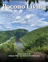
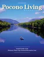
Pocono Living Magazine and Pocono Family Magazine, two regional publications filled with articles, features and photography exploring and capturing the real Pocono Mountains living experience.
Our publications can be found at many locations throughout the Pocono Mountains region, and are available by subscription.
Do it for you and when you get to the end, you will thank yourself every single day.”
St. Luke’s Weight Management Center offers the region’s most comprehensive program for both surgical and non-surgical approaches to weight loss. Our team will help you better manage, care for and overcome obesity and the conditions and illnesses that go with it, including diabetes, high blood pressure, sleep apnea and more. Are you ready for a change in 2025? We are here for you!
Your weight loss journey starts TODAY!
Register for a FREE information seminar below or at sluhn.org/weightloss
>
“The still waters of a lake reflect the beauty all around it. When the mind is still, the beauty of the self is reflected in it.”
― Iyengar
Photo courtesy of Regina Matarazzo
by Tetyana Ohare
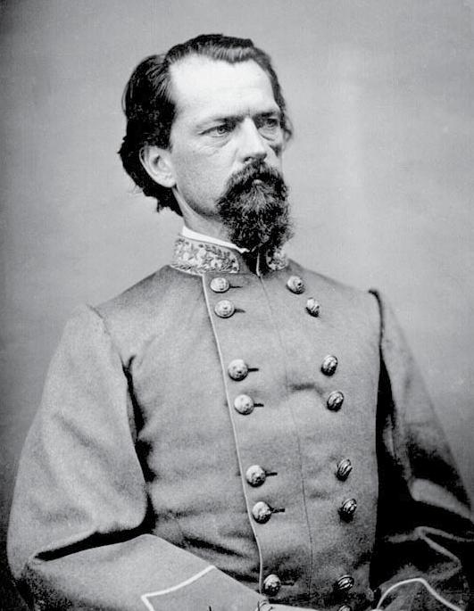
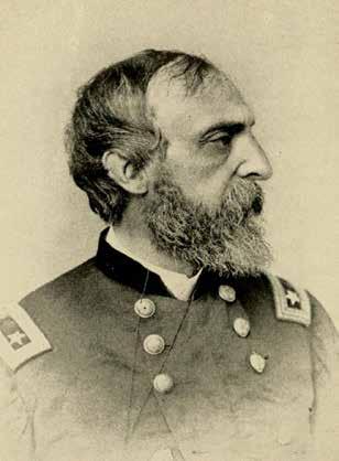
> Brig. Gen. John B. Gordon: Confederate soldiers in his brigade attempted to seize the covered bridge over the Susquehanna River at Wrightsville
CIVIL WAR
By John L. Moore
SOUTHERN SOLDIERS SAVE A PENNSYLVANIA VILLAGE FROM A FIRE STARTED BY NORTHERN TROOPS
John B. Gordon came to Pennsylvania looking for a fight. It was June 1863, and, as a brigadier general in the Confederate Army, he brought a brigade of Southern soldiers with him.
Gordon led his troops out of northern Virginia and over the Potomac River, which separated the Confederacy and the Union. Headed north, they crossed a thin wedge of western Maryland and, somewhere west of York, entered south-central Pennsylvania.
Gordon had orders to march to the Susquehanna River. He soon turned east along a road that led to York and, eventually, 12 miles beyond York, to the riverside town of Wrightsville.
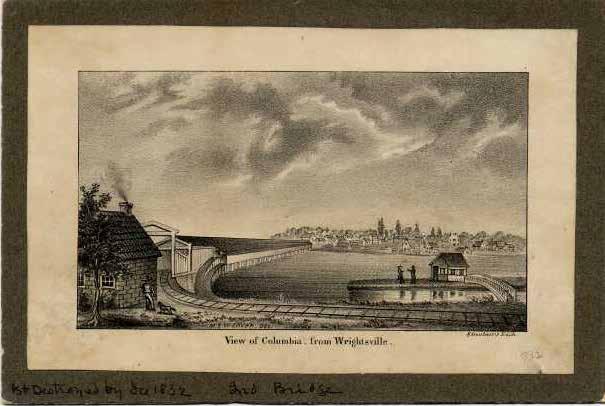
Wrightsville was important strategically because it was the location of the western end of a mile-long covered bridge across the river. This was the only bridge over the Susquehanna for many miles in either direction. Travelers bound for Lancaster, Harrisburg or Philadelphia used it to cross the river.
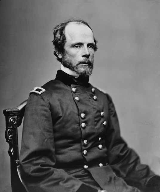
Gen. George Meade commanded the Union's Army of the Potomac, which had been fighting the Confederate forces in the east. Gordon and his superior officers knew that a Confederate march toward Philadelphia would “compel General Meade to send a portion of his army to the defense of that city,” Gordon said later. Dividing Meade’s army would weaken it, which would be helpful if the Southerners could force Meade to do battle someplace far from Philadelphia.
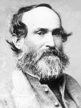
Gordon's commanding officer, Maj. Gen. Jubal Early, wanted to “march upon Lancaster … and then attack Harrisburg.”
Hence, Gordon’s men headed for Wrightsville, where they intended to seize the bridge. But first they had to pass through York.
“For many days we had been marching on the dusty turnpikes, under a broiling sun,” Gordon said. The soldiers had become “begrimed … from head to foot with the impalpable gray powder which rose in dense columns from the macadamized pikes.”
Urgency had prevented Gordon’s men from stopping to wash. “We had been compelled on these forced marches to leave baggage-wagons behind us, and there was no possibility of a change of clothing, and no time for brushing uniforms or washing the disfiguring dust from faces, hair, or beard,” the general said. “… The grotesque aspect of my troops was accentuated here and there, too, by barefooted men mounted double upon huge horses with shaggy manes.”
Gordon's Confederates marched into York on the morning of Sunday, June 28.
“A committee composed of the mayor and prominent citizens met my command on the main pike before we reached the corporate limits, their object being to make a peaceable surrender and ask for protection to life and property,” Gordon said. “They returned, I think, with a feeling of assured safety.”
As the soldiers entered the town, “the church bells were ringing, and the streets were filled with well-dressed people. The appearance of these church-going men, women, and children,
“Dividing Meade’s army would weaken it, which would be helpful if the Southerners could force Meade to do battle someplace far from Philadelphia.”
in their Sunday attire, strangely contrasted with that of my marching soldiers.”
Gordon rode at the head of the column. “Halting on the main street, where the sidewalks were densely packed, I rode a few rods in advance of my troops, in order to speak to the people from my horse.”
The general assured the townspeople that they had nothing to fear from the soldiers. “The troops behind me, though ill-clad and travel-stained, were good men and brave,” he said.
Gordon explained that “their own experience and the experience of their mothers, wives, and sisters at home had taught them how painful must be the sight of a hostile army in their town.”
He also emphasized that “under the orders of the Confederate commander-in-chief, both private property and non-combatants were safe.”
Gordon didn't tarry. He kept his remarks brief and rode on. “As we moved along the street … a little girl, probably twelve years of age, ran up to my horse and handed me a large bouquet of flowers.”
The general graciously accepted the bouquet without stopping. As he continued down the street, he noticed a piece of paper among the flowers. It was a note, written “in delicate handwriting, purporting to give the numbers and describe the position of the Union forces of Wrightsville.”
Gordon was intrigued. “I carefully read and reread this strange note,” he said later. “It bore no signature, and contained no assurance of sympathy for the Southern cause, but it was so terse and explicit in its terms as to compel my confidence.”
Soon Gordon's brigade had passed through York and was traveling east on the turnpike that led to the mile-long covered bridge over the Susquehanna, linking the west bank village of Wrightsville and the east bank town of Columbia.
> Drawing shows the Wrightsville-Columbia covered bridge over the Susquehanna River before Northern soldiers burned it in June 1863 to prevent Confederate troops from crossing the river. (Image courtesy of LancasterHistory.)
2025PHOTOCONTEST ENTER YOUR BEST SHOTS
Your photos could be seen by more than 26,000 readers when you enter them in Pocono Living Magazine’s Annual Photo Contest. The contest is open to amateur photographers only. (Those who do not earn a majority, over half, of their income as photographers).
You may enter no more than 15 images, so choose your best shots. Categories are “Scenics”, “Wildlife”, “Florals”, and “Historical Structures”.
Only photographs that are representative of the Pocono Mountains should be submitted. Individual photos should be attached to an email message and sent to: larry@poconomagazines.com. Photos submitted must be high resolution, (300 dpi), jpg or tiff files or they cannot be used. You must include your full name in the title with each photo submitted as you would like it to appear in the magazines. We will contact you for your mailing address to receive your prize if your photo is chosen as a winner in the contest.
Winning photos, along with the names, and hometowns if available, of each winner will appear in the October/November 2025 issue of Pocono LivingMagazineand the PoconoMagazines.com website. Some lucky participants may have their photo featured as a cover on PoconoLiving Magazine!
Your photos could be seen by more than 26,000 readers when you enter them in Pocono Living Magazine’s Annual Photo Contest.
RULES OF THE CONTEST:
1. Contest open to amateur photographers only.
2. Contest opens April 1, 2025 and closes August 1, 2025.
3. Enter electronic files by email to: larry@poconomagazines.com. One photo at a time.
4. Submitted photos must be as an attachment to an email message, (not within the body of the email), and be high resolution (300 dpi), jpeg or tiff files.
5. Please include your contact information (phone number, mailing address & email address) with the submission.
6. Each contestant may submit no more than 15 photographs. Choose any combination of categories.
7. Photos submitted may be judged for inclusion in this year’s contest, and in all future year’s contests, so you have several chances to be a winner.
8. Entered photos must have been taken recently, from January 2015 to present and be of a scene or subject found in the Pocono Mountains only.
10. Judging will take place in August and September 2025.
11. Winners will appear in the October/November issue of Pocono Living Magazine.
12. Contestants will retain all rights to their photography, but agree that Pocono Magazines, LLC and Pocono Mts. Publications, LLC may use their photos from time to time in the magazines that they publish and on the Pocono Magazines.com website provided proper credit is given to each photographer.
Questions? Email the editor at: larry@poconomagazines.com
Photo by Ray Caswell
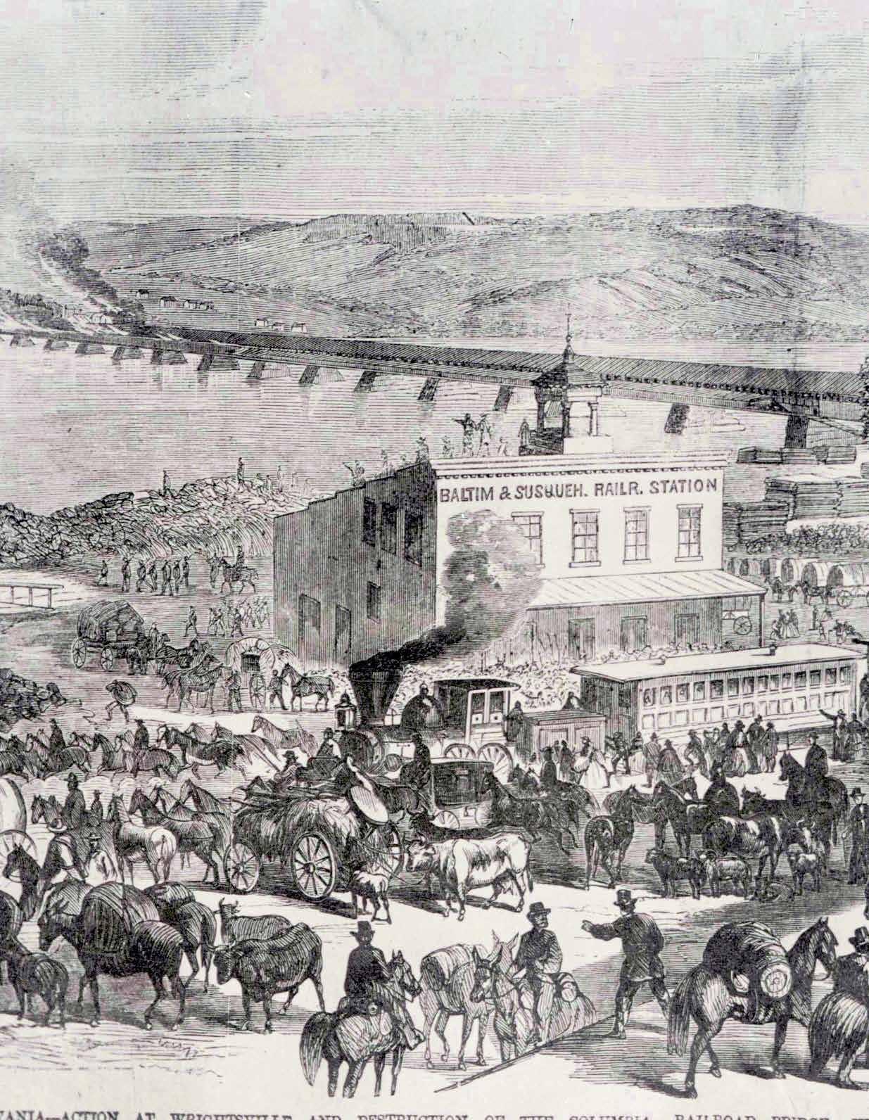
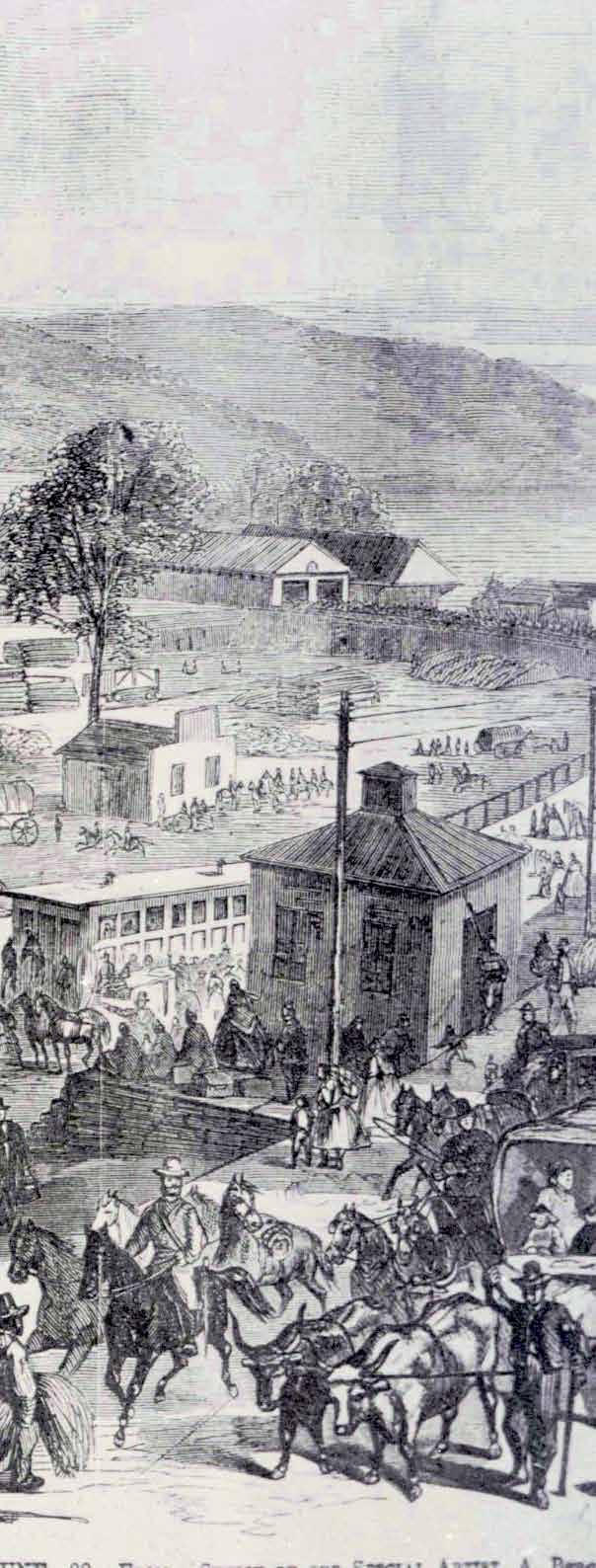
> Albert Berghaus did this sketch of Confederate soldiers in Wrightsville as the Wrightsville-Columbia bridge over the Susquehanna River burns. Smoke is visible in the upper left. Fire later destroyed the lumberyard located between railroad station and bridge entrance. Berghaus was a sketch artist for Frank Leslie’s Illustrated Newspaper, which published the picture. (Image courtesy of LancasterHistory.)
> Gen. George G. Meade: Commander of the U.S. Army of the Potomac
Supported by 23 stone piers, the wooden structure was 5,620 feet long and 40 feet wide, George R. Prowell reported in his 1907 “History of York County.” The lowest part of the bridge sat 15 feet above the river's high water mark. Pedestrians, horse-drawn wagons and carriages, and steam-powered railroad locomotives pulling passenger cars and freight cars all used it
Union soldiers posted along the Susquehanna knew Gordon was coming. They had orders to prevent him from crossing the river. The city of Lancaster was a mere 13 miles east of the bridge. Philadelphia was little more than 70 miles beyond Lancaster. Since early Sunday morning, the Northerners had been preparing to defend or, that failing, to destroy the bridge.
A Union officer, Major Granville Haller, had placed Wrightsville under martial law. “He ordered male citizens and some colored people to aid the soldiers in barricading the streets and to dig rifle pits on both sides of the turnpike in the western suburbs of the borough,” Prowell reported, citing details recorded by Wrightsville residents Calvin and James Smith. “Women were directed to bake bread for the soldiers.”
Union soldiers and Pennsylvania militia troops rushed into Wrightsville to defend it. Some of the troops guarding the bridge placed explosives in its center section so they could blow it up if Gordon attempted to cross.
The Confederate cannons also damaged a number of buildings, but didn't injure or kill anyone. According to Prowell, one shell “struck the corner of the Presbyterian Church, passed down Locust Street, going through the residence of Jacob H. Freet, and lodged on the attic. This shell, like many others, did not explode.” Another “struck what was known in early days as the Big Brick Hotel at the southeast corner of Second and Walnut Streets.” A number of other houses were also hit.
A mother carrying two children had a scare. “Mrs. Amanda Beaverson, whose husband was a soldier in the army, was crossing Third Street,” Prowell said. “A shell exploded a short distance away without injuring her. Mrs. Beaverson was rescued by Jacob H. Freet and Thomas Wilson who took her to an adjoining house and placed her children and herself in the cellar.”
As the rebel troops advanced on the bridge, the Yankees retreated. Gordon's men chased them across the bridge, “and the head of his column got half way over,” General Early said later.
At this point, Col. Jacob G. Frick, Sr., of Pottsville, commander of the 27th Pennsylvania Emergency Militia, ordered the Northern soldiers to torch the bridge. He had been instructed to do so by Maj. Gen. Darius Couch, the federal commander of the Department of the Susquehanna, headquartered at Harrisburg, Prowell said.
The fire quickly became so intense that the Confederates gave up pursuit and hurried back to Wrightsville.
The wooden structure provided ample fuel for a raging fire. “Large quantities of powder had been placed near the center on the bridge,” Prowell said. “At a given signal the powder was exploded, and the bridge took fire. The fire swept along from span to span until the whole structure was one roaring mass of angry flames.” “Blazing timbers hissed as they dropped in the stream and floated” downriver.
Gordon ordered his troops to fight the blaze. “With great energy my men labored to save the bridge.” The soldiers attempted to organize a bucket brigade. “I called on the citizens of Wrightsville for buckets and pails, but none were to be found.”
The flames worked their way across the western end of the bridge and eventually reached Wrightsville, Flames and sparks began shooting into the eastern edge of the town and setting buildings afire. They destroyed three dwellings, a foundry and two lumberyards, Prowell said.
The fire terrified the people of Wrightsville. “When the burning bridge fired the lumberyards on the river's banks, and the
> Maj. Gen. Jubal Early: Confederate officer who wanted to march on Lancaster, Harrisburg
> Maj. Gen. Darius Couch: Federal officer who instructed Colonel Frick to destroy the bridge
burning lumber fired the town, buckets and tubs and pails and pans innumerable came from their hiding-places,” Gordon said later.
One of the great contradictions of the Civil War occurred at this point. The Southern general ordered Confederate troops to save a Pennsylvania town from a fire started by Northern soldiers.
“My men labored as earnestly and bravely to save the town as they did to save the bridge,” Gordon said. “In the absence of fire-engines or other appliances, the only chance to arrest the progress of the flames was to form my men around the burning district, with the flank resting on the river's edge, and pass rapidly from hand to hand the pails of water.”
The rebels worked late into the night and finally quelled the fire.
At one point and “with great difficulty,” Gordon said his men “saved an attractive home from burning.”
Early the next morning, the woman who lived in the house sought out Gordon. She invited him and his officers to breakfast at her house.
“She insisted that I should bring with me ... as many as could find places in her dining-room. … At a bountifully supplied table in the early morning sat this modest, cultured woman, surrounded by soldiers in their worn, gray uniforms.”
Her friendliness surprised the general. “The welcome she gave us was so gracious, she was so self-possessed, so calm and kind, that I found myself in an inquiring state of mind as to whether her sympathies were with the Northern or Southern side in the pending war.”
As tactfully as he could, Gordon asked where her loyalties lay.
“In an instant, her eyes were flashing with patriotic fire, and she turned to me and said, ‘General Gordon, I cannot afford, Sir, to have you misunderstand me. You and your soldiers saved my home last night from burning, and I desire to give you this evidence of my appreciation, but I must have you understand, Sir, that I am a Union woman, that my husband and son are both in the Union army with my approval, and that my daily prayer to Heaven is that the Union cause may triumph and our country be saved.”
Her response made a lasting impression. “No Confederate left that room without a feeling of profound respect, of unqualified admiration, for that brave and worthy woman,” Gordon said.
With the bridge destroyed, the general had no way of crossing
the Susquehanna. Soon after breakfast, he ordered his brigade to leave Wrightsville and head west toward York. Two days later, they marched into Gettysburg.
“A more timely arrival never occurred,” Gordon said. It was Wednesday, July 1. “The battle had been raging for four or five hours.”
The Confederate generals already there lost little time in sending Gordon and his men into the fight. “My command was thrown quickly and squarely on the right flank of the Union army.”
John B. Gordon survived the Civil War. He later became governor of Georgia and represented Georgia in the U.S. Senate. He never learned the identity of the woman who wrote the note he had found in the bouquet in York.
Nor did he ever forget the courageous Wrightsville woman who had treated him and his officers to breakfast on the morning after the fire. More than 30 years later, while giving an address about the war at the Keystone State Normal School in Kutztown, Gordon described the breakfast and referred to his hostess as the “heroine of the Susquehanna.” In his 1903 memoir, Reminisces of the Civil. War, he identified her by name: Mrs. L. L. Rewalt.
JOHN L. MOORE
John L. Moore continues to pursue his lifelong interests in Pennsylvania’s colonial history and archaeology.
The Northumberland writer has published 15 nonfiction books about Pennsylvania during the 17th and 18th centuries.
His most recent book, “Border War,” is the seventh volume in his ongoing Revolutionary Pennsylvania Series. It is available in bookstores and online at the Sunbury Press Bookstore. Over the years John has participated in archaeological excavations of Native American sites along the Delaware and Susquehanna Rivers. A professional storyteller, he specializes in telling historically-accurate stories about real people and actual events in Pennsylvania history. These include the true story of Frances Slocum, a 5-year-old girl who lived as a Native American after being kidnapped by Indians during the American Revolution. Frances Slocum State Park near WilkesBarre was named for her.
DELAWARE WATER GAP BORN FROM TOURISM
By Amy Leiser
The area that would become the Borough of Delaware Water Gap was founded by Antoine Dutot, a French-born settler who emigrated from Santo Domingo in 1793. Dutot first arrived in Philadelphia where he was encouraged to settle northward along the Delaware River. It was here that he bought large tracts of land and named his settlement, Dutotsburg, after himself. Dutot died in 1841 and did not live to see Delaware Water Gap become the bustling city he had hoped.
Delaware Water Gap became a borough on May 31, 1889 when it broke off of Smithfield Township. John F. Barteau was chosen the Chief Burgess at a special election held at the Kittatinny House the following month on June 18. Interestingly, the borough’s fist official name was “Borough of Water Gap;” as it was incorporated in 1889, the names left out the word “Delaware.” The mistake was realized, and Barteau appeared before the courts on August 12, 1889 to rectify the error and amend the title to the “Borough of Delaware Water Gap.” In addition to Dutotsburg, Delaware Water Gap has also been known as “Monroe Square” and “Wolf Hollow.”
Because of the stunning landscape and majestic views, the area became an important destination for tourists starting in the 1800s. In fact, Delaware Water Gap was such a famous destination that it became the second largest inland resort in the United States (behind Saratoga Springs) and held the title of the most desirable vacation location in Pennsylvania.
The two most famous resorts were the Kittatinny Hotel and the Water Gap House. The Kittatinny Hotel was the earliest hotel in the borough and was built in 1829 by Antoine Dutot. Originally a 25-room structure, the building expanded over the years into a 500-room hotel. The Water Gap House was built in 1872 by Luke W. Brodhead and could accommodate 275
guests. The Glenwood House was built by Rev. Heratio Howell and welcomed 200 guests, and the Riverview House was built by John Blair and was originally known as the Lenape House. The central House, today known as the Deerhead Inn, was built in 1885 by Samuel Overfield. In 1900, B.F. Skiurm built the Delaware House which featured a bowling alley and was located closest to the train station. Of course, there were many small boarding houses and cottages for rent.
In 1903, the Delaware Water Gap train station was built and featured high ceilings, granite flooring, and chandeliers. This elegant structure welcomed thousands of tourists, and town and rail officials felt it was important to impress the clientele, especially since the Borough of Delaware Water Gap was the “Gateway to the Poconos.” The transportation industry goes hand-in-hand with the tourism industry.
The Presbyterian Church of the Mountain was dedicated in 1854, and the first minister was Horatio Howell. The first newspaper in Delaware Water Gap was known as the Mountain Echo, and it was first published in 1879. The first post office was opened in 1806 with Dutot serving as the first postmaster. There is only one cemetery located within the boundaries of Delaware Water Gap. The oldest headstone dates to 1840, and the cemetery is still in use today.
During the summer months, Delaware Water Gap’s population swelled with visitors. In the August 21, 1890 edition of the Stroudsburg Times, it was reported that 467 people permanently resided in the Borough. By 2010, that number increased to 746 individuals. Today, the Borough of Delaware Water Gap has the smallest population of residents of any municipality in Monroe County.
“Delaware Water Gap was such a famous destination that it became the second largest inland resort in the United States and held the title of the most desirable vacation location in Pennsylvania. “
The Pocono Mountains' Magazine
DELAWARE WATER GAP NATIONAL RECREATION AREA
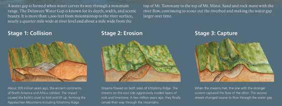
Located between the Pocono Plateau and Kittatinny Ridge in close proximity to the most densely populated region of the nation, Delaware Water Gap National Recreation Area and the Middle Delaware National Scenic and Recreational River preserve the natural, cultural, and scenic resources and values of the Delaware River valley and provide opportunities for resource-based recreation, education, and enjoyment
PARK REGULATIONS & SAFETY
• Launching, landing or operating an unmanned aircraft from or on lands and waters administered by the National Park Service within the boundaries of Delaware Water Gap National Recreation Area is prohibited except as approved in writing by the Superintendent.
• Climbing, jumping, diving, and rappelling is prohibited at all waterfalls, waterfall pools, and bridge abutments.
• Swimming and wading is prohibited within 50 feet upstream of waterfalls.
• Entry into caves, mine shafts and unoccupied structures is prohibited.
• Privately-owned property and residences exist within park boundaries. Please respect the rights and privacy of private property owners and other residents.
• Collection of plants, animals, rocks, mineral, and cultural objects is prohibited.
• Certain types of activities require a special use permit. Some common activities that require a permit include commercial photography, weddings, baptisms, first amendment activities, and competitive events.
• A permit is required for any road-based tour operating within the park. Road-based commercial tours are considered as one or more persons traveling on an improved roadway on an itinerary that a company or individual has packaged, priced, or sold for leisure/recreational purposes.
• Camp fires are only allowed at designated camp sites within metal fire grates. Personally owned grills, stoves, or lanterns are permitted at designated picnic sites (excluding Kittatinny Point and Childs Park), campground or river campsite. Fires are prohibited in all other areas.
• Do not feed or approach wildlife. Always maintain a distance of at least 100 yards from bears and 25 yards from other wildlife.
For a complete list of park specific closures, permit requirements and other restrictions, contact park headquarters at 570 426-2452.
CONTACT US
Main Address Park Headquarters
1978 River Road, Bushkill, Pennsylvania 18324
Email: DEWA_Interpretation@nps.gov
Park Headquarters Emergency 570-426-2452 800-543-4295
The National Park Service cares for the special places saved by the American people so that all may experience our heritage.
PETS
Pets must be restrained on a leash (6 feet or less). Pets may not be tied to an object and left unattended or left in a vehicle. Summer heat poses a threat to pets left in vehicles. Report lost pets to the park communication center at 570- 426-2457.
Please follow the rules of BARK! when visiting the park with your pet.
Bag your pet’s waste
Always wear a leash
Respect wildlife
Know where you can go
Pets are permitted in most areas of the park, including campgrounds, picnic areas, and on paved or dirt roads.
Pets are NOT permitted at the following sites (excludes working service animals):
In Pennsylvania: Raymondskill Falls and Raymondskill Creek Trail Dingmans Falls and Dingmans Creek Trail Valley View Group Campsites Memorial Day weekend through Labor Day: Smithfield Beach, Milford Beach, and Hialeah Picnic Area (except when accessing the McDade Trailhead)
In New Jersey: Turtle Beach Rivers Bend Group Campsites Watergate Recreation Site
THE RIVER, THE VALLEY, AND YOU
Paddlers slip down the river between low, forested mountains; anglers wade the cool streams; and hikers explore secluded places. This valley has attracted people for 13,000 years.
Abundant plant and wildlife sustained American Indians; floodplains nourished early farmer’s crops; waterfalls drew Victorian vacationers. Today, a 70,000-acre park welcomes you to the enticing Delaware Water Gap National Recreation Area and Middle Delaware National Scenic and Recreational River.
Millions of years of uplift, erosion, and glacial activity gave us the water gap, ridges, and streams that flow through hemlockand rhododendron-laced ravines and over waterfalls that pour off the Pocono Plateau.
Steeped in rich history, the trails, roads, sites, and traces reveal reminders of times gone. The Minsi Path and Minisink Trail converged on a Delaware River island that was once the center of a large American Indian settlement. Agricultural fields still in cultivation help preserve the rural landscape predominate in the 18th century. In the 1800s resorts flourished throughout the region where city dwellers arrived by carriage or rail, often spending the entire summer away from the urban heat. The water gap became a scenic wonder for fashionable travelers.
Today the natural and cultural wonders provide abundant recreational opportunities. This rural vacationland is yours to explore.
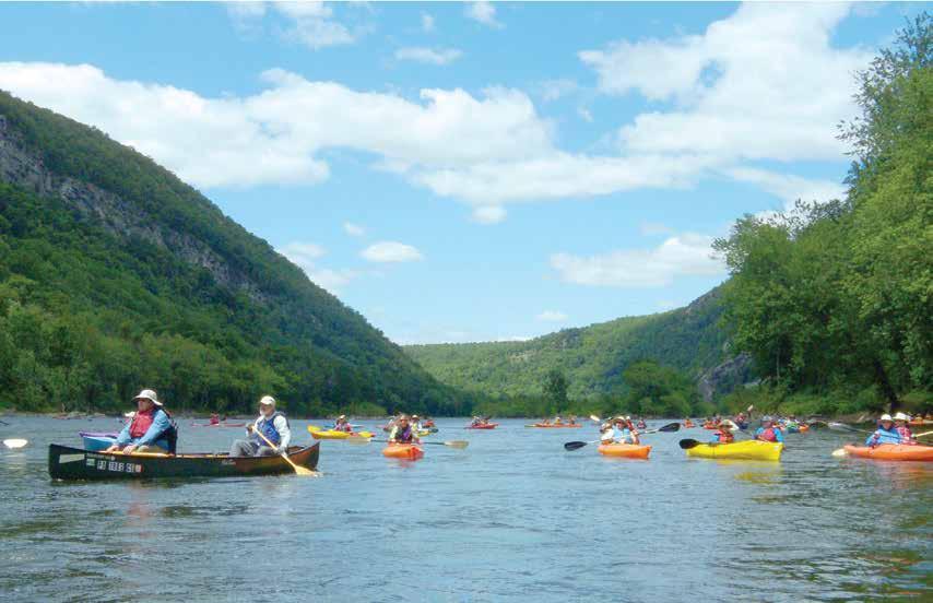
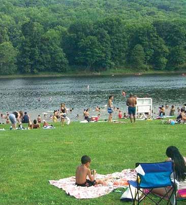
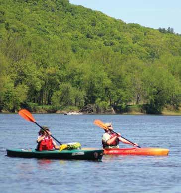
RIVER ACTIVITIES
Delaware Water Gap National Recreation Area includes nearly forty miles of the free-flowing Middle Delaware Scenic and Recreational River.
River-related activities, like swimming and paddling, are some of the popular pastimes on warm summer days.
TRAILS
From ridgetop to riverside, vistas to ravines, and from easy to extreme, more than 100 miles of trail offer something for everyone.
Choose a trail for hiking, biking, or boating to enjoy the natural beauty and the historic landscape of the river valley.
AUTO TOURS
Although the park is close to major cities, tranquil drives invite exploration. More than 100 miles of road lead to wonderful places.
Explore the varied landscapes in the valley: forests and fields, ridges and ravines, historic houses and hamlets
A DAY ON THE DELAWARE RIVER
The Delaware River is the longest undammed United States river east of the Mississippi, extending 330 miles from Hancock, New York to the Atlantic Ocean. The Delaware River Water Trail extends nearly 200 miles from Hancock to Trenton, New Jersey. Like a conventional trail, a water trail is a recreational corridor, but instead of hiking, it is traveled by boat, such as canoe, kayak or small-motorized watercraft.
The river boasts outstanding natural, cultural, recreational and scenic resources. In recognition of these qualities, the portion of the Delaware River traveling through Delaware Water Gap National Recreation Area was officially designated as the Middle Delaware National Scenic and Recreational River in 1978. Within the park, the river is a series of shallow riffles and deep pools, making this section particularly good for canoeing. Access points every eight to ten miles allow for easy day trips, and numerous primitive campsites allow for longer journeys.
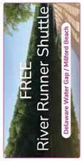
Bringing your own kayak or canoe? Take the chore out of relaying vehicles between your put-in and take-out on summer weekends. Use the River Runner Shuttle to transport you, your kayak and canoe, and your gear on Saturdays, Sundays and holidays Memorial Day weekend to Labor Day weekend. The service is free.
A day on the Delaware River allows you an opportunity to immerse yourself in an environment of tranquil natural landscapes, striking river valley scenery, and a substantially undeveloped river corridor that is unmatched among large rivers in the most densely populated region of the United States. While the Delaware River is easy for boaters, do not be misled by its calm appearance. Always follow proper water safety precautions to ensure you have a safe and enjoyable experience.
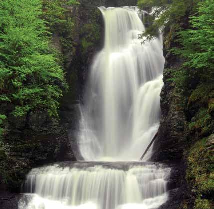
Buttermilk Falls
SWIMMING
Pack a swimsuit and a picnic and head to the beach - the river beach, that is. Unlike the sandy beaches along the ocean, the beaches here have soft grass on which to stretch out and enjoy the day.
Milford, Smithfield, and Turtle beaches are designated swim areas. Lifeguards monitor the beaches on weekends mid-June through Labor Day. Swimming in other areas of the river is not recommended. Picnic and restroom facilities are also available at the beaches. Grills are not provided, but personal grills are permitted. Alcohol and pets are not permitted.
Parking at swim beaches generally reaches capacity by 10:00 am on summer weekends. On Saturdays, Sundays, and holidays during the summer, consider parking at the Delaware Water Gap park-and-ride lot and riding the free River Runner Shuttle to Smithfield beach.
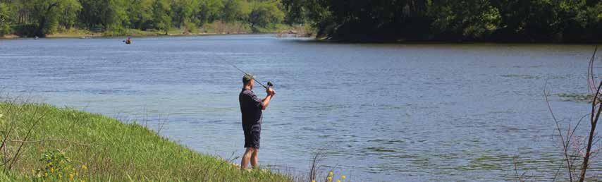
FISHING
Pack a swimsuit and a picnic and head to the beach - the river beach, that is. Unlike the sandy beaches along the ocean, the beaches here have soft grass on which to stretch out and enjoy the day.
Milford, Smithfield, and Turtle beaches are designated swim areas. Lifeguards monitor the beaches on weekends mid-June through Labor Day. Swimming in other areas of the river is not recommended. Picnic and restroom facilities are also available at the beaches. Grills are not provided, but personal grills are permitted. Alcohol and pets are not permitted.
Parking at swim beaches generally reaches capacity by 10:00 am on summer weekends. On Saturdays, Sundays, and holidays during the summer, consider parking at the Delaware Water Gap park-and-ride lot and riding the free River Runner Shuttle to Smithfield beach.
REGULATIONS
• A state fishing license is required for those 16 and older; regulations are enforced.
• Holders of either a New Jersey or Pennsylvania license may fish on the Delaware River and from either of its banks. This does not apply to the river’s tributaries.
• Special fishing regulations apply within the park. Refer to the appropriate state regulations for waters within the park.
Fishing is not permitted at:
• Dingmans Creek within George W. Childs Park area, including foot bridges and observation platforms. (Site closed in 2019)
• Dingmans Creek from the top of the Dingmans Falls to the east end of the Dingmans Falls Visitor Center parking lot from 8:00 am to 5:00 pm daily.
• Silverthread Falls in the pool at the base of the falls.
WATER SAFETY
Planning a safe day at the river begins well before you get near the water and does not end until you return home. Even though the Delaware River appears calm in some areas, DO NOT be misled! Moving water must be respected. The information below will help you better understand how to safely and comfortably enjoy the river.
In General:
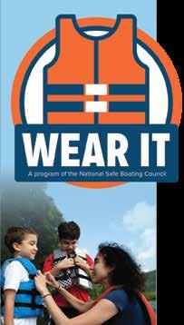
• Always wear your life jacket.
• Alcoholic beverages are prohibited at Milford Beach, Smithfield Beach, Kittatinny Point, and Hialeah Picnic Area in Pennsylvania, and Turtle Beach, Caddoo Worthington State Forest, and Tocks and Labar Islands in New Jersey. Alcoholic beverages are also prohibited between Depew Island on the north and Depue Island on the south.
• Do not drink during river activities.
• Wear shoes to protect your feet from sharp stones, glass, and other objects.
• Protect yourself from the sun; wear sunscreen, a hat, light clothing, and sunglasses.
• Stay hydrated. Bring and drink plenty of water. Do not drink river water unless it is boiled at least 10 minutes.
• Plan to be off the river before dark.
When Swimming:
• Wear your life jacket even when swimming; don’t overestimate your swimming ability.
• Do not attempt to swim or wade across the river. The Delaware River has strong currents and steep drop-offs. Swimming becomes more difficult with increased current and water depth. Even the strongest of swimmers should be extremely cautious.
• Swim at designated beaches. Lifeguards are on duty on weekends at Milford, Smithfield and Turtle beaches mid-June through Labor Day.
• Do not jump or dive from cliffs, rocks, or bridges into the river; the water may be shallow and objects can be submerged. Rivers are constantly changing, especially with high water. Rocks can show up in places they never were before.
• Do not swim alone - always stay with your group.
When Boating:
• Always wear your life jacket.
• Children 12 years of age and younger MUST WEAR a life jacket on board a vessel.
• Life jackets must be worn in vessels less than 16 feet between November 1 and April 30.
• Never stand in a canoe. For better balance, kneel in a canoe when going through rapids.
• If you capsize, don’t panic. Stay with your boat; even an overturned boat can support you. Keep upstream of your boat to avoid being pinned against a rock or obstacle. Float on your back with your feet pointed downstream. Use your paddle to push away from rocks and other obstacles. Retrieve boats and equipment only if it can be done safely.
• Be ready for changing weather and cold water. Bring rain gear. To protect against hypothermia, bring clothing made of wool, polypropylene, high-performance eece, or a wetsuit.
• Never try to stand in rapids. Your foot could become trapped between submerged rocks. With a foot trapped, the current can be strong enough to push you over and hold you under, even if you are wearing a life jacket.
• Always tell someone where you are going and when you expect to return. Arrange drop off and pick up points before you leave. Leave emergency phone numbers, vehicle description, and tag numbers with someone who can report that you are overdue.
• Bring a spare paddle, a throw line, whistle, and a first aid kit.
CAMPING
What better way to immerse yourself in an environment of solitude, tranquil natural landscapes, striking river valley scenery, and a substantially undeveloped river corridor than to go camping! Whether you enjoy the services available at a campground or prefer hiking or paddling to pitch a tent away from people, the park offers a campsite for you. The place you park your RV or set up your tent becomes your home away from home – make it a safe one.
In general:
• Make sure there are no dead limbs or trees in the vicinity of your campsite that might come down during a strong wind.
• Avoid drinking untreated water. Even clear, spring water can contain harmful bacteria.
• If in a campground, lock food in your vehicle. Bears and other wildlife have a great sense of smell.
• Keep your pet on a leash and never leave a pet unattended.
• Ground fires are prohibited, except in a provided fire grate.
• Do not bring wood from outside the park; firewood is available for purchase at Dingmans Campground.
• Collecting wood in the park for fires is prohibited, except downed wood within designated campsites.
DINGMANS CAMPGROUND
Located near Dingmans Ferry, PA
• Sites for tent and RV (some with hook-ups)
• Individual and group campsites
• Camp store
• Weekly activities
• River Runner Shuttle flag stop
• More information: dingmanscampground.com
MOHICAN OUTDOOR CENTER
Located along the Appalachian National Scenic Trail near Blairstown, NJ
• Individual and group tent sites
• Self-service, bunk-style cabins
• Water available
• Camp store & food service
• More information: outdoors.org/lodging/lodges/mohican
GROUP CAMPSITES
Valley View Located near Bushkill, PA
Rivers Bend Located near Millbrook Village, NJ
• Reservations required
• Available for groups of 20-40
• Primitive tent sites along the river
• Water available at Rivers Bend only
• River access for canoes and kayaks
• Valley View Campground is a River Runner Shuttle flag stop (1/3-mile walk)
• More information: nps.gov/dewa
RIVER CAMPING
For extended boat trips (14 miles or more), free primitive campsites along the river are available first-come, firstserve. Additionally, six sites at the Alosa Campsite are available by reservation only. For Alosa Campsite reservations visit recreation.gov and search for Alosa. Service charges will apply when making reservations either by phone or at recreation.gov.
River camping is limited to boaters on trips of at least 14 miles total for one night, 26 miles total for two nights and 34 miles total for three nights.
KEY REGULATIONS
• Camping along the river is permitted in designated sites only; sites are identified by signs and the presence of a steel fire grate.
• Camping is limited to one night at each location. Campsites are limited to five tents per campsite.
• Tents must be erected within 50 feet of the campsite fire grate.
• Fires permitted in existing fire grates only. Self-contained stoves are permitted.
• Collecting wood in the park for fires is prohibited, except downed wood within the designated campsite. Do not bring wood from outside the park; firewood is available for purchase at Dingmans Campground.
• Pack out what you pack in, including food scraps.
• Use soaps sparingly; even biodegradable soap is a pollutant.
• Do not urinate or defecate within 100 feet of any river or stream. Bury fecal material, including pet waste, at least six inches deep and at least 100 feet away from water.
• Leave what you find; digging, collecting, or removing objects is prohibited.
HIKING
More than 100 miles of trails meander through the park, including nearly 27 miles of the Appalachian National Scenic Trail. Hikers can enjoy the trails year-round, with each season offering its own special reward. During winter, the absence of deciduous leaves opens new vistas along trails and reveals stone walls, foundations, and other reminders of past residents. Spring provides a weekly parade of wild flowers and flowering trees. In summer, hikers can seek out cool retreats among the hemlock forests, and follow burbling streams to powerful falls and cascades. In autumn, hikers have crisp air to sharpen their senses and a wondrous palette of fall colors to enjoy.
Choosing a trail can be a daunting task. What to see? Waterfalls? Historic landscapes? Inspiring views? The following pages offer a simple guide to the many routes available.
BE PREPARED FOR YOUR VISIT
• Cell phone service is limited within the park.
• Carry (and drink) plenty of water; a leading cause of injuries on the trail is dehydration.
• Protect yourself from the sun; wear a hat, sunglasses and sunscreen.
• Wear sturdy shoes.
• Protect yourself from ticks and insects; use insect repellent, check and remove ticks when you return, and wear light-colored clothing to spot ticks more easily.
• Stay alert for snakes; do not put your hands and feet into places you cannot see.
• Be bear-aware; do not run if a bear approaches; make noise, wave your arms, and look large.
• Be able to recognize poison ivy and avoid contact with the plant.
• Trails are not regularly maintained or patrolled; travel carefully and at your own risk.
• Wear bright orange (shirt, vest, or hat) during hunting season.
KEY REGULATIONS
• Stay on trails; taking shortcuts causes trail erosion, damages native plants, and can be dangerous.
• Do not feed or approach wildlife.
• Be Bear Aware; stay at least 100 yard from bears, hike in groups of three or more, make noise, and properly store trash and any products with an odor.
• Pets must be leashed at all time
• Pack out what you pack in; do not leave trash behind.
HIKER SHUTTLE
The parking lots at Kittatinny Point and Dunnfield are generally full by 10 am on summer weekends. Monroe County Transit Authority offers a hiker shuttle between the Delaware Water Gap Park and Ride, Lake Lenape Trailhead, and the Kittatinny Point and Dunnfield parking lots. Service is offered every half hour between 10 am and 5:30 pm on Saturdays, Sundays, and holidays between Memorial Day and Labor Day weekends.
Childs Park Trail
Deer Leap Falls
Dingmans Falls
Photo by: Lou Nunez
RIVER RUNNER SHUTTLE
The National Park Service has partnered with Monroe County Transit Authority (MCTA) to provide free public bus service along the Pennsylvania side of the river. MTCA provides the River Runner Shuttle service on Saturdays and Sundays between Memorial Day and Labor Day weekends between Stroudsburg, PA and Milford Beach, PA. Additionally, bus service is provided on Memorial Day, Independence Day, and Labor Day.
The River Runner Shuttle is a free service and is ADA accessible. Pick your boarding location and destination using the schedule below. Be at the stop five minutes prior to the scheduled arrival with your gear ready to load. In addition to passengers, MCTA can also transport bicycles, canoes, kayaks, and leashed dogs. Passengers are required to load and secure their own belongings and MCTA operators will check the equipment to ensure it is properly stowed.
Loading and securing equipment takes some time, so please be aw are that there may be times when the bus is late. For groups of ten or more people, please contact MCTA in advance to ensure they are properly prepared for your large group.
The system is designed to enable riders to board the bus just a bout anywhere along the route where it is safe for the driver
stop. Simply wave to the shuttle driver from a safe and observa ble location. Remember to be at the stop five minutes before the scheduled time. Programs like the River Runner Shuttle are just one way the par k is working to lessen the footprint we all leave on the planet. For more information about the shuttle visit MCTA’s website at gomcta.com/trip or call 570
PENNSYLVANIA
SHUTTLE RIDING TIPS
For Boaters:
• Northbound shuttle service can be crowded with boaters, particularly in the morning. Consider riding your bike north on the McDade Recreational Trail and using the southbound shuttle to return to your vehicle.
• Riders are strongly encouraged to park at the Park-and-Ride in Delaware Water Gap for river trips that end at Kittatinny Point due to traffic congestion on summer weekends.
For Hikers:
• Hike a longer one-way trip on the McDade Recreational Trail by using the shuttle.
• Northbound shuttle service can be crowded with boaters, particularly in the morning. Consider hiking north on the McDade Recreational Trail and using the southbound shuttle to return to your vehicle.
• Peak demand for canoe and kayak shuttle is northbound in the morning before 10 am. Consider using the northbound shuttle to transport to your starting location later in the day, or use the northbound shuttle to transport back to your parked vehicle at the end of your trip.
• Have your gear at the shuttle stop and ready to load at least ten minutes before departure to ensure on-time service.
For Swimmers:
• When spending the day at Smithfield Beach, use the shuttle to go to the McDade Trailhead at Hialeah for a 1.9-mile walk back to Smithfield Beach.
• River Runner shuttle service is not available at Kittatinny Point after 8:50 am.
• The last northbound shuttle leaves Smithfield Beach at 3:20 pm. The last southbound shuttle leaves Milford Beach at 4:50 pm
• When spending the day at Milford Beach, use the shuttle to go to the McDade Trailhead at Pittman Orchard for a 2.2-mile walk back to Milford Beach.
For Bikers:
• Bike a longer one-way trip on the McDade Recreational Trail by using the shuttle.
» Subject to change, please visit the park website or contact the park for updated information before visiting.
TOURING OLD MINE ROAD
Constructed in the mid-1600s, Old Mine Road connected the Hudson River and Philadelphia to the Pahaquarry Mines and provided an important conduit for New Jersey farmers taking crops to area markets, making it one of the oldest commercial roads in the country. Today, Old Mine Road stitches together sections of several roads into the park’s main passage in New Jersey and still retains much of the flavor of 100 years ago, making it a popular driving and biking route.
1. MONTAGUE GRANGE #140
The National Grange, founded in 1867, is an organization that advocates for rural America and agriculture. The local Montague Grange was founded in 1904 and this hall was built in 1906. The local group remains active and continues to use the building for meetings and community activities.
2. FOSTER-ARMSTRONG HOUSE
Owners of this home operated a ferry, sawmill, and gristmill. The house was used as a tavern and inn for river travelers and reflects the standard of living of a prosperous family in the early 19th century. The Montague Association for the Restoration of Community History (MARCH) operates this historic house museum for tours weekends and during special events.
3. MINISINK DUTCH REFORMED CHURCH
The Minisink Church was the heart, both spiritually and geographically, of the four original Dutch Reformed congregations established in the Upper Delaware Valley in 1737. The present structure was built in 1899, and tombstones in the cemetery date to 1805. Though it remains small, the vibrant congregation is one of the oldest in the country.
4. NELDEN-ROBERTS STONEHOUSE
Built around 1820, this house’s construction is attributed to George Nelden, who acquired the property in 1816. The Roberts Family was the last owners of the house, along with the farmstead located across US 206.
5. WESTBROOK-BELL HOUSE
Built by Johannis Westbrook, this is the oldest house located in Delaware Water Gap National Recreation Area, possibly predating 1730, and was lived in by nine generations of the family until the acquisition of the property by the federal government.
6. NAMANOCK
While nothing remains today, this was the site of Fort Namanock during the French and Indian War (1754-1763). Forts in this time and era were little more than sturdy houses with a wooden defensive fence surrounding them.
7. ALONZO DEPUE HOUSE
As with other historic homes along Old Mine Road, the landscape would have been quite different one hundred years ago – open fields, a clear view to the river, and several farm outbuildings. For 48 consecutive years, Alonzo Depue recorded temperature and precipitation readings for the U.S. Weather Service from a weather station near the road without missing a day.
8. BEVANS-HELLWIG KITCHEN
In the late 19th century, this little stone building was the rear kitchen attached to a large farmhouse. Local tradition holds that the original structure was used as a French and Indian War fortification, known as Fort Carmer.
9. PETERS VALLEY
Peter Van Nest, a land surveyor, laid out the roads in the area and had them intersect outside of his home in 1867. Over the years, the hamlet’s name changed several times, including Hen’s Foot Corner and Bevans, before its current name of Peters Valley. Through a partnership with the National Park Service, Peters Valley School of Craft operates an active school of fine craft. Stop by the Craft Store and Gallery to browse artisan’s wares, learn about 209 workshop offerings, and find out more about the weekend self-guided tours of the village.
10. WALPACK CENTER
Like other villages along the Old Mine Road, the Kittatinny Ridge to the east and the highlands of New Jersey to the north isolated the hamlet of Walpack Center. Area farmers found what they needed at the village’s general store, post office, blacksmith shop, church, and school. By the early 20th century, however, automobiles and larger farms proved to be too much competition and the village began its decline. Today, the Walpack Historical Society operates a museum in the First Rosenkrans House on summer weekends.
11. VAN CAMPEN INN
While it is called an “inn,” it is more accurately a “yaugh house”—a rural residence in a remote area that was licensed under colonial law to provide food and shelter to travelers. During the French & Indian War (1754-1763), the Van Campen Inn “provided a safe haven
OVERLOOKS IN THE GAP
Tourist attractions of all sorts once lined River Drive through the Delaware Water Gap. This route, now known as PA 611, passes by many former attractions—but other than the stone guardrail lining the road, little remains of that historic past. Still, the stunning beauty of the water gap makes this short 2-mile drive a must-do during your visit.
RESORT POINT OVERLOOK
The best known part of Delaware Water Gap National Recreation Area is the distinct notch in the Kittatinny Ridge known as the “water gap.” In order to enjoy the area’s beauty, visitors in the early 1820s rented rooms with local families. By 1832, a 25-guest hotel overlooking the Delaware River opened in Delaware Water Gap, and in 1860, the Kittatinny Hotel expanded to accommodate 250 guests.
The popularity of the area surrounding the water gap continued to grow, and additional hotels opened to meet the lodging needs of vacationers. Typically, vacationing families consisted of mothers and their children spending the entire summer in one of the hotels
while the fathers joined them on the weekends. Visitors occupied themselves by hiking, swimming, fishing, dancing, playing tennis and golf, visiting amusement parks, shopping for souvenirs, and delighting in carriage, steamboat, and rowboat rides. According to the manager of the Kittatinny Hotel, “[p]erhaps the featuring asset of the Gap, aside from its beautiful gorge, through which shows the placid Delaware, is its health giving atmosphere, which permeates everywhere and which in itself has given the region much of its charm and popularity.”
By the early 1900s, many people had private automobiles. Magazines and newspapers extensively advertised various appealing destinations for city dwellers. At the same time, improved roads gave people a greater choice of holiday retreats. Weekend excursions began replacing summer- long holidays, and the traditional resort business of the Delaware Water Gap began to decline. The economic depression of the 1930s changed the nation’s way of life, and grand hotels could no longer compete with the new and popularly priced year-round weekend resorts in the nearby Pocono Mountains. A reclaimed the Kittatinny Hotel in 1931, and today, all that remains is the view from the location of this once grand hotel.
POINT OF GAP OVERLOOK
This overlook is in the heart of the Delaware Water Gap, between Mt. Minsi in Pennsylvania and Mt. Tammany in New Jersey. Just as it is a popular place for viewing today, this was also a popular stop for the Victorian vacationer. The Indian Head Lunch, a tourist attraction named for its view of the cliff with the same name across the river, offered meals and souvenirs, while the Myrtle William’s Gap Inn provided a place for picnicking and camping.
ARROW ISLAND OVERLOOK
Today, this overlook provides a wonderful view of the water gap and the trailhead for the Arrow Island Trail. In the early 1900s, however, this was a bustling tourist stop. Minsi Mountain Park encompassed about 200 acres, and a hotel with a few outlying cottages was located on the hill overlooking the river. Inventive owners marketed a nearby slate quarry as a romantic enticement called “the Grotto” and boasted of the clear waters found in the “Minsi Health Spring.” In the location of today’s parking area, the Bear Stop roadside attraction featured caged bears and deer for the tourists’ amusement.
Kittatinny House Hotel
BUTTERMILK FALLS
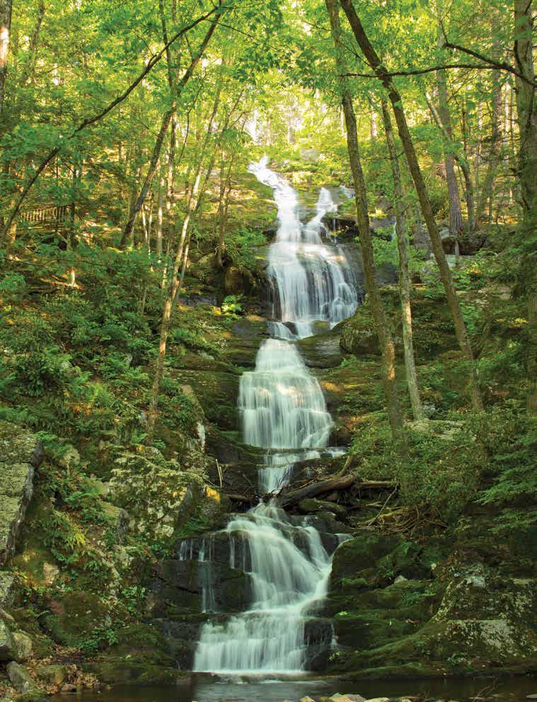
Buttermilk Falls Trail, New Jersey GPS 41.137164 -74.888793
The waterfall is located at the trailhead for the Buttermilk Falls Trail, and, therefore, requires no hiking to view. The cascading Buttermilk Falls is considered the highest waterfall in New Jersey at approximately 200 feet. A set of stairs climbs to a viewing platform at the top. The trail continues a nearly 1.5-mile steep climb to join the Appalachian National Scenic Trail at the top of the ridge.
Things to Know:
• Swimming and wading are not permitted in the waterfall and the pools.
• Stay on the designated trail.
• The drive to the waterfall is via a rural gravel road. Driving Mountain Road from Walpack Center is the recommended route, since Mountain Road south of Buttermilk Falls is very rough.
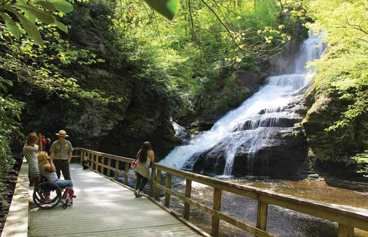
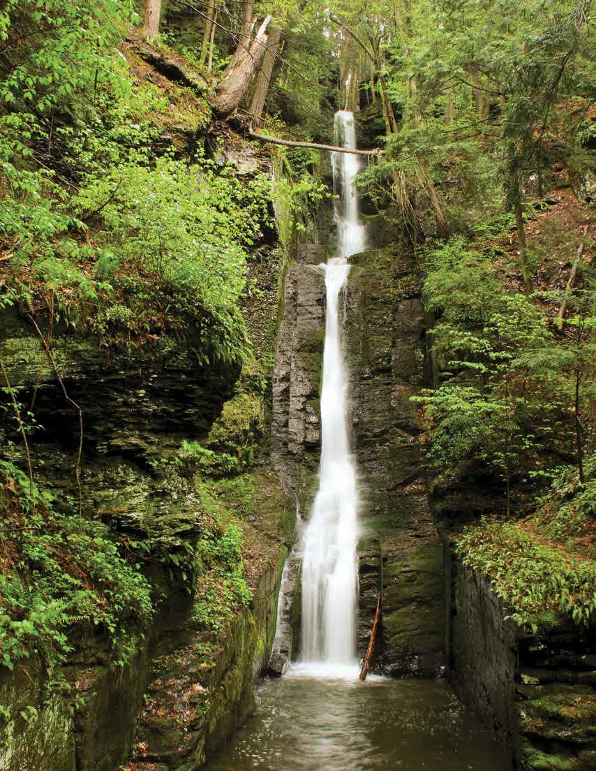
DINGMANS AND SILVERTHREAD FALLS
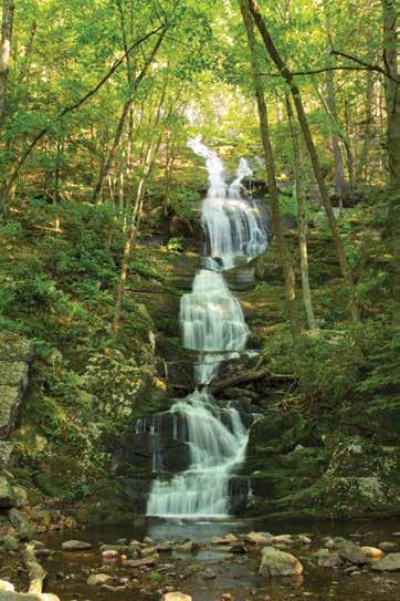
Dingmans Creek Trail, Pennsylvania GPS 41.229294 -74.887212
An accessible boardwalk trail meanders 0.3 mile through a pristine hemlock ravine. Shortly after starting the trail, Silverthread Falls gracefully drops 80 feet in a thin ribbon of water through a narrow geometric chute. The boardwalk continues through dense rhododendron shrubs and ends at the base of Dingmans Falls, the second highest waterfall in Pennsylvania at 130 feet. A wide rock ledge provides the backdrop for this cascading waterfall. The final tenth of a mile is a staircase that leads to a birds-eye view from the top.
Things to Know:
• Pets are not permitted on the trail.
• Swimming and wading is not permitted in the creek and waterfalls.
• Fishing is not permitted between Dingmans Falls and the trailhead parking area between 8:00 am and 5:00 pm.
• Restrooms and the Dingmans Falls Visitor Center are located at the trailhead.
• The parking lot fills quickly on summer weekends. To avoid the crowds, visit the area before 10:00 am or after 4:00 pm on weekends or visit on a weekday.
» Subject to change, please visit the park website or contact the park for updated information before visiting.
Buttermilk Falls
Dingmans Falls
> Silverthread Falls, Dingmans Falls Boardwalk Trail
People of the Delaware River Valley
Human occupation in the Delaware River valley dates back over 12,000 years when small family bands moved across the landscape, hunting game, fishing the rivers and streams and gathering food from the forests and grasslands. About 8,000 years ago, groups began to travel less and relied on a variety of foods found locally, such as acorns, nuts, sh, deer and turkey. Families began farming about 2,000 years ago, leading to a more settled lifestyle.
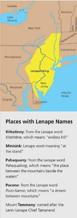
The Lenape (len-AH-pay) or Delaware lived in an area they called “Lenapehoking,” which means “Land of the Lenape.” Lenapehoking included eastern Pennsylvania, all of New Jersey, southeastern New York, northern Delaware, and a small section of southeastern Connecticut. While some Lenape lived in large villages of about 200 people, most lived in groups of 50 to 75. The arrival of Europeans in the mid1500s meant drastic changes for the Lenape. European explorers traded iron axes, cloth, and copper kettles with the Lenape for valuable animal
furs. In addition to the rich natural resources, Europeans also wanted land. Conflicts arose between the Lenape and European colonists over land ownership. Additionally, the introduction of diseases devastated the native population, who had no immunities. By the mid-1700s, warfare and diseases contributed to an estimated loss of 90% of the Lenape people. During the 1700s, most Lenape people either voluntarily moved or were forcibly moved west, eventually settling in Canada, Wisconsin, and Oklahoma.
Today, most Lenape decedents still live in Canada, Wisconsin, and Oklahoma. Their arts and oral traditions reflect their culture, and they continue to stay connected to their ancestral homeland. The Lenape legacy remains, and their impact is honored through various place names in the park today.
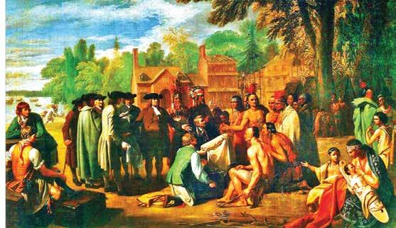
Left: Painting depicting William Penn entering into 1683 peace treaty
Right: Tish-Co-Han, Lenape Chief in the 1700s
Woolen Mill
Delaware Water Gap National Recreation Area is a National Park Service unit that includes 40 miles of the Middle Delaware River and more than 60,000 acres along the river's banks between Milford, PA, and Delaware Water Gap, PA. The park provides outdoor recreation opportunities while conserving the natural, cultural, and scenic resources of the recreation area.
www.nps.gov/dewa | (570)
GREAT NATURE APPS
By Tanni Haas, Ph.D.
June 5 is World Environment Day, a great occasion to take a trip to the local beach, park or wildlife reserve. There are few things that can bring a family together as spending quality time in nature enjoying plants and animals. Here are some nature-related apps that’ll add to the fun and at the same time teach your kids a lot about what they’re experiencing. The best part is that these apps are completely free, so take a moment and download an app – or three!
Audubon Bird Guide
(Available at: Apple App Store)
Developed by the Audubon Society, the Audubon Bird Guide is the most comprehensive and trusted one-stop source of information about North American birds. It includes detailed information about more than 800 species as well as audio clips of recorded bird calls and songs. It also has more than 3,000 beautiful photographs. Most importantly, you and the kids can look up and identify any bird that you observe by recording characteristics such as their color, size, body shape, and wingspan. You can also keep detailed records of your observations and upload and share photos with other bird watchers.
Photo by Casey Horner on Unsplash
iNaturalist
(Available at: Apple App Store)
What the Audubon Bird Guide app is to birds, iNaturalist app is to animal and plant life more generally. You simply take a photo of any animal or plant that you observe, upload the photo to the app, and the app will then help you determine which animal or plant it is. You can also identify animals by recording the sounds they make and uploading them to the app. This app offers you and the kids the opportunity to share all your observations with other users, too.
Wild Berries and Herbs Lite
(Available at: Apple App Store)
Wild Berries and Herbs Lite is a great companion app to iNaturalist. As you observe local plant life, you may come
across berries and herbs that appear familiar to you. Before you put anything in your mouth, snap a photo and let the app tell you whether what you’ve discovered is indeed edible or not. To make the identification as accurate as possible, the app includes several images for each berry and herb in various stages of growth. You can also search by name (if you happen to know what the berry or herb is called) as well as other identifying features.
Rockd
(Available at: Apple App Store)
Whether your outing is to a local beach, park, or wildlife reserve, chances are that you’ll be visiting a place with a unique geological history. To learn more about your surroundings, download Rockd, an app created by the Department of Geoscience at the University of Madison - Wisconsin. When
Photo by Dietra Alyssa Semple on Unsplash
you give the app access to your location, it generates detailed stratigraphic information (information about the rock layer you’re standing on) as well as the type of rock and its age. Your kids will learn that even the most mundane-looking local park has a rich geological history that goes back hundreds of thousands if not millions of years. They can even see what Earth looked like at the time when the rock they’re currently standing on was first formed.
“There are few things that can bring a family together as spending quality time in nature enjoying plants and animals.“
WWF Together
(Available at: Apple App Store)
It’s unlikely that you’ll encounter endangered animals during a trip to the local beach, park, or wild life reserve, but that doesn’t make it any less important for the kids to know about those animals. In fact, the less you know about endangered animals from direct experience, the more you need to learn about them second-hand. For that, download WWF Together. Created by the World Wildlife Fund, this app includes detailed information and fun facts about sixteen endangered animals, including pandas, sea turtles, and tigers. When you get home from your local outing, open the app together, look at all the beautiful photos and videos, and get information about how you and the kids can get involved in protecting endangered animals.
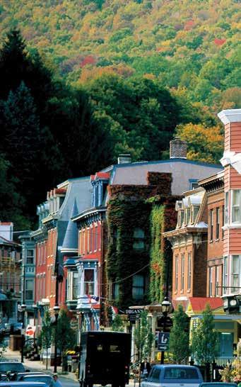
It’s not just a day of shopping here in the Pocono Mountains—it’s an experience. Wander our historic streets. Explore our art galleries. Find unique local goods. And stop for a bite at one of our top-rated neighborhood restaurants along the way. Discover all of our shopping and sights now at PoconoMountains.com.
Photo by Anton Atanasov on Unsplash
GET INVOLVED IN BUILDING A STRONGER COMMUNITY
Courtesy of StatePoint
Honoring volunteers while encouraging volunteerism in communities around the world is especially pertinent right now. According to a Pew Research report, only 54% of Americans feel a connection to others near them.
“Communities around the country are facing increased needs at a time when many people are feeling more isolated. Volunteering fills the gaps to strengthen community and the fabric of our society,” says Jennifer Sirangelo, president and
CEO of Points of Light, the world’s largest organization dedicated to increasing volunteer service.
But as Sirangelo points out, volunteering doesn’t just build healthier and more equitable communities, it’s also good for the individuals who are lending their time and talents. “Engaging in volunteer activities has been identified as an effective way to build confidence, alleviate anxiety and depression, and provide a sense of purpose and connection,” she says.
Photo Courtesy of Dragos Condrea / iStock via Getty Images Plus
Here are some ways you can take action:
Commit to Volunteering: With nearly 50% of volunteer postings going unfilled, your new commitment to volunteering can help meet critical community needs and ensure essential services are delivered. Already committed to a cause you care about? Deepen your engagement with one extra volunteer project a month, or by taking on a leadership position with an organization you work with.
Thank a Volunteer: Volunteers are the heartbeat of strengthening communities, and you can help recognize the vital role they play. Thank a volunteer or organization that is making an impact in your community.
Spread the Word: Use social media to spread the word about the importance of volunteering using the hashtag #ThankaVolunteer. To inspire others to take action, share your own volunteer story using #WhyIVolunteer.
“Communities around the country are facing increased needs at a time when many people are feeling more isolated. Volunteering fills the gaps to strengthen community and the fabric of our society”
Get Started: Not sure how to get started or where your efforts will make the biggest social impact? Visit Points of Light Engage, at engage.pointsoflight.org. This enormous database allows you to search for volunteer opportunities in your city or zip code based on your interests. Whether you’re volunteering on your own, with coworkers, or with family, you’ll be sure to find an opportunity that’s right for you.
“Volunteering is needed more than ever before. We are urging everyone to join us in taking action. Lend your time, talent and passion to making a real difference in your own neighborhood and to creating a better world,” says Sirangelo.
These pups may come in a small package (generally weighing 20 pounds or less), but they have big personalities and can make a huge impact on the lives of their owners.
"Despite their stature, small dogs are anything but pint-sized when it comes to their energy, personalities and distinct traits," said Purina veterinarian, Dr. RuthAnn Lobos. "They tend to live longer than larger dogs and love activity, play and adventure just as much as any other dog. However, they have a unique set of needs, and it's important for pet owners to recognize and support these through proper nutrition."
Curious about how to support your compact canine companion's nutrition? Check out these expert tips that can help you properly support your tiny dog's mighty needs.
NUTRIENT-DENSE FOOD
According to the Independent & Neighborhood Pet Retail Association, because their organs process food more quickly than those of larger dogs, smaller dogs need more calories per pound and food with high-quality ingredients.
To support your small dog's fast metabolism throughout their long life, feed them high-quality, calorie- and nutrient-dense food while ensuring they keep an ideal body condition. Dog food specially formulated for small dogs can provide all the protein, antioxidants, and other essential nutrients they need to fuel their play.
FOOD WITH HIGH ANTIOXIDANT LEVELS
You've probably seen many products at your grocery store boasting their antioxidant properties. Well, they're not just for humans! You can support your petite pup's immune system by purchasing dog food that is rich in antioxidants.
According to PetMD, there are numerous health benefits provided by antioxidants. These major molecules can protect cells from damage and strengthen the immune system, which can help to prevent serious health issues from developing.
PROTEIN-RICH MEALS
If you regularly hit the gym, you know how important protein is to support your gains. According to Dr. Lobos, small dogs also need protein to help them repair, grow and maintain strong muscles.
MinisinK
Classic American Fine Dining
“Despite their stature, small dogs are anything but pint-sized when it comes to their energy, personalities and distinct traits”
"When searching for dog foods to strengthen your pet, make sure to pick formulations that have essential amino acids from key protein sources to support their activity and growth," says Dr. Lobos.
SMALLER KIBBLE
Small dogs have small jaws and teeth, which can make it challenging for them to eat large pieces of kibble.
When choosing food for your pups, Dr. Lobos recommends going for dry dog food made with small dogs in mind. The smaller pieces of kibble not only help them chew more easily but also support their digestive and dental health.
WET FOOD
If you only feed your small dog dry food, consider adding wet food to their diet. According to Dr. Lobos, even if you're feeding them high-quality, nutritious kibble, wet food can
encourage selective eaters to engage with their bowls. Bonus: Wet food can also help your hound hydrate by adding moisture to their diet!
One product made for the tiny but mighty
There are many brands of dog food to choose from, but not all of them address a small dog's nutritional needs. However, you can rest easy knowing your small pup is getting the specialized nutrition they need when they eat Beneful IncrediBites.
The line of wet and dry products is made to support small dogs. It delivers big taste, fuels their larger-than-life personalities and supports their unique nutritional needs.
Beneful IncrediBites formulas are nutrient-rich recipes to help support faster metabolisms. They're also made with real meat, fish or poultry, have accents of natural fruits or vegetables, and are made without artificial colors, flavors or preservatives.
To learn more about these flavorful and fabulous foods for your Fido, visit Purina.com/Beneful.
Photo by Joe Caione on
Unsplash
MAKING GRASS SEED SMARTER AND LAWNS GREENER
Courtesy of Joan Casanova at Family Features
Photos courtesy
I
n neighborhoods across the country, homeowners are getting extra help in their quest for the elusive, perfect lawn.
The secret? An innovation in grass seed technology known as OptiGrowth, promising faster, stronger and more resilient grass – and it’s living up to the hype.
WHAT IS THE TECHNOLOGY?
A revolutionary, natural seed treatment, OptiGrowth is a unique technology designed to enhance the performance of grass seed, giving it a higher chance of success. It coats traditional grass seed in a protective, moisture-attracting layer designed to retain moisture and kickstart healthy growth without harming the environment.
Developed through years of agricultural research, this technology enhances the natural germination process, giving each seed a better chance to sprout, grow and survive early, tough conditions. It uses water more efficiently, develops stronger roots and shoots, and helps seeds survive in drought, poor soil conditions and extreme temperatures.
Unlike traditional uncoated grass seed, which can struggle in less-than-ideal soil conditions or unpredictable weather, seed treated with this technology is designed to thrive. It’s not genetically modified; instead, it’s a smarter version of existing seeds, treated to improve their natural abilities, which leads to faster growth, better health and a thicker, more resilient lawn.
FASTER-GROWING, HEALTHIER LAWNS
One of the biggest advantages of this coated seed is speed. Under ideal conditions, these seeds may germinate faster than untreated seeds. The faster sprouting reduces the vulnerable window when new grass can be overtaken by weeds, dried out by sun or washed away by heavy rains.
Grass seedlings also emerge healthier and develop deeper roots more quickly, setting the stage for a thicker, more resilient lawn. In the early stages, when most lawn failures happen, OptiGrowth seed can better resist stresses like drought, heat and foot traffic.
“New grass is incredibly delicate,” said Troy Hake, owner of Outsidepride.com, an online seed company specializing in a wide variety of high-quality grass seed, flower seeds
lawn & garden BILLY’S TIPS
What’s the peskiest part about the summer? You guessed it - insects! But, believe it or not, a little landscaping and maintenance can be the key to a pestfree home.
• Standing water is a breeding ground for flying insects, like mosquitoes. Check for leaky outdoor faucets and objects, like buckets, that collect water. For items that have to stay outside, flip them over or cover them with a tarp. By eliminating areas of still water, you’ll reduce the number of places for mosquitoes to lay their eggs.
• Apply a preventative grub control product early to stop grubs from taking over your yard. If you’ve already spotted grubs in your lawn, you’ll need corrective grub control instead. Grubs typically hatch in late-summer, so eliminate them while you still can.
• Mulch does wonders for your property...and for your pests. Insects, such as spiders and ants, love to make their homes in beds of warm, moist mulch. If you can’t say no to mulch, at least keep it a safe distance from your house and spread it no more than a few inches thick. You can also use a gravel border to create a separation between your house and mulch.
• Keep your lawn cut short to reduce places for creepy critters to hide. And always remember to stay on top of weeding and gutter maintenance. All of these places make optimal hideouts for insects.
• Opt for an organic insecticide to rid yourself of pests the natural way. Do-it-yourself recipes, like oil soap sprays, can control mites and beetles without harming your plants or your family. Introducing certain plants, like mint, into your garden can even ward off aphids. Check out Rodale’s OrganicLife online for some clever, natural tips and tricks!
Canfield’s Pet & Farm 315 Main
The coating acts as a shield, protecting the seed from stresses such as temperature fluctuations, heavy rains and dry spells. New lawns on sloped ground, areas with patchy sun and shade, or lawns planted in late spring or early fall – times when weather can be unpredictable – benefit the most.
These seeds are designed to succeed even when conditions aren’t ideal by improving moisture retention and boosting germination rates. This means less time reseeding, rewatering and repairing your lawn.
However, Hake notes that in perfect conditions – rich soil, regular rain, mild temperatures – traditional high-quality grass seed can still perform well.
“If you’re planting in ideal conditions and you can baby the lawn with watering and care, you might not need OptiGrowth,” Hake said. “But in most cases, perfect conditions are rare.”
A GREENER FUTURE
As innovations like OptiGrowth make their way into more products, it’s clear the future of lawn care is working smarter, not harder. These seeds have a built-in advantage – they grow faster, stay hydrated better, have fewer bald spots, require less reseeding and survive tougher conditions, leading to a greener, healthier lawn requiring less effort from you.
For more information, visit outsidepride.com.
Photo courtesy of Outsidepride.com
THERE’S
NO PLACE LIKE THE MOUNTAINS FOR THE HOLIDAYS.
Celebrate the holidays surrounded by great company and even better cuisine in the Pocono Mountains. From romantic dinners by candlelight to farm-to-table experiences, our local chefs are serving up something for every palate. Visit PoconoMountains.com to see all of our mouth-watering dining options and make your reservation.
FGET READY FOR A NATIONAL PARK TRIP
Courtesy of BPT
rom the geysers of Yellowstone to the granite cliffs of Yosemite, America’s national parks remain a premier destination for outdoor exploration. For many travelers, visiting national parks is a bucket list ambition. In fact, one in four Americans aspire to visit every national park in their lifetime, according to a recent online survey conducted in January 2025.*
With warmer weather here and outdoor enthusiasts gearing up for the season - now is the ideal time to start planning a national park adventure.
Before hitting the trail, OFF!® Mosquito and Tick Repellents has partnered with the National Park Foundation to share six tips to help make any national park experience worry-free and more memorable, so you can focus on the adventure.
• RESERVE ENTRY PASSES AND CAMPSITES EARLY
Many parks have moved to a reservation-based system to manage crowds. Book timed entry passes, campsites and guided tours well in advance. Highly visited parks like Arches, Glacier and Rocky Mountain often sell out weeks ahead.
• PLAN FOR UNEXPECTED WEATHER AND LAYER UP
Weather can be hard to plan around. Temps can drop fastespecially at higher altitudes - and unexpected showers can change hiking plans instantly. Come prepared with extra clothing - like a lightweight jacket, waterproof gear and long sleeves - in case the weather changes. If camping, consider extra layers for chilly nights.
Barrett
Cresco, PA
570-595-7171 www.barrettlibrary.org
Clymer Library Pocono Pines, PA
570-646-0826 www.clymerlibrary.org
Pocono
In the Poconos, neighbors care for each other. At Lehigh Valley Hospital–Pocono, we do the same. Our clinicians aren’t just experts in advanced treatments and technology, they’re also experts in caring for neighbors, families and friends. Discover care that is truly dedicated to you.