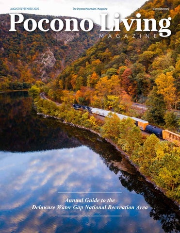
Pocono Living Magazine and Pocono Family Magazine, two regional publications filled with articles, features and photography exploring and capturing the real Pocono Mountains living experience.
Our publications can be found at many locations throughout the Pocono Mountains region, and are available by subscription.
St. Luke’s Weight Management Center offers the region’s most comprehensive program for both surgical and non-surgical approaches to weight loss. Our team will help you better manage, care for and overcome obesity and the conditions and illnesses that go with it, including diabetes, high blood pressure, sleep apnea and more. Are you ready for a change in 2025? We are here for you! “
Do it for you and when you get to the end, you will thank yourself every single day.”
Your weight loss journey starts TODAY!
Register for a FREE information seminar below or at sluhn.org/weightloss
“With
all these lovely tokens of September days are here, with summer best of weather and the autumns best of cheer”
― Helen Hunt Jackson
> Photo courtesy of Dave Sandt
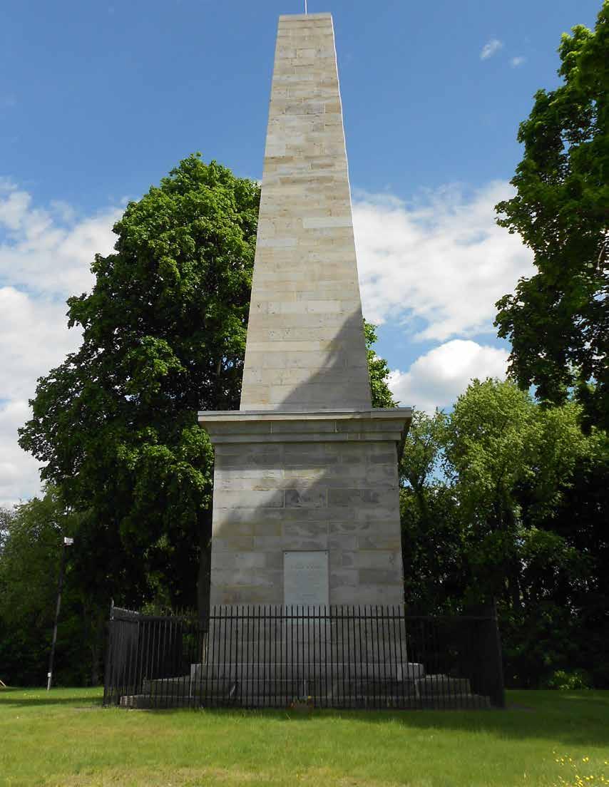
> The Wyoming Monument stands atop the mass grave of American patriots killed by Indians and Tory
during the Battle of Wyoming on July 3, 1778. It is located along Wyoming Avenue in the borough of Wyoming.
Rangers
THE SEARCH FOR FRANCES SLOCUM
By John L. Moore
Residents of Rhode Island, Jonathan and Ruth Slocum emigrated to Wilkes-Barre during the American Revolution, a time when Connecticut claimed much of what has since become northeast Pennsylvania.
In 1777, the Slocums traveled “to their new home in a covered wagon, and as the roads were bad and many streams had to be crossed, the journey was a long and tiresome one,” said 19th century historian John F. Meginness. They brought their nine children, the youngest of whom was a small girl named Frances.
In 1775 and 1776, the Susquehanna Valley remained peaceful as the British and Americans began fighting on distant batt;efields. Many Susquehanna men marched off to join General Washington, first in far-off Massachusetts, and, later, along the Delaware River north of Philadelphia.
By 1778, the war had spread to the Susquehanna. War parties of pro-British Indians, mainly Senecas and Delawares, began raiding isolated settlements on the river’s west and north branches. They were often accompanied by Tory rangers.
The Tories operated out of Unadilla, a village of Loyalists and pro-British Indians more than 160 miles upriver from Wilkes-Barre. They were led by Major John Butler, a New York Loyalist who had grown up along the Mohawk River.
In late June, Butler’s force of nearly 500 warriors and more than 100 Tories invaded the Wyoming Valley, a rich agricultural region that author Ernest Cruikshank described as “twenty-five miles in length and nowhere more than three in breadth.”
Cruikshank estimated the valley’s population at 6,000 settlers, most of them recent arrivals from Connecticut, which had formally designated the region as “the County of Westmoreland.”
The valley’s agricultural production helped make it a prime military target. In 1777, Wyoming Valley farmers had sent thousands of bushels of grain downriver for use by the Continental Army. 1778 promised to be another bountiful year. “The harvest then ripening would furnish a still greater quantity for the same purpose,” Cruikshank said.
For protection, the Wyoming men had erected five log forts in strategic spots throughout the valley. Spread over a distance of eight miles, they extended from Wilkes-Barre Fort on the south to Pittston Fort on the north. These two stood on the river’s east shore. The other three – Forty Fort, Wintermoot’s Fort, and Jenkins’ Fort – had been built west of the river.
Early summer ordinarily saw farm families hard at work in their fields and with their livestock, but this year, the appearance of Butler’s army on June 30 prompted valley settlers to quickly brace for war. “The militia were mustered. Old men and boys took their muskets,” one historian said. Throughout the valley, men, women and children hurried into the forts.
On July 1, rather than waiting inside the stockades, the Wyoming men ventured several miles north of Jenkins’ Fort to a cornfield where the invaders had killed eight valley farmers the previous day. When they failed to find their foes, the defenders returned to their forts.
“In 1777, the Slocums traveled “to their new home in a covered wagon, and as the roads were bad and many streams had to be crossed, the journey was a long and tiresome one.”
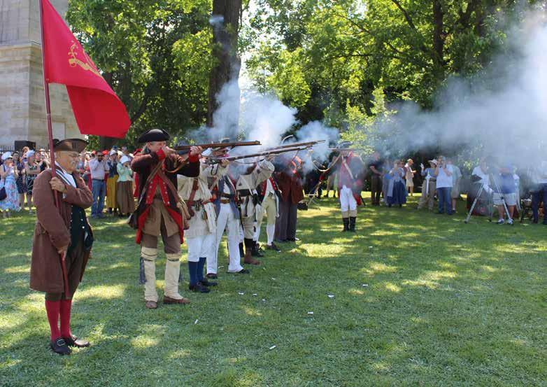
> Reenactors representing the 24th Connecticut Regiment of Militia fire a volley during July 4th ceremonies commemorating the Battle of Wyoming. The regiment helped defend the Wyoming Valley against Tory rangers and pro-British Indians.
The Wyoming officers decided to attack. On July 3, the troops gathered at Forty Fort, and, more than 400 strong, marched upriver to find Butler. Commanded by Colonel Nathan Denison, the 24th Connecticut Regiment of Militia formed the core of the Wyoming force. A company of soldiers belonging to the Continental Army also went along.
One writer said that the defenders were so desperate for troops that “old men, grandfathers, and boys of tender age were obliged to go to battle.” They included older teenagers such as 19-year-old Giles Slocum, the oldest of the Slocum children.
The defenders marched nearly four miles upriver when they met the invaders on a plain on the Susquehanna’s west shore near present-day Wyoming, Pa. It was after 4 o’clock in the afternoon.
Discharging three volleys, the Wyoming men fired first. When the Iroquois and Tories returned fire, the defenders began to retreat. They panicked and ran when their foes gave chase.
“A merciless pursuit began,” Cruikshank said. “Many tried to
swim the river, and were shot or drowned in the act.”
By the time the battle ended, the Indians and Tories had killed 302 Wyoming men, Colonel Denison reported.
Only “a pathetic remnant ... made its way back to the fort,” historian Barbara Graymont said in her 1972 book, “The Iroquois in the American Revolution.”
The survivors included Giles Slocum, who Meginness said “escaped to Monockanock Island in the river, where he concealed himself until it was safe to cross to ... the east side, and finally made his way to his father’s house” in Wilkes-Barre.
The island is east of the borough of Wyoming.
On July 4, Colonel Denison formally surrendered on behalf of the defenders . He “agreed that all the forts should be utterly demolished, ... and that none of the inhabitants should again bear arms,” Cruikshank said.
Terms of the capitulation also allowed the Connecticut settlers to leave Wyoming. Many went down the Susquehanna in boats, canoes and on rafts. They sought refuge at Fort Augusta,
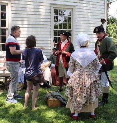
> Dressed as Tory Rangers, reenactors Sherry Emershaw, left, and Greg Boyer tell visitors at the Nathan Denison House in Forty Fort about the Battle of Wyoming. Boyer portrays Major John Butler, leader of the rangers. Denison, who negotiated the surrender of Forty Fort to the British on July 4, 1778, built the house in 1790.
a Pennsylvania fort 70 miles downriver at Sunbury that was already crowded with refugees who had fled Indian raids along the West Branch.
“Something in the way of charity ought to be done for the miserable objects that crowd the banks of this river, especially those who fled from Wyoming,” said William Maclay, one of the founders of Sunbury.
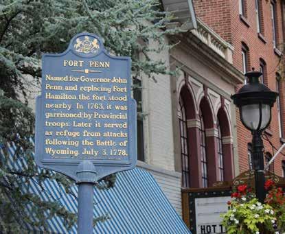
Many other Wyoming settlers took an Indian trail, the Pechoquealin Path, that crossed the Pocono Mountains and led from the Wyoming Valley to the Delaware River east of present-day Stroudsburg. Nearly 45 miles southeast of WilkesBarre, the trail passed Fort Penn, a Pennsylvania stockade post built by Colonel Jacob Stroud at present-day Stroudsburg in what is now Monroe County. Commander of the militia there, Stroud had constructed the log stockage around his house.
The refugees included 49-year-old Luke Swetland, who had emigrated from Connecticut with his family and had established a farm at Wyoming. He didn’t take part in the battle. Instead, he was assigned to the garrison at Forty Fort that day.
>
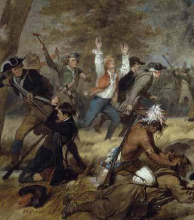
In 1858, historical artist Alonzo Chappel painted this interpretation of the 1778 Massacre of Wyoming.
> Colonel Jacob Stroud of the Pennsylvania Militia offered shelter to Wyoming Valley refugees at Fort Penn in present-day Stroudsburg.
After the surrender, Swetland and his family resumed farming, but warnings of new Indian raids soon prompted them to leave.
“Having no horses … I and my wife and four sons, the oldest of them about 14 years old, set out on foot, took as much victuals as we could well carry and a few trifles out of the house, and went to (the) Delaware River to Colonel Stroud’s,” Swetland wrote later.
The Swetlands remained at Fort Penn for several days. Soon “a party of Continental soldiers, together with a number of the Susquehanna inhabitants, were going back to retake” the Wyoming Valley, Swetland said. “I went with them to harvest my English grain.”
In late August, an Indian war party captured Swetland and took him to the Genessee River Valley in western New York.
Other Indian raids occurred during the following months.
On Nov. 2, for example, a boy named Nathan Kingsley was killed when a Delaware war party attacked the Slocum homestead. Nathan and his brother and mother had been staying with the Slocum family.
“The house stood just in the edge of the woods, and when the Indians approached, they saw the two Kingsley boys (Nathan and Wareham) at the door engaged in grinding a knife,” Meginness said. “ ... One of the Indians quickly drew up his gun
and shot the young man dead.”
Terrified, “Mrs. Slocum and several of the children fled into the woods, while Mary, one of the daughters, seized her brother Joseph, aged about two years, and rushed out of the back door,” the author said.
Frances remained in the house and hid behind the stairs to the second floor. The warriors came inside and ransacked the place. One went upstairs. As he came down, he “saw the feet of the child protruding from her hiding place,” Meginness said. The man grabbed the girl and took her outside.
The raid ended as quickly as it had begun. The warriors gathered up the items they intended to take. Frances; her older brother, 12-year-old Ebenezer; and Wareham Kingsley all stood near them in the front yard.
The war party began to leave. One warrior had the Kingsley boy. When Mrs. Slocum saw that another had Ebenezer and was “dragging him away,” she ran out of her hiding place in the brush to confront the man. She “pointed at the feet of the boy and exclaimed, ‘The child is lame. He can do thee no good!’ ”
The man released the boy, but “instantly seized little Frances, and, throwing her over his shoulder, rushed after his companions.” They disappeared in the woods.
Mrs. Slocum never saw Frances again.
Three days later, on Nov. 5, an Indian raid in the Nanticoke
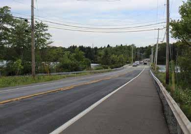
> Following the Battle of Wyoming, many settlers fled the Wilkes-Barre area. They traveled along an Indian trail that crossed Tobyhanna Creek east of Blakeslee. Route 940 follows the old trail as it crosses Pocono Lake, which is a dammed-up section of the creek.
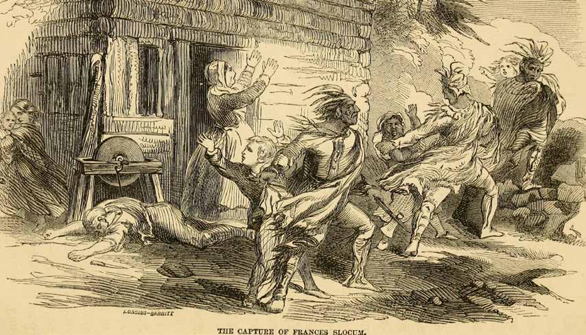
> This 1858 drawing shows the November 1778 Indian raid on the Slocum homestead in Wilkes-Barre.The warriors abducted 5-year-old Frances and another child, Wareham Kingsley.
area saw the destruction of the Lester family. The husband was killed and scalped. The wife was taken prisoner, and led off to Iroquois country in western New York. She took her small children with her.
On Dec. 16, Jonathan Slocum, his 16-year-old son, William, and his father-in-law Isaac Tripp, were feeding cattle in a pasture in sight of Wilkes-Barre Fort when a war party attacked them. “Mr. Slocum was shot dead,” Charles Miner reported in his “History of Wyoming.” Slocum’s father-in-law was “wounded, speared, and tomahawked. Both were scalped. William, wounded by a spent ball in the heel, escaped and gave the alarm.”
Soldiers rushed from the fort, but the Indians got away. William Slocum survived, but Isaac Tripp subsequently died of his wounds.
The Aftermath
Captured in August 1778, Luke Swetland spent a full year with the Seneca, the westernmost of the six Iroquois nations. When he learned in late summer of 1779 that an American army led
by Major General John Sullivan was invading the Iroquois country, he ran off to find it.
Around this time, Mrs. Lester, the woman captured near Nantocoke, also escaped and succeeded in making her way to the Americans. She had a small child with her. The soldiers welcomed her.
When the Sullivan campaign ended, both Mrs. Lester and Luke Swetland returned to the Wyoming Valley.
The Revolutionary War formally ended in September 1783, nearly five years after Frances Slocum had been abducted. With the frontier now peaceful, the Slocums began a search for Frances.
In 1784, the brothers, Giles and William, “traveled as far as Niagara,” Meginness said. “This was an important point during the war, and prisoners were frequently carried there when orders were issued to give them up.”
The brothers offered a cash reward for their sister’s return or even for information about her whereabouts. They devoted several weeks to this effort, but failed to turn up any leads.
“Disheartened and discouraged, the brothers finally gave up the search and returned home,” Meginness said.
In 1788, the Slocum brothers again left Wilkes-Barre, this time on a journey of several months to Indian villages and frontier trading posts in Ohio. “They were absent for several months and enlisted the sympathy of Indian agents and traders,” Meginness said. “... They offered a reward of $500 for any information with regard to their sister’s where abouts, but to no purpose.” Eventually, the searchers returned to Pennsylvania.
In 1789, the year that George Washington became president of the United States, government officials asked that Indians who had taken children from the white settlements during the war bring the youngsters to Tioga Point so their families could reclaim them. Frances would have been 15 by then.
Situated at the confluence of the Susquehanna and Cheming rivers, Tioga Point (present-day Athens, Pa.) lay some 90 miles upriver of Wilkes-Barre. Mrs. Slocum went there to look for her
daughter, but “after weeks of careful search among the captives, found no one that she could recognize as her lost Frances,” Meginness said.
And so Mrs. Slocums returned to Wilkes-Barre.
Eight years later, as determined as they had been unsuccessful, the Slocum brothers “undertook another expedition among the western Indians,” the writer said.
“Four of them, now mature men, and possessing ample means, entered the western wilderness and spent nearly the entire summer of 1797 in visiting the Indian settlements,” the author said. One brother, Isaac, went as far west as Detroit.
Once again, they failed to learn anything new about Frances, who would have been 24.
Mrs. Slocum died in 1807. Her daughter would have been 34.
In 1826, the Slocums learned that a white woman was the wife of a chief among the Wyandot Indians living in western Ohio.
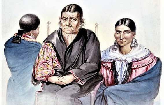
> When Joseph Slocum visited Little Bear Woman in Indiana in 1839, he hired British artist George Winter to sketch her and her two daughters, Yellow Leaf and Cut Finger. When Yellow Leaf wouldn’t look at the artist’s original sketch, Winter drew her with her back to him. Little Bear Woman’s birth name was Frances Slocum. She was Joseph’s sister.
Was this woman the missing Frances? Her younger brother Joseph, who was now about 50, traveled to Upper Sandusky and quickly determined that the woman was not his sister.
Another 11 years passed. During the summer of 1837, a Slocum family member received a letter from the Rev. Samuel Bowman, a Lancaster clergyman who had known the Slocums when he had lived in Wilkes-Barre.
Bowman’s letter contained a newspaper clipping about Colonel George W. Ewing of Logansport, Indiana. Two years earlier, in January 1835, Ewing had visited Miami Indians living along the Mississinewa River north of Indianapolis. He had met an elderly Miami woman named Maconaquah, which meant “Little Bear Woman.”
The article said that although Little Bear Woman didn’t speak English, Ewing spoke the Miami language and was able to converse with her. She told him that she hadn’t always lived with the Indians. She had once been the child of a white family that had lived along the Susquehanna River.
“Her own Christian name she has forgotten, but says her father’s name was Slocum,” Ewing said. She said that Delaware
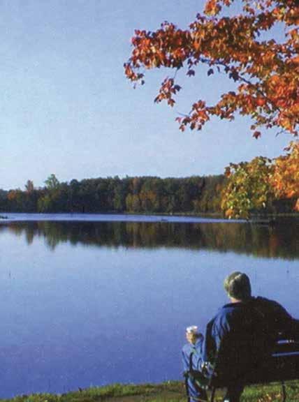
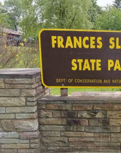
> Frances Slocum State Park is located about 10 miles northwest of Wilkes-Barre.
Indians took her “from her father’s house ... when she was very young.”
Other details in Ewing’s account convinced the Slocums that he might well be describing Frances. In September 1837, three of her siblings – Joseph, aged 61; Isaac, 62; and Mary, 69 – set out for Indiana. They reached Deaf Man’s Village on Sept. 22, accompanied by an interpreter. Little Bear Woman, by now a 64-year-old grandmother, greeted them politely but without enthusiasm.
Isaac arrived before Joseph and Mary did. He asked Little Bear Woman how she had injured her finger. Through the interpreter, she replied, “My brother struck it with a hammer in the shop, a long time ago, before I was carried away.”
Joseph and his siblings all knew the story of how a hammerwielding older brother had accidentally smashed his sister’s finger, permanently disfiguring it.
Little Bear Woman’s answer convinced the Slocums that she was indeed the long lost Frances.
The visit lasted several days. They met her two daughters – Cut Finger and Yellow Leaf – and their children. They learned that her two sons had died and were buried alongside their father,
> British artist George Winter made this portrait of Little Bear Woman at the request of her brother, Joseph Slocum, in 1839. She had been Frances Slocum before Delaware Indians abducted her in 1778.
Shepoconah, in the family cemetery near the cabin.
They invited Little Bear Woman to return to Pennsylvania with them, but she declined.
In 1839, Joseph returned to Deaf Man’s Village for a second visit. This time he brought his two daughters, Harriet Slocum and Hannah Bennett, to meet their aunt and cousins.
Hannah’s aunt and cousins clearly made a strong impression on her. “They had cloths and calicoes enough to fill a country store,” she said. “… Some of their dresses are richly ornamented with silver brooches, seven or eight rows of brooches as closely as they can be put together. They have many silver earrings. My aunt had seven pairs in her ears; her daughters perhaps a dozen apiece.”
Hannah wrote a detailed description of her aunt, who was “of small stature, not very much bent; (and) had her hair clubbed behind in calico, tied with worsted ferret.
“Her hair is somewhat gray, her eyes a bright chestnut, clear and
sprightly for one of her age, her face is very much wrinkled and weather beaten. She has a scar on her left cheek, received at an Indian dance. Her skin is not as dark as you would expect from her age and constant exposure. Her teeth are remarkably good.
“Her dress was a blue calico short gown, a white Mackinaw blanket, somewhat soiled by constant wear, a fold of blue broadcloth lapped around her, red cloth leggings, and buckskin moccasins.”
Little Bear Woman never returned to Wilkes-Barre. She was 74 when she died in March 1847. She was buried alongside her husband and sons at Deaf Man’s Village.
The name of Frances Slocum lives on. In Pennsylvania, Frances Slocum State Park is located northwest of Wilkes-Barre. In Indiana, the Frances Slocum State Forest and the Frances Slocum State Recreation Area are located near where her home was in the Mississinewa River Valley.
Many books have been written about Frances Slocum and her transformation into Little Bear Woman. One of them is the “Biography of Frances Slocum, The Lost Sister of Wyoming.” Pennsylvania author John F. Meginness published it in 1891. That book was a primary source for this article.
JOHN L. MOORE
John L. Moore continues to pursue his lifelong interests in Pennsylvania’s colonial history and archaeology. The Northumberland writer has published 15 nonfiction books about Pennsylvania during the 17th and 18th centuries.
His most recent book, “Border War,” is the seventh volume in his ongoing Revolutionary Pennsylvania Series. It is available in bookstores and online at the Sunbury Press Bookstore. Over the years John has participated in archaeological excavations of Native American sites along the Delaware and Susquehanna Rivers. A professional storyteller, he specializes in telling historically-accurate stories about real people and actual events in Pennsylvania history. These include the true story of Frances Slocum, a 5-year-old girl who lived as a Native American after being kidnapped by Indians during the American Revolution. Frances Slocum State Park near WilkesBarre was named for her.
The Pocono Mountains' Magazine
DELAWARE WATER GAP NATIONAL RECREATION AREA
Located between the Pocono Plateau and Kittatinny Ridge in close proximity to the most densely populated region of the nation, Delaware Water Gap National Recreation Area and the Middle Delaware National Scenic and Recreational River preserve the natural, cultural, and scenic resources and values of the Delaware River valley and provide opportunities for resource-based recreation, education, and enjoyment
PARK REGULATIONS & SAFETY
• Launching, landing or operating an unmanned aircraft from or on lands and waters administered by the National Park Service within the boundaries of Delaware Water Gap National Recreation Area is prohibited except as approved in writing by the Superintendent.
• Climbing, jumping, diving, and rappelling is prohibited at all waterfalls, waterfall pools, and bridge abutments.
• Swimming and wading is prohibited within 50 feet upstream of waterfalls.
• Entry into caves, mine shafts and unoccupied structures is prohibited.
• Privately-owned property and residences exist within park boundaries. Please respect the rights and privacy of private property owners and other residents.
• Collection of plants, animals, rocks, mineral, and cultural objects is prohibited.
• Certain types of activities require a special use permit. Some common activities that require a permit include commercial photography, weddings, baptisms, first amendment activities, and competitive events.
• A permit is required for any road-based tour operating within the park. Road-based commercial tours are considered as one or more persons traveling on an improved roadway on an itinerary that a company or individual has packaged, priced, or sold for leisure/recreational purposes.
• Camp fires are only allowed at designated camp sites within metal fire grates. Personally owned grills, stoves, or lanterns are permitted at designated picnic sites (excluding Kittatinny Point and Childs Park), campground or river campsite. Fires are prohibited in all other areas.
• Do not feed or approach wildlife. Always maintain a distance of at least 100 yards from bears and 25 yards from other wildlife.
For a complete list of park specific closures, permit requirements and other restrictions, contact park headquarters at 570 426-2452.
CONTACT US
Main Address Park Headquarters
1978 River Road, Bushkill, Pennsylvania 18324
Email: DEWA_Interpretation@nps.gov
Park Headquarters Emergency 570-426-2452 800-543-4295
The National Park Service cares for the special places saved by the American people so that all may experience our heritage.
PETS
Pets must be restrained on a leash (6 feet or less). Pets may not be tied to an object and left unattended or left in a vehicle. Summer heat poses a threat to pets left in vehicles. Report lost pets to the park communication center at 570- 426-2457.
Please follow the rules of BARK! when visiting the park with your pet.
Bag your pet’s waste
Always wear a leash
Respect wildlife
Know where you can go
Pets are permitted in most areas of the park, including campgrounds, picnic areas, and on paved or dirt roads.
Pets are NOT permitted at the following sites (excludes working service animals):
In Pennsylvania: Raymondskill Falls and Raymondskill Creek Trail Dingmans Falls and Dingmans Creek Trail Valley View Group Campsites Memorial Day weekend through Labor Day: Smithfield Beach, Milford Beach, and Hialeah Picnic Area (except when accessing the McDade Trailhead)
In New Jersey: Turtle Beach Rivers Bend Group Campsites Watergate Recreation Site
CONTENT
THE RIVER, THE VALLEY & YOU
» page 4
SUGGESTED TRIP
» page 6
A DAY ON THE DELAWARE
» page 8
SWIMMING & FISHING
» page 10
CAMPING
» page 12
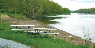
PICNICKING & RIDING
» page 13
BIKING
» page 13
HIKING
» page 14
RIVER RUNNER SHUTTLE
» page 18
TOURING OLD MINE ROAD
» page 20
OVERLOOKS IN THE GAP
» page 22
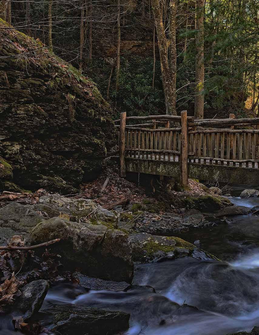
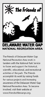
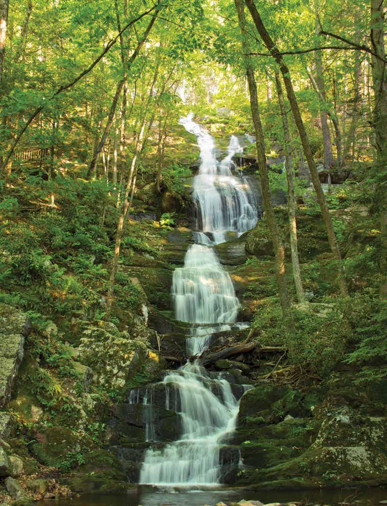
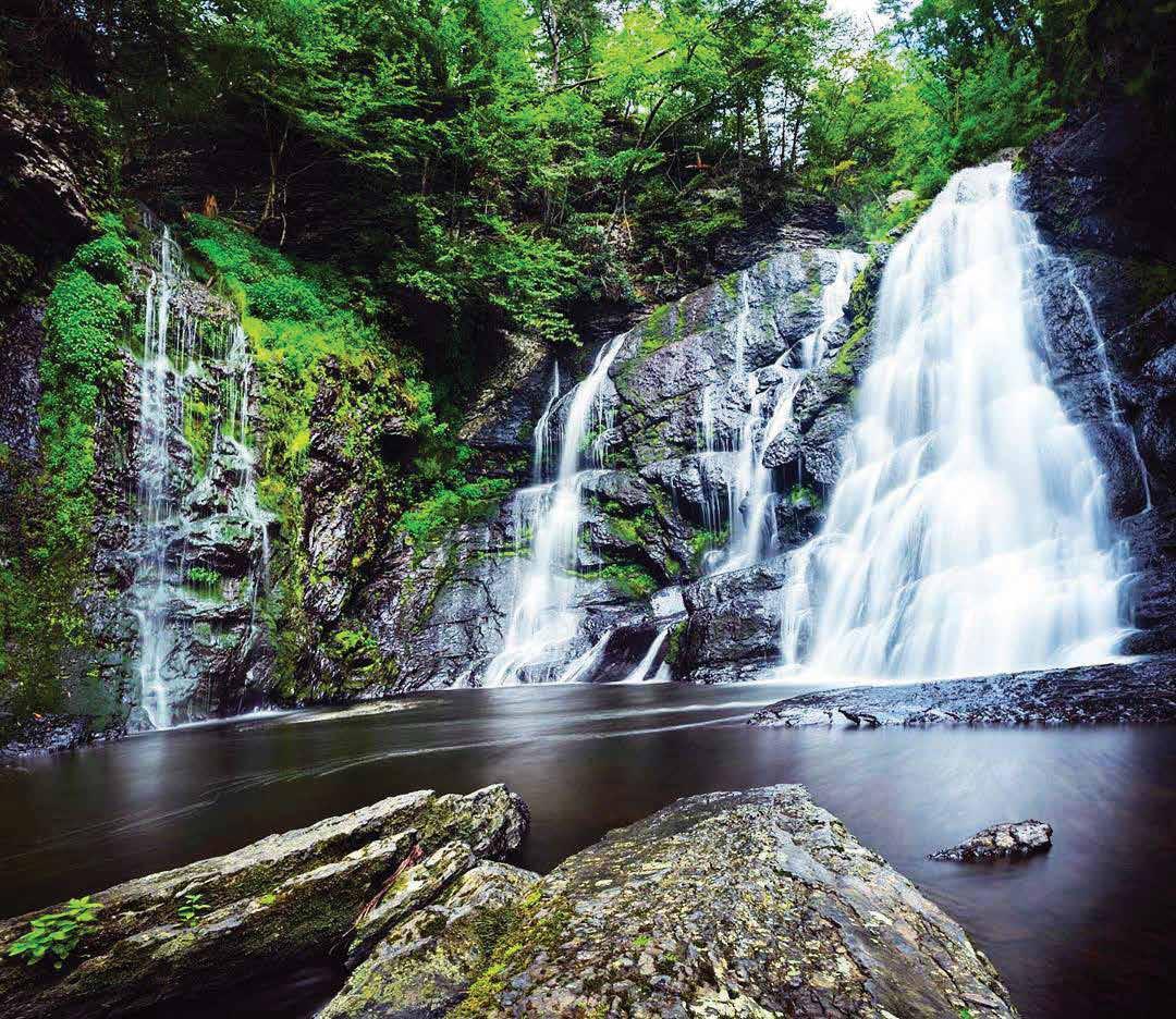
WATERFALLS
» page 23
PEOPLE OF THE DELAWARE
» page 26
COVER
By William McKee
Tumbling Waters
THE RIVER, THE VALLEY, AND YOU
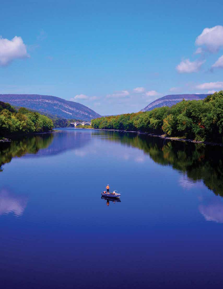
Paddlers slip down the river between low, forested mountains; anglers wade the cool streams; and hikers explore secluded places. This valley has attracted people for 13,000 years.
Abundant plant and wildlife sustained American Indians; floodplains nourished early farmer’s crops; waterfalls drew Victorian vacationers. Today, a 70,000-acre park welcomes you to the enticing Delaware Water Gap National Recreation Area and Middle Delaware National Scenic and Recreational River.
Millions of years of uplift, erosion, and glacial activity gave us the water gap, ridges, and streams that flow through hemlockand rhododendron-laced ravines and over waterfalls that pour off the Pocono Plateau.
Steeped in rich history, the trails, roads, sites, and traces reveal reminders of times gone. The Minsi Path and Minisink Trail converged on a Delaware River island that was once the center of a large American Indian settlement. Agricultural fields still in cultivation help preserve the rural landscape predominate in the 18th century. In the 1800s resorts flourished throughout the region where city dwellers arrived by carriage or rail, often spending the entire summer away from the urban heat. The water gap became a scenic wonder for fashionable travelers.
Today the natural and cultural wonders provide abundant recreational opportunities. This rural vacationland is yours to explore.
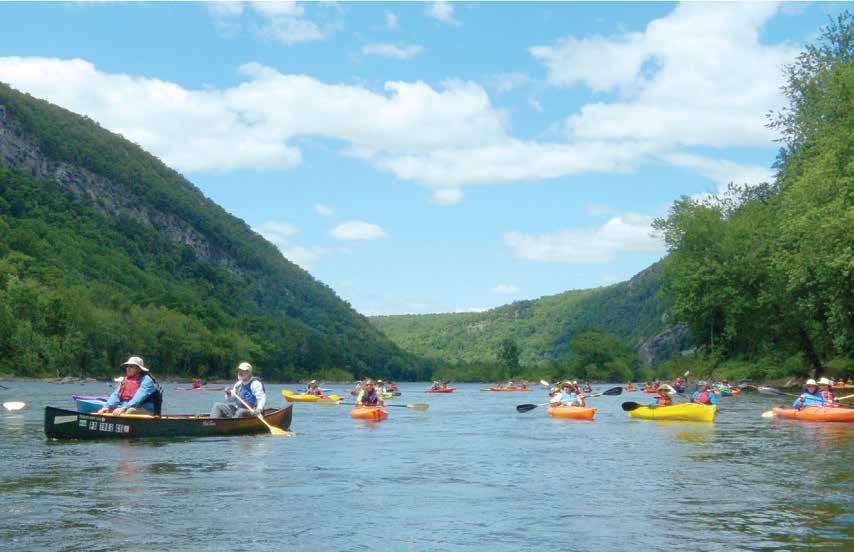
RIVER ACTIVITIES
Delaware Water Gap National Recreation Area includes nearly forty miles of the free-flowing Middle Delaware Scenic and Recreational River.
River-related activities, like swimming and paddling, are some of the popular pastimes on warm summer days.
TRAILS
From ridgetop to riverside, vistas to ravines, and from easy to extreme, more than 100 miles of trail offer something for everyone.
Choose a trail for hiking, biking, or boating to enjoy the natural beauty and the historic landscape of the river valley.
AUTO TOURS
Although the park is close to major cities, tranquil drives invite exploration. More than 100 miles of road lead to wonderful places.
Explore the varied landscapes in the valley: forests and fields, ridges and ravines, historic houses and hamlets
Fulmer Falls
SUGGESTED TRIP ITINERARIES
Delaware Water Gap National Recreation Area offers endless opportunities for exploration and discovery. The following are a few suggested itineraries to consider depending on your time and interests.
IF YOU HAVE A FEW HOURS:
• Stop by a park visitor center, where park rangers and volunteers can help you plan your adventure. Visitor center parking lots fill quickly on summer weekends. To avoid the crowds, visit the area before 10:00 am or after 4:00 pm on weekends or visit on a weekday.
• Walk a section of the McDade Recreational Trail, which extends most the length of the park in Pennsylvania and presents some of the best views of the Delaware River, as well as passes by charming streams, open farm fields, forests, and historic landscapes. On Saturdays, Sundays, and holidays between Memorial Day Weekend and Labor Day Weekend, use the River Runner Shuttle for your return trip along the trail.
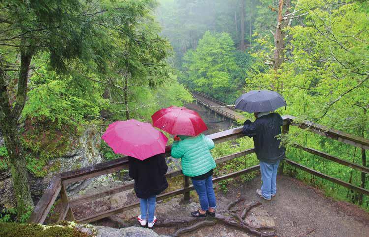
• View Raymondskill Falls by hiking a short, but steep, trail. To avoid the crowds, visit the area before 10:00 am or after 4:00 pm on weekends or visit on a weekday.
• Wander the quiet streets of Millbrook Village and explore life in the 1800s. This area is generally a good place to avoid crowds on summer weekends. Select buildings are open on summer Saturdays.
• Tour the Nelden-Roberts Stonehouse and the Foster-Armstrong House in Montague, NJ, on a summer Sunday afternoon. This area is generally a good place to avoid crowds on summer weekends.
• Tour the Rosencrans House and the Van Campen Inn in Walpack Center, NJ, on a summer Sunday afternoon. This area is generally a good place to avoid crowds on summer weekends.
• Stop at the three overlooks along PA 611 for stunning views of the Delaware Water Gap.
IF YOU HAVE HALF A DAY:
• Take a bike ride along the McDade Recreational Trail. Bring your own or rent a bike from a local outfitter. On Saturdays, Sundays, and holidays between Memorial Day Weekend and Labor Day Weekend, use the River Runner Shuttle to transport you and your bike, then ride back to your vehicle.
• Savor a picnic lunch at Hidden Lake and then take a stroll around the lake. This area is generally a good place to avoid crowds on summer weekends.
• Stroll around the Slateford Loop Trail to enjoy the quiet valley below the Kittatinny Ridge.
• Take a scenic drive along US 209.
• Choose a trail and venture on a hike.
IF YOU HAVE ALL DAY:
Consider signing up for a workshop offered by one of our partners located within the park.
• Peters Valley School of Craft offers 2-day to 5-day fine craft workshops. For more information, visit petersvalley.org.
• Appalachian Mountain Club’s Mohican Outdoor Center offers weekend getaways focusing on various outdoor activities. For more information, visit outdoors.org/lodging-camping/Lodges/Mohican.
• Pocono Environmental Education Center offers weekend getaways and workshops for youth, families and adults. For more information, visit peec.org.
View from Mt. Tammany (on the Red Dot & Blue Blaze trails)
A DAY ON THE DELAWARE RIVER
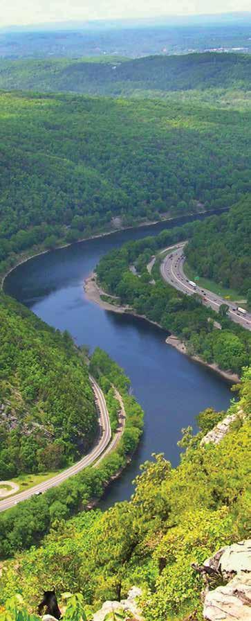
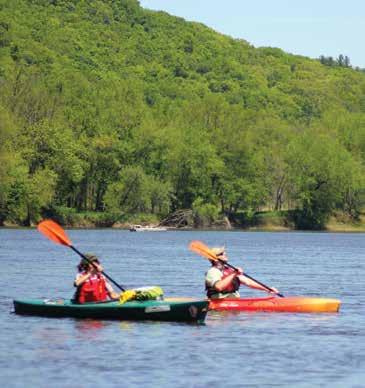
The Delaware River is the longest undammed United States river east of the Mississippi, extending 330 miles from Hancock, New York to the Atlantic Ocean. The Delaware River Water Trail extends nearly 200 miles from Hancock to Trenton, New Jersey. Like a conventional trail, a water trail is a recreational corridor, but instead of hiking, it is traveled by boat, such as canoe, kayak or small-motorized watercraft.
The river boasts outstanding natural, cultural, recreational and scenic resources. In recognition of these qualities, the portion of the Delaware River traveling through Delaware Water Gap National Recreation Area was officially designated as the Middle Delaware National Scenic and Recreational River in 1978. Within the park, the river is a series of shallow riffles and deep pools, making this section particularly good for canoeing. Access points every eight to ten miles allow for easy day trips, and numerous primitive campsites allow for longer journeys.
Bringing your own kayak or canoe? Take the chore out of relaying vehicles between your put-in and take-out on summer weekends. Use the River Runner Shuttle to transport you, your kayak and canoe, and your gear on Saturdays, Sundays and holidays Memorial Day weekend to Labor Day weekend. The service is free.
A day on the Delaware River allows you an opportunity to immerse yourself in an environment of tranquil natural landscapes, striking river valley scenery, and a substantially undeveloped river corridor that is unmatched among large rivers in the most densely populated region of the United States. While the Delaware River is easy for boaters, do not be misled by its calm appearance. Always follow proper water safety precautions to ensure you have a safe and enjoyable experience.
Buttermilk Falls
SWIMMING
Pack a swimsuit and a picnic and head to the beach - the river beach, that is. Unlike the sandy beaches along the ocean, the beaches here have soft grass on which to stretch out and enjoy the day.
Milford, Smithfield, and Turtle beaches are designated swim areas. Lifeguards monitor the beaches on weekends mid-June through Labor Day. Swimming in other areas of the river is not recommended. Picnic and restroom facilities are also available at the beaches. Grills are not provided, but personal grills are permitted. Alcohol and pets are not permitted.
Parking at swim beaches generally reaches capacity by 10:00 am on summer weekends. On Saturdays, Sundays, and holidays during the summer, consider parking at the Delaware Water Gap park-and-ride lot and riding the free River Runner Shuttle to Smithfield beach.
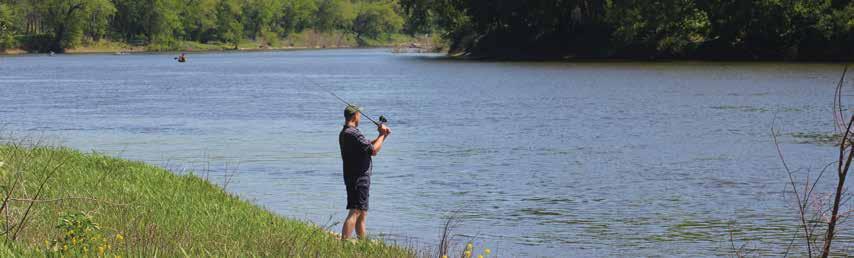
FISHING
Pack a swimsuit and a picnic and head to the beach - the river beach, that is. Unlike the sandy beaches along the ocean, the beaches here have soft grass on which to stretch out and enjoy the day.
Milford, Smithfield, and Turtle beaches are designated swim areas. Lifeguards monitor the beaches on weekends mid-June through Labor Day. Swimming in other areas of the river is not recommended. Picnic and restroom facilities are also available at the beaches. Grills are not provided, but personal grills are permitted. Alcohol and pets are not permitted.
Parking at swim beaches generally reaches capacity by 10:00 am on summer weekends. On Saturdays, Sundays, and holidays during the summer, consider parking at the Delaware Water Gap park-and-ride lot and riding the free River Runner Shuttle to Smithfield beach.
REGULATIONS
• A state fishing license is required for those 16 and older; regulations are enforced.
• Holders of either a New Jersey or Pennsylvania license may fish on the Delaware River and from either of its banks. This does not apply to the river’s tributaries.
• Special fishing regulations apply within the park. Refer to the appropriate state regulations for waters within the park.
Fishing is not permitted at:
• Dingmans Creek within George W. Childs Park area, including foot bridges and observation platforms. (Site closed in 2019)
• Dingmans Creek from the top of the Dingmans Falls to the east end of the Dingmans Falls Visitor Center parking lot from 8:00 am to 5:00 pm daily.
• Silverthread Falls in the pool at the base of the falls.
WATER SAFETY
Planning a safe day at the river begins well before you get near the water and does not end until you return home. Even though the Delaware River appears calm in some areas, DO NOT be misled! Moving water must be respected. The information below will help you better understand how to safely and comfortably enjoy the river.
In General:
• Always wear your life jacket.
• Alcoholic beverages are prohibited at Milford Beach, Smithfield Beach, Kittatinny Point, and Hialeah Picnic Area in Pennsylvania, and Turtle Beach, Caddoo Worthington State Forest, and Tocks and Labar Islands in New Jersey. Alcoholic beverages are also prohibited between Depew Island on the north and Depue Island on the south.
• Do not drink during river activities.
• Wear shoes to protect your feet from sharp stones, glass, and other objects.
• Protect yourself from the sun; wear sunscreen, a hat, light clothing, and sunglasses.
• Stay hydrated. Bring and drink plenty of water. Do not drink river water unless it is boiled at least 10 minutes.
• Plan to be off the river before dark.
When Swimming:
• Wear your life jacket even when swimming; don’t overestimate your swimming ability.
• Do not attempt to swim or wade across the river. The Delaware River has strong currents and steep drop-offs. Swimming becomes more difficult with increased current and water depth. Even the strongest of swimmers should be extremely cautious.
• Swim at designated beaches. Lifeguards are on duty on weekends at Milford, Smithfield and Turtle beaches mid-June through Labor Day.
• Do not jump or dive from cliffs, rocks, or bridges into the river; the water may be shallow and objects can be submerged. Rivers are constantly changing, especially with high water. Rocks can show up in places they never were before.
• Do not swim alone - always stay with your group.
When Boating:
• Always wear your life jacket.
• Children 12 years of age and younger MUST WEAR a life jacket on board a vessel.
• Life jackets must be worn in vessels less than 16 feet between November 1 and April 30.
• Never stand in a canoe. For better balance, kneel in a canoe when going through rapids.
• If you capsize, don’t panic. Stay with your boat; even an overturned boat can support you. Keep upstream of your boat to avoid being pinned against a rock or obstacle. Float on your back with your feet pointed downstream. Use your paddle to push away from rocks and other obstacles. Retrieve boats and equipment only if it can be done safely.
• Be ready for changing weather and cold water. Bring rain gear. To protect against hypothermia, bring clothing made of wool, polypropylene, high-performance eece, or a wetsuit.
• Never try to stand in rapids. Your foot could become trapped between submerged rocks. With a foot trapped, the current can be strong enough to push you over and hold you under, even if you are wearing a life jacket.
• Always tell someone where you are going and when you expect to return. Arrange drop off and pick up points before you leave. Leave emergency phone numbers, vehicle description, and tag numbers with someone who can report that you are overdue.
• Bring a spare paddle, a throw line, whistle, and a first aid kit.
CAMPING
What better way to immerse yourself in an environment of solitude, tranquil natural landscapes, striking river valley scenery, and a substantially undeveloped river corridor than to go camping! Whether you enjoy the services available at a campground or prefer hiking or paddling to pitch a tent away from people, the park offers a campsite for you. The place you park your RV or set up your tent becomes your home away from home – make it a safe one.
In general:
• Make sure there are no dead limbs or trees in the vicinity of your campsite that might come down during a strong wind.
• Avoid drinking untreated water. Even clear, spring water can contain harmful bacteria.
• If in a campground, lock food in your vehicle. Bears and other wildlife have a great sense of smell.
• Keep your pet on a leash and never leave a pet unattended.
• Ground fires are prohibited, except in a provided fire grate.
• Do not bring wood from outside the park; firewood is available for purchase at Dingmans Campground.
• Collecting wood in the park for fires is prohibited, except downed wood within designated campsites.
DINGMANS CAMPGROUND
Located near Dingmans Ferry, PA
• Sites for tent and RV (some with hook-ups)
• Individual and group campsites
• Camp store
• Weekly activities
• River Runner Shuttle flag stop
• More information: dingmanscampground.com
MOHICAN OUTDOOR CENTER
Located along the Appalachian National Scenic Trail near Blairstown, NJ
• Individual and group tent sites
• Self-service, bunk-style cabins
• Water available
• Camp store & food service
• More information: outdoors.org/lodging/lodges/mohican
GROUP CAMPSITES
Valley View Located near Bushkill, PA
Rivers Bend Located near Millbrook Village, NJ
• Reservations required
• Available for groups of 20-40
• Primitive tent sites along the river
• Water available at Rivers Bend only
• River access for canoes and kayaks
• Valley View Campground is a River Runner Shuttle flag stop (1/3-mile walk)
• More information: nps.gov/dewa
RIVER CAMPING
For extended boat trips (14 miles or more), free primitive campsites along the river are available first-come, firstserve. Additionally, six sites at the Alosa Campsite are available by reservation only. For Alosa Campsite reservations visit recreation.gov and search for Alosa. Service charges will apply when making reservations either by phone or at recreation.gov.
River camping is limited to boaters on trips of at least 14 miles total for one night, 26 miles total for two nights and 34 miles total for three nights.
KEY REGULATIONS
• Camping along the river is permitted in designated sites only; sites are identified by signs and the presence of a steel fire grate.
• Camping is limited to one night at each location. Campsites are limited to five tents per campsite.
• Tents must be erected within 50 feet of the campsite fire grate.
• Fires permitted in existing fire grates only. Self-contained stoves are permitted.
• Collecting wood in the park for fires is prohibited, except downed wood within the designated campsite. Do not bring wood from outside the park; firewood is available for purchase at Dingmans Campground.
• Pack out what you pack in, including food scraps.
• Use soaps sparingly; even biodegradable soap is a pollutant.
• Do not urinate or defecate within 100 feet of any river or stream. Bury fecal material, including pet waste, at least six inches deep and at least 100 feet away from water.
• Leave what you find; digging, collecting, or removing objects is prohibited.
PICNICKING
Numerous idyllic spots in the park await you and a red-checkered blanket. Grills are not provided anywhere in the park, but you are welcome to bring your own, except to Kittatinny Point. Ground fires are prohibited throughout the park. Do not bring wood from outside the park for any purpose; it may contain invasive insects and other organisms that threaten the survival of local plant and animal life. Collecting wood in the park for fires is also expressly prohibited, since even the smallest twig may serve as a critical habitat or food source for protected plant and animal life.
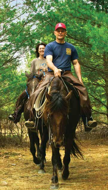
RIDING
Normally, horse riding is permitted on the Conashaugh View Trail in Pennsylvania and the Upper Ridge Trail in New Jersey for those who have their own horses. However, the Conashaugh View Trail sustained significant damage during a March 2018 winter storm and is closed to all recreational use until trail repairs are complete. Contact park headquarters at 570.426.2452 or visit the park’s website at www.nps.gov/dewa for the current status.
The Upper Ridge Trail near Layton, New Jersey, winds approximately five miles (in and back) through quiet woods, open fields and past isolated ponds. This trail is not heavily used and can become overgrown in the summer. Parking for trailers is along Jager Road. The trail is also open to hiking. Hikers should be alert to riders and must yield to horses by stepping off the trail and standing quietly until they pass. Please protect the environment by riding only on the marked trails, and crossing streams only on bridges. There are no horse rental liveries in the park.
BIKING
Cycling is a popular form of recreation in the park. The McDade Recreational Trail, a packed gravel path, parallels the Delaware River on the Pennsylvania side of the park for 32 miles and is perfect for mountain and hybrid bikes. This is the only trail where biking is permitted. A section between White Pines and Pittman Orchard trailheads is closed to biking. Motorized vehicles are not permitted on the McDade Recreational Trail.
Old Mine Road parallels the Delaware River on the New Jersey side for 34 miles in the park and passes through historic landscapes.
Road biking on US 209 in Pennsylvania is not recommended due to heavy traffic. Road biking on River Road in Pennsylvania is strongly discouraged due to sharp, steep turns, blind curves, and the lack of shoulders.
» Subject to change, please visit the park website or contact the park for updated information before visiting.
HIKING
More than 100 miles of trails meander through the park, including nearly 27 miles of the Appalachian National Scenic Trail. Hikers can enjoy the trails year-round, with each season offering its own special reward. During winter, the absence of deciduous leaves opens new vistas along trails and reveals stone walls, foundations, and other reminders of past residents. Spring provides a weekly parade of wild flowers and flowering trees. In summer, hikers can seek out cool retreats among the hemlock forests, and follow burbling streams to powerful falls and cascades. In autumn, hikers have crisp air to sharpen their senses and a wondrous palette of fall colors to enjoy.
Choosing a trail can be a daunting task. What to see? Waterfalls? Historic landscapes? Inspiring views? The following pages offer a simple guide to the many routes available.
BE PREPARED FOR YOUR VISIT
• Cell phone service is limited within the park.
• Carry (and drink) plenty of water; a leading cause of injuries on the trail is dehydration.
• Protect yourself from the sun; wear a hat, sunglasses and sunscreen.
• Wear sturdy shoes.
• Protect yourself from ticks and insects; use insect repellent, check and remove ticks when you return, and wear light-colored clothing to spot ticks more easily.
• Stay alert for snakes; do not put your hands and feet into places you cannot see.
• Be bear-aware; do not run if a bear approaches; make noise, wave your arms, and look large.
• Be able to recognize poison ivy and avoid contact with the plant.
• Trails are not regularly maintained or patrolled; travel carefully and at your own risk.
• Wear bright orange (shirt, vest, or hat) during hunting season.
KEY REGULATIONS
• Stay on trails; taking shortcuts causes trail erosion, damages native plants, and can be dangerous.
• Do not feed or approach wildlife.
• Be Bear Aware; stay at least 100 yard from bears, hike in groups of three or more, make noise, and properly store trash and any products with an odor.
• Pets must be leashed at all time
• Pack out what you pack in; do not leave trash behind.
HIKER SHUTTLE
The parking lots at Kittatinny Point and Dunnfield are generally full by 10 am on summer weekends. Monroe County Transit Authority offers a hiker shuttle between the Delaware Water Gap Park and Ride, Lake Lenape Trailhead, and the Kittatinny Point and Dunnfield parking lots. Service is offered every half hour between 10 am and 5:30 pm on Saturdays, Sundays, and holidays between Memorial Day and Labor Day weekends.
Childs Park Trail
Deer Leap Falls
Dingmans Falls
Photo by: Lou Nunez
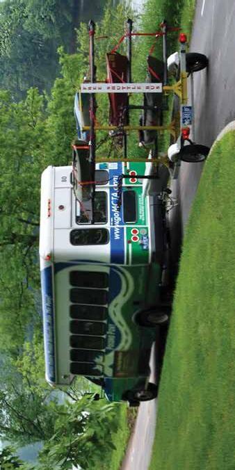
RIVER RUNNER SHUTTLE
The National Park Service has partnered with Monroe County Transit Authority (MCTA) to provide free public bus service along the Pennsylvania side of the river. MTCA provides the River Runner Shuttle service on Saturdays and Sundays between Memorial Day and Labor Day weekends between Stroudsburg, PA and Milford Beach, PA. Additionally, bus service is provided on Memorial Day, Independence Day, and Labor Day.
The River Runner Shuttle is a free service and is ADA accessible. Pick your boarding location and destination using the schedule below. Be at the stop five minutes prior to the scheduled arrival with your gear ready to load. In addition to passengers, MCTA can also transport bicycles, canoes, kayaks, and leashed dogs. Passengers are required to load and secure their own belongings and MCTA operators will check the equipment to ensure it is properly stowed.
Loading and securing equipment takes some time, so please be aw are that there may be times when the bus is late. For groups of ten or more people, please contact MCTA in advance to ensure they are properly prepared for your large group.
The system is designed to enable riders to board the bus just a bout anywhere along the route where it is safe for the driver
stop. Simply wave to the shuttle driver from a safe and observa ble location. Remember to be at the stop five minutes before the scheduled time. Programs like the River Runner Shuttle are just one way the par k is working to lessen the footprint we all leave on the planet. For more information about the shuttle visit MCTA’s website at gomcta.com/trip or call 570
PENNSYLVANIA
SHUTTLE RIDING TIPS
For Boaters:
• Northbound shuttle service can be crowded with boaters, particularly in the morning. Consider riding your bike north on the McDade Recreational Trail and using the southbound shuttle to return to your vehicle.
• Riders are strongly encouraged to park at the Park-and-Ride in Delaware Water Gap for river trips that end at Kittatinny Point due to traffic congestion on summer weekends.
For Hikers:
• Hike a longer one-way trip on the McDade Recreational Trail by using the shuttle.
• Northbound shuttle service can be crowded with boaters, particularly in the morning. Consider hiking north on the McDade Recreational Trail and using the southbound shuttle to return to your vehicle.
• Peak demand for canoe and kayak shuttle is northbound in the morning before 10 am. Consider using the northbound shuttle to transport to your starting location later in the day, or use the northbound shuttle to transport back to your parked vehicle at the end of your trip.
• Have your gear at the shuttle stop and ready to load at least ten minutes before departure to ensure on-time service.
For Swimmers:
• When spending the day at Smithfield Beach, use the shuttle to go to the McDade Trailhead at Hialeah for a 1.9-mile walk back to Smithfield Beach.
• River Runner shuttle service is not available at Kittatinny Point after 8:50 am.
• The last northbound shuttle leaves Smithfield Beach at 3:20 pm. The last southbound shuttle leaves Milford Beach at 4:50 pm
• When spending the day at Milford Beach, use the shuttle to go to the McDade Trailhead at Pittman Orchard for a 2.2-mile walk back to Milford Beach.
For Bikers:
• Bike a longer one-way trip on the McDade Recreational Trail by using the shuttle.
» Subject to change, please visit the park website or contact the park for updated information before visiting.
TOURING OLD MINE ROAD
Constructed in the mid-1600s, Old Mine Road connected the Hudson River and Philadelphia to the Pahaquarry Mines and provided an important conduit for New Jersey farmers taking crops to area markets, making it one of the oldest commercial roads in the country. Today, Old Mine Road stitches together sections of several roads into the park’s main passage in New Jersey and still retains much of the flavor of 100 years ago, making it a popular driving and biking route.
1. MONTAGUE GRANGE #140
The National Grange, founded in 1867, is an organization that advocates for rural America and agriculture. The local Montague Grange was founded in 1904 and this hall was built in 1906. The local group remains active and continues to use the building for meetings and community activities.
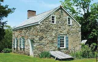
2. FOSTER-ARMSTRONG HOUSE
Owners of this home operated a ferry, sawmill, and gristmill. The house was used as a tavern and inn for river travelers and reflects the standard of living of a prosperous family in the early 19th century. The Montague Association for the Restoration of Community History (MARCH) operates this historic house museum for tours weekends and during special events.
3. MINISINK DUTCH REFORMED CHURCH
The Minisink Church was the heart, both spiritually and geographically, of the four original Dutch Reformed congregations established in the Upper Delaware Valley in 1737. The present structure was built in 1899, and tombstones in the cemetery date to 1805. Though it remains small, the vibrant congregation is one of the oldest in the country.
4. NELDEN-ROBERTS STONEHOUSE
Built around 1820, this house’s construction is attributed to George Nelden, who acquired the property in 1816. The Roberts Family was the last owners of the house, along with the farmstead located across US 206.
5. WESTBROOK-BELL HOUSE
Built by Johannis Westbrook, this is the oldest house located in Delaware Water Gap National Recreation Area, possibly predating 1730, and was lived in by nine generations of the family until the acquisition of the property by the federal government.
6. NAMANOCK
While nothing remains today, this was the site of Fort Namanock during the French and Indian War (1754-1763). Forts in this time and era were little more than sturdy houses with a wooden defensive fence surrounding them.
7. ALONZO DEPUE HOUSE
As with other historic homes along Old Mine Road, the landscape would have been quite different one hundred years ago – open fields, a clear view to the river, and several farm outbuildings. For 48 consecutive years, Alonzo Depue recorded temperature and precipitation readings for the U.S. Weather Service from a weather station near the road without missing a day.
8. BEVANS-HELLWIG KITCHEN
In the late 19th century, this little stone building was the rear kitchen attached to a large farmhouse. Local tradition holds that the original structure was used as a French and Indian War fortification, known as Fort Carmer.
9. PETERS VALLEY
Peter Van Nest, a land surveyor, laid out the roads in the area and had them intersect outside of his home in 1867. Over the years, the hamlet’s name changed several times, including Hen’s Foot Corner and Bevans, before its current name of Peters Valley. Through a partnership with the National Park Service, Peters Valley School of Craft operates an active school of fine craft. Stop by the Craft Store and Gallery to browse artisan’s wares, learn about 209 workshop offerings, and find out more about the weekend self-guided tours of the village.
10. WALPACK CENTER
Like other villages along the Old Mine Road, the Kittatinny Ridge to the east and the highlands of New Jersey to the north isolated the hamlet of Walpack Center. Area farmers found what they needed at the village’s general store, post office, blacksmith shop, church, and school. By the early 20th century, however, automobiles and larger farms proved to be too much competition and the village began its decline. Today, the Walpack Historical Society operates a museum in the First Rosenkrans House on summer weekends.
11. VAN CAMPEN INN
While it is called an “inn,” it is more accurately a “yaugh house”—a rural residence in a remote area that was licensed under colonial law to provide food and shelter to travelers. During the French & Indian War (1754-1763), the Van Campen Inn “provided a safe haven
when settlers ed for protection from Indian attack” and in November 1763, 150 settlers sought shelter in the “stout walls” of the house. The Walpack Historical Society offers tours of the house on most Sundays during the summer.
12. DELAWARE VIEW HOUSE
Constructed in the early 1800s, numerous changes over the years enlarged this once small house. As the house expanded, it also changed uses, including serving as the Flatbrook Hotel hunting lodge, the Losey Boarding House, and Salamovka – a summer retreat for Russian emigrants.
13. MILLBROOK VILLAGE
In 1832, Abram Garis built a grist mill along the Van Campen Brook. The mill soon attracted other businesses and by 1875, Millbrook was a thriving farm village. By 1910, most businesses had closed their doors. Today, only a handful of original Millbrook buildings remain. Other buildings have been moved from other sites or are newly built to help depict village life in the valley during the late 19th and early 20th century. On summer weekends and during special events, several buildings are open, with park staff and Millbrook Village Society volunteers demonstrating folk ways of the 1800s.
14. CALNO SCHOOL
In the 19th century, schools were located in places that would allow students to walk no more than four or five miles to attend. In 1881, the Calno School District counted 48 school-age youth, but only 30 were on the school’s register and the average daily attendance was only 15. The poorly paid teachers boarded with local families and seldom stayed more than a year or two. When this school was in operation, there was also a school in Millbrook Village, only five miles north.
15. PAHAQUARRY
The Coppermine Trail passes by the foundation of the Pahaquarry Copper Mine processing mill and mine shafts. Brief periods of mining attempted during the past three centuries were never successful, despite improved technology and mineral extraction methods. In 1925, this area became the Pahaquarry Boy Scout Camp and operated until 1971. It was just one of numerous scout and church camps that once existed within the park boundaries.
NOTE: Mine shafts are closed to protect critical bat habitat.
Nelden-Roberts Stonehouse
OVERLOOKS IN THE GAP
Tourist attractions of all sorts once lined River Drive through the Delaware Water Gap. This route, now known as PA 611, passes by many former attractions—but other than the stone guardrail lining the road, little remains of that historic past. Still, the stunning beauty of the water gap makes this short 2-mile drive a must-do during your visit.
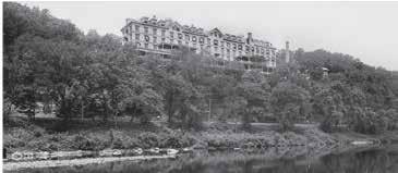
RESORT POINT OVERLOOK
The best known part of Delaware Water Gap National Recreation Area is the distinct notch in the Kittatinny Ridge known as the “water gap.” In order to enjoy the area’s beauty, visitors in the early 1820s rented rooms with local families. By 1832, a 25-guest hotel overlooking the Delaware River opened in Delaware Water Gap, and in 1860, the Kittatinny Hotel expanded to accommodate 250 guests.
The popularity of the area surrounding the water gap continued to grow, and additional hotels opened to meet the lodging needs of vacationers. Typically, vacationing families consisted of mothers and their children spending the entire summer in one of the hotels
while the fathers joined them on the weekends. Visitors occupied themselves by hiking, swimming, fishing, dancing, playing tennis and golf, visiting amusement parks, shopping for souvenirs, and delighting in carriage, steamboat, and rowboat rides. According to the manager of the Kittatinny Hotel, “[p]erhaps the featuring asset of the Gap, aside from its beautiful gorge, through which shows the placid Delaware, is its health giving atmosphere, which permeates everywhere and which in itself has given the region much of its charm and popularity.”
By the early 1900s, many people had private automobiles. Magazines and newspapers extensively advertised various appealing destinations for city dwellers. At the same time, improved roads gave people a greater choice of holiday retreats. Weekend excursions began replacing summer- long holidays, and the traditional resort business of the Delaware Water Gap began to decline. The economic depression of the 1930s changed the nation’s way of life, and grand hotels could no longer compete with the new and popularly priced year-round weekend resorts in the nearby Pocono Mountains. A reclaimed the Kittatinny Hotel in 1931, and today, all that remains is the view from the location of this once grand hotel.
POINT OF GAP OVERLOOK
This overlook is in the heart of the Delaware Water Gap, between Mt. Minsi in Pennsylvania and Mt. Tammany in New Jersey. Just as it is a popular place for viewing today, this was also a popular stop for the Victorian vacationer. The Indian Head Lunch, a tourist attraction named for its view of the cliff with the same name across the river, offered meals and souvenirs, while the Myrtle William’s Gap Inn provided a place for picnicking and camping.
ARROW ISLAND OVERLOOK
Today, this overlook provides a wonderful view of the water gap and the trailhead for the Arrow Island Trail. In the early 1900s, however, this was a bustling tourist stop. Minsi Mountain Park encompassed about 200 acres, and a hotel with a few outlying cottages was located on the hill overlooking the river. Inventive owners marketed a nearby slate quarry as a romantic enticement called “the Grotto” and boasted of the clear waters found in the “Minsi Health Spring.” In the location of today’s parking area, the Bear Stop roadside attraction featured caged bears and deer for the tourists’ amusement.
Kittatinny House Hotel
WATERFALLS
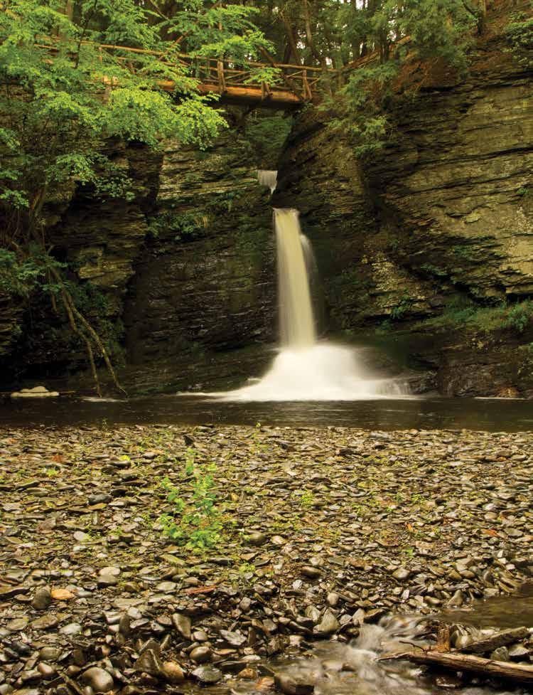
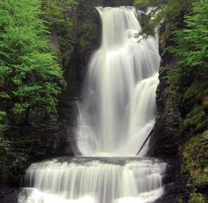
RAYMONDSKILL FALLS
Raymondskill Creek Trail, Pennsylvania GPS 41.290231 -74.840853
The loop trail that leads to the waterfall is only 0.3 mile, but is steep. The three tiers of Raymondskill Falls have a combined height of approximately 150 feet, making it one of the tallest waterfall in Pennsylvania. If the drops from each tier are added together, the waterfall is only a few feet shorter than Niagara Falls. The upper viewing area overlooks the upper pool and the narrow chute of the first drop. The lower viewing area provides an outstanding view and photo opportunity of the falls. A spur trail leads to the creek, but not to the bottom of the waterfall.
Things to Know:
• Pets are not permitted on the trail.
• Swimming and wading is not permitted in the creek and waterfalls.
• Stay on the designated trail.
• Restrooms are located at the parking lot.
• The parking lot at the trailhead fills quickly on summer weekends. To avoid the crowds, visit the area before 10:00 am or after 4:00 pm on weekends or visit on a weekday.
Raymondskill Falls Courtesy of PMVB
BUTTERMILK FALLS
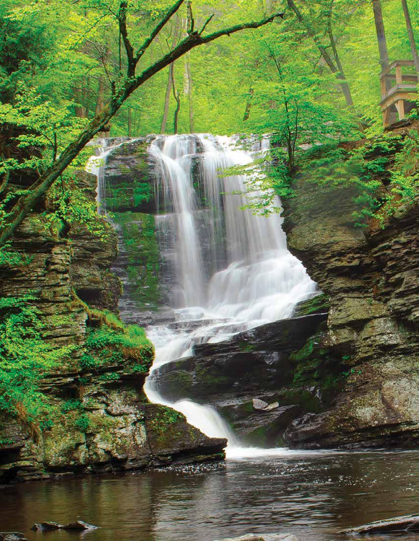
Buttermilk Falls Trail, New Jersey GPS 41.137164 -74.888793
The waterfall is located at the trailhead for the Buttermilk Falls Trail, and, therefore, requires no hiking to view. The cascading Buttermilk Falls is considered the highest waterfall in New Jersey at approximately 200 feet. A set of stairs climbs to a viewing platform at the top. The trail continues a nearly 1.5-mile steep climb to join the Appalachian National Scenic Trail at the top of the ridge.
Things to Know:
• Swimming and wading are not permitted in the waterfall and the pools.
• Stay on the designated trail.
• The drive to the waterfall is via a rural gravel road. Driving Mountain Road from Walpack Center is the recommended route, since Mountain Road south of Buttermilk Falls is very rough.
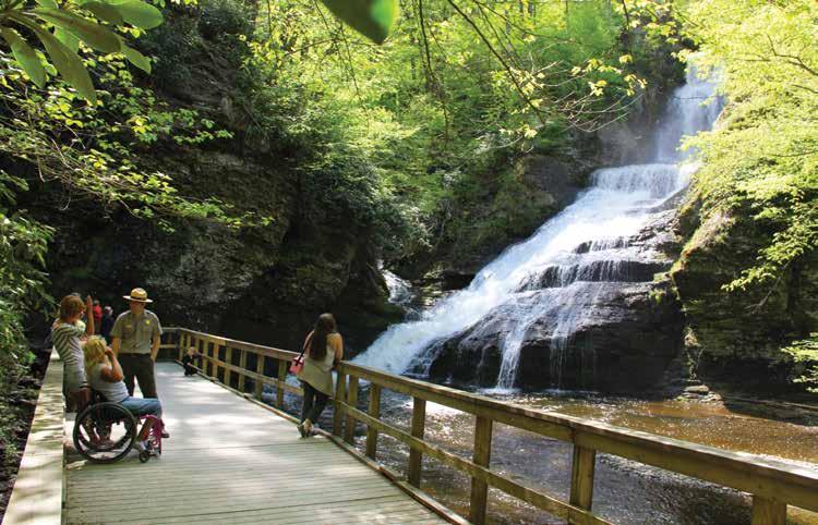
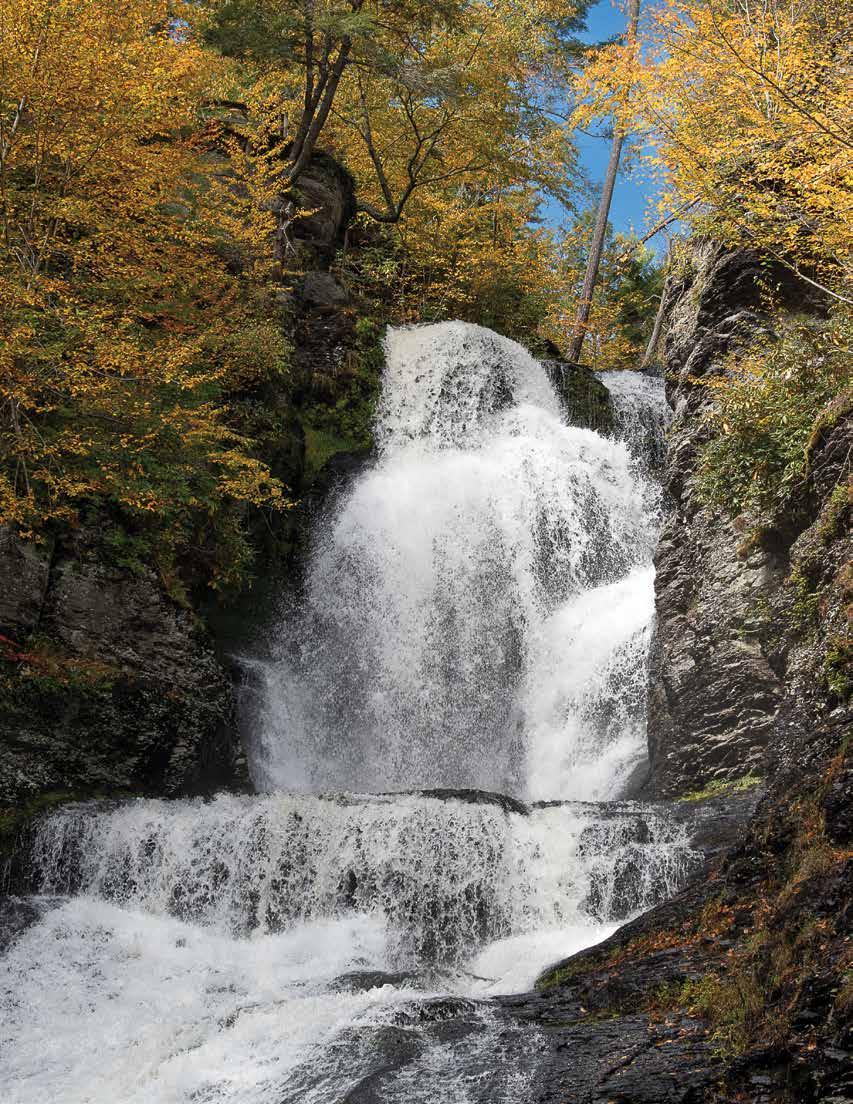
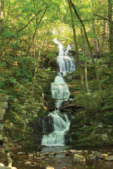
DINGMANS AND SILVERTHREAD FALLS
Dingmans Creek Trail, Pennsylvania GPS 41.229294 -74.887212
An accessible boardwalk trail meanders 0.3 mile through a pristine hemlock ravine. Shortly after starting the trail, Silverthread Falls gracefully drops 80 feet in a thin ribbon of water through a narrow geometric chute. The boardwalk continues through dense rhododendron shrubs and ends at the base of Dingmans Falls, the second highest waterfall in Pennsylvania at 130 feet. A wide rock ledge provides the backdrop for this cascading waterfall. The final tenth of a mile is a staircase that leads to a birds-eye view from the top.
Things to Know:
• Pets are not permitted on the trail.
• Swimming and wading is not permitted in the creek and waterfalls.
• Fishing is not permitted between Dingmans Falls and the trailhead parking area between 8:00 am and 5:00 pm.
• Restrooms and the Dingmans Falls Visitor Center are located at the trailhead.
• The parking lot fills quickly on summer weekends. To avoid the crowds, visit the area before 10:00 am or after 4:00 pm on weekends or visit on a weekday.
» Subject to change, please visit the park website or contact the park for updated information before visiting.
Buttermilk Falls
Dingmans Falls
> Silverthread Falls, Dingmans Falls Boardwalk Trail
People of the Delaware River Valley
Human occupation in the Delaware River valley dates back over 12,000 years when small family bands moved across the landscape, hunting game, fishing the rivers and streams and gathering food from the forests and grasslands. About 8,000 years ago, groups began to travel less and relied on a variety of foods found locally, such as acorns, nuts, sh, deer and turkey. Families began farming about 2,000 years ago, leading to a more settled lifestyle.
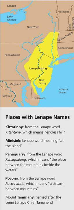
The Lenape (len-AH-pay) or Delaware lived in an area they called “Lenapehoking,” which means “Land of the Lenape.” Lenapehoking included eastern Pennsylvania, all of New Jersey, southeastern New York, northern Delaware, and a small section of southeastern Connecticut. While some Lenape lived in large villages of about 200 people, most lived in groups of 50 to 75. The arrival of Europeans in the mid1500s meant drastic changes for the Lenape. European explorers traded iron axes, cloth, and copper kettles with the Lenape for valuable animal
furs. In addition to the rich natural resources, Europeans also wanted land. Conflicts arose between the Lenape and European colonists over land ownership. Additionally, the introduction of diseases devastated the native population, who had no immunities. By the mid-1700s, warfare and diseases contributed to an estimated loss of 90% of the Lenape people. During the 1700s, most Lenape people either voluntarily moved or were forcibly moved west, eventually settling in Canada, Wisconsin, and Oklahoma.
Today, most Lenape decedents still live in Canada, Wisconsin, and Oklahoma. Their arts and oral traditions reflect their culture, and they continue to stay connected to their ancestral homeland. The Lenape legacy remains, and their impact is honored through various place names in the park today.
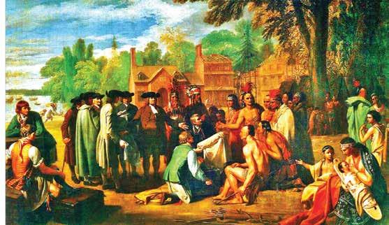
Left: Painting depicting William Penn entering into 1683 peace treaty
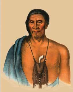
Right: Tish-Co-Han, Lenape Chief in the 1700s
Woolen Mill
Delaware Water Gap National Recreation Area is a National Park Service unit that includes 40 miles of the Middle Delaware River and more than 60,000 acres along the river's banks between Milford, PA, and Delaware Water Gap, PA. The park provides outdoor recreation opportunities while conserving the natural, cultural, and scenic resources of the recreation area.
www.nps.gov/dewa | (570)
AN INTERVIEW WITH LITTLE BEAR WOMAN
Frances Slocum had become the Miami Indian grandmother Little Bear Woman by the time her Slocum siblings visited her in Indiana in 1837. They made a transcript of parts of their conversations with her. Since she had forgotten how to speak English, an interpreter translated her remarks.
THE SLOCUMS: “Were you ever tired of living with the Indians?”
FRANCES: “No. I always had enough to live on, and have lived well. The Indians always used me kindly.”
THE SLOCUMS: “Did you know that you had white relations who were seeking you for so many years?”
FRANCES: “No. no one told me, and I never heard of it. I never thought anything about my white relations unless it was a little while after I was taken.”
THE SLOCUMS: “We live where our father and mother used to live, on the banks of the beautiful Susquehanna, and we want you to return with us. We will give you of our property, and you shall be one of us, and share all that we have. You shall have a good house, and every thing you desire. Oh, do go back with us!”
FRANCES: “No, I can not. I have always lived with the Indians. They have always used me very kindly. I am used to them. The Great Spirit has always allowed me to live with them, and I wish to live and die with them.
“Your wah-puh-mone (looking-glass) may be longer than mine, but this is my home. I do not wish to live any better, or anywhere else, and I think the Great Spirit has permitted me to live so long because
By John L. Moore
I have always lived with the Indians. I should have died sooner if I had left them.
“My husband and my boys are buried here, and I can not leave them. On his dying day my husband charged me not to leave the Indians. I have a house and large lands, two daughters, a son-in-law, three grandchildren, and every thing to make me comfortable. …”
France describes her abduction
At one point during the visit, Frances described events of the day of the Indian raid on the Slocum homestead in WilkesBarre in 1778.
FRANCES: “I can well remember the day when the Delaware Indians came suddenly to our house. I remember that they killed and scalped a man near the door, taking the scalp with them. They then pushed the (second) boy through the door.
“He came to me, and we both went and hid under the staircase. They went upstairs and rifled the house, though I cannot remember what they took, except some loaf sugar and some bundles. I remember that they took me and the boy on their backs through the bushes. I believe the rest of the family had fled, except my mother.
“They carried us a long way, as it seemed to me, to a cave, where they had left their blankets and traveling things. It was over the mountain and a long way down on the other side. Here they stopped while it was yet light, and there we stayed all night. I can remember nothing about that night, except that I was very tired, and lay down on the ground and cried till I was asleep.
“The next day we set out and traveled many days in the woods before we came to a village of Indians. When we stopped at night, the Indians would cut down a few boughs of hemlock on which to sleep, and then make up a great fire of logs at their feet, which lasted all night.
“When they cooked anything, they stuck a stick in it and held it to the fire as long as they chose. They drank at the brooks and springs, and for me they made a little cup of white birch bark, out of which I drank. …
“Very early one morning two of the same Indians took a horse, and placed the boy and me upon it, and again set out on their journey. One went before on foot, and the other behind, driving the horse. In this way, we traveled a long way till we came to a village where these Indians belonged. ... One of them was a Delaware chief by the name of Tuck Horse. …
“Early one morning this Tuck Horse came and took me and dressed my hair in the Indian way, and painted my face and skin. He then dressed me in beautiful wampum beads, and made me look, as I thought, very fine. I was much pleased with the beautiful wampum.
“We then lived on a hill, and I remember he took me by the hand and led me down to the river side to a house where lived an old man and woman. … I was brought to these old people to have them adopt me if they would … They agreed to it, and … they gave me the name of We-let-a wash, which was the name of their youngest child, whom they had lately buried.”
“On this
day of
remembrance, we pay tribute to those touched by the tragedies of this day, and by coming together as a community, we keep hope for a better future alive”
9/11 NATIONAL DAY OF SERVICE & REMEMBRANCE
Courtesy of StatePoint
Each year, September 11 National Day of Service and Remembrance is a chance to turn a dark day in the nation’s history into a day of doing good. Now federally recognized, it’s become the largest American day of service, honoring all those who demonstrated extraordinary compassion and courage in the aftermath of the attacks.
Unfortunately, formal volunteerism is on the decline. According to the U.S. Census and AmeriCorps’ “Volunteering in America” report, volunteerism in the United States went down seven percentage points from 2019 to 2023, the largest change since the agencies began collecting data in 2002.
“Volunteers are critical to helping communities thrive, just like they were after 9/11, making this a great day to get involved and start a habit of volunteering,” says Jennifer Sirangelo, president and CEO of Points of Light, a global nonprofit dedicated to inspiring, equipping and mobilizing people to take action that changes the world.
Points of Light recognizes ordinary people doing extraordinary things to strengthen communities with its Daily Point of Light Award. To boost volunteer engagement this 9/11 Day and beyond, the organization is sharing the story of an honoree who is also a volunteer first responder, along with information about how you can give back to your community.
Photo by Jack Cohen on Unsplash
INSPIRED FROM THE START
While watching the events of 9/11 unfold, 10-year-old Chris Zelenka begged his mother to allow him to travel into the city so he could help the countless first responders he saw on TV. Seeing so many people working together that day is what sparked his passion for serving others, and led him to join the South Spring Valley Fire Department when he was 16. Seventeen years after becoming a volunteer firefighter, Zelenka is still tirelessly serving his community. Along with his firefighting duties, he serves as the department’s financial secretary and co-lead of its fundraising committee. Over the past several years, he has also worked with nonprofits ranging from Wreaths Across America to Special Olympics, Habitat for Humanity and the Bergen County LGBTQ+ Alliance.
BOOSTING VOLUNTEERISM
The events of 9/11 bonded people and communities, and in the days, weeks and months following the attacks, volunteerism surged as people learned what they were capable of accomplishing when they worked together. Points of Light, which is committed to increasing the rate of volunteering, believes that a day of service like 9/11 Day can serve a kick-off to a life of civic engagement.
Zelenka’s words of wisdom for those who want to get involved but don’t know where to start: “Do what you can. That’s the biggest thing. That could be a donation once in a while. That could be giving blood. Obviously more is great, but I think sometimes people think they have to do so much. You can do little things and really make a big change, and it plays a bigger role into the grander scheme of things.”
TAKE ACTION
Plan your day of service now by visiting Points of Light’s Engage platform at pointsoflight.org/volunteer to search a database of hundreds of thousands of in-person and virtual volunteer opportunities. And remember that beyond volunteering, there are many ways to engage your community on 9/11 Day, from buying from businesses that support first responders to thanking those who work in service roles.
“On this day of remembrance, we pay tribute to those touched by the tragedies of this day, and by coming together as a community, we keep hope for a better future alive,” says Sirangelo.
It’s not just a day of shopping here in the Pocono Mountains—it’s an experience. Wander our historic streets. Explore our art galleries. Find unique local goods. And stop for a bite at one of our top-rated neighborhood restaurants along the way. Discover all of our shopping and sights now at PoconoMountains.com.
Pets provide unconditional love to their companions; in return, it’s important to make sure they live happy and healthy lives by providing the best care possible. This means making sure that in addition to food, treats and toys, they receive daily care for their eyes, ears and overall health.
With a desire to bring a dog into his family’s lives, Albert, a Bausch + Lomb employee, rescued a terrier mix named Watson. However, it soon became apparent Watson needed some extra love and care to help protect his eyes and ears from irritation and excess buildup. When finding a remedy proved difficult, Albert worked with veterinarians to develop Project Watson Health Care for Dogs, a comprehensive line of quality products targeting these specific areas.
“Feeding your pet a proper diet based on his or her breed, age, size and lifestyle plays a big role in overall health.”
To help ensure your furry member of the family has the best head to tail health possible, consider these tips.
SCHEDULE REGULAR VET VISITS
Routine wellness checks are an essential part of your pet’s care. Annual screenings, even if your dog seems healthy, allow your veterinarian to provide vaccines to combat disease and uncover any health issues that may have otherwise gone undiagnosed until symptoms advanced.
WATCH YOUR PET’S DIET
Feeding your pet a proper diet based on his or her breed, age, size and lifestyle plays a big role in overall health. A balanced diet that includes high-quality food can lead to a shiny coat, healthy skin, bright eyes and may also help strengthen your pet’s immune system, maintain intestinal health, increase mental acuity, regulate weight, keep muscles and joints healthy and more.
Photo courtesy of Pixabay
SUPPORT CLEAN EARS AND EYES
Often overlooked, the eyes and ears are vital areas to the overall health and wellness of your pet. To help keep these areas free of any buildup of bacteria that may cause irritation, consider an option like the line of Project Watson Health Care Products for Dogs, which includes an eye wash, eyelid wipe, ear wash, ear wipe and supplements made using high-quality and naturally inspired ingredients.
Excessive blinking or pawing at the eyes can be signs of buildup, irritation or infection. Dirt and debris trapped around the eyes can also clump in fur, leading to skin irritation and infections while excessive tear production can lead to fur staining, which can develop an unpleasant odor. Eye wipes can be used daily to relieve staining and remove excess buildup. Washing your dog’s ears may help reduce dirt, debris and wax buildup; help prevent itching; and reduce the chance of infection while keeping ears smelling fresh.
CREATE AN EXERCISE ROUTINE
Walks, games in the backyard and social time with other pets can help keep your furry friend in good physical condition. While different breeds and species often have different needs, adequate activity can provide benefits beyond the physical, including reducing boredom, which can potentially lead to anxiety or destructive behaviors.
PREVENT PESTS
In addition to regular vaccinations, ensure your pet is up to date on parasite prevention. This includes fleas, ticks, mites, heartworm and more which can cause reactions ranging from mild to severe (or even fatal in some cases of heartworm or Lyme disease). Look for pests and skin abnormalities when grooming your pet and contact your vet if your pet excessively scratches, chews or licks his or her fur or ears, or persistently shakes his or her head.
For more solutions to keep your four-legged friend happy and healthy, speak with your veterinarian or visit tryprojectwatson.com.
Photo Courtesy of Family Features
SUCCESSFUL BERRY HARVEST
Photo Courtesy of Vlad Kiselov on Unsplash
Courtesy of Family Features
Different berries thrive in different conditions, making selecting varieties that are well-suited to your local climate key to a successful harvest. For instance, strawberries and blueberries prefer cooler climates while raspberries and blackberries can tolerate a wider temperature range.
“Timing
is everything when it comes to harvesting berries.”
When selecting berries for your garden, consult local gardening experts or agricultural extensions, then consider these tips to ensure your berry harvest is bountiful and delicious.
PLANTING
Most berries prefer well-drained, slightly acidic soil that is rich in organic matter. Ensure the planting site receives at least six hours of sunlight each day. Space plants to their specific requirements then add mulch around the plants to help retain moisture, suppress weeds and maintain soil temperature.
REGULAR MAINTENANCE
Regular watering is essential, especially during dry spells. Also be sure to remove dead or diseased canes and thin out crowded areas to promote better air circulation and light penetration and prevent fungal diseases.
TIMING THE HARVEST
Timing is everything when it comes to harvesting berries. Picking them at the right moment ensures maximum flavor and nutritional value. Berries should be fully ripe but not overripe and come off the plant easily with a gentle tug.
● Strawberries should be fully red with no green tips
● Blueberries should have a uniform blue color with a slight grayish bloom
● Raspberries should be deep in color and free from white or light pink hues
● Blackberries should be dark black and slightly dull
Immediately after picking, place berries in a cool, shaded area to prevent overheating and spoiling. Gently rinse berries in cold water before storing in the refrigerator. If storing longer, consider freezing berries in a single layer on a baking sheet before transferring to airtight containers or freezer bags.
Find more tips for your garden at eLivingtoday.com.
KEEP YOUR YARD LOOKING GREAT ALL SEASON
Courtesy of BPT
Choosing the right materials and incorporating well-planned design features can enhance the appearance of your landscape while reducing the effort needed for maintenance.
"Adding mulched areas around shrubs, plants and trees, as well as creating access pathways, are key design elements we use to enhance the beauty of a landscape," says Lavonne Thompson, owner of Gabby's Gardens in St. Croix Falls, Wisconsin.
Many materials can help keep your landscape looking beautiful, such as mulch, landscape rock, flagstone steppers, concrete pavers and natural stone. To create and maintain a professional look for your landscaped areas, Thompson recommends these elements:
Create distinctive borders for garden beds, tree rings and
other landscaped areas using natural stone, concrete pavers or edging. It will make it easier to mow around plus add definition, texture and color.
Construct paths using natural stone steppers, concrete pavers, mulch or landscape rock. Not only do these materials create visual interest and define walkways, but they also improve accessibility.
Use mulch, landscape rock or gravel to give landscaped areas a finished look. "Mulch adds interest and gives a clean, finished appearance that enhances curb appeal," says Thompson.
Maintenance of mulched areas can be a challenge with thunderstorms, critters, traffic and falling leaves. To keep
Photos courtesy of Pixabay
landscaped areas looking beautiful and minimize seasonal maintenance, Thompson uses NorthRock® Landscape Loc Mulch & Rock Bond, an environmentally friendly compound that can be applied to keep mulch and landscape rock locked in place.
Landscape Loc helps to prevent mulch movement from rain, wind, critters, mowers and blowers, while allowing the treated area to freely drain and breathe. It is safe for soil, groundwater, wildlife, people, pets and plants.
“Adding mulched areas around shrubs, plants and trees, as well as creating access pathways, are key design elements”
"Landscape Loc is a great product for when we are refreshing clients' projects in the spring," says Thompson. "It is essential in sloped areas and gardens to prevent mulch from moving out of place."
Landscape Loc can be used on landscape rocks that are 1/2" or smaller. It can also be used to control dust from gravel, sand, pebbles and light rock on walkways and driveways as well as to control erosion around those areas. The more porous the rock, the better Landscape Loc will bond. For denser rock, a heavier application is required.
Using a fan tip sprayer, apply Landscape Loc when refreshing and cleaning up landscape areas. It lays down white and dries clear, enhancing the look of mulch and other ground cover.
Landscape Loc is available at Amazon and local retailers in one- and five-gallon containers or as a concentrate to mix with water. Watch an application of Landscape Loc Concentrate at www.youtube.com/watch?v=zOdssqFrQVY.
"It's great that Landscape Loc goes down white before drying clear," says Thompson. "That way if you are called away for a moment, you can pick right up where you left off."
ATTRACT BACKYARD BIRDS WITH THE RIGHT SEEDS
Courtesy of Family Features
While almost all bird seed may look pretty much the same to you, it doesn't to the birds you're feeding. Knowing what kinds of seeds different birds like can help you attract a variety of fine feathered friends to your feeders.
Consider these popular seed types and the common backyard birds they attract:
Sunflower - Black sunflower seeds attract blue jays, goldfinches, woodpeckers, purple finches, chickadees, titmice and nuthatches. Striped sunflower seeds appeal to chickadees, doves, grosbeaks, northern cardinals, nuthatches, titmice and woodpeckers. Sunflower hearts (also known as "hulled sunflower" and "sunflower chips") attract chickadees, common redpolls, juncos, doves, finches, goldfinches, grosbeaks, nuthatches, pine siskins, titmice and woodpeckers.
Nyjer - These lightweight, tiny seeds are a favorite of goldfinches. Put nyjer seeds in a hanging feeder with tiny holes so the small seeds won't get blown away. Nyjer also attracts redpolls, juncos, doves, indigo bunting and pine siskin.
Safflower - These white seeds are slightly smaller than black sunflower seeds. Because they are bitter, grackles, blue jays, starlings - and squirrels - don't like them. However, they do attract doves, purple finches, chickadees, titmice and downy woodpeckers.
White millet - Good for scattering on the ground, white millet attracts ground feeders such as juncos, sparrows, indigo buntings, towhees and mourning doves.
Cracked corn - Popular with ground feeders, cracked corn appeals to doves, crows, jays, sparrows, juncos and towhees. Avoid getting finely cracked corn as it's vulnerable to rot and can quickly turn to mush.
“Bird seed is required by law to list ingredients in order of content. Some cheaper mixes have filler seeds such as wheat, red milo, red millet or “assorted grain products.”
When choosing a bird seed mix, pay attention to the ingredients list on the package. Bird seed is required by law to list ingredients in order of content. Some cheaper mixes have filler seeds such as wheat, red milo, red millet or "assorted grain products." Most backyard birds won't eat those, and your seed mix could end up wasted on the ground.
Learn more about making your backyard an oasis for birds of all kinds at eLivingtoday.com.
Photo Courtesy of Pixabay
THERE’S NO PLACE LIKE THE MOUNTAINS FOR THE HOLIDAYS.
Celebrate the holidays surrounded by great company and even better cuisine in the Pocono Mountains. From romantic dinners by candlelight to farm-to-table experiences, our local chefs are serving up something for every palate. Visit PoconoMountains.com to see all of our mouth-watering dining options and make your reservation.
DARE YOUR FINANCIAL INVESTMENTS GOOD FOR THE PLANET
id you know that a thoughtful investment strategy can go beyond simply delivering big returns? Financial professionals say that with some careful consideration, it can also reflect your values.
To help you get started, CERTIFIED FINANCIAL PLANNER® professionals answer some commonly asked questions about how to align your finances with what matters most to you:
How can I be a responsible investor? Socially responsible investing (SRI) is a strategy that aligns your portfolio with your passions and involves seeking out investment opportunities with companies that follow environmental, social and governance (ESG) standards. For example:
• Does the company work to minimize its environmental impact?
• Does the company treat its employees and stakeholders fairly?
• Does it support social programs in its community?
• Does the company employ ethical governance and legal practices? Does it conduct impartial internal audits? Is its decision-making transparent and accountable?
How can I research ESG investments? First, determine your priorities, then do some research. You can find information about ESG investments on websites such as GreenInvestor and Morningstar. For a list of socially responsible mutual funds, visit the US SIF website.
Courtesy of StatePoint
Following the news can help you identify which companies are making a positive impact. A CFP® professional can guide you in avoiding unethical companies, finding meaningful investment opportunities and ensuring that your strategy continues to move you toward your financial goals.
What does ESG investing look like? Beyond traditional stocks and bonds, SRI choices can include mutual funds and exchange-traded funds (ETFs), alternative investments, such as peer-to-peer lending and farmland investments, community development financial investments that provide services in low-income areas, and micro-financing that supports startups worldwide, including in developing countries.
How else can I give back? In addition to socially responsible investing, your financial planning strategy can also include philanthropic giving. This might mean contributions to the charity of your choice, planned giving in your will or contributions to a donor-advised fund. Your CFP® professional can help you structure these donations to maximize their impact while optimizing tax benefits.
To find a CFP® professional who will help you invest in the future you want to help create, visit LetsMakeAPlan.org.
With a smart plan and a financial advisor’s guidance, you can make a meaningful impact on the world, no matter how much money you have.
ANTOINE DUTOT
(c) Jacob Wackerhausen / iStock via Getty Images Plus
Barrett
Cresco, PA
570-595-7171 www.barrettlibrary.org
Clymer Library Pocono Pines, PA
570-646-0826 www.clymerlibrary.org Pocono
In the Poconos, neighbors care for each other. At Lehigh Valley Hospital–Pocono, we do the same. Our clinicians aren’t just experts in advanced treatments and technology, they’re also experts in caring for neighbors, families and friends. Discover care that is truly dedicated to you.