
TEMPLE, TEXAS TC 1 INTRODUCTION 2 NEIGHBORHOOD OVERVIEW 3 PURPOSE AND MISSION 4 PLANNING BACKGROUND 5 THE STORY 6 THE WHAT 7 THE WHY 8 THE HOW 9 COMMUNITY INPUT & BACKGROUND 10 DEMOGRAPHIC INFORMATION 11 DEMOGRAPHIC TAKEAWAYS 12 EVENT PHOTOS 13 SURVEY RESULTS 14 SURVEY TAKEAWAYS 15 INVENTOR Y & ANALYSIS 16 CITY CONTEXT 17 PLAN AREA MAP 18 PHOTO INVENTORY 19 FUTURE LAND USE & MAJOR THOROUGHFARE PLAN 20 ZONING 21 PROPERTY CONDITIONS 22 SIDEWALK ANALYSIS 23 OPPORTUNITIES & CONSTRAINTS TABLE OF CONTENTS 24 ANALYSIS SKETCH: 15TH STREET INTERSECTION 25 ANALYSIS SKETCH: 13TH STREET INTERSECTION 26 ANALYSIS SKETCH: NETTLES PARK ENTRY 27 CONCEPT & PLANNING 28 MAJOR THOROUGHFARE RECOMMENDATIONS 29 3RD STREET 30 15TH STREET 31 13TH STREET 32 4TH STREET 33 13TH STREET REALIGNMENT 34 UTILITIES PLACEMENT 35 ENHANCEMENT FOCUS MAP 36 NUGENT TO ROYAL 38 WALKER TO ROYAL 39 THE GROVE 41 THE GROVE, 3RD STREET ARRIVAL 42 OPTIMIST GARDENS INFILL 43 NEIGHBORHOOD GARDENS 44 COMMUNITY FLOWER GARDEN 46 MEMORIAL/ BUTTERFLY GARDEN 47 ENGLISH/ SECRET GARDEN 48 HISTORIC PRESERVATION 49 NEIGHBORHOOD IDENTITY 50 LIGHTING PLAN 51 LIGHTING ZONES 52 REC OMMENDATIONS 53 ACTION PLAN 54 ACTION PLAN & CAPITAL IMPROVEMENT PLAN 55 CAPITAL PROJECTS MAP 56 WATER LINES EXHIBIT 57 WASTEWATER LINES EXHIBIT
Introduction
GARDEN DISTRICT 1
Garden District
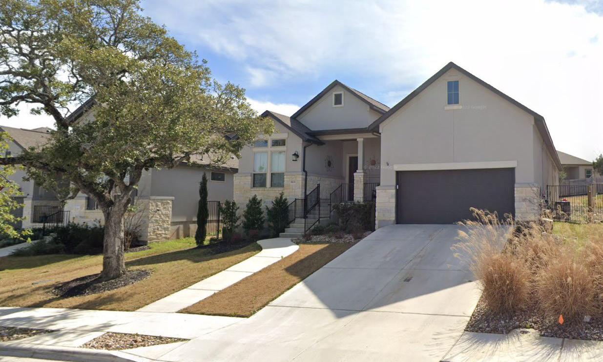
The Garden District is one of Temple’s most iconic areas. The neighborhood is comprised mostly of single story, ranch style homes. Many of them are architectural marvels that would make Frank Lloyd Wright proud. The mid-century modern homes are also representative of the relationships of the residents in this unique area. Neighbors provide support for each other, reminiscent of the close knit culture in the 50s and 60s. The mixture of empty nesters and young families provides many opportunities for multi-generational gatherings or just fun conversations along the roadway. All of these features make the Garden District one of the most desirable neighborhoods in Temple
TEMPLE, TEXAS 2 NEIGHBORHOOD OVERVIEW
PURPOSE
The City of Temple is dedicated to fostering cohesive, distinct, vibrant, safe and attractive neighborhoods, where citizens take pride and are engaged with their community. These objectives will be accomplished through the work of the City’s neighborhood team. Through a process of collaboration and communication, the City’s Neighborhood Team will strive to ensure continued improvements to Temple’s neighborhoods, as well as access to a wide variety of housing types that are safe, accessible and affordable.
HOUSING & COMMUNITY DEVELOPMENT
NEIGHBORHOOD PLANNING
YOUR NEIGHBORHOOD TEAM
MISSION
Working alongside residents in each neighborhood, our mission is to identify neighborhood concerns, values, vision and goals. Through this process, the City will develop long-range plans for each Neighborhood Planning District to include:
• City Capital Improvement Projects
• Private Investment & Economic Development Opportunities
• Community Development Block Grant Projects
A strong emphasis will be placed on improving the quality of life in each neighborhood while increasing access to affordable housing.
GARDEN DISTRICT 3 Crestview Ferguson Park East Downs Jackson Park Bellaire Garden Historic Downtown TempleCityLimits TempleCityLimits TMED Temple Heights Northwest Hills I-35 Midtown Birdcreek Barnhardt Woodlawn Central Silo Midtown 35 35 317 TEXAS 363 TEXAS 363 TEXAS 95 TEXAS 36 TEXAS 190 US
PURPOSE AND MISSION

PLANNING BACKGROUND
The Garden District Neighborhood is one of 18 planning districts within the City of Temple. Each district plan has a similar planning process that is intended to complement the City’s Comprehensive Plan with a more focused effort at the neighborhood level. This plan looks at the existing conditions and engages residents to derive genuine information and direction from the neighborhood. While using the best practices for planning, the results of each plan define specific recommendations that are unique to each district.
TEMPLE, TEXAS 4 PLANNING BACKGROUND
The Story
GARDEN DISTRICT 5
GARDEN DISTRICT IS...

The Garden District has a wide variety of uses and diverse housing types throughout the neighborhood. This unique character gives the district a fun and eclectic feel.


ECLECTIC ENDURING CONNECTED ORGANIC
This district is located in an area within Temple that is close to multiple nearby schools and parks. With close proximity to both Downtown and the Historic District, as well as access to I-35, the Garden District is a convenient location for a variety of different people.

Several of the homes in the Garden District are included in the Regulatory Historic District, while many other homes are built in more recent years. The homes and established trees in this neighborhood give an enduring legacy to the district.

This district has a non traditional road layout with many unique intersections and roads throughout the neighborhood. This organic feel contributes to the character of the neighborhood.
TEMPLE, TEXAS 6 THE WHAT


GARDEN DISTRICT 7 THE WHY
SUSTAIN REPRESENT STUDENTS & PARENTS EMBRACE


CULTIVATE
• Grow the neighborhood as a cohesive community with unique character.
• Embrace the Garden District name through developing gardens, parks, open space, and stormwater treatment facilities that contribute to the neighborhood branding.
SET EDGES
• Develop neighborhood services along 3rd Street that are appropriate and useful for neighborhood residents.
• Provide safe routes to school for students and teachers.
• Improve the development to north of the neighborhood with compatible land uses.
ORGANIZE
• Prioritize pedestrian connections in the neighborhood to improve walkability.
• Increase safety and wayfinding by improving confusing intersections.
• Organize car queuing for school pickup through signage or road markings that set clear delineation for traffic.
STRATEGIC CONSIDERATIONS
This planning effort is intended to compliment the focus areas and initiatives laid forth in Temple By Design, the 2020 Comprehensive Master Plan. The strategic considerations identified above highlight key features of the plan area that are intended to help guide unique recommendations for the Midtown Neighborhood. These resulting recommendations will be compiled into an Action Plan which include references to the specific Comprehensive Plan Initiatives they are intending to help realize. This planning effort includes a public engagement and visioning process to determine recommendations which ultimately lead to a series of corresponding capital improvement projects.
TEMPLE, TEXAS 8 THE HOW
Community Input & Background
GARDEN DISTRICT 9
DEMOGRAPHIC PROFILE
A look into the demographics helps to frame the characteristics of the plan area’s population. This information is used to guide recommendations for policies and changes to the built environment. This information is derived from. This information is derived from the American Community Survey 2014-2019 5-year using Esri’s Community Analyst software that aggregates multiple block groups that make up the plan area. This gives us the most accurate information for the defined area and helps tell the story of the plan area demographics.
Total Population
1,358
Population by Age Cohort


Under 5 years
0306090120150

Race and Ethnicity 3.0% 5.5% 8.2% 83.3% 25% Hispanic Black Asian Two or more races White $56,605 Median Household Income 6.4% Households Below Poverty Line Financial Characteristics Median Age 38.6 Median Age 2.51 People per Household Average Household Size 15.6% Less Than High School 17.5% High School/GED 38.0% Some College/ Associates 28.9% Bachelors or Higher Educational Attainment Employment of Residents by Industry Other Services Public Administration Finance, Insurance, and Real Estate Wholesale Trade Information Construction Agriculture Transportation, Warehousing, and Utilities Educational Services, Healthcare, and Social Assistance Arts, Entertainment, Recreation, Accommodations, and Food Service Manufacturing Retail Trade Professional, Scientific, Management, Administrative, and Waste Management 31.6% 1.3% 0.6% 1.7% 1.9% 3.0% 3.3% 4.1% 6.1% 6.3% 8.5% 8.5% 23.1%
5
to 9 years 10 to 14 years
to24
to 29
30
34
35 to 39 years 40 to 44 years 45 to 49 years 50 to 54 years 55 to 59 years 60 to 64 years 65 to 69 years 70 to 74 years 75 to 79 years 80 to 84 years 85 years+ TEMPLE, TEXAS 10 DEMOGRAPHIC INFORMATION
15 to 19 years 20
years 25
years
to
years
2014
2010
2000
1990
1980

DEMOGRAPHIC TAKEAWAYS
The following are a few summary conclusions derived from reviewing the demographics within the plan area:
• A significant portion of the population is children under 15 years old
• Educational attainment is high, with a majority of the population having some college or higher level of education
• There are few households below the poverty line
• A large majority of the homes in this neighborhood were built in the 50s
• Home ownership rate is high
• Most households have access to at least one vehicle, which corresponds with the high number of people who use a car or truck to get to work.


Housing Rent vs. Own 78.4% Own 21.6% Rent 050100150200250300 Years Homes Built
or earlier
to 1949
to 1959
to 1969
to 1979
1939
1940
1950
1960
1970
to
1989
to
1999
to
2009
to
2013
or later 0.0% Bicycle, Motorcycle, Other 0.0% Transit 91.5% Car/Truck 8.5% Walk or Work from Home Means of Transportation to Work Vehicles Per Household 29.8% 36.9% 3 or more 2 Vehicles No Vehicles 1 Vehicle 5.3% 28.0% GARDEN DISTRICT 11 DEMOGRAPHIC TAKEAWAYS
PUBLIC ENGAGEMENT
The Neighborhood Planning Team was challenged to develop a community engagement method so that crucial feedback could be gathered from the residents of th Garden District. The City Staff conducted events in an effort to engage plan area residents and inform them about the planning effort. As part of that outreach, residents were asked to respond to a an online survey. The results of the outreach efforts are highlighted on the following pages.


ONLINE SURVEY RESULTS
What is the biggest strength of the plan area? area homes parks trees quietneighbors streets mature Location Beautiful Established access Friendly community Close neighborhood
What is the biggest strength of the plan area? area homes parks trees quietneighbors streets mature Location Beautiful Established access Friendly community Close neighborhood
Unsafe trash
Lack park Unsafe trash
What is the biggest weakness of the plan area? homes Streets neighborhood street traffic sidewalks Lighting 15th yards
Lack park
What is the biggest weakness of the plan area?
homes Streets neighborhood street traffic sidewalks Lighting 15th yards
TEMPLE, TEXAS 12 EVENT PHOTOS
What are the Code Compliance issues that
What role best describes your relationship with the Garden District?


Work and Live in the Garden District Temple resident or visitor that frequents the Garden District Work/ Own/ Lease Business in the Garden District Resident of the Garden District 71% 1 5% 13% 1%
01020304050
your neighborhood? 8 5 18 18 21 33 37 44 47 Substandard driveways/carport conditions Fence condition Trash bins Graffiti Illegal dumping/litter Vacant/substandard buildings Tall grass Junk/abandoned vehicles Sidewalk condition Please select the future housing needs in the Garden District plan area. 2 2 3 3 3 16 30 76 Urban Duplexes Triplexes and fourplexes Condominium apartments (ownership) Townhouses Apartments (rental) Not sure housing should be a priority Single family homes Revitalize existing housing 01020304050607080
an alternative to personal vehicle trips in Temple? 6 7 9 36 81 Walk Rideshare/Taxi Bicycle Carpool The HOP 020406080100
affect
Which of the following modes of transportation would you or do you use as
Garden
(Rank
to least
Public Art Signage and Wayfinding Trash Receptacle Screening Flower Beds/ Gardens Building Façade Improvements Retail Outdoor Dining Sidewalks/ Trails 19 22 31 35 36 46 67 66 01020304050607080 01020304050 At Jefferson Park, what amenities do you frequently use? 13 12 13 32 44 Playing Field Workout Hot Spots Picnic an BBQ Area Playground Hike/Bike Trail What businesses or services are missing from the Garden District? Streets park Restaurants grocery retail store residential shopping shops Restaurant businesses dining entertainment sidewalks bars Are there any areas in the Garden District that experience frequent drainage issues? streets street 15th Park 13th sure aware Yes near intersection water home Curbs corner North several drainage What additional types of public space or parks amenity for leisure and recreation would you like to see in the Garden District Plan? area use Park dog garden Nettles trails walking trees skate Community Optimist court walk trail Water pickle ball nice 01020304050 Regarding Jefferson Park, select your priorities for park improvements. 14 14 15 31 32 40 43 Improve/replace existing backstop Additional playground amenities Additional picnic/BBQ amenities No improvements are needed Add restrooms and water fountains Expand the existing hike/bike trail Add a sport court What are the key destinations or activities you frequent in the Garden District? 20 6 22 39 71 Parks or other Recreation Visit Friends School Work Shopping 01020304050607080 What transportation and pedestrian improvements would you like to see in your neighborhood? 29 25 15 14 12 10 36 41 50 57 Courtesey (Fixed Route) Shuttle Improved Alleys 8 Hike and Bike Trails Curb and Gutter Directional Signage ADA Accessibility Scooter/Bike Share Bus Stops Landscaping Street Lights Bike Lanes 0102030405060
GARDEN DISTRICT 13 SURVEY RESULTS
What general improvements would you like to see in the
District
from most important
important)?
ONLINE SURVEY RESULTS
PERFORMANCE VS IMPORTANCE
The performance versus importance assessment matrix asks survey respondents about their views on the City’s performance in provision of facilities and/or services, as well as the importance of those same facilities and/or services. These responses are plotted against each other to provide a measurement and suggested prioritization for planning efforts, by showing the results in conjunction with the target line (the point where importance and performance meet).


PUBLIC SURVEY TAKEAWAYS


The following are a few summary conclusions derived from reviewing the online survey responses:
• Survey respondents said the biggest strengths of the neighborhood are neighbors, homes, and parks while the biggest weaknesses are streets, sidewalks, and lighting.
• Vacant/substandard housing is the biggest code compliance issue in the neighborhood and revitalizing existing housing was identified as the biggest housing need.
• Residential and neighborhood services are the most important land uses for the plan area.
• Restaurant and grocery are identified as the 2 main businesses missing from the neighborhood.
Public Safety Code Enforcement Animal Control Parks/Open Space Trails Sidewalks Street Conditions Vehicle Traffic Control Water Utilities Sewer Utilities Drainage Development Standards Land Use Makeup Street Trees/ Beautification 1 2 3 4 5 6 7 8 9 10 11 12 13 14 10 9 8 7 6 5 4 3 2 1 12345678910 0 1 2 3 4 5 6 7 8 TargetLine Low Priority Importance Performance vs Importance Assessment Matrix Performance Keep It Up Needs Work Possible Overkill 910 11 14 13 12
Increased Police Patrols Ineffective Somewhat Ineffective Somewhat Effective Very Effective Neither Effective or Ineffective Improved Crosswalks Ineffective Somewhat Ineffective Neither Effective or Ineffective Somewhat Effective Very Effective More Pedestrian Lighting Ineffective Somewhat Ineffective Neither Effective or Ineffective Somewhat Effective Very Effective Traffic Safety/ Calming Ineffective Somewhat Ineffective Neither Effective or Ineffective Somewhat Effective Very Effective Rate the following land uses on their importance to the Garden District. (1–unimportant, 5 – most important). Restaurants/ Bars 1 2 4 3 5 Hotel/ AirB&B/B&B 1 2 4 3 5 Retail/Shopping 1 2 4 3 5 Entertainment 1 2 4 3 5 Granny Flat/ Garage Apartment 1 2 4 3 5 Government 1 2 4 3 5 Professional Offices 1 2 4 3 5 Neighborhood Services 1 2 4 3 5 Residential 1 2 4 3 5 TEMPLE, TEXAS 14 SURVEY TAKEAWAYS
Rank your preference of the following safety measures.
Inventory & Analysis
GARDEN DISTRICT 15


This exhibit provides a regional context for the plan area as well as important destinations such as schools, grocery, and parks & open space. 0’
TEMPLE, TEXAS 16 CITY CONTEXT
500’ 1000’ 2000’


This exhibit shows the plan area boundaries and important points of interest.
GARDEN DISTRICT 17 PLAN AREA MAP
0’ 100’ 200’ 400’

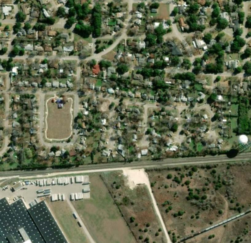
PHOTO INVENTORY
The images displayed on the right are taken from the Garden District plan area. These images assist in providing context to the character of the neighborhood’s built environment. Images were selected to show neighborhood assets, concerns, opportunities, conditions, etc.


TEMPLE, TEXAS 18 02 09 10 12 07 08 03 04 05 01 06 11 PHOTO INVENTORY 02 05 08 03 01 04 07 10 06 09 11 12


This exhibit shows the Future Land Use Plan and Major Thoroughfare Plan for the Garden District from the 2020 Comprehensive Plan.
GARDEN DISTRICT 19 FUTURE LAND USE & MAJOR THOROUGHFARE PLAN
0’ 100’ 200’ 400’

This exhibit shows the location and breakdown for the Garden District zoning.


TEMPLE, TEXAS 20 ZONING
0’ 100’ 200’ 400’
This exhibit shows the conditions of properties in the neighborhood and provides an overview of residential structure health.
A = Great Shape
B = Minor Cosmetic Repair Needed
C = Major Cosmetic Repair and/or Minor Structural Repair Needed
D = Major Structural Repair Needed
F = Structural Repair Needed Beyond the Worth of the Property and/or Dangerous Structure
For examples of property conditions ratings see Appendix, Property Conditions


GARDEN DISTRICT 21 PROPERTY CONDITIONS
0’ 100’ 200’ 400’


TEMPLE,
22 SIDEWALK
TEXAS
ANALYSIS
100’ 200’ 400’
This exhibit shows the existing pedestrian infrastructure and how it currently serves the Garden District properties.
0’

This exhibit highlights specific opportunities and constraints that are found within the Garden District.

GARDEN DISTRICT 23 OPPORTUNITIES & CONSTRAINTS
100’ 200’ 400’
0’


15th Street Intersection
The intersection at 15th Street, 13th Street, West Virginia Avenue, and Mayborn Drive creates a disorienting and dangerous condition fro both pedestrians and drivers. Improving this intersection will improve the clarity and wayfinding within the neighborhood, as well as increase the branding and character through the implementation of gardens.


Overall Takeaways:
• 15th Street becomes a safer through street for the neighborhood by reducing conflict points.
• Gardens located within the area contribute to neighborhood character
• Both vehicular and pedestrian traffic have improved access to and from the school.
TEMPLE, TEXAS 24 ANALYSIS SKETCH: 15TH STREET INTERSECTION
AFTER SUPPLEMENTAL IMAGES
Location Map
BEFORE


13th Street Intersection
Located close to the school, this heavily trafficked intersection can be a hazard to pedestrians and vehicular traffic. Simplifying the intersection by creating a ‘T’ intersection creates more visibility and will slow down the traffic to improve overall safety. Enhanced streetscape and signage further improves intersection safety.


Overall Takeaways:
• Create a ‘T’ intersection to slow traffic and improve safety.
• Streetscape elements contribute aesthetic character and wayfinding.
• Sidewalks improve walkability near school property.
GARDEN DISTRICT 25 ANALYSIS SKETCH: 13TH STREET INTERSECTION
Location Map
AFTER
SUPPLEMENTAL IMAGES BEFORE
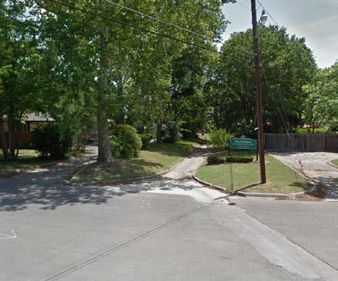

Nettles Park Entry
The existing Nettles Park entry is somewhat hidden within the neighborhood. Improving this park entry can raise awareness of the park to neighborhood residents and contribute to the garden character of the district. Enhanced landscaping and signage will help better define this entry point.


SUPPLEMENTAL IMAGES
Overall Takeaways:
• Increased landscaping and signage improve awareness of the park to neighborhood residents
• Rain Gardens or drainage facilities may be needed to alleviate stormwater flow
TEMPLE, TEXAS 26 ANALYSIS SKETCH: NETTLES PARK ENTRY AFTER
Location Map
BEFORE
Concept & Planning
GARDEN DISTRICT 27


This exhibit builds upon the direction of Temple’s Comprehensive Plan in refining the Major Thoroughfare Plan (MTP) to meet the needs of the Garden District.
The following are the key takeaways:
• A bicycle boulevard follows 7th Street and connects into 5th Street.
• Shell Road, 13th Street, Walker Avenue, Zenith Avenue, and Monticello Road all become Pedestrian Connectors.
• 15th Street remains as a Neighborhood Collector.


Jefferson
Nettles
Walker
Lamar Middle
Jefferson
Miller
Optimist Park Fannin Loop Goliad St. Monticello Rd. 15th St. 13th St. 11th St. 7th St. 5th St. Erath Dr. Duval Ct. Crockett
Bowie
Alamo Ct. Park Ave. Nugent Ave.
Victory Ave. Walker Ave. Zenith Ave. Industrial Blvd. Shell Ave. Thompson Ave. West Virginia Ave. Zenith Ave.
Recommendations
Neighborhood
Pedestrian
Bicycle
Intersection
TEMPLE, TEXAS 28 MAJOR THOROUGHFARE RECOMMENDATIONS
Park
Park
Park
School
Elementary School
Park
Ct.
Ct.
35
MTP
Major Arterial
Collector
Connector
Boulevard
Enhancement
0’ 100’ 200’ 400’

CHARACTER IMAGERY


Major Arterial
Minor Arterial
Community Collector Neighborhood Collector Pedestrian Connector
Bicycle Boulevard


3rd Street
As the only major arterial in the Garden District, this road accounts for much of the vehicular traffic in and out of this neighborhood. Focusing on sidewalk and street tree maintenance behind the curb would have the highest impact on this street.
Key Characteristics:
• Increase consistency of street trees
• Maintain R.O.W. to preserve landscape, street trees, and pedestrian environment
• Driveways and parking access should be located off rear alley to preserve sidewalk continuity and overall curb appeal.
Varies 10’ Minimum Varies 10’ Minimum GARDEN DISTRICT BELLAIRE NEIGHBORHOOD 95’-125’ Existing R.O.W. 5'-0" Sidewalk 5'-0" Sidewalk 12'-0" Travel Lane 12'-0" Travel Lane 12'-0" Travel Lane 12'-0" Travel Lane CL
GARDEN DISTRICT 29 3RD STREET


CHARACTER IMAGERY


15th Street
Major Arterial
Minor Arterial
Community Collector
Neighborhood Collector
Pedestrian Connector
Bicycle Boulevard
This Neighborhood Collector provides a key route in and out of the neighborhood. Creating a comfortable pedestrian environment along these streets is important to encourage walkability within the neighborhood.
Key Characteristics:
• Enhanced focus on pedestrian realm including sidewalk infill/maintenance and landscaping.
• Traffic calming measures such as change in paving material or addition of rumble strips are appropriate at certain locations.
• Streets should balance vehicle traffic demands and pedestrian safety.
• Meander sidewalk to preserve trees
50'-90’ Existing R.O.W. 10'-0" Planting Strip, 8’ Minimum 10'-0" Planting Strip, 8’ Minimum 5'-0" Sidewalk 5'-0" Sidewalk 15'-0" Travel Lane 15'-0" Travel Lane CL
TEMPLE, TEXAS 30
15TH STREET


CHARACTER IMAGERY
School Zone Considerations
Implementing safe routes to school includes addressing school pick-up and drop-off queuing issues. This is possible along these streets using a two part approach. The first part is improving sidewalks in key areas throughout the plan area to reduce the number of cars queued and increase overall walkability. Additionally, better defined rules and signage can help create a more efficient pickup. Enforcing these rules will encourage the most orderly pick-up and drop-off area.


11th Street
The streets designated as Pedestrian connectors are focused on the pedestrian experience. Sidewalks and street trees are important on these streets and traffic calming may be appropriate.
Key Characteristics:
• Enhanced landscaping for pedestrian experience
• Maintain R.O.W. to preserve landscape areas, street trees, and pedestrian environment
• Intersections should highlight pedestrian presence and increase visibility.
• Meander sidewalks to preserve trees
• Intersections should highlight pedestrian presence and increase visibility
60' Existing R.O.W. Jefferson Elementary School 15'-0" Travel Lane 15'-0" Travel Lane 5'-0" Planting Strip 5'-0" Planting Strip 5'-0" Sidewalk 5'-0" Sidewalk CL to AM NOTICE STUDENT PICK-UP ONLY DRIVERS MUST REMAIN WITH VEHICLE DO NOT BLOCK INTERSECTION QUEUING 7 to 9 AM 2:30 to 4:30 PM SAFE SCHOOL NOTICE Major Arterial Minor Arterial Community Collector Neighborhood Collector Pedestrian Connector Bicycle Boulevard GARDEN DISTRICT 31 13TH STREET

CHARACTER IMAGERY


Major Arterial
Minor Arterial
Community Collector
Neighborhood Collector
Pedestrian Connector
Bicycle Boulevard


7th Street
As a relatively low traffic street, 7th Street can be designated as a Bicycle Boulevard. Street markings and signage will help improve vehicle awareness of the bicyclist presence.
Key Characteristics:
• Maintain low vehicular traffic street
• Visible street markings and signage as bicycle route
• There should be no delineation of a designated bicycle lane. The desire is for the bicyclists to travel comfortably at a safe distance from parked vehicle door zones
• Maintain R.O.W. to preserve landscape areas, street trees, and pedestrian environment
• If less than 8’ planting strip is available, do not plan street tree in remaining planting strip area.
CL 80' Existing R.O.W. 15'-0" Travel Lane 15'-0" Travel Lane 10’-0” Planting Strip 10’-0” Planting Strip 5'-0" Sidewalk 5'-0" Sidewalk
TEMPLE, TEXAS 32
4TH STREET
Realigning 13th Street to create a “T” intersection with Mayborn Drive will reduce the number of conflict points at a confusing and dangerous intersection. A portion of both West Virginia Avenue and 13th Street will be removed and used for expanded park space. This new intersection alignment will also create a safer route to school for neighborhood children. This alignment creates two new park areas that can be programmed to better serve residents.
Key Characteristics:
• Maintain existing driveways along roads that are to be removed
• Park space is expanded and better programmed
• Fewer conflicts between vehicles
• Creates a safe route to school
• Intersections are enhanced to improve safety

Option 1
This option improves intersection safety by creating a “T” intersection at 15th Street and West Virginia Avenue. Pedestrian connection is improved and park space is expanded by removing the road between Walker Avenue and Mayborn Drive. Mayborn Drive is used for pedestrian access and emergency vehicles only.

Option 2
This option creates an improved pedestrian connection and safe route to school, and also expands the overall park space by removing the portion of road between Walker Avenue and 13th Street. Mayborn Drive is unaffected by this option.

Option 3
This option narrows the paving width of both Mayborn Drive and 13th Street. The extra space created is used for expanded park opportunities. 13th Street is used for emergency vehicle access only and Mayborn Drive is used for emergency vehicles and pedestrian access only.

0’ 10’ 20’ 40’ GARDEN DISTRICT 33 13TH STREET REALIGNMENT
13TH STREET REALIGNMENT
UTILITY PLACEMENT INTERSECTION ENHANCEMENTS

Intersection enhancement are intended to be located where vehicular traffic and pedestrian traffic are the most concentrated within a neighborhood. These locations, as one would suspect, aligned with street hierarchy of the Major Thoroughfare Plan. Arterials and collectors predicate a need for guiding vehicles and pedestrians alike to controlled and uncontrolled crossings. The plans identification of pedestrian connects is a means for the city to better manage its resources for sidewalks infrastructure and as such these routes will have a higher presence pedestrians. Within the interior of the Garden District Neighborhood where neighborhood collectors and pedestrian connectors cross there is a need to communicate to both drivers and pedestrians location of a crossing.
Intersection Enhancement Recommendations
• Streets should consider painted/striped crosswalk and pedestrian crossing signage
• Stop signs may be appropriate at the most heavily trafficked intersections or where vehicular speeding is prevalent
• Crossing flags maybe appropriate for routes that are key corridors for students.
The Garden District is an established neighborhood within the City of Temple and as such its existing utilities have been in place for quite sometime. The use of alleys and rear of property utility easements were have helped facilitate an inviting environment with it tree lined streets. As this is where wastewater and overhead utility connections are found, all funneling back toward the Knob Creek trunk line. Moving forward, the diagram below provides some direction as how to assign the placement of utilities within the context of to the street R.O.W. spacing and programing.
1 2
Water
Water lines located in the street R.O.W. in an unprogrammed area, with beneath the sidewalk being preferable to under the street. Pipe size can vary, but should not encroach on the tree’s critical root zone.
Planting Strip
Planting strips of 6’ or greater are needed to give a street tree proper growing conditions.
Stormwater
3 Common Trench
The stormwater pipe should be placed underneath the curb and gutter in the street R.O.W. Pipe size can vary, but should not encroach on the tree’s critical root zone.
Electric, telecommunications, and other overhead utilities connections are found along the alley or rear of property. East-west streets provide The trench should preferably be located in a public utility easement adjacent to, but outside of the R.O.W.
Wastewater
Wastewater is primarily found in the rear of properties or within the alley in the Garden District Neighborhood. If wastewater lines are to be located in street R.O.W. they should be place in an unprogrammed area or beneath the sidewalk being preferable to under the street. Pipe size can vary, but should not encroach on the tree’s critical root zone.
15’ Max.


Ornamental Tree

Overhead Utilities
If utilities cannot be placed in a trench, the use of ornamental trees is an acceptable alternative to large shade trees to maintain street trees. These trees should not exceed 15’ mature height. Overhead utilities should be consolidated on one side of the road where possible.
2’ Min. 4” Conduits 6” Conduits
R.O.W. R.O.W.
3 2 4 4
Telecommunications Other Electric 2’ 3’
1
TEMPLE, TEXAS 34 UTILITIES PLACEMENT
Focus Areas
Historic Preservation
Active 3rd Street
Neighborhood Conservation
Walker Park
Victory Ave.
Active 3rd Street. 3rd Street is currently a major arterial with abundant vehicle traffic. The existing properties within this area are sales and supplies, as well as some residential. This area should maintain this long-term employment presence while striving to improve compatibility to nearby residential properties.
Jefferson Elementary School
Zenith Ave.
Neighborhood Conservation. The plan area has a number of architecturally significant structures. Efforts should focus on maintaining these structures as well as encouraging reconstruction or infill to complement the plan area’s architectural character.
Jefferson Park
Lamar Middle School
This exhibit is intended to provide land use priorities and direction for the built environment by assigning the types of enhancement that should define future investment.
Nettles Park
Historic Preservation. This small section of the plan area should continue the efforts for historic preservation of the existing residential structures.
Optimist Park
Fannin Loop Goliad St. Monticello Rd. 15th St.
5th
13th St. 11th St. 7th St.
St. Erath Dr. Duval Ct. Crockett Ct. Bowie Ct. Alamo Ct. Park Ave. Nugent Ave. 35
Walker Ave. Zenith Ave. Industrial Blvd. Shell Ave. Thompson Ave.
West Virginia Ave.
GARDEN DISTRICT 35 ENHANCEMENT FOCUS MAP
0’ 100’ 200’ 400’
NUGENT TO ROYAL

0’
Key Considerations: Driveways. Reducing the overall number of driveways along 3rd Street will reduce confusion for vehicles and improve pedestrian safety, as well as improve the aesthetic of the street.
Street Trees. Reducing the number of driveways along 3rd Street also increases the opportunity for street trees and landscaping, which can slow traffic, improve visual aesthetic, and increase pedestrian comfort.
Sidewalks. Providing more continuous sidewalks along 3rd Street can improve the safety and comfort of the pedestrian environment and encourage neighborhood walkability.
Intersection. Providing an enhanced intersection at 3rd Street and Nugent Avenue with improved crosswalks and signage can alert vehicles of the pedestrian presence and improve the overall safety.
Parking. Placing buildings at the front property line allows more room in the back of the property for off-street parking. Additionally, side streets provide parking and access, reducing traffic and congestion of 3rd Street.
3rd Street TEMPLE, TEXAS 36
Active
50’ 100’ 25’
NUGENT TO ROYAL
NUGENT AVENUE 3RD STREET 5TH STREET ROYAL AVENUE PARK AVENUE OAKLAND AVENUE
NUGENT TO ROYAL

Key Considerations: Streetscape. Future development and redevelopment along 3rd Street should provide enough space for viable planting strips that can allow for the unencumbered growth of street trees.
Cross Access. Utilize cross access in the rear of lots to improve circulation and provide outlets to east-west streets. This will reduce conflict points along 3rd Street, improving the pedestrian environment.
OAKLANDAVENUE PARKAVENUE
3RDSTREET
Residential Character. Business such as personal services like salons, offices, etc. may elect for a building style that matches the nearby residential architecture. This will have a strong impact on promoting the neighborhood feel of the Garden District.
Key Intersections. Intersections along 3rd Street at Nugent Avenue and Shell will provide opportunities for more intense neighborhood commercial. As such, intersection enhancements that provide additional safety measures for pedestrians are strongly encouraged.
Active 3rd Street
GARDEN DISTRICT 37 NUGENT TO ROYAL
WALKER TO ROYAL

Key Considerations:
Townhouses
Mixed-Use
3RD STREET
Neighborhood Commercial
Neighborhood Commercial
ROYAL AVENUE
WEST VIRGINIA AVENUE
Side Street Access. Using the east-west streets for access to businesses along 3rd Street would reduce the overall number of driveways along 3rd Street. This will result in improved pedestrian safety and aesthetic interest of the corridor.
Street Trees. Reducing the number of driveways along 3rd Street also increases the opportunity for street trees and landscaping, which can slow traffic, improve visual aesthetic, and increase pedestrian comfort.
WALKER TO ROYAL
SHELL AVENUE
Sidewalks. Providing more continuous sidewalks along 3rd Street can improve the safety and comfort of the pedestrian environment and encourage neighborhood walkability. Infill. There are a number of open or underdeveloped lots along this section of 3rd Street. Infill with neighborhood supporting commercial, residential, and vertical mixed use would be desirable.
0’ 100’ 200’ 50’
Parking. Placing building to the front property line allow more room in the back of the property for off-street parking. Additionally, side streets provide parking and access reducing traffic and congestion of 3rd Street.
3rd Street
Active
38
TEMPLE, TEXAS
WALKER AVENUE
THOMPSON AVENUE

North Arts District Connection
The site’s proximity to the Garden District may initially influence the scale, massing, and land uses for the site. However, the sites relative proximity to the North Arts District and potential connection via Spur 290, allow the site to act as a southern bookend to the proposed character and intensity of the future development in the North Arts District.
Contributions:
• Continuation of the investment in the North Arts District
• Improve connection and intersection features at 3rd Street and Spur 290

The Bosque
The physical addition of the a large planting of trees creating a bosque has two main purposes. The first is a buffering of I-35 on land is currently not available and due to some site constraints not suitable for development. The second is its affect on creating a unique land feature and prominent gateway element at an important entrance to Temple.
Contributions:
• Buffering of I-35
• Unique gateway element
• Shaded open space for nearby development

New Arrival
Utilizing the Spur 290 and 3rd Street intersection, the Grove creates an experiential development that welcomes visitors and new residents at this important northern gateway to the City. The site’s proposed layout and land use makeup are intended to create an internal main street like experience. Shopfronts, outdoor dinning, communal spaces provide street engagement at a more intimate level than along 3rd Street.
Contributions:
• Architectural interest immediately upon arrival
• A experiential development that welcomes visitors
• More housing choice for new residents and member of the Temple workforce

Vibrant Experience
Intentional multi-family developments can provide a spark to nearby development by providing a supporting base of patrons. Additionally, multi-family integrated into a larger development creates the symbiotic relationships that encourage higher rental demand from residents. The site intentionally encourages a mix of dining, retail, office, and personal services that promote an active site throughout the day. The intent is that the blend of uses provided support each other in a way that will result in a more robust longterm vitality of the development.
Contributions:
• Evening activity
• Convenient services for nearby residents
• Activation of the site throughout the entire day
Active 3rd Street
TEMPLE, TEXAS 40 THE GROVE
THE GROVE
1 2 3 4

Key Considerations: Stronger North Temple. Reimagining the Grove site will result in a more appealing Northern Temple. Temple’s visual presence along I-35 would improve. This type of change will help the longterm outlook of adjoining neighborhoods.
Softened Edge. The bosque of trees provides an important effect that softens the proposed buildings contributing to a more welcoming sense of arrival. The new planting provides programming for the empty TXDOT right-of-way.
Architectural Interest. A set of four to five storied apartment buildings would have the massing and definitive aesthetic character to draw the visual interest of the large amounts of daily traffic on I-35.
Iconic Signage. Signage is a more direct form of messaging that conveys activity and excitement can be found at a certain location. Additionally, it contributes to a unique identity that communicates a distinct sense of place.
THE GROVE, 3RD STREET ARRIVAL
Active 3rd Street
GARDEN DISTRICT 41
THE GROVE, 3RD STREET ARRIVAL
NEIGHBORHOOD INFILL
The lots in the southwestern portion of the plan area are large enough to accommodate a significant infill development. Any residential additions to the neighborhood should maintain the strong architectural character and engaging street environment found within the rest of the Garden District. The conceptual layout shows how a development may be accommodated with two distinct approaches to keep in line with the plan area’s character.


Alley loaded lots allow for the structure to have a more distinct architectural character, that would otherwise be lost on smaller lots with front garages. Moving the parking to the rear allows the house to be closer to the front property line and better engage the
60’ wide single-family lots allow for front driveways, where the homes architecture still maintains a majority of the front building facade. Architecture on smaller lots with front access garages lose their aesthetic interest and engagement of the street environment from the banality of the garage and bareness of the driveway.
Nugent Avenue Optimist Park 15th Street
0’ 50’ 100’ 25’


Community Flower Garden
A large and diverse garden for residents to come together to create a communal experience that offers both sustenance and therapeutic opportunities. At the edge of the neighborhood, this garden will act as a gateway into the neighborhood give visitors a visual cue to the district’s name.
Key Characteristics:
• Raised beds
• Edge plantings to screen vegetable garden
• Edge fencing
• Diversity of plantings- herbs, vegetables, fruit trees, roses, grasses,
• Tool shed/work bench
• Compost area

Memorial/ Butterfly Garden
An architecturally driven garden with a center community gazebo memorializing an event or a history of Temple will give this garden area a landmark and usable space to sit and reflect as well as slow and calm traffic. Surrounding the gazebo, dispersed pods of native plantings of flowers and grasses buffer users from the street edge.
Key Characteristics:
• Centralized traditional gazebo
• Native flowering plants in pods
• Decomposed granite secondary pathways
• Plant identification nameplates
• Historical or memorial plaque
• Pedestrian lighting
• Access sidewalks


English/Secret Garden
A lush hidden gem tucked into the heart of the neighborhood this garden allows for increased privacy for neighboring residences and controlled play areas for park visitors. Formal yet playful this garden offers passive and active recreation.
Key Characteristics:
• Evergreen, shade tolerant plants
• White gravel walkways
• Hedges
• Tranquil seating areas
• Focal element in the center
• Garden ‘rooms’
Fannin Loop Goliad St. Monticello Rd. 15th St. 13th St. 11th St. 7th St. 5th St. Erath Dr. Duval Ct. Crockett Ct. Bowie Ct. Alamo Ct. Park Ave. Nugent Ave. 35 Victory Ave. Walker Ave. Zenith Ave. IndustrialBlvd. Shell Ave. Thompson Ave. West Virginia Ave. ZenithAve.
GARDEN DISTRICT 43 2550100 NEIGHBORHOOD GARDENS
Neighborhood Conservation
NEIGHBORHOOD GARDENS
1 1 2 2 3 3

Perennials
 Communal Gardens
Roses
Annuals Neighborhood Monumentation Grass
Ornamental Grass Border
Split Rail Fence
Fruit Trees
Maintain Existing Trees
Communal Gardens
Roses
Annuals Neighborhood Monumentation Grass
Ornamental Grass Border
Split Rail Fence
Fruit Trees
Maintain Existing Trees
1 4 5 6 2 3
AVENUE INDUSTRIAL BLVD. 0’ 10’ 20’ 40’
COMMUNITY FLOWER GARDEN
15TH STREET ZENITH
Neighborhood Conservation
COMMUNITY FLOWER GARDEN

Key Considerations: Gathering Space. Providing a space for the community residents to gather and sit is a key part of this garden. This space helps build a sense of community and can help make this garden a unique destination within the district.
Use Flexibility. This garden provides flexibility of uses for the neighborhood residents. With space for working, sitting, and gathering, this park is a community asset that can be used by many different people. Monumentation. Incorporating neighborhood entry monumentation in this garden enhances arrival into the neighborhood and contributes to the overall character and name of the neighborhood.
Access. A sidewalk along 15th Street will provide a walking route to and from the garden for the neighborhood. Street trees and enhanced plantings along the garden edge will provide traffic calming and increase the walkability of the entire neighborhood.
COMMUNITY FLOWER GARDEN
GARDEN DISTRICT 45


A new alignment at the intersection of 15th Street, Mayborn Drive, and 13th Street will reduce the number of conflict points at a dangerous intersection, provide clarity for drivers, and increase park space for the neighborhood. This new alignment also contributes to a safe route to school for neighborhood students. Using this new space for a butterfly and memorial garden will provide a central park space for the neighborhood with various options for seating and planting. A traditional gazebo and neighborhood signage will improve wayfinding at this decision point. Supplementing existing trees with both ornamental and evergreen trees, shrubs,and plantings will provide visual interest year round and enhance the garden district identity. 5)


Trees


Art/Sculpture Focal Point
Neighborhood Signage
Neighborhood Signage
Traditional Gazebo Preserve Existing
0’10’20’40’ TEMPLE, TEXAS 46
Gravel Low Hedge Wall Flower Beds Ornamental Trees
Low Hedge Wall 6) Native Plant Pockets 3) Traditional Gazebo 4) Neighborhood Monumentation 2) Tranquility Garden Focal Point
MEMORIAL/BUTTERFLY GARDEN 1 4 5 6 2 3 15TH STREET MAYBORNDR. 13THSTREET 0’ 10’ 20’ 40’
1) Gravel Path

Existing Playground Formal Play Lawn Move Existing Swingset Secret Garden New Picnic Shelter Entry Garden Gravel Path Boxwood Hedge Border Enhanced Planting Path to swings and playground Seating Nooks Privacy Wall Rose Beds Forml English Garden Crepe Myrtles Upgraded Privacy Fencing Accessible Sidewalk Swale Crossing Maintain Drainage Swale Path to Entry Garden ENGLISH/SECRET GARDEN 1 4 5 2 3 11TH STREET 0’ 10’ 20’ 40’

Maintaining the Existing Character
It is a priority of the plan to protect the valuable contributions that the historic properties provide to the character and fabric of the Temple community. Fortunately, historic building preservation efforts are already in place within a portion of the plan area. The City of Temple provides regulatory protections found in Chapter 17, Historic Preservation of the Code of Ordinances. The boundary of this regulatory district only covers a small area of the Garden District Neighborhood and there are a number of homes unprotected that have significant architectural contributions to the neighborhood’s character. The images to the right highlight just a few structures within the neighborhood and their architectural styles.
The following is a list of recommendations and is intended to compliment the Historic Preservation Focus portion of the plan area:
• Conduct survey of neighborhood to inventory architecturally significant structures for future considerations for enhanced protections.
• Continue to enforce development regulations for historic properties.
• Invest in supporting infrastructures to maintain historic character. This infrastructure includes sidewalks, alleys, street trees, etc.
• Enhance key intersections to contribute to historic aesthetic and character.
• Align future branding efforts to be consistent with the current Temple Historic District.


Historic Preservation TEMPLE, TEXAS 48 HISTORIC PRESERVATION
Tudor Revival Ranch Style Tudor Revival
Minimal Traditional Ranch
Mid-Century Modern
Mid-Century Modern
Minimal Traditional Ranch Ranch Style
Tudor Revival


S 15th ST 800 S 15th ST 800 S 15th ST 800 SECRET GARDEN JEFFERSON PARK GARDEN DISTRICT GARDENGDISTRICT GARDEN DISTRICT GARDEN DISTRICT G GARDEN DISTRICT G GARDEN DISTRICT GARDEN DISTRICT GARDEN DISTRICT GARDEN DISTRICT GARDEN DISTRICT 49 NEIGHBORHOOD IDENTITY STREET SIGN TOPPERS NEIGHBORHOOD MONUMENTATION ENTRY AND WAYFINDING SIGNAGE
This exhibit provides lighting recommendations for the plan area. Further explanation of the different lighting zones can be found on the following page.
Fannin Loop Goliad St. Monticello Rd. 15th St. 13th St. 11th St. 7th St. 5th St. Erath Dr. Duval Ct. Crockett Ct. Bowie Ct. Alamo Ct. Park Ave. Nugent Ave. 35 Victory Ave. Walker Ave. Zenith Ave. Industrial Blvd. Shell Ave. Thompson Ave. West Virginia Ave. Zenith Ave. Jefferson Park Nettles Park Lamar Middle School Jefferson Elementary School Schematic Lighting Zones General Street Zone Neighborhood Zone Intersection Zone Park Zone TEMPLE, TEXAS 50 LIGHTING PLAN
Lighting Plan
0’ 100’ 200’ 400’
LIGHTING ZONES


GENERAL STREET ZONE
The General Street Zones are the pedestrian and vehicular corridors of the neighborhood. These streets see the largest portions of vehicular and pedestrian traffic both in and out of the neighborhood. As such, these corridors should have ample lighting and maintain high operating standards, while not overpowering residential properties.

PARK ZONE
The Park Zone is intended to be a highly visible and active linkage. The lighting should be pedestrian scaled and well lit as to encourage extended use.
Lighting Notes:
Spacing 90’
Average Foot-candles 0.65
Recommended application of dark sky fixtures that minimize glare while reducing light trespass and sky glow.
NEIGHBORHOOD ZONE
The Neighborhood Zone is the primary single-family residential portion of the plan area. This zone needs to balance lighting for safety concerns while maintaining residential privacy.
*Average
*Information informed by Highway Illumination Manual, Texas Department of Transportation, 2018 Recommended application of dark sky fixtures that minimize glare while reducing light trespass and sky glow.
INTERSECTION ZONE
The Intersection Zone highlights key pedestrian crossings. The traffic associated with these areas requires an increase in lighting to ensure both pedestrian and vehicular safety.
Lighting Notes:
Lamp Size 30,000 Lumens, 250 Watts
Spacing 1 light pole at each respective corner, 4 total.
*Average Foot-candles 2.0
*Information informed by Highway Illumination Manual, Texas Department of Transportation, 2018
Recommended application of dark sky fixtures that minimize glare while reducing light trespass and sky glow.

BUSINESS/COMMERCIAL CONSIDERATIONS
The use of Backlight, Uplight, and Glare (BUG) ratings should be considered for business or commercial properties to promote dark sky principles and reduce off-site lighting impact on adjacent properties, especially near a residential neighborhood.
GARDEN DISTRICT 51 LIGHTING ZONES
Lighting
Lamp Size 15,000
Spacing 120’
Notes:
Lumens, 150 Watts
poles staggered
0.6
Recommended
Lighting
: Lamp Size 9,500
Minimum
150’
*Average Foot-candles
*Information informed by Highway Illumination Manual, Texas Department of Transportation, 2018
application of dark sky fixtures that minimize glare while reducing light trespass and sky glow.
Notes
Lumens, 100 Watts
Spacing
poles staggered
Foot-candles 0.4
Recommendations
TEMPLE, TEXAS 52
Garden District Neighborhood Action Plan
This section of the plan summarizes the recommendations derived from the project findings into the Garden District Neighborhood Action Plan. These actions follow the direction put forth in the City’s Strategic Plan and Temple By Design, 2020 Comprehensive Master Plan. In accordance with those plans, the actions are organized by the focus areas Smart Growth, Public Safety, Places and Spaces, and High-performing Organization. The recommendations in the Action Plan will reference the respective Comprehensive Plan initiative they help to realize. The Action Plan will identify the implementation method, priority, and department involvement.
SMART GROWTH INITIATIVES
SMART GROWTH INITIATIVES
IS.1 Lighting Plan. Implement lighting plan within the Garden District Neighborhood. Evaluate high needs areas to receive lighting priority.
D.2 Evaluate problematic drainage areas within the neighborhood such as 13th and Fannin and the cul-de-sacs and look for solutions to pooling water from water line flushing.
D.3 Explore water catchment opportunities for garden elements throughout the neighborhood.
Parks and Trails
PT.1 Work with property owner to acquire property for Community Flower Garden. Once the property is acquired design and implement the Community Flower Garden.
PT.2 Upon completion of 13th Street/7th Street intersection realignment, work with property owner to design and implement for Memorial/Butterfly Garden.
Economic Growth
EG.1 Work with TEDC to explore options for better aligning commercial development along 3rd Street to serve nearby residential.
ST.5 3rd Street Intersections. Plan, design, and construct improvements and/or enhancements to important intersections along 3rd Street at Industrial Boulevard, Zenith Avenue, Walker Avenue, West Virginia Avenue, Shell Avenue, and Nugent Avenue. Intersection improvements should promote traffic calming measures and ensure ADA compliance. Consider use of brick pavers.
ST.6 Tree Program. Encourage new street trees and street tree replacement as needed throughout the plan area. Include review of street trees to ensure limbs do not impede ingress and egress of emergency and city vehicles. Consider ordinance revisions to assist in this program.
FS.1 Develop a program through the Temple Fire Dept to check/ install smoke detectors and make sure street numbers are visible from the road in the Garden District Neighborhood.
CH.2 Actively seek out absentee owners of abandoned or blighted properties and require needed repairs to be performed, the building to be secured, and administer minimum maintenance standards.
CH.3 Develop a program to mitigate illegal dumping (highlight temple tire disposal program), littering, and squatting; specifically the eastern edge of the planning area.
CH.4 Increase Code Compliance activity to reduce health and safety concerns expressed by residents. Program
Action Type Comprehensive Plan Initiative Priority Involved Departments Design and Development DD.1 Encourage infill and redevelopment that is respective of the plan area’s residential character. Policy 1.3.7 High Planning DD.2 Develop a corridor plan for 3rd Street including design standards and incentivize businesses to meet those design standards. Study 1.1.1 High Planning DD.3 Support the Redevelopment of the area identified as The Grove. This may be apart of the 3rd Street or an individual project initiative Policy, Study 1.1.1 Medium Planning Streets and Thoroughfares ST.1 15th Street. Construct/reconstruct sidewalks and implement traffic calming measures along 15th Street. Capital 2.2.2 2.2.3 High Public Works ST.2 13th Street/7th Street Intersection. Plan, design, and construction the realignment of the 13th Street and 7th Street Intersection. Capital 2.2.2 2.2.3 Medium Public Works ST.3 Pedestrian Connectors. Construct/reconstruct sidewalks along Shell Avenue, 5th Street, Zenith Avenue, Monticello Road, Walker Avenue, West Virginia Avenue, and 13th Street. Priority should be give to sidewalks that promote safe routes to school. Capital 2.2.2 2.2.3 High Public Works ST.4 7th Street and
Drive Bicycle
Plan,
construct
Capital 2.2.2 2.2.3 Medium Public Works
Capital 2.2.2 2.2.3 High Public Works
Capital, Policy 2.2.5 High Planning, Public Works ST.7
Capital 2.3.3 Medium Public Works ST.8
condition
Policy, Study 2.3.3 Medium Planning, GIS, Public Works ST.9 Involve
calming
throughout the neighborhood. Coordinate, Capital 2.2.7 Low Public Works, Police Infrastructure Systems PUBLIC SAFETY INITIATIVES Action Type Comprehensive Plan Initiative Priority Involved Departments Police Safety PS.1 Enhance
and
with
to
Coordination, Program 4.1.4 High Police, Transform Temple PS.2
and
in the
Coordination, Program 4.1.4 Medium Police PS.3
Coordination 4.1.4 High
Mayborn
Boulevard.
design, and
improvements and/or enhancements to 7th Street and Mayborn Drive. This includes markings and signage to delineate the corridor as a Bicycle Boulevard.
Remove poor condition sidewalks from plan area. Repair and add sidewalks in areas identified for sidewalk improvement.
Implement a sidewalk
evaluation on a 5-year cycle to assess for ADA compliance and connectivity. Schedule repairs and additions through the CIP plan or identify funding through other programs.
departments to evaluate solutions for traffic
methods
neighborhood relations by continuous evaluation of policing techniques
working
residents
develop crime reduction strategies..
Revamp the Neighborhood Watch program
encourage increased participation
program.
Target 15th Street with extra patrols to reduce excessive speeding and improver corridor’s safety.
Police Fire Safety
Coordination,
4.2.7 Medium
Program
Fire, Community Development Community Health
CH.1 Increase animal control efforts. Coordinate 4.3.2 High Animal Services
Medium
Program 4.3.4
Transform Temple
Program 4.3.4 High Transform Temple
4.3.4 Medium
Transform Temple
Action Type Comprehensive Plan Initiative Priority Involved Departments
Coordinate 1.2.6 High
Public Works
Oncor,
Program, Capital 1.5.4 Low
Public Works
Drainage D.1 Look for opportunities to implement green infrastructure, potentially tying improvements into usable parks and open space.
Parks,
Study,
High
Works
Capital 1.5.4
Public
Study,
Low
Works, Parks
Capital 1.5.4
Public
Capital 1.4.1 High Parks
Capital 1.4.1 Medium Parks
at
Park Capital 1.4.1 Low Parks PT.3
to
Park. Capital 1.4.1 Medium Parks
PT.3 Design and develop English/Secret Garden
Nettles
Add water fountains
Jefferson
Coordination 3.1.4 High TEDC,
Finance GARDEN DISTRICT 53 ACTION PLAN
Planning,
Unique Assets
UA.1
UA.2
Work with the Utility Billing Office to identify new residents in the Garden District Neighborhood so that a “Welcome to the Neighborhood” packet can be sent to them. This packet should include contact information, bulk trash pickup schedule, code compliance rules and regulations, and other useful information.
Worth with neighborhood to organization a group to champion and support the proposed garden sites. The size and commitment from this groups may correspond to benchmark for parks investment into the implementation of garden design concepts.
UA.3 Conduct historic resource survey and make corresponding National Registry of Historic Places nominations. Study 5.2.4
UA.4
UA.5
UA.6
Include Garden in the considerations when developing design guidelines that include recommendations for preservation of existing historic homes.
Promote the Local Historic Landmark Designation and Heritage Marker Program.
Planning
Coordinate 5.2.3
Planning
Work with residents to evaluate the neighborhood for a potential local historic district designation. Planning
Neighborhood Growth and Diversity
NGD.1
Promote all homeownership opportunities, classes and reinvestment programs to include outside organizations, HOME and CDBG.
Neighborhood Stabilization and Redevelopment
NSR.1
NSR.2
Program 7.1.2
Develop a community outreach program to educate the public about code compliance rules and regulations. Program 7.2.3
Promote the infill of residential and commercial through community development grant program.
Promote the use of the Track Temple app via promotional materials and expanded messaging
NSR.3
High Housing & Community Development
Medium Housing & Community Development
Program 7.2.7 Medium Transform Temple. Housing & Community Development
Establish a Neighborhood Coalition and a neighborhood champion to streamline communications on activities impacting the neighborhood, such as zoning cases, variance requests, applicable plat requests, Capital Improvement Plan projects, etc.
Develop an annual report to track progress on Garden District Neighborhood Action Plan.
Review and update the Temple CIP project list to include the projects identified in the Garden District Capital Improvement Plan.
Develop task force for coordination of neighborhood district planning initiatives. This task force should focus on identifying partnerships and secondary funding sources.
Garden District Neighborhood Capital Improvement Plan
The following list of projects was derived from the concepting and recommendations formulated as part of the planning process. The projects identified correlate with the actions found in the Garden District Neighborhood Action Plan. Projects may be a single action or a combination of actions. The opinion of the probable cost was developed uniquely for each particular project and includes the cost of construction, contingency, land/right-of-way acquisition, and professional services. Action prioritization in regards to project implementation should be followed; however, if circumstances arise that increase the urgency or cost savings for the realization of the project, deviations from the recommended action priority is appropriate.
HIGH-PERFORMING ORGANIZATION INITIATIVES Action Type Comprehensive Plan Initiative Priority Involved Departments Development Review DR.1
Policy 8.1.6 High Planning, Housing & Community Development Sub-Area Planning
Policy 8.2.1 High Planning SAP.2
Policy 8.3.2 High Planning
Coordination 8.2.3 High Planning Project Action Opinion of Probable Cost Implementing Department 1. 7th Street 2. 15th Street 3. Zenith Avenue 4. 11th Street 5. Monticello Road 6. Fannin Loop 7. Walker Avenue 8. West Virginia Avenue 9. 13th Street 10. Shell Avenue 11. Royal Avenue 12 5th Street 13. The Grove 14. Community Flower Garden 15. Memorial Garden 16. Secret Garden 17. Walker to Royal 18. Royal to Nugent 19. Jefferson Park Water Fountains
Value reflects 2020 bond package and property acquisition only. PLACES AND SPACES INITIATIVES Action Type Comprehensive Plan Initiative Priority Involved Departments Community Branding CB.1 Street Signs.
and implement street sign family, sign
banners, and wayfinding to be used in the plan area. Policy 5.1.4 Low Public Works CB.2 Work with businesses along 3rd Street to develop and implement corridor sign standards. Coordination, Regulation 5.1.3 5.1.6 Medium Community Development, Planning
SAP.1
SAP.3
*
Select
toppers,
Coordination, Program 5.2.3 High Housing & Community Development
Coordinate, Study,
5.2.3 Medium Parks, Planning
Program
High
High
Policy, Study 5.2.4
Planning
High
TEMPLE, TEXAS 54 ACTION PLAN & CAPITAL IMPROVEMENT PLAN
Program 7.2.3 High Transform Temple, Housing & Community Development


Fannin Loop Goliad St. Monticello Rd. 15th St. 13th St. 11th St. 7th St. 5th St. Erath Dr. Duval Ct. Crockett Ct. Bowie Ct. Alamo Ct. Park Ave. Nugent Ave. 35 Victory Ave. Walker Ave. Zenith Ave. Industrial Blvd. Shell Ave. Thompson Ave. West Virginia Ave. Zenith Ave. 12 10 4 11 1 2 3 6 5 7 8 9 13 14 15 Jefferson Park Nettles Park Walker Park Lamar Middle School Jefferson Elementary School Optimist Park Proposed Projects Catalyst Projects Streets Projects Zenith Avenue 13th Street Neighborhood Collector Monticello Road 7th Street 11th Street Pedestrian Connector Walker Avenue Fannin Loop West Virginia Avenue Bicycle Boulevard Community Flower Garden Shell Avenue Royal Avenue 5th Street 15th Street Memorial Garden Secret Garden 11 1 3 5 7 9 12 4 10 2 6 8 15 13 14 GARDEN DISTRICT 55 CAPITAL PROJECTS MAP 0’ 100’ 200’ 400’
The water lines identified in this exhibit provide recommended location and capacity to serve the neighborhood district.
TEMPLE, TEXAS 56 WATER LINES EXHIBIT
0’ 100’ 200’ 400’
The wastewater lines identified in this exhibit provide recommended location and capacity to serve the neighborhood district.
GARDEN DISTRICT 57 WASTEWATER LINES EXHIBIT
100’
0’
200’ 400’
