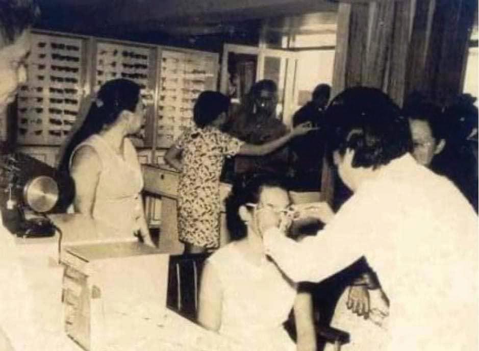
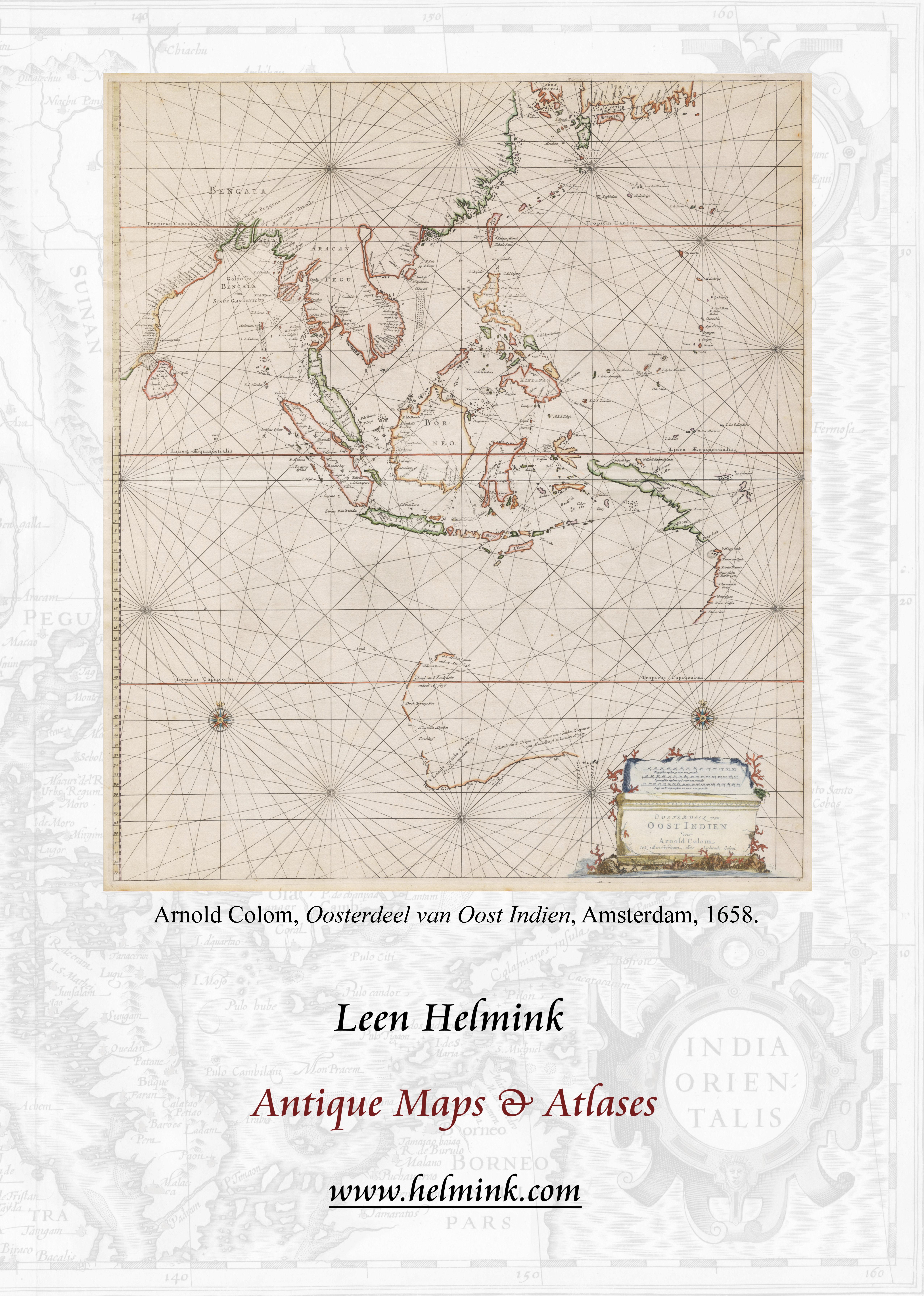
HP ACEBEDO


RareMaps.com 7407 La Jolla Blvd. | La Jolla, CA 92037 BLR@RareMaps.com | 858.551.8500 Fine & Rare Antique Maps, Sea Charts, Town Views & Atlases
The Naming of Cebu
by Margarita V. Binamira and Peter Geldart
EBUANOS who know their Shakespeare may well ask: What's in a name? Over the five centuries since the first documented arrival of Europeans, on the Magellan Elcano expedition in 1521, their precious isle set in the silver sea has been given well over two dozen different names on maps of Asia and the Philippine archipelago.
In the detailed manuscript account (and the accompanying maps) of the expedition by Antonio Pigafetta, Relazione del primo viaggio intorno al mondo, written in c.1525, the island is named Zzubu, although Zubu also appears in some editions of Pigafetta’s work.(1) The name is believed to have been the Spanish version of that used by the inhabitants of the island and its main town: Sugbo, also pronounced Sugbu in Visayan, and with an alternative spelling of Sogbú (2) A possible explanation for Pigafetta’s spelling may be that, because he was Italian and worked in Sevilla after he moved to Spain, he learned to speak Spanish with an Andalucian accent, where the voiced sibilant ‘z’ is used instead of ‘s’.(3)
Sugbo is said to come from ‘a Visayan verb which means to walk in the water, which the people landing at this place used to do at former times when the water in front of the city was shallow’.(4) Although this is the most plausible etymology, other historians believe the name Sugbo came from Sibo or Sibu, an abbreviated form of the old Cebuano phrase sinibuay ng hingpit meaning ‘a place for trading’, referring to the settlement’s port area. Another theory comes from oral legends saying Sugbo meant ‘great fire’ from the scorched earth strategy used to repel the Moros who raided the area for slaves.
As the 16th century progressed, Sugbo morphed into a plethora of spellings. Carlos Quirino wrote: “This island has been variously called Subuth, Cabue, Zebu, Zsubu, Cubiene, and Çubur.”(5) Subuth is in fact the earliest European name for the island, used by the Emperor Charles V’s courtier Maximilian von Sevenborgen (aka Maximilianus Transylvanus) in his work De Moluccis Insulis. This was the first account of the
Magellan Elcano circumnavigation, written from interviews with the survivors of the ship Victoria and published in Cologne in 1523. Taking his cue from Transylvanus, the German mapmaker Johannes Schöner then used Subuth on a globe he made, also in Cologne, that same year.
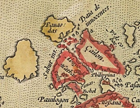
Some of the earliest European maps to show the Philippines are manuscript portolan charts by Iberian navigators, and early maps of Asia were also published in Italy. The ‘Carta Castiglioni’ of c.1525, attributed to Diogo Ribeira, shows Cebu as Çubu, as does the ‘Legazpi map’ attributed to Pierres Pli (aka Pierre Plin), a pilot in the Legazpi armada of 1564 65. The maps India Tercera Nuova Tabula by Girolamo Ruscelli (1561) and Descripcion delas Yndias del Poniente by Juan López de Velasco (1575, copied by Antonio de Herrera y Tordesillas in 1601) use Cubu, without the cedilla. Gaspar Viegas opted for Çubo in his c.1537 chart of the western part of the Pacific Ocean, and the Costa de Cubo is shown by Fernão Vaz Dourado in the portolan atlases he produced between 1550 and 1575.
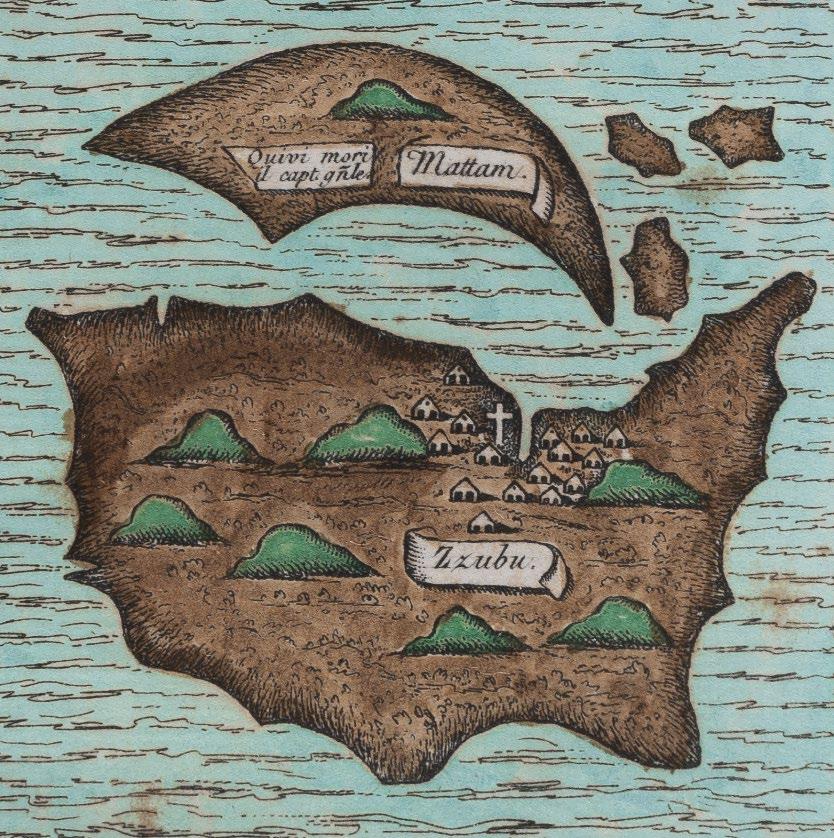
Detail of ‘Mattam’ and ‘Zzubu’ from Antonio Pigafetta’s map c.1525 (image courtesy of the Beinecke Rare Book and Manuscript Library, Yale University)

11
C
Detail of ‘Çubu’ from the ‘Carta Castiglioni’ attributed to Diogo Ribeira (c.1525)
(image courtesy of Biblioteca Estense Digitale)
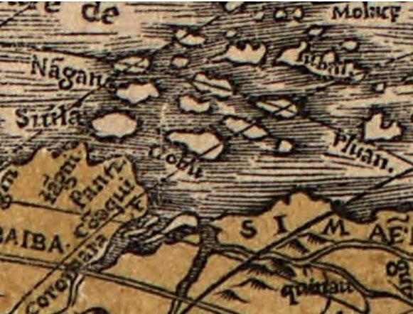
Detail of ‘Cobu’ from Nova, et Integra Universi Orbis Descriptio by Oronce Finé (1531) (image courtesy of the Library of Congress)
Detail of ‘Çubo’ from the untitled chart by Gaspar Viegas (c.1537)
(image courtesy of Archivio di Stato di Firenze)
Detail of ‘Cubu’ from India Tercera Nova Tabula by Giacomo Gastaldi (1548) (author’s collection)
Detail of ‘Costa de Cubo’ from the atlas by Fernão Vaz Dourado (c.1560)
(image courtesy of The Huntington Library)


Detail of ‘Costa de Cabo’ from the chart by Bartolomeu Velho (c.1560) (image courtesy of The Huntington Library)

12
The occasional use of the cedilla (Spanish for ‘little zed’) in Çubu and Çubo is explained by the use in 16th century Spanish orthography of ‘ç’ to indicate the sibilant sound ‘s’ when it came before a hard vowel (‘a’, ‘o’ or ‘u’) rather than the ‘k’ sound represented by ‘c’ before those hard vowels.(6) By putting the cedilla under Çubu and Çubo the pronunciation became Subu and Subo, which was closer to the original Sugbo (Sugbu in Visayan) than Cubu or Cubo pronounced with a hard ‘c’ (as in ‘Kubu’ or ’Kubo’). In 1741, the Real Academia Española (Royal Spanish Academy) overhauled the orthography of many Spanish words and inter alia decided that the cedilla would be dropped;(7) the Academy’s proposals were officially adopted by royal decree in 1844.
The vowels in Cubo were reversed by the French cartographer Oronce Finé, who showed Cobu to the east of Pluan (Palawan) on the first (1531) edition of his world map Nova, et Integra Universi Orbis Descriptio. (8) According to cartographic historian Thomas Suárez (op cit), this is ‘the first appearance of any Philippine islands on a printed map’.(9) Curiously, this spelling would reappear in 1727, on a map by Alexander Hamilton. In 1545 Alonso de Santa Cruz of Sevilla presented his manuscript Islario general de todas las islas del mundo to the king of Spain. In this work, consisting of some 120 maps and a lengthy description of various parts of the world, Magellan’s visit to Cubucue is described, but on the accompanying map the name Matam (Mactan) is used.
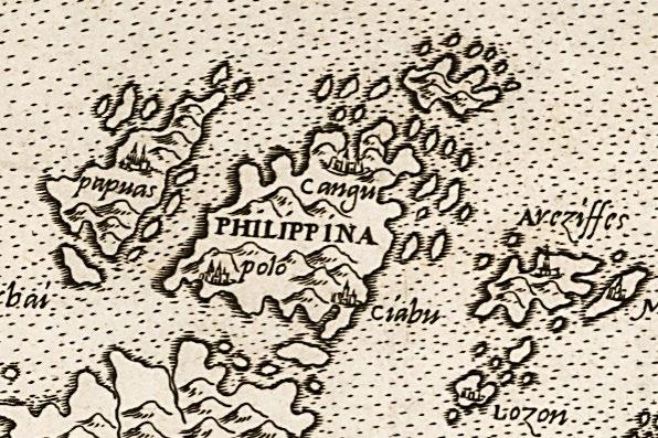
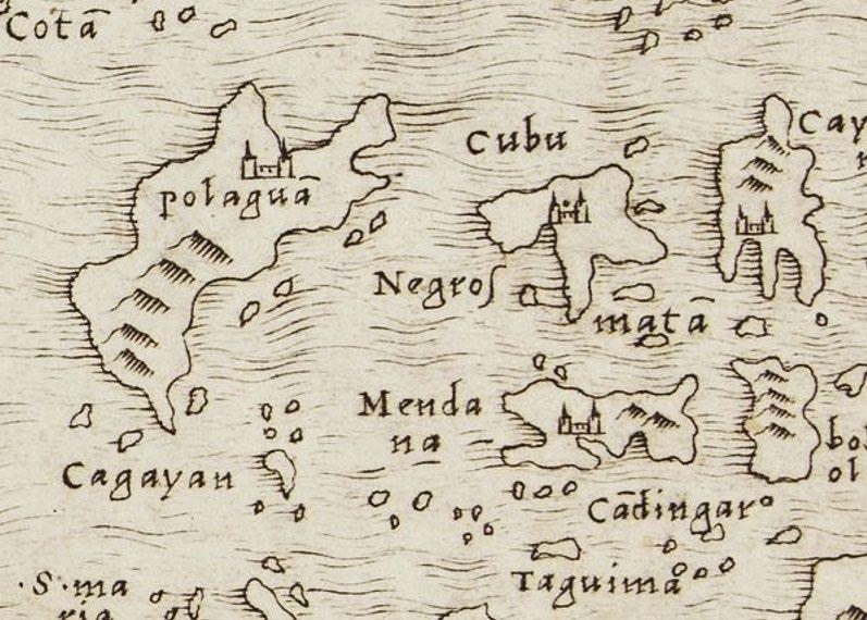
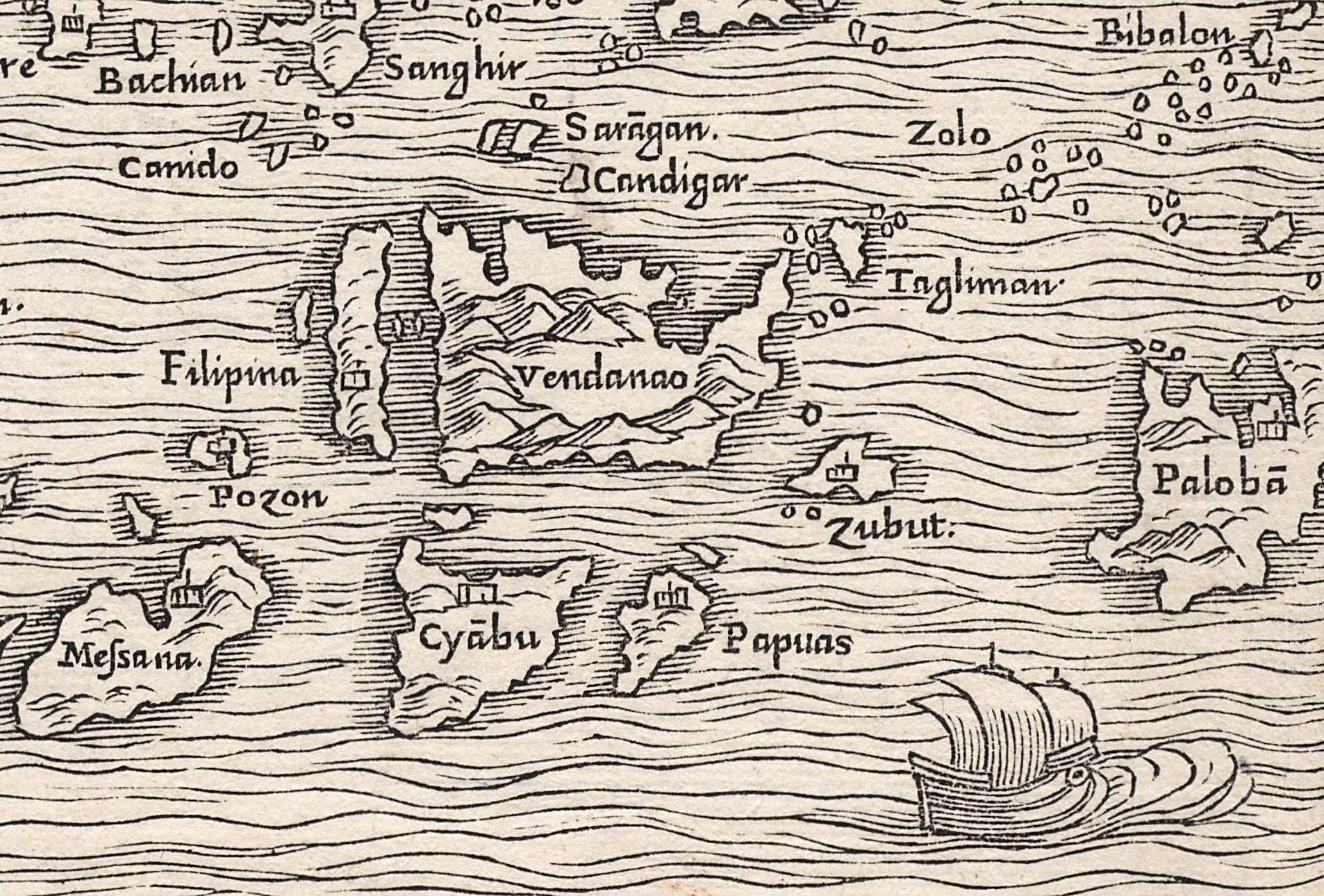
In his 1548 map India Tercera Nova Tabula the great Italian cartographer Giacomo Gastaldi also shows Cubu, but in Terza Tavola the first map to show an island with the name Filipina (10) published in 1554 in the second edition of Giovanni Battista Ramusio’s book of voyages, Delle Navigationi e Viaggi, he not only changes the island’s name but confuses its location. To quote Suárez again: “Ramusio appears to have combined different sources which refer to the island by different spellings, for he charts Cebu twice: once as Cyābu and a second time as Zubut.” The map is oriented to the south, and Cyābu is shown to the north of Vendanao (Mindanao) and due east of Papuas (Negros); Zubut is located to the southwest of Papuas, between Vendanao and Palobā (Palawan).
Detail of the city of ‘Çiabu’ on the island ‘Philippina’ from Il Disegno Della Terza Parte Dell’ Asia by Giacomo Gastaldi (1561) (image courtesy of Barry Lawrence Ruderman Antique Maps Inc.)
13
Detail of ‘Cyābu’ and ‘Zubut’ from Terza Tavola by Giacomo Gastaldi (1554) (author’s collection)
On Gastaldi’s third map of the region, Il Disegno Della Terza Parte Dell’ Asia, published in 1561, Zubut has disappeared, but the large island to the north of Vendanao has been given the name Philippina, and Ciabu is the toponym for the town on its southeast coast. The name of the city then becomes Chiabu on the spectacular 1587 world map by Urbano Monte.
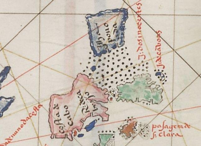
A manuscript chart of Southeast Asia dated c.1560, attributed to the Portuguese navigator Bartolomeu Velho, uses yet another spelling: a large, roughly trapezoidal island to the north of Mindanao and south of Ilha Pouoada (Panay) (11) is labelled Costa de Cabo with, towards the east of the island, the R: de Cabrijo Has this river been confused with the Cabrita shown in the Zamboanga peninsula on other 16th century portolan charts?(12)
The mapmakers of the ‘Golden Age’ of Dutch cartography were thoroughly inconsistent. When he published his map Tertiae partis Asiae in 1566, copied from Gastaldi’s 1561 map, Gerard de Jode included Ciabu; but his 1578 map Asiae Novissima Tabula shows Subut, presume ably copied from the seminal map of the world Nova et Aucta Orbis Terrae Descriptio ad Usum Navigantium Emendate Accommodata by Gerard Mercator, published in 1569. Abraham Ortelius also shows Subut (13) on his map of Southeast Asia, Indiae Orientalis Insularumque Adiacientium Typus (1571), but uses Costa de Cuba on his map of Asia, Asiae Nova Descriptio (1574), and Cubo on his maps of China, Chinae, olim Sinarum Regionis (1584), and the Pacific Ocean, Maris Pacifici (1589). A spectacular 1599 portolan chart of Asia by Evert Gijsbertsz shows the Costa de Cubo.

14
Detail of ‘Subut’ and ‘Subuc’ from Indiae Orientalis by Abraham Ortelius (1571) (image courtesy of Barry Lawrence Ruderman)
Detail of ‘Costa de Cuba’ from Asiae Nova Descriptio by Abraham Ortelius (1574) (image courtesy of Barry Lawrence Ruderman)
Detail of ‘Cubo’ from Chinae, olim Sinarum Regionis by Abraham Ortelius (1584) (author’s collection)
Detail of ‘Cabu’ from the ‘Spice Map’ by Petrus Plancius (c.1594) (author’s collection)
Detail of ‘Cabu’ on Insulae Philippinae by Petrus Kærius / Barent Langenes (1598) (author’s collection)
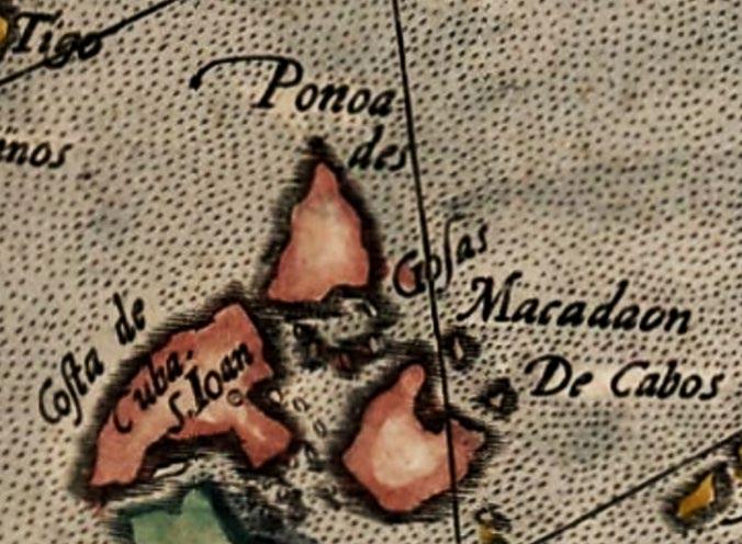
Cuba is the name used on Giovanni Mazza’s 1589 Asiae Nova Descriptio, the first printed map to show the island of Luconia (Luzon). The map of Asia by Arnoldo di Arnoldi, published by Matteo Florimi in Siena in c.1602, has the toponym Costa de Cuba along the northwestern side of an island southwest of Ponoades (Panay), although the town on the island itself is named S. Ioan. (14)
Towards the end of the 16th century another variation in the spelling of Cebu appears, on two important Dutch maps. Both Insulae Moluccae celeberrimae (the so called ‘Spice Map’) by Petrus Plancius (c.1594) and Exacta & accurata delineatio cum orarum maritimarum by Jan Huygen Van Linschoten (c.1596) name the island Cabu. These maps were the sources for the miniature maps of the Philippines that were the first to depict the archipelago on its own Consequently Cabu is the name shown on Insulae Philippinae by Petrus Kærius / Barent Langenes (1598); Philippinae Insulae by Johannes Metellus (1601); Insulae Philippinae by Cornelis van Wytfliet (1605); and Philippinae Insulae by Jodocus Hondius Jr. / Petrus Bertius (1616). Cabu is also used on Insulæ Indiæ Orientalis Præcipuæ by Hondius (1606) and an untitled map of Southeast Asia by Joris van Spilbergen (1619).
Somewhat surprisingly, the earliest map we have found that shows the island with its modern spelling Cebu is one of China. Sinarum Regni aliorumque regnorum et insularum illi adiacentium descriptio (description of the Kingdom of China and other adjacent kingdoms and islands) is a copperplate engraved map from a report on Jesuit missionary activities in China which used information from late 16th century Portuguese and Jesuit sources. It is believed to have been compiled by Fr. Michele Ruggieri, S. J. in Rome in c.1590 (15) The map shows China and its provinces, Korea, Japan, parts of Southeast Asia, and the Philippines, where Cebu is one of only six islands to be named. Some years later (c.1597) Cebu is found again, on a map of Asia by the Italian cartographer Fausto Rughesi, who had access to Jesuit sources of information in Rome; to the east the map also shows Cuba.
However, the arrival of the 17th century did not diminish cartographers’ appetite for the use of novel spellings for Cebu. The earliest known British map of the East Indies, a manuscript sea chart on vellum in the atlas produced by Martin Llewellyn in c.1598, features the island of Caebu. A set of gores for a terrestrial globe by Willem Nicolai titled Nova et integra universi Orbis descriptio, dated 1603, shows Suban (believed to be copied from a 1542 globe by Caspar Vopel)
Detail of ‘Cebu’ on Sinarum Regni aliorumque regnorum et insularum illi adiacentium descriptio attributed to Fr. Michele Ruggieri, S. J. (c.1588) (image courtesy of The Hong Kong University of Science and Technology Library)
15
Detail of ‘Cebu’ and ‘Cuba’ from a map by Fausto Rughesi (c.1597) (image courtesy of Barry Lawrence Ruderman)
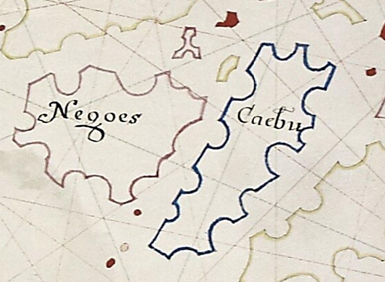
Detail of ‘Çaebu’ from the Martin Llewellyn atlas (c.1598) (image courtesy of Digital Bodleian ©The Governing Body of Christ Church, Oxford)
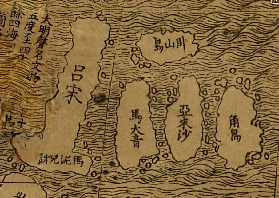
Detail of Cebu as 馬 大 音(ma da yin) from Matteo Ricci’s ‘Great universal geographic map’ (1602) (image courtesy of the Library of Congress)
Detail of ‘Suban’ from a globe gore by Willem Nicolai (1603) (image courtesy of Leen Helmink Antique Maps)
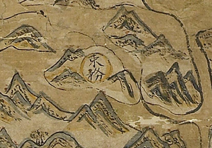
Detail of Cebu as 束 務 (shu wu) from the Selden Map (c.1620)

(image © Bodleian Library, University of Oxford)
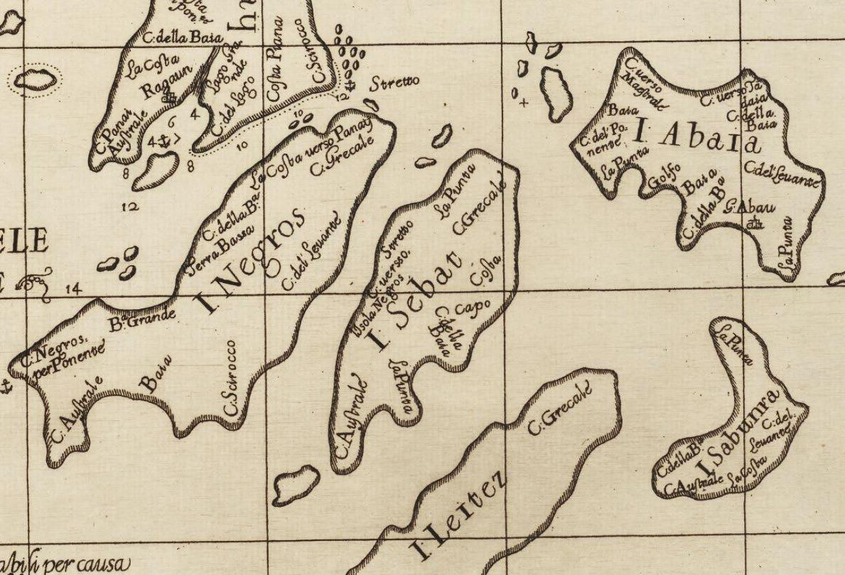
Detail of ‘Sebat’ from the Carta particolare dell’Isole Fillipine … d’Asia Carta X by Robert Dudley (1646) (image courtesy of Harvard University Map Collection)
16
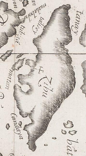
Robert Dudley used two variant spellings in the charts published in his nautical encyclopaedia Dell’Arcano Del Mare in 1646: Seba on the Carta seconda Generale del’Asia, and Sebat on the chart of the Visayas, Carta particolare dell’Isole Filipine è di Luzon … d’Asia Carta X. The Planta de las Islas Filipinas engraved by Marcos de Orozco in 1659 and published in 1663 in the Labor evangélica by Fr. Francisco Colin, S.J. exhibits the island of Zibu (see page 23)
In the 17th century the shape of Cebu became recognisable. On early maps the island appears rectangular, triangular, trapezoidal, rhomboidal, oval, kite shaped, D shaped or entirely irregular. As previously mentioned, some maps show a large island with Cebu and Negros fused together, and others have an amorphous landmass with only the southeastern coast delineated. Later maps show Cabu as a skinny, spiky amoeba. But Dudley, in 1646, and Orozco, in 1659, both made an attempt to draw the coastline with some accuracy, although the island still looks more like a pointed taro root than its true, elongated shape.
Chinese maps also named Cebu. Matteo Ricci’s K’un yu wan kuo ch’uan t’u (Great universal geographic map) of 1602 shows an elongated, rectangular island clearly recognisable from its position as Cebu, identified with the characters 馬 大 音 (ma da yin), a phonetic rendering of Matan (Mactan). The great manuscript Ming sea chart (c.1620) known as the Selden Map includes 16 ports in the Philippines with which China traded, including 束 務 (shu wu) as the phonetic name for Cebu.
In the mid to late 17th and early 18th centuries Cebu became the most common spelling, used on maps by Hessel Gerritsz, Nicolas Sanson, Melchisédec Thévenot, Pierre Duval, Vincenzo Coronelli and Herman Moll among others. However, the English mapmaker John Seller and the Dutch mapmakers Pieter Goos and Johannes van Keulen preferred Sebu. Then some new names materialised on certain English and Dutch maps. A chart of the Tradeing part of the East Indies and China by John Thornton (1703) identifies Cebu as Il. d. dios; a different chart with the same title by his son Samuel (1711) uses the name Nombre for the island, as does A Chart of Borneo Java and the Philippine Islands by Edmund Halley et al. in 1727.
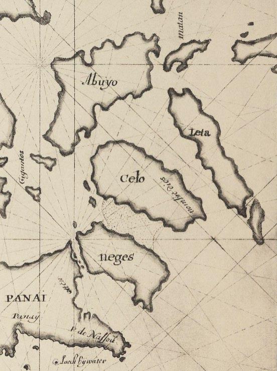
Detail of ‘Celo’ with ‘Nombre [de] Dios’ from a map by Johannes Vinckeboons (c.1665) (image courtesy of the Beinecke Rare Book and Manuscript Library, Yale University)
The explanation is provided by an untitled, c.1665 manuscript map of Luzon and the Visayas produced by Johannes Vinckeboons for the Dutch Vereenigde Oost Indische Compagnie (VOC). This map, which was copied by François Valentijn in 1724 and (as Nieuwe Afteekening van de Philippynse Eylenden) by Johannes II van Keulen in 1753, gives the island the novel name of Celo and shows the toponym Nombre [de] Dios on the southeast coast. This name for the city of Cebu was derived from its Spanish name: ‘La Ciudad del Santisimo Nombre de Jésus’ (see ‘Cebu City: A Cartographic Chronicle’ on page 21).
The Carta Chorographica del Archipielago de las Islas Philipinas made by Francisco Diaz Romero and Antonio de Ghandia (aka Echeandia) in 1727 shows an elongated Isla de Cebu with the coast line inaccurately indented. When, in 1734, Fr. Pedro Murillo Velarde, S.J. produced his much improved Carta Hydrographica y Chorographica delas Yslas Filipinas he opted for Zebu, a name not previously seen. Murillo Velarde was born in Laujar de Andarax in Spain’s southern province of Almeria, and his adoption of the spelling Zebu may also be explained by his Andalucian accent.
17
Detail of ‘Isla de Cebu’ from Carta Chorographica del Archipielago de las Islas Philipinas by Francisco Diaz Romero / Antonio de Ghandia (1727) (image ©The British Library Board)
Following Murillo Velarde’s lead, Zebu was widely used on other 18th century maps, including those by Francisco Badaraco (copied by R.W. Seale in 1748 for George Anson’s A Voyage Round the World), J.N. Bellin, J.B.B. d’Anville, William Herbert, Georg Mauritz Lowitz, Pedro Freylin, Robert Sayer, Louis Brion de la Tour, Louis Denis, Antonio Zatta, the Duque de Almodovar, and Giovanni Maria Cassini. But Sebu still appears, for example in c.1751 on globe gores by Johann Friedrich Endersch and in c.1752 on A New Map of the Philippine Islands by Thomas Kitchin.
When the French cartographer J B. N. D. D’Après de Mannevillette published the first edition of his atlas of sea charts Le Neptune Oriental in 1745, he introduced a Gallicised name for the island of Cibou, which was in turn used by other French mapmakers such as Georges Louis Le Rouge and Gilles Robert de Vaugondy. In 1808 the Direccion Hidrografica in Madrid produced its Carta General del Archipiélago De Filipinas, based on the surveys made by the Malaspina Expedition in 1792 93. In accordance with the usage that had been standardised by the Real Academia Española, an accent was added to the Isla de Zebú.
Throughout the 19th century four spellings predominated. Aaron Arrowsmith and H.K.W. Berghaus followed the Direccion de Hidrografía with Zebú, but Ildefonso de Aragón, James Horsburgh, J.W. Norie, the French Dépôt général de la Marine, Jean Mallat and the Hydrographic Office of the British Admiralty all stayed with Zebu.
Some Spanish cartographers, notably Manuel Roldán, Lieutenant Claudio Montero (on the surveys he produced for the Comisión Hidrográfica de Filipinas), Enrique Abella y Casariego and José Algué also added an accent, to the name Cebú. On his map Abella notes that the island was Sugbú de los naturales (to the natives). Other Spanish mapmakers, such as Francisco Coello and the lithographic printers Chofré & Cie., retained Cebu. Charts of the East India Archipelago by James Imray & Son initially showed Zebu, but later switched to Cebu.
Detail of ‘Zebu’ from Carta Hydrographica y Chorographica delas Yslas Filipinas by Fr. Pedro Murillo Velarde (1734) (image courtesy of the Library of Congress)
18
To our surprise, a completely novel toponym appeared in 1847. A New Chart of the China Sea and East India Archipelago, published in London by R. Blachford & Co., shows the island of Czebu. In 1867 the Dépôt des Cartes et Plans de la Marine introduced a different accent for its chart of the Port de Zébu Finally, for the map produced (from sea charts) for the official publication of the 1898 Treaty of Paris, the U.S. Government Printing Office reverted to Sebu
Variant spellings would persist into the 20th century; as late as 1933 the British Admiralty published its chart no. 3193 with the title Port Sebu (Cebu Harbour) and Approaches. But with the advent of the charts produced by the U.S. Coast and Geodetic Survey, and the atlases issued for the Philippine censuses of 1918 and 1939, the island whose names were not a few finally became forevermore Cebu
References & notes
Detail of ‘Czebu’ from A New Chart of the China Sea by R. Blachford & Co. (1847) (image courtesy of Barry Lawrence Ruderman Antique Maps Inc.)

1. Margarita V. Binamira, ‘A Venetian in the Visayas: Antonio Pigafetta’s Journey through the Islands’, in The Murillo Bulletin, Issue No. 2, PHIMCOS, Manila, June 2016.
2. Camilo de Arana, Derrotero del Archipiélago Filipino, Direccion de Hidrografia, Madrid, 1879.
3. John Moore, The Development of Spanish Sibilants, University of California, San Diego, 2005.
4. Norberto Romuáldez, Philippine Orthography, Visayas Printing Company, Iloilo, 1918.
5. Carlos Quirino, Philippine Cartography 1320 1899, 2nd revised edition, N. Israel, Amsterdam, 1963; Fourth Edition, edited by Dr. Carlos Madrid, Vibal Foundation, Quezon City, 2018.
6. André Martinet, ‘The Unvoicing of Old Spanish Sibilants’, in Romance Philology, Vol. 5, No. 2/3, Brepols Publishers, University of California Press, 1951 52.
7. Ortographia Española compuesta, y ordenada por la Real Academia Española, Madrid, 1741.
8. The first state of Finé’s map carries his name ‘Orontius F. Delph’ in the lower cartouche; the second state (also dated 1531) has the imprint of Hermannus Venraed.
9. Thomas Suárez, Early Mapping of Southeast Asia, Periplus Editions (HK) Ltd, Hong Kong, 1999.
10. John L. Silva, ‘Naming the Philippines: The Upside down 1554 Ramusio Gastaldi Map’, in The Murillo Bulletin, Issue No. 10, PHIMCOS, Manila, November 2020.
11. Raphael P.M. Lotilla, ‘The Naming and Mapping of Panay in the 16th & 17th centuries’, in The Murillo Bulletin, Issue No. 11, PHIMCOS, Manila, May 2021.
12. Felice Noelle Rodriguez, ‘Mapping the Growth of Zamboanga from Pigafetta to the 19th Century’, in The Murillo Bulletin, Issue No. 13, PHIMCOS, Manila, May 2022.
13. On his 1571 map Ortelius uses the spelling Subut for the island but Subuc for the town; Subuc is also the name of the town on the sheet of Asia in the 1587 manuscript portolan atlas by Joan Martines.
14. Margarita V. Binamira, ‘Illusions, Confusions and Delusions the mythical island of St. John’, in The Murillo Bulletin, Issue No. 6, PHIMCOS, Manila, August 2018.
15. Marco Caboara, ‘The First Printed Missionary Map of China’, in the IMCoS Journal, Issue No. 162, International Map Collectors’ Society, December 2020.
19
Cebu City: A Cartographic Chronicle from the 16th to the 20th Centuries
by Margarita V. Binamira
THE HISTORY of Cebu City begins long before the arrival of the Spanish, and even longer before the first maps and images of the city appear. Cebu Island, in the center of the Visayas, is relatively narrow, with coastal plains bordering rugged mountain ranges and limestone plateaus that traverse the island from north to south. Centrally located on the eastern coast of the island, the settlement of Sugbo, or Sugbu as it was also known to its inhabitants (see ‘The Naming of Cebu’ on page 11), grew around a sheltered harbor. As was then typical of the island’s communities, Sugbu hugged the coast in an elongated pattern, with its harbor allowing it to prosper as a pre colonial trading center.
Pre Colonial Sugbu
Archaeological evidence shows that Sugbu could have been settled as early as the 10th century A.D. The settlement became a central trading area for other nearby islands in the Visayas and Northern Mindanao, and historians believe that traders from Siam, Champa and other islands within the archipelago frequented Sugbu at this time However, as Cebu did not produce commercial quantities of tradeable goods, Chinese traders bypassed the port of Sugbu. Rather, pre colonial Chinese ceramics, pottery, iron tools, glass, lead ingots and commercial gold found in Cebu were probably brought in by local, inter island and Muslim traders, and exchanged for beeswax, cotton, pearls, tortoiseshell, betel nuts, and slave labor.
Trade became the driving force for the settlement’s growth, linking Sugbu to other islands in the archipelago as well as to other economies in Southeast Asia. Ceramics and other artifacts unearthed by archaeologists around Fort San Pedro show that to have been the main trading area before the arrival of the Spanish, and by the 16th century the settlement around the port already encompassed around 30 hectares of land. Because of its terrain, the settlement that developed was linear, with its houses and other structures spread out along the narrow coastal plain.
Pre colonial Sugbu was typical of settlements at the time. It grew from an aggrupation of peoples with a common goal, to live and work together to sustain their families. When they were not involved in active trade, fishing, agriculture and crafts provided the population with a sustainable livelihood. Sugbu’s geographic location, and the sheltered nature of its port, made it an ideal settlement for trade. Against this backdrop, the Spanish arrived.
The Spanish Encounter
A lot of what we know transpired during Ferdinand Magellan’s visit to Cebu in 1521 comes from the first hand account of Antonio Pigafetta, the scribe who accompanied the expedition. Pigafetta recounts that natives from other islands, the rajahs Kolambu and Siagu, suggested they visit Sugbu for provisions, and even guided them there. As our earliest observer of the village of Sugbu, Pigafetta talks of an open square where the king and other seniors met to discuss business, and describes the houses ’constructed of wood and built on planks and bamboo, raised from the ground on logs’.(1) We still see houses raised on stilts in some coastal villages today. In a map of Zzubu attributed to Pigafetta, he shows the clustering of houses around what is most likely the port area.
21
Detail of ‘Zzubu’ from the 1801 edition of Antonio Pigafetta’s Premier voyage autour du monde (from the author’s collection)
Interestingly, Pigafetta gives proof that Sugbu was already a thriving port when the Spanish arrived. He writes about a Siamese agent left behind in the settlement who was trading gold and slaves, and notes that the king and chieftains ate from (most likely Chinese) porcelain. Other 16th century accounts mention that the Chinese did eventually find their way to Cebu, and describe it as a place frequented by traders who exchanged their porcelain for gold, slaves and food supplies. Because Cebu is not a gold producing island, it most likely came from other parts of the Visayas, or even from as far as Camarines in Bicol or Butuan in Mindanao.
Not much is known about Cebu during the interim period from Magellan’s disastrous visit to the arrival in Sugbu of Miguel López de Legazpi on April 27, 1565, 44 years to the day after Magellan’s death. Other Spanish expeditions had made their way to the islands, but only Álvaro de Saavedra mentions Sugbu, in 1528; he describes the natives as pagans, still practicing pagan rituals. It was Legazpi’s expedition that marked the beginning of Spain’s centuries long influence over the archipelago.
When Legazpi arrived in Sugbu, he found a thriving settlement with around 300 houses and a population of more than 2,000 people. After diplomacy failed to get the natives to show allegiance to Spain as the new colonial power, and possibly as revenge for the killing of Magellan, Legazpi ordered the village burned and razed to the ground. Nevertheless, records show that he hoped Cebu would become a permanent Spanish settlement. Shortly after, he ordered the construction of a fort on the tip of a triangular piece of land that jutted out into the water, roughly the shape of the harbor promontory. The Jesuit historian Nicholas Cushner described the fort as a ‘mere palisade of dried palm leaves and logs, with sand used to bolster the corners’.(2)
Around the fort, Legazpi identified and measured the areas for the Spanish living quarters and, according to historical documents, used a line of trees to delineate the Spanish settlement. He drew a line in the sand which he told the natives not to cross because all indios (the indigenous inhabitants) were to be removed from within the area and relocated elsewhere, to an area south of the village which would be called San Nicolas.
In one of the burnt huts Juan de Camuz, one of Legazpi’s men, found an image of the child Jesus, believed to be the same statue given by Magellan to the Queen of Cebu in 1521. Seeing it as a sign, Legazpi ordered a church made of bamboo and nipa to be built on the location where the statue of the Santo Niño was found. The image and the church, named Nombre de Jesús in honor of the statue, were to be under the auspices of the Augustinian priests who accompanied the expedition.
Since these events all happened on the feast day of St. Michael, Legazpi called the settlement the Villa de San Miguel, the first Hispanic name for Sugbu. In 1571 the name was changed to the Villa del Santisimo Nombre de Jesús, after the Santo Niño. Then, in 1594, King Philip II of Spain promoted the Villa (town) to a Ciudad (city) and it was renamed again as La Ciudad del Santisimo Nombre de Jesús. To this day Cebu City is known to the older generation simply as ang syudad (the city)
Historian R.R. Reed described the small colony in Cebu with its palisaded fort as ’flimsy and liable to collapse under sustained attack’.(3) And for sure, there were sporadic attacks from various forces, including the indios who, until a peace treaty was signed, did not acknowledge the authority of the Spanish. On June 4, 1565 Legazpi and Rajah Tupas signed the one sided Treaty of Cebu under which the natives agreed to recognize Spanish sovereignty, pay tribute, trade with the Spaniards on a reciprocal basis, sell all the food supplies the Spaniards needed at local prices, and accept eviction from their homes and resettlement in San Nicolas. In return, the Spanish would defend the Cebuanos against their enemies.
Provisioning for the little settlement was problematic. With the addition of some 300 Spaniards to feed, food shortages became serious and, contrary to the treaty, the locals did not make it easy for them to source food. This threw off the balance of the settlement’s food equilibrium, achieved by subsistence farming and fishing. Many of the natives fled to the hinterland to avoid the Spaniards and the new settlement, taking with them their food and leaving little to feed the foreigners or those indios who chose to remain.
22
Security for the settlement was also a problem. Attacks and constant harassment by the Portuguese (who claimed Cebu Island for the Portuguese king) and the various unfriendly locals threatened to disrupt peace among the conquerors. Circumstances were difficult enough that in a letter written in 1569 Legazpi says that he moved his settlement from Cebu to Panay both to address the food supply problem and for better protection from Portuguese attacks. When reinforcements arrived from Spain, he returned to Cebu, with a new title as adelantado (governor) and Captain General of Cebu.
Legazpi did not stay long in Cebu or Panay. By 1571 he moved his administrative center to Manila, from where he would govern the Spanish colony. Even so, the Spanish kept Cebu as the base of operations for the Visayas and the southern islands, and it would remain a key political, administrative and military center for centuries to come. More importantly, Cebu served as an ecclesiastical center from where the word of God was spread. A papal bull in 1595 established Cebu as the seat of a diocese that encompassed the Visayas, northern Mindanao, and the Marianas Islands.
When the capital moved north to Manila, the town of Cebu faltered. Legazpi took not only the administration of the colony to Manila, but also the principal Spanish trade route from Cebu that had begun in 1565. With the relocation of the shipping hub for the galleons and their trade, Cebu started to decline as a major trading port, and Chinese and other Southeast Asian traders began to bypass the port.
In the 1590s, the Spanish living in Sugbu were allowed to build their own galleons and rejoin the lucrative galleon trade. It prospered for a while, but was short lived because of the many restrictions imposed by Manila regulating what could or could not be exported. Another barrier to trade, which caused collateral damage, was the looming war between the Spanish and the Dutch in search of spices. The trading ship San Antonio, built in Cebu, was hurriedly converted into a warship upon the orders of Antonio de Morga (Lieutenant to the Governor General) and renamed the San Diego. In 1600, in battle with the Dutch corsair Olivier van Noort, the San Diego sank off the coast of Nasugbu, Batangas, with all its cargo intact.
Another ship from Cebu sank on its way to Acapulco, and with an unprofitable and unlucky business environment, Cebu’s foray into the galleon trade ended in 1604. Without profitable enterprise, the Spanish began to abandon Cebu, choosing the more lucrative north to base themselves and their businesses. By the 1620s, Cebu City and its port were commercially inactive and had become ‘an economically depressed backwater’.(4) Ushered in by the loss of the galleon trade, emigrating population and other economic and political issues, Cebu’s decline and stagnation would last for two centuries.
Detail of ‘Zibu’ from Planta de las Islas Filipinas by Marcos de Orozco (1663) (from the collection of Rudolf J.H. Lietz)
God and the Virreinato will Provide The island of Cebu begins to appear on European maps and charts soon after the return of the Magellan Elcano expedition to Sevilla, under a variety of names. The town of Cebu is first shown by pictographs on the maps of Giacomo Gastaldi, on which it is unnamed in his maps of 1548 and 1554, and given the toponym Ciabu on his 1561 map Il Disegno Della Terza Parte Dell’ Asia Abraham Ortelius shows a pictograph for Subuc in 1571, and André Thevet and Gerard de Jode both have one for Subut, in 1575 and 1578 respectively. But later Dutch maps (including the first miniature maps of the Philippines by itself) have no toponym for the city of Cebu. Most 17th maps also do not show or name the city, although its presence is indicated by a large cross on the 1659 map by Marcos de Orozco.
23
Spain had two main reasons to settle and colonize these islands: trade and evangelism. So as not to be left out in the cold, Spain wanted a foothold to participate in the robust trade in spices from the Moluccas and Borneo that was tightly controlled by the Dutch and Portuguese, and also to profit from the on going trade in silks and other products from China and Japan. Magellan was in fact tasked to look for an alternate route to source spices, not to colonize, and (among other reasons) Legazpi moved his administration from Cebu to Manila to be closer to China and Japan.
The second reason for coming was to convert the natives to Christianity, and Legazpi’s expedition included a number of Augustinian friars. In the 1590s, the Spanish population of soldiers, civilians and missionaries in the Ciudad numbered from 50 to 100. With the collapse of the galleon trade, the majority of Spanish civilians left for Manila, but not all of the Spaniards abandoned the city; the missionaries, religious and some civilians remained, along with a handful of administrators to take care of Cebu and the areas under its responsibility.
Although Cebu was not a profitable settlement, geopolitics was in play and the town was made a city in 1594 and a diocese in 1595. In 1580 King Philip II of Spain had become King Philip I of Portugal, and all the Portuguese territories overseas were integrated into the Spanish empire. These included the Portuguese trading settlements in the Moluccas, which gave Spain a new opportunity to enter the trade in spices.
Despite the vast reduction in economic activity in the island and the city in the early 17th century, the Spanish continued to maintain Cebu as the military, religious and administrative center for the southern islands. The order to keep a colonial presence in Cebu was given because it was nearer to Mindanao and the Moluccas than was Manila, and it could be used as an outpost from which to convert the Muslims in the south. The objectives for colonization ‒ trade, missionary work and regional administration ‒ overlapped in the decision to maintain the settlement in Cebu.
Aside from the falling population, the Ciudad itself was in disrepair, and it was costing Spain and the Virreinato (Viceroyalty) in Mexico a tidy sum to maintain it. In fact, the royal fiscál
(attorney general) in Manila wrote to King Charles II suggesting Spain abandon the colony because of its economic dependence. In reality, the colony’s financial troubles really just mirrored those of Spain which, by the early 18th century, had bigger problems at home and was running out of funds.
Despite the terrible state Cebu was in, the twin objectives of administering the city and converting the natives continued, carried out hand in hand by the state and the church. The state assumed administrative responsibility, with the task of conversion assigned, in different areas, to various religious orders: the Dominicans, the Franciscans, the Augustinians, and the Jesuits.
Although the town of Villa del Santisimo Nombre de Jesús was established in 1571, and the parish of the indios was established by the Augustinians in San Nicolas 1584, the parish of the Ciudad del Santisimo Nombre de Jesús did not come about until 1598. The arrival of the Jesuits and their missionary work with the Chinese led to the establishment of a parish in the district of Parian in 1614.
Pueblos (villages) were set up, with each pueblo encompassing many barrios (barangays), in which churches and parishes were also estab lished by the religious orders. As these often suffered from a lack of converted almas (souls), the Spanish implemented the strategy of the reducciónes (resettlements) they had used in South America, with disastrous results.
Slave Raids
As the Spanish went to the other islands, Mindanao included, to try and colonize and convert the natives, they noticed a number of non natives among the locals: slaves that had been taken during raids. For the raiders, slaves were simply a commodity, a tradable asset and a mobile symbol of prosperity. They were a source of labor and, in some cases, wives or concubines for the datus (chiefs) and Chinese. To the Spaniards, however, the Moro (Muslim) raiders were pirates, turning the conflict against the slavers into a religious war. It was perhaps naïve of the Spanish to think that they could eliminate slavery, which would remain a practice in Sulu until the end of Spanish colonial rule.
24
When Legazpi moved his administrative center to Manila, he left local administration in the hands of loyal Spanish subjects who remained in Cebu as part of the Encomienda System. These encomienderos, given responsibility over tracts of land and all the resources (including the indios) found within their borders, were tasked to defend the indios against their enemies, raiders included, and ensure their conversion to Christianity by the friars. The native inhabitants were scattered all over the place, so in order to locate and convert these almas the Spanish implemented the reducción policy whereby the indios were relocated and concentrated in villages where they could be easily administered bajo de las campanas (under the bells).
Because of the hilly nature of the island’s interior, the villages in Cebu were concentrated along the coasts, thereby issuing an open invitation for raiders to come and pillage the coastal settlements. The indios became prime targets for the raiders, who came in fast boats and easily took them away by the hundreds. The encomienderos were unable to defend the unlucky indios, who ended up as slaves.
As well as the Muslims from the south, Visayans also engaged in slave raiding. But during the late 18th and early 19th centuries, when the frequency and gravity of the raids increased, most of the fierce, tattooed and daring marauders came from the Sulu Sultanate. To defend against these Iranun and Samal Balanguigui raiders, the Spanish, especially the friars, took to building forts and watchtowers along the shores to warn of approaching warships. They also formed a Marina Sutil (light navy) of fast, well armed sailing boats, manned by locals, that could fight back against the raiders. In the Visayas, the province of Cebu was equipped to command one of the four divisions of the Marina Sutil (5) The strategies employed by the Spanish deterred the raiders, but did not totally stop them from their pillaging and kidnapping. It was only with the arrival of steam gunboats in the 19th century that the Spanish navy eventually put a halt to the raiding.
Esta Mapa se hizo Esta Ciudad de Cebú el año de 1699 from a parishioners’ petition published in 1850 53 (image courtesy of the Archivo Histórico Nacional de Madrid) ѵ

25
Restive Natives and the Lutao
Living under the threat of slave raiders, and with the tribute that the Spanish demanded from them often taken in the form of forced labor, it was inevitable that the natives would rebel. One rebellion that affected Cebu City was the Sumuroy Revolt in Samar of 1649. The Spanish would take men to the Port of Cavite to work in the shipyards, and in the town of Palapag, Samar, when news spread that the men were being rounded up to be brought to Cavite, a disgruntled man named Agustin (aka Juan) Sumuroy led an organized revolt. To quell the insurrection, which lasted a little over a year and spread to neighboring towns and provinces, including Cebu, the Spanish brought in reinforcements from Zamboanga, including 400 Lutao.
The Lutao, also called the Sama Bajau, are a group of people described as ’sea nomads’, people who live on water, in boats or houses on stilts. As they were excellent sailors and warriors, and many were converted Christians, they were recruited to the service of Spain and, when needed, helped in the defense of the Spanish crown.(6) In the case of the Sumuroy Rebellion, the Lutao were glad to assist the Spanish defeat their sworn enemies, the Visayans. After the uprising was put down, not all the Lutao returned to Mindanao; some decided to stay in the areas that they had defended for the Spanish, put down roots and built homes on land. One such place was Cebu, and a settlement of Christian Lutao, tired of their gypsy life on water, grew outside the city. Historian Bruce Fenner wrote that the Lutao could have arrived in Cebu ‘during the early part of the 17th Century’ and started a settlement there.(7) The settlement would grow in 1650, and again in 1663 when the Spanish garrison in Zamboanga was abandoned and another wave of Lutao arrived in Cebu.
The Growth of Cebu City
While the friars were busy converting the non Christians, town building continued in the hands of the public administrators, usually Spanish. Probably the first map of the city, titled Esta Mapa se hizo Esta Ciudad de Cebú el año de 1699 …, shows the land ownership in 1699.(8) Well over a century after Legazpi’s arrival, and in the middle of a full blown economic crisis, the city was evolving and was built with a clearly marked grid pattern.
The Leyes de Indias (Laws of the Indies), signed by King Philip II in 1573, established the principles of settlement planning, and these rules were followed in Cebu City. The basic element was the grid design, with a rectangular street pattern, and the orderly arrangement of public and private structures. Most important was the creation of a plaza mayor (town square), which could function as a gathering place for the citizens and where monuments could be erected for all to admire. The town was to be set near a harbor (which Cebu was) and should establish links, either by land or by water, with other towns and trading areas.
In the case of the Ciudad de Cebu, the plaza mayor (called the Plaza de Armas on the 1699 map, later renamed the Plaza Mayor, then the Plaza Maria Cristina, and today the Plaza Independencia) is between La Fuerza (the fort), the Cabildo de Cebu (administrative center), and the religious center with the Cathedral (later to be managed by the diocese). The Augustinians were given land to build a church and a convent to house the image of the Santo Niño. Over time, as more religious groups arrived, they too were given property to establish schools and convents like the Jesuit school that would eventually become San Carlos University. At that time the boundaries of the Ciudad were not distinctly clear, but merged with the natural boundaries of marshes, swamps, rivers and the sea.
As earlier noted, the 17th century was a difficult time for Cebu City, and the infrastructure that had been built in the 16th century was falling apart. Records show that in 1628 a fire destroyed a huge portion of the city, including the Santo Niño Church and palisade fort; as described below, a larger fort was built, and its manpower strengthened.
Apart from descriptions of the emergence and rebuilding of the Ciudad, there are no clear images, prints or maps of the city until the end of the 17th century. By this time, we see that the Ciudad was not the colonial city envisioned by the Spanish. Plans to elevate Cebu into a proper Hispanic city with a wall around its Spanish enclave (like Intramuros in Manila) did not happen, and most of the lot owners were the religious orders. Nor did Cebu become prominent as a maritime center for the Visayas and Mindanao. Colonial rule disrupted a thriving
26
Plan de la Fuerza S.n Pedro de la Ciudad de Zebu (1738) from Planos de las Plazas, Presidios, y Fortificaciones … en las Yslas Filipinas (image courtesy of the Archivo del Museo Naval de Madrid)
settlement and, as the 17th and 18th centuries wore on, the Ciudad remained in the doldrums, with little commercial activity and reverted its focus onto agriculture and subsistence farming.
18th Century Maps and Plans of Cebu City

The Carta Chorographica del Archipielago de las Islas Philipinas made by Francisco Diaz Romero and Antonio de Ghandia (aka Echeandia) in 1727 has a large pictograph for the city of Cebu, with a number of churches and houses, and the 1734 Carta Hydrographica y Chorographica delas Yslas Filipinas by Fr. Pedro Murillo Velarde gives the city two names: Zebu and Nom.e de Ihs. (i.e. Nombre de Jesús)
In 1738 a Plan de la Fuerza S.n Pedro de la Ciudad de Zebu was published in a book on fortifications in the Philippines commissioned by the Governor General, Fernando Valdés Tamón.(9) As well as showing details of the fort itself, with its guardhouse, living quarters, store rooms and well, the plan famously displays the grid pattern of the city, with many of the landmarks from the map of 39 years earlier, albeit with a different
orientation. These include the Jesuit college and church, the cathedral, the Santo Niño church and convent, and the council and episcopal houses.
Beyond the boundaries of the Ciudad, across the estuary to the north, the buildings of the Parian de los Sangleyes (settlement of the Chinese mestizos) are shown, together with the church of St. John the Baptist and several pantanos (swamps). The church and convent of La Concepción is shown across the canal de fagina (now called Pagina) that delineates the south western border of the Ciudad. By this time, as shown by the number of religious establish ments, Cebu had become commercially insigni ficant and most of the activity was concentrated on the non violent conversion of the natives who had not fled to the hills to avoid being taken by the Muslim raiders.
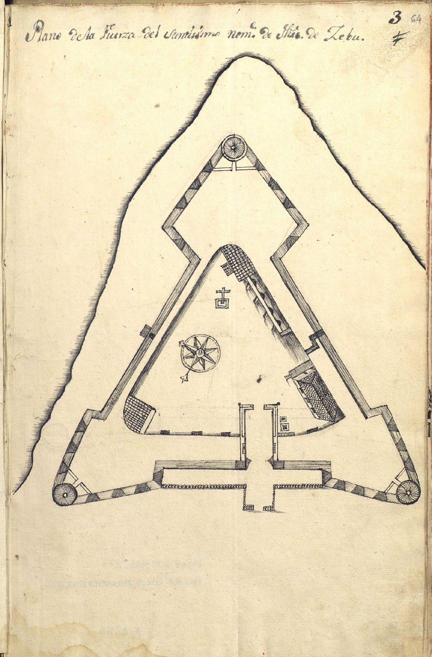
A slightly later book of plans of forts and presidios (fortifications) in the Philippines contains a detailed Plano de la Fuerza del Santíssimo (sic) nombre de Jesús de Zebú dated 1753.(10) After the original fort had been razed by fire in 1628, it
27
was rebuilt using stone and mortar. The date of construction of the new fort is uncertain, possibly as early as 1630, and it may have been repeatedly strengthened over the following century. Its triangular shape, conforming to the promontory that jutted out to sea, has two long sides of equal length seawards and a shorter side landwards, with three baluartes (bastions), one at each corner. This shape allowed the watchmen to look out for approaching threats on two sides and warn the soldiers accordingly. Entrance to the fort was across from the Plaza Mayor, in accordance with the planning rules of the Leyes de Indias.
At a time when the Muslim slave raids were increasing, it was crucial to have warnings and alarm signals for approaching warships. Fort San Pedro was well stocked and provisioned in terms of arms and munitions, and its military complement was strengthened by bringing in recruits from Pampanga in Luzon to fortify the defenses, with Spanish and native troops taking turns to look out for raiders. Because of the large military presence at the fort, Cebu City and its immediate environs did not suffer from too many raids, unlike other coastal towns on the island.
Life in Cebu City in the 18th Century
Cebu City in the early to mid 18th century had become a veritable backwater and a really miserable place to be. Despite the town building and conversions, because of the raids, lack of commercial opportunities and absence of overall colonial leadership, the inhabitants of Cebu left in droves. The exodus of Spaniards continued, and by 1738 only two remained living in the Ciudad who were not public officials, soldiers or priests.(11) As there were hardly enough people to maintain the city, in 1755 Governor General Pedro Manuel de Arandía demoted the Ciudad del Santisimo Nombre to a mere pueblo. At the same time, the barrios of Lutao and Parian were also made pueblos. Historian Michael Cullinane estimates that in the 1770s the population of Cebu City and its environs, including the Ciudad, Parian, Lutao and areas of San Nicolas was only around 18,722, hardly enough to keep the city self sufficient.(12)
Complicating things further were two events. The first was the expulsion of the Jesuits from the Philippines, by order of King Charles III, in 1768.
Plano de la Fuerza del Santíssimo nombre de Jesús de Zebú (1753), from Descripciones con planos y figuras … de los presidios … en las Yslas Filipinas (image courtesy of the Archivo General de Indias)
As it was, there was a limited number of Spanish priests around to tend to the various parishes that had been established. After the Jesuits left, the Augustinians and Recollects, already stretched thinly, took over the parishes and schools abandoned by the Jesuits. The second negative event was the expulsion of the non Christian Chinese in 1773 by Governor General Simón de Anda. The Chinese had been responsible for keeping Cebu’s meager trade going during these tough times, and with their expulsion it was the Chinese mestizos that came to the rescue and kept the city commercially afloat.
The sangleyes (Chinese traders and settlers in the Philippines) and mestizos de sangley (of mixed Chinese and native Filipino ancestry) played an enormous role in the history of Cebu City. Their presence is noted in most maps of the city which show, to the north of the Ciudad, the pueblo of Parian, the designated area where the sangleyes and mestizos de sangley lived.
28
Chinese traders had been calling on the port of Sugbu for centuries, and it was inevitable that some stayed and married locals. When the Spanish arrived, their offspring, of mixed blood, were looked at as neither native nor Chinese but mestizos. Under the Spanish rules for ethnic segregation, the Chinese and the Chinese mestizos were set apart from both the Spanish and the natives, and segregated to the Parian area across the estuary, which was the natural dividing line. Parian was established in 1590, when Cebu still participated in the galleon trade, and quickly evolved into a market and trading center. The parish was established in 1614 by the Jesuits, who baptized the Chinese community and taught them reading, writing, arithmetic and Christian doctrine.
Always intrepid entrepreneurs, rich, industrious and active, it was the Chinese mestizos who helped Cebu City weather the difficult 18th and early 19th centuries. This was a small group who had both the foresight and the capital to invest. They numbered only a few thousand and continued to live apart from the Ciudad in Parian, but some historians go so far as to say Cebu City would not have survived without them.(13)
The Philippines was moving from a subsistence economy to an export crop economy. From Cebu, Chinese mestizos sent purchasing agents to Leyte, Samar, Negros and Panay in the Visayas, and to Caraga and Misamis in Mindanao, to buy up local products and raw materials for shipment to Manila, where they were sold to Chinese, European or other foreign merchants. These trade goods included agricultural and semi processed products such as sugar, tobacco, coffee, cacao, coconut oil, pearls, wax and gold. In Manila, the mestizos purchased imported manufactured wares to sell in the Visayas.(14)
The Spanish and Spanish mestizos were few in number, the native Filipinos had no capital, and the non Christian Chinese had been expelled in 1773. By the start of the 19th century, the Chinese mestizos had emerged as a different social class, neither indio nor Chinese, as they rose to prominence as comerciantes (merchants). They were also absorbed into Filipino culture and adopted Christianity. Wealthy and educated, by 1815 they dominated most commercial trade as well as civil, religious, and economic activities, and had influence over the natives.
The residents of Parian constituted only 25% of Cebu City’s population, but they had the best built homes and shophouses. They also began accumulating large tracts of land outside the city limits to plant tobacco, sugar, and other commodities that were highly in demand. The Chinese mestizos, in their zeal to expand agricultural output, began to enquire about purchasing the friar lands (cultivated and uncultivated) that abutted Cebu City. The Augustinians, who had ownership over these lands, felt threatened and moved to abolish the Parian parish, which they did in 1849.
Title cartouche of Juan Díaz Maqueda’s 1793 Plano del Puerto del Zebú (1805) (image courtesy of the Archivo del Museo Naval de Madrid)
Early 19th Century Maps of Cebu City
In 1792, the Philippines was visited by the five year expedition to South America and the Pacific Ocean led by Alessandro Malaspina. When the corvettes Descubierta and Atrevida left Manila in mid November for their return voyage to Cadiz: “Primer Piloto (Master) Juan Díaz Maqueda and Segundo Piloto Jerónimo Delgado were left behind with orders to devote the next six months to a survey of the Visayan Islands in the goleta (schooner) Santa Ana, important both in the interests of navigation in the archipelago and access to the Pacific Ocean.” (15)
As a result, the Museo Naval de Madrid holds a manuscript chart titled Carta Esferica ó Plano del Puerto del Zebú formado entre la Ysla de este Nombre y la de Matan en el Archipiélago Filiphino (sic).(16) The chart, dated Año de 1793 but ‘delineated’ by José Felipe de Inciarte in Cadiz in 1805, states that it was drawn from Maqueda’s surveys. Cebu City is shown, with the fort but no
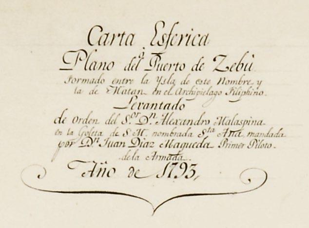
29
other details, and San Nicolas to the west, separated from the city by the Pagina river. Lines of soundings crisscross the harbor and the whole of the channel between Cebu and Mactan. The channel between Mactan and the island of Olango is stated to be limpio y hondable (clean and suitable for anchoring), but the channel between Olango and Bohol segun noticias es sucio (is reported to be dirty).
The National Archives of the Philippines has a manuscript map, dated 1833, whose legend and explanations say a lot about the city at the time. The Plano Topografico de la Ciudad de Cebú y sus barrios de los Lutaos y Parian con sus terrenos anecsos hasta los limites de los Pueblos S. Nicolas y Talamban is color coded. The purple area comprises the Ciudad. To the west, a brown area shows the pueblo of the Lutao, and the yellow area is Parian, also a pueblo, where the Chinese mestizos lived and worked; to the east of Parian, also in brown, is the Ysla del Tinago occupada por naturales del barrio de Lutaos. The word tinago means hidden, and the island was called ‘the island of the hidden’ because boats would take shelter out of sight in the inlet whenever there was a storm.

As explained by Dr. Soriano in her article on the lost waterways of Cebu (see page 45), the inlet has since silted up and the island is now connected to the mainland; however, the barangay is still called Tinago.
Boats and ships that came to trade would dock in an inland waterway close to Parian, bypassing the Ciudad, the Spanish enclave. These demarcations are clear on paper but, in reality, there were no physical barriers, and nothing to stop the Chinese in Parian, the Lutao ‒ who at this point were already called naturales (natives) as they had been in Cebu City for more than two centuries ‒ and even the Spanish behind their imaginary walls from commingling or intermarrying.
The native barrios of San Nicolas and Talamban are shown to the west and north, in light blue and blue gray respectively. San Nicolas, established at the time of Legazpi, was where all the original indios were told to stay behind the line of a largish estuary, La Fagina (Pagina). Talamban, on the other hand, was an area of the friar lands given to the Augustinians after all the Spanish encomienderos had left.
Plano Topografico de la Ciudad de Cebú y sus barrios de los Lutaos y Parian … (1833) (image courtesy of the National Archives of the Philippines)
30
The Plano Topografico de la Ciudad de Zebu … Año 1840 (image courtesy of the Archivo Cartográfico y de Estudios Geográficos del Centro Geográfico del Ejército)

Another manuscript map, Plano Topografico de la Ciudad de Zebu ‒ Barrios de Lutaos y Parian y parte del Pueblo de San Nicolas y limite del de Talamban Año 1840 is in the Archivo Cartográfico y de Estudios Geográficos del Centro Geográfico del Ejército in Madrid.(17) Made seven years after the previous one, this map highlights the fort, where the arms and ammunition for the province were kept, the seminary and the cathedral. It also shows the Barrios of Lutao and Parian, and part of the Pueblo de San Nicolas and the limits of Talamban. The explanations to the map say the houses and buildings colored red are made of mamposteria y teja (masonry with roof tiles), and those in yellow or straw colored are of piedra, tabla y nipa (stone, boards and nipa). Most of the houses and edifices in Parian are red, and the majority of those in the Ciudad are yellow.
The Plano Topográfico de la Ciudad de Cebú ‒Barrios de Lutaos y Parian parte del pueblo de Sn. Nicolás y límites de Tatambam is also an impressive, colored manuscript map of the city.(18) Housed at the Archivo del Museo Naval in Madrid, the map, dated 1842, was rectificado y aumentado (revised and augmented) by Captain
of Artillery J. Novello, and is initialed ‘J.N.’. Like the 1840 map, it highlights the red roofs of the masonry buildings, and shows the smaller nipa thatched houses in brown. The calzadas (roads) to Mandaue and Talisay are shown leading to the north and the south respectively, and the western border is the calzada to San Nicolas.
An addition to the 1840 map is a building on the waterfront on the south side of the city. Marked ‘R’, the legend states that this is an edificio que sera tribunal, carcel, y tiendas de generos (a building that will be a court, jail and goods stores). Nearby the letter ‘H’ marks the chapel curiously noted in the legend as where se halla depositada la primera cruz que puso Magallanes (where the first cross planted by Magellan is found). Historians believe it was actually the Augustinian friar Martin de Rada who erected the cross, not Magellan, as there are no records from Legazpi’s time that say they found a cross, only the Santo Niño. Fr. de Rada, ‘the apostle of the Christian Faith in Cebu’, arrived with Legazpi in 1565 and stayed until 1572, when he moved to Manila as the Augustinian regional superior in the Philippines.
31
Plano Topográfico de la Ciudad de Cebú : Barrios de Lutaos y Parian … año de 1842 (top), with the detail of the Ciudad and the Parian and Lutao districts (below) (images courtesy of the Archivo del Museo Naval de Madrid)


32
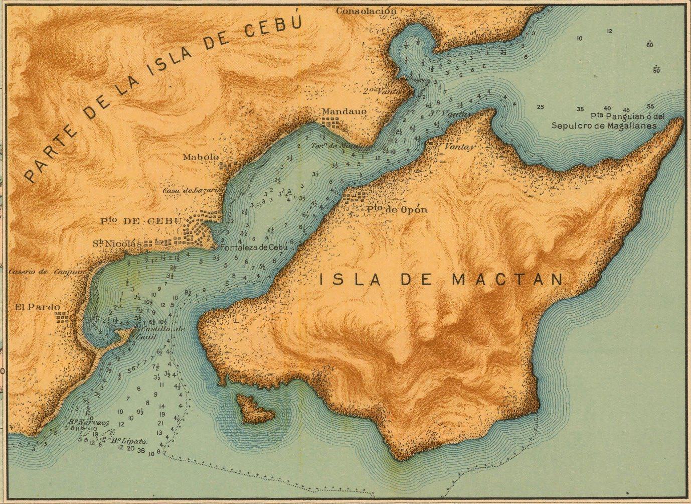
The Archivo del Museo Naval in Madrid holds a manuscript chart by Guillermo de Aubarede y Pérez titled (in a circular cartouche with elaborate scrollwork) Plano del Puerto de Zebú Levantado por el Comandante y Oficiales de la Comisión Hidrográfica en el Archipiélago Filipino Año de 1843 (19) The chart covers the coast of Cebu from the Castillo de Cauit and the Caserio de Canjuan in the southwest to Punta Bagatan (aka Bagacay) in the northeast. In the city, the fort and the grid pattern of the streets in the Ciudad are shown, surrounded by the buildings in the adjacent barrios in a semicircle. To the west are the Torre y Pueblo de San Nicolas, and to the northeast the Casa de Lazarinos (asylum for lepers); further out, we see the Pueblo and the Torreon de Mandaui.
The northern part of La Isla de Magtan (sic) is shown, including the Pueblo de Opon and Punta Panguian ó del Sepulcro de Magallanes. Lines of
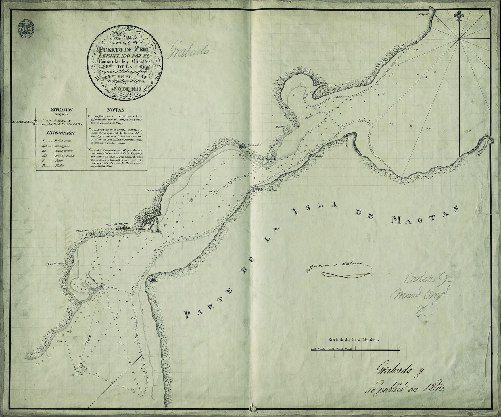
soundings crisscross the channel between Cebu and Mactan, and reefs (including the Bajo Lipata) and shallows are drawn. Interspersed with the soundings are letters which indicate the nature of the sea floor: A for arena (sand), Afa for arena fina (fine sand), Ag for arena gruesa (coarse sand), AP for arena y piedra (sand and stone), F for fango (mud), and P for piedra (stone).
To the northeast of Mandaui (today Mandaue) and in two locations on the northwest coast of Mactan, three vantay (coastguard stations, from the local word bantay for a watchman) are marked. Notes give details of the height of the tides and direction of the currents at these locations, and of the best anchorage during the northeast monsoon. In 1850, a printed edition of this chart was published in Madrid by the Dirección de Hidrografía, to which an inset Plano del Fondeadero de Tinaan by Claudio Montero was added in 1870.
33
Plano del Puerto de Zebú Levantado por el Comandante y Oficiales de la Comisión Hidrográfica en el Archipiélago Filipino Año de 1843 (image courtesy of the Archivo del Museo Naval de Madrid)
The 1847 Map of Cebu (image courtesy of the National Archives of the Philippines)
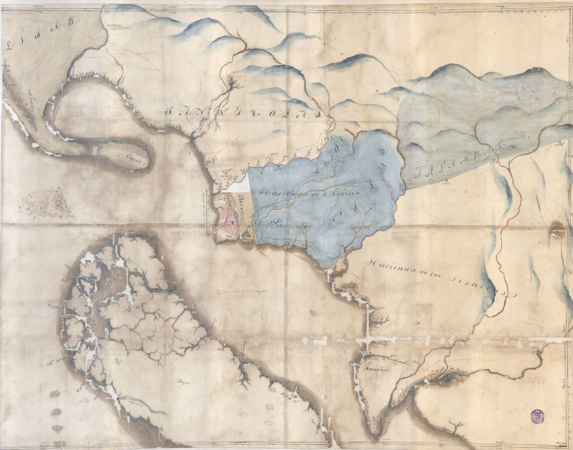
Another color coded manuscript map of Cebu in the National Archives of the Philippines is untitled and undated, but referred to as the 1847 Map of Cebu. Oriented to the west, the map covers the area from the mountains in the west to the channel between Cebu and Mactan to the south and east. The central portion of the map delineates the districts of the Ciudad, Parian, Lutao and Tinago. North of Parian, beyond the Linea de los Mojones de Banilad, lie the friar lands; the mojones (boundary stones) for the Hacienda de San Agustin and, further to the northwest, the Hacienda de los Jesuitas are located. San Nicolas is to the west, over the Rio de la Fagina, with Talamban further north.
By this time, a lot was going on in Cebu City and, by extension, the rest of the colony and the world. All these events led to Cebu City being poised to turn its economic fortunes around and, in the early 19th century, re emerge as a center of trade for products from the Visayas. Philippine agricultural crops were finding importance in the
world markets, the galleon trade had ended in 1815, Manila opened as a world port in 1834, and the indulto de commercio (license to trade) was abolished in 1844, all of which allowed provincial merchants increased economic activity and scope. Shipbuilding was also deregulated in 1842, and the following year a shipyard was opened in Cebu.
Against this worldwide backdrop, the Chinese mestizos remained extremely active in Cebu’s economy. Historian Edgar Wickberg states that it was the mestizos who made Cebu wealthy.(20) By this time, they had emerged into a ‘third class’, neither pure nor mixed Spanish, and neither pure nor mixed indio. Technically, they were not nobles, but nor were they commoners. Yet they had evolved into landed wealth, had readily adopted Spanish culture and Christianity, and had become Cebu’s ‘merchant elite’. Their connections to Cebu’s port centered commerce gave them social and economic prominence, and a social class to contend with.
34
Around this time, the Spanish began to return in search of economic opportunities as trade and agricultural ownership began to rise. More Spanish priests also came, filling the once abandoned parishes and churches. As the price of sugar was starting to increase in world markets and the Chinese mestizos wanted to participate in the boom, they were expanding their landholdings and extending beyond Parian and the city limits of Cebu. Feeling threatened, the Augustinians and other Spaniards wanted to limit the powers of the Chinese mestizos. In 1849, not only was the parish of Parian abolished, but so were the towns / pueblos of Parian and Lutao, with both incorporated under Cebu City
The Chinese were also allowed to return by the 1790s, though their participation in business was limited to farming and artisanal work. As such, few actually returned. By the 1850s, Chinese merchants who came to Cebu were Christianized and also settled in Parian. Cullinane estimates that in the 1840s there were only seven Chinese who lived in Parian, but by 1885 there were 1,032 merchants living in and around the district.(21)
It was a changing time in the Parian district. Through the centuries, the small Parian river that ran through the neighborhood had begun to silt up, making it difficult if not impossible for merchant ships to navigate. Instead, the ships docked in the Lutao area. The warehouses, offices and other commercial buildings associated with the port also moved out of the Parian area, which transformed itself from a commercial trading area to a residential area for mestizos and indios. From a population of about 100 people in 1744, Parian ballooned to about 2,500 people in the 1840s.(22) In 1849, some two years after the 1847 Map of Cebu was drawn, the Parian and Lutao districts had a population of 4,720, and the Ciudad had 5,576 people.
Although the Chinese and Spanish were now involved in trade, the Chinese mestizos still controlled most of it. Aside from trans shipments and wholesale procurement, they ventured into retail trade and, probably, shipbuilding after the shipyard opened in 1843. While the Chinese had to pay freight to carry the goods they bought and sold, the Cebuano Chinese mestizos owned their own ships, so the cost of sending goods to Manila was considerably less. Plus, they also engaged in credit lending, financing and tax collection.
Later 19th Century Maps of Cebu City
Change was happening quickly around the world, and Cebu and the colony had to keep up. The steamship made the transport of goods faster, and the opening up of the Suez canal in 1869 made for increased European demand in agricultural goods. In 1855, the neighboring ports of Iloilo in Panay and Zamboanga in Mindanao opened to international trade. It was inevitable that Cebu would come next, and in 1860 the port of Cebu was opened to worldwide trade. By this time, the Parian river had silted up and was no longer navigable. With the arrival of steamships, these larger vessels were better accommodated in the southern Lutao district of the city. Chinese and Spanish now flocked to the south to ensure prime locations in the area.
The opening of the port brought changes to Cebu City an increase in population, an influx of Chinese immigrants and Western merchants, a rise in new industries and work classes, changes in property ownership patterns, expansion of the colonial bureaucracy, and advances in transport and communications.
The strict delineation of Chinese, native and Spanish settlements became more ambiguous as inter ethnic relationships increased and ethnic distinctions blurred. There was a more diverse character to the population. Even the ethnic Chinese mestizos as a separate group began to be assimilated into a Hispanized Cebuano society. They could no longer speak Chinese, spoke fluent Cebuano and shared a common religion with the Spanish. As such, residential patterns changed; Spanish and Spanish mestizos also lived in Parian, and Chinese immigrants settled in the Lutao / Ermita port district. Because of the location of the port, the southern part of Cebu City became the prime commercial center.
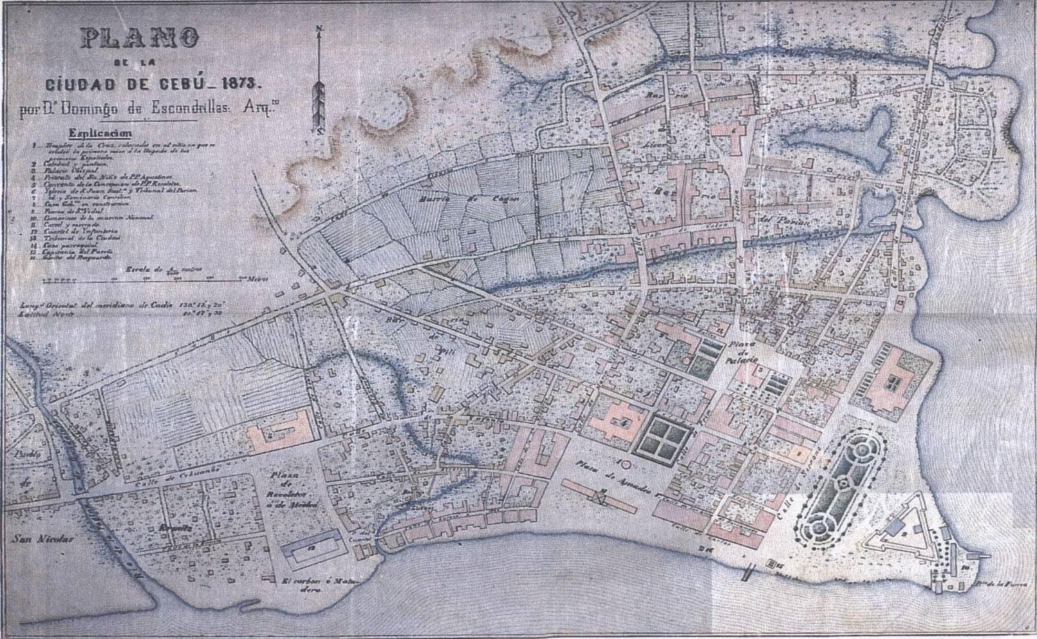
These changes are shown on the Plano de la Ciudad de Cebú ‒ 1873, kept in the Cartoteca del Archivo General Militar de Madrid.(23) The map is by Don Domingo de Escondrillas, an architect and the Director of Public Works in Cebu City. He designed structures including churches and bridges in Cebu and Bohol, and the provincial jail of Cebu. Escondrillas was also the proprietor of the Imprentas Escondrillas, the first printing press in Cebu,(24) where the map is likely to have been printed.
35
Aside from the usual landmarks of the Fort, the Cathedral and Parian, Escondrillas shows the shrinking Lutao area. He does point out new areas: the Barrio de Cogon to the west of Parian, and Ermita to the west of the Ciudad. As previously mentioned, Cebu was outgrowing its prelimited boundaries to accommodate new residents, and the Barrio de Cogon was such an evolving residential area. As the Lutao area began to shrink, the toponym fell out of use, to be almost absorbed by the area called Ermita. It is here that we find El carbon ó Matadero, next to the Capitanio del Puerto
The market area of Carbon takes its name from the coal depot where ships would load coal when they called at the port of Cebu. Behind the matadero (slaughterhouse) lies the cuartel de ynfanteria (infantry barracks) and the Plaza de Recoletos. In 1883, archival documents in the National Archives of the Philippines show an application to construct a large quadrangular shed that would function as the slaughterhouse, with meat stalls around it. Over time, more vendors selling not just meat but other fresh produce and manufactured goods congregated, spilling over to the Carbon area. Today, the public market located in the same area is referred to as Carbon.(25)
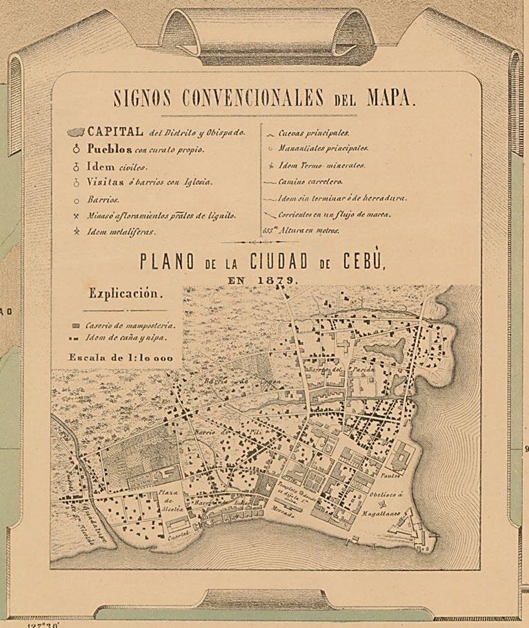
In 1884 Enrique Abella y Casariego produced a magnificent wall map, Plano Topográfico de la Isla de Cebú (see page 7), which has an inset map Plano de la Ciudad de Cebù en 1879. We see the Barrio de Lutao, again shrinking in size, and the new areas, Barrio de Cogon and Barrio de Pili. Notations show the locations of the Templete donde se dijo la 1.a misa (pavillion where the first mass was said) and the Obelisco á Magallanes (obelisk dedicated to Magellan). Abella also shows the building materials used for the various structures of the city, whether mamposteria (masonry, most likely with tiled roofs) or caña y nipa (bamboo cane with nipa palm thatch). Most of the buildings in the Parian district are the former, materiales fuertes (strong materials) as they came to be known, with the increasing wealth of the Chinese mestizos reflected in their homes.
The National Archives of the Philippines holds a collection of manuscript documents titled Terrenos de Cebu. The collection contains a map, titled Plano topográfico de una parte de la Cabecera de Cebú, which shows a portion of the city that was the cabecera (capital) of the province of Cebu. The map, which is undated but most likely from c.1882, focuses on the Ciudad and is centered on the Tribunal de Naturales (city
36
Plano de la Ciudad de Cebú ‒ 1873 por Dn Domingo de Escondrillas: Arq.to (image courtesy of the Cartoteca del Archivo General Militar de Madrid)
Plano topográfico de una parte de la Cabecera de Cebú (top) and Vista del plano (bottom) from Terrenos de Cebu (c.1882) (images courtesy of the National Archives of the Philippines)


37
hall) which, as previously mentioned, had been built in c.1842 on the south side of the Plaza de Amadeo 1o (named after Amadeo I, the Italian prince who reigned as King of Spain from 1870 to 1873). The City Hall of Cebu is in the same location today, but the plaza has been renamed Plaza Sugbu.
The map and the accompanying Vista del plano show how the commercial and trading area had moved south from the Parian district to the Lutao area. Between the Plaza de Amadeo 1o and the Paseo de Dolores (today Plaza Independencia) sits the Barrio de Panpangos, which had opened up to accommodate the influx of migrants, starting with the soldiers from Pampanga brought in to support Fort San Pedro during the Muslim raids. The Gariton del resguardo (guardhouse) and the Capitania del Puerto (port captaincy) are near the pantalanes (piers) that were crucial to the port of Cebu
The opening of the port was a catalyst for urbanization. At this point, it was clear that the pre existing areas of the Ciudad, Parian and Lutao were no longer sufficient to contain the new arrivals, and development of the areas outside the city was needed to house the migrants. The rise in exports and trade necessitated an increase in merchants, land owners and trading agents that were not necessarily present in Cebu City before.
This ushered in an era of rapid growth in the port area to keep up with the increased amount of trade. Cebu was not only the point of shipment to foreign shores, it was also the main point for the collection, handling and distribution of trade commodities from within the Visayas and other parts of the colony. Rice, corn, sugar, abaca (hemp), tobacco and coffee came from Negros, Leyte, Bohol, Samar and Northern Mindanao. Cebu served as the point for transshipment of goods to Manila and to further markets like Australia, the United States, Great Britain and, of course, Spain. It was also where inbound cargo was repacked for distribution to nearby islands.
This rapid economic growth resulted in a transfer of wealth to Cebu City. The urban activities concentrated around the port area became the nerve center of the city. Administrative hubs were located here, as were the economic institutions that bloomed: banks, brokerage
houses, trading companies, insurance agencies and shipping firms. By 1868 major trading houses, including Smith Bell & Co. and Loney, Kerr & Co., both British, and the American firm Russell, Sturgis & Co., all had major offices with representatives in Cebu City. Administrative centers were also located near the port for convenience: the Casa Gobierno (provincial government house), the Ayuntamiento (city hall), Fort San Pedro (which was always there), and other government offices. But the area of the Ciudad depicted in the 1882 map had become a small portion of a quickly urbanizing Cebu City.
New residential areas, especially in areas outside the city limits, began to mushroom. By 1890, Cebu City had a population of 16,398 residents in 18 barrios or districts.(26) Twice this number existed in the adjoining areas of San Nicolas, Pardo, Mabolo and Talamban, which housed the majority of the immigrants who came to service the growing economy. Central business areas emerged in Cebu City, especially in the southern, previously strictly Lutao enclave around the public Carbon market with its Chinese shops, where the urban population would go for a variety of goods and food items.
Enter Uncle Sam
Fast forward to the Spanish American War and the handover of the Philippines from Spain to the United States of America in 1898. There were some who resisted the regime change, but by the turn of the century the Americans in Cebu were there to stay. The map of the island of Cebu from the 1899 Atlas de Filipinas was jointly authored by Fr. José Algué, the Jesuit director of the Manila Observatory, and the United States Coast and Geodetic Survey. An inset map shows Cebu City, the island of Mactan and the adjoining areas.(27)
We see the spread of the city to the neighboring towns of Talisay, El Pardo and San Nicolás to the southwest, and to Mabolo and Mandaue to the northeast. In between Cebu City and the suburb of Mabolo is the Casa de Lazarido (sic) Leprosy was wide spread in the colony at that time, but health care was not high on Spain’s priority list in its colonies. The Spaniards attempted to segregate those afflicted with leprosy in the Casa de Lazarido, but did little to cure them.(28) After this map was produced, the leprosarium in Cebu was transferred to Mandaue.(29)
38
It was clear that by this time Cebu City had turned a corner, and was doing well economically. What did the city really look like then? Towns were well connected to each other only by sea. As late as the 1900s there were still no roads, only trails that were hard to navigate especially after rain. To cross the island took five or six hours by horse or pony. Streets were wide enough and relatively clean, although dusty. Since cars would not come for another decade or two, there was certainly no traffic to worry about! There was no electricity or piped running water.
The American colonial administration went into high gear to modernize Cebu City. Widespread fires in the early 1900s, particularly in the Lutao/Ermita area, razed the city’s commercial center. This was an opportunity for planning and renewal. Also, San Nicolas was administratively attached to Cebu in 1901, giving the planners a larger urban area to work with.
The Americans prioritized reclaiming land to prepare for a new port complex that could accommodate larger ships and warehouses. They began to dig artesian wells in order to minimize
the spread of waterborne diseases like cholera and dysentery. New roads and bridges were built, and by 1905 electricity lit up the city at night. The Cebu Waterworks System, completed in 1912 and later renamed the Aguas Potables de Osmeña (Osmeña Waterworks System), brought piped water from the Buhisan Dam (built by the Atlantic Gulf and Pacific Company) to the northern parts of Cebu City and the Fuente Osmeña fountain in a newly developed suburb of the city.
In 1907, work started on a railroad system that was to stretch from Danao in the north to Argao in the south. It was inaugurated in 1911 and would run until 1942. Primarily used to transport sugar cane and hemp to the port of Cebu, it also served as an efficient people mover, allowing residents from further afield to commute to Cebu City for work. Sadly, its business model began to unravel when a bus company, the Cebu Autobus Company (founded in 1926), started to undercut rail fares and it became cheaper to go by bus than by rail. After the rails were damaged in World War II they were never repaired, nor were the trains put back into service.
39
Inset of Cebu City and vicinity from the map of Cebu by Fr. José Algué, S.J. in the Atlas de Filipinas (1899) (image courtesy of the David Rumsey Map Collection
Cebu Harbor and Approaches with inset of Cebu Harbor, U. S. Coast & Geodetic Survey (1925) 1932 (image courtesy of the Historical Map & Chart Collection, National Oceanic and Atmospheric Administration)
Suburban Expansion and Urban Development
A chart of Cebu Harbor and Approaches (at a scale of 1:30,000) published by the U. S. Coast & Geodetic Survey in 1925, based on surveys to 1924, shows the whole of the harbor and the island of Mactan, with numerous soundings, and lights, beacons and buoys highlighted in dark yellow.(30) An inset of Cebu Harbor (at a scale of 1:10,000) covers the city from the salt vats south of the Vinalusan river to the Leper Hospital and the adjacent cemetery to the north. The lines and sidings of the Philippine Railway Co. are drawn along the northwest of the city, with a branch line running alongside the Guadalupe River to the port, the Plaza de Libertad (now Independencia) and a pier to the south of Fort San Pedro. Land along the waterfront to the north of the fort is ‘to be filled’ to provide for the expansion of the harbor. Across from the port, on the coast of Mactan, sits the refueling base of the Asiatic Petroleum Co. (later Shell) with its oil storage tanks.
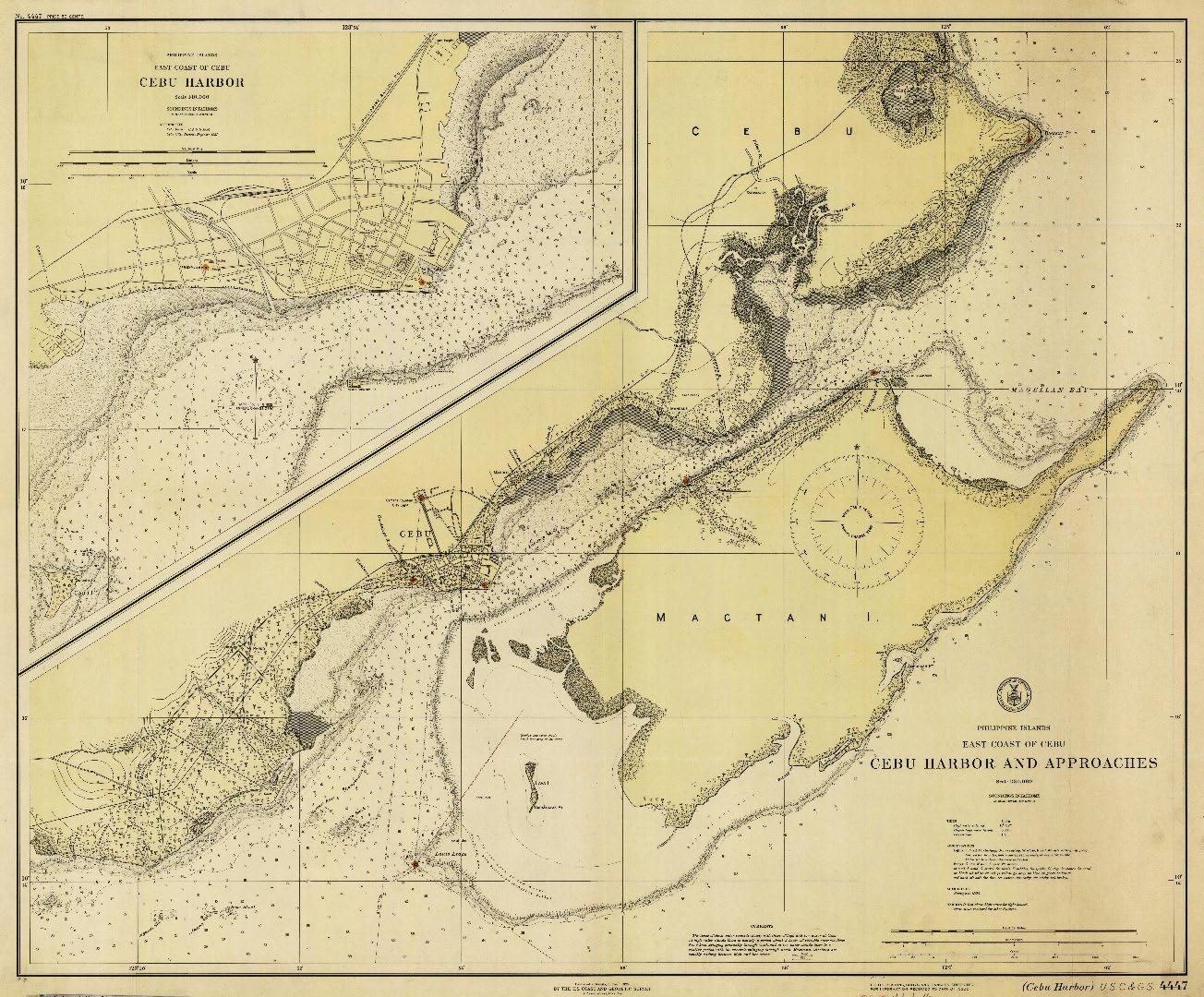
By the mid 1920s it was clear that Cebu’s city limits were no longer adequate to provide space for all the new residents. Two large Augustinian friar estates adjacent to Cebu City, the Banilad Talamban estate and the Talisay Minglanilla estate, together totaling thousands of hectares, were purchased by the Americans, divided into smaller lots, and redistributed to private companies and individuals. Development, residential and commercial, quickly spready outwards from the strictly ‘downtown’ commercial area of the Ciudad. As Cebu City grew, districts additional to Parian and Lutao started to emerge, including Tinago, Pili, Ermita, Zapatera and Carreta.
Various trade acts passed in the United States made it easier to export raw materials like sugar, coconut and hemp to the Americas. This caused increased demand for these products and downstream industries like agricultural harvesting, processing, and shipping. The port area was enlarged to include additional piers,
40
private warehouses and a new customs house. Foreign commercial houses were also located in other areas of the Ciudad, along with British and American banks. Their presence, and the increased volume of trade, necessitated the improvement of communications; telephone, cable and telegraph services were rapidly installed.
The era of the Commonwealth of the Philippines began in 1935. In 1937, Manuel Quezon, President of the Commonwealth, declared Cebu a chartered city. Urbanization in Cebu City was growing at a rapid clip, and so was the population. The need to move away from downtown was promoted by building the domed Cebu Provincial Capitol (designed by the Filipino architect Juan M. Arellano) towards the hinterland, further afield from the Fuente Osmeña. The Fuente was already considered by many to be ‘far’ from the downtown districts of Parian and the Ciudad. Though the railway system was floundering at this point, Cebu Autobus was providing the necessary means to commute from this new developing area to places of work. Photographs and postcards from the 1930s document the newly built Capitol, the Rizal Public Library, Fuente Osmeña and Jones Avenue. There is practically nothing around them, but this emptiness would not last long.
War and Peace come to Cebu
Cebu was not immune to the ravages of World War II. On April 10, 1942, 12,000 Japanese troops landed on Cebu; the 6,500 defenders evacuated the capital and moved inland, and the following day the Japanese took possession of Cebu City. An annotated U.S. military aerial reconnaissance photograph taken on November 4, 1944 shows how downtown Cebu had been converted into a war zone.(31) There are areas of destruction from the widespread fires that had gone out of control after the Americans torched the warehouses and fuel storage tanks in the
port area when the Japanese invaded. ‘Numerous buildings in area destroyed by Allied bombings in 1942’ are indicated, and the ‘possible’ location of a POW camp is shown. The Rizal Library had been converted into the Japanese Administration Building, and a second airstrip for the Lahug airfield was under construction.
Another Photomap of Cebu Town, produced by the U.S. Army Corps of Engineers in December 1944, covers the area from the Go Chan Hill (sic) lighthouse to the harbor, and from the Basak salt works to the Lahug Airfield.(32) Wrecks lie off Fort San Pedro, the University of the Philippines is a barracks, and the Insane Asylum had been ‘destroyed 18 Nov. 1944’. The Battle for Cebu City began when the U. S. Seventh Fleet arrived on March 26, 1945. Following stiff fighting around the port, the ‘Battle of Gochan Hill’, and a Japanese final stand near Mandaue, the city was liberated, not a day too soon, on April 8.
In the aftermath of the war, the rebuilding and rehabilitation of Cebu City moved it further afield from the original shoreline settlement. The areas around the Capitol and Fuente Osmeña were developed. The Lahug airstrip served as Cebu’s airport until 1966, when it was decommissioned and the airbase on Mactan island opened to civilian aircraft as Cebu Mactan Airport. Post war, the area of Cebu City was host to a population of nearly 147,000 people.
Conclusion
Today, Cebu City is the sixth largest city in the Philippines and the most populous in the Visayas, with roughly 965,000 inhabitants. This is a far cry from the 2,000 people Legazpi found living on the shore in 1565. From a settlement to a Villa to a Ciudad, then reverting to a pueblo before the revival of its fortunes and reinstatement as a city, the village of Sugbu has evolved to become the metropolis of Cebu City.
I would like to dedicate this article, which is based on the presentation I gave to PHIMCOS on May 25, 2022, to the memory of my father, the late Augusto Villalon, Jr., who taught me so much about the history of Cebu City. I also thank Andoni Aboitiz; Jonathan Best and John Silva of the Ortigas Foundation Library; Efren P. Carandang, Deputy Administrator, and Celeste Barile at the National Mapping and Resource Information Authority (NAMRIA); Peter Geldart, editor of The Murillo Bulletin; Lucy Urgello Miller; Jorge Mojarro; Michael G. Price; Alfredo Roca; Dr. Felice Noelle Rodriguez; and Aurea Silva of the National Archives of the Philippines for their assistance, and for providing images from their collections for the presentation and for this article.
41
Selected Bibliography
Jose Eleazar R. Bersales and Ino Manalo (editors), Integración / Internación: The Urbanization of Cebu in Archival Records of the Spanish Colonial Period, University of San Carlos Press and National Archives of the Philippines, Cebu City, 2017.
Emma Helen Blair and James Alexander Robertson, The Philippine Islands, 1493 1803, The Arthur H. Clark Company, Cleveland, Ohio, 1903 09.
Philip Bowring, Empire of the Winds The Global Role of Asia’s Great Archipelago, I.B. Tauris & Co. Ltd., London and New York, 2019.
Michael Cullinane and Peter Xenos, ‘The growth of population in Cebu during the Spanish Era’, in Population and History: the Demographic Origins of the Modern Philippines, Center for Southeast Asian Studies, University of Wisconsin, 1998.
Bruce L. Fenner, Cebu Under the Spanish Flag (1521‒1896): An Economic and Social History, University of San Carlos Press, Cebu City, 1985.
Lucy Urgello Miller, Glimpses of Old Cebu: Images of the Colonial Era, University of San Carlos Press, Cebu City, 2010.
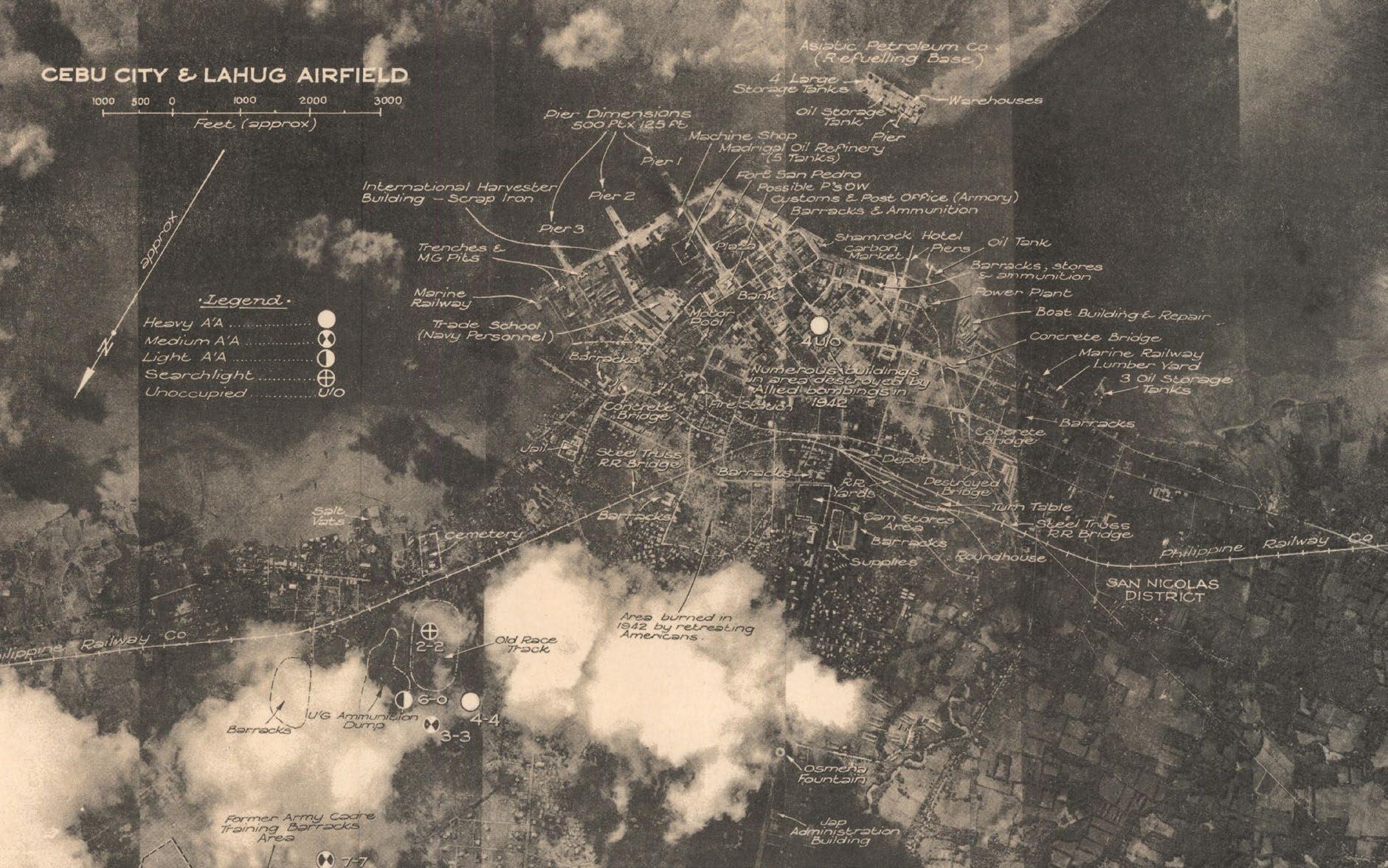
Resil B. Mojares, Casa Gorordo in Cebu: Urban Residence in a Philippine Province, Ramon Aboitiz Foundation, Cebu City, 1983.
, ‘The Formation of a City: Trade and Politics in Nineteenth Century Cebu’, in Philippine Quarterly of Culture and Society, Vol. 19, No. 4, University of San Carlos Publications, Cebu City, 1991.
, ‘Dakbayan: A Cultural History of Space in a Visayan City’, in Philippine Quarterly of Culture and Society, Vol. 40, No. ¾, University of San Carlos Publications, Cebu City, 2012.
42
Detail from aerial photograph of Cebu City & Lahug Airfield taken on 4th November 1944 by the Allied Geographical Section (image courtesy of Monash University Library)
Resil B. Mojares and Susan F. Quimpo (editors), Cebu – More Than An Island, Ayala Foundation, Inc., Manila, and Cebuano Studies Center, University of San Carlos, Cebu City, 1997.
Jorge Mojarro (editor), More Spanish Than We Admit, Vol. 3, Vibal Foundation Inc., Quezon City, 2020.
John A. Peterson, Archie Manongsong Tiauzon, Mark Horrocks and Maria Kottermair, Environmental History of an Early Spanish Settlement in the Visayas, Philippines: Excavations in the Parian District of Cebu City, SPAFA Journal, Vol. 4, SEAMEO Regional Centre for Archaeology and Fine Arts, Bangkok, 2020
Dionisio A. Sy, A Short History of Cebu 1500‒1890s and the Anti Spanish Revolution in Cebu, Second Edition, Bathalad, Inc. Cebu City, 1996.
Edgar Wickberg, ‘The Chinese Mestizo in Philippine History’, in The Journal of Southeast Asian History, Vol. 5, No. 1, Center for East Asian Studies, University of Kansas, Lawrence, 1964.
Notes and References
1. Antonio Pigafetta, Magellan’s Voyage Around the World, the original text of the Ambrosian MS with English translation by James Alexander Robertson, The Arthur H. Clark Company, Cleveland, 1906; and manuscript of Journal of Magellan’s Voyage c.1525, Beinecke Rare Book and Manuscript Library MS 351, Yale University Library: https://collections.library.yale.edu/catalog/2017752
2. Nicholas P. Cushner, The Isles of the West: Early Spanish Voyages to the Philippines 1521 1564, Ateneo de Manila University Press, Manila, 1966.
3. Robert R. Reed, Colonial Manila: the Context of Hispanic Urbanism and Process of Morphogenesis, University of California Press, Berkely, 1978; cited in Mojares Casa Gorordo in Cebu (1983) op cit
4. Fenner op cit, cited in Cullinane and Xenos, op cit
5. Francisco Mallari S.J., ‘The Spanish Navy in the Philippines, 1589 1787’, in Philippine Studies, Vol. 37, No. 4, Ateneo de Manila University, Manila 1989.
6. Felice Noelle Rodriguez, ‘Mapping the Growth of Zamboanga from Pigafetta to the 19th Century’, in The Murillo Bulletin, Issue No. 13, PHIMCOS, Manila, May 2022.
7. Fenner op cit, cited in Sy op cit
8. Esta Mapa se hizo Esta Ciudad de Cebú el año de 1699 …, published in 1850 53 in Los feligreses de la suprimida parroquia de Parian y Lutaos solicitan el restablecimiento de dicha parroquia (The parishioners of the suppressed parish of Parian and Lutao request the re establishment of the said parish), Archivo Histórico Nacional de Madrid, ES.28079.AHN/16//ULTRAMAR,2174,Exp.20: http://pares.mcu.es/ParesBusquedas20/catalogo/show/12715857?nm
9. Plan de la Fuerza Sn. Pedro de la Ciudad de Zebu, in Planos de las Plazas, Presidios, y Fortificaciones en todo el Distrito de las Provincias, que sujeta el Real Dominio en las Yslas Filipinas …, 1738, Archivo del Museo Naval de Madrid, AMN 0399 Ms.1040 / 000: http://bibliotecavirtualdefensa.es/BVMDefensa/exp_pacifico/es/consulta/registro.do?id=36160
10. Plano de la Fuerza del Santíssimo nombre de Jesús de Zebú, in Descripciones con planos y figuras de la capital de Manila, puerto de Cavite, fuerzas de los presidios y otras fortificaciones en todo el distrito de las provincias que sugeta el real dominio en las Yslas Filipinas, 1753, Archivo General de Indias, ES.41091.AGI//MP LIBROS_MANUSCRITOS,81: http://pares.mcu.es/ParesBusquedas20/catalogo/show/20802?nm
11. Mojares, The Formation of a City (1991) op cit.
12. Cullinane and Xenos op cit.
13. Fr. Manuel Buzeta and Fr. Felipe Bravo, Diccionario Geográfico, Estadístico, Histórico, de las Islas Filipinas, Imprenta de D. José C. de la Peña, Madrid, 1850.
14. Wickberg op cit.
15. Andrew David, Felipe Fernandez Armesto, Carlos Novi and Glyndwr Williams (editors), The Malaspina Expedition 1789 1794, Volume III, The Hakluyt Society, London, 2004.
43
16. Carta Esferica ó Plano del Puerto del Zebú ... (1793) 1805, Archivo del Museo Naval de Madrid, MN 65 10: http://bibliotecavirtualdefensa.es/BVMDefensa/es/consulta/registro.do?id=48963
17. Plano Topografico de la Ciudad de Zebu ‒ Barrios de Lutaos y Parian y parte del Pueblo de San Nicolas y limite del de Talamban Año 1840, Archivo Cartográfico y de Estudios Geográficos del Centro Geográfico del Ejército, Ar.Q T.3 C.3_353: http://bibliotecavirtualdefensa.es/BVMDefensa/es/consulta/registro.do?id=105350
18. Plano Topográfico de la Ciudad de Cebú ‒ Barrios de Lutaos y Parian parte del pueblo de Sn. Nicolás y límites de Tatambam rectificado y aumentado pr. el Capitan de Artilla. Novella año de 1842, Archivo del Museo Naval de Madrid, MN 65 16: http://bibliotecavirtualdefensa.es/BVMDefensa/es/consulta/registro.do?id=48981
19. Plano del Puerto de Zebú Levantado por el Comandante y Oficiales de la Comisión Hidrográfica en el Archipiélago Filipino Año de 1843, Archivo del Museo Naval de Madrid, MN 65 6: http://bibliotecavirtualdefensa.es/BVMDefensa/es/consulta/registro.do?id=48956
20. Wickberg op cit.
21. Cullinane and Xenos op cit.
22. Mojares, Casa Gorordo in Cebu (1983) op cit.
23. Plano de la Ciudad de Cebú ‒ 1873 por Dn. Domingo de Escondrillas: Arq.to, Cartoteca del Archivo General Militar de Madrid: http://www.bibliodef.es/abnetopac/BaratzCL?TITN=212723
24. Resil B. Mojares, ‘Cebuano Literature: A Survey of Sources’, in Philippine Quarterly of Culture and Society, Vol. 1, No. 2, University of San Carlos Publications, Cebu City, 1973.
25. Resil B. Mojares, ‘Calle Colon and the Sites of Public Memory’, in Integración / Internación, op cit.
26. Mojares, Dakbayan (2012) op cit.
27. José Algué, S.J. / United States Coast and Geodetic Survey, Atlas de Filipinas, Manila, 1899 / Government Printing Office, Washington D.C., 1900.
28. John Foreman, The Philippine Islands: A Political, Geographical, Ethnographical, Social and Commercial History of the Philippine Archipelago and its Political Dependencies, Embracing the whole Period of Spanish Rule, Sampson Low, Marston & Co., Ltd., London, 1899. 29. Transferred from Cebu to Mandaue, today the leprosarium is the Eversley Childs Sanitarium. 30. Cebu Harbor and Approaches / Cebu Harbor, U.S. Coast & Geodetic Survey chart no. 4447, Historical Map & Chart Collection, National Oceanic and Atmospheric Administration: https://www.historicalcharts.noaa.gov/image.php?filename=4447 12 1925
31. Cebu City, Lahug Airfield and vicinity, Allied Geographical Section South West Pacific Area Terrain Studies, photograph no. 106, Monash Collections Online: http://hdl.handle.net/1959.1/1194096 32. Photomap Cebu Town, First Edition Dec. 1944, University of Wisconsin Milwaukee Libraries: https://collections.lib.uwm.edu/digital/collection/agdm/id/6959/rec/1
44
The Lost Waterways of Cebu City
by Dr. Maricor N. Soriano, University of the Philippines Diliman
IN MY WORK as a professor of physics who specializes in developing hardware and software tools for video and image processing, I have become interested in showing how an analysis of historical maps can reveal the hazards of flooding and liquefaction in the modern cities of today. My team is based at the National Institute of Physics in the National Science Complex, UP Diliman, where I head the Video and Image Processing Group (VIP) at the Instrumentation Physics Lab.
We use old Spanish and American era maps of towns in the Philippines, overlaid on modern Google maps, to identify vanished metropolitan waterways. So far, we have been able to use these techniques and methods in Metro Manila, Tacloban City, Iloilo City, Davao City, Naga City and Cebu City.
With the mounting risks to the environment caused by climate change this topic has become of ever increasing importance. The objectives of our Cartography of Old Informs the New (COIN) project, funded by the Department of Science and Technology, are to: digitally archive historical maps;
align these old maps with current maps to detect lost bodies of water; validate the loss of waterways through fieldwork; and
inform stakeholders of the hazards identified, including flooding and the dangers of liquefaction of loose soil or subsidence induced by earthquakes
Flood hazard map of Cebu City showing the areas of high, medium and low risk over a 100 year period (image courtesy of the Nationwide Operational Assessment of Hazards (NOAH) website: https://noah.up.edu.ph/know your hazards)

45
Details of (left) the Ysla del Tinago and its inlet from the 1833 Plano Topografico de la Ciudad de Cebú and (right) the lagoons in the same area from the Plano de la Ciudad de Cebú ‒ 1873 (images courtesy of the National Archives of the Philippines and the Cartoteca del Archivo General Militar de Madrid respectively)
An example of the dangers of uncontrolled flooding to Cebuanos was reported in Philippine News on January 27, 2011:
Metro Cebu and Mandaue City were submerged due to a heavy downpour which lasted for several hours, causing numerous stranded commuters and heavy traffic in the city. The three major creeks in Barangay Tipolo in Mandaue, Panagdait in Cebu City and Mahiga Creek that crosses both cities overflowed and caused the flooding. The flood water rose up to five feet in different puroks and barangays, and devastated properties and other belongings. In the downtown area, flooding in the area is normal during heavy downpours because the drainage system cannot hold too much water.
Antique maps are usually inaccurate but, given the importance of fresh water, sources such as rivers, lakes, lagoons and estuaries are often depicted more accurately than are terrestrial features on old maps. To be suitable for our purposes, the old maps must show the streets and other landmarks of the city (such as churches, houses and forts) which are still there today; these then become ground control points. Using these features as reference points, the historical maps can be aligned with modern maps using commercially available image processing software that ‘rubber sheet’ stretches the old maps onto the true coordinates established by
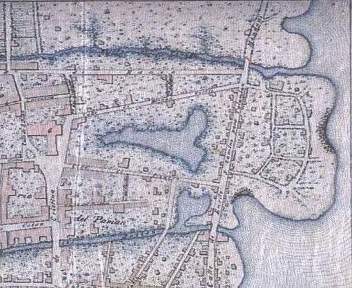
satellite mapping. By overlaying the two maps, both areas of water that have been reclaimed as land and areas of land that have eroded away can be identified.
Following this tabletop analysis I send my students out on field trips to identify lost waterways ‘on the ground’. They advise the local government officials of our project, and then interview the local inhabitants. In particular they ask for information on areas subject to frequent flooding, especially if it occurs when no heavy rain has recently fallen. This fieldwork can establish which streams or estuaries still exist, those that have been channeled underground, and those that have been lost to land reclamation.
Our base maps for Cebu City were the 1833 Plano Topografico de la Ciudad de Cebú y sus barrios de los Lutaos y Parian (in the National Archives of the Philippines) and the Plano de la Ciudad de Cebú ‒ 1873 (in the Cartoteca del Archivo General Militar de Madrid), both of which are described in Marga Binamira’s article ‘Cebu City: A Cartographic Chronicle’ on page 21
The 1833 map shows a substantial sea inlet between the Ysla del Tinago and the barangay of Parian to its west. The 1873 map shows that, 40 years later, this inlet has been closed, leaving a lagoon in the middle of what has now become the barangay of Tinago. The reclaimed land lies
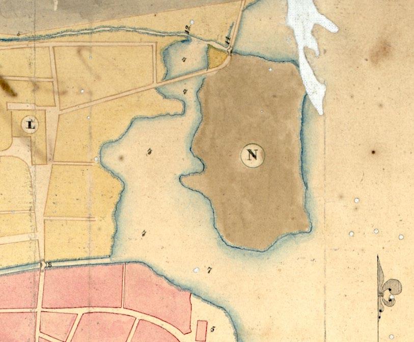
46
between two rivers or creeks, running east west, and there is a second, smaller lagoon connected to the southern estuary close to the sea. Looking at today’s map of the area, both lagoons have been reclaimed, but the remains of the estuaries are still there with the Kamputhaw River and the Parian Estero (part of which is now underground) forming the northern and southern borders of barangay Tinago respectively. There has also been extensive land reclamation along the coast to the north of the port.
When I visited Cebu to perform the fieldwork and validate our findings I followed a small road to the Parian Estero, and found that the creek is still there. I noticed a covered drainage ditch running along the road; the locals confirmed that the area is lower than sea level and has a high risk of flooding, and that the ditch serves to drain away the water. At the end of the road a prominent overhead sign identifies the Barangay Disaster
Control Office, where I was greeted by the barangay councilors. I gave a presentation on our work and warned the councilors that, as well as flooding, the area could be at risk of ground liquefaction in the case of an earthquake, in which case the buildings should be evacuated as quickly as possible. One of them said that her grandmother used to wash her clothes in that very location, which corroborated the antique cartographic evidence of the existence of the former lagoons.
I hope that our project can be continued and expanded with the help of any detailed city maps that PHIMCOS members may have in their collections. The work is not only historically interesting but also of potentially critical importance as it can enable local government agencies to assess the risks of flooding and liquefaction when, for example, issuing building permits

This article is based on the presentation I gave to PHIMCOS on August 18, 2021. I would like to acknowledge the assistance provided by Prof. Ari Ide Ektessabi at the Advanced Imaging Technology Laboratory (AITL), Kyoto University; Victorino Mapa Manalo, Executive Director, and Ma. Glenda Villas Gomez, Senior Archivist, at the National Archives of the Philippines; and the Department of Science and Technology ‒ Philippine Council for Industry, Energy, and Emerging Technology Research and Development (DOST PCIEERD).
A. Torres, Zayda Domini P. Abraham, Ari Ide Ektessabi and Maricor N. Soriano is available for downloading at: https://arxiv.org/abs/1812.05756
47
The full COIN Report Lost Waterways: Clues from Digitized Historical Maps of Manila and other Philippines Cities by Karol Giuseppe A. Jubilo, Meryl Regine L. Algodon, Elexis Mae
Lost S�ll there Underground
Cebu City Waterways
Image courtesy of Google Maps © 2021
WATTIS FINE ART Est. 1988 Specialist Antique & Art Dealers
“Horse racing in Cebu. The British Consul is the president and sole judge of the Racetrack in Cebu, the oldest city in the Philippines.” www.wattis.com.hk
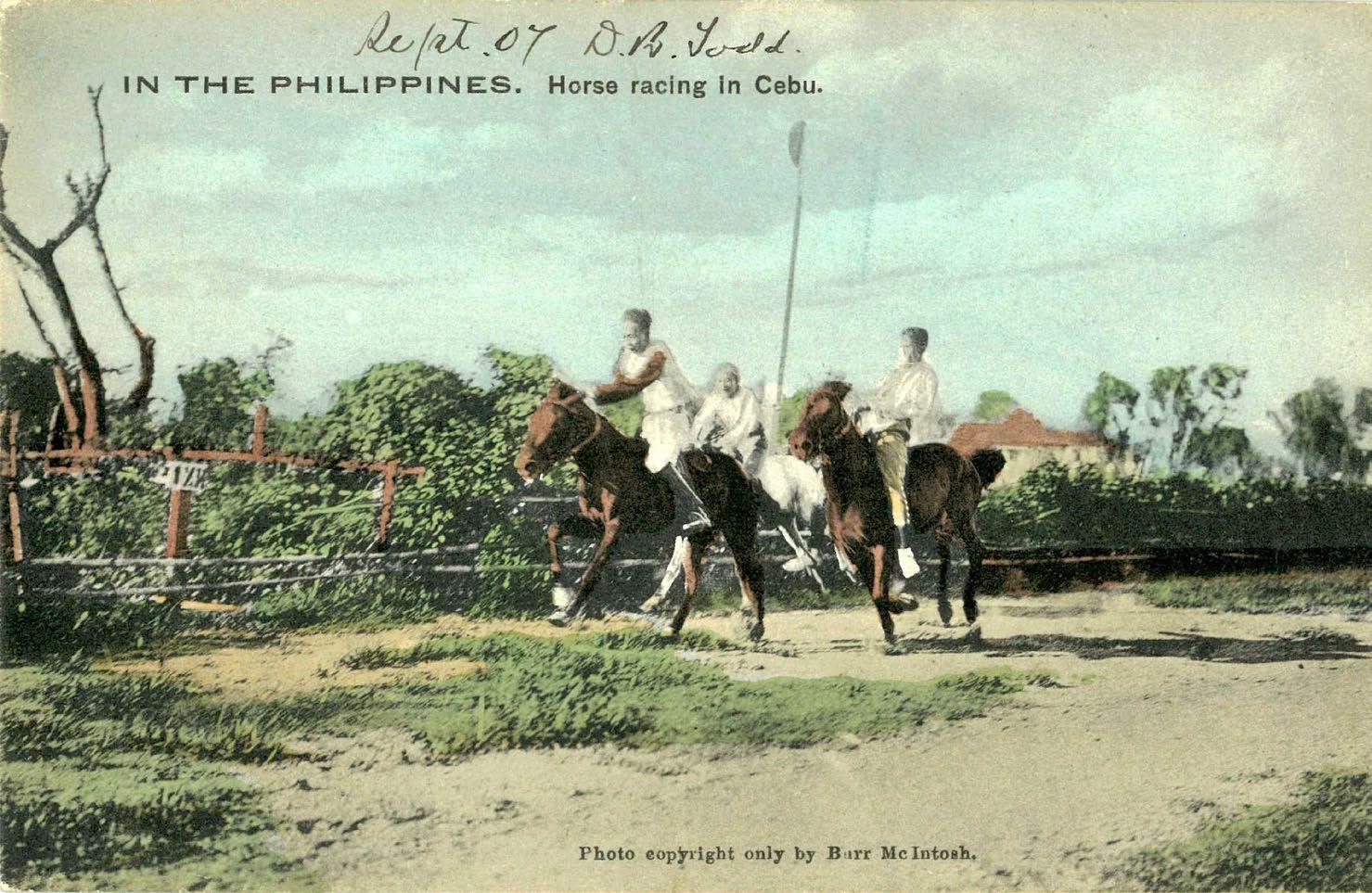
Antique maps, prints, photographs, postcards, paintings & books

48
Photographers of Colonial Cebu
by Michael G. Price
EBU is the epicenter of the Bisdak phenomenon, a contraction of the term bisayang dakû, translatable as ‘truly Cebuano’ with the implication of taking great pride in Cebuano heritage. It is undeniable that Cebuanos, until quite recently recognized as a plurality in the Philippines, possess a distinct subculture, characterized among other things by having their own language (while being multilingual) and their own historical heroes. They are known for being fun loving, expressive, showy of affection and musically inclined, but less deferential than other Filipinos (without the polite po).
One concrete manifestation of Bisdak is the intense appreciation by many Cebuanos for historical photos, fiercely competing for them at the highest levels in such places as eBay auctions. Therefore it is quite difficult and expensive for any individual to try collecting Cebu photos and picture postcards, and I have been fairly fortunate, only after many years, to obtain a decent assortment of them. Here I am presenting a selection of them from my own collection, arranged roughly chronologically or alphabetically by photographer or publisher.
Of course it is impossible to account for the numerous Cebu photos made anonymously, often by amateurs, so included here are only those photos and postcards that are attributed to, or that can be tentatively assigned to, a commercial professional photographer. I have also omitted various examples which appear to be inconsequential.
Although photo supplies were available for purchase in several boticas (pharmacies) previously, so we know photography was ongoing, the first commercial photographer in Cebu was Calixto Aguilar. Starting in the late 1880s, he was one of the earliest of all native Filipino photographers, along with others pre 1898 such as Felix Laureano from Panay; E. Soliman of Guimaras; Eulalio de los Reyes of Calbayog, Samar; Luis Castaño of Cebu; Agapito Conchu of Cavite, who was one of the Thirteen
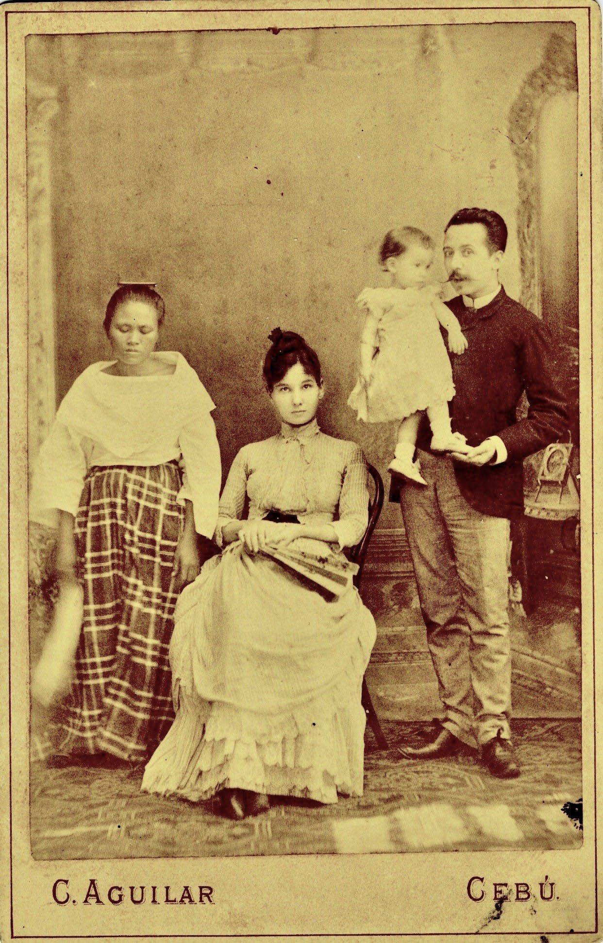
Martyrs shot on September 12, 1896; Joaquin Reyes and Miguel Reyes of Manila, who may or may not have been related; and Antonio and Mariano Panlasigui of Vigan.
Calixto Aguilar’s studio was located on what was Calle Cadiz, today M. Logarta Street. He made portraits as cartes de visite (calling cards) and cabinet cards, often with an ornate back design. In one of his cabinet cards of a family group, dated by hand 8 December, 1889, the overly entitled foreign woman contrasts sharply with the shy yaya (nursemaid) with her eyes shut (fig.1a); the back of the card mount (printed in Europe) has the studio’s name Galeria de Fotografia de C. Aguilar Cebú Filipinas in a fancy design (fig. 1b). In contrast, one of Aguilar’s small cartes de visite with the portrait of a local Filipina and baby (fig. 1c) has only a cheaper handstamp (fig. 1d) instead of the ornate, imported design on the cabinet card.
49
Fig. 1a - A cabinet card by Calixto Aguilar
C
One of the very best photographers in pre 1900 Philippines was Manual Arias of Manila, a Spaniard. In May 1903 he published two postcards of Cebu from photos he had presumably taken in 1899 during a trip he made to Zamboanga. The postcards, made in Japan, show the cotta (fort) and fondeadero (anchorage) of Cebu (figs. 2a & 2b).

In 1899 the Manila based Englishmen Roy Squires and William Bingham began selling photo supplies, postcards and photographic views, including several from Cebu such as the one of San Nicholas Church taken in c.1902 (fig. 3) The slanted SB monogram in the lower right corner of the photo stands for Squires & Bingham.
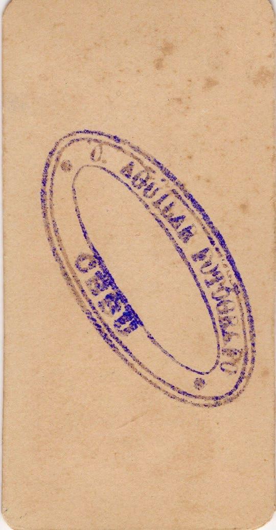
After his discharge from the U.S. Army in October 1899, Dean C. Tatom became the most prominent photographer in Cebu. At first he mostly produced cartes de visit and cabinet cards for American soldiers which, like Aguilar’s, have handstamped backs for the former and fancy backs (printed in Vienna) for the latter (figs. 4a, 4b, 4c & 4d). He married in Cebu and remained there until his death in 1937, although he stopped photographic work long before then. His Cebuano wives were Blandina Sabellano and Victorina Basaga. Tatom’s main production was of numerous 5” x 7” photos of Cebu, none bearing his name since they were intended to be pasted into albums, available from 1901 to 1908. Some of these were provided with typewritten captions evidently composed by Tatom himself, for example a street market in Mandaoe (sic) captioned ‘Have some bananas two centavos a bunch’ (fig. 5). ˂
Figs. 2a & 2b - Postcards of the Cotta de Cebu and Fondeadero de Cebu by Manual Arias 1903
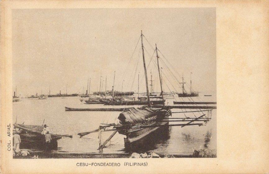
50
Fig. 1b - The ornate back of fig 1a Figs. 1c & 1d - A small carte de visite portrait by Calixto Aguilar
Tatom was also responsible for a locally printed set of at least 25 different sepia toned postcards, without captions, with a monogram of the initials of the photo engraver who made the plates for printing in the bottom corners and Tarjeta Postal Post Card on the back. These first appeared in early 1904, based on photos taken as early as 1900, and were not previously attributed, for example those of the University
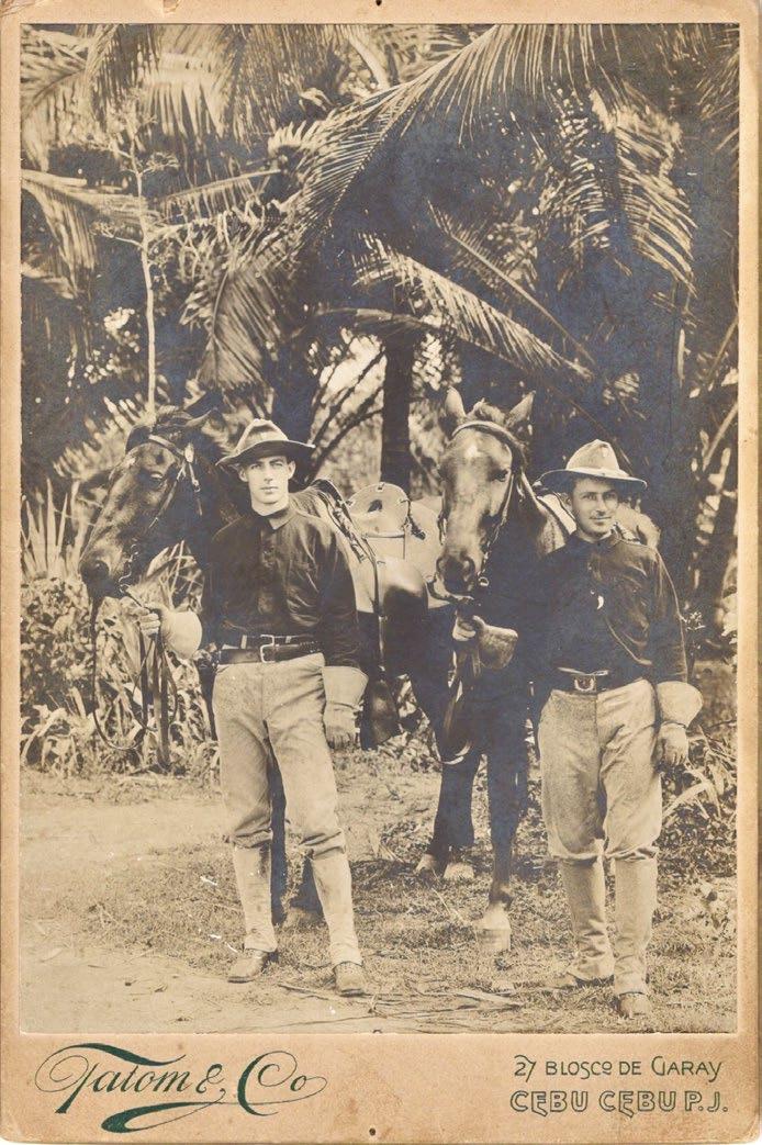
of San Carlos (fig. 6a) and a distinctive old house in Cebu (fig. 6b). Many of Tatom’s photos were also published by Thomas P. Joseph (see below), including one titled ‘Market at Cebu’ (fig. 7a) and another titled ‘One way of Transportation Cebu’ (fig. 7b) which depicts an example of the solid wheel carabao carts, once typical of Cebu, found only there and in northern Pampanga and southern Tarlac.
51
Fig. 3 A photograph of San Nicholas Church c.1902
Fig. 4a Carte de visite of an American for Squires Bingham & Co. soldier by Dean Tatom c.1899
Fig 4b The back of fig 4a Fig 4c Cabinet card of American soldiers
Fig 4d The back of fig. 4c by Dean Tatom
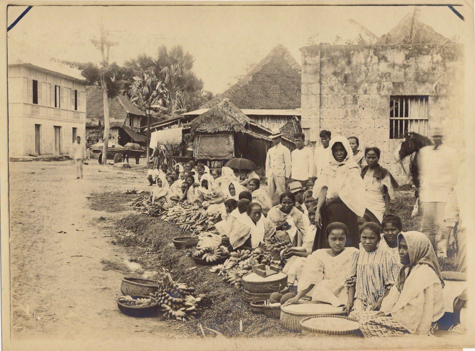
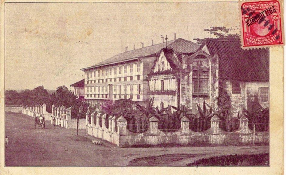
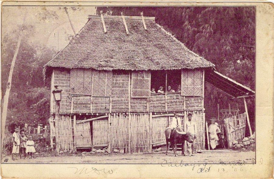
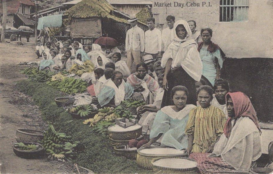
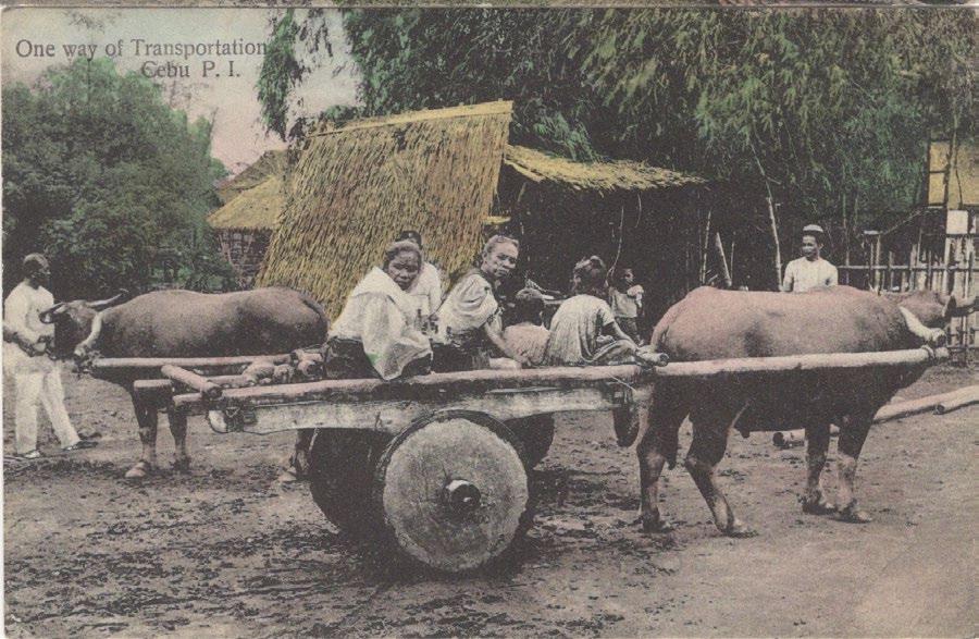
52
Fig. 5 ‘Have some bananas two centavos a bunch, Mandaoe, Cebu’ by Dean Tatom
Fig. 6a Postcard of the University of San Carlos, attributed to Dean Tatom
Fig. 6b Postcard of a distinctive old house in Cebu, attributed to Dean Tatom
Fig. 7a ‘Market at Cebu’, a postcard from the photograph in fig. 5 by Dean Tatom
Fig. 7b ‘One way of Transportation Cebu’, a postcard from a photograph by Dean Tatom
Other Tatom photos were published as picture postcards in both color and black and white by Photo Supply Co. of Manila, including a frequently reproduced view of armed men lined up (fig. 8). The caption reads: “Insurgents waiting to give up their arms at a surrender near Cebu, P.I.” But that cannot be right as the men are holding Remington rifles, some have U.S. campaign hats, and there are Americans lurking in the background; these men are undoubtedly U. S. Army hirelings. Was this an ordinary wrong guess, or instead a deliberate attempt to provide propaganda for the American colonial regime? Professor Resil B. Mojares has commented (in a personal communication):
We know how the postcard producers selected and captioned images in ways that would make them interesting to the buyers. The men in the photo could be Philippine Scouts or early elements of what would become the Philippine Scouts since they still look like a ragtag group. One of the terms of surrender of the so called insurgents in Cebu in 1901 was for surrenderees to be given the opportunity to be absorbed into the Philippine Constabulary. Hence, an insurgent this month can reappear as a Philippine Constabulary soldier or Scout the following month.
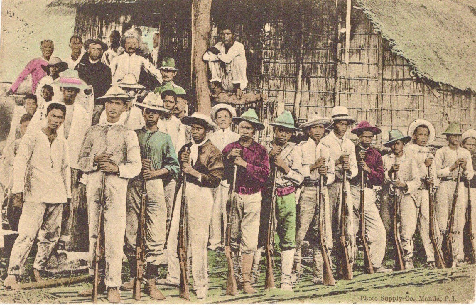
Thomas P. Joseph of the American Bazaar on Calle Magallanes was a prolific postcard pub lisher, although most of the views he sold were based on earlier photos by Tatom. His postcards
can be arranged into several different sets. The largest set, of which the earliest known is dated February 7, 1910, contained 40 different hand colored views. The publisher of this set is not named, but we can assume it was Joseph because the sender of a postcard showing his store wrote on the back: “The American Bazaar in this picture is where I purchased this card tonight.” (figs. 9a & 9b). There were three separate and independent American Bazaars in the Philippines: Joseph's in Cebu (fig. 10), Isaac Beck's on Escolta, Manila, and Abraham Broad's in Zamboanga; all three were major postcard publishers.
The colors in these postcards were applied individually by hand to each one, probably with the help of stencils. A color printed collotype set with a smooth finish made in Germany explicitly for the American Bazaar in Cebu lacks any printer’s code number and was issued on August 6, 1910 (fig. 11). Another, similar color printed collotype set has small code numbers in the lower right corners of the backs, numbered V 74/1 to V 74/15 and X 74/1 to X 74/15; these have a matte finish, with the earliest date seen being May 21, 1911 (fig. 12). The American Bazaar also produced a card with a pocket of miniature folded views, made in Austria.
From among a large set of 408 numbered color printed postcards printed in Germany by Stengel & Co. of Dresden, 20 different views of Cebu
53
Fig. 8 A postcard of so called ‘Insurgents’ by Photo Supply Co. of Manila, from a photograph by Dean Tatom
Fig.
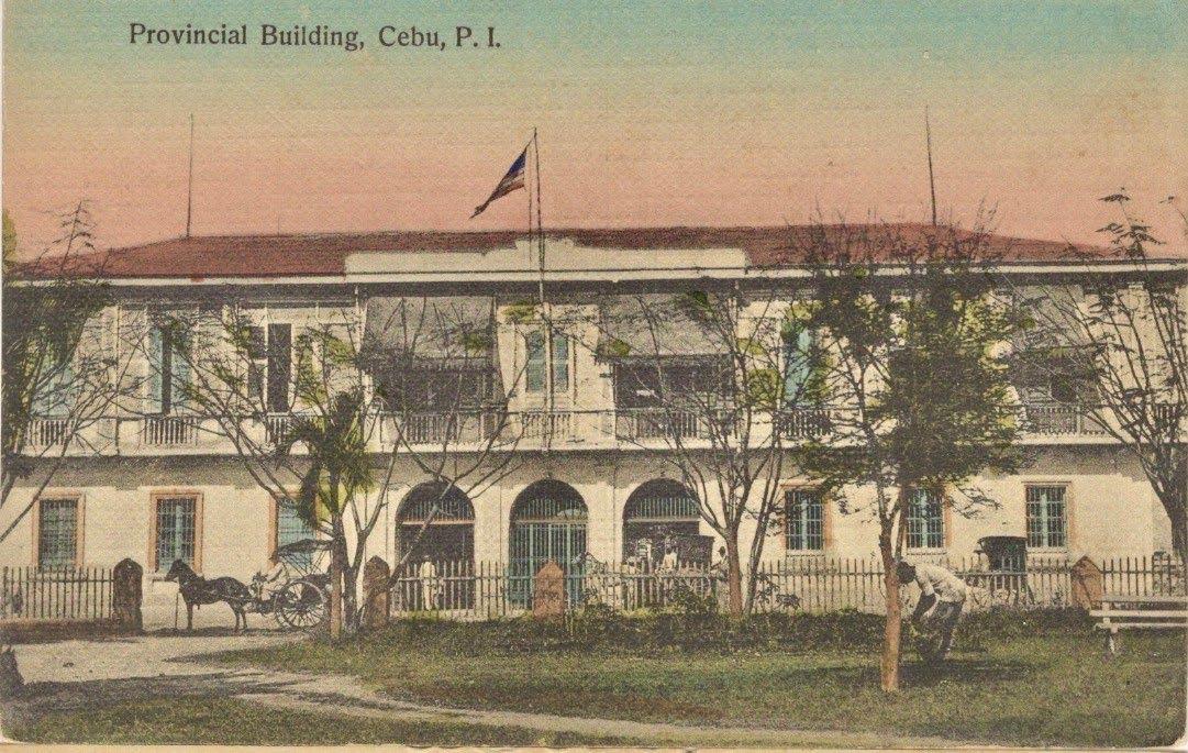
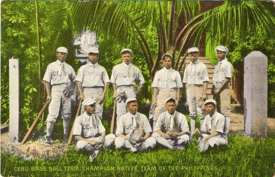
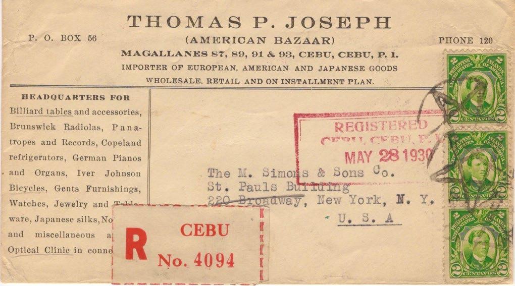
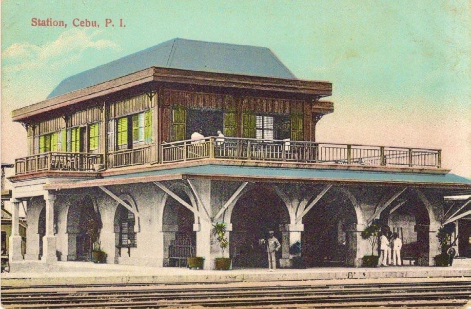

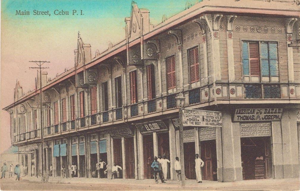
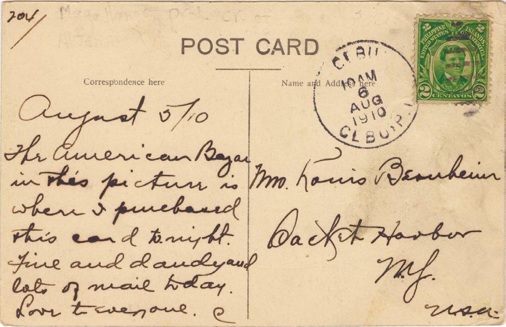
54
Fig. 9a Handcolored 1910 postcard showing the storefront of Thomas P. Joseph’s American Bazaar
9b Back of the anonymous American Bazaar postcard with the sender’s message
Fig. 10 Envelope used by Thomas P. Joseph of the American Bazaar, Cebu
Fig. 11 The Station, Cebu, from a 1910 set of postcards color printed in Germany for the American Bazaar
Fig. 12 The old Provincial Building, Cebu, from a 1911 set of postcards printed for the American Bazaar
Fig. 13a The monogram logo of the LS Co. of Manila
Fig. 13b Postcard by the LS Co. made from a 1910 photo of the ‘Cebu base ball team, champion native team’
Fig. 13c Postcard by the LS Co. made from a 1912 photo of the Guadalupe River ’After a destructive Typhoon’
Fig. 14 ’Freight
were published from 1909 to 1912 by the LS Co. of Manila. The LS Co. was originally Lambert Springer Co. and then later became Lambert Sales Co.; the backs of their postcards carry the firm’s monogram logo in a small circle (fig. 13a). Most of the postcards were made from photos taken by Charles Martin, the official government photographer in Manila. Martin was one of several American ex soldiers who became prolific high quality photographers in the Philippines in the early 1900s, others being Dionisio Encinas in Zamboanga, Pedro Casanave in Iloilo, Samuel Shera who started in Cavite, Edward Gallaher (a former U.S Marine) in Olongapo and, of course, Dean Tatom in Cebu.
Two examples of LS Co. postcards of Cebu are A261 ‘Cebu base ball team. Champion native team of the Philippines’, taken after winning in the Visayan and Carnival meets of 1910 (fig 13b); and A72 ‘After a destructive Typhoon, Philippines’, a view looking west up the Guadalupe River taken from the Forbes Bridge, Cebu City, after the storm of October 15, 1912 (fig. 13c).
About 15 color printed views of Cebu were made by Camera Supply Co. of Manila, and explicitly printed in Germany, starting in 1909. One of these postcards, titled ‘Freight Train P. I.’ (fig. 14), apparently not previously recognized as depicting Cebu, can be identified by the topo graphy and the locomotive.
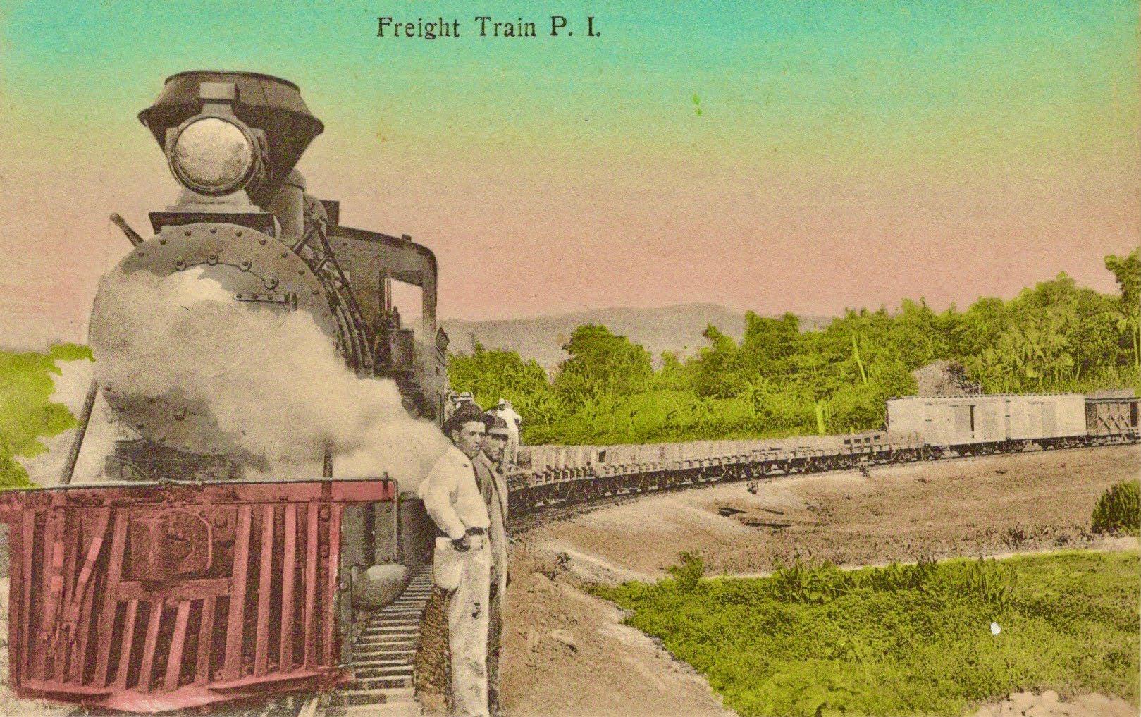
David Leopold Falek, an emigrant from Austria in 1904, published occasional postcards of Cebu over a considerable period ‒ from at least 1913 until the mid 1930s. He purchased what was the International Hotel and renamed it the Hotel Vienna for his original home town, as shown in an advertising postcard from c.1935 (fig. 15). He was also the owner of the Teatro Oriente, and locally married Maria Rivera Mir. One of the real photo postcards locally printed by the D.L. Falek Company shows Calle Magallanes (fig. 16).
Fig. 15 Advertising postcard for D.L. Falek’s Hotel Vienna, c.1935
Falek produced a postcard for Cebu’s 1st Exposi tion and Carnival, held from December 29, 1913 to January 3, 1914; the design was signed by him in the lower left corner (fig. 17a). My copy was mailed by the pre eminent early Cebuano postcard collector, Victorino Reynes, who was active as a philatelist and art collector from the
55
Train P. I.’, a postcard published in c.1909 by Camera Supply Co. of Manila
Fig. 17b The back of fig. 17a
Fig. 17a Postcard designed by D.L. Falek ˃ for Cebu’s 1st Exposition and Carnival, mailed by the collector Victorino Reynes
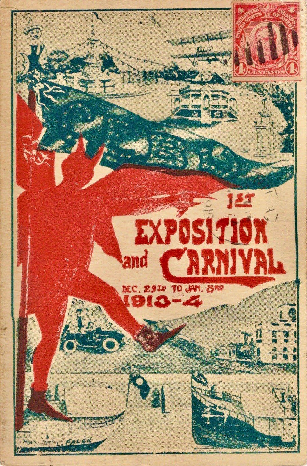
1900s up to the 1950s (fig. 17b); his collections survived the war and have now been widely dispersed. He lived on Colon St., directly across from Falek’s Teatro Oriente, so they undoub tedly knew each other well.
One of the rarest and most beautiful sets of color printed Cebu postcards was published by L.G. Joseph, with his name on the backs, numbered from 1 to 84 (an improbable total). These first appeared in 1917 and were evidently printed in Japan when European printers were unavailable because of World War I. The Josephs were Lebanese, whose family had emigrated to Madras in southern India, where the two brothers Thomas and Lazarus were born and raised; from there they moved on to Singapore, and later to Cebu.
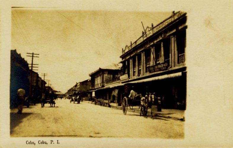
The postcards, which were based on the photos L.G. Joseph took from 1913 to 1916, include: No. 1 ‘Market Day’ (fig. 18a); No. 34 ‘Cebu Station’ (fig. 18b); No. 39 ‘Fire Station’ (on which the sender has written in Spanish that it was also the library) (fig. 18c); and ‘Main Street’
(i.e. Calle Magallanes), showing the American Shoe Store at right (fig. 18d). Other real photo postcards have captions written in Joseph’s quite distinctive style of handwriting, for example ‘San Carlos College Founded in 1575’ (fig. 19a) and ‘St. John’s Day’ (fig. 19b). St. John’s Day, June 24, was an occasion for wild dousings when (usually teenage) boys would have fun surprising strangers by splashing them in a pretended baptism with not necessarily clean water, and then running away to avoid retaliation.
Photo Materials and Paper Co. of Cebu published 50 color printed postcards in 1924, numbered R 93605 to R 93654, printed by Curt Teich & Company of Chicago. These were also made into two booklets of 25 postcards each, which have a perforated edge when detached. The publisher was Henry Aronson, a Lithuanian born American and former soldier who had previously worked for Camera Supply Co. of Manila. He married Maria C. Garcia in Talisay, Cebu, raised children there, and acquired land in Minglanilla and Lahug. His business on Calle
56
Fig. 16 Photo postcard of Calle Magallanes locally printed by D.L. Falek c.1920
Fig.
Fig.
Fig.
Fig.
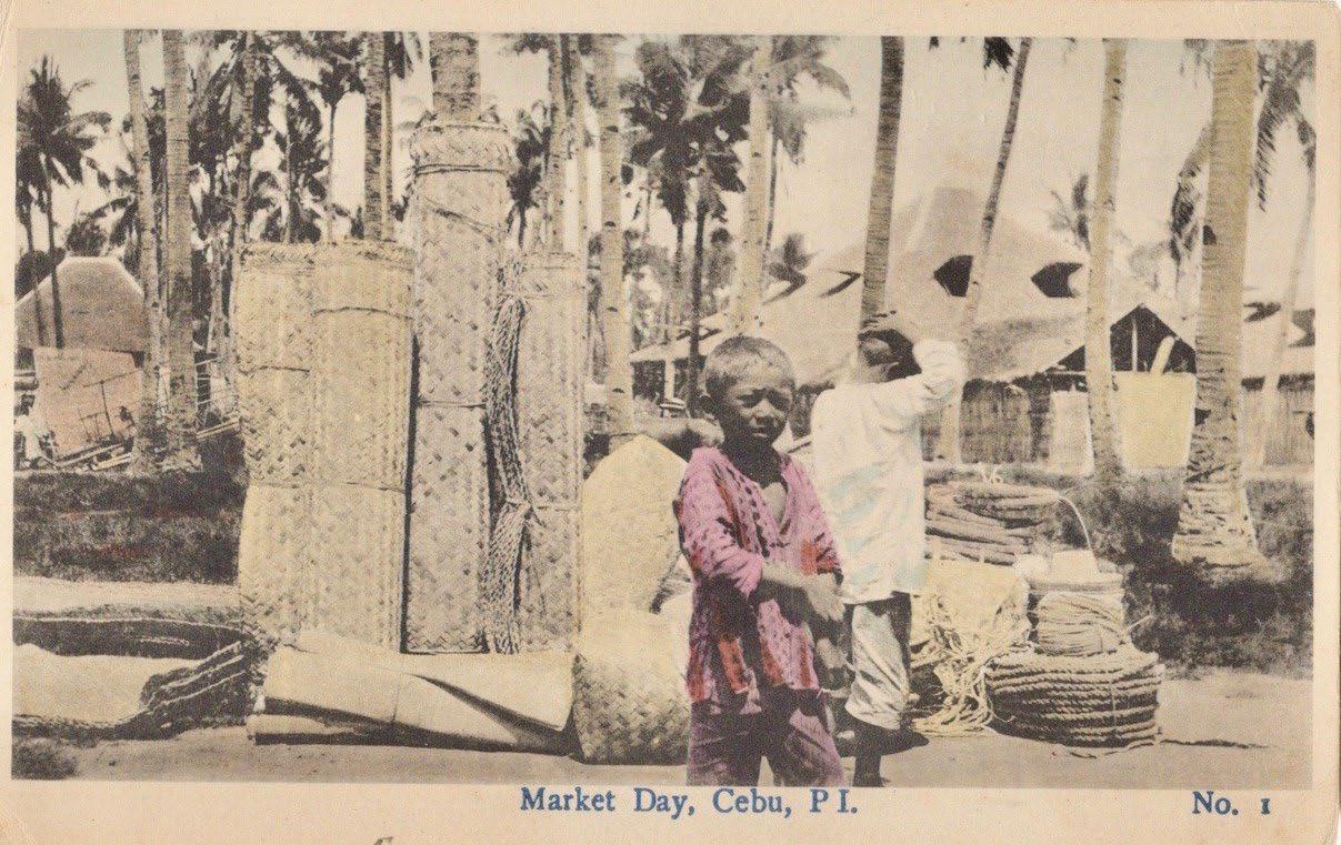
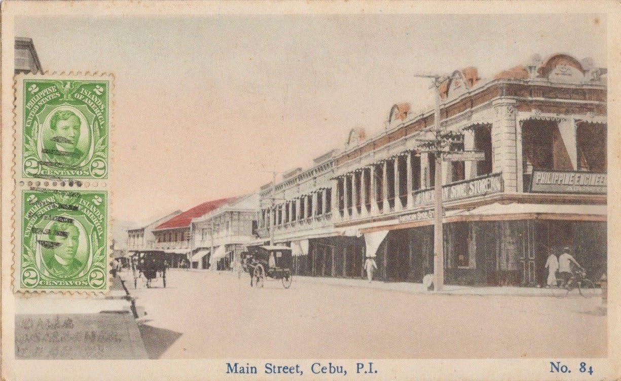
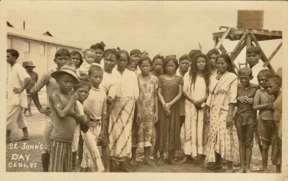
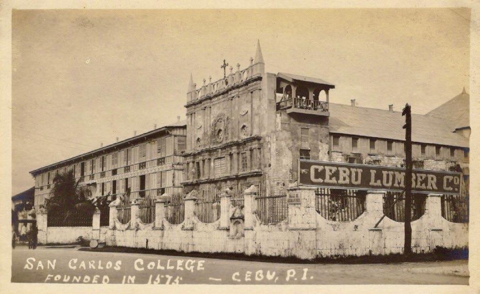
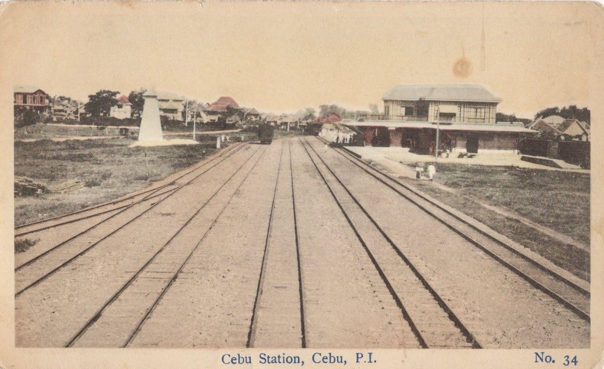
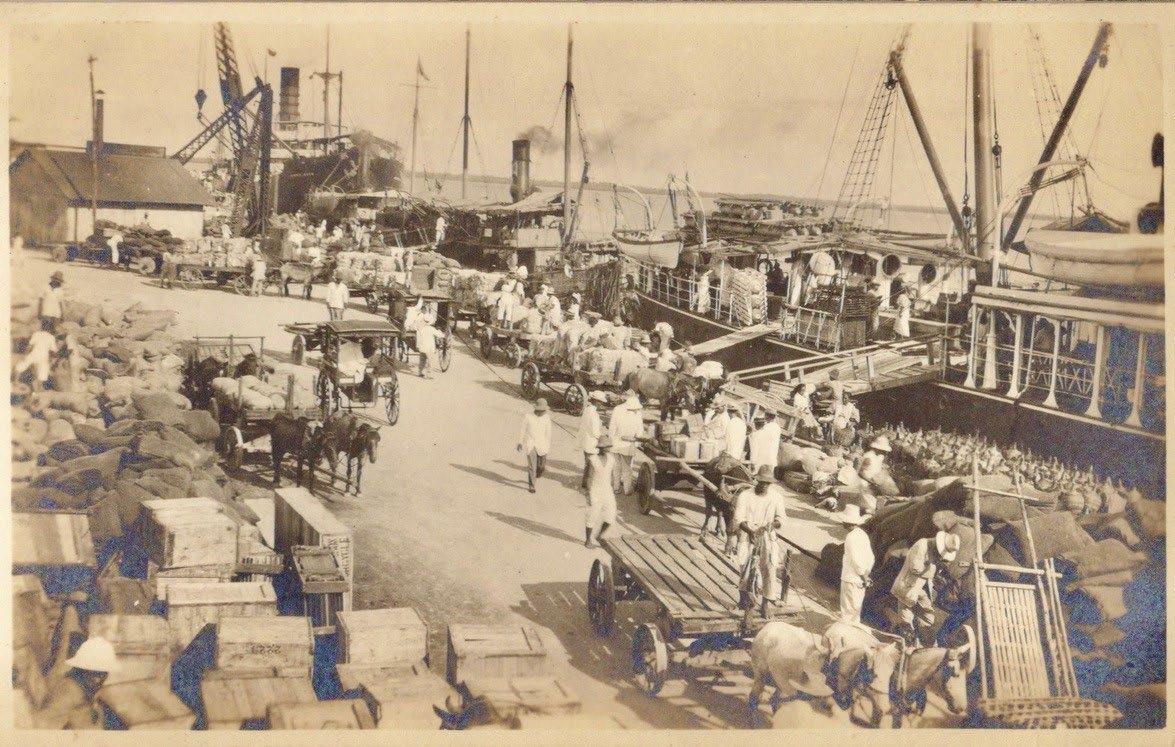
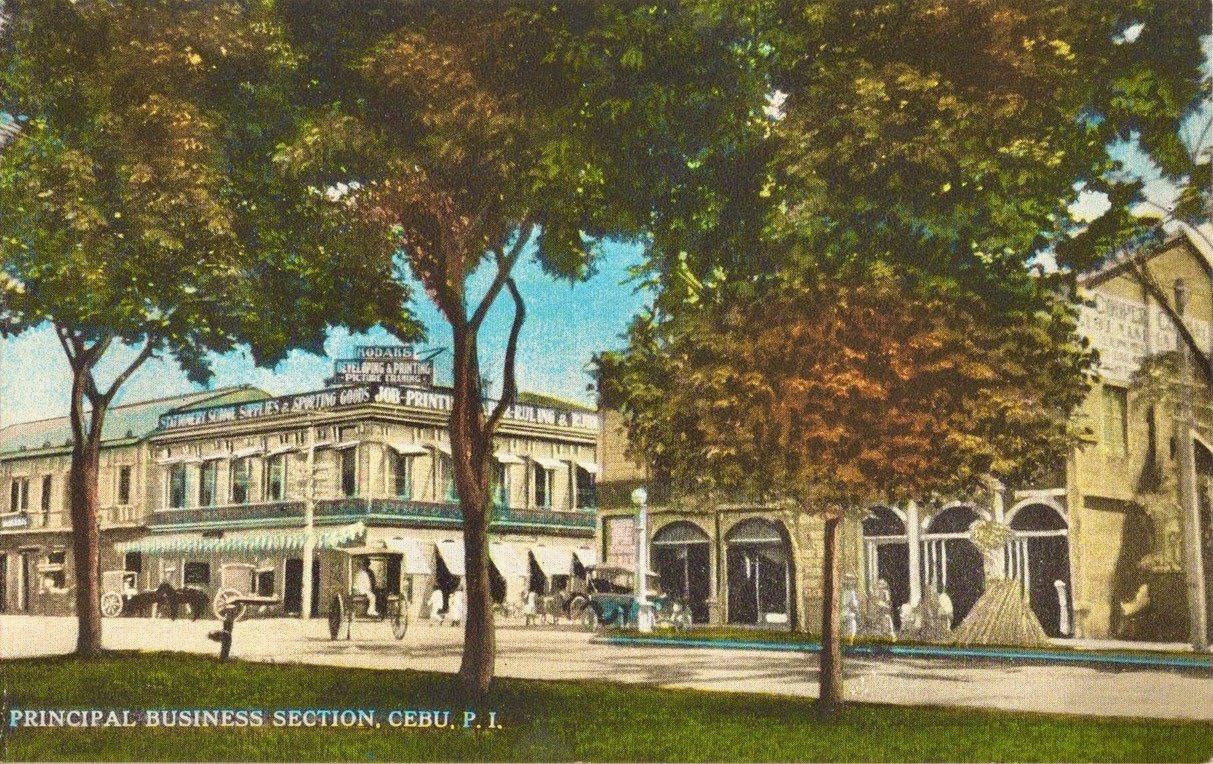
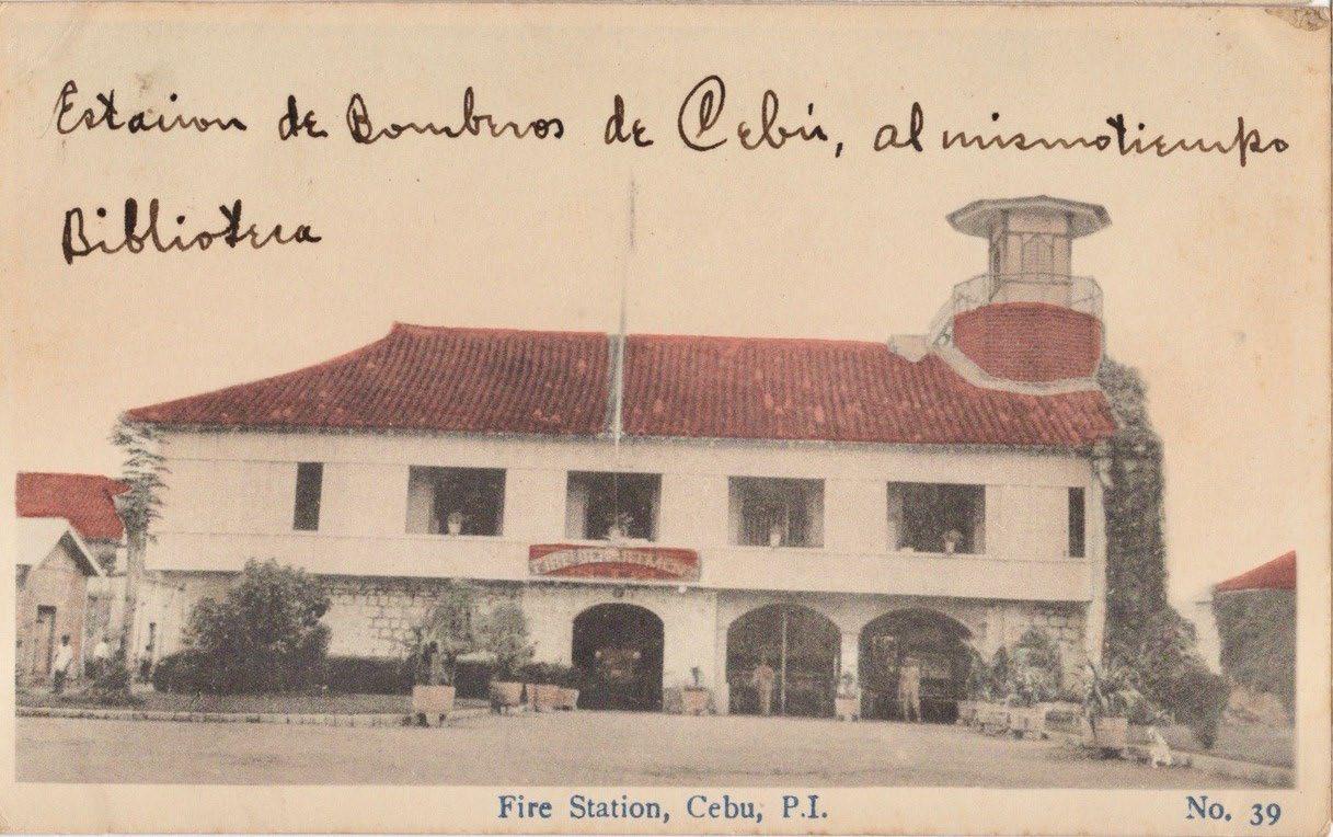
57
18a Postcard No. 1 ‘Market Day’ from a photograph by L.G. Joseph
18b Postcard No. 34 ’Cebu Station’ from a photograph by L.G. Joseph
18c No. 39 ‘Fire Station, Cebu’ from a photograph by L.G. Joseph
18d Postcard No. 84 ‘Main Street’ from a photograph by L.G. Joseph
Fig. 19a Real photo postcard by L.G. Joseph: ‘San Carlos College’
Fig. 19b Real photo postcard by L.G. Joseph: ‘St. John’s Day’
Fig. 20a Real photo postcard by Henry Aronson showing an early view of the Cebu waterfront
Fig. 20b Postcard depicting Henry Aronson’s business in the Principal Business Section, Cebu
Magallanes at the corner of Calle Jakosalem is shown in postcard R 93612, a view of the Principal Business Section, Cebu taken from the Plaza Rizal (fig. 20b).
Various of Aronson’s postcard scenes had also been issued as real photo postcards going back to at least 1914, some borrowed or pirated, and several not from Cebu. For example, an early real photo view of the Cebu waterfront, with horses, carabaos, oxen and sacks of copra (fig. 20a), was reissued as postcard R 93613 (fig. 20c). It is difficult to know if Aronson was much of a photographer himself, or only an entrepreneur, as his store also included the Aghma Studio with J. Mart as the photographer.
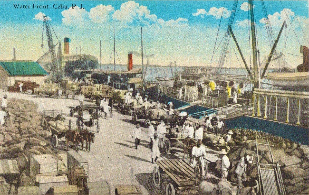
Amidst all these postcards and photographs, a remarkable circumstance about the Philippines emerged. From about 1915 to 1940 it became commonplace for Filipinos to send or give photos of themselves or their group to friends, relatives, classmates, penpals, etc. more often than anywhere else in the world, a quantitative fact presented here for the first time, and demonstrated by the sheer number of the surviving examples, despite the loss of many during World War II. This nationwide practice, among those who could afford it, led to the existence of millions of personal photos from those years, mostly on postcards, which have
thick sturdy paper stock, better resisting the many enemies of paper in the tropics, as well as being easily sent through the mail by merely adding a stamp.
In Cebu, a large number of photo studios mostly did personal portraits, the more prosperous of them offering wardrobes of clothing for clients to borrow for posing, even hairdressers, and fancy painted backdrops to choose from. Almost anyone with a camera could claim to be a photo studio, but here I am featuring (mostly alphabetically) only the more prominent ones, those who identified themselves in a caption, or a handstamp, or an embossed seal, or in a few cases with their own preprinted postcard photo paper.
The evidently Chinese owner of Bungkhong Studio, Chiong Bungkhong (sometimes spelled Bunkhong) also called his studio Fotografia Artistica. He was active from 1904 to 1926, was at one time the most prolific photographer in Cebu, and had his own preprinted postcard stock (fig. 21). A portrait embossed with the studio name C. Bungkhong has ‘A mi prima Loleng’ (To my cousin Loleng) in manuscript on the back and is signed by I. Osmeña, who has been identified by Michael Cullinane as probably Inocentes, a cousin of the future President, Sergio Osmeña (figs 22a & 22b).
58
Fig. 20c Colored postcard of the ‘Water Front, Cebu’, from the photo by Henry Aronson shown in fig. 20a
Fig. 21 Heading of C. Bunkhong’s preprinted postcard paper
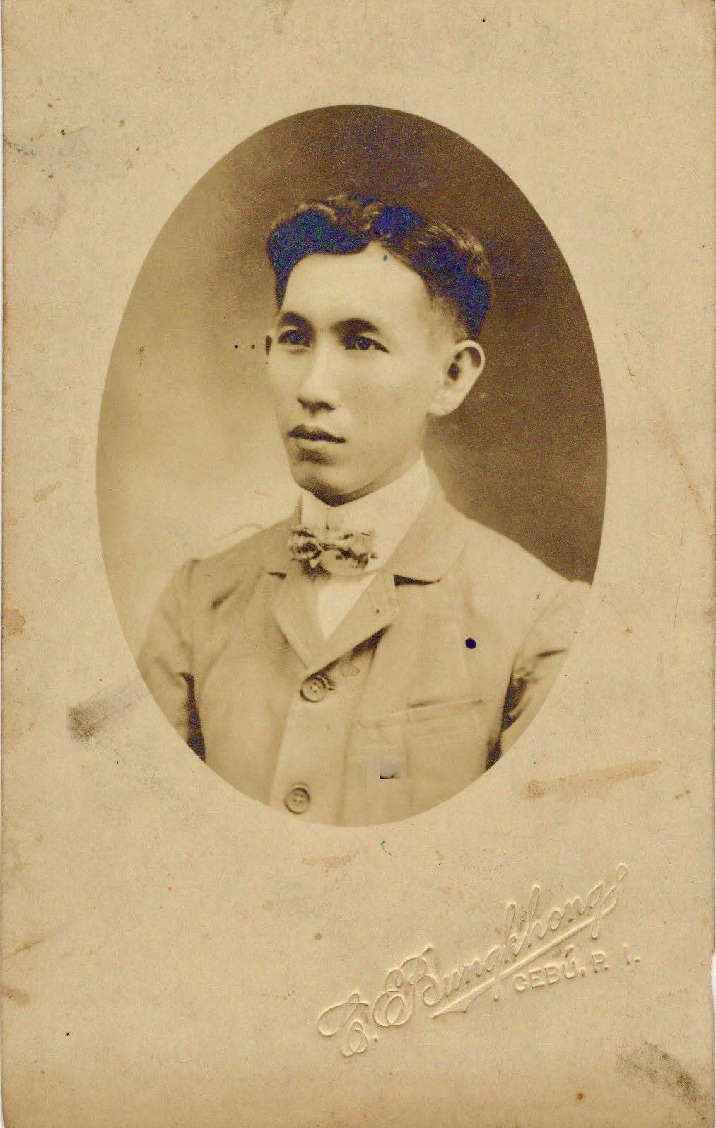
Fig. 22b Detail of the dedication by Inocentes Osmeña on the back of fig. 22a
Having become the premier studio business in Cebu by about 1930, Cebu Studio was the most prestigious and prolific. It had two locations and was owned by the Japanese national M.S. Kuboki, who had previously worked in Jolo and Davao. The studio had its own preprinted type of postcard photo paper, and its film envelope (fig. 23) advertised that: “We sell Kodak Film ‒the dependable film in the yellow box.” Cebu Studio made landscapes and other scenes, such as the church in Opon (today Lapu Lapu City) in Mactan on a bright sunny day (fig. 24), the Ang Kalipayan movie theater (fig. 25a) and the S. I. (Southern Islands) Auditorium c.1930 (fig. 25b), which featured Luis Borromeo or Borromeo Lou, a legendary Cebuano entertainer most famous for Filipinizing vaudeville as bodabil
Cebu Studio also specialized in exquisite society portraits of stunningly beautiful women. The famous Swedish beauty Greta Garbo had one favorite photographer, named C.S. Bull, whose expert portraits helped make her career so successful. Similarly, it was Cebu Studio and M.S. Kuboki who made some of the gorgeous beauties of Cebu famous, including portraits of Isidora ‘Doray’ Siloria, a renowned singer and actress (fig. 26).
59
Fig. 22a Portrait by C. Bungkhong signed by Inocentes Osmeña
Fig. 23 A Kodak film envelope used by Cebu Studio
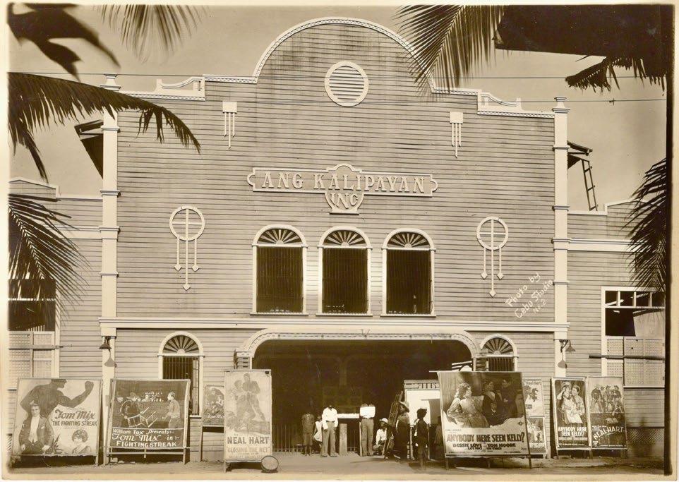
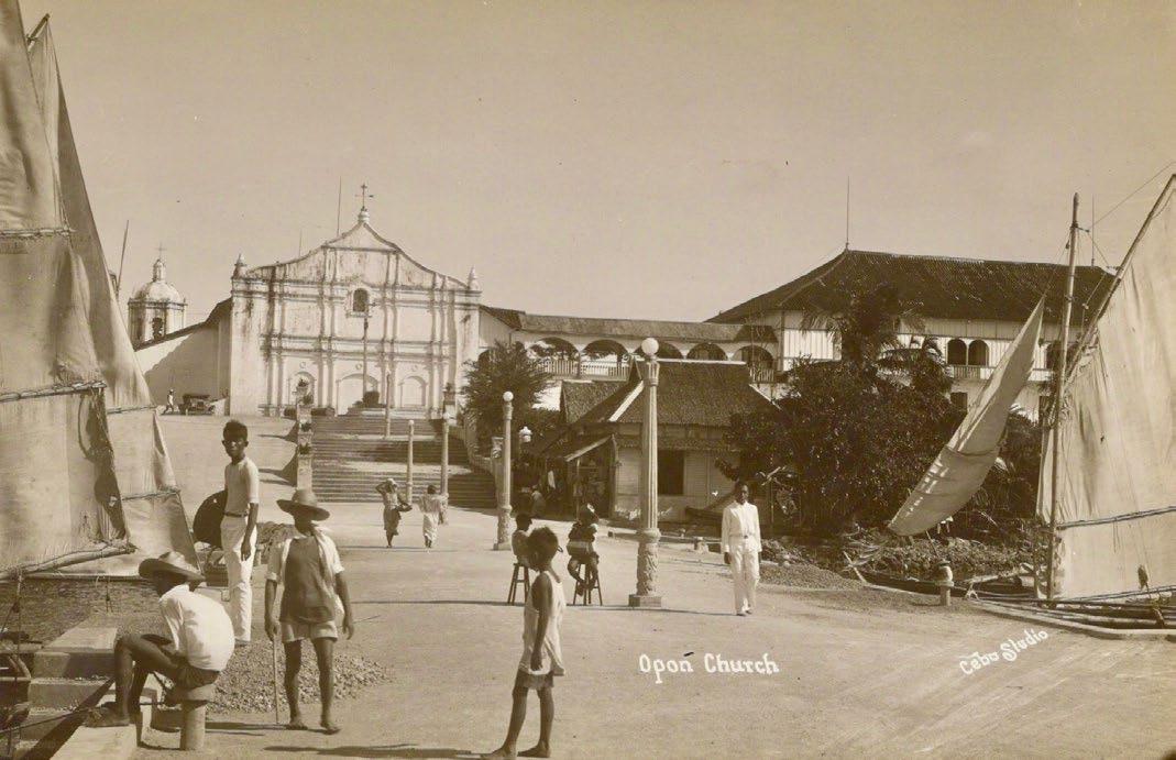
60
Fig. 24 ‘A bright sunny day in Mactan’: Opon Church by Cebu Studio
Figs. 25a & 25b The Ang Kalipayan theater (left) and S. I. (Southern Islands) Auditorium (right) by Cebu Studio
Fig. 26 Portraits of Isidora ‘Doray’ Siloria by Cebu Studio
Fig. 28
Chayseng Studio, whose proprietor S. Chayseng was obviously Chinese, was also called Fotografia Tokming and Centro Moderno Fotografico. Active c.1915 30, the studio had its own decorative preprinted postcard stock (fig. 27) and also embossed photos with its elaborate seal as on the portrait photo of a young man (fig. 28). We do not know the subject’s name because he signed himself only as the Original, a common practice; such studio portraits were much more often made for women than men. The Cebuano language scholar Erlinda K. Alburo suggests that a group school photograph by Chayseng is of the Inmaculada Concepcion School (fig. 29).
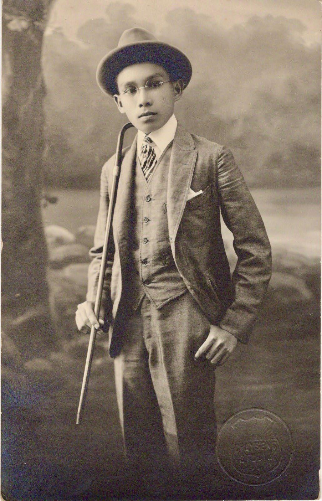
Fig. 27 - Chayseng Studio’s preprinted photo postcard paper
Mancao Studio existed in Carcar, although the most famous member of that photographic family was Filemon Aguilar ‘Frank’ Mancao who made his reputation by photographing Filipino farmworkers in California during the Great Depression of the 1930s. This Cebuano family is deservedly represented here by the photo of ‘The flowers of Pook’ taken by L.A. Mancao, dated June 17, 1927 (fig. 30). Today Pooc (sic) is a barangay of Talisay City, Cebu.
I do not have the name of the owner of National Studio, active in the 1930s, who often assigned his photographic employees to cover events outside Cebu City, such as the crowning of Princess Annie of Just Imagine Club, Pinamungahan on April 16, 1932 (fig. 31) and of Her Majesty Queen Domenica I and Consort, Elected ‘Miss Liberty’ at the Dalaguete Town Fiesta on Feb. 14 15, 1937 (fig. 32).
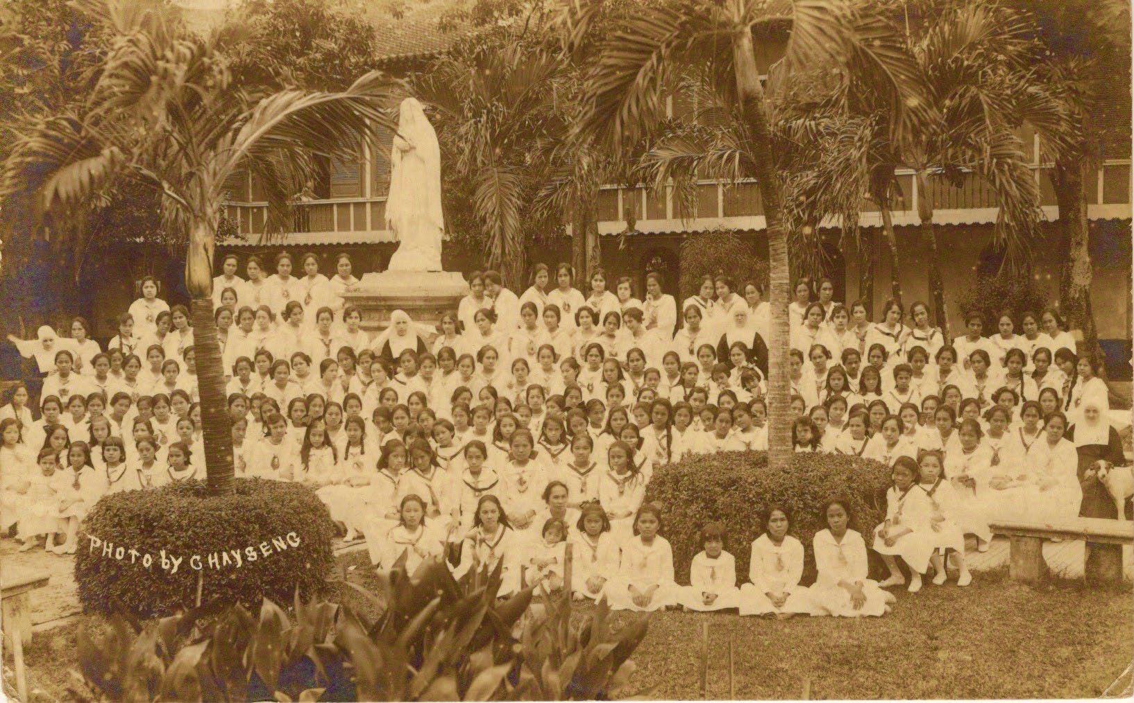
In an almost completely male monopolized profession in the Philippines, it was gratifying to find Rosa Studio, also known as R. Gonzales Studio and Fotografia Feminista, whose owne
29
61
- Unidentified studio portrait by Chayseng Studio
Fig.
Photo of the Inmaculada Concepcion School by Chayseng
was Rosa Gonzalez de Tumulak. It was located at different times at 152 Calle Manalili and 213 Calle Juan Luna, and produced studio portraits with the elaborate props popular at the time (figs. 33a & 33b) and a dramatic photo of the 1927 Cebu Carnival (featured on the back cover) Other notable women photographers in the Philippines were foreigners: Josephine Barnes Harnish in Zamboanga around 1902, and Chet Peypoch in Manila after World War II.
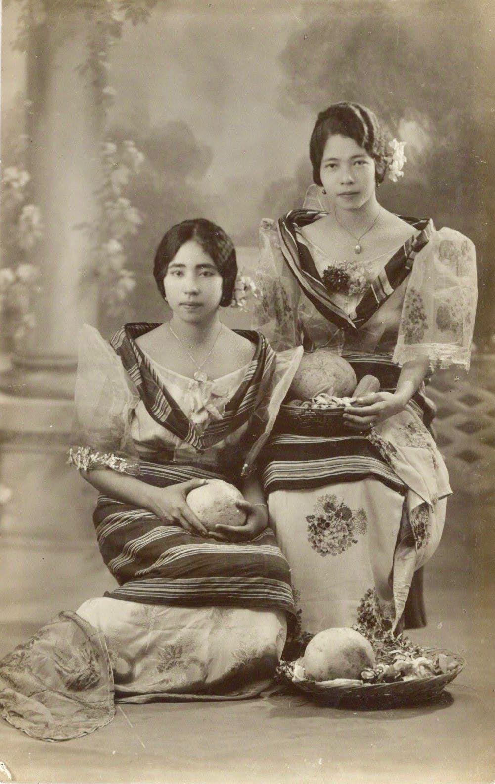
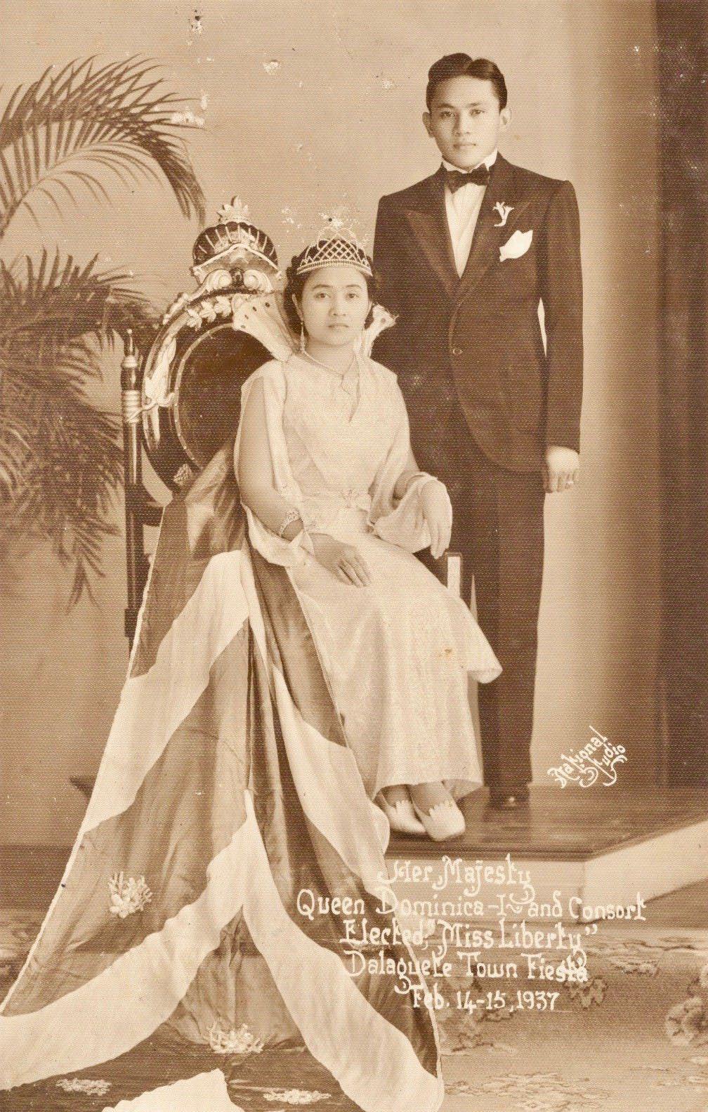
As far as I know, the only studios in Cebu that operated both before and after World War II were Venus Studio and Sanson Studio. The latter pictured the Cebu Indoor Baseball team of the Cebu Normal School, Champion in the 1933 East Visayan Athletic Meet held in Tacloban on Dec. 15 17, 1933 (fig. 34). Despite the caption saying ‘Indoor Baseball’, they actually played softball outdoors, without gloves, catching the ball in their bare hands or in their skirts.
62
Fig. 30 ‘The flowers of Pook’ by L. A. Mancao 1927
Fig. 31 Princess Annie of Pinamungahan by National Studio 1932
Fig 32 Queen Domenica I and Consort, Figs 33a & 33b Studio portraits by Rosa Gonzales de Tumulak Dalaguete town fiesta 1937, by National Studio labeled Rosa Studio (left) and R. Gonzales Studio (right)
Shadow Studio seems to have existed during only the last few years before the War. In her studio portrait, Miss Maria O. Peñaflor, Graduate in Dressmaking and Costume Designing, Visayan Fashion Academy, June 17, 1938 is presumably wearing a dress she made herself (fig. 35).
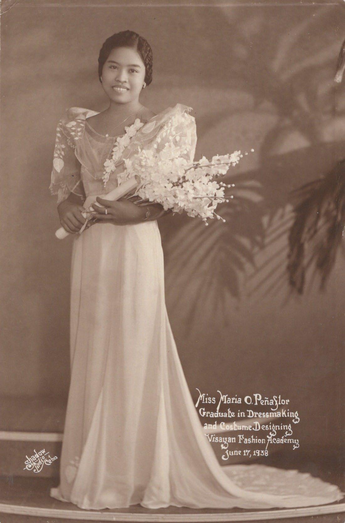
Star Studio belonged to Quir and Montaner and was active at least from 1920 to 1930. One of their portraits shows a lady with her handnet and basket, ready to catch studio fish (fig. 36).
The Dutchman Karel Knip came to the Philippines as a supply officer for the Philippine Constabulary and stayed on to become a photographer, calling himself The Visayan Art Studio or ‒ as embossed on his studio portrait of ‘Andang’ (fig. 37) ‒ Visayan Artistic Studio. In a note added by the recipient, Conrada ‘Andang’ Basan, pictured in January 1930, was said to be the best girl athlete at her school. Knip’s advertising postcard offered Island Views, Photo Supplies, Developing, Printing, Artistic Portraits, Enlargements, and Velox Postcards (fig. 38). Velox was a brand of postcard photo paper manufactured by the Eastman Kodak Company.
63
Fig. 34 The Indoor Baseball (i.e. softball) team of the Cebu Normal School, by Sanson Studio 1933
Fig. 35 Miss Maria O. Peñaflor, Graduate in Dressmaking, by Shadow Studio 1938
In addition to the various studios and photographers of Cebu mentioned above and pictured, there were many others, as shown in the following table.
Studio / photographer Dates active Proprietor / notes
Amading’s Studio, Toledo early 1920s
City Studio c.1927 36 not connected to City Studio, Zamboanga Climaco y Gandionko c.1902 08
Fotografia Española de Cebu
Fotografia Filipina 1895 1902 Luis Castaño
Fotografia Modernista c.1909 F. Aguilar
Gaudencio Mosqueda c.1901
Gran Novedad Fotografia 1895
Hijada Studio pre World War II Japanese owned
Iriarte Studio c. 1920 Prudencio Iriarte S. Kavinta c.1913 Simeon Cavinta (also Fotografia Universal)
Modelo Filipino pre 1920 Najarro’s Little Shop c.1929
Perez Studio, Barili c. 1925 P. I. Studio 1930s
Robles Studio pre World War II
Royal Studio c. 1937
Silver Studio pre World War II
Sun Studio, Cebu pre World War II B. Nagata; unrelated to Sun Studio, Manila
Venus Studio, Cebu 1930s to 1950s different from Venus Studio, Manila
We already knew photography was a cosmopolitan pursuit after its earliest inventions were shared freely with the world by France, rather than patenting them. It is not so remarkable then that this study of a local or regional nature for Cebu is simultaneously international, with connections to Austria,
China, England, Germany, Japan, Lebanon, Lithuania, the Netherlands, Spain and the United States. Although colonialism itself is intrinsically international, Cebu’s photographic links go far beyond the narrow limits of the Philippines’ own colonial history.
64
Acknowledgements
Michael Cullinane, Center for Southeast Asian Studies, University of Wisconsin Madison, was indispensably helpful in many ways, especially by scrutinizing the early directories of Cebu. I also received valuable information from the true Cebuanos Prof. Resil B. Mojares, author of many scholarly books; Lucy Urgello Miller for her superb volume ‘Glimpses of Old Cebu’; Fe Susan Go the SE Asia librarian at the University of Michigan; Isabel Taylor Escoda, author and newspaper columnist; Margarita V. Binamira; Erlinda K. Alburo; Joet Reoma of Ann Arbor, MI; and Aires Robledo Muaña of Jackson, MI. Finally, I thank Peter Geldart, the assiduous and meticulous editor of ‘The Murillo Bulletin’.
As well as photographs and postcards, photographic stereoviews of Cebu were also published, notably by Underwood & Underwood, the Keystone View Company and B.W. Kilburn from photos taken c.1900 However, stereoviews are not illustrated in this article since they are displayed extensively in ‘Glimpses of Old Cebu’ by Lucy Urgello Miller (University of San Carlos Press, Cebu, 2010), which is available from the author lvumiller@gmail.com ‒ in the U.S., from the publisher in Cebu City, and from Grupo Kalinangan ‒https://grupokalinangan.org ‒ in Manila; and in the ‘Catalogue of Philippine Stereoviews’ by Christian Perez (We Print Graphics and Publication Services, Manila, 2002).
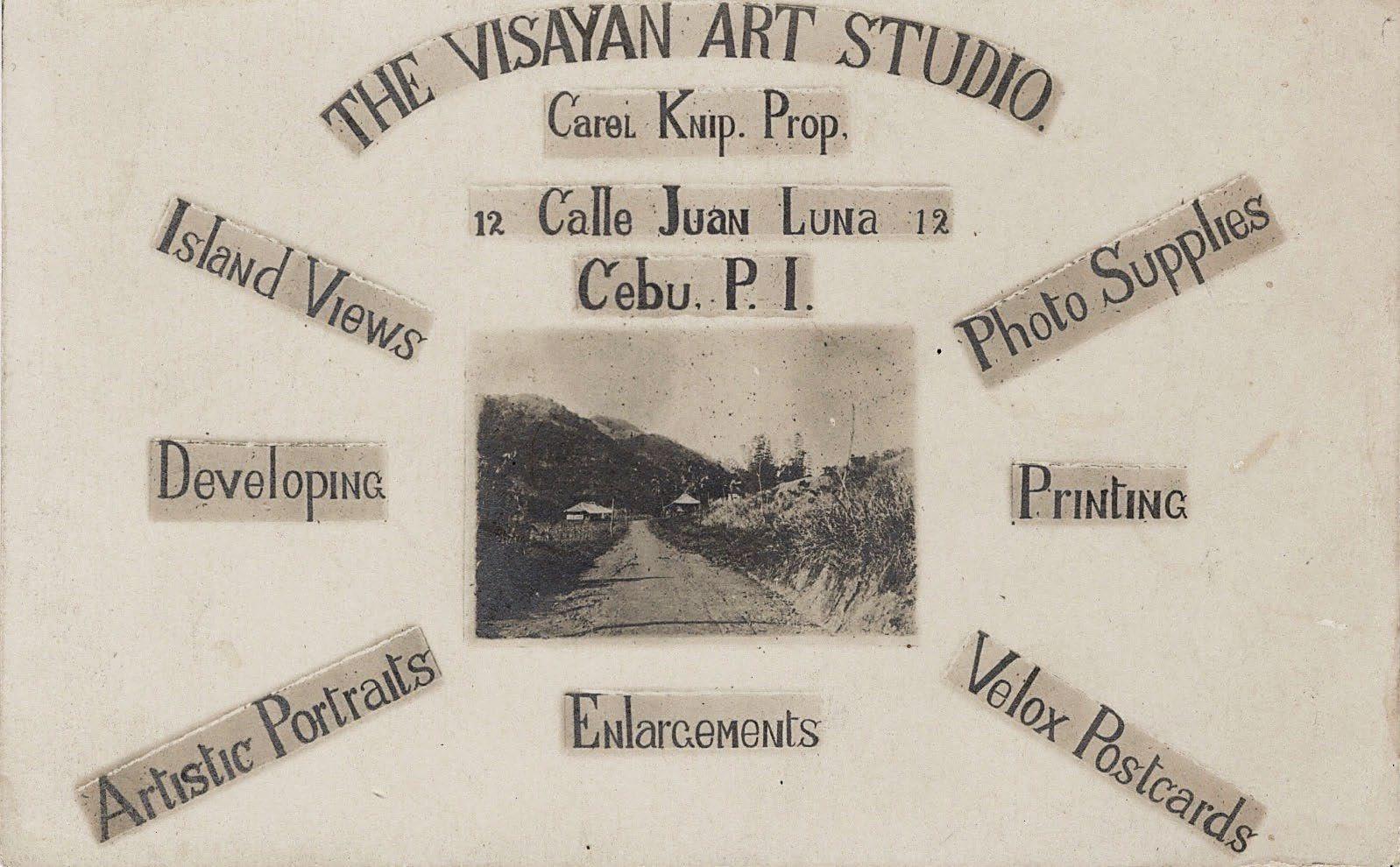
65
Fig. 36 Portrait of a lady ready to catch studio fish at Star Studio, Cebu
ᴧ
Fig. 38 Advertising postcard for the Visayan Art Studio Fig. 37 Conrada ‘Andang’ Basan by Visayan Art Studio ˃
BLAEU, Johannes. [Manuscript chart of the Javan Sea]. Amsterdam, 1672.
Daniel Crouch Rare Books info@crouchrarebooks.com crouchrarebooks.com
London 4 Bury Street, St James’s London SW1Y 6AB +44 (0)20 7042 0240
New York PO Box 329, Larchmont NY 10538-2945, USA +1 (212) 602 1779
Faros y Fanales: Cebu’s Spanish Lighthouses
by Peter Geldart
LIGHTHOUSES were among the many modern technologies introduced to the Philippines by the Spanish in the 19th century. The oldest faro (lighthouse) to be built in the country was at the entrance to the Pasig River in Manila, first lit in 1846, and this was followed by lighthouses on the islands of Corregidor and Pulo Caballo at the entrance of Manila Bay, both inaugurated in 1853. By the end of Spanish colonial rule in the Philippines, across the archipelago 55 lighthouses had been built (or were under construction) by the Cuerpo de Ingenieros de Caminos, Canales y Puertos (Corps of Engineers of Roads, Canals and Ports).
Lighthouses are used for a number of purposes: as fixed points of reference for navigation, for the identification and warning of rocks, reefs and shallows, as lights guiding navigators to landfall, and to mark the entrances to ports and harbours. To accommodate these various uses, during the Spanish period lighthouses were made in different sizes and with lights of different strength, classified into six ordenes (orders).
Those of the primero orden, throwing their beam the farthest out to sea, were used to guide ships arriving from international waters; the segundo orden were used for navigating the channels and straits between islands; the tercero orden, with a narrower beam, guided vessels through straits, channels and passages; and those of the cuarto, quinto and sexto ordenes were primarily used as beacons, buoys and harbour lights.
The Spanish authorities were well aware of the benefits to shipping that had accrued from their implementation of a comprehensive system of marine lights around the coasts of Peninsular Spain, and determined to do the same for the Philippines. Consequently, to quote from Faros españoles de ultramar, the definitive book on Spanish lighthouses overseas published by the Ministerio de Obras Públicas y Transportes:(1)
As a result of the needs identified, a Plan General de Faros (General Lighthouse Plan) was drawn up, which the General Directorate of Hydrography would entrust to Lieutenant Claudio Montero, who completed it on June 6, 1857. Sent to the Government of the Islands, it was later approved by a Royal Decree of March 17, 1859 which ordered the architect of the Treasury to settle the expense budget, installation and maintenance for the light houses that would be included; he finished it on March 5, 1860.(2)
67
The Liloan lighthouse on Bagacay Point, built in 1904 and photographed in 1910 24 (from the collection of Lucy Urgello Miller)
In 1867 another commission headed by Eduardo López Navarro, head of the Cuerpo de Ingenieros de Caminos, Canales y Puertos, and Carlos Pineda of the Armada (Spanish Navy) was formed to identify sites in the archipelago that needed lighthouses. The work was completed in 1874, with a total of 70 potential sites identified, and a final report was submitted by engineer Magin Pers y Pers on 14 September, 1887. This report, Plan General del Alumbrado Maritimo del Archipielago Filipino, includes a map that shows all of the proposed lighthouses.(3) Each light is identified by a pictograph showing the order of the light, and the pattern and colour(s) of its flashes, supplemented by a code explained in the legend Apariencias de los Faros. Arcs are drawn to show the distances from which the lights could be seen at sea, sea routes are indicated in red, and there is a separate table of Luces Locales
The Plan General del Alumbrado Maritimo shows that not only the coasts of the largest islands needed to be lit, but also the vital sea routes between islands. The opening of the
ports of Iloilo (in 1855) and Cebu (in 1860) to international trade resulted in a substantial increase in the volume of trade between them and Manila, and these sea routes in particular were considered important. For the island of Cebu, five lighthouses and their classification are identified on the map:
Punta Bulalaque (aka Bulalagui) at the north end of Cebu 3B
Punta Bantulin on the northeast coast of Cebu 3BR
Liloan on the east coast of Cebu LF
Isla Cabilao an island near Bohol facing Cebu 3B Punta Tañon at the south end of Cebu 3 BR
3B indicates a third order light with white flashes in groups of three; 3BR indicates a third order light with white flashes in groups of three alternating with a single red flash; and LF indicates a fixed white light.
Notice to Mariners issued by the U.S. Light house Board dated August 4, 1858 (from the author’s collection)
68
Detail of Cebu’s lighthouses from (left) Plan General del Alumbrado Maritimo del Archipielago Filipino (1887) and (right) Plan de Apariencias del Alumbrado Maritimo de Filipinas (1890) (images courtesy of the Archivo Histórico Nacional, Madrid)
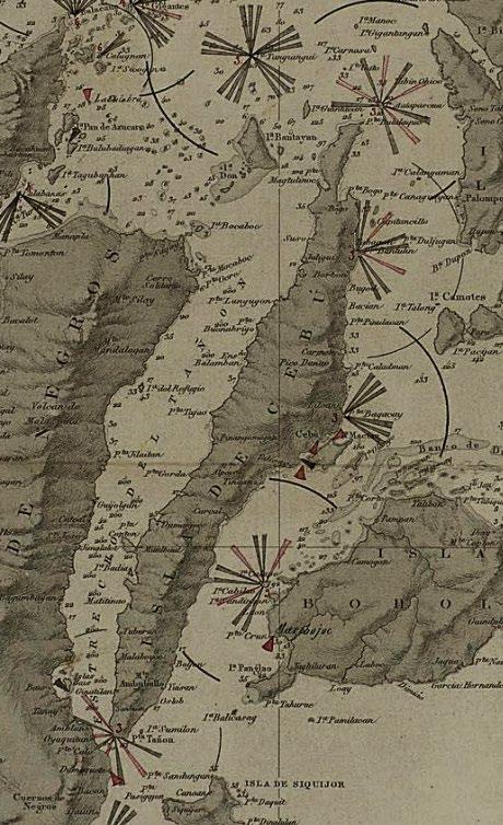
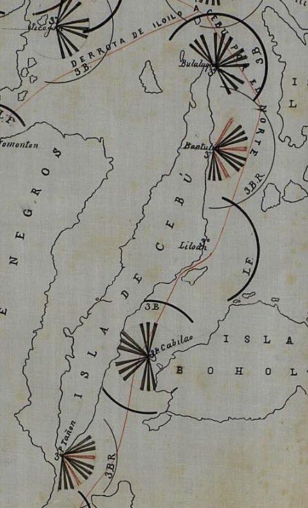
Three years later a new Plan de Apariencias del Alumbrado Maritimo de Filipinas was produced.(4) The accompanying map uses the Carta General del Archipiélago Filipino levantada principalmente por la Comisión Hidrográfica al mando del Capitan de navio D. Claudio Montero y Gay, published by the Direccion de Hidrografia in Madrid in 1875, on which the proposed lighthouses have been added in manuscript. The map is dated ‘20 de Junio de 1890’, carries the stamp of the ‘Obras Publicas Comisiones Especiales’, and is signed by ‘El Ingeniero, Gmº Brockmann’; Guillermo Brockmann was the head of the Lighthouse Service.
The 1890 plan mostly shows the same lighthouses as the 1887 plan, but with revisions to the earlier map. A lighthouse has been added on the island of Tanguingui (as discussed further below), and the lighthouse at Punta Bulalaque has been moved to the island of Malapascua. At Punta Bantulin and Isla Cabilao the lights are
now shown as having double white flashes alternating with a single red flash. The light at Punta Bagacay is no longer shown as fixed but as a third or fourth order light with white flashes in groups of three. The light at Punta Tañon has been moved a little to the west, and its pattern changed from white flashes in groups of three alternating with a single red flash to alternating single white and red flashes.
Four fanales (beacons) are now shown in the vicinity of Cebu Harbour: fixed red lights at the northwestern tip and off the southwestern corner of Mactan; a fixed white light at the port of Cebu; and a fixed red light near the City of Mandaue. The last of these, today known as the Torre de Mandaue, is also mistakenly called the Bantayan sa Hari (a tower intended to watch out for Moro slave raiders). According to Trizer Dale Mansueto: “This former torreon can still be seen today, a badly restored circular watch tower at the foot of the old Mandaue Mactan Bridge in Barangay Opao.”(5)
69
Some of the lighthouses shown on these two plans were never built, or were moved to different locations. A suggestion was made that the lighthouse at Punta Bulalaque would be ‘mejor en el islote de Chocolate’ (better on Chocolate Island, today Padji Island), located between the point and the island of Malapascua; in 1894 plans were drawn up to build the lighthouse on Malapascua, but it was not in fact completed until 1913. The light proposed for Punta Bantulin was replaced by the one on the island of Capitancillo (as discussed further below). As for Punta Tañon, it appears that no detailed plans were made for a lighthouse at this location and it was never built.
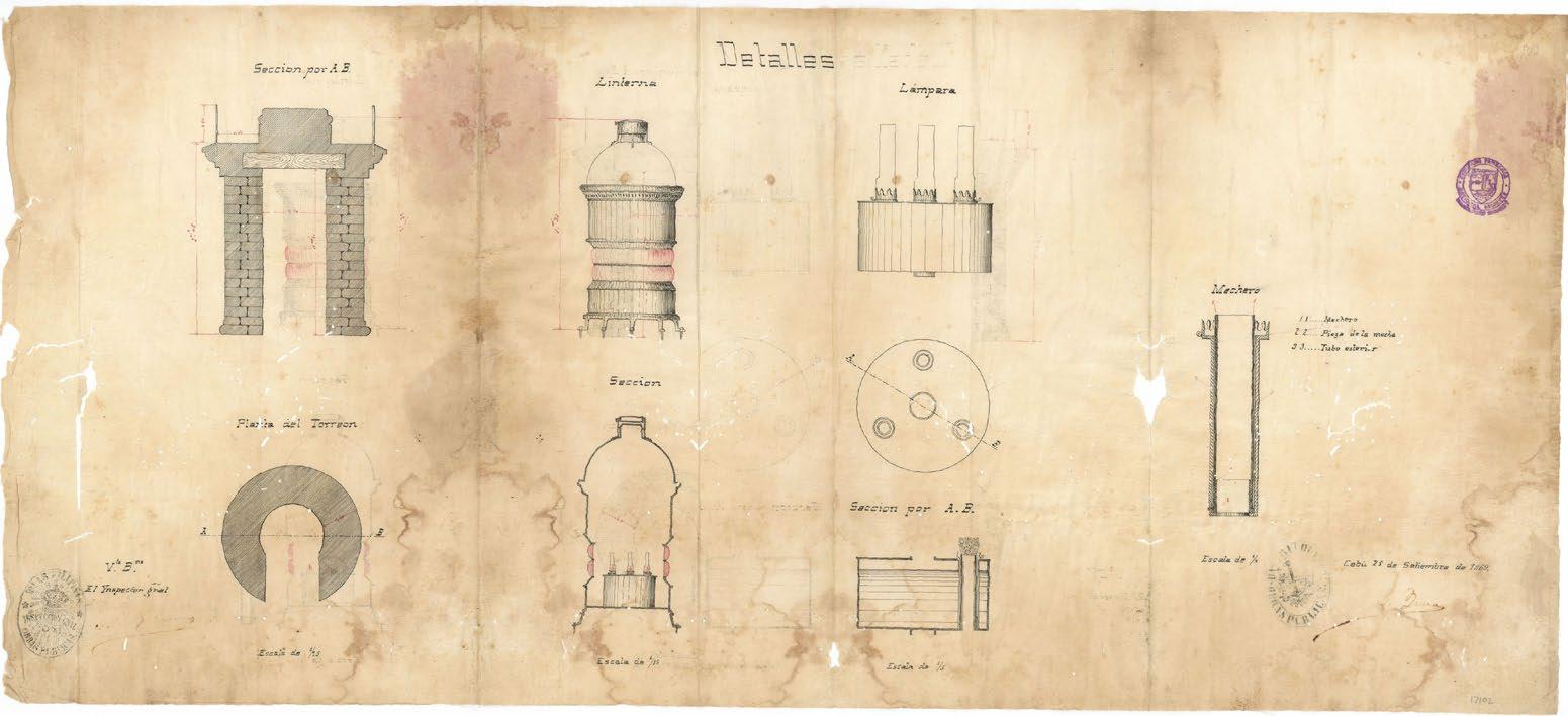
The first documented lighthouse in Cebu was the one at Liloan, as announced in a Notice to Mariners issued ‘By order of the Light house Board’ of the U.S. Treasury in Washington D.C., dated August 4, 1858 and signed by the Board’s Secretary, Thornton A. Jenkins.(6)
The Notice reads (in part) as follows:
NOTICE TO MARINERS. CHINA SEA PHILIPPINE ISLANDS. LIGHT AT PORT ZEBU.
The Spanish Government has given notice, that a harbour light has been established at Point Dapdap (?) at the northeast entrance of Port Zebu, on the eastern coast of Zebu, one of the Filipinas or Philippine islands, in the China Sea.
The light is a fixed white light, placed at an elevation of 50 English feet above the level of the sea, and should be visible in clear weather at a distance of four miles.
Its position is in about lat. 10o 21 ½’ N., long. 124o 3’ east of Greenwich by the Admiralty charts, or in long. 123o 49’ east, according to the Spanish official notice.
Proyecto de un torreon para luz del puerto de Cebù Plano Focal (left) with (below) its Detalles, plans from the Obras Publicas dated September 25, 1869 (images courtesy of the National Archives of the Philippines)
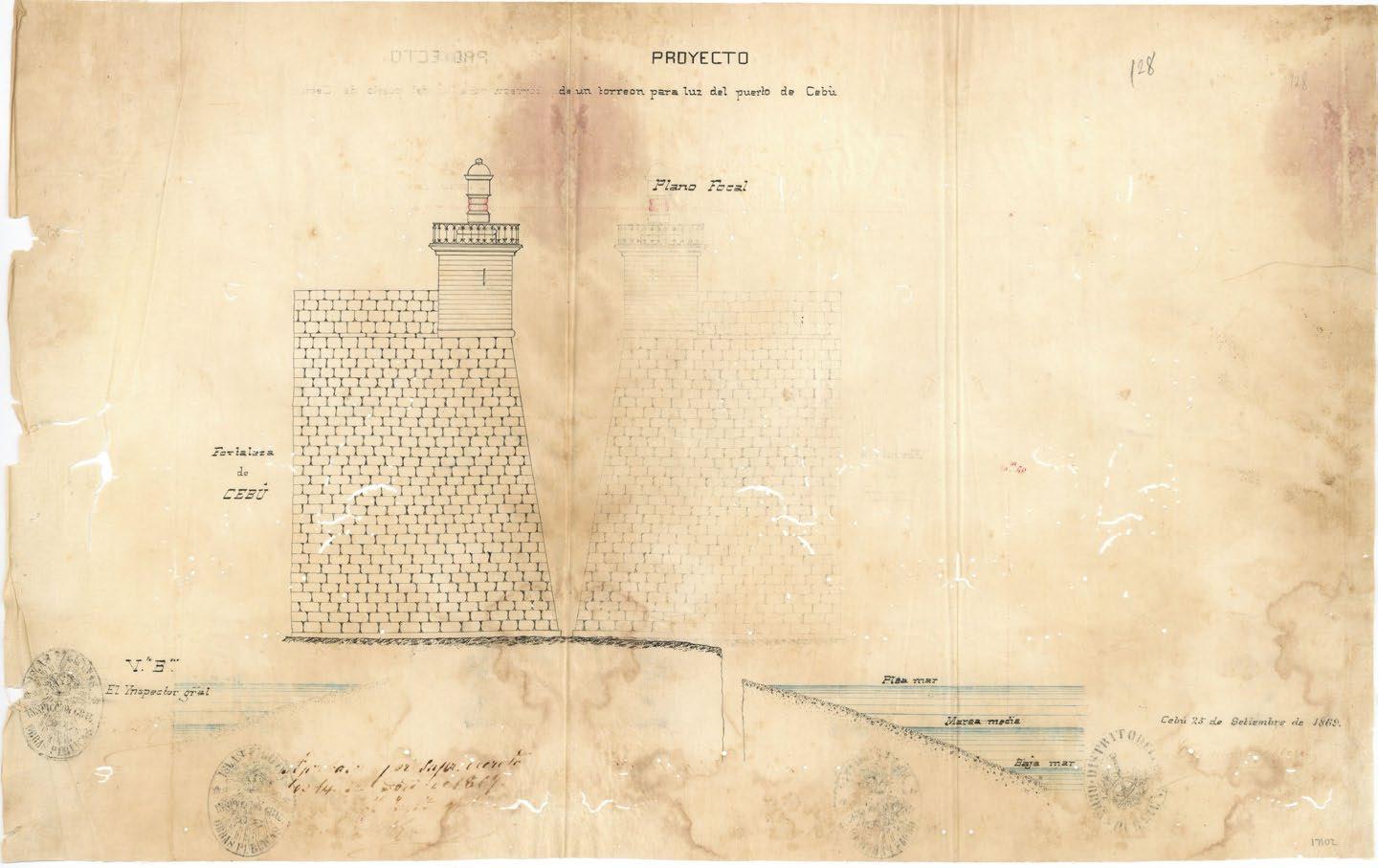
70
Faro de 4o Orden del Islote Capitancillo, plan by the Servicio de Faros dated December 9, 1893 (image courtesy of the National Archives of the Philippines)
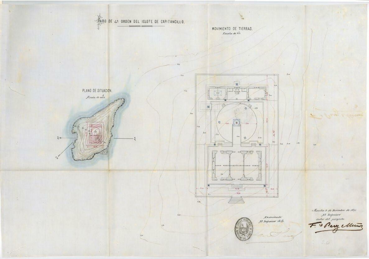
The location given for the lighthouse, Point Dapdap (aka Punta Cot cot), is incorrect, as hinted at by the ‘(?)’ in the Notice. Liloan lies between Point Dapdap to the north and Point Bagacay to the south, and the location of the Liloan lighthouse was in fact above the latter, as correctly shown by the stated coordinates 10o 21½’ N., 124o 3’ E. The small Luz de Bagacay was apparently reconstructed in 1874, as described by Don Camilo de Arana in the 1879 Derrotero del Archipiélago Filipino:
On 1 January, 1874, a fixed white light elevated 14.10 meters above the sea, with an approximate range of 9 miles, was lit at Bagacay Point. Its tower is circular, 6.46 meters high, and the keepers' house is made of nipa and is separated from the tower. This light is difficult to distinguish among the multitude of much more vivid lights that the fishermen light in its vicinity.(7)
Located some four miles north of the channel leading to the port of Cebu, the Bagacay lighthouse was of vital importance for ships approaching the port whether they were coming from Manila or arriving from the east through the Surigao passage and around Bohol. Given the difficulty of passing through the north channel, ships would wait until daylight to enter the port, and consequently a more powerful light at Bagacay was deemed necessary. Plans for the new lighthouse, to be built on a higher site ‒ a plateau above the beach some 300 metres from the existing Liloan light ‒ were produced by Engineer José Cabestany on June
19, 1894; these were revised on 17 October, 1895 and approved by the Governor the following month.
However, the works were suspended in 1896 because of a lack of resources, and the Philippine Revolution followed by the Philippine American War ensured the project remained on hold. The new lighthouse was eventually authorised by an executive order issued on 28 July, 1903 by the then Governor General of the Philippines, William Howard Taft; it was built under the direction of George Putnam,(8) and first lit on 1 April, 1905. 72 feet high and built of stone and concrete, the octagonal tower with its balcony and lantern has become a favourite subject for painters and photographers, and was designated a National Historical Landmark in 2004.
Ships heading for Cebu from Manila pass through the Jintotolo Channel between the islands of Masbate and Panay to enter the Visayan Sea, and then into the Camotes Sea between Leyte, Cebu and Bohol. Lighthouses were needed to guide ships through these vital sea routes, including one on the flat coral islet of Tanguingui in the southeastern part of the Visayan Sea north of Bantayan Island. A plan for the lighthouse was prepared on November 5, 1893 by Primitivo Lluelmo Salvador.
The tower was commissioned by Engineer Enrique Gadea and approved on 10 January, 1894; a revised plan (with modifications
71
suggested by Brockmann) was then submitted on 22 December, 1894. However, construction of the Faro del Islote de Tanguingui was overtaken by political events and it was abandoned by its Spanish builders. The American colonial administration continued the project, and the lighthouse was completed and first lit in 1904.
Another fourth order lighthouse was planned for the small, uninhabited coral islet of Capitancillo in the Camotes Sea to the northeast
Bibliography
of the island of Cebu, about four miles east of Bogo City. Francisco Pérez Muñoz prepared plans for the project on 9 December, 1893, but modifications were suggested by Brockmann. The project was started on 18 April, 1895 but discontinued; on 15 May, 1897 José Cabestany again modified the project. As with the lighthouse on Tanguingui, construction of the Faro del Islote de Capitancillo was interrupted by war. The Americans eventually purchased a lighthouse for Capitancillo that was manu factured overseas and erected in 1905
Camilo de Arana, Derrotero del Archipiélago Filipino, Direccion de Hidrografia, Madrid, 1879.
Tim Harrison & Kathleen Finnegan, ‘Philippines' Light to Get Makeover’, in Lighthouse Digest, March 2005
Trizer Dale D. Mansueto, ‘The Port of Cebu: Navigation and Economic Development During the Spanish Era, 1521 1898’, in Integración / Internación: The Urbanization of Cebu in Archival Records of the Spanish Colonial Period, University of San Carlos Press and National Archives of the Philippines, Cebu City, 2017.
Manuel Maximo Lopez del Castillo Noche, Lonely Sentinels of the Sea: The Spanish Lighthouses in the Philippines, UST Publishing House, Manila, 2005.
Russ Rowlett, The Lighthouse Directory, University of North Carolina at Chapel Hill, 2022: http://www.ibiblio.org/lighthouse/phlce.htm
Miguel Angel Sánchez Terry, Faros españoles de ultramar, Ministerio de Obras Públicas y Transportes, Madrid, 1992.
Notes and References
1. Sánchez Terry op cit.
2. Translation by the author. Lieutenant Claudio Montero was in charge of the Comisión Hidrográfica de Filipinas,
3. Plan General del Alumbrado Maritimo del Archipielago Filipino, Archivo Histórico Nacional, Madrid; reference code ES.28079.AHN/16//ULTRAMAR,MPD.5847: http://pares.mcu.es:80/ParesBusquedas20/catalogo/description/7269904
4. Plan de Apariencias del Alumbrado Maritimo de Filipinas, Archivo Histórico Nacional, Madrid; reference code ES.28079.AHN/16//ULTRAMAR,MPD.5928 http://pares.mcu.es:80/ParesBusquedas20/catalogo/description/7271207
5. Mansueto op cit.
6. The quasi military United States Lighthouse Board, the second agency of the U.S. federal government, was under the Department of Treasury and responsible for the construction and maintenance of all lighthouses and navigation aids in the United States between 1852 and 1910. It replaced the Treasury's Lighthouse Establishment, which had had jurisdiction since 1791, and was disestablished in 1910 in favour of the more civilian Lighthouse Service under the Department of Commerce which, in 1939, was itself merged into the United States Coast Guard. Often using data obtained from foreign notices, in the 1850s the Lighthouse Board began printing and distributing changes made in aids to navigation as a Notice to Mariners.
7. Camilo de Arana op cit. Translation by the author.
8. George R. Putnam worked for the U.S. Coast and Geodetic Survey and had arrived in the Philippines in 1900 as the first Director of the USC&GS’s office in Manila. He returned to the U.S. and in 1910 was appointed by President Taft as the first Commissioner of the U.S. Lighthouse Service, a position he held until 1935.
72
Straits: Beyond the Myth of Magellan reviewed by Andoni F. Aboitiz
Straits: Beyond the Myth of Magellan
by Felipe Fernández Armesto
University of California Press, March 2022
ISBN: 9780520383364; hardback, 380 pp ISBN: 9781526632104; paperback, 384 pp
SHOULD you decide to read this book, do not approach it as just a biography of Ferdinand Magellan. Instead, pick it up to give yourself a new perspective on the explorer and the world's first circumnavigation. As a tip, gaining more than a cursory knowledge of that event and its participants before taking on the first page will serve you well. You could, for example, read Laurence Bergman’s popular biography Over the Edge of the World: Magellan's Terrifying Circum navigation of the Globe (William Morrow and Company, New York, 2003).
Fernández Armesto’s book starts by describing the early 16th century world according to the Europeans. It is an essential beginning point that blends well with the questions of Who? and Why? answered in the succeeding chapters. For example, the author (a British historian and author currently with the University of London) elucidates the politics of the ‘coopetition’ (to use a modern portmanteau word) between the royal courts of Spain and Portugal. Understanding that relationship is critical to an account of why Magellan attempted his voyage in the first place. Similarly, this interrelationship caused many of the events in the journey.
The narrative continues with the story of the Spice Islands (the Moluccas, today the Maluku Islands in Indonesia), the domination of these islands by the Portuguese, and the route from Europe to the East Indies. This telling comple ments the setting for Magellan's years in India and Southeast Asia before his grand voyage. The author plants the seed for his theory that Magellan knew that the Philippines existed, and that this archipelago was his real destination. As a student of cartography, this premise appears highly plausible to me, considering how close the Moluccas are to Mindanao.
The author's view of Magellan's personality is brought forward in these early chapters and continues throughout the book. His traits, in conjunction with the prevailing geopolitical situation, are used to explain Magellan's decision to defect from his native Portugal under King Manuel I and instead to offer his services to the Spanish King Carlos I (Carlos V of the Holy Roman Empire). The rationale for many of Magellan's actions, including his fateful decision to invade Mactan, is explained by delving into his character.
Subsequently, the book details the process of convincing the Spanish monarch to support and fund an attempt to reach the Spice Islands through a rumoured passage on the American continent. Finding a new route was considered of great strategic importance for Spain in the early 16th century. This is followed by a highly detailed account of the preparations for the logistics of the voyage, complicated by the fact that Magellan was completely unsure how long it would take.
73
Lessons in leadership and organization were my most noteworthy takeaway from this narrative The author again displays his brilliant gift of contrasting new perspectives against standard histories. For example, a short discussion on the politics of agreeing on the size of the earth is revelatory and remarkable.
What surprised me in this book was how widely it was known that Magellan would attempt to sail to the East Indies by crossing the Atlantic. It was, apparently, no secret. As an aside, for an expansion of the politics and personalities surrounding the voyage I suggest the reader review the article ‘The Atlas Miller (1519 1522): A Trojan horse against Magellan's project’ by Alfredo Pinheiro Marques, published in the IMCoS Journal No. 165 (International Map Collectors' Society, June 2021). Of course, this tale is also well told in Straits
The author then tackles the plunge into the Atlantic by Magellan's fleet in September 1519. The chapter is titled ’The Cruel Sea’ for excellent reasons. The hardships endured, coupled with the dysfunction of the organisation, come through. One will both appreciate how difficult this voyage was from the beginning and get a taste of what was to come.
The story brings the reader across the Atlantic, the ships landing in Brazil at points already familiar to Europeans. Magellan’s probing of the coasts of South America, Argentina and Patagonia is a thrilling story, as is the excrucia ting search for the pass to the other side of the Americas. Particularly harrowing is the tale of the navigation through what we now call the Strait of Magellan. One senses the mental strain of the seemingly endless exploration of bays and inlets, the party not knowing when it would find its way through to the ‘South Sea’ that we know today as the Pacific Ocean. And the strain of not knowing if time would run out on them.
The reader feels palpable relief when Magellan and his crew finally discover the route through to the South Sea. Of course, Magellan did not know how vast the Pacific is. In all innocence he continued his journey and the author argues that, ironically, this ignorance enabled the crossing. Had Magellan and his men known what lay ahead, the conjecture that they would not have attempted the crossing is credible.
Magellan did cross the Pacific and survived to make landfall, where the author believes he intended to reach in the first place: the Philippines. What follows in the book is a unique analysis of the politics of the various chiefdoms of the Visayan islands and Magellan's reactions to them.
I was particularly captivated by the chapter on his romp through the different islands. Fernández Armesto writes extensively about Magellan's dealings with the various chiefs, particularly the Rajah Humabon of Cebu Island. This chapter was refreshing, for it gave me insight into the thinking and actions of the various island leaders in the Central Visayas group. The Spanish encountered well established polities and had to defer to local demands more than is widely assumed. This new angle on historical first encounters was most enlightening. An expanded study of these seminal weeks is more than overdue.
The author closes the book by presenting many theories about both the voyage and Magellan himself. Indeed, some of his conclusions are a surprise to read. His judgements about Magellan are pointed and, at first reading, harsh. Readers must assess the author's views for themselves
I highly recommend the book should you be interested in a new appreciation of and insights into the world's first navigation and what it meant. While the book educated me and answered questions I had not thought to ask, I was still left with more questions than answers. I say this with a positive note as my curiosity was aroused and the book has motivated me to expand my study of the life and times of Magellan.
As a collector of maps, some of my pieces showing Southeast Asia have taken on a deeper meaning. To enjoy a satisfying experience from the book, get a globe and maps to follow Magellan as he travels from Sanlúcar de Barrameda to the Visayas, and then continue to follow the Victoria as she survives the encounters in the Philippines and makes her way back to Spain while eluding the Portuguese. In my judgement, Straits meets the definition of a good history book and will delight lovers of history and cartography.
74
PHIMCOS Board of Trustees (from September 2022)
Mariano Cacho, Jr. Honorary Chairman Emeritus
Margarita V. Binamira Secretary
Jaime C. González President
Vincent S. Pérez Treasurer
Lisa Ongpin Periquet Vice President
Andoni F. Aboitiz Trustee
Edwin R. Bautista Trustee Felice Noelle Rodriguez Trustee Hans B. Sicat Trustee
PHIMCOS Members
Individual members
Andoni F. Aboitiz Margarita V. Binamira William Brandenburg Robin Bridge
Mariano Cacho, Jr. Julian Candiah Jan Mikael David Leovino Ma. Garcia Michael A. Gibb Ian Gill Richard Jackson Ephraim Jose * Jaime C. Laya Elizabeth Lietz Rudolf J.H. Lietz Mark Lim
Raphael P.M. Lotilla José L. Mabilangan Gonzalo Mac Crohon Carlos Madrid William Alain Miailhe de Burgh Francisco Romero Milán Jorge Mojarro Alberto Montilla
Juan José Morales Ambeth Ocampo Maria Isabel Ongpin Christian Perez Vincent S. Pérez Lisa Ongpin Periquet Michael G. Price Daniele Quaggiotto
Dieter Reichert Alfredo Roca Felice Noelle Rodriguez Emmanuel A. Ticzon Jonathan Wattis Hans Clifford Yao * new member
Joint members
Angelica & Edwin R. Bautista Marinela & Maria Paz K. Fabella
Ernestine D. Villareal Fernando & Marcelo Cordero Fernando Jr. Ma. Fedeliz & Peter Geldart Marie Constance Y. & Jaime C. González
Felice & Andres Sta. Maria Junever Mahilum West & John Robert West
Corporate members
Calamian Islands Corp. (nominees: Carlos R. Araneta & Janet T. Ong)
Legispro Corp. (nominees: Hans B. Sicat & Regina F. Sicat)
Ortigas Foundation, Inc. (nominees: Jonathan Best & Beatriz V. Lalana)
PHIMCOS Committee Members
Communications Committee
Margarita V. Binamira*
Education Committee
Finance Committee
Membership Committee
Vincent S. Pérez* Hans B. Sicat* Peter Geldart* Edwin R. Bautista* Jaime C. González Lisa Ongpin Periquet Christian Perez Jaime C. Laya Hans B. Sicat Alfredo Roca Emmanuel A. Ticzon Regina F. Sicat
Andoni F. Aboitiz*
*Chair / Co Chair *Editor, The Murillo Bulletin
PHIMCOS Assistant: Yvette Montilla
76
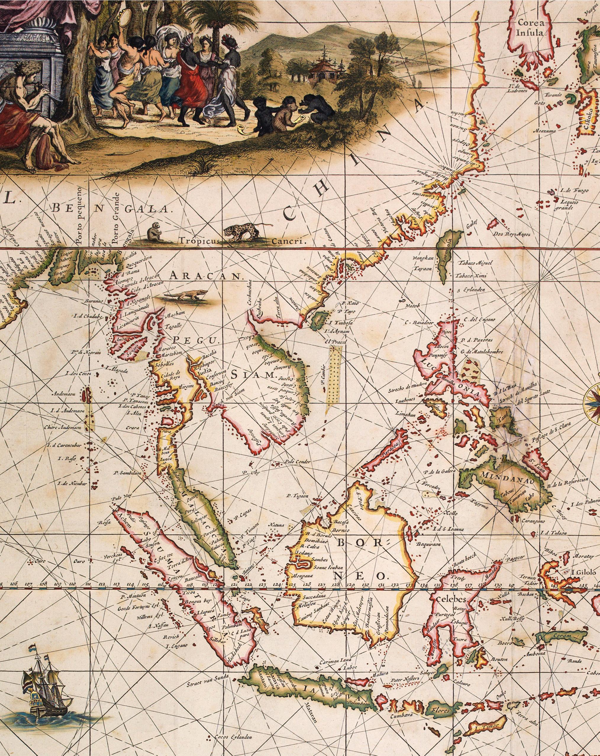
online galler y at : ww w.swaen.com/philippines paulus@swaen.com AMSTERDAM, The Nertherlands, Tel.: +31 20 2255198 Paulus Swaen ww w.swaen.com internet map auc tions 40 years of map selling excellence AMSTERDAM - CLEARWATER Februar y - March - April - May - June - September - Oc tober - November CLEAR WATER, USA, Tel.: +1 727 697 3298
By

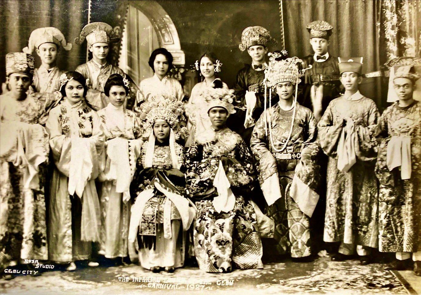
©PHIMCOS 2022. All Rights Reserved.
Printed by Primex Printers, Inc. Mandaluyong City, Philippines
Group portrait of the Imperial Court at the 1927 Cebu Carnival, clad in fanciful oriental costumes, with at lower center the Empress Encarnacion Livionko and her consort Victorino Climaco.
Rosa Studio, Cebu City; the proprietor, Rosa Gonzalez de Tumulak, was the only Filipino woman photographer before World War II. (from the collection of Michael G. Price)