

Connecting the Atlanta Trail Network to the Silver Comet Trail has been one of the primary goals of PATH for over ten years and we are very close to making this seamless connection a reality. The project was delayed when CSX sold Tilford Yards to Amazon, and the trail alignment was no longer feasible. Today, we are happy to announce all phases of the Silver Comet Connector (SCC) are either finished or under construction. Completion is targeted for the summer of 2026.
PATH wrapped up the segment from the East/West Connector along the railroad corridor to Plant Atkinson Road in 2024 A . Cobb County will
12,000 16,000 Feet
complete their segment from Plant Atkinson Road to the Chattahoochee River by fall 2025 B .
PATH previously extended a section of the SCC from the Whetstone Trail to the road bridge across the Chattahoochee River along Marietta Blvd. and Atlanta Road. Construction of the SCC along MacArthur Blvd. from the Whetstone Trail to Chattahoochee Avenue is underway and will be complete this summer C .
Construction of the SCC from Marietta Blvd. to The Works on Chattahoochee Avenue begins this month. The SCC includes 3 bridges and 2 extensive boardwalk structures D
The SCC user will cross Chattahoochee Avenue at the signalized intersection and follow along the completed trail behind Top Golf to Ellsworth Industrial Blvd. south of Star Provisions where it connects to the Northwest Beltline segment, currently under construction.
Get excited as the Silver Comet Trail and the Beltline will be connected by the end of 2026 giving Atlantans a safe, inviting way to enjoy the westside of Atlanta and rural northwest Georgia without getting into a car. Completing the SCC will put the keystone in the wellloved archway connecting Atlanta to Alabama. l
Amani Trail
This project will allow access for the residents in the Edgewood neighborhood to the Eastside Trolley Trail creating a safe connection for children to local schools.
Another extension to the Eastside Trolley Trail is planned along Flat Shoals Avenue to connect to the Beltline. This project will be bundled with the Amani Trail to maximize efficiency for construction and will add a seamless connection for the neighborhood.
Atlanta Riverlands Project
Along the Chattahoochee River and across Peachtree Creek, this trail will connect the Silver Comet Connector to Standing Peachtree Park. Construction is scheduled to begin this spring. The goal is to complete this project as part of the mayor’s improvement program for the World Cup in 2026.
SCC MacArthur Trail
This segment of the Silver Comet Connector runs along the south side of MacArthur Blvd. connecting the existing Whetstone Trail to Chattahoochee Ave. Construction is underway and
scheduled to be completed this summer.
Construction began last fall. This project connects Peachtree Hills neighborhood across the creek to Peachtree Park Drive. Completion is scheduled by the end of 2026.
Phase 1 connects Northside Drive to Trabert Avenue. Completion is scheduled for spring 2025. The remainder of Segment 3 is fully designed and currently in for permitting.
Northwest Beltline (Segment 5)
Construction is underway in Blandtown to connect Marietta Blvd. to English Street Completion is scheduled for the end of 2025.
From Loridans Drive, this phase will extend the trail to the Sandy Springs city limits. Awaiting final approval from GDOT and the City of Atlanta and expected to break ground this month.
This segment extends the existing trail from Wieuca

Road, through Mountain Way Common to Loridans Drive. Crews are installing handrails/ landscaping and plan to wrap up in June.
Silver Comet Connector (Segments 2 and 3)
These segments provide a greenway connection from Marietta Blvd. across Collier Road to The Works on Chattahoochee Avenue. Expected to break ground this spring.
Westside Trail 2
Westside residents will be connected from the Beltline at Washington Park to the Mercedes Benz stadium and the Atlanta University Center. Construction is underway and will be completed this summer.
Silver Comet
ConnectorWoodall Rail Trail

This segment of the SCC was completed in February. A ribbon cutting will be scheduled for this spring.
The Paper Trail
The trail is an extension from the Westside Beltline

Connector to W. Marietta St. It was completed in March.
Scan QR codes for trail progress videos

Back in 1990, the founders of PATH saw the need to establish a network of trails and linear parks in Atlanta. They floated the idea with the Planning Department and Commissioner Leon Eplan together with Planner Alycen Whiddon were receptive and offered to help.
Alycen organized PATH volunteers to field surveys in various areas of the city and to document a plan for linear parks and trails. The result was the Atlanta Greenway Trail Plan by Roy Ashley & Associates adopted by City Council in 1992.
PATH and the city have been building from this plan for 34 years and realized it was time for an update!

The updated plan began in early 2024 and is called Trails ATL. It’s available for review by the public in anticipation of a
City Council vote in June. PATH staff have been working overtime conducting field work, exploring trail opportunities and meeting with neighborhood associations, non-profit organizations, focus groups and government officials. The result is an updated plan that honors the trail building work we’ve accomplished over the last three decades and prepares everyone for the future expansion of Atlanta’s Trail Network. The plan calls for an additional 140 miles of greenway and 280 miles of street trails that together with our existing and funded network of trails will provide a 10-minute walk or wheelchair access to high quality trails for 94% of Atlanta residents.
Trails ATL builds on PATH’s successful and innovative public-private partnership with the city towards transforming Atlanta into the most trail-connected city in America. Atlanta residents can help by attending Neighborhood Planning Unit meetings and donating generously to PATH to help us fulfill our mission. Follow along by scanning the QR code for the Trails ATL site below to view the draft plan. l
The plan... will provide a 10-minute walk or wheelchair access to high quality trails for 94% of Atlanta residents.


In 2017, the City of Newnan officials reached out to PATH to discuss developing a trail system around Newnan. We were in the final stages of building the Carrollton Greenbelt, right up the road, so Newnan officials thought we were good candidates for developing trails in their community.
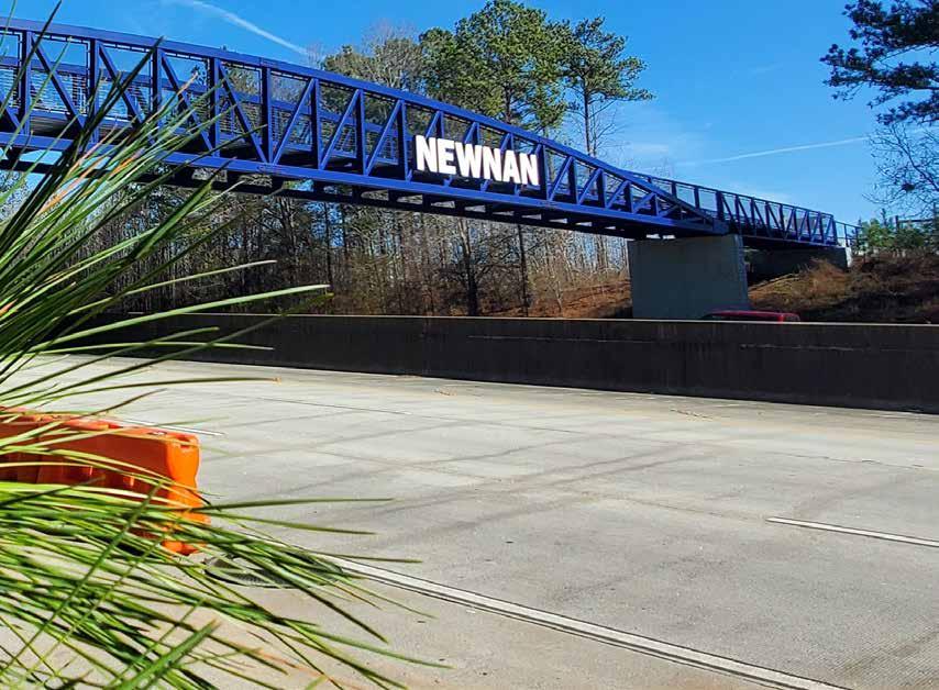
The first thing PATH noticed about Newnan was how Interstate 85 bisects the town. The downtown commercial district was separated from most of the city’s new residential development by I-85, making it problematic for access between most neighborhoods to downtown without a car.
We spent hours trying to find a way to cross I-85 without subjecting trail users to exit and entrance ramp traffic at one of the interchanges for Newnan. We finally located a spot that was suitable for a bridge over the interstate. There were easements to obtain for the bridge

and trail on both sides of the interstate, but we presented the proposal to the city and to a packed, public meeting, and got a thumbs up.
There was much more to the plan than the bridge over the interstate, but the bridge was the connection that made the plan work. PATH partnered with Newnan long enough to build the first phase of the trail, including the bridge over I-85 which connected newer neighborhoods to historic downtown. Since we left, Newnan has extended the trail into downtown.
Hasco Craver, Assistant City Manager, says the city is building two more phases of the system this year. “We have also applied for federal funding for two additional phases. The LINC is the most successful recreational amenity we’ve built in the fifteen years I’ve been at the city,” Hasco said.
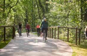
The LINC travels through lush forests and alongside rushing creeks before reaching downtown. There are very few street crossings as a result of the city going to the expense of providing tunnels under busy roads.
There are five miles of the LINC to enjoy just a short drive down I-85 from Atlanta. It’s worth the trip! l
I’ve lived long enough to see trails become mainstream.
When we started PATH in 1991, Metro Atlanta was totally car centric. People were pushing baby strollers and walking their dogs down the gutters of streets. There was no initiative to build sidewalks or anything to support nonmotorized travel. One of our first projects was to build a sidewalk along West Paces Ferry Road, initiated by Sam Massell from the Buckhead Coalition. I was referred to as the bike guy at city hall and at GDOT headquarters. Being an advocate for non-motorized travel was completely foreign to most government officials we encountered.
Now it seems like everybody wants to live in a “walkable community.” Places to walk and ride have replaced community centers with pools as the number one requested amenity by people moving into a development. Metro Atlanta communities are finally allocating tax dollars to infrastructure that supports non-motorized transportation modes.


In all fairness, we did start PATH during a time when federal funding through the Intermodal Surface Transportation Efficiency Act (ISTEA) was established and gas had become an expensive commodity. That said, we ‘encouraged’ local governments to apply for ISTEA funding and often raised the local match from the philanthropic community.
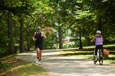
Today, in some respects, the world’s a better place. People who choose nonmotorized modes of travel have their own infrastructure on which to travel, rather than being squeezed between vehicles and the curb on traffic-filled streets. Parents have a safe environment to
walk or bike with their kids. More people have a choice of biking or walking rather than contributing to traffic congestion while getting healthier as they travel.
Non-motorized travel is being taken seriously. Whereas in 1991, it was thought of as purely recreational, often associated with kids. Trails help ‘pave the way’ for electric scooters and electric-assisted bikes, beckoning more people to spend less money on gas and avoid the crowded streets.
I guess it was worth being called the ‘bike guy’ and being looked at as a ‘kook’ few times. l
PATH Foundation
1601 West Peachtree Street
Atlanta, GA 30309
Charlie Shufeldt, Chairman
Alexander C. Taylor, Vice Chairman
C. Austin Stephens, Secretary
Harry L. Anderson, Treasurer
Jennifer Dorian
B. Harvey Hill, Jr.
Jaime Hockin
Ciannat Howett
James C. Kennedy
Sarah K. Kennedy
Scott Kitchens
E. Cody Laird, Jr.
Stephen Lanier
Tree McGlown
Lyle Ross

John W. Somerhalder II
Stephanie Stephens
Richard Tyler
Lauren Wilson
W. Douglas Ellis, Jr., Emeritus
William C. Fowler, Emeritus
Carol Muldawer, Emeritus
Greta deMayo, Executive Director
Ed McBrayer, Executive Advisor
When Atlanta Beltline Inc. (ABI) was searching the westside of Atlanta for trail corridors a decade ago, the out-of-service rail spur between Jefferson Street (today’s Westside Beltline Connector) and W. Marietta Street was a favorable alignment for a greenway.
Fast-forward to 2025. CSX included this corridor as part of the package deal during negotiations with ABI, however, they decided not to place the primary Beltline in that location. In the meantime, development has exploded in the vicinity which includes the Westside Paper development.
Follow us on Facebook and Instagram and visit our website at pathfoundation.org.
The Paper Trail opened to the public on March 13th. Atlanta’s Mayor Andre Dickens helped PATH and the CID celebrate the grand opening (see cover). Trail users from all over the city can dine at Pancake Social or visit the gym. This trail can be easily accessed from the Westside Beltline Connector trailhead at 11 Joseph E. Lowery Blvd NW, Atlanta, GA 30318.
