Connecting Communities Across Georgia along 334 Miles of Trails
See page 6
PATH Foundation
A Non-Profit Organization Dedicated to Planning and Building Greenway Trails

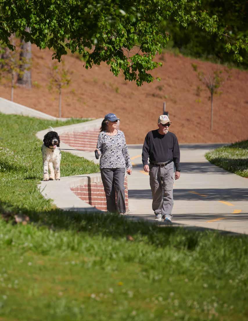

Connecting Communities Across Georgia along 334 Miles of Trails
See page 6
PATH Foundation
A Non-Profit Organization Dedicated to Planning and Building Greenway Trails


Amani Trail Spur
This trail will complement the Eastside Trolley Trail. Design is about complete and construction will begin in 2026. This will create a safe route for access to the schools and recreation facilities in the area.
Eastside Trolley Trail to Beltline
The City of Atlanta is redesigning the Arkwright Place/Flat Shoals Avenue intersection which will become part of the Eastside Trolley Trail extension. Improvements to this intersection will create a safer intersection for the community and a clean transition to the Beltline.
Proctor Creek Greenway –Segment 4
This trail is currently 30% designed with a schedule anticipating construction in Summer 2026. This 2.4mile segment begins at West Highlands and ends at Lillian Cooper Shepherd Park. The trail follows Proctor Creek with two bridges over the creek, an at-grade crossing of Hollywood Road, and a neighborhood spur connection to Abner Place.
South Peachtree Creek Trail –Medlock to Lulah Hills
This trail has been designed, engineered, and permitted. With construction underway in
2026, the trail will extend the existing South Peachtree Creek Trail through Medlock Park and Clyde Shephard Nature Preserve to Lulah Hills (the old North DeKalb Mall).
Atlanta Riverlands Segment 1
This project is under construction (Great job COA DPR Team!!!) and will connect Standing Peachtree Park to the Silver Comet Connector along Marietta Blvd offering future trail connectivity to the Northwest Beltline. It will include a bridge at the confluence of Peachtree Creek and the Chattahoochee River.
Northwest Beltline - Segment 1
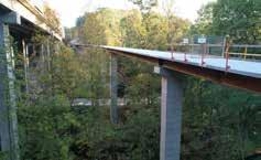
This trail will feature a cable bridge that will cross Peachtree Creek. The iconic bridge will join an elevated walkway
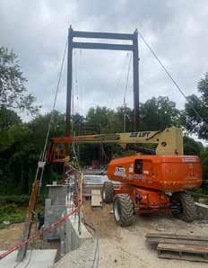
that will transition through a wooded area and ultimately be linked to the Northeast Beltline.
Northwest Beltline - Segment 3
This short section will extend along Trabert Avenue and connect into Monday Night Brewery. It will be completed this month.
Northwest Beltline - Segment 5
The intersection of Ellsworth Industrial Blvd. and Elaine Avenue will see big changes as this is where the Westside Beltline Connector and the Silver Comet Connector will come together creating a seamless passage to the Beltline.
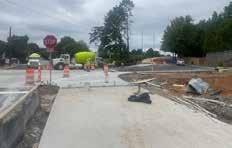

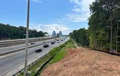
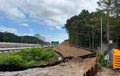
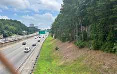
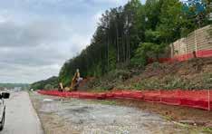
PATH400 - Loridans Drive to Sandy Springs City Limits
This segment of PATH400 is underway in tandem with several other segments to the north. Led by the City of Sandy Springs, this will complete
PATH400. The northernmost segment will link PATH400 to the future trail system in Sandy Springs using the I-285 Interchange installed by GDOT back in March.
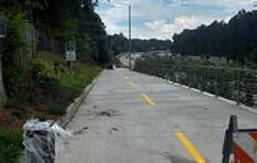
Construction of this portion of PATH400 is being finalized. A ribbon cutting event is scheduled for September 26, 2025. Stay tuned for details on our website and social media.
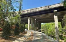
This trail connects to the existing Silver Comet Connector (previously named Whetstone Creek Trail) along MacArthur Blvd. where users can visit Scofflaw Brewery and the new BRYKS development.
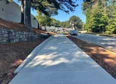
Completion will be Fall 2025 with trees being planted in early November.
Construction of the side path trail along Atlanta Road is being finalized by CW Mathews. This section of trail will not be open for shared-use until the trail is safely completed between the existing trail along the abandoned rail corridor to Atlanta Road. PATH is working directly with Cobb County to ensure the county fulfills their commitment to fully complete the Plant Atkinson Road portion of the Silver Comet Connector. PATH does not have a date for full completion yet but will keep everyone posted.
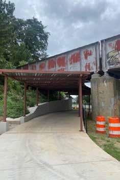
Construction begins this month to create a connection from MacArthur Blvd. to the recently completed Silver Comet Connector – Woodall Rail Trail. Completion of this segment will create a seamless link to the Northwest Beltline – Segment 5.
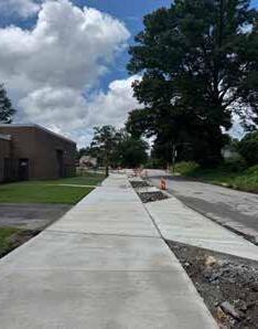
Connecting to the Beltline at Washington Park, this project has been rebranded as “Capitol West Lake” in the recently adopted TrailsATL plan. It is an extension of one of PATH’s Clark Atlanta University trails first constructed during the 1996 Olympics. It will provide a safe transition to the MLK cycle track at James Brawley connecting to the Mercedes Benz Stadium. Completion is scheduled for Fall 2025.
Back in 1990, the City of Atlanta identified the Georgia 400 corridor as a potential and desirable place to build a trail that would create the only safe connection between the northern suburbs and the city’s network of trails inside I-285. It was included in the 1994 Greenway Trail Master Plan despite being told by GDOT that it would never happen.
Twenty years later, PATH would get a call from Denise Starling, Executive Director of Liveable Buckhead, wanting to discuss the prospect of making this decade old vision a reality along Georgia 400 through Buckhead. Denise and Carlos Perez, Landscape Architect, had already done a lot of the heavy lifting prior to meeting with us. They had negotiated a tentative agreement with GDOT, conducted public meetings along the intended route and had many civic and city leaders voicing public support.
A couple of years later, the first phase connecting Old Ivy Road to Tower Place was completed, followed by the second phase connecting Old Ivy Road to Wieuca and then the third phase from the Gordon Bynum bridge to Miami Circle. The current phase from Wieuca Road to Loridans Drive will be complete this month and we
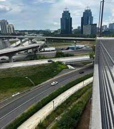
have begun construction from Loridans Drive north to the city limits.
GDOT is prohibited by the state charter from using their funds for anything but roads and road bridges. They contacted PATH to discuss PATH400 and the interchange project at I-285. GDOT explained that although they could not pay for the trail, they were willing to include it in their plans if we could raise funds required to build it. Together with the City of Sandy Springs we were able to make that happen and earlier in 2025 the PATH400 trail segment through the interchange of GA400 & I-285 was completed. Once the “Springway” trail system being planned by Sandy Springs extends south from Morgan Falls, there will be a seamless connection of PATH400 south to the Beltline and north to the Chattahoochee River.
When the PATH team was invited to LaGrange in 2016, we couldn’t help but notice the abandoned textile mills that were the cornerstone of employment in the old days. A local citizen suggested naming the trail system ‘The Thread’. The name honored the memory of the thriving textile industry and at the same time signaled a new way to travel about the city that appealed to younger citizens and would benefit downtown merchants.
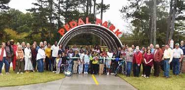
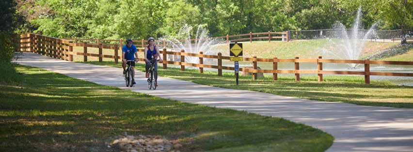
The PATH Team master planned The Thread to feed into the downtown commercial district from every sector of the city so residents could walk or bike to downtown restaurants and shops around LaFayette Square. The model project of The Thread was completed in 2018 and encircled Granger Park with a spur towards the downtown square. In Granger Park, the trail touches a retention pond that has been transformed into a beautiful pond feature with three fountains. Additional phases of The Thread have been built which wind through LaGrange College, Weathersbee Elementary and LaGrange High School. They connect parks and greenspaces, meander through neighborhoods and provide the community with recreational amenities and safe access throughout the city. Recently
completed are two segments totaling 2.7 miles. A 1.2-mile extension connects the George Harris Baseball Complex and Upper Big Springs Road to the Nutwood Winery and another 1.5-mile extension from Miller Street to Hunnicutt Street completes a 5-mile loop. In all, the City of LaGrange, with the help of Friends of The Thread (FOTT) are to be commended on their trail building progress. Since 2018, over 15 miles of trails have been built for everyone to enjoy.

Natalie Hale, FOTT Executive Director, works closely with city staff to make certain The Thread receives grants and local funding. In a recent SPLOST vote, which is the primary funding source the city has for infrastructure improvements, The Thread was the biggest ticket item. It was passed by the largest majority vote ever validating how much “people love The Thread!” and desire more trails to be built.
Natalie and the City of LaGrange welcome visitors. “We invite all trail enthusiasts to join us on The Thread. We’ve got a premier hotel on the town square and 15+ miles of trails to enjoy.” Natalie says, “LaGrange is only an hour south of I-285 on I-85. Happy Trails!” l


Back in the early nineties, we launched our first capital campaign to connect the 1996 Olympic Games venue. We had our eye on land that a group called Citizens Against Unwanted Thoroughfares in Older Neighborhoods (CAUTION) and the Georgia Department of Transportation (GDOT) were in the late stages of battling over for a four-lane highway. It was obvious the CAUTION group was going to prevail.
GDOT had torn down a ton of houses in anticipation of their highway and as partial restitution had agreed to enhance their swath of destruction, among other park-like amenities, with a trail beside their scaled down street that terminated at Moreland Avenue.
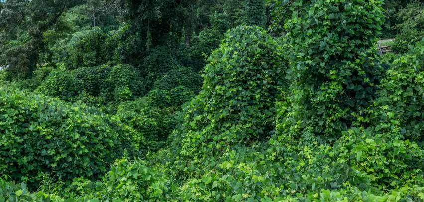
That gave the citizens and PATH, almost two miles of trail that terminated unfortunately, before crossing Moreland Avenue. That left the field east of Moreland to become a giant kudzu patch. After several years left undeveloped and unmaintained, the kudzu was chest high from Moreland Avenue to Oakdale Road and from North Avenue to Druid Place.


Our effort to connect the venue at Georgia Tech with the venue at Stone Mountain, logically, went through that kudzu field. We had, what is now, a segment of the Stone Mountain Trail designed and funded.
I happened to go down Moreland Avenue the Friday before the Monday we were scheduled to start construction and witnessed a homeless person emerging from under the kudzu at North Avenue and Moreland.
I immediately turned onto North Avenue to further grasp the situation. How many more people were mixed in with the kudzu? How was I going to make sure nobody got hurt during kudzu removal? I decided the man I had witnessed coming out from under the kudzu was the best source of information I needed before Monday.


Sure enough, I came back at noon to find an incredibly tall, skinny man with a big, old, dirty cowboy hat waiting on me. “You must be Mayor Tex” I said. We exchanged pleasantries, followed by me asking him about his ‘Kudzu Kingdom’.
He said about a hundred people lived under the kudzu. “Most of them have boxes somewhere else. I’ll have them all out before Monday morning.”
I drove by to check on progress Sunday to find people coming out of the kudzu in droves.
Mayor Tex had delivered! We constructed the Stone Mountain Trail in time for the Olympics as planned.
I kept hoping I would encounter Mayor Tex again so I could thank him for what he did. Maybe he’ll be president someday. l
I ran to catch him. He was delightful, though stinky. He informed me that I need to talk with Tex, who he said was the ‘mayor’ and that he could help me move people out. He volunteered to have Tex at that location at noon.


PATH Foundation
1601 West Peachtree Street
Atlanta, GA 30309
C. Austin Stephens, , Chairman
Alexander C. Taylor, Vice Chairman
Tree McGlown, Secretary
Harry L. Anderson, Treasurer
B. Harvey Hill, Jr.
Jamie Hockin
Ciannat Howett
James C. Kennedy
Sarah K. Kennedy
Scott Kitchens
E. Cody Laird, Jr.
Stephen Lanier
Lyle Ross
R. Charles Shufeldt

John W. Somerhalder II
Stephanie Stephens
Richard Tyler
Lauren Wilson
W. Douglas Ellis, Jr., Emeritus
William C. Fowler, Emeritus
Carol Muldawer, Emeritus
Greta deMayo, Executive Director
Ed McBrayer, Executive Advisor
Follow us on Facebook and Instagram and visit our website at pathfoundation.org.