PLANNING PORTFOLIO


SELECTED WORKS 2016-2020
PART 1 of 2: https://issuu.com/pallavi.singh/docs/portfolio_2023_pallavi
01 02 03 05 06 08 07
URBAN DESIGN: REIMAGINING THE URBAN LANDSCAPE OF TEKU
04
CONSERVATION OF SIMRAUNGADH RESTORATION OF HERITAGE AND SETTLEMENT
RIVERFRONT DEVELOPMENT AND STREETSCAPES DESIGN Group Work [2018]

RECONSTRUCTI -ON HOUSING OF TAUKHEL


CONSERVATION DESIGN STUDIO Group Work [2019]
MUSEUM OF CONTEMPORARY ART: A DESIGN FOR GLOBAL ART FORMS

REJUVINATING THE NEWAR COMMUNITY AFFECTED BY 2072 Group Work [2018]
DESIGN OF PICNIC SPOT AND TEMPLE AREA

FINAL YEAR RESEARCH AND DESIGN THESIS Individual Work [2019]
KUBINDE MEMORIAL PARK
INTEGRATED URBAN DEVELOPMENT PLAN (IUDP) Company Work [2020]
CRAFT INDUSTRY
BALEPHI-SUKUTE CORRIDOR PLAN: NEPAL WHITEWATER CENTER


DESIGN FOR TOURISM DEVELOPMENT Company Work [2020]
DESIGN STUDIO PROJECT Individual Work [2017]
DESIGN FOR TOURISM DEVELOPMENT Company Work [2020]
Location: Teku-Kalimati, Bishnumati Bridge, Kathmandu
Area: 210000sq.m.
Stretch:250m from the Bishnumati Bridge along all the four directions
For the purpose of the study, the context site was divided into four distinct study areas plus the linear TekuKalimati road network These areas reflect social and functional geographies.


A balance was struck between identifying the physical characteristics of a study area and making decisions based on its social identity All of the study areas have different character areas within them – for example, along the river, there is a historic core with a dense, heritage rich character

On site visits and analyzing the existing urban fabric of Teku, Kathnandu, are we moved on to categorize the design into number of criteria.
Character: A distinct sense of place responding to local context and history
Continuity and Enclosure: Continuity of Land use
Quality of public realm: A place with safe, attractive, well used and successful outdoor areas
Legibility: A readily understandable, and easily navigable and enjoyable environment
Easy of movement: A place that is easy to get to, go through and move around. An accessible, well connected, pedestrian and cycle friendly environment

Adaptability: A place that can change easily to future needs and lifestyle demands.
Resource efficiency: A place that works with the natural landscape, has a pleasant microclimate, utilizes solar potential, is comfortable to walk and cycle around, has low noise and pollution levels and is rich in biodiversity
Diversity and intensity: A varied, stimulating environment of uses, experiences and choice
My Contribution
Research and Field visit
Site Study and Analysis
Recommendation of land use policies
Design of Street sections and Intersections
Riverfront development design


In this project, along with land use mapping of the area, Conservation and Restoration Designs for Core Heritage and Settlement Area were done in order to preserve the existing heritage while increasing its tourism, economical and agricultural reach. Architectural conservation solutions were carried out after appropriate land use planning of whole site


Simroungadh which inherits historic, cultural and archeological importance from Karnatakperiod, is situated inBaradistrict of Narayanizone of mid –Terai according to the political geography of Nepal It is also historically a fortified settlement during the period
Research and Field visit
Perform Questionnaires
Detail Documentation
Land use mapping and street sections
Typical mixed use prototype designs

The study area spread from the stretch joining Ranibas and Kankali temples which was divided into three zones for public investment in restoration and conservation works of the fortified city.
A Monumental Area – A:
This zone constitutes of agglomeration of objects of utmost architectural and archaeological values surrounding the Kankali Temple
B Monumental Area – B:
This zone constitutes of agglomeration of objects of utmost architectural and archaeological values surrounding the Ranibas Temple.
C. Transitional Area – C:
This zone constitutes of streets, places and buildings bordering these streets which interconnect A and B zones They show characteristics like ratio of streets size to height of buildings and reflect the cultural and economic activities of the area The boundaries of zones are shown in the attached map ‘conception of preservation’


No of prototypes were designed based on architectural requirement of each land use zone Consideration of climatic conditions and indigenous Architectural and urban design essence was taken


Typical Khapada House of Simraungadh Sketches showing building form with element


Proposed Cross Street Section
 View from Entrance
Central Courtyard
Eating/ Sitting Area
View from Entrance
Central Courtyard
Eating/ Sitting Area
• Collaboration with Lumanti Support Group for academic housing reconstruction project in settlement of Taukhel , Chandragiri municipality which is 7-8 km from Kathmandu.
• Planning with community participation.
• To reconstruct the housing to the modern needs while preserving its Newari essence.
• To promote the creation and maintenance of an adequate supply of sound, affordable housing integrated throughout the region
• To study the social and economic background of the people in Taukhel and provide the design solution as per the need


Research and Field visit
Site Study and Analysis


Implementing relevant planning strategies, devising suitable plans for Jatra (Festival) road and the connecting the unused lands into the existing ones favoring easy visual access and balance in open spaces. Design of Street sections and Intersections

Prototype development: I designed the segregated areas with prototypes and open spaces farthest from the existing major road – Jatra (Street Festival) road


The planning was done considering the wind direction pattern and sun orientation, with
An organic pattern is created in relation to the existing major road, A linear spline providing visual opportunities through context site with rich pedestrian experiences


Pedestrian oriented planning: Consistent with the principle of equity, particularly in communities with low levels of car ownership, public transport becomes a necessity once the pedestrian scale is exceeded

COMMUNITY HALL
P9: RESIDENTIAL WITH SHOPS


P10: DUPLEX UNITS
P7: RESIDENTIAL
P4: RESIDENTIAL

P8: RESIDENTIAL
P5: RESIDENTIAL
P6: RESIDENTIAL
RESIDENTIAL CUM COMMERCIAL IN THE FRONT STRETCH
P3: DUPLEX UNITS
P1: RESIDENTIAL CUM COMMERCIAL
P2: RESIDENTIAL & WORKSHOP

DUPLEX TRADITIONAL PROTOTYPES
BUILDING AROUND EXISTING HERITAGE
BUILDING PUBLIC ACCESSIBLE SPACES

The newer plots were designed in a post modern style while retaining the essence of a Newari household.

Brick facade, emphasis on window openings and space planning were some of the characteristics considered.

.
EARTHQUAKE


Mediums: Revit, Sketchup , V-Ray, Photoshop


In our country Nepal, well-known museums are limited to those built back some decades ago, dedicated mostly to history, heritage and locality While there is no museum dedicated to modern or contemporary art, existing museums were lacking in different areas even today
Problem Statements
Museums aremostlyofadaptivelyreusedbuildings
InadequateresponsetoenvironmentalParametersofexistingmuseums
Gapintechnologicalandspatialadvancementsleadingtostagnantformofart

My project intends to incorporate space for new art forms while providing meaningful experience to visitors through exploration and leaning – a museum with distinct architectural identity
The project is concerned with creating an interactive and educational environment for upcoming and professional artists, and general public of diverse interests and age groups, while engaging in the art that reflects the world around us.

In the advancing world of technology and new generations – our country has numerous ground-breaking young artists coming up with unique materials which do not fit in the traditional exhibit.
Lingering with the cultural ideas we have not been able to account an architecture entirely dedicated to the creativity of the presentday artists.
Need of building museums acknowledging museum architecture, with proper design standards and considerations

Museum now should also incorporate technological advancements in terms of storage, display as well as learning
Color is an essential component of almost every form of art and can be used to evoke a certain mood or to create a message or sharp response in the viewer. It can be used to set characters apart from one another or bring them together. The colors of the color wheel is taken into account and the shape is remodeled into a compressed form.


Location:Baluwatar,Kathmandu SiteArea:342,674sq.ft.(62-9-0-4)


The color and form is imitated into Gallery and Rest areas. The central focus - an amphitheater radiating sense of spaces towards other functional areas.


• ‘Museum of Contemporary Art’ aims to house evolving contemporary art that targets users from a global perspective
• Site - most suited in the Kathmandu valley - the capital of Nepal and the most forward city in recognizing global values Studying the criterias of Physicalcharacteristics, visualquality , transportation,adjacent landuses, economicview , the site in Baluwatar was chosen as a suitable site.


i. Building orientation: ample amount of sunlight is exposed in accordance to the building type and use.


To control light exposure in the gallery areas- large building surface towards the north with moderate and diffused sunlight (with views of northern mountains and hills); smaller building surface area towards South controlled with passive solar techniques

The gallery are raised such that to allow better skylight angle from the sloped roofs
ii The prevailing wind from North- West is allowed through the build forms
The low slope south facing roof with skylight openings allow diffused lighting into the gallery, hence maximum daylight can be used
Green areas scattered through the site as large landscapes and small courtyard spaces reduce heat island effect The green area on the north sets outdoor gallery within natural environment.
The visual access from the main road is important to draw visitors into the museum. Passerby's are targeted to be drawn to the dynamic color and building form of the museum buildings.


Gallery Circulation is a chain type layout with sequence of display units with alternate resting areas while comb circulation is also possible.


The museum complex is designed highlighting its main function – the gallery with the concept of color and unique form Other building forms follow respective functions while merging the idea of contemporary architecture from around the world and that of Nepal by introducing modern and contemporary design elements such as large openings, use of glass to brick facades of the buildings While the brick façade gives the buildings its own identity and feeling of coziness the gallery block imparts a sense of contradiction and attempts play of color into the visitors’ eyes


The use of color induces a dynamic element and gives a sense of curiosity to the visitors even from afar. The chromatically arranged galleries are brought together while expressing uniqueness of its own. The arrangement brings in a sense of exploration to the model.

Location: Golma Devi, Bagmati Pradesh, Kathmandu
On collaborative involvement with stakeholders and planning as per requirement of the municipality, the significance of the religious site was chosen to enhance tourism in the area.

This was the 1st project I was involved under the project Integrated Urban Development Project (IUDP )
The site planning approach: Relies on rejuvenating the temple area by restoring its components, giving proper access from the main road and designing the picnic spot area for as a recreational area, which would benefit the areas in terms of tourism and economy.


INTEGRATED URBAN DEVELOPMENT PLAN (IUDP)


PICNIC SPOT AND TEMPLE AREA NEPAL ARCHITECTS CONSULT

My Involvement
Research and Study
Site Analysis and Program Formulation
Concept and Design
Detail Drawings and 3D visualization
The current user activities on the site guides number of design approach in terms of approach and continuation of user activity in the area while increasing the engagement of people by providing elements for recreation and relaxation that enhances the quality experience of the tourist visiting the site. PICNIC SPOT AREA


Report and Presentations
MASTERPLAN SITE AREA: 1817.5 SQ. M. (3-9-0-2.5)
GOLMA DEVI TEMPLE BAJRAYOGINI SHANKARAPUR PUKHILACHHI SALI RIVER MAIN ROAD SITE BOUNDARY GOLMA DEVI TEMPLE


The picnic spot is designed with necessary amenities for the visitors considering the natural landscape of the site and minimal intervention to the environment. Temple Area

The temple area maintains its religious and cultural significance with restoration to the site and addition of design elements to increase use of area
The site area has been fenced and resting shelters, view desks are also designed at different places overlooking the North - West view The activities in and around are generally passive leisure activities like sight-seeing and picnic

 Picnic Spot Area
Mediums: AutoCAD, Sketchup, Lumion, Photoshop
Picnic Spot Area
Picnic Spot Area
Mediums: AutoCAD, Sketchup, Lumion, Photoshop
Picnic Spot Area
In the context of the project, a memorial park is designed dedicated to the remembrance of the 22 martyrs of the Nepalese civil war. The site which was an originally a cremation ground for the Local Tamang community of the area is a point of departure for the concept of the project, given the existing components

In the two part of the site, the lower part is designed for a memorial and the upper part continues it s current use with a well designed cremation area.
My Involvement
Research and Study
Site Analysis and Program Formulation
Concept and Design
Detail Drawings and 3D visualization
Report and Presentations
Intended users
i. Memorial park visitors: People who come for the purpose of recreation and learning
ii. Historians and enthusiasts: provision of museum and library for in dept learning
iii. Local Public: A portion of the site is provided for the local public, which will also inject a sense of curiosity to the people passing by


iv. Tamang (Indigenous) Community: The upper park is designed to be the cremation are for the Tamang community.


MEMORIAL STRUCTURE WITH NEPAL FLAG ADMIN/ MUSEUM BUILDING ROAD FRONT LANDSCAPE


Divided into public and semi-public area limiting public access to the existing structure
The highest level of the site is taken as a frontal focus where the memorial monument is proposed and the area will act as a viewing area. Designed with creation of peaceful space in mind – without superstructures the area will focus on reflecting on peace with nature around. The names of the martyrs will be carved into the stone built memorial muniment and will have the Nepal’s flag at height of 22 feet symbolizing the number of martyrs from the event of insurgency
Mediums: AutoCAD, Sketchup, Lumion, Photoshop


Wood carving industry being the most prominent in the site area of Bungamati, the concept of wood as a raw material was taken
GROUND FLOOR. FIRSTFLOOR
This project started with sketching – an element near to wooden craft. A section of a tree trunk was a start, which slowly modeled into a unique form aligning with the functional aspects of the project
Using hand drawing as a tool from start to finish I gained a sense of liberty into form building and put together my imagination into life.

The objective of this project is to design a craft industry for different forms – wooden, stone, Thanka, etc.
The viewing point is designed such that it generates view toward all working areas and the central gallery


Here visitors can simply observe the factory’s process.
visitors to view selected parts of the craft process. The gallery as a base directs the visitors around and about it
production areas have individual outdoor and indoor work setting to expand function and workability
Unique features of the section transform into open and built areas with central focus – a central gallery

The use of timber elevation treatment give a warmer tone to the otherwise concrete and cold factory setting of a traditional factory.
SEMI- UNDERGROUND GALLERY
CAFE
OVERHEAR CONNECTION – OPEN VIEWING ADMIN
FACTORY PRODUCTION AREA STORAGE
Sindupalchowkdistrict being home to the BhoteKoshiriver, one of the prominent rivers for white water sports, and other rivers with high rapid was chosed by the Department of Tourism of Nepal as an appropriate destination for the white water sports in the country
This rafting school, which is a rafting hub comprising of functions primarily of rafting academy and other functions related to Whitewater sports such as hosting competitions, providing trainings for kayaking besides rafting, holding seminars and conference, providing outdoor activity area for professionals as well as amateurs, etc.


Design
Detail Drawings and 3D visualization
Report and Presentations
The masterplan is developed with 3 major levels dividing the entrance area, accommodation and learning area.


Passing through the parking on the immediate entry to the site, the pedestrian pathway guides the users to the entrance plaza – giving public access to reception and galleries.
Then the site is divided into the functions of 1. outdoor activity area, 2. class rooms and 3. accommodation.
Bracing the sloped site terrain the buildings are designed in a stepped sectional concept.
BALEPHI-SUKUTE CORRIDOR PLAN: NEPAL WHITEWATER CENTER

NEPAL ARCHITECTS CONSULT
The site has been designed to face the river with each roof levels acting decks and viewing platform for spectators to watch rafting tournament.


The riverfront has been integrated into the design by incorporation of ramps along the bank of the tier stretching next to the site
All the buildings area designed as semi recessed structures with green roofs over them that are directly accessible from the ground level at higher elevation, Buildings are designed as segregated compact structures to correspond to the step terrain and earthquake prone site
The entire stretch of BalephiSukute corridor is dedicated to water sports and water related tourism. Number of resorts lying on either side of Araniko highway that runs along this stretch host such activities and events. The Balephi-Sukute area is one of the prime destinations for white water related sports


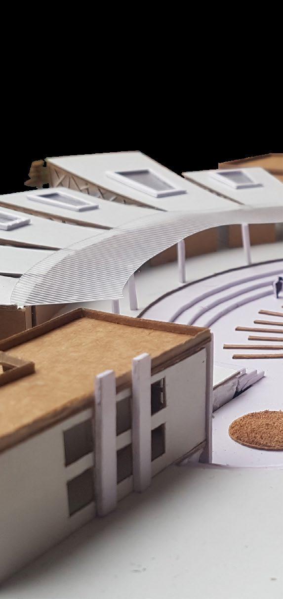
 CITY BUS TERMINAL, DESIGN STUDIO - 2017
INTERIOIR MODEL, Accessible and Culture Nepal (ACCAC) - 2018
VAASTU MODEL, Accessible and Culture Nepal (ACCAC) - 2018
RDF DESIGN COMPETITION, 2017
JIGYASA: EXHIBITION AT THAPATHALI CAMPUS, 2019
POST EARTHQUAKE RURAL HOUSE DEIGN
LIVING ROOM INTERIOR, 2016
CITY BUS TERMINAL, DESIGN STUDIO - 2017
INTERIOIR MODEL, Accessible and Culture Nepal (ACCAC) - 2018
VAASTU MODEL, Accessible and Culture Nepal (ACCAC) - 2018
RDF DESIGN COMPETITION, 2017
JIGYASA: EXHIBITION AT THAPATHALI CAMPUS, 2019
POST EARTHQUAKE RURAL HOUSE DEIGN
LIVING ROOM INTERIOR, 2016


