4
How can we retool architects and community stakeholders with a place-based design framework to address adaptation to sea level rise and climate change?
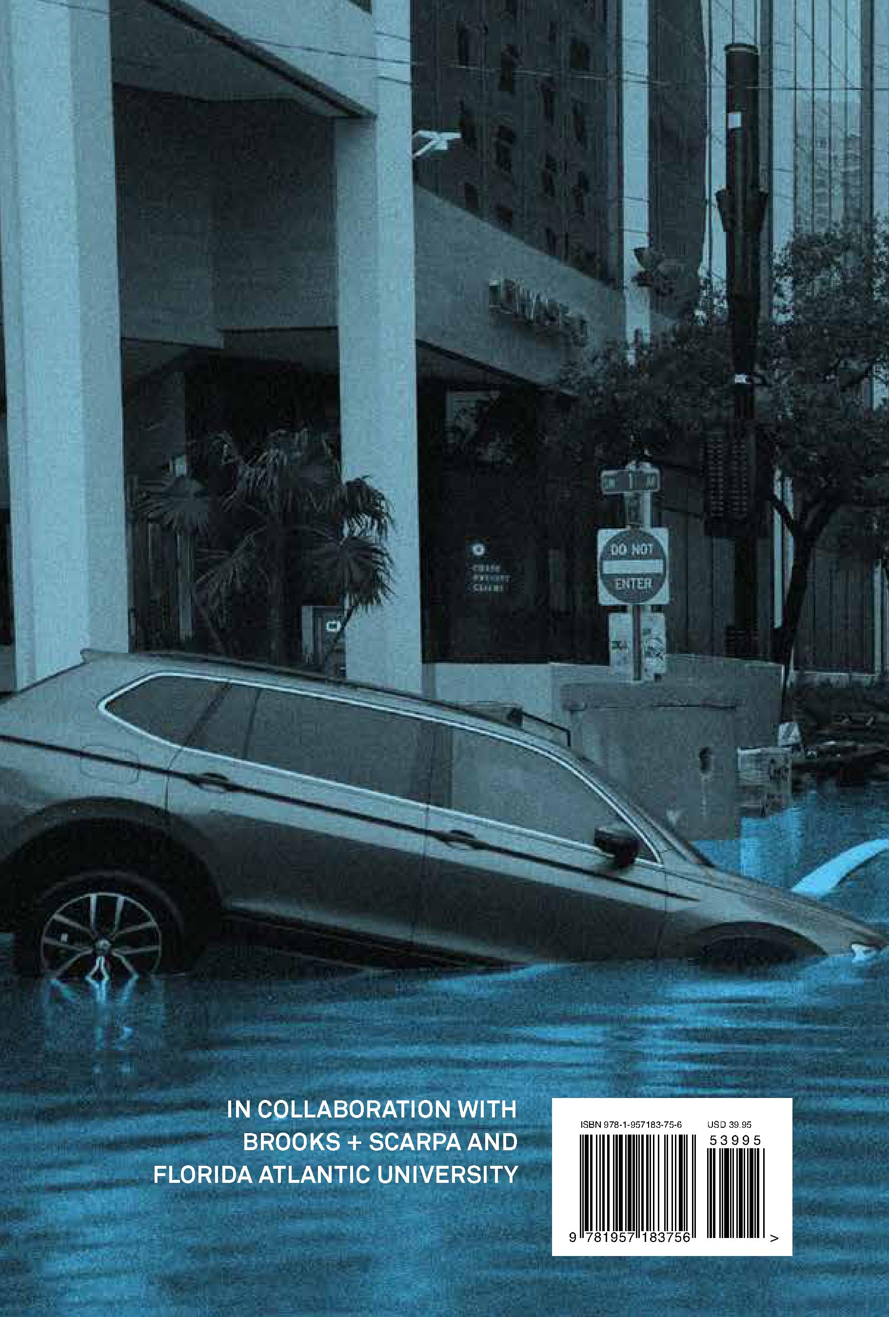
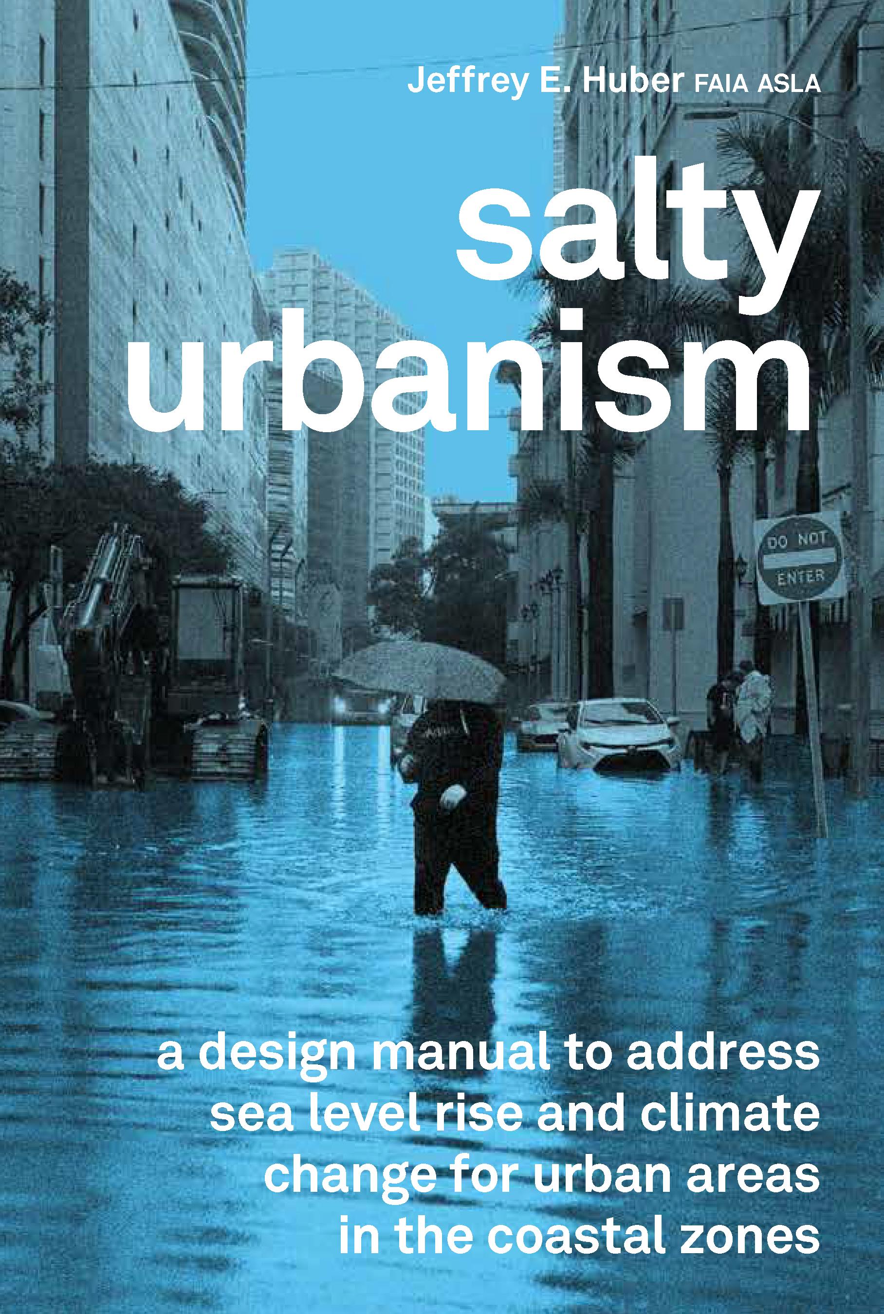
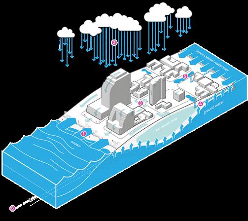
In an inevitable future of sea level rise and climate change, a new framework for urban design and architecture that embeds ecosystem services and adjusts to increasingly salty landscapes will emerge as the only viable adaptation solution in South Florida. The porous limestone substrate poses particular challenges unlike any other coastal location in the United States, where levees, walls, and pumps are not long-term solutions as water seeps up through the ground. Due to South Florida’s unique geomorphology flooding occurs four ways from storm surge, high ground water table fluctuation (wet/dry seasons), extreme rainfall events, and now sea level rise. These dynamic and permanent flood states will radically alter the coastal built environment more than anything else over the next 100 years.
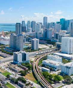
Referred to as “the Venice of America,” Fort Lauderdale is unique in that it boasts 330 miles of shoreline edge, a population of over 170,000 that swells during season, and industries and culture that are tied to the interface between water and land. Where the two systems meet—the city and water—lies an incredible opportunity for creative development reconciling the demands of each. Salty Urbanism provides a methodology and approach for the emerging crisis of climate change related issues and takes its cues from reconciliation ecology, a branch of ecology which studies and builds robust networks of biodiversity, known simply as green infrastructure, within humandominated ecosystems. These new ecologies provide critical ecosystem services related to flood management, food supply, temperature regulation and geochemical balance (pH regulation). Salty Urbanism also infers that new development patterns (architecture and urban design) will emerge. These new adaptive built and natural ecologies will force residents to rethink and retool their relationship with water—one where designing for exceedance, or rather managed flooding, is the norm.
5

contents

Problemscape / 1
Introduction / 18
Ecotypes / 46
Infrastructure / 70
Architecture / 144
Urban Design / 170
Plant Palettes / 210
Glossary / 230
Bibliography / 244
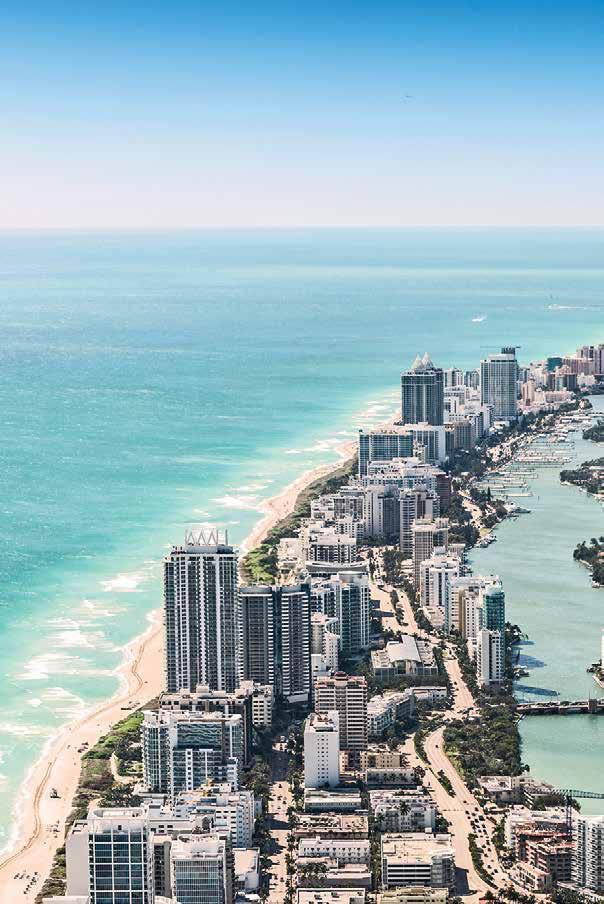
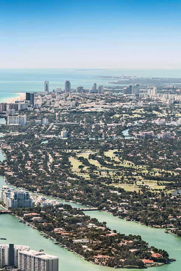
Southeast Florida is a paradise; it is the only tropical region within the continental united states.
8
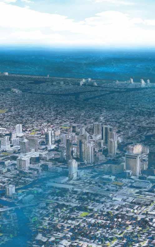
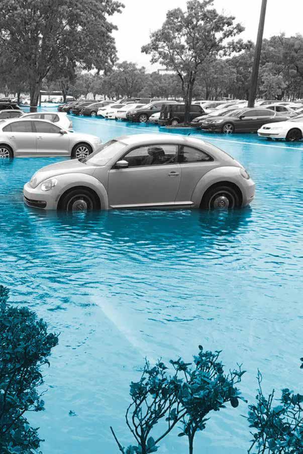
Over the next hundred years south Florida will experience radical changes to the built and ecological environment from climate change and sea level rise.
9
10
“the infrastructure we have is built for a world that doesn’t exist anymore”
Nicole Hernandez Hammer, 2015 Environmental Studies Researcher, Union of Concerned Scientists
11
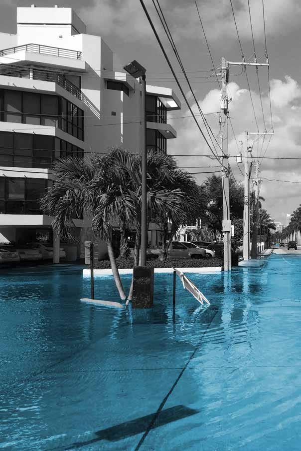
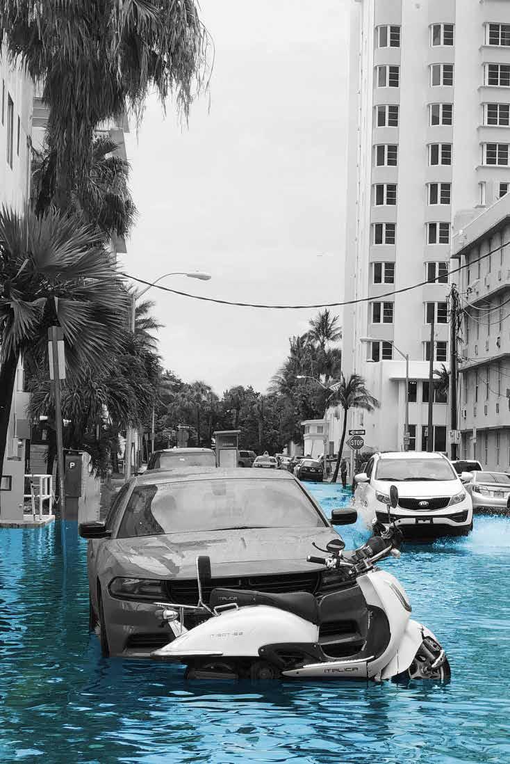
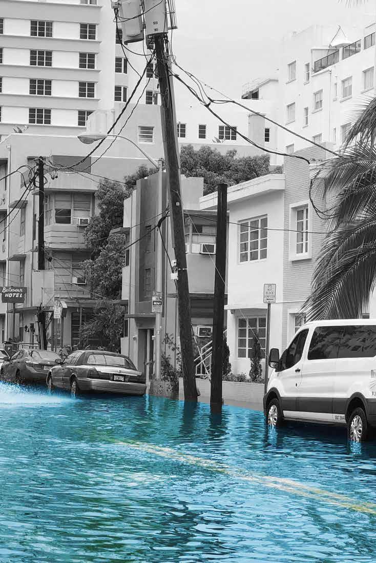
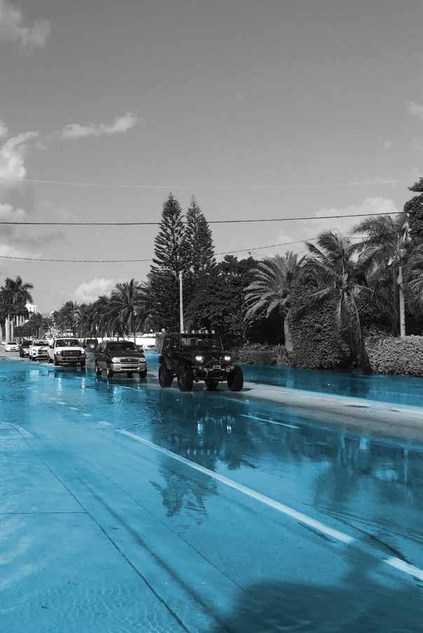
Seasonal high-tide flooding, commonly called “King Tides,” only occur about three times a year today, but such events could multiply over the next thirty years to become the daily high tide as early as 2050.
12
13
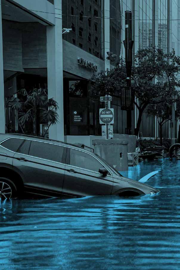
Storm surge, like that from Hurricane Irma, will compound with rising sea levels to make floods more widespread and longer-lasting.
14
15
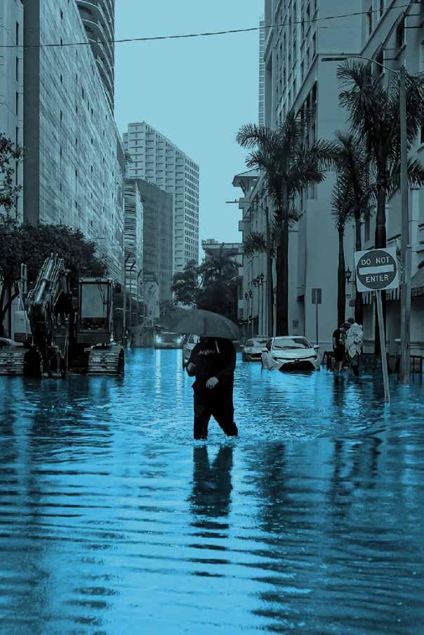
All types of flooding will become more frequent and more extreme as stormwater has increasingly fewer places to drain to.
16
17
19
current Florida coastline
“The most important line on this planet is the coastline, and we mistake it as something static, but understandably so because throughout recorded human history it has relatively remained the same, but it’s now shifting and we need to adapt.”
John Englander, Oceanographer
KEY WEST
20
WEST PALM BEACH
FORT LAUDERDALE
21
MIAMI
future Florida coastline
By 2100 moderate projections show six feet of sea level rise will inundate the region, drastically changing the environment. Essentially South Florida will become the Upper Keys.
KEY WEST
22
Only six feet of sea level rise will cause profound alterations to the landscape
WEST PALM BEACH
FORT LAUDERDALE
MIAMI
23
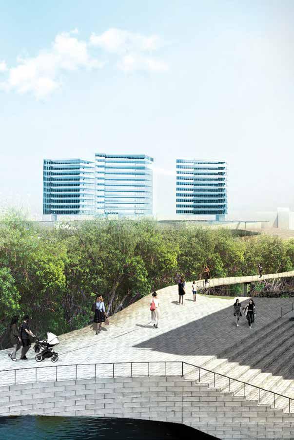
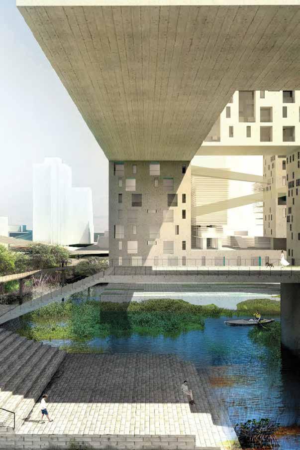
What if future development in the region served as a flood adaptive asset, rather than an environmental liability in the face of rising seas and climate change?
24
25
average duration
time required by a typical tree
Current data show that the south Florida region is nearest to the “NOAA Intermediate High” projection, meaning that 6 feet of sea level rise above today by the end of the century is not unrealistic.

2 feet of rise above today is the threshold at which we must plan for adaptation, rather than mitigation, meaning we will need to start to plan and design our cities differently.
It takes 10 years to plan, engineer, fund and build most projects...
...many projects are designed to have a useful life expectancy of at least 50 years, meaning that infrastructure
built today will de ne the adaptive capacity for a South Florida tommorrow that has a mean sea-level
feet higher than today and “Kind Tide” that
is experienced as the daily high tide in many places.
PHASE 3 PHASE 1 [TODAY] PHASE 19902000 2010 2020 20402050 2060 Projected Rise in Relative Sea-Levels for South Florida this Century (the “0” elevation is the observed mean sea-level at Key West in 2000) 14”- 24”
PHASE 2 IMPLEMENTATION [TODAY]
PHASE
2
5
DESIGN LIFE 2023 2030
observed, local sea-levels rose by at least 4 inches from 2000 to 2020 0 2 3 4 5 6 7 8 9 10 11 1 12 FEET 70 years 30 years 15 years 2020 - 2040 2040 - 2070 36” high shoreline 21” 17” 10” 65” tall person 21” 40” 54”
-
26
a person born today will likely live to see
duration for a home mortgage cycle
tree to produce a full range of potential ben ts
All infrastructure and built features represent a balance between resilient function and costs of construction, therefore, matching the project scope with a assumed projection is critical
Infrastructure projects have a design life of 50 years and should use the shaded area below that best matches goals and funding.
Long-term infrastructure projects with a design life of more than 50 years should plan for a minimum of 6 feet.
2100 PHASE 4 18”- 36” 29”-62” 40”- 92” 2070 20902100 2110 2120 NOAAHigh NOAAIntermediate High IPCC Median 0 24 36 48 60
INCHES
in 2023 should include considering the conditions in 2073 PHASE 3 PHASE 4 PHASE 2 PHASE 1 2073 72 84 96 2080 108 120 132 12 144 mean sealevel today NOAA Int-High IPCC Median NOAA High 2070 - 2120 mean hightide today typical seawall 32” high Tidal Range 54” 40” 96” 136”
planning
27

The rising tide
Given that the rate of sea level rise is increasing, the pace of change will culminate over time. During the 2030s, the frequency of high-tide floods may only increase slightly above today, adding just a few more days of seasonal King Tides and just a few more inches to their maximum depths. But these increases could suddenly triple by the 2040s, with King Tide conditions occuring at high tide every day for an entire month or more1 and at nearly double the current depths. As much as two feet of sea level rise above today is likely as early as 2050. At two feet of rise, what
are considered “King Tide” conditions today will simply become the daily high tides, while seasonal high-tide flooding will become more equivalent to what is considered “major flooding” now.2 However, way before this relatively dramatic shift, many much more subtle and chronic issues caused by elevated sea levels will have long strained communities. With as little as three to six inches in rise above today, saltwater intrusion into the porous aquifer will drastically reduce south Florida’s drinking water supply.3 At eleven inches of rise, direct damages to buildings and infrastructure caused by increasingly frequent sunny day floods will have outpaced the yearly costs associated with
sea level rise & climate change introduction 28
3 feet of sea level rise (c. 2070)
6 feet of sea level rise (c. 2100)
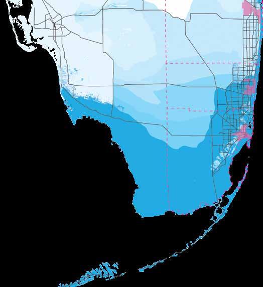
extent of daily high-tide flooding county boundaries major municipalities (from north to south):
West Palm Beach
Fort Lauderdale
Miami
hurricanes and rain-driven floods.4 At the same time, a warming climate will bring about other problems, many of which will compound and heighten the issues of a rising sea. While it is much more difficult to predict future changes in rainfall, current best estimates indicate that the overall climate will become far drier on average5 while also experiencing increases in wet season flooding, in large part due to increasing urbanization.6 Combined with regionally elevated water levels, these changes in local climate will likely push already strained urban infrastructure to its limits and excacerbate a wide variety of socio-economic issues. Looking out to the end of the century, south Florida
faces an even more extreme shift with the potential for six feet of sea-level rise or more. At six feet of rise above today, the urban coast will shift to a fully marine paradigm, one where freshwater can only be stored aboveground and where tidewaters flow through most city streets on a daily basis. South Florida cities will need to radically re-conceptualize their relationships with flooding and water.
1. 2. 3. Heimlich and Bloetscher 2011 - sea level rise/climate change problems & drinking water.
4. McAlpine and Porter 2018 - direct damages of tidal flooding on south FL real estate.
5. Obeysekera et al. 2015 - future FL water/temp with climate change.
6. Mitsova et al. 2020 - impact of heat on health/social vulnerability
29
flooding landscapes
south Florida’s five types of flooding
1. Storm Surge
Storm surge refers to a dramatic, but temporary, rise in sea level caused by pressure and/or wind displacement from a hurricane or other large storm offshore.
2. Rainfall
Heavy, seasonal rainfall can cause rapid flooding of low-lying areas within minutes or hours (typically less than six hours).
3. Urban Runoff
Once rain enters the urban landscape it flows downhill over impervious surfaces (i.e, roads and buildings) as “runoff,” collecting speed, pollutants, and problems along its route.
4. Groundwater
Groundwater is, quite simply, water retained underground. Rainwater naturally percolates and soaks into tiny spaces in the earth, but where saturated earth (i.e, the “water table”) rises too near the surface, groundwater can worsen and prolong flooding.
5. Tidal Flooding
Seasonal high tides can overtop shorelines and storm drains and cause “sunny day” flooding. Tidal flooding events only occur as much as three times a year today, generally during the months of October and November, but are expected to become ten to one hundred times more frequent over the next thirty years.
introduction sea level rise & climate change 30
flooding and urban south Florida
South Florida’s environment and abundance of waterways presents many economic and recreational opportunities to residents but also a variety of flood risks. Flooding can occur in south Florida by way of five distinct pathways, many of which tend to compound upon one another seasonally. While some of these are directly influenced by coastal exposure, others are more influenced by localized topography or by the behavior of water in the underlying geology. The urban landscape itself can be a cause for flooding as an over-abundance of “impervious surfaces” prevents stormwater from draining into soils, creates “runoff,” and reduces the area where floodwaters can safely dissipate.
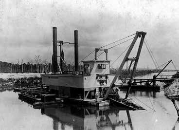
Historically, water and the efforts to control it have driven south Florida’s development patterns. From the earliest settlements and trading posts to the luxurious resorts and urban landscapes of today, Florida’s history is interwoven with flood management. For south Florida, specifically, the trajectory of the built environment is most closely linked to the series of projects meant to “drain the Everglades.” Prior to these drainage projects, communities in south Florida were largely small, flood-adaptive hamlets situated on the relative elevation of islands or “hammocks” adjacent to riverine and coastal transportation routes.
Development skyrocketed once the regional drainage projects were completed in the 1950s and 60s, resulting in the sprawling metropolis of today. As of 2020, south Florida is the eighth most populace metropolitan area in the United States, accounting for nearly 30 percent of the entire state’s population.7 These numbers are expected to continue to increase, by as much as 80 percent in Palm Beach and Miami-Dade and by nearly 300 percent in Broward County, over the next thirty years.8 Regardless of sea level rise, this growth will invariably result in more of all five types of flooding as more, non-adaptive development continues to cover flood-prone landscapes.
7. US Census, 2020 - FL population
a. https://www.census.gov/library/stories/state-by-state/ florida-population-change-between-census-decade.html
8. Florida Office of Economic and Demographic ResearchFL population growth
a. http://edr.state.fl.us/Content/ http://edr.state.fl.us/Content/population-demographics/data/ MediumProjections_2020.pdf
31
problemscape
The combination of an ever-increasing population, rising sea levels, and a history of myopic development practices has resulted in a “problemscape” of interlocking urban issues across south Florida. One problem begets or worsen another, which affects yet another — and so on — resulting in a “cascade” of culminating issues across the urban landscape. Many of these issues, particularly erosion and pollution, exist in various chronic and acute forms irrespective of climate


change and are instead attributable to development practices that prioritize local economic and recreational goals over environmental integrity. Climate change will only heighten these problems and expand their reach far beyond that of environmental policy, likely impacting every aspect of society, from the real-estate market to drinking water reserves. To address this problemscape, it is useful to first understand what the problems are and their connections.
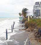
erosion
Rising sea levels will erode beaches and aging seawalls, threatening inland infrastructure and building foundations.
tidal flooding
“Sunny day” flooding will worsen erosion and pollution rates while costing south Florida hundreds of millions in direct damages.
precipitation
More intense and erratic rain-events and droughts will increasingly challenge all aspects of water management.
elevated water tables
Saltwater intrusion will elevate groundwater, farther enhancing flooding potential while reducing regional drinking water reserves.
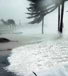
storm surge
Tropical storms and hurricanes are expected to become more frequent and more intense, causing many direct and indirect damages.
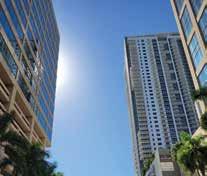
heat island effect
Increasingly higher average temperatures will enhance urban heat islands, damaging both human and ecosystem health.
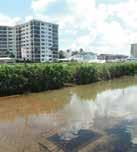
pollution
Urban pollution will worsen with increasing floods, temperatures, and urbanization, degrading water quality and quality of life.
introduction sea level rise & climate change 32
drinking water & saltwater intrusion
Most of south Florida’s drinking water is pumped to the surface by wells tapping groundwater reserves located in the shallow Biscayne and Floridan aquifers. The porous limestone “karst” geology of these aquifers allows the ample surface waters of the Everglades to percolate and filter down into the aquifer, thereby “re-charging” the supply of fresh, clean, drinking water. However, the porous nature of this geology also means that rising sea levels cause saltwater to infiltrate into the aquifer through a process known as “saltwater intrusion.” To date, saltwater intrusion has already made dozens of coastal wells in Miami-Dade and southern Broward too salty for human consumption. The rapidly increasing urban population in these same areas has prompted managers to take increasingly drastic measures to maintain regional freshwater reserves. As such, the sustainability of drinking water in south Florida is becoming increasingly complex and expensive.
heat
Heat can be especially pervasive in urban areas due to the conductive/radiative/reflective properties of many common building materials, particularly asphalt, concrete, steel, and glass. In areas where there is an over-abundance of these materials and a lack of the cooling influences of plants and water, an “urban heat island effect” may take hold, enhancing the severity and persistance of extreme heat. This phenomenon is expected to increase substantially over the next fifty years, resulting in a greater incidence of heat-related illnesses and a reduction of dissolved oxygen in waterways, worsening pollution issues.
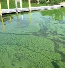
pollution
Urban areas produce a variety of toxic substances and wastes, many of which are directly released into the environment. These often fall onto surfaces like roads and buildings where they are eventually washed off into waterways with stormwater as runoff. Septic systems, releases from broken sewer pipes, and poor construction practices also contribute to water quality issues. At the same time, the absence of intact ecosystems along the urban coast means that the landscape has few opportunities to remediate this pollution, a combination that results in degraded water quality, causing “harmful algal blooms” that deplete oxygen in the water, kill fish, smell, reduce property values, and degrade quality-of-life generally.
saltwater intrusion
freshwater
saltwater
over-draw from aquifer
freshwater
saltwater
33
Broward County case-study
While all of south Florida shares the problems and risks of climate change, Broward County is arguably one of the most perilous locations in the region. This largely stems from the fact that a majority of the County’s area — roughly centered around the New River — was once a massive, eastward-flowing floodplain for the Everglades. In contrast to Miami-Dade or Palm Beach, major development in Broward was only possible after the successful channelization and drainage of the Everglades. Although few recall the connection today, the county was named for Napoleon Bonaparte Broward who, as governor of Florida between 1905-09, was among the first to seriously push for drainage of the Everglades. Today, Broward County is (mostly) dry
and has realized the erstwhile governor’s dream, but this was a dream built upon the foundation of a static sea level. Today’s massive complex of canals, pumps, and dam-like control structures is a system that depends, at it’s core, on the tendency of water to flow out to the ocean with gravity. On average, southern Broward’s elevation is about three feet above sea level, and many of the county’s key drainage canals rely on this meager elevation difference to move excess stormwater away from the inland cities and suburbs out to the coast. But as sea levels continue to rise, and water tables elevate nearer to the surface, this essential function will become increasingly challenged.
surface elevation (feet) above sea level


<3’ >12’ N introduction sea level rise 34
Broward County Miami-Dade County 25 miles 12 0 Broward County Land Elevation Map
Palm Beach County
While parts of coastal Miami-Dade may experience a greater frequency of tidal flooding, Broward has some of the worst rates and extents of saltwater intrusion in south Florida today. As of 2019, nearly all of the drinking wells east of I-95 have been closed, with those remaining operational having to increasingly contend with saline over-draw. Groundwater being closer to the surface also leads to a greater potential for “ponding” above the landscape after heavy rains, and this will become especially true if storms increase in frequency and intensity and if urban impervious surface cover expands. Given this confluence of factors, it is likely
that inland Broward County will likely be among the first non-coastal urban areas impacted by sea level rise. If the control structures that meter the drainage of Everglades water to the coast reach an equilibrium with sea level, most of inland Broward County would experience widespread flooding every year. With no place to drain water as runoff, no room to store water in the ground, and no land area to safely hold water above ground, the only place left for this water is to flood the urban landscape. While this situation is by no means unique to Broward, the county will be among the first to feel its effects.
saltwaterintrusionline(2019)
surface elevation (feet) above water table within 0.05’

35
15’ N 12 miles 630
Broward County Water Table Elevation Map
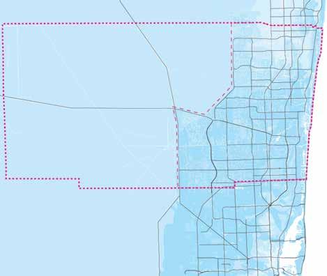
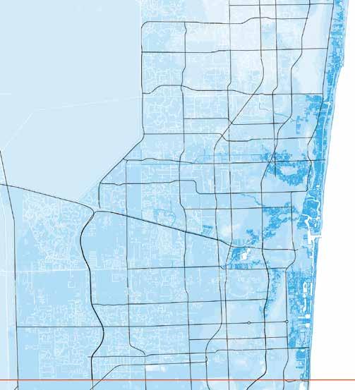
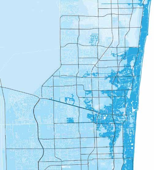
2040 scenario
daily tidal flooding
A lower-to-middling range sea level rise projection (similar to the “NOAA Int-High” on pp. 22-23) for sea level rise this century is utilized for the following map series to highlight areas in Broward County that may experience an increase in tidal influence moving into the future. The dark blue color highlights increased flooding, but is not meant to indicate constant inundation. Rather, it simply indicates areas that are likely to be overtopped daily by high tides or areas that are
likely to be flooded by the surge of a category 1 storm with a path and behavior similar to Hurricane Irma. Given the changes in sea level rise rates that have already been observed, an additional foot of rise above today’s sea levels seems likely by the year 2040. What this map does not show is the accompanying rise of the water table and the effects this would have on flooding inland. It is likely that increases in rain-driven flooding wil also increase everywhere.
introduction sea level rise 36
category 1 storm surge
By 2040, storm surge from a category 1 hurricane could inundate far more areas than a similar storm in the past. While Hurricane Irma itself caused significant amounts of surge flooding in relatively localized areas, the same kind of surge in Broward after an additional foot in sea level rise could inundate entire neighborhoods. An aspect of Hurricane Irma that was especially challenging for Broward and Miami-Dade was persistent flooding experienced across the region
after the storm. This was the result of stormwater management facilties becoming overloaded by the shear volume of rain released over the region, and at a time of year when both rain volumes and sea levels are naturally elevated and when stormwater networks are already at capacity. This same kind of “compound flooding” would be both deeper and last significantly longer if sea level rise were to elevate the regional water tables by an appreciable amount.
37
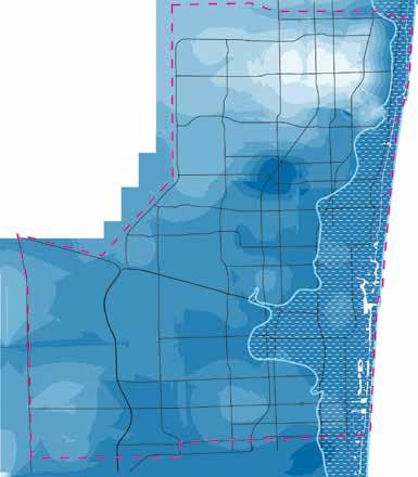
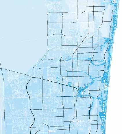
2060 scenario
daily tidal flooding
By 2060, it is likely that over two feet of sea level rise will be impacting the region. In this scenario, high tides would begin to inundate entire neighborhoods almost every day. However, if present planning goals are met prior to 2060, most waterfront properties in both Broward and Miami-Dade Counties will have raised their shoreline elevations about twice above their heights now (i.e, >5 ft. NAVD88). If this change is successful, the daily tidal flooding experienced would likely be
less than what is shown below. It is also important to remember that shorelines are not the only consideration as tidewaters can “back-up” through storm drains and other stormwater infrastructure and cause flooding inland of the shoreline itself. However, even if “tidal check valves” and other adaptive infrastructue are perfectly implemented across the county, flooding from ponding rain would still be common even after a relatively minor rainstorm.
sea level rise introduction 38
category 1 storm surge
Surge from a category 1 storm in 2060 would likely cause extensive inundation and accompanying damage from erosion. Surge caused by Hurricane Irma in 2017 moved tons of sand off of beaches in Broward and spread it over roads and other urban areas. This sort of impact is likely to occur with storms only a fraction of Irma’s strength after a sea level rise of more than two feet. Again, this assumes there has been no structural change to the elevation of shorelines. Similarly, if the
“salinity control structures” — those dams that separate inland water from tidewater within the regional canal network — are over-topped by surge, then tidal-induced flooding will also likely occur much farther inland than ever before. If this were to happen, the possible damage and lost drainage capacity of these dams, combined with heavy rain from an Irma-like storm, would result in widespread and long-lasting flooding across the region and could persist for months.
39
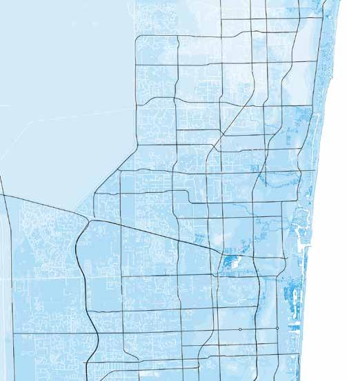
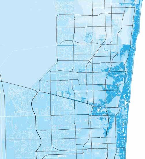
2080 scenario
daily tidal flooding
Towards the end of the century, and after three feet of sea level rise, seasonal King Tide conditions overtop the salinity control structures at the heights they are today. This causes urban areas much farther inland to experience tidal changes for the first time and renders the regional drainage network effectively useless as the elevation differential required to drain excess stormwater from inland areas to tide equilizes, negating the use of gravity and requiring enormous and
monstoursly expensive pumping to provide similar levels of service. SFWMD, USACE, and local partners are already working to expand the inland portions of these canals and to elevate key areas along the network, providing additional storage and attenuation capacity for inland stormwater volumes that may help up to this point. However, after three feet in sea level rise, even these improvements would struggle to keep up, and many coastal areas would regularly flood regardless.
introduction sea level rise 40
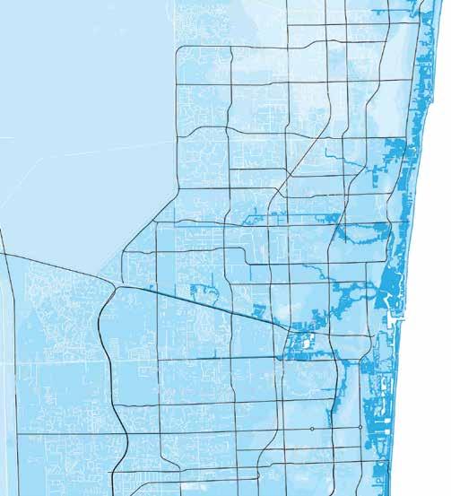
category 1 storm surge
Assuming there has been no change to stormwater and shoreline infrastructure by 2080, surge from even relatively modest storms would inundate much of the region. With the regional control structures at equilibrium with high tides during the King Tide months, even normal conditions could result in most of Broward County experiencing perisistent flooding, with a thin layer of water ranging between a few inches to several feet deep covering the landscape after
every rain event. Even if there were no hurricanes, the extent of high-tide flooding shown in the opposing map would likely be enough to overload most of the region’s drainage capacity and would have elevated the underlying water tables to very near the surface in many areas. This combination would mean that most of Broward could expect to be flooded like this every summer, with water only subsiding well after the wet season rains have ended.
41
solutions
parks, not pipes
Just as these problems have synergistic causes there exist synergistic solutions able to address many of the root issues underlying compounding climate-urban cascades. Utilizing plants and “soft” landscapes for infrastructural purposes traditionally reserved for “hard” engineering has the potential to improve many urban-climate problems, enhancing the adaptive capacity of landscapes to climate change while also improving urban quality of life. This softer way of managing water with landscapes is known as “green stormwater infrastructure.”
Conventional urban infrastructure treats water in the landscape as a waste to dispose of and as a threat to life and property, resulting in an “inputs/outputs” and “control/defend” mindset. While the power of water to destroy should never be underestimated, viewing water as only a nuisance and not as the life-giving substance that it is has resulted in urban landscapes that reflect this mindset with debilitating results. Where rainwater once fell onto trees and wetlands, percolating and infiltrating into the ground and evaporating


into the air at zero cost, now stormwater runs off of buildings, lawns, and roads — gaining speed, volume, and pollutants along the way, creating new problems that did not exist before and that require costly management. This phenomenon is sometimes referred to as “urban stream syndrome” aptly referencing how a natural system replaced by engineering can force itself back onto the artificial as a disservice when extreme conditions occur.
Where plants and landscapes are used to manage urban stormwater instead of pipes and pumps, not only are runoff rates reduced and water quality improved, but a host of other benefits are enhanced as well, including reduced urban temperatures, improved mitigation of pollutants, and provision of wildlife habitat. Well designed urban tree cover alone can simultaneously reduce heat islands, reduce runoff-driven flooding, and increase access to quality urban green space, all of which are increasingly understood to be important aspects of urban public health.


runoff
evaporation 50% in ltration 42% in ltration 20% runoff 38% evaporation 35% in ltration 15% in ltration 35% evaporation 15% evaporation 30% runoff 50% runoff 0% impervious surface 10-20% impervious surface 30-50% impervious surface 75-100% impervious surface
grey introduction sea level rise 42
10%
40%
green
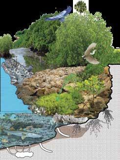

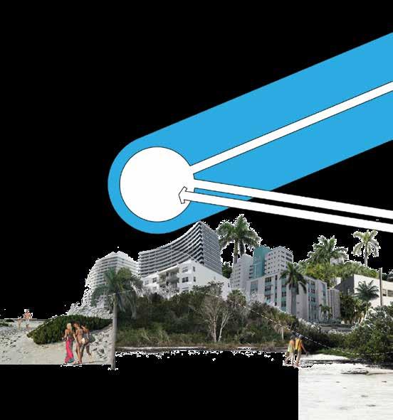
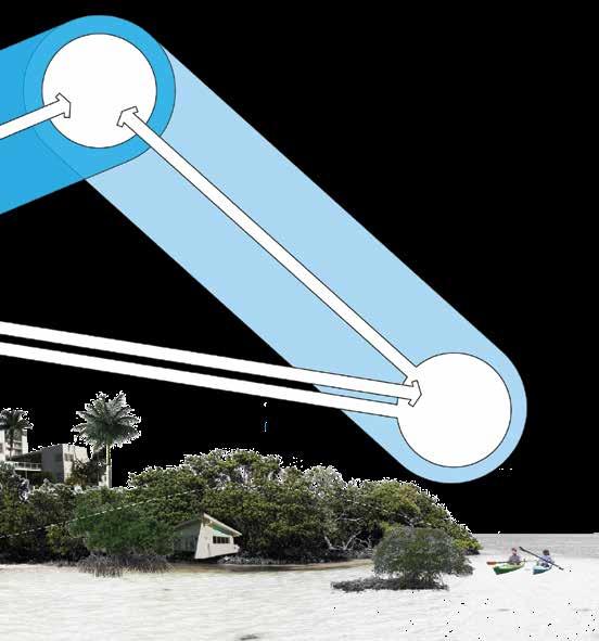
greenways, not giant walls
Armored walls known as “seawalls” are the mainstay shoreline of urban south Florida. This is mostly because they maximize buildable land area with waterfront while also preventing erosion and retaining inland soils. While convenient, this practice has become so widespread that precious few of the region’s valuable estuarine habitats remain, causing and worsening a variety of environmental problems. But seawalls were never the only option. Shorelines that use the stabilizing power of plants and marine habitats, often called “coastal green infrastructure,” have always been an equally suitable alternative.
As the sea rises, south Florida shorelines will continue to be on the frontline of adaptation efforts. Many of the seawalls throughout the region today were built nearly fifty years ago and would need to be replaced soon anyway, irrespective of elevated tidal stress. Simply raising shorelines would help to protect inland areas but at the continued cost of the region’s unique coastal ecosystems, halting them from migrating with the rising tides. Seawalls also require continual restructuring with sea level rise, making them more expensive in the long term. Mangroves, on the otherhand, have the potential to grow and adapt to rising seas at minimal cost.
However, coastal ecosystems in southeast Florida are some of the most imperiled in the world due a host of pressures caused by the urban coast. Being stuck between rising seas and rising walls, many unique Florida habitats, like mangroves, seagrasses, and coral reefs, will be unable to adapt. The loss of these systems would not only present an aesthetic and moral crisis for Florida but a direct economic one as well. As these important ecosystems continue to decline, it will only become harder to leverage their unique adaptive benefits.
While coastal green infrastructure generally requires more land area to implement than seawalls, these nature-based solutions manage coastal resources much more holistically, resulting in a more costeffective investment over time, imparting “cobenefits” and creating amenities that improve urban quality of life through living place-making.
soft hard 43
salty urbanism
Salty Urbanism is a concept that focuses on the development of coastal cities and their relationship with the surrounding natural and economic systems. It recognizes the unique challenges and opportunities presented by flood-prone coastal areas and aims to create sustainable and resilient urban environments. Salty Urbanism takes into consideration the quality of life for residents, the economic systems in place, and the preservation and integration of the natural systems.
Quality of life is a fundamental aspect of Salty Urbanism. Coastal cities offer a distinct lifestyle with access to beaches, waterfronts, and natural beauty.
Economic systems play a crucial role in coastal cities, especially those with active ports and tourism industries. Salty Urbanism recognizes the economic potential of these cities and seeks to leverage their natural assets. It promotes the diversification of the local economy, encouraging a balance between traditional industries and emerging sectors such as green technology, marine research, and sustainable tourism. By fostering innovation and entrepreneurship, Salty Urbanism helps create jobs, attract investment, and enhance economic resilience.
economic system
introduction sea level rise
economicsystem
Natural system thinking is a key component of Salty Urbanism. Coastal cities are directly influenced by their surrounding ecosystems, including beaches, wetlands, and marine habitats. Recognizing the value of these natural systems, Salty Urbanism emphasizes their protection and integration into urban design. It promotes sustainable development practices that minimize the ecological footprint of cities and ensure the long-term viability of the coastal environment. This includes measures such as protecting and restoring coastal ecosystems, managing stormwater runoff, and implementing climate adaptation strategies.
quality of life
Salty Urbanism also encourages collaboration between architects, urban planners, engineers, scientists, and local communities to develop holistic solutions. By adopting a systems thinking approach, it aims to address the interconnected challenges faced by coastal cities, such as rising sea levels, climate change, and population growth. This involves considering the social, economic, and environmental aspects of urban development and finding innovative solutions that benefit both humans and nature.
Overall, Salty Urbanism offers a framework for creating flood-adaptive coastal cities that prioritize the quality of life for residents, foster a resilient and diverse economic system, and promote the protection and integration of natural systems. By embracing the unique characteristics and challenges of coastal areas, Salty Urbanism strives to create vibrant, livable, and environmentally conscious urban environments.
environmentalquality
preservation & maintenance
environmental services
natural system
45
large trees
These are large landscape trees useful as hedgegrow screens, specimens, wide avenue plantings and/or for providing urban canopy and shade cover.
red maple Acer rubrum 45’- 50’

All grow taller than thirty feet at maturity and so must be set back at least thirty feet away from the nearest powerlines.
willow bustic Sideroxylon salicifolium 30’-50’ lime rock, sand, muck
royal poinciana Delonix regia 30’- 70’

loam, lime rock, sand, clay
red mulberry Morus rubra

35’-70’
loam, sand

Pr/Ev Pr/D Pr/Ev


loam, lime rock
Pr/D
!

Pr/D

bridalveil tree Caesalpinia granadillo 25’-35’
Pr/Ev


Japanese fern tree Filicium decipiens 20’-35’

loam, sand, clay
avocado Persea americana 30’- 65’

loam, lime rock, sand
slash pine Pinus elliottii 80’-100’ loam, sand, clay

loam, lime rock, sand
queen crape myrtle Lagerstroemia speciosa

35’- 60’
loam, sand, clay
Pr/Ev

Pr/Ev

false mastic Sideroxylon foetidissimum

40’- 70’
lime rock, sand
silk floss tree Chorisia speciosa 30’-50’

loam, sand, clay
persimmon Diospyros virginana

35’-60’
loam, sand, clay
Pr/Ev

Pr/Ev

low salt tolerance
preferred soil moisture
Pr/Ev

Pr/Ev

Pr/D


bald cypress Taxodium distichum 50’-100’
loam, muck, sand, clay
Pr/D


banyans Ficus spp. 40’-60’
loam, muck, sand, lime rock
Pr/Ev

hydric mesic xeric
! FL #’-#’

live oak Quercus virginiana 40’-80’
loam, sand
Pr/Ev

caution advised siting near structures
CAUTION - weedy exotic species
caution - weedy native species !
species mature height range indicates Florida native species
FL
FL
FL
FL
FL
FL
FL
FL
growth rate
slow moderate fast full sunpart shadefull shade
phenology
Pr - long-lived perennial pr - short-lived perennial
An - annual
Ev - evergreen D - deciduous preferred sun exposure

West Indies mahogany Swietenia mahagoni 30’- 70’

wild tamarind Lysiloma latisiliquum 30’- 40’

paradise tree
Pr/Ev Pr/D
Simarouba glauca

30’-50’ loam, lime rock, sand, clay
loam, sand, clay


Jamaican dogwood Piscidia piscipula

15’-50’ loam, lime rock, sand
mango Mangifera indica

sand, loam, clay
pond cypress
Taxodium ascendens

50’-85’
loam, muck, sand
monkey apple Mimusops coriacea

20’-40’
red mangrove Rhizophora mangle

20’-50’
marine sediments, lime rock

Pr/D

lime rock, sand
Pr/Ev

Florida soapberry Sapindus saponaria
30’- 40’

Pr/Ev

loam, sand, lime rock, clay
Pr/D

Pr/Ev

loam, sand, lime rock
Pr/Ev lime rock, sand
yew podocarpus
Podocarpus macrophyllus

20’-60’
loam, sand, clay
black mangrove Avicennia germinans

20’- 40’
marine sediments, sand
pitch apple Clusia rosea
30’-60’ sand
25’- 50’

Pr/Ev

green buttonwood
Conocarpus erectus
Pr/Ev
30’-50’

lime rock, sand

Pr/Ev

Pr/Ev
!

eastern red cedar Juniperus virginiana
Pr/Ev
25’-40’

loam, muck, sand
seagrape
Coccoloba uvifera

Pr/Ev
25’- 50’


high salt tolerance
growth forms
sprawling canopy rounded canopy vase-like canopy irregular canopy thicket forming upright conifer
Pr/Ev
FL FL FL FL FL FL FL FL FL FL FL ! FL
contributors and collaborators
Brooks + Scarpa
Jeffrey Huber, FAIA, ASLA
Lawrence Scarpa, FAIA
Angela Brooks, FAIA
Kun Li, Project Designer
Fan Wu, Project Designer
Arty Vartanyan, Project Designer
Pieter Conradie, Project Designer
Heather Akers, Project Designer
Aren Castro, Project Designer
Mason Millner, Project Designer
Claudia Perdomo, Intern
Alyssa Scherger, Intern
Florida Atlantic University
School of Architecture
Jeffrey Huber, FAIA, ASLA, Associate Professor
John Sandell, Associate Professor
Anthony Abbate, AIA, Professor
Francis Lyn, Associate Professor
Henning Haupt, Associate Professor
Kun Li, Research Assistant
Pieter Conradie, Research Assistant
Gerardo Ormachea, Research Assistant
Ian Fennimore, Research Assistant
Heather Akers, Research Assistant
Chance Stillman, Research Assistant
Dogus Oren, Research Assistant
Dane Quist, Research Assistant
Nicholas DiMattia, Research Assistant
Architecture Students:
German Avila, Pieter Conradie, Hernan D’Angelo, Nicholas DiMattia, Eduardo Ecenarro, Hassan El Wazzan, Austin Fox, David Gillis, Cody Gosier, Laetitia Lamarre, Francys Liscano, Olga Marin, Haleng Mustafo, Javier Mendoza, Rodrigo Navarro, Kevin Ortega, Carlos Tejado, Emily Peters, Gilberto Pujols, Dane Quist, Jessie Robles, Maria Rodriguez, Ricardo Rodriguez, Kathleen Valdez, Maria Valero, Kyle Vayda, Rollson Virgile, Katja Whyte, Nadia Zuta, Heather Akers, Luis Ardila, Juanita Bernal, Laren Buss, Cristin Courtney, Christopher Emile, Christie Garcia, Noah Illes, Fadia Jawhari, Daniel Justiniano, Carlos Justiniano, Maria Kokalias, Tyler Laforme, Jonathan Llampay, Amber Lewis, Rebeca Machado, Angela Menah, Lisa Munoz, Michael Olitsky, Dogus Oren, Michael Ospina, Elizabeth Parry, Connor Peede, Daniel Shareef, Deshay Sinclair, Chance Stillman, Anthony Talavera, Diego Valencia, Kevin Van Osterom.
Florida Center for Environmental Studies (CES)
Dr. Colin Polsky, Director and Professor
Richard Jones, Senior Research Associate (co-led publication efforts)*
College of Engineering and Computer Science
Dr. Fredrick Bloetscher, Professor
School of Urban and Regional Planning
Dr. Diana Mitsova, Professor
Rayan Alhawiti, Research Associate
Connor Bailey, Research Associate
University of Southern California School of Architecture
Lawrence Scarpa, FAIA, Adjunct Professor
Esther Margulies, ASLA, Associate Professor of Practice of Landscape Architecture
Architecture Students:
Norah Altwaijri, Chase Ashley, Danut Bidasca, Jennifer Brozozowski, Milioni Doshi, Christian Estrada, Hieu Huynh, Yangxiaoxia Li, Yu Liu, Jen Yu (Jason) Lo, Zhuo Wang, Mengyu Wu, Yufei Liu , Sarah De La Cruz, Wan Sin Lan, Can Derman, Tyler Gates, Jun Jun Wang, Zachary Bergmann, Chi In Wong, Jerry Ta, Yuan Pu, Manwei Li, Shu Wei, Sneha Ravani, Ai-Ju Liu, Jing Sun, Ziqiong Liu, Xiaolu Song, Liang Zhao, Shuwei Liu, Jiayu Liang, Lin Cheng, Clara Yoshihara, Yuliang Jiang.
University of Kansas School of Architecture
Dr. Keith Van de Riet, Associate Professor
Architecture Students:
Nicholas Bontrager, Camille Cieutat, Anna Collins, Patrick Griffin, Jake Lester, Pennie Liu, Zachary Overschmidt, Kevin Purdom, Quentin Rabu, Nicolas Rakowski, Spencer Reed, Emma Riordan, Hannah Rupprecht, Claire Ryan, Joseph Schaefer-Glick, Mitchell Starrs, Hannah Underwood.
With additional support from the City of Fort Lauderdale and Broward County Natural Resources and Management Division.
A special acknowledgement for Richard Jones from the Florida Center for Environmental Studies at Florida Atlantic University who took on the major responsibility and push to see this publication through completion. His efforts and all other contributors and collaborators were instrumental in seeing this publication come to fruition.
259
ORO Editions
Publishers of Architecture, Art, and Design
Gordon Goff: Publisher
www.oroeditions.com
info@oroeditions.com
Published by ORO Editions.
Copyright © 2024 Brooks + Scarpa.
All rights reserved. No part of this book may be reproduced, stored in a retrieval system, or transmitted in any form or by any means, including electronic, mechanical, photocopying of microfilming, recording, or otherwise (except that copying permitted by Sections 107 and 108 of the US Copyright Law and except by reviewers for the public press) without written permission from the publisher.
You must not circulate this book in any other binding or cover and you must impose this same condition on any acquirer.
Author: Jeffrey E. Huber, FAIA, ASLA
Book Design: Florida Atlantic University and Brooks + Scarpa, with Pablo Mandel / CircularStudio Project Manager: Jake Anderson
10 9 8 7 6 5 4 3 2 1 First Edition
ISBN: 978-1-957183-75-6
Color Separations and Printing: ORO Editions Inc. Printed in China
ORO Editions makes a continuous effort to minimize the overall carbon footprint of its publications. As part of this goal, ORO, in association with Global ReLeaf, arranges to plant trees to replace those used in the manufacturing of the paper produced for its books. Global ReLeaf is an international campaign run by American Forests, one of the world’s oldest nonprofit conservation organizations. Global ReLeaf is American Forests’ education and action program that helps individuals, organizations, agencies, and corporations improve the local and global environment by planting and caring for trees.
This publication was supported by the National Sea Grant College Program of the U.S. Department of Commerce’s National Oceanic and Atmospheric Administration (NOAA), Grant No. NA 14OAR4170108. The views expressed are those of the authors and do not necessarily reflect the view of these organizations. Additional information is available by contacting Florida Sea Grant, University of Florida, PO Box 110409, Gainesville FL, 32611-0409, tel. (352) 392.2801, www.flseagrant.org.