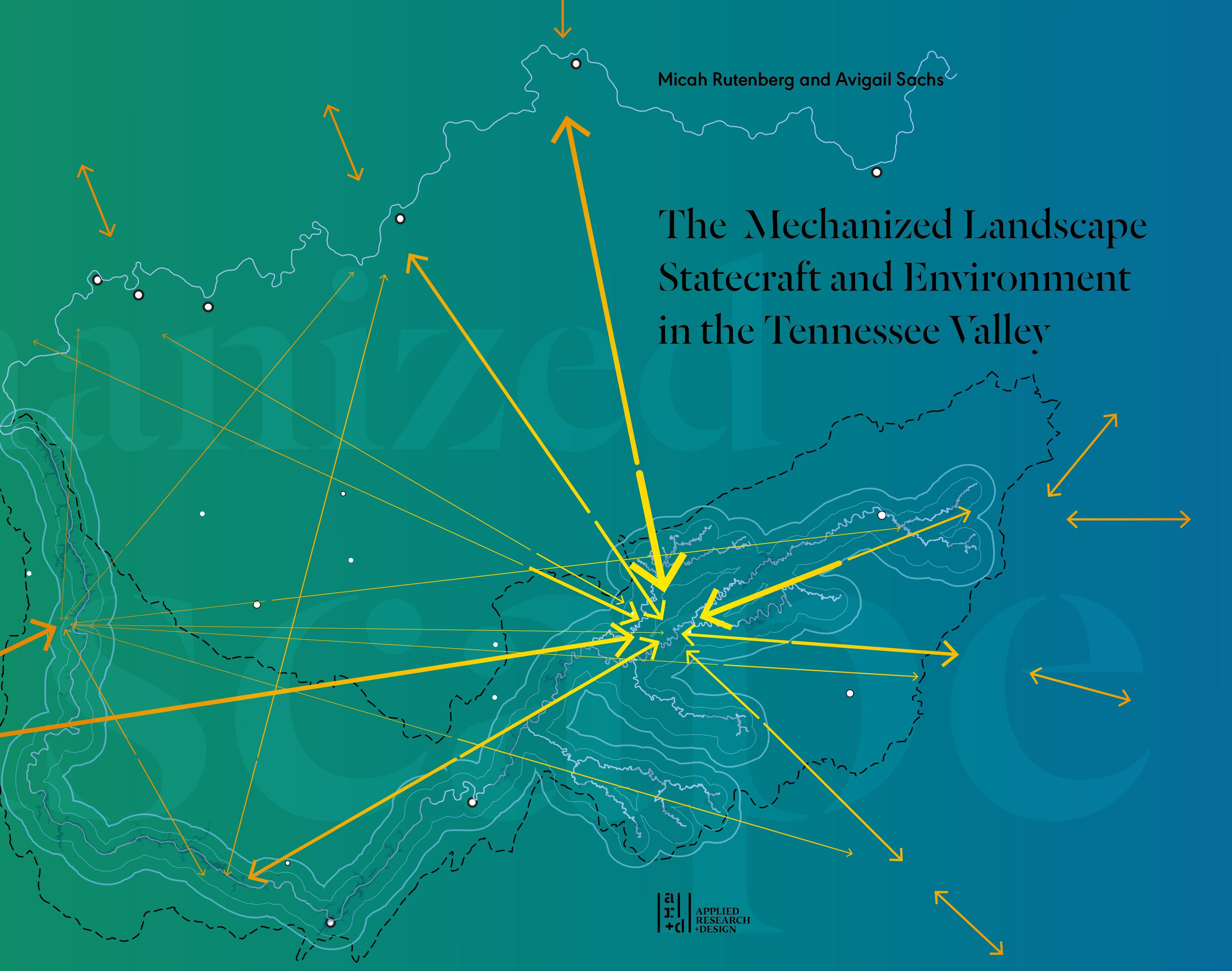




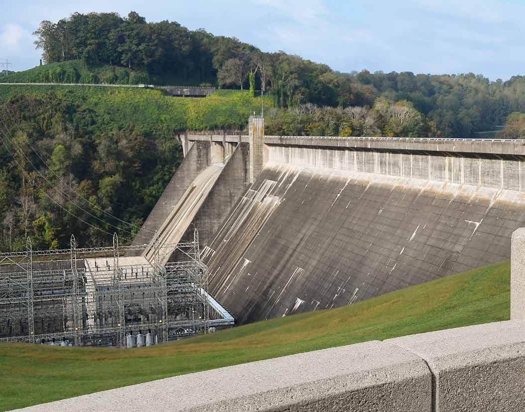
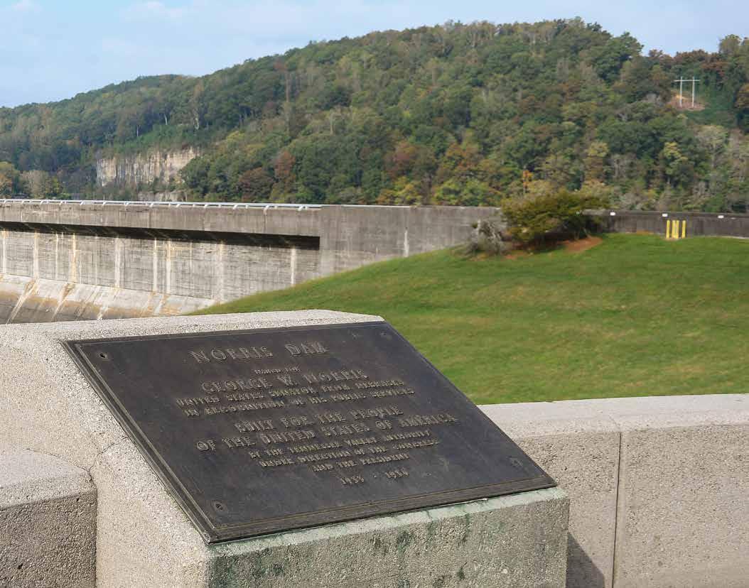
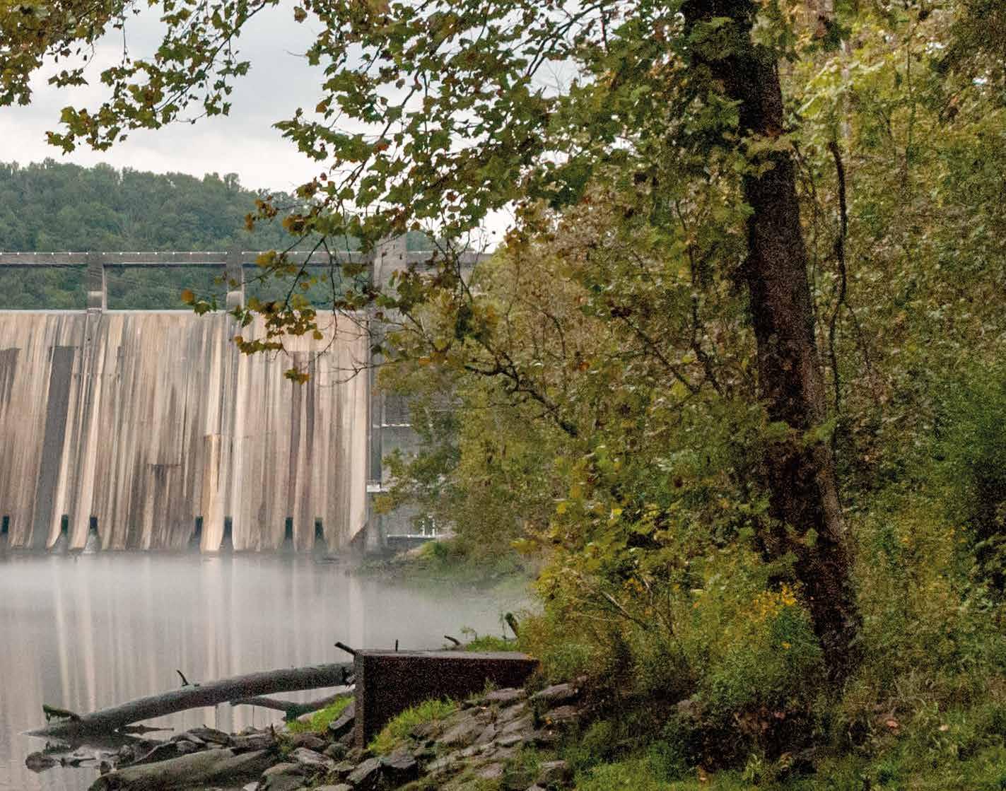
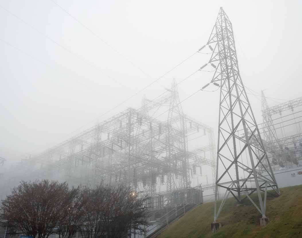
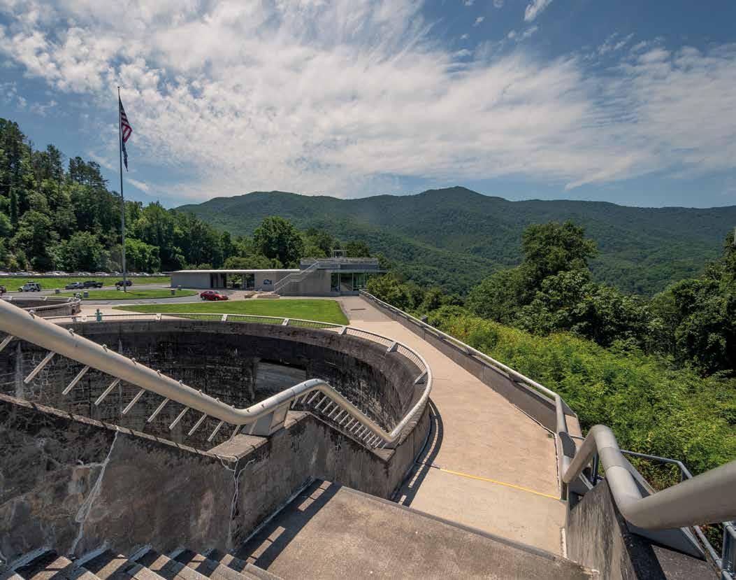
Visitors to Norris Dam, an imposing structure extending across the Clinch River in East Tennessee, first view it from a concrete platform situated in front of a glassand-steel welcome center. From this overlook, curved staircases descend to a grassy slope that ends in a tangle of power lines, switches, circuit breakers, and steel frames that make up the electric substation below. Just beyond is the powerhouse: a prime example—along with the dam above it—of stoic, well-proportioned Modernist design as applied to utilitarian infrastructure. This orchestrated scene is punctuated with a patinaed bronze plaque, seamlessly integrated into the concrete boundary of the overlook. The plaque positions the visitor and trains their attention toward an iconic view of the dam. The plaque declares that the dam, powerhouse, and landscape—the totality of everything that makes up the scene—were “Built for the People of the United States by the Tennessee Valley Authority under the Direction of the Congress and the President, 1933–1936.”
In essence, the plaque conveys the obvious. All infrastructure is, to a large extent, a political act; it delivers the essential resources needed for society to function, while also signifying the presence of the state and its ability to meet the needs of its citizens. Indeed, infrastructure’s invisibility—the simple fact that it is present in the
landscape and that it operates as planned—is, in itself, the sign of a well-functioning modern government. The prominent location of the plaque in the landscape serves to amplify this message. The words convey the message rhetorically, even as the choreographed scene and its elements add their visual persuasion, while the spatial experience of the environment engages human behavior and emotions. This multilayered messaging was, for the Tennessee Valley Authority (TVA), a form of statecraft—the art of government persuasion and diplomacy.
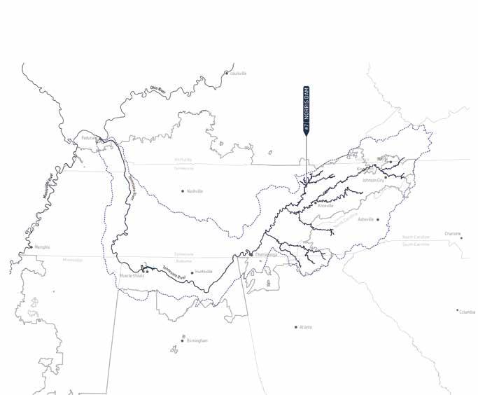
The plaque spotlighting that iconic view of Norris Dam is but one example of the TVA’s messaging efforts. Across the massive structure, another overlook showcases a map of the entire TVA system of multipurpose dams, adding a geographic element to the overt statecraft and giving visitors a sense of the vast spatial scope of the project. And far below, in the river itself, the TVA promotes a popular spot for fishers trying their luck. These two ways of experiencing the river and its tributaries—abstractly, through the language of cartography, and physically, by wading into the water—together serve as a dramatic example of the layered messaging of TVA statecraft.
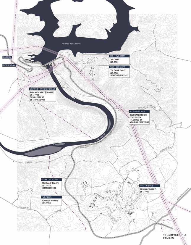
One mile below the dam, along the Norris Freeway—a scenic road designed and built by the TVA—is an 18th-century grist mill. The TVA
relocated the mill from a community named Lost Creek, thus preserving it from being entombed by the rising waters of the reservoir captured by Norris Dam. The mill is a relic of a period in the area’s history when it was settled by pioneers of British descent, soon after the Revolutionary War. But much else of the region’s history was sacrificed to the dam construction: indigenous sites and artifacts were left to be submerged in the reservoir’s depths, and Black Valley residents were altogether forgotten. This selective care for history reveals a symbolic dimension of the TVA’s statecraft; it suggests that the construction of large-scale infrastructure, such as dams and powerhouses, takes its place as yet another chapter in the unfolding of America’s Manifest Destiny.
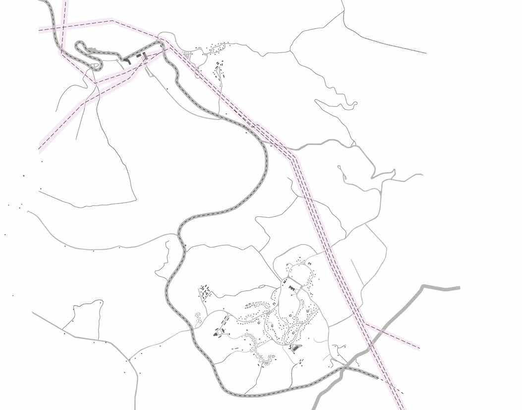
Norris, Tennessee, two miles to the south, is a town designed and built by the TVA. If the mill symbolizes and celebrates individualism and pioneer resourcefulness, Norris stands as one of the most comprehensive examples of the communal emphasis of the regional planning ideology of the 1930s. While Norris residents do own their individual plots of land, the environment they live in is shared. There are no fences; the residents enjoy a continuous landscape that alternates between forest and clearing, as well as a network of pedestrian walkways and the central public and commercial buildings. Behind the dam is the reservoir known as Norris Lake. Here, the environment is explicitly arranged for tourism and recreation—boating, fishing, hiking, and biking—in the sylvan setting of the lake’s forested shores. Marinas and resorts offer myriad ways to enjoy the lake; the houses along the shoreline (vacation homes, for the most part) display the entire range of investment, from basic trailers to multi-story rental units. The message embedded in this environment, also created by the TVA, contrasts

Norris Model, 1936
At Norris Dam, the TVA experimented with integrated development, including the provision of employee housing.

The Mechanized Landscape
dramatically with the communal emphasis of Norris, Tennessee; it is an overt celebration of a consumer-driven economy.
As architects who are residents of the Tennessee Valley, we have been both fascinated and puzzled by the complex environment of Norris Dam and the Tennessee Valley. Could we reconcile, theoretically, the disparate elements of this territory? This book is a documentation of our joint pursuit of this question. The concept of a mechanized landscape shaped our process from the start, as it captured the extent to which the TVA—a federal agency with jurisdiction over the entire Tennessee Valley—transformed the region, and it conveyed how seamlessly we see geography and infrastructure working together. As we delved further into the TVA’s intentions, however, it became clear that the mechanized landscape is also ideological: a physical manifestation of a powerful statecraft.
Over the two decades examined here, 1933–1953, the TVA’s statecraft was hardly uniform. As a New Deal entity, the TVA was the product of unprecedented experimentation by the United States federal government. The TVA Act, the legal basis for the agency’s operation, was written in haste; it drew on multiple (sometimes incompatible) conceptions of American society and democracy. All TVA personnel, however, saw their mission as defined by human needs. Rather than engaging in environmentalism, TVA efforts were firmly rooted in the idea that the environment should and must be shaped for human welfare. What human welfare entailed, and how this might represent the core value of democratic freedom, was, however, a topic of wide-ranging discussion and even disagreement within the agency.
Environment was also a fluid term. Each unit of the TVA focused on a different aspect of the Tennessee Valley, notwithstanding the agency’s insistence that its overall goal was regional
rather than piecemeal transformation. Some of its interventions were directed at the physical, even the natural, reality of the valley—its water flows, soil, flora, and fauna—while others focused on human settlements, and especially houses.
The intersection between statecraft and environment does not explain every aspect of the Tennessee Valley, but it offers a matrix for exploring the final product—the mechanized landscape. Within this matrix we identified five topics of special interest. The first three can be thought of as machines in the environment, and they were clearly authorized in the original legislation creating the TVA. Each of these machines is an amalgam of large-scale projects in resource development. The river machine included flood prevention and navigation; the land machine addressed forestry and soil conservation; the power machine produced power for rural electrification. Two further projects emerged from the operation of these three machines: support for the housing industry, and the creation of a regional tourist economy—here termed the housing and recreation regions.
It was clear to us from the start that such a multivalent topic would require more than one mode of exploration. We followed three distinct paths that became the elements of this book: mapping, photography, and text. Each medium captures some, but not all, of the aspects of our topic. We were constantly fascinated by the ways these different media complement each other, and by the similarity between our own method and the TVA’s approach to both statecraft and environmental transformation. Even though all three media were developed together, our goal was to create a visual document in which the images take center stage. The text is intended to provide context for these images, but it does not attempt to explain them.
As a modernizing force in the Tennessee Valley, the TVA also introduced new types of


documentation to the region, including accurate geospatial mapping and detailed surveys. The vast amount of data recorded by the TVA has been preserved by the federal government as part of the public record; it is available for study. The maps we prepared for this book draw on the depth of this archive, supplemented occasionally with external studies, media reports, and field accounts that offer a perspective from outside the Authority. We took the TVA information at face value; rather than critiquing the agency’s decisions, we sought to visualize their consequences. We did not, for example, “correct” the TVA terminology but adopted the words they used, which at times seem outdated or jarring. Nor did we assume that the TVA is an example of either “good” or “bad” government; it rather represents a complex and sustained, yet shifting, effort to enmesh statecraft and the environment.
The maps are geographically accurate and, with some exceptions, drawn to scale. They adhere to the cartographic convention of creating detached, abstract views. Preparing the maps, however, highlighted fundamental differences among the three “machines” and the two regional “efforts.” The river machine, for example, was tightly controlled and was thus more easily mapped than the land machine, which was diffused across the valley on private lands. Understanding the power machine required mapping not only the TVA’s original projections but also the outcomes of a series of legal challenges brought against the agency in its early years. Mapping individual houses helped us unravel the TVA housing enterprise; focusing on Norris Lake brought the tourist industry into view. This diversity is evident in the maps selected for this book.
Photography, the second mode of exploration, involved extensive travel by car and boat throughout the Tennessee Valley. It required paying close attention to the water levels of
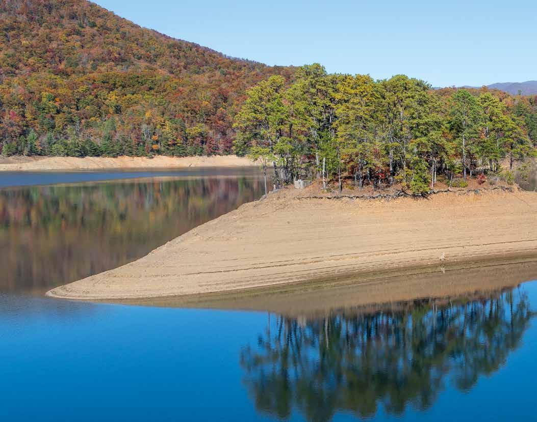
Norris and the other TVA lakes, often rearranging the schedule to take advantage of unusual rainfall. Being immersed in the environment meant not only visiting each of the TVA dams, but also staying overnight in lakeside cabins. The TVA allowed us to visit the interiors of some powerhouses (no longer open to the public), and we learned a lot from the operators of the dams. As part documentary, part artistic expression, the photographs are meant to situate the reader within a scene and to contextualize the historical and cartographic data. We hope that the photos can also be appreciated for their aesthetic quality as much as for the mechanized landscape they capture.
The book can of course be read linearly, but this is not necessary. The layout and the combination of media are intended to allow the reader multiple entry points, to pick up and leave off as guided by one’s interests. We hope the complexity of the mechanized landscape of the Tennessee Valley will prove as fascinating in print as it is in life.
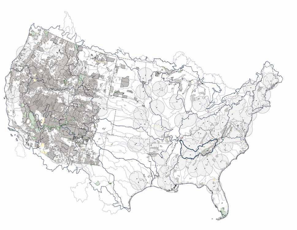
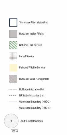
Federal Land Administration and the Location of Land-grant Universities
As the United States expanded westward in the 19th century, the federal government assumed responsibility for planning and resource development. In creating the TVA, the Roosevelt Administration applied the logic of large-scale planning to a territory that had been colonized without it. Land-grant universities, also a federal investment, played a key role in these efforts.
In 1862, in the midst of the Civil War, the Union government enacted the Homestead Act. Would-be homesteaders—any head of a household, male or female, who was already a citizen or simply declared their intention to become one—could lay claim to 160 acres of “free” land. This was land seized from Indigenous Peoples, through treaty or coercion or both, that had been opened for settlement. To then gain title to those acres, homesteaders had to be industrious, investing their labor to make the land agriculturally productive for five years. The Homestead Act extended the frontier of early British colonialization across the continent, legalizing the passing of land expropriated from Indigenous Peoples into private—mostly white and Protestant—hands. Its social goal was to create a nation of freeholders rather than tenants or serfs, who would rely on their own labor—not that of servants or enslaved people—and who would actively participate in a democratic society.
In the early 19th century Thomas Jefferson had singled out farmers as the “chosen people of God,” uniquely endowed with virtue and independence, giving them iconic status in American society¹. Not all homesteaders became farmers, however; the new settlements also needed artisanal production and small-scale industry. But all these frontiersmen (and to some extent frontierswomen) were accorded special prestige
as people of industry, not of leisure. This status was translated into policy in the 1862 Morrill Act, empowering the states to sell public land to individual owners and use the proceeds to support institutions of higher education. These “land-grant colleges” were expected to focus on agriculture and the mechanic arts, to develop and disseminate knowledge about these topics of vital importance to pioneers on the frontier. The logic of the frontier was rooted in a specific interpretation of the environment. The North American continent was seen as an uncontrolled and terrifying wilderness, to be conquered and subdued by virtuous pioneers². The success of this process, referred to as Manifest Destiny, was reflected in the emergence of a rural ideal of tilled plots and green pastures—not cities—replacing forests and deserts. This was a modern-day interpretation of a classical trope, identified by Leo Marx as the pastoral ideal³. This ideal, of a middle landscape untainted by the corruption of civilization, would have been familiar to educated Americans of the day, especially if they had studied Roman rhetoric and poetry. In North America, Marx argues, the seeming abundance of “free” land made the pastoral ideal into a possible reality.
In 1893, historian Fredrick Jackson Turner translated the ideas associated with Manifest Destiny into a national myth, later published
Franklin D. Roosevelt’s personal interest in planning and regionalism, though it also reflected the experimental nature of the New Deal itself.³⁴
The TVA was unique also in its structure. It was to be directed by a triumvirate of directors rather than a single individual. Roosevelt moved swiftly to appoint Arthur E. Morgan, an engineer with experience in building dams as well as a firm believer in social and environmental reform. He was joined by Harcourt A. Morgan (no relation to Arthur), an agronomer and president of the University of Tennessee, Knoxville, who had been involved in soil conservation in the Tennessee Valley for several decades. David E. Lilienthal, the third member, was a lawyer by training who had engaged in litigation against private electric companies in other parts of the United States. Thus, all the various professional and intellectual interests that had contributed to the establishment of the TVA—and the tensions between them—were positioned in the institution from its inception, beyond the terse instrumental language of its legal authorization.
The TVA engineers soon set about developing the projects authorized in the TVA Act, considering them part of the “Unified Development of the Tennessee River System.”³⁵ In recognition of the comprehensive nature of their approach, we conceptualize their work as an integrated set of three machines—three large-scale operations enacted across the environment of the Tennessee Valley. The first, the river machine, began with the construction of a system of dams to provide both flood protection and navigation. This project had the largest environmental impact: to build the dams and create their reservoirs, the TVA purchased or expropriated land across the Valley, transforming private lands into public land under federal jurisdiction. To this day, the reservoir lakes and their shorelines remain in the public domain, allowing the TVA
to store and release water in response to seasonal precipitation.
The second system, the land machine, responded to the fourth and fifth authorizations: to work toward “proper” reforestation and use of marginal lands—that is, the promotion of forestry and agriculture. Both projects required stemming severe soil erosion in the Tennessee Valley, exacerbated by inefficient farming practices. Rather than buying properties, the TVA developed a program for manufacturing and distributing seedlings and fertilizers and for disseminating the knowledge needed to productively care for forests and crops. The agency’s explicit end-to-end control over the land machine was limited. Perhaps to compensate, it developed a complex system of infrastructural power that brought the TVA goals to the “people” of the Tennessee Valley.
The third project, which we call the power machine, had an environmental imprint even smaller than that of the land machine. The TVA built powerhouses at most of the dams and produced energy efficiently, that is, more cheaply than the market. The challenge of the power machine was to make this power available to the rural residents of the Tennessee Valley, who were not then connected to the electric grid. Building such a grid required some innovation, well within the TVA’s capabilities. The TVA had to contend, however, with severe opposition from private electric companies in the region, transforming the implementation of an engineering project into a legal challenge. The power machine was stalled for several years, but in the late 1930s the Supreme Court decided in favor of the TVA, allowing it to complete its plan for the rural electrification of the Tennessee Valley.
The differences between the three machines, and especially their interactions with Valley residents, produced deep tensions within the organization. Arthur Morgan, who had taken


Plan of Norris, Tennessee, 1933-1936
The TVA built the town of Norris, Tennessee, to house employees constructing Norris Dam, but designed it as a permanent model of the Garden City ideal. This was the only model town to be built by the TVA.


The Tennessee Valley Authority (TVA) Act of 1933 authorized the new agency to engage in projects promoting the social and economic welfare of the residents of the Tennessee Valley. TVA Director Arthur E. Morgan interpreted this direction as sanction to engage in comprehensive regional planning, and he authorized the preparation of a plan for a complete reorganization of the territory. Such a plan, he reasoned, would identify the areas in the region suitable for settlement, allowing the TVA to direct residents there and to provide them with the opportunity to thrive socially and economically. The plan would also assure that industry could be properly and efficiently decentralized across the region, while maintaining its mostly rural character.
Recognizing the importance of demonstration, Morgan determined to use the construction of the first TVA installation as a model of his vision for the entire Tennessee Valley. The dam and powerhouse were named for Senator George Norris, the sponsor of the TVA Act; they are located on the Clinch River, a tributary of the Tennessee. The construction of the dam necessitated extensive land acquisition—but Morgan directed the TVA to purchase more land than was strictly needed, to assemble a large contiguous territory that could be refashioned as a spatial and physical model.
SHOVEL OPERATIONS
SHOVEL 1
BUCYRUS 75-B
Serial #: 11595
Dipper: 3 cu. yds.
Boom: 29 ft. Power: 75 hp electric
Date of operation: 06/34 - 10/35
OPERATING TIME
Gross operation: 8337 hrs.
Delays: 1611 hrs.
of Service: 2743 hrs.
Tons per Load: 14.6 Loads per Hour: 10.8 Total Loads: 72,774
Tons: 1,061,040
SHOVEL 2
MARION 4101
Serial #: 6681
Dipper: 3 cu. yds.
Boom: 31 ft.
Power: 75 hp electric
Date of operation: 06/34 - 10/35
OPERATING TIME
Gross operation: 7790 hrs.
Delays: 1550 hrs.
Out of Service: 2930 hrs.
PRODUCTIVITY
Tons per Load: 14.6
Loads per Hour: 10.1
Total Loads: 62,894
Total Tons: 916,998
MIXING PLANT CAPACITY
Cobble: 210 cu. yds.
Gravel 1: 140 cu. yds.
Gravel 2: 140 cu. yds.
Gravel 3: 210 cu. yds.
Coarse Sand: 210 cu. yds.
Fine Sand: 210 cu. yds.
2 Cement Bins: 410 bbls. ea.
Aggregate capacity: 1,100 cu. yds.
Cement capacity: 940 barrels
CEMENT SILO
Diameter: 30 ft Capacity: 6,000 barrels
TOWER
Top Rail Elevation: 1,165 ft.
Suspension Point: 1,240 ft. Counterweight: 390 tons
TAIL TOWER
Top Rail Elevation: 1,062 ft.
Suspension Point: 1,172 ft.
HORIZONTAL PULLS
Cable Span:1,925.5 ft.
Track Cable Pull: 362,000 lbs.
Operating Cable Pulls: 31,000 lbs.
Light and Conductor Cable Pulls: 60,000 lbs. Total without Impact: 453,000 lbs.
PRODUCTIVITY
Full Load: 18 tons
Lowering Speed: 400 ft/min.
Hoisting Speed: 300 ft/min.
Carriage Travel: 1,200 ft/min.
Tower Traversing Speed: 50 ft/min.
Load at Cont. Operation: 16 tons
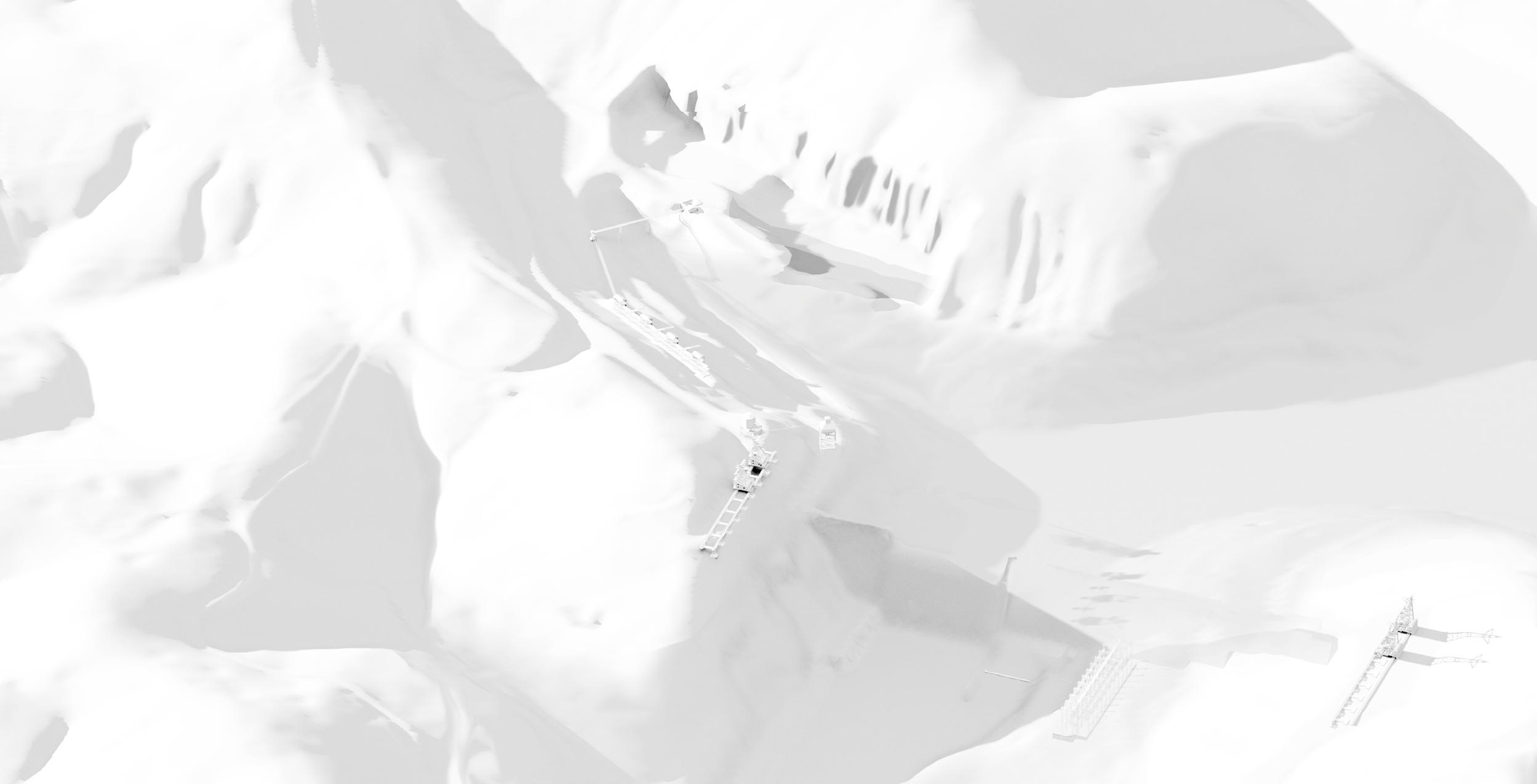
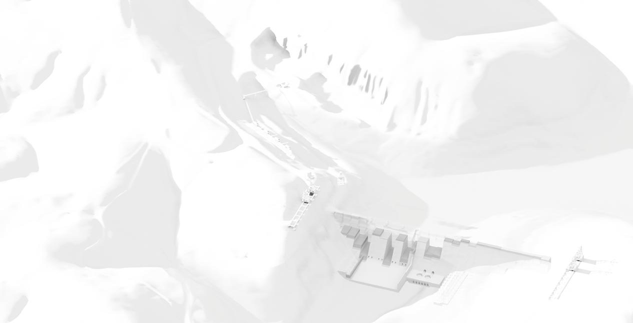
Axonometric view of Norris Dam under construction, 1935 The layout of the construction site at Norris Dam created an inverse symmetry – the dam rose as the quarry deepened. The void left by the quarry now houses public restrooms, an observation point, and a privately run marina.
MAIN FLOOR: 11/33 - 07/35 El. 1065’ 60% of extracted volume
LIFT 01: 08/35 - 10/35 El. 1045’
LIFT 02: 11/35 - 04/36 El. 1010’




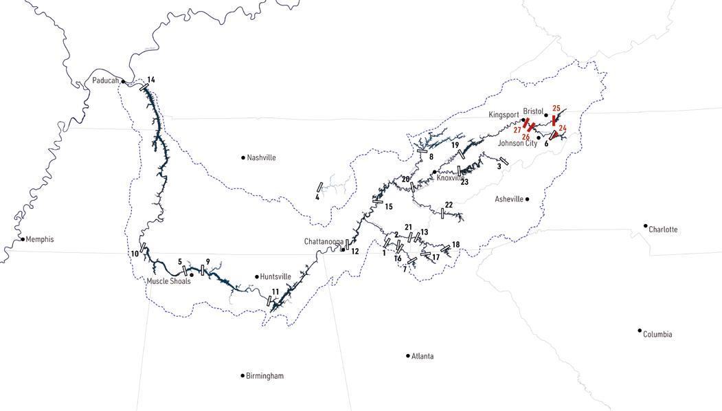


Industrial Freight along the Tennessee River in 1945
The navigation channel created as part of the river machine supported trade and industrial development along the Tennessee River and created new transportation hubs.
New Industrial Growth Centers
Primary commodities
01: Chemicals
02: Light & heavy metals, chemicals
03: Chemicals, metals
04: Chemicals, other
05: Distribution terminals, grain processing 06: Newsprint milling, associated chemicals
River freight graph
Logs & Lumber
Proposed
Hiwassee
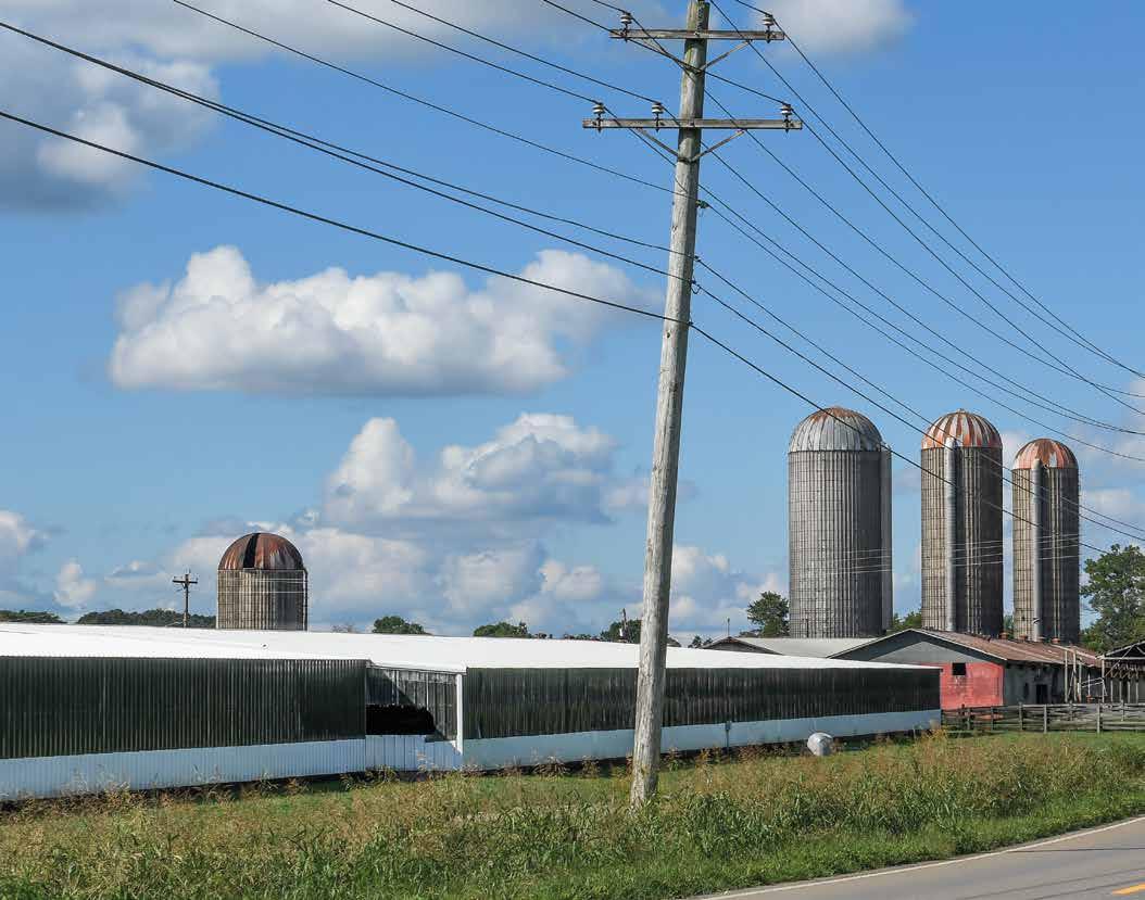

was the use of fertilizers, which would replenish nitrogen in the ground and turn exploited land into fertile soil.
The fertilizer project was clearly stated in the TVA Act, which allowed the TVA to repurpose two WWI ammunition plants in Muscle Shoals, Alabama. The TVA was directed to keep these facilities in readiness for future conflict, but it could use them in the meantime to produce fertilizers. Conveniently, war production and agricultural production had overlapping manufacturing processes: the same equipment and processes used to create ammonium nitrate for high explosives could also be used to produce phosphorus-based agricultural fertilizers.
The region’s landscape also played a role in shaping the land machine. One of the largest concentrations of phosphorous-bearing rock in the United States was located in Tennessee’s Williamson, Maury, and Davidson Counties. In the early 1930s, these plots were owned by corporations such as Monsanto, International Ag, and Consolidated Phosphate. The TVA, following its ethic of regulating competitive business, purchased the mineral rights, thereby controlling the sites of extraction. By 1944, the TVA had secured 57 tracts comprising 1,703 acres of mineable land, containing an estimated 23,466,250 tons of brown phosphate matrix.⁷⁴
Once mined, the phosphorous-bearing rock was transferred by rail to Muscle Shoals, where the TVA used the Haber-Bosch process to produce advanced fertilizers. This process, developed in Germany, had been disseminated globally as part of the 1920 Versailles Treaty.
The centralization of the land machine began and ended at Muscle Shoals. The TVA did not deliver phosphates directly to Tennessee Valley farmers, nor were farmers compelled to utilize the TVA’s products. Instead, the agency created a demonstration program. Enlisting the help of the agricultural experiment stations in
each state, the TVA recruited landowners who were willing to use their private property as a test site. Unlike the forestry program, the TVA negotiated contracts directly with the participants. The TVA would provide fertilizers, and the farmers would agree to deploy them and then report crop yields back to the TVA. The test demonstration program depended on the production and distribution of fertilizers, but the main currency in the system was knowledge. The TVA published technical papers on fertilizer manufacturing and secured numerous patents for the technologies it developed. Even more importantly, it used participating farms to test its products. As W. H. Droze comments, this system created a “three-way arrangement combining the farmer's lands, the knowledge of the agricultural scientists and extension workers of the land-grant universities, and the fertilizer and funds of the TVA.”⁷⁵
Broadly speaking, the demonstration farms worked: the TVA oversaw a sea change in farming practices in the Tennessee Valley. Paul K. Conkin notes that the fertilizer program was effective in his own village: as land was turned over to pasture, the landscape became greener.⁷⁶ The rural environment of the Tennessee Valley thus became a testament to the TVA project and a demonstration of how statecraft might be embedded in the environment. The TVA’s robust fertilizer program also served as an example of putting infrastructural power into practice. The TVA created new environmental and material conditions and then encouraged the behaviors that would lead to their desired outcome. It gave farmers the opportunity to run their farm as they saw fit, while contributing to shared knowledge at the same. The land machine, though tailored to the specific conditions of the Tennessee Valley, was intended to serve as a model that could be scaled up and applied to other regions of the country.

Relocation and Reconstruction of Infrastructure Flooded by the Norris Reservoir, 1937 The rising waters of the Norris reservoir disrupted the existing transportation system in the surrounding area. The TVA used the opportunity to upgrade infrastructure and increase access to the new lake.


[2020]
Freeway
[1934]
Relocation + Renovation [1934]
settlement [1936] Existing settlement [1891]
settlement[2020]
TVA Land Disposal [1942]
boundary
Projected transfer [public use]
Projected sale [private use]


