Title: Fifth Nature: Co-designing Singapore’s Future Urban Form from Nature-Society Ecologies and Reserve Lands/ Seas
Fifth Nature
Co-designing Singapore’s Future Urban Form from Nature-Society Ecologies and Reserve Lands/Seas
Design Studio Report
AY 2024/ 2025
Semester 1
Landscape Architecture Department of Architecture College of Design and Engineering
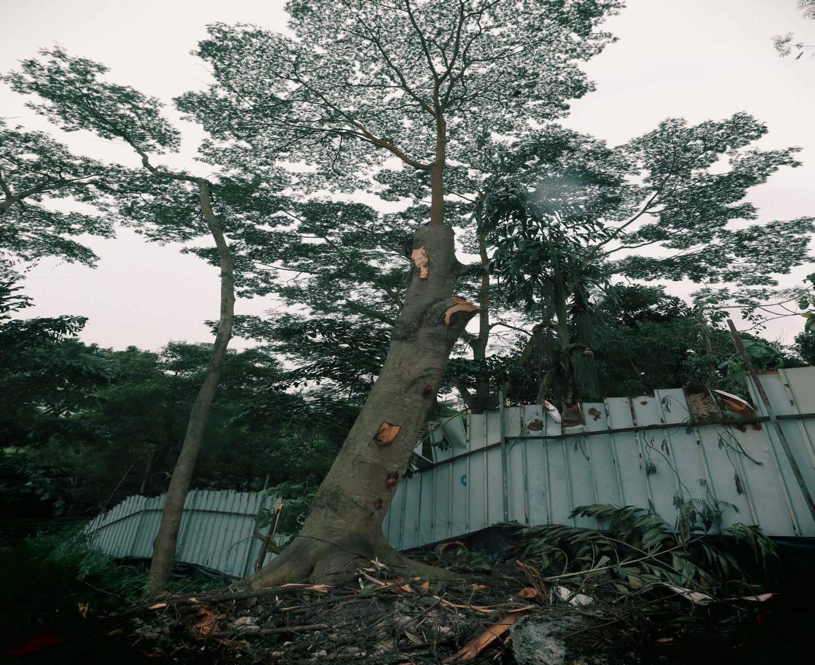
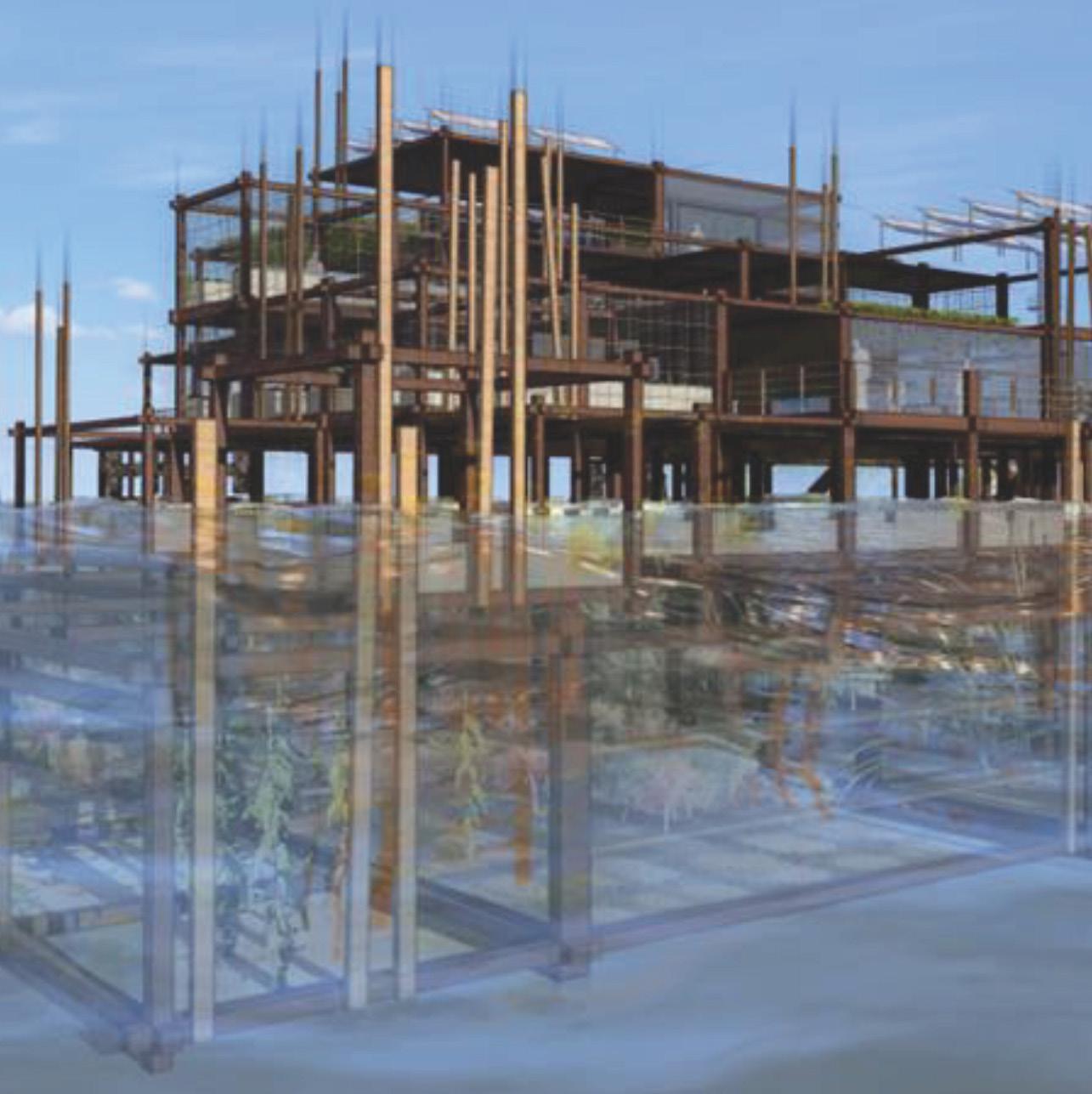
Cover Photo Credit: Ernesto Yeo, 2024
Studio Coordinator
Victoria Jane Marshall
Studio Instructors:
Guo Lehana
Gu Tiantong
Janice Tung
Maxime Decaudin
Teaching Assistant: Bhagyesh Sakhala
Guest Lectures:
Brian McGrath
Ernesto Yeo
Kun Yi James Lim
Robert Zhao
Introduction*
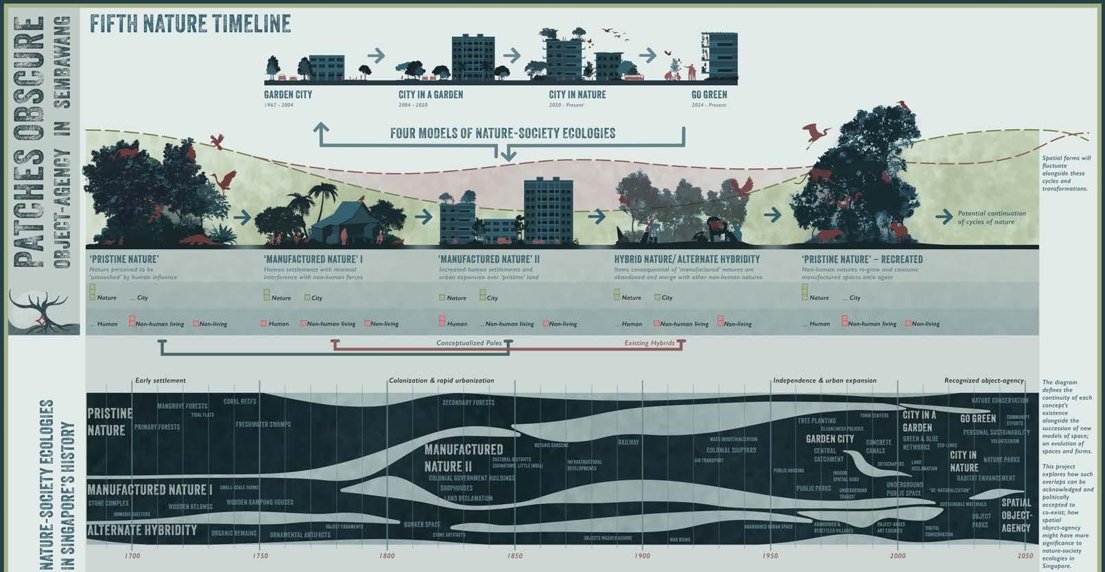
Since 1965, nature has been central to urban policy in Singapore. What nature? is an important question, for there have been various interpretations on the topic, each with powerful spatial outcomes and roles for landscape architects. Given the variety of interpretations, it might be reasoned that ideas of nature and society are not stable here. Might this be a positive trait? For it offers an opening for imagination. Learning from and with the nature-society ecologies that have been mobilised so far, the Fifth Nature studio will explore what other nature practices are needed for the immediate present and future.
Acknowledging that there is creativity and simplification in any act of categorisation, the Fifth Nature studio narrates four nature-society ecologies of independent Singapore; The Garden City 1971; City in a Garden 2004; City in Nature 2012; and Go-Green 2023. These four ecologies are distinct and form a useful comparative basis for discussion. As you will learn, each nature-society ecology is a state-led campaign that is imagined in relation to power, the lived landscape at a certain moment in time, and toward an aspirational future. Unlike those stateled campaigns, your fifth nature-society ecologies will explore expanded definitions of power (including nonhuman agency), it will be situated in your historic present, and arc toward a mode of practice that you wish to explore in your landscape architecture career. It is a creative research project.
Each state-led nature-society campaign has generated landscape design projects for landscape architects, making them more than just social ideas and more like lived ecologies. This linear statement – from urban policy to landscape design – might also be imagined the other way. Landscape architects not only respond to urban policy, but urban policy is informed by place. Meaning that everyday settlement ecologies and certain innovative landscapes created by residents, artists, and landscape architects can be prescient – and inspire novel ideas of nature-society relations, that are then formalised by the state. The Fifth Nature studio is positioned in this productive dialog between design and policy. Might you be open to the fact that your creative research project can have impact in ways that you cannot yet know?
While we are often told that Singapore is small, you will not be searching for a one size fits all solution. Supported by an assignment dedicated to theory development, each student will generate an individual project (paired projects are allowed with permission) on a given study area. Your project will demonstrate a distinct, locality-level transformation in urban form with a clearly articulated and spatially defined expression of emplaced nature-society ecologies. An important motivation for your designed transformation is the old-fashioned concept of “place” and the notion of designing with and for “incremental change” – you will not be creating a masterplan for a fixed future.
Overall, the studio emphasis is to function as a creative research hub that produces many scenarios. That is, the fifth nature studio is a space of multiplicity –a shared container full of many possibilities. Fifth nature(s), plural.
* From Studio Syllabus
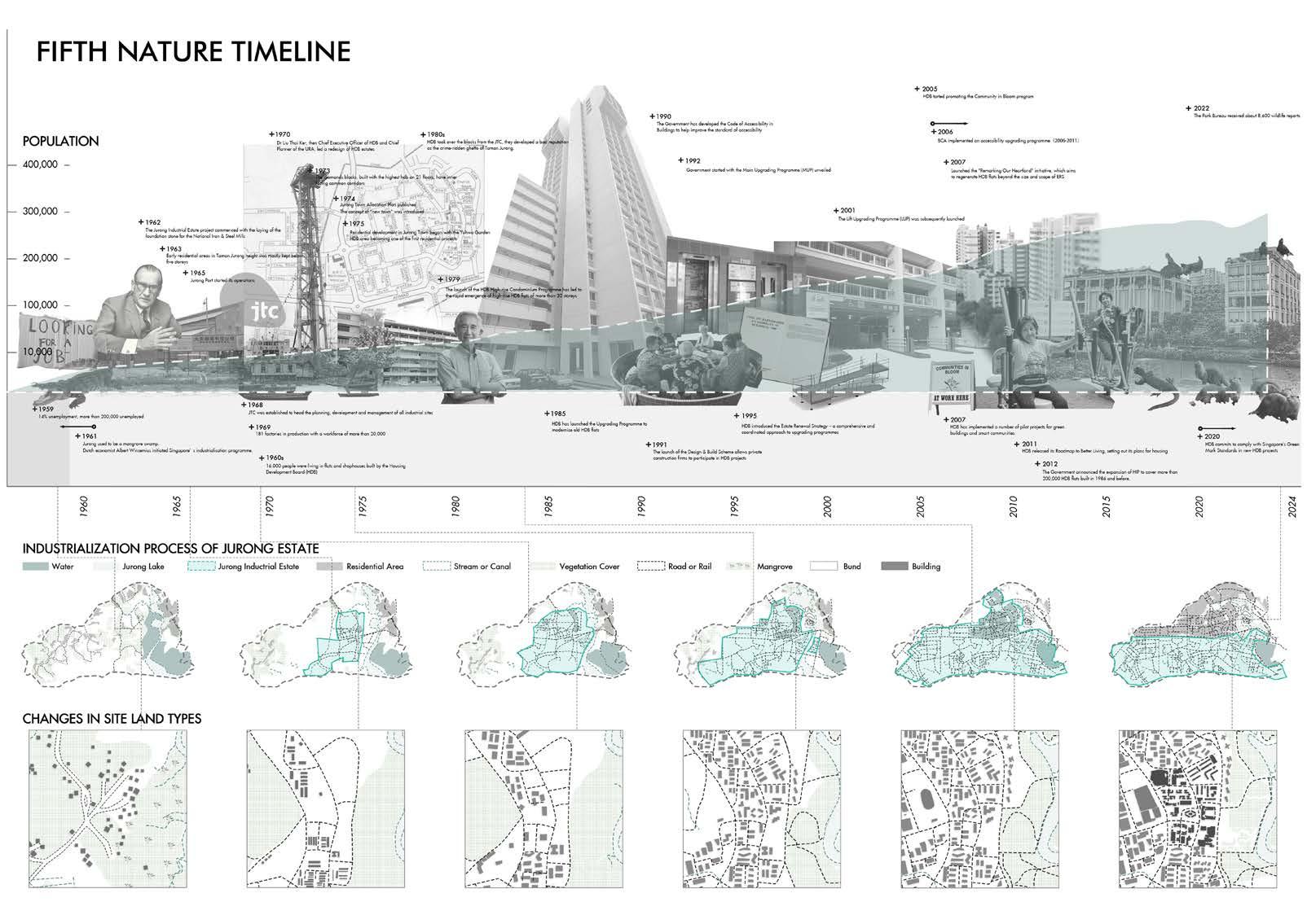
It is helpful to summarise the existing four nature-society ecologies. While they are presented here chronologically, they all coexist. Your fifth nature study area will surely interact with all these in emplaced ways.
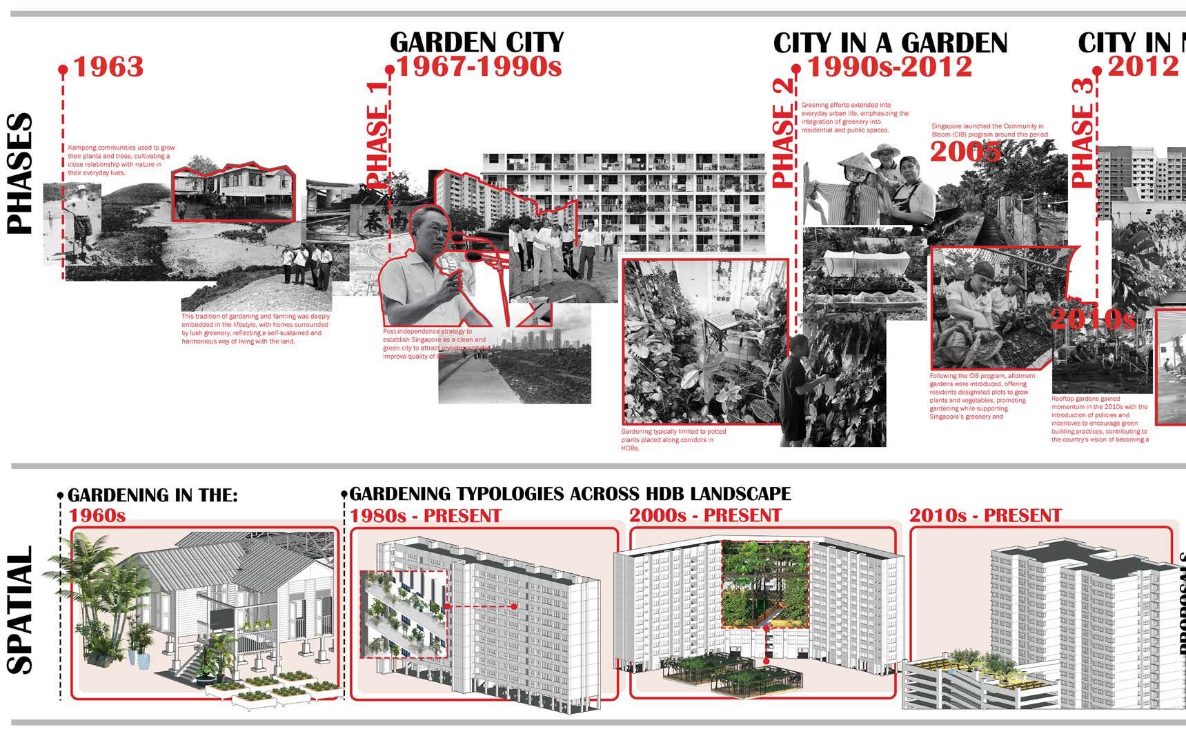
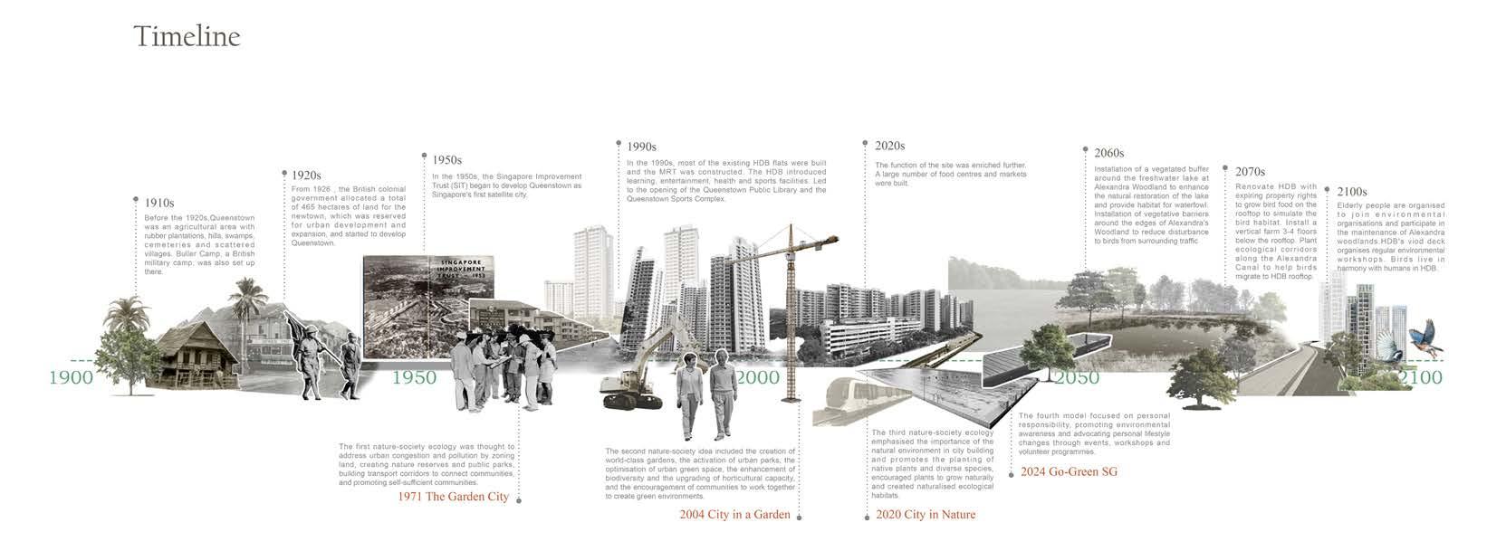
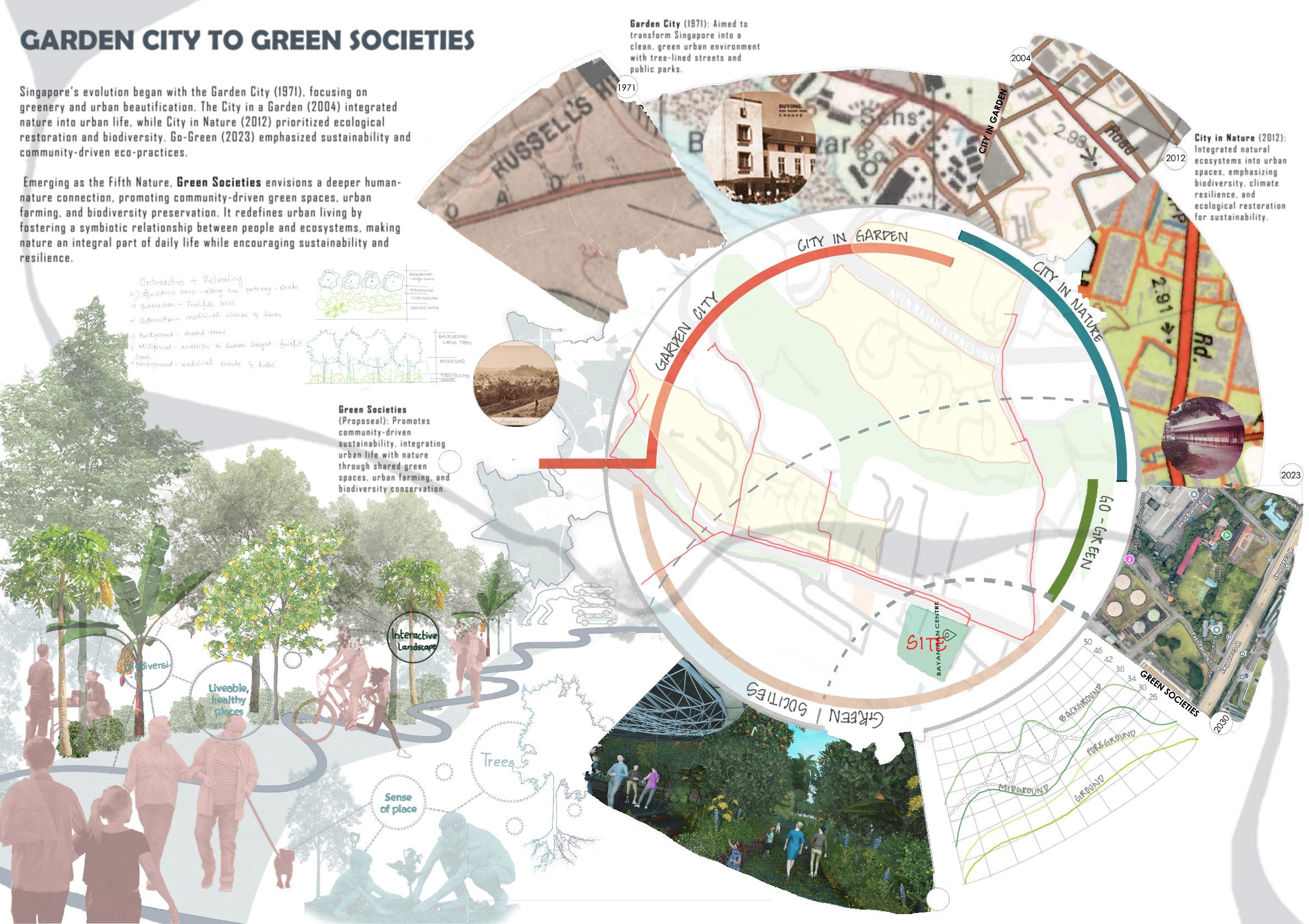
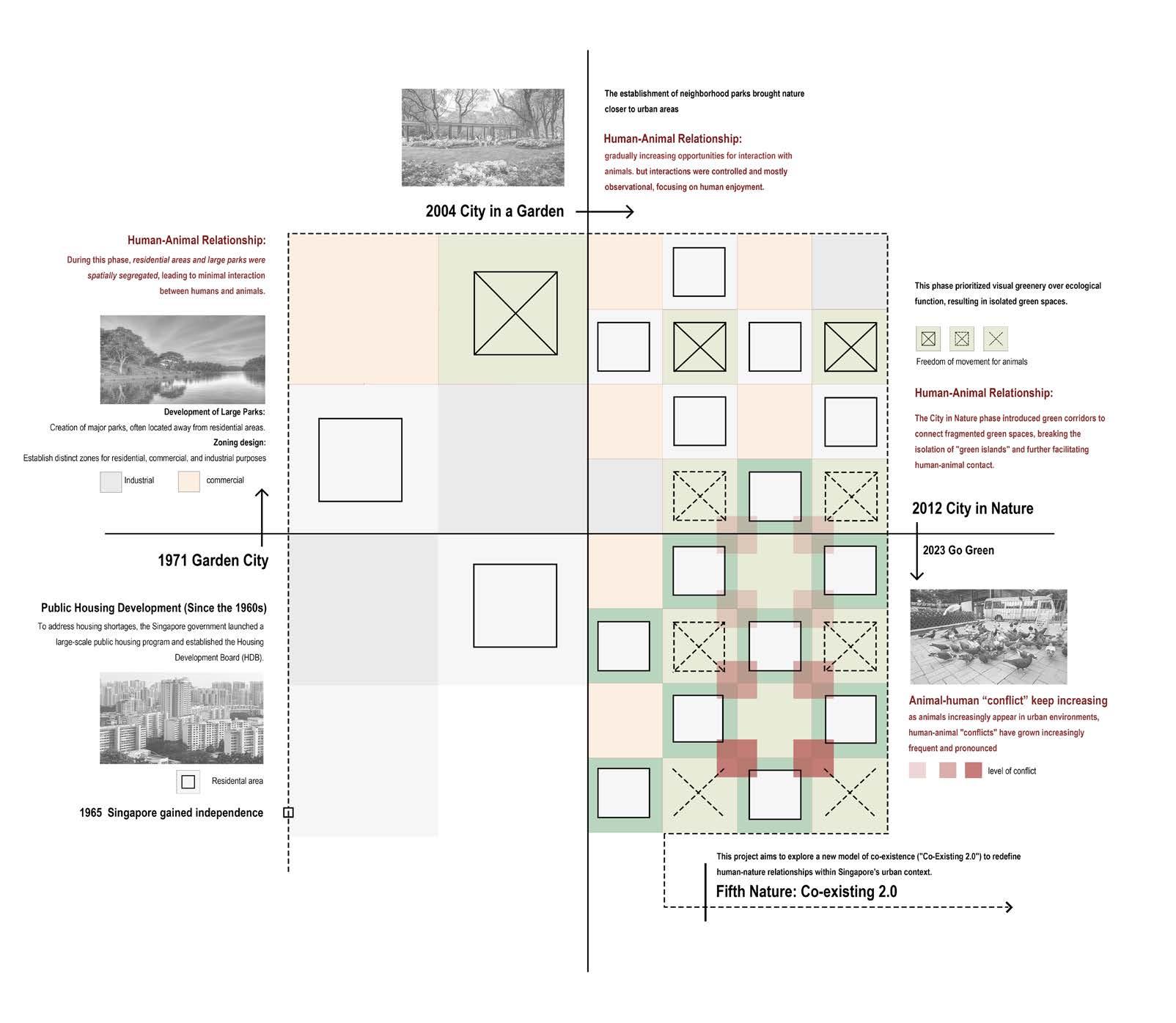
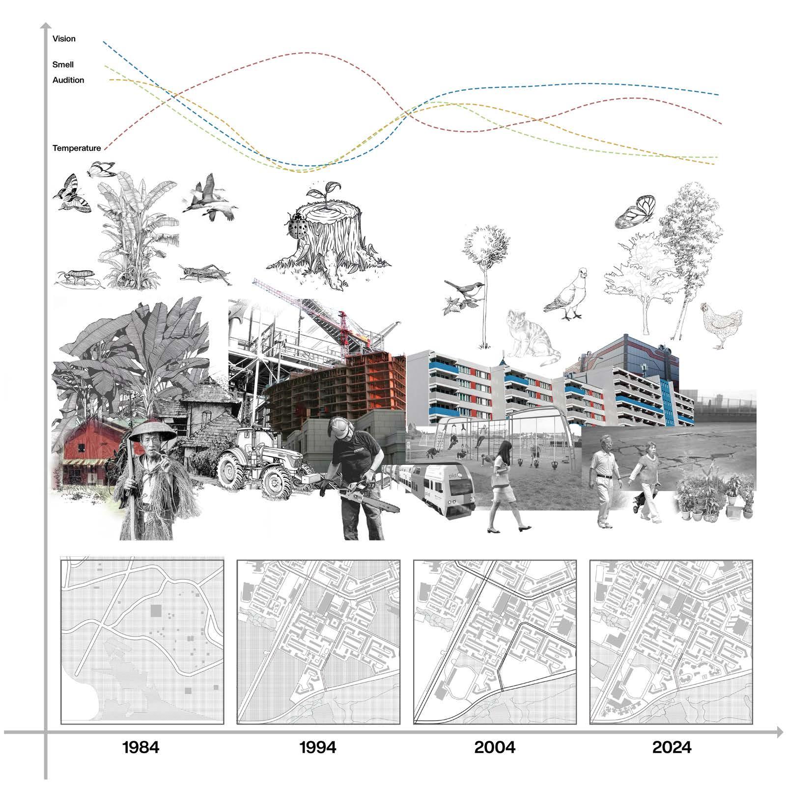
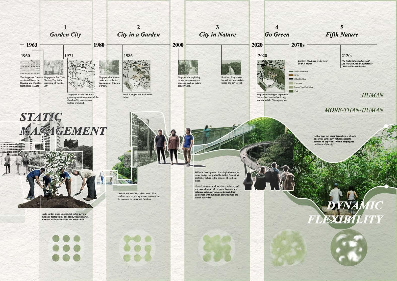
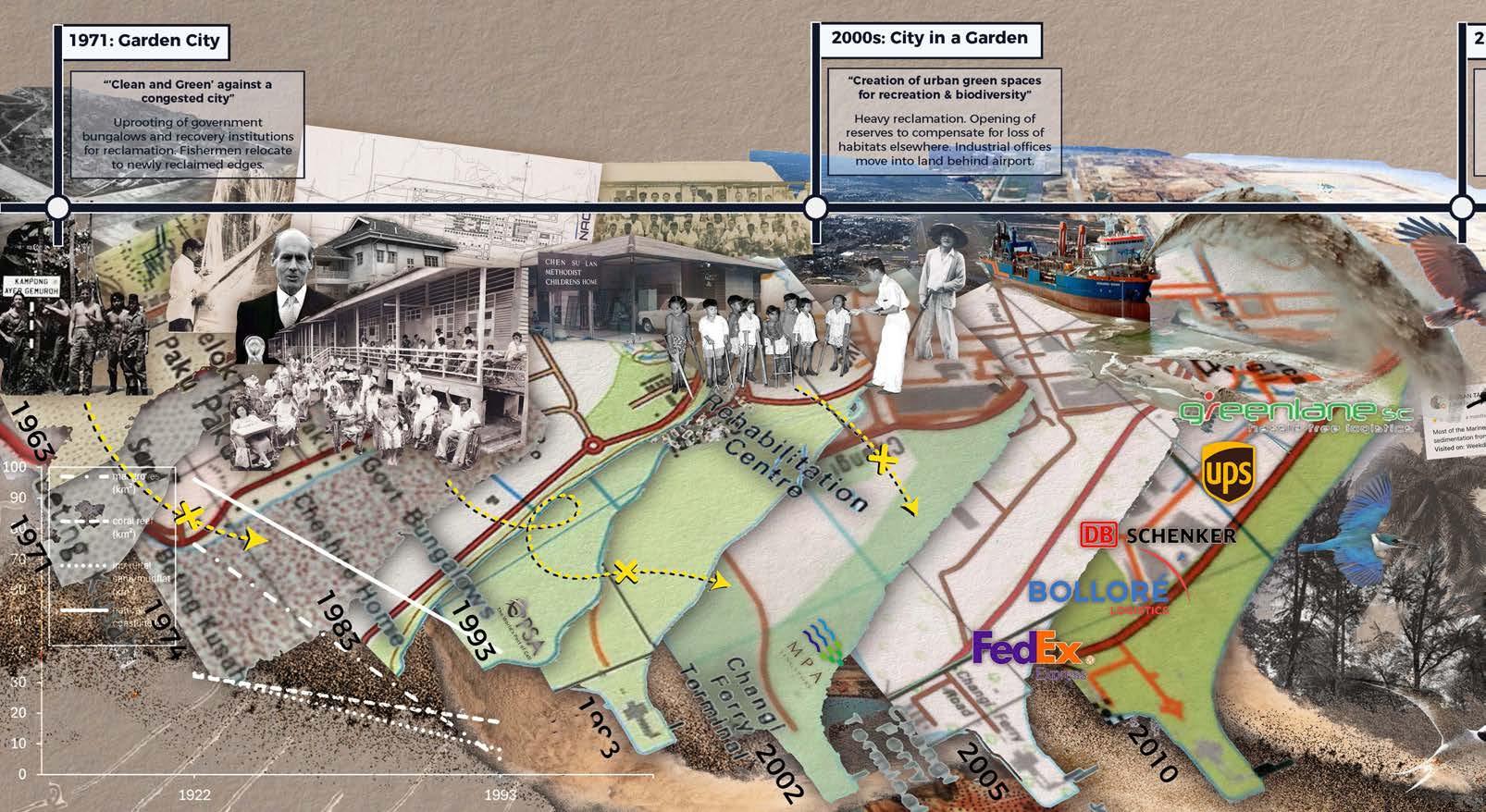
The first nature-society ecology in independent Singapore is embedded within the Garden City. The Garden City is an urban model which was introduced in 1898 by Sir Ebenezer Howard (1902) in the United Kingdom and later interpreted into the Singapore context. In Singapore, the Garden City is first expressed in the 1971 concept masterplan, which has since undergone revisions in 1991, 2001 and 2011. Described by urban designers Peter Rowe and Limin Hee (2019, p. 43), the Garden City of Singapore in 1971 included many of the tropes from Howard.
First, there is the division of land into zones, particularly separating industry from the other uses. Second, there is the large catchment areas at the centre and both eastern and western sides of the island, which provide for extensive natural conservation areas, as well as public parks and recreation areas. Third, there are the major expressway and transit corridors that form the armature of connection between and among satellite communities and new towns. Fourth there is the idea of selfcontained communities and in a manner similar to the Garden City ward and centre arrangement proposed by Howard in 1902.
It is important to grasp that the Garden City urban model was thought to solve the supposed problem of the congested and polluted city. The Garden City urban model as proposed by Howard is not to be confused with an image making campaign also entitled Garden City launched in 1967 by then Prime Minister Lee Kuan Yew.
In the initial phase, the Garden City image campaign launched by Lee Kuan Yew was implemented in with a vision of “clean and green”. It was expressed in the form of annual treeplanting, which is a practice that continues today. According to landscape architect Edmund Waller (2001, p. 53), the tree planting campaign was used to promote Singapore’s image abroad - to show foreign investors that the new government could “get things done”. Later, from 1971-1991, the garden city focused on residents through the development of small parks and
landscaped pedestrian malls. These early aesthetic campaigns were considered a success, which resulted in their scaling up as part of the vision of the Garden City Action Committee in 2004 and rebranded as City in a Garden policy.
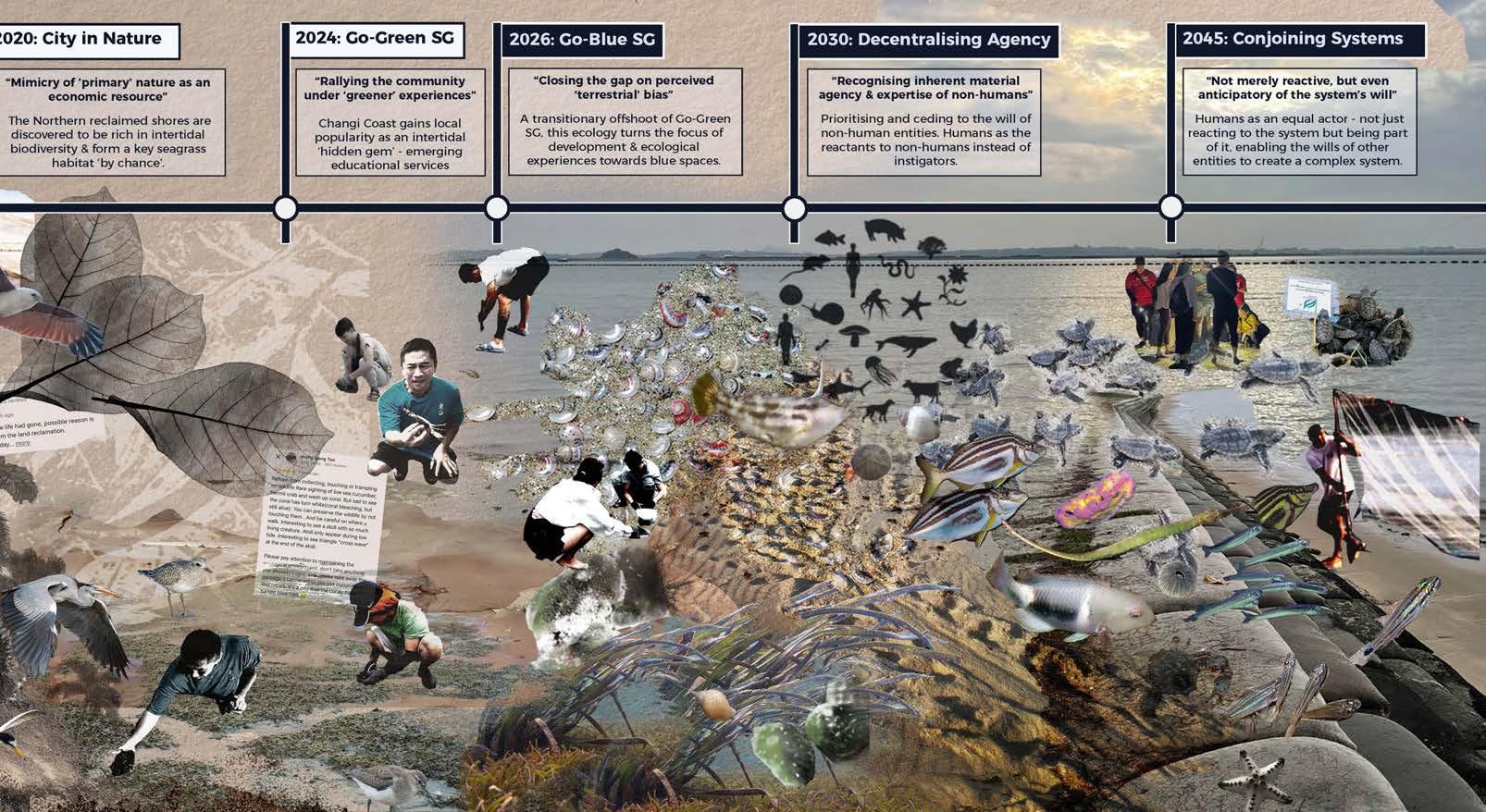
City in a Garden is our second nature-society idea. Again, the summary by Rowe and Hee (2019, p. 45) is helpful for understanding the various dimensions to this policy and its designed landscape outcomes. The first goal was to “establish world-class gardens”. The Singapore Botanical Gardens and the Gardens by the Bay we created at this time. The second goal was to “rejuvenate urban parks and enliven the streetscape”, which is later seen in a Green and Blue Plan that focuses on networked landscape infrastructure. The third goal was to “optimize urban spaces for greenery and recreation” and fourth, to “enrich biodiversity in an urban environment”. As such, Bukit Timah Nature Reserve, the Water Catchment Area, the Labrador Nature Reserve, and Sungei Buloh were all created within this policy. The fifth goal was to “enhance competencies of the landscape and horticultural industries”, for example the Pasir Panjang Nursery, located adjacent to HortPark. The final goal was to “engage and inspire communities to co-create a greener Singapore”, which we will see later in the Go-Green initiative. The City in a Garden is thus an ambitious, multifaceted policy.
The landscape outcomes of The City in a Garden have been reflected upon. Geographers Lily Kong and Brenda Yeoh (1996) outline three “social constructions of nature” in Singapore that exist concurrently. On the topic of “salubrious nature, aesthetic landscape, and public playground” they argue that the language adopted to describe a pleasing “natural landscape” of The City in a Garden include “colour, variety and orderliness” (1996, p. 413). They state, while colour and variety were introduced into the city through natural vegetation, this was done with a clear objective of “order and system, and specifically, of not encouraging an indiscriminatory profusion of foliage and verdure”. This orderliness is seen to be “a form of nature acceptable to urban living, one in which there is no unruliness, and one which is managed by human hands”.
This maintained orderliness of the “natural landscape” of The City in a Garden is an intense experience of contrasts. For instance, landscape architect Joshua Comaroff and architect
Ong Ker-Shing (2012, 2024) reflect upon the dual landscape practices of clearing “greening” so that it can appear like a garden and importantly, does not form “jungle” on the one hand. And on the other hand, producing secondary forest “jungle” as reserve land through benign neglect. They argue that landscape construction (the clearing, “jungle”, and the garden) in Singapore of the early 2010’s is “a form of warfare” and an example of “paramilitary gardening”. The next nature-society ecology can be seen as an extension of the “environmentality” analysis by Comaroff and Ong (2024, p. 174; Also see Foucault, 1970), for the “return to nature” in the next nature-society idea is also highly prescribed.
The third nature-society ecology is entitled City in Nature, which was introduced in 2020 by NParks (2024). In this scenario, as Rowe and Hee (2019, p. 37) argue, the usual dominance of constructed over “natural” environments in city making is inverted. They state.
More recently, more of a convergence into a “city in nature” is emerging, with greater emphasis strongly on the identity aspect of an altogether tropical landscape in which living takes place befitting Singapore’s geographic and otherwise natural location. This latest “turn” on “garden” and “city” also argues for greater complementarity of green and blue aspects of Singapore’s intrinsic environment. It involves efforts to intensify the planting of more native and more diversified plant species; and through multi-layered heights of plants to emulate the forest structure and to create more ecosystems providing niches for different fauna species. The plantings are thus carefully curated in the beginning but will be left to grow and evolve naturally to produce a naturalistic rather than garden-like setting.
Thus, “tropical”, “intrinsic”, and “naturalistic” nature is given new value in the City in Nature. As Kong and Yeoh (1996, p. 416) note, nature as an economic resource is an idea that has been present in Singapore since the Colonial era. In the City in Nature campaign, mimicry of “primary” nature is an economic resource and “[tropical] nature is hence heritage”. It is conserved as part of “the nation’s consciousness of its own unique identity” and as a “magnet to draw tourists [and residents] who seek to escape the press of urban life to find the pure and pristine”. Such nature is now quantified digitally, for the City in Nature also brings with it technological optimism and environmental
finance schemes. The (anthropocentric) biophilic approach and nature-based solutions are all present in the Active Beautiful, Clean Waters Program sites, Park Connectors, Nature Ways, the old Rail Corridor re-wilding, and the greening of many building facades and rooftops.
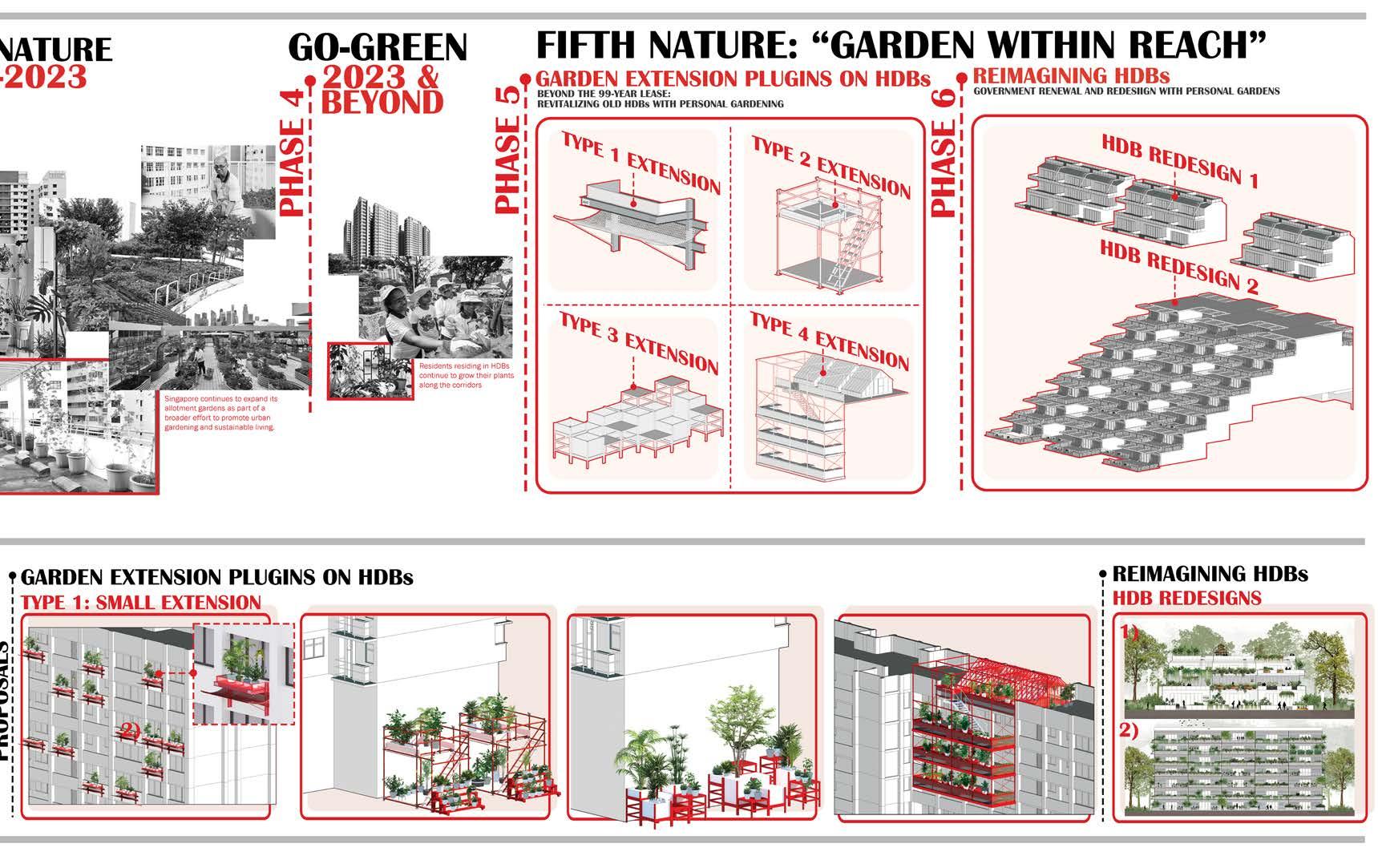
The fourth model is entitled Go-Green SG, which is led by the Ministry of Sustainability and the Environment and is championed by the new prime minister Lawrence Wong. Go Green is defined as a “whole-of-nation movement” to rally the community to take collective action for cleaner and greener Singapore experiences, based on individual lifestyles, personal interests and goals (Ministry of Sustainability and the Environment, 2024). Designed landscape projects in this nature-society ecology include tours, workshops and talks, volunteering, dining experiences, and events. Go-Green is thus, distinctly different than the previous nature-society ecologies. With its focus on personal responsibility, it marks a shift from the state-led construction of a scenic, orderly nature (City in Garden) and a tropical, heritage nature (City in Nature).
The curated, environmental action experiences of GoGreen can be thought of within a post-political frame, and as such critiqued as superficial. As geographer Harvey Neo (2021, p. 111) explains, postpolitics presents an “aura” of political openness without necessarily ceding political ground and political legitimacy to non-state elements, both in the way political issues are identified and defined, and in how they might be resolved. Thus, he argues that “there are limits to which environmental engagement as seen in Singapore can bring forth an emancipatory society-nature relationship in the age of the Anthropocene”. Another way to learn about the critique of a campaign like Go Green (and city in Nature) is to look at what sociologist Alexander Stoner claims. He says, the “autonomous ecoconsumer” is an environmental subjectivity prefigured by neoliberal environmentalism (2020, p. 6). That is, while individualistic market actions can appear in opposition to environmental unsustainability, such “happy consciousness” (2020, p. 9) instead reproduces the social order of capitalist societies.
Prompts
In order ground your fifth nature(s) creative research and have a productive engagement with the above four nature-society ecologies, we a prompt.
The prompt is an introduction to critical nature-society theory, which might assist you to imagine anew within the present post-political impasse. You will read a book entitled More-than-Human by geographers Jamie Lorimer and Timothy Hodgetts (2024). More-than-human is an approach to critical environmental research that asks, “what happens to geographic thought when the separation of humans from the natural world is rejected”? Although more-than-human work is diverse, three shared concerns are identified in the book.
• First, an interest in the power of nonhuman organisms and material things to shape worlds, alongside actions by human beings.
• Second, an assertion that knowledge is not universal but is situated in time and place and therefore that different forms of knowledge are possible, and that these might conflict.
• Third, a close attention to the relations and processes through which worlds come together.
The studio is an individual and a collective research endeavour. More-than-human geography is an emerging body of scholarship from cultural geography not landscape architecture, meaning that it is an analytical approach rather than a projective tactic. Thus, there are few intentionally built, “morethan-human landscapes” that we can point to as precedents. You must make the leap from analysis to projection in your own way, and in relation to your study area. In our exploration of the multiplicities of the fifth nature society-ecology we ask that you have an open mind and take your design research methods seriously. We also ask that you to trust in an interactive and collaborative design process across the whole five-studio collective. On the completion of the course, we will reflect as a group and see what we have made. Maybe there are some design outcomes, tactics, or practices that emerge as thematic? We do not know yet, and so all we must do is try and see what we can create together. This studio is the first of a three-year pedagogy project. Your projects form the beginning-phase of a 2024-2026 community of practice on the topic of Singapore’s fifth nature-society at the Department of Architecture.
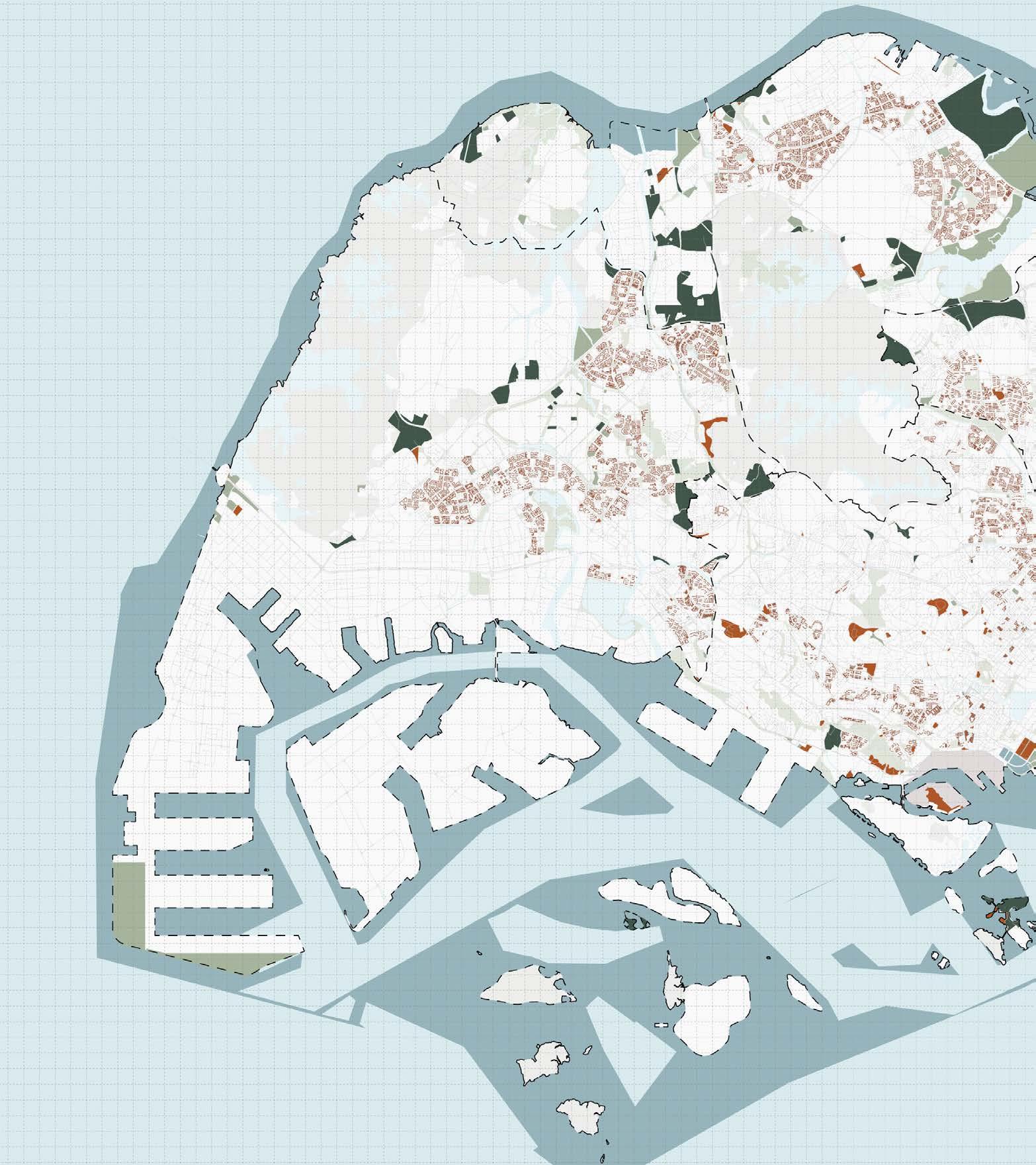
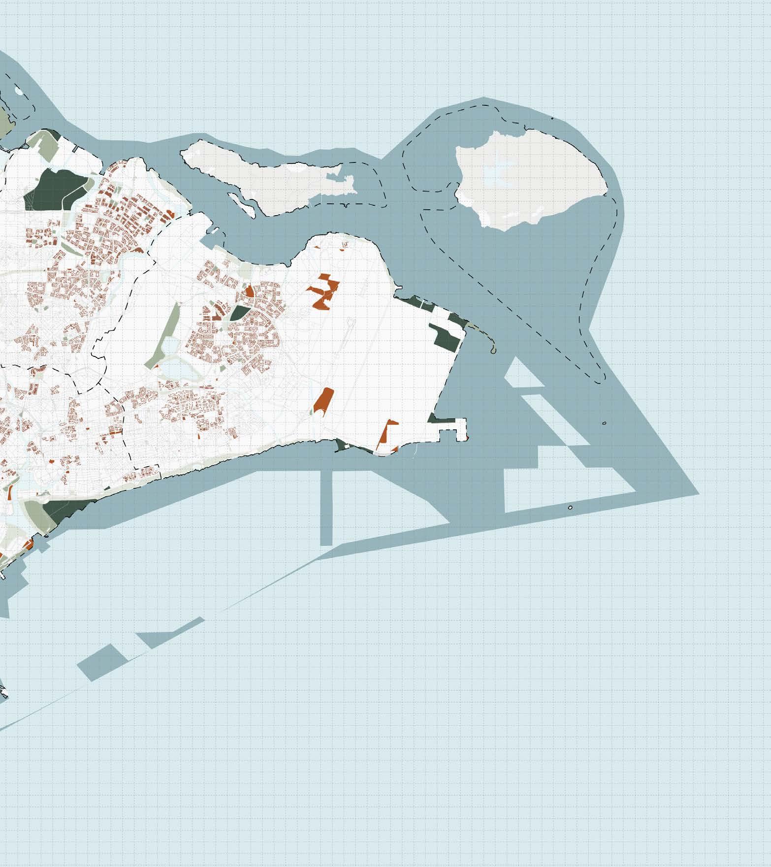
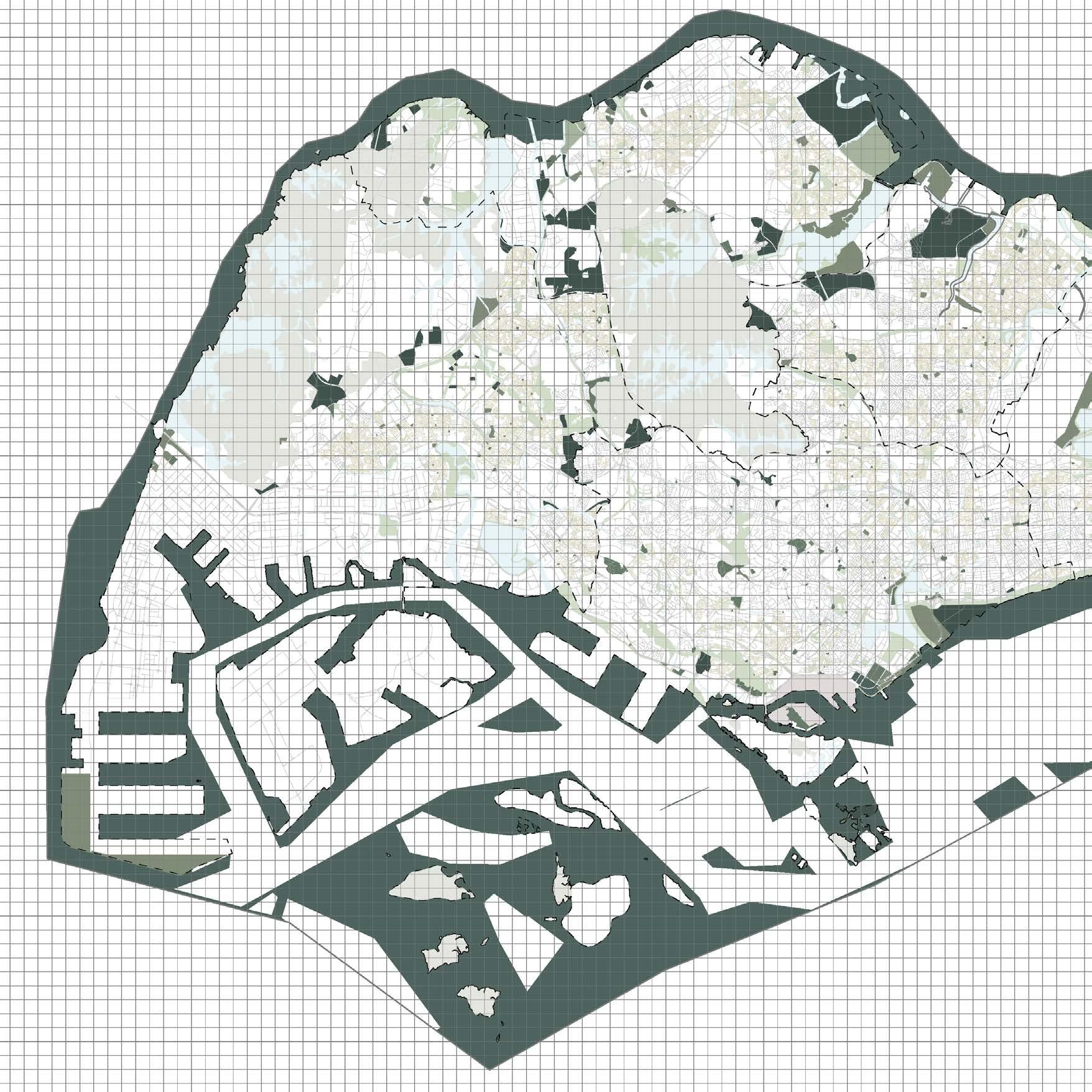
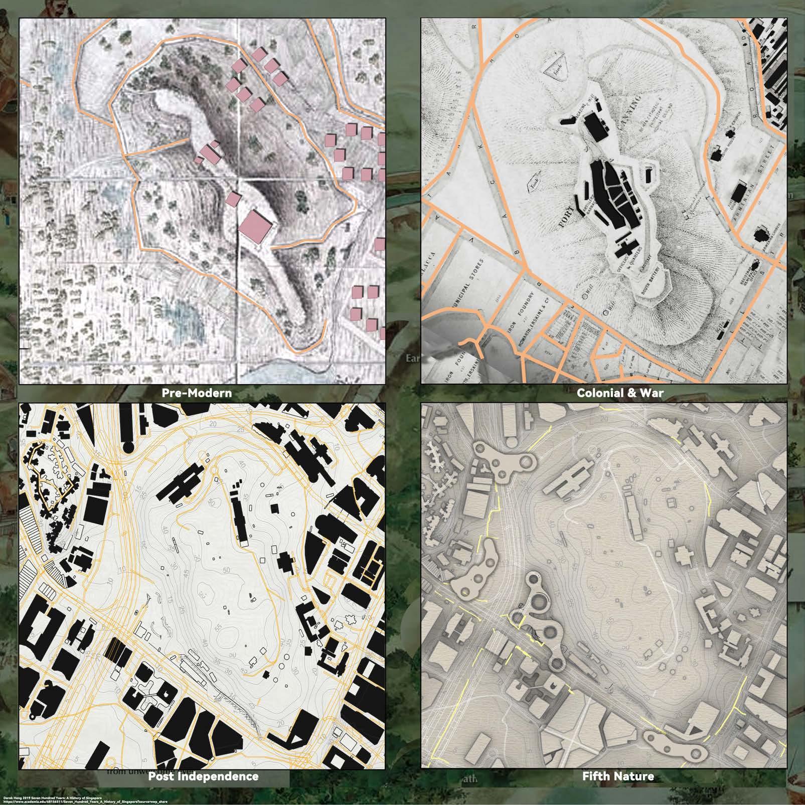
Land Cover
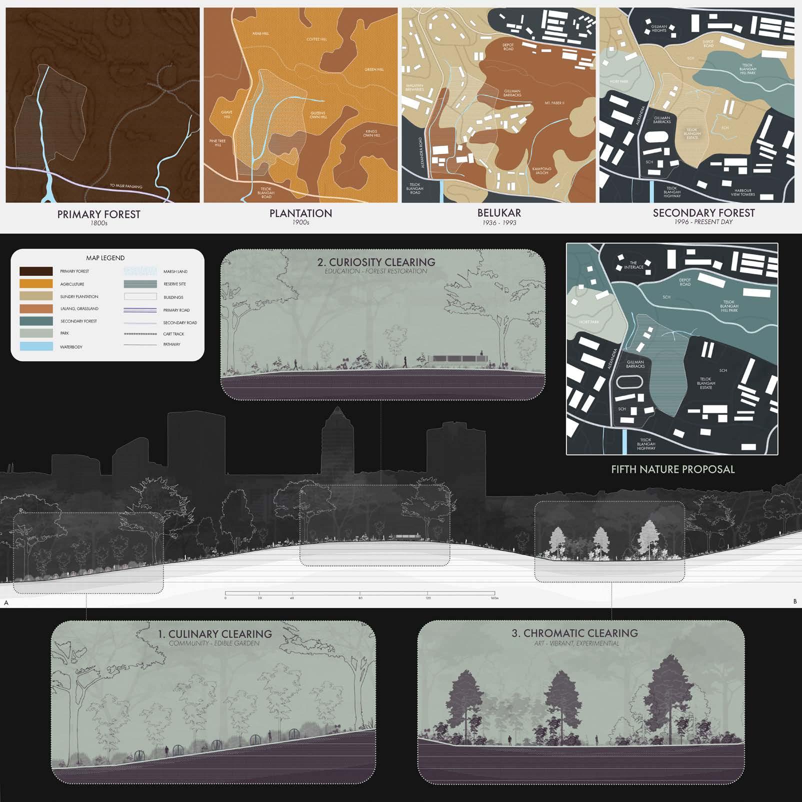
The reserve lands of Singapore can be thought of as “wooded” reserve land, “mowed” reserve land, “voided” HDB reserve land, “tidal” reserve sea. All these lands are in flux in the historic present and will be thought about in playful flux in our studio. They are in “reserve” for what nature-society ecologies? For instance,
• Since the 1800’s, “primary” forest land has been removed in Singapore, but some small patches remain (in conserved land and military land) and humans are (mostly) excluded.
•
• “Wooded” reserve lands have grown and might stay in place (as “jungle”), be cultivated as “park” or “enclosed garden” or might be cut down and become “mowed” reserve land or buildings with “voided” HDB reserve land (for example, Dover Forest).
•
• Future (“third forest”?), wooded reserve lands might be cultivated on “mowed” reserve land or on “voided” reserve land in HDB estates, or in parks (for example, “wilding” initiatives that “mimic” primary forest ecology). In such instance humans might be included or excluded.
•
• “Mowed” reserve land might stay in place or become buildings with “voided” reserve land, or as above, might by cultivated as (“third forest”?) wooded reserve lands. In such instance humans might be included or excluded.
•
• Similarly, “mowed” reserve land might stay in place or be cultivated as “park” or “enclosed garden”. Again, humans might be included or excluded.
•
• HDB buildings and “voided” HDB reserve land might get demolished, becoming “mowed” reserve land or be cultivated as “park” or “enclosed garden”. Again, humans might be included or excluded.
•
• Alternatively, “voided” HDB reserve land might be imagined as being cultivated as (“third forest”?) wooded reserve lands with HDB buildings being partially demolished, retrofitted, or relocated on site with increased verticality. Again, in such instance humans might be included or excluded.
•
• Lastly, who knows what will happen with our remaining sea?
Guiding Questions References
Overall, your creative research project will be prompted by these guiding questions:
What if future urban form at the locality level is arranged in response to secondary (or third?) forests reserve land and place, rather than hard infrastructure like roads and MRT?
How might your project shape reserve land flux in an incremental way, rather by masterplan? Who or what does what, when, and how?
What spaces and practices does your project afford? And how might surrounding incremental reserve land change shape such spaces and practices as “place” in time?
What modes of creative research are needed to explore such future imaginaries of garden, nature, society, and urban form? For instance, what fieldwork might you undertake, what archives might you explore, what exploratory drawings might be made, for whom or what?
What modes of representation are needed to communicate such future imaginaries of nature and urban form? For instance, what drawings, objects, or digital media might best express your project? What narratives might best orient a diverse audience?
Comaroff, J., & Ong, K.-S. (2012). Paramilitary Gardening: Landscape and authoritarianism. City Axioms: Urban (In)security, Department of Social Anthropology, Sweden.
Comaroff, J., & Ong, K.-S. (2024). Paramilitary Gardening: Landscape and authoritarianism. In A.-S. Springer & E. Turpin (Eds.),
Seeing Forest: Robert Zhao Renhui (pp. 160–176). K. Verlag & Singapore Art Museum.
Foucault, M. (1970). The Order of Things: An archaeology of the human sciences; Tavistock Publications.
Howard, E. (1902). Garden Cities of Tomorrow. S. Sonnenschein & Co., Ltd.
Kong, L., & Yeoh, B. (1996). Social Constructions of Nature in Urban Singapore. Southeast Asian Studies, 34(2), 402–423.
Lorimer, J., & Hodgetts, T. (2024). More-than-human. Routledge. Ministry of Sustainability and the Environment. (2024). Go Green SG [Government]. Go Green SG. https://www.gogreen.gov.sg/
Neo, H. (2021). The post-politics of environmental engagement in Singapore. In Jobin, M. Ho, & H.-H. M. Hsiao (Eds.), Environmental movements and politics of the asian anthropocene (pp. 109–137). ISEAS Publishing.
Rowe, P., & Hee, L. (2019). A city in blue and green: The Singapore story. Springer.
Stoner, A. (2020). Things are Getting Worse on Our Way to Catastrophe: Neoliberal Environmentalism, Repressive Desublimation, and the Autonomous Ecoconsumer. Critical Sociology, 47(3), 1–16.
Waller, E. (2001). Landscape Planning in Singapore. NUS Press.
Chapter 1 Chapter 2
1. Chapter Introduction
2. Fuubutsushi Chen Jiaying
3. Fluid Boundaries Navigating Integration Mai Siyao
4. Garden Within Reach Nuramirah Binte Mohd Nor
5. Sarimbun TerraFlow Amirul Bin Ismaiday
6. Shared Growth With Simpang Deng Pinyi
7. Self-Sufficient & Bird Friendly Community Chen Zeya
8. Nurtured Ties Vadlakunta Akshitha
9. Wired Wilds Mariam Yusuf Rajkotwala
10. Bring Elderly Close To Nature Shu Yao
11. Human Hands, Butterfly Wings Cao Yutong
12. Traces of Nature Teo Kai Liang
13. Unbounding Nature Clarissa Ke
14. Living Symbiosis Shruthakeerthi Karthikeyan
15. Modular Islands Luo Siqi
16. The T-Weave Pan Yuwen
17. Cyclical Weave Wang Wenhao
18. Co-Working, Co-Living, Co-Living @ Bedok Wayne Tan
Some Things Are Not Going To Be
1. Chapter Introduction
2. Cross-Species Erudition Sean Ho
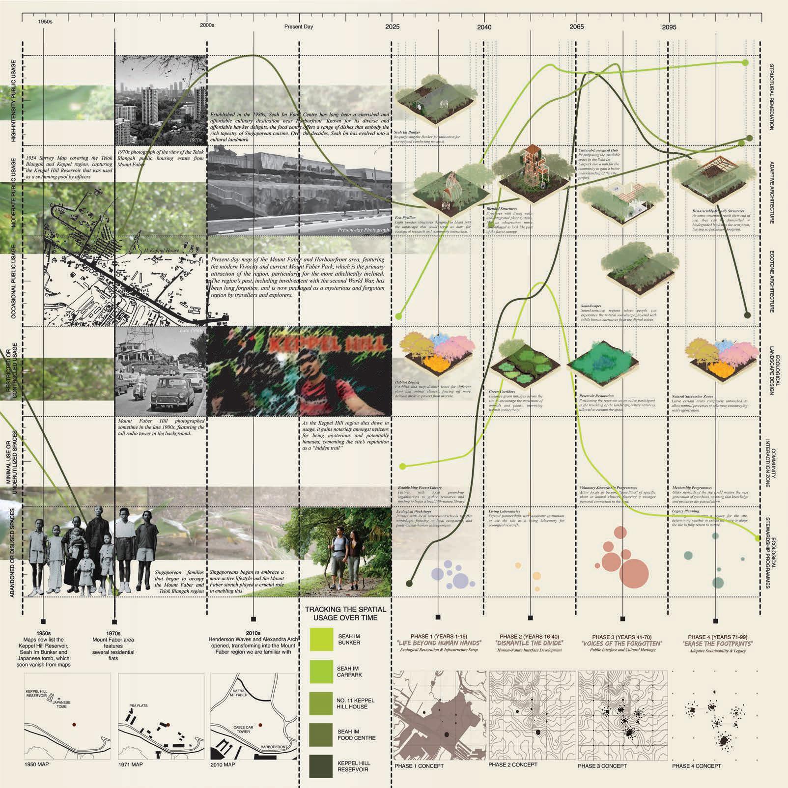
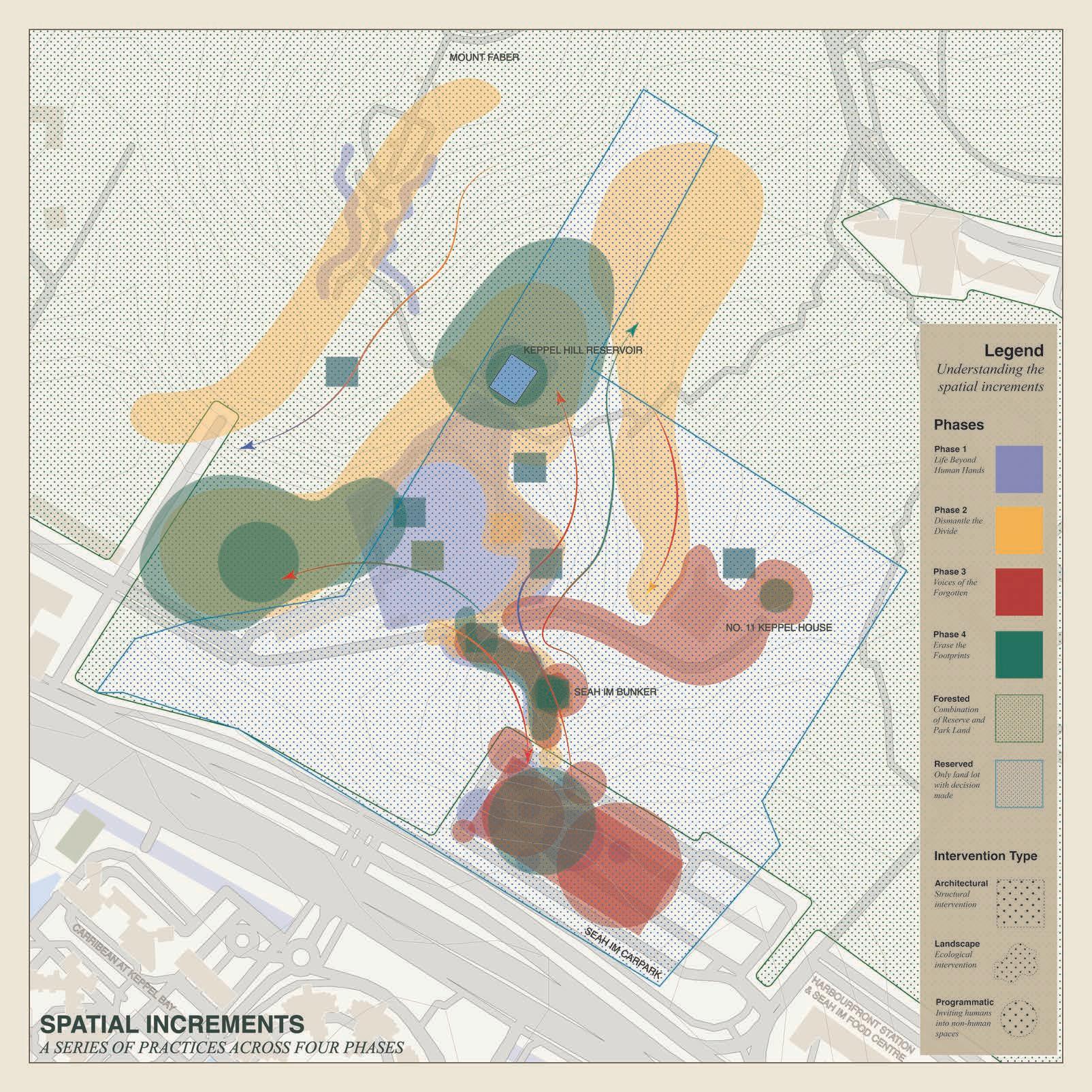
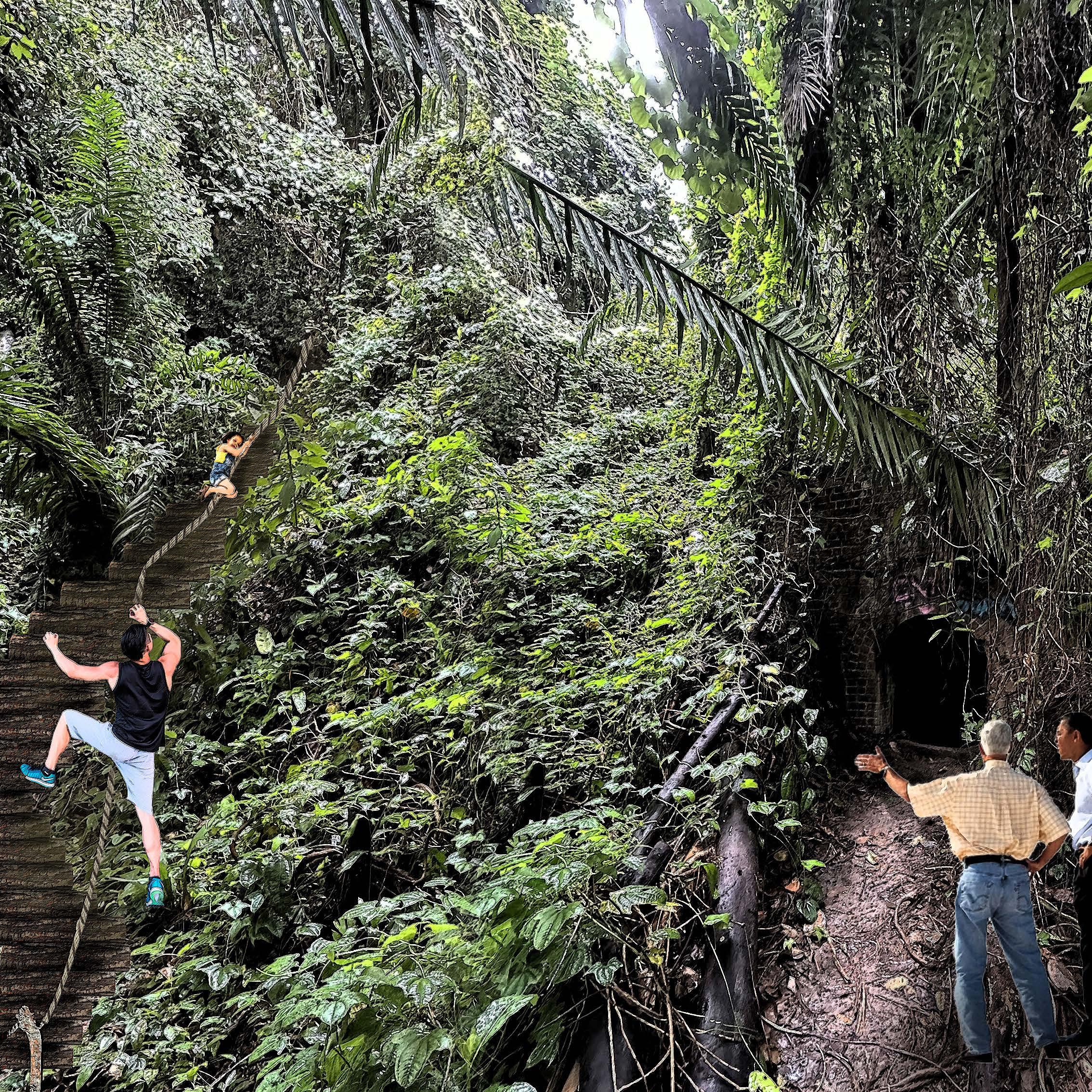
3. Palimpsests of Keppel Hill Radhakrishnan Srivarshini
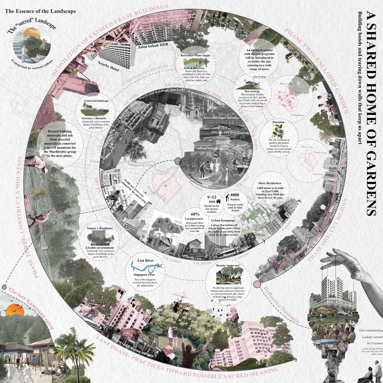
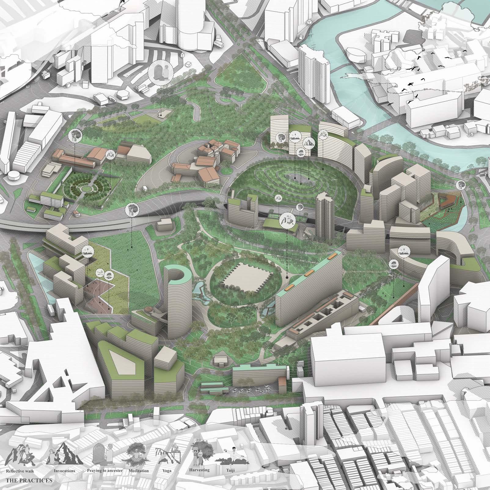
4. A Shared Home of Gardens Sun Peiqiang
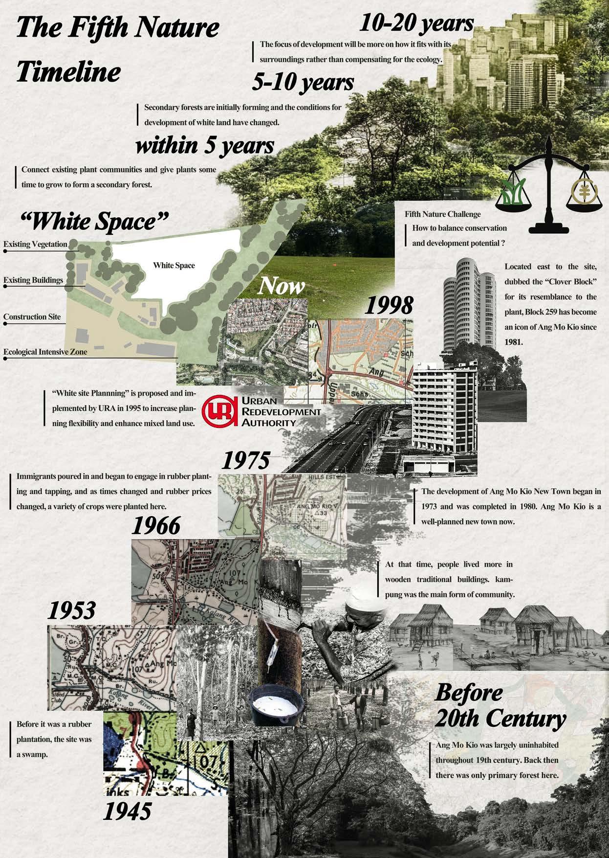
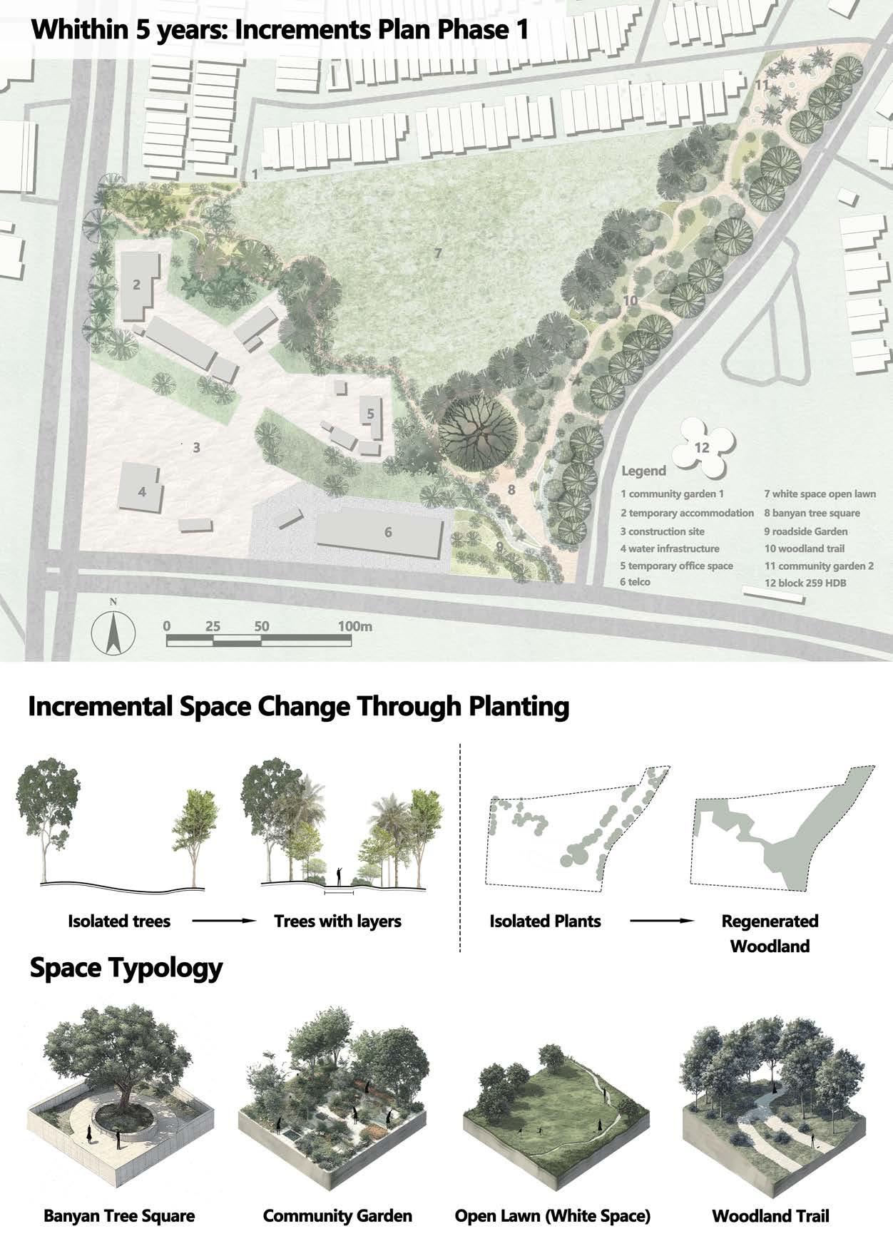
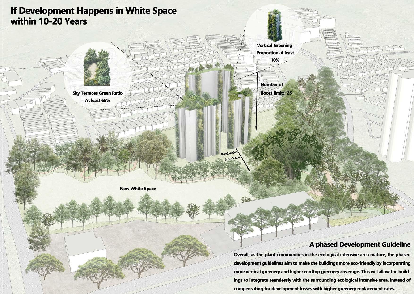
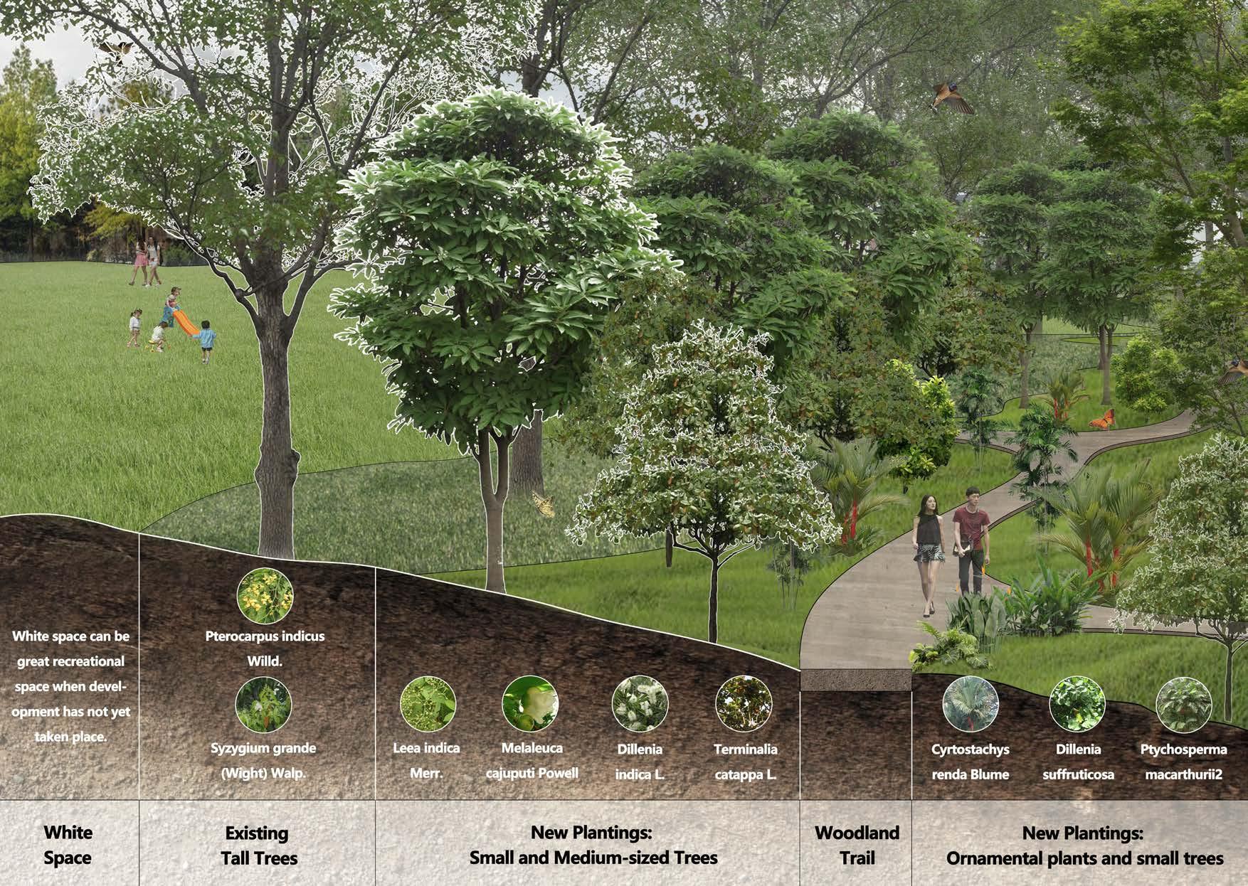
5. White Space Inside White Site Planning Xu Yingrui
6. Within The Cycle Chang Yuwei
7. Wild Encroach Qi Kexin
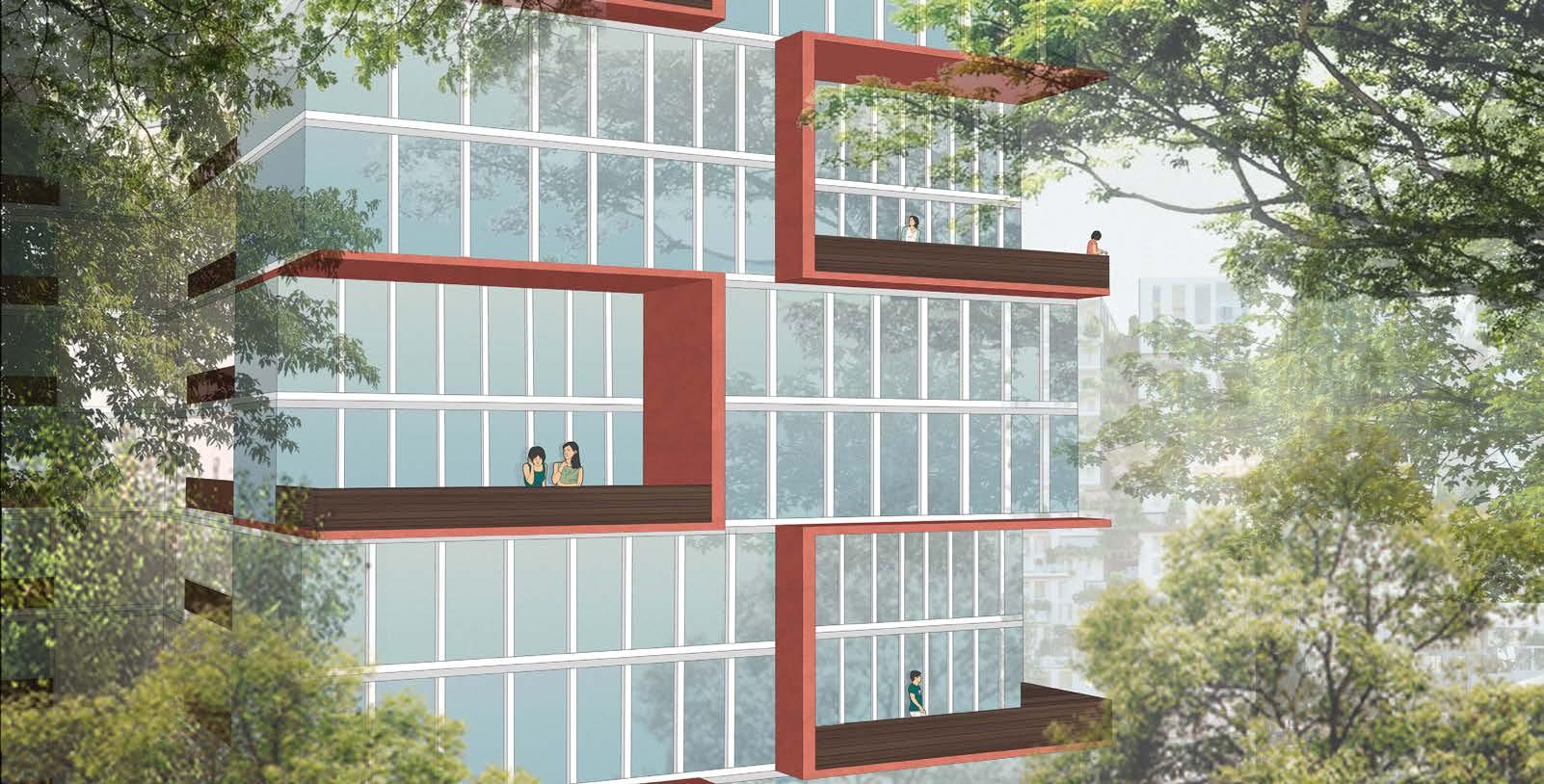
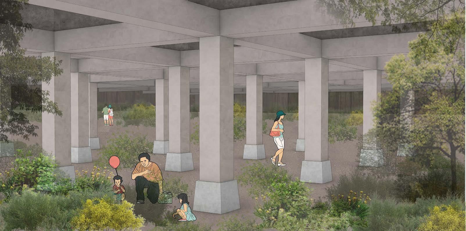
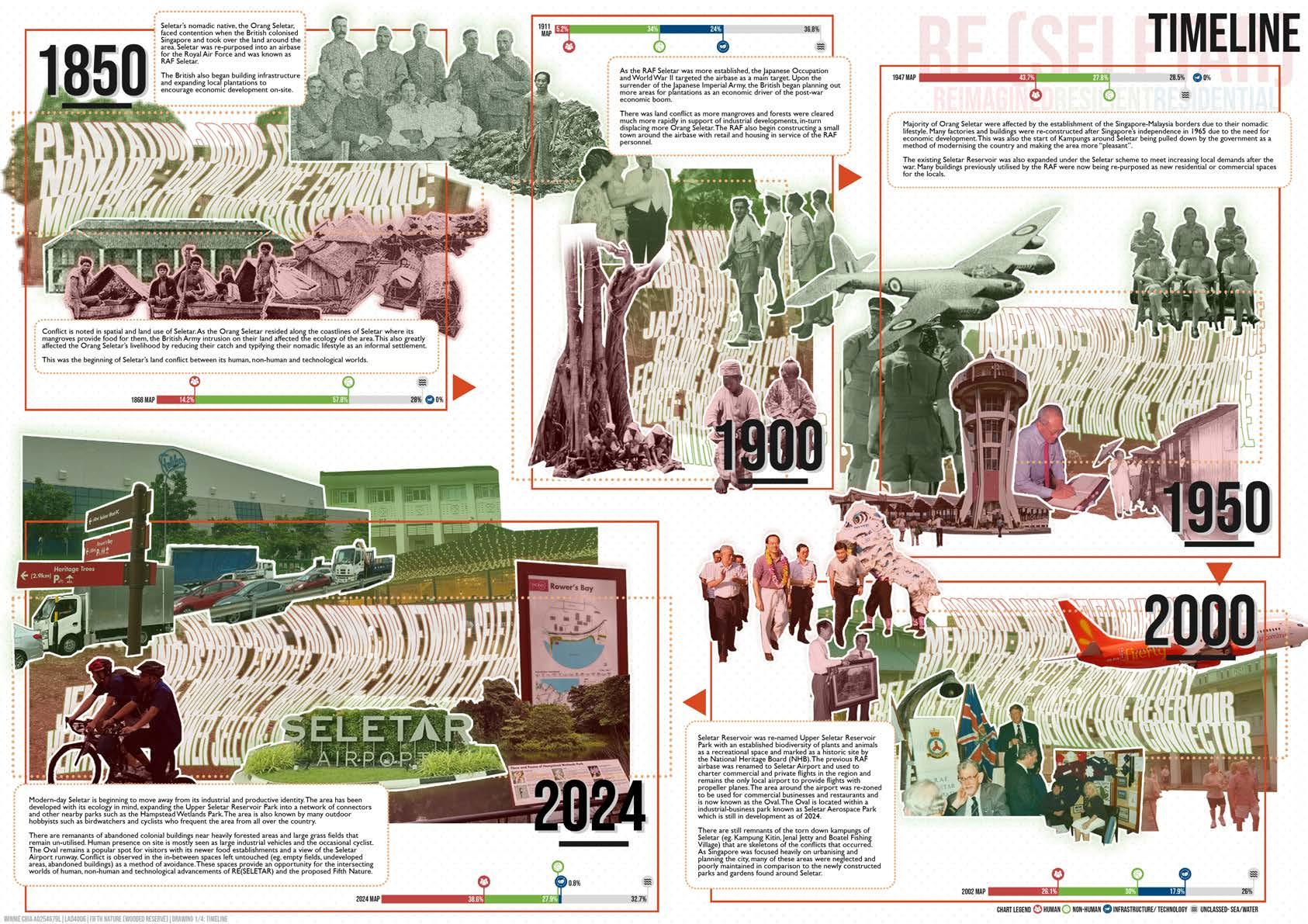
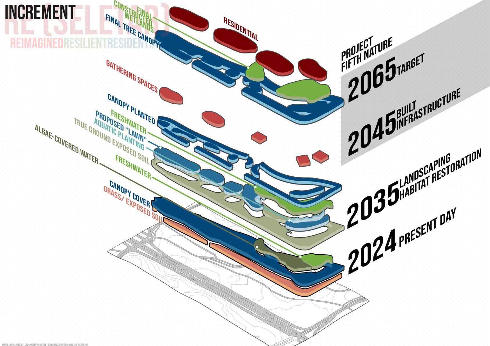
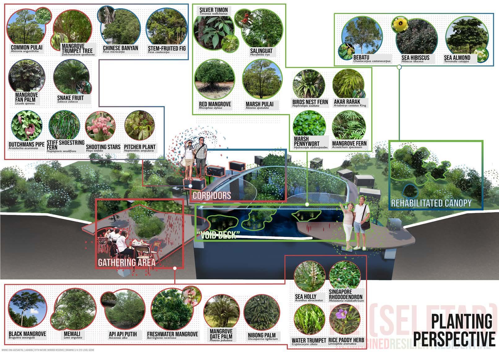
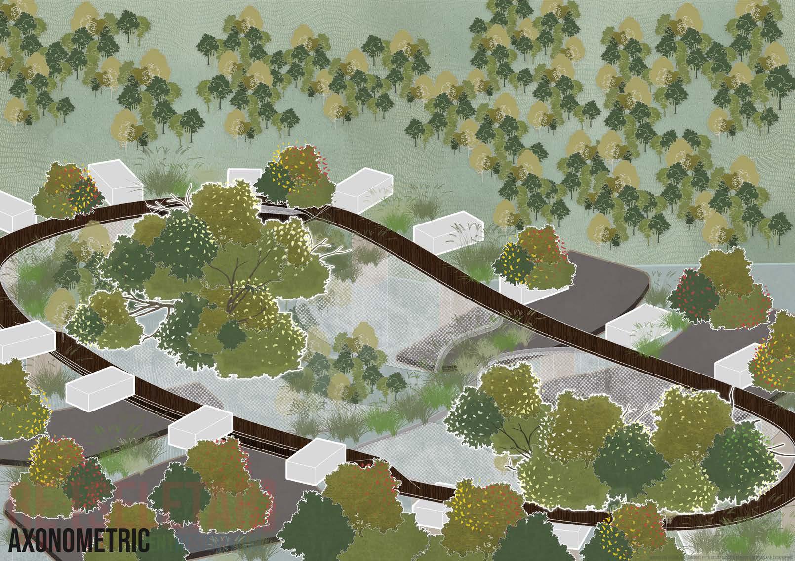
8. Re(Seletar) Winnie Chia
9. Green Wilding Simon Seah
Chapter 3 Chapter 4
1. Chapter Introduction
To Let Things Be Different We Need To Be Different
We Need
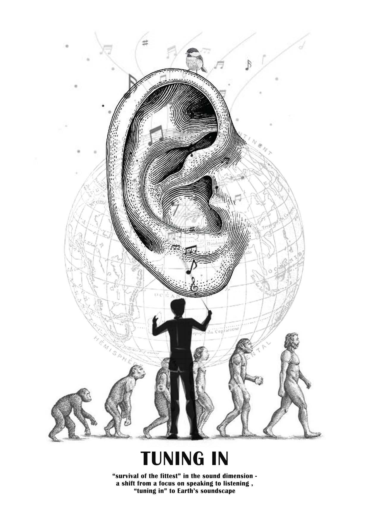
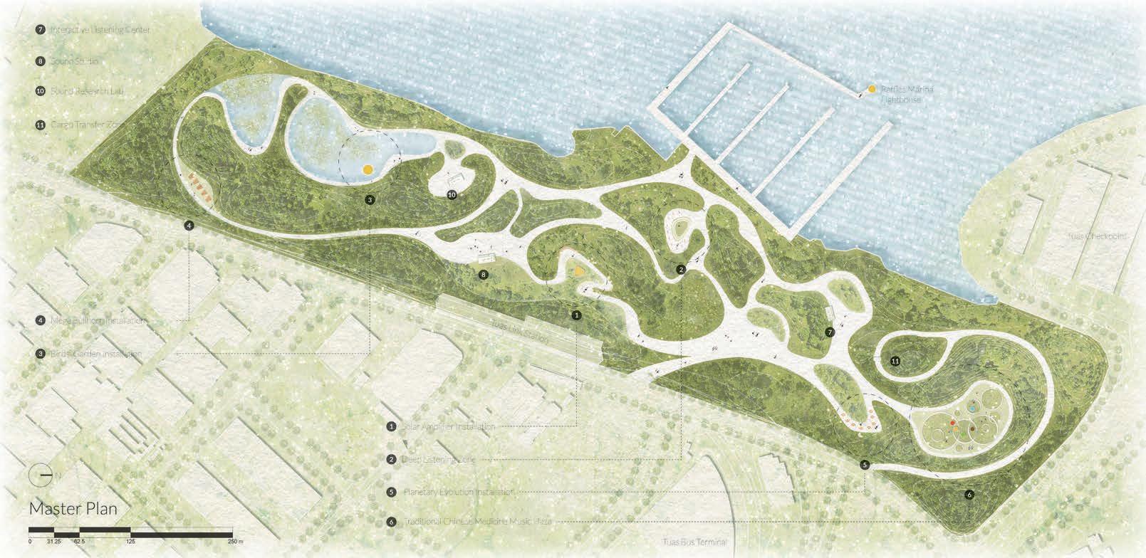
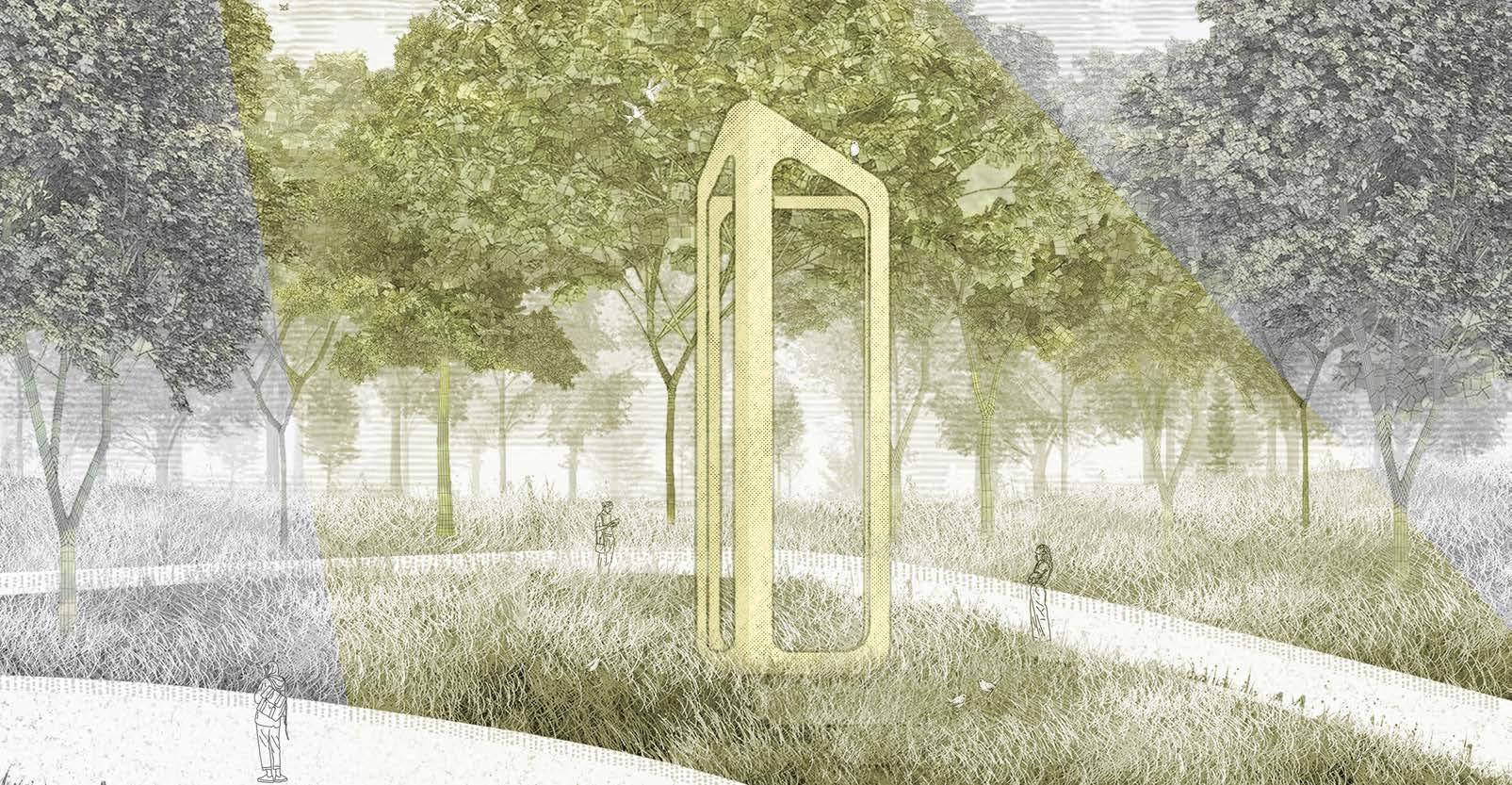
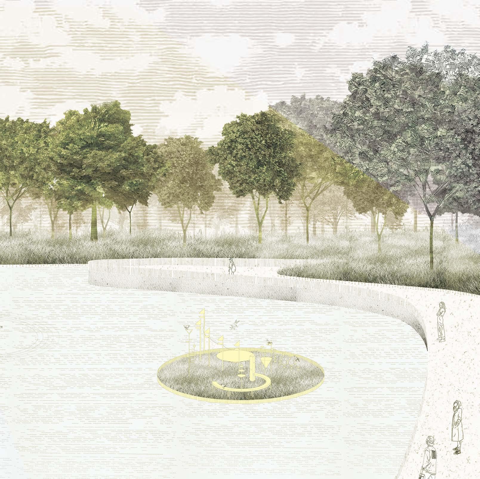
2. Tuning In Yang Xiaoyang
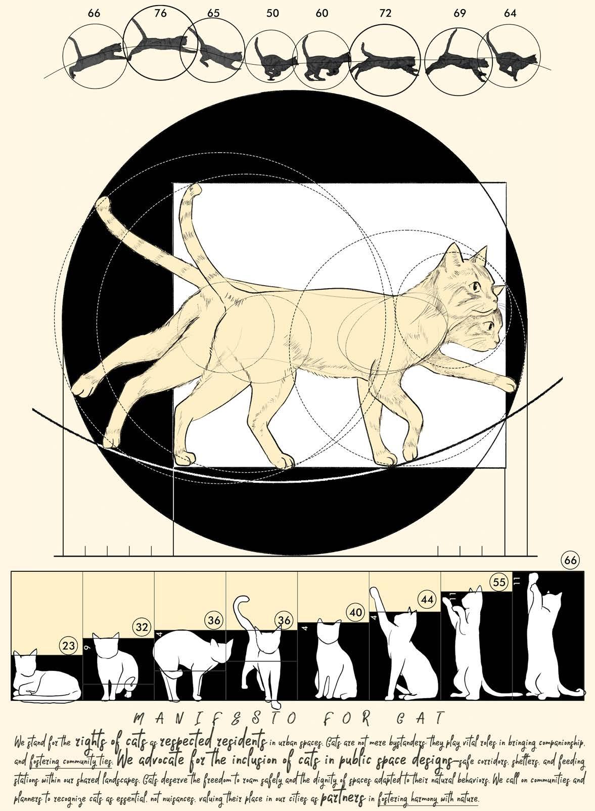
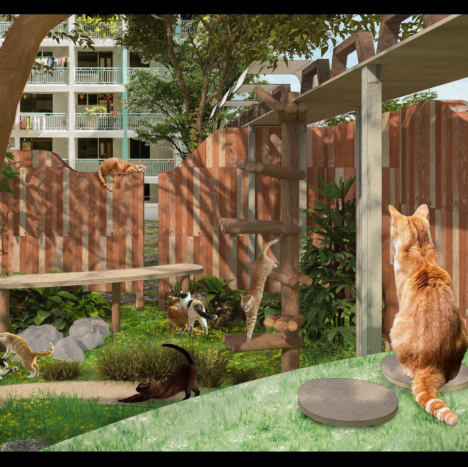
3. Change For Cat Yang YuanYuan
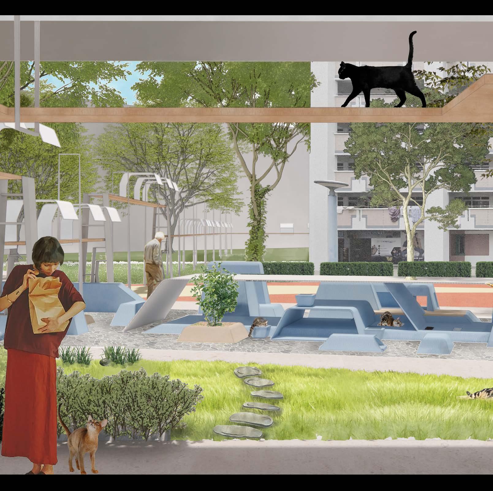
4. Patches Obscure Altoaimi Lina
5. Jelutung Geophemeral Winston Choi
6. Land Of Resonance Du Xinyang
7. Corridor Dialogues Li Mu
8. Breath Between Land and Water Li Yixuan
9. Co-Existing 2.0 Yi Wang
10. Palimpsest of Circuit Road Abdul Tha’Qif
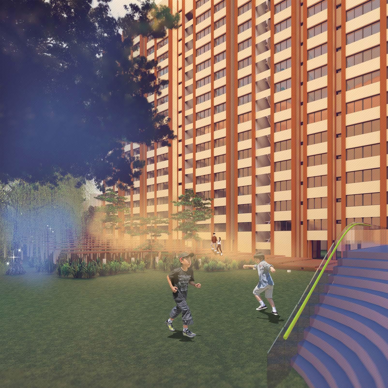
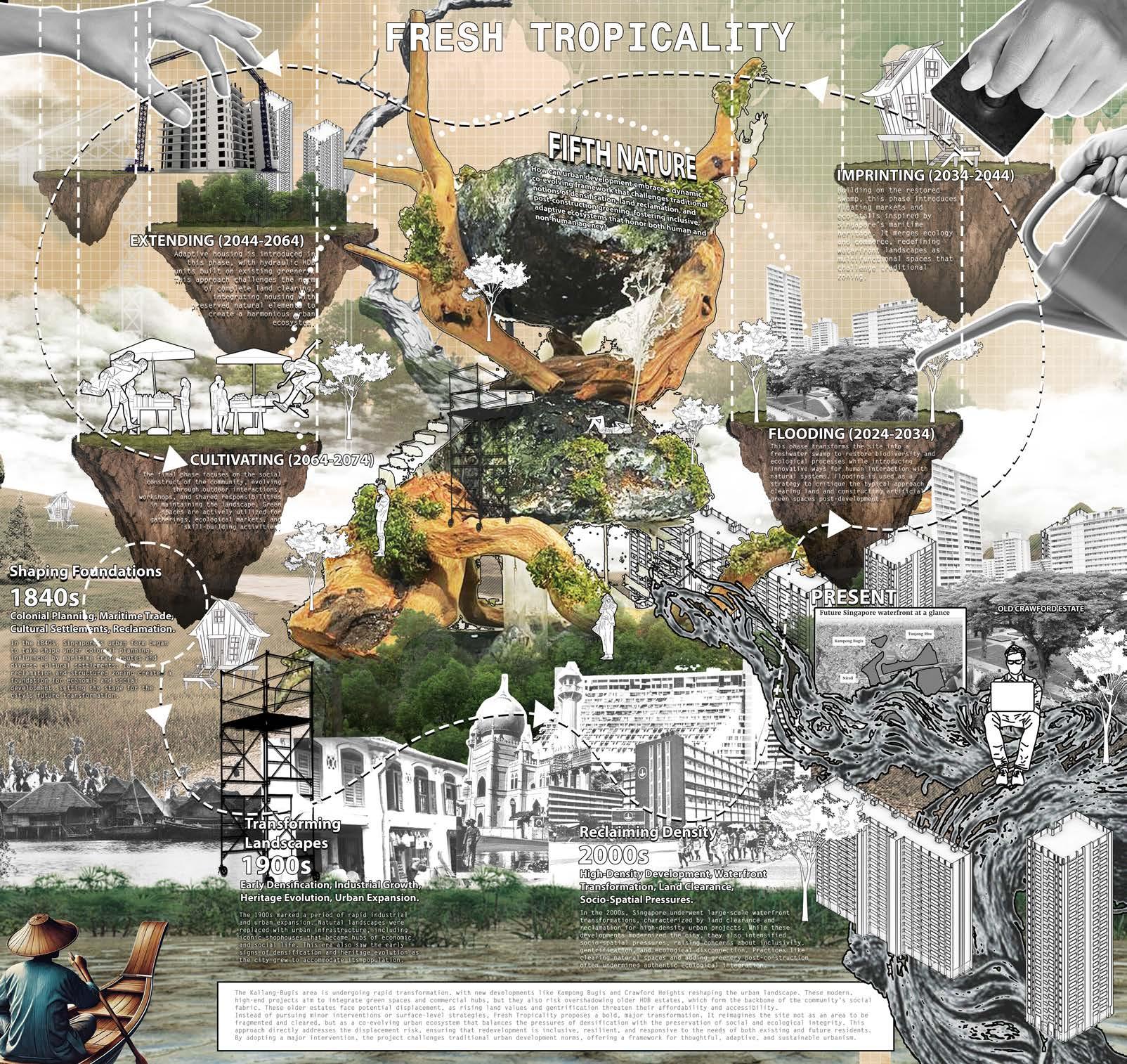
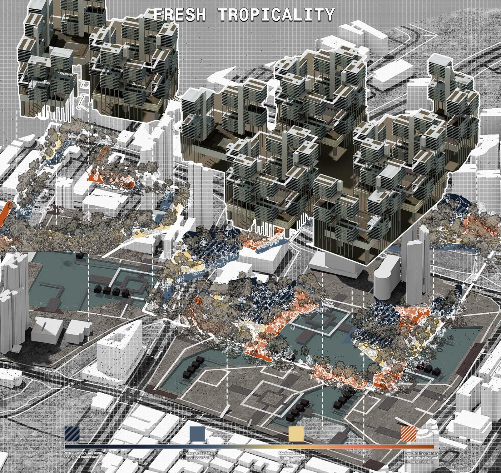
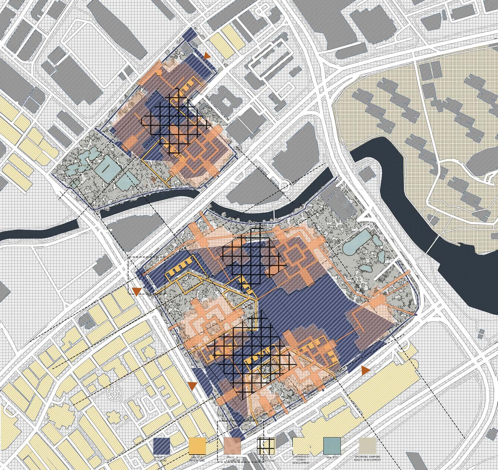
11. Fresh Tropicality Izwan Shah
12. The Niche Li Xiyuan
13. Seeing Stars Wang Qianwen & Zhang Xinyao
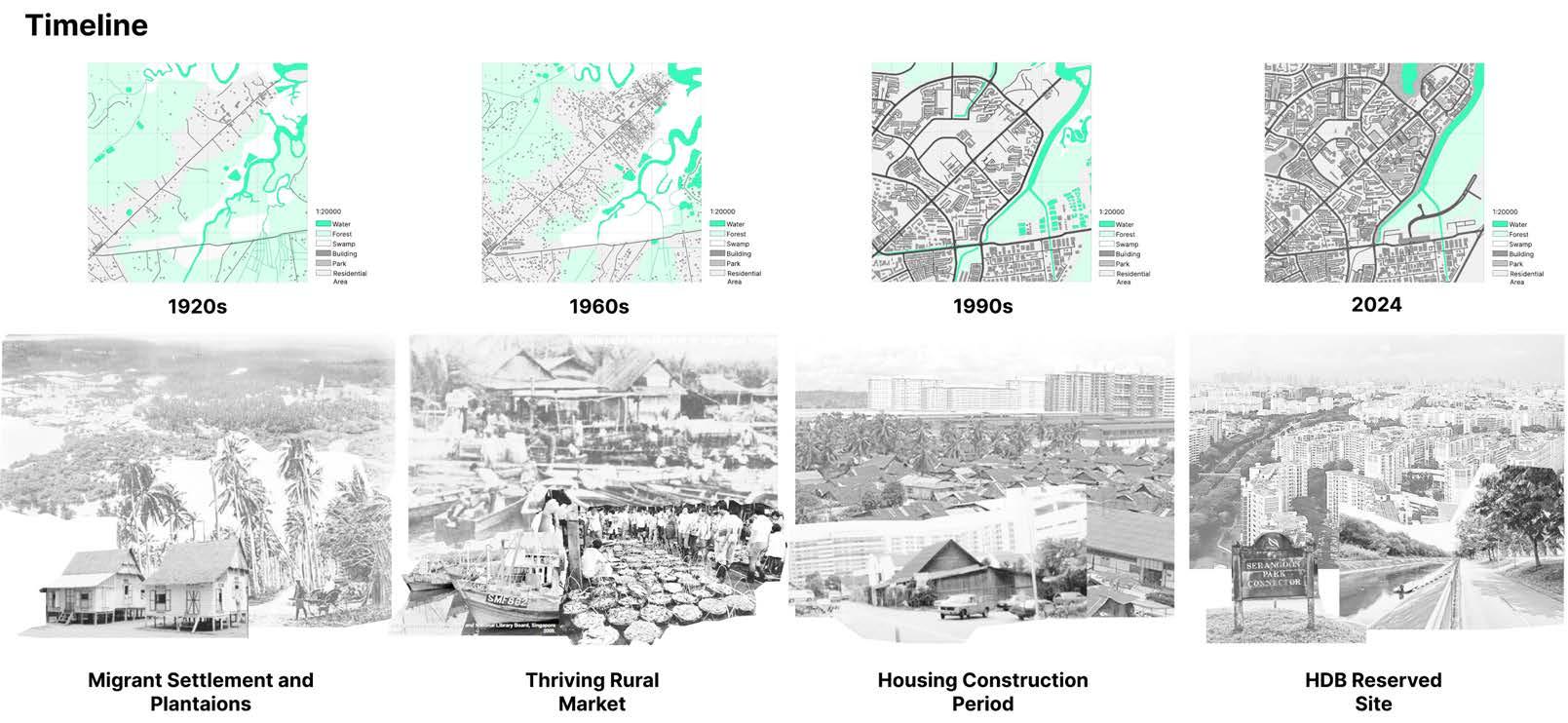
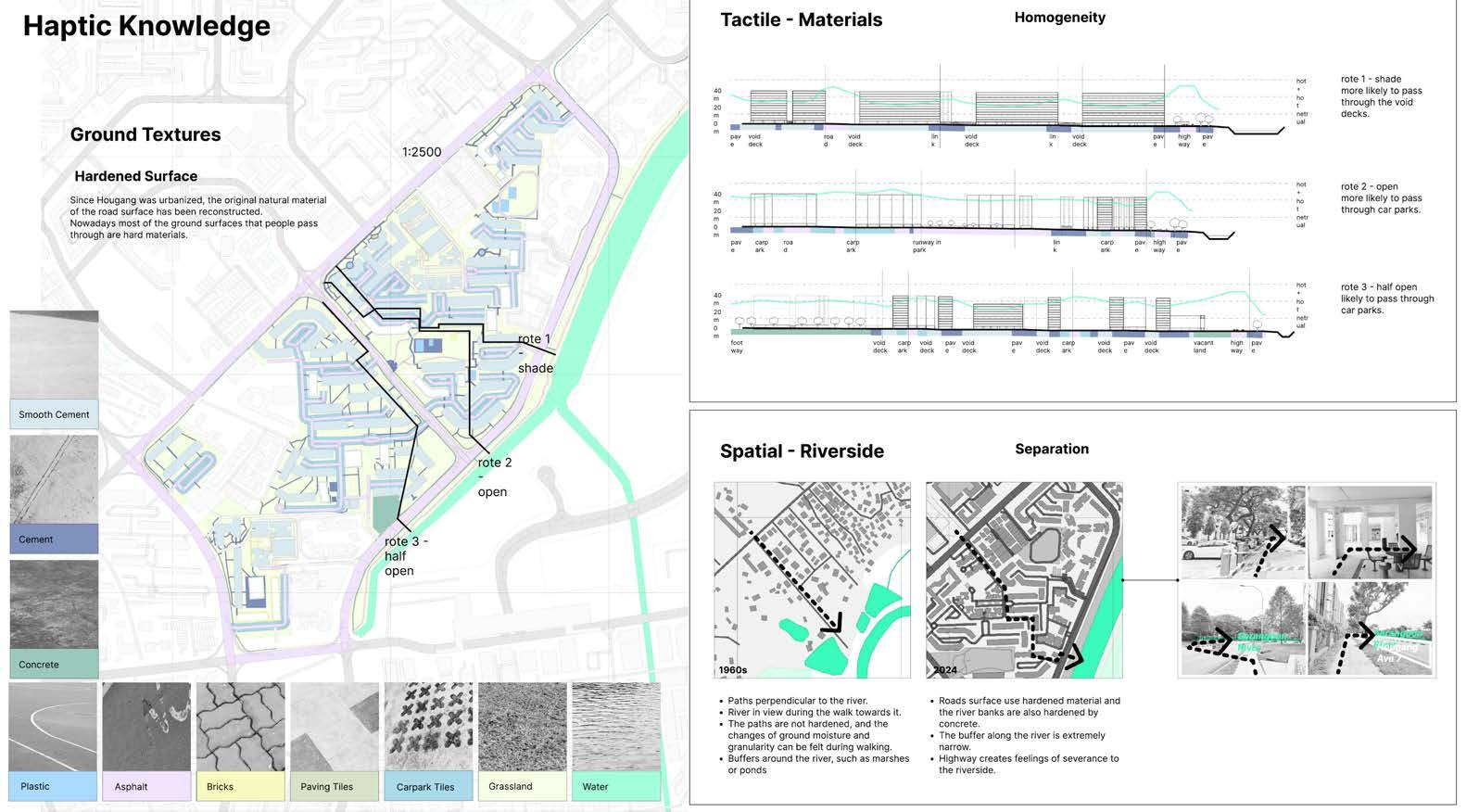
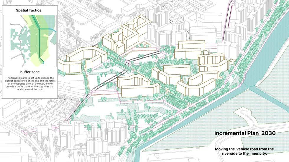
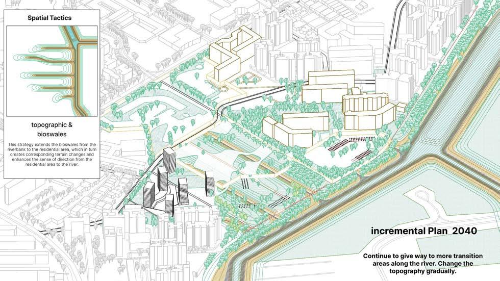
14. Hougang Reimagined Chen Yingzhao
15. Border Bloom Zhou Yao
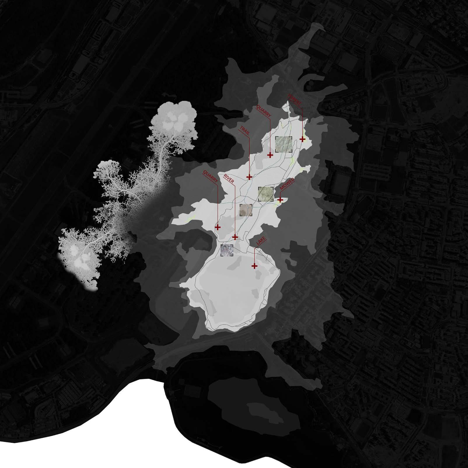
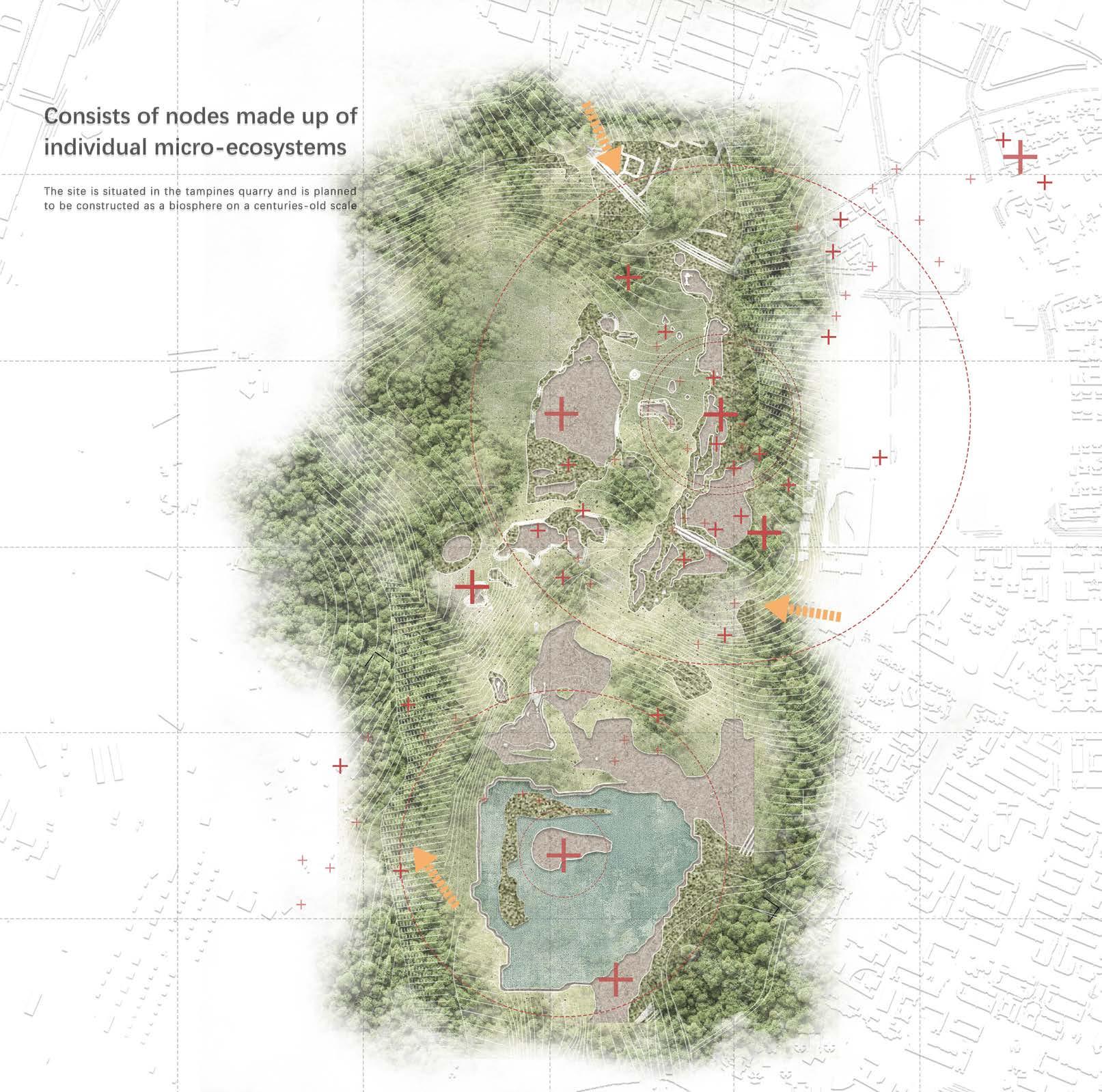
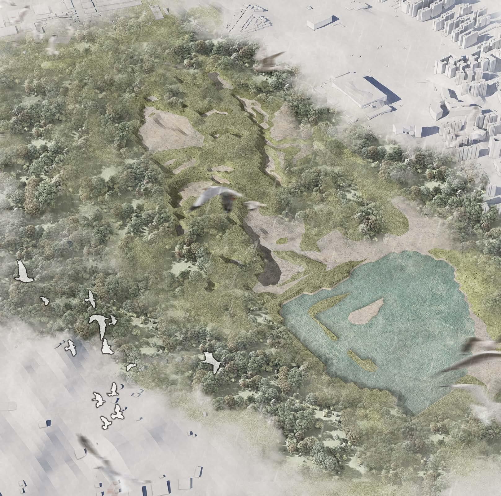
16. A Spatial and temporal cycles in the quarry microbiosphere Huang Jinguo
1. Chapter Introduction
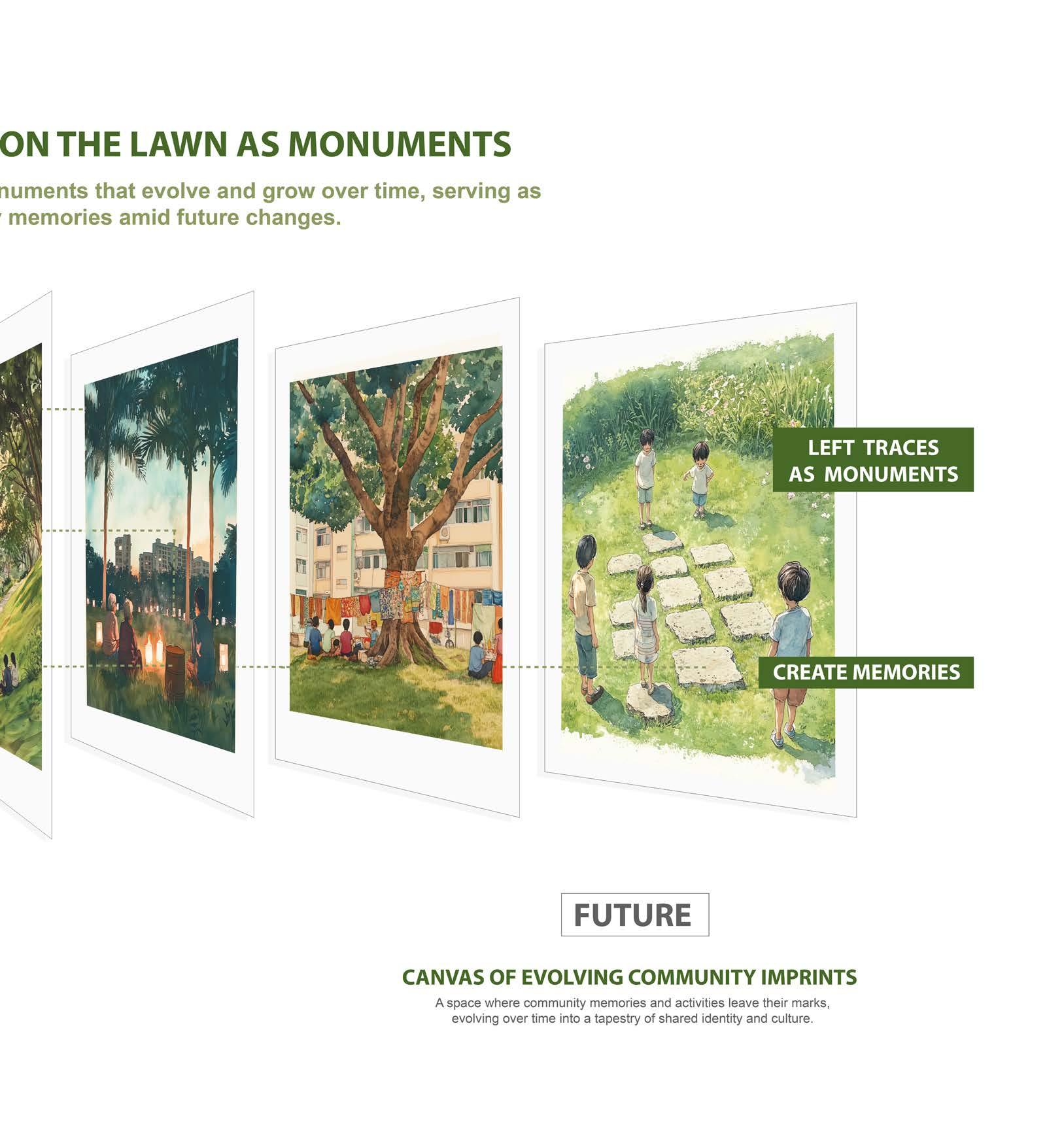
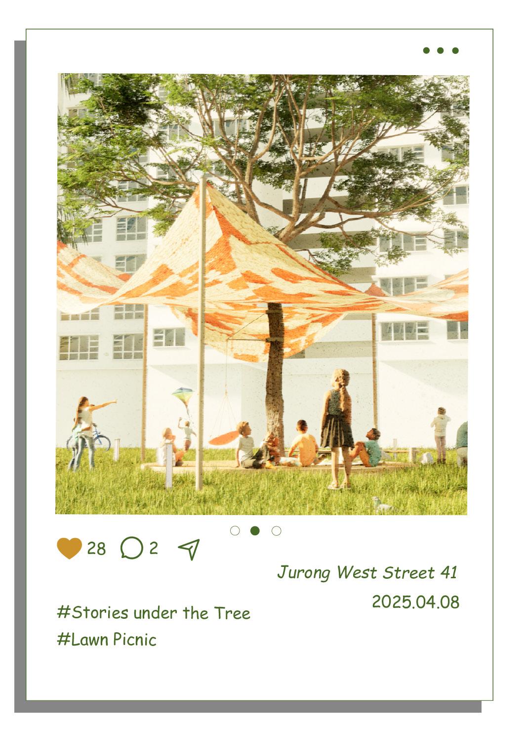
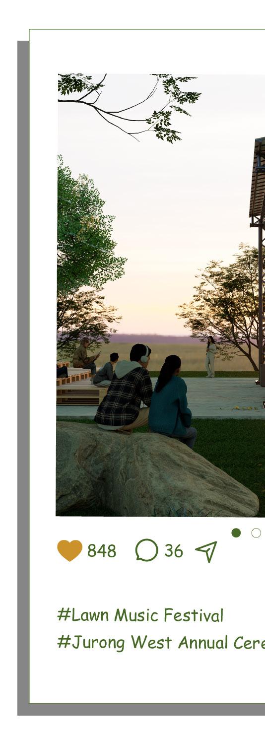
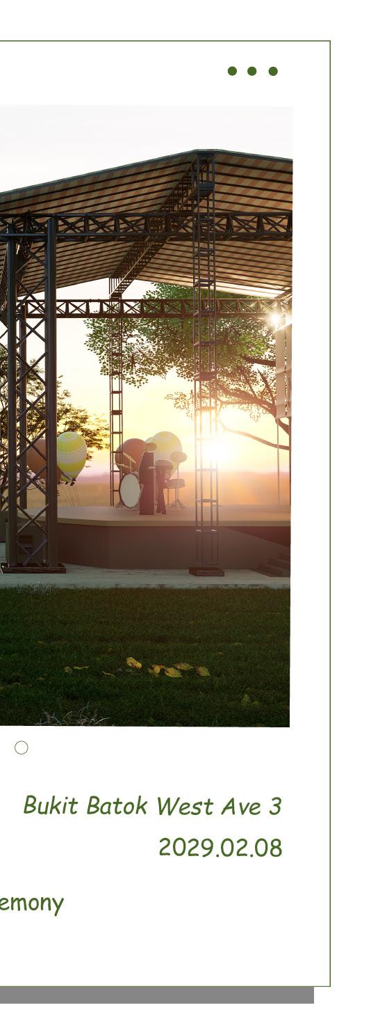
2. Ephemeral Everyday Monuments Li Kejie
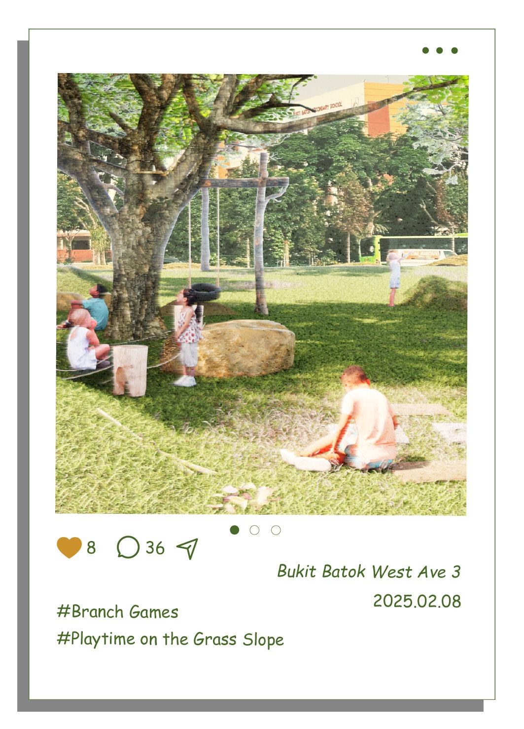
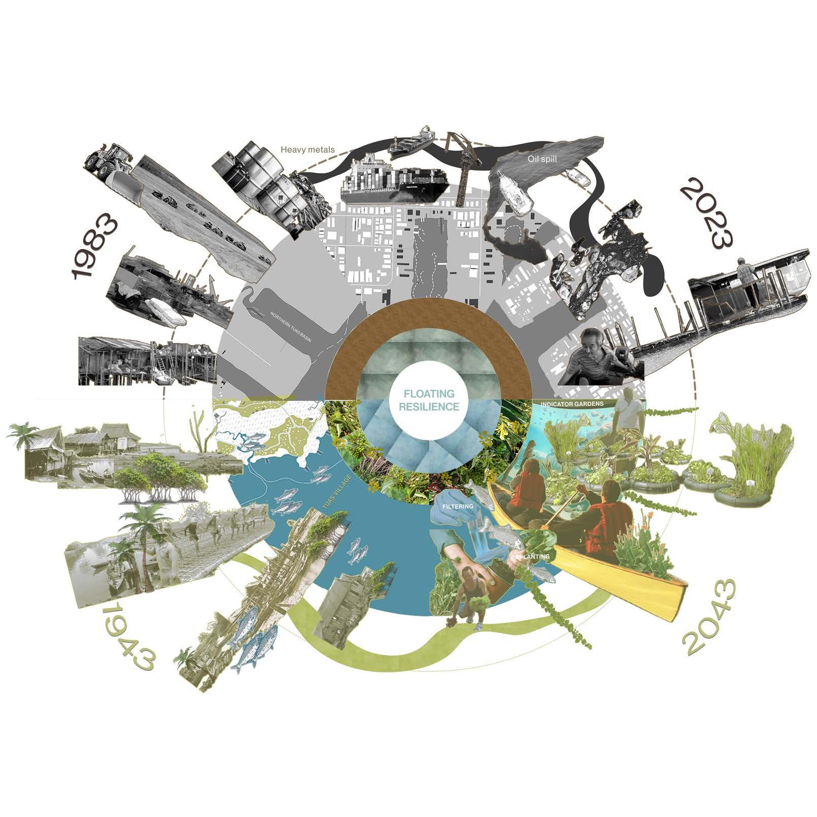
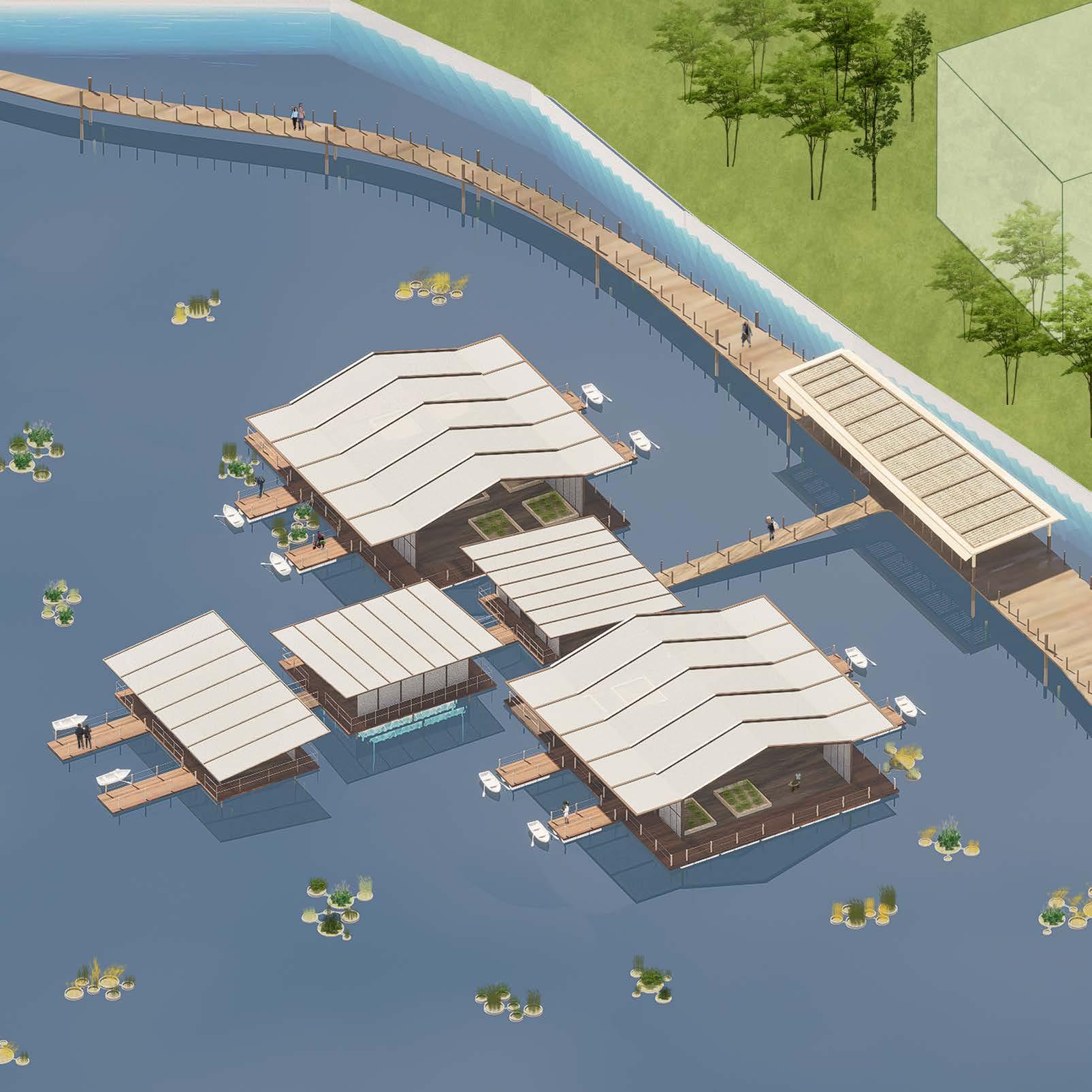
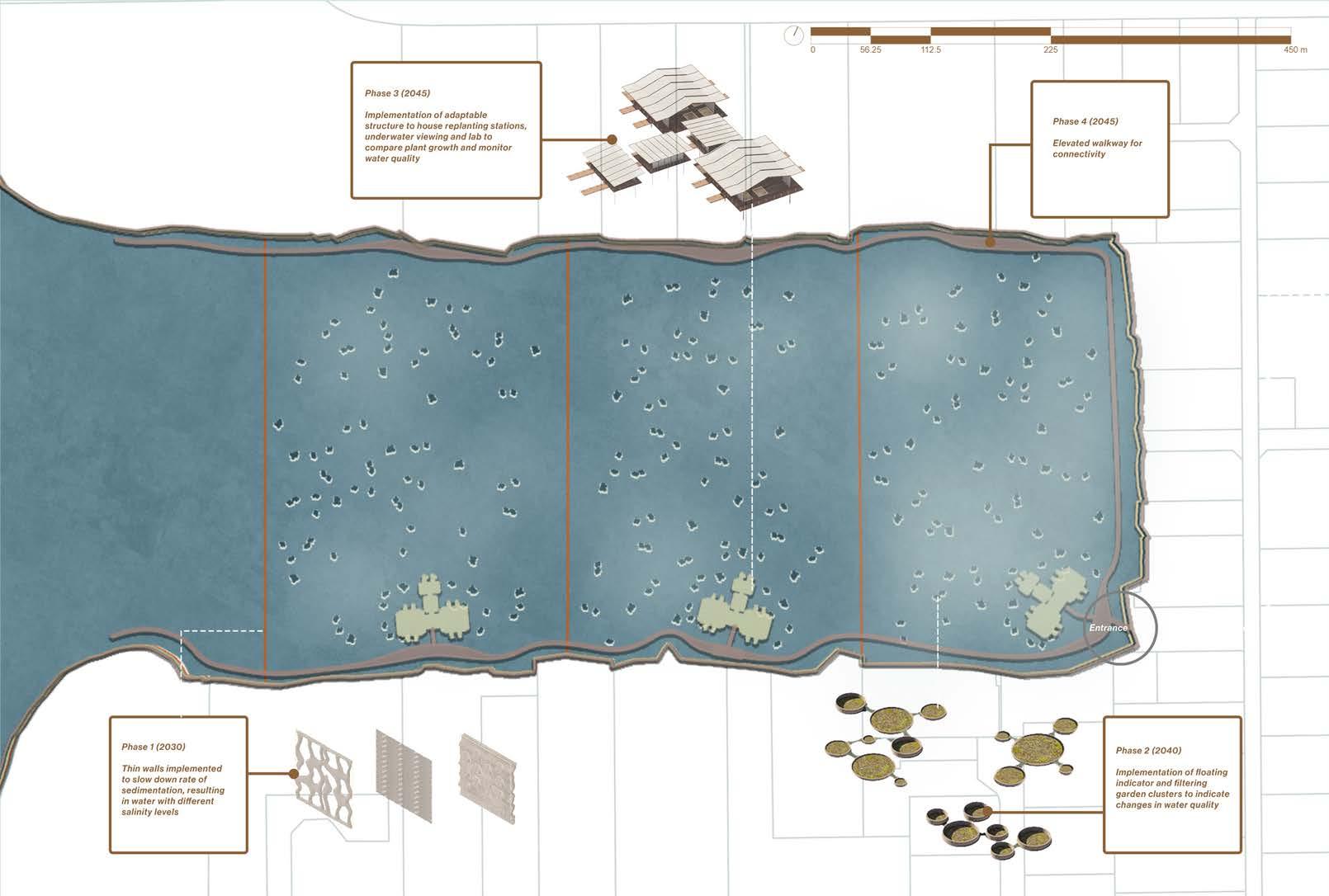
3. Floating Resilience Nur Neesha Shafeera Binte
4. Living Together Wen Guangyuan
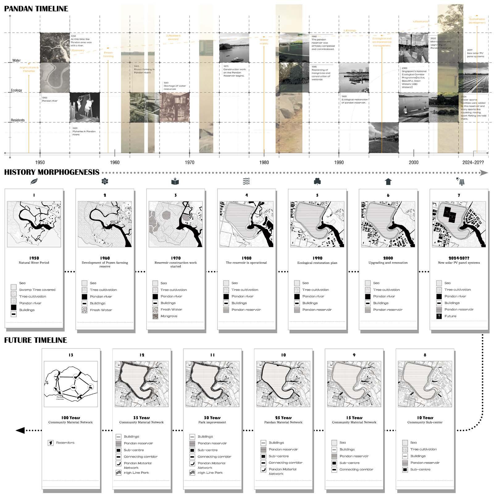
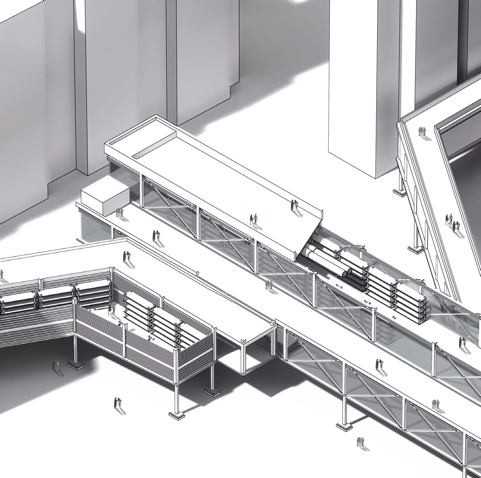
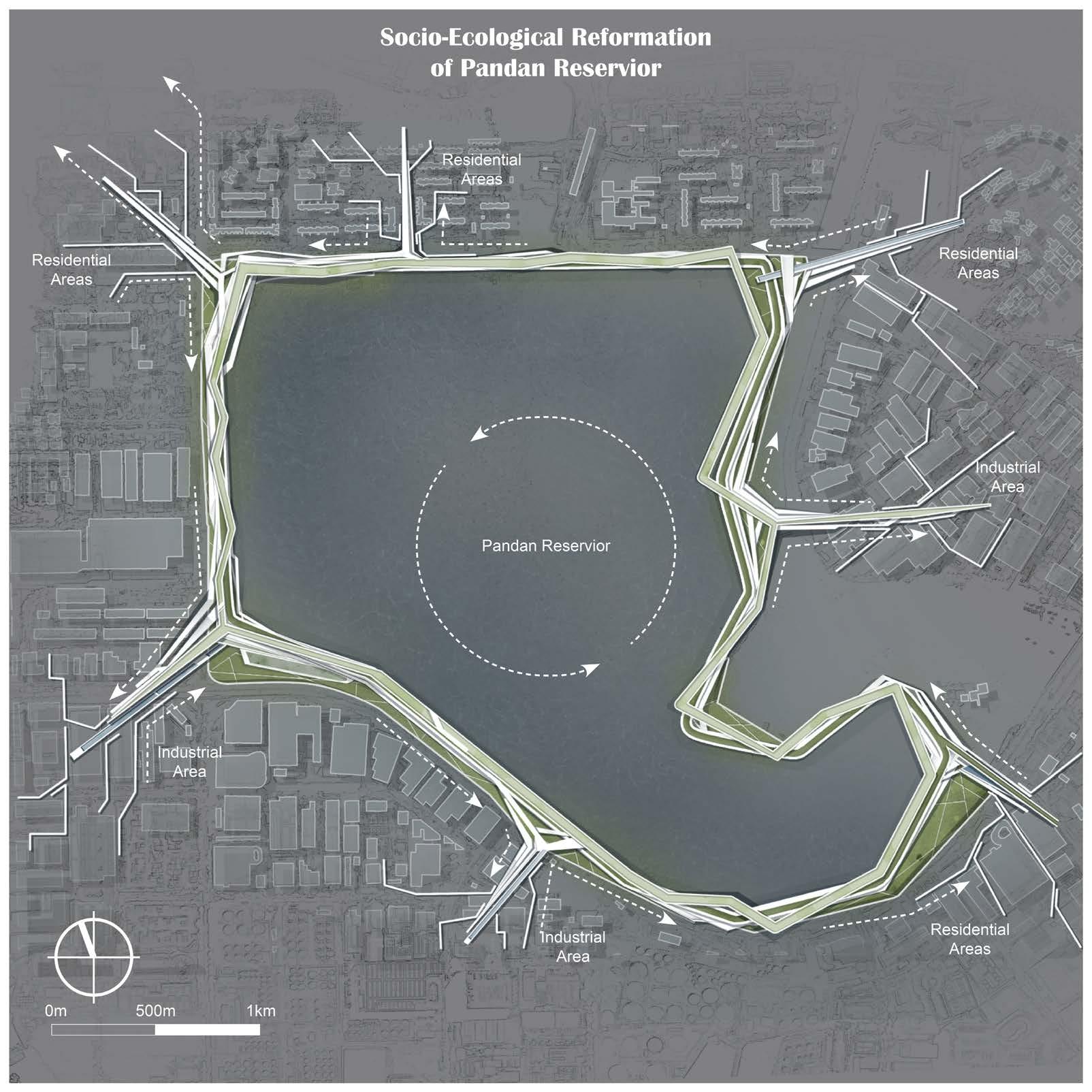
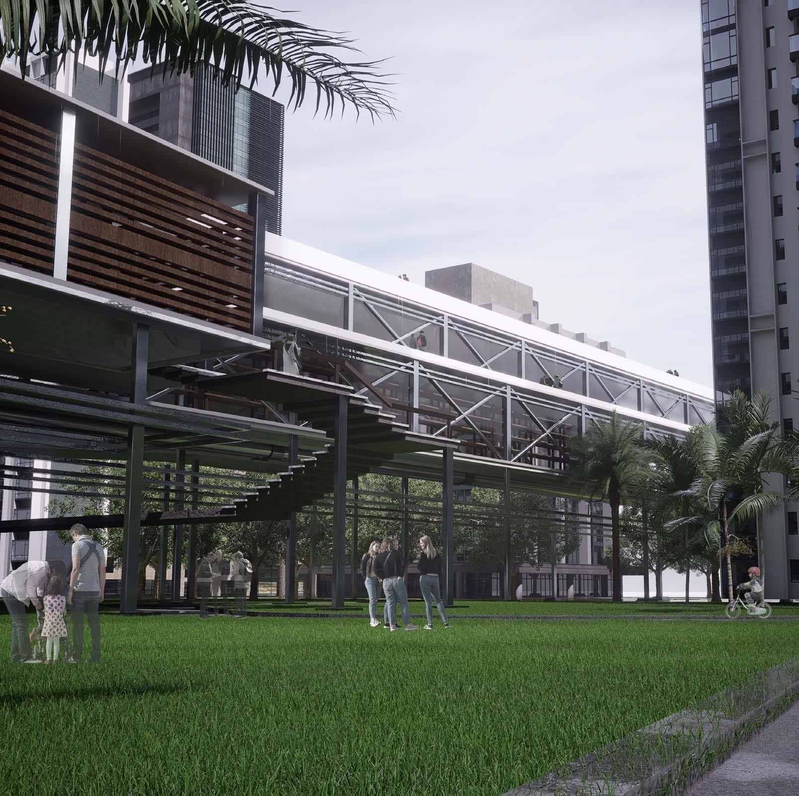
5. Socio-Economic Reformation of Pandan Reservoir Zhou Siyuan
10. Niche Construction in Disturbance Zhou Qinying
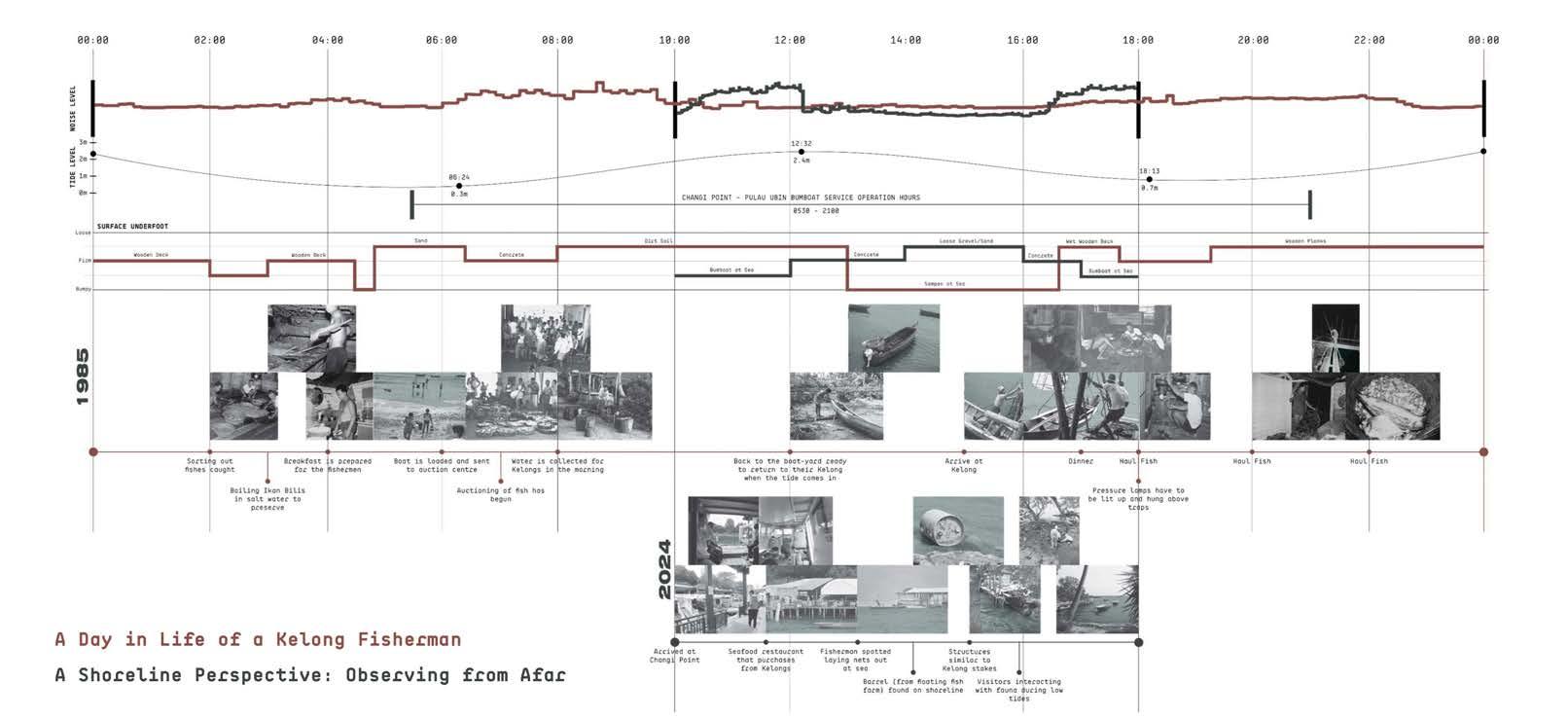
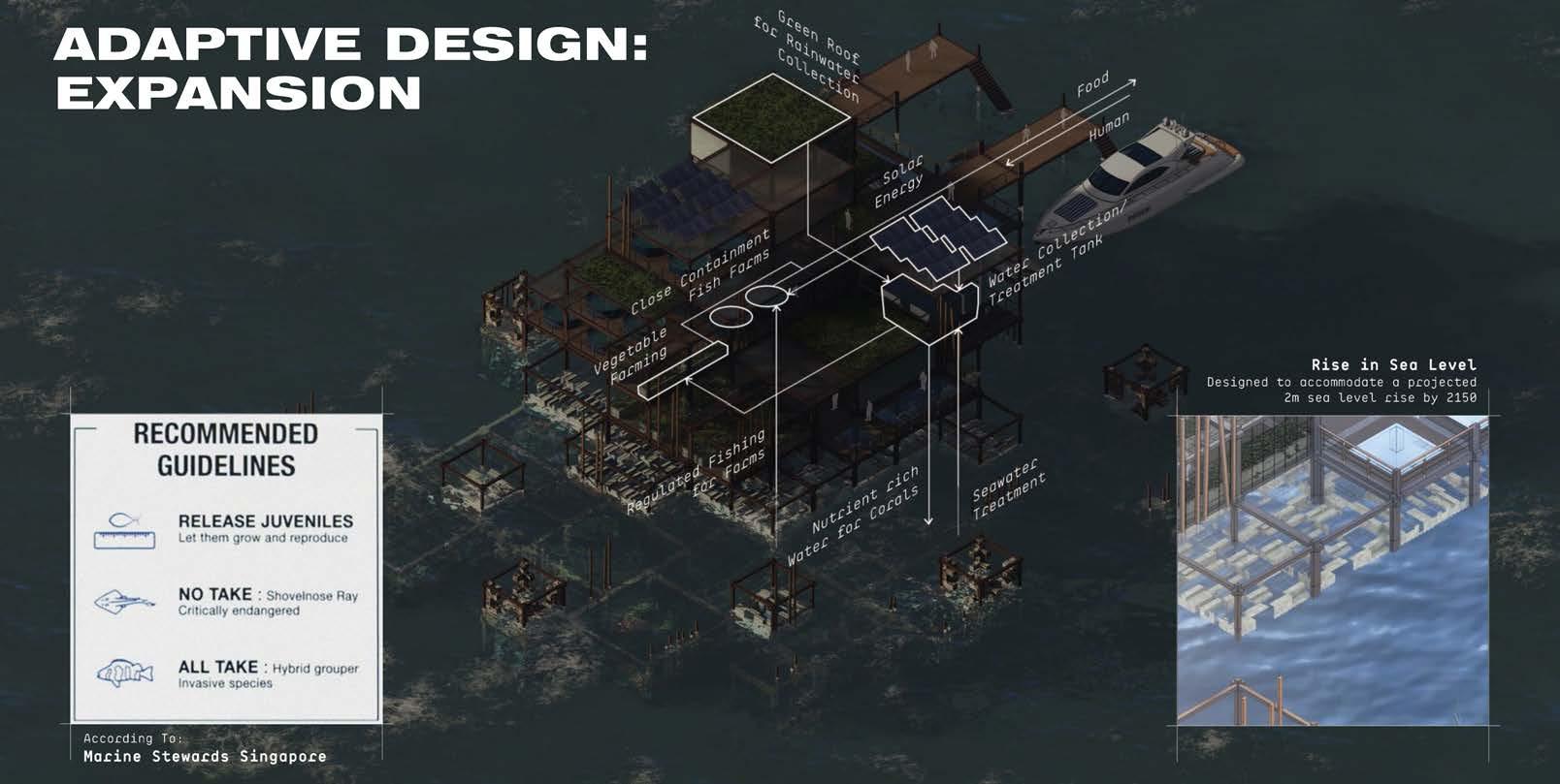
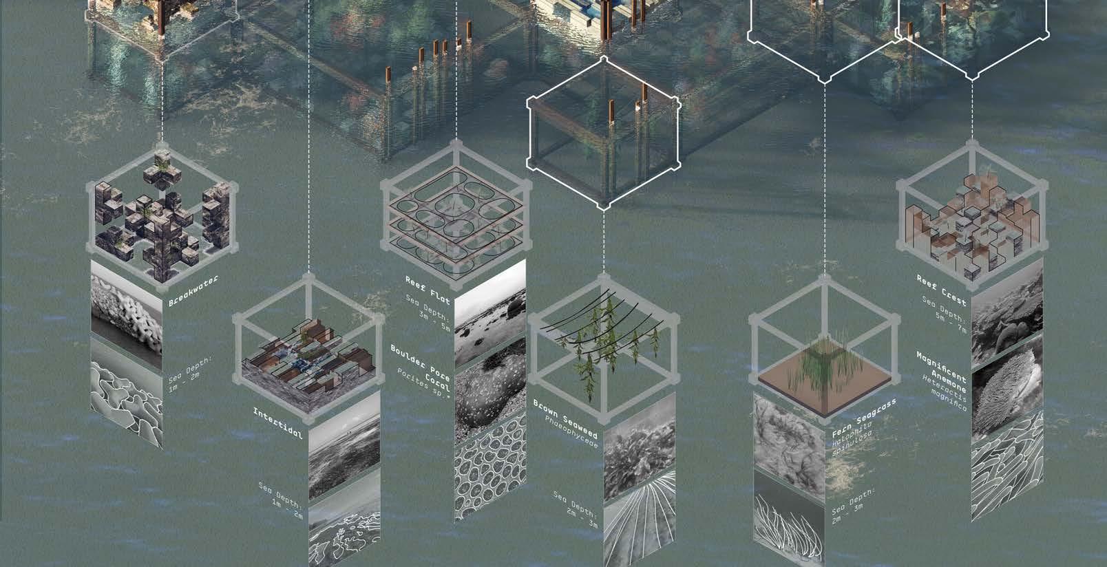
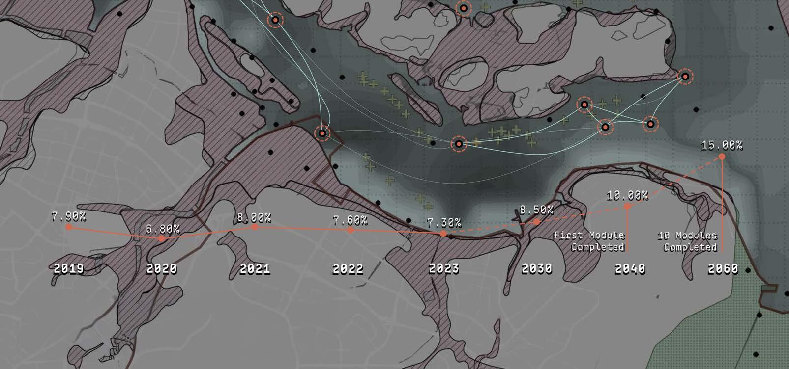
11. Kelong Ecosystem Deston Seah
12. Lively Matters Nadia Kuan
13. Living in Mutual Symbiosis Wu Qingyi
LEGEND
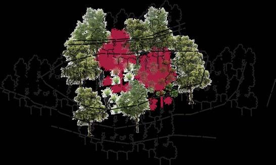
Note: The grid is 500m x 500m
Housing Development Board
Reserved Sites with Trees (WoodedDominant Human Management)
Reserved Sites with Trees (WoodedLimited Human Management)
Reserved Sites without Trees (Mowed)
Reserved Seas (Tidal)
Open Spaces (Voided)
Waterbodies
Chen Jiaying
Mai Si Yao 3. Nuramirah Binte Mohd Nor 4. Amirul Bin Ismaiday 5. Deng Pinyi 6. Chen Zeya 7. Akshitha Vadlakunta 8. Mariam Yusuf Rajkotwala
Shu Yao
Teo Kai Liang
Cao Yutong 12. Clarissa Ke Li Wen
Shruthakeerthi Karthikeyan
Luo Siqi
Pan Yuwen
Wang Wenhao
Wayne Tan Pei Wee
Chapter 1 Everything Is Going To Be Okay
Projects in this theme advocate for a connection between humans and Nature, which are assumed to somehow be separate. They argue that landscape architecture can join them together again, just like they were in an idealized past. In this theme, Nature is thought to have a balance-seeking force.
Nature is often viewed as separate from humans. The projects in this theme reinforce this idea of a separation of the two entities and argue that landscape design can bridge the gap. Nature, in this case, is regarded as the balance-seeking force through which harmony can somehow be achieved. The projects thus imagine that designed environmental and social changes are possible–– and the quicker we accept that, the quicker we can mend the perceived gap.
Projects like Fuubutsushi, Traces of Nature, Living Symbiosis, Human Hands Butterfly Wings all advocate, among other things, for the agency of a balance-seeking Nature for human and more-than-human entities’ connection and resilience. The proposals involve dynamic partnerships and negotiations to give strength to spaces of spontaneous nature and biodiversity, just like they were in an idealized past.
Other projects focus on aspects of co-living. Wired Wilds, for example, envisions the transformation of a well-known Singaporean heritage site as a template for co-living and balance. Co-working, Co-living, Co-loving @ Bedok and Bringing Elderly Close to Nature similarly take the concept and apply it to old HDB estates. All of these projects propose an inclusive community for the social and economic needs of humans and use landscape design as a tool to express characteristics of harmonious coexistence with Nature from an idealized past.
In addition, there are projects that expedite the growth of nature through technology. Modular Islands is one such proposal which embraces the ‘indeterminate quality of sea level rise’ as an inevitability. The project is designed to allow humans and nature to harmoniously persevere with it supported by specially designed, modular units.
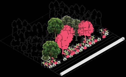
LEGEND
Housing Development Board
Reserved Sites with Trees (WoodedDominant Human Management)
Reserved Sites with Trees (WoodedLimited Human Management)
Reserved Sites without Trees (Mowed)
Reserved Seas (Tidal)
Open Spaces (Voided)
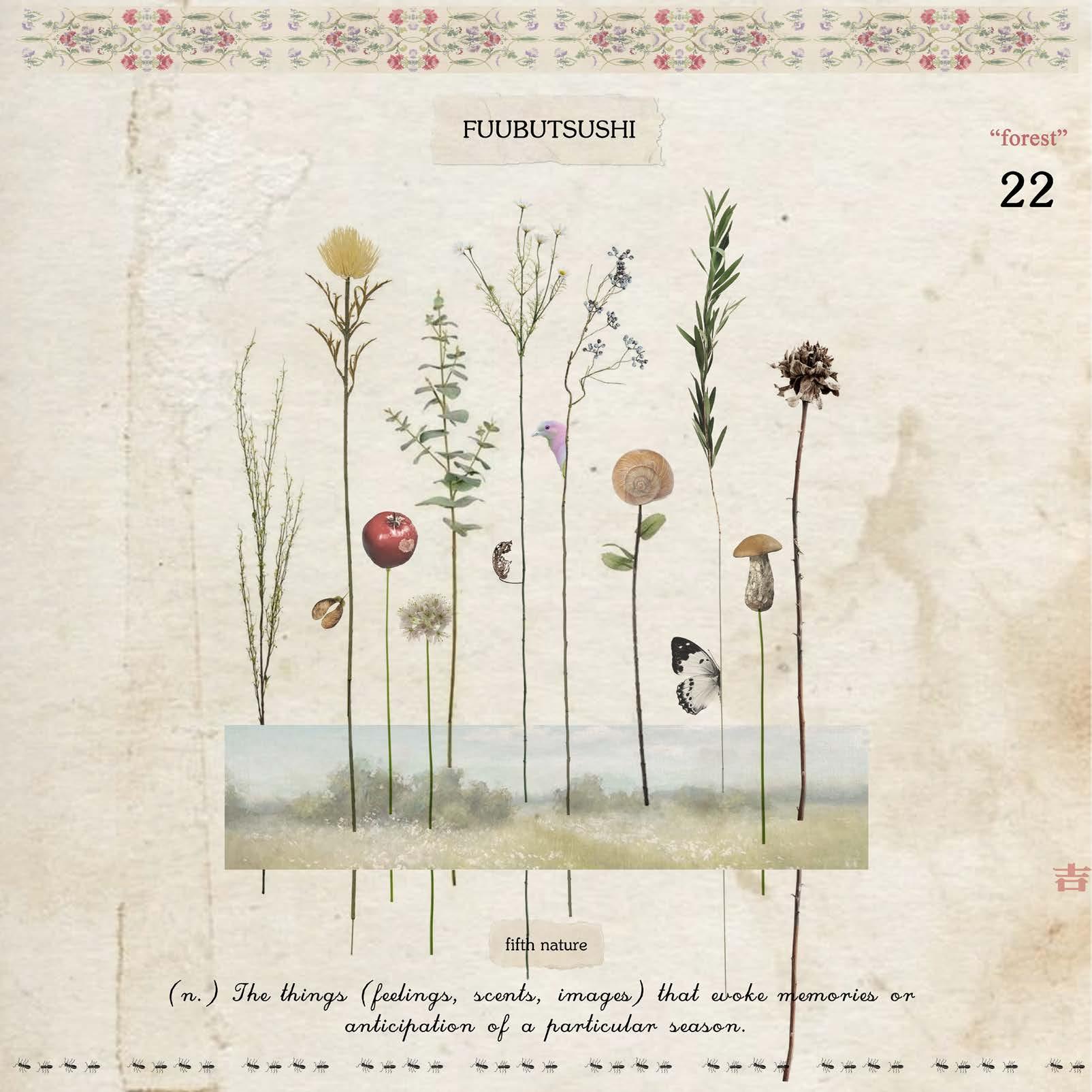
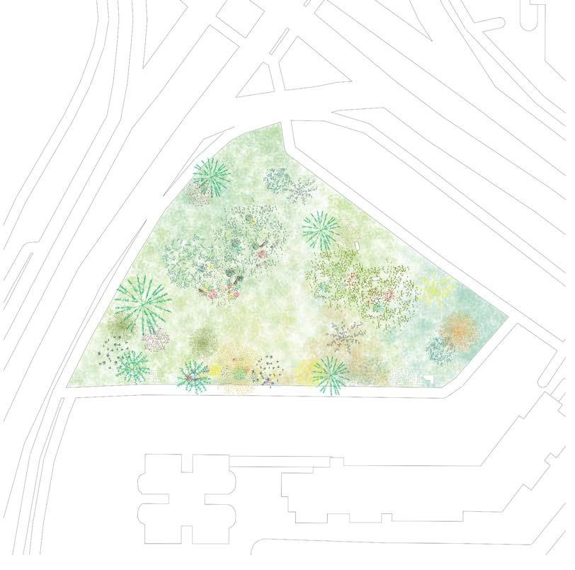
Whispers of Time: Fuubutsushi in a Shifting Landscape
Chen Jiaying
Tutor: Maxime Decaudin
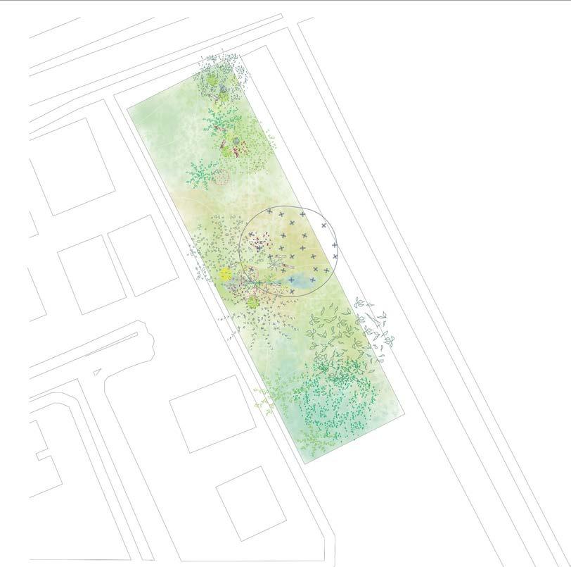
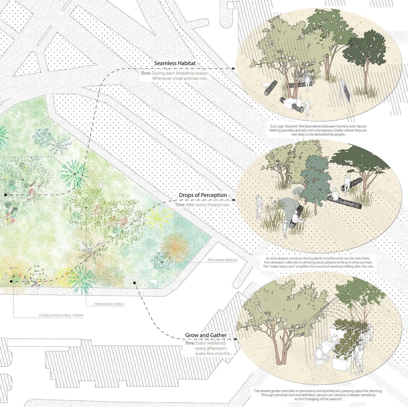
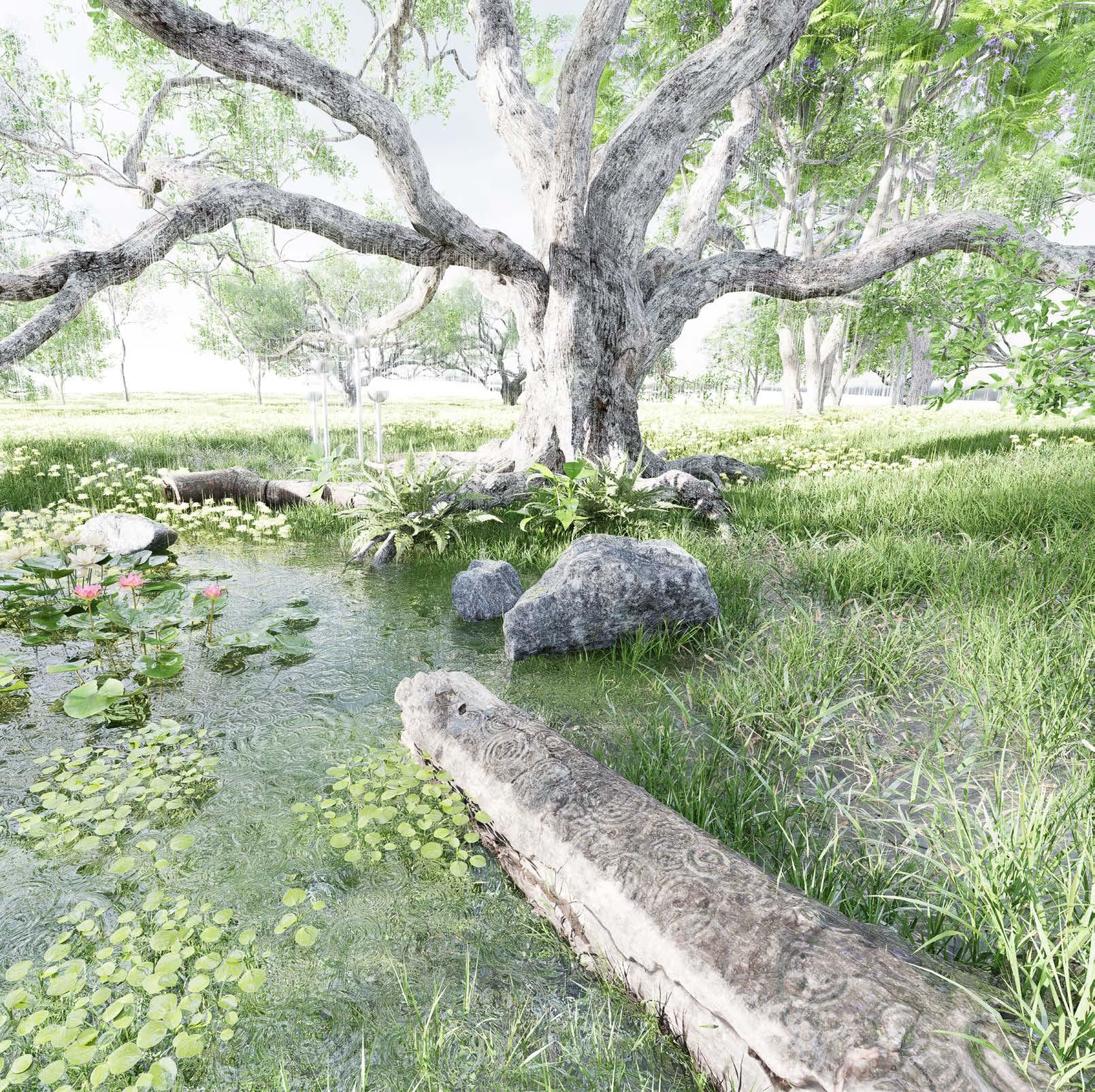
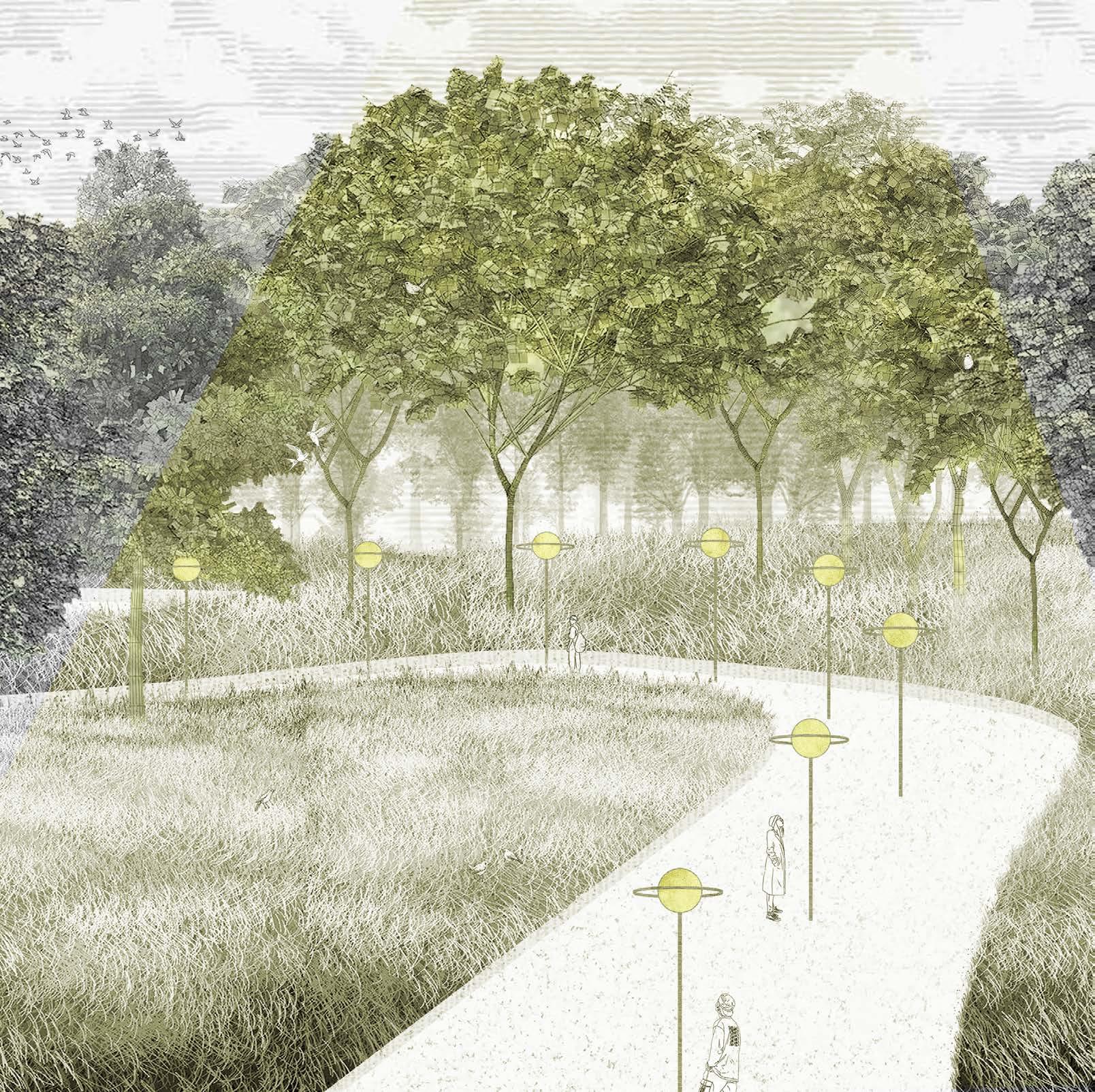
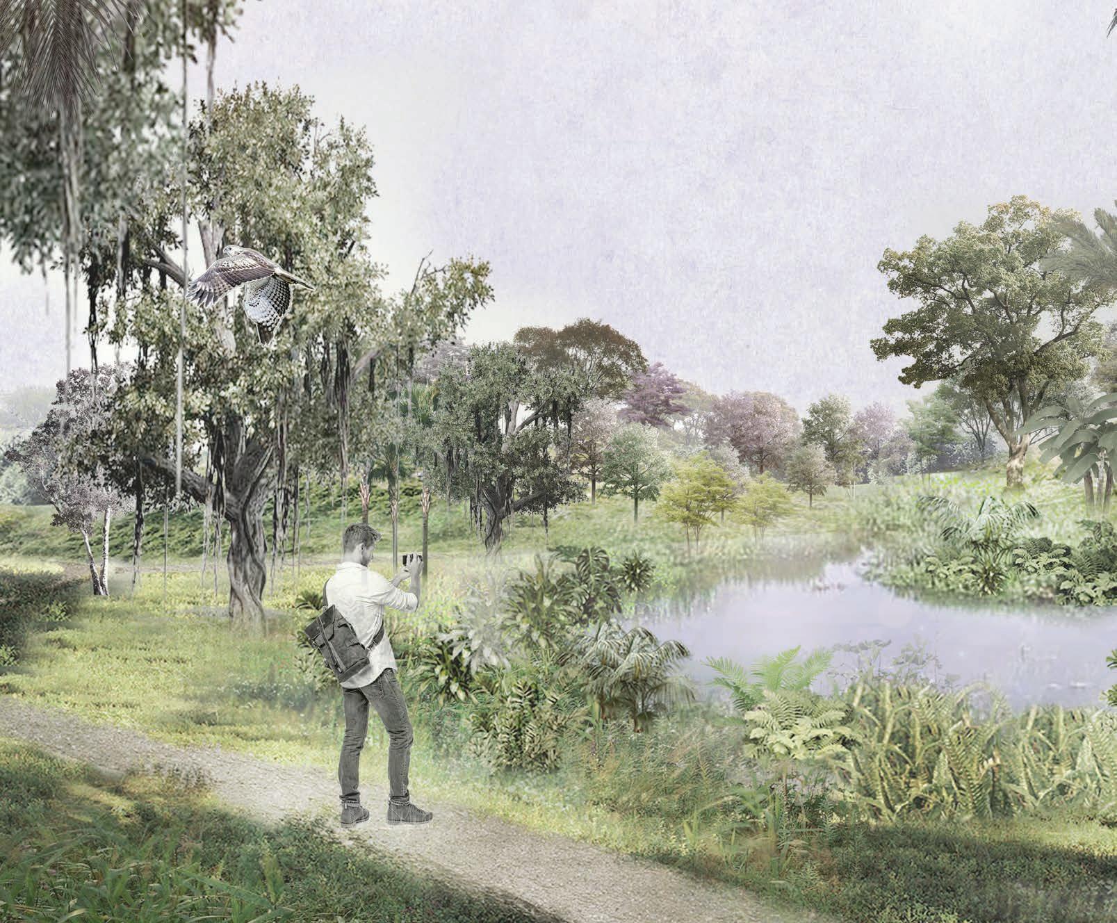
This project proposes to reimagine our collective relationship with Singapore’s urban environment by embracing the natural rhythms of the tropical climate rather than imposing rigid, artificial controls. The modern urban landscapes proposed by previous nature policies, such as the Garden City of City in Nature, require constant maintenance and celebrate overly structured designs such as Gardens by the Bay or The Jewel. Speculating on a Singapore’s fifth nature, this project seeks to dissolve these barriers, creating small, everyday spaces that poetically reveal dynamic shifts through the days and seasons, celebrating nature’s cycles of growth, decay, light, rain, rest, and renewal. Such a cultural reframing of our collective and individual relationship with the natural processes that surround us is illustrated through the redesign of a series of small reserve sites located in Jurong West.
The core design strategies create fluid boundaries that adapt to the rhythms of nature and the needs of the community. Simple, versatile elements bridge the gap between human and natural spaces. Fallen logs, for instance, serve multiple purposes: seating for people, surfaces for plant growth, and pathways for insects. Movable nets, designed for ease of assembly, create temporary shelters for sensitive animals like cats, providing refuge during breeding seasons or other critical periods. These nets can be repositioned seasonally, demonstrating a thoughtful approach to creating shared spaces for wildlife and humans. Shallow depressions in low-lying areas offer naturally wet habitats for moisture-loving plants and animals. After rainfall, these spaces come alive with the sounds of frogs and the emergence of mushrooms, celebrating the vitality of tropical ecosystems.
Residents engage directly with the sites, cultivating personal gardens with flowers or vegetables that reflect their unique relationships with these places and their seasonal
change. This act of nurturing deepens their emotional connection to the land, while regular activities like mowing establish recurring rhythms that align human actions with natural cycles. These interactions reinforce the idea that human presence can complement, rather than dominate, natural processes. Through common, everyday experiences, people create their own Fuubutsushi—a Japanese term capturing the emotional cues of seasonal changes—by observing and participating in the site’s dynamic shifts. Time is no longer measured by mechanical schedules but by sensory immersion in nature’s patterns, fostering mindfulness and appreciation for the subtleties of the environment.
In Whispers of Time, the landscape becomes a living, shared ecosystem that blends human and natural rhythms. By nurturing this connection, the project inspires care and love for the environment, creating an inclusive place for everyone.
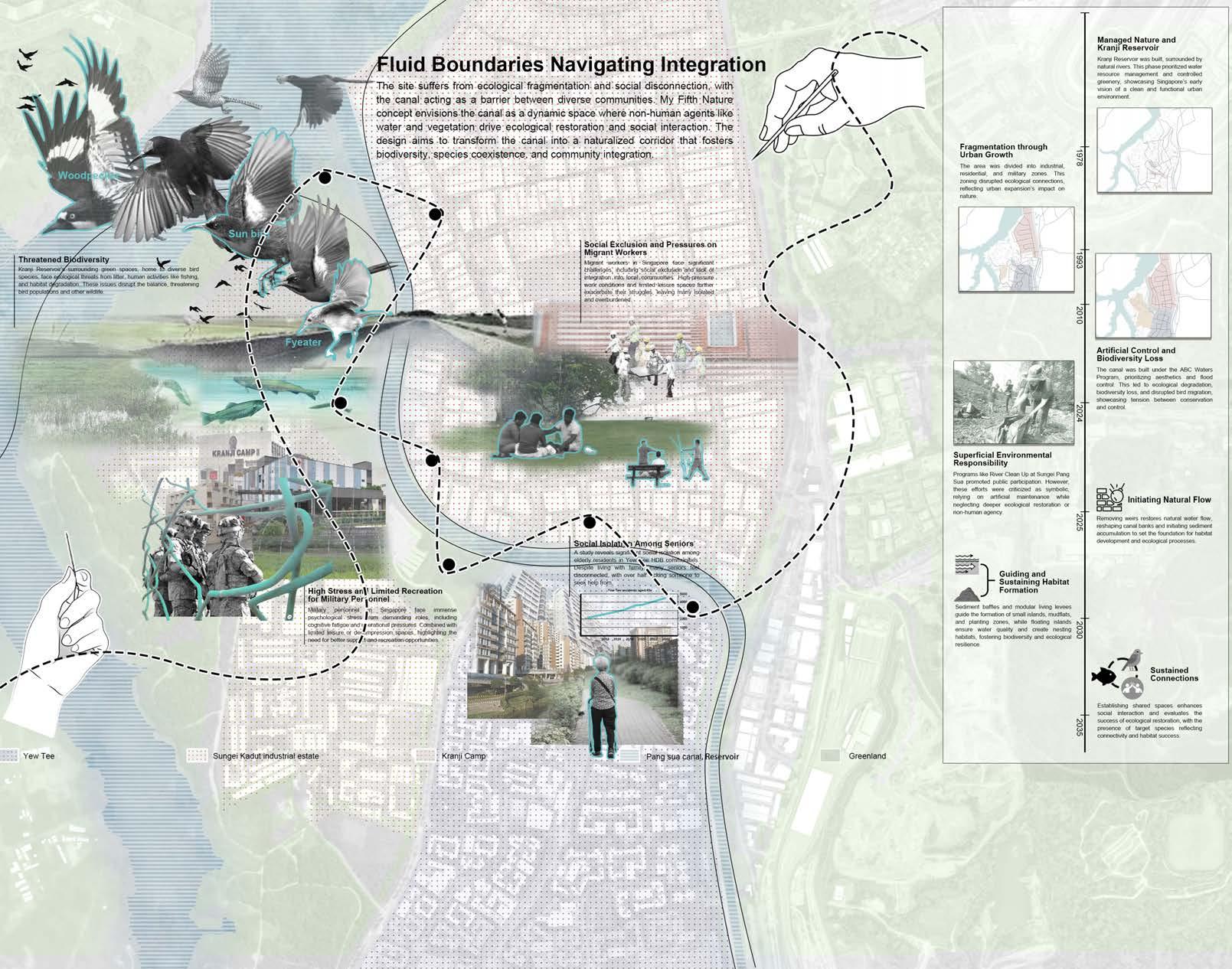
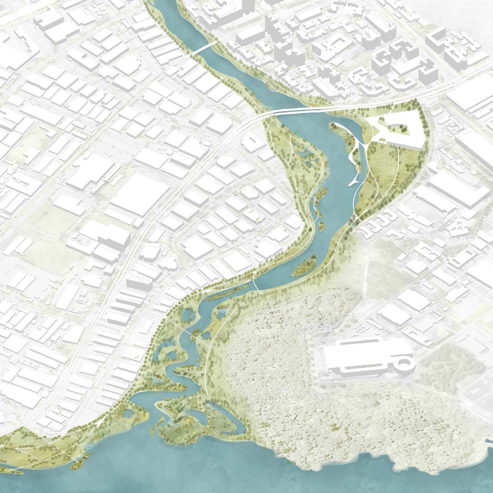
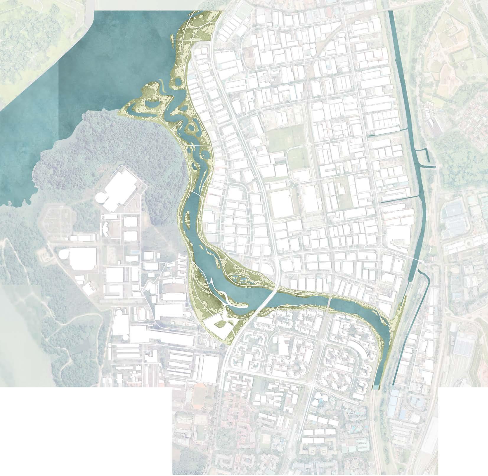
Fluid Boundaries Navigating Integration
Mai Siyao
Tutor: Maxime Decaudin
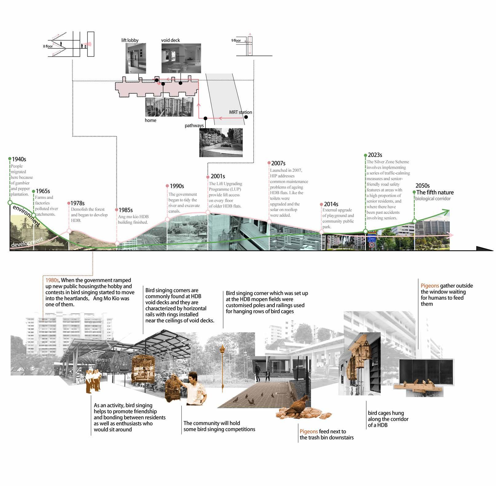
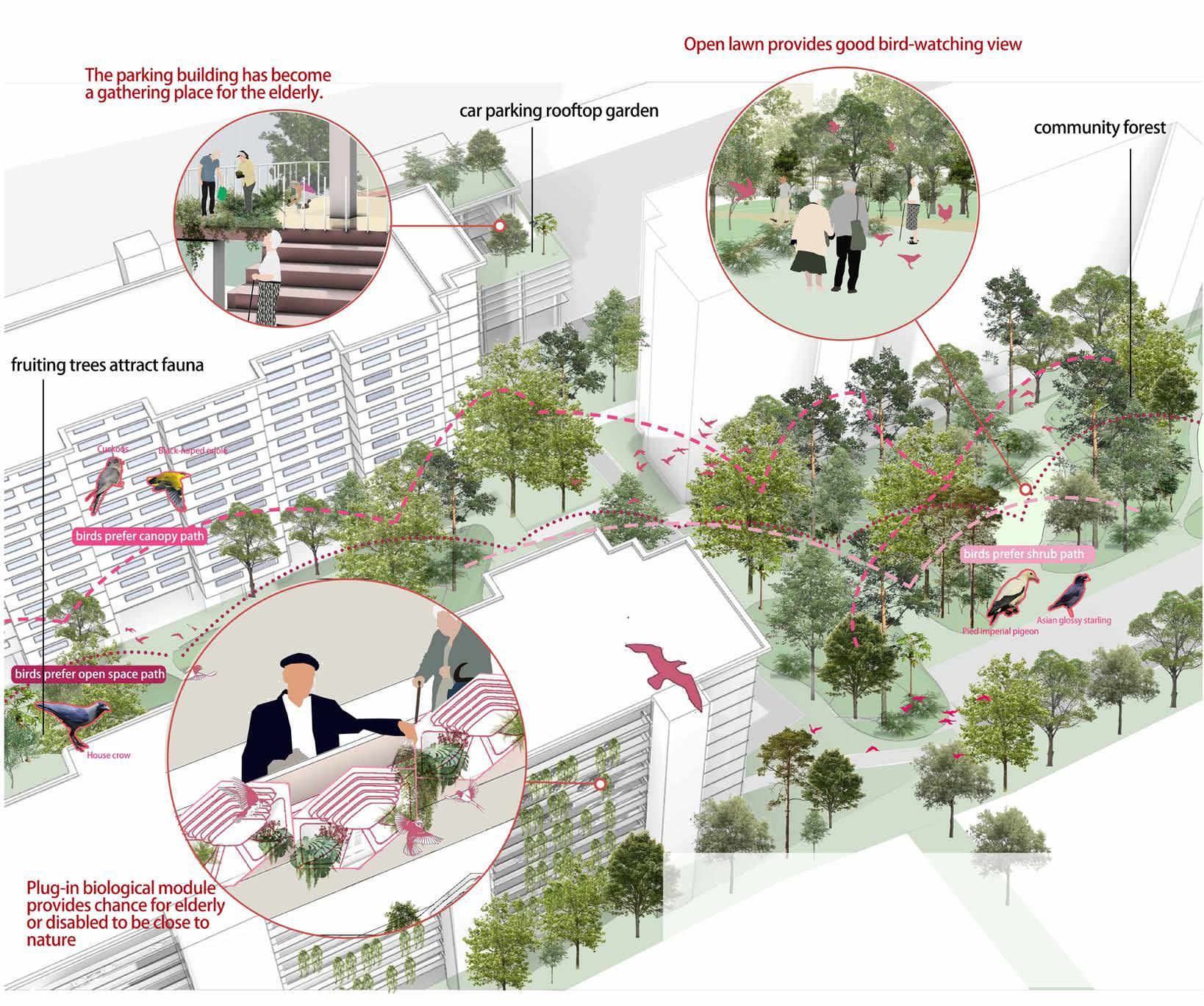
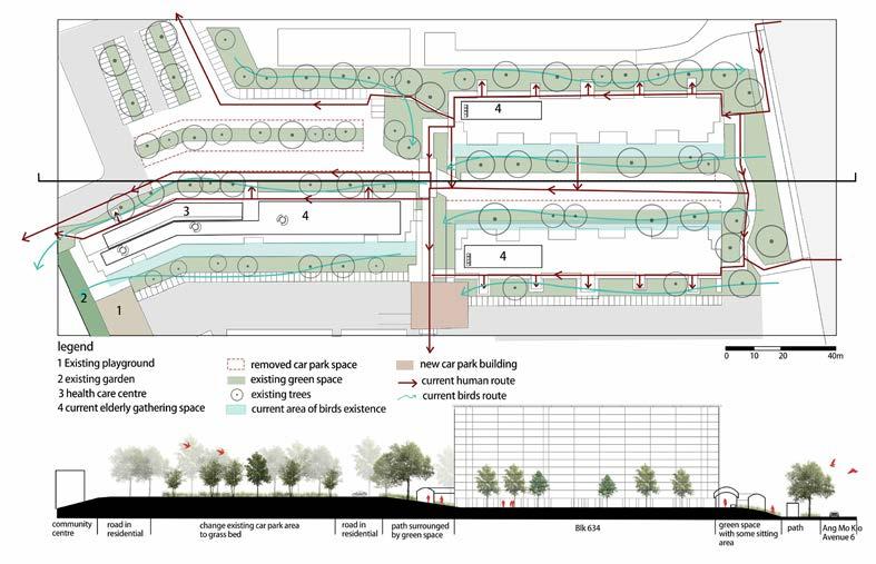
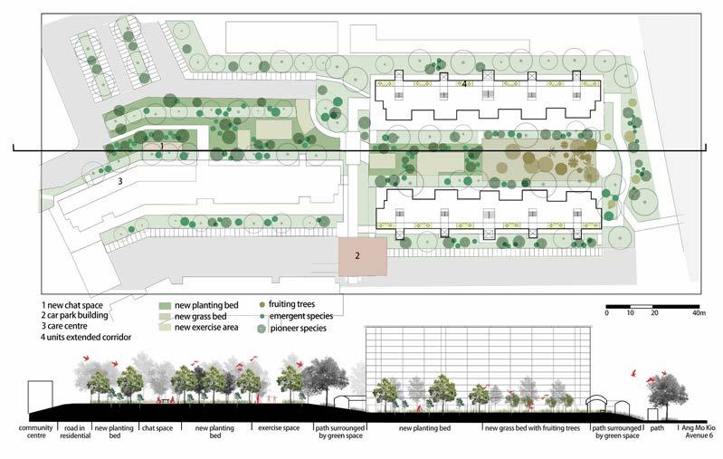
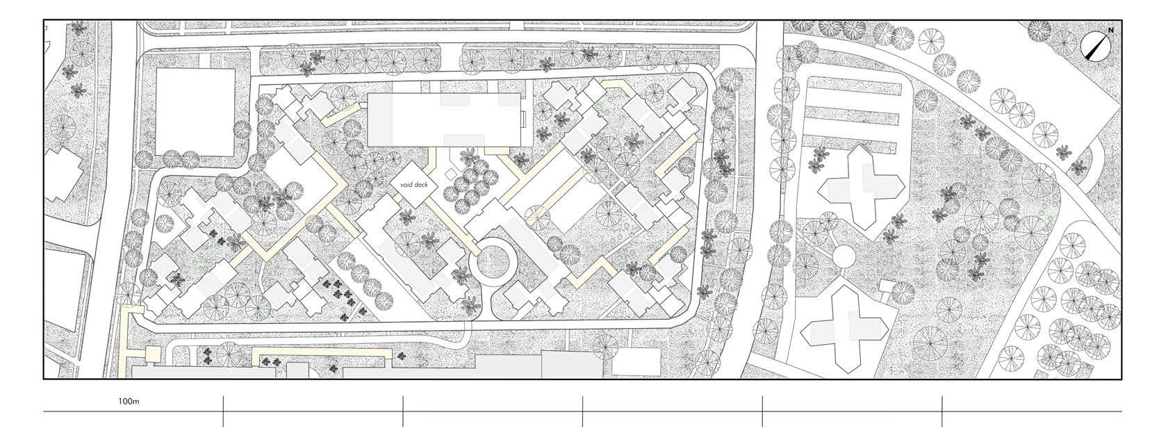
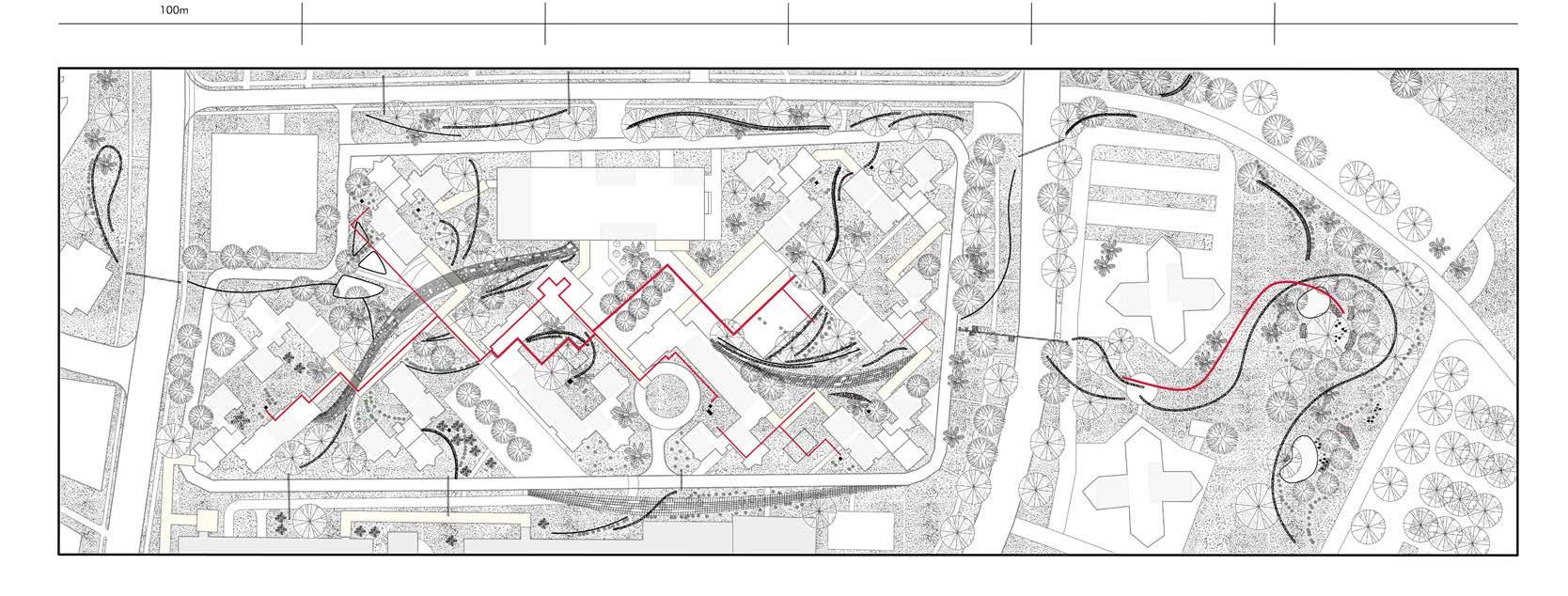
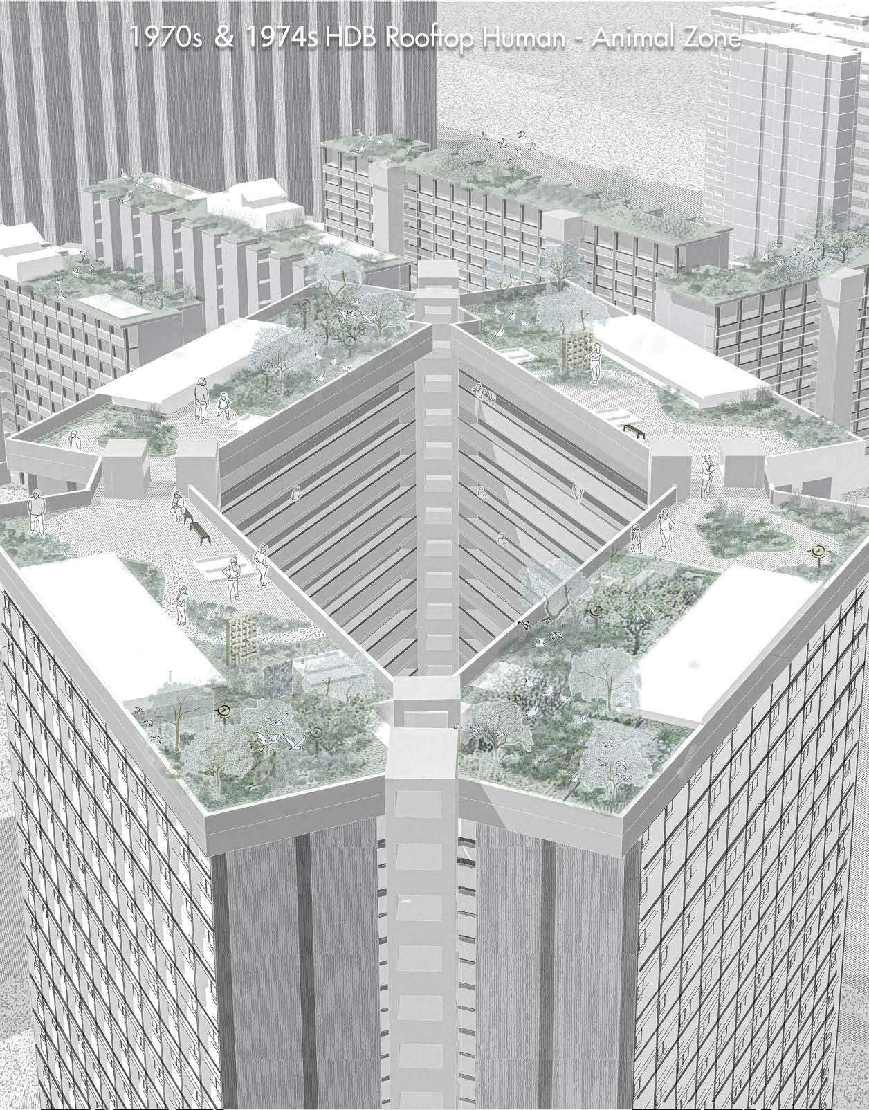
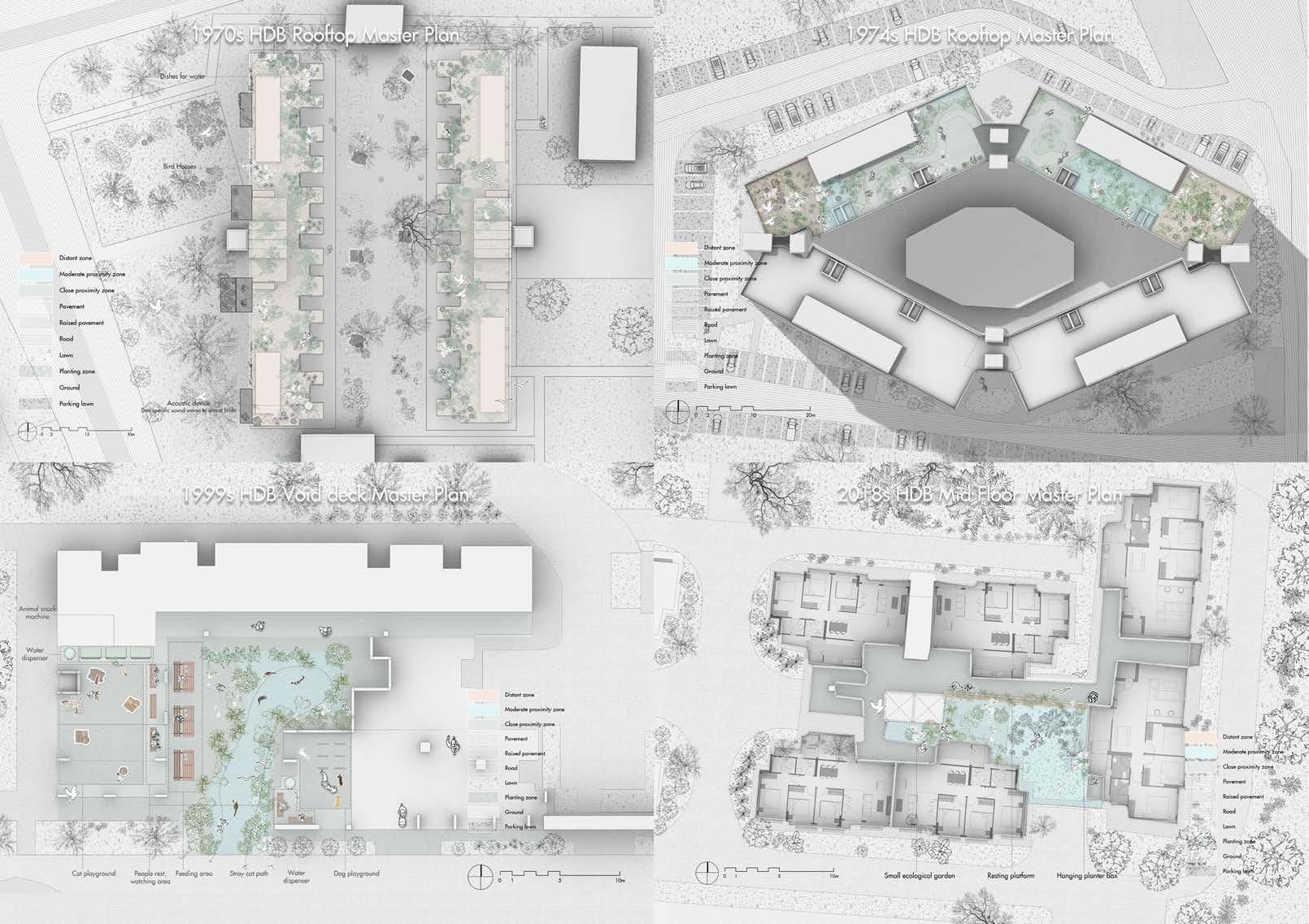
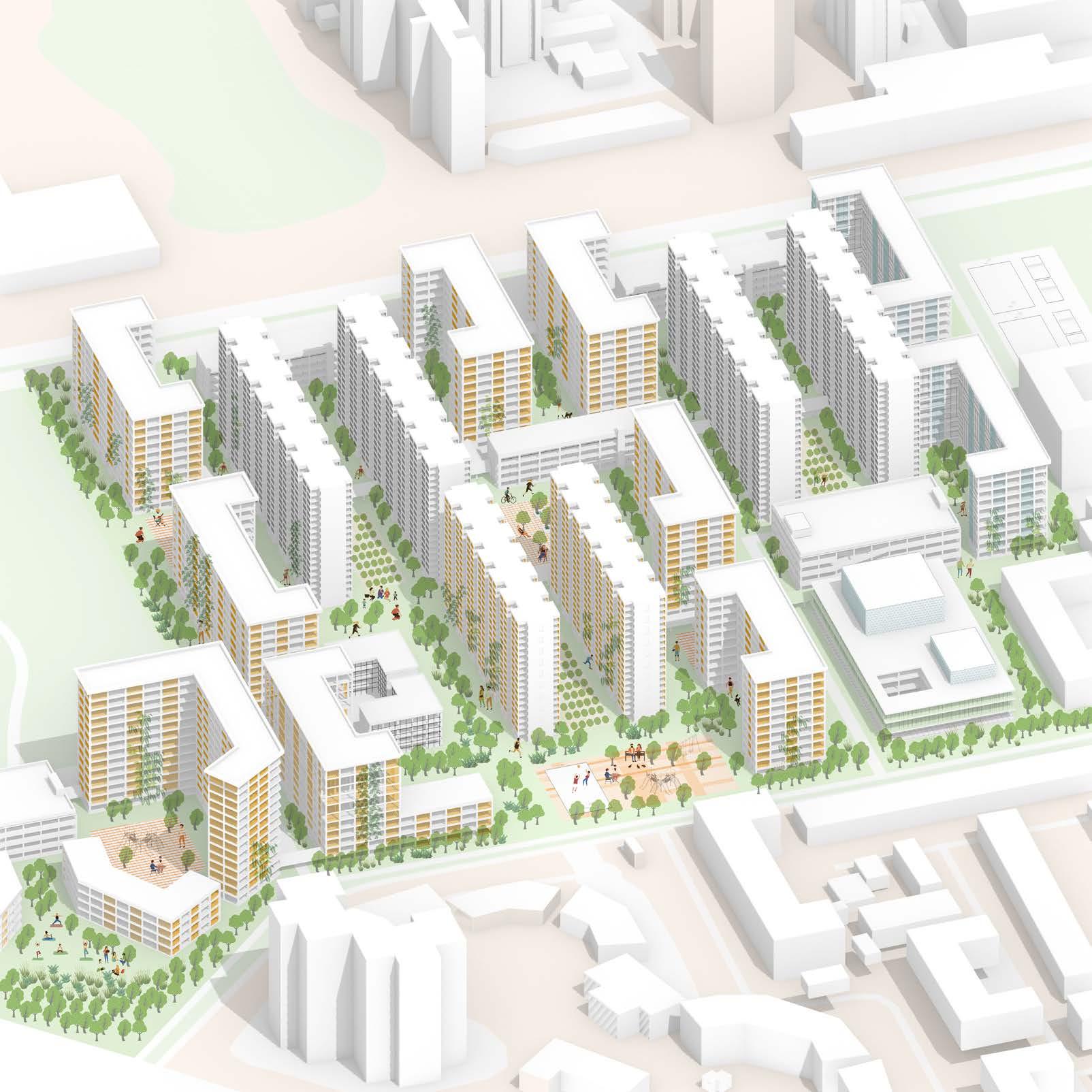
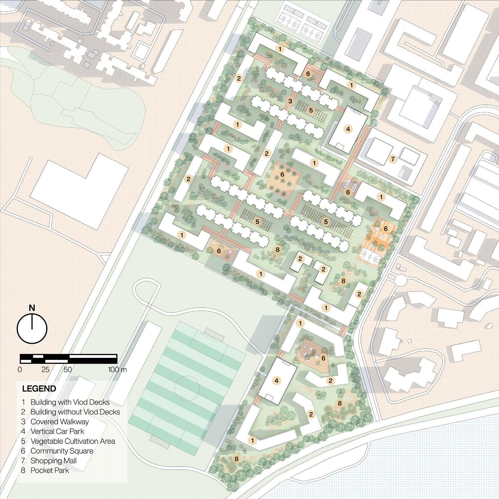
Due to a population control policy in the 1970s and lifestyle changes in the 2000s, an aging population pattern has emerged in Singapore. The number of elderly people has increased rapidly in recent years. While healthy lifestyle groups exist in many HDB estates, less mobile elderly residents often stay at home, leading to spiraling health issues. In Ang Mo Kio, 68% of residents are over 65 years old as of 2024. Given that the living environment is a basic factor in human life and development, this project aims to connect elderly residents of varying mobility levels to the external natural environment.
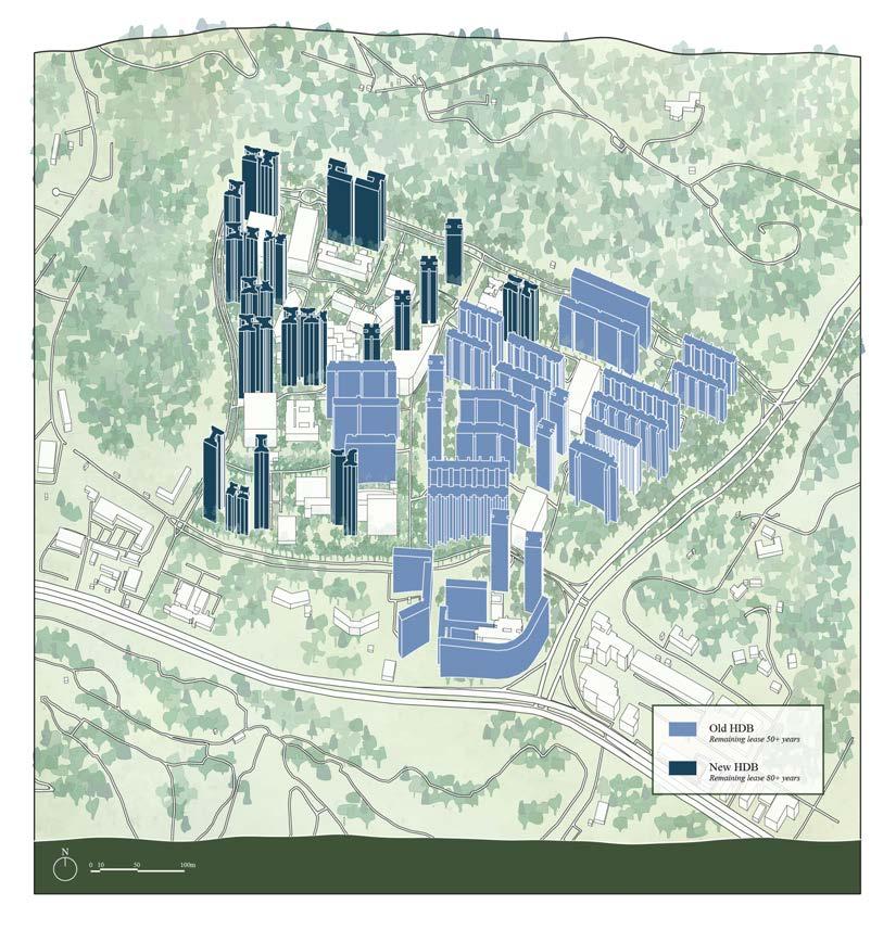
The project examines the evolution of urban construction and the natural environment in Ang Mo Kio from 1950 to today, alongside the shifting relationships between humans and nonhuman beings. The HDB flats in the area were built before 1985 and have undergone government-supported upgrades. However, some upgrades inadvertently hindered mobility, such as lift upgrading in 2003, which added lift landings to every floor. While increasing accessibility, this reduced residents’ movement and their exposure to the external environment. Previously, residents on non-lift landing floors would traverse corridors to reach stairs, offering them views of the external environment and a connection to it. This connection has been lost with the lift upgrades.
To address these challenges, the project seeks to extend nature parks into HDB precincts, introducing more biodiversity into residences, with a focus on birds as key species. Research shows birds are accessible urban wildlife and benefit mental and physical health. Using a theoretical framework connecting human sensory experiences with non-human activities, the project rethinks the spatial possibilities of the HDB precinct. Techniques correlate animal and plant characteristics, Birdwatching activities serve as a medium for connecting people with animals.
Interventions are applied vertically and horizontally, with spatial scales from individual units to HDB blocks to the entire community. The project follows a 10-year phased plan over 50 years, aligning with typical HDB upgrading cycles. By integrating biodiversity into daily life, the project aims to enhance the elderly’s lifestyle and reestablish their connection with nature.
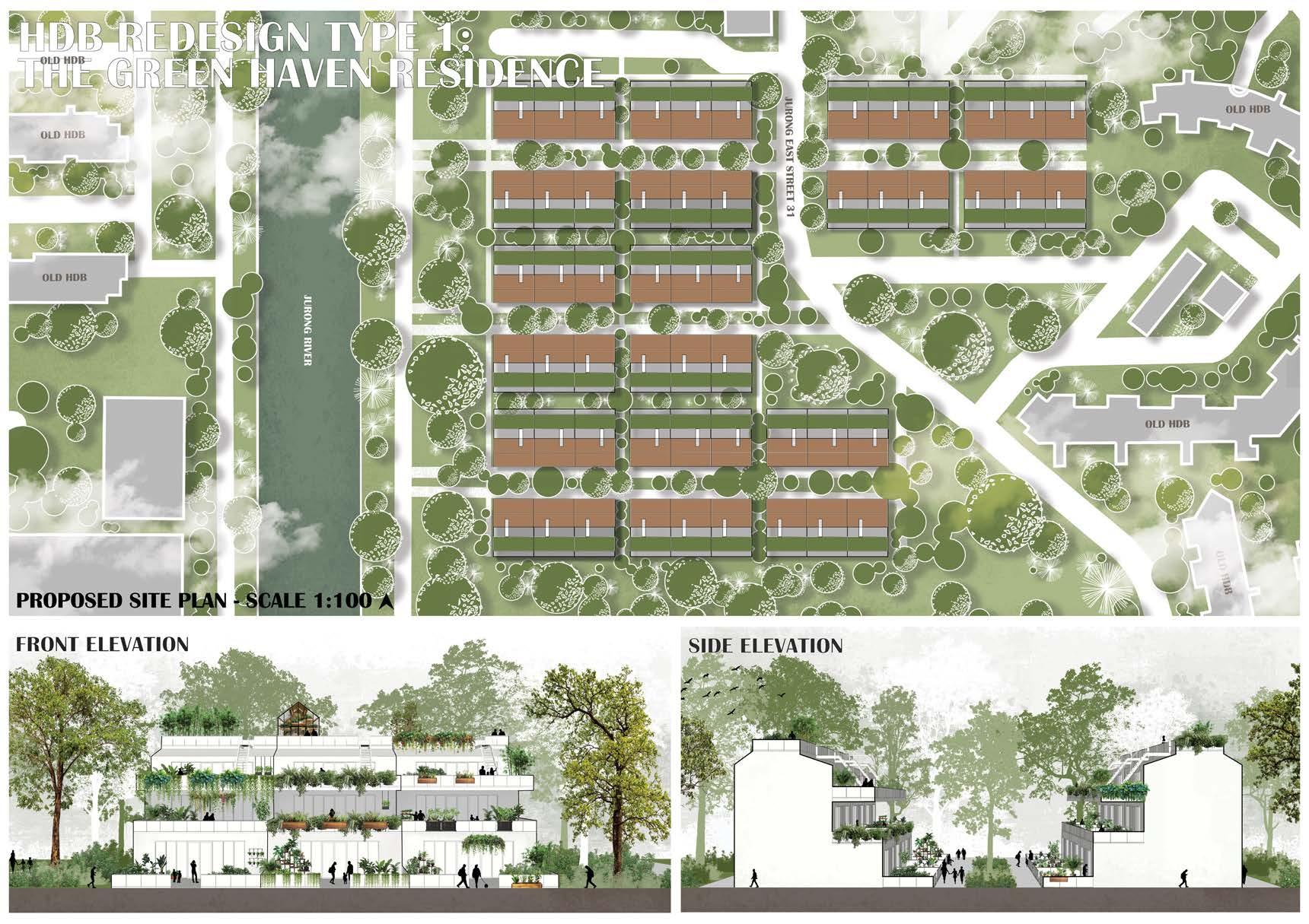
Garden Within Reach
Nuramirah Binte Mohd Nor
Tutor: Maxime Decaudin
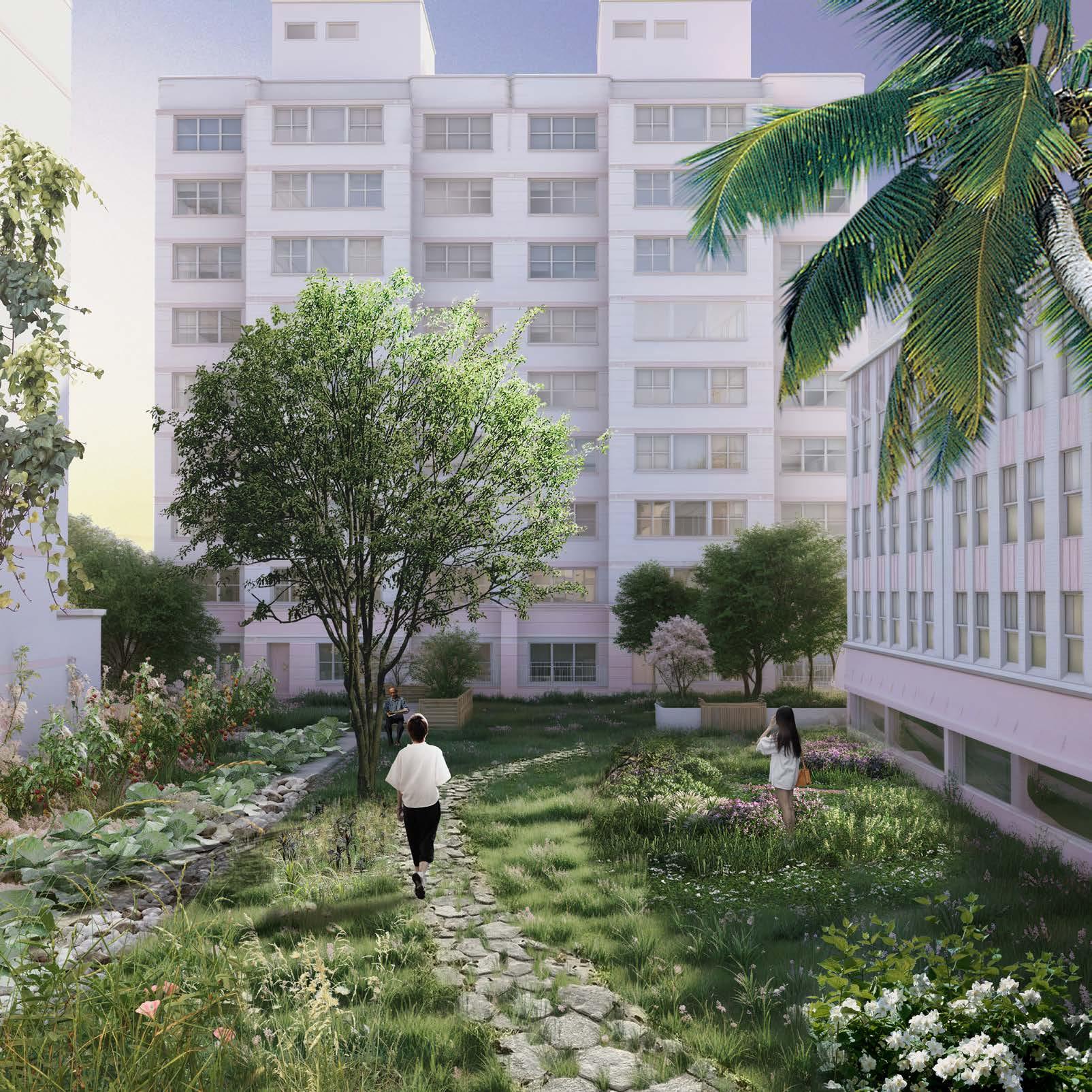
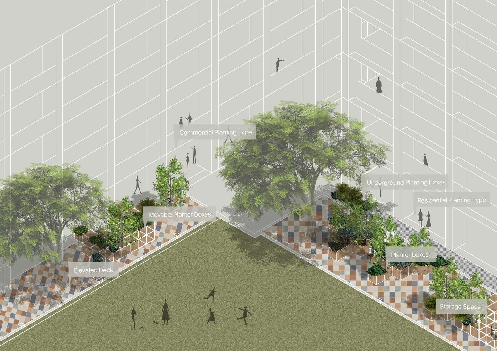
Titled Reimagining HDBs: Garden within Reach, this project reimagines Singapore’s HDBs through the lens of private gardening, an approach that seamlessly integrates nature into urban living spaces. Building upon the individualization trend of Singapore’s environmental policy as illustrated by the Go Green campaign, I propose to emphasize a deeply personal Fifth Nature concept. Inspired by Singapore’s traditional kampongs, where personal gardens were a vital part of daily life, this proposal addresses the contemporary desires of HDB residents for personal gardening spaces within the city’s dense environment. Traditional HDBs, which replaced kampongs, limited gardening to communal spaces or narrow personal areas like corridors, creating challenges in privacy, accessibility, and individual expression. This project envisions a solution: transforming HDBs into personalized green sanctuaries, offering the possibility for gardening to become an integral part of urban living.
To achieve this, I propose two design strategies and test them on a site located in Jurong East. First, I designed a series of Gardening Extension Plugins for HDB units nearing their lease expiration. These modular extensions come in multiple customizable forms: small planters by windows, medium-sized external garden attachments, and expansive garden planes extending from blind walls. Each plugin provides residents with convenient, eco-friendly gardening options directly accessible from their homes, revitalizing the HDB landscape into a dynamic green infrastructure. For those on the top floor, private rooftop gardens offer an exclusive green space, enhancing urban density with the joy of cultivating personal greenery.
In the long run, as HDBs get redeveloped, I propose a unique housing model with garden-integrated homes for residents prioritizing personal gardening. Designed with indoor-outdoor connectivity, these new homes allow residents to nurture plants within their personal living space, adapting the kampong lifestyle to Singapore’s modern urban setting. Diversifying the current HDB offer, this model fully embraces an individualised Fifth Nature philosophy, fostering a continual, meaningful connection between city dwellers and nature.
In conclusion, Reimagining HDBs: Garden within Reach is both an ecological and social statement that champions personal green spaces within high-rise urban living. By redefining gardening in HDBs, the project envisions a new relationship with nature in Singapore in which citizens have the right to garden within their homes, creating an alternative understanding of sustainability and a deeply personal Fifth Nature.
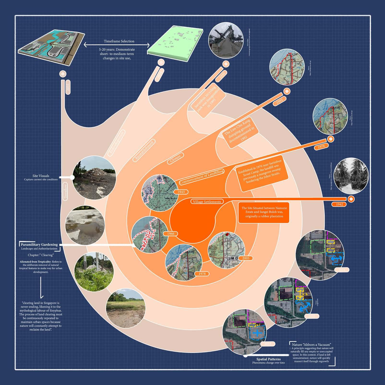
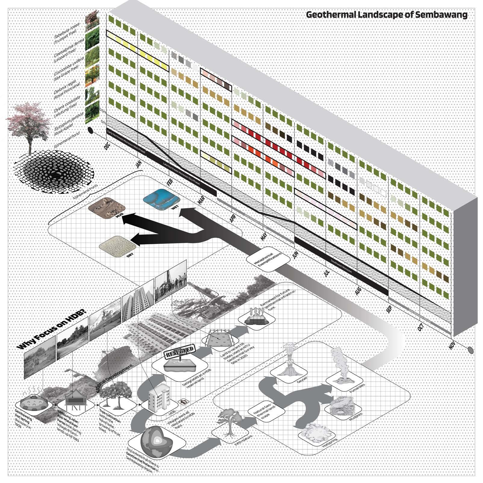
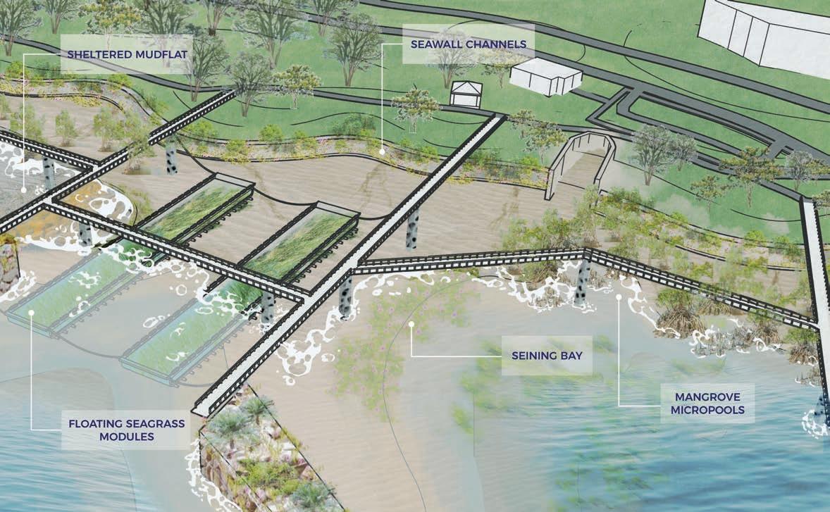
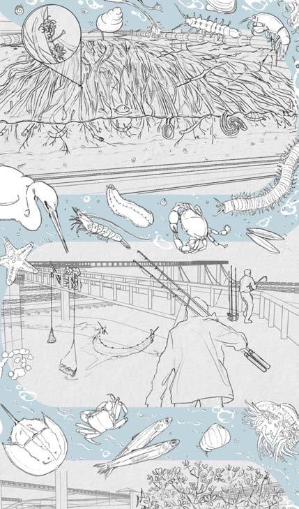
Sarimbun TerraFlow
Amirul Bin Ismaidey
Tutor: Gu Tiantong
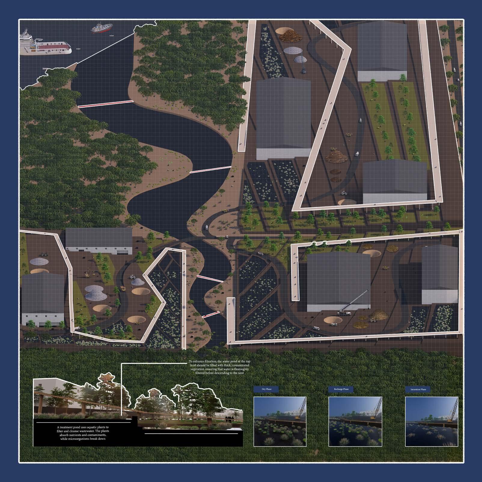
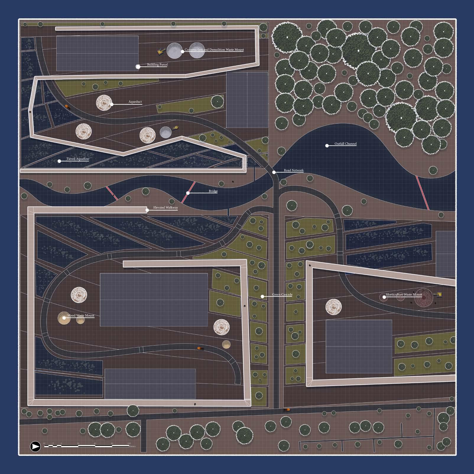
The Sarimbun Recycling Park plays a critical role in Singapore’s waste management system but faces mounting challenges due to growing waste volumes and limited land availability. Traditional redevelopment methods fail to address bulky waste and the spatial needs of complex recycling operations. To tackle these issues, the TerraFlow model reimagines waste and water as interconnected resources, enhancing efficiency, minimising environmental impact and optimising space for future demands.
At its core, Terraflow integrates the natural movement of rainwater and groundwater with waste management systems. This synergy addresses environmental risks such as waste leachates, harmful by product of materials like construction and horticulture waste. By aligning water flow with waste processes, the model ensures better coordination and control while transforming waste handling into a flexible and adaptive system.
The terraced landscape design is a key feature of TerraFlow, creating multiple levels to manage water and waste movement. This layout prevents water logging and erosion while maximizing space for waste processing. Strategically placed staging areas temporarily hold materials before treatment, while an aqueduct system channels rainwater and wastewater below ground to a central basin for processing.
To address contamination, the model incorporates phytoremediation basins that use plants to filter and purify wastewater. These plants absorb and break down contaminants as water flows through the terraces. The treated water is reused on-site for operations before being safely released into the environment, reducing reliance on traditional discharge methods.
Additionally, Sarimbun’s transport infrastructure now features roads made from a mix of asphalt and low-density polyethylene (LDPE) plastic waste. This composite material increases durability under heavy vehicular traffic while repurposing plastic waste.
By treating water and waste as interconnected elements, the TerraFlow Model provides a holistic framework for waste management. It addresses growing waste volumes, limited space, and the complexities of waste streams like construction debris, wood and horticulture. Inspired by the concept of fifth nature, this approach integrates natural processes, transforming waste and water into valuable resources. TerraFlow offers a forward-looking, adaptable solution that optimises land use and redefines waste management for future needs.
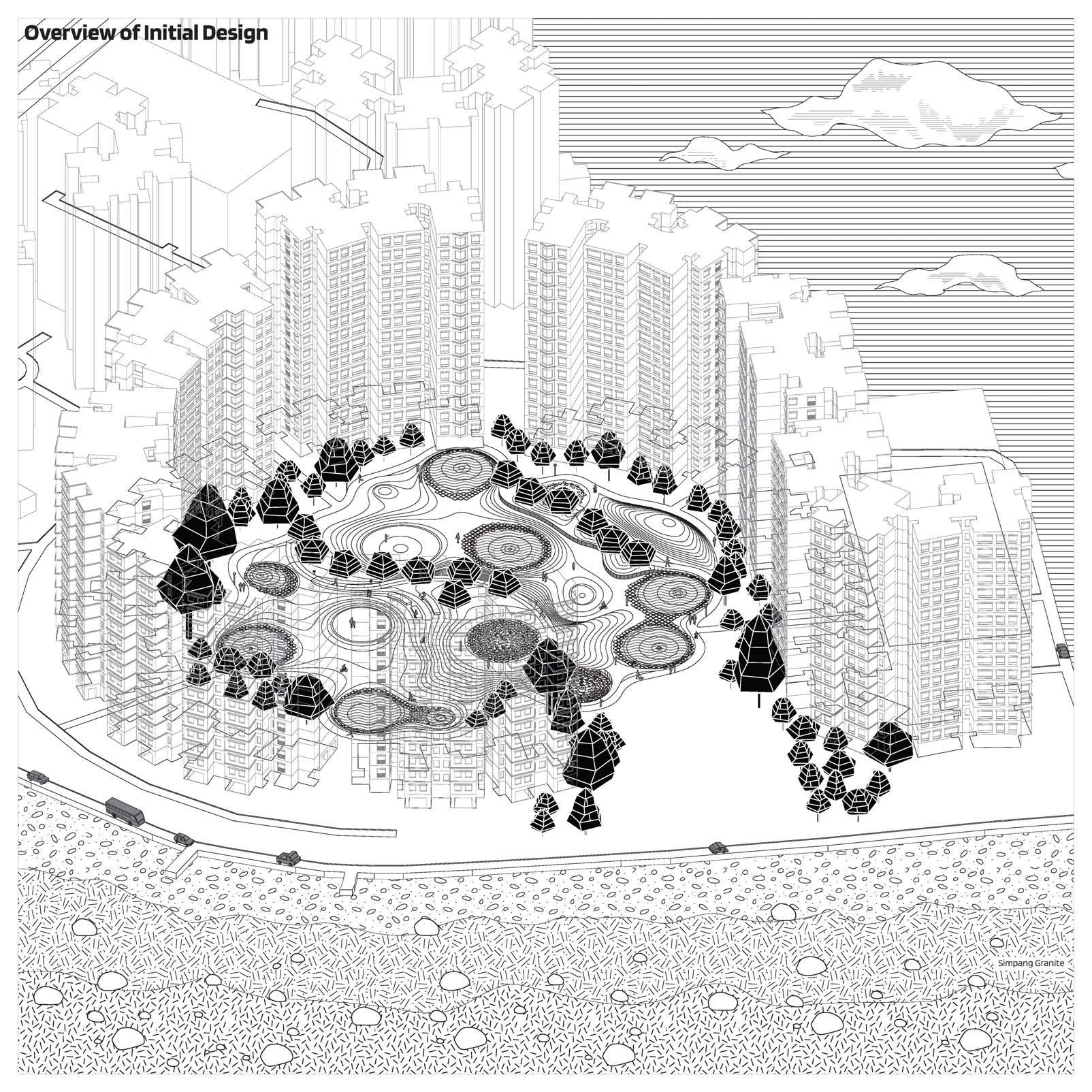
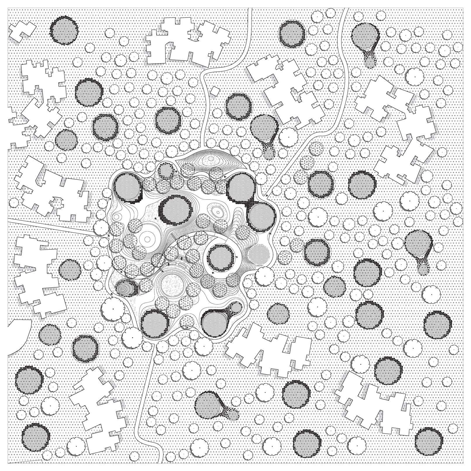
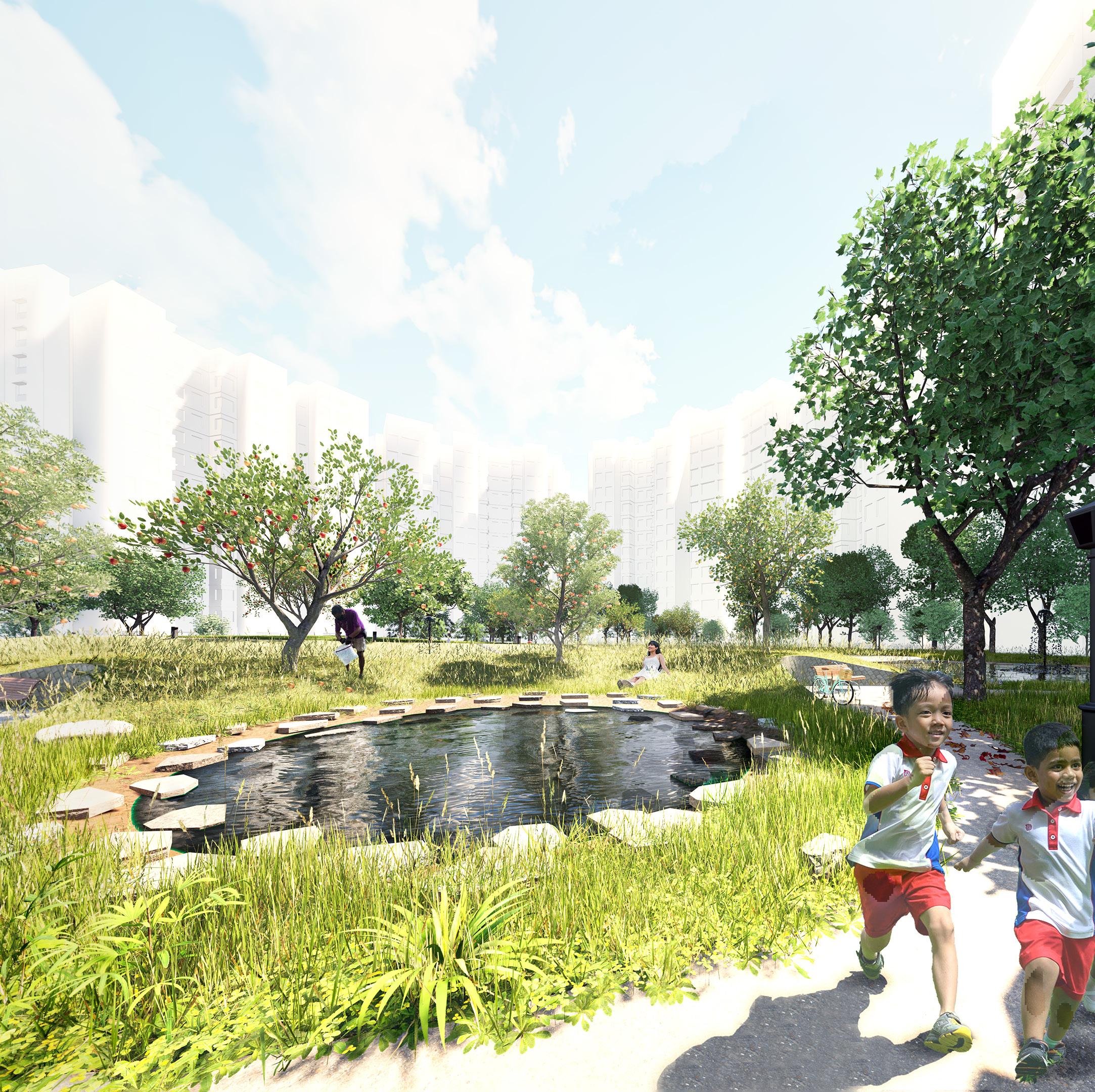
Shared Growth with Simpang
Deng Pinyi
Tutor: Gu Tiantong
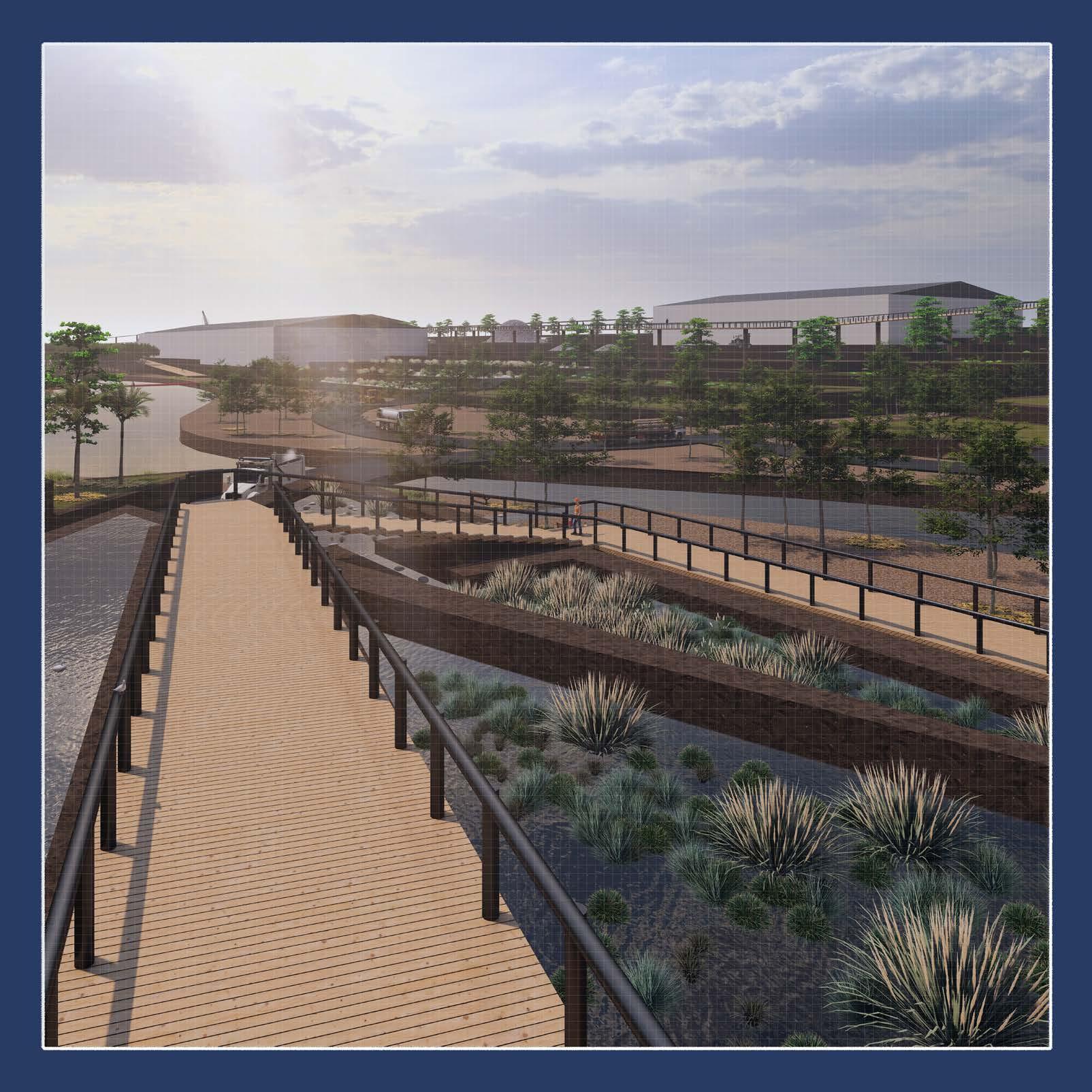
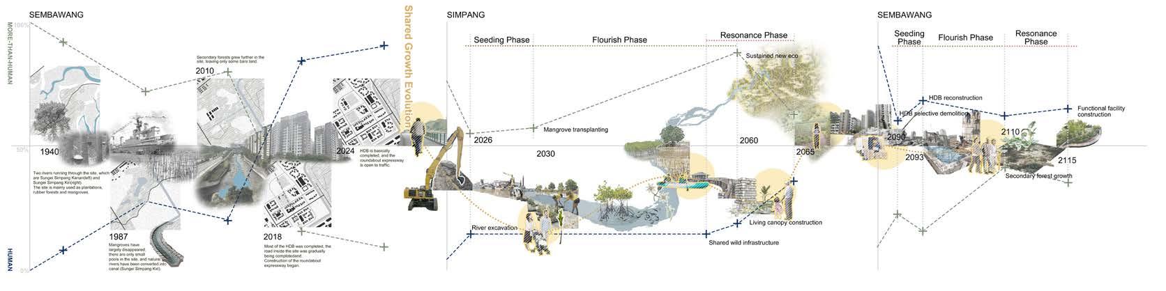
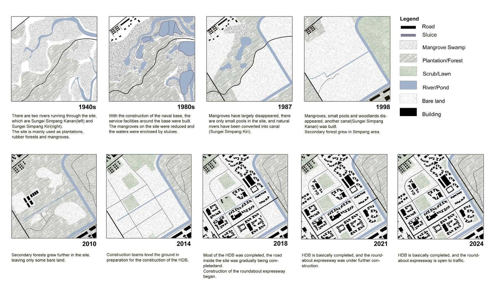
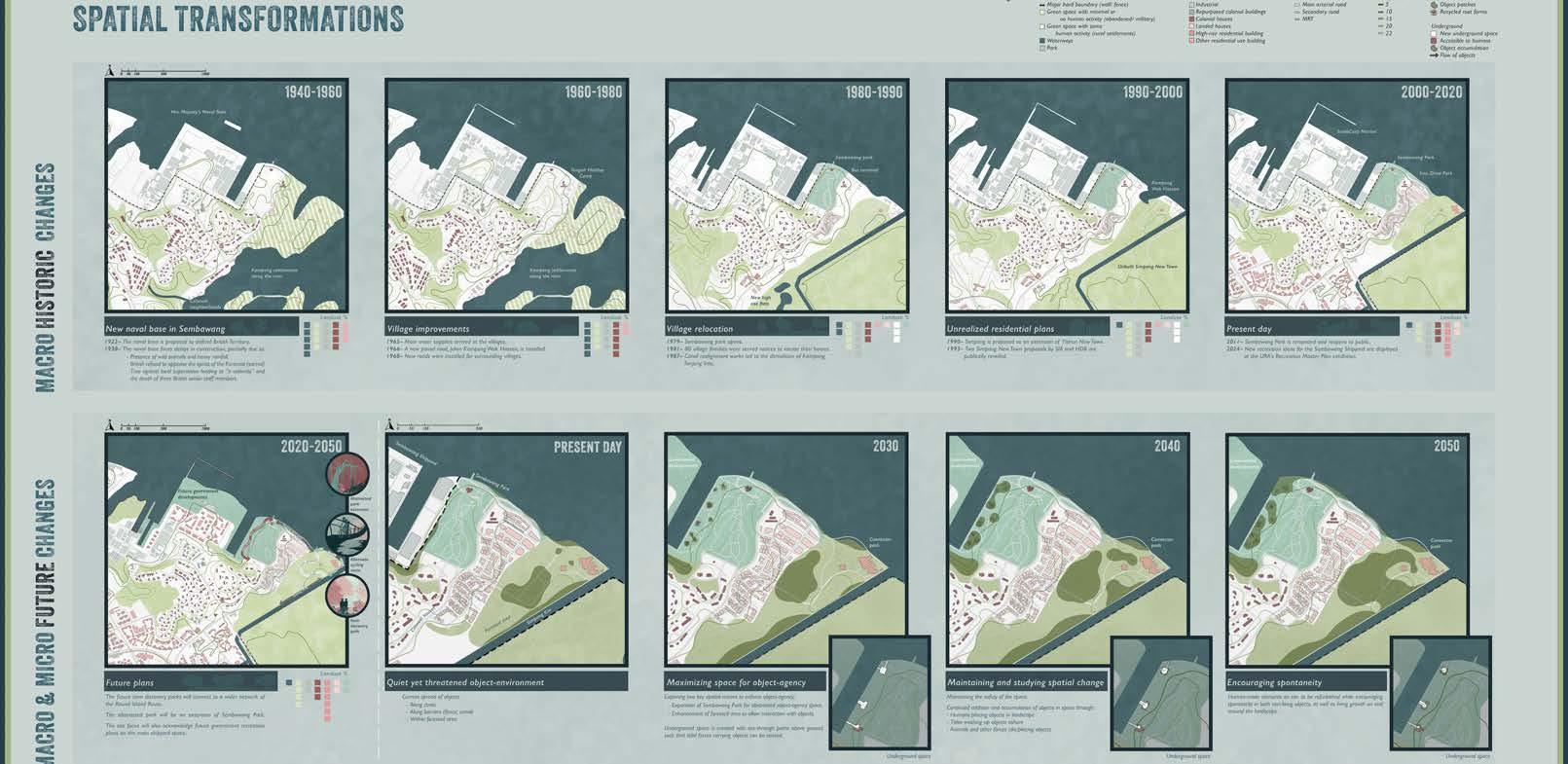
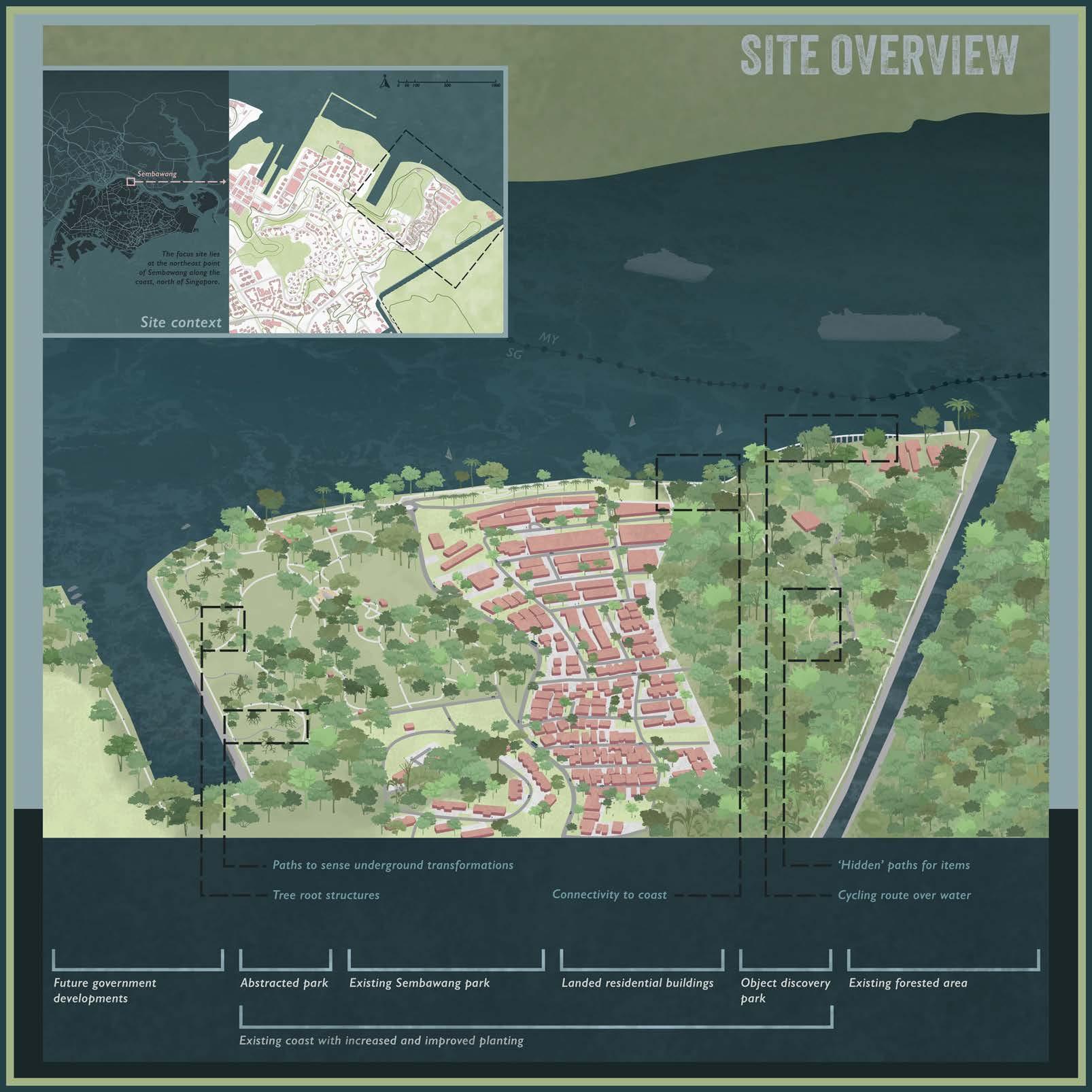
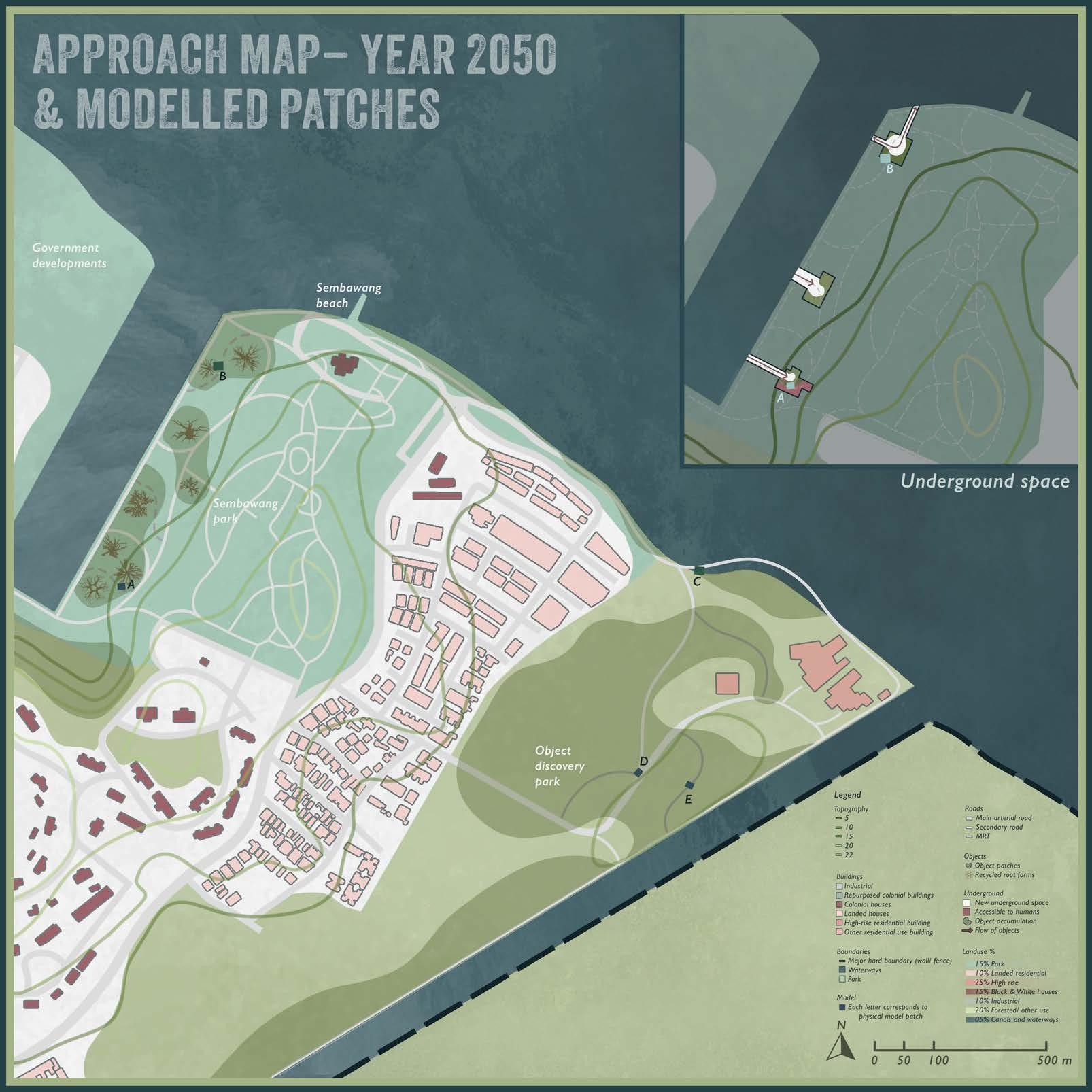
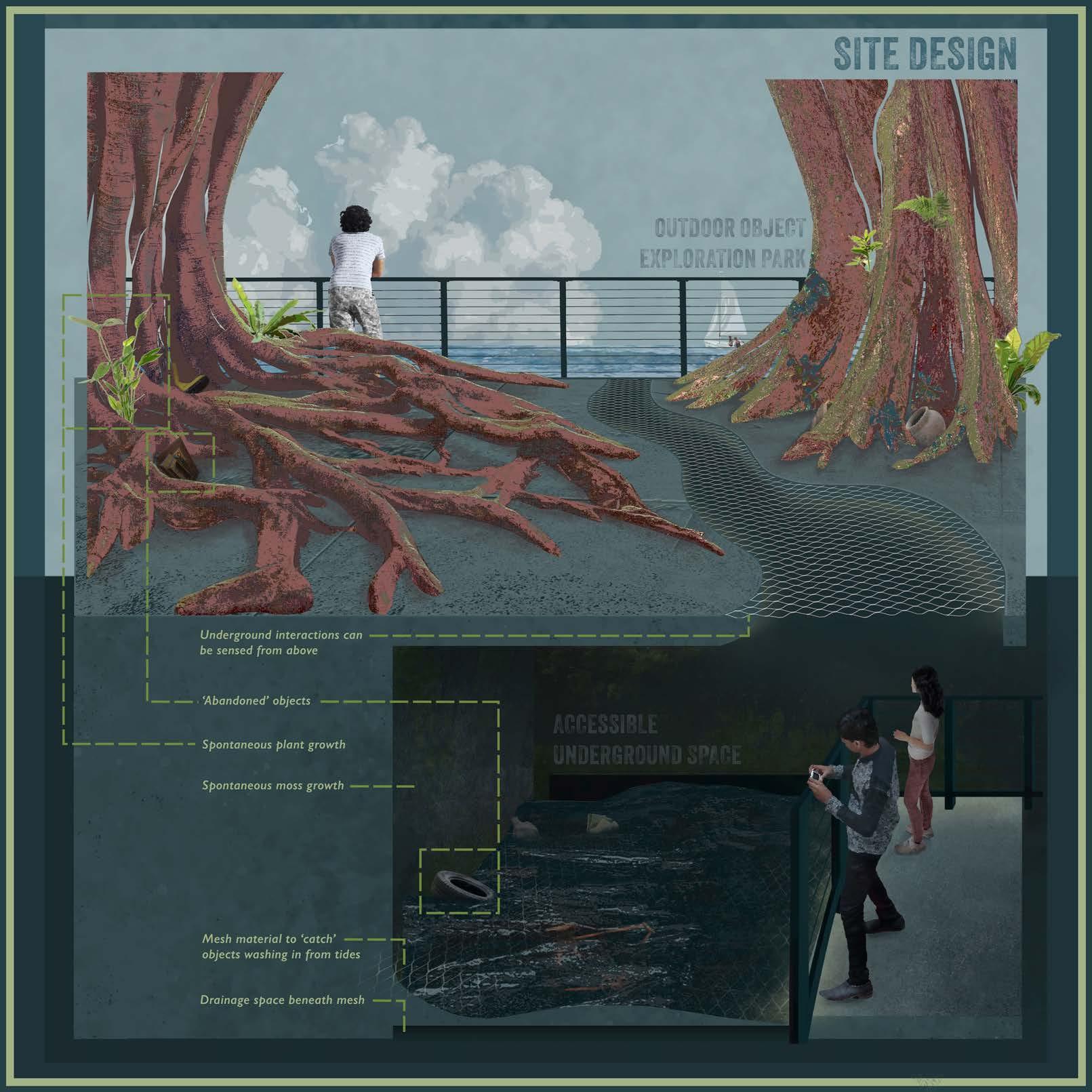
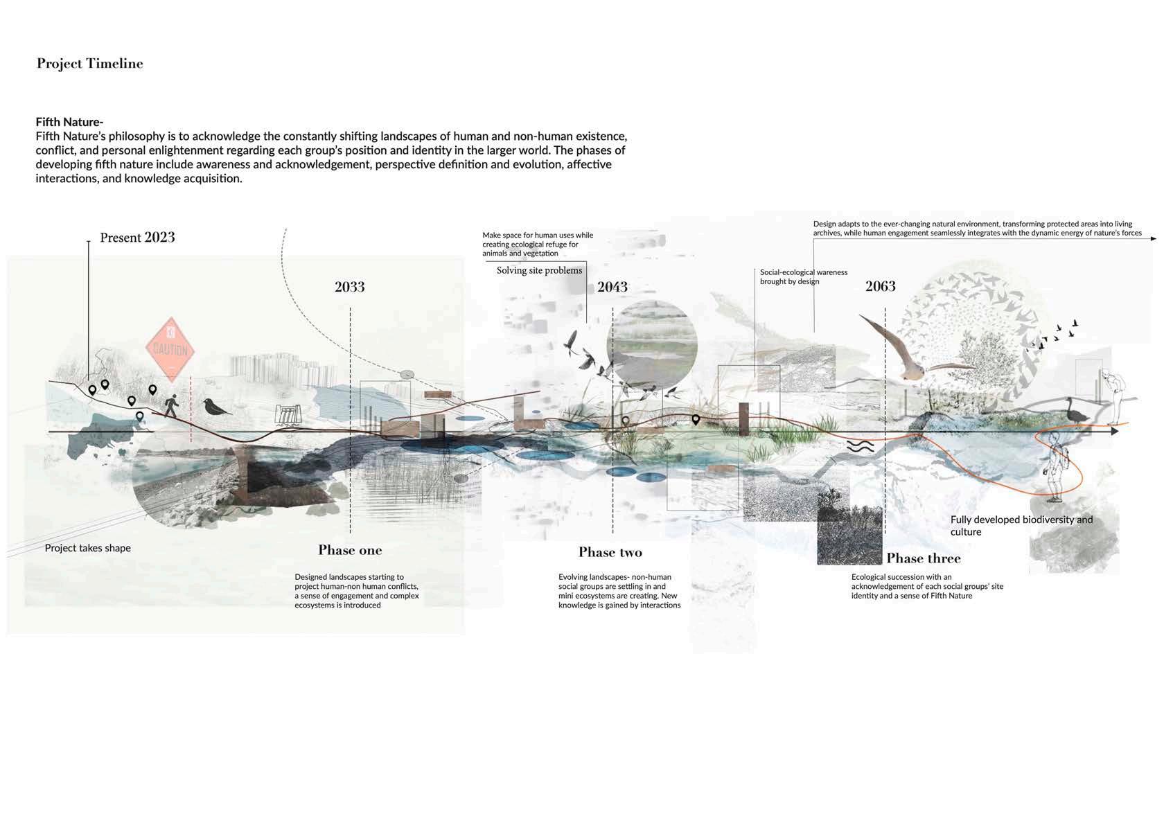
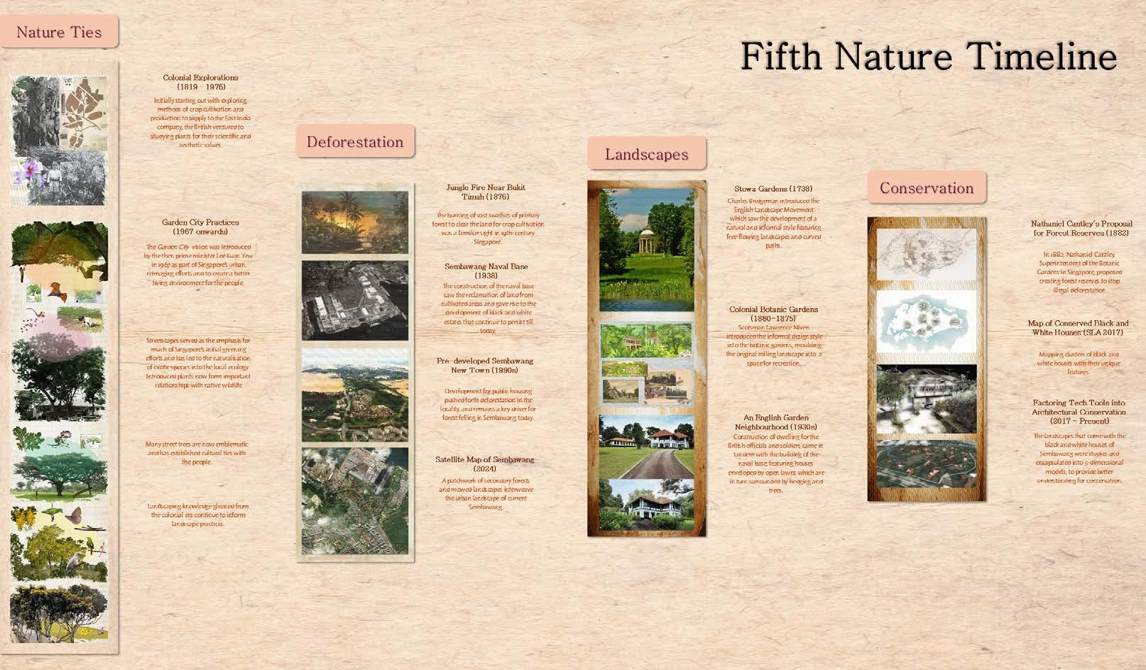
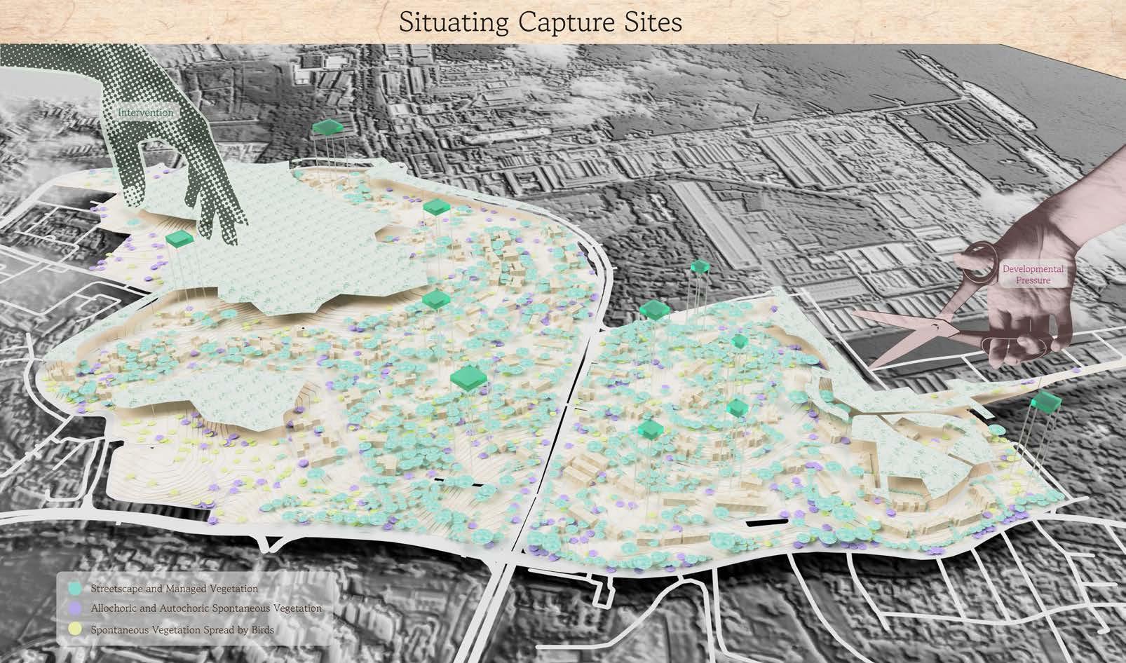
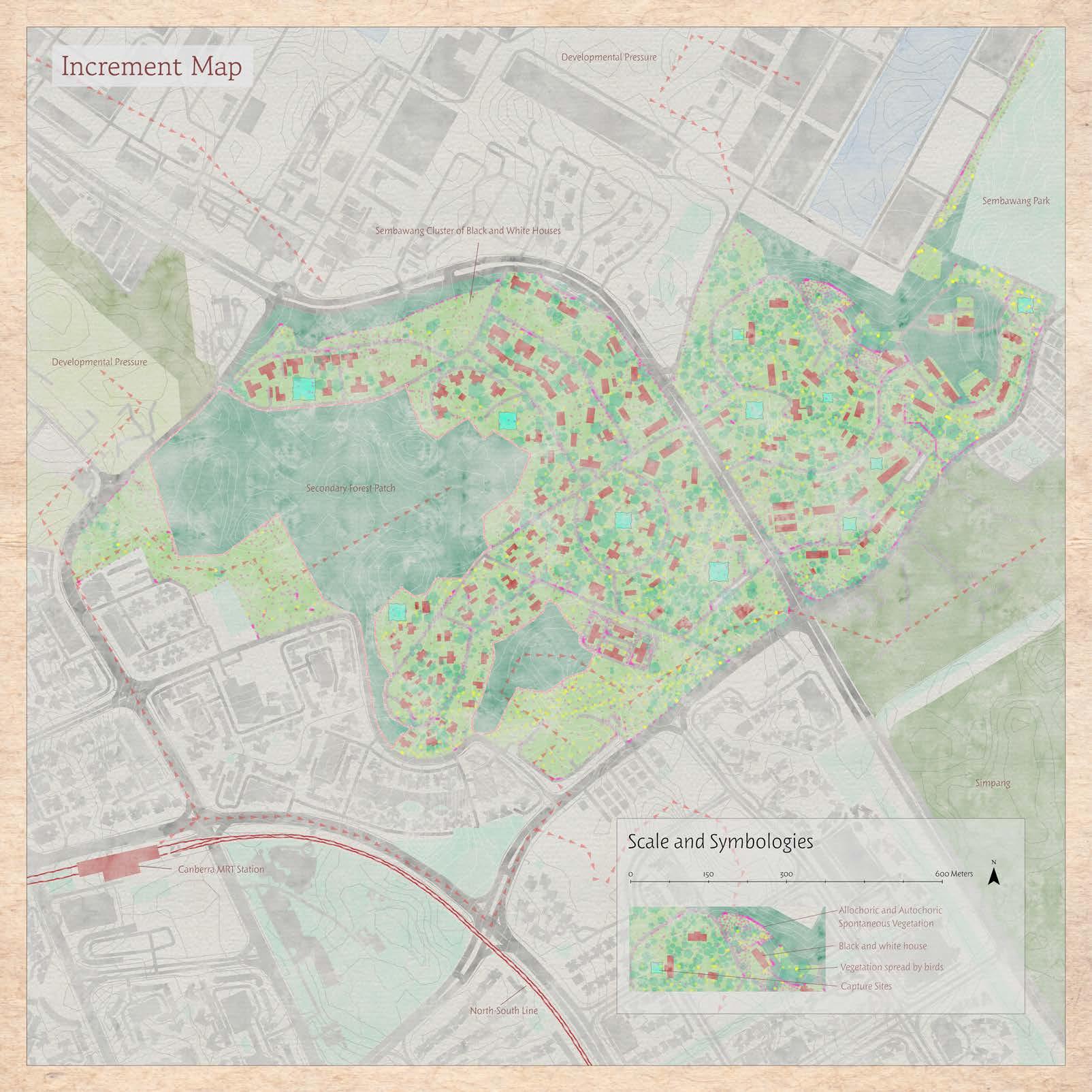
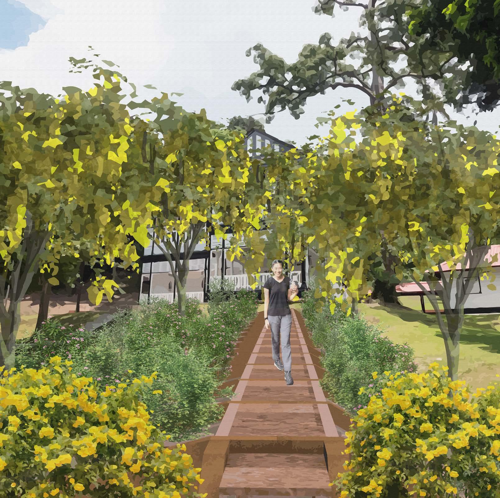
This project is situated in the Simpang area of northern Singapore, encompassing established HDB estates in Sembawang. Formerly a military training base, Simpang is now reserve land covered by natural vegetation, with traces of past human activities remain in the form of bare lands and dirt roads. On the opposite side of the Simpang Kiri canal, the naturally regenerating Simpang contrasts with the developed Sembawang HDB estates.
Over the next century, rising sea levels caused by climate change will pose significant flooding risks to this area. Tracing its transformation reveals that rapid urbanization and humancentered development have replaced vegetation, habitats, and waterways with roads and housing. The human-centered design approach has marginalized the ‘more-than-human,’ shrinking their living spaces and creating an estrangement between humans and the morethan-human world—once part of an interconnected community.
This project envisions a future community where humans and nature share equal rights through Shared Growth Evolution, a design approach distinct from traditional one-shot planning. By prioritizing time and space for the more-than-human, Shared Growth Evolution seeks to bridge the physical and spiritual gap between human and non-human entities.
Shared Growth Evolution unfolds in three phases: Seeding Phase, Flourish Phase, and Resonance Phase.
Cultivating the Foundations of Shared Growth In this phase, human act as sowers of the future urban landscape, collaborating with more-than-humans rather than a sole decision-maker. For example, by attentively observing and responding to the site’s ecological conditions, human interventions align with natural processes, fostering mutual growth and co-creation.
Giving Way to More-Than-Human This critical and timeintensive phase is where the site transitions into a space led by more-than-humans. With the ‘seeds’ planted in the previous stage, more-than-humans start to grow on their own.
Crafting Shared Futures In the final phase, the flourishing outcomes are reassessed to ensure the seamless integration of human activities with the evolved landscape. Construction areas, forms, and materials are thoughtfully chosen to minimize disruption to the existing ecosystems. Functional spaces for human use are introduced in alignment with the natural conditions that have emerged over time.
Overall, this project envisions a future where humans and more-than-humans coexist in interdependence, cultivating shared growth and fostering mutual resilience. By framing the challenges of climate change as opportunities, it redefines urban landscape design as a collaborative process that centers on the temporal and spatial needs of more-than-human communities.
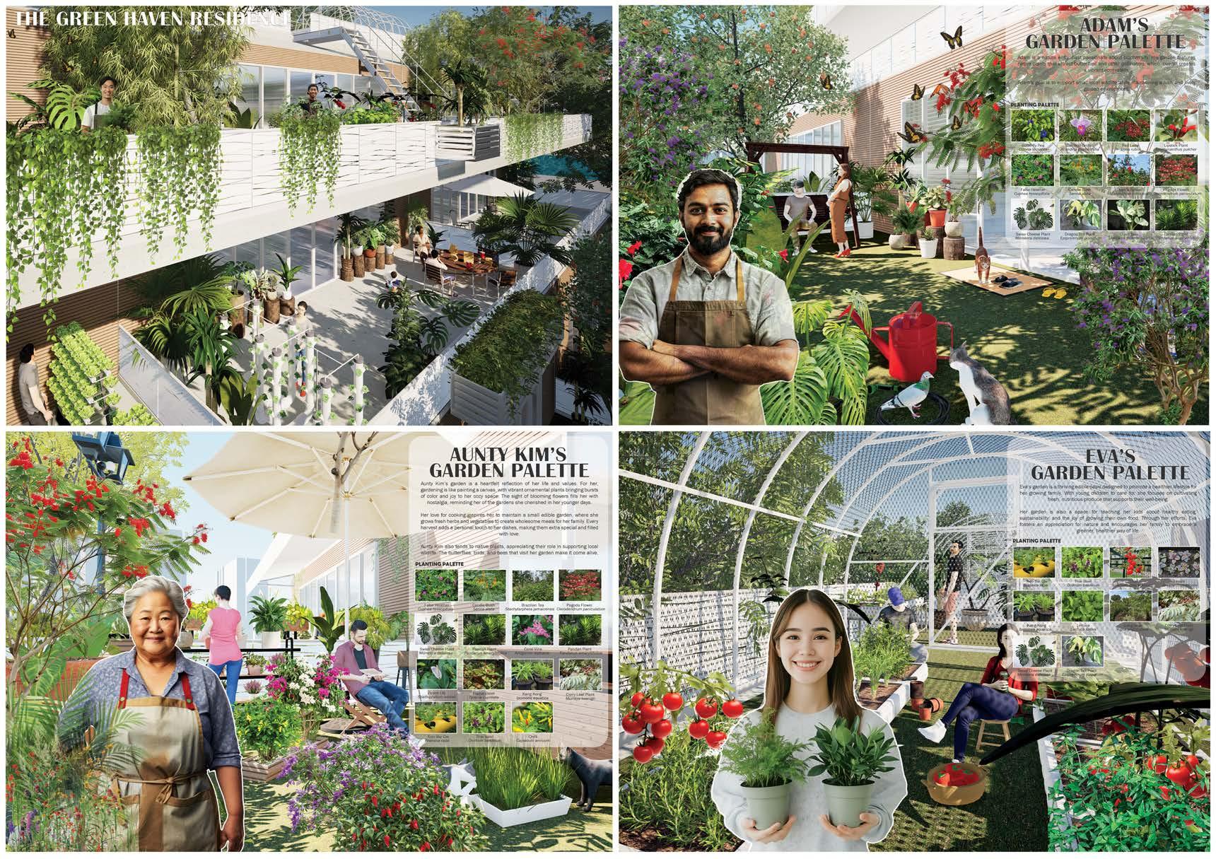
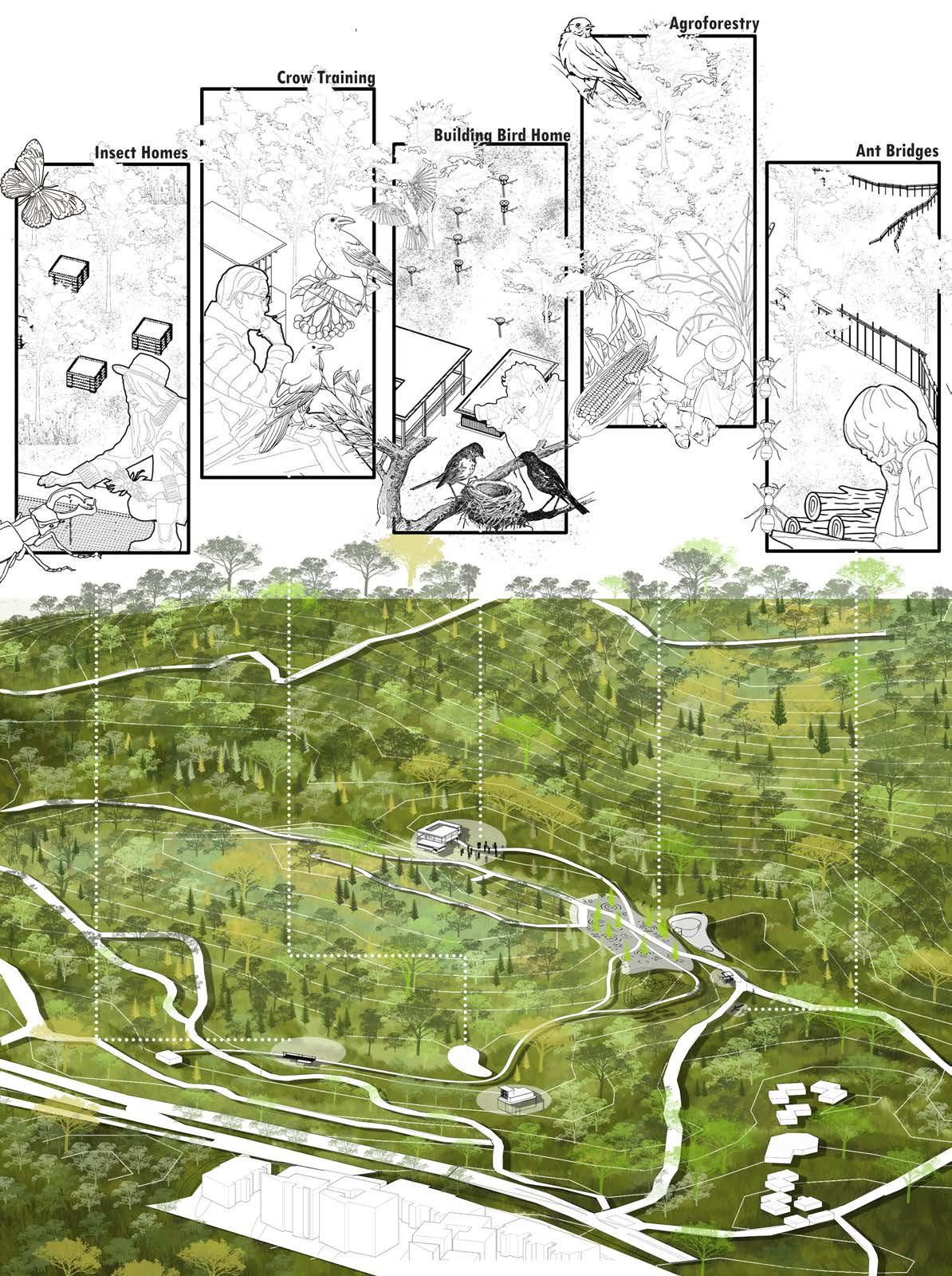
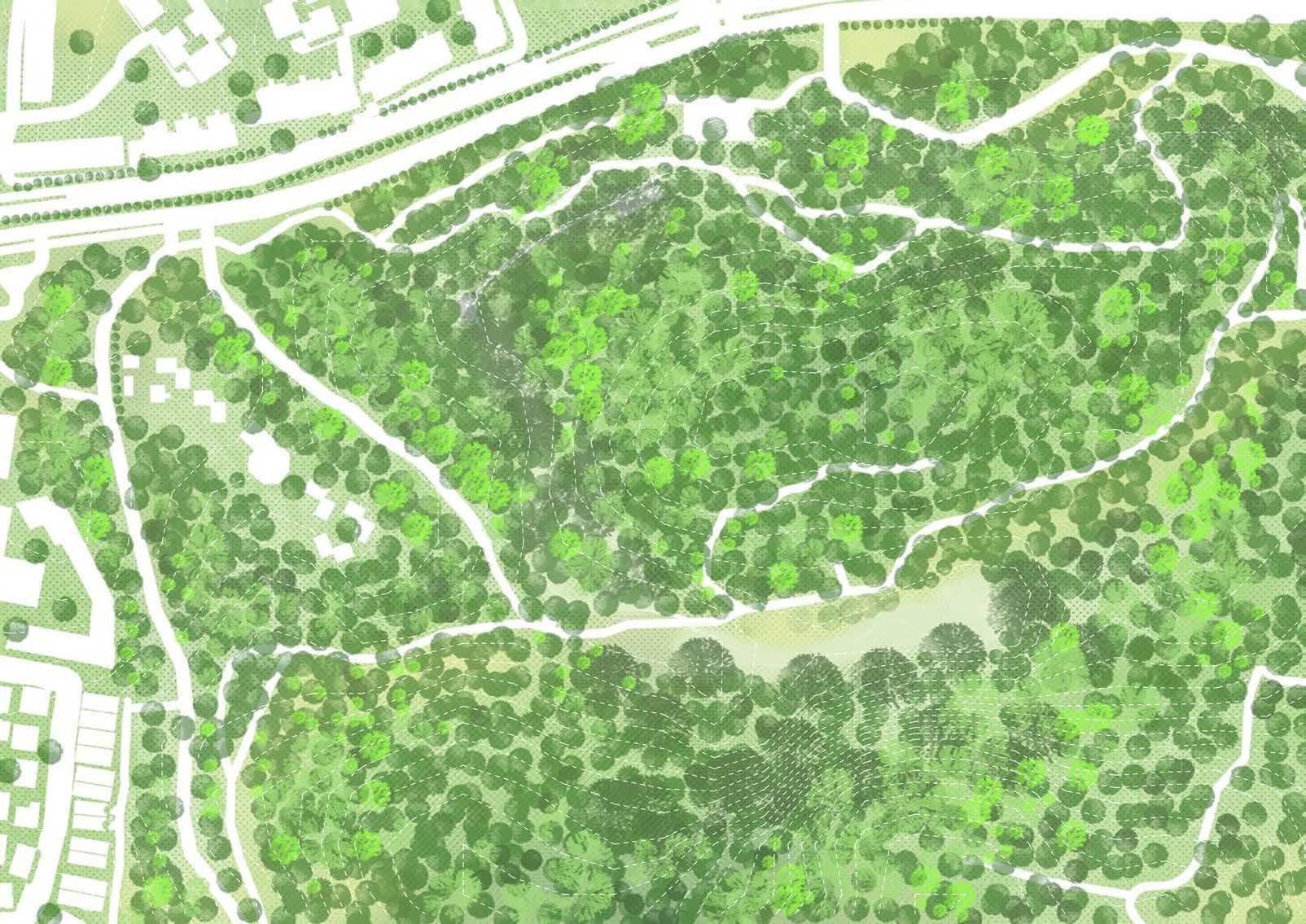
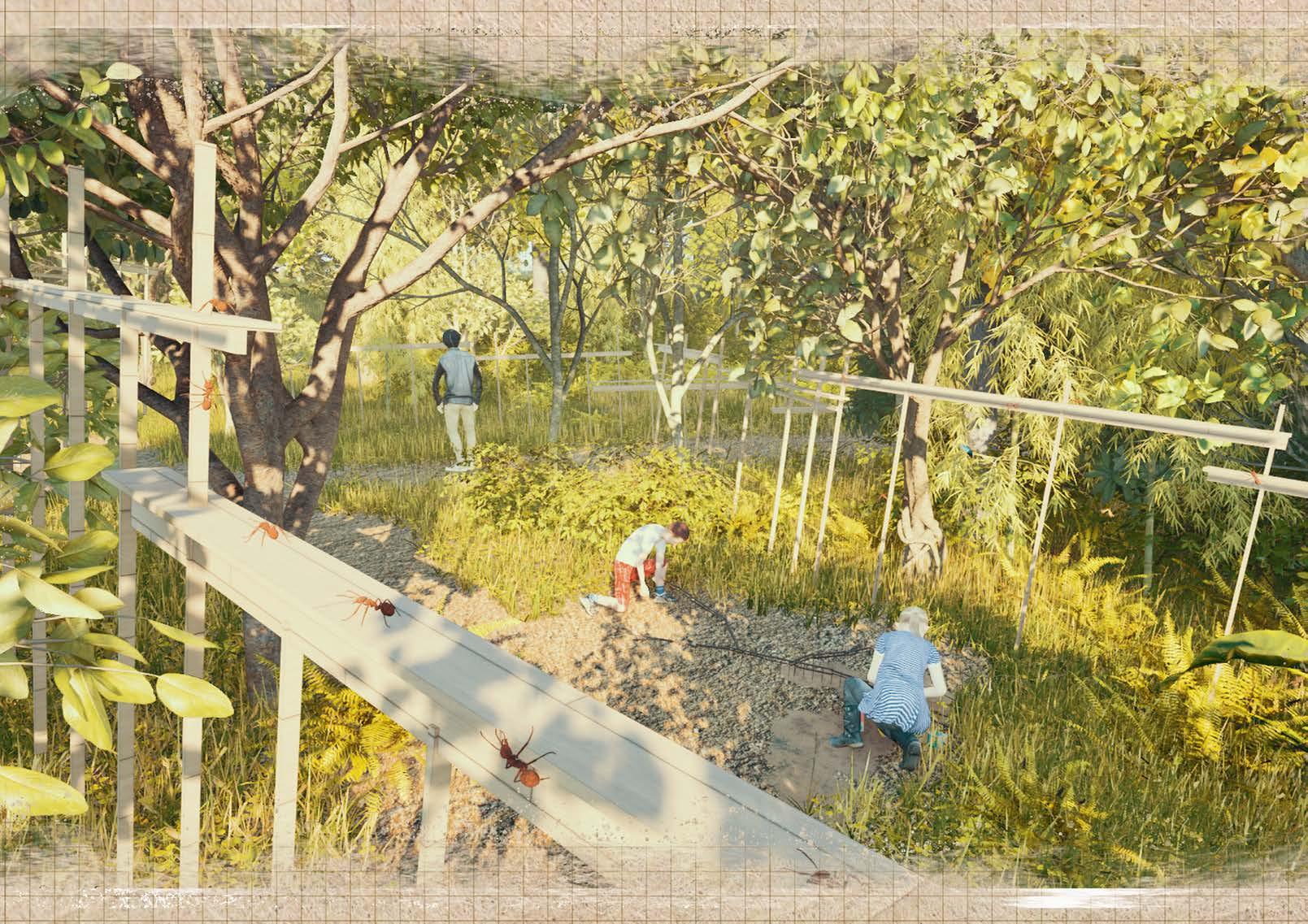
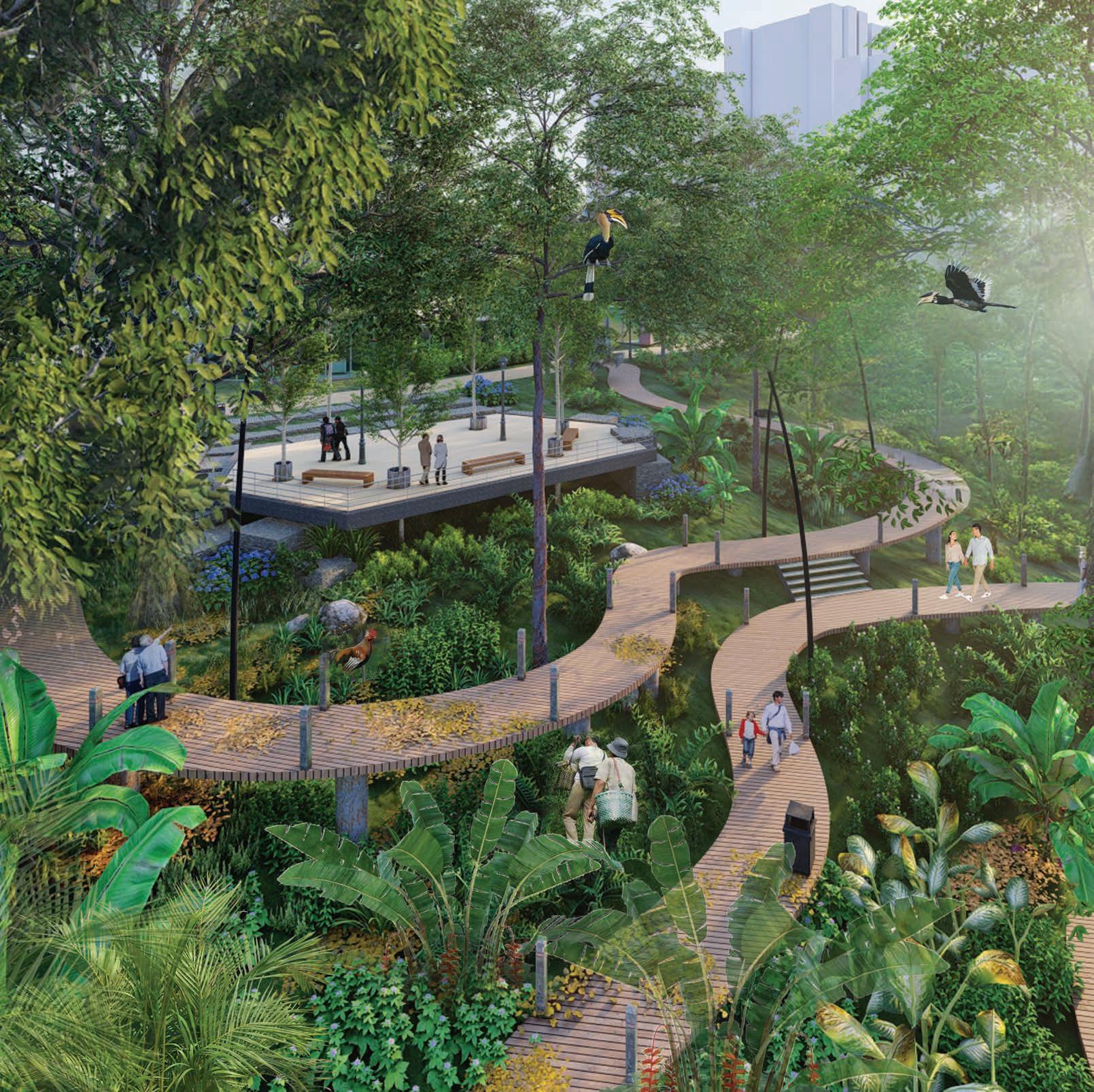
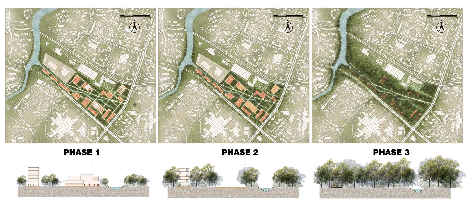
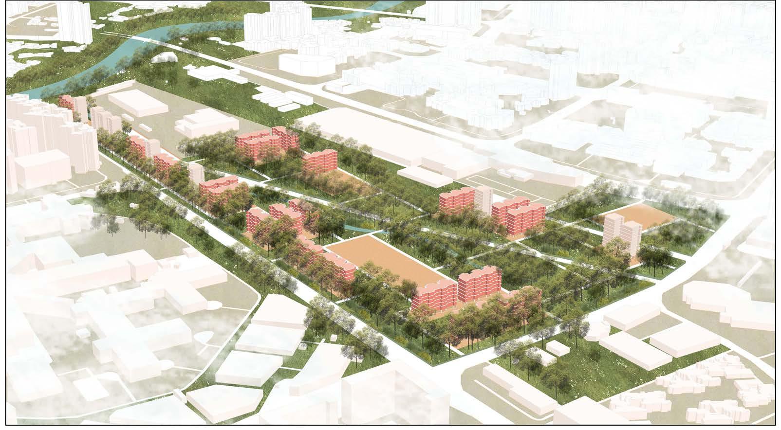
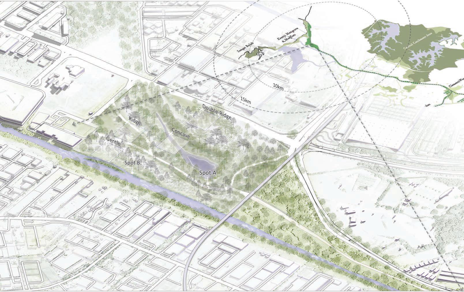
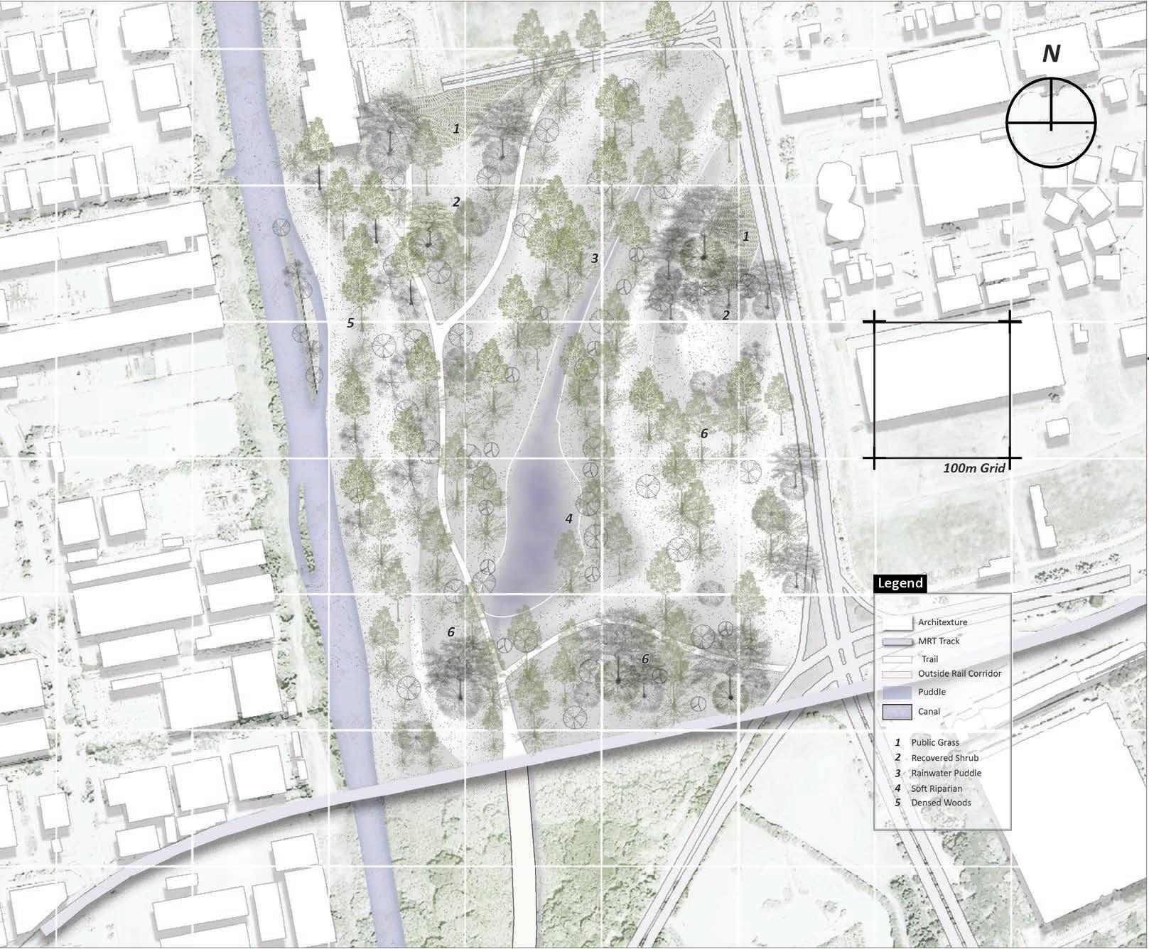
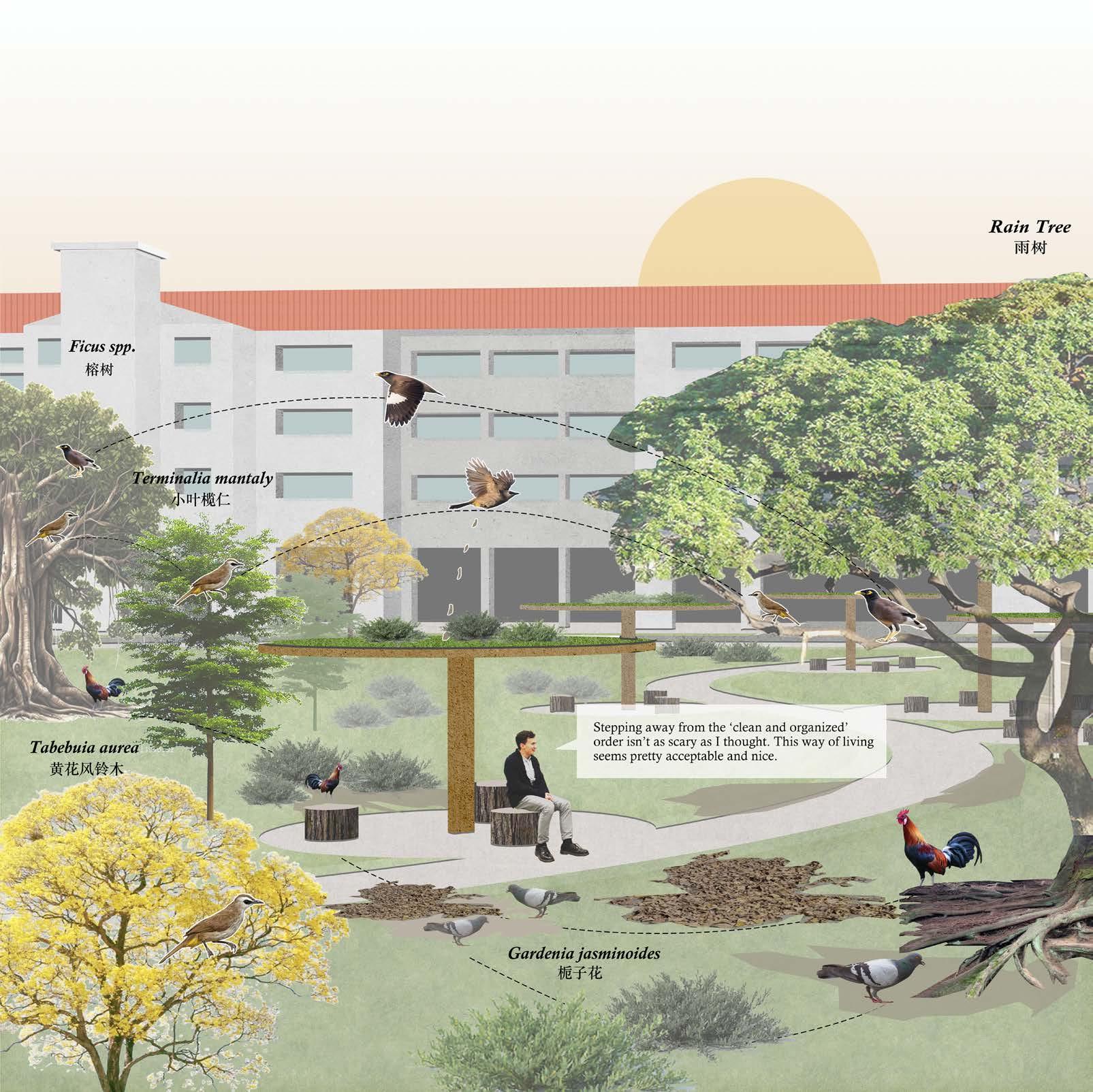
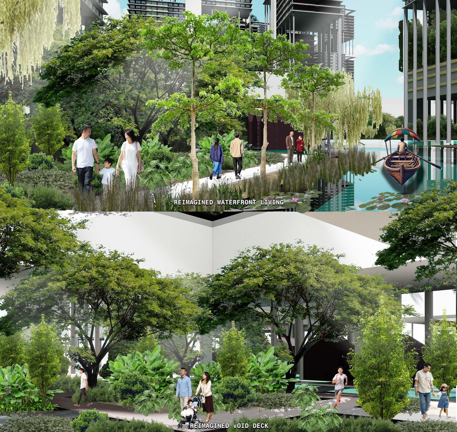
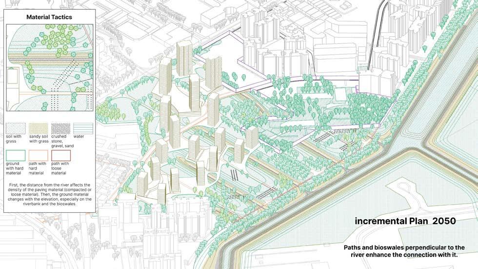
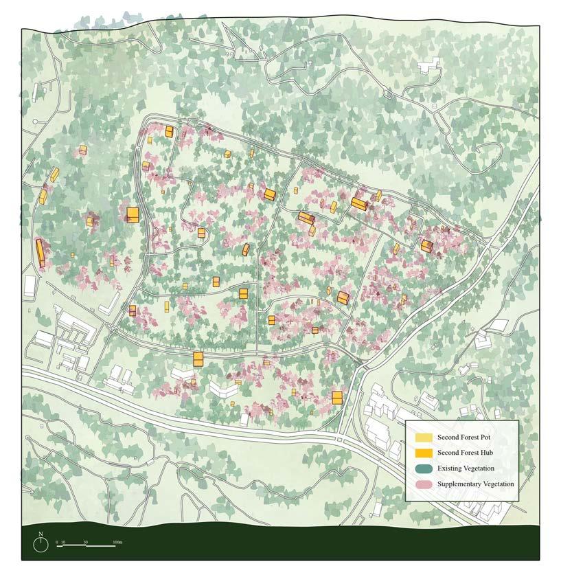
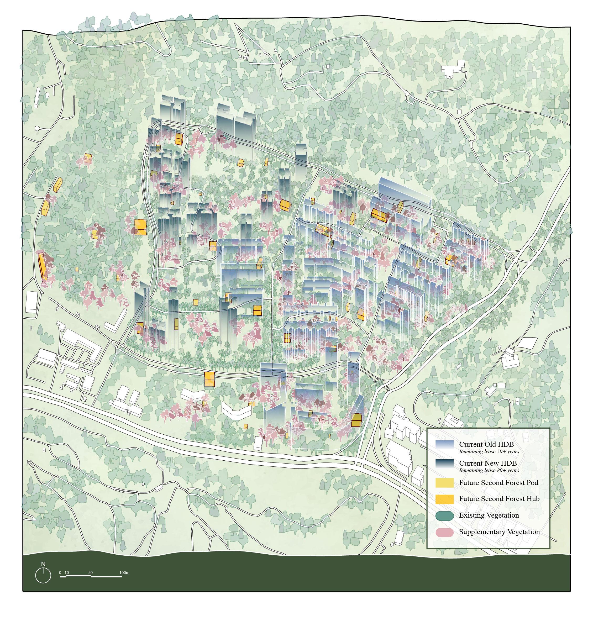
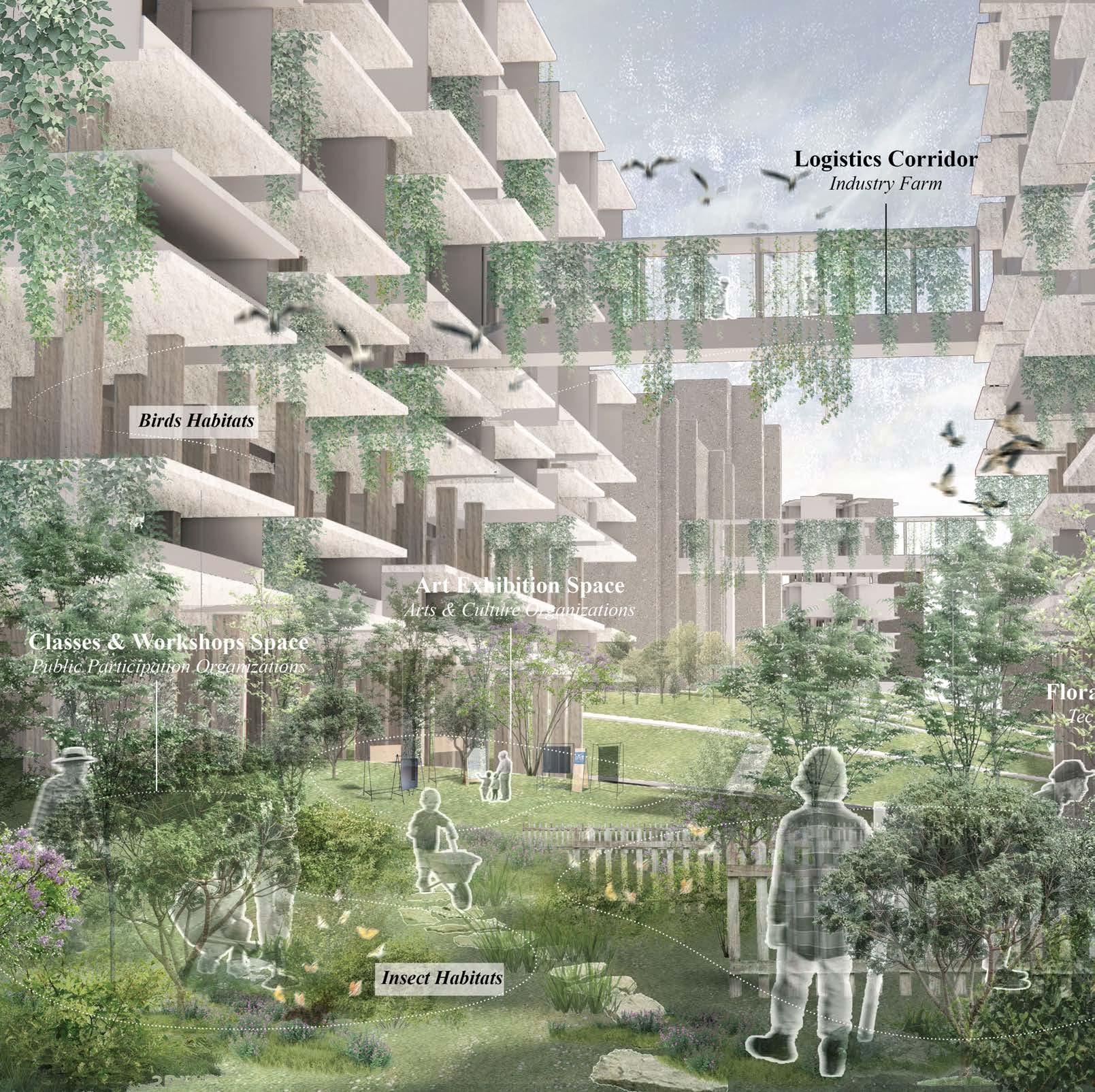
Self-Sufficient & Bird Friendly Community
Chen Zeya
Tutor: Victoria Jane Marshall
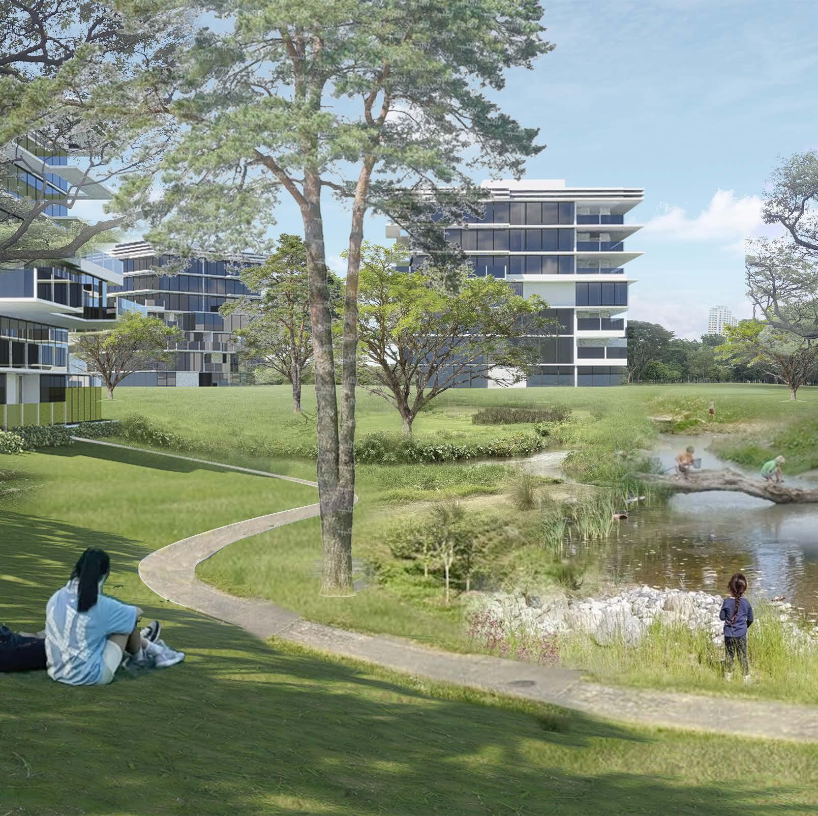
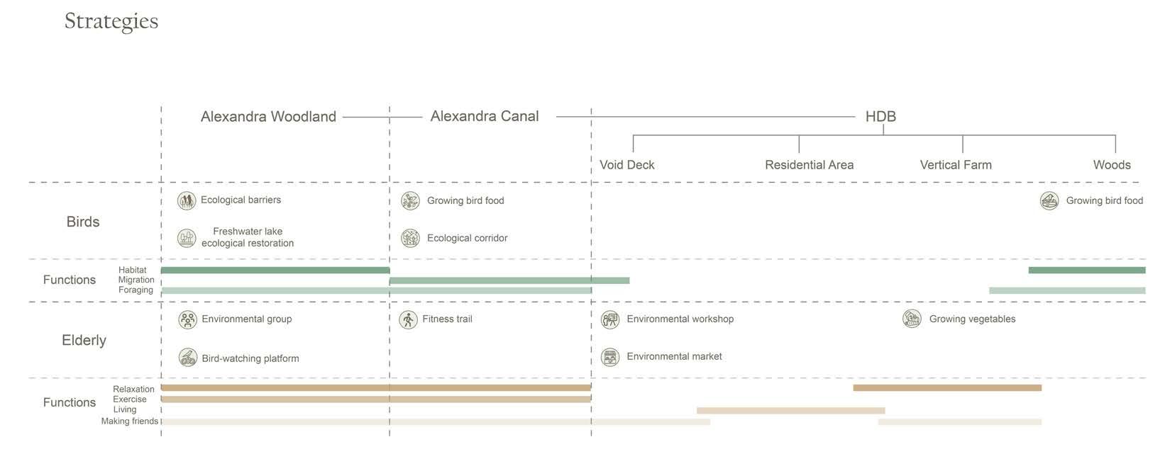
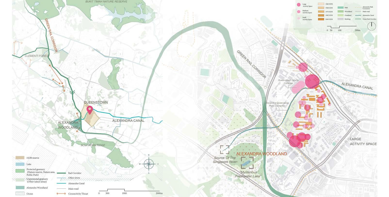
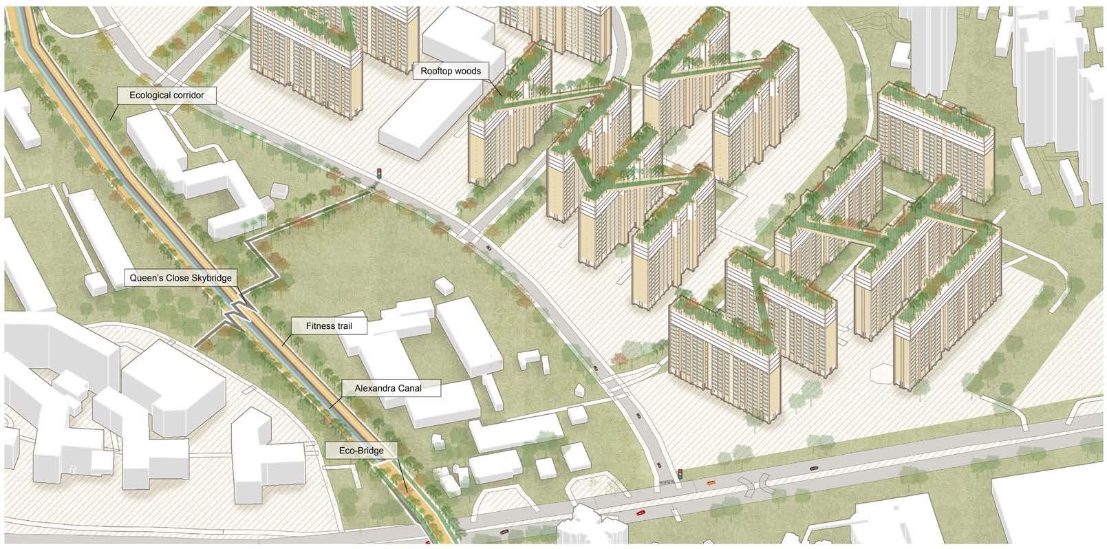
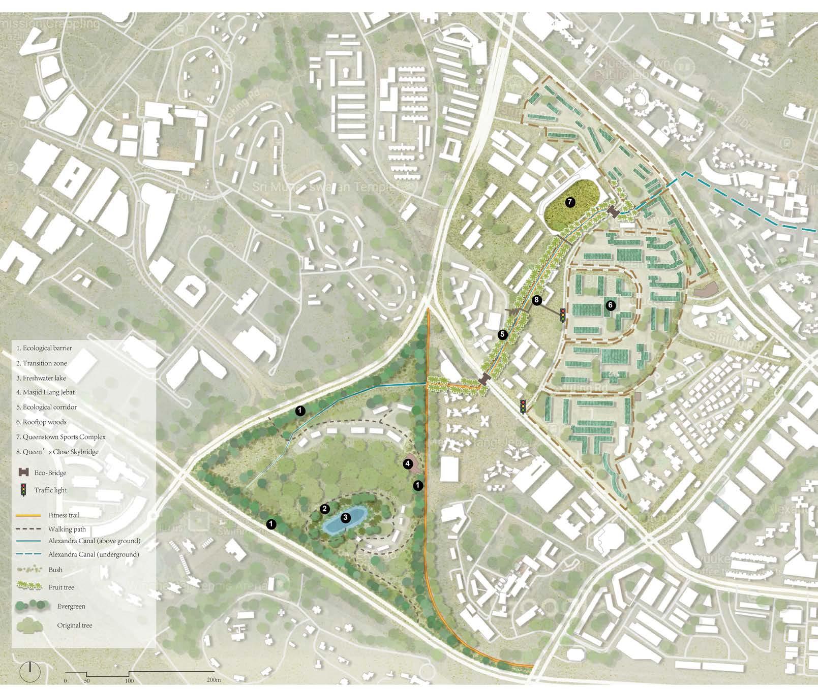
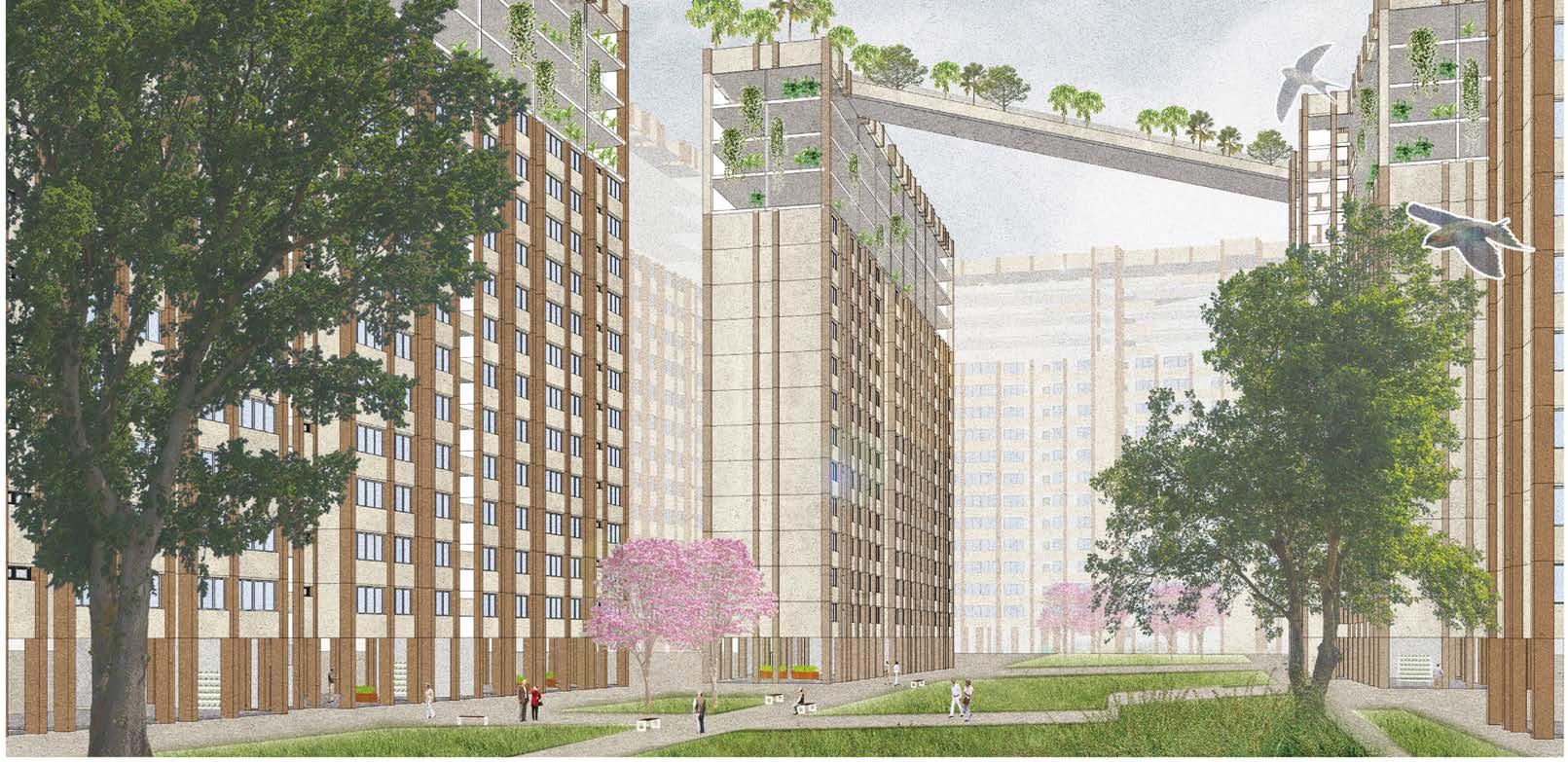
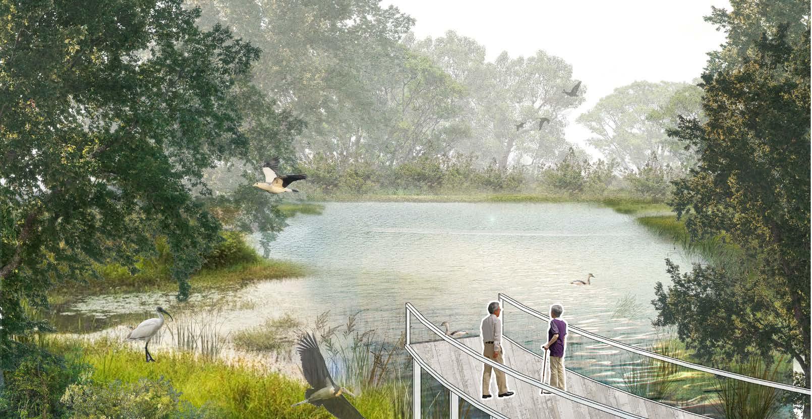
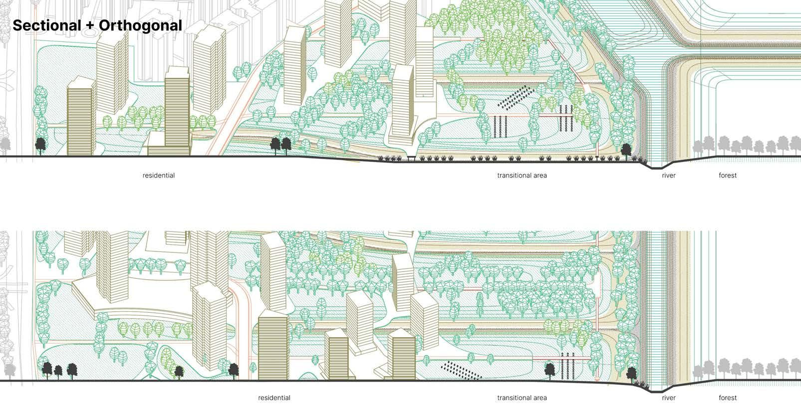
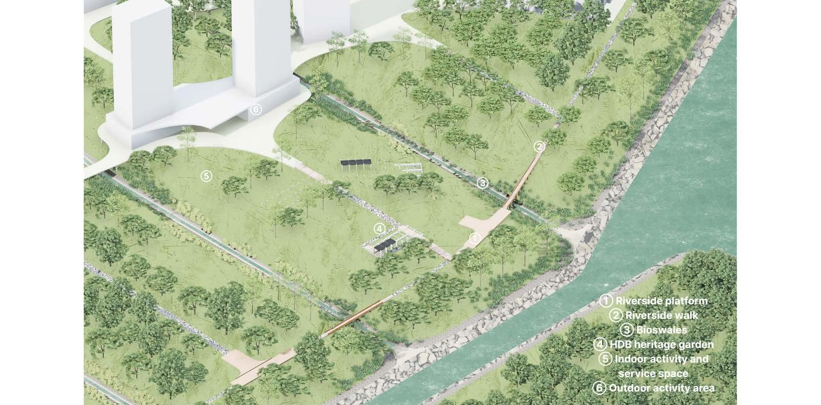
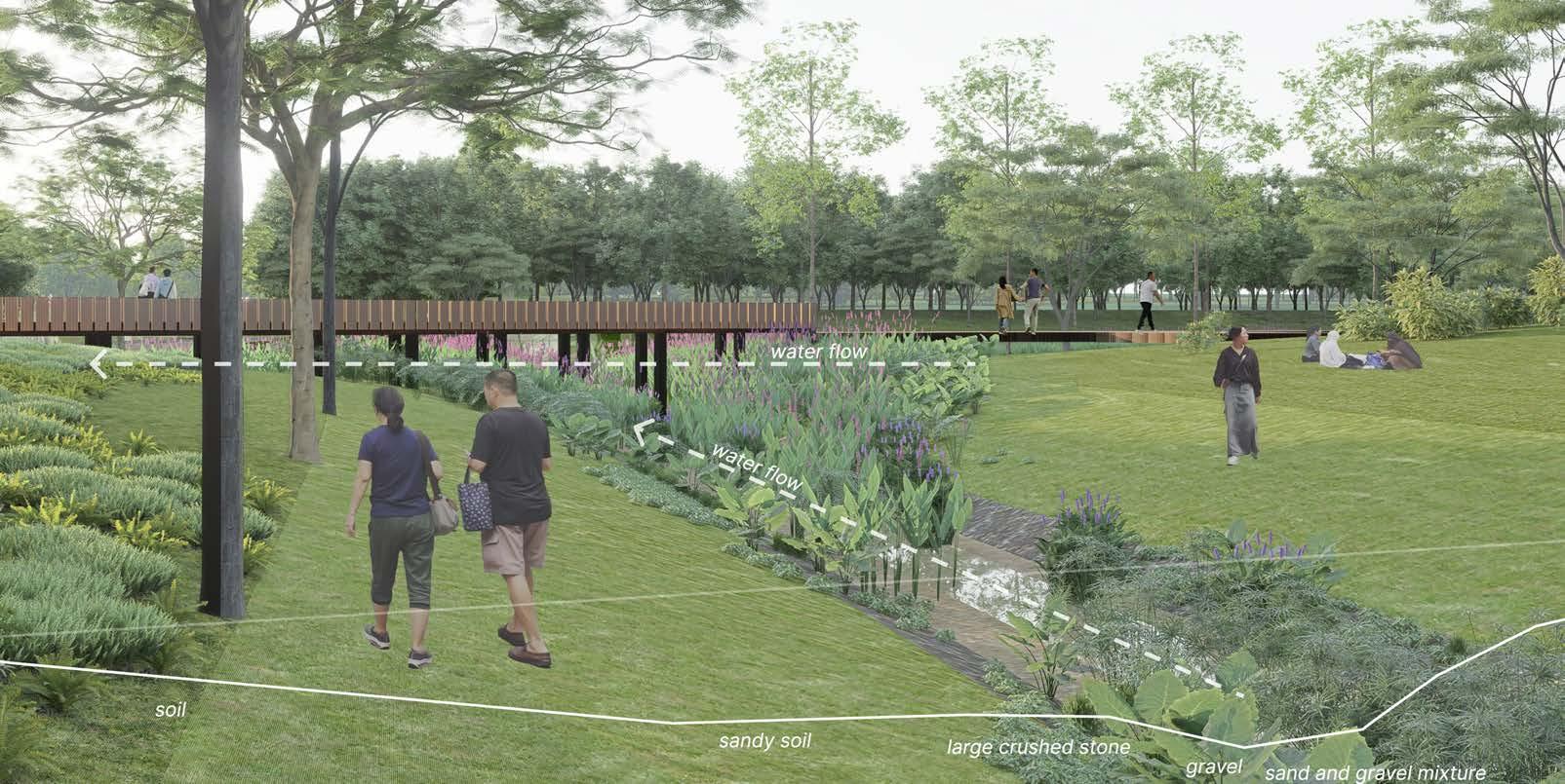
My project is A landscape design project for the future of Queenstown HDB: integrating food cultivation with rare bird conservation while establishing eco-friendly workshops and environmental organizations tailored for elderly participation. Five HDB reserves located between Commonwealth Ave, Queensway and Alexandra road. The community is able to provide habitat for rare birds and is self-sufficient in daily vegetables. The project is important for it addresses three issues; fragmented habitats for endangered birds; food security as Singapore has set a target of achieving 30% local food production by 2030; and the struggles of elderly people in old HDBs.
The project has three parts that I narrate as a journey from the woodland to the Singapore Reiver. First, to protect endangered bird species, an ecological corridor is designed to extend from Alexandra Woodland to the Alexandra canal, flowing through Queenstown and eventually joining the Singapore River. This corridor provides a migratory route for birds, enabling their movement towards woodland areas above proposed vertical farms, which serves as an essential habitat. Concurrently, this corridor provides residents with space for leisure and exercise.
Second, for buildings with expiring titles will be retained, and rooftop fruit trees and other bird-attracting vegetation will be planted to simulate bird habitats. Vertical farms spanning three to four floors below the rooftops will support hydroponic cultivation of leafy greens such as bok choy and lettuce. The void decks will host eco-workshops, where environmental lectures, sustainable material-based crafts, and sales exhibitions will take place regularly.
Third, to further encourage elderly residents to engage in outdoor activities, an environmental group will be established. Elderly members can participate in the daily upkeep and
ecological conservation of Alexandra Woodland, Green Rail Corridor and Singapore River, observing and recording wildlife sightings and uploading these records to an online exhibition to increase public awareness of endangered birds and more.
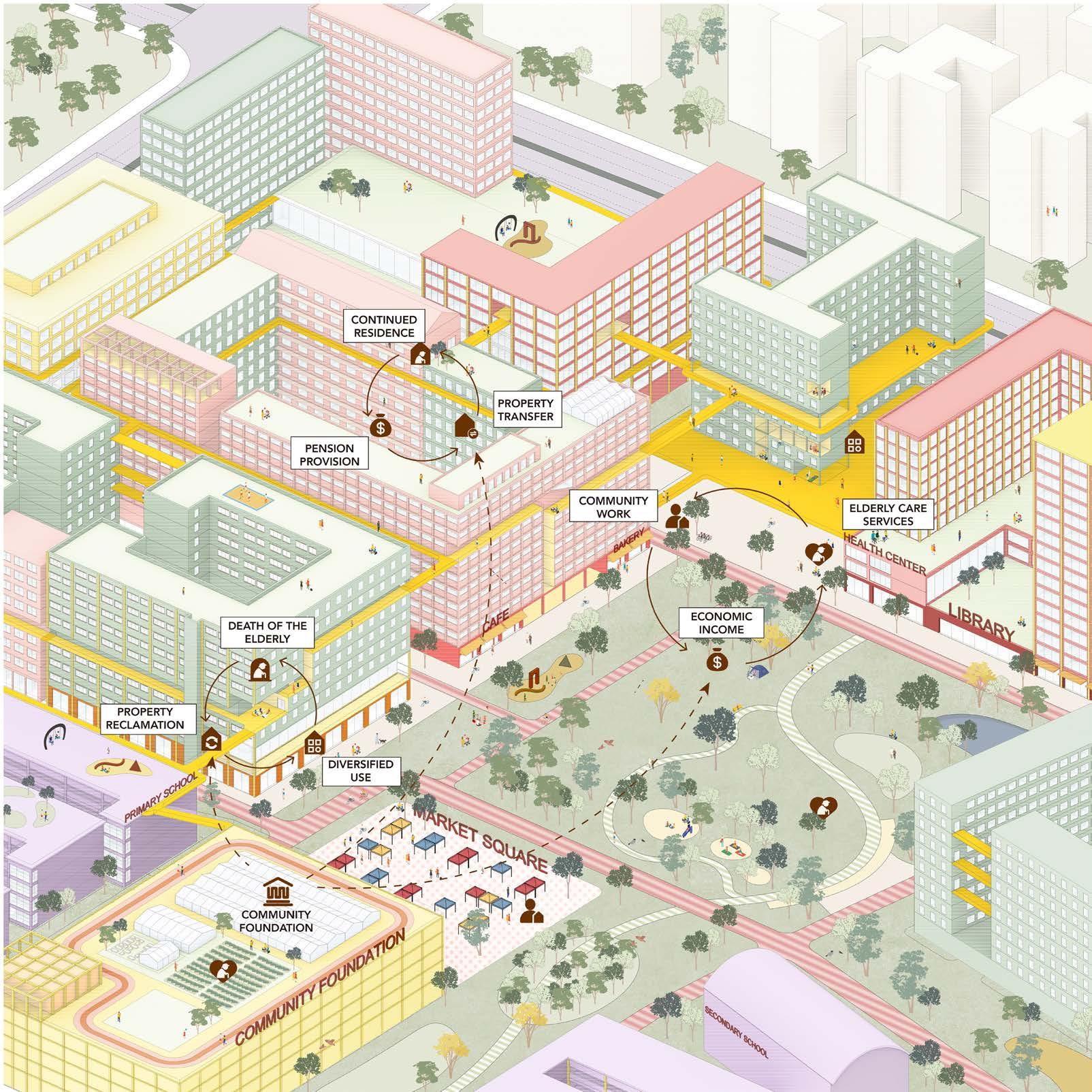
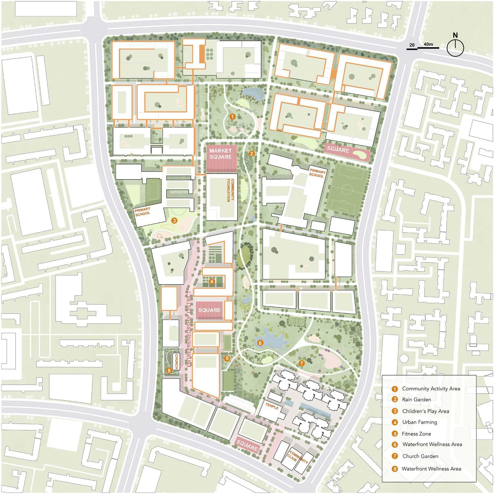
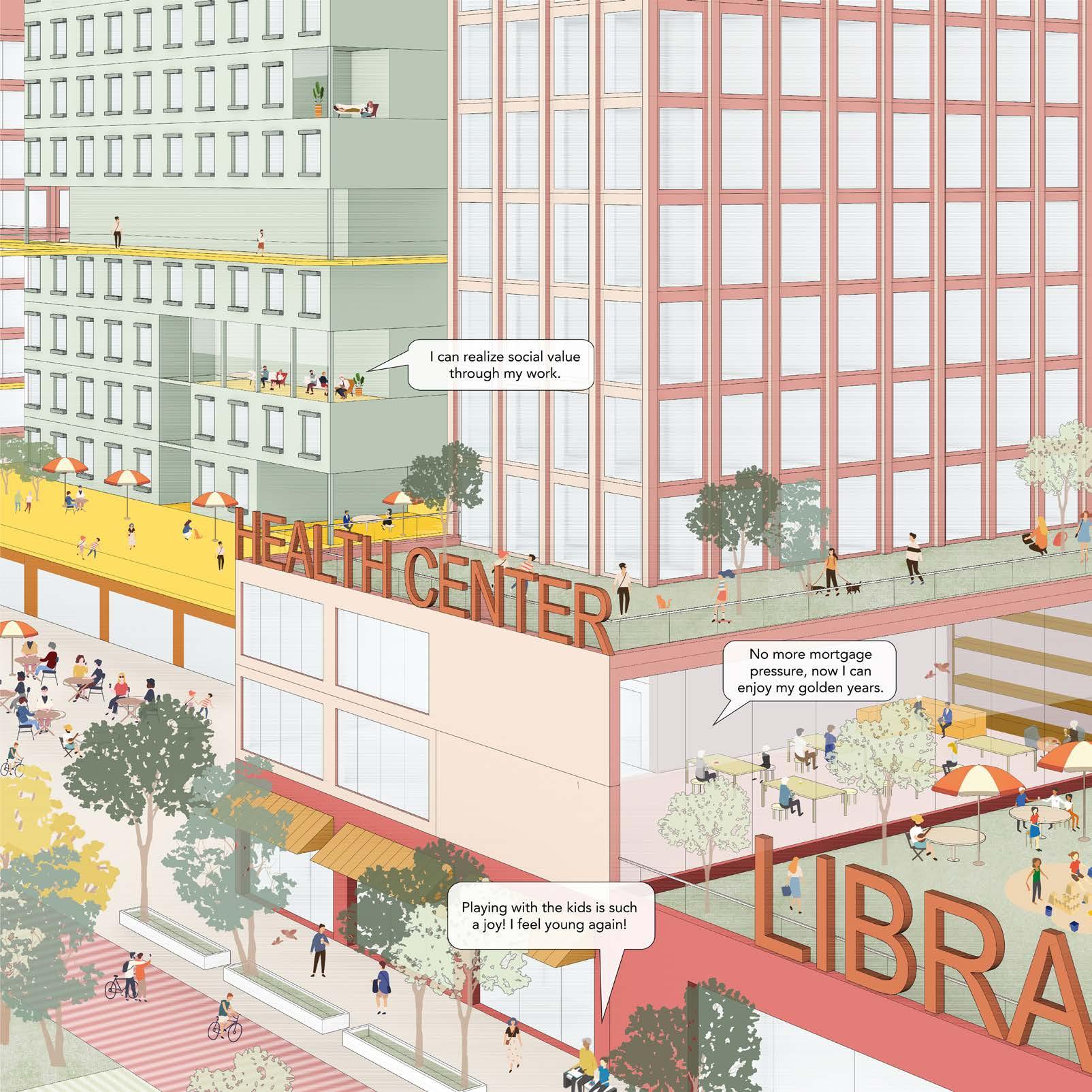
Overall, Compared to city in nature’s broader, policyorientated strategy, this project is community-centred, with a greater emphasis on social problem-solving and the concrete implementation of ecological functions, and a greater focus on the participation of residents, especially the elderly, in ecological conservation. A selfsufficient, bird-friendly eco-community is being created.
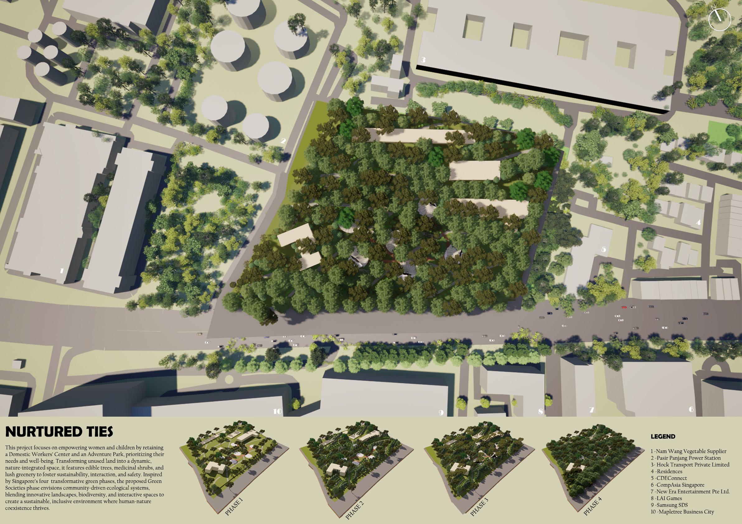
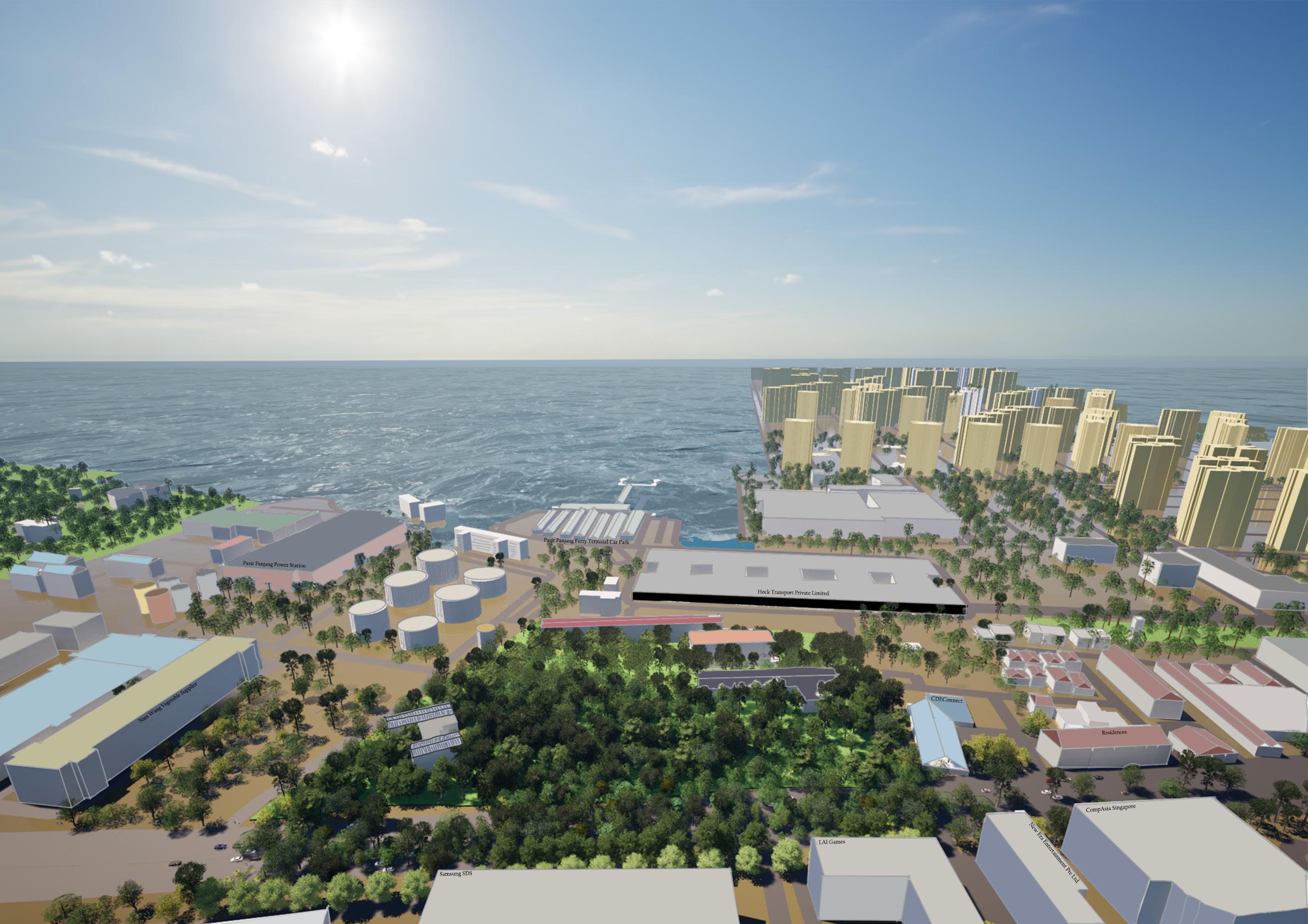
Nurtured Ties
Vadlakunta Akshitha
Tutor: Victoria Jane Marshall
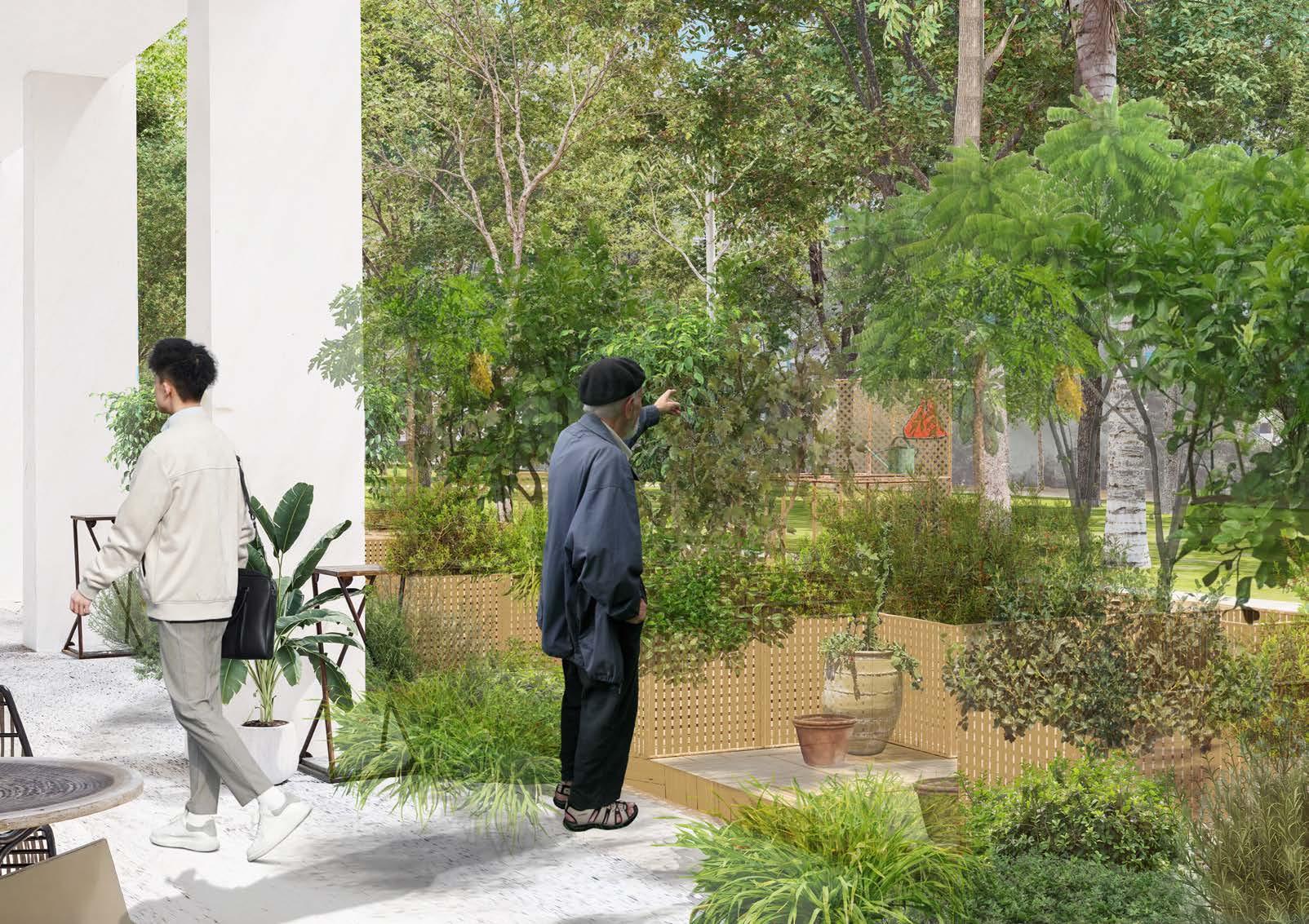
The project tries to give birth to a refreshing and inclusive environment that nurtures the essence of societal coexistence while setting a precedent for the 5th phase of urban greening, Green Societies. Seamlessly fusing nature with purpose, the project aspires to foster a place for some of the most sensitive sectors of society: domestic workers and children. By designing innovative landscapes and programming thoughtfully, the site will offer physical refuge and opportunities for connection, education, and self-sufficiency.
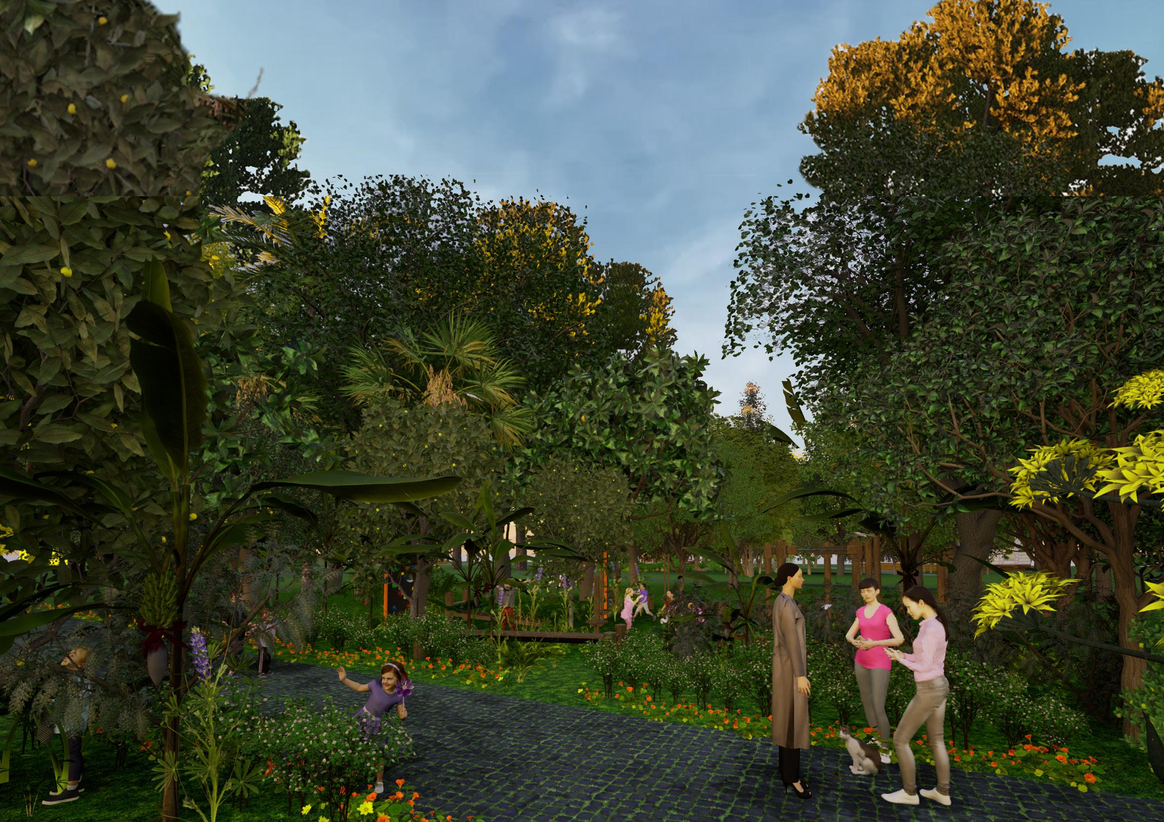
The project envisions converting a barren plot into a lively eco-conscious environment. By including tall, shady trees in the background for serenity, edible shrubs and fruit trees in the mid-ground for nutrition, and medicinal plants at ground level for use, the site will become a functional and restorative green oasis. These design elements improve biodiversity and establish direct relations between human beings and nature, in keeping with the values promoted by the concept of Green Societies.
The dual focus of the project—an adventure center for children and a domestic workers’ center—addresses their unique needs by offering them a place to be themselves. The adventure park invites children to play and explore to learn, while a supportive and interactive environment is created at the center for the domestic workers, nurturing dignity and community engagement.
Nurtured Ties focuses on community-oriented green infrastructure, with the purpose of engaging the public in activities ranging from farming to biodiversity education and exploration. This approach creates not only a sustainable ecosystem but also fosters a culture of ecological stewardship among residents.
The vision of Green Societies, will redefine the relationship between people and their surroundings. It is designed to be a space of interaction, growth, and recognition not only for its served members but also for the larger community it inspires. Nurtured Ties aspires to serve as a model for how urban design can protect, empower, and rejuvenate sensitive communities while enriching the environment.
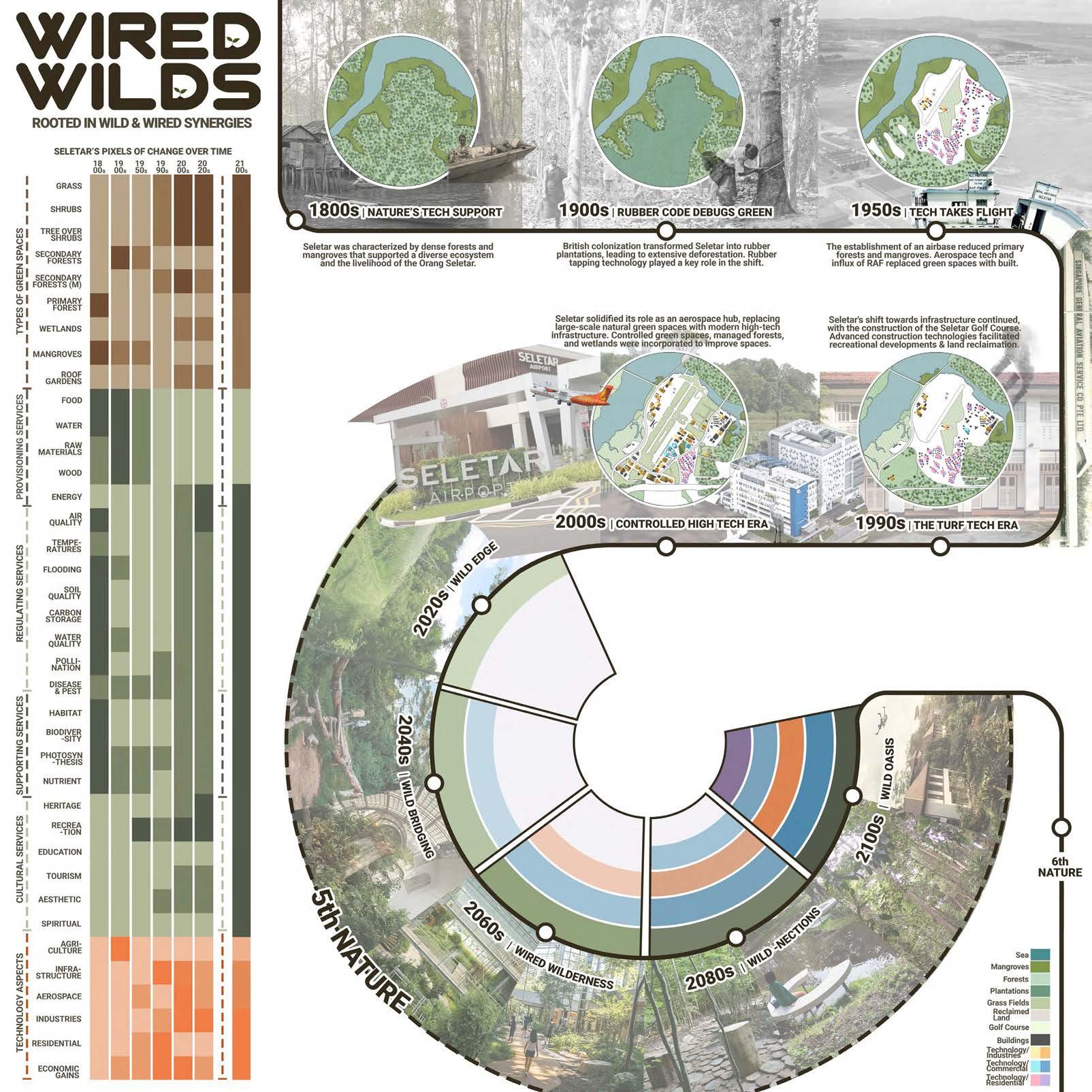
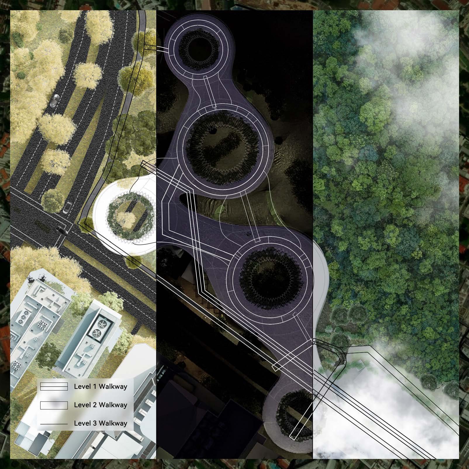
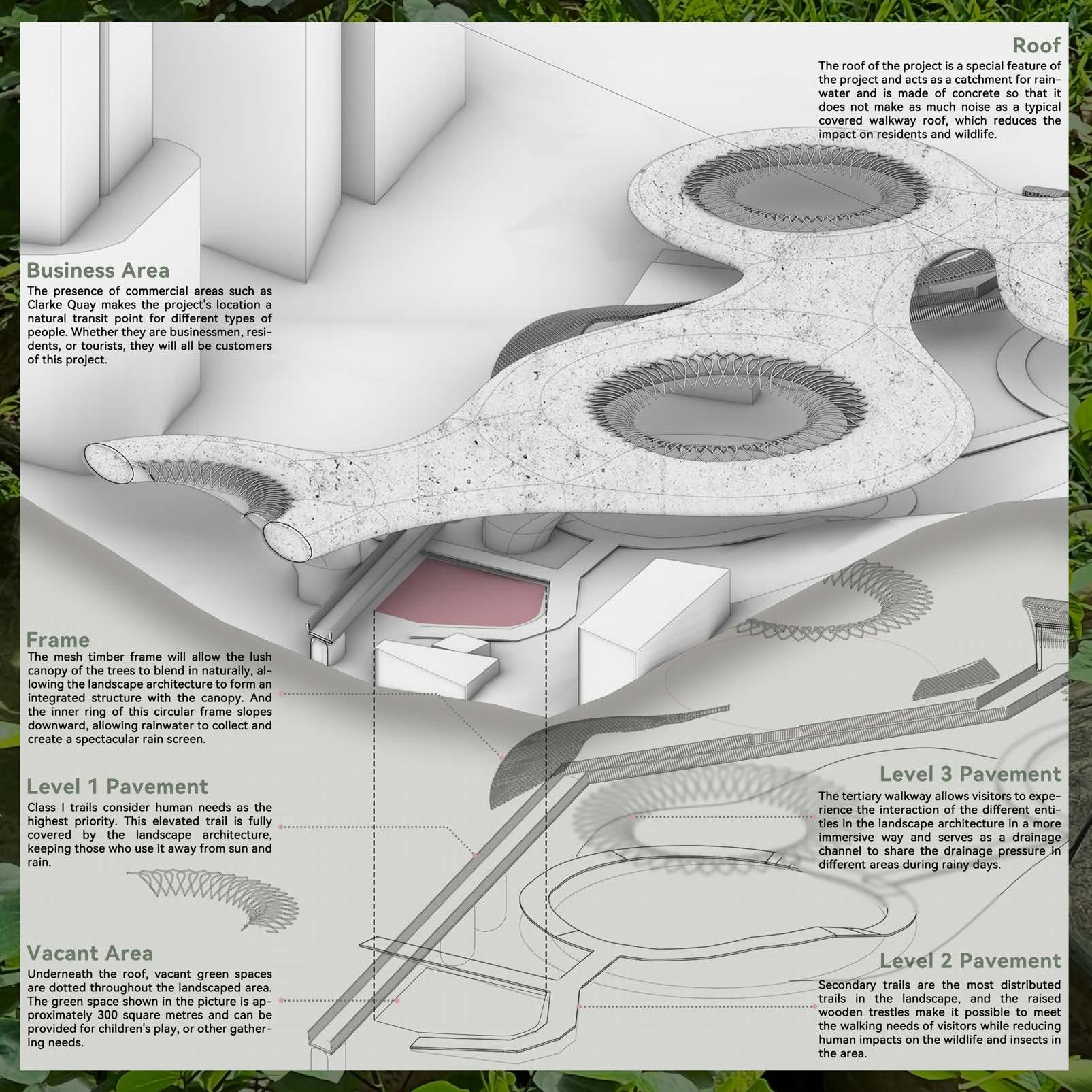
Wired Wilds
Mariam Yusuf Rajkotwala
Tutor: Lehana Guo
Seletar, with its layered history and evolving landscape, from colonial houses to secondary forests, wetlands, and the Seletar Aerospace Park stands as a unique intersection of ecological richness and technological potential. Wired Wilds envisions a future where these elements create a resilient, interconnected ecosystem that respects Seletar’s past while boldly embracing the future.
A Living, Evolving System Drawing from Hybrid Geographies, Digital Ecologies, Cyborg Manifesto, and ActorNetwork Theory, Wired Wilds frames Seletar and redefines our understanding of landscapes as an integrated, adaptive system, where natural, technological, and social processes interact. Wired Wilds aims to become a living network where technology nurtures the wild and the wild shapes the tech, land and human interactions.
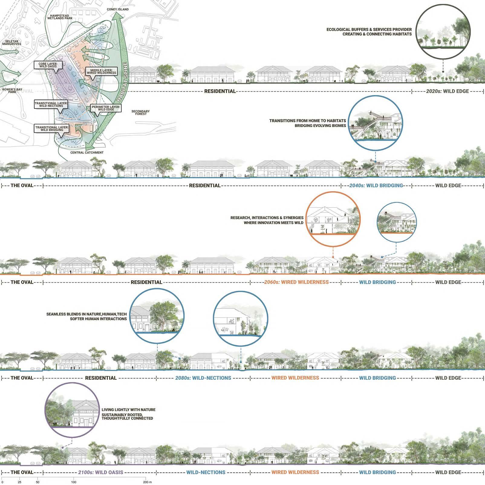
The design framework arranges the landscape into transitional gradients, creating distinct zones while blending ecological and human-centered spaces. Each layer offers a unique experience, fostering a balanced environment that emphasizes ecological preservation, technological innovation, and community engagement.
Perimeter Layer: The outermost perimeter acts as an ecological buffer, an essential Wild Edge that connects habitats, supports biodiversity, and strengthens regional ecological corridors.
Transitional Layer: This zone repurposes colonial houses, transforming them from homes to habitats that bridge human spaces and natural biomes. Wild Bridging connects humans to surrounding habitats giving them a glimpse into the natural wonders.
Middle Layer: This area merges nature, technology, and human activity, promoting synergy between research, innovation, and wild landscapes. it transforms colonial houses into adaptive, tech-enhanced hubs, creating an interactive space for fostering deeper nature-centered experiences.
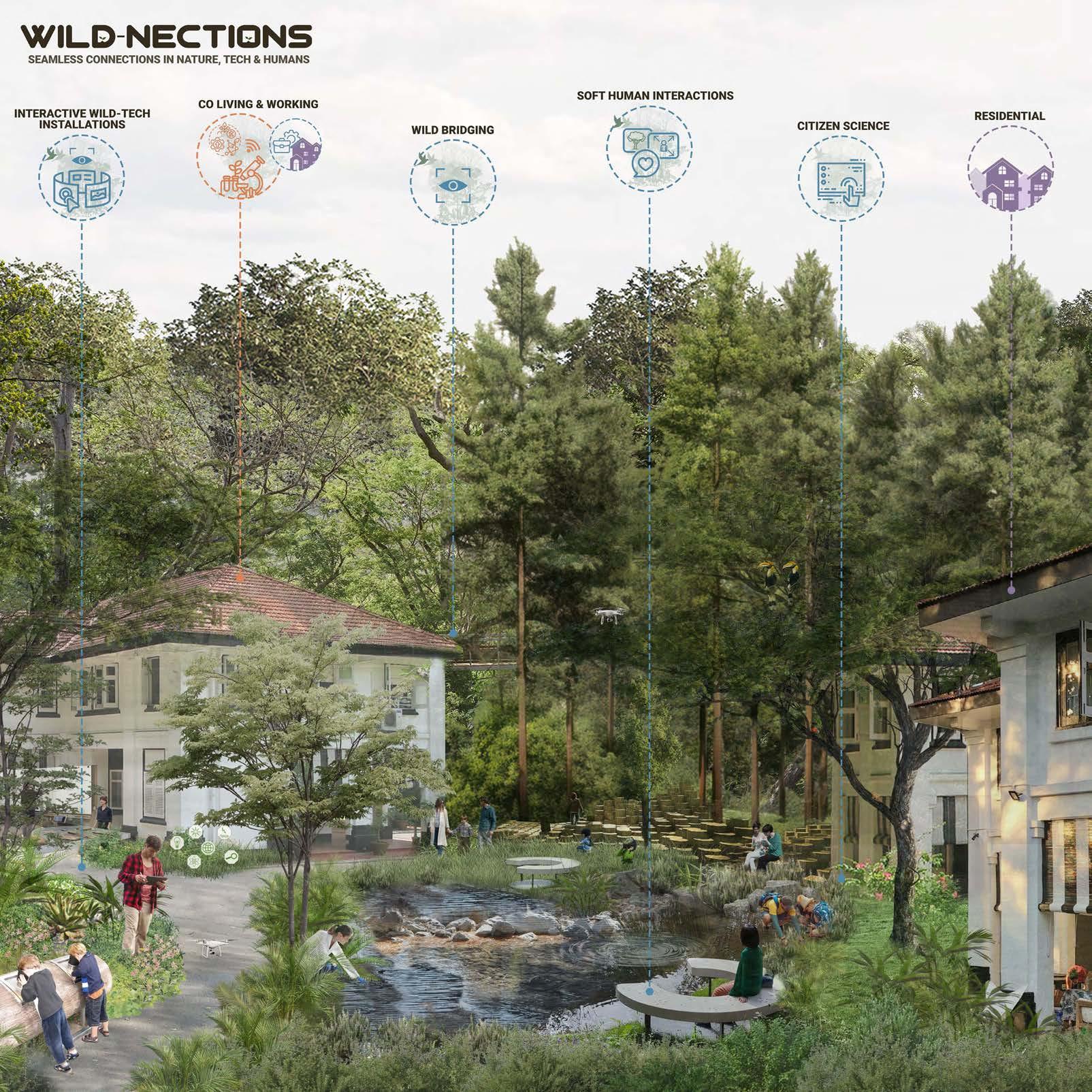
Transitional Layer: Softening the transition from the middle zone, this layer creates blended spaces that offer Wildnections for connections and interactions. It allows co-working and temporary living while enhancing the relationship between residents, visitors, and workers through nature-integrated experiences.
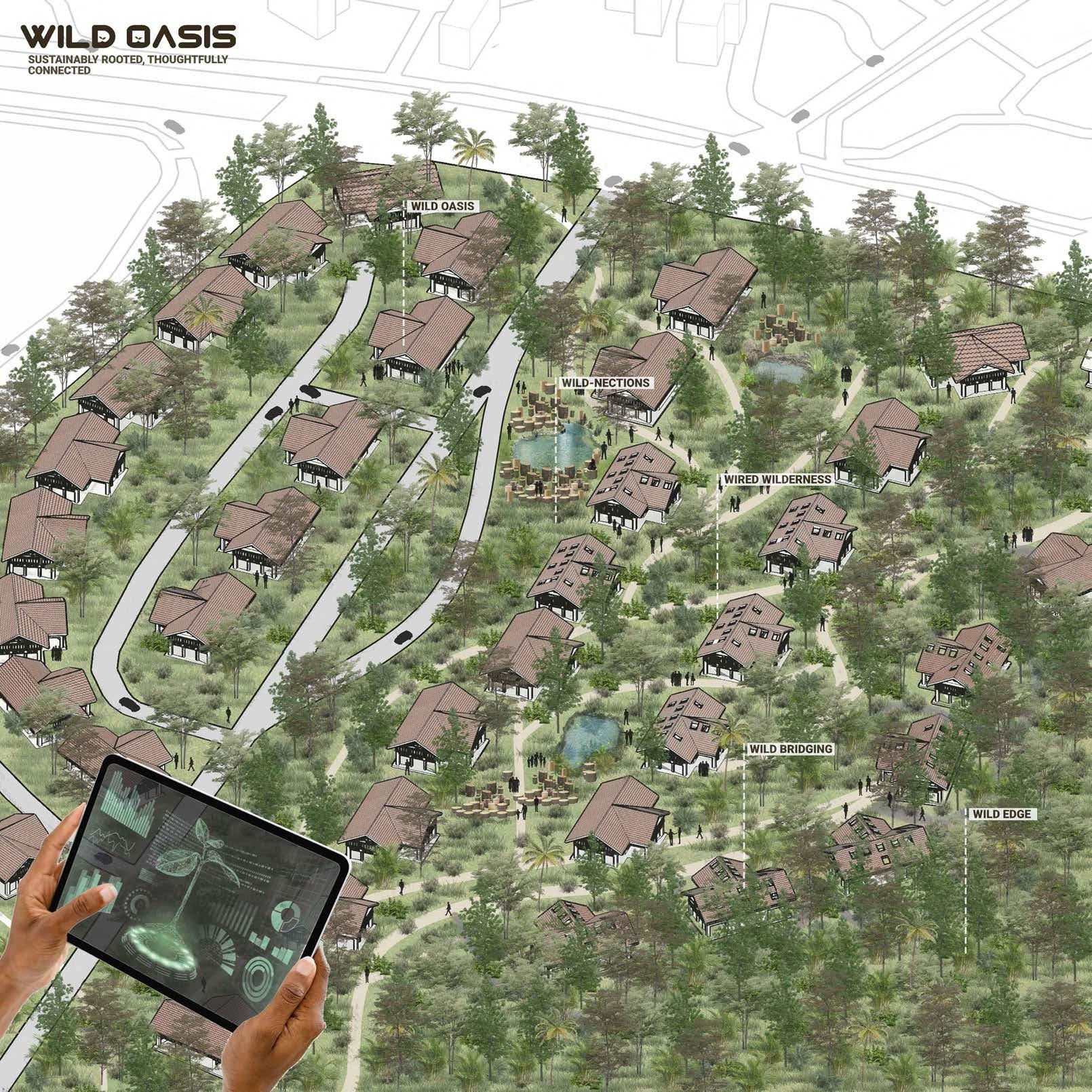
Core Layer: At the heart of Wired Wilds, Wild Oasis serves as a ‘living experiment’. Each preceding layer converges here in a thoughtfully connected, ecologically resilient zone, where living lightly with nature is a guiding principle.
Wired Wilds reimagines reserve lands not as isolated ecosystems but as living laboratories, where all actors - humans, wildlife, infrastructure, and technology exist in a dynamic, interdependent network. This vision balances modern complexities with natural systems, allowing both to flourish in a thoughtfully rooted, symbiotic future.
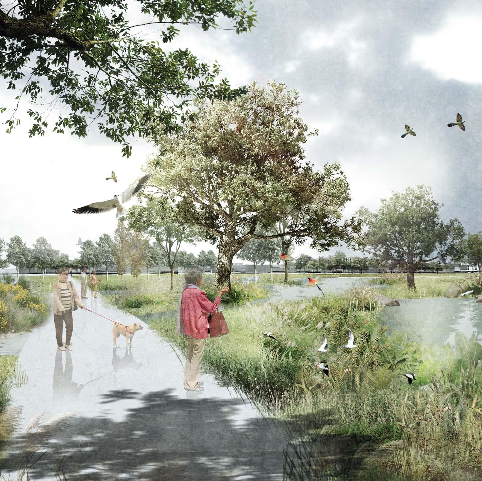
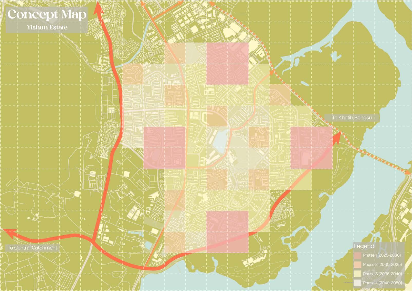
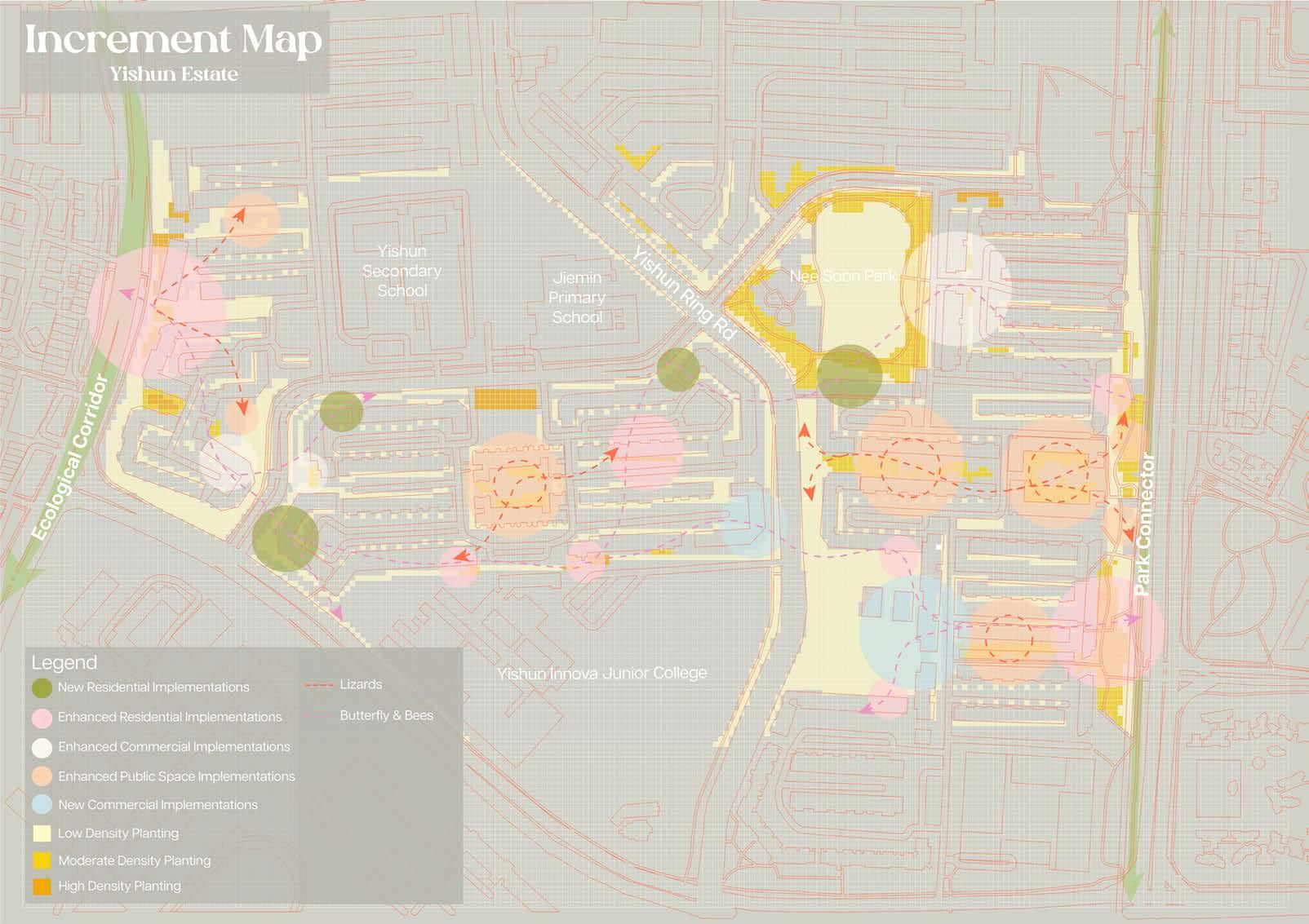
Bring Elderly Close To Nature
Shu Yao
Tutor: Lehana Guo
Due to a population control policy in the 1970s and lifestyle changes in the 2000s, an aging population pattern has emerged in Singapore. The number of elderly people has increased rapidly in recent years. While healthy lifestyle groups exist in many HDB estates, less mobile elderly residents often stay at home, leading to spiraling health issues. In Ang Mo Kio, 68% of residents are over 65 years old as of 2024. Given that the living environment is a basic factor in human life and development, this project aims to connect elderly residents of varying mobility levels to the external natural environment.
The project examines the evolution of urban construction and the natural environment in Ang Mo Kio from 1950 to today, alongside the shifting relationships between humans and nonhuman beings. The HDB flats in the area were built before 1985 and have undergone government-supported upgrades. However, some upgrades inadvertently hindered mobility, such as lift upgrading in 2003, which added lift landings to every floor. While increasing accessibility, this reduced residents’ movement and their exposure to the external environment. Previously, residents on non-lift landing floors would traverse corridors to reach stairs, offering them views of the external environment and a connection to it. This connection has been lost with the lift upgrades.
To address these challenges, the project seeks to extend nature parks into HDB precincts, introducing more biodiversity into residences, with a focus on birds as key species. Research shows birds are accessible urban wildlife and benefit mental and physical health. Using a theoretical framework connecting human sensory experiences with non-human activities, the project rethinks the spatial possibilities of the HDB precinct. Techniques correlate animal and plant characteristics with elderly sensory systems (visual, auditory, tactile). Birdwatching activities serve as a medium for connecting people with animals.
Interventions are applied vertically and horizontally, with spatial scales from individual units to HDB blocks to the entire community. The project follows a 10-year phased plan over 50 years, aligning with typical HDB upgrading cycles. By integrating biodiversity into daily life, the project aims to enhance the elderly’s lifestyle and reestablish their connection with nature.
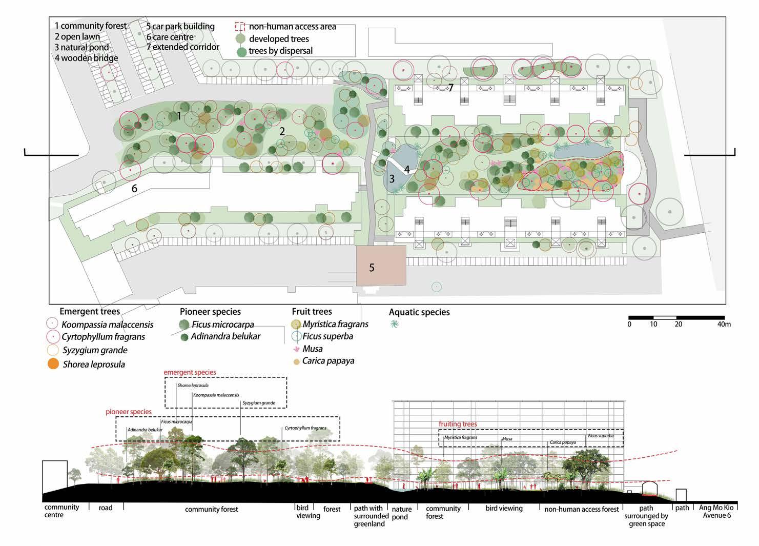
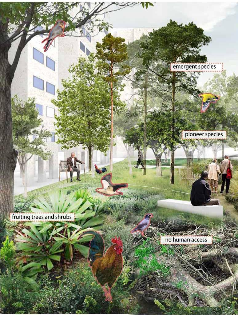
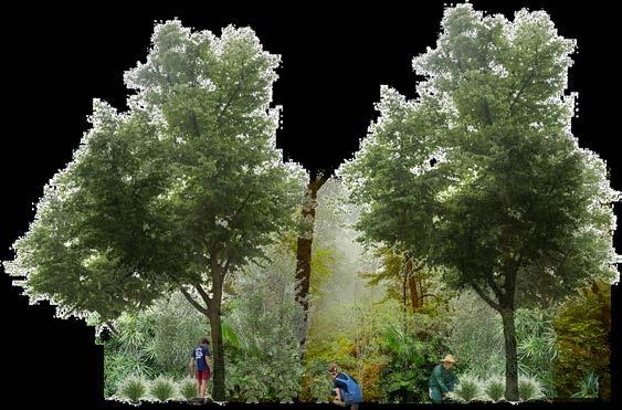
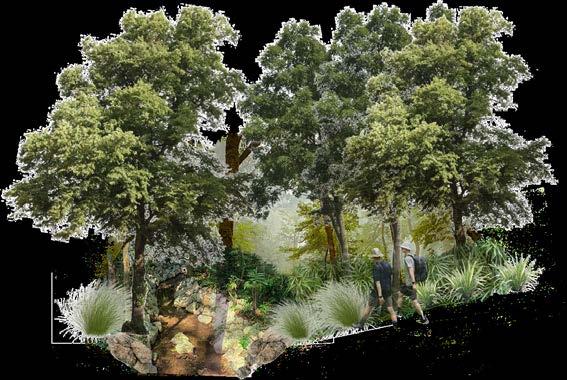
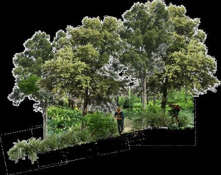
Traces of Nature
Teo Kai Liang
Tutor: Lehana Guo
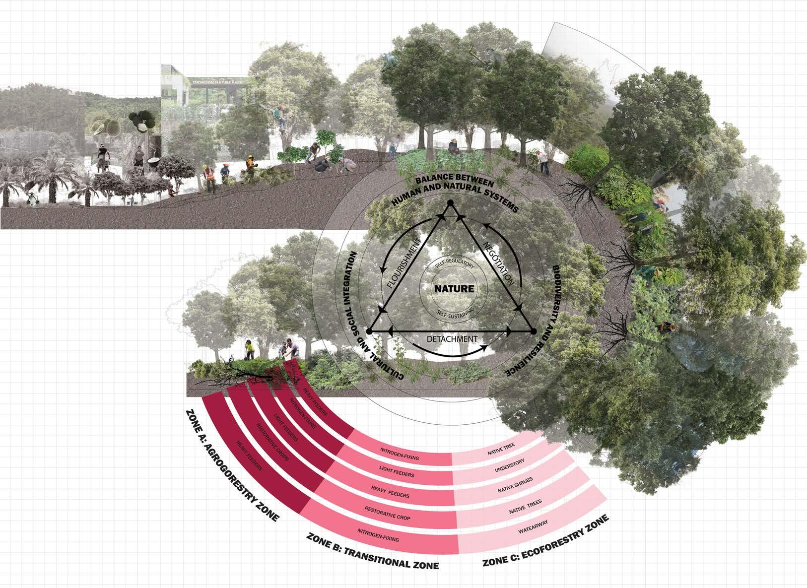
Thomson Nature Park, formerly known as Hainan village is undergoing a decade-long approach focusing on fast-growing, fruit-bearing species to improve both local flora dispersion and degraded soil condition under the Nparks Forest Restoration Plan. This demonstrates the current governmental effort in restoring our degraded forest patches. However, the site still maintains its status as a reserve site, prompting questions as to whether it will continue to remain so, or suffer the same fate as other reserved green spaces.
My project envisions the park beyond this current state, into a catalyst for my 5th nature, that defines it as a self-regulatory and self-sustaining entity, and its inhabitants, human and non-human are part of this story of nature. Nature undergoes different states of flourishing, detachment and negotiation, leaving traces of history produced by humans and non-humans, showing either direct or indirect manipulation of the land and its features to create an environment that affects how we engage with the nature park today.
Introducing my design framework objectives: (1) Establishing balance between human and non-human systems, (2) Encourage social and cultural integration and (3) Cultivate biodiversity and resilience. They are achieved through the following strategies:
(1) Establishing transitional forestry nodes that provides edible, medicinal, cultural benefits for humans and an expanded food supply for non-humans
(2) Planting of native plants that proliferate and expand beyond ecoforestry nodes, integrating with other plant succession species in its continuous growth to support the forest inhabitants.
(3) Establishing the foraging practice as a tool for navigation and knowledge building that empowers and foster community action.
(4) The formation of foraging trails by human users continues to be shaped by late stage forest growth, and all inhabitants will need to adapt and negotiate with evolving conditions.
This project draws agency in the current state of Singapore’s natural spaces. Despite opposition from community and grassroots organisations, forests continue to be encroached and cleared for urban development. Through an integrated forestry approach, it makes the case that human and nonhuman involvement in shaping our nature parks goes beyond the ecological, and possesses cultural and social value that outweighs the economical.
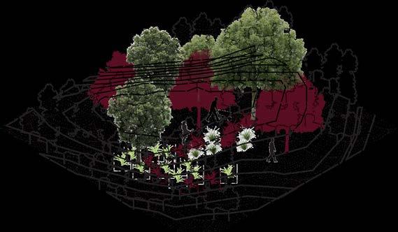
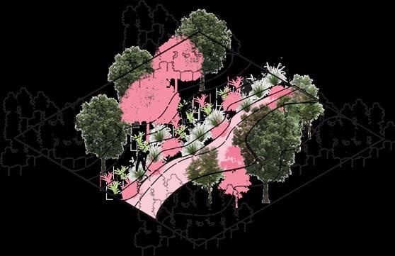
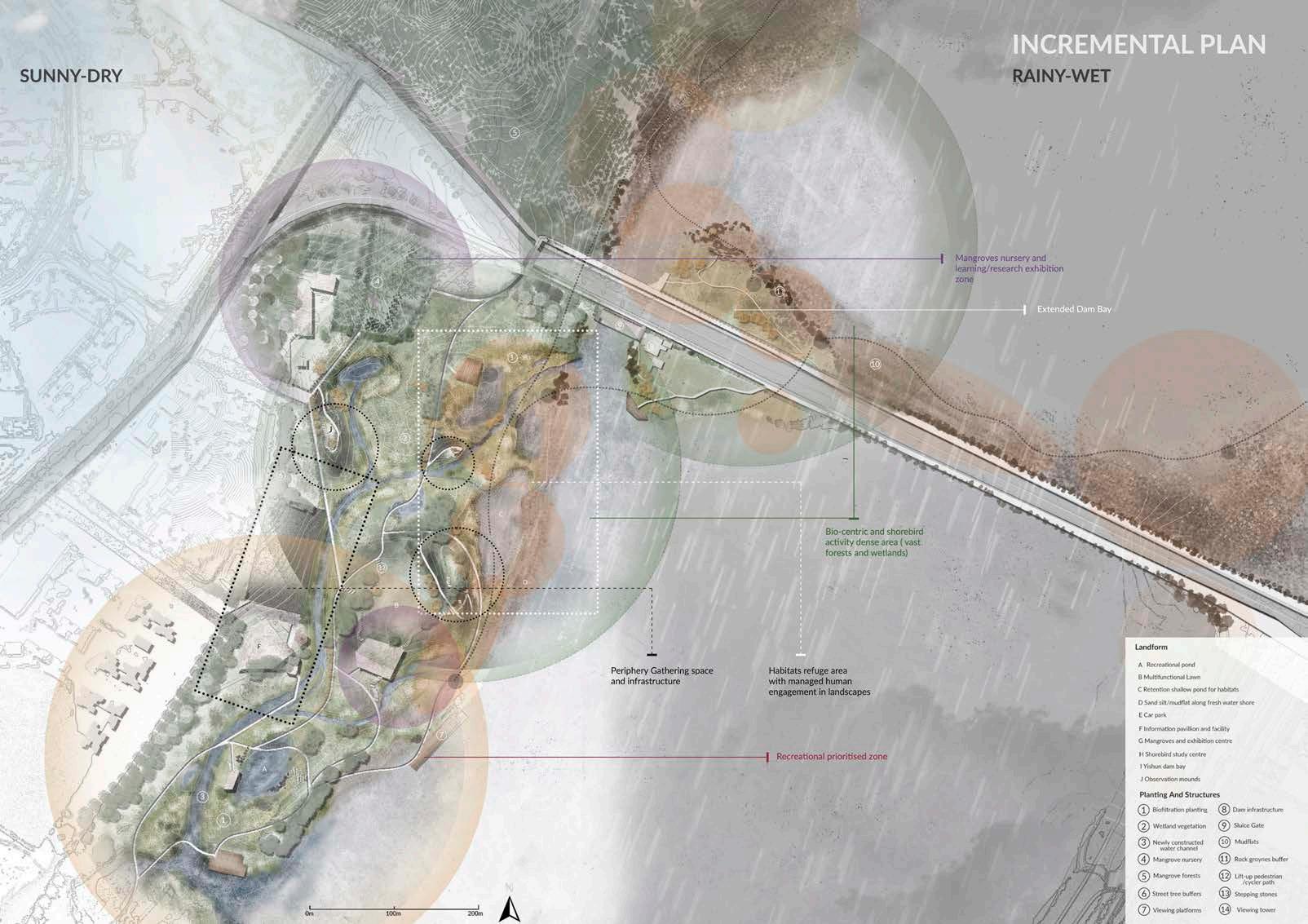
Agroforestry Zone
Transitional Zone
Ecoforestry Zone Park Edge
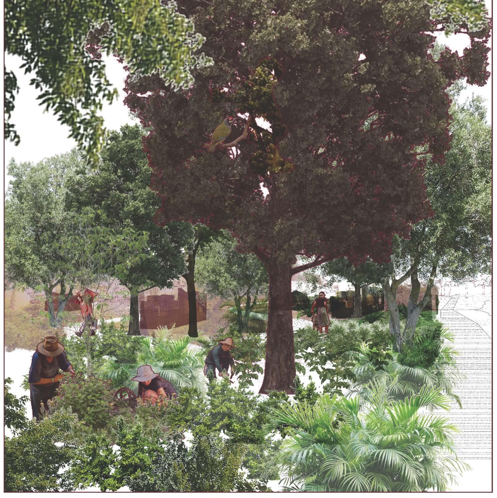
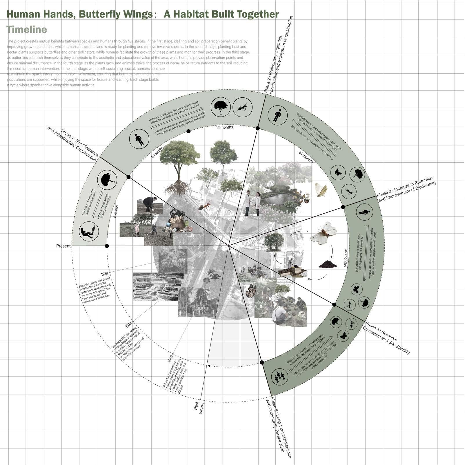
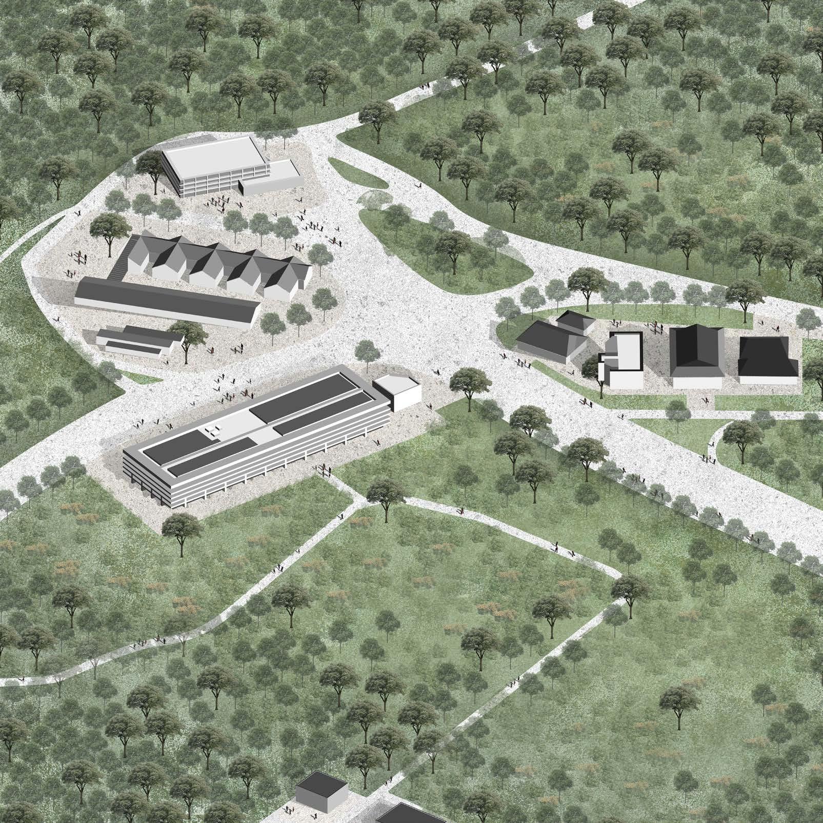
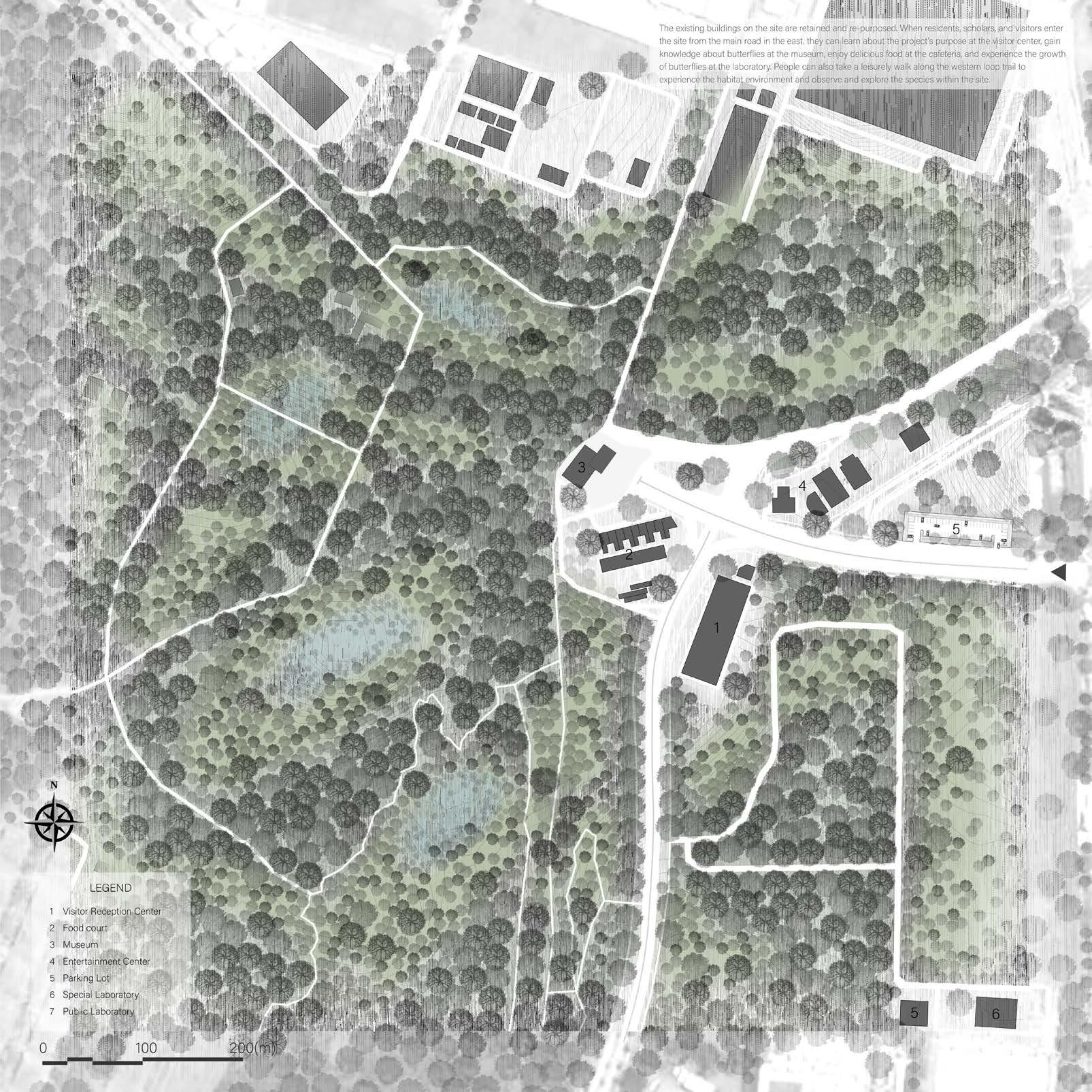
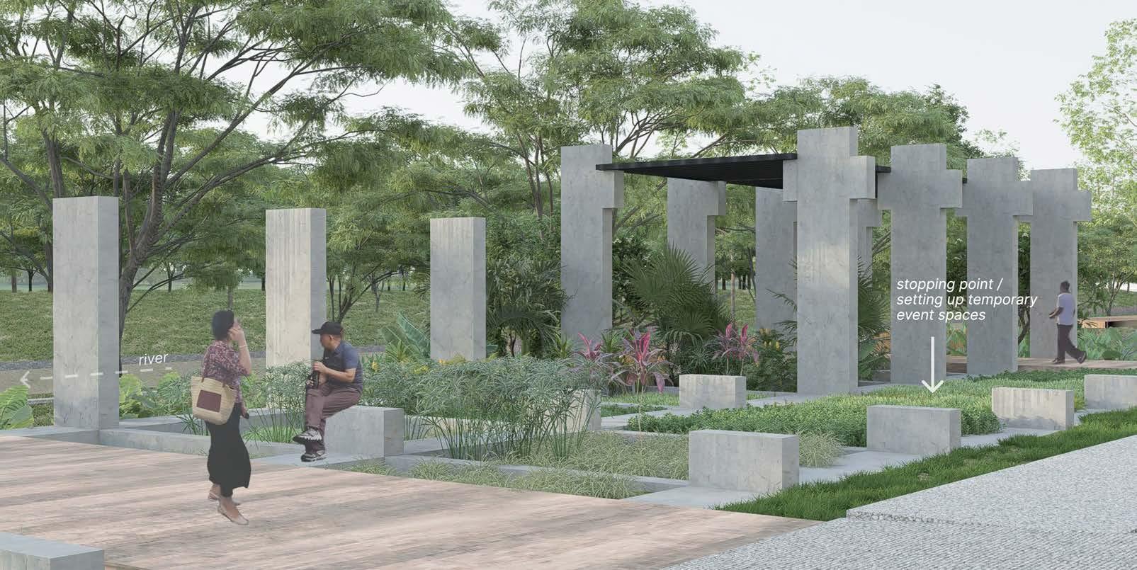
Human Hands, Butterfly Wings
Cao Yutong
Tutor: Janice Tung
This project restores the habitat of Arhopala pseudomuta (Raffles’s oakblue butterfly) at Paya Lebar East. The site, once characterized by coconut and rubber plantations, transitioned into a quarry in 1912, leading to residential settlements for quarry workers. Quarrying declined after 1981, and the site was eventually designated as a reserved area.
Arhopala pseudomuta is vital to the ecosystem, supporting plant pollination and forming a symbiotic relationship with ants, where larvae provide nectar in exchange for protection. However, habitat loss due to urban sprawl, reduced host plants, and pesticide use have threatened its survival, highlighting the need for habitat restoration.
The project examines the butterfly’s ecological needs— host plants, movement, and life cycle challenges—to develop a restoration strategy. During the larvae stage, Ficus tree leaves offer food and protection, while adults rely on nectar-producing plants like Lantana camara L. for sustenance. Threats include invasive species, such as red fire ants, and the need for access to water bodies for essential minerals. The butterfly’s daily activity range of 50–200 meters guides site organization, with rainwater collection points forming ponds spaced 200 meters apart. These water bodies act as ecological anchors, supporting the butterfly’s lifecycle.
Host plants are strategically deployed to match growth stages and succession sequences. Taller trees provide ecological buffers, while shrubs and herbs serve as food sources. Plants are arranged in rings to maximize sunlight exposure, creating ecological steppingstones to support butterfly movement. Existing site structures are repurposed into offering educational tours about the butterfly’s lifecycle and ecological importance. A western loop trail immerses visitors in the restored habitat, fostering connections between humans and urban ecology.
The Fifth Nature concept frames the project as a dynamic habitat system, addressing specific site and species needs through layered design. The evolving system enhances biodiversity and stability over time. Initial efforts focus on key areas to support the butterfly’s life cycle, while subsequent phases integrate multiple species, creating a multi-dimensional habitat of shrubs, trees, and open spaces. This approach transcends traditional conservation, promoting coexistence and ecological integration. By fostering reciprocal relationships between humans and the environment, the project serves as a model for sustainable urban ecology.
Unbounding Nature
Clarissa Ke Li Wen
Tutor: Janice Tung
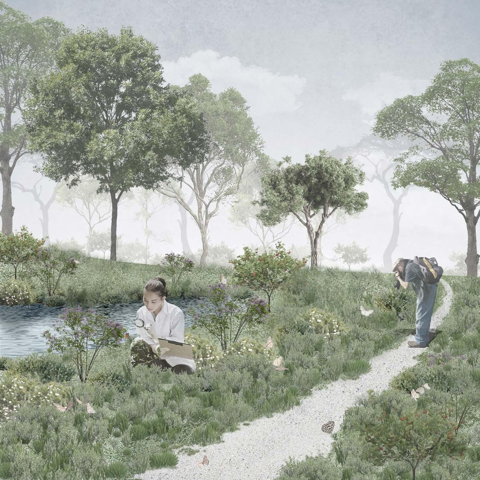
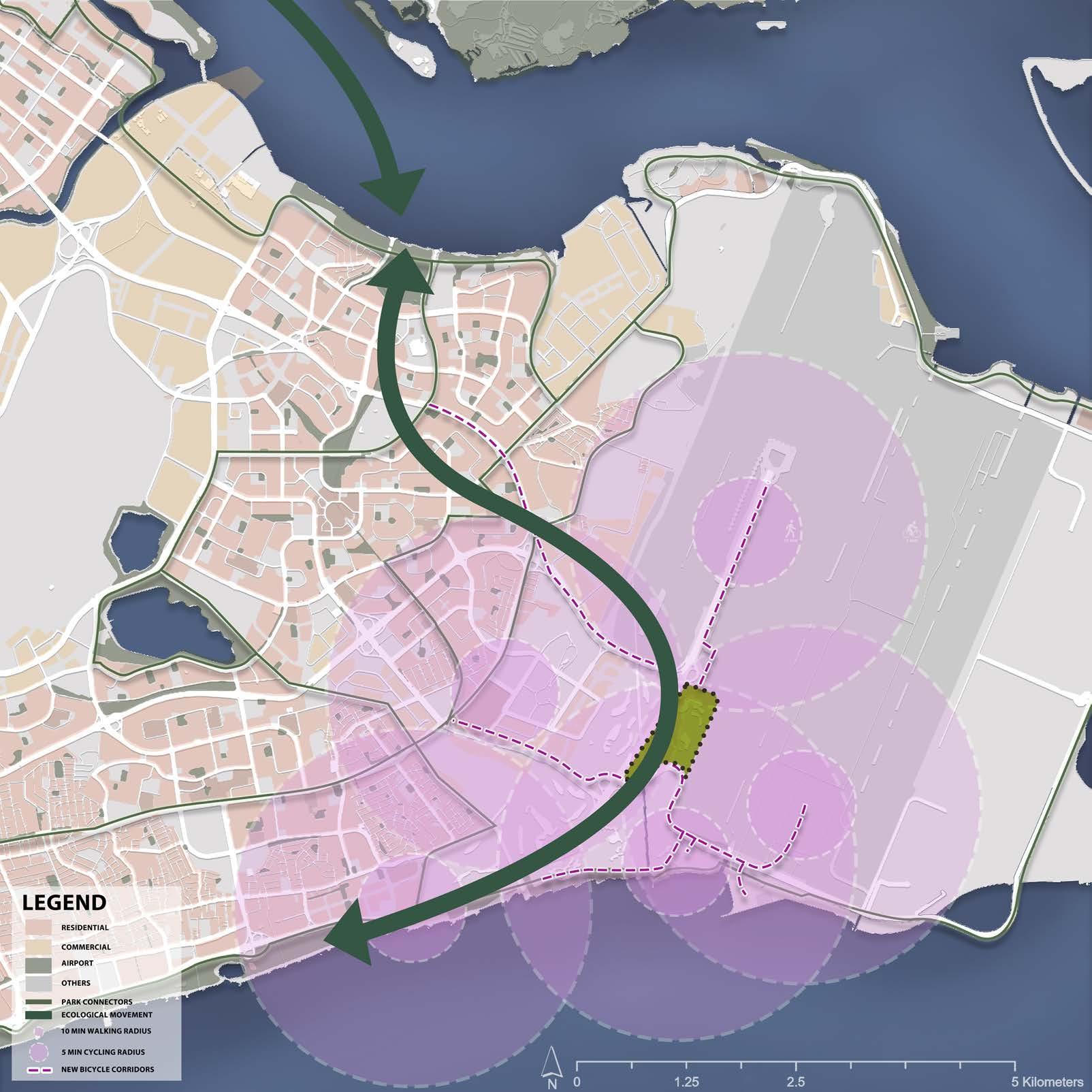
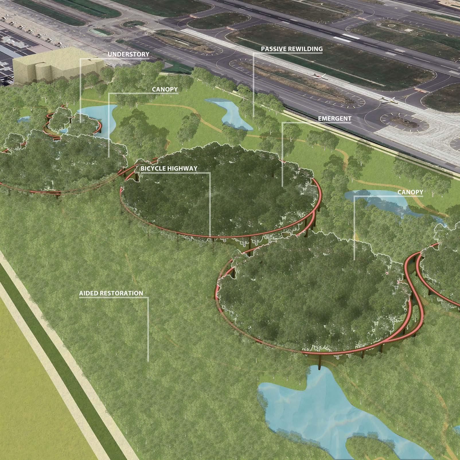
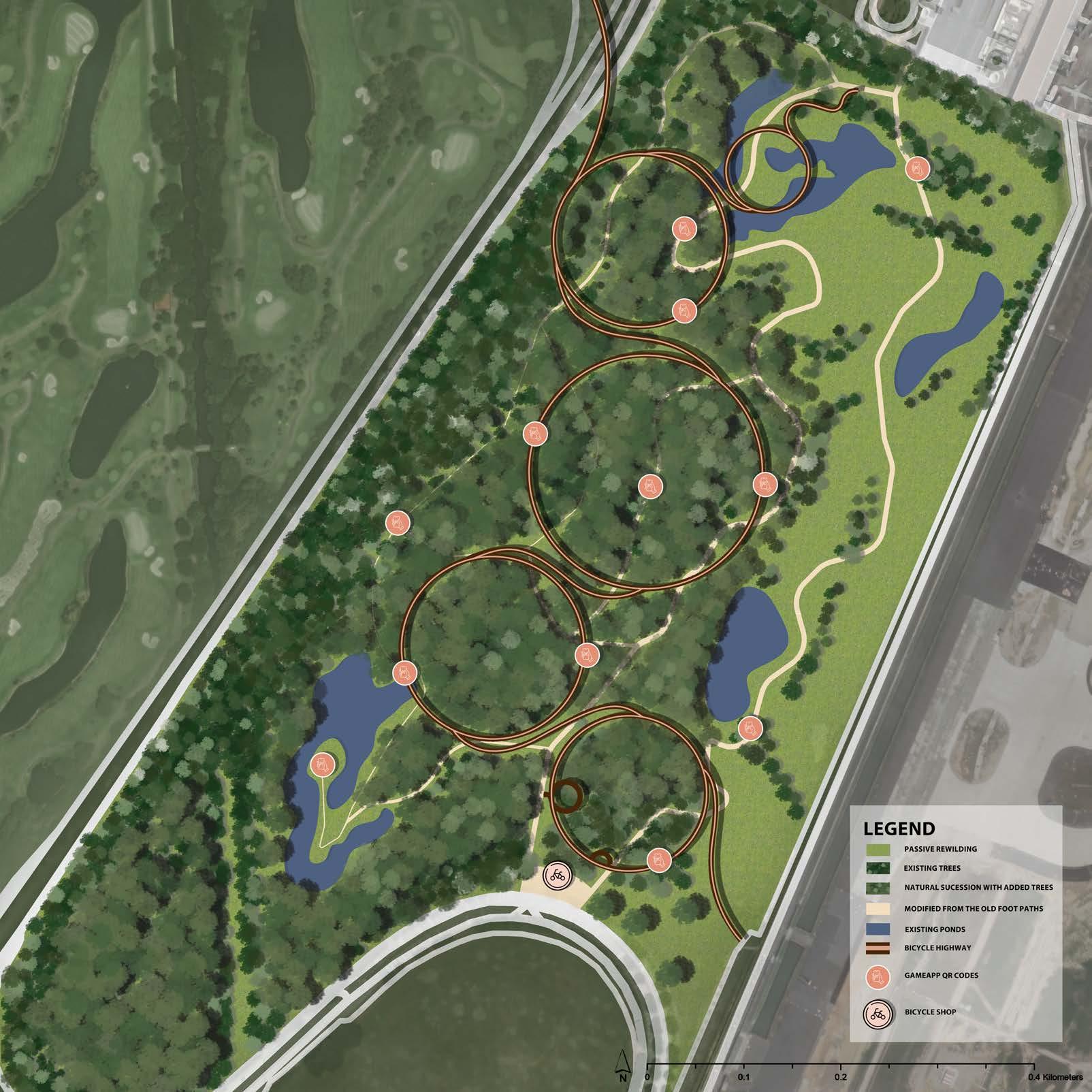
The Tanah Merah Country Club Garden Course near Changi Airport is an exclusive, privately owned golf facility. As Changi Airport plans further development, speculation grows about the future of the course, with the possibility of transforming it into a publicly accessible space. Currently, its exclusivity is reinforced by its isolation—bordered by airports and golf courses—and its monoculture landscape, which limits biodiversity. Access is restricted to club members and guests, reinforcing its private nature. This spatial exclusion reduces the efficiency of land resource utilization as the current golf course is socially and ecologically exclusive. To transform this exclusive space into a more inclusive environment involves a 2 stages approach. The initial stage employs three strategies, converting half of the site into an accessible, democratic landscape, integrating human activity, biodiversity, and technology. The Second stage focuses on the designated temporal reserve zone, influenced by the design outcomes of the first phase. This “reserve within a reserve” serves as a platform for studying biodiversity recovery through a combination of aided ecological restoration and passive rewilding.
The first strategy aims to reclaim the golf course into a forested habitat by reintroducing facilitating and accelerating successional processes along the East Asian Australasian Flyway, which passes through the site. Allowing natural succession by retaining the existing trees on the site and adding native plants that attract and support the local species. This increases the opportunity for pollination and dispersal, growing into a forest. This approach creates an ecological stepping stone for local species of birds and pollinators as well as a pitstop for migratory birds. Establishing a landscape continuum across the island via transportation (PCN) and ecological connections, facilitating the movement of humans, flora, and fauna. By thoughtfully integrating spaces where human and wildlife activity intersect, the design balances accessibility with ecological sensitivity, enhancing environmental connectivity while providing meaningful experiences for visitors.
The secondary strategy focuses on enhancing connectivity through an extensive network of retrofitted walkways and
new bicycle highways. Positioned with the consideration of desired lines and connectivity to key adjacent areas like Changi Airport, Expo, East Coast Park, and an upcoming MRT Station, the new transportation network will facilitate movement and accessibility. The bicycle highways were designed to intertwine into the 4 layers of a forest, allowing users to observe the various flora and fauna changes within a forest.
The third strategy leverages technology to create an interactive, democratic environment. An app inspired by Pokémon Go and geocaching will encourage users to document sightings of local flora and fauna, promoting active exploration and deeper engagement with biodiversity. The collected data will contribute to an open platform, supporting scientific studies and conservation efforts. This citizen science initiative will also inform the landscape design of the remaining third of the site, allowing for data-driven decisions that prioritize ecological restoration.
In the second stage, the data collected and observation studies of the difference between biodiversity recovery through both active ecological restoration and passive rewilding will be used to reinform the design of the remaining third of the site. This data collection and studies play a major role in empowering the animal agencies and plant agencies with a voice on how they would like to design the site. Creating an inclusive and democratic landscape for humans from all walks of life as well as the animals and plants in the area.
In conclusion, transforming the Tanah Merah Country Club Garden Course into an inclusive and sustainable space represents an innovative approach to urban development that prioritizes social, ecological, and technological integration. The two-stage strategy leverages ecological restoration, connectivity, and interactive technology to reimagine the site as a multifunctional landscape. Ultimately, this transformation not only maximizes the efficiency of land resource utilization but also serves as a model for future developments that harmonize urbanization with ecological stewardship.
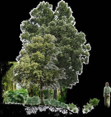
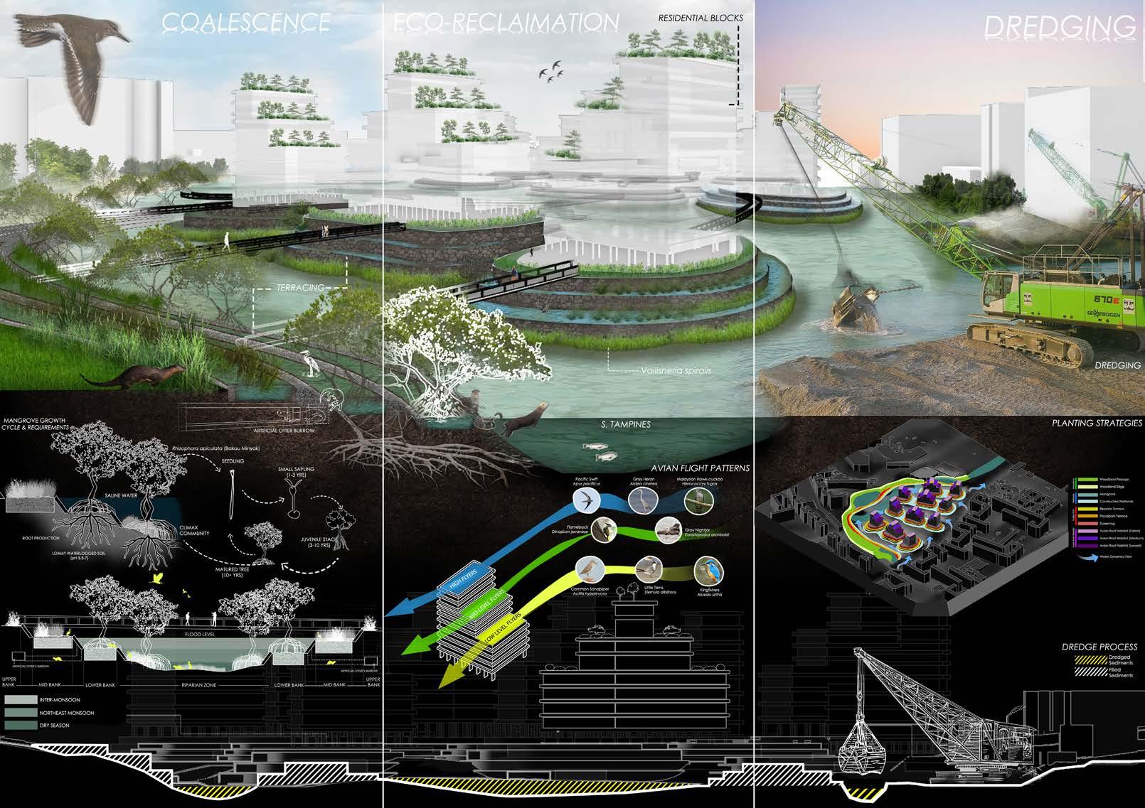
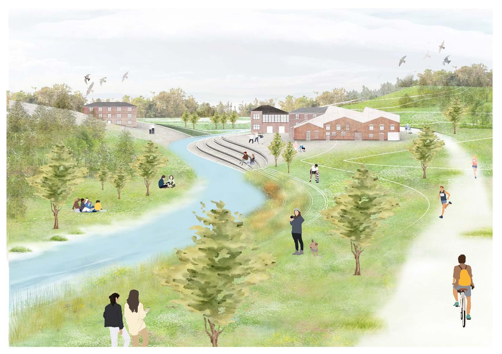
Living Symbiosis
Shruthakeerthi Karthikeyan
Tutor: Janice Tung
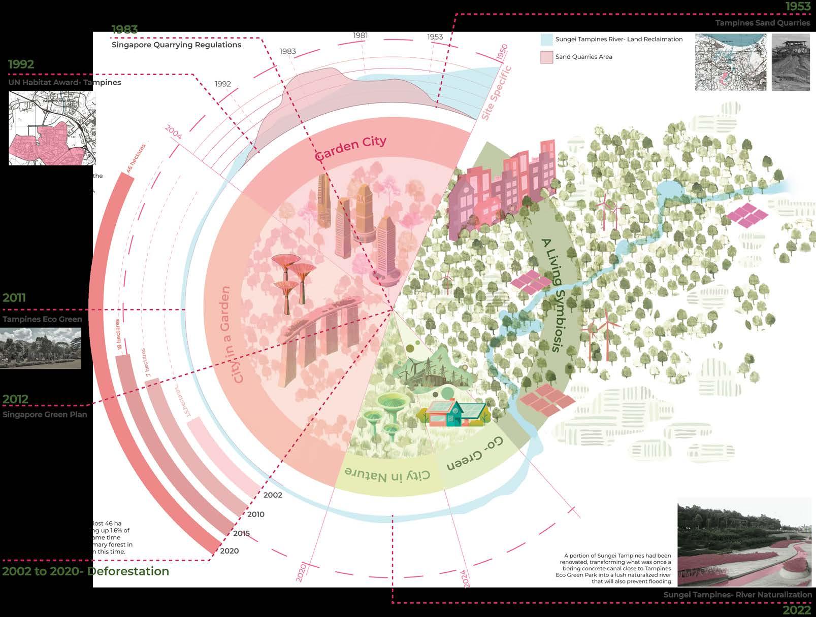
Tampines is a UN-Habitat award-winning site in Singapore. At its heart sits a secondary forest known as Tampines Eco Green. This space acts as a landscape hub for the community but primarily attracts individuals seeking to experience ‘untouched nature’.
This site has been an outlier throughout history, managing to escape the clutches of infrastructural development as the areas surrounding it saw changes in occupation, land use and people. However, it has managed to remain a centrepiece in the community since its opening in 2010.
But what does it truly mean to be a part of a community? The word is often associated with belonging, but its origins come from the Latin word communis which means ‘to be shared by all’. This site presents a paradox; being a communal natural space that the community engages with seldom, and only for recreation.
This disconnect made me aspire to redefine community spaces in a way that fosters a better relationship between humans and their environment. Nature isn’t a break from life, it is a part of it. This fifth nature project envisions a future where nature and technology form a dynamic partnership creating a responsive ecosystem. It fosters a symbiosis between the internal and external actors of the site and establishes a self-sustaining loop that is capable of adapting to change. The environment thus created has an agency of its own. In the long run, it enables a community that is capable of meeting its food and energy consumption needs.
The project will unfold in phases. The initial phase emphasizes the development of human and non-human actors independently. This is significant to regenerate ecological systems. The limitation of human interaction lays the groundwork for improving the biome.
A major aspect of this project is strengthening the existing secondary forest. However, to create a selfsustaining community while doing so requires both the non-destructive
maintenance of the wooded land and an analysis of deficient resources for humans. So, the solution is two-fold:
Ecological: This includes replanting strategies to promote the idea of permaculture and creating a denser forest. The work of maintenance falls on the forest itself. Allogenic engineer species such as turtles, otters and zooplanktons, are employed for ecosystem management due to their natural behaviour.
Technological: While the forest is a provider of many resources for the community around, it cannot fulfil the demands entirely. Technological interventions lend themselves to bridging this gap and increasing the sustainability quotient. It includes incorporating renewable energy solutions, retrofitting urban structures, etc., compensating and enhancing what the ecological systems couldn’t achieve in isolation.
By balancing ecological and technological strategies, A Living Symbiosis aims to create a model of coexistence. The interventions are designed to evolve, allowing the community to adapt and thrive alongside nature. In doing so, Tampines Eco Green can transcend its current role as a niche nature hub and become the heart of a sustainable, inclusive future.
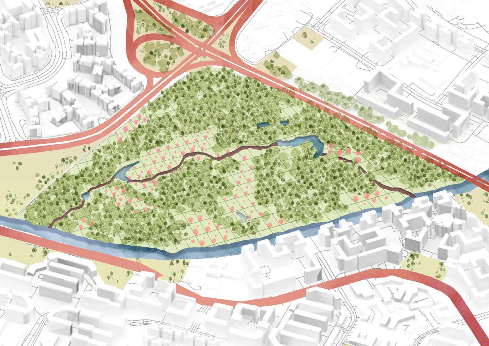
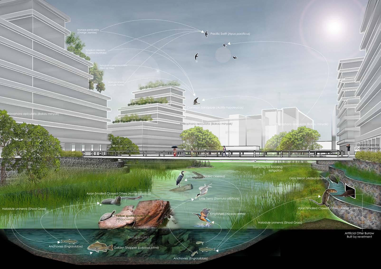
Legend
Existing Trees and Plantations
New/Proposed Trees and Plantations
Planting Proposal
New Planting Area= 5.48 ha
Native Angiosperms
Tembusu (Cyrtophyllum fragrans)
Sea Apple (Syzygium grande)
Singapore Kopsia (Kopsia singaporensis)
Rengas Tree (Gluta wallichii)
Malayan Teak (Vitex pinnata)
Fruit-Bearing Plants (Native and Cultivated)
Mangosteen (Garcinia mangostana)
Rambutan (Nephelium lappaceum)
Jackfruit (Artocarpus heterophyllus)
Papaya (Carica papaya)
Banana (Musa spp.)
Wild Fruits
Sea Almond (Terminalia catappa)
Singapore Rhododendron (Melastoma malabathricum)
Elephant Apple (Dillenia indica)
Indian Gooseberry (Phyllanthus emblica)
Cempedak (Artocarpus integer)
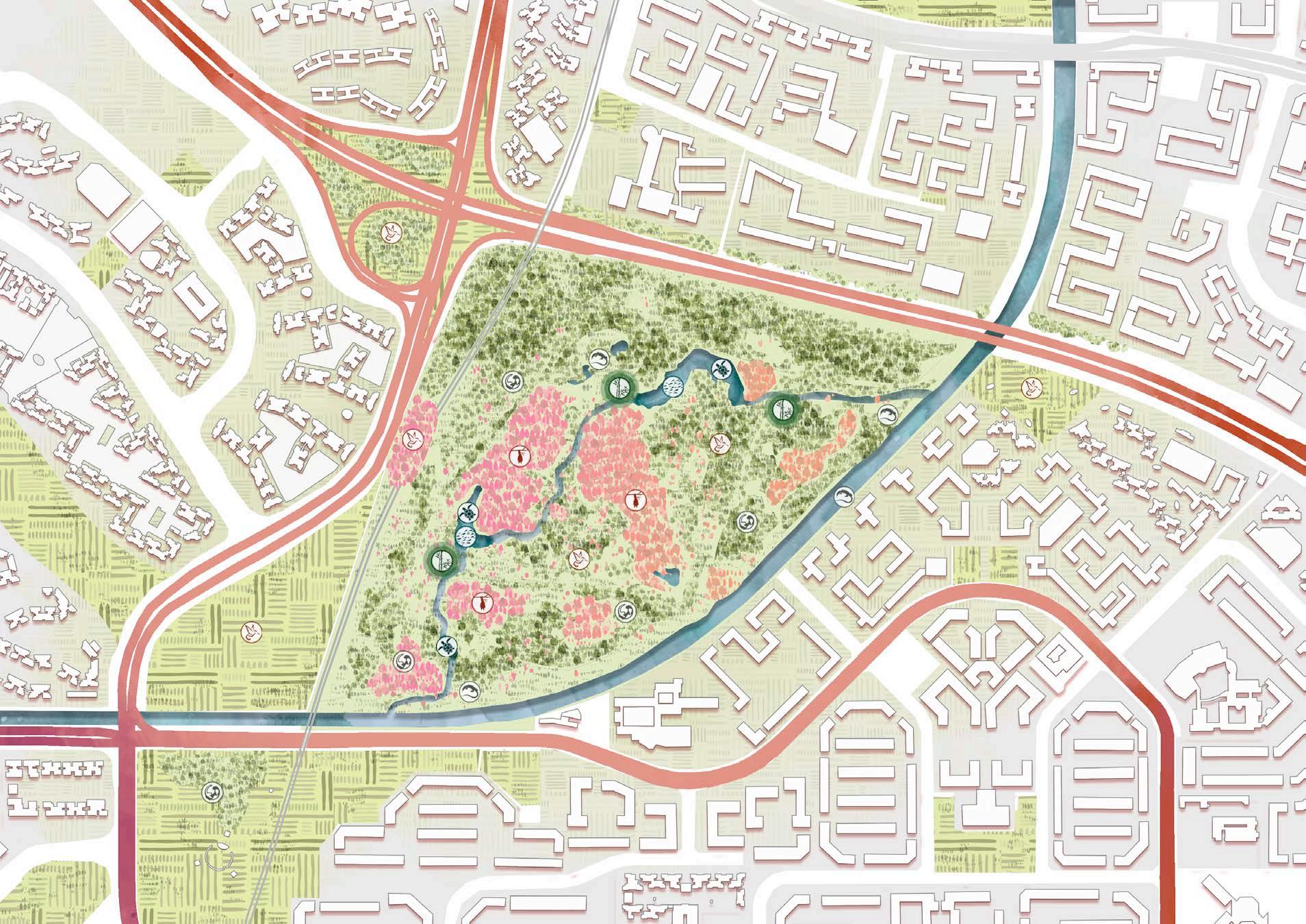
Ecological Systems
Bank Stabilization
Zooplankton
Biofilms, which are made up of microorganisms and can stabilize sedimentary environments.
Bambusa
Bamboo is a natural fiber that can be used to stabilize slopes and control erosion.
Mineral Transfer
Poecilia reticulata
Fish absorb minerals from their diet and from the water through their skin and gills.
Testudines
Turtles provide a links between aquatic and terrestrial ecosystems, transporting nutrients.
The direction of the flow of water also determines the flow of minerals.
Pollination
Soil Tilling
Pteropodidae
Fruit bats are important pollinators that help spread seeds and pollinate crops.
Flowers pollinated by sunbirds often have long tubular flowers with lots of sugary nectar.
The pollination allow for the forest to grow organically beyond the boundaries.
Nectariniidae Varanus
They dig large, intricate burrows or warrens for the purpose of laying their eggs.
Lutrinae
Otters burrow in underground dens called holts, which are often located near water sources
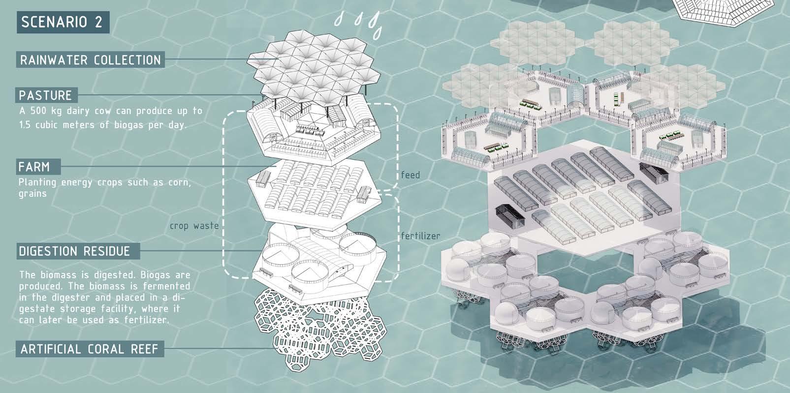
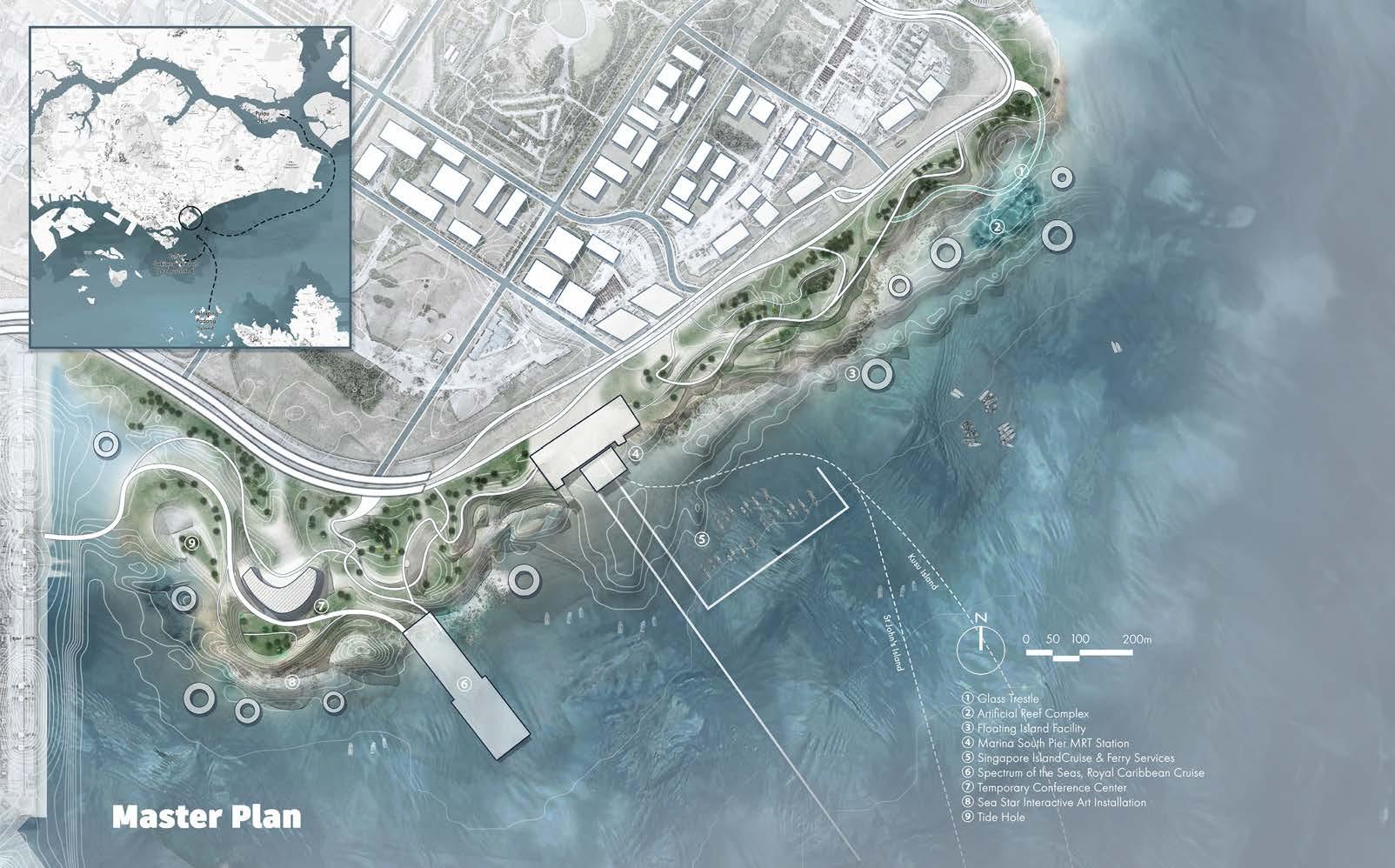
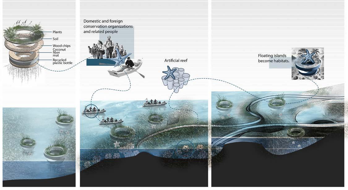
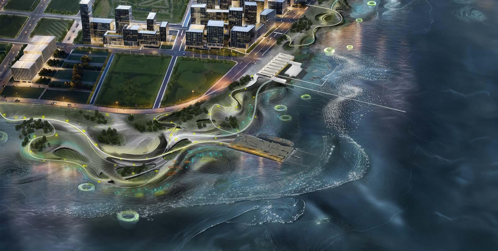
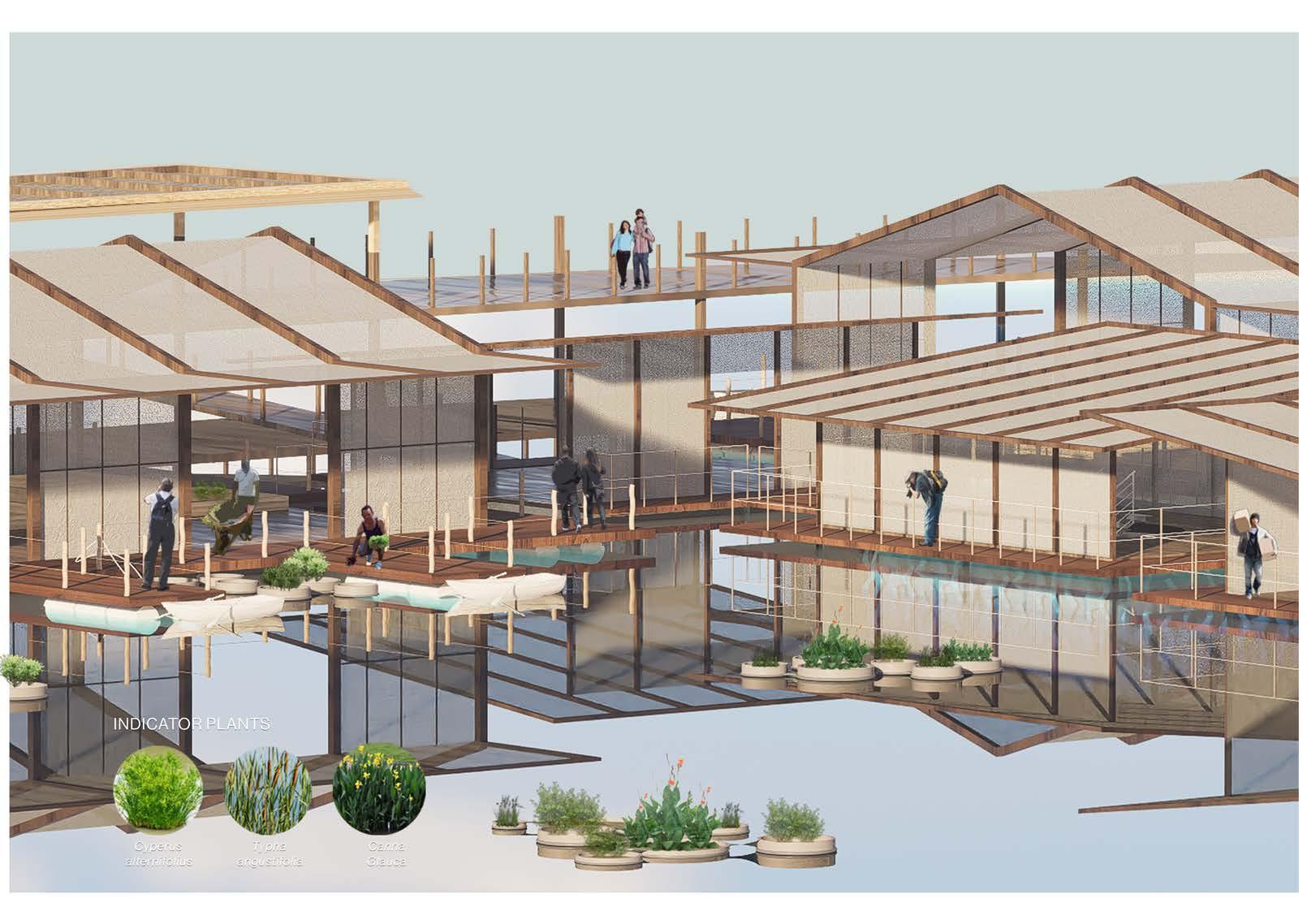
Modular Islands
Luo Siqi
Tutor: Janice Tung
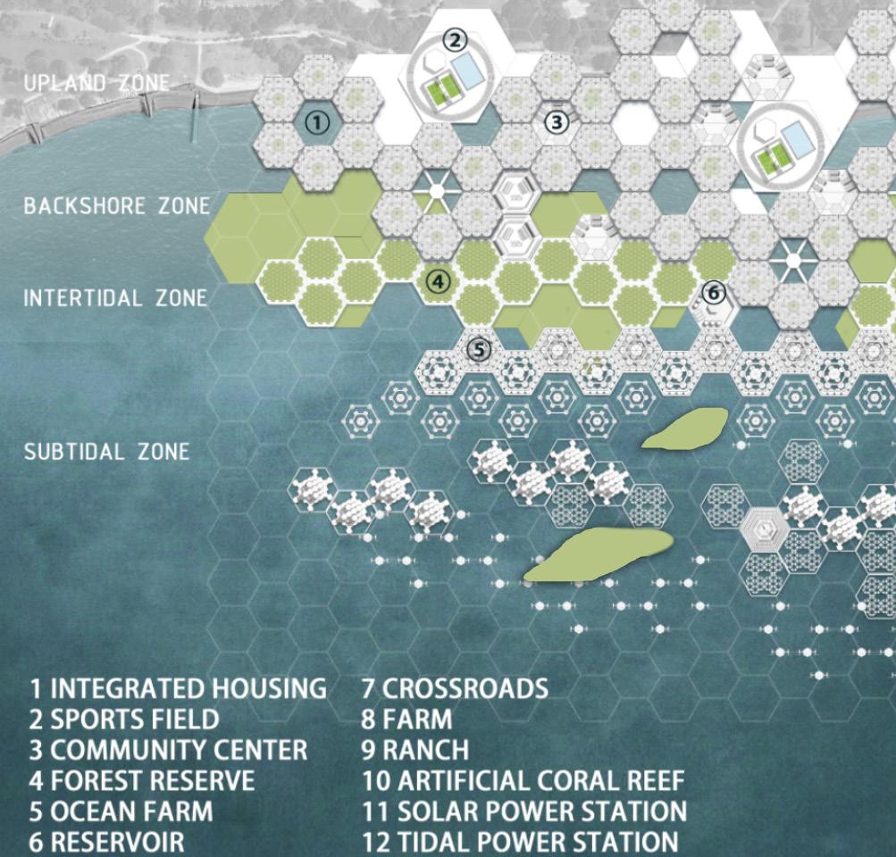
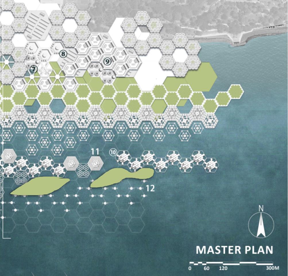
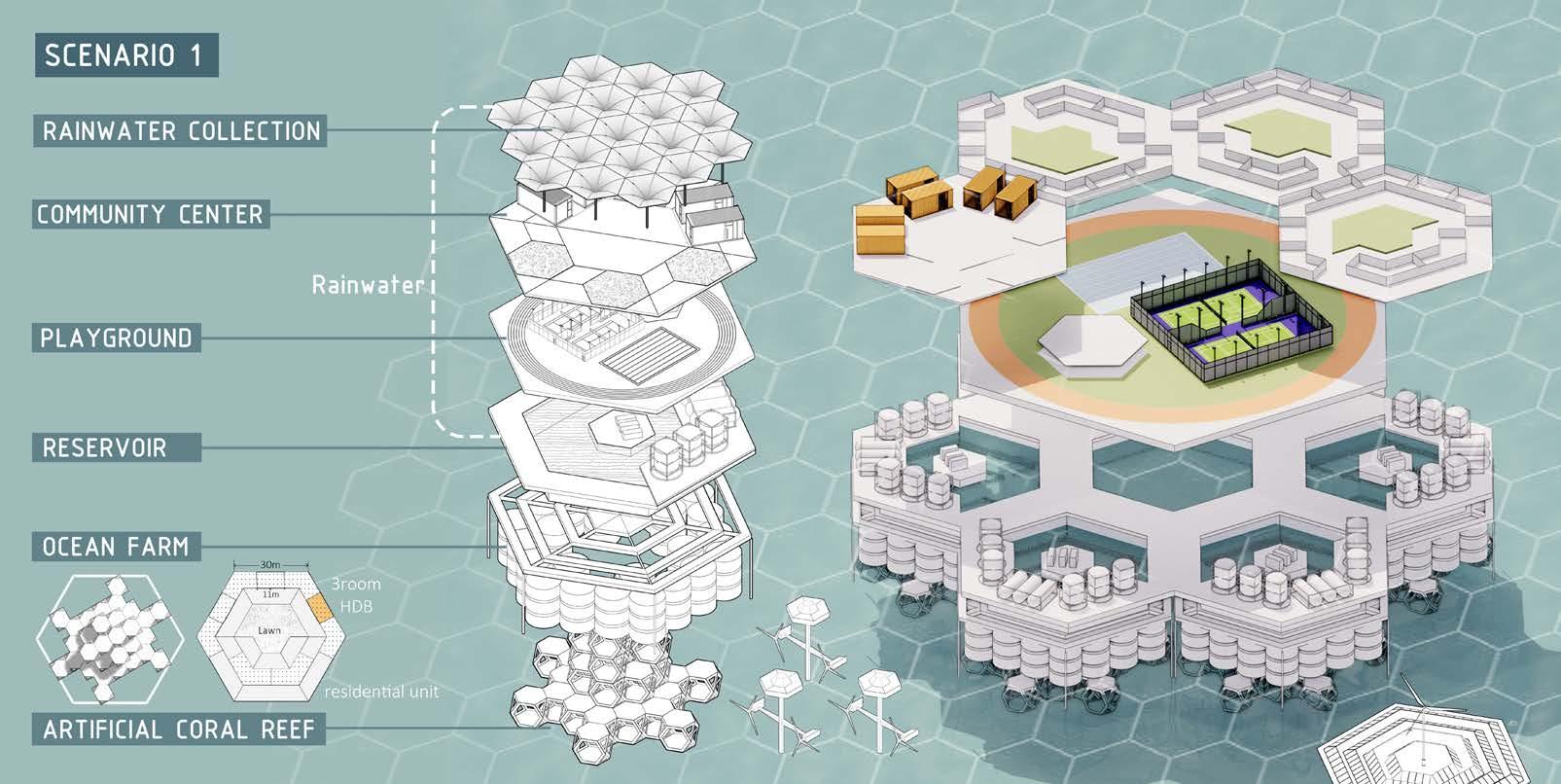
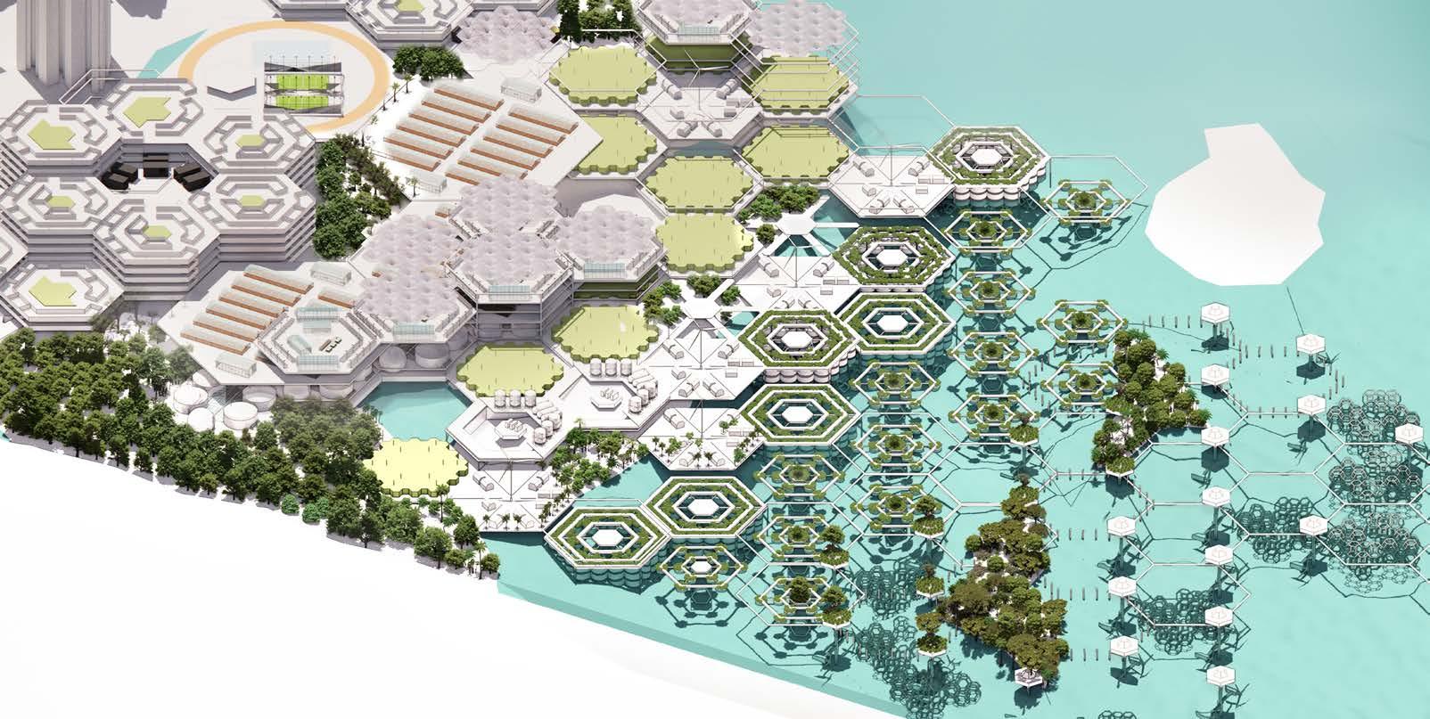
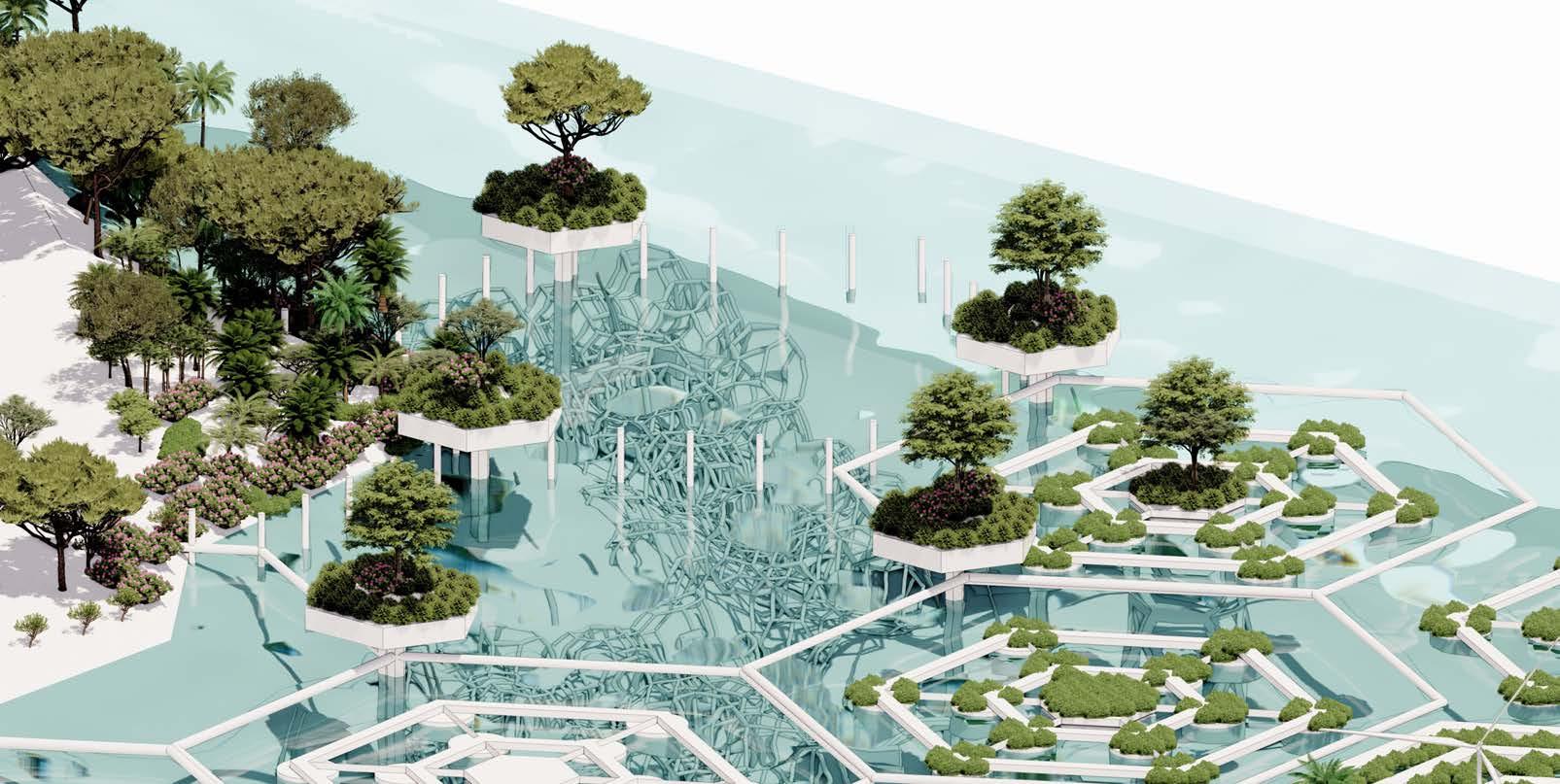
This project embraces the indeterminate natures of sea level rise – a global, irreversible, and gradual phenomenon that poses significant threats to both human and natural systems. It seeks to reconceptualize how coastal habitats can accommodate rising water levels, enabling coexistence between human life and ephemeral aquatic ecologies. Address this universal challenge requires adaptable solutions that transcend geographical, environmental and cultural contexts. The design intervention adopts concepts of modularity and integration as design principals; drawing inspiration from the Metabolism School of Architecture. Flexible, scalable structures combined with cost-effective prefabrication and assembly technologies are envisioned to adapt urban systems to dynamic natural conditions. Additionally, compact, dense urban geometries are deployed to further enhance social efficiency while simultaneously addressing critical ecological and infrastructural needs.
The first strategy involves modular urban facilities, utilizing hexagonal forms of varying scales to create a standardized yet variable array of urban elements. These modules are multifunctional: encompassing infrastructure, ecological protection, habitat structures and public spaces. The hexagonal framework is not limited to man-made elements, but also natural space. The modules are systematically classified by function, spatial orientation, or heights, facilitating systematic synergies and functionality. Functional groupings include elements such as breakwaters and wave-breaking blocks, while hierarchical relationships between scales ensure inclusivity and compositional synergy. The modules are an armature which enables iterative growth across scales: from site to the region; while maintain coherence and adaptability.
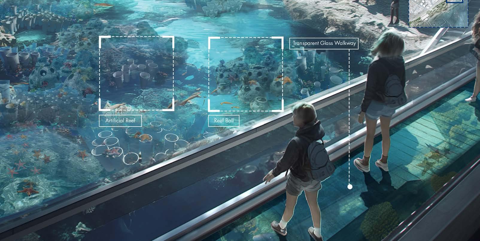
The second strategy emphasizes a dynamic and phased adaptation. In the short term, costal interventions modules operate together in response to tidal fluctuations. Artificial coral reef habitats, for example, will provide ecological services at varying water conditions - offering refuge and food source for migratory birds during low tide with specially designed footholds, while remaining submerged during high tide.
Similarly, wetland trails on the seashore will intermittently emerge; and floating infrastructure such as solar water purification facilities will maintain operational and connected, on sea level. For long term adaption, a phased transformation will be orchestrated in alignment with the projected sea levels, establishing a framework for urban evolution.
This project critiques the limitations of conventional master planning, advocating instead for an adaptive, flexible approach that responds to temporal environmental dynamics. Addressing sea level rise necessitates a paradigm shift from resistance to coexistence. By embracing modularity with nuanced understanding of climate change and environmental processes, this project proposes an adaptive urban framework that harmonizes ecological, social and infrastructural priorities, offering a vision for coastal resiliency in Singapore and beyond.
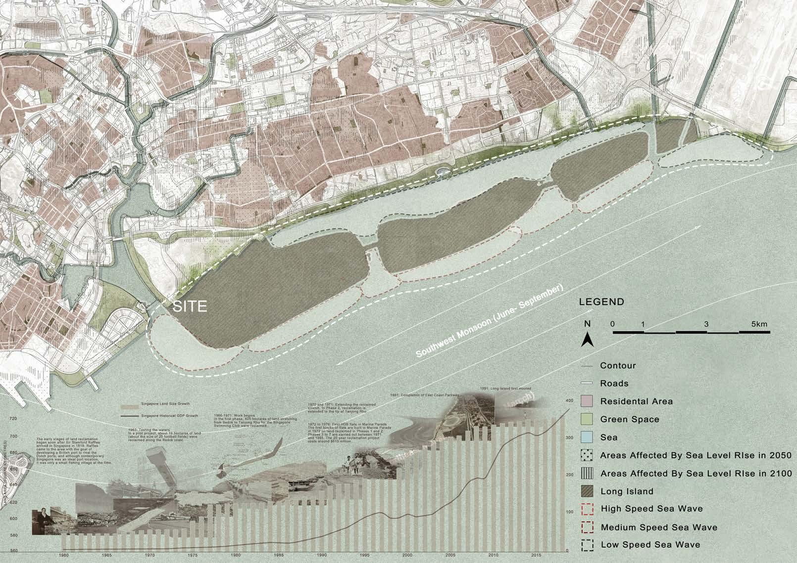
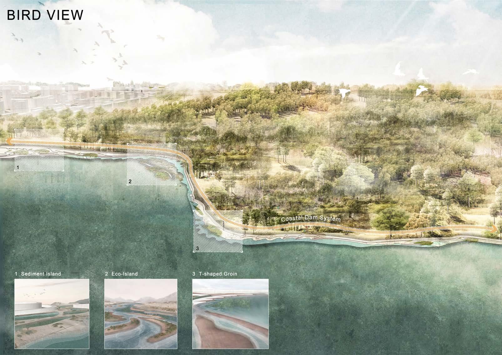
The T-Weave
Pan Yuwen
Tutor: Janice Tung
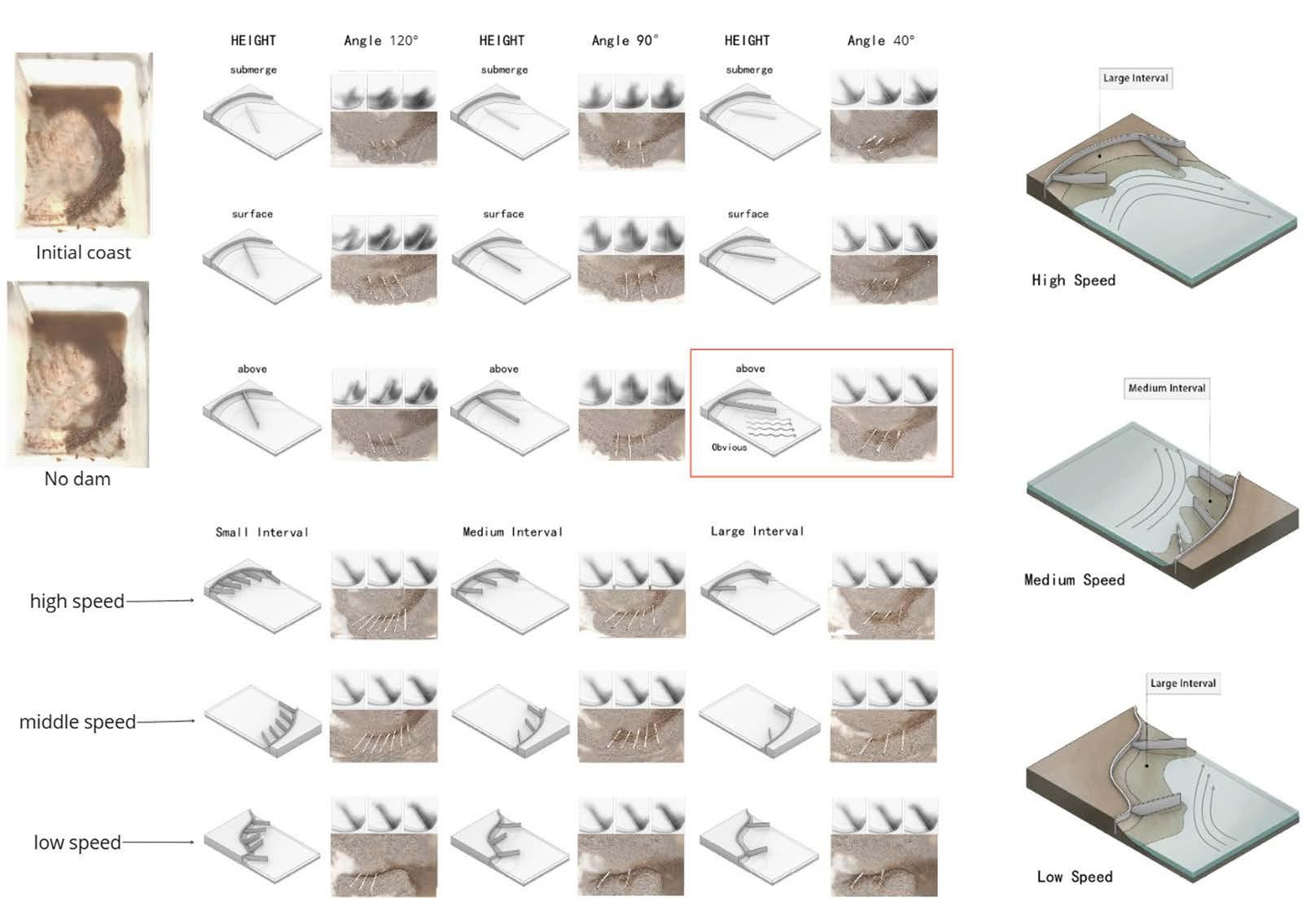
The project is conceived as a multi-functional groyne device around Singapore’s Long Island area. It integrates ecological protection, coastal resilience, and innovative visitor experiences. Designed to be 5-7 meters above ground level, the groyne provides visitors with a unique perspective of nature. It serves as a protective structure in response to Singapore’s coastal sprawl and climate change. The groyne device is the backbone for future regional development and expansion of Long Island. This design responds to multiple challenges posed by climate change, rising sea levels and urban development to the East Coast region.
A series of angled breakwater structures forms the lower level of the groyne to enhance sedimentation along the shoreline, mitigate wave inundation, and strengthen coastal protection. Detailed simulation tests identify the optimal height and angle of these structures to effectively absorb and disperse highenergy waves, preventing coastal erosion. To further promote biodiversity, the breakwater surface adopts geometries inspired by mangrove root structures, forming a habitat armature which enables small marine organisms to attach themselves to it while supporting natural sedimentation processes along the coast. This simulated mangrove design not only strengthens coastline protection but also establishes an ecological continuum for coastal habitats.
The groyne serves as a flexible, multifunctional infrastructure connecting various ecological and recreational nodes, such as mangroves, wetlands, and ecological hotspots. In addition to viewing platforms, it incorporates features like educational hubs, integrated artificial reefs to promote marine biodiversity, and tidal pools designed for species habitat enhancement. These elements will allow visitors to engage deeply with the coastal ecosystem through hands-on learning and observation, while the structure itself utilises sustainable materials and designs that adapt to changing sea levels, reduce erosion, and support natural sediment accumulation, ensuring long-term ecological resilience and functionality.
As an integral part of the Long Island Plan, this groyne provides both environmental and social value. It not only offers a sustainable solution in coastal protection to help the Long Island region adapt to the challenges of climate change but also raises public awareness by demonstrating the role of mangrove forests and wetland ecology.
By designing a multi-functional ecological groyne, the project hopes to bring more profound environmental and social impacts to Singapore’s Long Island region, making the East Coast an interactive landscape that addresses climate change and biodiversity.
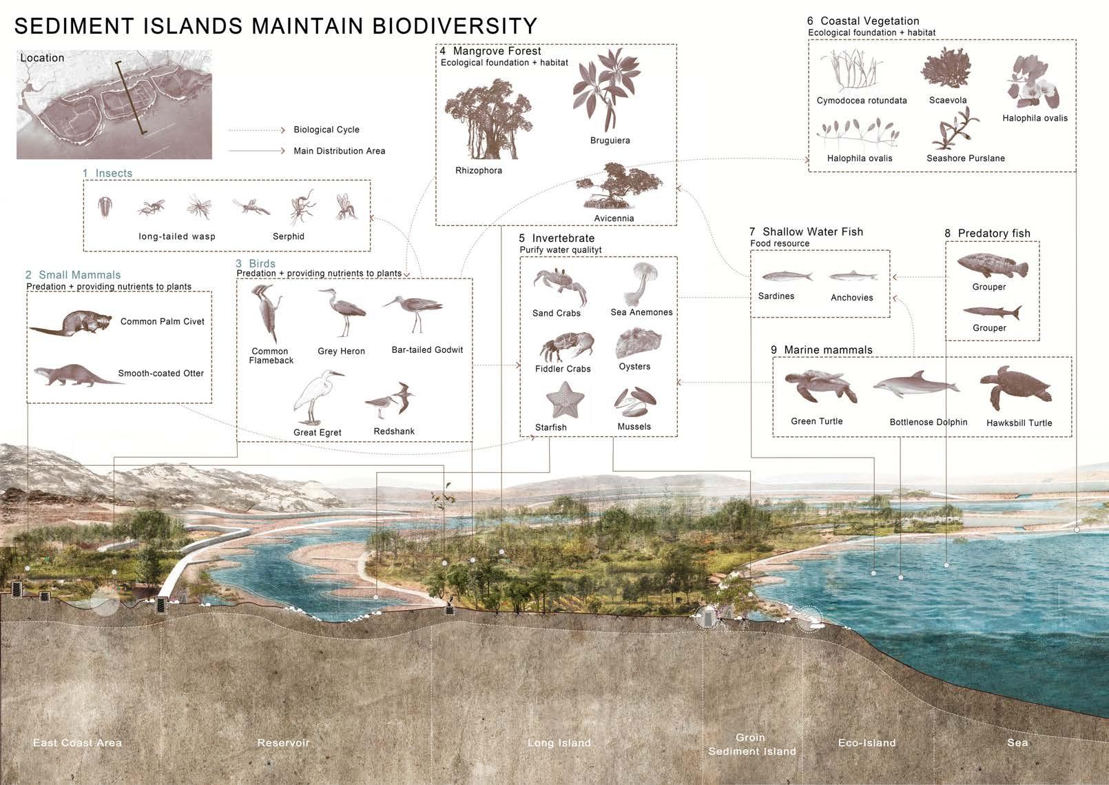
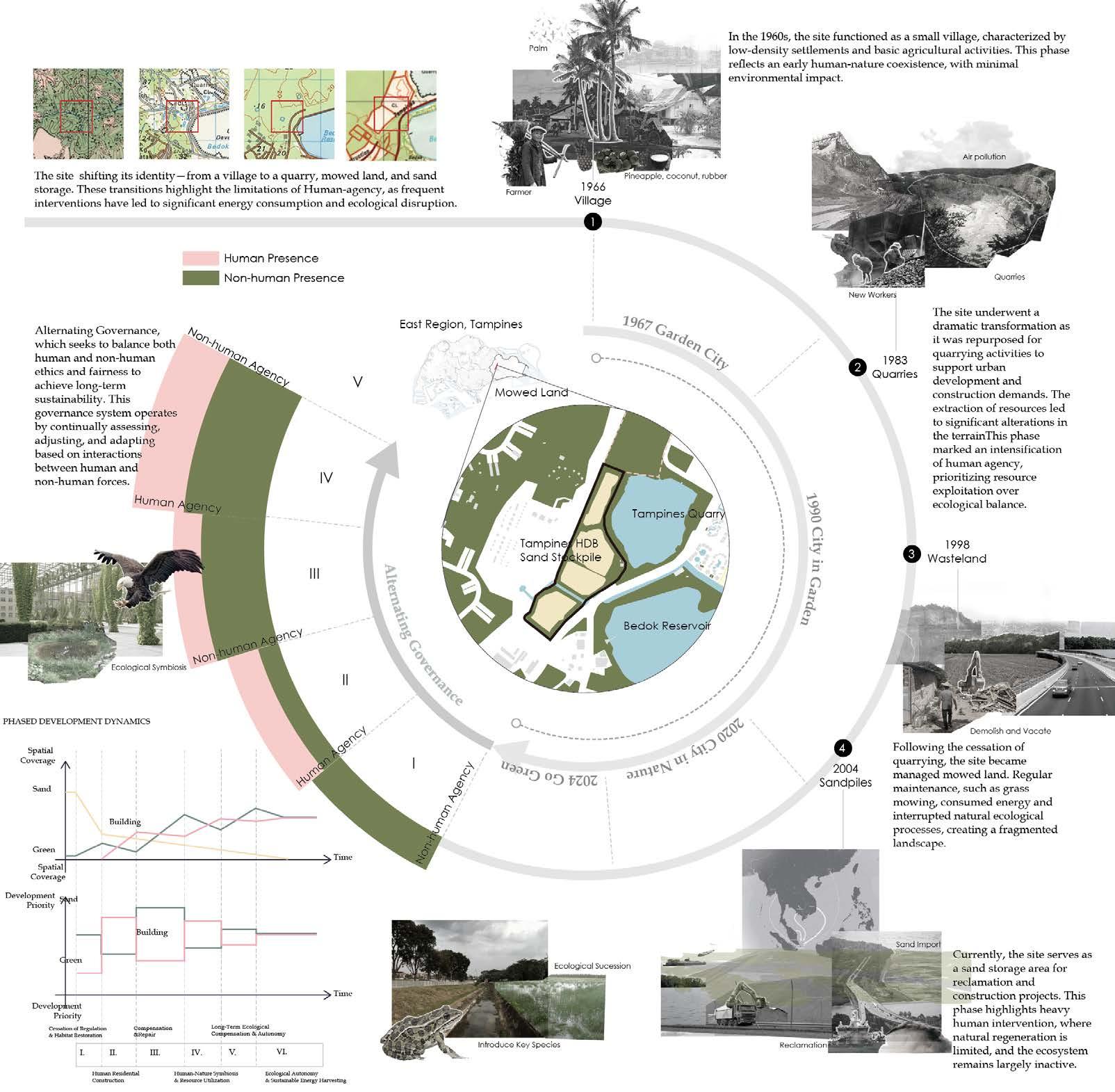
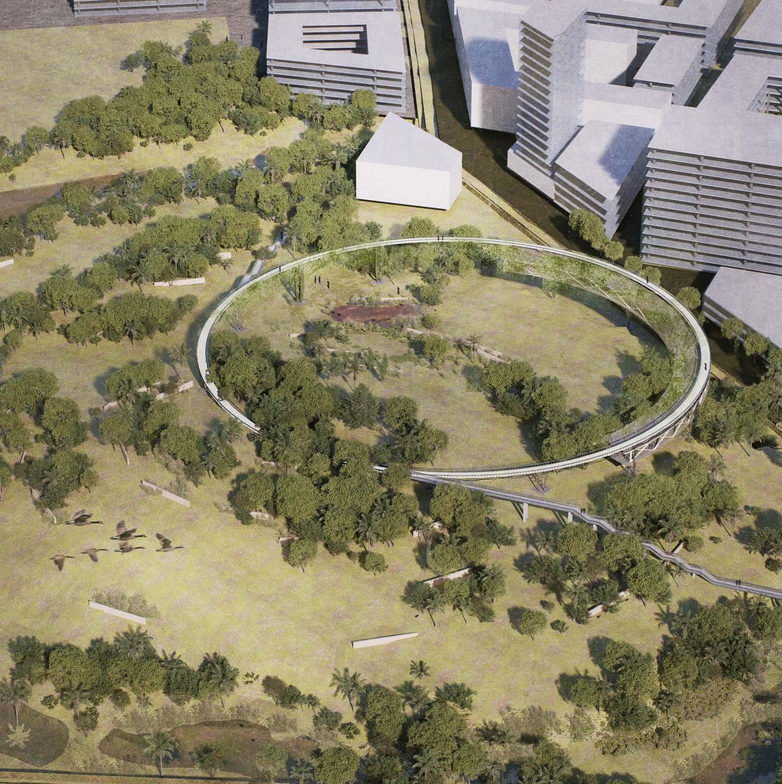
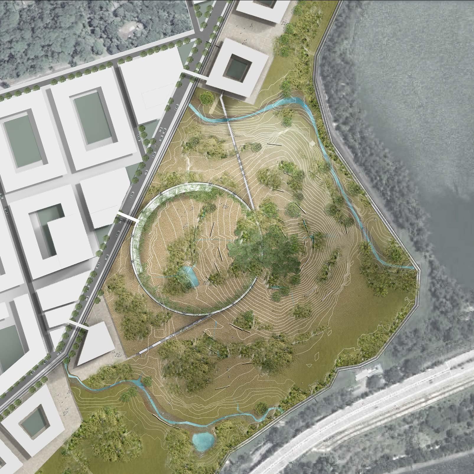
Cyclical Weave
Wang Wenhao
Tutor: Janice Tung
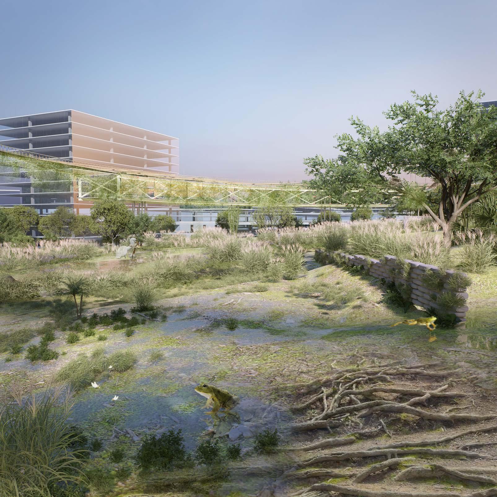
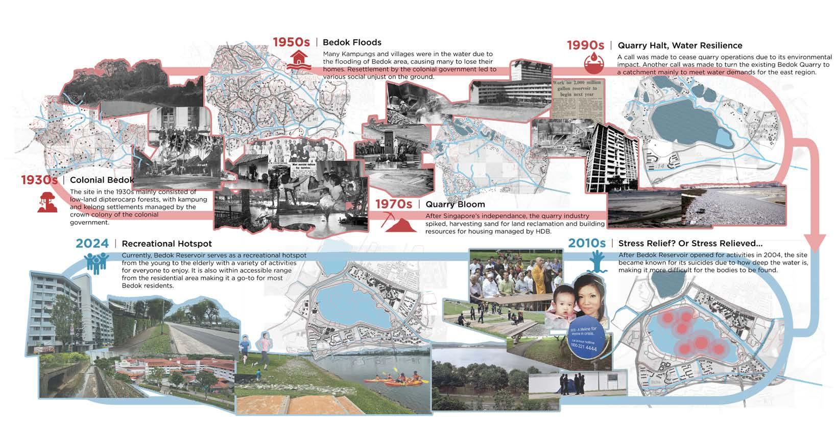
This project explores a site in Tampines, near Bedok Reservoir, that has undergone significant changes since the 1960s— from a village to a quarry, mowed land, and eventually a sand storage area—reflecting human agency through governmentdriven interventions. Such transformations highlight the limitations of human-led planning, including energy consumption and ecological disruption, resulting in fragmented habitats and reduced biodiversity.
The project introduces Hybrid Agency, a governance model alternating between nature-led and human-led phases, fostering ecological restoration while balancing human needs.
Phase One spans 30 years, beginning in the monsoon season, where natural processes form ponds. Strategically placed flood sandbags filled with sand and grass seeds guide the creation of river channels that foster ecological growth. This phase establishes critical habitats, such as a frog habitat linked by a frog ladder to Bedok Reservoir, while halting mowing allows native plants to spread, enhancing biodiversity.
Phase Two shifts to human-led governance. In addition to constructing residential buildings, humans build sand walls to rehabilitate sandpiles, capturing sediment during rainfall to facilitate plant succession. A circular pedestrian bridge is constructed for observation and activities, serving as both a functional and symbolic structure. Climbing plants begin to grow along scaffolding, creating an evolving green canopy.
Phase Three sees nature taking the lead again. The sand walls provide shelter for frogs, protecting them from predators, while frogs follow water pathways to reach a hillside pond for breeding. The vines growing on the bridge’s scaffolding offer nesting materials for birds, which establish nests in sheltered areas under the bridge. Additionally, the abundance of frogs attracts predators, contributing to a more balanced food chain and fostering a thriving ecosystem.
Phase Four resumes human governance, introducing public facilities to the circular bridge, which becomes a hub for
recreation and community engagement. The bridge is extended to connect with external urban areas, integrating the site into the surrounding neighborhood while maintaining its ecological significance.
The Hybrid Agency approach ensures an iterative process where human and non-human actors adapt to and learn from one another. This long-term strategy promotes biodiversity, reduces energy consumption, and supports ecological resilience, laying the foundation for Ecological Autonomy.
Sandbag: P2
Successional Vegetation (P3)
Frog ladder (P1)
Frog ladder (P3)
Successional Vegetation (P1)
Sandbag: P4
Bird's Nest (P3)
Ephemeral Lake(P3)
Ephemeral River (P1)
Pedestrian Skywalk (P2)
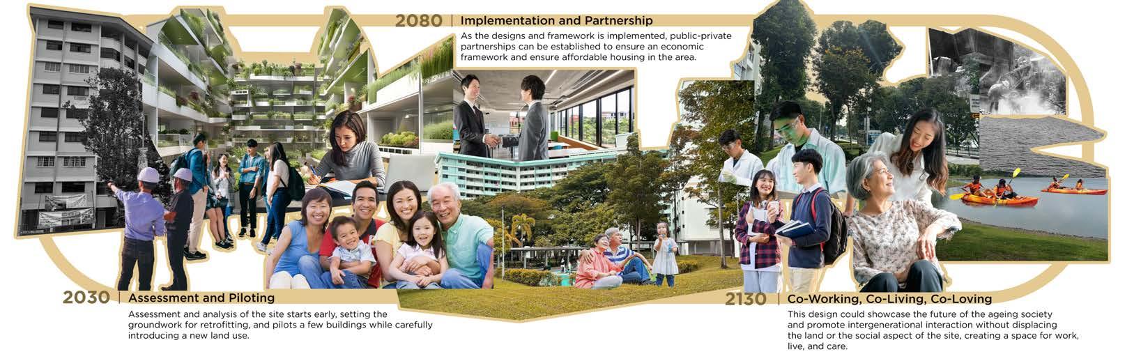
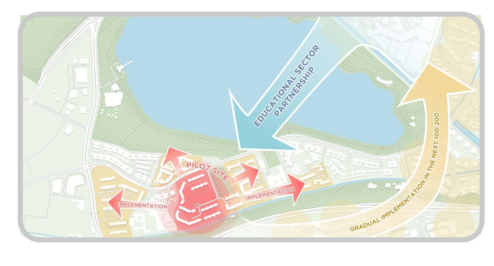
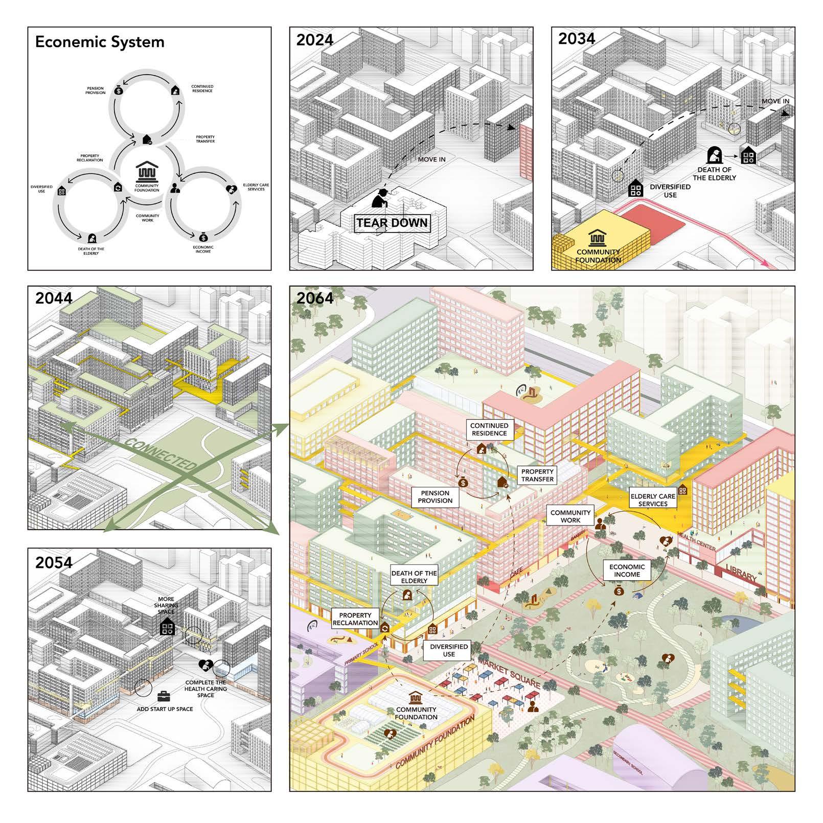
Co-Working, Co-Living, CoLoving @ Bedok
Wayne Tan Pei Wee
Tutor: Janice Tung
Bedok’s transformation over the decades tells a story of hange and displacement. What began as a forested hill with indigenous housing became a sand quarry, then a reservoir, and now a mix of recreational spaces and high-rise residential buildings. This evolution mirrors Singapore’s rapid urban development, often prioritizing economic progress over social heritage. For Bedok, this has meant the loss of close-knit communities and a sense of belonging, especially for older residents who were displaced over time.
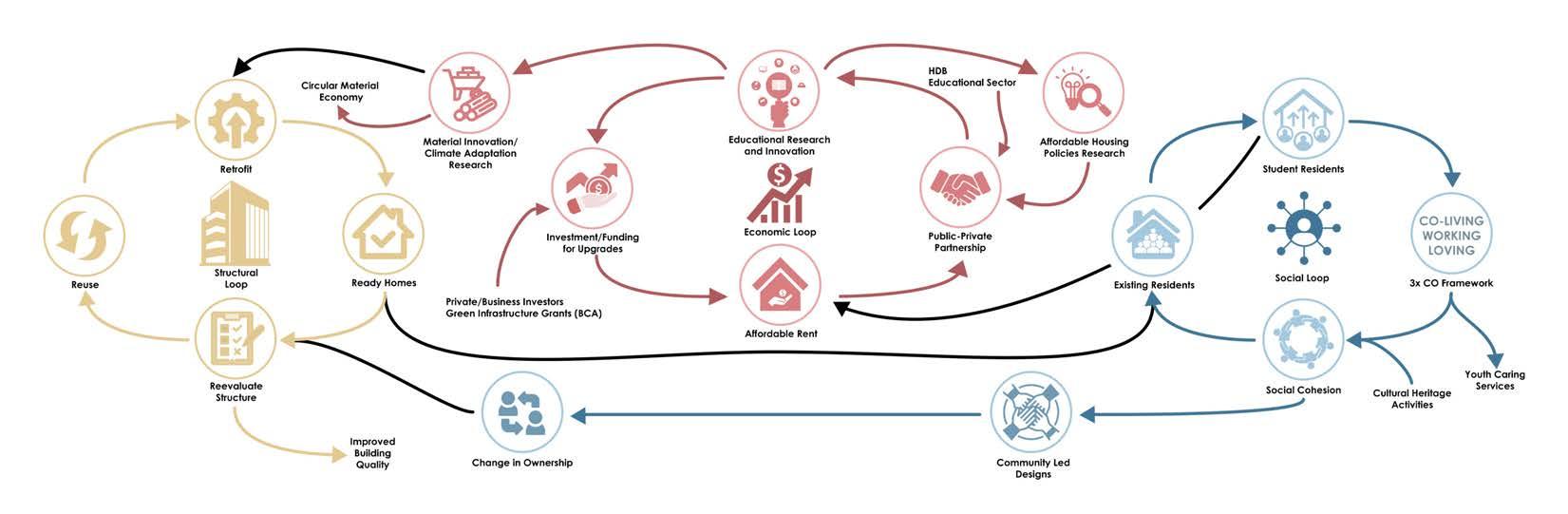
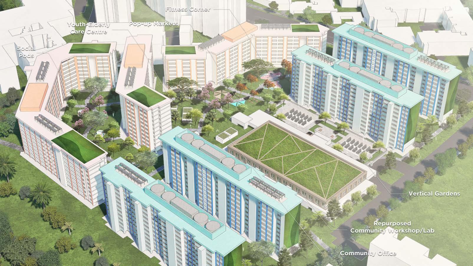
This project challenges the typical approach to redevelopment, which clears out land entirely for new developments, often disrupting lives and social networks. Instead, it proposes a new way to evolve residential spaces while preserving their social fabric. By retrofitting existing housing and blending old and new residents, it aims to maintain Bedok’s character and community connections while addressing Singapore’s economic goals.
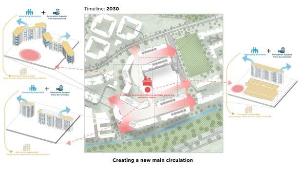
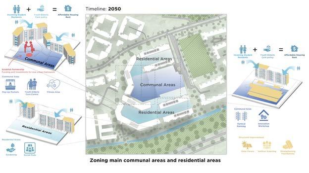
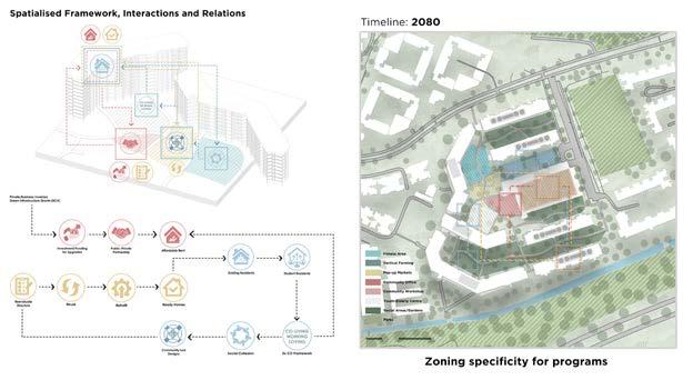
The proposed framework reimagines Bedok as a space where people of different generations and backgrounds can live and work together. It focuses on co-living, co-working, and coloving to foster a sense of community. Existing elderly residents who have deep ties to the area are encouraged to stay, while younger residents, like students, are introduced to bring fresh energy. Students contribute by engaging in affordable co-living programs that connect them with older residents through mentorship and shared activities. Partnerships between public housing authorities and educational institutions ensure the housing remains affordable and accessible. To avoid gentrification, higher-income residents are encouraged to move to other areas, freeing up space for those who benefit most from affordable housing. This creates a balanced and inclusive community that supports both social and economic needs.
The landscape plays a crucial role in bringing people together. Carefully designed gardens, courtyards, and shared spaces invite both older and younger residents to interact naturally and comfortably. For instance, plants are positioned to maintain open views and create a sense of safety, while outdoor markets and innovation hubs provide spaces for collaboration. These spaces blur the lines between private and communal areas, fostering casual connections and shared experiences.
By addressing the challenges of displacement and rethinking redevelopment, this project offers a sustainable model for housing in Singapore. Bedok becomes more than just a residential area—it transforms into a thriving, intergenerational community that balances tradition and progress, embodying the values of co-living, co-working, and co-loving.
1. Sean Ho Tiongteng
2. Radhakrishnan Srivarshini
3. Sun Peiqiang
4. Xu Yingrui 5. Chang Yuwei
6. Qi Kexin
7. Winnie Chia
8. Simon Seah
Chapter 2 Some Things Are Not Going To Be Okay
Projects in this theme acknowledge that humans and nature are unbalanced in unhealthy ways in certain places, and that landscape architecture can balance such unhealthy ecologies. For these projects an idealized, balance-seeking “natural Nature”, still exists, but it is elsewhere or latent.
Unlike the idealised views of nature in the first chapter, the second chapter is grounded in the idea that there is an imbalance that exists between humans and Nature, and this is often manifested in unhealthy ways in certain places. The projects, cognizant of such disparity, argue that landscape architecture can balance such maligned ecologies. While these projects still hold the thought that a glorified and balance-seeking idea of “natural Nature” exists, it is elsewhere or latent.
Projects like A Shared Home of Gardens and Re(Seletar) critique the often overused concept of ‘traditional community’, while understanding its importance and role in creating a healthy social environment. In doing so, they learn from the past but use landscape design to move forward. A Shared Home of Gardens draws from the spirit of the Sacred mountains that is prevalent in Chinese, Indian, and Malay cultures and interprets it for the Singaporean context around Pearl’s Hill- Jalan Kukoh locality. Whereas Re(Seletar) designs for conflict and resilience of urban communities, arguing for the necessity of conflict for eventual symbiosis.
Green Wilding, Cross-Species Erudition, and Wild Encroach, on the other hand, take a different approach by focusing their design proposals on the maligned ecologies in their respective study areas. Cross-Species Erudition incorporates features to facilitate networks of interaction to enhance the site’s biodiversity. Wild Encroach and Green Wilding take barren urbanscapes that are designed for humans,
LRT stations and HDBs, respectively, and reimagine them as ecological landscapes.
The projects in this chapter analyse both the positives and negatives of the ‘old ways’ and propose alternative ways to shape their futures.
LEGEND
Housing Development Board
Reserved Sites with Trees (WoodedDominant Human Management)
Reserved Sites with Trees (WoodedLimited Human Management)
Reserved Sites without Trees (Mowed)
Reserved Seas (Tidal)
Open Spaces (Voided)
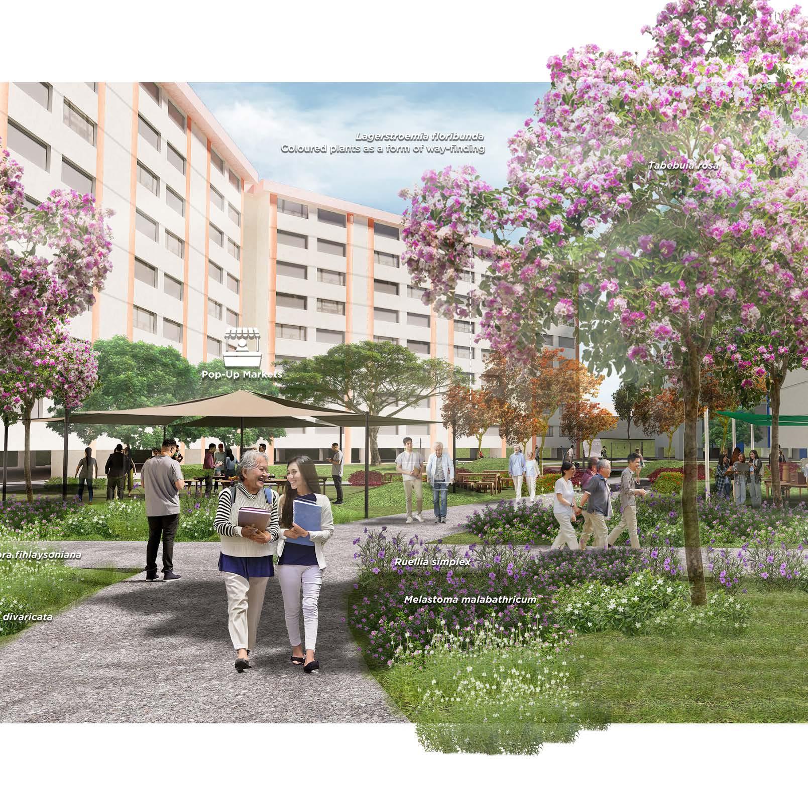
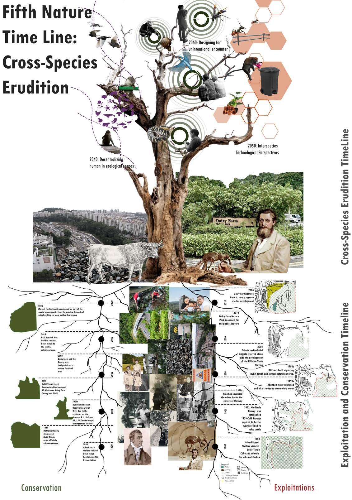
Cross-Species Erudition
Ho Tiongteng Sean
Tutor: Maxime Decaudin
The Dairy Farm Nature Park acts as a buffer between Singapore’s natural areas and urban developments, embodying a historical struggle between conservation and exploitation. Granite mining and residential expansion have left visible marks on the landscape, what I term “human scars.” This project explores how nature responds to these scars, adapts to humanmade structures and remnants over time, highlighting how nature navigates and coexists with human impacts. Guided by the concept of Cross-Species Erudition derived from Donna Haraway and Anna Tsing’s work, the project emphasizes how different species—including humans—can learn from unintentional interactions within shared environments. By documenting these encounters, such as ants using human-built fences and birds inhabiting urban peripheries, the project provides a framework for understanding the nuanced emotional and functional exchanges between species in both natural and urban settings.
The design strategies incorporate practical features to facilitate intentional cross-species interactions on the site. For instance, a network of ant pathways, along with fruiting trees, storage spaces, and workshops, supports ant movement, creating a more interconnected habitat. Additionally, part of the strategy includes growing bamboo, allowing ants enthusiasts to collect and harvest the plant to create bridges for the ants. Bird training facilities enable local enthusiasts to work with native house crows in collecting litter, demonstrating the practical benefits of cross-species relationships.
An agroforestry system further strengthens these connections by fostering sustainable interactions between species, enhancing the site’s biodiversity, and providing a food source for the bird training facilities. Loose granite stones found on the site are used to form rings around agroforestry trees, marking crop-growing areas and creating a barrier to prevent weeds from encroaching. Collecting loose granite rocks along the road in Dairy Farm will also improve circulation within the park, making it safer for visitors.
Planting strategies include growing native and regional species to promote ecological resilience, diversify plant life, and extend the flowering period on site. Lastly, a workshop area allows bird enthusiasts to gather fallen branches and logs to create bird homes, offering refuge to vulnerable species such as swallows and Plume-toed Swiftlet found on the site.
By prioritizing these multi-species interactions, the project redefines urban landscapes as collaborative, multi-species environments, embodying a “fifth nature” where human and non-human elements contribute to a resilient ecosystem. This project advances environmental stewardship by promoting a shared ecosystem model, in which mutual learning and adaptation support biodiversity and sustainable cohabitation in urban settings are learnt through active participation in growing the non-human environment.
Palimpsests of Keppel Hill
Radhakrishnan Srivarshini
Tutor: Victoria Jane Marshall
This project transforms Keppel Hill Reservoir and its surroundings into a landscape of radical ecological entanglement. It is a 99year project, guided by the Eco-Tone Companions, a political organization committed to reshaping human-nature dynamics. Palimpsests of Keppel Hill reimagines the Keppel Hill Reservoir as a natural swimming pool and a site of adventure and encounter where human influence is carefully curated and non-human agency flourishes. The design’s goal is to invoke embodied cognition in humans, allowing humans to create landscape that we perceive through sensory engagement, recognizing place as a shared ecosystem. Ultimately, the organize aims to cultivate ‘more-than-human’ humans.
My 99-Year Fifth Nature timeline is divided into four key phases, each reflecting a shift from restoration to a fullyintentional ecological hybridity. My first phase is entitled Life Beyond Human Hands and it is projected to extend for 15 years. This phase initiates the Infrastructural Setup to facilitate greater understanding of the ecological conditions of the site. My second phase, Dismantle the Divide, extending for 25 years, begins to shape intentional Human-Nature hybridity through minimal-impact paths, inviting tactile interaction and embodied experiences. This phase also marks the 25-year Reservoir Infrastructure project. My third phase, Voices of the Forgotten, extending for 30 years, focuses on developing the Public Interface by incorporating interpretive features reflecting the landscape’s history. My last phase is entitled Erase the Footprints and it is expected to extend for the last 20 years, minimizing human presence by focusing on Legacy Formation, leaving natural processes and embodied memories to shape legacy.
In particular, I focus on the Reservoir Infrastructure project as a key design element to restore its former usage as a swimming pool, but subvert expectations by transforming it into a natural swimming pool through 6 key phases, ranging from environmental studies, establishing drainage connections, introducing wetlands and boardwalks to eventually opening the reservoir up as a natural swimming pool for explorers that visit the space.
Through the Eco-Tone Companions’ stewardship, Keppel Hill Reservoir’s restoration exemplifies Fifth Nature: a radical departure from traditional human-centred recreational spaces in Singapore. The act of introducing an unconventional recreational space that is inviting of both humans and nonhumans (in particular, where non-humans step into spaces with existing non-human agency) is in itself radical and meant to cater to a niche audience of adventurous Singaporeans, a controversial notion in land-scarce Singapore championing multi-use spaces. This incremental transformation invites a community of adventurers to immerse themselves within a living, evolving ecosystem that fosters both ecological resilience and humble human engagement.
A Shared Home of Gardens
Sun Peiqiang
Tutor: Victoria Jane Marshall
The project addresses the limitations of Singapore’s current interpretation of the ‘kampung spirit’ which predominantly emphasizes restorative nostalgia, thereby idealizing a past sense of community that may no longer align with contemporary needs. Informed by Nallari’s (2021) critique, my project explores the potential of what Nallari terms ‘reflective nostalgia’ which is a perspective that engages with the past to inspire forwardlooking, adaptable solutions. By moving beyond a solely elderly-focused framework, the project proposes a diverse, multigenerational approach to landuse at Pearls’ Hill- Jalan Kukoh, transforming it from an ‘urban kampung’ primarily inhabited by elderly and low-income residents into a vibrant, inclusive place. This reimagined hill will welcome diverse users and support a variety of activities, while also supporting residents’ cultural practices and meaningful spaces.
The first strategy aims to reconnect Pearl’s Hill with the Jalan Kukoh area through an enhanced network that incorporates a variety of enclosed gardens, each offering unique activities. This approach not only bridges the communities of these two localities but also welcomes individuals from nearby areas such as Chinatown, Clarke Quay, and River Valley, fostering meaningful interactions among residents. By designing these gardens with themes inspired by diverse cultural practices— such as reflective walking spaces and farming areas for communal harvesting, the project can effectively address the unique needs of different demographic groups and ethnic communities.
The second strategy entails transforming the Jalan Kukoh HDB into a ‘mountain’ that serves a significant cultural purpose for the diverse people, Chinese, Indian, and Malay ethnicity in Southeast Asia. In many places in the region, mountains are highly esteemed, representing spiritual, cultural, and practical significance. Many groups have distinct interpretations grounded in their histories, religions, and philosophies, often in relation to one mountain. My project interprets this phenomenon into Singapore. The materials from demolished building structures will be repurposed to create pebble pathways, while part of the land will be sourced from another area to support this initiative.
Overall, the project proposes a new vision for the future development of Singapore, arguing that ex-panding residential areas in the Pearl’s Hill- Jalan Kukoh locality may not be ideal given the anticipated decline in population. Instead, it suggests that creating more landscaped spaces in the area could help restore the spiritual and multi-community atmosphere of the site, fostering a greater sense of connection among residents and enhancing the overall quality of life
White Space inside White Site Planning
Xu Yingrui
Tutor: Lehana Guo
Singapore retains a amount of reserved land, largely due to the government’s practice of “white site planning.” This approach involves temporarily paving undeveloped land with grass, assessing its value every five years, and putting it on the market when appropriate. My chosen area, a prime land, adjacent to the Central Catchment Area and Ang Mo Kio Park, has been reserved for decades despite its high development potential, and whether it will be developed in the future is still an open question. This uncertainty raises the challenge: How can design balance conservation and development potential on such land?
Inspired by “actor network” theory, I aspire to incorporate non-human and human elements into a holistic consideration, which aim to create a space that fosters connections and evolution. Based on considerations for conserving the existing plant community, creating buffer zones and transitions to the surrounding environment, and ensuring accessibility to nearby infrastructure, the planning strategy designates a “white space” within the site, reserved for future development. This area will have minimal changes—only lawns with terrain, dotted rewilding, and lightweight, removable facilities—allowing for flexibility in future use.
The remaining land will serve as “ecological intensive zones.”Based on the existing tree species, a diverse planting plan will be implemented to revitalize the isolated plant communities on the site, reconnecting them into a regenerated forest, which aims to create more interconnected spaces for all non-human elements. The new plantings, combined with the existing vegetation, will create a dynamic visual experience, alternating between open and enclosed views, forming various landscape layers. Over time, the growing plant communities will influence the development conditions within the “white space,” guiding important policy designs, such as building height restrictions, boundary setbacks, vertical greenery, and phased adjustments to sky terraces.
The different typology of landscape within the “ecological intensive zones” will also enhance the interaction between people and nature. An ecological plaza will be designed around the site’s largest banyan tree, providing opportunities to experience the passage of time up close. An elevated forest walkway will add to the site’s interest. The community gardens interspersed throughout will enrich the surrounding community life. Before development, the large grass slope within the “white space” will also serve as an excellent public and recreational area. Overall, this project emphasizes holistic thinking, aiming to create a selfevolving ecosystem and corresponding development policy adjustments.
Within The Cycle
Chang Yuwei
Tutor: Lehana Guo
The project Within the Cycle is inspired by the Hindu concept of Saṃsāra, where existence is understood as a continuous cycle of birth, death, and rebirth. In the context of nature and human activities, Saṃsāra affects our urban environment through these inescapable stages of Destruction, Reconstruction and Preservation. The organic environment diminished because of human activities, which in turn led to the artificial recreation of life through nature. Lastly the preservation of what is, from what it has been. This cyclical process ultimately brings us to the beginning, where mankind’s action would reignite the wheel of life. The design emphasizes the dynamic interplay between these stages, fostering a karmic response to past and future environmental and social contexts. Leveraging the existing site context as a foundation to enhance future prospects, creating a more harmonious and sustainable urban environment.
Destruction phase: This phase redefines traditional site clearance, often referred to as “tabula rasa,” which typically results in excessive waste and environmental disruption. Instead of seeing destruction as erasure, this approach transforms all materials—organic and manmade—into resources for future use. Organic materials like trees and soil are composted or mulched, while manmade materials such as concrete and metal are dismantled and recycled into functional elements. The spatial design for this phase includes temporary composting stations and material sorting zones integrated within the site.
Reconstruction phase: For this project, an area is designated for commercial development, aligning with the completion of the Cross Island MRT. The reconstruction phase includes key improvements such as a gabion wall made from pavement debris to control erosion. The soil will be enriched with composted organic matter to support new tree growth. A central plaza typology is proposed, creating a shared public space that integrates natural features like Dipterocarpus Nursery and shade-providing trees to blend urban development with nature.
Preservation phase: This phase enhances the natural environment while educating visitors about tropical forest
ecology. As trees mature, they will create a lush, multi-tiered ecosystem. A forest tour will showcase diverse flora and fauna, while an elevated boardwalk will protect the forest floor, promoting awareness and respect for the area’s ecological significance. Viewing platforms along the boardwalk provide spaces for reflection and connection with nature.
Within the Cycle speaks to the cyclical relationship between nature and human activities, inspired by Saṃsāra. It reimagines urban spaces through Destruction, Reconstruction, and Preservation, creating a sustainable environment that responds to past actions and future needs.
Wild Encroach
Qi Kexin
Tutor: Lehana Guo
This project, Wild Encroach, is a forward-looking initiative aiming to return urban land to non-humans, transcending traditional anthropocentrism. Located next to the Sengkang LRT station, with part of the site serving as a depot, the area has historically prioritized human needs. The project seeks to challenge this perspective, beginning with activities of economic value, progressing to social-value development, and culminating in a space of high ecological benefit. Wild Encroach envisions a future where human activities diminish, allowing the forest to become the primary non-human habitat.
The project unfolds in three phases, progressively reclaiming the land for non-human life.
Phase I: Economic and Community Foundations (20 years) The site integrates commercial areas, residential neighborhoods, and urban forest to recover infrastructure costs through economic growth. Commercial facilities provide stable income to support light rail operations, while neighborhoods act as an economic base and community anchor. The urban forest enhances the living environment, boosting the area’s economic value. This phase establishes the foundation for future ecological transformation.
Phase II: Economic to Social Transformation (15 years) Economic elements gradually phase out, emphasizing social benefits. The focus shifts to reconstructing the relationship between humans and nature through environmental education and community activities. This phase reorients the perception of nature from a utilitarian view to one integrated into human life.
Phase III: Ecological Restoration and Human Withdrawal (40 years) The site transitions into an exclusively forested space as human inhabitants and infrastructure are removed. Residential structures transform into habitats for non-human species. The forest becomes a refuge for biodiversity and a research site for observing urban ecological recovery. This phase achieves the project’s ultimate goal: establishing a framework for ecosystem recovery in urban landscapes.
The spatial strategy is rooted in the concept of the forest enveloping and eventually overtaking human spaces. A grid arrangement combines forest, residential, and commercial areas, gradually deforming as the forest expands. Buildings adapt to integrate with vegetation growth, transforming the structured grid into a non-human-dominated forest space.
In summary, Wild Encroach provides a roadmap for transitioning a human-centered landscape into an ecological sanctuary. Through phased transformation, the project creates a habitat for flora and fauna, offering a reference for future urban ecological recovery frameworks.
Re(Seletar)
Winnie Chia
Tutor: Lehana Guo
The framework of Re(Seletar) is derived from the concept of post-humanism, defined as: the mode of thinking about the intersecting human, non-human and technological worlds. It patents the idea of incorporating these human aspects of social and cultural geography to create one unified narrative rather than 3 separated concepts. Within Re(Seletar) this definition has been changed to intersecting human, non-human and infrastructure to allow for the theory to cater more specifically to the site’s context.
In the post-humanism theory, the categorising of attributes into human, non-human and infrastructure are assessed by their affective atmospheres. Affective atmospheres are non-tangible traits observed within a space such as dynamics, atmosphere and routines occurring within Seletar. These traits are what define and eventually branch into the approach and constructed spaces of Re(Seletar).
As a concept, post-humanism supports the idealised world of all aspects of urban life existing together; but that’s not always true. These can blend and create an intersection of conflict where a new dynamic is formed organically. The hybridised new affects facilitate interactions which defines the resilience of urban systems through the quality of their relationships; ideally symbiotic. The spaces of these resilient zones of conflict are necessary to serve as a communicative medium between human, non-human and infrastructure. The invasive and challenging nature of these conflict spaces can explore the ideas of post-humanism in its entirety, supporting the projected Fifth Nature of Seletar as a novel approach to urban living.
By understanding that these spaces are not in competition with each other but instead forming new types of urban spaces, it forms the final concept of Re(Seletar) as a residentialcommercial mixed used town that works in tandem with its ecological systems and environment for a more resilient Seletar.
Green Wilding
Simon Seah
Tutor: Janice Tung
Pasir Ris Town Park has undergone significant changes due to urbanization. Once home to mangroves, tidal flats, and kampong communities, the area saw its transformation begin in the 1960s with recreational development and continued into the 1980s with housing and infrastructure projects. These changes resulted in the loss of natural ecosystems, such as mangroves, leading to a decline in biodiversity and diminished ecosystem services like flood mitigation and wildlife corridors. While the reintroduction of fishing ponds in 1989 sought to revive the site’s fishing heritage, it disrupted ecosystems, fueling recurring conflicts between humans and wildlife, especially otters.
The Asian small-clawed otters (Aonyx cinereus), a threatened species, face restricted movement due to fencing and habitat fragmentation caused by urban development. These conditions, compounded by scarce natural food sources, have escalated human-otter conflicts. The site also serves as a critical stopover along the East-Asian Australasian Flyway for migratory birds like the Common Sandpiper (Actitis hypoleucos) and Pacific Swift (Apus pacificus), alongside native species such as Gray Herons (Ardea cinerea) and Little Terns (Sternula albifrons), highlighting its ecological importance.
This project seeks to restore balance by reconnecting fragmented habitats, fostering cohabitation between humans and wildlife through design informed by an Umwelt approach. The creation of riparian corridors and artificial burrows accommodates otters’ nesting and foraging needs, while paddy field terracing along HDB “islands” deters otters from void decks, mitigates flooding, and restores habitats. The terraces include mangroves (Rhizophora apiculata) for coastal restoration and provide foraging grounds for species like Gray Herons during monsoons.
Fruit-bearing trees, such as Sterculia parviflora, attract birds by offering nesting sites and food along ecological corridors linking Tampines Eco Green, the Cross-Island MRT station, and adaptively reused HDB rooftops. Aquatic flora like Halodule uninervis supports algae growth, sustaining fish populations that feed birds and otters, fostering a resilient ecosystem.
By integrating ecological and human needs, the project embodies Green-Wilding—a Fifth Nature where humans are coparticipants in ecological processes, creating sustainable spaces that value shared futures and resilience, redefining human and non-human relationships for a sustainable future.
Student Projects:
14.
1. Yang Xiaoyang
Yang YuanYuan
Lina Altoaimi
Winston Choi
5. Du Xinyang
6. Li Mu
7. Li Yixuan
8. Yi Wang
9. Abdul Tha’Qif Bin Abdul Terawis
10. Izwan Shah
11. Li Xiyuan
12. Wang Qianwen & Zhang Xinyao
13. Chen Yingzhao
Zhou Yao
Huang Jinguo
Chapter 3
We Need To Let Things Be Different
Projects in this theme acknowledge that Earth is in a time of rupture and that novel, entangled human-nature ecologies are emerging everywhere. They argue that landscape architecture can guide everyday people to acclimatize to such non-linear change in emplaced ways.
The projects in chapter three recognise that Earth is in a time of rupture. As a result of this, they reason that novel, entangled human-nature ecologies are emerging everywhere. Landscape architecture, thus, falls into the role of guiding people to adapt and transform to such non-linear changes in situated ways. For these projects, an idealized, balance-seeking “natural nature” is no longer a relevant framework.
One of the characteristics that select projects in this chapter hone in on is the sensory feel of a particular landscape. Tuning in, for instance, views landscape as an acoustic ecosystem that emphasises mindfulness through the design of sound. Patches Obscure, on the other hand, focuses on the sense of sight to give agency to hidden and forgotten objects of a landscape. Jeletung Geophemeral proposes a geothermalinspired landscape which foresees a transformation of HDBs.
Projects like Co-existing 2.0, Corridor Dialogues, Seeing Stars, and Change for Cat, reimagine an urban transformation through the lens of birds, cats and starfish. The goal is to maximise the interaction between humans and non-human residents through landscape design, but with the latter at the heart of its landscape design strategy.
Other projects seek to blur boundaries between urban ecologies and reshape them in a way that the transformation creates protection for wildlife. Breath Between Land and Water, Fresh Tropicality and Border Bloom are examples of such proposals. They integrate human activities with ecological
processes to enhance the foundation of the biomes their study areas focus on.
LEGEND
Housing Development Board
Reserved Sites with Trees (WoodedDominant Human Management)
Reserved Sites with Trees (WoodedLimited Human Management)
Reserved Sites without Trees (Mowed)
Reserved Seas (Tidal)
Open Spaces (Voided)
Waterbodies
Tuning In
Yang Xiaoyang
Tutor: Maxime Decaudin
This project redefines humanity’s relationship with sound within ecological and social paradigm, encouraging a shift from a focus on speaking to listening. Drawing from evolutionary biology, empathy, and the concept of a shared acoustic environment, I propose a design in which humans learn to tune in to Earth’s soundscape, recognizing it as a cohesive, interconnected ecosystem in which all beings participate. By rethinking sound as an ecological asset, this project seeks to foster a deeper sense of responsibility and connection to the environment. The site, strategically located near Tuas Link Station, the bus terminal, Tuas Depot, Tuas Port, and the Tuas Checkpoint at the Malaysian border, holds significant transportation value. In the future, the area may be fully repurposed for transportation, featuring an underground hub and a sound ecological park to enhance connectivity and environmental harmony.
The first design strategy centers on restoring the natural soundscape through the creation of a vibrant mini-forest within the park. This approach not only enhances biodiversity but also supports the clarity and diversity of natural sounds. By incorporating bird-friendly features such as perching points and feeding stations, the project attracts a range of bird species whose songs create a soothing, familiar atmosphere. Birdsong evokes an evolutionary memory of comfort and security, rooted in our connection to nature, and helps visitors feel more at ease in the environment. This rich, natural soundscape engages visitors on a sensory level, allowing them to reconnect with nature in a way that is both immersive and therapeutic. By fostering a diverse and healthy soundscape, this strategy also promotes greater biodiversity, as the thriving ecosystem encourages various species to inhabit the space.
The second strategy focuses on shaping the soundscape to enhance people’s active engagement with the park’s acoustic ecology, fostering a deeper understanding of the concept of Tuning In. By using elevated terrain and natural barriers around the site, the design minimizes external noise, creating a peaceful environment where visitors can fully immerse themselves in the sounds of nature. Within this quiet setting, carefully designed soundscapes and interpretive
signage guide visitors in exploring the acoustic environment. Designated quiet zones encourage intentional listening, inviting visitors to reflect on their own impact on the environment and cultivate an appreciation for the subtleties of natural sounds. This approach encourages mindfulness, promoting a respectful and meaningful connection to the park’s sound ecology.
In summary, Tuning In reimagines humanity’s role within a shared acoustic ecosystem, emphasizing connection, mindfulness, and ecological stewardship. Through a combination of habitat restoration and sound-focused design, the project fosters an appreciation of sound as a shared resource, encouraging a respectful auditory relationship with nature. By blending restored natural soundscapes with opportunities for intentional listening, the project nurtures a sense of shared responsibility, enhancing both individual and communal connections to the environment.
Change for Cat
Yang Yuanyuan
Tutor: Maxime Decaudin
This project transforms the way cats live in Singapore’s HDB, reimagining interactions between cats and people to create a harmonious coexistence in previously human-centered spaces. My vision for the fifth nature is to help community cats establish and express their roles, strengthening their sense of identity. The concept of Cat-Community-Declaration originates from Singapore’s historical cat policies and stories of joint humancat resistance. “Vitruvian Cat” seeks to elevate urban life and governance beyond a human-centered view, integrating cats’ rights and needs into the community structure to foster a new socio-ecological balance.
One primary strategy is to create band-like interactive social zones that diverge from human pathways, providing different social distance spaces for cats with varying levels of sociability. The parabolic offset creates distances ranging from 0 to 10 meters, allowing cats to find their comfort zone within the landscape. Whether a cat is friendly and enjoys petting, prefers observing from a distance, or is unsocial but needs food, each can find a space suited to its needs. These zones are near community corridors and children’s play areas, with various terrain units combined to meet different landscape functions, suporting natural feline behaviors like climbing, observing, and hiding.
Another key strategy focuses on creating adaptable outdoor spaces for pet cats. These spaces include a series of human-cat interaction game installations, elevated observation platforms, hidden vegetation corners, and sunlit seating, fostering closer interaction between cats and people. These outdoor spaces ensure pet cats find comfortable, adaptable public spaces where they can explore and interact within a safe, engaging landscape.
This strategy centers on designing safe, comfortable landscape pathways tailored to cats, using ground cover or shrubs for enclosure and cat-friendly materials for surface treatments. The material selection prioritizes texture, color, temperature, and grip to ensure comfort in varying weather and times of day. For example, fine gravel aids drainage, natural
grass provides a soft touch, and soft textile surfaces offer grip and comfort. Elevated corridors with resting platforms support cats’ instinct to observe from high points while proecting them from road traffic. These raised pathways feature non-slip materials and mesh designs, with semi-open railings and soft plants for shelter and visibility.
The project speaks to a new vision of urban living where cats, as integral members of the community, enjoy rights to space and engagement. This design reimagines HDB landscapes as inclusive environments that advance a deeper ecological and social relationship between.
Patches Obscure
Lina Altoaimi
Tutor: Gu Tiantong
The discovery of patches of remnant forest in the urbanized site surrounding Sembawang Park sparked dialogue regarding the users of the forest and spaces ‘forgotten’. These spaces often included manufactured objects which were concealed, or nooks where people and objects alike could hide in. The nature of ‘hidden’ spaces, being concealed from government agency in Singapore, allowed them to transform in space and in meaning beyond our common understanding of spatial forms which are allowed, by the government, to exist in Singapore. Hidden spaces are often the result of spontaneity, rather than rigid control over the appearance and value of the environment; humans spontaneously place items within the forest unplanned, and other creatures and forces, such as tidal forces, shift and conceal objects in the environment. As these spaces contradict the current nature-society ecologies which are perceived and governed in Singapore, they are undervalued, and their existence threatened.
One strategy to enable object-agency within the Sembawang landscape is to minimize the curation of the space, and maximize the conservation of forested patches, while allowing humans and nonhumans to subtly bring in items to place in the forest. The movements within the forest will be limited to informal paths, thus slowing potential artificial changes of the forest over time.
The alternate key strategy to enforce object-agency within the Sembawang landscape is to curate a space which allows humans to observe, appreciate, and become a part of the space alongside non-living objects. On this site, the curated landscape manifests through recycled organic materials from the forest, reshaped into forms mimicking root structures which often host hidden objects. An added dimension of a rigid underground area enables tidal forces to shift, wash up, and trap objects within this space– non-human actors are thus able to “hide” objects on site. Unplanned plant and moss growth also elevate the spontaneity of this space, as in the first strategy.
The two aforementioned strategies interweave throughout the Sembawang landscape to address different
modes of this fifthnature exploration; as these objects are placed throughout the landscape by human and non-human actors, they accumulate and begin to change the nature and meaning of the space.
The site then becomes a host of patches and landscapes interacting with objects as they enter and transform the space. In summary, this designed urban intervention fosters spaces which enable and encourage object-agency, and the interactions between objects with human and non-human actors. It fosters a space which acknowledges the stories of manufactured objects, and their significance on shaping the landscape.
Jelutung Geophemeral
Choi Yung Zhen, Winston
Tutor: Gu Tiantong
Jelutung Geophemeral transforms the existing Jelutung Harbour Park within Sembawang’s HDB area into a geothermal-inspired landscape, capturing the essence of geothermal features like geysers, fumaroles, hot springs, and mud pots. This design draws on recent studies indicating potential for geothermal energy in the region, including nearby HDB reserve land that may be earmarked for future geothermal infrastructure. The historical connections to Kampung Jalan Ayer Mata, or ‘Hot Spring Village’ influenced the choice of this site; This area, once used for tree cultivation within the naval base, carries symbolic significance for Singapore as it challenges the longstanding image of a green city, presenting instead a vision of nature that can be dry.
The design seeks to establish a relationship between geothermal landscape and the HDB context by translating geothermal textures—such as the concentric circles of boiling mud, scale-like cascading pools, and cracked, dried land patterns—into features that integrate seamlessly within the HDB environment, fostering a deeper connection between residents and the hidden geothermal forces beneath. These ponds, 0.5m deep, respond to Singapore’s climate, drying out during the hottest months (April, May, and October) to reveal a cracked stone pattern that contrasts with the flowering trees like Tabebuia rosea and Delonix regia, which are in bloom at that time. A transitionary space is created by retaining mature trees around the HDB perimeter, forming a boundary between residential areas and the geothermal landscape. Within the garden, fruit trees and lithophytes are placed in crevices of cracked stone formations, enhancing the site’s organic, geothermalinspired character.
In a 100-year timeline, the geothermal landscape gradually overtakes the HDB area as its 99-year lease approaches its end:
0–20 Years: Foundation and enjoyment, establishing geothermal patterns and seasonal changes that residents can appreciate. People manage the fruit trees on ground.
50–80 Years: Geothermal dominance, with partial demolition of HDBs allowing vegetation and geothermal features to reclaim spaces, creating micro-ecosystems within the HDB footprint. Residents begin to live within that landscape as opposed to visiting the landscape.
80–100 Years: Full transformation and rebuilding, as HDBs are fully demolished. New buildings, sporadically placed to preserve geothermal elements, incorporate heating and cooling features from the geothermal power plants that harmonize with the geothermal landscape, while residents live and traverse around the landscape.
Land of Resonance
Du Xinyang
Tutor: Gu Tiantong
Fifth Nature’s philosophy embraces the dynamic interplay between human and non-human existence, recognizing the shifting landscapes shaped by conflict, coexistence, and personal enlightenment about each group’s identity and role within the broader world. Landscapes serve as living entities that resonate with site-specific information and experiential moments, cultivating awareness, redefining perspectives, fostering emotional connections, and facilitating knowledge acquisition.
This project, located along Yishun Dam’s estuarine shoreline from Lower Seletar Reservoir to the open sea, seeks to balance human access with the movement of diverse nonhuman species, such as shorebirds, fish, and mudflat organisms. As Yishun faces urban expansion with new estates and road developments, the tension between human infrastructure demands and the ecological needs of resident and migratory species becomes increasingly apparent. Shorebirds, for instance, depend on this area as a vital migratory habitat from late August to February.The site’s mudflats, mangroves, and riparian vegetation offer a chance to balance habitats with human activity, but noise, traffic, encroachment, and waste increasingly strain this fragile ecosystem. These challenges highlight the urgent need for landscape strategies that accommodate both human development and the seasonal rhythms of non-human life. The project aims to transform competition into coexistence by designing a landscape that respects the seasonal flows of estuary waters and bird migrations while meeting human needs. By implementing thoughtful zoning and adaptive spaces, the design aspires to create a sustainable, evolving, and self-maintaining environment where human and non-human timelines converge in mutual respect and understanding. The landscape acts as a device that opens up conversations between humans and non-humans in their understanding of space and existence. Knowledge of our living environment is believed to be learnt through positive interactions within the landscapes and groups.
‘Let the land speak’ Strategies - This project incorporates strategies that differ from traditional ecological conservation,
cultural identity, and enhanced human access, on top of that, the goal of landscape taking place is to help humans understand the current ecosystem on-site (humans + non-humans) and then allow growth along with time in different design phases. (everchanging time and landscape dynamics) to further advance the creation of an effective, shared space along Yishun Dam.
Ecological Growth- To preserve the substantial bird habitats, present on-site, specific strategies focus on vegetation management and wildlife accommodation:
• Dedicated Spaces: Design varied landforms to create zones fostering human and non-human interaction.
• Freshwater Quality: Remove debris to ensure a clean, healthy environment for wildlife and visitors.
Recognition of Non-Human Presence and Status- To integrate non-human perspectives and elevate their presence on-site, the design embraces:
• Migratory Timeline Response: Use landscaping and plantings aligned with birds’ migratory patterns to highlight natural cycles.
• Cultural Activities: Host seasonal festivals, birdwatching, and learning events to celebrate non-human life and engage visitors.
Enhanced Human Access and Awareness- To manage heavy traffic and encourage personal engagement with the site, the following strategies are planned:
•Elevated Roads and Paths: Design lifted and expanded roads to reduce human-wildlife conflict while addressing traffic flow.
•Walking and Cycling Paths: Develop integrated trail systems that promote self-guided exploration, fostering personal connection to the site’s unique identity.
Corridor Dialogues
Li Mu
Tutor: Gu Tiantong
This project reimagines Kranji Woodland as a negotiation space between more-than-human agents (forest trees, endangered birds, NSS, and the public) and developmentalism. It explores how these elements gain agency and express their voice in urban development.
Focusing on tree and bird habitats, the design constructs a space that amplifies the influence of more-than-human entities. Meanwhile, this corridor will be maximally preserved and evolve with development pressures, becoming an ecological link for surrounding Reserves and a transitional buffer between developed and reserved areas. The project is activated in the following stages:
Bird-Driven Spatial Strategy and Initial Negotiation
Guided by the behaviour and ecological needs of 3 endangered bird species, this stage creates a suitable habitat by shaping terrain and arranging layered vegetation. This initiates a preliminary negotiation between more-than-human elements and humans. My design creates gentle slopes and low shrub layers as spaces for the Grey-headed Fish Eagle. Additionally, shaping ridge terrain along the clearance boundary guides the water to support shrub growth and form a dense barrier for the concealment of other birds. Lowering the Green Corridor of existing terrain creates a continuous low-altitude flight space, with a walking path left for minimal human intervention. Humans as ‘observers’ and ‘intervenors’, then adjust the terrain and vegetation according to the ecological needs.
Tree-led Spatial Forming and Vegetation: Succession Showing a proactive succession, vegetation expands without intervention. This creates a naturally built boundary and showcases tree rights in the negotiation process. Vegetation forms multiple layers and occupies the corridor area based on terrain changes. The shrub in the waterfront area becomes more enriched, creating a soft riparian edge. Dense, level terrain areas become the core spaces for birds’ nesting and breeding. During this stage, humans primarily act as ‘retreaters’ and ‘managers’ without direct intervention. Their activity range shifts from the corridor to the recovered, cleared area.
Human Re-entry and Negotiation Legacy: Assuming a complex negotiation stage when future redevelopment begins, when developers re-evaluate this woodland, it will demonstrate greater value. The spaces not occupied by vegetation will be reopened for humans. Terrain imprints from earlier stages remain as symbolic scars, representing past incidents and the progression of more-than-human agency. This woodland becomes an important link and buffer for the surrounding reserves.
My project transforms Kranji Woodland into a dynamic negotiation space. Through progressive stages, it becomes a symbol of dialogue and resilience, with more-than-human elements increasingly enhancing their influence in the urban landscape.
Breath Between Land and Water
Li Yixuan
Tutor: Gu Tiantong
When it comes to the relationship between land and the sea, people have a lot of things to talk about, from the Age of Discovery to the sunlight on the beach. However, if we discard everything that we judge from the human perspective, we find ourself, as a land-based species, know, and care little about the water. The sea on the map stays blank except for air or shipping route. Human neglect of the water has long been dominating when we were shaping the space wherever on the earth. We reject the water and make the water to go away every time we don’t want it. Water agency is thus removed from every place occupied by human. However, water nurtures many lives and fluences far more spaces, feelings, species and things than human thinks. Even on the land, water can have non-negligible impacts. The land-water intersection area which is much influenced by the water give birth to a lot of unique ecosystems and creatures. In the uninfluenced state, land-water boundary forms many ecosystems, like mangroves, sandy shores, reef shores, etc. On the contrary, it is a pity when human shape their space without any consideration for them and cut the land-water boundary casually and sharply, rejecting water agency totally and leaving no spaces for those ecosystems to survive. For example, human set fence and trees as two barriers separating the water and the land in woodland waterfront park.
Thus, I reshaped the land-water boundary for them to fully communicate and develop unique environment for those creatures based on the transition area between water and land by breaking the sharp man-made boundary and add mild, multiple hills, whose height gradually declines from land to deeper water. All I want to do is to allow the emergence of those ecosystems who originally occupy the land-water boundary. In waterfront park, I picked mangroves as the one to emerge. But it never means human are going to plant mangrove trees here. Human only need to remove the human made barrier and give back the space. When human agency withdraws, there are a
lot of possibilities this site may become. Because mangroves from by floating seeds on the sea and the site is surrounded by mangroves, which means it is the most possible one to show up when suitable space is given in the site. After that, as tide goes up and down, hills are divided into 3 parts. The close-to-land hills will show up totally when tides go down, which means even human is accessible to this area for half day. The middle close part will also show up half day, but it won’t be influenced by human physically. Then the far-from-land part is almost totally dominated by the sea.
Co-Existing 2.0
Yi Wang
Tutor: Gu Tiantong
Singapore’s urban development has evolved through several key phases: Garden City (1971), City in a Garden (2004), City in Nature (2012), and most recently, Go-Green SG (2023). This progression reflects a growing understanding of human-nature connections, which I will analyze through the lens of humananimal relationships.
In the Garden City phase, residential areas and large parks were spatially segregated, resulting in limited humananimal interaction. By the City in a Garden phase, the establishment of neighborhood parks brought nature closer to urban areas, gradually increasing opportunities for interaction with animals. The City in Nature phase introduced green corridors to connect fragmented green spaces, breaking the isolation of ‘green islands’ and further facilitating human-animal contact. These transitions highlight Singapore’s increasing focus on ecological functionality and efforts to deepen its understanding of natural systems.
However, I believe the earlier phases largely retained a dualistic and anthropocentric perspective, with designs prioritizing human needs. Human-animal interactions were mostly observational, lacking deeper symbiotic experiences. Moreover, as animals increasingly appear in urban environments, human-animal ‘conflicts’ (from a human-centric perspective) have grown increasingly frequent and pronounced. This project aims to explore a new model of co-existence (Co-existing 2.0) to redefine human-nature relationships within Singapore’s urban context. Based on the site conditions, the design focuses on birds as a case study to propose innovative approaches for harmonious cohabitation.
First, we must acknowledge that humans and birds are already coexisting—conflict is also one form of coexistence. Instead of eliminating ‘conflicts’ from a human-centric perspective, we should shift away from the binary opposition of humans and nature, recognizing humans as part of nature and rethinking our hostile attitude toward birds.
In Singapore, agencies like NParks have resorted to culling birds, such as pigeons and mynas, to maintain a “clean and organized” urban order. These birds are often labeled as invasive species or health risks, though the actual threat they pose is less severe than perceived, leading to strained human-bird relationships. However, from an ecological perspective, humans and these birds mostly share more neutral interactions, such as commensalism (one benefits, the other is unaffected) and neutralism (both share a habitat without significant impact on each other). This raises the question: Do we really need to uphold this imposed ‘clean and organized’ order? Is coexisting with these animals as threatening as it seems? How can we design spaces that promote better coexistence between humans and birds?
In response, I propose a Co-existing 2.0 Zone where birds are treated as community members. By understanding their needs and behaviors, spatial planning and planting design will strategically integrate or separate human and bird activities to mitigate perceived ‘conflicts’. This zone aims to inspire and guide people to adopt a more respectful and open attitude, encouraging generous acceptance of birds living in human-built environments and fostering a new vision of urban coexistence.
Palimpsest of Circuit Road
Abdul Tha’Qif Bin Abdul Terawis
Tutor: Victoria Jane Marshall
By challenging the traditional 99-year lease structure of HDBs, Ci.Res envisions a shift in authority from HDB to industrial entities like JTC, working in close partnership with Residents’ Committees (RCs) as Singapore’s Fifth Nature. This progressive power-sharing model, beginning with a 60-40 split favoring JTC and gradually balancing out over time, enables residents to comanage their evolving environment while fostering a beneficial relationship between residential and industrial realms.
The spatial organization at Circuit Road draws inspiration from its namesake—circuitry—to implement gradual, one-way directional transformations within the landscape. This strategy enables a seamless transition from a purely residential area into a mixed-use industrial zone, where changes in land use happen progressively, allowing residents to adapt to the shifting dynamics.
Landscape elements include ‘dents’ or voids for shared, open spaces, as well as ‘stacks’ or mounts designated for productive zones, creating a circuit-board-like design that facilitates flexibility in land use. As industrial and residential needs evolve, soil excavated from dents will be reused in these stacks for industries such as urban agriculture that can be used to cultivate food for workers such as Papaya Gardens, and terraced common spaces that support the transitional design language.
Another landscape element is the ‘weather world’, which tailors environmental conditions such as humidity, temperature, and shade based on the spatial arrangement. This concept influences how industries are embedded into communities, as varying environmental needs dictate where certain industries thrive. Overall, the project has an emphasis on movement— hether centralized, grid-based, or linear—guides the types of micro-industries suitable for each zone. For instance, centered movement supports communal spaces like office and F&B outlets; grid movement favors production-focused microindustries such as electronics manufacturing; and linear movement facilitates co-creation spaces like workshops and research hubs.
In blending residential and industrial uses with responsive landscape strategies, this project envisions a transformative and collaborative urban environment. Ci.Res serves as an incubator for micro-industries, empowering residents and industrial players alike to engage in a dynamic ecosystem that can continuously evolve and redefine Singapore’s approach to urban living.
Fresh Tropicality
Izwan Shah
Tutor: Victoria Jane Marshall
The Kallang-Bugis district, steeped in urban history, faces critical challenges as rising land values and modern developments threaten its social fabric and ecological identity. Government policies often focus on clearing older estates, removing greenery, and prioritizing densification. While these strategies aim to create modern urban living, they risk gentrification, displacing long-term residents, and eroding the socio-cultural dynamics that have defined the area for decades.
Fresh Tropicality proposes a paradigm shift, critiquing the traditional “City in Nature” model that treats greenery as an afterthought to construction and densification. Instead, it offers a co-evolving system where human activity, ecological processes, and urban living interact seamlessly. This concept reimagines waterfront development by prioritizing ecological and social sustainability alongside urban densification.
The first phase begins with the relocation of residents from the older Crawford estate to Kampong Bugis, clearing the site to restore lost greenery as a thriving freshwater swamp. This transformation replaces the greenery lost to adjacent developments, creating a dynamic urban ecosystem through Hydro-Phyto Regenerative Corridors. Elevated pathways and ecopavilions allow visitors to experience the restored environment while supporting biodiversity and water management.
Building on this foundation, the second phase introduces floating markets and eco-stalls inspired by Singapore’s maritime heritage, merging commerce with ecology. Planting schemes adapt to light and water conditions, ensuring the swamp evolves as both an ecological and economic hub, challenging the traditional separation of commercial spaces from natural environments.
In the third phase, adaptive housing emerges with hydraulic HDB units that integrate semi-enclosed gardens and allow waterways to flow beneath. This approach challenges the norm of completely clearing land for HDB developments, instead building on existing greenery with minimal clearing. By preserving significant portions of the landscape, it critiques the
‘City in Nature’ framework, which often involves reclaiming land only to rebuild green spaces after construction.
The final phase emphasizes how the social construct of the area will grow organically over time. Open communal spaces and green corridors encourage residents and visitors to move freely through the landscape, fostering shared experiences and activities. The interaction between human activity and the thriving greenery creates a dynamic district where social and ecological connections deepen over time, ensuring the area remains active, inclusive, and resilient. Fresh Tropicality critiques static, profit-driven urban models by embedding co-evolution, inclusivity, and adaptability into the urban fabric. It envisions Kallang-Bugis as a district that evolves with its residents and environment—an emergent fifth nature, redefining urban living for a sustainable and inclusive future.
The Niche
Li Xiyuan
Tutor:
Victoria Jane Marshall
My design uses a niche construction approach, merging natural elements with a forward-looking aesthetic under the theme of ‘weather’. Inspired by Singapore’s covered walkways—intended to foster community and belonging beyond basic shelter—I noted their current limited function and envisioned a more interactive design. For my Nature study, I chose Fort Canning Park’s southwestern reserve, a historical site layered with ancient, colonial, and modern influences. Historically, landscape designs each served distinct purposes: tropical landscapes adapted to climate; royal and pleasure landscapes prioritized exclusivity; resource and defense landscapes emphasized functionality; and modern landscapes stress order but often lack flexibility. My design bridges these diverse functions, enabling the landscape to serve multiple roles inclusively. By centering on ‘weather’, the design integrates into the area’s ecology, moving beyond the isolation of human structures and instead inviting ecological elements into built spaces. It creates varied experiences across weather conditions, making it a dynamic ‘landscape architecture’ or ‘environmental architecture’, In today’s age of rigid forms, I see this adaptable, ecologically integrated approach as forwardlooking.
I reimagined the covered walkway as a circular structure with a planted green space, roof, and three walkway levels. The roof features a gradient design, providing shade for people and wildlife on sunny days and channeling rainwater into a cascading waterfall during rain, adding a striking visual effect. The top walkway is elevated for commuters, the second-level wooden path is slightly above ground to reduce impact on ground-dwelling species, and the third walkway sits within recessed greenery, offering an immersive experience in good weather and serving as a drainage channel in rain. This design fosters interactions among people, animals, and plants.
In analyzing my study area, I observed a diverse mix of land uses, including HDB residences, hotels, and dining and entertainment venues. The needs of HDB residents, however, appear underrepresented compared to the influence of heritage and entertainment landscapes. My niche proposal addresses this imbalance by integrating an actor-network approach that
considers the needs and impacts of all stakeholders, with a focus on enhancing inclusivity for the residential community.
This project envisions a landscape architecture unifying nature and society through adaptable ‘niches’ — human landscapes that both respond to and positively influence nonhuman entities. Here, ‘weather’ acts as a non-human agent shaping these niches, fostering diverse experiences across one day. The three-part pathway design meets the needs of different groups while positively adapting to and supporting other nonhuman entities within the Fifth Nature Learning Zone.
Seeing Stars
Wang QianWen and Zhang Xinyao
Tutor: Victoria Jane Marshall
Our design is located in Singapore’s Marina South area, rethinking urban transformation through the Seeing Stars concept. By this, we are referring to our imagined star of a socially and environmentally just future. As well as, actual sea stars, which are a type of star-shaped echinoderms and are often incorrectly called starfish, but they are not fish. We find the lens of Seeing Stars helpful as it allows us to open our creative ideas on coastal development in a new way. To illustrate this point consider the various roles that sea stars have played, and might play in Singapore. To begin with, fishermen once treated sea stars as a food resource and sold them. When the Singapore River and adjacent coastline were reshaped by landfill, the sea star changed its role. It was invisible, and not seen as a barrier for more land reclamation. Its habitat was sacrificed for the ‘greater good’. More recently, when some of the sea stars in Singapore became endangered, more international and national protection, particularly non-governmental organizations, engaged in protecting sea stars. In this conservation work, they define the sea star as a victim. In the next stage, according to our design, we the sea star role into roommate, allowing for an appropriate increase in human interaction with starfish without interfering with their survival, while granting them habitat.
To achieve the goal in the fourth stage, we hope to achieve we imagine three incremental steps. In the first step, which is a type of ‘reverse reclamation’, we renovated an existing reclaimed site to form a public ‘reef’ - serving as a “living room” for interactions between people and sea stars and constructed floating islands offshore. Sea stars can migrate through the root systems of plants attached to the floating islands. In the second step, after the reverse reclamation, the sea stars are intentionally introduced from a sea star nursery on Chek Jawa, Pulau Ubin. This is an assisted migration and will be a public event. The base of the western area appears. Then the reshaping strategy can be applied to the western part. The material system will play an important role in building the floating island and reshaping the land. Meanwhile, the combination of artificial reefs and floating islands serves the construction of the sea star habitat. In the third step, we will curate experiential tours appropriately to realize human interaction with and as sea stars and other of our
charismatic reef roommates. In terms of spiritual interaction, we will set up tide-related activities such as the ‘tide festival’ in January, April, July, and October according to the changing laws of the tides, inviting people to gather together in the coastal area while dressing up as sea stars.
Our design is based on as far as not interfering with the life cycle of the sea stars, and maximizing the interaction between humans and sea stars, such as setting up some tidal sea star observation points.
Hougang Reimagined
Chen Yingzhao
Tutor: Lehana Guo
The objective of this project is to redevelop the neighbourhood in Hougang by enhancing the agency of the ground and the river.
The relationship this project trying to explore is how geographical elements in the city enter into people’s impressions. This change in relationship can be reflected in the Hougang site. In rural times, people in Hougang had a closer relationship with the river. The Serangoon River was not only a source of local fishery production, but also a shared memory. After the HDB neighbourhood was built in the Hougang area in the 1980s, this relationship was changed due to changes in the spatial typology and changes in the industrial structure. However, I believe that even after these evolutionary processes have taken place in the Hougang area, the relationship between people and geographical elements is still important. In order to enhance a sense of identity in the Hougang HDB neighbourhood, and increase people’s awareness of urban nature, I believe that the agency of the river and the ground needs to be amplified. Therefore, the design proposal is to renew the neighbourhood in phases.
The design proposal combines spatial strategies with material strategies to produce a neighbourhood that conforms to the above design concepts. First is the spatial layout of the land use types. The transition area is set up to change the distinct appearance of the site and the forest on the opposite bank of the river, and to provide a buffer zone for the creatures that inhabit around the river. Then is the topography. The design extends the bioswales from the riverbank to the residential area, which in turn creates corresponding terrain changes and enhances the sense of direction from the residential area to the river. Consequently, spatial difference affect changes in material.
First, the distance from the river affects the density of the paving material (compacted or loose material). Then, the ground material changes with the elevation, especially on the riverbank and the bioswales. In short, both patterns are related to the distance to the water. Additionally, the spatial layout of the buildings allows each unit to face the river and get the widest
view. The location of the units supports people moving between the residential buildings and the riverbank through the most direct path, intuitively feeling their positional relationship to the riverbank.
Finally, the design also retains some traces of the old HDB buildings, honestly facing the traces of man-made objects and transforming them into small gardens with an archaeological feel.
In conclulsion, the design proposal responds to the fifth nature by influencing people’s impressions of geographical elements in the city.
Border Bloom
Zhou Yao
Tutor:
Lehana Guo
The earliest borders were often shaped by the natural landscape. The original borders of Coney Island were separations of natural topography and vegetation, and the natural soft borders effectively protected the island’s biodiversity. With Singapore’s urban expansion, the original natural borders of the island were altered through artificial reclamation, and the concept of boundaries became more rigid. Strict spatial demarcation and land use controls have created ‘hard borders’. Borders have evolved from mere natural separations to tools for controlling and utilising resources, and their function has gradually changed from ecological protection to part of urban development and economic functions. Today, the opening of Coney Island Park reconfigures the link between nature and human activity. At the same time, it is tightly controlled as a national boundary. The concept of the border became blurred.
Through using Bruno Latour’s actor-network theory as the theoretical framework for spatial definition, the project defined borders as one that is fluid with porous zones of interaction, rather than one that creates fixed divisions. These borders are no longer linear demarcations, but complex landscapes where nature, society and urbanisation overlap and interests.
The reinterpretation of Border Landscapes from this perspective means seeing borders not as defined edges, but as gradual transitions that support both human activities and ecological processes. It reflects a holistic approach to design where the landscape incorporates the unpredictability and change inherent in natural systems, allowing for the development of new urban-nature relationships. As such, the ‘Fifth Nature’ concept of this project is essentially about envisioning borders as adaptive living spaces that bridge the gap between urbanisation and ecological integrity, ensuring that urban development is responsive to environmental and social dynamics. Such adaptability is critical to addressing issues such as climate change, migration and urban expansion.
Specific to the design of the site, the integration of human activities and ecological processes is gradually achieved in three phases. The first phase focuses on enhancing the
ecological foundation. Key ecological areas are created by improving the quality of forests and introducing water bodies, which form the cornerstone of ecological conservation and provide ecological support for the subsequent introduction of human activities. The second phase introduces more ecological facilities to form landscape corridors. Through human activities the borders between human and non-human components of the original site are broken down. The last phase introduces residential areas. Depending on the type of potential residents and their needs, the different types of communities are created by combining the first two phases. In addition, plants are used as a medium for transforming borders at all phases. Ultimately, a complex network of intersecting actors is composed in this border picture.
A Spatial and temporal cycles in the quarry microbiosphere
Huang Jinguo
Tutor: Janice Tung
The concept of “Inclusive Organic Nature” and the Anthropocene in the site is a long-term historical process that includes the cosurvival of human beings and ecological systems. This project seek to address these complexities using a small abandoned quarry remnant in tampines lake as an example; exploring the longstanding contradictions between human development and natural systems.
This project aims to cultivate successional relationships through various phases. In the initial natural phase, focus is put into capturing the site’s original material elements to restore its original spirit. By beginning with organisms such as egrets, cyanobacteria, sedge and coal ore, the project constructs interconnected biospheres, microbiospheres, phytospheres and inorganic matterospheres. Specific substances as fungi, algae, insects and Cyperus are introduced to facilitate ecological restoration and systemic homeostasis, aiming to create a balanced and self -sustaining environment.
The second phase leverages existing ecological relationships to establish new interconnectivities, reconceptualizing them into a cohesive large-scale ecosystem. lies in the restoration of the ecosystems that have only been destroyed and never restored in the past and focus more on residual traces of history and activity on time scales of whole human and nature historical process. Operating through spatial and temporal strategies, this approach anticipates and fosters a resilient ecosystem, guiding it towards progressive evolution, constructing an ecological evolutionary network that transcends immediate timescale.
The third stage is a historical vision that spans millennia. I try to imagine and conceptualize how the relationship between human beings and nature and the course of society will change after the long term future, and what I can do about it. Therefore, I try to reflect in this small site the historical evolutionary relationship after restoring the ruins and rebuilding the ecology, mainly focusing on the micro-material cycle in the stratum. For example, how fungi decompose plant and animal remains and deliver nutrients to plant roots, how plants decay and fall into the stratum after thousands of years, and how inorganic matter reacts to form peat, which is then compressed by the rock layers and turned into coal, which is then dug up again by human beings, burned, and volatilized into the air to be reabsorbed by plants, and so on, this is the whole history of ecological cycles.
The site’s evolution and design employ slime mold algorithms to simulate the migration and expansion patterns of plants and animals, mimicking growth trajectories that spans millennia. This model reconstructs the site’s historical process, tracing its journey from the era of mining to the modern ecological cycle restoration, and projecting its natural evolution in the future. Integrating the concepts of “Inclusive Organic Nature ” and the Anthropocene Throughout human history, this approach attempts to encapsulate the complex interrelations between human and nature through space and time within this site. Through small scale ecological renewal, the project seeks to portray a vision where human beings are embedded into nature, reflecting an enduring interconnected necessity that has evolved across the course of history.
A “Spatial and temporal” cycles in the quarry microbiosphere
——Tampines Quarry Lakes and Quarry Park
Jinguo Huang Janice Group
A historical process of change among quarry, nature and human that spans thousands of years from the past to the future, exploring the boundaries of nature and mankind.
EYE-LEVEL SCENE
Student Projects:
1. Li Kejie
2. Nur Neesha Shafeera Binte Selamatshahh
3. Wen Guangyuan
4. Zhou Siyuan
5. Chen Zuoran
6. Cleon Lai Yi Hui
7. Lebelle Merci Abbeyquaye
8. Kaena Sutanu
9. Zhou Qinying
10. Deston Seah Yun Zhang
11. Nadia Kuan Shiqi
12. Wu Qingyi
Chapter 4
We Need To Be Different
Projects in this theme acknowledge that in order to address Earth in a time of rupture it is humans that need to be different, and that landscape architecture can assist in this task. This means a reframing of the body, as something that is not separate from non-human nature – to decenter the human – and turn toward a focus on enacting novel forms of association between human bodies and power, between human bodies and animals, between human bodies and plants, microbes, and so on, spatially.
Similar to Chapter 3, projects in this theme acknowledge Earth does not have a balance seeking force, but that its “natural” state is one of rupture. To address this conceptual shift, they propose that it is humans who need to ‘unlearn’ various frameworks for self-identity and agency. Landscape design is imagined to be important in assisting in this task. This means a reframing of the body, as something that is not separate from nature, to decenter the human is not easy when it is habitually thought of as the central agent of change – for good or bad. Projects in this chapter explore this task by bringing a focus on enacting novel forms of association between human bodies and power, between human bodies and animals, between human bodies and plants, microbes, and so on, spatially.
Socio-Ecological Reformation of Pandan Reservoir, Living Together and Floating Resilience embody this idea by highlighting the dependence of human and non-human systems. Through reimagining land reclamation, HDBs and urban ecosystems with the concept of hybridity, they share the power of transformation with not just humans.
Other projects propose novel combinations of urban ecologies that would work better for a transforming world. A Clearing in the Jungle, for example, represents a curated jungle scape that creates a seminatural urban space which has both cultivated and ‘wild’ nature. Niche Construction in Disturbance
sees nature not as a static green space, but as a dynamic asset that evolves with disturbances. The relationship between humans and non-human nature is thus seen as adaptive and ever-evolving.
Lastly, Living in Mutual Symbiosis designs a communitydriven integration model through fluid interconnectivity. While the agency remains with the community, with concepts such as shared ownership, the economic models and spatial design prevalent in its proposal are uniquely mobilised for an expanded idea of life in its many forms .
LEGEND
Housing Development Board
Reserved Sites with Trees (WoodedDominant Human Management)
Reserved Sites with Trees (WoodedLimited Human Management)
Reserved Sites without Trees (Mowed)
Reserved Seas (Tidal)
Open Spaces (Voided)
Ephemeral Everyday Monuments
Li Kejie
Tutor: Maxime
Decaudin
Ephemeral Everyday Monuments reimagines a series of small, mowed reserve sites in Jurong West as dynamic spaces that celebrate the traces of temporary activities and natural processes. Rather than viewing these plots as idle spaces awaiting future development, the project integrates time as a core design dimension, redefining these sites as evolving landscapes that bridge short-term uses with long-term transformations. By preserving and honoring the traces of everyday activities, the project fosters a sense of belonging and continuity while highlighting the interplay between community life and environmental change. These traces serve as enduring markers that adapt to future transformations, enriching the site’s identity and history.
The first strategy conserves and exhibits the traces left by temporary activities. Flexible design elements, such as ground markers, movable structures, and adaptive installations, visually record interactions like markets, gatherings, and recreational events. These design tools allow the community to visualize their contributions to a collective memory, gradually transforming these imprints into informal landmarks that enrich the site’s cultural and personal significance. By integrating historical layers into future spatial designs, the project creates a seamless dialogue between past and present, ensuring that the patterns of human activity inform and shape future developments.
The second strategy focuses on integrating natural cycles and growth patterns into the site’s evolution. As natural elements like trees grow or grass patches change color, these organic processes inform the layout and adaptability of community activities. For example, as trees grow larger, their shadows structure the arrangement of market stalls, while grass discoloration left beneath temporary structures serves as an ephemeral marker of past use. These interactions between nature and design provide valuable clues for future development,
allowing the space to remain flexible and responsive to both human needs and environmental changes. The interplay between these temporary and permanent elements ensures the site evolves organically, balancing present use with longterm sustainability.
Ultimately, Ephemeral Everyday Monuments transforms reserve mowed sites into spaces of cultural and environmental significance. By celebrating temporary activities and their traces, the project provides functionality and belonging in the short term while preserving a sense of local history for future development. This approach reinforces the adaptability and continuity of the site, creating a bridge between the past and the future, and fostering a dynamic relationship between the community and its environment.
Floating Resilience
Nur Neesha Shafeera Binte Selamatshah
Tutor: Maxime Decaudin
Floating Resilience reimagines Singapore’s approach to reclaiming the sea, addressing the environmental consequences of industrial activities and exploring sustainable strategies to replace reclamation. Located in the post-industrial landscape of Jurong, the site suffers from poor water quality due to anthropogenic pollution, including high levels of heavy metals such as lead and cadmium from nearby shipyards. The proposal introduces an alternative to the scheduled reclamation of the site that enables incremental improvement in water quality while fostering human awareness of these changes over time. It draws inspiration from historical practices of the Orang Laut, who respected and adapted to the sea’s rhythms, integrating their principles into contemporary design solutions.
The project revolves around two set of strategies. The first one involves floating indicator gardens, which act as both remediation tools and environmental monitors. These gardens utilize aquatic emergent plants, such as Cyperus alternifolius, Typha angustifolia, and Canna glauca, known for their heavy metal phytoremediation properties. As these plants absorb pollutants, visible signs of stress—like leaf discoloration or rolling—indicate changes in water quality. Additionally, three thin mesh walls slow sedimentation, creating pools with varying salinity levels and encouraging the development of diverse aquatic ecosystems. The design incorporates pockets and pathways within these walls to provide shelter for small fish and feeding grounds within the root systems of the floating gardens. This strategy creates a dynamic interaction between plant and marine life, fostering ecological restoration while allowing visitors to observe the incremental improvements in water quality.
The second strategy derives knowledge from the Orang Laut, focusing on their adaptive methods of living on the water. Inspired by the multifunctionality of traditional kelongs, the project incorporates floating structures and mesh-based designs to store materials for replanting affected vegetation and maintaining the water gardens. This functional layout ensures accessibility and efficiency while paying homage to traditional water-based living. Additionally, a boat ride program enables
visitors to engage with the site, reflecting on the historical and environmental changes brought about by human activities and fostering greater awareness of the need for sustainable practices.
In conclusion, the project emphasizes evolutionary resilience, highlighting the interdependence of human and natural systems. By fostering preparedness, persistence, adaptability, and transformability, it promotes the capacity for both systems to evolve together. This approach not only mitigates the environmental damage caused by human actions but also demonstrates the potential of long term, sustainable, and historically anchored alternatives to land reclamation, offering a hopeful vision as Singapore’s enters its fifth nature.
Living Together
Wen Guangyuan
Tutor: Maxime Decaudin
As urban density increases, the relationship between humans and animals within shared spaces grows more intricate. Simple ‘harmonious coexistence’ falls short, lacking attention to the specific comfort distances each species needs. The Fifth Nature concept aims to transcend conventional coexistence by fostering thoughtful proximity-based interactions. Unlike traditional cityscapes that prioritize human needs, Fifth Nature reimagines HDB spaces as environments that respect and facilitate diverse species’ comfort distances, allowing for harmonious interactions within close urban settings.
Distance is at the heart of human and animal comfort. People don’t want monkeys climbing into their homes, and birds prefer people not to approach them. Fifth Nature addresses these dynamics by creating ‘proximity zones’ that respect specific comfort distances for different species. Observing the existing relationships between humans and animals in HDBs, the project identifies areas of tension and positive interaction. Each design strategy is tailored to the unique characteristics of each HDB type. Considering factors such as spatial layout, building heights, availability of space, and materials, these interventions optimize human-animal interactions through zones that support both human and animal needs. Additionally, some smart technology can be incorporated, offering a responsive approach that adjusts the proximity zones based on realtime interactions.
The design categorizes animals into three proximity zones—close, moderate, and distant—to guide specific interventions for comfortable coexistence. Close Proximity Zone: Spaces designed for animals that are comfortable with close human interaction, such as pets and stray cats. For example, in the 1970s HDB with narrow, enclosed courtyards, I designate areas for close proximity, creating small pet-friendly zones. In the 1999s HDB void deck, I provide a comfortable activity area for the community’s cats and pets, providing residents with different ways to interact with these animals. Moderate Proximity Zone: This zone accommodates animals that prefer moderate distance from humans. On the rooftops of 1974 Diamond Block HDBs, for instance, I use plant barriers and birding walls to separate
areas, allowing animals to engage indirectly with humans while maintaining some privacy. These features create pockets where animals like small birds can feel secure but visible enough for observation. Distant Proximity Zone: For animals that thrive at a greater distance from humans, we design secluded zones. For example, we create wildlife-friendly spaces for more reserved species on the rooftops of 1970s HDBs , such as certain birds that avoid human presence. Rooftop greenery and Bird-friendly facilities provide isolated perches and shelters, fostering safe habitats for distant interactions without disturbing human residents.
The Fifth Nature fosters adaptable spaces in HDBs that balance human-animal coexistence, respecting each species’ comfort through proximity-based design.
Socio-Ecological Reformation of Pandan Reservior
Zhou Siyuan
Tutor: Maxime Decaudin
The project offers an alternative future for the Pandan Reservoir, which will be more than just the large floating solar panels that are currently planned as Singapore’s newest ‘green’ infrastructure. Instead, Socio-Ecological Reformation of Pandan Reservoir reimagines the broader area as a dynamic urban organism, integrating natural and social systems to establish a symbiotic relationship between the city and its environment. Drawing from Urban Political Ecology (UPE) theory, the project embraces the concept of ‘hybridity’, rejecting the notion of cities as unnatural. Instead, it highlights cities as interconnected landscapes shaped by ecological, social, material, and symbolic systems, forming ever-evolving socio-ecological networks.
The project unfolds around three main design strategies. The first strategy focuses on reconfiguring Pandan Reservoir into a blend of natural and urban processes. A new linear park anchors the site, connecting the reservoir and surrounding meadows with the broader urban fabric through major nodes. This park functions as both ecological infrastructure and social space, enhancing natural processes like biodiversity and improving microclimate while meeting urban needs for mobility and recreation. By integrating these functions, the park bridges natural and social processes, creating a cohesive, adaptive urban ecosystem.
The second strategy emphasizes the establishment of dynamic material flows that interlink natural and urban systems. Drawing on the theory of urban metabolism, the project considers the exchange of resources—such as water, solar energy, and other materials—as a mutual interaction
between society and nature. Solar floating panels on the reservoir and integrated water resource systems should not only support urban needs but in this case also provide feedback loops that sustain the reservoir’s ecological processes. These interconnected material flows ensure resilience by linking local and regional ecological processes within urban infrastructure, enabling mutual reinforcement and a more holistic approach to sustainability.
Finally, the third strategy addresses social inequalities in resource use, ensuring that natural benefits are equitably distributed across different social groups. The project proposes multi-functional productive landscapes, where low-income communities can access affordable land for food cultivation or lease public facilities like solar panels. By involving the community in resource production and management, the project ensures that ecological benefits are shared inclusively, fostering equity and reducing disparities typical of urban contexts.
In conclusion, Socio-Ecological Reformation of Pandan Reservoir envisions the Pandan area as a resilient urban ecosystem grounded in the UPE concept of “hybridity.” By merging natural and social systems, the project creates a multilayered material circulation network that links ecological and urban processes. This approach not only fosters a symbiotic relationship between the city and nature but also ensures equity and sustainability, positioning the Pandan reservoir as a model for adaptive urban design.
Multisensory Symbiotic Field
Chen Zhuoran
Tutor: Gu Tiantong
This project aims to create a Multisensory Symbiotic Field where human experiences intertwine deeply with the sensory outputs of more-than-human elements. Drawing from theories in Morethan-Human, I view the landscape as a dynamic field centered on sensory interactions between human and non-human agents. This perspective uses sensory perception as a tool to understand how non-human elements shape our experiences and explores their own sensory needs. While recording my sensory experiences of the site as a human, I also attempt to adopt the perspective of the non-human elements within the site to explore their sensory experiences. Through a bidirectional sensory analysis, I identify how the landscape can be adjusted to meet the needs of key elements within the site. The goal is not merely to enhance sensory diversity but to optimize shared experiences, creating an environment that meets the needs of the primary living entities within the site. This design approach acknowledges that every element within the site contributes to the overall sensory experience. We should understand the messages they convey through their sensations, rather than merely creating a human-centered space.
The first stage involves conducting a site survey to record sensory experiences, such as perceived temperature, sounds, smells, and visual elements. Based on the similarities in sensory perceptions and the proximity of related elements, the site is divided into distinct zones. Within these zones, specific points are selected as ‘Sensory Anchors’ to serve as representative sampling points for analysis.
In the second stage, each ‘Sensory Anchor’ is analyzed to understand which more-than-human elements contribute to the sensory inputs. This step helps identify how these elements, such as plants, soil, or nearby structures, accumulate to create specific sensory experiences. Further research into the sensory characteristics of these more-than-human elements reveals
their effects on shaping human perceptions and their own sensory requirements.
In the third stage, decoding the multisensory messages from each ‘Sensory Anchor’ helps identify problems and opportunities in the site. For instance, at a point where trees grow too close to a building, they lack sufficient sunlight, causing vertical growth but limited horizontal expansion. This results in a smaller canopy, reducing shade and increasing perceived heat for people. In the design, increasing the distance between trees and buildings allows trees to receive adequate sunlight while also enhancing the thermal comfort of the area. The sensory interactions between human and non-human elements are optimized, creating a multisensory symbiotic landscape.
The Multisensory Symbiotic Field project begins with understanding the site through sensory experiences, integrating both human and non-human sensory inputs. By analyzing these inputs from both perspectives, the design optimizes the site to meet the needs of key elements. This approach creates an environment that does not solely serve humans, where multisensory interactions form a cohesive and adaptive space.
To Inherit a Forest
Cleon Lai Yi Hui
Tutor: Gu Tiantong
Colonialism has an extensive influence over the modification of the environment, playing out in multiple tropes – deforestation, nature-ties, conservation and landscape practices. We inherit similar practices in how we treat forests, conserve architectural heritage, maintain and grow new landscapes, as well as interacting with our natural environment. We inherit the nature of our predecessors in desiring and exerting control over the non-human environment. Trees continue to be planted within delineated boundaries and along rigid lines. Unique to the chosen site, the conservation of black and white estates, remnants of our colonial past, led to the perpetuation of mowed landscapes that form as part of the introduced English landscape movement.
The proposed fifth nature is a subversion of the politics of control, according the power once practised by humans to the plants that will shape the land they inhabit. The reclamation of the colonial estate as a new form of reserve site with enriched heritage is proposed, which is designated to blend with natural heritage. This is done through situating capture sites into the landscape, to ‘catch onto’ spontaneous vegetation, integrating the native and naturalised vegetation into a landscape that is conserved and inherited by generations as part of a unit with the heritage buildings.
The first strategy involves the study of existing streetscape elements and forests on site, and how they may behave to spread their seeds through allochoric, autochoric and zoochoric methods of dispersal. These create new territorial lines along the mowed lawns of the colonial estates, to predict the situating of capture sites into the landscape, to ‘catch onto’ spontaneous vegetation. This integrates the native and naturalised vegetation into a landscape that is conserved and inherited by generations as part of a unit as the heritage buildings.
The second strategy involves the articulation of colonial house architecture (column arrangement) to form an intersecting grid that is used to inspire the form of a designed intervention to capture spontaneous vegetation. The gridlines in 2-dimensional space are translated into 3-dimensional
topographical landforms (ridges), where new forests can now regenerate on. These grid ridges serve as the initial built base (human intervention), that collects new plant material, which facilitates the agency of plants to take over.
The third strategy involves the integration of the framework species method and succession, which populates the grid ridges into a forest. The framework species method involves the selection and planting of ground cover and shrubs that aid in the stabilisation of the newly moulded slopes. Thereafter, seed bank provided by the existing proximal secondary forests and streetscapes will come in to form the taller layers. This warps the pre-existing notion that streetscape trees are confined to the linear formations that they are planted, reconfiguring themselves into a forest.
The newly formed space serves to provide an avenue for humans to exist as a transient detached observer of the changes to the landscape after the initial stages of topography construction. The design process accords greater control to plants and time instead of humans to reshape the environment.
Spontaneous Encounters
Lebelle Merci Abbeyquaye
Tutor: Gu Tiantong
The site is a residential estate in Yishun, which mainly consists of elderly residents. The estate has the typical public housing construction, with densely packed buildings, governmentally designed social spaces and parks. However, while lacking in planting diversity the site has a planting culture that is spontaneous, being influenced by residents, it takes on its own planting schemes and habits. This project aims to transform residential spaces through utilising actor-network theory by Bruno Latour with two main strategies. Firstly, using the residentially influenced planting to enhance the site’s softscape. Secondly, linking these on a macro scale to allow for ecological diversification.
The first strategy stemmed from identifying the transformation process from the interactions of human and plant agency that has occurred on site and metabolising the process. The site has its own specific planting culture, where spontaneous planting takes on the form of miniature gardens which pushes beyond Singapore’s traditional private-public spatial boundaries moving into “governmentally owned” public space.The process, although simple, then changes the form of the space, thus, creating a new identity through both the plants’ growth pattern and the residents’ choice. Therefore the design aims to provide residents the opportunity to move beyond their flats, planting in public space by creating modular planter boxes that can be combined and moved to an individual’s liking. Allowing for more abundant and diversifying planting options and growth. The planting occurs on an elevated deck to maintain the health of the existing mature trees in the area.
The second strategy is understanding the presence of animal agency that is a result of the spontaneous planting. By giving opportunities for residential plantings, the presence of spontaneous animals are attracted to the area. The design then designates areas for planting opportunities of about 100m-300m that will facilitate the movement of these animals throughout the site and eventually further into the Yishun estate. These nodes are distributed closely to corridors that are linked to nature reserves that will diversify both plant and animal ecology within the estate.
In summary the project does not only apply to the Yishun Estate but aims to identify and understand the importance of creating informed designs in collaboration with all residents in Singapore. Preventing fragmentation of nature within the country due to residential spaces, instead providing opportunities for nature to continuously grow with the space and result in metabolised change.
A Clearing in the Jungle
Keana Sutanu
Tutor: Victoria Jane Marshall
A Clearing in the Jungle envisions Singapore’s first experimental, co-evolving, and semi-wild urban space. Located within a historically rich area, the land carries many layered narratives: once a primary forest, later cultivated as plantations, repurposed as a military base, and now a hub for contemporary art. This project seeks to transition the reserve site from a temporary space to a thriving, permanent jungle – through the process of seamlessly weaving visitors and programs into the surrounding secondary forest.
The design involves a curated journey along a jungle trail, following the natural topography of the land. This path serves as a connection between the Telok Blangah Estate and Alexandra District, encouraging greater interaction between residents and visitors. The rhythm and movement experienced within the trails and clearings are reminiscent of my personal experience of the site – moving through open and enclosed spaces, shifting from hot to cold, and loud to soft. Translating this concept from an urban context to an organic environment is part of the sensorial experience that I intend to convey through this journey.
The site features three clearings located along the trail, each with their own distinct themes that aligns with the existing Art, Education and Community agencies within Gillman Barracks. The design also uses three main spatial tactics - Gather, Share, and Grow, each expressed through a combination of planting strategies that enhances the features of each clearing:
Gather: Focused on bringing people together, this planting strategy involves using Contrast in Color and Form, where vivid planting palettes and diverse textures transform the jungle into a vibrant, interactive landscape.
Share: Centered on guiding and immersing visitors within shared spaces, this strategy incorporates Pathway Buffers, where the trails are framed by dense vegetation.
Grow: Fostering ecological richness, this strategy uses a Layered Planting approach to mimic natural ecosystems, in order to support and expand the existing biodiversity.
The concept of ‘Fifth Nature’ represents a curated junglescape that blurs the boundary between the cultivated and the wild. The creation of this semi-natural urban space provides agency to the land, allowing it to transition from a transient space to a permanent feature - proposing an entirely new classification of landscape.
Niche Construction in Disturbance
Zhou Qinying
Tutor: Victoria Jane Marshall
This project uses the Telok Blangah as the study area, demonstrating the troubled relationship between human and nonhuman life. I do this by looking at a range of disturbances and I reshape the study area through an evolving set of design strategies. Ultimately, the project presents my core concept of the Fifth Nature, which acknowledges the inevitability of disturbance and reframes it as an opportunity to shape new ecosystems and more-than-human humans through a process of Niche Construction. This approach allows human and non-human life to adapt, influence each other, and coexist dynamically within a changing environment.
The design process places significant emphasis on the transformation of agency within Telok Blangah’s evolving multispecies interactions, considering both the shifting power dynamics and ecological knowledge about the structure, function, and future potential of secondary forest ecosystems, leading to shifts in the area’s cycles: the HDB cycle, Coexistence Hub cycle, and Adaptive Reserve Land cycle, each cycle reflects a unique stage within this range of disturbances and adaptive responses, gradually transitioning the area from human-centric control to an ecology-led multispecies network:
The first cycle is the HDB cycle, which follows a hybrid ecology thematic. This initial stage showcases Singapore’s traditional urban management model, governed by Town Councils, where residential use is the primary function of the area. Nature habitats and buildings are separated, and humans control nature through facilities. At this stage, natural elements are viewed as non-human parts of the city, providing visual enhancement and some ecological functions. Subsequently, as the community ages and management resources decline, cracks appear in the building and plants gradually grow in these cracks, which can be seen as a disturbance.
The second cycle is the Coexistence Hub cycle (Multispecies Coexistence): In this stage, the agency of the site shifts towards Socio-Ecological Organizations, providing a third option for the HDB area other than demolition and reconstruction. It explores a new land-use model known as the Coexistence Lease, introducing industry farms, research spaces, and diverse habitats within buildings, weaving humans and more-thanhumans into an interactive ecosystem. Land use transitions from residential to a symbiotic space, uncovering the site’s missing values, including research value, educational value, and ecological value. In this stage, the boundaries between nonhumans, humans, and more-than-human humans become blurred, achieving a gradual bidirectional interaction.
The third cycle is the Adaptive Reserve Land cycle (Dynamic Rewilding): This is the final cycle of the design, maintained and protected by the National Parks Board (NParks) and the National Environment Agency (NEA). The site forms an ecological core where nature achieves self-sustaining with animals and plants becoming dominant. Major human activities are confined to the periphery, but some low-intervention activities are allowed for learning and exploring, helping people to better understand the secondary forest, and to see the secondary forest as a second chance for our future generation.
In this project, nature is no longer just a static “green space” or ‘fixed asset’. Through the transformations of different cycles, the project gradually reveals how nature reconstructs and evolves amidst disturbances to reach the Niche Construction, achieving a dynamic balance with human spaces. The Fifth Nature is not merely a simple combination of traditional nature and urbanity but a dynamic urban ecosystem that leverages natural disturbances as opportunities to reconstruct ecological balance, shaping a more resilient and adaptable urban environment.
Kelong Ecosystem
Seah Yun Zhang Deston
Tutor: Lehana Guo
Kelongs - traditional wooden fishing structures built on stilts, were integral to Singapore’s fishing culture, dating back to the 1800s and flourishing by the 1950s, with approximately 300 Kelongs scattered around the country’s waters. Over time, factors such as land reclamation, overfishing, light pollution and the introduction of new sustainable fish farming methods have contributed to a sharp decline in Kelongs, leaving only 4 left today, all on the road to demolition. When the last Kelong is demolished, Singapore will lose a significant part of its cultural and maritime heritage. The disappearance of these structures will further distance Singapore from its fishing roots and the cultural identity tied to these iconic sea structures.
This project focuses on one of the last remaining Kelongs located near Pulau Ubin in the northeast of Singapore, which is scheduled for demolition by the end of 2024, as a study. The aim is to use this site as a model to adapt cultural practices and infrastructure to align with future marine rewilding and sustainable fish farming goals. This approach will consider both human and non-human needs, transforming Kelongs into an ecosystem that increases the local food production, while allowing marine habitats to be restored.
Module Expansion: Drawing inspiration from both traditional Kelongs and natural coral forms, the project proposes a modular design approach. This ensures flexibility for expansion or reduction based on the success of each development phase. Careful testing and research will be conducted to maintain a balance and success of fish farming and marine restoration, before the Kelong Ecosystem module is fully developed.
Module Replication: Once the Kelong Ecosystem is established, the modular design will act as a blueprint to be replicated across Singapore’s former Kelong sites. These replicas will each differ as they adapt to local sea depths and environmental conditions, while ensuring there is minimal disturbance to marine life from human activity. In doing so, the completed Kelong Ecosystems will form a marine restoration network, contributing to habitat recovery.
The project ultimately seeks to preserve Kelong culture while addressing ecological concerns, offering economic benefits to support local food production. By merging human, non-human, cultural, and natural elements across the reserve seas of Singapore, the project ensures that Kelong Ecosystem modules will preserve culture while contributing to both the marine ecosystem and the country’s evolving goals.
Lively Matters
Kuan Shiqi Nadia
Tutor: Janice Tung
This project presents a new human-ecological model through the redesign of an intertidal stretch located in Changi Coast. The model examines the various players acting on any ecosystem and its environment as a Lively Matters to reframe their relationships through their ways of life and interactions. These studies provide a springboard contextualising the system actors’ individual lived experiences at different scales, identifying trends across the feeding habits, lifestyles and strategies to inform environmental conditions tailored to their needs. Our ethos focuses on working with and providing agency to the specialised adaptations of actors to target specific site conditions. By catering to commonalities of different actors’ habits to inform the site’s condition, the agency of different actors of the site’s assemblage can be amplified.
Another critical element of Lively Matters entails decentralising human agency and upholding human actors to the same standards and scale as others. How may examining human actors under the same lens shine new light on our interactions with the non-human and draw new parallels between our ways of life? Where the modern anthropogenic vision assumes humans as the main instigators and effectors of change towards society’s own needs, this project challenges the passive and active roles implicit in typical urban development.
Lastly, the design deals with temporality of both the actors and the site condition itself. Through a feedback loop model, the modular configuration of the intervention continually adapts to the evolving site conditions, user interactions and actors over time. The design is not merely reactive, but anticipatory in nature: it speculates on how the site will evolve over time, orchestrating a responsive system which operates across scales - from the individual organism to the region.
Changi Coast demonstrates this novel ethos in action –the northern shores of Singapore are characterised by turbid waters, typically poor conditions for biodiversity. Yet, the site is a rich hotspot for seagrass beds, intertidal activities and fishermen. Upon scrutiny, many of its thriving fauna have adapted to the low visibility and shifting sediments by adopting
strategies involving tunnelling, ambushing and relying on nontactile senses to feed and achieve their own unique way of life. Humans too are involved in the system on the same equitable scale as the rest of the actors, categorising their habits into the same terminology we perceive nature with. The resulting design capitalises on these distinctive lifestyles of the various actors to merge these microworlds into a single space.
By harnessing longshore drift and sediment deposition, this approach enables forecasting of the shifting coastline’s future morphology and its subsequent changes in microhabitat typologies. Embracing the inevitable evolution of its biodiversity demographic, the design aims to identify, anticipate and facilitate changes that benefit both present and future actors – revealing the temporal territories and emergent networks of Changi’s coasts and its inhabitants.
Living in Mutual Symbiosis
Wu Qingyi
Tutor: Janice Tung
Singapore’s aging population is growing rapidly, and many retirees continue to face mortgage payments and insufficient income sources, significantly impacting their quality of life. In addition to financial strain, elderly residents encounter growing challenges with health, mobility, and memory, further complicating their daily lives. Existing housing policies have not effectively addressed their economic and emotional needs. This project seeks to explore a community-driven, intergenerational model that alleviates the financial burden on the elderly while enhancing their well-being through an innovative blend of a shared ownership economic model and spatial design, enabling flexible financial options and promoting communal engagement.
Located in a high-aging community on the east side of Pasir Ris Town Park in Singapore, this project spans approximately 32 hectares. The design envisions a new housing model that seamlessly integrates urban landscapes and architecture, creating a cohesive living environment where indoor and outdoor spaces intertwine. This approach not only meets the daily needs of elderly residents by blending residential areas with public green spaces into a fluid, interconnected spatial condition but also introduces a communal property shareholding mechanism. Through this system, residents hold shares corresponding to their living units, enabling dynamic rights transfers within the community. Retirees may choose to mortgage their property to the community in exchange for pensions issued as shares or participate in community work to accumulate shares. Once enough shares are accumulated, residents can reclaim full ownership of their property, providing a sustainable pathway to financial stability. Through shared living and working spaces, intergenerational collaboration, and community services that support accessibility for the elderly, vacated housing units are repurposed to foster mutual benefits. These economic strategies foster regular interactions between the elderly and younger residents, creating a dynamic balance of resource sharing and financial flow within the community.
The design mimics ecological succession, where residents and community resources self-regulate through interactions, fostering adaptability and sustainable development. As elderly residents pass away, move in with family, or emigrate, housing becomes available, the community collectively decides how to repurpose these spaces, introducing new functional modules such as care centers, commercial facilities, and health services. Through mutual symbiosis, resource sharing, and dynamic adjustments among residents and functional modules, the community evolves into a vibrant, multigenerational, and sustainable living environment. By piloting this design in the Pasir Ris community, the project aims to offer a new model for senior living in Singapore, providing an innovative solution to address the social and economic challenges faced by the elderly in a rapidly aging society.
Studio Reader
Southeast Asia and Singapore: pre-colonial, colonial
Cantley, R. (1883). Report on the forests of the Straits Settlements. Singapore Printing office.
Dobby, E. G. H. (1940). Singapore: Town and Country. Geographical Review, 30(1), 84–109. https://doi.org/10.2307/210451
Noor, F. A. (2003). The cult of wood. In F. A. Noor, E. Khoo, & D. Lok (Eds.), The spirit of wood: The art of malay woodcarving—Works by master carvers from kelantan, terengganu and patani. Periplus.
Reid, A. (1993). Southeast Asia in the age of commerce, 1450-1680. Yale University Press.
Reid, A. (1999). Charting the shape of early modern southeast Asia. Silkworm Books.
Zakaria, F. (2023). The camphor tree and the elephant: Religion and ecological change in maritime Southeast Asia. University of Washington Press.
Singapore: Nature-society, identity
Barnard, T. P. (Ed.). (2024). Singaporean creatures: Histories of humans and other animals in the Garden City. National University of Singapore Press.
Comaroff, J., & Ong, K.-S. (2012). Paramilitary Gardening: Landscape and authoritarianism. City Axioms: Urban (In)security, Department of Social Anthropology, Sweden.
Jalais, A. (2021). The Singapore “Garden City”: The death and life of nature in an Asian city. In A. Rademacher & K. Sivaramakrishnan (Eds.), Death and life of nature in Asian cities (pp. 82–101). Hong Kong University Press.
Kong, L., & Yeoh, B. (1996). Social constructions of nature in urban Singapore. Southeast Asian Studies, 34(2), 402–423. Rowe, P., & Hee, L. (2019). A city in blue and green: The Singapore story. Springer.
Schneider-Mayerson, M. (2020). Eating chilli crab in the Anthropocene: Environmental perspectives on life in Singapore. Ethos Books.
Waller, E. (2001). Landscape planning in Singapore. Singapore University Press.
Yee, M. (2024). Wild Worlds, Patch Planet. In A.-S. Springer & E. Turpin (Eds.), Seeing forest: Robert Zhao Renhui (pp. 235–261). K. Verlag & Singapore Art Museum.
Yeoh, B., & Kong, L. (1996). The notion of place in the construction of history, nostalgia and heritage in Singapore. Singapore Journal of Tropical Geography, 17(1), 52–65.
Singapore: Kampung ecologies
Blaut, J. M. (1953). The economic geography of a one-acre farm on Singapore island: A study in applied micro-geography. The Malayan Journal of Tropical Geography, 1, 37–48.
Bunnel, T., Ong, C. E., & Sidaway, J. (2013). Editorial: Jim Blaut and the trajectories of tropical geography. Singapore Journal of Tropical Geography, 34, 285–291.
Clammer, J. (1983). Village communities and the development process in Singapore: A review of village studies and their methodological and socio-economic implications. Southeast Asian Journal of Social Science, 11(1), 92–103.
Lim, K. S. (1996). A leaf from my nature diaries. Nature Watch, 4(3), 10–13.
Nallari, A., & Poorthuis, A. (2021). Rethinking ‘kampung’ or ‘village’ in the (re)making of Singapore and Singaporeans. Singapore Journal of Tropical Geography, 42(3).
Templeman, G. J., & Suykerbuyk, F. J. J. (1983). Agriculture in Singapore: Problems of space and productivity. Singapore Journal of Tropical Geography, 4(1), 62–72.
Teo, S. E., & Savage, V. R. (1985). Singapore landscape: A historical overview of housing change. Singapore Journal of Tropical Geography, 6(1), 48–63.
Singapore: Nostalgia and biodiversity
Ang, S. L. (2021). Nature Conservation in Singapore [Government]. Biblioasia. https://biblioasia.nlb.gov.sg/vol-17/issue-1/apr-jun-2021/ nature/
Brook, B. W., Sodhi, N. S., & Ng, P. K. L. (2003). Catastrophic extinctions follow deforestation in Singapore. Nature, 424(6947). http:// dx.doi.org.libproxy1.nus.edu.sg/10.1038/nature01795
Chisolm, R. A. (2023). Two centuries of biodiversity discovery and loss in Singapore. Proceedings of the National Academy of Sciences of the United States of America, 120(51). https://doi.org/10.1073/pnas.2309034120
Corlett, R. T. (1991). Plant succession on degraded land in Singapore. Journal of Tropical Forest Science, 4(2), 151–161.
Corlett, R. T. (1992). The ecological transformation of Singapore, 1819-1990. Journal of Biogeography, 19(4), 411–420.
Hill, D. H. (1977). The vegetation map of Singapore: A first approximation. Journal of Tropical Geography, 45, 26–33.
Loh, K. S. (1998). Within the Singapore Story: The use and narrative of history in Singapore. Crossroads: An Interdisciplinary Journal of Southeast Asian Studies, 12(2), 1–21.
Wee, Y. C. (1986). The city and the forest: Plant life in urban Singapore. Singapore University Press.
Studio Reader
Wee, Y. C. (2018). Wee Yeow Chin (Dr) (Accession Number 004272; Vol. 3). https://www.nas.gov.sg/archivesonline/oral_history_ interviews/record-details/09038934-4e67-11e8-b81e-001a4a5ba61b
Yeoh, B., & Kong, L. (1996). The notion of place in the construction of history, nostalgia and heritage in Singapore. Singapore Journal of Tropical Geography, 17(1), 52–65.
Zoe, E. Y. (2023, March 10). S’pore photographer documents “last eaglet” at Dover Forest East, which will be cleared for housing. Mothership. https://mothership.sg/2023/03/dover-forest-last-eaglet/
Singapore: Re-wilding
Hwang, Y. H. (2010). Observation of urban spontaneous vegetation as landscape material. Journal of Landscape Architecture in Asia, 5, 61–71.
Hwang, Y. H. (2020). Rewilding urban landscapes: Attributes, types, and application as a greening policy. In I. Douglas, P. M. L. Anderson, D. Goode, M. C. Houck, D. Maddox, H. Nagendra, & P. Y. Tan (Eds.), The Routledge Handbook of Urban Ecology (pp. 762–772). Routledge.
Hwang, Y. H. (2024). Rewilding Singapore [Education]. https://blog.nus.edu.sg/urbanwildlab/rewilding-singapore/ Hwang, Y. H., Endo, K., & Lum, S. (2020). Rewilding singapore: Exploring landscape design strategiesthat bring forest ecology into the urban context. City Green, 18, 34–41.
Hwang, Y. H., & Yue, Z. E. J. (2019). Intended wildness: Utilising spontaneous growth for biodiverse green spaces in a tropical city. Journal of Landscape Architecture, 14(1), 54–63.
Hwang, Y. H., Yue, Z. E. J., Ling, S. K., & Tan, H. H. V. (2019). It’s ok to be wilder: Preference for natural growth in urban green spaces in a tropical city. 2019, 38, 165–176.
Hwang, Y. H., Yue, Z. E. J., & Mayura, P. (2019). Urban wild initiative: Rewilding urban green spaces to enhance biodiversity. City Green, 17, 34–39.
Hwang, Y. H., Yue, Z. E. J., & Tan, Y. C. (2016). Observation of floristic succession and biodiversity on rewilded lawns in a tropical city. Landscape Research Journal, 42, 678–694.
Forest urbanisms
De Meulder, B., & Shannon, K. (Eds.). (2024). Forest urbanisms: New non-human and human ecologies for the 21st century. Leuven University Press.
De Meulder, B., Shannon, K., & Nguen, M. Q. (2019). Forest urbanisms: Urban and ecological strategies and tools for the Sonian Forest in Belgium. Landscape Architecture Frontiers, 7(1), 18–33.
Shannon, K., Cavalieri, C., & Konijnendijk, C. (2023). Urban forests, forest urbanisms and global warming: Developing greener, cooler
and more resilient and adaptable cities. Journal of Landscape Architecture, 18(1), 8–13.
NTU Center for Contemporary Art Singapore. (2024). Climates Habitats Environments [Education]. Climates Habitats Environments. https://climateshabitatsenvironments.art/
Zhao Renhui, R. (2024). Institute of Critical Zoologists [Art]. Critical Zoologists. https://www.criticalzoologists.org/
Alter-ontological possibilities
Barua. (2023). Lively cities: Reconfiguring urban ecology. University of Minnesota Press.
Bauer, U. (2019). The Posthuman City. Climates. Habitats. Environments [exhibition catalogue]. Nayang Technical University, Center for Contemporary Art. https://ntu.ccasingapore.org/exhibition/the-posthuman-city-climates-habitats-environments/
Dwyer, C., Perry, C., Salomon, D., & Velikov, K. (2021). Ambiguous Territory: Architecture, landscape and the postnatural. Actar Publishers.
Haraway, D. J. (1991). Simians, Cyborgs, and Women: The reinvention of nature. Routledge.
Haraway, D. J. (2016). Staying with the Trouble: Making kin in the Chthulucene. Duke University Press.
Kirksey, E. (2014). The Multispecies Salon. Duke University Press.
Leveratto, J. (2021). Posthuman architecture: A catalogue of archetypes. ORO Editions.
Springer, A.-S. (2024). Hidden in plain sight: On ruderal trajectories and the formation of alter-ontological possibilities. In A.-S. Springer & E. Turpin (Eds.), Seeing Forest: Robert Zhao Renhui (pp. 41–67). K. Verlag & Singapore Art Museum.
Tsing, A. L. (2012). On Nonscalability: The living world is not amenable to precision-nested scales. Common Knowledge, 18(3), Article 3.
Tsing, A. L. (2014). More than human sociality: A call for critical description. In K. Hastrup (Ed.), Anthropology and nature (pp. 259–259). Routledge.
Tsing, A. L., Mathews, A. S., & Bubant, N. (2019). Patchy anthropocene: Landscape structure, multispecies history, and the retooling of anthropology: An introduction to supplement 20. Current Anthropology, 60(S20), 186–197.
Vincent, E., & Poon, A. (Eds.). (2021). Making Kin: Ecofeminist essays from Singapore. Ethos Books.
Studio Reader
Degrowth
Roddier, M. (2024). Degrowth, Energy Sobriety, Low-Tech: Towards an Architecture of Conviviality. Places Journal. https:// placesjournal.org/reading-list/degrowth-energy-sobriety-low-tech-towards-an-architecture-of-conviviality/
HDB and Void Deck
Cairns, S., Jacobs, J. M., Jiang, Y., Padawangi, R., & Tan, E. (2014). Singapore’s Void Decks. In W. S. W. Lim (Ed.), Public Space in Urban Asia (pp. 80–89). World Scientific.
Chang, S. (2000). A High-Rise Vernacular in Singapore’s Housing Development Board Housing. Berkeley Planning Journal, 14(1), 97–116. https://doi.org/10.5070/BP314112985
Chee, L. (2017). Keeping cats, hoarding things: Domestic situations in the public spaces of the Singaporean housing block. Routledge, 22(6), 1041–1046.
Chua, B. H. (1997). Modernism and the vernacular: Transformation of public spaces and social life in Singapore. In B. H. Chua, Political Legitimacy and Housing: Stakeholding in Singapore (pp. 70–89). Taylor & Francis Group.
Wong, A. K., & Yeh, S. H. K. (Eds.). (1985). Housing a nation: 25 years of public housing in Singapore. Maruzen Asia for Housing & Development Board.
Yeh, A. G. O., & Yuen, B. (2010). Tall building living in high density cities: A comparison of Hong Kong and Singapore. In Y. K. Cheung & W. Chau (Eds.), High-rise living in Asian cities (pp. 9–23). Springer.
Yuen, B. (2005). The shifting paradigms of high-rise living. In Tall Buildings: From Engineering to Sustainability (pp. 33–38). World Scientific.
Yuen, B., & Yeh, A. G. O. (2010a). In the march of high-rise. In B. Yuen & A. G. O. Yeh (Eds.), High-rise living in Asian cities (pp. 179–186). Springer.
Yuen, B., & Yeh, A. G. O. (2010b). Liveability of tall residential buildings. In B. Yuen & A. G. O. Yeh (Eds.), High-rise living in Asian cities (pp. 129–147). Springer.