
CHESAPEAKE A WATERSHED MOMENT FOR THE
Establishing a new national park unit

Unveiling the Ecological Impacts of Air Pollutants in National Parks
The science behind NPCA’s Polluted Parks 2024 report

Vital Forests Why and where to protect old-growth forests in and around parks
Most At-Risk Coastal Parks Cutting-edge data evaluates four categories of coastal resilience in national parks
SPRING 2024 Science News
NPCA CONSERVATION PROGRAMS

A WATERSHED MOMENT
THE
CHESAPEAKE

MID-ATLANTIC REGIONAL OFFICE
Written by ED STIERLI NPCA Mid-Atlantic Senior Regional Director
A blue crab lays on the sandy shores of the Chesapeake Bay in Maryland. The blue crab is an iconic symbol of the Chesapeake. They drive regional culture and serve an important role in the food web of the Bay. Photo by Patrick Wolf.
FOR
Designed by AMY TIAN NPCA Geospatial Science Fellow
The largest estuary in North America,
the Chesapeake Bay and its watershed spans 64,000 square miles across six states and the District of Columbia. The Bay is recognized as one of America’s Great Waters and one of the most biologically productive estuaries in the world.
With its ecological and cultural significance, the Chesapeake has become a symbol of the delicate balance between human activity and nature. This
expansive estuary, home to over 3,600 species, is not just a body of water — it’s a thriving ecosystem that has sustained Native peoples for centuries and played a pivotal role in American history.
The Chesapeake Bay is already home to more than 50 national park sites that tell the story of America’s diverse history. Chief Powhatan and the Algonquian people established their Tribal headquarters,
15 NPCA

Werowocomoco, along the York River. Captain John Smith voyaged throughout the Bay’s tributaries and the Jamestown colony settled on the banks of the James River. The region experienced major battles during the American Revolution, the War of 1812, and the Civil War. In 1619, the first Africans were traded into slavery on this continent in what is now present-day Virginia and in 1849, Harriet Tubman journeyed across the region to escape to freedom.
Over a span of just a few centuries, the majority of Native Americans found themselves displaced from their ancestral territories. The Bay watershed developed into cities and farms, and natural filters which served as the vital organs of the region’s ecosystem hovered on the edge of collapse.
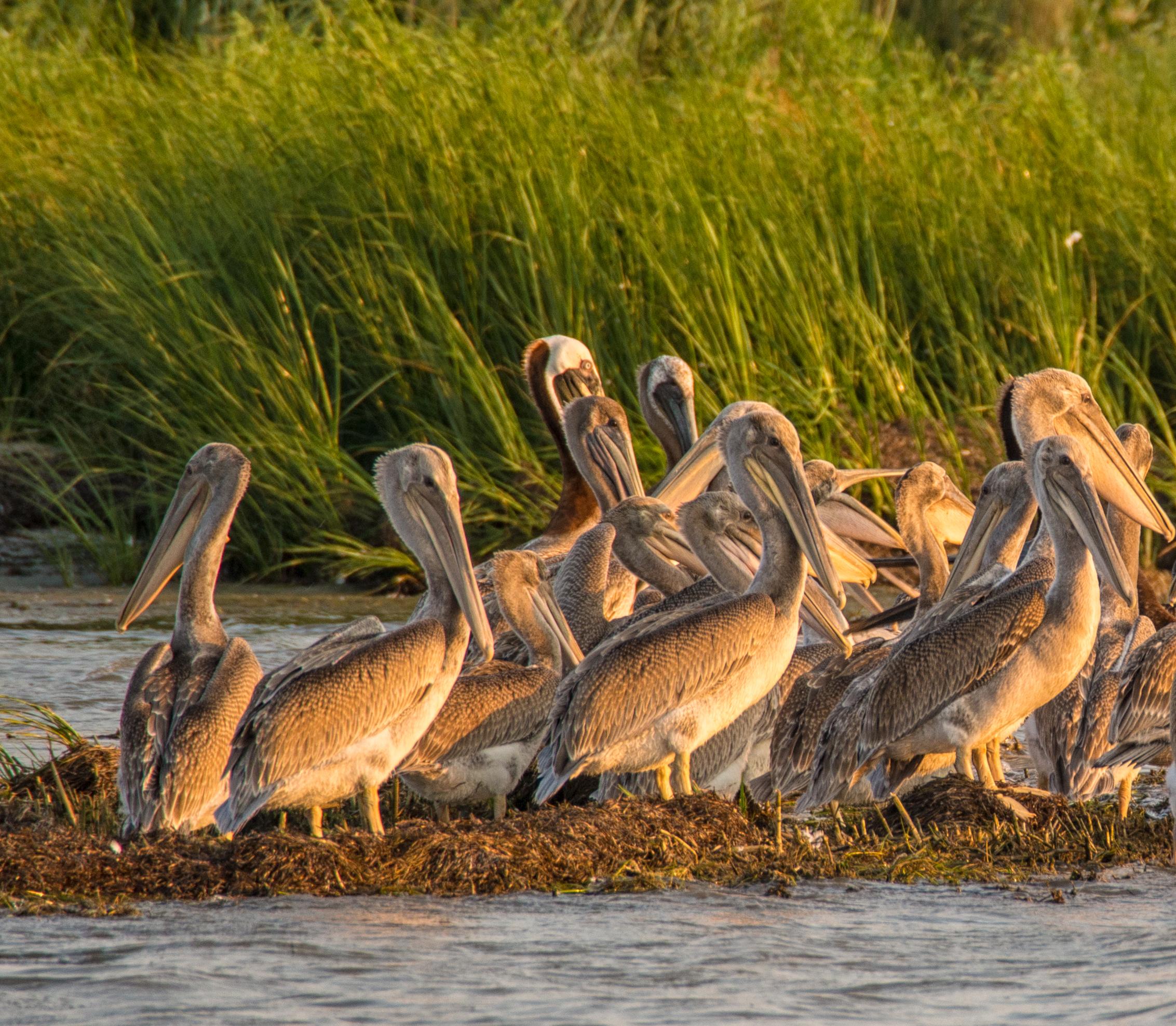
A large group of Brown Pelican fledglings on the coast of the Chesapeake Bay. The Bay is a key part of the Atlantic Flyway and has over 1 million migratory birds every winter.
SPRING 2024 16
Photo by David Kay | Dreamstime.com.

Oysters have tremendous ecological value in the Bay. They purify the water of pollutants as they filter for their food. Historically, oysters could once filter the entire water volume of the Bay in a week. With the remaining oysters today, it would take more than a year.
Photo by Daryl Ariawan.

“We’re at a critical juncture. the choices we make today will determine the fate of the Chesapeake Bay for generations to come...”
Renee Reber, NPCA Climate & Clean Water Program Manager
Beginning of the conservation movement
FOR A GENERATION, ENVIRONMENTALISTS HAVE BEEN TIRELESSLY working to safeguard the Chesapeake Bay and its tributaries. This conservation movement has evolved into a powerful force, fueled by innovative science and collaborative partnerships. These began during the 20th century with the establishment of new national parks, such as Shenandoah National Park, and many wildlife refuges and state parks across the watershed.
Air and water pollution from land-based activities degrade water quality and contribute to growing dead zones, depleting aquatic life such as blue crabs and oysters. Such pollution threats include stormwater runoff containing fertilizer, chemicals, and sediments; municipal wastewater and industrial wastes; and airborne nitrogen and toxic mercury from power plants and motor vehicles. Additionally, over harvesting and disease have reduced oyster populations that helped filter pollutants from water.
Renee Reber, NPCA Climate & Clean Water Program Manager and stormwater expert, reflects on the need for urgent action, “We’re at a critical juncture. The choices we make today will determine the fate of the Chesapeake Bay for generations to come, and it’s critical that we don’t lose momentum, especially in the face of climate change and development pressures.”
Over the last four decades governmental and nongovernmental groups have been working to restore the Chesapeake watershed. Notable successes include the reduction of point source pollution and the decreasing trends in nitrogen and phosphorus pollution levels. However, much work remains to restore the bay to the highly productive ecosystem from historical times.


Threats to the Chesapeake
The Chesapeake Bay faces numerous threats due to human activities. The following are a few examples of threats:
Power plants and motor contribute to airborne such as nitrogen and pollutants fall back onto surface and waterways, to algal blooms, clouding and creating dead zones. Hal Bergman.
AIR POLLUTION TOP LEFT
19 NPCA


TOP RIGHT
BOTTOM LEFT

BOTTOM MIDDLE
BOTTOM RIGHT
DEAD ZONES
motor vehicles airborne pollutants mercury. These onto the earth’s waterways, contributing clouding the water, zones.
Photo by POLLUTION
Dead zones are aquatic areas that are depleted of oxygen. Due to dead zones, underwater grasses, crabs, fish, and other marine life can devastate biodiversity and food chains. Photo by Aj_OP | iStock. com.
AGRICULTURE RUNOFF
Agriculture is essential to people but is also the largest source of nutrient and sediment pollution entering the Chesapeake. Overtilling, fertilizers, and pesticides contribute excess nutrients and chemical imbalances in the water.
STORMWATER RUNOFF
When rain falls on parking lots, roads, roofs, and driveways, it can wash harmful pollutants like fertilizer, pet waste, chemical contaminants, and litter into Bay’s waterways. Photo by Iri-s | iStock.com.
OVERHARVESTING
Overharvesting and disease have reduced oyster populations that helped filter pollutants from the water. Photo by wakila | iStock.com.
Photo by fotokostic | iStock.com.
SPRING 2024 20
Cutting-edge innovation
THE CHESAPEAKE WAS THE FIRST ESTUARY IN THE nation to be targeted for integrated watershed and ecosystem restoration. In 1998, the Chesapeake Bay was listed as impaired under the Clean Water Act for failure to meet water quality standards, specifically for nitrogen, phosphorus, and sediment. Despite efforts to clean the Bay, it still does not meet the standards.
The Clean Water Act requires each state to develop Total Maximum Daily Loads (TMDL) for their impaired waterways. The Bay states agreed that, in this case, a “state by state” approach would not be as effective as a regional approach and invited the U.S. Environmental Protection Agency (EPA) to develop a bay-wide TMDL.
Twelve years after being listed as impaired, in December 2010, EPA issued a bay-wide TMDL, which identified the maximum aggregate of pollutants possible for achieving water quality standards. The pollutant aggregates are divided among states, which give states the flexibility to decide which actions to take to reduce pollutants in the bay.
The health of the Bay is measured in part by the population of indicator species, such as oysters, blue crabs, and striped bass. Data on habitat health is also evaluated, including underwater grasses, forest buffers, wetlands, and forests.
Land conservation and restoration have had tangible and critical benefits for the Bay restoration and conservation movement — filtering water, recharging aquifers, sequestering carbon, absorbing nitrogen, in addition to wildlife habitat and access for recreation.
The Chesapeake Conservancy’s Conservation Innovation Center (CIC), established in 2013, has been on the forefront of data-driven strategies to inform land conservation. This includes precision conservation, where CIC analysts apply advanced spatial analysis techniques to prioritize conservation best management practices to ensure maximized ecosystem services and have the greatest impact.
Joel Dunn, President and CEO of the Chesapeake Conservancy, has led efforts to unite conservationists in the region around data-driven goals, such as launching the Chesapeake Conservation Partnership. “The CIC is empowering others to work smarter, not harder, through the latest technology. Just as the use of technology changed the corporate world to make it more efficient, technology is changing the conservation movement.”
Data and maps produced by the center have helped prioritize lands for conservation and restoration opportunities, as well as inform optimal solar siting or vacant lots in the City of Baltimore that can be transformed into usable green space.

A new national park unit
THERE ARE MANY NATIONAL PARK UNITS IN THE Chesapeake Bay watershed, and for decades NPCA’s Mid-Atlantic Regional Office has advocated for policies to protect water quality, reduce air pollution, and expand public access for recreation. This included helping to lead efforts to establish new national parks, such as Fort Monroe National Monument and Harriet Tubman Underground Railroad National Historical Park.
But none are dedicated solely to telling the powerful and unique story of the Bay, which is why NPCA and the Chesapeake Conservancy are leading efforts to establish the Chesapeake National Recreation Area (CNRA).
Pamela Goddard, Mid-Atlantic Senior Program Director, leads NPCA’s efforts to establish new parks, including Fort Monroe, recognizes that “the Chesapeake Bay watershed is celebrated for its iconic natural beauty, historic significance and diverse outdoor recreational opportunities. Creating a new national park in the Chesapeake will increase public access while sharing with park visitors the many unique sites and stories the region has to offer.“
Lawmakers have considered a national park unit for

the Bay since President Ronald Reagan declared the Chesapeake Bay a national priority in his 1984 State of the Union address, and the opportunity is finally here.
In July 2023, Senator Van Hollen and Representative Sarbanes of Maryland, along with a bipartisan congressional delegation, introduced the Chesapeake National Recreation Act. This legislation will designate a unified Chesapeake National Recreation Area as part of the National Park System, designating a collection of new and existing parks and public lands along the Bay as the new CNRA. Four key sites included are Whitehall, Burtis House, Thomas Point Shoal Lighthouse, and Fort Monroe North Beach (descriptions on next page 23).
“Just as the use of technology changed the corporate world to make it more efficient, technology is changing the conservation movement.”
Joel Dunn, President & CEO of Chesapeake Conservancy
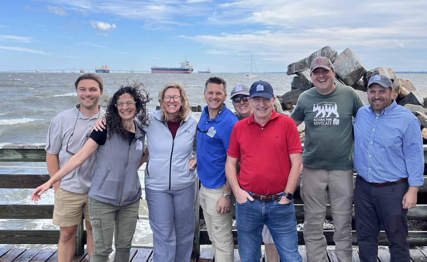
NPCA MIDATLANTIC TEAM
NPCA staff and volunteers visiting Thomas Shoal Point Lighthouse, a new park that would be in the CNRA.
The CIC is a scientific powerhouse for the Chesapeake Bay, creating essential data to prioritize conservation management.
LEFT
CONSERVATION INNOVATION CENTER RIGHT
SPRING 2024 22


“Creating a new national park in the Chesapeake will increase public access while sharing with park visitors the many unique sites and stories the region has to offer.”
Pamela Goddard, NPCA Mid-Atlantic Senior Program Director

25 NPCA

THE CNRA WOULD ENABLE THE PARK SERVICE TO elevate the stories that too often go untold, including the story of Indigenous peoples who have inhabited the Chesapeake for more than 12,000 years, but whose land was taken from them, often violently. A new national park unit would bring opportunities to share ancestral connections to the land and water.
Places that highlight the Bay across Maryland and Virginia, such as state and local parks and wildlife refuges, could become part of the CNRA and benefit from the resources of the National Park Service to help improve the visitor experience, improve public access to the Bay, protect the natural environment, and advance landscape-scale conservation.
NPCA works with partners to improve equitable access to the Chesapeake Bay and its tributaries, such as the Anacostia River. These photos are from a partner paddle event NPCA co-sponsored at Anacostia Park. Photos by Annie Riker | NPCA.
As bipartisan support gathers for the CNRA, there’s a sense of anticipation for the historic moment that lies ahead. Passage of the Chesapeake National Recreation Act would be a culminating achievement for the Bay’s restoration efforts — a testament to the power of collaboration, innovation, and a shared commitment to safeguarding the Chesapeake Bay for generations to come.
SPRING 2024 26
Science News
Spring 2024
Product of NPCA’s Conservation Programs.
Produced by: Conservation Science
Ryan Valdez, Nik Moy, and Amy Tian
Contact Nik Moy, nmoy@npca.org, if you would like to share with any audiences external to NPCA or print a version of this newsletter. Additionally, please let us know if you have questions, suggestions, or story ideas for the next issues of Science News.
Interested in helping advance Conservation Science at NPCA? Please reach out to Julie Hogan at jhogan@npca.org to explore how your suppport can make a meaningful impact.
To view this report digitally and access links:


