COMMUNITY
KAYAKING ADVENTURE
ALONG LANE COVE RIVER
T
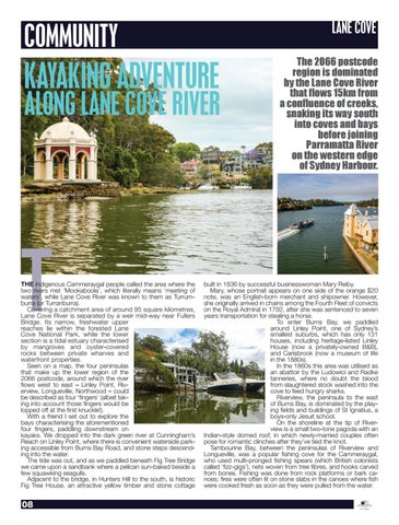
THE indigenous Cammeraygal people called the area where the two rivers met ‘Mookaboola’, which literally means ‘meeting of waters’, while Lane Cove River was known to them as Turrumburra (or Turranburra). Covering a catchment area of around 95 square kilometres, Lane Cove River is separated by a weir mid-way near Fullers Bridge. Its narrow, freshwater upper reaches lie within the forested Lane Cove National Park, while the lower section is a tidal estuary characterised by mangroves and oyster-covered rocks between private wharves and waterfront properties. Seen on a map, the four peninsulas that make up the lower region of the 2066 postcode, around which the river flows west to east – Linley Point, Riverview, Longueville, Northwood – could be described as four ‘fingers’ (albeit taking into account those fingers would be lopped off at the first knuckle!). With a friend I set out to explore the bays characterising the aforementioned four fingers, paddling downstream on kayaks. We dropped into the dark green river at Cunningham’s Reach on Linley Point, where there is convenient waterside parking accessible from Burns Bay Road, and stone steps descending into the water. The tide was out, and as we paddled beneath Fig Tree Bridge we came upon a sandbank where a pelican sun-baked beside a few squawking seagulls. Adjacent to the bridge, in Hunters Hill to the south, is historic Fig Tree House, an attractive yellow timber and stone cottage
08
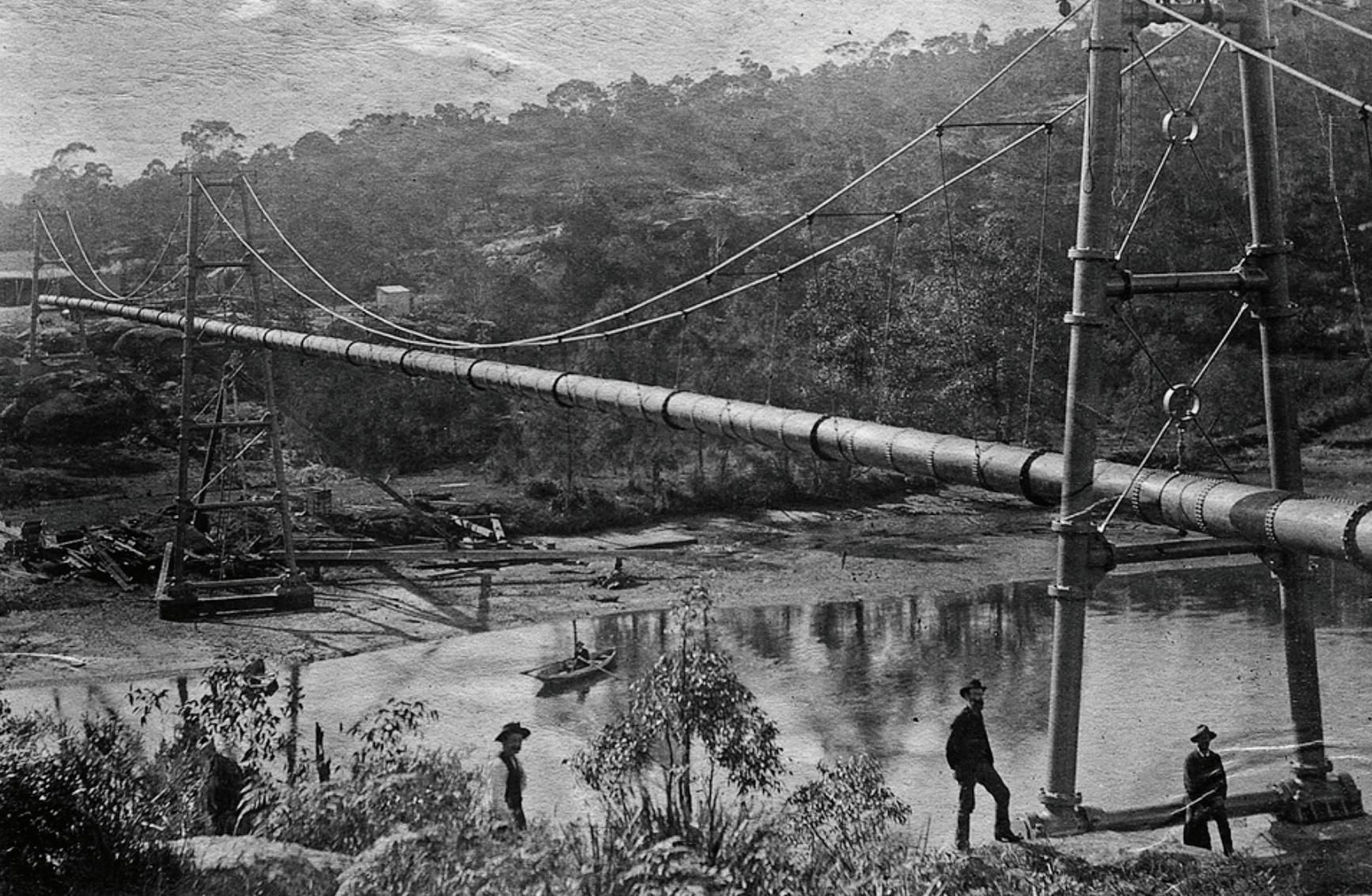
The 2066 postcode region is dominated by the Lane Cove River that flows 15km from a confluence of creeks, snaking its way south into coves and bays before joining Parramatta River on the western edge of Sydney Harbour.
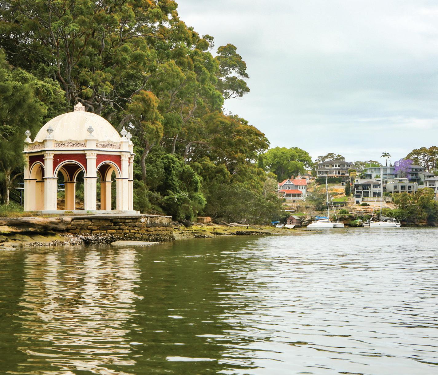
built in 1836 by successful businesswoman Mary Reiby. Mary, whose portrait appears on one side of the orange $20 note, was an English-born merchant and shipowner. However, she originally arrived in chains among the Fourth Fleet of convicts on the Royal Admiral in 1792, after she was sentenced to seven years transportation for stealing a horse. To enter Burns Bay, we paddled around Linley Point, one of Sydney’s smallest suburbs, which has only 131 houses, including heritage-listed Linley House (now a privately-owned B&B), and Carisbrook (now a museum of life in the 1880s). In the 1860s this area was utilised as an abattoir by the Ludowici and Radke tanneries, where no doubt the blood from slaughtered stock washed into the cove to feed hungry sharks. Riverview, the peninsula to the east of Burns Bay, is dominated by the playing fields and buildings of St Ignatius, a boys-only Jesuit school. On the shoreline at the tip of Riverview is a small two-tone pagoda with an Indian-style domed roof, in which newly-married couples often pose for romantic clinches after they’ve tied the knot. Tambourine Bay, between the peninsulas of Riverview and Longueville, was a popular fishing cove for the Cammeraygal, who used multi-pronged fishing spears (which British colonists called ‘fizz-gigs’), nets woven from tree fibres, and hooks carved from bones. Fishing was done from rock platforms or bark canoes; fires were often lit on stone slabs in the canoes where fish were cooked fresh as soon as they were pulled from the water.