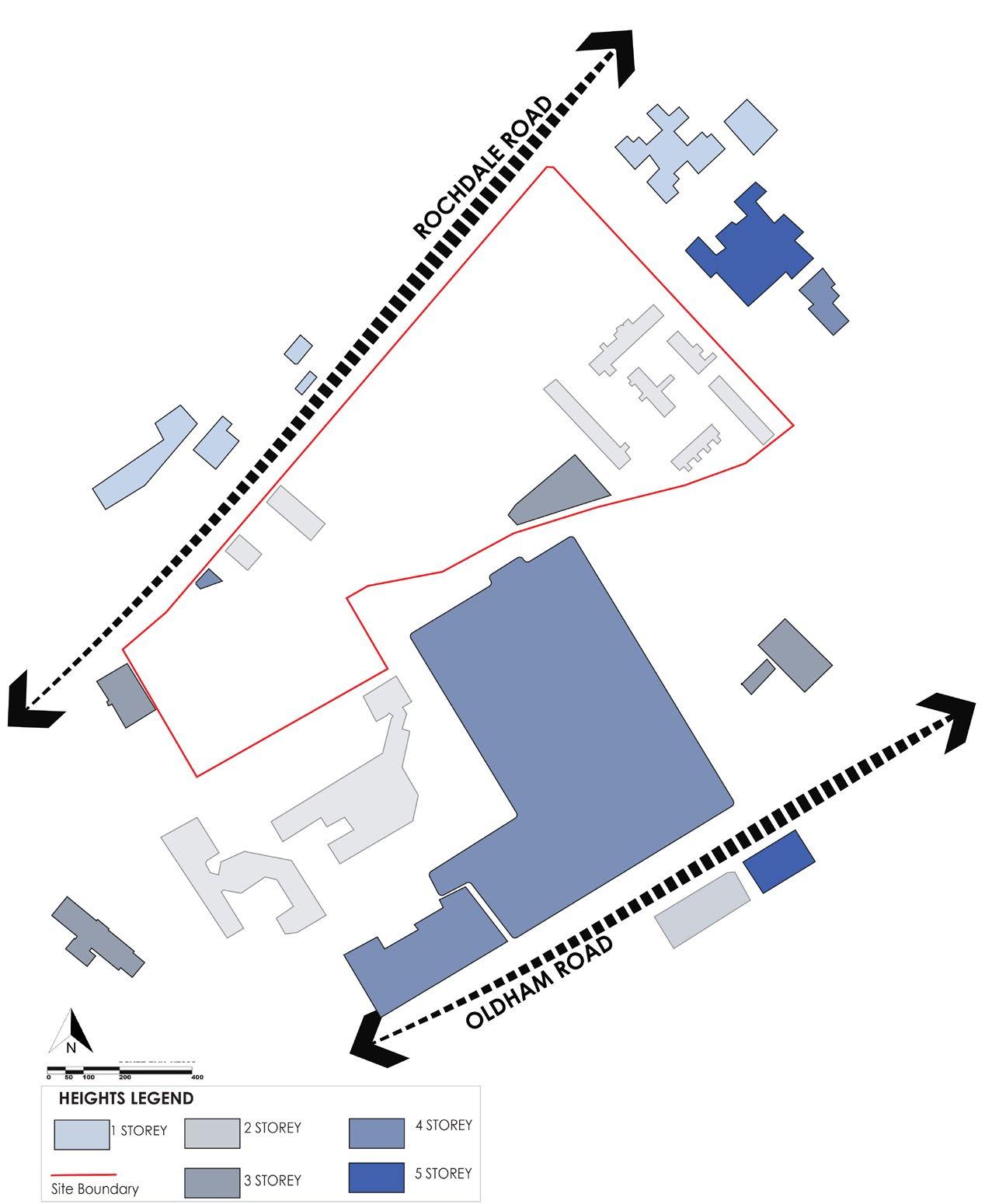
ROCHDALE ROAD
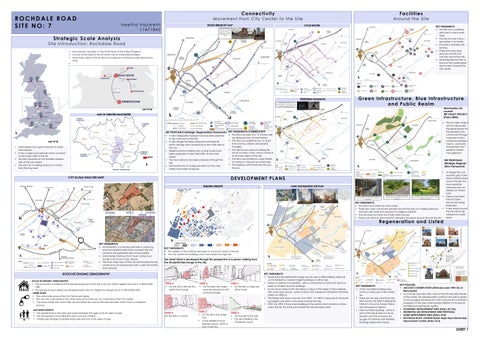
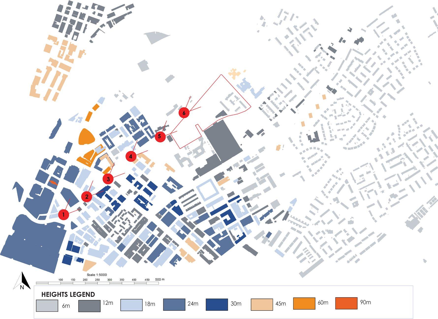
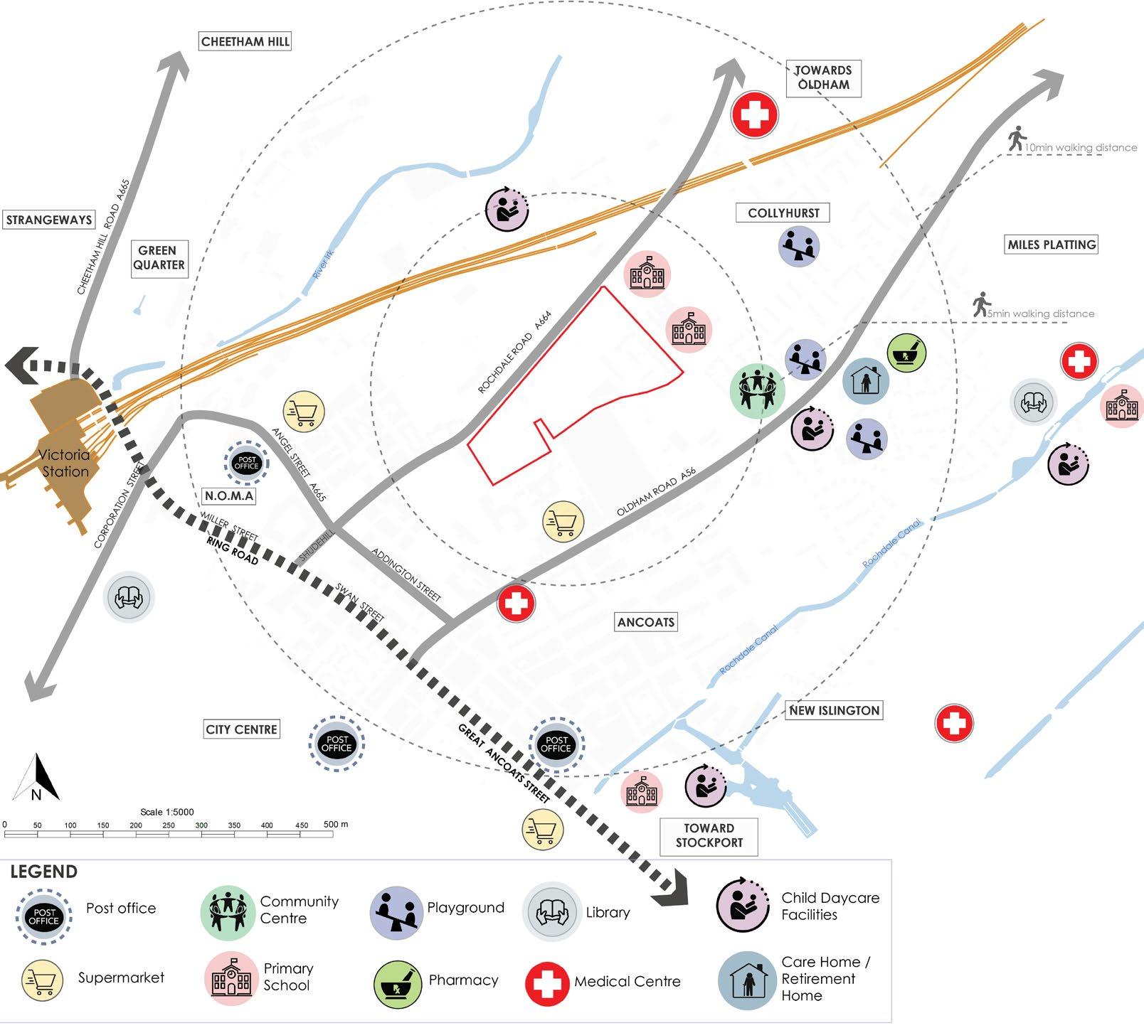
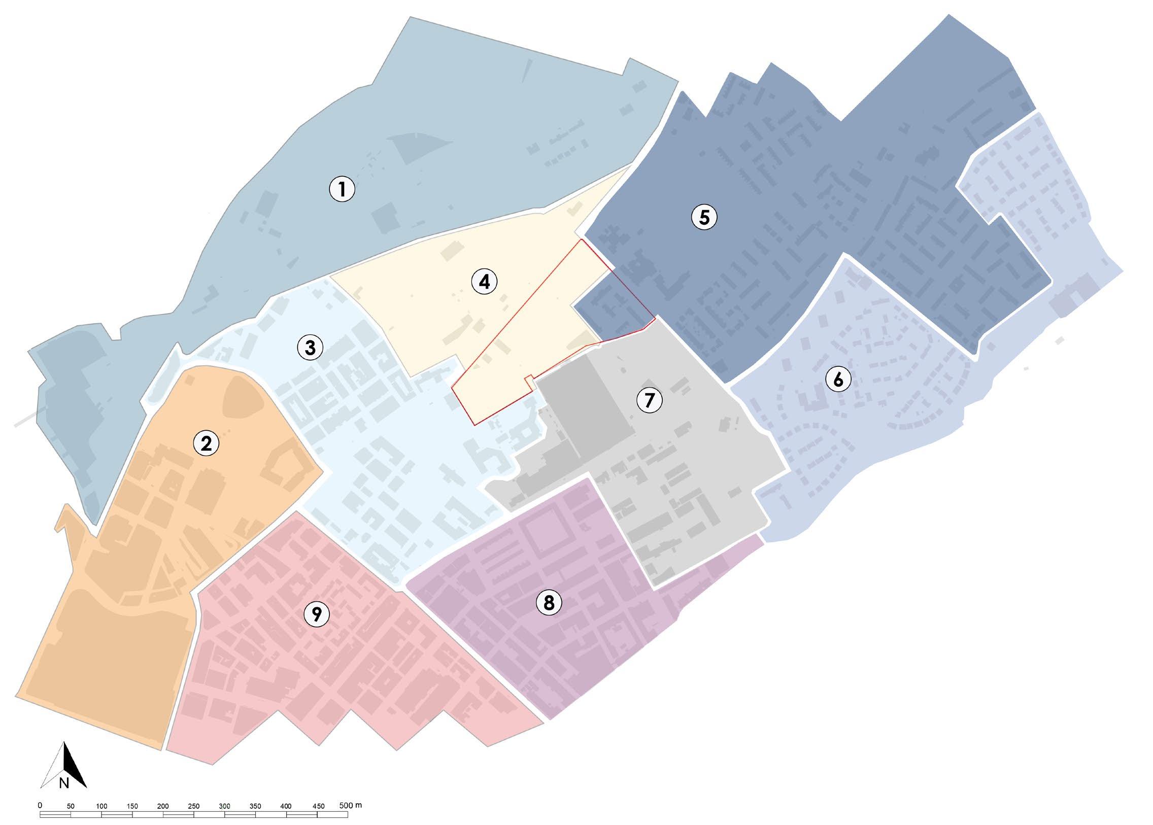
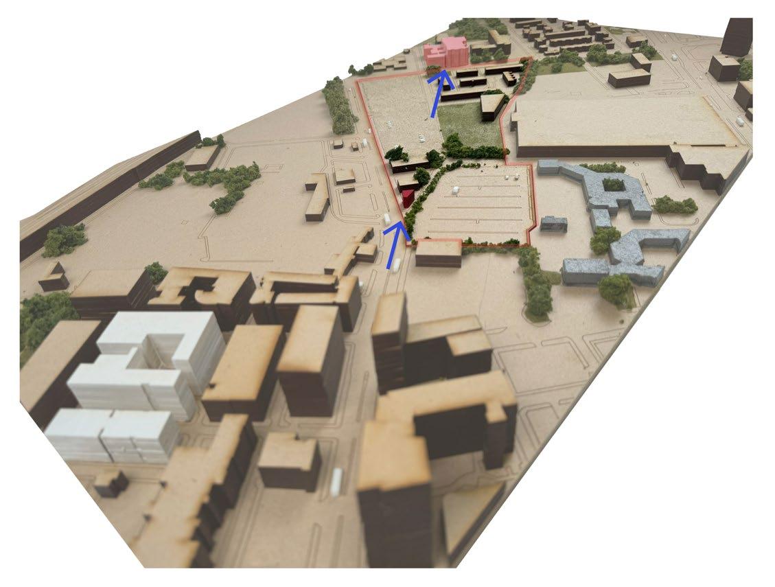
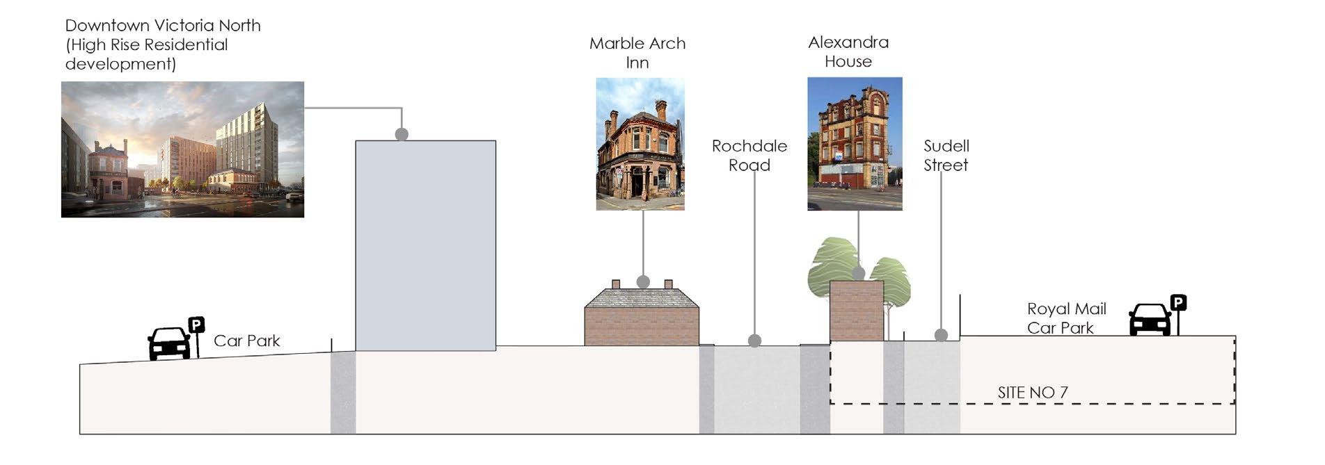
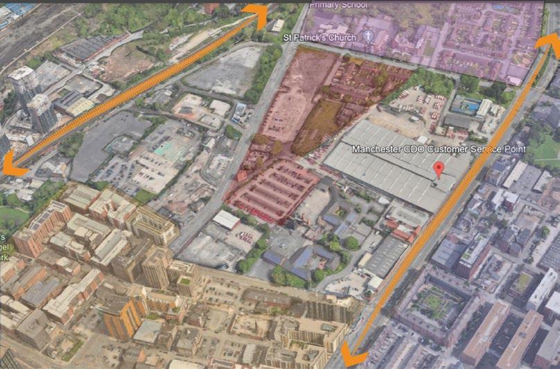
Scale Analysis Site Introduction: Rochdale Road
•
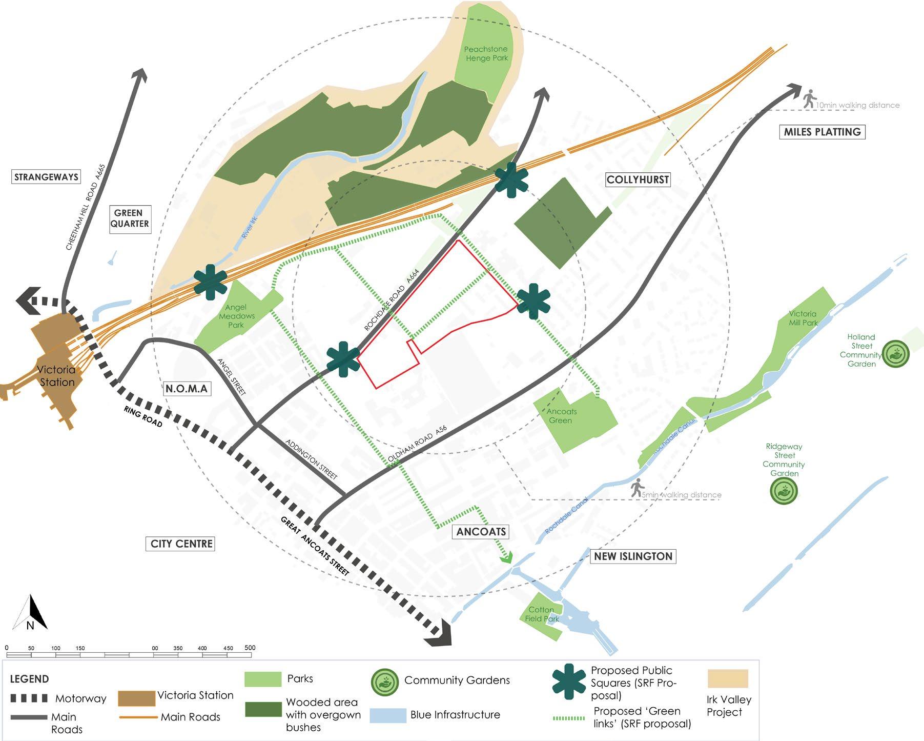
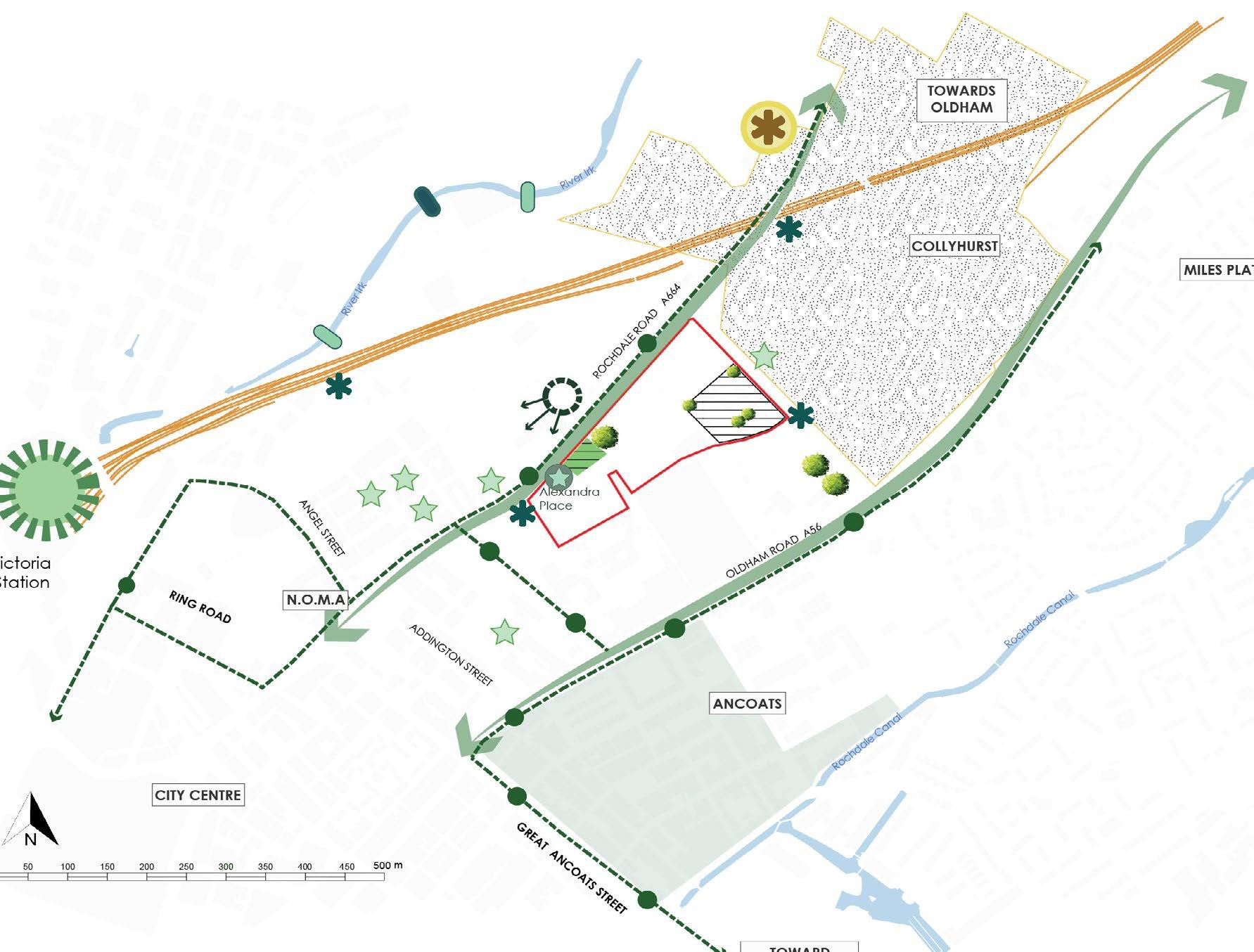
SRF PROPOSALS (Strategic Regeneration Framework)
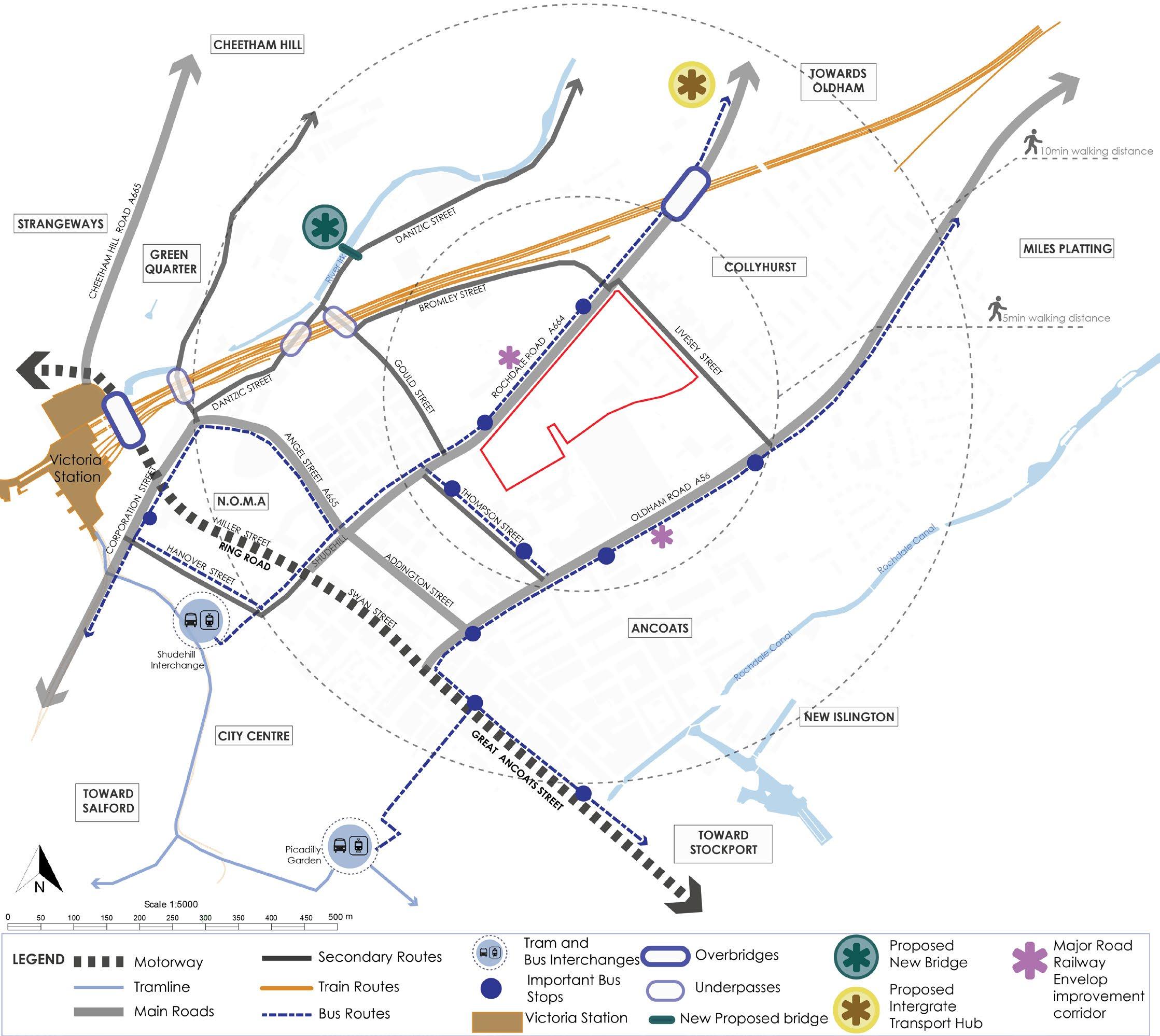
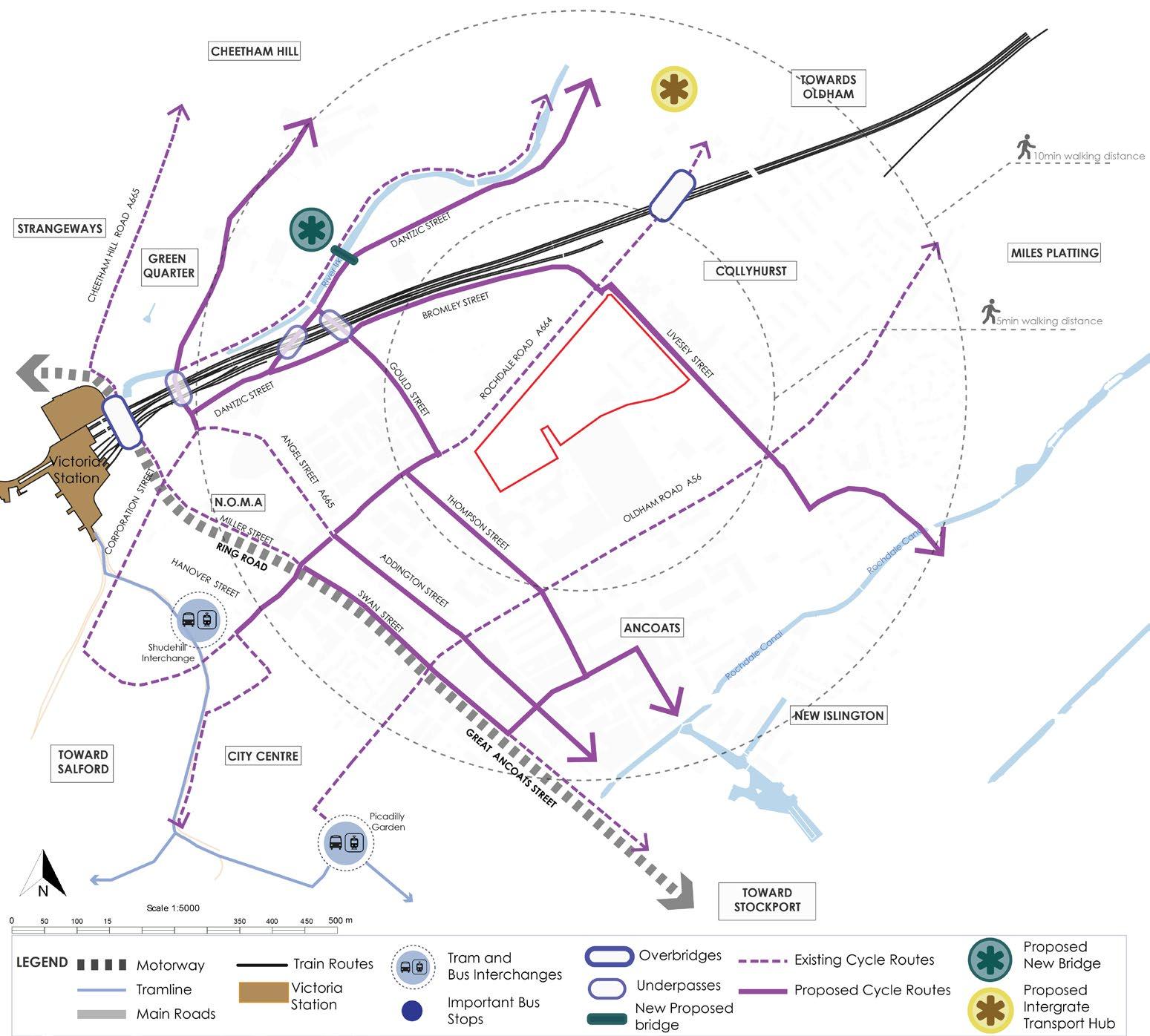
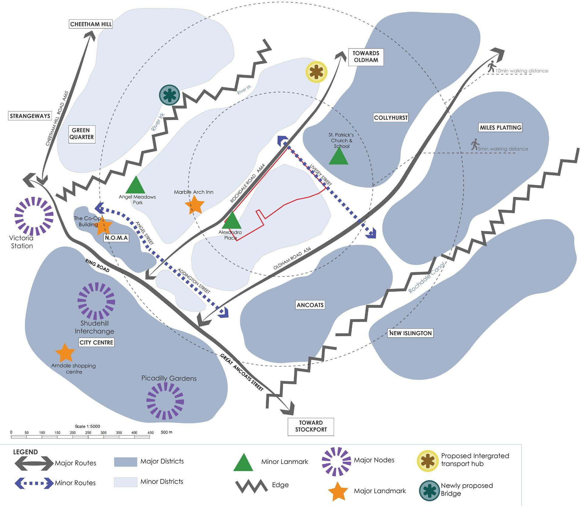
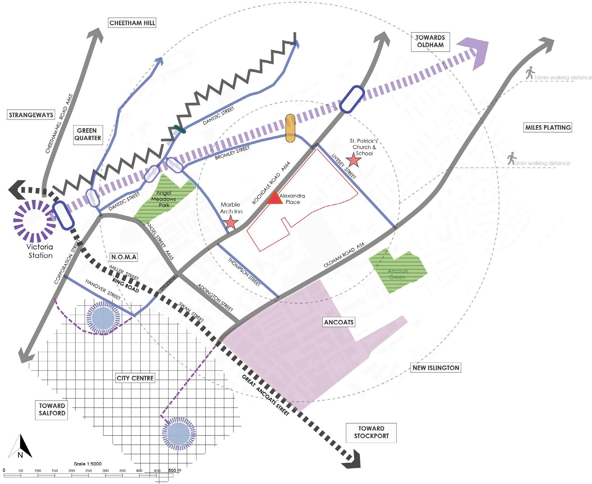
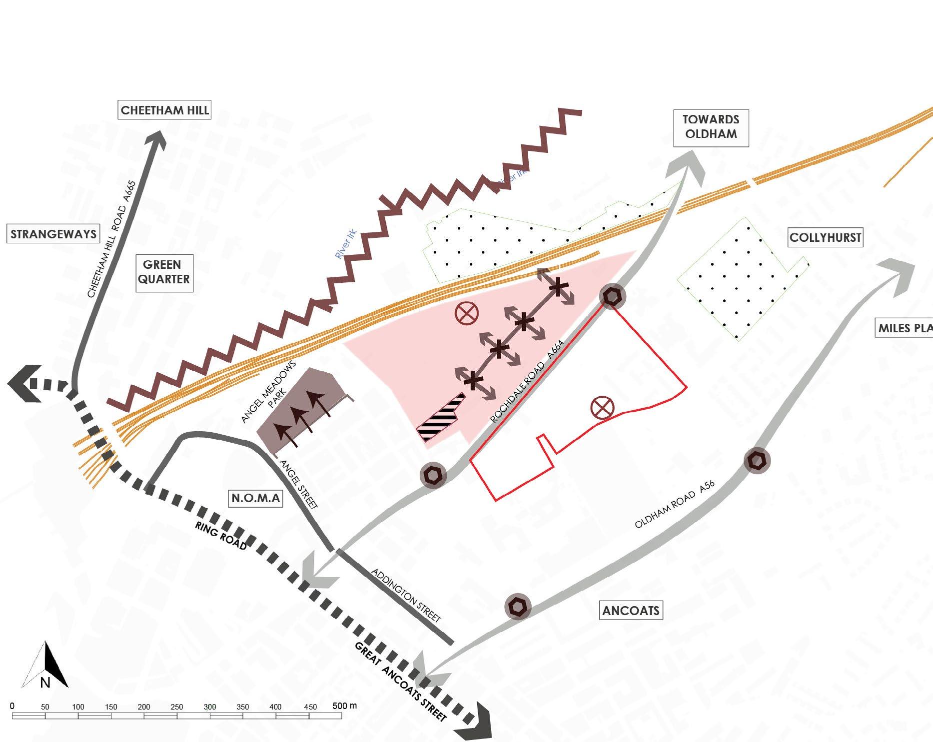
• A new Intergrated Transport hub has been planned to the north east of the site
• A new bridge has been proposed over River Irk, which will help with connectivity to the north side of the city.
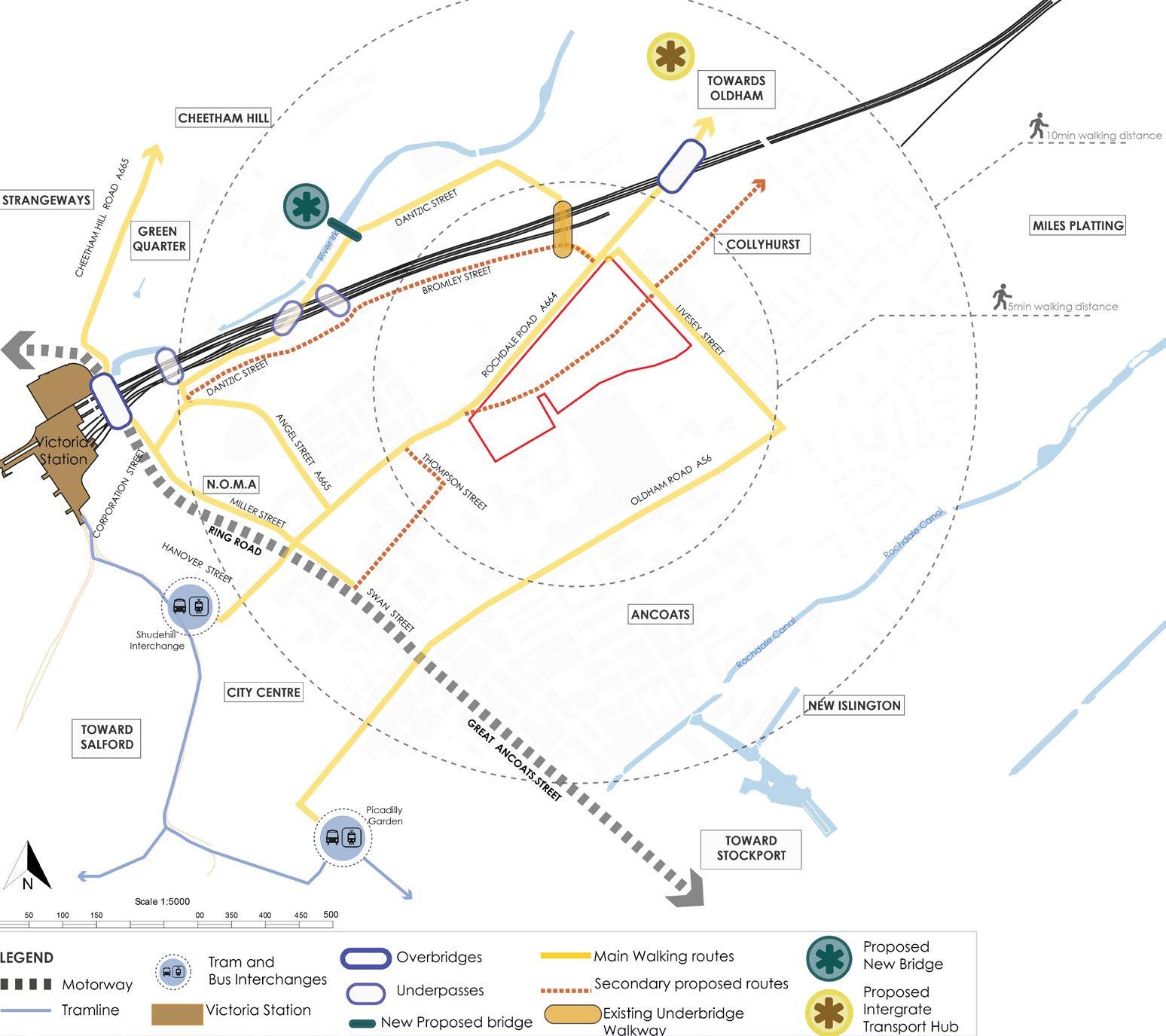
• Neighbourhood walking and cycling routes have been proposed to ease the traffic on the main streets.
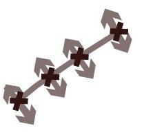
• The new walkway has been proposed through the site.
• Enhancements of cycling provisions on the main streets have been proposed
TAKEAWAYS-CONNECTIVITY
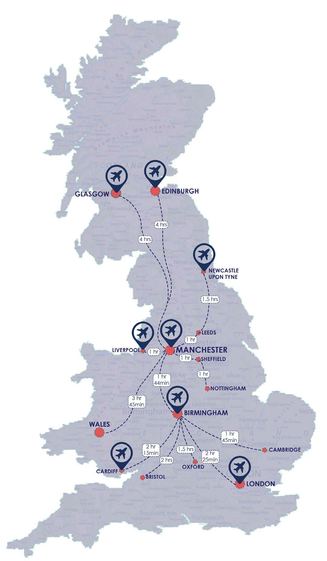
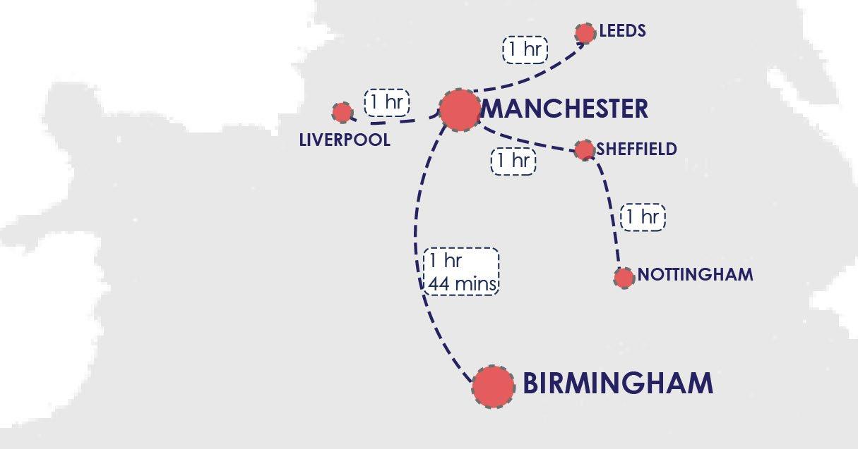
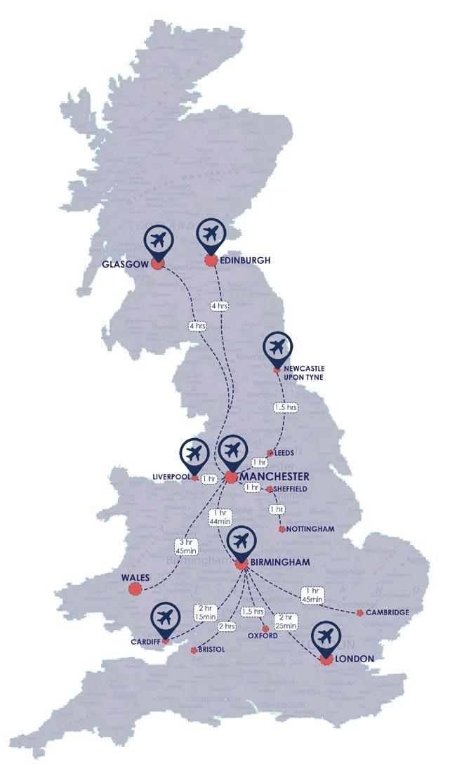
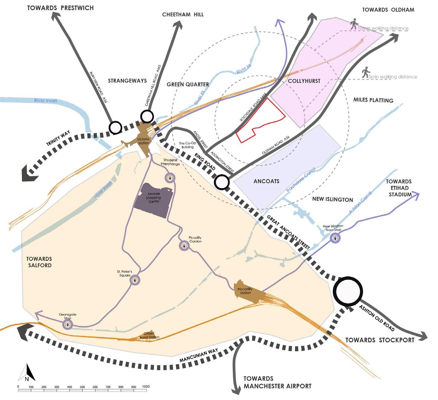
• The site is located at a 15 minute walking distance from Victoria Station.
• The site is accessible by bus to major Tram and bus stations (Shudehill & Picadilly).
• The site has bus stops at walking distance at every 2 mins, which connects to all major areas of the city.
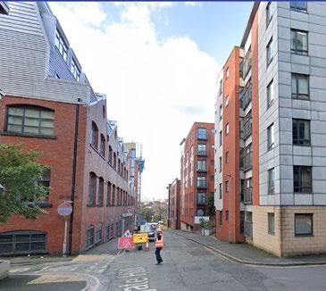
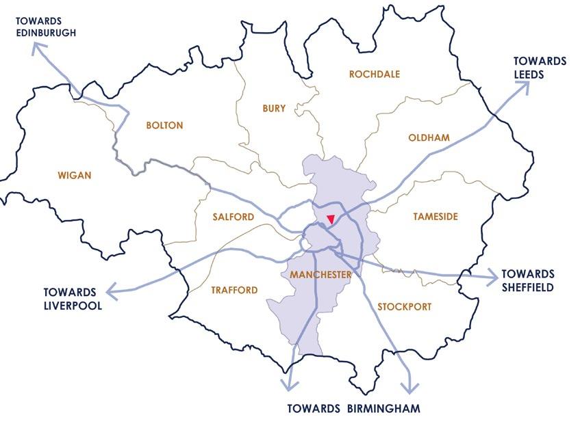
• The site is surrounded by major Streets (A routes) on the east and west side.
• The existing cycle routes are not continuous.
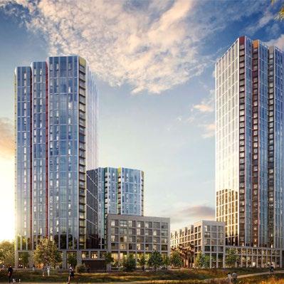
DEVELOPMENT PLANS
TAKEAWAYS
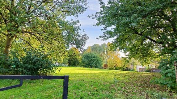
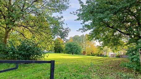
• The site is surrounded by a few parks.
• There are a few community gardens around the site at a walking distance, they are very small and are part of a religious institute.
• The site does not have any Public realm spaces
• There is an obvious disconnection between the green spaces around the site
city council: IRK VALLEY PROJECT (Policy BM2)
• The
SRF PROPOSALS (Strategic Regeneration Framework)
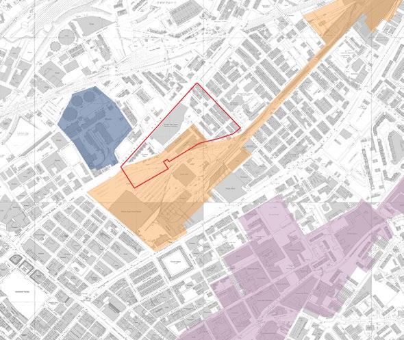
• To bridge the connectivity gap of the Green infrastructure aound the site, the new pesestrian walkways are considered as ‘Green Links’ .
• Natural and Semi Natural Open spaces are being proposed.
• A few areas around the site will be developed for public realm
•
AREA
SWOT
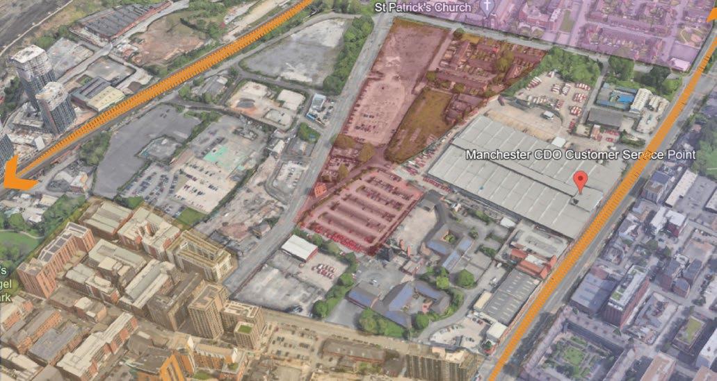
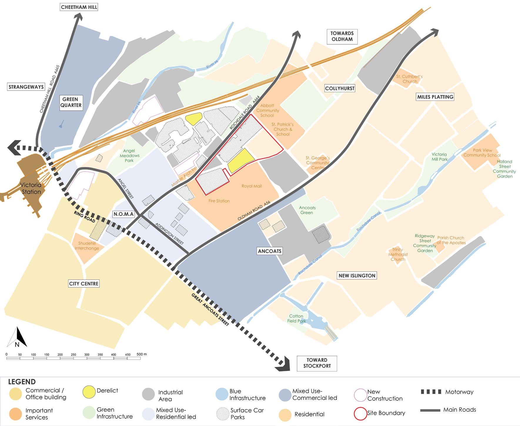
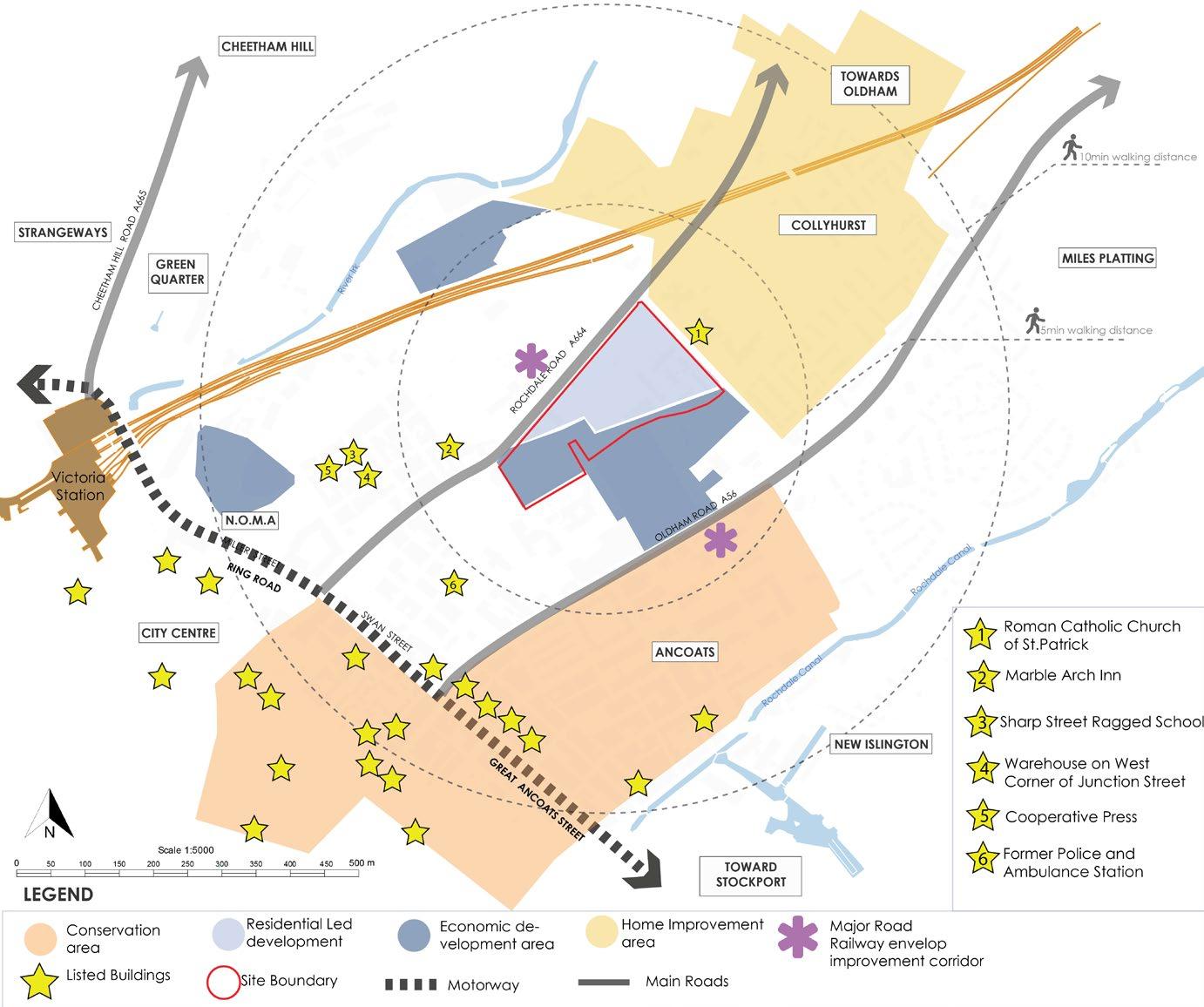
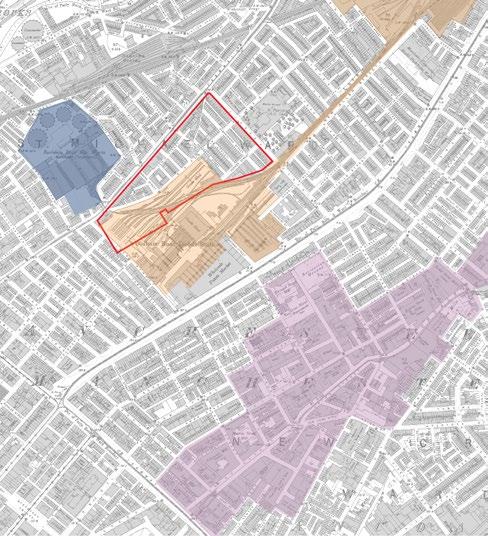
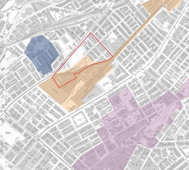
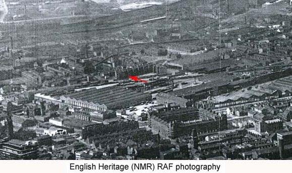
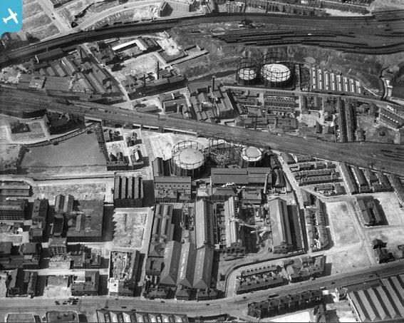
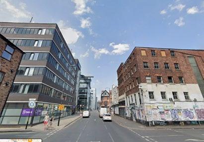
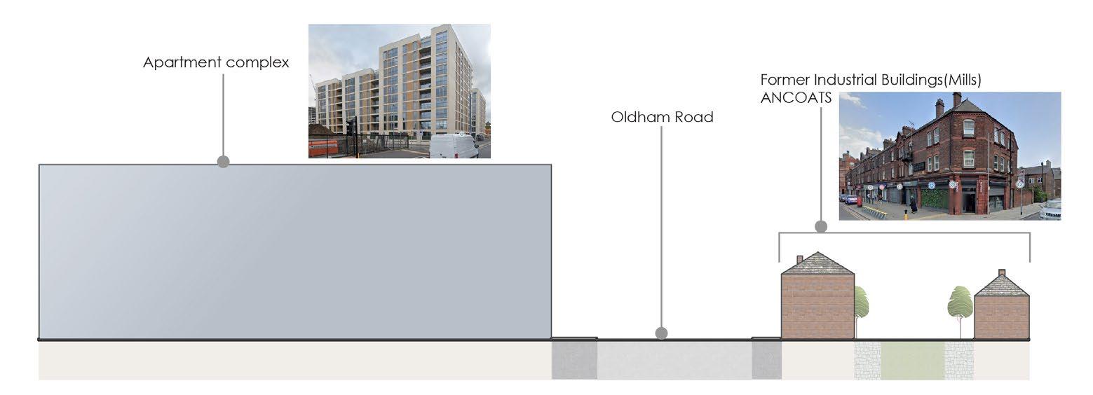
• HISTORICAL EVOLUTION: The site is close to Ancoats, which has a strong character.Ancoats is part of a conservation area due to it history as an Industrial area(Textile mills).
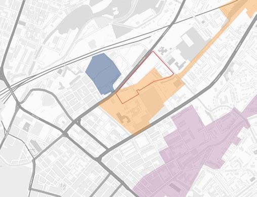
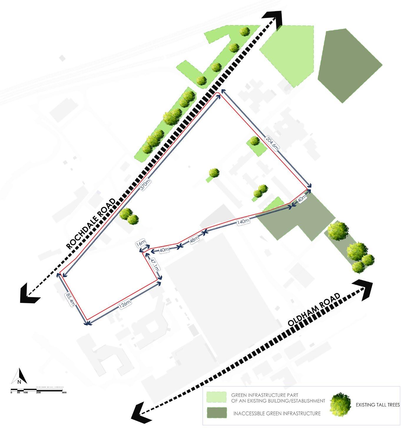
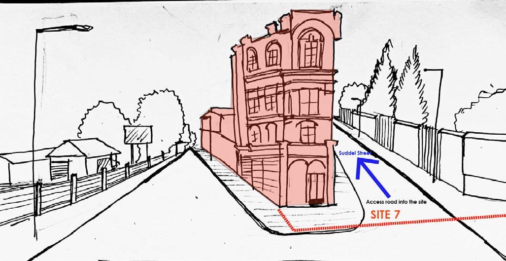
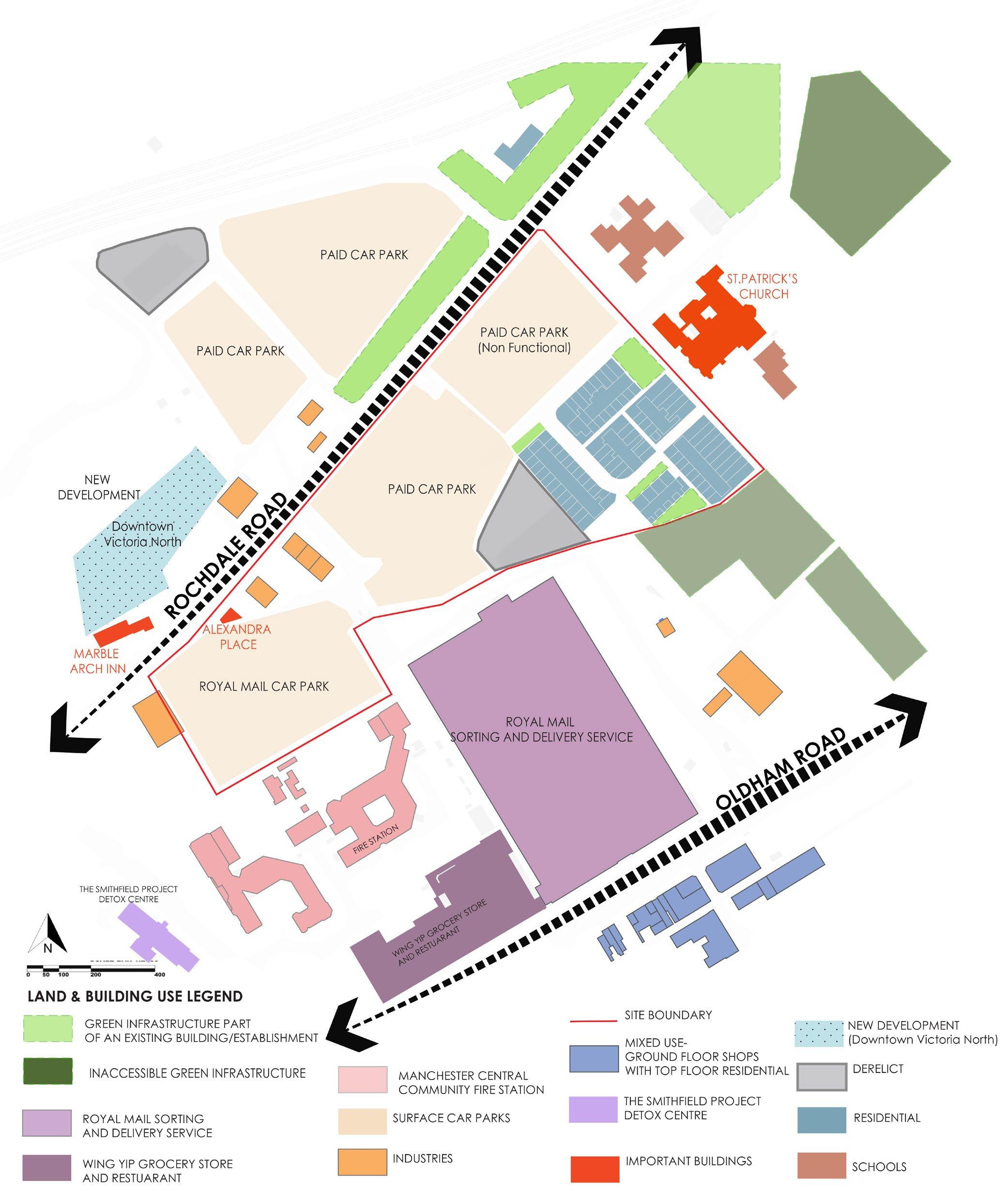
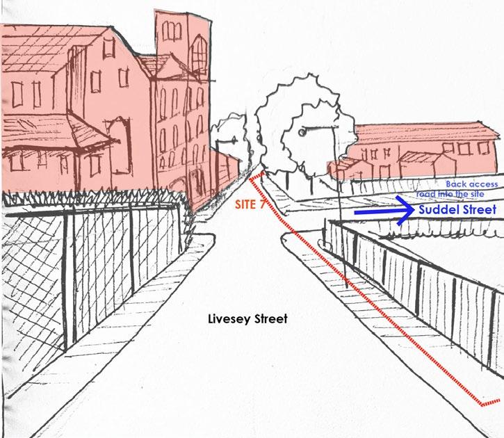
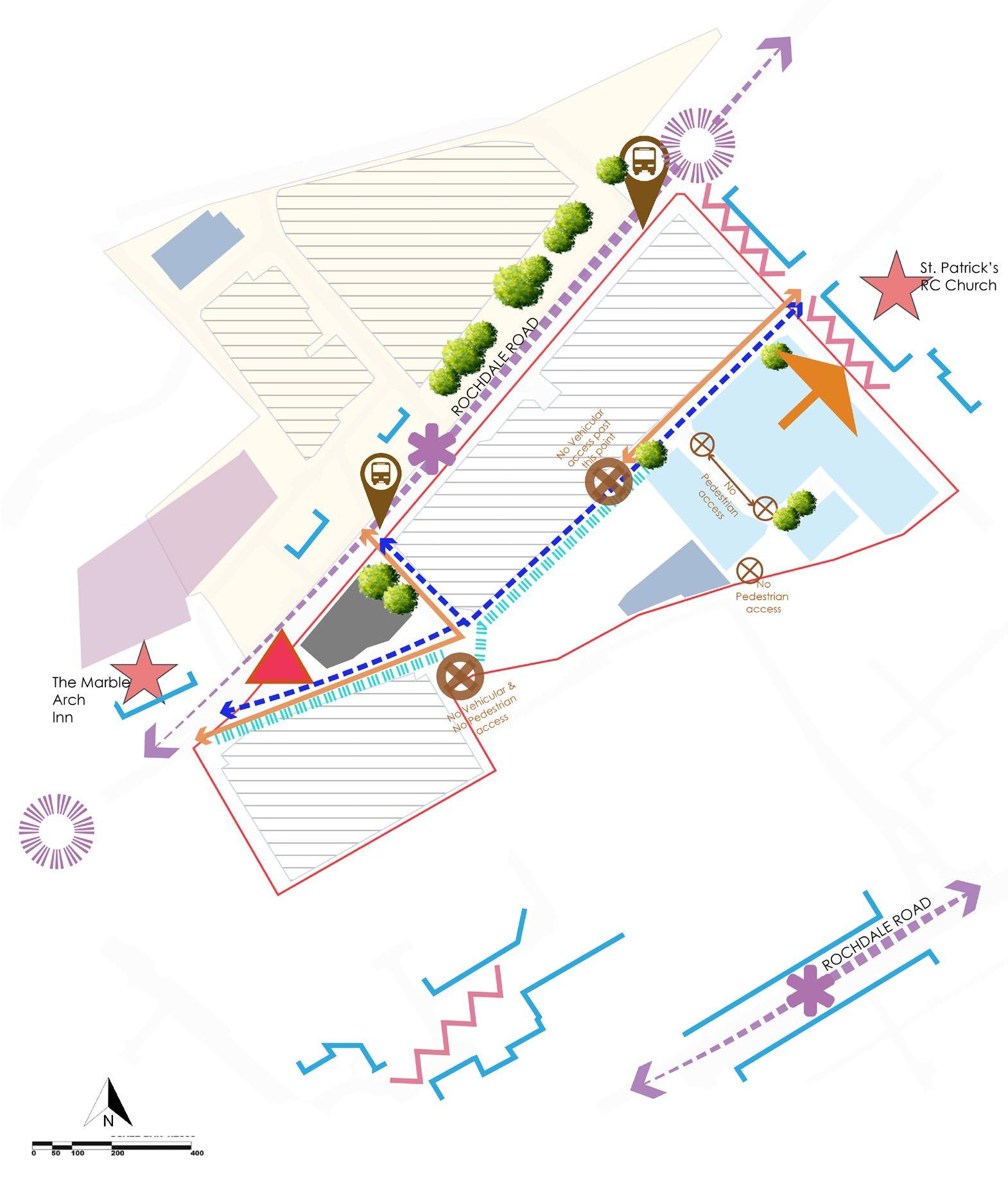
• ACCESS ROADS: Site is flanked by two important road networks the Rochdale Road and Oldham road.
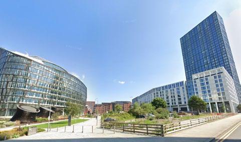
• KEY NODE: The building Alexandra park which sits on the edge of the site.
• GOOD BUS ROUTE: The site is surrounded by bus stops, which connect to the City centre
• CLOSE PROXIMITY TO VICTORIA STATION: The site is at a walking distance to Victoria Station.
• LESS PUBLIC REALM SPACES CLOSE TO THE SITE
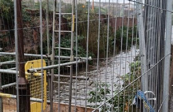
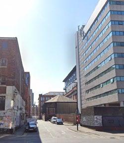
• FRAGMENTED AREAS SURROUNDING THE SITE: PART OF A FORMER GAS WORKS:
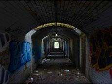
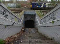
• POOR NORTH- SOUTH CONNECTIVITY (THROUGH WALKING , BUS AND TRAM ROUTES)
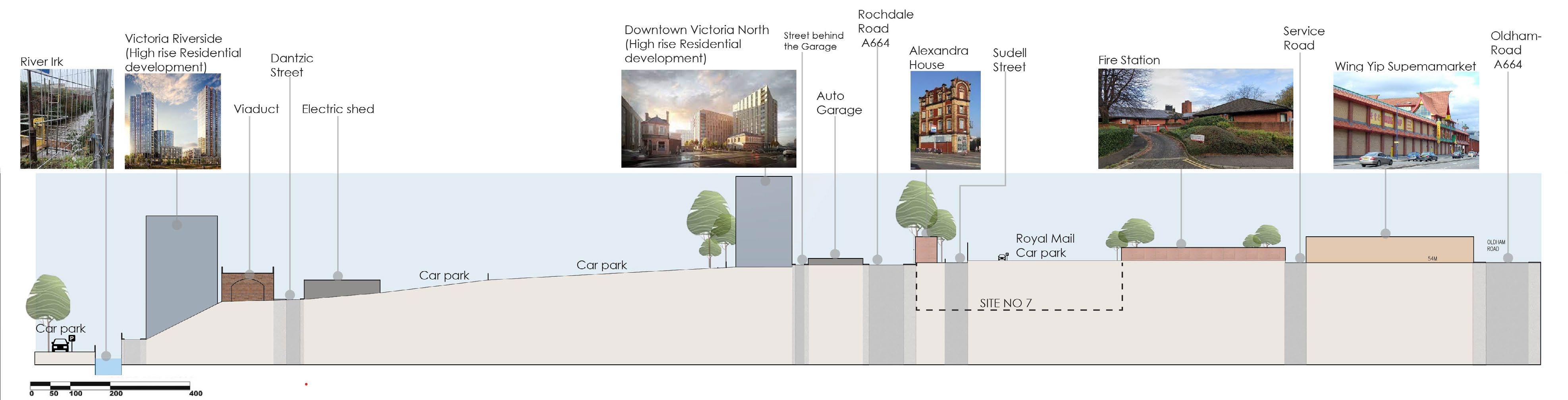
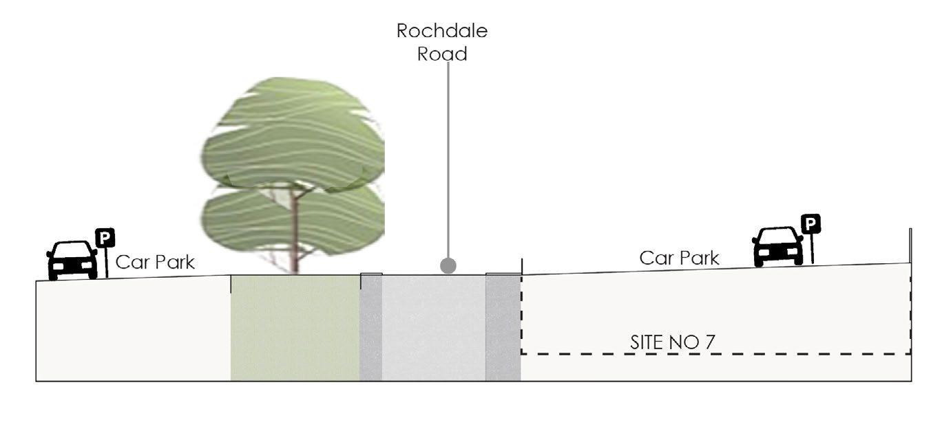
• SLOPED TOPOGRAPHY: NO LEGIBILITY OF THE ANGEL MEADOWS PARK
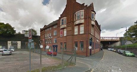
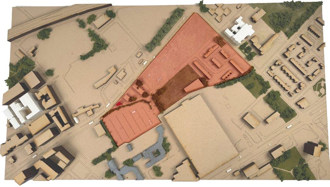
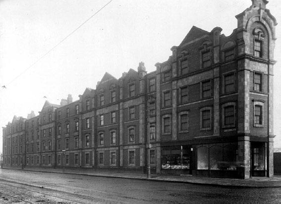
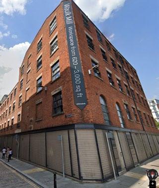
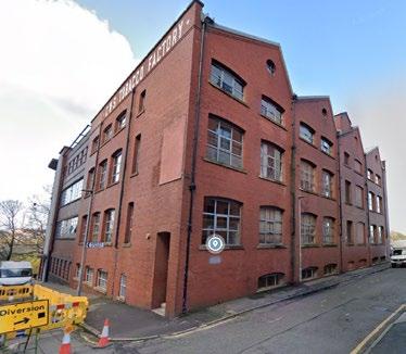
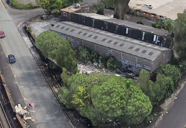
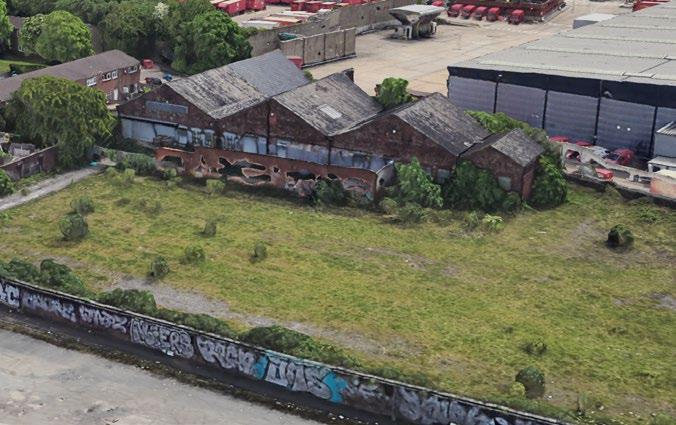
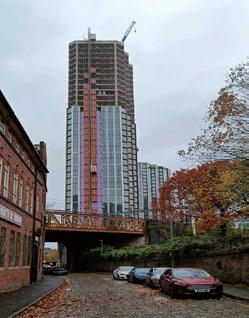
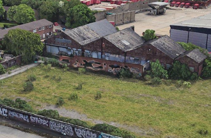
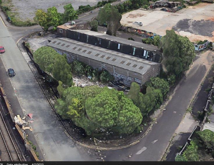
• EXISTING DERELICT BUILDING WITHING THE SITE
• EXISTIGN SOCIO ECONOMIC DEMOGRAPHICS
• AGE DEMOGRAPHICS
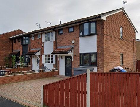
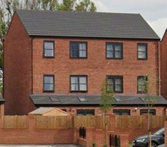
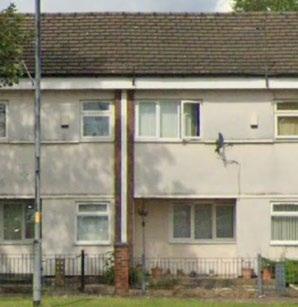
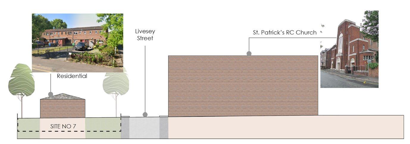
• EXISTING HOUSES ON THE SITE:
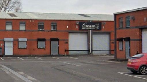
• EXISTING AUTO GARAGES ON THE SITE
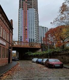
• EXISTING TALL TREES ON THE SITE
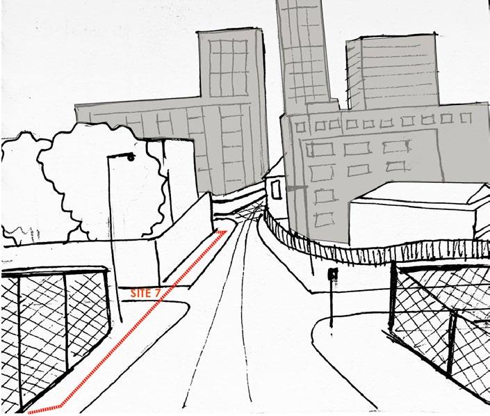
• STRONG VIEWS INTO THE CITY
• LACK OF AMENITIES SURROUNDING THE AREA
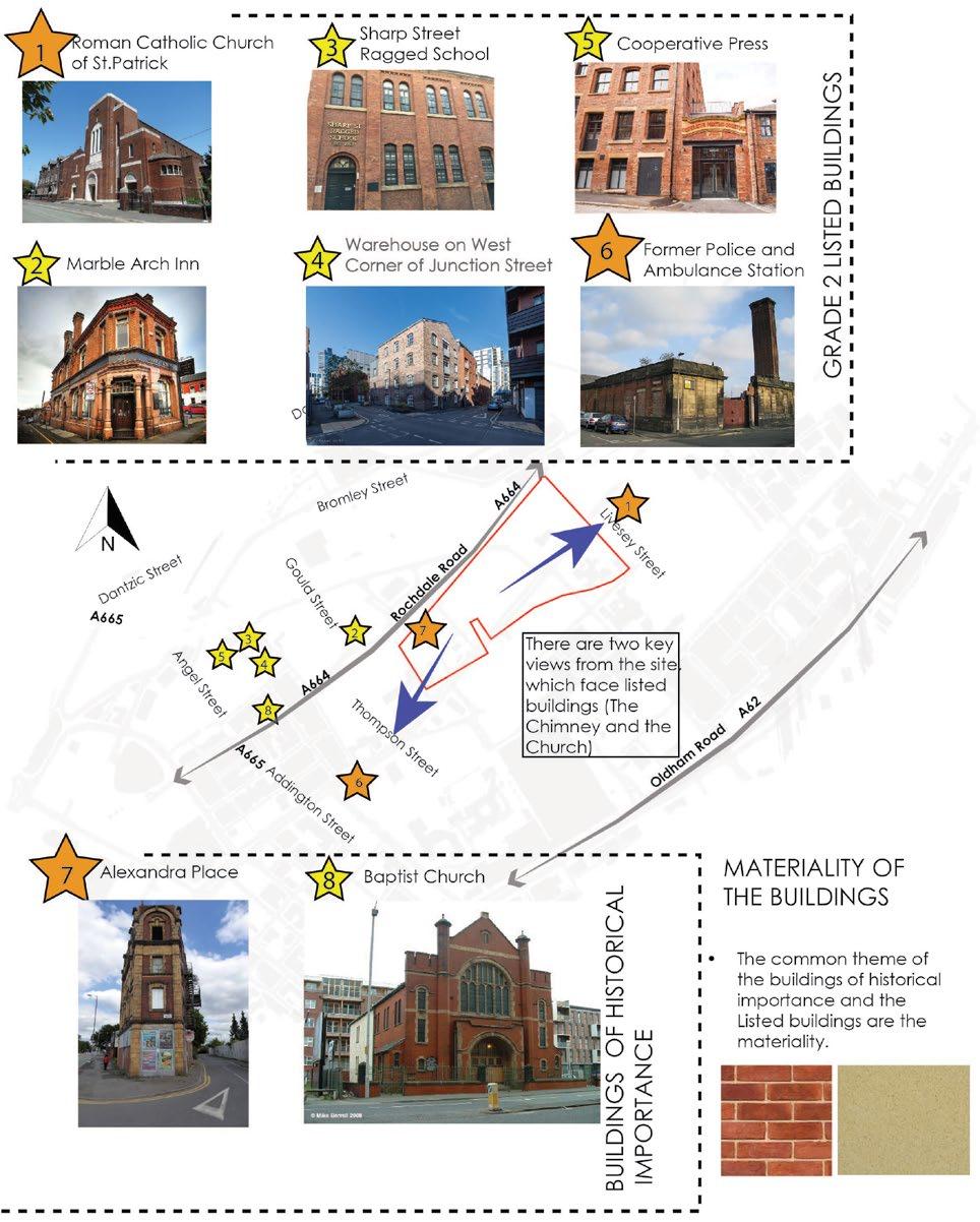
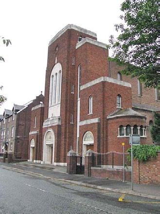
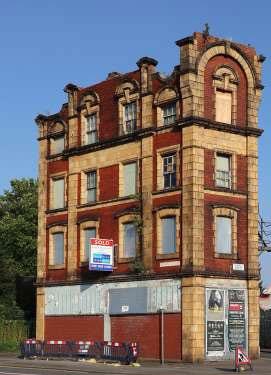
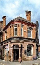
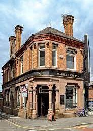
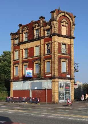
• EXISTING LISTED BUILDINGS CLOSE TO THE SITE
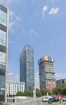
• FUTURE DEVELOPMENTS PLANNED AROUND TEH SITE
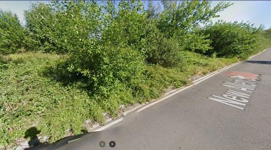
• UNKEPT OVER GROWN GREEN INFRASTRUCTURE
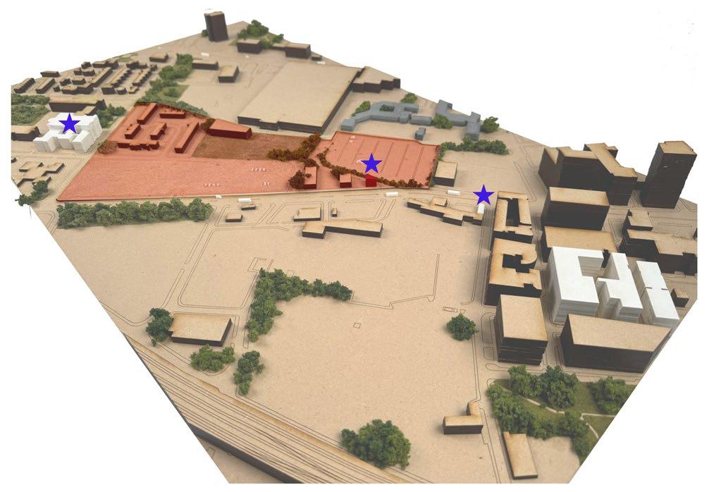
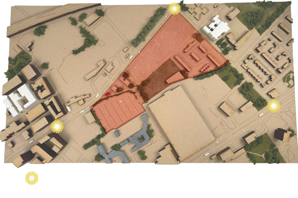
OPPORTUNITIES MAP
EXISTING
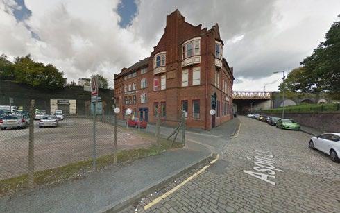
EXISTING LISTED BUILDINGS: The site is surrounded by listed buildings. Bringing in a importance to the area.
ALEXANDRA PLACE: As a uniquely shaped structure on the corner of the site. This acts a node to distinguish the site from other areas
EXISTING SERVICE BUILDINGS: The site contains these service buildings, which gives us an opportunity to understand the needs of the people who have visited the site, and build on it further.
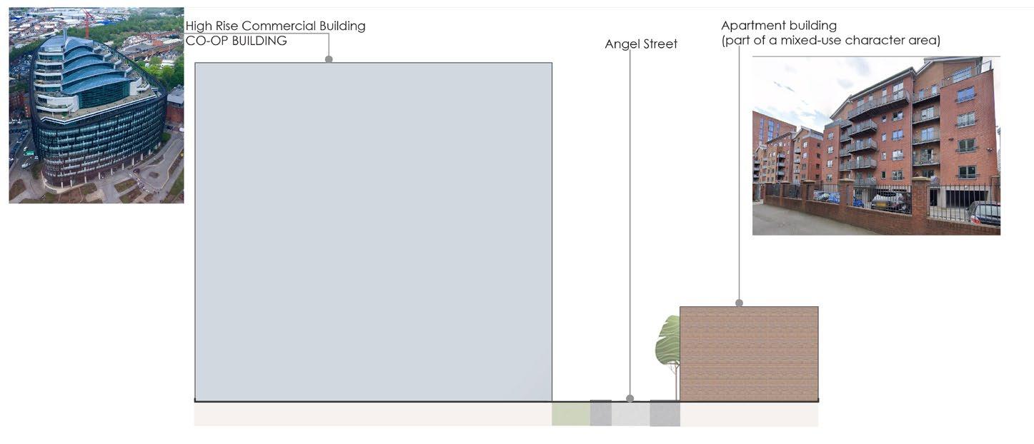
EXISTING RESIDENCES: As the site has existing residences, makes us aware of what can be built on the site
CONSTRAINTS MAP