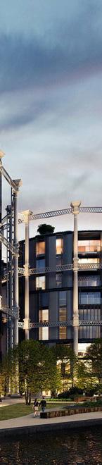
The development of the eastlands site, a strategically located site of approximately 27 hectares, presents an important opportunity to deliver a new urban quarter close to Manchester’s city centre and the Etihad Campus. The regeneration of the site will transform the site from an underused area that currently separated surrounding neighbourhoods into a high-quality and sustainable development. The development will enhance the Etihad Campus’ status as a key destination, while also creating an attractive and inclusive new neighbourhood that creates a sense of place and identity by respecting the site’s heritage.
The Masterplan Framework aims to provide a document that will guide the future development at the Eastlands site, ensuring that development will be contextual yet ambitious. Detailed analysis regarding the physical and socioeconomic context of the site has driven the creation of a vision that prioritises community, culture and cityzens. Specific objectives and actions make the broad vision more tangible, supporting future designers and planners in creating a masterplan that succeeds in delivering this framework’s vision. In addition, this documents seeks to engage existing communities, developers and investors, communicating the outstanding impact that the development can have on not only the local area, but also wider Manchester.
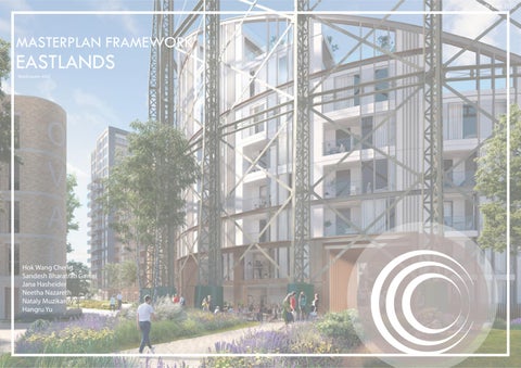
Introduction
The Purpose of Masterplan Framework
2 Strategic Scale
2STRATEGIC SCALE
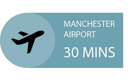
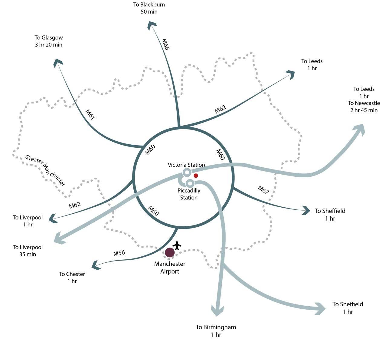
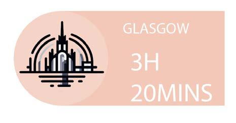
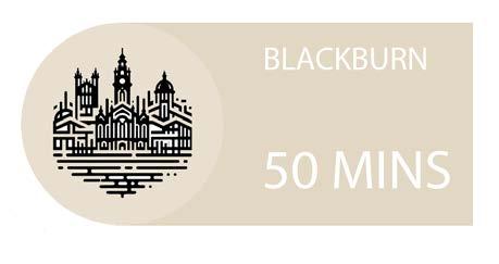
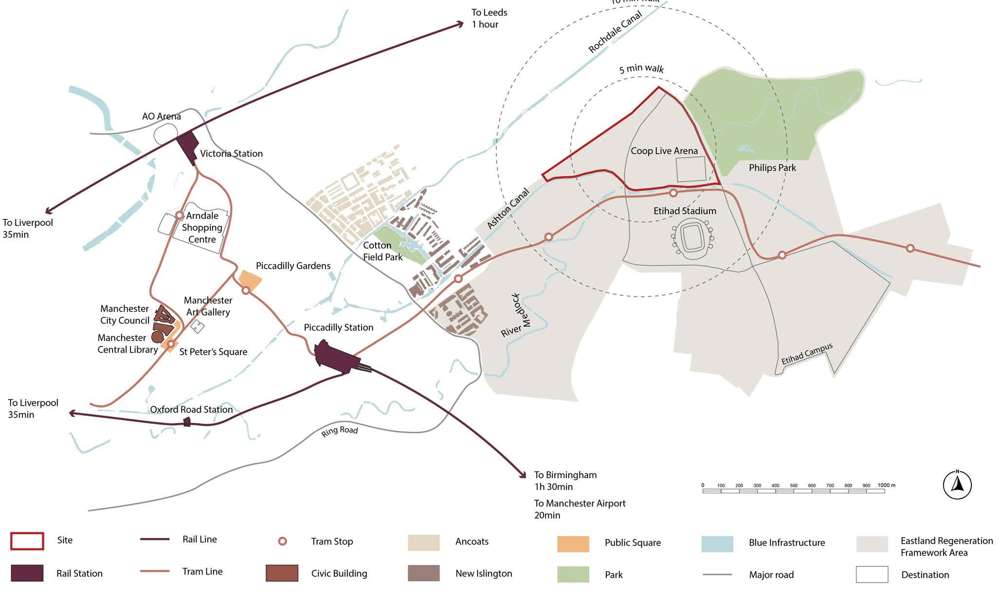
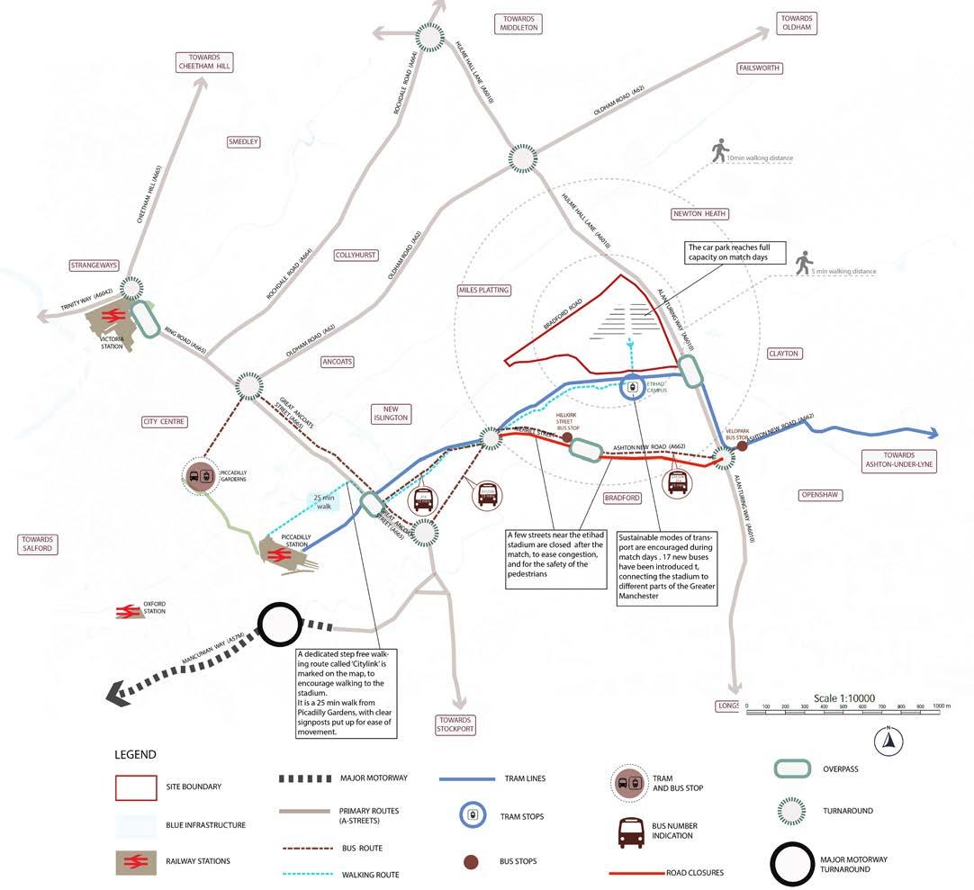
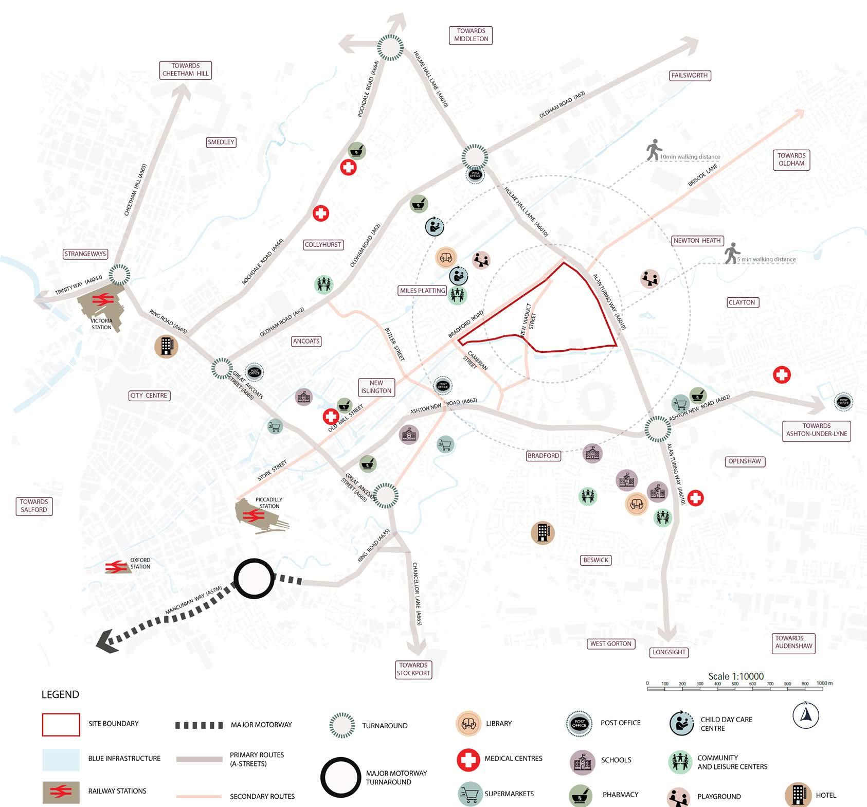
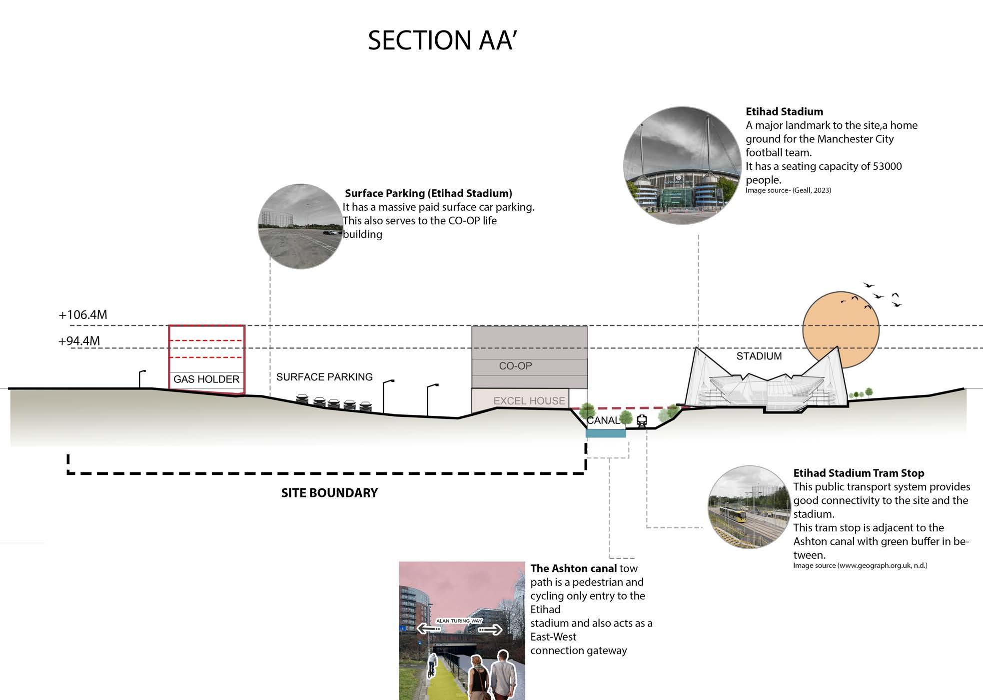
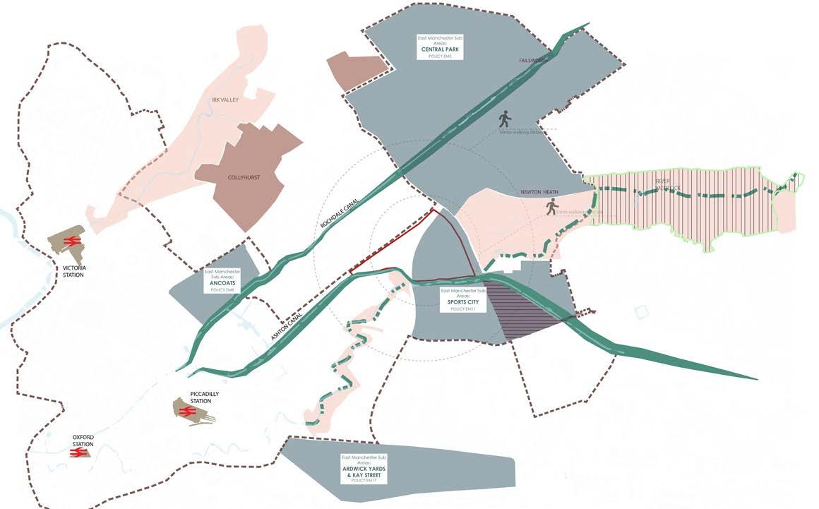
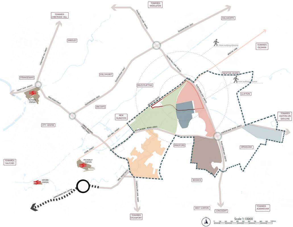
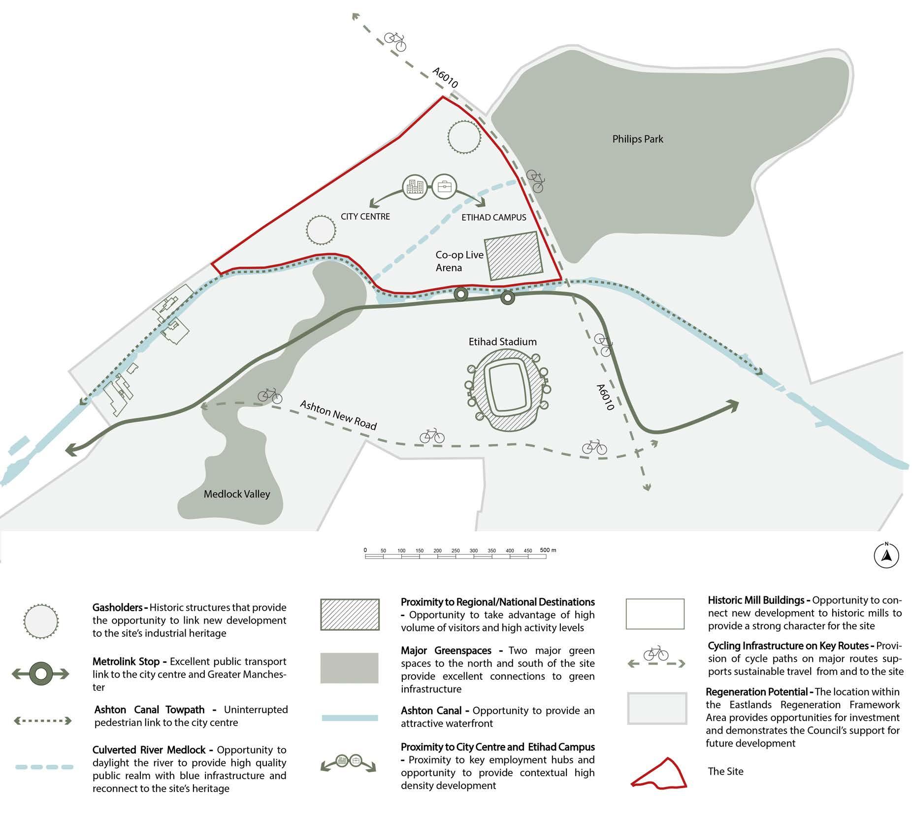
The site is located in central Manchester, close to the city’s two main transport hubs, Piccadilly Station and Victoria Station. The site is therefore easily accessible from other cities in the region as well as the country. Additionally, Manchester Airport can be reached within 20 minutes from Piccadilly Station, connecting the site internationally.
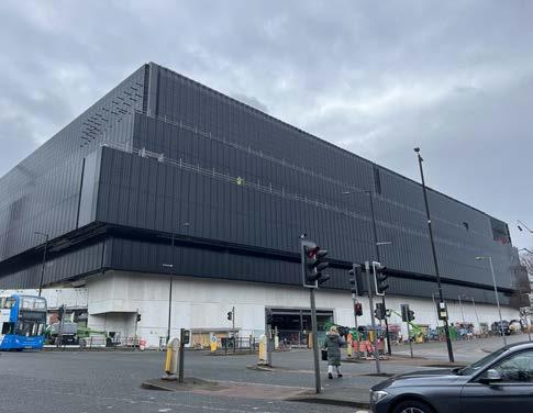
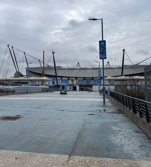
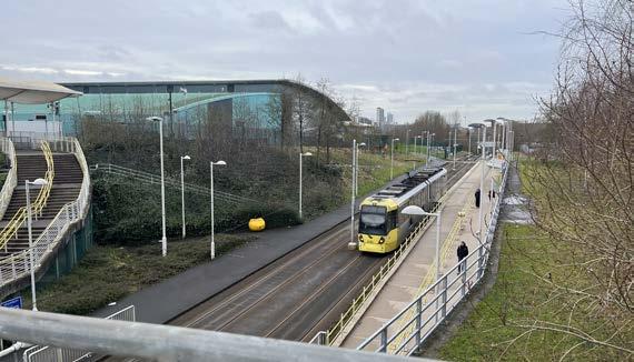
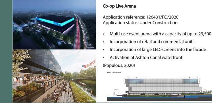
Within Manchester, the site has excellent sustainable travel links to both the city centre and Greater Manchester. The Metrolink, Manchester’s tram system, has a stop immediately adjacent to the site boundary. Key destinations that can be reached within a ten-minute walk of the site are the Co-op Live Arena, a multifunctional event venue that is currently under construction, the Etihad Campus with the Etihad Stadium, a major football stadium that is the home of the football club Manchester City, and Philips Park, a large historic park.
The site has high potential for regeneration. It is located within the Eastlands Regeneration Framework Area, with sets out the Council’s ambition to redevelop the site as a mixed-use development (Manchester City Council, 2017). The proximity to the Etihad Campus is going to drive new development on site, attracting investment and incentivising the Council to support the delivery of appropriate proposals.
81,1% above the age 65+
14,823 total population
5,2% Anual Population Growth
36.4% 1 person household
Key Takeaways:
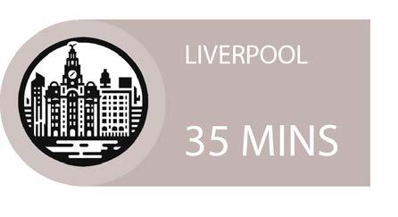
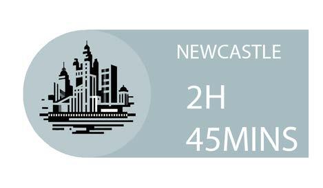
The site is also connected to major cities across the UK through the city’s extensive tram and railway networks.
3
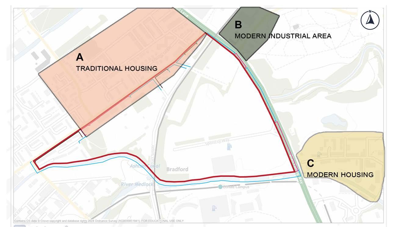
Area and Local Scale
3AREA AND LOCAL SCALE
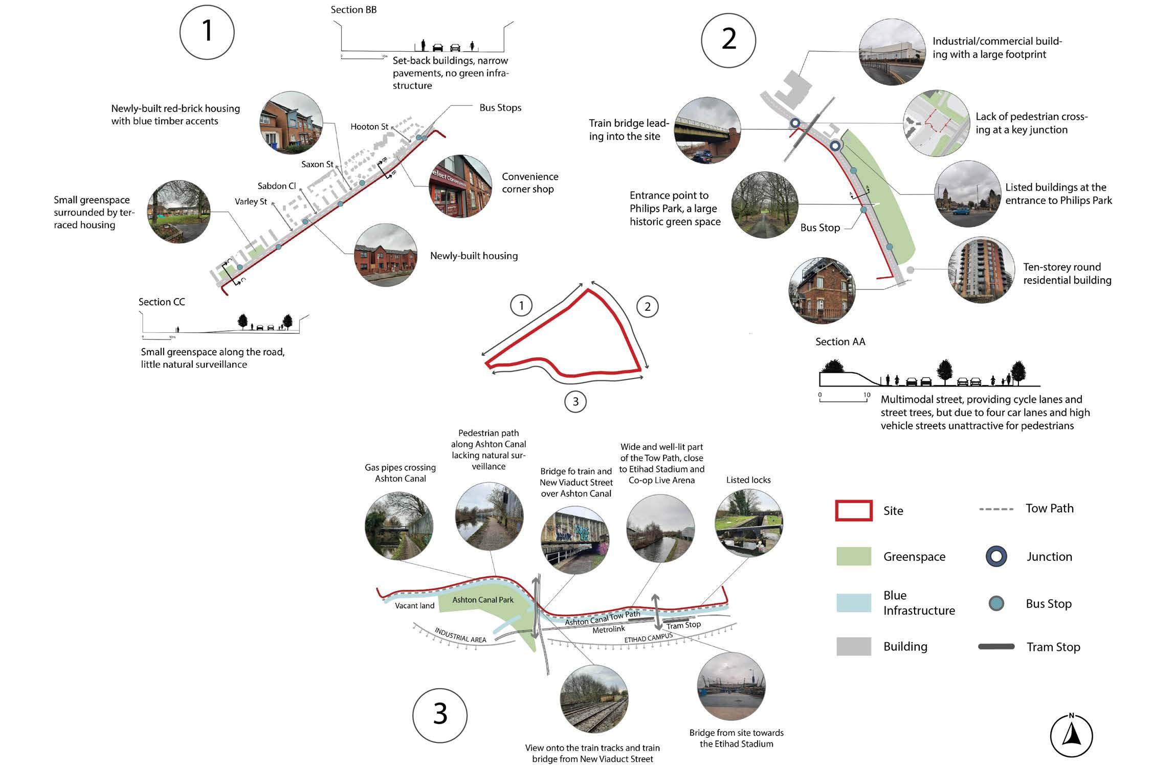
Road Hierarchy
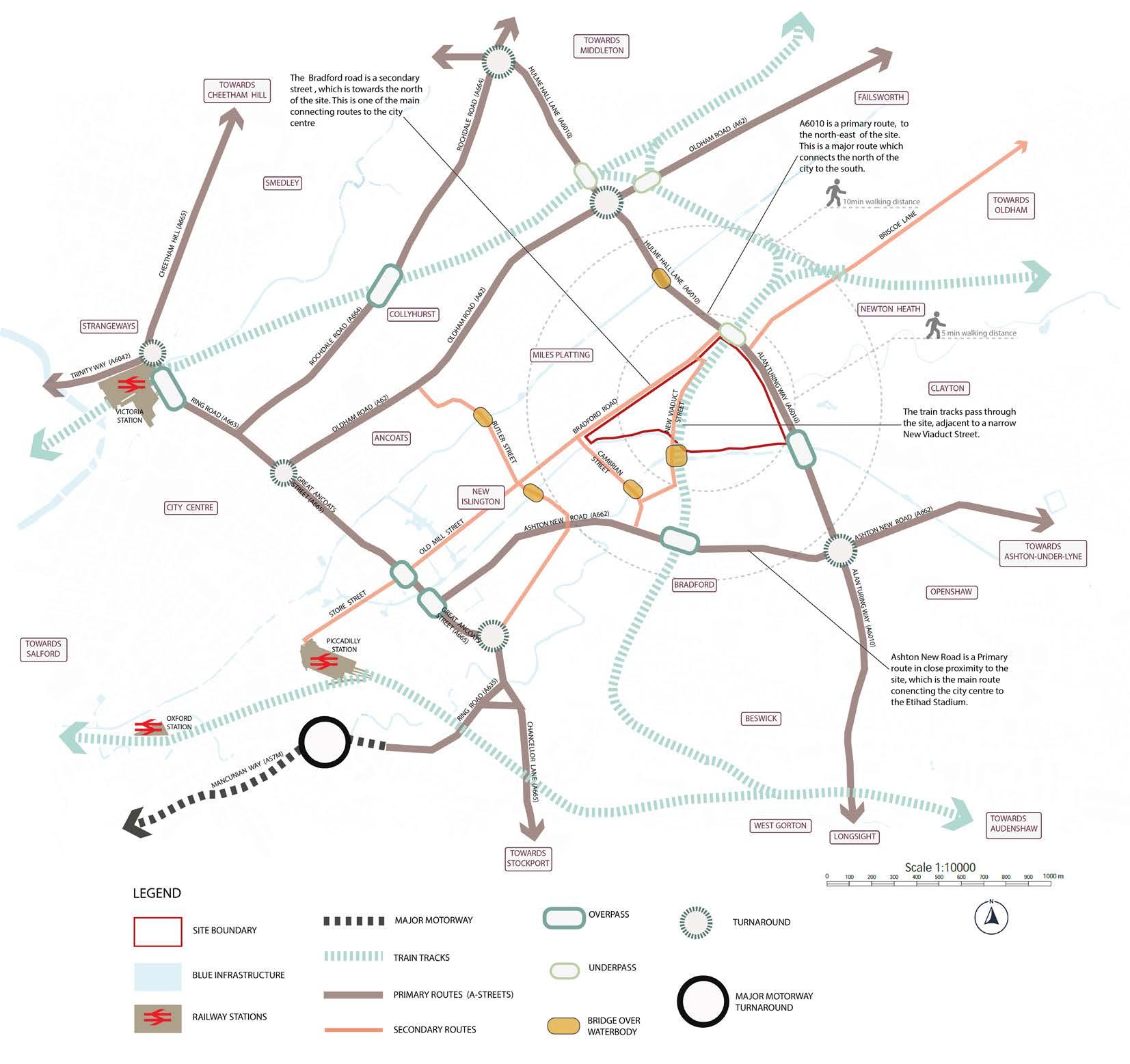
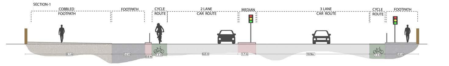
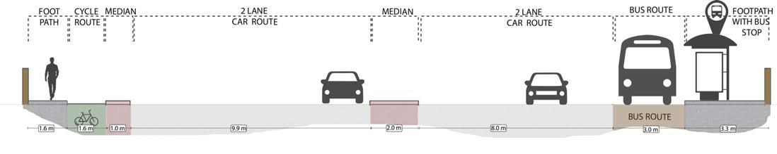
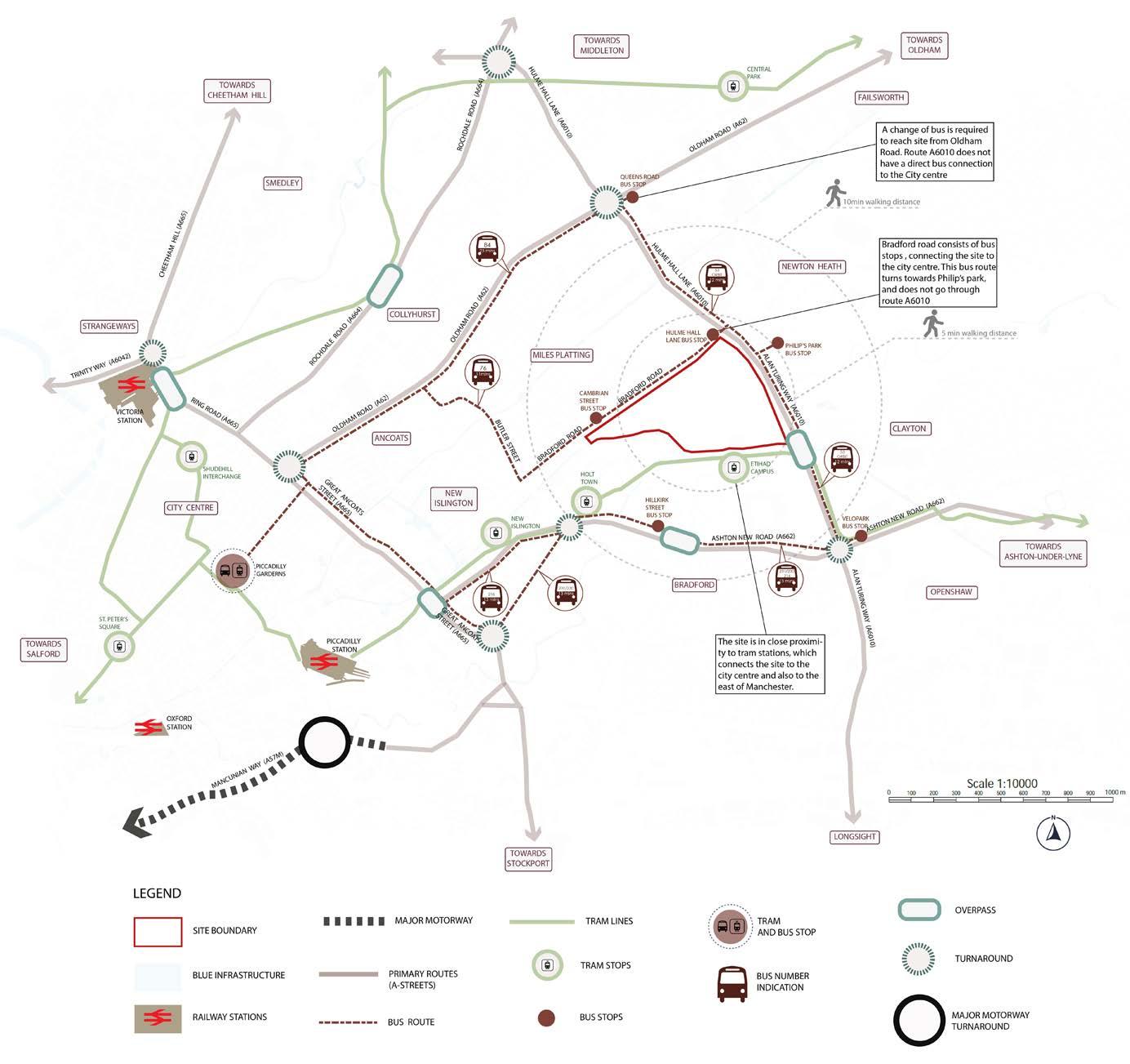
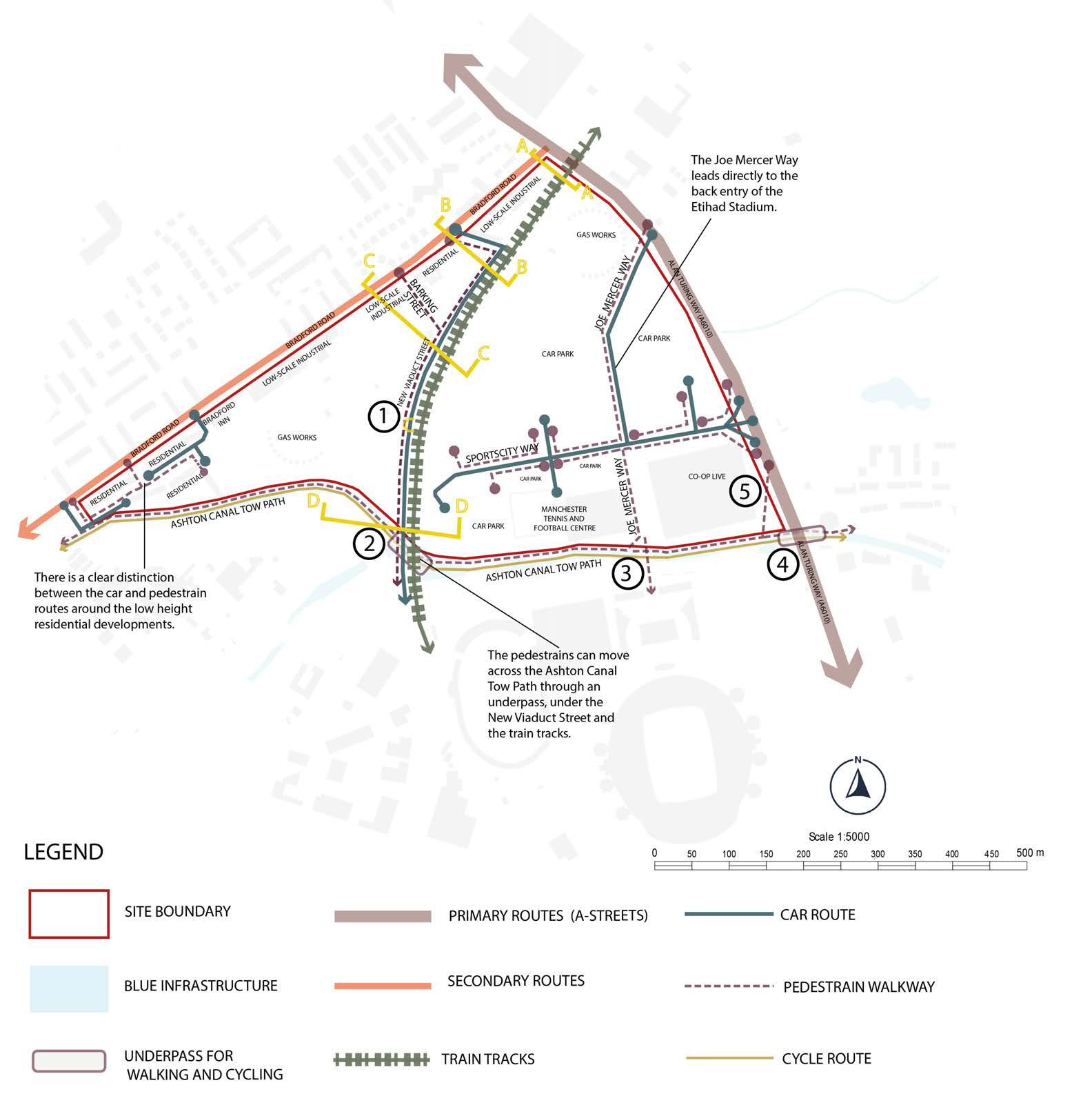
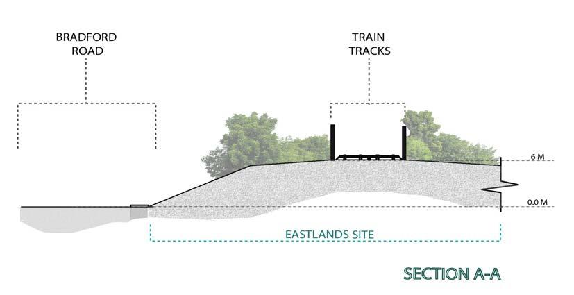
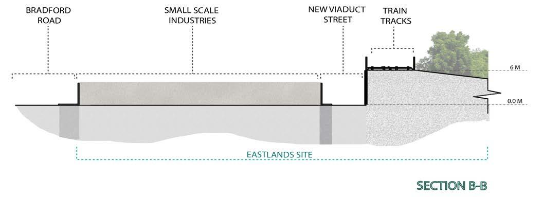
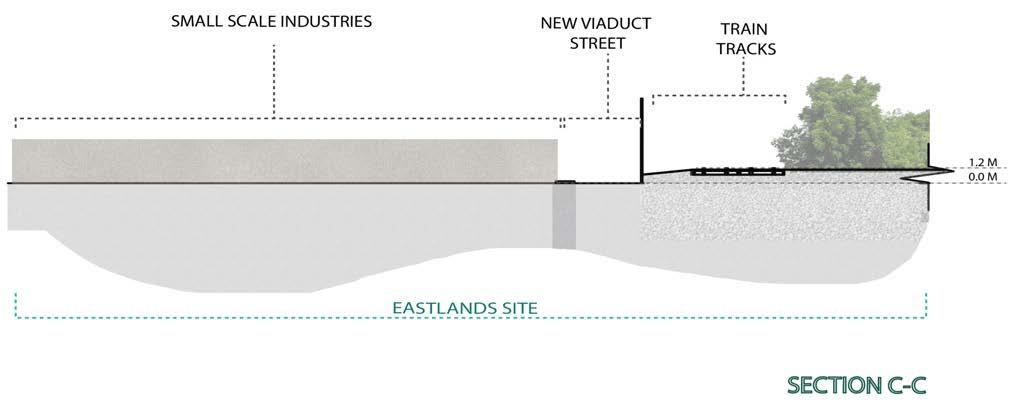
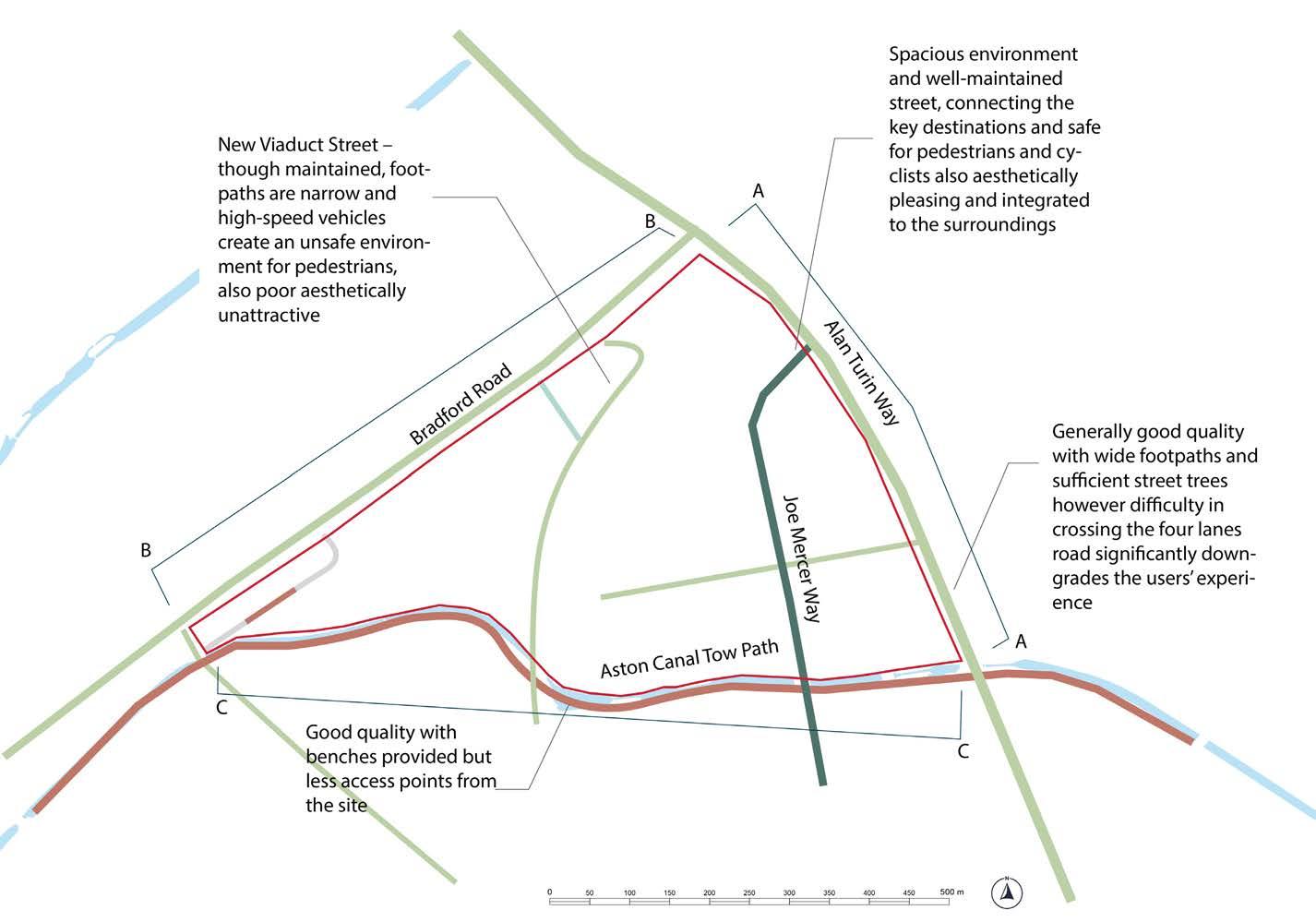
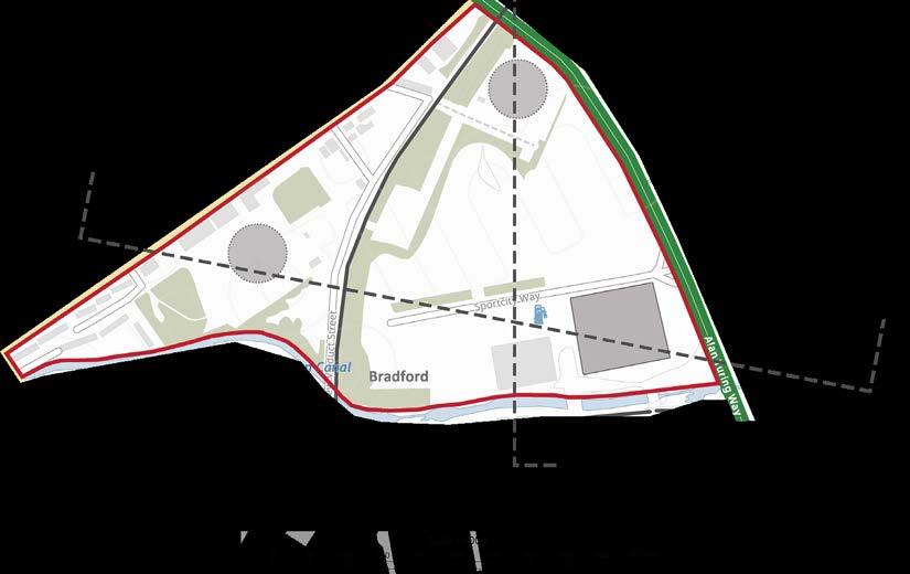
The Eastlands site is strategically located nearby primary and secondary road connections. The A6010 runs north-south along the site’s western boundary, providing a major arterial link.
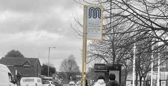
Bradford Road forms the northern site boundary. As a secondary route, it sees regular bus traffic and stops, offering public transport access. Bradford Road also directly connects the site to the city centre.
To the south lies Etihad Stadium, a major destination accessible via the A662 Ashton New Road primary route.
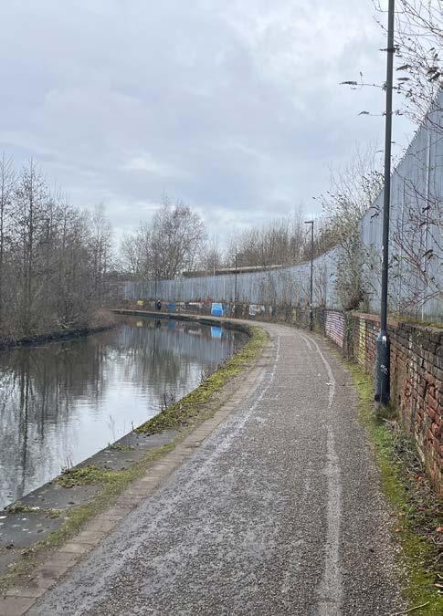
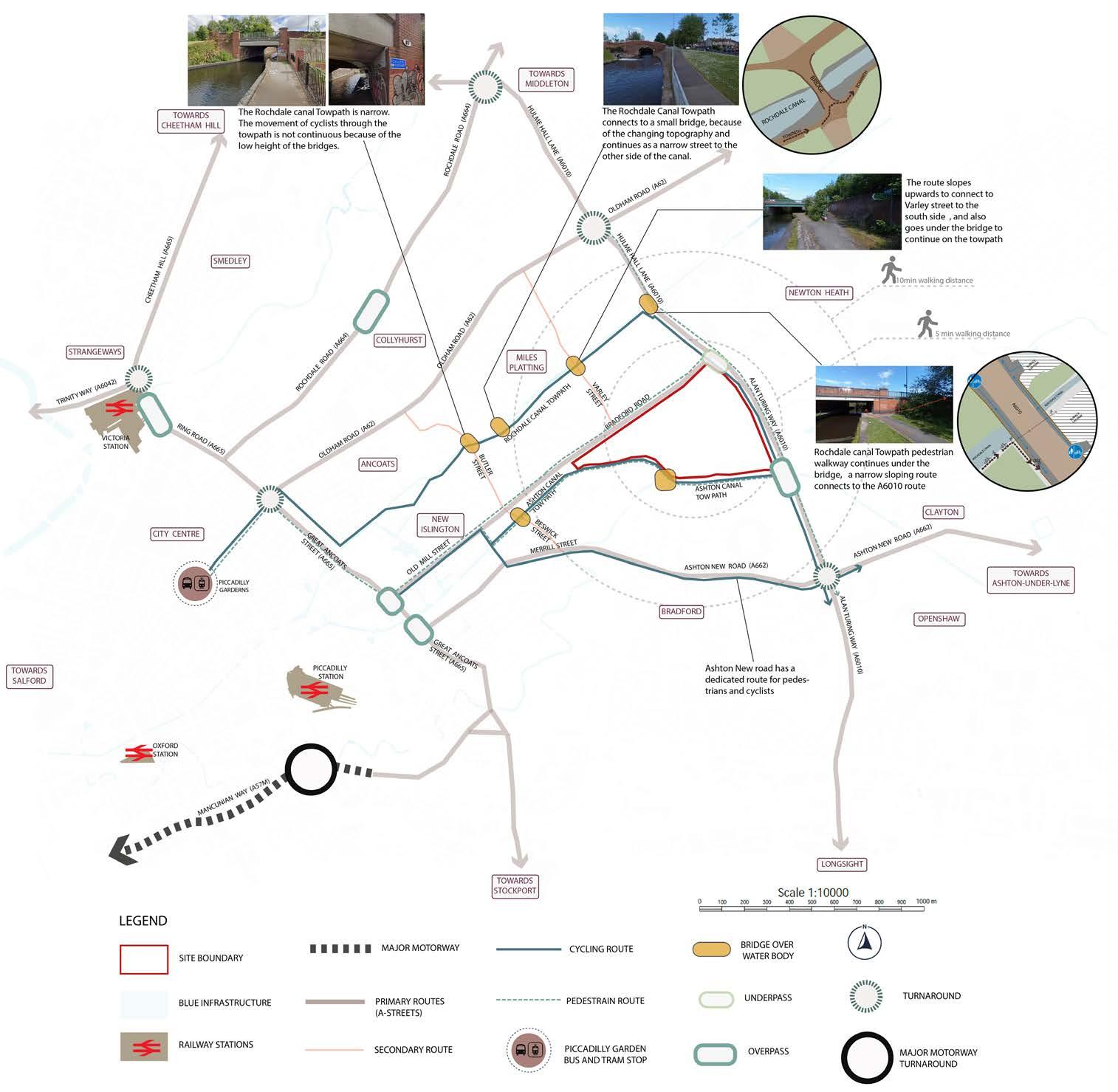
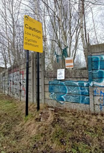
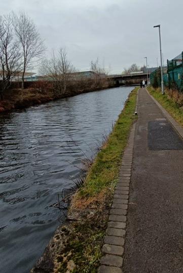
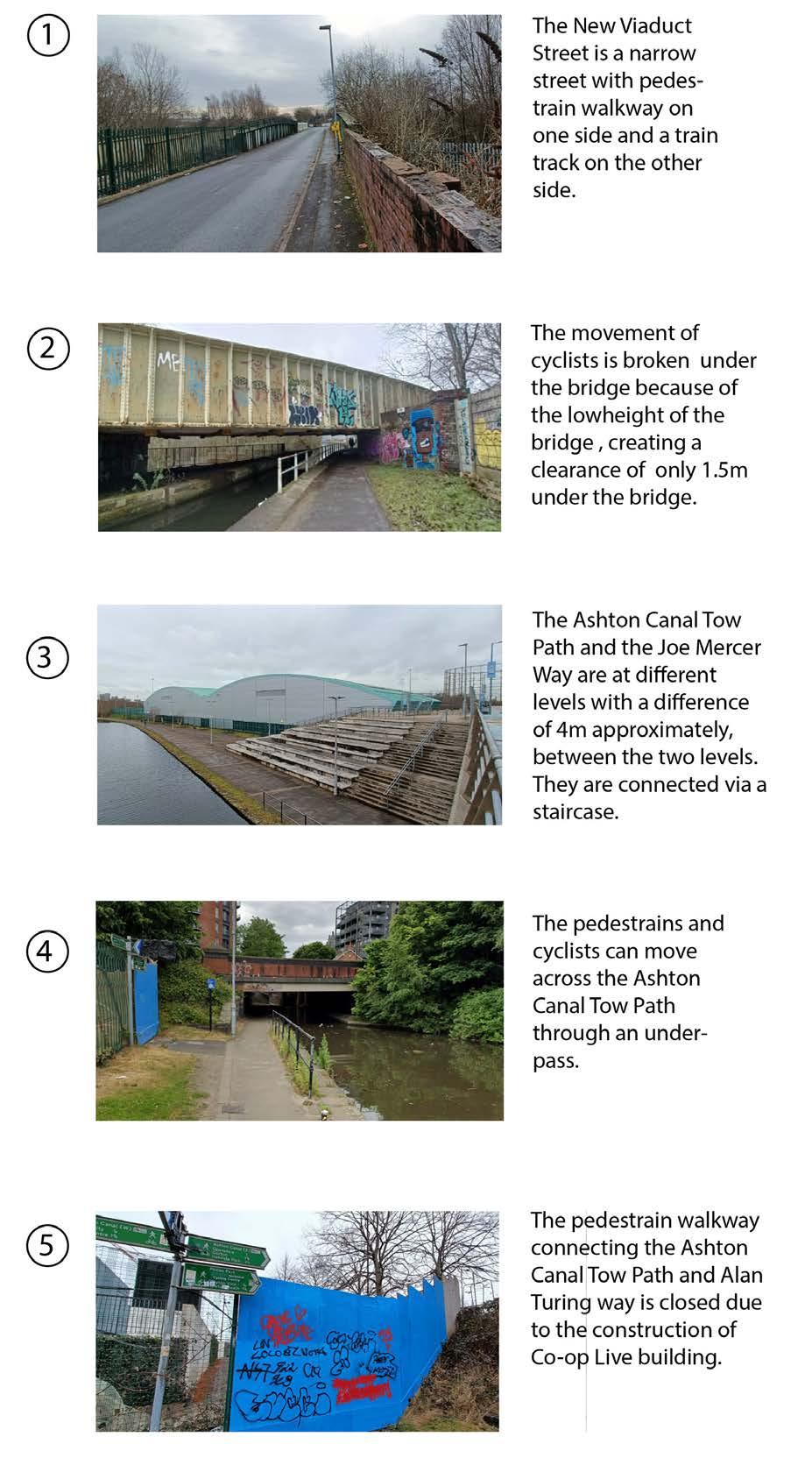
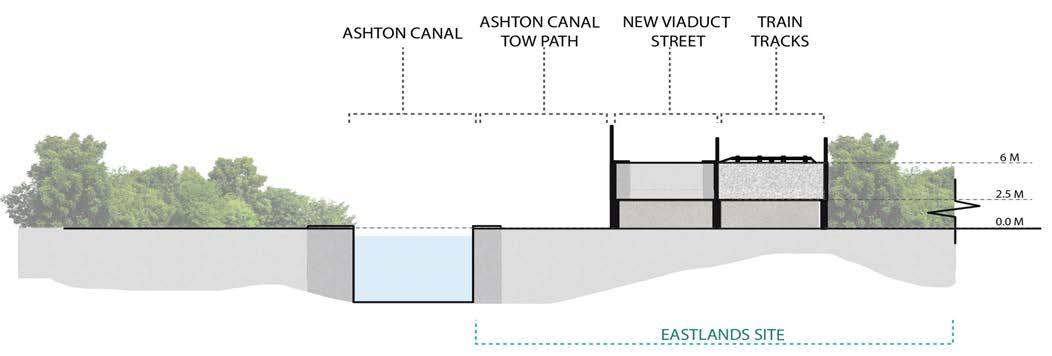
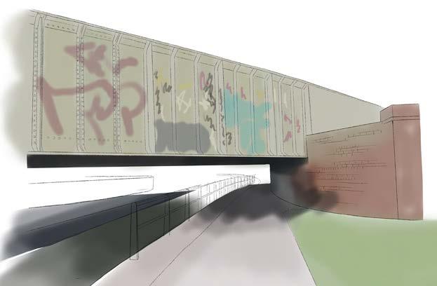
The Ashton Canal Tow Path borders the east site edge, delivering an active transport link for pedestrians and cyclists. However, its narrow width and low bridges make it suboptimal for continuous cycling. Still, it provides an alternative to streets with vehicle traffic. The cycle route through the Ashton Canal Tow Path is of low quality, as it is narrow and shared between cyclists and pedestrians, which can cause clashes.
The
Existence of underpasses on the tow path cause difficulties for cyclists, limiting the site’s permeability for cycling routes.
The inconsistent nature of the site’s topography lowers walkability.
Key Takeaways:
cycling network surrounding the site is fragmented.
3CONNECTIONS AREA AND LOCAL SCALE
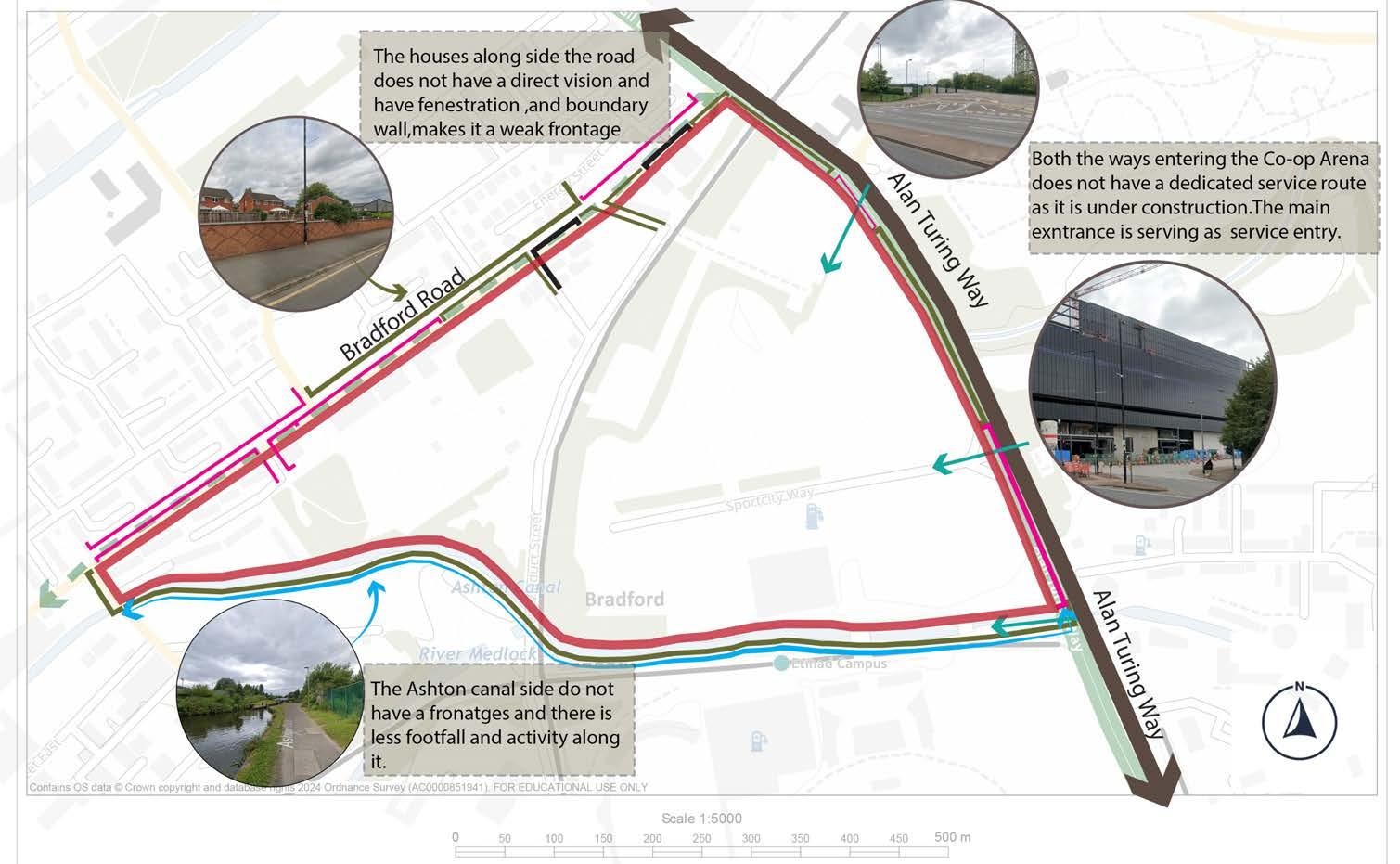
The main entry points to the site are from the heavily trafficked 4-lane A6010 route to the north of the site. While this route benefits the car movements, it neglects pedestrian safety. The junction connecting Bradford Road to the A6010 route does not have any pedestrian crossings, creating a significant barrier to pedestrian movement. However, it does accommodate cycling movement with segregated cycle lanes. Bradford Road does not have any cycle cycle lanes, but is well connected to the city centre via frequent buses.
Permeability within the site is low. There are no east westroutes through the site, with the railway line acting as a key barrier. A car-centred road, New Viaduct Street, along the train tracks provides one north-south link, but the lack of safe pedestrian infrastructure discourages pedestrian movement. Apart from New Viaduct Street, there is a small number of routes along Bradford Road that reach into the site to service industrial units or residential buildings, as well as one route from the A6010 to access the Etihad car Parks. The only route that attracts a significant amount of footfall is the Ashton Canal Tow Path, a pedestrian route along the southern boundary of the site. The number of access points connecting the Tow Path into the site is however low.
The route networks bounding the site are vehicle-centred with a lack of sufficient pedestrian crossings, restricting the permeability of key routes and causing safety issues.
The railway track divides the site and acts as a key barrier.
The connections of the routes within the site are poor. Only one route is car-free and safe for pedestrians, resulting in poor walkability.
Key Takeaways:
3AREA AND LOCAL SCALE
EDGE CONDITIONS
The site has different contexts around its edges. To the east, the site is bounded by the A6010, a major corridor for vehicular movement. The road benefits from segregated cycle paths, however, is lacks safe pedestrian crossings at a junction at the northern tip of the site. Beyond the A6010, the western edge is predominantly made up of Philips Park, which creates an inactive frontage due to walls along the park.
Bradford Road, a key route connecting the east of Manchester to the city centre runs along the western boundary of the site. The street provides some green infrastructure in the form of trees and two small pocket parks. The buildings are a mixture of older terraced houses and newly-built semi-detached houses. Lower-hierarchy roads lead off Bradford road into the residential neighbourhood, creating a permeable edge.
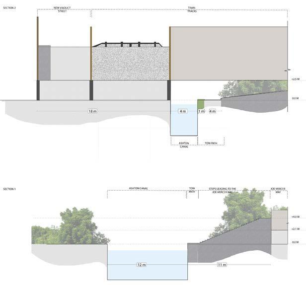
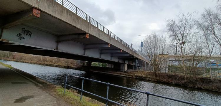
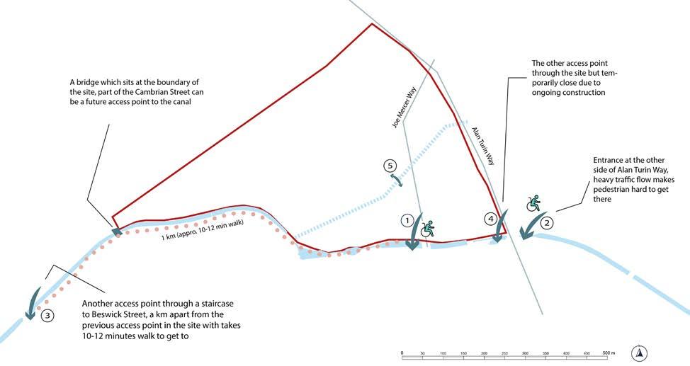
To the south, the site is entirely bounded by the Ashton Canal. There are only two bridges from the site over the canal, hence, the connectivity to the area to the south is low.
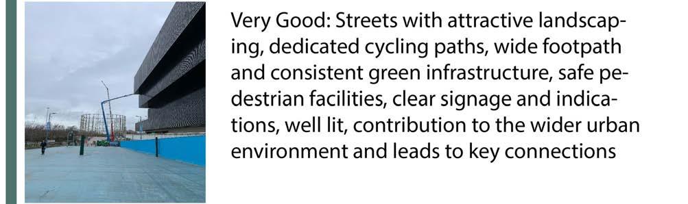
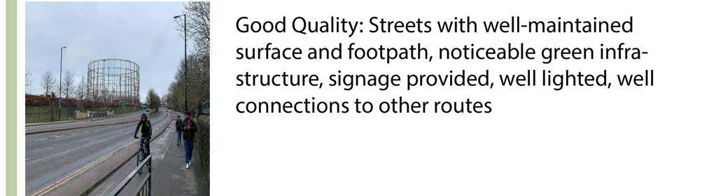
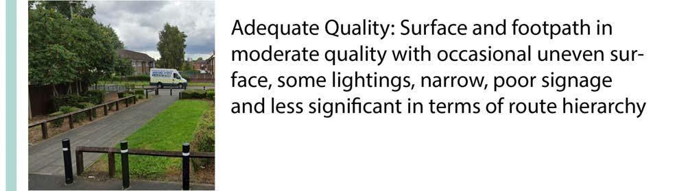
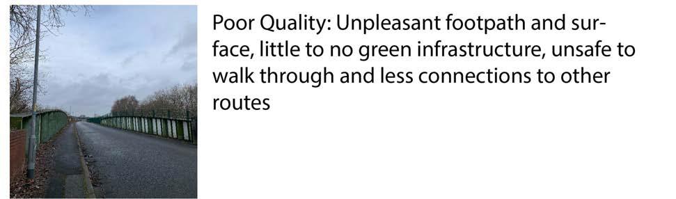
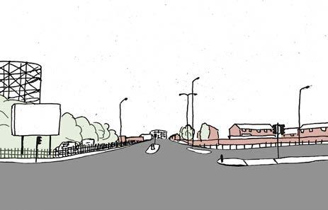
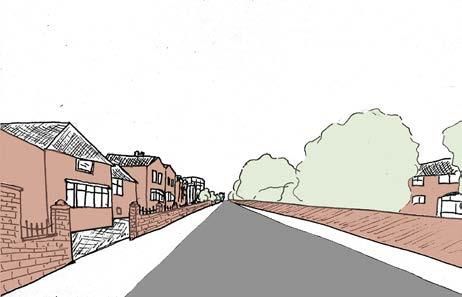
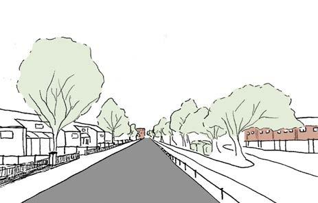
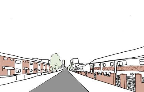
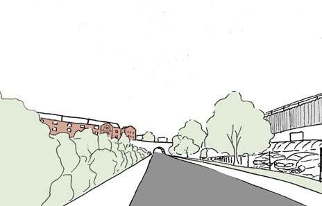
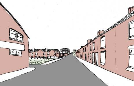
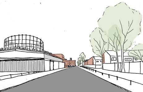
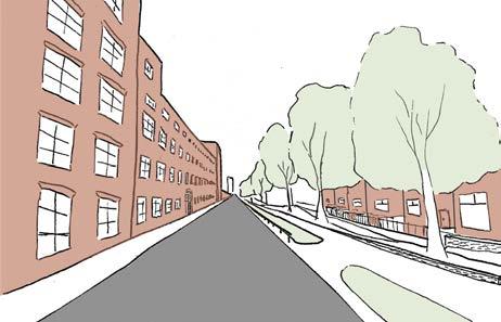
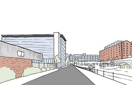
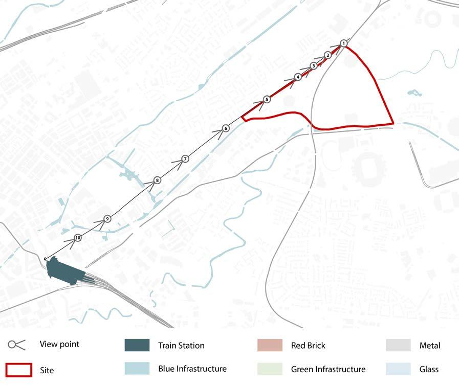
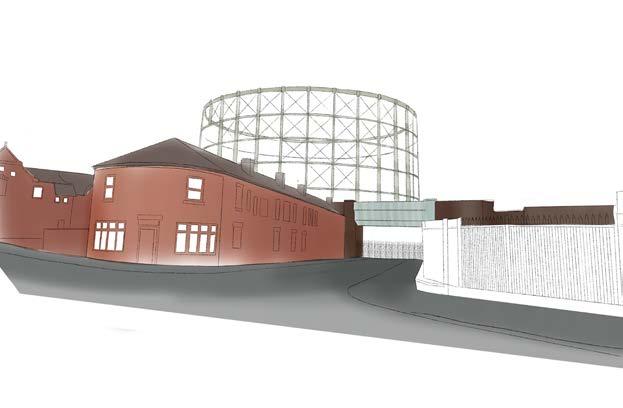
The serial vision demonstrates the human experience of travelling along Bradford Road from the site to Piccadilly Station in the city centre. Along the route, the quality of the streets varies, with differing levels of green infrastructure, pavement widths and natural surveillance. Along industrial part of the site, frontages are weak, reducing the perception of safety. In addition, the key route connecting the site and the city centre demonstrates the changes in character around the site, varying between areas with low-quality industrial buildings with blank facades, areas with older terraced housing with big front gardens and areas with new high-density residential blocks with modern facades and a high sense of enclosure.
Legibility
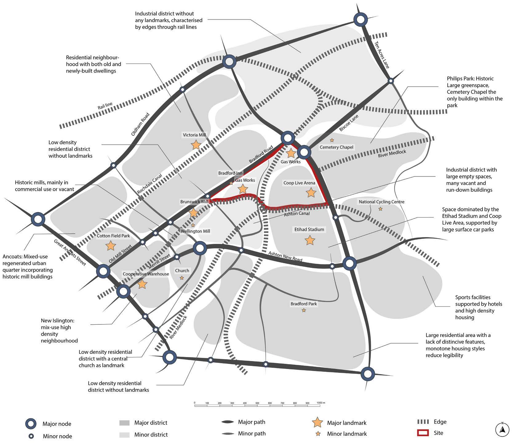
The site sits within a mostly legible area. Legibility increases towards the city centre due to a higher number of paths, nodes and landmarks. Legibility to the north decreases significantly due to a poorly defined district that lacks landmarks, paths and routes. While the site itself is also partly located in a poorly defined area and has only one significant path running through the site. The high number of landmarks improved the legibility of the site.
3AREA AND LOCAL SCALE
GI AND PUBLIC REALM
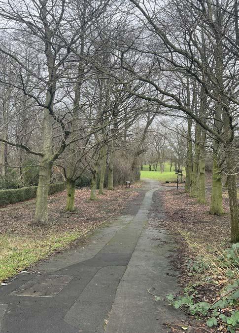
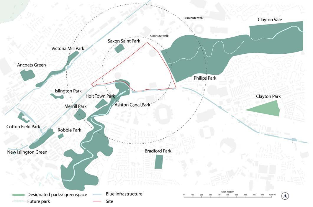
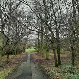
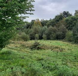
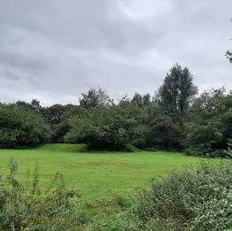
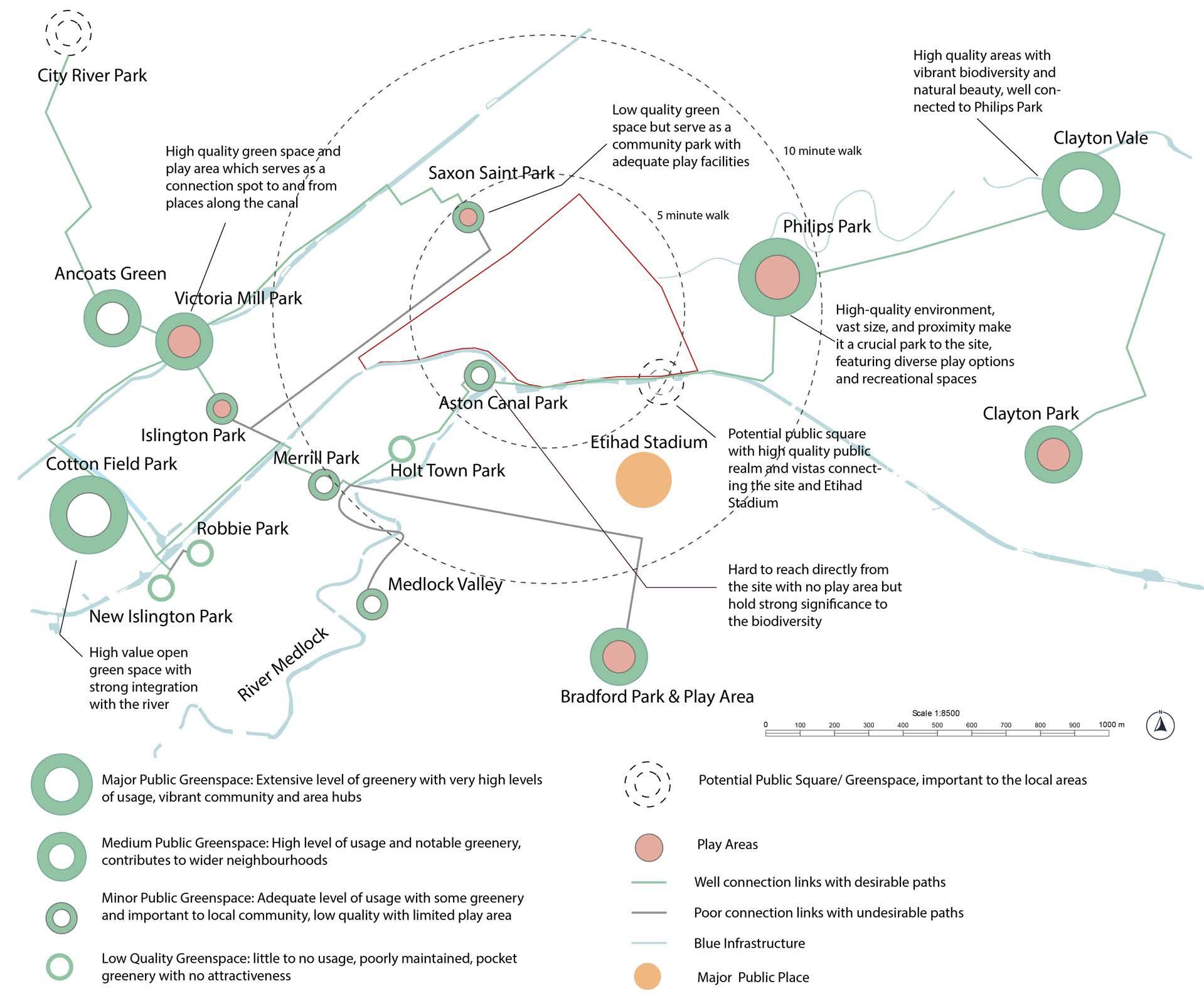
The site is situated in the edge of Manchester, bounded by the Ashton Canal and accompanied by several green spaces. Most green infrastructure in the site are street trees and overgrown unmanaged bushes along the canal tow path, making them inaccessible and unpleasant. Lack of access and surface parking disconnect the links between Philips Park, the canal and GI along River Medlock so there is an opportunity to form a green corridor between the parks. Merrill, Saxon Saint and Holt Town Park are neighbourhood parks that simply cannot be served as a suitable park for the future site development.
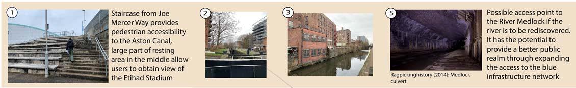
The Ashton Canal, which may be reached by towpath, is the only direct blue infrastructure access point for the site. However, there are constraints as only one entry point to the canal is available due to temporary closure of another one, and the rest of entrances are located outside the site boundaries. So, the remaining access point becomes the stairs connecting to Joe Mercer Way. This restriction represents a lost opportunity for the site as it significantly decreases accessibility to the blue infrastructure.
Furthermore, the absence of accessible pathways for disabled users deteriorates the site permeability and inclusivity for potential users. The accessibility issues caused by the restricted access to the canal are worsen by this lack of design for people with disabilities, which ultimately reduces the site’s potential usability.
Though there are large green spaces surrounding the site, the size of the site disconnects the parks, particularly Philips Park and the Medlock Valley.
Ashton Canal is largely inaccessible as there is only one access point from the site onto the Tow Path. The existing access point is not accessible for people with mobility issues.
Blue Infrastructure
Key Takeaways:
Philips Park Saxon Saint Park Medlock Valley Holt Town Park
3AREA AND LOCAL SCALE
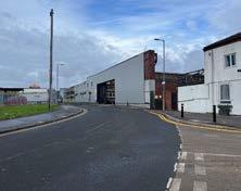
EXISTING DEVELOPMENT
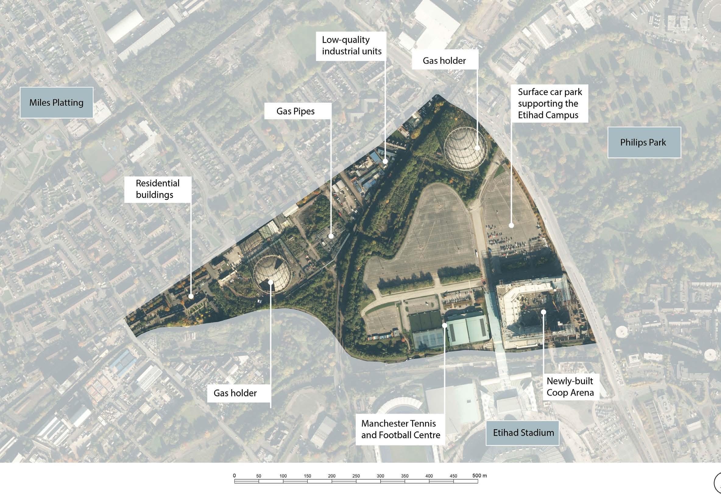
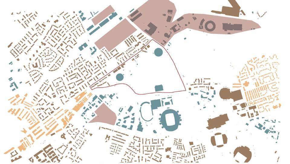
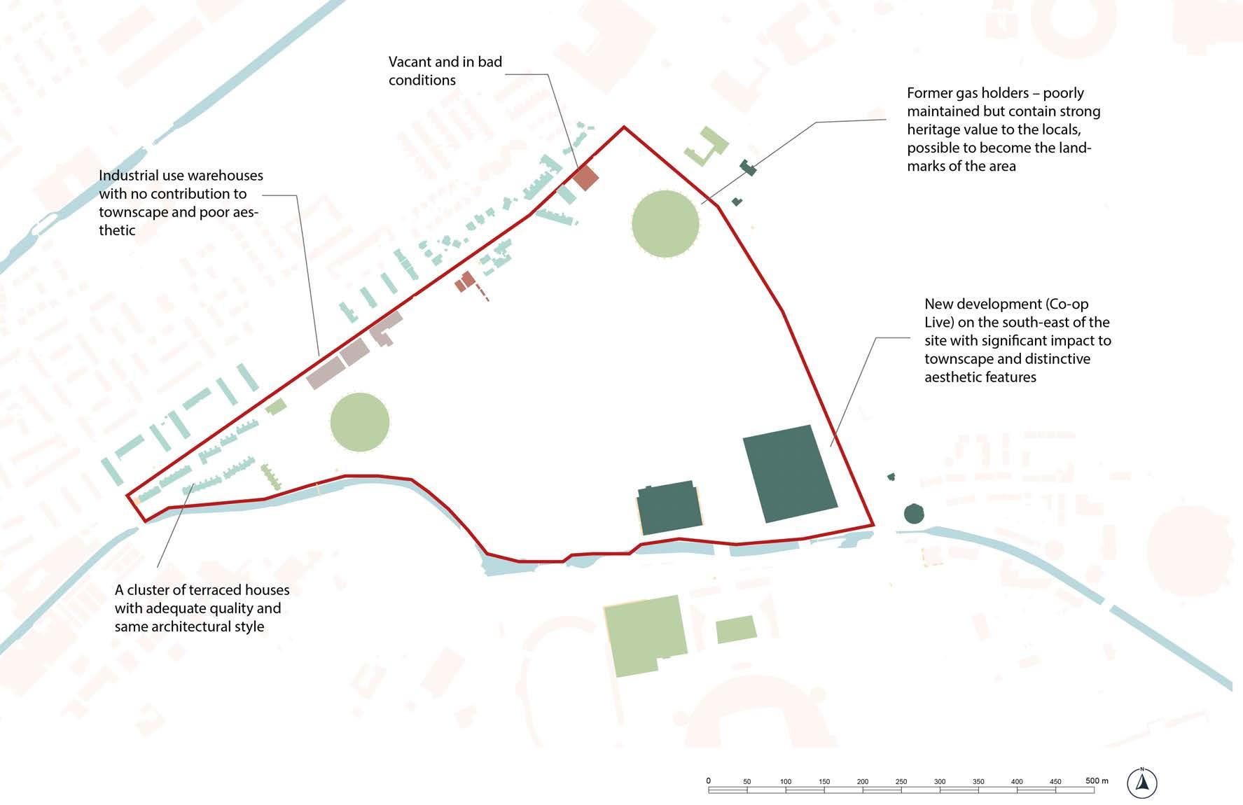
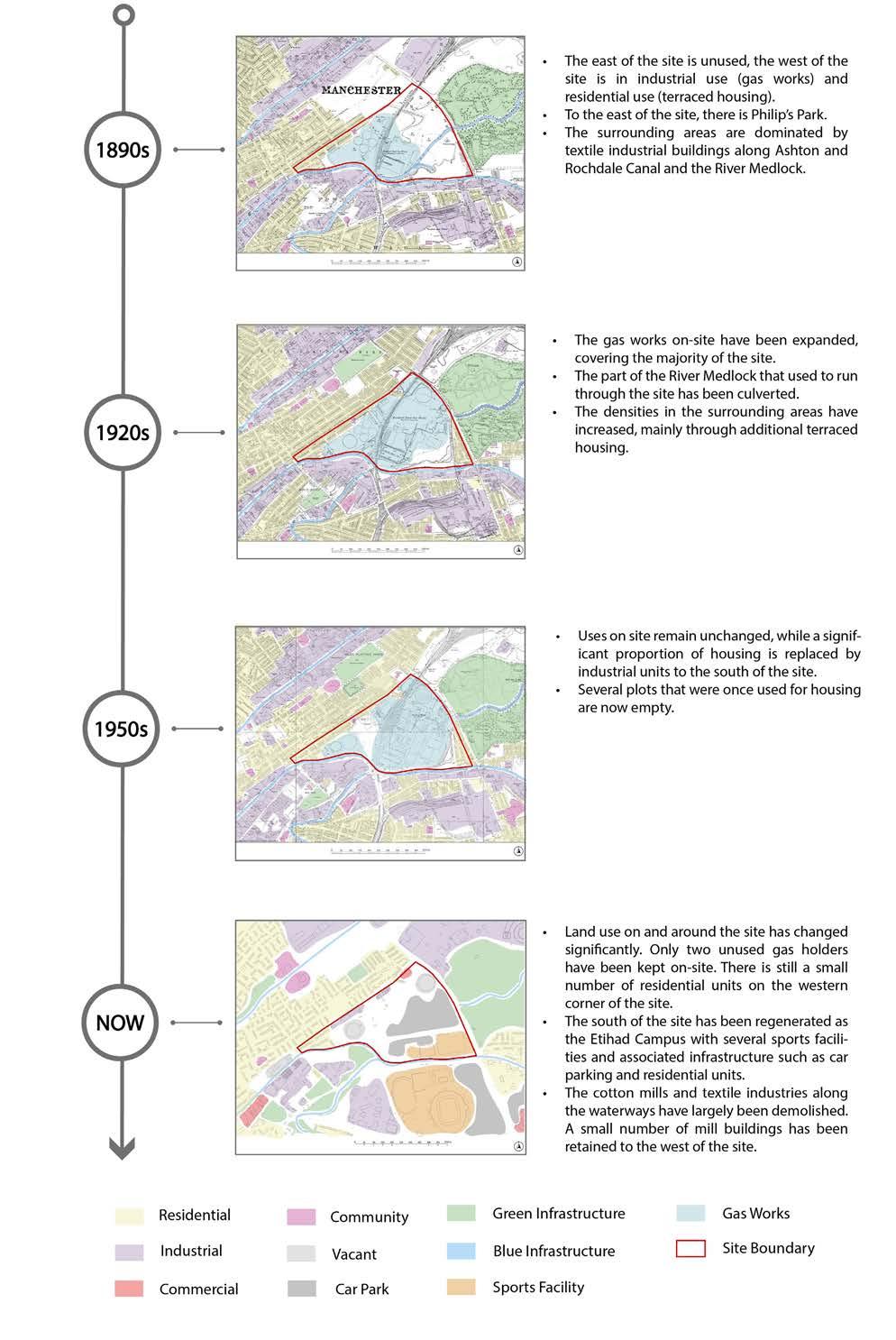
There is a strong correlation between the land use and the morphology of the area. The low-density residential areas have a fine grain with an organised pattern. New Islington, a regenerated neighbourhood with high-density buildings as well as historic mill buildings along Ashton Canal have a coarser grain with a more compact structure. Areas in industrial and leisure use are mostly fragmented, made up of buildings with large footprints that are separated by void areas, usually either vacant land, large service areas and surface car parks. Fragmented areas create poorly defined spaces to the north and south of the site.
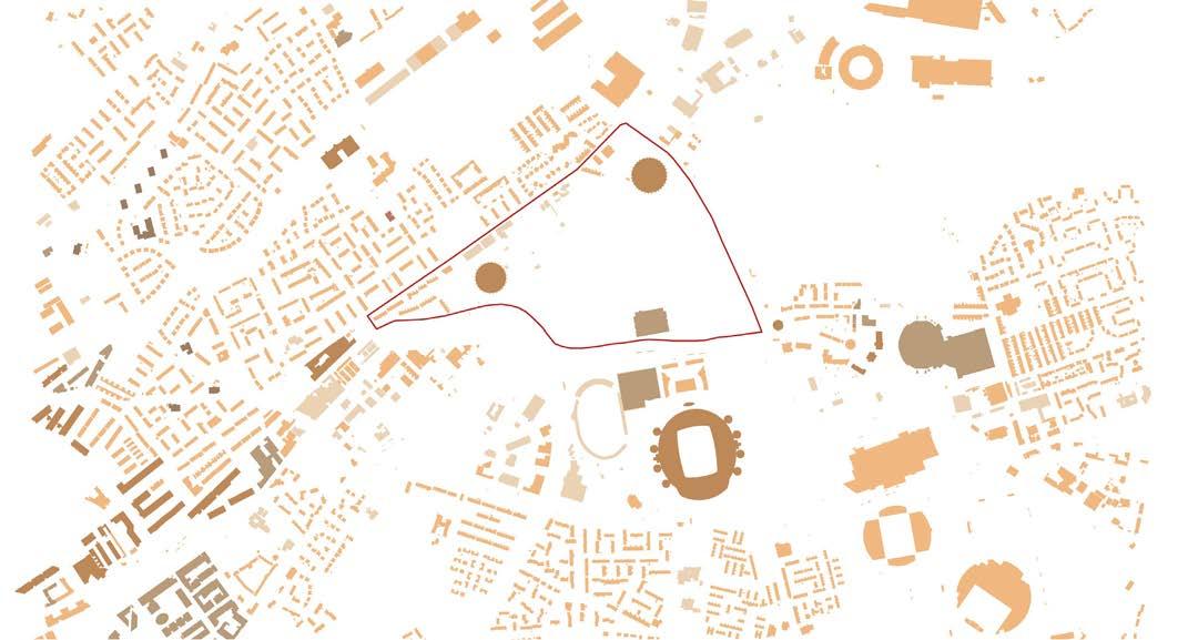
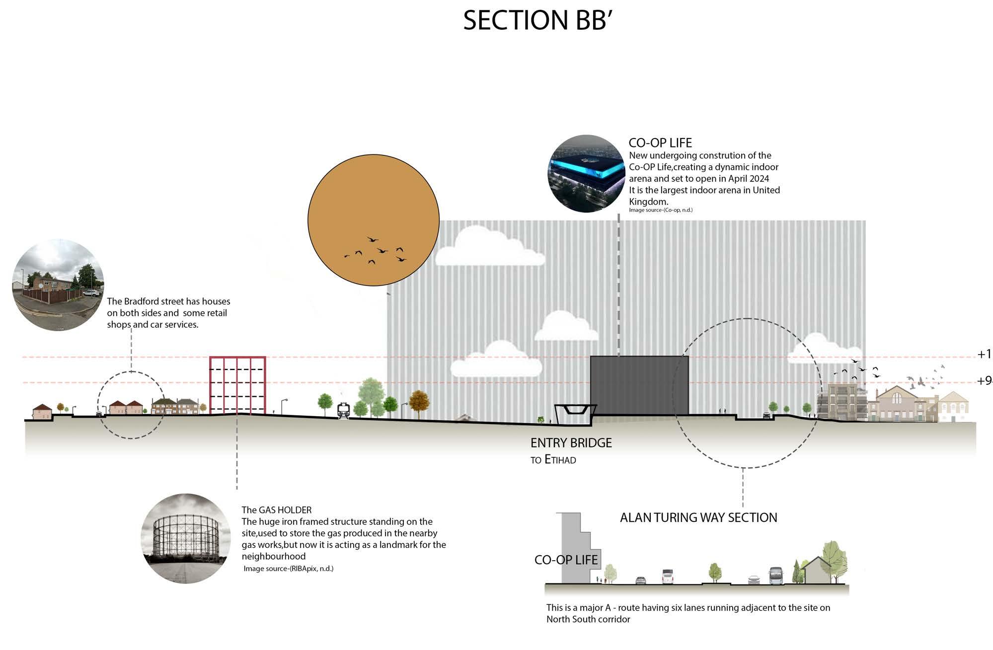
The buildings on-site are predominantly low-rise due, as most buildings are either terraced residential buildings or low-quality industrial units. Exceptions are the vacant gasholders and the newly built Co-op Live Arena. Outside of the site boundary, the site is surrounded by areas with taller buildings to the east and west. To the west, building heights increase towards New Islington and the city centre, and due to the historic cotton mills that have been retained along Ashton Canal. To the east and southeast, there are clusters of higher buildings, such as the Etihad Stadium and supporting residential towers. The presence of higher buildings on the periphery of the site demonstrates that the site sits in a transitional zone, allowing future development to include taller buildings.
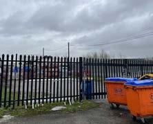
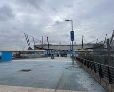
The site is currently in different uses. A small proportion of the western part of the site is residential, while the central part of the site is predominantly in industrial use. There are both active and abandoned gas works infrastructure on site. The eastern part of the site is mostly taken up by surface car parks that support the sports and leisure facilities of the Etihad Campus. The Etihad Campus, extending into the boundaries of our site with the newly developed Co-op Live Arena, fills the area with a distinct cultural significance. Further sporting amenities such as the National Cycling Centre, enhance the area’s appeal as a sports and leisure hub.
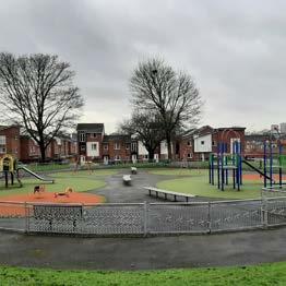
Residential neighbourhoods surround the site in all directions, but dominate the areas northwest and west of the site. The site with its inactive uses currently separates the surrounding residential areas. Further industrial areas can be found to the north and south of the site. Two large green spaces, Philips Park and the Medlock Valley are located immediately adjacent to the site boundaries. The number of facilities needed to support daily needs that are accessible within a ten-minute walk from the site is adequate. A large supermarket, and a large high-quality greenspace, and a high number of leisure and sports facilities can be accessed. There are several schools in the surrounding residential neighbourhoods. Improvements are needed regarding healthcare, retail and hospitality provision. Understanding the distribution of existing facilities is vital for understanding the liveability and functionality of the area, as well as for planning any future development to ensure a balanced distribution of services and amenities.
Key Takeaways:
Grains changed from fine to large from to city centre towards the site, reflecting the evolving development of the city.
The site is bounded low-rise buildings to the north and south and higher-rise buildings to the east and west.
Land uses are mixed and the provision of amenities is adequate.
Building Height Morphology
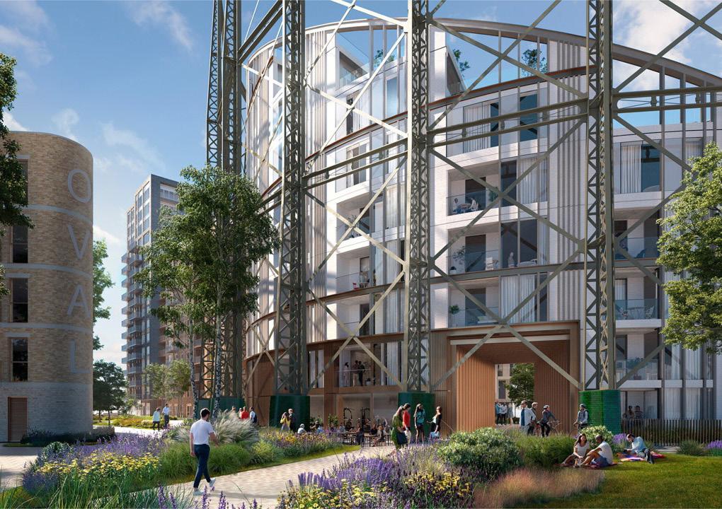
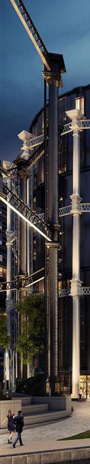
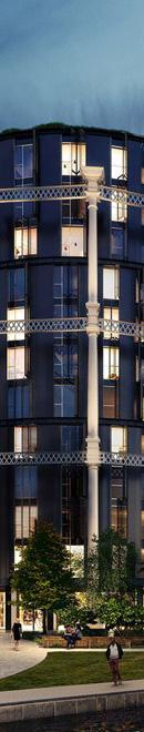
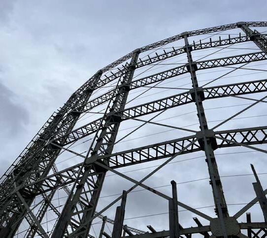
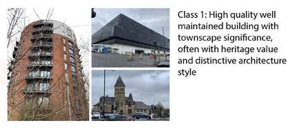
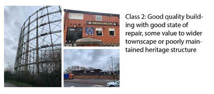
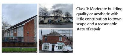
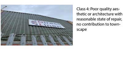
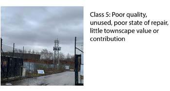
The site has a variety of building qualities, with the highest-quality buildings concentrated in the southern part. Among the highest-quality buildings are the recently built Co-op Live and the nearby tennis centre, which stand out for their unique facades. The two former gas holders also retain their good quality because of their historical value to the neighbourhood, which enhances the townscape in the surrounding area.
Along the Bradford Road edge, there is a cluster of residential areas with an adequate quality rating, along with warehouses with poor quality and vacant buildings with very poor quality. The surrounding land uses have an impact on this building quality range, the Etihad Stadium to the south ensures that new construction will be built to high standards. On the other hand, overall building quality decreases as one moves from residential areas towards industrial areas.
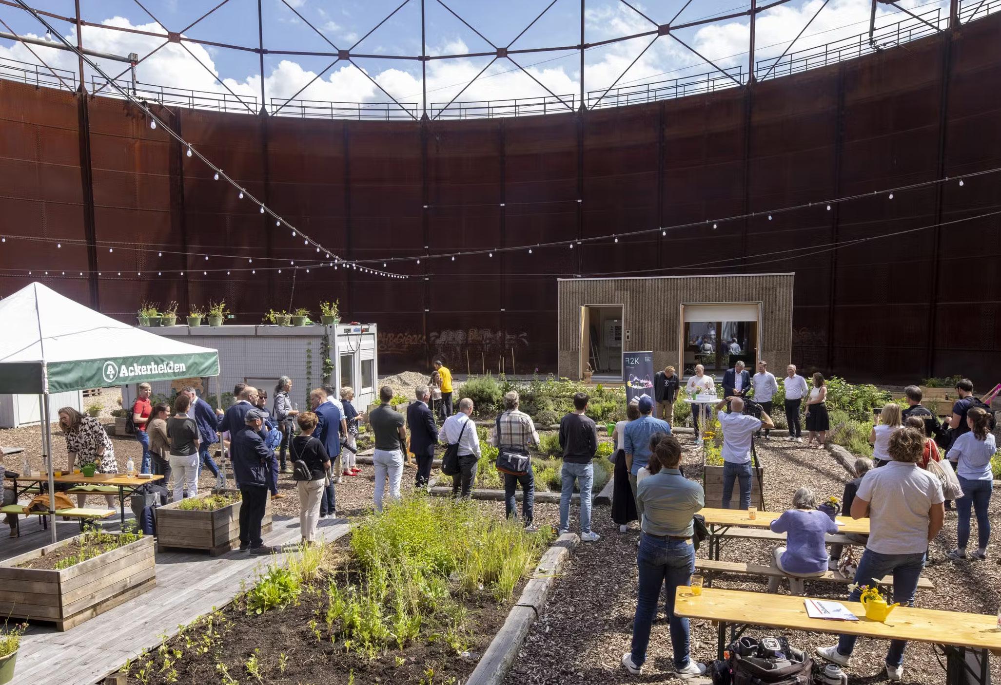
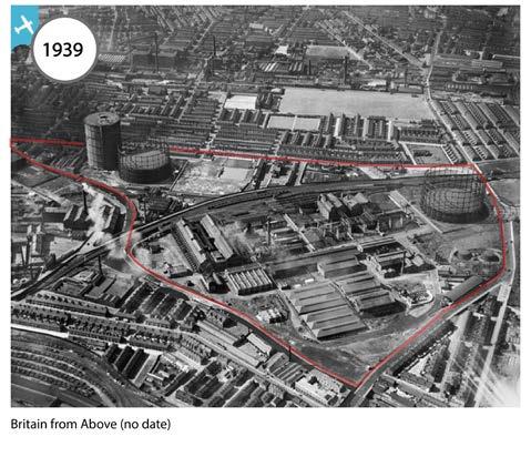
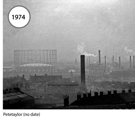
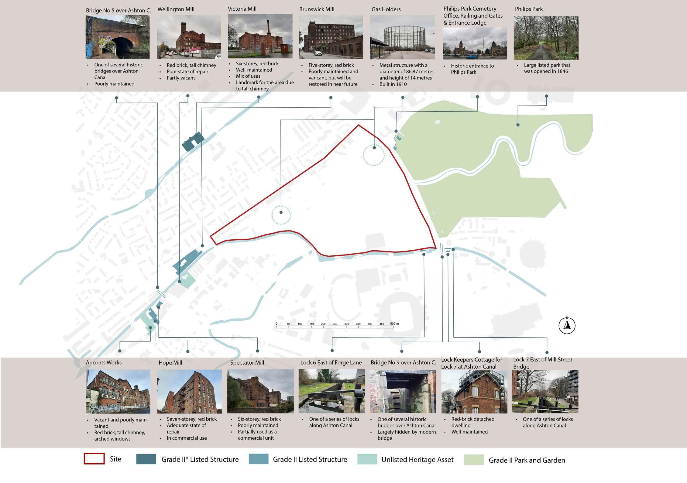
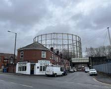
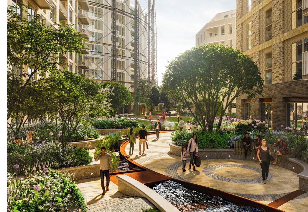
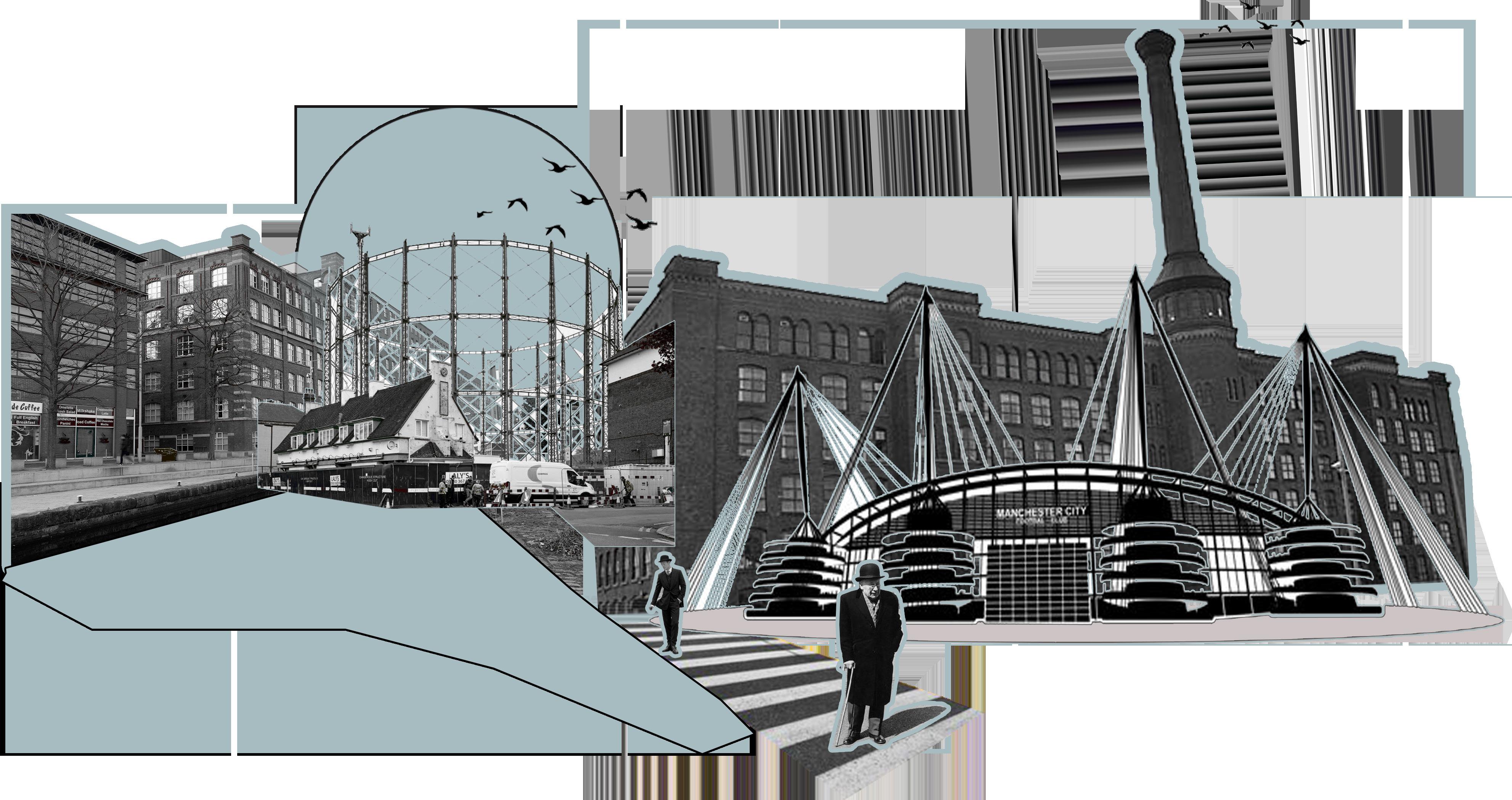
The heritage of the site is an important consideration for the design of a new neighbourhood at Bradford. The site has a strong connection to Manchester’s industrial past. Since the 19th century, it has been the location of gas works. Two unused gasholders are the remaining features of the gas works. While they are not listed, they are important heritage assets, serving as landmarks for the local area due to their height and distinctive character.
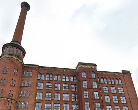
Because of the high number of waterways in the area, the wider neighbourhood was also in industrial use. The area was dominated by textile factories and cotton mills along Ashton Canal, Rochdale Canal and the River Medlock, supported by dense terraced housing. Several historic mill buildings have been retained to the west of the site along Ashton Canal. Some of them have been listed as Grade II heritage assets.
The area has strong ties to the city’s industrial history with listed buildings along the canal.
Many buildings were abandoned and removed in the post-industrial period, creating urban voids in some areas or change of use into light industrial.
Despite having no listed buildings on the site, the two former gas holders represent a key icon to the local community. This allows the residents to connect the history of the city through the remaining heritage.
Key Takeaways:
3CHARACTER
OLD GAS INDUSTRIAL AREA
A manufacturing zone characterized by numerous unoccupied structures in disrepair.
The landscape is overshadowed by the remnants of old gas facilities.
The area is inactive, with weak structural edges and a lack of barriers and walls delineating private property from public spaces
Aged mills of historical significance in need of repair.
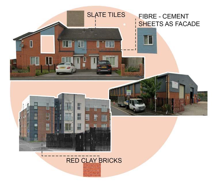
Distinctive local style characterized by multi-story (5-8) red brick buildings with grilled windows and chimneys. Rough and uneven urban layout.
SKETCHES
Spacious semi-detached houses accompanied by expansive front and rear gardens, resulting in a sparsely populated area.
The homes are predominantly built with a pale red or orange brick and feature a significant number with dark window frames and woodwork accents.
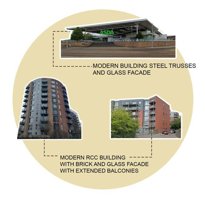
ETIHAD CAMPUS
The area is primarily occupied by significant sporting venues, with the Etihad Stadium being the most notable attraction.
Extensive spaces are allocated for vehicle parking.
The level of bustle is generally subdued, except on days when there are sports events.
A multifunctional city sector comprising restored historical mills and modern constructions.
The considerable height and expansive base of buildings, coupled with minimal spacing from the street, result in a very sheltered roadway environment.
The exteriors of the buildings are dynamic and well-defined.
Building heights of up to ten storeys, providing enclosure
Varied colours and materials used for building facades
Provision of high quality public space
VICTORIA MILL RESIDENTIAL
Rows of houses with a setback positioning, featuring front lawns and rear gardens.
The terraces are laid out in a right-angled pattern.
The streets are spacious yet not through-ways due to numerous dead-ends.
Most structures are constructed from red brick.
Recently constructed semi-detached homes with two to three floors.
Echoing the style of the iconic Victoria Mill, these buildings feature red brickwork and black window frames.
Structures are positioned away from the roadways.
Spacious semi-detached houses accompanied by expansive front and rear gardens, resulting in a sparsely populated area.
The homes are predominantly built with a pale red or orange brick and feature a significant number with dark window frames and woodwork accents.
ASHTON NEW RD INDUSTRIAL
Industrial structures with substantial ground coverage, typically consisting of single-story warehouses.
Satisfactory construction standards with all units occupied. Multiple parking facilities.
An absence of lively or robust exterior facades.
OLDHAM INDUSTRIAL AREA
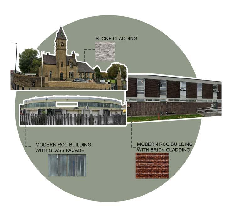
Modern industrial units showcasing mix of brick, steel and concrete materials
Old mills repurposed into new offices, blending historic charm with contemporary design
Fragmented grain with big scale buildings
Compact rows of connected houses.
The area is hard to navigate due to uniformity in architecture; buildings are very similar in shape but vary in brick color, and there are no distinctive features or landmarks.
New-built modern residential blocks
NEW ISLINGTON ANCOATS BESWICK RESIDENTIAL
SAINT ANNE’S RESIDENTIAL
SITE ATTRIBUTES
Architectural Material Pallete
The material palette of buildings on-site is dominated by brick of different colours. The terrace housing rows have a mix of red bricks, white plaster and horizontal fibre-cement sheets as facade treatment. The industrial buildings are of mixed ages. Instead of red brick, many have dark brown bricks, stone cladding and modern glass facades on newer units as well. The modern residential dwellings have integrated red brick, complemented by external metal balcony and glass.
The houses alongside the road do not directly overlook the street, They have fenestration and boundary walls, making them a weak frontage. As the Co-op Live is currently still under construction, both access points act as service routes. A dedicated service route is still lacking.
The Ashton canal side does not have any building frontages, resulting in a lack of passive surveillance along the Tow Path.
Activity levels and active frontages onto and around the site are low. Bradford Road has several strong frontages due to the residential buildings that with windows and doors and attract some activity. The Metrolink Stop and the Ashton Canal attract activity along the southern site boundary, but buildings frontages are weak. The entry points onto the site from Alan Turing are only active on match days. They lack building frontages and land uses that attract activity outside of match days.
Architectural pallete
3AREA AND LOCAL SCALE
Environmental concerns
ENVIRONMENTAL CONSIDERATIONS
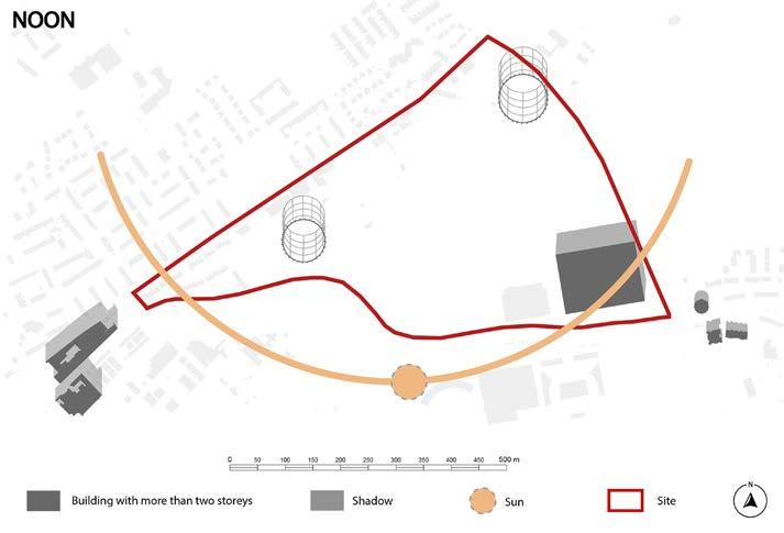
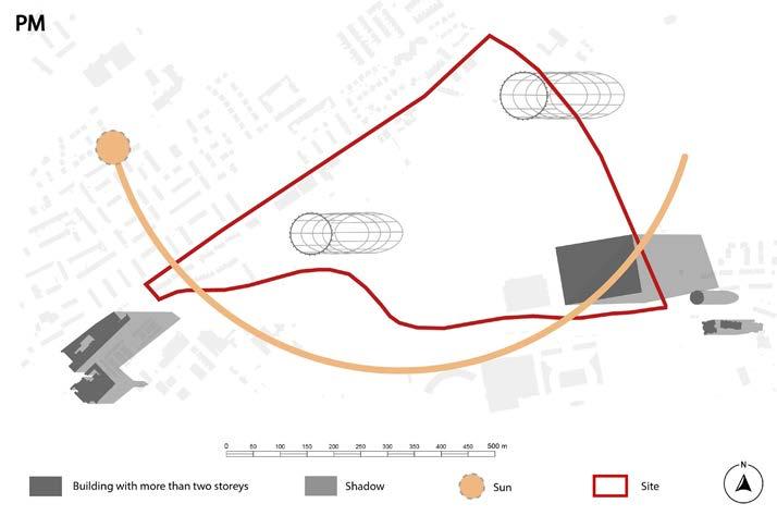
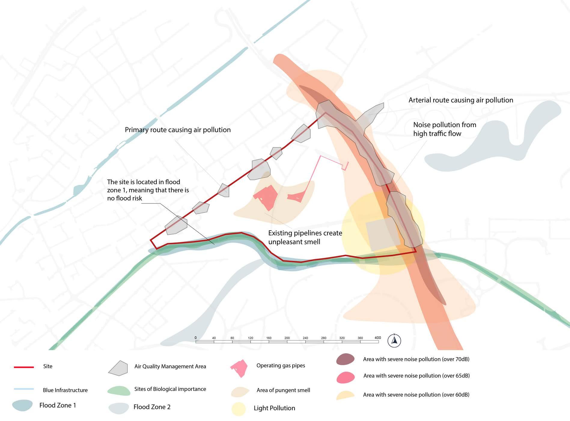
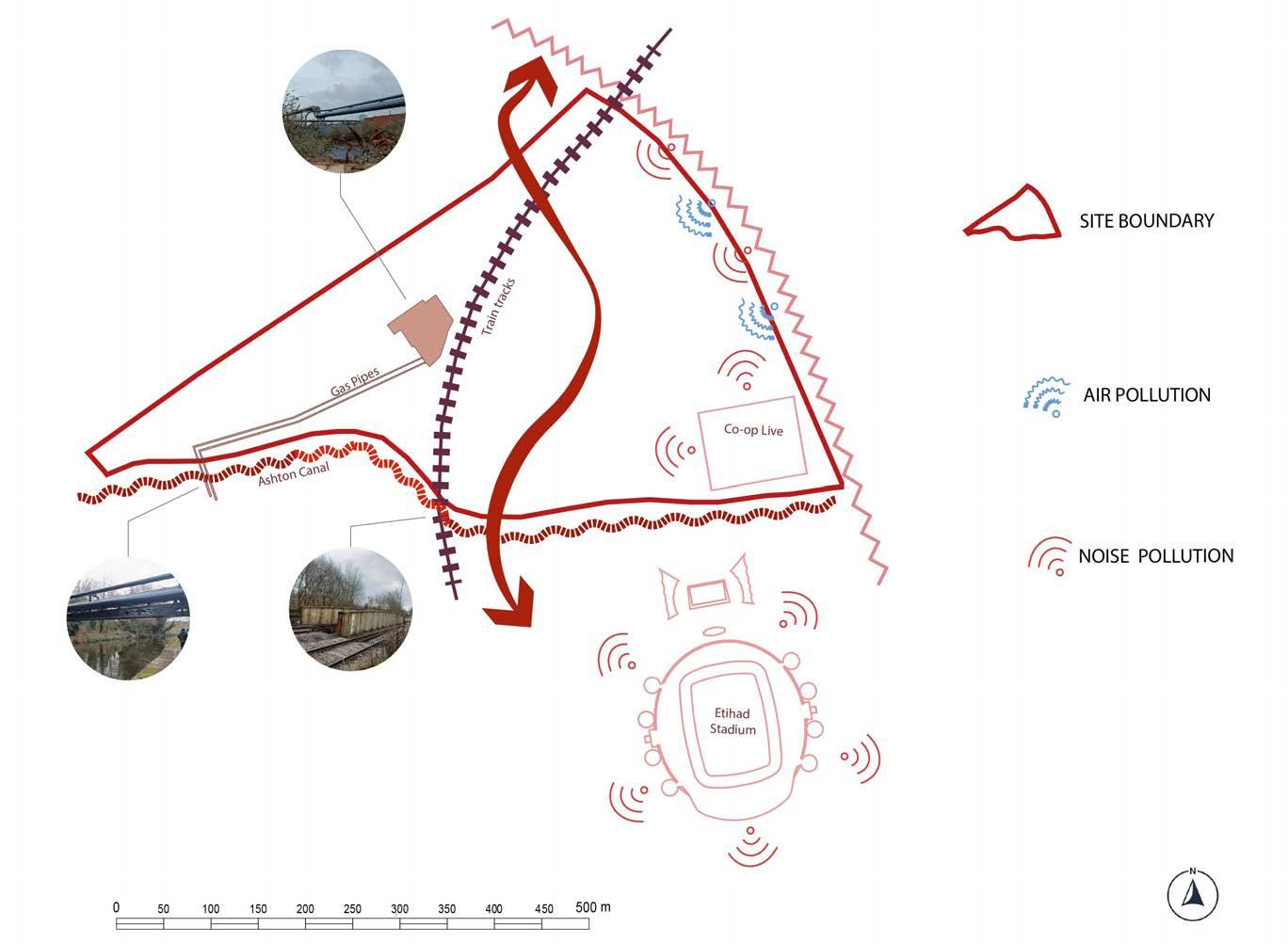
The site is impacted by several environmental issues. To the east and northwest, air quality is poor, identified through an air quality management area due to heavy traffic flow on adjacent primary routes such as Bradford Road and Alan Turin Way. In addition, noise pollution from traffic, events at the Etihad Stadium on matchday, and the future Co-op Live worsen the issue. Operating pipelines lining the train tracks emit unpleasant odours, potentially affecting users’ overall perception of the area. Moreover, there is a risk of light pollution from the Co-op Live’s large LED panels. Despite the Ashton Canal running along the site, there is no flood risk, providing opportunities for development along the Tow Path.
Keys Takeaways:
Major environmental issues are caused by the key routes surrounding the site with heavy traffic.
Actions need to be considered in future developments to cope with the existing pipe lines and the biodiversity of the canal.
There is no flood risk from Ashton Canal.
4 Policy
FUTURE DEVELOPMENT
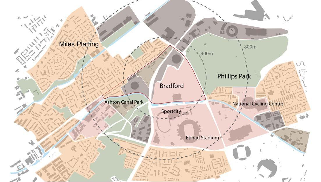
As described in the Manchester City Council Policy List, the Eastlands site is part of a regional center. The areas considered as regional centers are places which are appropriate for large-scale leisure uses which the City Centre is not suitable for. Eastland is also a district center and the focus of major design national and regional sporting events.
In the Core Strategy (Manchester City Council, 2012), Eastlands is classed as a growing destination that will provide significant employment opportunities which will benefit both the local community as well as the wider city and region. Due to the Etihad Campus, Eastlands is an international destination for sport, leisure and recreation. Further development in the area is going to contribute to Manchester’s economic growth.
The Greater Manchester Sites Of Biological Importance Selection Guidelines (Greater Manchester Ecology Unit, 2016) also identify the importance to Ashton Canal and the River Medlock as natural assets. Ashton Canal is classed as a site of biological interest. It used to be an important part of Manchester’s industrial period, now it is becoming an importance corridor for wildlife. The River Medlock, which runs below the site in a culvert, is part of the River Valley Project. The aim of the River Valley Project is the promotion of urban ecology, the enhancement of green space management and the improved accessibility of natural greenspaces.
Eastlands Regeneration Framework
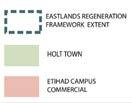
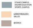
The site sits within the Eastlands Regeneration Framework (ERF) Area (Manchester City Council, 2017). The ERF is a document that sets out Manchester City Council’s vision for the redevelopment of the area east of the city centre. The ERF Area consists of six smaller divisions within it, of which three sit within the site boundaries.
The Holt Town Area is anticipated to be regenerated as a mixed-use neighbourhood that offers family homes, employment space for a diverse range of businesses and cultural and entertainment uses. The Ashton Canal Tow Path is planned to be improved as a pedestrian and cycle route.
The Etihad Campus Higher Education Sports Campus division will take advantage of the high density of sports facilities across the Etihad Campus. The new facilities would present an opportunity to provide a new sports related education programme.
The Etihad Campus Commercial division anticipates to support the sports facilties at the Etihad Campus with hotels, retail, food and beverage and car parking. This will boost the Etihad Campus as a destination, supporting the projects wider commercial development. New facilities, easily accessible via the tram stop, will be serve both residents and visitors.
5 Design Consideration
5DESIGN CONSIDERATION OPPORTUNITIES
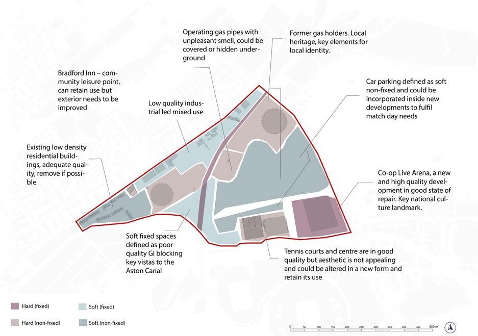
This hard and soft analysis illustrates which buildings we are going to be retained and removed. The majority of the buildings on the site are expected to be retained in the southern part, while those in the northern section are to be removed. The largest indoor stadium in the United Kingdom, the recently built Co-op Live arena, has great cultural significance and will be retained. As a fixed element, the railway track cannot be removed in the foreseeable future. The tennis centre is in good repair but lacks an active or strong frontage, therefore it has to be renovated externally while retaining its use. Because of their cultural significance, the former gas holders, also categorised as hard non-fixed structures will be retained to some extent. Residential areas and surface car parking are to be removed since future developments will provide similar land uses in a different form. To improve important vistas from the site, overgrown green infrastructure and industrial-led mixed areas which are classified as soft fixed and will be removed.
CONSTRAINTS
Soft and Hard
Soft and Hard analysis
6
Actions and Objectives
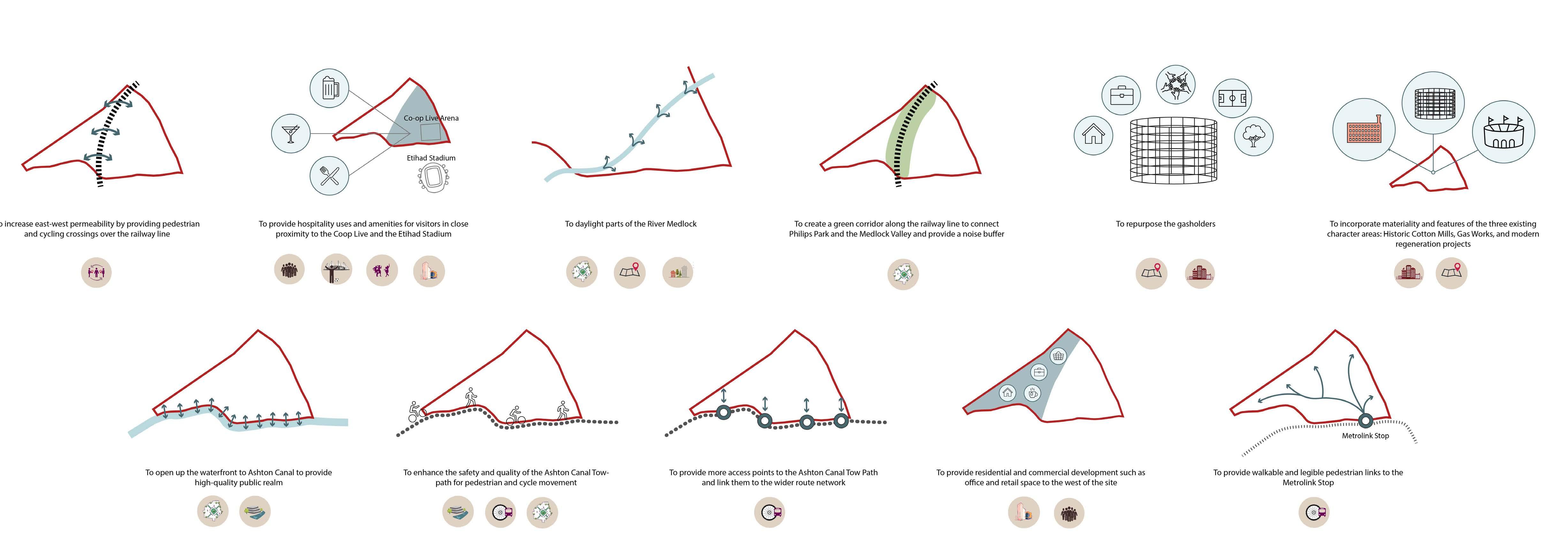
1 2 3 4 5
To bridge the disconnected areas on-site.
To enhance the existing leisure and entertainment facilities provided on Etihad Campus To promote high.quality and well-connected public realm.
To develop a new character are by incorporating local landmarks and architectural features.
To enhance local built and natural assets to create a sense of identity.
6 7 8 9 10 11
To activate the Ashton Canal Waterfront.
To create an inclusive and diverse mixed-use development.
To create a green buffer between the sports and entertainment facilities and residential development.
To create spaces that serve locals as well as visitors.
To improve sustainable transport connections within the site.
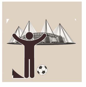
To boost the fan experience of visitors of the Etihad Campus.
7 Vision
VISION
Situated within established communities, our development aims to strengthen local identity by enhancing both built and natural heritage features. Attractive spaces will foster social interaction across diverse demographics. New amenities will serve existing and new residents as well as visitors, contributing to the overall growth and cohesion of the community.
CULTURE
The design will draw from the area’s rich culture, blending the site’s historic industrial identity with the evolving character of recent development at the Etihad Campus and the Co-op Live Arena. The site will become a contemporary hub for entertainment and leisure uses, complemented by features referencing the architectural legacy of the cotton mills and gas works on and around the site. A vibrant waterfront will be created along Ashton Canal and rediscovered sections of the River Medlock.
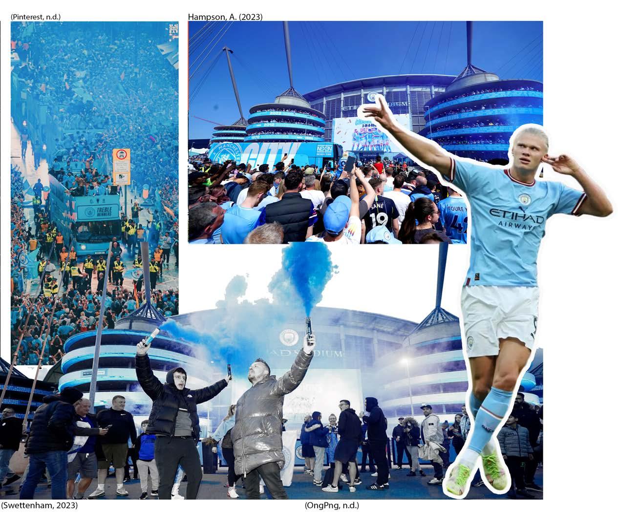
CITYZENS
The nickname “Cityzens” for Manchester City FC’s supporters is a play on the word “city,” reflecting the club’s identity and its connection to the city of Manchester. Our development will create spaces for supporters, reflecting their role not just as fans but as integral parts of the club’s fabric and the wider community. It will reinforce the sense of belonging, community, and shared identity amongst the club’s supporters.
REFERENCES:
BDP. (2022). Ancoats Works Design and Access Statement. Available at: https://pa.manchester.gov.uk/online-applications/files/9EE986CB9E46C7866DF01709F71D96F4/pdf/133324_FO_2022-DESIGN___ACCESS_STATEMENT-1920625.pdf (Accessed: 17 February 2024).
Britain from Above (no date) Bradford Road Gas Works, Manchester, 1939. Available at: https://britainfromabove.org.uk/image/epw062706 (Accessed: 26 February 2024).
Byng, M. (no date) ‘Gasholder conversions: a glimpse inside the show flat for the King’s Cross triplets’, The Spaces [online]. Available at: https://thespaces.com/gasholder-conversions-a-glimpse-inside-the-show-flat-for-the-kings-cross-triplets/ (Accessed 26 February 2024).
Census (2021), Office of National Statistics ONS. Available at: https://www.ons.gov.uk/visualisations/customprofiles/build/#E05011350 (Accessed: 23 February 2024).
Co-op. (no date). The UK’s first purpose-driven arena. Available at: https://www.coop.co.uk/coop-live (Accessed: 23 February 2024).
Dobraszczyk, P. (2014) Red River Shore: Exploring the Medlock culvert, ragpickinghistory. Available at: https://www.ragpickinghistory.co.uk/post/red-river-shore-exploring-the-medlock-culvert (Accessed: 12 February 2024).
Geall, M. (2023). ’Manchester’s Etihad Stadium could be getting a £300 million upgrade’. Time Out, 19 April [Online]. Available at: https://www.timeout.com/uk/news/manchesters-etihad-stadium-could-be-getting-a-bumper-300-million-upgrade-041923 (Accessed 23 February 2024).
Greater Manchester Ecology Unit (2016). Greater Manchester Sites Of Biological Importance Selection Guidelines. Available at: https://www.tameside.gov.uk/ecologyunit/sbi/guidelines.pdf (Accessed: 26 February 2024).
Hampson, A. (2023). ‘Champions Manchester City given rapturous reception ahead of Chelsea match’, The Independent, 21 May [Online]. Available at: https://www.independent.co.uk/sport/football/manchester-city-arsenal-pep-guardiola-nottingham-forest-premier-league-b2342998.html (Accessed: 22 February 2024).
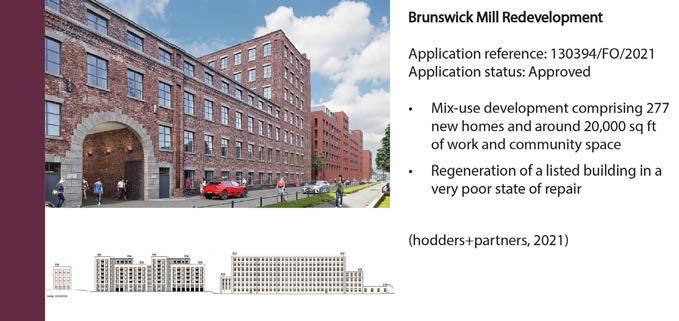
hodder+partners (2021). Brunswick Place Design + Access Statement. Available at: https://pa.manchester.gov.uk/online-applications/files/6B53BFC71F74A15A097D89C824D6E534/pdf/130394_FO_2021-DESIGN___ACCESS_STATEMENT-1683282.pdf (Accessed: 17 February 2024).
jmarchitect (2023). Varley Street SEND Secondary School. Design & Access Statement. Available at: https://pa.manchester.gov.uk/online-applications/files/8465078D1D7706866153B495AFD8AD00/pdf/136645_VO_2023-DESIGN___ACCESS_STATEMENT-2218928.pdf (Accessed: 17 February 2024).
Levitt Bernstein People Design (2019). Land at Coleshill Street. Design & Access Statement. Available at: https://pa.manchester.gov.uk/online-applications/files/6E7E96B33F395FEBA0D655189F3C815C/pdf/125596_FO_2019-DESIGN___ACCESS_STATEMENT-1339989.pdf (Accessed: 17 February 2024).
Manchester City Council (2012). Core Strategy. Available at: https://www.manchester.gov.uk/downloads/download/5672/core_strategy (Accessed: 26 February 2024).
Manchester City Council (2017). Eastlands Regeneration Framework. Available at: https://www.manchester.gov.uk/info/200024/consultations_and_surveys/7505/eastlands_regeneration_framework (Accessed: 17 February 2024).
Oakview (2023). Co-op Live Arena, Available at: https://www.cooplive.com/events (Accessed 22 February 2024).
OngPng. (no date). ‘Haaland celebrating’, PNG Image [online]. Available at: https://ongpng.com/stock-photography/haaland-celebrating-png-image/ (Accessed: 22 February 2024).
Petetaylor (no date). Bradford Rd gas works, 1974. Available at: https://www.petetaylor.org.uk/photo_4819518.html (Accessed 26 February 2024).
Pinterest (no date). Availabe at: https://www.pinterest.co.uk/pin/700520917069708396/. (Accessed: 22 February 2024)
Pinterest. (no date). https://www.pinterest.co.uk/pin/700520917069707901/
Populous (2020). OVG Manchester. Design And Access Statement. Available at: https://pa.manchester.gov.uk/online -applications/files/45EA98A44C9329D90E43D0788EA6CB41/pdf/126431_FO_2020-DESIGN___ACCESS_STATEMENT-1396174.pdf (Accessed: 17 February 2024).
RIBApix. (no date). Gas holder, Manchester. Available at: https://www.ribapix.com/Gas-holder-Manchester_RIBA54668 (Accessed 23 Feb. 2024).
Rolfe Judd (2022). Oval Gasworks. Available at: https://www.rolfe-judd.co.uk/planning/insights/oval-gasworks-planning/ (Accessed 26 February 2024).
Swettenham, L. (2023). ‘Man City and their fans celebrate another Premier League title in Etihad Stadium party - 40 brilliant pictures’, Manchester Evening News, 21 May [online]. Available at: https://www.manchestereveningnews.co.uk/sport/football/football-news/gallery/man-city-premier-league-pictures-26960884 (Accessed: 22 February 2024).
Zollverein (2023). Der neue Modulraum im Gasometer auf der Kokerei Zollverein_(c) Georg Lukas. Available at: https://www.zollverein.de/news/zukunftsfaehiger-arbeitsraum-steht-auf-zollverein/der-neue-modulraum-im-gasometer-auf-der-kokerei-zollverein_c-georglukas/ (Accessed: 26 February 2023).