


1 CITY OF NATCHITOCHES COMPREHENSIVE PLAN


Natchitoches is a wonderful place. As the oldest, permanent European settlement in the Louisiana Purchase Territory, we know our place in history and strive to continue to contribute to the great state of Louisiana in a major way. We are a city of many identities, and we are poised to continue our legacy of greatness. We are the home of the Northwestern State University. We boast a vibrant tourism industry. We provide a safe and secure hamlet for those seeking to retire. We host the nation’s premier Christmas celebration.
Natchitoches is already an amazing place to live, and we know our future will be even greater. The Comprehensive Plan will help us to continue to build on our legacy of history in a way that benefits our current residents and future generations.
This plan is a living document that we will revisit and update accordingly. I want to personally thank the members of the steering committee for their dedication and guidance. We truly believe the vision set forth in this plan will help shape the thriving City of Natchitoches for current and future residents, prospective businesses, and tourists.
As our City continues to grow and change over the next decade, know that the Natchitoches we have come to adore will remain. This plan embraces our present while moving us forward into an even more prolific future.
Ronnie Williams, Jr., MayorRonnie Williams, Jr. Mayor
Nikeo Collins Chief of Police
Randy LaCaze Director of Community Development
Kevin Warner Recreation and Parks Director
Donald Forest Sr. Public Works Director
Clarissa Brown-Smith Director of FInance
Matt Anderson Utility Office Director
Betty Sawyer-Smith Councilwoman-At-Large
Eddie Harrington District 1 City Councilman
Dale Nielsen District 2 City Councilman
Christopher Petite District 3 City Councilman
Shontrell Roque Planning & Zoning Director
Edd Lee Chief of Staff, Purchasing / HR Director
John Wynn Fire Chief
Rosemary Elie District 4 City Councilwoman
Ronnie Williams, Jr. Mayor
Rebecca Blankenbaker Cane River National Heritage Area
Kamal Deep
Alliance Compressors City of Natchitoches Industrial Development
Van Erikson
Northwestern State University
Chris Gilson
Northwestern State University
Tom Matuschka Natchitoches Regional Medical Center
Reba Phelps Natchitoches Parish School Board
Elvin Shields Natchitoches Resident
Travis Tyler Natchitoches Parish Port
Laura Lyles Natchitoches Area Chamber of Commerce
Katrice Below Bank of Montgomery
Jill Leo City of Natchitoches Historic District Development Commission
Billy Jo Guin Water District
Laurie Morrow Northwestern State University
John Richmond Natchitoches Parish Government
Ralph Wilson Natchitoches Resident
Kelli West Natchitoches Convention & Visitors Bureau

Parish Initiatives
City Initiatives
• Center City District
• Medical & Retail District
• Campus Edge District
• I-49 District
• North Access Corridor • Regional Initiatives
Founded in 1714, Natchitoches has endured longer than any Louisiana city. For tourists, it’s a destination for Creole culture, historic homes, meat pies, and Christmas lights. From around the region, visitors come for healthcare and award-winning education. Residents prize the picturesque location along the Cane River, the deep roots, and the close-knit environment a small town offers. But challenges and barriers impede this singular place from offering everything it can to its people.
What will the years ahead look like for Natchitoches? What could they look like with a renewed vision? In late 2021, the City engaged a team of planning consultants to collaborate with a steering committee, representing a variety of backgrounds and perspectives. Together, over the course of a year, we articulated a shared vision for the future and developed a Comprehensive Plan for implementing this vision, vetting the document with stakeholders as well as the public.
The Comprehensive Plan provides a detailed framework for overcoming challenges, maximizing assets, and reaching the
desired future. Developed in tandem, the Economic Development Plan is a catalyst for the road ahead. A community empowered by resources and fruitful partnerships will move much farther.
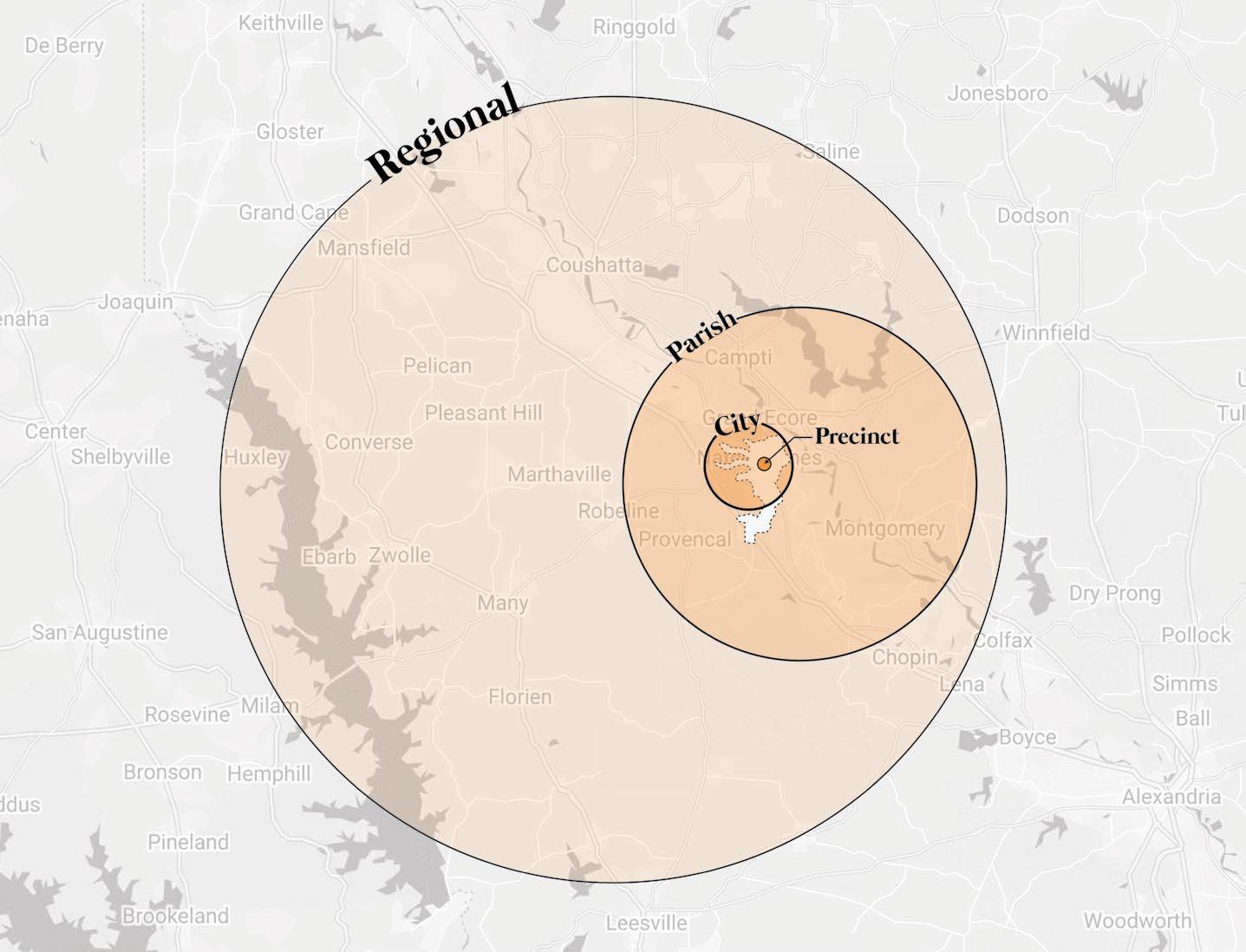
These plans rely on a deep understanding of the city, from its development over time to its present-day statistics. Analysis revealed Natchitoches as a rich, multifaceted place. For that reason, plans focus on Natchitoches at different scales: the region, the parish, and the city. Within the city itself, specific precincts are identified for focused attention.
Immense value exists in this place and within the people who live here. Pushing aside barriers and finding partners where we may have overlooked them before, we will find opportunity to position Natchitoches as a true regional leader that will attract new residents and provide for those who live and work here.
At the start of 2022, a representative steering committee began meeting to identify community values and aspirations. We looked at the most pressing community needs as well as the challenges that must be overcome to address them. From these conversations, we derived a set of Guiding Principles to ensure alignment throughout the process. A parallel economic development planning process began in spring 2022.
In spring and summer of 2022, data was gathered around the city’s demographics, zoning, and geography compared with peer communities. We charted the paths of a local resident, a regional resident, a tourist/visitor, and a traveler around the region, clarifying development trends and highlighting special districts.
From September 2022 to January 2023, we looked at the partnerships that will be necessary to achieve a shared vision for Natchitoches’ future. We also reviewed possibilities at a regional, parish, city, and precinct scale and determined top priorities.
In spring 2023, the proposed concepts for growth throughout the city were organized into a framework plan. In the pages that follow, you will find detailed documentation of the planning process and its findings, and the strategies designed to achieve short- and long-term goals for Natchitoches. Open houses held in October 2023 enabled the public to review the plan and offer feedback.

Rich in assets and heritage, the City of Natchitoches is unique among cities in Louisiana, and in many respects, unique as compared to peer communities in America. While cultural and civic connections to the past are easily identifiable, a shared aspirational future vision has been more elusive. This comprehensive plan document reflects a realistic assessment of current conditions, both strengths and weaknesses. This document also paints a picture of possibility as the City of Natchitoches considers its collective future.
This plan represents the shared vision and expectations of community leaders and stakeholders for community development over the next decade and beyond. Developed collaboratively, this Comprehensive Plan will serve to guide City, Parish and Regional development and policy decisions relative to land use, transportation, natural resources, and infrastructure.
The Comprehensive Plan steering committee began its efforts by answering key questions about unique community assets worthy of enhancement and current challenges in need of attention. The committee also looked beyond the immediate to consider aspirational opportunities for our community and obstacles that may require future attention.
The information presented here was thoughtfully and deliberately considered. As a result, we’ve found common ground for all members of the Natchitoches community to embrace the future together.

You will note that responses recorded honestly assess and respectfully build upon our shared cultural heritage and the legacy of past community leaders. Ideas also represent a shared perspective of hope and new possibility. Collectively, these ideas form a rich perspective of who we have been, who we are, and who we aspire to become as a community.


race fear resources age change disparity barriers loss distrust

education
risktaking identity workforce incubator growth healthy historic industry affordability expertise
Our guiding principles were distilled from steering committee discussions over the first two months of the planning process. Respective principles represent high-level goals and expectations for the planning process, providing focus and clarity. As the plan developed over time, the principles also served as a means of evaluating alternatives.
Our ultimate planning recommendations result directly from these guiding principles. As plans are implemented and pursued, the principles will continue to provide foundational insight.
By remaining focused on and exercising these principles in our civic endeavors, the City of Natchitoches will meet future challenges and opportunities with shared confidence that our efforts are focused and our decision making is supported.
Consistently communicated, the guiding principles will serve as a marketing tool to promote our city as well as a differentiator in a competitive landscape.
Rather than work in silos, we will build consensus and align our organizational missions. With strong community connections, we will promote inclusivity and equitable investment.

We will enrich our community through emphasizing education, expanding local retail, ensuring access to regional healthcare, and celebrating our proximity to unique natural systems.
We will address blight and encourage development of housing stock at multiple price points, reinforcing pride of place with owner occupancy and strong neighborhood identity. Neighborhoods will provide for walkability and feature parks for community use.
We will increase the mobility and connectivity of our community, whether you travel by car, by bike, or by foot.
We will embrace the diverse cultures, ideas, and authenticity in our historic city. While maintaining our small town charm, we will enhance tourism and utilize beautiful community spaces for festivals and events.
We will leverage our geography, support entrepreneurs, and grow our community leadership. We will market ourselves effectively, engaging innovators and accepting reasonable risk.
Despite its rich heritage, planning efforts for the City of Natchitoches have been rare in the recent past. The last Comprehensive Plan for the City was adopted by the City Council in January of 1957. The Natchitoches City/Parish Master Plan was created in 1988 and updated in 1996, as Master Plan 2020. The most recent planning effort, the Natchitoches Transportation 2030 Plan is dated December 2008 and almost entirely focuses upon vehicular transportation and associated infrastructure. Although past planning documents do provide valuable perspective, much has changed in the intervening years. Past metrics no longer apply to current conditions.
For our effort, we evaluated current physical and cultural influences impacting the City of Natchitoches. The information presented here provides a baseline understanding of historic and recent development patterns, historic and current community assets, early community demographics and recent data gathered in the 2020 census. Natural systems, transportation and utility infrastructure were also evaluated. Analysis revealed new conditions to be addressed and long-standing development patterns that directly influence planning recommendations included in subsequent sections.
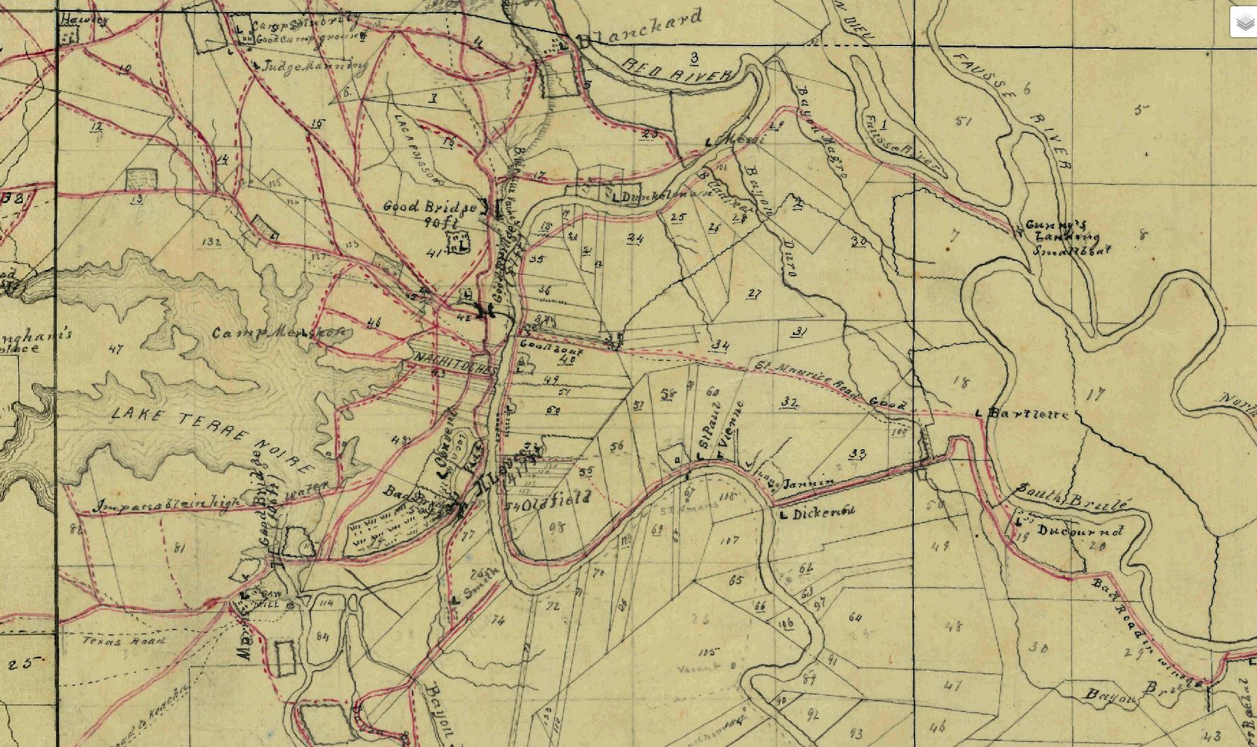
Civil Works Map File, Record Group 77, Z-33
“The history of Natchitoches is like a palimpsest, or ancient tablet, over written yet never entirely erased, modified and changed to meet changing conditions.”
- 1957 Comprehensive Plan
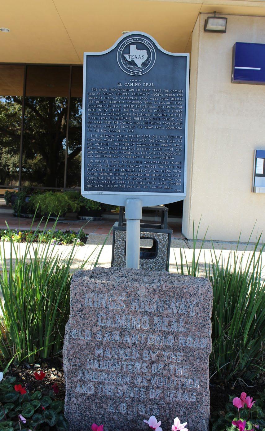
The City of Natchitoches is the oldest permanent settlement in the Louisiana Purchase. Layered physical patterns of development illustrated in this section provide a rich and sometimes complex fabric of natural systems and manmade improvements. Natchitoches was connected to San Antonio and Mexico City via the El Camino Real; the Natchez Trace provided connection to development in the eastern portions of the continent. From its early settlement days, in the 1700s, Natchitoches functioned as a crossroads, connecting people and cultures in a focused, complex place. That legacy of breadth of connection, diversity of culture, and nuanced environment continues to this day in a blend of traditions and influences from the Spanish, the, French, the Creole community, the enslaved Black people, and the Indigenous tribes.
When Jefferson purchased Louisiana from France in 1803, an influx of American settlers followed. Natchitoches played a strategic role: as frontier post; as trading hub; as river port link to New Orleans; and as military outpost.
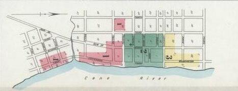
The historic development of Natchitoches reflects the diversity of its inhabitants, the complexity of its regional standing, and its geographical connection to the river. Early mapping illustrates the traditional French arpent system of land subdivision. Long narrow parcels provided landowners with river frontage and land suitable for cultivation, with habitation juxtaposed on the intricate and meandering patterns of the natural systems of lakes, bayous, and rivers. Primary development by camp, neighborhood, or precinct was a natural consequence.
Like much larger cities, Natchitoches’ development was characterized by a linked system of neighborhoods, each with its own history and culture. As example, Breda Town was originally a plantation in the mid-1800s. After the Civil War, many of those formerly enslaved became sharecroppers on the same land. Jackson Square (actually a long rectangle) developed as the center of the Black community. In addition to thriving as a civic neighborhood, Jackson Square was the birthplace of the Lincoln Institute, leading educational initiatives for Black boys and girls in Natchitoches. Neighborhood development patterns in Natchitoches continued through the early 1900s.
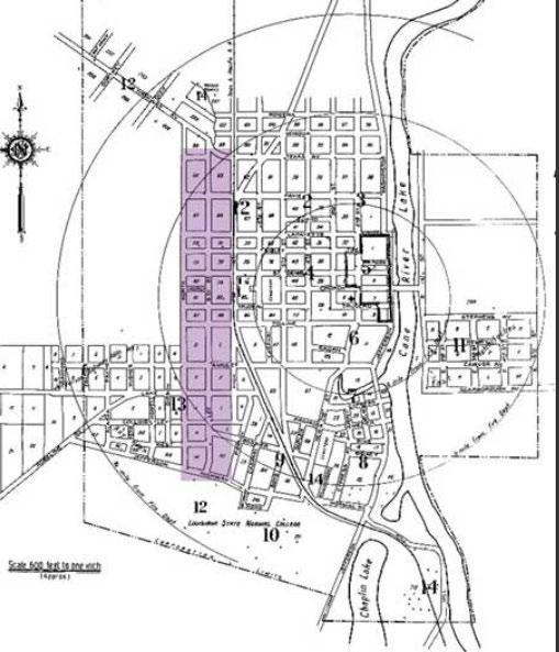
Sanborn maps before the turn of the century identify a formal city street grid largely occupying the high ground on the west side of the Cane River. Street grids run parallel and perpendicular to the river corresponding to the geometry of the early French arpent system. Grids rotate in response to the river course, creating intersections of respective cartesian geometry that remain to this day.
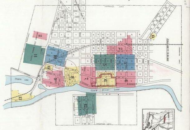
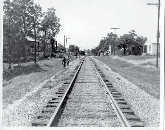
Sanborn maps from the early 19oos capture westward expansion radiating northwest and northeast around Sibley Lake, railroad integration into the city street fabric extending north and south, additional development between Second Street and the riverfront, a bridge across the Cane River Lake, and extension of the grid street pattern to the east side of the river.
University Parkway, South Boulevard, and Keyser Avenue.
Planning in the late 1950s proposed a loop connection east and west joining Highway 1 to the south and Highway 6 to the north and a perimeter roadway encircling the perimeter of Sibley Lake. Significant land areas were planned for residential development; commercial development was targeted at strategic intersections of the existing city street grid and the proposed perimeter loop routes. Two additional bridges across the Cane River were anticipated.
This late 1980s effort anticipated urbanization between I-49 and the City of Natchitoches in the vicinity of Highway 6, defined as the new “Gateway to Natchitoches.” Plans focused on the alleviation of traffic congestion caused by rapid growth and lack of orderly development. A new direct route to the Natchitoches Regional Airport improved commercial and industrial access.
The 1988 Master Plan was revised in 1996 owing to crucial developments in the intervening years including increased accessibility for Natchitoches after the completion of I-49 and the Red River Navigation Project and the establishment of the Alliance comrpessor plant in a new industrial park. Among recommendations were development of the port site and transportation improvements including the East Loop, road widening for Keyser Avenue and Texas Street, and sidewalks. The plan also called for city and parish to partner and share gains on industrial and commercial development.
Transportation mapping from 2008 includes depictions of the current I-49 corridor, the Highway 1 western loop, the Highway 6 bypass and perimeter highway development encircling Sibley Lake. This study proposed an alternative route for the eastern loop connecting Highway 1 with Highway 6 via the dam on the north end and a new river crossing on the south.
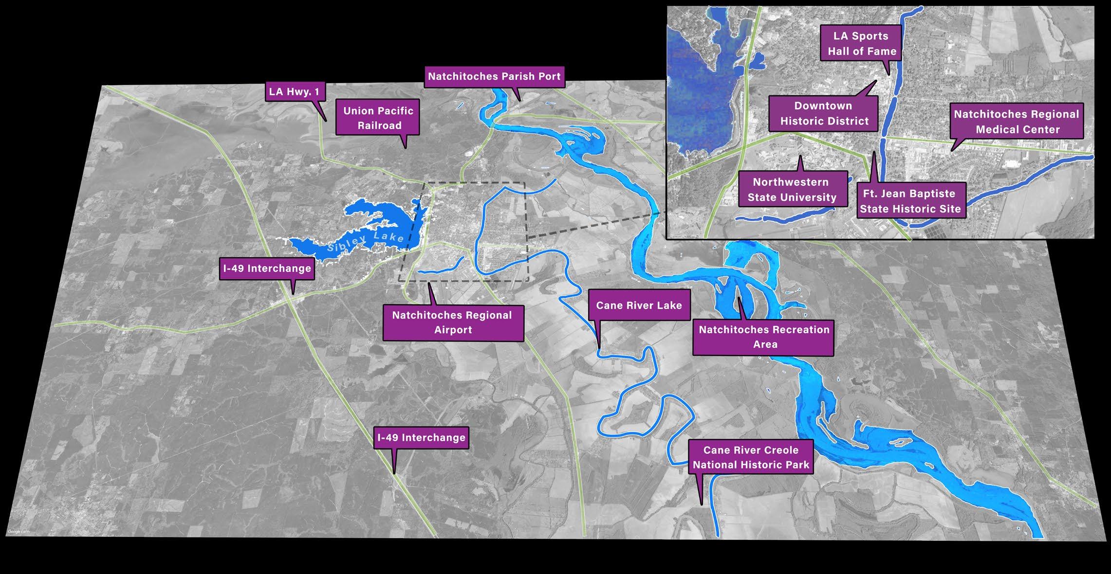
Natchitoches and the surrounding region are blessed with abundant natural, cultural and infrastructure assets, many of which are concentrated within the current city limits. The diversity and concentration of assets reflect the historical significance of the city and represent primary opportunities to implement a next evolution for Natchitoches.

Specific highlights include:
• Robust natural and recreational assets including the Cane River Lake, Chaplin Lake, Sibley Lake, Red River, Toledo Bend, and Kisatchie National Forest
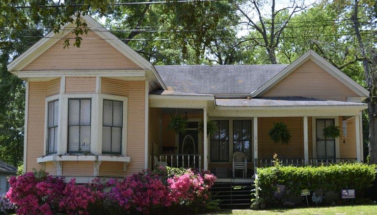
• Historically significant urban, architectural, and cultural fabric including Natchitoches Historic District, Front Street, Melrose Plantation, Texas and Pacific Railway Depot, and Grand Ecore
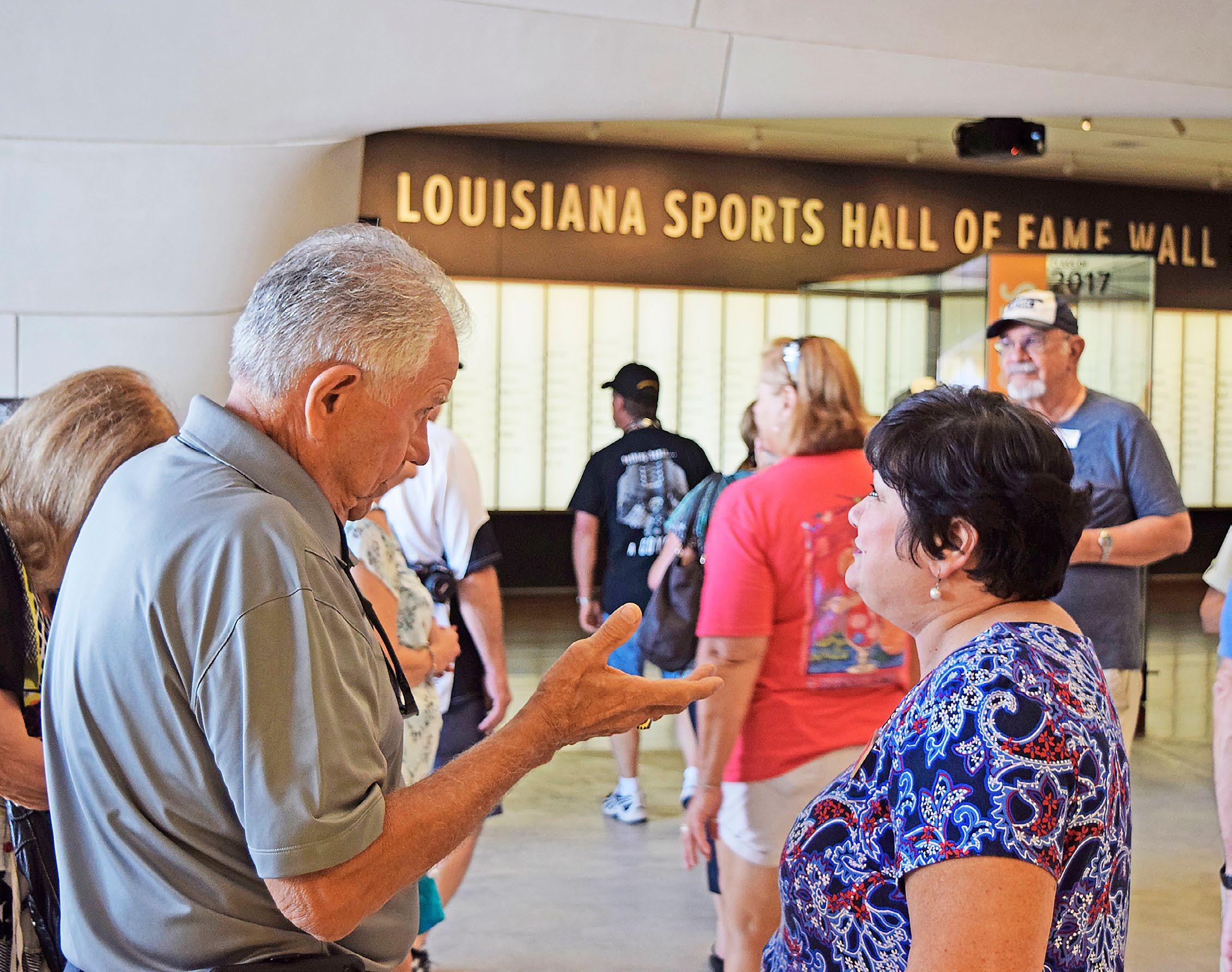
• Federal and state cultural assets including Cane River Creole National Historic Park, National Center for Preservation Technology and Training, Ft. Jean Baptiste State Historic Site, Natchitoches National Fish Hatchery, and Louisiana Sports Hall of Fame
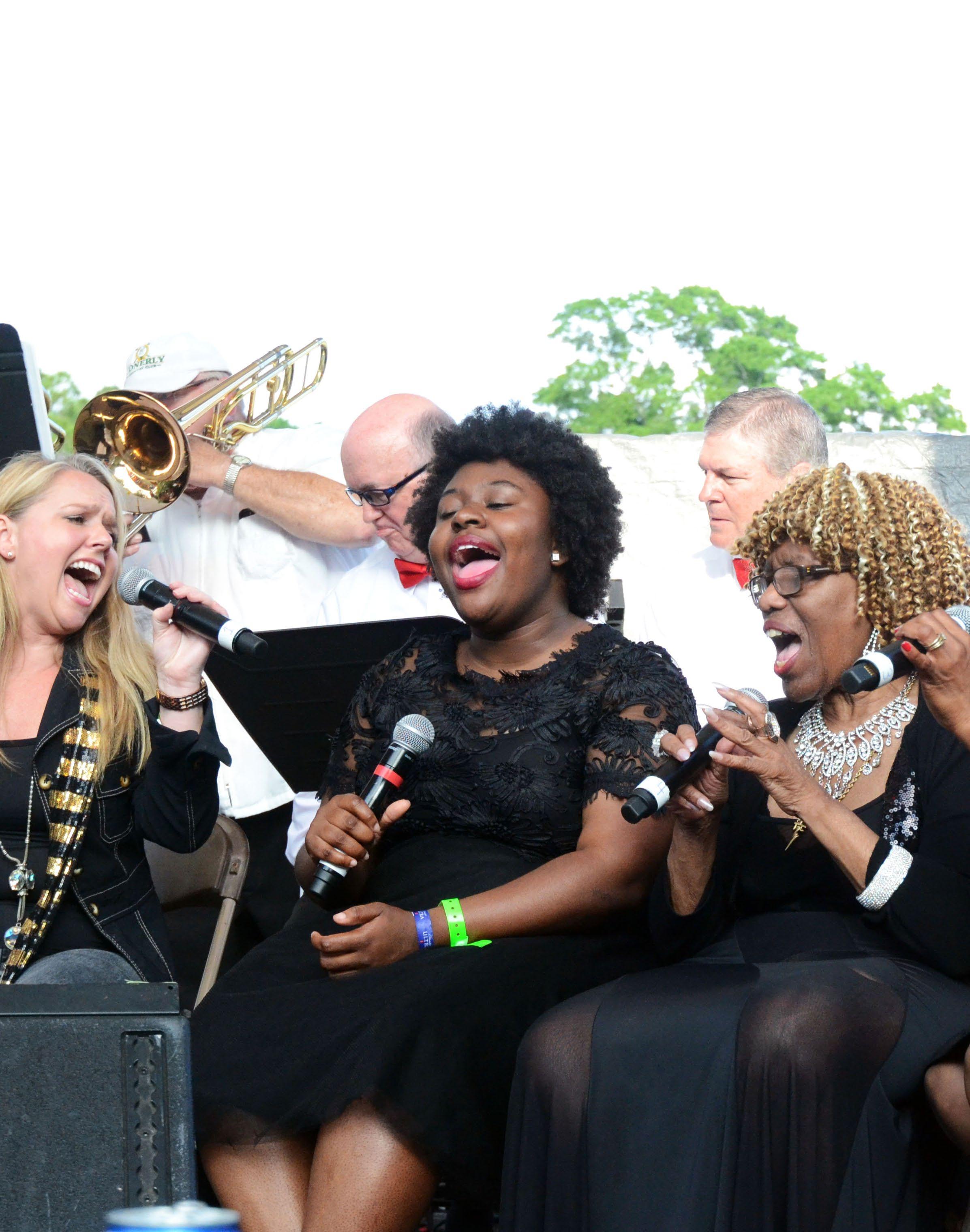
• Established cultural festivals including the Annual Pub Crawl, Jazz and R&B Festival, Cane River Zydeco Festival, Classic Car Show, Fleur de Lis Arts and Crafts Market, and Natchitoches Christmas Festival
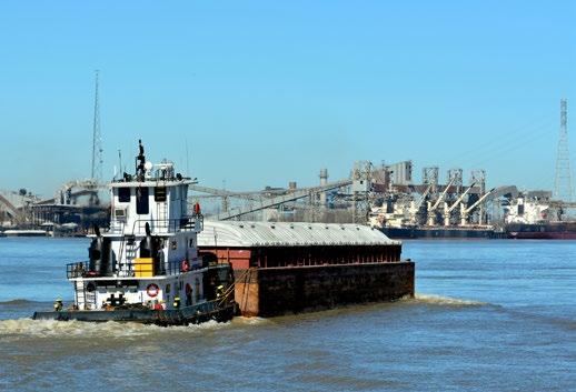
• One of only 2 bridges crossing the Red River between Alexandria and Shreveport and the only slack water port on the Red River
• Confluence of primary transportation corridors including US Interstate Highway 49, State Highways 1 and 71 North/ South, and State Highway 6/84, and Red River
• Union Pacific and Canadian Pacific Kansas City (CPKC) rail corridors connecting Shreveport to New Orleans
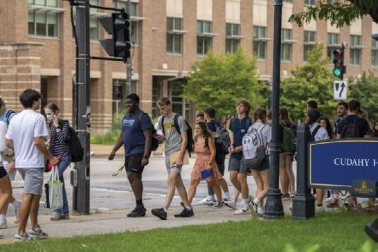
• Northwestern State University (NSU) and Louisiana School for Math, Science, and the Arts, the State’s premier secondary school
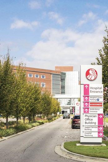
• Natchitoches Regional Medical Center and regional retailers
• Natchitoches Regional Airport
• Regional employers including Alliance Compressors, Pilgrim’s Pride, International Paper, Lott Oil, Roy O. Martin, and Weyerhaeuser
The value and concentration of assets consistently garner national and regional media attention and make Natchitoches a premier tourist destination and a prime candidate for smart growth.
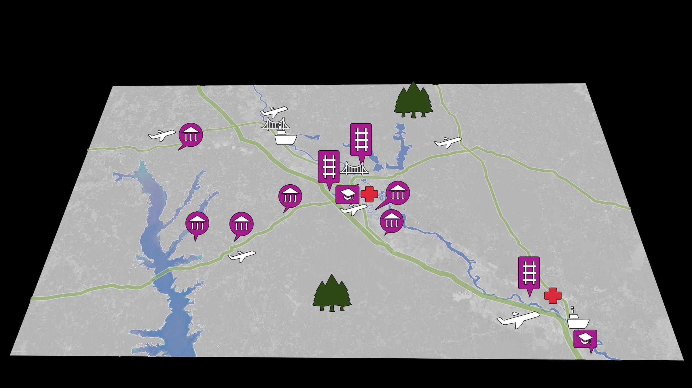


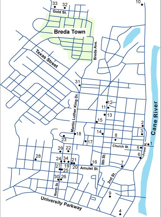
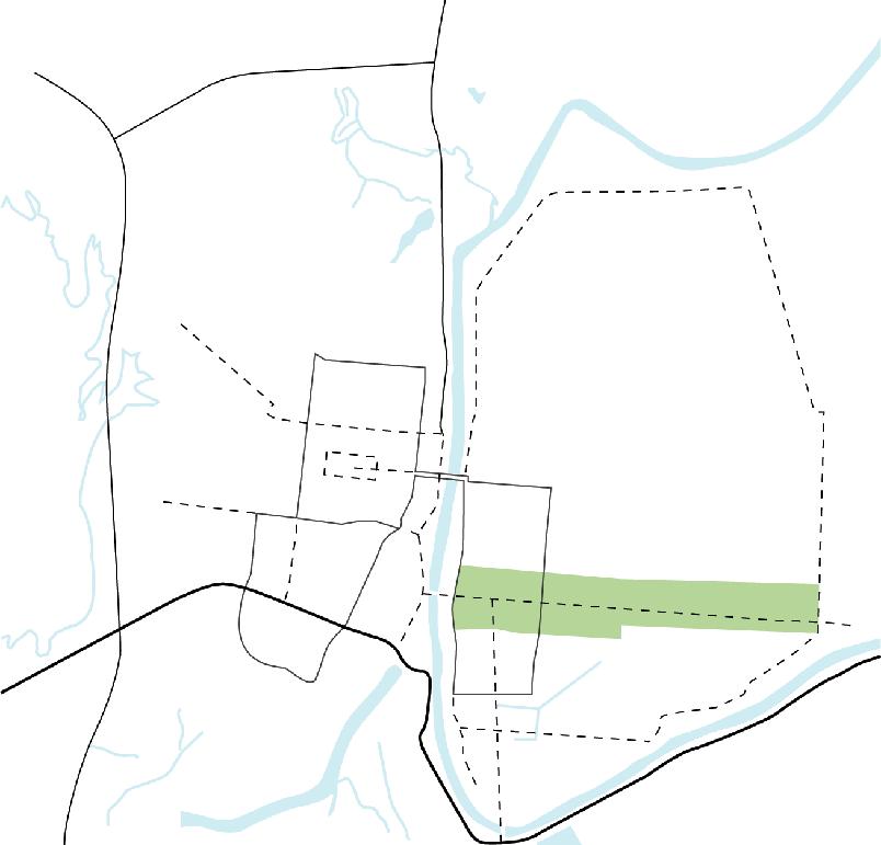
As illustrated here, the steering committee provided insight into community destinations as they viewed the city from the individual perspectives of a city resident, a regional/parish resident, a tourist/visitor, and a traveler passing through. The resulting compilation confirmed a concentration of community activity along Front Street and in the Historic District, and a concentration of commercial activity along Keyser Avenue expanding eastward. This mapping effort also illustrated more recently established patterns of activity concentrated on the NSU campus and along the University
Local Point of Interest
Tourist / Visitor Point of Interest
Parkway corridor extending southwest to the I-49 exchange. Insight into newer patterns of activity in need of focused attention north along Highway 6 and northwest toward the intersection of the Highway 6 bypass and Highway 1 emerged from this exercise.
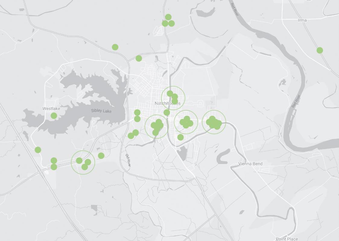
Regional Resident Point of Interest
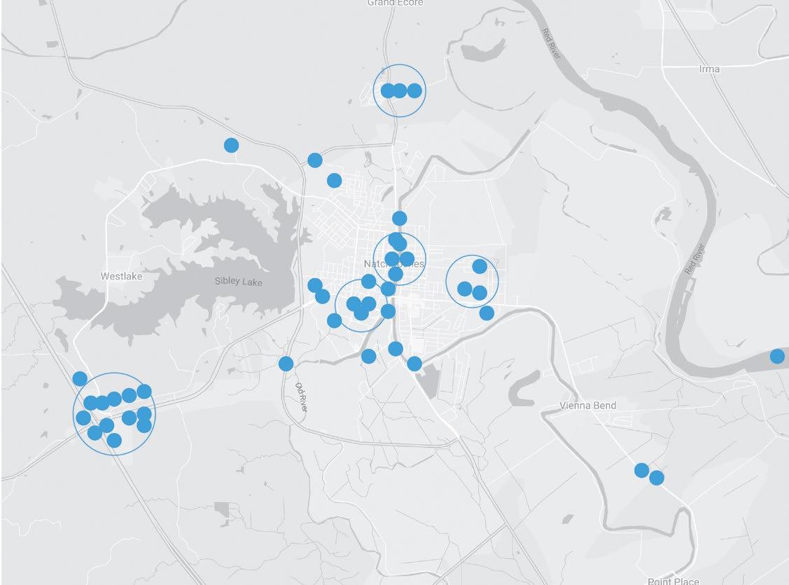
Traveler Point of Interest
DESTINATION = REGIONAL RESIDENT DESTINATION =
TOURIST/VISITOR DESTINATION = TRAVELER DESTINATION =
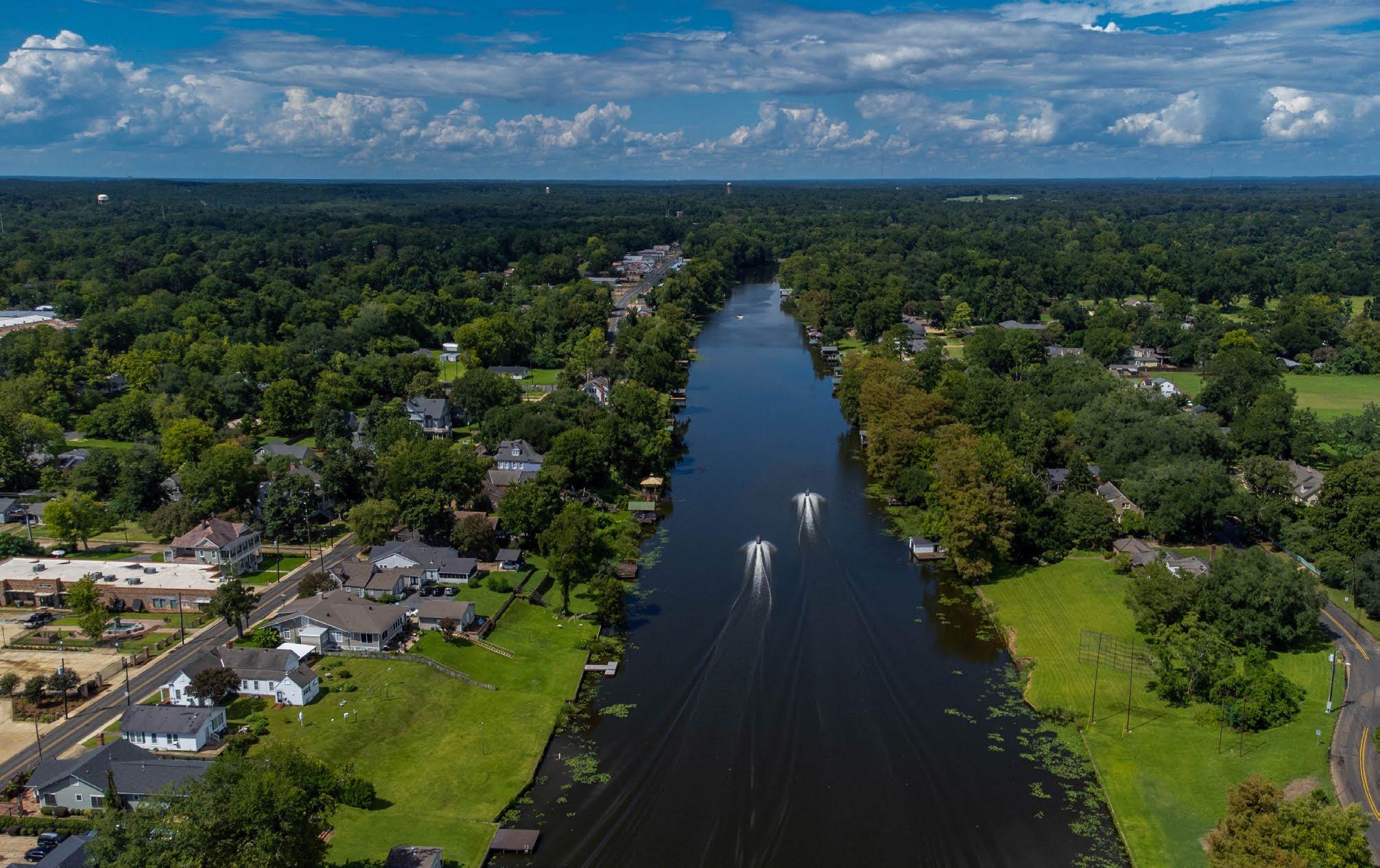
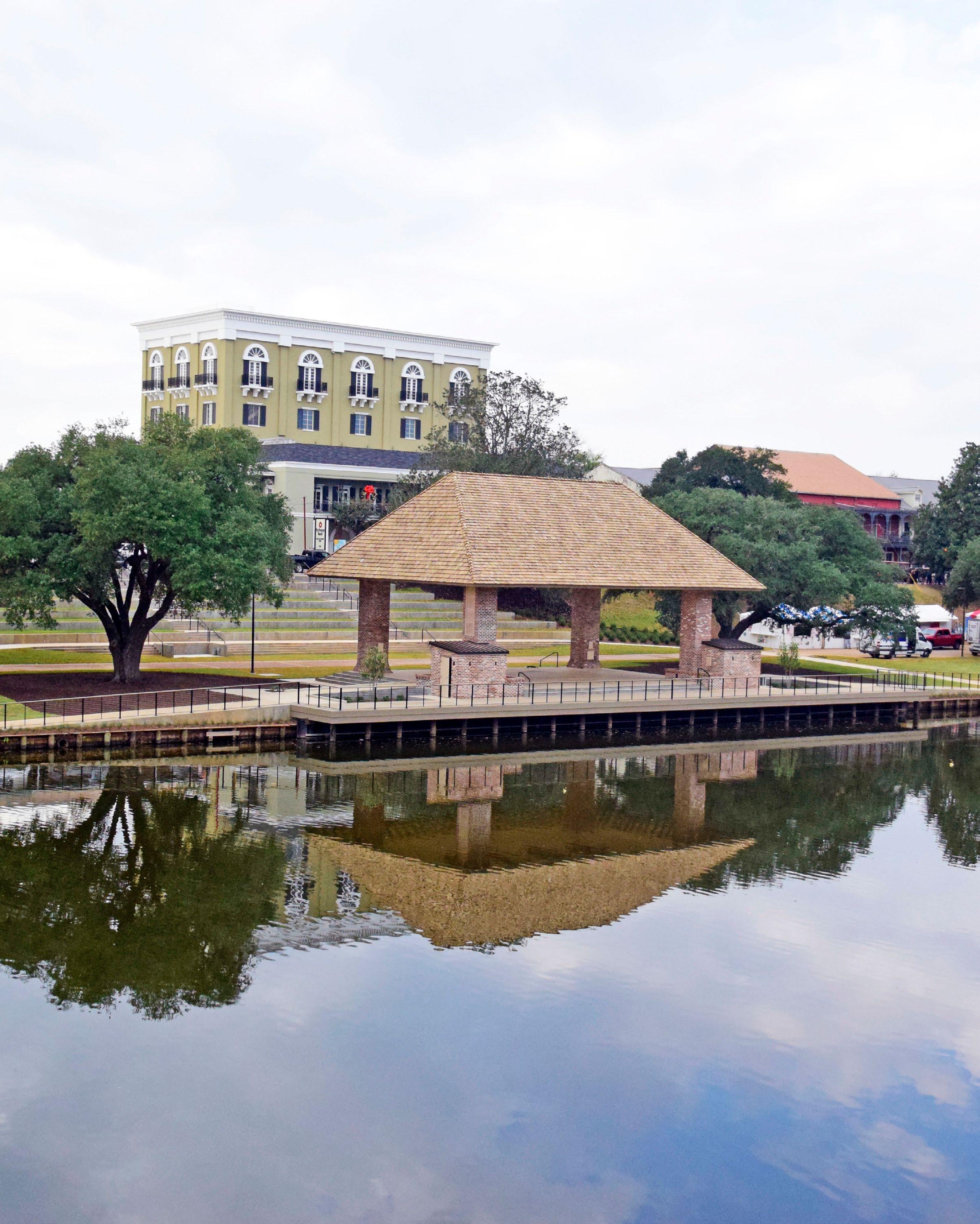
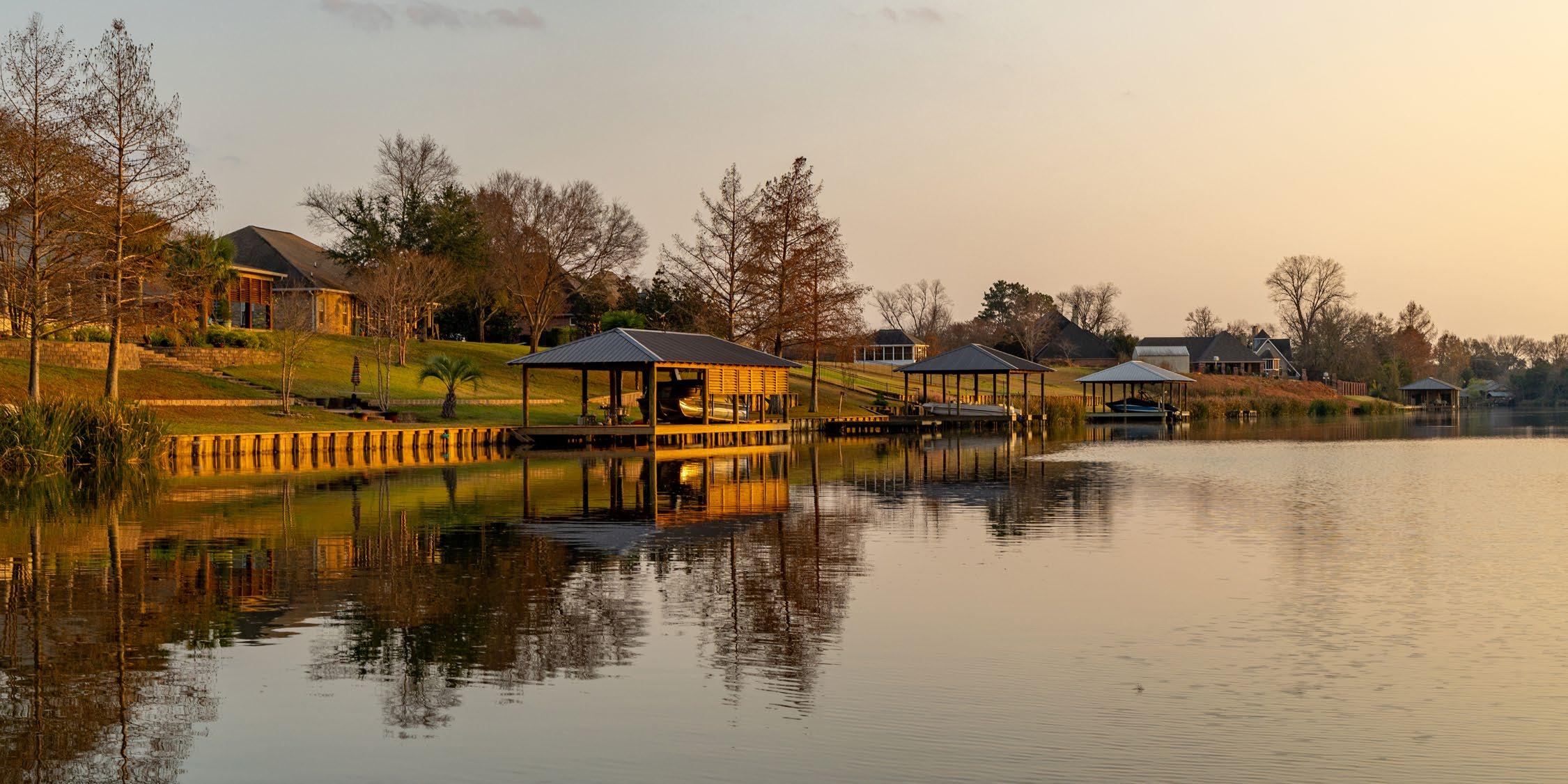
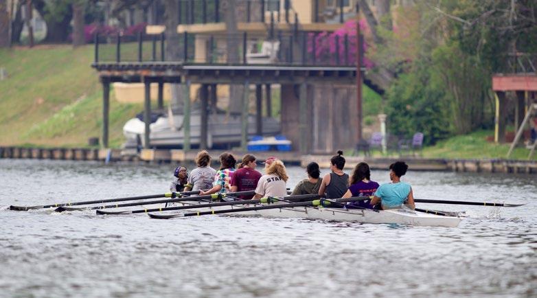
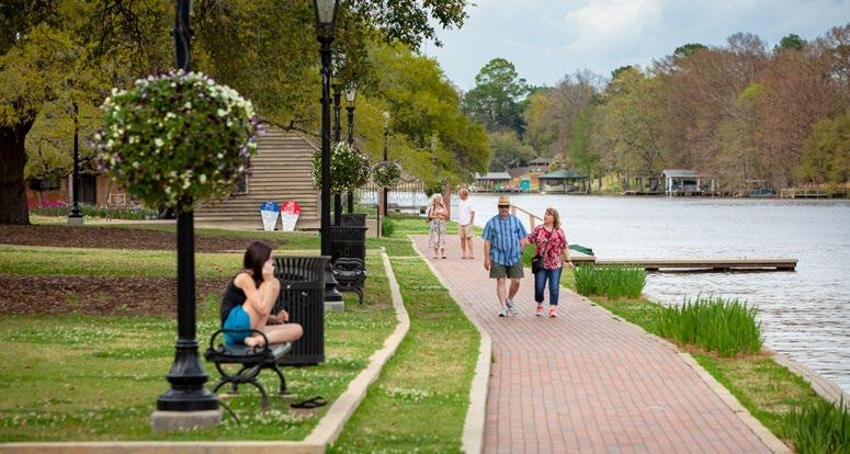
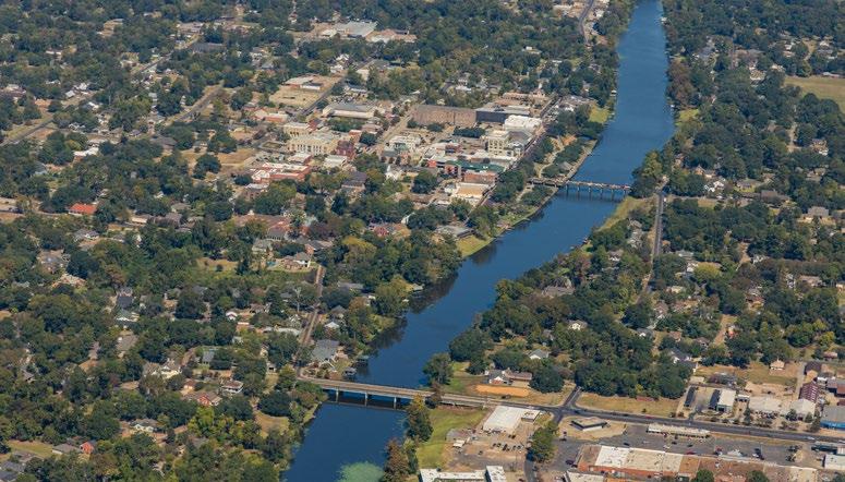
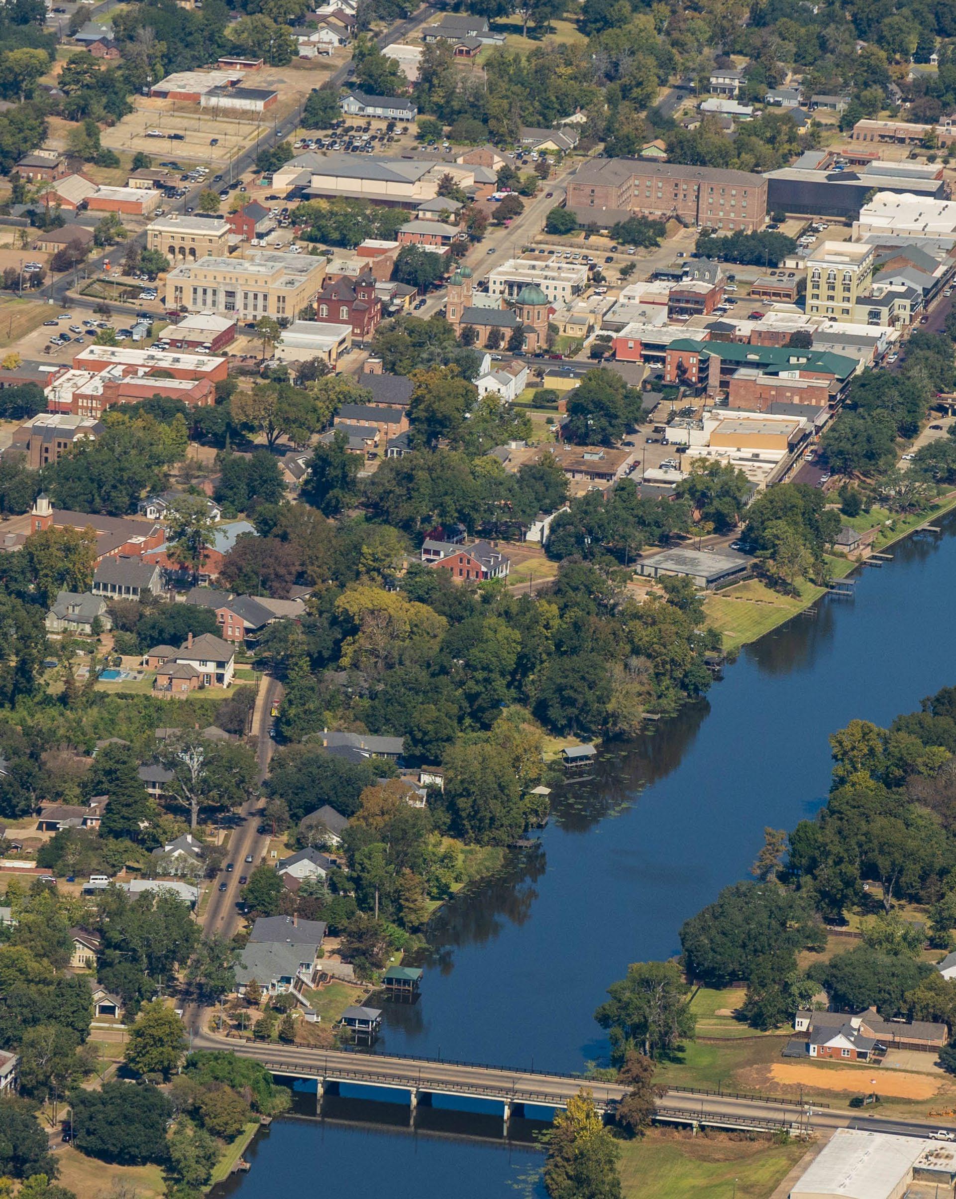
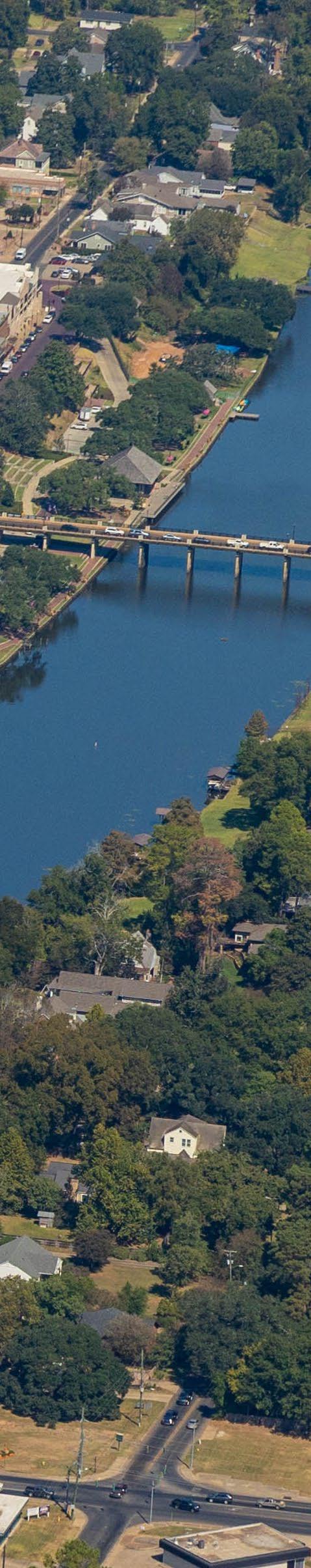
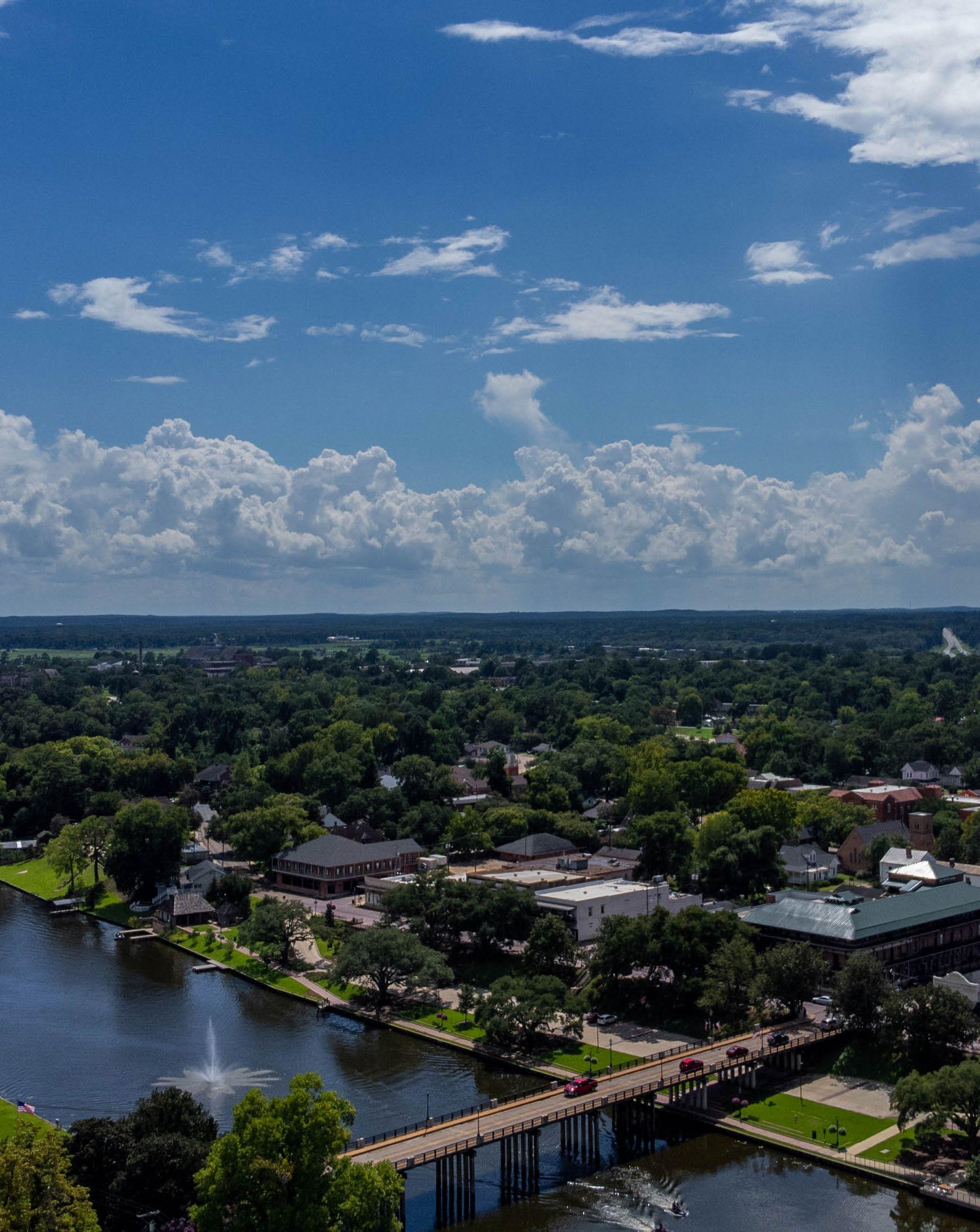
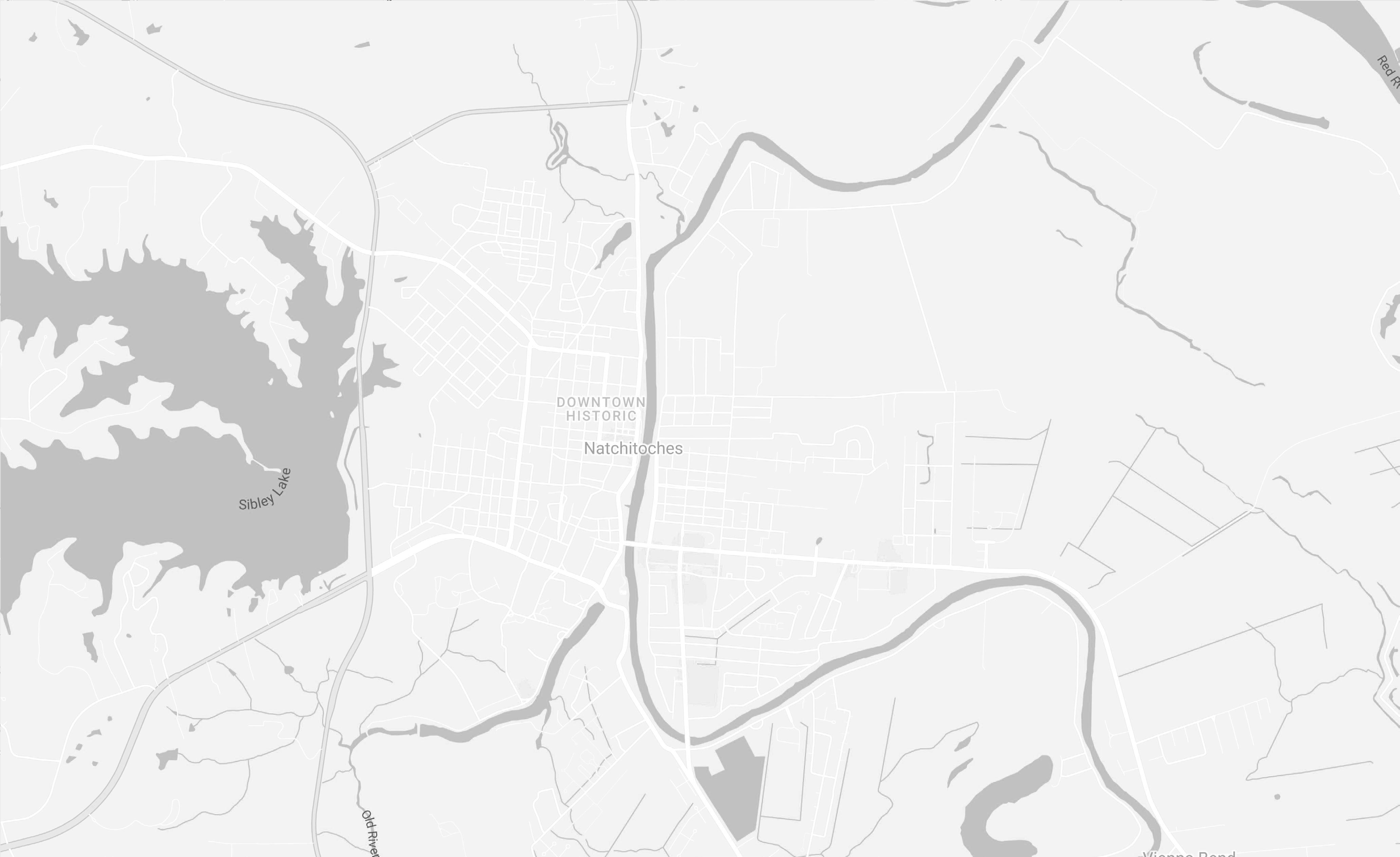
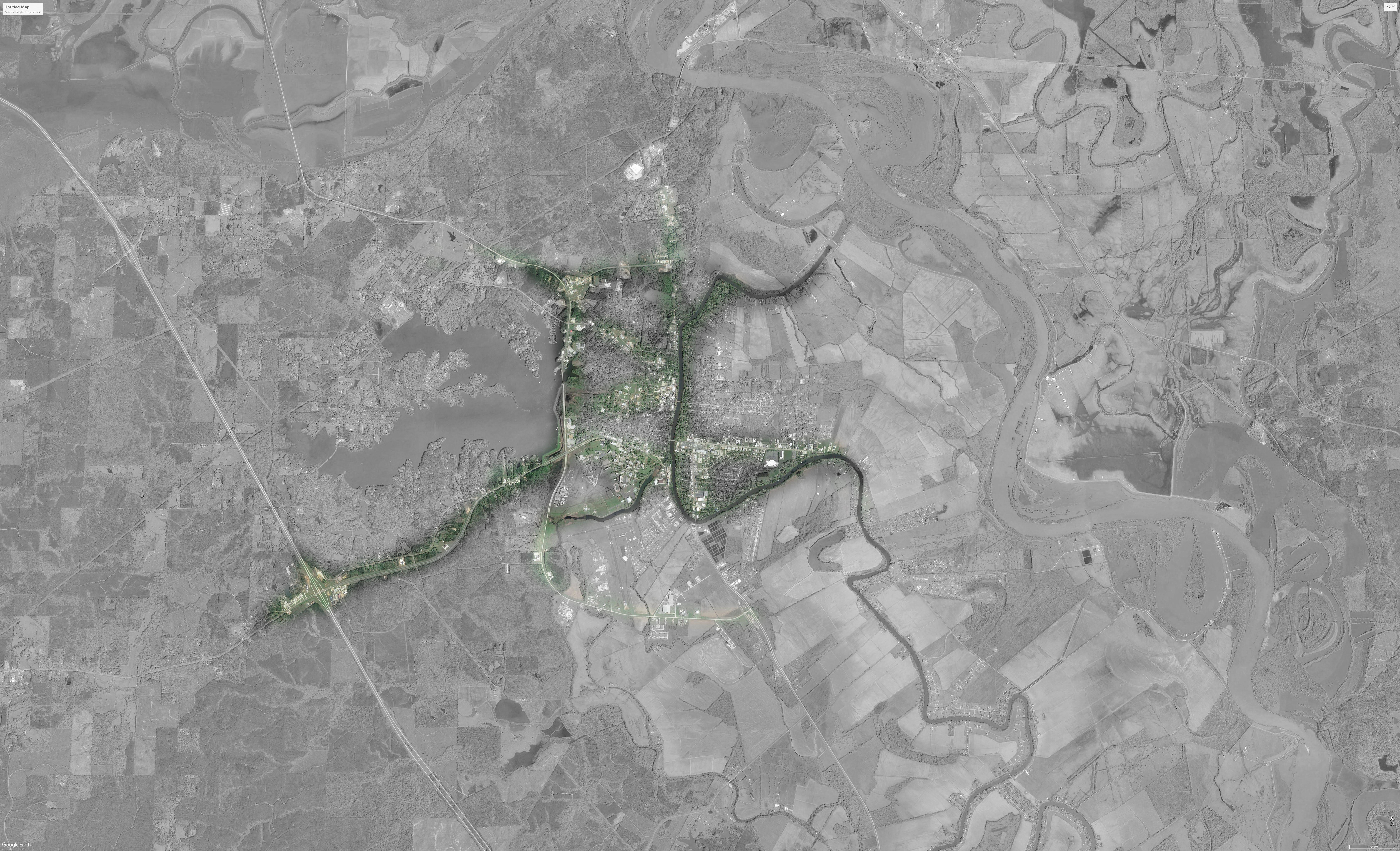
Water has been and continues to be a primary driver of settlement patterns in Natchitoches. For early settlers, the Cane River was the head of navigable water on the Mississippi/Red River route. Responding to natural changes in the Red River channel at Grand Ecore, the Cane River became separated from the Red River channel in the early 20th century; it remains today as a 35-mile long lake, the iconic liquid sinew connecting Natchitoches to the larger Cane River region.
The Cane River Lake and Chaplin Lake support recreational experiences and competitive rowing due to their stable water levels. Sibley Lake serves as the primary source of potable water for the city. It covers approximately 2,000 acres with a 38-mile shoreline popular for recreational activities including fishing, hunting, boating, skiing, camping, and picnicking. The Cane River Lake and Sibley Lake are both accessible via free public boat ramp. Nearby Toledo Bend, one of the country’s largest manmade reservoirs, supports world class fishing attracting numerous large fishing tournaments year-
round. Many marinas offer fishing piers and launching ramps, and there are public launching ramps on both the Texas and the Louisiana sides of the reservoir.
Natchitoches is home to the Kisatchie Ranger District and affords easy access to all regions of the Kisatchie National Forest, Louisiana’s only National Forest. Kisatchie provides for a broad range of outdoor activities and featues more than 100 miles of hiking trails with distances varying from a half-mile to nearly 30 miles.
The 84-acre Grady Erwin Nature Area, at the intersection of University Parkway and Highway 1 bypass, features three trail systems for bikers, walkers, and runners, totaling 4.5 miles. Nearby, Parc Natchitoches sports park hosts local and regional sports recreation with a 5-plex baseball pavilion, 4 soccer fields, walking trails, and a stocked pond. Natchitoches offers an abundance of lightly traveled, paved rural roads and challenging mountain-biking trails intended for recreational biking, community rides, and competitive events. The City Council recent-
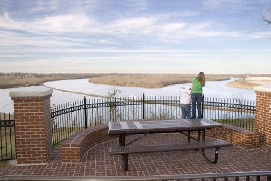
ly committed support for the 300-mile-long Bayou State Trail connecting the Gulf of Mexico in St. Mary Parish to the Arkansas State line. The Red River provides both recreational and commercial opportunities to Louisiana residents. From an 80-foot high bluff, the J. Bennett Johnston Waterway Grand Ecore Visitor Center offers extraordinary views of Red River, cultural and historical displays of the area, waterway exploration and navigation information and a walking trail for visitors.
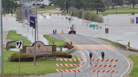
In 2016, flooding in Natchitoches served as a reminder that water is also an ever-present threat to property and development interests now that the City has expanded to lower land areas east and west. While the Cane River Lake system offers an ideal reservoir to accommodate flood surges, there remains a need for enhanced regulation to mitigate and clean storm water runoff and strategic improvements to direct run off as the City considers future development. As example, a matching grant from the La. Watershed Initiative will facilitate construction of a new drainage ditch that will direct water from the present East Natchitoches Drainage Canal to the north end of Cane River. Proposed improvements will alleviate flooding in the City along Blanchard Road, St. Clair, Caitlin, Ledet, Keyser and St. Maurice Lane and in the farmland east of the city.
City water treatment capacity, which has not been increased in almost 30 years, has become a priority with the water plant running at capacity multiple times per year. The Louisiana Water Sector Commission has awarded $5 million to the City of Natchitoches to rehabilitate its water treatment plants. Plant 1, built in 1959, and Plant 2, built in 1971, will receive minor updates. Plant 3, built in 1995, will be updated to address the specific mandates outlined by the Louisiana Department of Health Administrative order. A fourth plant will be added to meet growing water demand. This plant will be able to treat an additional 2 million gallons of water a day.
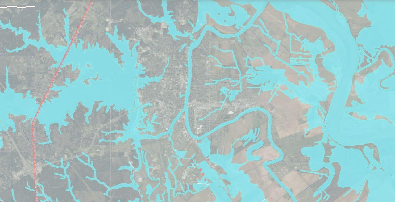
Inundation map

• Red River
• Cane River Lake
• US I-49
• US Highway 71
• LA Highway 1
• LA Highway 1 Business
• LA Highway 6/84
• LA Highway 6 Business
• LA Highway 494
• LA Highway 540
• LA Highway 1223
• LA Highway 1224
• LA Highway 3191
• Union Pacific Railroad
• Kansas City Southern Railroad
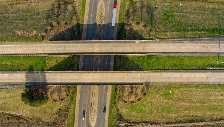
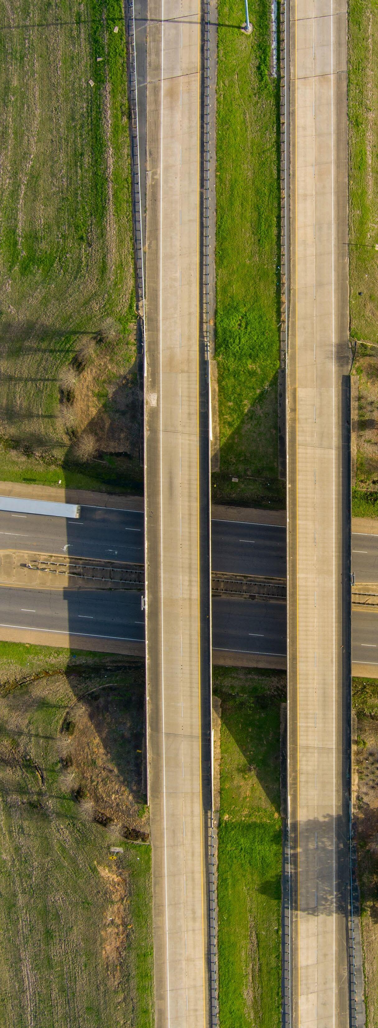
Louisiana DOTD is a major influence on the long-term health of the community. All vehicular access to the City of Natchitoches is limited to state highways, and all 3 critical bridges crossing the Cane River Lake to connect East and West Natchitoches occur on state highway routes.
Western portions of loop development proposed in the City Comprehensive Plan in 1957 and the 2008 Transportation Plan have largely been completed; however, eastern portions of the loop recommendations have failed to gain traction and remain undeveloped. Traffic congestion challenges, primarily focused at Cane River Lake crossings, are significant and represent a serious challenge for long term development in Natchitoches. The replacement of the Church Street bridge is a current DOTD construction priority.
The Natchitoches Regional Medical Center and primary development of regional commercial retail business are primarily focused along Keyser Avenue (State Highway 494) in East Natchitoches. Local street infrastructure north and south of Keyser Avenue are disconnected and align infrequently, making vehicular negotiation of this corridor challenging. Pedestrian and cyclist use of this district is intimidating.
Natchitoches holds a strategic position on the US Interstate 49 Corridor between Alexandria to the south
and Shreveport to the north. City limits have been extended to encompass the Highway 6 / I-49 interchange, and a Tax Increment Financing (TIF) district has been established to support development at this important intersection. Despite the desirable location, frontage roads are largely undeveloped and few land parcels are currently readily available for development.
Tracing the historic El Camino Real trading route, which connected settlement in Natchitoches to Texas and Mexico, State Highway 6 crosses the Red River, links Natchitoches to the Toledo Bend reservoir, and connects with Nacogdoches, TX, via Texas state highway. This route represents a primary east/west interstate transportation corridor and features multiple recreational and cultural points of interest for tourists.
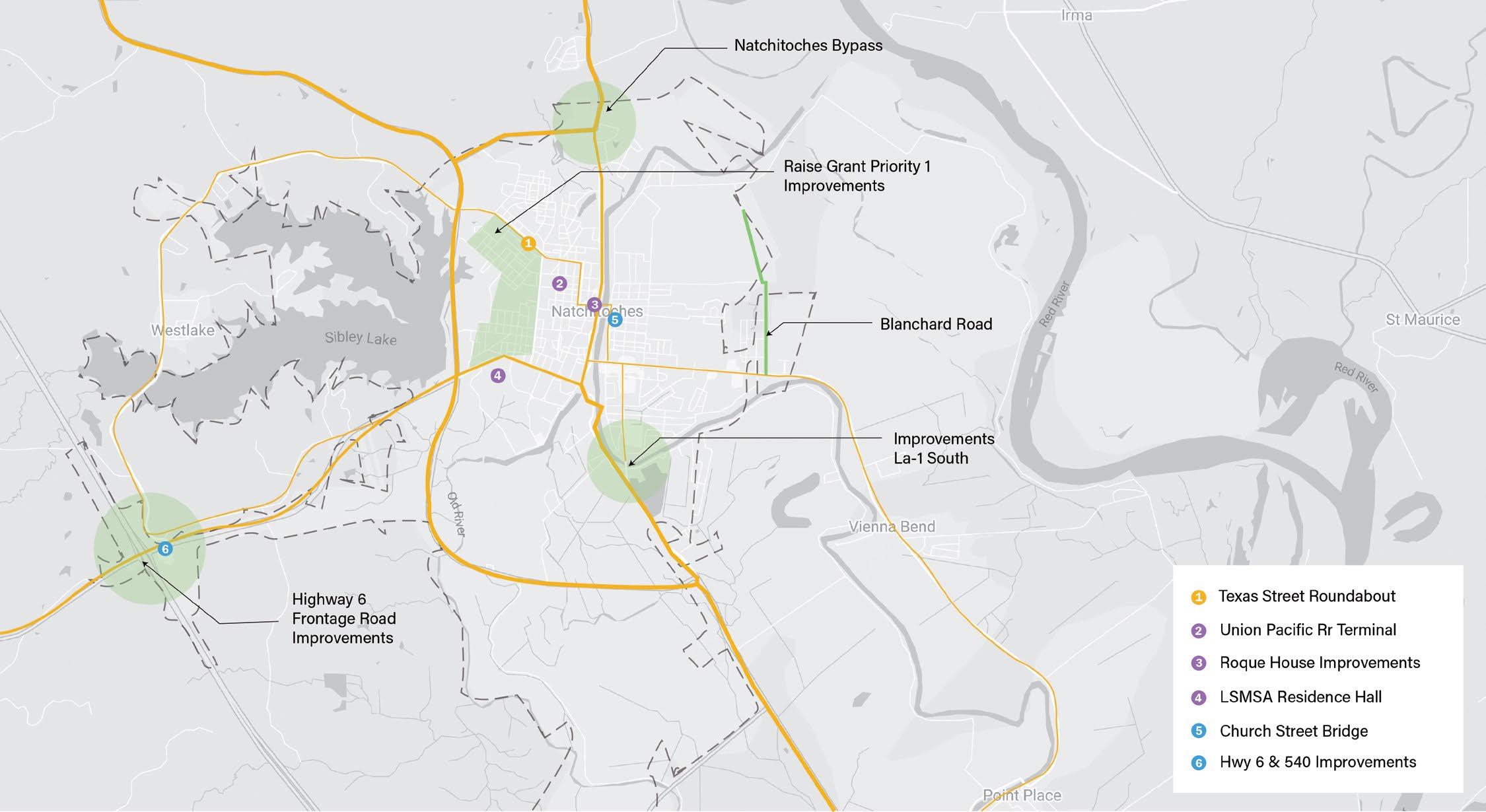
In 2020, the city adopted a Bicycle and Pedestrian Master Plan to serve as a guide for improving bicycle and pedestrian networks inside city limits. In 2022, the city was awarded a $17 million RAISE grant that will fund many of the improvements prioritized in the plan.
Improvements to city street fabric will be foundational to neighborhood improvements and community development recommendations included in this comprehensive plan.
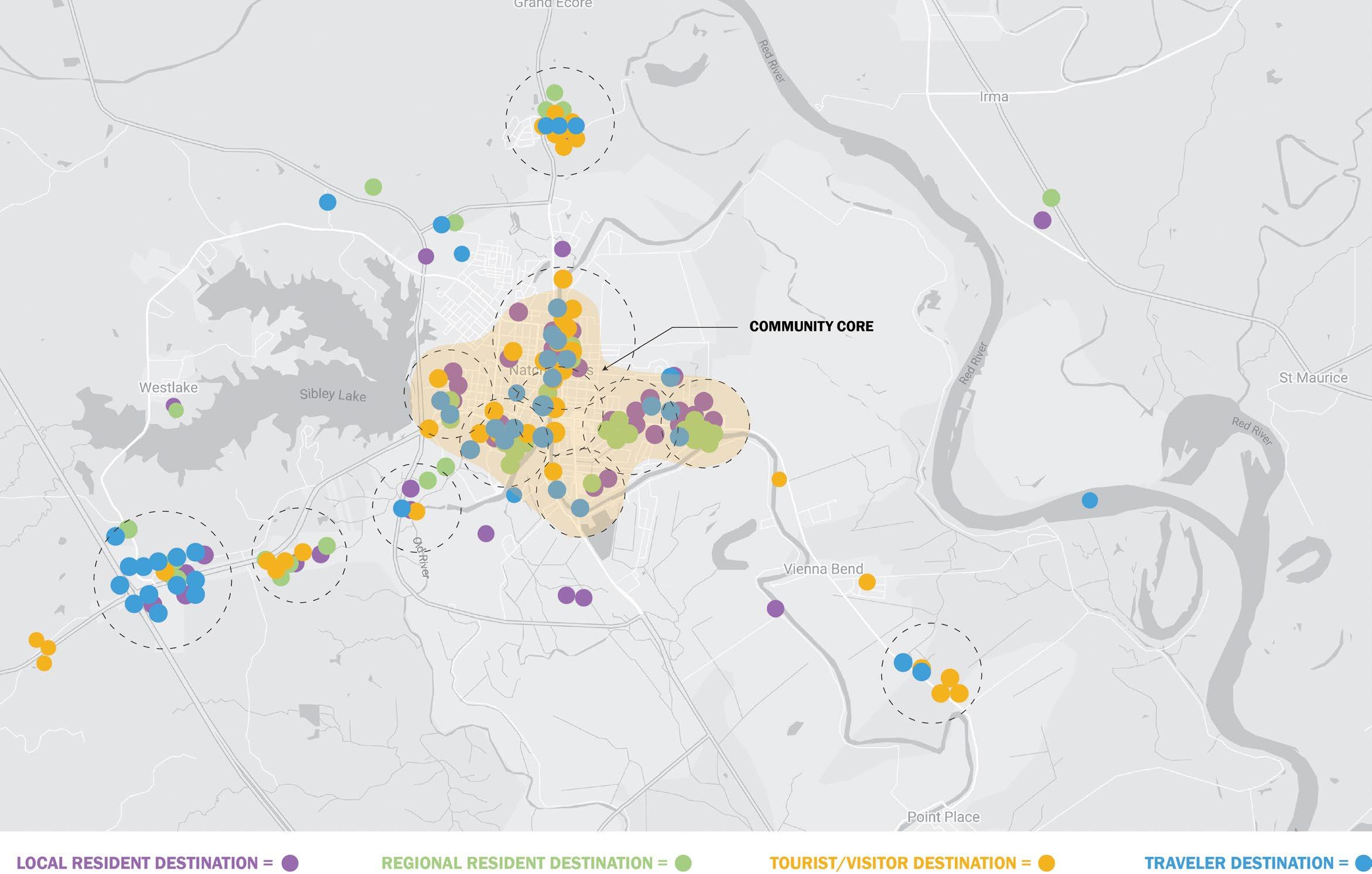
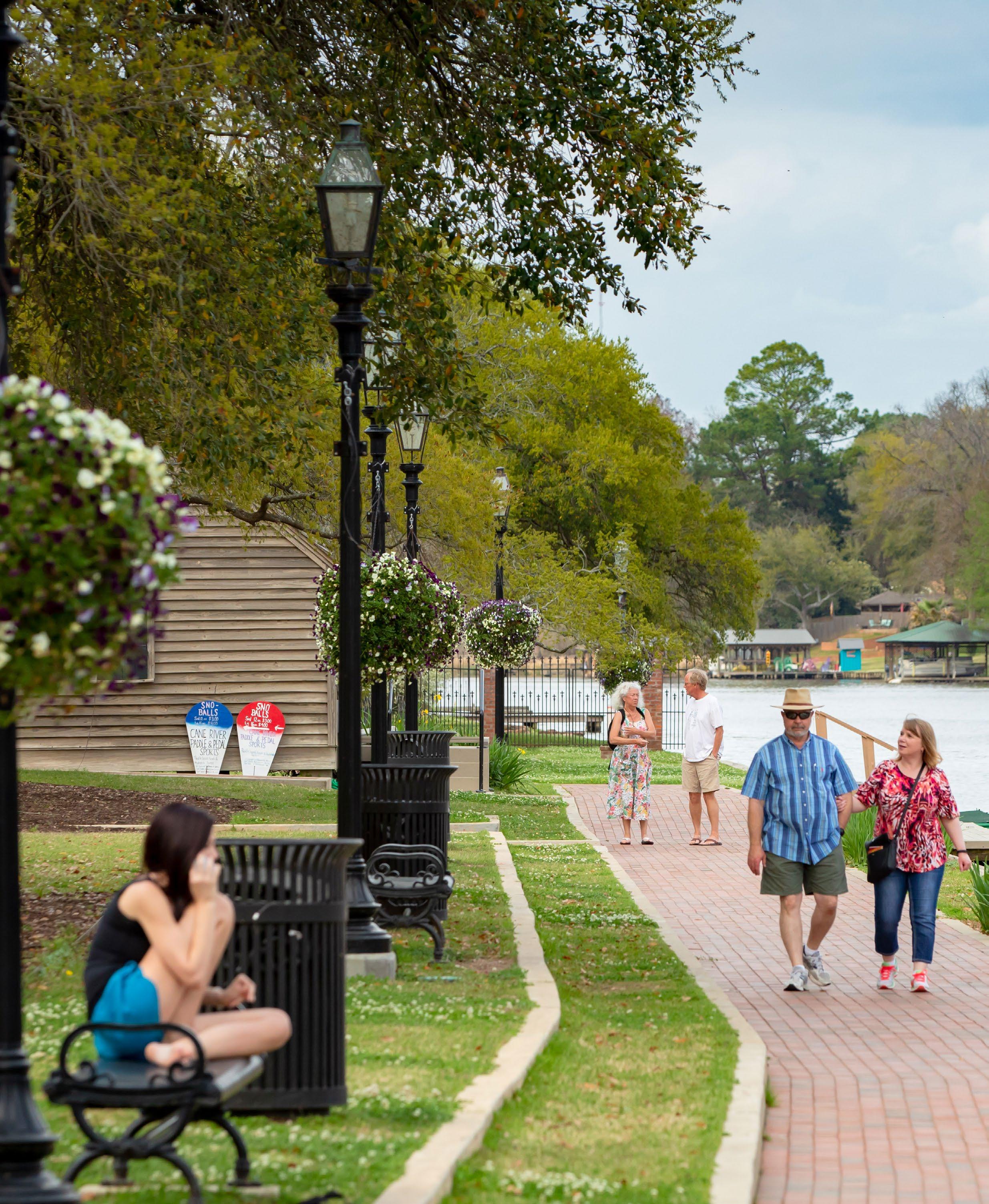
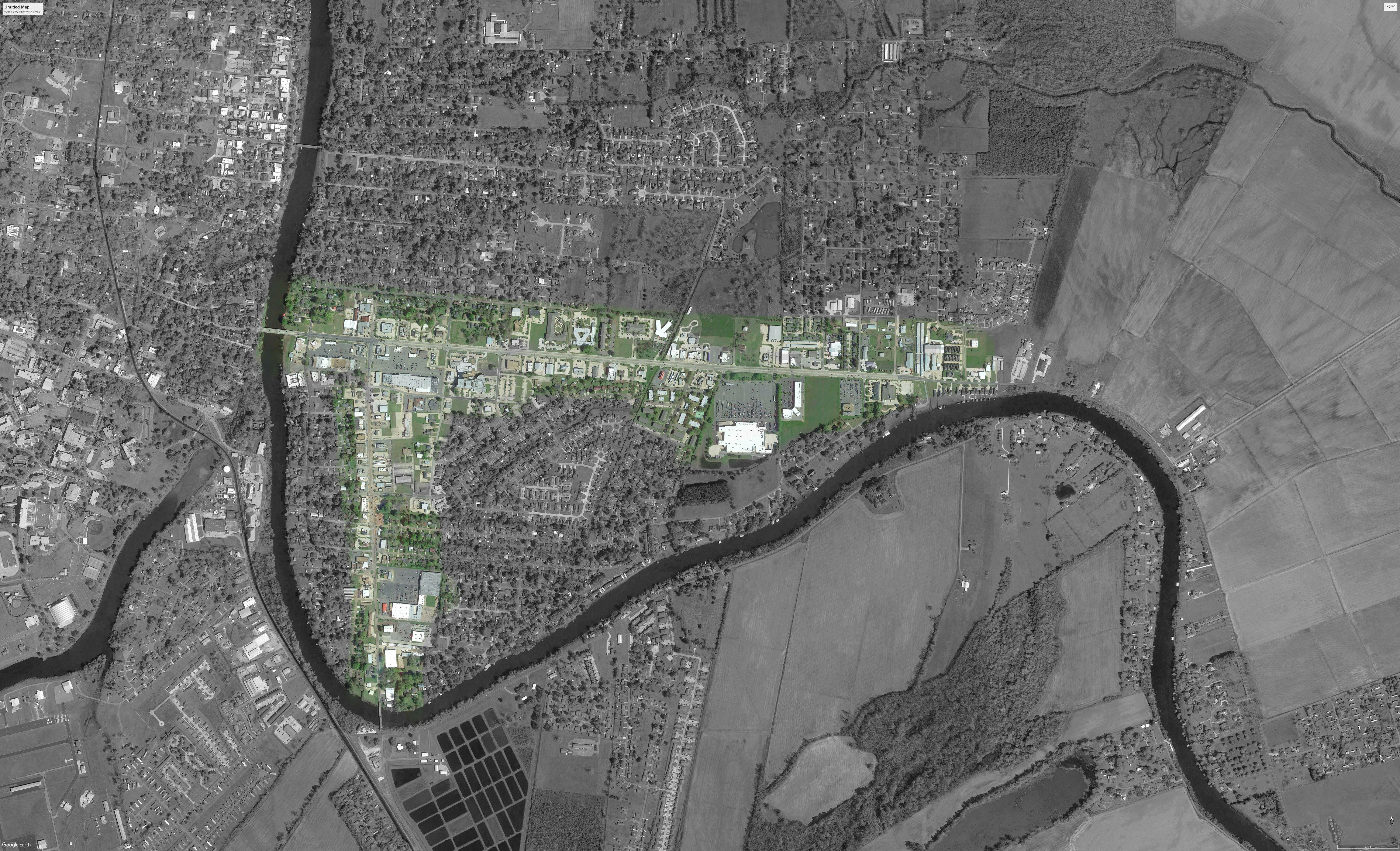
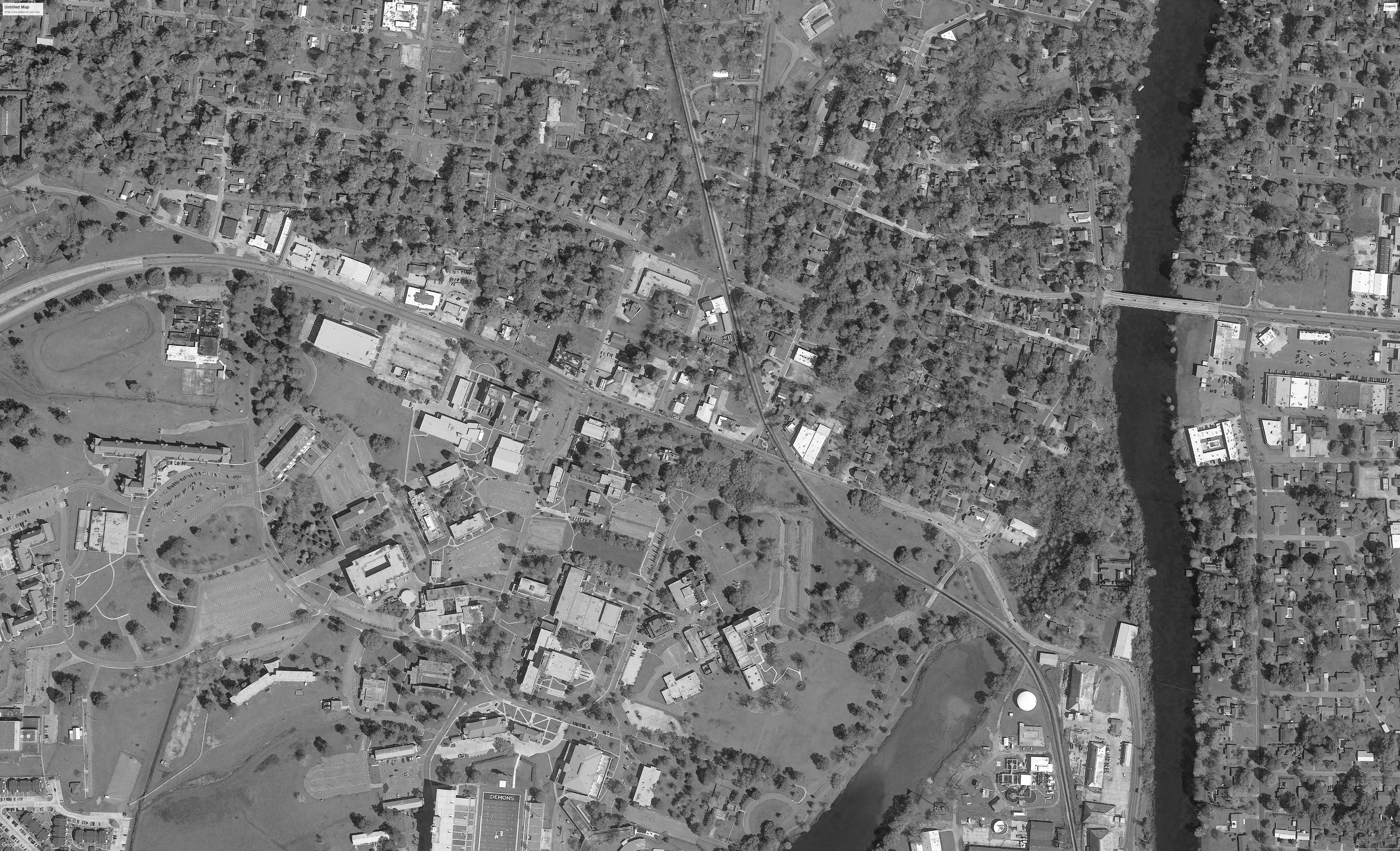
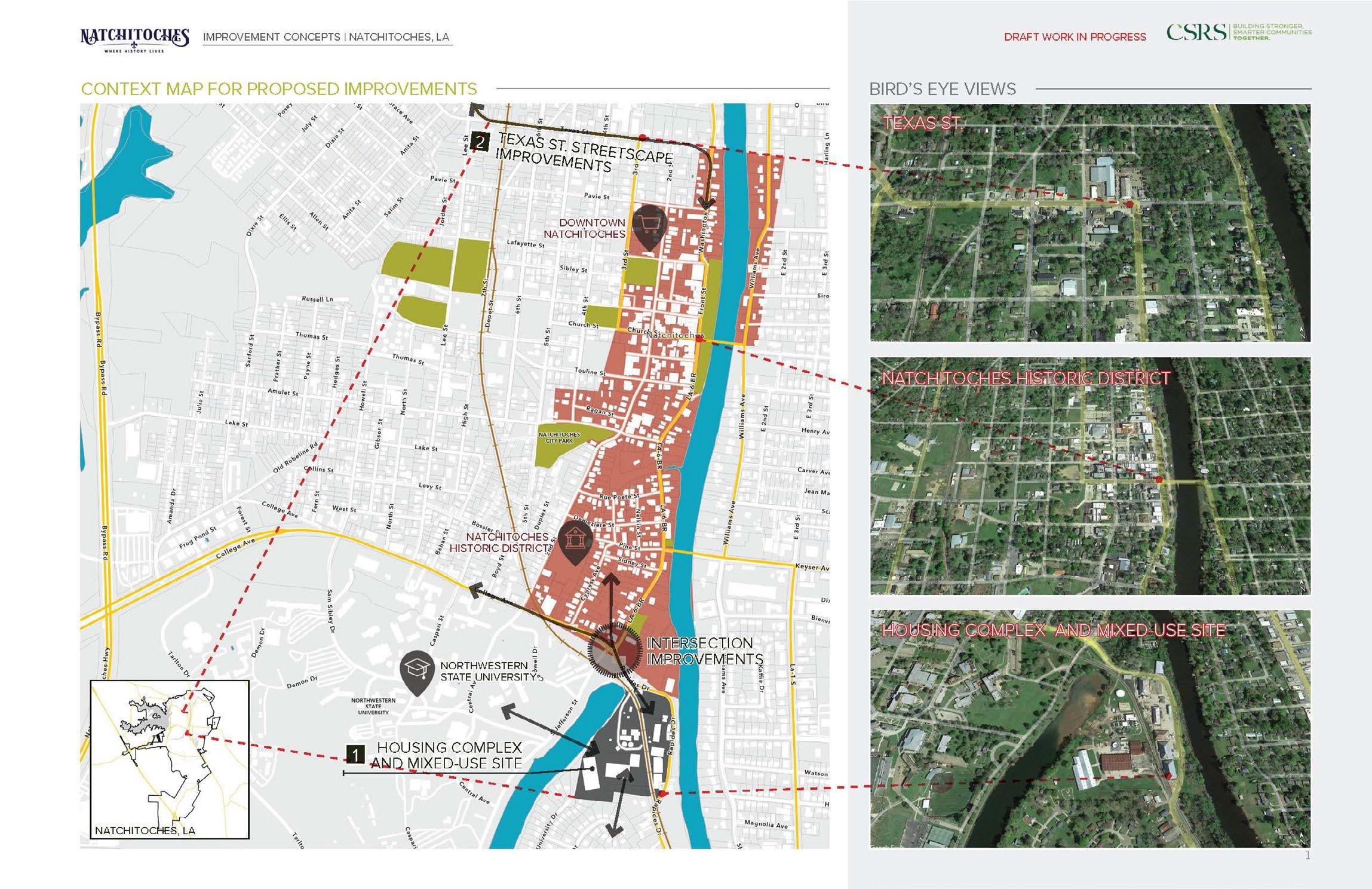
Destination analysis by the steering committee revealed the city’s core, widely assumed to be focused at Front Street along the Cane River Lake, is in reality much more complex and extensive than previously understood.
Original city development between MLK to the west and the Cane River house most of the community’s cultural assets and civic facilities. Health care resources and retail services along Keyser Avenue represent critical infrastructure to the economic viability of the city and surrounding region. Natchitoches Regional Medical Center is the largest employer in the city. As the second largest, Northwestern State Universi-
ty serves alongside LSMSA and the Natchitoches campus of Bossier Parish Community College as a regional educational resource and an emerging regional leadership influence. Collectively, these areas constitute an expanded understanding of the city core.
Previously understood incrementally, the city core is best reconsidered as a whole. Critical infrastructure linking the entire core, provisions for reliable connected access, and interdependent planned development in the core area are critical to the long-term success of the city of Natchitoches.
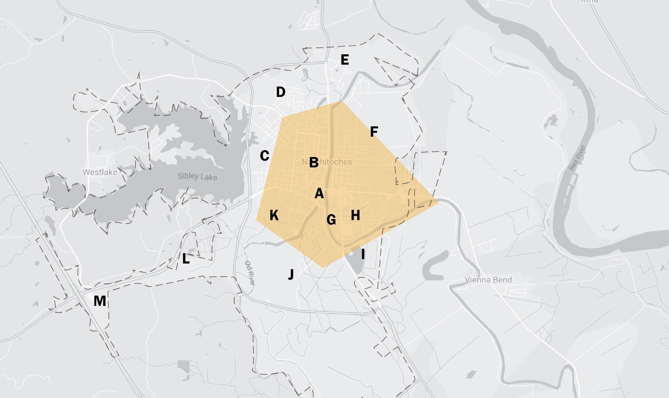
In keeping with its historical beginnings, Natchitoches remains a city of camps, neighborhoods, and precincts. As such, the city functions similarly to much larger municipalities and residents retain primary identity connections to their place of residence and employment in addition to their affinity to the community at large. Planned improvements must embrace this integrated diversity considering the complex and unique needs of each precinct within the context of city and regional priorities. Improvements must function at multiple scales simultaneously for success.
Source: 2020 US Census
Owner-Occupied Housing
Data available from the 2020 US Census offers insight into more recent development trends in the City of Natchitoches and identifies specific issues that must be addressed for the community to thrive. Specifically, the comprehensive planning process has considered the following:
• City population has declined 5.7% in the last decade. Population decline is currently projected to continue over the next census period.
• A relatively young city population with a unique age demographic distribution includes an aging population concentrated in the center of the city surrounded on all sides by younger age groups.
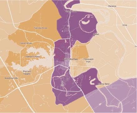
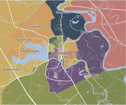
• The diverse city population is majority female (53.5%) and black (57.5%). Black population is concentrated between the Cane River Lake and Sibley Lake with white populations concentrated east of the Cane River and areas North, South, and West of Sibley Lake.
• There is a significant shortage of housing inventory at all price strata.
• An alarmingly low rate (30.7%) of home ownership creates sustainability challenges for city neighborhoods and blight pressuring city development regulation and enforcement.
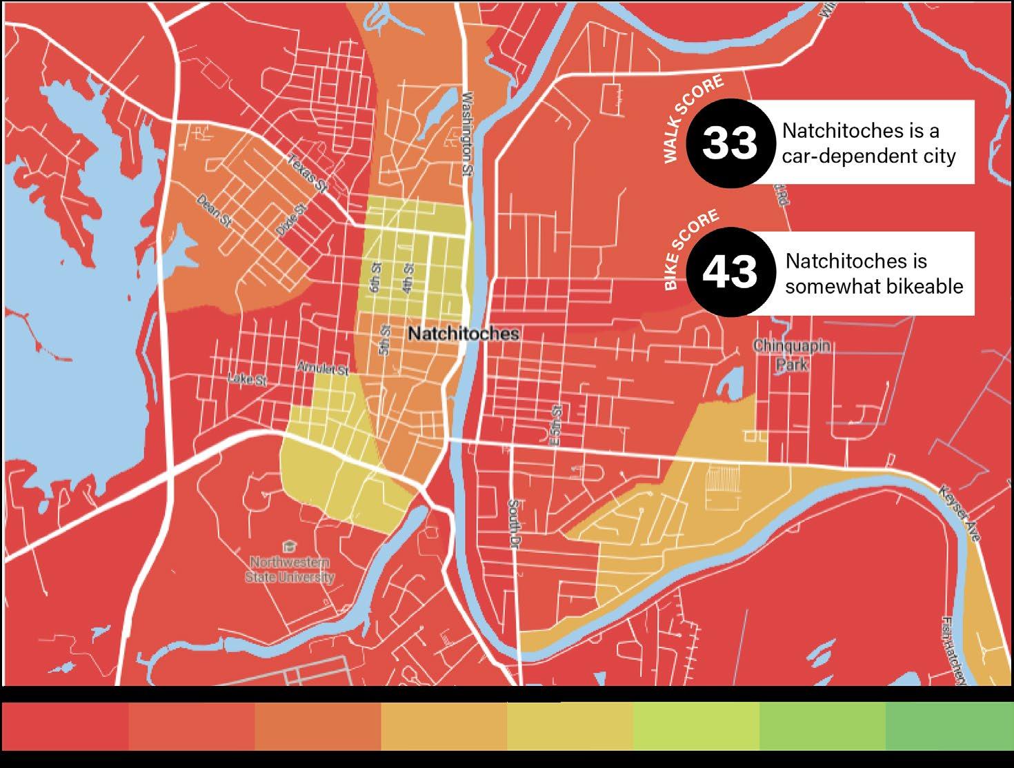
• Low walkability scores contrast with a significant percentage of the city population lacking an automobile for transportation.
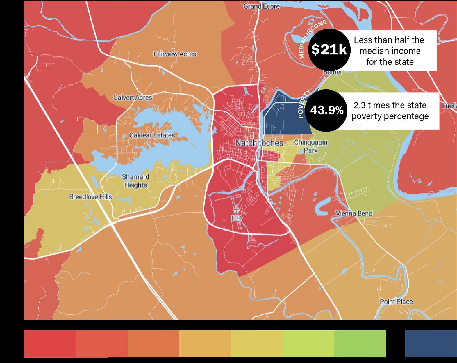
• Low median household income ($21,175) is less than half the state average.
• The high poverty rate (43.9%) is more than twice the state average.
• High crime statistics are double the national average for violent crimes and property crimes.
• Low percentages of households have computers and broadband internet access as compared to the state average.
• Employment is trending upward, hitting a 13-year-economic high (16,257) in spring 2022, according to the CENLA Economic Dashboard issued by LSU Alexandria.
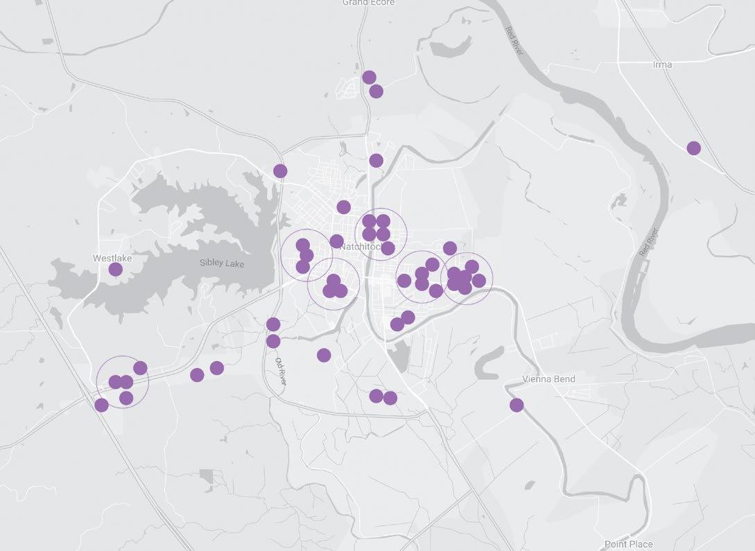
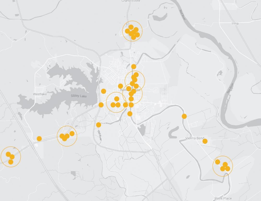
Investment in Natchitoches has been consistent and substantial. Initiatives illustrated below reflect active community improvements approaching $200 million. In recent history, community development has been limited to targeted community stakeholders; individual projects have exhibited little synergistic community impact as a result. Further, many residents have a limited understanding of active positive improvements and remain pessimistic of community potential in the face of prevalent need.
Numerous planning efforts are ongoing in parallel to the Comprehensive Planning process. It is of primary interest to community health that respective planning efforts become integrated and that respective efforts to conceptualize, promote, fund, and implement planned improvements remain aligned with the guiding principles contained in this document.
To achieve this result, the City should assess and amend this plan annually to include the results of the ongoing improvement efforts listed below. Further, in recognition of the breadth of development activity and interests, this comprehensive plan should be updated on a five year cycle to embrace the latest initiatives and emerging needs. Examples of parallel initiatives include:
• Economic Development Strategic Plan initiated by the Natchitoches Economic Development Alliance (NEDA) and conducted in parallel with the city comprehensive plan
• Funded Raise Grant Improvements to implement the 2020 Pedestrian and Bicycle Master Plan
• Mill District Feasibility Study by CSRS
• National Park Service Community Service Assistance Grant to develop an outdoor recreation plan
• Natchitoches Parish Rural Transportation Pilot Program
• Louisiana Water Sector Commission Water Treatment Improvement Grant
• La. Watershed Initiative match grant for drainage improvements in east Natchitoches
• Bayou State Hiking Trail Plan
• DOTD Planned improvements including Church Street bridge replacement, Texas street roundabout, La 505 and 3278 intersection roundabout, planned Keyser Avenue improvements
• Union Pacific Railroad Terminal Renovations
• Roque House improvements
• State Facility Planning and Control projects at NSU
• Others to be identified
To the extent possible, ongoing planning considerations at NSU and the Natchitoches Regional Medical Center should be informed by the information included in the city comprehensive plan and respective plans should be coordinated upon conclusion.

Recognizing the multi-dimensional nature of the comprehensive plan, Natchitoches must embrace improvements to its social, community, and regulatory infrastructure to facilitate and sustain the physical improvement initiatives included in the Comprehensive Plan. Much of this effort will require consistent behind-the-scenes focus to pave the way for more visible progress.
Each priority initiative identified will benefit from a community champion that understands the challenge, will be persistent when faced with obstacles, is able to realistically assess progress, and can enlist the support of others as needed for success.
Smart, sustainable growth for Natchitoches requires acknowledgement of and consistent improvements to underlying community challenges. Recognizable response patterns will have limited impact on current challenges. New collaborative engagement patterns are needed for success.
To pave the way for the future, the steering committee and city leadership identified 7 priorities to enable the community and to strengthen community fabric in Natchitoches which include:
• Replace aging infrastructure (e.g. water mains, sewer mains)
• Expand capacity for water, wastewater, and electrical
• Increase internet capacity and employ strategic wireless hotspots
• Address right of way maintenance
• Update vacant and adjudicated property regulations
• Update city land use & permit approval processes
• Update city zoning ordinance to address short-term rentals
• Include form-based zoning for limited lot sizes, and precinct requirements, as recommended in comprehensive plan
• Update permitted uses in alignment with comprehensive plan
• Develop and adopt a future land use map
• Improve surveillance fabric
• Build upon city crime task force efforts underway (e.g., additional street patrols, teamed response) to grow trust and participation among residential and business communities
• Improve accessibility and response by:
▷ coordinating operations
▷ expanding capabilities of public safety
▷ updating and adding stations in response to development
▷ enhancing advanced life support systems
▷ boosting public engagement
• Partner to address underlying contributing issues e.g., extreme poverty rates; limited economic opportunity; fewer owner-occupied properties/neighborhoods; blight and deteriorating neighborhood fabric; limited policing resources
• Establish alternative education options for juvenile offenders

• Prepare community foundation for an active role as entrepreneurial thought leader, grantmaker, and implementation vehicle for community development and redevelopment
• Use comprehensive plan as a framework to align aspirations across organizations, including healthcare, education, and tourism
• Promote plan priorities and initiatives while communicating challenges and progress through monthly status updates
• Market effectively by clarifying message and communicating consistently
• Proactively target and recruit aligned businesses & industries, leveraging technology as a marketing and experience tool
• Establish and enrich partnerships at a city/parish level and regional level
• Leverage leadership at educational institutions including NSU and LSMSA to enhance and broaden educational opportunities at all age levels
• Develop regional response in support of animal welfare
• Establish regional transportation cooperative among DOTD, Regional Rural Public Transportation, and City/ Parish
• Expand mobility and access through multimodal transportation, employer/service shuttles, bike share and similar service providers, recreational interests
• Align Raise Grant implementation priorities with Comprehensive Plan
• Prioritize mobility hubs
• Identify and promote neighborhood identity, encouraging the creation and activation of neighborhood associations with neighborhood watch, events & engagement
• Provide for neighborhood conservation overlay districts
• Designate community foundation as a land bank, or housing redevelopment trust, actively developing housing stock for owner-occupants, educating homebuyers,
and preserving neighborhoods
• Engage church leaders and congregants as vital components of strong neighborhood networks
• Explore opportunities for renovating and revitalizing housing with Louisiana Housing Corporation and Habitat for Humanity
• See Center City District of Framework Plan (p. 54) as well as I-49 District (p. 66) and North Access Corridor (p. 70) for new housing developments.
• Leverage unparalleled set of assets and resources to embrace natural systems and parks/recreation as an industry
• Collaborate as an industry roundtable, tapping potential for cross promotion, marketing, memberships, and bundled experiences
• Align and share events for increased economic impact
• Use natural system assets for community health, education, and research
• Engage with peers in regional, national & international networks
• Recruit, incentivize, and incubate feeder businesses and experiences

Planning initiatives identified in this section provide the structure upon which the precinct plans included in the subsequent section can be confidently executed. These initiatives support and sustain more detailed development at precinct and project scales. They provide necessary perspective to see linkages between individual projects and to connect aligned community partners to expand the impact of respective entrepreneurial ideas. They become the means of expanding influence and making broader connections to mutually beneficial regional, state, and national initiatives.
For perspective, successful implementation of framework plans in this section will require the following:
Each framework plan illustrated here will require collaborative engagement to implement. Possibility must be shared and embraced by others. Resource acquisition will rely upon shared application and promotion. As a result, established limitations and restrictions will need to be re-considered and inevitable challenges will need to be faced together. Cooperative endeavor agreements (CEAs), Public Private Partnerships (P3s), Joint Jurisdictional Agreements (JJEs), economic districts crossing jurisdictional boundaries, and similar strategies will need to be explored as enabling capital for success. Shared engagement success will become a powerful competitive advantage.


Framework plans illustrated at Regional, Parish, and City scales are interconnected. Together they form a new matrix of possibility. Considered in isolation they will lack imagination and quickly devolve to compete for scarce community resources. Considered together they will deliver synergy as one effort informs and elevates the others. Implementation at one scale will facilitate progress at all scales.
Framework plans touch physical, economic, social, and community fabric simultaneously. As a result, simple ideas can have exponential impact. As a natural prerequisite, framework plans require strong, engaged, and consistent leadership to initiate and sustain. Community expectations and public accountability for results will be essential for framework plans to transition through a natural pace of term limitations and election cycles.
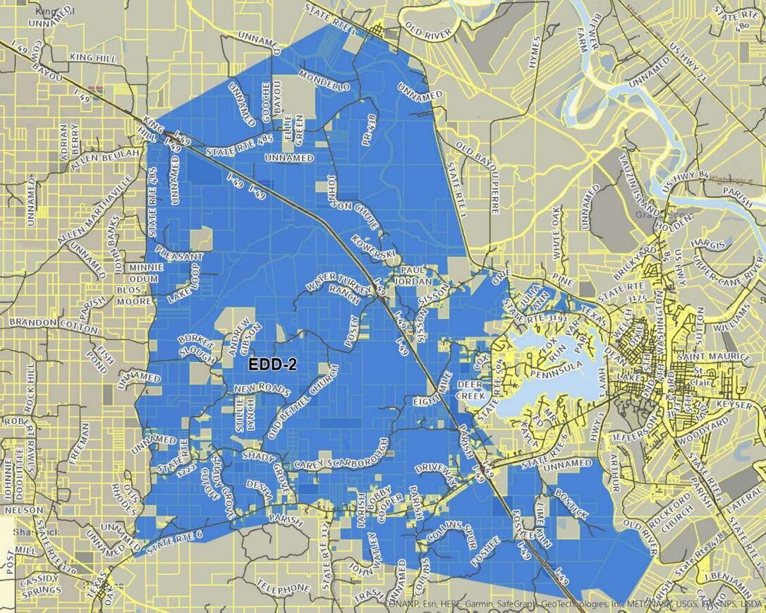
Highway 1 Industry and Manufacturing Corridor: The section of the LA Highway 1 corridor north of Natchitoches from Powhatan to Hanna offers unique existing infrastructure assets in close proximity necessary for industrial and distribution interests development including: direct access to the Red River, direct access to the Union Pacific rail line, and frontage along LA Highway 1 with multiple quick access connections to Interstate 49. This concentration of infrastructure is unique in the region and is similar to corridors between Baton Rouge and New Orleans. Available land for development makes this zone prime for promotion through Louisiana Economic Development (LED) and regional economic agencies.
Establish expanded recreational and history loop(s) radiating from Natchitoches: Active history tours and associated outdoor activities linking Natchitoches to the Cane River National Historic park are well established. This initiative would expand the current link to a loop connecting Melrose Plantation, the Kisatchie National Forest, Los Adaes State Historic Site in Robeline, Fort Jesup State Historic Site near Many, recreational assets at Toledo Bend, Mansfield State Historic Site, Coushatta Lock and Dam, and Grand Ecore Visitor Center via state and parish roads suitable for touring vehicles and cyclists. Loop designation would allow expanded engagement with state and local marketing interests, allow joint promotion of existing assets, open economic development opportunities facilitating touring groups along the route, and allow development of activities and events to attract new visitors.


Establish an active connection between Natchitoches and Nacogdoches: Physically linked via LA Highway 6 and TX Highway 21, Natchitoches has much in common with its historical neighbor to the west. Both communities:
• were frontier posts along the El Camino Real with a long history worthy of celebration
• function as the seat of Parish/County government
• rely heavily on an active state university
• have an established regional medical center
• support commercial retail infrastructure that serves a surrounding rural region
• have an active historic district with cultural assets attractive to tourists.
Highways linking the two communities meet at the Toledo Bend Reservoir and pass through multiple points of historical interest including San Augustine, TX, Fort Jesup State Historic Site, Los Adaes State Historic Site, and the Kisatchie National Forest.
Media promotions indicate that this corridor has already garnered attention from RV touring groups and motorcycle touring groups. Both communities benefit from recreation possibilities and tournaments held at Toledo Bend. Cycling groups, adventure touring groups and eco-tourists are likely candidates for expanded event consideration and informal touring promotion.
This initiative envisions a robust peer-to-peer set of community relationships allowing leadership in respective cities to discuss current trends, challenges, and best practices in a non-competitive environment. In addition to regular leadership engagement, an annual community summit would allow exploration of shared market research, consideration of new regional event possibilities, joint promotion of events already well established, and collaborative development of promotional collateral designed to benefit respective communities.
Future Opportunities: Red River Levee Trail, connecting three parks in Central Louisiana (Marksville, Pineville, and Boyce); Bayou State Hiking Trail, long-distance trail spanning over 100 miles throughout the state and catering to cyclists as well as hikers
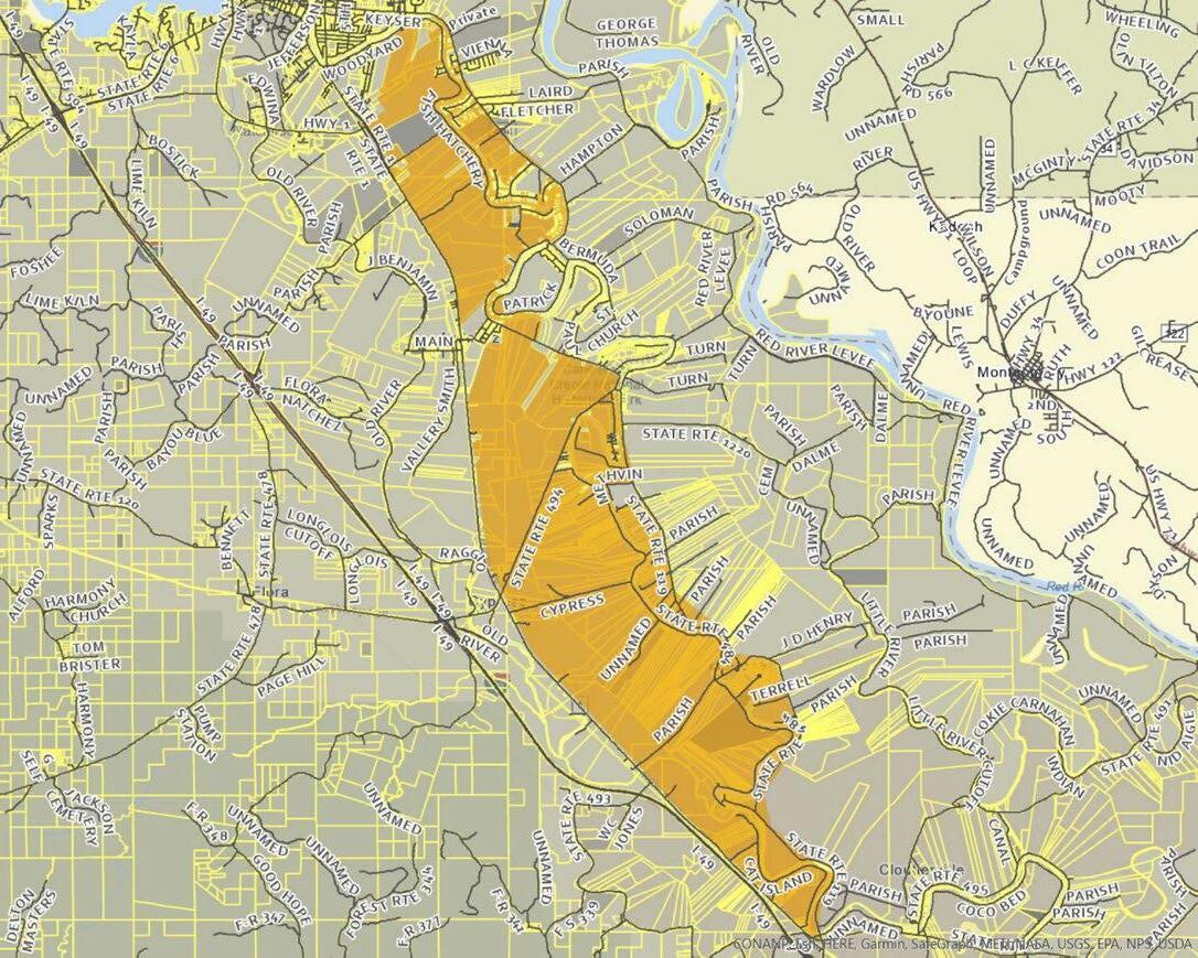

Establish economic development districts: In spring 2023, the Natchitoches Parish Council adopted ordinances to create four economic development districts. The districts will finance economic development projects within each locality through sales and use tax increments and will be managed, in a cooperative endeavor agreement, by the non-profit Natchitoches Community Alliance Foundation.
The Natchitoches Community Alliance Foundation will develop, maintain, update, and implement an Economic Development Plan to serve as a guidepost. The foundation will also review and recommend economic development projects that will be financed by accrued district funds as well as provide incentives to draw private investment to these projects, anticipating that new jobs and increased revenues will ensue. In June 2023, Natchitoches Parish was named a “Development Ready Community” by Louisiana Economic Development owing to its strategic economic planning. The parish is only
the seventh in the state to receive this designation; the City of Natchitoches was named such in 2010.
Other development possibilities include:
Western Hills
Land areas east of I-49 and south of University Parkway offer possibility for needed residential use, planned residential communities and inventory to support destination housing and short-term vacation rentals. Areas of interest are currently accessible via Rue Gabriel within the city limits and Lime Kiln Road and Bostic Road within the parish. Land use possibilities for this district are further delineated in the I-49 Precinct included in the next section.
North Bypass and Northern Hills
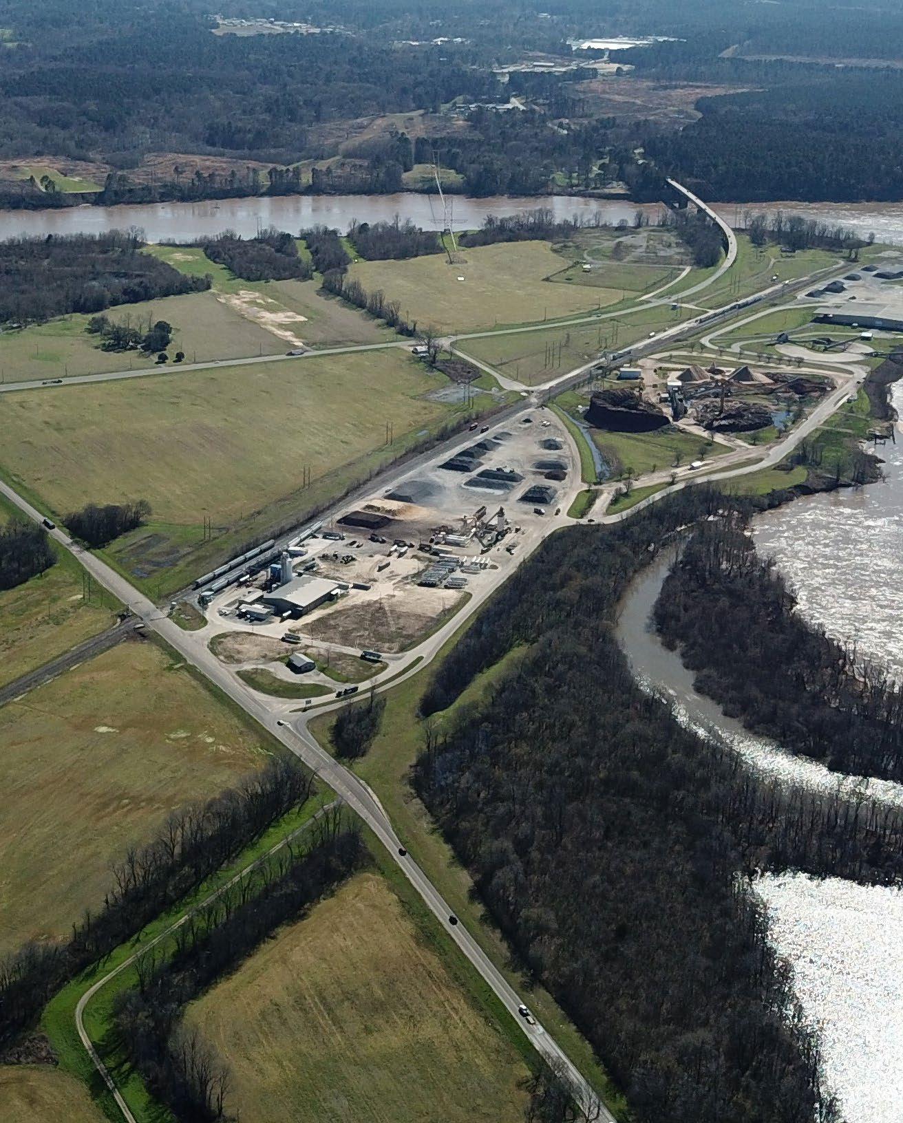
Steering committee destination analysis identified emerging development possibilities for the LA Highway 6 bypass connecting Highway 1 and Highway 6 north of the city, originally planned as a component of the City’s 1957 Comprehensive Plan. This corridor currently forms the northern boundary between City and Parish. Vehicular improvements along this corridor and portions of LA Highway 1 north will provide the Port of Natchitoches much needed reliable access to Interstate 49 without the need to traverse highway infrastructure within the city.
Reliable I-49 access north of the city will open land areas for regional distribution and service interests and will expand multi-modal possibilities for the Port.
In addition to commercial land use possibilities along the LA Highway 6 bypass corridor, higher elevation land areas north of the bypass are prime for residential development. Access to land areas north of the bypass are currently limited to White Oak Lane from LA Highway 1 north and Brickyard road and Parish Road 429 from LA Highway 6 north. Land use possibilities for this district are further delineated in the North Access Corridor Precinct included in the next section.
Future Opportunities: Completion of east loop as proposed in the 2008 City transportation plan connecting Highway 6 north to Highway 1 south through east Natchitoches.
The city currently lacks public transportation infrastructure link ing the expanded city core. The Cane River lake functions as a primary barrier between east and west Natchitoches. With concentration of health care and retail services on South Drive and Keyser Ave in the east, traffic presents a significant obstacle to access for regional visitors and severely limits pedestrian and bicycle modalities of transportation for those without automobile access.
NSU and Natchitoches Regional Medical Center continue to independently explore shuttle possibilities to facilitate timely patient access for medical appointments, reliable employee access to work venues, and student access to primary retail services, restaurants, and entertainment.
The rural transportation initiative offers city accessibility via shuttle for parish residents but is unable to facilitate multi-service stops within the core. Recent Raise Grant funding for implementation of the City’s pedestrian and bicycle master plan will support additional walkability but will not directly address public transportation needs.
The Core Framework plan illustrated integrates four primary solutions into one simple, wholistic transportation system to safely and reliably facilitate transportation throughout the core district. Components include:
Mobility Hubs provide safe, accessible transportation centers for intra-city users, rural transportation riders, event shuttles, and regional shuttle services connected to airports and bus transportation providers. For success, each mobility hub will need:
• clear way-finding signage
• covered, well lighted waiting area for safe weather protection
• emergency call station connected to monitored emergency dispatch
• bike share inventory on site
• limited parking capacity on site
• covered pick-up and drop-off area
• technology enabled access to local and regional route schedules, status updates and ticketing
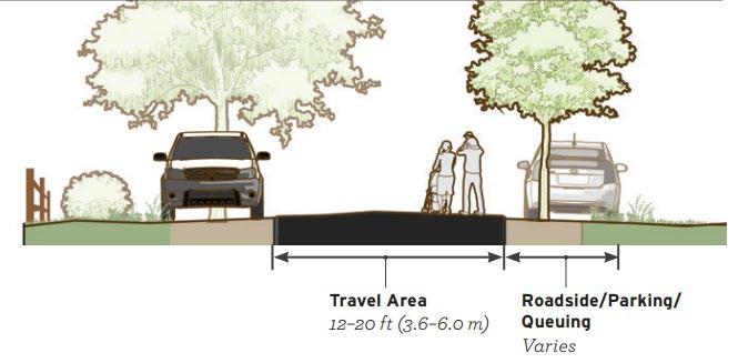
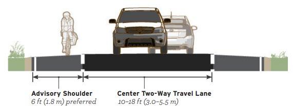
Read this: “Small Town and Rural Multimodal Networks” is the Federal Highway Adminsitration’s free design resource and idea book to support safe and active travel.
fhwa.dot.gov/environment/ bicycle_pedestrian/publications/small_towns
Future improvements could include charging stations at each hub location, car rental at designated hubs, digital advertising and promotion, and community services supporting riding population. Locations designated on the map and below are readily adaptable to Mobility Hub functionality immediately with little/no additional infrastructure investment required:
• Natchitoches Event Center
• MLK Recreation Center
• NSU Student Union
• Medical/Retail Hub
The loop route designated will:
• connect respective mobility hubs via existing multi-modal streets
• direct core traffic to less stressed vehicular routes
• safely accommodate pedestrians via existing and developed sidewalk and street lighting infrastructure
• allow for safe crossings at major streets via existing lighted intersections.
• allow predictable and reliable transport of individuals from hub to hub
• facilitate route transportation using a range of traditional and unconventional vehicle possibilities
• support hub connection to pedestrian friendly street infrastructure as envisioned by the Pedestrian and Bicycle Master Plan improvements
• reduce trips characteristic of point-point transportation solutions
• enable public/private shared investment with confident results
This route can be expanded to accommodate future hub locations as future need and resources dictate.
Transit vehicle possibilities range from traditional multi-passenger vans to limited capacity crossover vehicles to open air multi-passenger golf carts. Use of electric vehicles will reduce the burden of fuel cost expenses. Most peer communities employing micro-transit solutions utilize a subsidized business model with riders paying a modest per trip fee with public/private stakeholders’ investment and grant opportunities to cover capital costs and operating shortfalls.
In addition to the designated mobility loop route, the framework plan identifies priority streets for improvement in support
of multimodal transportation. These strategic targets represent high value routes to extend multi-modal fabric to and from designated mobility hubs into adjacent neighborhoods, establish connections to schools, campus and parks and provide access to desirable commercial service zones. These improvements align with the city’s bicycle and pedestrian improvement plan and recent funding allocation through the Raise Grant. Examples here from the Federal Highway Administration (see left and below) illustrate low-cost improvements to allow existing street fabric to meet multi-modal needs within existing rightsof-way.
The designated east “sharrow” (road shared by cyclists and motor vehicles) utilizes existing city street, parish highway and state highway infrastructure as an initial designated recreational loop for cyclists with access to the Cane River Lake north, south and east of the current commercial core. This route offers a wide variety of scenery as it connects neighborhoods, rural areas, and perimeter lakefront development to the mobility loop and the community core. Future, extended recreational routes for cyclists are anticipated to build from this initial loop as a base expanding connections via existing parish road infrastructure to the Red River levee and natural assets further east.
The designated greenway links existing pedestrian, civic and natural system assets on the west side of Natchitoches into a continuous loop route. Many parts of this proposed loop already exist: Natchitoches riverfront; city street fabric connected to the Union Pacific Rail museum; Lee Street Park; Sibley Lake Dam; Grady Erwin Nature Area; NSU Golf course; NSU Boathouse; existing NSU paved walking path along Chaplin Lake; pedestrian infrastructure within Ft. Jean Baptiste State Park; and pedestrian improvements along Jefferson Avenue. Connecting the existing assets will establish a unique, marketable recreational loop featuring many of the historical and natural system resources exclusive to Natchitoches. A direct western link to Parc Natchitoches would further extend the loop and open additional possibilities to host adventure competitive events along all or portions of the loop greenway.

A generational opportunity to reverse negative development trends, reclaim the center of our city, and provide desirable housing inventory at multiple price points.


This precinct plan expands on the renovation of the historic Texas and Pacific Railway Depot by returning city and parish owned property in the center of the city to economic activity. The plan provides for 90 – 100 lots for market-rate residential development using established city development patterns. Proposed improvements build upon existing street and utility infrastructure and expand green space and civic amenities to reconnect the community.
Highlights
• Provides civic greenway along Union Pacific railway from Amulet Street to Texas Street
• Safe, designated pedestrian and bicycle crossings over U.P. Rail
• 40+ residential lots on city/parish owned land between MLK and U.P. rail
• 50+ residential lots on city/parish owned land east of U.P. rail
• Employs established residential land use patterns
• Adds tourist bus drop off and civic infrastructure to extend experience of the Railway Depot museum
• Activates Church Street axis from Railway Depot to Cane River Lake
• Additional green city fabric linking Lee Street Park to Catholic Cemetery
• Provides public parking supporting Railway Depot and downtown destinations
• Re-activates abandoned school property along MLK for potential mixed-use development
• Prepare & Adopt City Future Land Use Map recapturing center city for residential use
• Form Based Zoning inclusions to expand development possibilities for new and existing residential properties with limited street frontage
• Concurrent planning with National Park Service to expand influence of Railway Depot museum; concurrent planning to create NPS regional archive in state-of-the-art facility
• Establish working partnership with officials controlling U.P. rail right-of-way through city limits
• Establish foundation as vehicle for public/private development
• Concurrent planning with city and private groups for warehouse space in city-owned property elsewhere
 CHURCH STREET Cane River
Planned improvements to reduce congestion, accommodate growth, open landlocked acres for development, and improve the patron experience.

Christ the King Lutheran
River South Commons


This precinct serves as the service and commercial engine for Natchitoches. Improvements proposed offer resolution for challenges currently being encountered, identity consistent with the character of Natchitoches, improved access and safety and predictability for additional growth aligned with community vision. The plan envisions transformation of Keyser Avenue and South Drive from intimidating, automobile dependent corridors to desirable service destinations with community experiences consistent with other Natchitoches landmarks.
• Establishes district gateways and identity
• Establishes clear district delineation for medical and retail services
• Anticipates planned expansion of regional medical center, medical specialty & support facilities
• Landscape & hardscape improvements to visually soften Keyser Avenue and South Drive
• Landscape improvements to large surface parking in the district
• Walkable pedestrian connections from Mobility Hub to destination services within the district
• Incorporates DOTD proposed roundabouts and planned landscaped median at Keyser Avenue
• Incorporates planned parish drainage improvements to reduce localized flooding concerns; converts open drainage into civic park amenity
• Connects Scarborough Ave with Claudia Street to complete street fabric north of Keyser Avenue
• Re-aligns Street infrastructure north and south of Keyser Avenue for convenient, safe access
• Enhanced access opens additional property for development
• Establish district merchants association to promote, advocate & collaborate for district
• Enable district leaders to meet regularly, share plans, & plan across organizations
• Implement planned DOTD and parish drainage improvements
• Establish landscape, lighting, signage standards for district implementation
• Adopt updated zoning and landscape standards for district development

Planned opportunities to make a positive first impression, better integrate town and gown, and support pedestrian oriented activities at the campus edge.


Existing Buildings
New Parking
Green Space/Greenways
University-Owned
Micro-Transit Routes
Multimodal Street Key
U.P. Railroad Track
Pedestrian/Cyclist Crosswalk
Mobility Hub
Footbridge
As required by current city zoning regulations, development along the north side of University Parkway is presently dominated by automobile parking lots. This harsh development is in stark contrast to the landscaped NSU campus environment and historic buildings immediately south. This precinct plan will shift parking demands to convenient, publicly-controlled lots, thereby promoting mixed use development and destination quality pedestrian oriented uses along the campus edge.
Highlights
• University Parkway as first and lasting impression of Natchitoches
• Walkable, active, pedestrian corridor as natural extension of campus environment
• Mixed use development with active destinations on grade level
• Active outdoor spaces as natural extension of business located along the corridor
• Landscape & hardscape improvements along the parkway to support desired uses
• Convenient public parking in walkable proximity supporting corridor enterprise
• Shared use of NSU library parking as district asset
• Segregation of vehicular and pedestrian crossings at University parkway
• Connection to existing NSU and LSMSA pedestrian walkways
• Planned integration of NSU innovation center as feature corridor destination
• Underground utilities as resources allow
Necessary Steps
• Adopt City Future Land Use Map designating boundaries of campus edge as feature district
• Update district zoning to eliminate parking requirements and require landscape edge development
• Adopt city alcohol policy consistent with desired district uses
• Acquire land for public parking development
• Establish economic development district to provide revenue resources for required public infrastructure
Planned opportunity to expand access, open land for economic development, and designate large tracts for future planned residential uses.

Natchitoches holds a highly desirable geographic position midway between Shreveport and Alexandria and serves as a gateway to cultural and natural assets unique in the southern US. Proposed improvements in this precinct explores the potential for high value development in city and parish areas adjacent to the LA 6 and I-49 interchange and the University Parkway corridor connection to the city. Strategic extension of street and road infrastructure will open new land development possibilities. Generated in collaboration with current landowners, land uses proposed reflect highest and best use recommendations, response to high priority community needs for residential properties and potential economic development opportunities for large single-owner land tracts immediately adjacent to this key interstate corridor intersection.
• Frontage road extension north of University Parkway to 8-mile loop road
• Rue de Gabriel extension to Hayes Ave. along existing utility ROW south of University Parkway
• Opening new land for development along I-49 frontage & both sides of University Parkway, serving as gateway corridor
• Improvements of existing parish road infrastructure anticipating future development activity
• Land use recommendations for land areas newly accessible
Natchitoches
Existing Rural
Regional Recreational
Regional Commercial
Low-Density Residential
Single Owner
High-Density Residential (TND)
Interstate Frontage Commercial
Greenspace/Recreation
Ecotourism
Commercial
I-49 Commercial Frontage Traditional Neighborhood Development (TND)
Owner
Connection Existing Roads DOTD Roundabout
• Development potential of high value, low density residential properties
• Development potential for planned residential communities: traditional neighborhood development (TND); senior living & retirement development; build to rent destination development, etc.
• DOTD recommended roundabout improvements at intersection of highways 504 and 3278
• Land Use recommendations for recreational and eco-tourism adjacent to Parc Natchitoches
• Economic development opportunity for single-owner large land area tracts west of I-49 (e.g. outlet mall, distribution, manufacturing, high-tech industry)
• “Win-win” City and Parish development partnership structure
• Extension or layered expansion of existing TIF boundaries
• Outsourced market analysis to establish economic foundation for proposed development
• Land & additional ROW acquisition for road improvements
• LED engagement to explore potential for large land tracts


Planned optimization of perimeter loop infrastructure currently in place; continuation of previous planned corridor east and west of Natchitoches.

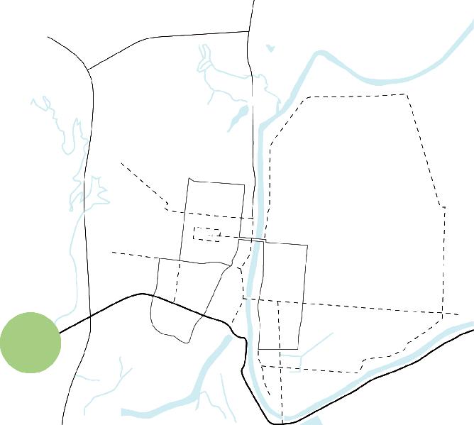
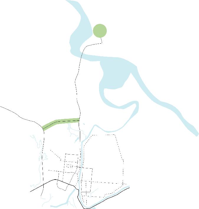
Development in Natchitoches has long been filtered through a southern access lens. LA highways 6, 1 and Interstate 49 deliver significant traffic counts for visitors from a multi-parish region north and east. Connection to primary medical and retail service corridors in east Natchitoches remains difficult; incremental service enterprise development along the LA 3175 north bypass offers restricted choice. Plans for this precinct offer unique regional development potential, improving access for the Natchitoches Parish Port and land areas north of the city. Corridor planning includes future consideration for a more robust connection to East Natchitoches as proposed in the 1957 Master Plan and the 2008 Transportation Plan.
Highlights
• Enhanced access to Natchitoches Parish Port in support of multi-modal (land, rail, water) development opportunities
• Enhanced access and promotion of Grand Ecore and adjacent land as community destination
• Key land/rail development opportunity along U.P. rail corridor with quick access to I-49 via LA 1
• Extension of LA 3175 (LA 6 Bypass) to Highway 3191 via Sorgee Road ROW
• Regional services (including primary care, market, pharmacy, etc.) land use recommendation for triangle circumscribed by LA 1, 3175, and 3191
• Landscape improvements LA 6 north of for improved first impression after crossing Red River
• Improvements of existing parish road infrastructure anticipating future development activity
• Development potential of high value, low density residential properties north along LA 1
• Preservation of north corridor connection to east Natchitoches as proposed in 2008 Transportation Plan; Target Cane River Lake Dam as preferred future connection route
• Regional distribution land use potential at I-49 Posey Road and LA 485 interchanges
Necessary Steps
• “Win-win” City and Parish development partnership structure
• Connectivity investigation with La DOTD leadership
• Outsourced market analysis to establish economic foundation for proposed development
• Proposed landscape requirements for properties with frontage on LA 6 and 3175
• Land owner discussions & LED engagement to explore potential for north interchange tracts

Source: CSRS Market Analysis
The City of Natchitoches engaged CSRS to perform a market analysis of the city. The study cited Northwestern State University as an asset but lack of housing and cultural amenities as a detractor for potential residents. The study recommends constructing a mixed-used development in the Mill District to create vibrancy near campus and reverse a decline in on-campus enrollment. The walkable area would incorporate housing options for students and young professionals as well as small business support services. The unique environment has potential to support public recreation options and to cater to students and families alike. Stakeholders desire a development that will “complement downtown and extend the campus.”

Source: CSRS Market Analysis

The Comprehensive Plan will provide the roadmap for progress, while the Economic Development Plan will support the community infrastructure, incentives, and financial resources essential for implementation. Carried out together, the plans take a picture and make it possible.
Comprehensive Planning in Natchitoches has benefited from earlier planning efforts. The foundation of community engagement, depth of research, thoughtful ideas and published recommendations have established the groundwork necessary for change.
Concurrent private sector investments continue to fuel economic development opportunity in the city and parish. Since initiation of the Comprehensive planning process in December 2021 and the Economic Development planning process in spring 2022, the city has experienced:
• $45 million+ in permitted private sector funded construction & development projects
• $50 million+ in announced expansion projects from major city/ parish employees
• $50 million+ in appropriated State capital outlay funding for improvements at Northwestern State University
• $25 million+ in grant funding awards in support of key initiatives incorporated into the Comprehensive Plan
Examples of grant funded initiatives are included on the facing page.
In the community, the comprehensive planning process has activated consistent peer-to-peer engagement focused on possibilities available through collaborative engagement. The draft planning documents have already served to communicate potential to grant agencies and investors. These plans illustrate how specific projects will yield synergistic results through the broader community plan. The City of Natchitoches is well positioned to implement the vision represented in this document. Consistency of message and purpose will be the community capital necessary to sustain progress already underway.
In late summer 2022, the City of Natchitoches was awarded a $17 million RAISE Grant by the U.S. Department of Transportation, which will catalyze economic development along the historic Texas Street business corridor. Grant funds will also allow for implementation of the initial phases of the city’s 2020 bicycle and pedestrian master plan.
In July 2022, the National Park Service (NPS) awarded Cane River National Heritage Area and Natchitoches a Community Assistance Grant. Through this grant, CNRHA will receive support from NPS’ Rivers, Trails & Conservation Assistance program and the National Center for Preservation Technology and Training (NCPTT) to create an outdoor recreation plan, including an inventory of the natural assets across the area’s 116,000 acres.
In February 2023, the Louisiana Water Sector Commission, funded by the American Rescue Plan Act, awarded a $5 million grant to the City of Natchitoches. The funds will support the rehabilitation and expansion of the existing water treatment plant to address current and future fresh water capacity demand in the city.

In fall 2022, the Rapides Area Planning Commission was awarded funds for a Rural Public Transportation Pilot Program, to support curb-to-curb transportation service throughout Grant and Natchitoches Parishes. The pilot program began on March 22, 2023, and will be operated by RAPC for two years, with a total of $1.5 million in funding.
In February 2023, U.S. Department of Transportation awarded $280,000 to the City of Natchitoches as part of the Safe Street for All Grant Program (SS4A). The funds will support the development of a comprehensive safety action plan aimed at the reduction of transportation-related fatalities and injuries.
In February 2023, the National Endowment for the Arts awarded the City of Natchitoches a $50,000 grant that will allow the exploration of land use possibilities for the Ben D. Johnson Educational Center.

DADCO Consulting was engaged by the Natchitoches Economic Development Alliance to prepare an economic development Strategic Plan The 110-page report includes data collection, stakeholder meetings, and fieldwork.
This report provides, in detail, suggested courses of action to ensure that Natchitoches City and Parish develop a coordinated and sustained program of improvement. The following report recommendations identify the priority actions that should be taken:

• The Natchitoches Economic Development Alliance must be completely restructured to include staffing, financial resources and the necessary authority to lead and effectuate the changes outlined in this analysis.
• All city and parish organizations must unite to ensure the highest and best use of community assets and to work on the significant plan of work outlined in this report.
• A combined city/parish effort should take immediate steps to address and enhance public health and safety.
• All city and parish educational facilities must come together to create a seamless path for students and adults to move from respective levels of education into the local/regional workforce fabric.
• City and parish coordination must be enhanced to provide governmental efficiency and the maximum utilization of limited resources.
• All marketing efforts should be coordinated to insure a uniform message to visitors, businesses and community residents.
• Workforce deficiencies, including turnover, must be immediately addressed to insure small business survival and larger business retention or expansion.
• The critical lack of housing must be addressed through a combined approach focusing on the rehabilitation of existing housing and the development of new single-family residences.


A realistic approach to build upon traction realized to date, maintain effective community collaboration, leverage the comprehensive plan document as a multidimensional tool, and execute on present opportunity.
The Enabling Community section of the Comprehensive Plan (see page 36) identifies 7 key priorities designed to address current community concerns and build the civic infrastructure necessary to move Natchitoches toward its aspirational future. These initiatives will require steady, consistent, behind-the-scenes investment to realize the improvements desired. Each initiative deserves a community champion invested in progress, committed to collaborative action and
Effective implementation of the Comprehensive Plan vision will require a phased approach at macro and micro scales.
From a macro, overall plan perspective, priorities and precinct responses will develop at different rates over time. For maximum community benefit, progress on each initiative must balance willingness to engage with the expected impact. Consistent effort at respective precincts will be needed to maintain traction, with additional focus warranted as specific need and interest arise.
As initial guidance, the steering committee has recommended primary focus on the precincts noted below. Continued engagement with the steering committee over time will allow city leadership to make decisions aligned with community priorities.
Framework Plan: Initial efforts to establish a simple, reliable transportation network and mobility hub locations to interface with the rural transportation initiative are critical to address priority community transportation needs. The framework plan focus will also assist priority implementation of Raise Grant improvements to upgrade existing streets for enhanced, connected accessibility.
I-49 District: Current entrepreneurial interests and active DOTD planning are spurring incremental property development exploration in this district. Grant funding possibilities may be readily available to extend critical transportation fabric as well.
Aligning respective interests behind a planned development approach is critical to prevent individual decisions from
persistence to see results. None of the initiatives identified can be achieved by individual effort and unilateral action. All will require leadership focus and support from the City to sustain progress over time.
limiting/restricting/preventing long term community benefit. This district also offers opportunity for new residential development, the lack of which currently limits community growth.
Campus Edge District: Planned university improvements provide a unique opportunity to take initial steps toward implementation of planned improvements in this district.
Center City District: Development in this district offers the biggest hurdles and the largest potential benefit for pressing community needs. Returning city center property to economic activity will address pressing needs for housing, will enhance renovations underway at the Union Pacific Railroad station and re-connect community fabric currently severed by the railroad.
At a micro, precinct scale perspective, enabling tasks are identified for each precinct plan included in the Comprehensive Plan. These tasks represent foundational effort needed to clear existing administrative hurdles to development and align public/private/non-profit interests toward a unified vision. Focus on enabling tasks will be critical for progress, and as a result, should receive immediate attention. In some cases, special assignments or strategic outsourcing may be required to facilitate enabling tasks where current time commitments limit capability to take on additional responsibilities. Entrepreneurial interests may be available to support enabling tasks if properly focused.
Properly leveraged, the Comprehensive Plan has multiple uses for the City of Natchitoches. The Plan should function as:
Marketing Tool: The Comprehensive Plan should support efforts to effectively market the City as a premier destination to live, work and play. The document includes strategic recommendations to align respective marketing efforts and share a consistent marketing message across all communication platforms.
Economic Development Tool: The Comprehensive Plan should be a differentiator for city and regional economic development efforts. Clear communication of how individual opportunities fit into a greater community vision will enhance consideration from organizations considering Natchitoches as a business destination and from agencies looking to invest in legacy locations/projects.
Resource Prioritization Tool: The Comprehensive Plan should facilitate public and private sector budget planning
for maximum benefit. Alignment of incremental investments as illustrated in the Comprehensive Plan will maximize return on investment, provide confidence in future impact of reoccurring allocations and one-time capital projects, and expand collaborative possibilities, such as public – private –non-profit, share future aspirations.
Leadership Tool: The Comprehensive Plan should provide public, private and non-profit sector leaders a clear understanding of community vision and values. Reinforcement of the guiding principles included in the Comprehensive Plan will form common ground for the entire community to grow and develop together over time.
Community Accountability Tool: The Comprehensive Plan should be a means of holding leaders and organizations accountable to respond and make substantive progress toward shared aspirations identified. Annual progress reporting on respective initiatives and planning recommendations will allow the entire community to remain engaged as the plan takes form over time.
City Transportation Framework Commercial Development
Single-Owner Land Tracts
Greenspace/Recreation
Parks
Interstate Frontage
Commercial
Low-Density Residential`
High-Density Residential`
Mill District
Tipton Associates, APAC
449 Westmoreland Dr.
Baton Rouge, LA 70806
225.387.0101
Ashe Broussard Weinzettle Architects, LLC
301 Jackson St., Ste. 205
Alexandria, LA 71301
318.473.0252
Ken Tipton, AIA
Doug Ashe, FAIA
Mike Nichols, AIA
Lucie Carter
Amanda Carambat
Phuong Le, Assoc. AIA
Shane Higdon, AIA
Michael DeSoto
SonJa Miller
Jesse Poole/Poole Media
Don Cummins
Emily Zering
Brian Jarreau
Natchitoches Chamber of Commerce