
INDIANA INDIANA MICHIGAN ILLINOIS 94 94 80 65 Lake Michigan Hammond Gateway East Chicago Gary Metro Center Miller Portage/ Ogden Dunes 11th Street South Bend Dune Park Beverly Shores Ridge Road Main Street Gary Metro Center 2023 NORTHWEST INDIANA TDD TOD Strategic Implementation Plan
Acknowledgments
This project was completed with Federal Transit Administration TOD Pilot Planning Funds applied for and with a grant match from the Northwest Indiana Regional Development Authority and the Northern Indiana Commuter Transit District.
Throughout this process, the team worked closely with the City of Gary to identify and collaboratively advance planning for the community to be proactive about future TOD.
Project Leadership
Northwest Indiana Regional Development Authority


Sherri Ziller, President and CEO
Northern Indiana Commuter Transit District
Michael Noland, President
i Gary • Metro Center
ii Northwest Indiana TDD • TOD Strategic Implementation Plan Table of Contents 01 02 03 Introduction TOD Strategy Appendix Introduction 1 Transit-Oriented Development 3 Northwest Indiana TOD Strategy 5 Overview 12 Land Use Planning 23 Development Planning 27 Infrastructure 49 Zoning 69 Implementation 74
01
Introduction 01
Overview
The Northwest Indiana Regional Development Authority (Northwest Indiana RDA) and Northern Indiana Commuter Transit District (NICTD) collaborated in 2020 to pursue a Federal Transit Administration Pilot Grant to provide planning assistance to Northwest Indiana communities impacted by the modernization and double tracking of the NICTD South Shore Line and the construction of the NICTD West Lake Line. With support from the State of Indiana and Northwest Indiana cities and towns, the two organizations successfully obtained this grant and, through a competitive RFP process, selected MKSK as the lead planning consultant to prepare this Northwest Indiana Transit-Oriented Development Strategic Implementation Plan. MKSK brought a team of experts to supplement their planning expertise including: Shrewsberry Associates, focused on Civil, Utility, and Transportation Engineering; Metric Environmental, focused on Environmental Conditions and Brownfields; and Town Planning and Urban Design Collaborative (TPUDC), focused on Zoning.
Project Background
Prior to this planning process, the Northwest Indiana RDA was authorized by the Indiana State Legislature to create economic development boundaries, called Transit Development Districts (TDDs), which function similarly to a Tax-Increment Financing District, with the purpose of enabling Transit-Oriented Development (TOD) in Northwest Indiana. TOD in Northwest Indiana will leverage these rail capital investments to provide the opportunity for additional economic development as part of the TDDs established under HEA 1144-2017. As part of this legislation, the RDA is tasked with “incentivizing, guiding and promoting economic development around the stations along the South Shore commuter line and future West Lake Corridor line.” These boundaries are no more than 320 acres (1/2 square mile) in area; capture the incremental growth in local income and property tax revenue for
use in public investment related to the station area; and are calibrated specifically for each community based on analysis, areas of opportunity, and the goals and visions of the community. The first group of eight TDDs was established in September of 2022.
This planning process harnessed the momentum generated by the capital improvements to the NICTD commuter rail system and the creation of TDDs. The team, in close collaboration with the RDA and NICTD, then commenced a process focused on how each community impacted with the rail projects and TDDs can be proactive in attracting economic development in accordance with its own growth path. This planning process commenced in September 2021 and was finalized in March 2023.
The communities along the NICTD South Shore and West Lake Lines are diverse and unique. The history, people, natural environment, and built character of each community differentiates it from another; those qualities create an unmistakable identity. In each city and town, there is a deep pride and a sense of individual spirit. Because of this, it is of the highest importance that the growth of these communities be carefully considered against what makes them special today and what their aspirations may be for tomorrow.
The planning process is built upon a deep knowledge of work and a close collaborative relationship with local cities and towns and the RDA’s long-standing commitment to supporting capital investments and economic development in Northwest Indiana. This process also built upon work completed as part of the West Lake Transit-Oriented Development Plan for Hammond, Munster, and Dyer in 2017, completed by the Northwest Indiana Regional Plan Commission (NIRPC), and recent plans completed by local cities and towns.
2 Northwest Indiana TDD • TOD Strategic Implementation Plan
01 Introduction
Transit-Oriented Development
Transit-Oriented Development Primer
Transit-Oriented Development will look different in each Northwest Indiana community, tied to each community’s individual growth path.
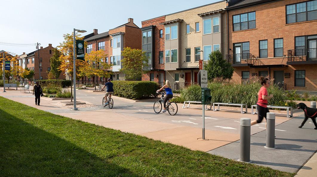
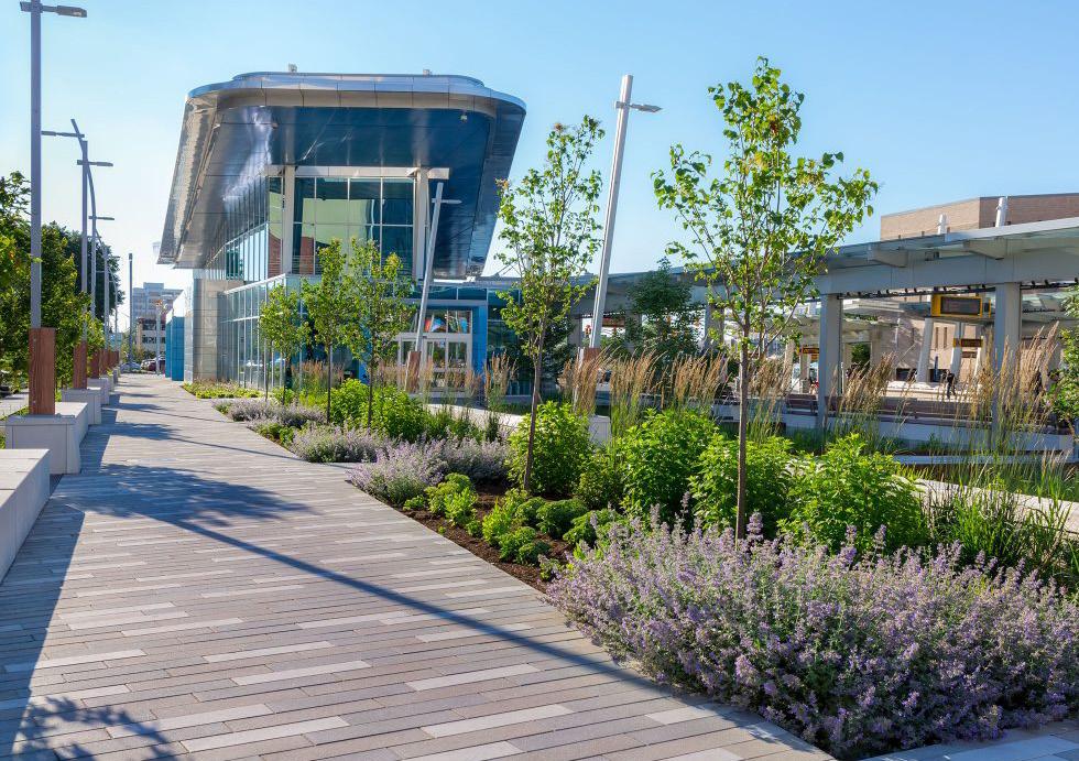
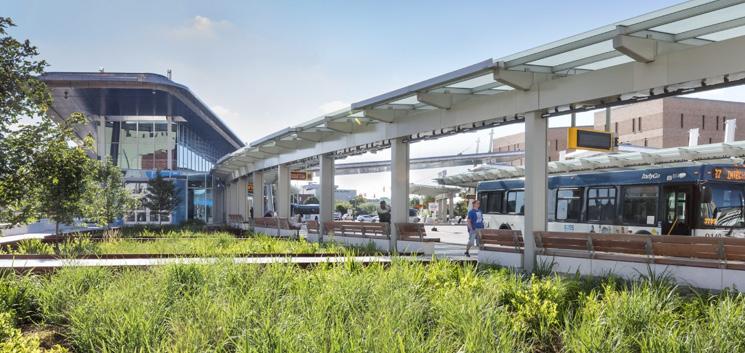
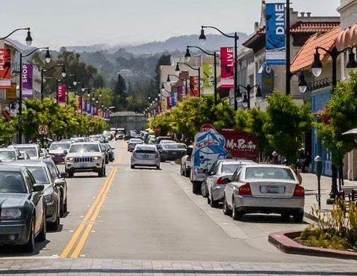
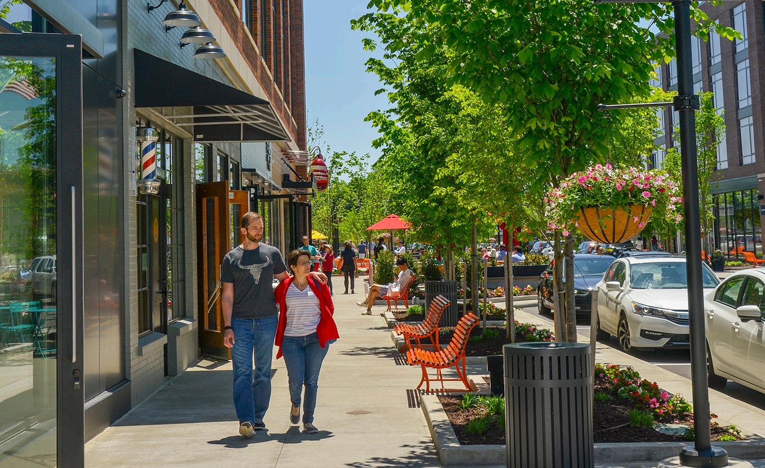
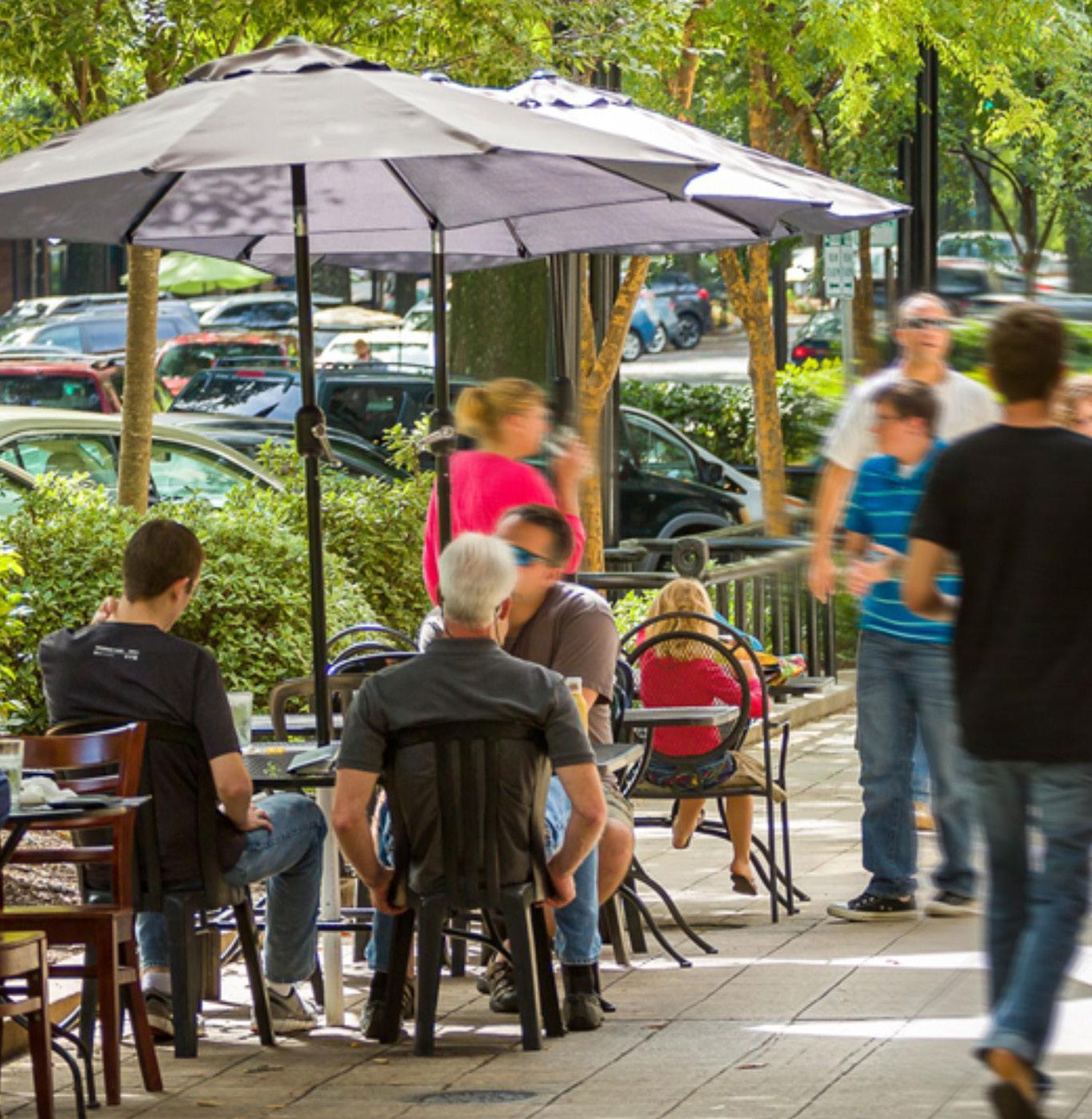
The Federal Transit Administration defines Transit-Oriented Development (TOD) as a dense, walkable, mixed-use area centered around or located near a transit station. This concentration of development fosters a vibrant, connected community because of increased access to jobs, amenities, businesses, and housing. TOD also emphasizes non-motorized infrastructure with less reliance on automobiles, resulting in improved safety, congestion mitigation, environmental resiliency, and better quality of life for all.
Benefits of TOD:
• Provides transportation choices and reduces dependence on driving
• Reduces vehicular travel times, congestion, and emissions
• Encourages more walkable cities and towns
• Reduces land consumption for development
• Reduces parking and increases the opportunity for higher/better uses of land
• Provides residents with choices to live, work, and play in the same area
• Expands equitable access to jobs and housing
• Links urban and suburban areas to people and jobs
• Increases housing choices by including a variety of housing types (such as homes on smaller lots, condominiums, townhomes, apartments, etc.)
• Fosters lively community nodes with co-located mix of uses (including all housing types, retail/ shops, restaurants, office, institutional, and commercial)
• Stimulates the revitalization of economically challenged areas
• Increases the potential for community growth and economic activity, stimulates the local economy
• Results in higher state and local tax revenues from increased development opportunity and activity
• Increases a community’s resiliency through a more dynamic mix of uses that makes it less subject to economic volatility
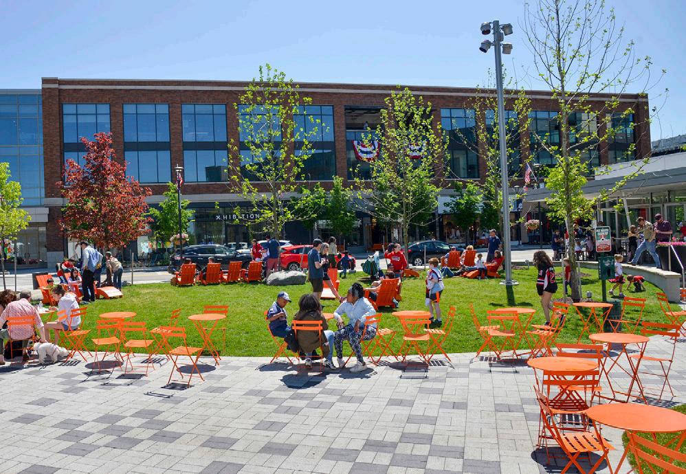
Equitable Transit-Oriented Development
Furthermore, TOD brings equity to the conversation. Equitable Transit-Oriented Development (ETOD) is an important and emerging lens through which economic, environmental, and social sustainability is at the forefront. ETOD focuses on representing the community in decision-making to realize communityfocused benefits. ETOD has the potential to uplift historically disadvantaged communities by providing tailored planning support. Planning grounded in equity should produce policies and programs that improve transit access to economic and social opportunities such as workforce housing, jobs, education, healthy food, recreation, and healthcare, particularly in underserved areas.
Information through this process will help communities plan proactively for development; attract the private market to invest based on assets and opportunities; and apply for funding through local, state, federal, and philanthropic sources. Cities and towns can easily advance planning recommendations produced as part of this process into adopted plans and ordinances that support community building and economic development pursuant to their growth path.
Why is TOD Important for Northwest Indiana?
The historical investment in the NICTD South Shore and West Lake Lines, paired with the ability for TDDs to catalyze development in Northwest Indiana, will be transformative in the communities along the lines. This is a once-in-a-generation opportunity to build upon the public investments (including the $646 million in the Double Track and $852 million in the West Lake capital improvements) to attract economic development to the region through TOD tethered to the country’s third-largest city, Chicago.
Introduction 3
TOD will boost the economy of Northwest Indiana and offer new, healthier lifestyle choices for residents of the region’s cities and towns. The modernization of the NICTD commuter rail line will allow for enhanced rail competition with vehicular commuters into the Chicago Loop, bringing the rail commute time equal to, if not faster than, vehicular drive times, and much cheaper than driving and parking in Chicago.
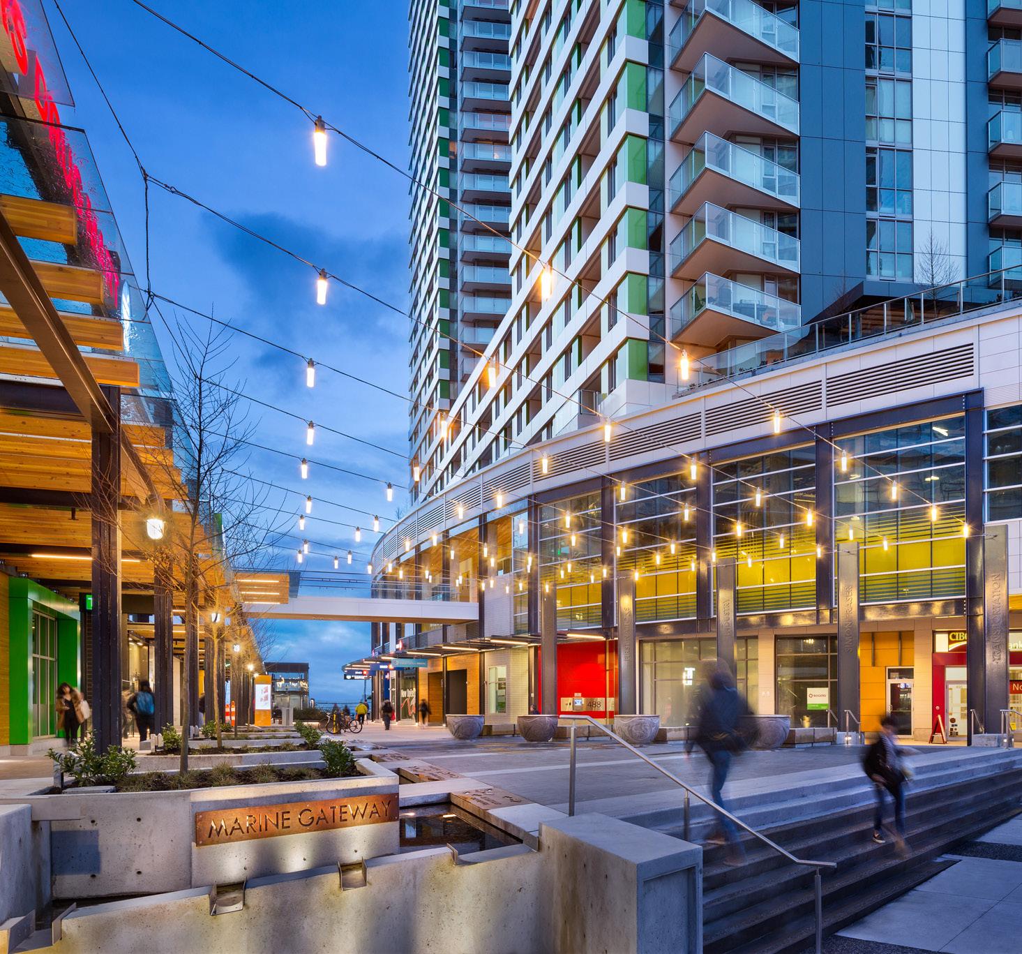
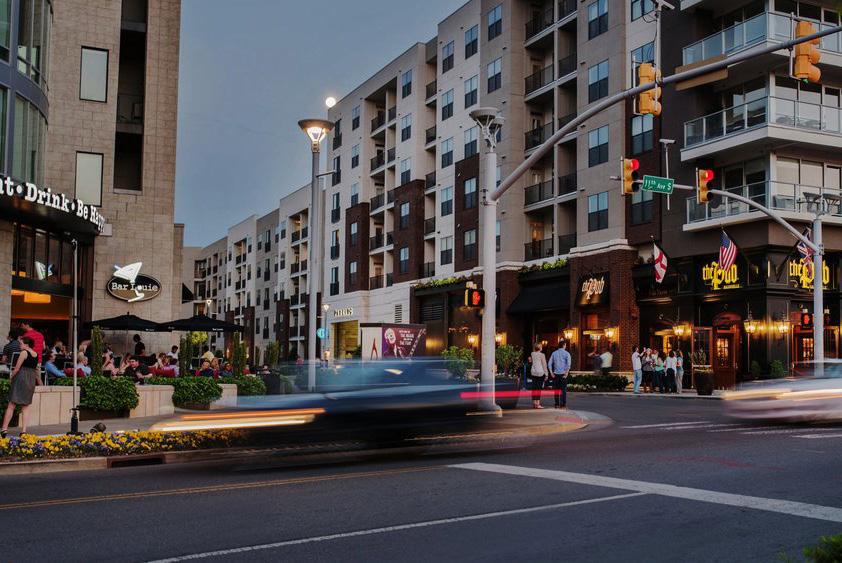
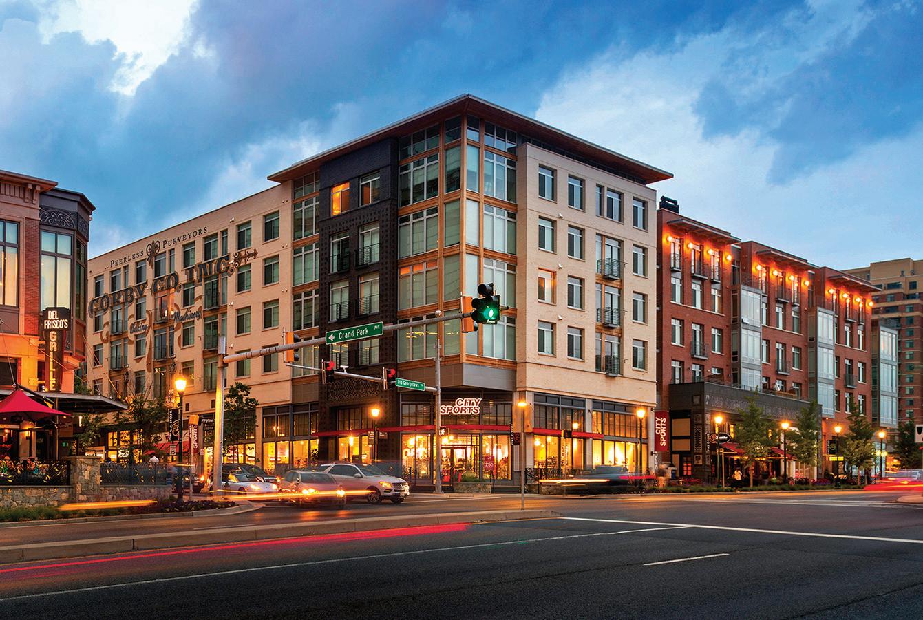
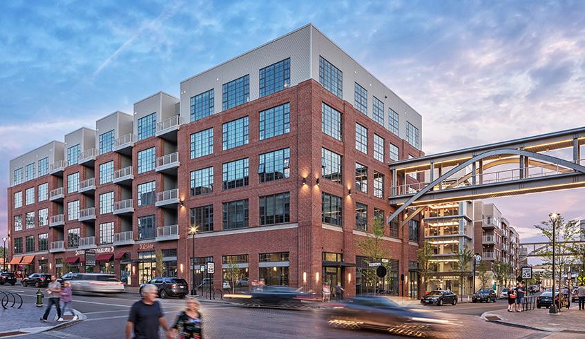
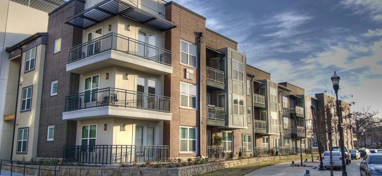
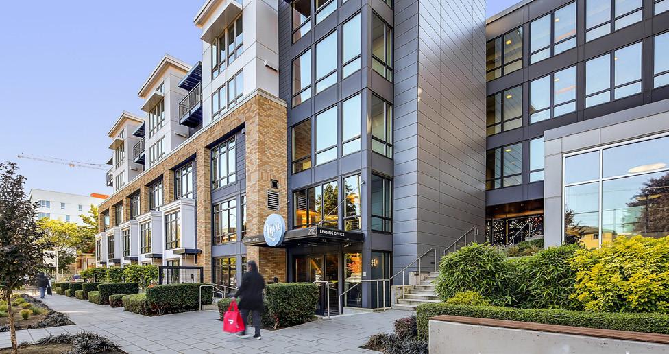
The RDA’s Comprehensive Strategic Plan estimates $2.7 billion in projected TOD investments in Northwest Indiana due to these rail projects. Many communities are receiving upgraded stations as part of the rail capital improvements. New stations are being constructed in Hammond, Miller (Gary), Michigan City, and Munster; existing stations are being upgraded in Portage/Ogden Dunes and Dune Park. Due to these improvements, TOD projects are already occurring in Michigan City and Hammond, with others to follow. This type of investment has also been happening in the Chicagoland suburbs for decades.
Orland Park Metra Station - SWS Line (2007)
+17% 1.2M +37%
Square Feet of New Construction
Elmhurst Metra Station - UP-W Line (2006)
+11% 640k +40%
Square Feet of New Construction
Highland Park Metra Station - UP-N Line (2009)
0% 640k +43%
Square Feet of New Construction
Romeoville Metra Station - HC Line (2018) 0% 316k +3%
Square Feet of New Construction
Example metrics illustrating the levels and types of investment and impacts occurring in TOD areas in Chicagoland suburbs.
$2.7 Billion in Projected TOD Investments Due to Rail Projects
4 Northwest Indiana TDD • TOD Strategic Implementation Plan 2022 Billions $0.0 $1.0 $2.0 $3.0 2023 2024 2025 2026 2027 2028 2029 2030 2031 2032 2033 2034 2035 2036 2037 2038 2039 2040 2041 South Bend East Chicago Michigan City Munster Dyer Gary Miller Hammond South Gary Metro Hammond Gateway Portage Ogden Dunes Munster Ridge Road
Population Growth Population Growth Population Growth Population Growth Change in Real Estate Value Change in Real Estate Value Change in Real Estate Value Change in Real Estate Value
Northwest Indiana TOD Strategy
Planning Process
This process commenced by bringing the same level of planning assistance to each community impacted by the NICTD South Shore and West Lake Lines, focusing on communities with a TDD boundary in place or with significant economic development opportunities tied to the station area. To accomplish this, a three-step process planning process was employed. This process began with work sessions with each city or town to understand the level of interest and goals for TOD in each community in alignment with their individual growth path.
Through the previous TDD boundary process, the consultant team understood that various factors, such as local political and staff changes, potential catalytic private development, and ongoing planning or infrastructure projects, would impact project work and schedules on a community-by-community basis. To account for these variables, we employed a schedule that begins with a first step of identifying planning needs for each station area.
Based on planning needs and community readiness, we proposed to group station areas to accommodate varying situations and stagger planning activities.
Generally, each community process took approximately 12 months. All of this work was completed between October 2021 and March 2023. During this time, Northwest Indiana RDA and the consultant team met directly with local staff, stakeholders, elected and appointed officials, and the public to solicit feedback and direction for each TOD-focused plan. As a result, individualized community plans have been developed for each study area with supporting appendix materials from technical sub-consultants.
Step 1
Present Previous Findings, Confirm Direction & Establish Priorities
Timeframe: 6-8 weeks
Step 2
Conduct In-Depth Analysis, Advance Development/ Infrastructure Planning & Evaluate Regulating Resources
Timeframe: varies
Step 3
Conduct Individualized Planning Activities & Provide Recommendations and Documentation
Timeframe: varies
CONCURRENT: Public Engagement, Client, Local Officials & Team Meetings
Planning Process Introduction 5
West Lake Line & South Shore Double Track Projects
West Lake Line Project
9 MILES South Shore Line Double Track Project
25 MILES
16 MILES
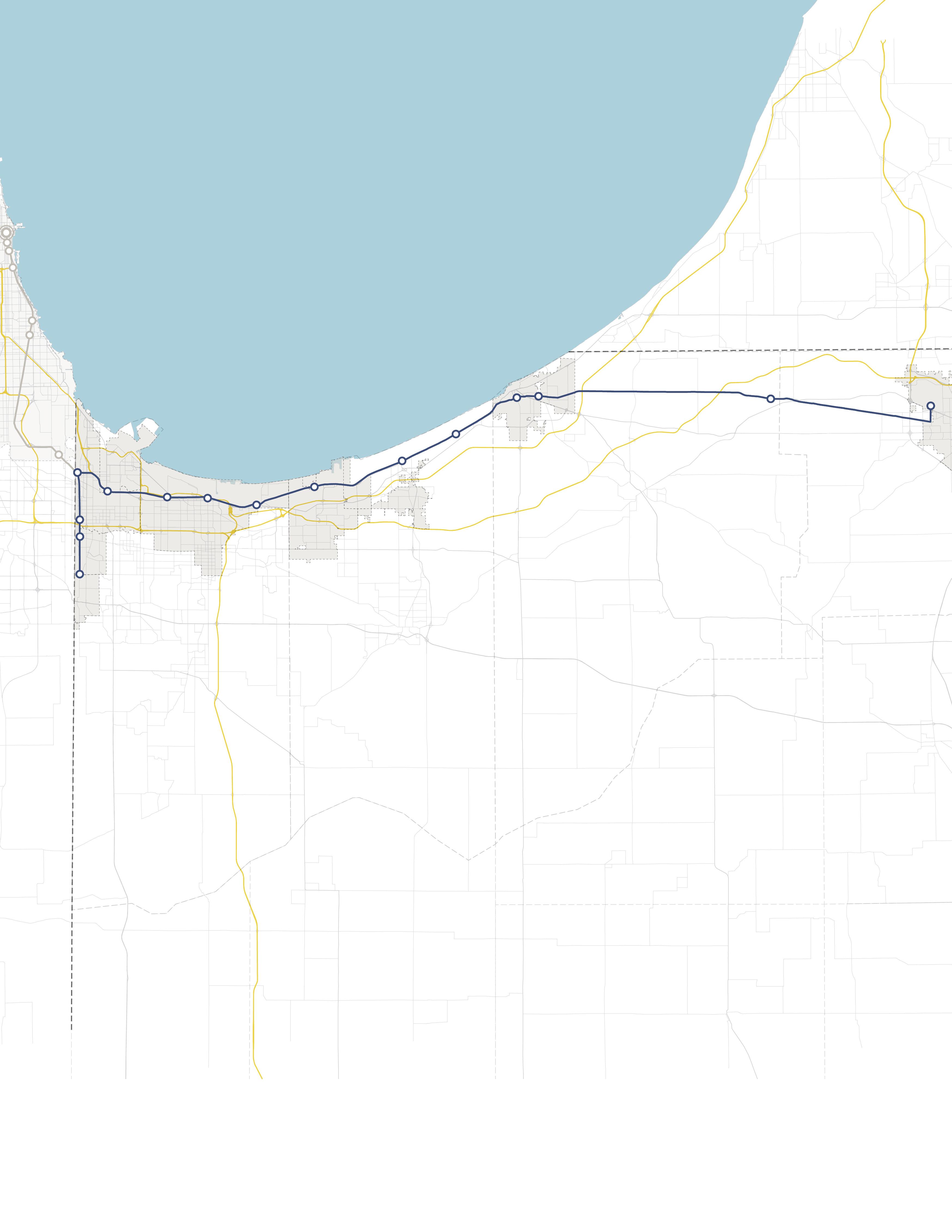
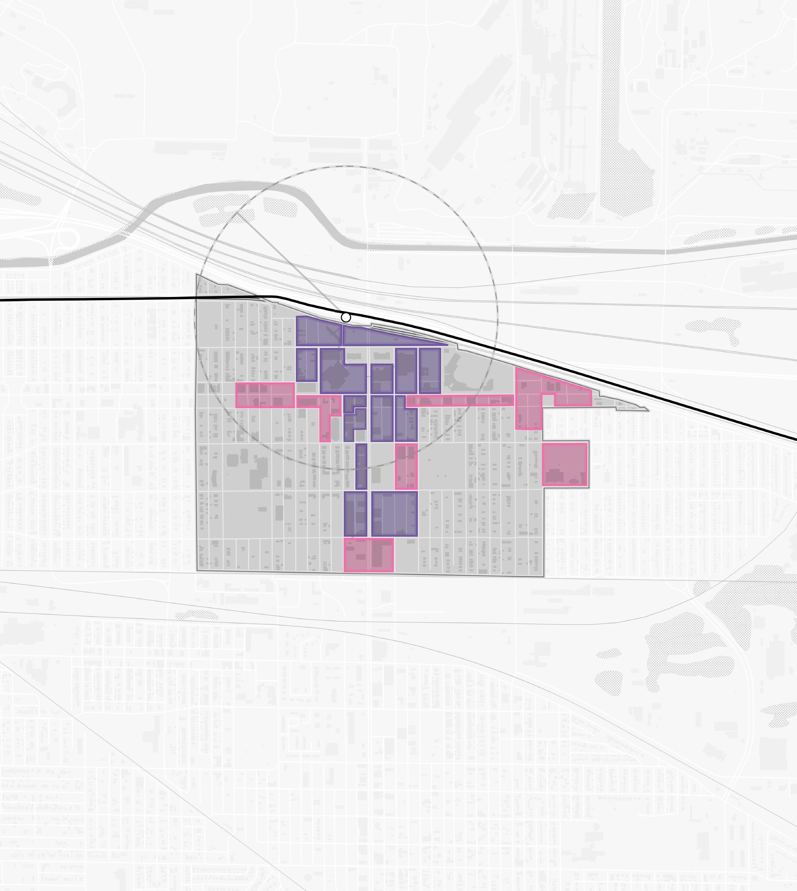
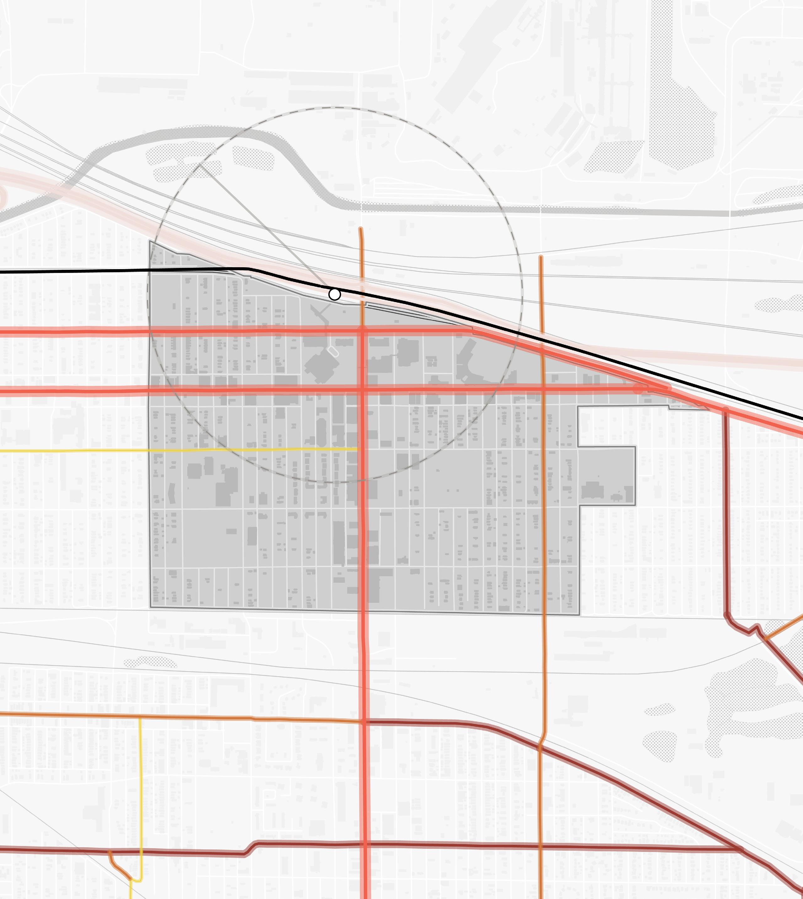
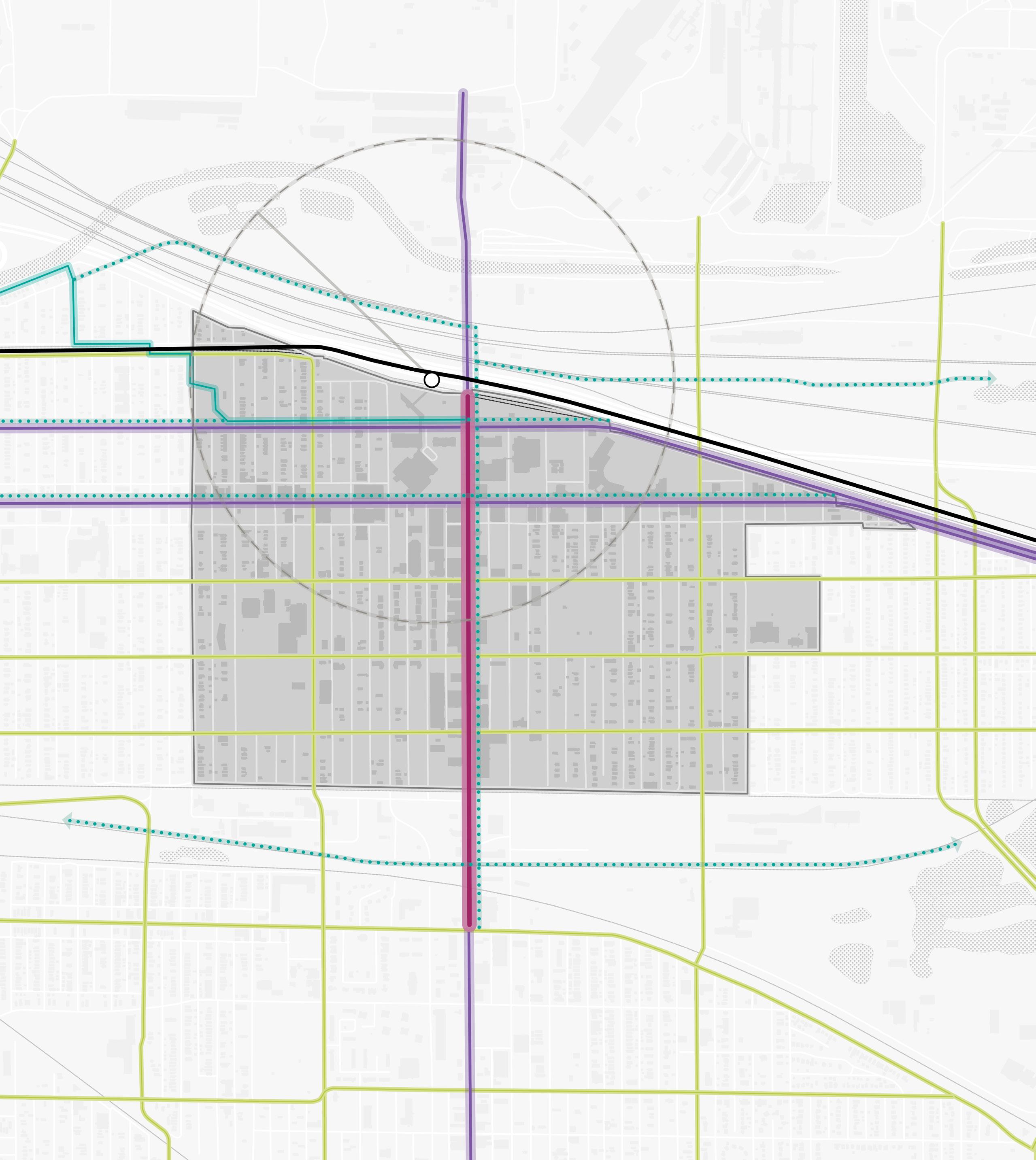
Communities Studied
The project focused primarily on communities with an established TDD boundary or with a TOD study area. However, high-level assessments were also conducted for communities with stations along the South Shore Line who are eligible for future TDD boundaries. Several stations along the lines were not studied at the request of local leadership in consultation with the Northwest Indiana RDA and NICTD.
South Shore Line
• East Chicago (TDD Boundary)
• Metro Center, Gary (TOD Study Area)
• Miller, Gary (TDD Boundary)
• Portage/Ogden Dunes (Two-Community TDD Boundary)
• Dune Park (High-Level Study)
• Beverly Shores (High-Level Study)
• Michigan City (TDD Boundary)
• South Bend (High-Level Study)
West Lake Line
• Hammond Gateway/Downtown, Hammond (TDD Boundary)
• Ridge Road, Munster (TDD Boundary)
• Main Street, Munster & Dyer (Two-Community TDD Boundary)
NORTH INDIANA INDIANA MICHIGAN ILLINOIS 94 94 80 65 Lake Michigan Lake County Porter County LaPorte County St. Joseph County GARY PORTAGE BURNS HARBOR PORTER CHESTERTON MICHIGAN CITY EAST CHICAGO HAMMOND MUNSTER DYER SOUTH BEND Hammond Gateway East Chicago Gary Metro Center Miller Portage/ Ogden Dunes 11th Street South Bend Dune Park Beverly Shores Ridge Road Main Street 6 Northwest Indiana TDD • TOD Strategic Implementation Plan
Rail Extension
Project Area New Second Track
Scope of Work
To further develop an individualized approach for each community, work plans were created, incorporating specific information desired by the FTA to be included in the planning process and other planning processes at the request of the communities, if any. The Scope of Work Breakdown on the following pages detail the work plan and planning activities in this process.
The following task list organized the work plans:
• Individualized engagement approach
• TOD readiness evaluation
• Previous planning gaps and opportunities
• TOD types and community priorities
• Potential areas of impact (TOD areas and other areas of anticipated significant change)
• Future land use projections (5-, 10- , 20-year time horizons)
• Development feasibility testing and potential community impacts
• Development character renderings
• Thoroughfare typology assignments
• Conceptual corridor designs
• Brownfield assessments
• Infrastructure assessments
• Zoning code/ordinance analysis and recommendations
• Order of magnitude infrastructure and corridor cost estimates
• Additional tasks as requested by individual communities, which may consist of corridor/ connectivity planning, neighborhood/subarea planning, additional engagement activities, additional site concept designs and/or renderings, development pitch kits, open space and trail planning, case study research, additional conceptual street design, capacity building, action planning, and one-year follow-up summaries
Scope Items
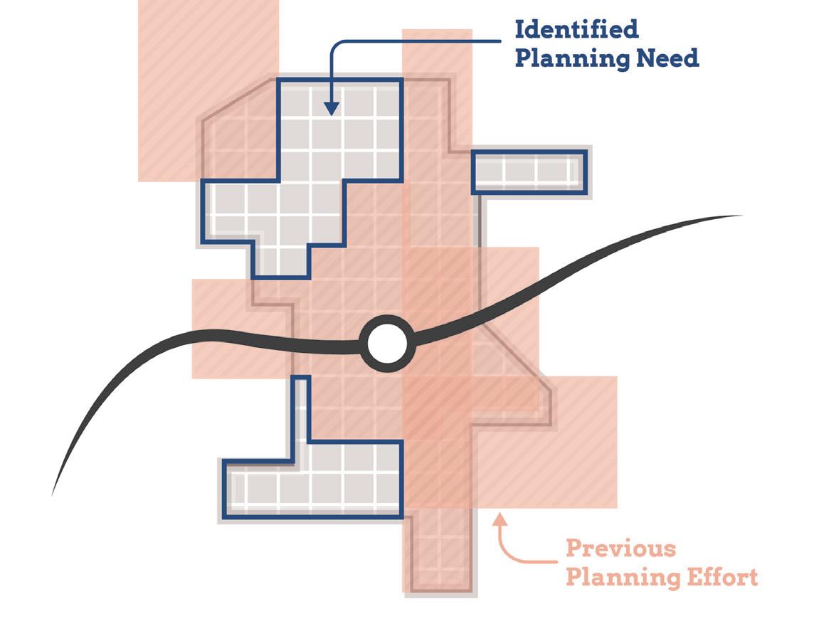
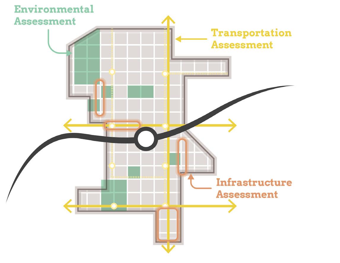
Planning Needs and Gaps Analysis
Land Use & Zoning Review and Recommendations
Environmental Assessment and Recommendations
Transportation Assessment and Recommendations
Infrastructure Assessment and Recommendations
Development Testing
Capital Improvements Plan
On-Going Efforts
Coordination with NICTD
Stakeholder and Public Engagement
Introduction 7
Planning Needs and Gaps Analysis
• Confirm framework plan direction by correlating objectives from previously completed plans with the community’s current future vision
• Identify gaps and opportunities not addressed in local planning based on previously completed plans
• Determine and prioritize planning needs for future development and recommendations
Land Use & Zoning Review and Recommendations
• Record and analyze current land use and zoning ordinances
• Identify potential changes in land use and zoning ordinances to achieve desired future development
• Coordinate zoning with planning concepts and planned land uses
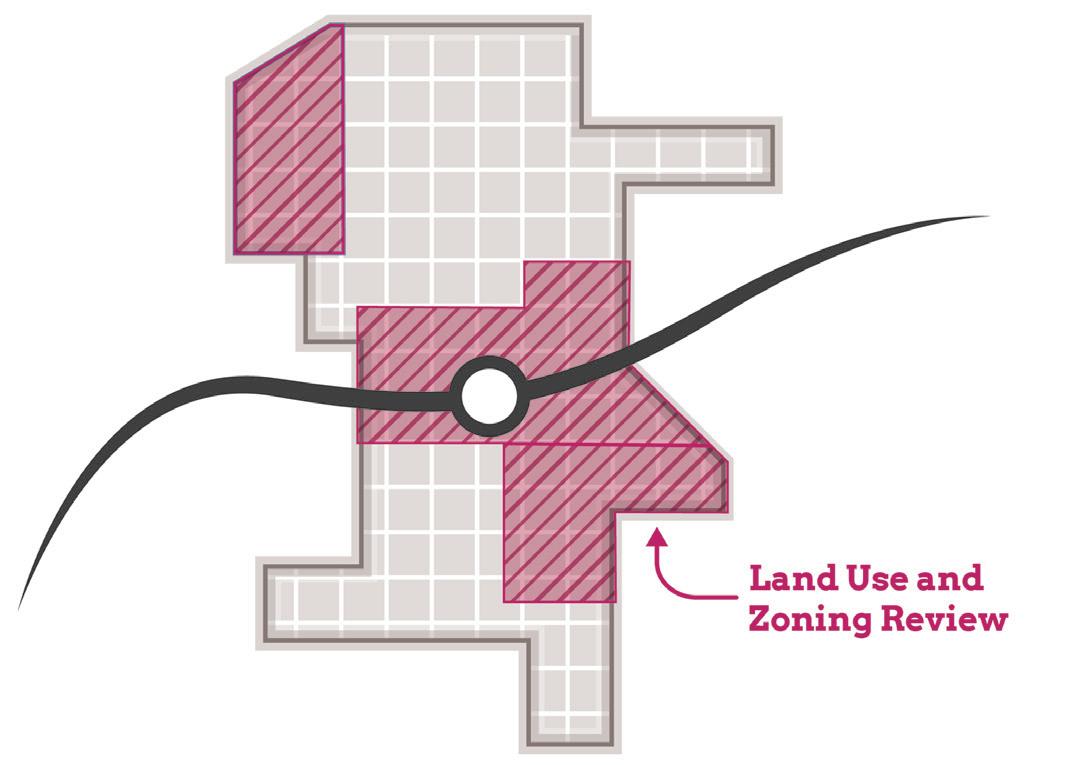
• Draft zoning code revisions and/or design guidelines to promote future TOD
• Draft regulating plan/zoning map
• RDA consultants will take zoning through process for adoption by local entities
Environmental Assessment and Recommendations
• Limited assessment of sites with potential or known environmental/brownfield concerns
Transportation Assessment and Recommendations
• Corridor and connectivity planning that improves access and walkability to the station area
Infrastructure Assessment and Recommendations
• Evaluating stormwater, utility, road, and pedestrian facilities at site and district scales
Scope of Work Breakdown
8 Northwest Indiana TDD • TOD Strategic Implementation Plan
Development Testing
• Identify up to eight priority development sites per station area (each “site” up to 10 acres)
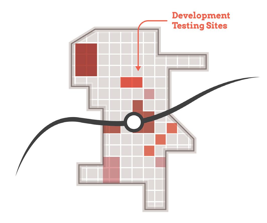
• Test development scenarios for priority sites
• Assess potential site uses based on land use projections and market understanding
• Develop conceptual site plans and three dimensional massing illustrations showing potential infill and redevelopment
Capital Improvements Plan
• Order of magnitude cost estimates for infrastructure improvements and projects to effectuate development (with close collaboration with local units)
Scope of Work Breakdown
Introduction 9
TOD Readiness
At the onset of the process, the team acknowledged that each community differed in its potential for TOD as a result of existing policies and infrastructure in place that are necessary to enable TOD, referred to as TOD readiness. To diagnose each community’s TOD readiness, a matrix was developed to evaluate factors of TOD readiness and was completed in collaboration with local officials. In addition, NICTD completed TOD assessments, which were consulted as these evaluations were completed.
TOD Readiness Criteria
• NICTD Station currently operational or under construction
• TDD Boundary is adopted or the community is eligible for a TDD Boundary
• Adopted policy documents that address or plan for TOD (i.e. comprehensive plan, neighborhood plan)
• Adopted zoning ordinances (or overlays) that address or plan for TOD
• Existing walkable grid as part of a downtown or mixed-use neighborhood that connects or can connect to the station
• Currently operational/planned trail or multi-modal infrastructure
• Existing urban amenities that are walkable and/ or within 1/2 mile of the station (i.e. restaurants, grocery, drug stores, office, parks/plazas)
• Existing dense and quality housing stock (more than eight dwelling units/acre), including rowhouses/townhomes, apartments, condos, and ADUs
• Vacant developable sites within TDD Boundary
• Local unit has demonstrated additional initiatives to support TOD
• Current infrastructure has the capacity to support additional development or TOD
Anticipated Results
At the conclusion of this process, control of local land use and zoning remains with the cities and towns. This process aims to provide proactive guidance and recommendations that the local units can use to advance their planning processes, resulting in updated comprehensive plans, area plans, and zoning ordinances complete with locally-controlled public input. In addition, components of this study are designed in a highly-graphic format to inform development discussions, potential RFP’s, and grant applications. The following sections reflect recommendations particular to each TOD study area with key considerations, immediate next steps (next year), short-term recommendations (next five years), and long-term recommendations (beyond five years).
Each community-specific section will function as a standalone plan that is meant to be pulled out of the overall regional plan and referenced by officials of local cities and towns, public members, and the development community. This information is supplemented by more technical information in the respective appendices.
10 Northwest Indiana TDD • TOD Strategic Implementation Plan
02 TOD Strategy 02
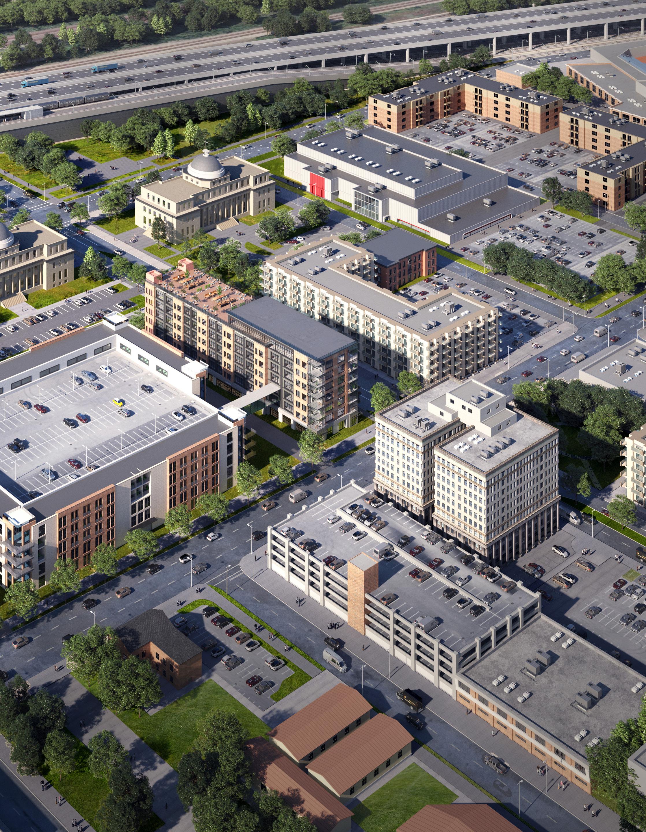
Gary Metro Center 02
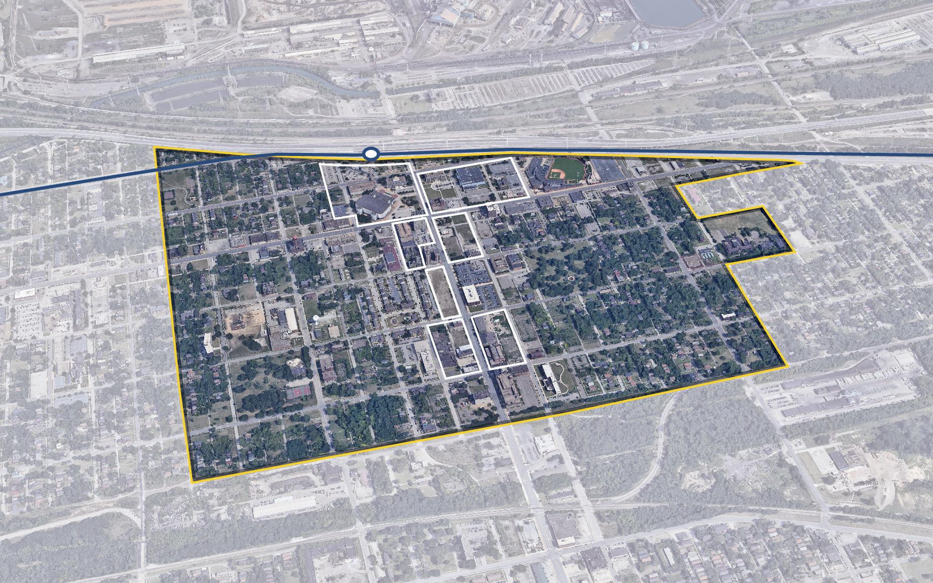
Downtown Gary is at a critical point where substantial infrastructure investment, property assembly and dispensation, and continued strategic demolition are required to reverse decades of disinvestment in Gary’s downtown. In 2023, legislation is being advanced to provide a funding source through the State of Indiana to pay for the demolition and construction of a new Gary Metro Station. This could also lead to other federal and philanthropic grants. If successful, the station investment can further support a complementary land stabilization and development strategy led by the City of Gary and Gary Housing Authority (GHA).
Gary’s downtown will benefit from improved commute times (40 minutes) into Downtown Chicago. The investment in replacing the 40-year-old Gary Metro Station – with a modern and inviting multi-modal station with integrated secured parking – is a catalyst that can begin to transform Downtown Gary. The transit-oriented development (TOD) strategy is a multi-pronged approach that prioritizes a new multi-modal station while leveraging areas identified as shovel-ready sites for development opportunities. These sites are identified due to vacancy, public ownership, existing utilities, and proximity to the station. This approach targets blocks immediately surrounding the station, including the Genesis
Convention Center, and blocks along Broadway as far south as 8th Avenue, to redevelop as an active mixed-use core.
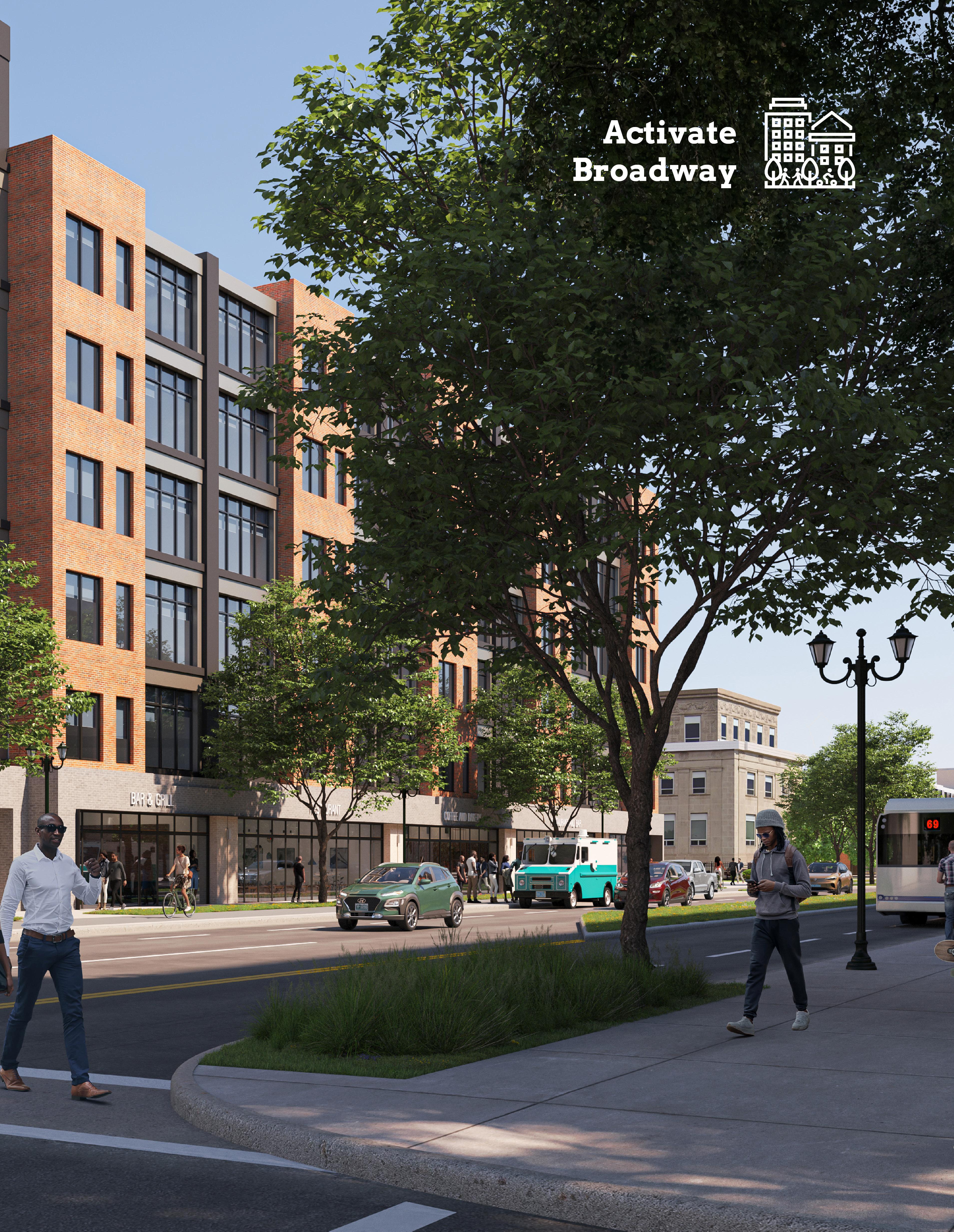
One component to creating an active downtown environment is ensuring safe and inviting multi-modal connections to the station area with a Complete Streets approach to Broadway and the potential redesign of 4th and 5th Avenues into two-way streets. Walkable pedestrian-scaled streets and paths that link to existing and planned local and regional trail systems could capitalize on Gary’s prime location in the region.
Phasing and prioritizing redevelopment and infrastructure improvements are crucial to ensuring Gary’s sustainable growth and revitalization, catalyzed by a new Gary Metro Station.
12 Northwest Indiana TDD • TOD Strategic Implementation Plan
TOD Readiness
The City of Gary understands and actively supports the potential to replace the Gary Metro Center as a catalyst to revitalize downtown through TOD. This support is parallel to the State of Indiana legislative support for catalytic TOD investments downtown in a new multi-modal train and bus station.
The City and the Gary Housing Authority have also been proactive in property acquisition and demolition of unsafe and underperforming properties in the downtown, with a focus on assembling land for TOD. There are also ongoing studies to determine the feasibility of converting 4th and 5th Avenues from one-way to two-way streets to improve pedestrian safety, access, and economic development opportunities downtown. The City plans to update its zoning code to support TOD over the next year.
This document serves as a roadmap for TOD implementation by providing recommendations for land use, development, zoning, and infrastructure investments.
Evaluation Criteria
NICTD Station currently operational or under construction
TDD Boundary is adopted or the community is eligible for a TDD Boundary
Adopted zoning ordinances (or overlays) that address or plan for TOD
Adopted policy documents that address or plan for TOD (i.e. comprehensive plan, neighborhood plan)
Existing walkable grid as part of a downtown or mixed-use neighborhood that connects or can connect to the station
Currently operational/planned trail or multi-modal infrastructure
Existing urban amenities that are walkable/within 1/2 mile of the station (i.e. restaurants, grocery, drug stores, office, parks/plazas)
Existing dense and quality housing stock (more than 8 dwelling units/acre), including rowhouses/ townhomes, apartments, condos, and ADUs
Vacant developable sites within TDD Boundary
Local unit has demonstrated additional initiatives to support TOD
Current infrastructure has the capacity to support TOD/additional development
Gary • Metro Center 13
Community Priorities
Community priorities were developed by working closely with City officials to confirm economic development goals, identify key sites of interest, and understand recent and ongoing municipal and development projects. These priorities form a future vision for the TDD boundary area specific to Downtown Gary, which include the following:
• Replace the Gary Metro Station incorporating ADA accessibility, a new station platform, kiss-andride, and Gary Public Transportation Corporation (GPTC) bus service
• Promote transit-oriented mixed-use development around the station area including the Genesis Convention Center block
• Redesign Broadway as a Complete Street with streetscape, multi-modal functionality, and traffic calming and study the feasibility of two-way conversions of 4th and 5th Avenues
• Rebuild the housing market, prioritizing affordable housing and transitioning into new market-rate
• Create a demolition and land-banking strategy where blocks transition to temporary conservation green spaces as the market matures
Big Moves
“Big Moves” are defined as enabling steps to signal to the market that conditions are right for transit-oriented development to occur. Downtown Gary and the greater metro area present the opportunity for equitable, transit-oriented development. A phased anchor-based approach should be implemented, targeting the blocks around the Gary Metro Station and the Genesis Convention Center. This effort should co-locate community resources within existing anchors. Broadway Avenue should be enhanced with a Complete Street design, including multi-use paths to increase pedestrian comfort and safety and connect to future local and regional trails. 4th and 5th Avenues also have the potential for improved pedestrian crossings, a more activated public environment, and a Complete Street design to accommodate more modes of travel. In addition, a conversion to two-way traffic will help calm traffic and make the streets more friendly to all users. In the short term, tax credit development in collaboration with Gary Housing Authority could lead to investments as an enabling step to show visible improvements in the downtown area leading to long-term infrastructure investments.
14 Northwest Indiana TDD • TOD Strategic Implementation Plan
Property Control
Improving Station Access
The City of Gary has been actively acquiring, clearing, and assembling vacant and underutilized properties to create a better environment for economic development to lead to reinvestment of downtown and the entire community.
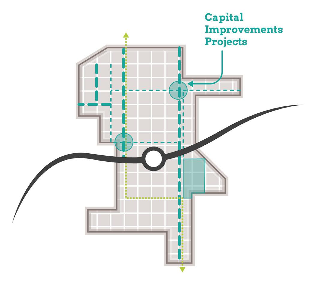
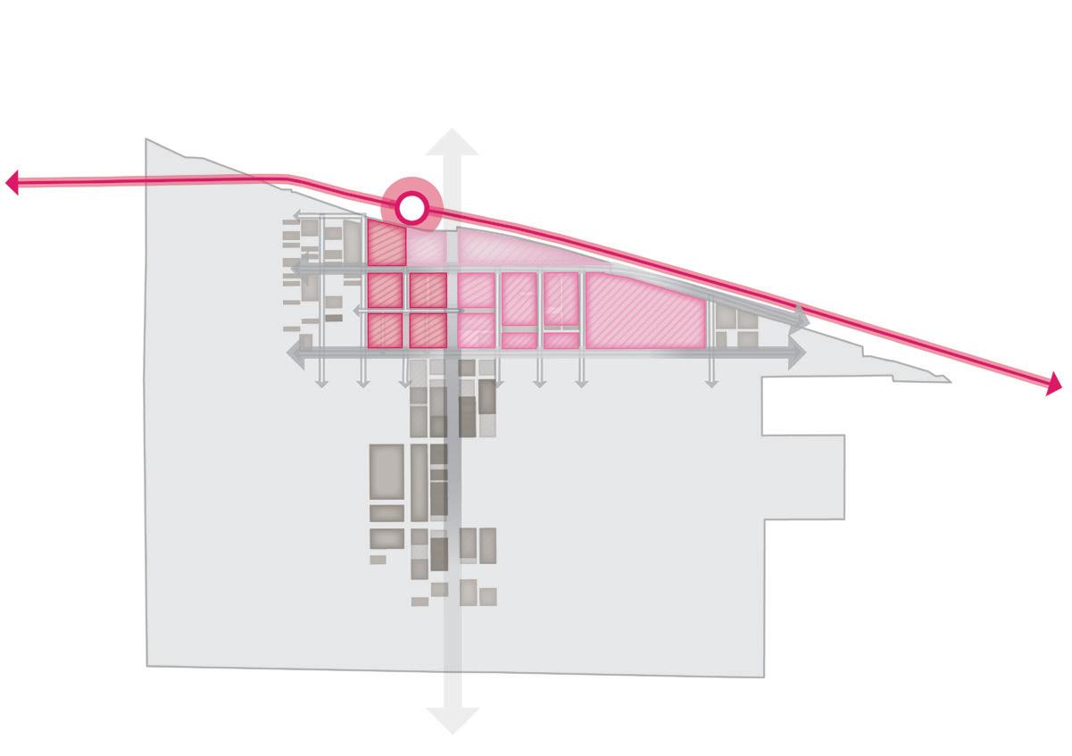
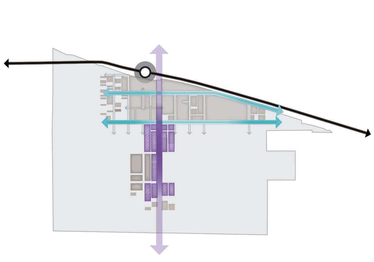
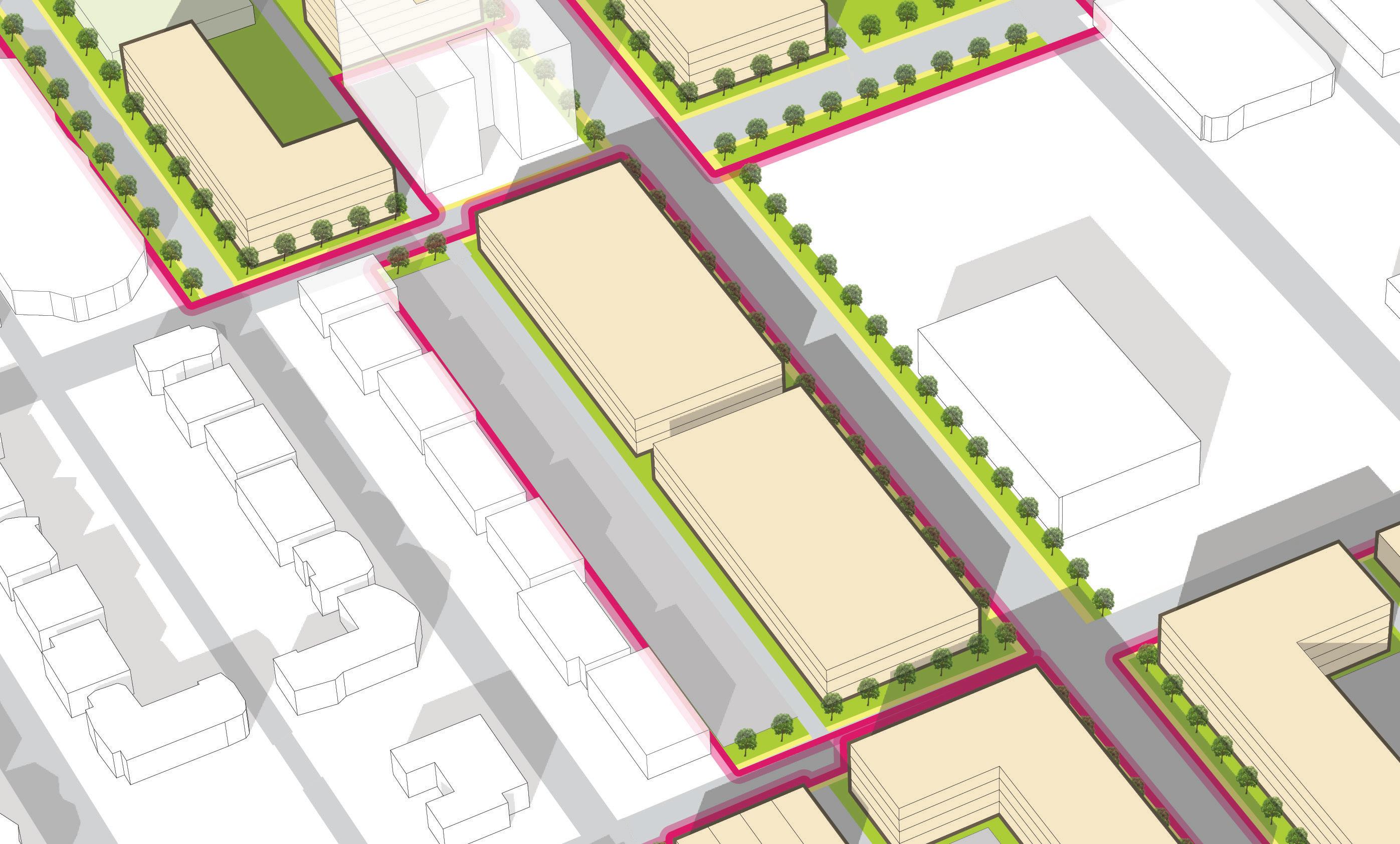
The current scale of street blocks in the downtown core support large civic buildings. Re-establishing a pedestrian-scaled grid and enhancing access to the station includes right-sizing existing streets, creating new connections through the Genesis Convention Center block, and introducing convenient mid-block pedestrian pathways. Safe crossings are proposed at strategic intersections of Broadway, 4th Avenue, and 5th Avenue.
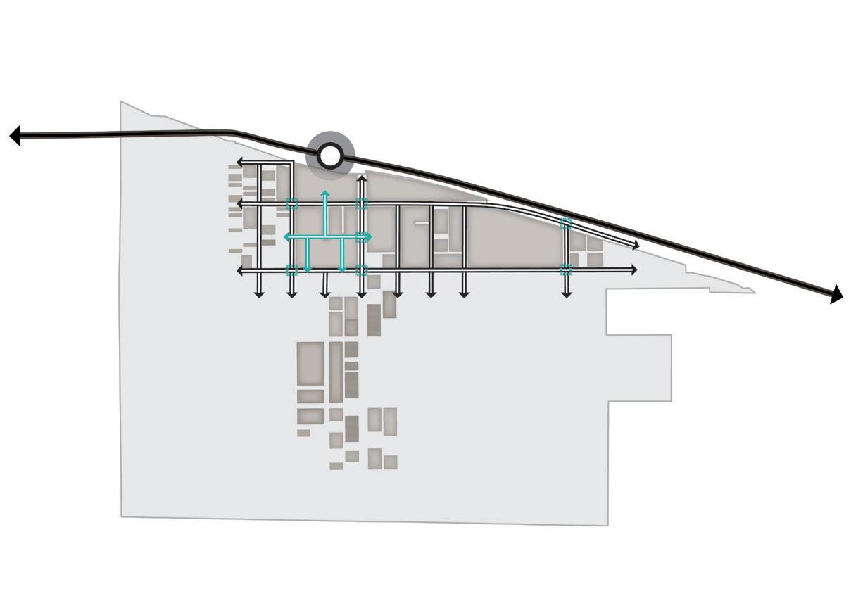
Gary • Metro Center 15 5th Ave 4th Ave Adams St Broadway 5th Ave 4th Ave Adams St Broadway South Shore Line South Shore Line
Big Moves NORTH
Re-Defining Broadway
Station as the Catalyst
Broadway is envisioned as an activated community corridor, with mixed-use and commercial development that responds to an enhanced pedestrian realm. The proposal for a Complete Street design includes a “green buffer” linear park, multi-use paths, transit facilities, and accommodating amenities.
The Gary Metro Station acts as an anchor, with mixed-use development clustered along new and enhanced pedestrian-scaled corridors. Development opportunities can be explored in multiple densities, with a prioritization strategy that identifies, acquires, and redevelops properties with the greatest catalytic transformational potential.
16 Northwest Indiana TDD • TOD Strategic Implementation Plan
5th Ave 4th Ave Adams St Broadway 5th Ave 4th Ave Adams St Broadway South Shore Line South Shore Line
Big Moves NORTH
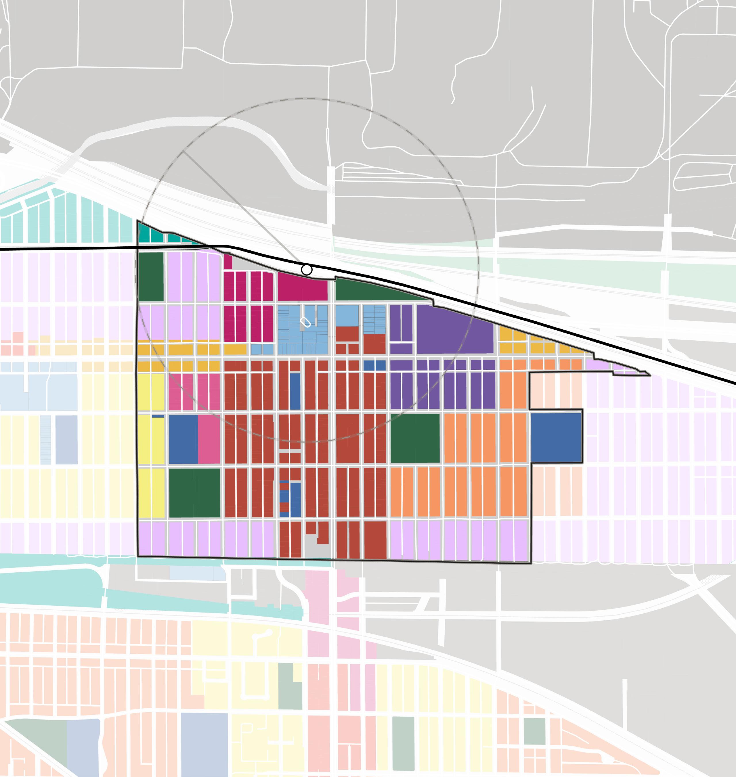
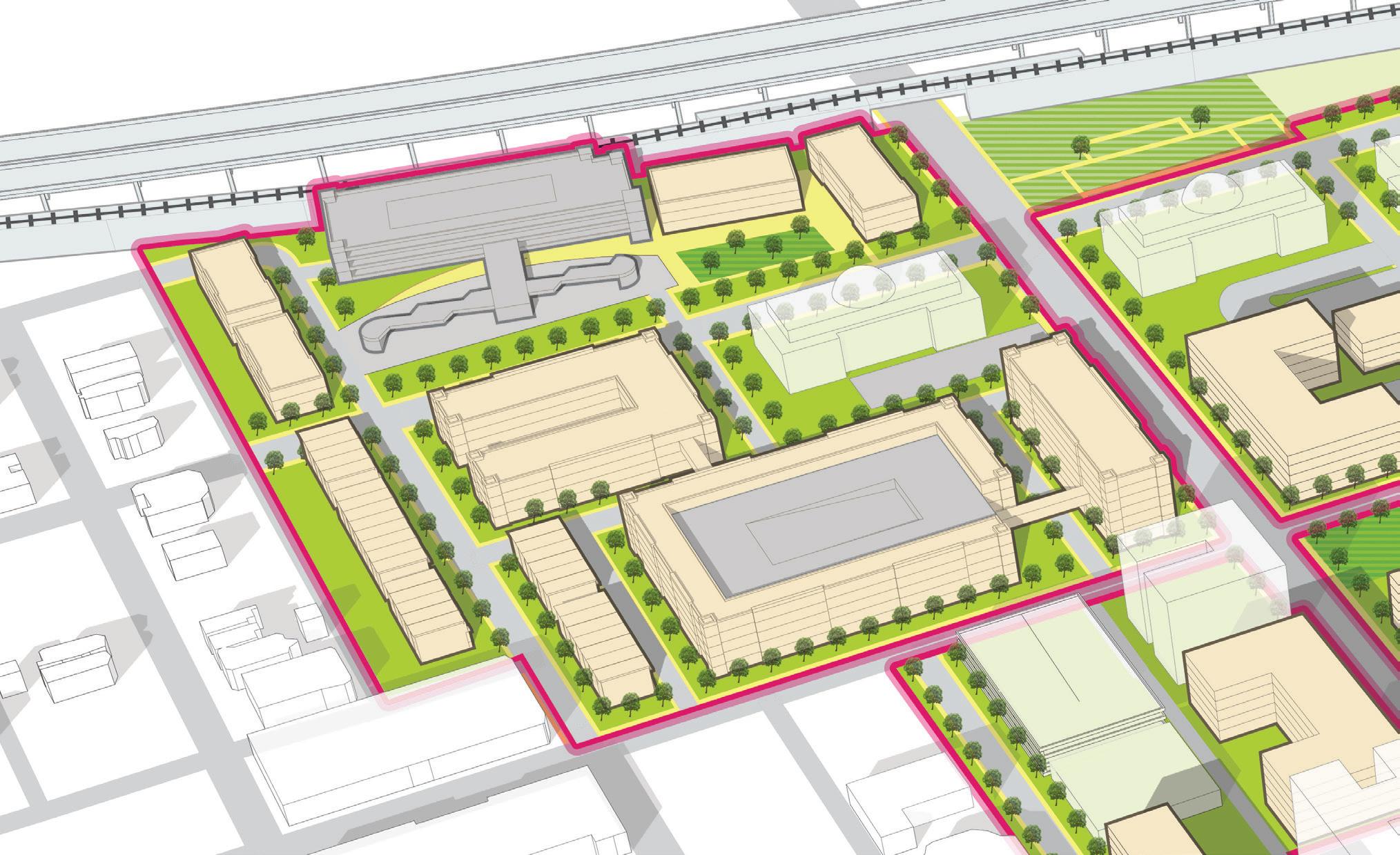
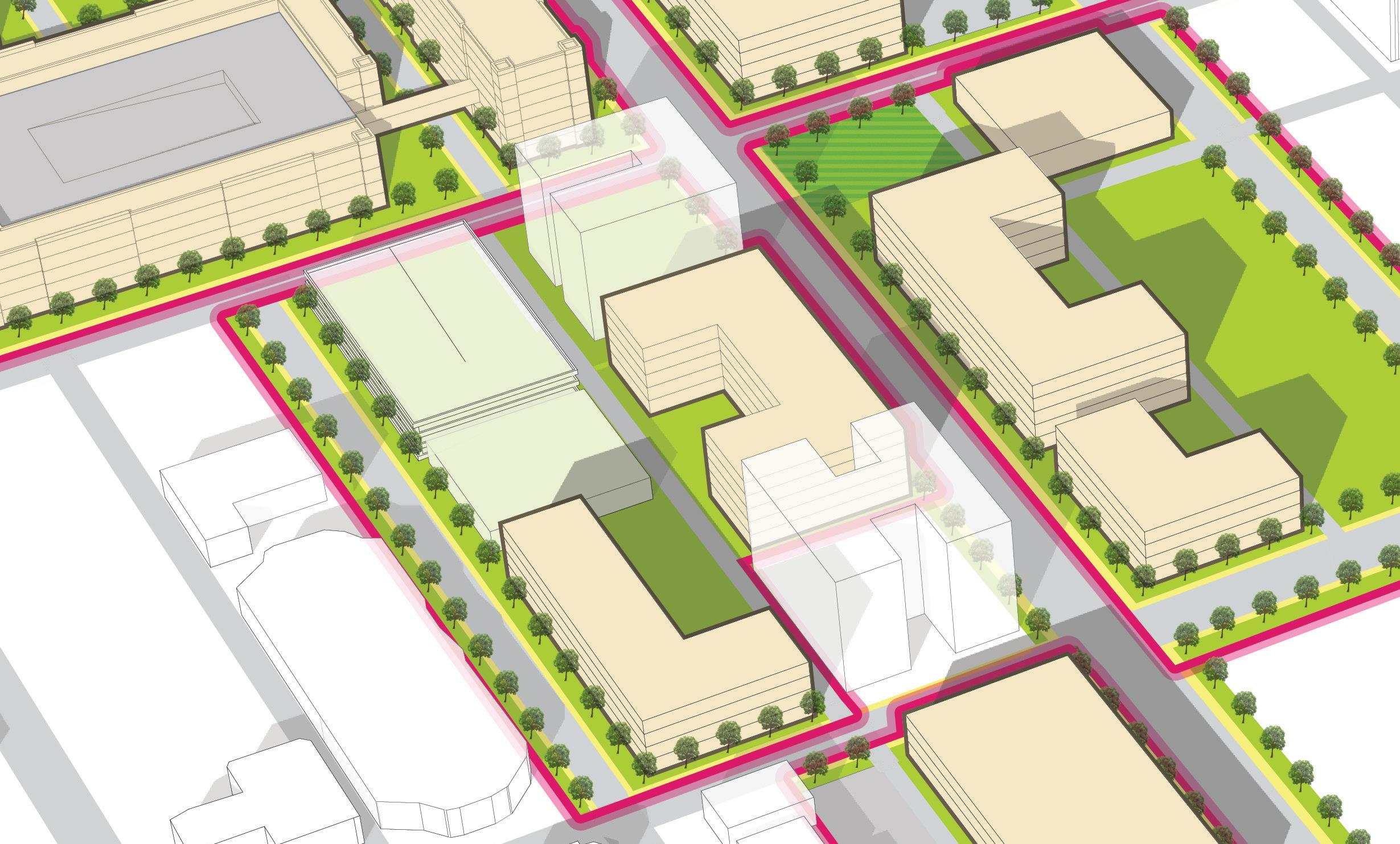
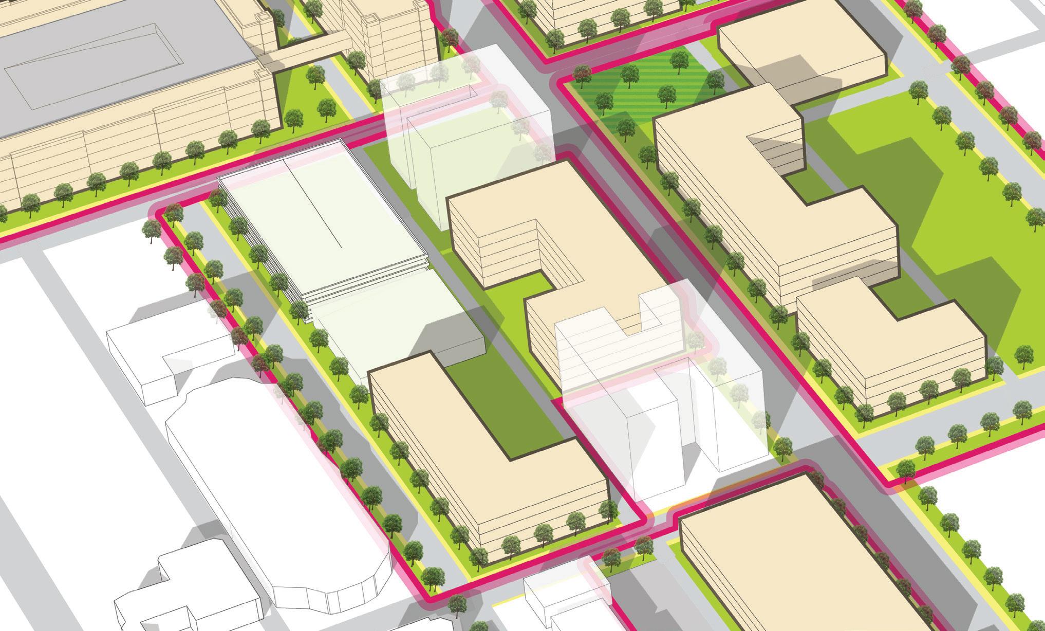
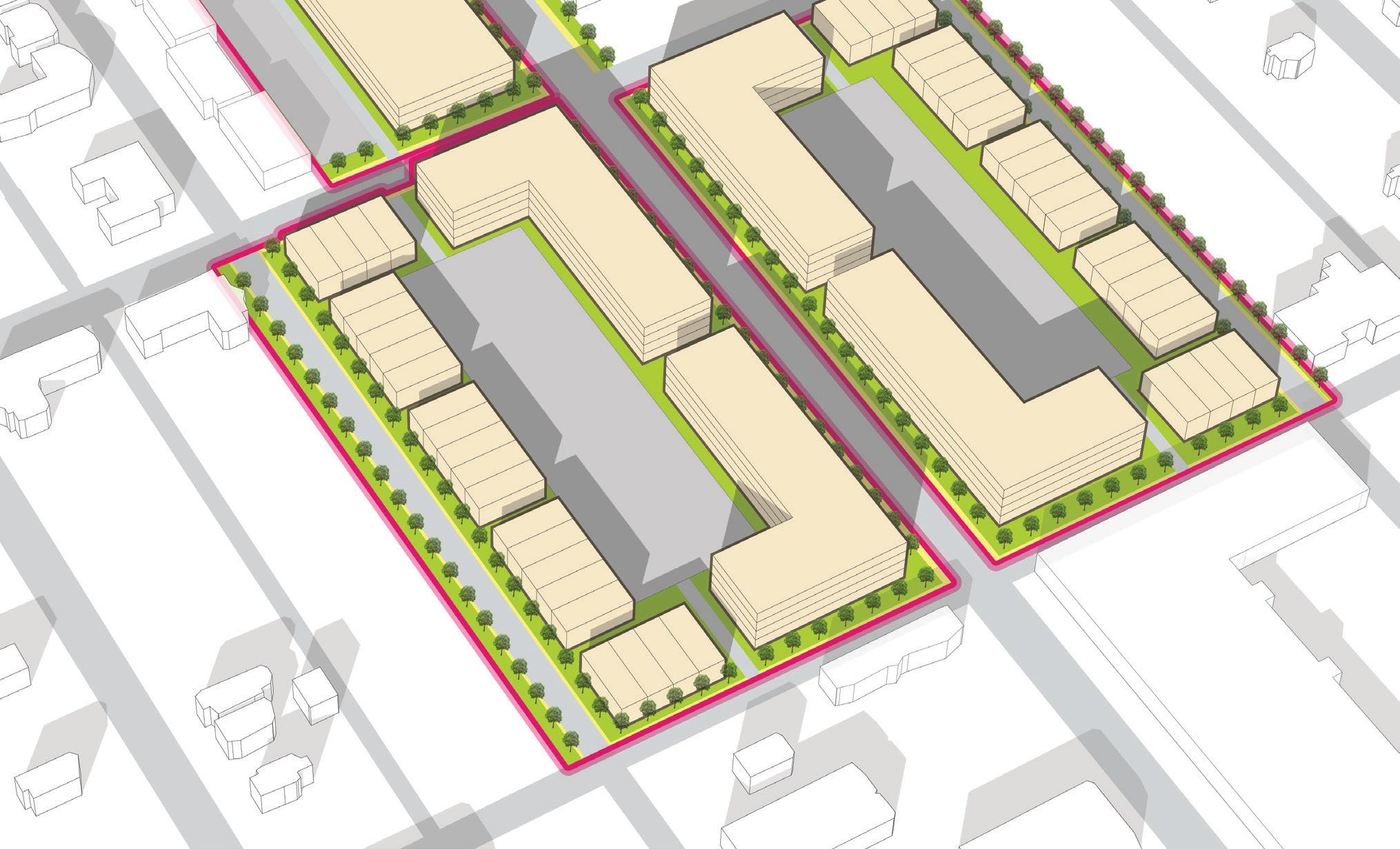
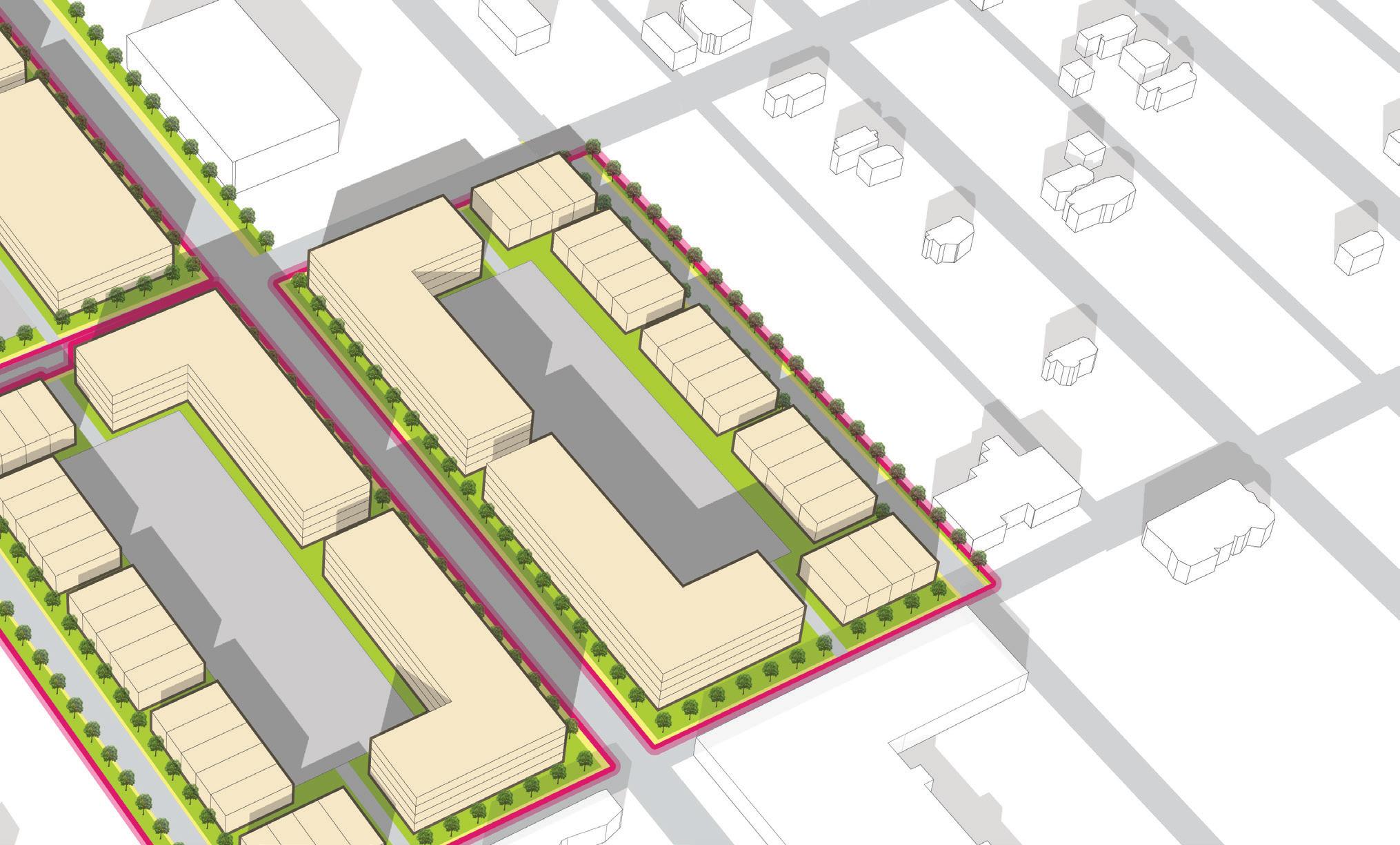
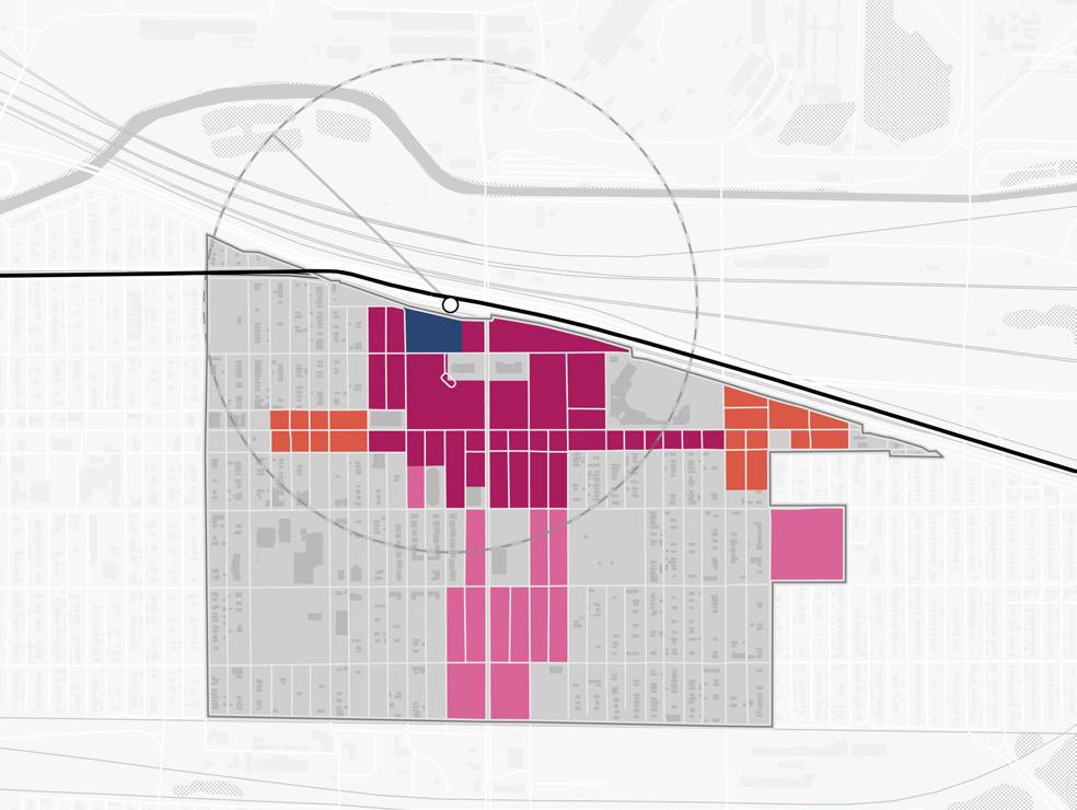
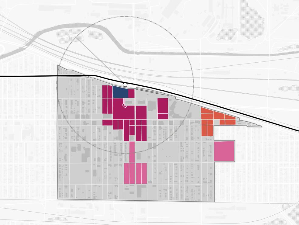
TOD Opportunity
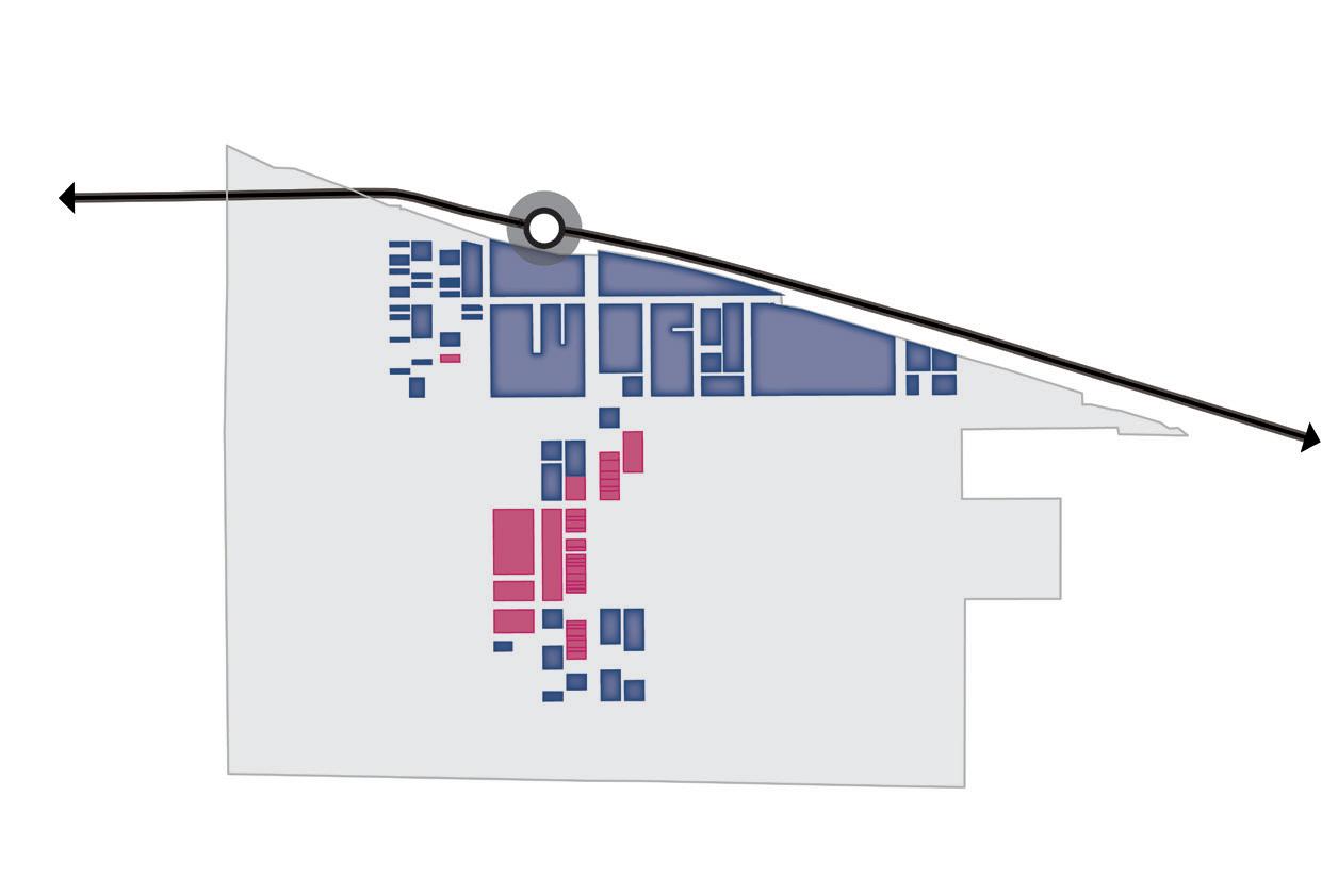
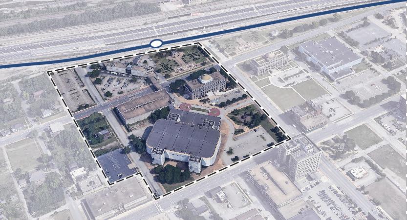
An overall TOD Opportunity vision was developed with the City of Gary outlining the development and investment potential within the TDD boundary area. Opportunity sites were identified as Areas of Impact within each TDD boundary that have the greatest development potential. Characteristics such as cleared sites, underutilized land or surface parking lots, buildings suitable for adaptive reuse, and consolidated or municipal land ownership were important factors determining the development potential of sites.
Gary Metro Center (Site A) is identified as the gravitational center for TOD in Downtown Gary, and the first phase of an incremental development strategy. Sites B, C, and D would utilize its proximity to the new Metro Center with smaller scale commuter-oriented commercial activity following investment in the new station. Sites E, F, and G all have the potential to transform into mixed-use development that continues to rebuild the downtown core from the Metro Center to Gary SouthShore RailCats U.S. Steel Yard Stadium. Further south, sites along the Broadway corridor are envisioned to create an activated corridor with mixed-use buildings and commercial frontage. Development eventually transitions into a variety of residential types including affordable, senior and market-rate housing options. Sites along 5th Avenue would increase in development potential with the completion of the two-way conversion of 4th and 5th Avenues that is currently being studied. Within these areas, the significant local property control can expedite development if the right catalytic project was accomplished and creates the market conditions to attract further development. Within these areas, much of the property is under local control, which could expedite development if the right catalytic project, such as a replacement for the Gary Metro Station, is completed.
Areas of Impact
Areas of Impact were established to distinguish between major (re)development areas, both TOD and non-TOD, and areas to be maintained, preserved, and enhanced. These designations begin to direct development activity and other targeted investments based on proximity and relationship to the station area.
TOD Opportunity Sites
These areas are prime sites for transit-oriented development due to their proximity and connectivity to the station area. Development of these sites should be dense and urban in form, promote walkability and multi-modal access, and emphasize a quality public realm and sense of place. Access to the station area is crucial in these areas. Development should be mixed-use, integrating a variety of active ground-floor commercial uses and upper-floor uses within a building and integrating a variety of uses in a collection of buildings on a site
Sites A, B, C, and D
Sites A, B, C, and D are a combined 19.8 acres located in the downtown core of Gary. Site A includes the existing Gary Metro Station and associated parking lots adjacent to the station and along Adams Street. Along Jefferson Street exists primarily vacant cleared land and several remaining single-family homes with a mix of private and public owners. Site B consists of Gateway Park, which is aging and underutilized, to the east of the station. Site C is directly north of the Gary Public Library and is bounded by Adams and Jefferson Streets and is mostly vacant land, with a few residential structures. Much of this block is privately-owned, but the City of Gary has acquired some parcels. Site D is the City block consisting of the vacant Genesis Convention Center and includes a surface parking lot and a deteriorating parking structure along 4th Avenue. The City owns the entirety of Site D. Existing constraints of the sites are the raised South Shore Line tracks and platform to the north and the one-way truck routes on both 4th and 5th Avenue. Adjacent to the site is the Lake County Superior Courthouse and City Hall, providing a daytime workforce presence that will continue to require parking on-site.
Sites E, F, and G
For purposes of this study, individual sites may have been grouped to demonstrate synergy among sites for development potential.
Sites E, F, and G are a combined 8.9 acres in area, consisting of the blocks between 4th and 5th Avenues from Broadway to the U.S. Steel Yard Stadium combined, and majority-owned by the City of Gary. Site E is located at the prominent corner of 5th Avenue and Broadway, there are two privately-owned vacant commercial/office buildings fronting Broadway and a City-owned parking lot behind the buildings to the west. Site F includes the Hudson-Campbell Sports Complex, which houses fitness services and City offices, to the north and surface parking lots to the south on 5th Avenue. The entirety of Site F is owned by the City. Site G includes the City of Gary Fire Department Headquarters fronting 5th Avenue, a few historic buildings fronting Connecticut Street – one of which is owned by the City – and large surface parking areas serving the SouthShore RailCats, owned by the City. These sites are easily accessible by north-south streets and an east-west alley that
Gary • Metro Center 17
Areas of Impact
The Downtown Gary TOD area provides a generational opportunity to uplift Gary by replacing the aged Metro Station. When combined with a development strategy that prioritizes equitable, transit-oriented development and improves existing community anchors, this effort will provide a significant and long-term improvement to Gary.
18 Northwest Indiana TDD • TOD Strategic Implementation Plan Site S 3.7 Total Acres Site H 1.4 Total Acres Site U 12.2 Total Acres Gary Metro Center 1/2Mile Broadway Madison St E 5th Ave E 6th Ave EDunesHwy E 7th Ave E 8th Ave E 4th Ave TOD Opportunity Site Area of Significant Change 90 20 53 Site A 4.3 Total Acres Site B 6.3 Total Acres Site C 2.6 Total Acres Site D 6.6 Total Acres Site I 0.97 Total Acres Site J 1.9 Total Acres Site P 7.3 Total Acres Site Q 8.3 Total Acres Site R 3.7 Total Acres Site T 3.0 Total Acres Site L 1.3 Total Acres Site K 3.3 Total Acres Site M 1.7 Total Acres Site N 3.4 Total Acres Site O 6.9 Total Acres Site E 1.9 Total Acres Site F 3.7 Total Acres Site G 3.3 Total Acres South Shore Line A B C D E F G H S I J K M N O T R P Q U L Virginia St GrandCalumet River NORTH City Hall Genesis Convention Center Borman Square Park U.S. Steel Yard Stadium Buffington Park Broadway
currently provides access to the parking lot on these blocks. With the majority of these sites under City ownership, development is very feasible, particularly on underutilized surface parking lots.
Sites I and J
Sites I and J include the block directly to the south of the Genesis Convention Center and total 3 acres. The City or the Gary Housing Authority (GHA) owns almost the entire block, with the exception of a parking garage on 5th Avenue and the historic Gary Bank building, which houses multiple uses including City offices and Centier Bank. Several vacant structures on these sites include a deteriorating commercial building and the long ruined City Methodist Church, which is likely in such condition that can no longer be restored and preserved. The parking lot south of the Centier Bank building is currently well-utilized, but it presents a prime development opportunity to create significant frontage along Broadway. Demolition of vacant structures would need to occur to enable development along Washington Street.
Site K
Site K is located on the east side of Broadway south of 5th Avenue and is 3.3 acres. The site is primarily vacant undeveloped land, all of which is owned by GHA. 5th and Broadway Park exists at the northwest corner of the site and could provide an anchor green space for new development. Existing buildings on this site include a privately-owned commercial building fronting Broadway and a Baptist church fronting 6th Avenue that also owns a parking area to the rear. This site has been recently cleared for GHA development that could add housing units proximate to the station.
Site M
Site M is 1.7 acres of cleared, shovel-ready land along the west side of Broadway between 6th and 7th Avenues. This site is owned by GHA and presents another opportunity to add a significant amount of housing units downtown.
Site N
Site N is 3.4 acres and has multiple owners, both private and public. Several commercial buildings exist on this site with frontage on Broadway and Washington Street. Many of these buildings are vacant and in disrepair, but a few have historic architectural features that should be restored and preserves if possible. One of this historic buildings is owned by Lake County. GHA owns 0.7 acres of vacant land along Broadway on this site, and the City owns a total of approximately three-quarters of an acre of vacant land throughout this site.
Site O
Site O is 6.9 acres and is owned by the City, GHA, and one private owner. The northern portion of this site is owned by GHA, who has partnered with a developer and recently completed construction of the Broadway Lofts, a mixed-use affordable housing development, at the corner of Broadway and 7th Avenue. A second phase is planned immediately to the east, between the alley and Massachusetts Street. The City owns approximately 0.9 acres at the southern end of the block, near the Broadway and 8th Avenue intersection, which includes a three-story historic building facing Broadway. The remaining central portion of the site is owned by a single private owner and includes a commercial building fronting Broadway and vacant land along Massachusetts Street.
Areas of Significant Change (Non-TOD)
These areas have been identified for their potential for redevelopment and a major change in use and/or form. These areas are outside the walkable area surrounding the station – therefore not TOD – but high-quality development of these sites is possible and will significantly impact the community. These areas may be identified for several reasons: they have been included in development planning in this plan but are not proximate to the station; they may have development planning efforts ongoing outside of this plan; or there may be a high potential for future development in the long term that has not been studied yet. Development of these sites may require changes in land use, updates to zoning designation and/or regulations, infrastructure upgrades, or environmental review.
Site H
Site H is 1.4 acres and is privately-owned by five different owners. This site includes Bethel Church and Ministries, two occupied commercial buildings along 5th Avenue, and the Christ Episcopal Church at Adams Street and 6th Avenue. Several parcels on this site have been cleared and are under one owner.
Site P
Site P is 7.3 acres and is majority owned by the City. Several blocks along either side of 5th Avenue are City-owned cleared, shovel-ready sites. These cleared sites could make a significant impact to 5th Avenue east of Broadway if developed. One privately-owned commercial building exists along 5th Avenue within this site. South of 5th Avenue, between Virginia and Carolina Streets, exists multiple vacant residential parcels and a few remaining single-family residences. The City owns many of these vacant parcels along both sides of the block.
Gary • Metro Center 19
Site Q
Site Q is the 8.3-acre block between 6th and 7th Avenues and Caroline and Rhode Island Streets, and is entirely owned by GHA. This site includes the Emerson School building along 7th Avenue, with the remainder of the site being vacant land. This site is surrounded by single-family residential neighborhood.
Site R
Site R is 3.7 acres includes frontage along 5th Avenue east of Broadway, from the alley behind Massachusetts Street to Virginia Street. This portion of 5th Avenue consists of several commercial structures and surface parking lots and is partially owned by the City and GHA. Development of these blocks could create significant commercial activity fronting 5th Street that could activate the blocks surrounding U.S. Steel Yard Stadium.
Site S
Site S is 3.4 acres and includes the commercial buildings along both sides of 5th Avenue, west of Broadway, between Jefferson Street and the alley east of Jackson Street. The site includes many single-story commercial buildings, most of which appear vacant. Two commercial buildings are occupied, but are in poor condition. The remainder of this site is vacant land, which is owned by a mix of public and private owners. The City owns part of the block immediately adjacent to the Gary Public Library, GHA owns and operates a residential tower on the south side of 5th Avenue.
Site T
Site T is 3.0 acres and includes the block directly to the west of Buffington Park. Much of this site is privatelyowned, including a large vacant commercial building and parking lot and several single-family residential properties. The Calumet Township Trustee’s Office is located on this site along 6th Avenue. The City owns vacant land at the intersection of Massachusetts Street and 7th Avenue, and several vacant parcels along Connecticut Street are federally-owned.
Site U
Site U is 12.2 acres, and includes a mix of structures and vacant land, publicly- and privately-owned. The City owns two multi-story buildings and a large parking lot on the east side of Broadway and half an acre of vacant land on the west side of Broadway. A multi-story vacant historic building and adjacent parking lot has the potential for restoration and reuse. A dilapidated building and an auto-oriented business exist along Washington Street.
Areas to Maintain and Invest
All other areas within the TDD boundary not identified for future development investment opportunities should be targeted for enhancement and preservation efforts that protect the existing character and build upon the strengths or existing assets. These areas are generally stable and established neighborhoods or active commercial nodes. Opportunities for small infill development or rehabilitation of structures may be present in these areas but should occur with a focus on compatibility with the surrounding context and land uses.
TOD Types
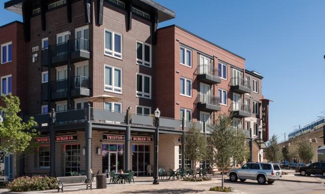
Transit-Oriented Development (TOD) Types are not prescriptive of future land use or zoning but instead describe the vision for creating a vibrant ecosystem with walkability, transit access, and a diverse range of businesses, destinations, and housing. These descriptions have an overarching intent statement and describe typical uses and goals for how development or redevelopment could occur in each of these areas. Short statements are paired with character imagery from other similar places to help visualize these places.
Future TOD in Gary’s Metro Center Station Area are envisioned as Downtown TOD and Village TOD Types. The following descriptions explain the key considerations of each of the TOD Types.
20 Northwest Indiana TDD • TOD Strategic Implementation Plan
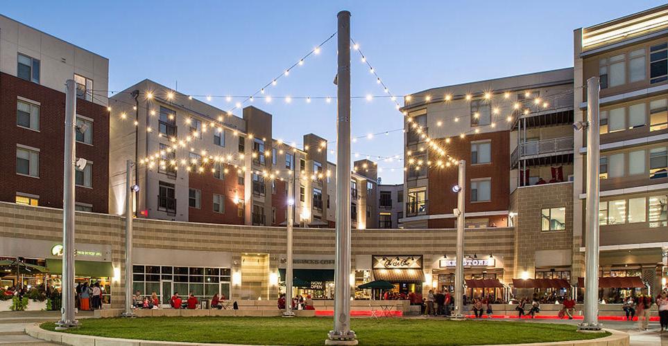
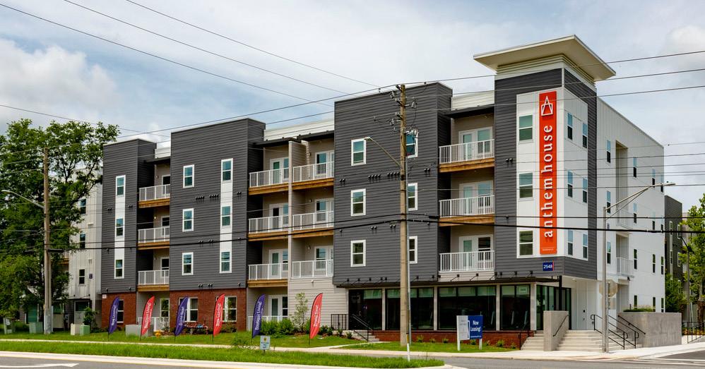
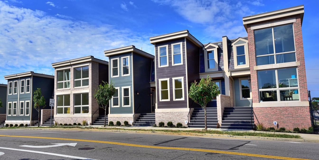
Downtown TOD
Downtown areas with denser, compact blocks that are highly-walkable and connected, containing a mix of uses serving the entire community
TOD Types
Typical Land Uses
Mixed-Use (vertically and horizontally integrated); Retail/Offices/Services; Attached Housing; Flex Office/Employment; Medical Offices/Services; Government/Public Facilities; Cultural/Civic; Hospitality; Entertainment; Larger Multi-Family Housing; Structured Parking
Secondary Land Uses
Parks/Plazas; Large Parks/Natural Space; Religious, Education, and Assembly Facilities; Surface Parking
Parking
On-street parking with limited off-street parking; shared public parking lots and parking structures with short- and long-term bike parking; structured parking should be lined or fronted by mixed-use buildings with active ground floor uses
Transportation
Interconnected street grid with wide sidewalks, bike facilities, and multiple and frequent bus/ transit connections; robust system of alleys
Typical Building Heights/ Density
Medium- to high-density with a minimum of 10 dwelling units per acre, typically 30+ units per acre; 3 stories minimum; anticipated average height of 5+ stories
Infill / Redevelopment
Infill should continue the existing visual pattern, rhythm or orientation of surrounding context along the street while adding appropriate height and density. Historically significant or contributing buildings should preserved or adaptively reused when possible.
Other Considerations Development should be supportive of pedestrian activity.
Gary • Metro Center 21
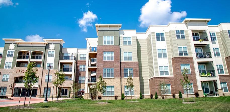
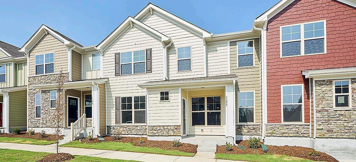
Village TOD
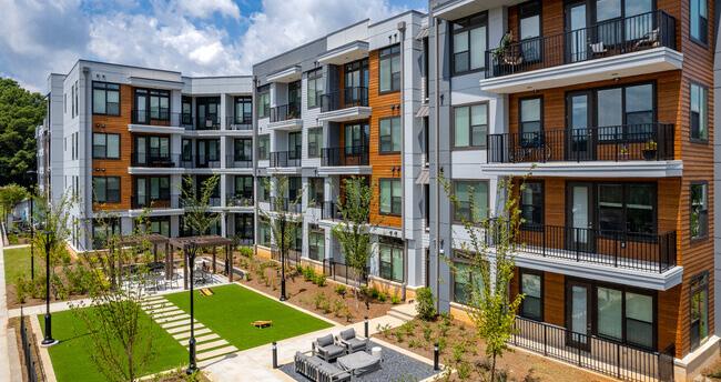
Compact, walkable areas with scaled mixed-use buildings that engage and support an active public realm serving the entire community
TOD Types
Typical Land Uses
Multi-Family Housing; Supportive Housing; Attached Housing; Retail/Offices/Services; Flex Office/Employment; Medical Offices/Services; Government/Public Facilities; Hospitality; Entertainment; Mixed-Use (vertically and horizontally integrated); Surface and Structured
Secondary Land Uses
Pocket Parks/Plazas; Greenways/Trails; Recreation Facilities; Cultural/Civic; Religious, Education, and Assembly Facilities; Floodplain/ Floodway; Preservation/Conservation Area
Parking
On-street parking with limited clustered off-street parking; shared public parking lots and structures with short- and long-term bike parking
Transportation
Typical Building Heights/ Density
Interconnected street grid with wide sidewalks, bike facilities, and frequent bus/transit connections
Medium density of 10-25 dwelling units per acre; 2 stories minimum; anticipated average height of 3-4+ stories
Infill / Redevelopment
Infill should continue the existing visual pattern, rhythm or orientation of surrounding context along the street while adding appropriate height and density. Historically significant or contributing buildings should preserved or adaptively reused when possible.
Other Considerations
Any redevelopment should occur in a sustainable manner that minimizes impacts on natural areas, incorporates proper stormwater management, and mitigates potential hazards to air or water quality.
22 Northwest Indiana TDD • TOD Strategic Implementation Plan
Land Use Planning
Documentation and Analysis
Previous Planning
Relevant recommendations from previous plans, including the 2019 City of Gary Comprehensive Plan, were documented and incorporated into the recommendations for this process.
City of Gary Comprehensive Plan (2019)
Previous land use and development planning led by the City of Gary Comprehensive Plan focuses on strategies that grow Gary’s population; increase the tax base; build generational wealth; create authentic solutions rooted in Gary; improve collaboration, connectivity, and information sharing; and keep an open mind to possibilities. These overarching principles are translated into specific goals focused on Downtown and the entire community. The Comprehensive Plan successfully integrates ideas from other community plans and connecting them with updated City priorities. The Comprehensive Plan outlines key strategies for downtown revitalization:
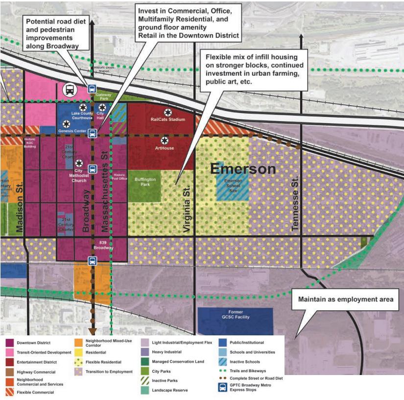
• Flexible Residential Areas - Residential areas east of Rhode Island Street are maintained as residential but allow for more open space, productive landscapes, and green/blue infrastructure. These areas are at a tipping point and may transition to other uses over time. Blight elimination and public investment should focus on stabilizing these areas to complement stronger housing demand to the west and better serve neighboring downtown blocks.
• Residential Transition Areas - The majority of Emerson, east of Rhode Island Street and south of 8th Avenue, are past a tipping point for residential demand and no longer adhere to its historical development patterns. A focus on new opportunities for employment, art, and urban farming should continue in these areas.
• Potential new residential development should allow for strategic infill housing that builds on stronger blocks, and zoning should provide for creative new possibilities like tiny houses or cooperatives around activity centers pursuant to neighborhood demand and tastes.
• Downtown District - Vacant properties and large inactive public parcels will be targeted for reuse or redevelopment with a mix of ground-floor retail, commercial, office, multi-family residential, arts, and entertainment uses that will serve
residents and attract visitors to the City. Higher-density transit-oriented development (TOD), including homes and a variety of everyday goods and services for residents and commuters, will be encouraged around the Gary Metro Station.
• Reconfiguration of 4th and 5th Avenues - 5th Avenue will be converted to a two-way Complete Street with pedestrian and streetscape enhancements. Truck traffic is recommended to be rerouted along 4th Avenue.
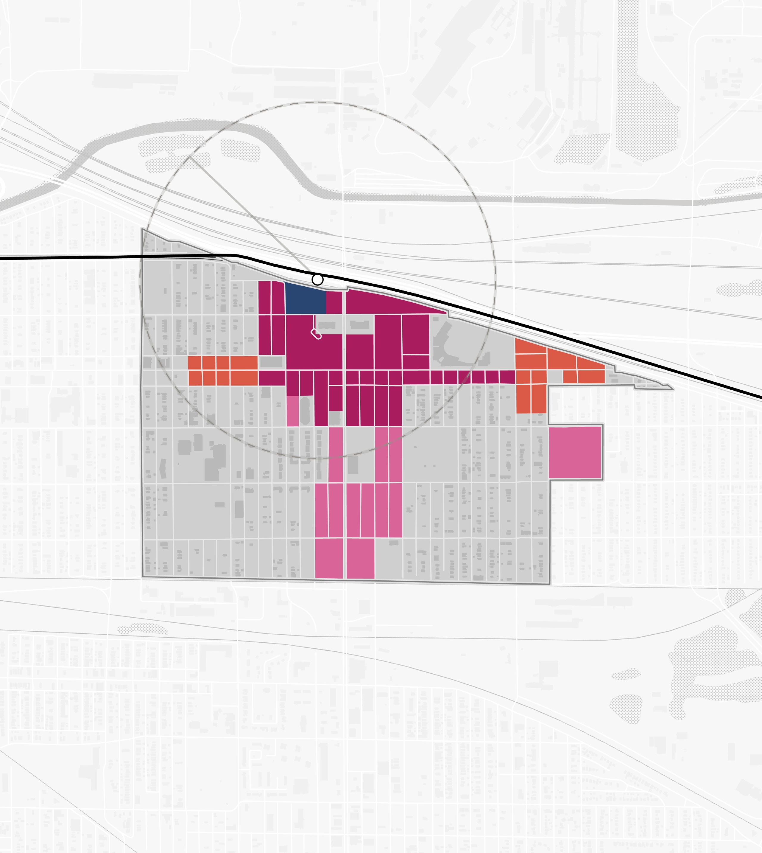
Existing Land Use
The Gary Metro Center site and blocks immediately adjacent are considered Transit-Oriented Development land use. Several Public uses are located around the Broadway and 4th Avenue intersection. Further south along the Broadway corridor and blocks south of 5th Avenue between Madison and Connecticut Streets are considered the Downtown District land use. The block of the U.S. Steel Yard Stadium and adjacent blocks to the south are considered Entertainment District. Flexible Commercial uses are concentrated in nodes along 5th Avenue. The remainder of the TOD study area is a mix of residential uses with scattered sites of Schools and Universities and City Park land uses dispersed throughout the neighborhood areas. Beyond residential areas is the Transition to Employment land use that provides a significant buffer between residential areas and industrial areas.
Gary • Metro Center 23
Imagery from the Gary Comprehensive Plan (2019)
Residential Flexible Residential Transition to Employment Neighborhood Commercial and Services Neighborhood Mixed-use Corridor Flexible Commercial Public Schools and Universities City Park Landscape Reserve Entertainment District Downtown District Transit-Oriented Development Light Industrial/ Employment Flex 24 Northwest Indiana TDD • TOD Strategic Implementation Plan Gary Metro Center 1/2Mile Broadway Madison St E 5th Ave E 6th Ave EDunesHwy E 7th Ave E 8th Ave E 4th Ave 90 20 53 South Shore Line GrandCalumet River Broadway City Hall Genesis Convention Center Borman Square Park U.S. Steel Yard Stadium Buffington Park NORTH Existing Land Use
Future Land Use
The approach to future land use planning in this plan focuses on areas that are anticipated to change. Future land use is shown in general categories of land use to guide future land use and development decisions while allowing for flexibility in densities and building types. These land use descriptions also illustrate a general character and scale of the built environment recommended as most appropriate.
Other areas within the TDD boundaries that are not anticipated to change are not included in future land use planning. More detailed projections over 5-, 10-, and 20-year time horizons are mapped out for specific development sites included in this plan to represent a phased approach to development and land use.
The approach to future land use simplifies the land uses downtown, where TOD has the potential to bring back considerable economic development opportunities, residents, and businesses. This strategy concentrates high-density Mixed-Use Core land uses to the immediate vicinity of the station and key corridors to encourage impactful high-density development. Mixed-Use Neighborhood land uses continue along the blocks surrounding the Broadway corridor south of 6th Avenue. Neighborhood Commercial land uses follow the 5th Avenue corridor east and west of the downtown core.
Other areas adjacent to targeted TOD sites could follow a range of land use recommendations included in the City of Gary Comprehensive Plan.
Station Area
The Station Area use applies to the immediate land surrounding the NICTD Rail Station. This area includes the station platform, transit centers or amenities, parking lots or structures for transit riders, and maintenance yards. In the long term, some station areas may have the ability for Mixed-Use Joint Development to occur.
Mixed-Use Core
Mixed-Use Core land uses consist of high-density mixed-use areas, such as downtowns, are characterized by compact block patterns and tall mixed-use buildings. Businesses, services, and institutions serve the immediate residential population and the entire community. Buildings are oriented to the sidewalk, with attractive and active ground floor uses that support and encourage pedestrian activity. Plazas, pocket parks, sidewalks, or activated alleys should serve as public spaces for residents, employees, and visitors.
Mixed-Use Neighborhood
Mixed-Use Neighborhood land uses are medium-scale mixed-use areas that are often called town or village centers. They typically have compact development emphasizing connectivity and walkability with an accommodating public realm and storefronts that engage the street/pedestrians. The development pattern should be of appropriate scale in relation to the street and may include vertically integrated uses and horizontally integrated uses. Plazas, pocket parks, sidewalks, or activated alleys should serve as public spaces for residents, employees, and visitors. This typology provides retail and services to surrounding neighborhoods in a pedestrian-friendly environment, making it possible to accomplish several errands in a single trip.
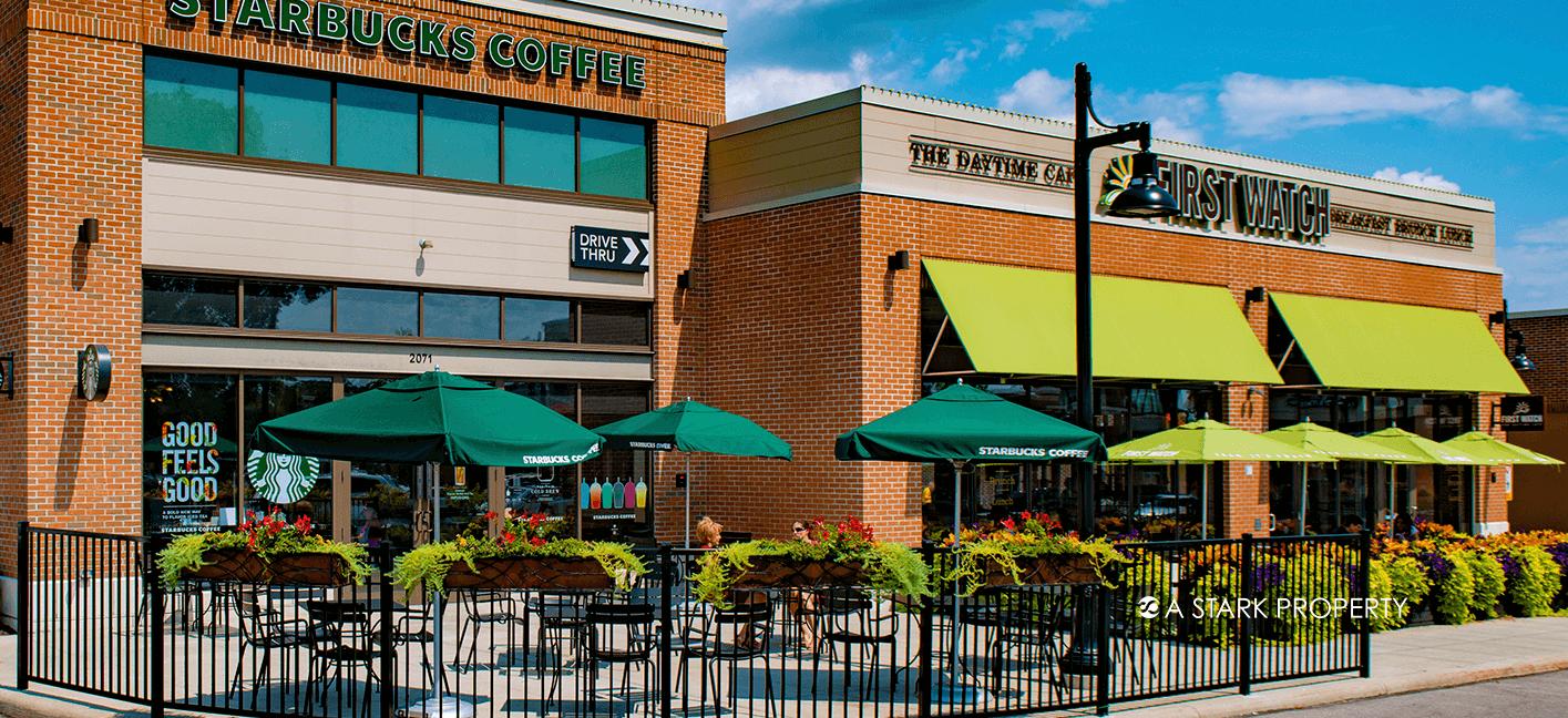
Neighborhood Commercial
Contains primarily single-story commercial, retail, and service businesses that are either in freestanding buildings or small, integrated centers. Development patterns tend to be more auto-oriented than mixed-use districts and are characterized by large parking areas, usually in front of or to the side of buildings, that may or may not be shared by adjacent uses. Along a corridor, there is typically a lack of adequate pedestrian facilities, bike facilities, and green space.
Gary • Metro Center 25
26 Northwest Indiana TDD • TOD Strategic Implementation Plan Gary Metro Center 1/2Mile Broadway Madison St E 5th Ave E 6th Ave EDunesHwy E 7th Ave E 8th Ave E 4th Ave 90 20 53 South Shore Line GrandCalumet River Broadway City Hall Genesis Convention Center Borman Square Park
Buffington Park NORTH Future Land Use Station Area Mixed-Use Core Mixed-Use Neighborhood Neighborhood Commercial
U.S.
Steel Yard Stadium
Development Planning
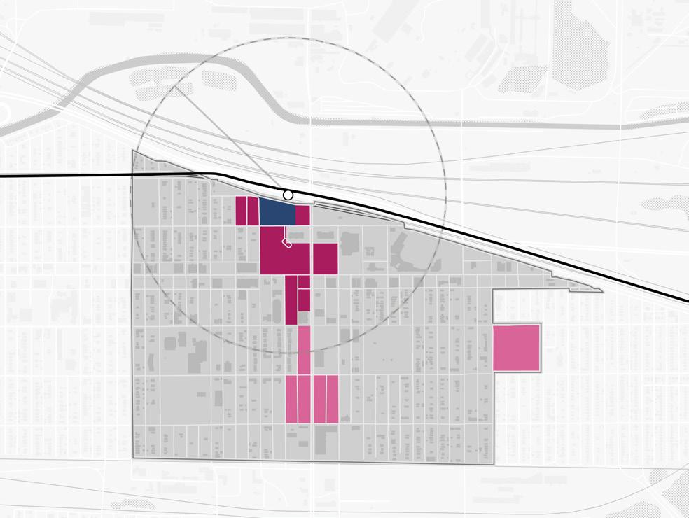
Development Concepts
Within this TOD study area, two distinct strategies informed development opportunities that were tested more thoroughly. The primary strategy employed was to focus on sites with catalytic development potential that could spur investment by the private market in the short term. A secondary strategy was employed for long-term opportunities for which development potential is anticipated to increase with continued public and private investments as well as enabling infrastructure improvements. Specific development concepts were envisioned and analyzed by a range of development impacts that define an arc of development that supports Downtown Gary’s economic development path.
Seven development opportunities were studied in this planning process and selected to illustrate the potential of TOD in more detail with scenario planning and renderings.
Sites
Gary • Metro Center 27
& D
I & J
K Site M Site O SouthShoreLine NORTH Site N
Sites A,B,C
Sites
Site
E,
& G
F,
Broadway
Ave
5th
4th Ave
Sites A, B, C & D (Gary Metro Station Area)
South Shore Rail Connection
Gary Metro Center
Parking, Drop-off & Pick-up
5thAve
SouthShoreLine
Broadway
Lake County Superior Courthouse
Existing Conditions: Station Platform
Existing Conditions: Metro Center Exterior
Existing Conditions: Parking Garage, 4th Avenue
Existing Conditions: Lobby
28 Northwest Indiana TDD • TOD Strategic Implementation Plan
Adams St
E4thAve
NORTH
City Hall
Genesis Convention Center
Parking Garage
Gary Public Library
Development Character
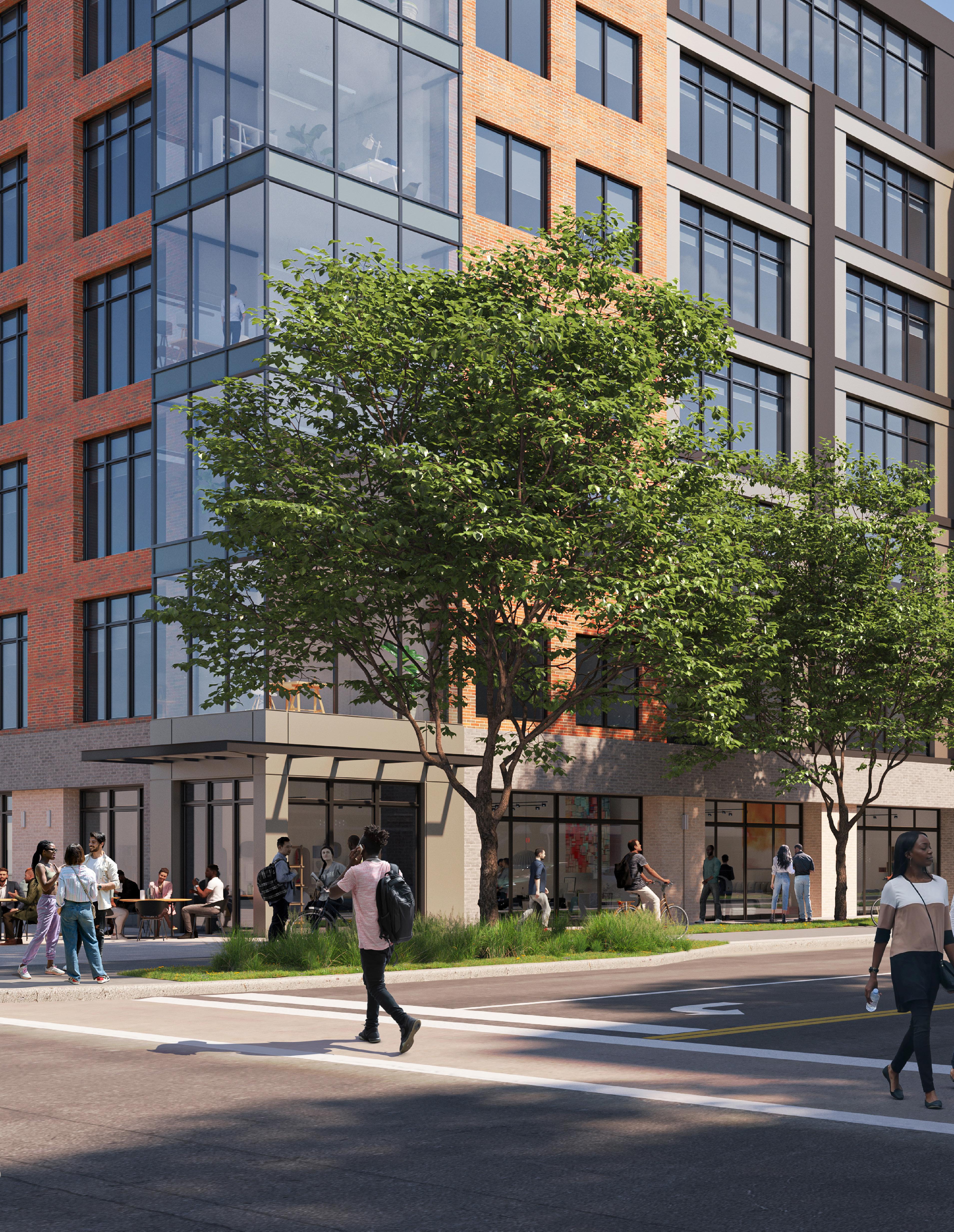
• Mixed-Use Core land use characterized by walkable development anchored by a new multi-modal station that provides ground-floor commercial in mixed-use buildings to promote an active public realm and re-establish frontage along major corridors
• This site has the potential to attract senior tax credit and market-rate development with a variety of housing options to increase the residential population downtown. Townhomes and smaller-scale multi-family buildings to the west along Adams Street begin to transition to existing residential blocks
• As a second phase, priority sites close to the Gary Metro Station, including that occupied by the Genesis Convention Center today, should be redeveloped with a parking structure that serves the entire block.
• New pedestrian-scaled streets promote walkability, break up the large block, and create new connections to facilitate access to the station
Gary • Metro Center 29
B ,C
D
Sites A,
&
5thAve
Adams St
4thAve Broadway
Gary Public Library
NORTH
City Hall
Development Program 19.8Acres Senior Housing 120 Units Multi-Family Residential 268 Units Mixed-Use 110 Residential Units 24,000 SF Office 12,000 SF Commercial
Lake County Superior Courthouse
NICTD Coordination
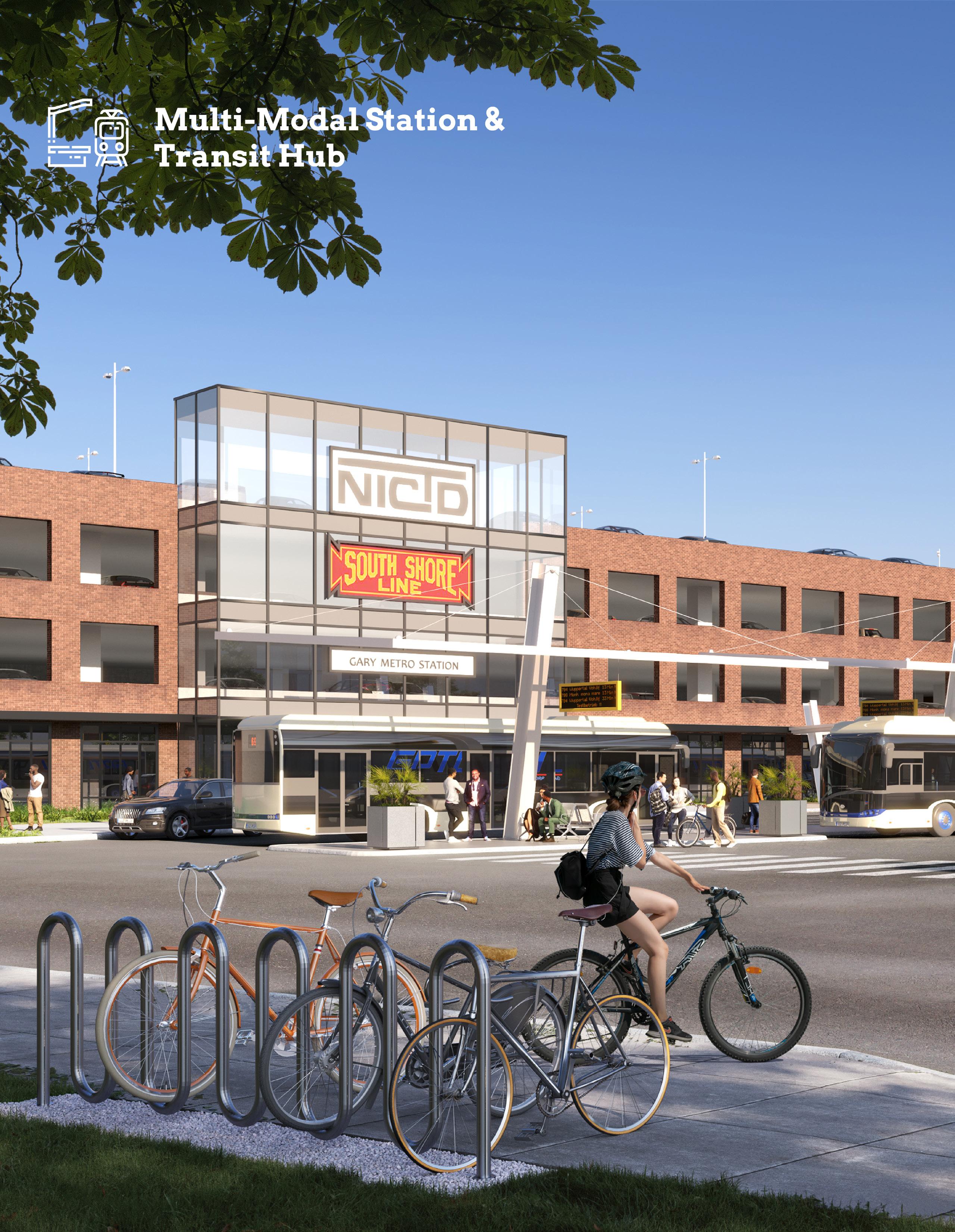
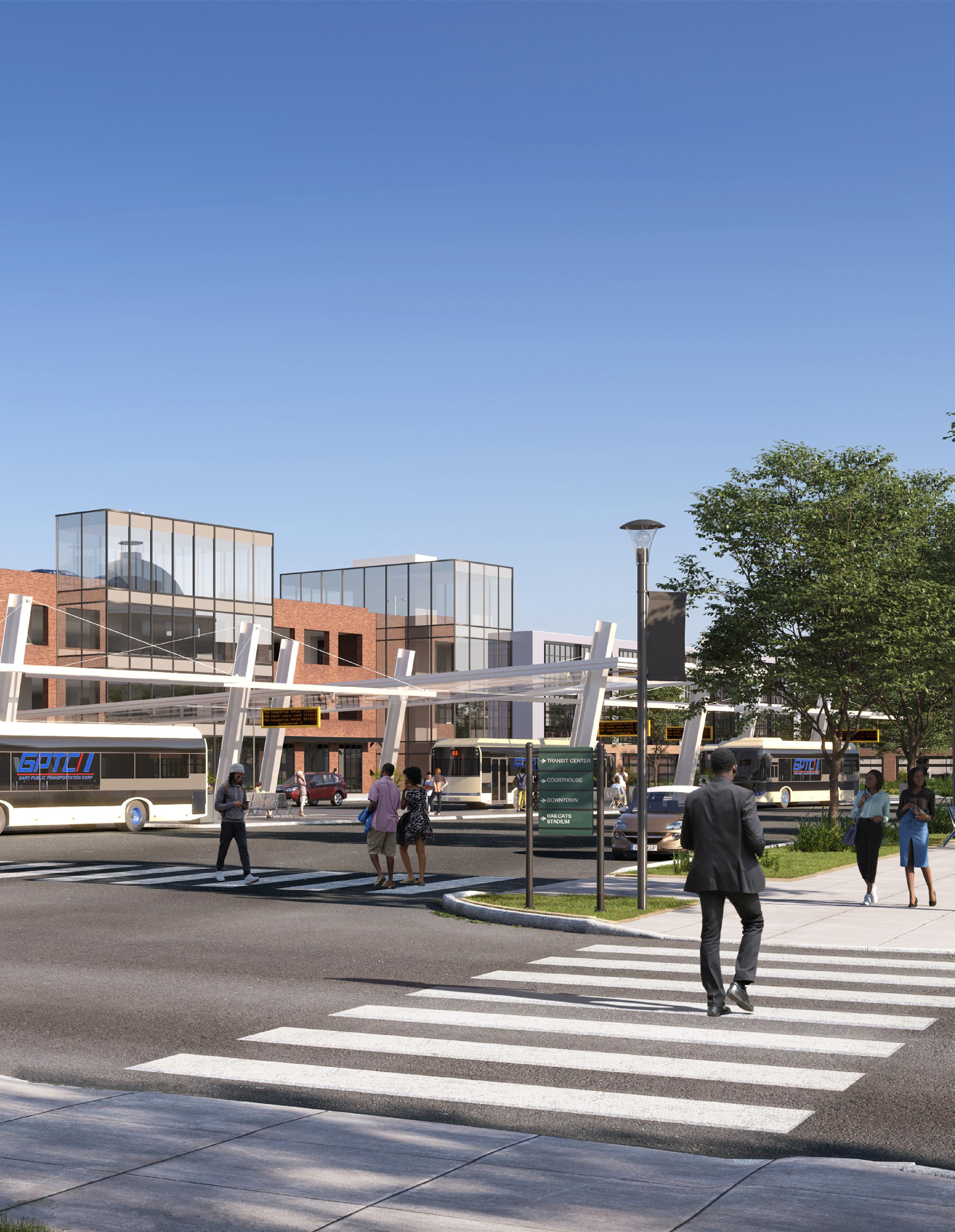
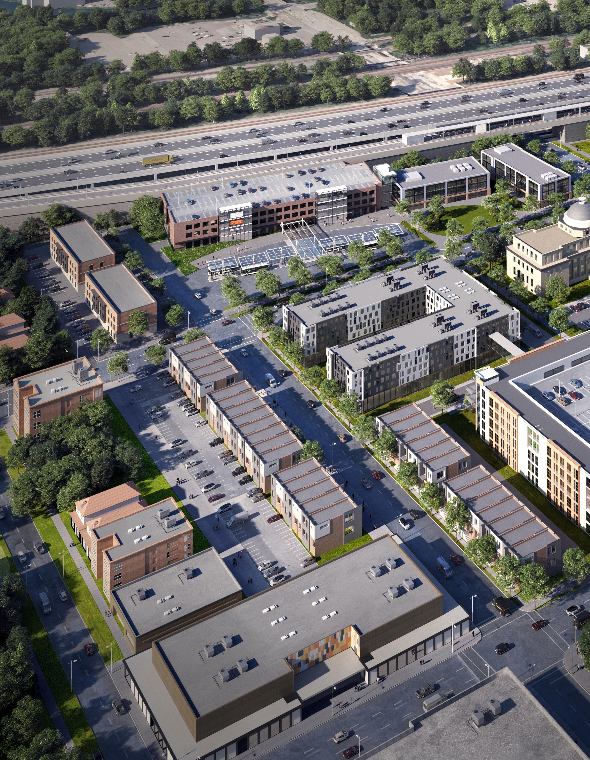
Throughout this process, the team collaborated closely with NICTD on the potential for a new Gary Metro Station as a multi-modal center serving both NICTD and GPTC bus service. The following information summarizes key considerations and multi-modal station requirements.
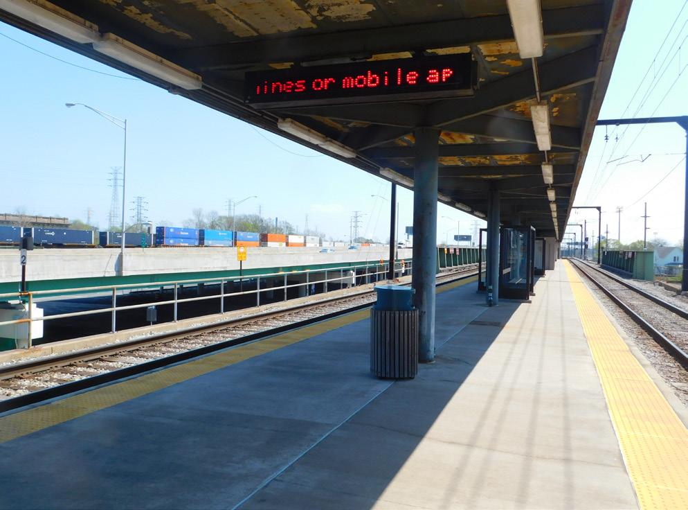
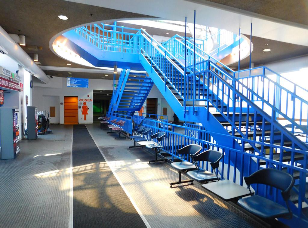
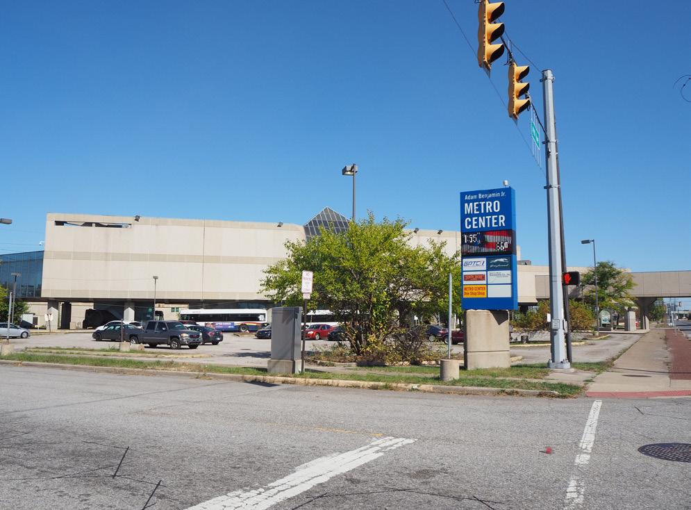
Gary Metro Station Current Conditions
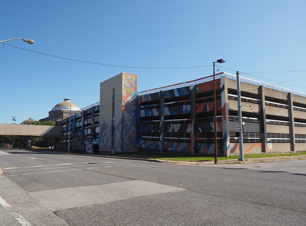
The Gary Metro Station consists of a single, elevated low-level platform accessed via a pedestrian way from the station building south of the elevated tracks. The station also accommodates GPTC with bus circulation and at-grade transfer stops. This station, owned by the City of Gary, is not designed in such a way to promote a positive rider experience, is not easily accessible for people with disabilities, nor does it promote secure access to the station by commuters. It also has severe condition issues such as leaking skylights, structural instability, chronic elevator failures, and a structurally unsound parking garage south of 4th Avenue adjacent to the Genesis Convention Center and Lake County Superior Courthouse. Investment in a new multi-modal station area can unlock the potential for future market-rate development on adjacent blocks.
Proposed Multi-Modal Station
A new Gary Metro Station needs to service passengers with an inviting, efficient, modern, and secure ADA-accessible structure with integrated parking. This new building will connect to NICTD’s existing center-rail passenger rail platform via a pedestrian way. A secured four-level parking structure is proposed providing approximately 420 spaces, including ADA-compliant spaces on the second level with direct access to NICTD’s platform. The plan also provides a new 12-bay GPTC bus terminal in front of the parking structure. This development would include opportunities on the ground floor for micro-retail and community services geared towards commuters.
Additional private development adjacent to the station could utilize the station parking garage in a shared parking situation, which could create additional income from parking by users of the surrounding development.
Multi-Modal Station Requirements
Station Building:
• ADA-accessible Routes & Amenities
• Enhanced Station Security
• High-level Station Platform and Waiting Area
• Elevators to Main Floor Lobby
Parking:
The design of the garage can be enlarged or wrapped with residential/multi-family, community services, and/or micro-retail.
• Structured Parking integrated with Station Building
• Grade-level, ADA-accessible Parking
• High-level Boarding Platform
• Electric Vehicle Charging Stations
Bus / Drop-off Area:
• Up to 12 GPTC and Shared-use/Over-the-road Bus Bays
• Rapid Charging Stations for Electric Buses
• Up to 20 Kiss-n-Ride Spaces for NICTD and Bus Drop-off
• Rideshare (Uber/Lyft)
Site/Station Area Requirements
The following improvements will further promote first and last-mile access to the new Gary Metro Station.
Station Area:
• Opportunity for adjacent development directly to the east by private market, with a green space anchoring the station block
Arterial Roads (TOD Connectors):
• Two-way conversion of 4th and 5th Avenue to create a safer pedestrian environment
• Raised crosswalks at intersections where Broadway Avenue crosses 4th and 5th Avenues
Parks and Trails:
• Integration of the Marquette Greenway by connecting to station site
30 Northwest Indiana TDD • TOD Strategic Implementation Plan

Gary • Metro Center 31
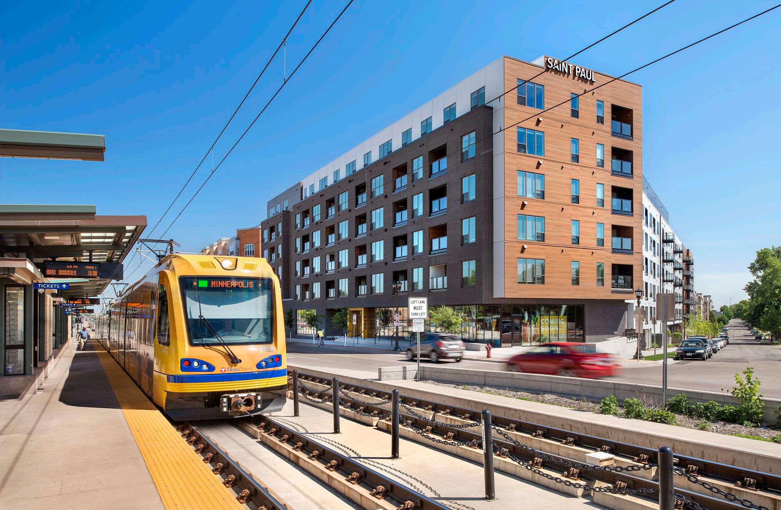
2700 University, St. Paul, MN
Julia M. Carson Transit Center, Indianapolis, IN
Julia M. Carson Transit Center, Indianapolis, IN
Examples: Multi-Modal Station Area Character
Examples: Multi-Modal Station Area Character
32 Northwest Indiana TDD • TOD Strategic Implementation Plan
Van Aken, Shaker Heights, OH
Orleans Landing, Detroit, MI
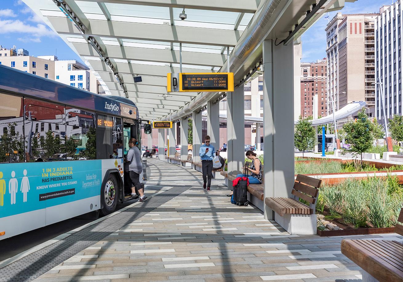
Julia M. Carson Transit Center, Indianapolis, IN
Julia M. Carson Transit Center, Indianapolis, IN
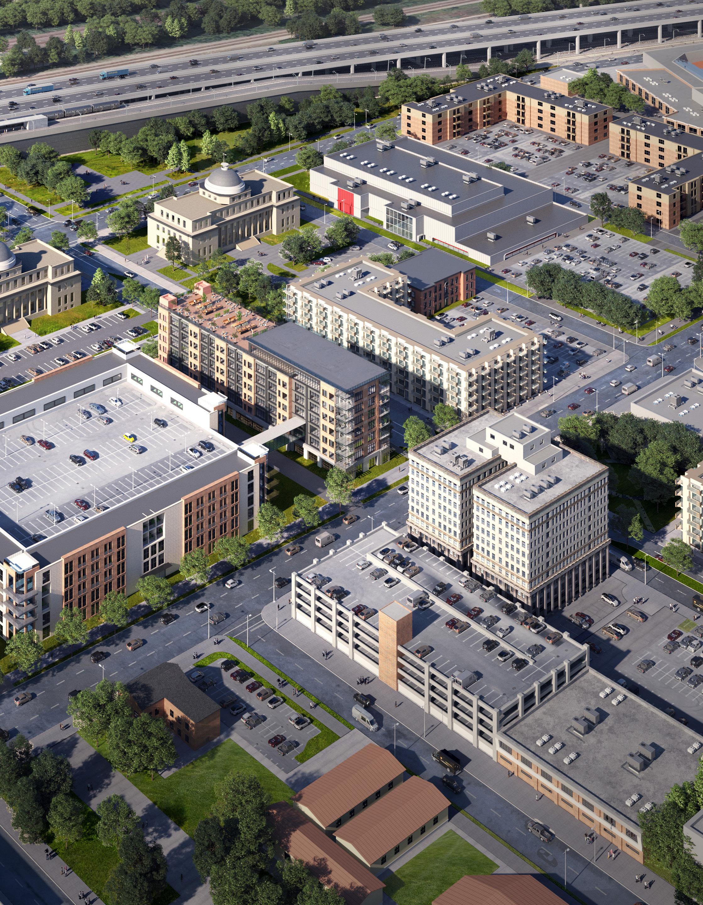
City Hall
Development Program
Mixed-Use
8.9Acres
188 Residential Units
20,000 SF Commercial Commercial
Development Character
5,000 SF
• Mixed-Use Core land use characterized by walkable development anchored by a renovated City Hall and potential Hudson-Campbell Sports Complex adaptive re-use
• City Hall and a revitalized Broadway Avenue with infill development at the intersection of 5th Avenue builds density on both sides of the street
• Development east of the Hudson-Campbell Sports Complex anchors an entertainment district with added residential units and active ground-floor commercial to enhance the experience at the U.S. Steel Yard Stadium
Gary • Metro Center 33
F & G NORTH
5thAve
4thAve
Sites E,
Broadway
Stadium Plaza
U.S. Steel Yard Stadium
Development Character
• Mixed-Use Core land use as part of a strategic infill strategy to knit together the street wall along the west side of Broadway Avenue between the historic Centier Bank building and Genesis Towers senior housing
• The existing parking structure will service the site, supplemented by on-street parking
• The City Methodist Church ruin is shown as demolished, and a new multi-family building in its place
34 Northwest Indiana TDD • TOD Strategic Implementation Plan Sites I & J NORTH Broadway Washington St 5thAve 6thAve Centier Bank
21st Century Charter School
Development Program 3.8Acres Mixed-Use 39 Residential Units 5,000 SF Commercial Multi-Family Residential 42 Units
Development Program
Mixed-Use
3.3Acres
96 Residential Units 14,000 SF Commercial
Development Character
• Mixed-Use Core land use playing off the synergy along the Broadway corridor
• 5th & Broadway Park is maintained with new development with ground-floor commercial activating the edges
• Development may include a mix of housing types including market-rate multi-family, senior and/or workforce multi-family, supportive housing, and ground-floor commercial uses
• Proposed development self-parks behind the building with a surface parking lot accessed from existing alleys. This lot presents a future opportunity for redevelopment that increases the density of the block.
Gary • Metro Center 35 Site K NORTH
6thAve MassachusettsSt
5thAve Broadway
Centier Bank
5th & Broadway Park
Development Program
1.7Acres
Mixed-Use 72 Residential Units 9,000 SF Commercial
Development Character
• Mixed-Use Neighborhood land use demonstrating the ability to build off of investments made by Gary Housing Authority in the Horace Mann development further west
• Development may include a mix of housing types, including market-rate multi-family, senior and/or workforce multi-family, supportive housing, and ground-floor commercial uses
• Parking in the rear as a surface lot with access from the existing alley
• This property is shovel-ready and owned by the Gary Housing Authority
36 Northwest Indiana TDD • TOD Strategic Implementation Plan
Broadway 7thAve WashingtonSt 6thAve NORTH
Site M
Frank L. O’Bannon Building
Development Program
Multi-Family Residential
3.4Acres
120 Units
Townhomes 23 Units
Development Character
• Mixed-Use Neighborhood land use demonstrating the ability to continue building a residential base downtown
• Higher-density buildings concentrated along Broadway to maintain frontage along the corridor with townhomes facing Washington Street that steps down the development scale to match existing residential
• Parking is internal to the site as a surface lot accessed by the existing alley
Gary • Metro Center 37
7thAve
Site N WashingtonSt Broadway 8thAve
Gary City Government Offices
NORTH
Horace Mann Apartments
Development Character
• Mixed-Use Neighborhood land use demonstrating the ability to continue building a residential base downtown
• Higher-density buildings concentrated along Broadway to maintain frontage and complement development proposed on the west side of the corridor
• Townhomes facing Massachusetts Street that steps down in scale to match existing residential
• Parking is internal to the site as a surface parking lot accessed by the existing alley
38 Northwest Indiana TDD • TOD Strategic Implementation Plan
O
Site
W8thAve Broadway E7thAve MassachusettsSt Connecticut St
Gary City Government Offices
NORTH
Frank L. O’Bannon Building
Development Program 3.4Acres Multi-Family Residential 120 Units Townhomes 23 Units
ADA-accessible, Secured Parking (420 spaces)
 NICTD & GPTC Lobby and Micro-Retail Opportunities
 12 GPTC & Shared Bus Bays
Adams Street
12 GPTC & Shared Bus Bays
Adams Street
Arc of Development
At this level of study, it is difficult to assign exact timeframes to development, but this plan illustrates a potential range and arc of development over time that could be possible with the right set of incentives and conditions supported by the market.
To understand the full range of potential of these sites, high-level capacity tests were conducted using various densities and types of development possible for each community. Estimations of several metrics of community impacts, including population changes, jobs created, and generated vehicle trips, were calculated based on future potential development. These impacts were informed by market analysis conducted by KPMG and Policy Analytics. ownership status, local guidance and interest, and quantitative and qualitative planning analysis.
The arc of development for each community was defined collectively for selected development opportunities within the TDD boundary that projects future development potential over 5-, 10-, and 20-year time horizons. Quantitative and qualitative factors such as property ownership, developer engagement or interest, site conditions, current regulations or future regulatory changes were considered in determining the arc of development over time. This study is confident, however, that investments outlined herein can change the outlook and perception of this area and thus induce the private development market over time.
Variables that can potentially change the market in Downtown Gary:
• Availability of funding and timing of a new Gary Metro Center
• Availability of State and Federal incentives
• The ability of the City of Gary and Gary Housing Authority to leverage properties owned today
• Innovative procurement methods such as P3 and Build-Operate-Transfer
• Activation of the public, philanthropic, and private markets to make a transformational investment in Downtown Gary
Projected Land Use & Development: 5-Year Horizon
Projected Land Use & Development: 10-Year Horizon
Projected Land Use & Development: 20-Year Horizon
Station Area Mixed-Use Core
Neighborhood
Gary • Metro Center 45
Mixed-Use Neighborhood
Commercial
Broadway 90 South Shore Line E 4th Ave Broadway 90 South Shore Line E 4th Ave Broadway 90 South Shore Line E 4th Ave
Impact Projections
* Vehicle trips generated does not include projected commuters in 2022 or 2040 at full build out
** Source: NICTD
46 Northwest Indiana TDD • TOD Strategic Implementation Plan Land Use Total Development in Acres 8.79 - 31.67 Acres Total Development in Sq. Ft. 383,000 - 1,379,900 SF Retail Development 35,000 - 80,900 SF Office Development ± 24,000 SF Multi-Family Residential Development 264,000 - 1,155,000 SF Age-In-Place Residential Development 60,000 - 120,000 SF Residential Housing Units Total Housing Units 264 - 1,334 Rental Units 324 - 1,275 Owner-Occupied Units ± 60 Projected Impacts Residential Population Increase 680 - 2,550 Households with School-Aged Children 125 - 465 Employees 60 - 280 Vehicle Trips Generated* 2,900 - 11,165 (2022)** 2,900 - 11,165 (2040)**
 Rowhouse Development Infill
 Mixed-Use & Office, Anchoring 5th Ave & Broadway
Gary Bank Building & Parking Structure
Downtown Infill Multi-Family
City Hall 5thAvenue
Hudson-Campbell Sports Complex Broadway
Stadium Adjacent Infill Multi-Family
Mixed-Use & Office, Anchoring 5th Ave & Broadway
Gary Bank Building & Parking Structure
Downtown Infill Multi-Family
City Hall 5thAvenue
Hudson-Campbell Sports Complex Broadway
Stadium Adjacent Infill Multi-Family
Infrastructure
Documentation and Analysis
Functional Classifications
Determined by INDOT, functional classifications were documented and used in analysis to understand the hierarchy of corridors in each community. These classifications also helped inform street design and public realm character typologies.
US 20, a Principal Arterial through Downtown Gary, divides from East Dunes Highway east of downtown into the one-way pair of 4th Avenue (westbound) and 5th Avenue (eastbound). Eventually, 4th Avenue connects west to the US 12/Industrial Highway heading towards the Gary Airport and Buffington Harbor. West of downtown the pair connects to Cline Avenue/IN 192. These Principal Arterials bring a significant volume of truck traffic into downtown, and they are in need of upgrades and safety improvements. City officials indicated that trucks often utilize US 20 through Gary to avoid tolls on I-90 and Cline Avenue. The City and INDOT are currently studying the feasibility of a two-way conversion or Complete Streets project to calm traffic along 4th and 5th Avenues and create a more walkable downtown. In addition to these improvements, the City is interested in establishing a new east/west truck route along rail right-of-way or through US Steel’s industrial complex.
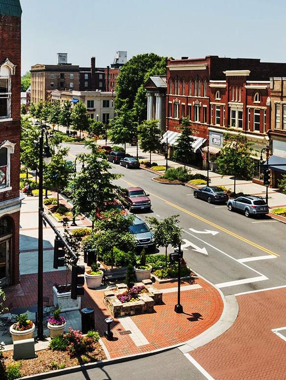
Broadway Avenue/IN 53 is another Principal Arterial and primary corridor through downtown. Broadway has a wide right-of-way from historically serving as a streetcar corridor. Today, Broadway has significantly less traffic and could be a candidate for a Complete Streets redesign.
Within the TOD study area, Virginia Street and East 6th Avenue are both Collectors as they connect downtown to the surrounding areas to the south. The remainder of Gary’s intact street grid consists of local roads in primarily residential neighborhood contexts.
Gary • Metro Center 49
50 Northwest Indiana TDD • TOD Strategic Implementation Plan Gary Metro Center 1/2Mile South Shore Line GrandCalumet River City Hall Borman Square Park U.S. Steel Yard Stadium Buffington Park NORTH Genesis Convention Center Madison St E 6th Ave E 7th Ave E 8th Ave 53 Broadway EDunesHwy E 4th Ave E 5th Ave E 6th Ave Harrison St Virginia St W 11th Ave W 15th Ave E11thAve Tennessee St 90 20 20 20 Functional Classifications Freeways (Interstates) Principal Arterial Minor Arterial Major Collector Minor Collector
Thoroughfare Typologies
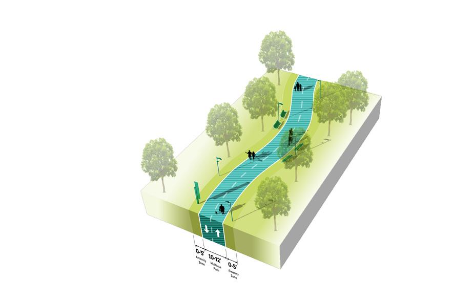
Thoroughfare Typologies were developed to analyze existing corridor conditions and create aspirational goals for future street design and streetscape. Typologies focused on important corridor segments within and connecting to the TDD boundary to guide the design and character of roadways, sidewalks, and amenities within the public right-of-way. These typologies depict typical elements of corridors, including the number of travel lanes, landscaping, lighting, bicycle infrastructure, and sidewalks and paths.
Broadway Avenue has the most opportunity to transform Downtown Gary from a thoroughfare investment as a TOD Priority Thoroughfare. As the historic heart of the community, this should be envisioned as a Complete Street with on-street parking and high-quality multi-modal and pedestrian amenities. This corridor is also expected to be a significant pedestrian connector from the Marquette Greenway to the planned Gary Elevate Trail. It is also important to locate GPTG bus stops along this corridor, servicing the downtown area.
4th and 5th Avenues as TOD Connectors also prioritize walkability and multi-modal amenities, which the proposed redesign of the pair aims to accomplish. Key
Gary • Metro Center 51
Route TOD Priority Thoroughfare
Pedestrian
Vehicular Route Trail/Greenway
TOD Connector Key
TOD Priority Thoroughfare TOD Connector Key Vehicular Route Existing Trail/Greenway Key Pedestrian Route Proposed Marquette Greenway Gary Green Link Trail Proposed Gary Elevate Trail 52 Northwest Indiana TDD • TOD Strategic Implementation Plan Gary Metro Center 1/2Mile South Shore Line Broadway City Hall Genesis Convention Center Borman Square Park U.S. Steel Yard Stadium Buffington Park NORTH DunesHwy E 4th Ave E 5th Ave Broadway Broadway Buchanan St Madison St Virginia St Ohio St Tennessee St E 6th Ave E 7th Ave W 11th St W 15th St E 8th Ave 20 20 20 90 Thoroughfare Typologies
TOD Priority Thoroughfare
Designed as a Complete Street, accommodating all modes of transportation with high-quality facilities, amenities, and public realm

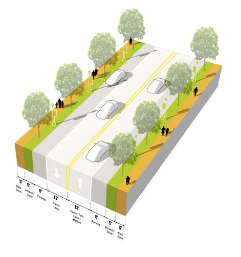
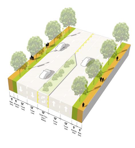
TOD Priority Thoroughfares support the highest intensity of activity, at local and regional scales. The function of these corridors is primarily to provide multi-modal access to the Station Area and to generate street-level activity for a mix of uses. These corridors will likely carry a high volume of traffic, but at lower vehicle speeds to also accommodate safe, highly-walkable conditions for pedestrians and bicyclists. An attractive, high-quality public realm provides abundant amenities for pedestrians and bicyclists, creating a safe and comfortable environment and establishing an identity/ sense of place. Buildings are typically oriented toward the sidewalk with active ground floor uses. Sidewalks should be wide enough to accommodate a clear walking path along with amenities such as street trees, planters, landscaping, outdoor dining, and gathering areas. Transit is also highly accessible along TOD Priority Thoroughfares, and transit stops should be enhanced and designed as part of the public realm. Parking is typically provided on-street, and access to development blocks or off-street parking should not occur directly from the corridor.
Number of Lanes/ Target Speed
Non-motorized Facilities
Bus/transit Facilities
Parking
Access Management
Public Realm Design/Amenities
2-4 lanes / 25-35 mph
Dedicated facilities (dedicated/separated bike lanes, sharrows, multi-use paths) wide sidewalks; frequent crossings that are well-designed and enhanced for safety and access, including mid-block crossings where necessary
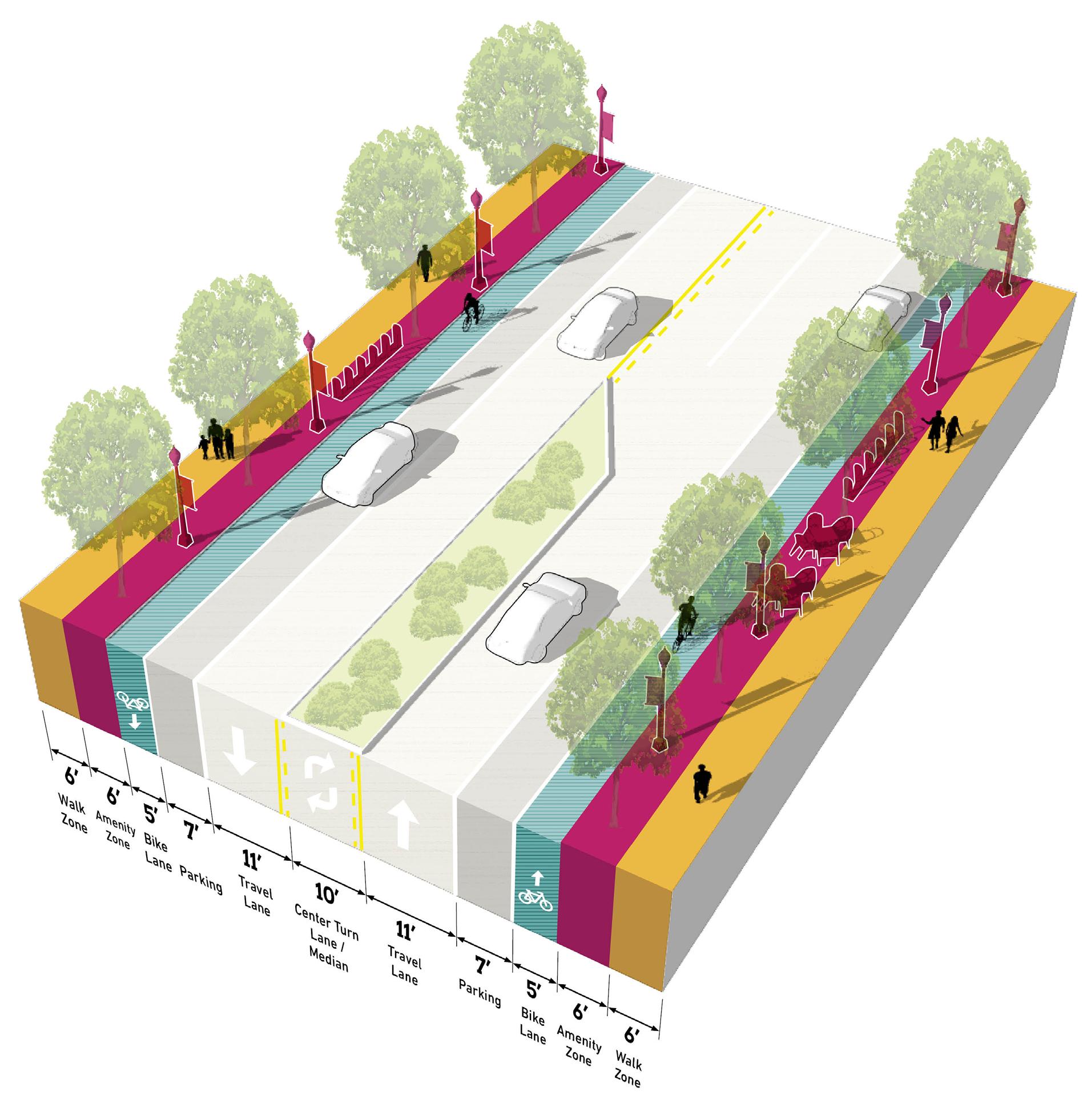
Well-served by bus/transit; enhanced transit stops including shelters and other amenities; Station Area as a hub for transit facilities; bus pull-off or drop-off zones encouraged
On-street parking; any off-street parking, either structured garages or surface lots, should be to the rear of buildings, interior to blocks, and/or properly screened and well-designed with landscaping
Very limited to no driveways in the TOD Station Area; shared parking among buildings and uses is highly encouraged to reduce the number of driveways; driveways, if present, should be adequately spaced and offset to prevent conflicts; consolidation of existing driveways should be studied
High quality and active public realm design with abundant amenities for pedestrians and bicyclists; design should be reflective of the community character and identity; sidewalks should provide adequate clear space for pedestrian circulation
54 Northwest Indiana TDD • TOD Strategic Implementation Plan
TOD Priority Thoroughfare
TOD Connector
Multi-modal street that balances modes of transportation to connect to other major facilities, with high-quality public realm and frequent amenities
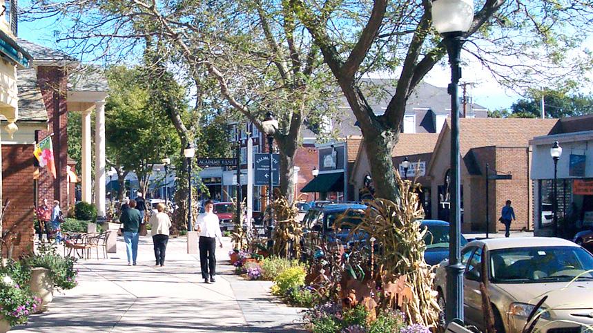
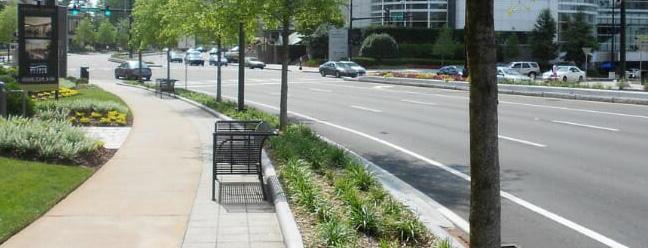
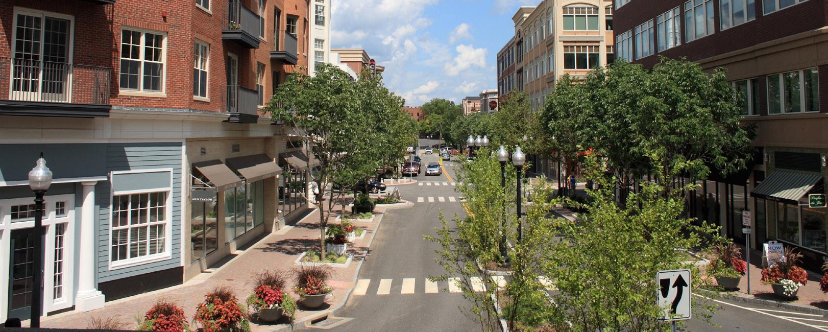
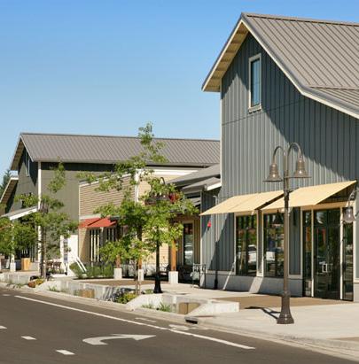
TOD Connector Thoroughfares may vary more in density of development and intensity of uses, depending on the context. These corridors serve to provide access to TOD Priority Corridors, transit-oriented development and the Station Area for the broader community and connect to other key destinations. TOD Connectors are multi-modal in design with lower vehicular speeds, connected pedestrian and bicycle networks, and transit stops. Bicycle infrastructure may vary from dedicated facilities to shared streets, depending on available right-of-way. A high-quality public realm should continue along these corridors, but may be less intense or frequent in amenities depending on right-of-way and context. Buildings are typically oriented toward the sidewalk with active ground floor uses, but setbacks may increase with a decrease in density. Driveways, both residential and commercial, may be present along the corridor, but infrequent; access management should ensure safe entry/exit along the corridor. Parking is typically provided on-street, and access to development blocks or off-street parking should not occur directly from the corridor.
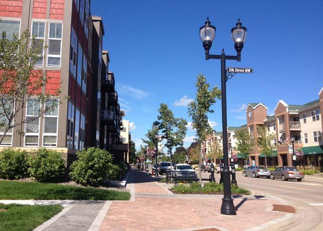
Number of Lanes/ Target Speed
Non-motorized Facilities
Bus/transit Facilities
Parking
Access Management
Public Realm Design/Amenities
2-4 lanes / 25-35 mph
Connecting gaps of existing facilities (dedicated/separated bike lanes, sharrows, multi-use paths, sidewalks, well-designed and enhanced crossings); enhancing existing facilities to improve safety and accessibility
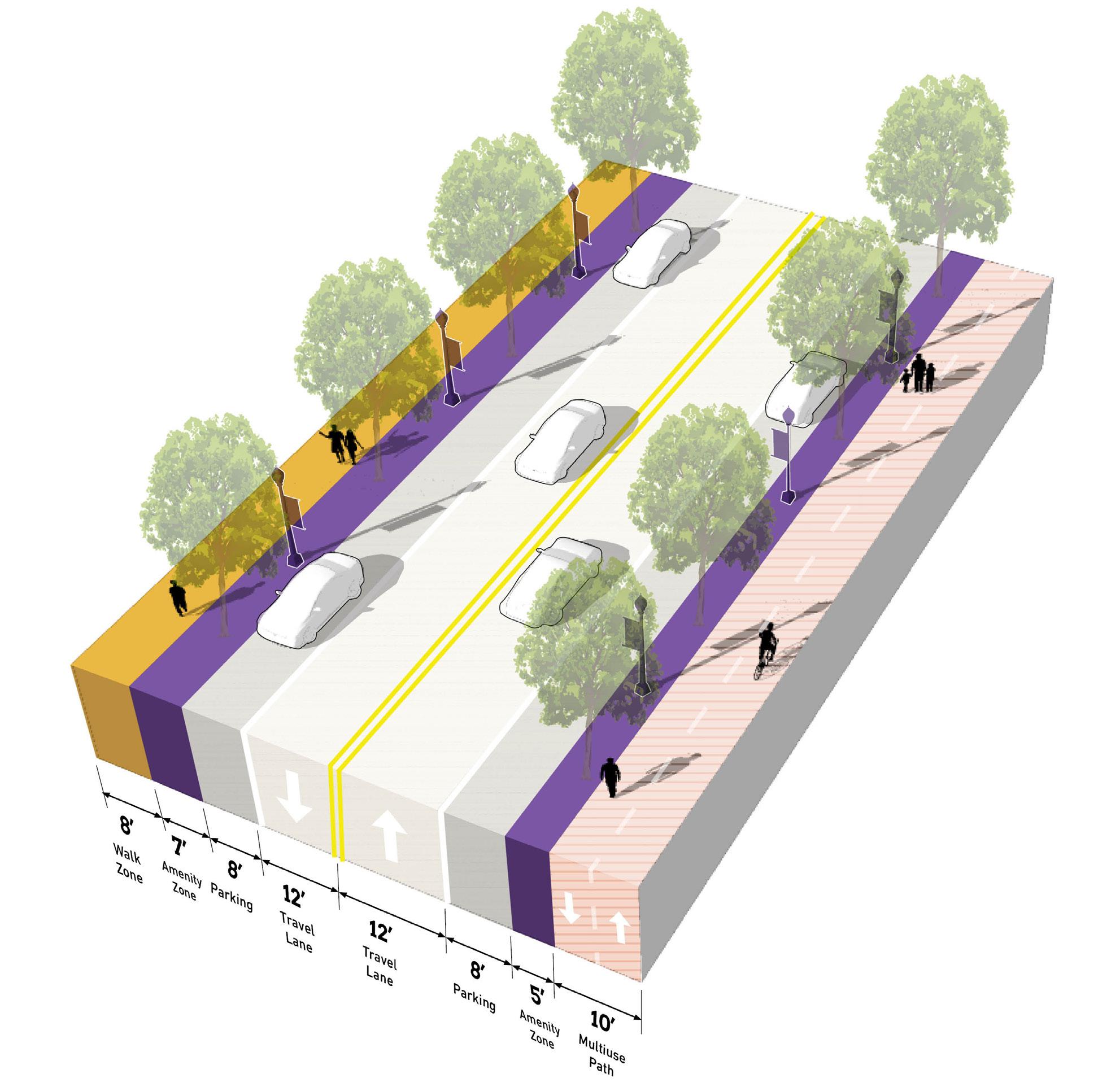
Well-served by bus/transit; enhanced transit stops including shelters and other amenities; bus pull-off or drop-off zones encouraged
On-street parking; any off-street parking, either structured garages or surface lots, should be to the rear of buildings, interior to blocks, and/or properly screened and well-designed with landscaping
Limited driveways along corridor; shared parking among buildings and uses is highly encouraged to reduce the number of driveways; driveways, if present, should be adequately spaced and offset to prevent conflicts; consolidation of existing driveways should be studied
High quality and active public realm design with many amenities for pedestrians and bicyclists; design should be reflective of the community character and identity; sidewalks should provide adequate clear space for pedestrian circulation
56 Northwest Indiana TDD • TOD Strategic Implementation Plan
TOD Connector
Key Vehicular Route
Primarily functions for vehicular travel but ensures adequate access and safety for all other modes along the corridor, connects to other facilities in the community
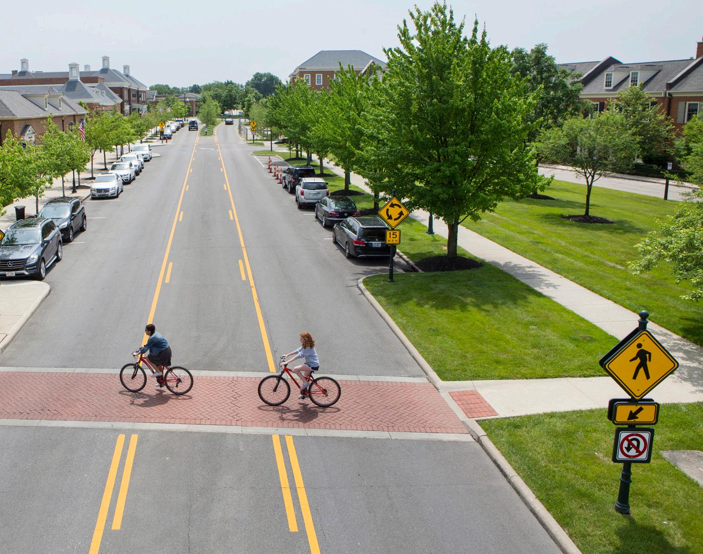
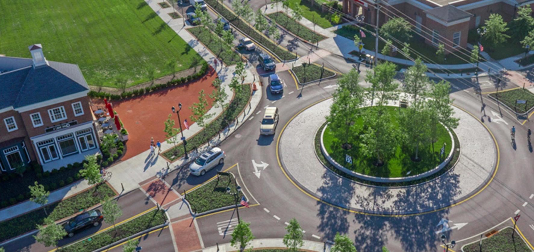
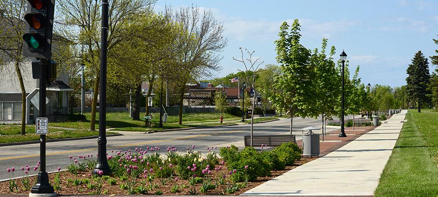
Key Vehicular Routes serve areas of moderate density and transition areas to more residential or neighborhood scale areas of the community. These corridors are more auto-oriented, linking residents to major community destinations, services, and amenities, but should still contribute to the network of safe and comfortable pedestrian and bicycle facilities. Transit service may be less frequent on these thoroughfares, but should still be accessible to important transit routes. Vehicular speeds are low along these thoroughfares, and the public realm may be less formal in design, especially in residential areas. However, quality design should still contribute to a sense of place along these corridors. On-street parking may exist in denser areas, and residential and commercial driveways are more frequent along Key Vehicular Routes, especially in more suburban-style development areas. New development should establish a high level of public realm and prevent or mitigate any vehicular conflicts through access management interventions. Parking is typically provided on-street, and access to development blocks or off-street parking should not occur directly from the thoroughfare.
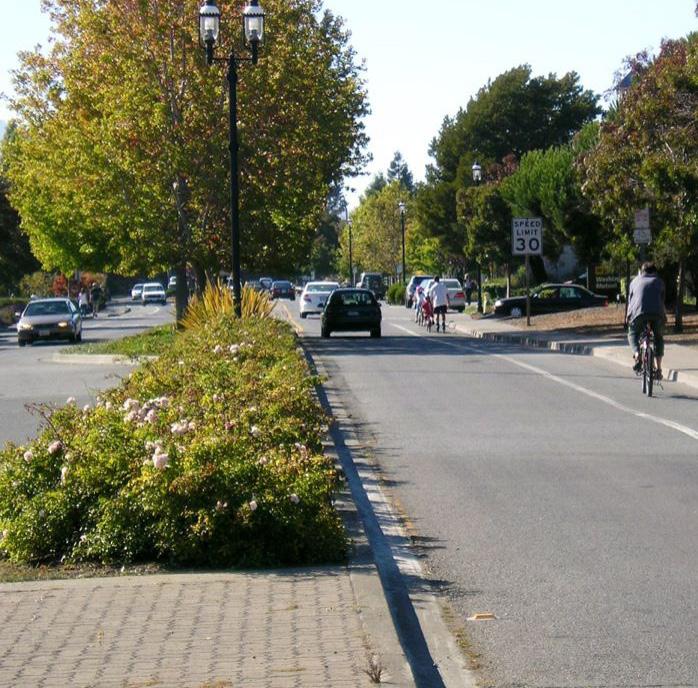
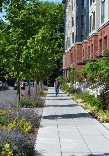
Number of Lanes/Target Speed 2 lanes / 20-25 mph
Non-motorized Facilities
Connecting gaps of existing facilities and access to enhanced facilities (sharrows, multi-use paths, sidewalks, well-designed and enhanced crossings); focus on balancing of modes
Bus/transit Facilities
Some bus/transit facilities, less frequent but enhanced transit stops; stops should be located at key destinations
Parking
On-street parking; any off-street parking, either structured garages or surface lots, should be to the rear of buildings, interior to blocks, and/or properly screened and well-designed with landscaping (if visible from corridor)
Access Management
Public realm design with basic amenities for pedestrians and bicyclists; design should be reflective of the community character and identity; sidewalks should provide adequate clear space for pedestrian circulation
Public Realm
Design/ Amenities
High quality and active public realm design with many amenities for pedestrians and bicyclists; design should be reflective of the community character and identity; sidewalks should provide adequate clear space for pedestrian circulation
58 Northwest Indiana TDD • TOD Strategic Implementation Plan
Key
Route
Vehicular
Key Pedestrian Route
Functions primarily for pedestrians, typically as a highly-designed pathway or as a trail or greenway, and may also accommodate bicyclists
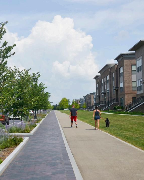

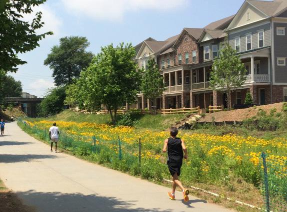
Key Pedestrian Routes primarily serve pedestrians to connect to key destinations, transit access, and the Station Area. These routes may exist alongside vehicular corridors or they may exist in the form of a pedestrian pathway or trail. In the case of a trail, bicycles may also be accommodated. Amenities and landscaping should be designed at pedestrian-scale and either contribute to the surrounding character or to particular brand if part of a larger trail network. Wayfinding and signage is particularly important to highlight access points and destinations across the community. New Key Pedestrian Routes should be planned to avoid vehicular conflicts such as driveways, and these conflicts should be reduced to the extent possible along existing Key Pedestrian Routes.
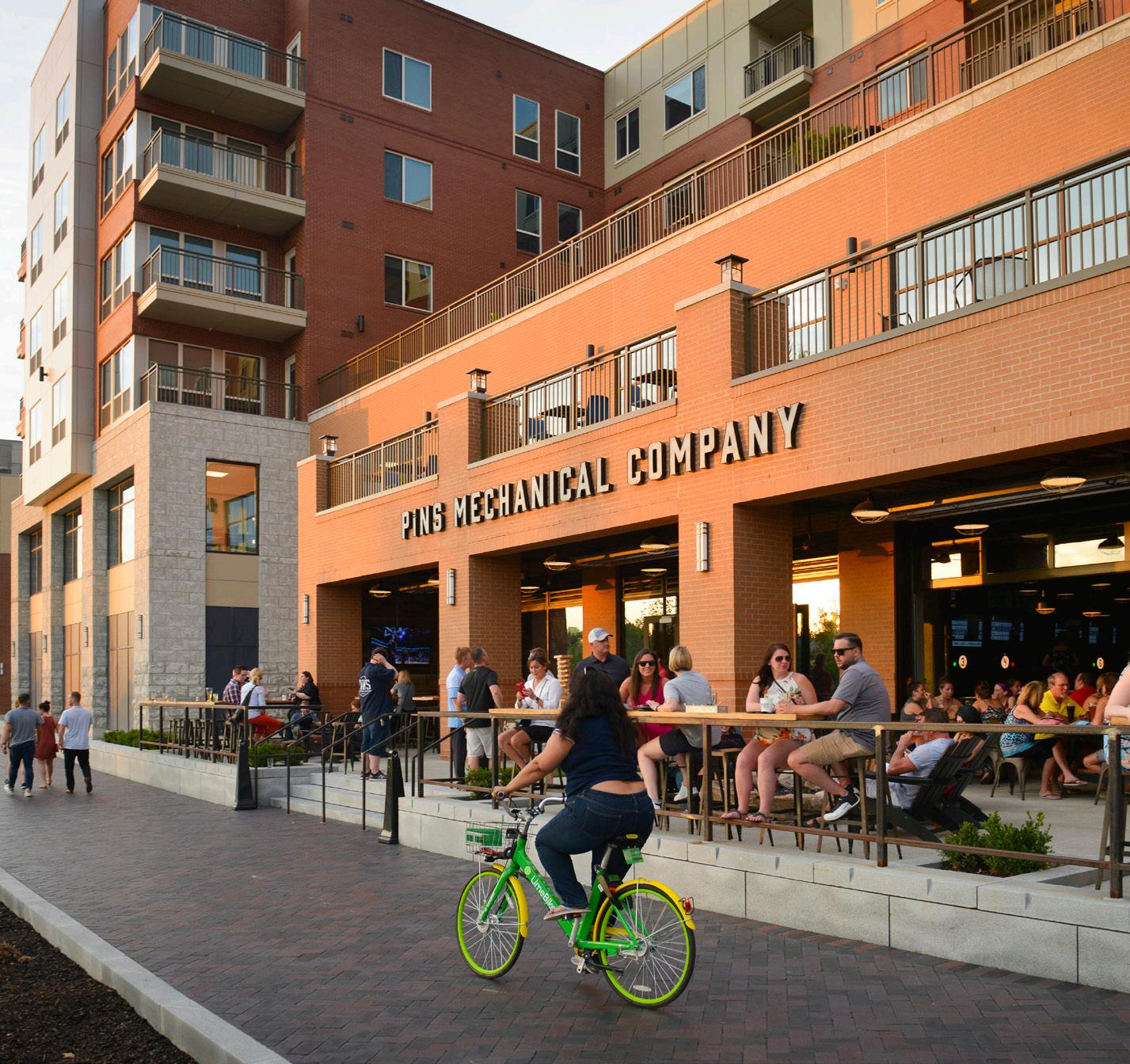

Number of Lanes/Target Speed N/A or Varies
Non-motorized Facilities
Completing gaps of existing facilities and access to enhanced facilities (sidewalks, multi-use paths, and well-design and enhanced crossings where intersecting with roadways); may exist along roadways or as a separated facilities like a path or trail
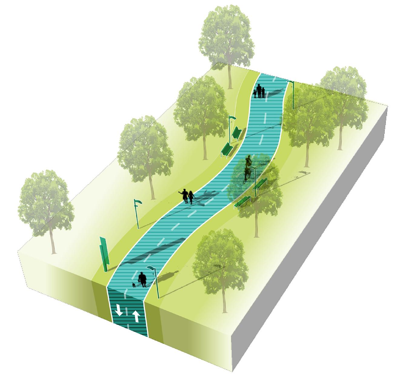
Bus/transit Facilities
Some bus/transit facilities, less frequent but enhanced transit stops; stops should be well-connected by a complete network of pedestrian facilities
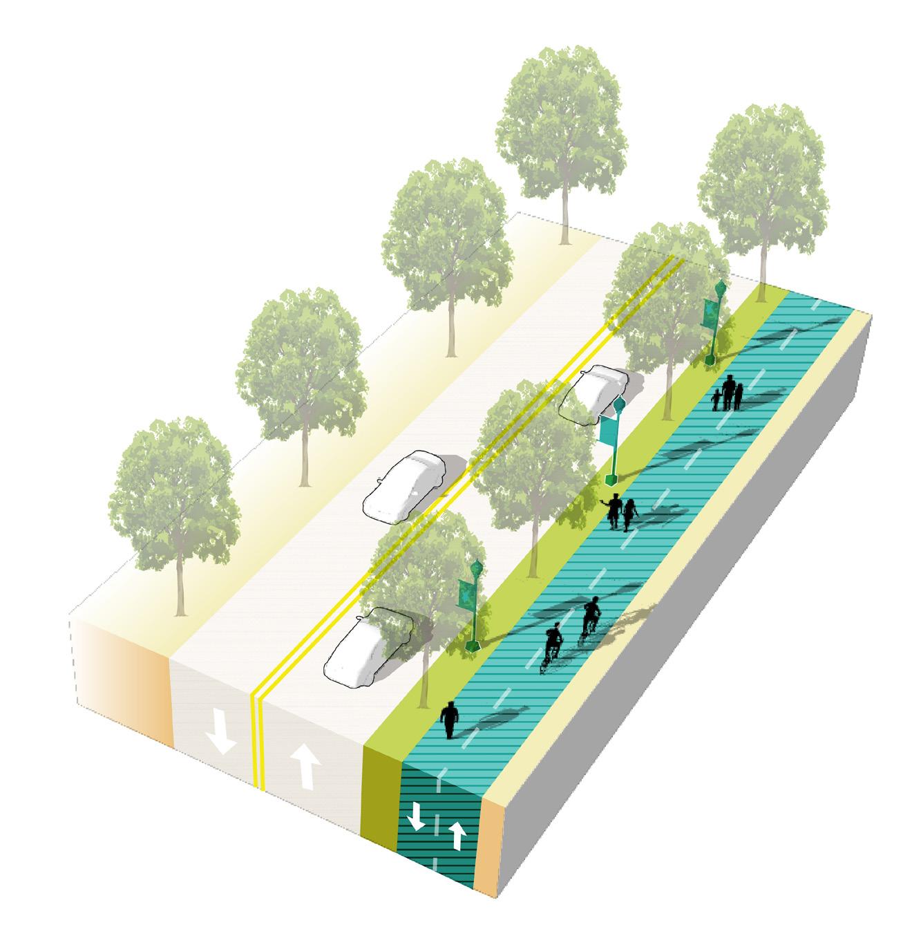
Parking
Parking areas, on-street or off-street, should be located near trailheads. Pedestrian routes may connect parking areas to other destinations in the community.
Access Management
Limited driveways intersecting with pedestrian routes to reduce conflicts with vehicle entries/exits and maximize pedestrian safety. New pedestrian routes should be planned along corridors with minimal driveway conflicts, or access management interventions may be implemented.
Public Realm Design/ Amenities
Amenities along pedestrian routes should be tailored to pedestrians (or bicyclists if a multi-use path or trail); design should be reflective of the community character and identity;local or regional trails may be designed with individual branding
60 Northwest Indiana TDD • TOD Strategic Implementation Plan
Key
Route
Pedestrian
Thoroughfare & Streetscape Design
Further studies were conducted on TOD Priority Thoroughfares at the request of the local units. These studies and the corresponding cost estimates are included in determining possibilities for infrastructure improvements that could catalyze TOD. These studies provide concept-level plans that communities could use to have conversations with stakeholders/funders, such as NIRPC and INDOT, and with local elected, appointed, and staff-level officials about the importance of high-quality infrastructure in the creation of TOD.
In the Gary Metro Center TOD study area, Broadway was identified as a priority for a road diet and Complete Streets design. In addition, the City is interested in converting the one-way pair of 4th and 5th Avenues to two-way traffic.
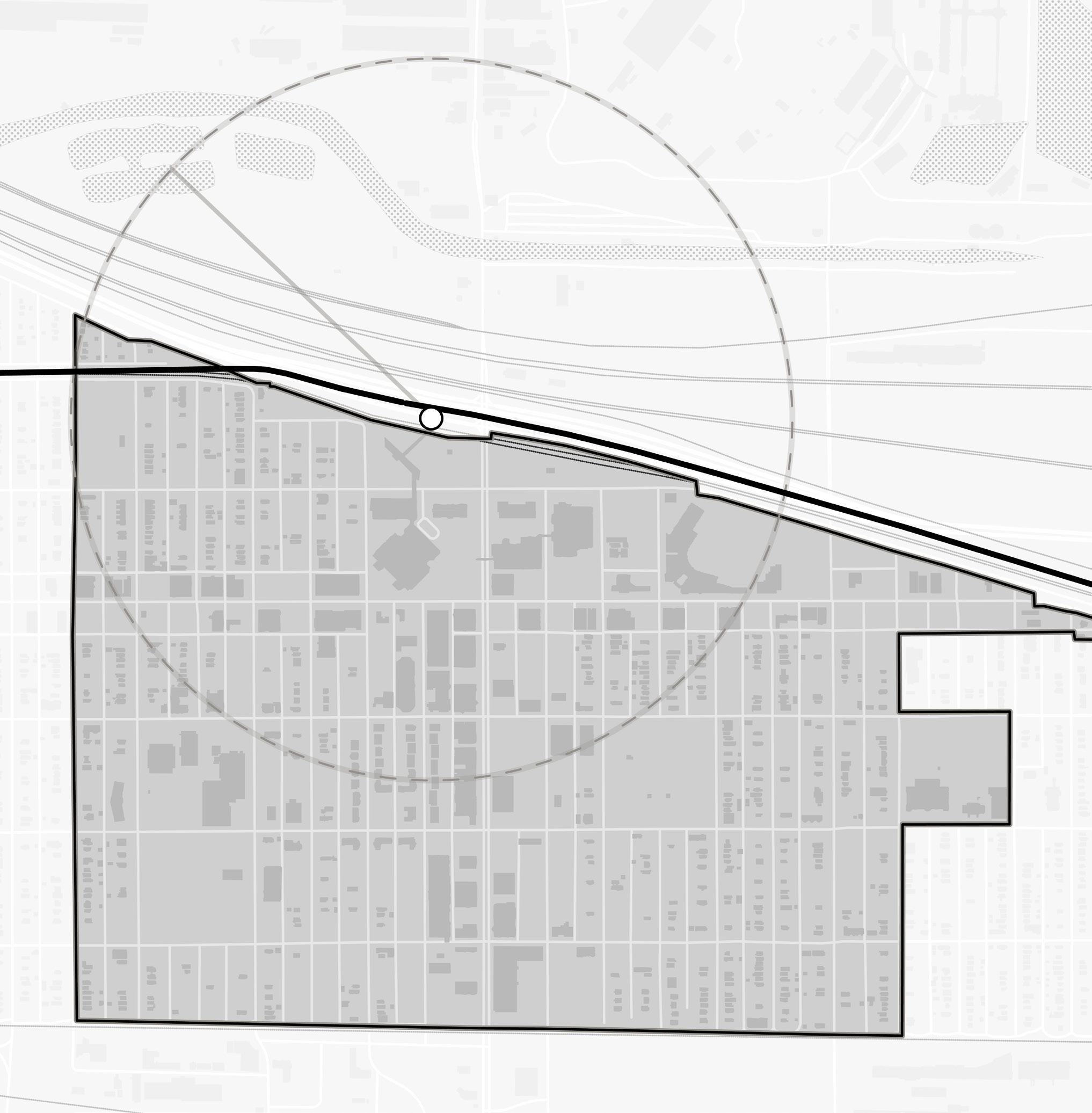
E 4th Ave E 5th Ave Madison St Broadway E 7th Ave E 6th Ave E 8th Ave Virginia St South Shore Line 20 EDunesHwy 1/2Mile Grand Calumet River Broadway Road Diet 4th Avenue Two-Way Conversion 5th Avenue Two-Way Conversion Gary Metro Center 62 Northwest Indiana TDD • TOD Strategic Implementation Plan NORTH
Broadway Ave: Phase 1
A Complete Streets approach to redesigning Broadway includes reducing lane widths, incorporating a center median, plantings, a multi-use trail, and transit amenities.
In phase one, restriping reduces lane widths and creates a center median to calm traffic and restrict left-turn movements in strategic locations. The addition of a multi-use trail on the western side of the corridor could be painted in this first phase, with bollards or buffer separating the trail from vehicular traffic. This first phase does not require changes to existing curbs.
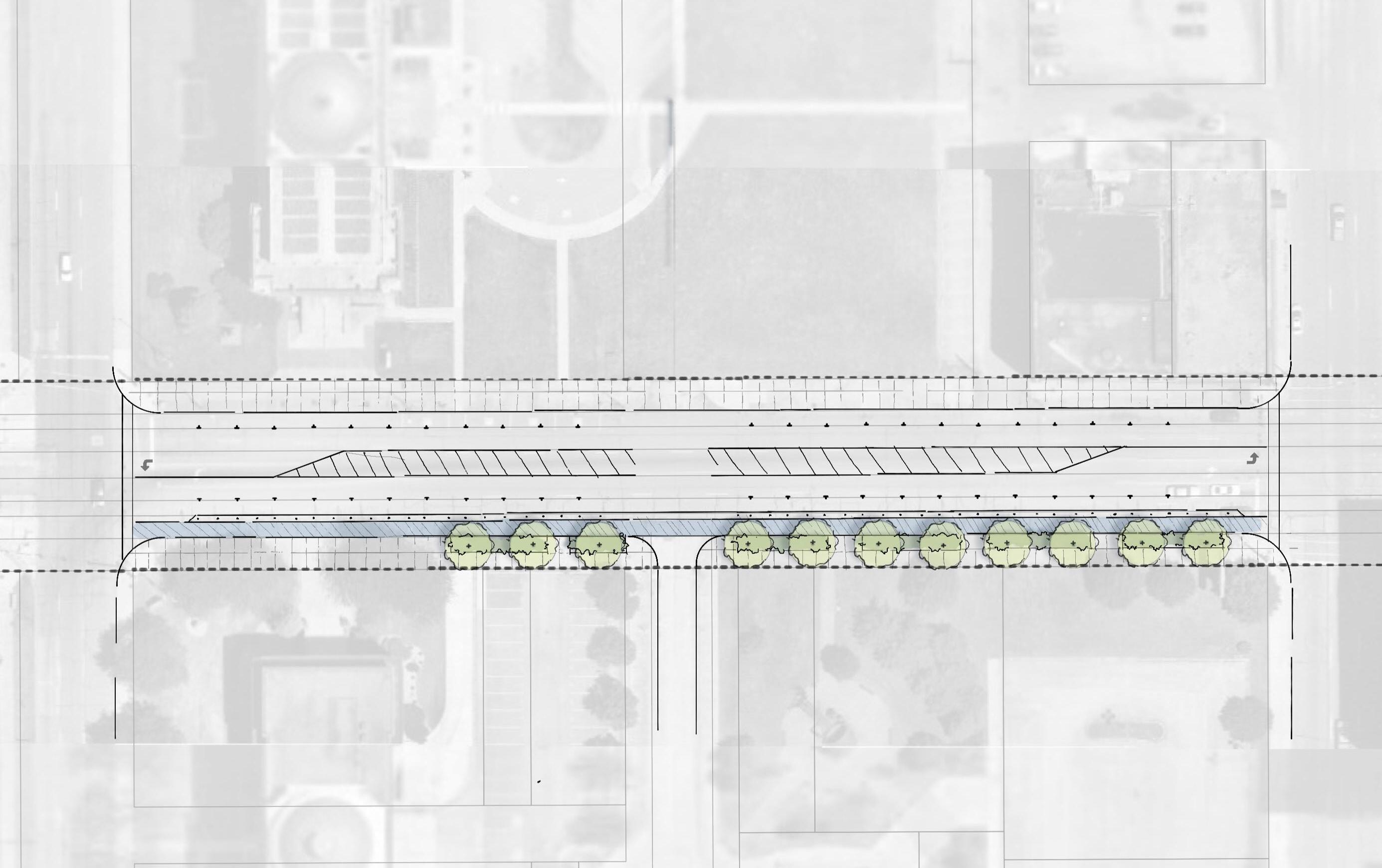
Gary • Metro Center 63 City Hall Lake County Superior Courthouse Washington St 4th Ave 5th Ave 100’ ROW Broadway Existing Conditions
Conceptual Sketch for Broadway Phase 1
NORTH Lake County Superior Courthouse City Hall 100’ ROW 8’ On-Street Parking 12’ Drive Lane 14’ Striped Median 4th Ave Washington St 5th Ave 10’ Painted Cycle Track 2’ Buffer/ Plastic Bollards 7’ Planting Area 10’ Walk 8’ On-Street Parking 12’ Drive Lane Street Trees Where No Canopy Exists 7’ Planting Broadway Existing 17’ Walk Existing Curb Existing Curb
Broadway Ave: Phase 2
In the second phase, the configuration from the first phase can be formalized by extending curbs to include bump outs and installing raised medians, further calming traffic and creating additional space for street tree plantings that improve comfort in the pedestrian realm. A new curb configuration on the west side of Broadway accommodates an asphalt multi-use path at sidewalk grade, separated and buffered from the roadway. Installing the multi-use path at sidewalk grade enhances real and perceived safety for all users.
Street tree plantings divide the sidewalk from the multi-use trail to clearly separate modes of travel. Adequate signage and pavement markings should also be considered to encourage proper use of the trail. The sidewalk and curb on the east side of Broadway remains unchanged in this concept.
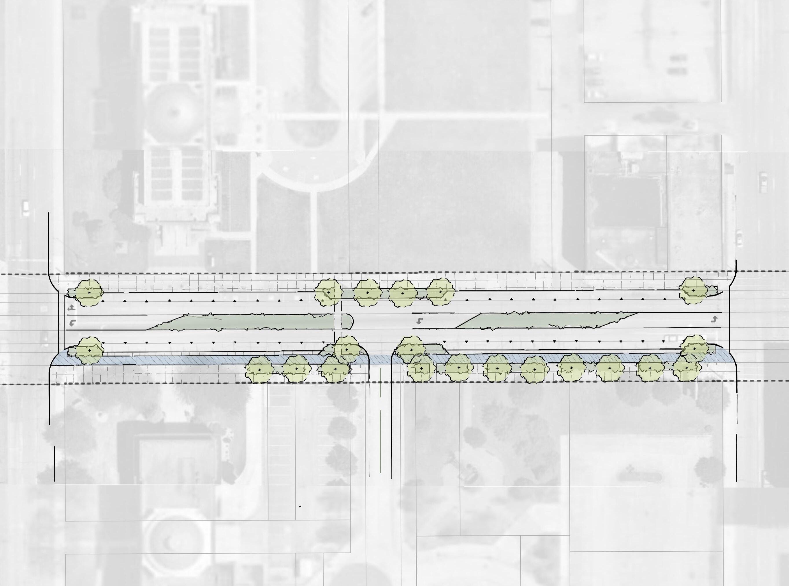
64 Northwest Indiana TDD • TOD Strategic Implementation Plan Lake
Conceptual Sketch
Broadway Phase
17’ Walk Existing Curb Lake County
Courthouse City Hall Washington St Broadway 4th Ave 5th Ave 100’ ROW
County Superior Courthouse
for
2 Existing
Superior
NORTH City Hall 8’ On-Street Parking 4th Ave Washington St 5th Ave 10’ Asphalt Trail 2’ Buffer Behind Curb Max. Curb Bumpouts That Allow Truck Turning Max. Curb Bumpouts That Allow Truck Turning 7’ Planting Area 7’ Planting Area with Street Trees Curb Bumpout With Planting Curb Bumpout With Planting Turn Lane if 2-way Washington Street 10’ Walk Midblock Crossing 8’ On-Street Parking 12’ Drive Lanes Broadway 100’ ROW Existing Conditions 14’ Planted Median
Broadway Ave: Alternate Design #1
An alternative concept for re-designing Broadway proposes restriping and planted medians. Curb bump-outs at intersections and a new tabletop mid-block crossing at Washington Street enhance walkability and pedestrian safety across the Broadway corridor to and from the station. A multi-use trail is part of curb relocation on the east side of the roadway.
Expansion of the right-of-way to the west could create additional space for varied planting areas to create a promenade-like setting for the public realm.
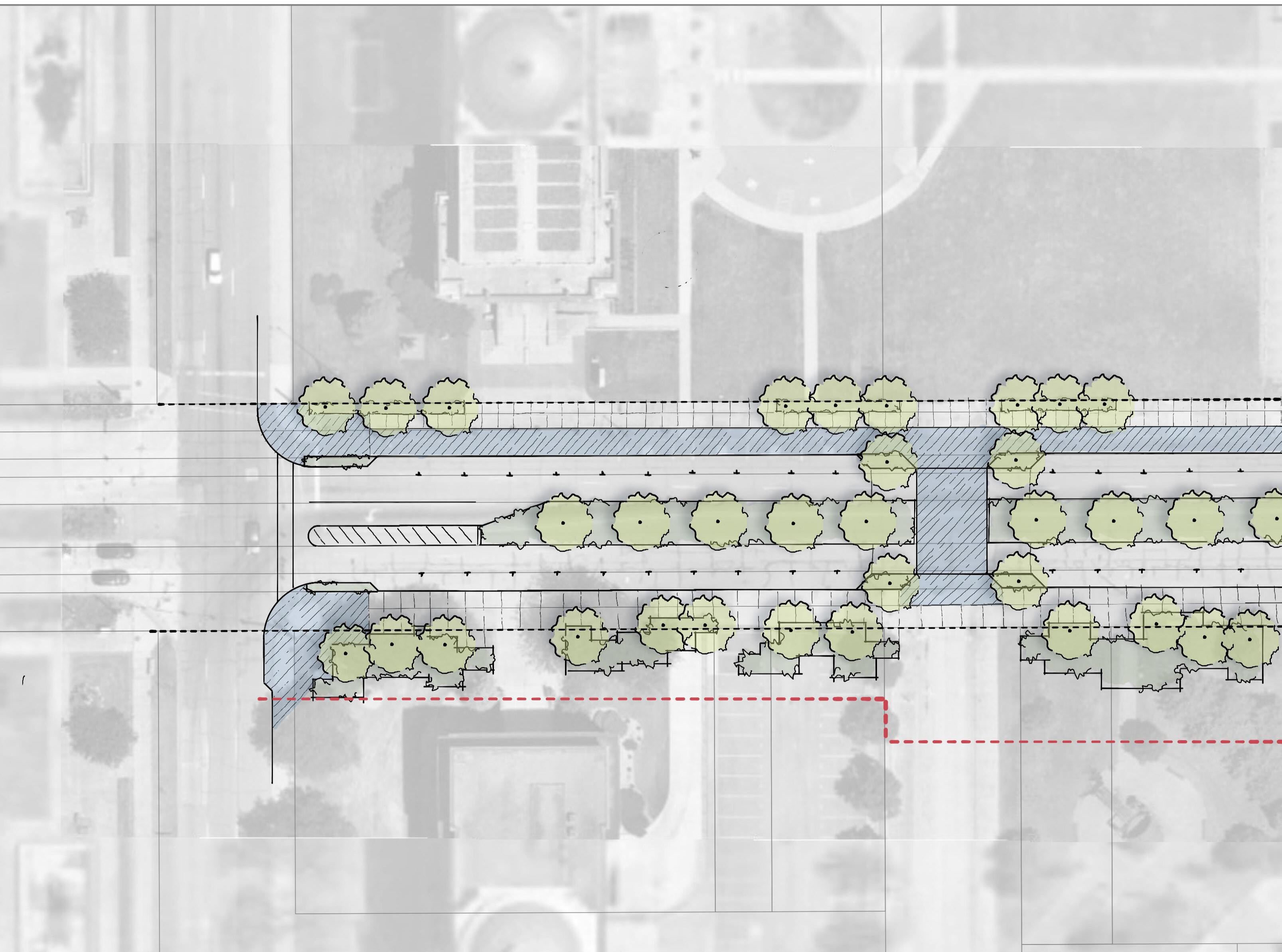
Gary • Metro Center 65
Sketch for Broadway Alternate Design #1 Lake County Superior Courthouse City Hall Washington St Broadway 4th Ave 100’ ROW
Conceptual
NORTH Lake County Superior Courthouse City Hall 100’ ROW 4’ Planting Area 12’ Multi-Use Trail 18’ Planted Median 8’ On-Street Parking 4’ Planting with Street Trees Striped Median Allows Truck Turning 4th Ave Washington St Max. Curb Bumpout Given Turning Movements 12’ Drive Lane 12’ Drive Lane Broadway Varied Planting Tabletop Crossing Possible Expansion of Public Space or ROW Existing 17’ Walk Existing Conditions
Broadway Ave: Alternate Design #2
A second alternative concept for Broadway configures back-in angled parking in the center of the corridor instead of a center median. This arrangement of parking also serves to calm traffic in both directions. Existing curbs remain on the east side, but relocated on the west side to accommodate a multi-use trail. A tabletop mid-block crossing at Washington Street with additional planting areas create a safe and walkable public realm, and enhance pedestrian access to the station across Broadway.

City Hall 100’ ROW 4th Ave Washington St Planting at Back of Parking Midblock Crossing 12’ Asphalt Trail 7’ Planting Area Revised Curb Line Median Tapers for Turning Movements 10’ Walk Broadway 12’ Drive Lane Back-in Angled Parking Back-in Angled Parking 12’ Drive Lane Existing Curb Existing 17’ Walk 66 Northwest Indiana TDD • TOD Strategic Implementation Plan Conceptual Sketch for Broadway Alternate Design #2 Lake County Superior Courthouse Lake County Superior Courthouse City Hall Washington St Broadway 4th Ave 100’ ROW
NORTH
Existing Conditions
4th Avenue
This team’s analysis disagrees with the recommendation from the Cit of Gary Comprehensive Plan that 4th Avenue carries the bulk of the truck traffic throughout downtown. 5th Avenue, with the wider 80’ right-of-way, will carry the majority of the truck traffic, while 4th Avenue should feel more like a neighborhood-scale street.
On 4th Avenue, a two-lane section will signal slower travel with either striped or planted medians. Lanes may be added only as necessary at intersections when traffic volumes are better understood. A ten-foot right-of-way expansion on the east side would allow for continuous sidewalk and tree lawns on either side of Broadway.
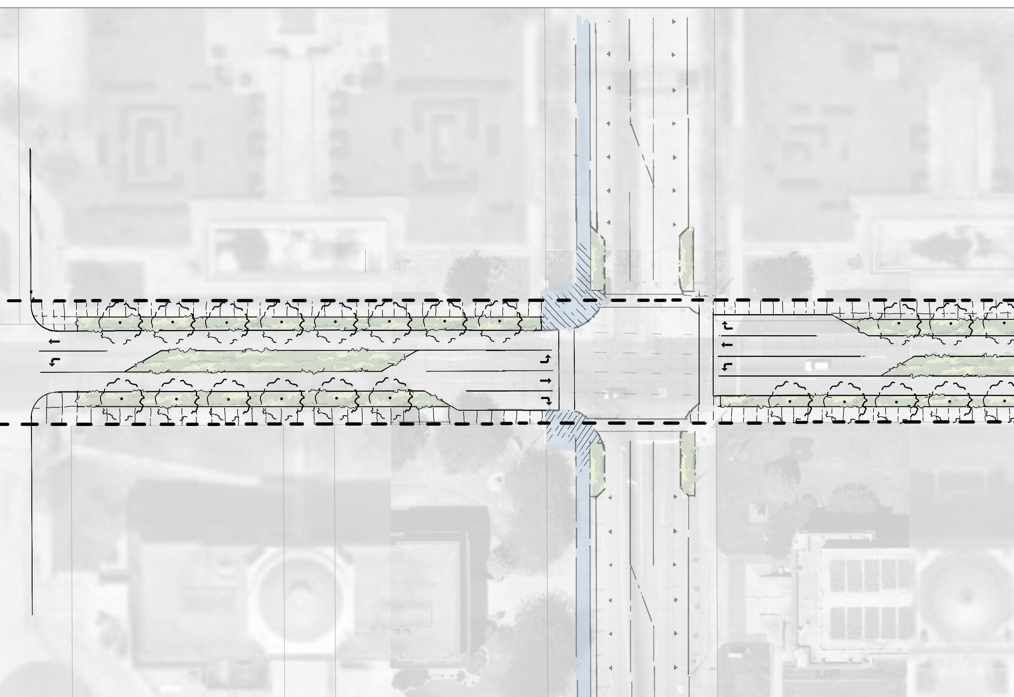
Lake County Superior Courthouse City Hall 70’ ROW Broadway 12’ Planted or Striped Median Right Turn Lane at Major Intersection
Turn Lane at Major Intersection 10’ Walk 6’ Planting Area 8’ Planting Area 8’ Walk 8’ Walk 10’ Walk 4th Avenue 12’ Planted or Striped Median 12’ Drive Lanes 6’ Planting Area 8’ Walk 8’ Walk 8’ Planting Area 10’ ROW Expansion to Continue Walk at Intersection Gary • Metro Center 67
Right
Conceptual Sketch for 4th Avenue City Hall Broadway 4th Ave 60’ ROW
Lake County Superior Courthouse
NORTH
Existing Conditions
5th Avenue
The curb-to-curb width of 5th Avenue will likely have to increase by four feet to accommodate a five-lane section with dedicated left turn lanes at intersections. A striped median would calm traffic by restricting left turns in strategic locations and shifting to left-turn lanes at key intersections. In the downtown area, vacant parcels could be acquired to allow for right-of-way expansion on the east side to prioritize more comfortable pedestrian space with street trees.
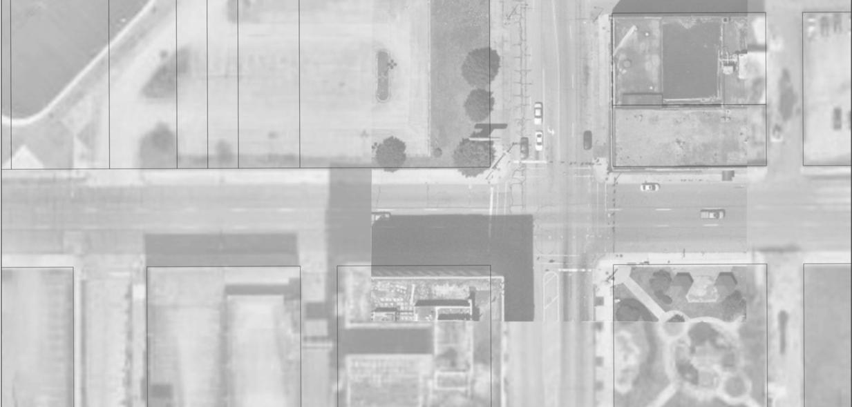
5th Avenue
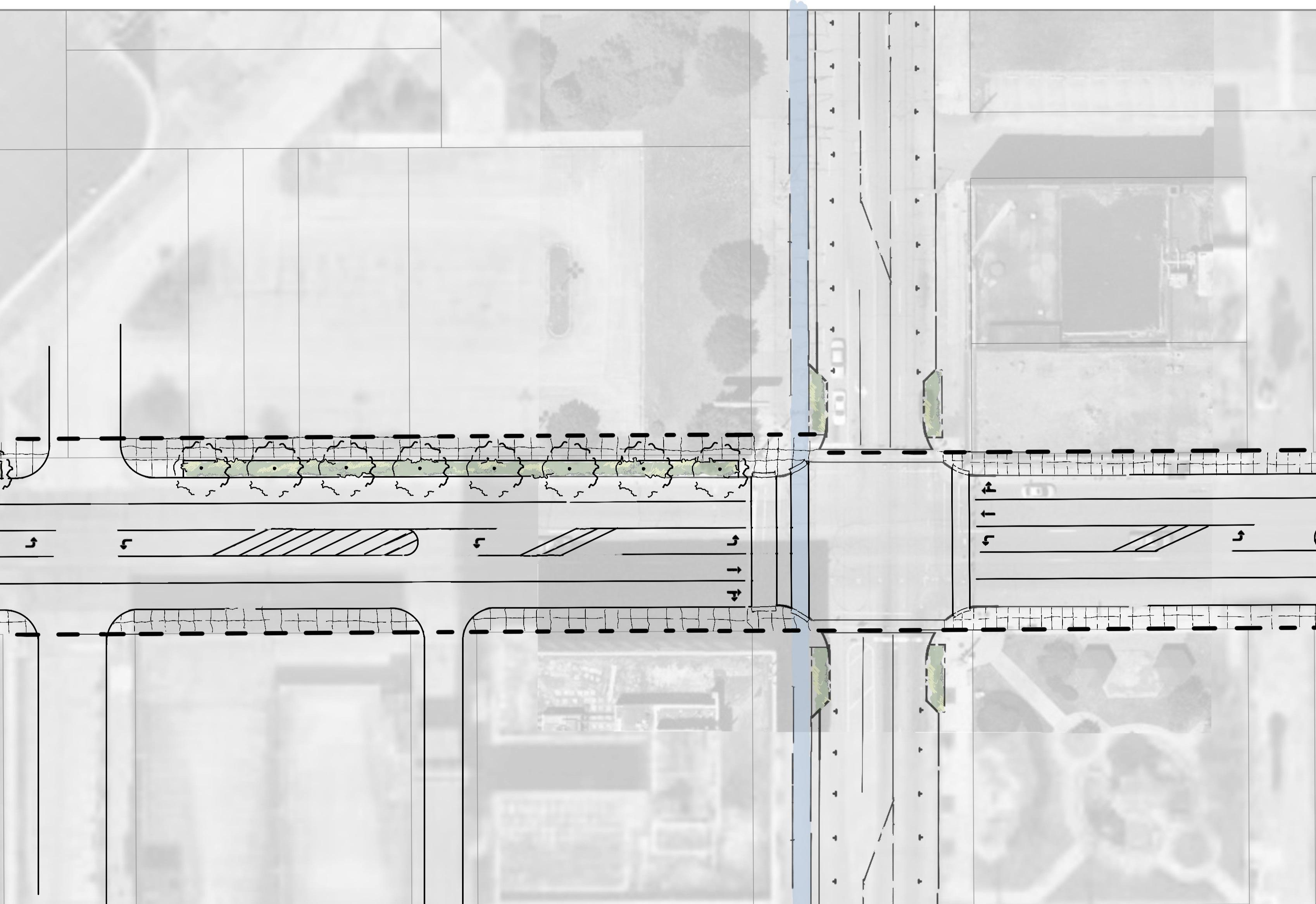
68 Northwest Indiana TDD • TOD Strategic Implementation Plan
10’
Conceptual Sketch for 5th Avenue
ROW Expansion to Allow Street Tree Planting
Existing Development 5th and Broadway Park 90’ ROW 80’ ROW Broadway Washington St 12’ Turn Lanes/ Striped Median 12’ Drive Lanes 10’ Walk 10’ Walk 10’ Walk
12’ Turn Lane/ Striped Median 12’ Drive Lanes 8’ Street Tree Planting 12’ Walk 12’ Drive Lanes Existing ROW 5th and Broadway Park Existing Development Broadway 5th Ave 80’ ROW NORTH Existing Conditions
Zoning
Coding Objectives
The team worked with City of Gary staff to identify coding objectives, review the current code for the ability to achieve TOD, and prepare draft code language that the City can review and locally adopt following this planning process. The team recorded current zoning within the TOD study area and relevant recommendations from previous plans. The City’s current zoning code requires an update to prepare the community for TOD. The team has prepared an evaluation of the current code and a new coding template. Due to the detail and length of the coding template, detailed zoning recommendations are in the Appendix.
Existing Zoning Districts & Metrics
The table below lists the existing Zoning Districts within the TOD study area, along with their metrics, which were taken into account in the analysis.
Not less than 20% of the lot depth. For buildings exceeding 25 ft in height, the yard shall increase by one foot for each two feet by which the building exceeds 25 ft, but not exceed 40 ft.
[Single-family one story dwelling]: Combined widths of at least 12 ft
[Single-family dwelling > 1 story] Combined widths of at least 15 feet
Not less than 2/3 of the building height, but no less than 30 ft. R3
7,000 sq ft 60 ft
Not less than 20% of the lot depth. For buildings exceeding 25 ft in height, the yard shall increase by one foot for each two feet by which the building exceeds 25 ft, but not exceed 40 ft.
Not less than 20% of the lot depth. For buildings exceeding 25 ft in height, the yard shall increase by one foot for each two feet by which the building exceeds 25 ft, but not exceed 40 ft.
[Single-family one story dwelling]: Combined widths of at least 12 ft
[Single-family dwelling > 1 story] Combined widths of at least 15 feet
Not less than 2/3 of the building height, but no less than 30 ft. R4
[Single-family one story dwelling]: Combined widths of at least 12 ft
[Single-family dwelling > 1 story] Combined widths of at least 15 feet
Not less than 2/3 of the building height, but no less than 30 ft.
R5 1.0 1,200 sq ft N/A
Not less than 20% of the lot depth. For buildings exceeding 25 ft in height, the yard shall increase by one foot for each two feet by which the building exceeds 25 ft, but not exceed 40 ft.
Not less in width than 10% of the building width or 20% of the building height (residential building).
Not less than 2/3 of the building height but in no case less than 12 feet (nonresidential building).
Not less than 2/3 of the building height, but no less than 30 ft. However, a rear yard may begin at a height of no more than 6 ft above curb level for the sole purpose of providing enclosed accessory off-street parking facilities beneath.
Gary • Metro Center 69
District Max. Floor Area Ratio Min. Lot Area Min. Lot Width Min. Front Setback Min. Side Setback Min. Rear Setback R2 0.5
6,000 sq ft 50 ft
0.5
0.5
5,000 sq ft 40 ft
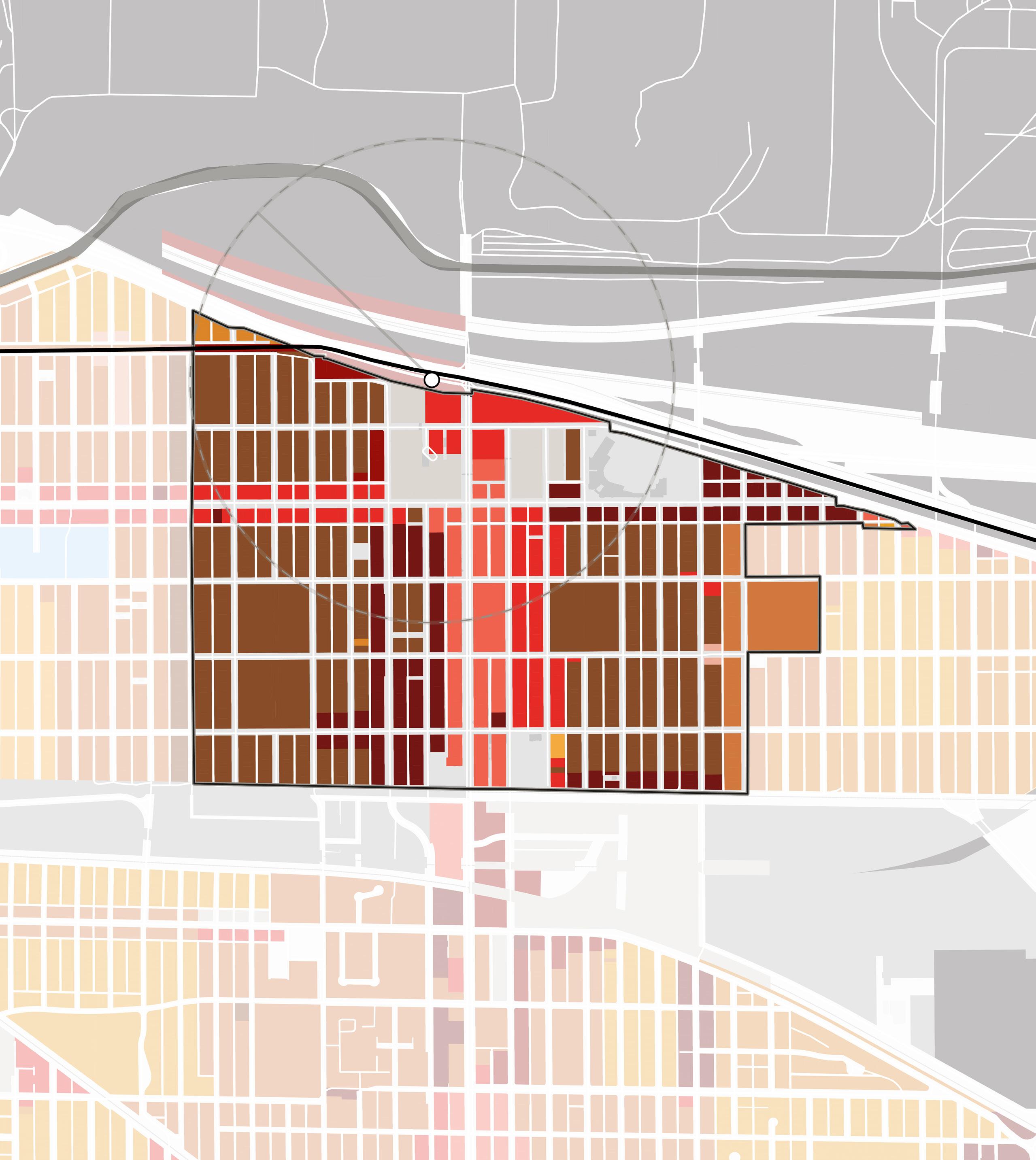
70 Northwest Indiana TDD • TOD Strategic Implementation Plan Gary Metro Center 1/2Mile Broadway Madison St E 5th Ave E 6th Ave EDunesHwy E 7th Ave E 8th Ave E 4th Ave 90 20 53 South Shore Line GrandCalumet River Broadway City Hall Genesis Convention Center Borman Square Park U.S. Steel Yard Stadium Buffington Park NORTH M1-1 M1-1 R3 B2 B3 B3 B4 B4 B3 B3 B5 B5 B5 B5 B5 R2 B5 B2 R6 R6 R6 R6 R6 R6 B1 B2 B2 R3 R4 R5 B1 B2 B3 B4 B5 R2 R3 R4 R5 R6 M1- 1 M2-2 Other Existing Zoning Districts
R6 2.0 1,250 sq ft N/A
Not less than 20% of the lot depth. For buildings exceeding 25 ft in height, the yard shall increase by one foot for each two feet by which the building exceeds 25 ft, but not exceed 40 ft.
Not less in width than 10% of the building width or 20% of the building height (residential building).
Not less than 2/3 of the building height but in no case less than 12 feet (nonresidential building).
B1 1.5 5,000 sq ft 40 ft
Not required, except when adjacent to a residence, a yard equal in depth to the minimum front yard required shall be provided for a distance of at least 25 ft.
Not less than 2/3 of the building height, but no less than 30 ft. However, a rear yard may begin at a height of no more than 6 ft above curb level for the sole purpose of providing enclosed accessory off-street parking facilities beneath.
B2 1.5 7,500 sq ft 60 ft
Not required, except when adjacent to a residence, a yard equal in depth to the minimum front yard required shall be provided for a distance of at least 25 ft.
Not required, except for when adjacent to a residence, a yard shall be provided along the side lot line and shall be equal in dimension to the minimum side yard.
Not required, except for when adjacent to a residence, a yard shall be provided along the side lot line and shall be equal in dimension to the minimum side yard.
Not required, except for when adjacent to a residence, a yard shall be provided along the rear lot line and shall be equal in dimension to the minimum side yard.
30 ft for residential uses located above the 1st floor.
B3 3.5 10,000 sq ft 75 ft
Not required, except when adjacent to a residence, a yard equal in depth to the minimum front yard required shall be provided for a distance of at least 25 ft.
Not required, except for when adjacent to a residence, a yard shall be provided along the side lot line and shall be equal in dimension to the minimum side yard.
30 ft for residential uses located above the 1st floor.
B4 2.0 N/A N/A
Not required, except when adjacent to a residence, a yard equal in depth to the minimum front yard required shall be provided for a distance of at least 25 ft.
Not required, except for when adjacent to a residence, a yard shall be provided along the side lot line and shall be equal in dimension to the minimum side yard.
30 ft for residential uses located above the 1st floor.
Not less in width than 10% of the lot width but not exceed 20 ft in width. When across the street from a residence district, a side yard shall be provided on each zoning lot. Each side yard shall be equal in width to 10% of the lot, but not exceed 50 ft in width.
Determined by uses and plans.
Gary • Metro Center 71 District Max. Floor Area Ratio Min. Lot Area Min. Lot Width Min. Front Setback Min. Side Setback Min. Rear Setback
M1-1 1.0 43,560 sq ft 140 ft No less than 25 ft.
less
Determined by uses and plans. M2-2 2.0 N/A N/A No less than 25
Not
than 10% of the lot width but not exceeding 20 ft.
ft.
Codes and Recommendations
This plan recommends that the City of Gary simplifies its outdated zoning code and considers several ranges of development that are appropriate for the downtown core. This includes three thresholds of mixed-use districts and a civic zoning district.
The CD-4 General Urban District consists of a medium intensity area that has a mix of building types and residential, retail, office and other commercial uses; there are medium, shallow or no front setbacks and narrow to medium side setbacks. It has variable private landscaping, and it has streets with curbs, sidewalks, and thoroughfare trees that define medium-sized blocks.
The CD-5 Urban Center District consists of higher intensity mixed use areas. It has a tight network of thoroughfares with wide sidewalks and regular tree spacing, defining medium-sized blocks. Buildings are set close to the sidewalks.
The CD-6 Urban Core District is the highest intensity area and features predominantly attached buildings forming a continuous street wall and accommodating mixed uses, as well as entertainment, civic and cultural uses. Thoroughfares have wide sidewalks and steady tree planting. Buildings are set at close to the sidewalk.
The Civic Zone (CV) is assigned to areas designated for Civic purposes. These may be open space of one or more civic space types allowed within or adjacent to any specific character district, as well as sites dedicated to significant buildings to be used for civic purposes, such as libraries, museums, places of worship, and schools.
72 Northwest Indiana TDD • TOD Strategic Implementation Plan
Proposed Zoning Districts
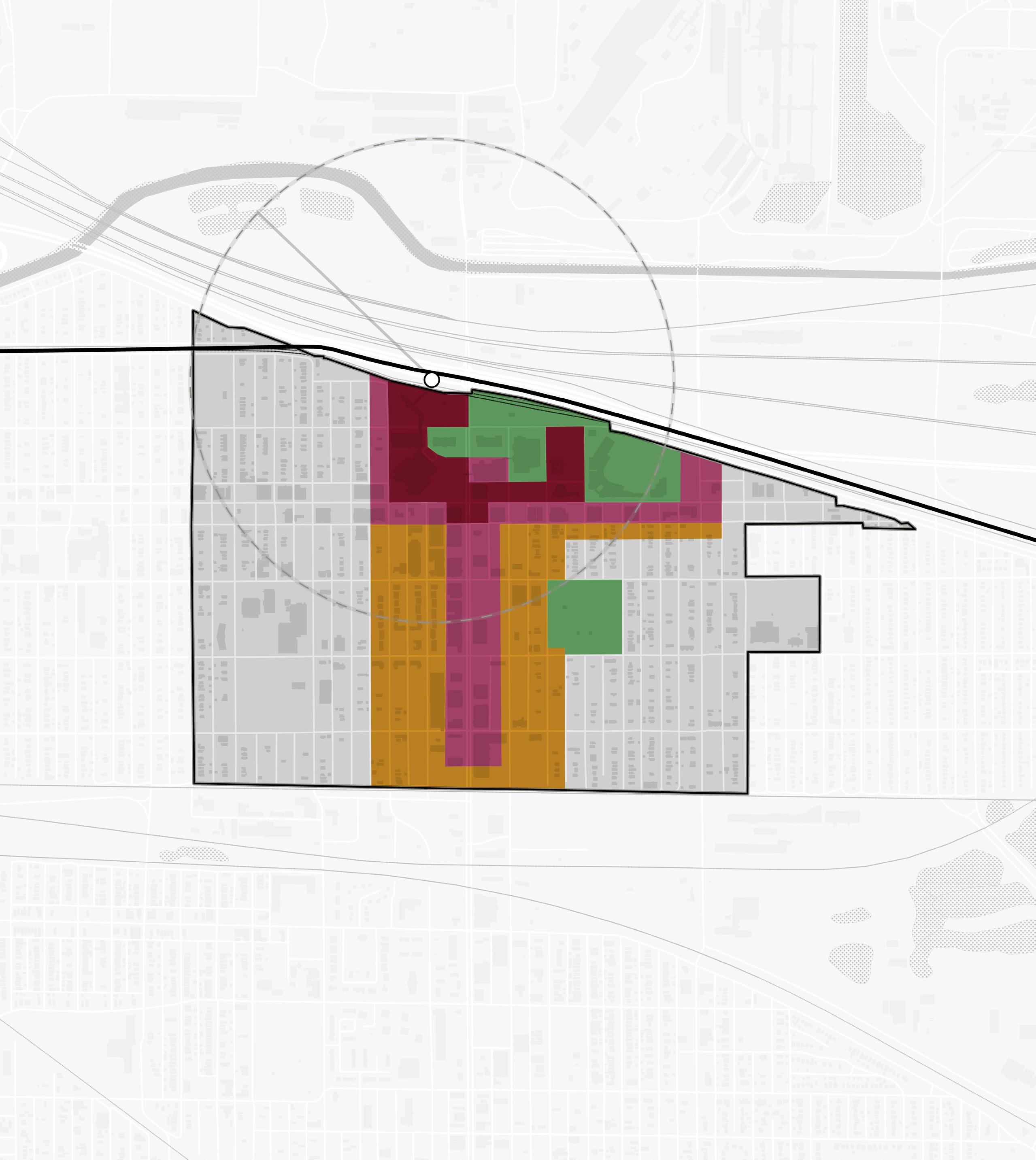
CD-6 CD-5 CD-4 CV Gary • Metro Center 73 Gary Metro Center 1/2Mile Broadway Madison St E 5th Ave E 6th Ave EDunesHwy E 7th Ave E 8th Ave E 4th Ave 90 20 53 South Shore Line GrandCalumet River Broadway City Hall Genesis Convention Center Borman Square Park U.S. Steel Yard Stadium Buffington Park NORTH
CD-4 CV CD-6 CV CD-5 CD-5
Implementation
Implementation Strategies
While planning efforts are inherently long-range in scope, there is a benefit to identifying early projects – catalyst projects – that are necessary to improve market conditions and spark changes. This is where a development plan becomes more tangible with near-term goals that can be brought into sharper focus for the community and achieved relatively quickly to create momentum into the future.
Critical components of an implementable development plan include site capacity, economic viability, and political support. The implementation strategy summarizes project recommendations contained within.
Implementation strategies are outlined in three timeframes and are defined below: Immediate Next Steps, Short-Term Strategies, and Long-Term Strategies.
Immediate Next Steps
Actions to take quickly to get recommendations set up for implementation
Short-Term Strategies
Tasks and projects that can be executed in a 1-5 year timeframe
Long-Term Strategies
Tasks and projects that require additional work to execute and can be completed in 5 or more years
Enabling Actions
• Continue to follow SB 434 legislation in the Spring of 2023 to determine if it passes and can create a fund or other mechanism to support replacement of the Gary Metro Station and provide public safety and unsafe building removal funds
• Explore the potential of partnering with NICTD, GPTC, and the RDA to apply for Federal Transit Administration Capital Projects grants. Meet with FTA Region 5 staff in Chicago to discuss grant eligibility for all parties in the advancement of a new Gary Metro Station.
• Convene a meeting between City of Gary leadership and the RDA to review potential draft Downtown Gary TDD boundaries. Once all parties agree on a potential boundaries, set a schedule for public engagement sessions, City leadership approval, required RDA board hearings, and State Budget Committee approval in 2023.
Recommendations
Land Use & Zoning
Immediate Next Steps
• Create a working group of City staff and Plan Commission members to review the recommendations within the Gary Metro Station TOD Implementation Strategy. Evaluate the potential of adopting this plan as an area plan to guide land use and development as part of the City’s Comprehensive Plan.
• Review the zoning recommendations and calibrated zoning template. Bring this draft information to the working group to further evaluate next steps for updates to the City’s Zoning Ordinance. Use the recommendations from this study to inform revisions to the zoning code to enable TOD and potential applicability to the entire City.
Short-Term Strategies
• Begin the necessary legal review process and make updates to the Zoning Ordinance to incorporate the calibrated zoning template as an overlay or rezoned districts. Conduct a public process to vet the recommendations and make desired changes. Continue to educate the community, city officials, and boards and commissions about the importance of transit-oriented development in reaching the goals of the City. Adopt new code language and regulating plan into the City’s Zoning Ordinance.
• Ensure that adopted zoning allows for housing development at the desired density and that is compatible with the adjacent existing neighborhood-scale context
74 Northwest Indiana TDD • TOD Strategic Implementation Plan
Long-Term Strategies
• Apply the updated land use and zoning to help elevate the development quality, emphasizing appropriate scale and walkability, and improve the experience for petitioners seeking to do projects in the City
(Re)development
Immediate Next Steps
• Create a working group of City staff and Redevelopment Commission members to review the Gary Metro Station TOD Implementation Strategy and the Gary Metro Station: TOD Visioning report to educate members on how TDDs can help enable TOD
• Partner with the Gary Housing Authority (GHA) and Northwest Indiana Development Corporation to engage the development community and explore creative development deals in the downtown area, including the RFQs recently released by GHA
• Engage the development community and conduct an Industry Day and/or bus tour advertising opportunities in downtown and throughout the region
• Evaluate properties within 1/4 mile of the Gary Metro Station as part of further site due diligence including tax and foreclosure status, ownership, detailed building and site conditions assessments, Environmental Site Assessments, utilities analysis
• Determine ways for early activation of vacant areas to stabilize and draw positive attention to the potential of this area
Short-Term Strategies
• Leverage properties assembled/controlled by the City of Gary and GHA to target specific redevelopment zones with the first zone being the immediate station area and downtown core
• Acquire, landbank, and clear properties within areas targeted for redevelopment. If properties are in stable and occupied condition, continue their current use.
• Assess ownership of properties within areas which could be stabilized and add infill development over time. Continue to hold properties landbanked within this area and encourage investment by private owners in these areas.
• Pair municipal and GHA owned properties with additional available properties identified in redevelopment scenarios within this plan for assemblage, marketing, and evaluation of sale/ hold strategies for development
• Prioritize additional property acquisition by the City or GHA of properties that are for sale or tax sale along Broadway, 4th, and 5th Avenues and one block west of Adams Street
• Identify critical infrastructure needs within the study area boundary
• Utilize renderings included within this TOD strategy to hold conversations with RDA, GHA, Northwest Indiana Development Corporation, and potential developers to prepare City-owned properties for development. Renderings are designed to help the City and developers understand the TOD vision and prepare RFPs, tax credit applications, and grant requests.
• Engage the White Family Foundation, Lilly Foundation, Lake County Legacy Foundation, and other entities to begin strategizing a potential philanthropic role informed by the Gary Metro Station: TOD Visioning report
• Prepare shovel-ready sites for a master development RFP with the potential for partnerships with GHA and Northwest Indiana Development Corporation
• Use the Gary Metro Station: TOD Visioning report to discuss with US Steel about removing a restrictive covenant from Gateway Park west of Broadway
• Reference the brownfield analysis included in the Appendix when discussing redevelopment on sites within the TDD boundary
• Promote denser housing types such as townhomes and multi-family buildings. Population density will be crucial to obtaining the vitality and services that the community needs and wants in the future.
• Promote sustainable design through adaptive re-use or the use of local, durable and/or recycled building materials, permeable pavement, electric charging stations and solar panels, shared parking strategies, and native plant species
Long-Term Strategies
• Leverage the ongoing SB 434 legislation and the completed Gary Metro Station: TOD Visioning report to bring attention to and support downtown revitalization with a new station as the catalyst
Gary • Metro Center 75
• Use the Arc of Development study to advance conversations with the community and other major stakeholders about the potential for revitalization tied to TOD, including population growth, job creation, and economic development through TDD revenue
• Support a redevelopment strategy for the Genesis Convention Center Block with the goal of activating this near-station site:
› Conduct a cost analysis to compare the potential Return on Investment (ROI) of adaptive reuse vs. demolition
› Discuss the potential of pairing redevelopment of the Genesis Convention Center site with joint development at the station as part of a master development RFP
› Understand developer interest and assess the gap needed to secure market interest in this project. Meet with developers to discuss alternative procurement methods and development models, such as Public-Private Partnerships (P3) and Build-OperateTransfer (BOT)
› Understand what short-term uses could activate this facility as a revenue-generating source on a before a new station and/or eventual redevelopment occurs
• Revitalize a block of Broadway one block deep on the west and two blocks deep along the corridor. Potential candidates include blocks between 5th and 6th and 7th and 8th Avenues. This action will demonstrate positive attention to the most stable blocks within Downtown Gary. This could be a collaboration between the City, Gary Housing Authority, Northwest Indiana Development Corporation, and private developers.
• Develop a block-by-block revitalization strategy for Broadway and market the potential to the private market as well as non-profits, and foundations. Rehab structures as part of a block-by-block revitalization strategy incrementally.
• Engage and partner with developers who understand the intricacies of tax credits, opportunity zones, and difficult markets
• Use surface parking as a temporary use to meet parking demands and transition these sites into mixed-use development over time. It is possible that the parking garage adjacent to the Centier Bank building could be retained for future parking needs.
• As mixed-use development occurs, ground-floor commercial or non-profit spaces could be subsidized to ensure storefronts are filled until demand stabilizes. Target upper floors of mixed-use buildings as multi-family units for loft-style apartments.
• Utilize, maintain, and improve existing parks or greenspaces as amenities adjacent to residential development
• Generate demand in industrial/employment sites in the area by engaging critical partners such as IEDC. Once the TDD boundary is established and industrial investment occurs, dollars can be built into the TDD to repair infrastructure and provide gap financing for catalytic projects downtown.
Transportation, Mobility & Multi-Modal Station
Immediate Next Steps
• Advance conversations with NIRPC to ensure the Broadway Complete Street strategy supports and connects to ongoing design and planning for the Marquette Greenway and Gary Elevate Trail
• Meet with GPTC to determine optimal locations for future bus stops aligned with thoroughfare planning
• Support replacement of the Gary Metro Center with a modern, multi-modal station that improves rider experience, attracts new riders, optimizes access, and enhances amenity spaces and retail options. Seek the opportunities for creative development and capital funding partnerships with public and private partners.
Short-Term Strategies
• Seek financial support for the continued design, engineering, and due diligence of a schematiclevel design and engineering study for the station. Conduct programming studies to understand space and capacity needs and create a more detailed cost estimate.
Long-Term Strategies
• Collaborate with NICTD, GPTC, the RDA, and NIRPC to develop a cost-sharing agreement for a new high-level boarding platform, parking structure, and a multi-modal bus, bike, and pedestrian hub
• Once funding is secured for the Gary Metro Station, conduct additional due diligence including design development, construction document-level design, and engineering study for the station and associated platform and track improvements. Commence construction of the replacement for the station.
76 Northwest Indiana TDD • TOD Strategic Implementation Plan
• Once the new Gary Metro Station is built, create site-specific readiness strategies for TOD sites including:
› Working with local units to advance development and infrastructure possibilities to facilitate market response
› Financial evaluations including capital stacks, development meetings, and strategic planning
› RFP template with marketing-quality renderings
› Developer outreach
Thoroughfare Improvements
Immediate Next Steps
• Engage INDOT to restart the 4th and 5th Avenues two-way conversion study. Reference the corridor concepts included in this plan as concepts that work to support TOD.
• Coordinate with INDOT to review Broadway corridor concepts and determine support for a two-phase redesign of Broadway into a Complete Street
• Coordinate with Gary Public Works and INDOT to determine if phased improvements to Broadway between 4th Avenue and 6th Avenue could be accomplished next time resurfacing occurs
Short-Term Strategies
• Coordinate with INDOT on improvement projects affecting state routes/INDOT jurisdictional roads
• Support the first phase of redesigning Broadway in a phased approach to allow for both short-term and long-term improvements to the corridor as the front door to development in the downtown core
• Support a redesign of 4th and 5th Avenues that balance the short-term need for truck traffic and access with the need for safe pedestrian circulation, which may include enhanced crosswalks and intersection controls and access management strategies
• Evaluate the potential to reconnect portions of the street grid through the Genesis Convention Center block and understand what degree of utility relocation might be required to create more walkable, regular shaped blocks for development
Long-Term Strategies
• Support the second phase of redesigning Broadway with more enhanced streetscape improvements built upon the earlier short-term phase. Depending on further analysis, this second, more transformative phase might require a total rebuild of the street with utility upgrades occurring at the same time.
• Study the potential of re-routing trucks away from downtown by either creating a different route north of I-90/Indiana Toll Road or exploring an agreement with the Toll Road Concessionaire to encourage trucks to use the parallel route between I-94, I-65, and Cline Avenue/IN 912
Capital Improvements
Immediate Next Steps
• Convene a working group consisting of the City, NICTD, GPTC, and the RDA to review the Gary Metro Station: TOD Visioning report, determine what changes might need to occur based on feedback from all parties, and understand what further research might be needed to identify potential funding sources (excluding potential state funding currently working through the legislature).
Short-Term Strategies
• Seek funding through INDOT, NIRPC, state and federal grants, and TDD revenue for implementation of a multi-phased approach to Broadway and improvements to 4th and 5th Avenues
• Work with NIRPC to add the proposed Complete Streets improvements identified in this study to the Transportation Improvement Plan (TIP) for implementation funding
Gary • Metro Center 77
Community Building & Identity
Immediate Next Steps
• Create a joint message and brand amongst the City, NICTD, GPTC, and the RDA in support of a new transit center and a walkable, compact neighborhood that is complementary to downtown and demonstrates a phased revitalization strategy
• Work with the Decay Devils and other non-profits to fund and implement short-term activation, improvements, and community awareness strategies:
› Commence a “Mayor’s Night Out” focused on the potential for a new station to catalyze revitalization of Downtown Gary in an authentic way that supports the community
› Host a pop-up food truck event to discuss opportunities for enhancements in the area
› As development projects and investment occur downtown, celebrate those wins with signage and social media campaigns
› Create temporary signage with renderings to showcase the possibilities downtown at key redevelopment sites such as the Gary Metro Station, Genesis Convention Center, and sites along Broadway
Short-Term Strategies
• Engage in public dialogue about the potential downtown revitalization that can result from a new multi-modal Gary Metro Station. Obtain feedback from the public and document along with any potential changes to the TOD Visioning report.
• Employ an Equitable Development Toolkit to model impactful and inclusive growth on catalytic sites. Prioritize support for projects which:
› Convene enhanced outreach to minority and non-English speaking populations within the community
› Incorporate bilingual wayfinding signage
› Support mixed-income and workforcefocused residential development
› Establish a framework for preventing displacement
› Create community wealth-building pathways
› Invest in the public realm and promote authentic identity tied to place
› Support the growth of a thriving minorityowned Business community and startups
78 Northwest Indiana TDD • TOD Strategic Implementation Plan
Capital Improvement Projects
Capital project planning is integrated into preparing plans, conducting planning activities, and advancing development planning at TOD Opportunity sites. Required upgrades to utilities, streets, and public realm streetscapes were studied as part of this project as they are necessary to support TOD in these communities. As these infrastructure needs were identified, capital improvement plans were created and tailored to each station area. These charts include an estimated cost range for conceptual designs to guide decision-making, funding allocation, and eventual implementation.
4th & 5th Avenues)
Station Cost Estimate
The Station Cost Estimate includes a range of potential costs for planning purposes, including demolition of the existing Gary Metro Station (excluding the parking garage across 4th Avenue), site preparation, construction costs, engineering and design of a new station, permitting, and contingencies. It is important to note that the following estimate should not be used for construction purposes and is defined as an order-of-magnitude estimate for planning purposes.
Components include:
• Demolition of existing structures
• Four-story parking garage (420 spaces)
• Garage building frontage (30 feet deep)
• Sidewalk pavement
• Landscaping
• Shade Structures
(including hard costs, soft costs, and contingency)
• Storm Retention
• Site Furnishings
• Site Lighting (garage will have its own)
• High-level boarding platform and track improvements
Corridor Calculated Cost Estimated Cost Range BROADWAY Phase 1 (per block) $269,920 $242,928 - $296,912 Phase 2 (per block) $1,292,560 $1,163,304 - $1,421,816 Total - Phase 1* $1,889,440 $1,700,496 - $2,078,384 Total - Phase 2* $9,047,920 $8,143,128 - $9,952,712 4TH AVENUE 4th Avenue (per block) $1,114,280 $1,002,852 - $1,225,708 Total* $11,142,800 $10,028,520 - $12,257,080 5TH AVENUE 5th Avenue (per block) $1,035,288 $931,759 - $1,138,816 Total* $15,529,320 $13,976,388 - $17,082,252 Downtown Improvements Cost Estimate (Broadway,
Gary • Metro Center 79 Station Element Estimated Cost High-level Boarding Platform and Track Improvements $50,000,000 Demolition of Existing Gary Metro Station $900,000 New Parking Garage $25,200,000 Garage Building Frontage $4,300,000 Sitework $11,000,000 TOTAL
$91,400,000
*Total costs for Broadway include blocks from 4th Avenue to 10th Place. Total costs for 4th Avenue include blocks from Madison Street to Virginia Street. Total costs for 5th Avenue include blocks from Madison Street to Kentucky Street.
Property Acquisition Strategy
A phased property acquisition strategy is integral to revitalizing Downtown Gary and achieving transit-oriented development. The areas shown on the map within the orange boundary are designated as Phase 1 high-profile sites for continued property acquisition by the City of Gary. Focusing on this area first will allow for continued assembly of land and demolition of vacant and unsafe structures to support an overall development strategy nearest to the station. Once TOD has begun in Phase 1 areas and properties are sold for development, Phase 2 sites within the yellow boundary can be prioritized for continued stabilization.
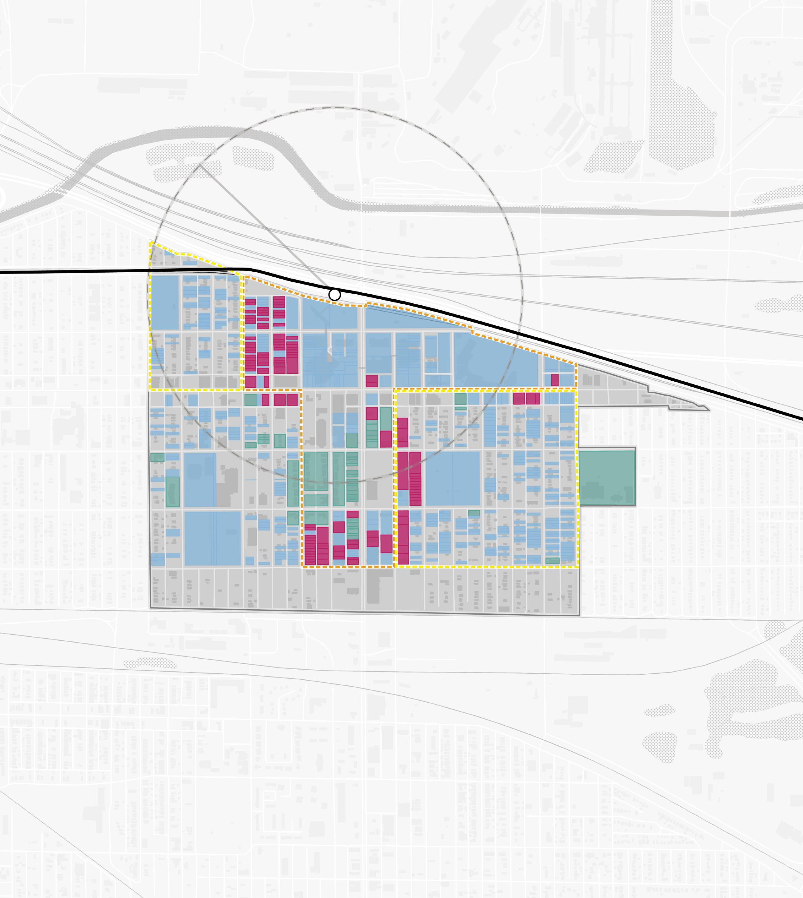
Acquire
Focus
Focus
GHA-Owned Parcels City-Owned Parcels Parcels to
Phase 1
Area Phase 2
Area
80 Northwest Indiana TDD • TOD Strategic Implementation Plan Gary
1/2Mile Broadway Madison St E 5th Ave E 6th Ave EDunesHwy E 7th Ave E 8th Ave E 4th Ave 90 20 53 South Shore Line GrandCalumet River Broadway
Genesis
Center
Metro Center
City Hall
Convention
Borman Square Park
U.S. Steel Yard Stadium
NORTH
Buffington Park

INDIANA INDIANA MICHIGAN ILLINOIS 94 94 80 65 Lake Michigan Hammond Gateway East Chicago Gary Metro Center Miller Portage/ Ogden Dunes 11th Street South Bend Dune Park Beverly Shores Ridge Road Main Street
