


MINNESOTA BIKE RIDES TRAIL MAPS &S TRA
Summer 2024
522 Sinclair Lewis Avenue Sauk Centre, MN 56378 www.MnTrails.com
Minnesota Trails Staff
Jan Lasar
Editor/Publisher
Joyce Frericks Accounting
Karen Knoblach
Page Layout & Design
Graphic Design
Editorial Board
Brett Feldman
Executive Director
Parks & Trails Council of Minnesota
Vol. 29, No. 2 May 2024
Minnesota Trails magazine is a continuation of Minnesota Bike Trails & Rides, published quarterly in cooperation with the Parks & Trails Council of Minnesota, a nonprofit organization that acquires, protects and enhances critical lands for public enjoyment. Your $35 membership subscription supports this work.
Minnesota Trails is not responsible for the return of unsolicited materials and reserves the right to reject unsuitable advertising. Information in this publication is as accurate as possible. Opinions expressed are those of the authors and not of Minnesota Trails.

Continuing the


DEERSTAND RESTAURANT & BAR 24188 Mohs St, Deerwood (218) 534-9253 www.deerstandrestaurant.com
Menu, Salad Bar, Cocktails, Meat Raffles and Fun!

HUDSON SMOKEHOUSE 208 Curtis Ave, Ironton (218) 772-0096 www.hudson218.com
BBQ, food, coffee, beer, wine & cocktails
LODGING
CUYUNA LAKES STAY 23688 Forest Rd, Deerwood (218) 866-2353


23457 Co Rd 31, Crosby (218) 838-6858
www.redriderresort.com
Cabins and camping right off the MTB trails.

222 2nd St NW, Crosby (218) 622-0321
www.thesanctuarycrosby.com
A boutique hotel just blocks from downtown Crosby and the bike trails


324 Curtis Ave, Ironton (218) 772-0177 www.cykelonline.com

OARS-N-MINE
22640 MN-6, Crosby (218) 546-6912 www.oarsnmine.com Docks, lifts, bait and


www.cuyunalakesstay.com Nightly, weekly, monthly lodging DEERWOOD BANK 21236 Archibald Rd, Deerwood (218) 534-3111
www.deerwoodbank.com Banking Made Nice & Simple

Cuyuna Lakes Chamber members are ready to serve you!
members are to serve you

2 MINNESOTA TRAILS | Summer 2024
FINANCIAL
SPECIALTY STORE
THE
Full
218-546-8131 www.CuyunaLakes.com
BIKE
Bike
SUP rentals TIMBER BUILDING SUPPLY & ACE HARDWARE 14506 MN-6, Deerwood (218) 678-2063 www.timberbuildingsupply.com Your local building supplier VICTUAL 124 W Main St, Crosby (218) 545-1000 www.shopvictual.com Ice cream, cheese, charcuterie, gourmet, gifts, spirits COMMON GOODS 27 W Main St, Crosby (218) 772-2999 www.commongoodsmn.org Locations in Crosby, Baxter & Crosslake EAT / DRINK SERVICES www.coldwellbankercrown.com Serving the Cuyuna Lakes and surrounding areas (218) 546-8346 CRMC SUPER ONE Clinic – Pharmacy Inside Crosby Super One Store (218) 545-5350 www.cuyunamed.org CUYUNA LAKES CHAMBER 21236 Archibald Rd, Deerwood
218) 546-8131 www.cuyunalakes.com Crosby Ironton Deerwood Bay Lake Cuyuna Emily MID MINNESOTA FEDERAL CREDIT UNION 117 West Main St, Crosby (218) 546-5428 www.mmfcu.org Member owned and working for you WING WELLNESS PLLC MEDICAL SPA 14693 Woodrow Rd, Brainerd (218) 839-9463 www.wingwellness.com Look and feel your best.
tackle
SHOP
sales, bike rentals, bike repairs, kayak and
(


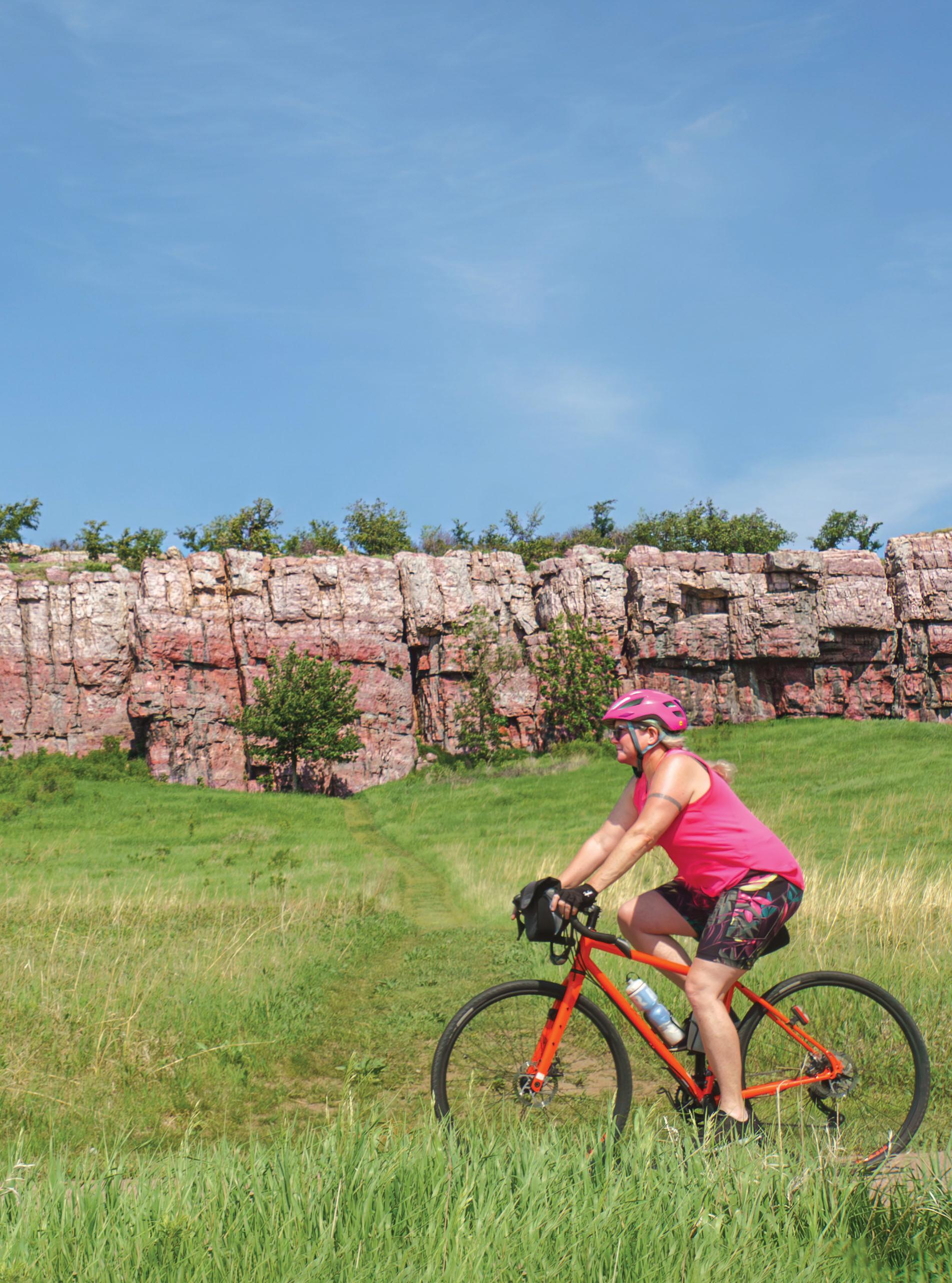
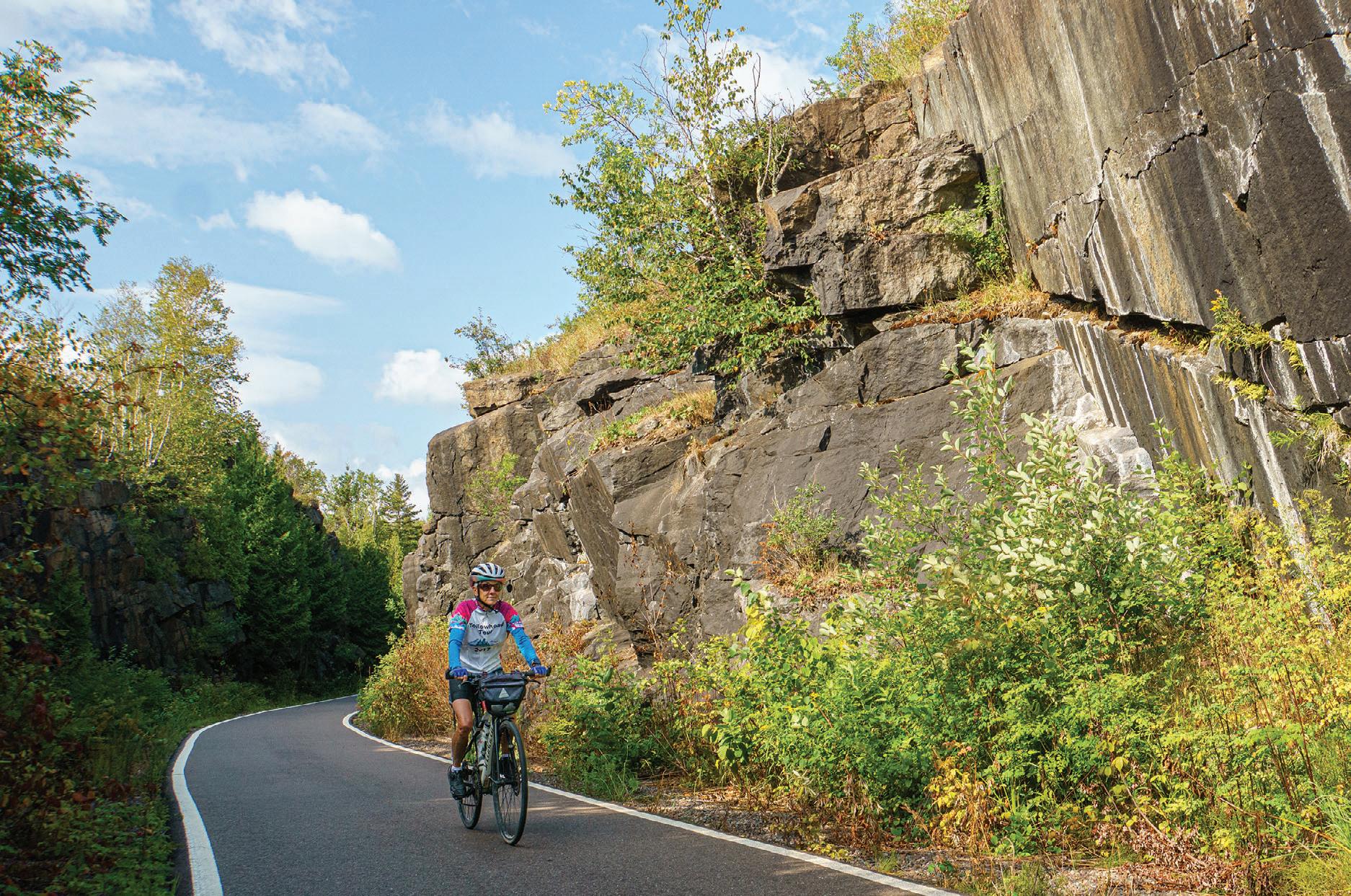
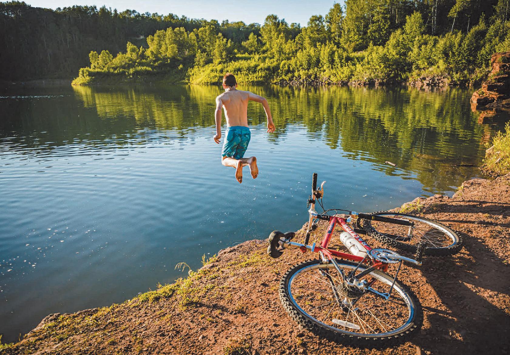
Summer 2024 | MINNESOTA TRAILS 3 Thief River Falls is home to multi-use paved trails, unpaved trails, & shared bike lanes. VisitTRF.com SUMMER 2024 Contents PHOTO: Creative trail routing on a flood diversion dam, Luverne, MN. Jan Lasar photo COVER: Quartzite cliffs along the trail at Blue Mounds State Park. Jan Lasar photo THANK YOU: FOLLOW US ON: FEATURES 8 Munger Mission Molly Brewer Hoeg 11 A 50-Year Cycle Interview with Pat Geraghty, owner of Rydjor Bikes | Jan Lasar 49 Luverne’s Bike Trails Make Connections Jan Lasar 52 A Giant Experience Tomassoni Tour | Jan Lasar 53 The Currie Loop Casey Jones Trail | Jan Lasar DEPARTMENTS 4 Parks & Trails Council News Lisa Filter 12 Bike Rides & Tours Minnesota Events June-October 18 Minnesota Bike Trail Guide Minnesota Trails by Region 54 MN Trails Map Minnesota’s Trails At-A-Glance 55 Trail Partners Find Trail-Friendly Businesses COLUMNS 6 Minnesota Miles Jan Lasar MINNESOTA_TRAILS_MAGAZINE MNTRAILS
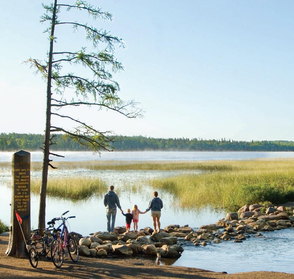
HEARTLAND SPUR TRAIL UNDERWAY AT ITASCA
A DECADES-LONG EFFORT MAKES HEADWAY THIS SUMMER WITH FIRST PHASE MOSTLY WITHIN THE PARK
One of Minnesota’s most treasured landscapes, Itasca State Park, is well known as the headwaters of the Mississippi River. Still, a lesser-known part of its recreational appeal is the six-mile paved, multi-use trail connecting the historic Douglas Lodge with the river’s headwaters.
This summer, crews will be out in the park breaking ground on an exciting new connection between the park’s trail and the Heartland State Trail, referred to as the Heartland Spur Trail.
-
opment will encompass two
miles within the park and is expected to be completed by the summer of 2025. This segment will intersect with the current trail near the Jacob Brower Visito . From here, it will meander, then exit the park at its eastern border and continue until it reaches a

under Highway 71. This tunnel was built last fall in anticipation of the trail and creates a safe crossing for trail users at a busy highway.
Getting the trail spur this far along has been an act of persistence and doggedness on behalf of local advocates who have been working for over a decade. In 2012, the State Legislature authorized the development of the Heartland Spur Trail with a proposed route from Park Rapids to Itasca State Park.
Since then, advocates have poured countless hours into working with the DNR to map the route and secure funding. Support has come from Hubbard County, Parks Rapids Area Chamber of Commerce, legislators, and trail users, among others. Meanwhile, Parks & Trails Council has provided legislative assistance.
4 MINNESOTA TRAILS | Summer 2024
THE VIEW FROM PARKS & TRAILS COUNCIL
Trail at Itasca State Park. Nancy Jahnel / P&TC photo contest
Tunnel under Hwy. 71 for Heartland Spur Trail near Itasca State Park. photo by Eric Haugland
Last year, the Heartland Spur got a boost with a $2.4 million bonding allocation. This year when the Minnesota Legislature passed the largest investment package for parks and trails in state history. That funding, combined with $2 million from the 2020 Legislative Session, is fueling the construction currently underway.
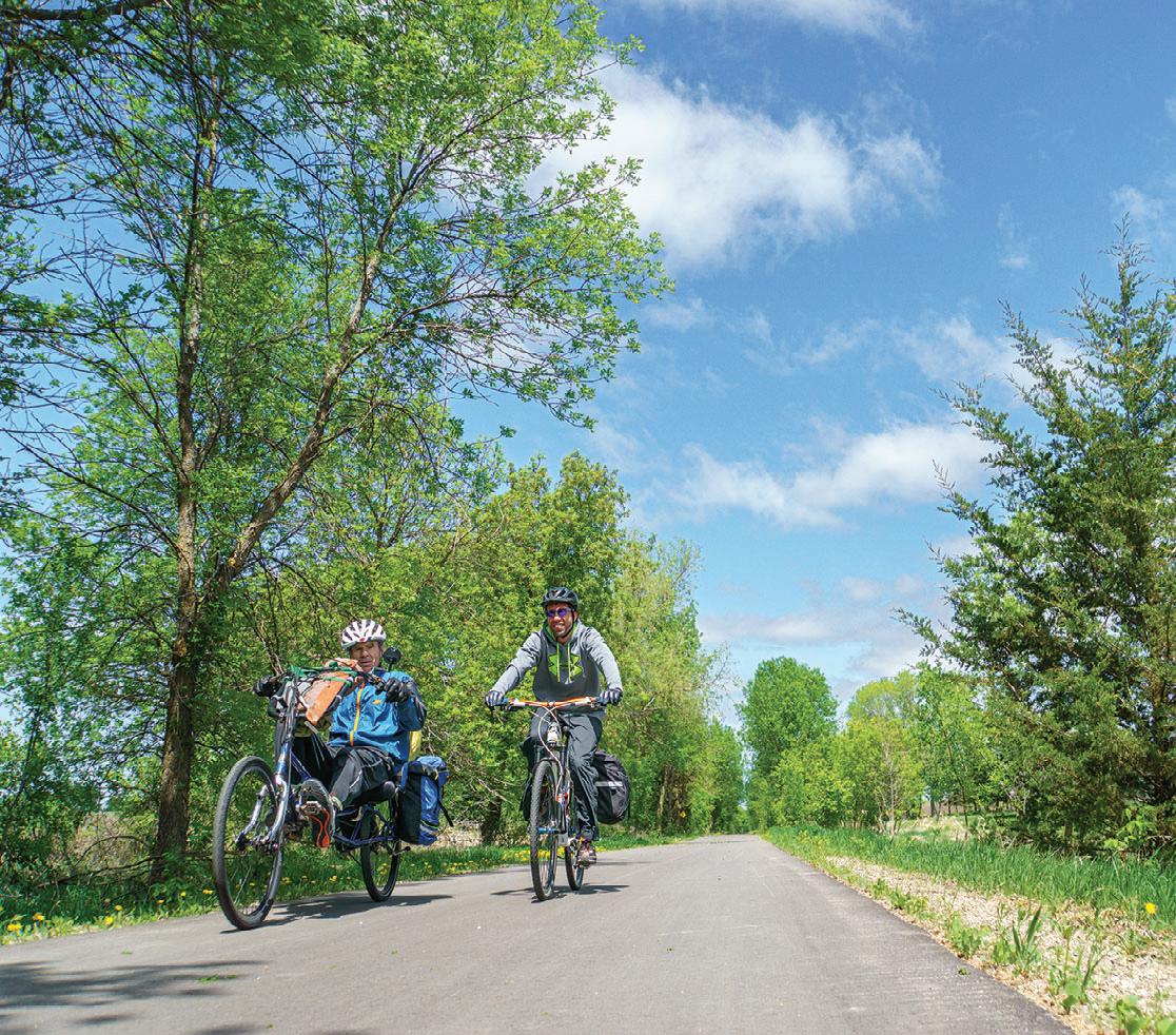
Local advocate Eric Haugland expects this trail segment to be used by park visitors, but
“We’re hoping to secure another $6.25 million from the state legislature this session to begin building the next phase,” Haugland explained. This phase will extend the current segment another 14 miles from the tunnel to Emmaville, which promotes itself as the “biggest little town in the world.” It is actually an unincorporated community with a population of roughly four people. Still, it boasts a campground, small store, and cafe that act as a hub for locals and tourists alike.
The planned route to Emmaville traverses scenic forest lands owned by the DNR and the county as part of tax-forfeited property. Having the land already acquired puts this project on the fast track, as that often presents a major hurdle to trail development.
Nonetheless, this will likely take several years to complete the segment to Emmaville. The speed of the project depends on the Legislature’s continuing to appropriate bonding funds. The 2024 legislative session was still in progress at the time of this writing, and a bill was being drafted. In the meantime, we look forward to celebrating phase-one groundbreaking sometime this summer and the inspiration it will provide to keep the project rolling along until it reaches Park Rapids.
~STORY BY LISA FILTER/P&TC

PARKS & TRAILS COUNCIL OF MINNESOTA
is proud to play a role in securing funding for trail development by working with our Friends Group Partners in navigating the legislative process. In 2023, we assisted eight groups to secure a total of $25 million in investments. As of April 2024, we are working with another six trail groups to secure funding during the 2024 legislative session.
See updates on these projects at: PARKSANDTRAILS.ORG/ 2024-LEGISLATIVE-PRIORITIES


Summer 2024 | MINNESOTA TRAILS 5
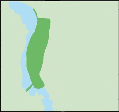
HEARTLAND STATE TRAIL (CURRENT)
HEARTLAND SPUR (UNDER CONSTRUCTION)
HEARTLAND SPUR (AWAITING FUNDING)
continues 45
Cass
HEARTLAND SPUR (FINAL PLANNED PHASE)
miles to
Lake
HAPPY Anniversary, literally.
On the eve of my 10-year anniversary at the helm of this Minnesota-focused outdoor magazine, we’re releasing another issue into the wild, but I would not be able to write this if I didn’t have the best people in the world on my side.
her across the state in every season and all kinds of weather and she‘s been frostbitten, sunburned, chased by a pair of irate sandhill cranes and nearly had a dead squirrel dropped on her head by an eagle.
I‘m also thankful for you, the reader of Trails. Your letters and emails, even the ones that point out a typo in an article, (that's been read ten times by three different people before print day) keep me walking with my chin up through the everyday slog of life. After all, the performance is for the audience and it‘s good to get feedback and not wander too far off into the weeds.
I'm thankful for the support my wife, Jen, has given me in this Trails adventure. About ten years ago I was at a crossroads, job-wise. As I pondered whether I should risk going down the path of becoming the owner of Trails or continue with the for sure thing I had, it was she who gave me the final, subtle push. “You‘d be stupid not to do it,” she said. As a reward for her insistence, I‘ve been dragging
An equally important partner on this journey are our advertisers and I’m thankful for the increasing number of people out there who feel Trails is the right vehicle for their message. I’ve heard others call advertising a necessary evil, but there’s nothing evil about it, in my opinion. Much like the content, the ads tell a relevant story and become part of the magazine fabric. At the print shop, this fabric of 45-pound #5 web gloss with a 70-72% brightness turns into a book worth reading. Bonus: On the pages of Trails, there are no mystery pop-ups for something you googled earlier.
Trails came with an established partnership with the Parks and Trails Council of Minneso-
| DISTILLERY | RES TA U RANTS | BIKESHOPS
ta, a 70-year young organization dedicated to enhancing and protecting our parks and trails. I‘m very lucky to have met Brett Feldman, President, and Lisa Filter, External Relations Director, two people with a bona fide passion and dedication to the cause. We‘ve established a great connection that‘s part of my life now.
However, none of this would matter without the people who do the actual work behind the scenes.
There’s Joyce, who lives and breathes spreadsheets to make sure the books are in tip-top shape. If it wasn’t for her, the path I took ten years ago would have dropped me off a cliff, because a numbers guy I ain’t.
If you’ve read Trails in the last couple of years, you‘ve noticed Karen's striking layouts and crisp designs in the pages of the magazine. After she joined the team, I didn’t even have to use my vague napkin sketch technique anymore. She knows the perimeters and gets it done.
Pat, who’s been hunting down errors in the pages of the magazine for many years, sacrifices four weekends a year in retirement to make sure my shaky syntax and errant commas do not make it into the final proof. To see evidence of what happens when I don’t run something by her, read my blog.
AS MY TRAILS JOURNEY ENTERS YEAR TEN I’M HAPPY TO HAVE THE BEST PEOPLE IN THE WORLD ON MY SIDE.


6 MINNESOTA TRAILS | Summer 2024 Milesoftrailsarewaitingfor you. East Cannon River Trail Mill Towns Trail Sechler Park Mountain Bike Trail Cowling Arboretum Trails #THISISNORTHFIELD
BREWERIES
WWW.V I S I T NORTHFIELD.COM
Jan Lasar Trails Editor/Publisher
Minnesota Miles


Summer 2024 | MINNESOTA TRAILS 7 IS OUT THERE. connection Explore a state park or trail at mnDNR.gov/parksandtrails Drawn to a place and alive in the moment.
MISSION
STORY BY MOLLY BREWER HOEG PHOTOS JAN LASAR
IT’S EASY TO TAKE SOMETHING FOR GRANTED WHEN IT’S RIGHT IN YOUR BACKYARD. I LIVE IN DULUTH AND THEWILLARD MUNGER STATE TRAIL IS MY GO-TO FOR A LEISURELY RIDE, A LONG-DISTANCE CHALLENGE, OR A COMPANIONABLE


FE FEATATURUREES S WOUOULD LD BE DOIOING NG IT T AN INJUUSTICCE, E, SO I CHALLENGED MY M SELF L TO RIDE ITTS LE L NGGTH T AN AND D RE R ALLY
TA TAKE KE IN N MY SU SURRRROUOUNDNDININGSGS.


JA JAUNUNT T WI W TH A FRRIEIEND ND BU BUT T TO OVVERRLOLOOK OK ITS TS SC SCENENERERY Y AN AND D


I decided to break the trip into two chunks, traveling north to south beginning with the 15 miles from Duluth to Carlton. That way I’d be able to make it a loop, returning via a scenic section of Highway 23.
Starting from the trailhead parking lot behind the Munger Inn, I immediately dove into greenery and quickly lost the city. Although this section included a 10mile climb, the grade rose so gradually it was almost imperceptible. The pavement was new and smooth and I was looking forward to a great ride on a chilly and breezy day.
The trail follows former railroads routes, including the one that saved the lives of so many fleeing the devastating Hinckley and Cloquet fires in 1894. Building these railroads required deep cuts in the route’s rocky cliffs and today’s bike trail benefits from this heavy lifting. As I passed by the towering walls I had seen so many times, I now noticed skinny trees growing from the cracks up high, a patchwork of colorful lichen on the rock faces and thick moss carpets flowing down the sheer, inhospitable walls. Every fissure and every crevice housed a tiny garden, clinging to life and defying gravity. My new mission to be more observant on this trail was off to a good start.
8 MINNESOTA TRAILS | Summer 2024
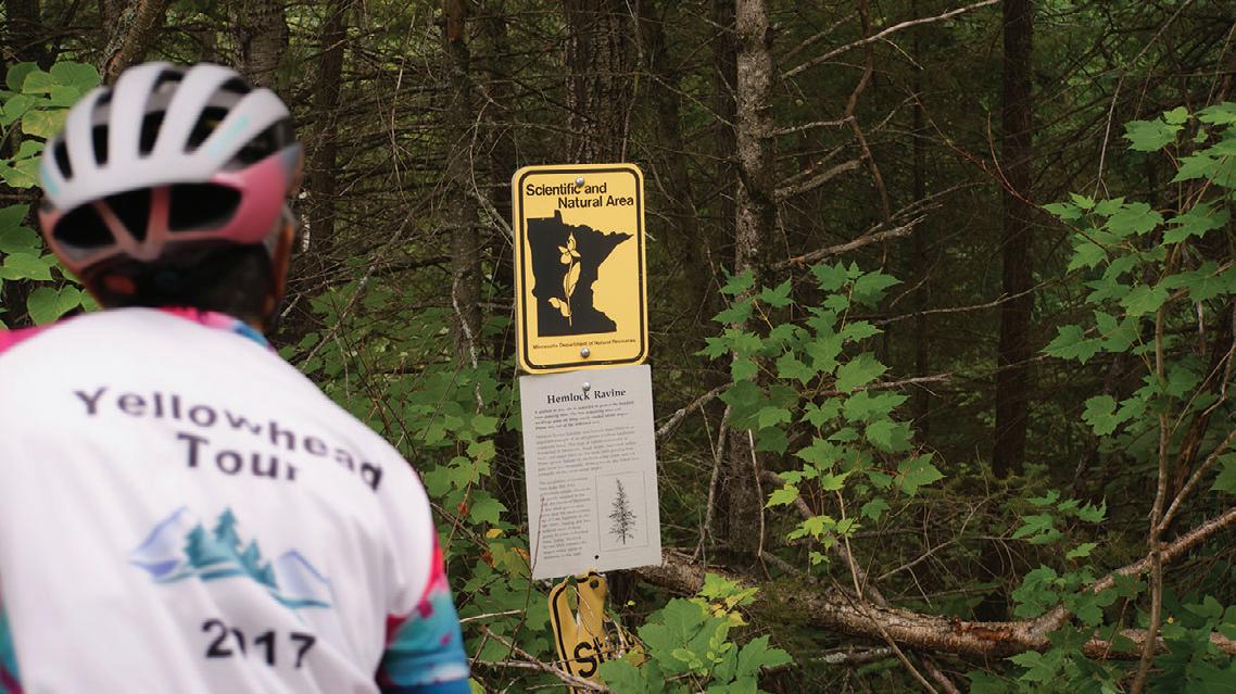
Leaving the rocks behind and traveling through miles of secluded woodlands, I came to a place previously unknown to me. The only hint of its existence was a small sign just off to the side; a detail I had missed on countless trips on this old favorite trail. The Hemlock Ravine Scientific and Natural Area is a 50-acre preserve that protects some old growth forest, including a quarter of the state’s eastern hemlock trees. It’s open by research permit only and as hard as I tried I could not identify any hemlocks by peering into the woods from the trail. I appreciated the effort to preserve this rare species, nevertheless.
Not far beyond, I noticed a long, narrow body of water on my left. A large information sign explained it was Forbay Lake, part of the extensive waterway that channels the St. Louis River to the Thomson Hydroelectric power plant. The trail continued along the canal until it reached the entrance to Jay Cooke State Park.
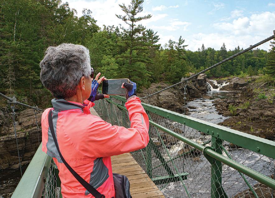
I couldn’t get this close to the park without visiting the famous swinging bridge and, fortunately, a convenient side trail whisked me right to a bike rack by the main lodge with a fun, zippy downhill ride. I walked across the bridge and took in the St. Louis River’s amber waters as they rushed down its rocky bed on the way to Lake Superior – a sight that fascinates me every time I visit. I returned to the Munger Trail via the park road, which clung to the edge of the river, offering more nice views. As I pedaled upstream, I observed a group of whitewater rafters clamoring up the banks of the river, raft in tow, to be picked up by a van. They must have been some brave souls to have made it this far.
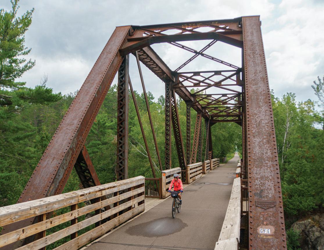
Just outside of Jay Cooke State Park, the Thomson trestle bridge is always a great stopping spot. It even has observation platforms on each side for viewing the river, and sometimes daredevil kayakers,
coming down the enormous gorge. On the north side was the massive Thomson Dam. At 1,600 feet across, it’s the largest and most visible structure of the area’s hydroelectric project. Water pours down from there, flows around an island, then under the bridge and is finally joined by a smaller tributary on the other side. There’s always plenty to see.
Half a mile later I came to the village of Carlton, where the trail lands in a pleasant park with a covered picnic area, outhouses, and ample parking. Plenty of options for services and places to eat are a short distance away in the main downtown area. On that cool, blustery day, I found a cozy coffee shop and warmed up with a hot latte and a scone.
The Munger Trail connects to the Alex Laveau Memorial Trail in Carlton and I chose to explore that spur and make it a loop back to my starting point. The seven-mile route has a very rural feel as it quietly winds through woods
with occasional views of farms. It took me through Wrenshall and ended at Highway 23 where I started the road ride back to my car. I didn’t know this until I had returned home and followed my route on a map, but at that point I was about two miles due west of the Minnesota-Wisconsin border, the Superior Hiking Trail’s southern terminus and the interstate trailhead for the North Country Trail. The former railroad grade continued unpaved and overgrown, under the highway, then disappeared into the thicket.
The wide shoulders of Highway 23 carried me to the expansive overlook of Veterans Evergreen Memorial Park. In the distance to the northwest was Jay Cooke and the swinging bridge. I had almost come full circle around the park at this point. I crossed over the St. Louis River again at the bottom of a long downhill coast, then returned through the Duluth neighborhood of Fond du Lac to the Munger Inn for a 40-mile loop.
Summer 2024 | MINNESOTA TRAILS 9
The next day it was time to ride the remainder of the Munger Trail. While this section covers 55 miles from Carlton to Hinckley, I tend to think of it as the lower “half” of the trail. It’s a far more rural route, travels between small towns with open views of farmland and is lined with trees in many areas. It clings close to Highway 61 from just beyond Carlton until Rutledge. Traffic is sparse so it’s not a bother, but you know it’s there, on the other side of the trees.
When I left Carlton, I settled into easy pedaling on fairly flat land, allowing
my brain to wander as the miles passed by. The first site I noticed was a wellappointed playground and picnic area that runs along the bike trail in tiny Mahtowa, as well as a country store across the street, should supplies be needed.
Below that, I passed pastoral fields and stopped on a bridge over the Moose Horn River to take in the views. In Moose Lake, a new section of trail leads away from the main road and skirts the town on a pleasant detour, including the Dairy Queen, which is a frequent draw for me.
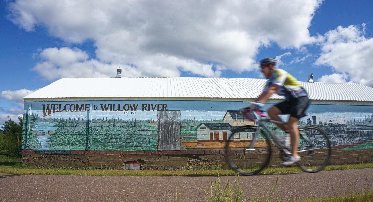
You’ll know when you reach Willow River by the detailed mural of historic places and events on a long, low building. Beyond that is an inviting park alongside the trail. Complete with picnic tables, a pavilion, real toilets and a children’s playground, it also included a display of old firefighting equipment in a small glass-fronted building. I considered it well worth the stop, chatting with likeminded cyclists on break like me.
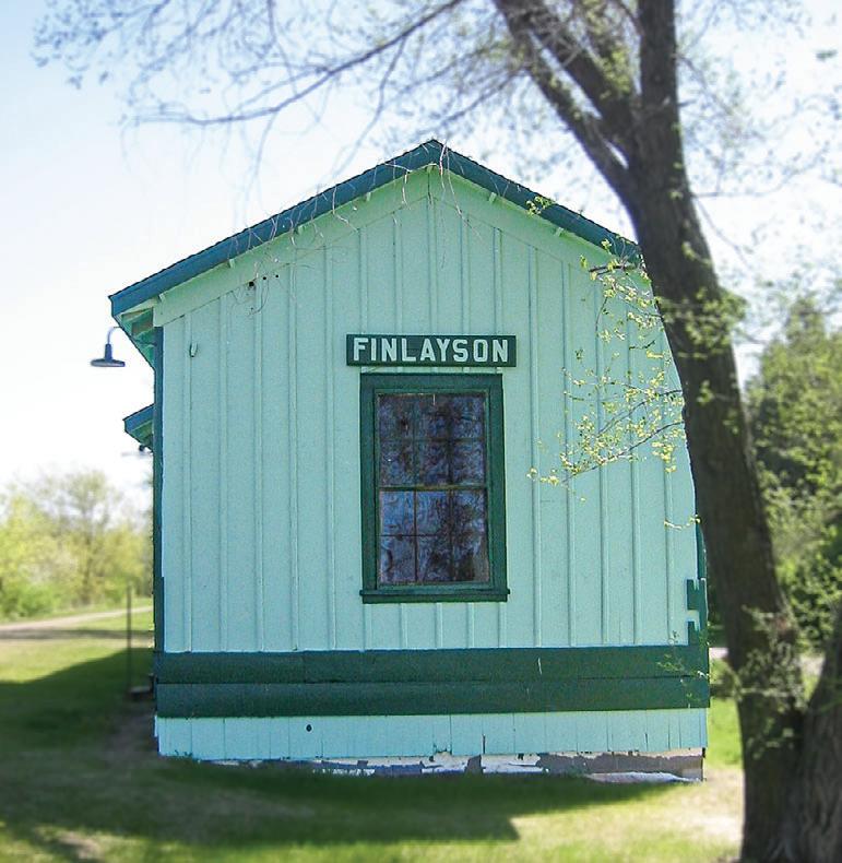
In Finlayson I stopped to admire the historic passenger depot. The squat, rectangular building just off the trail would have blended into the background had it not been for the seafoam green paint job on the wooden exterior. I wondered what it was like waiting for a train inside the old station, especially in the winter when the only heat was from a potbelly stove.
Soon I came to what I call the roly-poly section of the trail. It’s the only segment that offers a tree-lined curvy path up and down over some low hills. At only a mile long it’s still a good workout and a break from the straight railroad bed.
The remainder of the path resumes its rural persona and long, straight stretches until it reached the terminus in Hinckley, a quiet, unassuming trailhead with a parking area.
It was the end for the day, but not for the last time. I’m sure I'll be back again and see more things for the first time. Mission accomplished, for now.
See the Bike Trail Guide starting on page 18 for more on Willard Munger State Trail.
10 MINNESOTA TRAILS | Summer 2024
A 50-Year CYCLE
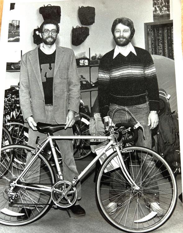
Interview with Pat Geraghty, owner of Rydjor Bikes
BY JAN LASAR
WHAT MADE YOU WANT TO OPEN A BIKE SHOP BACK IN 1973?
Dan and I wanted to open a motorcycle shop, but at 21 years old, did not have the resources. There was a bicycle boom happening in the early 1970s and we were at a lake in Minneapolis and saw all these people riding lightweight 10-speed bicycles and thought, “Let’s open a bike shop and we’ll have a place to work on our motorcycles!” Neither of us owned a bike at the time. Well, racing motocross is a young person’s sport and we changed from racing motorcycles to riding bicycles. The best thing we ever did.
WHAT DOES RIDING A BIKE MEAN TO YOU?
Freedom. Just get on and ride. I owe my health and sanity to bike riding.
HOW MANY MAKES AND MODELS OF BICYCLES DID YOU OFFER IN THE BEGINNING? HOW ABOUT NOW?
We connected with a distributor in Minneapolis called Wheel Goods and took on Miyata, Batavus and Steyr. We added Fuji, Raleigh and Cannondale in those early years. In 1986, we became a Trek dealer, which proved to be very successful. Trek was the first supplier that provided us with the tools and resources to make our business successful, I don’t know where we would be without that partnership. Today we carry Trek and Electra bikes and e-bikes, and Aventon e-bikes.
HOW HAS BIKE DESIGN CHANGED?
Bicycle design and technology have steadily improved. I owned a 1988 Cannondale, rode it for years and thought it handled and shifted well. I got a new Trek Madone in 2006 and, wow, it was so much better shifting, braking, riding. A night and day difference from my Cannondale, which was a good bike in
IN 1973, TWO TWENTY-SOMETHINGS, FRIENDS PAT GERAGHTY AND DAN ULWELLING, SCRAPED TOGETHER ENOUGH CASH TO OPEN UP THEIR OWN BIKE SHOP. IT WAS ONLY MEANT TO FUND THEIR MOTORCYCLE RACING HOBBY, BUT IT ENDED UP BEING A DEFINING MOMENT IN THEIR LIVES. RYDJOR BIKES HAS MOVED A FEW TIMES IN ITS HISTORY, BUT IT’S BEEN IN ITS CURRENT LOCATION IN DOWNTOWN AUSTIN, MINNESOTA, FOR THE LAST FORTY YEARS. DAN PASSED AWAY IN 2006, BUT HIS LEGACY LIVES ON IN THE FORM OF A BIKE COLLECTION WHICH ADORNS THE WALLS AND CEILING OF THE FORMER KRESGE DEPARTMENT STORE BUILDING. I RECENTLY TALKED WITH PAT AS HE LOOKS BACK AT 50 YEARS OF BEING IN THE MINNESOTA BIKE RETAIL WORLD.
its day. Today’s bikes are that much better than they were in 2006. And e-bikes, 7 years ago we got a couple in our shop and they collected dust, now we envision that all of us will be riding one at some point in our cycling life.
HOW HAS THE BIKE INDUSTRY CHANGED?
Many changes. One is, in the early days people opening bike shops were largely bicyclists, but not business people. Today, there are many large, multiplestore bike shops. Bicycle manufacturers are buying bike shops when owners age out and want to sell their business. And, like all retail brick and mortar industries, the internet has become our major competitor. But one thing has not changed, bike shops offer expert service and advice, and you cannot get that anywhere else.
WHAT’S YOUR BIGGEST CHALLENGE TODAY?
Since the pandemic, the bicycle industry has turned upside down. From 2020 to 2022, every bike we had on the floor sold, the industry had many delays in manufacturing, and bikes were backordered for up to two years. Before the pandemic we could get most bikes from our supplier within a week. Now it’s just the opposite, sales are back to normal, except for e-bikes, and many shops and manufacturers are sitting on a lot of inventory. In our 50 years in business, we never experienced anything like what has happened in the industry in the last 4 years.
WHAT’S THE BEST PART OF BEING A BIKE SHOP OWNER?
You love everything about it. Many of your customers become your friends, you get to see your customers on bikes and staying healthy, and if you’re a techie like me, you get to see the coolest, most innovative products made.
WHEN AND WHY DID YOU START COLLECTING BIKES?
Dan is the person responsible for our collection. In the early
days, we took in some cool old bikes, but just stored them in the basement, not knowing where it would go. Then, Dan got serious and with his amazing knowledge and the internet coming on in the 1990s, he decided which bikes he wanted to display the evolution of bicycling. He put together a collection of the evolution of bicycles and it’s one of the best collections anywhere.
YOUR ADVICE TO SOMEONE WHO WANTS TO OPEN A BIKE SHOP TODAY?
Beware. Brick and mortar retail faces more obstacles today than ever. Look at opening a bike shop from a purely business standpoint, be well funded, and have a sharp finance person on your team. When Dan and I started, we basically learned from the school of hard knocks. You will not stay in business that way today.
WHAT ARE YOUR PLANS FOR THE FUTURE OF THE SHOP?
Well, I am not getting any younger, but I love being a part of Rydjor. I promised Dan that I would do everything I could to keep Rydjor going, so that is my plan.

Summer 2024 | MINNESOTA TRAILS 11
Twenty-something friends Pat Geraghty (left) and Dan Ulwelling opened Rydjor Bikes in 1973.
Bike Rides & Tours
The Freebike
Minneapolis, MN
June 1, 2024
www.mntrails.com/event/the-freebike
The Log Jam
Mountain Bike | Cloquet, MN
June 1, 2024
www.mntrails.com/event/the-log-jam
2024 MINNESOTA TOUR DE CURE
Road | Minneapolis, MN
June 1, 2024
Tour de Cure is a premier cycling event for all ages and abilities. All routes will be fully supported with bike mechanics, volunteer route marshals, rest stops with food and water, cheering volunteers and more.
www.diabetes.org/mntourdecure
TOUR
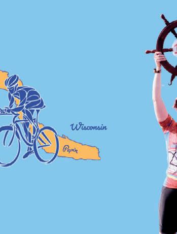
DE PEPIN
Road | Lake City, MN
June 1, 2024
Tour de Pepin is one of the Midwest’s most unique cycling tours where riders have several options to ride through the captivating terrain and historic towns around Lake Pepin. Distances: 32, 44, 50, 72, 100 miles.
www.tourdepepin.com


Tour of Lakes
Road | Brainerd, MN
June 1, 2024
www.mntrails.com/event/tour-of-lakes
ZEB PIKE-RIDE TO THE RIVER
Trail | Holdingford, MN
June 1, 2024
Follow in the footsteps of explorer Zebulon Pike, who set out to discover the source of the Mississippi River. This family-friendly 20-mile roundtrip will take you down the Lake Wobegon and Soo Line Trails to the impressive trestle-bridge crossing at the world’s most famous river. www.artinmotiononthelakewobegontrail. com/events
Bike MS: MS 150
Road, Trail | Proctor, MN
June 8-9, 2024
www.mntrails.com/event/bike-ms-ms-150
CARAMEL ROLL RIDE
Trail | Albany, MN
June 8, 2024
Choose from three options: East to Avon, Collegeville and Saint Joseph, west to Freeport, and of course, north to Holdingford and the covered bridge, then on the Soo Line Trail to Bowlus and Blanchard Dam on the Mississippi River. www.lakewobegontrail.com/lwta-rides
KKD Gravel
Gravel | Farmington, MN
June 8, 2024
www.mntrails.com/event/kkd-gravel
LADY SLIPPER RIDE
Trail | Avon, MN
June 15, 2024
See the Minnesota State Flower, the Pink and White Showy Lady’s Slipper in full bloom. This is a short ride to see the beautiful Lady’s Slipper orchids growing along the Lake Wobegon Trail. It’s a free ride, but donations will be accepted. www.lakewobegontrail.com/lwta-rides
THE TOUR OF MINNESOTA
Road/Trail | Central MN
June 15-22, 2024
The 50th annual Tour of Minnesota, formerly the Klobuchar Bike Ride, will visit the Cannon Falls area in 2024. Daily trip length will vary, but riders will travel a total of about 350 miles with a rest day. www.tourofminnesota.com
DAM2DAM RIDE
Road | Little Falls, MN
June 15, 2024
Follow the Great River Road through Charles A. Lindbergh State Park to historic Blanchard Dam and enjoy miles of Mississippi riverfront and quiet back roads. The Dam2Dam Bike Ride is a great way to experience the Mississippi River and the Little Falls area and it’s free! Distances: 20, 40 miles. www.mntrails.com/event/dam2dam-ride
LOOP THE LAKE RIDE
Trail | Bemidji, MN
June 15, 2024
Take a bike cruise around Lake Bemidji with the whole family and experience the first city on the Mississippi from the seat of your bike. There'll be lots of familyfriendly activities.
www.bikebemidji.com
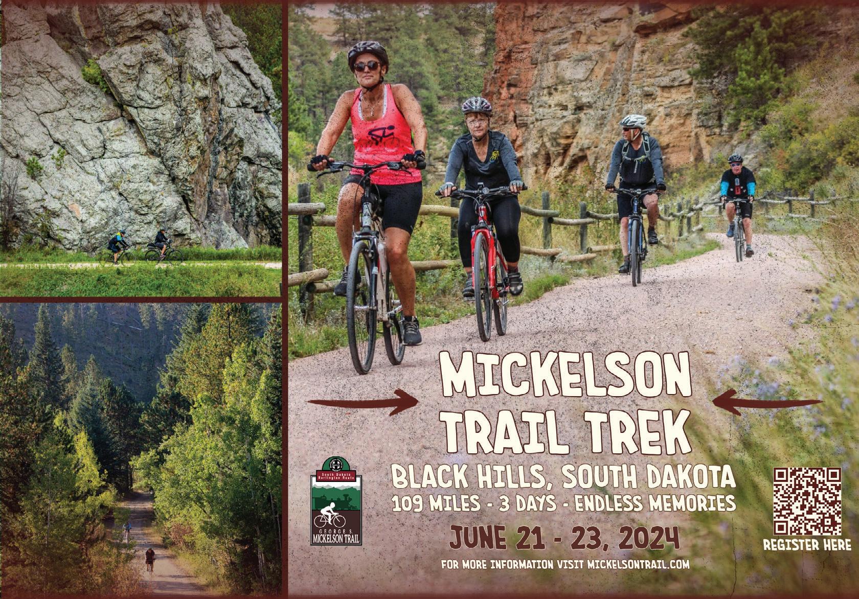
MICKELSON SUMMER TRAIL TREK
Trail/Gravel | Custer, SD
June 21-23, 2024
Enjoy the beauty of the heart of the Black Hills as you travel through the scenic valleys, old railroad tunnels and historic mining towns on the 119-mile Mickelson Trail. It’s a great way to explore the Black Hills at a slower pace. Registration includes trail pass, shuttle, refreshments and meals. https://gfp.sd.gov/parks/detail/george-s-mickelson-trail/
The Fox
Gravel | Finland, MN
June 22-23, 2024 www.mntrails.com/event/the-fox


12 MINNESOTA TRAILS | Summer 2024
GREAT SCOTT BIKE RIDE
JULY 4 2024 Includes fully stocked rest stops & lunch 25 & 50 miles WWW.GREATSCOTTCYCLING.COM H IKE • BIKE • P A DDLE• CAM P WWW.EXPLO REFORT.COM Up-to-Date Information and Details at www.mntrails.com/events
Prior Lake, MN
THE SPRING BIKE FLING
Trail | Walker, MN
June 22, 2024
Take a ride on the Paul Bunyan Trail from Walker to Hackensack and experience the beauty of the Chippewa National Forest in Paul Bunyan’s back yard. Your ride options are plentiful: A 24 or 48-mile out and back or a 36-mile loop ride. Included in the registration are a t-shirt and a bag full of awesome swag. www.leech-lake.com/spring-bike-fling
Lutsen 99er
Mountain Bike | Lutsen, MN
June 29, 2024
www.mntrails.com/event/lutsen-99er
GREAT SCOTT BIKE RIDE
Road | Prior Lake, MN
July 4, 2024
Enjoy the sights and sounds of rural Scott County on this ride hosted by the Great Scott Cycling Club. Route choices are 25 and 50 miles. SAG and rest stops are provided along with lunch after the ride. https://www.greatscottcycling.com/gsbr.php
FREEDHEM 76
Gravel | Freedhem, MN
July 6, 2024
The Freedhem 76 is a race/ride on north central Minnesota’s finest gravel, minimum maintenance roads and trails to celebrate Independence Day. There’s lots of gravel, lots of lakes and scenery galore. www.freedhem76.com
BLUENOSE GOPHER 50
Gravel | Granite Falls, MN
July 13, 2024
This gravel ride explores the challenging ups and downs of the Minnesota River Valley in search of the route of a longforgotten 1890s bike race. Breathtaking views, billion-year-old granite and quiet back roads make for a unique ride. www.bluenose.coop/bluenosegopher50
Unicon 21
Mountain, track and road unicycling | Bemidji, MN
July 14-26, 2024
www.mntrails.com/event/unicon-21
Get Some Southern Gravel!
GRANITE FALLS, MN
Saturday, July13, 2024

Bike Duluth Festival
Duluth, MN
July 19-21, 2024
www.mntrails.com/even/bike-duluth-festival
The Wolf Gravel | Two Harbors, MN
July 19-21, 2024
www.mntrails.com/event/the-wolf
TOUR OF SAINTS
Road/Trail | Saint Joseph, MN
July 21, 2024
It’s not a race. It’s a heavenly little ride. From cities across Minnesota and neighboring states, each year 1,000 or more cyclists gather in St. Joseph to wind their way along quiet byways and rolling hills of central Minnesota. Distances: 18, 35, 50 miles.
www.bikemn.org/all-events/tour-of-saints
Bike MS: Ride Across Minnesota 2024
Road | Northfield, MN
July 22-26, 2024
www.mntrails.com/event/bike-ms-rideacross-minnesota-2024
The Hotdish Gravel | Winona, MN
July 27, 2024
www.mntrails.com/event/the-hotdish
SCENIC SHORE BIKE TOUR
Road | Mequon, WI
July 27-28, 2024
The Scenic Shore Bike Tour is a two-day, 150-mile, fully supported cycling event on the beautiful shoreline of Lake Michigan. Pedal 25, 75 or 150-miles with 1,500 cycling enthusiasts in support of a cure for blood cancer.
www.scenicshore150.org
TOUR DE BUN BICYCLE CLASSIC
Road | Montgomery, MN
July 27, 2024
Ride your bike in the heart of Minnesota Czech Country in scenic Le Sueur County. Each route will have refreshment stops at various points and will provide scenic rural countryside on paved, lightly traveled roads.
www.montgomerymn.org/tour-de-bun-bikeclassic


www.bluenose.coop/bluenosegopher50


Summer 2024 | MINNESOTA TRAILS 13
Bike Rides & Tours
15, 35 and 50-mile routes A sweet ride in the heart of Minnesota Czech Country to celebrate Kolacky Days! Tour de Bun July 27, 2024 Bike Classic montgomerymn.org/tour-de-bun-bike-classic Register Early & Save: Saturday,May 25 Saturday, September, 28 Sunday,September 15 Saturday,August 10 Sunday,July 21 bikemn.org/events Rides 2024 FAMILY FRIENDLY BICYCLE ALLIANCE OF MINNESOTA ROCHESTER ST.
JOSEPH
MPLS./ST.
ALBERT LEA
PAUL
THIEF RIVER FALLS
Bike Rides & Tours 2024
Dirty Lemming
Gravel | Brownton, MN
July 27, 2024
www.mntrails.com/event/dirty-lemming
JDRF Ride
Road | La Crosse, WI
August 1-4, 2024
www.mntrails.com/event/jdrf-ride
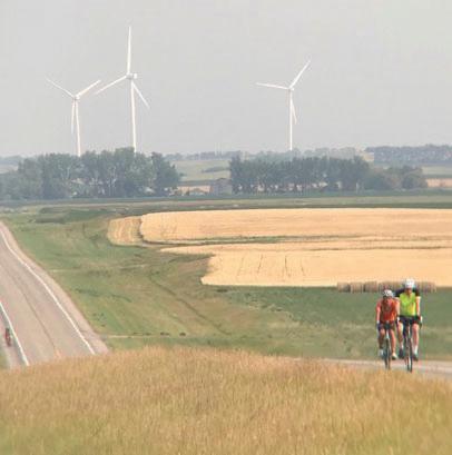
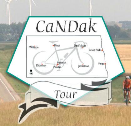
CANDAK: BACK TO OUR ROOTS
Road | Garrison, ND
August 3-10, 2024
This ride carries on the tradition of the CANDISK ride of North Dakota with daily routes ranging from 35 to 70 miles and a century option. This is a multi-day tour through North Dakota with terrain varying from flat fields to steep hills. www.candak.net
TOUR DE TONKA
Road | Minnetonka, MN
August 3, 2024
Tour de Tonka is a scenic bike ride through the Lake Minnetonka area and its surrounding communities. With so many different route options, there’s a ride for everyone. www.tourdetonka.org

GREAT RIVER ENERGY
MESABI TRAIL TOUR
Trail | Buhl, MN
August 10, 2024
While you pedal fully supported along one of Minnesota’s premiere paved bicycle trails you will encounter historic & scenic points of interest, enjoy food & music at rest stops. In 2024, the ride will travel between Buhl and Calumet, a round trip of 70 miles.
www.mesabitrail.com/events-and-tours/ annual tour
The Day Across MN (DAMN)
Gravel | Gary, SD
August 10, 2024
www.mntrails.com/event/the-day-acrossminnesota-damn
Hollo Gravel Classic
Gravel | Battle Lake, MN
August 10, 2024
www.mntrails.com/event/hollo-gravel-classic
ROCK-N-ROLL THE LAKES
Road | Albert Lea, MN
August 10, 2024
Albert Lea knows how to rock! Riders can choose from one of three different routes—10, 30 or 50 miles—of SAGsupported, “rolling” fun around our lakes and community. All three courses hug picturesque lakeshores and offer a variety of beautiful southern Minnesota scenery. www.bikemn.org/all-events/rock-and-rollthe-lakes
BRIDGE THE VALLEY BIKE RALLY
Road/Gravel | Stillwater, MN
August 11, 2024
Join the Stillwater Sunrise Rotary Club on an epic trip through the hills and valleys around Stillwater, MN. Part of the Rivers, Lakes, Fields Tri-Ride Series including Pedal Prior and the Northfield Rotary Bike Tour. Ride all three for extra swag and prize drawings. www.bridgethevalley.org
Bicycling Around Minnesota (BAM)
Road/Trail | Minnesota’s Iron Range
August 15-18, 2024
www.mntrails.com/event/bicycling-aroundminnesota-bam
GITCHI-GAMI TRAIL RIDE
Trail | Gooseberry Falls State Park, MN
August 17, 2024
Enjoy a supported, recreational ride on the Gitchi-Gami State Trail along Lake Superior’s scenic North Shore. You’ll get up close and personal with some superior views, be serenaded by waterfalls, wind through multiple state parks and don’t forget: Snacks, t-shirts and sag support are provided! Ride lengths: 8, 28, 34 and 55 miles.
www.ggta.org/ride.php


14 MINNESOTA TRAILS | Summer 2024
One of the most challenging & beautiful rides in the Midwest! SATURDAY, SEPT. 21, 2024 www.RideTheRidges.bike Crossing Minnesota to End Cancer RIDEMN1.ORG 2024 R I DEM N 1 September 7-14 One week & 400 miles. Garrison, ND August 3-10, 2024 CaNDak.net
PEDAL PRIOR
Road/Trail | Prior Lake, MN
August 24, 2024
Discover beautiful Prior Lake and Scott County as you pedal your way through quaint towns, picturesque lakes and rolling farmland. Part of the Rivers, Lakes, Fields Tri-Ride Series including Bridge the Valley Bike Rally and the Northfield Rotary Bike Tour. Ride all three for extra swag and prize drawings. www.pedalprior.com
River Valley 100
Road or Gravel | Mankato, MN
August 25, 2024
www.mntrails.com/event/river-valley-100
Gray Duck Grit
Gravel | Northfield, MN
August 31-September 1, 2024 www.mntrails.com/event/gray-duck-grit
CARAMEL APPLE RIDE
Trail | Sauk Centre, MN
September 7, 2024
Enjoy the fall colors and great apple refreshments at all the rest stops including caramel apples and other treats from local vendors. Spend the day riding the great Lake Wobegon Trail Country. www.lakewobegontrail.com/lwta-rides
NORTHFIELD ROTARY BIKE TOUR
Road/Gravel | Dundas, MN
September 7, 2024
There’s a route for everyone: Road, gravel or family. Part of the Rivers, Lakes, Fields Tri-Ride Series including Bridge the Valley Bike Rally and the Pedal Prior. Ride all three for extra swag and prize drawings. www.northfieldrotary.org/page/northfieldrotary-bike-tour
RIDEMN1
Road | Oslo, MN
September 7-14, 2024
RideMN1 holds an annual bicycle ride across Minnesota to raise awareness about cancer. This time they visit Oslo, Warren, Grygla, Red Lake, Effie, Cook, Ely and Silver Bay. www.ridemn1.org
North Star Bicycle Race
Road | Saint Paul, MN to US-Canada border
September 11, 2024
www.mntrails.com/event/north-star-bicycle-race
BORDER BIKE RIDE
Trail/Road | Riceville, IA
September 14, 2024
Ride across state lines and visit your neighbors on the other side. This familyfriendly event has route options for everyone on Iowa’s Wapsi Great Line Grail, Minnesota's Shooting Star Trail, or both. borderbike.wgwltrail.com
Gritty Goose Gravel Grinder
Gravel | Monticello, MN
September 14, 2024
www.mntrails.com/event/gritty-goose
LOONS CHALLENGE RIDE
Trail | Twin Cities, MN
September 15, 2024
Join in the fight against Type 1 Diabetes as we challenge you to push your limits and ride up to 100 miles through the scenic Twin Cities landscape. For more information email minnesotadakotas@jdrf.org
TWIN CITIES BIKE TOUR
Road/Trail | Minneapolis, MN
September 15, 2024
Be a part of this inaugural cycling event, destined to be a celebration of the trails and communities that fuel thriving bicycling culture.
www.bikemn.org/all-events/tcbt/
TOMASSONI TOUR
Trail | Tower, MN
September 19-22, 2024
At this fundraising ride cyclists will be able to choose between two different ride lengths on the beautiful Mesabi Trail and experience white glove treatment as they help in the fight against ALS. www.neversurrenderinc.org
Summer 2024 | MINNESOTA TRAILS 15 Bike Rides & Tours 2024
MICKELSON TRAIL TREK
Trail/Gravel | Custer, SD
September 20-22, 2024
Enjoy the beauty of the heart of the Black Hills as you travel through the scenic valleys, old railroad tunnels and historic mining towns on the 119-mile Mickelson Trail. It’s a great way to explore the Black Hills at a slower pace. Registration includes trail pass, shuttle, refreshments and meals.
https://gfp.sd.gov/parks/detail/george-s-mickelson-trail/


MORA BIKE TOUR
Road | Mora, MN
September 21, 2024
The annual Mora Bike Tour starts and finishes at the Vasaloppet Nordic Center and offers two routes on rural country roads. Rest stops keep riders hydrated and a mobile repair van lends assistance if needed.
www.vasaloppet.us/mora-bike-tour
RIDE THE RIDGES
Road | Winona, MN
September 21, 2024
Ride the Ridges will take riders through some of the most scenic areas in southeastern Minnesota, from lush valleys along streams to bluffs overlooking the Mississippi River. All routes have well-stocked rest stops featuring local delicacies. Distances: 22, 44, 70, 110 miles.
www.ridetheridges.bike
Tour of Lakeville
Road/Trail | Lakeville, MN
September 21, 2024
www.mntrails.com/event/tour-of-lakeville
Headwaters 100
Road | Park Rapids, MN
September 28, 2024
www.mntrails.com/event/headwaters-100
Heck of the North
Gravel | Two Harbors, MN
September 28, 2024
www.mntrails.com/event/heck-of-the-north
ROSEWOOD GRAMBLE
Road, Gravel | Thief River Falls, MN
September 28, 2024
Join Bike Thief River Falls on this ramble on gravel (Gramble) and see rural Pennington and Marshall counties. You’ll ride the former beach ridges of Glacial Lake Agassiz, minimum maintenance roads and a bit of trail. www.bikemn.org/all-events/rosewoodgramble
WHEELIN’ TO WALL
Road/Gravel | Wall, SD
September 28-29, 2024
Experience the magic of Badlands National Park and its striking rock formations on this two-day cycling celebration. Road and gravel routes are available on this supported ride and a Pedal Parade of Lights and a poker run are part of the fun. www.wheelintowall.com
Fall de Tonka
Road | Minnetonka, MN
September 29, 2024
www.mntrails.com/event/fall-de-tonka
The Gunflint Scramble!
Mountain Bike | Grand Marais, MN
October 5, 2024
www.mntrails.com/event/the-gunflintscramble
DIRT BAG GRAVEL GRINDER Gravel | Clearwater, MN
October 5, 2024
This central Minnesota fall ride on the backroads around Clearwater honors the memory of the late John Egbers. In the spirit of gravel riding, it’s free and unsupported
Visit the ride’s Facebook page for more details.
Wild Ride Mountain Bike Festival
Lebanon Hills Regional Park | Eagan, MN
October 5, 2024
www.mntrails.com/event/wild-ridemountain-bike-festival
Ride to End Alz
Road | Maple Grove, MN
Elm Creek Park Reserve
October 13, 2024
www.mntrails.com/event/ride-to-end-alz
As of deadline, the information in this calendar was accurate.
rivers, lakes & fields
bridge the valley bike rally
August 11, 2024
Stillwater, MN
BridgeTheValley.org
PEDAL PRIOR PRIOR LAKE ROTARY
August 24, 2024
Prior Lake, MN
PedalPrior.com 11, 40, 69 mile and gravel routes
10, 25, 45, 70 miles road & a new gravel route NORTHFIELD ROTARY BIKE TOUR
September 7, 2024
Dundas, MN
NorthfieldRotary.org road, gravel and family routes
16 MINNESOTA TRAILS | Summer 2024
A SERIES OF ROTARY-SPONSORED RIDES: REGISTER FOR ALL 3–GET EXTRA SWAG & ENTRY INTO 3 CASH PRIZE DRAWINGS FINDATRAIL Over17milesoftrails VISITOWATONNA.ORG
Bike Rides & Tours 2024
Up-to-Date Information and Details at www.mntrails.com/events


THE TRAILS ARE CALLING


Looking to hit the trails, but don’t know where to start? Visit your authorized Trek retailer today to learn about the different ways to ride off-road. We’re here to help you choose the right mountain bike for however and wherever you want to ride.


Adventure Cycle & Ski advcycle.bike | Winona
DL Bike Shop dlbikeshop.com | Detroit Lakes Downtown Bicycles
Gateway Cycle gatewaycycle.com | Oakdale
Jake’s Bikes jakesbikes.com | Alexandria
Martin’s Cycling & Fitness
Outdoor Motion outdoormotionbikes.com | Hutchinson
Ramsey Bicycle ramseybicycle.com | Ramsey
Red Wing Bicycle Co. redwingbikes.com | Red Wing
Revolution Cycle and Ski revolutioncycleandski.com | St. Cloud
Rick’s Cycling and Sports Center rickscycling.com | Willmar
Rydjor Bike Shop rydjor.com | Austin

Straight River Sports straightriversports.com | Owatonna
The Bike Shop thebikeshopmarshall.com | Marshall


Summer 2024 | MINNESOTA TRAILS 17
TK24 MN Retailers MTB Summer Group Ad indd 1
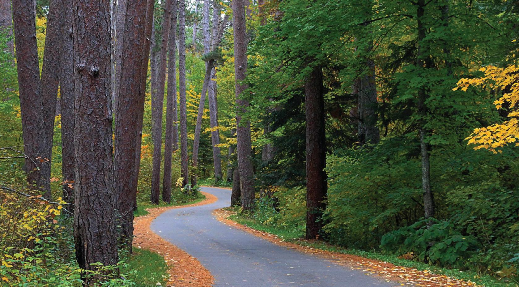
WILLARD MUNGER STATE TRAIL
Willard Munger State Trail
70 miles
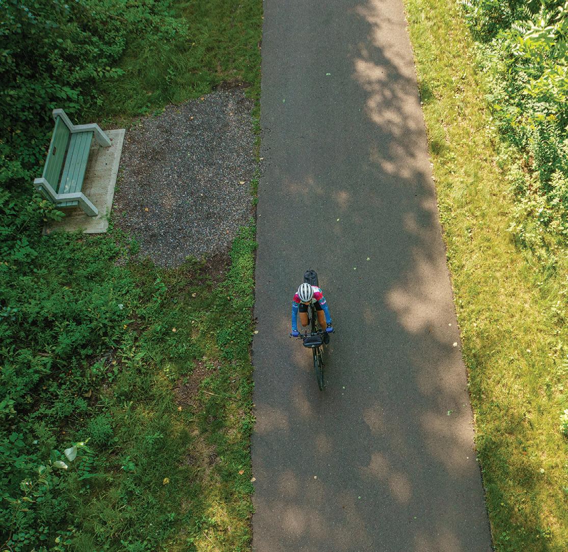
The Willard Munger Trail connects Hinckley to Duluth with a continuous trail that offers a changing experience as you travel along. The southern segment from Hinckley to Carlton is flat, straight and sometimes out in the open.
The so-called Hinckley Fire Trail section follows the railroad line that carried many area residents to safety during the devastating 1894 Hinckley Fire. It goes about 55 miles from Hinckley to Carlton, with entry points at Finlayson, Willow River, Sturgeon Lake and Moose Lake.
Nearly the entire trail is flat and straight on the bed of the abandoned railroad right-of-way and it crosses several bridges, skirts ponds and goes through the woods. A couple of stretches parallel a highway. Points of interest along this section include the Hinckley Fire Museum across from the trailhead and the historic Finlayson and Moose Lake Depots. A 2-mile road ride will take you into Moose Lake State Park.
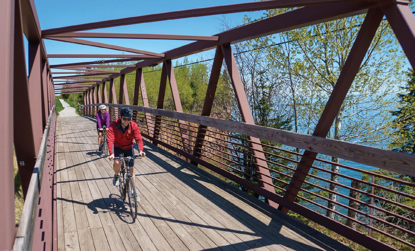
The northern segment is a 15-mile descent from Carlton to West Duluth that travels through trees and rock cuts with scenic views of the St. Louis River and the twin ports of Duluth and Superior. Riders can stop on a high railroad trestle to enjoy a breathtaking look over the St. Louis River near Carlton and watch kayakers take on the rapids cut through the rock. A short, paved trail splits off into Jay Cooke State Park shortly thereafter. Move on and view the wonders of a hydroelectric power plant, pedal through now-rare stands of hemlock trees, and relax on a hillside rest stop overlooking western Duluth and Lake Superior. From this Bardon Peak the ride is downhill to where the trail ends near the Lake Superior Zoo.
Connections: The 16-mile Alex Laveau Memorial Trail segment connects Carlton
18 MINNESOTA TRAILS | Summer 2024 P P P P P P P P P P U.S. Route Paved Trail Trail Bike Way State Route County Route Public Campground State Park Parking LEGEND 48 210 St. Croix State Park Cromwell Sawyer Otter Creek Mahtowa Barnum Kettle River Moose Lake Willow River Askov Bruno Kerrick Duquette Nickerson Holyoke Wrenshall Cloquet Proctor Duluth Superior Scanlon Rutledge Finlayson Groningen Friesland Hinckley 18 35 73 Nemadji State Forest Jay Cooke State Park Alex Laveau Memorial Trail St. Louis River Trail St. Croix State Park Moose Lake State Park 2 St. Louis River Kettle River Sturgeon Lake Lake Superior Find More Maps at www.MNTrails.com Carlton 23 23 Banning State Park 27 Sandstone Sturgeon Lake
70 MILES PAVED TotalDistancesinMiles TotalDistancesinMiles 1323 10 32 19 9 36 23 13 4 45 29 19 10 6 55 42 32 23 17 11 5970 4657 3647 2738 2132 1526 415 19 HinckleyFinlaysonWillowRiverMooseLakeBarnumMahtowaCarltonWrenshallDuluth 2024 Willard Munger BIKE TRAIL GUIDE
Railroad trestle turned trail at Jay Cooke State Park. Jan Lasar photo
with Gary-New Duluth, but not all of it is paved. From Carlton (at the intersection of the main trail with County Road 1), a six-mile paved segment goes south through Wrenshall and ends at Highway 23. A combination of bike routes on paved road shoulders and city streets continues from there.
The 2.5-mile paved St. Louis River Trail between Carlton and Scanlon is a short road ride away on city streets and can be accessed on Chestnut Street, across from Carlton Bike Rental.
At the end of the trail in Duluth (at Pulaski Street) you can access the 5-mile Western Waterfront Trail. This packed gravel trail runs along the St. Louis River shoreline from the Spirit Lake Marina to near Fremont Street in Duluth’s Irving neighborhood.
Between Friesland and Groningen (at Grindstone Lake Road) a paved trail splits off and travels east toward Sandstone. It stops short of reaching town, however, just west of I-35. A 4-mile road ride along the shoulder of Highway 61 and 23 north through Sandstone takes you to the western edge of Banning State Park where a paved bike trail of less than a mile ends near the park office.
Eventually, the James L. Oberstar State Trail will make the connection between the end of the Sunrise Prairie Trail and the city of Hinckley. Together with the existing Hardwood Creek, Gateway and Browns Creek Trails and partially completed Swedish Immigrant Trail, this important connection is part of a master vision of a trail network linking Saint Paul to Taylors Falls and Duluth.

Summer 2024 | MINNESOTA TRAILS 19 Willard Munger 2024 BIKE TRAIL GUIDE
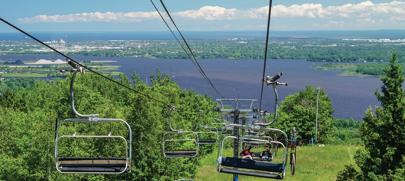
WWW.SPIRITMT.COM LIFT-SERVED DOWNHILL MOUNTAIN BIKING WITH A VIEW
Approaching Jay Cooke State Park from the northeast. Jan Lasar photo

GITCHI-GAMI STATE TRAIL


Gitchi-Gami State Trail
33.4 miles
Destined to become one of the most scenic paved trails in the nation, the GitchiGami parallels the North Shore Scenic Drive Byway, the popular Superior Hiking Trail and the Lake Superior Water Trail. Gitchi-Gami offers an active way to enjoy Minnesota’s North Shore with fantastic views of its namesake lake.
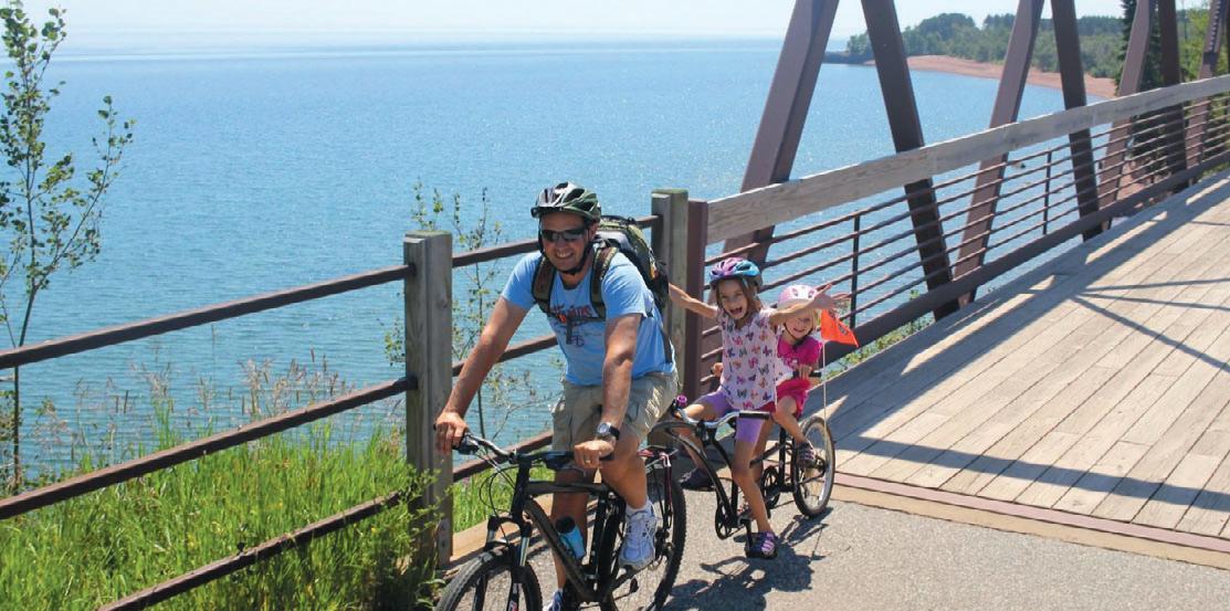
Along the Trail: The Gitchi-Gami State Trail will eventually trace 89 miles of the North Shore, weaving its way through five state parks from Two Harbors to Grand Marais. The longest trail section to date runs more than 17 miles from Gooseberry Falls State Park across the Split Rock River, through Split Rock Lighthouse State Park and Beaver Bay, and on to Silver Bay. At Split Rock Lighthouse State Park, you ride just below a wayside rest and scenic overlook with a picture-perfect view of the lighthouse. To visit the lighthouse and interpretive center, take the short spur trail leading there. Split Rock Lighthouse State Park and Beaver Bay both have trail centers with parking. The half -mile lakeside swing around Highway 61’s Silver Creek Tunnel is worth visiting on wheels or on foot for its panoramic views of Lake Superior. There’s also a three-mile stretch of trail from Schroeder to Tofte, passing through Temperance River State Park and offering a view of Carlton Peak. This stretch could make a nice out-and-back casual ride or family trip of six miles with a stop for a hike to see the Temperance River Gorge. Navigating through the Town of Tofte, there is a half-mile gap in the trail. Make plans to take the Town Park Road, which can bring riders some excellent opportunities to engage with Lake Superior. The trail once again picks up on the northeast side of Tofte where it continues another 7.3 miles.
Trail Sections:
Silver Creek Cliff : The Gitchi-Gami State Trail begins with a short yet impressive onemile section of the original North Shore Drive, running 4,000 feet around the Silver Cliff Creek Tunnel northwest of Two Harbors. This section of the trail offers a spectacular vista of Lake Superior and has a reproduction of the original 1924 North Shore Gateway arch and brass plaque welcoming visitors. While this section isn’t ready for through traffic, you may want to park just east of the tunnel and walk across the trail bridge to enjoy the view. This is also an area to see rock climbers and a great place for travel photos.
Gooseberry State Park to Silver Bay:
Seven miles east of Silver Creek Cliff is the popular Gooseberry Falls State Park where the next segment of the Gitchi-Gami Trail starts. The trail may be accessed near the Visitors Center, or add another mile to your ride by winding through the park, past the campground and near the mouth of the Gooseberry River, find the trailhead for a gentle sweeping ride up towards the Visitor Center and Highway 61 bridge over the falls. This trail segment winds through Iona’s Beach Scientific and Natural area, before leading to Split Rock Lighthouse State Park and
towns of Beaver Bay and Silver Bay.
20 MINNESOTA TRAILS | Summer 2024 Grand Marais Lutsen Tofte Schroeder Taconite Harbor Silver Bay Beaver Bay Two Harbors Cascade River Temperance River George H. Crosby Manitou Tettegouche Split Rock Lighthouse Gooseberry Falls LakeSuperior Find More Maps at www.MNTrails.com Future Trail Bike Trail State Park Parking Restroom Camping Picnic/Rest Area P P P P P P P P P P P P
33.4 MILES PAVED Cut Face Creek State Wayside P
the
2024 Gitchi-Gami BIKE TRAIL GUIDE Explore three of Minnesota’s most scenic and diverse trail systems, from along Lake Superior’s North Shore to miles of paths carved through the rugged wilderness. Visit LOVINLAKECOUNTY.com for trail maps and more info! BeaverBay, MN Split Rock Wilds Two Harbors, MN Demonstration Forest Gooseberry Falls to Silver Bay Gitche-Gami State Trail bikin’ lake county
Temperance River State Park: The Gitchi-Gami State Trail picks up again at the east parking lot in Schroeder and travels through Temperance River State Park, about four miles to the west of Tofte. This segment crosses the Temperance River Gorge and an ancient stream bed that is thought to have been an ancient route for the Temperance River into Lake Superior. The Temperance River Gorge offers spectacular views of the river and rocks below. You can also view the 1,526-foot Carlton Peak. Trail users can use the Blue Fin Bay Lake walk trail for about a half-mile to rejoin the trail on the east edge of town. This trail segment currently offers parking in Schroeder, and at the Tofte Public Water Access. Food, beverages and restroom facilities are available in Tofte.
Tofte to Grand Marais: This 7.4-mile trail segment starts at the northeast end of the town of Tofte. At County Road 34, where the trail used to dead-end, a tunnel underpass beneath Highway 61 connects to a new trail segment that ends at County Road 5 (Lutsen Ski Hill Road). The 4.8-mile segment of completed Gitchi-Gami State Trail connecting Grand Marais to the Cut Face Creek State Wayside is a flowy trail with many opportunities to see the lake. A highlight is a wooden arched bridge with viewing platforms on each side with views of the Fall River to one side, and Lake Superior on the other. Additionally, this 4.8mile segment connects to the Grand Marais Corridor Trail, a one-mile paved bike trail that travels through the heart of downtown Grand Marais.

SATURDAY, AUGUST 3
11AM–3PM


offering 8, 28, 34, or 55-mile fully supported options
AUGUST 17, 2024


Summer 2024 | MINNESOTA TRAILS 21 Gitchi-Gami BIKE TRAIL GUIDE 2024
Between Split Rock Lighthouse and Gooseberry Falls State Park. Jan Lasar photo
Kid Boogie Down | Live Music Maker’s Market | Food | Root Beer!
Mesabi Trail 150 miles
Grand Rapids to Ely
Via the Mesabi Trail, you can enjoy miles of paved trail stretching from the Mississippi River (Grand Rapids) to the Boundary Waters (Ely). When completed in just a couple of years, that mileage will expand to 165 miles. The trail runs through a wide range of scenery, from dramatic views of mining operations, to secluded woods, a jungle of vegetation, mine lakes and reservoirs.
It traverses forest, meadows, rivers, streams and lakes in a region bound on the east end by the Boundary Waters Canoe Area Wilderness and on the west by the
MESABI TRAIL
Mississippi River. In between, the Mesabi Trail takes visitors past the edges of the open pit mines of the Iron Range and areas abundant with wildlife, nature and the rich heritage of hardy pioneers.
Unlike a lot of paved trails in the state, the Mesabi Trail is created from old logging and mining roads, former roadways, some abandoned rail grade and new trail. There are even a couple of floating bridges. The trail crosses Minnesota’s tallest bridge just outside of Virginia. It spans 1,132 feet and crosses the Rouchleau mine lake 200 feet above the water’s surface for a spectacular view from your bike seat.
Currently, over 75 continuous miles
stretch from Grand Rapids to McKinley. After a short diversion to the shoulder of Hwy. 135, riders can re-connect with the trail again just outside of Biwabik. Another 24 miles travel from Biwabik through Giant’s Ridge Recreation Area to just outside of Tower. This section includes a ¾-mile long floating bridge across the Embarrass Wetland Complex and the Darwin Meyers Wildlife Management Area. The segment from Tower through the new Lake Vermilion Soudan Underground Mine State Park into Ely is now complete.
Additional spurs connect into communities like Chisholm with the Minnesota Discovery Center, and Eveleth with the US Hockey Hall of Fame and the world's largest hockey stick sculpture.
Off the bike you can tour a mine, a logging camp, the Greyhound bus museum or visit the childhood homes of Judy Garland and Bob Dylan. Many campgrounds and local parks are easily accessible from the trail, highways and nearby communities. Food, lodging, shopping, antiquing, golfing, fishing, camping and swimming are all in close proximity to segments of the trail, with communities and services available near all entry points.
Check for rail updates at mesabitrail.com before planning your cycling adventure.
22 MINNESOTA TRAILS | Summer 2024 Mesabi 2024 BIKE TRAIL GUIDE Bike Trail Future Trail Public Campground State Park Points of Interest LEGEND Veterans Park & Campground Itasca County Fairgrounds Hill Annex Mine State Park McCarthy Beach State Park Fayal Eveleth Mt. Iron Virginia McKinley Biwabik Aurora Embarrass Babbitt Ely Winton Soudan Tower Hoyt Lakes Kinney Buhl Chisholm Hibbing Keewatin Nashwauk Pengilly Calumet Marble Taconite Bovey Coleraine Grand Rapids Sparta Gilbert 135 169 169 135 110 37 37 25 73 5 73 65 57 8 65 7 1 53 53 169 169 169 169 169 2 2 21 21 Bear Head Lake Lake Vermilion Swan Lake Birch Lake Shagawa Lake 169 21 Find More Maps at www.MNTrails.com Lake Vermilion - Soudan Underground Mine State Park 1 International Wolf Center North American Bear Center Fortune Bay Bois Forte Heritage Museum and RV Park Giants Ridge Recreation Area US Hockey Hall fo Fame Minnesota Discovery Center and Redhead Mountain Bike Park Hull Rust Mine Overlook Oxhide Lake Overlook Tioga Recreation Area Greyhound Bus Museum Chisholm Museum of Mining 61 38 Boundary Waters Canoe Area
150 MILES PAVED TotalDistancesinMiles 16.3 29.3 13 39.3 23 10 46.3 30 17 7 51.3 35 22 12 5 64.374.583 94 4858.266.777.7 3545.253.764.7 2535.243.754.7 1828.236.747.7 1323.2 10.2 31.742.7 18.729.7 8.519.5 11 GrandRapidsMarbleKeewatinHibbingChisholmBuhlVirginiaMcKinleyGiantsRidge ® Embarrass Bear Head Lake State Park 26
Details
at www.mntrails.com/ bike-trails/
Floating bridge in the Embarass Wetland Complex. Jan Lasar photo


Summer 2024 | MINNESOTA TRAILS 23 Mesabi 2024 BIKE TRAIL GUIDE
MesabiTrail.com Mississippi River to t ry Wate VisitGrandRapids.comIronRange.org
Between Lake Vermillion State Park and Ely. Jan Lasar photo
Paul Bunyan State Trail 120 miles
The paved Paul Bunyan Trail is Minnesota’s and the country’s longest rail trail. It has been inducted into the Rails to Trails Conservancy’s Hall of Fame, as a “Signature Minnesota Destination.”
The trail’s namesake, Paul Bunyan, is a reminder of the rich forestlands that supported a robust timber industry and are ever present on your ride through the pines and you'll see many incarnations of Paul Bunyan and his sidekick, Babe the Blue Ox, in towns along this one-of-a-kind trail.
Along the Trail: The trail starts at Crow Wing State Park near Brainerd and ends at Lake Bemidji State Park near Bemidji. Including a few on-road connections, the total mileage is closer to 123 miles.
Trail Sections:
Crow Wing State Park to Walker: Riders can catch glimpses of the Mississippi River on their way through the park towards Brainerd’s Northland Arboretum. The Brainerd lakes area is a favorite with tourists seeking an Up North experience with creature comforts. Countless resorts, hotels and campgrounds cater to cyclists and are located near the trail. North of Brainerd you’ll find wetlands, gardens and the little towns of Merrifield and Nisswa. Downtown Nisswa is a bustling tourist town with many shops and restaurants to explore. Stop for a tour of the historic pioneer village and regular turtle
races throughout the summer. The Pequot Lakes Visitor’s Center is a good place to rest and recharge. Rumor has it Paul Bunyan’s bobber now serves as the town’s water tower. Stop and take a rest in Paul Bunyan’s chair at Bobber Park.
At the Pine River Information Center, you


can see vintage displays, including a pair of Paul Bunyan’s baby shoes, big enough to stand in. Keep an eye out for carved critters along the trail, like Colonel Cobber in Backus. This 10-foot chainsaw carving of a corncob man is a favorite picture opportunity with cyclists. Farther down the trail you can meet Paul Bunyan’s girlfriend, Lucette, in Hackensack, home to an annual chainsaw carving festival. After Hackensack, take either the hilly route through the Chippewa National Forest to the shared section of the Heartland and Paul Bunyan Trail or the Shingobee Connector trail. Both routes connect to downtown Walker, but the Shingobee trail is shorter and easier.
Walker to Bemidji: On the way to Bemidji, you will cross the Kabekona River and go through Benedict, Laporte and Guthrie in a mix of quiet, rolling farmlands, crystal clear lakes and forest lands. Bemidji, the first city on the Mississippi River, is on the south side of Lake Bemidji and flanked by the Mississippi Headwaters State Forest to the west and Lake Bemidji State Park to the north. In Bemidji, you’ll want to visit the famous statue of Paul Bunyan and his Blue Ox named Babe. Continue on to Lake Bemidji State Park or ride a 17-mile scenic loop around Lake Bemidji.
Connections: Traveling north on the Paul Bunyan State Trail after Hackensack, you'll enter the Chippewa National Forest and come to a Y intersection. Go left and ride the hilly section of the Paul Bunyan Trail through the Chippewa National Forest to the intersection with the Heartland Trail west of Walker. Go right and take the easier Shingobee Trail into Walker from the south. After you cross Paul Bunyan Drive on the bridge in Bemidji, connect to the 17-mile
24 MINNESOTA TRAILS | Summer 2024
Bunyan BIKE TRAIL GUIDE
Paul
The trail crosses the outlet of the Mississippi River at Lake Bemidji. Jan Lasar photo
Lake Bemidji Trail around Lake Bemidji. It doesn't matter which way you go around the lake, the route ends at Lake Bemidji State Park.
The Paul Bunyan Trail is also part of the Mississippi River Trail Scenic Bikeway, a signed route from the Mississippi Headwaters to the Gulf of Mexico.
History: The Paul Bunyan trail follows the original railroad line built in 1893 and abandoned by Burlington Northern in 1983. In October 1992, the first 50 miles of the Paul Bunyan Trail from Brainerd to Hackensack opened to the public and it has since more than doubled in length.


Summer 2024 | MINNESOTA TRAILS 25 Paul Bunyan BIKE TRAIL GUIDE
2024 leech-lake.com | 218-547-1313 3 Walker, MN is connected to more than 150 miles of paved trails!
The Paul Bunyan Trail is officially part of the Mississippi River Trail Bike Route. Jan Lasar photo
Choose Your Adventure. VISITBRAINERD VisitBrainerd.com
Photo Credit: Explore MN
Heartland State Trail
54 miles
The Heartland State Trail is another mustsee destination in the heart of Minnesota's lake country. Numerous towns, resorts and parks provide amenities to the rider on one of Minnesota’s most visited recreational trail systems.
Trail Sections:
Park Rapids to Dorset: The official start of the Heartland Trail is at Park Rapids’ Heartland Park, which has shelters, restrooms, a swimming beach and a bridge across the Fish Hook River. Your six-mile journey to Dorset will take you through scenery ranging from thick woods to grasslands dotted with lakes. The popular trailhead in Dorset has access to shops and restaurants, a large parking lot, outdoor toilet, playground and shaded picnic areas. The corral on the other side of the trail is for those on horses who use the unpaved trail parallel to the paved trail.
Dorset to Nevis: The next five miles to Nevis are quite pleasant. The trail travels through the woods with glimpses of an occasional pond. Pines and poplar trees are plentiful and birch stand out nicely from the green background. Just before you get to Nevis, enjoy views of Shallow and Belle Taine Lakes as you cross over the channel connecting the two. Stop here for a selfie with the World’s Largest Muskie statue.
Nevis to Akeley: The rest area in Nevis has water and restrooms. Stop and see a statue of the World’s Largest Tiger Muskie. In Akeley, stop and sit in Paul Bunyan’s hand for a picture.
Akeley to Walker: The Heartland Trail and the Paul Bunyan Trail share a trail segment from just northeast of Akeley to Walker. At a parking lot a few miles outside of Akeley, riders can turn onto the Paul Bunyan
Trail and ride through the Chippewa National Forest. This eight-mile segment on paved logging roads-turned-trail has a grade of up to 8 percent. It hooks up to the Shingobee Connection Trail into Walker. Alternatively, you can continue on the shared segment and access the town of Walker that way. Just outside of town, the Paul Bunyan and Heartland Trails part ways. The Paul Bunyan Trail continues northwest to Bemidji, while the Heartland Trail continues northeast to Cass Lake.
Walker to Cass Lake: North of Walker, you’ll need to ride two miles on a paved road shoulder to get from one section of the trail to the other. The trail skirts the west side of Leech Lake, then cuts through some woods and marshland and parallels Highway 371 for 10 miles to Cass Lake. At 41 miles, there is a large steel bridge, which once carried trains across Steamboat River.
Connections: In Walker, connect to the Shingobee Trail near Chase on the Lake Resort. This seven-mile combination of road routes and standalone trail crosses Shingobee Bay on the south end of Leech Lake and will take you to the Paul Bunyan Trail. Go south at this intersection toward Hackensack or west through the Chippewa National Forest and loop back to Walker via the Heartland/Paul Bunyan Trail. Near Cass Lake, where the trail intersects with County Road 76, connect with the Mi-Gi-Zi Trail by riding about a half a mile east on a signed road route. Follow the 14-mile trail counterclockwise around Pike Bay’s beautiful shores and the Chippewa National Forest and arrive at a trailhead north of Pike Bay after about ten miles. From there, a signed bike route will take you back to the Heartland Trail on quiet city streets through Cass Lake.
Future expansions of the Heartland include a 20-mile extension north from Park Rapids to Itasca State Park and an 86-mile segment from Park Rapids west to Moorhead. Of this segment, about five miles are paved going northwest from Frazee to connect with existing trails in Detroit Lakes.
26 MINNESOTA TRAILS | Summer 2024
BIKE TRAIL GUIDE
Heartland
The newest section of the Heartland Trail connects Frazee to Detroit Lakes.
2024 explore Itasca State Park and the 49-mile Heartland State Trail in the | 218-732-4111 | www.parkrapids.com
Jan Lasar photo
TRAIL MAP


Summer 2024 | MINNESOTA TRAILS 27 Lake Bemidji Heartland State Trail North Country Hiking Trail Paul Bunyan State Trail 210 7 2 40 9 Lake Itasca Lake George P 39 20 12 Lake Bemidji State Park Itasca State Park Guthrie Mississippi River Trail Heartland State Trail Mi-Gi-Zi Trail Cass Lake Wilkinson Laporte HeartlandTrail DistanceinMiles PaulBunyanTrail DistanceinMiles Benedict Hackensack Backus Walker Trail Loop Pine River Pequot Lakes Jenkins Nisswa Merrifield Brainerd Baxter Crow Wing State Park Nevis Dorset Park Rapids Walker 8 14 371 371 200 16 Paul Bunyan State Trail 64 34 16 84 84 Akeley 210 371 H 371 34
Heartland, Paul Bunyan, Mi-Gi-Zi and Itasca Wilderness Trail
11.6 17.9 27.3 39.8 47.0
11.6 21.0 33.5 40.7 6.3 15.7 28.2 35.4 9.4 21.9 29.1 12.5 19.7 7.2 ParkRapidsDorsetNevisAkeleyWalkerWilkinson2mi.S.ofCassLake 9.0 15.9 22.1 25.4 31.4 40.7 48.2 71.0 77.6 82.8 89.0 94.2 100.6 110.0 13.0 24.0 28.9 45.1 38.4 44.4 53.7 61.2 84.0 90.6 95.8 104.0 107.2 113.6 123.0 6.9 13.1 16.4 22.4 31.7 39.2 62.0 68.6 73.8 80.0 85.2 91.6 98.9 6.2 9.5 15.5 24.8 32.3 55.1 61.7 66.9 72.1 78.3 84.7 92.0 3.3 9.3 18.6 26.1 48.9 55.5 60.7 66.9 73.1 78.5 85.8 6.0 15.3 22.8 45.6 52.2 57.4 63.6 68.8 75.2 82.5 9.3 16.8 39.6 46.2 51.4 57.6 62.8 69.2 76.5 7.5 30.3 36.9 42.1 48.3 53.5 59.9 67.2 22.8 29.4 34.6 40.8 46.0 52.4 59.7 6.6 11.8 18.2 23.2 29.6 36.9 5.2 11.4 16.6 23.0 30.3 6.2 11.4 17.8 25.1 5.2 11.6 18.9 6.4 13.7 7.3 CrowWingSt.ParkBrainerd/BaxterMerrifieldNisswaPequotLakes JenkinsPineRiverBackusHackensackWalkerBenedictLaporteGuthrieNaryBemidjiLakeBemidjiStatepark Park Rapids Heartland Park Fish Hook River Baxter Brainerd Crow Wing State Park 210 371 371 HighlandScenic Dr. Mississippi River Trail Misssissippi River B371 123 30th Ave. Charles St. Rollinger St. 1st St. 2nd St. King St. Bridge St. Franklin Ave. Excelsior Rd. Evergreen Rd. Jasperwood Rd. Northland Arboretum White Sand Lake Cuyuna Lakes State Trail Perch Lake Rush Lake Buffalo Lake Boom Lake P 197 Lake Bemidji Paul Bunyan State Trail Irving Lake 1st St. 1st St. Mill St. 4th St. Gould Ave. Grant Ave. Lake Ave. Little Norway Ave. IndustrialPaulBunyanDr. ParkDr. Washington Ave. Clauson Ave. 5th St. Cass Lake Pike Bay Garfield Lake Leech Lake Walker Bay Traders Bay Agency Bay SteamboatBay Benedict Lake Kabekona Lake Kabekona Bay Ten Mile Lake Stony Lake Pleasant Lake Pine Mountain Lake Birch Norway Lake Lower Whitefish Lake BigLakeTrout Pelican Lake North Long Lake Lower Cullen Lake Gull Lake Wilson Bay Upper Whitefish Lake UpperLakeHay Lake Itasca Elf Lake Itasca Wilderness Sanctuary Scientific & Natural Area Itasca State Park Wilderness Trail More Maps at MNTrails.com Map Courtesy of Bemidji 2 71 71 71 71 P P P P P P P P P P P P P P P P P P P P P P H H P P 0510 LEGEND U.S. Route Paved Trail Bikeway (MRT) Horse Trail State Route Parking County Route Restroom Public Campground Picnic State Park Hospital H P 200 Heartland St. North St. Lawn St. Pearle St. Todd St. Downtown Minnesota St. Kaywood Dr. Forestview Ave. Eastern Ave. East River Dr. Paul Bunyan State Trail 12 200 371 34 371 P P Heartland State Trail Shingobee Connection Trail Leech Lake Long Lake May Lake P North Country Hiking Trail 83 26 12 P Paul Bunyan/Heartland Map BIKE TRAIL GUIDE
6.3
5.3
Glacial Lakes State Trail
28 miles
The area around the Glacial Lakes Trail is dotted with countless lakes shaped by retreating glaciers some 10,000 years ago. Today, communities in this popular tourist area welcome visitors who come here to recreate at the lake, on the bike or both.
Along the trail: The trail starts at the Civic Center on the northern edge of Willmar. It goes northeast through beautiful farmland, prairie, and communities along the way include Spicer, New London, Hawick and Paynesville, where the trail currently terminates. A five-mile segment between Roscoe and Richmond is also paved.
Connections: Just northeast of Willmar, take the five-mile Eagle Lake Loop Trail which circles back to the Civic Center. A city bike route also takes you to downtown Willmar. In Spicer, take a ride around Green Lake on a combination of trails and signed routes. At the eastern end of the Glacial Lakes Trail, take Paynesville’s connector route to the Lake Koronis Trail. At Richmond, the Glacial Lakes Trail connects to the RoCoRi Trail, travels on to Rockville.
A three-mile section of the trail has just been finished inside of Sibley State Park. It


28 MINNESOTA TRAILS | Summer 2024
BIKE TRAIL GUIDE
Glacial Lakes
2024
Jump Right In! www.willmarlakesarea.com 320-235-3552 360 lakes and miles of trails to explore! •Ride the Glacial Lakes State Trail •Explore Sibley State Park •Discover the Glacial Ridge Scenic Byway •Just a short drive west of the Twin Cities CONVENTION & VISITORS BUREAU
Between Spicer and New London. Jan Lasar photo
Summer 2024 | MINNESOTA TRAILS 29 Glacial Lakes BIKE TRAIL GUIDE Lake Koronis Trail (road & paved trail) Lake Koronis Regional Park Green Lake Bike Way (road & paved trail) Middle Fork Crow River Paynesville Roscoe Richmond Hawick Sibley State Park New London Connects to Rocori Trail City Bike Trail City Bike Trail (paved) Atwater Kandiyohi Willmar Spicer 4 10 P 5 26 8 9 5 Lake Koronis Green Lake Diamond Lake 71 71 Nest Lake Games Lake Norway Lake P U.S. Route Paved Trail Other Trails Future Trail State Route County Route Public Campground State Park Parking LEGEND Find More Maps at www.MNTrails.com P P P 23
STATE TRAIL 28 MILES PAVED TotalDistancesinMiles TotalDistancesinMiles 6.512 5.5 18 11.5 6 16 9.5 4 10 25 18.5 13 7 17 36 30.5 24 18 28 13.5 41 35.5 29 23 33 18.5 5 WillmarSpicerNewLondonHawickSibleyStateParkPaynesvilleRichmondColdSpring Eagle Lake 9 Eagle Lake Loop (paved trail) P 48 38 Andrew Lake 40 40 2 48 2024
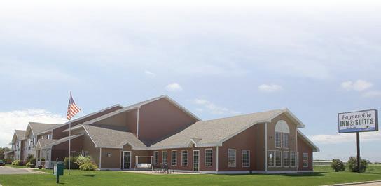
Details at www.mntrails.com/ bike-trails/ meanders from the park border at Highway 71 through prairie and woodlands and past the visitor center, the beach, the new amphitheater next to the trail center and ends at the boat landing. A connection from Highway 71 to nearby New London is in the works. 700 Diekmann Drive Paynesville, MN 56362 320-243-4146 www.paynesvilleinn.com Right on the Bike Trail Ride the Glacial Lakes & Lake Koronis Trail PAYNESVILLE INN & SUITES
GLACIAL LAKES
Railroad trestle bridge at Nest Lake near New London. Jan Lasar photo
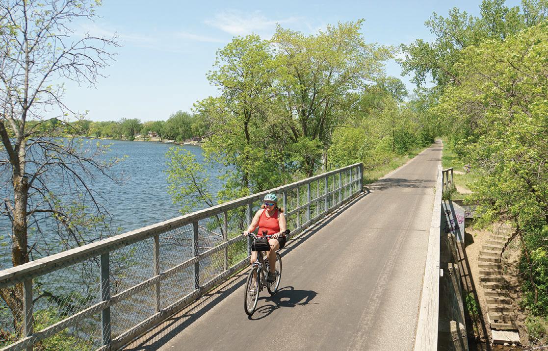
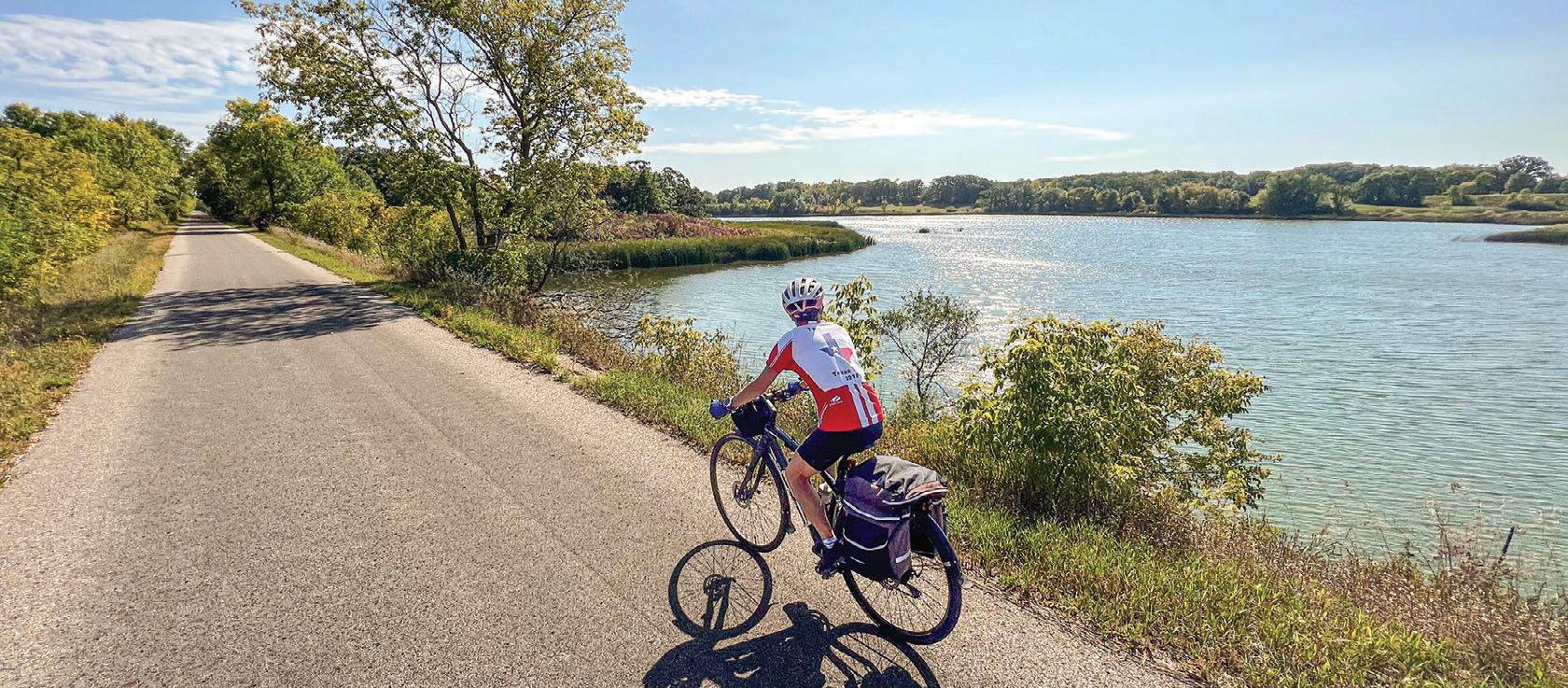
CENTRAL LAKES STATE TRAIL
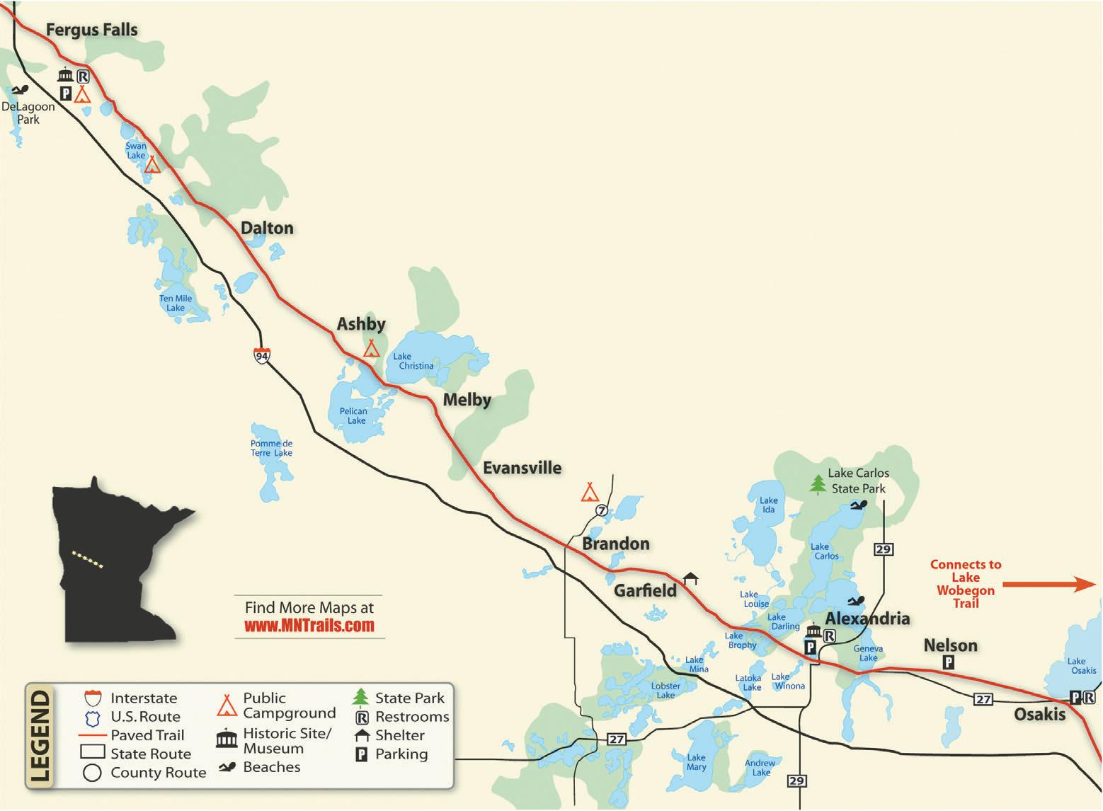
Central Lakes State Trail
55 miles
The 55-mile-long, paved trail starts at the Fergus Falls trailhead on Highway 210 and travels southeast through the communities of Dalton, Ashby, Melby, Evansville, Brandon, Garfield, Alexandria, Nelson and Osakis. The trail, a former railroad grade, is generally flat and level. It passes through a varied landscape of woods, grasslands, lakes, wetlands and farm fields. Communities with rest stops and amenities are generally seven to ten miles apart. The Central Lakes Trail is open to non-motorized use and groomed for snowmobiling in the winter.
Along the Trail: The official Fergus Falls Trailhead is near the intersection of Minnesota Highway 210 and 19th Street, where you can find parking, bathrooms, picnic facilities, a bike repair station and play sculpture. Camping is available at DeLagoon Park, about a mile down the trail from the trailhead. This large park also offers a swimming beach and picnic facilities. Traveling from Fergus Falls you'll cross the Continental Divide, where water flows south
into the Mississippi or north into Hudson Bay. The small communities along the trail tuck in neatly between reed-lined lakes and the occasional farm field and you'll easily find camping, restaurants and places to rest. Stop for a photo op at the well-known statue of Big Ole the Viking at the north end of downtown Alexandria, near the Runestone Museum. If you're visiting in early summer, keep an eye out for pink or yellow Lady’s Slippers blooming along the trail.

30 MINNESOTA TRAILS | Summer 2024 Central Lakes BIKE TRAIL GUIDE Bridge crossing between Lake Cowdrey and Lake Darling in Alexandria . Jan Lasar photo
2024
55 MILES PAVED TotalDistancesinMiles TotalDistancesinMiles 611 5 19 13 8 25 19 14 6 31 25 20 12 6 36 30 25 17 11 5 40 45 55 34 39 49 29 34 44 21 26 36 15 20 30 9 14 24 4 9 5 19 15 10 OsakisNelsonAlexandriaGarfieldBrandonEvansvilleMelbyAshbyDaltonFergusFalls 320.219.7433 SALES • SERVICE • RENTALS Right off the Central Lakes Trail 419 N. Nokomis Street, Alexandria
Near Fergus Falls. Jan Lasar photo
A Combined History: The Lake and Central Lakes Trail are built on the rail corridor formerly owned by Burlington Northern Railroad Company. As the profitability of the railroad line declined, Burlington Northern leased use of the tracks to smaller short line railroads. One of the last such companies was the Otter Tail Valley Railroad, which ran trains between
Moorhead, MN and Avon, MN, from 1986 until 1991, when the line was officially abandoned. The Lake Wobegon Regional Trail opened in 1998 and the Central Lakes State Trail was dedicated in 2005. The two trails officially joined near Osakis, MN in 2007.
Connections: Just east of Osakis, the Central Lakes State Trail connects to the
65-mile-long, paved Lake Wobegon Trail. From DeLagoon Park, city bike routes take you to Grotto Lake Park with the famous statue of Otto the Otter. Feasibility of a connecting trail between Fergus Falls and Pelican Rapids is being explored. Another trail in the planning stages would connect Ashby to Battle Lake and Glendalough State Park.


Central Lakes BIKE TRAIL GUIDE
2024 WakeupinAlexandriaonaMonday
LAKE WOBEGON REGIONAL TRAIL

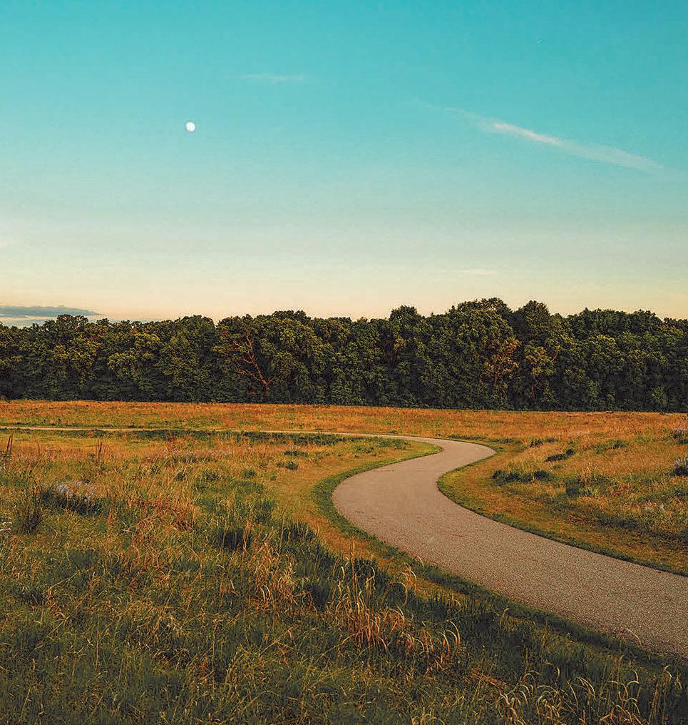
Lake Wobegon Regional Trail


The Lake Wobegon Trail is a 10-foot wide, bituminous surfaced hike-and-bike pathway. It travels through the central Minnesota counties of Stearns and Todd from the city of Waite Park to the city of Osakis. The trail also has an extension from Albany heading northeast to Holdingford and the Stearns/Morrison County line.


Starting at Rivers Edge Park in Waite Park, you'll cross the Sauk River on this newest section of the Lake Wobegon Trail. En route to St. Joseph you ride along natural areas and farm fields. A few miles outside of St. Joseph, see the old town of Collegeville, which now consists of only a few homes, but once had a popular train depot, boarding house, post office and store. You can turn left at Collegeville for a 2.5-mile side trip to Saint John’s University. At Avon, you’ll find shelters, bathrooms, a water fountain and a two-storied lookout tower/shelter that gives you a bird’s eye view of the surrounding region. The next 5.5 miles are perhaps the most beautiful along this stretch of trail, with deeper woods, prairies and lakes. Keep an eye out for Lady’s Slipper orchids in May and June. Just west of Albany, a spur of the Lake Wobegon Trail goes north nine miles to Holdingford, home of Minnesota’s longest covered bridge. This spur connects with the paved Soo Line Trail at the county line and offers pastoral views of a natural landscape. The Soo Line trail goes through Bowlus, crosses the Mississippi River at Blanchard Dam and ends at a trailhead on Highway 10. West of Albany, you’ll find Freeport, the birthplace
32 MINNESOTA TRAILS | Summer 2024 Lake Wobegon BIKE TRAIL GUIDE P P P P P P Two Rivers Lakes MississippiRiver Ochotto Lake Lower Spunk Lake Middle Spunk Lake Upper Spunk Lake Minnie Lake Linneman Lake SaukRiver Sagatagan Lake Kraemer Lake Lake Anna 127 Bowlus Royalton Blanchard Dam County Line Charles A. Lindbergh State Park Holdingford Melrose Freeport Albany Avon St. Joseph St. Cloud Waite Park West Union Osakis Lake Wobegon Regional Trail trail ends in Osakis and connects to Central Lakes Trail 10 Lake Osakis Sauk Lake McCormick Lake Sauk River Mill Pond Uhlenholts Lake North Lake Freeport Lake 71 P Saint John’s University College of St. Benedict’s Old Collegeville Station River’s Edge Park 94 94 LEGEND P Soo Line Trail City Trail SooLineTrail Lake Wobegon/ State Park Campground Parking Restroom Shelter 10 Little Falls P Sauk Centre 17 17 9 26 P Find More Maps at www.MNTrails.com
65 MILES PAVED TotalDistancesinMiles 2.35.3 3 10.3 8 5 16.3 14 11 6 22.8 20.5 17.5 12.5 6.5 28.8 26.5 23.5 18.5 12.5 6 37.344.8 42.5 39.5 34.5 28.5 22 16 7.5 50.8 48.5 45.5 40.5 34.5 28 22 13.5 6 35 32 27.0 21 14.5 8.5 WaiteParkSt.JosephCollegeville AvonAlbanyFreeportMelroseSaukCentreWestUnionOsakis NORTHERN SPUR Lake Wobegon Albany to Holdingford 9.4 miles Holdingford to County Line 3.5 miles Soo Line County Line to Bowlus 4.0 miles Bowlus to Blanchard Dam 3.5 miles Blanchard Dam to HWY 10 2.5 miles P P 2024
65 miles
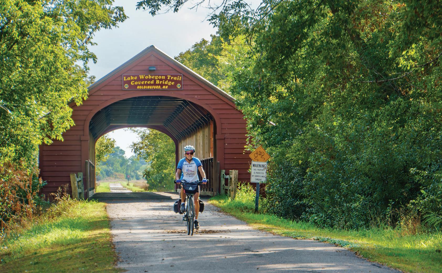


Summer 2024 | MINNESOTA TRAILS 33 Lake Wobegon BIKE TRAIL GUIDE 2024
1400 4TH ST., HOLDINGFORD | 320-746-0689 rotating gallery exhibits | open art studio | live music | community events | beer & wine | café & co ee a space friendly to families, folks of all ages and users of the Lake Wobegon Trail | www.ArtInMotionOnTheLakeWobegonTrail.com | OPEN MAY – OCT. crea t ivi t y , co m m uni t y & connec t ion t o na t ure THE ARTIST, THE APPRECIATOR & THE TRAVELING SOUL ARE ALL WELCOME HERE.
Holdingford's covered bridge. Jan Lasar photo
of Lake Wobegon. Garrison Keillor is said to have had the inspiration for some of his fictional places here. Head west for 5.7 miles to Melrose, home of the Melrose Area Museum. The official Melrose Trailhead is across the road near the Melrose Feed Mill. When you arrive in Sauk Centre, take a detour to see the Original Main Street made famous by Sinclair Lewis in his novel, Main Street. Farther up, you will find a city trail dropping back to Sinclair Lewis Park where you can find camping, bathrooms and parking. The 12-mile stretch between Sauk Centre and Osakis veers off into the country through the tiny town of West Union before entering Osakis.
History: See Central Lakes Trail
Connections: Just outside of Osakis, continue on to the Central Lakes State Trail, a 55-mile paved trail to Fergus Falls. At the Stearns/Morrison County line north of Albany, the Wobegon connects to the paved Soo Line Trail. A link from Sauk Centre north to Browerville is being explored. Eventually, the natural-surfaced Dairyland Trail will reach Albany and will make a connection with Brooten, MN. In 2022, the Lake Wobegon and Central Lakes Trails were designated part of the US Bicycle Route 20 (USBR 20) between Moorhead and the junction of USBR 45 and the Mississippi River Trail (MRT) in St. Cloud.
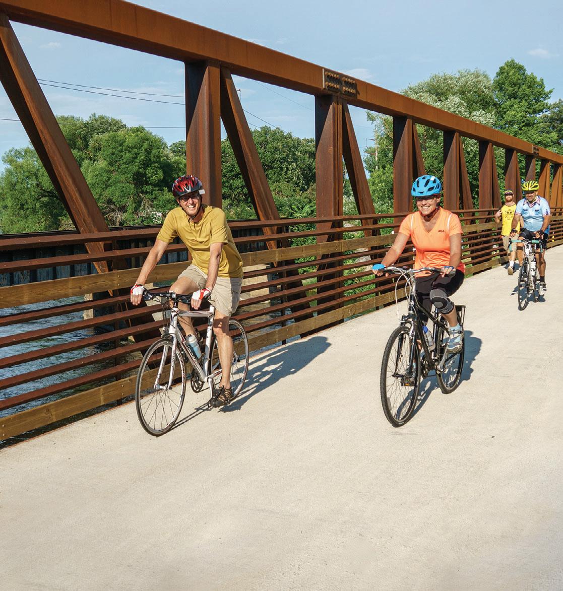
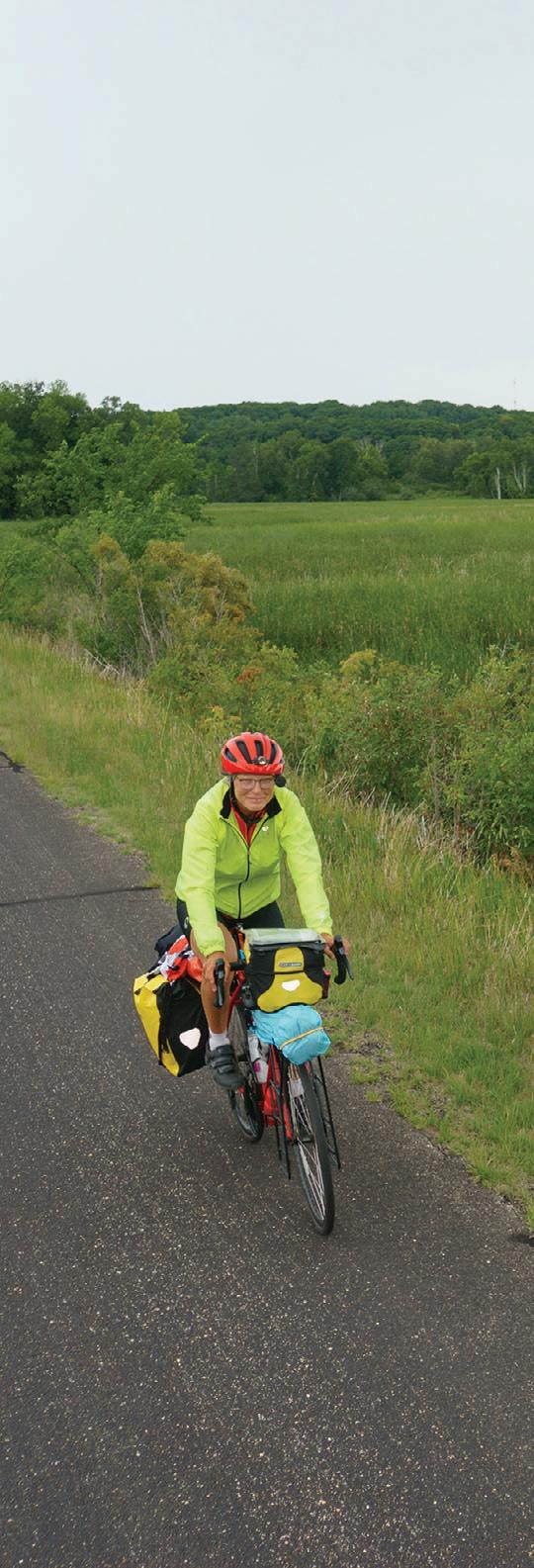
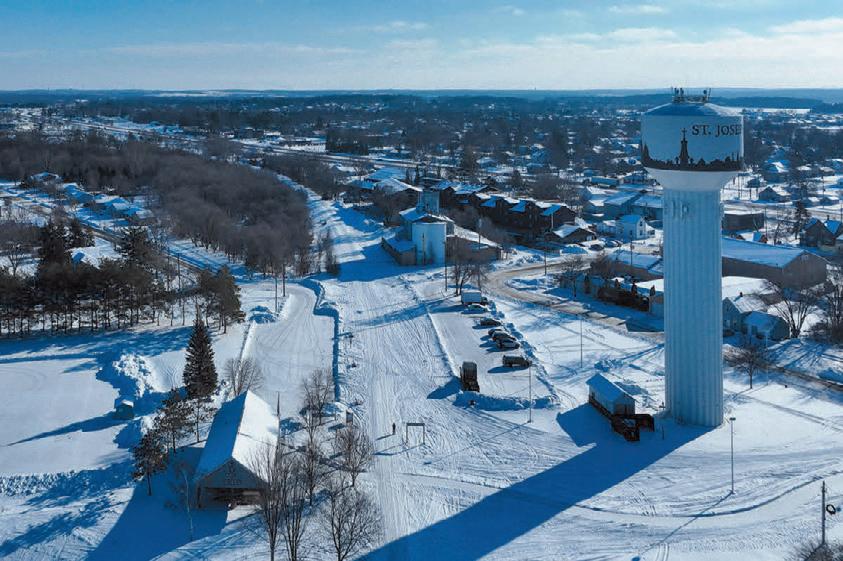
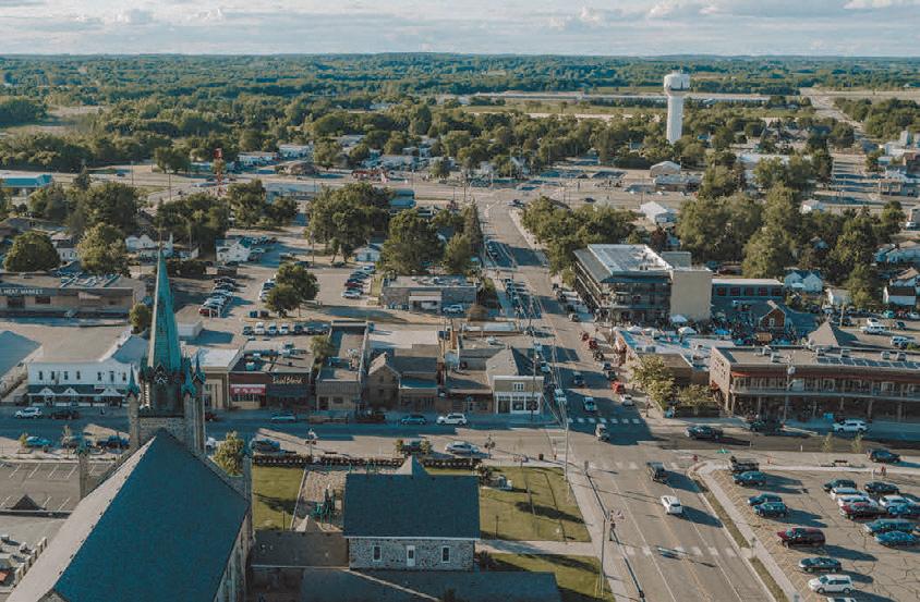

34 MINNESOTA TRAILS | Summer 2024 Lake Wobegon BIKE TRAIL GUIDE 2024 VISIT JOE TOWN Small Town Warmth Big City Cool Saint Joseph, Minnesota ARTISAN SHOPS CRAFT BEER & CIDER AWARD WINNING RESTAURANTS RIGHT ON THE WOBEGON TRAIL www.joetown.org ALBANY · AVON · BOWLUS · FREEPORT HOLDINGFORD · MELROSE · OSAKIS SAUK CENTRE · WAITE PARK · WEST UNION Ride Lake Wobegon Country LakeWobegonTrail.com
The trail is popular with cross-country bike travelers. Jan Lasar photo
STATE TRAIL LUCE LINE
Luce Line State Trail 63 miles
The Luce Line State Trail stretches 63 miles in a westerly direction from the metro suburb of Plymouth to the small town of Cosmos in west-central Minnesota. Along the way you'll visit the communities of Wayzata, Watertown, Winsted, Hutchinson, Silver Lake and Cedar Mills.
It runs on a former railroad line covered with a variety of surfaces ranging from crushed limestone between Plymouth and Winsted, pavement between Winsted and just west of Hutchinson, gravel between Hutchinson and Cedar Mills to a mowed grass path between Cedar Mills and Cosmos. The western trailhead is just west of Cosmos in a county park on Thompson Lake. While it starts in the heart of the western suburbs,
the Luce Line Trail offers a varied landscape of woodland, marsh and lakes with a portion running through remnants of the Big Woods and stands of maple and basswood. A horse trail parallels the Luce Line between Hutchinson and Plymouth.
History: The trailway dates back to the old Electric Short Line of 1908, which moved goods and passengers in and out of the Twin Cities. It was renamed Luce Line after the family who owned and extended it as far as Lake Lillian. After the railroad ceased operations, the DNR acquired parts of the corridor to create the state’s first nature trail in 1970. By 1975 the state owned most of the right of way and between 1977 and 1980 built the trail to Winsted. In 2015, a 23-mile section between Winsted and Hutchinson was paved.
Connections: The Luce Line State Trail allows access to many Twin Cities metro area trails. In Plymouth, the natural surface part of the Luce Line State Trail connects to the paved Luce Line Regional Trail, which ends east of Sweeney Lake in Golden Valley, but further connections are ahead. At Medicine Lake this section connects to the 13-mile Medicine Lake Regional Trail and the Basset Creek Regional Trail. The Medicine Lake Trail ends at Elm Creek Park Reserve in Maple Grove. Connections from here include the Rush Creek and Crystal Lake Regional Trails. In Wayzata, a short ride on city roads will take trail users to the Dakota Rail Regional Trail, which continues roughly southwest for 26 miles and ends in Lester Prairie.


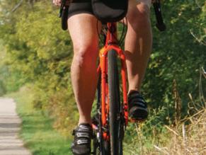


Summer 2024 | MINNESOTA TRAILS 35 Luce Line BIKE TRAIL GUIDE 2024 www.MNTrails.com p Butler Lake South Lake Eastern Portion Oak Lake South Fork Crow River Rice Lake Ox Yoke Lake Whaletail Lake Dutch LakeWest Arm Stubbs Bay Lake Minnetonka Mud L. Gleason Lake Parkers Lake WRIGHT CO. HENNEPIN CO. CARVER CO. MCLEOD CO. Winsted Lake Winsted 5 261 9 6 6 30 30 8 10 21 L.Mary L.Ann L. Emma 20 33 21 122 20 122 P P P P P P P 103 25 25 13 10 10 15 24 16 16 17 92 17 83 151 19 84 19 6 20 Watertown 92 90 26 26 394 494 Summer Only Mound Independence Maple Plain Long Lake Orono Plymouth Lyndale Minnetrista 6 135 146 51 5 15 61 6 Katrina Lake 24 101 16 Baker Park Reserve Wood-Rill S.N.A. 201 12 12 12 55 Proposed Wayzata DakotaRailTrail 15 Thomp
63 MILES ON A VARIETY OF SURFACES www.MNTrails.com Find More Maps at EasternPortion LEGEND Paved (Asphalt) Adjacent Horse Trail Undeveloped Crushed Aggregate Base Crushed Limestone Parking Restroom Public Campground Picnic/Rest Area State Park P TotalDistancesinMiles 67 1 19 13 12 29 23 22 10 39 31 30 18 8 44 38 37 25 15 7 VicksburgLaneTrailheadWakefield-ConryRestAreaStubb’sBayRd.TrailAccess WatertownWinstedSilverLakeHutchinsonCedarMillsThompsonLake(nearCosmos) 51.5 45.5 44.5 32.5 22.5 14.5 7.5 63 56 55 43 33 24.5 17.5 10 RENVILLE CO. MEEKER CO. Hutchinson Lester Prairie 12 (mowed grass) South Fork Crow River Otter Lake Lake Cedar Belle Lake Hooke Lake Boon Lake Mud Lake 10 1 35 12 115 P P P Silver Lake 2 2 24 15 2 7 7 22 7 Cedar Mills 26 Cosmos 19 19 20 22 14 16 7 7 5 4 4 12 7 76 79 71 71 61 15 Swan Lake 4 4 P P 261 5 20 16 7 Thompson Lake 5 33 Silver Lake Winsted Lake 73 6 Winsted Western Portion MCLEOD CO. Proposed
explore Hutchinson.com CAMPING • LODGING • FISHING • PARKS • LAKES WINERY • BREWERY • DINING • SHOPPING your gateway to the Luce Line Trail Line Trail your gateway to the Luce Line Trail
STATE TRAIL
Gateway State Trail 18 miles
The Gateway Trail is a true getaway trail starting deep in metropolitan St. Paul, just a mile from the State Capitol. It finishes after 18 miles at Pine Point Regional Park, five miles north of Stillwater. The trail is open to biking, hiking, horseback riding, in-line skating and skiing and is wheelchair accessible. This paved trail on the old Soo Line railway grade quickly changes from an urban to a rural setting with forests, lakes, wetlands and prairies.
Connections: At Duluth Junction the Gateway State Trail connects with the Brown's Creek State Trail, which in turn links with the St. Croix River Crossing Loop Trail in
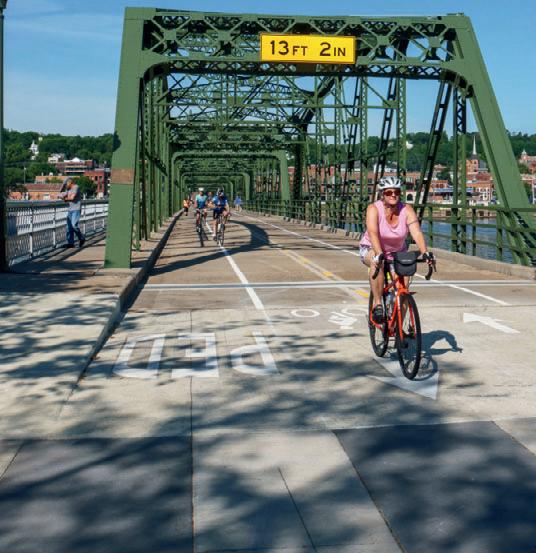
Stillwater and provides access to other trail opportunities in Phalen-Keller Regional Park and the Bruce Vento Trail. An extension of the Gateway north into Taylors Falls is being explored.
Brown’s Creek State Trail
5.9 miles
About 14 miles from St. Paul on the Gateway Trail, at Duluth Junction, the Brown’s Creek Trail starts and runs 5.9 miles into downtown Stillwater. It passes through heavily wooded areas and past golf courses. Riders can view a historic stone bridge from the mid-1800s. At about the halfway point, Brown’s Creek Park provides restrooms and ample parking. Then, riders will descend a
canyon to Highway 95. This section of the trail provides views of spectacular fall colors and small waterfalls. The final miles of the Brown’s Creek Trail follow the St. Croix River into Stillwater.
St. Croix River Crossing Loop
4.9 miles
This paved trail takes off from the end of the Brown's Creek State Trail, travels through downtown Stillwater and makes a loop across the river into Wisconsin. Riders cross the river on the iconic Stillwater lift bridge open only to non-motorized traffic, and the new St. Croix Crossing Bridge, which has separated bike and pedestrian lanes. Lots of scenic views on this section.


36 MINNESOTA TRAILS | Summer 2024
18 miles of paved trail from St. Paul to Pine Point Regional Park. 5.9 miles Brown’s Creek Trail. 4.9 miles St. Croix River Crossing Loop. www.MNTrails.com Find More Maps at P Maplewood Minnehaha Ave. St. Paul Oakdale Mahtomedi Grant WI Duluth Junction Stillwater North St. Paul GatewayStateTrail Brown’s Creek StateTrail St. Croix River CrossingLoop Little Canada Roseville Vadnais Lakes Vadnais-Snail Lakes Reg. Parks Pine Point Regional Park Historic Lift Bridge St. Croix Crossing Bridge Phalen-Keller Regional Park L. Owasso Gervais L. Keller L. Lake Phalen White Bear Lake St. Croix River 694 35E 35E
GATEWAY/ BROWN’S CREEK and St. Croix River Crossing Loop 28. MILES PAVED 61 P P P P P P P P P P P P P P P LEGEND Paved Trail Horseback Riding Parking Restroom P Picnic/Rest Area
Gateway/Brown’s Creek BIKE TRAIL GUIDE 2024 6825 Hwy 10 • Ramsey, MN 763-323-6666 TREK • ELECTRA ramseybicycle.com Your friendly neighborhood bicycle shop! We feature quality bicycles from Marin, Reid, Specialized, Sun, Serfas & Worksman. Open 6 days a week, closed Sundays Children’s, Road, Comfort, e-bikes, BMX, Mountain Bikes, Tricycles & Unicycles 2661 County Road I - Mounds View, MN 763.784.6966 CARSBikeShop.com
Sakatah Singing Hills
State Trail
39 miles
Mankato to Faribault
This paved, abandoned railroad bed passes through cool, wooded areas as well as open, sun-drenched farm fields and connects the communities of Mankato, Madison Lake, Elysian, Waterville, Morristown, Warsaw and Faribault.
Besides the woods and open fields there are several river crossings, fields of sumac, many ponds, several lakes and lots of benches for resting. At Madison Lake, a historical marker tells of Charles Lindbergh’s barnstorming days when he gave rides in his Jenny for $5 in a nearby field. About threefourths of the trail is under a canopy of tall trees, giving it a boulevard feeling at times and a forested feeling at other times. At Waterville, the trail passes through Sakatah Lake State Park under a dense canopy of
SAKATAH SINGING HILLS STATE TRAIL
trees and provides a separate bicycling campground, picnic grounds, lake access and hiking trails. The Faribault access to the Sakatah Trail is at the White Sands trailhead one-half mile north of Highway 60. The trail is open to biking, hiking, in-line skating, cross-country skiing, horseback riding and snowmobiling in some sections.
Connections include the paved 12-mile Red Jacket trail between Mankato and Rapidan. (It crosses over three railroad trestles, including historic Red Jacket Trestle, which is 80 feet high and 550 feet long.) The North Minnesota River Trail brings cyclists from the Sakatah Trail through downtown Mankato into the Sibley City Park, where they can connect with the paved Minneopa Trail directly into Minneopa State Park. Also accessible is Mankato’s city bike trail system of over 50 miles. Future connections on the Faribault side include the Mill Towns Trail into Cannon Falls, where it connects to the Cannon Valley Trail into Red Wing.
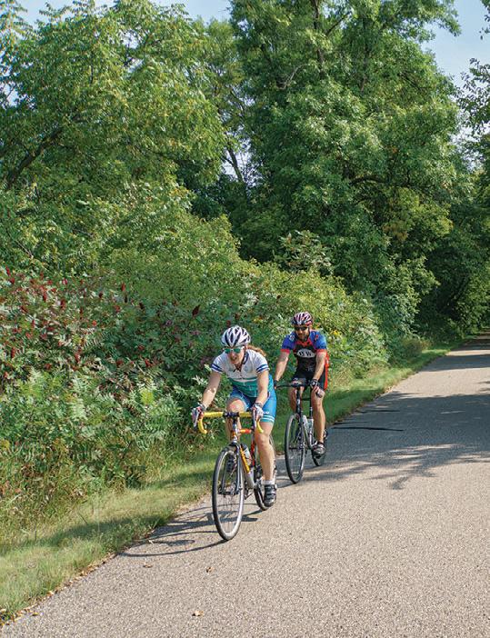
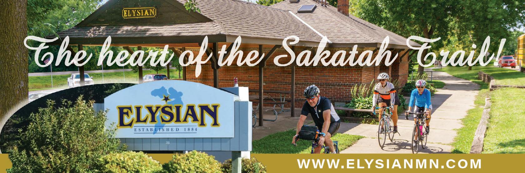
Summer 2024 | MINNESOTA TRAILS 37 Sakatah BIKE TRAIL GUIDE 2024 P P P P P P 14 14 169 22 21 27 MinnesotaRiver Kasota Eagle Lake County Park Duck Lake County Park Bray County Park Janesville Sportsman’s Park Lake Francis City Park Sakatah Lake State Park Morristown Centennial Park St. Peter Minneopa State Park North Minnesota River Trail Minneopa Trail Red Jacket Trail Mankato Rapidan Eagle Lake Madison Lake Waterville Elysian Janesville Waseca 22 83 3 18 LEGEND U.S. Route Paved Trail State Route Parking County Route Public Campground State Park P 200 Morristown Warsaw Faribault 13 16 7 14 10 13 16 10 60 60 35 14 Cedar Lake Wells Lake Cannon Lake Lower Sakatah Sakatah Lake Tetonka Lake Reeds Lake Lake Elysian Madison Lake Round Lake Duck Lake Ballantyne Lake Eagle Lake Wita Lake Lake Washington
Find More Maps at www.MNTrails.com P 39 MILES PAVED TotalDistancesinMiles 5.78.7 3.0 13.0 7.0 4.2 14.7 9.0 6.0 1.7 21.5 15.7 12.7 8.5 6.0 29.0 23.2 20.2 16.0 13.5 7.5 39.0 33.2 30.2 26.0 23.5 17.5 10.0 FaribaultWarsawMorristownSakatahLakeStateParkWatervilleElysianMadisonLakeMankato
Near Morristown. Jan Lasar photo
CANNON VALLEY
TRAIL
Cannon Valley Trail 19.7 miles
The paved Cannon Valley Trail from Cannon Falls to Red Wing follows an old Chicago Great Western railroad route and hugs the Cannon River. The trail is bordered by cliffs and lined with wildflowers, often
under the canopy of lush trees. The trail is open year-round for non-motorized use and groomed for cross-country skiing in the winter. It also has several interpretive sites as well as rest stops with benches, water and toilets. Trail users need to purchase a wheel pass.
Along the Trail: In Cannon Falls, the city section of the trail begins in a park on the Cannon River near the falls that gave the city its name. This half-mile trail winds around the park, picnic areas and ponds before heading through a residential area to the official start of the Cannon Valley
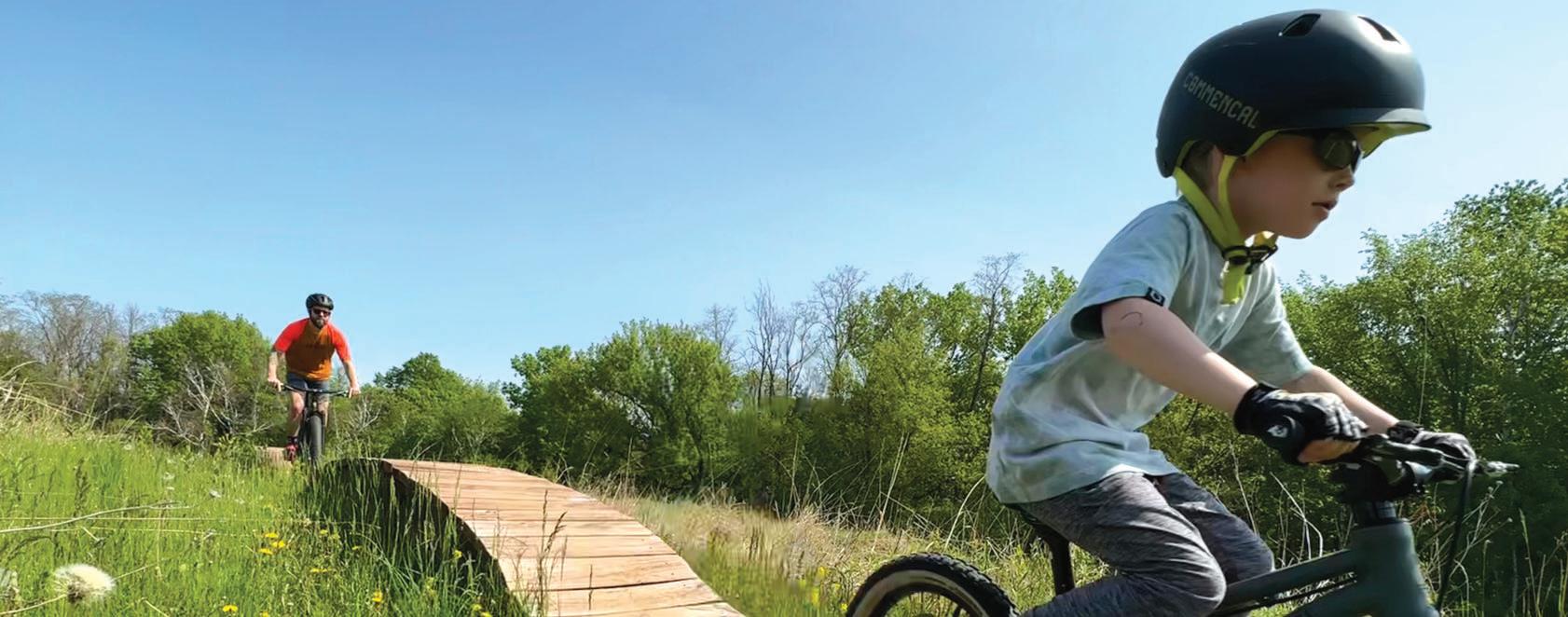


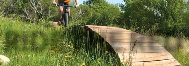


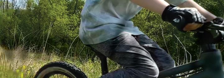
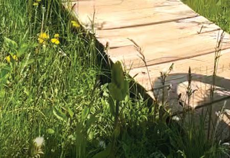


38 MINNESOTA TRAILS | Summer 2024 Cannon Valley BIKE TRAIL GUIDE 2024
19.7 MILES PAVED 52 19 Oak Lane To Rochester Lake Byllesby Regional Park Goodhue County Park Lake Byllesby To Twin Cities To Hastings Cannon Falls Mill Towns State Trail Hay Creek Trail Goodhue Pioneer State Trail Anderson Memorial Rest Area www.MNTrails.com Find More Maps at Welch Station Access Marshall Memorial Rest Area Welch CannonRiver PineCreek TroutBrook BelleCreek SpringCreek Hay Creek 61 7 W 316 P P LEGEND U.S. Route Bike Trail Paved City Trail State Route Parking County Route Restroom Public Campground Picnic Water State Park P 200 W Red Wing TotalDistancesinMiles 3.69.6 6.0 19.4 11.1 7.515.8 9.8 1.5 8.3 CannonFallsAndersonRestAreaWelchStationAccessMarshallRestArea RedWing P River Terrace Prairie SNA Tangential Wildlife Management Area Cannon River Turtle Preserve SNA Silvernale Archaeology Preserve Red Wing Archaeological Preserve WWW.REDWING.ORG | REDWINGMTB.COM RIDE THE RED WING trails! Red Wing Area Mountain Bike Organization (RAMBO), a proud sponsor of our local mountain bike trails, operates through a group of dedicated volunteers. Their hard work creates and sustains enjoyable trails and courses for all mountain bike enthusiasts. Join this passionate group to support what you love. Coordinated group rides, camaradery and more.
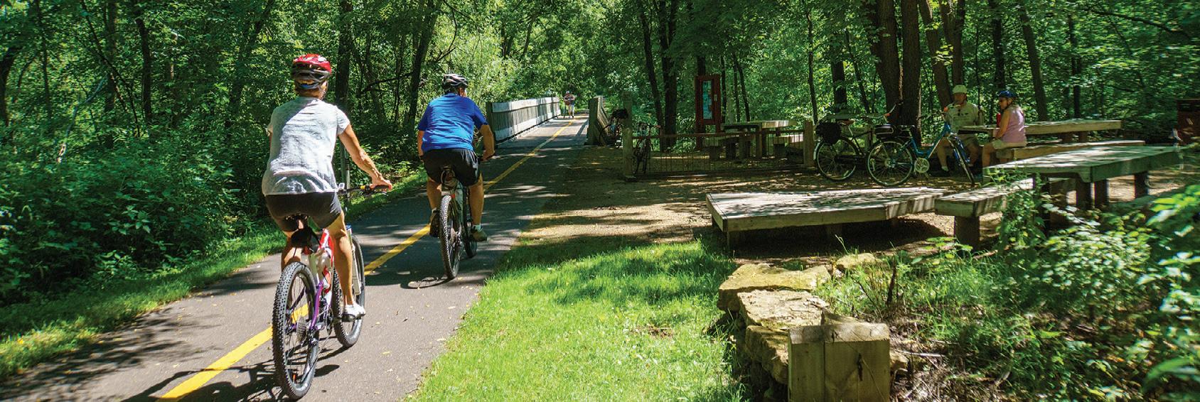
Trail. Seventeen old mileage markers can be seen along the trail’s route. Originally, these concrete posts were used to identify the number of miles from Mankato, which explains why you’ll see these same markers on the Sakatah Trail. The little town of Welch is the midpoint of the ride and has a rest stop that includes bathrooms. The trail then passes by Cannon River Turtle Preserve SNA, Red Wing, Silvernale Archaeology Preserves and a wetland observation deck, before reaching the downtown Red Wing trailhead near the historic Pottery Place.
Connections: At Cannon Falls the trail connects to the Mill Towns Trail, which will eventually link to the Sakatah Singing Hills Trail at Faribault. Currently paved sections of the Mill Towns Trail: Two miles at Cannon Falls, three miles between Dundas and Northfield, two miles east from Faribault. Another connection in Red Wing takes you down the 5-mile northern portion of the Goodhue Pioneer Trail, which currently ends at the Hay Creek Campground, but will one day connect to the Douglas State Trail near Rochester. Another future trail connection includes the Mississippi Blufflands State Trail, which will link Red Wing with Lake City.

Summer 2024 | MINNESOTA TRAILS 39
Cannon Valley 2024 BIKE TRAIL GUIDE
Map mural at the Welch rest stop. Jan Lasar photo
E-bike rental in Red Wing, MN Visit our new Red Wing location at 2345 Main Street. Call (651) 327-2864 & “e-joy” your ride! easy to rent. easy to ride. e-BikesWhe www.RollingRiverBikeRental.com
Shady rest stop along the trail. Jan Lasar photo

Root River/Harmony-
Preston Valley State Trail
60 miles


The Root River and Harmony-Preston Valley State Trail system in the heart of southeastern Minnesota’s Bluff Country is one of the major trail destinations in Minnesota. Scenic views, historic buildings and points of interest along both trails attract visitors from all over and the rural communities in this trail network provide many services. Campgrounds, bed and breakfasts, restaurants, museums, outfitters and unique stores can be found in many of the trail towns.
The Root River Trail runs from Fountain all the way through Lanesboro, Whalan, Peterson, Rushford and Houston for a total of 42 miles. The former rail bed follows the meandering Root River through spectacular limestone bluffs, picturesque farms and small towns. It is generally flat and level, except for short stretches on its eastern segment.
At Isinours Junction it connects with the 18-mile-long Harmony-Preston Valley Trail, which connects the two communities for which it was named. The northern two thirds of this trail are built on abandoned railroad grade and are fairly flat. The southern segment leaves the constraints of the railroad bed and climbs to the rim of the valley with great views of the countryside.
Stop and see a large sinkhole at the Karst Interpretive Site a half-mile from Harmony.
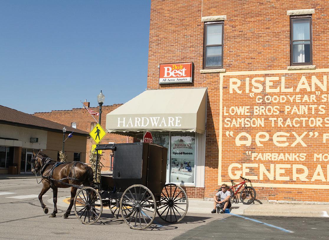
A similar site is about a mile from Fountain on the Root River Trail. Summer uses on both trails include hiking, biking and inline skating. The Root River Trail is groomed for crosscountry skiing between Isinours Junction and Houston.
Along the Trail:
Fountain: Official Sinkhole Capital of the United States. View them from the trail.
Harmony: Home of Niagara Cave, which has an underground waterfall.
40 MINNESOTA TRAILS | Summer 2024 Root
Valley BIKE TRAIL GUIDE
River/Harmony-Preston
LEGEND U.S. Route Paved Trail State Route Parking County Route Public Campground P 200 Find More Maps at www.MNTrails.com
ROOT RIVER/ HARMONY-PRESTON VALLEY STATE TRAIL 60 MILES PAVED TotalDistancesinMiles 12.617.4 4.8 26.3 13.7 8.9 30.9 18.3 13.5 4.6 35.6 23 18.2 9.3 4.7 42.1 29.5 24.7 15.8 12.2 6.5 41.153.4 28.540.8 23.736 14.827.1 10.222.5 5.517.8 1224.3 12.3 HoustonRushfordPetersonWhalanLanesboroTrailJunctionFountainPrestonHarmony
Isinours Trail Junction
Rush hour in Harmony. Jan Lasar photo
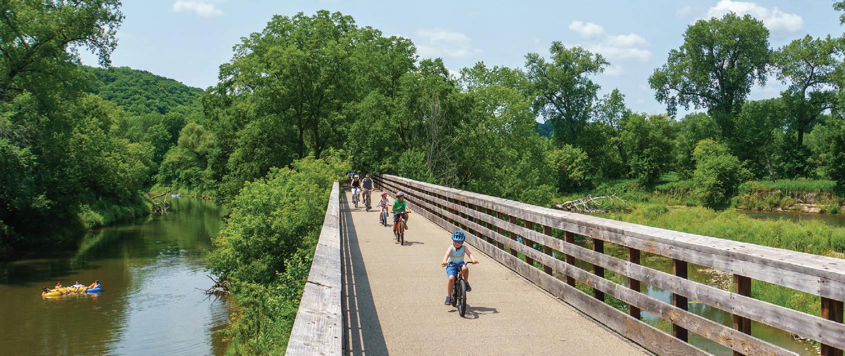
Houston: International Owl Center with live owls on display.
Lanesboro: The Commonweal Theatre and public art displays make Lanesboro a destination for the art lover.
Peterson: Peterson Station Museum of Norwegian culture.
Preston: Minnesota’s Trout Capital has the National Trout Center, and is close to Forestville/Mystery Cave State Park.
Rushford: The historic train depot on the trail houses a museum and rest area.
Whalan: A small town with a world-famous pie shop. Home of the annual Standstill Parade, where the parade marchers stand still and the spectators walk around.
Connections: An extension of the Harmony-Preston Valley Trail south toward Niagara Cave and then the Iowa border is currently being worked on. On the Iowa side trail groups are working to connect the Prairie Farmer Trail from Cresco, IA to the Minnesota side to form an interstate trail network.

Details at www.mntrails.com/bike-trails/


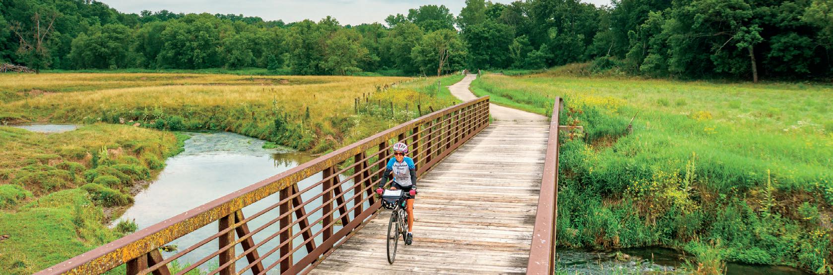
Summer 2024 | MINNESOTA TRAILS 41
Root River/Harmony-Preston Valley BIKE TRAIL GUIDE 2024
Preston’s historic elevator at the trailhead. Jan Lasar photo
Pictureyourselfhere.
At the confluence of the north and south branch of the Root River near Lanesboro. Jan Lasar photo


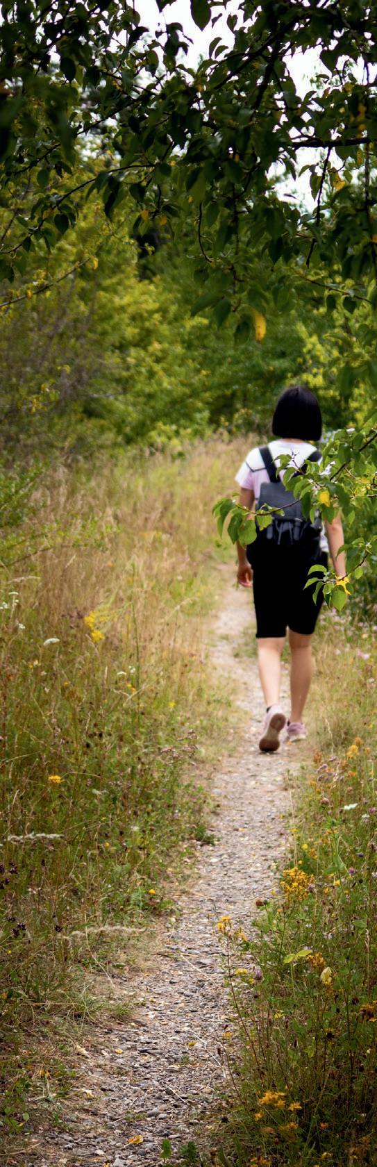
Blazing Star State Trail
7.5 miles
Albert Lea to Myre-Big Island State Park
The Blazing Star State Trail connects the city of Albert Lea with Myre-Big Island State Park with a paved six-mile segment. Another paved 1.5-mile segment can be found in Hayward, MN. The master plan for the Blazing
Star State Trail is to eventually link Albert Lea, Hayward and Austin. Here, it'll connect to the Shooting Star State Trail which runs from Austin to Le Roy for about 28 miles. The resulting trail system will be about 50 miles long and connect Myre-Big Island and Lake Louise State Parks. Although short, this trail is a favorite with southern Minnesota birdwatchers, especially during migration time at the state park.
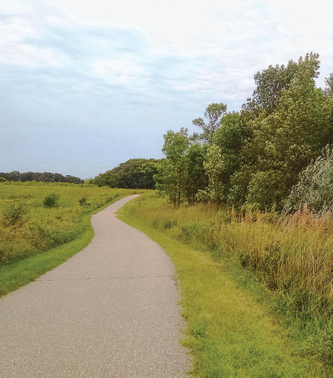
42 MINNESOTA TRAILS | Summer 2024 Blazing Star BIKE TRAIL GUIDE
The Blazing Star State Trail at Myre-Big Island State Park. Andrew Oftedal photo Albert Lea Hayward www.MNTrails.com Find More Maps at TRAIL BLAZING STAR STATE 7.5 MILES PAVED P P P P P P P 35 65 65 91 133 109 102 119 18 48 19 120 26 Myre-Big Island State Park Albert Lea Lake Goose Lake 38 38 38 38 LEGEND Paved Trail Unpaved Trail Parking P Restroom
2024
TRAIL CAMDEN REGIONAL
Camden Regional Trail
15 miles
Marshall, MN to Camden State Park
The Camden Regional Trail connects the southwestern Minnesota town of Marshall to nearby Camden State Park and makes for a nice afternoon outing in southwestern Minnesota.
Start your trip at the Red Baron Arena and Expo on the southeastern edge of town, where a tunnel takes you safely under Hwy. 23 and onto the campus of Southwest Minnesota State University. The route starts north, then cuts west across the northern outskirts of Marshall. After the airport and the golf course, the trail starts heading southwest through a scenic stretch along the banks of the Redwood River, then along Hwy. 23. You'll pass through the small town of Lynd, MN before you begin your ascent to the edge of Camden State Park. After another mile on a very scenic and winding section, you'll reach the park office and the end of the trail.
There are plenty of benches to rest along the Camden Regional Trail and interpretive kiosks with maps tell the natural and historical story of the area.
Parking is available at the Red Baron Arena, Southwest Minnesota State University, Justice Park, Victory Park and the Camden State Park office. Water and restrooms are at Camden, Justice and Victory Parks.
Connections: Marshall's network of on and off-street bike routes take you to some of the city's numerous parks and Camden State Park offers about 5 miles of mountain
trails.
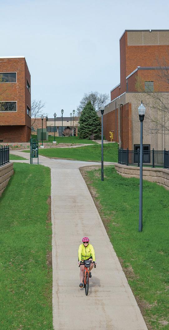


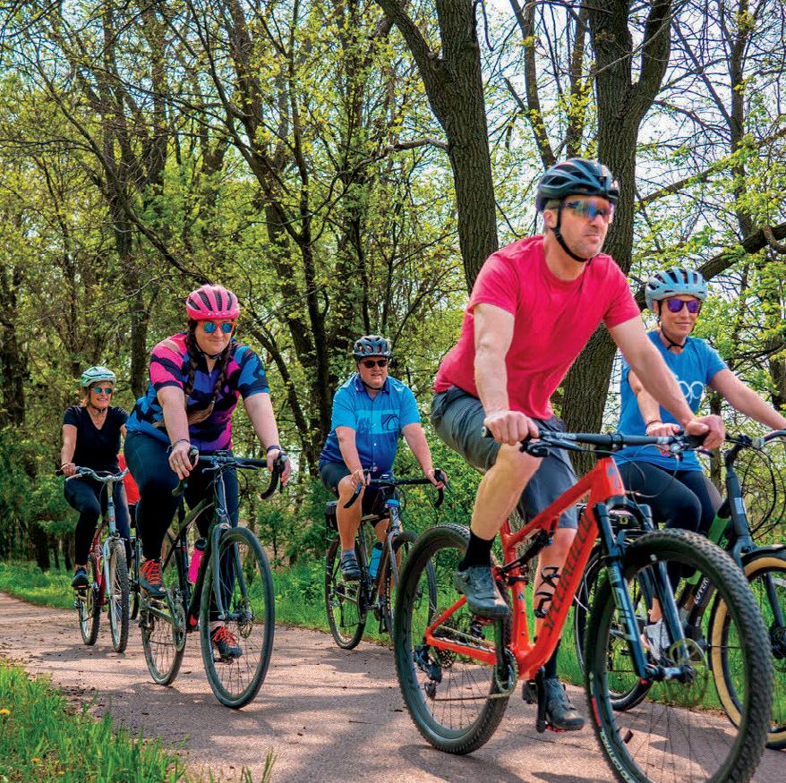


Summer 2024 | MINNESOTA TRAILS 43 Camden BIKE TRAIL GUIDE 2024
Lynd Victory Park Justice Park Southwest MN State University Red Baron Arena Marshall Camden State Park P P P P
bike
15 MILES PAVED www.MNTrails.com Find More Maps at TotalDistancesinMiles 37.1 4.1 11.7 8.7 4.6 14.8 11.8 7.7 3.1 RedBaronArenaJusticeParkVictoryParkLyndCamdenStatePark 68 19 23 23 23 23 23 59 59 19 23 LEGEND Paved Trail Parking P Restroom Camping P
On the SMSU Campus. Jan Lasar photo
Shooting Star State Trail
28.75
The Shooting Star Trail is a paved trail through remnants of tall grass prairies with an abundance of native wildflowers. Much of it is built on an abandoned railroad grade. The eastern terminus is in Le Roy, MN, which is on MN Hwy. 56 just west of its junction with US 63 right above the Iowa/Minnesota state line. The trail soon passes through Lake Louise State Park and continues northwest to the towns of Taopi, Adams and Rose Creek. The final leg of the trail travels north out of Rose Creek and picks up Austin's network of city trails north of I-90.
Highlights: Remnant tallgrass prairie with wildflowers like prairie smoke, rattlesnake master, wild indigo, aster, goldenrod and blazing star wildflowers. The trail passes by several interpretive and recreational opportunities, including Rustic Retreat Wildlife Management Area, Shooting Star Prairie Scientific and Natural Area, Taopi Prairie Interpretive Area and Mower County Natural and Scenic Area.
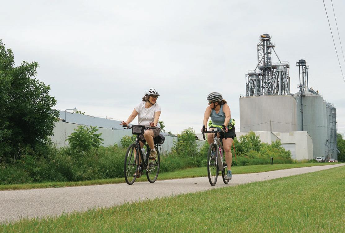

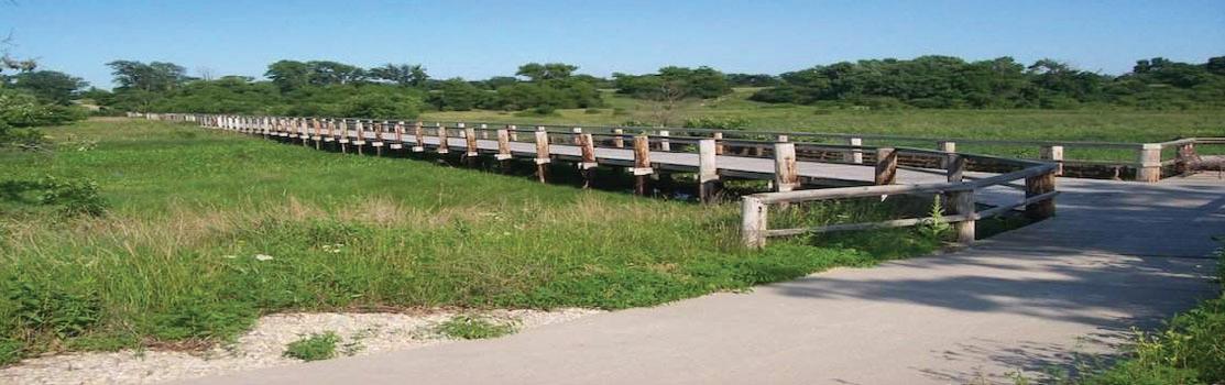


Connections: The last leg of the project calls for the trail to drop south from Austin to the town of Lyle on the Minnesota-Iowa border. While a timeline for this last part has not been established, another extension has the potential to become a reality much sooner. From near Taopi, a four-mile leg will extend to the Minnesota-Iowa border and connect to the Wapsi-Great Western Line Trail. This 27-mile paved trail travels southeast from the state border into Elma, IA. Together with Austin's city trails, the resulting network will be 72 miles long.


44 MINNESOTA TRAILS | Summer 2024 Shooting Star BIKE TRAIL GUIDE 2024 www.MNTrails.com Find More Maps at LEGEND Paved Trail Picnic/Rest Area Parking Restroom P Rose Creek Adams Elkton Adams City Park 215th Street Taopi Underpass Le Roy Lake Louise State Park 19 5 19 5 4 7 7 18 11 P 6 6 6 56 P 9 9 9 8 4 14 P P P Lake Louise Upper Iowa River North Branch Little Cedar River 63 56 56 278 245 56 63 208 244 217 207 240 27 236 230 203 90 3 13 218 56 Austin Jay C. Hormel Nature Center STATE TRAIL SHOOTING STAR 28.75 MILES PAVED 56 TotalDistancesinMiles 9.75 13.75 4 19.75 10 6 28.75 19 15 9 LeRoyTaopiAdamsRoseCreekAustin 4 45 58 P
miles
Shooting Star Trail & Wapsi-Great Western Line Trail 22+ 26+ and 56+ route rides
n 2 Shooti 2 | Ride the trails that connect Minnesota & Iowa SATURDAY, SEPTEMBER
borderbike.wgwltrail.com
14TH
Rural scene in Adams, MN. Jan Lasar photo
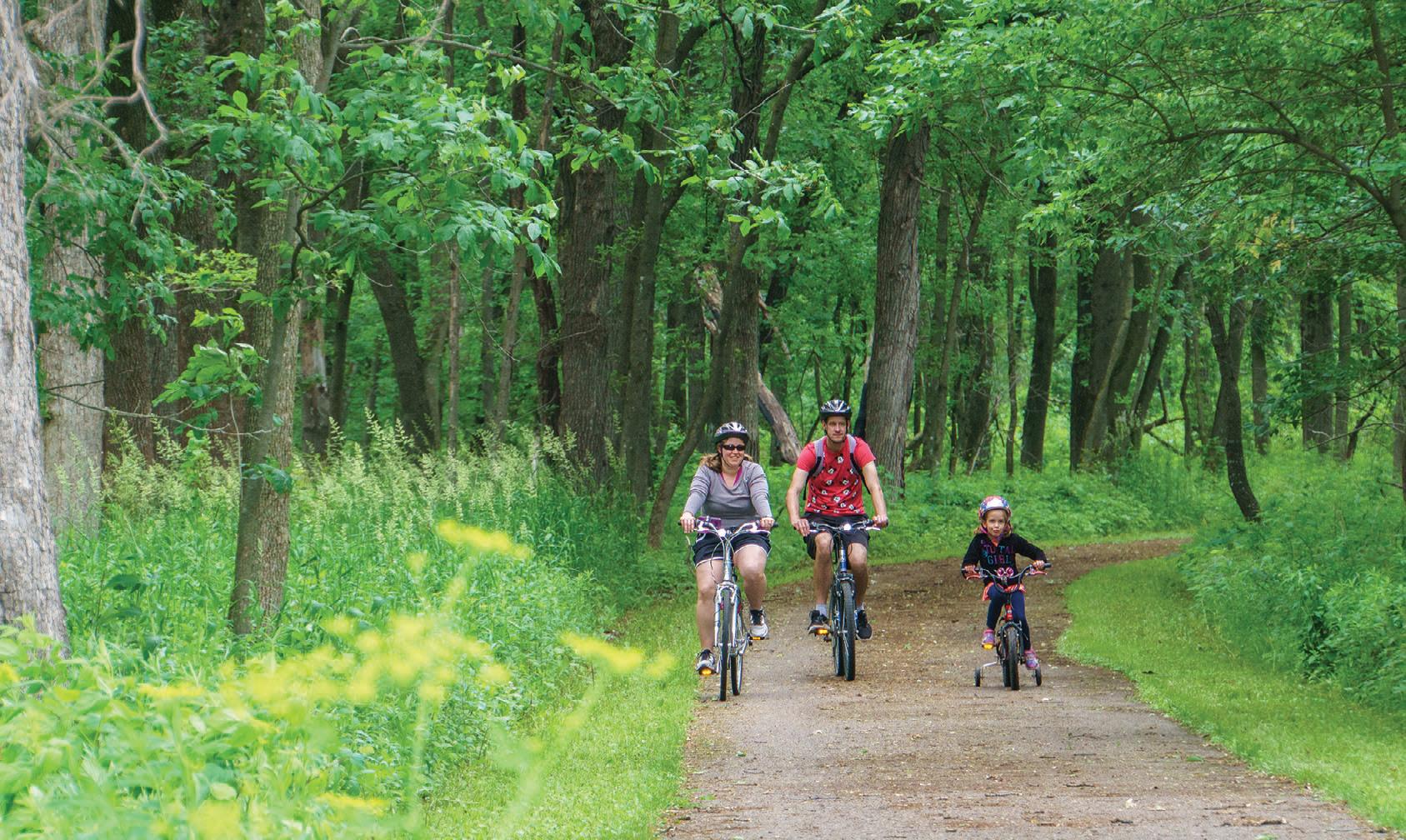

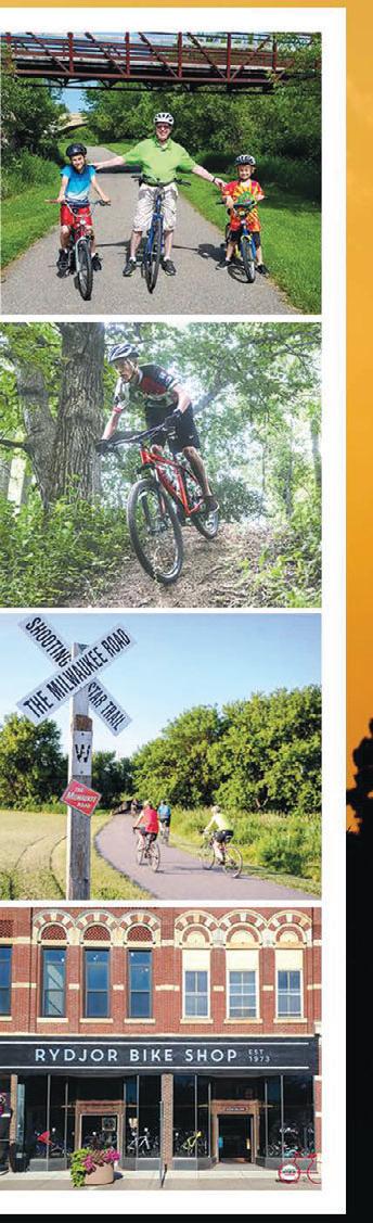

Summer 2024 | MINNESOTA TRAILS 45
Shooting Star BIKE TRAIL GUIDE 2024
At Lake Louise State Park. Jan Lasar photo
TRAIL CASEY JONES STATE
Casey Jones State Trail
19 miles total
Pipestone, Woodstock, Lake Wilson, Currie
The Casey Jones Trail is the first rails to trails conversion in Minnesota, authorized

in 1967. It consists of three main sections, not yet connected to one another: Eight paved miles and two gravel miles between Pipestone and Woodstock, followed by two miles of natural surface trail. 1.5 miles of natural surface west of Lake Wilson and a 5.5-mile paved loop between Lake Shetek
State Park and Currie. The out and back ride from the Pipestone trailhead gives riders a close-up look at farm fields and wind turbines and makes for an easy afternoon outing. The so-called Currie Loop does not have a designated trailhead, but parking is available at Forman Acres County Park just
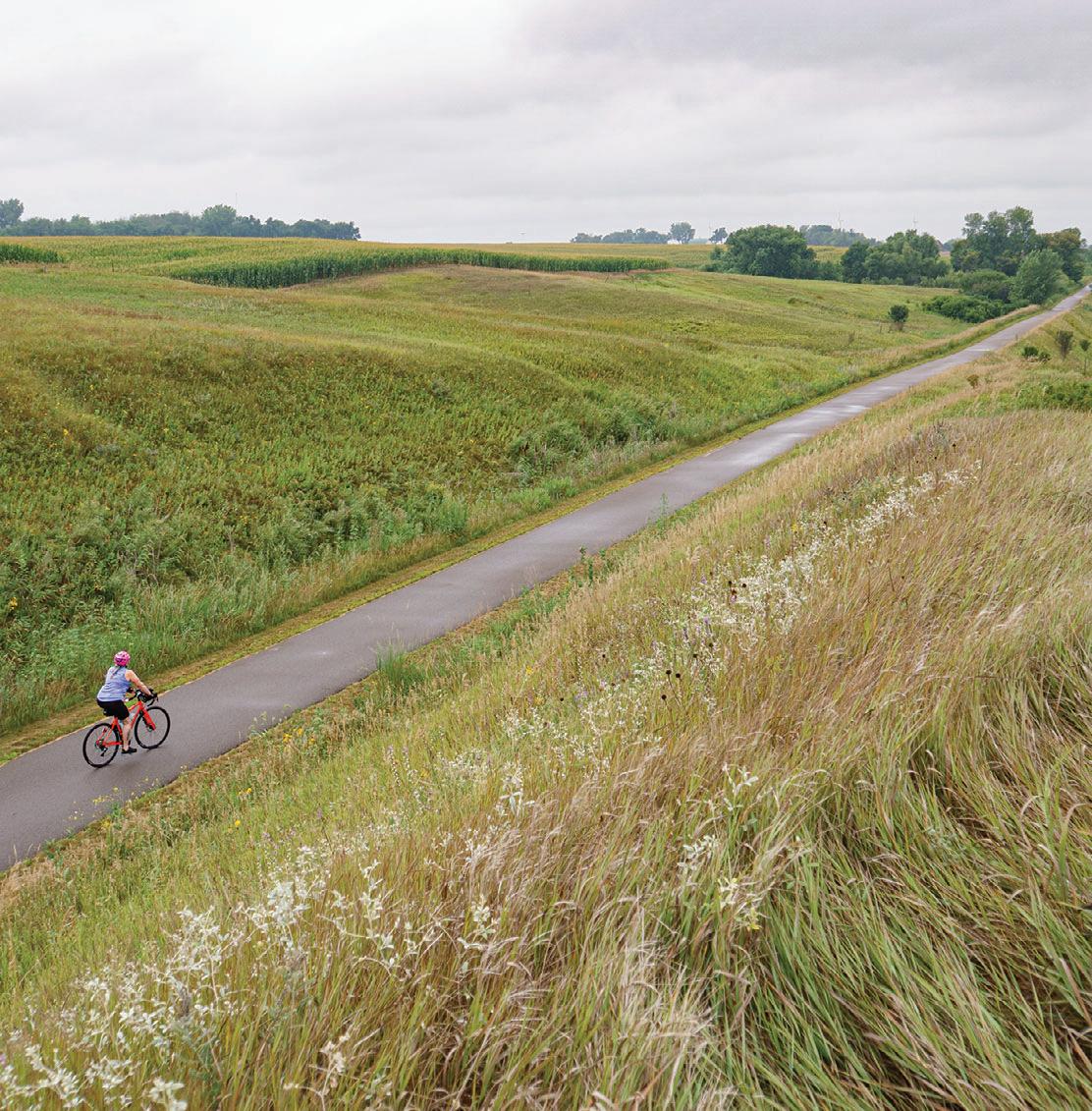
46 MINNESOTA TRAILS | Summer 2024 Casey Jones BIKE TRAIL GUIDE 2024
The Casey Jones State Trail travels on abandoned railroad grade. Jan Lasar photo
Hatfield Holland 8 miles 2 miles 2 miles 1.5 miles 5.5 mile Woodstock Lake Wilson Hadley Lake Shetek Slayton Currie Currie Avoca www.MNTrails.com Find More Maps at LEGEND Paved Trail Gravel Trail Natural Surface Parking P Restroom
19 TOTAL MILES Pipestone 23 30 30 30 91 91 30 267 59 59 59 75 75 PIPESTONE CO. MURRAY CO. 30 35 38 38 37 Currie Loop Lake Shetek Lake Shetek State Park P P P
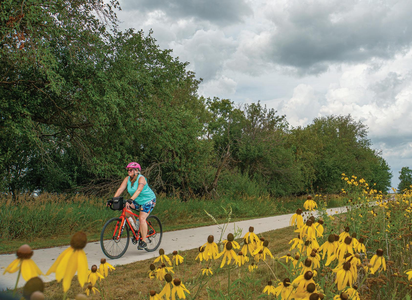
outside Lake Shetek State Park or End-O-Line Railroad Park and Museum. Another option is to park at the picnic area inside the state park, ride the park road and access the trail at the park office. Traveling counter-clockwise from there, you'll first pass the Lake Shetek State Monument and ride between Smith and Shetek Lakes. At a dam at the very southern tip of Lake Shetek, the Des Moines River emerges. After another mile, the trail takes a sharp left turn at End-O-Line Railroad Park and makes its way back to the park. Eventually, the Casey Jones Trail will span over 100 miles from Luverne through Pipestone to Redwood Falls.
Along the Trail: In Pipestone, the Indian Lake Trail will make a loop of about four miles on the northern end of town when complete. Currently, the 2.6-mile trail travels north from the city campground, then heads west to round the northern edge of the wildlife refuge adjacent to Pipestone National Monument. This section has great views of restored prairie and its namesake lake with spots to pull over and take in the scenery. The trail ends at 9th St. NW, but the next phase of construction will have it extend through Hiawatha Pageant Park and complete the loop at the campground. A later phase will have a leg extend south into downtown Pipestone.
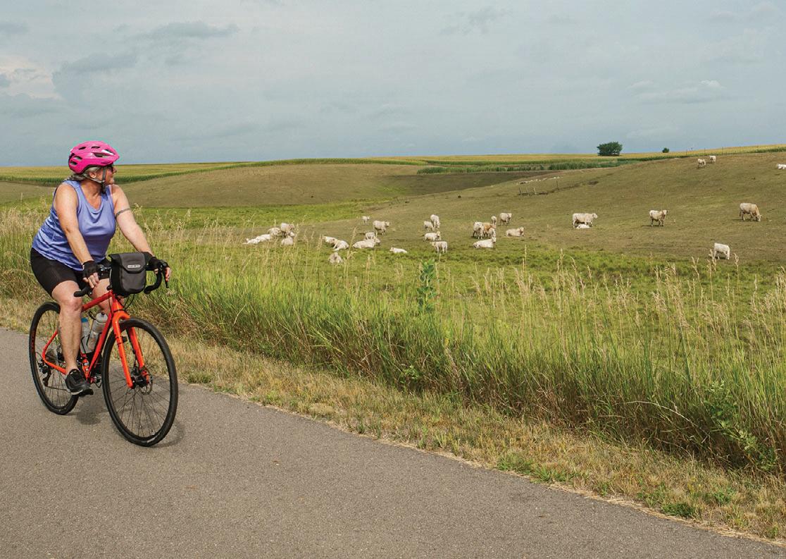
Summer 2024 | MINNESOTA TRAILS 47 Casey Jones BIKE TRAIL GUIDE 2024
Gray headed coneflowers bloom along the Indian Lake trail in July. Jan Lasar photo
Charolais cattle graze on the hills near PIpestone. Jan Lasar photo
Details at www.mntrails.com/bike-trails/
LUVERNE TRAILS
Luverne Loop Bike Trail (7.4 miles)
Hwy 75 Bike Lanes
Blue Mounds Trail (6 miles)
Christopher Martin Ashby
Memorial Trail (2 miles)
Parking State Park
Restroom
Luverne Loop Trail
15 miles
with Blue Mounds Trail and Christopher Martin Ashby Memorial Trail
This paved trail in the far southwestern corner of Minnesota circles downtown Luverne and connects many of the town’s parks and sights. Downtown with its many shops, restaurants and attractions is never far away and the scenery varies between prairie views, quaint neighborhoods and the meandering Rock River. Start your trip at the modern trailhead building on the southeastern edge of town and make a 7.4mile loop in either direction.
Connections: In the north, the Luverne Loop connects to the Blue Mounds Trail which adds another paved four-mile leg into Blue Mounds State Park. See the striking rock formations of the park rise up from the ground as you travel north across the prairie.
The paved Christopher Martin Ashby Memorial Trail takes off from the trailhead and travels approximately two miles east through River Road Campground and ends at County Road 9.
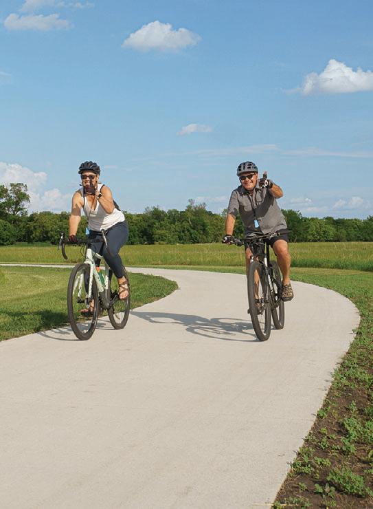
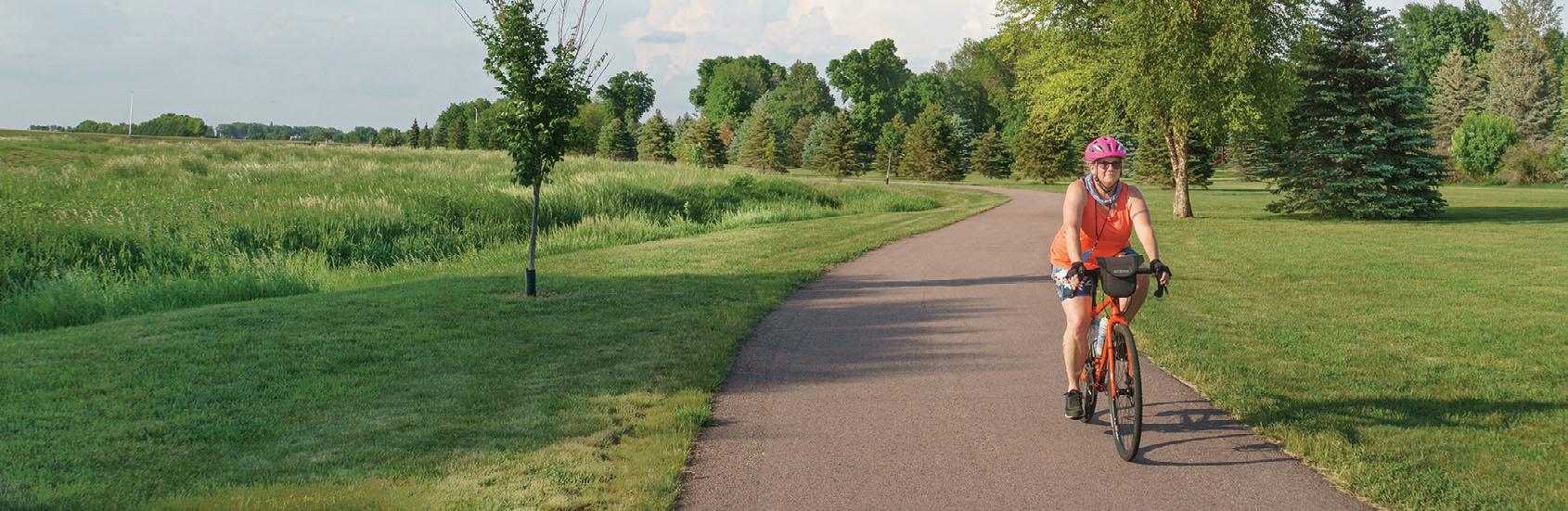
48 MINNESOTA TRAILS | Summer 2024 Luverne Loop BIKE TRAIL GUIDE 2024
Blue Mounds State Park Eagle Rock Vista RockRiver 90 4 4 9 75 75 8 8 147 131ST ST E BARCK ST E DODGE ST E LUVERNE ST E MAIN ST EDGEHILL ST WARREN ST HATTING ST W KOEHN AVE N KNISS AVE/HWY 75 BLUE MOUND AVE 9 111TH ST ROCK RIVER DR
Area P P Luverne Loop Trailhead Luverne Aquatics Center P P Evergreen Park Sanford Medical Center Tonto Park Prairie View Complex P Hawkinson Park P Luverne Campground The Lake Blue Mound Ice Arena P Rotary Park P Redbird Field P River Road Campground P Luverne City Park Riverside Park Kolbert Park P
Camping Picnic/Rest
15 MILES PAVED P
Jan Lasar photos


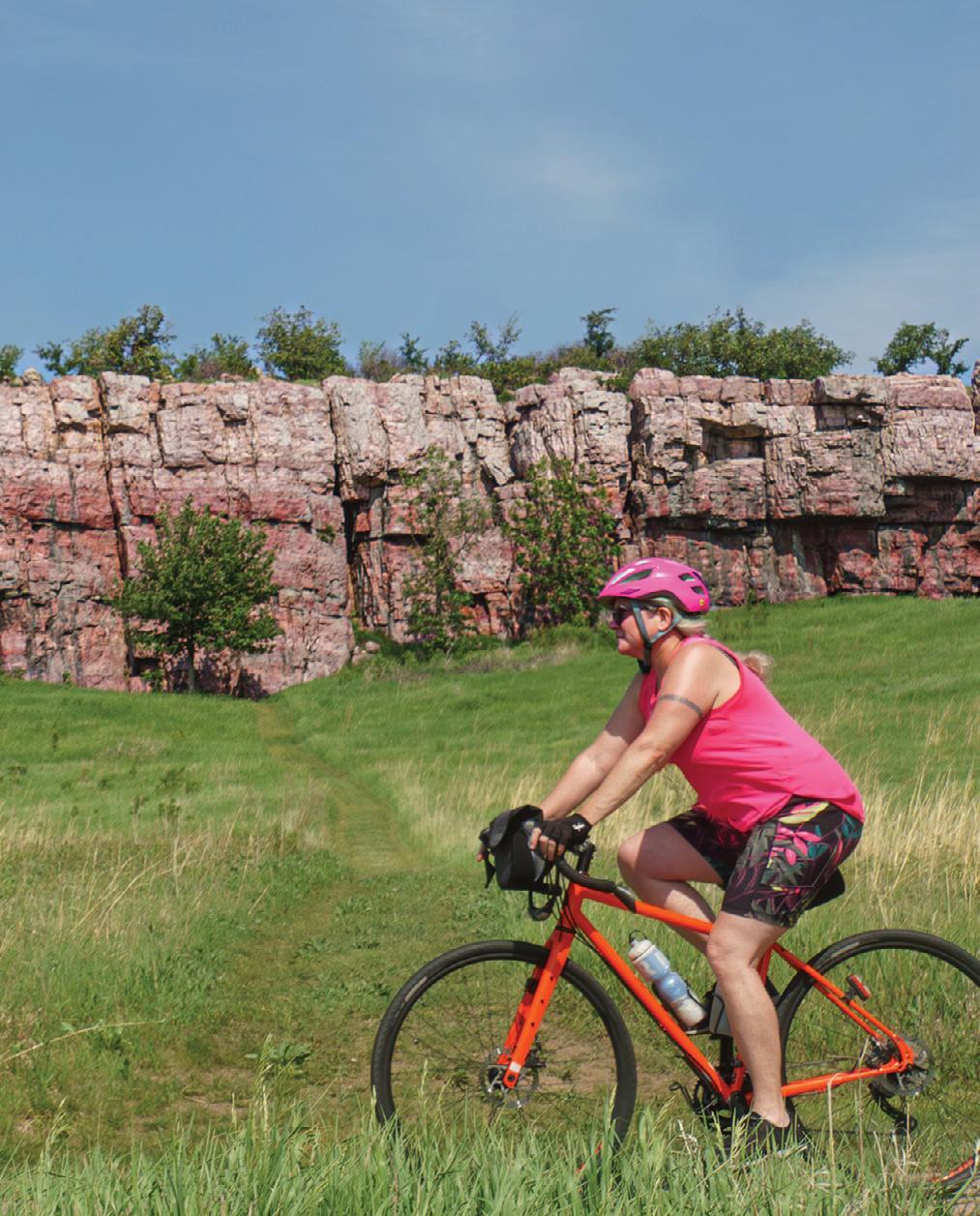
TUCKED INTO THE FAR SOUTHWESTERN CORNER OF MINNESOTA, LUVERNE HAS LONG BEEN HOME TO BLUE MOUNDS STATE PARK, WHICH IS SO CLOSE TO TOWN, IT FEELS LIKE A CITY PARK. IT WAS A NATURAL FIT TO MOVE BIKES AND PEDESTRIANS OFF THE ROAD AND ONTO WHAT WOULD BECOME THE BLUE MOUND TRAIL, BUT IT DIDN’T STOP THERE.
AFTER TEN YEARS IN THE MAKING, THE LUVERNE LOOP TRAIL WAS COMPLETED IN 2023. THIS SEVEN-MILE PAVED ROUTE CIRCLES THE TOWN, AND TOGETHER WITH THE SIXMILE SPUR NORTH TO BLUE MOUNDS STATE PARK AND THE TWO-MILE CHRISTOPHER MARTIN ASHBY MEMORIAL TRAIL, LUVERNE’S NETWORK OF RECREATIONAL ROUTES HAS NOW GROWN TO ABOUT 15 MILES.
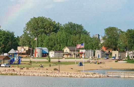


MAKE CONNECTIONS LUVERNE’S BIKE TRAILS
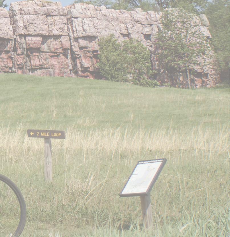
My wife, Jen, and I arrived on a Thursday, the eve of Luverne’s annual Buffalo Days celebration, and moved into our digs at the Luverne Campground. At what locals call The Lake, we checked into one of nine tiny homes available to rent. As comfy as it looked, we rode our bikes into downtown right away with a short detour to visit the Luverne farmers market.
A large, vertical sign on a grassy knoll let us know we were at the trailhead for the Luverne Loop Trail, where a crowd had gathered for the inaugural Tour de Loop and trail ribbon cutting. The trailhead building, a former Casey’s convenience store, was gutted and remodeled to have bathrooms, a water fill station and space for a future bike and watersport rental concessionaire. Giant scissors snipped the red band, the two ends fluttered to the ground, the crowd cheered and the ride was on.
Jen and I took off, going clockwise around the loop. We passed Redbird Field on the Rock River where kids in crisp, white uniforms played ball, then rolled across a wide open, grassy area. The intense heat of the day was fading and a pleasant breeze kept things cool. The trail then crossed Highway 75 and worked its way around the Luverne Ice Arena. We were now on the west side of the loop and passed by a familiar sight: across The Lake, we saw our tiny home headquarters. Farther ahead, we passed through Kolbert and Hawkinson Parks as well as the Luverne disc golf course and more baseball and softball fields. They were perfectly manicured and ready for a weekend’s worth of ballgames during Buffalo Days. After that, we rode on top of what looked like a flood diversion dam for a short stint and stopped to admire the Child’s Remembrance Garden at Tonto Park. We continued onto the northern part of the loop, which was one big downhill ride. At North Blue Mounds Avenue, we turned south. Behind us, Blue Mounds State Park’s cliffs jutted from the prairie in the distance, but that was on the agenda for the next day.
Friday’s forecast called for another scorcher and we were off to an early start to take the bike trail to the park, hike the trails and return to town for some more sightseeing. It was going to be a hot one, but we had plenty of water and lubed up with an insane amount of sunscreen.
Summer 2024 | MINNESOTA TRAILS 49
Quartzite cliffs along the trail at Blue Mounds State Park
Tiny homes for rent at The Lake.
STORY AND PHOTOS BY JAN LASAR
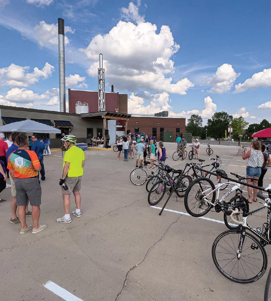
eLuvernetrailheadbefore the ride
At the familiar trailhead, we rode north until we left the city limits behind, en route to Blue Mounds State Park. Soon, the signature rock formations appeared on the horizon. We had an up-close look at these red, pink, purple and blue Quartzite cliffs as the trail entered the park and took us right past an impressive rock wall. The breeze picked up and the wind rippled the tall grass which looked like water flowing down the hills. Our water was nearly gone when we reached the park after only six miles, and we refilled ourselves and our bottles at a spigot at the unoccupied group camp where we found refuge in the shade of a huge oak. After cooling down, we left the bikes behind and went for a hike. On the Upper Cliffline Trail we were on top of the world, with wide open views.
It was just us, the warblers and a myriad of insects buzzing in the meadows. We were lucky to spot blooming prairie smoke on the edges of the trail. Prickly pear cactus grows here, too, tucked into the crevices of quartzite outcroppings. One steep descent later, we were on the Lower Cliffline Trail, heading the opposite way. Back at the group camp it was time for an old-fashioned cool-down. On the count of three, Jen flipped up the handle of the hydrant. Immediately, ice-cold water shot out and sprayed off my head. A couple of deep gasps later, my internal thermostat was back in the green. Then it was Jen’s turn. We were both soaked, but happy. Our trail lunch was a simple ham and cheese sandwich with bread from the farmers market, but it was a perfect moment.
On the newly constructed segment of the Luverne Loop Trail

THE TRAILHEAD BUILDING, A FORMER CASEY’S CONVENIENCE STORE, WAS GUTTED AND REMODELED TO HAVE BATHROOMS, A WATER FILL STATION AND SPACE FOR A FUTURE BIKE AND WATERSPORT RENTAL CONCESSIONAIRE.
Sitting at a picnic table, dripping wet and eating a sandwich, brought back memories of childhood summers and trips to the beach. By the time we had made the trek back to town, our shirts were dry.
Back at “the barn” at the campground, we cleaned up and dressed up because Buffalo Days was about to kick off. The smell of full-lead gas and the low rumble of high-powered engines set the stage for the famous Friday night Cruise-In on Main Street, now in its 33rd year. Show cars trickled in at a steady pace. Hundreds of classic rides were lined up along the curb with hoods up and tops off as people walked by and talked horsepower with the proud owners. It’s one thing to own a robin’s egg blue, 1953 Chevy Bel Air, but perhaps the proudest man on the block was showing off his homemade Flintstones car, built from Cottonwood and pine logs. “Does it work?” I asked. “It rolls!” was the answer. There was a line to have your picture taken with it, and Jen couldn’t resist.
We enjoyed the show for a while, but the long, hot day was beginning to catch up with us. At sunset, we left the revving engines behind and strolled away, while the music echoed off the quartzite buildings on Main Street and followed us home.
We made another round on the Luverne Loop on a pleasant Saturday morning, and this time we included the leg of the Christopher Martin Ashby Memorial Trail. It was a short, but scenic, wooded ride through Luverne City Park and past the Rock River Reservoir. We passed the town’s other camping area, the River Road Campground, then took in the view from the tallest hill on
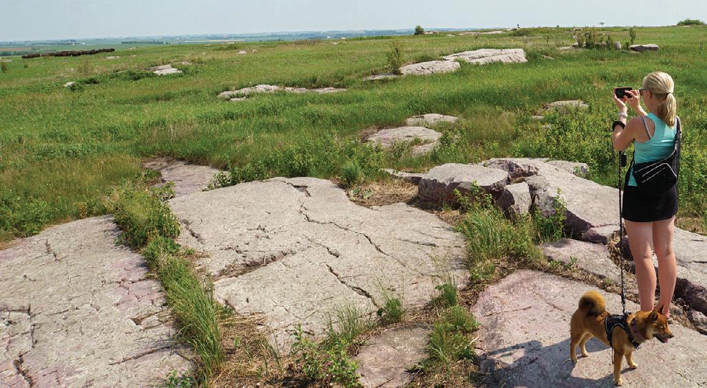
50 MINNESOTA TRAILS | Summer 2024
A glimpse of the bison herd on the Eagle Rock Trail
A crowd gathers atth
Read the full story: https://mntrails.com/luvernes-bike-trails-make-connections/
the trail. To the north was Blue Mounds State Park and our vantage point made it clear just how unusual the quartzite rock formations are and how suddenly they spring from the landscape around them.
Back in town, we visited the Rock County Historical Society’s History Center, with its mind-boggling nutcracker collection; The historic Hinkly House, and the craft fair that was part of the Buffalo Days festivities.
We had to leave on Sunday, but we weren’t done sightseeing and returned to the state park by car. From Eagle Rock Vista, we went for a short hike on the Eagle Rock and Western Loop Trails and were happy to see the bison in full view near the edge of their 550-acre range.
Just a few miles down dusty country roads, there’s Touch the Sky Prairie, a 1,000-acre unit within the Northern Tallgrass National Wildlife Refuge. Minnesota once had over 18 million acres of native prairie, most of which disappeared under the plow in the last century. In a place like Touch the Sky Prairie, you can get a glimpse of what it must have been like before then. Once we hiked inwards and out of sight of
WE SAT IN THE SHADE OF A SMALL STAND OF TREES SURROUNDING THE FALLS FOR A WHILE AND LISTENED TO THE WATER RUSH OVER THE ROCKY OUTCROPPINGS.
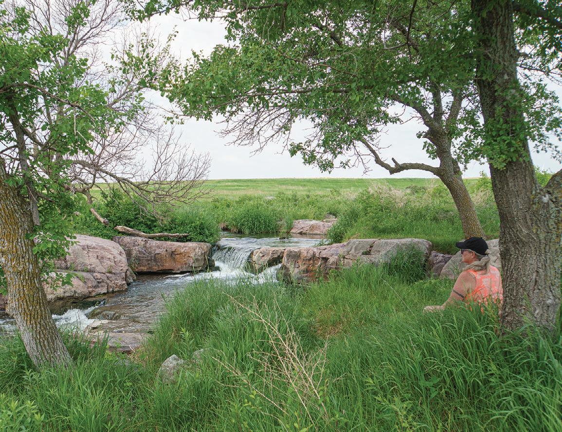
the surrounding farms, there was just us, the wind, the grasses, the birds and a sky that really did seem close enough to touch. Something we didn’t expect to see was a waterfall. We sat in the shade of a small stand of trees surrounding the falls for a while and listened to the water rush over the rocky outcroppings.
Some call it dawdling, we call it taking the scenic route home, but leaving a great place is always hard. On the walk back, thunder clouds appeared on the horizon and the skies opened up. Once again on this trip, we were dripping wet, but happy.


Summer 2024 | MINNESOTA TRAILS 51
Waterfall atTouch the Sky Prairie
in Luverne Minnesota! MINNESOTA
YOUR FAMILY ADVENTURE AWAITS
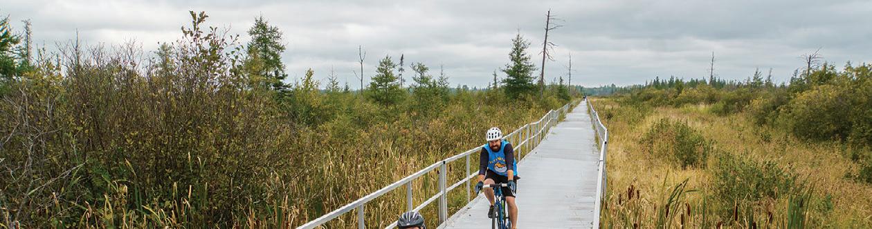


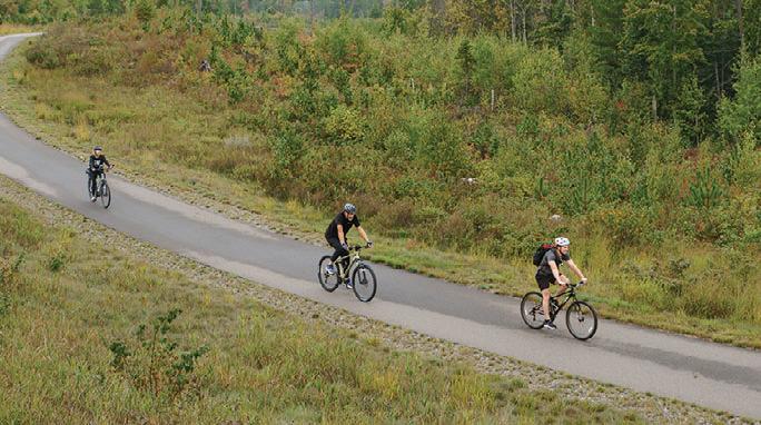


AOn a cool and damp morning last September, a coach parked on a quiet Main Street in Soudan, MN. Its doors opened and instantly the small parking lot across from Saint Paul's Lutheran Church was buzzing. People in exercise gear began spilling from the bus, more vehicles arrived, bikes were handed down from trailers, everyone milled around and chatted. Eventually, the group was corralled to stand still long enough for a picture. One by one, riders mounted their bikes and disappeared down a trail into the woods, destination Ely.


EXPERIENCE


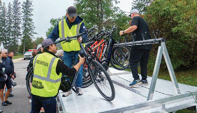
funding for the Mesabi Trail. He died of ALS in 2022. “State Senator Tomassoni was a key part in the Mesabi Trail project so it was a natural choice,” she said.
Day one of the two-day ride had the group travel between Soudan and Ely on the Mesabi Trail’s newest segment. They rode through Lake Vermillion Soudan Underground Mine State Park and made their way up to Eagle’s Nest Township Hall just a few miles away from Bear Head Lake State Park. After a rest stop, the trip continued through rugged scenery of pine and birch forest on a freshly paved ribbon of trail.
everyone off in the morning where the trail currently dead-ends at a road north of Embarass. The creative minds behind the route of the Mesabi Trail used every available method to get across the Mesabi Iron Range and at times the paved trail runs on old mining roads, abandoned highway and forest trails. In this section, engineers designed a 3/4-mile-long floating bridge across the Embarass Wetland Complex to make the connection.
It’s not an unusual scene on the Mesabi Trail. Dirt was first turned on the ambitious Iron Range project in 1997. Today, the trail network linking Grand Rapids and Ely is only 12 miles short of its 162-mile vision and has become a major draw for visitors and locals. (See Mesabi Trail, page 22.)
Toda Rapid its majo Mesa


Immediately after the bridge, riders were in for another treat as they worked their way up to the crest of the Laurentian divide. This ancient rock spine crosses North America and travels through northern Minnesota, dividing the Lake Superior and Hudson Bay watersheds. It’s the very thing that gave the area its name as the Ojibwe called it Mesabi, giant in their language.
It’s also caught the attention of Never Surrender, Inc. The Hermantown, Minnesota, based non-profit raises funds ght Amyotrophic Lateral Sclerosis (ALS), a progressive neurological disease that affects nerve cells in the brain and spinal cord.


eir key fundraisers, the Black Woods Blizzard Tour and the Kolar Toyota ALS Fishing Tournament have been hugely successful and they hope to carry this momentum to an all-new event. The Tomassoni Tour promises participants white glove and red carpet treatment as they raise money and ride the Mesabi, and that means meals, shuttles, ride support, entertainment and posh accommodations at Fortune Bay Resort Casino in Tower, Minnesota.
Todd Lauer beamed with pride as he rolled over the finish line at the Ely Recreational Center, cheered on by his fellow riders. “Absolutely gorgeous,” was his first impression of the 25-mile ride. Lauer, who lives in Iron Junction, Minnesota, was diagnosed with ALS in 2015. He learned of Never Surrender’s successful drives and suggested a fundraiser ride on the trail in his back yard as his way of “doing something” to battle the disease. “Never Surrender donates 90% of the funds they receive back to hospitals, patients, and clinics, helping [people with ALS] live as good as they can for as long as they can,” he said. He hopes that the Tomassoni Ride will be yet another way to reach that goal. “It’s a great value, when you raise a little bit of money, you come here, make some great friends and you ride some awesome trails,” he said.
The fall colors were beginning to come in and riders had a good look at the area from atop the ridge. It was another very scenic 25-mile ramble which, for some, ended with lunch at the Mesabi East Football Fields in Aurora. Those with fresher legs returned on two wheels and made it back to the resort with plenty of time before the evening banquet.
Ride Director Julie Jacobson said the tour is named after the late Senator David Tomassoni who was the primary author of a number of bills that secured
After lunch, the crowd dispersed; some riding back for a 50-mile day and some taking the shuttle back to the resort to get ready for an outdoor lakeside dining experience that evening.

It’s Surre Minn to fig (ALS a spina Th Blizza Fishin succe mom Toma white and t suppo accom Casin Rid to David autho
The agenda for the next day called for a 25-mile trek between Embarass and Aurora and the shuttle dropped
Jacobson said putting this event together is a year-round labor of love as it takes dozens of dedicated volunteers to handle everything from shuttle driving to lunch delivery. “A lot of work happens behind the scenes to wrap-up an event and start preparing for the next,” she adds. But besides the months of planning and the seriousness of Never Surrender’s mission, the idea is to provide a first-class experience for their fundraising riders.
“We have a lot of fun, both on the trail and in the evenings. It’s a fun bunch,” she said.
52 MINNESOTA TRAILS | Summer 2024
2024 TOMASSONI TOUR September 19-21 | Tower, MN | Fortune Bay Casino Resort | tomassonitour.com
STORY & PHOTOS BY JAN LASAR ST O RY PH O T OS BY J AN LA S A R
Todd Lauer, front and Tyler Vandal cross the floating bridge through the Embarass Wetland Complex.Riders on the way to Ely | Volunteers unload bikes from a custom-built trailer on day one.


Minnesota’s bike trails,


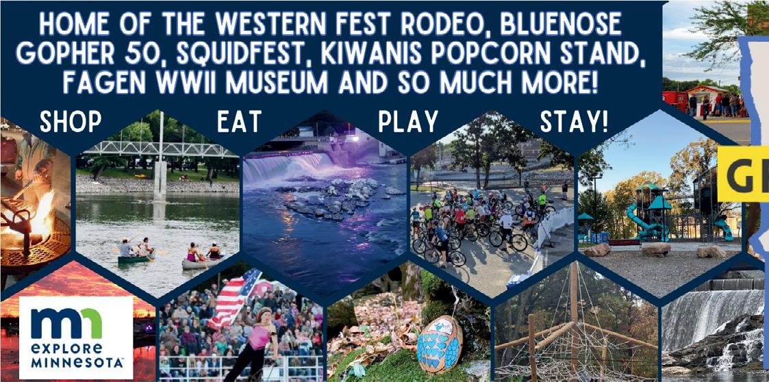


54 MINNESOTA TRAILS | Summer 2024 54 5 MIN MI NES NE OTA TR AIL A S Summer 20 2 24 PRAIRIE DECIDUOUS FOREST CONIFEROUS FOREST TALLGRASS ASPEN PARKLAND STATE PARKS STATE RECREATION AREAS BIKE TRAILS ROADS STATE WATER TRAILS CITIES LONG DISTANCE HIKING TRAILS May 2023 MAP LEGEND Not for Navigation Mille Lacs Lake Lower Red Lake Lake Winnibigoshish Leech Lake Upper Red Lake Lake of the Woods Rainy River Rainy Lake Minnesota St. Croix River Mississippi Lake Superior Lake Superior Little Fork Red Lake Pomme de Terre Chippewa Redwood Cottonwood Des Moines Watonwan Blue Earth Shell Rock Cedar Root Zumbro Whitewater Straight Cannon Red River of the North Big Fork Vermillion Mississippi Rum Kettle Snake Mississippi Pine Crow Wing Long Prairie Sauk Crow, North Fork Crow, South Fork Cloquet St. Louis Otter Tail Cass Lake Grand Marais Tofte Ely Duluth Two Harbors Silver Bay Eveleth Bemidji Brainerd Walker Wadena Park Rapids Detroit Lakes International Falls Hinckley Mora Crosby Marine on St. Croix Stillwater Hastings Lake City Cannon Falls Hugo North Branch Sandstone Minneapolis Hutchinson Saint Paul Rochester Red Wing Winona Harmony Preston Lanesboro Owatanna Faribault Marshall Mankato New Ulm Pipestone Saint Cloud Little Falls Fergus Falls Alexandria Willmar Albert Lea Austin Blue Earth Worthington Luverne St. James Moorhead Erskine Crookston Chisholm Grand Rapids 94 94 35 35 90 90 10 71 71 53 2 2 71 75 59 59 12 12 59 59 75 14 14 52 52 61 63 169 212 212 169 75 75 63 Paynesville Sauk Centre Albany St. Joseph 169 Voyageurs National Park BWCA North Country Trail North Country Trail Kekekabic Trail Border Route Trail Superior Hiking Trail Central Lakes Glendalough Cuyuna Country Rec. Area Paul Bunyan Paul Bunyan Heartland Migizi Minnesota Valley Rec. Area Sakatah Singing Hills Fair Ridge Camden Casey Jones Blue Mounds Lake Wobegon Soo Line Soo Line Willard Munger Mesabi Rainy Lake Alex Laveau Segment Brown’s Creek Gitchi Gami Trail Gateway Harmony-Preston Valley Blazing Star Shooting Star Root River Douglas Great River Ridge Cannon Valley Glacial Lakes ROCORI Dakota Rail Luce Line Grand Rounds Sunrise Prairie Hardwood Creek LRT Goodhue Pioneer Frontenac John A. Latsch Great River Bluffs Beaver Creek Valley Forestville / Mystery Cave Lake Louise Myre Big Island Rice Lake Whitewater Carley Sakatah Lake Nerstrand Big Woods Minneopa Kilen Woods Blue Mounds Split Rock Creek Pipestone National Monument Lake Shetek Flandrau Fort Ridgely Camden Upper Sioux Agency Lac qui Parle Big Stone Lake Monson Lake Sibley Greenleaf Lake Rec. Area Fort Snelling Lake Maria Glacial Lakes Lake Carlos Charles A. Lindbergh Mille Lacs Kathio Father Hennepin Banning Moose Lake Jay Cooke Gooseberry Falls Split Rock Lighthouse Tettegouche George H. Crosby Manitou Temperance River Cascade River Judge C.R. Magney Bear Head Lake Lake Vermilion /Soudan Undergound Mine Scenic McCarthy Beach Hill Annex Mine Iron Range OHV Rec. Area Savanna Portage Crow Wing Maplewood Glendalough Buffalo River Itasca La Salle Lake Rec. Area Schoolcraft Lake Bemidji Big Bog Rec. Area Franz Jevne Garden Island Rec. Area Zippel Bay Hayes Lake Lake Bronson Old Mill Red River Rec. Area Grand Portage Wild River Interstate William O’Brien St. Croix Afton Grand Portage National Monument
long distance hiking trails, water trails, state parks, state recreation areas
and biomes
TRAIL PARTNERS
You need a place to
BIKE SHOPS
CYKEL 218-772-0177 324 Curtis Avenue, Ironton www.cykelonline.com
FITZHARRIS BIKE & SPORT 320-251-2844 105 7th Avenue S, St. Cloud www.fitzharrismn.com
JAKE’S BIKES 320-219-7433 419 N. Nokomis St., Alexandria www.jakesbikes.com
REVOLUTION CYCLE AND SKI 320-251-2453 160 29th Avenue South, St. Cloud www.revolutioncycleandski.com
TOURIGHT BICYCLE SHOP 320-639-2453 124 2nd Street NE, Little Falls www.tourightbicycleshop.com
BIKE KING 651-457-7766 6489 Cahill Avenue, Inver Grove Heights www.bike-king.com
CARS BIKE SHOP 763-784-6966 2661 Co Road I & Old Hwy 10, Mounds View www.carsbikeshop.com
RAMSEY BICYCLE 763-323-6666 6825 Hwy. 10 NW, Ramsey www.ramseybicycles.com
SPECIALTY STORES
COMMON GOODS 218-772-2999 27 W Main Street, Crosby www.commongoodsmn.org
LITTLE ROCKS DESIGN STICKERS Melrose 320-333-2520 www.littlerocksdesign.com
VICTUAL 218-545-1000 124 West Main Street, Crosby www.shopvictual.com
EAT & DRINK
THE DEERSTAND RESTAURANT AND BAR 24188 Mohs Street, Deerwood 218-534-9253 www.deerstandrestaurant.com
THE HUDSON SMOKEHOUSE 218-772-0096 208 Curtis Avenue, Ironton www.hudson218.com
LODGING/B&Bs/ CAMPING
BIG RIVER RESORT 651-565-9932 1110 Hiawatha Dr. E www.bigriverresort.com
CUYUNA LAKES STAY 218-866-2353 23688 Forest Road, Deerwood www.cuyunalakesstay.com
RED RIDER RESORT 218-838-6858 23457 Co. Rd. 31, Crosby www.redriderresort.com
THE SANCTUARY 218-622-0321 222 2nd Street NW, Crosby www.thesanctuarycrosby.com
GREEN HERON B&B 218-999-5795 2810 Meyers Bay Road, Grand Rapids www.greenheronbandb.com
GEAR RENTALS
LAKE WOBEGON OUTFITTERS 320-333-3874 Lake Wobegon Trailhead, Avon lakewobegonoutfitters.com
SERVICES
COLDWELL BANKER CROWN REALTORS Hwy. 6 & 210, Crosby 218-546-8346 www.coldwellbankercrown.com
CUYUNA REGIONAL MEDICAL CENTER 320 East Main Street, Crosby 218-546-7000 www.cuyunamed.org
DEERWOOD BANK 218-534-3111 21236 Archibald Road, Deerwood www.deerwoodbank.com
MID MINNESOTA FEDERAL CREDIT UNION 117 West Main Street, Crosby 218-546-5428 www.mmfcu.org
OARS-N-MINE 218-546-6912 22640 MN-6, Crosby www.oarsnmine.com
TIMBER BUILDING SUPPLY 218-678-2063 14506 State Highway 6, Deerwood www.timberbuildingsupply.com
WING WELLNESS PLLC MEDICAL SPA 14693 Woodrow Rd., Brainerd 218-839-9463 www.wingwellness.com
INFORMATION
GRANITE FALLS CONVENTION AND VISITORS BUREAU 320-321-3202 761 Prentice Street S, Granite Falls www.visitgranitefalls.com
HUTCHINSON CHAMBER 320-587-5252 2 Main St., Hutchinson www.explorehutchinson.com
VISIT BRAINERD 800-450-7247 14084 Baxter Drive, STE 12, Brainerd www.visitbrainerd.com
LOVIN’ LAKE COUNTY 218-391-5081 1330 MN-61, Two Harbors www.lovinlakecounty.com
See more details at: www.mntrails.com/trail-partners


Summer 2024 | MINNESOTA TRAILS 55 #MeTime LakeOfTheWoodsMN.com Zippel Bay State Park
61 35 35 71 71 2 2 94 90 90 Minnesota Trails Directory Regions Northeast Region Duluth St. Cloud Bemidji Mankato Northwest Region Southern Region Metro Region Central Region
eat,
Trail Partners
here to help!
stay, play and upgrade your gear? Our
are

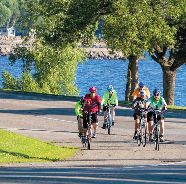
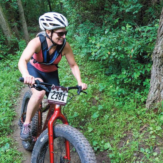


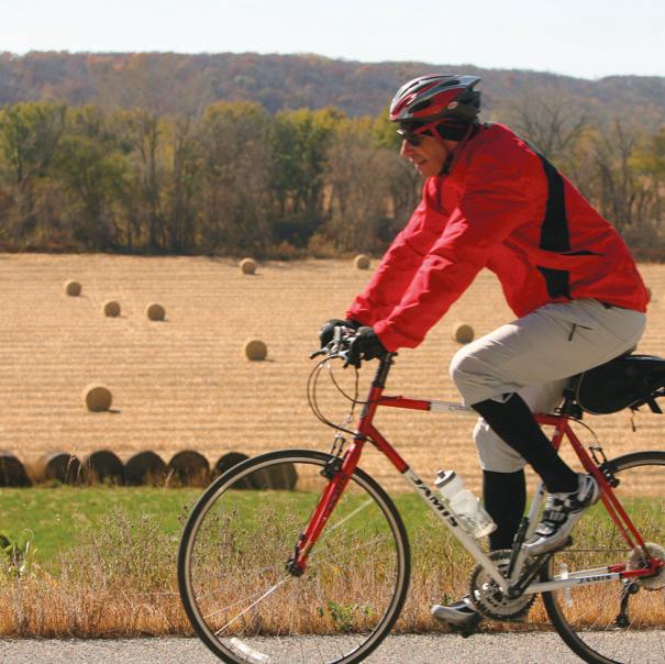
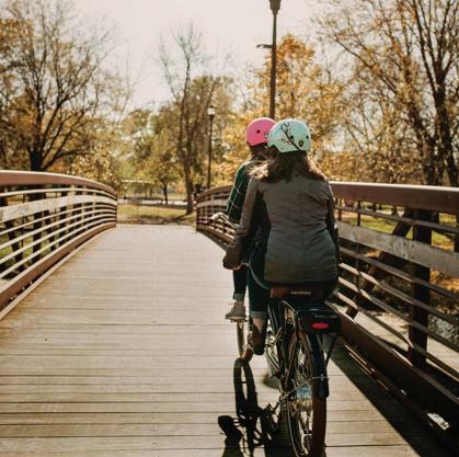
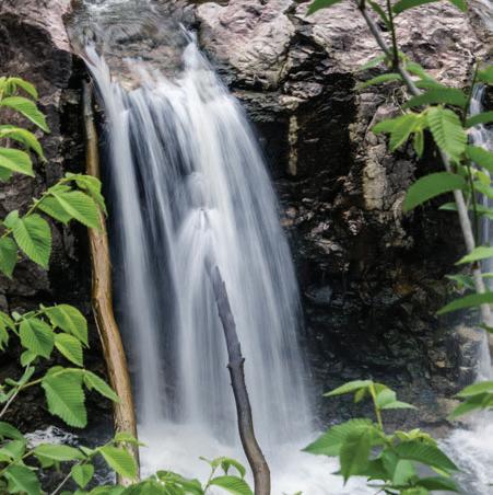
56 MINNESOTA TRAILS | Summer 2024 AROUND THE LAKE OFFTHE BEATEN THROUGHTHE COUNTRYSIDE ATERFALL ERTHE BRIDGE ExploreSouthernMinnesota.com Explore Minnesota Tourism and MN Trails Photos WHERE WILL YOUR TAKE YOU?
