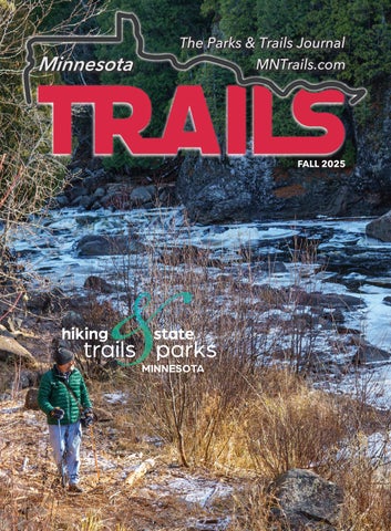
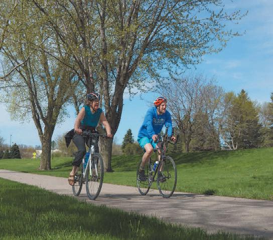
Minnesota Trails magazine is a continuation of Minnesota Bike Trails & Rides, published quarterly in cooperation with the Parks & Trails Council of Minnesota, a nonprofit organization that acquires, protects and enhances critical lands for public enjoyment. Your $35 membership subscription supports this work.
Minnesota Trails is not responsible for the return of unsolicited materials and reserves the right to reject unsuitable advertising. Information in this publication is as accurate as possible. Opinions expressed are those of the authors and not of Minnesota Trails.
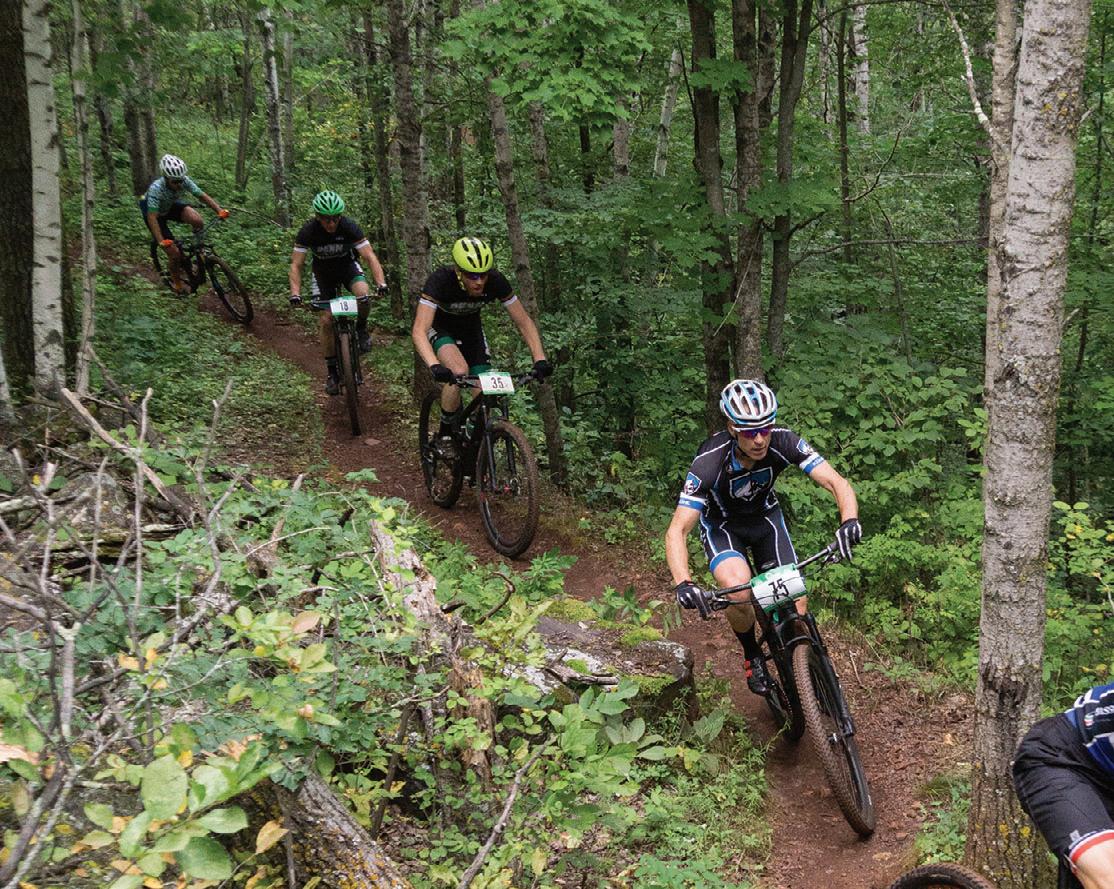
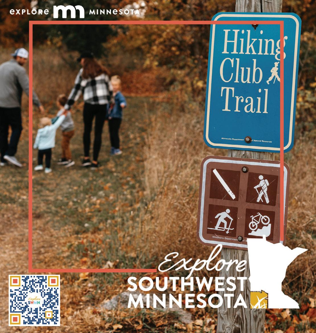
Continuing the
DEERSTAND RESTAURANT & BAR
24188 Mohs St, Deerwood (218) 534-9253
www.deerstandrestaurant.com
Full Menu, Salad Bar, Cocktails, Meat Raffles and Fun!
LODGING
23457 Co Rd 31, Crosby (218) 838-6858
www.redriderresort.com
Cabins and camping right off the MTB trails.
222 2nd St NW, Crosby (218) 622-0321
www.thesanctuarycrosby.com A boutique hotel just blocks from downtown Crosby and the bike trails
COMMON GOODS 27 W Main St, Crosby (218) 772-2999
www.commongoodsmn.org
Thrifting for the greater good! Crosby, Baxter, Crosslake
MID MINNESOTA FEDERAL CREDIT UNION 117 West Main St, Crosby (218) 546-5428
www.mmfcu.org Member owned and working for you
CRMC SUPER ONE Clinic – Pharmacy Inside Crosby Super One Store (218) 545-5350 www.cuyunamed.org
CUYUNA LAKES CHAMBER 21236 Archibald Rd, Deerwood (218) 546-8131 www.cuyunalakes.com Crosby Ironton Deerwood Bay Lake Cuyuna Emily
OARS-N-MINE
22640 MN-6, Crosby (218) 546-6912
www.oarsnmine.com
Docks, lifts, bait and tackle
Cuyuna Lakes Chamber members are ready to serve you!
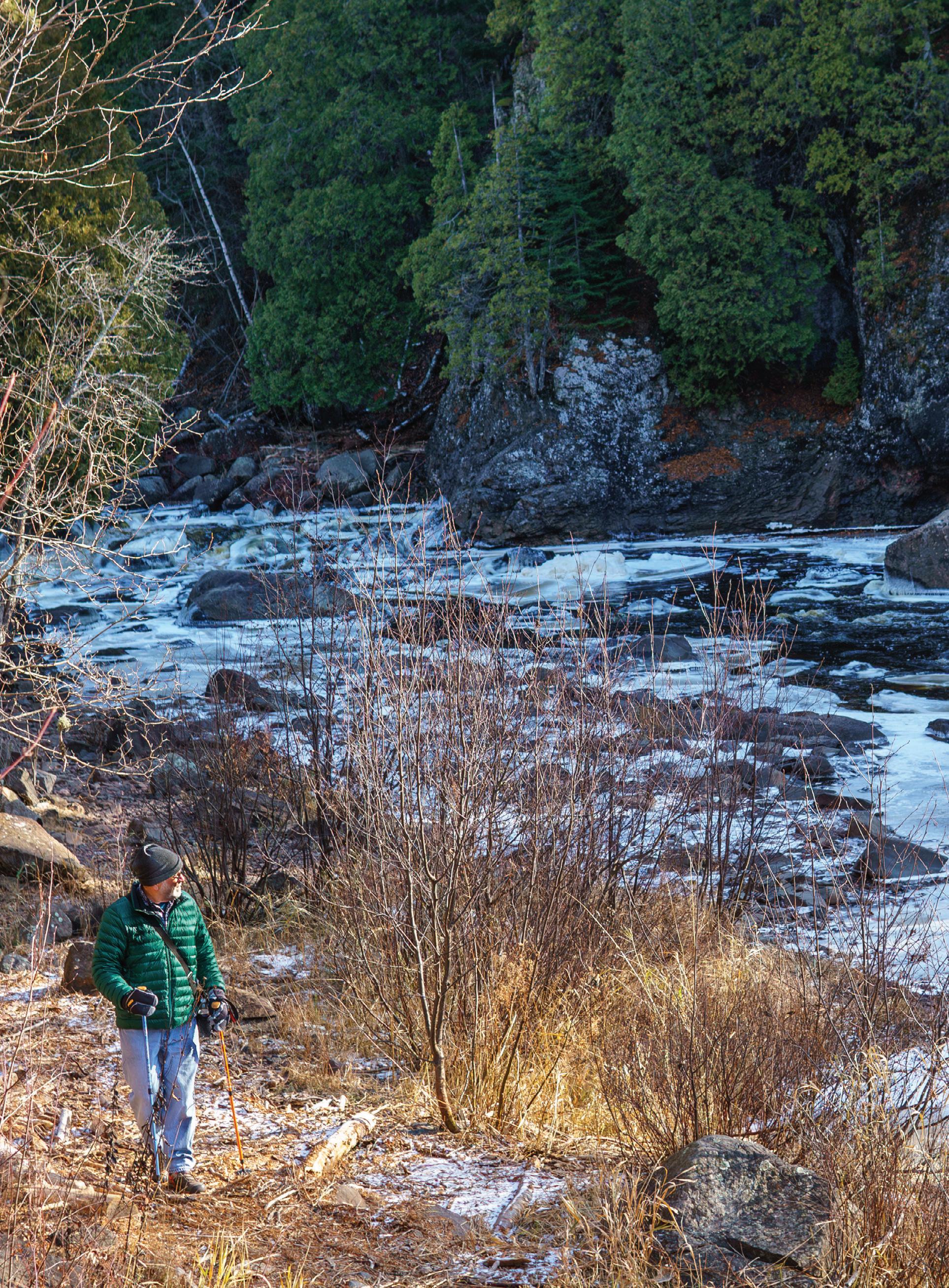
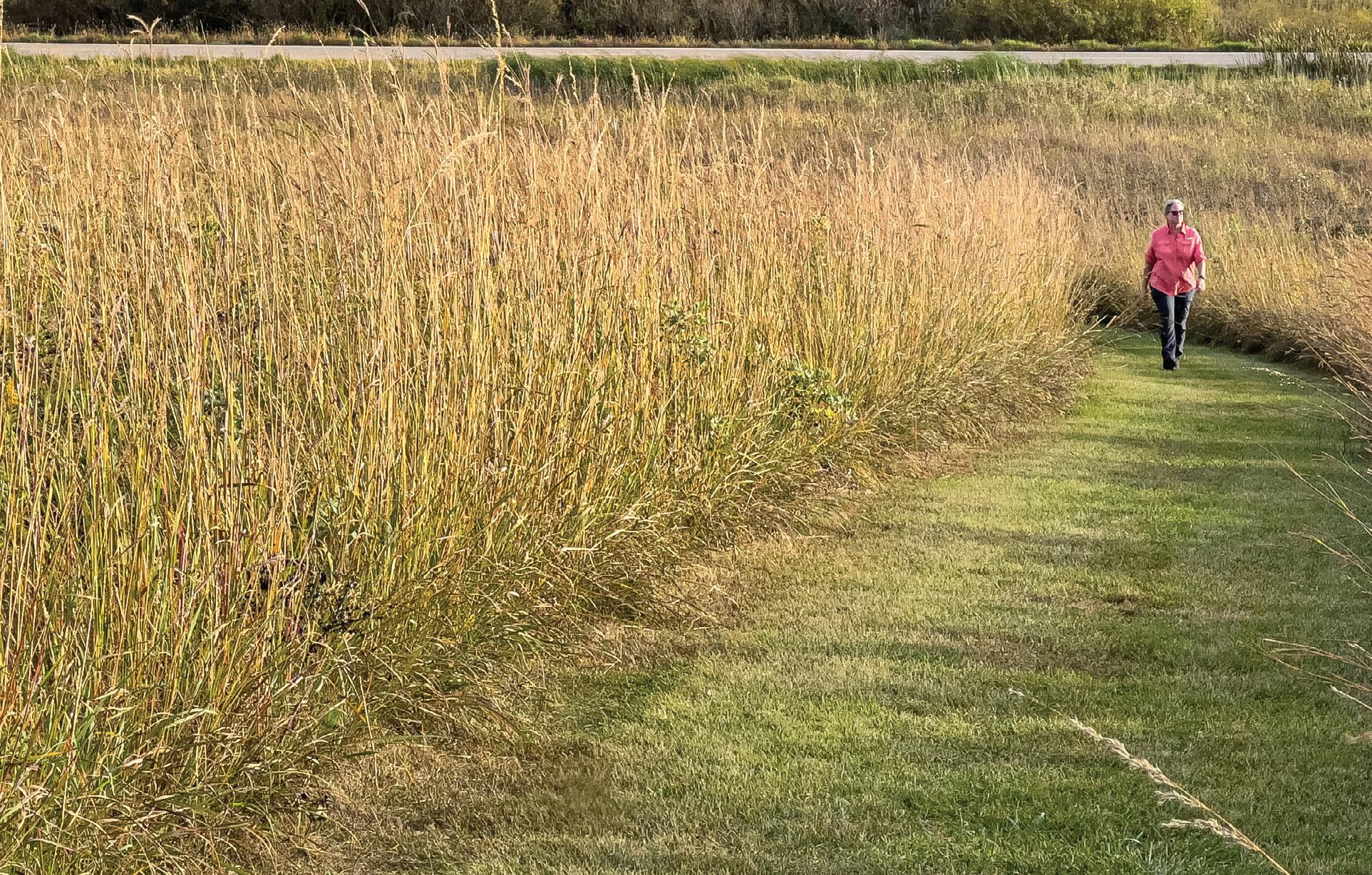
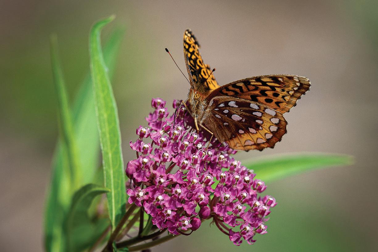
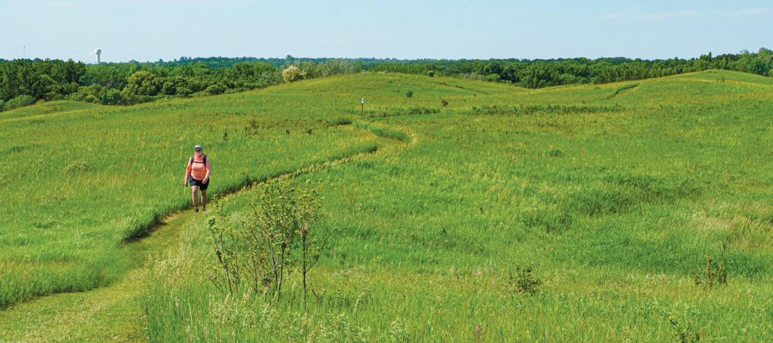
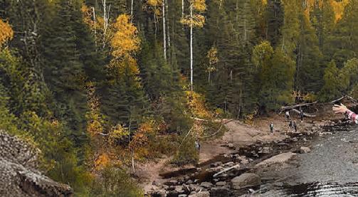
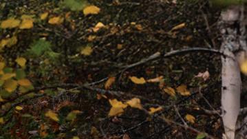
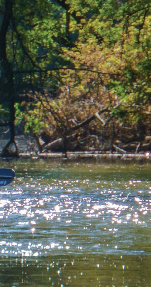
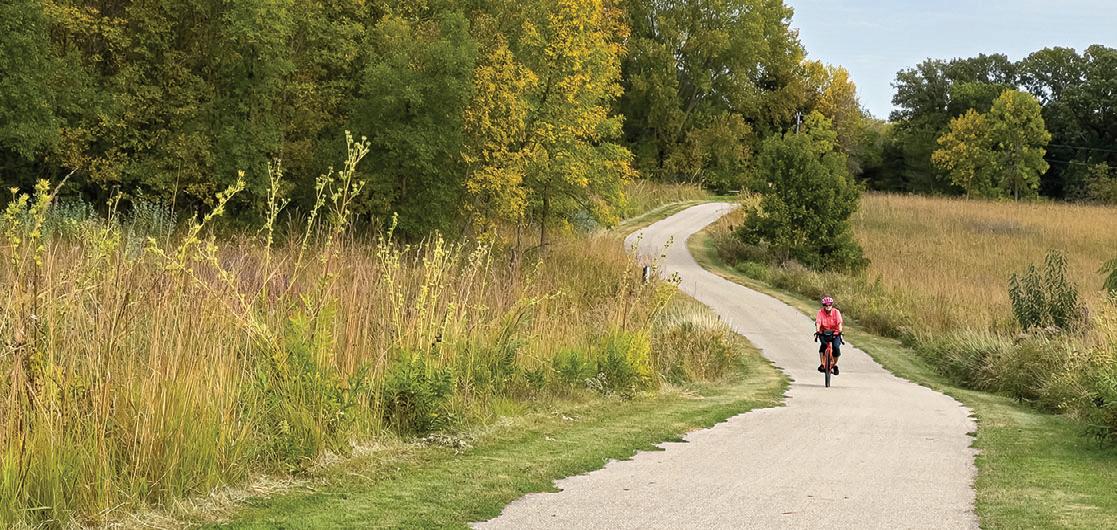
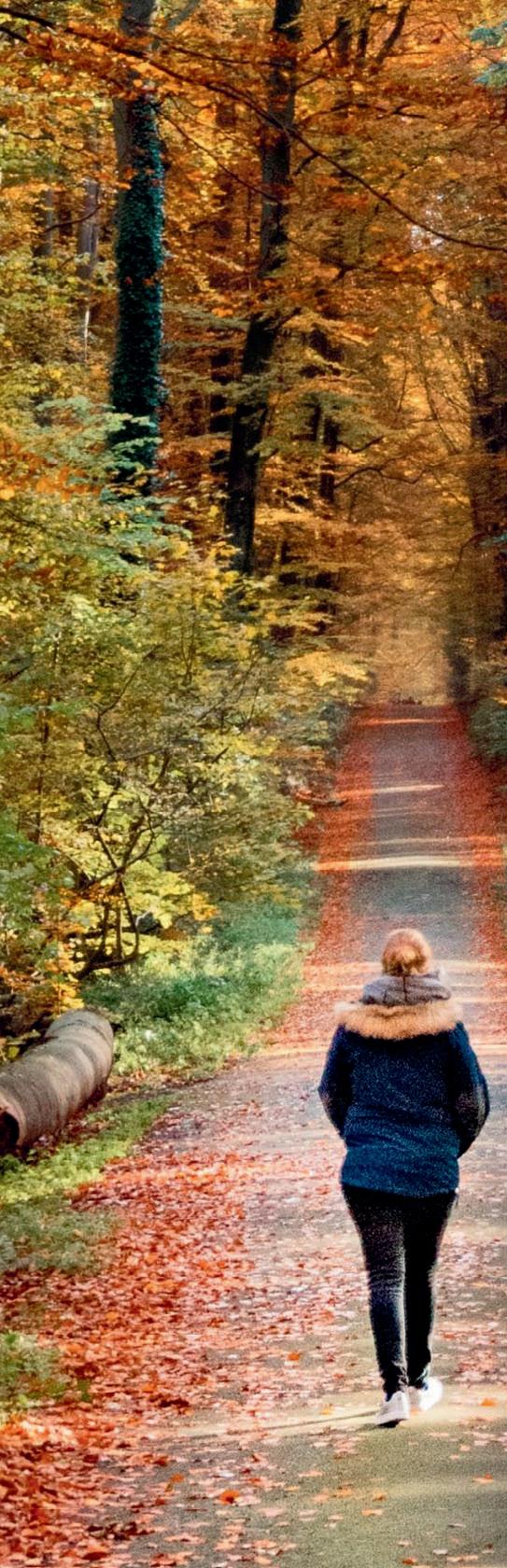
PHOTO: The Prairie View Trail at Myre-Big Island State Park. See story on p. 35 Jan Lasar photo
2025 PHOTO CONTEST WINNERS
Parks & Trails Council’s annual photo contest highlights the incredible beauty and diversity protected within Minnesota State Parks. Thank you to the fantastic
PARKSANDTRAILS.ORG/OUR-EVENTS/2025-PHOTO-CONTEST/
NORTHWESTERN MINNESOTA STATE PARKS
GLENDALOUGH STATE PARK BY EDIE THIEL
This photo was taken on the shore of Annie Battle Lake. On a late July morning, I was at that park to take photos of Canadian Geese and Mergansers I had spotted the night before. No matter how hard I tried, I couldn’t produce any decent photos of the geese, and the mergansers were nowhere to be seen. Glancing over my shoulder, and I thought, “I might as well take some shots.” Sometimes, it’s not the shot you were trying for, but it’s the shot you need to take. Surrounded by nature, people have the opportunity to slow the pace of life, look around, and experience beauty in detail.
SOUTHWESTERN MINNESOTA STATE PARKS
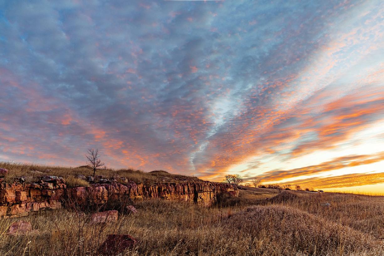
BLUE MOUNDS STATE PARK BY KIM VANDEN BOSCH
I’m so lucky to live only 25 miles from Blue Mounds State Park. I had always wanted to get some dramatic sunrise photos from this spot so I headed out early because there were cool clouds that I thought would lead to a cooling up from the prairie, the big open sky, and, of course, the clouds! What I always feel when visiting this park is the quiet beauty and the permanence of the place—and the generations of people who have explored this area.
NORTHEASTERN MINNESOTA STATE PARKS
JAY COOKE STATE PARK BY LEVI
JANSSEN
This photo was captured from the northern bank of the river, just west of the iconic Swing Bridge. Jay Cooke is easily one of my favorite state parks in Minnesota. Each fall, a fellow photographer and I plan a trip to chase the season’s colors—usually heading up the North Shore. On our return from one of these autumn journeys, we made a spontaneous stop at Jay Cooke, and it completely delivered. The light, the textures, the calm—it was one of those moments you hope to catch when traveling with a camera. Get outside. Let the wild places slow you down.
SOUTHEASTERN MINNESOTA STATE PARKS
FORT SNELLING STATE PARK BY TED NARVESON
I consider Fort Snelling State Park a hidden gem of the Twin Cities. Early mornings and evenings, the park comes alive with wildlife. Most people are astonished that so much wildlife exists near two major highways and MSP airport. The Great Horned Owlet was captured early one morning in April, just after sunrise. That morning, the conditions were exactly what I wanted, making the shot successful. Within the next week, the owlet had left the nest and was exploring its new world, under the watchful eyes of its parents. This photo shows the vulnerability of one of nature’s great owls.
A New Way to Pay For State Parks
To visit a Minnesota state park or recreation area, you need a valid permit. Options include a $7 daily pass, a $35 annual pass, or a special Minnesota state park license plate, which costs $60 in addition to your vehicle registration and must be renewed annually. Now, state lawmakers have asked the Minnesota Department of Natural Resources (DNR) to make recommendations to reduce state park vehicle entrance fees. The hope is that a new, reduced-fee structure could attract more visitors and increase revenue.
Recently, I had a chance to talk with Brett Feldman, president of the Parks & Trails Council of Minnesota, about how this might work.
I understand your organization has been recommending the sale of reduced-price park permits as part of the vehicle registration process for several years now. Why is it necessary? We’re always on the lookout for good ideas to improve how our state parks are managed and funded. Our state parks have a maintenance backlog of approximately $144 million, so more funding is needed. In recent years, the DNR has been pushing to increase the cost of park permits, but such proposals don’t generate significant revenue and risk pricing people out. Outdoor gear is expensive, and 28% of Minnesotans say they don’t have enough money to pay outdoor recreation fees. We need a funding model that both generates enough money to care for our state parks while also keeping them welcoming, accessible, and affordable.
Jan Lasar Trails Editor/Publisher
How could a new way to pay increase both accessibility and revenue for Minnesota’s state parks? The model that’s worked in other states is offering a lower-priced state park permit when renewing your vehicle registration. The idea originated in Montana in 2004, was adopted by Michigan in 2010, and has spread to other states since. The specifics are a little different in every state, but the general premise is the same: reduce the cost of the state park permit to increase affordability and encourage use; put the choice in front of everyone who registers their vehicles; and if enough people buy the pass, there’s potential to significantly increase park revenue. It sounds too good to be true, but other states have shown it works.
What timeline is the DNR working with to develop and potentially implement this new access plan? The legislature directed the DNR and the Department of Public Safety to draft recommendations for a new permit option by January 15, 2026. The legislature would need to approve any change. Mid-2027 is likely the earliest any new system could be implemented. Will this new system replace the annual pass? Potentially, but not necessarily. In some states, the permit offered with vehicle registration is designed to be the primary or only way residents buy park permits. In others, it’s designed to be a once-a-year “sale price,” and regularly priced permits are still sold at parks. Regardless of the specifics, there will still need to be a way for non-residents to purchase state park permits when they’re visiting.
What ideas or models is the DNR considering for the new payment system, and how would they differ from the current setup? The DNR is still in the process of developing recommendations, so we don’t know everything they’re considering. Currently, if you want to visit a state park, you have to pay at the park entrance or buy and print a permit online before you go. Our idea is: when you renew your vehicle registration, you are given the choice of adding on a reduced-price, state park annual vehicle permit. In Michigan, which is a model for this type of program, the cost is currently $14. For people who buy the pass, a state park sticker could be included in the mail with your tabs. Or your vehicle tabs could have an indicator that you purchased the state park permit. There are lots of options to consider for how the new permit could work.
Could a new payment model include discounted or free access for certain groups, such as low-income families or veterans? Certainly. There’s currently discounted or free access for tribal members, active-duty military, and school-related visits, among others. There’s also a library program where people can check out 7-day park passes. All those programs could continue alongside a new, low-cost park permit offered with vehicle registrations. The special license plate could also continue for people who want to make the extra donation.
Anything you’d like to add? Parks & Trails Council will be engaged on this issue during the 2026 Legislative Session. We encourage anyone who cares about parks to add their voice to ours by becoming a member, signing up for updates, and supporting our work.
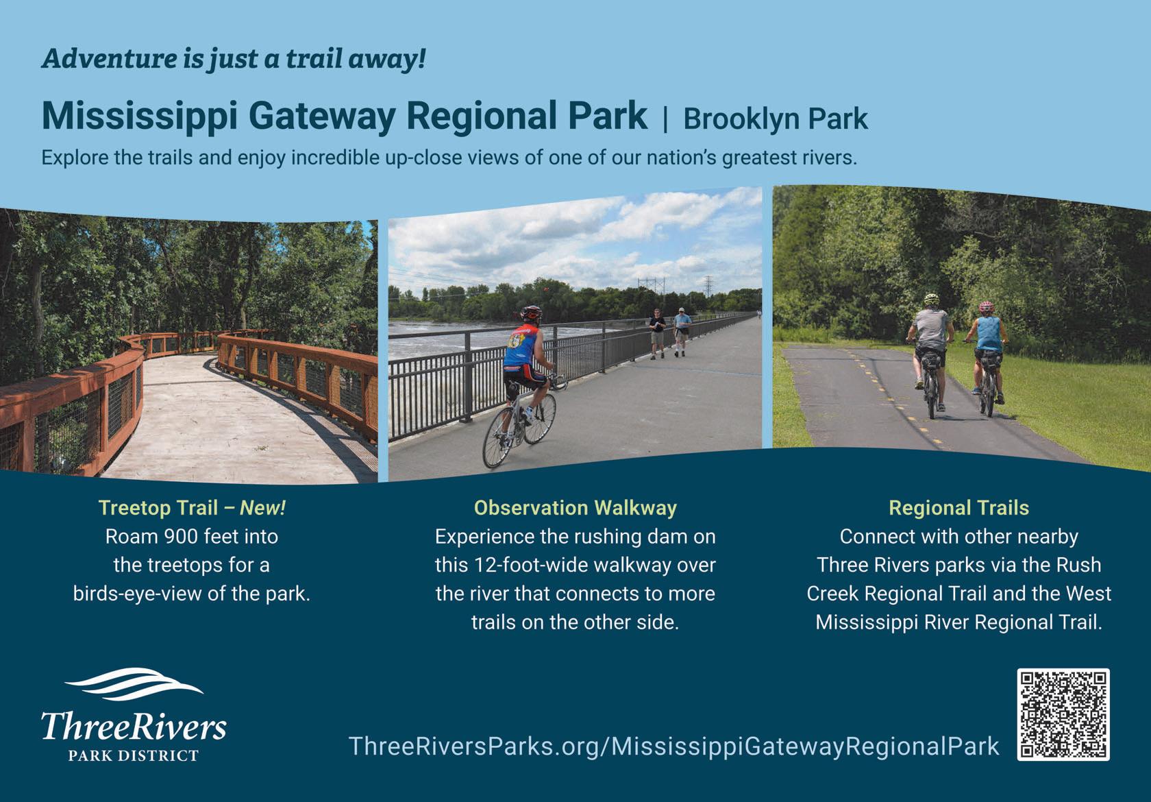
Minnesota Miles
Explore Otter Tail County Trails
maplewood state park
Located in northwestern Otter Tail County, Minnesota, Maplewood State Park is one of the hidden gems in the state. The 9,200-acre park sits between the state’s eastern forests and western prairies. Each autumn, its diverse landscapes share a stunning display of brilliant reds, oranges and gold.
Scan the QR code to discover additional trails in OtterTail County
TRAIL UPDATE
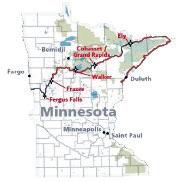
By Matt Davis | Regional Trail Coordinator for the North Country Trail Association in Minnesota, North Dakota and Wisconsin
The volunteers of the North Country Trail Association (NCTA), along with their partners at the Superior Hiking Trail Association (SHTA) and the Border Route Trail Association (BRTA), continue to grow, maintain, and improve Minnesota’s long-distance hiking network. Here are a few recent developments to keep you up to date.
Ely, Grand Rapids, and Cohasset Join the Ranks of NCTA Trail Towns
past year, join of W T is a located the Nort Nation Trail t hike essen
The cities of Ely, Cohasset, and Grand Rapids became North Country Trail Association Trail Towns over the past year, joining the ranks of Fergus Falls, Frazee, and Walker. A Trail Town is a community located along the North Country National Scenic Trail that supports hikers with essential services, promotes the trail to its citizens, and embraces it as a valuable resource to be protected and celebrated. Trail Towns are built on strong relationships between the town, the trail, and local NCTA volunteers.
Volunteers build trail in Cohasset, MN in 2024. | NCTA Photo
Arrowhead Chapter’s New Trail Project Near Grand Rapids
The Arrowhead (ARW) Chapter continues its work on the Highway 6 to Tioga Beach project, recently adding a new backcountry campsite and three more miles of trail. A grand opening was held last summer for the first new segment between Tioga Beach and County Road 17.
Superior Hiking Trail Association Continues Trail Improvements
The SHTA remains hard at work on the shared Superior Hiking Trail/North Country Trail, focused on making it more sustainable and enjoyable. This year, they’re completing renovations on the Bean and Bear loop, Split Rock River loop, and Cascade River loop, along with conducting much-needed work in Duluth and other areas. Some projects are volunteer-led, while others will be completed by professional trail contractors.
superiorhiking.org/2025-trail-renewal-projects/
Ongoing Maintenance on the Border Route Trail (BRT)
This spring, eight volunteer trail maintenance teams worked on the BRT, covering 28 of the 30 non-wilderness miles. Progress on the portion running through the Boundary Waters Canoe Area Wilderness (BWCAW) is slower due to the limitations of non-motorized tools and the remote nature of the terrain. A three-person recon team conducted a partial deadfall sweep from the western terminus to Clearwater in early May. Recon reports and feedback from recent trail users are critical for planning future maintenance. Additional trips are scheduled for the fall.
Bridge replacement and upgrade planning has begun for the Portage Brook and Stump Rivers. Additionally, the shared eastern terminus between the Border Route Trail and the Superior Hiking Trail is in urgent need of improvements, including a vault toilet rehabilitation and expanded parking, due to increased trail use. www.borderroutetrail.org
Future Trail Building Efforts Need More Volunteers
Big changes are underway with the implementation of the NCT’s Arrowhead re-route in northeastern Minnesota. The Chippewa National Forest has approved construction of 11 new miles of trail that will parallel State Highway 6 northeast of Remer. This new segment will eventually connect with the Arrowhead Chapter’s Grand Rapids project mentioned earlier. In preparation, the Star of the North (STN) Chapter plans to organize trail-clearing weekends this fall.
Meanwhile, the Superior National Forest is undergoing environmental review for a 12-mile trail segment between Glipi Forest Road and Fernberg Road, including three new backcountry campsites. Approval is expected this fall, with the Kekekabic (KEK) Chapter aiming to start construction in May.
The newly formed Ely Northwoods (ELY) Chapter has scouted a 20-mile route between Bear Head Lake State Park and the southwestern edge of Ely. Construction on this segment is anticipated to begin in 2027.
To get involved with the NCTA—whether by joining a chapter-led hike, volunteering at a workday, or attending a meeting—visit the Events Calendar: northcountrytrail.org/events/map/ to find activities near you. Learn more about volunteering: northcountrytrail.org/volunteer/ways-to-volunteer/
“WHERE CAN I GO HIKING AROUND HERE?
HOW IS THERE NOT A TRAIL YET?”
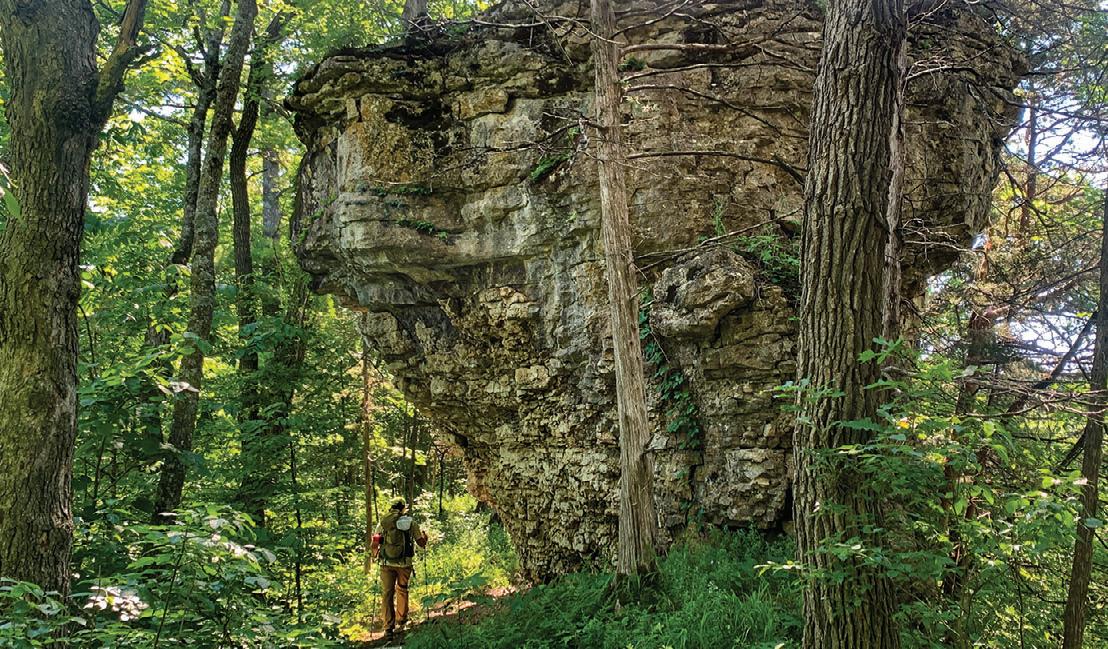
Marty Walsh was no stranger to questions like these. Southeastern Minnesota’s stop-and-stare-gorgeous Driftless area has plenty of hiking trails, but it’s missing a really long one.
Glacial advances from eons past gave it a shot but missed scouring this part of the upper Midwest, leaving us
CONVERSATION WITH THE Visionaries
with bulbous bluffs and deep, intimate valleys—the perfect playground for outdoors fans in these parts who recreate with verve and appreciate a walk in the woods.
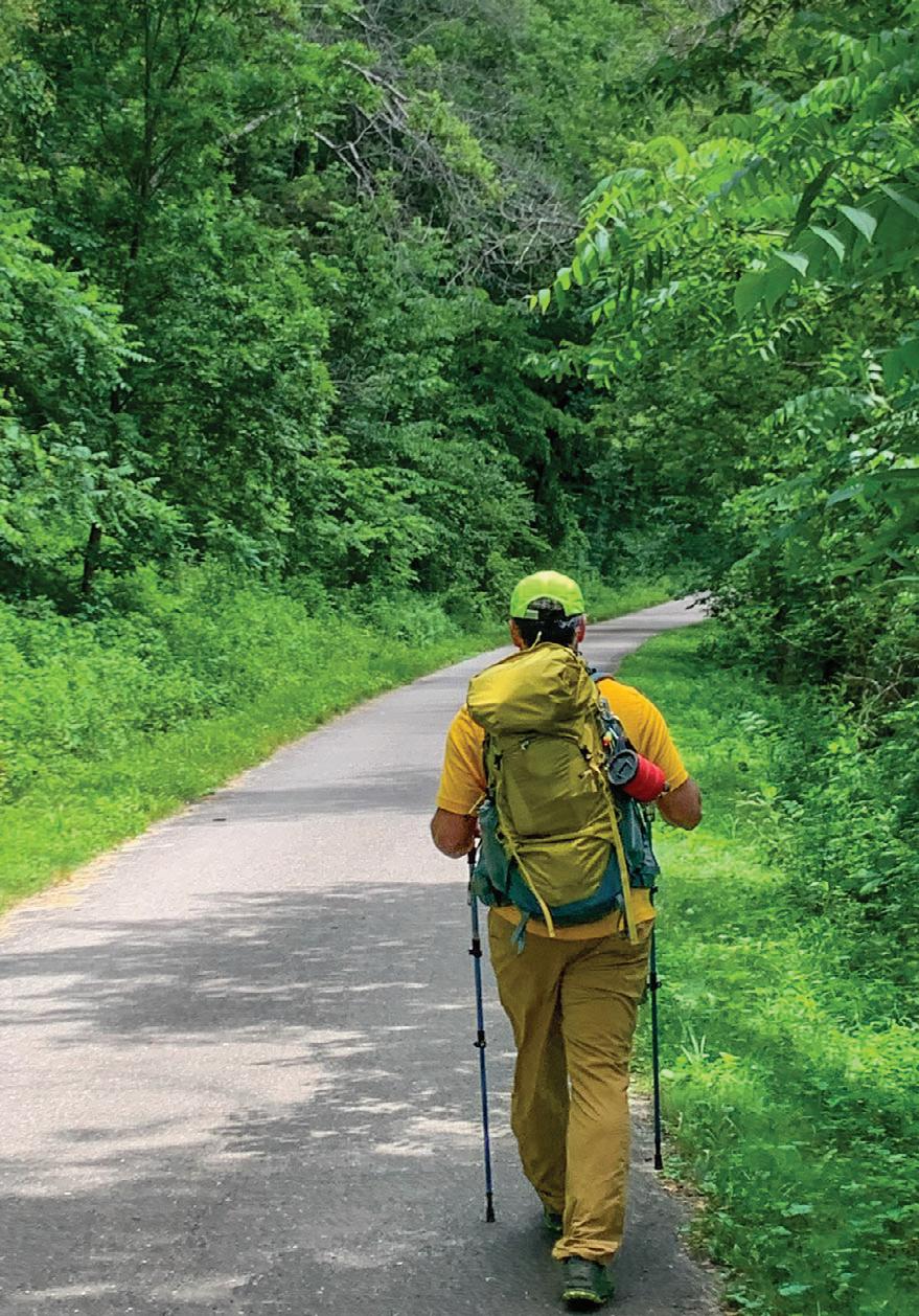
Volunteer and MNDHT board member
Andy Petzold during a test hike on the Root River State Trail. MARTY WALSH
The MNDNR is considering Beaver Creek Valley State Park for a possible trail alignment. ALEXA SHAPIRO PHOTO
STORY BY STEVE JOHNSON
I talked with Walsh, founder and board Chair, as well as Alexa Shapiro, Director of the Minnesota Driftless Hiking Trail organization, about Minnesota’s most ambitious new hiking project—the Minnesota Driftless Hiking Trail, 125 squiggly miles from Chatfield to the Reno Overlook at the Mississippi River east of Caledonia. What started as a “what-if” idea is now a burgeoning organization with legislative backing, community support, and a vision to transform how we experience this unique landscape.
MARTY, HOW DID THIS WHOLE THING GET STARTED?
“The origin really emerged for me from taking my professional career in community development and asking ‘What can we do with the assets that we have in our community?’ We have great state forests and state parks. We’re already so big in Southeastern Minnesota with bike culture, fly fishing, canoeing to a degree. We’re really missing hiking. I want to see that here.
It really just didn’t seem, to a kind of daydreamy type of person, that a long distance trail was a huge next step. And it was an idea that landed well with a lot of people—both in the local community and in the backpacking community—and it slowly just picked up steam.
Now that we’re officially called the Minnesota Driftless Hiking Trail, it’s a much stronger organization because it’s being done the right way, both internally and externally, getting investment from the local population.”
YOU’RE BOTH AVID BACKPACKERS. WHAT’S YOUR AFfINITY FOR THE DRIFTLESs AREA?
Alexa: “One thing that always stands out to me about this area is just how much we see other people attaching to it. We have a robust recreational economy here, and whenever I run into people visiting,
they talk about the beautiful drive down Highway 61, past the bluffs and river valleys.
When I talk about this project and share about the Driftless region specifically, you can really see how people understand that this is a unique and valuable resource here in Minnesota, and why it would deserve to be highlighted with a trail. This is such a unique landscape compared to the rest of Minnesota. We see that in how many people want to come down here just to recreate or vacation and even move to this region to be in a more outdoor-based landscape.”
HOW IS THE TRAIL GETtING BUILT?
Alexa: “It’ll be a bit of a mix. We know that we’ll be relying heavily on volunteers—we want our organization to be supported by volunteers similar to other trail agencies in the country. But also, through a grant from the LegislativeCitizen Commission on Minnesota Resources, some of the funding will go toward working with trail consultants to develop and design the trail.”
Marty: “I think the other component of that is from an efficiency standpoint—a large portion of the first 20 to 30 miles will leverage existing trails and educate people that with a little bit of work, these can all be linked together. It’s bits and pieces that we view more as a whole, helping people string them together. That’s kind of where we started, and that helps build up the affinity for it that we can tap into for volunteers.
The other long trail that’s probably most a model for construction is the Ice Age Trail. If we can build two miles here, we’ll do it and tell you how to get to the next one. There are two focus areas [of the trail corridor] where we think it’ll be easiest to get the most miles the fastest, and those are both more middle-ish, so that’s where construction will start and then it’ll grow out organically from there.”
HOW IS THE RECEPTION FROM LANDOWNERS ALONG THE WAY?
Alexa: “So far I’ve been really impressed with the positive feedback. One of the biggest things we’ve focused on is continuing the outreach work that Marty and the rest of the board have been doing. We’ve hosted several community forums— essentially listening sessions where we invite people to learn about the project and then share their ideas, feedback, and concerns so we can create a trail that really works to highlight the vision, values, and goals of the local community.
In each of those forums we’ve received helpful feedback. We see that people understand the potential economic benefit the trail could bring to their communities and that outdoor access is really valuable for a number of things.
A story stands out in my mind—we’ve had a lot of parents commenting on how much they would appreciate having an asset like this in their communities, to have a close-to-home area to bring their kids and get them outside and engaged in nature.
I think backpacking is such a powerful experience for a lot of people, but especially for youth. I’ve guided youth backpacking before, and every time I’m just blown away by how much they take away from the experience—just watching them feel stronger, more capable and confident, and engaging with nature in a completely different way than they do when they're at home and just going outside for little stretches of time.”
MARTY, TELl ME ABOUT THE DEePER CONnECTION PEOPLE DEVELOP TO THIS LANDSCAPE.
“You have to be up close and personal to the Driftless area to really understand why it’s different. The deeper you dig, the more unique it becomes—whether it’s geology, the natural history, the human history and the culture—and giving kids that strong attachment that comes from walking through a space rather than driving or biking through it.
You start up west of Chatfield, pretty much on the high prairie. Then you’ll see the river cut down into the landscape around you. To see that change from the high prairie down to the river with the towering bluffs over you—it’s a space where geologic and human scale really intersect well. I don’t think that can happen without you becoming really affixed to the place. It puts the specialness of place here but also puts it in context of everything that’s around it.”
WHAT DOES TIMING LOoK LIKE FOR PEOPLE TO GET OUT ON THE TRAIL?
Alexa: “We expect within the next one to two years to see discrete sections of trail. In the center of our trail corridor, there are a couple areas where we think we can
The Cabbage Rocks served as an inspiration for the MNDHT logo. | MARTY WALSH PHOTO
designate trail faster than elsewhere. It’ll still be probably another ten years before we have a functionally complete trail, well-blazed, with maps online and all the information hikers need to do the full hike.”
HOW CAN PEOPLE GET INVOLVED WITH VOLUNTEeRING?
Alexa: “Currently we don’t have any highlighted dates that folks can get involved, but we know that we are quickly approaching the time period where we’re going to need a lot of hands to help support that designation work. On our website, there’s a ‘Newsletter and Get Involved’ button. When we have volunteer opportunities available, we send out a newsletter with all the different opportunities for folks to get involved.
We’ve been really fortunate—even without having had any active trail building days or clearing days yet, our volunteer list has grown. We are getting a lot of excitement from folks to get out into the trail corridor and do that work, and we’re excited to get out there with them.”
Marty: “We still run into a lot of people who aren’t familiar with the project so even if they can’t make it out on build days, [it helps to] wear the trail t-shirts around, talk to friends, share it on social media to increase awareness that this is something they want to see.”
DO YOU HAVE ANY FAVORITE PARTS OF THIS YOUNG TRAIL?
Marty: “The whole thing is exciting because of how you tie it all together, but the area I’ve come to appreciate the most is the eastern terminus of the trail where it hits the Mississippi River. It’s a really intense landscape, a lot of up and down. When a lot of people think of the Driftless Area, they don’t think about the Mississippi River, when in fact that is the triggering action of the whole thing.
The Reno area is where you still have hints of the prairie, you have deep gorges, you have hardwood and softwood forest, and you roll down into the Mississippi. It’s pretty remote but also relatively easy to access.”
Alexa: “Mine would definitely be in the Lanesboro area at Eagle Bluff Environmental Learning Center. It’s a really unique landscape with a lot of variety. They have beautiful prairie but also have woodland area that you can wander through with unique trees and wildlife. Then they have the Root River that passes right through the area as well. It’s a great example of the diversity that the Driftless Area offers.”
WHAT TRAILS INSPIRED THIS PROJECT?
Alexa: “I started backpacking nine years ago. In 2016 I did my first backpacking trip on the Ozark Trail in Missouri. That was a great experience, with beautiful bluffs, lush green, and deep river valleys, and a wonderful introduction to Midwest hiking.
But the trail that inspires me the most is my very first thru-hike, the Pacific Crest Trail. I hiked that in 2017, and [that trip] always reminds me of how much I love backpacking.”
Marty: “I think I would call attention to the Ozark Trail too. For a lot of us in the Upper Midwest, the default is to go north, but there are parts of the Ozark Trail that are maybe only an hour further than parts of the Superior Hiking Trail, and to hop down there extends your season by a couple of months.
The other one is the Centennial Trail out in western South Dakota, in the Black Hills. Especially the southern end of that, you’re in largely a grassland environment. There aren’t a lot of places where you can hike 20 to 30 miles in grassland, and it is extremely remote.”
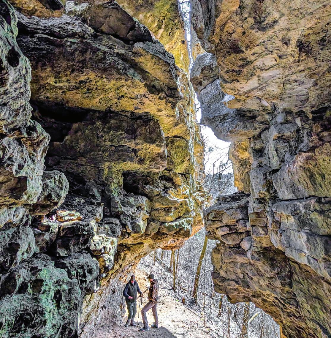
Volunteer Jim Mason guides local residents at Cabbage Rocks, an iconic dolostone feature in the Richard J. Dorer Memorial Hardwood State Forest. | JIM MASON PHOTO
RIDEMN1
Road | Karlstad, MN
September 6-13, 2025
RideMN1 holds an annual bicycle ride across Minnesota to raise awareness about cancer. This time they visit Karlstad, Warroad, Baudette, Littlefork, Orr, Side Lake, Hoyt Lakes and Silver Bay. There’s optional pre-ride camping and a dinner the day before. www.ridemn1.org
NORTHFIELD ROTARY BIKE TOUR
Road/Gravel | Dundas, MN
September 6, 2025
There’s a route for everyone: Road, gravel or family. Part of the Rivers, Lakes, Fields Ride Series, including Bridge the Valley Bike Rally. Ride both for extra swag and prize drawings.
As always, Classic riders enjoy the scenic and historic Grand Rounds in Saint Paul. Enjoy a delightful tour of five regional parks, plus a jaunt over the Mississippi River over to lovely Lilydale Park. Live music at every rest stop! www.bikeclassic.org
North Star Bicycle Race
Road | Saint Paul, MN to US-Canada border September 10, 2025
www.mntrails.com/event/north-star-bicyclerace
Old Fashioned Gravel
Gravel | Hokah, MN
September 13, 2025
www.mntrails.com/event/old-fashioned-gravel
TWIN CITIES BIKE TOUR
Road/Trail | Minneapolis, MN
September 14, 2025
This ride is destined to be a celebration of the trails and communities that fuel thriving bicycling culture. www.bikemn.org/all-events/tcbt/
Tomassoni Tour
Trail | Tower, MN
September 18-20, 2025
www.mntrails.com/event/tomassoni-tour
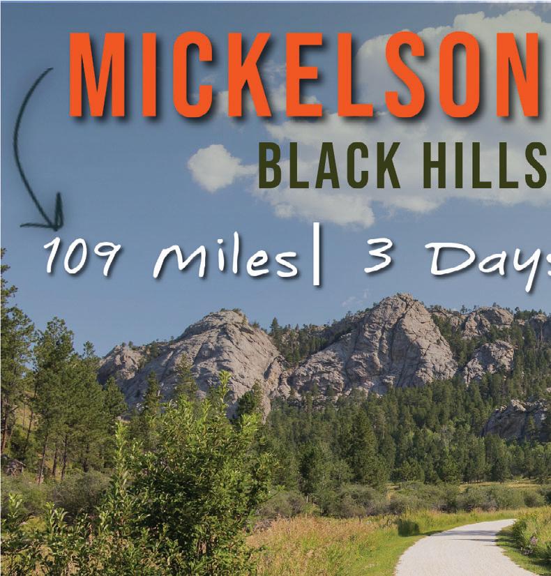
MICKELSON TRAIL TREK
Trail/Gravel | Custer, SD
September 19-21, 2025
Enjoy the beauty of the heart of the Black Hills as you travel through the scenic valleys, old railroad tunnels and historic mining towns on the 119-mile Mickelson Trail. It’s a great way to explore the Black Hills at a slower pace. Registration includes trail pass, shuttle, refreshments and meals.
www.mickelsontrail.com
MAYOR’S BIKE RIDE
Trail | Spicer, New London & Willmar, MN
September 19, 2025
Mayors from Spicer, New London and Willmar will be leading a ride starting at 5:00pm in each of their towns to come together for a picnic at Goat Ridge Brewing in New London, MN. All three towns are connected by the Glacial Lakes State Trail.
www.willmarlakesarea.com/event/mayorsbike-ride
MORA BIKE TOUR
Road | Mora, MN
September 20, 2025
The annual Mora Bike Tour starts and finishes at the Vasaloppet Nordic Center and offers two routes on rural country roads. Rest stops keep riders hydrated and a mobile repair van lends assistance if needed.
http://www.vasaloppet.us/mora-bike-tour
RIDE THE RIDGES
Road | Winona, MN
September 20, 2025
Ride the Ridges will take riders through some of the most scenic areas in southeastern Minnesota, from lush valleys along streams to bluffs overlooking the Mississippi River. All routes have well-stocked rest stops featuring local delicacies. Distances: 22, 44, 70, 110 miles
www.ridetheridges.bike
ROSEWOOD GRAMBLE
Road, Gravel | Thief River Falls, MN
September 20, 2025
Join Bike Thief River Falls on this ramble on gravel (Gramble) and see rural Pennington and Marshall counties. You’ll ride the former beach ridges of Glacial Lake Agassiz, minimum maintenance roads and a bit of trail.
www.bikemn.org/all-events/rosewoodgramble
Tour of Lakeville
Road, Trail | Lakeville, MN
September 20, 2025
www.mntrails.com/event/tour-of-lakeville
KATO BIKE FALL FEST
Road/Trail | Mankato, MN
September 26-28, 2025
The Kato Bike Fall Fest is a weekendlong celebration to show off the depth of the amazing bike culture of the greater Mankato area. Expect the best routes, treats, and fun in the serenity of a southern Minnesota autumn. www.bikemn.org/all-events/kato-bike-fall-fest
WHEELIN’ TO WALL
Road/Gravel | Wall, SD
September 27-28, 2025
Experience the magic of Badlands National Park and its striking rock formations on this two-day cycling celebration. Road and gravel routes are available on this supported ride and a Pedal Parade of Lights and a poker run are part of the fun. www.wheelintowall.com
As of deadline, the information in this calendar was accurate. For Up-To-Date Information & Details Check WWW.MNTRAILS.COM/EVENTS
DIRT BAG GRAVEL GRINDER
Gravel | Clearwater, MN
September 27, 2025
This central Minnesota fall ride on the backroads around Clearwater honors the memory of the late John Egbers. In the spirit of gravel riding, it’s free and unsupported.
www.mntrails.com/event/dirt-bag-gravelgrinder
The Gunflint Scramble!
Mountain Bike | Grand Marais, MN
September 27, 2025
www.mntrails.com/event/the-gunflintscramble
Fulton Gran Fondo
Road | Minneapolis, MN
September 27, 2025
www.mntrails.com/event/fulton-gran-fondo
Headwaters 100
Road | Park Rapids, MN
September 27, 2025
www.mntrails.com/event/headwaters-100
Heck of the North Gravel | Two Harbors, MN
October 4, 2025
www.mntrails.com/event/heck-of-the-north
The Filthy 50 Gravel | Lanesboro, MN
October 11, 2025
www.mntrails.com/event/filthy-50
“I
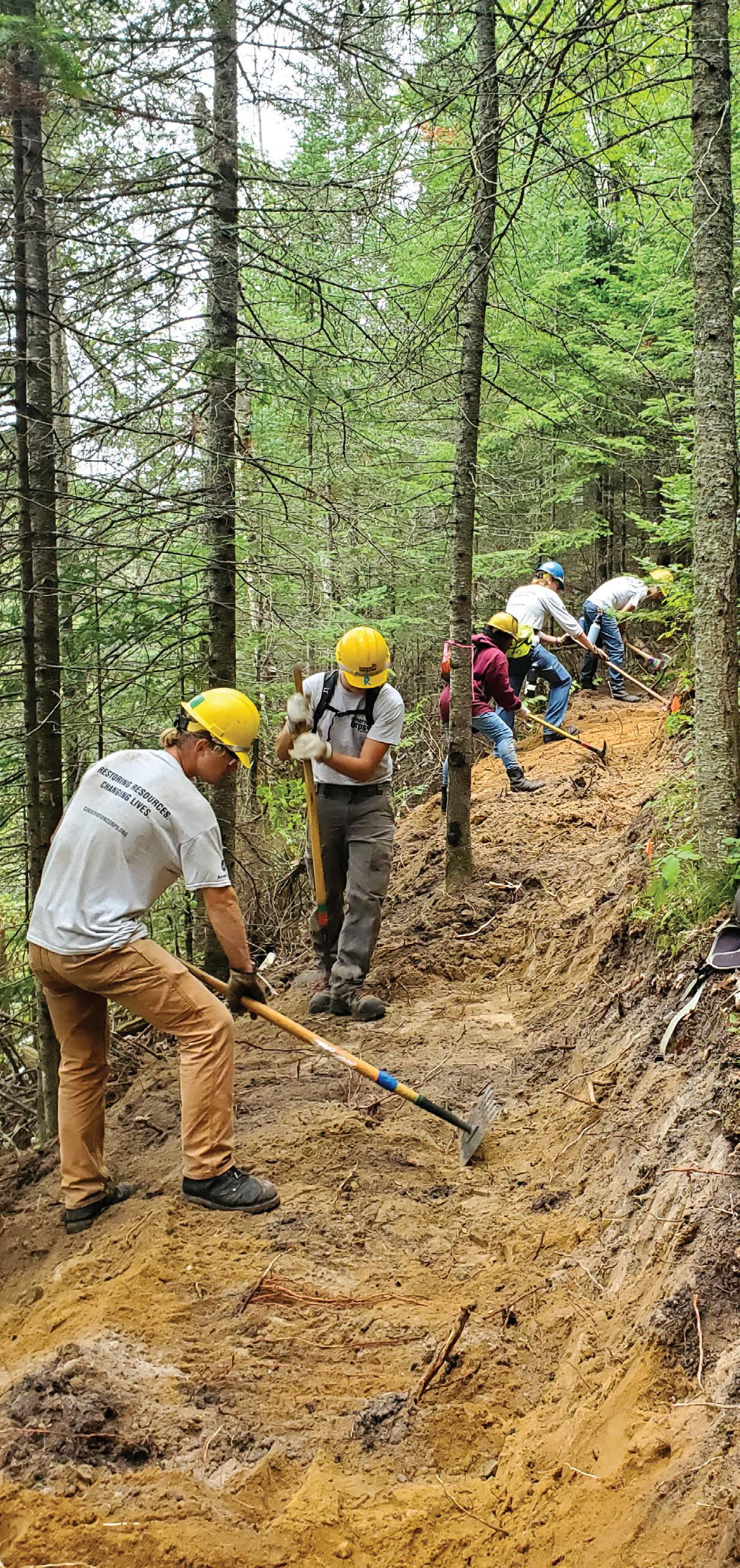
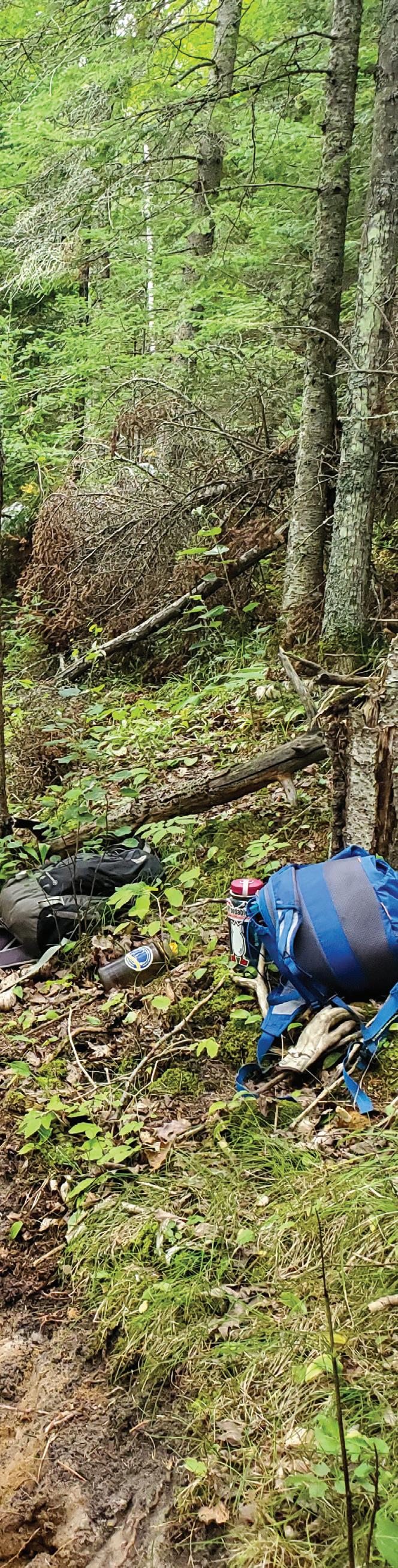
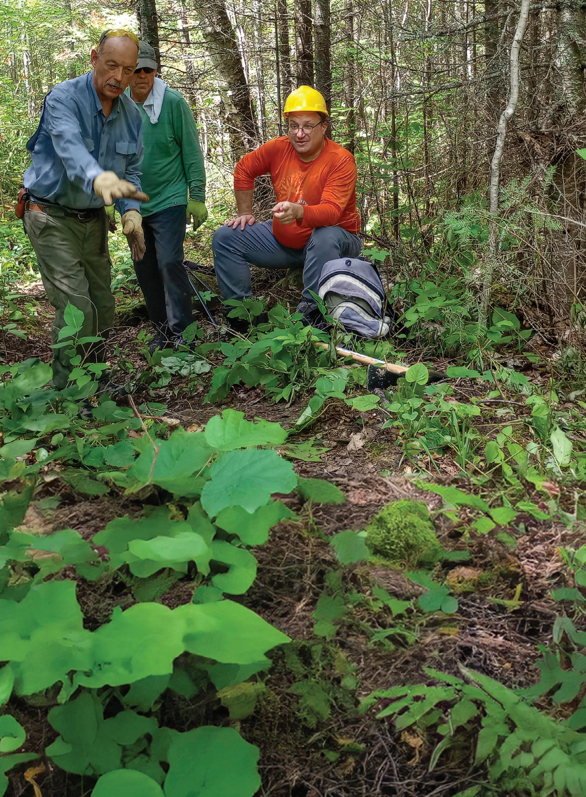
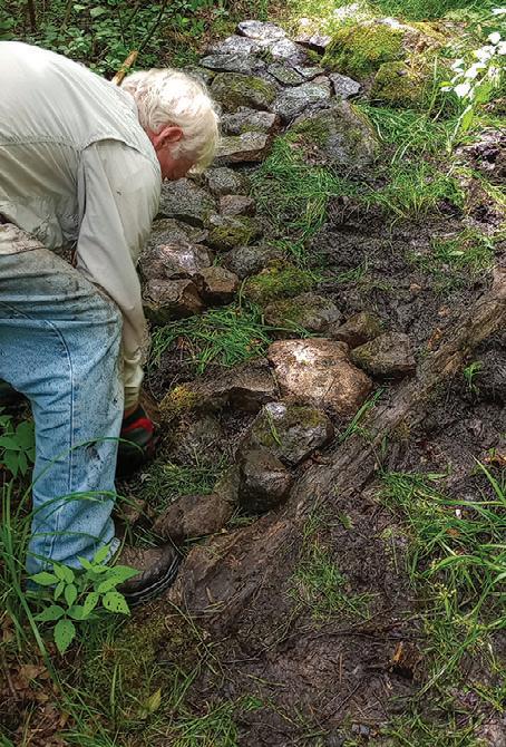
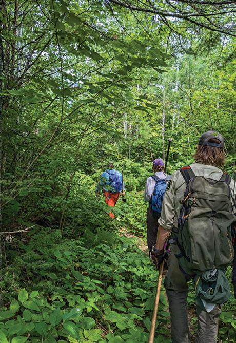
“Hikers coming through!” someone called, and we quickly shuffled off the trail where we had been working. These were the first people we’d seen on South Lake Trail since our small group arrived two days ago. Until now, it had been just us, our tools, and one lone moose galumphing away from us.
If you haven’t heard of South Lake Trail, you’re not alone. The four-mile path begins near the Gunflint Trail and heads north into the Boundary Waters Canoe Area Wilderness. It connects to the Border Route Trail and continues to — you guessed it — South Lake. It also connects to the three-mile Moss Lake Trail, and both are two of many lesser-traveled trails in the 3.9-million-acre Superior National Forest in northeastern Minnesota.
It’s no surprise that such a vast network of trails needs support, and last summer, volunteers from the Northwoods Volunteer Connection (NVC), a nonprofit based out of Tofte, Minnesota, did their
STORY BY JO SWANSON
Above: Before digging, volunteers discuss drainage problems and potential solutions | JO SWANSON PHOTO
THINK IT’S IMPORTANT TO GIVE BACK TO TRAILS WHENEVER AND WHEREVER I CAN,” – Julie Gavran, Texas, volunteer
part to improve South Lake Trail and Moss Lake Trail. With the help of United States Forest Service staff, they installed a boardwalk and stepping stones through soggy areas, cleared intense growth obstructing the path, improved trail drainage, and removed large fallen trees.
As NVC’s Executive Director, one of the best parts of my role has been the chance to explore lesser-known destinations. I see trails like Moss Lake Trail and South Lake Trail as pressure-relief valves for the Forest: on days when most trailheads are packed with cars and there’s a line just to get a
photo at famous vistas, places like these still offer solitude.
That solitude is a big part of what NVC hopes to nurture. While we want to have an impact on heavily trafficked areas, it’s critical that other footpaths receive attention — especially because shorter trails don’t always have a specific group maintaining them. But they’re no less important and offer a totally different experience.
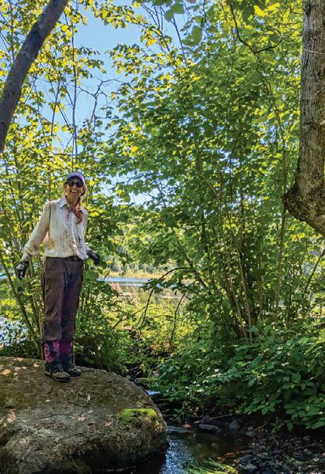
Julie Gavran was traveling from Texas when she decided to join the NVC crew. “I think it’s important to give back to trails whenever and wherever I can,” she explained. She
View of Moss Lake from Moss Lake Trail | JO SWANSON PHOTO
Brett Gerrard with the US Forest Service (foreground) teaches volunteers how to install a perfect boardwalk.
JO SWANSON PHOTO
Northwoods Volunteer Connection is returning to Moss Lake Trail and South Lake Trail in 2025, work funded in part by a grant from the Legacy Trails Grant Program. You can learn more about these and other projects at www.northwoods volunteerconnection org
calls herself a highpointer, ticking off visits to each state’s highest spot, and our project’s proximity to Minnesota’s Eagle Mountain (elevation: 2,301 feet) led her to volunteer. “Though the bugs are really bad,” she confessed. “We don’t have anything like this in Texas.”
On Moss Lake Trail, NVC volunteer Richard Lutz took off his hardhat for a minute to fan away a few lateseason mosquitoes. Originally from Pennsylvania, he recently moved to Two Harbors and wanted to get involved with trail stewardship in the Superior National Forest. “Trail maintenance draws in an interesting group of people,” he said, his helmet hair askew at wild angles as if to prove the point. As he talked through trail erosion challenges with other volunteers, he explained: “Water is the number one enemy of trails. Anything we can do to get water off the trail quickly, well, the trail’s going to be better for it.”
Few places have more water than the Superior National Forest. As we removed built-up berms that funneled water along, instead of off the trail, we were contributing to the well-being of both the trail and the rainwater that will inevitably fall on it. “Many trails were built really steeply,” Lutz pointed out. “We’ll do what we can to make these areas a little less likely to erode.”
The fight against erosion is an ongoing battle. It’ll take more than one season to improve the hiking experience on Moss Lake Trail and South Lake Trail, but every bit helps. By the time our seven
days were nearly up, both trails looked better than they had in years.
At a gorgeous windswept overlook, volunteers with sweat-stained backs cooled off in the tall grass and looked out over Moss, Duncan, and Rose Lakes on a gorgeous summer weekend. Snippets of conversations floated in the humid air: “One time I paddled … Did you hear that bird? … Is that Canada way over there? ...” Amazingly, we were less than a mile from a parking lot, but no one came by and not a whisper of civilization encroached on us.
On my way home, fragrant after long days in the woods and excited to spend some quality time in air conditioning, I drove by a popular trailhead. Six cars were jammed into a space made for five; there were likely more people on that trail than we’d seen on South Lake Trail and Moss Lake Trail combined in the last week.
Many of us find joy in returning to the same trail again and again, watching it change with the seasons and years, familiar vistas greeting us like old friends. But there’s also a kind of magic to setting foot on a quiet trail where few tread. Tending to special places of solitude like Moss Lake and South Lake Trail is an enormous task; it’s the collaboration of volunteers, nonprofit organizations, Forest Service staff, and funders working together to make it happen. It involves more than time and simple effort; it takes sweat and sore muscles and probably a few blisters and bug bites along the way. And it’s so worth it.
Jo Swanson has been the Executive Director of Northwoods Volunteer Connection since January 2024. She is a long-distance hiker and wilderness enthusiast who collects nights spent outside. She is based out of Two Harbors and loves exploring the entire Superior National Forest and all of Minnesota’s public lands.
Photos from left: Dave Klett installs a sustainable rock path to elevate the trail out of a low area, JO SWANSON
PHOTO | Carolyn Lipke discovers the perfect rock for a lunch break, JULIE GAVRAN PHOTO | South Lake Trail is a winding, green tunnel at times, JULIE
GAVRAN PHOTO
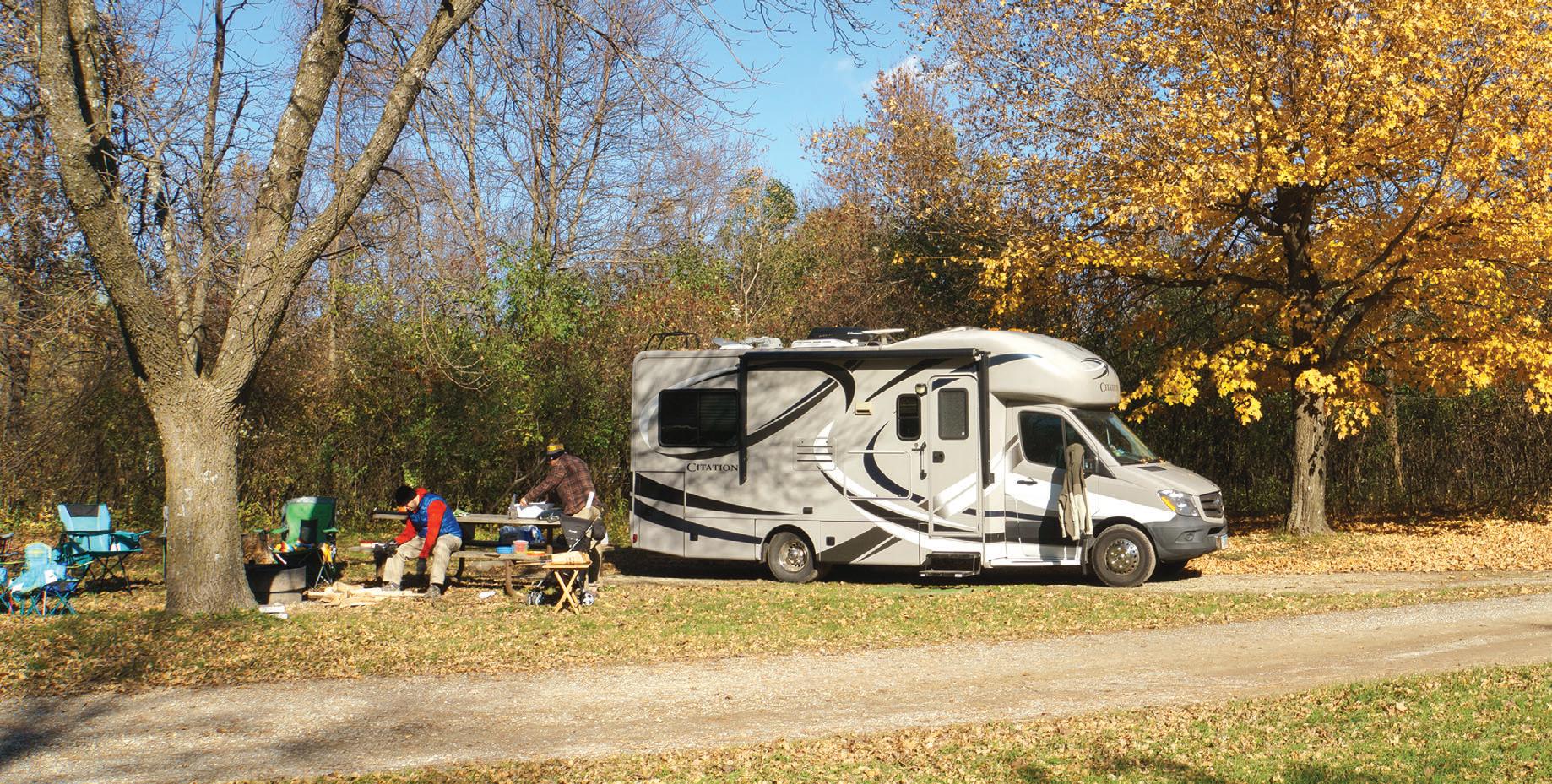
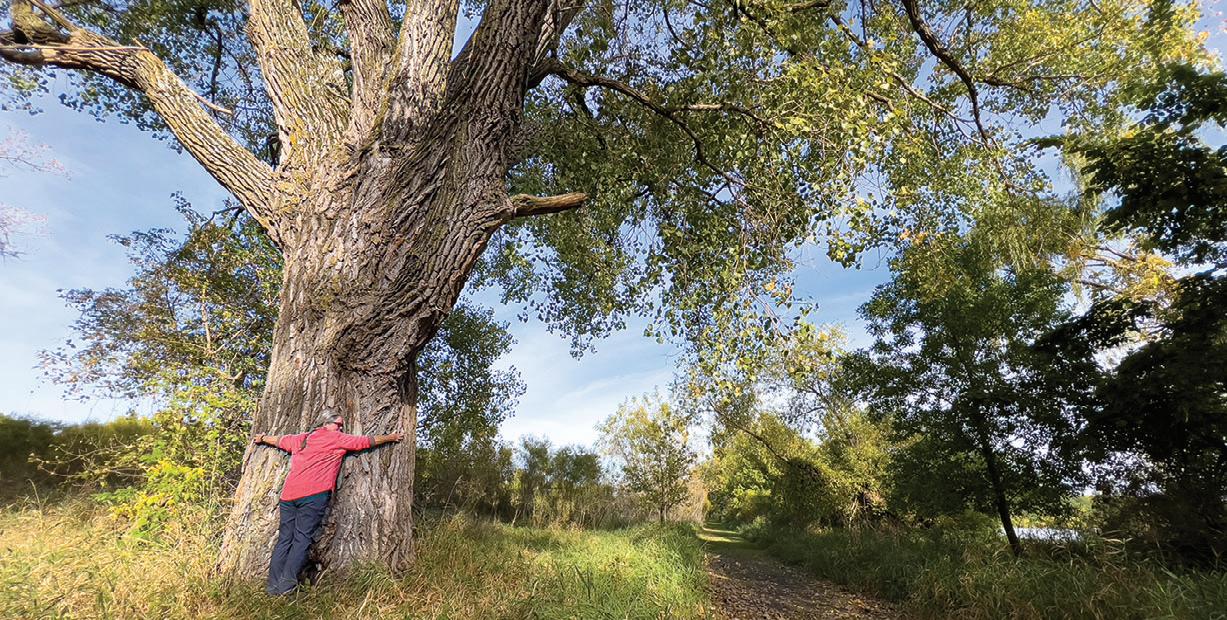
It all started as a New Year’s resolution—a simple goal to get outside, reconnect with nature, and share that experience with the people I loved. With 64 state parks and a wide variety of county and city parks, Minnesota offers a wealth of natural beauty to explore. From tranquil prairie grasses and whispering forests to roaming bison and gentle creeks, the landscape was calling. I set a goal: twelve camping trips in twelve months. It would hold me accountable and carve out space in a busy life for peace, adventure, and togetherness.
Beauty
That night, as the wind howled outside, I realized this was exactly what I had hoped for when I set my goal.
My sister, Erica, and I pulled up to Lake Carlos State Park on a January afternoon, our breath fogging in the frigid air. Located about ten miles from Alexandria, the park was a quiet wonderland of snow-covered trees and frozen meadows. We had reserved a camper cabin—the first I had ever stayed in. Despite the cold, the cozy, heated cabin welcomed us with warmth and charm.
We unpacked our sleeping bags and laid them out on the sturdy wooden bunk beds. A built-in picnic table gave us space for dinner and board games, and the attached screen porch served as a perfect spot for storing our cooler.
Snowshoeing through the silent woods, the only sounds we heard were the crunch of snow beneath our feet and the occasional call of a raven overhead. Afterward, we warmed up with mugs of hot chocolate and played games by the soft glow of a lantern. That night, as the wind howled outside, I realized this was exactly what I had hoped for when I set my goal.
STORY & PHOTOS BY AMY RAU
Mille Lacs Kathio State Park
OUR EXPERIENCES: WHERE WE STAYED:
Camper Cabin
WHEN WE VISITED:
February, March
March reminded me that revisiting a place doesn’t mean repeating an experience—it often deepens it.
In February, my dad, Dan, joined my kids Carter, Maggie, and me for a trip to Mille Lacs Kathio State Park in Onamia. We were there for a naturalist-led snowshoe geocaching program, a perfect combination of education and adventure.
We arrived early and spent some time in the visitor center, where interactive exhibits introduced us to the
area’s rich Indigenous history. e kids were especially captivated by the bird display, pretending to be owls and robins as they learned about feathers ight.
When the program began, a friendly park naturalist explained how geocaching worked. She handed out GPS units and walked us through the basics. Once we had our coordinates entered, we strapped on our snowshoes and set off along the wooded trails near Lake Ogechie.
The snow was fresh and deep, blanketing the forest in a hushed beauty. The GPS guided us to hidden caches tucked beneath logs and tucked into tree hollows. The kids squealed with excitement each time we found one. It felt like a scavenger hunt wrapped in a winter wonderland.
That evening, we returned to our camper cabin, cheeks rosy and spirits high and I felt grateful for the time together and for the gentle nudge this year-long goal had already given me.
MARCH: MILLE LACS KATHIO, ROUND TWO
Spring break brought us back to Mille Lacs Kathio, this time with Erica joining Carter, Maggie, and me for a midweek stay. Although we had just visited the park a month earlier, the landscape—and we—felt different. As the philosopher Heraclitus once said, “No man ever steps in the same river twice, for it’s not the same river and he’s not the same man.”
A late-season snowfall had coated the trees in white again, but signs of spring peeked through: trickles of meltwater, brighter skies, the occasional chirp of returning birds.
The cabin area was entirely empty, giving us a peaceful, private retreat. Our days were filled with hiking and outdoor play. We explored short trails near the cabin that wound through the forest and opened into small play areas with swings and slides. The kids found endless entertainment in sticks, rocks, and patches of mud that emerged as the snow melted.
The familiarity of the park made it easy to relax, and the absence of distractions let us focus on each other. March reminded me that revisiting a place doesn’t mean repeating an experience—it often deepens it.
APRIL: WILD RIVER STATE PARK
The first truly warm breeze of the year greeted us as we arrived at Wild River State Park in April. Nestled along the St. Croix River, the park was within easy driving distance of the Twin Cities, making it a perfect weekend destination for a short but restorative trip.
I came with my dad and Erica again, eager to enjoy the transition from winter to spring. This time, I brought my hammock, and one sunny afternoon I strung it between two trees and sank into its fabric with a book in hand. Above me, the branches swayed gently, and the scent of earth and thawing moss filled the air.
Geocaching had become something of a theme on our trips, so we took to the trails with GPS units once again. Frogs croaked from hidden pools, providing a chorus as we searched for treasures along the wooded paths.
The trails were dry in some areas, still a bit icy in others, but we navigated them easily. The river shimmered in the afternoon light, and signs of life—greening grass, sprouting buds—were everywhere. It felt like nature was waking up alongside us.
We spent the evenings in our camper cabin, sharing meals and laughing over old stories. April’s trip reminded me how grounding it is to be in nature during times of change—and how much beauty there is in small, early awakenings.
MAY: AFTON STATE PARK
May was a gift: a child-free weekend at Afton State Park with my husband, Brodie. With spring in full swing, the rolling hills of the park were lush and green, and we were more than ready for some couple time.
We stayed in a camper cabin tucked away from the main campground, giving us a quiet space to reconnect. On our first afternoon, we hiked along the St. Croix River, the water glinting in the sunlight as birds darted between branches overhead. The hills challenged us, but the views from the bluffs made every step worth it.
After the hike, we cleaned up and drove into downtown Afton for a well-earned dinner. Savoring a delicious meal, we remembered what it felt like to just be together—not as parents or workers, but as partners.
The next morning, we explored more of the park’s 20 miles of trails, vowing to return again soon. May’s adventure was about balance: the joy of being outdoors, the peace of being away from responsibilities, and the quiet happiness of rediscovering each other.
Photo Credit: Explore MN
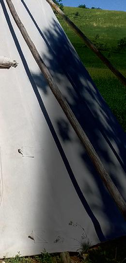
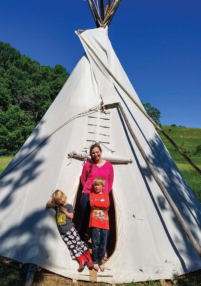
Editor’s note: Upper Sioux Agency State Park was permanently closed on February 16, 2024, but tipi camping is still available at Blue Mounds State Park.
June’s trip took us to a new kind of shelter: a tipi at Upper Sioux Agency State Park. Erica, Carter, Maggie, and I were curious and excited. The tipi, built on a wooden platform with canvas sides, offered a camping experience that felt rustic and fun— without the hassle of setting up a tent.
CAMPGROUND:
WHEN WE VISITED: OUR EXPERIENCES: WHERE WE STAYED:
We arrived on a warm afternoon and quickly got settled, and the kids loved the novelty of the tipi. That evening, we hiked to the historic monument that gave the park its name. The trail wound through rolling hills, with prairie grasses swaying beside us and patches of woodland offering shady breaks. We spotted a bull snake sunning itself near the trail, which delighted the kids. Interpretive signs along the path taught us about the area’s history, and I found myself reflecting on the land’s layered past as we returned to our camp.
of the tipi. That evenin
Upper Sioux Agency State Park Tipi!
June was filled with new sights and a deepening appreciation for where we live.
On the way home, we stopped at Ramsey/Cansayapi Park in Redwood Falls to see the waterfalls. The mist rising from the falls cooled us as we stood at the overlook, and I felt again how rich and varied Minnesota’s landscapes are. June was filled with new sights and a deepening appreciation for where we live.
WHITEWATER STATE PARK
July’s adventure took our family to Whitewater State Park in the scenic Driftless Region of southeastern Minnesota. Nestled in the bluffs about 30 minutes from Rochester, the park is a fly-fishing paradise— something my husband Brodie was especially excited about. We pitched our tent under a canopy of trees near the Whitewater River, where the bubbling current made the perfect soundtrack to our stay.
The kids waded in the shallow water while Brodie cast his line upstream. I lounged on the bank and watched minnows dart between rocks, the sunlight dancing on the surface. Later that afternoon, we joined dozens of others for a festive celebration— Whitewater’s 100th anniversary. The Okee Dokee Brothers took the stage and filled the campground with joyful music, and families danced barefoot in the grass.
That evening, we hiked to Chimney Rock, a sandstone spire that offered breathtaking views of the valley below. As dusk settled in, we made our way to the visitor center where a bald eagle from the National Eagle Center was being featured in a live presentation. Seeing such a majestic bird up close left us in awe.
The next morning, I set out alone for a sunrise run on the Dakota and Coyote Point trails. The mist was still rising from the valleys, and deer moved silently through the trees. July’s trip gave us everything: celebration, solitude, and the perfect balance between movement and rest.
Though I’d lived in Minnesota for years, I had never visited St. Croix State Park—the largest in the state. Brodie and I decided it was finally time to change that. Located about an hour outside the Twin Cities, the park’s vastness was both exciting and a bit intimidating.
Our goal was to find a quiet creek where Brodie could flyfish. A helpful ranger gave us a map and pointed us toward
a promising spot. We set off eagerly, but the mosquitoes had other plans. Swatting constantly and walking at double pace, we made it to the creek— but the relentless biting forced a quick retreat.
Back at the campground, we were relieved to find fewer mosquitoes. We set up our tent in a shaded area and settled in for the night. With the bugs behind us, we roasted marshmallows and told stories under the stars. The kids stayed up late, their sticky faces glowing with firelight.
CAMPGROUND:
St. Croix State Park
Campground – Tent
August August reminded us that not every adventure goes as planned—but with a little patience, it still ends up being a story worth telling.
The next day was blissfully uneventful. We took a slow bike ride to the park’s swimming beach, passing meadows and woodlands on the way. The kids splashed in the water while Brodie and I dozed
in the sun. August reminded us that not every adventure goes as planned—but with a little patience, it still ends up being a story worth telling.
September’s trip was a local one—a quick 15-minute drive brought us to Elm Creek Park Reserve in the northwest suburbs of Minneapolis. Part of the Three Rivers Park District, the group camp at Elm Creek was a hidden gem along the creek’s banks. The kids wasted no time diving into the outdoors and built forts from fallen branches, ran through open grassy fields, and explored the shallow creek, splashing as they explored.
Despite being so close to the city, the towering trees and chirping birds made us feel far away. The forest canopy provided shade and seclusion, and at night, the stars twinkled above just as brightly as they did in more remote parks. It was one of the most relaxed trips of the year—low on planning but rich in experience. Elm Creek proved that adventure doesn’t require distance, just intention. Sometimes, the best camping moments happen right in your backyard.
they I trips but
OCTOBER: SAVANNAH PORTAGE STATE PARK
October’s crisp air carried us north to Savannah Portage State Park, where my friend Josie and I booked a camper cabin for a peaceful fall retreat. The leaves had turned vibrant hues of red, gold, and orange, carpeting the ground and making every trail feel magical.
We spent hours hiking around Lake Shumway, the trees mirrored perfectly in the still water. Each step on the trail was accompanied by the satisfying crunch of dry leaves underfoot. The air was cool but not cold, just right for long walks and hot drinks.
Back at the cabin, we lit a small campfire and wrapped ourselves in blankets. With no kids on this trip, we had uninterrupted conversations and plenty of quiet moments to soak in the season. The park was nearly empty—just a few other campers tucked away in distant cabins—which made the experience even more serene.
It was the kind of weekend that lingered in memory, full of simple comforts and uninterrupted nature. October showed me the unique joy of fall camping—the quiet, the colors, and the chance to slow down as the year winds toward its close.
FLANDRAU STATE PARK
By November, winter was creeping in. I invited Jenni—my longtime friend and adventure partner—on a trip to Flandrau State Park. Her family had never stayed in a camper cabin, so it was a new kind of adventure for them.
Though we couldn’t enjoy the park’s summer swimming pond, the kids didn’t mind. They spent hours busting themselves with sticks, stomping through leaf piles, and smearing mud on their jackets with gleeful abandon.
The cabin was a perfect retreat from the chill and it felt like a slower rhythm had taken hold, one where there was no rush, no urgency—just time spent outdoors and time spent together.
The next morning, we set out for one last hike on the Ridges Trail. The air was brisk, and a few snowflakes drifted down as we walked. From the top of the trail, we could see the quiet woods stretch out in all directions.
Flandrau gave us a gentle prelude to winter and reminded us that even the less flashy parks have their own quiet magic. It was a fitting way to begin wrapping up the year.
CAMPGROUND: CAMPGROUND INFORMATION
Minneopa State Park
WHERE WE STAYED:
Camper Cabin
WHEN WE VISITED:
December
OUR EXPERIENCES:
December’s trip wrapped up our year of adventure on a note of joy, gratitude, and cozy satisfaction. We had done it—twelve months, twelve trips, countless memories.
We ended our yearlong adventure in December with a trip to Mankato, combining a family-friendly urban outing with one last stay in a camper cabin at Minneopa State Park. First, we visited the Children’s Museum of Southern Minnesota. Carter and Maggie spent hours exploring the multi-level play structure, weaving in and out of nooks, racing down slides, and losing themselves in imaginative play.
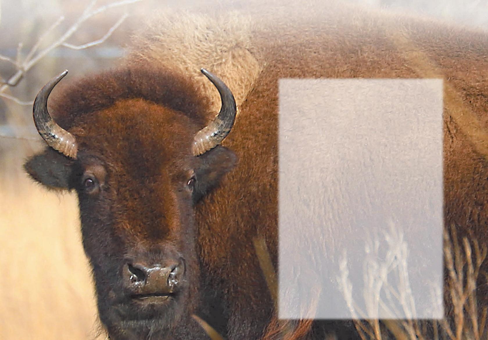
Later, we took a short drive to the park and set off on the bison drive. As snow flurries danced around us, we watched in awe as a herd of bison ambled across the snowy prairie—so close to the road we could see the frost on their fur. It felt like a scene from another century.
At the campground, we had the place to ourselves. The kids built snow forts, throwing powdery snow into the air as they laughed and tumbled. After dinner, we bundled up and headed to the Kiwanis Holiday Lights display at Mankato’s Sibley Park, a dazzling array of lights that filled the night with color and wonder.
Back in the cabin, warm and tired, the kids hunted for hidden pennies left by previous campers. We added our own to the tradition before crawling into our sleeping bags.
December’s trip wrapped up our year of adventure on a note of joy, gratitude, and cozy satisfaction. We had done it— twelve months, twelve trips, countless memories.
goal turned into a transformation. Each month brought us closer—to the land, to each other, and to ourselves. We discovered new parks, slept in tipis and cabins, braved snow and mosquitoes, and found joy in hammocks and muddy boots.
This wasn’t just about camping—it was about making space for what matters. And as the new year approached, I knew this wouldn’t be the end. It was just the beginning of a lifelong journey into the wild beauty of Minnesota.
Over the years, land project work by the Parks and Trails Council of Minnesota has added 897 acres to Afton State Park, 282 acres to Whitewater State Park, and 78 acres to Mille Lacs Kathio State Park.
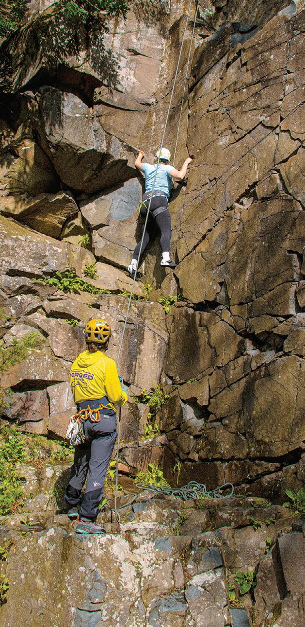
O F A CLIMBER PLOTTING THEIR NEXT MOVE IS PALPABLE. ROCK CLIMBING AND BOULDERING ARE EXPERIENCING A SURGE IN POPULARITY, AND MINNESOTA, WITH ITS SURPRISING ABUNDANCE OF NATURAL AND INDOOR CLIMBING SPOTS, IS BECOMING A HAVEN FOR ENTHUSIASTS O F ALL
Tourist Rock at Interstate State Park is an easy to get to location.
I STARTED CLIMBING AND FELL IN LOVE WITH IT INSTANTLY. SINCE THEN, I HAVE MET SO MANY REMARKABLE PEOPLE, GONE ON AMAZING ADVENTURES, AND EVEN TURNED IT INTO A CAREER AND BUSINESS. I'VE CLIMBED AND WORKED IN MANY PLACES AROUND THE COUNTRY AND HOPE TO CONTINUE CLIMBING THROUGHOUT THE WORLD IN THE FUTURE.
IF CONQUERING YOUR FEARS IS SOMETHING THAT INTERESTS YOU, READ ON.
THE BASICS
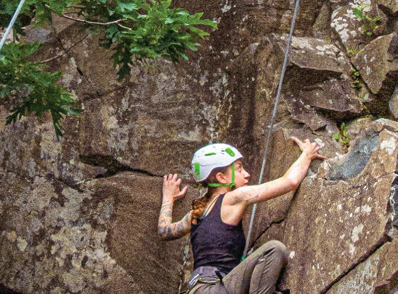
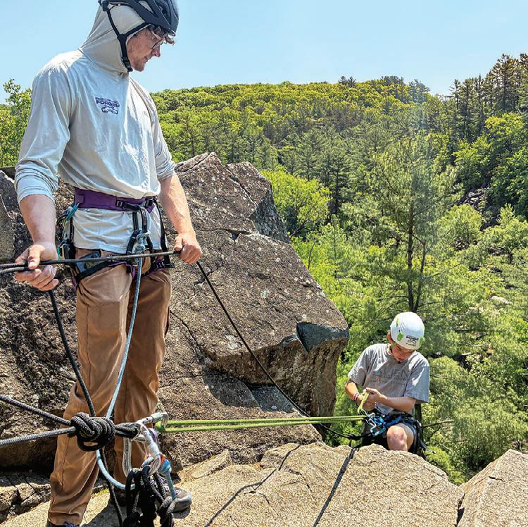
Rock climbing is a challenging sport that tests both physical and mental strength. Climbers ascend natural rock formations or artificial climbing walls, using their hands and feet to reach the top of a designated route. Ropes and specialized safety equipment are often used to manage falls and ensure safety.
Climbing encompasses various styles. Most beginners start with top-roping, where the rope is fixed at the top of the wall, with two strands running down. The belayer, the person who manages the rope from the ground, and the climber each tie into opposite ends. The belayer uses a device to manage the rope, ensuring that if the climber falls, the rope catches them. When done correctly, top-roping is the safest form of climbing.
Bouldering, the most accessible form of climbing, requires no ropes or complex setup. It uses crash pads—small, portable mattresses—to cushion falls from relatively short boulders, typically between 8 and 12 feet high. All you need to get started are a crash pad, climbing shoes, chalk to improve your grip, and some friends.
Lead
climbing, on the other hand, involves starting with the rope on the ground and clipping into protection points along the wall as you go up, bringing the rope with you. Sport climbing, the most common type of lead climbing, uses pre-placed bolts in the rock for protection.
Traditional climbing—“trad,” as climbers call it—uses devices called cams or nuts, placed in cracks or holes in the rock. These pieces of gear are wedged or expanded
DISCOVERINGTHE THRILLSOFCLIMBING INMINNESOTA
STORY & PHOTOS BY MASON HENKE, OWNER OF FORGED GUIDES IN CENTURIA, WI
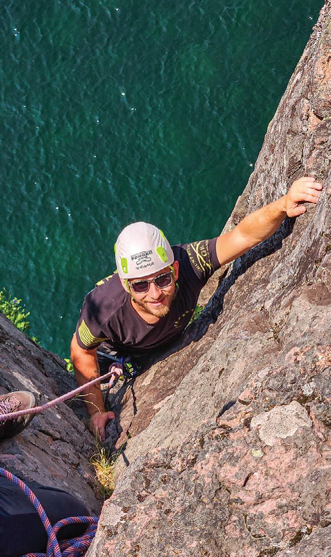
Climbing a corner at Tettegouche's Shovel Point.
WHERE TO GO IN MINNESOTA
within the rock to hold a fall and are removable afterward, leaving no permanent trace. This is one of the most advanced types of climbing and requires extensive practical knowledge.
WHY SHOULD I TRY IT?
Rock climbing is a fun sport that combines mental, physical, and even emotional challenges, and it’s inclusive of all ages and abilities. I’ve taken people as young as two and as old as 87 climbing for their first time. In other words, your age is no excuse.
Climbing offers a wealth of physical and mental benefits. It provides a full-body workout, engaging numerous muscle groups to build strength, endurance, and flexibility, while also improving balance, coordination, and overall fitness. It can also reduce stress through its meditative focus and enhance problem-solving skills by challenging climbers to strategize and adapt. It also fosters a strong mindbody connection, promoting mindfulness, and the boost of confidence you get by overcoming challenges is invaluable.
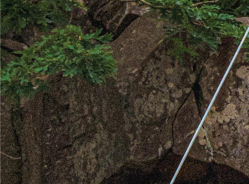
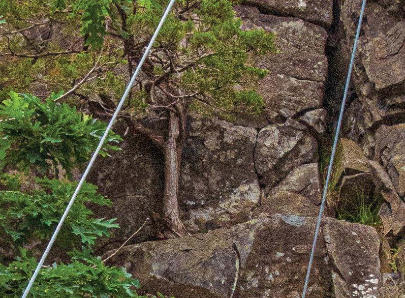
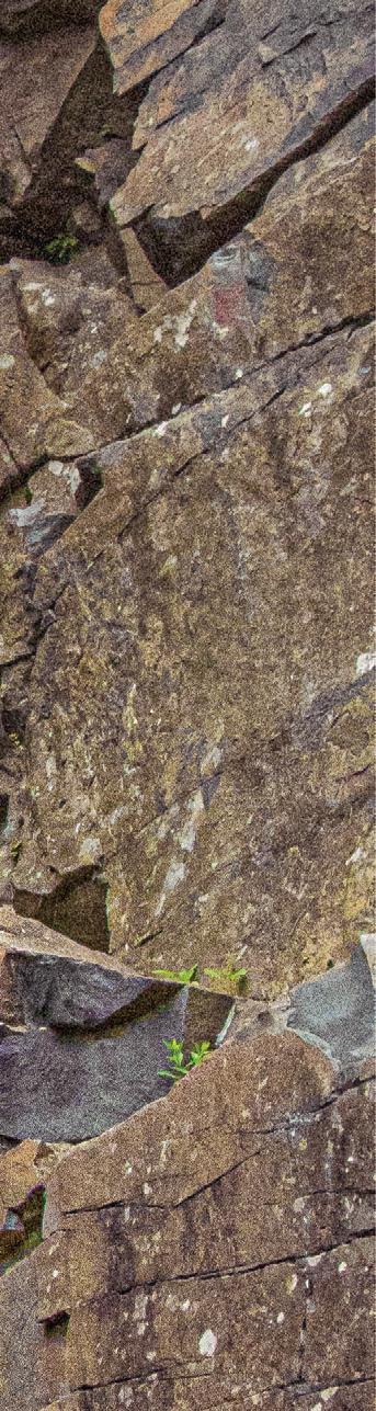
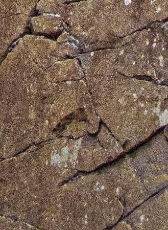
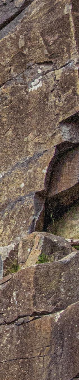
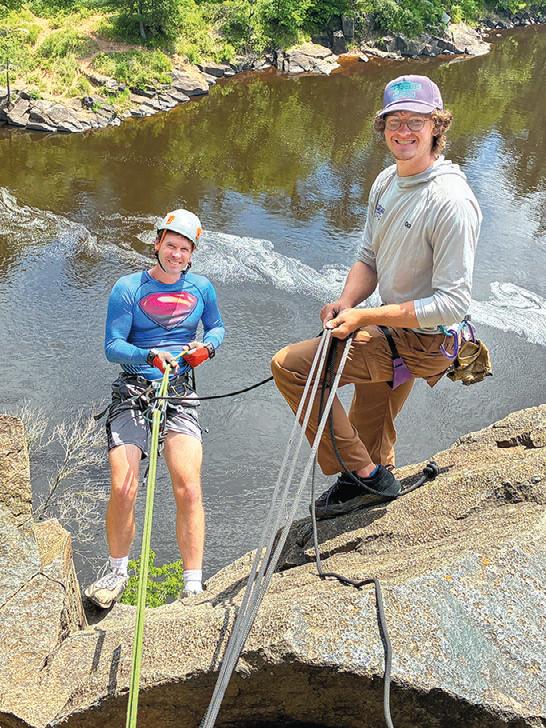
INTERSTATE STATE PARK offers opportunities for traditional climbing, top-roping, and bouldering on a volcanic rock called basalt. Basalt’s strength, varied texture, columnar jointing, and weathering patterns offer reliable holds.
TETTEGOUCHE STATE PARK’S PALISADE HEAD AND ADJACENT SHOVEL POINT are the sport’s crown jewels of Minnesota, with more than 100 climbs and potential for more. Dramatically positioned over Lake Superior, both areas carry an air of seriousness, with some of the best views in the Midwest.
Diagonally across the state, BLUE MOUNDS STATE PARK just outside of Luverne has climbing routes that scale up impressive 100-foot quartzite cliffs jutting from the otherwise flat prairie.
WHAT IF I’M AFRAID OF HEIGHTS?
Fear of heights is a very common concern among beginner climbers, but it can be overcome. Starting small, getting familiar with shorter heights, and becoming comfortable with trusting yourself are good ways to test the waters. Something that has helped me is learning how the climbing gear and safety systems work and realizing how strong they are. Indoor climbing is another great tool, because when you are inside, things feel more in control.
Rappeling—getting back down from the top—is an essential climbing skill.
Above the river at Interstate State Park.
Climbing up with a patient belayer at Interstate State Park.
DO I HAVE TO BE SUPER FIT?
Climbing is for all fitness levels, and one of the common misconceptions is that you need to be super strong to climb. It turns out it’s mostly about technique and using your legs.
GETTING STARTED
If you’re new to rock climbing, consider taking guided trips or classes offered by professionals, like Forged Guides. Climbing is a sport that requires a solid foundation to build on, and experienced guides provide valuable tips, techniques, and support to help you improve your skills and confidence.
Climbing gyms are also a great way to start, as they offer unparalleled access to a wide variety of climbs, all set up and ready for you to try. Climbing gyms are also a great way to meet other climbers.
The climbing community is what makes the sport so amazing. The people you’ll meet are some of the most determined, strong, and adventurous individuals, and sharing climbing experiences leads to amazing bonds and friendships.
ROBINSON PARK AND BANNING STATE PARK offer beginner-friendly areas, with a large number of beginner-level sport climbs and ice climbing, conveniently located only an hour north of the Twin Cities in Sandstone.
HE MNI CAN/BARN BLUFF in Red Wing is southern Minnesota’s go-to sport climbing area with its 350-foot dolomite crags overlooking the Mississippi River Valley.
In Winona, the Sugarloaf’s dolomite walls are a great way for beginning to intermediate climbers to hone their skills. In the winter, the WINONA ICE PARK AT SUGARLOAF PARK is a premier destination for ice climbers, with cascades of frozen water dropping hundreds of feet from the top.
Over the years, land project work by the Parks and Trails Council of Minnesota has added 300 acres to Tettegouche State Park, and 40 acres to Banning State Park, including a bouldering area.
WHETHER YOU’RE SEEKING A THRILLING PHYSICAL CHALLENGE, A WAY TO CONQUER YOUR FEARS, OR SIMPLY A NEW AND ENGAGING ACTIVITY, ROCK CLIMBING AND BOULDERING OFFER SOMETHING FOR EVERYONE. TAKE A DEEP BREATH, CHALK UP YOUR HANDS, AND DISCOVER THE VERTICAL WORLD WAITING FOR YOU IN MINNESOTA. YOU MIGHT JUST SURPRISE YOURSELF.
SOUTHERN
It was time to put the pieces of this puzzle together, and my wife, Jen, and I decided to go for a closer look.
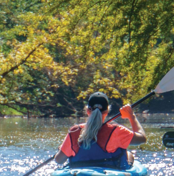
On a sunny afternoon in September, we drove to Austin’s Lafayette Park. Tim Ruzek, Water Plan and Outreach Coordinator of the Cedar River Watershed District in Mower County, was waiting for us with canoes and gear, and the three of us hit the water. Twenty five miles of the Cedar River’s 338 miles are designated as a Minnesota state water trail, between Lansing and the Minnesota/Iowa border, but we weren’t that ambitious that day. Our trip was an easy three and a half mile paddle downriver at a leisurely pace, and it was a calm, sunny day to boot. The Cedar is subject to regular flooding and has carved a sizable riverbed into the southern Minnesota landscape. The day we paddled, water levels were low, and we traveled through a kind of shallow valley lined with cottonwoods, maple, and the occasional limestone outcropping. We were hidden from the city, but we could clearly hear it. Eventually, Turtle Creek joined the Cedar from the northwest, then we floated past the former McAfee
I WAS THERE WHEN THEY CUT THE RIBB O N TO WELCO ME THE SH OOTING STAR STATE TRAIL INTO AUSTIN, MN. SINCE 1993, THE GRASSR OOTS PRAIRIE VISI O NS GR O UP HAD BEEN W O RKING HARD O N THEIR DREAM O F A BIKE TRAIL IN S O UTHERN MINNES OTA, BETWEEN LAKE LO UISE STATE PARK AND AUSTIN, AND O N A BLUSTERY O CTO BER M O RNING IN 2019 THAT M O MENT HAD CO ME.
S TO RY & PH OTOS B Y J AN LASA R
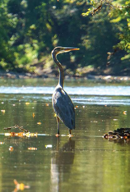
Dam. It was removed in 1936; its only remnant was a yellow brick building on the east bank. With the city behind us, the sounds turned more natural, and we spotted a great blue heron when we came around a bend. Our journey ended when we reached Riverwood Landing near Austin’s Sola Fide Planetarium.
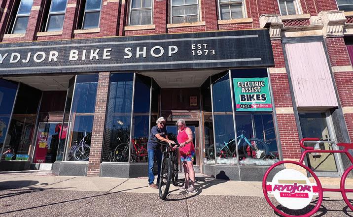
In 1973, two twenty somethings, friends Pat Geraghty and Dan Ulwelling, opened a bike shop in Austin. Rydjor Bikes has moved a few times in its history, but it’s been in its current location in downtown Austin for the last forty years. Dan passed away in 2006, but his legacy lives on in the form of a bike collection that adorns the walls and ceiling of the former Kresge department store building. Pat was at the shop and had two mountain bikes ready to go for us on a pleasant Saturday morning. Schindler’s Way is a flat and fast five mile single track system that flows through forest and prairie and sweeps along the Cedar River near the Hormel Foods campus and Todd Park. It was on our Austin to do list that morning. Just a short trip on Austin’s city bike trail system took us there, and we warmed up
AT ABOUT THE SAME TIME, THE CITY DEDICATED A MOUNTAIN BIKE TRAIL SYSTEM, AND KIDS STARTED JOINING THE HIGH SCHOOL MOUNTAIN BIKE TEAM IN DROVES. AUSTIN WAS NOW SOLIDLY IN TRAIL TOWN TERRITORY, BUT THIS TRANSFORMATION ACTUALLY STARTED BEFORE THAT. IN 1911, THE MINNESOTA DEPARTMENT OF NATURAL RESOURCES MADE A STRETCH OF THE CEDAR RIVER THROUGH AUSTIN AN OFFICIAL STATE WATER TRAIL, AND THE JAY C. HORMEL NATURE CENTER HAS WELCOMED VISITORS TO ITS TEN MILE TRAIL SYSTEM SINCE 1975.
on the Prairie Trail, then moved on to the North Loop and Cedar Side trails. Builders really eked out all they could from this small sliver of river bottom land and constructed winding trails through open fields and thick forest, as well as single track along the river. Throw in a couple of log jumps, a rock garden, and a drop, and it was a fun couple of hours well spent. We managed to ride about eight miles and then returned to downtown.
On Sunday morning, we started our journey on the Shooting Star Trail at the Jay C. Hormel Nature Center. Leaving Austin, the trail travels through farm fields and pockets of remnant prairie. It visits the towns of Rose Creek, Adams, and Taopi, then
snakes through Lake Louise State Park and on to LeRoy, where it ends after 28 miles. Our itinerary for the day was a ride to Rose Creek and back, followed by a walk at the nature center. We left Austin behind and rode through the open country on a wonderfully sunny day. The flat trail made the going easy, and the light headwind didn’t bother us because we knew the reward was coming on the return trip. Combines were bringing in the last of the summer harvest, sending dusty plumes into the air. Fall was knocking, but we didn’t think about that at all. Our legs were good, the pedals turned effortlessly, and we chatted away as we usually do on our bike rides. Eighteen miles later, we were back, but not quite done yet.
The Jay C. Hormel Nature Center’s five hundred acres of wetlands, forest, and prairie are home to ten miles of walking trails, some of which become ski trails in the winter. The nature center itself houses an interpretive exhibit and puts on programs for school groups. It felt good to shake out the legs after the ride, and we enjoyed strolling the grounds and taking in the natural sights and sounds of this green oasis.
We hung around for a while and talked about our trip. Over the last three days we had been on a water trail, a mountain bike trail, a paved bike trail, and a walking trail. We had eaten well, seen sights, and met fun people, and we both agreed we needed to visit this city of trails again.
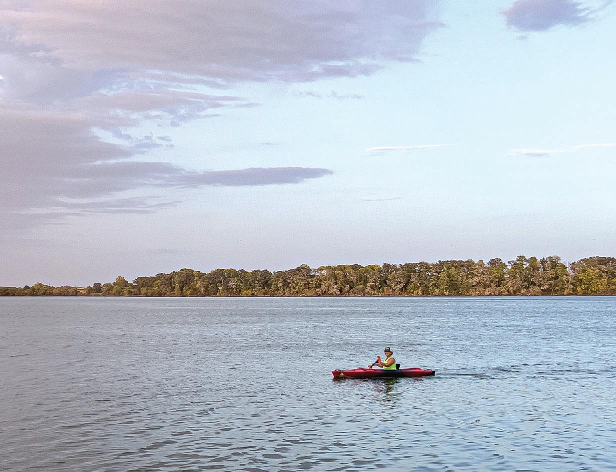
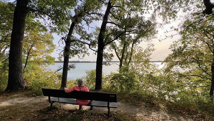
Myre-Big Island
STATE PARK
Looking for a place that packs hiking, bird watching, paddling, and even island camping into one trip? Head to Myre-Big Island State Park, just three miles southeast of Albert Lea in southern Minnesota’s Freeborn County. With scenic trails, unique geology, and a peaceful lake, this park is full of ways to relax, explore, and connect with nature.
STORY & PHOTOS BY JAN LASAR
TRAILS
With 16 miles of trails weaving through prairie, wetlands, and woods, there’s a hike (or ride) here for everyone.
One highlight is the Esker Trail on the park’s north end. It traces a striking ridge formed by a stream that once ran under a melting glacier. The gravel ridge—called an esker—still snakes across the landscape, a quiet reminder of Minnesota’s icy past. Those same glaciers also left behind kettle lakes and marshes, including what’s now Albert Lea Lake.
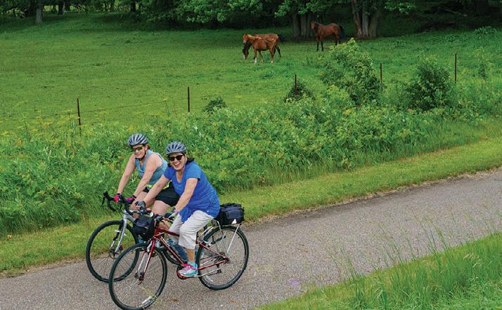
Another favorite is the Great Marsh Trail, a magnet for bird watchers who come to spot ducks, geese, and other water-loving wildlife. Many hiking paths are shared with mountain bikers, and cyclists can also hop on the Blazing Star State Trail, a smooth six-mile ride into downtown Albert Lea.
With 16 miles of trails weaving through prairie, wetlands, and woods, there’s a hike (or ride) here for everyone.
CAMPING
Whether you prefer your campsite full-service or far-flung, Myre-Big Island has you covered. The main campground—about 60 sites strong—is nestled on Big Island, surrounded by oaks and water views. Connected to it by trail is Little Island, home to a quiet, walk-in group camp.
Over on the mainland, New York Point juts out like an arrowhead into the lake and features a full-service group center with a dining hall, kitchen, and crafts building—perfect for reunions or youth trips.
The White Fox Campground, also on the mainland, offers about 30 more open, sunny campsites for those who like a little more space.
If you’re craving solitude, grab your pack and head to one of the park’s four backcountry campsites, tucked along a peninsula trail.
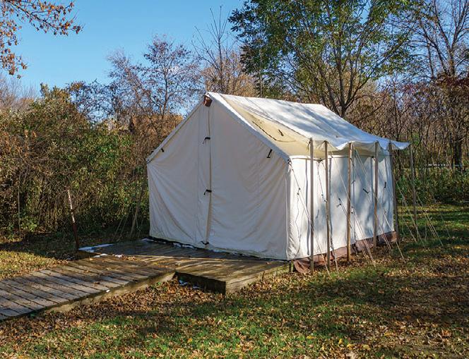
And if “roughing it” isn’t your style? Book one of the cozy, seasonal camper cabins, which sleep five and let you enjoy the outdoors with a roof over your head. You can also try glamping in a canvas-walled tent.
Blazing Star State Trail
White Fox Campground
Canvas wall tent along the Pelican Trail
FISHING AND BOATING
If you love casting a line, bring your gear. Albert Lea Lake is popular in summer with anglers reeling in panfish, carp, and bullheads. But fishing isn’t the only way to enjoy the water. The lake is part of the Shell Rock River State Water Trail, a scenic 20-mile paddling route that begins at Fountain Lake, flows through Albert Lea Lake, and follows the Shell Rock River all the way to the Iowa border. It’s a great way to explore the region from a new perspective.
PLANTS AND WILDLIFE
Myre-Big Island is a gem for wildlife lovers—especially birders. Thanks to its mix of marsh, meadow, and forest, the park is alive with birdsong and wingbeats. Keep an eye out for white pelicans, Canada geese, and a variety of ducks and shorebirds in the summer. Overhead, you might spot hawks soaring over the fields in search of rodents. Wildflowers also thrive here—more than 450 species bloom throughout the seasons, from spring ephemerals to late-summer prairie blossoms.
WINTER
When the snow falls, the park quiets down—but it doesn’t shut down. Strap on your snowshoes and explore the trails at your own pace. While there aren’t groomed routes for skiing, the open terrain and frozen marshes offer a peaceful winter retreat.
Pictured above: 2,600-acre Albert Lea Lake surrounds Myre-Big Island State Park on three sides
Scenic overlook on Big Island
Bur Oak Trail
TRAIL PARTNERS
Need a place to eat, stay, play and upgrade your gear? Our Trail Partners are here to help!
BIKE SHOPS
FITZHARRIS BIKE & SPORT
320-251-2844 105 7th Avenue S, St. Cloud www.fitzharrismn.com
JAKE’S BIKES
320-219-7433 419 N. Nokomis Street, Alexandria www.jakesbikes.com
REVOLUTION CYCLE AND SKI
320-251-2453 160 29th Avenue S, St. Cloud www.revolutioncycleandski.com
TOURIGHT BICYCLE SHOP
320-639-2453 124 2nd Street NE, Little Falls www.tourightbicycleshop.com
BIKE KING 651-457-7766 6489 Cahill Avenue, Inver Grove Heights www.bike-king.com
CARS BIKE SHOP 763-784-6966 2661 Co Road I & Old Hwy. 10, Mounds View www.carsbikeshop.com
651-565-9932 1110 Hiawatha Drive E, Wabasha www.bigriverresort.com
BATTLE LAKE INN
218-862-2500 102 Glenhaven Drive, Battle Lake www.battlelakeinn.com
RED RIDER RESORT
23457 Co. Rd. 31, Crosby www.redriderresort.com
THE SANCTUARY
218-838-6858
218-622-0321 222 2nd Street NW, Crosby www.thesanctuarycrosby.com
EARLY FROST FARMS STUDIO
218-208-9613 7273 Palo Tia Road, Embarrass, MN 55723 www.earlyfrostfarms.com
SPECIALTY STORES
COMMON GOODS 218-772-2999
27 W Main Street, Crosby www.commongoodsmn.org
LITTLE ROCKS DESIGN STICKERS Melrose 320-333-2520 www.littlerocksdesign.com
VICTUAL 218-545-1000 124 West Main Street, Crosby www.shopvictual.com
EAT & DRINK
THE DEERSTAND RESTAURANT AND BAR 24188 Mohs Street, Deerwood 218-534-9253 www.deerstandrestaurant.com
THE MILL 730 Church Avenue, Albany 320-845-6455 www.themillalbanymn.com
SERVICES
CUYUNA REGIONAL MEDICAL CENTER 320 E Main Street, Crosby 218-546-7000 www.cuyunamed.org
DEERWOOD BANK 218-534-3111 21236 Archibald Road, Deerwood www.deerwoodbank.com
MID MINNESOTA FEDERAL CREDIT UNION 117 W Main Street, Crosby 218-546-5428 www.mmfcu.org
OARS-N-MINE 218-546-6912 22640 MN-6, Crosby www.oarsnmine.com See more details at:
INFORMATION
HUTCHINSON CHAMBER 320-587-5252 2 Main Street, Hutchinson www.explorehutchinson.com
VISIT BRAINERD 800-450-7247 214 S 7th Street, Brainerd www.visitbrainerd.com
IRON RANGE TOURISM 218-749-8161 111 Station 44 Rd, Eveleth, MN 55734 www.ironrange.org
LOVIN’ LAKE COUNTY 218-595-2800 1330 MN-61, Two Harbors www.lovinlakecounty.com
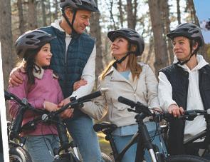
IT’S TRAIL SEASON
Looking to hit the trails, but don’t know where to start? Visit your authorized Trek retailer today to learn about the different ways to ride off-road. We’re here to help you choose the right mountain bike for however and wherever you want to ride.
Adventure Cycle & Ski advcycle.com | Winona, MN
All Seasons Sports allseasonssports.net | Delano, MN