Minnesota Trails magazine is a continuation of Minnesota Bike Trails & Rides, published quarterly in cooperation with the Parks & Trails Council of Minnesota, a nonprofit organization that acquires, protects and enhances critical lands for public enjoyment. Your $35 membership subscription supports this work.
Minnesota Trails is not responsible for the return of unsolicited materials and reserves the right to reject unsuitable advertising. Information in this publication is as accurate as possible. Opinions expressed are those of the authors and not of Minnesota Trails.
Continuing the
DEERSTAND RESTAURANT & BAR
24188 Mohs St, Deerwood (218) 534-9253
ww w.deerstandrestaurant.com
Full Menu, Salad Bar, Cocktails, Meat Raffles and Fun!
LODGING
COMMON GOODS
27 W Main St, Crosby (218) 772-2999
ww w.commongoodsmn.org
Thrifting for the greater good! Crosby, Baxter, Crosslake
Cuyuna Lakes Chamber members are ready to serve you!
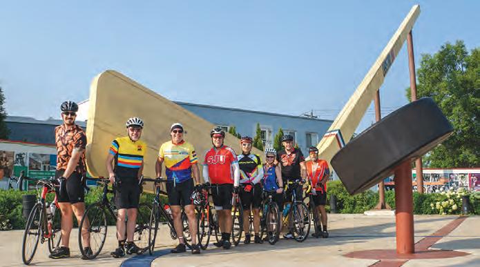
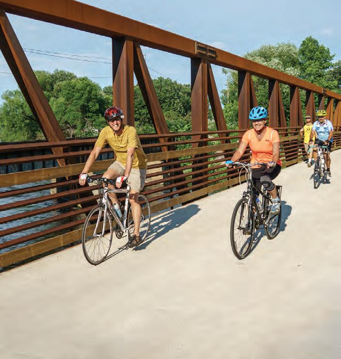
9 Gitchi-Gami Ride
Molly Brewer Hoeg
51 Summer Trails in Little Falls
Jan Lasar
52 Base Camp Southwest
Jan
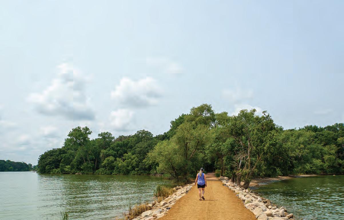
PHOTO: The Loon Island Causeway is part of the Hiking Club Trail at Lake Shetek State Park in Currie, MN. Jan Lasar photo
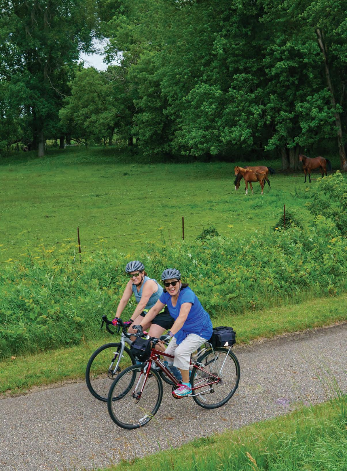
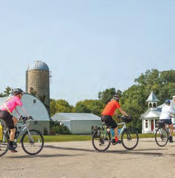
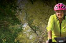
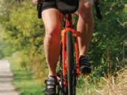
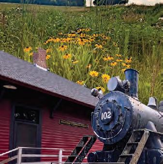
COVER: Two riders on the Shooting Star Trail Ride enjoy rural scenery near Adams, MN. Jan Lasar photo
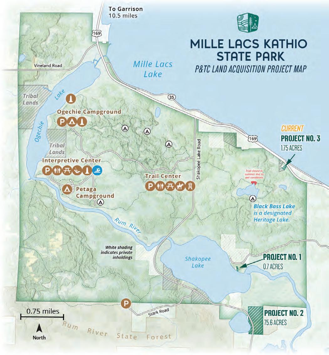
PARKS & TRAILS COUNCIL ACQUIRES LAND FOR MILLE LACS KATHIO
STATE PARK
THE SMALL PROPERTY ALONG HWY. 169 COULD OFFER ACCESS TO PRISTINE LAKES IN THE STATE PARK.
Asmall but key property will soon be added to Mille Lacs Kathio State Park, thanks to the
Minnesota is near popular Mille Lacs Lake, though only a small, little-used area actually touches serves as a border, creating a the lake, with various homes, cabins, and businesses lining the
One modest modular home
but their acquisition timeline was longer than the landowners
private owners to swoop in, demolish it, and build a highvalue home, which would have land to be added to the state the property in March 2025 and the MNDNR needs to secure its increase recreational access to land into a small parking lot
A minimally maintained trail
encompassed within the state regulations against using motors one backpacking site on this lake, accessible via a 2-mile hiking trail
the lake is closer to one mile in
not to develop recreational access, the property would allow emergency access to this as wetlands, its inclusion into the park helps protect the water quality on the nearby Mille Lacs
View of property acquired for Mille Lacs
Kathio State Park.
Google Street View image from Hwy. 169 in Onamia, MN. Image captured May 2024. Retrieved April 7, 2025
An unmaintained trail leads from the property to scenic Black Bass Lake in the state park. Photo by Steve Young / P&TC
This is the third land acquisition project that Parks & Tarils Council has undertaken for Mille Lacs Kathio State Park.
Map by Andrew Oftedal / P&TC
A New Ride IN MANKATO
Greater Mankato Bike and Walk Advocates (GMBWA) became a new BikeMN chapter in 2023, and has since encouraged individuals and families to walk and bike as part of a healthy lifestyle.
Part of their community engagement focuses on events like May Bike Month, the River Valley 100, Sakatah Scramble, and Walktober. In 2025, a new event enters the lineup. The inaugural Kato Bike Fall Fest promises to pick up where the Mankato River Ramble left off, with a September weekend that celebrates all things biking in southern Minnesota.
I had a chance to talk with Chris Corley, GMBWA board member, about what this new bike-centered event is going to look like in 2025.
TELL ME ABOUT THE NEW KATO BIKE FALL FEST. Our primary goal is to introduce others to the trails, roads, and parks unique to Mankato. Greater Mankato is an amazing place for cycling, hiking, and walking, not to mention other recreational activities. September might be the most beautiful month in south central Minnesota, and the River Valley will be beautiful. All routes begin and end at Mount Kato.
WHAT ARE THE ROUTES? We have a variety of routes for every cyclist. Our shortest loop, which is about 12 miles, will take you past the Children’s Zoo at Sibley Park, go out to Minneopa State Park to see the falls, then head back into the Blue
Earth River Valley back to Mount Kato.
Our longer paved route follows the short route, heads back into town, and then along the Minnesota River and Sakatah Trails before heading back to Mount Kato via the Le Sueur River valley.
There's also a lot of great gravel riding in Mankato, so we have introduced two gravel routes. A shorter route will take cyclists through some of the local parks. The longer route, one of our most popular rides for locals, heads south from Mount Kato down to Good Thunder and across multiple river valleys. All of our routes will have rest stops. We maintain the popular rest stop at Minneopa Falls, for example. We’re including rest stops at our BMX track and at Javen’s Winery for our longer paved routes. Our long gravel loop will have a rest stop at Red Iron Mercantile in Good Thunder.
WHY SHOULD SOMEONE PARTICIPATE IN THIS EVENT? If you haven't experienced the many trails in Mankato, you should really make an effort to come and explore the area and all we have to offer. Everyone will appreciate the new gathering spot at Mount Kato, which is a yearround recreation hub for many of us who live here. One hundred percent of proceeds after expenses go to support BikeMN and GMBWA. They are entirely recirculated back into the community to support cycling and pedestrian projects, particularly for youth.
HOW MANY PEOPLE ARE YOU EXPECTING?
We really don’t have any participant goals at this time. We're just hoping for a fun weekend. Our previous rides have drawn over 1500 cyclists, so we anticipate having a good crowd at the event this year.
WHAT ELSE WILL BE GOING ON THAT WEEKEND? We’re hoping to add a festivallike atmosphere to the weekend. We'll have a mountain bike ride on the trails at Mount Kato the night before, with a bonfire afterwards. On Sunday we will have BMX and bike polo demonstrations, food trucks, and beverages available. We’re also hoping to host a cyclocross event that riders can watch or participate in. Our weekend will start off with mountain bike rides at Mount Kato on Saturday, September 27. On Sunday, riders will choose from the available routes and set off on their days. The later morning and afternoon will include the demonstrations and cyclocross events.
HOW LONG DID THIS TAKE TO PLAN? This event has been drawn up over the last year. I’d say all in it will have taken us 18 months to plan. On ride day, we'll have several dozen volunteers working. ANY FUTURE PLANS FOR THE ORGANIZATION?
We’re excited to be introducing a variety of riding and advocacy options over the calendar year. This year, our August 24 River Valley 100 will have a competitive option for the longer gravel event for the first time in our history. I love everything about this event because it's so relaxed and community-oriented.
ANYTHING YOU WOULD LIKE TO ADD? Dam
Store Pie. Anyone who knows our rides knows we should have some pretty good pie available for the riders. Jenny’s pies are a Mankato cycling staple, not to be missed.
Jan Lasar Trails Editor/Publisher
TrailsQA &
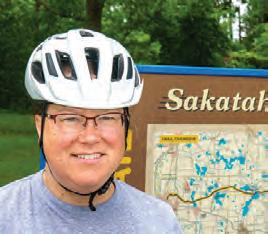
Occupation: Social worker
Gear: REI Co-Op gravel bike
Seen: Biking the Paul Bunyan Trail with her husband Jason
How many miles do you bike per year? About 1,200.
What does being outdoors mean to you? Peaceful, rejuvenating serenity.
Favorite Minnesota park or trail? Mississippi River County Park in Sartell, MN. There's skiing, hiking, and paddling.
Best Minnesota experience? When I hiked the Superior Hiking Trail, I came to an overlook and there was a bald eagle right in front of me.
Worst Minnesota experience? Hiking to a backcountry campsite at Itasca State Park in July. The mosquitos and ticks were so bad when we got there, and we hiked right back.
Advice for the novice? Go at your own pace.
What's on your Minnesota bucket list? In all of my years here, I've never seen a moose. I also need to see the northern lights.
What would you do with $1,000? Stay at a lodge on the Gunflint Trail and go skiing.
Trail Treat? Homemade pizza with mushrooms, mozzarella, sausage and olives.
Snapshots of people we meet along the trail
Occupation: Internal auditor for a bank
Seen: Riding the Tomassoni Tour on the Mesabi Trail
How many miles do you bike per year? I’ve biked 350 miles so far this year.
What does being outdoors mean to you? The solitude helps me to focus, sleep better, and keep my head clear, and keep going.
Favorite Minnesota park or trail? I like the Mesabi Trail. It’s in my backyard, and if I want to see something new I just go to a different part of the trail.
Best Minnesota experience?
Riding the Tomassoni Tour this weekend was probably the best experience I’ve had in many, many years.
Worst Minnesota experience? My wife and I went camping in the Boundary Waters with our two year old son and we had four inches of rain.
Advice for the novice? Go get a really good bike. If you have good equipment, you will use it more.
What’s on your Minnesota bucket list? I’d like to ride some more trails and do more events.
What would you do with $1,000? I would buy a nice e-bike for my wife and say “Let’s go ride together.”
Trail Treat? Rocky road ice cream from the store in Soudan, MN.
Occupation: Parts manager at a tractor dealership
Gear: Fuji Sportive 1.5 road bike
Seen: Riding the Luverne Loop Tour with the Blue Mound Cycling Club
How many miles do you bike per year? Last year was over 3,000.
What does being outdoors mean to you? I snowshoe, I hike, I bike. Anything I can do to be outside.
What’s your favorite thing to do outdoors? I like to hike and bike.
Best outdoor experience? Biking out in the South Dakota Black Hills on the Mickelson Trail in the rain was one of the neatest experiences.
Worst outdoor experience? Wiping out on the ice on my fatbike and injuring my shoulder.
Advice for the novice? Take your time, do a little bit every day to get to longer bike rides.
What’s on your Minnesota bucket list? I want to ride some of the Duluth area trails.
What would you do with $1,000? I would find a place to ride my bike.
Trail Treat? After good, long burn I enjoy a good whiskey Coke.
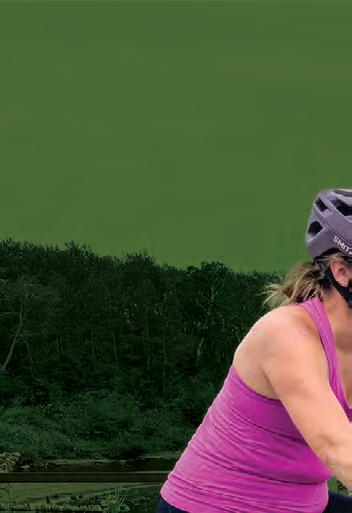
Occupation: Banking Associate
Gear: Specialized Haul Short Tail e-bike with front and back panniers
Seen: Riding bike on the Sakatah Singing Hills State Trail near Faribault
How many miles do you bike per year? Maybe 500? What does being outdoors mean to you? Being on a bike you're experiencing the smells, the sounds and the sights and you're involved with your environment.
Favorite Minnesota park or trail? Right now, I’m enjoying the Sakatah Singing Hills State Trail.
Best Minnesota experience? Meeting new people on the trail, just like this morning on my way here.
Advice for the novice? Biking is a social event. If you want to meet new people, biking is definitely what you should do.
What’s on your Minnesota bucket list? I want to do more bike events across Minnesota.
What would you do with $1,000? New experiences, like those bike rides. I usually stop at coffee shops to let people know that cyclists are out there and they bring money to their community. Trail Treat? Peanut butter chunk ice cream.
Scott Bowman Luverne, MN
Todd Lauer Iron, MN
Beth Gary Nisswa, MN
Jodi Erickson Mankato, MN
STORY BY MOLLY BREWER HOEG
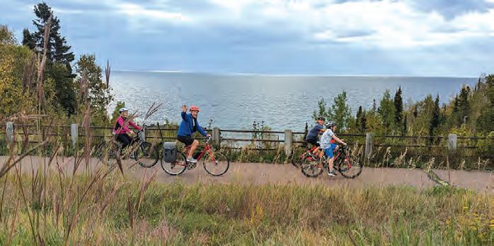
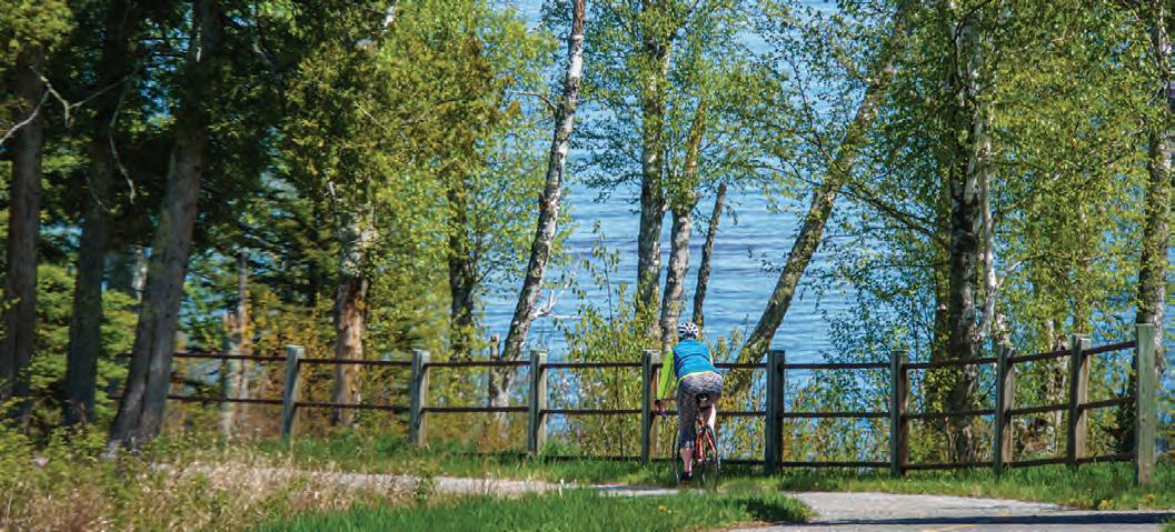
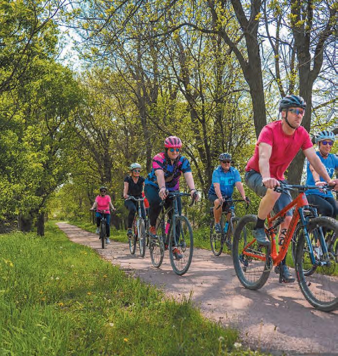
GITCHI-GAMI Ride
From the moment I received the registration email, I knew I was going to have a e tone was so welcoming, inclusive and planning behind it. Even though I’ve cycled every part of the trail multiple times, I had never participated in the organized ride. Now, I was excited about the opportunity to support the trail, and I convinced my daughter, Karen, to come along with me
Superior’s North Shore originated in
Superior’s North Shore in the late 1980s with resort owners who wanted to connect their properties and
AUGUST 16, 2
create a safe corridor for biking, inline skating, and walking. With backing from the Minnesota Department of Natural Resources (MNDNR) and the Minnesota Department of Transportation (MNDOT) and the establishment of a trail support group, the scope grew. Eventually, this new recreational trail on Minnesota’s north shore was to cover 89 miles between Grand Marais and Two Harbors, linking six iconic state parks. In 1999, the trail cial status as the Gitchi-Gami State Trail, and the support group was renamed the Gitchi-Gami Trail Association rough close collaboration, these three organizations develop, support
create a safe corridor for inline and With from Minnesota support miles between Grand Marais and Two Harbors, six iconic state In 1999, the trail gained offi Association (GGTA). Th close collaboration, and ma promot on the comple The lot at G swarmi Lycra-c and tho ted the from h y The enth tion ten all of o
and maintain the trail, while GGTA also promotes the trail and oversees activities on the trail. To date, 35 miles have been completed.
e morning of the ride, the parking lot at Gooseberry Falls State Park was swarming with people, ranging from Lycra-clad road cyclists to young families, and those on e-bikes. Karen quickly spotted the “Biker Babes,” a group of women om her fitness studio who do the ride every year.
e air was festive, and we were greeted by enthusiastic volunteers at the registration tent. They checked us in, answered all of our questions, and gave us a day
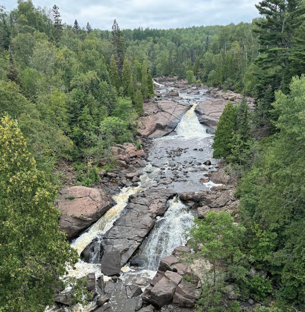
PHOTO BY MOLLY BREWER HOEG
pass good at all Minnesota State Parks. Spokengear Cyclery & trusses and a dramatic view of the rock on the northern shore. Our next destination was Split Rock Lighthouse State Park, traveling one of the oldest sections of the trail, which wound away from e terrain became more challenging as we rounded curves, dipped down toward the lake, and rose back up several times. We rode that hilly stretch through thick grasses and bushes dotted is part of the trail is one of my favorites, particularly for its beauty and solitude, but it does not actu. That trip requires a short detour and an entrance
“ON RIDE DAY, WE DEVELOP RELATIONSHIPS. THERE ARE A LOT OF REPEAT RIDERS, AND WE’VE WATCHED FAMILIES GROW UP.”
Michelle Pierson, Executive Director of the GGTA
Closer to Beaver Bay, the trail leveled out as it sidled up to the highway. By this time, the day had warmed up, but in typical North Shore fashion, we still found chilly pockets near the lake where the e trail was flanked by grass, with trees between us and the shore. Riders were well spread out, so we felt like we were enjoying our own private e 14-mile rest stop was set up in grand style at the wayside rest in Beaver Bay, where we and many others grazed tables laden with energy bars, bags of chips, bananas, cool, fresh grapes, and mounds of the best peanut butter sandwiches we’d ever had. Even more welcoming were the volunteers, who were always ready to chat. ed by GGTA board members, their families, and past participants, many of them were ride veterans. Pierson called the ride a “mom and pop” event and said at ked beautifully for us. The convenience of real bathrooms and grassy spots to sit, rounded ts of this
Fully refreshed, we felt ready to take on the upcoming segment to Sil-
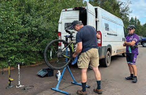
Dan Cruikshank, owner of Spokengear and GGTA vice president, assists a rider on the Gitchi-Gami Trail Ride.
PHOTO BY MOLLY BREWER HOEG
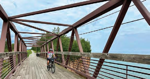
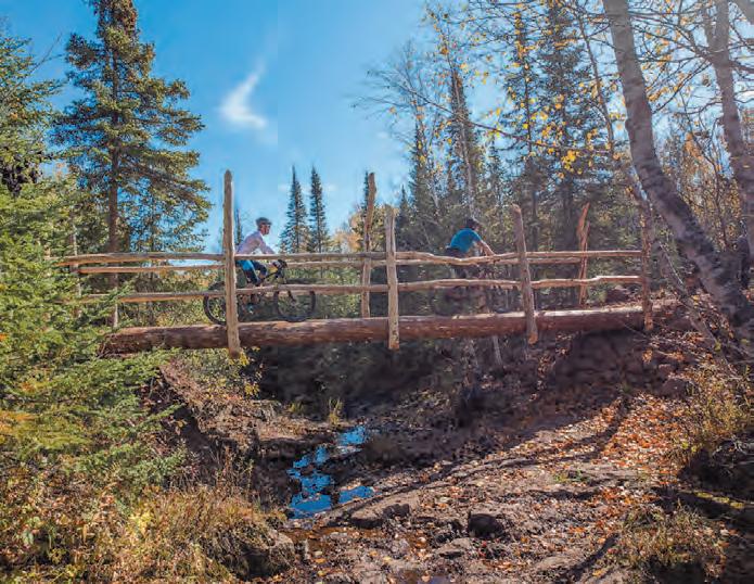
Overhead truss bridge near Iona's Beach.| PHOTO BY KAREN KENNEDY
ver Bay. That portion of trail veers inland, which meant going uphill. But, it was manageable, and we were easily distracted by the sights and interpretive signs on the Northshore Mining Company land. We rode through a tunnel underneath a railroad track, and then over a bridge, with a pipeline underneath. Rail cars next to the trail were full of chunky ore from the iron range, en route to the processing plant, to be pulverized and shipped out on ore boats. Over flower-filled grassy fields, we could see the plant in the distance; a reminder of what industry drove this area.
The 34-mile route finished where the trail currently ends at Highway 11 in Silver Bay, our turnaround point. The longer route continued on the road, and we wondered what it was like. Nicole Parks, one of the 55-miler Biker Babes, later told us she was surrounded by big pines when she rode that leg, and saw little car traffic. “There’s a really long, gradual stretch of hill, and a gorgeous rest stop at Lax Lake, where we walked out on a dock,” she said.
Our return trip went by quickly. We descended the hill this time, knowing what lay ahead in the Split Rock area. We were greeted by jubilant volunteers at the finish and mingled with other riders, reveling in completing the ride. “We had 174 participants this year,” said Pierson. As a testament to the loyalty of its cyclists, she said, “About fifty percent are repeat riders over the years.”
The 2025 ride promises to be a special event. At the 25th anniversary on August 16, GGTA will reveal their new logo and branded jerseys, and enter each rider into a prize raffle.
Castle Danger Brewery in Two Harbors, who will be celebrating their own anniversary that day, is the location of the unofficial after-party. “But, your North Shore weekend doesn’t have to end with the ride,” Pierson said. She encourages everyone to stick around on Sunday, and take part in the Grit and Gratitude Ride, which explores the roads around Two Harbors. Happening the same weekend, she said, is the Rock Splitter Mountain Bike Race near Beaver Bay, hosted by the Cyclists of Gitchee Gumee Shores (COGGS).
“Almost nobody has a bad day when they spend it on a bicycle,” she said.
“ALMOST NOBODY HAS A BAD DAY WHEN THEY SPEND IT ON A BICYCLE.”
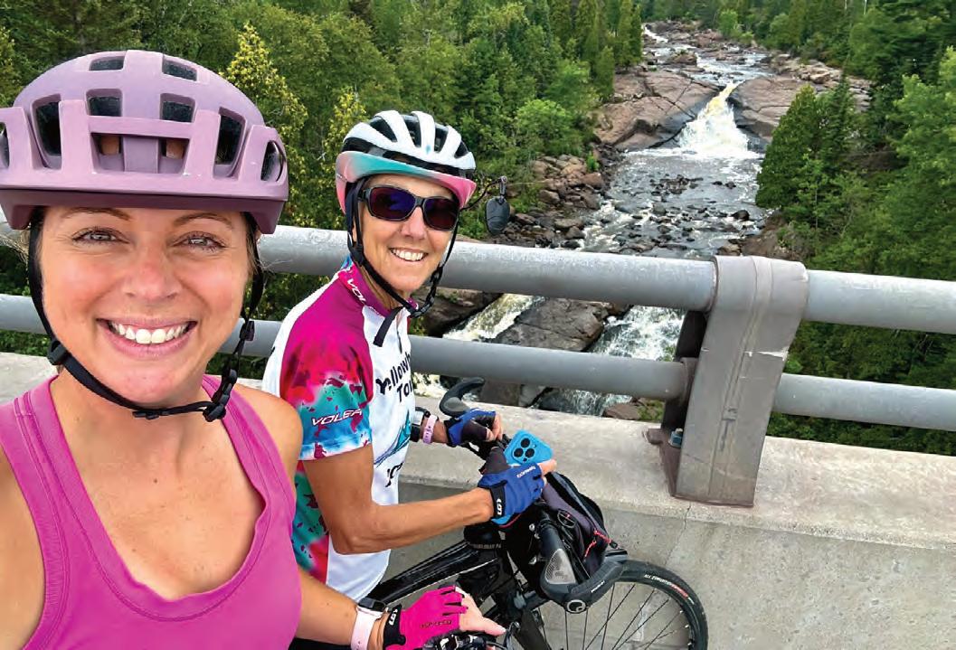
Author Molly Brewer Hoeg (right) and daughter Karen Kennedy stop for a selfie by a scenic view of the Beaver River. | PHOTO BY KAREN KENNEDY
PHOTO BY CARL SHAFFER
LUVERNE LOOP TOUR
Trail | Luverne, MN
June 5, 2025
Enjoy a leisurely spring loop around Luverne on the 7.4-mile trail, register for prize drawings and gather for a treat! Stick around for the weekend and celebrate Luverne’s annual Buffalo Days. www.luvernechamber.com
BIKE MS: MS 150
Road/Trail | Proctor, MN
June 7-8, 2025
Start biking from Proctor on the Willard Munger State Trail. Enjoy the northern hardwood forests, lakes, and bogs on your ride to Hinckley, and stay overnight before riding on to White Bear Lake for the grand finish. events.nationalmssociety.org
KKD Gravel
Gravel/Farmington, MN
June 7, 2025
www.mntrails.com/event/kkd-gravel
Up-To-Date Information & Details at: WWW.MNTRAILS.COM/ EVENTS
TOUR DE PEPIN
Road | Lake City, MN
June 7, 2025
Tour de Pepin is one of the Midwest’s most unique cycling tours where riders have several options to ride through the captivating terrain and historic towns around Lake Pepin. Distances: 32, 44, 50, 72, 100 miles.
www.lakecity.org/tour-de-pepin
Tour of Lakes
Road | Brainerd, MN
June 7, 2025
www.mntrails.com/event/tour-of-lakes
THE TOUR OF MINNESOTA
Road/Trail | Grand Rapids, Chisholm, Ely, MN
June 14-20, 2025
The format will change slightly in 2025. Rather than moving to a new town each day, riders will spend two days each in Grand Rapids, Chisholm, and Ely, and ride loops.
www.tourofminnesota.com
The Hotdish Gravel | Winona, MN
June 14, 2025
http://www.mntrails.com/event/the-hotdish
Two great rides this year!
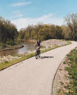
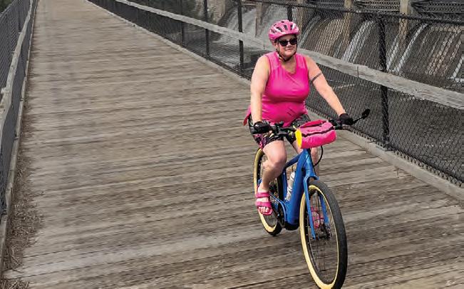
SHOOTING STAR TRAIL RIDE
Trail | Adams, MN
June 14, 2025
Back for 2025, this family favorite ride takes you through the prairies of southern Minnesota on the Shooting Star Trail. www.shootingstartrail.org
MICKELSON SUMMER TRAIL TREK
Trail/Gravel | Custer, SD
June 20-22, 2025
Enjoy the beauty of the heart of the Black Hills as you travel through the scenic valleys, old railroad tunnels and historic mining towns on the 119-mile Mickelson Trail. It’s a great way to explore the Black Hills at a slower pace. Registration includes trail pass, shuttle, refreshments and meals.
Take a bike cruise around Lake Bemidji with the whole family and experience the first city on the Mississippi from the seat of your bike. There’ll be lots of familyfriendly activities. www.bikebemidji.com
THE SPRING BIKE FLING
Trail | Walker, MN
June 21, 2025
Take a ride on the Paul Bunyan Trail from Walker to Hackensack and experience the beauty of the Chippewa National Forest in Paul Bunyan’s back yard. Your ride options are plentiful: A 24 or 48-mile out and back or a 36-mile loop ride. Included in the registration are a t-shirt and a bag full of awesome swag. www.leech-lake.com/spring-bike-fling
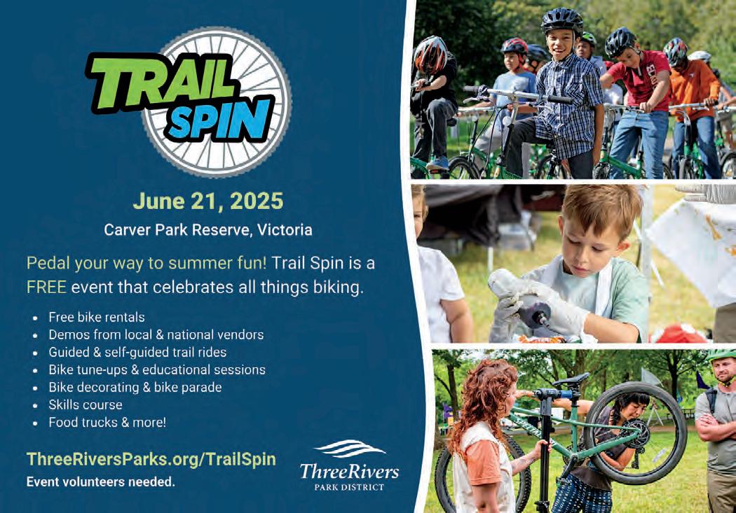
TRAIL SPIN
Trail | Victoria, MN
June 21, 2025
From bike parades to skills courses and free rentals, there's something for everyone at this family-friendly biking celebration at Carver Park Reserve. Of course, you can always hit the Monarch singletrack, and refuel at one of many food trucks.
www.threeriversparks.org/trailspin
SPECIAL DISCOUNTS when you sign up for both rides!
MN
Aug. 10, 2025 bridgethevalley.org
Bike to Duluth
Road/Trail | Minneapolis, MN
June 28, 2025
www.mntrails.com/event/bike-to-duluth
Lutsen 99er
Mountain Bike | Lutsen, MN
June 28, 2025
www.mntrails.com/event/lutsen-99er
Great Scott Bike Ride
Road | Prior Lake, MN
July 4, 2025
www.mntrails.com/event/great-scott-bike-ride
Freedhem 76
Gravel | Freedhem, MN
July 6, 2025
www.mntrails.com/event/freedhem-76
Bike.Build.Home 500
Road/Trail | Saint Joseph, MN
July 8-13, 2025
www.mntrails.com/event/bike-build-home
RIDE ACROSS WISCONSIN
Road | Eau Claire, WI
July 12, 2025
In its 10th year, Ride Across Wisconsin will make a one day loop around Eau Claire, WI, with another scenic and challenging ride.
It’s not a race. It’s a heavenly little ride. From cities across Minnesota and neighboring states, each year 1,000 or more cyclists gather in St. Joseph to wind their way along quiet byways and rolling hills of central Minnesota. Distances: 18, 35, 50 miles. www.bikemn.org/all-events/tour-of-saints
BIKE MS: RIDE ACROSS MINNESOTA 2025
Road | Marshall, MN
July 21-25, 2025
The 5-day experience you know and love is back! Start in Marshall, MN, and cycle to Granite Falls and Willmar, before returning to Marshall. Cycle through these beautiful cities and join a community of riders dedicated to changing the world for people with MS. events.nationalmssociety.org
SCENIC SHORE BIKE TOUR
Road | Mequon, WI
July 26-27, 2025
The Scenic Shore Bike Tour is a two-day, 150-mile, fully supported cycling event that is open to riders of all ages and abilities. The beautiful shoreline of Lake Michigan is the picturesque setting for a weekend of biking with 1,500 cycling enthusiasts. Pedal 25, 75 or 150-miles in support of a cure for blood cancer. www.scenicshore150.org
The
Fox
Gravel | Finland, MN
July 26-27, 2025
www.mntrails.com/event/the-fox
BLUENOSE GOPHER 50
Gravel | Granite Falls, MN
July 26, 2025
This gravel ride explores the challenging ups and downs of the Minnesota River Valley in search of the route of a longforgotten 1890s bike race. Breathtaking views, billion-year-old granite and quiet back roads steeped in history are the backdrop for a unique ride.
www.bluenose.coop/bluenosegopher50
TOUR DE BUN BICYCLE
CLASSIC
Road/Gravel | Montgomery, MN
July 26, 2025
Ride your bike in the heart of Minnesota Czech Country in scenic Le Sueur County. Each route will have refreshment stops at various points and will provide scenic rural countryside on lightly traveled roads. www.montgomerymn.org/tour-de-bun-bikeclassic
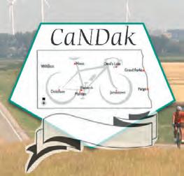
CANDAK
Road | Pembina, ND
August 2-9, 2025
This ride carries on the tradition of the CANDISK ride of North Dakota with daily routes ranging from 35 to 70 miles and a century option. This is a multi-day tour through North Dakota with terrain varying from flat fields to steep hills. www.candak.net
GREAT RIVER ENERGY
MESABI TRAIL TOUR
Trail | Between Grand Rapids and Nashwauk, MN
August 2, 2025
While you pedal fully supported along one of Minnesota’s premiere paved bicycle trails you will encounter historic and scenic points of interest, enjoy food and music at rest stops.
Tour de Tonka is a scenic bike ride through the Lake Minnetonka area and its surrounding communities. With so many different route options, there’s a ride for everyone. www.tourdetonka.org
Apple Blossom Bike Tour
Road | La Crescent, MN
August 9, 2025
www.mntrails.com/event/apple-blossombike-tour
Hollo Gravel Classic
Gravel | Battle Lake, MN
August 9, 2025
www.mntrails.com/event/hollo-gravel-classic
BRIDGE
THE VALLEY
BIKE RALLY
Road/Gravel | Stillwater, MN
August 10, 2025
Join the Stillwater Sunrise Rotary Club on an epic trip through the hills and valleys around Stillwater, MN. Part of the Rivers, Lakes, Fields Ride Series, including Northfield Rotary Bike Tour. Ride both for extra swag and prize drawings. www.bridgethevalley.org
GITCHI-GAMI TRAIL RIDE
Trail | Gooseberry Falls State Park, MN
August 16, 2025
Enjoy a supported, recreational ride on the Gitchi-Gami State Trail along Lake Superior’s scenic North Shore. You’ll get up close and personal with some superior views, be serenaded by waterfalls and wind through multiple state parks. 2025 marks the 25th anniversary! www.ggta.org/ride.php
ROCK-N-ROLL THE LAKES
Road | Albert Lea, MN
August 16, 2025
Albert Lea knows how to rock! Riders can choose from one of three different routes—10, 30, or 50 miles—of SAGsupported, “rolling” fun around Albert Lea. All three courses hug picturesque lake shores and offer a variety of beautiful southern Minnesota scenery. www.bikemn.org/all-events/rock-and-rollthe-lakes
BAM riders enjoy rolling over paved, lowtraffic roads and bikeways in Minnesota, and each year the route moves to a different region of the state to promote the wonderful communities there. This year, they’re riding in the Brainerd Lakes area with overnights in Pequot Lakes, Pine River and Emily. bambiketour.org
Ride to End Alz
Road | Stillwater, MN
August 24, 2025
www.mntrails.com/event/ride-to-end-alz
River Valley 100
Road/Gravel | Mankato, MN
August 24, 2025
www.mntrails.com/event/river-valley-100
Gray Duck Grit
Gravel | Cannon Falls, MN
August 30-31, 2025
www.mntrails.com/event/gray-duck-grit
RIDEMN1
Road | Karlstad, MN
September 6-13, 2025
RideMN1 holds an annual bicycle ride across Minnesota to raise awareness about cancer. This time they visit Karlstad, Warroad, Baudette, Littlefork, Orr, Side Lake, Hoyt Lakes and Silver Bay. There’s optional pre-ride camping and a dinner the day before.
www.ridemn1.org
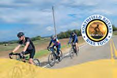
NORTHFIELD ROTARY BIKE TOUR
Road/Gravel | Dundas, MN
September 6, 2025
There’s a route for everyone: Road, gravel or family. Part of the Rivers, Lakes, Fields Ride Series, including Bridge the Valley Bike Rally. Ride both for extra swag and prize drawings.
As always, Classic riders enjoy the scenic and historic Grand Round in Saint Paul. Two scenic routes take you to six regional parks and three rest stops, where riders enjoy live music, excellent treats and waterfront views. www.bikeclassic.org
North Star Bicycle Race
Road | Saint Paul, MN to US-Canada border
September 10, 2025
www.mntrails.com/event/north-star-bicyclerace
Old Fashioned Gravel
Gravel | Hokah, MN
September 13, 2025
www.mntrails.com/event/old-fashionedgravel
TWIN CITIES BIKE TOUR
Road/Trail | Minneapolis, MN
September 14, 2025
This ride is destined to be a celebration of the trails and communities that fuel thriving bicycling culture. www.bikemn.org/all-events/tcbt/
Tomassoni Tour
Trail | Tower, MN
September 18-20, 2025
www.mntrails.com/event/tomassoni-tour
MICKELSON TRAIL TREK
Trail/Gravel | Custer, SD
September 19-21, 2025
Enjoy the beauty of the heart of the Black Hills as you travel through the scenic valleys, old railroad tunnels and historic mining towns on the 119-mile Mickelson Trail. It’s a great way to explore the Black Hills at a slower pace. Registration includes trail pass, shuttle, refreshments and meals. https://gfp.sd.gov/parks/detail/george-s-mickelson-trail/
As of deadline, the information in this calendar was accurate. For Up-To-Date Information & Details Check WWW.MNTRAILS.COM/EVENTS
MICKELSON TRAIL TREKS
Bike Rides & Tours 2025
MORA BIKE TOUR
Road | Mora, MN
September 20, 2025
The annual Mora Bike Tour starts and finishes at the Vasaloppet Nordic Center and offers two routes on rural country roads. Rest stops keep riders hydrated and a mobile repair van lends assistance if needed.
http://www.vasaloppet.us/mora-bike-tour
RIDE THE RIDGES
Road | Winona, MN
September 20, 2025
Ride the Ridges will take riders through some of the most scenic areas in southeastern Minnesota, from lush valleys along streams to bluffs overlooking the Mississippi River. All routes have well-stocked rest stops featuring local delicacies. Distances: 22, 44, 70, 110 miles
www.ridetheridges.bike
ROSEWOOD GRAMBLE
Road, Gravel | Thief River Falls, MN
September 20, 2025
Join Bike Thief River Falls on this ramble on gravel (Gramble) and see rural Pennington and Marshall counties. You’ll ride the former beach ridges of Glacial Lake Agassiz, minimum maintenance roads and a bit of trail.
www.bikemn.org/all-events/rosewoodgramble
Tour of Lakeville
Road, Trail | Lakeville, MN
September 20, 2025
www.mntrails.com/event/tour-of-lakeville
KATO BIKE FALL FEST
Road/Trail | Mankato, MN
September 26-28, 2025
The new Kato Bike Fall Fest is a weekend-long celebration to show off the depth of the amazing bike culture of the greater Mankato area, culminating with a supported bike ride on Sunday, September 28.
www.bikemn.org/all-events/kato-bike-fallfest
DIRT BAG GRAVEL GRINDER
Gravel | Clearwater, MN
September 27, 2025
This central Minnesota fall ride on the backroads around Clearwater honors the memory of the late John Egbers. In the spirit of gravel riding, it’s free and unsupported.
www.mntrails.com/event/dirt-bag-gravelgrinder
Fulton Gran Fondo Road | Minneapolis, MN
September 27, 2025
www.mntrails.com/event/fulton-gran-fondo
The Gunflint Scramble!
Mountain Bike | Grand Marais, MN
September 27, 2025
www.mntrails.com/event/the-gunflintscramble
Headwaters 100
Road | Park Rapids, MN
September 27, 2025
www.mntrails.com/event/headwaters-100
WHEELIN’ TO WALL
Road/Gravel | Wall, SD
September 27-28, 2025
Experience the magic of Badlands National Park and its striking rock formations on this two-day cycling celebration. Road and gravel routes are available on this supported ride and a Pedal Parade of Lights and a poker run are part of the fun.
www.wheelintowall.com
Heck of the North Gravel | Two Harbors, MN
October 4, 2025
www.mntrails.com/event/heck-of-the-north
The Filthy 50 Gravel | Lanesboro, MN
October 11, 2025
www.mntrails.com/event/filthy-50
WILLARD MUNGER STATE TRAIL
Willard Munger State Trail 70 miles
The Willard Munger Trail connects Hinckley to Duluth with a continuous trail that offers a changing experience as you travel along. The southern segment from Hinckley to Carlton is flat, straight and sometimes out in the open.
The so-called Hinckley Fire Trail section follows the railroad line that carried many area residents to safety during the devastating 1894 Hinckley Fire. It goes about 55 miles from Hinckley to Carlton, with entry points at Finlayson, Willow River, Sturgeon Lake and Moose Lake.
Nearly the entire trail is flat and straight on the bed of the abandoned railroad right-of-way and it crosses several bridges, skirts ponds and goes through the woods. A couple of stretches parallel a highway. Points of interest along this section include the Hinckley Fire Museum across from the trailhead and the historic Finlayson and Moose Lake Depots. A 2-mile road ride will take you into Moose Lake State Park.
The northern segment is a 15-mile descent from Carlton to West Duluth that travels through trees and rock cuts with scenic views of the St. Louis River and the twin ports of Duluth and Superior. Riders can stop on a high railroad trestle to enjoy a breathtaking look over the St. Louis River near Carlton and watch kayakers take on the rapids cut through the rock. A short, paved trail splits off into Jay Cooke State Park shortly thereafter. Move on and view the wonders of a hydroelectric power plant, pedal through now-rare stands of hemlock trees, and relax on a hillside rest stop overlooking western Duluth and Lake Superior. From this Bardon Peak the ride is downhill to where the trail ends near the Lake Superior Zoo.
Connections: The 16-mile Alex Laveau Memorial Trail segment connects Carlton with Gary-New Duluth, but not all of it is paved. From Carlton (at the intersection of the main trail with County Road 1), a six-mile paved segment goes south through Wrenshall and ends at Highway 23. A combination of bike routes on paved road shoulders and city streets continues from there.
The 2.5-mile paved St. Louis River Trail between Carlton and Scanlon is a short road ride away on city streets and can be accessed on Chestnut Street, across from Carlton Bike Rental.
At the end of the trail in Duluth (at Pulaski Street) you can access the 5-mile Western Waterfront Trail. This packed gravel trail runs along the St. Louis River shoreline from the Spirit Lake Marina to near Fremont Street in Duluth’s Irving neighborhood.
Between Friesland and Groningen (at Grindstone Lake Road) a paved trail splits off and travels east toward Sandstone. It stops short of reaching town, however, just west of I-35. A 4-mile road ride along the shoulder of Highway 61 and 23 north through Sandstone takes you to the western edge of Banning State Park where a paved bike trail of less than a mile ends near the park office.
Impressive rock cuts on the trail between Carlton and Duluth, made for steam trains. Jan Lasar photo
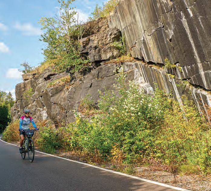
GITCHI-GAMI STATE TRAIL
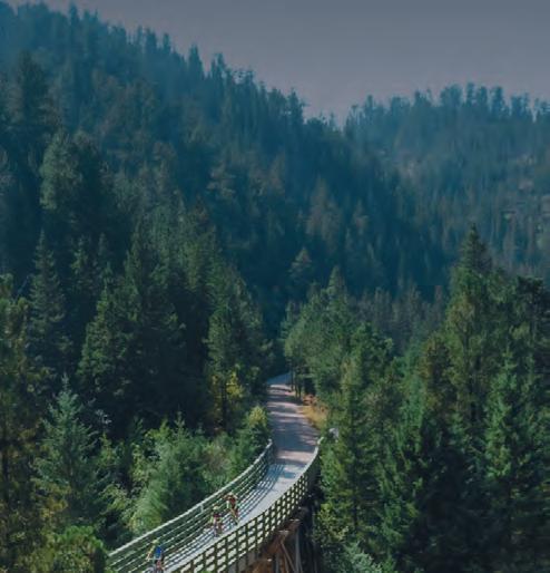
Destined to become one of the most scenic paved trails in the nation, the GitchiGami parallels the North Shore Scenic Drive Byway, the popular Superior Hiking Trail and the Lake Superior Water Trail. It offers an active way to enjoy Minnesota’s North Shore with fantastic views of its namesake lake. The Gitchi-Gami State Trail will eventually trace 89 miles of the North Shore, weaving its way through five state parks from Two Harbors to Grand Marais. The longest trail section to date runs more than 17 miles from Gooseberry Falls State Park through Split Rock Lighthouse State Park and on to Silver Bay.
Along the Trail:
Two Harbors: A new 0.89-mile segment connects users to the Burlington Bay wayside and the nearby Sonju trail to the historic Two Harbors Lighthouse at Agate Bay. Next steps for construction in this area will link the trail to Flood Bay State Wayside.
Silver Creek Cliff : The Gitchi-Gami State Trail covers a short yet impressive one-mile section of the original North Shore Drive, running 4,000 feet around the Silver Cliff Creek Tunnel northeast of Two Harbors. This section of the trail offers a spectacular vista of Lake Superior and has a reproduction of the original 1924 North Shore Gateway arch and brass plaque welcoming visitors. While this section isn’t ready for through traffic, you may want to park just east of the tunnel and walk across the trail bridge to enjoy the view. This is also an area to see rock climbers and a great place for travel photos.
Gooseberry Falls State Park to Silver Bay: Seven miles east of Silver Creek Cliff is the popular Gooseberry Falls State Park where the next segment of the Gitchi-Gami Trail starts. The trail may be accessed near the Visitors Center, or add another mile to your ride by winding through the park, past the campground and near the mouth of the Gooseberry River, find the trailhead for a gentle sweeping ride up towards the Visitor Center and Highway 61 bridge over the falls. This trail segment winds through Iona’s Beach Scientific and Natural area, before leading to Split Rock Lighthouse State Park and the towns of Beaver Bay and Silver Bay.
Schroeder to Lutsen: This 12.7-mile stretch is nearly complete, except for a short gap in Tofte.The Gitchi-Gami State Trail picks up at the east parking lot in Schroeder and travels through Temperance River State Park on its way to Lutsen. This segment crosses the Temperance River gorge, which offers spectacular views of the river and rocks below. The one-quarter-mile gap in the trail
in Tofte is expected to be paved in 2025. Between Tofte and Lutsen, the Ray Berglund State Wayside offers a place to rest. In Lutsen, a tunnel under Highway 61 connects to the town's center.
Grand Marais: The 5.1-mile leg connecting Grand Marais to the Cut Face
Creek State Wayside is a flowy trail with many opportunities to see the lake. One highlight is a wooden arched bridge with observation platforms. One side affords views of the Fall River, the other Lake Superior vistas. This section connects to the Grand Marais Corridor Trail, a one-mile paved bike trail that travels through the heart of downtown Grand Marais.
Get up close and personal with the largest freshwater lake in the world. Jan Lasar photo
Mesabi Trail 150 miles
Grand Rapids to Ely
Via the Mesabi Trail, you can enjoy miles of paved trail stretching from the Mississippi River (Grand Rapids) to the Boundary Waters (Ely). When completed in just a couple of years, that mileage will expand to 165 miles. The trail runs through a wide range of scenery, from dramatic views of mining operations, to secluded woods, a jungle of vegetation, mine lakes and reservoirs.
It traverses forest, meadows, rivers, streams and lakes in a region bound on the east end by the Boundary Waters Canoe Area Wilderness and on the west by the
MESABI TRAIL
Mississippi River. In between, the Mesabi Trail takes visitors past the edges of the open pit mines of the Iron Range and areas abundant with wildlife, nature and the rich heritage of hardy pioneers.
Unlike a lot of paved trails in the state, the Mesabi Trail is created from old logging and mining roads, former roadways, some abandoned rail grade and new trail. There are even a couple of floating bridges. The trail crosses Minnesota’s tallest bridge just outside of Virginia. It spans 1,132 feet and crosses the Rouchleau mine lake 200 feet above the water’s surface for a spectacular view from your bike seat.
Currently, over 75 continuous miles stretch
from Grand Rapids to McKinley. The leg from McKinley to Biwabik is expected to be paved in June of 2025. Another 24 miles travel from Biwabik through Giant’s Ridge Recreation Area to just outside of Tower. This section includes a ¾-mile long floating bridge across the Embarrass Wetland Complex and the Darwin Meyers Wildlife Management Area. The segment from Tower through the new Lake Vermilion Soudan Underground Mine State Park into Ely is now complete. Additional spurs connect into communities like Chisholm with the Minnesota Discovery Center, and Eveleth with the US Hockey Hall of Fame and the world's largest hockey stick sculpture. Off the bike you can tour a mine, a logging camp, the Greyhound bus museum or visit the childhood homes of Judy Garland and Bob Dylan. Many campgrounds and local parks are easily accessible from the trail, highways and nearby communities. Food, lodging, shopping, antiquing, golfing, fishing, camping and swimming are all in close proximity to segments of the trail, with communities and services available near all entry points.
Check for rail updates at mesabitrail.com before planning your cycling adventure.
Details at www.mntrails.com/ bike-trails/
There's lots to see along the Mesabi Trail, like the world's largest hockey stick at the US Hockey Hall of Fame in Eveleth. Jan Lasar photo
Between Lake Vermillion State Park and Ely the scenery starts to resemble that of the Boundary Waters. Jan Lasar photo
Paul Bunyan BIKE TRAIL GUIDE
Paul Bunyan State Trail
120 miles
The paved Paul Bunyan Trail is Minnesota’s and the country’s longest rail trail. It has been inducted into the Rails to Trails Conservancy’s Hall of Fame, as a “Signature Minnesota Destination.”
The trail’s namesake, Paul Bunyan, is a reminder of the rich forestlands that supported a robust timber industry and are ever present on your ride through the pines and you'll see many incarnations of Paul Bunyan and his sidekick, Babe the Blue Ox, in towns along this one-of-a-kind trail.
Along the Trail: The trail starts at Crow Wing State Park near Brainerd and ends at Lake Bemidji State Park near Bemidji. Including a few on-road connections, the total mileage is closer to 123 miles.
Trail Sections:
Crow Wing State Park to Walker: Riders can catch glimpses of the Mississippi River on their way through the park towards Brainerd’s Northland Arboretum. The Brainerd lakes area is a favorite with tourists seeking an Up North experience with creature comforts. Countless resorts, hotels and campgrounds cater to cyclists and are located near the trail. North of Brainerd you’ll find wetlands, gardens and the little towns of Merrifield and Nisswa. Downtown Nisswa is a bustling tourist town with many shops and restaurants to explore. Stop for a tour of the historic pioneer village and regular turtle
races throughout the summer. The Pequot Lakes Visitor’s Center is a good place to rest and recharge. Rumor has it Paul Bunyan’s bobber now serves as the town’s water tower.
At the Pine River Information Center, you can see vintage displays, including a pair
of Paul Bunyan’s baby shoes, big enough to stand in. Keep an eye out for carved critters along the trail, like Colonel Cobber in Backus. This 10-foot chainsaw carving of a corncob man is a favorite picture opportunity with cyclists. Farther down the trail you can meet Paul Bunyan’s girlfriend, Lucette, in Hackensack, home to an annual chainsaw carving festival. After Hackensack, take either the hilly route through the Chippewa National Forest to the shared section of the Heartland and Paul Bunyan Trail or the Shingobee Connector trail. Both routes connect to downtown Walker, but the Shingobee trail is shorter and easier.
Walker to Bemidji: On the way to Bemidji, you will cross the Kabekona River and go through Benedict, Laporte and Guthrie in a mix of quiet, rolling farmlands, crystal clear lakes and forest lands. Bemidji, the first city on the Mississippi River, is on the south side of Lake Bemidji and flanked by the Mississippi Headwaters State Forest to the west and Lake Bemidji State Park to the north. In Bemidji, you’ll want to visit the famous statue of Paul Bunyan and his Blue Ox named Babe. Continue on to Lake Bemidji State Park or ride a 17-mile scenic loop around Lake Bemidji.
Connections: Traveling north on the Paul Bunyan State Trail after Hackensack, you'll enter the Chippewa National Forest and come to a Y intersection. Go left and ride the hilly section of the Paul Bunyan Trail through the Chippewa National Forest to the intersection with the Heartland Trail west of Walker. Go right and take the easier Shingobee Trail into Walker from the south.
After you cross Paul Bunyan Drive on the bridge in Bemidji, connect to the 17-mile Lake Bemidji Trail around Lake Bemidji. It
Together with the Paul Bunyan and Heartland Trails, the Shingobee Connection makes for a great loop ride in the Walker area. Jan Lasar photo
doesn't matter which way you go around the lake, the route ends at Lake Bemidji State Park.
The Paul Bunyan Trail is also part of the Mississippi River Trail Scenic Bikeway, a signed route from the Mississippi Headwaters to the Gulf of Mexico.
History: The Paul Bunyan trail follows the original railroad line built in 1893 and abandoned by Burlington Northern in 1983. In October 1992, the first 50 miles of the Paul Bunyan Trail from Brainerd to Hackensack opened to the public and it has since more than doubled in length.
The Paul Bunyan Trail's journey north begins at Crow Wing State Park in Brainerd. Jan Lasar photo
Photo Credit: Explore MN
Heartland BIKE TRAIL
Heartland State Trail
54 miles
The Heartland State Trail is another mustsee destination in the heart of Minnesota's lake country. Numerous towns, resorts and parks provide amenities to the rider on one of Minnesota’s most visited recreational trail systems.
Trail Sections:
Park Rapids to Dorset: The official start of the Heartland Trail is at Park Rapids’ Heartland Park, which has shelters, restrooms, a swimming beach and a bridge across the Fish Hook River. Your six-mile journey to Dorset will take you through scenery ranging from thick woods to grasslands dotted with lakes. The popular trailhead in Dorset has access to shops and restaurants, a large parking lot, outdoor toilet, playground and shaded picnic areas. The corral on the other side of the trail is for those on horses who use the unpaved trail parallel to the paved trail.
Dorset to Nevis: The next five miles to Nevis are quite pleasant. The trail travels through the woods with glimpses of an occasional pond. Pines and poplar trees are plentiful and birch stand out nicely from the green background. Just before you get to Nevis, enjoy views of Shallow and Belle Taine Lakes as you cross over the channel connecting the two. Stop here for a selfie with the World’s Largest Muskie statue.
Nevis to Akeley: The rest area in Nevis has water and restrooms. Stop and see a statue of the World’s Largest Tiger Muskie. In Akeley, stop and sit in Paul Bunyan’s hand for a picture.
Akeley to Walker: The Heartland Trail and the Paul Bunyan Trail share a trail segment from just northeast of Akeley to Walker. At a parking lot a few miles outside of Akeley, riders can turn onto the Paul Bunyan
Trail and ride through the Chippewa National Forest. This eight-mile segment on paved logging roads-turned-trail has a grade of up to 8 percent. It hooks up to the Shingobee Connection Trail into Walker. Alternatively, you can continue on the shared segment and access the town of Walker that way. Just outside of town, the Paul Bunyan and Heartland Trails part ways. The Paul Bunyan Trail continues northwest to Bemidji, while the Heartland Trail continues northeast to Cass Lake.
Walker to Cass Lake: North of Walker, you’ll need to ride two miles on a paved road shoulder to get from one section of the trail to the other. The trail skirts the west side of Leech Lake, then cuts through some woods and marshland and parallels Highway 371 for 10 miles to Cass Lake. At 41 miles, there is a large steel bridge, which once carried trains across Steamboat River.
Connections: In Walker, connect to the Shingobee Trail near Chase on the Lake Resort. This seven-mile combination of road routes and standalone trail crosses Shingobee Bay on the south end of Leech Lake and will take you to the Paul Bunyan Trail. Go south at this intersection toward Hackensack or west through the Chippewa National Forest and loop back to Walker via the Heartland/Paul Bunyan Trail. Near Cass Lake, where the trail intersects with County Road 76, connect with the Mi-Gi-Zi Trail by riding about a half a mile east on a signed road route. Follow the 14-mile trail counterclockwise around Pike Bay’s beautiful shores and the Chippewa National Forest and arrive at a trailhead north of Pike Bay after about ten miles. From there, a signed bike route will take you back to the Heartland Trail on quiet city streets through Cass Lake.
Future expansions of the Heartland include a 20-mile extension north from Park Rapids to Itasca State Park and an 86-mile segment from Park Rapids west to Moorhead. Of this segment, about five miles are paved going northwest from Frazee to connect with existing trails in Detroit Lakes.
Public art on display at Red Bridge Park in Park Rapids. Jan Lasar photo
TRAIL MAP
Glacial Lakes BIKE TRAIL
Glacial Lakes State Trail
28 miles
The area around the Glacial Lakes Trail is dotted with countless lakes shaped by retreating glaciers some 10,000 years ago. Today, communities in this popular tourist area welcome visitors who come here to recreate at the lake, on the bike or both.
Along the trail: The trail starts at the Civic Center on the northern edge of Willmar. It goes northeast through beautiful farmland, prairie, and communities along the way including Spicer, New London, Hawick and Paynesville, where the trail currently terminates. A five-mile segment between Roscoe and Richmond is also paved.
Connections: Just northeast of Willmar, take the five-mile Eagle Lake Loop Trail which circles back to the Civic Center. A city bike route also takes you to downtown Willmar. In Spicer, take a ride around Green Lake on a combination of trails and signed routes. At the eastern end of the Glacial Lakes Trail, take Paynesville’s connector route to the Lake Koronis Trail. At Richmond, the Glacial Lakes Trail connects to the RoCoRi Trail, travels on to Rockville.
A three-mile section of the trail has just been finished inside of Sibley State Park. It
Between Spicer and New London. Jan Lasar photo
Taking a break at Green Lake in Spicer. Jan Lasar photo
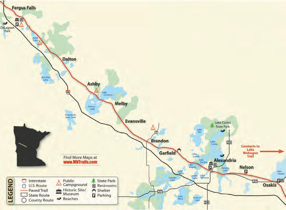
CENTRAL LAKES STATE TRAIL
Central Lakes State Trail
55 miles
The 55-mile-long, paved trail starts at the Fergus Falls trailhead on Highway 210 and travels southeast through the communities of Dalton, Ashby, Melby, Evansville, Brandon, Gar field, Alexandria, Nelson and Osakis. The trail, a former railroad grade, is generally flat and level. It passes through a varied landscape of woods, grasslands, lakes, wetlands and farm fields. Communities with rest stops and amenities are generally seven to ten miles apart. The Central Lakes Trail is open to non-motorized use and groomed for snowmobiling in the winter.
Along the Trail: The official Fergus Falls Trailhead is near the intersection of Minnesota Highway 210 and 19th Street, where you can find parking, bathrooms, picnic facilities, a bike repair station and play sculpture. Camping is available at DeLagoon Park, about a mile down the trail from the trailhead. This large park also offers a swimming beach and picnic facilities. Traveling from Fergus Falls you'll cross the Continental Divide, where water flows south
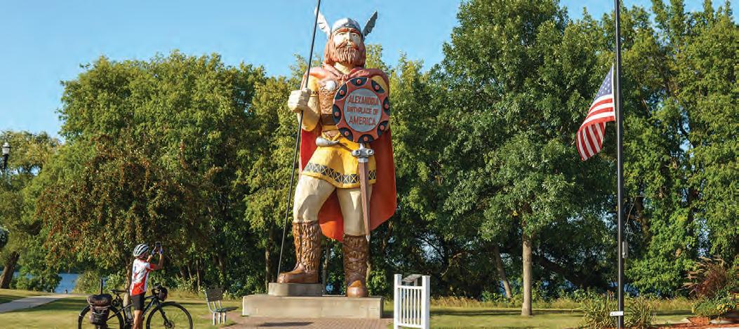
into the Mississippi or north into Hudson Bay. The small communities along the trail tuck in neatly between reed-lined lakes and the occasional farm field and you'll easily find camping, restaurants and places to rest. Stop for a photo op at the well-known statue of Big Ole the Viking at the north end of downtown Alexandria, near the Runestone Museum. If you’re visiting in early summer, keep an eye out for pink or yellow Lady’s Slippers blooming along the trail.
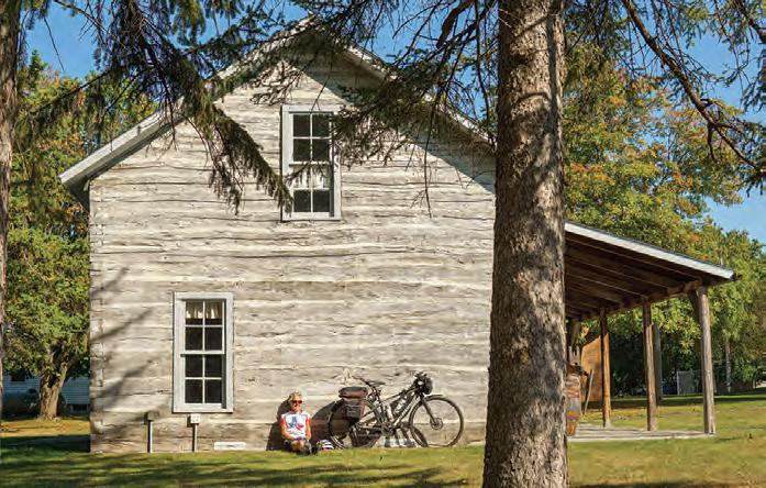
The Evansville Pioneer Village makes
Central Lakes State Trail. Jan Lasar photo
Alexandria's mascot, Big Ole, turns 60 years old in 2025. If you can't visit him in person, you can see his 24-hour live stream at https://explorealex.com/dt_places/big-ole-central-park/ Jan Lasar photo
A Combined History: The Lake and Central Lakes Trail are built on the rail corridor formerly owned by Burlington Northern Railroad Company. As the profitability of the railroad line declined, Burlington Northern leased use of the tracks to smaller short line railroads. One of the last such companies was the Otter Tail Valley Railroad, which ran trains between
Moorhead, MN and Avon, MN, from 1986 until 1991, when the line was officially abandoned. The Lake Wobegon Regional Trail opened in 1998 and the Central Lakes State Trail was dedicated in 2005. The two trails officially joined near Osakis, MN in 2007.
Connections: Just east of Osakis, the Central Lakes State Trail connects to the
65-mile-long, paved Lake Wobegon Trail. From DeLagoon Park, city bike routes take you to Grotto Lake Park with the famous statue of Otto the Otter. Feasibility of a connecting trail between Fergus Falls and Pelican Rapids is being explored. Another trail in the planning stages would connect Ashby to Battle Lake and Glendalough State Park.
LAKE WOBEGON REGIONAL TRAIL
Lake Wobegon Regional Trail
The Lake Wobegon Trail is a 10-foot wide, bituminous surfaced hike-and-bike pathway. It travels through the central Minnesota counties of Stearns and Todd from the city of Waite Park to the city of Osakis. The trail also has an extension from Albany heading northeast to Holdingford and the Stearns/Morrison County line.
Starting at Rivers Edge Park in Waite Park, you'll cross the Sauk River on this newest section of the Lake Wobegon Trail. En route to St. Joseph you ride along natural areas and farm fields. A few miles outside of St. Joseph, see the old town of Collegeville, which now consists of only a few homes, but once had a popular train depot, boarding house, post office and store. You can turn left at Collegeville for a 2.5-mile side trip to Saint John’s University.
At Avon, you’ll find shelters, bathrooms, a water fountain and a two-storied lookout tower/shelter that gives you a bird’s eye view of the surrounding region. The next 5.5 miles are perhaps the most beautiful along this stretch of trail, with deeper woods, prairies and lakes. Keep an eye out for Lady’s Slipper orchids in May and June.
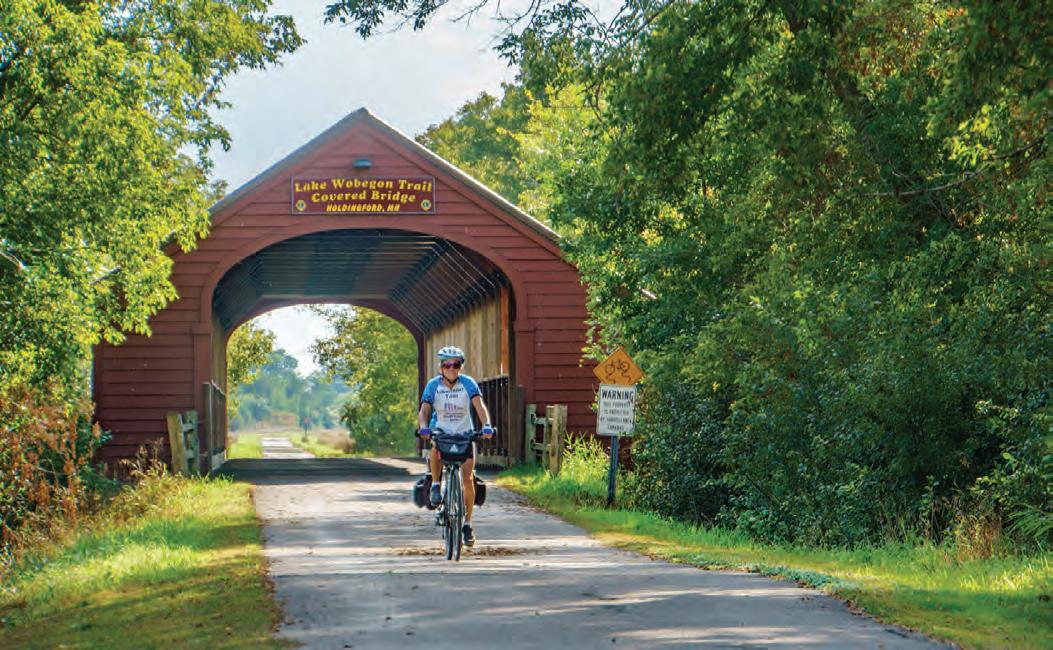
Just west of Albany, a spur of the Lake Wobegon Trail goes north nine miles to Holdingford, home of Minnesota’s longest covered bridge. This spur connects with the paved Soo Line Trail at the county line and offers pastoral views of a natural landscape. The Soo Line trail goes through Bowlus, crosses the Mississippi River at Blanchard Dam and ends at a trailhead on Highway 10. West of Albany, you’ll find
Holdingford's covered bridge. Jan Lasar photo
Freeport, the birthplace of Lake Wobegon. Garrison Keillor is said to have had the inspiration for some of his fictional places here. Head west for 5.7 miles to Melrose, home of the Melrose Area Museum. The official Melrose Trailhead is across the road near the Melrose Feed Mill. When you arrive in Sauk Centre, take a detour to see the Original Main Street made famous by Sinclair Lewis in his novel, Main Street. Farther up, you will find a city trail dropping back to Sinclair Lewis Park where you can find camping, bathrooms and parking. The 12-mile stretch between Sauk Centre and Osakis veers off into the country through the tiny town of West Union before entering Osakis.
Connections: Just outside of Osakis, continue on to the Central Lakes State Trail, a 55-mile paved trail to Fergus Falls. At the Stearns/Morrison County line north of Albany, the Wobegon connects to the paved Soo Line Trail. A link from Sauk Centre north to Browerville is being explored. Eventually, the natural-surfaced Dairyland Trail will reach Albany and will make a connection with Brooten, MN. In 2022, the Lake Wobegon and Central Lakes Trails were designated part of the US Bicycle Route 20 (USBR 20) between Moorhead and the junction of USBR 45 and the Mississippi River Trail (MRT) in St. Cloud.
STATE TRAIL LUCE LINE
Luce Line State Trail 63 miles
The Luce Line State Trail stretches 63 miles in a westerly direction from the metro suburb of Plymouth to the small town of Cosmos in west-central Minnesota. Along the way you'll visit the communities of Wayzata, Watertown, Winsted, Hutchinson, Silver Lake and Cedar Mills.
It runs on a former railroad line covered with a variety of surfaces ranging from crushed limestone between Plymouth and Winsted, pavement between Winsted and just west of Hutchinson, gravel between Hutchinson and Cedar Mills to a mowed grass path between Cedar Mills and Cosmos. The western trailhead is just west of Cosmos in a county park on Thompson Lake. While it starts in the heart of the western suburbs,
the Luce Line Trail offers a varied landscape of woodland, marsh and lakes with a portion running through remnants of the Big Woods and stands of maple and basswood. A horse trail parallels the Luce Line between Hutchinson and Plymouth.
History: The trailway dates back to the old Electric Short Line of 1908, which moved goods and passengers in and out of the Twin Cities. It was renamed Luce Line after the family who owned and extended it as far as Lake Lillian. After the railroad ceased operations, the DNR acquired parts of the corridor to create the state’s first nature trail in 1970. By 1975 the state owned most of the right of way and between 1977 and 1980 built the trail to Winsted. In 2015, a 23-mile section between Winsted and Hutchinson was paved.
Connections: The Luce Line State Trail allows access to many Twin Cities metro area trails. In Plymouth, the natural surface part of the Luce Line State Trail connects to the paved Luce Line Regional Trail, which ends east of Sweeney Lake in Golden Valley, but further connections are ahead. At Medicine Lake this section connects to the 13-mile Medicine Lake Regional Trail and the Basset Creek Regional Trail. The Medicine Lake Trail ends at Elm Creek Park Reserve in Maple Grove. Connections from here include the Rush Creek and Crystal Lake Regional Trails. In Wayzata, a short ride on city roads will take trail users to the Dakota Rail Regional Trail, which continues roughly southwest for 26 miles and ends in Lester Prairie.
HEART OF THE LAKES TRAIL
This paved trail connects Perham to Pelican Rapids via Maplewood State Park, traveling through the popular lakes region of west central Minnesota. For some of its route, the trail shadows the course of the Ottertail Scenic Byway, one of Minnesota’s 22 scenic road routes. Unlike a rails to trails conversion, this picturesque trail through the country is not flat, and there are no towns along the route besides the two it connects.
Amenities along the way include numerous benches for resting and five trailheads with varying additional conveniences like maps, bike repair stations, restrooms and water fountains.
Leaving from the trailhead at the football fields in Pelican Rapids, you’ll soon enter the Leaf Hills region, whose rolling hills and many lakes were sculpted by glaciers during the last ice age.
At the south end of Lake Lida, the trail enters Maplewood State Park, which allows access to 25 miles of hiking trails, a swimming beach, camping, and other park amenities. After exiting the north end of the
state park, the route continues east through a rural landscape dotted with farms, and you’ll begin to see signs for the many resorts Otter Tail County is known for.
Closer to Perham, the trail travels through a smattering of lakes, the largest ones being the chain of McDonald Lakes. At the end of the trail on the east side of Highway 10, a short ride on road shoulders takes you into Perham.
As of this issue's print date, the section through Maplewood State Park is scheduled to be finished in late spring or early summer of 2025.
Otter
Explore Otter Tail County Trails
otter traiL scenic byway
This scenic drive has some of the most diverse landscapes in all of Minnesota. There are sections of rolling hills, winding roads, wooded views, fertile fields, lakes & rivers. There are quaint communities that offer great places to eat, shop or stroll throughout the 150 mile loop.
Scan the QR code to discover additional trails in OtterTail County
CANNON VALLEY
TRAIL
Cannon
Valley Trail 19.7 miles
The paved Cannon Valley Trail from Cannon Falls to Red Wing follows an old Chicago Great Western railroad route and
hugs the Cannon River. The trail is bordered by cliffs and lined with wildflowers, often under the canopy of lush trees. The trail is open year-round for non-motorized use and groomed for cross-country skiing in the
winter. It also has several interpretive sites as well as rest stops with benches, water and toilets. Trail users need to purchase a wheel pass.
Along the Trail: In Cannon Falls, the city section of the trail begins in a park on the Cannon River near the falls that gave the city its name. This half-mile trail winds around the park, picnic areas and ponds before heading through a residential area to the official start of the Cannon Valley Trail. Seventeen old mileage markers can be seen along the trail’s route. Originally, these concrete posts were used to identify the number of miles from Mankato, which explains why you’ll see these same markers on the Sakatah Trail. The little town of Welch is the midpoint of the ride and has a rest stop that includes bathrooms. The trail then passes by Cannon River Turtle Preserve SNA, Red Wing, Silvernale Archaeology Preserves and a wetland observation deck, before reaching the downtown Red Wing trailhead near the historic Pottery Place.
Connections: At Cannon Falls the trail connects to the Mill Towns Trail, which will eventually link to the Sakatah Singing Hills Trail at Faribault. Currently paved sections of the Mill Towns Trail: Two miles at Cannon Falls, three miles between Dundas and Nor thfield, two miles east from Faribault. Another connection in Red Wing takes you down the 5-mile northern portion of the Goodhue Pioneer Trail, which currently ends at the Hay Creek Campground, but will one day connect to the Douglas State Trail near Rochester. Another future trail connection includes the Mississippi Blufflands State Trail, which will link Red Wing with Lake City.
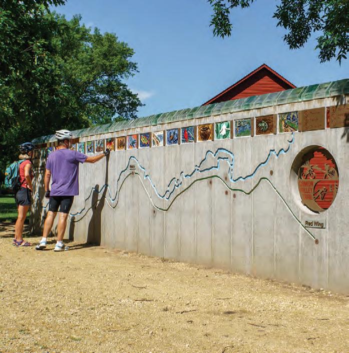
Map mural at the Welch rest stop. Jan Lasar photo
Shady rest stop along the trail. Jan Lasar photo
Root
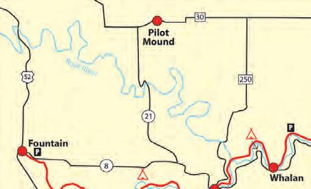
River/HarmonyPreston Valley State Trail
60 miles
The Root River and Harmony-Preston Valley State Trail system in the heart of southeastern Minnesota’s Bluff Country is one of the major trail destinations in Minnesota. Scenic views, historic buildings and points of interest along both trails attract visitors from all over and the rural communities in this trail network provide many services. Campgrounds, bed and breakfasts, restaurants, museums, outfitters and unique stores can be found in many of the trail towns.
The Root River Trail runs from Fountain all the
way through Lanesboro, Whalan, Peterson, Rushford and Houston for a total of 42 miles. The former rail bed follows the meandering Root River through spectacular limestone bluffs, picturesque farms and small towns. It is generally flat and level, except for short stretches on its eastern segment.
At Isinours Junction it connects with the 18-mile-long Harmony-Preston Valley Trail, which connects the two communities for which it was named. The northern two thirds of this trail are built on abandoned railroad grade and are fairly flat. The southern segment leaves the constraints of the railroad bed and climbs to the rim of the valley with great views of the countryside.
Stop and see a large sinkhole at the Karst Interpretive Site a half-mile from Harmony. A similar site is about a mile from Fountain on the Root River Trail. Summer uses on both trails include hiking, biking and inline skating. The Root River Trail is groomed for crosscountry skiing between Isinours Junction and Houston.
Along the Trail:
Fountain: Official Sinkhole Capital of the United States. View them from the trail.
Harmony: Home of Niagara Cave, which has an underground waterfall.
Houston: International Owl Center with live owls on display.
Isinours Trail Junction
Lanesboro: The Commonweal Theatre and public art displays make Lanesboro a destination for the art lover.
Peterson: Peterson Station Museum of Norwegian culture.
Preston: Minnesota’s Trout Capital has the National Trout Center, and is close to Forestville/Mystery Cave State Park.
Rushford: The historic train depot on the trail houses a museum and rest area.
Whalan: A small town with a world-famous pie shop. Home of the annual Standstill Parade, where the parade marchers stand still and the spectators walk around.
Connections: An extension of the Harmony-Preston Valley Trail south toward Niagara Cave and then the Iowa border is currently being worked on. On the Iowa side trail groups are working to connect the Prairie Farmer Trail from Cresco, IA to the Minnesota side to form an interstate trail network.
Another leg of the trail linking Preston with Forestville/Mystery Cave State Park is in the works as well.
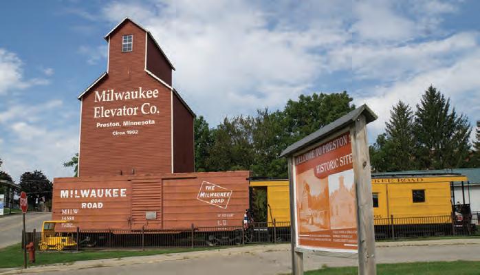
Preston’s historic elevator at the trailhead. Jan Lasar photo
At the confluence of the north and south branches of the Root River near Lanesboro. Jan Lasar photo
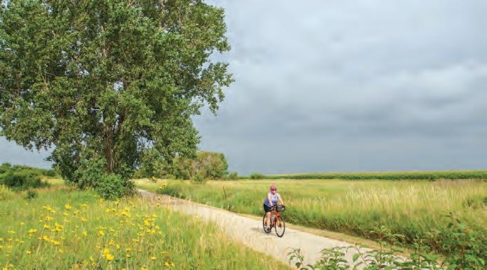
Shooting Star State Trail
28.75 miles
The Shooting Star Trail is a paved trail through remnants of tall grass prairies with an abundance of native wildflowers. Much of it is built on an abandoned railroad grade. The eastern terminus is in Le Roy, MN, which is on MN Hwy. 56 just west of its junction with US 63 right above the Iowa/Minnesota state line. The trail soon passes through Lake Louise State Park and continues northwest to the towns of Taopi, Adams and Rose Creek. The final leg of the trail travels north out of Rose Creek and picks up Austin's network of city trails north of I-90.
Highlights: Remnant tallgrass prairie with wildflowers like prairie smoke, rattlesnake master, wild indigo, aster, goldenrod and blazing star wildflowers. The trail passes by several interpretive and recreational opportunities, including Rustic Retreat Wildlife Management Area, Shooting Star Prairie Scientific and Natural Area, Taopi Prairie Interpretive Area and Mower County Natural and Scenic Area.
Connections: The last leg of the project calls for the trail to drop south from Austin to the town of Lyle on the Minnesota-Iowa border. While a timeline for this last part has not been established, another extension has the potential to become a reality much sooner.
From near Taopi, a four-mile leg will extend to the Minnesota-Iowa border and connect to the Wapsi-Great Western Line Trail. This 27-mile paved trail travels southeast from the state border into Elma, IA. Together with Austin’s city trails, the resulting network will be 72 miles long.
Rural scene in Adams, MN. Jan Lasar photo
Blazing Star State Trail
7.5 miles Albert Lea to Myre-Big Island State Park
The Blazing Star State Trail connects the city of Albert Lea with Myre-Big Island State Park with a paved six-mile segment. Another paved 1.5-mile segment can be found in Hayward, MN. The master plan for the Blazing
Star State Trail is to eventually link Albert Lea, Hayward and Austin. There, it’ll connect to the Shooting Star State Trail which runs from Austin to Le Roy for about 28 miles. The resulting trail system will be about 50 miles long and connect Myre-Big Island and Lake Louise State Parks. Although short, this trail is a favorite with southern Minnesota birdwatchers, especially during migration time at the state park.
The Blazing Star State Trail at Myre-Big Island State Park. Jan Lasar photo
Albert Lea
Luverne Loop Bike Trail (7.4 miles) Hwy 75 Bike Lanes
Blue Mounds Trail (4 miles)
Christopher Martin Ashby Memorial Trail (2 miles)
Luverne Loop Trail
13 miles with Blue Mounds Trail and Christopher Martin Ashby Memorial Trail
This paved trail system in the far southwestern corner of Minnesota circles Luverne and connects many of the town’s parks and sights. Downtown and its many shops and restaurants are never far away, and the scenery varies between prairie views, quaint neighborhoods, and the meandering Rock River. The trail wraps around the city, offering a harmonious mix of scenic nature and easy access to urban areas. As you explore, you'll come across numerous parks and attractions, such as the Children's Remembrance Garden, and you'll also pass through wildlife habitats and native grasslands.
Start your trip at the modern trailhead building on the southeastern edge of town, and connect to other trail segments from there.
In the north, the Luverne Loop connects to the Blue Mounds Trail, which adds another paved four-mile leg into Blue Mounds State Park. See the striking rock formations of the park rise up from the ground as you travel north across the prairie. At the park, you can discover miles of hiking trails winding through tallgrass prairie, see a herd of bison, and take in the stunning scenery of Sioux Quartzite cliffs.
The two-mile Christopher Martin Ashby Trail starts on the east bank of the Rock River by the main trailhead, crosses the river, and winds through Luverne City Park. It then continues east out of Luverne along Rock River Road, ending at Rock County Road 9. The Ashby Trail provides a peaceful ride through lush green areas with few road crossings, perfect for a relaxing bike ride.
Riders give a thumbs up on the annual Luverne Loop Tour. Jan Lasar photo
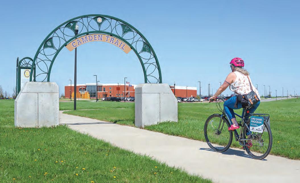
Camden Regional Trail
15 miles
Marshall, MN to Camden State Park
The Camden Regional Trail connects the southwestern Minnesota town of Marshall to nearby Camden State Park and makes for a nice afternoon outing in southwestern Minnesota.
Start your trip at the Red Baron Arena and Expo on the southeastern edge of town, where a tunnel takes you safely under Hwy. 23 and onto the campus of Southwest Minnesota State University. The route starts north, then cuts west across the northern outskirts of Marshall. After the airport and the golf course, the trail starts heading southwest through a scenic stretch along the banks of the Redwood River, then along Hwy. 23. You'll pass through the small town of Lynd, MN before you begin your ascent to the edge of Camden State Park. After another mile on a very scenic and winding section, you’ll reach the park office and the end of the trail.
There are plenty of benches to rest along the Camden Regional Trail and interpretive kiosks with maps tell the natural and historical story of the area.
Parking is available at the Red Baron Arena, Southwest Minnesota State University, Justice Park, Victory Park and the Camden State Park office. Water and restrooms are at Camden, Justice and Victory Parks.
Connections: Marshall’s network of on and off-street bike routes take you to some of the city's numerous parks and Camden State Park offers about 5 miles of mountain bike trails.
On the outskirts of Marshall, the Camden Trail travels along the Redwood River. Jan Lasar photo
To ride the Camden Trail, bring your own bike, or rent one from Marshall's bike share program. Jan Lasar photo
TRAIL CASEY JONES STATE
Casey Jones State Trail
19 miles total
Pipestone, Woodstock, Lake Wilson, Currie
The Casey Jones Trail is the first rails to trails conversion in Minnesota, authorized in 1967. It consists of three main sections, not yet connected to one another: Eight paved miles and two gravel miles between Pipestone and Woodstock, followed by two miles of natural surface trail, 1.5 miles of natural surface west of Lake Wilson and a 5.5-mile paved loop between Lake Shetek State Park and Currie. The out and back ride from the Pipestone trailhead gives riders a close -up look at farm fields and wind turbines and makes for an easy afternoon outing. The so-called Currie Loop does not have a designated trailhead, but parking is available at Forman Acres County Park just outside Lake Shetek State Park or End-O-Line Railroad Park and Museum. Another option is to park at the picnic area inside the state park, ride the park road and access the trail at
the park office. Traveling counter-clockwise from there, you'll first pass the Lake Shetek State Monument and ride between Smith
and Shetek Lakes. At a dam at the very southern tip of Lake Shetek, the Des Moines River emerges. After another mile, the trail takes a sharp left turn at End-O-Line Railroad Park and makes its way back to the park. Eventually, the Casey Jones Trail will span over 100 miles from Luverne through Pipestone to Redwood Falls.
Along the Trail: In Pipestone, the Indian Lake Trail will make a loop of about four miles on the northern end of town when complete. Currently, the 2.6-mile trail travels north from the city campground, then heads west to round the northern edge of the wildlife refuge adjacent to Pipestone National Monument. This section has great views of restored prairie and its namesake lake with spots to pull over and take in the scenery. The trail ends at 9th St. NW, but the next phase of construction will have it extend through Hiawatha Pageant Park and complete the loop at the campground. A later phase will have a leg extend south into downtown Pipestone.
The Casey Jones State Trail travels on abandoned railroad grade. Jan Lasar photo
SAINT JAMES & WATLINE
Saint James and WatLine Trails
9 miles total Saint James
The four-mile Saint James Bike Trail circles Saint James Lake and connects to the 5-mile WatLine Trail. Start at Memorial Park, which is close to the town’s attractions and restaurants, as well as the municipal pool, Tiell Park Campground, and the Saint James Railroad Museum Park. A ride in either direction will take you to the connection to the WatLine Trail. This southern leg takes you through open farm country to Long Lake County Park, which has a swimming beach. An extension of the trail farther south into Ormsby is in the works.
View of the city’s grain elevator from the southern end of Saint James Lake. Jan Lasar photo
Memorial Park serves as the trailhead for the Saint James Trail. Jan Lasar photo
SOO LINE TRAIL
Soo Line Trail 10 miles
This scenic trail starts at the northern end of the Lake Wobegon Trail between Holdingford and Bowlus at the Stearns and Morrison County line. The quiet trail crosses a pastoral landscape with an occasional farm and wetland.
Along the Trail: Bowlus’ trailhead resembles the long-gone railroad stop and has bathrooms, parking and water.
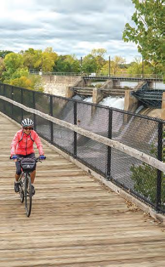
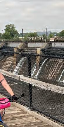
Four miles farther to the northeast, the trail crosses the railroad trestle just downstream of Blanchard Dam on the Mississippi, which has a 1920s hydroelectric station still in use today. Cyclists have access to Charles A. Lindbergh State Park via the Mississippi River Trail Scenic Bikeway on the west side of the river.
The paved section ends at a trailhead at Highway 10 near Royalton, but continues unpaved to Superior, WI with another paved 11-mile segment between Isle and Onamia near Mille Lacs and Father Hennepin State Parks.
Connections: A few miles north of Holdingford, the Soo Line Trail connects with the Lake Wobegon Trail in Stearns County. A future trail connection to the Paul Bunyan Trail, the Camp Ripley/Veterans State Trail, is currently in the planning stages.
This link will start at Blanchard Dam, run through Charles A. Lindbergh State Park, then on to Camp Ripley, and finally reach the southern terminus of the Paul Bunyan State Trail at Crow Wing State Park. When complete, the Camp Ripley/Veterans State Trail will link the Central Lakes, Lake Wobegon, Paul Bunyan, Heartland and Mi-Gi-Zi trails and become a major connector between central and northern Minnesota’s trails. The first mile between Little Falls’ Mill Ruins Park and the state park has been built.
The Soo Line Trail crosses the Mississippi River at Blanchard Dam. Jan Lasar photo
Trails IN LITTLE FALLS
STORY
&
PHOTOS
BY
JAN LASAR
WITH THE PROMISE OF BEAUTIFUL SUMMER
WEATHER, MY WIFE, JEN, AND I DECIDED TO VISIT LITTLE FALLS ONE DAY. THIS CENTRAL MINNESOTA TOWN ON THE MISSISSIPPI HAS A UNIQUE BLEND OF HISTORY AND NATURE THAT WE WERE EXCITED TO DISCOVER, AND WE FIGURED THAT RENTING E-BIKES WOULD LET US SEE IT ALL WITHOUT HAVING TO DRIVE FROM PLACE TO PLACE. ZIPPING AROUND TOWN ON OUR FIRST EXPERIENCE WITH E-BIKES TURNED WHAT COULD HAVE BEEN AN ORDINARY DAY INTO AN ADVENTURE, WITH GAS LEFT IN THE TANK AT THE END OF THE DAY, LITERALLY, AND FIGURATIVELY.
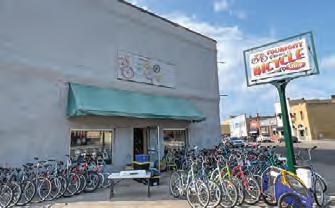
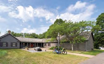
Dave and Susan Sperstad are the husband-and-wife team behind TOURIGHT BICYCLE SHOP, which opened in 2015 and has since become a certified Bicycle Friendly Business. The two also started Little Falls Bicycles, a non-profit with the goal of increasing bike ridership in the area by refurbishing used bikes and teaching people to maintain and ride them.
We found Dave waiting for us, sitting on a chair on the sidewalk in front of the shop on a pleasant morning, coffee cup in hand. It didn’t take him long to set us up and explain how the bikes work. It was our first time on an e-bike, and our reaction was likely the same as everyone else’s. When we first stepped on the pedals there was a “whoa!” moment when the machine sprang into action and propelled us forward. After a few circles in front of the shop, we took off with our built-in tailwind. We still had to pedal, however, because when we stopped working, so did the bike.
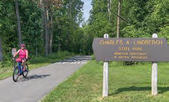
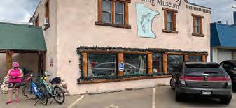
Our first stop was the LINDBERGH HOUSE AND MUSEUM across the street from CHARLES A. LINDBERGH STATE PARK. To get there, we briefly rode on the fledgling CAMP RIPLEY/ VETERANS STATE TRAIL. It’s only a mile long now, but will make a connection between the Soo Line Trail and the Paul Bunyan State Trail someday. The state park and the museum are on the grounds of what once was the Lindbergh family’s farm and the museum and historic summer home are now managed by the Minnesota Historical Society. Just down the road, we stopped at the CHARLES A. WEYERHAEUSER MEMORIAL
MUSEUM. e Morrison
Dave The CountyHistorical haspermanent
County Historical Society has permanent exhibits here which tell the story of early life of Little Falls as a lumber town. We had only ridden about two and a half miles with two stops, and Jen was itching to see what that e-bike could do. From the museum, we turned south onto the GREAT RIVER ROAD, one of Minnesota’s 22 scenic byways. It’s also part of the MISSISSIPPI RIVER TRAIL SCENIC BIKEWAY (MRT), a signed bike route following the river from start to finish. Part of the 600-mile route through Minnesota passes through Little Falls.
It was a beautiful day for a bike ride, with mild temps and plenty of sunshine. A natural tailwind made things easy, but with the boost from the motor, the ride turned into a thrill. We were able to chat and keep a 17-mile-an-hour pace without breaking a sweat, and that just put a smile on our faces. When we came to a hill, Jen couldn’t take it any longer. She set the boost to max, and with a “See ya later!” she blasted up the incline and waited for me at the top.
When we reached BLANCHARD DAM, we turned onto the SOO LINE TRAIL, which crosses the Mississippi River on a former railroad trestle. We took a break there and enjoyed spectacular views of the hydroelectric dam and the downstream path of the river as the spray from the roaring waters settled on us and a conjured up a short-lived miniature rainbow. The scenic Soo Line Trail takes off from the northern end of the Lake Wobegon Trail between Holdingford and Bowlus, at the Stearns
and Morrison county lines. The paved section ends at a trailhead at Highway 10 near Royalton but continues unpaved to Superior, WI, with another paved 11-mile segment between Isle and Onamia near Mille Lacs and Father Hennepin State Parks.
Now on the east side of the river, we made our way back to town, following Hillton Road. Our natural tailwind had turned into a headwind, but the motor fought back and our average barely dropped. Back in town, we parked our rides at the MINNESOTA FISHING MUSEUM AND HALL OF FAME. Of course, we had to browse the O-Fish-L gift shop before we moved on. Our exploration of Little Falls continued with a visit to PINE GROVE ZOO. If you want to see what the Little Falls area looked like before the lumber companies came, the stately, old-growth white pines adjacent to PINE GROVE PARK will give you an idea.
We ended the day at Little Falls’ STARRY EYED BREWING. It was nice and sunny, and their big garage door was open to the patio. Capping off a day of riding with a cold pint was all we needed.
LINCOLN COUNTY
BASE CAMP: Hole in the Mountain County Park Lake Benton, MN
RIDE YOUR BIKE
Turn your wheels toward Tyler, MN, for a very special celebration. When Danish colonists established a Lutheran congregation there in 1885, they brought their culinary traditions with them and introduced the Aebleskiver to the new world. The town still celebrates Aebleskiver Days in July, in honor of this spherical pancake, which is the main attraction of this festival. Ride gravel roads to Tyler, following the Buffalo Ridge, part of a geological feature called the Coteau des Prairies, a massive plateau 200 miles long and 70 miles wide that covers the eastern Dakotas and southwestern Minnesota. It sits significantly higher than the surrounding area, which you'll notice while climbing out of Lake Benton for a 16-mile roundtrip through rural Lincoln County.
HIT THE WATER
For an easy paddle, put the kayaks into Lake Benton and explore the scenic shoreline for a while. The lake is about five miles long, a mile and a half at its widest, and besides a couple of resorts and small neighborhoods, the shore is undeveloped. Near the boat landing on the western end of the lake, a narrow strip of land reaches out into the water and makes for a great spot to watch the sunset.
Currie was at the en Western the rusty, crook into the wo the park C and ride p The last co a v b beetween Smi . d ebleis tion of this festival. , MN
MURrAY COUNTY
BASE
SOUTHWEST
BASE CAMP: Lake Shetek State Park | Currie, MN T to visit End-O-L and Museum, which includ and many from M past. The main attraction is which was used to turn eng
RIDE YOUR BIKE
Follow the Casey Jones Trail into nearby Currie to visit the End-O-Line Railroad Park and Museum, which includes a steam engine and many buildings from Murray County's e main attraction is a manual turntable which was used to turn engines around 180 degrees and send them back east, because Currie was literally at the end of the line for the Chicago Western Railroad. Today, the rusty, crooked tracks disappear into the woods at the edge of the park. Complete the loop and ride past the Currie Dam. e last couple of miles travel through a very scenic section between Smith and Shetek Lakes.
For a bit more adventure, take the bike out to the local vineyard for a roundtrip gravel ride of about 18 miles. Besides corn and soybean fields, an amazing number of little parcels of natural areas, set aside as Wildlife Management and waterfowl breeding areas line the route, brimming with wildflowers.
EXPLORE A PARK
At Lake Shetek State Park, walk the Hiking Club Trail across the Loon Island Causeway, a narrow 1000-foot land bridge. Loon Island is small and the hiking trail that circles it is less than a mile long, but it’s worth a visit. You’ll learn about the area’s natural history reading the interpretive signs along the way.
STORY & PHOTOS BY JAN LASAR
LAST SUMMER, THE TRAILS TEAM VISITED THE SOUTHWESTERN CORNER OF THE STATE IN SEARCH OF ADVENTURE AND NEW DISCOVERIES. WE FOUND THAT ESTABLISHING A BASE CAMP AND EMBARKING ON DAY TRIPS TO DISCOVER THIS REGION WAS A GREAT APPROACH TO EXPLORATION. IT ALLOWED US TO BE CLOSE TO THE ACTION WHILE PROVIDING A COMFORTABLE AND FAMILIAR SPOT TO RETURN TO EACH EVENING. WE DELVED DEEPER INTO THE AREA’S ATTRACTIONS WITHOUT THE HASSLE OF CONSTANTLY PACKING AND MOVING, AND EVEN DURING THE HEIGHT OF SUMMER, THE CAMPGROUNDS WERE QUIET, AND THE CROWDS WERE FEW.
JACKSON COUNTY
BASE CAMP: Robertson County Park | Jackson, MN
RIDE YOUR BIKE
Jackson County operates nine parks and recreation areas, four of which offer camping. Three of these four, Brown, Anderson and Robertson Park, are clustered around Loon and Pearl Lake, southwest of Jackson, near the Minnesota-Iowa border.
The paved Loon Lake Trail connects Brown to Robertson Park, then drops south through farm fields and prairie and ends at Iowa's MiniWakan State Park. It’s a pleasant five-mile ride.
Belmont County Park’s mountain bike trails wind through 80 wooded acres on the Des Moines River. Three trail loops with Lakota names make for a total of five miles of singletrack. Wowahwa (peace) is an easy, flat, beginner trail that’s just shy of one mile long. Ian Shasha Wapka (Red Stone River, the Lakota name for the Des Moines River) is a 1.8-mile, intermediate ride and the 2.7-mile Thaththanka (bison) trail is a good fit for advanced riders. Warm up with a couple of loops on the easy trails, then drop into the ravine and on to more advanced riding.
COTtONWOoD COUNTY
BASE CAMP: Talcot County Park | Dundee, MN
RIDE YOUR BIKE
Ride the paved trail around the Mountain Lake's namesake 220-acre lake for a great way to get warmed up before hitting the shops and restaurants in town. The northwestern corner of the five-mile trail passes through the grassy knolls of the Mountain Lake State Wildlife Management Area, with unimpeded views of the town and the lake.
EXPLORE A PARK
The Jeffers Petroglyphs historic site in Comfrey, MN, has held special significance for the humans who traveled across the continent in ancient times, and they have left their marks in the reddish quartzite that rises from the prairie. Over the millennia, ancestors of today’s Native Americans used stone tools to carve petroglyphs
In Jackson, make your rounds around town, literally, on the Des Moines River, Sunset and Nelson Creek bike trail loops. While the Sunset Loop makes an almost complete circle around the perimeter of Jackson, the Des Moines River Loop travels on both sides of the river with scenic views of the rushing waters. Part of the Nelson Creek Trail cuts through a picturesque piece of land along its namesake creek.
EXPLORE A PARK
Quiet 200-acre Kilen Woods State Park on the Des Moines River has five miles of hiking trails that travel through a diverse landscape of open prairie, river bottom meadows and oak forest. Piece together a nice, easy hike on the Sioux, Riverside, Ox Cart and Rock Creek trails. Much like the trails at Belmont County Park, just a mile and a half to the southeast, the hiking paths here meander down steep slopes, cut into the glacial drift by the Des Moines River. Beginning in September, monarch butterflies are plentiful in the meadows as they gather for their annual migration.
into the hard rock to tell their story through depictions of people, animals, constellations, and maps. There are more than 5,000 of these carvings, and some of the oldest date back 7,000 years. Special late-day viewing times allow you to walk right up to the petroglyphs without shoes and see them in a more favorable evening light.
At Red Rock Falls County Park, near Sanborn, MN, little Mound Creek takes center stage. It becomes a breathtaking waterfall as it tumbles down a 30-foot rock cliff, pooling at the bottom. Similar to the Jeffers Petroglyphs, located just four miles away, these falls have historically attracted indigenous people. A footpath that circles the gorge leads visitors to another tiered waterfall further upstream.
TRAIL PARTNERS
BIKE SHOPS
FITZHARRIS BIKE & SPORT
320-251-2844 105 7th Avenue S, St. Cloud www.fitzharrismn.com
JAKE’S BIKES 320-219-7433 419 N. Nokomis Street, Alexandria www.jakesbikes.com
REVOLUTION CYCLE AND SKI 320-251-2453 160 29th Avenue S, St. Cloud www.revolutioncycleandski.com
TOURIGHT BICYCLE SHOP 320-639-2453 124 2nd Street NE, Little Falls www.tourightbicycleshop.com
BIKE KING 651-457-7766 6489 Cahill Avenue, Inver Grove Heights www.bike-king.com
CARS BIKE SHOP
763-784-6966 2661 Co Road I & Old Hwy. 10, Mounds View www.carsbikeshop.com