


Mount Vernon Contact:
Craig Lindholm, City Administrator
109 N Kaufman Street
Mount Vernon, TX 75457 Office: 903.537.2252
MHS Planning & Design Team:
Hunter Rush, Senior Planner & Partner
John Waltz, Planner
Zach Clark, Planner
Jonathan Povoski, Graphic Designer 212 W 9th Street Tyler, TX 75703 Office: 903.597.6606
MHS Planning & Design, LLC would like to thank the following leaders and volunteers for their input in the development of this plan. A special thanks to invested citizens, the Franklin County Industrial Foundation, Economic Development Corporation, and City Staff for their participation and input during the planning process.
City of Mount Vernon City Council:
Brad Hyman, Mayor
Mark Huddleston, Mayor Pro Tem
Rebecca Bailey, Council Person
Harold Cason, Council Person
Mary Keys, Council Person
Martin Carrascosa, Council Person
City of Mount Vernon Economic Development Corporation:
Mark Sachse, President
Roger Gekiere, Vice President
Jeff Byrnes
Kevin Anthony
Jack Carlson
G.W. Sharp
Julia Munoz
Franklin County Industrial Foundation:
Frankie Cooper, Director
Tracey Reed, Director
Len Lowry, Director
Landon Ramsay, Director
Bob McFarland, Director
Jennifer Harland, Director
Jack Carlson, Director
Jerry Hubbell, Director
Jeff Byrnes, Director
Ryan Morris, Director
Stan Lowry, Director
Gail Reed, Director
Scott Lee, County Judge
Dr. Jason McCullough, S, Mount Vernon ISD
Craig Lindholm, City Manager
Theresa Brown, President, Chamber
Dana Reeves, Manager, Water District
The City of Mount Vernon partnered with MHS Planning & Design (MHS) in 2023 to perform an analysis of the city’s northern and southern corridors and make recommendations for future growth. The Executive Summary is intended to briefly explain the process utilized to identify existing conditions, determine the needs of the city, and create a road map to develop a strategic plan that meets the desires of the residents and community leaders. This plan shall serve as a guide for how the City of Mount Vernon can best develop in specific growth areas over the next five years.
The time is now for the Mount Vernon community to cast a vision for the corridors that will positively affect the culture of the area. The city is in an ideal position for local leaders to make decisions that can lead to a well-rounded community as more people are choosing to live here. This is important for current and future residents of the City of Mount Vernon.
Mount Vernon is located along Interstate 30 between Dallas (70 miles west) and Texarkana (70 miles east). It is important to note that the nearby Dallas-Fort Worth (DFW) metroplex is rapidly growing. This growth can bring new residents and visitors to the community that are accustomed to amenities found in larger urban areas. In addition to the DFW population growth, the City of Texarkana
is making changes which can attract new residents. The effects of these changes can spill over into Mount Vernon. As Mount Vernon experiences this spillover growth and continues to develop, the physical and cultural infrastructure will need to be updated. Investment into civic, office, and commercial amenities should be a priority to the city as accessibility to parks and various retail and restaurant options enhance the quality of life for the community. The investment in the physical infrastructure will provide the city with the capacity for growth.
The Strategic Planning process requires an understanding of the existing physical, social, and economic conditions of the area to make recommendations. Throughout the process, there were meetings with stakeholders, the Franklin County Industrial Board, the Mount Vernon Economic Development Corporation (EDC), city council, and city staff to understand various perspectives of the strengths, weaknesses, opportunities, and threats of Mount Vernon. It is apparent that the City of Mount Vernon has many strengths, like its historic charm, lively downtown, and tight-knit community. The city also has the opportunity to prepare for future residential and commercial development. It is important to note that the
city should address existing weaknesses related to downtown development and land use planning. It is recommended that the city increase the number and types of jobs and housing, develop an upper education pipeline, improve healthcare access, adopt and update land use and road design policies, enhance gateways, and utilize a TIF district to develop a livework-play neighborhood.
To better understand the needs of the community and stakeholders, a full day was spent with discussions between local residents and community leaders. To continue tracking the progress of the Implementation Schedule and ensure the goals conform to the Strategic Plan, the City of Mount Vernon should review and modify this plan as necessary at a minimum of five years.
THERE IS AN OPPORTUNITY FOR ORGANIZATIONS TO COLLABORATE AND GROW MARKETS AROUND THE EXISTING AMENITIES AND NATURAL ASSETS.
The 2010 Comprehensive Plan is a document which purpose is to proactively address future socioeconomic changes and development by considering the interconnected influences of land use, housing, economy, environment, etc.
The 2016 Downtown Strategy Report describes the strategic prioritization of historic preservation to spur redevelopment projects in the Square.
The 2023 Strategic Plan describes analysis of the public’s goals and objectives from previous plans in relation to the potential developable acreage around the Interstate 30/ Highway 37 corridors.
The Capital Improvements Plan describes the location, schedule and financing of capital improvements as budgeted by the city. These improvements can include emergency services, Public Works projects, and Parks and Recreation areas.
The Annual Financial Report of the City of Mount Vernon describes the municipality’s financial health in relation to revenue and debt incurred from the previous fiscal year.
A strategic plan is a document adopted by City Council that serves as a guide on how to best develop the community. These plans are typically more focused compared to a Comprehensive Plan on certain topics, like a community’s goals and objectives or a specified area of a city. Building on previous plans’ data, the Mount Vernon Strategic Plan envisions a community where all people can call it home, a flourishing downtown that encourages residential, commercial, and recreational activity, and a healthy place that incorporates the three E’s of sustainability: Economic, Equity, and Environmental.
Urban economic theory suggests that any city, town, or village is either growing or shrinking - nothing remains stagnant. Influenced by economic and social factors like job opportunities and housing prices, populations constantly move to and throughout cities and regions. As businesses grow and houses are purchased, there are companies, developers, and investors who become increasingly interested and involved in building neighborhoods, offices, and storefronts - all which utilize a city’s infrastructure. In anticipation or response, a city should collaborate with and understand the needs of its citizens, study demographic trends, and implement best planning practices. This data-in-action leads to a proactive plan that encourages incremental growth, a minimized cost burden, and a stable living standard for
everyone. If a city only operates on a yearto-year management strategy, the rapid population growth or rapid population loss can strain municipal services and the quality of life for all citizens, leading to spikes in traffic congestion, crime, or shuttered businesses.
It is crucial for Mount Vernon to anticipate spillover growth from the development boom happening in the Dallas-Fort Worth (DFW) metropolitan area. DFW is expected to be the fifth fastest growing large metro area in the country by 2028. Typically, as growth occurs in an urbanized area, populations migrate to the outer suburbs, along major corridors, and around natural features such as lakes. While growth is occurring all around DFW, notable concentrations are happening to the north
and the east around Interstate 30. This increase in population and development is anticipated to continue, and the impact will most likely be felt in the surrounding communities.
As Mount Vernon is located near Texarkana, it is important to be aware of this community’s development. Although Texarkana is not currently experiencing an increase in population, the city is actively making improvements which could spur new population growth. In

Figure1: Major metro areas to the east and west of Mount Vernon
November 2022, the residents voted to approve a $189 million bond package that will go towards improving the Texarkana independent school district (ISD) system.
In addition to this approved bond, the Texarkana public transit system (the T-Line) is likely to be improved. The Texas Transportation Commission (TTC) provided nearly $70 million in additional funding to transit providers throughout Texas in 2022. This funding can be used to improve public transit systems, including the purchase of new vehicles, construction of new facilities, and expanding service areas. While Texarkana will not receive all the TTC funding, some of the funding can be distributed, which can improve the community’s transportation system. With the new funding opportunities and commitments set to enhance Texarkana,
there is an assumption that growth will follow. Mount Vernon may experience some of the spillover growth and see an increase in the number of visitors that travel to the community.
The major roadways in Mount Vernon are Interstate 30, Highway 67 & 37. TxDOT is continuously updating Texas roadways, and there have been discussion for improvements like lane widening, landscaping, and safety enhancements to I-30. Major roadway expansions are proposed to help meet the anticipated transportation needs that will arise from the rapid growth in personal vehicles and commercial freight.
Strategic planning helps municipalities and organizations like the Franklin County
Industrial Board and the Mount Vernon Economic Development Corporation, who can capitalize on infrastructure investments by making data-driven decisions and leveraging their economic incentives to help start and grow local industries and businesses. Popular tax mechanisms like the Tax Increment Financing (TIF) District and Hotel Occupancy Tax (HOT) can be utilized to secure funding for infrastructure and business support. Planned mixeduse neighborhoods utilizing a ‘live-workplay’ design with housing, boutiques, offices, and pedestrian-friendly amenities become a focal point for residents and a tourist destination for the region. These developments have efficient land use
and utility usage, minimizing the cost burden on the taxpayer while meeting the community’s various needs.
As a result of the steady growth rate in Mount Vernon along with the nearby presence of the DFW metroplex and Texarkana, it is crucial for the City of Mount Vernon to conduct a Strategic Plan to aim for a healthy and prosperous future. This Strategic Plan incorporates best development practices and research to the benefit of each citizen. With this plan, decision makers can help steer development in an optimized and efficient manner.
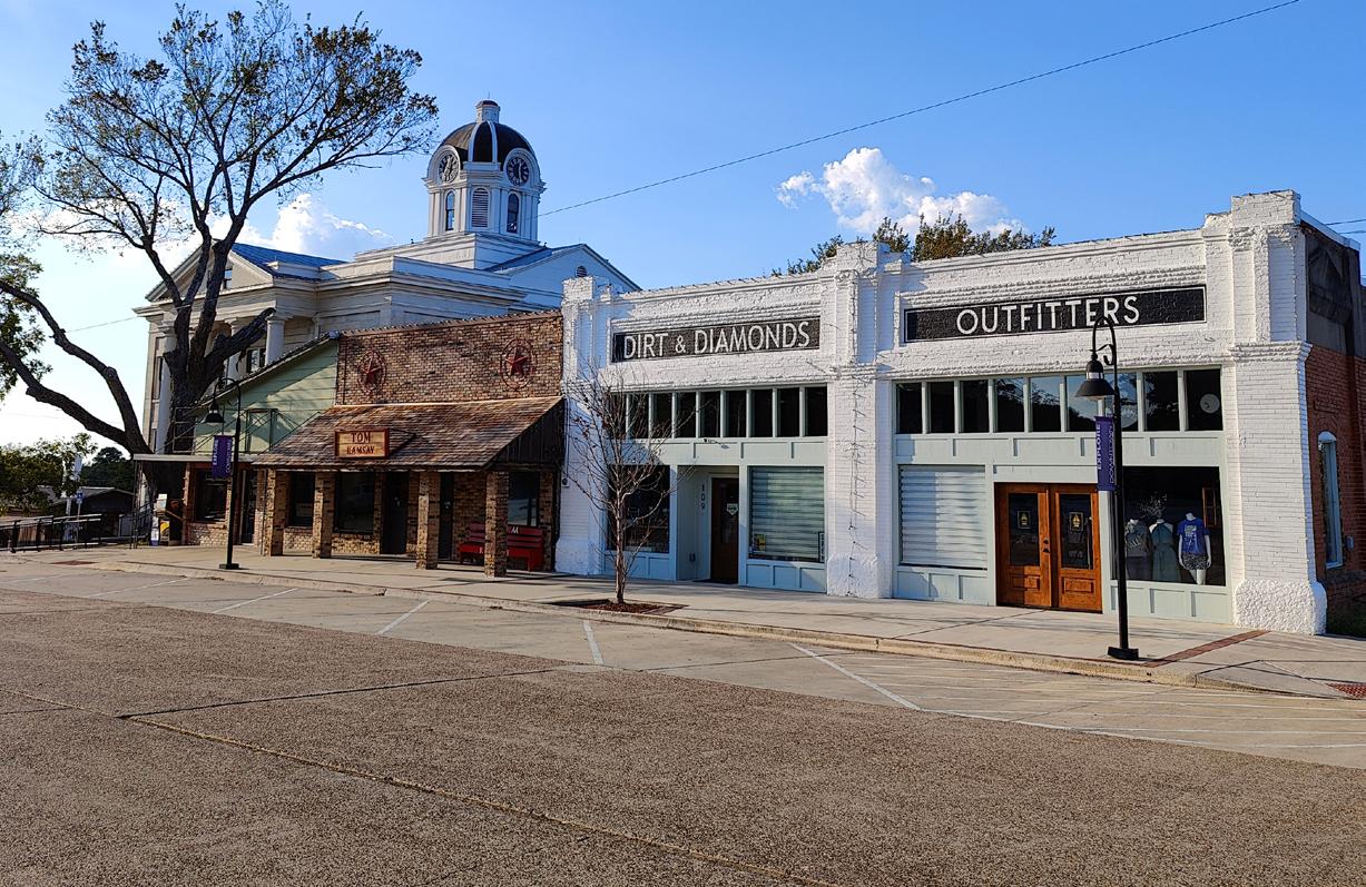
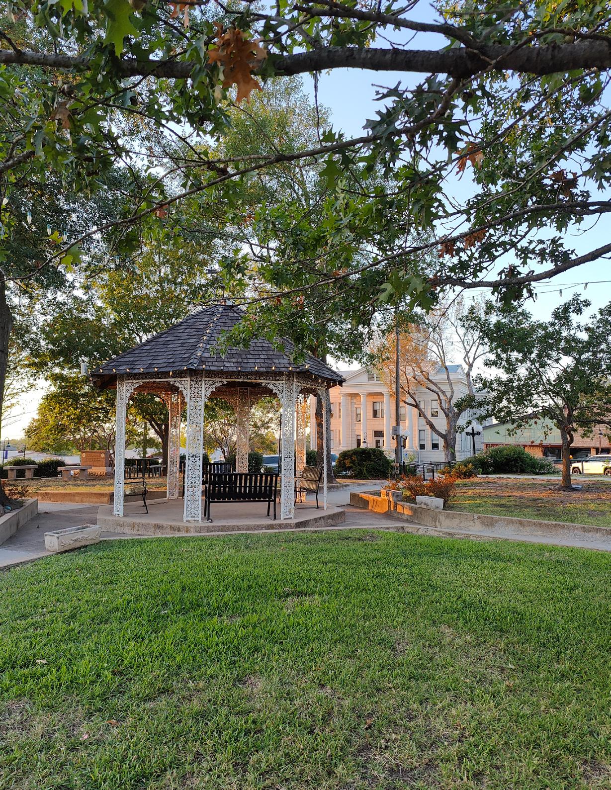
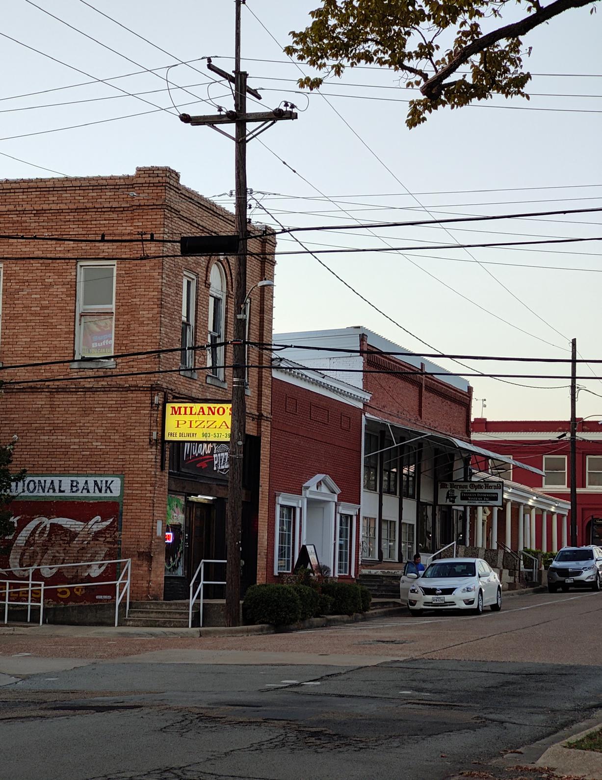
Mount Vernon’s main street square has a clean, updated streetscape serving stylish storefronts.
To provide effective and fiscally responsible municipal services in a manner which promotes our high standard of community life.
Mount Vernon is a caring community committed to excellence and quality of life, aspiring to be the community of choice for ourselves, our children, and future generation - beautiful, clean, vibrant, and safe.
We will strive to preserve our heritage and friendly hometown atmosphere and to celebrate the diversity of all our citizens.
This Strategic Plan is intended to build on the City’s goals & objectives derived from previous plans. The plan implements best land use practices and theory for the north and south corridors around Interstate 30 and City Lake. The purpose
of this Strategic Plan is to prepare for the growth of Mount Vernon, specifically in the northern and southern corridors, while promoting the health, safety, and welfare of the citizens.
Goal #1: Ensure there is sufficient housing for the community.
Objective 1.1: Create environments that allow for a variety of housing to be developed.
Objective 1.2: Ensure housing types are compatible with current and future land uses.
Objective 1.3: Create opportunities that encourage aging in place.
Objective 1.4: Promote homeownership.
Goal #2: Establish a unique sense of identity and provide a high quality-of-life for the community.
Objective 2.1: Promote pedestrian-oriented development that will encourage alternative transportation options ensuring pedestrians can safely walk to commercial and recreational facilities.
Objective 2.2: Implement design standards to create a cohesive community.
Objective 2.3: Ensure recreational needs of the community are being met.
Objective 2.4: Establish methods to increase civic pride.
Objective 2.5: Provide programming opportunities for all members of the community, regardless of age or ability.
Goal #3: Promote Mount Vernon’s assets toward the greater region to increase awareness and stimulate the local economy.
Objective 3.1: Enhance principal gateways & interstate exits with cohesive branding and scenery.
Objective 3.2: Explore partnerships with other organizational entities to develop unique points of interest.
Objective 3.3: Establish methods for historic preservation.
Objective 3.4: Enhance and promote downtown Mount Vernon.
Goal #4: Ensure Mount Vernon has a healthy and resilient business climate.
Objective 4.1: Pursue and encourage business creation and retention, especially local entities.
Objective 4.2: Ensure a diversified tax base through a balance of land uses.
Objective 4.3: Continue to develop higher education access.
Objective 4.4: Continue to leverage economic incentive packages.
Goal #5: Ensure the provision of a balanced park and open space system for the enjoyment of all Mount Vernon residents and visitors.
Objective 5.1: Provide diverse options for active and passive recreational opportunities for all, regardless of age or ability.
Objective 5.2: Encourage the distribution of parkland to assist with meeting National goals of having all residents within a 10-minute walk to a park.
Objective 5.3: Develop a maintenance program which will address maintenance schedules, park equipment, replacement funds, and maintenance for additional parks as they come online.
Objective 5.4: Ensure that all park facilities meet the most current safety guidelines and accessibility standards.
Objective 5.5: Develop trail systems along creeks, floodways, and utility easements that will link public and private recreational facilities, neighborhoods, and school campuses.
Objective 5.6: Identify, protect, and preserve quality natural open spaces for unstructured recreational activities, inherent aesthetic value, and protection of valuable ecosystems.
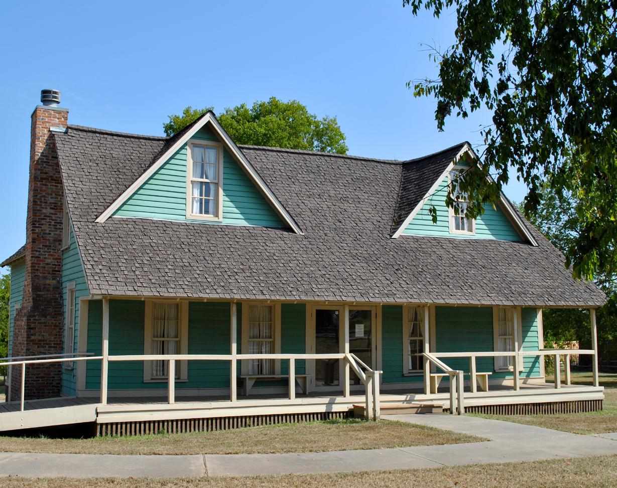
Mount Vernon, a town in Northeast Texas, has a history dating back to the mid-19th century. Known for its hospitality, unique charm, and historical character, Mount Vernon is a blend of the old and the new, where traditional values coincide with modern amenities.
The area where Mount Vernon is currently located was originally inhabited by the Caddo Indians. European settlers, primarily from Southern states, began arriving in the 1840s, attracted by the promise of fertile soil for cotton farming and the lure of vast, untamed wilderness. The town, first named “Lone Star” in 1848, changed its name to Mount Vernon in 1875. The City was allegedly named Lone Star based on George Washington’s Virginia estate, reflecting the settlers’ hopes and aspirations.
The town experienced significant growth after the railroad arrived in 1875. This infrastructure not only made the region more accessible but also facilitated commerce. Mount Vernon quickly evolved into a bustling agricultural hub, with cotton and corn being the primary crops. The presence of the railroad attracted businesses and sparked a boom in the local economy.
The turn of the 20th century brought further developments to the town. Mount Vernon became the county seat of Franklin County in 1912. This designation bolstered the community’s status and prosperity. Around the same time,
the town’s agricultural focus gradually diversified, with dairy farming and ranching becoming prominent.
Mount Vernon endured the hardships of the Great Depression in the 1930s, however, federal relief programs and community resilience helped the town weather this difficult period. Post-World War II, the town benefited from broader economic growth in Texas, diversifying into a variety of industries including manufacturing, retail, and services. Interstate 30 was completed in 1957, connecting several towns across East Texas to the route between DFW and Texarkana, which further bolstered the area’s industries. In the latter part of the 20th century, Mount Vernon began leveraging its rich historical heritage to promote tourism. The town is home to numerous historical landmarks, including the Franklin County Courthouse, which was built in 1912, and the Bankhead Highway Visitor Center, which showcases the history of one of America’s first transcontinental highways.
Although Mount Vernon’s story is deeply rooted in the past, it continues to evolve and grow, welcoming new generations while honoring its rich and diverse history. It is this mixture of heritage, hospitality, and heart that makes Mount Vernon, Texas, a unique and cherished part of American history. The town’s motto, “Preserving the Past, Embracing the Future”, accurately captures its spirit, embodying the town’s steadfast commitment to progress while honoring its past.
It is crucial for a strategic plan to have an overall analysis of the community. Online resources (including the Decennial Census and the American Community Survey) were utilized to assess and understand Mount Vernon’s demographics. The Decennial Census is conducted every ten years and is a comprehensive analysis of the demographics of the United States. The American Community Survey is an annual study that “fills in the gaps” between each census, and it uses a sample size to estimate an area’s demographics. Both of these surveys are conducted by the Census Bureau; however, the significant differences are the time period for when the study is conducted and the level of detail the survey covers.
The City of Mount Vernon has been continuously growing over the past several decades. The 2020 Decennial Census recorded a total population of
2,780 people. This population grew 4.5% between 2010 and 2020, which is faster than Franklin County in the same time period (-2.3%). This is important to note as even though Franklin County experienced a decrease in population, Mount Vernon is continuing to grow.
Overall, Mount Vernon is a young community, with a median age of 33.5 years old. The median age for Mount Vernon is younger than Texas (34.8 years), and Franklin County (42.4 years). The younger age of this community is important to note as younger communities generally have different needs and lifestyles than older communities. Historically, it has been researched that younger generations are more likely to live in urban areas rather than suburban areas. This is important to be aware of as urban areas typically provide environments where residents can live, work, and play, including
Figure 2: Recorded and projected population growth of Mount Vernon
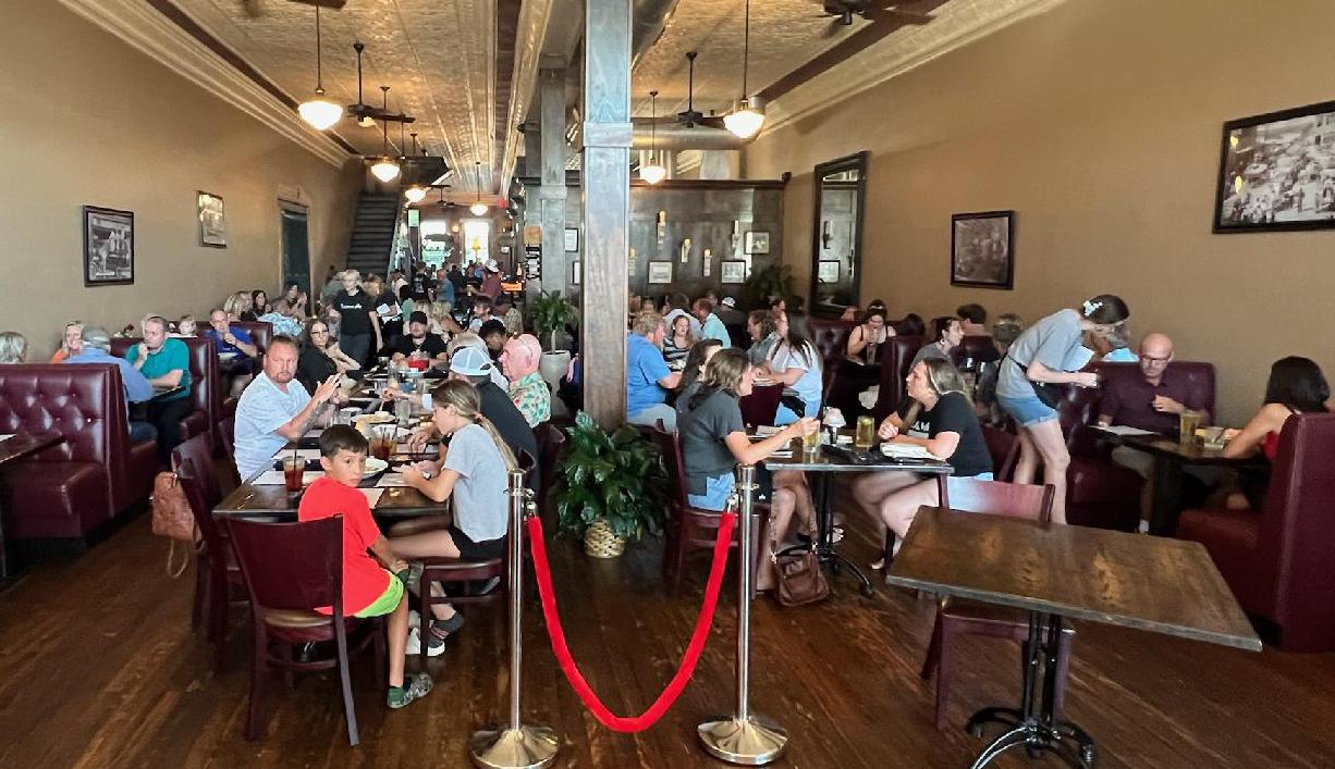
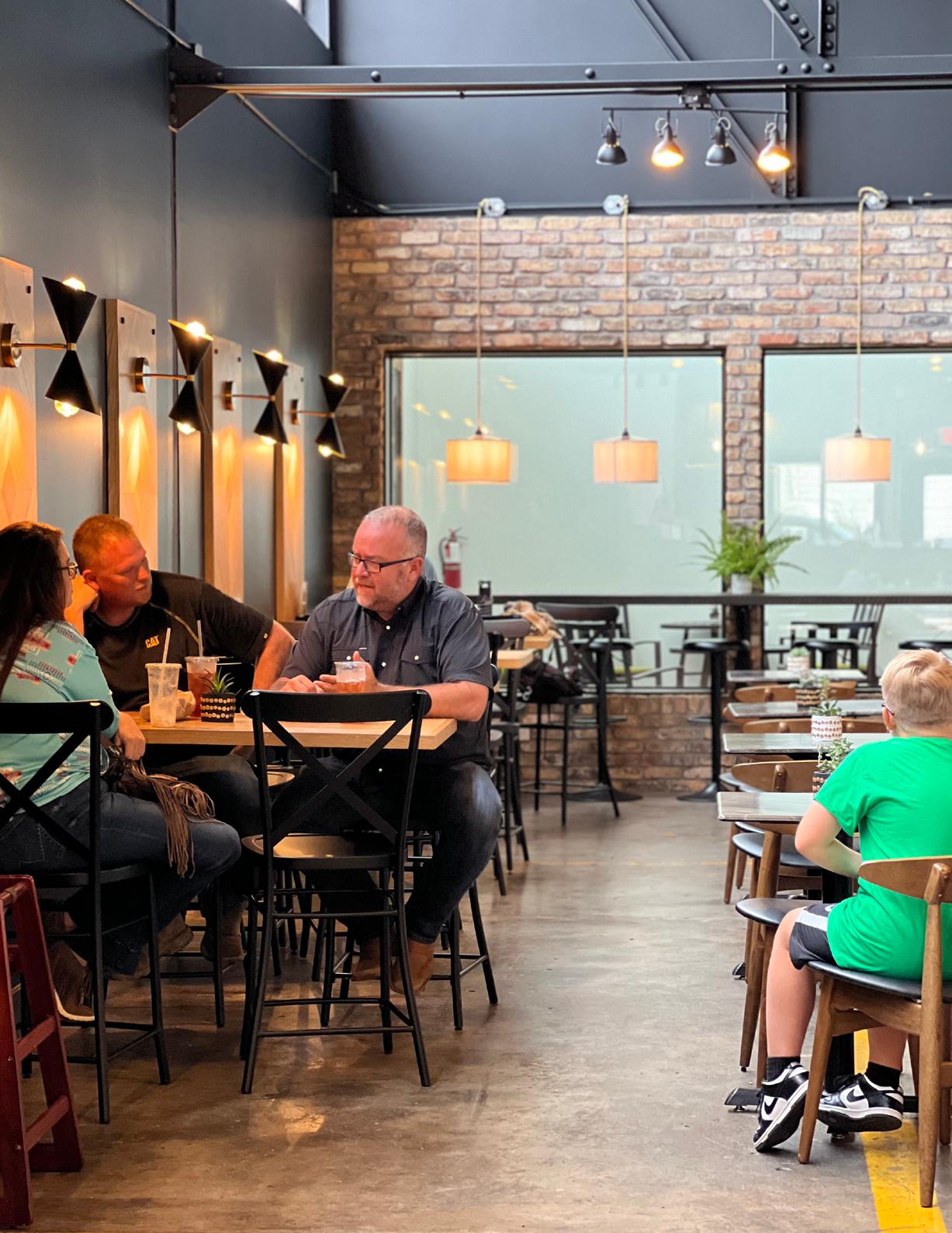
(Above) The Chophouse is one of the excellent restaurants on the Square created during a season of redevelopment.
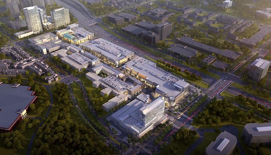
(Below) Architecture firm Gensler’s render of a new ‘urban burb’ development in Plano shows invested effort to retrofit a mainstreet to combat DFW’s urban sprawl.
Mount Vernon Corridor Strategic Plan
concepts such as walkable communities and mixed-use areas. In recent years, it has been observed that while a higher proportion of millennials are living in urban areas, there has been an increase in the number of millennials moving outside of the city center. Millennials have been moving to what is known as “urban burbs.” Urban burbs have facilities and amenities typically found in city centers, such as offices, grocery stores, restaurants, and parks all within walking distance to residences. This is important to note because while the DFW area may be expanding, more people will be choosing to live outside of the city - a growing demand that Mount Vernon could experience. Although this trend has been observed among the younger generation, this type of development also suits the older demographics. Market demand could shift to encourage developments that incorporate low maintenance housing within walking distance to a shopping area, restaurant, park, medical facility, pharmacy, etc.
The Census Bureau classifies race according to the U.S. Office of Management (OMB). This classification breaks race down into six categories: White, Black or African American, American Indian or Alaska Native, Asian, Native Hawaiian or Other Pacific Islander, and Some Other Race. The population of Mount Vernon predominately identifies as White (74%), then Black or African American (14%) followed by Two or More Races (8%). No
responses were recorded that identified solely as American Indian or Alaska Native, Asian, Native Hawaiian or Other Pacific Islander. The classification of races identified above separates race from the concept of ethnicity. This is important to note as people of Hispanic ethnicity can identify as any of the above races. Of the 2,780 recorded people in the 2020 Census, 20% identify as being of Hispanic origin.
The median household income for Mount Vernon has been significantly increasing. In 2020 the recorded median household income was $56,016. While this number is still lower than the median household income of Franklin County ($59,632) and
Two or More Races (8%)
Some Other Race (4%)
Figure 3: Racial breakdown of Mount Vernon’s population
Demographics
Texas ($67,321), Mount Vernon could catch up quickly to the County and State with strategic plans in place based on the proposed growth.
The employment sector in Mount Vernon is fairly diverse. This community consists of white-collar and blue-collar industries. There is not one specific industry that has a majority of the population employed, however there are a few sectors that are more predominate than others. The three largest industries include: Manufacturing (16%), Retail Trade (14%), and Healthcare & Social Assistance (14%). The breakdown of the employment industry is important as it can be used to determine how to best economically develop the community. There are generalist communities which offer a wide variety of employment opportunities, and then there are specialized communities which have a small variety of industries driving the local economy. Currently, Mount Vernon resembles a generalist community.
The City of Mount Vernon is a community where the majority (68%) of residents own the home they live in. This is in line with State (62%) and National (64%) trends, but it is significantly lower than homeownership rates in Franklin County (83%). This is important to note as not everyone may be able to afford or desire to own their own home. Having a variety of housing options such as single-family, multi-family, and middle housing (duplexes, townhouses, courtyard buildings, etc.) can ensure all community members can have their housing needs met.
The job occupations were analyzed to determine how people in Mount Vernon were employed. The most common job occupations include Production, Construction, Healthcare, Education, and Office Administration. This information reinforces the idea that Mount Vernon consists of white-collar and blue-collar workers.
Stakeholder engagement generates qualitative data and encourages personal investment from the community.
MHS met with the Franklin County Industrial Foundation board, EDC, and city staff multiple times throughout the development of this strategic plan. An initial kick-off meeting was conducted on June 1, 2023. This meeting laid out the foundation of the strategic plan, generated enthusiasm for members in the community, ensured all members understood the purpose and scope, and outlined the steps necessary to complete this plan. Stakeholder interviews were performed on July 7 at City Hall with key stakeholders and various on-line interviews following that date. The general audience of the stakeholder meetings consisted of community leaders, business owners, realtors, educators, and retirees.
The significant discussions at the stakeholder meetings and the data gathered at the site visits provided an understanding of the present conditions of the city along with short-term and long-term needs and desires. The public input was studied through a needs analysis which identified the community’s strengths, weaknesses, opportunities, and threats (SWOT). The needs analysis was considered alongside national best planning practices to develop the Strategic Plan’s planning analysis, recommendations and implementation schedule chapters.
Public input envisions the city becoming a vibrant, modern, and rural bedroom community to the DFW metropolitan area while maintaining historical values and
local charm. The mentioned goals include providing recreational opportunities, especially for the younger population and retirees, maintain current citizen population base and increase working professional population, attract an anchor business to draw in regional and local shoppers, and market the Square as an event area for festivals, cook-offs, music in the park, etc. Citizens desire to maintain the community’s identity of the Piney Woods, historic, and exceptional culinary experiences.
Current industries in Mount Vernon include distribution, food manufacturing, light industrial, healthcare, and welding. Another large employer is the Mount Vernon ISD and its affiliated schools. The stakeholders voiced an interest in growing the existing industries and increasing the number of IT jobs.
Corridor is to focus planning on City Lake. The land use components discussed included a walkable low density residential development around the lake, commercial (including a hotel) along TX-37, and sports tourism facilities in the nearby open space. Enhancing the I-30 gateway with wayfinding signage to tie into the north corridor is also desired.
In addition to the desired land uses within the city’s northern and southern corridors, the stakeholder and public input expressed a desire to include a retirement community. According to the discussion, people want to retire and have
The stakeholders view Mount Vernon’s proximity to Interstate-30 as a crucial catalyst for growth. The public consensus for the North Corridor is to enhance the I-30 gateway with a visually appealing, small scale commercial frontage that builds on the community’s historical charm. Behind the commercial land would be residential neighborhoods consisting of a variety of housing types geared towards working professionals and retirees. These homes are desired to be primarily owneroccupied.
The public consensus for the South
amenities associated with the community. These amenities include a clubhouse with recreational opportunities, restaurants, walking and biking trails, and other common social spaces that can facilitate community connection. Other preferred items include a gated garden homestyle neighborhood with a Home Owner’s Association. This neighborhood would allow for safe and slow travel with golf carts as a viable mode of transportation. While this land use helps achieve the objective of aging in place, most of these elements can be integrated into general neighborhood design.
The Needs Analysis is based on the stated desires from citizens, the Franklin County Industrial Foundation Board, the Mount Vernon EDC, city staff, current conditions, demographic data, and the consultant’s professional opinion. This Needs Analysis is the basis for the remainder of the Mount Vernon Strategic Plan, and the needs will influence and determine the priorities, recommendations, and implementation process. Through the Needs Analysis, staff can identify the strengths, weaknesses, opportunities, and threats of Mount Vernon.
IS AN OPPORTUNITY FOR
Mount Vernon’s notable strengths include its education system, community pride, perception of safety, and proximity to regional amenities. Mount Vernon ISD historically scores higher than the region and state average across all subjects (Texas Education Agency), and it had an overall ‘A’ rating in the region in 2022. Citizens are proud of the “small-town feel,” they support local businesses, and they view the area as safe. A standout detail from field observations is the significant number of homes that have yard signs indicating the original homeowner and
date of construction. The community has direct access to major transportation and shipping corridors of Interstate 30 and Blackburn Railroad rail line. I-30 connects Dallas through Arkansas to major shipping airports like Memphis, TN (FedEx headquarters) and Nashville. Data from a recent traffic study reflects this dynamic, as over 50% of the 38,000 daily vehicle trips are classified as distribution while 50% are residential traffic. In comparison, I-20, which lies 50 miles south and connects Dallas to Louisiana and the majority of the Southeast US, consists of 30% distribution and 70% residential trips. It is important to note that I-30’s connection to major production and distribution points can be appealing to companies that create large product volume. Input also views Mount Vernon’s proximity to Lake Cypress, the Mount Pleasant Regional Aiport, DFW and Texarkana as one of its greatest assets.
Mount Vernon’s weaknesses appear to be its underutilized interstate frontage, underutilized square, housing shortage, and limited visibility of amenities. Citizens commented the city lacks an attractive gateway or frontage that can draw traffic from I-30 to the Square. Assets like the Square and City Lake are farther from the major thoroughfare and not visible from other highways due to obstructions. While the Square has been greatly enhanced, it still lacks diverse and tax-
generating businesses. Civic events located at the Square are also lacking due to limited staffing and programming. Citizens do not think there is a strong and cohesive city-wide identity. The housing market is in a lull, partially due to high interest rates. Mount Vernon lacks starter homes, and existing properties are slightly more expensive compared to surrounding communities; homes valued at $180,000 to $250,000 are difficult to find. Housing demand outweighs supply, yet there are no evident signs of new housing being built. Outside of the Square and the historic neighborhoods, there is a shortage of charming amenities and buildings. The stakeholders perceive that the younger population are leaving and not later returning to the community,
which is commonly referred to as “Brain Drain.”
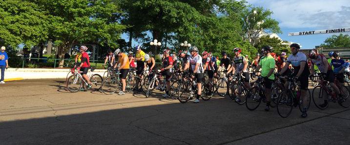
Public input believes the community’s opportunities are spurred by the potential residential, commercial, and industrial growth from interstate and rail access. Improvements to public infrastructure increase utility capacity for all types of development. Expansions to public infrastructure can attract new businesses and residents. It has been observed that the younger generations (millennials to generation alpha) prefer having amenities often found in urban areas. Expanding public infrastructure can create environments that allow these urban amenities to exist. There are opportunities to grow the rodeo, lake community, and
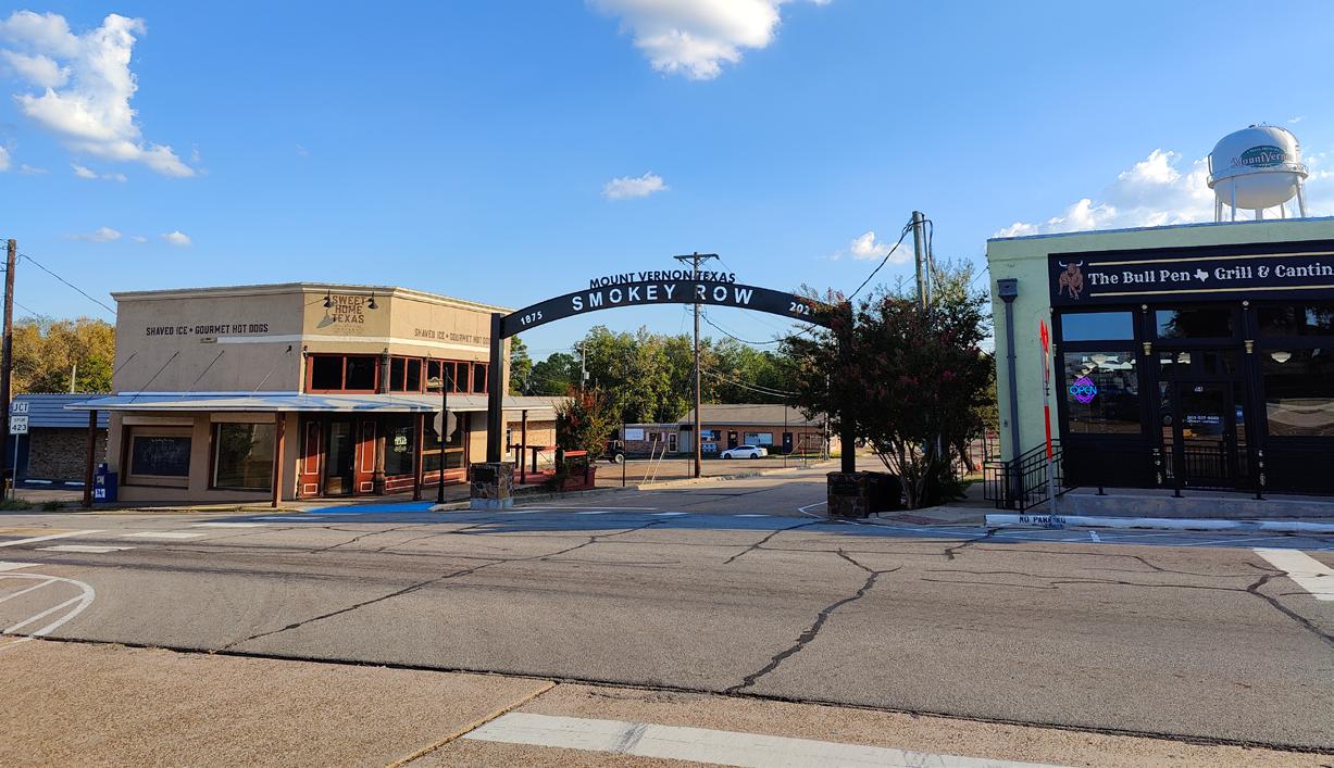
‘Smokey Row’ is both a wayfinding tool and a historical reference to the commecial area lost largely due to a fire.
During the discussions, stakeholders were asked to evaluate their community. From these evaluations, the Strengths, Weaknesses, Opportunities, and Threats (SWOT) for the city were identified. It is important to identify the SWOT of a community so that development recommendations are rooted in community input and best industry practices. The following section summarizes the findings:
• Education
• Community Pride
• Safety
• Proximity to Amenities
• Untapped Infrastructure Capacity
• Transportation and Shipping Industries
• Organizational Collaboration
• Land Use
• Civic Programming
• Millennials / Gen Z
• Housing Stock
• Aesthetics
• Programming
• Visibility
• Medical Service Access
• Youth Leaving Town
• Cultural Shifts
• Increased Cost of Living
• Construction Costs
• Zoning
Mainstreet markets through collaboration of various public and private organizations and sponsors.
The public expressed their desire for new developments to grow from the city’s existing culture and not conflict with it. The community does not want future retail and restaurants to be too expensive and strain the current population’s cost of living, yet they are also worried about being exposed to the mass development of fast food and big-box retailer chains due to lack of zoning protections. Other noted concerns were the unease regarding growth and increase in taxes, along with the already existing strained housing market.
and discourage sprawl. The city needs to enhance its civic infrastructure to retain its existing population and improve the quality of life for all citizens. The need to sustain the existing cost of living is vital. This need is not unique to Mount Vernon as many communities throughout the state have similar apprehensions. The purpose of the plan is to alleviate and strategically address these items through the recommendations.
Based on the SWOT analysis, the community needs consist of new developments, retained populations, enhanced branding, and updated programming. The city needs additional housing units at various price points for current and future residents. This necessitates increasing the number and payroll level of jobs. The city needs to adjust zoning, land use, and development policies to encourage incremental growth
Mount Vernon Corridor Strategic Plan
The following Planning Analysis & Recommendations expand on the previous Needs Analysis and align with the Values, Goals, and Objectives stated in earlier chapters. These are based on public input, discussions with the EDC and Industrial Foundation board, city staff input, and the consultants’ professional opinion. The corridor analysis and recommendations also consider the layout of existing roads, structures, and topography when determining potential locations for growth.
Influenced by the sociodemographic data and analysis, it is suggested that the recommendations be considered for implementation over the next three to five years. The recommendations should be implemented to ensure Mount Vernon meets the needs of the citizens, visitors, and city staff in the future and encourage sustainable growth.
It is recommended that the City of Mount Vernon:
Prepare for Housing Growth
Attract and Promote Businesses
Establish an Upper Education
Pipeline
Improve Healthcare Access
Incorporate Complete Streets & Traditional Neighborhood Development Policies
Encourage a ‘Live-Work-Play’ Development
Create a TIF District
Enhance Community Quality of Life
Assess Brand and Develop Placemaking Materials
Update the Comprehensive Parks, Recreation, and Open Space Master Plan
The following sections support the recommendations list by elaborating on best planning practices in light of local conditions, specifically the need for a ‘live-work-play’ neighborhood.
The Strategic Plan has been created with the anticipation of spillover population growth from DFW, Texarkana, and any unspecified metropolitan areas. This aligns with the community’s desire for more housing, as identified in the Need Analysis. Mount Vernon’s housing inventory appears to be limited, and traditional real estate theory suggests it is in the Recovery Phase of the real estate cycle. The real estate cycle occurs in four phases - Recovery, Expansion, Hyper Supply, and Recession. As the name suggests, Recovery follows a Recession, and the economy recovers as the average citizen is slowly able to
grow more spending capacity. While the rental population is high and home sales stagnate during this phase, existing stock is likely to experience renovation or replacement. Lack of supply with growing demand typically leads to higher house prices and undeveloped land values due to comps and speculation. Recovery rolls into the Expansion Phase, and the housing economy’s supply/demand level approaches an equilibrium as new homes are added to the market. The general public starts to regain confidence in the economy, job growth strengthens, companies are able to increase payroll, and families can buy more or build wealth. Expansion transitions to Hyper Supply when the supply of houses exceeds the demand. This saturation is due to a variety of reasons, commonly from overbuilding or homeowners defaulting on mortgages. This results in a ‘seller’s market’, and property owners either sell out of fear of their home becoming unsold and vacant, or they buy and hold onto properties until the market recovers. A Hyper Market crash leads to a Recession, where the supply far exceeds the demand, citizens have weakened buying power. Techniques like lowering interest rates, offers tax breaks and incentives, and conducting public-private-partnerships are commonly used to spur growth. Mount Vernon is in the Recovery phase, so it is recommended to identify and provide market information to developers and investors to spark interest in the
area ahead of rapid growth. It is also recommended to revise the zoning and subdivision ordinance to create code that is both developer-friendly and protects residents. This includes allowing for Homeowners Associations (HOAs) to create and enforce deed restrictions.
The Demographics Chapter identified that Mount Vernon is a generalist community with primary industries consisting of Manufacturing, Retail Trade, and Healthcare & Social Assistance. The Needs Analysis revealed that the community wants to grow by having a large and diverse job selection. It is recommended that the city maintain a diverse, but clustered economy. A clustered economy is a geographic concentration of competing and collaborating firms. Other economic theories like Agglomeration Economies and Economy of Scale state that having a concentration of similar and complimentary industries leads to efficiency, innovation, and increased levels of production, which result in job growth and higher employee payroll. To become more resilient to economic shocks such as market crashes and rapid inflation, it is recommended to have multiple clusters of various industries (healthcare & social assistance, educational services, manufacturing, etc). Additionally, the creation of new jobs will create the demand for additional housing.
Previous studies performed by local organizations and boards on behalf of the city have shown that 50% of traffic on Interstate 30 is commercial, which is 20% higher than traffic on Interstate 20 to the south. Commercial traffic typically consists of semi-trucks and other large vehicles. The high volume of commercial traffic is primarily due to I-30 having high-capacity roads that connect distribution centers (origin) and retail centers (destination). It is recommended that the city continually grows the supply chain industry - with job sources such as Lowe’s distribution along with supportive truck businesses such as Duke’s and Love’s travel centerswhile simultaneously growing other professional and service-orientated sectors.
HAVING A CONCENTRATION OF SIMILAR AND COMPLIMENTARY INDUSTRIES CAN LEAD TO JOB GROWTH AND HIGHER WAGES.
Business attraction can be enhanced using strategies such as offering wider utility access, upgrading utility lines, and encouraging business locations in designated areas. A common land use strategy is to develop a business park that has the infrastructure capacity for multiple companies. Fiber optic telecom has rapidly become a necessity for most industries, and the Needs Analysis identified the need for IT and hybrid/remote jobs. While some cities have provided fiber optic as a
public utility, it has become increasingly evident that private companies are more suitable to own, operate and maintain this distribution equipment due to high upfront costs of installation and long-term liability. Businesses often look for areas with high vehicle or pedestrian traffic counts (like highways and neighborhoods) because this increases their public presence and client- and customer-base. Professional and service-oriented businesses are drawn to high-quality designed districts. Architectural facades that use a variety of materials with similar (but not uniform) style enhance design quality and give a space a unique sense of place without having to utilize expensive materials. It is recommended to identify and partner with developers that incorporate these techniques. In addition to the above recommendations it is recommended to identify and attract an internet service provider (ISP) to distribute and manage a fiber network, to update the municipal zoning map to locate businesses around the main street district and major roads, and to update the zoning ordinance to incorporate minor design guidelines.
Business retention and payroll growth is facilitated by having an engaged business community and supportive customer base. Mount Vernon has an active Chamber of Commerce, which is a popular entity to manage and grow the area’s business culture. The Stakeholder Engagement and Needs Analysis Chapters reveal that Mount Vernon’s citizens are very supportive of local businesses. Recommendations include establishing collaboration among businesses, workforce training, and education centers, creating unique and consistent branding to instill local pride, and hiring dedicated staff for civic event planning.
AN
PORTION OF THE EDUCATION PIPELINE LIES BETWEEN HIGHSCHOOL AND COLLEGE, A SPACE WHICH MOUNT VERNON CAN FILL.
Economic growth has historically been rooted in agricultural and mineral extraction. Over time, it shifted to massproduction manufacturing, and now economies are predominately driven by knowledge. Technological advancement over the last 100 years in robotics has automated manual labor processes and drastically reduced the number of jobs for agricultural and mass-production manufacturing. The knowledge economy hinges on the talent and education of people rather than machinery.
Mount Vernon has signs of the agricultural, manufacturing, and knowledge-based economies. While all three economies are valuable and can be simultaneously maintained, it is recommended to
invest more in the knowledge economy to prepare for a shift in the emerging job sectors. This investment would appear as enhancing and expanding the educationpipeline, which is a term describing the levels from preschool through college. A strong pipeline means all students have access to quality education that result in a high percentage of graduates. An underinvested portion of the pipeline lies between high school and college, a space which Mount Vernon can fill. Summer bridge programs have proven to be effective in increasing retention rates and the GPA of unprepared high school students. Another type of transitionary program involves partnership with a local or regional company. BMW, whose US headquarters is in northwest South Carolina, offers the ‘BMW Scholars Program’. This two-year program allows students to work parttime at BMW while attending class fulltime at the local community colleges to pursue an associates degree. The student gains vital hands-on experience and tuition assistance from BMW, and they become viable candidates for fulltime positions. Mount Vernon has highly rated primary schools compared to the region, and the development of a community college with an industry-
specific bridge program or trade school would capitalize on this strength.
The Needs Analysis revealed citizens’ desires for an emergency services
Figure 4: The rise and fall of employed agricultural workers
medical facility, especially for persons 65 years and over, which account for 22.5% of the total Franklin County population. This aligns with Goals & Objectives concerning quality of life and aging in place. Having local access to medical care, especially rapid ambulatory response, provides a sense of peace for older adults and may reduce health insurance costs for businesses. According to data from the School of Public Health at UT Health Houston, Mount Vernon is in a zip code whose medical costs are 18% higher than
the state average. There are two medical facilities within a 25-minute driving radius of Mount Vernon. Titus Regional Medical Center in Mount Pleasant is 15 minutes east and has departments for emergency care, cardiology, family medicine, imaging services, neurology, orthopedics, TitusFIT wellness center, urology, and women’s health. CHRISTUS Mother Frances Hospital in Winnsboro is 25 minutes south and has departments for emergency care, diabetes, digestive care, and imaging.
Ambulatory Surgical Centers
Assisted Living Facilities
End Stage Renal Disease Facilities
General Special Hospital Beds By County
Trauma/General Special Hospitals
Intermediate Care Facilities
Nursing Facilites
Substance Abuse Treatment Facilities
Proximity (in miles)
Due to the proximity and suite of services provided by the Titus Regional Medical Center in addition to the aboveaverage medical costs for the region, it is recommended that Mount Vernon pursue a small-scale medical facility that focuses primarily on emergency care.
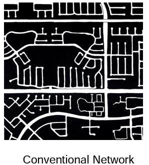
Complete Streets is a design philosophy that considers both vehicles and pedestrians in its road network and design profile. The two primary elements of a road network are mobility and accessibility. Mobility is determined by the amount of time it takes to move from A to B, which is often influenced by the posted speed limit. Accessibility is determined by the amount of land that is accessible between A and B, which is influenced by the number of intersections and driveways. Urban planning theory recommends a ‘Traditional Neighborhood Development’ (TND) road hierarchy using boulevards, avenues, and streets instead of the conventional arterial, collector, and local categories. The TND road hierarchy adjusts the design specifications for traffic volume and encourages curvilinear and gridded design to maintain mobility and
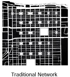
accessibility without adding traffic lanes. Typical design profile elements include divided medians, sidewalks, marked crossings, street lights, bike lanes, and shade trees. It is recommended for the city to develop and utilize a Complete Streets network & design and a Traditional Neighborhood Development road hierarchy when efficiently and safely facilitating vehicle and pedestrian traffic.
Commercial vehicles are a vital part of the commercial supply chain for local and regional businesses. However, the nature of these vehicles potentially creates challenges and negative externalities. Large vehicles shorten the lifespan of paved surfaces, increasing the ongoing maintenance costs. Their presence in mixed traffic increases the risk of vehicle
Patrick Square is a residential-centric Live-Work-Play neighborhood in Clemson, SC.
and pedestrian accidents due to prevalent blind spots and limited movement. They produce loud noises and pollution, and they require a larger turning radius for navigation. These factors often influence roadway design to have wider traffic lanes and intersections, which creates a non-pedestrian friendly environment. Because of this, it is recommended that commercial traffic be limited to the interstate corridor and any future designated bypass roads.
Several factors and strategies identified in the previous sections support the recommendation for a ‘Live-Work-Play’ master planned development. The location of the development is crucial for its success. While the development should be positioned along the existing highways and interstate, it is not recommended to be centered on a highway due to the presence of commercial vehicles in mixed traffic. Instead, it should be centered around
a planned boulevard that connects existing highways. This will increase the likelihood of generating volume of throughtraffic without commercial vehicles.
Higher density developments typically have a fiscally efficient infrastructure capacity. While utility line diameters may need to be wider to sustain pressure and flow, having shorter lengths of lines to more businesses is significantly less expensive for city maintenance budgets and taxpayers overall.
Road efficiency has historically been measured by the level of service, which focuses on the number of vehicles passing through a location per hour. However, like with freight traffic, roadway design that only focuses on this metric tends to be wider and not pedestrian-friendly. In addition to traffic counts, a factor to consider is the density of businesses along a roadway. This can be measured by dividing the annual property and sales tax generated by each business per foot of its road frontage. Higher lot density
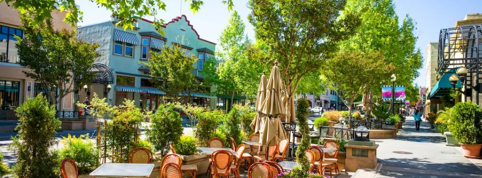
Mainstreet in Mountainview, CA has a lively, walkable, streetscape and mix of residential, retail, and office spaces.
typically has a higher the dollar per foot of generated tax revenue along a roadway. This means the public infrastructure is being maximized, which is beneficial to the city and its citizens.
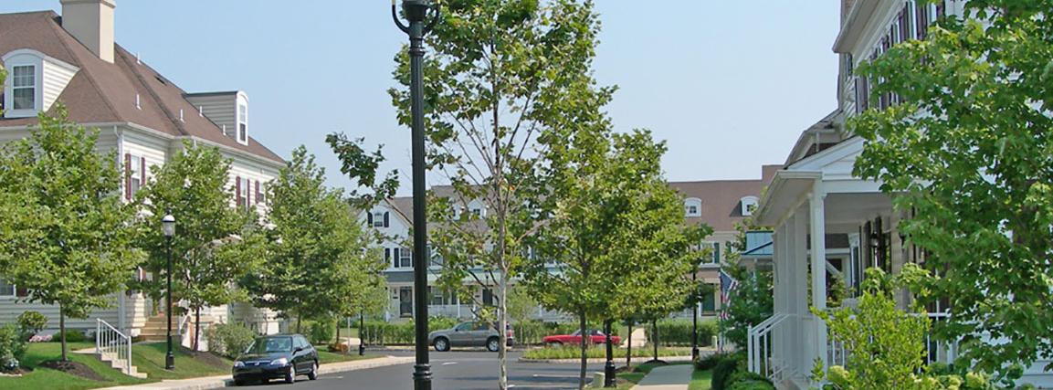
Live-work-play developments can support a wide variety of housing types and densities with equitable access. These developments are usually shaped and positioned intentionally to maximize natural assets and minimize negative externalities. The transect development pattern is a common layout. Various land uses occur on a spectrum radiating from a
geographic core. The core (historically the ‘Texas Square’) is a dense concentration of apartments and townhouses, office space, and retail. Vertical mixed-use structures, anchor commercial tenants, and on-street parking are encouraged here. Bounding the core is a ring of townhouses, small lot single-family homes, and office units. The outer areas of the development should be large lot singlefamily homes. Urban design strategieswhich incorporate walkable infrastructure, including shade, seating, sidewalks, and park space - should be utilized to enhance the pedestrian experience.
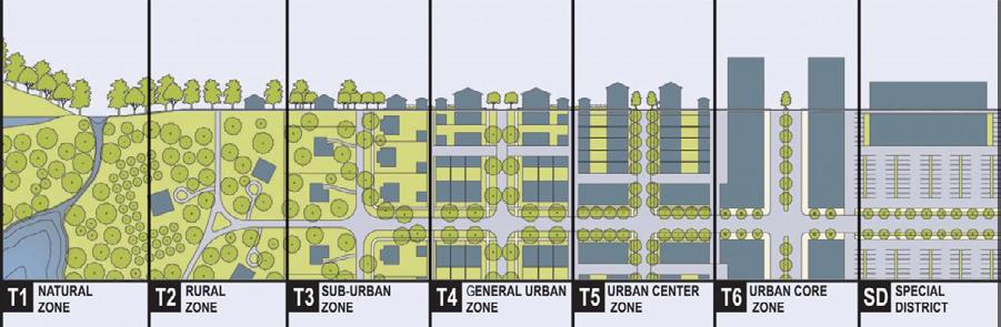
The Rural-to-Urban Transect (by Duany Plater-Zyberk & Co) shows the development spectrum in relation to density and nature.
Live-work-play developments encourage a healthy and sustainable tax base by generating both property and sales taxes with housing and jobs. The national average commuting time is approximately 30 minutes. This commuter threshold is well beyond Mount Vernon’s city limits, which increases the likelihood for commuter citizens. Solely providing houses would only turn Mount Vernon into a bedroom community for a larger metropolitan economy. This would place too much risk on the housing market to sustain the municipal budget and hinder the quality of services the city could provide its citizens. It is recommended to develop a mixed-use neighborhood to diversify the land use and type of revenue.
A Tax Increment Financing (TIF) District is a popular funding mechanism that local governments can use for infrastructure improvements to draw private investment to an area. A TIF is tied to a Tax Increment Reinvestment Zone (TIRZ), which is a spatially-bound zone in a city as determined by a city council. A TIF is
the TIRZ. Properties within the TIRZ can have some of their ad valorem tax redirected to pay for improvements in the zone. One of the best applications of a TIF is on undeveloped property because its current state is not generating a significant amount of property tax for the general budget compared to its improved state. While a TIF does not dedicate all of its tax revenue for the general budget, once it expires, a city could have a new community asset that is generating more taxes to fund public services without financially burdening each resident. It is recommended to create a TIRZ to fund projects like a live-work-play master planned development.
Quality of life is a comprehensive term that considers how effectively a citizen’s needs are being met, and it is influenced by the factors and strategies previously mentioned in the Strategic Plan. It is recommended to make civic investments like hiring dedicated programming staff and creating and improving public parks and facilities to enhance the quality of life of citizens.
not a tax rate increase or an additional tax for residents or the properties within
Quality of life can be measured quantitatively and qualitatively. For example, Census Data and Geographic Information System (GIS) software can be used to determine citizens’ access to various necessary assets and recreational opportunities. A Community Satisfaction Survey can be used to
determine citizens’ overall satisfaction and opinion of specific assets. A Community Satisfaction Survey is recommended to assist civic agencies with understanding the needs of the community in a measurable manner. The survey should be brief (10 questions) and the content should be consistent so that any change in opinion can be quantified and tracked. This data can lead to the effective creation, budgeting, and implementation of strategies for growth.
A strong brand cleanly and clearly communicates and carries the identity and vision of a city. A brand assists with catalyzing economic development by encouraging civic collaboration, ownership, and pride. While branding is typically associated with a city’s logo and slogan, it can be utilized for placemaking to personalize specific districts (like the ‘Smokey Row’ sign in the Square). A sign package provides a suite of sign designs (ex. monument, pole) that are applied to various settings around town but fit within the overarching style of the brand. It is recommended that Mount Vernon assess its current brand for revision and partner with local citizens and developers to create placemaking elements.
Recreation,
Public parks are necessary for enhanced quality of life, as they provide opportunities for recreation and transportation. They create safe spaces for children to play, youth and adults to participate in walking, biking, and local sports leagues, and communities to gather for events. Parks have been attributed to improving the health and wellness of communities. Parks provide opportunities for physical activity, which can help reduce risks for various diseases. They are also important regarding environmental benefits. Parkland provides flood control measures to detain and/or retain water, it sustains habitats for local birds, insects, and wildlife, and it preserves and enhances regional biodiversity. The presence of park space has been known to improve the
PUBLIC PARKS
NECESSARY FOR ENHANCED QUALITY OF LIFE, AS THEY PROVIDE OPPORTUNITIES FOR RECREATION AND TRANSPORTATION.
local economy. Park users are drawn in, and they can spend money in local shops and restaurants. Parks are also known to increase property values of surrounding properties.
An updated Comprehensive Parks, Recreation, and Open Space Master Plan can provide the city an analysis of its current park inventory, citizen desires, and current state and national trends to help determine future municipal
investments. It is recommended to update the Parks Master Plan and include a Trail Master Plan section to promote the implementation of a trail network throughout the city for enhanced pedestrian transportation and recreation.
The research and planning process have revealed items that are recommended for future consideration to enhance citizens’ quality of life and economic growth. These recommendations include investigating the feasibility of a retirement neighborhood, incorporating historic preservation guidelines, incorporating parkland development fees, and continuing to implement the action items outlined the in 2016 Downtown Strategy Report. These items are necessary but should be be considered later once higher priorities are accomplished. However, these priorities should be adjusted if the Council or community believes there is an emerging need or if an opportunity (i.e. grant funding, interested developer, etc.) presents itself.

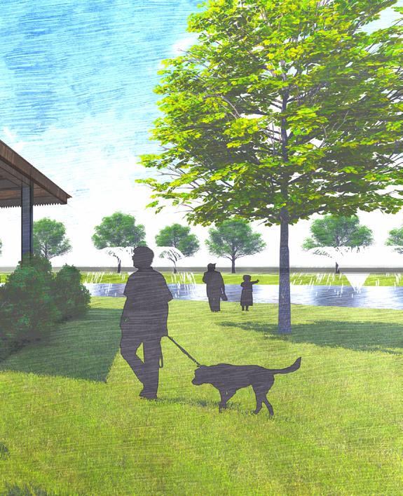
(Above) Conceptual render of the Northern Corridor’s park and open space.
(Below) The neighborhood park will serve residents and the nearby Mixed-Use area.
The northern corridor is designed as a live-work-play area, emphasizing connectivity between diverse land uses to benefit all users. The mixed-use nature of the development enhances housing, civic, and commercial space value, enriching the neighborhood’s sense of place. Medium lot density addresses housing demands and supports local businesses. Commercial areas along the frontage road cater to interstate customers seeking quick service. At the core of the design
is the mixed-use zone and open space, which offer office, retail, restaurant, and recreational services for city residents.
A well-designed road and sidewalk system facilitates easy movement between residential and commercial zones. The primary roads are envisioned as divided boulevards with landscaping to act as welcoming gateways that encourage slower vehicle speeds. Gateways shape first impressions and the overall experience. The neighborhood utilizes a grid-like street layout to optimize traffic flow. To encourage walking, the neighborhood has shaded, designated sidewalks and points of interest such as landmarks and housing facades.

Figure 7: Schematic Layout of a live-work-play neighborhood in the northern corridor of Mount Vernon.
The southern corridor is designed as a lake-centric development for entertainment and leisure. Commercial use such as a hotel and retail is recommended along Hwy 37 to take advantage of traffic
volume and the viewshed from I-30 to the north. A commercial strip is envisioned at the intersection of TX 115 & TX 21, and a lakefront restaurant would be a strong draw to the area. The existing rodeo has proposed improvements such as defined driveways and parking areas and improved surfaces.
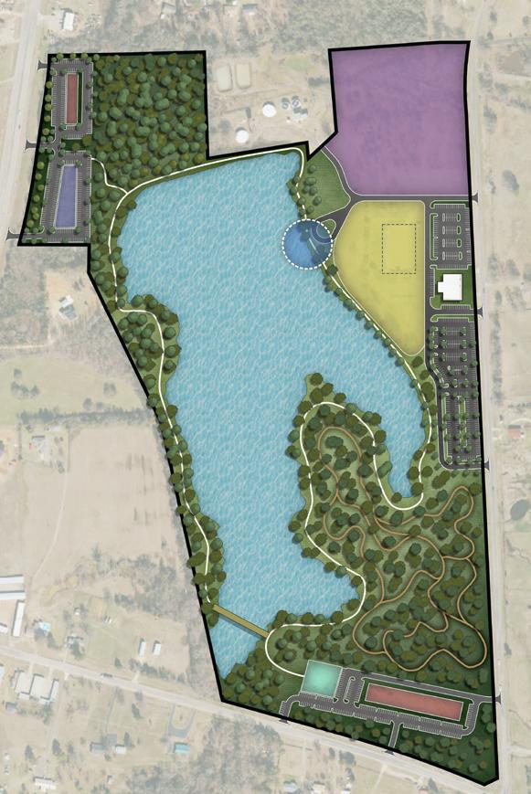
Figure 8: Schematic Layout of a lake-centric development around City Lake in the southern corridor of Mount Vernon.
Outdoor recreation such as a kayak launch, a lake trail with boardwalks, and mountain biking trails are recommended in suitable areas. The trail includes a boardwalk in the southwest corner to help users navigate the terrain and provide excellent fishing locations and scenic views of the lake.
The land use in the northeast along FM 115 is recommended for a future land use study that considers local and regional market conditions for the best use.
The following Implementation Schedule presents action items that are based on the City’s goals and objectives, needs analysis, planning analysis, and recommendations found in previous chapters. The aligned City Goal is listed under each Implementation item. The purpose of the implementation schedule is to provide a framework to assist with future city planning. The implementation schedule is intended to be a flexible guide for the growth over the next five
Develop Northern Corridor
Goal 1, Goal 2, Goal 4, Goal 5
years and into the future. The city, in partnership with Industrial Foundation and EDC should evaluate and change the order of implementation if necessary or take advantage of any unforeseen opportunities that may arise as long as it fits within the recommendations of this plan.
Primary Area of Focus: 1-2 years
Supporting Priority: 1-5 years
Future Priority: 6 - 10 years
• Acquire land or collaborate with landowners
• Ensure zoning and future land uses are compatible
• Establish a TIF District
• Partner with a developer to create a ‘Live-Work-Play’ Site Master Plan
Develop Southern Corridor Goal 1
• Ensure zoning and future land uses are compatible
• Partner with a developer to create a lake-centric Site Master Plan
Goal 1
• Conduct a housing study to determine growth projections and housing types
• Collaborate with a developer to build houses
• Ensure zoning and future land uses are compatible with single-family and multi-family housing opportunities
• Educate the public regarding HOA deed restrictions
• Grow the number of young professionals and families living in the community by 10% by 2030
• Engage in community discussions and assess feasibility of adopting a parkland dedication ordinance
Goal 3, Goal 4
• Revise local economic development incentive packages based on current assets and the regional marketplace
• Identify and adopt a recruitment strategy for the development of a business park
• Identify and pursue companies based on existing and desired industry clusters
• Increase foot traffic and retail sales in the mainstreet commercial districts by 10% by 2030
• Continue to support business community organizations like the Franklin County Industrial Foundation, EDC and Chamber of Commerce through frequent dialogue and collaboration
Goal 2, Goal 5
• Create and distribute an annual or biennial Community Satisfaction Survey; within six years, achieve a 15% increase in respondents who are “satisfied” or “very satisfied”
• Hire staff for civic programming (festivals, evening & weekend shows, etc.)
• Identify properties to be developed as community parkland
Goal 3
• Create sign standards
• Create brand strategy
Update the Comprehensive Parks, Recreation, and Open Space Master Plan
Goal 5
• Add a Trails Master Plan section
Incorporate a Complete Streets & Traditional Neighborhood Development Policy
Goal 2
• Establish road standards for the development of complete streets
• Revise the zoning code and subdivision ordinances
Establish an Upper Education Pipeline
Goal 4
• Identify and adopt a recruitment strategy for a technical college
• Develop a bridge program connecting high school graduates to a nearby technical college, community college, junior college, or university
Improve Healthcare Access
Goal 2, Goal 4
• Develop and execute a recruitment strategy for an emergency medical provider