


This page intentionally left blank.

This page intentionally left blank.


Mount Vernon Contact:
Craig Lindholm, City Administrator 109 N Kaufman Street
Mount Vernon, TX 75457 Office: 903.537.2252
MHS Planning & Design Team:
Hunter Rush, Senior Planner & Partner
John Waltz, Planner
Zach Clark, Planner
Jonathan Povoski, Graphic Designer 212 W 9th Street Tyler, TX 75703 Office: 903.597.6606
This page intentionally left blank.
This page to hold city adoption and seal
The City of Mount Vernon and MHS Planning & Design, LLC would like to thank the residents of Mount Vernon, Economic Development Corporation, City Council, City Staff, community leaders, and volunteers for their participation and input in the development of the Land Use Plan 2024-2034.
City of Mount Vernon City Council:
Brad Hyman, Mayor
Mark Huddleston, Mayor Pro Tem
Rebecca Bailey, Council Person
Martin Carrascosa, Council Person
Harold Cason, Council Person
Mary Keys, Council Person
City of Mount Vernon Economic Development Corporation:
Mark Sachshe, President
Julia Munoz, Board Vice President
Jeff Byrnes, Secretary
Kevin Anthony, Board Member
Don Huffstetter, Board Member
Kristin Scott, Board Member
G.W. Sharp, Board Member
Craig Lindholm, Director
City of Mount Vernon Staff:
Craig Lindholm, City Administrator
Kathy Lovier Johnson, City Secretary/Municipal Judge, TRMC
Angie Pike, Deputy City Secretary, TRMC
Kassidy Wesson, Main Street Director
Chad Pike, Public Works Director
The 2024-2034 Mount Vernon Land Use Plan includes recommendations to update the City’s zoning ordinance. The goal of the Land Use Plan is to modernize the City’s ordinances to meet the current and future needs of the community with a streamlined and accessible regulatory framework. These recommendations are based on the needs and desires of the public & administration, the analysis of existing conditions of physical and political boundaries and regulations, an overall strategy of smart growth, and professional opinion.
The City partnered with MHS Planning & Design to guide the planning process and develop the land use study, which included gathering public input to understand the community’s assets to preserve, weaknesses to diminish, opportunities to foster, and threats to avoid. Public input included stakeholder interviews, an online survey, and commission and council meetings.
While not a complete overhaul of the ordinances and maps, the 2024 Land Use Plan restructures the residential, commercial, industrial, and open space land use standards to match existing properties while preparing future developments to fit within smart growth strategies such as the Transect pattern and Traditional Neighborhood Developments (see the 2023 Strategic Plan for more information on these terms). Smart Growth strategies can enhance the quality of life for all citizens by encouraging pedestrianfriendly areas, mitigating traffic to appropriate existing and future corridors, maintaining efficient public infrastructure, and protecting natural and cultural assets among citizens.
The Land Use Plan proposes a simplified land classification system, reducing the categories from 13 to 9. The redrawing of future land use boundaries redistributes the percentage of land that is civic & open space, residential, commercial, and industrial within the ETJ and City Limits. While commercial land has received a minor adjustment, civic & open space areas (agriculture, parks, & open space/floodplain) have greatly increased. This change is to promote the preservation of farmland in the areas outside of municipal boundaries which are the most susceptible to urban sprawl. As the Ultimate Capacity calculations (see Figure 11) show, this reduced area for potential residential development area can still accommodate an aggressive population growth.
Civic & Open Space
Residential
Commercial
• Parks and Open Space
• Public/Semi-Public
• Estate Density Residential
• Low Density Residential
• Medium Density Residential
• High Density Residential
• Manufactured Home Overlay
• Central Business District
• Office
• Mixed Use
• Retail
• Commercial
• Agriculture, Parks & Open Space/Floodplain
• Institutional
• Residential Estates
• Suburban Residential
• Mixed-Residential
• Low Intensity Commercial
• High Intensity Commercial
• Mixed-Use Center Industrial
Figure 01: Future Land Use Table - Existing & Proposed
• Manufacturing, Warehouse, & Industrial
Figure 02: Future Land Use Categories - 2008 & 2024
Agriculture
Residential
Planned
Public
Commercial
Industrial
• (AG) Agriculture
• Park
• R-3 Residential
• R-4 Residential
• R-6 Residential
• R-16 Residential
• R-17 Residential
• (MH) Manufactured Housing
• (PD) Planned Development
• (CF) Community Facilities
• Hospital
• Office Services
• Local Retail
• General Business
• Outdoor Commercial
• Intensive Industrial
• (AG) Agricultural Homesteads
• (R-1) Residential Estates
• (R-2) Low-Density Residential
• (R-3) Mid-Density Residential
• (R-4) Multifamily Residential
• (MU-TC) Mixed-Use Town Center
• (PD) Planned Development
• (CF) Community Facilities
• (B-1) Neighborhood Business
• (B-2) Community Business
• (B-3) Regional Business
• (D-1) Light Industrial
• (D-2) General Industrial
Existing land use, zoning, planning documents, and regulations were studied to determine which rules were helping or hindering the City and developers to reach their shared goals. The zoning classification has been reduced from 16 to 13 classes. The zoning ordinance was previously updated in 1999 with the inclusion of the HUD-Code Manufactured Housing District; the zoning and future land use maps were previously updated in 2009 coinciding with the adoption of the 2009 Comprehensive Plan.
Miscellaneous zoning, subdivision, and infrastructure regulations were adopted in 2020 & 2023. The following list includes recommended zoning and subdivision ordinance additions and revisions:
Land Uses
• Add mixed-use zoning
• Revise existing zones & future land uses
• Revise setbacks, lot size minimums, and building envelopes
Balance Mobility, Accessibility, and Safety
• Add shared driveways
• Add shared cross-access easements
• Add shared parking
• Revise minimum distance between driveways
• Plan for additional arterials
Update Quality of Life Regulations
• Add Screening/Buffering Standards
• Add Parkland Dedication
• Add Cell Tower Regulations
• Add Drive-Through Lanes
• Add Industrial Facades
• Revise Landscaping Standards
• Revise Lighting Standards
• Revise Sign Standards
The following steps and actions were taken to gather and assess data to make land use recommendations for the City of Mount Vernon.
Step 1: Gauge public preference for future land use types and land use regulations
Action 1: develop and distribute a public survey that captures feedback about existing conditions, land use preferences, and perceived need for regulations.
Action 2: conduct interviews with a group of community stakeholders
Step 2: Compile existing public infrastructure & environmental features
Action 3: create an inventory of existing land use within Mount Vernon through Geographic Information Systems (GIS) data and windshield surveying.
Action 4: create an inventory of existing streets, water, sewer, stormwater utilizing available GIS data.
Action 5: create a map of existing floodplains, steep slopes, and wetlands utilizing available GIS data.
Step 3: Analyze Data & develop recommendations to guide future land use policy decisions
Action 6: evaluate existing land use regulations, infrastructure, analyze natural features within the study area including hydrology, floodplains, steep slopes, and wetlands
Action 7: utilize findings, public input, and best practices to formulate a set of goals & recommendations for public administration.
The City of Mount Vernon is updating its zoning ordinance and land use documents with the 2024 Land Use Plan. The land use plan defines the various ways parcels are used in a city. Through the creation of the Future Land Use Plan, development and investment decisions aligned with this vision will boost the fiscal sustainability and stable population growth of the city while creating an environment for people to live, work, and play. Sound future land use planning is intended to guide policy and zoning decisions for Mount Vernon for the next 10 to 20 years and should be flexible to allow the City to determine specific uses if it maintains compatibility with adjacent land uses and consistency with the overall vision.
A Future Land Use Plan and zoning ordinance should foster consistency, efficiency, and reliability among citizens, developers, and public leaders. Appropriately defined land use types should achieve the following goals:
• The landowner should be able to build structures and make improvements that enable them to use their property.
• The adjacent landowners should be assured that their properties and livelihoods will not be negatively impacted by the actions of the property owner.
• All landowners in a community have a shared interest in ensuring that the property held in common (such as public land) and the combined impact of individual land use decisions contribute to a community that is a stable and desirable place to live and work.
The Future Land Use Plan should help guide decisions made by the administration related to Annexation & Extraterritorial Jurisdiction mapping. The Land Use Plan takes into account growth factors and the compatibility of land uses. These terms are defined in this chapter.
Mission: To provide effective and fiscally responsible municipal services in a manner which promotes our high standard of community life.
Mount Vernon is a caring community committed to excellence and quality of life, aspiring to be the community of choice for ourselves, our children, and future generationbeautiful, clean, vibrant, and safe.
Vision: We will strive to preserve our heritage and friendly hometown atmosphere and to celebrate the diversity of all our citizens.
Motto: Small Town, Big Living
The purpose of the Mount Vernon Land Use Plan is to gather and assess citizen input, evaluate existing conditions, guide future land use decisions, provide a legal foundation for future land use regulations, and inform long-range infrastructure policy.
The State of Texas has established laws in regard to the way incorporated communities can ensure the health, safety and welfare of their citizens. State law gives municipalities the power to regulate the use of land, but only if such regulations are based on a plan. Authority of a City to create a comprehensive plan is rooted in Chapters 211, 212 and 213 of the Texas Local Government Code.
Chapter 211: Chapter 211 of the Texas Local Government Code allows the government body of a community to regulate zoning, including:
1) the height, number of stories, and size of buildings and other structures;
2) the percentage of a lot that may be occupied;
3) the size of yards, courts, and other open spaces;
4) population density;
5) the location and use of buildings, other structures, and land for business, industrial, residential, or other purposes; and
6) the pumping, extraction, and use of groundwater by persons other than retail public utilities, as defined by Section 13.002, Water Code, for the purpose of preventing the use or contact with groundwater that presents an actual or potential threat to human health.
Chapter 212: Chapter 212 of the Texas Local Government Code allows the governing body of a community to regulate subdivision development within the City limits and also within the Extraterritorial Jurisdiction (ETJ) which varies depending upon the population of the community.
Chapter 213: Chapter 213 of the Texas Local Government Code allows the governing body of a community to create a comprehensive plan for the long-range development of the municipality. Basic recommendations for comprehensive planning are to address land use, transportation and public facilities, but may include a wide variety of other issues determined by the community.
It is important to note that a comprehensive plan is NOT a zoning ordinance but rather is intended to be used as a tool to guide development, infrastructure and land use decisions in the future. The comprehensive plan does, however, serve as a basis on which zoning decisions are made, as specified by Chapter 211 of the Texas Local Development Code. All land use-related municipal processes, such as development, redevelopment, the subdivision of land, and more, should align with the overarching vision established in the Future Land Use Plan.
• The 2010 Comprehensive Plan describes strategies to proactively address future socioeconomic changes and development by considering the interconnected influences of land use, housing, economy, environment, etc.
• The 2016 Downtown Strategy Report describes the strategic prioritization of historic preservation to spur redevelopment projects in the Square.
• The 2023 Strategic Plan describes analysis of the public’s goals and objectives from previous plans in relation to the potential developable acreage around the Interstate 30/Highway 37 corridors.
• The 2023 Engineering and Design Standards describes the updated infrastructure design guidelines for new development.
• The 2023 Water Distribution System Evaluation & 2023 Wastewater Collection System Analysis describe the city’s water and sewer existing conditions and growth capacity.
• The 2024-2034 Parks Master Plan describes state of the existing park system and provides recommendations, priorities, and funding mechanisms to enhance the park system through land acquisition and park enhancements based on public comment.
• The 2025 Housing Study describes the assessment of existing housing inventory and demand to determine a projected gap.
• The Capital Improvements Plan describes the location, schedule and financing of capital improvements as budgeted by the city. These improvements can include emergency services, Public Works projects, and Parks and Recreation areas.
• The Annual Financial Report describes the municipality’s financial health in relation to revenue and debt incurred from the previous fiscal year.


In 2019, the Texas State Legislature limited the ability of cities to annex, essentially requiring consent by the residents and/ or property owners within a potential annexation area. With limited opportunity for annexation, the City will need to continue utilizing other growth management tools such as development agreements and Municipal Utility Districts (MUDs) to provide services in the Extraterritorial Jurisdiction (ETJ). The changes in annexation law inadvertently encourage a renewed focus upon infill and redevelopment within the existing city limits. However, areas in the ETJ must still be connected to the rest of the planning jurisdiction to provide for connectivity if development on the City’s fringes or annexation does occur in the future. The following section further describes the function of ETJs.
Annexation is the process by which a city expands its boundaries to include additional adjacent land and properties, declaring the territory within the defined boundaries to be part of the city, and ordering it subject to all of the rules and regulations applicable to the city in accordance with state law. It is a common method for cities to grow and provide services to new areas. Cities can use annexation to exercise authority to protect public health and safety, increase the population and tax base, and offer municipal services. Mount Vernon should strategically use annexation to ensure new, high-quality housing and commercial development is located in key areas around existing infrastructure and cultural districts.
As a Dillon’s Rule municipality (having a population under 5,000), Mount Vernon has authoritative powers explicitly granted by the state over an extended unincorporated area known as the "Extraterritorial Jurisdiction" (ETJ), which lies ½ mile beyond its city limits. According to Chapter 42 of the TEXAS LOCAL GOVERNMENT CODE, the Texas Legislature establishes the policy that ETJs be designated around cities to enable municipal governments to “promote and protect the general health, safety, and welfare of individuals residing in and near” the city limits.
The ETJ serves two purposes: First, cities can (under special circumstances) annex land only within their ETJ, and there is a statutory prohibition against another municipality annexing into the ETJ of another city; and cities can extend and enforce their subdivision regulations into their ETJ. Cities cannot, however, enforce zoning or building regulations in the ETJ.
Annexation and general expansion of land development is dependent upon several factors, most of which are outside the direct regulatory authority of the City. While
the majority of development investment is made by the disparate body of private landowners and entities, the City can make investment decisions to determine the expansion of public infrastructure and regulate land use. Because of this, the City should utilize strategies that consider existing infrastructure capacity and layout, sensitive environmental areas like floodplains, and the desired quality of life of all citizens.
Similar to the 2019 state ruling, the ETJ’s value as a regulatory tool to preserve the character and efficient use of land surrounding a city limit has been affected by recent legislation. Vaguely determined areas can now be deannexed upon request with majority of votes from residents within the area. While land use can still be assigned, it should not be fully anticipated to be considered in a long-range development strategy.
Infrastructure: Viewed as the framework of the city, infrastructure includes roadways and water, sewer, storm sewer, electric, gas, and telecommunication utility lines. Infrastructure enables development, as all lots are required to have road frontage if they are subdivided, and all developments are required to have water, sewer, storm sewer, and electricity utilities. Infrastructure expansion is an expensive and disruptive process that requires planning and engineering to understand the effects of the future development on existing capacity and the environment. Cities primarily oversee the process of expanding trunk lines (larger diameter lines) for water, sewer, and storm sewer, while large private developers design branch lines in partnership with the city for each development. If infrastructure and development demand do not align, “leap frogging” can occur.
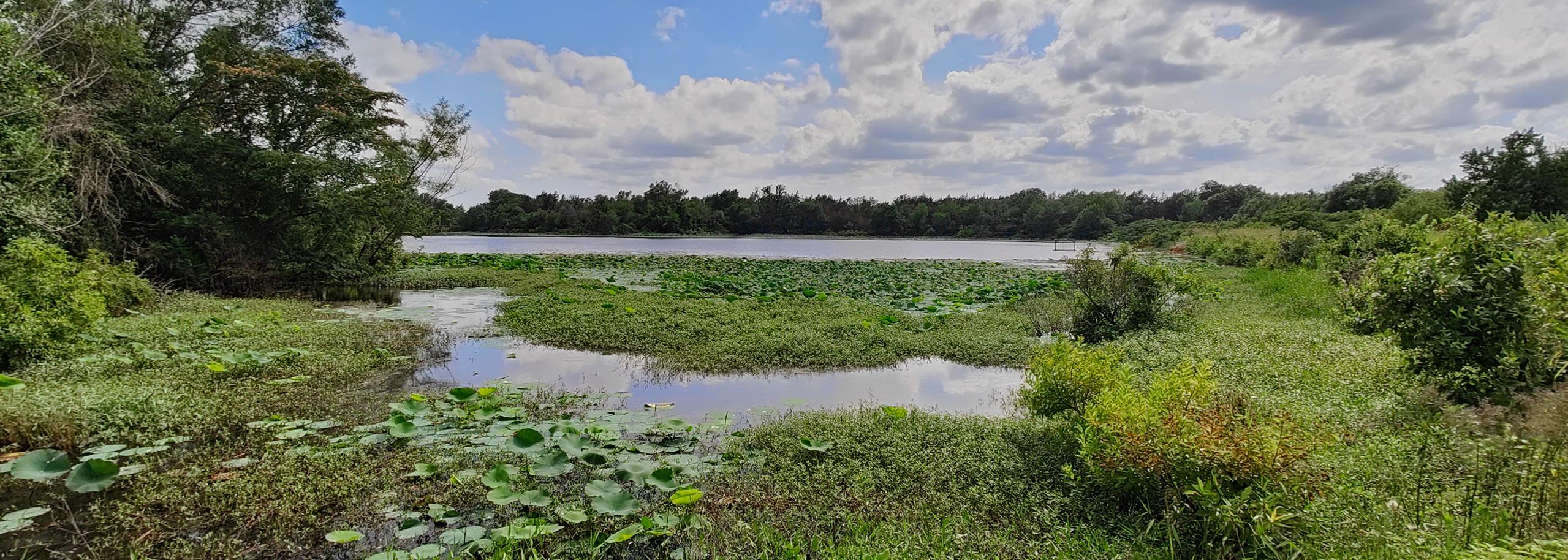
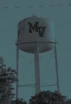
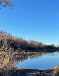
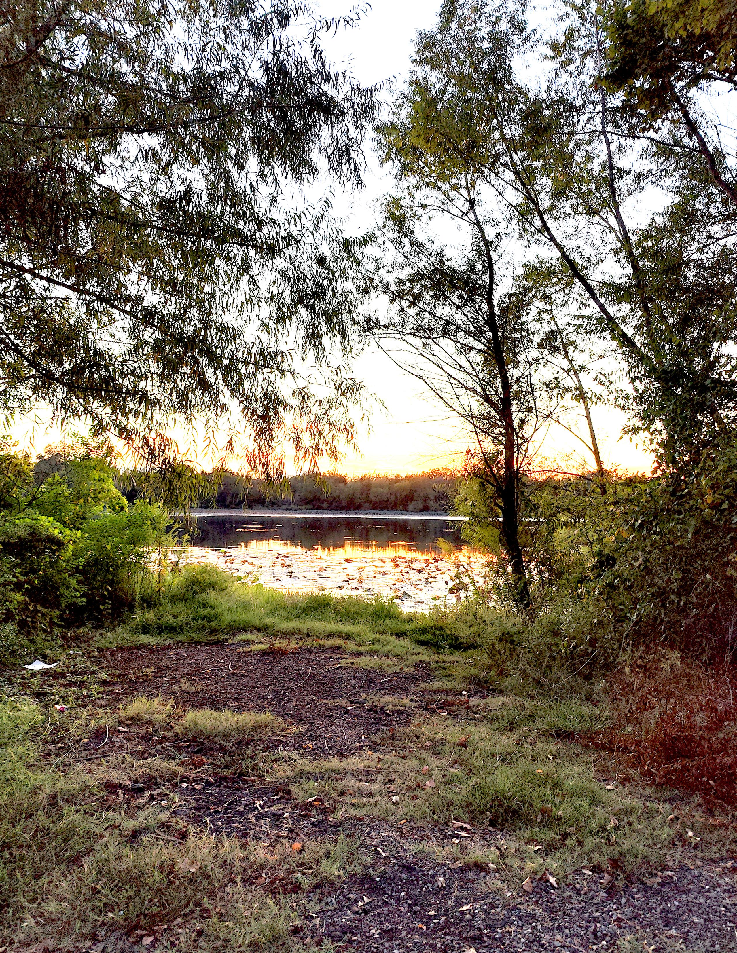
City Lake is an untapped public amenity.
Leapfrog development is when development skips over vacant land directly adjacent to developed urban areas in favor of land farther away, typically because it is not as expensive. Leapfrog development can lead to the fragmentation of agricultural land, which may disrupt agricultural activity and impact the long-term viability of the agricultural sector, and reduce the service efficiency of public infrastructure.
Environmental Limitations: Environmental limitations for development are present in areas that have floodplains, wetlands, steep slopes, suitable agricultural soil, and water capacity. Federal protection laws can cause any development to be costly in time and finances, so preservation techniques are recommended to protect sensitive and complex biomes such as floodplains and wetlands. Preservation has benefits for the overall area, such as flood event mitigation that reduces potential damage to existing homes and businesses.
Quality of Life Conditions: Quality of life is a comprehensive term that includes factors affecting each citizen’s lifestyle, such as parks, natural open spaces, schools, and cultural and recreational opportunities. Quality of life can attract development and
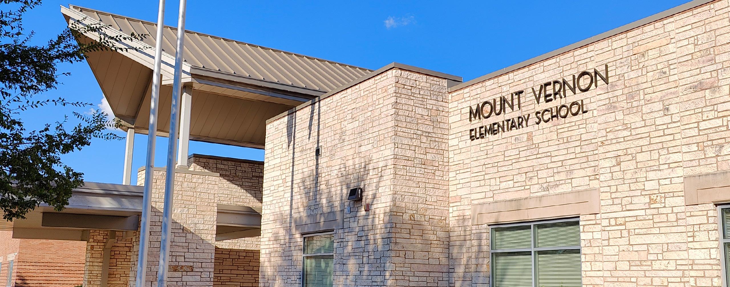
Mount Vernon ISD received an A ranking from the latest Texas Education Agency scoring.
increase property values. For example, school quality is an important determinant for the location of family-oriented residential development. However, school quality is less important for residential developments that are more likely to attract singles, childless couples, empty-nesters, and retirees, so other factors become influential. Quality of life conditions affect businesses as well; companies that provide good jobs for workers want to be located in places with a wide variety of amenities because it helps with employment attraction and retention.
Compatibility of land uses is rooted in the original purpose of zoning. Land use regulations separated land uses of high intensity (loud noises, abrasive smells, bright lights) with land uses of lower intensity (low density neighborhoods and small businesses). However, the flaws of historical zoning include not only creating a segmentation of land uses that exacerbated sprawl, but it also often encouraged multi-family developments to be used as a transition buffer between high and low uses.
Land use configuration should consider a calculated, fiscal infrastructure efficiency and intangible sense of place. For example, wider roads and larger utility lines have a higher capacity, but they are more expensive to build and maintain. Commercial and multi-family land uses often create a higher traffic & utility demand on the system while significantly increasing property values and generated tax revenue. Thus, large corridors are compatible with more intense land uses, while less dense land uses like ¼-acre single-family lots should be served by a smaller network of infrastructure lines.
Land use regulations pertaining to subdivision layouts shape each new housing development, which is a piece of the larger city-wide puzzle. In other words, a city is comprised of individual neighborhood developments that have various effects on public infrastructure and the City’s housing and economy. Small lot developments may be more appropriate on the inner core of the City because they sustain density and make pedestrian-scale elements like diverse street facades, concentrated points of interest, and short origin/destination routes more cost-effective. If built suitably, these neighborhoods’ appeal create a stable tax-base, use less infrastructure capacity, and reduce the conversion of farmland on the outskirts of the City.
This chapter covers the historical and current demographic information of the citizens of Mount Vernon. Unlike other studies, land use planning is heavily contingent upon precedent and current conditions. While the past does not have to define the future, especially in light of extreme growth, the most culturally sustainable strategies to integrate with desirable visions and goals should acknowledge and sometimes build upon previous events and decisions. For instance, the lots south of Main Street vary in size. Older, larger lots are 3-5 acres to maintain horses for transportation, while newer lots are smaller with the influence of the personal vehicle and modern housing market. Generally, all homes were built based on the W.S Keith Survey before subdivision standards were implemented, so setbacks are nonuniform and range from 5 to 30 feet from the publicly owned Right-of-Way.
Other reports from organizations such as the Texas State Historical Association have crafted detailed narratives of the City of Mount Vernon, so this report will focus on a high-level overview of development milestones across the community that have shaped its land use pattern. While not a comprehensive list, the milestones are as follows:
1841: Houses, churches, cemetery, and school are present on the east side of Holbrook Street built by the African-American community and Anglo community. Commercial buildings were burned during the Civil War.
1848, 1849: The city, first named “Lone Star”, is established with lots and blocks around a town square. The federal post office is built. Homes are predominately single-family.
1841 – 1885: Various residential neighborhoods are built around Old Bankhead Highway.
1875: Franklin County is established and the city’s name is changed to Mount Vernon and made county seat.
1885: Single-family homes are built west and north of Main Street.
1887: The railroad is built south of the town square.
1912: The courthouse is constructed.
1919: The Bankhead Highway (major east-west transcontinental automobile route) is built through Main Street.
1936: The economy diversifies from predominantly agricultural to include light industrial and manufacturing based on oil-production.
1950s – 1970s: several neighborhood churches are demolished and replaced with homes.
1960s: Interstate-30 (I-30) is built approximately 2 miles south of Main Street, spurring vehicle-centric growth. Mount Vernon ISD builds school campus along Hwy 37.
1990s – 2010s: The I-30 corridor interchanges and southern service road become builtout. The northern service road remains generally undeveloped. Hwy 37 experiences commercial development.
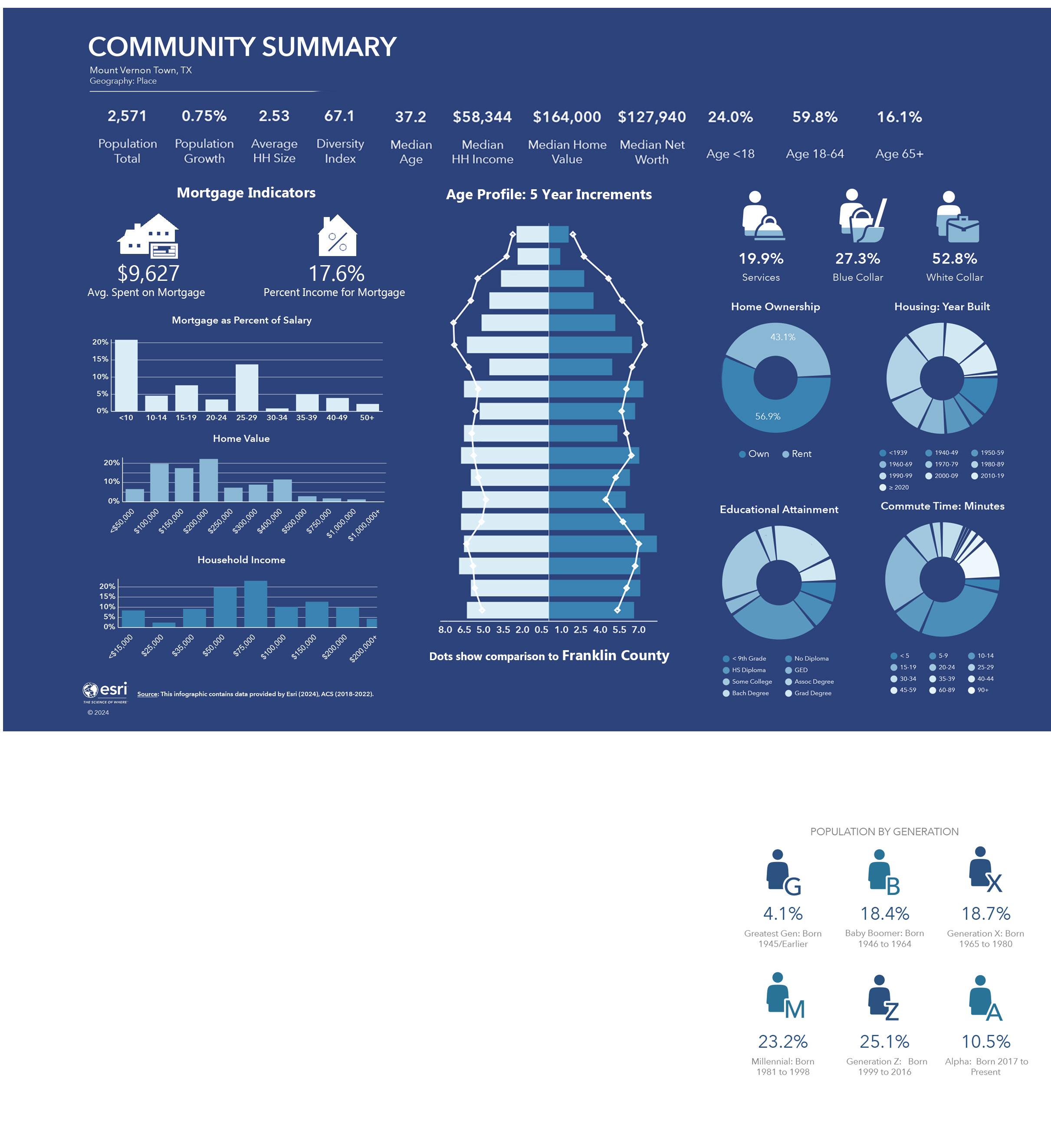
The 2020 Decennial Census, American Community Survey (ACS), and ESRI’s Business Analyst software were used to better understand the community’s demographics. Both the Census and the ACS data are collected through citizen surveys. The Census is conducted every 10 years, and the data officially affects congressional representation. The ACS is conducted annually and utilizes a sample size to represent the larger population. A five-year average was utilized for the ACS data spanning from 2018 - 2023 to reflect the population. ESRI’s Business Analyst utilizing proprietary data to generate population estimations. This Demographic Analysis provides an overall snapshot of Mount Vernon. The analysis compares the local profile to that of Franklin County, and the U.S. when applicable.
Note: The annual population estimates for smaller, rural cities are less accurate compared to larger communities due to the lack of statistical sampling methods. While the 2023 Strategic Plan stated the 2020 population to be 2780, the 2020 estimation has been revised by the US Census Bureau to be 2,491 at the time of this plan. Due to the limitations of the Census compared to more sophisticated geospatial analysis provided by ESRI, the population trends are sourced from ESRI.
The estimated 2024 population is 2,571. The average annual growth rate since 2020 is 0.30%. Applying this compound growth rate, the City’s population is estimated to naturally grow to 2,610 by 2029. An alternative population projection has been determined in the 2025 Housing Study. If the local economy is altered by the inclusion of new employers like a lithium plant, the City could absorb 350 owner-occupied housing units and 295 renter-occupied units over the next five years, pushing the total population to around to 3,000.
Recorded Projected 2,750 2,500 Population
Principles for the Land Use Plan began early in the planning process. A broad formation of community principles were discussed as a part of the stakeholder interviews and public meetings. The goals were trimmed and refined during subsequent meetings with city administration. Project goals have been vetted at numerous phases in the engagement process. A final set of goals for the 2034 Land Use Plan are listed below:
Preserve
• Preserve historic single-family neighborhoods.
• Preserve generational farmland for economic and environmental benefits.
• Preserve major drainage corridors for park location and trail development in linear greenways with neighborhood access.
• Preserve land for industrial and distribution uses in clusters near transportation facilities and in business parks.
• Preserve land for future transportation rights-of-way.
• Promote development patterns and connected developments for walkable environments and alternative transportation.
• Promote mixed-use development centers at important intersections to include residential, commercial, employment, park, and civic areas in close proximity.
• Promote infill development on vacant lots in the core of Mount Vernon order to take advantage of existing infrastructure and services and attract new commercial investment to serve a larger population.
• Promote diverse housing types in new developments.
• Promote the location of single-family and duplex uses on local and collector streets and multifamily uses on collector and arterial streets.
• Encourage utility extensions to new areas to promote development adjacent to existing developed or platted areas and discourage “leapfrog” development.
• Encourage land uses that provide appropriate transitions from higher-impact uses through medium-impact uses to lower-impact uses.
• Maximize commercial development along the I-30 corridor while ensuring quality growth with revised development regulations.
• Prioritize infrastructure in support of economic development along major commercial corridors.
• Increase walkable development in downtown.
• Support higher density residential and mixed-use development downtown.
• Keep and expand City facilities in downtown.
• Support additional funding sources to aid in quality commercial growth.
• Develop a larger system of parks, pedestrian trails, and open spaces.
• Support the efficient use of land while enhancing the natural environment.
• Support expansion and quality in the Mount Vernon Independent School District (MVISD).
• Increase City revenue sources from new commercial and industrial development.
• Avoid small developments of isolated land uses that are not compatible.
• Modify the City’s Development and Zoning Ordinances to implement this new plan.
• Review and update the public safety facilities plan.
• Make zoning generally compatible with the Land Use Plan.
• Reference the Future Land Use principles to guide future rezoning decisions and respect the geographical arrangement of land uses when considering rezoning requests.
• Plan and size infrastructure for future adopted land uses.
• Implement the future land use guide through capital investment planning.
• Dedicate staff to monitor and conduct monthly updates to the land use and zoning maps.
The existing land use of Mount Vernon reflects past development decisions and tells the story of the City’s development history and trends. The planning process helps to ensure that coordinated land use decisions enhance the overall quality of life by mitigating the impacts of incompatible uses near neighborhoods. This process begins with examining the types and locations of existing land uses within Mount Vernon and determining how and where new growth and development may be accommodated.
The land use plan utilizes land use classes, which are general definitions with no technical dimension or performance standards. The land use plan has classes for existing land uses and future land uses, which is determined by the needs and priorities of the city in relation to realistic limitations of current conditions.
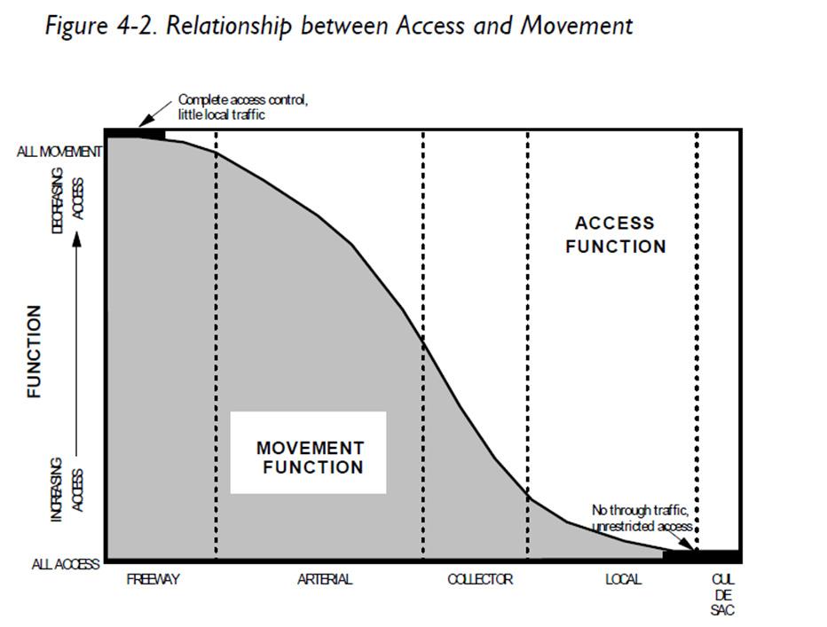
Transportation and land use planning are directly related – one affects the other. Mount Vernon’s public road hierarchy, as common with other cities, generally fits within 8 thoroughfare classes – interstates, frontage roads, highways (freeway/tollways), downtown thoroughfares, major and minor arterials and major and minor collectors. Each class provides a certain degree of capacity and accessibility to adjacent land uses, but they vary by function and geometric design. The table below displays the various elements of each class; the typical road cross sections can be viewed in the City’s Design Guidelines and Engineering Standards.
Since the 1940s, personal vehicles have heavily dictated land use patterns across the country, and while pedestrian and multi-modal infrastructure are being included more in the transportation network, it still follows ROW patterns of vehicles between land uses.
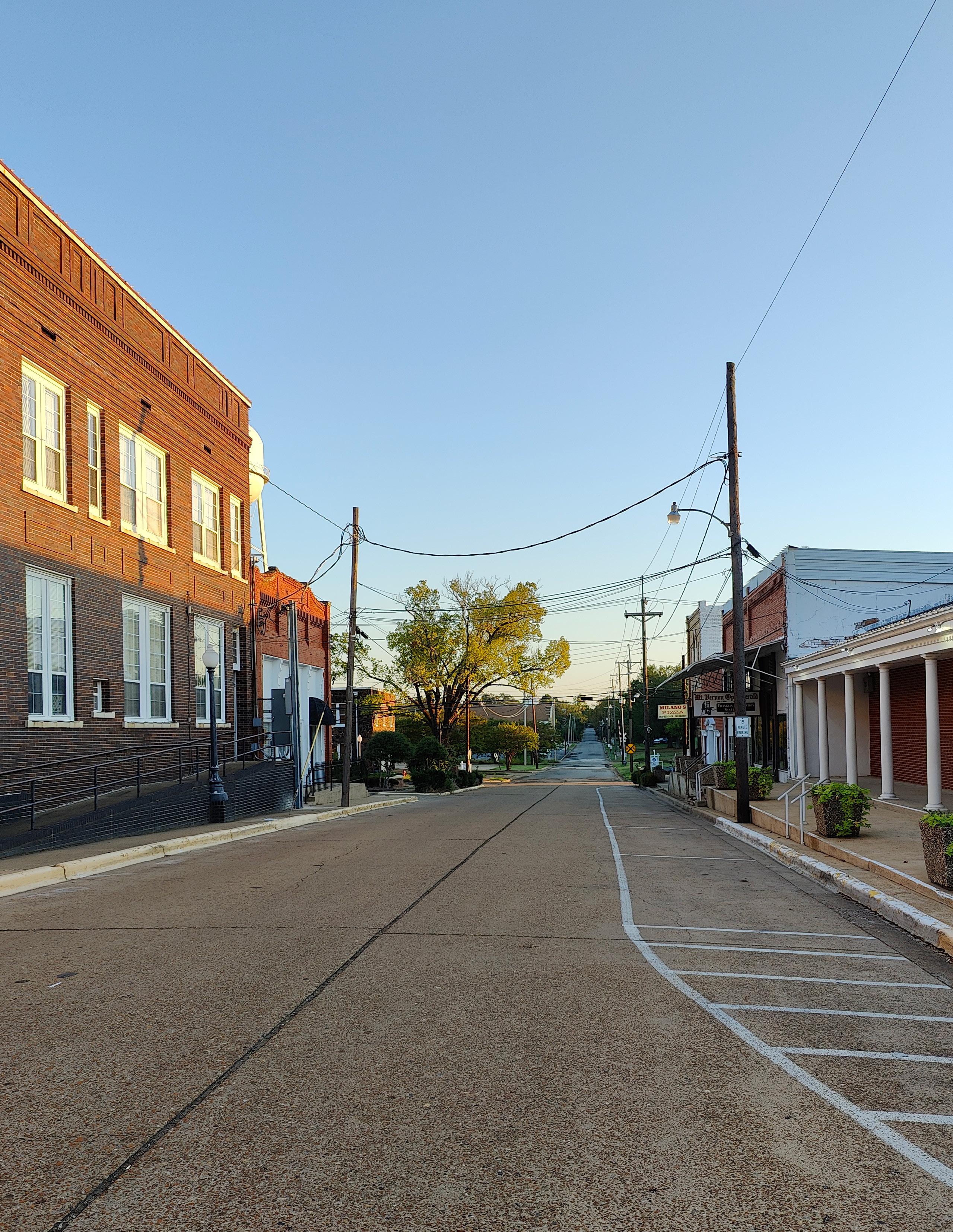
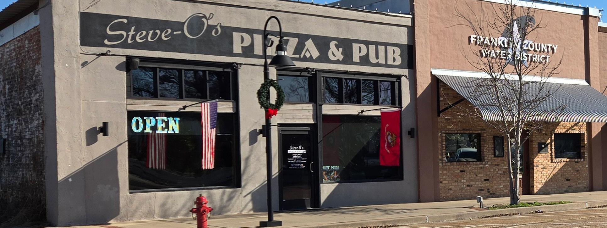
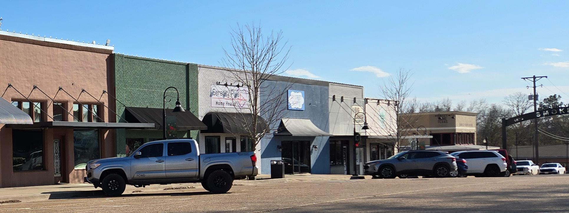
The majority of Mount Vernon’s land pattern appears to be walkable suburban and rural in character. The historic core of the town is laid out in the traditional ‘Texas Square,’ with a public building or open space in the middle of a street grid consisting of commercial or mixed uses. The core is very walkable with pedestrian facilities such as wide sidewalks, on-street and angled parking, shorter light fixtures, plantings, seating, murals, business awnings, and canopies. Several of the businesses are nontax generating entities.
Unlike the more common auto-centric suburban character made prevalent post1940s (which can still be found in pockets around Mount Vernon), most of the city’s neighborhoods are framed in a gridded street pattern with ½ - ¼ acre lots, with some roads following meandering lanes between barns and pastures. The lack of dead-end cul-de-sacs provides various routes for vehicles, and aside from the main thoroughfares like Main St, Yates St, Rutherford St, and Holbrook St, streets may not experience a high volume of traffic. While there is a lack of pedestrian amenities like sidewalks and benches, streets are mostly curbed with no bar ditches, so this infrastructure
can be more easily added in. The close proximity of The Square and Mount Vernon ISD bookend this walkable pattern. Although alleyways were platted, few have been built. There does not appear to be a regular pattern of shade trees or landscaping, but mature trees are present.
Farther from the walkable suburban and historic core are rural patches of residential lots. These large tracts are primarily used for agriculture production with minimal residencies. Rural areas tend to be more sensitive than other areas to incompatible development like high-density residential or big-box commercial.
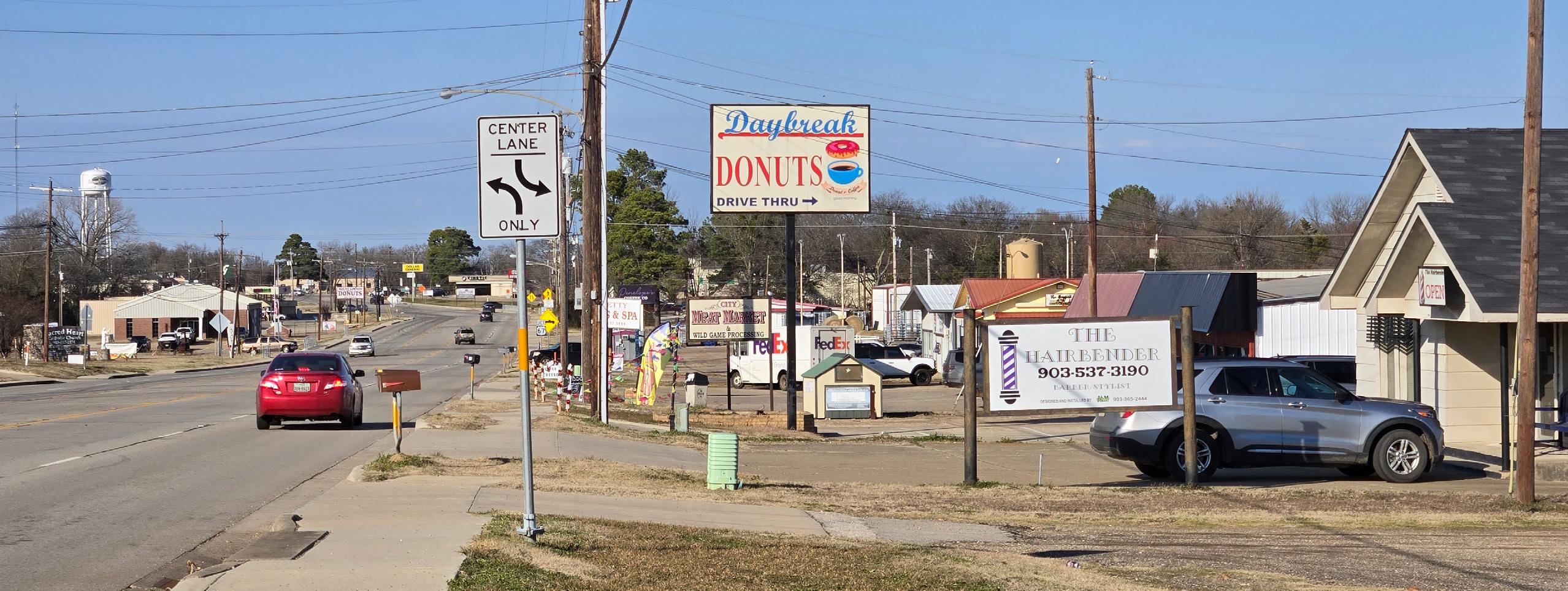
There are two primary commercial corridors hosting most of the commercial, office, and industrial land uses. Highway 37 is a minor arterial that connects the majority of Mount Vernon’s diverse land uses to Interstate-30. Highway 37 has multi-scale commercial, retail, and institutional land uses, while Interstate-30 primarily has commercial and industrial land uses.
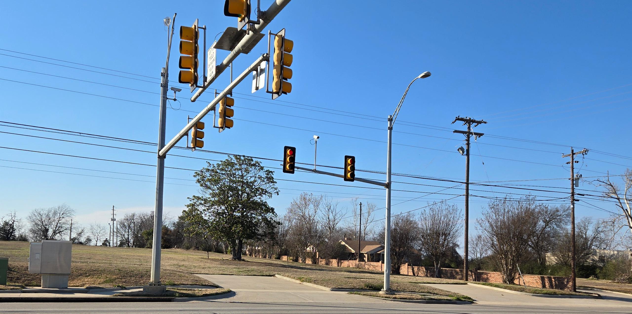
The following charts and maps display statistics related to commuter data, crash data, and traffic conditions. The analysis suggests that Mount Vernon has experienced an increase in vehicular activity since 2013.
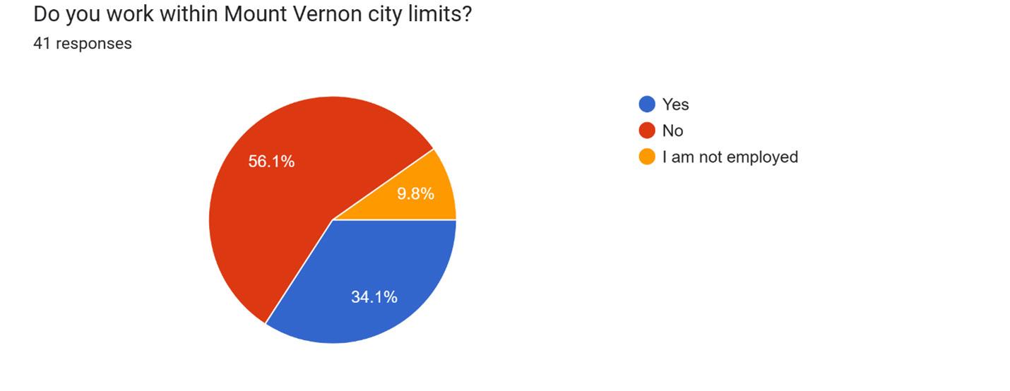
The Inflow/Outflow Job Count data displays the population who live and work either inside or outside city limits. Translating the data, from 2013 to 2022 there has been a 53.3% increase in the number of citizens who both live and work in Mount Vernon, a 29% increase for people who work in the city but live outside the limits, and a 7% decrease for people who work outside the city but live inside city limits. 2018 was a high-water mark for each respective data point.
The forecast interstate congestion provided by the Texas Department of Transportation anticipates travel lanes west of the Highway 37/I-30 interchange to upgrade from ‘moderately congested’ to ‘congested’, with less space between travel vehicles on average. Travel lanes east of Highway 37 are anticipated to remain the same.
Average daily traffic counts indicate that vehicle trips at marked locations have increased since 2013 (except for a drop in 2018) across the city except near the Holbrook Street/I-30 interchange.
The crash report heat map displays concentrations of reported vehicle incidents by law enforcement since 2020. There have been approximately 200 total recorded crashes over the past five years, with the majority occurring between 2020-2023. While there are notable concentrations of crashes at the intersections of Hwy 37 @ Tiger Blvd, Hwy 37 @ Hwy 67, and Hwy 67 @ I-30, it is a relativity scattered distribution across the area.
Existing Land Use data was created from analyzed property information provided by the Franklin County Appraisal District. The data was classified using both county definitions, tax codes, and unique definitions provided by the land planning consultant. The land use classes include:
• Agriculture
• Single-Family Residential
• Multifamily Residential*
• Commercial
• Civic
• Open Lot
*Multifamily unit count is approximate due to limitations of observational field work.
An important land type for future land planning is Open Lots because it influences land use policy regarding infrastructure provisions for infill development and roadway expansion & maintenance without annexation. The amount of vacant land available within the City is also significant because it has the potential to be developed in different ways and in accordance with the long-range vision for Mount Vernon. This total does not include lots appraised as agricultural or lots exempt due to being owned by an ISD or religious institution. Vacancy data is utilized in the Recommendations chapter to determine the City’s ultimate capacity for residential growth.
Agriculture (926 Acres)
Single-Family Residential (452 Acres)
Multifamily Residential (58 Acres)
Commercial (273 Acres)
Civic (365 Acres)
Open Lot (486 Acres)
Mount Vernon is currently zoned with residential and commercial uses primarily composing the central developed core of the city with additional residential zoning north of Highway 67 and industrial zoning along US Highway 271. Much of the outer edges of the city are zoned as “Agricultural”.
There are four historical districts that act as overlay districts covering a significant portion of the town and include over 60 marked historical homes. The historical districts are managed by a landmark commission with goals, standards and procedures, and authoritative powers regarding certificate of appropriateness and designation of historic landmarks. Additional information can be found in the City’s ordinances.
Planning future land uses is an important aspect in ensuring that Mount Vernon develops physically into the community that reflects the goals and needs of its residents. Zoning is a key component for influencing land use development; however, land use and zoning do not always match. Some properties have non-conforming status and are “grandfathered” into their current use, meaning that the use was previously permitted when the property was first developed and before the planned land use changed. Nonconforming status means that a property can continue operating as-is but cannot expand the non-conforming use; if a property is severely damaged or not in use for a designated period of time, it loses its non-conforming status and must be made conforming to the new standards. There are several properties that are non-conforming due to existing lot size. To reduce this amount, the recommended zoning map relaxes the minimum lot size for single-family uses while increasing the lot size minimum for multi-family uses.
Public engagement was an integral part of the planning process for the Land Use Plan. Public input reflects the current desires and needs of citizens, public service organizations, and city administration. This information was collected using engagement methods such as stakeholder interviews and online surveying.
Stakeholder interviews were conducted to gauge public preference for future land use types and regulations.
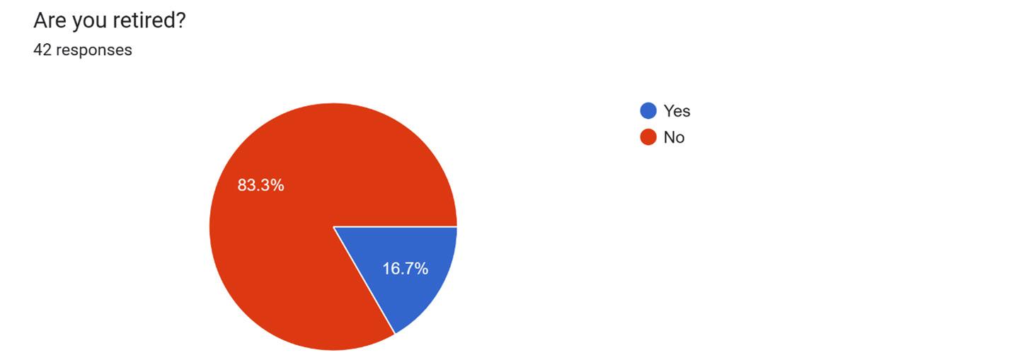
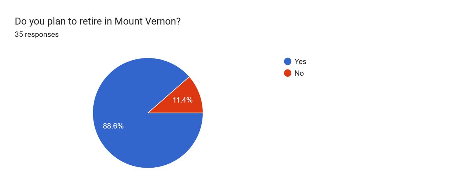
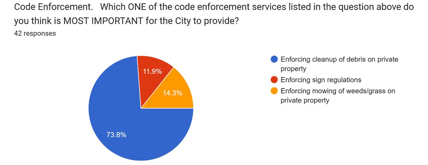
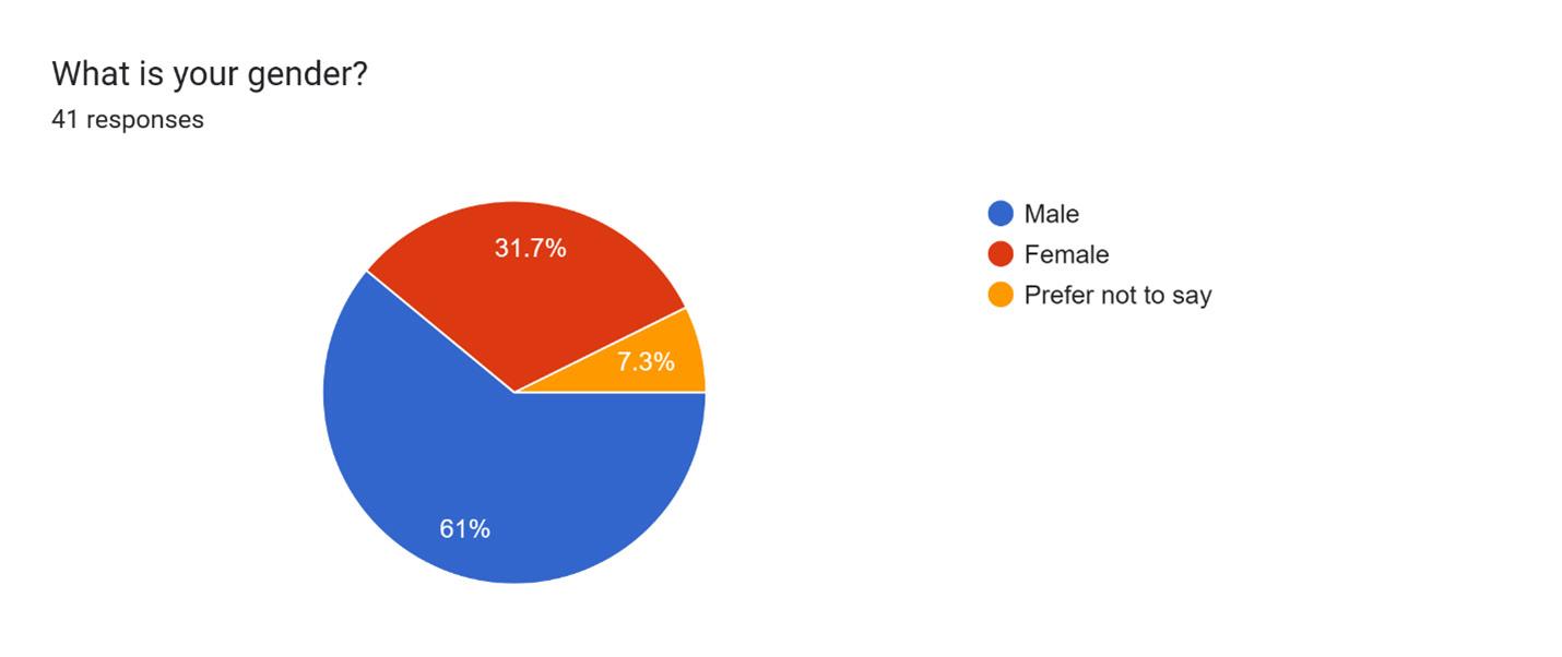
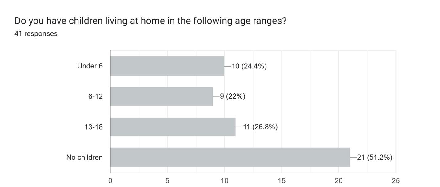
A community input survey was developed and hosted online so that citizens could conveniently fill out the form on their computer, tablet, or phone. The survey’s URL was posted on the City’s website and social media platforms. The survey took approximately 10 minutes to complete and received 42 responses.
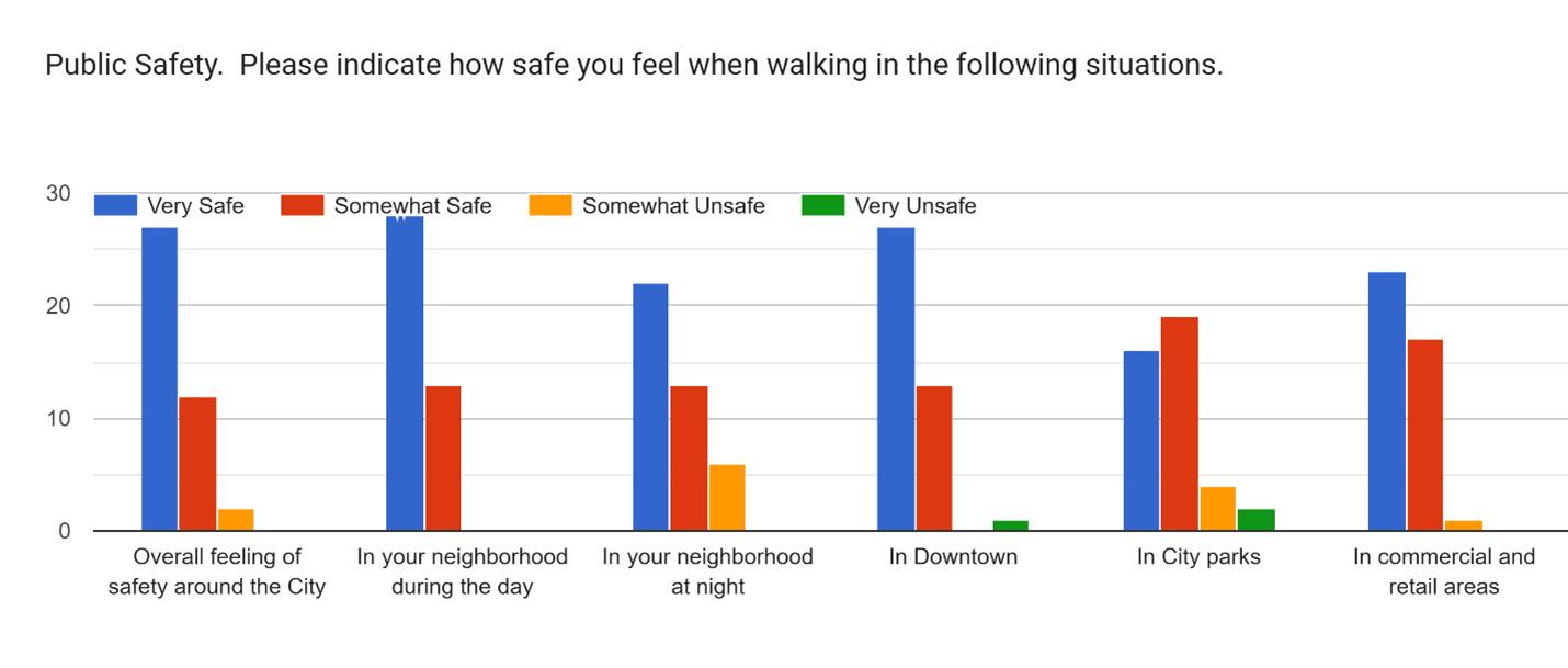
The survey aimed to understand citizens’ views about living in Mount Vernon and to collect sociodemographic data. Questions ranged from general quality of life, safety, land uses, code enforcement, infrastructure, and transportation.
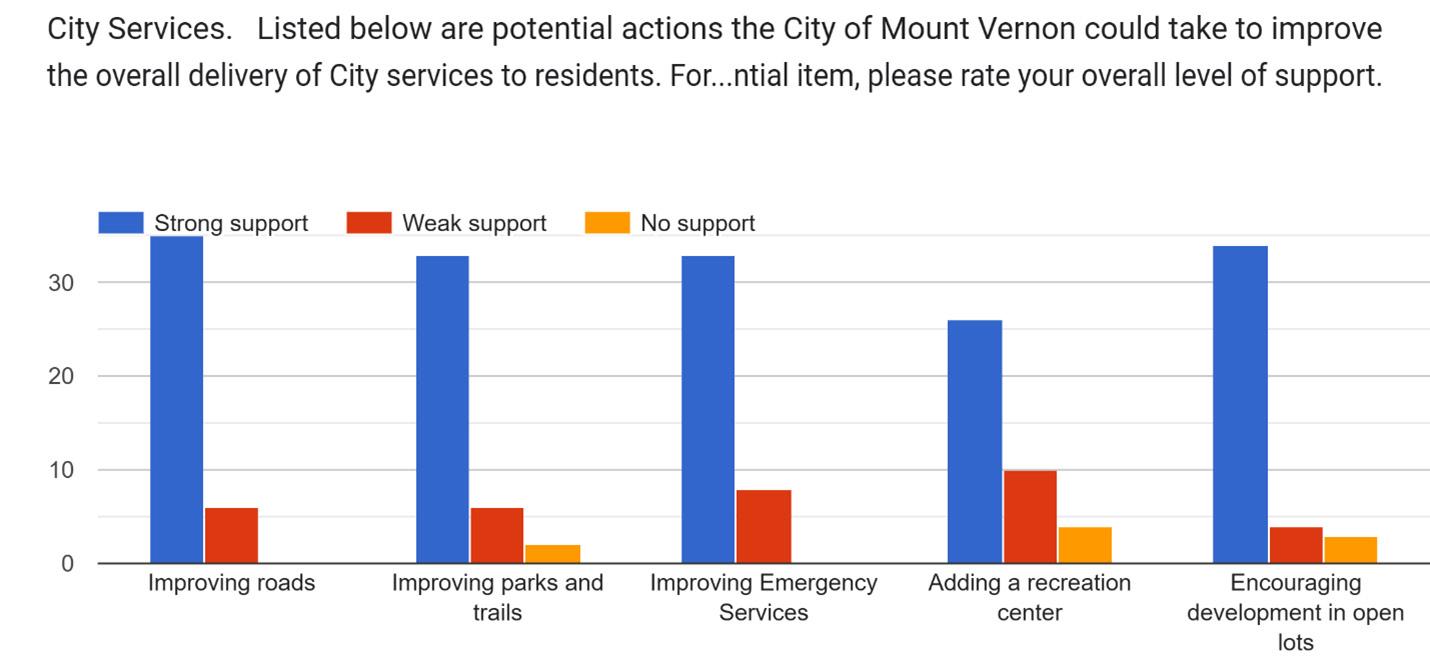
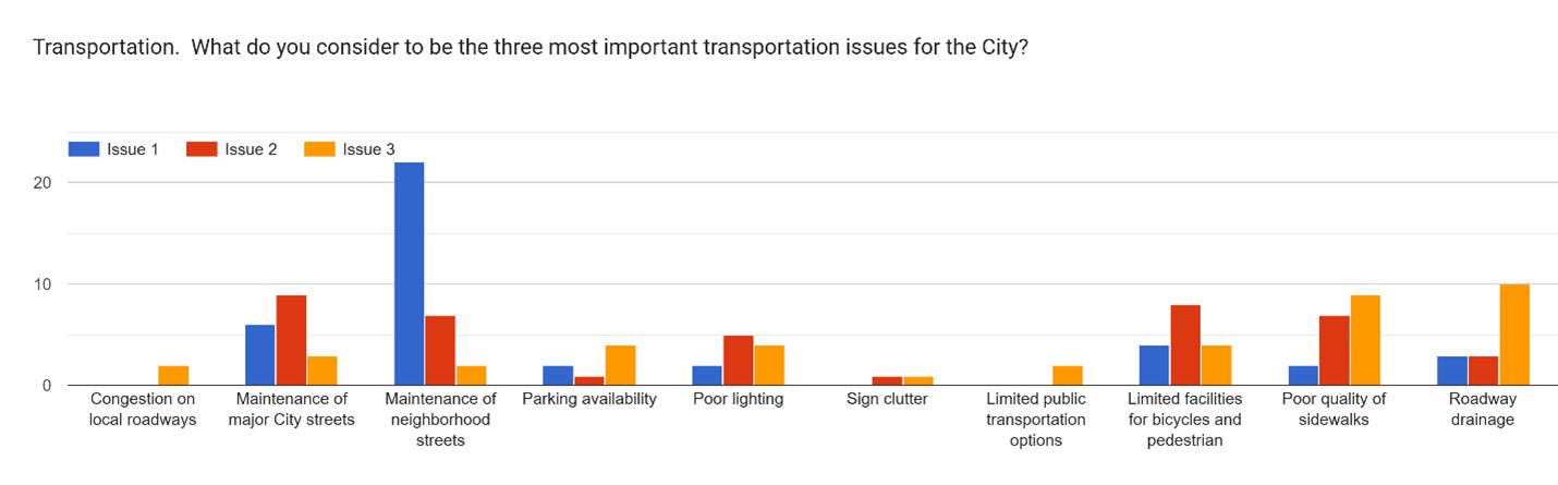
Citizens voiced strong support for improving roads, parks & trails, EMS services, and infill development. They voiced weak support for a new recreation center. Public parks, plazas, or open spaces were the most requested amenity, while accessory dwelling units were the least requested. Citizens view the city’s most important transportation issues is maintenance of neighborhood streets and the least important issues as congestion of local roadways and limited public transportation options.
Parks
Neighborhood (Night)
Commercial Areas
General Safety Downtown
Neighborhood (Day)
Very Dissatisfied Very Satisfied
05: Perception of Safety in Mount Vernon
Job Availability
Appearance of Neighborhoods
Quality of Life
Quality of New Development
Appearance of Commercial Districts
Public Services
Very Dissatisfied Very Satisfied
06: Perception of Mount Vernon
Strengths
• Great quality of life (ex. school system, events, downtown).
• Ample open land and infill lots along major corridors and neighborhood streets.
• Overall feeling of safety around the City.
• Personal pride in historical housing.
Weaknesses
• Perceived lack of job opportunities.
• Lower public satisfaction level towards quality of new developments and appearance of neighborhood.
• Aging housing inventory.
Opportunities
• Attract diverse population cohorts with emergent job opportunities.
• Provide additional housing for greater region and major employment centers.
• Build on strong citizen support for more city services, especially neighborhood street maintenance.
Threats
• Feeling somewhat safe in City parks compared to other areas.
• Current construction costs and interest rates are limiting housing production.
• Lack of diversity in major employers could limit agglomeration economy (see 2023 Strategic Report).
The following recommendations of the Land Use Plan pertain to land use allocation, zoning ordinance regulations, and generally long-range planning. The majority of these regulations are translating into ordinance language in the City’s zoning and subdivision ordinances.
Encourage Strategic Land Planning & Public-Private Partnerships: Land use patterns and decisions are shaped by factors such as population and economic growth, transportation accessibility, infrastructure availability, environmental limitations, and quality of life elements (ex. school quality, parks and recreational facilities, and cultural amenities). While the Future Land Use guide, zoning ordinance, and development regulations establish a framework for land use, the majority of development decisions are made by the private sector. However, government can influence these choices through public investments, incentives, and disincentives. Thus, both government regulatory framework & incentives and private investments cause development of a specific type of land use. It is recommended for the City to identify key private developers and investors to spur specific projects such as the North Corridor (see 2023 Strategic Plan).
Adopt Mixed-Use Zoning Regulations: Mixed-Use zoning has been a popular land use strategy for years since urban planners like Andres Duany and Elizabeth Plater-Zyberk have been promoting pedestrian-focus Traditional Neighborhood Developments. MixedUse refers to both a land use type and a building layout; vertical mixed-use refers to a building with multiple distinct and compatible uses such as ground floor commercial and upper floor residential, while horizontal mixed-use refers to highdensity distinct and compatible uses within reasonable walking distance. It is recommended for the City to incorporate mixed-use zoning and land use into key areas of the City.
Mobility is influenced by the amount of time it takes to move from A to B, which is typically determined by road speed. Accessibility is influenced by the amount of land access while traveling from A to B, which is affected by the number of intersections and driveways. These variables are influenced at the macro-level by road network system design (connectivity between road types, spacing between intersections & driveways, etc.) and at the micro-level by road profiles (lane width, grade, material).
Encourage a Diverse Housing Market: The 2025 Housing Study conducted by Catalyst Commercial determined that the City of Mount Vernon’s housing market presently can support 350 new houses
over the next five years across all types and price points. It is recommended that these housing units take the form primarily of traditional single-family units, garden homes, and duplexes, and secondarily of multi-family units. Other notable goals from the Housing Study include creating a housing dashboard, establishing a housing committee, and creating a Demolition-Rebuild Program.
Balance Commercial & Residential Uses: The regional average commuting time is approximately 5 to 20 minutes, establishing the commuter threshold beyond the city limits and increasing the likelihood for commuter citizens. Solely providing houses would only turn Mount Vernon into a bedroom community for a larger metropolitan economy. This would place too much risk on the housing market to sustain the municipal budget and stymie the quality of services the city could provide its citizens. It is recommended for the City to balance the percentage of commercial use with residential use to encourage a diverse tax base.
Protect Existing Neighborhood Character: In the heart of the City are neighborhoods that are essentially “built-out” and are not likely to be the focus of extensive infill development or redevelopment. These areas often were platted before current development regulations were in place, often resulting in nonconforming situations. The Neighborhood Conservation Overlay provides additional character protection by maintaining lot density, housing type, and tree protection, and addresses nonconforming issues such as setbacks from the property line. It is recommended to implement a “Neighborhood Conservation Overlay” within the City.
Balance Mobility, Accessibility, and Safety: It is important for the city to develop and utilize a road hierarchy system that favors both vehicle and pedestrian traffic to move volume efficiently and safely. The City can improve lane volume and traffic safety in light of the increasing vehicle trips by reducing the number of driveways on arterial roads and relocating them to collector roads. It is recommended for the City to encourage gridded street design pattern and compact intersection design, reduce the maximum block width, update zoning code for drive-thru lane standards & cross-access easements, increase the minimum distance between driveways in new developments, and consider a road design study at the intersection of Hwy 37 & 67.
Plan for More Arterials: The City will near build-out with the addition of new housing and the development of the North Corridor. To foster efficient traffic flow, it is recommended for the City to plan for minor arterials between Highway 37 and I-30 and an east-west minor arterial.
Utilize Digital Management System: Data management is the process of compiling, organizing, and sharing information. While the City has some resources online via the city & county websites and Municode, zoning and land use resources are limited to static maps. The City can integrate a GIS data management system to analyze spatial information such as zoning cases, traffic conditions, property values, and crime incidents. It is recommended for the City to integrate ESRI’s ArcPro software or ArcGIS Online platform to manage and share public assets.
Adopt Parkland Dedication Regulations: A basic and long-held principle of growth management is that development must be supported by adequate public facilities and services and that private and public investment must be coordinated to achieve that objective. Parkland dedication ordinances are intended to ensure that park facilities are available when homeowners buy their new homes, and to avoid authorizing development without ensuring that the park infrastructure necessary to support the new demands is available. New, large residential developments would be required to dedicate a ratio of open space to the City to be made into a public park or provide park fees in lieu of property. It is recommended for the City to adopt a Parkland Dedication ordinance.
Update Lighting Standards: Any lighting that is installed across the City should be shielded and incorporated with warm LED lighting, photocells, and timers to minimize utility. There are many benefits for lighting design regulations that reduce light pollution. Aside from uncompromised safety, shielded lights conserve the natural night sky over the city, which is a quintessential aspect of rural living for citizens and tourists. Additionally, most bird species migrate at night, and light pollution can significantly hinder this process. The International Dark Sky Places program certifies communities that have excelled at preserving and protecting dark places and minimizing light pollution. It is recommended for the City to pursue becoming a Dark Sky Community and adopt lighting standards that align with this designation.
Update Sign Ordinance: The updated sign ordinance is intended to improve the visual aesthetics and traffic safety of major thoroughfares and historic areas within the city. It is recommended to enact a moratorium on billboards, to limit pole signs only around Interstate-30, to encourage monument signs throughout the city, and to enforce performance regulations like lighting standards.
Northbound view of Highway 37
Adopt Cell Tower Regulations: Cell towers are vital to ensure strong and consistent signal strength for mobile phones and other devices. However, telecommunication companies typically prefer to own their own tower instead of collocating their equipment onto a competitor’s infrastructure. Cell tower regulations are intended to protect the city from unnecessary telecommunication infrastructure for safety and local aesthetics. These regulations will require telecommunication companies to prove their structures are safe for the surrounding residents in case of failure and that collocation is not a viable option due to local constraints. It is recommended that the City adopt cell tower regulations to preserve the safety of citizens and the aesthetics of the community.
The Future Land Use Plan utilizes a range of land use types to classify all properties within city limits and the extraterritorial jurisdiction. The Future Land Use Types are generally organized by the following nine classes:
• Agriculture, Parks & Open Space/Floodplain
Institutional
Estate Density
Low Density
High Density Residential
Manufactured Home Overlay
Central Business District
Residential Estates
Industrial
Figure 09: Future Land Use - Existing & Proposed
Warehouse, & Industrial Agriculture, Parks & Open Space/Floodplain
Areas that are recommended to be conserved for their natural function or open space qualities. These areas include floodplains, riparian buffers, common areas, and open space. The land use designation also includes agricultural areas, which are characterized by large tracts of undeveloped land utilized for agricultural production, wildlife management, or ranching. Residential home sites are located randomly throughout the countryside. There are opportunities for additional uses that support the character and economic viability of agriculture. Lot sizes are typically greater than 2 acres.
Intent
• Protect environmentally sensitive areas and the flora & fauna that reside.
• Preserve drainage patterns to reduce flood damage on surrounding properties.
• Promote nature-centric areas for communal relaxation, recreation, and education.
• To sustain existing drainage patterns, impervious surfacing should be limited.
• Implement design regulations such as height limitations, setbacks, and buffering are enforced to minimize negative externalities on surrounding properties.
Generally appropriate zoning districts
AG, CF
Uses
Primary: protected natural areas, flood management areas, parks, trails, farming, ranching, wildlife management.
Secondary: active sports facilities in a limited area. Single Family (SF) detached homes and supporting structures, agriculture-related tourism, local food production. Cluster Residential may be permitted within a larger property if the criteria in this land use is met.
Primarily single-family residential areas that have a low level of development activities. These areas are appropriate for very low-density residential lots that range from 3 to 5 acres, or average 40,000 square feet lots when clustered around open space. Lots may or may not have farm and livestock restrictions.
Intent
• Support a wide range of lot sizes, long blocks, and curvilinear streets. Buildings tend to be located greater than 30 feet from a fronting street.
• When establishing new residential areas or expanding existing developments, provide pedestrian and vehicular connectivity between adjacent developments.
• To sustain existing drainage patterns, impervious surfacing should be limited.
Generally appropriate zoning districts:
AG, CF, R-1
Uses
Primary: estate & rural zoning.
Secondary: parks and open space.
Primarily single-family residential areas that consist of low to moderate density single-family lots less than 2 acres in area. These areas may also include limited townhomes, duplexes, other housing types, and some non-residential uses that are compatible with surrounding single-family areas. Development types tend to be highly consistent within a subdivision or neighborhood and are easy to navigate by car, bike, or on foot.
Intent
• Accommodate streetscape features such as sidewalks, street trees, and lighting.
• Support neighborhoods with a mix of housing types, promoting mid-density.
• Encourage community facilities, parks, and greenways within neighborhoods.
• Provide pedestrian and vehicular connectivity between adjacent developments when establishing new residential areas or expanding existing developments.
Generally appropriate zoning districts: R-2, R-3
Uses
Primary: lower density residential (ex. detached single-family).
Secondary: mid-density residential (ex. townhomes, duplexes, garden homes).
Areas appropriate for a mix of moderate density residential development including townhomes, duplexes, multifamily buildings (3-12 unit), and limited small-lot single family. These areas are appropriate for residential infill and redevelopment that allows original character to evolve. These areas may serve as buffers between more intense mixed-use development and suburban residential or neighborhood conservation areas.
Intent
• Accommodate a walkable pattern of small lots, small blocks, and well-connected street pattern.
• Accommodate streetscape features such as sidewalks, street trees, and lighting.
• Encourage community facilities, parks, and greenways within neighborhoods.
• Support neighborhoods with a mix of housing types and where larger or more dense housing is located near community facilities or adjacent to commercial or neighborhood centers.
Generally appropriate zoning districts
R-2, R-3, R-4, B-1, CF
Uses
Primary: mid-density residential (ex. duplex, townhomes) & high-density residential (ex. triplex, quadplex, multi-family apartments)
Secondary: limited-scale lower density residential (ex. detached single-family)
These centers include a horizontal mix of uses including destination retail, restaurants, employment opportunities, entertainment use, and commercial uses that serve a regional market. These centers may include a variety of housing types.
Intent
• These dense areas should include complimentary uses that take advantage of accessibility via walking and biking.
• Parking should be grouped into clusters primarily behind structures from the street.
• Incorporate structures designed to accommodate a combination of uses on a single parcel.
Generally appropriate zoning districts
MU-TC, CF
Uses
Primary: retail, commercial, offices, hotels, entertainment centers, services and office use, civic, high- and mid-density residential
Secondary: low-density residential
Areas designated for public or semi-public purposes that sustain the quality of life. These zones are designed to enhance social infrastructure in the community, ensuring residents have access to essential & emergency services while minimizing the impact of these facilities on neighboring areas. Property owners range from the City of Mount Vernon, Franklin County, and Mount Vernon Independent School District, and church organizations.
Intent
• Promote accessibility and safety by being centered near neighborhoods, commercial districts, or corridors.
• Utilize pedestrian-scale amenities such as sidewalks, street trees & landscaping, lighting, seating, etc.
• Incorporate buffering to minimize negative externalities that affect the area’s visual aesthetics, smell, and sound.
• Provide public parks to enhance citizen quality of life.
Generally appropriate zoning districts:
CF, R-1, B-1, MU-TC
Uses
Primary: education facilities, hospitals, parks, government buildings, fire stations, police stations, cemeteries, religious institutions
Secondary: none
Typically characterized by small, freestanding buildings containing one or more businesses. Includes land dedicated to the sale of both wholesale and retail goods and services, and land dedicated to the uses of executive or professional services.
Intent:
• Can accommodate vehicle-centric businesses like drive-thru restaurants.
• Unlike larger shopping centers that may attract regional customers, NC developments primarily provide services for residents of surrounding neighborhoods.
• Incorporate buffering to minimize negative externalities that affect the area’s visual aesthetics, smell, and sound.
Generally appropriate zoning districts:
R-3, R-4, B-1, B-2, CF
Uses
Primary: retail and commercial
Secondary: civic
Areas that include office, research and large commercial uses that may be planned and developed as a unified project. Generally, these areas need convenient access to arterial roadways.
Intent
• Accommodate a variety of large footprint buildings.
• Accommodate commercial and service users within Business Centers.
• Accommodate pedestrian connectivity to and within Business Centers.
• Provide buffering through landscaping and building placement where large-scale employment sites are adjacent to residential areas.
Generally appropriate zoning districts: R-4, B-2, B-3, CF
Uses
Primary: higher education, research and technology, professional offices, office parks, flex office, medical, large footprint commercial
Secondary: civic, parks and open space
Provide jobs and locations for a range of companies that produce or distribute both raw and refined products. Large buildings are typically needed for storage and logistics and are located near major transportation corridors.
Intent
• Includes land that pertains to the manufacturing, fabrication, mass storing, and/or distribution of goods.
• Design regulations such as height limitations, setbacks, and buffering is enforced to minimize negative externalities on surrounding properties.
Generally appropriate zoning districts: D-1, D-2, B-3
Uses
Primary: manufacturing, distribution centers, technology/data centers, flex office, lowimpact industrial
Secondary: retail & office uses, training facilities, civic, parks and open space
Ultimate capacity, as defined within this document, is the maximum number of residents that Mount Vernon can support, given its current City limits and ETJ. There are several sources that provide the data used to calculate the ultimate capacity:
• Mount Vernon’s Existing Land Use map is reviewed to obtain information on where vacant areas exist within the City.
• The Future Land Use Plan map is reviewed to obtain information on planned locations for future residential areas and on the projected densities of those residential areas. The least intensive and most intensive maximum unit count allowed by the zoning classes are calculated to generate the low and high range.
• The City’s 2023 U.S. Census information is reviewed to obtain information on occupancy rates (vacant vs. total housing units) and the number of persons per household.
These elements are calculated together and are added to the City current population of 2,571 residents. As Figure 11 shows, the ultimate population capacity of Mount Vernon as calculated herein is approximately 21,340-24,390 people. When compared to population projections, it can be seen that Mount Vernon has sufficient room to grow well beyond 2030 even at the most aggressive growth rate.
Agriculture, Open Space (3710 Acres)
Residential Estates (1602 Acres)
Suburban Residential (1030 Acres)
Mixed Residential (280 Acres)
Mixed-Use Center (359 Acres)
Institutional (201 Acres)
Low Intenstiy Commercial (807 Acres)
High Intensity Commercial (569 Acres)
Manufacturing, Warehouse, and Industry (72 Acres)
10: Future Acreage Allocation
The recommended updates to the zoning code aim to balance the development of businesses and housing through the City and simplify the zoning classification system. There are 13 proposed zoning classes compared to the existing 14 classes. The range of Residential and Commercial zones are based on density, unit-types, and potential performance standard intensity (i.e. lights, noises, smells). New residential uses include garden homes and apartments.
AG (1274 acres)
R-1 (195 acres)
R-2 (349 acres)
R-3 (83 acres)
R-4 (0 acres)
PD (170 acres)
MU-TC (10 acres)
CF (444 acres)
B-1 (17 acres)
B-2 (98 acres)
B-3 (161 acres)
D-1 (39 acres)
D-2 (0 acres)
Agriculture, Parks & Open Space/Floodplain Residential Estates
Mixed Residential
Low Intensity Commercial High Intensity Commercial Manufacturing, Warehouse, & Industrial
Agricultural Homestead
R-1 Residential Estates
SF Low-Density
Residential
SF Mid-Density Residential
Development Mixed-Use Town Center
Figure 14: Zones and Future Land Use Classes
Per Chapter 213 of the Texas Local Government Code, the land use plan of a Comprehensive Plan is not a zoning ordinance or zoning map. Zones depicted in this map may not align with desired future land uses, but as development opportunities arise, the FLU map can be considered for strategic decision-making.
At times, the City will likely encounter development proposals that do not directly reflect the purpose and intent of the land use pattern shown on the Future Land Use Plan. Review of such development proposals should include the following considerations:
• Will the proposed change enhance the site and the surrounding area?
• Is the proposed change a better use than that recommended by the Future Land Use Plan?
• Will the proposed use impact adjacent residential areas in a negative manner? Or, will the proposed use be compatible with, and/or enhance, adjacent residential areas?
• Are uses adjacent to the proposed use similar in nature in terms of appearance, hours of operation, and other general aspects of compatibility?
• Does the proposed use present a significant benefit to the public health, safety and welfare of the community?
• Would it contribute to the City's long-term economic wellbeing?
Development proposals that are inconsistent with the Future Land Use Plan (or that do not meet its general intent) should be reviewed based upon the above questions and should be evaluated on their own merit. It should be incumbent upon the applicant to provide evidence that the proposal meets the aforementioned considerations and supports community goals and objectives as set forth within this Plan. It is important to recognize that proposals contrary to the Plan could be an improvement over the uses shown on the Plan for a particular area. This may be due to changing market, development and/or economic trends that occur at some point in the future after the Plan is adopted. If such changes occur, and especially if there is a significant benefit to the City of Mount Vernon, then these proposals should be approved, and the Future Land Use Plan should be amended accordingly. To ensure continual support and application of the plan, it is recommended for the City to expand staffing or utilizing outside consulting for proposal reviews and data system management.
*Additional public input comments can be provided from City by request.
Stakeholder Meeting - January 15, 2025
• Great school system and good benefit to community
• Construction costs limit who can buy homes
• Public wariness of land uses such as Accessory Dwelling Units & battery substations in City
• A mentioned desire for a hotel around the Hwy 37/I-30 interchange
• Hope is to attract young and prosperous mix to afford homes
• Today is bedroom community. Want to grow with more $350K households. Young families moving into area and want to draw them in (remote work)
• Aim for having an urgent care, fire and EMT in a central hub (getting a hospital may be unrealistic)
• Various development opportunities at the Holbrook St/I-30 Interchange

This page intentionally left blank.