City of Cleburne Contact:
Aaron Dobson, Director of Parks & Recreation
418 W. Henderson Street
P.O. Box 677
Cleburne, Texas 76033
Office: 817-645-0949
MHS Planning Contact:
Hunter Rush, Senior Planner & Partner
Emily Gunderson, Planner
212 W. 9th Street Tyler, Texas 75701
Office: 903-597-6606
The City of Cleburne and MHS Planning & Design, LLC would like to thank the following community leaders and volunteers for their input in the development of this master plan. A special thanks to the residents of Cleburne for their participation and input during the planning process.
Scott Cain – Mayor
Derek Weathers – Councilmember, SMD 1
Christopher Boedeker – Mayor Pro Tem, SMD 2
Mike Mann – Councilmember, SMD 3
John Warren – Councilmember, SMD 4
Christopher Boedeker – Chairman
John Warren – Vice Chairman
Steve Shaffer
Debby Miller
Kim Lively
Brian Goodman
Steve Polasek – City Manager
Chris Fuller – Deputy City Manager
Ivy Peterson – City Secretary
Brian Goodman – President
Shane Atkins
Sheryl Gray
Steve Shaffer
Kyle May
Aaron Dobson – Director of Parks & Recreation
Kristi Dempsey – Administrative Assistant
Rodney Carlock – Parks Superintendent
Katie Easdon - Recreation Manager
Debby Miller - President
Christopher Boedeker
Michelle Kennon
Kim Lively
Mike Mann
Jean Moss
John Warren
Scott Cain, Ex Officio
The City of Cleburne would like to give a special thank you to the community leaders who volunteered their time while serving on City Council and the Parks & Recreation Board: Robert O. Kelly, D.D.S. - Former Councilmember, Betty Cook - Former Parks & Recreation Board Member & Johnathan Laureles - Former Parks & Recreation Board Member.


The City of Cleburne hired MHS Planning & Design in November 2019 to perform an analysis of the overall parks system and make recommendations for future parks, trails and open space developments. The Summary is intended to briefly explain the process the City & MHS utilized to understand the existing parks system, conduct public input, develop a mission and vision statement, set goals and objectives determine the needs of the community and create a road map to develop a parks system that meets the desires of the residents of Cleburne. As the City continues to grow, the parks system will need to grow too. The investment into parks should be a priority to the City due to the fact that parks, trails and open spaces drive commercial development and increase residential property values.
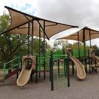
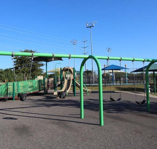
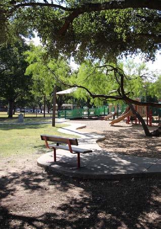
After initial review of the 21 parks, natural areas, sports fields & courts, recreational center, golf course and water park, it is apparent that the City of Cleburne has a great foundation for a successful parks system. However, it is important to note that many of the existing parks need upgrades and more resources allocated to maintenance. The City must continue to update, enhance and maintain the existing parks to ensure they are safe, aesthetically pleasing and meet the desires of the community.
In addition to improving and continually maintaining the existing parks system, the City must look towards the future and acquire additional properties for parkland throughout the city limits to ensure the total developed parks acres grows simultaneously with the growing population.
The Level of Service is a measurement of usable park acres per 1,000 residents within the community. Based on the existing parks system, surrounding communities and the National Recreation and Park Association standards, the City of Cleburne’s recommended Level of Service is 17.3 acres per 1,000 people. The City of Cleburne currently has a total of 466.50 usable park acres and a current population of 31,080 residents. Based on these numbers, the City has a Level of Service of 15.01 acres of developed parkland for every 1,000 residents. It is imperative the City acquire properties over the next three to seven years to ensure the gap between the existing Level of Service and the growing population does not continue to increase.
To understand the desires of the residents of Cleburne, the City provided several different forms of engagement to ensure everyone had the opportunity to voice their opinion regarding the existing and the future parks system.

Two surveys were conducted in the City of Cleburne during the development of this Master Plan. There was one statistically valid survey for the entire parks and recreation system and one information survey for the development of Lake Pat Cleburne. Combined the City received 1,775 responses (652 Master Plan responses & 1,123 Lake Pat Cleburne responses). The statistically valid Master Plan survey was designed and analyzed by the National Service Research (NSR) Company.
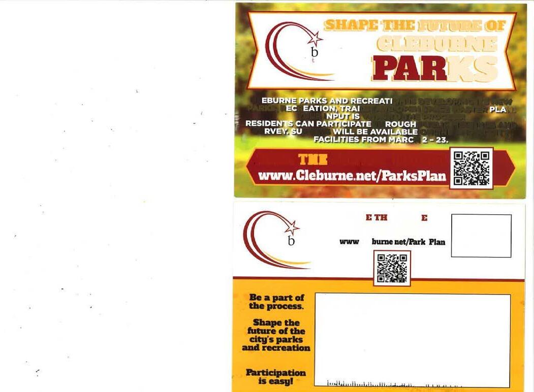
An important aspect of the planning process was to conduct a demand and needs assessment which involved citizen input. This citizen input is the foundation of a great master plan, therefore the City of Cleburne Parks and Recreation Department used multiple types of citizen input and public meetings to receive recommendations and feedback during the planning process. NSR worked closely with MHS Planning & Design and the City of Cleburne staff throughout the research process. The City of Cleburne mailed 34,000 postcards (17,000 Master Plan
postcards & 17,000 Lake Pat Cleburne postcards) to households throughout the City. The postcard provided information about the needs assessment survey and provided an online link to access the survey.
An additional survey was conducted specifically for the Lake Pat Cleburne needs analysis. This survey was available for all residents to complete online or submit a paper copy. The survey was also sent specifically to the homeowners around Lake Pat Cleburne. The survey helped determine the list of priorities for Lake Pat Cleburne and Buddy Stewart Park.
Overall, 58% of the residents rated the quality of the parks and recreation opportunities in Cleburne as satisfactory. 52% of Cleburne residents rated the quantity of parks in Cleburne as satisfactory. Over 80% of residents strongly agree or agree that parks and recreation facilities are well worth the cost to taxpayers.
Enhance existing parks to make them inviting & safe for children & families.
Acquire additional park properties to ensure Cleburne's Level of Service standard does not decrease as the population increases.
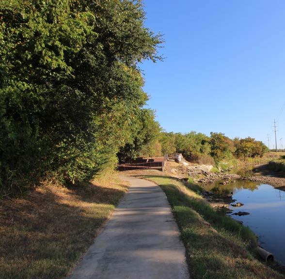
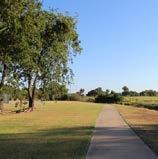
Construct trails within parks and throughout the City for safe & interconnected recreational opportunities.
Develop Lake Pat Cleburne with both active and passive recreational opportunities.
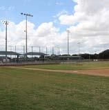
Upgrade and enhance the sport complexes to ensure fields are satisfactory for recreational & tournament play.
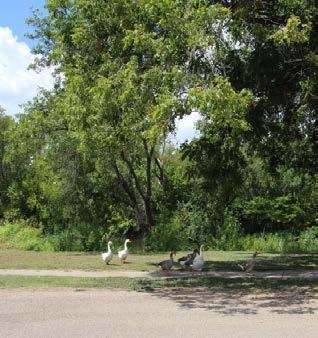
Preserve natural open spaces to ensure areas remain free from development.
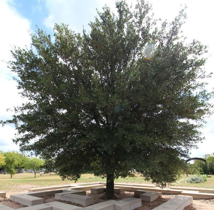
Enhance the golf course greens with natural turf & plant native trees for additional shade.
Upgrade Booker T. Washington Recreation Center to better suit the needs of the community.
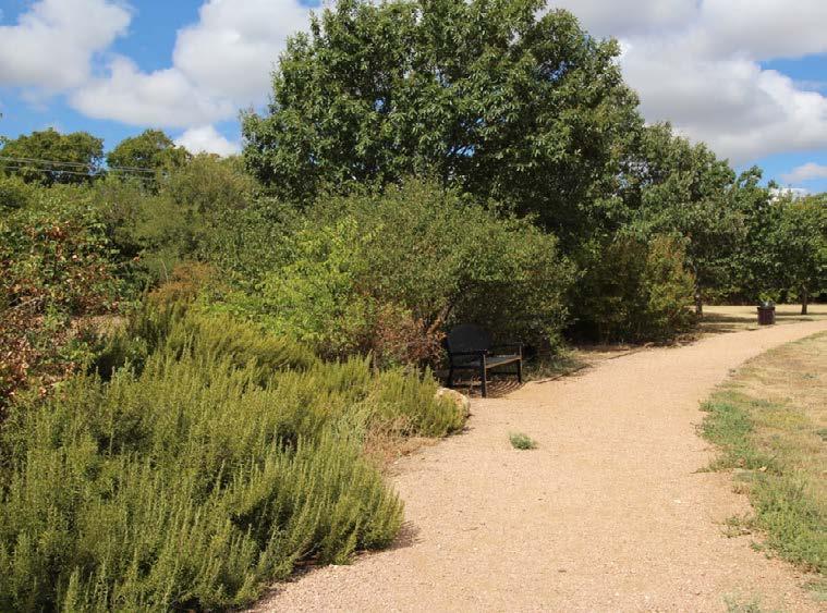
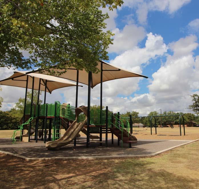
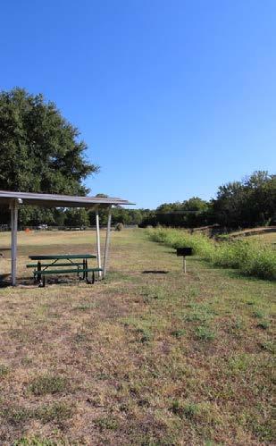
Provide general park amenities such as shade, picnic tables, benches, bbq grills & native plants.
The following Parks System Priorities list is based on the Needs Summary and recurring themes from the focus group and public meetings, citizen surveys, City Staff recommendations and the professional consultant’s opinion. The Advisory Committee reviewed the major themes and worked with City Staff and MHS Planning to determine the top priorities listed below. It is important to note the following list is intended to be a guide for development of existing and future parks and amenities over the next ten years.
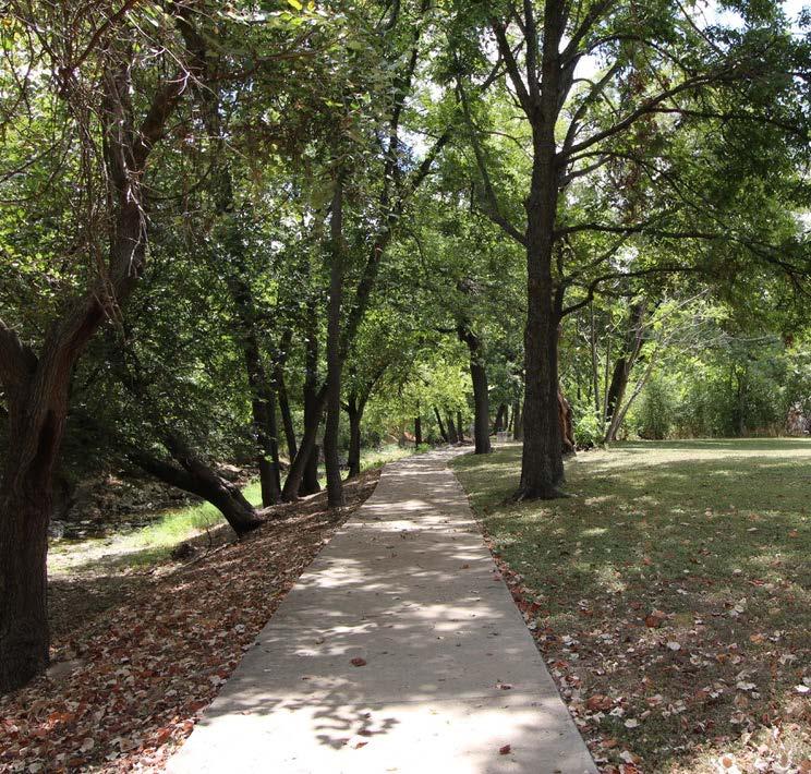
Multi-Purpose Trails & Nature Trails
Shaded Spaces in the Parks
Site Amenities: Benches, Tables, Water Fountains, Grills, Bike Racks, etc.
Open Space & Natural Areas
city of cleburne ' s parks & recreation department mission
"To provide memorable experiences through parks and recreation that enrich our community."
city of cleburne ' s parks & recreation department vision
“The
vision of the City of Cleburne’s Parks and Recreation Department is to continually provide and maintain safe, attractive, and inviting parks, trails and programs for the residents of Cleburne.”
This plan is meant to serve all areas within the city limits of Cleburne. A more detailed analysis of potential projects, scopes, costs, timelines and funding sources are provided for implementation through the year 2031. For this plan to remain meaningful, it should be periodically amended and revised throughout the implementation period. Typically, plans are updated every five years to reflect the current needs of the community.
purpose of the plan
The purpose of the Parks, Recreation, Trails and Open Space Master Plan is to present community-wide goals, objectives and needs regarding the Parks System. The Plan will serve as an informational tool related to parks, trails & open spaces to help guide City Council, the Parks Department, and City Staff on present and future decisions. The purpose is to provide implementable projects regarding the existing and future parks, trails and open space system.
The Parks, Recreation, Trails and Open Space Master Plan planning process began in 2019 when the City of Cleburne contracted with MHS Planning & Design to develop a new parks plan to better suit the changing needs of the community. The Advisory Committee, representing a cross section of the community with City Council members, Parks Board members, 4B Board members and key City Staff were selected to guide the development of the Parks Master Plan for future park, trails and recreation opportunities. The Advisory Committee, Parks Board, 4B Board, City Staff and City Council were involved in each major step of the planning process and provided the local insight needed to produce a successful document to assist in guiding local decision makers through 2031.
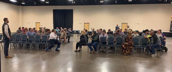
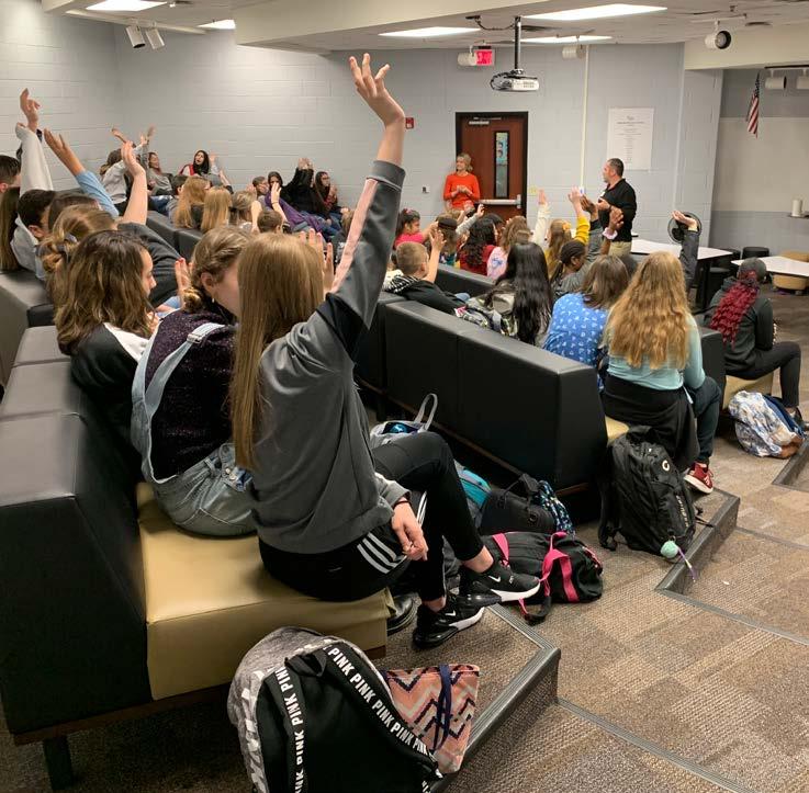
The City of Cleburne is committed to understanding the needs of the residents to develop a Parks Master Plan that represents the needs of the community. The City went above and beyond collecting data from residents through several different avenues to connect with as many citizens as possible. The City of Cleburne developed a statistically valid, online survey and continually promoted the surveys by mailing out 34,000 postcards to residents, using multiple online social media platforms and contacting local schools. A total of 1,775 survey responses (652 Master Plan responses & 1,123 Lake Pat Cleburne responses) were completed and submitted to the City. In addition to gathering public input through the surveys, the City conducted focus group meetings to better understand these specific group needs within the City of Cleburne’s parks, recreation and open space system. Additionally, the City and MHS conducted four different focus group meetings at the high school, two middle schools and an elementary school. The City also hosted an open public Town Hall Meeting that was attended by approximately 70 residents. Every individual in attendance had the opportunity to ask questions or provide input regarding the existing and future parks system.
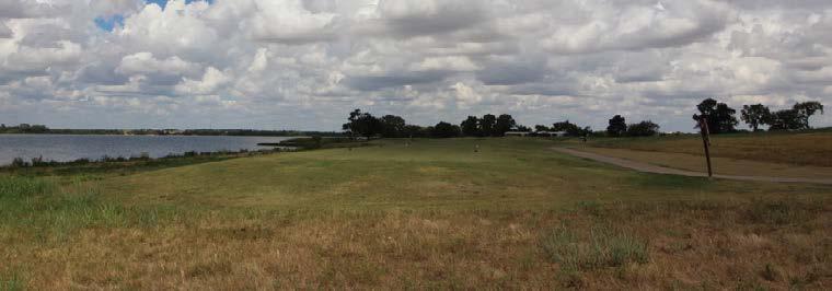
Lake Pat Cleburne is an asset to the entire City and surrounding areas. The lake is used primarily for fishing but is open for skiing, boating, swimming, kayaking, canoeing, etc. To better understand the needs for this specific site, a citizen survey was conducted and MHS developed two conceptual Site Plans and presented them to the City for comments, questions and concerns.
Existing and future parks projects were developed based on the citizen survey results, focus group input, public meeting comments, the Advisory Committee, City Council, Parks Board and City Staff. Taking into account existing inventory, available resources, and professional opinion the parks projects and overall master plan focus on the importance and need for maintenance as the parks system continues to grow and develop. This plan dives into new parks ordinance recommendations based on both neighboring communities and national standards.
To ensure the Advisory Committee was continually engaged in the process, the City hosted a meeting to present the survey findings, goals and objectives and the proposed projects and timeline. The Advisory Committee provided feedback so MHS could adjust different aspects of the plan. After the meeting, the master project list was refined and the projects for the City were prioritized based on local demand and their perception of needs. This parks master plan was presented to the Advisory Committee, 4B Board, Parks Board and City Council to verify that the City of Cleburne Parks Master Plan reflects the community’s needs and priorities.
Known for its role as a crossroads and transportation center, the City of Cleburne can trace its roots back to the old wagon trail, Johnson County road. The road was used by soldiers moving from Fort Belknap to Fort Graham. In the early days, the location of the City near West Buffalo Creek attracted travelers and cattlemen from the nearby Chisholm Trail. After the Civil War, Camp Henderson, a temporary facility, was renamed and re-established as a town and named after Gen. Patrick R. Cleburne on March 23, 1867. The City became the county seat of Johnson County and currently is on U.S. Highway 67, thirty miles south of Fort Worth.
The City continued to develop with the arrival of the railroad in the 1870s through the 1900s. By the 1990s, the City of Cleburne was still served by Santa Fe and Amtrak.
During the 1920s through the 1940s, the City sustained a population decline and financial crisis during the depression and WWII. By 1945, the City began to increase in population and find a renewal of economic prosperity caused by close proximity to the Dallas-Fort Worth Metroplex. Cleburne experienced substantial growth, increased employment, and expanded higher education opportunities.
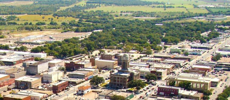
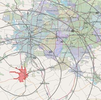
The City of Cleburne is located 30 miles south of Fort Worth and is the county seat of Johnson County. Cleburne is a unique town with a rich history about transportation, the Civil War, and agriculture. The Town has a vibrant community and is focused on a high quality of life by providing many amenities for its residents and visitors. The City offers a small water park, a sports complex for tournaments, a multi-use
sports facility for semi-professional sports, a theater for live performances, multiple museums and many parks and natural areas. The major employers in the City include Cleburne Independent School District, Walmart and its distribution center, local hospitals, and local government agencies such as the City and Johnson County. Cleburne is a growing town with a strong sense of City pride.
34.9 square miles
Since 2010, the City of Cleburne has added 632 housing units and the average household size is 2.65, with 19.4% of households speaking a language other than English in the home.
homeownership

10,915 households
$137,853
Average Value of Owner-Occupied Households in 2020
$50,253
Median Household Income
Owner-Occupied Housing - 61.3%
Renter-Occupied Housing - 38.7%
According to the North Central Texas Council of Governments 2020 Population Estimates, the population of Cleburne, Texas is 31,080 in 2020. 6.3% are under 5 years of age, 22.3% are between 6 and 19 years of age, 56.2% are between 20 years and 64 years and 22.3% are 65 years or older. Using Cleburne Public Works' 3.25% population growth rate, the projected population of Cleburne is 42,794 by 2030. city

Two or More - 1.04% Population 31,080
White - 91.75% Black - 3.68% Asian - 0.81% American Indian - 0.65% Pacific Islander - 0.46% Other - 1.61%
Across the United States and Texas, more cities are building and connecting parks through extensive trail systems, sidewalks and bike lanes. These connections give citizens more options and access to recreational facilities. The data and statistics highlighted in this section are national findings and are used to emphasize the impact parks and trails can have on a city and region.

Private property values increase with a closer proximity to parks. This increase in property value also increases property tax revenues and improves local economies.

Parks and recreation programs generate revenue directly from fees and provide indirect revenues to local and regional economies from sports tournaments and special events.
Home prices near parks & trails can be 3% to 5% higher than comparable homes in the area.

The Mineral Wells to Weatherford Rail-Trail near Dallas, Texas attracts approximately 300,000 people annually and generate local revenues of $2 million.


Studies show reductions in stress, lowered blood pressure, and perceived physical health when citizens visit parks.
Parks and trails provide mental and health benefits to all residents.


Residents living near trails are 50% more likely to meet the recommended activity guidelines.
When Cleburne constructs greenbelts throughout the community, especially along Buffalo Creek, the land is acquired and preserved as natural open space or parkland. The preservation of this land will provide a safe habitat for flora and fauna as the City continues to grow and develop.

The construction of greenbelts helps with preventing natural erosion and provides a buffer to filter water from road runoff before contaminating the existing water source.

All statistics and information are referenced from: https://activelivingresearch.org/blog - and - https://www.greenway.org/ - and - https://www.railstotrails.org/experience-trails/benefits-of-trails/ - and - Crompton, John, The Impact of Greenways and Trails on Proximate Property Values, 2019
To better understand the existing conditions of the City of Cleburne's parks system, an inventory and assessment was conducted. The assessment of the parks system included walk throughs of each park, interviews with City Staff, a review of the annual budget and two citizen surveys. The parks classification system for all parks in the City are separated into six major categories where each parks category serves a unique purpose. The City of Cleburne’s Parks Classification and Inventory is as follows:
Special Use Park Varies
Determined by Primary Use Dependant on Primary Use
Small playground, landscaping, sidewalks, drinking fountains, picnic tables, lawn area & benches
Playgrounds, picnic areas, pavilions, sports courts and/or fields, restroom, drinking fountains, natural open spaces, landscaping & parking
Sports courts and/or fields, playgrounds, picnic areas, pavilions, walking/jogging trails, swimming pools, spraygrounds, open space, landscaping, recreation centers, restroom, drinking fountains & parking
Concentration of one or two of the following:
Baseball/softball complex, soccer fields, sports stadiums, golf courses, water parks, performing arts parks, amphitheaters, drinking fountains & ornamental gardens
Linear Parks Varies Varies 5,000 - Entire Community
Natural Areas Varies
Determined by Primary Use Entire Community
Landscaping, multi-purpose trails, benches, information kiosks, exercise courses, playground, signage, picnic stations, lighting & drinking fountains
Nature trails, multi-purpose trails, benches, picnic areas, wildlife viewing stations, educational components, information kiosks, interpretive signs, exercise courses & drinking fountains
The existing parks in the City of Cleburne are classified in the table shown below. A brief description and inventory of each individual park can be found on the following pages. To illustrate the geographic distribution and areas of the City currently served by the parks system, the service area of each existing park has been shown on page 37. Ideally, all developed areas of the City should fall within the service area of a mini-neighborhood park, neighborhood park or community park.


913 Westhill Drive
Total Acres - 0.73
Developed Acres - 0.00
• Creek Access
• Picnic Table
• Park Sign
700 Granbury Street
Total Acres - 1.69
Developed Acres - 1.69
• Benches
• Gardens
• Parking (Unpaved)
• Park Sign
• Picnic Table
• Playground
• Restroom / Maintenance Building
600 North Brazos Street
Total Acres - 0.39
Developed Acres - 0.39
• Basketball Court
• Drinking Fountain
• Park Sign
• Picnic Tables
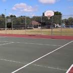
1228 Hilltop Drive
Total Acres - 2.33
Developed Acres - 2.33
• Baseball / Softball (Backstops only)
• Basketball Court (Lighted; half court)
• Drinking Fountain
• Grill
• Picnic Table
• Playground
• Park Sign
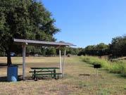
604 Buffalo Street
Total Acres - 4.16
Developed Acres - 4.16
• Benches
• Grill
• Park Sign
• Picnic Table
20. Winchester Park
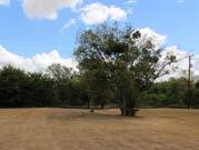
1411 Hyde Park Blvd
Total Acres - 0.51
Developed Acres - 0.00
• Undeveloped Facilities
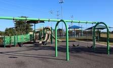
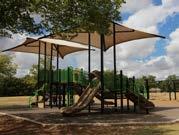
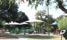
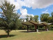
600 Park Street
Total Acres - 10.79
Developed Acres - 10.79
• Basketball Court
• Benches
• Drinking Fountain
• Grills
• Park Sign
• Parking
• Pavilion
• Picnic Shelters
• Picnic Tables
• Playground
• Restrooms
• Softball Diamond (Lighted)
• Splash Pad
• Trails (Lighted)
301 Westhill Drive
Total Acres - 19.80
Developed Acres - 19.80
• Baseball / Softball (Backstops only)
• Basketball (Lighted)
• Benches
• Gazebo
• Grills
• Historic Site (“Spirit of Cleburne” steam engine)
• Horseshoe Pits
• Interpretive Signs
• Maintenance Building
• Parking
• Park Sign
service area varies
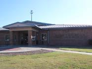
100 Mansfield Road
Total Acres - 4.32
Developed Acres - 4.32
• Gymnasium
• Weight Room
• Cardio Room
• Banquet Hall with Kitchen
• Restroom / Locker Room
• Computer Lab
• Multi-Use Room
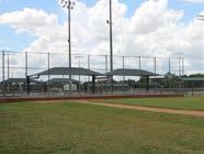
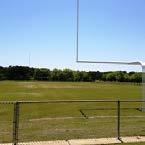
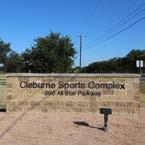
900 All Star Parkway
Total Acres - 87.81
Developed Acres - 87.81
• 7 Baseball / Softball Fields (Lighted)
• 20 Soccer Fields
• 2 Football Fields
• 2 Batting Cages
• Soft Toss Station
• 2 Playgrounds
• 4 Concession Stands
• Restrooms
• Pavilions
• Benches
2501 Country Club Road
Total Acres - 216.52
Developed Acres - 216.52
• Grill
• Pro Shop
• 18-Holes
• Driving Range
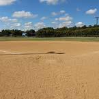
901 S Walnut Street
Total Acres - 3.00
Developed Acres - 3.00
• Baseball Field
• Restroom
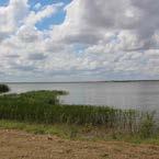
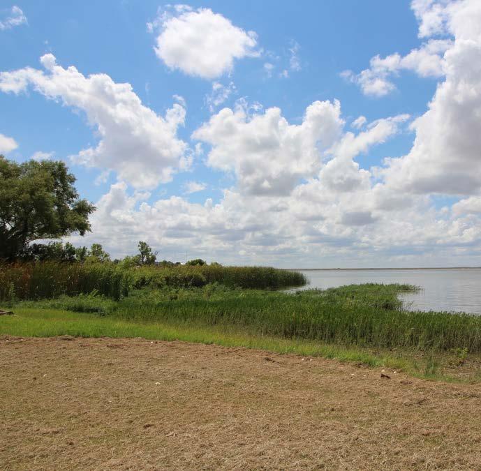
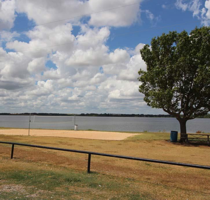
1900 - 2500 Lakeshore Drive
Total Acres - 26.89
Developed Acres - 26.89
• Boat Dock / Pier
• Boat Ramps
• Grill
• Parking
• Pavilions
• Picnic Shelters
• Picnic Tables
• Sand Volleyball
• Swimming Beach
225 South Washington Street
Total Acres - 24.68
Developed Acres - 24.68
• 2 Baseball / Softball Fields (Lighted)
• Batting Cages
• Pee-Wee Football Field
• Parking
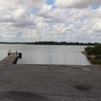
2900 Spur 1434
Total Acres - 8.19
Developed Acres - 1.40
• Boat Ramp
• Parking
• Park Sign
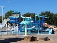
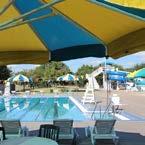
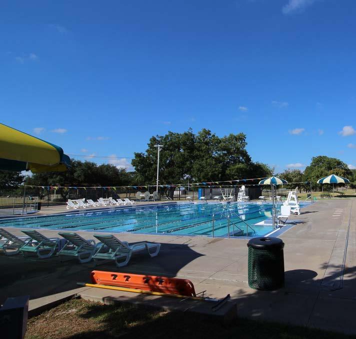
1010 Hillsboro Street
Total Acres - 2.90
Developed Acres - 2.90
• 8-Lane Competition Pool
• Leisure Pool
• Zero-Depth Sprayground Entry
• Kids Water Playground with Slide
• Lazy River
• Vortex
• 2 Water Slides
• Concession Stand
• Locker Rooms
• Gift Shop
• Parking
• Seasonal Winter Dome
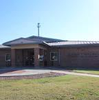
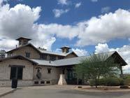
1628 West Henderson Street
Total Acres - 10.65
Developed Acres - 10.65
• Arbor
• Benches
• Children’s Garden & Maze
• Community Center / Meeting Rooms (Renovated House)
• Gardens
• Parking
• Pavilion
• Pond
• Windmill
• Trails
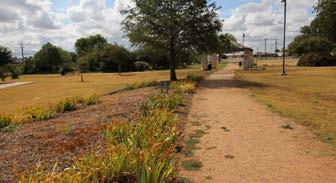
service area varies
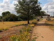
800 Olive Street
Total Acres - 8.51
Developed Acres - 8.51
• Trail
• Benches
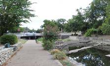
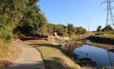
9 North Buffalo Street
Total Acres - 4.93
Developed Acres - 4.93
• Benches
• Grill
• Trails (Lighted)
service area varies
2424 W Henderson
Total Acres - 121.58
Developed Acres - 101.41
• Boat Ramp
• Grills
• Parking
• Pavilions
• Picnic Tables
• Trail
Near the intersection of Roberts Avenue & McAnear Street
Total Acres - 4.57
Developed Acres - 0.00
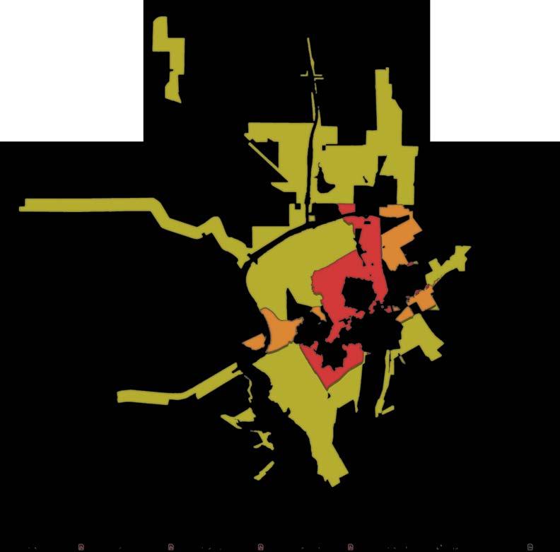
The service area radius map designates the ideal carrying capacity for different park classifications. Mini-neighborhood parks typically serve a 1/2-mile radius, while community parks can serve up to a 2-mile radius. The standard set by the National Recreation and Parks Association (NRPA) is for all residents to have safe and equal access to parks within a 1/2-mile or 10-minute walk of their house.
1/2 mile service area
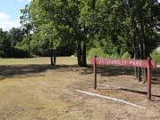
9. J.E Standley Park
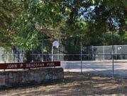
10. John P. Bradshaw Park
11. John S. Butner Park
15. P.D Lacewell Park
18. Westhill Park
20. Winchester Park
2 mile service area Mini
service area varies by use
7. East Buffalo Creek Park
17. West Buffalo Creek Park
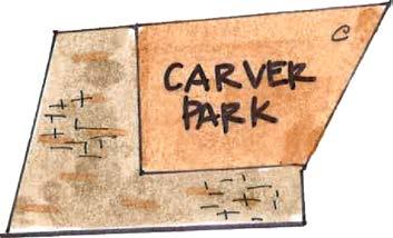
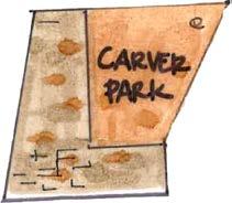
3. Carver Park
8. Hulen Park
service area varies by use
2. Byron “Buddy” Stewart Park
13. McAnear Park
service area varies by use
1. Booker T. Washington Rec Center
4. Cleburne Golf Links
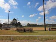
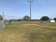
5. Cleburne Sports Complex
6. Don Moore Field
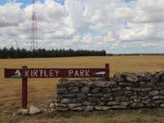
12. Kirtley Park
14. Old Sports Complex
16. Splash Station
19. West Lake Pat Cleburne Boat Ramp
21. Winston Patrick McGregor Park
*The parks on the map that do not have a service area circle still serve the City of Cleburne in some capacity. The natural areas, linear parks and special use facilities do not have a standard service area because the facilities and parks vary in size and have different carrying capacity levels.


The existing trails in the City of Cleburne are classified in the table shown below. A brief description of the types of users and location of each trail can be found on the following pages. The City of Cleburne has a strong but limited framework for creating a trails system. The City has sidewalks, a few loop trails and the beginning of greenbelt corridors. The purpose of this portion of the Parks, Open Space and Trails Master Plan is to highlight the connections and current gaps in the system.
*A total of 0.40 miles are developed within West Buffalo Creek Greenbelt, however, there are ADA & bike restraints such as stairs & creek crossings. ** The Cleburne Sports Complex contains loop trails to access facilities, however, they have not been included in the total amount because access is not provided for daily recreational use.
There are various types of citizens who will utilize the trails in Cleburne. The major reasons for which they use trails fall into two categories: recreation and exercise. The types of users may include walkers, runners, bicyclists and others. They would all be using the same trails but may require different facilities along the trails. Each user may have a preference on the type of trail and how close it is to vehicular traffic.
Pedestrians include walkers, joggers and runners will be the primary users of the trail system and they will have varying needs and comfort levels. They will use the trail system for two reasons, recreation and exercise. Walkers will participate at a slower, passive pace which may appeal to more vulnerable populations such as mothers with strollers, younger children and older adults. Runners and joggers prefer wider trails which allow them to run in groups and safely pass walkers. Pedestrians typically prefer loop trails that connect to larger trail systems, which allows them to drive and start at a park or trailhead.
Bicycling appeals to many citizens and each may have their own comfort level and reason for riding. Most bicyclists will use the trails for recreation and participate for more leisure purposes, rather than commuting. They prefer off-street trails, shareduse paths and low-traffic neighborhood roads. Advanced cyclists have experience sharing the roads with cars and maneuvering through traffic. Seniors, families and children are the most vulnerable and their accessibility and lower speed should be considered when creating access points, sight lines and orientation of the trail.
Other type of users on the trails include skateboarders, scooters, hoverboarders, in-line skaters and BMX riders. These users will be more aware of cracks in the surfacing and fallen debris on the trails.
1 mile walk = 20 minutes (3 mph)
1 mile bike ride = 6 minutes (10 mph)
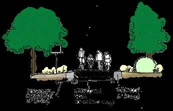
The three facility types best suited for Cleburne include shared-use paths, loop trails, sidepaths or sidewalks. The following images and descriptions are examples of each type and include recommendations on when to use and how to retrofit each type.
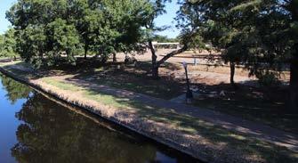
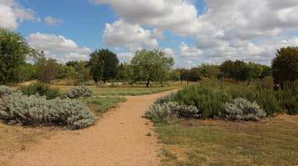
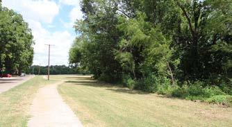
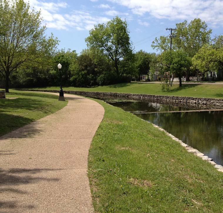
Shared–use Paths are physically separated from the flow of vehicular traffic and are not always parallel or adjacent to the roadway. These paths are for non–motorized traffic such as runners, walkers, bicyclists, skaters, wheelchair users, etc. The paths are typically found along creek corridors, greenbelts,
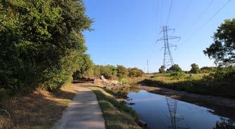
within or adjacent to utility easements, railroad right-of-ways and road right-of-ways. Shared-use paths are recommended to be 10’–12’ wide with a 2'–wide shoulder and a suggested 10'–12’ of vertical clearance. A center line striping is recommended for a shared-use path with heavy volumes of traffic.
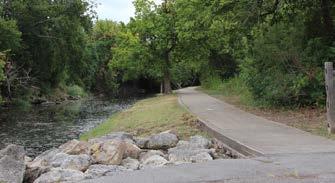
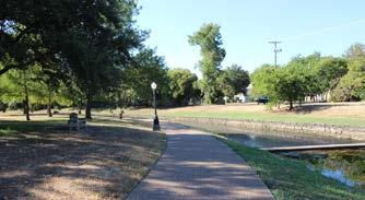
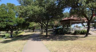
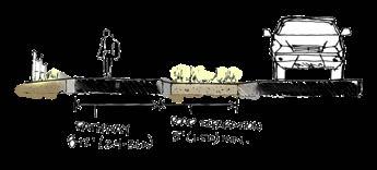
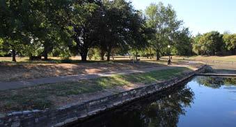
Loop trails can be used to describe many types of trails that are completely contained within individual park boundaries. These trails can vary in use, surfacing material and width. The different types of surfacing include concrete, asphalt, crushed granite or stone, boardwalk, mulch, natural dirt and others.
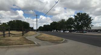
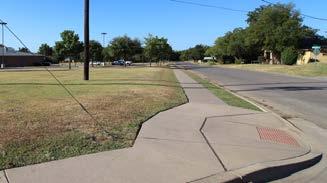
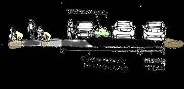
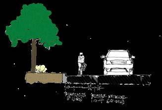
Sidepaths are bidirectional trails located adjacent and parallel to roadways. They are physically separate from the flow of vehicular traffic and typically wider than traditional citysidewalks to accommodate higher volumes of pedestrians and bicyclists. Sidewalks can be retrofitted to accommodate heavy amounts of traffic by expanding the width or adding an additional sidewalk to the opposite side of the roadway. The City of Cleburne has a growing sidewalk network which
Loop trails are typically 8'-10' wide with a minimum of 6', if 8' cannot be accommodated. Depending on the use, different types of signs may be suggested or required. These include, but are not limited to, directional signage, mileage markers, warning signs and gateways.
can be leveraged to expand the trail system throughout the community. City Staff needs to ensure that sidepaths are compliant with ADA standards, have adequate crossing signage and signals and are strengthened with crosswalks. Sidepaths are typically 8’–10’ wide, minimum 6', depending on intended carrying capacity. They should be separated from the roadway by using a 3'–5' wide buffer of grass, plantings, or vertical delineators.


Existing Park
Undeveloped Park
Existing Greenway
Existing Trail Road
City Limit
Level of Service is a measurement of usable park acres per 1,000 residents within the community. The purpose of the Level of Service is for City Staff and residents to better understand the importance of the parks system within the City. The Level of Service will help support essential decisions by government officials regarding parks, open space and trail developments into the future. This analysis can help support investment decisions related to land acquisition,
facility improvements and population changes over time. The Level of Service for parks and open spaces are based on usable parkland, therefore, undeveloped or unusable parkland is not factored into the calculation. While private recreational spaces, Home Owner Associations (HOAs) open space lots, outdoor public school play areas and sports fields are valuable for the community, these facilities are not included in the Level of Service tabulation.
To create a recommended standard for the City of Cleburne, MHS Planning compared Cleburne to surrounding communities and the NRPA standard of 10.1 acres per 1,000 residents.
17.30 acres per 1,000 residents
Total - 15.01 developed acres per 1,000 residents.
Total Available Park Acres: 564.95
Total Developed Park Acres: 466.50
Total Population: 31,080 population
NRPAKennedaleBurleson MansfieldGranburyWaxahachie
To create a recommended standard for the Level of Service Analysis, MHS Planning compared the City of Cleburne to surrounding communities and the NRPA standard. The NRPA standard of 10.1 acres per 1,000 residents is meant to be a recommended guide, not a specific rule. Each community will set their own community-specific standard
based on previous trends and neighboring communities. Cleburne is responsible for determining their own balance of quantity versus quality parks system. It is important to continue monitoring the Level of Service that best suits Cleburne based on future population projections, available land and high-quality parks.
National Recreation and Park Association (NRPA) and Trust for Public Land (TPL) are encouraging cities to improve access to parks and green spaces by ensuring that every resident has safe and easy access to a quality park within a 10-minute walk. TPL publishes a report each year with statistics about each city's progress on providing quality
parks within a 10-minute walk of each resident. According to this report, on average, only 30% of Cleburne residents have access to a park within a 10-minute walk. The report shows access by age, income, race and ethnicity and in Cleburne only 30% of residents within each category have access to a quality park within a 10-minute walk.
*Based on the Trust for Public Land Findings
Yes - 31%
No - 69%
Flood Plains
City Boundaries
TxDOT Owned Road
Trail Along TxDOT Owned Road
City Boundaries
Bike Shared Lane - Proposed Along TxDOT Road
TxDOT Owned Road
Shared Use Path - Proposed Along TxDOT Road
Trail Along TxDOT Owned Road
Bike Shared Lane - Proposed Along TxDOT Road
Bike Shared Lane - Existing
Bike Shared Lane - Proposed
Shared Use Path - Proposed Along TxDOT Road
Bike Signed Route - Proposed
Bike Shared Lane - Existing
Greenbelt - Existing
Bike Shared Lane - Proposed
Greenbelt - Proposed
Bike Signed Route - Proposed
Shared Use Paths - Proposed
Loop Trail - Existing
Greenbelt - Proposed
Street Crossings
Shared Use Paths - Proposed
Flood Plains
Crossings
Trail - Existing
City Boundaries
Street Crossings
TxDOT Owned Road
Crossings
Trail Along TxDOT Owned Road
Along TxDOT Owned Road
Bike Shared Lane - Proposed Along TxDOT Road
Future Park Locations
Shared Use Path - Proposed Along TxDOT Road
Use Path - Proposed Along TxDOT Road Greenbelt - Existing
Existing Undeveloped Parks
Existing Schools Existing Undeveloped Parks
Bike Shared Lane - Existing
Bike Shared Lane - Proposed
Future Park Locations
Bike Signed Route - Proposed
Existing Schools
Greenbelt - Existing
Greenbelt - Proposed
Lane - Proposed Along TxDOT Road


Shared Use Paths - Proposed
Cleburne Parks and Recreation Department hosts numerous programs and events throughout the year. This section highlights various recreation and athletic programs and special events the Department offers. The programs are listed by location and where the programs are offered.
• Community Swimming: Open swim is offered during the summer season for the general public.
• Cleburne ISD Swim Team: Cleburne ISD uses the competition pool year round for swim meets and practices. The pool has a Winter Dome for protection in the cold and rain.
• Sigma Swim Team: Sigma Swim is a public-private partnership that utilizes the pool year round for practices.
• Sigma Swim Lessons: Swim lessons are contracted through Sigma Swim to offer a variety of lessons for all ages.
• Fitness Classes: The City offers various aquatic fitness classes for all ages.
• Movies: Dive-in Movie Nights are offered to the community to enjoy a movie while spending time in the pool.
• Birthday Parties: Three different party packages are offered during the summer season for participants to purchase and celebrate their party.
• Fitness Classes: The City offers a variety of fitness classes at various intensity levels for different age groups. These classes are offered on a weekly basis.
• Cooking Matters Class: The City partners with Tarrant Country Food Bank to offer a free cooking class to the community. This class is offered at least twice a year and supplies families with one meal each week of the 6 week class.
• Library Computer Classes: The Parks and Recreation Department partners with the Library to offer different skill level classes for computer knowledge.
• Pickle Ball Night: The City hosts weekly pickle ball nights for community members to come and play.
• Volleyball Night: The City offers weekly volleyball nights for community members to come and play.
• Movie Night: During the holidays, the City offers movie nights for community members.
• MLK Day: The Parks and Recreation Department partners with East Cleburne Community Center to host a Martin Luther King Jr Day Banquet.
• BTW Birthday Celebration: Once a year, in the spring time, the City hosts a celebration to remember the City's history and celebrate the current members of Booker T. Washington Recreation Center.
• Art Class: The City offers an art class in the fall, with an instructor, on how to create art pieces using chalk paint.
• Adult Softball: The City offers Competitive and Recreation leagues throughout the year. The Parks and Recreation Department helps prepare and maintain the fields.
• Adult Kickball: The City hosts Recreation Co-Ed leagues throughout the year.
• Fishing Derby: The event is located at Hulen Park for kids and families to participate. During the event, lunch is prepared and served by the Parks and Recreation Department. This City partners with Texas Parks and Wildlife for the event.
• Drive Thru Trunk or Treat: The City partners with The Railroaders and Autumn on the Square to bring businesses an opportunity to market their organization while participating in a fun community-wide Halloween event.
• Virtual Programming: The Parks and Recreation Department offers a variety of virtual programming for all ages to engage and connect through the City's online community.
• Movie Night at the Airport: The City partners with the airport to host a movie night under the stars. Before the movie, there are games and crafts; during the movie there is popcorn and drinks.
• Market Days at Market Square: There are 20 or more vendors who gather and sell handmade items at Market Square.
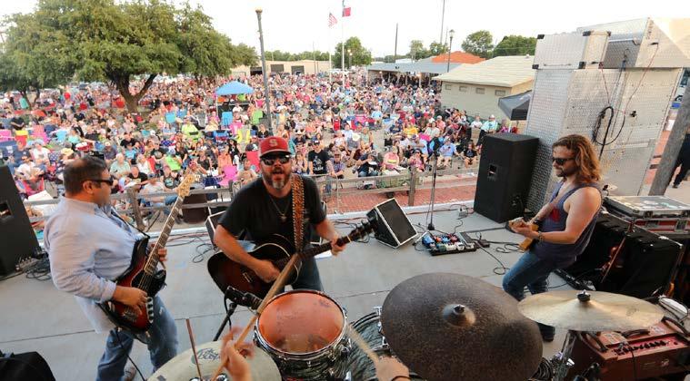
• Downtown Sounds: The City hosts live music, serves a variety of food, and keeps Downtown open later to provide late-night shopping.
• Senior Bingo: The City partners with various senior organizations in the community to provide weekly bingo opportunities with a variety of prizes for winners.
• Senior Health Fair: There are over 20 different senior organizations that meet with senior citizens to share information about their organizations and what they offer.
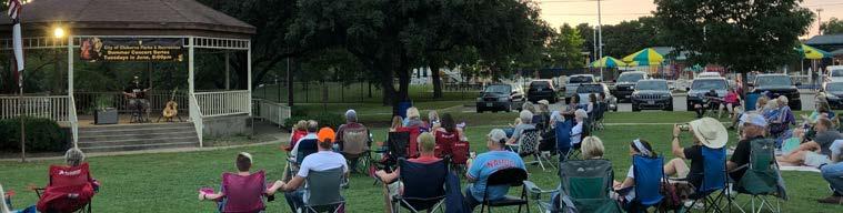
• Festivals at Hulen Park: During the year, there are a variety of festivals held at Hulen Park. The Parks and Recreation Department helps book and manage the events.
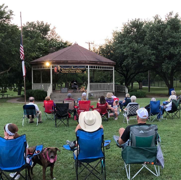
• Hulen Park Concerts: In the month of June, the City offers live music events for community.
• Springfest Carnival in the Park: The City partners with the Plaza to host a community-wide carnival.
• Cinco de Mayo: The Parks and Recreation Department partners with the Chamber to provide the community with a cultural experience celebrating various aspects of Mexican heritage. There is live music, food, vendors and entertainment.
The City of Cleburne citizens, local organizations and other agencies host programs and events throughout the year. The Parks and Recreation Department supports these events by assisting with set-up, clean up, logistics, grounds maintenance, and provides lighting. Below are programs and events hosted by organizations other than the City. The information in italics is the role the Parks and Recreation plays to support these events.
• Fitness Classes at Hulen Park: Various fitness groups meet at the Park to workout. Support and clean up.
• Friends of Winston Patrick McGregor Park: A group of volunteers that spend time supporting the Park. Support volunteer work days and provide guidance (tools, community service volunteers, preparation, clean up, volunteer forms, etc).
• Cleburne Wine Festival: A community-wide event to support local vendors and artisans. Help with logistics, set up, maintain grounds, and clean up.
• Star gazing event at Lake Pat Cleburne. Set up and clean up.
• Equipment Show: An event to show children the different types of equipment the City has. Support with equipment.
• Dragon Boat Races: Fundraising event to support the Chamber of Commerce. Provide logistics, place boats in the water and remove them, grounds maintenance, traffic control and clean up.
• Shakespeare in the Park: Event for the local theater company and Chamber of Commerce. Support with logistics, supply the McGregor Park House for actors preparation, clean up on a nightly basis, set up advertisement along the Park.
• 4th of July at the Depot: A celebration event for community. Help with set up, traffic and clean up.
• Whistle Stop (Hulen, Market Square, and other City facilities): A Christmas light event for public. Help with logistics, install and remove the lights, and grounds maintenance.
• Whistle Stop Lighted Christmas Parade: Benefits the CCC Foundation for scholarships. Set up and clean up.
other programs & events
• Chisholm Trail Outdoor Museum Boat Show. Set up and clean up.
• 5K Runs: A variety of 5K’s start and finish at Hulen Park throughout the year. Assist with logistics, set up, grounds maintenance and clean up.
• V.F.W.: The local VFW places flags at P.D. Lacewell Park for Memorial Day. Support and clean up.
• Keep Cleburne Beautiful: A local organization that removes and prevents trash and litter from gathering in the City's waterways. Support and clean up.
• AgriLife Extension Services: This organization provides accommodations for locals to receive their Continuing Education Units (CEUs).
• Hulen Park - Raise up American Patriots: A local Christian group that sings and states their testimonies. Clean up.
• Keene Seventh Day Adventist Academy: This group helps set up projects for school aged children to help the Parks Department.
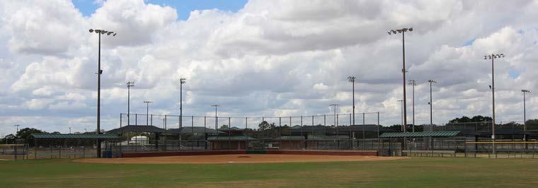
The City of Cleburne has tournament-grade athletic facilities. With these facilities many local associations and organizations use them for events and tournaments. The Parks and Recreation Department support these associations and organizations by providing grounds maintenance, set up, clean up and logistics. The following information highlights some the events and programs that occur at the City's athletic facilities.
cleburne sports complex partners & events
• Cleburne Baseball and Softball Association
• Cleburne Soccer Association
• Cleburne Football Association
• Johnson County Sports Association
• Various Tournament Providers
• Chisholm Trail Classic: A youth soccer tournament that brings hundreds of teams to the Complex and City.
• Cleburne ISD Cross Country Invitational and District Host Site
• Various 5K Host Site
• The Parks and Recreation Department maintains the athletic fields and supports the local organizations.
• Tournaments
• The City averages 24 tournaments a year to support local associations, organizations, businesses, and various independent school districts.
• Hosts Men's & Women’s City Championships
• Hosts Men's & Women’s Senior City Championships
• Programs
• Hosts youth golf camps in the summer.
• Offers private lessons year round for all ages and skill level. The golf pros provide lessons on putting, chipping, and the long game.
• Chamber Events
• Hosts Chamber Golf Tournament
• Hosts the 4th of July celebration by providing support with logistic, use of parking lots, supply golf carts for VIP rental use, food and beverages, oversee set up, clean up and tear down.
• Independent School Districts
• Hosts the Cleburne ISD fail safe system for Smith Middle School.
• Provides practice and tournament facilities for three local high schools throughout the year.
• Provides products for: Cleburne ISD, Joshua ISD, Glen Rose ISD, Alvarado ISD & Rio Vista ISD.
National Service Research (NSR) completed a comprehensive research study for the City of Cleburne as part of the Parks Master Plan. An important aspect of the planning process was to conduct a demand and needs assessment which involved citizen input. This citizen input is the foundation of a great master plan, therefore the City of Cleburne Parks and Recreation Department used multiple types of citizen input and public meetings to receive recommendations and feedback during the planning process. NSR worked closely with MHS Planning & Design and the City of Cleburne staff throughout the research process. The City of Cleburne mailed 34,000 postcards to households throughout the City. The postcard
provided information about the needs assessment survey and provided an online link to access the survey. To complete this study effort, NSR designed and conducted a statistically valid, online survey for Cleburne residents to complete. The survey was posted on the City of Cleburne website and various social media sites. There were 652 survey responses. An additional survey was conducted specifically for the Lake Pat Cleburne needs analysis. This survey was available for all residents to complete online or submit a paper copy. The survey was also sent specifically to the homeowners around Lake Pat Cleburne. A total of 1,123 survey responses were received. The survey helped determine the list of priorities for Lake Pat Cleburne and Buddy Stewart Park.
Over half of the survey respondents find out about parks and recreation opportunities through Facebook and 31% learn through the park and recreation flyers.


65% of respondents feel parks, recreation and open space in Cleburne is more important today compared to 10 years ago.

All age groups have interest in participating in a City of Cleburne recreation or leisure program.
72% of respondents are willing to pay additional property taxes to fund the improvement priorities. The mean amount they are willing to pay is $114/year
85% of respondents strongly agree/ agree that parks and recreation facilities in Cleburne are well worth the cost to taxpayers.

58% of respondents rated the quality of parks and recreation opportunities as excellent or satisfactory.

Half of respondents (52%) rated the quantity of parks and recreation opportunities as excellent or satisfactory.
*See pages 50 to 53 for the City of Cleburne Parks and Recreation Department's list of programs and events.


Community and neighborhood parks, athletic fields, playgrounds, Lake Pat Cleburne and trails are the most frequently used facilities, at least weekly, in Cleburne.


The list below is in rank order of the respondents’ choice for the most important facility or needed amenity in the City of Cleburne.
Expand Amenities Along Lake Pat Cleburne
Add Trails to Lake Pat Cleburne
Add Additional Trails and Connections Throughout the City

strengths weaknesses
• Athletic Complex with High Quality Maintenance
• Great Improvement in the Parks System Over the Previous 3 Years
• Recreation Programming
• Special Events
• Quality of Staff
• Strong Park System Framework
• Aging Park Amenities: Playgrounds, Sports Courts, Ball Fields, Picnic Tables, Pavilions
• Lack of Continuous Trail Connectivity, Skate Park & Pickleball Courts
• Underutilization of Lake Pat Cleburne, Buddy Stewart Park & McGregor Park
• Deferred Maintenance

- a continual reinvestment into their parks & they value a high quality, well maintained and safe parks system.
- a balance of active and passive recreational opportunities including trails and natural areas along Lake Pat Cleburne. - connectivity to parks, schools, residential and commercial areas.
The following goals and objectives are provided to give direction for future community decisions regarding parks, open spaces and the maintenance of public spaces within the city limits of Cleburne. These goals and objectives were established based on input from the City of Cleburne residents, the Parks Master Plan Advisory Committee, City Staff and the consultant’s professional opinion.
parks goal
To provide a balanced parks system that meets the diverse recreational needs of the citizens of Cleburne, is easily accessible by residents, promotes healthy living and creates a distinct community character.
• To ensure all parks and recreational opportunities are available to the residents of Cleburne regardless of age, physical or mental ability, race, income or religion.
• To focus on the development of Lake Pat Cleburne and the surrounding park properties to provide additional recreational opportunities for residents and visitors.
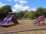
• To continually invest in new and updated equipment at high-use community parks such as Hulen Park and Carver Park.
• To be proactive in the development of existing parkland owned by the City.
• To provide new and different recreational opportunities throughout the parks system for residents.
• To continue to partner with other public and private entities for the development and enhancements of parks and recreational facilities.
• To develop and install consistent signage throughout the entire parks system.
To identify and preserve high quality natural open spaces for the protection of valuable ecosystems, inherent aesthetic value and unstructured recreational activities.
• To provide citizens with well-balanced recreational experiences that include both active and passive opportunities.
• To address natural open space needs when developing active recreational facilities.
• To be proactive in the acquisition and protection of unique natural open spaces throughout the City of Cleburne, specifically along East and West Buffalo Creek and within Byron “Buddy” Stewart Park and McAnear Park.
• To limit development in natural open spaces to minimize adverse effects on valuable ecosystems.
To provide a comprehensive network of trails and sidewalks that safely connect the citizens of Cleburne to specific destinations, provide alternative transportation options and safe environments for recreational exercise.
• To construct trails purposefully throughout the community to provide the opportunity for residents to reasonably and safely access public parks.
• To intentionally design greenbelts that will positively impact trail tourism, the environment and the health and wellness of the citizens of Cleburne.
• To construct sustainable trails using natural and permeable materials to strengthen the environmental benefits of greenbelts.
• To utilize the City’s easements, rights-of-way, existing sidewalks and safe street crossings to supplement a better trail network.
• To continually research the viability of developing trail systems along creeks, floodways and private utility easements that will link public and private recreational facilities, local businesses, neighborhoods, school campuses and neighboring communities.
• To provide necessary amenities such as bike racks, benches, rest stations, water fountains and shaded areas to encourage trail usage and enhance the user experience.
• To provide and install trail signage such as wayfinding, gateways, trailheads and directional maps to improve connectivity and enhance the user experience.
goal
To ensure a high quality, safe and aesthetically pleasing parks system through continued maintenance, upkeep and strategic planning.
• To continue maintaining the existing parks system at a high level and increase maintenance capabilities as new facilities are developed.
• To focus on hiring and retaining employees with technical skills to ensure the parks system is maintained at a high level.
• To continue to forge partnerships with public and private organizations for the maintenance of recreational facilities.
• To ensure funding availability for future maintenance needs and increased responsibilities.
• To ensure all maintenance vehicles, including trucks, tractors, mowers, edgers, blowers, etc. are routinely maintained to prolong the life of each individual piece of equipment.
The City of Cleburne has 564.95 acres of parkland and open space that is managed and maintained by the Parks and Recreation Department. The parks system and various types of amenities require different levels of maintenance and service. Each service requires diverse skill levels and different time requirements to complete. To maintain parks at Level A, the services include regularly scheduled mowing, edging, weed-eating, blowing, and trash collection. Other services include irrigation, fertilizing, planting and pruning, ballfield maintenance, flood control and various other tasks as they arise. It is recommended the City continue to contract out Level B and Level C routine activities such as park mowing, blowing, edging and weed eating. Technical
staff should continued to be hired and trained in areas of sports fields, golf course and aquatic maintenance, irrigation, fertilization and playground inspection and repair. The City should continue to invest, train and provide certification opportunities for technical skill-sets. Based on City Staff input and professional opinion, the City of Cleburne’s Parks System is split into three different categories based on the level of maintenance performed. The categories are high level, medium level and low level of maintenance. Depending on the level of maintenance required, each park will have predetermined amounts of acreage designated within each level of maintenance. The following pages describe each level and the amount of park acreages the City maintains.
Level A maintenance parks are developed parks with high-activity use that are maintained and operated by the City. Typically, mini neighborhood parks, neighborhood parks, community parks and special-use parks are maintained at a high level. These parks involve weekly or biweekly mowing, edging, fertilizing, trash collection, irrigation system repairs and maintenance, tree and shrub trimming, etc. The City of Cleburne offers 8.33 acres of Level A parks for every 1,000 residents.
Level B maintenance parks are those that have an undeveloped portion but are still maintained routinely by the City. These parks are maintained periodically with mowing and edging as needed, removal of fallen trees, trash collection, trail cleaning and erosion control when necessary. The City of Cleburne offers 3.31 acres of Level B parks for every 1,000 residents.
Level C maintenance parks areas are undeveloped parks and maintained on an as needed basis. These parks are maintained on an as needed basis such as brush hogging, the removal of fallen trees and repairs of any issues that could impact the safety of citizens. The City of Cleburne offers 2.21 acres of Level C parks for every 1,000 residents.
Wayfinding and signage is an important aspect to the Cleburne Parks System. Wayfinding is a form of signage that guides people through physical spaces, such as parks to assist and enhance the user experience. It is recommended the City adopt a wayfinding and signage plan that is meaningful and unique to the parks system. A successful signage system consists of several different construction materials and styles that are repeated throughout each park. The intent is to create a wayfinding system that allows park users to know when they have arrived at parks and how to navigate them.
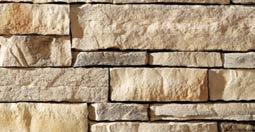
For the City of Cleburne, the following sign design standards are recommended: steel, wood and stacked stone. These three,
at a minimum two, elements should be present on all signs that are located in parks. It is also recommended that each park have a gateway entry sign that identifies the main entry and a secondary park gateway entry sign at larger parks that identifies less traffic areas. Secondary park gateway entry signs can be used as the primary sign at smaller and less frequented parks as long as the materials are consistent.
The materials used are important to show consistency throughout the park system and ensure what materials are needed when renovations, updates or general maintenance is needed. Typically, stacked stone, IPE wood and steel materials are sturdy and do not need periodic maintenance.
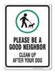
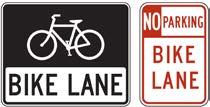
In addition to distinctive park entry signs, the City should use additional signage to guide users and encourage specific behavior. Examples of these signs are shown below. Additional signage and pavement markings can be used to reinforce bike lanes and prevent motorists from driving or parking in a designated bike lane. Pavement markings are also necessary to delineate which roads are for bicyclists and motorists. It brings awareness to both riders and drivers about sharing road space.
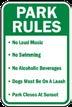


Park Gateway Entry: A lighted sign to designate the main entrance and transition the user into the park boundaries.
Secondary Park Gateway Entry: Designate a park entrance.
Trail Head with Map: Designate a major access point for a trail; provides directional information.
Mile Marker: Posts along the trail that identifies the distance from a set point.
Directional: Provide directions and distances to nearby destinations and key points of interest.
Interpretive: An educational display which describes and explains natural, historic or cultural points of interest.
When implementing and building a trail network, it is important to know and adhere to design standards which are mandated by State and National agencies. These agencies include American Association of State Highway and Transportation Officials (AASHTO), National Association of City Transportation Officials (NACTO), Texas Accessibility
Standards (TAS), Institute of Transportation Engineers (ITE) and Texas Manual on Uniform Traffic Control Devices (TMUTCD). By following the standards, the City of Cleburne will create a safe, reliable and connected trail network that is easier to maintain and enjoyed by all citizens for recreation, exercise, and transportation.
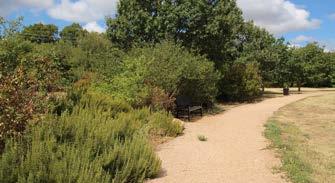
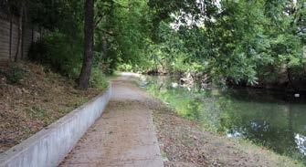
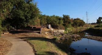
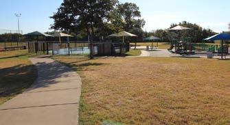
Crime Prevention Through Environmental Design (CPTED) is a theory and method implemented in many cities to create safe environments through four design principles. These strategies are established and enforced by law enforcement officers, architects, city planners, landscapers, and volunteers to create a safe physical environment and prevent crime. The goal of CPTED is to integrate the four design principles during the
design phase of development and throughout the maintenance lifetime of a physical environment. The improved designs will help reduce fear and incidence of crime to improve the quality of life for citizens. There are four overlapping CPTED strategies: Natural Surveillance, Natural Access Control, Territorial Reinforcement and Maintenance. The photos are examples of CPTED principles currently in use in the parks system.
Natural Surveillance:
The placement of physical features and people in a way that maximizes visibility and minimizes hidden areas or blind corners.
Natural Access Control:
The placement of physical barriers and access points to guide users to and through spaces by a specific route. Design features include signage, lighting, gateways and fencing.
Territorial Reinforcement:
The placement of physical delineators to define the areas of control and distinguish between public and private spaces. This can be accomplished through landscape plantings, pavement changes and gateway treatments to define property lines.
Maintenance:
High levels of maintenance create an environment of care and reduce tolerance for disorder. Maintenance reduces plant overgrowth and increases visibility through pruning, replacing light bulbs and removing trash.
Park Ordinances are the rules and regulations pertaining to all of the recreation facilities in Cleburne. The following is a summary of the recommended changes to Chapter 98 of the Cleburne Park Ordinances. It is imperative to note these are merely recommendations. The City Council will need to vote to approve the proposed changes.
The majority of the original ordinance sections were adopted in the late 1960’s with a number of revisions occurring throughout the years. Many of the definitions and regulations are out of date and positions identified in the ordinance no longer exist. The primary goal of the revision/update is to simplify the regulations while establishing up to date standards.
As a general rule, it is best practice to include the technical details in the ordinance itself, while referencing City policy documents for items that can change from year to year. An example of this would be establishing the rules for using a particular park in the ordinance while referencing a current fee schedule and hours of operation that can be amended or updated annually, either by Staff or by a Policy Board. These types of changes are recommended throughout the park ordinances to minimize the amount of changes by a City Council vote.
In the General Provisions section, the park curfews were modified to coincide with daylight hours rather than a specific time. Throughout the Parks and Recreation chapter, the City Manager or designee was added to all sections so that specific responsibilities can be delegated by the City Manager or designee. In the Park and Recreation Board section, the duties of the Board was clarified to be an oversight Board. Splash Pad and Pool hours of operation and fee schedules have been removed and instead will reference an annually adopted fee schedule.
Lake Pat Cleburne had the majority of changes as most of these regulations were adopted in the 1960’s. Primarily, references to regulations established and enforced by others, such as Texas Parks and Wildlife (TPWD), have been established to keep the regulations up to date. Subsequently, individual requirements, such as boat registration and boat safety gear requirements, have been removed from the ordinance. Sewage facility regulations have been removed and reference the local health code guidelines. This section also adds enforcement authority to relevant departments such as TPWD Game Wardens and County Sheriff’s Department. The Pier and Boathouse section should be updated and should establish procedures for annual inspections of facilities over water. It should also establish a procedure for annual inspections of facilities over water.
The golf course operates as an independent entity. Fees and course hours need to be continually adjusted to stay competitive in the market. It is recommended to remove the fees and hours to give the City Manager or designee more flexibility in changing rates and hours of operations.
The individual parks have the hours and fees removed and reference an annually adopted fee schedule. This gives the City Manager or designee the ability to negotiate special events with individual groups without needing to obtain a variance to the ordinance.
Overall, many of the recommendations to the parks ordinances are to ensure that the rules and regulations refer to big picture items, the City Manager or designee has authority in decision making and that the document is simplified.
Lake Pat Cleburne is a significant community feature which has been underutilized in the past. It has great potential to be a community and regional hub, provide many recreational opportunities and become a destination for both Cleburne residents and surrounding cities. The following goal and objectives are provided to guide future community decisions in the development of Lake Pat Cleburne and future surrounding amenity sites.
lake pat cleburne goal
To create a recreational lake experience that provides social spaces, amenities, economic opportunities, natural and passive open areas and sustainable development for the benefit of all Cleburne residents.
lake pat cleburne objectives
• To develop passive and active recreational facilities and programming around Lake Pat Cleburne.
• To proactively build sustainable and natural features along Lake Pat Cleburne.
• To steward and conserve the environmentally sensitive landscapes surrounding Lake Pat Cleburne.
• To seek alternative funding opportunities to construct and maintain amenities around Lake Pat Cleburne.
• To develop a Lake Pat Cleburne district with unique and consistent signage.
• To provide amenities and programming that are accessible to the residents of Cleburne.
• To continue to partner with other public and private entities for the development, enhancements and hosting of events at Lake Pat Cleburne.
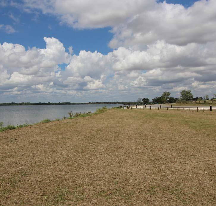
The existing conditions around Lake Pat Cleburne are opportune for development and recreational programming. Below is an inventory list of current amenities and facilities surrounding and in proximity to Lake Pat Cleburne. Ideally, all shorelines and land within proximity to Lake Pat Cleburne should have designated uses whether they are active or passive recreation.
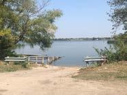
• 1,700+ acre lake
• Premier city-owned park land adjacent to Lake Pat Cleburne
• Buffered by existing amenities:
• Buddy Stewart Park
• West Lake Pat Cleburne Boat Ramp
• Kirtley Park
• Lake Pat Cleburne Boat Launch
• Cleburne Golf Links
The Chisholm Trail Outdoor Museum, a privately-ran outdoor museum on City-owned property, is on the northern side of Lake Pat off of Highway 67. This facility has trails, observation areas, and a kayak launch.
The needs analysis is based on various forms of input: focus groups, a Town Hall meeting, two citizen surveys, the Advisory Committee, City Staff and the consultant’s professional opinion. Detailed in the next few pages are several big picture needs that have been identified by the above groups and the citizen survey.
There are a number of recreational activities that can be both active and passive, depending on the users’ intention at the time. Due to this, the conflicting activities are assumed to be active when describing them in the section below. It is better to assume they will be more active because the facilities will be designed and implemented for a higher impact use than if they were designed to only be passive.
Lake Pat Cleburne has tremendous opportunities for more active recreation programming and amenities. In the Lake Pat citizen survey, 10.15% of residents solely chose active recreation as the primary function of Lake Pat Cleburne, while almost 68% of residents voted for both active and passive recreational amenities around the lake. The recreational activities which fall into both active and passive categories include fishing, a swim beach and trails. Fishing can occur on the lake in a boat and on a fishing pier; this activity has both passive and active components to it. A swim beach can be active with swimmers in the water or passive with users
floating along the shoreline. The beach could be active with residents playing games, but also passive as people relax to sunbathe or read. In the Lake Pat Cleburne citizen survey, the popular active recreation activities already occurring at Lake Pat Cleburne include: fishing, walking/hiking, boating, kayaking/canoeing, volleyball and jogging. When asked which additional recreational facilities would citizens like to have at Lake Pat, the top active recreation responses include fishing piers, multi-use paved and nature trails, playgrounds, a swim beach, an amphitheater, boardwalks and sand volleyball courts.

The top active recreation activity requested at Lake Pat are FISHING PIERS .
The City-owned areas surrounding Lake Pat Cleburne have great potential for large-scale passive recreation. In the citizen survey, 17.9% of residents chose only passive recreation as the primary function of Lake Pat Cleburne, while almost 68% of residents chose both active and passive recreation as the primary function. Passive recreation activities include picnicking, rest and relaxation spaces, bird watching and wildlife observation, photography, pavilion use and picnic benches. When asked if
there were other activities that residents used Lake Pat for, many responded with relaxing, driving, photography and bird watching and wildlife observation. When asked which additional recreational facilities would citizens like to have at Lake Pat Cleburne, the top passive recreation responses include pavilions and picnic areas, tree plantings, bird watching and wildlife observation, wildflower and pollinator habitats and open spaces for general play.
The top passive recreation activity requested at Lake Pat are

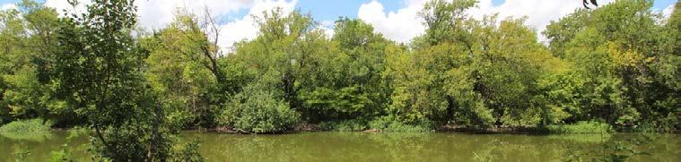
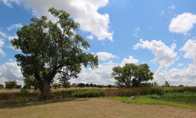
The City of Cleburne owns a plethora amount of land around Lake Pat Cleburne, which allows the City to preserve several acres of existing natural space. The natural areas with the highest conservation priority include the Cross Timbers woodlands and the remnant prairies near Buddy Stewart Park, as well as the riparian zone at Lake Pat Cleburne. When considering the preservation of the riparian zone of a river or stream, it consists of the riverbanks and the low-lying plain which is subject to flooding. By preserving large natural open spaces, the City of
Cleburne can maintain its rural appeal while also providing engaging active and passive recreational programming. Nearly 61% of Cleburne residents responded that it is very important or important to preserve the shoreline along Lake Pat Cleburne as natural open space. Almost 82% of citizens responded that it is somewhat important to very important that specific areas along Lake Pat shoreline be supplemented with native plantings for conservation and preservation of natural areas.
As the City continues to expand in population and absorb growth from the Dallas/Fort Worth Metroplex, it is imperative the City of Cleburne focus on developing and utilizing Lake Pat Cleburne and Buddy Stewart Park as a central piece of the parks and recreation system. Based on the feedback from the citizen survey and City Staff, Lake Pat
Cleburne should have more active recreational opportunities and Buddy Stewart Park will remain as a primitive area with more passive recreational activities. The System Priorities in the lists below are influenced by a Town Hall meeting and citizen survey, the Advisory Committee, City Staff and the consultant’s professional opinion.
kirtley park priorities
1. Multi-Use Paved & Nature Trails with Signage
2. Fishing Piers
3. Restroom Facilities
4. Playgrounds
5. Pedestrian Amenities (picnic areas, benches, drinking fountains, etc.)
6. Swim Beach
7. Amphitheater
8. Boardwalk for Bird Watching and Wildlife Observation
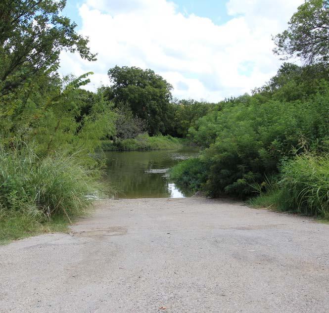
9. Rehabilitate Boat Ramp
10. Sand Volleyball Courts
buddy stewart park priorities
1. Fishing Piers
2. Disc Golf Course
3. Dog Park
4. Boat and Paddle Sport Launches
5. Boardwalks for Bird Watching and Wildlife Observation
6. Pedestrian Amenities (picnic areas, benches, drinking fountains, etc.)
7. Pavilions
8. Nature Play and Lawn Game Spaces
9. Nature Trails with Interpretive Signage
10. Wildflower and Pollinator Habitats
Influenced by the needs analysis, list of priorities, the citizen survey and City Staff, the following recommendations should be considered over the next five to ten years.
active recreation recommendations
• Design and construct a multi-use trail, with trail loops, along the shoreline of the proposed development
• Design and construct a disc golf course at Buddy Stewart Park
• Rehabilitate the existing boat launches: Lake Pat Cleburne, West Public and Buddy Stewart
• Design and construct a designated swim beach area
• Construct paddle sport launches in conjunction with the boat or shallow launches
• Design and construct fishing piers on either end of the proposed development
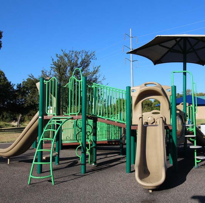
• Provide an inclusive and fully-accessible playground for children of all ages
• Construct a restroom facility on the southern end of the developed park
• Increase the number of sand volleyball courts around Lake Pat Cleburne
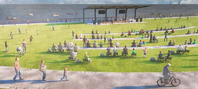
• Design and construct an amphitheater that opens toward Lake Pat Cleburne
passive recreation recommendations
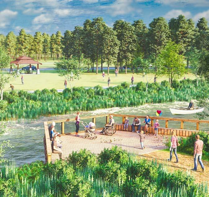
• Construct boardwalks at Lake Pat Cleburne and Buddy Stewart Park for birding and wildlife observation
• Construct a pavilion/stage with the amphitheater
• Add more pedestrian amenities such as picnic spaces, benches, drinking fountains and signage along trails
• Designate and maintain open grassy areas for lawn games and general play
• Consider a feasibility study to construct a nature trail around the entirety of Lake Pat Cleburne
natural area recommendations
• Preserve the primitive nature of Buddy Stewart Park by continuing low-impact and sustainable development practices
• Designate low foot traffic areas as wildflower and pollinator habitats
• Increase the number of natural and aquatic plantings along the shoreline
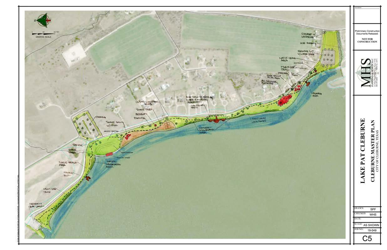
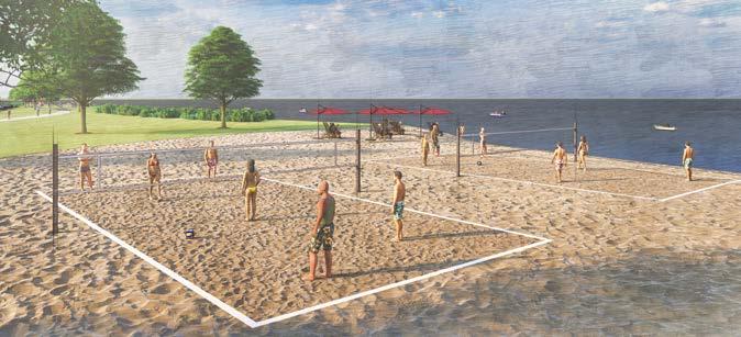
This park master plan is based on input from Cleburne residents, City Staff and the consultant's professional opinion. The site plan and 3D renderings are visual representations of the recommendations and priorities listed within this chapter.
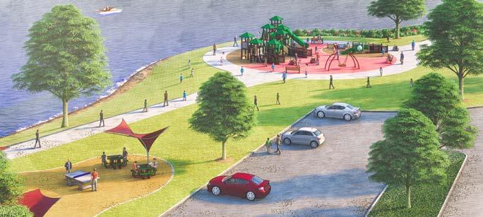
Playground & Picnic Area
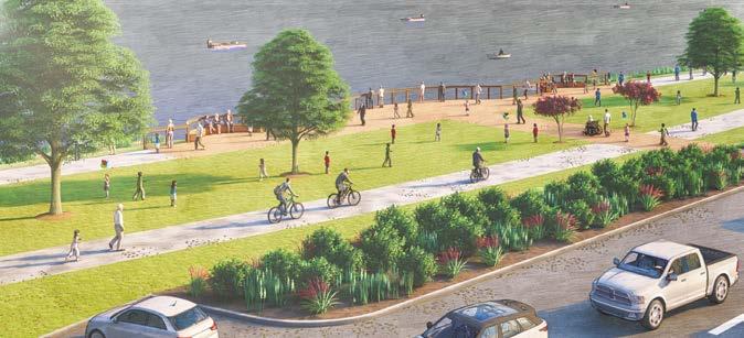
This park master plan is based on input from Cleburne residents, City Staff and the consultant's professional opinion. The site plan and 3D renderings are visual representations of the recommendations and priorities listed within this chapter.

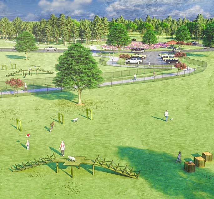
Dog Park & Wildflower Area
The Needs Analysis is based on the input from Town Hall meetings, Focus Group meetings, two citizen surveys, the Advisory Committee, City Staff and the consultant’s professional opinion. Over the next few pages are the general needs in the overall parks system, divided into subsections, which have been common themes during the planning process. Lake Pat Cleburne is not extensively described in the following paragraphs due to there being an individual Lake Pat Chapter later in the plan.
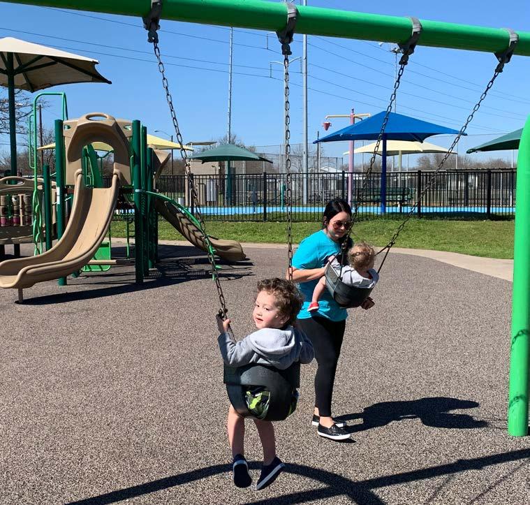
As the parks system begins to age and Cleburne continues to develop, the Parks Department should look to diversify, expand and design additional park features and recreational opportunities throughout the entire City. The amenities and recreational opportunities at Booker T. Washing Recreation Center, Hulen Park, Splash Station and Carver Park need to be updated and enhanced to sustain the attraction from residents and surrounding communities. Splash Station is a great asset to the Cleburne Parks and Recreation Department but it is beginning to lose its uniqueness. The City needs to update the amenities and add an additional aquatic feature. There are a variety of different sized parks in Cleburne, but they lack development and recreational programming. Moving into the next ten years, the City has great potential to build upon the current framework and elevate and distinguish itself from neighboring communities.
Throughout the Town Hall meeting and focus group meetings, it was repeatedly stated that the City needs to focus on the development of trails throughout the community and reconstructing trails that are too damaged to be used. Many residents feel the need for more unique forms of recreation and not standard park amenities such as playgrounds, benches, picnic areas, etc. Citizens expressed the need for a skate park within the community. Numerous conversations with local residents lead to the understanding that a dog park and a disc golf course are desired in town. These two recreational facilities need large open areas to function properly, therefore Buddy Stewart Park is a prime location for a disc golf course and a dog park.
There is a need to upgrade and renovate the existing recreational spaces and parks in Cleburne. In the citizen survey, when asked what are the most needed facilities in Cleburne, renovate and enhance existing parks ranked fifth, add shade to playgrounds ranked sixth, improve and enhance maintenance of parks ranked seventh and add additional playgrounds ranked eleventh. As Cleburne grows and diversifies, it is important that neighborhood and community parks reflect the desires of the community.
The City has undeveloped parks which can be designed for desired and innovative facilities. The undeveloped parks at the mini-neighborhood-level include J.E. Standley Park, John S. Butner and Winchester Park; undeveloped natural area-level parks are Buddy Stewart Park and McAnear Park
To improve park safety and accessibility, each playground and additional element should be routinely evaluated for maintenance, possible structure replacement and ensuring the structure is compliant with the current safety guidelines established by the Consumer Product Safety Commission (CPSC). In general, parks and individual elements need to be assessed in terms of accessibility and, if needed, upgraded to the newest ADA standards, established under the Americans with Disabilities Act.
As the City of Cleburne grows in population and becomes more diverse, there is a need to expand the parks system through the acquisition of new land, rezoning existing undeveloped City land, developing existing parkland and updating older parks. While the City of Cleburne's Level of Service is sufficient for the existing community, it is important for the City to anticipate future population growth. To anticipate this growth, the City needs to proactively be purchasing land and developing parks, while it is economically feasible, to maintain a high Level of Service. The land acquisition should be focused in the northern and western portions of Cleburne because the majority of development is trending in these regions.
Priority locations for the development of new parks, on existing City property, include the land adjacent to Carver Park and the recently acquired McAnear property. The land adjacent to Carver Park is ideal parkland because it is partially in the floodplain, already borders an existing park and has abandoned buildings which can be demolished while the existing slabs can be used as sports courts. The land is not suitable for commercial or residential development because it is relatively small and not easily accessible by thoroughfares.
The McAnear property, recently acquired in 2020, is also a great location for parkland because of the increased residential development occurring in the west portion of Cleburne. This property should have walking trails, a playground, parking and site amenities.
As residential development continues to expand within the City limits, it is imperative for City Staff to acquire and develop portions of the parks system to ensure the City’s developed park acreage increases at the same rate as the population. As park development occurs, it is recommended that the City design an overall master plan for each specific project which will allow the City to develop new parks in systematic phases to ensure projects can be built on schedule and within a reasonable budget.
The
park needs in the City of Cleburne

Youth athletics have different recreational needs than the general public. Focus group meetings were specifically held with the leaders of each organized sport to better understand the needs from each organization. The meetings gave insight into what each group currently uses for games and practices and what additional facilities they need to continue supporting the youth in Cleburne. It is important to note that every youth organization stated they are happy with the current facilities;
especially as the field maintenance and Parks Department leadership have improved over the past several years. It was mentioned that the current number of ball fields are adequate to efficiently handle the level of play. However, there is a need for more fields to allow for increased tournament play. While each organization has its own specific needs, as seen in the following paragraphs, many organizations expressed overlapping desires which are outlined in the following list:

The top athletic needs in the City of Cleburne include PRACTICE
Youth baseball and softball currently plays at the Cleburne Sports Complex and practices at the Old Sports Complex. The City hosts many tournaments throughout the season and it is imperative the fields are maintained at a high level to continue attracting high-caliber tournaments. The City should continue to look for more opportunities to host additional tournaments. To maintain healthy fields, a target of no more than 14 teams (7 games) should be played on a single field in a week. Throughout the focus group meeting, the leaders of youth baseball expressed gratitude to the City and Parks Department for the large improvements over the past several years at the ballfields. Although they had many praises, it was apparent there were some additional needs at the facility. Drainage on the fields was one of the largest concerns as it
impedes play and causes scheduling issues during the rainy season. In addition, there was a desire to construct a Field of Dreams; a field that is specifically designed to allow children of all ages and abilities to play baseball. The participation rate in recreational youth softball has been declining nationally over the past several years and unfortunately, the trend in decline is local in Cleburne. Even with the decline in the sport, it is imperative to continue to maintain and provide spaces for those who do choose to participate in the sport. After discussions with the local leadership in the sport, it was apparent that no additional softball fields were needed but practice facilities are always desired. It is typical for each softball field to accommodate 12 teams (6 games) per week to ensure the fields remain healthy and are not overused.
Youth soccer is a growing sport in the City of Cleburne and all over the nation. Soccer is a high impact sport and it is important to maintain the turf at a high level to ensure safe play. It is standard for most soccer games, in the City, to occur on Saturdays; creating a target level of 12 teams (6 games) per field per week (Saturday). As youth soccer demand grows, so do the needs of the organizations and
youth football
Youth football participation has cycles of growth and decline over the past several years but still remains an important and active sport in the City of Cleburne. Currently, youth football plays and practices on fields at the Cleburne Sports Complex. Overall, the leaders of youth football are generally happy with the fields but are in need of support amenities to successfully host games. The biggest needs for youth football are additional
the City. Some of the largest needs within the sport are the minor renovations of fields to enhance the drainage issues. A multi-purpose field or artificial turf field is desired for a premier game field at the Sports Complex. In addition, there was some discussion regarding the desire for a renovated restroom and concession facility which many within the sports organizations supported.
lighted fields, additional bleachers, a PA system and new scoreboards. In addition, there was a strong desire to renovate the press box as many stated that it seemed dangerous to climb and remain in for long periods of time. Youth football typically plays games on Saturdays and to ensure field health, it is suggested that a total of 12 teams (6 games) per field are played per week (Saturday).
The Homeschool Athletics Group is organized to ensure that children who school from home have the same opportunities to recreate with children who attend public or private schools and can participate in recreational activities. The City of Cleburne, the Homeschool Youth Athletics Group and other organized youth athletic groups work closely together to share the recreational facilities provided by the City. To assist
In the 1960s, Cleburne Golf Links was constructed as a 9-hole course. In 2009, the City invested resources in the course and expanded it to an 18-hole golf course. There is a pro shop, grill and restaurant, event space and driving range. There is an average of 24,000 players a year with a growing interest outside of local play. To continue increasing the amount of interest and number of weekly players, the City should consider hosting more tournaments and promoting the Clubhouse as an event space. Due to the current and anticipated growth of the course, there is a need to hire additional staff for the Pro Shop and general maintenance. The current configuration of
funding the program, the homeschool youth organization relies on selling concessions; thus, one of the main needs of the group is more access to the concession stand. The City has done an excellent job of providing many recreational facilities and many of the needs for this group are the same for the others; additional lighting and practice space is needed.
the golf course does not allow for players to come back to the Clubhouse until hole 18 because of the out-and-back style of the course. The majority of the holes are linear, without any curves. Needs pertaining to course infrastructure include continued assessment of the course's irrigation, increasing and enhancing the number of bunkers, planting additional shade trees throughout the course, improving the topsoil, replacing turf on select greens and technical maintenance on the larger mowers twice a year. A tree plan was suggested during the meeting, which would allow for the City to systematically plant, irrigate and maintain tree canopy throughout the course.
Booker T. Washington Recreation Center is currently the only indoor athletic facility owned by the City of Cleburne. The facility has a combination volleyball court and basketball court; therefore, youth volleyball and basketball games cannot be scheduled at the same time. Also available at the Recreation Center is a cardio room, weight room, locker rooms, a banquet hall and kitchen. Booker T. Washington needs to be
It is necessary for the Parks and Recreation Department to anticipate the population growth by being proactive in the protection and conservation of their existing open space. The City has unique natural and open spaces such as Lake Pat Cleburne, Buddy Stewart Park, McAnear Park, West Buffalo Creek, East Buffalo Creek and McAnear Creek. Natural open spaces are ideal for passive recreation and primitive activities such as walking trails, reading and relaxing, bird watching, wildlife observation, photography and picnicking. These natural areas are important to have throughout Cleburne because of the habitat diversity they provide, water recharge and filtration abilities, mitigate stormwater and improve air quality.
updated and modernized to meet the changing needs of the community and provide enough amenities to meet the growing demand. The City should consider enhancing and expanding the historical memorabilia collection showcasing the history and legacy of Booker T. Washington Recreation Center. The City should construct an additional indoor basketball facility on the City-owned land adjacent to Booker T. Washington.
McAnear Park is an undeveloped tract of land that is currently owned by the City along McAnear Creek. There is currently a need to develop a linear park to serve the surrounding neighborhood while focusing on the preservation of the natural resources. The City has additional opportunities to extend the greenbelts along West and East Buffalo Creek as well as create a new greenbelt along McAnear Creek. The sustainable development of these greenbelts will provide greater opportunities for Cleburne residents to access parks, lead healthier lives and stay more active. This will also increase the ratio of developed park acreage per 1,000 residents to ensure the City is developing parkland at the same rate as the population growth.
The City of Cleburne should converse natural areas for HABITAT
WATER RECHARGE & FILTRATION MITIGATE STORMWATER & IMPROVE


The top community needs in the City of Cleburne include BENCHES, PICNIC AREAS, BBQ GRILLS, SHADE, SIGNAGE, ADA ACCESS, SPECIAL EVENTS & PROGRAMS.
In addition to creating new parks and upgrading existing facilities, the Parks and Recreation Department will need to provide more park support facilities. Support facilities are park amenities that are not specifically recreational-based but instead provide basic, community needs at local parks. These types of amenities are benches, bike racks, drinking fountains/ water bottle refill stations, grilling and picnic areas, parking lots, restrooms, shade and wayfinding. Shade can be provided through trees or man-made elements such as shade canopies, sails, umbrellas and pavilions.
Wayfinding is a process using signage, pavement markings and gateways to help citizens navigate and orient themselves through the physical environment and enhance their understanding, use and experience of a space. Cleburne needs a cohesive and integrated wayfinding plan throughout the entire parks system from mini-neighborhood such as P.D. Lacewell to the trail network to community parks such as Hulen Park. The signs needed for the wayfinding system include directional signage, confirmation signage, trailhead signs with maps, entry gateways and mile markers.
Throughout the planning process, including public meeting and focus group meetings, the topic of special events and programs were mentioned numerous times. Many residents are interested in a variety of events such as festivals, outdoor amphitheater programs and fitness classes. The need for programmed recreational opportunities, whether formal or informal, is needed within the community. The Parks Department and other local groups need to coordinate to host local events, whether large or small, for the residents of Cleburne.
When preparing for and designing additional facilities, enhancing existing parks and amenities and hosting special events, the City of Cleburne needs to continue providing accessible elements and programs. Through the engagement of persons with disabilities and minority groups City Staff can continue adapting culturally-sensitive programs and including ADA compliant amenities to parks.
The trail needs section is intended to be used as a general resource and starting point for the City of Cleburne’s trail network. In the past, the City has constructed trails and sidewalks in parks and along Buffalo Creek without a specific plan or guide. This section explores trail system options and analyzes the City's ability to construct and delineate trails. Cleburne has an existing trail framework with sidewalks in the Downtown area and along collector/arterial streets, on wide streets in newer areas of the City, and along natural creeks. The City should look for opportunities to retrofit and incorporate trails into the existing framework. Throughout the planning process, there was strong support from the citizens
and City Staff to strengthen and improve the trail system in Cleburne. Citizens voiced concern for better walkability and improved signage around Downtown and throughout the parks system. When surveyed if citizens could reasonably walk to a park, 26% responded yes, while 58% said they used trails more than twice a year. This indicates the need for a larger trail network with stronger connections to everyday locations such as schools, parks, Downtown, The Depot and local businesses. In the future, after the trail system is expanded, citizens will have access to safer walking spaces, can lead healthier lifestyles. The following pages provide greater detail about trail destinations and connections.

The top trail needs in the City of Cleburne include TRAILS ALONG LAKE PAT, CITY-WIDE TRAIL
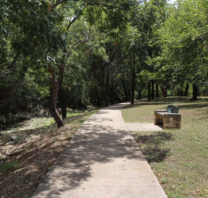
In addition to the recreational and exercise benefits of trails, these paths provide exceptional opportunities to connect Cleburne residents to various destinations around the City. These destinations and safe connections encourage families and individuals to explore Cleburne by walking, jogging, bicycling and skating. As the City expands and develops,
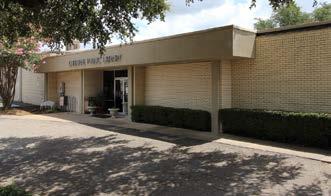
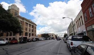
the City should anticipate the need to connect destinations by constructing trails, sidewalks and shared-use paths to integrate the trail system in new residential and commercial developments. The City of Cleburne has key destinations, as seen in the following images, that should be connected through the trail network.
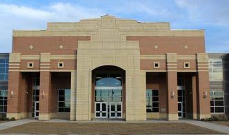
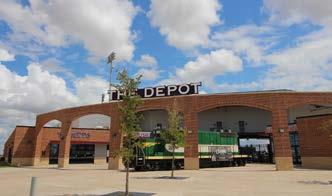
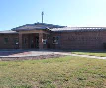
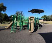
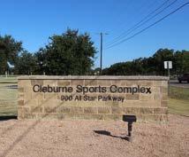
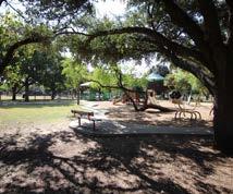
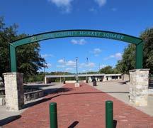
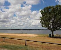
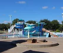
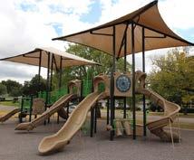
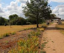
The following actions are recommended to be implemented to ensure the Cleburne Parks System continues to meet the recreational needs of the growing community. Recommendations are determined by the citizens of Cleburne through the public Town Hall meeting, focus group meetings
new park recommendations
and the surveys. The Advisory Committee, City Council and City Staff provided valuable insight about the needs of the community to ensure the following recommendations will benefit the City of Cleburne today and into the future. These recommendations can be developed in multi-year phases.
- Develop the City-owned land north of Carver Park as parkland
• Construct concrete and nature loop trails
• Connect the loop trails to Carver Park and East Buffalo Creek Park
• Install mile markers and additional signage along loop trails
• Replace existing playground
• Construct open lawn area for multi-purpose field practice and general play
• Construct a large pavilion
• Convert the existing building slab into multi-use sports courts
• Install site amenities: picnic tables, benches, trash receptacles, signage
- Develop the land south of McAnear Park
• Develop a linear park
• Construct a playground*
• Construct walking trails*
• Construct a parking lot*
• Install site amenities: picnic tables, benches, trash receptacles, signage
- Acquire and develop a community park in north Cleburne
• Construct multi-purpose practice fields and/or courts
• Install a playground
• Install a sprayground
• Construct multi-purpose loop trails
• Construct nature trails
• Construct wildlife viewing stations
• Install site amenities: picnic tables, benches, trash receptacles, signage
*Funding and construction provided by developer.
- Hulen Park
• Construct an additional pedestrian bridge across Buffalo Creek to Don Moore Field
• Construct a loop trail around Don Moore Field
• Redevelop existing courts to appropriate sports courts (basketball & pickleball)
• Construct a skate park
• Renovate existing parking lot near Don Moore Field
• Install new playground near Don Moore Field
• Construct new parking lot near maintenance building
• Construct a pavilion at Don Moore Field
• Renovate restroom at Don Moore Field
- Splash Station
• Renovate existing locker rooms
• Renovate family changing area
• Construct additional storage facility
• Update water amenities
- Buddy Stewart Park
• Construct a fishing pier
• Construct a disc golf course
• Construct a dog park
• Construct a kayak and canoe launch
• Construct wildlife viewing stations
• Construct additional trails
- Develop the shoreline along Kirtley Park at Lake Pat Cleburne (see Chapter 6)
- Carver Park
• Replace fencing at baseball field
• Install irrigation at baseball field
• Renovate large pavilion
• Install shade structures
• Construct volleyball courts
- Winston Patrick McGregor Park
• Replace fencing
• Improve nature trails
• Improve pond and irrigation
• Plant additional natural vegetation and wildflowers
• Install site amenities: benches, trash receptacles, signage
- Westhill Park
• Construct a loop trail
• Rehabilitate the existing basketball court
• Construct pavilion
• Install site amenities: benches, trash receptacles, signage
- P.D. Lacewell Park
• Construct a loop trail
• Remove non-functioning facilities: restroom, cistern, gazebo
• Construct pavilion
• Install a new playground
• Construct a parking lot
• Install site amenities: benches, trash receptacles, signage
- Winchester Park
• Install a playground
• Construct a sidepath
• Install site amenities: benches, trash receptacles, signage
- J.E. Standley Park
• Install a playground
• Construct a loop trail
• Install site amenities: picnic tables, benches, trash receptacles, signage
- John S. Butner Park
• Install a playground
• Construct a loop trail
• Install site amenities: picnic tables, benches, trash receptacles, signage
athletic recommendations
- Old Sports Complex
• Increase practice field capacity
• Replace existing fencing and irrigation
• Improve lighting capacity
• Improve parking lot
• Rehabilitate restroom facilities
• Construct playground
• Install site amenities: picnic benches, trash receptacles, signage
- Cleburne Sports Complex
• Construct trails connecting existing sidewalks
• Provide light systems on unlit fields
• Install shade canopies over bleachers
• Construct playground near soccer fields
• Construct playground near football fields
• Replace backstop fencing with netting system
• Renovate maintenance facility
• Convert cubie field into a baseball/softball field
• Construct and provide additional storage space for equipment
• Install site amenities: picnic benches, trash receptacles, signage
indoor facility recommendations
- Booker T. Washington Recreation Center
• Replace gym flooring
• Replace roofing
• Convert old day care facility to either Parks & Recreation Department administration offices or as special event space
• Construct outdoor playground
• Construct loop trails with the potential to connect to East Buffalo Creek Greenbelt
• Renovate interior
• Construct additional indoor basketball facility on City-owned land adjacent to Booker T. Washington
- McGregor House at Winston Patrick McGregor Park
• Renovate facility for either Parks & Recreation Department administration offices or to enhance the special event space
natural open space recommendations
- Acquire land and extend greenbelts
• Develop a greenbelt corridor along McAnear Creek going north from Country Club Road to McAnear Park
• Construct additional multi-purpose paved trails along West and East Buffalo Creek
- Utilize low-impact and sustainable development in natural open spaces to minimize adverse effects on valuable ecosystems
- Preserve natural areas around Lake Pat Cleburne and Buddy Stewart Park
general community recommendations
- Add more amenities to existing parks to increase user experience and comfort
• Shade structures and trees near playgrounds, benches, trailheads and picnic areas
• Drinking fountains and water bottle refill stations at trailhead and restrooms
• Benches and other rest areas along trails and near playgrounds
• Bike racks at recreation centers, parks and trails
- Create a complete Wayfinding Plan for the parks system
• Create a general theme for signage & determine where signs, maps, mile markers and gateways will be placed
• Install signage throughout the parks system
- Continue to partner with other City Departments and local organizations to host outdoor events and programs such as festivals, concerts and fitness classes
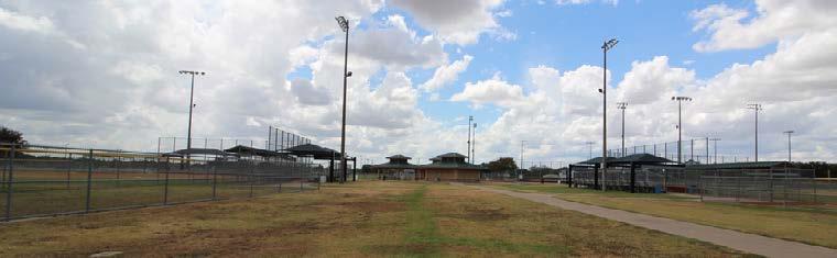
The following recommendations are based on City Staff input, the existing needs, opportunities and constraints, and the desires of Cleburne residents. Cleburne citizens want to have connectivity to parks, schools, residential and commercial areas with a balance of active and passive recreational opportunities which can achieved through trails. To begin identifying and constructing a trails system, it is advised for the City to utilize the existing infrastructure and park loop trails. This can be
accomplished through installing directional and confirmation signage, mile markers, crosswalks and ADA compliant facilities. The future considerations, in Chapter 8, are anticipated improvements and developments for the City to progressively work on over the next five to ten years and beyond. These include expanding greenbelts along the natural creek corridors and constructing bikeways on the wider streets as development continues to increase in the City.
• Construct both concrete and natural trails at Lake Pat Cleburne and Kirtley Park.
• Extend existing concrete path at Buddy Stewart Park and construct nature trails in the northwest wooded area.
• Extend concrete trail at Hulen Park and Don Moore Field and install an additional pedestrian bridge across Buffalo Creek.
• Extend the existing loop trail at Carver Park and construct a nature trail in the northeast wooded area.
• Connect existing sidewalks at the Sports Complex to create larger loop trails near the soccer fields.
• Construct a loop trail at PD Lacewell Park.
• Construct a loop trail at Westhill Park.
• Upgrade trails and paths to the recommended 8’ width (6’ minimum) when repairing existing trails when the space allows.
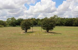
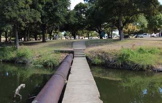
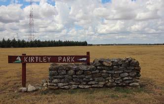
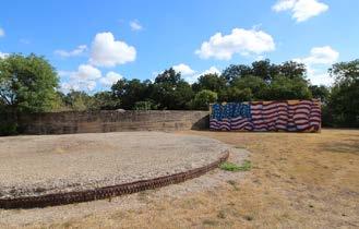
The following Parks System Amenities Priorities list is based on the recurring themes from the focus group meetings, Town Hall meetings, citizen surveys, City Staff recommendations and the professional consultant’s opinion. The Advisory Committee reviewed the major themes and
worked with City Staff to determine the top priorities listed below. It is important to note the following list is intended to be a guide for development of existing and future parks and amenities over the next ten years. These priorities build off of the previous plan's recommendations.
Shaded Spaces in the Parks Site Amenities: Benches, Tables, Water Fountains, Grills, Bike Racks, etc.
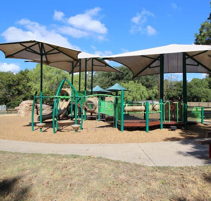
The City of Cleburne is projected to continue growing and developing in the next decade. As development and the population increases, it is important the parks system continues to increase. Although it is necessary to enhance and redevelop existing parks, it is crucial the City acquire new land, rezone existing City-owned properties or develop undeveloped existing parks already within the parks system. The current Level of Service (LOS) in the City is 15.01 acres of developed parkland per 1,000 residents. The recommended LOS in Cleburne is currently 17.3 acres of usable park acres per 1,000 residents. This figure was calculated based on developing J.E. Standley Park, McAnear Park, Winchester Park, and continuing to develop Booker T. Washington Recreation Center, Byron "Buddy" Stewart Park, Cleburne Golf Links, Cleburne Sports Complex, and West Lake Pat Cleburne Boat Ramp.
Based on the 2031 projected population of 44,185 residents, the City will need to acquire and develop an additional 297.89 acres of parkland over the next decade to reach the recommended 17.3 acres of usable parkland per 1,000 residents.

The yellow dots in the map on the following page suggests areas throughout the City where future parks should be considered. These areas are based on current needs, future developments, land availability and the 10-Minute Walk map. It is important to note that the dots are merely representational and do not represent specific parcels of land, but suggest areas of the community in which parks are needed. The City will need to review each area and coordinate with potential land owners on the availability of land for future parks. Due to the fact that over 120 acres will need to be acquired in the next ten years, it is highly recommended the City begin the process of searching for specific areas of acquisition to ensure parkland is dedicated for the future.
The RECOMMENDED LEVEL OF SERVICE IS 17.3 ACRES per 1,000 residents. By 2031, the City of Cleburne needs to have 764.39 ACRES OF DEVELOPED PARKLAND.


As the City of Cleburne continues to develop, the Parks and Recreation Department should be coordinating with other City Departments to ensure the trail network is implemented during construction, redevelopments and new developments. The City of Cleburne has a Master Thoroughfare Plan which was adopted in 2008 and amended in 2017. The plan is guiding the City’s short-term and long-term transportation needs. While it does not expand into great detail about pedestrian facilities, it does propose road improvements and future expansions. The Parks and Recreation Department should coordinate with the Community Development and Public Works Departments to implement the proposed trail network. It is best to begin these discussions early during the planning process to accommodate
the proposed trails, wide sidewalks and on-street bike facilities. In addition to the City of Cleburne Departments, Johnson County and the Texas Department of Transportation (TxDOT) should be contacted because some streets are owned and maintained by these government entities. These two agencies will own and manage the majority of roads on the fringe of Cleburne and a few major thoroughfares which travel through Downtown. The roads TxDOT and Johnson County manage typically have higher traffic volumes. There is a need for high levels of coordination between all three entities. It is crucial to begin these conversations early in the process to allow for ample planning and cooperation through the design, funding, implementation and maintenance of this trail network.
greenbelt considerations
• Extend the greenways along East and West Buffalo Creek.
- Acquire land through easements or buffers along the southern portion of East Buffalo Creek from E 2nd Street to E Henderson Street.
- Construct sustainable multi-use paths along East Buffalo Creek until Carver Park.
- Acquire land through easements or buffers along the northern portion of West Buffalo Creek from W Heard Street to W Kilpatrick Street.
- Construct sustainable multi-use paths along West Buffalo Creek from Hulen Park to W Kilpatrick Street.
• Develop McAnear Greenbelt from Country Club Road to McAnear Park.
• Identify and eliminate gaps in the greenbelt network. This may require the construction of shared use paths or on-street pavement markings.
• Install trail amenities such as rest areas with shade, drinking fountains and trash receptacles along trails.
• Improve the wayfinding and gateways to trailheads.
• Provide lighting at trailheads and gateways.
• Install bike racks and repair stations at trailheads.

legend
Existing Park
Undeveloped Park
Existing Greenway
Proposed Greenway
Existing Trail
Proposed Loop Trail
Proposed Shared Use Path Road City Limit
Similar to the trail network section, the City of Cleburne should anticipate the growth of the City and proactively coordinate with internal City Departments to ensure the bikeway system is implemented during the design and construction of roadway redevelopments and
new developments. Additionally, the Parks and Recreation Department, Community Development Department, and Public Works Department should have an organized plan to coordinate with Johnson County and TxDOT to construct or retrofit bikeways on non City-owned roadways.
bikeway & shared use path considerations
• Identify city-wide on-street and shared-use bike routes.
• Coordinate with TxDOT for potential funding opportunities and approval.
• Create a Wayfinding System Plan to design system-wide signage, identify sign and pavement marking locations and create an implementation schedule.
• Install wayfinding for trail/bike network through the use of on-street signage and pavement markings.
• Identify high-visibility connections near railroad crossings and school locations.
• Install street safety measures at trail crossings such as flashing beacons, crosswalks, vertical delineators, etc.
• Assess traffic calming measures to lower vehicular speeds when trails or crossings are present (ie speed humps, speed cushions, speed tables, altering pavement materials & pinchpoints).
• Look for opportunities to design and construct an 8’-10’ wide shared use path from Hulen Park to the Sports Complex, along E 2nd Street.
• Look for opportunities to design and construct an 8’-10’ wide shared use path from Booker T. Washington Recreation Center to Carver Park, along Mansfield Road and Park Street.


legend
Existing Park
Undeveloped Park
Proposed Shared Lane
Proposed Signed Route
Proposed Sidepath
TxDOT Bikeway
TxDOT Road
Road
City Limit
The opportunities represented in the images are examples which exist in the City of Cleburne. These include sidewalks, existing creek corridors, destinations, recommended street designs and residential areas. These all contribute to the goal of providing a comprehensive network of trails that safely connect the citizens of Cleburne to destinations by providing safe, alternative trail options. Cleburne has great potential to be a trails community because of the grid-like development of the City, wide streets in newer developments, slower traffic and a vibrant downtown. It is important to note that a connected trail network is not established through a single trail, path or sidewalk but instead consists of many facilities that support pedestrian mobility through the community. The
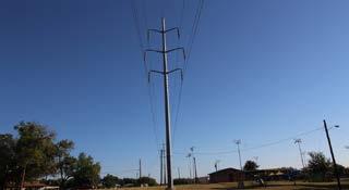
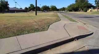
City of Cleburne has options when it comes to designing and implementing an active trail network. There are different types of street infrastructure that can be retrofitted to fit the needs of different types of roads. Already existing greenbelts along West and East Buffalo Creek provide opportunities for expanded greenways and can encourage the City to acquire easements for the remaining sections of Buffalo Creek. The City has an opportunity to work with private landowners along McAnear Creek to develop it as a natural recreational corridor before development expands in the area. Additional opportunities include parks which are undeveloped and have the potential for loop trails, the expansion of Carver Park and the land development of McAnear Park.
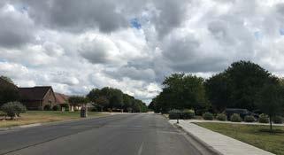
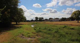
Constraints exist when designing and implementing a trail network in a smaller, rural city which favors vehicular transportation, but through careful planning and the integration of already in-place infrastructure, the City of Cleburne can have a usable trail network. Barriers in the trail network include the north-south railway along 171, private landowners adjacent to Buffalo Creek, and cracking/narrow pedestrian infrastructure. The proposed trail network connects various aspects of the community and there are four railroad crossings that will require attention. The impact of these barriers can be minimized through signage, pavement markings, traffic calming measures, and pedestrian bridges.
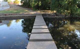
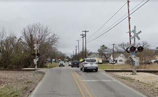
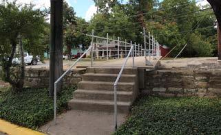
2424 W Henderson
22 11
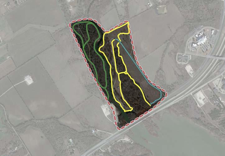
1111
2020

Existing Trail
Proposed Nature Trail
Proposed Concrete Trail
Description
2121 1212

This loop trail extends the already existing concrete path within the Park, while also proposing a new nature trail construction in the wooded areas near the proposed disc golf course in the northwest area of the park. These paths will add an additional 2.15 miles of trail, totaling 4.13 available miles in Buddy Stewart Park. The trail will feature benches, shade, trash cans and wayfinding.
Trail Specifications
Trail Width: 8’-wide
Trail Material: natural surfacing & concrete
Proposed Trail Length: 1-1/2 mile natural surfacing & 1/2 mile concrete
600 Park Street
Description
Existing Trail
Proposed Nature Trail
Proposed Concrete Trail
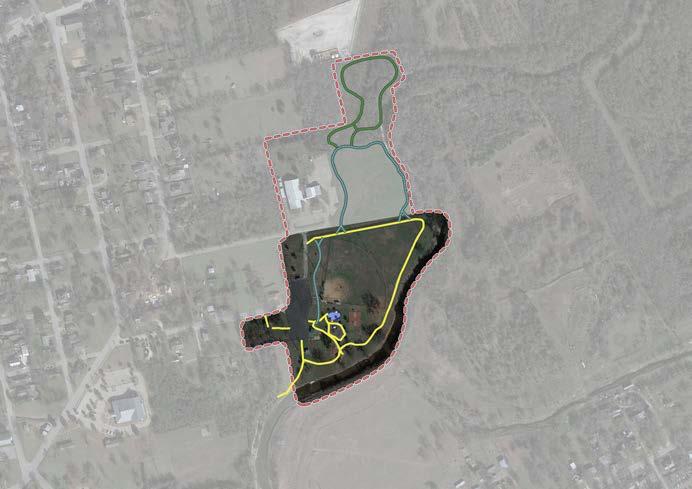
This loop trail extends the already existing concrete trail in the Park, along with adding two new trails on the City-owned property north of Carver Park (in the opaque area within the red boundary line). A path between Booker T. Washington and Carver Park should be constructed along the easement on Oak Street, this will connect both facilities without having to cross streets and walk near traffic. These paths will add an additional 0.73 miles of trail, totaling 1.15 available miles in Carver Park. The trails will feature benches, shade, trash cans and wayfinding.
Trail Specifications
Trail Width: 8' wide
Trail Material: natural surfacing & concrete
Proposed Trail Length: 1/3 mile crushed granite & 1/2 mile concrete
Cleburne Sports Complex - Proposed Loop Trail
900 All Star Parkway
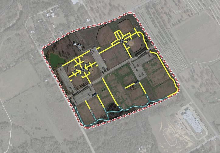

Existing Trail

Proposed Concrete Trail
Description
This loop trail extends the already existing concrete pathways within the park. The sidewalks in the Sports Complex connect all the sports fields and allow participants and spectators to reach each field. These path connectors will add an additional 2/3 of a mile of trail, totaling 2.38 available miles in Cleburne Sports Complex.
Trail Specifications
Trail Width: 8' wide
Trail Material: Concrete
Proposed Trail Length: 2/3 miles
301 Westhill Drive
Existing Trail
Proposed Concrete Trail

Proposed Bridge
Description
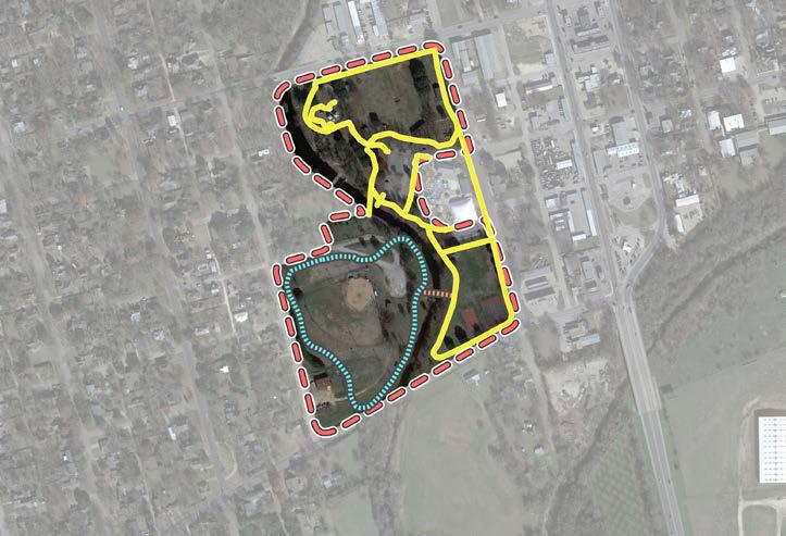
This loop trail extends the already existing concrete path within Hulen to include Don Moore field and the surrounding open space. This path will add an additional 0.50 mile of trail, totaling 1.5 available miles within Hulen Park. The trail will feature benches, shade, trash cans and wayfinding. In addition to the trail, a new pedestrian bridge should be installed across Buffalo Creek, connecting Don Moore Field to Ronnie Kirkpatrick Field.
Trail Specifications
Trail Width: 8’-wide
Trail Material: concrete
Proposed Trail Length: 1/2 mile
Bridge: 125-foot prefabricated bridge
P.D. Lacewell Park - Proposed Loop Trail
700 Granbury Street
1212

Description
1515 1313 1414 1515
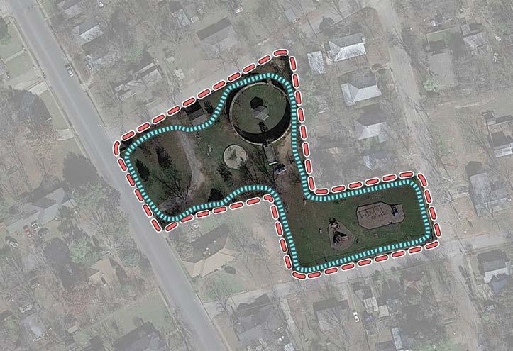
This loop trail will be the first and primary trail to exist in P.D. Lacewell Park. This path will surround the perimeter of the park, encompassing the playground, parking and open space. This path will add 0.25 mile of trail within P.D. Lacewell Park. The trail will feature benches, shade, trash cans and wayfinding.
Trail Specifications
Trail Width: 8' wide
Trail Material: concrete
Proposed Trail Length: 1/4 mile
1228 Hilltop Drive
1515 1818 1717 1515 1616
Description
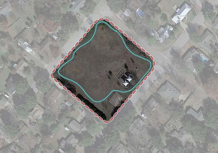
This loop trail will be the first path constructed at Westhill park. This trail will be built on the perimeter of the park, encompassing the playground, rehabilitated basketball court and open space. This path will create a 0.25 mile trail within Westhill Park. The path will feature benches, shade, trash cans and wayfinding.
Trail Specifications
Trail Width: 8' wide
Trail Material: concrete
Proposed Trail Length: 1/4 mile
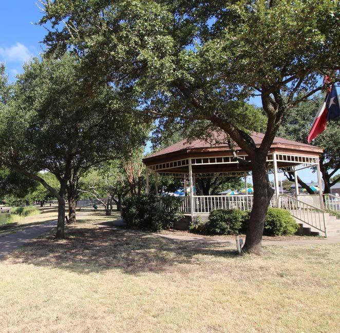
The following Implementation Schedule presents action items that are based on the needs, recommendations and priorities found in this Master Plan. The purpose of this Implementation Schedule is to provide a framework to assist with future park and community development planning in the City. The Implementation Schedule is grouped by Tier 1, Tier 2 and Tier 3. These tiers are categorized based on projected start and completion schedules. Tier 1 projects are proposed for 2021 to 2024,
Tier 2 projects are for 2024to 2027 and Tier 3 projects are for 2027 to 2031. It is important to note the following Implementation Schedule is intended to be a flexible guide for development of parks and facilities over the next five to ten years and beyond. The City should evaluate and change the order of projects if necessary or take advantage of any unforeseen opportunities that may arise that are not identified in this schedule as long as it fits the goals and objectives of this plan and the community.
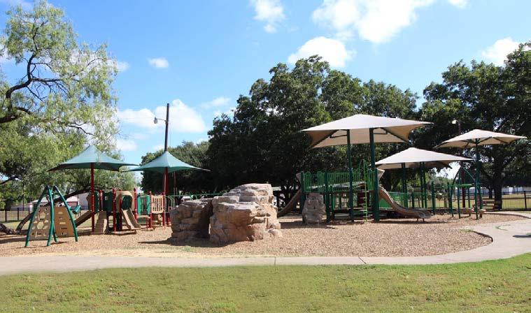

- Develop Kirtley Park at Lake Pat Cleburne (TPWD Grant Opportunity)
- Construct multi-purpose trails along east shoreline
- Construct swim beach
- Provide site amenities: covered picnic tables, benches & trash cans
- Construct restroom facility
- Construct parking lot
- Install playground
- Enhance Buddy Stewart Park (TPWD Grant Opportunity)
- Construct a disc golf course
- Construct a dog park
- Construct nature trails
- Plant native vegetation
- Expand Carver Park (TPWD Grant Opportunity)
- Construct 1/4 mi. concrete loop trail
- Construct 1/3 mi. nature trail loop
- Install park and trail signage
- Expand existing playground
- Construct open lawn area for multi-purpose field practice & general play
- Convert existing building slab into multi-use sports courts (pending approval by structural engineers)
- Update Hulen Park
- Convert existing tennis courts to basketball courts
- Redevelop existing basketball court to a pickleball court
- Create a Parks & Recreation Branding Plan
- Standardize and install park entry & wayfinding signs
- Develop a Detailed Trails Plan with Designated Routes & Technical Standards
- Adopt New Park Ordinances
- Continue to partner with CISD to provide recreational opportunities for the entire community
- Enhance Cleburne Sports Complex
- Construct 2/3 mi. loop trails around soccer fields in the southern portion of the property
- Install lights on unlit fields
- Construct additional storage for equipment
- Install shade canopies over bleachers
- Construct playground near soccer fields
- Construct playground near football fields
- Replace backstop fencing with netting system
- Renovate maintenance facility
- Convert cubie field into baseball/softball field
- Develop Kirtley Park at Lake Pat Cleburne (TPWD Grant Opportunity)
- Construct concession area
- Install shade structures
- Construct boardwalk with viewing stations
- Plant trees and native vegetation in select areas
- Construct paddle sport launch adjacent to boat ramp
- Construct parking lot
- Construct amphitheater
- Construct sand volleyball courts
- Construct loop trails
- Redevelop boat ramp
- Resurface & stripe parking lot
- Construct fishing pier
- Expand Carver Park (TPWD Grant Opportunity)
- Install irrigation in baseball field
- Install fencing at baseball field
- Renovate large, existing pavilion
- Install shade structures
- Install site amenities: picnic table, bench & trash receptacle
- Construct volleyball courts
- Construct additional large pavilion
- Update Don Moore Field
- Renovate parking lot
- Install new playground
- Construct pavilion
- Construct skate park
- Renovate restroom
- Construct pedestrian bridge across Buffalo Creek to Don Moore Field
- Construct 1/2 mi. trail around Don Moore Field
- Update Booker T. Washington Recreation Center
- Replace flooring
- Repair roofing
- Construct outdoor playground
- Construct loop trails connecting to East Buffalo Creek Greenbelt
- Enhance Buddy Stewart Park (TPWD Grant Opportunity)
- Construct fishing pier
- Construct kayak/canoe launch
- Construct wildlife viewing stations
- Update Winston Patrick McGregor Park
- Improve existing pond
- Improve and expand irrigation system
- Replace split-rail fencing
- Improve nature trails
- Improve existing vegetation by planting native, drought-tolerant & adaptive plant materials
- Establish a wildflower area
- Install site amenities: picnic table, bench & trash receptacle
- Improve Cleburne Links Golf Course
- Returf greens on the 18-hole course
- Update John P. Bradshaw Park
- Rehabilitate basketball court with new surfacing and goals
- Install site amenities: picnic table, bench & trash receptacle
- Develop +/- 7 Acres South of McAnear Park for a Linear Park Development (TPWD Grant Opportunity)
- Construct playground
- Construct loop trail
- Construct parking lot
- Install site amenities: picnic table, bench & trash receptacle
- Hire Additional Parks, Recreation & Facility Staff as Additional Parkland is Acquired and Amenities are Constructed or Expanded. This includes staff for Booker T. Washington, Cleburne Golf Links and Splash Station.
- Continue Partnering with Other City Departments, Local Organizations and Local Businesses to Host Outdoor Recreational Programs such as Festivals, Concerts and Fitness Classes.
- Improve Old Sports Complex
- Replace existing fencing and irrigation
- Improve site lighting
- Replace asphalt parking lot to accommodate 100 parking spots
- Rehabilitate restroom facilities
- Install playground
- Construct pavilion
- Install site amenities: picnic table, bench & trash receptacle
- Renovate P.D. Lacewell Park (TPWD Grant Opportunity)
- Construct 1/4 mi. trail around perimeter of park
- Provide & install benches and trash receptacles
- Install new playground equipment
- Construct parking lot
- Remove concrete cistern & gazebo
- Construct a pavilion
- Remove non-functioning restroom
- Redevelop Lake Pat Cleburne West Boat Ramp (TPWD Grant Opportunity)
- Redevelop boat ramp
- Resurface & stripe parking lot
- Construct paddle sport launch adjacent to boat ramp
- Construct fishing pier
- Develop J.E. Standley Park (TPWD Grant Opportunity)
- Install small playground
- Construct shade structures
- Construct sidepath
- Install site amenities: picnic table, bench & trash receptacle
- Develop John S. Butner Park (TPWD Grant Opportunity)
- Install small playground
- Construct shade structures
- Construct sidepath
- Install site amenities: picnic table, bench & trash receptacle
- Improve Westhill Park
- Construct 1/4 mi. concrete trail
- Rehabilitate existing basketball concrete slab
- Construct pavilion
- Install site amenities: picnic table, bench & trash receptacle
- Develop Winchester Park (TPWD Grant Opportunity)
- Install small playground
- Construct shade structures
- Construct sidepath
- Install site amenities: picnic table, bench & trash receptacle
- Improve Cleburne Links Golf Course
- Plant trees at the Cleburne Links Golf Course
- Acquire and Develop Greenbelt (Determine Location)
Specialty Projects
- Construct All-Inclusive Playground
- A playground which goes beyond the minimum accessibility requirements and implements Universal Design to create play experiences for all users regardless of any disability or impairment.
- Recommended location is Kirtley Park.
- Acquire & Develop a Community Park in North Cleburne (TPWD Grant Opportunity)
- Construct multi-purpose practice fields and/or courts
- Install playground
- Install sprayground
- Construct multi-purpose loop trails
- Construct nature trails
- Construct wildlife viewing stations
- Install site amenities: picnic tables, benches & trash receptacles
- Construct Field of Dreams (Public-Private Partnership)
- Implement the Connectivity Network As Cleburne Expands and Redevelops
- Require new developments to construct sidewalks
- Acquire land along creek corridors
- Add bike lane striping as roads are repaved
- Renovate Booker T. Washington Recreation Center
- Renovate interior of building
- Construct indoor basketball facility
- Upgrade Splash Station
- Update aquatic amenities (i.e. FlowRider or Expanded Sprayground)
- Renovate existing locker rooms
- Renovate family changing area
- Construct additional storage facility
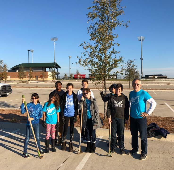
The City of Cleburne Parks and Recreation Department offers a variety of recreation programs and special events throughout the year. The City aims to provide recreation opportunities and community events for all skill levels, ages and interests. In addition to the City-run programs and events, there are numerous local associations and organizations in


Cleburne that provide programming and special events. A detailed account of these opportunities can be found on pages 48 to 53 in Chapter 3. This section highlights the partners and community organizations that offer programs and who the City supports in various capacities for events. These organizations contribute to the high quality of life in Cleburne.


The City of Cleburne has a variety of different funding opportunities available that can assist with the funding of the proposed projects in this plan. Funding sources typically fall within three different categories: Local Partnership Opportunities, Local City Funding or State and Federal Funding. There may also be additional funding available which is not listed within this plan.
These funds are typically used for smaller projects such as repairs and replacements at existing park facilities.
These bonds are issued by the city following an election in which the voters authorize their issuance for specific stated purposes, as well as the necessary tax increases to support them. These bonds pledge the property or ad valorem taxing power of the city.
These certificates have basically the same effect as general obligation bonds except they do not require an election to authorize them. These certificates are issued on the authorization of the City Council. Repayment is based on the property taxing power of the city, utility system revenues, or a combination of the two.
These fees are typically imposed on developers when they bring new projects into the community. The fees are typically used to ensure that as more development comes to the City, more park land is acquired, developed or improved. Each community has a specific ordinance, but typically the city can require the developer to provide land for a park, cash in lieu of the required land or park development fees.
This method of financing requires the eventual user of each facility to pay a fee for the use of each facility. Fees to be charged users can be established to pay for debt service, maintenance, and operation of the parks system.
Donations from foundations, corporations, and/or private individuals are often used to acquire and develop parks. The city should constantly identify and pursue opportunities to receive such funding for parks. One avenue for receiving donations is through the use of the Texas Parks & Recreation Foundation. This foundation has been developed to help all communities in the State of Texas to maximize the benefits of donations of land, property, and money.
The 4B Economic Development Board of Directors was created in 2001 to act on behalf of the City to develop, implement, provide, and finance projects under Section 4B of the Development Corporation Act.
The City of Cleburne can issue debt in the form of bonds to fund day-to-day obligations and capital projects.
These grants are intended for communities with a population of less than 500,000 and can be used for the acquisition of parkland, park development or for the renovation of existing parks and open spaces. This grant is a 50% matching grant with a ceiling of $750,000.
These grants are intended for communities with a population of less than 500,000 and can be used for the construction of recreation centers, local community centers, nature centers and other applicable indoor facilities. This grant is a 50% matching grant with a ceiling of $1.5 million.
These grants are primarily used to assist non-profits and local governments for recreational programming geared toward under served populations. The intent of the funds are to introduce the importance of environmental education and conservation and provide TPWD mission oriented outdoor recreational activities. This grant is a TPWD Sponsored grant with a minimum funding requirement of $5,000 and a ceiling of $50,000.
These grants are intended for both motorized and non-motorized recreational trail projects; including new trail construction, existing trail improvements, acquisition of trail corridors, trailheads and/or amenities. This grant is federally funded by the Federal Highway Administration and administered by TPWD. This grant is 80 / 20 grant with up to 80% of the project being funded through TPWD with a ceiling of $200,000 for non-motorized trails and no ceiling for motorized trails.
Administered by state departments of transportation, this is a federal grant; there is no local matching needed for these funds. The purpose of the SRTS program is to encourage safe bicycling and walking among schoolchildren. These proposals can be located anywhere in the state, regardless of population size. The SRTS projects must be planned to be within public right of way within 2 miles of a public, charter, or private school serving K-8th grade students. The types of projects typically funded include bicycle infrastructure improvements, shared use paths, sidewalk improvements and infrastructure-related projects to improve safety for non-motorized transportation.
These funds are federally funded and administered through TPWD through the Texas Recreation Park Account. Note: If a City applies for an Outdoor Grant, Small Community Grant or Indoor Recreation Grant, TPWD may choose to fund a successful project directly through LWCF with no additional or separate application.
These funds are primarily used for parks and recreational opportunities and consist of LWCF & Urban Park and Recreation Recovery Act (UPARR) dollars. The United States Congress appropriates funds to each State.
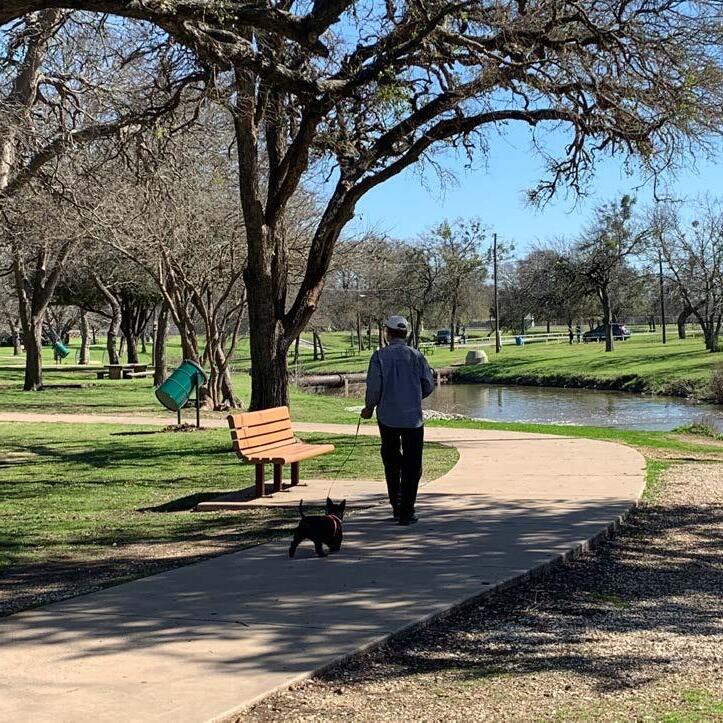
The following design development boards with the individual park site plans and design photos are intended to be used for future planning. The site plans supplement the Parks, Recreation, Trails & Open Space Master Plan Implementation Schedule to guide the City of Cleburne as they expand, develop and improve their existing parks and recreation system. The Individual Park Design pages are representational of future upgrades and developments of
each park, these designs are not to be used for construction. On each page there will be an aerial image of the existing park, a list of existing amenities, a small graphic showing the high, medium, and low maintenance levels within the park, and the park classification and acreage. Additionally, there will be a rendering of the proposed changes and future design of the park, photos to represent the new amenities and a list of proposed amenities.
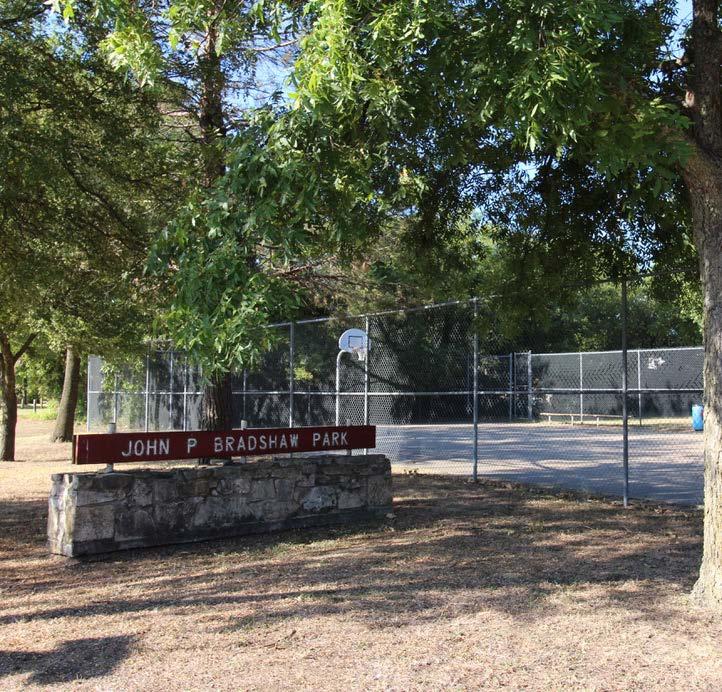

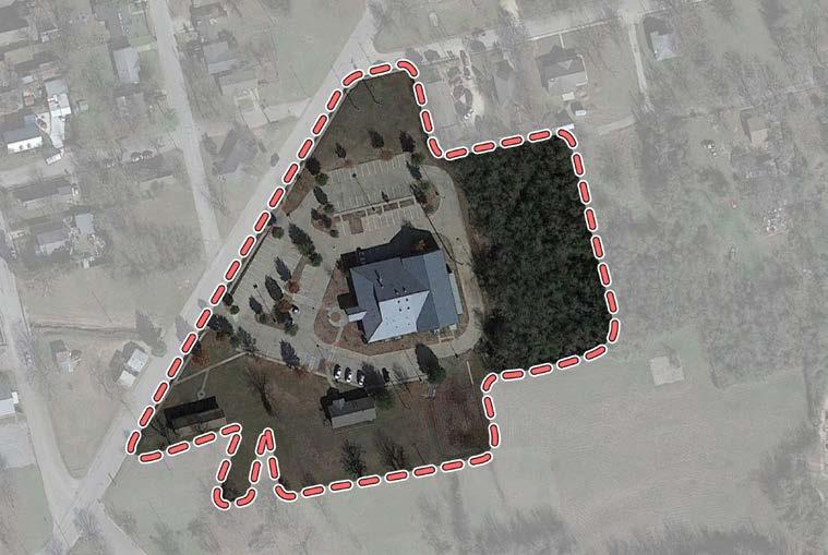
• Gymnasium
• Weight Room
• Cardio Room
• Banquet Hall with Kitchen
• Restroom / Locker Room
• Computer Lab
• Multi-Use Room
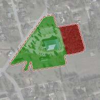

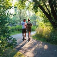
Walking Trails
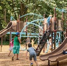
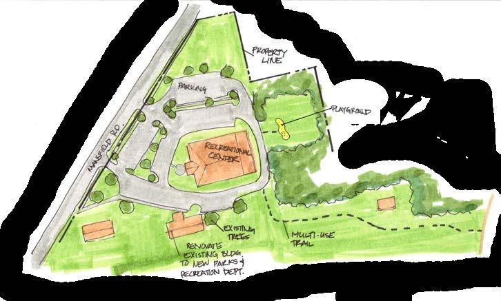
Proposed Amenities
• Basketball Flooring
• Roofing
• Playground
• Loop Trails
• Convert Day Care Facility to Parks & Recreation
Department Office or Special Event Space
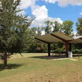
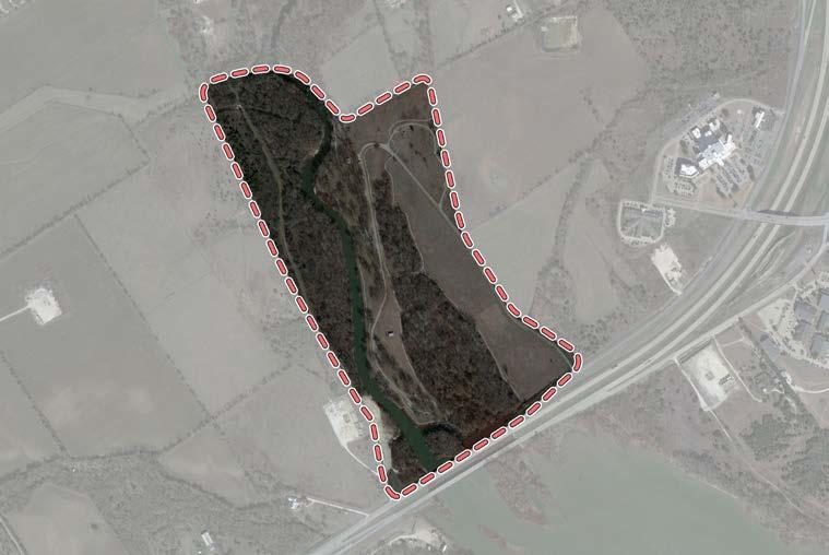
• Boat Ramp • Grills • Parking • Pavilions
Picnic Tables
Trails
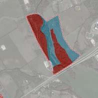
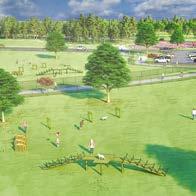
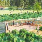
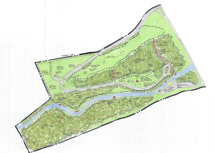
• Disc Golf Course
• Dog Park
• Nature Trails
• Fishing Pier
• Native Plants Fishing Pier Dog Park
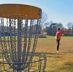
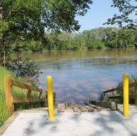
• Kayak / Canoe Launch
• Wildlife Viewing Station
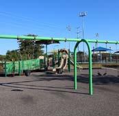
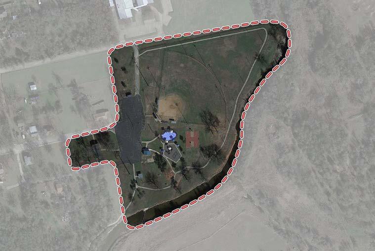
Santa Fe St
Park St
• Basketball Court
• Benches
• Drinking Fountain
• Grills • Park Sign • Parking • Pavilion
• Picnic Shelters
• Picnic Tables
• Playground
• Restrooms
• Softball Diamond (Lighted)
• Splash Pad • Trails (Lighted)
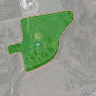
Multi-Sport Court
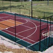
Pavilion
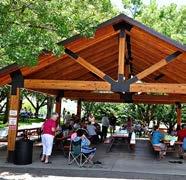
Proposed Park Expansion
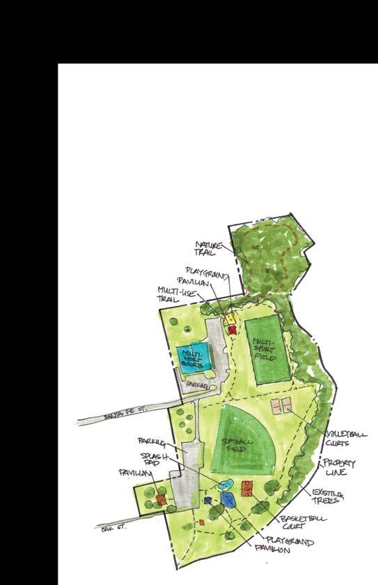
• 1/4 mi. Concrete Trail
• 1/3 mi. Nature Trail
• Signage
• Playground
• Open Lawn
• Multi-Sport Court
• Irrigation
• Fencing
• Refurbish Pavilion

Nature
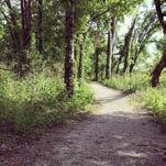
• Shade Structures
• Site Amenities
• Volleyball Court
• Pavilion
Trail
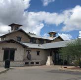
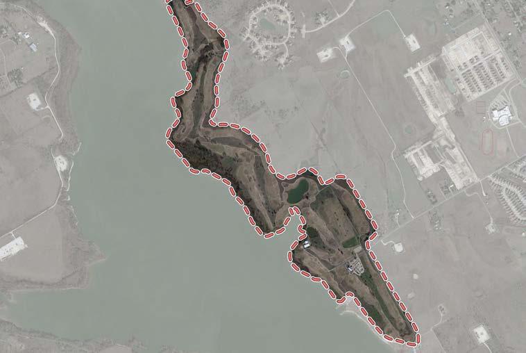
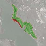
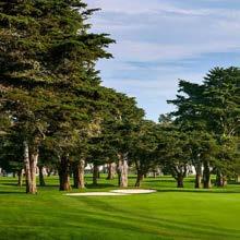
Native Planting
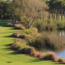
• Returf Greens
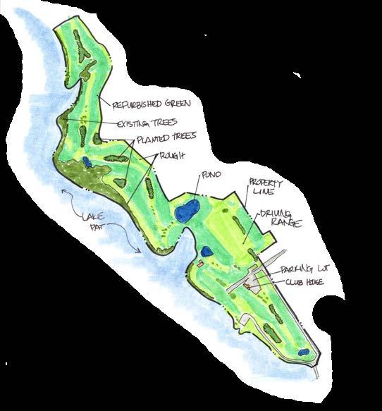
• Plant Trees
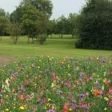
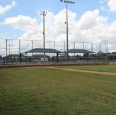
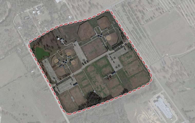
• Soft Toss Station
• 7 Baseball / Softball Fields (Lighted)
• 20 Soccer Fields
• 2 Football Fields
• 2 Batting Cages
• 2 Playgrounds
• 4 Concession Stands
• Restrooms
• Pavilions
• Benches
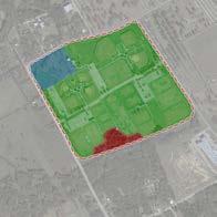
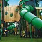
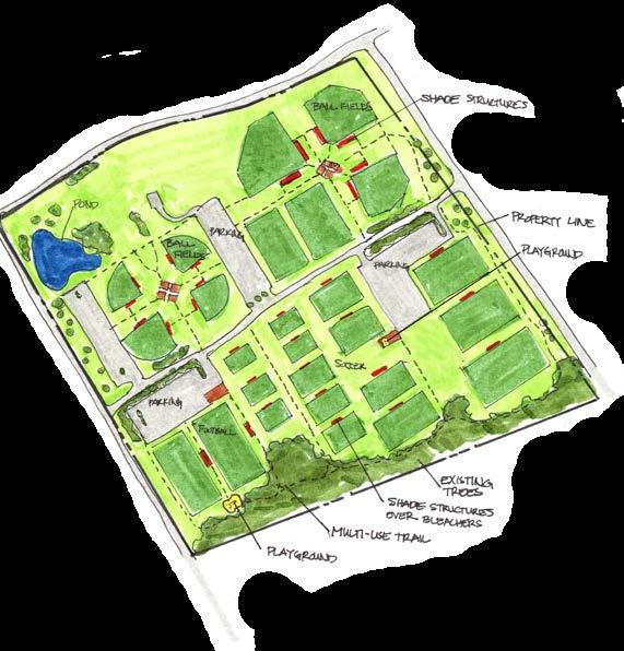
• 2/3 mi. Concrete Trail
• Field Lights
• Storage
• Shade Canopies
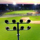
• Playground(s)
• Backstop Fencing
• Maintenance Facility
• Field Conversion
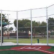
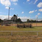
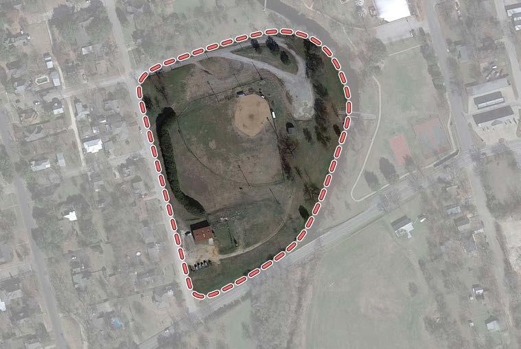
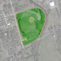

• 1/2 mi. Concrete Trail
• Parking Lot
• Playground
• Pavilion
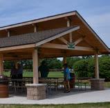
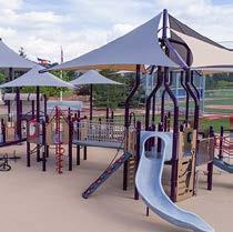
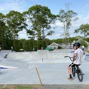
• Restroom
• Pedestrian Bridge
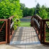
Pedestrian Bridge
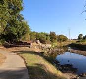
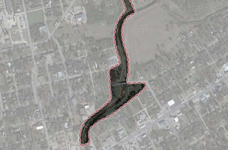
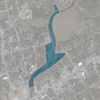
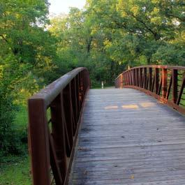
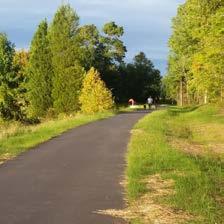
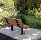
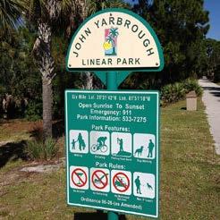
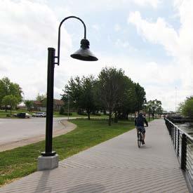
• Signage
• Pedestrian Bridge
• Expand Trail
• Site Amenities
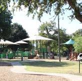
301 Westhill Drive
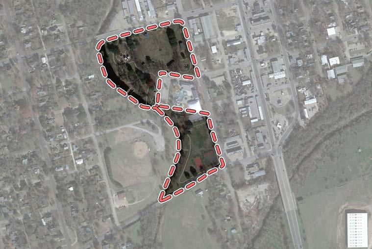
• Baseball / Softball (Backstops only)
• Basketball (Lighted)
• Benches
• Gazebo
• Grills
• Historic Site ("Spirit of Cleburne" steam engine)
• Horseshoe Pits
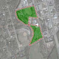
• Interpretive Signs
• Maintenance Building
• Parking
• Park Sign
Court
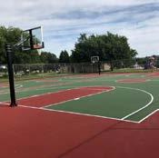
• Convert Tennis Court to Basketball
• Convert Basketball Court to Pickleball
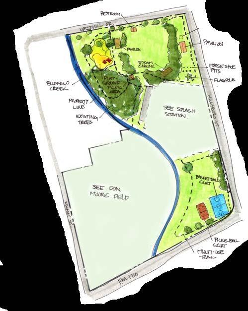
• Skate Park
• Pavilion Cover on Basketball Court
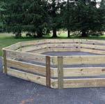
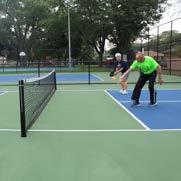
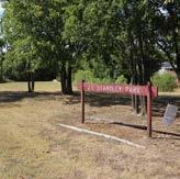
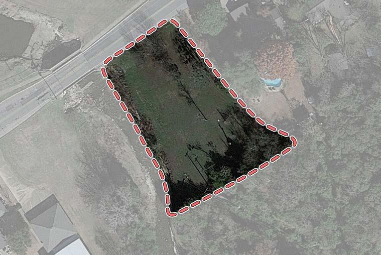
• Creek Access
Picnic Table
Park Sign
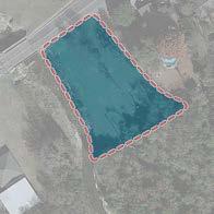
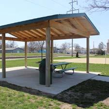
Pavilion
• Sidepath
• Playground
• Shade Structures
• Site Amenities
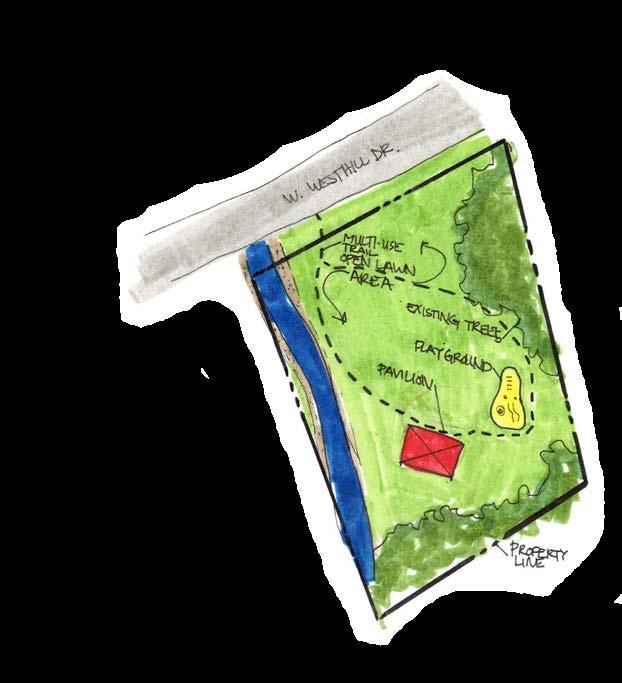
Playground
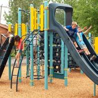
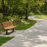
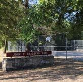
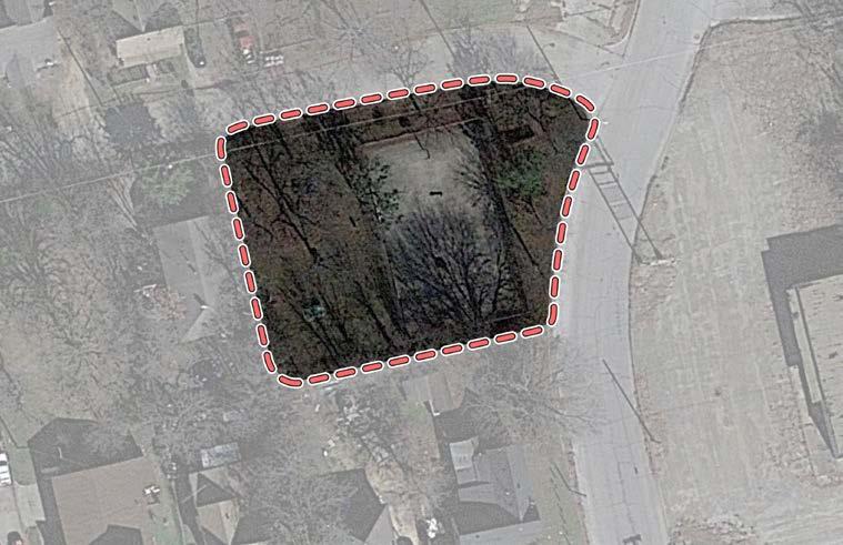
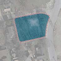
Basketball Court
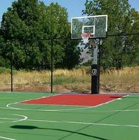
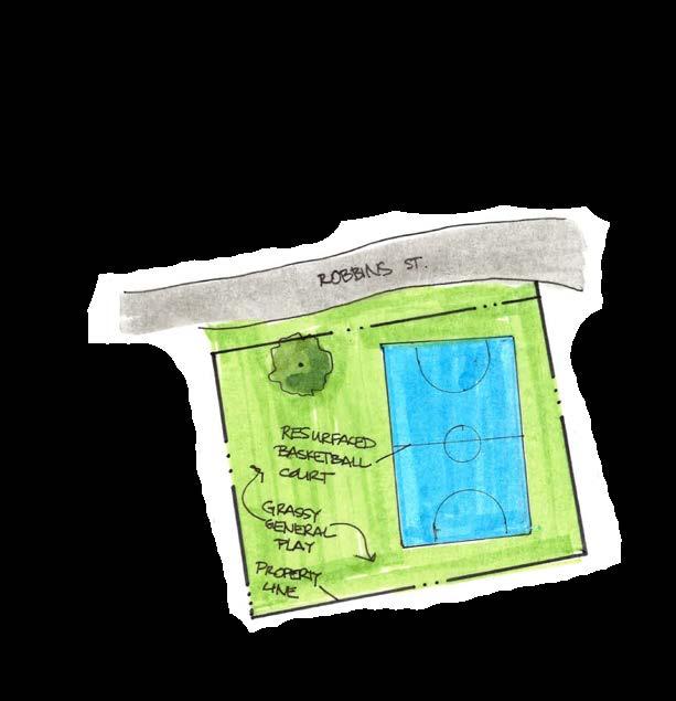
• Rehabilitate Basketball Court
• Site Amenities Proposed Amenities
Site Amenities
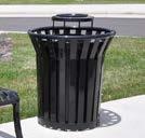
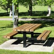
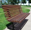
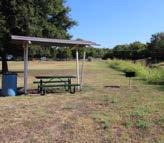
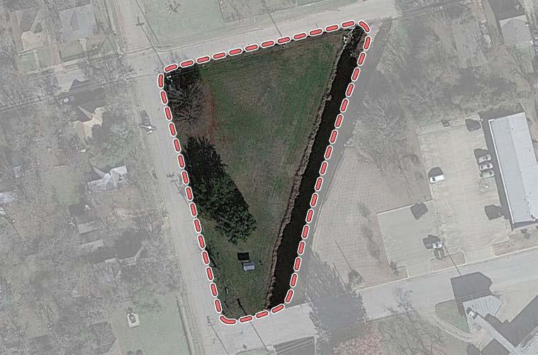
• Benches
Grill
Park Sign
Picnic Table
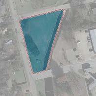
• Sidepath
• Playground
• Shade Structures
• Site Amenities Proposed Amenities
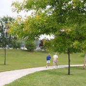
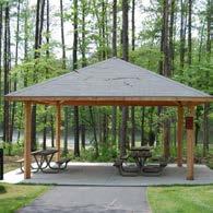
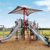
Shade
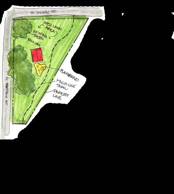
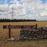
Maintenance Level

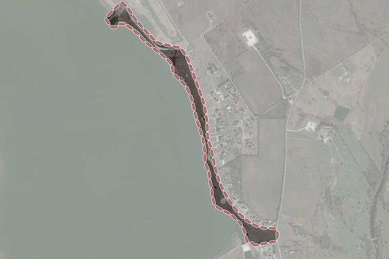
• Boat Dock / Pier
• Boat Ramps
• Grill
• Parking
• Pavilions
• Picnic Shelters
• Picnic Tables
• Sand Volleyball
• Swimming Beach
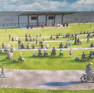
Amphitheater
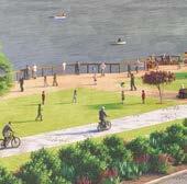
Boardwalk
Sand Volleyball Courts
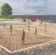
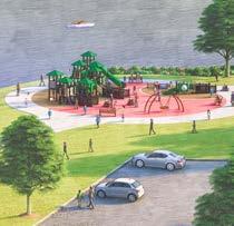
Playground
• Trails
• Swim Beach
• Site Amenities
• Restroom
• Parking Lot(s)
• Playground
• Shade Structures
• Boardwalk
• Trees & Natural Plants
• Concession Area
• Kayak / Canoe Launch
• Parking Lot
• Amphitheater
• Sand Volleyball Courts
• Refurbish Boat Ramp
• Fishing Pier
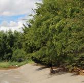
McAnear Park
Near the Intersection of Roberts Avenue & McAnear Street
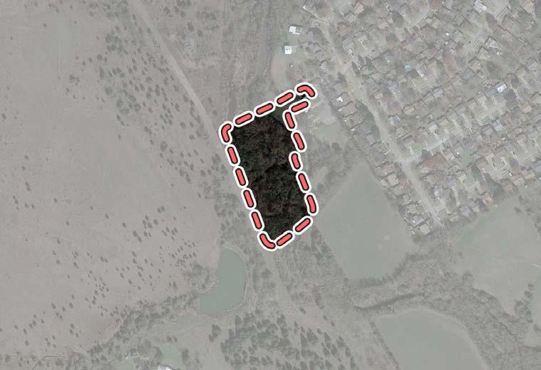
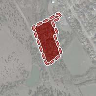
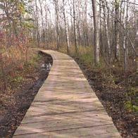
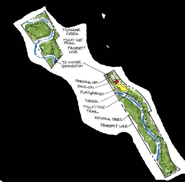
• Playground
• Loop Trail
• Parking Lot
• Site Amenities
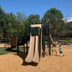
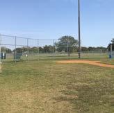
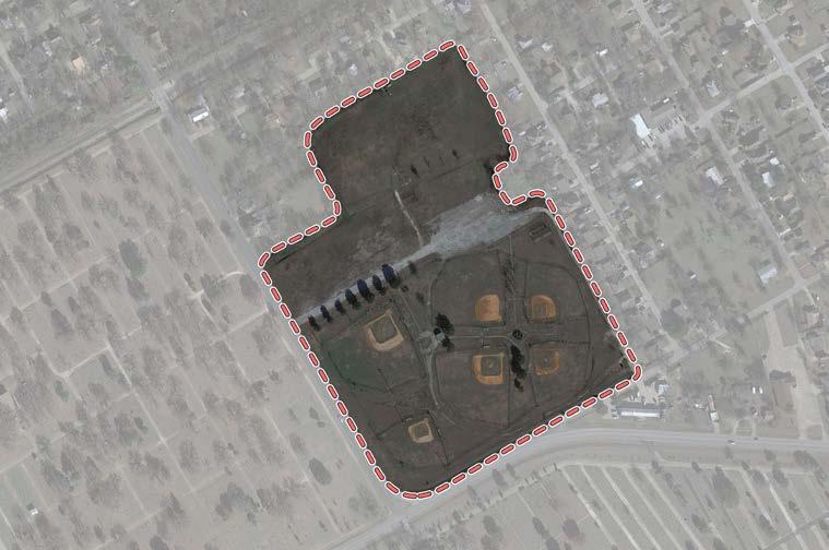
• 2 Baseball / Softball Fields (Lighted)
• Batting Cages • Pee-Wee Football Field • Parking
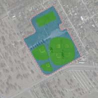
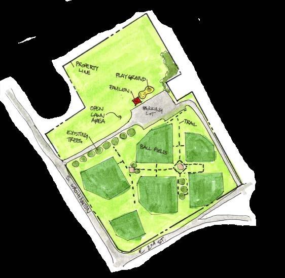
• Fencing
• Irrigation
• Lighting
• Asphalt Parking Lot
Playground
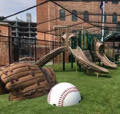
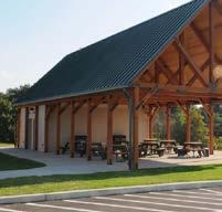
Pavilion with Restrooms
• Restroom
• Playground
• Pavilion
• Site Amenities
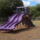
1212
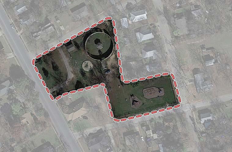
Existing Amenities 1515 1313 1414 1515
• Benches
• Gardens
• Gazebo (Inaccessible)
• Parking
• Park Sign
• Picnic Table
• Playground
• Maintenance Building (Former restroom)
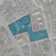
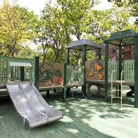
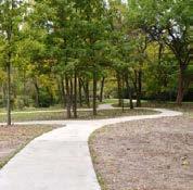
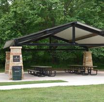
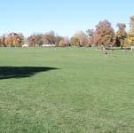
• 1/4 mi. Trail
• Site Amenities
• Playground
• Parking Lot
• Pavilion
• Remove Cistern & Gazebo
• Remove Maintenance Building
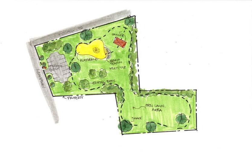
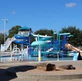
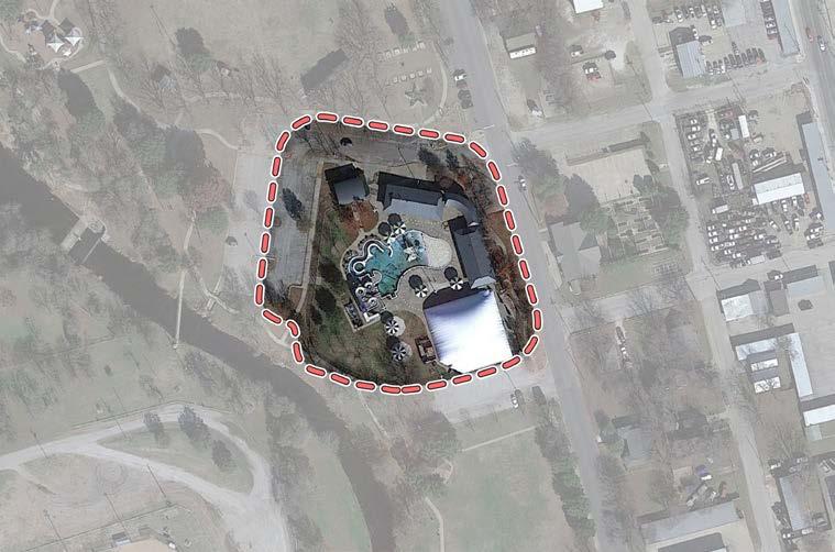
• 8-Lane Competition Pool
• Leisure Pool
• Zero-Depth Sprayground Entry
• Kids Water Playground with Slide
• Lazy River
• Vortex
• 2 Water Slides
• Concession Stand
• Locker Rooms
• Gift Shop
• Parking
• Seasonal
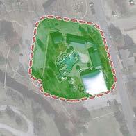
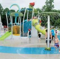
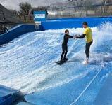
Locker Rooms
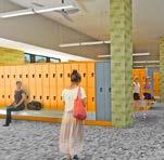
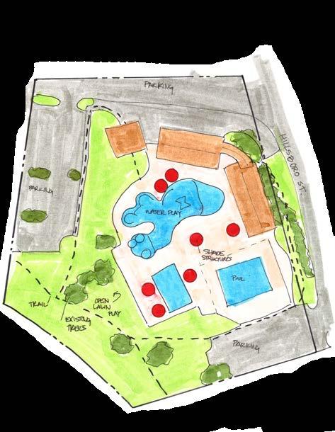
• Aquatic Amenities (e.g. FlowRider, Splash Pad, etc.)
• Renovate Locker Rooms
• Renovate Family Changing Area
• Storage Facility Proposed
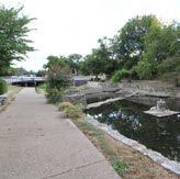
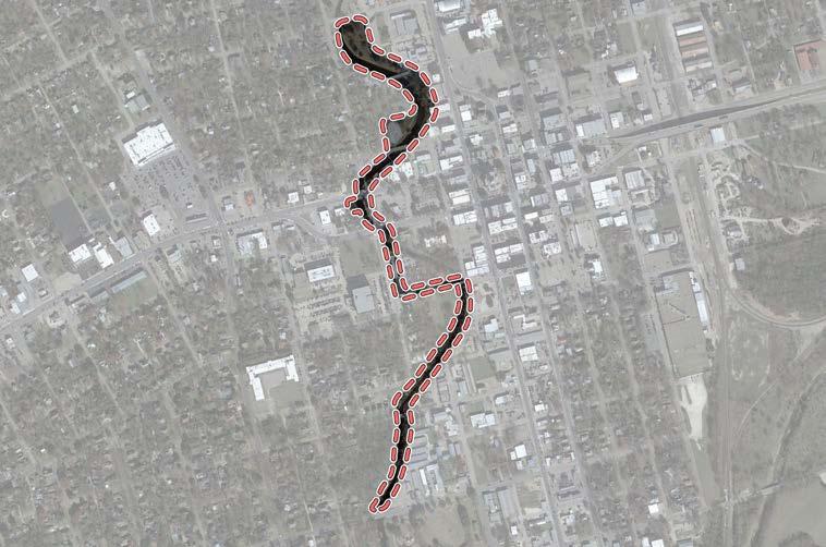
Benches
Grill
Trails (Lighted)
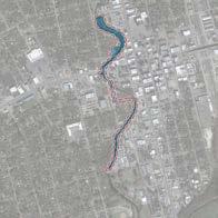
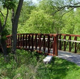
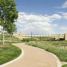
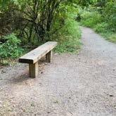
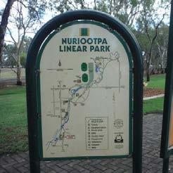
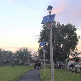
• Signage
• Pedestrian Bridge
• Expand Trail
• Site Amenities
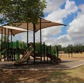
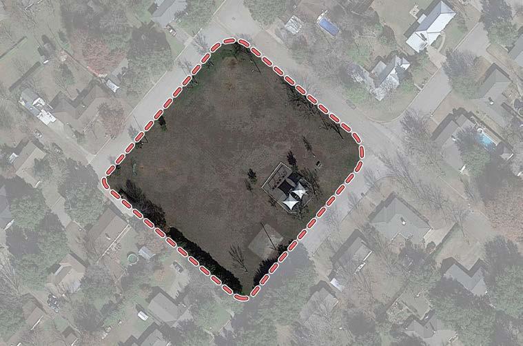
• Baseball / Softball (Backstops only)
• Basketball Court (Lighted & Half Court) • Drinking Fountain • Grill • Picnic Table
Playground
Park Sign
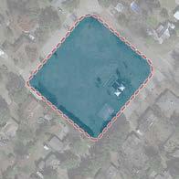
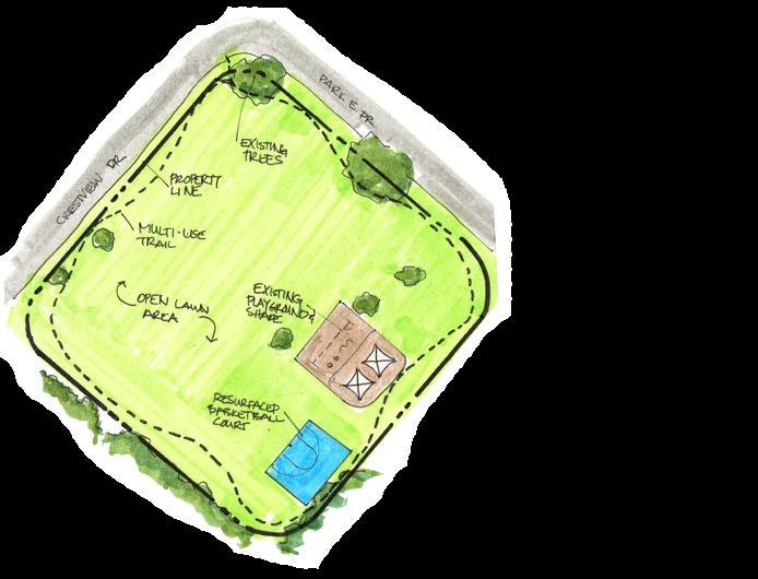
• 1/4 mi. Concrete Trail
• Refurbish Basketball Court
• Pavilion
• Site Amenities
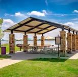
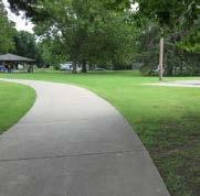
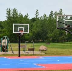
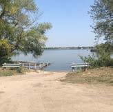
2900 Spur 1434 West Lake Pat Cleburne Boat Ramp special use park Total Acres - 8.19 Developed Acres - 1.40
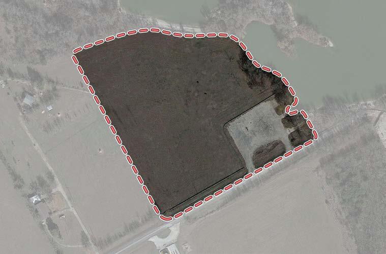
• Boat Ramp • Parking • Park Sign Existing Amenities Maintenance Level
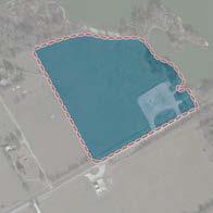
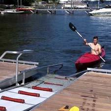
/ Canoe Launch
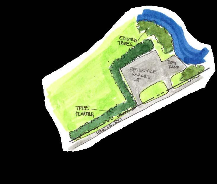
• Refurbish Boat Ramp
• Refurbish Parking Lot
• Kayak / Canoe Launch
• Fishing Pier
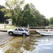
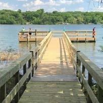
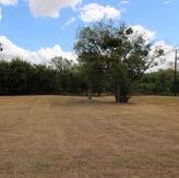
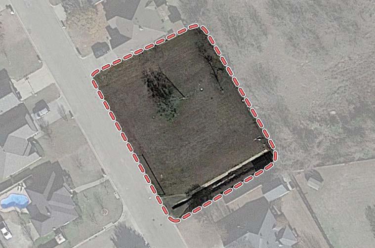
• Undeveloped Facilities
Park Blvd
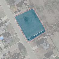
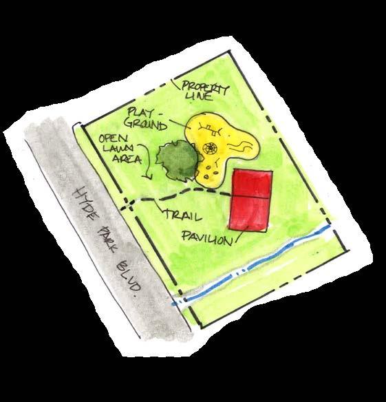
• Sidepath
• Playground
• Shade Structures
• Site Amenities Proposed Amenities
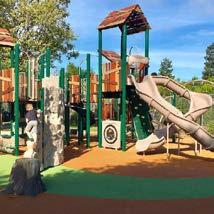
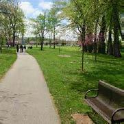
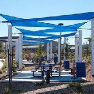
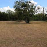
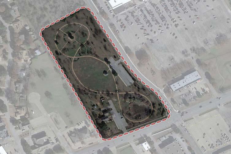
• Arbor
• Benches
• Children' Garden & Maze
• Gardens
• Parking
• Pavilion
• Community Center / Meeting Rooms (Renovated House)
• Pond • Windmill
Trails
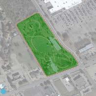
Maintenance Level
Plantings
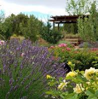
Fencing
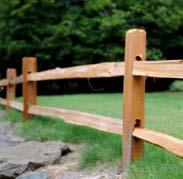
• Refurbish Pond
• Irrigation
• Fencing
• Nature Trails
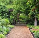

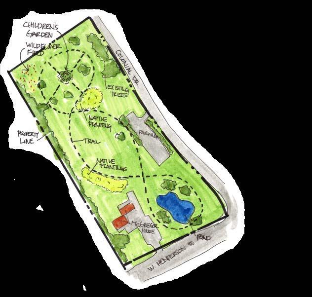
• Plantings
• Site Amenities
• Renovate McGregor House to host Parks & Recreation Department Staff or Special Events
The following maps are intended to be used for maintenance scheduling and determining the resources needed to maintain the parks, fields and facilities at the predetermined levels. High level maintenance parks involve weekly or biweekly mowing, edging, fertilizing, trash collection, irrigation system repairs and maintenance, tree and shrub
trimming, etc. Medium level maintenance parks require periodic mowing and edging, removal of fallen trees, trash collection, trail cleaning and erosion control when necessary. Low level parks are maintained on an as needed basis such as brush hogging, the removal of fallen trees and repairs of any issues that could impact the safety of citizens.
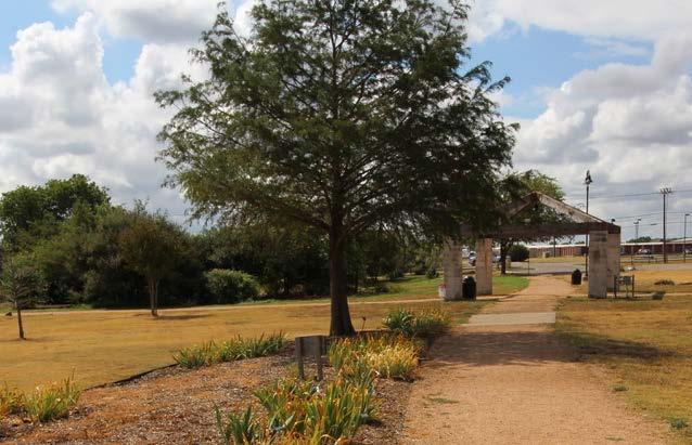
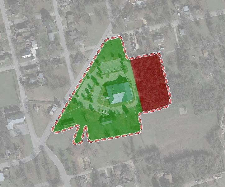
2424 W Henderson
Byron "Buddy" Stewart Park 1111 2020 22 11 2121 1212
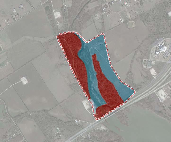
Maintenance Legend
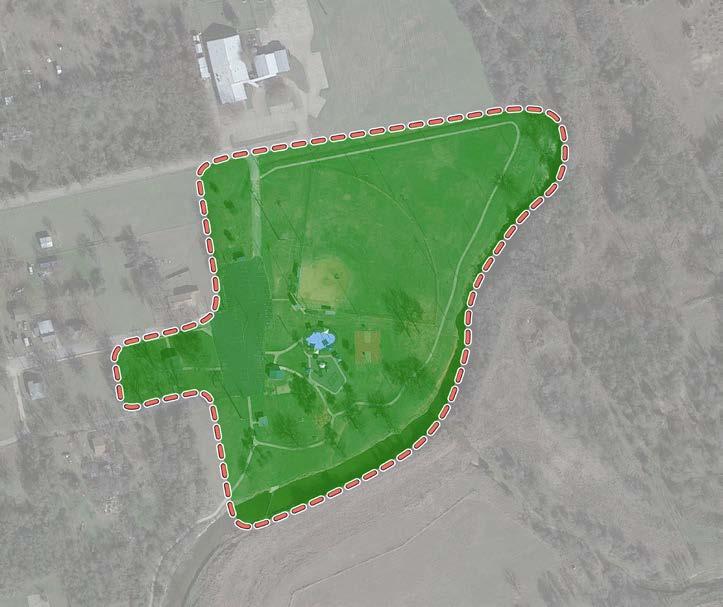
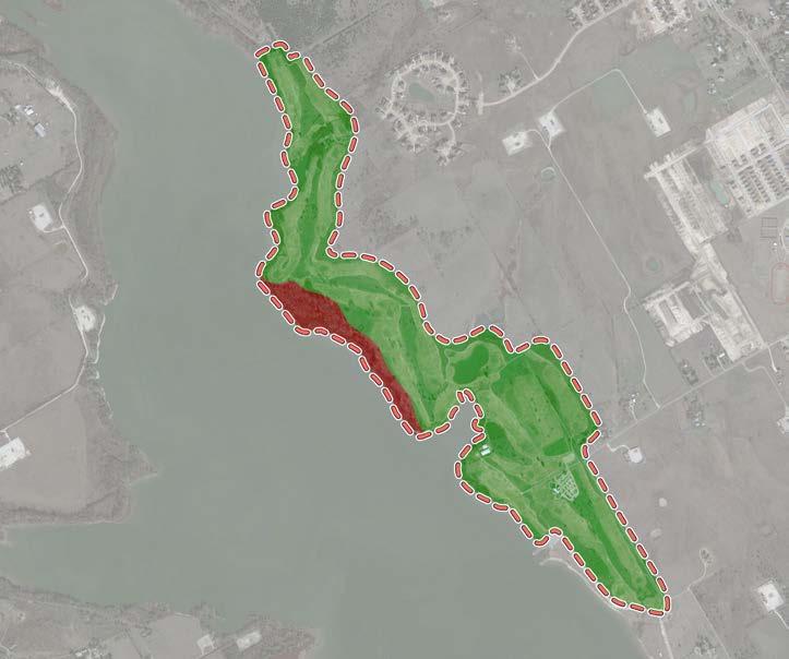
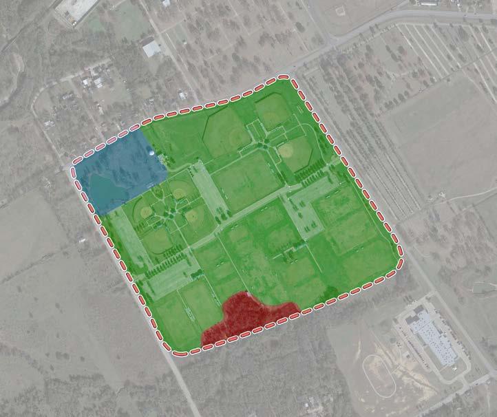
901 S Walnut Street Don
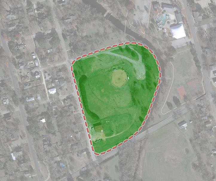
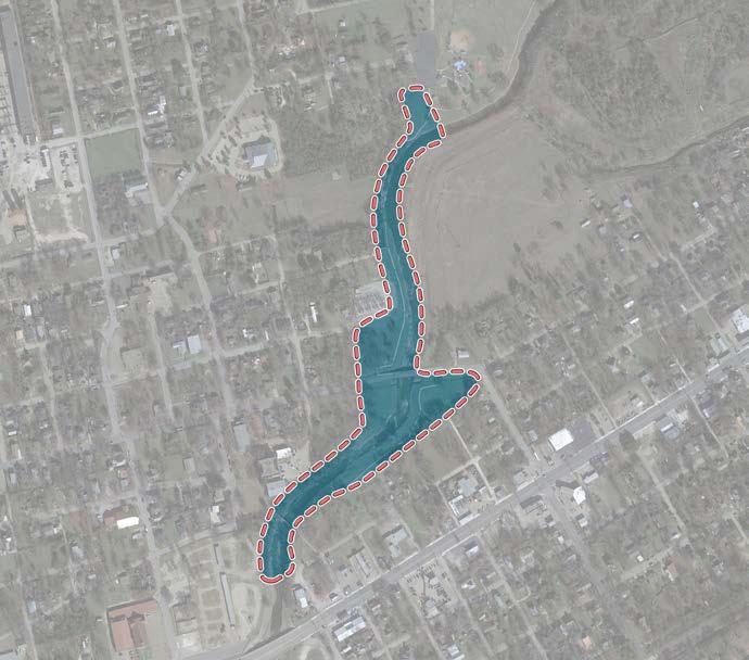
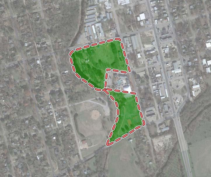
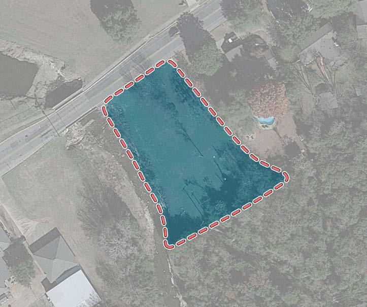
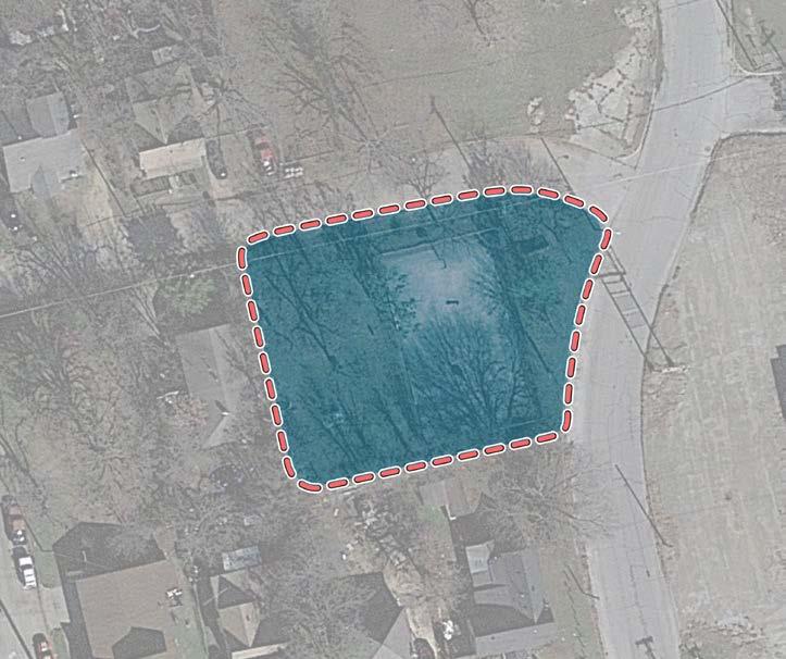
604 Buffalo Street
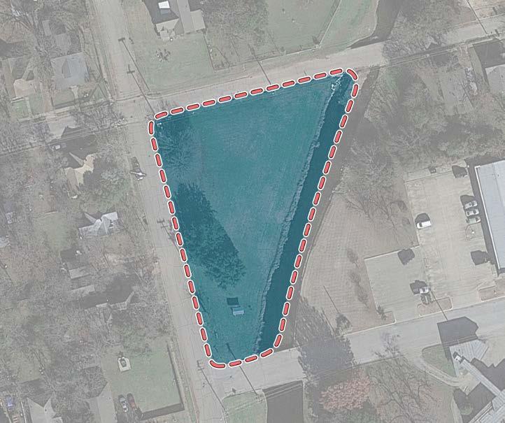
Kirtley Park
1900-2500 Lakeshore Drive
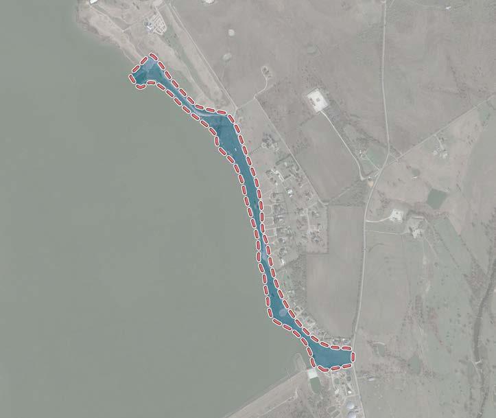
Maintenance Legend
Near the intersection of Roberts Avenue and McAnear Street
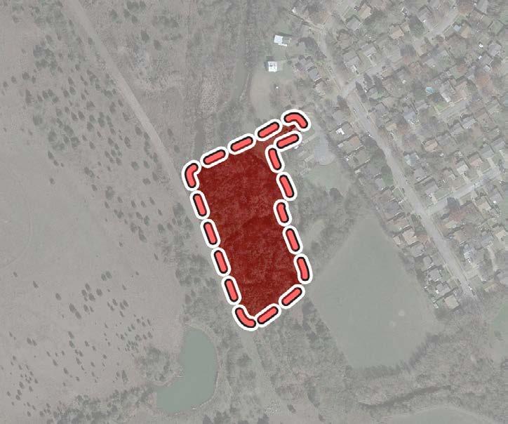
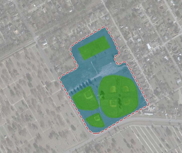
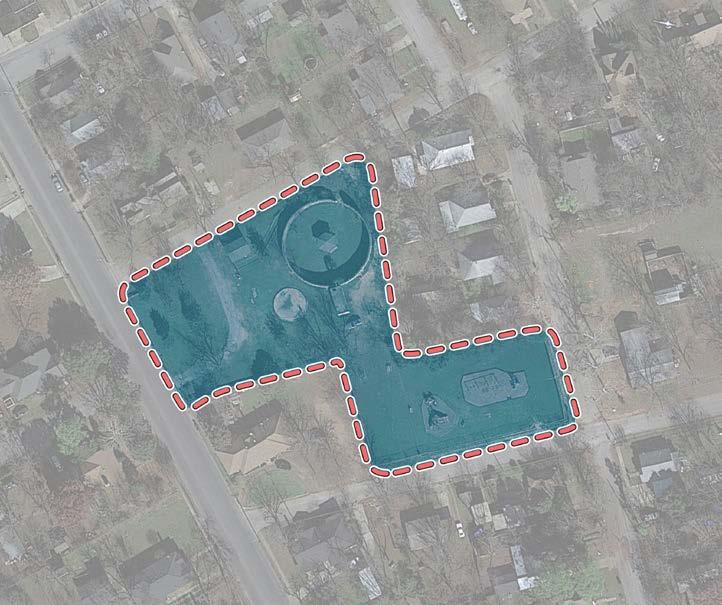
1010 Hillsboro Street
1313 1414 1515 1616
Maintenance Legend
1515
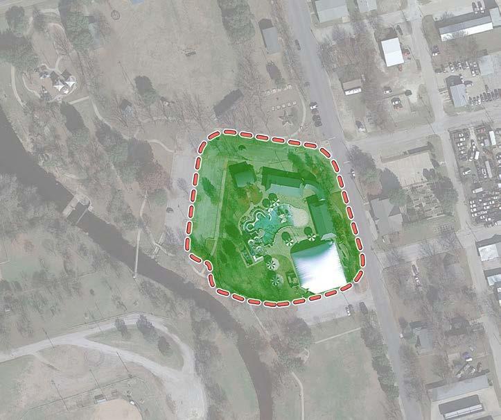
9 North Buffalo Street
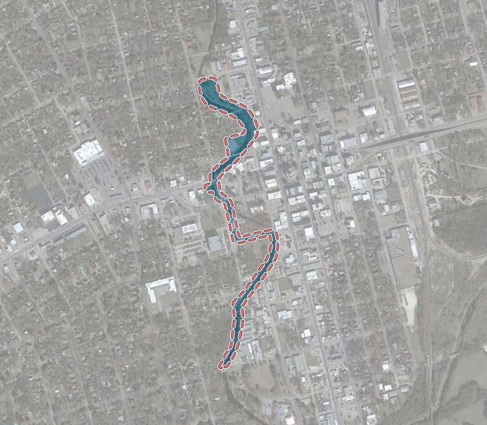
1228
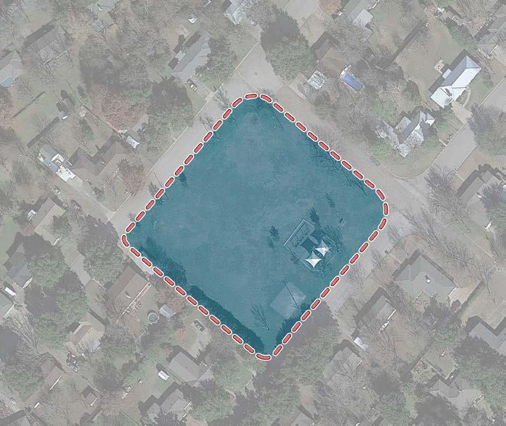
Maintenance Legend
2900 Spur 1434
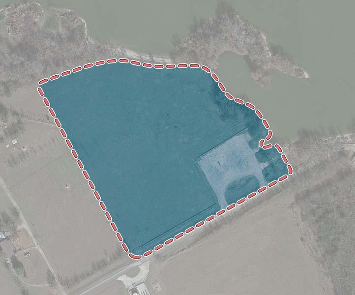
1411 Hyde Park Boulevard
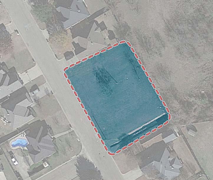
Maintenance Legend
1628
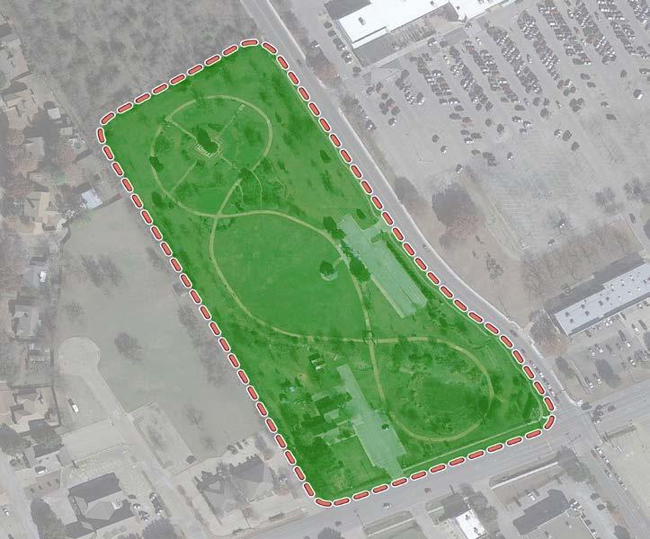
Awareness of Parks, Recreation Facilities, and Programs
Q. How do you find out about parks, recreation facilities and recreation programs in Cleburne?
Results: Just over half of respondents find out about parks and recreation opportunities through Facebook social media and 31% find out through park and recreation flyers. The primary other answers were; word of mouth, mail, newspaper, driving around and the Internet.
Facebook/Social Media
Parks & Recreation Brochures/Flyers
City of Cleburne Website Other
Emails from City of Cleburne
Youth Sports Associations
School District Publications
Q. The role of parks, recreation and open space in Cleburne today, as compared to 10 years ago is more important, the same importance, or less important to you and your household members?
Results: 65% of respondents feel parks, recreation and open space in Cleburne is more important today compared to 10 years ago.
Q. How would you rate the quality of parks and recreational opportunities in the City of Cleburne?
Results: Just over half (58%) rated the quality of parks and recreation opportunities as excellent or satisfactory. 29% reported the quality is somewhat unsatisfactory and 9% reported unsatisfactory.
Unsatisfactory - 29%
- 54%
- 4%
Q. How would you rate the quantity of parks and recreational opportunities in the City of Cleburne?
Results: Half of respondents (52%) rated the quantity of parks and recreation opportunities as excellent or satisfactory. 31% reported the quantity is somewhat unsatisfactory and 11% reported unsatisfactory.
- 46% Somewhat Unsatisfactory - 31%
Opinion - 4% Excellent - 6%
Opinion - 6%
- 11%
Q. Which age groups in your household would be interested in participating in a City of Cleburne recreation or leisure program? Results: All age groups have interest in participating in a City of Cleburne recreation or leisure program.
Q. Within the past three years, do you feel the quality of each of these parks and recreation facilities in the City has improved, stayed the same or declined? Results: Respondents feel that playgrounds, the recreation center and athletic fields are the most improved, whereas boat launch ramps, basketball courts and picnic tables have seen the largest declines in quality.
*Excludes not aware/don’t use answers
Q. Which of these would you or your household members (of any age) be most interested in participating? Results: The programs of interest are presented in the chart. There is high interest in many recreation programs and events.
Q. How much more per year in additional property taxes would you be willing to pay in order to fund the improvement priorities you have suggested in the survey? Results: 72% of respondents are willing to pay additional property taxes in order to fund the improvement priorities. The mean amount they are willing to pay is $114/year.
*Excludes 49 non-residents who responded to the survey and did not answer this question.
Q. Parks and recreation facilities in Cleburne are well worth the cost to taxpayers. Results: 85% (strongly agree/agree) of respondents feel parks and recreation facilities in Cleburne are well worth the cost to taxpayers.
Strongly Agree - 43% Agree - 42%
Disagree - 10% Strongly Disagree - 5%
Q. Within the past year, how often have you or someone from your household visited or used these facilities in City of Cleburne? Results: Community and neighborhood parks, Lake Pat Cleburne, playgrounds, picnic tables trails and pavilions are the most frequently used facilities in Cleburne.
community parks
neighborhood parks
athletic fields
playgrounds
lake pat cleburne
trails
cleburne golf links
splash station
basketball courts
boat launch ramps
picnic tables
senior center
pavilions
booker t. washington
splash pad
at least weekly
at least monthly
at least quarterly
twice a year or less
never
Q. The Cleburne Parks and Recreation Department is establishing priorities to direct future departmental actions. How important is it for Cleburne to….
Results: The mean score is a calculation of the 4, 3, 2,1 scores excluding the no opinion responses.
• The priority rank lists, in rank order, the respondents’ first, second and third most important facilities or amenities.
• These rankings will provide guidance for the Master Plan priorities.
Q. How did you find out about this online survey?
Results: Almost half of respondents found out about this survey from the postcard mailed by the City of Cleburne. 23% found out about the survey through City of Cleburne social media sites. 11% filled out paper surveys that were available at the recreation center, senior center, library and other city facilities.
Q. In your section of the City, what ONE recreational facility or amenity would you say is most lacking?
Northwest - 93 comments
- Playgrounds
- Trails, sidewalks – walking/biking
- Fishing
- Improve boat ramp
- Dog park
- Recreation center
- Parks
Southwest - 178 comments
- Dog park
- Splash pad
- Trails and sidewalks
- Lake Pat amenities and activities, regular stockings, trails, beach area
- Playground
- Hulen Park improvements
- Recreation center
Northeast - 27 comments
- Splash pad
- Community park
- Dog park
- Playground with shade
- Skate park
- Lake Pat - pavilions, grills, trash cans, water, electrical
Southeast - 30 comments
- Dog park
- Skate park
- Trails
- Tennis courts
- Pickle ball