Spatial Thinking and Urban Design
 Max s3887124
Purnima s3941296
Darshit s3913743
Max s3887124
Purnima s3941296
Darshit s3913743
ARCH 1274
Michelle s3959067
Urban Challenge in Brunswick
Problem Statement
Livability as detailed by Jacobs and Appleyeard (1987) is the creation of cities whose aim is to promote active public spaces and green spaces, enhance safety and promote inclusive communities by creating distinct spaces through an improved urban design form and quality Accordingly our problem statement; How can we revitalize the urban blight, lack of safety, sparse green space, inequity and post industrial malaise of the Brunswick Site towards making it a liveable vibrant neighbourhood. To underline this problem - a livability matrix has been utilized to guide the SWOT analysis.
Legend: Equity & Access Climate Resilience Safety Active Mobility
Strengths
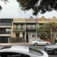
Location: Union Street
Item: Street Greening
Evaluation:
Reclamation to greening/gardening/canopy. Using road space allows for maintenance of footpath integrity
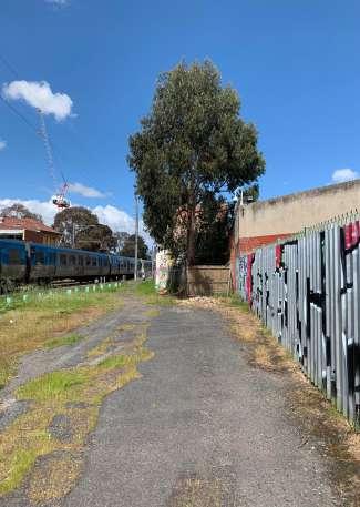
Location: Jewell Station
Item: Shared Path Design
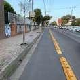
Evaluation: The path markings - alteration of pattern - help to calm cyclists as they approach & intersect high density pedestrian area.
Location:
Item: Shared Path Lighting
Evaluation: A very common pedestrian & cyclist corridor, recent lighting upgrades enhances the equity of this space to be used by more people without fear
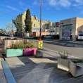
Location: Dawson St
Item: Tactical Urbanism
Evaluation:
Opportunities
Location: 33 Saxon Street
Item: Urban Renewal Evaluation:
development plans to extend to community centre, green space & creative space.
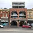
Location: 209 Sydney Road
Item: Ethical & Sensitive Development
Evaluation: This site represents a thoughtful development on what was a Sydney Road/Brunswick cultural institution [Kinki Gerlinki]. Middle density, & highly development for the site.
Location: Ollie Pizza Parlour
Item: Parklet Program
Evaluation: This venue illustrates the usage of Moreland Parklet program. Reclamation of street scape for dining and social activity - is an initiative to replicate in the more lifeless parts of the site - as well gives more room for higher need footpath users.
Location: Fallon St
Item: Road Canopy / Street Trees
Evaluation: Fallon Street represents a use-case to replicate - in enhancing street

Vision Statement
Weaknesses
Location: Goodman Street
Item: Footpath width
Evaluation: Residential footpath width is regularly slim limiting equity of access & increasing potential for hazard.
Location: Harvey Street
Issue: Cul de Sac
Evaluation: Brunswick Secondary & RMIT sites abut several residential areas/streets. No through roads across many streets contribute to calming of vehicles, but restriction of even walking/bike riding dislocates potential for activity
Location: Brickworks
Issue: Urban Heat Island
Evaluation: Brickworks transition to residential zoning has missed some opportunity
Very trees with most open space concrete making it vulnerable to urban heat island
Location: Breese St
Issue: Lighting
Evaluation: Recently demolished sites, reduce amenity and activity, combined with poor lighting reduces safety of street scape.
Threats
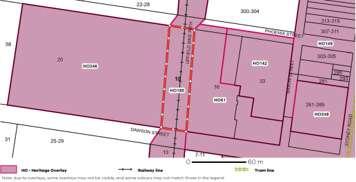
Location: Brunswick Road
Issue: Heritage Overlay
Evaluation:
heritage overlay plays an important role, it can be a potential handbrake on site reform and progress.
Location: Rosser St
Issue: Aging Buildings-Empty Sites
Evaluation: The longer buildings or sites remain unused or in disrepair, the costlier it can be to renew them.
Location: Phoenix St
Issue:
Evaluation: symptom of urban decay
Location: Barkley St
Issue:
Evaluation: With urban renewal can come skyrocketing housing prices, and accompanying pricing out of long time renters and historic migrant community. Equity concerns must be considered.
Our vision for 2050 is to see a transformed Brunswick with a high livability index made possible by active public spaces, promotion of active and sustainable transport modality, space equity for land-use and inclusive safe spaces to produce thriving and vibrant communities.
Threat: Heritage Overlay
VicPlan

Moreland C ty Council | Park Close to Home: A Framework to Fi l Open Space Gaps – Background Report 23
Location Location Nightingale Village collective of Nightingale buildings, Three blocks south Nightingale Anstey and two blocks South of Breathe Architecture’s The Commons Nightingale Nightingale Village located on Duckett Street between Sydney Road and the Like Anstey, the Village designed to prioritise community. Building setbacks provide public generosity, landscaped green will contribute amenity and activation for Village residents and surrounding neighbours. 212 214 Albion Street storey apartments (Pelicano) Florence Street storey apartments (The Commons) Florence Street storey apartments (Nightingale 1) Florence Street storey townhouses Florence Street storey apartments (“Mesh”) 204-206 Breese Street storey apartments (“Breese St” by Milieu) 47 Breese Street storey apartments Nightingale Village Nightingale apartment buildings Nearby Developments Nightingale Village Nearby Residential Development Sydney Rd Albion Florence West Duckett McFarland Mackenzie St New Eckersall St Bryant Tinning St Hope St Osborne arle Jones St St Warne Gro Sydney Rd Stewart Anstey Station Commons Nightingale Nightingale Village CBD 6.3km Nightingale Housing Brunswick Locations Heritage Overlay
Pedestrian Sidewalk Cover & Heat Vulnerability Index

This map attemps to portray a connection between street canopy cover and the heat index produced at that area.

Impervious streets and landscapes have an effect in inducing the UHI phenomenon. The industrial area has increased impermeable surfaces such as parking lots, large driveways and low albedo pavements which owe to higher temperatures resulting in a high heat induced vulnerability (Vujovic et al 2021).


Pavement Material
Source:
Source:
Legend
Source:
Sidewalk with minimal or no canopy cover
Sidewalk with sporadic tree cover
Sidewalk with sufficient tree cover
Source:
Existing trees
Major problem zones with no canopy cover
Heat vulnerability ratings are from 1 to 5. These points are alloted based on three major components (Sun et al 2019):
- Heat Exposure
- Sensitivity to heat
- Adaptive Capacity
Heat Vulnerability Index Map with sidewalk canopy cover
Source: Heat Vulnerability Index (2018) (SA1) https://mapshare.vic.gov.au/coolinggreening/
Edited by: Purnima
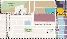
TEMPLE PARK BRUNSWICK SECONDARY COLLEGE RMIT BRUNSWICK CAMPUS TOWN HALL JEWELL STATION GILPIN
PARK
5 4 3 2 1 0 0 100 200m
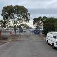
Vacant plots and open parking made of impermeable materials at Pottery Ct
Open parking at RMIT University made of impermeable materials
1 5 6 2 3 4 1 5 6 2 3 4 Image Sources (on map): Group 10 Max Massingham Michelle Ndlovu Purnima Menon Darshit Gondaliya Google Earth
Menon
Dawson Street Union Street Phoenix Street Gold Street Brunswick Road Barkley Street Sydney Road Grantham Street Grey Street Pearson Street Syme Street
Source: Max Massingham
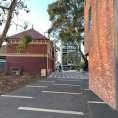
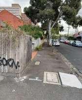
Impermeable pavements and sporadic tree cover along Phoenix Street.
Max Massingham
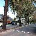
No tree cover along Sydney Road with high degrees of impermeable surfaces.
Google Earth
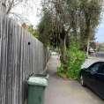
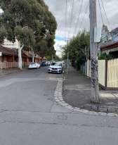
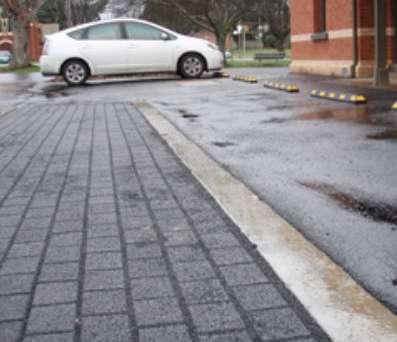
Tree cover along sidewalks at Union Street, with minimal green spaces on footpaths.
Source: Max Massingham
Wavering sidewalks made of impermeabe materials and undulating levels.
Max Massingham
Junction at Temple Park showing contrast in permeable surfaces.
Google Earth
Minimal tree cover along footpath with poor facade treatment at Dawson Street.
Author: Michelle Ndlovu and Purnima Menon
Pedestrian Activity & Urban Activity Mapping


Active streets are minimal in the residential and industrial zones. The streets appear ‘passive’ with no active surveillance denoted as ‘eyes on the street’ by Jane Jacobs (1961, p. 106).

As denoted by the map, high active streets within the site are characterised either by commercial use, institutional use, public parks and transit nodes. Industrial and residential zones have minimal urban activity making the streets dull and barren.

Pedestrian Activity Zones
Activities caused by or near University or college campus, due to student and pedestrian crowd
HIGH-ACTIVITY ZONES

Activity near Cafes and restaurants during peak hours

Commercial Institutional Transit Zone


Activity near public open spaces such as parks and recreational zones
Activity node with people accessing the Gilpin Park during morning and evening hours of the day. Activities include - trails, dog walks, kids play zones.

Travelling pedestrian traffic on footpaths and sidewalks


Police Complex
Tram Station
Railway Station

Railway Line


Dead end zones/ dead alley ways
Map for urban activity hotspots
High activity urban activity zones along Sydney Road and the junction of Brunswick Road due to local shops, cafes, restaurants and the public tram station.

0 100 200m
TEMPLE PARK RMIT BRUNSWICK CAMPUS TOWN HALL JEWELL STATION GILPIN PARK Dawson Street Union Street Phoenix Street Gold Street Brunswick Road Barkley Street Sydney Road Grantham Street Grey Street Pearson Street Syme Street
Map Source: Group 10 Max Massingham Michelle Ndlovu Purnima Menon Darshit Gondaliya Vic Government Open Data, https://www.data.vic.gov.au/ , Google Earth, Self on-site Assessment Edited: Purnima Menon
Author: Michelle Ndlovu and Purnima Menon
Legend
Source: Max Massingham
Uninteractive facades along Phoenix Street with no tree canopy.
Source: Brunswick Voice 2021, Medium
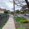
Gilpin Park is home to a multitude of activities and serves as a urban hotspot.
Source: Jewell Station Interpretation 2016, Lovell Chen
Jewell Station and the reserve see multiple pedestrian traffic at the locality.
Mapping Linkages & Connections
Poor linkages exist between the residential zones, green spaces, industrial and transit zones. This increases travel time and demands the use of vehicles.

Wide crossing junctions create hinderance for pedestrians due to incoming vehicular traffic - especially at Dawson Street due to the presence of institutional campus in vicinity.


No interaction between the public and private realm due to closed off building facades causing minimal urban activity and potential for urban interaction between pedestrians and interior spaces.
Source: Max Massingham
Source: Google Earth
Source: Max Massingham
Source: Google Earth


Map depicting connections and linkages with problem intersections
Source: Vic Government Open Data, https://www.data.vic.gov.au/ , Google Earth, Self on-site Assessment Edited by: Purnima Menon
0 100 200m
TEMPLE
PARK
BRUNSWICK SECONDARY COLLEGE
TOWN HALL
GILPIN
RMIT BRUNSWICK CAMPUS
JEWELL STATION
PARK
Retail node with high vehicle and pedestrian traffic with lack of pedestrian safety controls.
Group 10 Max Massingham Michelle Ndlovu Purnima
Gondaliya Dawson Street Union Street Phoenix Street Gold Street Brunswick Road Barkley Street Sydney Road Grantham Street Grey Street Pearson Street Syme Street
Activity node with lack of safe pedestrian crossing - especially for students.
Menon Darshit
Activity node with high pedestrian and vehicular volume due to RMIT Campus and presence of Railway line.
Uninteractive facades along Fallon St near the industrial zone
Street crossings with lack of pedestrian traffic lights and cycle paths clashing with road traffic
Major intersection at Dawson and Fallon Street where incoming traffic meets pedestrian crowd from college and university campus
Confusing crozzing zones near parking spaces causing a hinderance to pedestrian traffic
Dead
dead
Railway Line Railway Station Tram Station Difficult Pedestrian Crossings Busy Streets No Active Building Frontage Poor linkage between zones Legend
end zones/
alley ways
Author: Michelle Ndlovu
Mapping for Safety Analysis


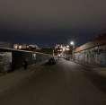
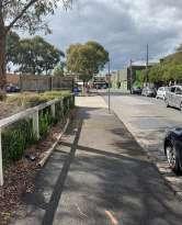
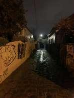
Alleyways characterise with little to no lighting indicate that the area and is likely to increase the chances of criminal activities and generate unsafe zones for residents.
Areas with more lighting and open-ness have been linked to safe and happy zones.
Areas lacking sufficient lighting, have been considered unsafe and unhappy zones and as per the crime statistics shown, with the Brunswick site having an increased crime rate since 2021.

Crime statistics of Moreland Suburbs - Year Ending March 2022
Source: Crime Statistics Agency, Latest crime data by area https://www.crimestatistics.vic.gov.au/crime-statistics/latest-crime-data-by-area
Legend
Streetlights at a distance of about 20m
Streetlights at a distance of approx. 150m-200m


Streetlights present at large distance/ no lighting

Dead end Zones with no/minimal lighting

Unhappy Zones
Happy Zones
Source: Google Maps, CROWDSPOT - Happy and sad places
People reported feeling happy & rejuvinated at Temple Park due to shaded trees and open spaces.
Source:
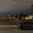
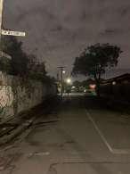
People reported feeling unsafe at vacant plots and at the skywalk area at Phoenix St due to minimal lighting at night.
Group 10 Max
Menon
Massingham Michelle Ndlovu Purnima Menon Darshit Gondaliya Vic Government Open Data, https://www.data.vic.gov.au/ , Google Earth, CROWDSPOT, Self on-site assessment Edited: Purnima
Roads with minimal lighting and vacant plots with alley ways lacking sufficient lighting which give rise to unsafe spaces.
Source: Max Massingham
Author: Michelle Ndlovu & Purnima Menon
TEMPLE PARK
RMIT
TOWN HALL JEWELL STATION
Dawson Street Union Street Phoenix Street Gold Street Brunswick Road Barkley Street Sydney Road Grantham Street Grey Street
BRUNSWICK SECONDARY COLLEGE
BRUNSWICK CAMPUS
GILPIN PARK
Pearson Street
Syme Street

Creative & Cultural Expression
The historic & current diversity gives rise to the varied community buildings on site. Both Old [buildings of faith] and New [educational and art].


 Sydney Road Community School
RMIT School of Fashion
Tian Di Temple
Blackdot gallery [former school]
Sydney Road Community School
RMIT School of Fashion
Tian Di Temple
Blackdot gallery [former school]
Creative & Cultural Expression
Site Boundary
Creative & Cultural Expression
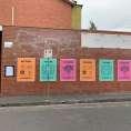
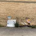
Brunswick is renowned for its cultural richness, and this is manifested in the street scape through art. Though creative expression can be undermined by the stain of vandalism

Key Learning: The outcome for the space must allow for creative expression while discouraging vandalistic tendencies
Artistic expression not respected by graffiti
Boundary
The line between street art & vandalism is sometimes blurry – and the control over the public sphere controversial.


Street Vibrancy is enhanced through tactical urbanism

Street can quickly devolve to vandalism when left unchecked or unharnessed – and ultimately transition spaces to urban decay
Site
Creative & Cultural Expression
Urban Design Recommendation
Max s3887124 Purnima s3941296 Darshit s3913743 Michelle s3959067 ARCH 1274_Assignment 3
Proposed Masterplan
Proposed Masterplan for the Brunswick Site at Merri-bek, houses varied land use typologies including, residential, commercial, industrial, and recreational zones.
Jewell Station + Civic Arts + Green Precinct via LXRP allow for Extensive Green Space – combat urban heat island effect. Bike Path & Pedestrian segregation – enhanced accessibility for all users.
Social infra-structure – contributes to safety in numbers and antidote to urban blight.
- Lower car speeds/Street Calming

- Tactical urbanism and art
- Enhanced bike infrastructure
- Lighting & Wayfinding techniques
- Equity in access between parks and precinct
Jewell Station with proposed raised rail line and platforms.
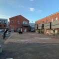
Adaptive reuse of the Police Precinct to a Mixed use Centre.
Redesigned Urban Plaza.
Activity Centre with installations Activity Centre for users.
Redesigned Urban Green space.
Skateboard Park
Raised Urban Forest above car park.
Redesigned Shared Zone for Wilson Street from Jewell Station via Temple Park and on Grey Street.
Community Garden Propsal adjoining Kaiseal Street.
Redesigned connecting alley roads for active street intervension.
Redesigned pedestrian and bike path for Barry Street connecting Temple park to Gilpin Park.
Group 10 Max Massingham Michelle Ndlovu Purnima Menon Darshit Gondaliya
Source: Google Earth Edited by: Purnima Menon
0 100 200m Sydney Road Grantham Road Pearson Street Barry Street Grey Street Albert Street Wilson Street Phoenix Street Dawson Street Union Street Barkly Street Gilpin Park Temple Park Jewell Station Reserve RMIT Campus Brunswick HighSchool Civic Arts Precinct 4 4
Proposed Masterplan for Brunswick
Jewell Station Precinct
Civic Arts Precinct
Green Precinct
Jewell Reserve
Active Streets Design
1 2 1 2 3 4 1 2
3 1 2 3
4 3 2 1 2 3 1 4 2 3 1 1 2
Active Street Design allows
Elevation connects Wilson Avenue to Wilson street, creating an uninterrupted pedestrian view to Temple Park.
Greater real estate has been used for urban forest, catering for the overall placemaking objectives.


Utilization of skatepark pays cultural reference to Brunswick counter cultural identity.


Legend
Edited by: Purnima Menon
2 3 5 6 7 1 2 3 4 6 7 8 4 1
Proposed Plan for Jewell Station and Green Precinct
Existing Station New Jewell Station raised above Jewell Reserve Cycle/bike track Pedestrian pathway Urban forest Skate Park
Urban Forest view Edited: Purnima Menon
Sectional view of the Jewell Station Precinct
0 50m 100m
Sectional view of the Urban forest
Policy Implication for Civic Arts Precinct
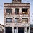
The heart of the Civic arts Precinct currently inhabited by a non-public facing Police complex that instead of a relationship to the surrounding space it holds an actively hostile and obstructive one. It is proposed that it is moved elsewhere with the below planning process undertaken to achieve that aim.
Add text re: 18 & 20 Dawson St
1. Site Analysis
Hostile Frontage
2. Planning Scheme Analysis
3. Proposition
Obstructive to Wayfinding
Zoning Overlay
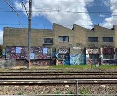
18 Dawson Street
• Presently within State Transport Infrastructure [TRZ1] – demolition within this zone will form part of broader LXRP
Demolish - 18 Dawson Street
20 Dawson Street
• Presently Industrial 1 zoning [IN1Z]
• Amendment to planning scheme will be required to rezone address Commercial 1 zone [C1Z]
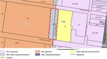
• Upper corner to be rezoned as PPRZ
Modify - 20 Dawson Street
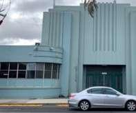
18 Dawson Street
• Heritage Overlay [HO] establishes permit requirement to demolish
20 Dawson Street
• 1934 Latiner Hat Factory
• Heritage Overlay [HO] establishes that modification to the site requires a permit
• H0246 – No additional constraints
• Modernist façade is significant and will be retained
References: https://mapshare.vic.gov.au/vicplan/
Moreland Heritage Gap Study 2019, Volume 1: Findings and Methodology Merri-bek Planning Scheme
Civic Arts Precinct
The transition to an arts hub precinct is in perfect harmony with the context of the site [Brunswick Design District] while extensive site greening on previously underutilized spaces [car parks on Phoenix and within 18 Dawson] further alleviates urban heat island concerns.
- Transitions existing site from hostile & uninviting [Police Complex].
- To one more open, green, collaborative and community oriented [arts hub].


- Establishment of shared hub for multi-use cultural and creative Assets.

- Surrounded by green open space, parkland.


Entry/exit to the new precinct Redesigned built form for the civic arts precinct

Urban zone with art installations
Existing parking with grass pavers
Redesigned urban activity centre

track
zone with court Open green recreational zone RMIT University Campus
Precinct with Skate park
Group 10
Max Massingham Michelle Ndlovu Purnima Menon Darshit Gondaliya
Edited by: Purnima Menon
1 1 1 2 10 11 3 5 6 7 8 9 12 4 Dawson
Phoenix
Albert
Legend
Proposed design for Civic Arts Centre
Street
Street
Street
Amphitheater
Cycle
Raised
1 2 3 4 5 6 7 8 9 10 11 12 0 100m 50m Proposed Masterplan Max Massingham Michelle Ndlovu Purnima Menon Darshit Gondaliya Source: Google Earth Edited by: Purnima Menon Proposed Masterplan for Brunswick 100 200m
Activity
Green
rail tracks
Urban Activity zone with art installations
Civic Arts Precinct Amphitheater
Edited by: Darshit Gondaliya
Edited by: Darshit Gondaliya
Edited by: Purnima Menon
Proposed design for Civic Arts Centre 0 100m 50m
Dawson Street
Phoenix Street
Albert Street
Civic Arts Precinct Basketball court
Civic Arts Precinct Activity area
Edited by: Darshit Gondaliya
Edited by: Darshit Gondaliya
Policy Implication for Civic Arts Precinct
The police complex is uniquely situated within the Brunswick Design District – are partnership of RMIT, Merri-Bek City Council & Creative Victoria. Thus – the site provides for great potential consolidation & expansion of all the existing creative assets of Brunswick. Neighbouring community and civic facilities also inform the space – with the Brunswick Baths, Library and Town Hall nearby.
Maker Community
70 Saxon St
• Offers skill development and equipment
• Presently open only 3 days per week
• Excess demand for facilities
Brunswick High School
47 Dawson St
• Overflow space to allow for youth population growth of Brunswick
• Dedicated learning space for arts based subject for study
RMIT University
25 Dawson St
• Overflow space to allow for population growth of Merri-bek/ Melbourne
References: https://bdd.org.au/
Stupid Old Studios
8/10 Peveril St
• Podcasting
• Live performance venue
Northern Theatre Company
3 Dawson St
• Formed in 1990
• Temporarily Closed in 2020
• Relaunch and expansion
• Comedy Firebird School of Music
81 Sydney Road
• Boutique Music School
• All Ages instrument discipline
Site Boundary
Policy Implication for Civic Arts Precinct
Once rezoned the space will facilitate a variety of skills, recreation & creative endeavors that will pay homage to the site and Brunswick’s heritage with textiles of the 20th century – redesigned for the 21st. The choice a single former industrial building [20,000 sqm] is in keeping with outcome from Merri-Bek Arts and Infrastructure Plan 2018-2023; high ceiling & flexible floor plates, ability for creative clustering but also segregation where appropriate [music/performance separation from machinery].The space sizes may be large today – but Brunswick total dwellings are expected to grow by 30% by 2036 represented significant population growth creating added demand. The geography is situated within the ‘Brunswick Design District’ and will embody this ethos
Maker Community
70 Saxon St
• Offers skill development and equipment
• Presently open only 3 days per week
• Excess demand for facilities

Firebird School of Music
81 Sydney Road
• Boutique Music School
• All Ages instrument discipline

Brunswick High School
47 Dawson St
• Overflow space to allow for youth population growth of Brunswick
• Dedicated learning space for arts based subject for study
Moreland Arts & Infrastructure Plan 2018-2023
Understanding the Local Impacts of Covid-19 on Population and housing in Moreland, Charter Keck Cramer 2021 https://bdd.org.au/
RMIT University
25 Dawson St
• Overflow space to allow for population growth of Merri-bek/ Melbourne
Northern Theatre Company
3 Dawson St
• Formed in 1990
• Temporarily Closed in 2020
• Relaunch and expansion
Stupid Old Studios
8/10 Peveril St
• Podcasting
• Live performance venue
• Comedy
1 2 3 4 5 4
Policy Implication ‘Connective Corridors’
In order to make the site speak as one – streetscape improvements across several strategically chosen streets are proposed to create a network of safe, walkable/ride-able streets linking the four key green corners 1. Gilpin Park, 2. New Civic Arts Precinct, 3. Jewell Station, 4. Temple Park.
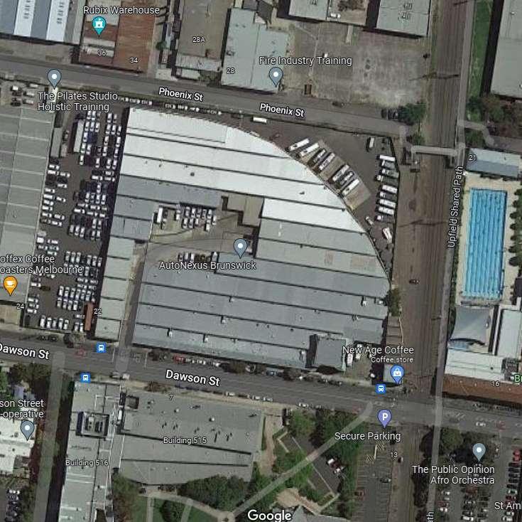
Pottery Court – Tactical Urbanism
• Connects Gilpin Park via Brickworks
• Currently motor vehicle preferred
• Appropriate for shared zone application and better wayfinding. 20km speed, planters & signage
• Policy Lever: Body Corporate Special Resolution
•
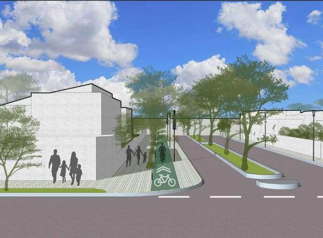
Barry St – Shared Path
• Existing cycling corridors has basic sharrow treatment – no protection from dooring.
• Borrow Albion St precedent [Sydney Rd to Lygon]
• Extend Footpath Width + Establish Bi-directional shared path with existing footpath
• Northbound traffic permitted – but parking removed Western side
• Properties maintain rear access via Kailseal Lane
• Policy Lever: Council Resolution Required
Gray St – Shared Zone
Gray St existing cycling corridor
– does not have any protection –exception one way car treatment
Build on this by establishing shared zone for traffic calming
Maintain Bi-directional rights for cyclists
Policy Lever: Council Resolution Required
Phoenix St – Shared Laneway
• Presently dislocated from Gilpin + Brickworks by private industrial land carpark & driveway.
• Rezone from industrial to mixed use – connective pathway in ‘shared lane’ between Pottery Crt Syme & Fallon St
• Will allow line of site from new Civic/Arts precinct to Brickworks/ Gilpin
• Sets foundation for future evolution of Industrial Zone
• Policy Lever: Planning Scheme amendment
Shared Zone
Shared Path
Shared Laneway
Tactical Urbanism
Wilson Avenue
• Space was reclaimed under Brunswick structure plan 2010, pop up park 2014, implemented 2016.
• Park Extension & further public space towards Jewell Station 2023
Wilson St Shared Zone
• Now a very important connective corridor post LXRP to Wilson Avenue from Temple park
• Establish Shared Street learnings from Victoria/Albert Brunswick East via Merri-bek
• 20km speed limit Planter Boxes + Bollards + artworks to street calm
• Policy Lever: Council Resolution Required
Brunswick Structure Plan Strategic Framework 2010 https://conversations.merri-bek.vic.gov.au/transport-projects/shared-zone-trial-brunswick-east
Site Boundary
Active Streets & Connecting Urban Spaces
Building on Merri-Bek successful trial and implementation of & Albert St Victoria St shared zones – strong candidates for further experimentation of this model are Wilson St & Gray St. The combination of the elevated Jewell Station & Wilson Avenue Streetscape Improvement Plan creates a potential for an uninterrupted pedestrian boulevard stretching from Sydney Rd to Temple Park.
Gray St is already a one-way street – with bike riders allowed bidirectional movement. Streetscape however still narrow and unfriendly so application of further shared street principles is required. Its geographic position next to temple park means application of traffic calming principles for expected high pedestrianization is preferred.
Planning for Shared Streets - Wilson Street and Grey Street
ic Government Open Data, https://ww


Design Recommendation for Shared Streets.
Source: https://conversations.merri-bek.vic.gov.au/transport-projects/shared-zone-trial-brunswick-east
Design Recommendation for Shared Streets.


Source: https://conversations.merri-bek.vic.gov.au/transport-projects/shared-zone-trial-brunswick-east

Group 10
Max Massingham Michelle Ndlovu Purnima Menon Darshit Gondaliya
Ndlovu Purnima Menon Darshit Gondaliya
Proposed Masterplan for Brunswick
Map showing Wilson Street and Grey Street with context to Temple Park and Jewell Station
Wilson Street Grey Street Temple Park Barkly street Gold Street Jewell Station Reserve 1 2
Active Streets & Connecting Urban Spaces
- Precedent from Albion Street shared path [between Sydney Road And Lygon Street]

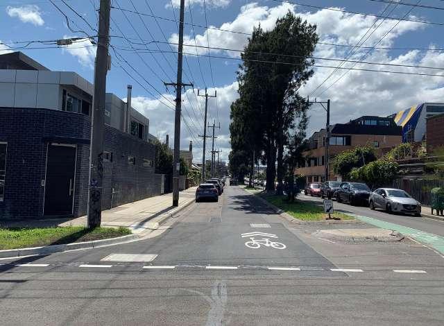
- Barry St Acts as a key bike corridor from the Gilpin/Clifton Park Precincts via brickworks to Royal Park.
- Extension of footpath was necessary to ensure amenity for pedestrians not undermined by bike-riding.
Planning for Barry Street
Existing Parking for Cars


Two-way bike lane
Existing footpath with Masonry Pavers
After

Design Palette and Intent
Proposed Plan for Barry Street
Reference:
Green Tree Canopy Cover Pedestrian footpath with green paver blocks


One way road for Cars without on street parking

Design considerations for Barry Street to improve urban activity.
Source: Streets Alive Yarra.
https://streets-alive-yarra.org/journal/designing-streets-for-kids/
https://www.theage.com.au/national/victoria/residents-rally-against-push-to-redevelop-heritage-brickworks-20201109-p56cr8.html
Permeable masontry pavers for pedestrian footpaths.
Edited: Darshit Gondaliya
Source: Max Massingham
Stormwater tree pits to collect runoff water.
Edited: Purnima Menon
Barry St
Gilpin Park
Temple Park
Active Streets & Connecting Urban Spaces
- Site surrounded by Kaiseal Lane & Hennessy St a prime example of urban blight for the overall site.

- Reclamation of this underutilized space for a community garden was decided as method of urban regeneration to foster community connectedness while addressing urban heat island.

Planning for Community Gardens
Source: https://www.camdenhighline.com/design
Redesign of Kaiseal Lane
Design recommendation for Kaiseal alleyway
Connecting laneway of Kaiseal therefore is essential to greening and placemaking – with improved lighting, wayfinding to ensure accessibility and safety principles are tended to. It enables access to the community garden with access for car park garages within homes.


Source: https://conversations.merri-bek.vic.gov.au/carlisle-street-coburg-trial-road-closure-and-shared-zones
Redesign of Alley ways for safer streets

Group 10
Max Massingham Michelle Ndlovu Purnima Menon Darshit Gondaliya
Current Car Junk yard behind Kaiseal lane
Source: Google earth
Proposed Community Garden for neighbourhood residents
Current Car Junk yard behind Kaiseal lane
Source: Max Massingham
Design recommendations for alleys along residential zones with lighting and trees
Source: Google earth. Edited by Purnima Menon
Spatial Thinking and Urban Design
Max s3887124 Purnima s3941296 Darshit s3913743 Michelle s3959067 ARCH 1274 Thank You
