MAPS


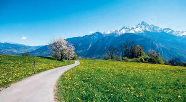
The rays of the sun come back to caress the Rhône valley. The orchards are budding, the hillsides of the vineyard regain their tender green foliage and the ground is lined with countless species of multicoloured flowers. This beautiful painting in movement varies with the rate of the melting snow.
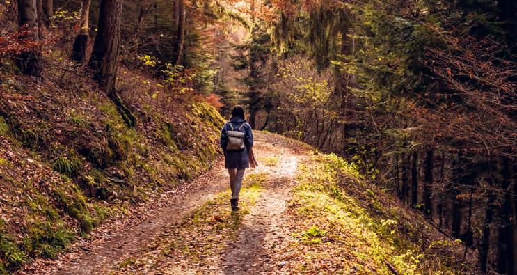
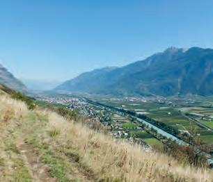
Nestled at the Rhône elbow, the region has numerous natural treasures and invites each hiker to discover them, whatever the season !
The gardens and orchards are ready for harvesting, including the emblematic fruit of the region, the apricot, which you must taste! When the mercury rises, walks in the forests as well as in altitude offer an ideal and pleasant refuge. Water finds its way down from springs and glaciers to crisscross the different valleys. On its way, it meets streams, bisse, mountain lakes, fountains... so many sources that will bring a little freshness to your walks.
The season is marked by the start of the harvest and the arrival of chestnuts. This is the perfect time to savour a traditional brisolée accompanied by a glass of regional wine after a stroll through the vineyards or the chestnut forest The vegetation takes on its orange outfit, the forest walks take on a shimmering colour. Make sure to stroll in the middle of the tallest larch forest in Europe.
Nature wraps up in its majestic white coat. With good snow boots or snowshoes, discover the magical spectacle of trees covered with white gold, icicles that accumulate on the mazot (small houses) roofs, the pink reflection of the sun on the snow or discreet traces of animals freshly left in the powder.
WALK WITH INTERNET CONNECTION
Scan
WALK WITHOUT INTERNET CONNECTION (INSTALLATION WITH WI-FI)
1. Install the Maps.me app.
2. On the app. :
a — Accept the privacy policy, the conditions of use, the geolocation and authorise the app. to access the multimedia files
b — Download the «Région lémanique» or «Suisse» map
3. Go to www.martigny.com/rando and download the KML file corresponding to the desired walk
a — With Android : open the file with the Maps.me app.
b — With Iphone : go to the downloads, open the file and copy it to the Maps.me app. (requires IOS13)
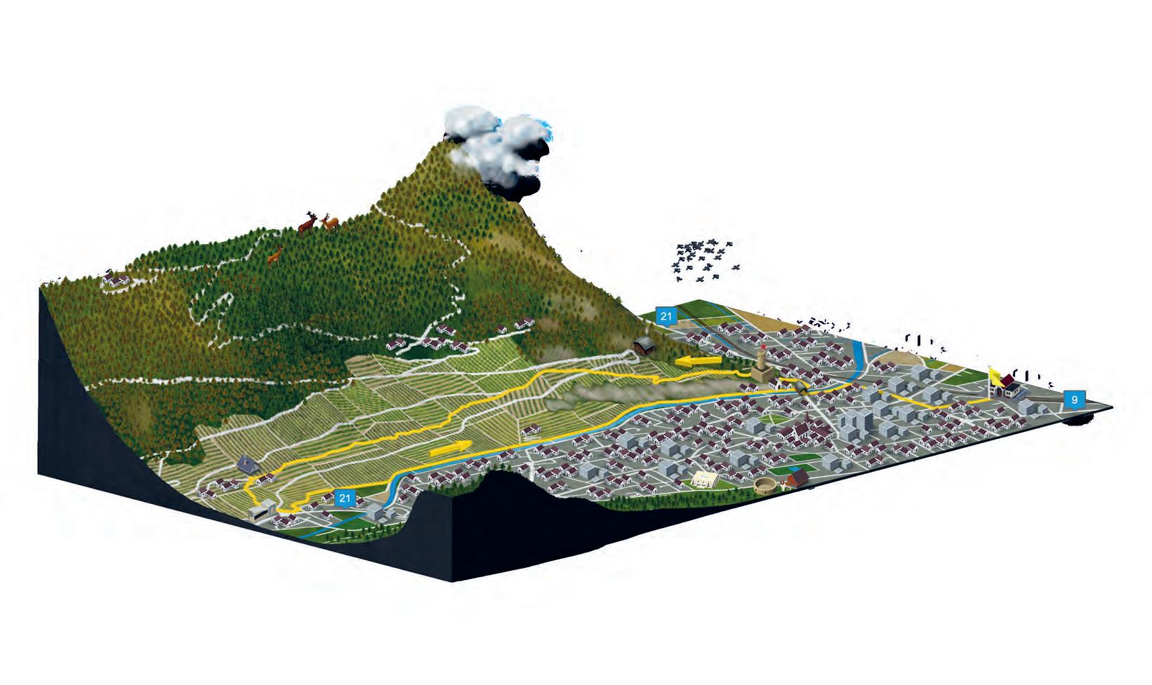
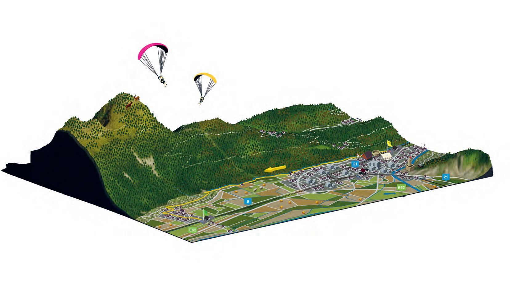
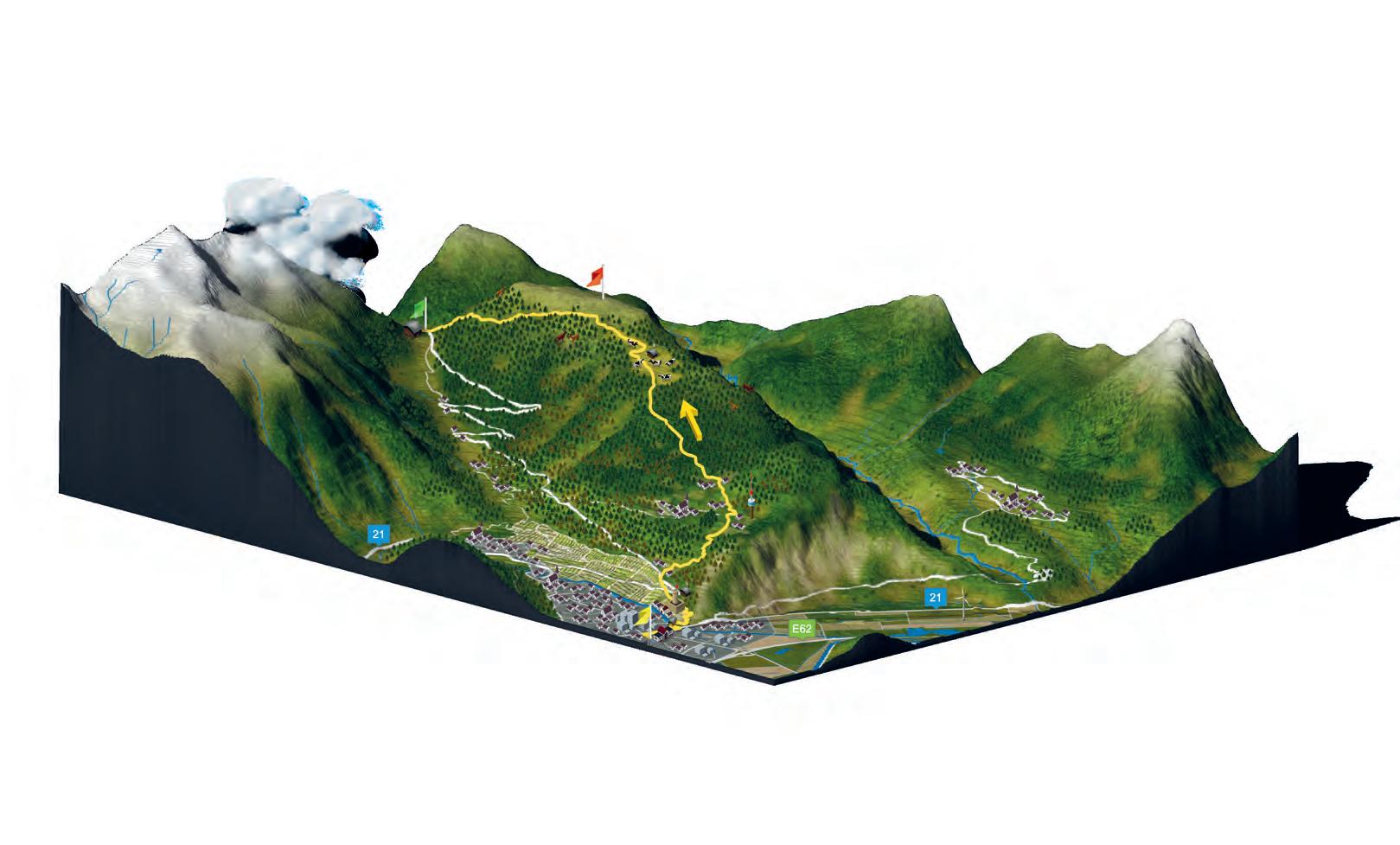
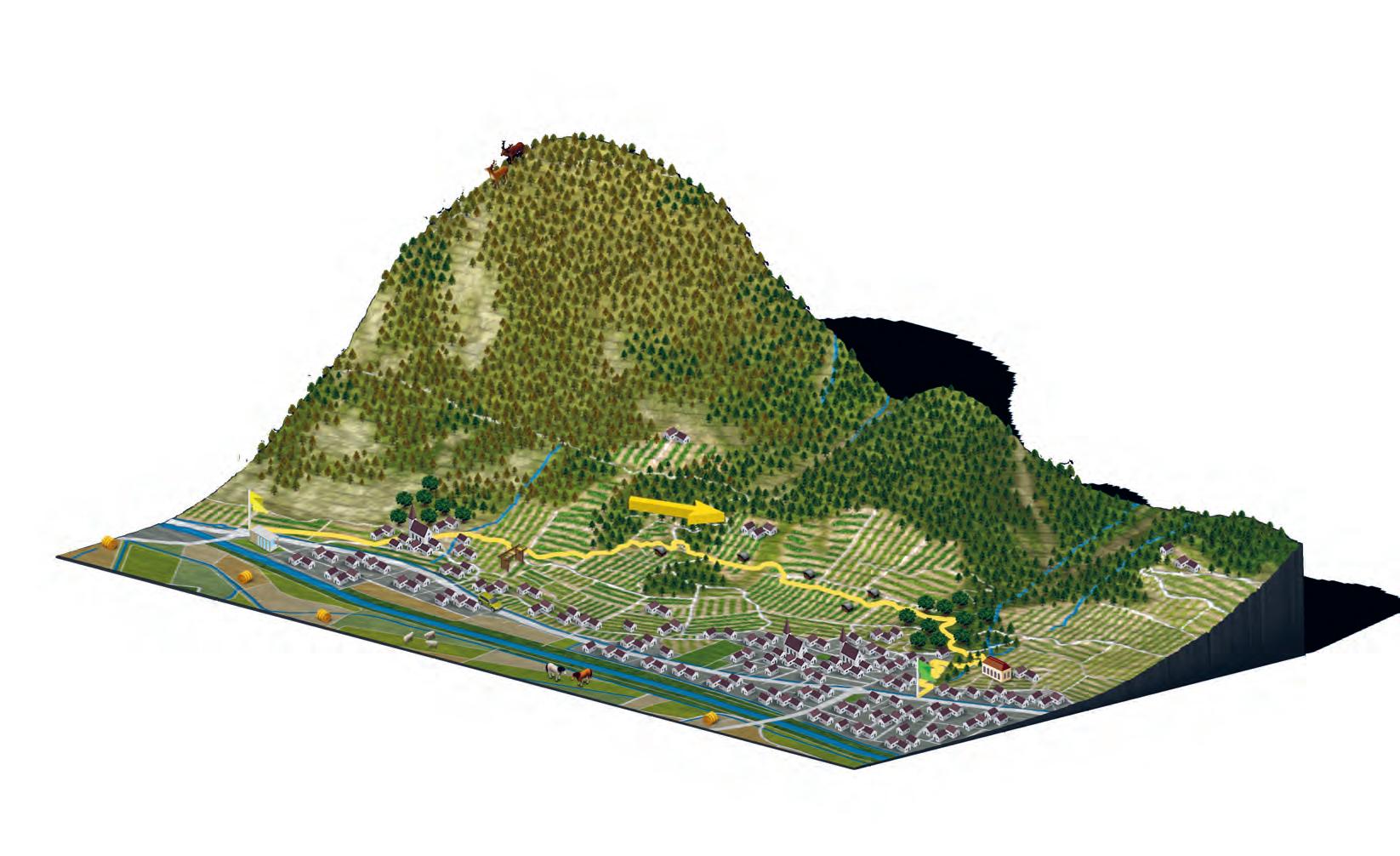
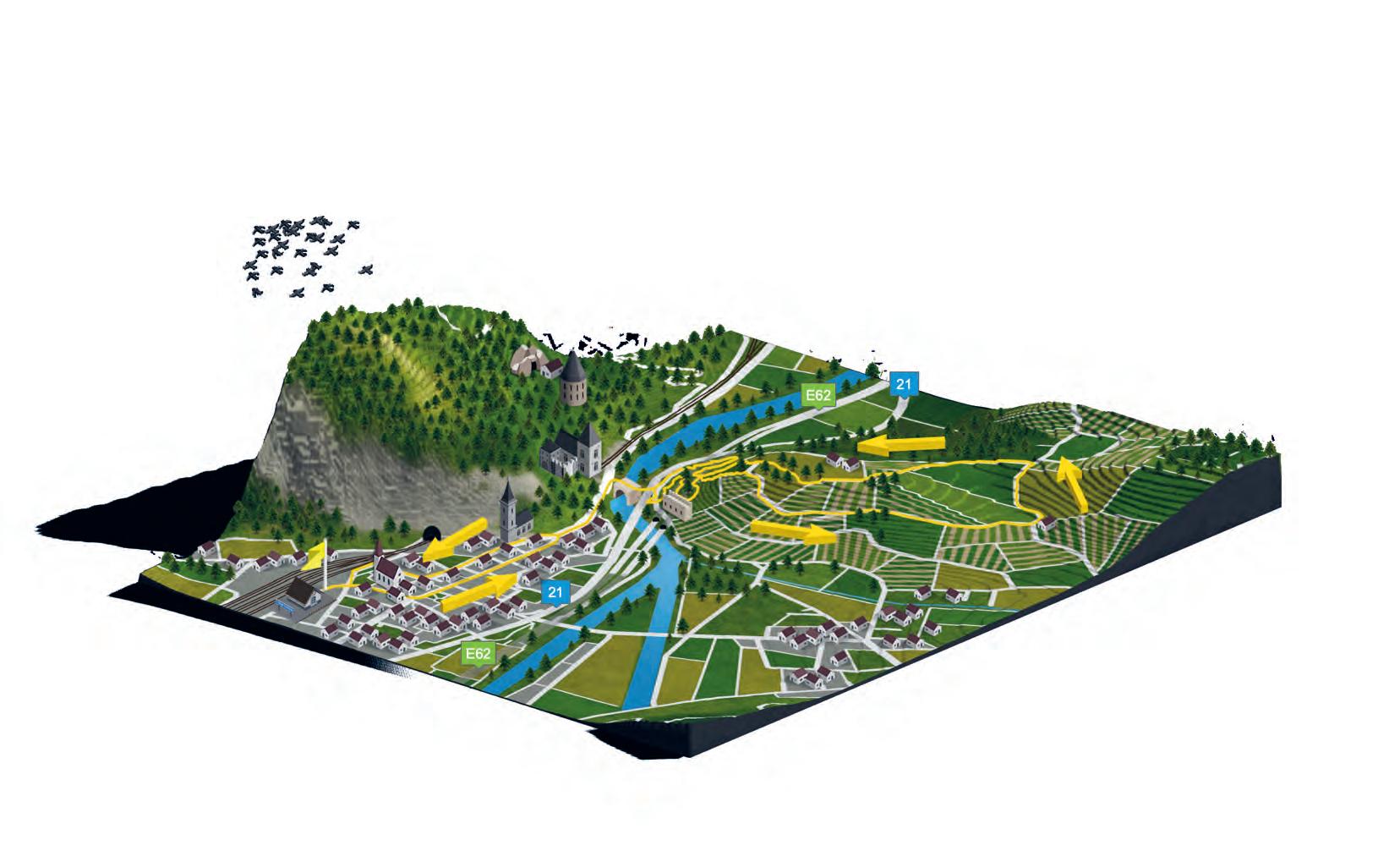
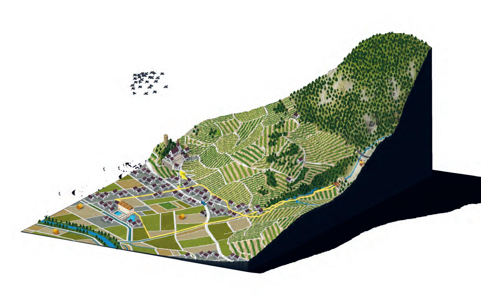
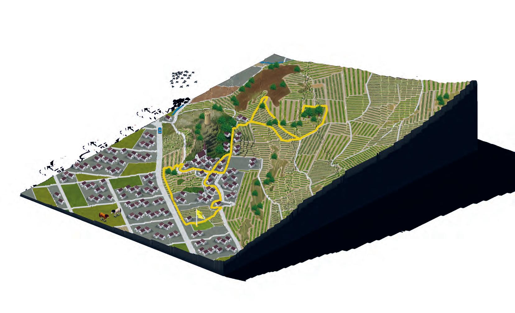
BÂTIAZ
MARTIGNY-COMBE

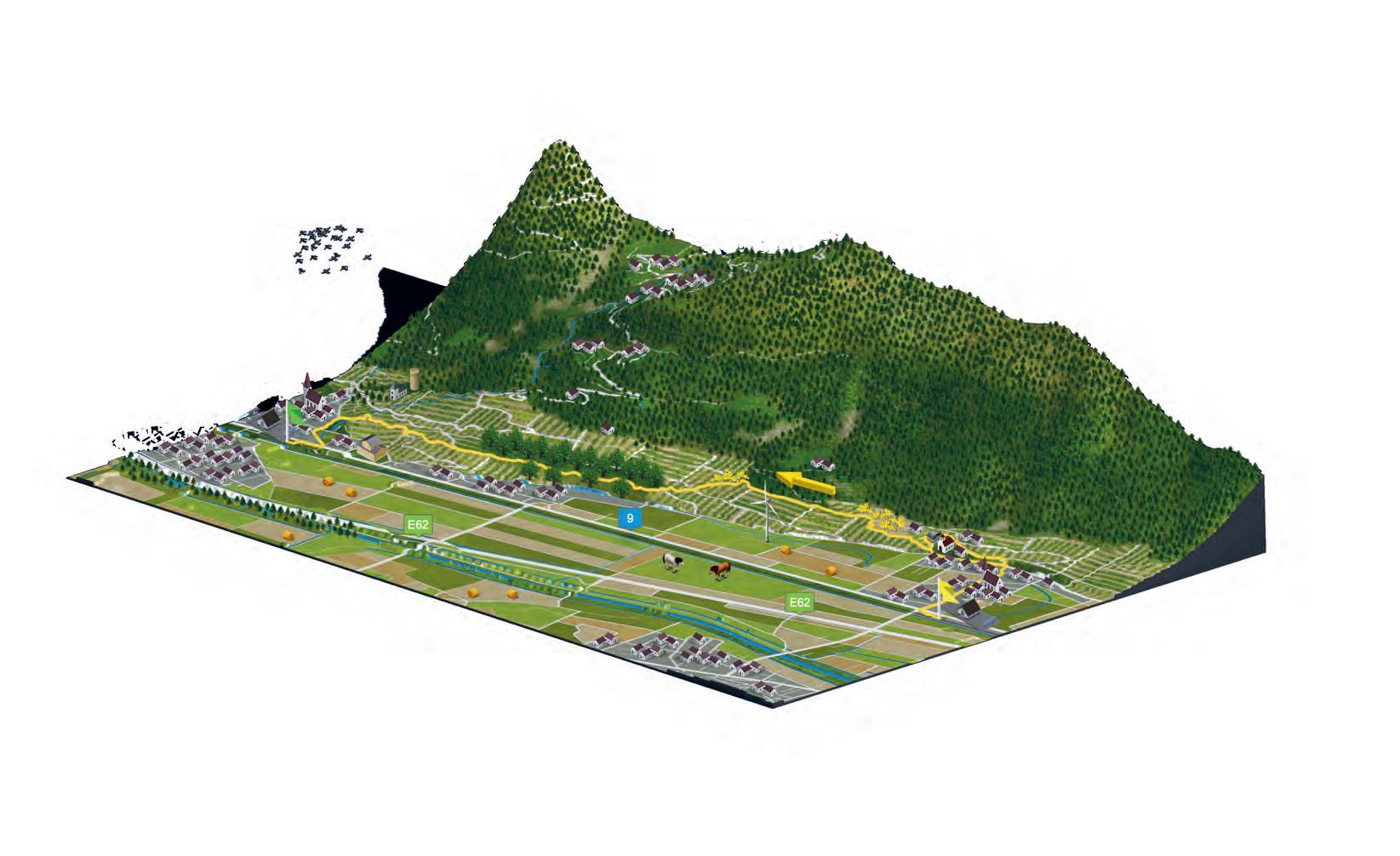
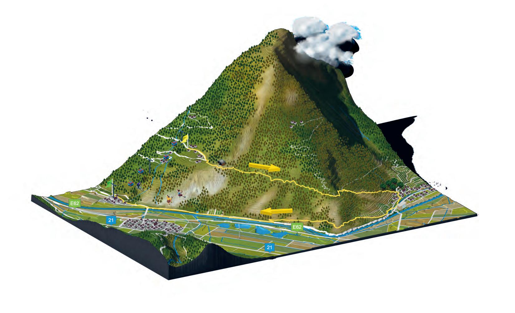
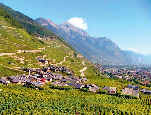
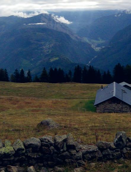
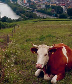
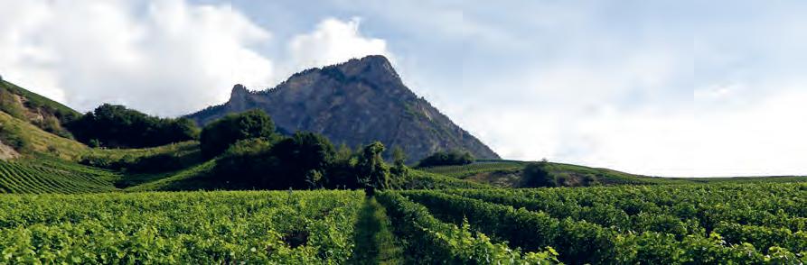
This walk allows you to discover some of the city’s treasures such as the La Bâtiaz covered bridge, the Martigny and Martigny-Combe vineyards, the Bâtiaz Castle, the magnificent hamlet of Plan-Cerisier and a bucolic section along the Dranse. Cultivated in terraces, the vines are superimposed, hanging one above the other. The steep slope and the excellent climate provide conditions conducive to the high quality of the grapes. In 1812, the production of the best Valais wine was reported to be on Martigny’s hill-side.
MARTIGNY TRAIN STATION > BÂTIAZ COVERED BRIDGE >
BÂTIAZ CASTLE > PLAN-CERISIER > MARTIGNY-COMBE >
BÂTIAZ COVERED BRIDGE > MARTIGNY TRAIN STATION
THE VINES Dry stone walls
LA
Direction panels to follow
MARTIGNY Roundabouts
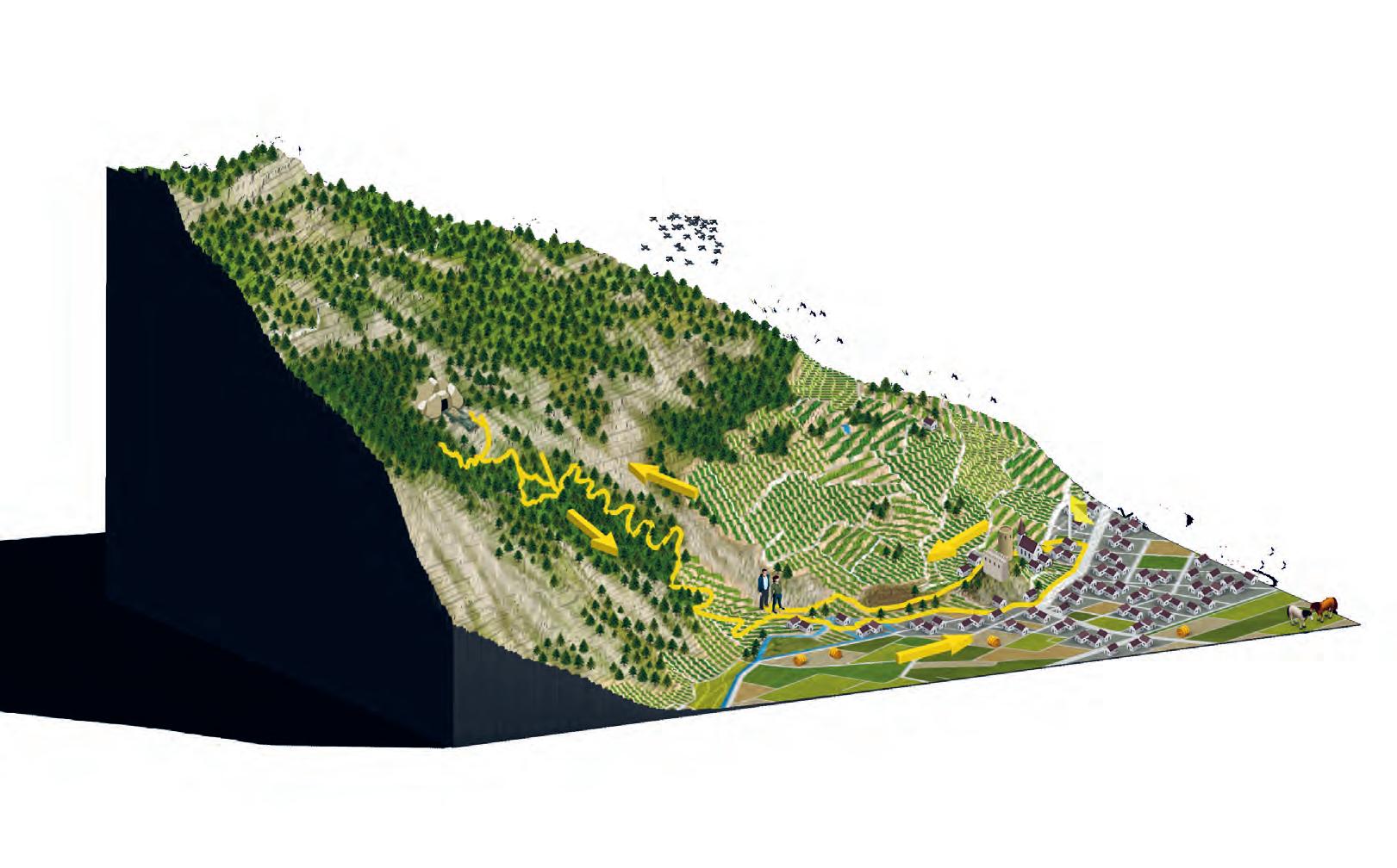
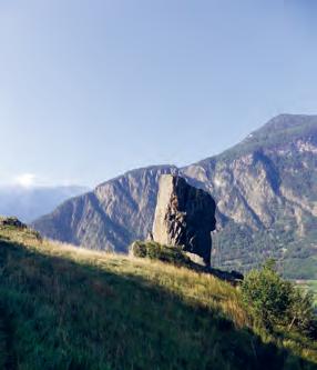
Set in the middle of rich and fascinating vegetation, away from the tourist resorts, dotted with old disused mines and educational panels, this trail is a true witness of the past heritage. With a remarkable geology and a subsoil with more than 150 minerals, Mont Chemin takes advantage of limestone and well-drained soils to welcome a sumptuous larch forest.

DES PLANCHES PASS > TÊTE DES ÉCONDUITS >
CHEZ LARZE > DES PLANCHES PASS
You will be amazed by the larch forest and its fire-like colours in autumn!
Direction panels to follow
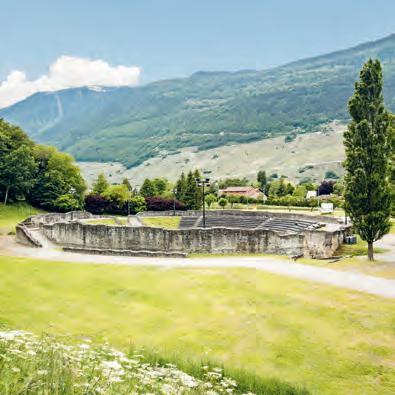
4.5 KM PEDESTRIAN PATH / TARRED ROAD FOREST ROAD 1 H 45This walk along the Guercet bisse is the ideal opportunity for a fresh forest getaway. Before leaving Martigny, take the opportunity to visit the Pierre Gianadda Foundation and/or the Barryland Museum and do not forget to take a tour of the amphitheatre, while imagining what the city must have looked like in Roman times. The second part of the trail crosses the Charrat vineyard.
MARTIGNY-BOURG TRAIN STATION > AMPHITHEATRE > LE GUERCET > CHARRAT TRAIN STATION
In a few seconds, you escape the noise of the city, finding yourself in a green and soothing nature.
Direction panels to follow
 7.8 KM
PEDESTRIAN PATH / TARRED ROAD
2 H 20
7.8 KM
PEDESTRIAN PATH / TARRED ROAD
2 H 20
MARTIGNY Roundabouts
Gallo-Roman remains
Pierre Gianadda Foundation
Barryland
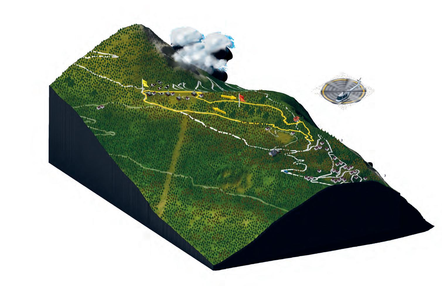
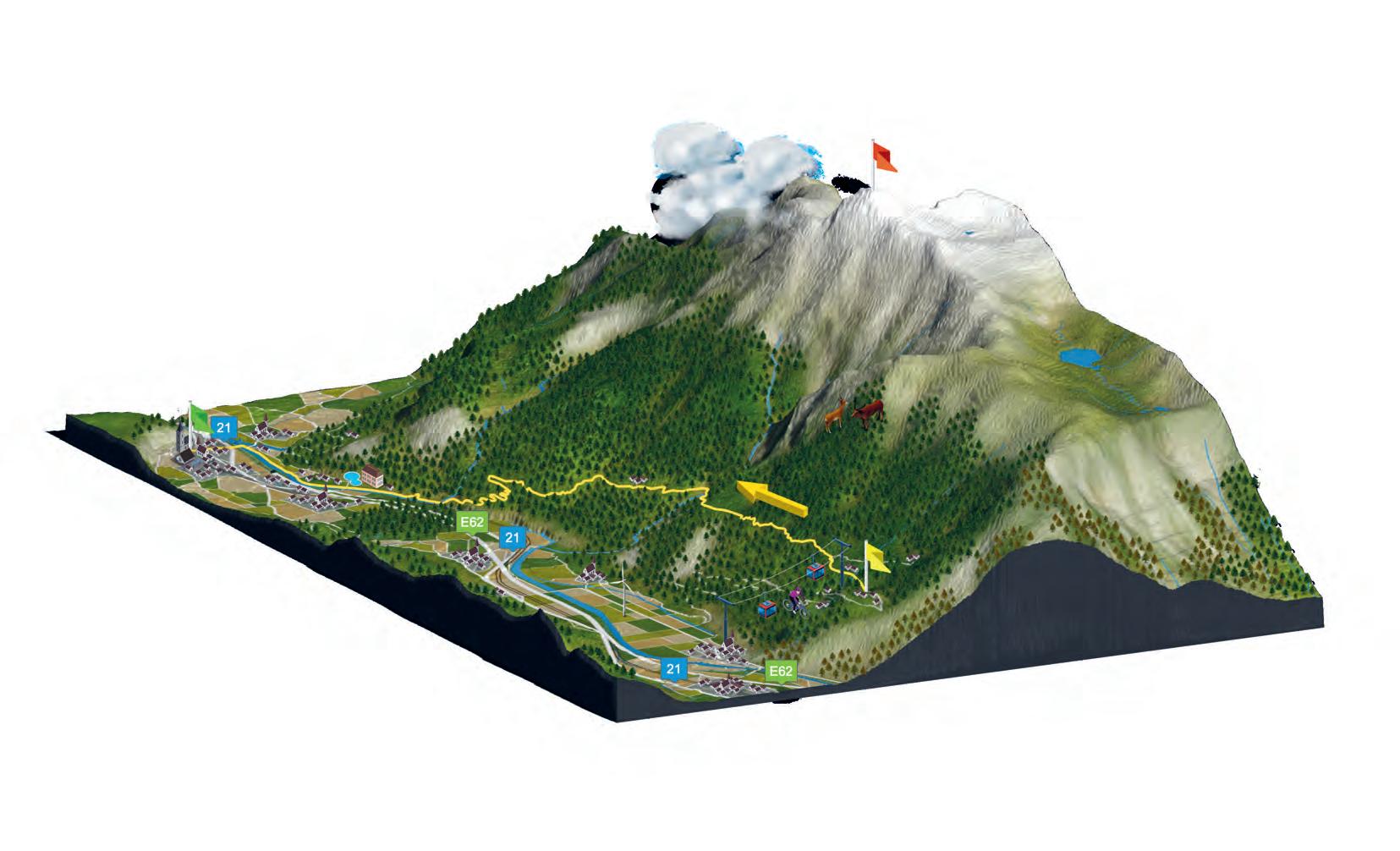
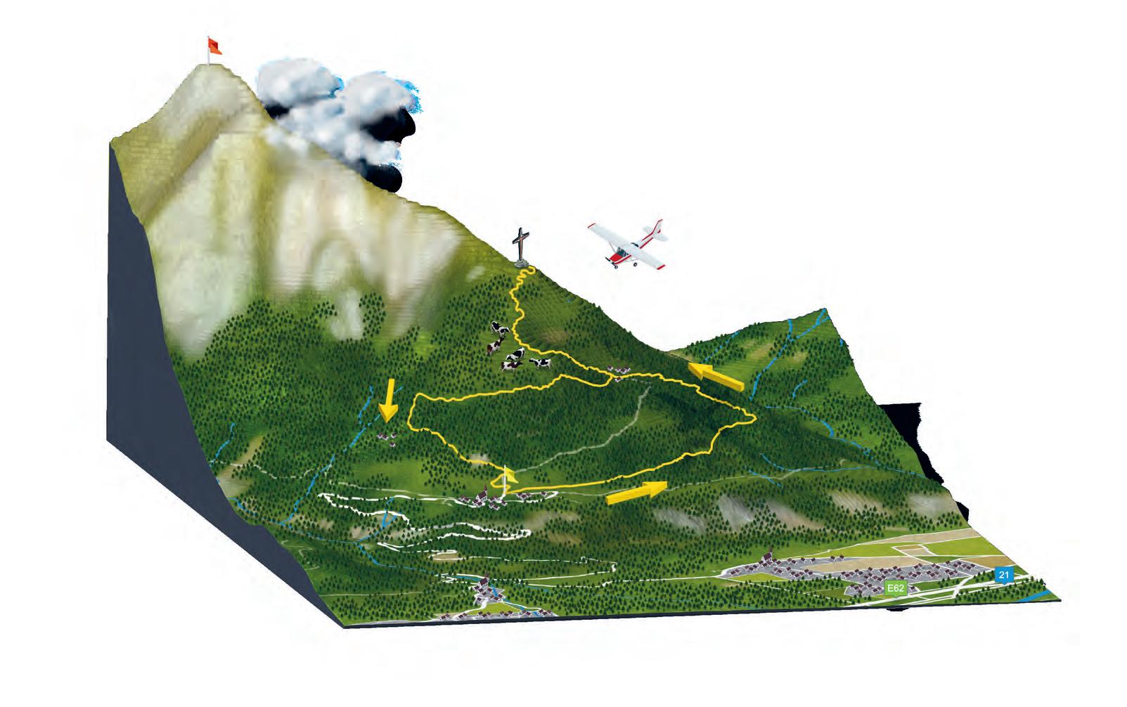
To reach the spectacular views worthy of postcards, you have to prepare yourself for the 1,500 metres rise in altitude of Mont Arpille from Martigny. To appreciate the climb, why not stopover at the Bâtiaz Castle, discover the bread ovens in the picturesque hamlets of Ravoire and above all, take the time to admire the Rhône plain during the climb. From the Alpine pasture to the Mont de l’Arpille, the ascent takes 30 minutes.
*In winter, part of the stretch is possible on snowshoes between Ravoire and the Arpille Alpine pasture.
MARTIGNY TRAIN STATION > BÂTIAZ CASTLE >
LE SOMMET-DES-VIGNES > RAVOIRE > ARPILLE ALPINE PASTURE >
LA FORCLAZ PASS
RAVOIRE Bread ovens
Antenna
SOMMET-DES-VIGNES
Terraced vineyards
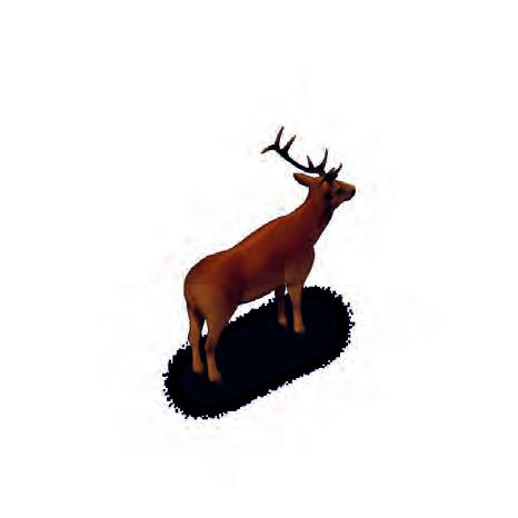
Pay attention, you may be joined by some deer.
BÂTIAZ CASTLE
Bombard cannon
Mangonel Escape room View
Direction panels to follow
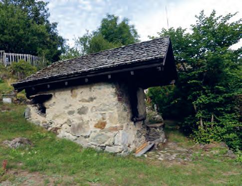
Come and explore the Bread Oven Trail: a lovely walk through the hamlets of Ravoire, to discover bread ovens. In the old days, there were thirteen and today there are seven, which are still intact and, for the most part, operational. Overlooking Martigny, Ravoire is appreciated for spending a quiet moment in the peaceful setting.
OLD HOTEL IN RAVOIRE > COUVERT DE RAVOIRE >
SUR LE MONT > LE FEYLET > CHEZ-LES-PILLET >
CHEZ-LES-PETOUD > OLD HOTEL IN RAVOIRE
Direction panels to follow
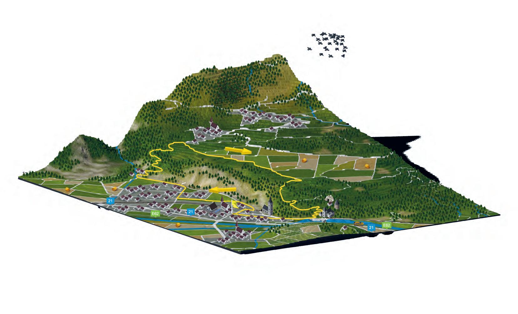
4.5 KM 2 H 00In the heart of the countryside of Vouipes (wasps), nickname of the Bovernier and Valettes villages inhabitants, this walk takes you into the forest along trails and forest roads. This route includes the Tour of the Fountains, a pleasant educational walk through thirteen fountains, all of them provide a piece of the village history. Discover in particular where their nickname comes from and the origin of their famous vines. It is possible to combine this walk with the Durnand Gorges tour, offering a magical and refreshing spectacle.
BOVERNIER TRAIN STATION > BOVERNIER > LES VALETTES >
DURNAND GORGES > BÉMONT > TOUR OF THE FOUNTAINS > LES ILES > BOVERNIER TRAIN STATION
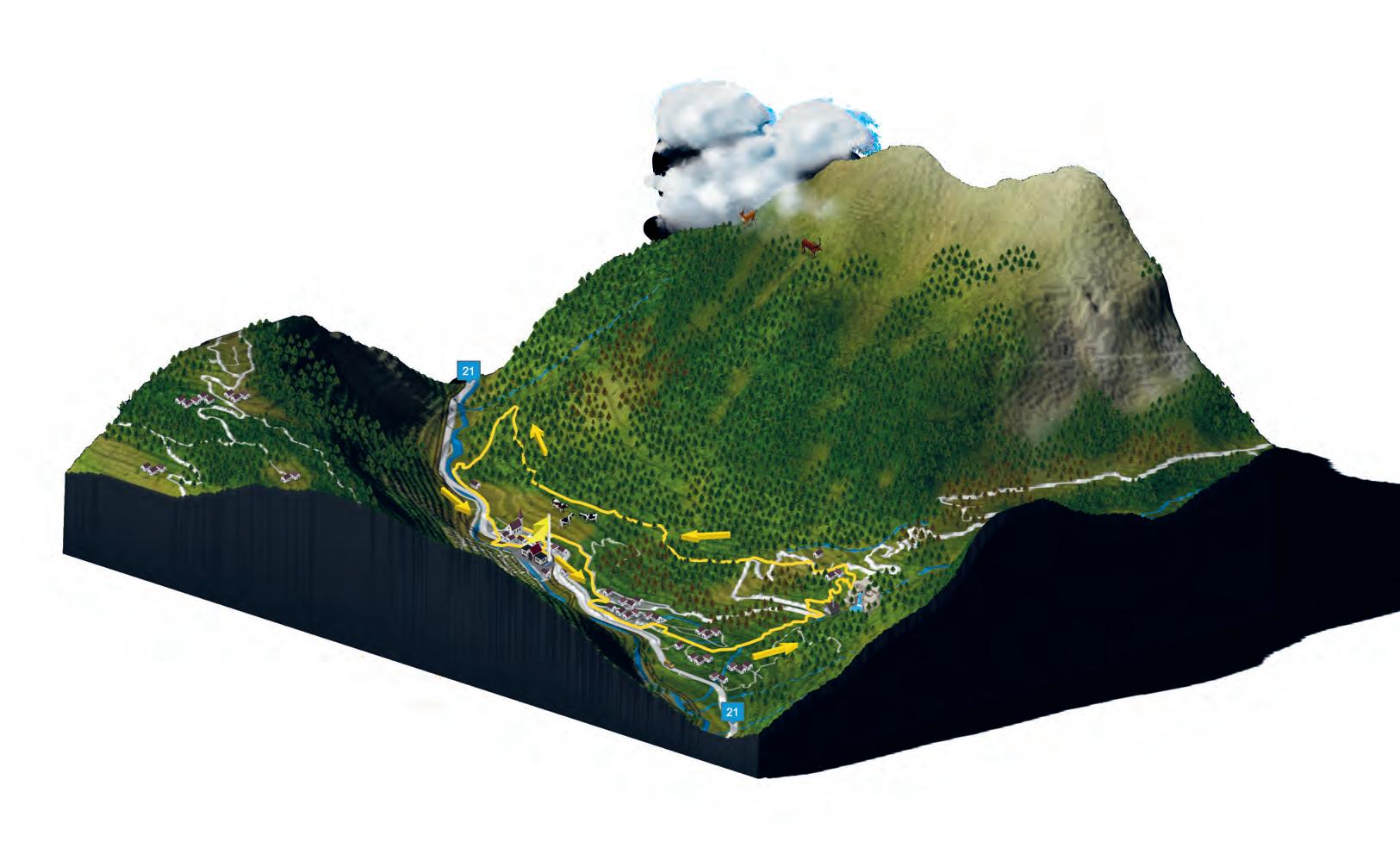
The freshness and spectacle provided by the Durnand Gorges, ranked amongst the 10 most beautiful gorges in Europe (off route).
Direction panels to follow
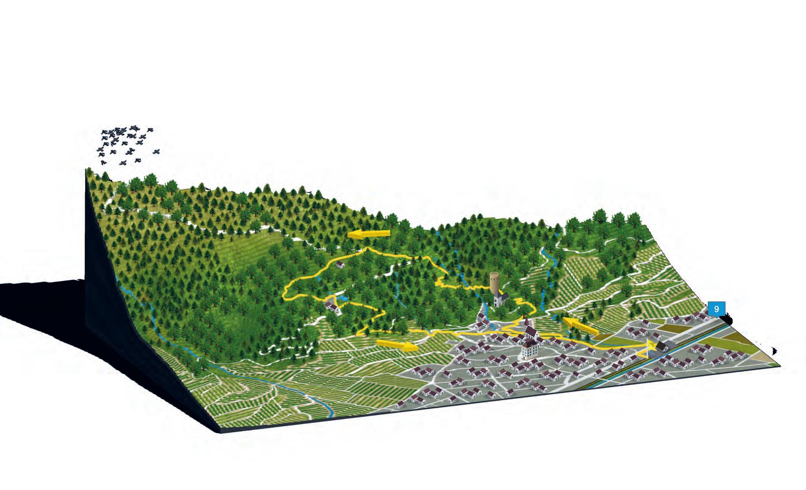
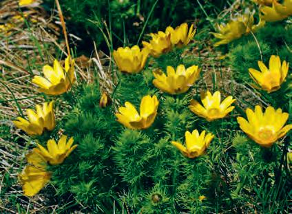
This trail allows you to discover a flower unique to the region, the spring adonis; it is the symbol of the Valais flora. Its bright yellow colour accompanies the hikers on a large part of the route but to see it, you have to choose the right season between early April and May. This walk follows the Rhône Valley and leads to the village of Saxon and its famous apricot trees.
07
300 700 500 900
2
Direction panels to follow
Scan this QR code to download the GPS map. Procedure on page 3
Possible in winter but without snow
6.8 KM 2 H 15Pleasant, wide, slight drop in altitude and vertiginous, the trail starts from Erié, goes through the La Blè pass to reach Sorniot. This route runs along the southern flank of Grand Chavalard, between the steep slopes of crystalline rocks at the foot and the steppe and limestone rock walls towards the summit. At La Blè, the landscape suddenly opens up to the glacial cirque and the lower lake. The Sorniot hut awaits you to taste delicious «PDO» raclette cheeses and apline serac cheese.
This balcony trail offers a plunging view of the plain and a panoramic view of the Mt-Blanc and Grand-Combin mountains.
Direction panels to follow
ACCESS In summer, shuttles from Fully. Info on fullytourisme.ch By
 9.1 KM
PEDESTRIAN PATH
car via a small mountain road.
3 H 20
9.1 KM
PEDESTRIAN PATH
car via a small mountain road.
3 H 20
LES FOLLATÈRES
Spring meadow saffron (bulbocodes)
Nature reserve (fauna and flora)
BRANSON
Chapel
Chestnut forest and its sculpture
Preserved mazots (small houses)
Vineyard
FULLY CANAL
RHÔNE
TASTING PAVILION
Following this path, you will cross the picturesque protected village of Branson, which is built directly on the rock. You will stroll through a chestnut forest, as well as passing through the rich steppes. At the beginning of the year, you will be able to witness the spectacular display of spring meadow saffron (bulbocode). This flower is present in Switzerland only in the canton of Valais, on its very sunny slopes. It has a very short flowering period beginning when the snow starts to melt. You will be able to enjoy many other flowers that brighten this trail all throughout the year.
RHÔNE BRIDGE > BRANSON > FOLLATÈRES NATURE RESERVE > RHÔNE BRIDGE
PEDESTRIAN PATH / TARRED ROAD
Visiting the village of Branson is exceptional. The wonderful contrast of mazots (small houses) and modern dwellings helps preserving the historic character of the place.
Direction panels to follow
3.6 KM 1 H 30BRANSON Chapel
Chestnut forest and its sculpture
Preserved mazots (small houses)
LES FOLLATÈRES
Spring meadow saffron Trail (walk 09)
Nature reserve (fauna and flora)
TASTING PAVILION
FULLY CANAL
This walk offers an exceptional view of the Rhône plain and links the Branson chestnut forest and that of Vers-l’Eglise. There are several information panels along the trail giving explanations on the evolution of the vine over the seasons, as well as on the Fully vineyard. During your walk, you can also discover the numerous vineyard huts scattered throughout the vineyard. These little houses, used throughout the season for growing vines, also serve as shelters for breaks, especially at harvest time!
10
FULLY VINE AND VINEYARD HUTS TRAIL
RHÔNE BRIDGE > BRANSON > COMBE D’ENFER >
CHESTNUT FOREST > BELLE USINE >
FULLY CREPPIER (BUS STOP)
LA PERGOLA DE LA PETITE ARVINE
Relaxation area Free library
VINEYARD Vineyard huts
Combe d’Enfer Dry stone walls Educational panel
CHESTNUT FOREST Family Quiz Vita course
BELLE USINE
RHÔNE
VERS L’ÉGLISE-CHÂTAIGNIER Mini zoo St-Symphorien Church
PEDESTRIAN PATH / TARRED ROAD
2
Direction panels to follow
Scan this QR code to download the GPS map. Procedure on page 3
4.3 KM 1 H 30
RHÔNE DORÉNAZ Cable car Fairytale house Legends path Climbing walls CHAMPEX D’ALLESSE Mountain bike downhill track
trap TASTING PAVILION
BRANSON Chapel Chestnut forest and its sculpture
Preserved mazots (small houses) Vineyard
GOUILLES DU ROSEL Western City Water sports
Paintball
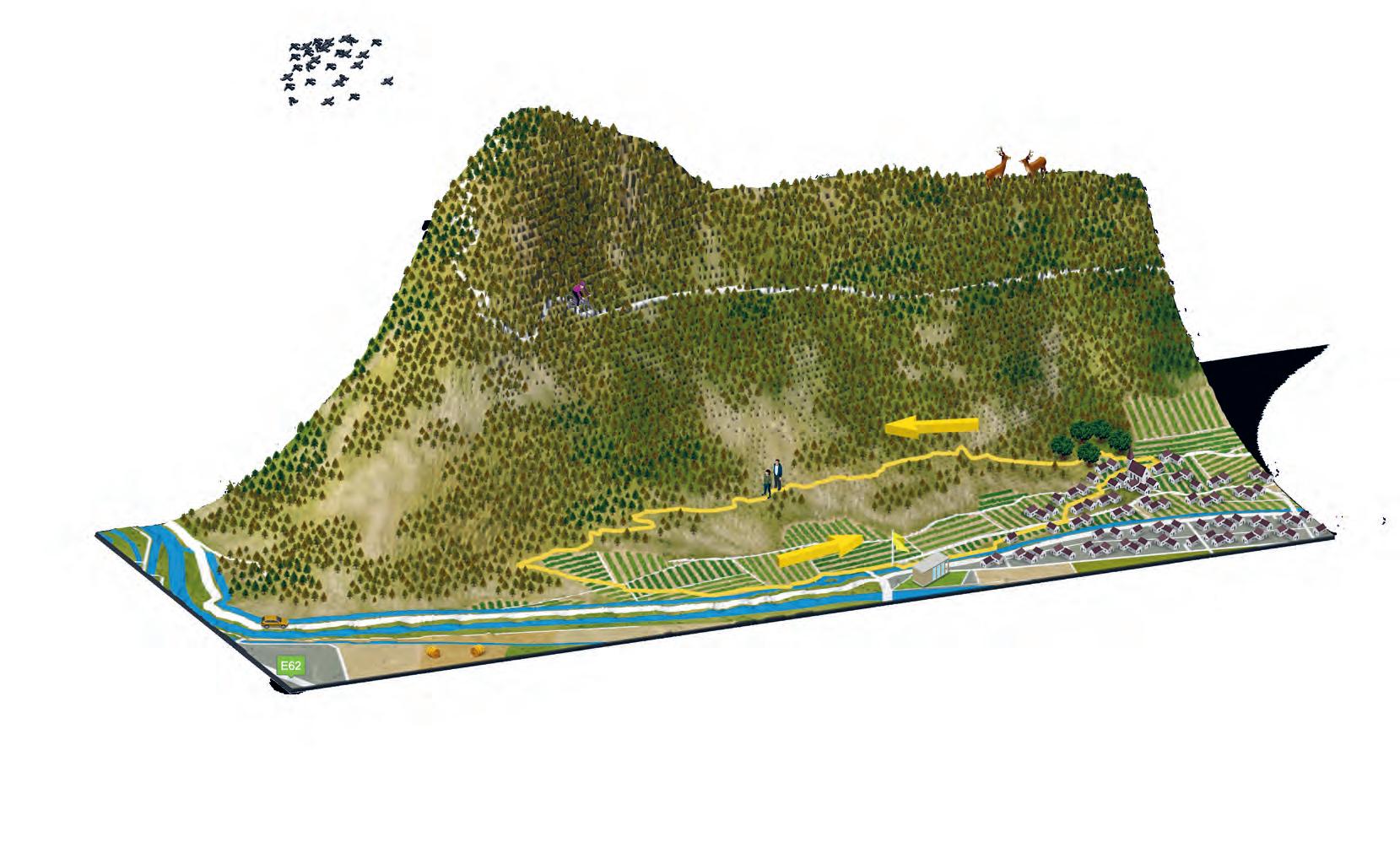
This hill-side excursion allows you to cross the entire Follatères nature reserve from Donéraz to Branson. This reserve, known to naturalists and enthusiasts, offers a wealth of unique flora and fauna with over 200 species of southern or eastern plants. The landscape is wild and untouched by human intervention.
11
DORÉNAZ FOLLATÈRES TOUR
> DORÉNAZ
PEDESTRIAN PATH / TARRED ROAD FOREST ROAD
3
Direction panels to follow
ACCESS Start in Champex d’Allesse, at the cable car station.
DENT DE MORCLES 2969 m
L’AVANÇON Pissechèvre waterfall
LAVEY-LES-BAINS
Franck K exhibition
Chapel Bains de Lavey
SAINT-MAURICE Abbey
Saint-Sigismond church
Saint-Maurice castle
Fairy’s Cave Military fort
RHÔNE
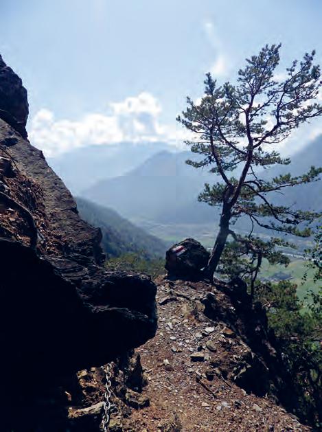
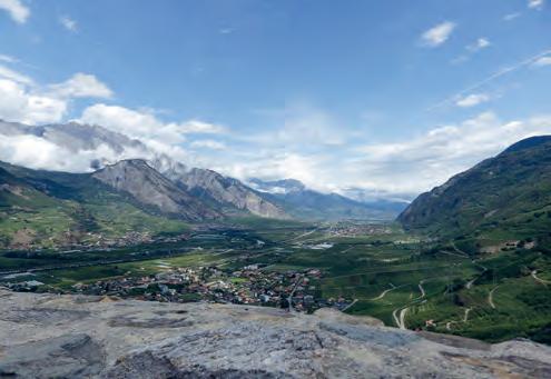
The trail overlooks two communes known as «Outre-Rhône», Dorénaz and Collonges, the only communes in the district of Saint-Maurice located on the right bank of the Rhône.The path leads down the plain to Lavey-les-Bains and Saint-Maurice. The 180° panoramic view between Lake Geneva and the town of Martigny is truly magical. Beware, the route is vertiginous and there are some challenging passages where you have to hold on a chain.
12
DORÉNAZ CHAMPEX D’ALLESSELAVEY - SAINT-MAURICE
CHAMPEX D’ALLESSE > PLEX > LE MONT > WHITE HOUSE > ESLEX > LAVEY-LES-BAINS > SAINT-MAURICE
DORÉNAZ
Cable car
Fairytale house
Legends path
Climbing walls
CHAMPEX D’ALLESSE Mountain bike downhill track
3
After a long walk enjoy the relaxing effect of the water of
Direction panels to follow
LE MAUVOISIN
VÉROSSAZ
LES CASES
SAINT-MAURICE Saint-Sigismond church Notre Dame du Scex Limestone cliff
This walk invites you to take some height and discover the Plateau de Vérossaz, by going around the majestic cliff which overlooks the city of Saint-Maurice. You can admire the magnificent panoramic view of the Salantin and all the Rhône Valley. Why not complete your walk with a visit to one of the main tourist sites in the city : Fairy’s Cave, military forts Château de Saint-Maurice as well as the Abbey and its treasure.
SAINT-MAURICE TRAIN STATION > LES CASES > VÉROSSAZ > DUFOUR TOWER > SAINT-MAURICE TRAIN STATION
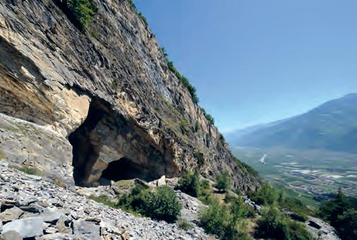
FAIRY’S CAVE Waterfall in the mountain Military fort
SAINT-MAURICE CASTLE Medieval bridge Dufour tower
ABBEY
RHÔNE
2
By adventuring a few more metres off the trail, you will be able to enjoy the magic of the Fairy’s Cave and all its freshness.
Direction panels to follow
2
SAINT-MAURICE
FAIRY’S CAVE Waterfall in the mountain Military fort
Educational panel
Defensive walls
Fortin
Trenches
Military batteries
Vineyard
A real strategic passage to access the upper Rhône valley, Saint-Maurice is steeped in military history. The Dufour fortifications were built as early as 1831, at a time when the political and military situation in Europe was in turmoil and the threat of war was upon us. During this walk, walkers can enjoy Saint-Maurice’s vineyards, which are located in the canton of Vaud.
14
SAINT-MAURICE DUFOUR FORTIFICATIONS
DUFOUR FORTIFICATIONS > L’AUMÔNERIE >
DUFOUR FORTIFICATIONS > ABBEY >
1
Direction panels to follow
Possible in winter but without snow
200 400 600 800
map Quaint village
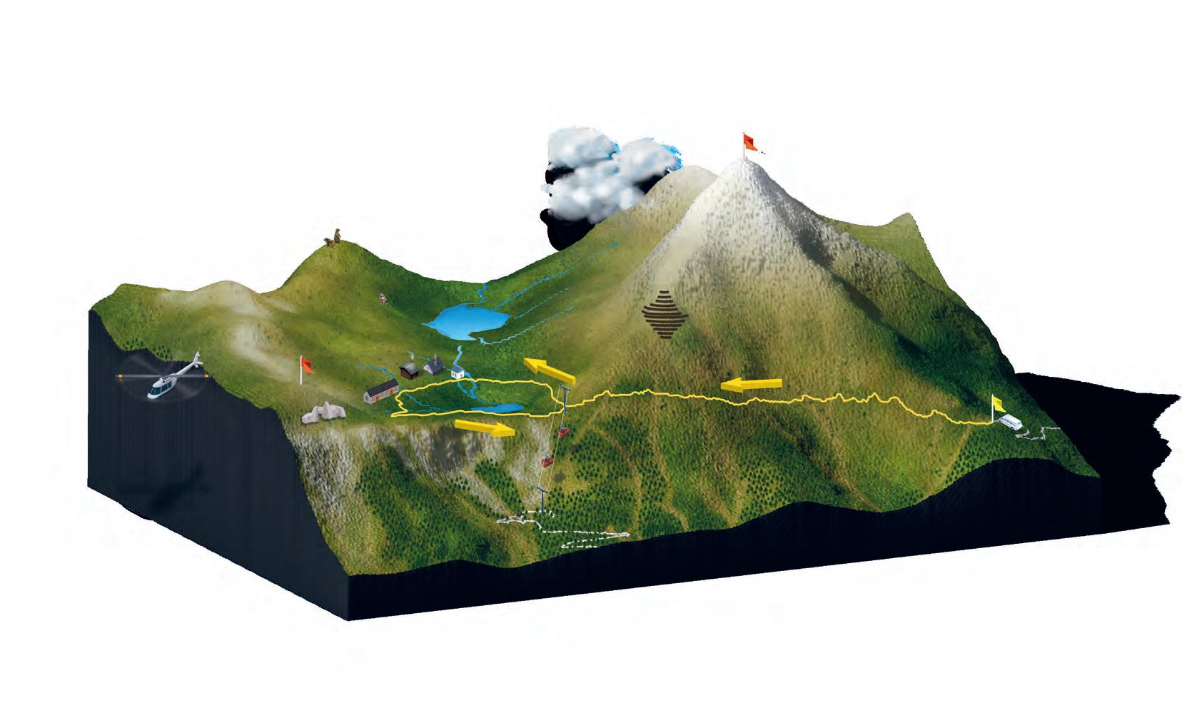
This magnificent circuit allows you to reach the Aiguille de Mex from where the magnificent panorama, which extends from the Lake Geneva basin to Mont-Blanc, is sure to take your breath away. With its unobstructed view from all sides, the summit is one of the most beautiful vantage points in the whole region. From the village of Mex, the landscape changes from forests to pastures. Your effort will be rewarded with a breath-taking scenic view. 8,5 KM
MEX > LES PLANETS > L’AIGUILLE > LES PLANETS > LES MAYEUX > MEX
Direction panels to follow
LES PLANETS
SAILLON
Medieval town
Medieval garden
Escape game
Museum of Counterfeit Currency
Farinet’s vineyard
Bayard tower
FARINET’S FOOTBRIDGE Dove of Peace LA SALENTZE
Commemorative plaque for Farinet
Salentze gorge
Thermal pumping station
Via Farinetta (ferrata)
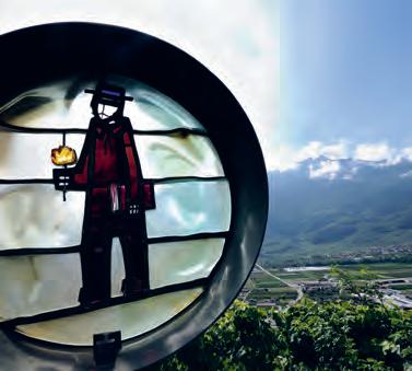
This trail takes walkers to the hot spring of Bains de Saillon. The painter Gustave Courbet immortalised this place on his canvas «La Caverne des Géants». This painting illustrates this idyllic place where there is also a commemorative plaque in honour of the Valais Robin Hood, Farinet, who spent his life and died in these gorges.
...................... 400 600 800
16
SAILLON THERMAL WATER SPRING
TÊTE DU GÉANT - THERMAL WATER SPRING > PLACE FARINET
4,4 KM
1 H 25
1
Direction panels to follow
Possible in winter but without snow
BAYARD TOWER
Panoramic view
MEDIEVAL GARDEN
Tomb of Farinet
Rose of Farinet Saillon marble altar (Church)
This initiatory itinerary is punctuated by 21 giant stained glass windows, imposing works of art by the painter Héritier and the glassmaker Imboden. The memory of the counterfeiter, Joseph-Samuel Farinet, remains present throughout the trail. It also allows you to discover the magnificent medieval village of Saillon and its countless treasures. 17
PLACE FARINET > CHEMIN DES ÉCOLIERS > SAILLON MEDIEVAL TOWN > FARINET’S VINEYARD > SAILLON MEDIEVAL TOWN > PLACE FARINET
2,8 KM
1 H 00
FARINET’S VINEYARD
Wall of Remembrance
Youth Dove
Personalities plaques
= Stained glass
PEDESTRIAN PATH / TARRED ROAD
1
Let yourself be taken by the tranquillity that radiates from the Vigne à Farinet.
Direction panels to follow
The walkers are able to reach the marble quarry via a trail through vineyards and forest. Anyone who takes time out to walk this path can imagine the difficulty of transporting the marble to the plain (before the arrival of the funicular). For security reasons, it is forbidden to cross the fence, which prevents access to the galleries. 18
PLACE FARINET > SAILLON MEDIEVAL TOWN > MARBLE QUARRY > LES BARMES > PLACE FARINET
PEDESTRIAN PATH / TARRED ROAD FOREST ROAD
When you arrive at the marble quarry, shout your name to hear it echo through the rocks.
Direction panels to follow
APRICOT TREES
SAXON CASTLE Saxon tower Castle’s chapel 25 varieties of apricots
VELLA TORRENT
SAXONNET TORRENT
TOVASSIÈRE
Saxon, the Swiss apricot capital, offers an educational walk through the village, its orchards, vineyards and forest. The trail is dotted with information panels revealing all the secrets of the fruit. At the Saxon tower, take advantage of a break and appreciate not only the breathtaking view of the region but also of its space with 25 varieties of apricots available to walkers. The tour proposed in this brochure corresponds to the small loop of the Apricot Trail. During the walk, however, it is possible to join the big trail and extend your walk by an hour.
19
SAXON TRAIN STATION > SAXON TOWER > BONATRY > TOVASSIÈRE > CHURCH > SAXON TRAIN STATION
Enjoy the spring show when the apricot trees are in full
Direction panels to follow
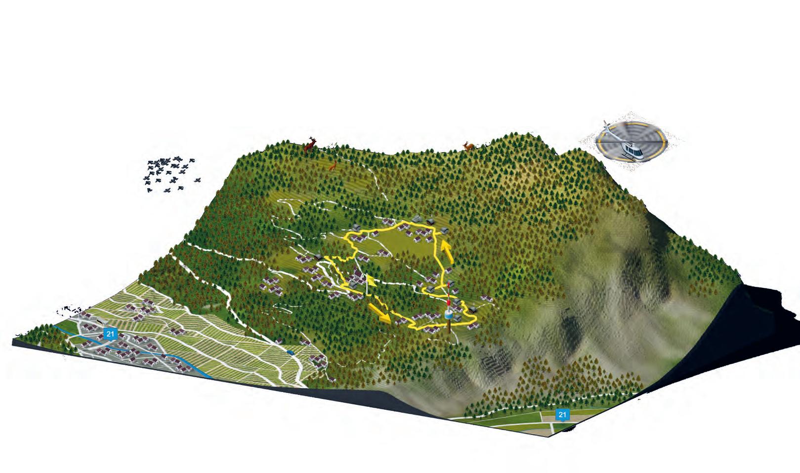
Possible in winter but without snow
Discover the village of Saxon and its history while having fun. The fun trail offers a series of information panels presenting on one side a cultural aspect of the village and on the other, a seasonal quiz with different levels of difficulty, allowing children and adults to participate. It is an opportunity to associate legs and brains.
The journey time of 1 hour and 20 minutes does not include playing time. The form for answering questions can be downloaded from: sdjsaxon.ch (in French only)
20
SAXON TRAIN STATION > CASINO > SCHOOL CENTRE > SAXON MUSEUM > CHURCH > SAXON TRAIN STATION
Daydream in the casino gardens while admiring the architecture and imagining reliving the great era of the place, when players flocked from all over Europe.
Direction panels to follow
At the crossroads of France and Italy, and in the heart of the Valais Alps, Martigny Région offers a rich cultural heritage, a mild and sunny climate and a wide range of activities. Vibrant towns, typical villages, natural and mountainous scenery, the region enjoys an excellent geographical location. Made up of several municipalities, this 300 km2 territory offers all the tourist attractions so allowing you to have a wonderful holiday.

Apricots, chestnuts, asparagus and pears are among nature’s treasures that can be enjoyed. How can you resist tasting an Assiette Valaisanne consisting of fabulous mountain cheeses and cold meats from the terroir, all to be accompanied by an excellent local wine, such as Petite Arvine ? To complete the meal on an excellent note, the Morand distillery offers world-famous quality brandies such as Williamine© and Abricotine.
If the city of Martigny, with its great museums and rich historical past, is considered as the cultural capital of the canton, the whole region is in tune with it: a true El Dorado for lovers of art and history. The Gallo-Roman remains of Martigny invite travellers to cross the ages to discover the Gallo-Roman temple, the Amphitheatre, the Domus of Domestic Engineering as well as the Mithraeum. In SaintMaurice, another era is highlighted with the Abbey, which is 1,500 years old. A treasure visible to the public testifies to the rich past of this place of worship.
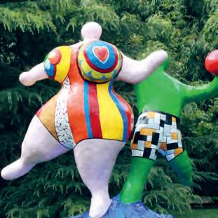
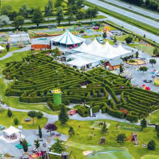
With several unique amusement parks and activities dedicated to all ages such as the Labyrinthe Aventure, Monstrofun, Western City, the Zoo des Marécotte or Verticalp Emosson, Martigny Région is ideal for families. The thermal pools of Saillon and Lavey-les-Bains welcome families looking for comfort and relaxation. Saunas, Turkish baths, massages, hammams are some of the services offered by these wellness centres.
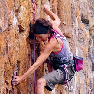
Between waterfalls, mountain lakes, gorges, glaciers, nature reserves, bisses, forests, shimmering meadows, mountains and majestic peaks, the destination is full of breathtaking landscapes. To discover these panoramas is to fill one’s head with unforgettable memories. Adrenaline and emotion are the key words describing the sports activities of the region. From canyoning, downhill mountain biking or scooter riding to windsurfing, climbing, via ferrata, zip line or paragliding, adventure guaranteed !