2024_ARCH672-UD732_River Whispers_Case Study Compilation
THE RIVER WHISPERS
PROPOSITIONS STUDIO ARCH 672/UD732
Graduate Students:
Zannatun Alim
Deepa Bansal
Virginia Bassily
Jaydipkumar Bharatbhai Nakrani
Jordan Biniker
Haley Cope
Stephanie Dutan
Max Freyberger
Akshita Mandhyan
Nahj Marium
Srinjayee Saha
Yi Min Tan
Instructor:
Maria Arquero de Alarcon
Associate Professor in Architecture + Urban Planning
In partnership with Ashoka Trust for Research in Ecology and the Environment (ATREE):
Mathivanan M.
Maria Antony P.
Dr. Thanigaivel A.
Saravanan A.
Thalavaipandi S.
Sanmadi K.R.
Teresa Scholastica Thomas
Santhanamari
Anish A.
Karthika
Sponsor:
A.Alfred Taubman College of Architecture and Urban Planning Travel Fund and the Diversity, Equity and Inclusion Initiative
TAUBMAN COLLEGE
Achitecture-Urban Planning
University of Michigan
INTRODUCTION INDIA AND TAMIL NADU
TAMIRAPARANI WATERSHED
Jordan Biniker
Virginia Bassily Zannatun Alim Deepa Bansal
Jay Nakrani
Haley Cope
CASE STUDIES PROJECTS
INTRODUCTION
SUNGEI BULOH WETLAND RESERVE
MAPUNGUBWE INTERPRETATION CENTRE
TENEMENT MUSEUM
CONFLICTORIUM
NORTHEAST BAMBOO PAVILION
INTRODUCTION
MISSING MOBILE
REFERENCES
ACKNOWLEDGMENTS
STUDENT BIOS
Akshita Mandhyan
Srinjayee Saha
Stephanie Dutan Max Freyberger Nahj Marium
Yi Min Tan
INTRODUCTION
To be given the prompt of designing an “interpretation center,” one must come to terms with what exactly that means. Does it need to be permanent? Can it be more than a physical structure? What is being interpreted? Who is the intended audience? These questions examine the role and purpose of interpretation in various contexts, prompting a further analysis that moves beyond the idea of a static, single-location center.
The River Whispers studio has examined a range of case studies from around the world, offering diverse perspectives on interpretation. These examples spanned different forms, functions, and urban scales, from small installations to large, city-wide initiatives. This variety demonstrated the many ways interpretation can be applied—ranging from traditional museum exhibits to dynamic, site-specific installations that can be activated in response to events.
The case studies inspired a new understanding of what an “interpretation strategy” could mean. Interpretation isn’t just about presenting a fixed narrative; it can take many forms, using a variety of mediums such as architecture, landscape design, digital tools, and even performance. Interpretation is a flexible, adaptable process that can be framed and spatialized in multiple ways depending on the context. Interpretation strategies emphasize various perspectives on the same subject. Some focus on historical significance, others on environmental impact, and still others on personal or community experiences. This diversity expands the scope of what can be interpreted and the audiences who can engage with it. It became clear that interpretation isn’t confined to a single building or site—it can be integrated into the fabric of a city, landscape, or even exist temporarily, activated for specific moments.
Interpretation is a versatile tool. One that can be shaped to suit different contexts, audiences, and objectives, encouraging one to think creatively about how and where it can be applied.
SUNGEI BULOH WETLAND RESERVE
BIRD MIGRATION
Sungei Buloh Wetland Reserve (SBWR) is part of the East AsianAustralasian Flyway, one of the world’s major bird migration routes. It plays a critical role in providing food and rest for migratory shorebirds, which are under threat due to habitat loss across the region of Southeast Asia.
SUNGAI BULOH WETLAND RESERVE
HISTORY
TO LEARN & TELL
Land is gradually developed for farming use. Ponds were dug for farming freshwater fish and the land was used to grow vegetables and cash crops such as rubber and coconut, as well as rearing poultry. Due to the rich organic nutrients present in the waterlogged and muddy mangrove swamps, these mangroves had mostly been cleared for prawn ponds.
The Sungei Buloh Nature Park was officially opened by then Prime Minister Goh Chok Tong on 6 December. Jurong Bird Park was appointed to manage the nature park in its early years but it is now run by the National Parks Board.
The Straits Settlements Government (under British rule)designated Sungei Buloh area a forest reserve.
After a birdwatcher member of the society’s bird saw flocks of waders flying from the Strait of Johor towards Sungei Buloh. A meeting was set and a group conservation committee put forth a proposal for the creation of a 318-hectare nature reserve in Sungei Buloh.
An area of 87 hectares was eventually designated for the Sungei Buloh Nature Park
The park was officially gazetted as a nature reserve and renamed Sungei Buloh Wetland Reserve (SBWR) to reflect its new status. The area was also enlarged to 130 ha. SBWR was recognized as a site of international importance for migratory birds when it was inducted by Wetlands International into the East Asian Australasian Shorebird Site Network.
The SBWR was also declared an ASEAN Heritage Park by ASEAN Member Countries.
MAPPING
TO NAVIGATE & ENGAGE
The view to the city of the Singapore with extremely tall skysrapers is blocked by the green buffer and tall trees of the reserve, which immerses the visitors in this green oasis reserve, which is a really small part of the city.
Wetland Center
The Wetland Center hosts exhibitions and classes that educates visitors about the wetland and the ecosystem that relates and revolves around it.
This trail is mainly for schools and families. Explore the various habitats from freshwater ponds to mudflats and mangroves, and understand the flora and fauna that lives here.
This trail is a short and easy walk which is suitable for all ages to enjoy nature. It goes through a forest landscape.
The “Green Buffer“ is the interpretation that the reserve puts you in a sense of “a green oasis” in a continuous and rapidly urbanizing city.
Migratory Bird Trail
This trail has bird hides along the trail, you will be able to spot resident birds. Between August to April, spot migratory birds that have traveled from as far as the Arctic region to rest and feed at the Reserve.
This trail introduces you to the mangrove forest and brings you close to the trees and wildlife. Mudskippers, monitor lizards, mud lobsters, crabs, spiders can be spotted.
The Visitor Center is the first stop most people start their journey. It comprises the history of the reserve and many other features.
Visitor Center
Mangrove Boardwalk
Coastal Trail Forest Trail
Green Buffer
View to city
100m
INTERPRETATION TO STEWARD & CHANGE
CRITICAL LENS
Visitor Management
The reserve limits the number of visitors to reduce disturbance to the environment. The reserve is open from 7 AM–7 PM, leaving the remaining 12 hours for the species to live in a silent environment. To prevent overcrowding and reduce the impact on core areas, the reserve distributes visitors across longer and different trails.
Construction & Labor
The trails of SBWR were hand-constructed and repaired by hands, as there is a decision to not use crane and other heavy machinery in order to not disturb the roots of the trees, wildlife and natural soil structure in general. Prefabricated components were also assembled off-site and then brought to the reserve for installation. Reducing on-site construction activities and minimizes disturbances to the environment.
Government Intervention
SBWR has enforcement officers who patrol the reserve to ensure compliance with regulations. They also uses technology such as CCTV cameras and unmanned drones to monitor the reserve and detect any illegal activities or environmental threats. Unauthorized entry into restricted areas or harming wildlife can result in substantial fines or even imprisonment.
Urbanization
As Singapore continues to urbanize, the reserve is increasingly surrounded by industrial and residential areas. Land reclamation for urbanization project has made Singapore lose many of its mangroves. Furthermore, urbanization leads to habitat fragmentation, which can isolate the wetland ecosystem and prevent the free movement of wildlife.
MAPUNGUBWE INTERPRETATION CENTRE
The Mapungubwe Interpretation Centre, designed by Peter Rich Architects, is a notable example of sustainable architecture that integrates both cultural and environmental elements. The center covers an area of approximately 5,000 square meters. The project has been widely recognized for its innovative and sustainable design, winning multiple awards, including the World Building of the Year Award at the 2009 World Architecture Festival.
SITE
Shashe and Limpopo rivers
Mapungubwe cultural landscape
History of the Lost Civilization
Archaeological Importance
Indiginious Community
The Mapungubwe Cultural Landscape, located in South Africa at the confluence of the Limpopo and Shashe rivers, is a UNESCO World Heritage site renowned for its archaeological significance and biodiversity. It was home to the Kingdom of Mapungubwe, one of the earliest known African civilizations, which thrived between the 9th and 14th centuries. The interaction between cultural heritage and the natural environment makes Mapungubwe a place of immense cultural and ecological value.
PROGRAM
The proposals needed to provide about 3000m2 of exhibition space for the artifacts of the Mapungubwe Kingdom, interpretive areas for the cultural and natural significance of the park, and headquarters for the park staff, and amenities for visiting tourists. Coupled with these architectural requirements were development aspirations to improve the conditions of communities surrounding the parkland.
Cafeteria
and Resting Spaces
Educational Facilities
Visitor Center
Exhibition Spaces
4.
5. Outdoor court
6. WCs
7. Restaurant
8. Craft shop
9. Floating walkway
10. Vaulted exhibition space
11. East (morning) cairn
12. West (afternoon) cairn
13. Teaching and learning
14. Mesa walkway access
15. Return route
16. External teaching
17. Game drive drop-off
Floor Plan
1. Pedestrian arrival/ departure
2. Arrival landing 3. Bridge
Reception cairn
South African
Social / Environmental Stability
The Mapungubwe Interpretation Centre exemplifies how thoughtful architectural design can contribute to both environmental conservation and social development, balancing the preservation of cultural heritage with the promotion of sustainable practices. The use of labor-intensive methods not only created jobs but also encouraged a sense of ownership and pride in preserving local heritage.
INVOLVEMENT
Government of South Africa
The Mapungubwe Interpretation Centre was commissioned by the South African government and overseen by the University of Pretoria, in collaboration with the South African Heritage Resources Agency (SAHRA) and the Department of Environmental Affairs and Tourism.
University of Pretoria
South African Heritage Resources Agency (SAHRA)
SAHRA is the national body responsible for the identification, conservation, protection, and promotion of South Africa’s cultural heritage. SAHRA plays a critical role in preserving South Africa’s diverse cultural history, from ancient archaeological sites like Mapungubwe to colonial and post-apartheid heritage resources.
The Department of Environmental Affairs and Tourism (DEAT)
Combined responsibilities for both environmental management and tourism promotion. It aimed to balance environmental conservation with the economic opportunities offered by tourism.
RELEVANCY
COMMUNITY ENGAGEMENT & ECOLOGICAL INFLUENCE
Critical Analysis of Form, Function, and Sustainability
The Mapungubwe Interpretation Centre is a renowned example of sustainable architecture, blending cultural significance with innovative design. However, there are areas where its sustainability and functionality could be enhanced, particularly regarding its shape, footprint, material use, and the balance between indoor and outdoor spaces. Below is a comprehensive overview of key aspects and potential improvements.
Interactive Exhibits: The center could benefit from more interactive or multimedia exhibits that enhance visitor engagement with the history of the Mapungubwe Kingdom. Creating open-air exhibition spaces where visitors can explore artifacts or replicas of archaeological finds in a natural setting. These could be integrated into the landscape, offering a direct connection to the historical and environmental significance of the site.
Interpretive Trails: Developing interpretive trails with educational signage about the region’s biodiversity, geology, and the cultural history of Mapungubwe. This would allow visitors to experience the site’s natural context while learning about its historical significance.
Land Impact: A broad footprint can disrupt local ecosystems, affect water runoff patterns, and reduce permeable surfaces. In a UNESCO World Heritage site like Mapungubwe, minimizing ecological disturbance is crucial.
Energy Consumption: A larger footprint generally means higher energy consumption for maintenance, lighting, and climate control. Although the center uses passive design strategies, reducing the overall footprint or breaking up the mass into more adaptable, smaller segments could make energy management even more efficient.
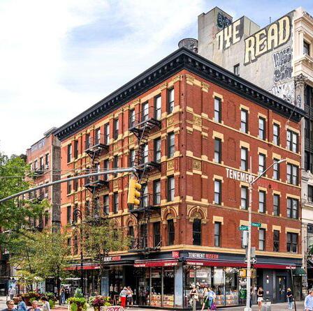
TENEMENT MUSEUM
NEW YORK, NEW YORK
OVERVIEW
TELLING THE STORY OF THE TENEMENT MUSEUM
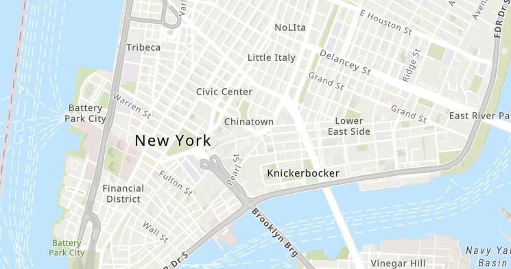
The Tenement Museum is a nonprofit cultural institution that preserves the rich history of working-class tenements who moved to the city between the 1860s and 1980s recreating homes of immigrants, migrants, and refugees. The museum spans between two restored tenement buildings and can be visited at in the city’s Lower East Side neighborhood at 97 and 103 Orchard Street. The area is historically known for its diverse immigrant populations. Serving as a public museum, the institution highlights the challenges, resilience, and contributions of immigrants, while preserving the building to engage visitors with personal histories and broader issues like immigration, labor, and housing, offering a reminder of the complex lives of immigrant and working-class communities in American history.
The museum is an affiliate site for the National Trust for Historic Preservation and is apart of the National Park Service. For the last 36 years, it’s been funded through government and city funding, private donations, corporate sponsorships, partnerships with other foundations and non-profits, special events and fundraisers, and earned revenue through ticket sales and annual memberships.
COLLECTIONS OF THE MUSEUM
HOW THE VISION CAME TO BE
ESTABLISHMENT
AN IDEA AND INITIATIVE
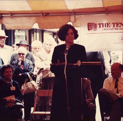
Opened in 1988 by historian Ruth Abram and social activist Anita Jacobson, the Tenement Museum was founded to preserve and highlight the often-overlooked history of immigrant and working-class experiences in America. Abram, inspired by the lack of representation for everyday people, sought to tell the story of how immigrants shaped the nation through their struggles, resilience, and contributions.
As they began restoring the 97 Orchard St. location, the founders uncovered historically significant artifacts—such as toys, hairpins, and business cards—that once belonged to immigrant families. These clues helped piece together stories of 19th- and 20th-century immigrants. Today, the Tenement Museum offers a chance to explore identity, public policy, urban development, and architecture through the lens of these families, connecting their experiences to those of modern-day newcomers.
After its restoration, the Tenement Museum reopened in 1992 with guided tours showcasing immigrant life. Over time, its offerings have expanded to include virtual tours, educational workshops, interactive exhibits, and public programs exploring immigration, labor, and housing. The museum also provides resources for schools and educators, making it a key platform for preserving immigrant stories and fostering dialogue on the ongoing impact of immigration in America. The Tenant Museum now has 11 exhibits with family stories stemming from China, Eastern Europe, Germany, Greece, Iceland, Italy, Puerto Rico, Russia, and even Black immigrants from the Caribbean.
RELEVANCY A MEANS TO CONNECT
A MODEL FOR EXPLORING LOCAL ADAPTATION AND ECOLOGY
The Tenement Museum tells the stories of how a diverse group of immigrants and migrants adapted to life in New York City. Through the use of artifacts and the tenement buildings themselves, these stories are given a visual and tactile life that helps people engage and connect with these people and their stories. A similar approach could be used to tell the story of the people of Thiruppadaimaruthur. Instead of focusing on adapting to life in a new country, the focus could be on how the people of Thiruppadaimaruthur have adapted to life in accordance with the Thamirabarani River and the local wildlife and the broader ecology of the region.
CONNECTING IMMIGRANT NARRATIVES ENGAGEMENT
CONNECTING HISTORY AND TODAY
The Tenement Museum utilizes its platform to engage the public in discussions about immigration, migration, and refugees throughout U.S. history. Specifically, the museum offers workshops for teachers, lesson plans for students, virtual and in person field trips for students, and an initiative to allow people across the country to share their stories using their online digital database. Likewise, our project could be utilized to engage the public in issues of land use, biodiversity, agriculture, and sustainability. Our project could be utilized to give voice to communities like Thiruppadaimaruthur in much the same way that the Tenement Museum gives voice to the people of New York City who have always been an essential part of its urban fabric, but have not always been recognized as such.
CRITIQUE
THE STORIES WE TELL
MISSING LINKS
EXPANDING THE IMMIGRANT EXPERIENCE
From 1988 to 2017, the museum told the stories of families from Germany, Ireland, Italy, Russia, and Greece, with a focal point of stories on the experience of Eastern European Jewish Families. In 2017, for the first time since its inception, the museum opened exhibits dedicated to families from countries outside of Europe and Russia. The addition of the stories of the Wong Family, from China, and the Saez-Velezes Family, from Puerto Rico, were a step towards recognizing and giving voice to the broader cultural heritage that defines New York City. However it wasn’t until 2021 that the museum opened its first exhibit to a Black family. These omissions are a reminder that what it means to be an American, or a New Yorker, is an ever evolving story, and it exemplifies the power and the responsibility that those who tell these stories have.
MISSED OPPORTUNITIES
PAST LESSONS ADDRESSING TODAY’S PROBLEMS
The museum does much to allow its visitors to momentarily walk in the shoes of the various families who immigrated to New York City and lived in the tenement buildings of the Lower East Side. Similarly, it strives to educate its visitors about housing in New York City throughout the 19th and 20th centuries. However, housing in New York City is still an issue with its share of problems and difficulties, and the museum could use its platform to highlight some of the issues surrounding the present day housing crisis in New York City.
“In an increasingly polarized world, existing in binaries, where conscious division on the basis of identity has become the norm, the Conflictorium stands for the in-between, beyond the black and white, where the shades of gray are acknowledged and celebrated for the cause of peace. In doing so, we at the Conflictorium envision ourselves as a medium that helps build bridges creatively; highlighting how social change is possible through innovation.”
Conflictorium is a museum of conflict - it has seven experiential galleries on the ground floor, each designed to provoke conversations on conflict, not only out there, but also within. The first floor consists of gallery spaces, residency rooms and a 40-seater auditorium, utilized for events such as exhibitions on various themes, workshops, book readings, cinema screenings and performances, from time-to-time.
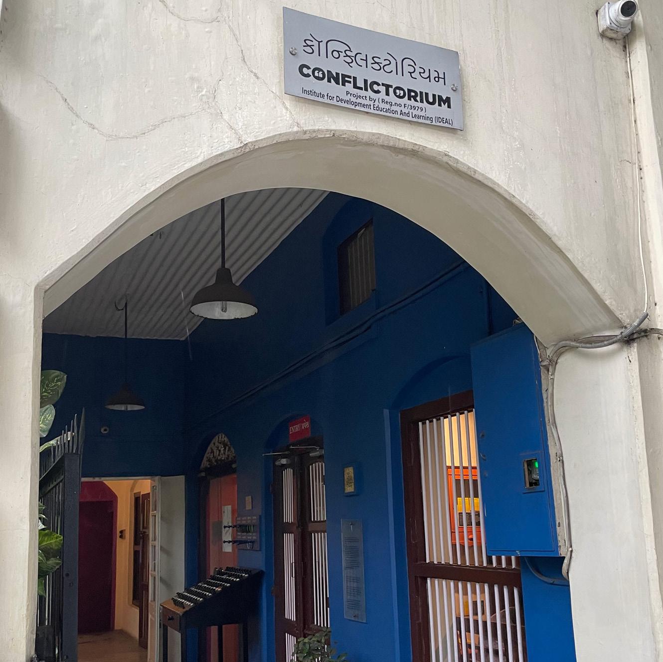
INTRODUCTION: WHERE AND WHY
23.03571214121062, 72.58652747210024
Why is Conflictorium located in Mirzapur, Ahmedabad?
Conflictorium came into existence on April 14, 2013. It is located in a city that has witnessed conflicts over religion in the form of violent riots in 1969 and as recent as 2002. This makes it imperative to have a space to have conversations about conflict.
“Avni Sethi, the founder of Conflictorium, is from Ahmedabad. She recognized how conflict-averse Gujarat is, emphasizing an image of non-violence despite the reality of multiple riots. The museum is conceptualized to extrapolate these conflicts through art, especially highlighting histories from the margins.”
“Being located in Mirzapur is key to the conversations we foster on intersectional identity and spatial politics, being right in the vicinity of Chalte Pir ni Dargah, the District Court of Ahmedabad Rural, a historic polytechnic college, a church, a temple, and a masjid.Mirzapur is marked under the Disturbed Areas Act of 1986. This act - intended to prevent distress sales after communal riots - mandates that property deals must be approved by the district collector in the stipulated areas. Ironically, it immediately became a tool to segregate the city of Ahmedabad based on religious lines. We've curated exhibitions and events to critically examine the Act and spatial justice in general.”
GALLERIES
“Histories are mostly records of conflicts, reflecting the ruler’s perspectives. They do not reflect the experiences of the people. Keeping this in mind, let us reclaim history to include your voice, my voice, everyone’s voice...The conflict timeline attempts to showcase the violent and oppressive past of Gujarat, since its inception in the year 1960.”
“The Gallery of Disputes, designed by Mansi Thakkar, aims to bring forth various kinds of conflicts and their causes in the context of our social fabric. Most often interlinked, these conflicts and their causes may become hard to define and understand.”
“When humans start behaving in exemplary ways, there remains no difference between us and Gods. Throughout time, people just like you and me have renounced baseness and shown us what we all are capable ofeven though the shadows of their differences continue to shape our destiny even today.”
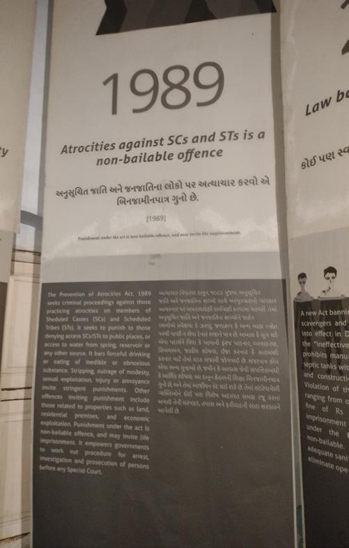
“In this space, we have displayed a copy of the Indian Constitution (a pre-1997 version) and there is no restrictions on visitors as to how they engage with it..In addition, the space also has panels that display human rights movement that spanned several years...”
Conflict Timeline
Gallery of Disputes
Empathy Alley
Moral Compass
“Even in an ideal society, conflict would persistpain, hurt, retribution would flare up. Instead of sowing seeds of silence inside our souls, can we find more creative and constructive ways to express and channel such memories? The Memory Lab is a community art installation that provides the visitors an outlet to express their innermost thoughts without any hesitation. The empty jars on the shelves are there to preserve the memories of conflict in the lives of the visitors.”
“If two entities have to occupy the same space, must one of them blend into or become subservient to th other? Is there a ‘third space’ which is beyond polarity, but opens up to the possibility of something entirely new? Can aesthetics be such a space?”
“The Peepal tree is the identifier, nourisher, and shade giver at the museum also serves as its Sorry Tree, holding space for apologies that were never asked for, expressed or understood... The sign of the truly powerful is humility; arrogance is a sign of cowardice. Apologizing and forgiving are perhaps the most profound of all human behaviors, with the capacity to transform the destinations of future generations.”
“Every visitor, before leaving the Conflictorium, engages with one last installation called the Feelings Map, where they reflect on what emotions they felt while walking through the museum’s different rooms.”
Memory Lab
Power of New
Sorry Tree
08. Feelings Map
REFLECTIONS
The Empathy Alley contains silhouettes of major political figures but they are all of male figures which presents a lack of representation of participation of different genders in relation to politics and empathy in society - does this present a case of our personal biases as designers or curators of spaces or of the larger society and politics with a lack of diverse representation?
The choice of Animal Farm (a western piece) as a metaphor for presenting the Caste System in India for the audiences of Ahmadabad or India is perhaps a representation of our colonized minds. Is it okay to use western methods of representation or should museums be mindful and offer inclusive programming/engagement and learning methods for diverse age groups and abilities more specific to the context, especially in the permanent galleries?
As we delve into the concept of interpretation, the case study of the Museum of Conflict offers valuable insights into how historical narratives can be presented in ways that challenge perceptions and provoke meaningful reflection. It helps us understand how to ask provoking questions by presenting the facts of the past, the realities of the present, and the uncertainties of the future. Through this dynamic approach, the museum becomes a space not just for learning, but for provoking deep, thought-provoking questions about conflict, identity, justice - social and spatial, and the role of individuals and societies in shaping history.
The choice of the container space is as important as the contents of the museums as is reflected in the case of Conflictorium - there is thoughtfulness in the selection of building, location, and representation - these choices all align with the values of the museum.
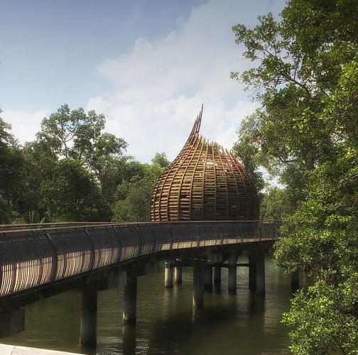
NORTHEAST BAMBOO PAVILION
The Northeast Bamboo Pavilion was built in Faridabad, India in 2023 as part of the Sarujkund International Craft Fair. This annual event is intended to showcase artisan skills and craftsmanship from around the world, with a particular emphasis on local handicrafts from India.
Designed by the Mumbai-based firm atArchitecture, the open air installation implements vernacular bamboo construction native to the region. The team collaborated with local artisans to carry out the complex process needed to generate the building’s unique shape from traditional materials. Throughout the fair, it functioned as an exhibition space to display the traditional practice of loom-working. The pavilion now continues to serve as a contemporary model of ancient architectural practices from northern India.
DESIGN
COURTYARDS AND ARTISANS
The pavilion houses eight circular gallery spaces, each representing one of the northern states of India. The intention was for these spaces to host a handloom native to each state, as well as artisans throughout the fair to provide live demonstrations of loom-work for visitors.
The central courtyard draws inspiration from Surajkund lake but also is a representation of Meghalaya which is the wettest state of Northeast India.
Bamboo lattice mimics woven textile and the lightness of weave. The wall behaves as a metaphor to the hand loom and handicraft of Northeast.
SYMBOLISM
Each design decision of the pavilion is rooted in inspiration directly from local sources and conditions. The bamboo lattice walls mimic the interweaving fibers of fabric made on the loom, while the organic sloping roof replicates the hilly landscape of the surrounding region.
The form of the roof draws inspiration from hilly slopes of northeast while also resonate the slope angles required for the rainy climate of North East India.
The roof and plan respect the existing trees by integrating them within the design and harmonious to the courtyards.
CONSTRUCTION
The structure comprises eight courtyards within a clean, rectangular shape. Each one is used to create a showcase of the hand looms of each state in the region.
‘The central courtyard represents Meghalaya, the rainiest landscape in the world, and faces the sky with a pool of water.
I. Sikkim
2. ArunchalPradesh
3. Mizoram
4. Assam
5. Meghalaya
6. Manipur
7. Nagaland
8. Tripura
Bamboo Craft
Built with bamboo by 90 craftsmen in 60 days.
On-site Collaboration
Design by the architect, adjusted with artisans during construction.
Central courtyard by the architect features a water pool, preserving old trees.
Open Design
Accessible paths ensured to blend into nature.
Bamboo Joinery Details
1. Bamboo shingles
2. Waterproofing membrane
3. Cane mat
4. Criss-cross bamboo support
5. 50mm bamboo purlins
6. 50mm bamboo tie (latitudinal)
7. 50mm bamboo tie (longitudinal)
8. 50mm terrazzo flooring
9. Bamboo bolted to steel pipe ankle
10.75 mm Bamboo columns @ 300 mm c/c
II. 25 mm dia steel pipe ankle
12. 100 x 100 x 10 mm base plate
13. Pebble in courtyard
14. Anchor bolt
15. 200 mm RCC grade slab
16. 75 mm PCC
17. Rubble Sole
18. Peripheral stone footing
Bamboo Roof Detail Plan
APPLICATION
BIOPHILLIC DESIGN
The space blends into nature with its layout. The design respects the existing trees by building around it. This feature could count as a valuable application in our design for an interpretation center, with nature of Tirunelveli where people are harmonious to ecology.
TRANSITIONAL SPACE
The light and transparent nature of walls and the design blends in. The non intrusive, temporary nature of pavilion is also a source of inspiration.
Although there was intention to make this structure vernacular, by trying to create a different wall type they had to introduce bolts.
Painted storks find a safe space in and around the village of Tirunelveli, can the walls allow nesting?
COMMUNITY INVOLVEMENT
The space is shown to be utilized by women to be doing their traditional socio economical activities. The interpretation center thus can be a space which uplifts the community by giving them a pleasant communal space.
We could also get inspired by the free flowing design with no designated space which allows adaptability and flexibility. This way the space can be used in various ways as needed.
Could the use of concrete for the base of pavilion be avoided? Couldn’t local techniques and materials for ground making the carbon footprint smaller?
The question of if all elements with metaphors was communicated or subdued
VERNACULAR OF KANI
Kani tribe of western ghats has deep knowledge of vernacular and they are deeply connected to nature
The project uses vernacular design involving local craftsmen. We could do the same in the interpretation center by reviving, conserving, showcasing Kani Tribe’s vernacular knowledge of building.
Women usually help out in farming majorly taking over most of the auxiliary activities such as de-husking , could they perform these activities in the center
ARCHAEOLOGICAL MUSEUM AND PARK KALKRIESE
INTRO: WHO, WHERE, WHEN, & WHY?
WHO BUILT THE MUSEUM AND PARK
Architects: ANNETTE GIGON / MIKE GUYER ARCHITECTS
• 34 Housing projects (~47%)
• 17 Museums (~24%)
•
• Began in 1989
• Won the award for this project in 1998
LOCATION
• Contributed in 150+ competitions
Submitted for: 1998 Competition in collaboration with Zulauf Seippel
Schweingruber Landscapearchitects, Baden
• Called after certain excavations confirmed the site as that where the Battle of the Teutoburg Forest happened.
Client: Varusschlacht im Osnabrücker
Land GmbH
Museum and Park Kalkriese, Germany
• This is the governmental entity under who’s jurisdiction the forest lies
• They also happen to not only be the funders of the competition (being the clients), but also of the construction.
Osnabrück, Germany
BATTLE OF THE TEUTOBURG FOREST
FUNDING ACTOR NETWORK
Locals
$ - bank $ - taxes
Federal Savings Bank + County
$ - commission
Architects
$ - tickets
Construction Costs + New Visitors’ Center
$ - tickets
Visitors
Peoples’ money was used to build pay for everything, but it as actually well-received by the public
HISTORY AND WHY THE MUSEUM WAS BUILT
The museum and park are located where one of the most important events in European history took place in 9 AD: The Battle of the Teutoburg Forest.
Location: Near modern Kalkriese
Start date: September 9
Hero: Arminius
Combatants: Roman Empire
Victor: Germany
End date: September 11
Casualties: 30,000
The battle ended in what became one of the most prominent defeats in Roman history, ad which ended the Augustus’ expansion period.
After certain excavation discoveries on the site, a competition was held for a design of a museum that tells the location’s history. The current museum and park is the result of the first-prize winning design.
The museum and park are designed to recreate the physical and sensory experiences that soldiers would have encountered during this battle. They aim to inform the public about the location and context of the famous Varus Battle between the ancient Germans and Romans in 9 AD.
The battleground itself is situated in a narrow passage between a dense beech and oak forest and lower marshland dotted with brooks and isolated trees. The German forces, concealed in the forest and protected by earthworks, launched a surprise attack on the marching columns of Roman legions, driving them into the marsh.
RESEARCH AND EXCAVATIONS
In the late 20th century, Mr. Tony Clunn, an archaeologist announced groundbreaking findings in his research and excavations of the site, which ended the doubt as to whether this was indeed the site where the famous battle took place or not. These included Roman various artifacts including a war mask and coins from Emperor Augustus’ time.
PHYSICAL ASPECTS: WHAT?
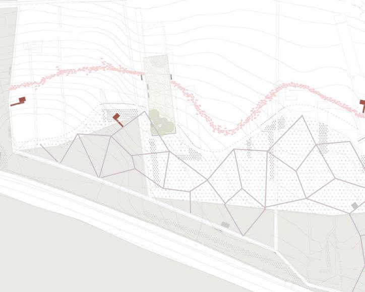
Excavated Landscape
A reconstruction of the original landscape excavated into the ground is an important intervention in the parkland forms an outdoor museum.
Steel Rods
The location and height of the German earthworks and their palisades are marked by steel poles.
One important aspect of the museum park are the three paths. They each represent different aspects of the historical events and how they relate to the landscape. They work together to create a narrative journey through the park, blending historical interpretation with modern elements to help visitors engage with the site.
Field Paths
These trails enable visitors to explore the entire terrain, extending beyond the positions of the Romans and ancient Germans, allowing them to navigate the area like a landscape park.
Route of Roman Legions
Slabs have been arranged irregularly to convey the chaos of battle. These slabs are etched with scribbles, numbers, and symbols from the conflict, allowing visitors to feel their textures beneath their feet as they walk through.
Paths of the Teutons
Visitors can access the forest through narrow paths lined with wood chips, allowing them to experience the freedom of movement that the ancient Germans had behind the earthworks.
New trees were planted in this area to replicate the ancient forest that existed during the battle. This enhances visitors’ understanding of the actual conditions at the site during that time.
CONTENT: HOW?
Three temporary pavilions - Listening, Seeing and Understanding - collect, concentrate and deepen sensory impressions while walking through the park. Located along the Roman Path, they allow the visitor to leave the reality of the landscape for a moment in order to experience it in a more intense way.
The Understanding Pavilion lets curious visitors peer back at the battlefield through slits in the wall, before facing a video installation that highlights current global conflict zones.
In the Seeing Pavilion, visitors experience a vivid, surreal upside-down image of the outside world through a camera obscura.
In the Listening Pavilion, a large hearing pipe made of welded galvanized steel segments amplifies and transmits sounds from the outside into a soundproof room.
Added later to the Archaeological Museum and Park Kalkriese, the visitors center now marks its entrance. Large windows on both sides offer views outdoors. The building is clad all around in facing bricks. The previous farmstead and the new building are united into a coherent ensemble by the material nature of their façades and together form an inviting courtyard.
The museum building is designed as a lowprofile structure, raised above the ground, with a 40-meter-high viewing tower that offers an aerial view of the battlefield. This tower allows visitors to visually engage with the landscape, emphasizing the importance of the terrain in the historical battle.
The museum presents archaeological findings from the site, including Roman artifacts, weapons, and armor. These exhibits complement the outdoor experience, providing greater insight into the battle.
CRITIQUES
DISAPPOINTING
• Too void of the magnitude of the event itself. Objects are not presented in a way that is accessible to the visitor, but rather the focus is on the research discovery experience of Mr. Clunn.
• Not enough is shown in terms of artifacts from the excavations or of the underlying history in this monumental site and historical event.
LACK OF ACCESSIBILITY
• Language is mainly in German
• Front desk representative speaks only German (at least in certain instances) and does not make an effort to speak any other language.
• Some of the text on board was not presented in a legible way both linguistically (German) and visually (red text on a black background)
• 7 Euros to get in (which for some visitors was too expensive for the experience they got in return.
INDECISIVENESS
• The site can’t seem to decide what it wants to be... museum of modern art? Museum of history? Park? Excavation site? Observation tower?
BIASES
• Not enough representation of Roman officials names was shown. Names were on the back of some artifacts and they were not presented in a way to show them.
RELEVANCE
Minimalism as a tool for reflection
Nature as the enduring exhibit
A dialogue between past and present
A reflective journey through history
Earth as a witness to conflict
Aspects of this projects relate to our studies and possible future interventions in India in several ways:
• Story-telling experience
• Information + Interpretation
• Involvement with the natural landscape
• Government funding (and most probably management/ operation as well)
Layered experiences of time
A reflective journey through history
REFERENCES
REFERENCES
GENERAL
Ashoka Trust for Research in Ecology and the Environment (ATREE), Indian Institute for Human Settlements (IIHS), ATREE’s Agasthyamalai Community Conservation Center (ACCC) Manimutharu, NellaiNeervalam, and Tirunelveli District Administration. “A Detailed Project Report for the Restoration of Socio-Ecological Systems of Tamiraparani Riverscape.” ATREE?, 2023.
Deloche, Jean. A Study in Nayaka-Period Social Life: Tiruppudaimarudur Painting and Carvings. EFEO; ECOLE FRANCAISE EXTREME ORIENT, 2011. ISBN-10 : 2855391083 ISBN-13 : 9782855391083
“Thiruppudaimarudur PBR,” n.d.
“Thirupudaimaruthur Management Plan,” n.d.
V, Vishnu, Soubadra Devy M, Mathivanan M, Vinod M Kumar, and Maria Antony P, eds. Trails of the Tamiraparani. 1st ed. Bengaluru, Karnataka, India: Ashoka Trust for Research in Ecology and the Environment (ATREE), 2021. ISBN: 978-81-952895-3-0
SBWR
National Parks Board. “History of Sungei Buloh Wetland Reserve.” (n.d.) . Accessed November 17, 2024. https://beta.nparks.gov.sg/visit/parks/sungei-buloh-wetland-reserve/special-features/ history.
Channel News Asia. “Sungei Buloh Wetland Reserve Celebrates 30 Years with Activities and Guided Walks to Previously Inaccessible Areas.” CNA. Published November 4, 2024. Accessed November 17, 2024. https://www.channelnewsasia.com/singapore/sungei-buloh-wetlandreserve-celebrates-30-years-activities-and-guided-walks-previously-inaccessibleareas-3948276.
Failed Architecture. “In Conquering the Sea, Singapore Erases Its History.” Published April 25, 2019. Accessed November 17, 2024. https://failedarchitecture.com/in-conquering-the-seasingapore-erases-its-history/.
MANPUNGUBWE
Peter Rich Architects. “Mapungubwe Interpretation Centre.” Published 2024. https://www. peterricharchitects.com/mapungubwe-interpretation-centre.
Designboom. “peter rich architects: mapungubwe interpretation center, south africa.” Published November 5, 2009. https://www.designboom.com/architecture/peter-rich-architectsmapungubwe-interpretatio.
The Architectural Review. “Mapungubwe Interpretation Centre by Peter Rich Architects, Mapungubwe National Park, South Africa.” Published 2024. https://www.architectural-review.com/today/ mapungubwe-interpretation-centre-by-peter-rich-architects-mapungubwe-national-parksouth-africa.
TENEMENT MUSEUM
Tenement Museum. “The Tenement Museum: NYC’s Urban Immigration History.” (n.d.). Accessed November 21, 2024. https://www.tenement.org/.
National Trust for Historic Preservation. “Tenement Museum.” (n.d.) Accessed November 21, 2024. https://savingplaces.org/places/tenement.
National Park Service. “Lower East Side Tenement Museum National Historic Site.” (n.d.). Accessed November 21, 2024. https://www.nps.gov/loea/index.htm.
CONFLICTORIUM
Conflictorium. “Conflictorium - Museum of Conflict.” (n.d.). Accessed September 21, 2024. https://www.conflictorium.org/.
Homegrown. “An Indian Museum Is Offering a Path towards Understanding & Resolving Conflict.” Published June 8, 2023. Accessed September 21, 2024. https://homegrown.co.in/homegrownvoices/an-indian-museum-is-offering-a-path-towards-understanding-resolving-conflict.
The Better India. “A Unique Museum in Ahmedabad Is Helping Conflict Victims by Highlighting Their Stories.” Published May 5, 2017. Accessed September 21, 2024. https://thebetterindia. com/98930/conflictorium-ahmedabad-unique-museum/.
Museum Futures. “The Conflictorium — MuseumFutures Copy.” Published 2018. Accessed September 21, 2024. https://museum-futures.com/The-Conflictorium.
NORTHEAST PAVILION
Archdaily. “NorthEast Bamboo Pavilion / atArchitecture”. Published on Jan 30 2024. https://www. archdaily.com/1012722/northeast-bamboo-pavilion-atarchitecture
Dezeen. “Northeast Pavilion Made from Bamboo by AtArchitecture in India.” Dezeen, January 28, 2024. Accessed November 25, 2024. https://www.dezeen.com/2024/01/28/northeastpavilion-bamboo-atarchitecture-india/.
Gigon Guyer Partner Architekten. “Archaeological Museum and Park Kalkriese.” (n.d.). Accessed September 23, 2024. https://www.gigon-guyer.ch/en/project/archaeological-museumkalkriese/.
Smithsonian Magazine. “The ambush that changed history.” Published Septemebr 2006. Accessed September 23, 2024. https://www.smithsonianmag.com/history/the-ambush-thatchanged-history-72636736/.
Encyclopedia Britannica. “Battle of the Teutoburg Forest | Summary, facts, & Significance.” Published August 13, 2007. Accessed September 23, 2024. https://www.britannica.com/event/Battleof-the-Teutoburg-Forest#ref343537.
Issuu. “MAP 8.” Published February 27, 2013. Accessed September 23, 2024. https://issuu.com/ taubmancollege/docs/map8_eames2000_gigonguyer.
National Museum of Denmark. “The battle of the Teutoburg Forest.” (n.d.). Accessed September 23, 2024. https://en.natmus.dk/historical-knowledge/denmark/prehistoric-period-until1050-ad/the-early-iron-age/the-chieftains-grave-from-hoby/the-battle-of-the-teutoburgforest/.
ACKNOWLEDGMENTS
Thalavaipandi S (Lepidopterist & Research Associate, ATREE) AND Santhanamari (Research Assistant, ATREE)
Anish A (Nature Education Consultant, ATREE)
Mathivanan M (Coordinator & Senior Research Associate, ATREE)
Karthika (Children book Illustrator) (Research
Dr Thanigaivel A (Herpetologist & Research Associate, ATREE)
Teresa Scholastica Thomas (Research Consultant, ATREE)
Saravanan A (Taxonomist & Senior Research Associate, ATREE)
Sanmadi KR (Research Consultant, ATREE)
Maria Antony P (Nature Educator & YouCAN Earth Educator Fellow, ATREE)
STUDENT BIOS
Zannatun Alim is in the final year of her Master of Architecture at the University of Michigan, where she also completed her Bachelor of Science in Architecture. She is interested in sustainable practices and design work in tropical, warmclimate environments connecting with her Bangladeshi roots. As a first-generation student, she is passionate about creating community-driven designs that celebrate cultural exchange and enrich everyday life.
Deepa Bansal is in her final year of the Master of Urban Design program at the University of Michigan. With a degree in Architecture from the University of Mumbai, India, she is interested in creating strategies for community-driven, bottom-up urbanization practices that foster a more equitable environment. Deepa is also a food enthusiast who loves cooking for her friends and family.
Virginia Bassily is in the final year of the Master of Urban Design at the University of Michigan. She has a background in Architectural Engineering from the American University in Cairo, Egypt, and is interested in the entanglements between the ‘informal’ and the ‘‘formal’ in urban settings. In her work, she seeks to contextualize the ways of globalization in the growing instant cities around the world.
Jordan Biniker is in the final year of the Master of Architecture at the University of Michigan. After years of practicing dentistry, his design interests lie at the intersection between landscape, social practices, and sustainable design.
Haley Cope is in her final year of the Master of Architecture at the University of Michigan. With a Bachelor of Science in Interior Design from Eastern Michigan University and a passion for all things related to education, her work reflects a strong focus on sustainable material practices.
Stephanie Dutan is in the final year of the Master of Architecture at the University of Michigan with a Bachelor of Design in Architecture from the University of Florida. Her work explores the interplay of temporality and the rich mediums of storytelling, tradition, and culture, seeking to create designs that honor and preserve cultural narratives.
Max Freyberger is in the final year of the Master of Architecture program at the University of Michigan, with a Bachelor of Arts in Architecture from UC Berkeley. His work emphasizes sustainable design and fostering harmony between built and natural environments. Originally from Kentucky, Max has a particular appreciation for the bold and flavorful fusion of Indian KFC, which he considers the pinnacle of fast food.
Nahj Marium is in the final year of her Master of Architecture program at the University of Michigan with a Bachelor’s in Architecture from Bangalore, India, and is passionate about ecological justice. With experience in architecture and landscape design, her research explores degrowth and alternative hedonism, aiming to shift focus beyond human-centered design toward harmonious ecological futures.
Akshita Mandhyan is in her final year of the Master of Urban Design at the University of Michigan holding a Bachelor’s in Architecture from India. Her work explores the intersection of gender, society, behavior, and urbanism, focusing on how these dynamics shape equitable and inclusive urban environments.
Jaydipkumar Nakrani is in his final year of the Master of Architecture at the University of Michigan with a Bachelor’s in Architecture from India. His design vision focuses on creating social spaces that foster community connections, landscapes that celebrate nature, and culturally inspired designs that leave a lasting impact.
Srinjayee Saha is in her final year of the Master of Architecture program at the University of Michigan, holding a Bachelor’s in Architecture from India. Her work centers on humancentric, evidence-based design, emphasizing thoughtful, research-driven solutions that prioritize user needs.
Yi Min Tan is in his final year of the Master of Architecture at the University of Michigan, where he also earned his Bachelor of Science in Architecture coming from Malaysia. His work focuses on storytelling and weaving concepts of time and temporality into spatial design.