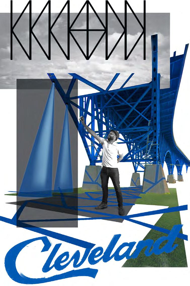
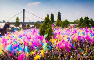
6 ideas
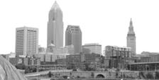
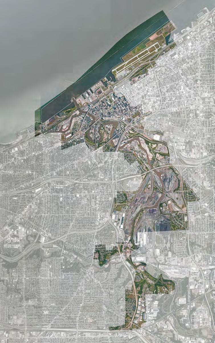
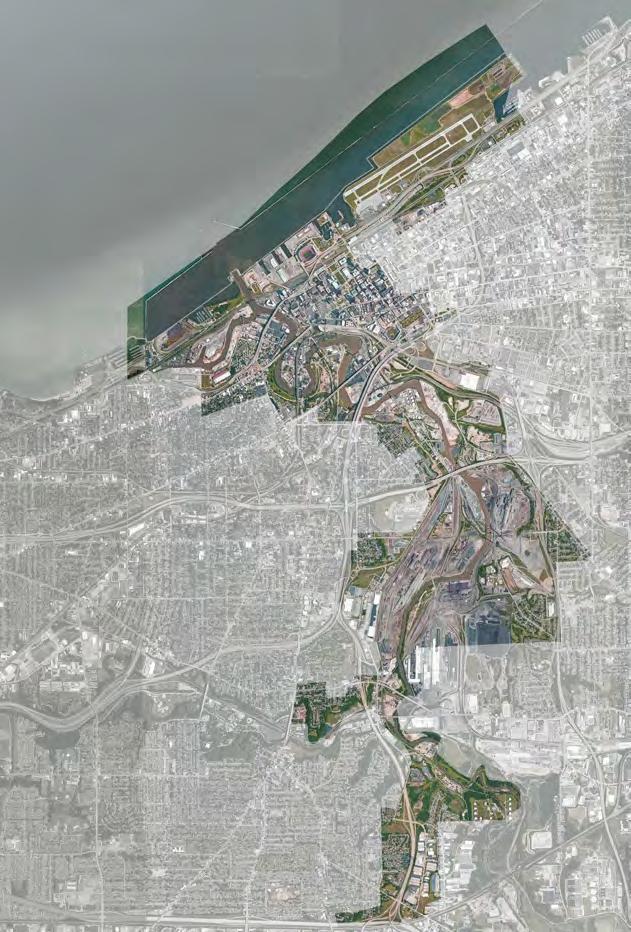
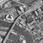
Cuyahoga River Valley
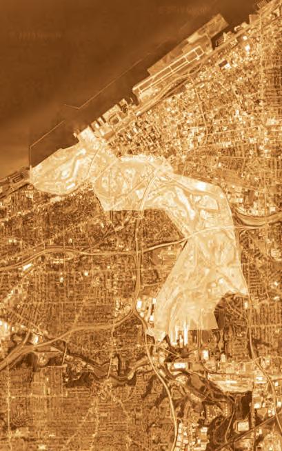
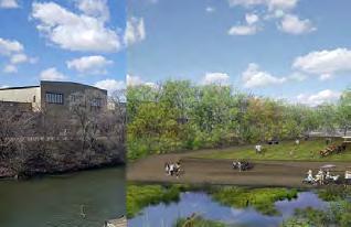
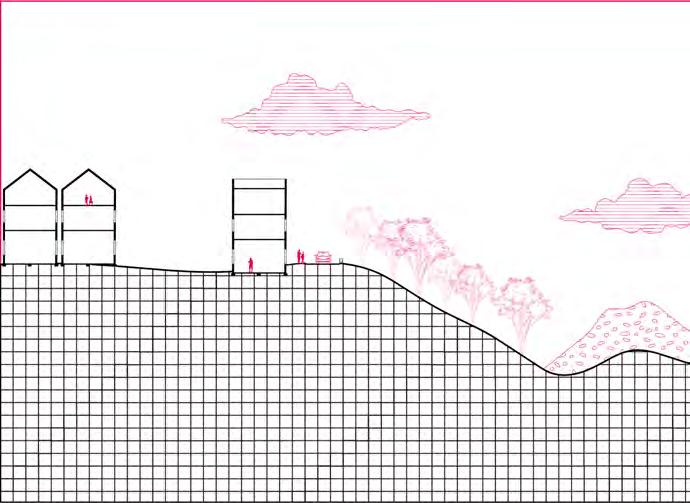
Six projects illustrate a series of strategies aiming to rediscover the Cuyahoga River on its course though Cleveland. The proposals reclaim land, pause time, frame view, draw institutions, and seed new occupations.
The projects could operate simultaneously or in an incremental manner. They learn from the cues found in place and look at the future with optimism.
Each project includes a series of precedent studies to offer lessons learned from other cities in the journey of recovery and reimagination of the urban waters.
Fall 2019 - Arch 509 Emerging Urbanisms
University of Michigan Taubman College
Instructor: Maria Arquero de Alarcon Thanks
by
Jacob Hite
by Christine Darragh
by Yunsong Liu
Interface by Lei Nie
by Liyah M. George, Salvador Lindquist, Abbie Prost
This proposal of a new governance model for the Cuyahoga River Valley in Cleveland frames the need to guide a new chapter of history to preserve the Cuyahoga riverfront development as a resource for the city and its residents.
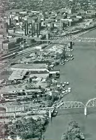
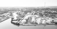
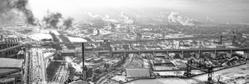
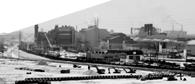
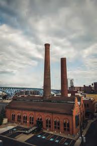
The river valley has served as Cleveland’s main productive hub since the City’s founding, and today is undergoing a rapid transformation. For over a century the river had facilitated the transport and production of steel, cement, and petroleum, as well as the shipping of minerals and other raw materials. Industry is still an important part of the city and its economic health, employing hundreds, but sections of the riverfront are increasing open to other opportunities.
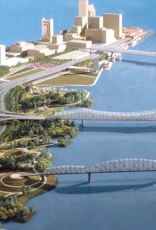
The legacy of heavy pollution still hangs over the Cuyahoga, but communities once adjacent to factories and gravel piles now have the possibility to experience the river in new ways. The interaction between the calm nature of the river and massive infrastructure of the city embues the valley almost magical properties, a sense of place that is increasingly rare. But this balance is tenuous. Developers have begun to propose large residential and commercial projects in the newly empty lots, drawn by beautiful views, a proximity to downtown, and waterfront access. While development in the valley might be desirable, there is a risk of losing an asset vital to the City’s past, present, and future.
An independent quasi-governmental non-profit consisting of representatives of the various levels of governments, citizens, and local organizations should be established to steward development with the valley and preserve public access to the river. The creation of the Cuyahoga River Valley Authority would ensure the protection of the unique features on the Cuyahoga, promote coordination between new and existing uses, and create an advocate for local residents.
The Cuyahoga River Valley Authority should strive for the improvement and preservation of the river valley for all residents. The organization’s objectives reflect its commitment to accessibility, equality, and sustainability for the common good.
Ensure public access to river and riverfront
Encourage harmony between new and existing uses along the river
Establish continuity along the river by coordinating design of new developments
Preserve the river’s function as a working waterway while facilitating new users
Promote a healthy environment through the reintroduction of natural processes
Create and upgrade infrastructure to serve local communities and industries
Cultivate opportunities for the citizens to directly shape the future of the river valley

Because of the complex claims of ownership of the river valley, both cultural and physical, the Cuyahoga River Valley Authority will need to collaborate with, lead, and empower a broad coalition of stakeholders to ensure its success. Utilizing Cleveland’s existing institutional infrastructure increases the operational capacity of the organization and creates opportunities to build on other’s efforts.
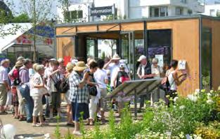
Community engagement is crucial to the success of the Cuyahoga River Valley Authority. Public involvement throughout the process of revitalization can steer development toward more equitable outcomes while promoting community support for future projects. From the beginning, the CRVA should continuously collect citizen input to build a collective vision for the future of the river valley. After extensive community workshops and educational meetings, this vision should be crafted into a Master Plan to guide the organization’s actions as it moves forward with redevelopment.
In order to give residents a direct opportunity to shape the riverfront, a participatory budgeting process could be established. This way, a portion of the organization’s budget is dedicated to publicly elected projects. This process can be implemented in a number of ways. Participants can vote which projects to implement to approve or rank those they believe the organization should prioritize. This form of direct local democracy builds stronger communities and promotes a more equitable distribution of public resources.
PRESERVE THE RIVER’S FUNCTION AS A WORKING WATERWAY WHILE FACILITATING NEW USERS
CREATE AND UPGRADE INFRASTRUCTURE TO SERVE LOCAL COMMUNITIES AND INDUSTRIES
ESTABLISH CONTINUITY ALONG THE RIVER BY COORDINATING DESIGN OF NEW DEVELOPMENTS
ENCOURAGE HARMONY BETWEEN NEW AND EXISTING USES ALONG THE RIVER
PROMOTE A HEALTHY ENVIRONMENT THROUGH THE REINTRODUCTION OF NATURAL PROCESSES
ENSURE PUBLIC ACCESS TO RIVER AND RIVERFRONT
CULTIVATE OPPORTUNITIES FOR CITIZENS TO DIRECTLY SHAPE THE FUTURE OF THE RIVER VALLEY
Organizational powers will be bestowed by the government and used to accomplish the Authority’ objectives. Funding can come from a number of sources both public and private, with opportunities to build independent revenue streams. Due to the complexity of the Cuyahoga River Valley Authority’s mission, it will be crucial to coordinate actions with intent.
wnership
y Leasing
e Programming
Remediation
e Development
ent Financing
Review
Development
Battery Park City Authority
Battery Park City Authority (BPCA) is a public benefit corporation created by New York State in 1963 to oversee the redevelopment of part of the Port of New York. The organization managed the creation of 92 acres of land on the Hudson River and established a plan for future development. The area is now a residential and commercial community. The BPCA owns and leases land, issues bonds, and manages large scale projects. One of BPCA’s most notable projects is the preservation of 36 acres of public open space.
The Anacostia Waterfront Corporation (AWC) was a government-owned corporation established in 2004 to head the environmental rehabilitation of the Anacostia River and revitalization of the surrounding neighborhoods. Working off a plan made by the city, the organization set the ground for the development of the DC stadium district. It also established programs for environmental clean-up and workforce training. The AWC faced criticism due to lack of communication with city agencies and was ultimately dissolved.
Riverfront Development Corporation of Delaware
Created by a Governor’s Task Force, the Riverfront Development Corporation of Delaware (RDC) redeveloped former shipping yards along the Brandywine and Christina Rivers into an major employment center and tourist destination. Funded by the State government, the organization has made major investments into the public realm, including environmental remediation. Today the RDC strives for complete ownership of the riverfront through acquisition, long-term leases or in participation with private developers.
Waterfront Toronto
Waterfront Toronto is organizational partnership between 3 levels of government that aims to revitalize the Toronto waterfront along Lake Ontario, promoting the environmental, social, and economic health of the citizens. This collaboration between the City, the Providence, and the Federal Government was created to encourage corroboration while utilizing the collective resources of the various agencies within each government. The organization oversees all aspects of the planning and development of 1,977 acres of land.
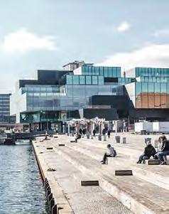
City & Port Development Corporation
Co-owned by the city of Copenhagen and the Danish national state, the City & Port Development Corporation utilizes the value gained from rezoned public land to finance major infrastructure improvements, with the largest portion of developable land being the federally owned port. This investment in infrastructure has created a vibrant, multi-purpose waterfront, major extensions of the City’s transit system and thousands of housing units built for market and social purposes.
Brussels Productive City and The Canal Plan
Brussels Productive City is an initiative by various regional planning agencies including the Master Architect of Brussels to preserve the industrial economy within the city, particularly along Brussel’s canal. The Canal Plan is a vision that guides the actions needed to ensure the continuation of the city’s industrial zones. In addition to traditional land use controls such as zoning, the Master Architect conducts formal design reviews for new developments and organizes design competitions for city projects to further the region’s goals.
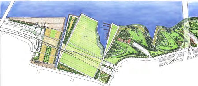
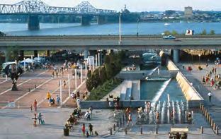
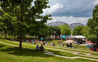
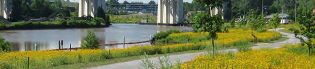
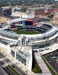
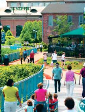
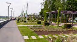
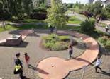
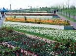
Louisville Waterfront Park is a 85 acre linear park along the Ohio Riverfront just east of downtown Louisville, Kentucky. The park is stewarded by the Waterfront Development Corporation, which is responsible for park maintenance, planning, and programming. The Louisville Waterfront consists of primarily open green space with a mix of passive and active recreational areas, all linked by paved walking trails. Within the space there are distinct areas such as Entry Plaza, Great Lawn, and Festival Plaza which attract a variety of uses.
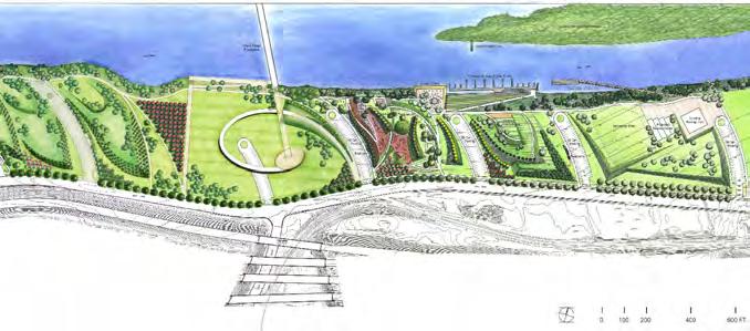
Image Source: Waterfront Development Corporation
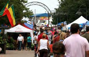
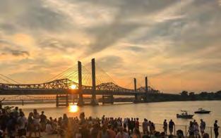
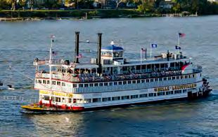
More than 150 events are held on the Louisville Waterfront every year. Programming is an important aspect of the park with thousands attending concerts, festivals, and craft fairs held on the grounds. The park also contains 2 marinas and a community boathouse, offering access for rowers and motorboats. The Big Four pedestrian bridge spans the Ohio River to Indiana, providing an unique connection to the neighboring city.
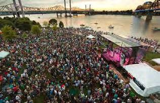
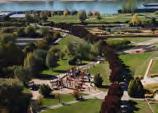
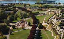
Louisville’s waterfront had been claimed almost entirely by industrial uses throughout the 20th century. Rail lines and an elevated freeway separate the land where the park now sits from the urban fabric of downtown Louisville. Louisville Waterfront Park shows the potential of what many would consider troubled spaces. What was once primarily scrapyards and sandpits has been transformed into the heart of the city, with the park attracting more than a million visitors every year. The park and the surrounding district has attracted an estimated $1.3 billion in investment since its creation, including residential apartments and condominiums, Louisville Slugger Field, and the Yum! Center sports and concert arena.
The park sits on public land, owned by the Metroparks Agency, and is ran by the Waterfront Development Corporation. The park was financed by funds from the local, county, and state government, as well as donations from local corporations, foundations and individuals. The current iteration of the park was constructed over three phases of development that spanned over 2 decades; the most recent completed in 2014. The total cost of development for these phases and related infrastructure was $112,870,000. A fourth phase will add another 22 acres to the existing park. Continued operations are funded by the metro and state governments and park-generated revenue including event fees and rents from concessions.
The Waterfront Development Corporation is a quasi-independent, non-governmental entity established to lead the redevelopment of the Downtown Louisville riverfront. The organization was formed in 1986 as a government partnership by the City of Louisville, Jefferson County, and the State of Kentucky, with each level of government providing equal funding and holding the same number of seats on the board. The initial WDC responsibilities did not include creation of a park, but the waterfront revitalization.
For the first 5 years, the WDC hosted a series of public forums to find out community needs. It was the strong expression of interest in green space that led to construct a park. Following the initial forums, and for a number of years, WDC staff averaged more than 85 public presentations per year to keep the community updated on construction and they currently average 30 to 40 per year.
In 2001, the Waterfront Development Corporation became a corporate entity. State and city officials still make up most, if not all, the organization’s board. It’s relationship with the various levels of government has been credited as one of the reasons for its continued success, as well as held as an example of inter-government corporation. At the same time, its non-governmental structure allows independence and ability to focus on its responsibilities free of political interference.
The park was master planned by Hargreaves Associates (now Hargreaves Jones) after five years of community engagement by the Waterfront Development Corporation determined that city residents valued open space and access to the river. The landscape architecture firm focused on the parks relationship to the river, allowing the river and its natural ecology to be enjoyed with minimal obstruction through greens paces.
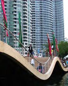
The main iteration of the park was built in 3 phases, with construction on the space continuous from 1994 through 2012. Phase I opened in stages from 1996 t0 1999 starting with the Wharf and finishing with the Great Lawn, Harbor Lawn and Harbor. This was largest section of the park that serves as the gateway between the waterfront and downtown. Phase II on the eastern end of the park included passive and active recreation spaces as well as natural areas such as meadows and groves. Phase III added some of the parks largest features such as the Big Four pedestrian bridge and the Big Four Lawn, one of the main gathering spaces in the park.


Phase IV of the Louisville Waterfront Park has been announced with plans provided by MKSK. This new development is focused on the waterfront west of downtown, connected to the rest of the park by a riverwalk. Plans include an experiential learning area and observation pier to create a destination spot distinct from the rest of the park. Connections between the new phase of the park and surrounding neighborhoods are prioritized with riverwalk improvements and dedicated pedestrian and cycling paths.
In addition to their responsibilities within Louisville Waterfront Park, the Waterfront Development Corporation also has design review authority for the Waterfront Overlay District. The district encompasses both the riverfront park that WDC designs, maintains, and programs, as well as large areas of land that border the park and the riverfront. This includes active industrial areas to the east, large portions of downtown commercial, swaths of neighborhood residential, and areas of former industrial land and open space.
A design board at the Louisville Waterfront Corporation reviews plans for development within the overlay district before they can apply for permits and approvals from the city. As part of this special zoning regulation, the WDC review board does not scrutinize the appropriateness of the use, but rather the design of the development and its context to surrounding uses and the river, prioritizing creation of pedestrian access and preservation of visual corridors.
The specific design criteria that the review board looks for differs based on the development goals in the area and the type of development proposed, but there are overarching goals that the Waterfront Development Corporation hopes to achieve with the review process. This includes unity between public spaces and private development, coordinating space systems and pedestrian flows between parcels and the river. Public access ability is prioritized for most of the riverfront, particularly near downtown and residential districts. Views are also considered, with both the visual experience traveling through the outer edges of the district and the slight lines to the parks and the river part of the review criteria.
The Waterfront Overlay District is divided into six separate sections, each with their own design intent that the Board uses in their review of new developments along the river:
Area A-1: Downtown (CBD) waterfront area aims a high degree of public use with parks, hotels, public assembly areas, high density residential areas, and river theme retail commercial uses. The character envisioned is an urban district with hard-edged landscape and streetscape treatment, especially pedestrian oriented for day and night use with continuous public access to the water’s edge.
Area A-2: This area provides the potential to expand the downtown waterfront oriented businesses and public uses. Protection of the established character of historic structures and the extension of the established Main Street scale are important. The transition and connection from the CBD to the river for the public, and especially pedestrian movement and vehicular linkages north and south across River Road, are key concepts.
Area A-3: This area encompasses Waterfront Park Phase IV and the transition into the surrounding neighborhoods. The transition of current industrial operations to commercial and residential mixed uses is encouraged. Strong visual and pedestrian connections to the park are emphasized, with a focus on walkability and multi-modal connectivity.
Area B: This area contains community active and passive recreation infrastructure, including large community gathering spaces. It serves as a transition buffer from the urbanizing waterfront to the west to the industrial waterfront to the east and encourages the extension of the public assembly and gathering facilities and river’s edge accessibility.
Area C-1: Providing river-oriented industry a location for operation, public access to the river’s edge is preferred, but it is understood that safety, security or other business needs may make river edge access impractical. The key design issues for the area include the visual relationships of proposed development to the Ohio River and preservation of the view shed from the interstates to the Ohio River. Industrial developments receive a decreased level of review focused on primarily exterior design.
Area C-2: This area is expected to have open space and recreational uses on the eastern end an the potential for private and public uses on the western side. Development intensity is expected to diminish from the medium density to the open space character present at the eastern edge of the Review District. The design issues focus on the corridors, where it is desirable for these to continue to serve as scenic, landscaped approaches to Louisville’s CBD from the east.
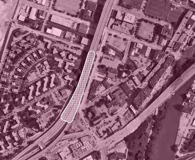
This project aims to establish a framework for a bi-annual (or multi-annual) design competition which would engage the public from viewpoints within the city of Cleveland in order to begin a comprehensive and open conversation about the future and health of the Cuyahoga River Valley.
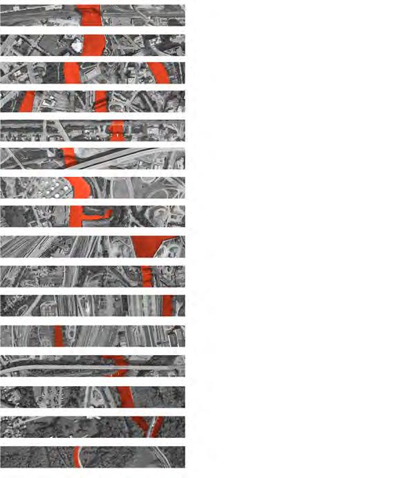
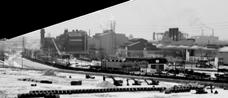
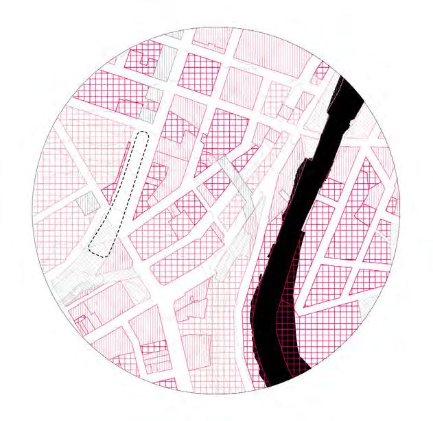
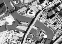
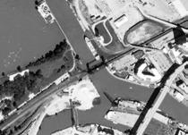
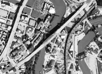
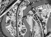
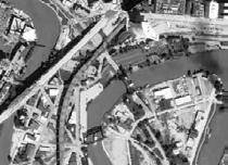
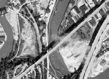
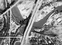
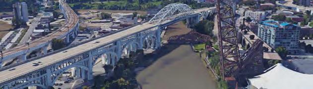
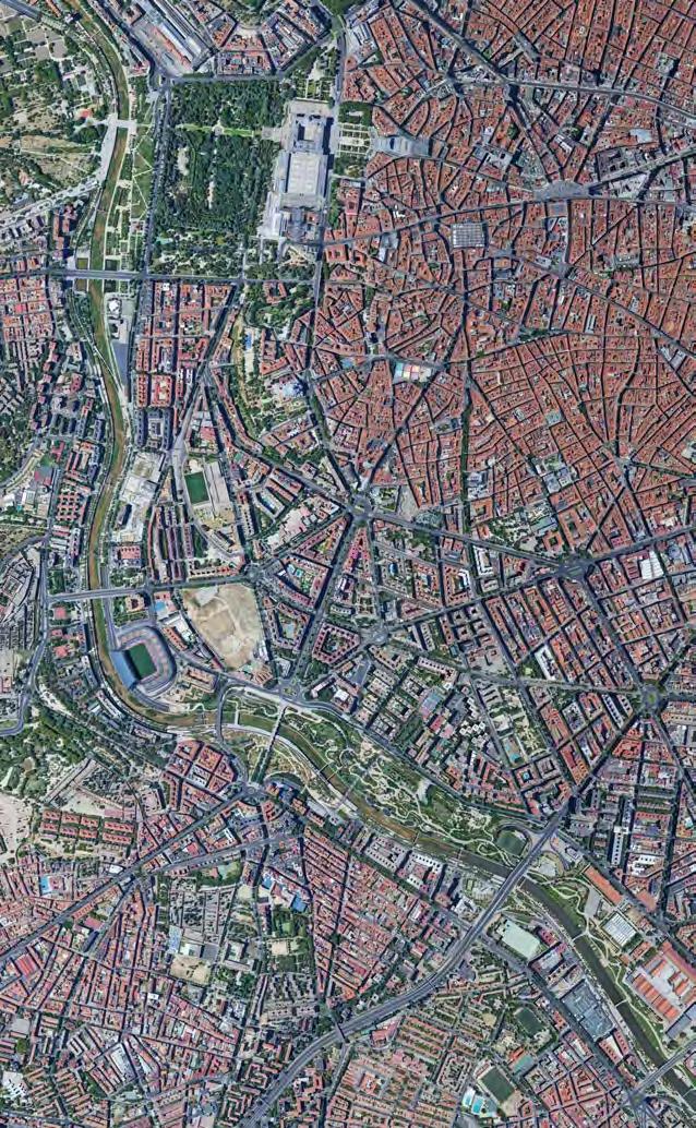
The Cuyahoga River is a central component to the geography of Cleveland. It winds its way through the center of the city, creating peninsulas from a series of ox-bows which twist back on themselves. Early plans of the city show a grid system (in gray above) struggling to respond to the irregular river winding through its middle.
Cleveland was founded as a network city, a node in a supply chain which shipped raw materials through the mid-west to the east coast. Over time, manufacturing companies used those raw materials to create component parts to ship over the world. Cleveland eventually grew to become the 5th largest city in the world.
In a deindustrializing landscape facing limited resources and a shrinking population, the city and the river must open itself to new definitions in order to maintain a vital, intertwined identity. The goal is the collective reimagination of the future Cuyahoga as a common thread connecting the diverse ecologies from the National Park in the south to Lake Erie in the north; connecting communities across the geographical breadth of the valley.
A B C D E
BRIEF:
COMMON THREAD CLEVELAND is a bi-annual series of installations staged across the city by artists, designers and architects whose proposals respond to themes of accessibility for the river front. Provocations are required to respond to both the site context and the question posed by that location.
Poses a relevant question at each site of access along the river. The sites are chosen for their visual access to the river, a point of dissonance which sheds light on the lack of physical access to the river through the city. The corresponding questions address the thematic concerns of the group tasked with envisioning the future of the Cuyahoga River Valley.
Cleveland is transitioning away from its industrial roots. Reimagining the city means new uses for the river, which is centrally located, but blocked by private properties and inaccessible industrial sites. Retaining its historic character as a port city is important to the future identity of Cleveland. But, accessibility means finding ways to open up paths along the river and across the city.
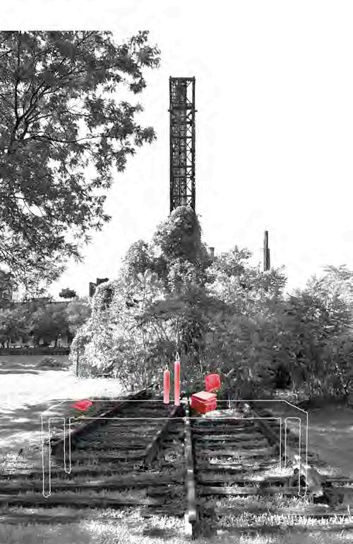
What would it look like, if “wild places” were protected as safe spaces for individuality?
Third Spaces are places with a sense of mystique and unfamiliarity; a place where others feel welcome.
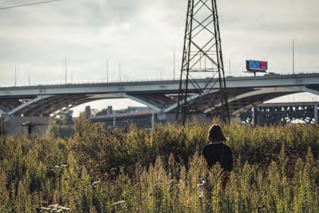
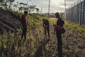
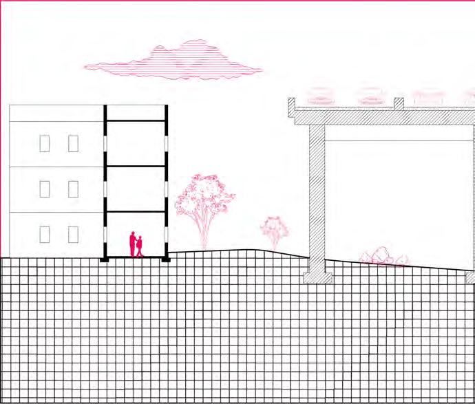
These places are often physically isolated and remain inclusive by resisting traditional programs or assigned uses. They are rarely maintained and by the very nature of being “forgotten”, they nurture safe spaces for animals and humans who don’t conform to common norms. Even these left-over spaces are valuable. How can you design for “third spaces” in the contemporary city, while embracing their very spirit? Yet here it is. This particular site is located along a forgotten railroad bed. It is overgrown from lack of use and maintenance. Located down an embankment from well-used railroad tracks, and next to the river, this is a space of wonder.
Your project should imagine what accessibility to and along the Cuyahoga River means. Proposed narratives should be bold, take a clear position, engage the public, and offer an educational component. Different and previously unconsidered perspectives are encouraged. Projects thoughtfully engage both the view as well as the question will be the most successful.
1
Build public engagement toward a connected and accessible waterfront through interventions designed to spark discourse.
2
Build public interest in an organizational body tasked with stewarding the Cuyahoga River and its interests in the city of Cleveland.

1The city employment demographic is changing. Industry is no longer the lead economic driver of the city. Primary sources of income come from the medical sector--the city is home to an internationally known hospital--the Cleveland Clinic. The service industry is growing as well. A transformation of the workforce is also a transformation of the businesses present in the city. Dwindling reliance on manufacturing and industry means that in some cases, the centrality and power of the manufacturing sector in Cleveland is also ebbing. This provides an opportunity to act strategically in regards to properties which are and were formerly occupied by large industrial sites. In many cases, these properties are located on or along the river. Creating on how to address future vacancies and properties for sale along the river gives the City leveraging power as future developers express interest in land along the river front.
2
Historically, developers have a strong voice in the city of Cleveland. Starting with Shaker Heights, one of the first developer-owned and maintained municipalities, developers have been an integral part of the city’s growth. However, if the city’s interests are to provide access to the public along a connected waterfront, a representative for the riverfront and the Cuyahoga River Valley must be present from the early negotiation stages to assure that the future of the river is cared for adequately.
Percent of Employed
Less than 5%
5% to 20%
20% to 35%
35% to 50%
Over 50%


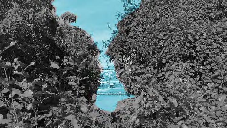
Cleveland is rich with views. In fact, views, especially from bridges, are the most available form of access to the Cuyahoga River. This project seeks to exploit the dissonance between physical and visual access in the city to stage interventions at these viewpoints in order to provoke conversation and public interest.
Building upon the interests of this group, each visual access point will have a question mapped onto it. The project brief requires applicants to propose a project which responds to both the context of the view as well as the question posed.
The questions broadly address the following areas of interest: Appropriation of Bridges
Cultivation of Wilderness within the City Celebration of Third Space
Industrial & Domestic Legacy
1Q: 1VIEW
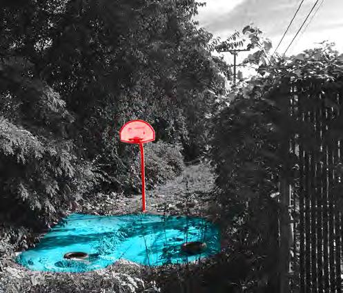
... if bridges spanned more than just sides of the river? ... if the Forest City were a sea of green and blue?
... if “wild places” were protected as safe spaces for individuality?
... if what’s unfamiliar wasn’t scary, and hidden spaces didn’t need finding?
Photo Credit Salvador Lindquist
... if Cleveland’s bridges connected us to the future?
... to imagine a hybrid habitat where humans and nature coexist?
... if Industrial Zones didn’t block access to the river?
... if Humans Invited Nature (back) into their Cities?
Biennial Sub-committee
9 Total Members, 3 Members representing each interest area, with at least one each currently serving on Cuyahoga River Valley Authority.
NEIGHBORHOOD REPRESENTATIVES
Detroit Shoreway
Historic Gateway
Ohio City
Tremont West
Burten Bell Carr
Campus District
Metro West
Historic Warehouse
Old Brooklyn Flats Forward
LAND Studio
Ohio Arts Council
Cuyahoga Arts and Culture Arts Cleveland
CHAMBER OF COMMERCE
Entertainment Districts
Commercial Business
TASKS:
Execute the timeline of the Common Thread Cleveland Biennial, Choose and advise independent jury.
Manage corporate sponsorship, grants and other fundraising mechanisms.
This project fulfills the following two objectives laid out in the Charter of the Cuyahoga River Valley Authority:
1
2
ENSURE PUBLIC ACCESS TO THE RIVER AND RIVERFRONT
CULTIVATE OPPORTUNITIES FOR THE CITIZENS TO DIRECTLY SHAPE THE FUTURE OF THE RIVER VALLEY
JURY
2 Individuals
Chosen from among members and leaders of the neighborhood, business, and non-profit community
GUEST JURY
2 Individuals
Well-known architects and artists, and celebrities with ties to the Cleveland Area.
LOCAL ARTISTS
2 Individuals
Chosen from among the local artist, architecture community.
TASKS:
Review proposal submissions, choose a proposal for each site.
Issue semi-finalist list and finalist list according to deadlines laid out in the proposed timeline
After the biennial, award a juried prize and confer a public input prize.
18 MONTHS
•Common Thread Cleveland Biennial Committee is Convened
•Jury Chosen
•Grant writing Solicited
15 MONTHS
•View locations identified, Questions determined
1 YEAR
•Corporate Sponsorships Solicited
•Call for Proposal issued
10 MONTHS
•Deadline for Submissions
9 MONTHS
•Semi-finalists announced
6 MONTHS
•Finalists Chosen
5 MONTHS
•Call for Volunteers
3 MONTHS
•Volunteers gathered and trained to assist with site specific weekly promotional events.
2 MONTHS
•Weekend events scheduled, promoted in local calendars. 4 WEEKS
•Construction begins at each site
2 WEEKS
•Local businesses receive map of the project locations, questions & directions for crowd voting.
1 WEEK
•Signage in place to educate and promote circulation of crowds.
WEEK 1
•Kick-off Gala
WEEK 2
•Weekend Events: Ecological Awareness Educational Theme
WEEK 3
•Weekend Event: Ride the River Biking Event
WEEK 4
•Meet the Designer
•Sponsorship Fundraiser, Designers in Attendance
WEEK 5
•Weekend Event: Run the River 5k Footrace Event
WEEK 6
•Entertainment or musical event staged WEEK 7
•Community events sponsored by adjacent community groups.
WEEK 8
•Closing ceremonies
•Awards Issued: Jury Prize and Community Engagement
•Next Celebrity Jurors Announced
AFTER
•Community Engagement aimed at soliciting community feedback into Biennial process.
•Business community debrief.
•Public Solicitation of Places and Questions.
Corporate sponsors and community stakeholder organizations sponsor a particular site
Material companies (glass, lumber) sponsor building and assembly materials for the proposal installations
Community Groups, Activist Organizations sponsor weekly activities at the sites as a way to educate the public, raise awareness, and promote agendas of riverfront connectivity, community and
Match grants offered by the public allow companies to match funds raised through community support campaigns.
Grant writing campaign can assist in funding of expanded site support, particular activities
By becoming individual sponsors, members of the community are given special access to artists, designers and activists, private “sneak peek events” and thematic “swag”.
Items available for purchase both assist in marketing and awareness of the bi-annual event, but also raise money at a level.


A simple and inspiring paragraph describing a future where all the proposed and imagined changes have taken place. The vision is a common agreement on a preferred future and helps both define and direct the work to generate momentum.
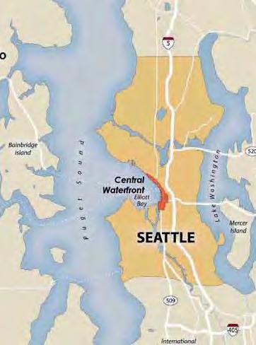
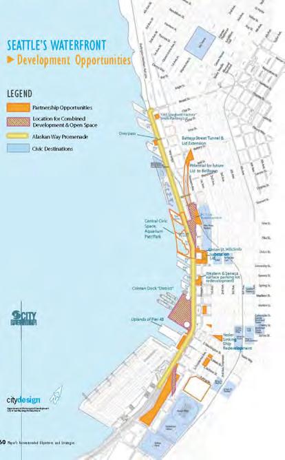
Seattle’s is simple but practical, mentioning the necessary replacement of the viaduct, and the reclamation of the waterfront. It makes clear its intentions of using the waterfront to unite the city, to welcome diversity, recognize the heritage of the place, but establish a framework for future growth which will make Seattle a standard for other aspiring cities.
The act of envisioning an accessible waterfront connecting Cuyahoga National Park with the Lake Erie shoreline is an opportunity to establish agency in the future of Cleveland.
For Seattle, the present is a place in flux. A location pivoting from one type of space to another. Change can be unsettling for people and places which perceive the new as a threat to their livelihood or existence. Simple acknowledgment can ease the growing pains.
Seattle takes a moment to recognize it’s history as a port and maritime center. It recognizes the pre-western history of its native population. Seattle establishes these stories as a part of it’s origins in order to root the city in a geographic location, to instill it with a sense of place, and to lay the foundations of the forward looking language which will honor but not be nostalgic for a past which has brought Seattle to the place it is today. A past which thrusts upon it a need to conceive of a new future.
Cleveland’s history instills in a sense of place, gives identity, which differentiates it from all other cities. Remembering the past, lays the foundation for a way forward into the future.
Idealistic and somewhat utopian, the future has a blankness about it which allows individuals and municipalities to write their hoped-for plans of diversity and inclusion, care for the ecology of place. But the documentation of what’s hoped for can be realized through goals, prioritization and consensus. For Seattle, or Cleveland, or any municipality, statements about the
future allow a place to have agency. By establishing a forward-looking plan, a city is less likely to be responsive to the whims of developers who also have an ideal future (and profit margin) which may or may not include the hopes laid out by the city. Documented, these become a conversation to establish common aims between competing interests within a city.
Seattle appointed a team to study the waterfront local ecologies. Why? In order to be good stewards of the water and waterfront as part of Seattle’s unique identity. It is a thread of history, a foundation upon which to build a way forward. Seattle’s ecology team identified ways that the waterfront ought to be protected for aquatic species and those residing in the intertidal zone. Knowing that development would threaten or conflict with the priorities laid out by this team of ecology advocates, the plan includes suggestions for how to build in a less impactful way, and what interventions could sit more lightly at the waters’ edge.
For Cleveland, also a city with a rich maritime past, identifying ways to reestablish, grow and protect the river’s edge ecology can help create a link between the upstream waters at the National Park and the Lake Erie shoreline.
In this plan, Seattle recognizes the need to manage the rain water volume which can cause sewage outfalls. These overflows damage water quality and occur when the volume of water flowing through the sewers is too great for the system to handle. Adding rain water management to the waterfront project allows Seattle to build a delay time between when it rains, and when some of the rainwater enters the sewers.
Clean water is a matter of public health. For Cleveland, similar issues of point source pollution exist. And, managing outfalls is a necessary component of any future including the river as a central figure.
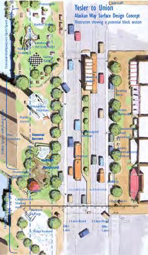
Through zoning or incentives, encourage retail spaces along pedestrian zones.
Reorient adjacent building facades to face toward these zones. Encourage housing and mixed-use development in areas near to pedestrian zones.
Access to the edge of the water is a right of the public. Ownership along the water’s edge is now stipulated to allow access for public passage on and through the space.
Reflecting a statement made in the Chicago Plan of 1919, making water access a matter of public right, allows the city to manage future development with linear connections in mind.
Protect access to the waterfront by locating parking away from the water or connecting it off-site through direct lanes of public transit.
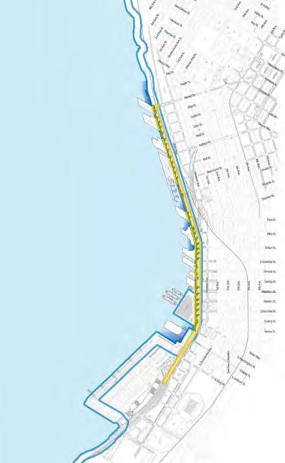
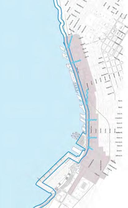
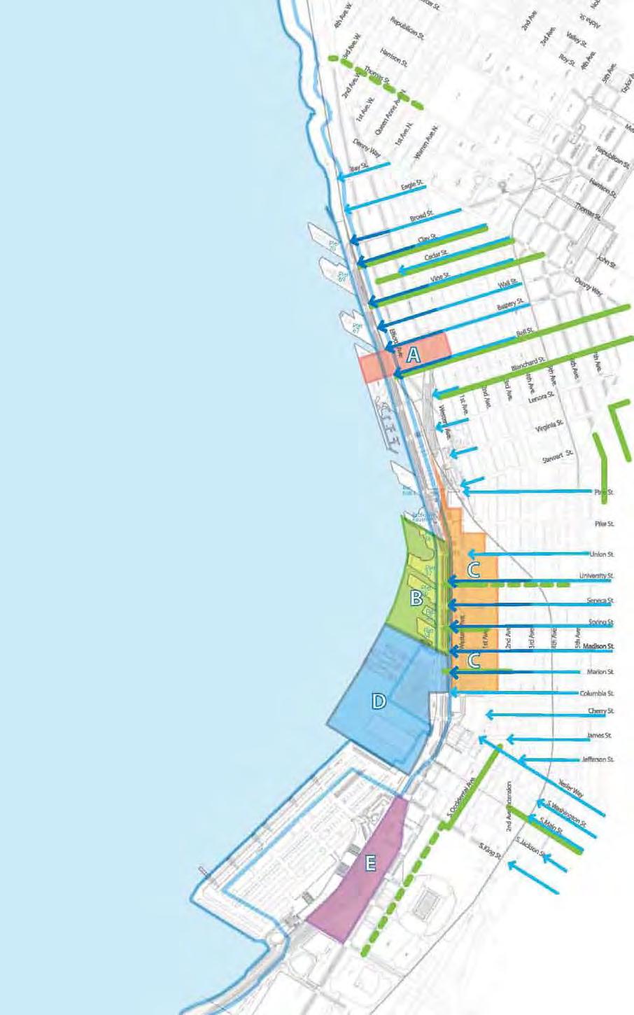
Through zoning initiatives, Seattle protects the “view corridors,” places with visual access to the sound are unique or Mount Hood. These two geographical elements of Seattle’s identity, and establish a sense of place. They also act as orienting marks.
A system of air rights transfers maintains view corridors and insures that the cityline does not obstruct the sigh lines of its most singular pieces of identity, and creates democratic access to these. This way, views are not reserved for those who can purchase the highest window in the city.
Seattle created a special development area with additional expectations for building and developing land within that waterfront. These add to the already existing zoning provisions, but provide for the special concerns associated with building on or near the water front.
Designated Green Streets
Proposed Green Streets
View Corridors
View Corridors with Upper Level Setbacks Required
Shoreline Regulation Zone
A Battery Street View Point & View Corridor
B Historic Piers
C Area Zoned DMC
D Colman Dock
E Current Industrial Zones
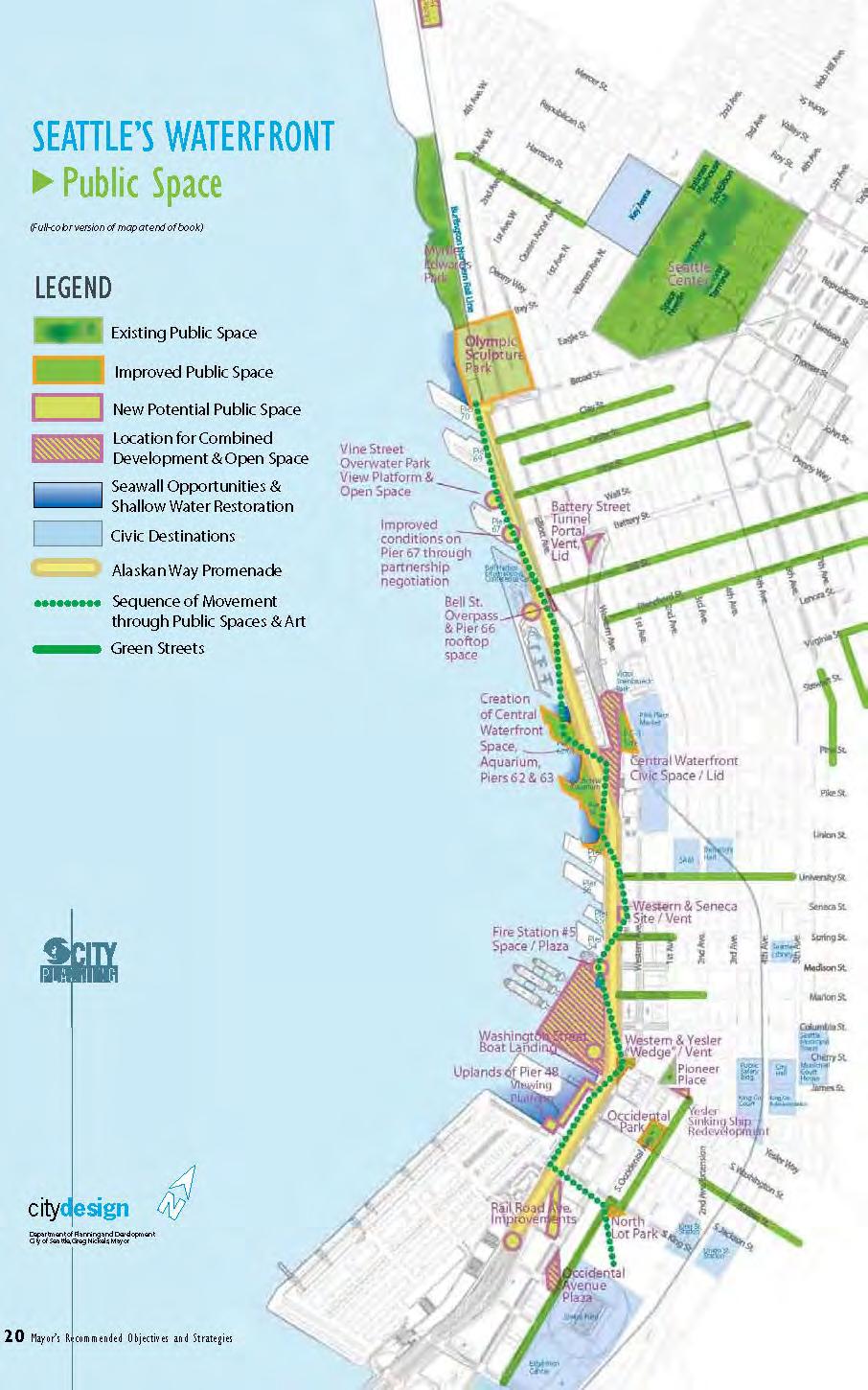
Included in this vision is a clear table stating all entities with a stake or a responsibility for the proposed projects. The plan specifically identified areas where interventions would be beneficial to the city. It outlined those properties, buildings and areas and described them and the city’s intentions for those individual spaces. This difference makes Seattle an active partner in development. By maintaining an oversight and defining what development looks like, Seattle exercises its municipal authority to establish a future city within the guidelines it has laid out in its vision.
Prioritize a public realm plan.
Establish guidelines for private development. Champion rights of way and open spaces.
PHASE IMPLEMENTATION + PRIORITIES
Develop clear priorities, have a plan for public access and education during the construction process.
PUBLIC REALM STRATEGY
Establish location and design of major public spaces, allow change to occur around spaces according to guidelines established in the public realm plan. Include regulatory incentives.
PUBLIC INVOLVEMENT
Find innovative ways to involved the public efficiently and meaningfully.
OVERSIGHT/COORDINATING ENTITY
Create one or more coordinating entities, with oversight to manage the redevelopment of waterfront in diff phases of project: quasi-public development agency for financing, construction management or a non-profit for programming and maintenance. Functions could include fundraising, construction, planning, assembling land, planning/ design new open spaces, and right of way improvements, ensuring integration of projects by jurisdictions other than the city of Seattle, coordinating construction schedules, maintaining programming and new/existing open spaces.
IDENTIFY THE ROLES AND RESPONSIBILITIES
of agencies and non-profit organizations who have a stake or sense of responsibility in this area… make a table of areas cross referenced by what agency/group has oversight.
“an illusory inertia”
Terrain Vague in the Cleveland’s Cuyahoga River Valley
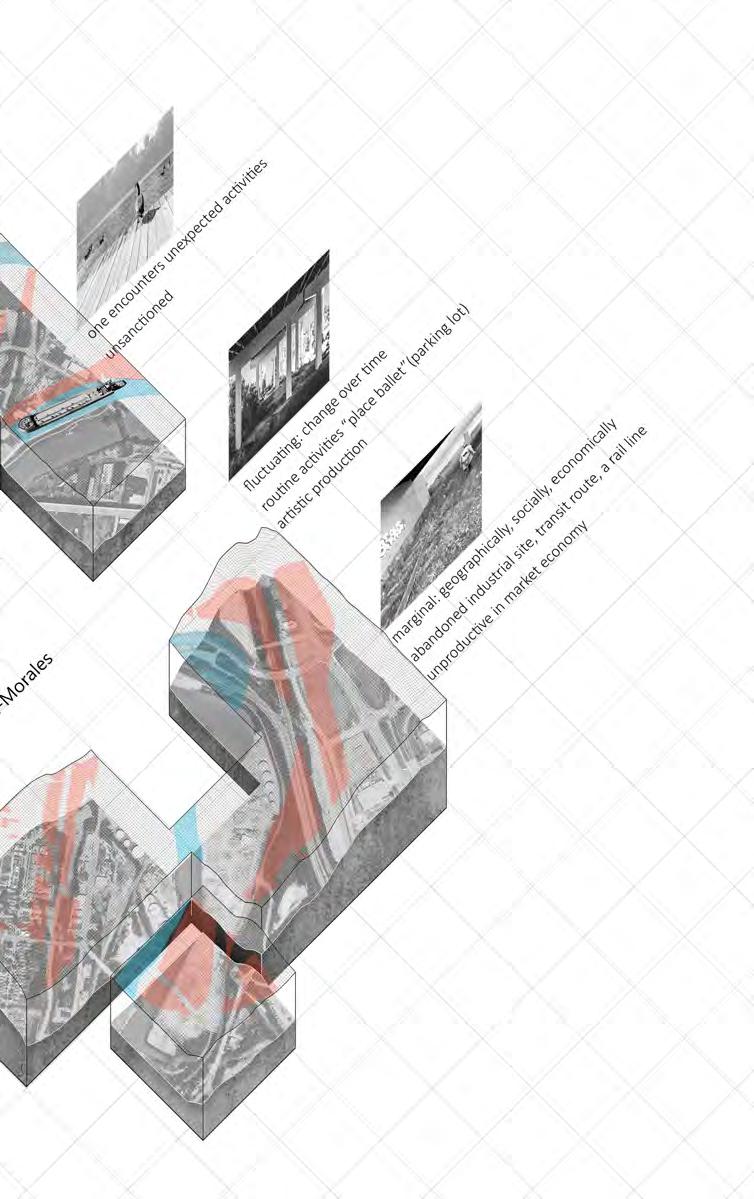
Terrain Vague are everyday areas that expose the stratified or palimpsest nature of all places, especially those with the appearance of codified stability where there exists. As Michel de Certeau puts it, a sense of “immobility” and “an illusory inertia”. Terrain Vague are what the architect-and-artist collective stalker calls, in its manifesto, “space of confrontation and contamination between the organic and the inorganic, between nature and artifice” that “constitute the built city’s negative, the interstitial and the marginal, spaces abandoned or in process of transformation.”
Spatial emptiness and physical accessibility, along with various smaller-scale physical features, generate many possibilities that people recognize and pursue with creativity and determination.
the terrain vague in Cleveland is silently inspiring and simultaneously inspiringly silent it has the capacity to narrate as well as the patience to listen stagnant in the process of urban development it is constantly open to interpretation it is the voice into the valley also registered as echoes from the previous always conflated with multiple moments in time and devoided of any. well categorized by the qualities of the unpromising yet resisting definition.
in searching . . .
“of time and the river”
“the meaning of the river flowing is not that all things are changing so that we cannot encounter them twice, but that some things stay the same only by changing.”
The “terrain vague” encounters various configurations of land features, giving each and every one of them a unique character and potential for exploration.
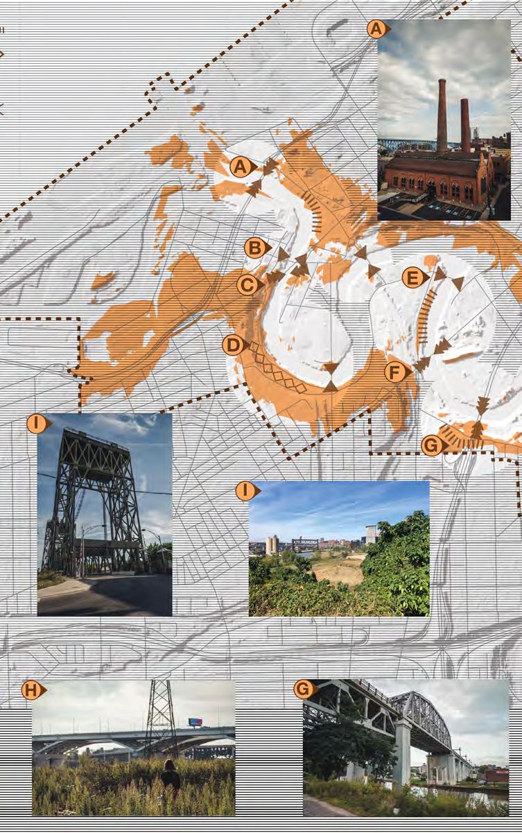
First Flats Rail Bridge
Main Avenue Viaduct
Center Street Bridge
Detroit-Superior Bridge
Columbus Rd Bridge
Quigley-Rockefeller rail draw bridge
West 3rd Street Bridge
rail draw bridge
r e s i d e n t i a l n e i g h b o r h o o d
r e s i d e n t i a l n e i g h b o r h o o d
stay hungry and hungrier
This map documents both the formal and informal ways of recreation, meaning some of them were designed with a purpose of entertaining and some are unexpectedly explored with happy moods through everyday interaction.
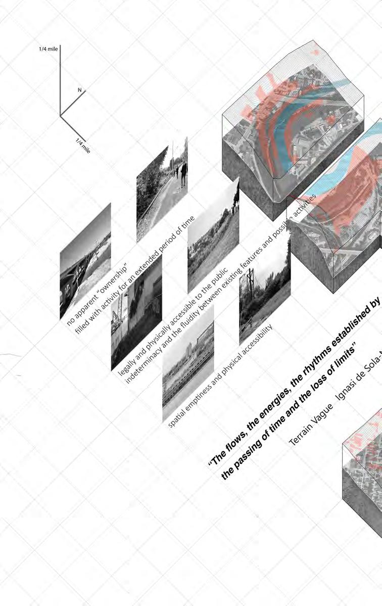
Terrain vagues share the feature of unattended and differ from each other in terms of other characters, for instance, the views that refine its sophistication, the land covers that sharpen its definition etc...
reference: Mariani, Manuela, and Patrick Barron, eds.
“Terrain Vague: Interstices at the Edge of the Pale,”
What can the designer propose... ... to appreciate the existing, to discover the imperfect place that captures the lazy gaze, where unsolicited programs welcome all...?
un on the unromantic
in terms of property
what is your take on the “make-no-sense”s how you read the
unreadables?
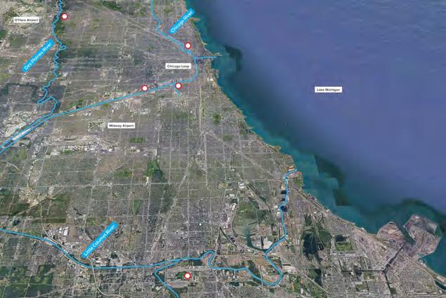
CHICAGO, IL (2016-ONGOING)
The existence of the city of Chicago is attributed to the rivers in the region. Native Americans and settlers saw that the slow flow into Lake Michigan provided an important transport route to the Mississippi River. The potential of this trade route quickly attracted settlers in the Chicago area. In just a few decades, as the city grew up almost overnight, the Chicagoans quickly and dramatically changed the river and the surrounding wetlands.
The river not only acted as a sewer, it provided sewage for more and more residents and emerging industries such as slaughterhouses, livestock farms, tanneries and steel mills. As time went by, the natural path of the river was deepened and straightened in many places to guide the flow of water, adapt to barge traffic and facilitate transportation.
The Chicago Land has experienced two centuries of settlement, industry, commerce and urban development. The city’s establishment and success over centuries has defied nature to change the curse of its rivers to suit the needs of the growing metropolis.
https://www.nrs.fs.fed.us/pubs/misc/chicagoriver/pdf/pamphlet.pdf
“Our rivers will be inviting: enhancements to infrastructure, information and programming will make our rivers more intuitive, meaningful and exciting places to be, drawing more people for recreation, work and relaxation.”
Cleanliness, safety and improved community connections will create more pleasant rivers and riversides. Better pathfinding and interpretive signage ensure that the system will be easy to navigate. The partnership with the city of Chicago, communities and civic leaders will advance further interventions like adding new access points, amenities, entertainment venues and events for residents and visitors of all ages and abilities. Programming activities will attract people to the rivers and et the foundation for the incremental reclamation of the riverfronts for citizens’ use.
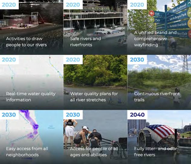
http://greatriverschicago.com/goals/index.html
“Our rivers will be productive: they have historically been and will continue to be working rivers that are transportation arteries, commercial corridors and tourism generators.”
Productive:
The project harnesses the economic value of the river and retains the water integrity. Modern working rivers generate more job opportunities and business attractions, for example, river’s transportation infrastructure to accommodate barges, tour boats, water taxis and recreational watercraft. Business, community, government and civic leaders will work together for innovative riverside development projects that coordinate people, businesses and nature.
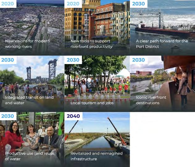
http://greatriverschicago.com/goals/index.html
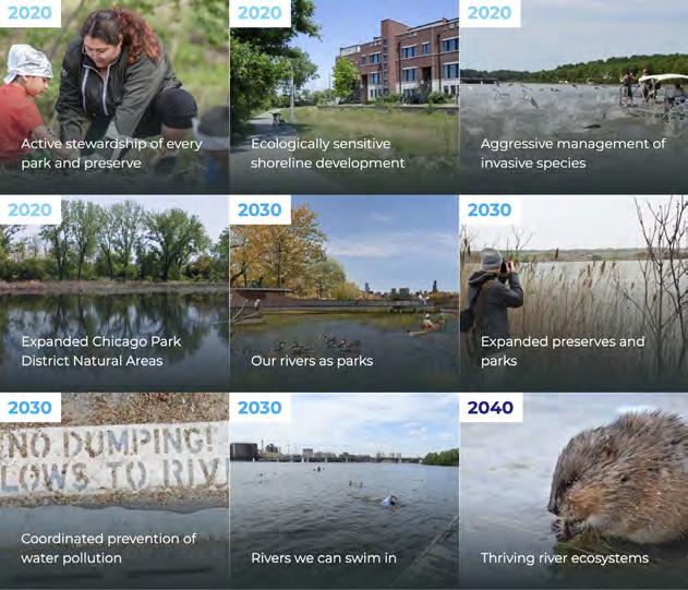
“Our rivers will be living: from riverbeds to shorelines, plants, animals and people will co-exist in vibrant, healthy ecosystems.”
Living:
Apart from life and human wellbeing, the project’s vision also focuses on the biological diversity including the preservation of wildlife and habitat. The process involves a series of studies on management of invasive species, reducing pollution by releasing of policies, and retrieving a balanced river ecosystem.
http://greatriverschicago.com/goals/index.html
CHICAGO, IL (2016-ONGOING)
Great Rivers Chicago is a vision to unlock the potential of the Chicago, Calumet, and Des Plaines rivers and riverfronts. The goal: to create inviting, productive, and living rivers that will make citizens proud, and connect communities. By reinterpreting the relationship to water, Great Rivers Chicago focuses on five place-based examinations that manifest new dimensions and perceptions.
• The suburban context--as connection between office park, transportation, and forest preserve is knit together by a riverfront trail.
• Post-industrial canal--a relationship between river, production, and commerce.
• Goose island--opportunity for a wetland park and recreation paradise for a booming tech-innovation community.
• The contaminated collateral channel--a natural ecosystem to filter river water.
• The plan includes outlining more riverfront activities and a unified system of wayfinding, a continuous system of riverfront trails that connects neighborhoods, and the relocation of certain industries that do not relay on river transportation.
http://www.r-barc.com/projects/great-rivers-chicago-vision-plan/
The Cuyahoga River takes on different physical and environmental conditions as it runs through Cleveland to Lake Erie: from a National Park, industrial sites, residential areas, and downtown. More activities and programming near the riverfront could vary accordingly to better utilize the existing resources and attract users.
industrial site downtown
residential
mapping of surrounding urban conditions
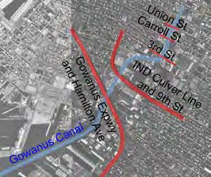
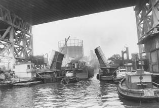
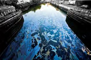
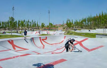
The Gowanus Canal (aka Gowanus Creek) is a 1.8-Mile (2.9-Kilometer) canal in Brooklyn, New York City, in the westernmost tip of Long Island. Since the middle of the 20th century, the canal was an important cargo transportation hub but in recent decades its use is decreasing. Although domestic water transport has also decreased, it is still used for occasional cargo transportation as well as daily sailing of boats, tugs and barges.
By the end of the 19th century, the massive use of industry had led to a large amount of large wastewater discharge into the Gowanus pipeline. Even most of it was recognized as one of the most polluted waters in the United States by 1990. Although generally considered incompatible with marine organisms due to the high proportion of fecal coliforms, low mortality caused by pathogenic bacteria and low oxygen concentrations. Various attempts to remove pollution or water from the canal have failed.
Both the Gowanus Canal and the Cuyahoga River have been used as major transportation and sewage for industries along the water bank. The historic contamination caused the US Environmental Protection Agency to target the Gowanus Canal, while the Cuyahoga River fire of 1969 raised the public’s attention of environmental consequences caused by industrial use of the river. Both two sites are now in need of reshaping the water’s value in terms of environmental economic and civic engagement.
https://gowanuscanalconservancy.org/history/ http://nymag.com/news/intelligencer/topic/57886/
https://commons.wikimedia.org/wiki/File:Gowanus_Canal_Map.jpg
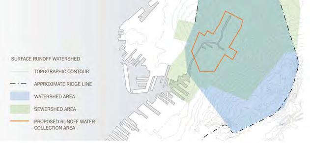
GOAL :
The Gowanus Canal is surrounded by a layer of industrial buildings and another layer of residential neighborhoods. Both the bank and the water are polluted by the industrial waste and New York’s combined sewer system regular discharges.
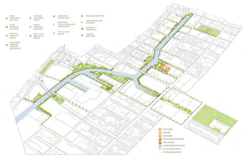
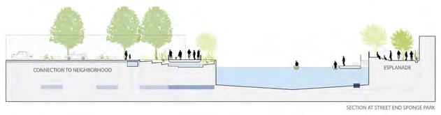
The accessibility of the water edge is limited. The Sponge Park™ masterplan by dlandstudio was created to address the need generated by several private development projects that open to the water.
In order to keep a safe and healthy place for public engagement, the sponge park is designed for surface water runoff management and absorption.
https://dlandstudio.com/Gowanus-Canal-Sponge-Park-Pilot
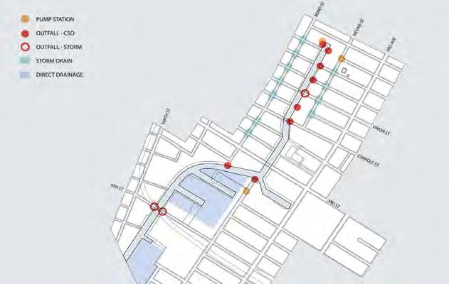
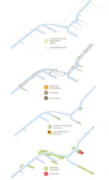
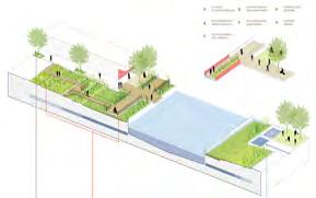
The Masterplan proposes a strategy of urban stitching, connecting the public and private lands adjacent to the canal to create a continuous esplanade with recreational spaces running the length of the canal. Existing street-ends would serve as entry-parks providing access to the esplanade and the water. These parks provide for community oriented programs such as dog runs, community gardens, public exhibition spaces and temporary markets. The park is a working landscape: it improves the canal environment while supporting active public engagement.
https://dlandstudio.com/Gowanus-Canal-Sponge-Park-Masterplan
Holistically sporadic plan:
More than just a park, the project consists of a system of infrastructural, public engagement components, for instance, street end park, infiltration swales, esplanade, boat launch, open space, and wetland... This system covers both the accessibility, playfulness, and the functional parts of the project.
Community engagement:
To better promote neighborhood’s engagement in the park’s use, the programming process invites the nearby residents into envisioning the uses of the parks. So instead of just having one “perfect” park in the whole area, the gowanus canal sponge park ends up having many place-based parks suitable for nearby residents.
https://dlandstudio.com/Gowanus-Canal-Sponge-Park-Pilot
BROOKLYN, NY (PILOT 2016)
The water runoff collectors deal with different levels of water volume.
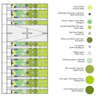
To maximize the parks’ environmental protection value, the plants chosen are based on their ability to absorb heavy metals and biological toxins.
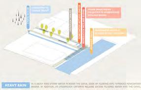
“In a light rain storm water is captured by filtration swales.”
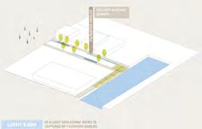
“In a medium rain storm water flows to filtration remediation wetland basins.”
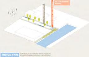
“In a heavy rain storm water reaches the canal edge by flowing into terraced remediation basins. In addition, cisterns release excess filtered water into the canal.”
http://www.r-barc.com/projects/great-rivers-chicago-vision-plan/
The notion of urban stitching offers an insight for designing the riverfront accesses in Cleveland, as can be seen in previous mapping of “terrain vague”. The river front is accessible to nearby residential neighborhoods, downtown buildings and industrial factories through dead-end roads and river walk trails. Small intervention seems more practical due to the scarcity of funding available.
Moreover, the solution for water leaking in a controlled manner is a way to address current problems. Especially the three-level-control with water runoff could be promising in the Cuyahoga River banks in Cleveland where the sinking land and running water combined may lead to serious natural issues. Metal absorbing plants for detoxifying the water and riverfront might need a second thought for they could be invasive species that cause further problems.
http://www.r-barc.com/projects/great-rivers-chicago-vision-plan/
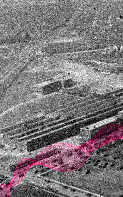
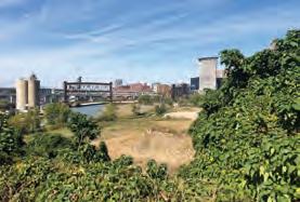
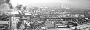
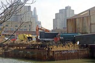
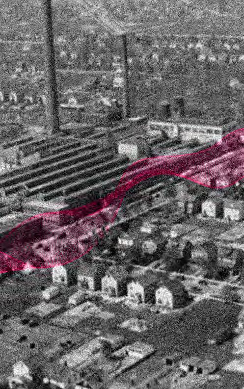
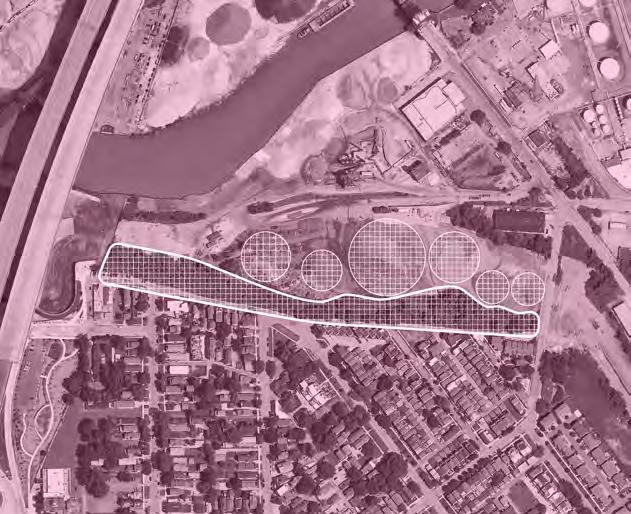
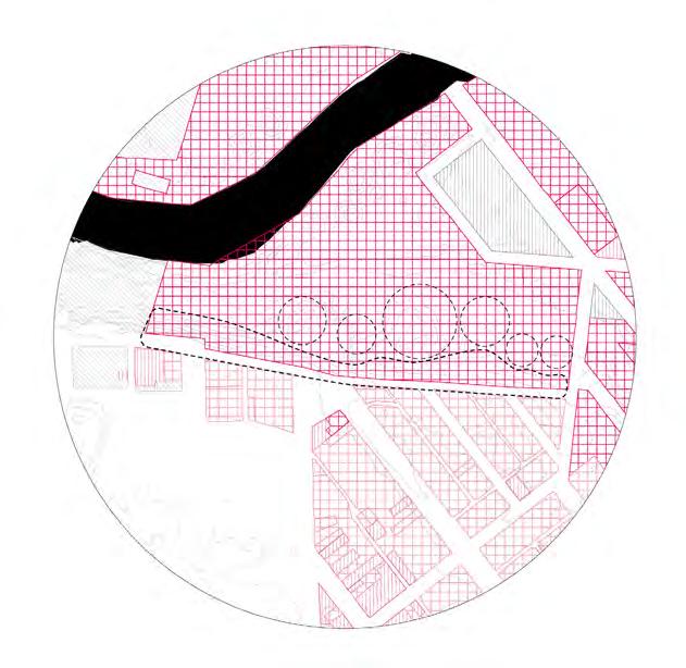
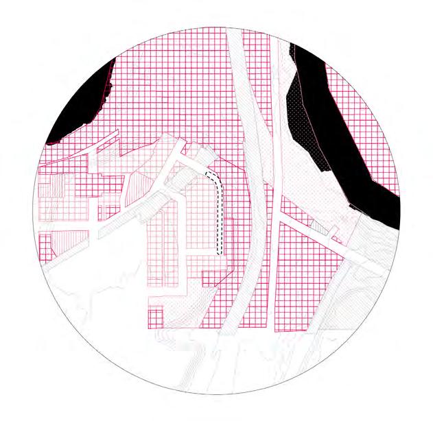
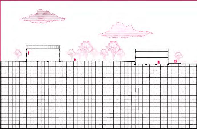
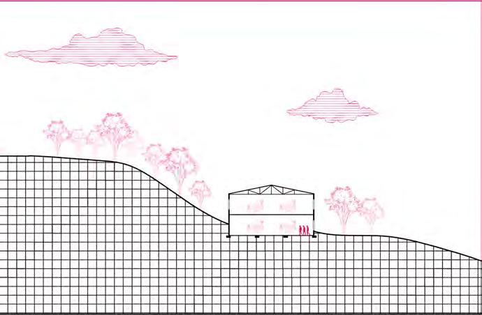
In Cleveland, industry claimed most of the lands along the Cuyahoga River in order to take advantage of its strong carrying capacity for the transportation of goods. This resulted in the decreased accessibility to the river for other uses than the industrial ones. And close to the industrial plants, a sea of working housing with no gap or protection for the residents. The thin interfaces between the two land uses, industry and dwelling, shaped the geographies of Cleveland. Indeed, the smell, dirt, and noise from the industry side have negative impacts on the neighborhoods. However, the magnificent scenes of the Cuyahoga Industrial Valley remain intensively captivating.
This project established an inventory of the typologies of the interfaces and proposes different interventions to create more diversified human oriented microenvironments. Since most of the industrial sites are still in use and contribute to the local economy, the interventions aim to give visibility to this situation through tactical components. Humble interventions to the existing interfaces help both sides get along with each other in a better way. Improvement of these micro-environment qualities makes the interfaces softer and more appropriate.
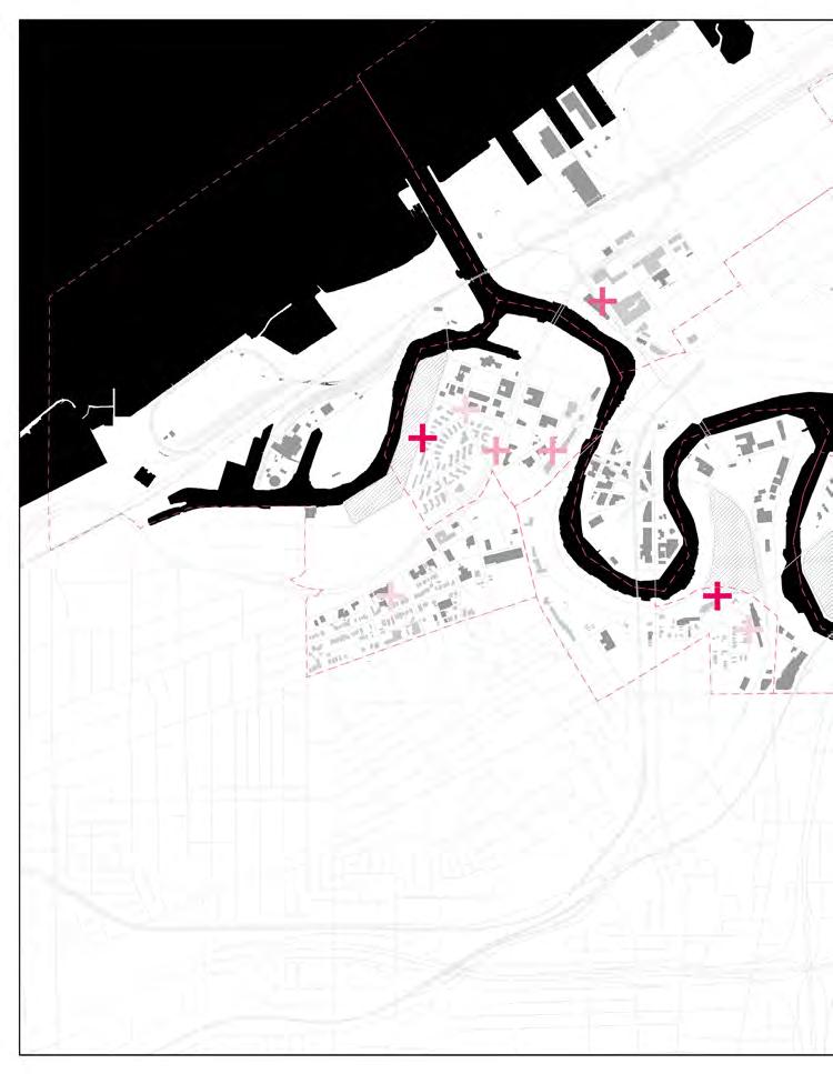
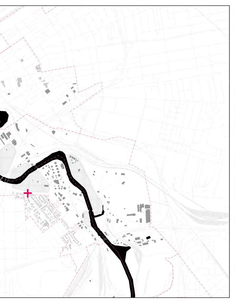
Erie
Site C
41°29’35.95” N
81°42’30.15” W
Block Group
Residential Building
Industry Building
Dump
Interface Type A: Gravel Pile
Interface Type B: Rail Track
Interface Type C: Viaduct
Interface Type D: Alley
Towpath Trail
Selected Sites
Phasing: different proposals will be implemented based on how polluted the sites are. Sites with higher level of pollution have greater priority and will be implemented firstly.
Funding: EPA, addressing industrial pollution issues; philanthropies, to increase public environmental quality; funding can be also from local-resident donation so as to make their homeland a better one.

The dust is blowing all the time!
The industry looks magnificent!

The green buffer helps!


It is noisy!
There is not enough trees!

The rail track looks cool tho!


A little bit smelly!

The viaduct is nice!
I don’t like the wastes!


I like the sunshine and the green!
I wanna sit around the alley and enjoy!


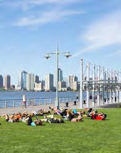
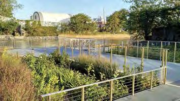
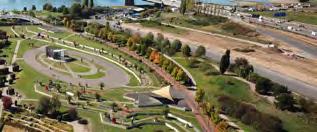
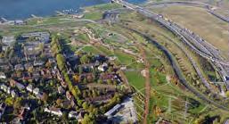
SEATTLE, WA (2001-2007)
The Olympic Sculpture park, designed by Weiss/Manfredi Architecture/Landscape/ Urbanism, is located in Seattle. It is planned as an improved public space according to the Seattle’s Central Waterfront Concept Plan which aims to reconnect the urban core to the water front. The park is located on a former industrial brownfield site, which was separated from the city context by an arterial road and several train tracks. The z-shaped
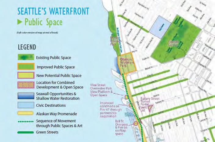
Image Source: Seattle’s Central Water Front Concept Plan

Image Source: http://www.weissmanfredi.com/project/seattle-art-museum-olympic-sculpture-park
configuration is used to connect the fragmented parts into a whole. In other words, it is a continuous landscape which starts from the city to the shoreline. What really shocking is its manipulation of the topography of the site, specifically, it is descending almost 40 feet from the top to the bottom. It is a brand-new pedestrian amenity for people to enjoy not only masterpieces of sculpture but also the spectacular river scene.
Image Source: http://www.weissmanfredi.com/project/seattle-art-museum-olympic-sculpture-park
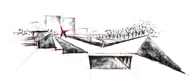
Image Source: http://www.weissmanfredi.com/project/seattle-art-museum-olympic-sculpture-park
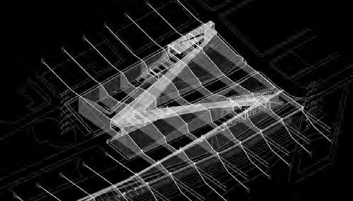

Image Source: http://www. weissmanfredi.com/project/ seattle-art-museum-olympicsculpture-park
Image Source: http://www. weissmanfredi.com/project/ seattle-art-museum-olympicsculpture-park
Image Source: http://www. weissmanfredi.com/project/ seattle-art-museum-olympicsculpture-park
The starting point of this proposal is the PACCAR Pavilion of 18,000 square feet. The site transitioned from a brownfield to a construction site and then to the final sculpture park. It is like a magnet that can attract people coming from the urban core to visit this place. A z-shaped green platform welcomes the visitors and initiate the promenade crossing an arterial road, and gaining views to the Olympic Mountains. The main sculpture collections are located in this section: Calder’s Eagle, Mark Dion’s Neukom Vivarium, Roxy Paine’s Split, etc.
The second part crosses several train tracks, and people can have a look at the city scene, the port, as well as the magnificent industrial train tracks. The last part of it offer people the views of a newly built beach as well as the gorgeous shoreline. It is a creative intervention which really focuses on how to reuse former industrial sites, how to make riverfront accessible, and how to deal with contaminated brownfield. However, a little critique here is that the space under the bridge crossing the train tracks and the arterial road looks a little bit monotonous. Indeed, design is important, however, the forces behind it might deserve more attention from us. The initial force for this park is a $25 million dollars donated by the former Microsoft president Jon Shirley and his wife Mary Shirley.
Image Source: http://www.weissmanfredi.com/project/seattle-art-museum-olympic-sculpture-park
Image Source: http://www.weissmanfredi.com/project/seattle-art-museum-olympic-sculpture-park SEATTLE, WA (2001-2007)
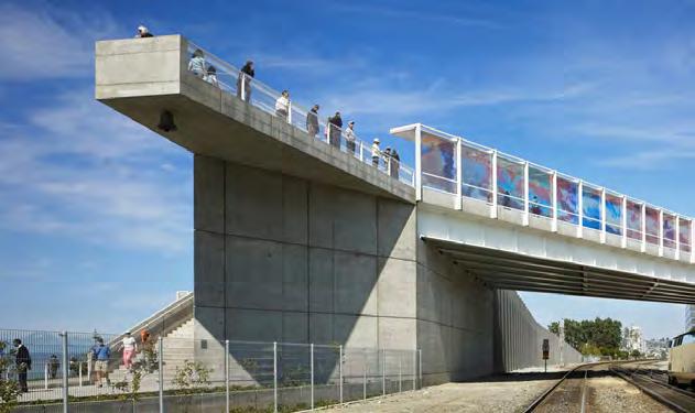
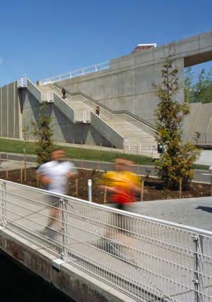
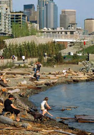
Image Source: http://www.weissmanfredi.com/project/seattle-art-museum-olympic-sculpture-park
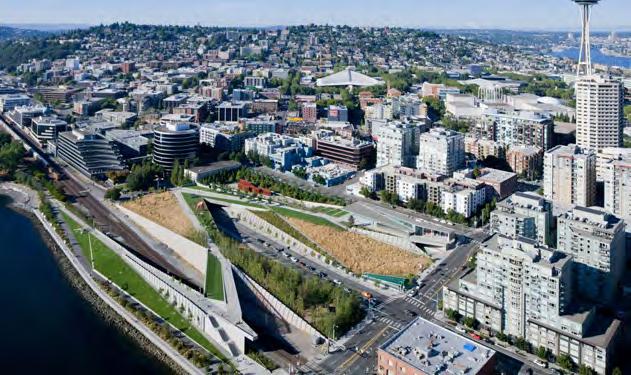
Image Source: http://www.weissmanfredi.com/project/seattle-art-museum-olympic-sculpture-park
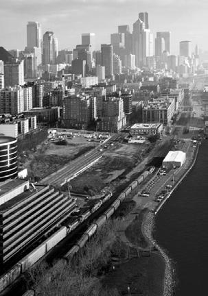
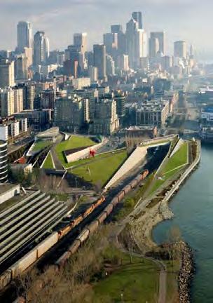
Image Source: http://www.weissmanfredi.com/project/seattle-art-museum-olympic-sculpture-park
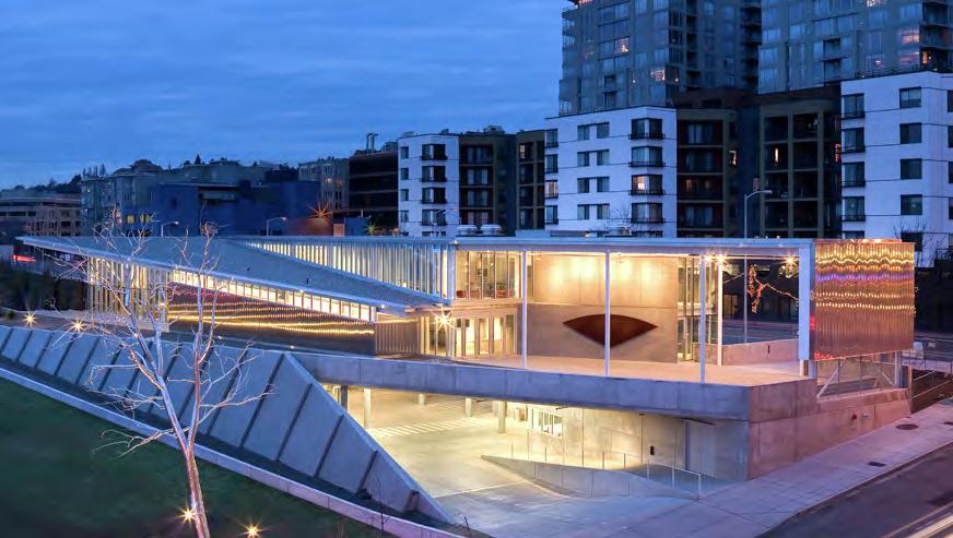
Image Source: http://www.weissmanfredi.com/project/seattle-art-museum-olympic-sculpture-park
This donation gave eternal free access to the public. The Shirley family also bought the very first piece of the series of sculptures, which is Calder’s Eagle. The total donation of the park is around $85 million dollars. According to the Seattle Time, 25 % of it comes
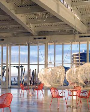
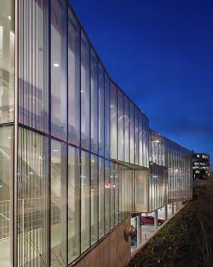
Image Source: http://www.weissmanfredi.com/project/seattle-art-museum-olympic-sculpture-park
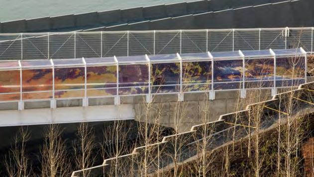
Image Source: http://www.weissmanfredi.com/project/seattle-art-museum-olympic-sculpture-park
from public sources, such as the City of Seattle, King County, Fish and Wild Life Service, Department of Housing and Urban Development, etc. What interesting here is some of the donation come from hundreds of thousands of ordinary people. The range is from
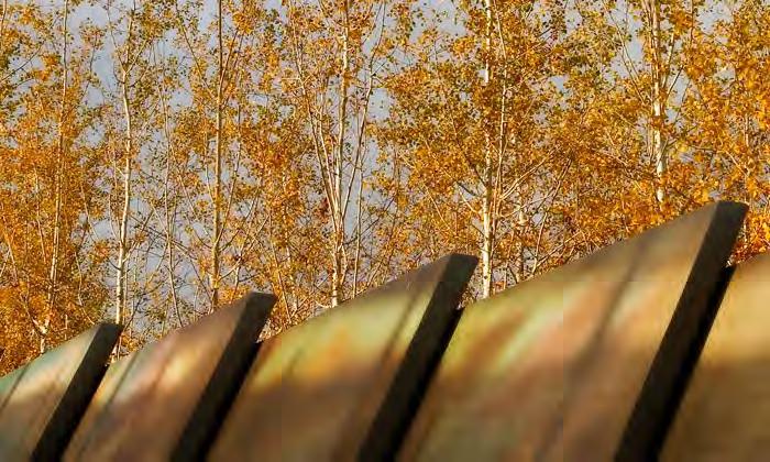
Image Source: http://www.weissmanfredi.com/project/seattle-art-museum-olympic-sculpture-park
SEATTLE, WA (2001-2007)
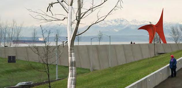
Image Source: http://www.weissmanfredi.com/project/seattle-art-museum-olympic-sculpture-park
$50 dollars to $500,000 dollars. Diversified donation sources imply the Olympic Sculpture Park is truly a park which belongs to the citizens and the public. High-level participation should be appreciated for sure. Even though the site condition is complicated, the team
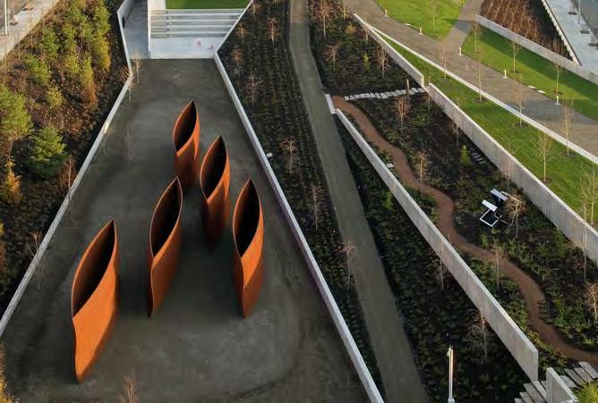
Image Source: http://www.weissmanfredi.com/project/seattle-art-museum-olympic-sculpture-park
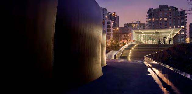
Image Source: http://www.weissmanfredi.com/project/seattle-art-museum-olympic-sculpture-park
is willing to face the challenge and bold enough to create this fantastic and gorgeous proposal.
Image Source: http://www.weissmanfredi.com/project/seattle-art-museum-olympic-sculpture-park
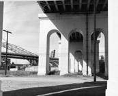
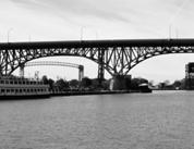
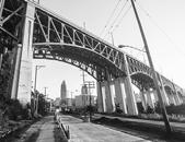
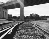
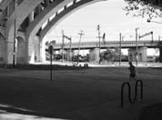
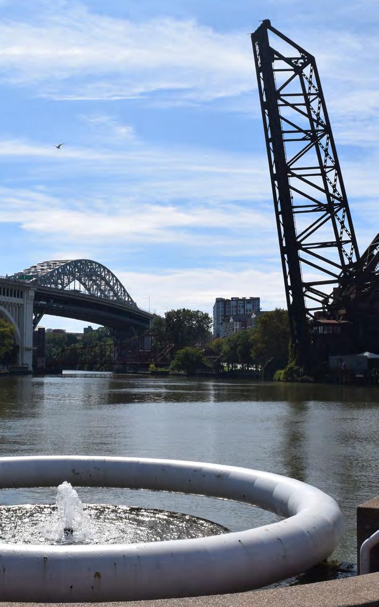
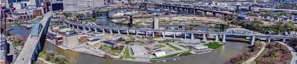
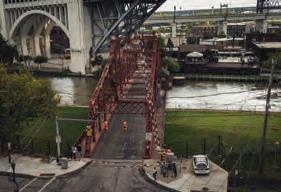
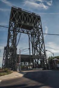
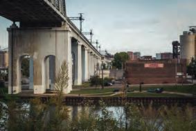
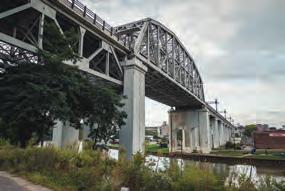
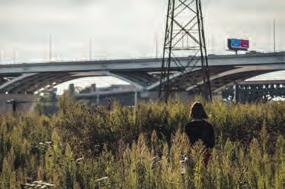
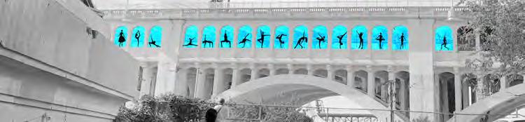
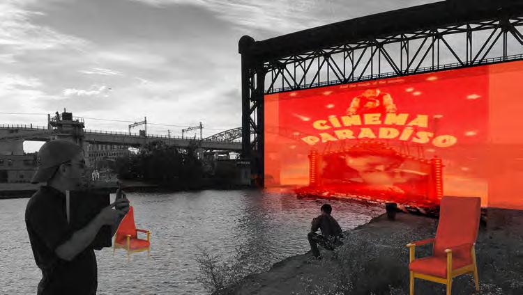
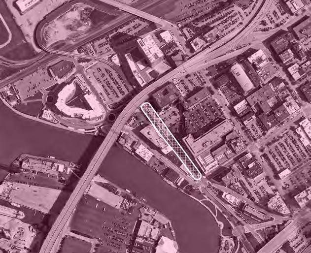
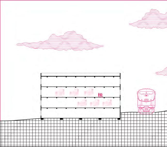
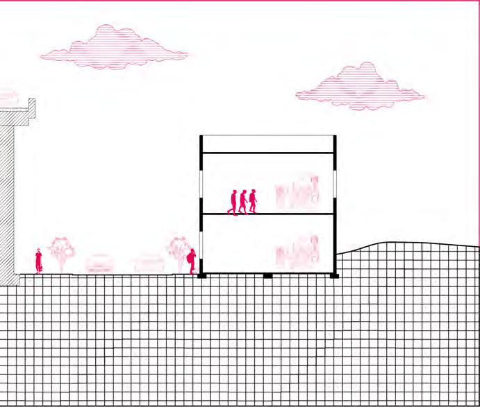
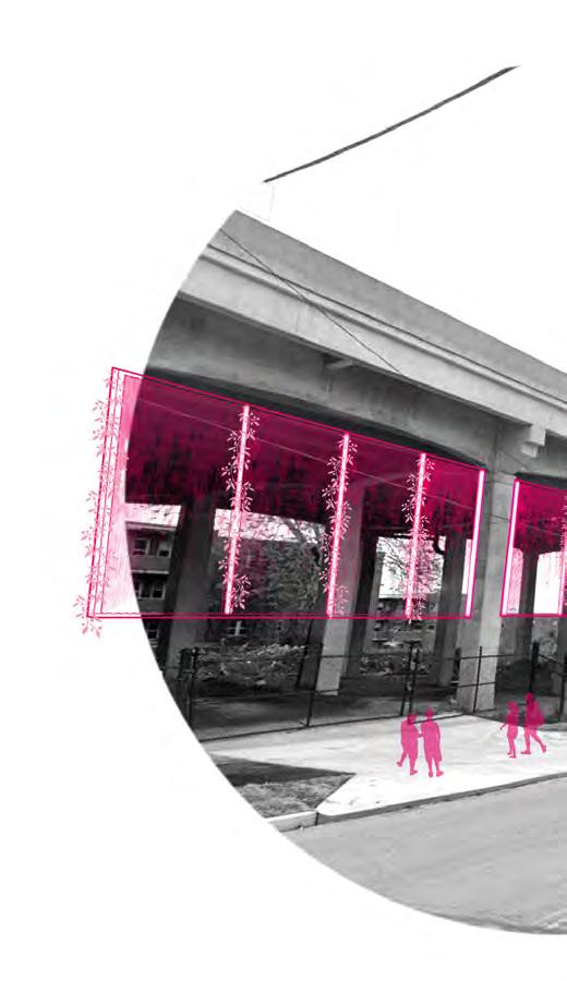
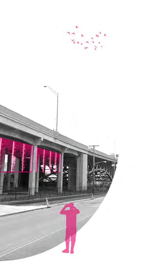
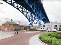
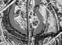
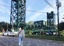
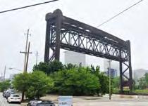
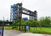
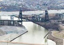
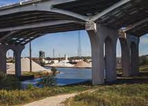
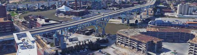
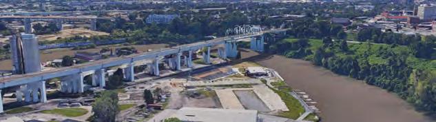
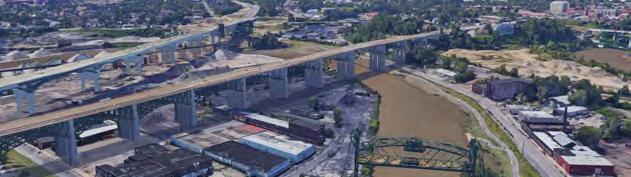
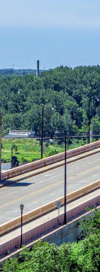
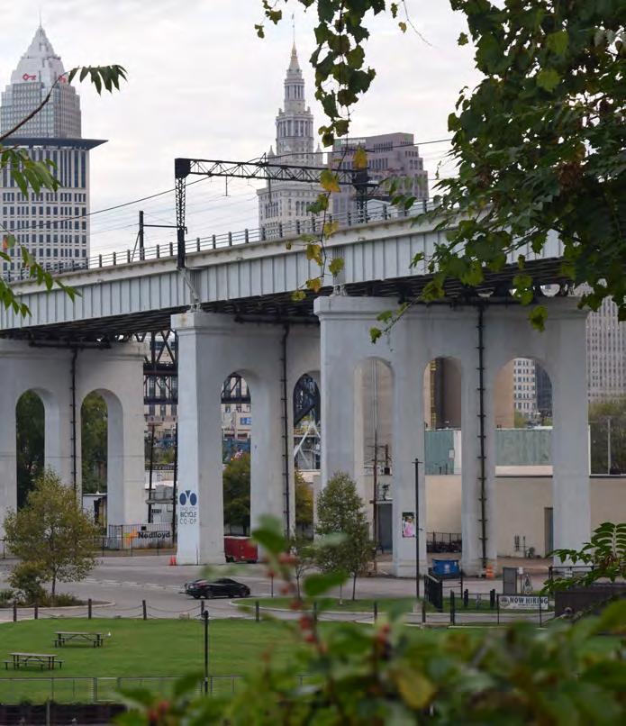
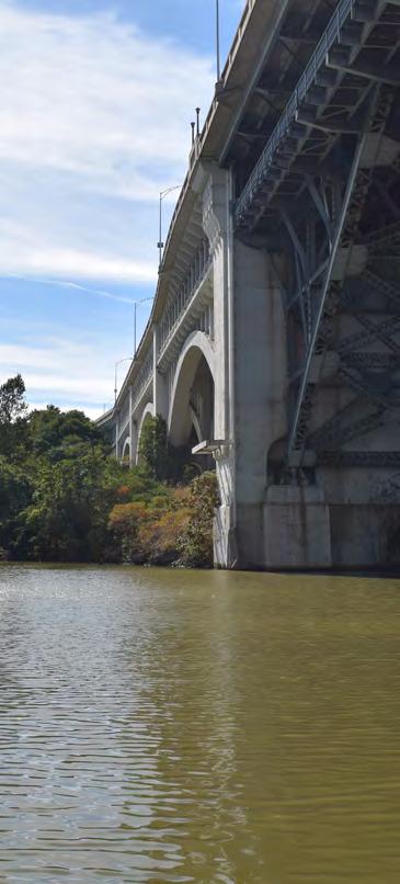
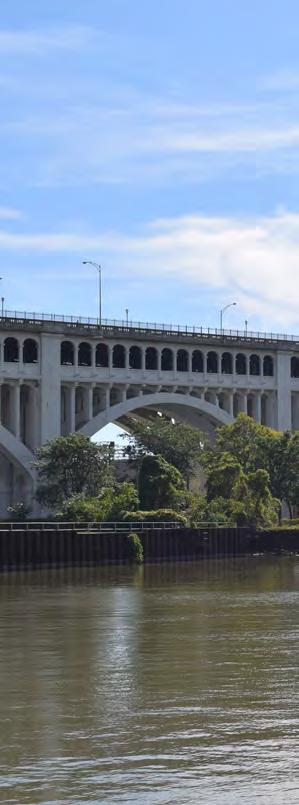
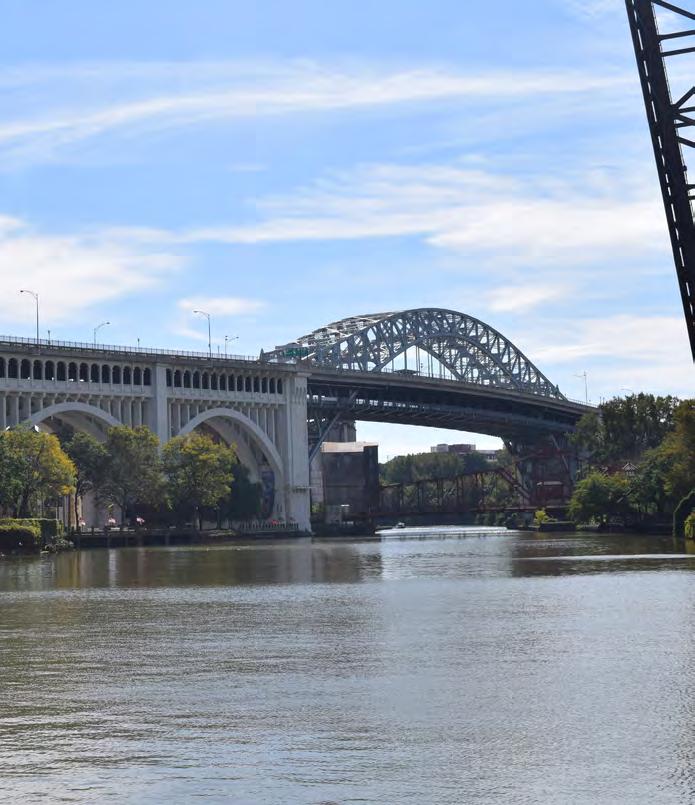
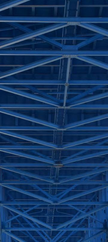
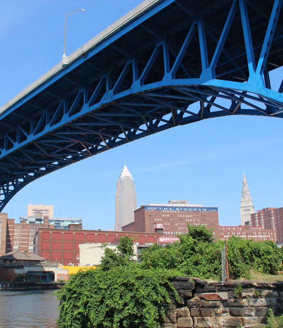
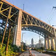
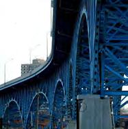
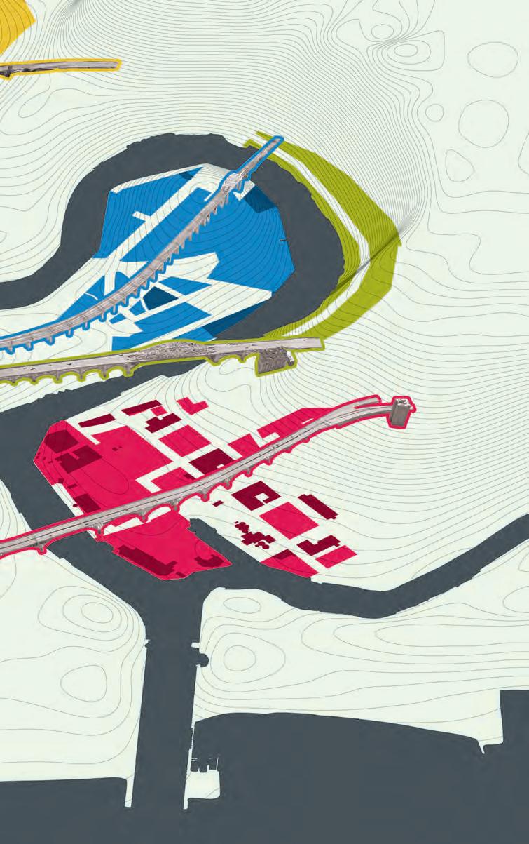
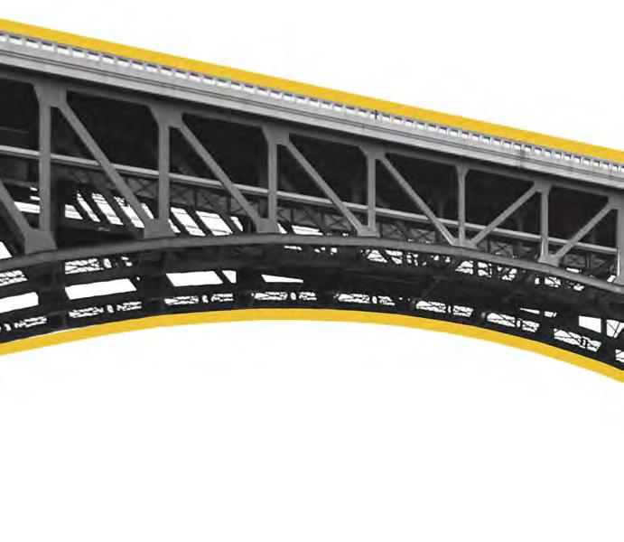
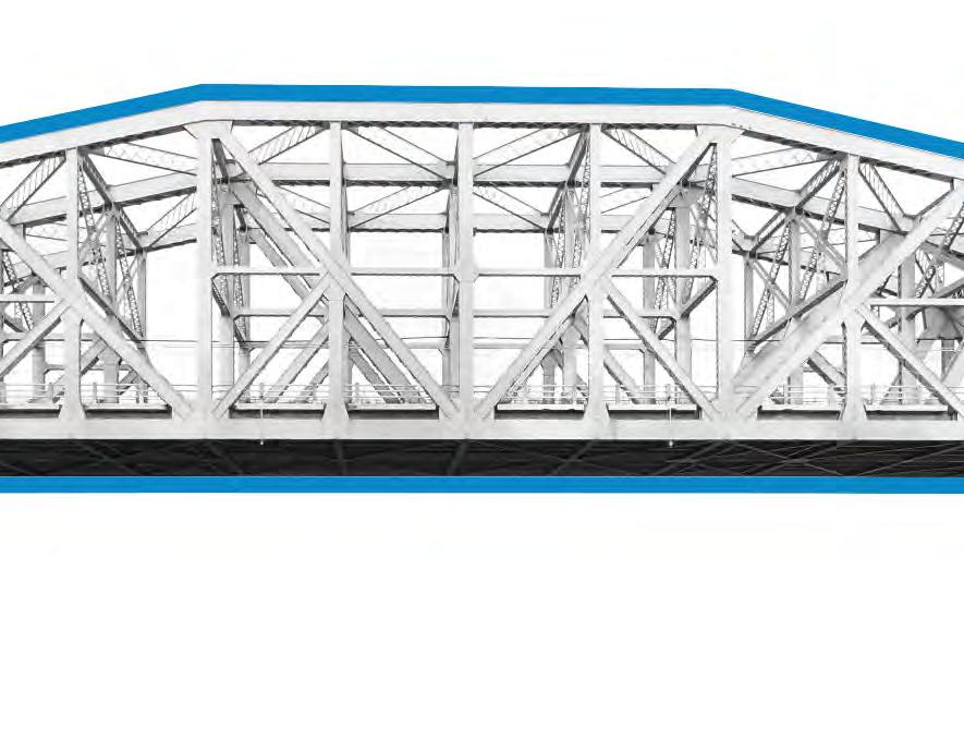
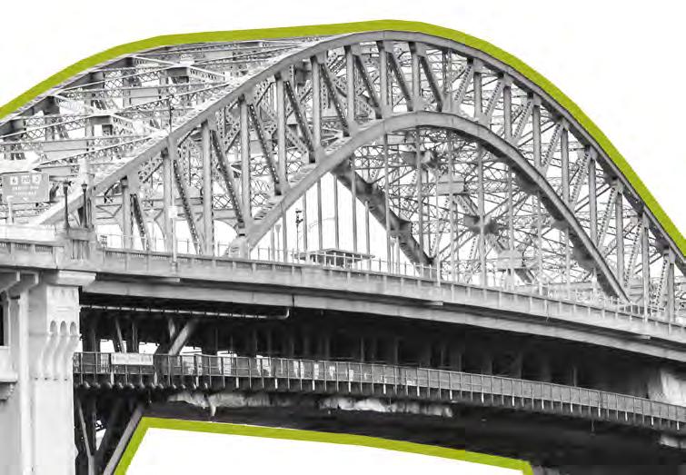
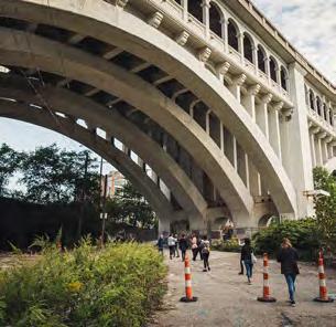
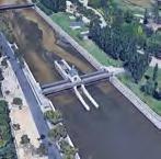
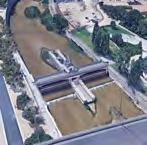
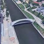
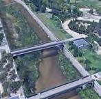
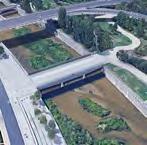
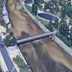
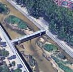
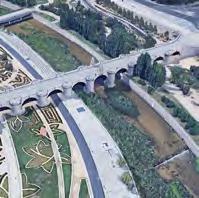
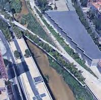
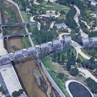
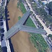
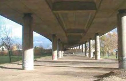
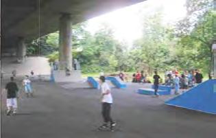
The meandering Cuyahoga River runs through the city of Cleveland on its way to Lake Erie, carving spectacular views for those crossing one of the many bridges that stitch east and west. Connecting both sides of the river, down in the valley or up in the higher city grounds, the constellation of bridges shape the historical identity of the industrial valley. This project aims to amplify the opportunities for interaction between the city and the Cuyahoga valley activating the bridges as social infrastructures and places of encounter. The high-level transit bridges and elevated rail perform as architectural icons for the city dweller and celebrate the working river as a spine of industrial transportation. The low level movable bridges, drawbridge, swing bridge vertical swing bridge) is an architectural performance.
Identifying these spaces and pedestrian corridors throughout the city, the project activates these infrastructural landmarks through a series of tactical moves driving new occupations, opportunities economic activity, and engagement zones.
Movable Bridges
Abandoned Bridges
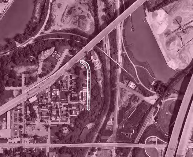
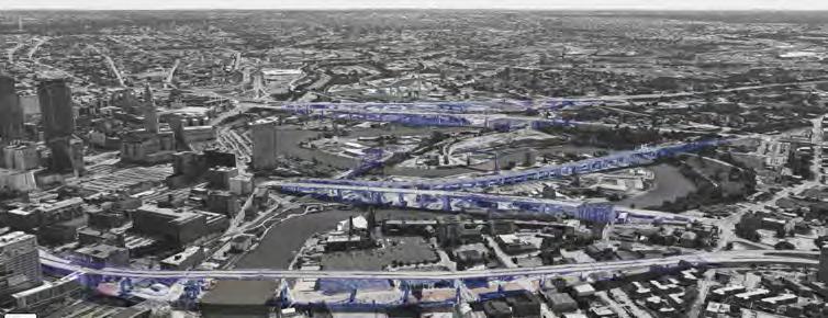
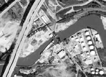
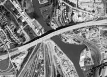
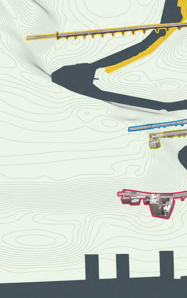
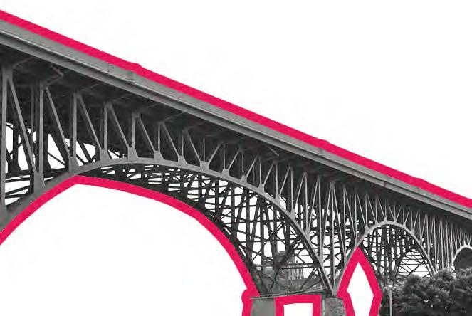
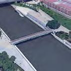
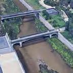
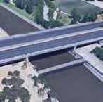
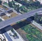
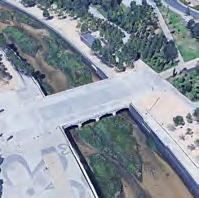
Indexing Cleveland’s bridges foregrounds the iconicity of transportation infrastructure along the Cuyahoga River Valley. By examining the various typologies of the bridges intersecting the river, we instigate new opportunities for appropriation of these infrastructures and their grounds to connect the city and the river.
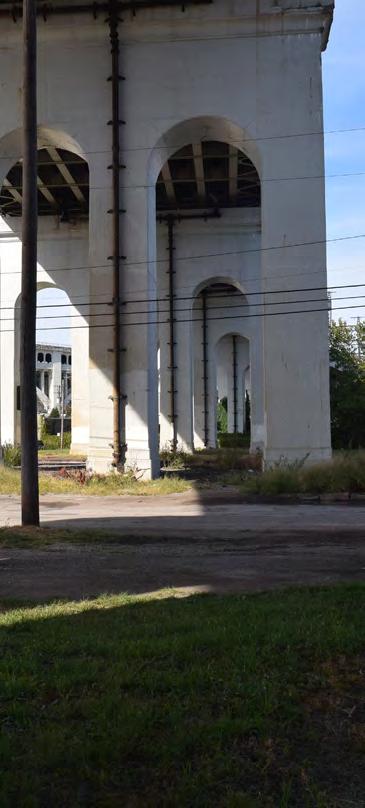
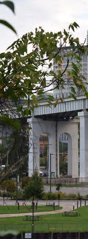
Through the compilation of the Cuyahoga River Bridge Index, we identified four high-span bridges as having excellent opportunity for proposing contextual design interventions. The four bridges diagram identifies the infrastructures and places them in relationship to their characteristic context. In addition, each intervention addresses the unique structural and aesthetic value of the bridges, all holding significant monumental value to the Cuyahoga Valley. In considering both the aesthetic and contextual characteristics of the individual bridges, we propose four conceptual approaches to amplify the recreational, programmatic, and aesthetic qualities of the valley that celebrates infrastructure, industry, and the grit embedded within Cleveland’s cultural fabric.
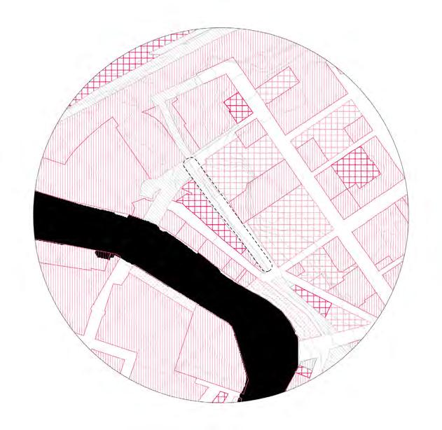
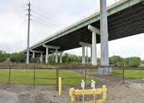
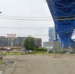
The Site map indicates the location of the bride in relation to the Cuyahoga river valley.
The adjacency diagram contextualizes the bridge with its adjacent urban space.
Industrial Land use
Green Spaces
Residential / Commercial
Riverfront Potential Activity zone
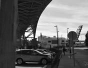
The aerial image indicates the terrain and occupancy of the adjacent landscape.
The spaces below the bridge which extends into the riverscape create interesting views of these structural landmarks. The images highlight potential nodes or spaces of activity.
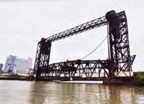
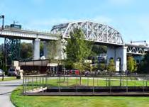
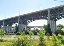
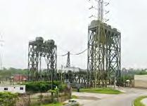
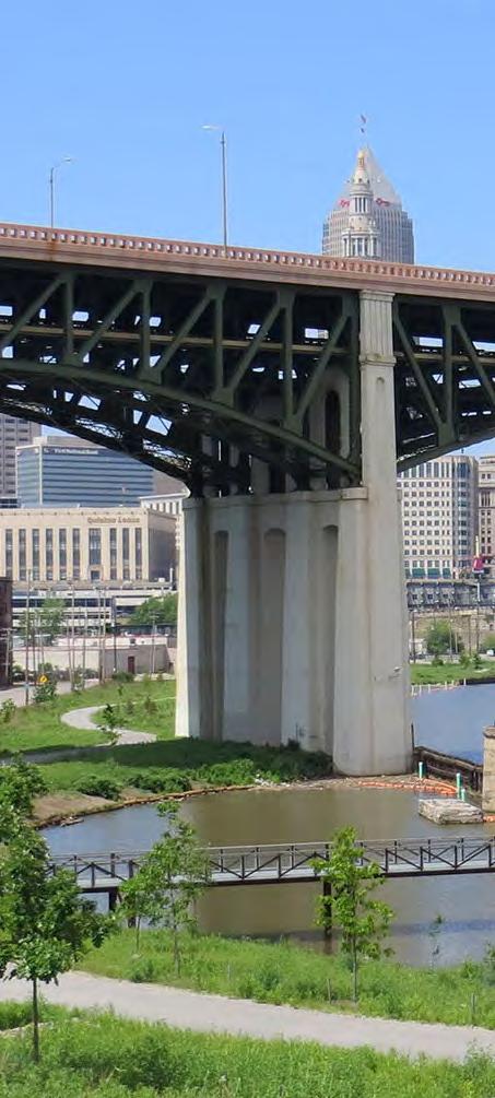
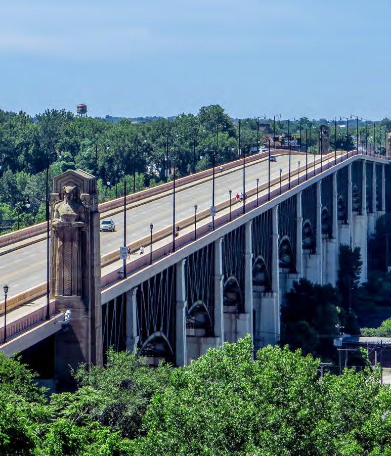
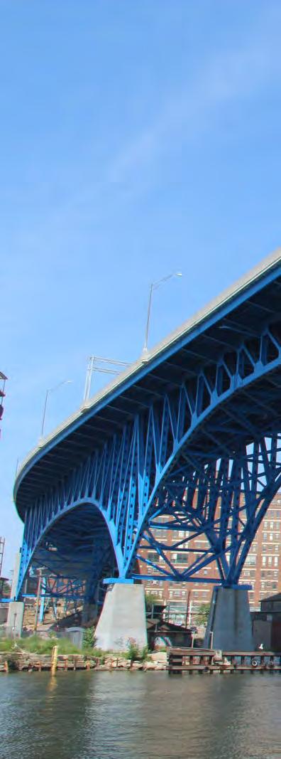
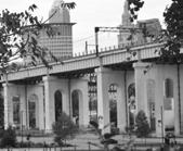
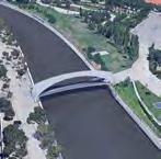
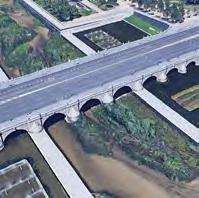
The Hope Memorial Bridge, originally the Lorain-Carnegie Bridge, was opened in 1932, the second of the major highlevel spans in downtown Cleveland.
This bridge is a Pennsylvania through truss bridge owned by the Greater Cleveland Regional Transit Authority opened in 1935.
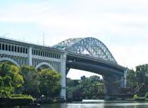
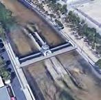
This bridge was opened in 1917 as the city’s first high-level bridge over the Cuyahoga River. It was built to relieve pressure from the old Superior Viaduct.
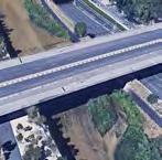
Also known as the Harold H. Burton Memorial Bridge, this bridge is a cantilever truss bridge competed in 1939 and is over 8,000 feet in length, the longest elevated structure in Ohio until 2007.
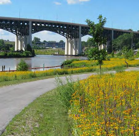
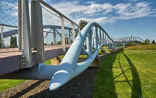
Through the Cleveland Bridge index, four bridges emerged as having high iconicity and presented high opportunities for elevating their inherent characteristics. Aside from their monumental value, these four bridges have the potential to capitalize on their adjacent land use. The Hope Memorial Bridge spans over the Tow Path Trail and Scranton Flats, the Irishtown Bridge spans large tracts of vacant and industrial land, the Detroit Superior Bridge has a connection to the Irishtown Bend ecological patch, and the Cleveland Memorial Shoreway Bridge is directly adjacent to major commercial hubs like the Greater Cleveland Aquarium and Jacobs Pavilion at Nautica.
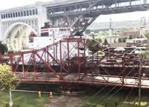
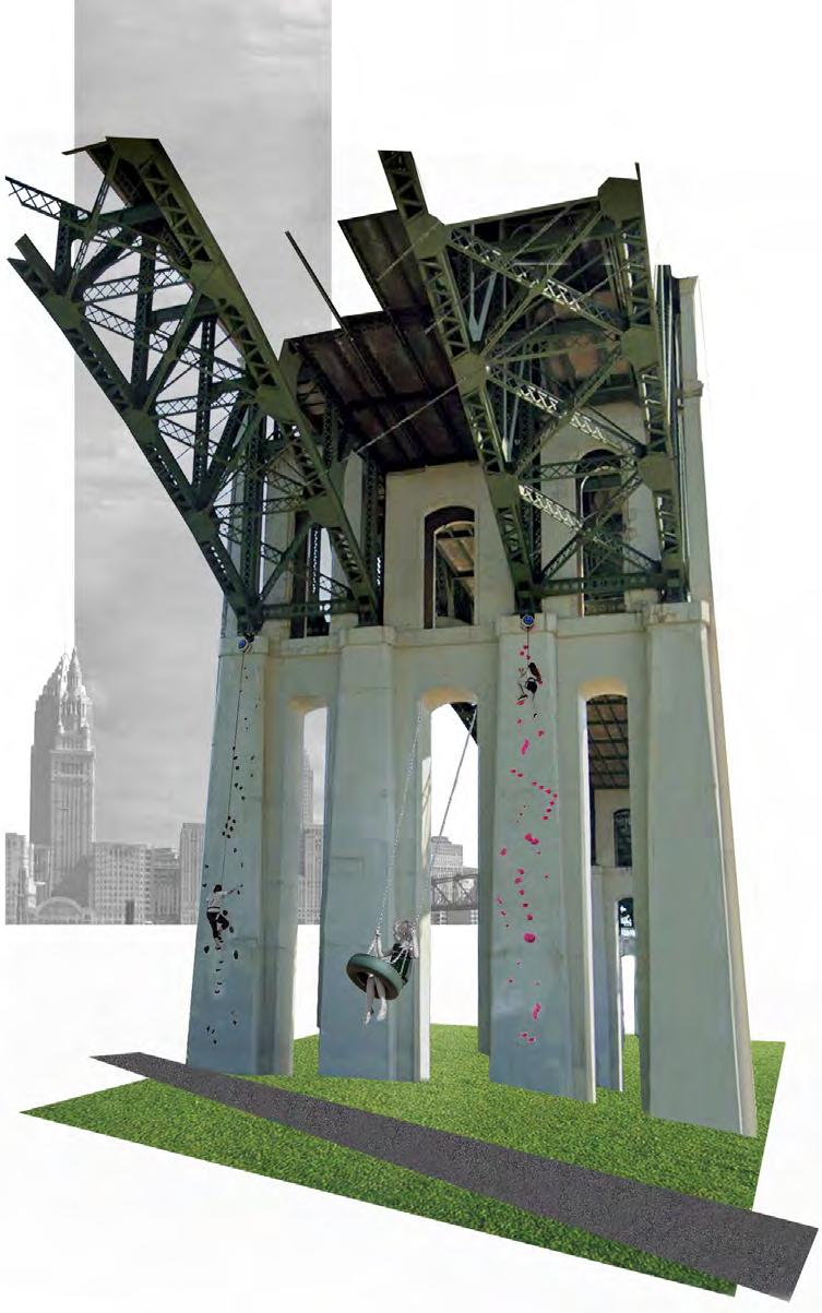
GIANT SWING
ROCK CLIMBING THE COLUMNS
TRUSS-SLIDE
TRUSS-TRUSS ZIPLINE
Suspense Suspended expands upon the notion of suspense and thrill by utilizing the truss structure of the Hope Memorial Bridge to suspend various types of play equipment. Giant swings, slides, rock climbing, and more build off of the recreational capacities of the Scranton Flats and the Tow Path Trail to infuse a bit more adventure along the Cuyahoga River.
NEON SIGNAGE
ARCH SCULPTURES
ARCH MURALS
ARCH LIGHTING
MUSICAL PROGRAMMING
ARCH
ARCHITECTURE
Cleveland Union Terminal Viaduct
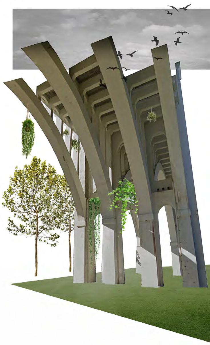
The Archway builds upon the repetition of arches the frame views beneath the bridge and across the Cuyahoga by occupying the structure through art, architecture, sculpture, light, and signage. The aesthetic of this intervention has the potential to playfully celebrate its unconventional adjacencies to vacant land, industry, infrastructure, and strip clubs.


VINES + OTHER HANGING VEGETATION
SCULPTURAL BIRD HOUSES
INVERTED BAT TOWERS
SUSPENDED PLANTERS
Directly adjacent to one of the largest patches of continuous riparian habitat at the mouth of the Cuyahoga River. Superior Wild celebrates habitat creation by introducing new urban sculptural habitats beneath the Detroit Superior Bridge. Inverted bat towers, suspended vegetation, oversized bird houses, and more reintroduce the “wild” back into downtown Cleveland.
PAINTED TRUSS GEOMETRY PROJECTION
The Truss Project recognizes the iconicity of the cantilever deck truss structure of the Main Avenue Bridge by projecting an abstraction of the structural geometries onto the ground plane. The projection is relentless and envelopes everything in its path, drawing a relationship to the verticality of the bridge and its relative proportion to the ground.
The individual bridge proposals are intended to provoke an imagination for Cleveland that foregrounds infrastructure as one of its most defining characteristics. But the question remains, who stands to gain from this redefinition? And who gets to refine it? Our hope is that the transformation of the bridges along the Cuyahoga River leverages a transdisciplinary approach and engages many different stakeholders throughout the process.
The residential communities adjacent to the bridges benefit from recreational spaces integrated within the fabric of the city and organizations like Cleveland Metro Housing Authority have the potential to capitalize on the transformation from vacant land to public space.
Cleveland Metro Housing Authority (Institution)
Cleveland Foundation (Non-profit/Foundation/Organization)
Metro West Community Development (Non-profit/Foundation/Organization)
Tremont West Development Corporation (Non-profit/Foundation/Organization)
Cleveland Foundation (Non-profit/Foundation/Organization)
Neighborhood development organizations
Cleveland City Council (Municipal)
The Cleveland Foundation (Non-profit/Foundation/Organization)
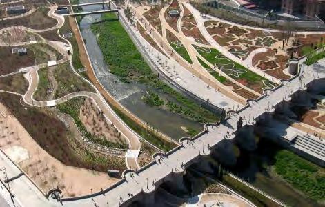
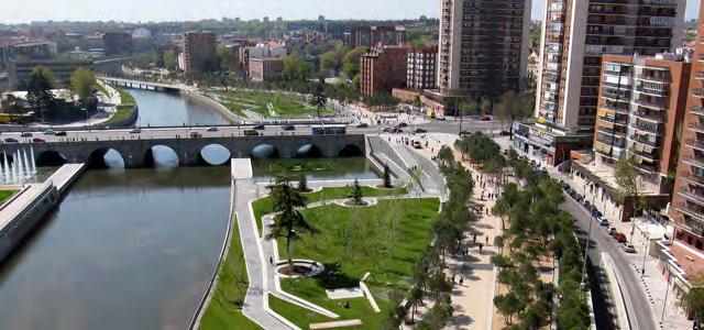
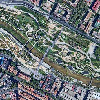
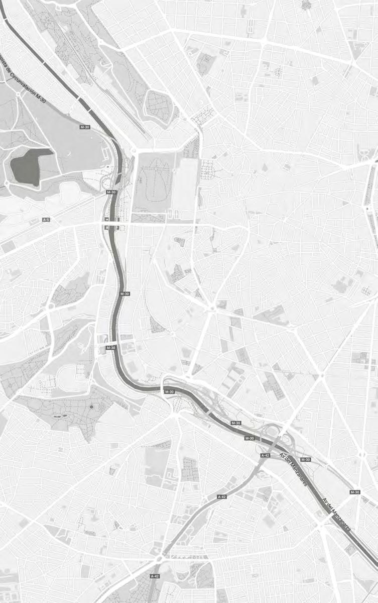
Madrid Rio is a project that began with the reconfiguration of transportation infrastructure, where five miles of roads that previously segmented the River Manzanares from the city were routed through tunnels. This project was perhaps one of the most ambitious projects ever undertaken in Madrid, costing nearly $5 billion to implement. The design aspirations for Madrid Rio emerged out of a design competition conducted in 2006 which was won by an interdisciplinary team of local and international practices including the likes of Burgos & Garrido, Porras La Casta, Rubio & Álvarez-Sala, and West 8.
This project was intended to be a holistic plan for the River Manzanares as it intersects with the city. Mobility, flood protection, bridge infrastructure, and public park space were just a few of the considerations this project had to grapple with. The complexity of an urban project at this scale is further compounded by contending political interests,. Mayor Alberto Ruiz-Gallardón was fortunately able to build consensus between political parties.
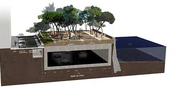
The Madrid Rio project cost was officially estimated at 4.1 million euros. Only 10% is attributed to the above ground interventions, and 90% is attributed to the underlying infrastructural costs. In order to facilitate the construction, maintenance, and financial operations, the autonomous company, Madrid Calle 30, was established. Madrid Calle 30 receives its funding from 80% public and 20% private participation.
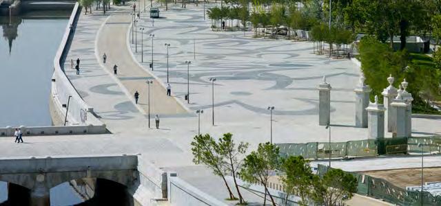
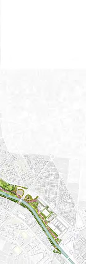
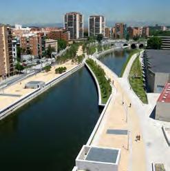
Where the river used to be a dividing element of the city, the park is now considered as a link between two previously disparate locations. Subterraneously shifting transportation infrastructure was just the first step to catalyzing this much improved connection, but was only one such intervention that contributed to this notion of a connected city. The intermingling of public, landscape, and bridge infrastructure not only provided the means of access, but also served as a new public commons. The following images illustrate how Madrid Rio improves accessibility by studying the various typologies of the public commons, landscapes, and bridges. This case study looks specifically at how the bridge infrastructure was utilized to improve the connectivity and iconicity of the riverfront.
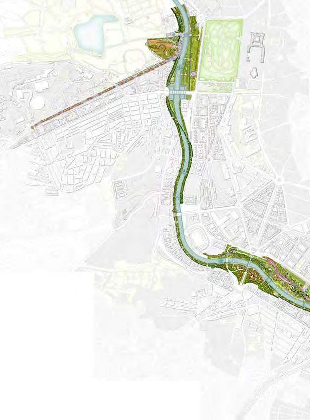
The extent of the infrastructural upgrades undertaken by the city expanded some 26 miles, about 4 of which occupied the banks of the River Manzanares. West 8 and a group of renowned architects from Madrid established a team, MRIO arquitectos, to develop the master plan for Madrid Rio. The team was selected because of their proposal to address the urban complexities through the means of landscape as their primary medium.
The design addressed issues of temporality by dividing the 80 hectare urban development into a series of seed projects that would establish the framework and foundation for other future projects. There has since been a total of 47 subprojects that have since been realized. Some of the more notable projects include: the Avenida de Portugal, Huerta de la Partida, Jardines de Puente de Segovia, Jardines de Puente de Toledo, Jardines de la Virgen del Puerto, Parque de la Arganzuela and the Salón de Pinos.
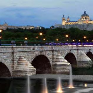
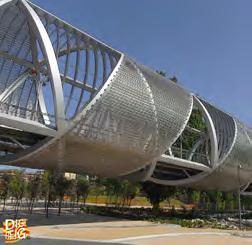
Larger park spaces weren’t the only major improvements, the Madrid Rio project also introduced 6 hectares of public and social spaces like sports facilities, artistic amenities, an urban beach, and kids play areas; the restoration of the river’s hydraulic heritage, and the construction of 12 new pedestrian bridges.
These bridges help to redefine the River Manzanares not as a divisive geographic feature, but key moments in which two previously disparate sides are stitched together.
Puente de la Reina Victoria MADRID, SPAIN (2006-2011)
Pasarela Aniceto Marinas
Infrastructure x Bridge
Pedestrian x Bridge
Landscape x Bridge
Statement x Bridge
Monument x Bridge
Conduit x Bridge
Puente del Rey
Puente de Segovia
Puente Oblicuo
Salón de Pinos
Pasarela y Puente de San Isidro Puente de Toledo
Puente de Argenzuela
Zona de Niños y Playas
40°23'20.92"N 3°41'53.41"W
40°23'14.93"N 3°41'46.54"W
40°23'18.18"N 3°41'50.28"W
40°23'53.46"N 3°42'45.02"W
40°23'42.35"N 3°42'17.05"W
40°23'59.78"N 3°43'2.31"W
40°23'44.76"N 3°42'25.36"W
40°23'59.62"N 3°43'4.55"W
40°23'28.39"N 3°42'0.65"W
40°23'54.42"N 3°42'46.25"W
40°23'35.56"N 3°42'7.25"W
40°23'59.90"N 3°42'59.67"W
40°24'13.63"N 3°43'21.18"W
40°23'59.62"N 3°43'4.55"W
40°23'46.88"N 3°42'32.10"W
40°25'18.21"N 3°43'23.65"W
40°23'58.76"N 3°42'53.75"W
40°24'39.63"N 3°43'20.57"W
40°24'50.47"N 3°43'22.46"W
40°23'53.28"N 3°42'40.75"W
40°25'8.00"N 3°43'19.13"W
40°24'18.60"N 3°43'22.03"W
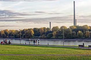
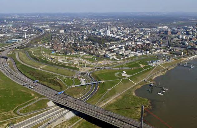
The Rhine forms both the geographical center of the Cologne/Bonn region as well as the focus of its people’s emotional attachment to their homeland. This stretch of river –between the Rhine Bad Honnef in the south and Leverkusen with its huge chemical plants in the north – is the linking element and showcase for the region’s variety and riches. But for a long time, the cities on the Rhine neglected their relationship with the river to which they owed their existence in the first place. Still an enormous potential for design lies untapped along the 142-kilometer stretch of riverbank. Mighty industries, roads and railroad tracks, single architectural highlights but also nondescript settlements with their backs to the river bank define the waterfront. Green banks and landscape areas are clearly second to the urbanised areas. But within the last decade the Rhine has been rediscovered in the Cologne/Bonn region.
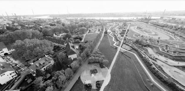
Regionale 2010 projects along the Rhine show the current efforts to change the built image of the region along its river and to reconnect the people with the river at different scales. Projects like the Cologne ´Rheinauhafen` (Rheinau Harbor) with ‘crane houses’, the reconfigured trade fair halls on the right bank in Cologne, the ‘re-coding’ of the Bonn cement factory (‘Bonn Visio’) in terms of content and architecture, and the ‘Neuland-Park’ on a former chemical dump site in Leverkusen all signify a changing attitude to this stretch of the river.
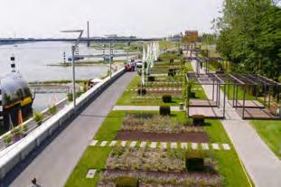
The Neuland Park is a combination of landscape and industrial park, a green area of retreat in this industrial sector. The park was created by filling in, sealing and planting a former waste dump has afforded direct access to the Rhine from the city center of Leverkusen, which was previously publicly inaccessible. The Chemiepark Leverkusen Park to the south, the Dhunnaune Mitte waste dump to the north and the main feeder roads had barred public access to the Rhine. The former waste dump was sealed and in-filled with topsoil, and seeded with grass. The park design plays with landscape park section and Rhine embankment park with vast lawns on one hand and natural areas on the floodplain areas. Signaling a new quality of life and work in the city, the park has opened a unique view of the impressive skyline of the chemical plants while offering recreational areas with opportunities for leisure and sports.
The Rhine was the easiest transport connection as well as freshwater source in the Cologne-Bonn region. Not unlike the Cuyahoga Valley, industrial landscapes dominated the riverscape as factories established at riverside locations. This project exemplifies the reconstruction of green connection corridors from the city center to the river and creation of spaces of recreation by embracing the existing industrial landscape. The intervention secures the riverfront and rediscovers spatial vistas once blocked off, for the public.
The Chemiepark Leverkusen to the south, the Dhunnaune Mitte waste dump to the north and the many motorway feeder roads had barred public access to the Rhine. Plans to extend the motorway A59, parallel to the Rhine between the Bayer plant and the city, to connect to the A1 further isolated the site. As a result, the urban periphery on the river were neglected by urban planners for a long time.
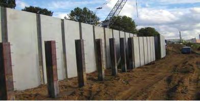
This 25-hectare site along the Rhine was used from 1923 until the end of the 1940s as a plant depot of Bayer AG. Approximately 3 million tons of construction debris, household waste and chemical residues were dumped here. The average thickness of the landfill is about 8 meters (26 feet). From the 1950s, apartments, the Bayer Kanuklub and a restaurant were built on the site. In 1985, as part of a development plan, the contaminated site was brought back to public awareness during an environmental impact assessment. A risk assessment revealed that the contaminated site must be protected by a sealing system that permanently prevents human-soil contact, prevents the penetration of rainwater into the contaminated site and excludes the uncontrolled discharge of contaminated soil air from the deposits. The construction of the seal lasted from 1995 to 2000. A 3.6 km long and up to 40 meters deep wall to the Rhine serves as a groundwater barrier.
The first agricultural alluvial landscape used is from the 1920s by Bayer used as a plant landfill. The landfills also served the flood protection for the Rhine riverfront land, in the 50s. Since its first diversion, the Dhünn had been increasingly straightened and narrowed.
An intervention to clean the riverfront deemed necessary on an environmental context:
To avoid contact between humans and deposits
To minimizing the entry of rainwater into the landfill
To prevent the uncontrolled discharge of toxic air
The sustainable reuse of the park was made possible 10 years after completion of surface sealing and traffic projects in the area Dhunnaue center. The City and Bayer also created a prerequisite for sustainable development for he city. 4,000 trees and 100 trees are used in the “forest belt” as noise and privacy protection from the A1 motorway.
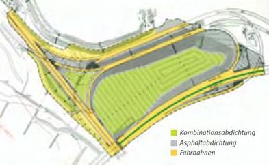
Currently, the parks’ interface the Rhine is a steep hill. As these are steep slopes the transitions to the lanes is too thick and is secured with a multi-layer asphalt waterproofing. The access to the riverfront is provided at intervals with steps and decks on the water bed. The geometric landscape architecture sets a natural, harmonious park design through the contrast of naturalness and artificiality, reminding of the former landfill.
The surface sealing around the LeverkusenWest inte -rchange, highly complicated technical structure, consists of a combination seal in the flat terrain, an asphaltic seal in the embankment areas and the dense roadways.
The ground water barrier prevents the entry of groundwater to the Bürrig landfill and the discharge of contaminated groundwater in the Rhine.
The park hosts several arenas for different activities, catering all age groups. Sprinkled with bridges, trails and streams, the Neuland park attracts neighboring communities to embrace nature and its industrial history.
PEDESTRIAN WALKWAY
PEDESTRIAN BRIDGE
PROMENADE
PLAYGROUND
FOR EVENTS
PLAYGROUND

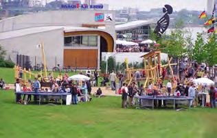
Neuland Park, with its stage and the many open spaces, is a venue opened throughout the year- from the Spring Festival, World Children’s Day and the “Nordic Christmas Market” to various sporting events and concerts of all kinds. The Sparkassen-Arena was initially called the “stage of rest.” As a stage with a seating for about 1,200 people, it offers space for smaller and medium-sized events, such as concerts, readings, theater and cabaret.
Numerous bridges characterize the Neuland Park. Three new bridges were created for the Landesgartenschau 2005. They overcome the busy Rheinallee, cross the Dhünn river and head up high above the themed gardens and offer a viewing platform on the Rhine. The boomerang trail, artery of the park, continues with a bridge construction, the Neulandbrücke, over the Rheinallee. A good 500 meters from the A1 motorway bridge, the Neuland bridge marks the Leverkusen Rhine panorama in a completely new way. In addition to the Neuland Bridge, the “Prinzbrücke” (the pedestrian and cyclist bridge 2003) and the “Bayer Pipe Bridge” in bright colours, sets a special accent on the banks of the Rhine at Leverkusen as a colorful ensemble.
Neuland severs as a public park for everyone. Leverkusen wins through the ‘Landesgartenschau’ an important recreational area on the Rhine. Rheinpark Leverkusen becomes an element of the “green fan” in which the Regional 2010 Green areas along the Rhine networked together. The parkland will also benefit neighbors and residents adjacent to the park, who were earlier exposed to toxic waste fumes. The design is well intergrated with the neighborhood with direct links and playgrounds located at the boundary.
Discovering new territory” also means “overcoming boundaries.” For one thing, as the park literally arises on “new land” and Leverkusen touches the river with the new Rheinpark, for the first time “Leverkusen is city on the Rhine.”
The Regionale 2010 is a regional development program set up by the State of North Rhine-Westphalia. This organization supported by the state government, attempt to bring the people of the Cologne-Bonn region back to their river by the means of urban planning and landscape architecture.
The regional commissioners of the region Cologne / Bonn reflected the fundamental objectives and structuring of the Regional 2010. They were the first speaking partner for communication between local authorities and the Regional 2010 Agency. Regional 2010 operates on the left and right of the Rhine across the municipal borders of a total of 50 municipalities, four districts and three county-free ones. Cities with almost 2,500 council and district members get together and seek to translate their objectives into action. The Regional Officer’s represented the Districts, independent cities and institutions in the Cologne / Bonn region.
All projects along the Rhine region undergo a competitive process and an intensive qualification process, which is coordinated and accompanied by a central steering unit, the REGIONALE agency.
Rhine Boulevard offers generous access to the water and a place from which to enjoy the impressive panorama of the old town opposite Cologne´s cathedral. Attraction to the right side of the Rhine River is now stronger, with a public space by the water serving Cologne as a whole.
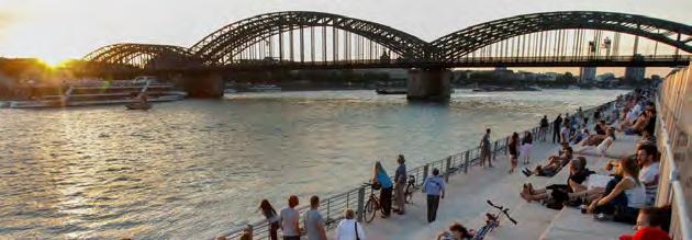
The Green C, initiated by The Regionale 2010, focuses on preserving, improving and extending existing open spaces to form a green belt network from one side of the Rhine to the other. This aims to safeguard and sustain open spaces in tension for pressures due to urban expansion, development, economic growth and landscape conservation.
It is part of a large-scale network of green belts and landscape corridors, which is to be developed as a cultural landscape network within the framework of the so-called "Green Master Plan"
Confluence Park is located on a bluff overlooking the point where the San Pedro Creek merges with the San Antonio River. The park includes a classroom building, a main pavilion and three smaller pavilions . These pavilions are created by massive sculptural concrete petals that provide shade during sunny days and collect rainwater during stormy days.
“Confluence Park is a living laboratory that allows visitors to gain a greater understanding of the ecotypes of the South Texas region and the function of the San Antonio River watershed,” said local architecture firm Lake Flato in a project description. “Throughout the park, visitors learn through observation, engagement and active participation.” The design team included Matsys, Lake Flato Architects, Rialto Studio, and ARchitectural Engineers Collaborative.
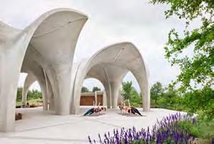
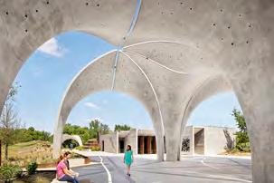
Confluence Park sits within a great riverwalk project that stretches for over 13 miles of the San Antonio River, at about the halfway point on the riverwalk, 3 miles South of the historic downtown district. A community effort to revitalize the river began in 1998 when Bexar County, the City of San Antonio and SARA created the San Antonio River Oversight Committee.
The 22 civic and neighborhood leaders appointed to the committee were given the responsibility of overseeing the planning, design, project management, construction and funding necessary for the project. In addition, the committee was charged with providing an open public forum for citizen input into the project’s development. The Oversight Committee was cochaired by former mayor Lila Cockrell and architect Irby Hightower. The project was completed in 2013 and an appreciation ceremony took place on November 2014 to commemorate the work of all the committee and sub-committee members through its existence.
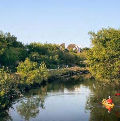
The central pavilion is composed of 22 concrete “petals” that form a network of vaults that provide shade and direct the flow of rainwater into an underground cistern used for the park’s irrigation. The design of the pavilion was inspired by the way many plants in the region direct rainwater to their root system through harnessing the structural efficiency of curved surfaces. Each petal was cast on site using a modified tilt-up construction technique and digitally fabricated fiberglass composite molds and then lifted into place in to form structural arches.
One concern in the development of the petals was to achieve a form that was efficiently modular yet did not appear to be too repetitive. The design uses the Cairo tile, an irregular pentagon, as a base grid in order to achieve cost-effective modularity and the desire for spatial richness. The pentagon is subdivided into 5 triangles in a way that results in only three unique modules: two asymmetrical triangles that are mirrors of each other and one equilateral triangle.
From this grid, a parametric model was used to create the three-dimensional solids of each petal. Structurally, each petal is half of an arch which starts out as a 16” thick column and tapers to a 4” deep curved roof. The double-curvature of the surface geometry helps the structural strength of the petal. Each petal is connected to its neighbor by two pin joints. The petals’ capacity to shed water in the proper direction was tested through water flow simulations.
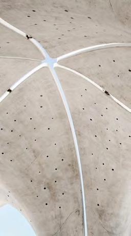
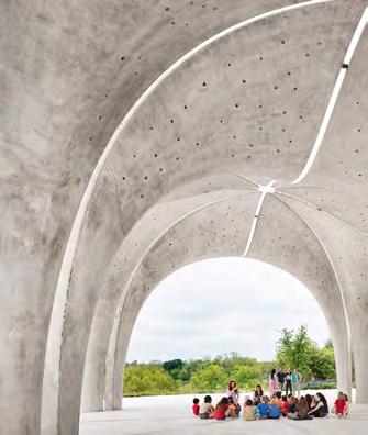
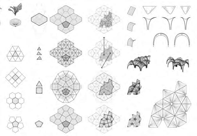
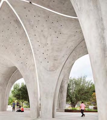
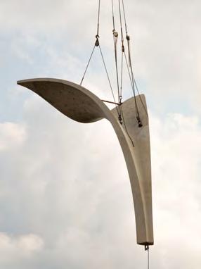
The pavilions throughout the park provide shade and shelter and engage visitors to visualize the water cycle at Confluence Park and its relationship to the San Antonio Rivershed. Also on site is the multi-purpose Estella Avery Education Center, a classroom space that opens to the pavilion and features a green roof with thermal mass for passive heating and cooling. Rainwater collected through the site-wide water catchment system serves as the primary source of water throughout the park, and a photovoltaic array on the roof of the multipurpose building is intended to offset 100% of the energy use for the project on a yearly basis. These sustainable features are meant to be experienced by the community as a display of more environmentally conscious ways of using energy and water.
The multi-purpose building contains the restrooms and a classroom space that opens to the pavilion. This building was designed to contrast with and be a supporting actor to the pavilion - the board formed concrete walls are highly textured compared to the smooth, fiberglass formed petals, and the more geometric forms contrast with the curves of the pavilion. The building’s lower elevation and planted roof makes it appear to emerge from the earth, becoming a fluid part of the landscape.
https://archello.com/project/confluence-park-riverpavilion
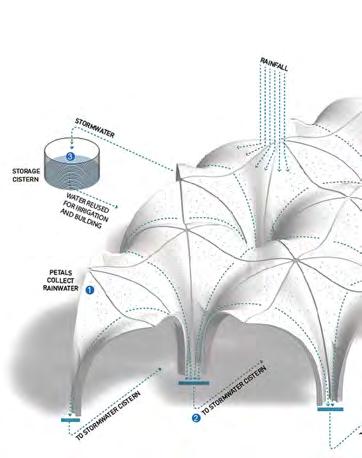
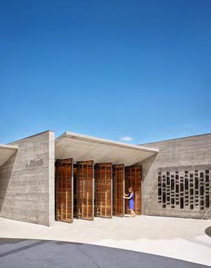
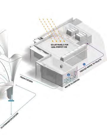
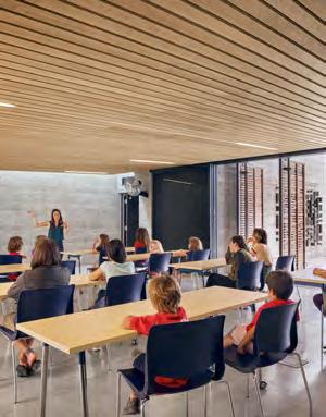
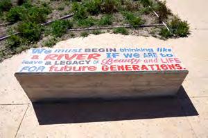
The park’s educational features include:
• Demonstration of 5 ecotypes in the South Texas region
• The use of Low Impact Development strategies to eliminate stormwater runoff into the San Antonio River
• A 130,000 gallon, site-wide water catchment basin to provide the primary source of water throughout the park
• A primary pavilion constructed of large concrete petals that together create a geometry that collects and funnels rainwater
• Satellite pavilions that create distinct nodes throughout the site for classroom gatherings
• A multi-purpose building with a green roof providing thermal mass for passive heating and cooling.
• A photovoltaic array intended to offset 100% of the energy use for the project on a yearly basis.
https://archello.com/project/confluence-park-riverpavilion
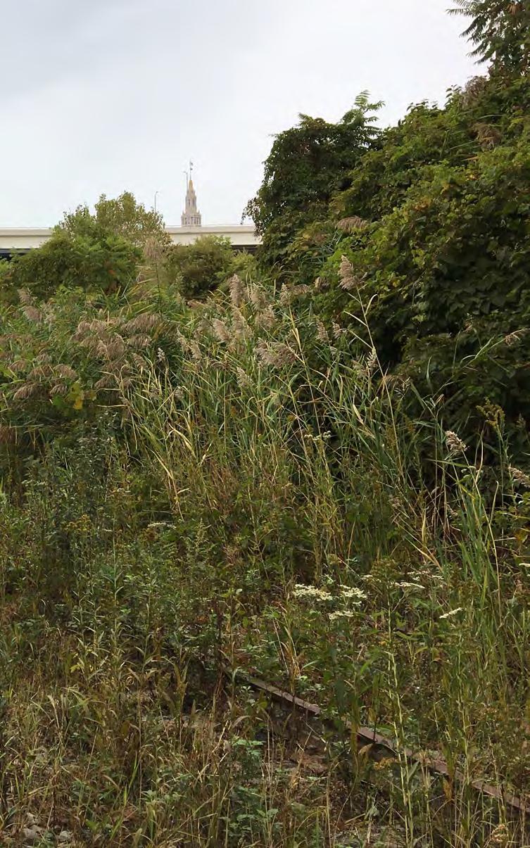
It is time to expand what has been a romantic attachment to the ornaments of nature into a commitment to reshape the city in harmony with the workings of nature.
— Anne Whiston Spirn
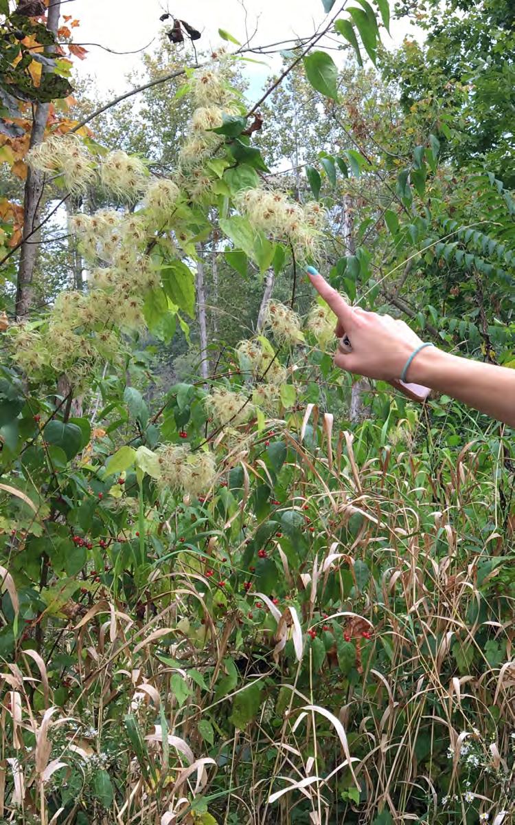
The modern American landscape is the result of dichotomous thinking that relegates land to nature or civilization, with little in between. The result is a landscape mosaic largely dominated by human activities, leaving the wilderness that remains as disconnected patches. This loss and fragmentation of habitat is driving what is now referred to as the sixth wave of mass extinction. In response, there is a call emerging for a paradigm shift toward a more holistic, creative approach to land management and conservation.
If we can learn to embrace the human and the wild as inextricably linked, our urban environments can support the natural ecosystems of which they are a part. The city, then, is reimagined as more than a built environment exclusively for humans, but an inclusive commons for all species. It embraces and cultivates diversity, rooting the city in an ethos of coexistence and nurturing. The relationship between city and ecosystem is redefined, visibly joining human and natural systems. The emerging environments are a dynamic space for education, reflection, research, and creativity. This landscape gives rise to a new community identity, renewing a wonder and appreciation for the natural world.
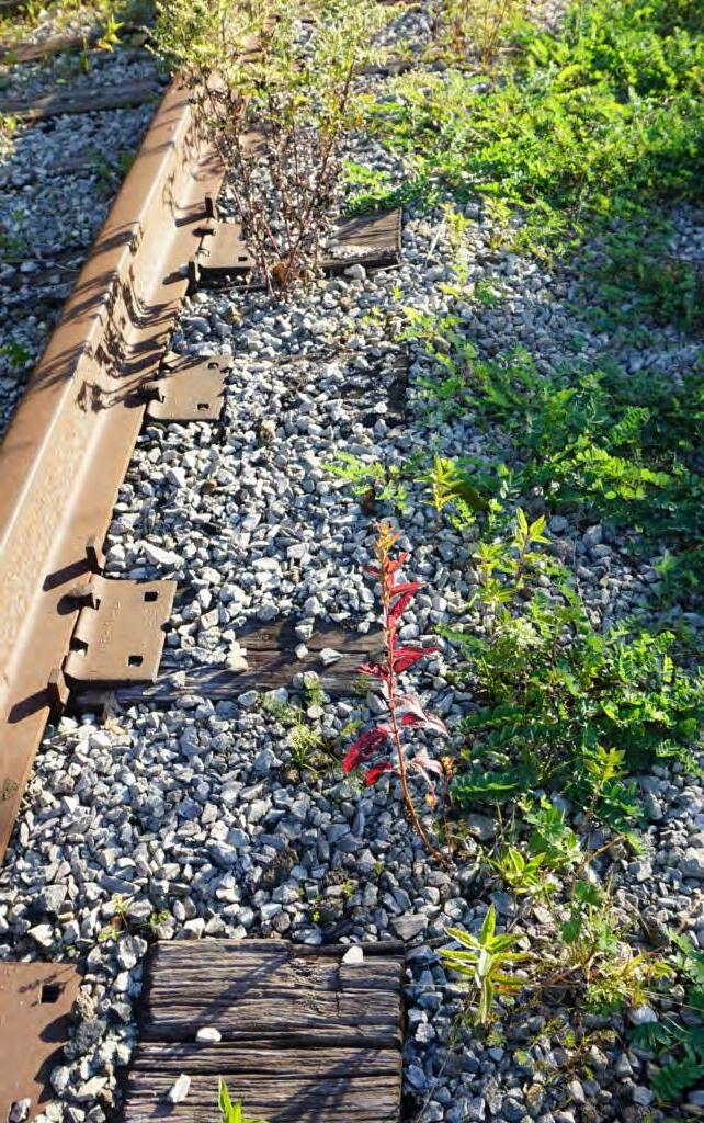
Civilization and urbanization has been a historically homogenizing process. We flatten, clearcut, pave, and mow. As the abandoned towpath trail weaves through Cleveland, it offers an invitation to life in an otherwise sterile, hostile landscape. Wilderness is reemerging along the Cuyahoga’s right bank, revealing an opportunity to uncover and set free a natural diversity that is seeping through the cracks.
This projects seeks to build upon that invitation, employing the towpath as a spine of ecological regeneration in support of biodiversity and resilience. Abandoned railways and urban voids are deconstructed, unpaving the way from Lake Erie to the Cuyahoga Valley.
The resulting corridor is inspired by the knowledge that nature is self-spreading, self-healing. It supports wildlife as it seeks to survive, adapt, and migrate across an increasingly fragmented landscape with a rapidly changing climate. Habitats are constructed in seemingly uninhabitable spaces, dissolving the boundary between the natural and built environments. It doesn’t take much to invite nature back in. In fact, it’s already here.
Before the Ohio & Erie Canal
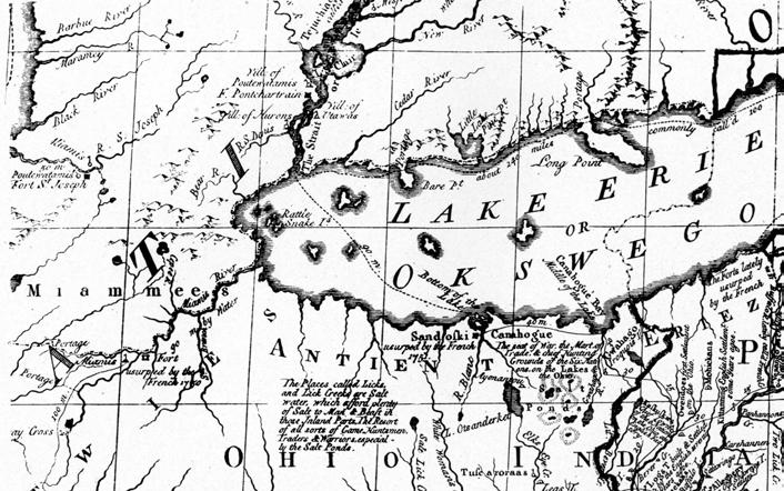
A section of Mitchell’s Map of 1755 provides information about rivers in the area south of Lake Erie (from A History of Cleveland Ohio, Vol. I, by Samuel P. Orth, facing page 82)
The importance of a passage from Lake Erie to the Ohio River was recognized by America’s founding fathers, including surveyor and engineer George Washington, who traveled to the Ohio River valley in 1753.
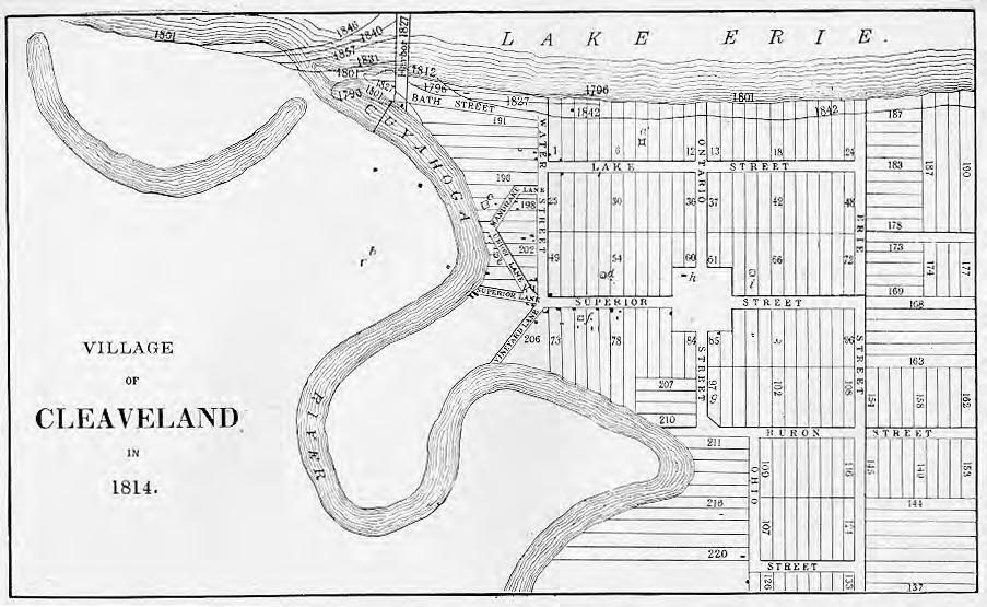
In 1796 Cleveland is founded by Moses Cleveland and a party of surveyors from the Connecticut Land Company. The town was laid out in a ten-acre public square bisected by two streets: Superior and Ontario. A classic New England Village.
and
The Cleveland attorney and politician successfully campaigned for the passage of a canal bill, and supervised the construction of the northern section of the canal as acting Canal Commissioner.
beginning on June 21,
In 1825, construction began on the Ohio & Erie Canal, linking Cleveland with the Ohio River at Portsmouth. By 1827 the canal was completed to Akron, a distance of 38 miles. In 1832, the entire canal was completed.
Once the Ohio & Erie Canal was open to navigation, change came swiftly to the towns along its route, and the effects were felt in surrounding areas as well. Commerce flowed from the eastern centers through Cleveland to the interior.
The new canal changed the natural and social landscape through which it carried passengers and cargo. Industries grew near locks, taking advantage of the power generated by water spill off. Land values rose and speculation ensued. Cleveland’s status as an important port grew, as did its population and industry.
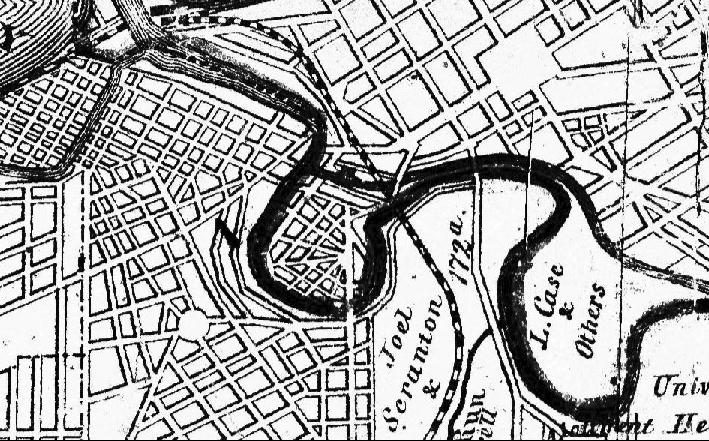
The opening of the Cleveland, Columbus & Cincinnati (CCC) Railroad in 1851. In 1839, approximately 20,000 people arrived in Cleveland via the canal. By, 1855, 4 years after the CCC Railroad opened in Cleveland, not a single passenger entered the city on a canal boat.
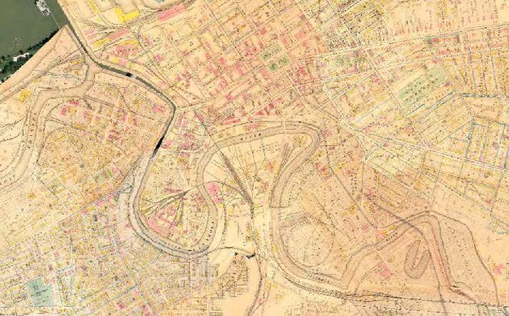
In 1874, Cleveland City Council signed a deal with the newly formed Valley Railway to lease the former canal bed to the railroad for a period of 99 years. For payment, the city received $265,000 of Valley Railway bonds. As construction on the Valley Railway began, the Ohio & Erie (O&E) Canal bed was filled with rail ballast to hold tracks. The remnants of the O&E Canal in Cleveland soon began to disappear.
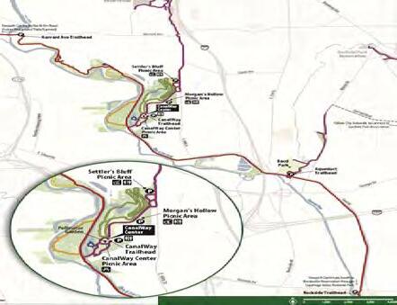
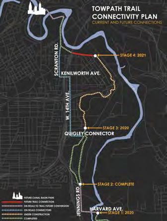
Whether birding, biking, hiking, running, riding on horseback, taking a canal boat ride, or traveling alongside it by scenic rail— folks find that old-school “travel” along the Towpath Trail adds an undeniable energy to the quality of life in Northeast Ohio.
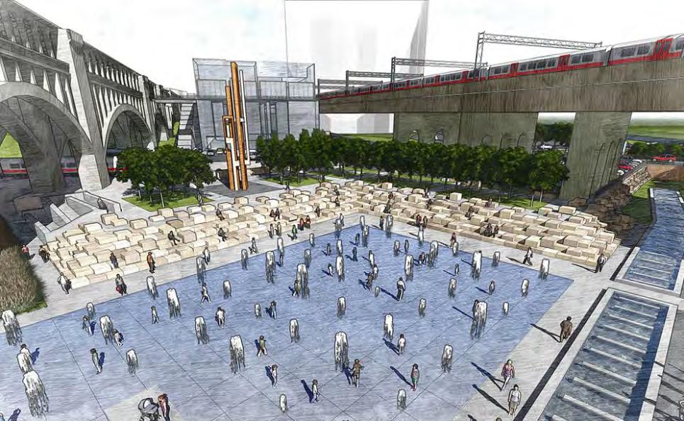
The Towpath Trail management team has worked to extend the popular Towpath Trail Greenway into Downtown Cleveland. Canal Basin Park will serve as a gathering place, interpretive park and connective hub at the northern end of the Towpath. But is building another humancentered trail the best option?
DETROIT-SUPERIOR HIGH LEVEL BRIDGE
Cuyahoga County Board of Comm.
INDUSTRIAL VACANT LAND STORAGE
Fats South Cleveland, LLC
ROCKEFELLER AVENUE BRIDGE
Concrete LLC.
ROUTE 490 BRIDGE
International Bulk Storage Group LLC
W&LE - CUYAHOGA RIVER BRIDGE
ISG Cleveland Works Railway
INTERNATIONAL STEEL GROUP, INC.
ISG Cleveland Works Railway
RAILROAD STEEL WORK
Norfolk & Western RR
The historic towpath becomes an invitation for wildlife habitat to reemerge amid a rich and heterogeneous urban landscape. The footprint is selected to foster movement of wildlife while preserving and embracing Cleveland’s industrial heritage. While the narrow corridor is protected from human impact, larger habitat patches provide opportunity for humans to observe and enter dynamic ecosystems.
NATURAL HABITAT
protected corridor
habitat patch
enhanced urban and industrial
ARTIFICIAL HABITAT
overpassing bridges
vertical wall
[bulkhead? retaining /sea wall?]
adapted building
adapted bridge

An abandoned railway serves as inaugural spine, seeded with windborne pioneers to inoculate surrounding landscape. Bridges and walls support native climbing vegetation for a greater initiatory impact.

Underutilized and vacant land is readily converted to habitat as soil is laid bare and abandoned structures become foundations for constructed habitat. Thread becomes dominated by shrubs and is colonized by reptiles and small mammals.

The corridor weaves through urban and industrial landscapes, designed to mitigate pollution and environmental impact, connecting landscapes in varying stages of succession. Over time, the land remediates and matures, granting predators and wide-range species safe home and passage

Consolidate ownership
Analyze and Inventory
species soil & pollution hydrology & topography wind & solar structures uses
Activate Ecologies
protect beneficial species remove invasive species amend soil & topography vegetate [seed + plant] construct artificial habitat
Remediate Brownfields
remove paving bioremediate adaptive reuse
Human Exposure
citizen science organize workforce education & interpretation construct trails & viewpoints


Adaptive Management
corridor management as a dynamic, iterative process of design, implementation, and assessment that evolves as it grows
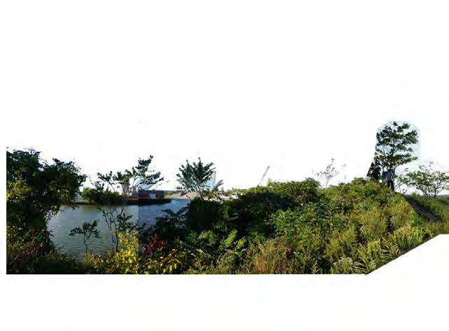
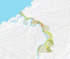

Current Condition
The river edge condition near the E 9th and S Broadway Street contains the railway directly next to the river with only a linear mount already covered with native vegetation. The flood barrier offers a proviledged spot for views of the Cuyahoga River. Without a direct constructed path to access the railway part, this spot is excellent for local species and a lookout viewpoint for humans.
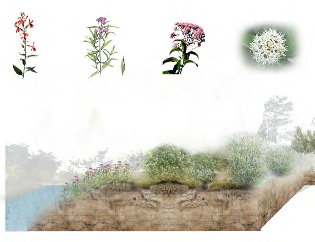
Create areas on top of the flood barrier for plants
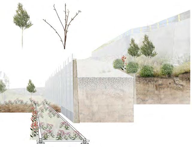
The first phase includes the clean up of invasive plants in the area to reintroduce Ohio native species --mainly grass, shrub and fern. Flowering plants around the riverside and along the railway celebrate the thick layer of history of the thread.
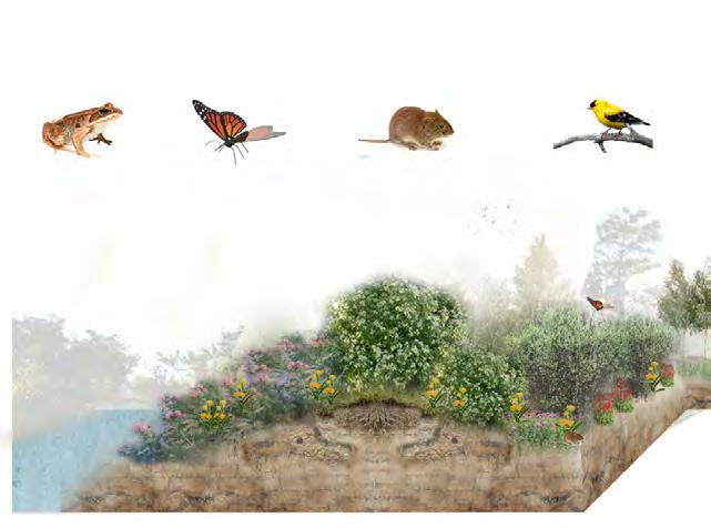
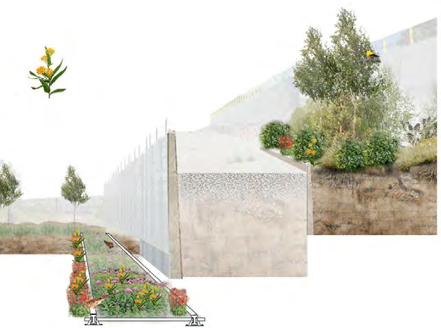
THREAD: PHASE 2
This section shows the growth after the first phase. The proposed vegetation attracts animals such as frogs, birds and butterflies. The flood barrier is still restricted from humans. Thus these species will be the first settlers of the area.
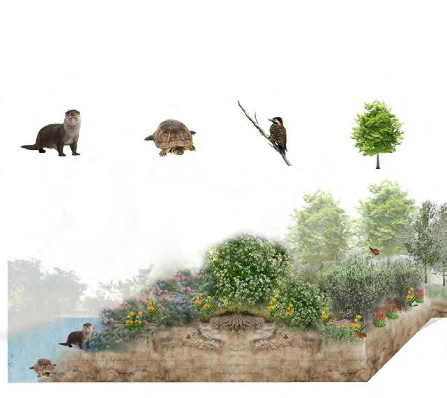
CONCEPTUAL SECTION I
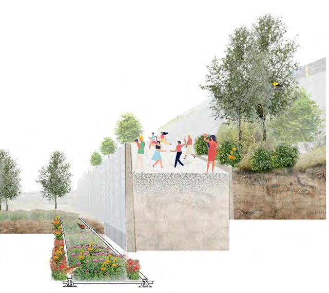
THREAD: PHASE 1
In the final phase, humans are invited to the upper level of the landscape.
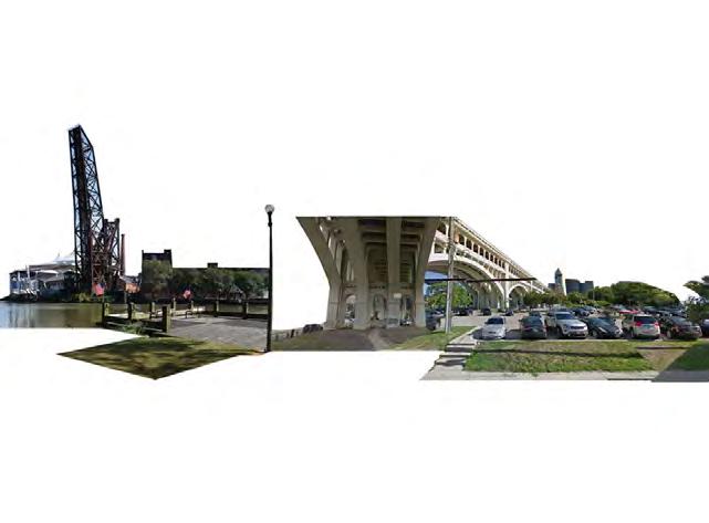
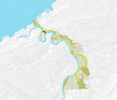
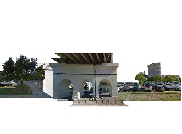
Current Condition
The current condition of the Canal Basin looking north-east, in between the two bridges, is now mainly used for parking. Situated in the center of the Ox Bend, this area is designed as a patch intended for restricted human interactions on the same level with the landscape.
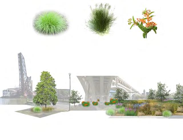
Riverside Lookout
Greenery under the bridge
Topography Change for w form pond to invite
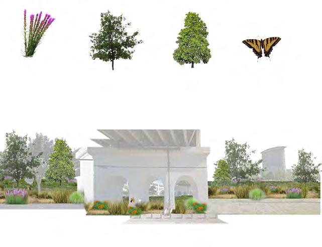
water gathering to in species
Patch: PHASE 1
Human restricted under bridge area Connects to thread
The first phase involves the removal of the parking lots concrete surface to create topographic change and allow water accumulation, connect the area across the under bridge area, introduce local species and connect to the thread on the south side.

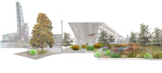
Riverside
Greenery
Topography
Change for w form pond to invite

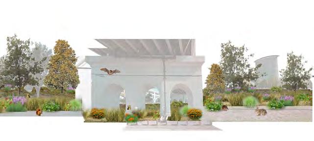
water gathering to in species
Human restricted under bridge area Connects to thread
PATCH: PHASE 2
This section shows the second phase of the area, while the trees and grass grow in the process, animals such as squirrels and rabbits start to come in. The improved environment under the bridge will invite in bats. More local species will appear naturally with the help of the animals. In this stage, human is still not allowed in the area for the sake of habitat growth.
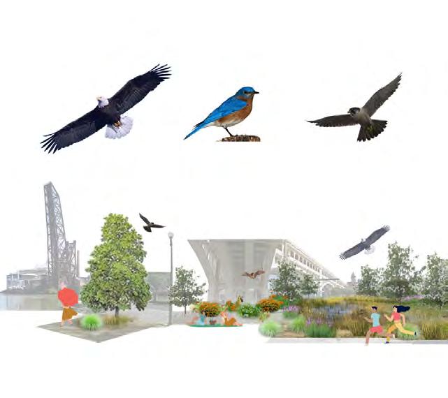
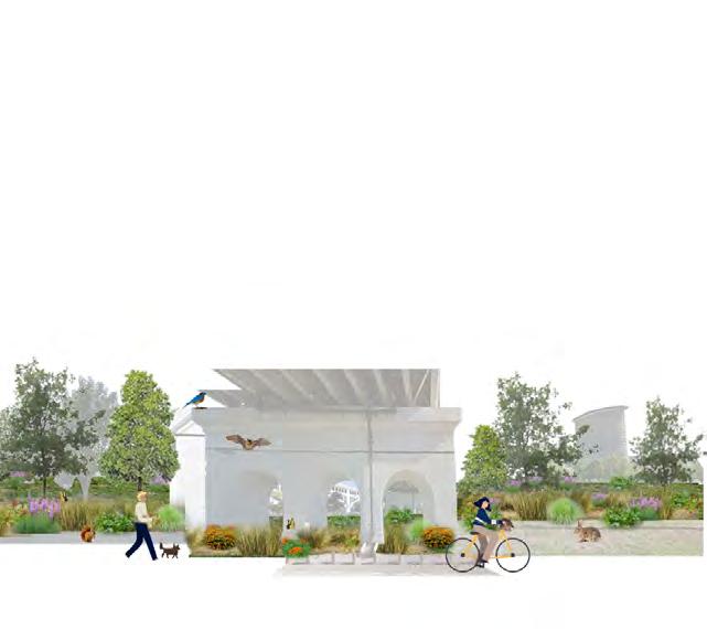
water gathering to in species
PATCH: PHASE 3
In the final stage, humans are invited to use the area. One under bridge area is intended for gatherings and more interaction while the other is restricted from human and remain as a natural habitat only.

The current condition of the Industrial Valley looking east includes industrial areas and the supporting rail and road infrastructures blocking river access. Situated in the southern part of the city, this area is designed as the final stage to spread the concept of the connected thread and create the buffer to mediate with the working industrial areas.
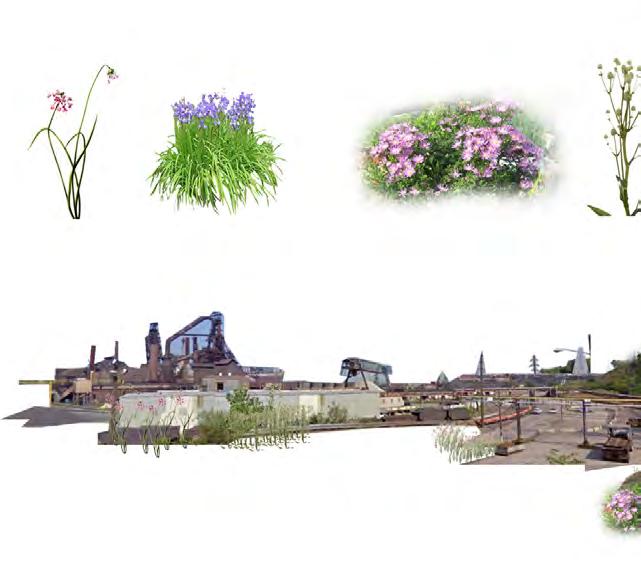
Industrial Factory Road link to the riverside Abandoned rail
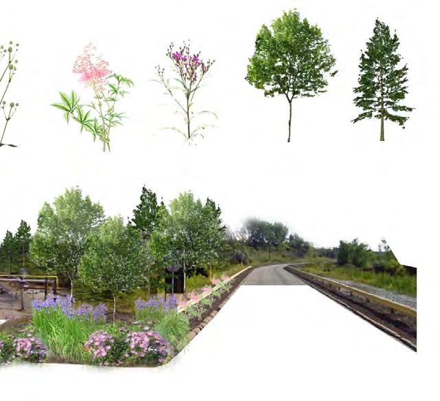
PATCH: PHASE1
The first phase involves the removal of the invasive vegetation, the connection across the abandoned rail and road infrastructures, introduction of local species and connection to the thread on the east side.
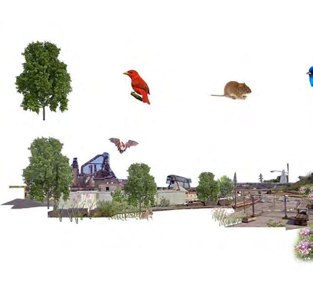
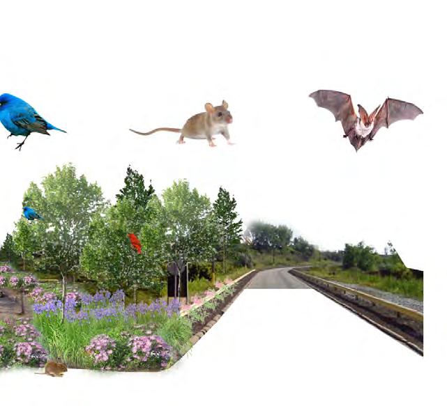
The second phase introduces local animal species, plants trees along the abandoned industrial rail and vacant areas and expands the buffer area to the riverside industrial area.
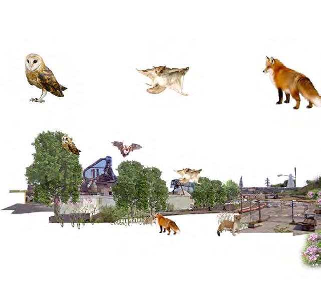
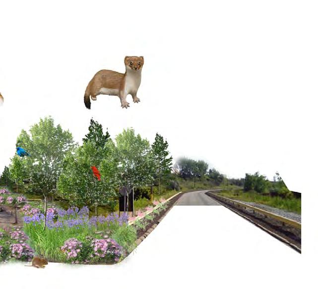
Linear green area
Connects to thread
The final phase introduces aditional local animal species and builds more connections to connect the ecological corridor and the river. The green buffer connects across the abandoned rail and road to allow local animals to travel along the Cuyahoga River.
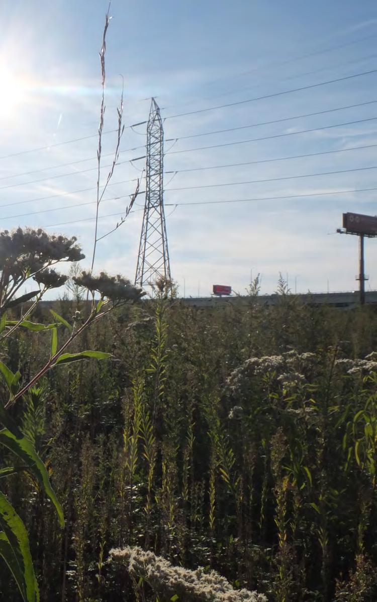
We live within this reality we create, and we’re quite unaware of how we create the reality. So the work is often a general koan into how we go about forming this world in which we live, in particular with seeing.
— James Turrell
Along the Towpath Trail a series of built artifacts become markers for wildlife habitat to reemerge amid a rich and heterogeneous urban landscape. Focusing on four main types: bridges, underbridges, abandoned buildings and industrial sites, these components foster wildlife movement in the Industrial Valley. The artifacts complement the corridor and the larger habitat patches and provide opportunity for humans to observe emerging urban natures at work.
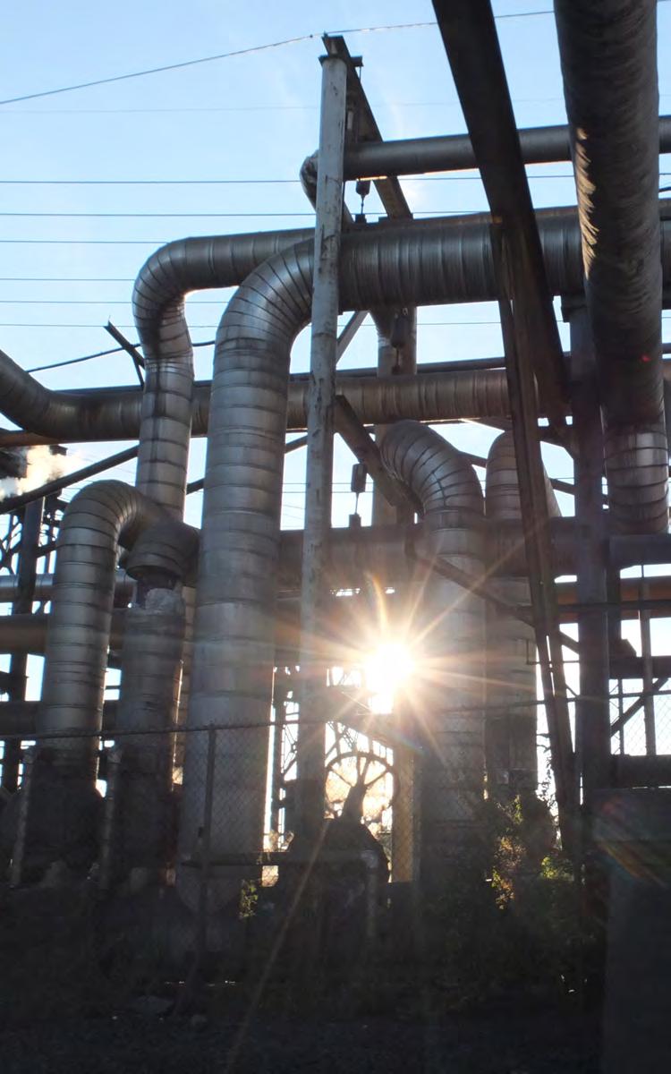
The Cuyahoga River Valley on its way through Cleveland contains a rich and complex urban ecology. The river, a collection of working and abandoned industrial artifacts, recreational uses, and thick infrastructural layers of transportation are interlinked as a unified system. This section of the proposal focuses in the opportunities to cultivate wilderness in the existing architectural and infrastructural artifacts that punctuate the valley by focusing on bridges, underbridges, abandoned buildings and industrial areas.
The reintroduction of biodiversity within the Cuyahoga River Valley is an incremental process. The project identifies a series of portential sites where the process of nature reclamation can take place and developes a prototypical approach addressing land ownership, the construction structural integrity, flooding patterns, and human access.
The proposal makes nature reclamation in the city visible and intervenes to amplify the processes of succession with minimal human intervention and maintenance. In each prototypical site, the proposal suggests a series of species that can adapt to these areas with little to no human intervention. Some of the processs are already taking placein abandoned and underused sites, and they remain key for the ecological regeneration of the Cuyahoga River Valley region.
Inspiration: Eco-Link@BKE in Singapore
Bridges are some of the most sculptural infrastructures along the Cuyahoga River. With over 100 bridges establishment, many are abandoned and nature is slowly taking over.
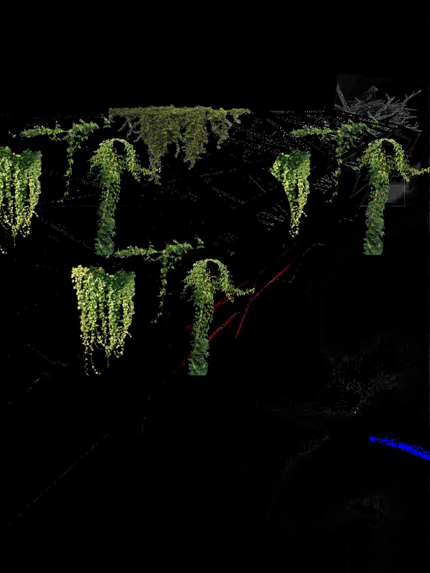
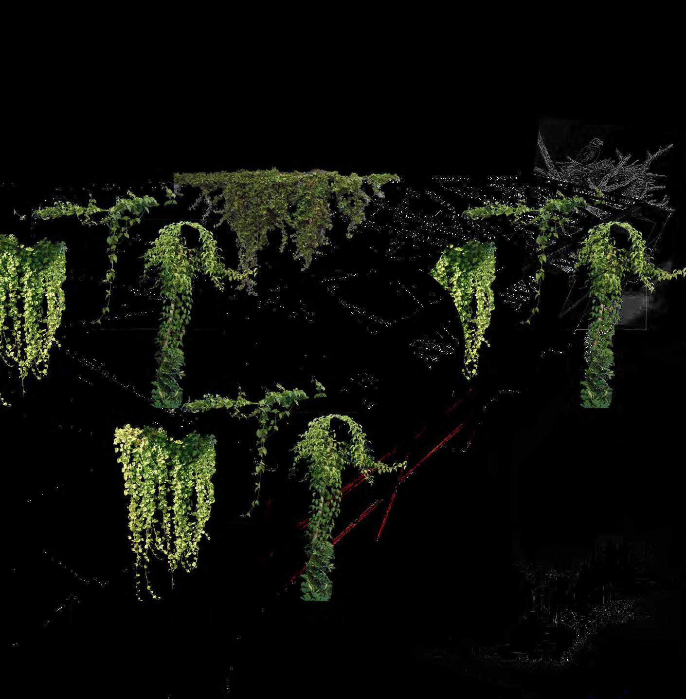
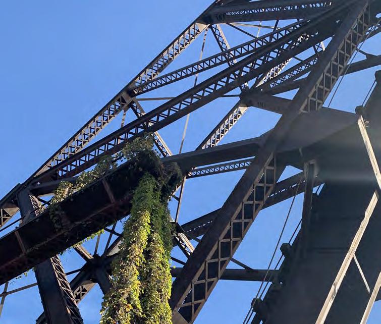
When it slowly starts to bloom, the plant attracts other species such as the Pipevine Swallowtail Butterfly. Proving
Introducing a healthy river and a tall mounted habitat. Bald eagles will take
Bald eagle’s in the region tell the story of a healthy environment that provides a lot of food . Bald eagles tend to build durable nests that they use for several years making a home and inviting others
(Plant)
Fast-growing perennial vine. One of the
Has been known to withstand temperatures as low as −71 °F. This plant will adhere to metal structures and
Inspiration: West Japan Railway
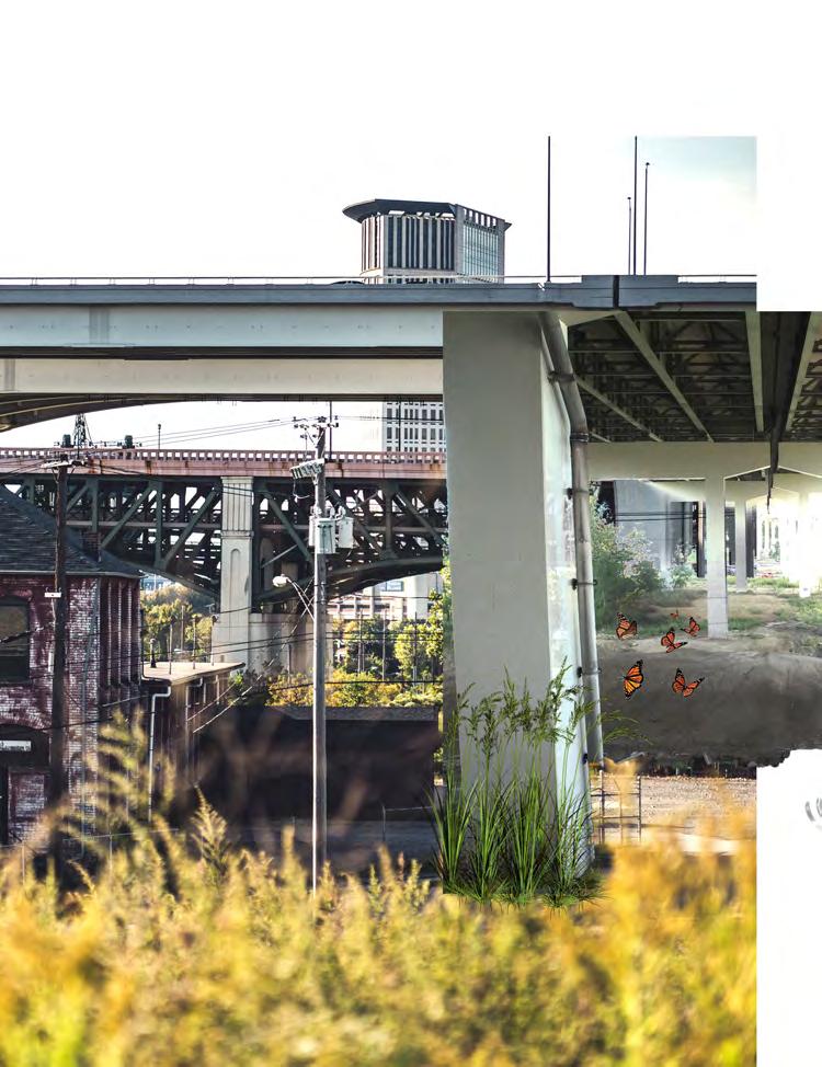
Under bridges are optimal zones to help steward emerging urban natures. Wildlife underpasses, for instance, assist animals in safely passing under busy roadways and continue their path within their habitat, which would otherwise be blocked by asphalt.
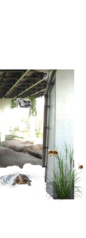
What: Fresh water turtle (Reptile) Endangered
How: Wetland requirements include a soft substrate, aquatic or emergent vegetation, and at least a partially open canopy.
Why: Habitat loss and wetland conversion threaten most.
What: Monarch butterfly (Insect) Endangered
How: Milkweed. A plant where most of the species nest.
Why: Habitat loss from deforestation and harsh weather. Pollinators for plants and important food source for birds, small animals, and other insects.
What: Asclepias syriaca, Common milkweed (Plant)
How: Plants grow in clumps or patches in meadows, fencerows, roadsides, railways, waste places, reducedtillage fields, and other open habitats.
Why: Host plants for monarch butterfly caterpillars (female monarchs lay their eggs on milkweeds). Flowers provide nectar for bees, butterflies, and other beneficial insects.
What: Cliff Swallow (Bird)
How: Traditionally built their nests on vertical cliff faces. With the expansion of road infrastructure, they adopt bridges, overpasses, and culverts as their colonial nesting sites.
Why: Nest structures provide homes and help balance population of insect.
Inspiration: House in the Woods, Kai Fagerström
Along the Cuyahoga River Industrial Valley, the presence of abandoned structures speaks of the impacts of a changing economic system in the urban landscape. Due to lack of investment for their maintenance, these structures often become damaged by water and insects and other species take over. In these buildings animal communities can typically see upwards to 15 species co-living together.
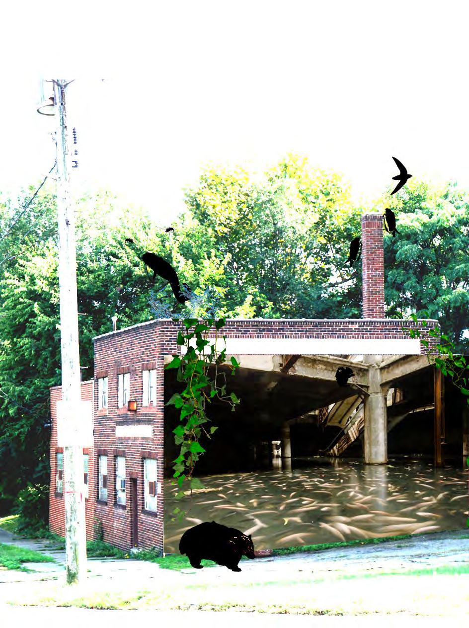
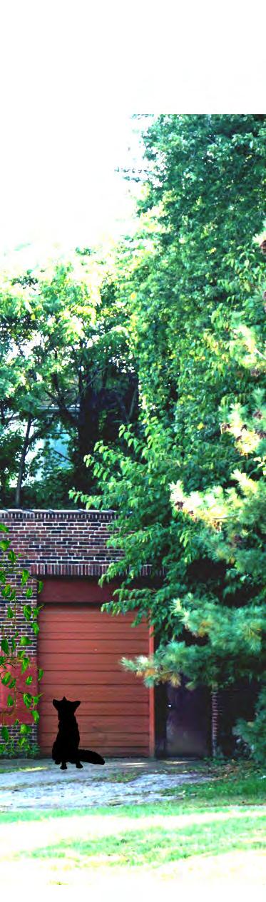
What: Chimney Swift (Bird)
How: Providing open ventilation for open brick chimneys or towers to allow for gripping and providing a safe habitat.
Why: These insectivores eat nearly one third of their own weight every day and devour flying insects, including mosquitoes, biting flies, and termites.
What: American Badger (Mammal)
How: Adaptable specie that prefer quiet areas
Why: Badgers commonly feed on mice, woodrats, rats, ground squirrels and pocket gophers.
What: Catfish (Fish)
How: Placement with human help to create an artificial habitat.
Why: Roofless structures collect rain water attracting mosquitoes and annoying locals around forgotten structures. The catfish combat the problem.
What: Parthenocissus quinquefolia, Virginia Creeper (Plant)
How: Native to Ohio vine that already grow in the region.
Why: Roots form at the nodes whenever vines encounter soil. Teas made from this plant have been used to treat numerous ailments.
What: Red Fox (Mammal)
How: Burrows in the ground where they sleep, a good location to store food
Why: Help to control populations of their prey animals.
Inspiration: Chernobyl Exclusion Zone
Industrial buildings, in particular, comprise a large part of Cuyahoga Valley on its way through Cleveland. Although large industrial operations remain active, a lot of the former production is long gone. Today, some of those sites are home to emerging species and wildlife forms.
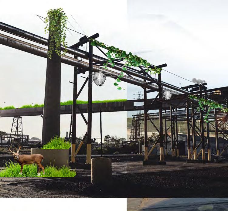
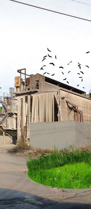
What: White-tailed Deer (Mammal)
How: In the absence of humans and heavy industry, the area can be repopulated.
Why: Other areas of Cleveland are filled with human activity and because of this the animals suffer habitat loss.
What: Yellowjacket wasps (Insect)
How: Absence of humans and structures are easy access off a corridor.
Why: Play a vital role in protecting gardens and farm crops by controlling pest populations. They capture and consume insects such as flies, caterpillars and beetle larvae.
What: Little brown bat (Mammal) Endangered
How: Provide a good place for them to roost. Bat houses can take many forms, from small backyard boxes to free-standing towers
Why: White-nose syndrome is a disease that affects hibernating bats and is caused by a fungus that typically form in caves.
What: Bouteloua gracilis, Blue Grama (Plant)
How: Native grass that would grow with low organic matter soils and is very drought tolerant.
Why: An important grazing grass in the central short grass prairie regions. Dense and shallow, it holds surface soil in place. Forms a sod over time.
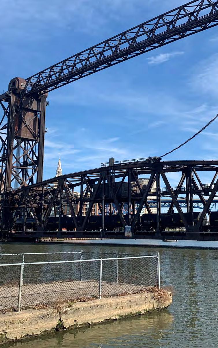
“Let
people from the community lead. Cities are full of exciting ideas and visionary leaders. Look for solutions already being developed by the community members themselves, and support them. Trust the people and the community you’re working with. They know. They live it every day.”
— Drew Philp
PITTSBURGH, PA (1991–ONGOING)
Like Cleveland, the City of Pittsburgh occupies a valley where rapid industrial growth during the early 20th century resulted in riverfronts dominated by industry. For over a century, the city turned its back to the rivers as they became polluted, channelized, and fenced off as platforms for industrial use, thereby separating the city and its residents from the pleasures of the water below. Following the collapse of the steel industry in the 1970’s, the city’s residents spearheaded a movement toward restoring and reconnecting with the riverfronts. Water, in turn, began to improve in quality and brownfields were converted for new uses.
In 1991, the construction of the city’s first riverfront rail trail started, spearheaded by the newly founded nonprofit organization, Friends of the Riverfront. After nearly three decades of collaborations between residents, planners, politicians, designers, ecologists, and artists, the Three Rivers Heritage Trail now spans over 25 miles of urban riverfront trails along both banks of Pittsburgh’s Allegheny, Monongahela and Ohio Rivers. The trail system serves as a thread that traverses a variety of terrains, weaving under and over highways and rail, crossing bridges to unite an extensive network of riverfront parks dotted with playscapes, public art, museums, theatres, and natural areas.
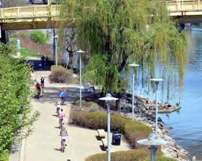
The Three Rivers Heritage Trail is the result of ambitious, interdisciplinary efforts to protect and restore Pittsburgh’s rivers and riverfronts after decades of legacy industrial pollution. While the first lengths of trails were converted railways, it has continued to transform industrial harbors, parking lots, roadways, and other brownfields into a corridor that fosters movement of people and wildlife. The trail draws residents and visitors alike to experience the city by bicycle, foot, skateboard, rollerskate or scooter. Importantly, the trail is not limited to one bank or one river, crossing the waterways at multiple points to trace all banks and link previously disparate communities to water, place, and each other.
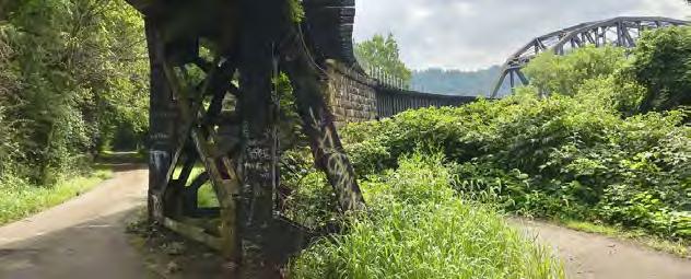
Within the city’s urban core, the trail and its parks are spaces of urban pride, where people come to play, socialize, enjoy artwork and scenery. Further upstream, the riverscape becomes a safe passage for a great diversity of wildlife. Interpretive signage throughout covers a range of topics including geological histories, Native American settlements, industrial legacies, and more. Perhaps its greatest strength is that the trail does not end. Rather, it serves as a spine converging a network of trails throughout the city and beyond connecting cyclists and hikers all the way to the Atlantic Coast in Washington, DC.
Since its groundbreaking nearly three decades ago, the Three Rivers Trail has become a model for other cities as they seek to connect people to water, support alternative modes of transit, and restore natural systems in urban environments. The trail’s success is a testament to the power of determined collaboration. Residents and environmental advocates have been essential initiating and continuing the trail construction and remain the leading stewards, with thousands of volunteers participating in restoration and maintenance every year. The political support of multiple mayors has empowered advocates and nonprofit organizations to grow the trail beyond their capacities. Financial support has come from the city, county, and state, in addition to private sources, thus enabling innovative works of engineering, design, and ecological restoration.
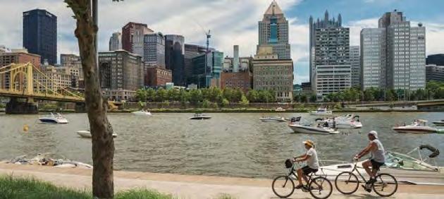
The Three Rivers Trail is a model of what a comprehensive trail network can be, revealing that it is possible to overcome great barriers to transform the way people relate to their urban landscape. However, it is important to remember that the trail does not stand alone. It is a part of greater efforts to improve life and place through public art, non-motorized transit, education, and the restoration of natural environments. In this way, the Pittsburgh riverfronts serve not only as a model but also a reminder that meaningful, lasting urban transformation takes the combined work of many stakeholders over many years.
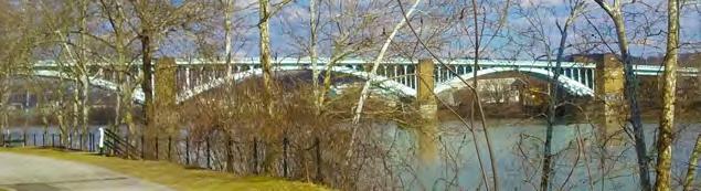
Along the south bank of the Allegheny River, connected to the Point State Park where the Allegheny and Monongohela Rivers converge to form the Ohio, there lies a particularly masterful section of the Three Rivers Trail. This narrow, 4,000-foot strip of riverfront reflects the trail’s greatest challenges and assets in one intriguing and ambitious design. In 1994, the Pittsburgh Cultural Trust commissioned landscape architecture firm Michael Van Valkenberg and Associates (MVVA) to design a riverfront park and trail as part of their larger effort to create a cultural center in a neglected portion of Pittsburgh’s downtown. The park was collaboratively designed by MVVA, artists Ann Hamilton and Michael Mercil, and international engineering firm Arup. Collectively, these entities created a park that embodies the resourcefulness, ingenuity, and artistry required to create a meaningful public space amid the unique challenges of the post-industrial riverfront.
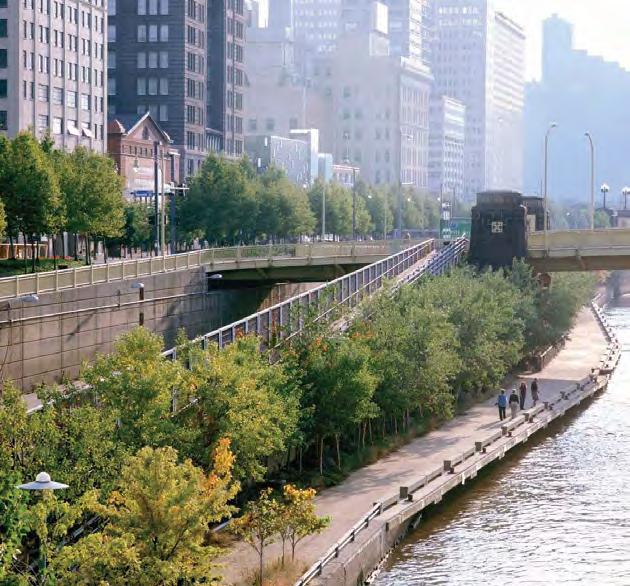
PITTSBURGH, PA (1999)
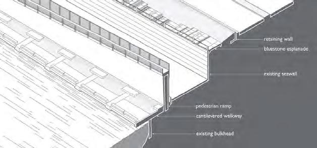
The brilliance of the Allegheny Riverfront Park lies in the designers’ ability to transform the site’s greatest constraints into its greatest assets. The site is an extremely narrow section of riverfront, separated by a three-lane highway and a 25-foot high seawall. Pittsburgh urban core towers above, with a sliver of riverfront below. This dramatic separation was approached by the designers as a unique opportunity to create a dialectic between the park’s upper and lower sections through the creation of two terraces distinct in texture and form, connected by a series of ramps and walkways. The final design emerged through a meticulous and collaborative process of design and engineering that transformed a seemingly uninhabitable site into a simple yet rich environment for enjoying the urban and the natural in one thin reality.
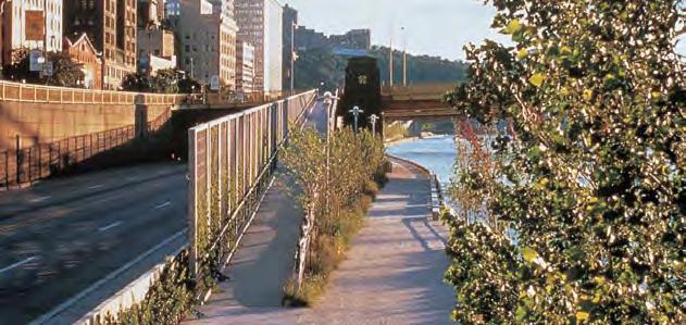
In such a tight space, every design decision takes on a new level of importance. The ramps are ADA accessible and designed to block noise from the transecting highway. Vined terraces and walls soften the landscape, lending visual screening and trapping air pollutants. Native plants were selected for their ability to survive the site’s harsh weather conditions and intense floods while providing habitat for resident or passing wildlife. Materials respond to honor the site’s disparate contexts. The use and patterning of bluestone on the upper terrace serves as homage to the city’s signature building material. Below, the paving transitions to concrete, pressed with native wetland reeds to honor native habitats mirror the movement of the adjacent river.
Despite its small size, the Allegheny Riverfront Park is a complex and rich landscape that honors its place along an urban riverfront that serves as gateway to the Allegheny Mountains. The thoughtful site design, engineering, and material selection, lend the site the elegance appropriate for the urban context while connecting it to the greater riverfront and Three Rivers Trail. It serves to remind us that the riverfront, no matter how narrow, can and should be a stunning space for people and wildlife to inhabit.
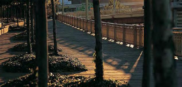
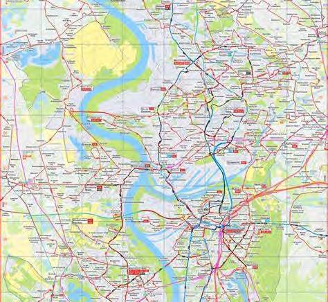
Duisburg, in the heart of the Ruhr valley, has reinvented itself following the decline of its traditional heavy industries. In 1991, an international competition was held to establish a masterplan for the renewal of the Inner Harbour – the largest inland waterway in the world. It provided an opportunity to test, at a large scale, ideas about mixed use and sustainability already being developed for the nearby Microelectronics Park.
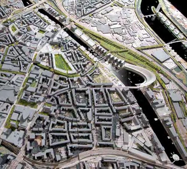
The Inner Harbour occupies an 89-hectare site adjacent to the city centre. The site benefits from excellent transportation links to cities and towns throughout the Ruhr. The masterplan aimed to draw the life of the city to the waterfront, combining selective refurbishment of buildings lining the harbour with new construction to provide housing, office space and light-industrial uses, as well as a wide range of social and cultural amenities.
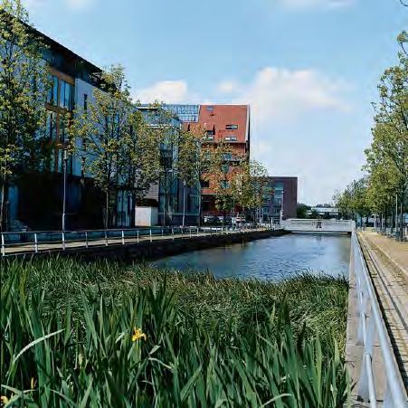
A guiding principle of the master plan was to create a flexible framework that allows elements to be developed independently over time by different architects. New infrastructure and public amenities were constructed first to establish the harbour as an attractive place to live, work, and visit. A tree-lined promenade was created along the waterfront and canals were excavated as armatures for new housing development. Apartments are grouped in five-story terraces which look out over the water or inland to communal gardens.
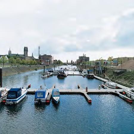
Future developments include the landmark Eurogate, a zero-emmision building planned for the waterfront. It offers flexible office, hotel and conferencing facilities and extends the public attractions around the harbour.
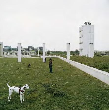
Transformed from a heavily industrial riverfront, this project faced a similar challenge with the Cuyahoga River in Cleveland. This case study offers insight on a masterplan approach that considers the riverfront as a whole system, combined with an architectural approach that creates a new identity along for the river through reclamation of water for public use.
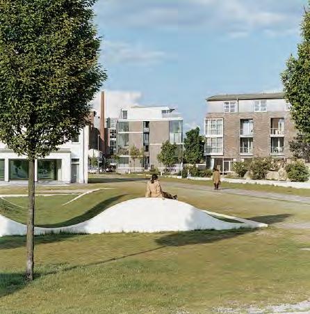
However, the master plan does little to create a cohesive riverfront landscape, with the resulting waterfront becoming static and, at times, unwelcoming. The lessons learned through the Inner Harbor at Duisburg can help inform the emergence of a vibrant and cohesive waterfront that integrates architecture and landscape to connect the City of Cleveland back to the Cuyahoga River.
(SINGAPORE, 2013)
The Bukit Timah Expressway (BKE) was constructed in 1986, severing the connectivity between two wilderness areas, the Bukit Timah Nature Reserve and the Central Catchment Nature Reserve. For over two decades, the expressway served as a barrier, contributing to the widespread habitat fragmentation that continues to endanger the nation’s treasured wildlife.
In 2013, Singapore constructed the Eco-Link to allow for safe passage of wildlife over the expressway. Designed by Stephen Caffyn Landscape Design (SCLD), the corridor marked a big step in Singapore’s efforts to integrate natural and human environments. The designers worked with scientists to design a soil profile that would sustain plants selected to provide habitat and food for migrating wildlife. Since its completion, research that has shown that a great diversity of wildlife, including monkeys, bats, birds, and squirrels, utilizes the Eco-Link to traverse a previously fragmented landscape.
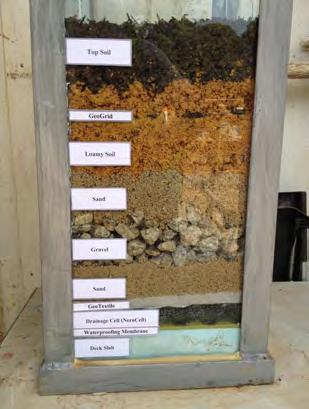
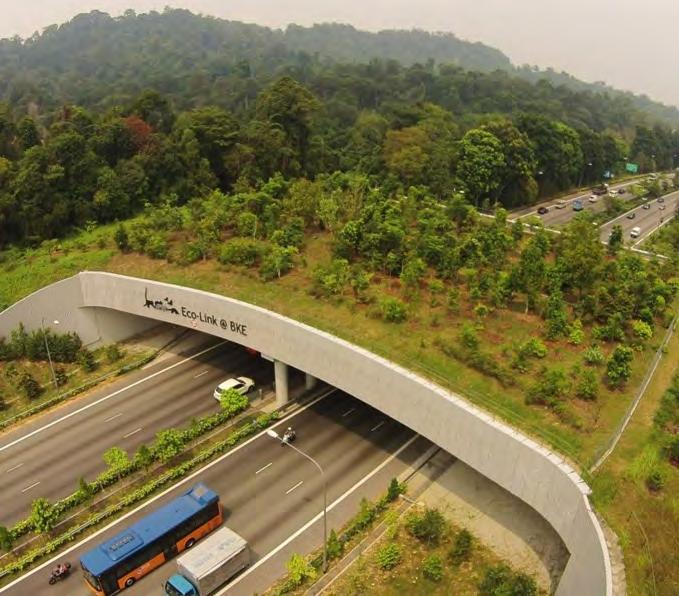
Singapore’s Eco-Link exemplifies how human design can be employed to heal and connect the natural environment. Cleveland’s Cuyahoga River has the potential to be reimagined as a space that fosters biodiversity, rather than hindering it. Cleveland is home to many abandoned bridges that could be creatively repurposed to connect habitat in an otherwise fragmented landscape. Recently, the City of Cleveland dismantled a bridge and reconstructed a new one close by. Such projects should be viewed as opportunities, where old bridges could be reimagined as a large, natural corridor. Similarly there is a bridge that leads to housing and feels empty. The bridge stops and overlooks the river but instead could be designed to foster migration of wildlife across the city.
(SINGAPORE, 2013)
The Eco-Link is an ecological corridor designed to mitigate the effects of wildlife fragmentation, integrating community engagement and fostering environmental education. Stakeholders and volunteers participated in construction and planting, learning hands-on about ecosystems they were working to restore and connect. While visited by park managers, researchers, and citizen scientists, the bridge is not accessible to the public, its goal being fostering wildlife in an otherwise humandominated landscape. The Eco-Link is a marvel of engineering in its ability to sustain the weight of the forested ecosystem above. Throughout the construction process, the road beneath remained open to travel. SCLD conducted extensive research on the local wildlife to inform a design that fostered the movement of desired species while inhibiting the movement of others. The team’s design incorporated escape ramps, escape flaps, and animal funnel fencing.
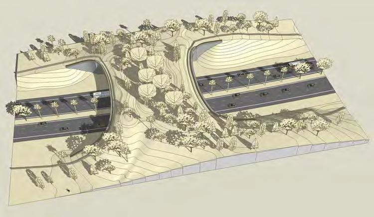
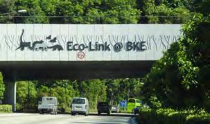
The research on what animals are getting harmed the most from this freeway and how to go about designing for them is highly relevant. Similarly, Cleveland can look at what types of birds, mammals, and incests can thrive from a proposed bridge like this. Ecological corridors are one way to protect wildlife after roads have been built.
As we continue to re-build the urban environment in Western Ohio, rich in forest and wildlife habitat, we must learn to incorporate ecological functions and integrate human and natural environments. As the Eco-Link shows, collaborative projects that engage citizens through the construction process and continued environmental education can succeed.