


Dear seafarers,
Welcome to this installment of Wavelength. You will find a wide range of topics, matched by the number of contributors, some of whom have made more than one submission.
The Technical article, submitted by a new contributor, Mariana Pynylo, takes us on a voyage along the Panama Canal and provides a detailed description of the preparations required prior to transiting this iconic body of water. This is followed by Delson Roche’s insightful explanation of the reasons why a more accurate technological means of global positioning is replacing one that is being phased out.
The Safety First contribution includes an excellent follow-up to the ‘context drives behaviour’ theme. This piece mainly focuses on the importance of drills, which drastically narrow team members’ variations in their perspectives of context so that their efforts become better coordinated. As pointed out, this was exemplified in the M/T Alexia incident. The Mental Well-Being section complements this aspect of teamwork by highlighting how trust underpins all the prerequisites for a team to be successful.
The relatively recent popular inclusion of our Seafarers providing a brief yet revealing glimpse of their professional lives continues in this issue. The response to a request for their stories was impressive as they were both willing and honoured to share their experiences with our readers. So, I would like to thank George P. Magioras from the Crew Department, Nostalgia contributors, Captains Prashant Kumar, Delson Roche, Adesh Tungare and Rommel Reyes, and Voices from the Fleet contributor, C/E JE Fernandes, for the time and effort they put in to provide a clear picture of their sources of inspiration and the camaraderie that exists among the Company’s Seafarers.
I sincerely hope that you enjoy this issue of Wavelength. If you have any comments, suggestions or questions regarding the content, please do not hesitate to contact me at contact@wavelength.gr
Best wishes, Nick Seaman
Twenty five officers and ratings gained a promotion in the fourth quarter of 2022. The list of the Company Seafarers together with their vessels and promotion details in chronological order is shown in the table below.
Just a glance at this list reveals how impressive it is. Not only is it relatively long, but it contains the names of ten of our Seafarers who have either reached the second highest or highest rung of the promotion ladder. It is evident, therefore, that their long years with the Company, their hard work and their progress in their respective careers have been well rewarded. Their achievements should serve as an inspiration across the fleet. Additionally, they
will now be able to assist those following in their footsteps through the Company Procedure which actively promotes the mentoring of prospective candidates for promotion.
Congratulations are due to all those promoted in the fourth quarter of 2022. All their efforts are much appreciated as they have demonstrated a commitment to the Company and to an industry without which global trade would be brought to its knees.
Disclaimer: The contents provided herewith are for general information purposes only and are not intended to replace or otherwise contradict the detailed instructions and procedures issued by the owners, managers, flag etc. The articles presented and the views expressed in the bulletin do not necessarily reflect those of the publishers. Editor: Nicholas Seaman • Email: contact@wavelength.gr • Design-Production: www.remdesign.gr
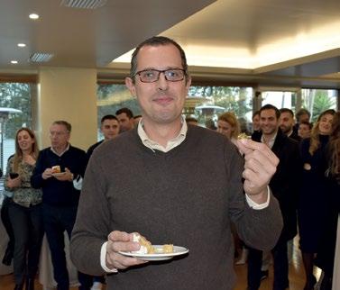
The tradition of cutting the pitta, which celebrates entering the New Year, took place in February. In the pitta there were five coins and finding one of these in your slice is believed to bring luck for the year ahead.
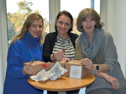
The lucky winners were Chara Markatzinou, SQE (Care and Welfare Coordinator), Tina Korosi, SQE (KPI Controller), Gerda Tiemersma, Personnel Manager, Yiannis K. Prokopiou, Crew (Director/Crew) and Apostolos Serraos, Technical (Superintendent Engineer). Thanks are due to Georgios P. Margioras for recording the event with such great pictures.
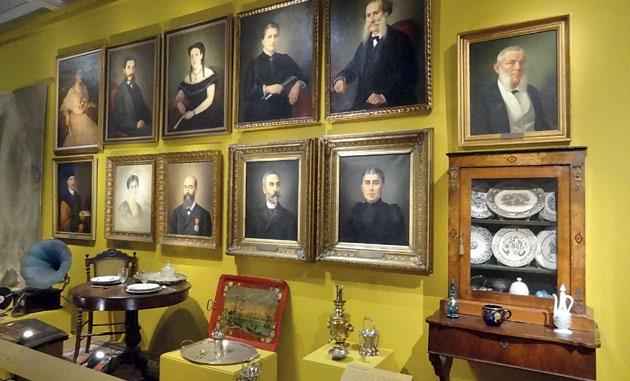
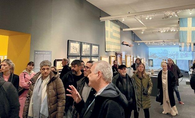
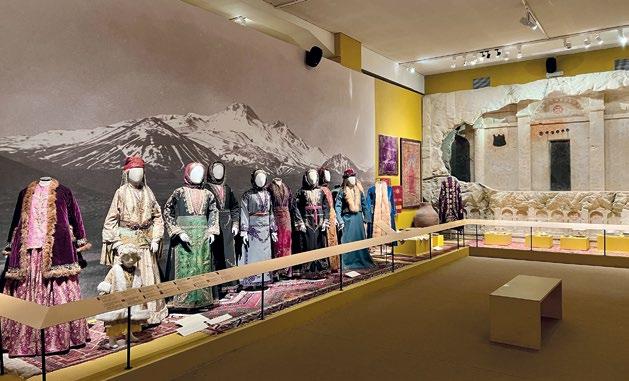
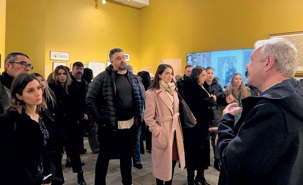
The Benaki Museum recently hosted a commemorative exhibition to mark the centennial anniversary of the Asia Minor Catastrophe called "Heyday, Catastrophe, Displacement and Rebirth". As this was an excellent opportunity to learn more about life in the Smyrna Quay, its destruction and what followed, the Company organised a visit.
The response to the invitation was impressive and the guided tour proved to be a huge success. Here are photos of some of the exhibits and visitors.

The Panama Canal is an artificial 82-km waterway in Panama that connects the Atlantic Ocean with the Pacific Ocean and divides North and South America. The Canal allows ships to pass between the Atlantic and Pacific Oceans without having to take the long and hazardous passage around Cape Horn, thus shortening the voyage by about 8,000 nautical miles.
By Mariana Pynylo

The Panama Canal was one of the largest construction projects in history, requiring various aspects of engineering knowledge for the project development. The main aim of building the Panama Canal was to create a direct shipping route from the Atlantic to the Pacific Ocean by taking into consideration the water levels, which are not the same.
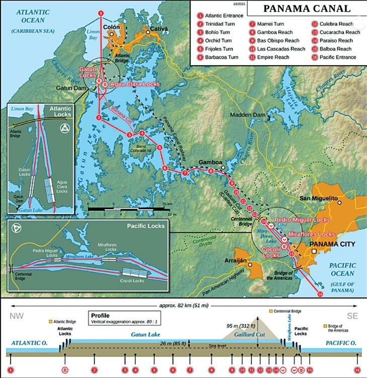

From its opening in 1914 until 1979, the Panama Canal was controlled solely by the United States, which built it. In 1979, however, control of the Canal passed to the Panama Canal Commission, a joint agency of the United States and the Republic of Panama, and complete control passed to Panama on 31st December 1999. The Canal is the responsibility of the Panama Canal Authority and all required aspects are to be addressed to them.
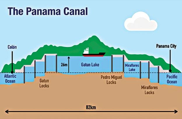
While transiting from the Atlantic to the Pacific, vessels first enter the approach channel in Limón Bay, which extends a distance of about 7 miles (11.2 km) to the Gatún Locks. At Gatún a series of three locks lifts vessels 85ft (26m) to Gatún Lake. The lake, formed by the Gatún Dam on the Chagres River and supplemented by waters from Alajuela Lake, covers an area of 166 square miles (430sq km). The channel through the lake varies in depth from 46 to 85ft (14 to 26m) and extends for about 23 miles (37km) to Gamboa. Gaillard (Culebra) Cut begins at Gamboa and passes through the Continental Divide. The channel through the cut has an average depth of about 43ft (13m) and extends some 8 miles (13km) to the Pedro Miguel Locks. The locks lower vessels 30ft (9m) to Miraflores Lake, at an elevation of 52ft (16m) above sea level. Vessels then pass through a channel almost 1.2 miles (1.9km) long to the two-stepped locks at Miraflores, where they are lowered to sea level. The final segment of the Canal is a dredged approach passage 7 miles (11.2km) long through which ships pass into the Pacific. Throughout its length, the Canal has a minimum bottom width of (15m); in Gatún Lake the width of the channel varies between 492 and 984ft (150 and 300m), and in Miraflores Lake the width is 738ft (225m).
In order to pass through the Panama Canal, each vessel has to comply with specific requirements. As described here below, it is important to notice that each year new regulations are published with minor changes and an annual update is required.

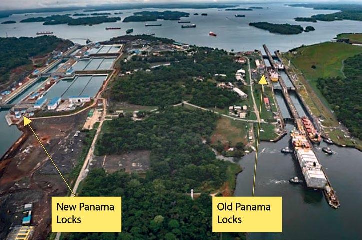
The maximum length overall, including bulbous bow acceptable for regular transit of the Neopanamax locks is 370.33 metres (1215ft).
The maximum beam (measured at the outer surface of the shell plate and all protruding structures below the lock walls) is 51.25 metres (168.14ft). The maximum draft is at 15.24 metres (50.0ft) for Tropical Fresh Water (TFW) at a Gatun Lake level of 25.91 metres (85.0ft) or higher.
The maximum length overall, including bulbous bow acceptable for regular transiting of the Panamax locks is 289.6 metres (950ft). The maximum draft has been set at 12.04 metres (39ft 6in) TFW at a Gatun Lake level of 24.01 metres (78.8ft) or higher. The maximum beam (measured at the outer surface of the shell plate and all protruding structures below the lock walls) is 32.31 metres (106ft)
When asking to transit through the Panama Canal, each vessel has to pay the necessary fees.
The first step to get a permit from the Panama Canal Authorities (ACP from now on), is to initiate correspondence by sending an email with the vessel’s main drawings, showing the vessel’s main data. It is necessary to produce from vessel’s loadicator ballast condition as per Panama Canal requirements.
A vessel, after having received permission to transit at less than the minimum required draft, will be inspected by the Authority upon its first visit under ballast conditions.
chamber pressed against both centre and side walls, indicating clearances of protrusions from lock structures and equipment.
- Midship Section (or Shell Expansion and bilge radius information).


- Engine Room plans.
- International Tonnage Certificate.
- International Load Line Certificate.
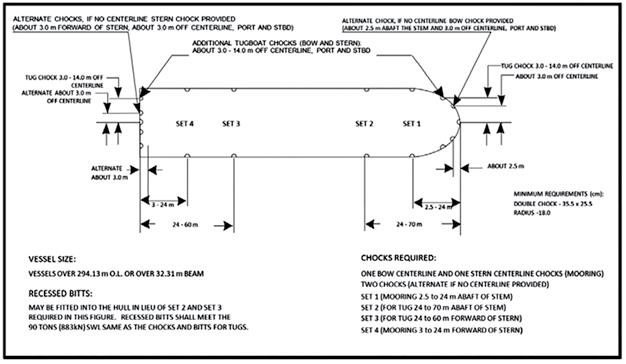
- Detailed drawings of chocks and bitts showing sizes and maximum strain capacities, if not indicated in the mooring arrangement.
The next step is the one that requires mooring and towing fittings installation, if the vessel has not been built to comply with ACP requirements.
The vessel’s mooring arrangement, has to be checked in the Office in combination with ACP requirements. Each vessel has to be examined in order to check the building condition of fittings, their SWL and current condition if it is not known. Visual checking also has to be performed in order to see if the current fittings and surrounding area are in good condition.

Prior to transit, Masters of vessels will be required to execute a form undertaking to release the Authority from liability in case of accident and to indemnify the Authority for damages sustained. The numerous constraints affecting the transit schedules of vessels and tows make it important that information provided in advance of the initial transit include the following documents for approval:
- General Arrangement (indicating deployed boarding facilities, blue steering light and pilot shelters/ platforms).
- Mooring Arrangement (indicating chock/bitt sizes and safe working load capacities).
- Wheelhouse Arrangement (showing required aids to navigation, such as indicators, wipers, horn controls, radar and others).
- Visibility Calculations (indicating compliance with ACP visibility requirements).
- Section Views showing the vessel inside the lock
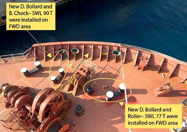
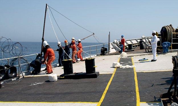
For vessels in our fleets, we have performed numerous mooring and towing fittings installations, with all the required steps and calculations. Below you will find some indicative photos:
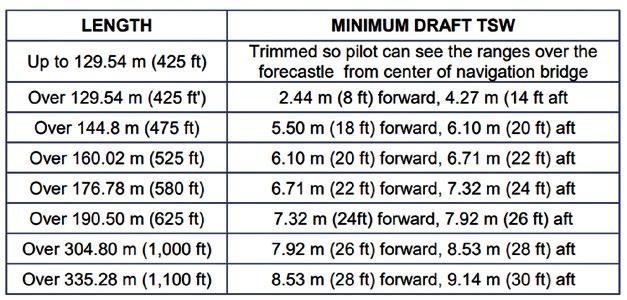
Figure 1: Draft requirements according to vessel’s length. Figure 2: Mooring and towing fittings requirements as per ACP.In order to install new fittings on the deck, under deck strength calculations have to be performed to check if the area where the fitting will be installed can withstand the forces. This can be done using the vessel’s drawings, such as the Mooring Arrangement, Standard of Fittings Installations, Profile and Decks drawings, and Hull Construction drawings. Additional modelling of the hull may be required and through the use of Autocad or Navis or Ansys or Rhinoceros tools etc., the hull structure has to be examined.
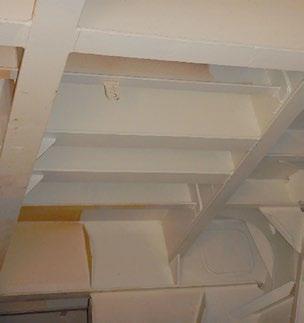
In some rare cases, the thickness of the deck plate has to be upgraded. This is, however, common practice for Bow Fittings, especially SPM’s. Most of the time, though, under deck reinforcement is required with T- brackets, Equal or Unequal Angles, Plates with Flanges, Brackets etc.
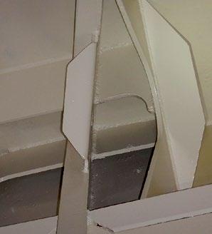
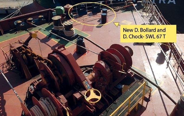
In addition, it is necessary to check that new and the previous mooring or towing ropes are working in combination. New drawings have to be prepared, which have to be submitted to Classification Society for their review and approval. After that, the vessel can proceed with the installation of fittings in the shipyard. Alignment checks will be carried out in order for the final position and height of the mooring and towing fittings to be verified and fixed prior to the final welding.
It might be necessary to relocate the existing vessel’s fittings/ pipes for the installation of new deck fittings or underdeck supports. In total, 19 Company vessels have successfully received ACP acceptance. Furthermore, five ships were provided with the required mooring and towing fittings at the building stage, while another five were acquired already in compliance with ACP requirements.
For the Visibility calculation, a visibility study is required to be submitted to ACP for their acceptance. The main required blind distance can be calculated using the following formula:
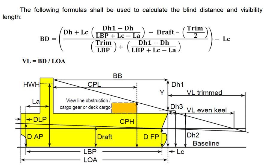

 Figure 5: M/T Ce-Bermuda, fittings installation in FWD area, current photo showing STBD side.
Figure 6: M/V Polymnia - new mooring and towing fittings installation
Figure 7: M/V Polymnia - underdeck supports installation.
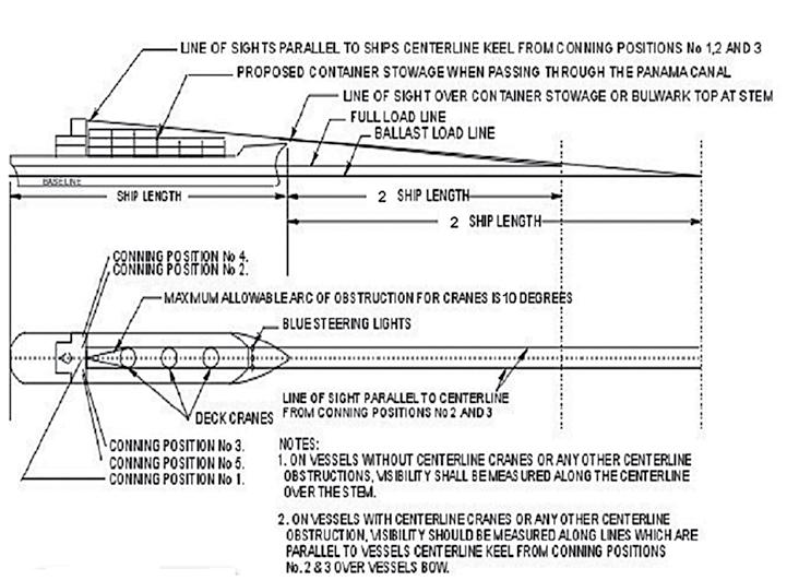
This calculation is required for ballast and laden conditions. For our fleets, we have performed the visibility calculation and we have submitted them to ACP with each approval case. For the Wheelhouse as per ACP requirements, no equipment or instrumentation shall block the close approach to the forward windows at Conning Positions 1, 2 and 3 and from the forward to after portions of the bridge wing ends at Conning Positions 4 and 5. A minimum of 1.0 meters clearance from consoles or obstructions should be provided in these areas. In some specific cases, for vessels in our fleet we had to proceed with clarifications, providing photos from the vessel’s wheelhouse and additional explanations in order to receive the acceptance.
To transit the Panama Canal there are some more verifications that will be required such as:
• WheelhouseWheelhouse Windows;
• Bridge Wings;
• Normal Conning Positions;
• Rudder Angle Indicators;
• Propeller Revolution Tachometer Indicators;
• Whistle Controls;
• Steering Light;

• Bow/Stern Thrusters;

• Compass;
• Course Recorders;
• Bridge Wing Spotlights;

• Radar;
• Steering Gear;
• Manning Requirements;
• Boarding Arrangements;
• Catwalks And (Accommodation And Pilot) Ladders Sizes/ Availability/Operation;

• Main And Emergency Source Of Electrical Power;
• Sanitary Facilities And Sewage Handling;
Other main work entails checking all the certificates of existing and new fittings. They will be requested from classes and ACP prior to transit and it is always good to be proactive. Deck and pilot shelters have to be installed in the middle of the ship and in the bridge wings, on the port and starboard sides of the vessel in order to protect people from extreme weather conditions during the vessel’s transit through the Canal.
• Ship Side Doors Positions;
• Accessibility To Deck;
• Main Propulsion Systems;
• Double Hull Requirements;
• Use Of Automatic Identification System (AIS);
• Oil Bilge Waters And Ballast Water To Be According To International Ballast Regulations, Including The BWMP;
• Emergency Scape Breathing Devices;
• Lightening In Night Requirements;
• Maneuvering Fuel Requirements;
Once the Office books the transit for the vessel, showing all the approvals received earlier from the Classification Society and the Panama Canal Authorities, the local officer will verify on board, one last time, all the facilities and the transit will be permitted.
Figure 8: Requirements from ACP notices Figure 9: M/T Ce-Bermuda- deck shelter Figure 10: M/T Ce-Bermuda- bridge shelter

Let us talk about a technology that has been a big deal in marine navigation for years - Differential Global Positioning System (DGPS) - and why it's disappearing. As you may have heard, many of these stations are being decommissioned. In this article, we'll explore why and what's replacing them.
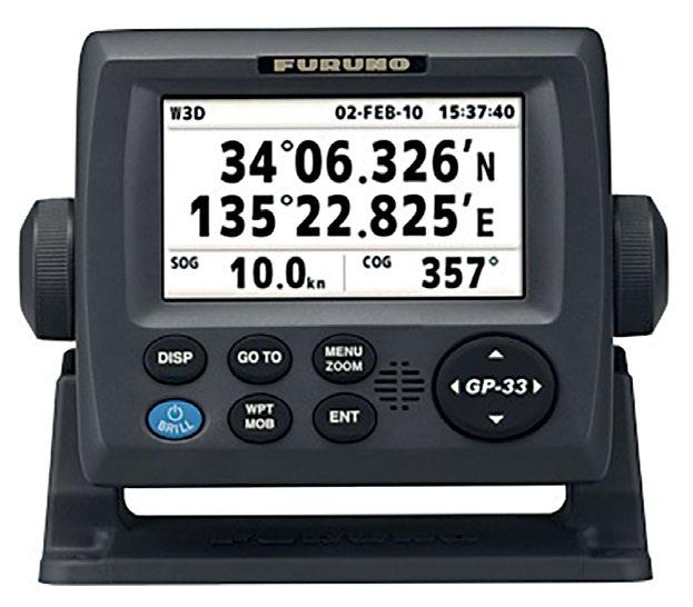
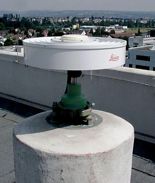
First, let us have a quick refresher on what DGPS is and how it works. DGPS is a technology that uses ground-based reference stations to improve GPS accuracy. These reference stations receive GPS signals from satellites and transmit correction signals to GPS receivers to improve their accuracy. This correction can improve GPS accuracy from a few metres to a few centimetres, depending on how close the reference station is and the number of reference stations available.
However, in recent years, many of these DGPS stations have been decommissioned or will be in the near future. The US (in June 2020) and Canada (in December 2022) decommissioned all of their DGPS stations. Similarly, the UK, Australia, South Africa, and Japan have shut down all or most of their DGPS stations, except for a few remote ones. Many other countries are following this trend, and soon there may be no DGPS signals available.
But why are these DGPS stations becoming redundant? Don't we need accurate positions? Well, the answer lies in the advancements made in GPS technology. One of the main reasons for the decommissioning of DGPS stations is the development of a new GPS signal called L2C. This signal is less susceptible to interference from other signals and environmental factors and includes more information about the satellite's position and time, which allows GPS receivers to better calculate their location. It also includes a built-in correction feature that reduces the need for external correction signals from DGPS stations. Overall, the L2C signal has improved GPS positioning accuracy by up to 30%.
Another reason for the decommissioning of DGPS stations is the adoption of a new satellite constellation called the Global Navigation Satellite System (GNSS). This system includes GPS and other satellite constellations like GLONASS, Galileo, and BeiDou. The use of multiple satellite constellations improves GPS accuracy and reduces the need for external correction signals.
So, what's replacing DGPS stations? The answer is Real-Time Kinematic (RTK) GPS technology. RTK GPS uses a single reference station to provide even greater accuracy than DGPS. RTK GPS can provide accuracy down to a few centimetres, making it an attractive alternative to DGPS in many applications. While modern-day GPS signals provide metre-level accuracy, RTK GPS can provide centimetre-level accuracy in real-time.
RTK GPS operates similarly to a DGPS station, using a land-based base station to communicate with a GPS receiver on a ship. Correction signals are sent from the base station to the receiver, enabling it to correct errors in the GPS signal caused by factors such as atmospheric conditions and signal interference. This produces precise and dependable position data in real-time. While RTK GPS is highly effective and cost-efficient, it operates within a small range, typically around 20 kilometres, in contrast to DGPS stations, which have ranges of hundreds of kilometres.
RTK GPS is mostly being adopted by ports where reliable and highly accurate position data, as well as precise ship movement in three dimensions, are needed. Ports are quickly adopting RTK GPS technology. For example, the Panama Canal Authority has
made it mandatory for all ships transiting the canal to have an RTK GPS system starting from October 1st 2023. Similarly, Rotterdam, Singapore, Shanghai, Long Beach, Antwerp, Port Hedland, and Hamburg have been testing the RTK system for use and integrating it into the portable pilot units carried by marine pilots. However, in open seas and coastal waters where RTK stations are out of reach, mariners are becoming familiar with lost DGPS alarms as more and more DGPS stations vanish.The discontinuation of DGPS service in certain areas will not impact the accuracy of satellite positioning. DGPS receivers will no longer receive the DGPS signal in areas where it was previously available. This may generate a ‘lost signal’ alarm, but the ship’s receiver will still provide a GPS derived position.

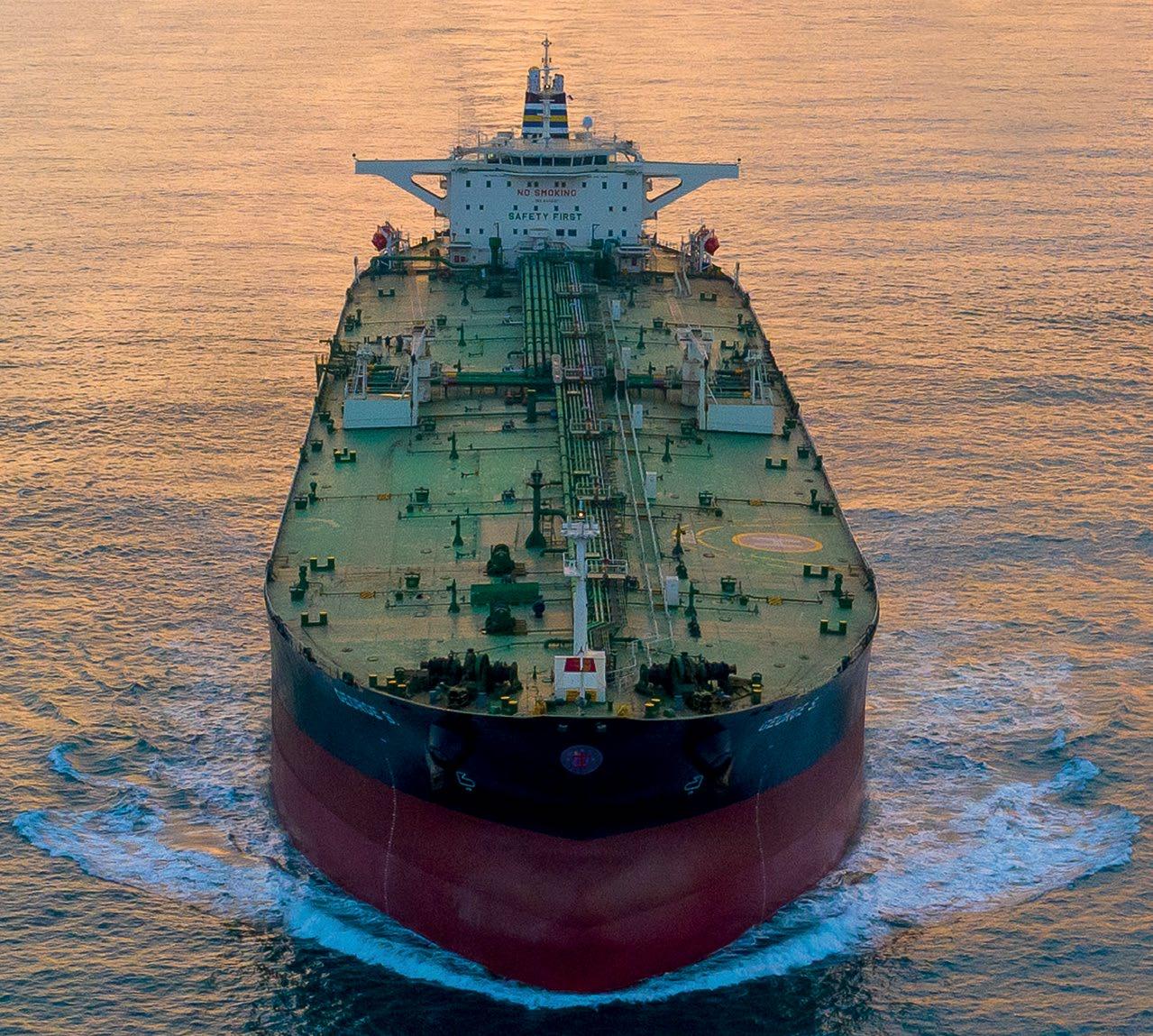
Technology is advancing rapidly and modern GPS receivers provide the following advantages:
- They are capable of receiving data from multiple satellites (i.e.: GPS, GLONASS, BeiDou) at the same time, resulting in highly accurate positioning.


- They can utilize regional Satellite-based Augmentation Systems (SBAS), such as the European Geostationary Navigation Overlay Service (EGNOS). SBAS improves the accuracy and reliability of GNSS information by correcting signal measurement errors and by providing information about the accuracy, integrity, continuity and availability of its signals.
- - They are not susceptible to spoofing (GPS spoofing happens when someone uses a radio transmitter to send a counterfeit GPS signal which makes the receiver believe it is at a false location).
Wishing you safe voyages, fair winds and following seas!
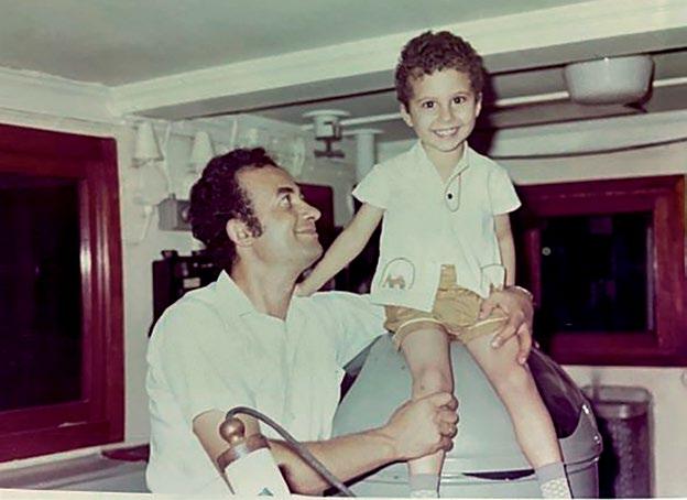
BASE STATION Land based GNSS receiver computes and transmits in real time location errors to the ship’s RTK GPS Global Satellite Navigation System (GNSS) Real Time Kinematic (RTK) GPS technologyI've really got quite enthusiastic about the fact that I was requested to write a personal article in our Wavelength magazine. Many of you know me as "GPM" which are the initials for my name, George Margioras. The letter "P" stands for my father's name, Panagiotis, whose footsteps I've followed in the shipping industry. I also sailed with him at a young age, visiting many countries worldwide. My father was a Captain who gained vast experience during his 32 years of sea service before working as a marine superintendent for a couple of years. Prior to his full retirement from shipping, he had established his own business related to S&P as well as to chartering matters.

Today, he is enjoying his life surrounded by his family, loved ones and many friends mainly from shipping.
Just a brief introduction of myself; I was born at Chios island, Greece in 1969.
When I was 7, my parents were permanently moved to Athens, where I graduated high school and then the Hellenic Marine Academy, where I obtained a marine engineer officer license. Upon completion of my studies, I performed my sea service as an apprentice engineer/ 3rd engineer for two years. Then, I continued
my studies at Sunderland University in the UK, where I gained a Bachelor’s Degree in Mechanical Engineering.
In October 1997 I was hired by Centrofin Management Inc. to work in the Technical Department as a Technical Reporting Supervisor. After almost one year, I became a Superintendent Engineer. I remained in that position till November 2022,when I was transferred to the Crew Department, which was a milestone in my career after 25 years.
By Georgios Margioras, Crew Department
My time at this Company has been a truly unique and rewarding experience. Since the very first day, I have felt a sense of community and belonging, fostered by the familial atmosphere and strong bonds between all personnel. Each day, I have looked forward to going to work, knowing that I would be surrounded by a dedicated and supportive team and colleagues.
The leadership team, including the COO and top management, have been actively involved in helping and supporting me, providing continues guidance, training and mentorship that has been invaluable to my growth and development.
In the Crew Department, I aim to utilize the skills and experience have gained, obtaining the best candidate selection, rotation to vessels, prompt crew line-up, evaluating the performance and perpetuating the Company's culture and mentality to our Seafarers.
My goal is to ensure that our Seafarers have the necessary qualifications to perform their duties to the best of their abilities and provide them with continuous support.
A message to our Captains and crew members:
“It is crucial for a Captain to create a positive and supportive work environment to ensure the success and the mission. All members of a team have a responsibility to encourage each other, adopt a culture of mutual trust and work together to achieve a common goal. Good leadership is essential for any team to thrive and succeed.”
I am grateful to have been a part of this Company, for the experiences that I have gained and the continuous learning process I have been exposed to.
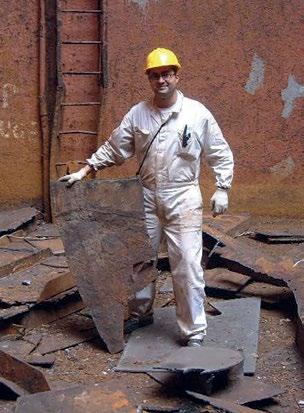
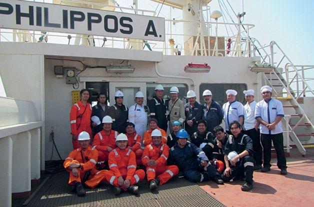
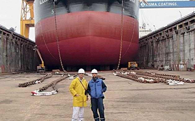
Year 2001, M/V IOANNIS 2 Special Survey at Nantong shipyard, China. Year 1973, Cpt. Panagiotis and myself on the bridge, stayed 16 months on board Year 2022, M/V Philippos A. Special Survey at Shanhaiguan shipyard, China.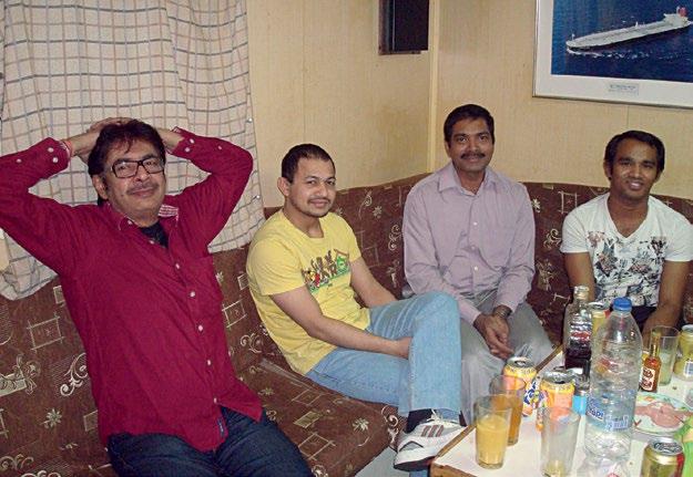
I, C/E J.E Fernandes, joined this Company in 2012 with M.T. CEWave as my first vessel. At the time, I was a bit apprehensive to have to board a 19-year-old vessel drawing from my previous experiences. However, the cosmetic appearance of the vessel belied her age. In the same contract, we successfully completed the 20-year Major Survey just prior to Christmas. Two years later, she was destined for the scrapyard, not due to her lack of performance, but due to commercial reasons. I recollect that on her final voyage, we steamed beyond the normal speed in order
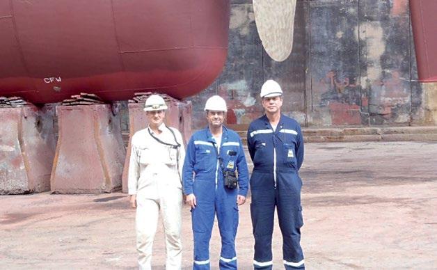
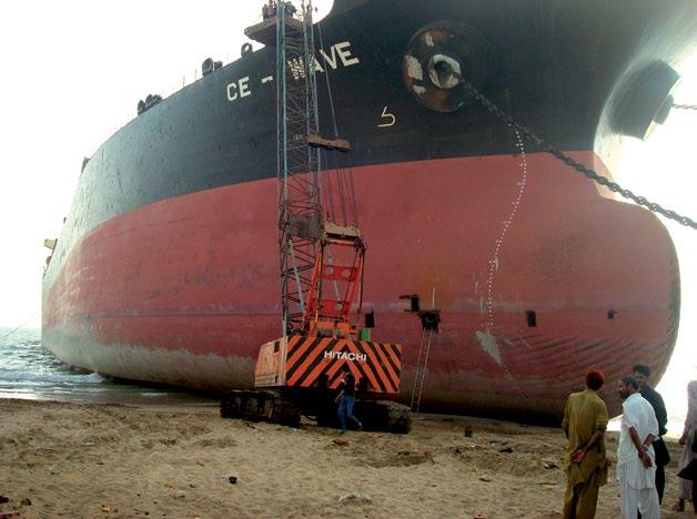

to beach the vessel at spring tide. The vessel still maintained her impeccable performance whilst not failing in any operation. Later, during the takeover of a chemical tanker I was aghast at the performance of the machinery. When questioned, the 3/E of the Chinese crew remarked “What do you expect? This is a 10-yearold ship”. I refrained from rebuking him with statistics from our Company. The tireless efforts from the “returning’ crew together with able support from the knowledgeable shore team enables the fleet to regale in her majestic glory.
 Year 2014, M/T MERAPI Special Survey at Constantza shipyard, Romania

Dear seafarers,
I can understand our seafarers’ life and how a hectic workload can make it. However, when it comes to your preparation for any emergency NEVER TAKE SHORTCUTS!
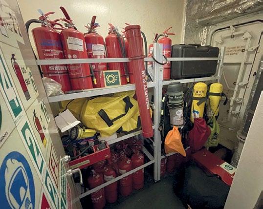
Don’t be complacent.
Don’t believe for a moment that “this will never happen to me”. In this line of work you need to adopt a state of “chronic unease”, esp. during your DRILLS.
With each drill you gain experience to prepare for all types of undesired event when one occurs.
With the experience of drills the primitive instinct of “fight or flight” will not compromise your training.
If your drills are effective, you will be able to make all the right choices when the time comes.
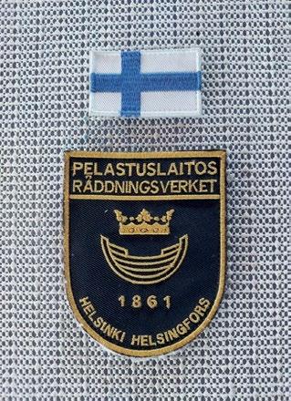
Check out the Alexia case: Our crew firefighting team with the Finland rescue team & the badges awarded to vessel’s team

On M/T Alexia, during a cabin fire, the vessel’s firefighting team performed all the right actions and prevented all possible casualties!
The Finland Rescue Team came on board only to commend our crew after the fire had long been extinguished by the vessel’s own means.
If our crew on M/T Alexia had been “bypassing” their fire drill process, I don’t even want to think about the consequences of a fire getting out of control instead of being swiftly contained.

I wish you safe voyages and a safe return home,
Elli Moretti
TRUST: TEN Really Useful Safety Tips FIRE PREVENTION
1. Check the physical condition of the Funnel Flaps and Blower Dampers, including their operation (remote and locally). Ensure adequate sealing (no light).
2. Is the Emergency Fire Pump taking suction itself without manual priming and pressurizing the fire main within a few minutes?
3. Check the Main Isolation Valve and Deck and Engine Room Isolation Valves for any leaks. Are the isolation valves correctly identified with prominent markings? Are all crew members aware of the location of isolation valves, its purpose and method of operation?
4. Confirm that the 2nd means of access to the Emergency Fire Pump Compartment is not locked from the inside. (No deadlocks or lockable latches on the inner side)
5. Is the International Shore Coupling available at a designated location and with the Nuts/Bolts, Gaskets and Spanners?
6. Is the Firefighter Radio Manual available in the Fire Training Manual?
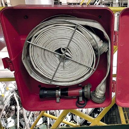
7. Are the Fire Hoses in a visually satisfactory condition and of appropriate length as per the Fire Plan?
8. Is the Fire Alarm System in a satisfactory working condition?
9. The Crew must be able to demonstrate the operation of the Quick Closing Valves for the tanks for fuel oil, lubricating oil and other flammable liquids.
10. In the case of the Hyper Mist System, are the suction / discharge valves kept open for immediate operation?
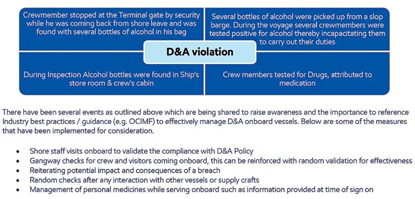
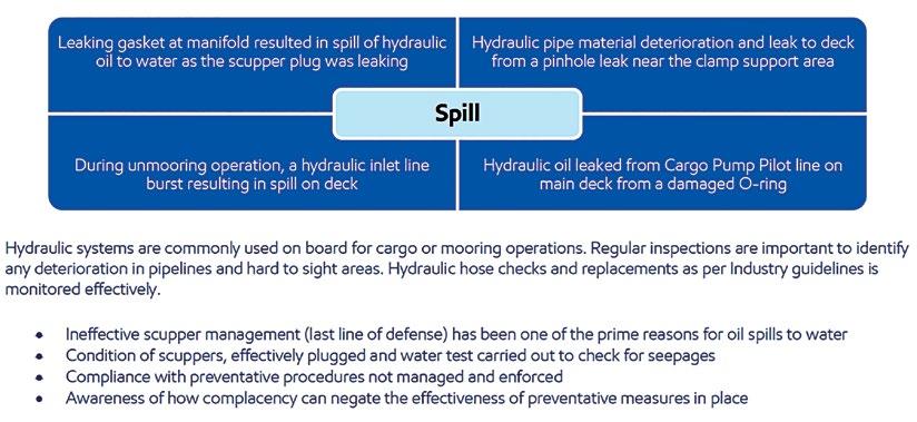
Source IMT CLIP # 03-2022: IMT have observed repetitive cases related to below 2 subjects
This CLIP is to draw attention to a number of drug & alcohol violations and loss of containment of hydraulic oil.
Life is full of changes and more often than not we are required to play different roles in both our personal and professional lives. Adapting to these roles requires versatility, which can result in people reaching their full potential not only for their own benefit but also for the benefit of those around them. Thus, we are proud to have in our team such versatile individuals who started out with the Company on the lower rungs of the professional ladder and have gone on to become Masters. Later on in their careers, some have become Trainers who share their invaluable experience across the fleet. Others have become an integral part of the Company’s shore team and are currently working as Superintendents. An insight into their mental approaches throughout their careers can only serve to inspire us to accept change, adopt a resilient stance and learn to cope with life’s challenges by identifying what is inevitable and going with the flow. Let us get to know them better.

Being a sailor can teach you a lot in life. We are in a changing work environment, such as time changes, harsh weather conditions, new places, and new regulations. This profession teaches us how to be brave and patient and how important it is to focus entirely on safety.
When I was in Std 4, I read the story of Vasco Da Gama, which inspired me to become a sailor. I was born in a landlocked area; therefore, I only saw ships or the sea once I did my diploma. Fortunately, there was an entrance exam for Marine institute (T.S Rajendra-ex Dufferin). I got admission to a nautical institute in 1989(Training Ship Rajendra).


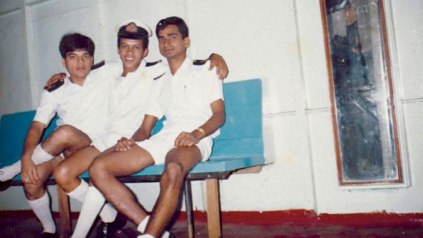
During my shipboard training officer job, I had the chance to interact with many nationalities. I learned a lot from them regarding their culture/behaviour, etc.

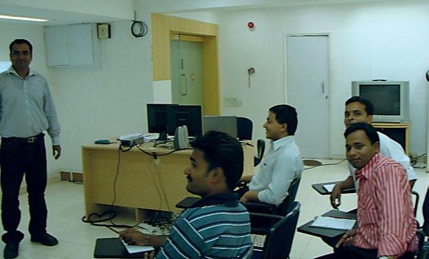
My unforgettable memory remains while guiding/training newly promoted Masters for bridge team management & ship handling to Capt.M.L.Raikwar /Capt. Sergiy Danlychenko/ Capt. Algodon & Capt. Mostaque Ahmed.
Experiences shape us while stories connect us. This is my story. I come from Mangalore, which was then a small town in India. As a young, skeptical 18-year-old, I reluctantly joined the sea, a profession I had never considered before. It follows that my days as a cadet were among the most challenging of my life. Homesickness, poor communication, inability to set foot on land, everything being foreign, a few difficult seniors, teasing, and most importantly, my own frustrations and unrealized dreams made me detest my life at sea.

During the last 23 years with Marine Trust Ltd/Centrofin Management Inc., I have been assigned several challenging jobs and successfully accomplished them with guidance from office personnel.
Many thanks to my colleagues ashore and at sea. Wishing you all safe and smooth seas always.

During those days of extended melancholy, I had my eureka moment. A quote on one of the cabin's doors read, "This day is also a part of my life, and I will not let it go to waste." I soon realized that every single day I sailed, I could learn something new. From the changing weather to the vessel's idiosyncrasies, machinery working and breakdowns, electronics working and sometimes-giving way, and the behaviour of my colleagues, everything started to fascinate me.
From cadet to Master, I never allowed myself to stop learning. I was privileged to have found wonderful mentors in Capt. Prashant Kumar, Capt. Rao, Capt. Vadera etc. Through them, I recognized the importance of having a great mentor. Sailing is difficult for most of us, and a couple of disengaged or even harsh colleagues on board or ashore can make the experience terrible. I chose to deal with this by immersing myself in different pursuits during my rest hours, such as coding, writing poems, working on my art skills, cooking, photography, and welding, learning about machinery and its functions from fantastic engineers, and most importantly, my favourite hobby of reading.
I am very thankful to our Marine Operations Manager, Michalis Kapsorrachis, for the effort he took in collating informative and engaging data, and sending it on board. It broadened my understanding of the industry.
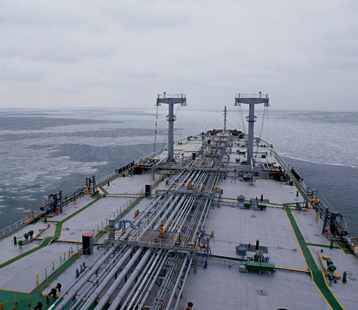
board M/T Merbabu as 2nd Officer On board M/T Semeru as 2nd Officer On board M/T Semeru as SBTRN Officer prior to entry into GoaI started forming bonds with the vessels I sailed with, not just its people. It was a common sight to see me standing, holding the rails of the vessel as I talked to her. Before leaving every vessel, I tried to do something for her. MT Semeru was my most difficult and cherished vessel, while M/T Star 2 kept us on our toes, but kept going.
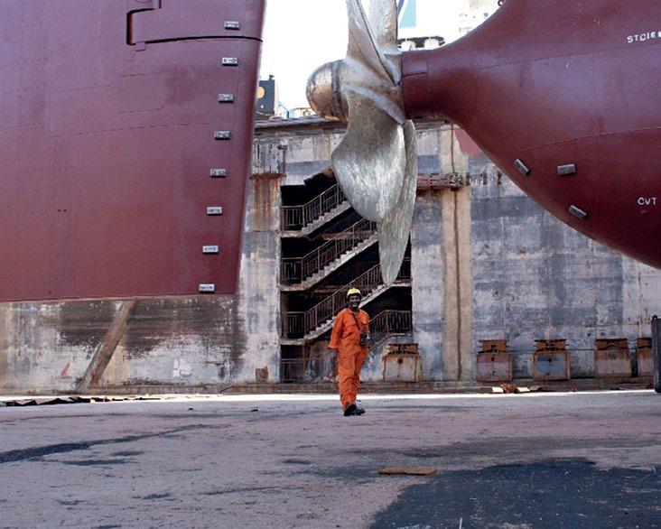
Life is about changes, and I was unprepared for the next one. Fortunately, Marine Trust, a family-like organization, had become my second home over the past 19 years. The admirable COO Anthony Lambros and the kind management accommodated me and my challenges, and I became the Navigational Superintendent. My job is now more mentally demanding and time-consuming, but it also involves a lot of reading and critical thinking, which drives me to do better. It has given me the opportunity to interact with our colleagues ashore and to keep an eye on all our vessels, which are guided, maintained, and led by our capable colleagues on board.
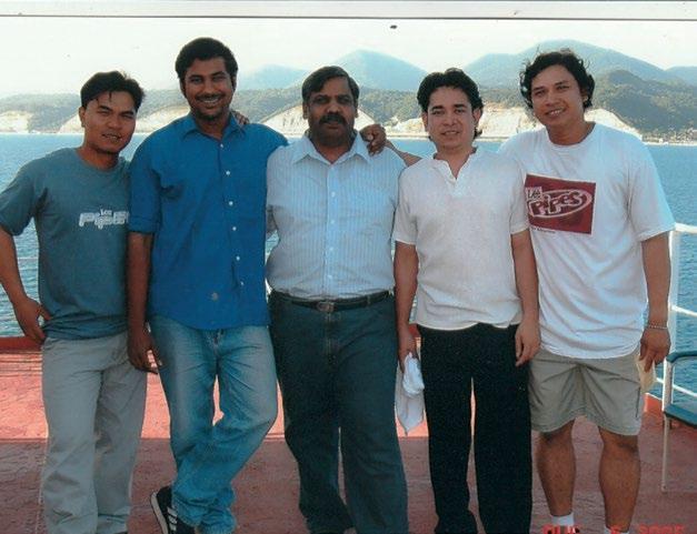
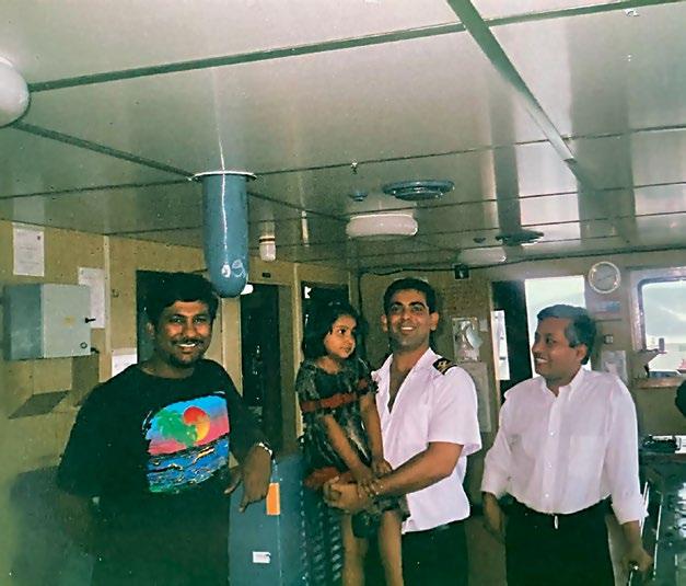
My most valuable learnings to date come from my time at sea. However, I wanted something different and requested an opportunity to work as a Shipboard Training Officer. With Director/Crewing Yannis K. Procopiou as my superior, I found guidance while being allowed to explore and find my way. This job helped me see different perspectives and needs. I revelled in the curiosity and enthusiasm of our officers, and yet felt defeated and burdened with misplaced attitudes and behaviours. Our main aim as training officers was and is to improve seamanship standards. I worked hard at it and this was indeed a less stressful phase of my professional life, as I enjoyed both learning and teaching.

My story may be different from yours, but it is finally these experiences that make us who we are and what we become. So let’s continue crafting our lives towards becoming a better seafarer, colleague and mentor.
On board M/T Star 2 as 3rd Officer. The young girl is Capt. Prashant KUMAR’s daughterThe type of thoughts you have will affect your life. If your thoughts are filled with anger, pity, sorrow, failure, then you will experience these feelings in your everyday life. What if you switch your mind to positive thinking? One of Albert Einstein’s famous quotes reads “The world as we have created it, is a process of our thinking. It cannot be changed without changing our thinking.”
“You may be deceived if you trust too much, but you will live in torment if you don't trust enough.”
Frank Crane, American minister and author
A team without trust is not really a team: it is just a group of individuals, working together, often making disappointing progress. They may not share information, battle over rights and responsibilities, and they may not cooperate with one another. No matter how capable or talented the people in a team are, they may never reach their full potential if trust is not present.
On the other hand, when trust is in place, each individual in the team becomes stronger, which leads to the group being able to achieve truly meaningful goals.
What is Trust anyway? It is “reliance on the character, ability, strength, or truth of someone or something.” In other words, you rely on someone else to do the right thing. You believe in the person's integrity and strength, to the extent that you are able to put yourself on the line.

Trust provides a sense of safety. When your team members feel safe with each other, they feel comfortable enough to open up and take the appropriate step of exposing their vulnerabilities. If your team members trust one another, they are more likely to share knowledge and to communicate openly. Without trust, there is less innovation, collaboration, creative thinking and productivity as people spend their time protecting themselves and their interests.
Lead by example and show your people that you trust others. Always remember that your team members are always watching you and taking cues from you, so take the opportunity to show them what trust in others really looks like. It is important to follow through on the promises you make and to set an example for everyone else.

Open communication is essential for building trust. You need to get everyone on your team talking to one another in an honest, meaningful way, and you can use several strategies to accomplish this. The more you share with your team members, thereby proving that you have no hidden agenda, the more comfortable they will feel trusting you and each other.
One way to build trust is to encourage your team members to see their colleagues as people. Think about creating situations that help them to share personal stories, and to bond. Do this by asking sensitively about their family without invading their privacy, or about their hobbies. Start by sharing some personal information about yourself, and then ask someone else about a hobby, or a musical interest.
When people work together, there will be honest mistakes and disappointments, and it is easy to blame someone. However, when everyone starts pointing fingers, an unpleasant atmosphere can quickly develop. This lowers morale, undermines trust, and is ultimately unproductive. Instead, encourage everyone in your group to think about the mistake in a constructive way.

Sometimes, cliques can form within a team, often between team members who share common interests or work tasks. However, these groups can – even inadvertently – make others feel isolated. They can also undermine trust between group members. Only by addressing the issue openly can you discourage this damaging behaviour.
If you manage an established team that has trust issues, it is essential to find out how these problems originated, so that you can come up with a strategy to overcome them.
Source: https://www.mindtools.com/aqdolgk/building-trust-inside-your-team
Although Samuel Plimsoll is best known for his contribution to shipping, perhaps his birthday should also serve as a reminder of how the compassion and integrity of an individual can spark changes that improve working conditions. Born in 1824, Samuel Plimsoll attended school until the age of 15 before going on to study at the People’s College of Sheffield. As a teenager, he became an amateur inventor, but more importantly, he demonstrated an empathy for those exposed to hardship. During those years, he wrote a pamphlet outlining a plan to prevent orphans from being sent to the workhouse. In his 20s, he became known as the ‘Miner’s Friend’ after helping to organize relief efforts following mining accidents. After the Lund Hill pit fire of 1857, which claimed 189 lives, he helped raise £10,000 and offered suggestions to implement safety measures that would prevent a repeat of the tragedy.
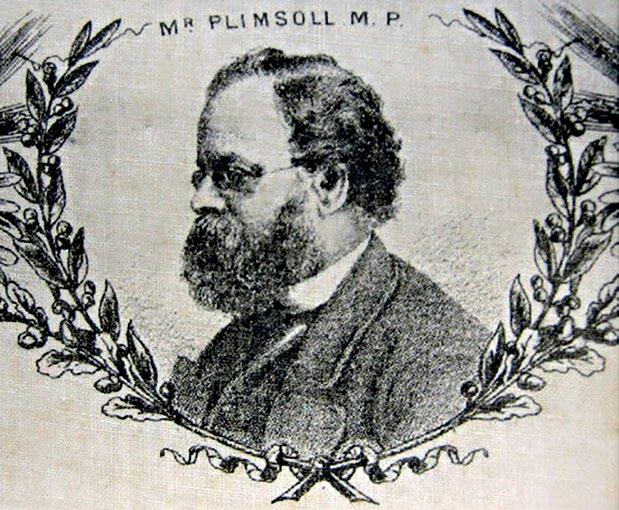
His campaign for seafarers’ safety began in earnest in the 1870s although the seeds had been sown much earlier. He was elected MP for Derby in 1867, and immediately showed that he was willing to cross political lines if individuals from another party shared his views.
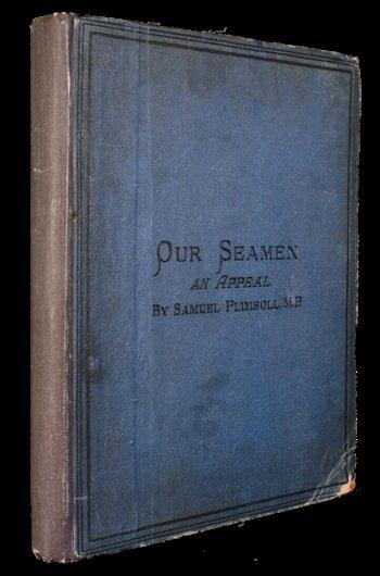
more frustrated. His frustration reached a peak in 1875, when he lost his temper in the House of Commons. He shook his fists at his colleagues, calling them ‘villains’, actions that brought him nothing but infamy. This did not stop him from winning his seat in 1880, but he decided to give up politics in favour of continuing the fight for the standardisation of the load line by the Board of Trade. His success prior to his departure from politics was limited to his Merchant Shipping Bill being passed in 1876. This bill left it up to the ship owners whether or not to adopt the lines, so it fell short of Plimsoll’s goal.
In 1890, Samuel Plimsoll’s efforts were rewarded as load lines were made mandatory. This breakthrough was achieved in part to William Vernon Harcourt, who as Samuel Plimsoll’s successor, vowed to fight for seafarers’ safety. Samuel Plimsoll became known as the ‘Seamen’s Friend’, and his political career can be summed up as his caring more for people and principle than his office or House of Commons procedure.
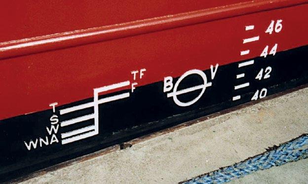
Today Samuel Plimsoll’s legacy can be seen worldwide in the form of a series of lines on cargo vessels. These lines are marked with a letter or letters that refer to water density, the season and the season in a specific area. There is also a circle with a line through it that indicates whether a cargo has been evenly loaded. The letters on either side of the circle represent the registration authority. For instance, LR is Lloyd’s Registry, AB is the American Bureau of Shipping and BV is the Bureau Veritas. The lines are positioned so as to ensure there is sufficient freeboard for the vessel’s buoyancy not to be compromised irrespective of the seas state. What is more, the lines must be placed on a surface that allows them to remain visible even when the paint fades.
Source: www.liverpoolmuseums.org.uk
In 1870, he heard Newcastle ship owner, James Hall, speak in support of a load line and other reforms for seafarers. The two joined forces with Hall providing an insight into his industry, and Plimsoll giving speeches and introducing three separate bills to Parliament between 1870 and 1872. Each of these together with the suggested amendments was blocked, so in 1873 he had a small book called ‘Our Seamen. An Appeal’, which took a year to write, published on his behalf. The appeal brought him ‘fame’ as it was received by the public in the same way as a ‘Vanity Fair’ critic, Nicolette Jones, who described his publication as ‘powerful and eloquent… because it is the simple cry of a simple honest man’. Despite the favourable reception, his tireless efforts to implement change met with stern resistance and he became more and
The compulsory use of Plimsoll lines can be safely regarded as a landmark moment in enhancing safety in the shipping industry. As such, 10th February should serve as a strong reminder that the safety of all seafarers is of paramount importance when changes in the industry are to be implemented. In other words, it is always ‘Safety First’.
Sources: www.liverpoolmuseums.org.uk, www.nationaltoday.com, www.nauticapedia.com, www.oceanservice.noaa.gov
Plimsoll Lines. By Wualex - Own work, Public Domain, https://commons.wikimedia.org/w/index.php?curid=6657505
As of January 2022, the carrying capacity of the world fleet was 2.2 bn dwt, 335m dwt of which sailed under the Liberian flag. As such, Liberia is a major flag of registration representing around 14% of the world fleet by tonnage. Of those vessels, the greatest tonnage is owned by Greek entities. Indeed, 25% of all vessels owned by Greeks are signed up with the Liberian Registry. The top four entities are rounded out by German, Japanese and Singaporean respectively.
In recent years, the Liberian Registry has become the fastest growing in the world. It ranks second in size to Panama, but in September 2021 it became the world’s largest tanker flag in terms of gross tonnage. As would be expected, the Liberian Registry operates worldwide. It possesses 28 full-service offices across the globe, including its Headquarters in Dulles, Virginia, Zurich, Busan, Piraeus, Tokyo, London, Singapore and of course, Monrovia, the Liberian capital.
The recent growth of the Registry has been matched by its service to the shipping industry, which began over 70 years ago, in terms of its involvement in projects that focus on innovative ship design features. More specifically, the Liberian Registry has been involved in more than 30 joint projects. In one of the latest it signed an MoU with three prominent design companies to develop autonomous ship technology.
In addition to quantitative growth (5.5% in 2021 and 2022), the Registry has achieved qualitative growth by its inclusion on the white list of the Tokyo MoU, covering the Asia-Pacific region, and being given QUALSHIP 21 Status by the US Coast Guard in 2022. Moreover, the Liberian Registry was recently shortlisted for a GREEN4SEA Initiative Award.
Although the Liberian Registry is the organization that is most often associated with the country, Liberia itself has other claims to firsts. One is as the oldest republic in Africa, and the other concerns the election of Ellen Johnson Sirleaf, the first woman to become a head of state on the African Continent.
(111,370 sq. km) which consists of low sandy coastal plains that extend about 350 miles (560 km) in length and around 25 miles (40km) inland, and a region of rolling hills with a mean average elevation of 300ft (90m). At the edge of the plains there are miles of beaches interspersed with lagoons, mangrove swamps and rock promontories, the highest of which is Cape Mount at approximately 1000 ft (300m) in height. Further inland there are forests and alluvial soils, making half the land suitable for agriculture.
As such, the Liberian economy is predominantly agrarian with rubber being the most valuable in commercial terms. Coffee and cacao have become more important in recent years, while kola nuts, peanuts and cotton are harvested on a large scale. As regards livestock, cattle and pigs are the most commonly raised. Other significant activities include deep sea fishing for mackerel, red snapper and barracuda, forestry and mining.
With its luxuriant and swamp forests, 53% of which are either primary or mature secondary, Liberia is recognised as a biodiversity hotspot. The country is home to more than 140 mammals, 600 bird species, and 75 reptiles and amphibians. Although many creatures suffered during the internal strife and conflict and have had pressure placed on their population since, the situation in the national parks has recently improved. In Sapo National Park, which is the oldest and largest, covering about 130,000 hectares, park rangers have received better training and equipment to combat illegal practices. Additionally, local community groups like the all-female ‘eco-champions’ group, which raises awareness of the importance of the park, have been instrumental in giving a lifeline to endangered species like the pygmy hippo and threatened species such as the Liberian mongoose.

Map of West Africa.

Source: www. nationsonline.org
Situated on the West African coast, Liberia has a population of over 5m, almost one third of whom live in the metropolitan area of Monrovia. The country covers an area of 43,000 sq. miles
Liberia offers a wide range of activities for visitors. Birders can explore forests and perhaps spot rare species like the Nimba Flycatcher, animal enthusiasts can visit Sapo National Park and beach lovers can enjoy surfing opportunities. Those who like walking can trek up Mount Nimba to see the stunning Kpatawee waterfall. Last, but not least, a visit to Providence Island, which is a World Heritage site, or even to a village, where cooking classes can be taken and local customs can be observed are other exciting options available.
It appears that the dark days of the civil war in Liberia are gradually having a lesser effect on the country. With the Registry taking the lead, Liberia has every right to be optimistic about the future.
Sources: www.hbs.unctad.org, www.liscr.com, www.britannica.com, www.enjoyliberiatravel.com, www.fauna-flora.org, en.wikipedia.org
Picture of a pygmy hippopotamus in Sapo National Park. Source: www. edgeofexistence.orgDubbed ‘the pastures of the ocean’, seagrass meadows are vital in the conservation of marine habitats. However, perhaps because they occupy such a small percentage (0.2%) of our oceans, they have been largely overlooked until fairly recently. Now, thanks to extensive research, their contribution to the health of marine environments has become clear and the need to protect them has become greater than ever.
Seagrass meadows are multifunctional. One obvious characteristic is their ability to function as ‘oxygen pumps’, which is a fitting description since they are able to produce up to 10 litres of oxygen per day for every square metre they occupy. On the other side of the equation, they are just as important as forests in terms of sequestering carbon. Indeed, they can store carbon 35 times faster than their land-based counterparts and can hold up to 83,000 metric tons of carbon per square kilometre.
Another property of seagrass meadows is they are able to absorb wave and tidal energy, and stabilize sediments. Thus, they contribute to coastal protection and prevent excessive coastal erosion. In addition, these marine grasslands are adept at filtering out nutrients that flow into the sea and trap sediments and particles. The former greatly reduces algal overgrowth, which can severely deplete oxygen levels in the marine environment. The latter characteristic assists in maintaining water clarity so that more light reaches greater depths. This results in better seagrass growth, improves the recreational quality of the water close to the coast and improves the habitats of marine creatures. Other benefits that seagrass meadows offer include their ability to mitigate the problems caused by ocean acidification like coral bleaching, and their capability of reducing diseases caused by bacterial pathogens.
Like mangroves, seagrass meadows provide both food and shelter for numerous creatures. They function as nurseries for prawn and fish species that coastal communities depend on for a living. Indeed, there is a strong correlation between the health

Lamb vindaloo dates back to the 15th century, when Portuguese explorers brought vindaloo dishes to India. The word ‘vindaloo’ derives from the Portuguese description of meat being marinated in vinegar and garlic. In Goa, where the original dish was introduced, the meats used were pork, beef, lamb, chicken and goat. Even seafood found its way into vindaloo recipes.
Since there was no wine vinegar of the type used by the Portuguese, a palm wine substitute was used. Other local ingredients included tamarind, black pepper, cinnamon and cardamom. The addition of chilies to the dish came about through their importation from the Americas, for which the Portuguese were responsible. When the British arrived, their recipe remained true to the Goan variation. It was not until the recipe was taken back to England that vindaloos transformed into hot curries.
The Indian variation of lamb curry is prepared using top quality chunks of lamb cooked in vindaloo sauce, vinegar, garlic, spices and
of seagrass meadows and the sizes of catch obtained by fisheries in the same area.
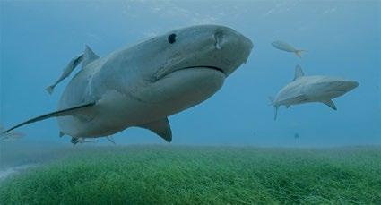
Moreover, they provide invaluable support for food chains. One of the predators at the top of those food chains is the much maligned shark. This top predator has been identified as a keystone species in seagrass meadow habitats as it prevents overgrazing by marine herbivores such as dugongs and turtles simply by patrolling the meadows. More specifically, one of the largest seagrass ecosystems which occupies an area of some 35,520 square miles (92,000 square kilometres) in the Bahamas is protected by tiger sharks. In a research collaboration between King Abdullah University of Science and Technology (KAUST) and an NGO called Beneath The Waves (BTW), this species was identified as the guardian of the meadows and as an indirect controller of the marine food supply in this body of water.
Other seagrass meadows of great interest area a huge one located in a remote area in the Indian Ocean and another situated in the Great Barrier Reef. The latter has amazed scientists as it has been classified though DNA analysis as a single organism occupying an area of 70 square miles (180 square kilometres) due to the fact that it has grown to this size over a period of around 4,500 years by cloning itself.
Given the wide range of benefits provided by seagrass meadows, there is no doubt that they must be protected at all costs. The same applies to their shark guardians which are often indiscriminately killed by those who do not appreciate their contribution to the health of marine ecosystems.
Sources: www.seagrasswatch.org, www.phys.org, www.kaust.edu.sa, www.iuch.org
red chilies. The latter ingredient is normally used sparingly so as not to drown out the flavourful spices that include ginger, coriander seeds, cloves, cinnamon, green cardamom, cumin seeds, black peppercorns and turmeric powder. Lamb vindaloo is served with steamed rice or rolls and on occasion with potatoes.
Source: www.adamantkitchen.com
Apart from being delicious, lamb vindaloo provides an energy boost and offers nutritional benefits. Garlic, for instance, improves heart health, staves off colds and reduces both cholesterol levels and blood pressure while cinnamon lowers cholesterol, triglycerides and blood sugar as well as acting as an anti-inflammatory. Ginger is also an anti-inflammatory. Last, but certainly not least, there is turmeric powder, whose active ingredient is circumin. The health properties of turmeric are well documented as it is known to assist brain function, reduce the risk of heart disease, and be a powerful antioxidant and anti-inflammatory.
Source: www.saveur.com, www.healthline.com, www.fatsecret.co.za
Tiger shark on patrol over a seagrass meadow. Source: www. beneaththewaves.orgZheng He was born c. 1371 in Kunyang in the Chinese province of Yunnan. As a young boy, he was known as Ma Sanbao, which was the name he had when Yunnan was reclaimed by the Chinese. This occurred in 1381, the date when the last Mongol-held region in China fell to forces led by Ming Dynasty generals. Ma Sanbao was one of the boys captured in the conflict.
During his military training, he became known as Ma He, and it was under that name that he developed his skills in warfare and diplomacy. At this time, the Chinese were a formidable maritime force responsible for a seaborne commerce driven by the demand for such commodities as spices and aromatics together with the need for raw materials. While these commercial activities satisfied demand within China, the improved technology in both shipbuilding and seafaring at the beginning of the Ming Dynasty along with the ambition of the Yongle Emperor led to a series of maritime missions to regions further west.
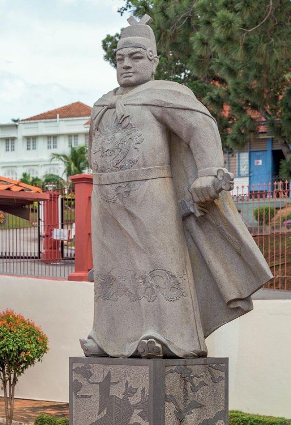
Having gained respect in the Yongle court, Ma He had the name Zheng He bestowed on him by the Emperor. He was then selected to supervise the construction of 3500 ships and then to become commander-in-chief of the Emperor’s planned missions to the ‘Western Oceans’. In all, Zheng He led seven such expeditions, the first of which began in 1405.
The itinerary for Zheng He’s first voyage was Champa (South Vietnam), Siam (Thailand), Java, Calicut (Kozhikode) on the Indian Malibar Coast and Ceylon (Sri Lanka). It could be considered a massive mission in terms of the size of fleet. Zheng He’s flagship measured around 400ft (122m), and his nine-masted vessel was accompanied by 62 treasure ships followed by almost 200 other ships of various sizes that carried horses and about 28,000 armed troops.
A year after returning from his first voyage, Zheng He set out on his second in 1408. He visited Calicut and Chochin (Kochi) before heading south to Ceylon, where his troops engaged in battle. The conflict was sparked by King Alagonkkara, whose troops were readily defeated by those of Zheng He. King Alagonakarra was taken captive and brought to the southern capital of Nanjing, a city which Zheng He would serve as commander.
In October 1409, Zheng He travelled further to Hormuz and paid a visit to Sumatra. His fourth voyage (1413-1415) also included a stop at Hormuz before a detachment of his fleet moved on to Dohar (Oman) and Aden (Yemen). On another mission there were visits to Mecca and Egypt before the fleet sailed down the east coast of Africa to towns in regions now known as Somalia and Kenya. When Zheng He returned, he brought back envoys from 30 states who were to pay homage to the Chinese Emperor.
The fifth voyage (1417-1419) entailed visits to the Persian Gulf and the east coast of Africa, while the sixth, which began in 1421, included revisiting parts of Asia, India, Arabia and Africa, and taking home foreign emissaries from China. In 1424, after Zheng He’s sixth voyage, the Yongle emperor died. His successor, the Xongxi emperor suspended all maritime expeditions abroad. On their reinstatement, Zheng He left China on his seventh voyage in the winter of 1432. Once again he visited Asia, India, the Persian Gulf and Africa. In the spring of 1433, Zheng He died in Calicut as the Grand Director, a title bestowed on him by the Emperor. His fleet returned to China in the summer of the same year. There can be no doubt that Zheng He was a
remarkable figure in maritime history. His skills that led to him being chosen to command missions conducted on a grand scale were supplemented by his lesser known skills such as writing. An extract from his description of travelling the ocean goes “We have traversed more than 100,000 li of immense water spaces and have beheld in the ocean huge waves like mountains rising in the sky, and we have set eyes on barbarian regions far away hidden in a blue transparency of light vapours, while our sails loftily unfurled like clouds day and night continued their course…”
Source: en.wikipedia.org
Zheng He’s reputation seems to have grown as he got older, and his measurements may have reflected this. As a eunuch, he would have been taller than normal, but according to some accounts he was over 7ft (2.1m), a good foot (0.3m) taller than most eunuchs. There has also been doubt cast over the size of his flagship and others in his fleet. However, these doubts were largely dispelled in 1962, when buried timbers were discovered in the Yangtze River. Among them was a 36ft (11m)-long steering port lying beside a rudder large enough to steer a ship of around 550ft (167m) in length. The wood was dated to about 600 years old, which coincides with the period of Zheng He’s voyages. So, perhaps Zheng He was indeed as much a giant in stature as he was a pioneer of the waves.
Sources: www.britannica.com, www.en.wikipedia.org, www.khanacademy.org
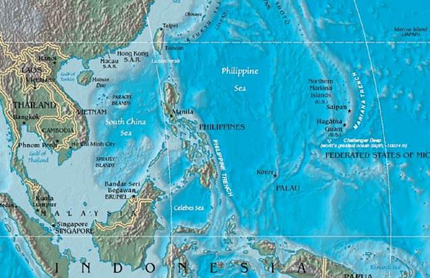
Modern monument to Zheng He at the Stadthuys Museum in Malacca City.The Philippine Sea, which lies in the Western Pacific, is the largest sea in the world with a surface area of some 2 million square miles (5m sq. km). To the north, the Sea extends to Honshu Island, while to the south, this large body of water is bordered by a ‘line’ joining Guam, Yap and Palau. To the west, the Philippine Sea is bounded by the South China Sea, the East China Sea and the East Indian Archipelago, and to the east by a ridge joining Japan to the Bonin and Mariana Islands.
The Philippine Sea is estimated to be millions of years old. More specifically, experts have concluded that it was formed between 120 and 130 million years ago. Apart from being the largest sea, it is the deepest. To the east of the island arcs, the mean average depth is 19,700ft (6000m), but at its deepest in the Philippine Trench it descends to 34,578ft (10,539m). In the Philippine Sea, there are many seamounts that rise from the depths. Their flat tops are often adorned with coral.

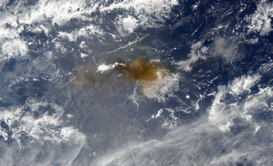
Another characteristic of the Philippine Sea is determined by the Pacific Ring of Fire, which crosses it. As the name suggests, this geological feature contains a series of active volcanoes. The latent power of these was witnessed in April 2005, when the Anatahan Volcano spewed 50 million cubic metres of ash into the atmosphere. The eruption was so large that it could be seen as a white haze made up of tiny droplets of sulphuric acid formed by the combination of sulphur dioxide (SO2) and water.
The Coral Triangle is considered to be the epicenter of marine biodiversity and since this area overlaps a substantial area of the Philippine Sea, the latter is, by extension, a biodiversity hotspot. This is borne out by the number of marine creatures and plants that call the Philippine Sea home. There are more than 3,200 fish species, about 500 coral species, 800 species of seaweed, 820 benthic algae species, 20% of the world’s shellfish species, 19 seagrass species and 30 species of mangrove. In addition, there are breeding grounds for threatened and endangered marine creatures such as the dugong, whale shark and megamouth shark.
Source: en.wikipedia.org
The world’s largest sea is estimated to provide for or support the livelihoods of around 120 million people. It is an important source of food for coastal communities in the Philippines and provides seafood for millions across the globe. As such, the Philippine fishing industry is one of the top producers in the world. Divided into two sectors, the municipal and commercial, this industry’s catches contain a wide range of species. The municipal sector comprises boats of 3GT or less and is therefore made up from small scale
Source: www.wikipedia.org
operations. The most frequently caught species in this sector are Indian sardine (7%), frigate tuna (6%), anchovies (4%) and squid (4%). Commercial vessels of over 3GT are used by fishermen whose catches consist of Indian sardine (20%), skipjack (18%), roundscad (a species of minnow) (15%) and yellowfin tuna (10%). Having such a bounty of fish close to the shores of the countries in close proximity to the Philippine Sea can cause tension and can easily lead to overfishing. Fortunately, agreements such as that drawn up between Taiwan and Japan, and regulations like those implemented by the US government to manage the marine resources in Guam’s EEZ have gone some way to avoiding these two problems. Moreover, the Philippines is a member of a Regional Intergovernmental Organisation called the Coral Triangle Initiative for Coral Reefs, Fisheries and Food Security (CTI-CFF), which manages marine, coastal and small islands ecosystems so as to protect livelihoods.
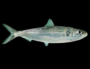
In addition to fishing vessels, there are traffic lanes in the Philippine Sea utilized by cargo vessels and tankers. However, the traffic density is far lower than it is to the west of the Philippines. Much of the marine traffic that traverses the Philippine Sea makes the crossing from Asia to South America or the Panama Canal and back because the islands in this body of water have relatively small populations. To the east, the Mariana Islands are home to just over 50,000 people, while to the south, Guam, Palau and Yap have populations of 170,000, 18,000 and 11,000 respectively. The Philippine Sea is one of the most remarkable of all. Its biodiversity, great depths and volcanic activity make it truly unique. Thus, for many the interest in it lies below the waves due to the fact that only 1% of the deep ocean bed has been explored, a statistic that has led to the speculation that great discoveries are yet to be made in this part of the world.
Sources: www.en.wikipedia.org, www.bloomberg.com, www.britannica.com www.fisherymanagement.fandom.com, www.marineinsight.com, www.earthobservatory.nasa.gov
Haze of the suphuric acid droplets formed after the Anatahan volcano eruption as seen from space. Source: earthobservatory.nasa.gov Indian sardine: one of the most frequently caught species in the Philippine Sea. Source: www. worldlifeexpectancy.com Dugong and calf: the threatened dugong relies on conditions in the Philippine Sea to breed.1. Make the names of two countries using all the letters in the following sentence: RINA CAN GET A NERF.
2. The letters in the chemical symbols for argon, beryllium, bismuth, carbon and sodium can be rearranged to form the name of a sea. What is the name of the sea?
3. I rhyme with where domestic felines can stay. Many people rely on me every single day. I am found in transport, including cars and I powered a rover after it landed on Mars. What am I?
4. Which three-letter word can be used to complete the following words: D_ _ _ EST, UNH_ _ _ D, CL_ _ _ LY and B_ _ _ INGS?
5. Marco has definite likes and preferences. He likes travelling and three of his favourite countries are Mexico, Canada and America, where his favourite states are Alabama and Colorado. He also likes visiting deserts, especially the Namib, Atacama and Sahara. His
1. Which Royal Navy submarine sank off the coast of the Greek island of Kefalonia on 6th December 1941?
A. HMS Urge B. HMS Regent
C. HMS Phoenix D. HMS Perseus
2. The CII of a ship is to be calculated annually from 2023. What does the 2nd letter ‘I’ in CII stand for?
A. Index B. Indicator C. Integer D. Intensity
3. Approximately what percentage of the world’s traded goods pass through the Strait of Malacca?
A. 10 B. 20 C. 30 D. 40
4. Above what speed does a vessel with a nano antifouling coating system have to move for the system to be effective?
A. 6 knots B. 8 knots C. 10 knots D. 14 knots
5. Which sea is connected to the Coral Sea via the Torres Strait between Australia and Papua New Guinea?
A. Solomon Sea B. Tasman Sea C. Arafura Sea D. Philippine Sea
favourite animals are the bonobo and tiger. By the same token which fruit would he prefer to eat: an avocado or an apricot? Why?
6. Which three-letter word can be placed after the words to the left and before the words to the right?
7. In five steps change the word EASY to HARD by changing one letter at a time to form intermediate words.
6. Now permanently berthed in her home port, the SS Rotterdam was renamed in 1997. By what name did she sail for Premier Cruises?
A. Rembrandt B. Van Gogh C. Vermeer D. Bruegel
7. What temperature does a surface in the engine room have to exceed to be regarded as a hot surface?
A.120°C B. 150°C C. 190°C D. 220°C
8. Salvador Alvarenga survived for 438 days in a fishing boat. In which country was he rescued?
A. Vanuatu B. Marshall Islands C. Nauru D. Samoa
9. Which of the following countries does not border with the Mediterranean Sea?
A. Croatia B. Libya C. Serbia D. Tunisia
10. Who is responsible for monitoring weather forecasts on board?
A. the Master B. the Watchkeeper
C. the Senior Officer D. all bridge team members
Find a keyword associated with several articles in this issue by solving the clues and rearranging the letters in the boxes with black borders.

1. Modern GPS receivers are not susceptible to this (8)
2. Blame fixes .... (7)
3. Never take these when preparing for an emergency (9)
4. Whatever does this to your mind, controls your life (8)
5. The epicentre of marine biodiversity (5,8)
Hint: Members of a successful team need to do this
Keyword: TRUST
KEYWORD answers: 1. Spoofing
QUIZ answers:
one parent is 36)
and consonants)
preferences contain alternating
Answers at the foot of the page
1. Argentina, France 2. Caribbean 3. A battery
8. A family of four has a combined age of 75. One parent’s age is four times the combined age of the children. The same parent’s age contains the two digits in the children’s ages. How old is the other parent? TEST YOUR BRAIN answers:
An avocado
In April 1989 William and Simone Butler, aged 60 and 52 respectively, decided to cruise around the coast of Costa Rica in their 40-foot (12.2-metre) boat called Siboney. As William was an experienced sailor, the journey from their home in Miami to the southwest coast of Central America was not deemed to be a daunting one. After all, he had coped with a typhoon off Florida 20 years earlier and had embarked on extensive adventures in the China Sea and the Caribbean.
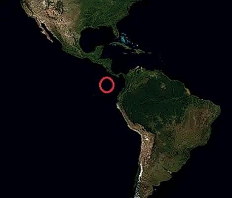

The couple left on 14th April and traversed the Panama Canal on 23rd May. The first legs of their voyage were relatively uneventful, so they were looking forward to doing a spot of fishing in the Pacific. However, all their expectations were dashed on the night of the 15th June, when their sleep was interrupted by a heavy thud on their boat. On reaching the deck, they were able to discern a very large pod of whales around Siboney. At one point this amazing sight became a threat. One of the whales struck the boat very hard. The strike created a crack in the hull and allowed water to gush in. Although such incidents with whales are rare, they are not unheard of as on occasion whales will ‘lash out’ to protect their offspring from a perceived threat. Below deck William saw how quickly the water was filling up the boat. He immediately realised that the chances of plugging the hole were close to zero, so he shouted to Simone to get the life raft ready. In the meantime, he gathered supplies and sent out distress signals, none of which received a reply.
On the life raft, the Butlers saw their boat disappear below the waves about 15 minutes after the second strike. William had managed to salvage several cans of food, half a jar of peanut butter, crackers, water, blankets and fishing gear. In addition, the raft had a flashlight and 3 flares on it. Although they had lost their boat, they were optimistic they would be soon rescued due to their proximity to the coast. However, they decided to begin rationing the food just in case their optimism was not well founded.
Less than 3 weeks later, their food ran out. Fortunately, their raft was a magnet for sea creatures, and Bill was able to catch a turtle. They ate some of its meat, leaving the rest to be used as bait. Fishing was fairly successful and he was able to catch about 2 lbs (0.9kg) per day. He ate enough to barely sustain himself but Simone, who detested fish, ate none, causing her to lose weight and became weaker. Recognizing his wife’s predicament, he urged her to eat, telling her in no uncertain terms what would
happen if she didn’t. He also cut up the first into tiny pieces and suggested she should imagine she was eating chicken, which she liked.
At this point, they were merely hanging on, so when stormy weather hit and disrupted their rest period, they grew weary. Then, to make matters worse, a pod of porpoises engaged in a feeding frenzy on the fish near their raft, resulting in a tear in it. They bailed the water out and tried to repair the damage, but could not seal the tear properly. They were now in dire straits.
The Butlers only hope was that their daughter had alerted the authorities (which she had), but without knowing William and Simone’s position there was little the coast guard could do. Suddenly, their hopes of rescue were elevated when they spotted a merchant vessel, used their last flare to attract attention and received a signal from the ship. Their joy, however, was short lived as the vessel did not deviate from her course. Totally demoralized, William and Simone lay down and prepared for the inevitable. Drained of all energy and hope, they gave up.
The day after they had used the last flare, they seemed to be fading away when they heard the noise of an approaching engine. Summoning up their remaining strength, they sat up. They saw a vessel belonging to the coast guard heading in their direction. Realising that rescue was imminent, they both burst into tears. That occurred on 19th August, 66 days after Siboney had sunk.
Source: www.youtube.com
During their time on the raft, they had only travelled about 50 miles (80km), being driven round and round by the waves and winds that they were at the mercy of. As regards their condition, it was poor though not life threatening. They had developed sores from exposure to the sea and sun, had lost over 50lbs (22.7kg) each, and they were both malnourished and dehydrated. William’s hand also had an open wound that required attention. In hospital they made a full recovery before returning home to recuperate. William decided not to sail again for a while. Instead, the couple spent time in the mountains and on the prairies. Eventually, the adventures at sea continued. Among the places Bill later visited were Cape Horn and the Blue Danube, but these exploits were not always plain sailing as another boat called New Chance was lost when it ran aground near Halifax, Nova Scotia in June 2000.
Source: www.bushcraftbuddy.com, www.apnews.com, www.wbutler.com
William and Simone Butler after being rescued Map showing location of drifting raft. Source: www.bushcraftbuddy.com