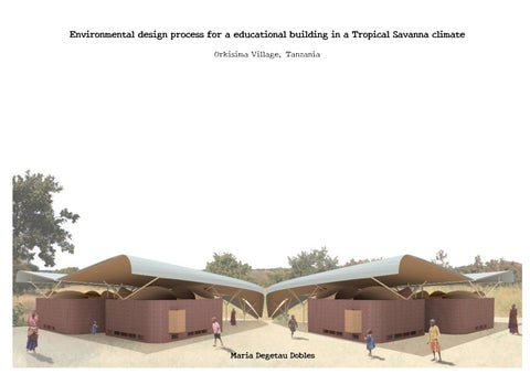
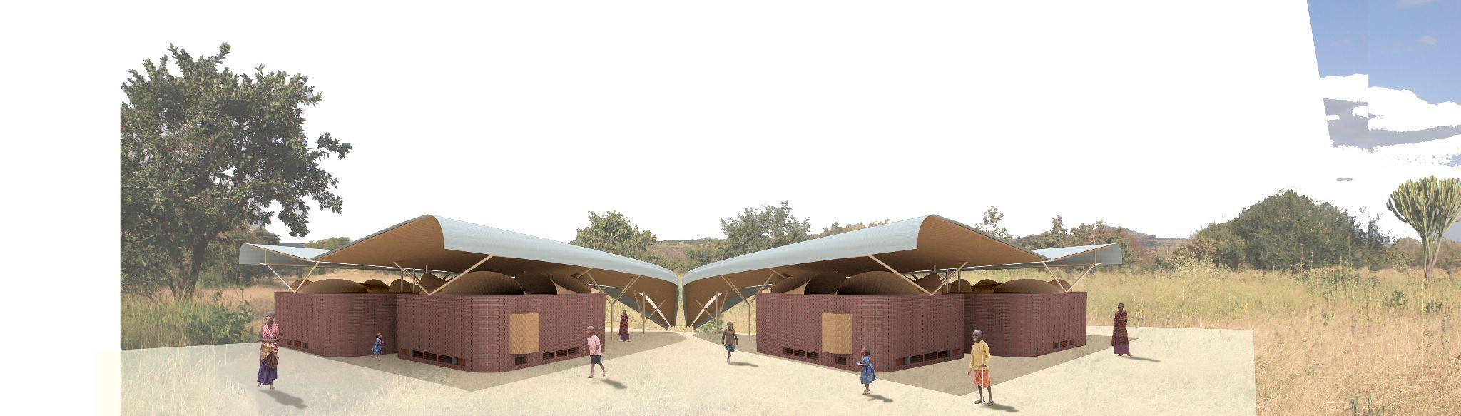
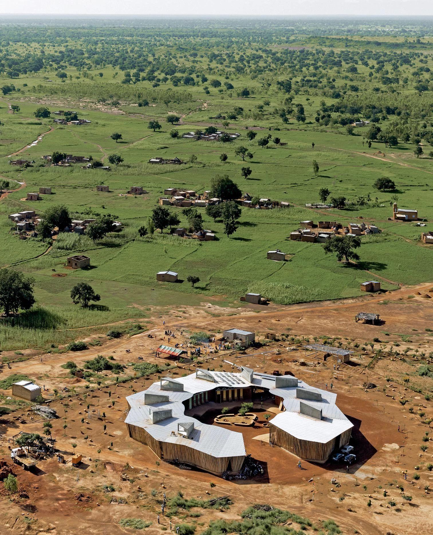
Environmental design process for a educational building in a Tropical Savanna climate
Orkisima Village, Tanzania
Maria Degetau Dobles
The objective of the proposed educational project is to protect the environment and preserve the native culture of the Maasai people in the northern region of Tanzania. This project is a result of the collective effort of the community, spanning across generations, who have come together to envision their future.
The impact of global climate change is being keenly felt in Tanzania, a country located near the equator, where a significant increase in temperatures poses a direct threat to life in the region and, consequently, to its culture and traditions. Given the rapid climatic changes, this area is gradually transforming into a tropical savannah. Therefore, it is imperative to implement strategic measures now to ensure the survival of this community.
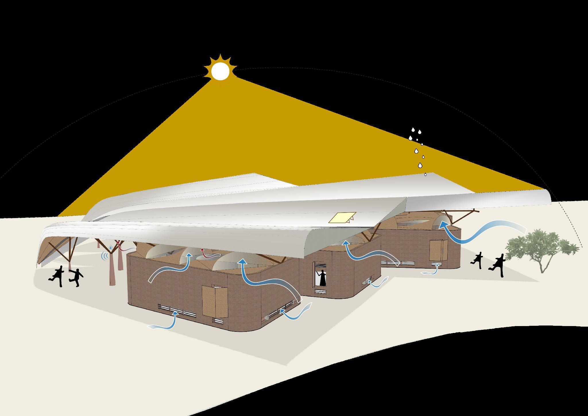
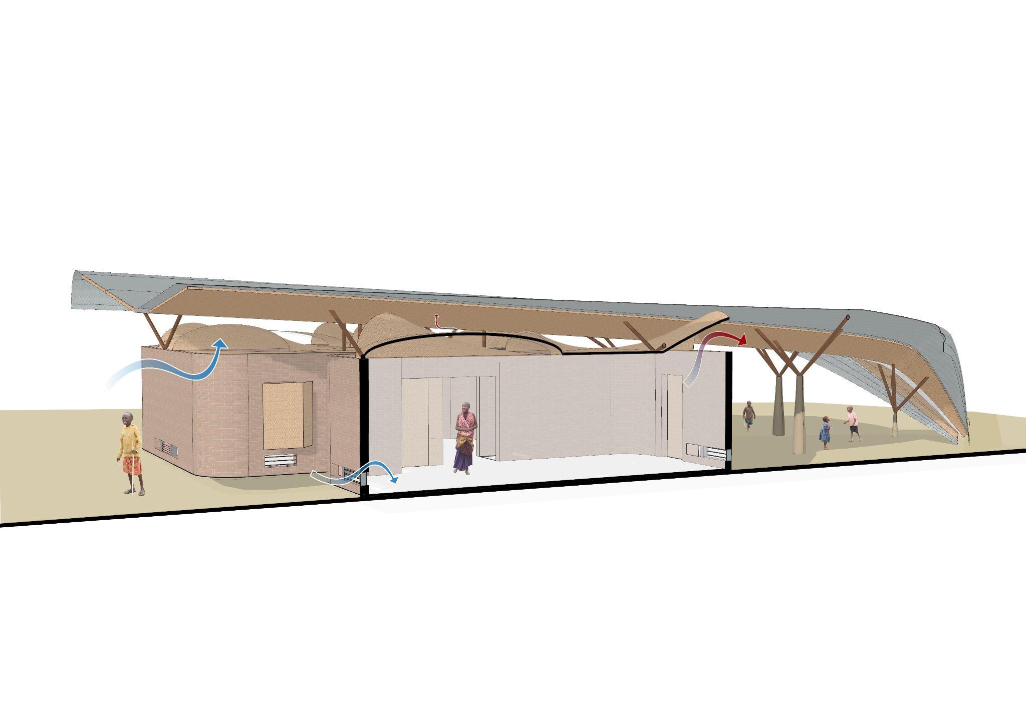
The project will draw inspiration from a combination of traditional Maasai building techniques and indigenous African architectural precedents, setting the design and environmental strategies to address the region's future climate conditions.
A comprehensive program has been proposed, one that embraces contemporary roles for women while still recognizing and preserving their traditional and indispensable responsibilities, such as providing access to water. To succeed, the project must address the lack of access to education and gender inequality, two intertwined challenges.
As a primary objective, the project aims to relocate the water supply to the heart of the community, and consequently, within the building itself. This approach will guide the design of the building, incorporating pertinent environmental strategies to ensure comfort throughout the year, especially during the warmer and more prolonged periods.
The project aims to collaborate closely with the community and the client through on-site visits, learning from their traditions and tailoring the project to meet the evolving needs of the Maasai people in the village of Orkisima.
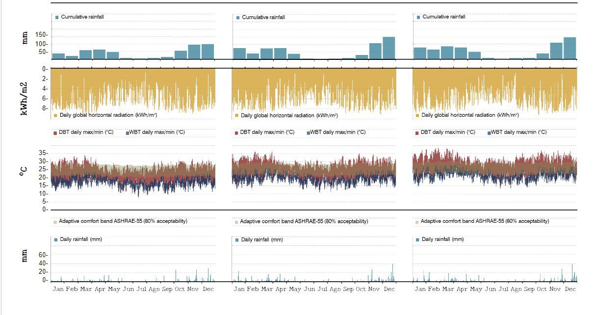
Fig 6.2.1- Set of graphs of the site`s climate using weather data 2022
Fig 6.2.2- Set of graphs of the site`s climate using weather data 2100 RCP 4.5
Fig 6.2.3- Set of graphs of the site`s climate using weather data 2100 RCP 8.4
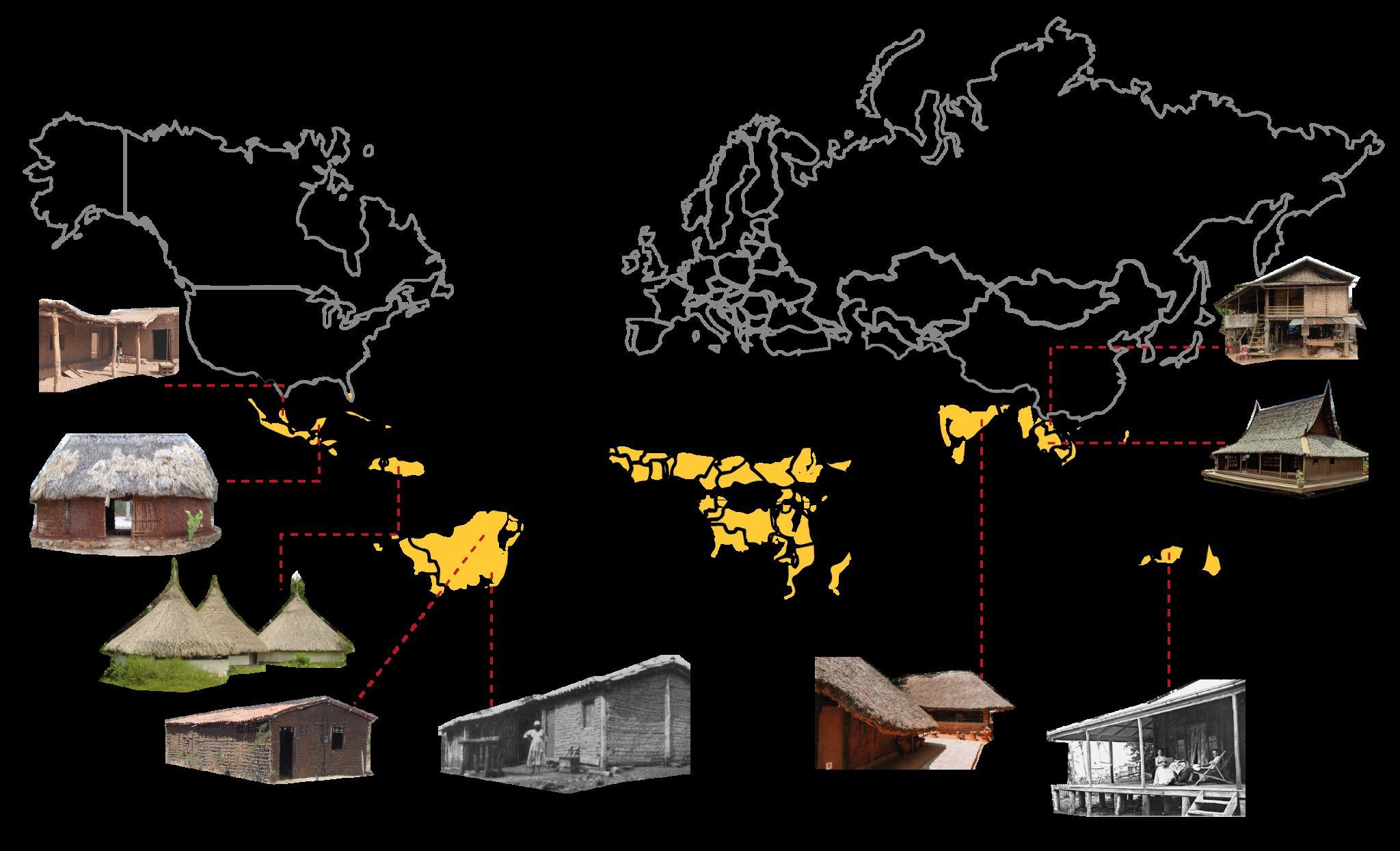
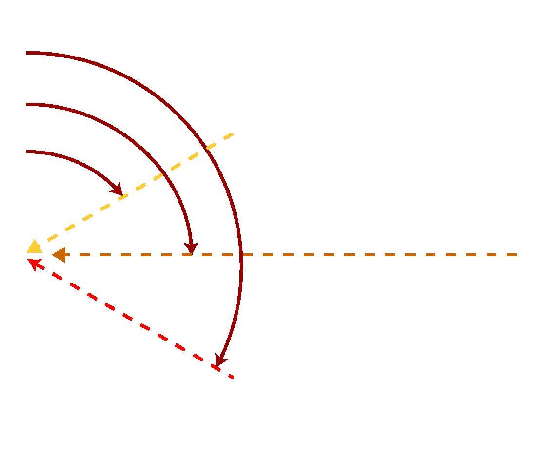
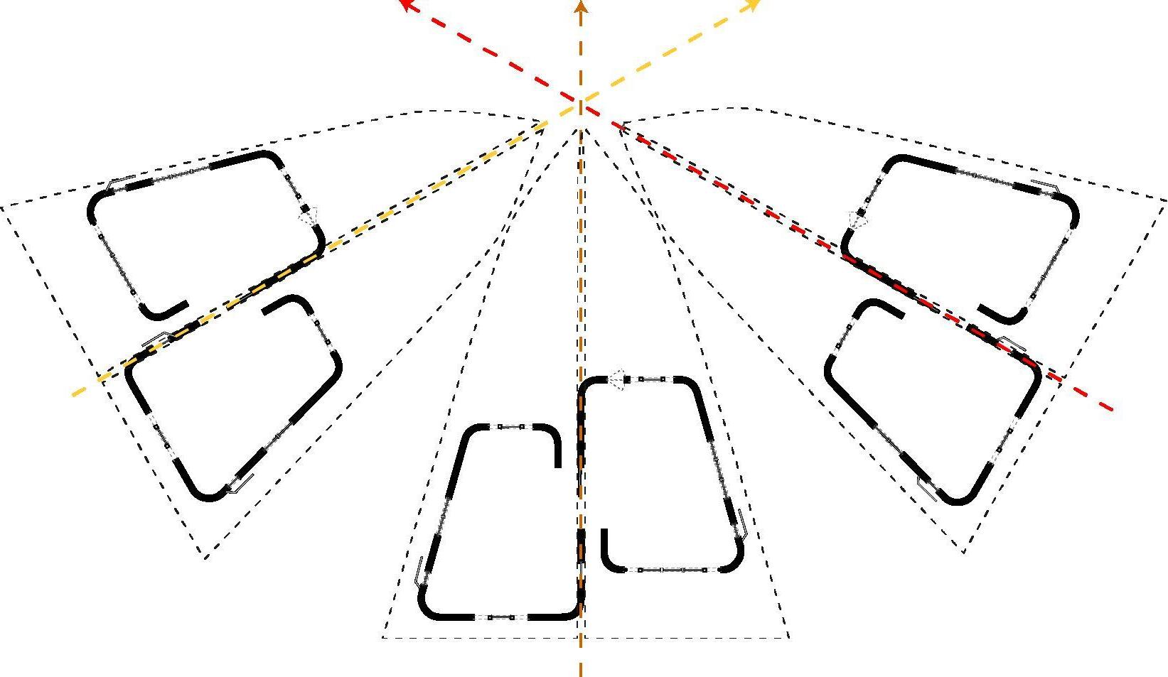
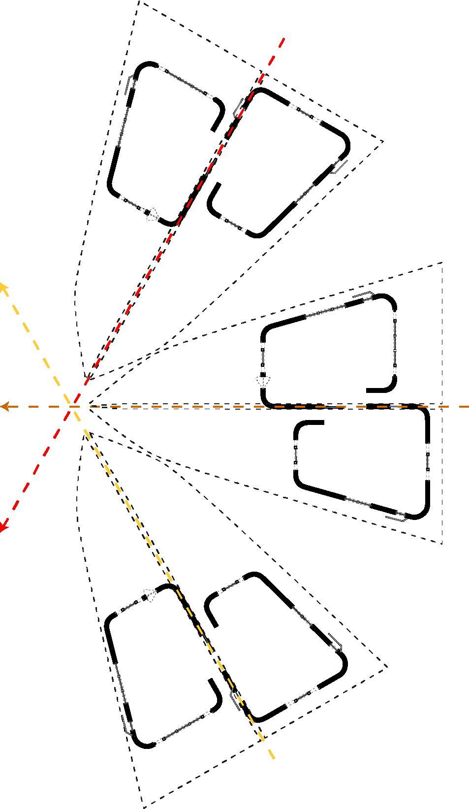
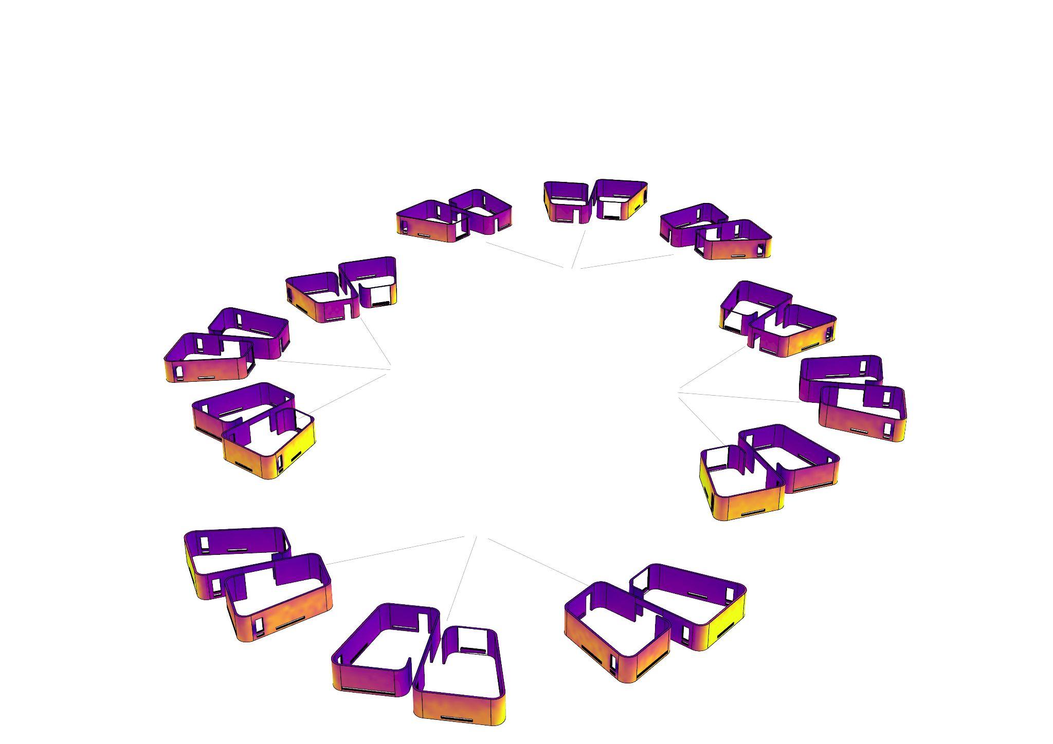
Fig 7.1.1- Diagram of tropical savannah vernacular precedents worldwide
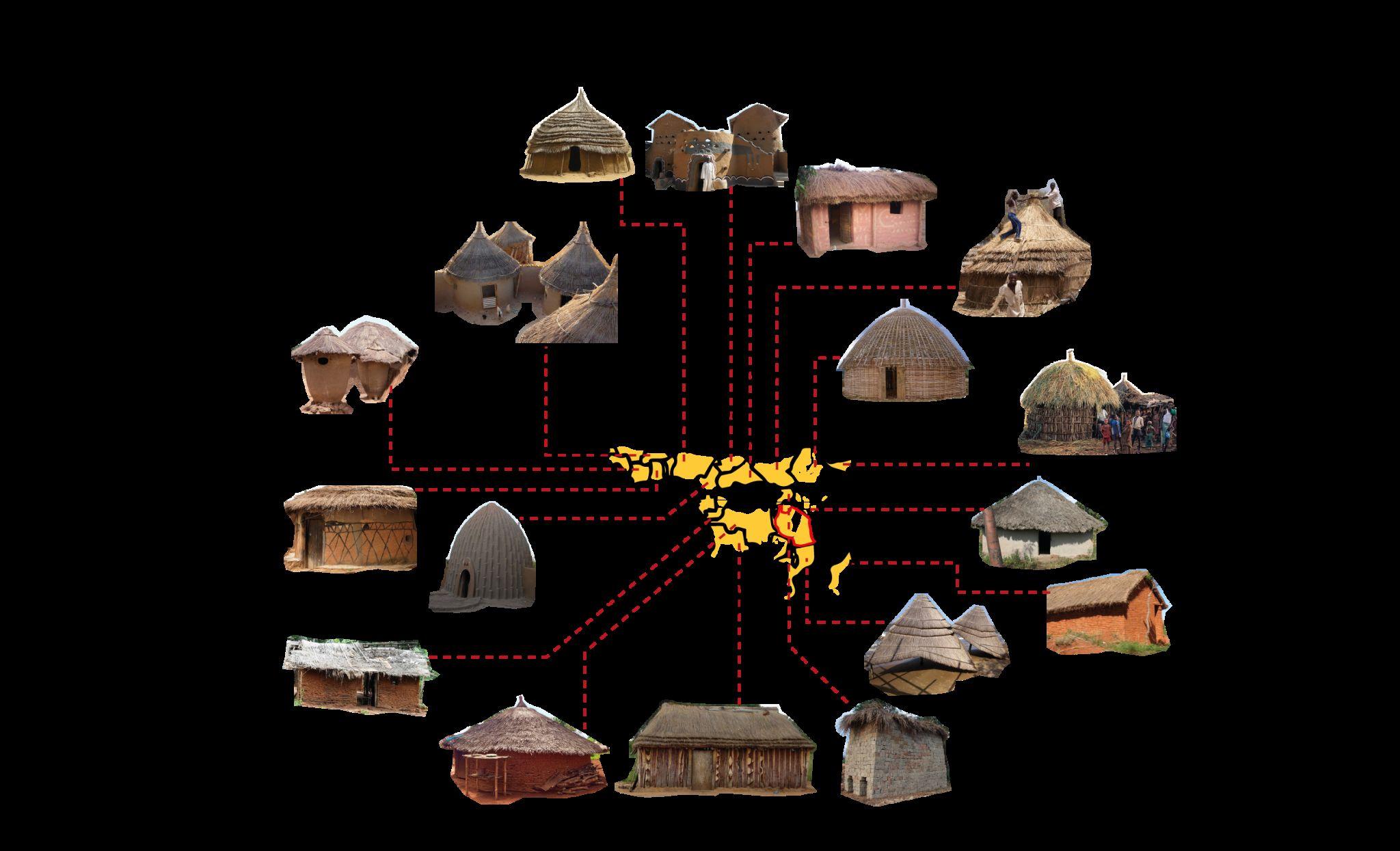
Fig 7.2.2- Diagram of day and night strategies implemented in vernacular precedents in Africa
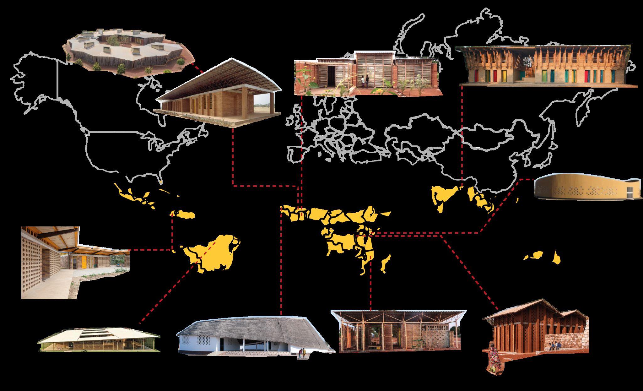
Fig 7.3.1- Diagram of tropical savannah school precedents worldwide
Fig 7.3.2- Diagram of day and night strategies implemented in school precedents worldwide
Fig 7.4.1- Diagram showing the building´s technique of METI school
Fig 7.4.2- Images of project (Anna Heringer, 2007)
Fig 7.5.1- Images of Lycee School (Kere Architecture, 2016)
Fig 7.5.2- Diagrams showcasing the environmental strategies by Francis Kere
Fig 7.5.3- Images of Gando School (Kere Architecture, 2001)
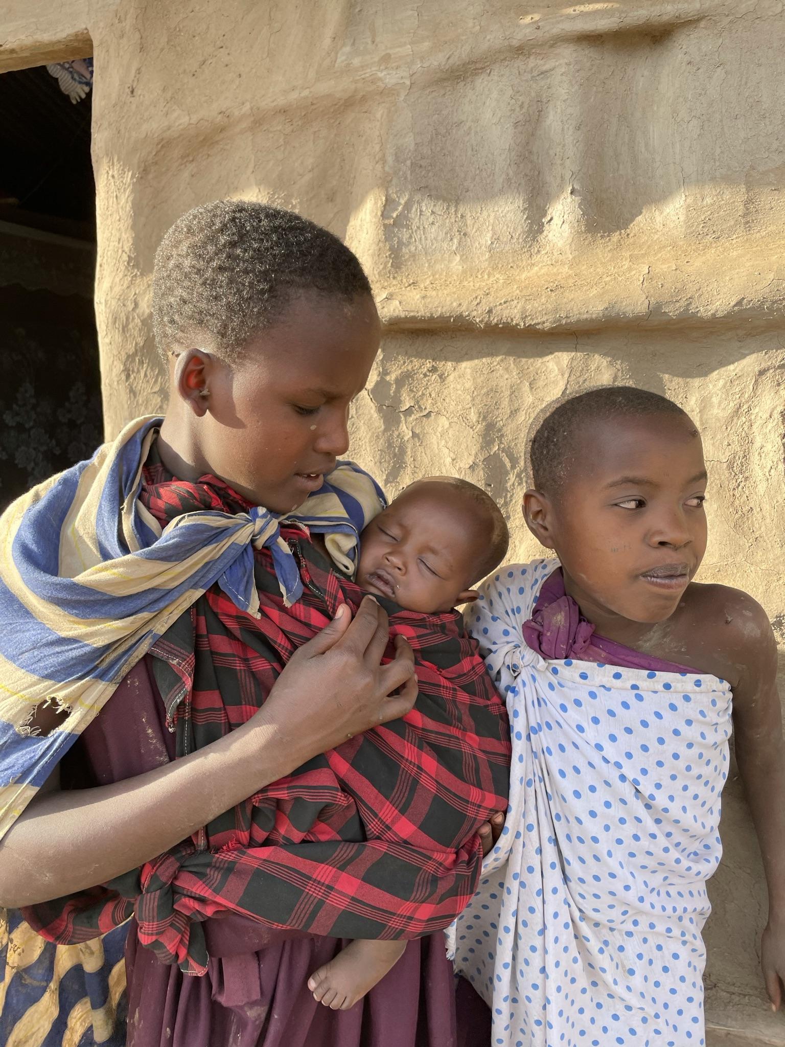
Fig 7.6.1- Images of Bomas from (Senses Atlas, 2021)
Fig 7.6.2- Images of Enkaji from Site visit and (Senses Atlas, 2021)
Fig 7.6.3- Diagram of a typical Boma
Fig 7.6.4- Diagram section of a Enkaji
Fig 8.1.1- Diagram of methodology of site visit
Fig 8.2.1-Pictures of members of the board of ISOMA, property of ISOMA
Fig 8.2.2-Pictures of meeting with local architect
Fig 8.2.3-Diagram of circular economy for the funding of the project
Fig 8.3.1 -Diagram of the sites that were travelled
Fig 8.3.2 -Pictures taken on site of the people in a celebration
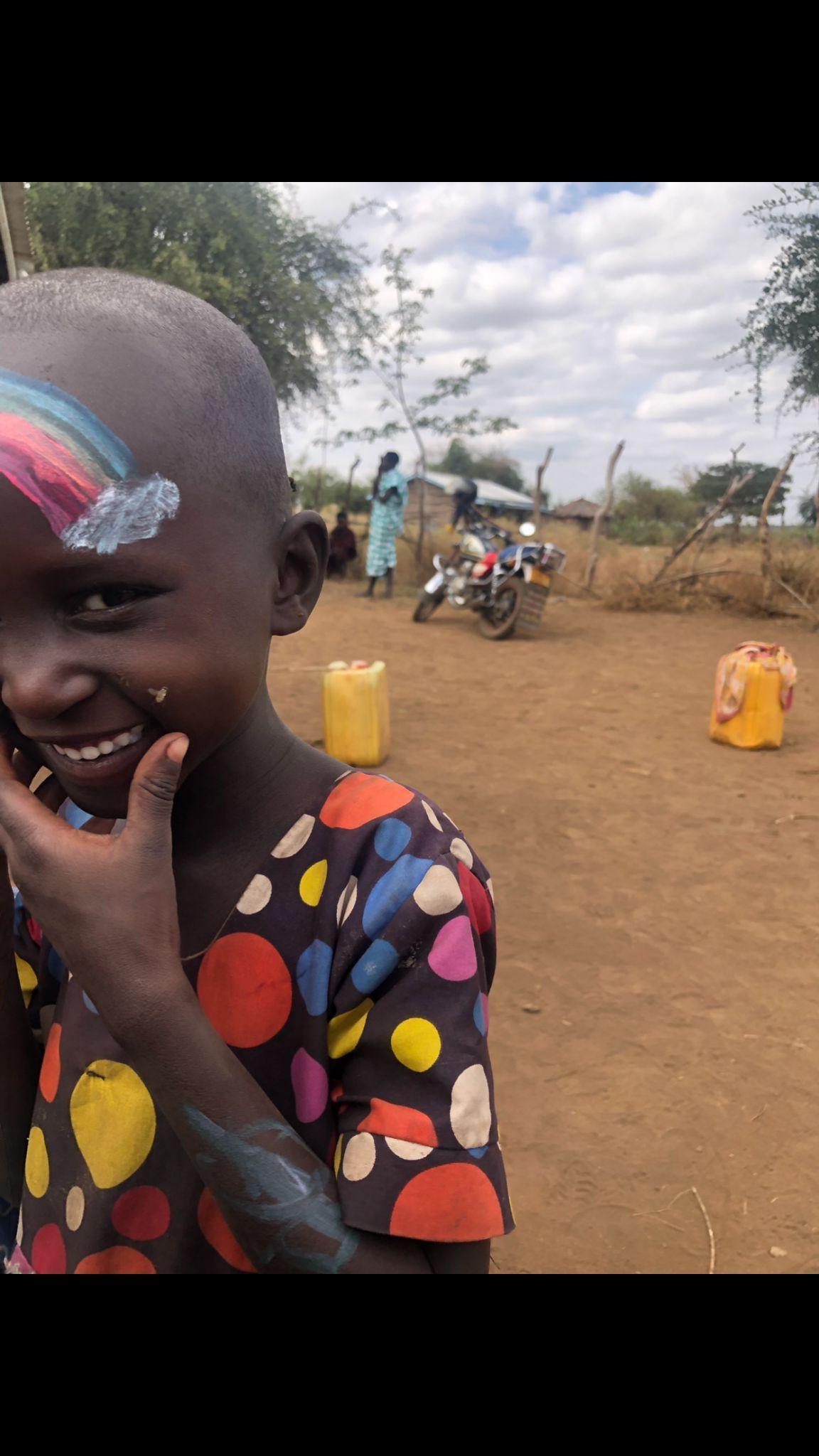
Fig 8.4.1 - Pictures of the kids of the village during painting activities
Fig 8.4.2 - Pictures taken on site of the activities with the kids
Fig 8.5.1 - Pictures taken on site of the interview process
Fig 8.6.1 - Pictures taken on site of the different typologies of houses
Fig 8.7.1 - Pictures taken on site of observations seen on the land /surroundings
Fig 8.8.1 - Pictures taken on site of observations seen on the existent school
Fig 8.9.1 - Pictures taken on site of observations in the village
Fig 9.1.1 - Pictures of the interviewees and their transcript
Fig 9.2.1 - Diagram of the interview analysis
Fig 9.3.1 - Table of building survey
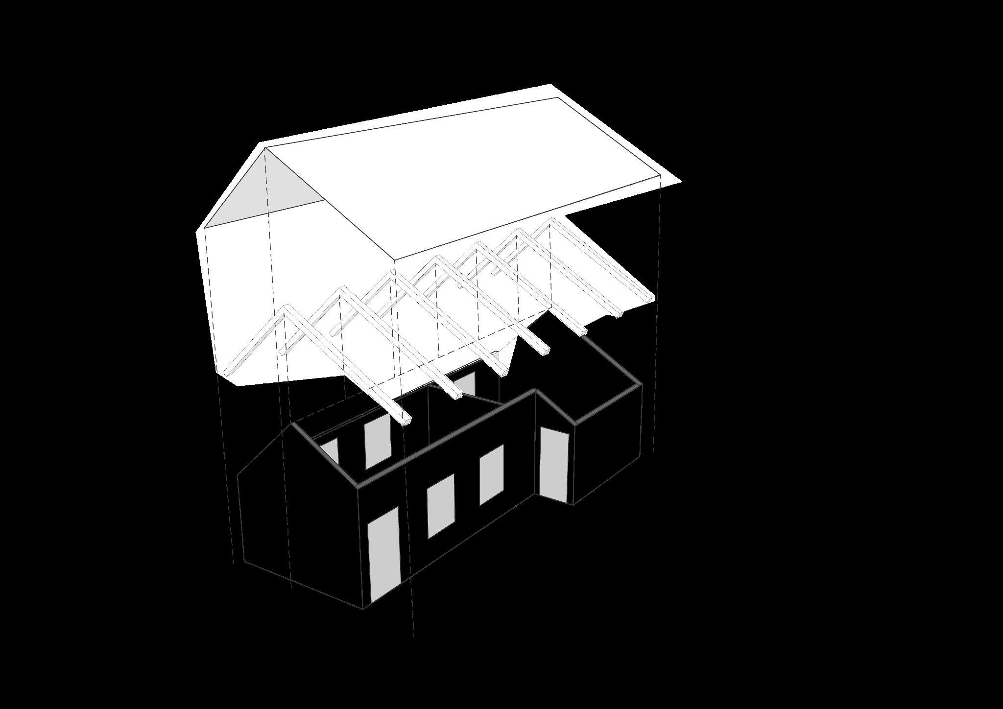
Fig 9.4.1 - Diagram showing the existent school configuration and strategies
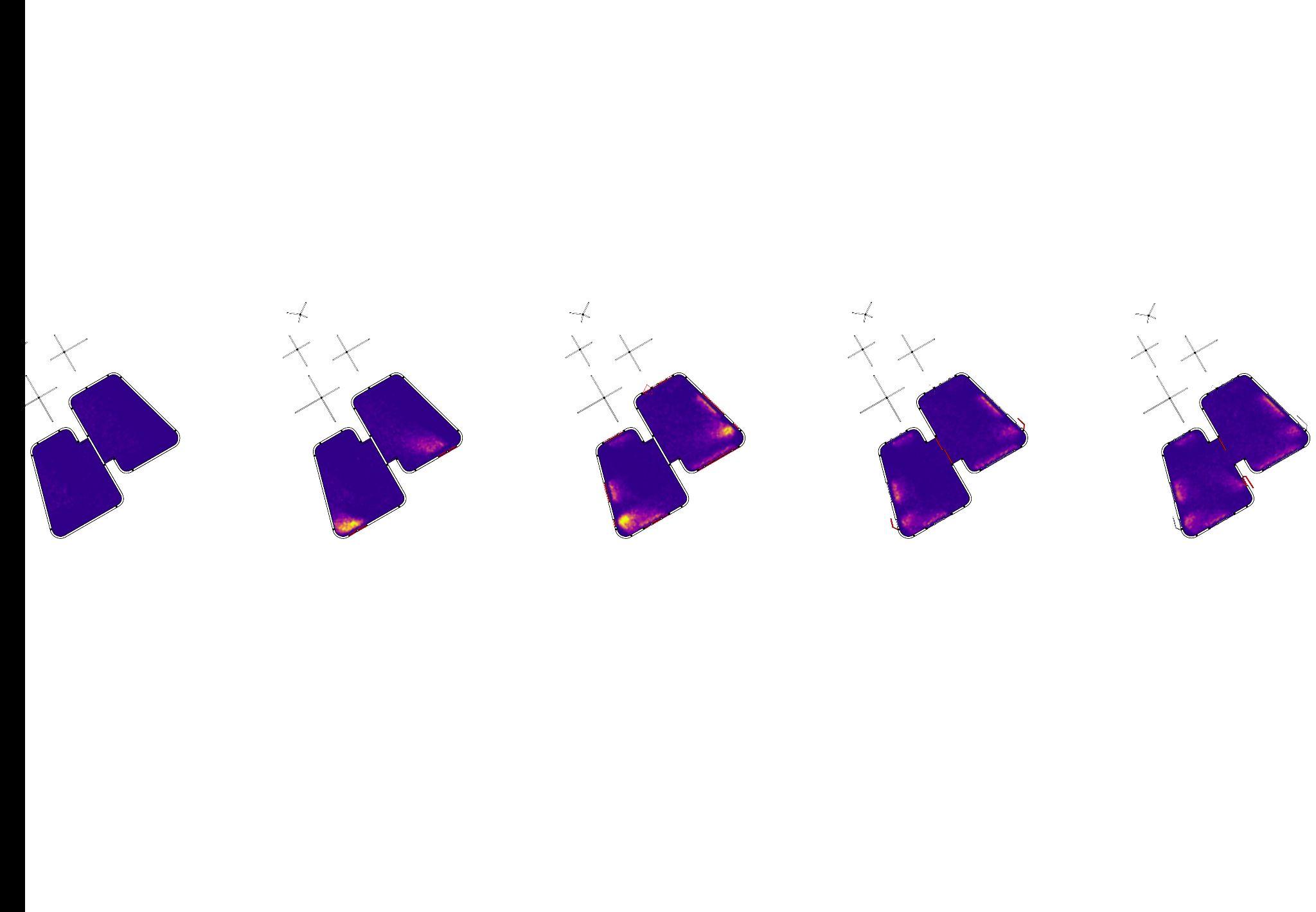
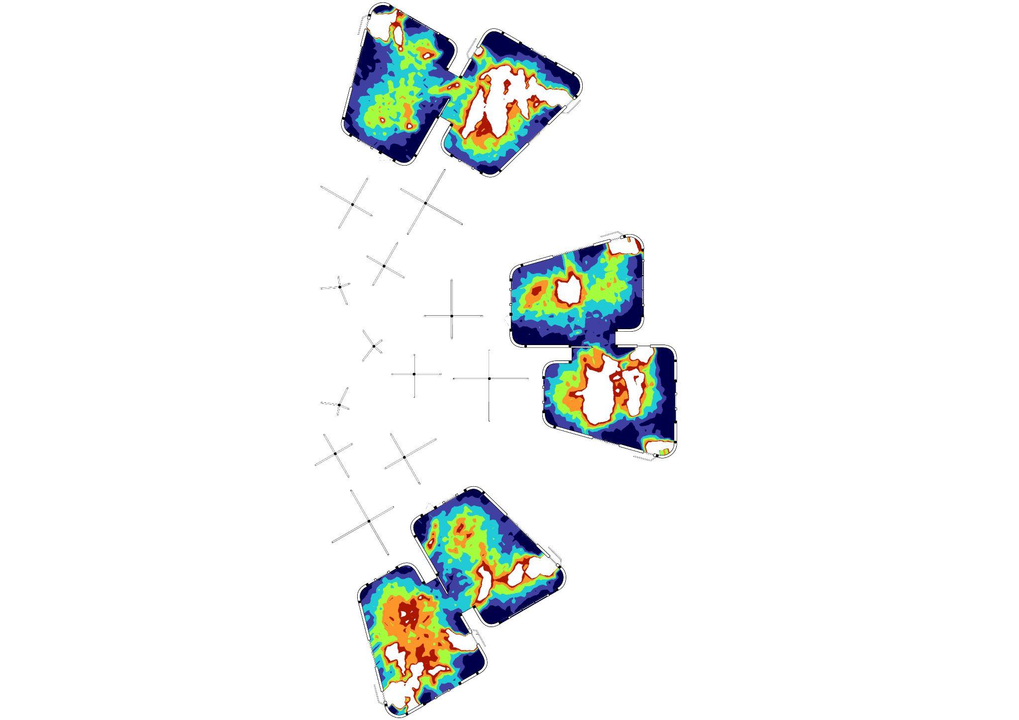
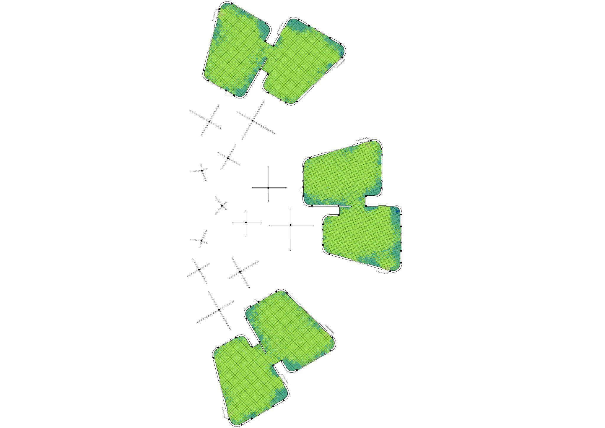
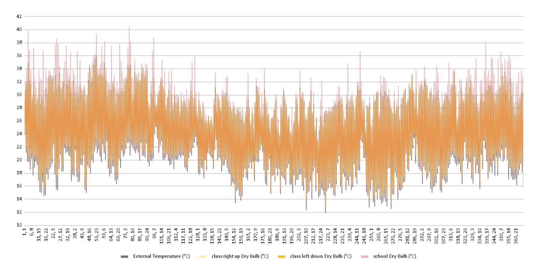
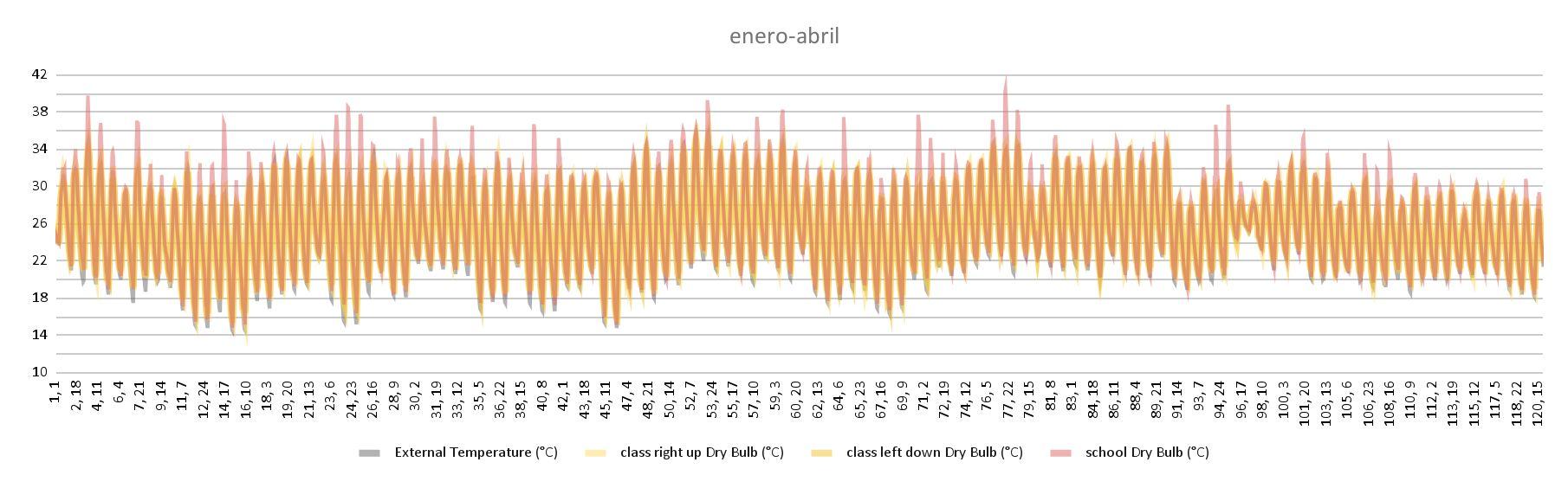
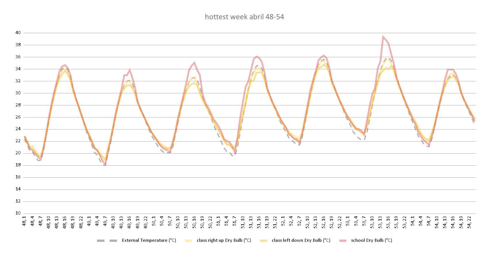
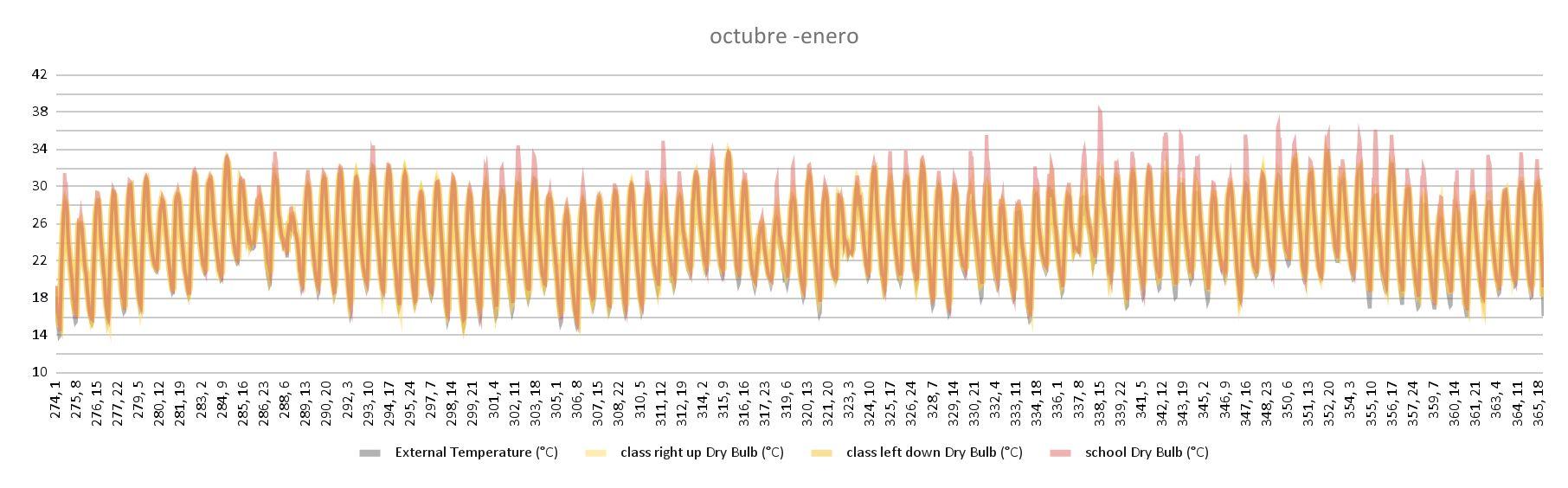
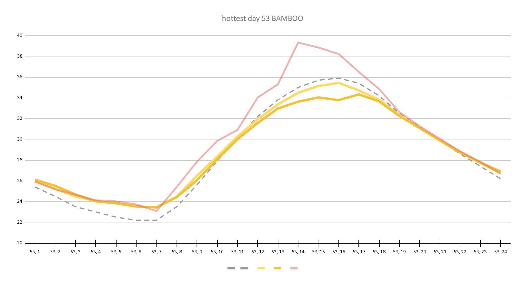
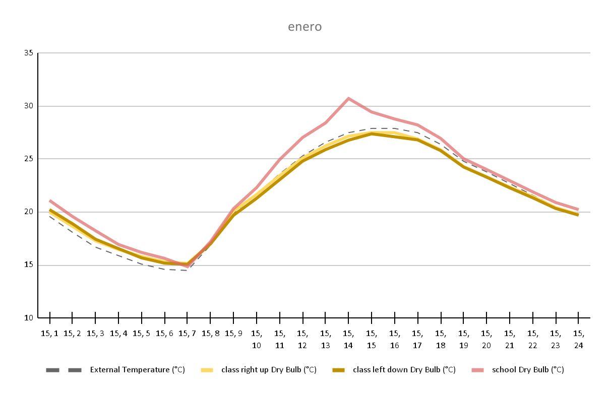
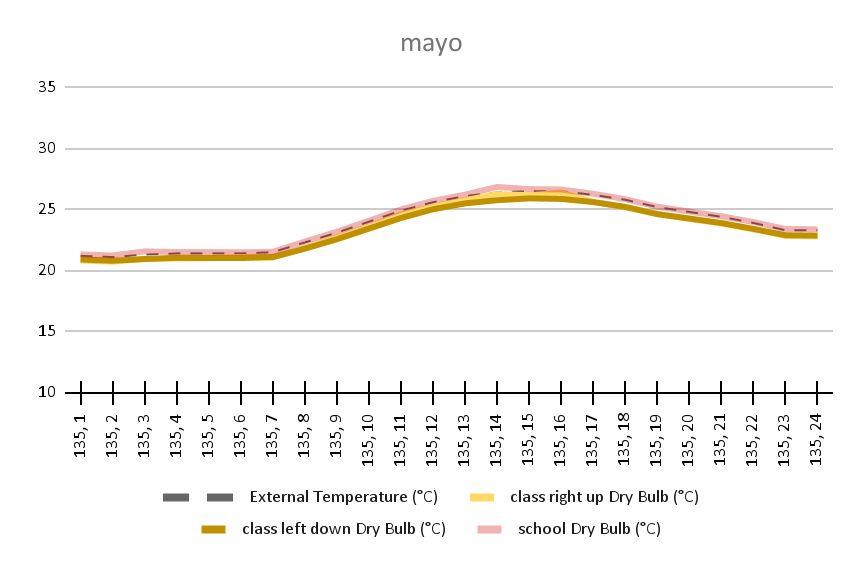
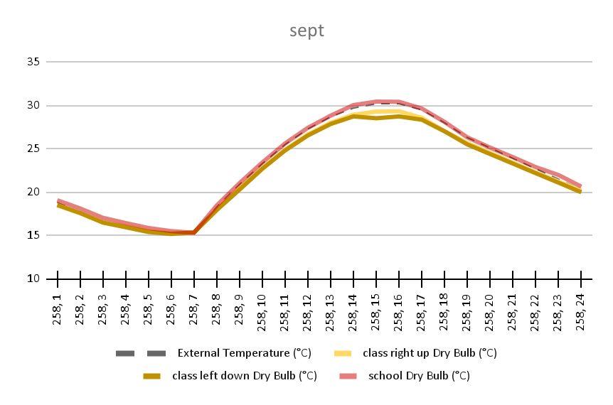
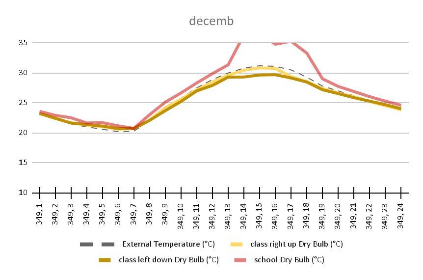
Fig 9.5.1 - Plan of existent school showing temperatures recorded on site
Fig 9.5.2 - Tas model of existent school
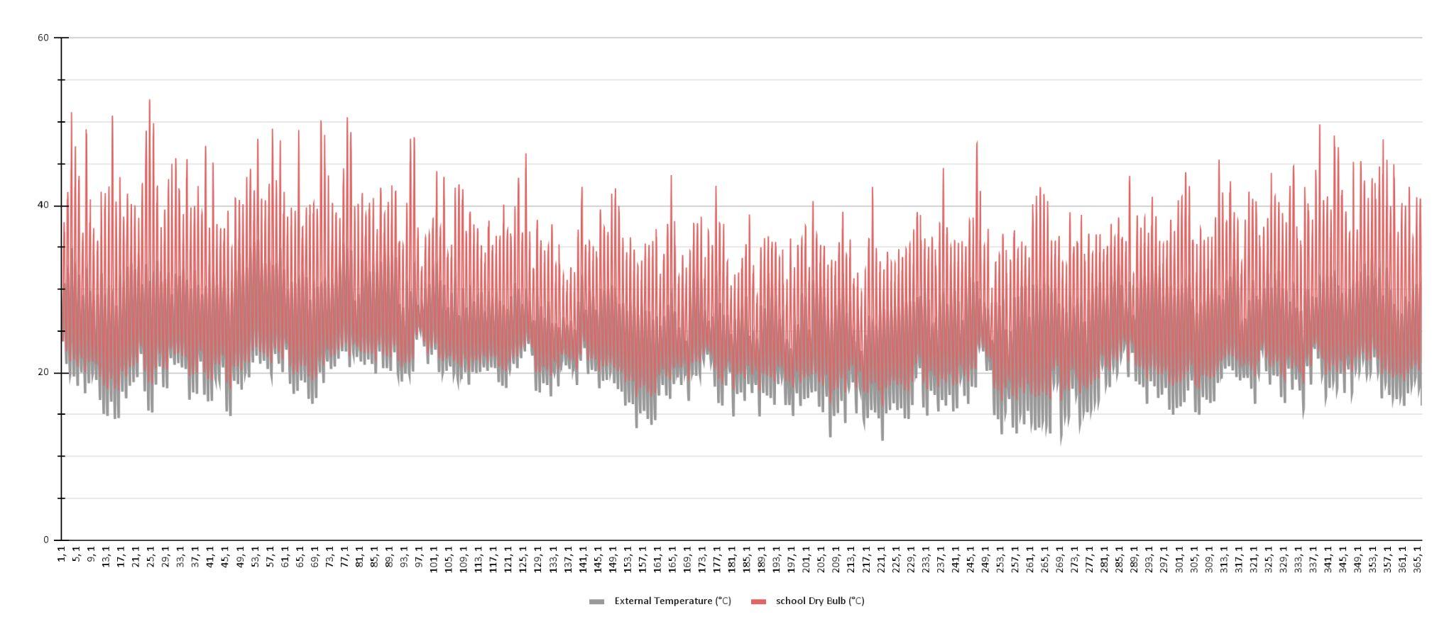
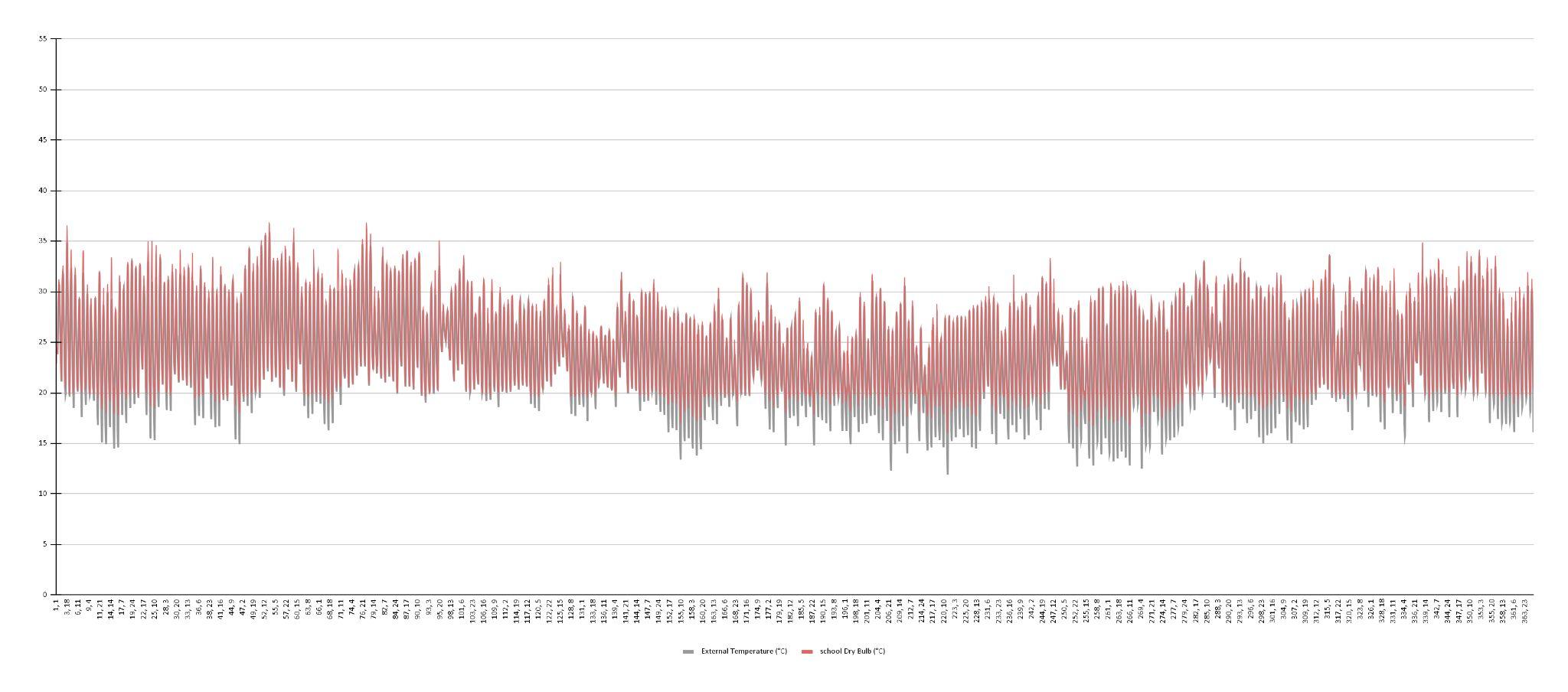
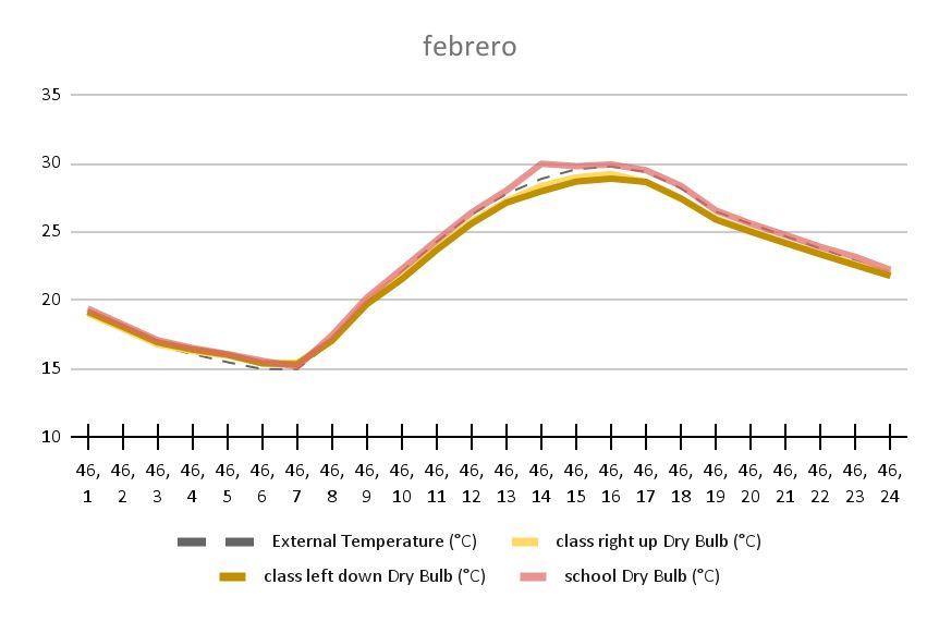
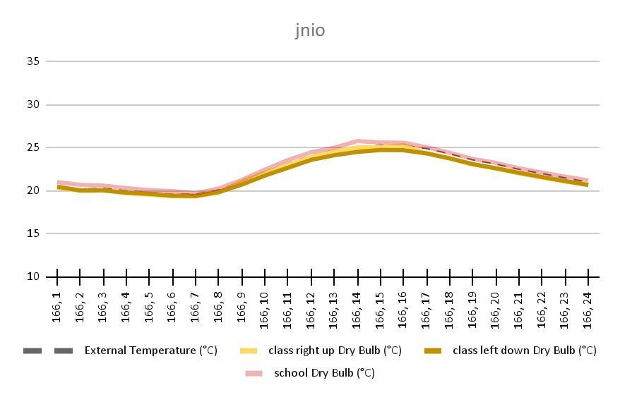
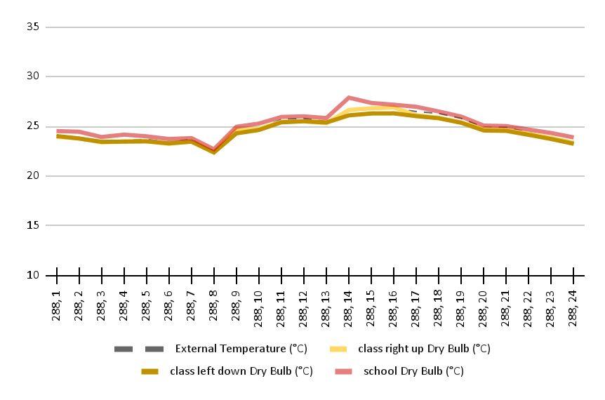
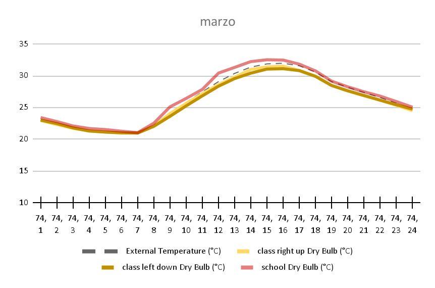
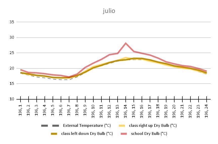
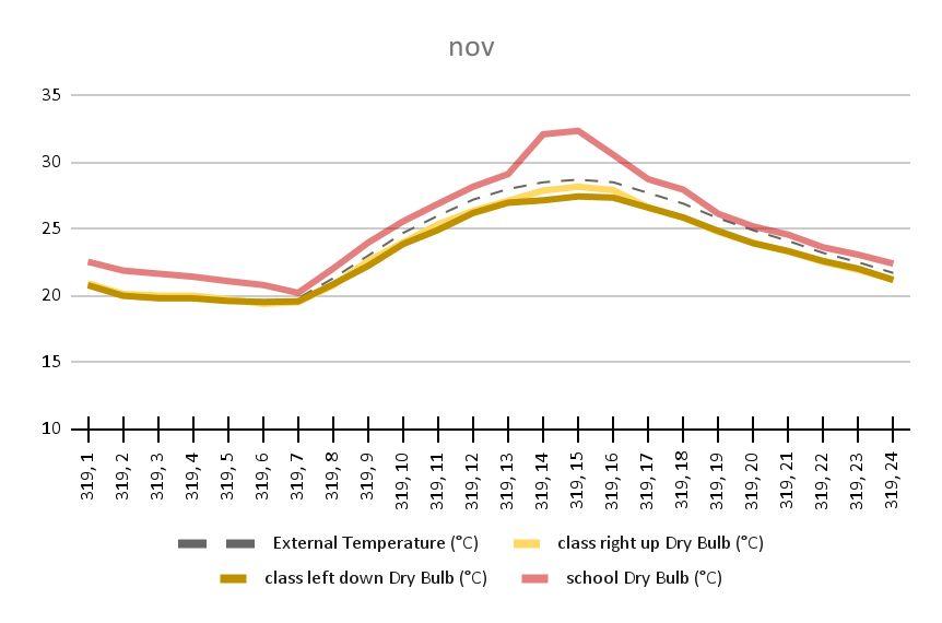
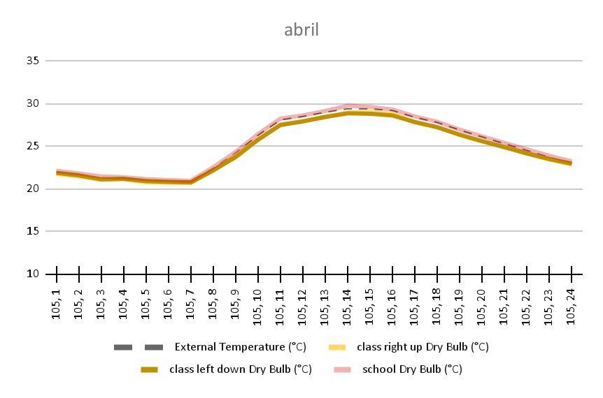
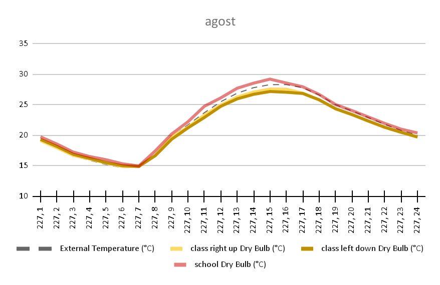
Fig 9.5.3 - Graph of DBT existent classroom with windows closed
Fig 9.5.4 - Graph of DBT existent classroom with windows open when temperature > 21°C
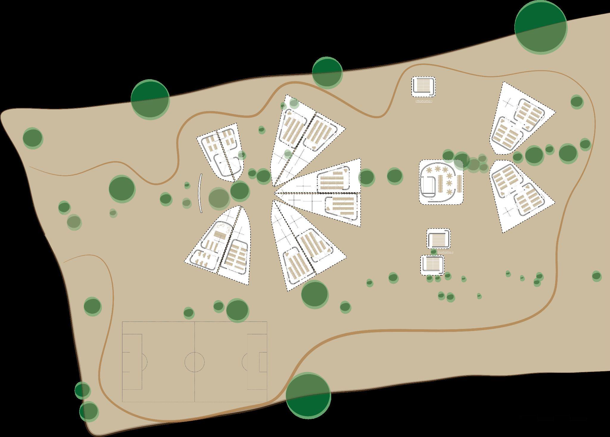
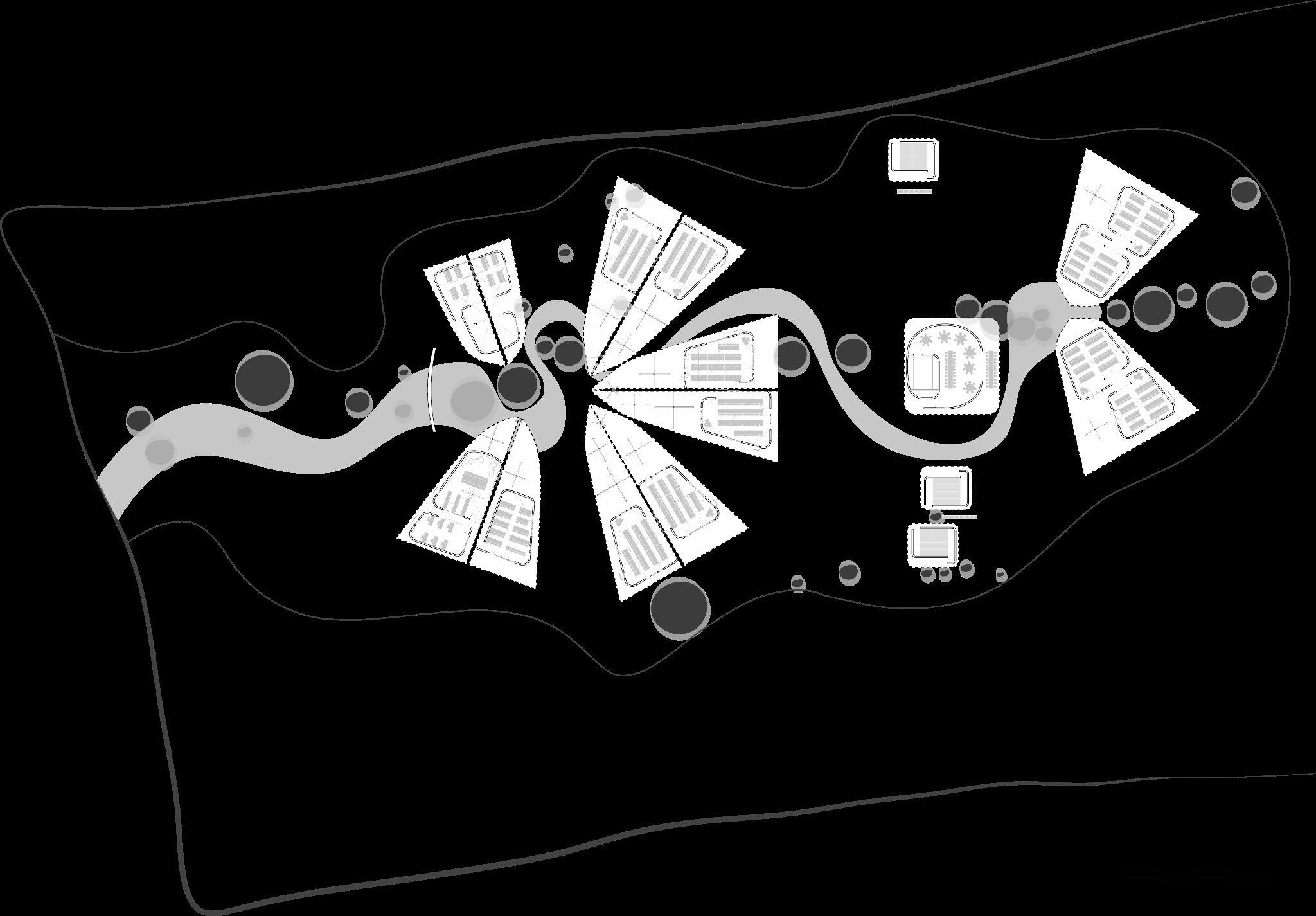
Fig 9.6.1 - Diagram of Orkisma`s village extent and programmes
Fig 10.1.1 - Compilation of images taken on site of the land. West and north west views
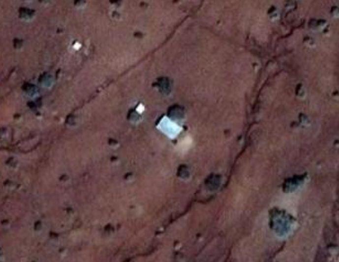
Fig 10.1.2 - Drone generated image of the site viewed from above
Fig 10.1.3 - Compilation of images taken on site of the land. North view
Fig 10.2.1 - Government`s survey of the site
Fig 10.2.2 - CAD drawing of the site with existing vegetation
Fig 10.2.3 - General dimension of the site and indication of topography section
Fig 10.2.4 - Topographic sections obtained with Google Earth
Fig 10.3.1 - Images taken on site of the existing vegetation
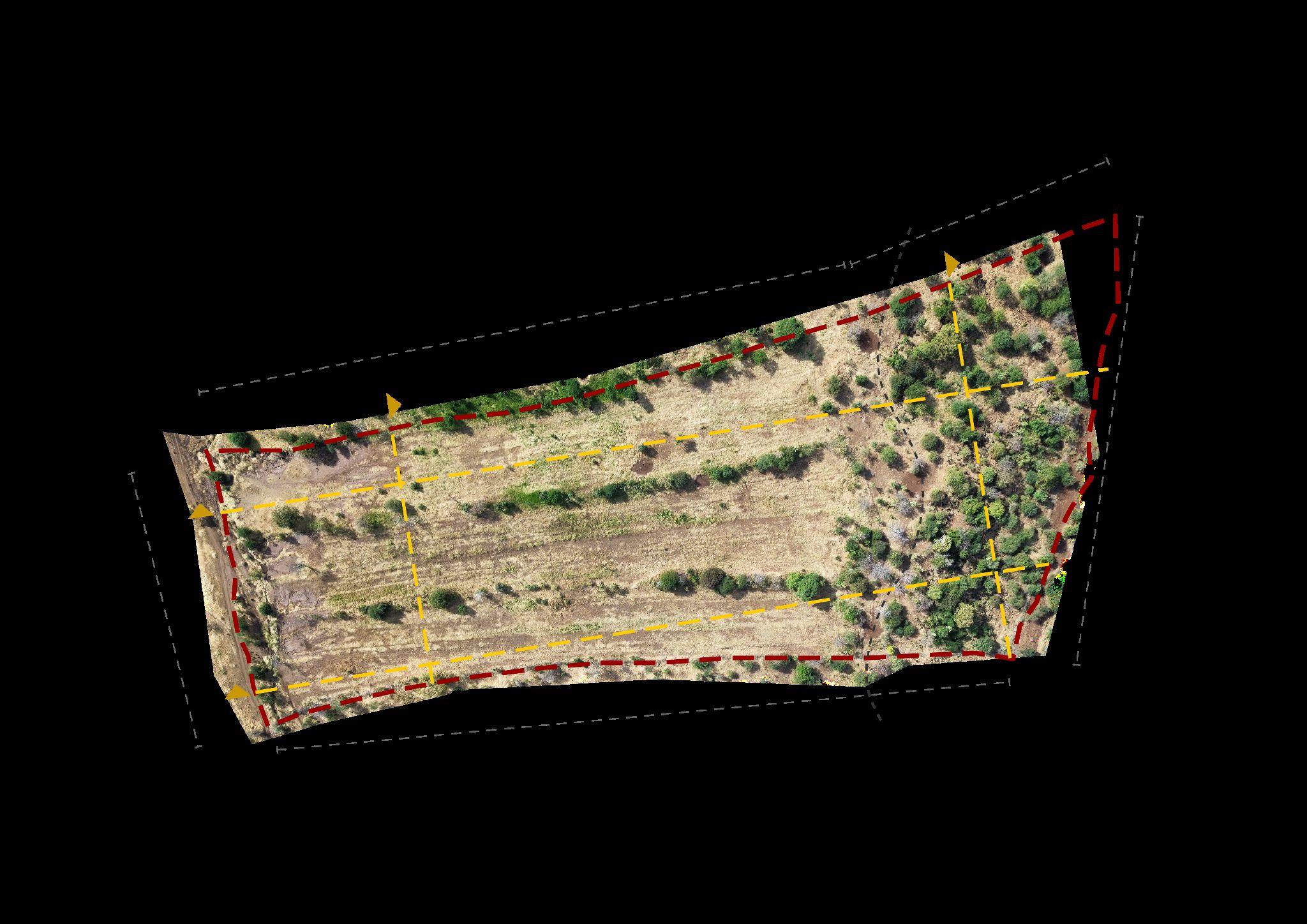
Fig 10.3.2 - Plan indicating the location of existing vegetation and division of the resulting segments
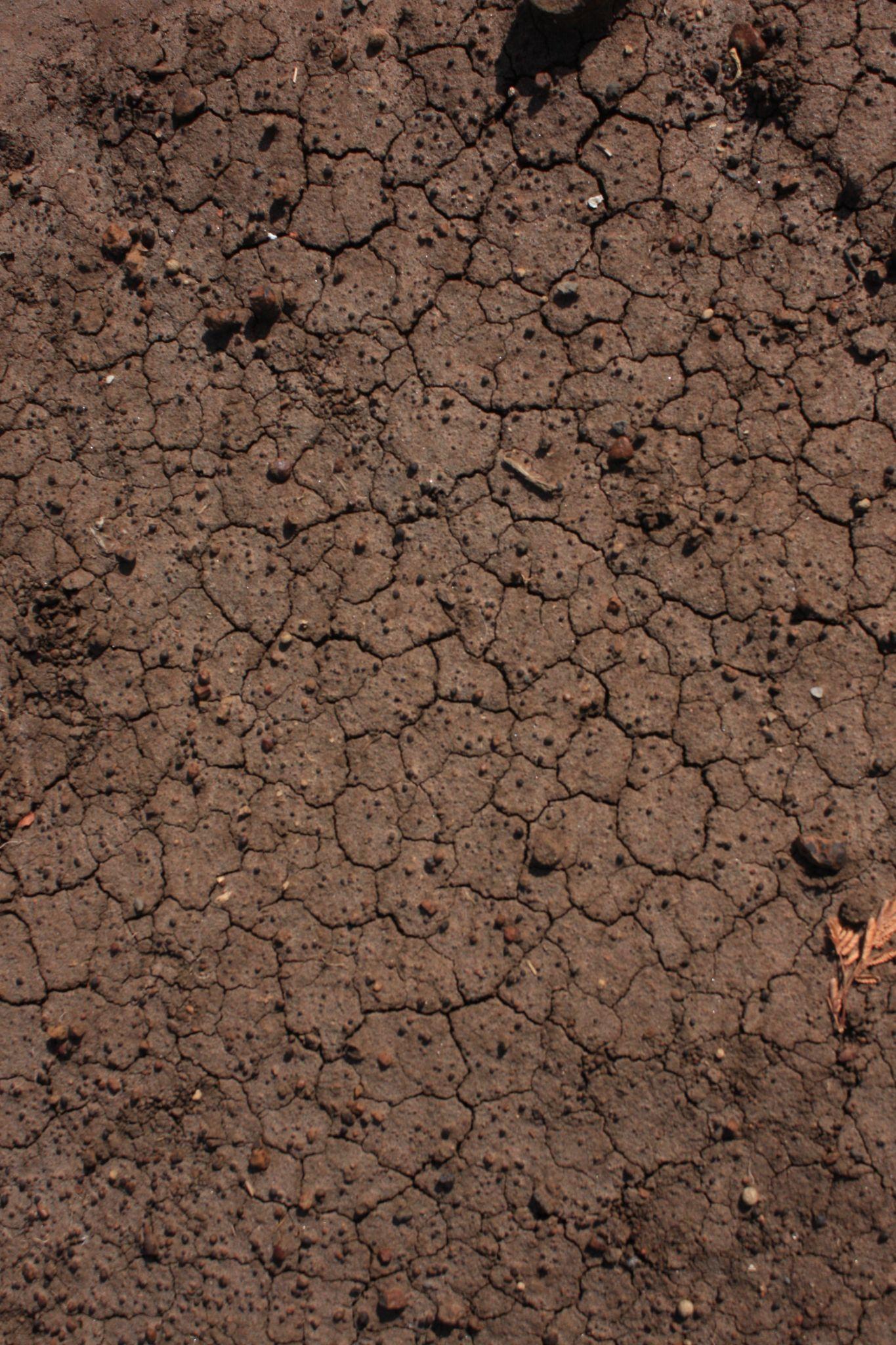
Fig 10.3.3 - Arid with few vegetation
Fig 10.3.4 - Fertile soil, shade from vegetation
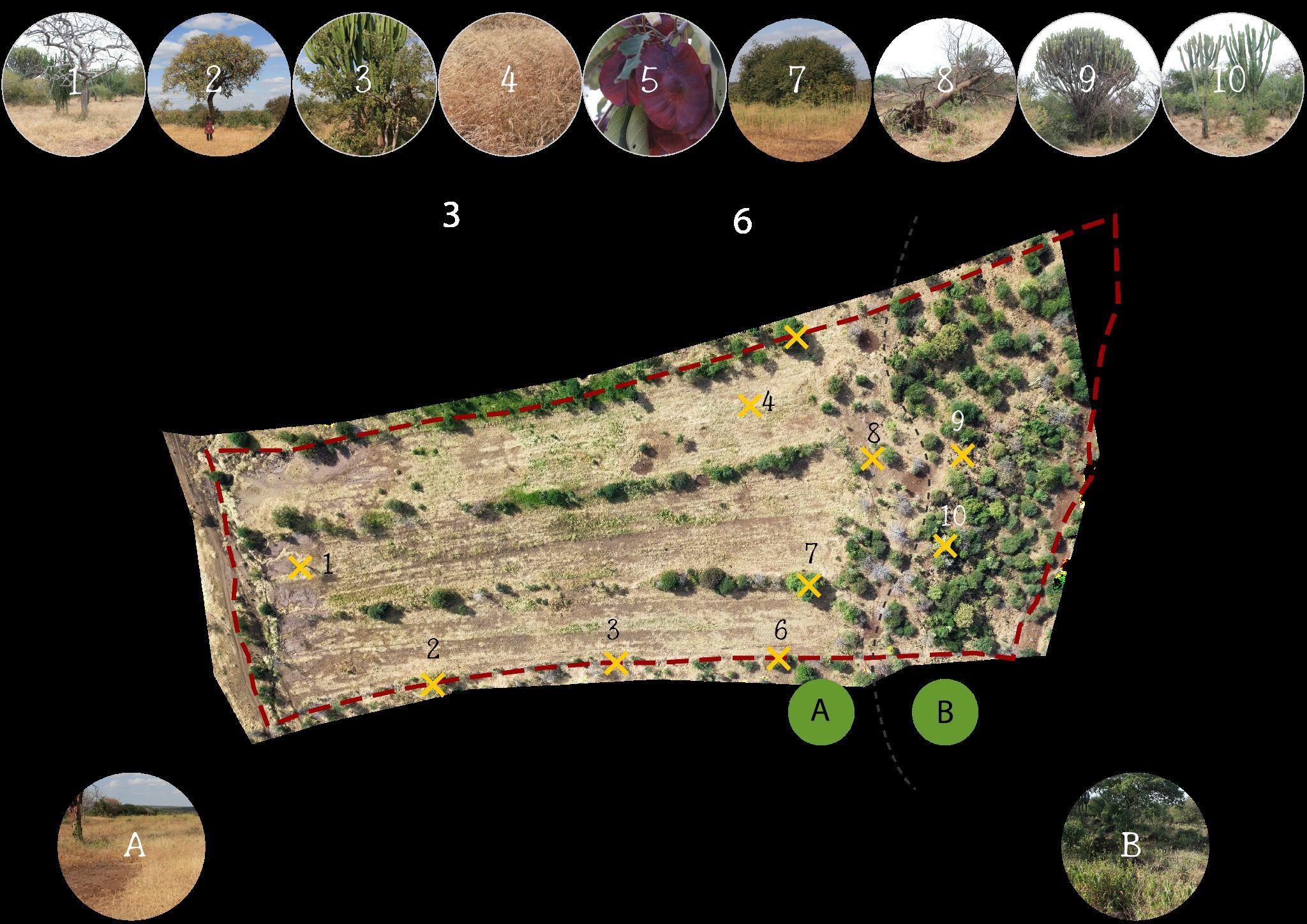
Fig 10.4.1 - Images taken on site of the different scenarios
Fig 10.4.2 - Plan indicating the location of the different scenarios and soil samples
Fig 10.4.3 - Images taken on site of the different soil samples taken
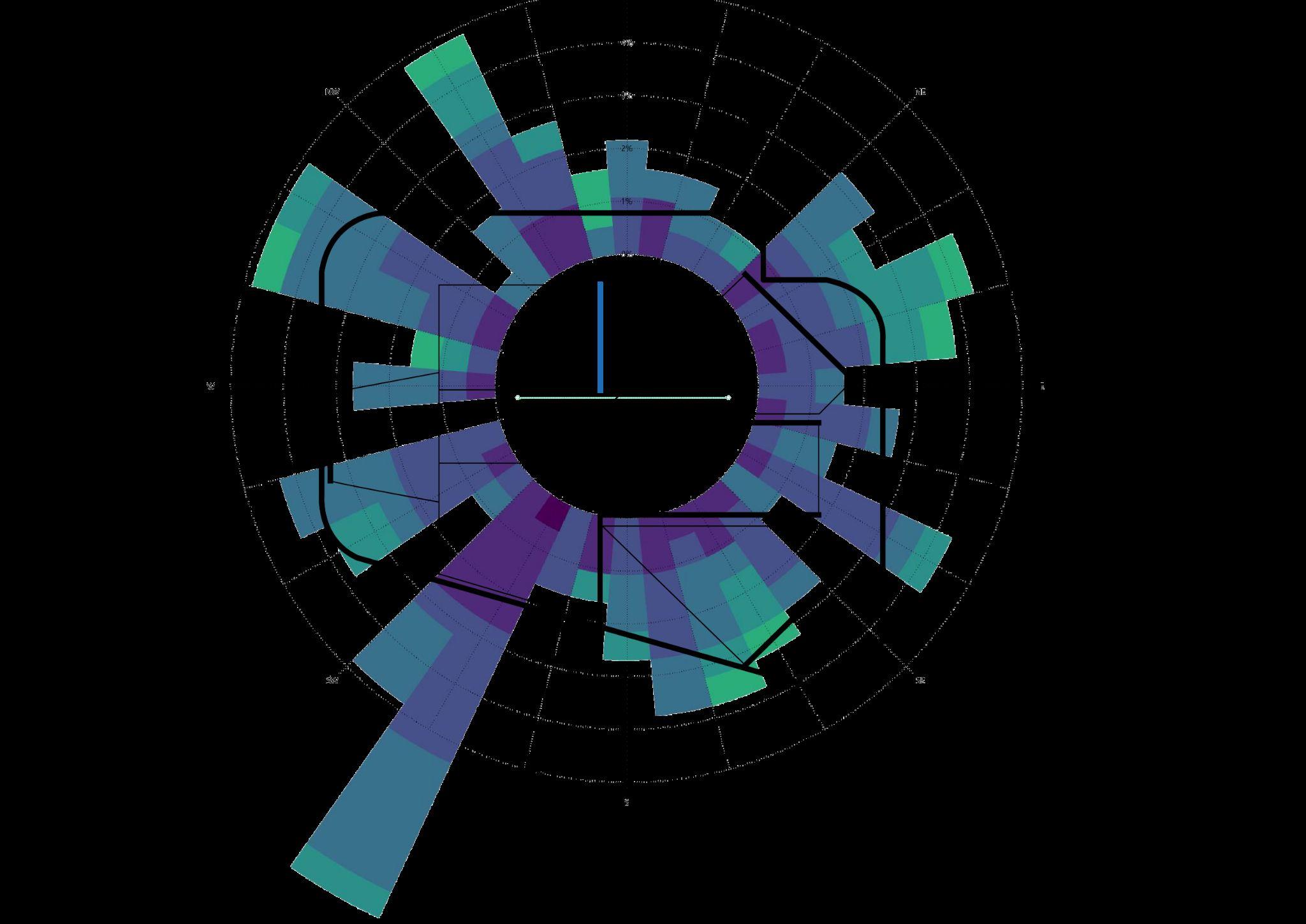
Fig 10.5.1 - Diagram indicating wind and solar preliminary analysis
Fig 10.6.1 - Daily Average Global Horizontal Radiation Table
Fig 10.6.2 - Average Dry Bulb Temperature Table
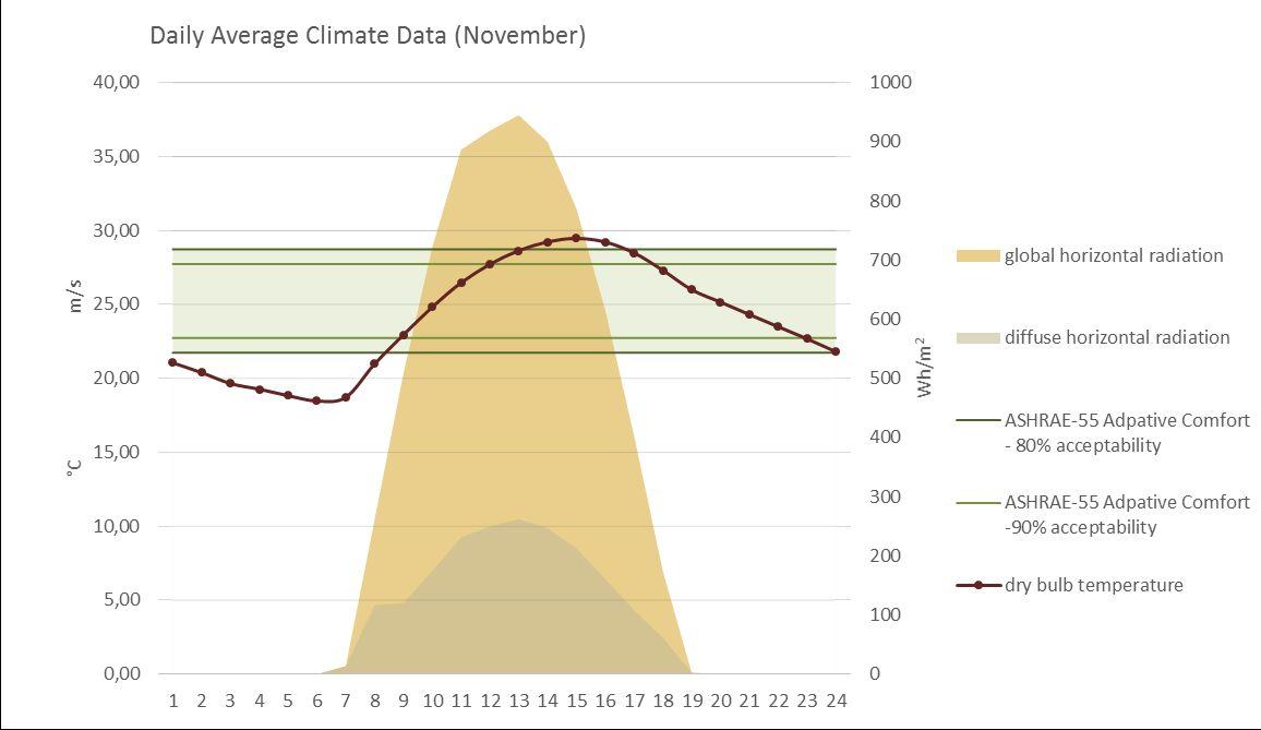
Fig 10.6.3 - Daily Average for November
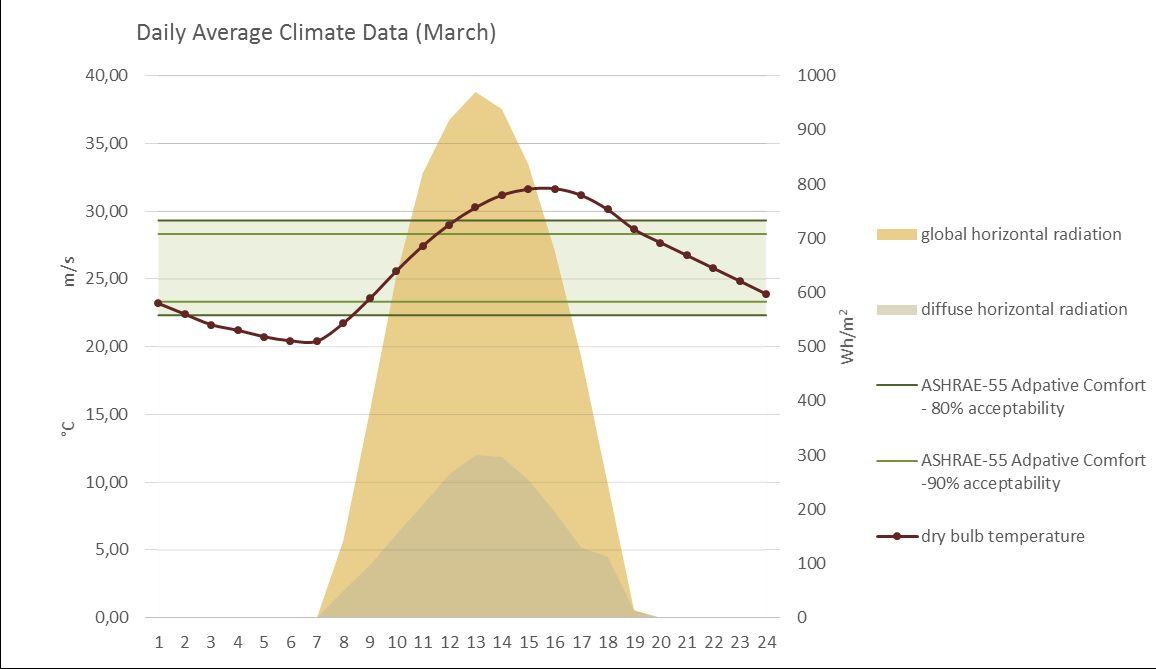
Fig 10.6.4 - Daily Average for March
Fig 10.7.1 - Diagram illustrating azimuth and elevation with respect of the north.
Fig 10.7.2 - Diagrams of sun path analysis. Plan and section of respective orientations
Fig 11.1.1 - Diagram of brief prior site visit
Fig 11.1.2 - Diagram of preliminary massing prior site visit
Fig 11.1.3 - Diagram of brief post-site visit
Fig 11.1.4 - Diagram of preliminary massing post-site visit
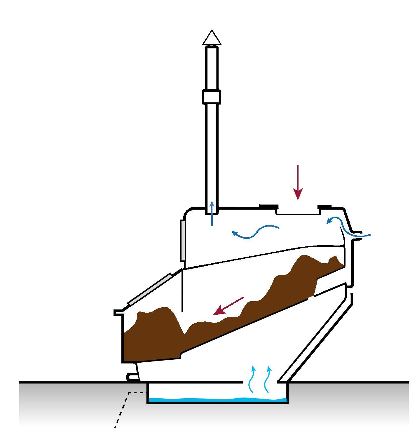
Fig 11.2.1 - Illustration of functioning of a dry toilet
Fig 11.2.2 - Image of Francis Kere, Gando Teachers´housing (Ouwerkerk, E.J., 2016)
Fig 11.2.3 - Image of Yasmeen Lari´s Zero Carbon Cultural Centre in Pakistan (The Guardian, 2020)
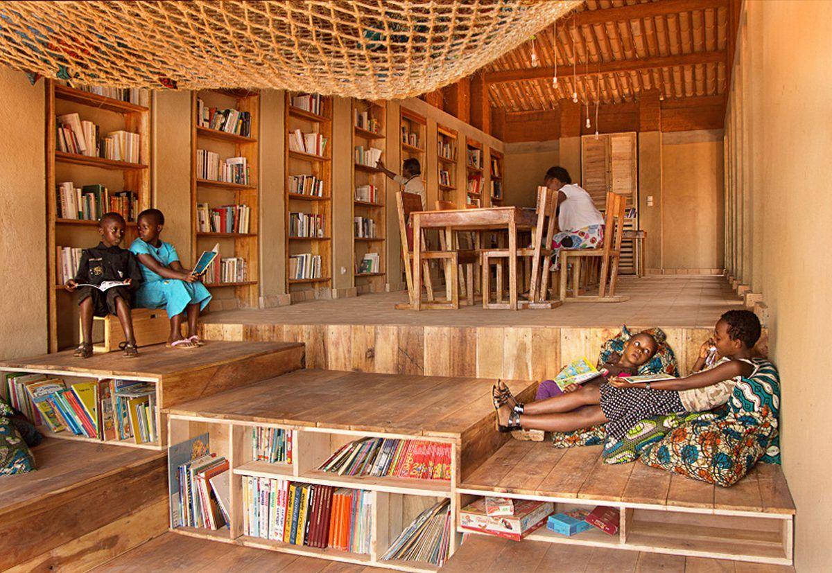
Fig 11.2.4 - Image of BC Architects, Library of Muyinga (Archdaily, 2020)
Fig 11.2.5 - Plan of Gando Primary School Library by Francis Kere (Kere Architecture, 2010)
Fig 11.2.6 - Image of Fass School by Toshiko Mori (Verzbolovskis, S. no date)
Fig 11.2.7 - Image of Lycee School by Francis Kere (Kere Architecture, 2016)
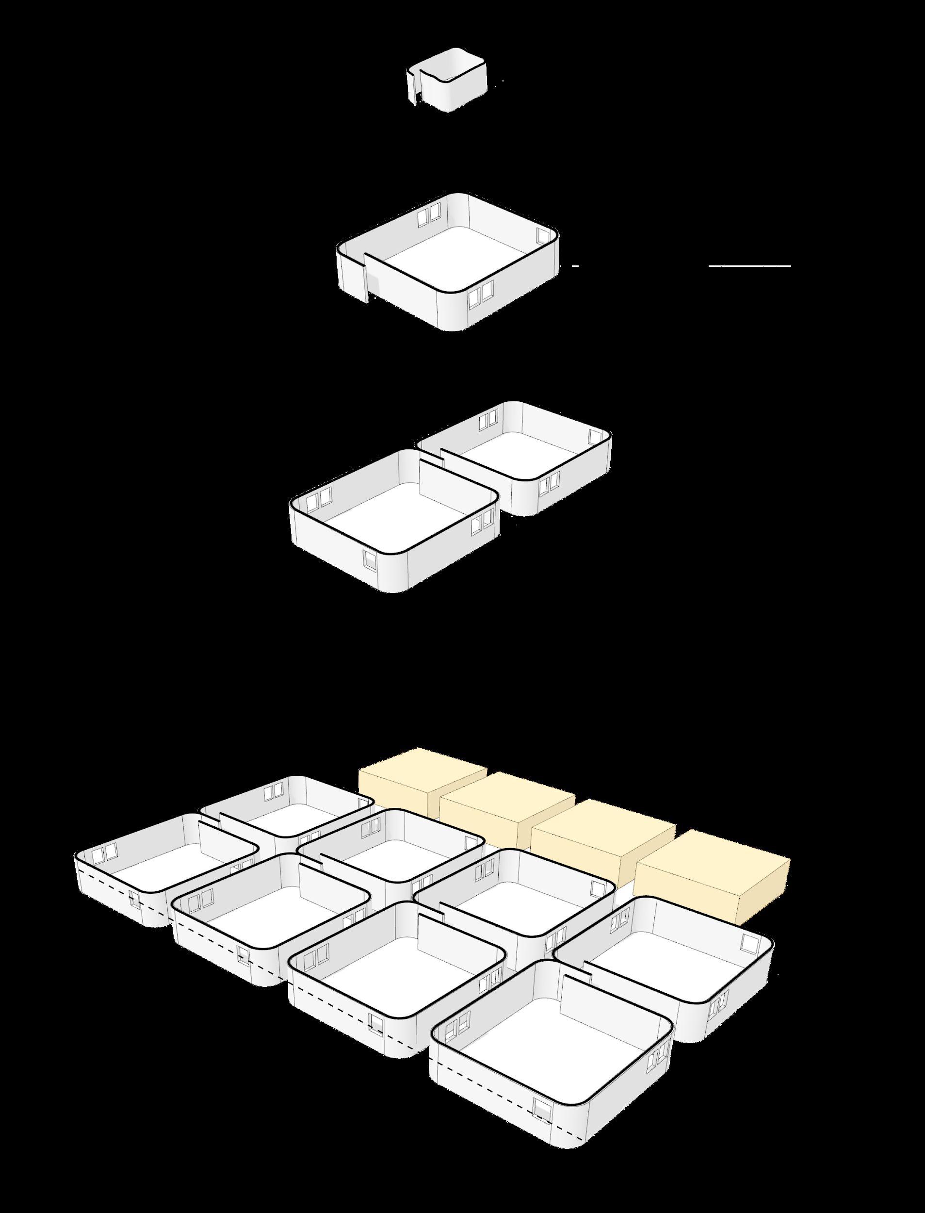
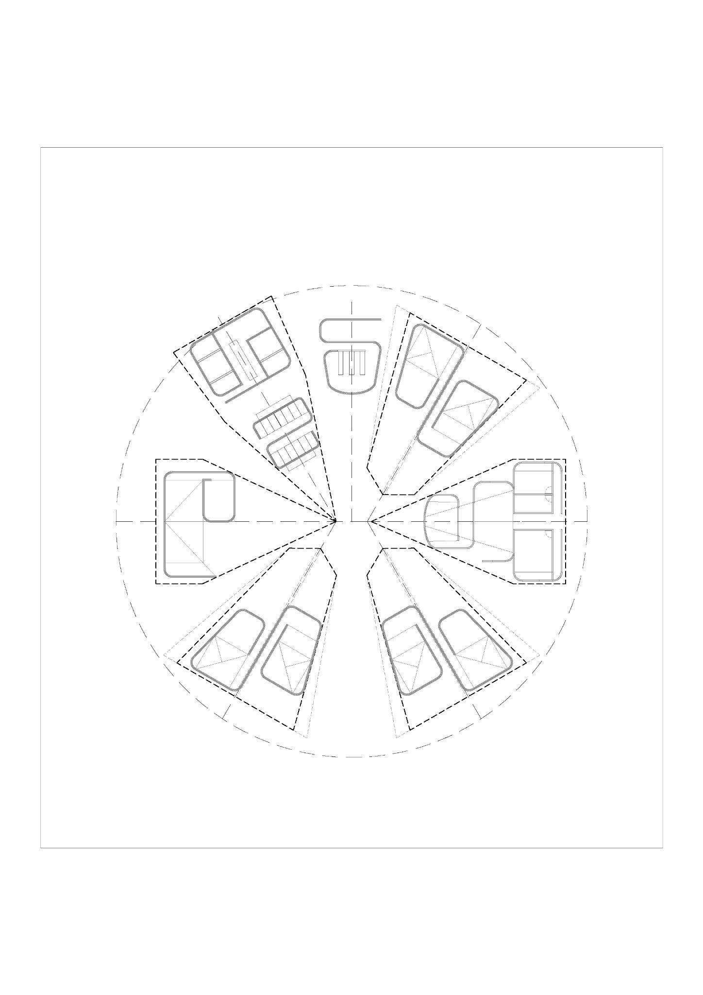
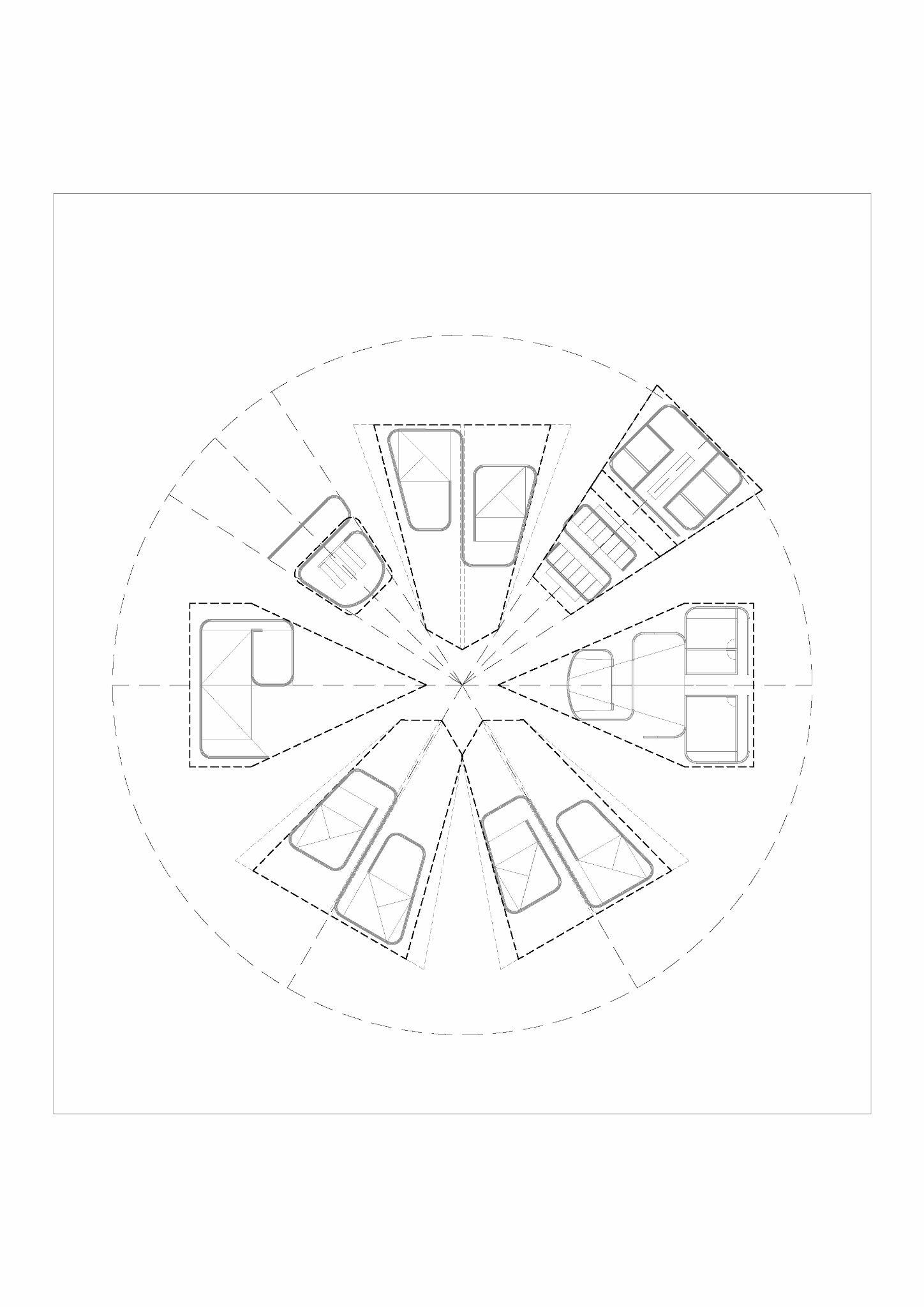
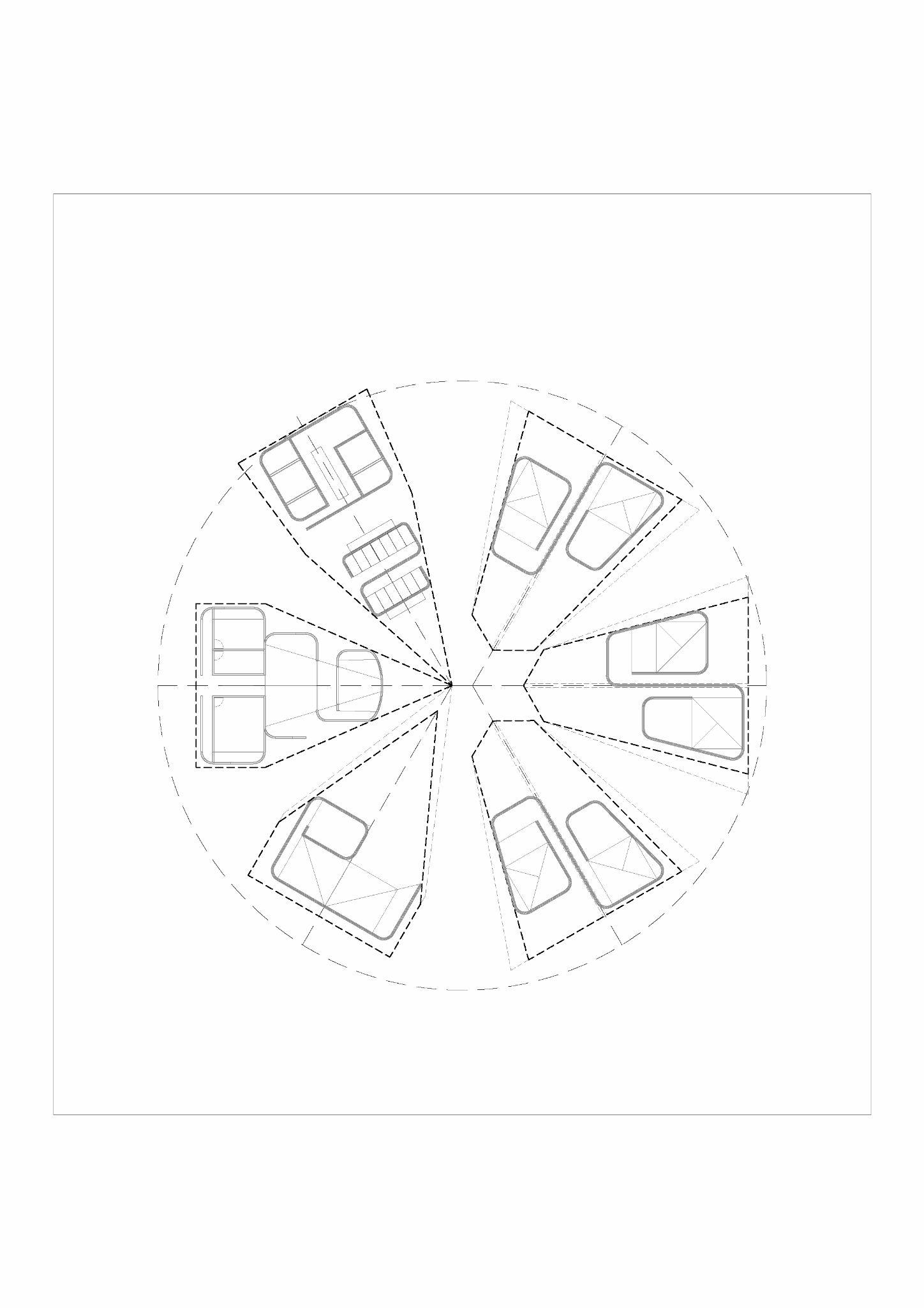
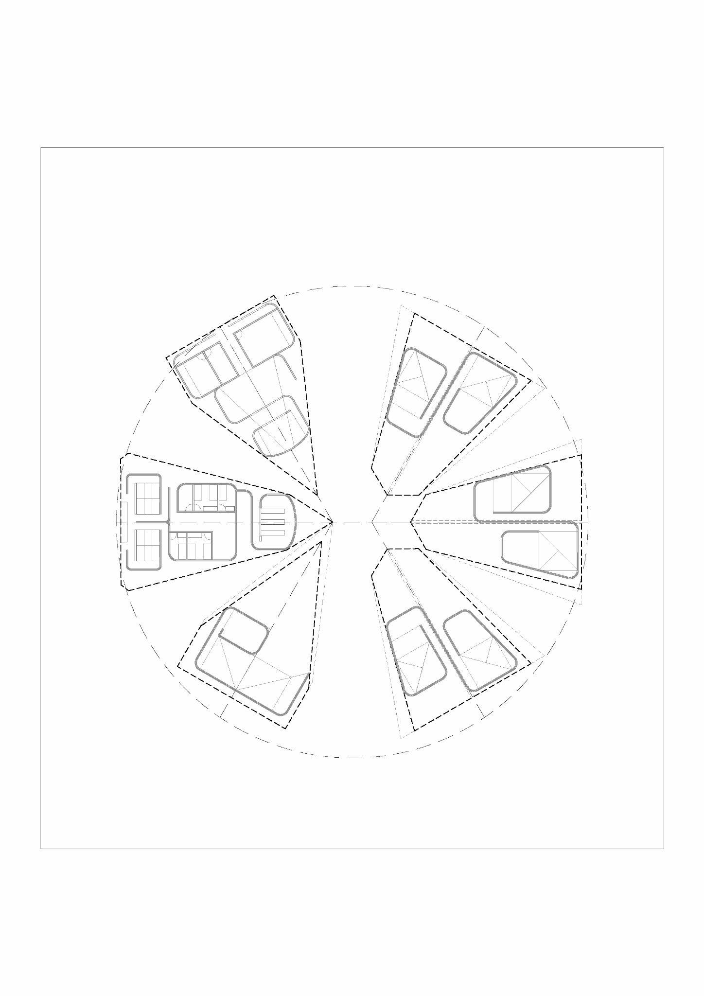
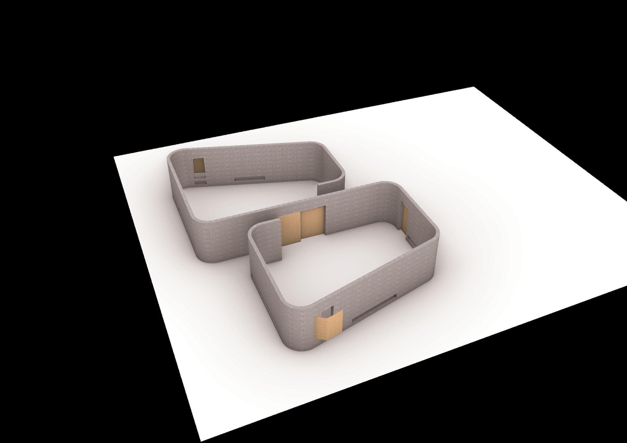
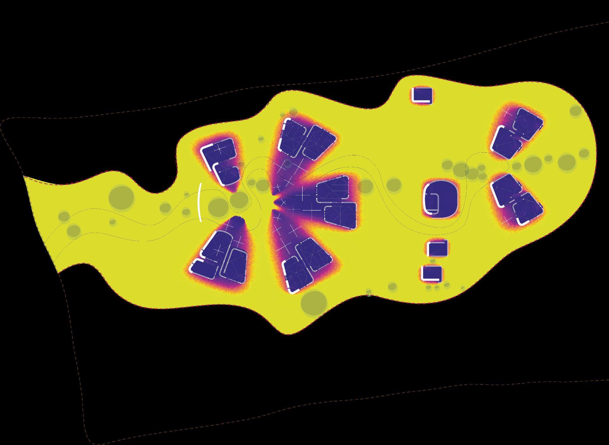
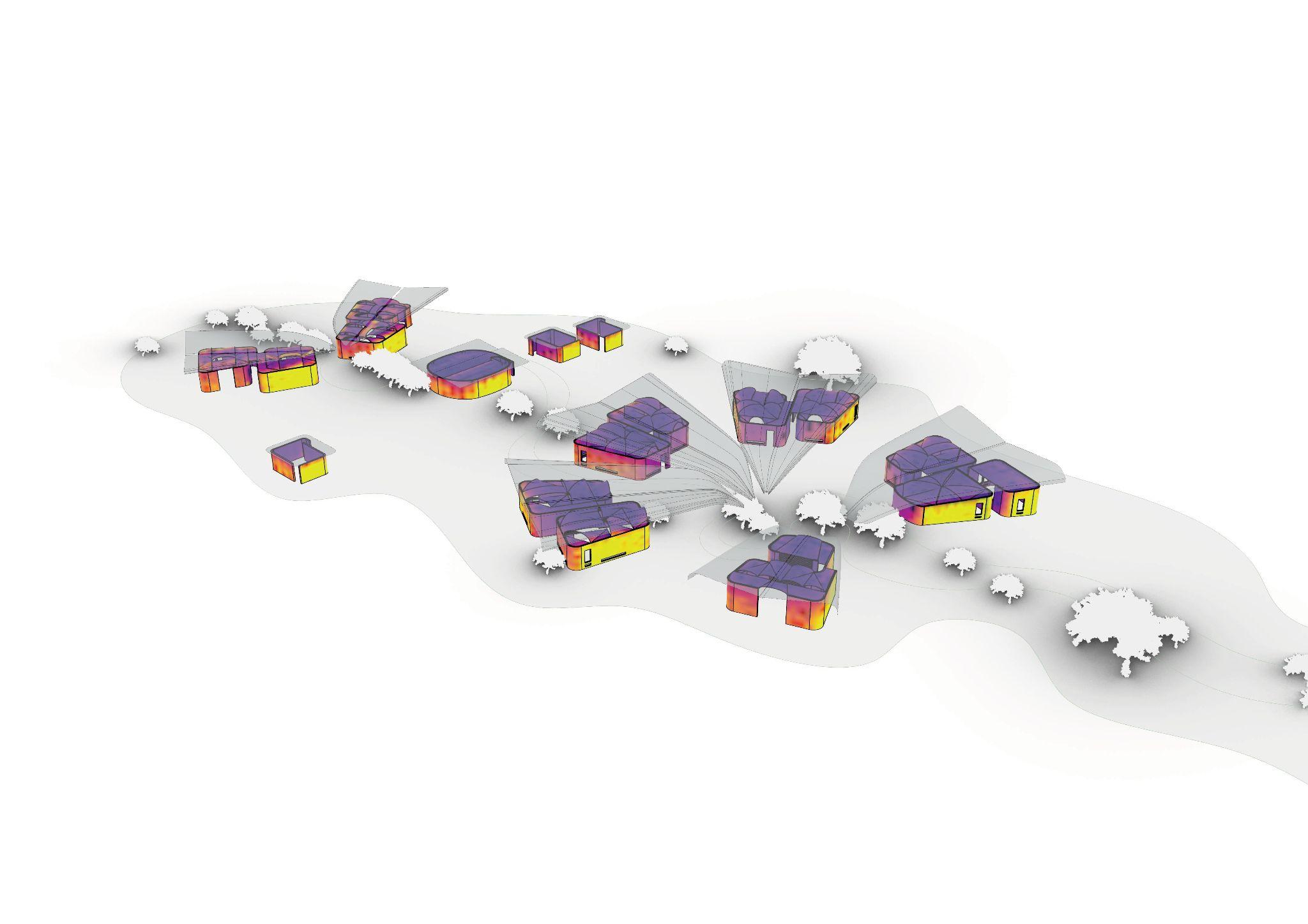
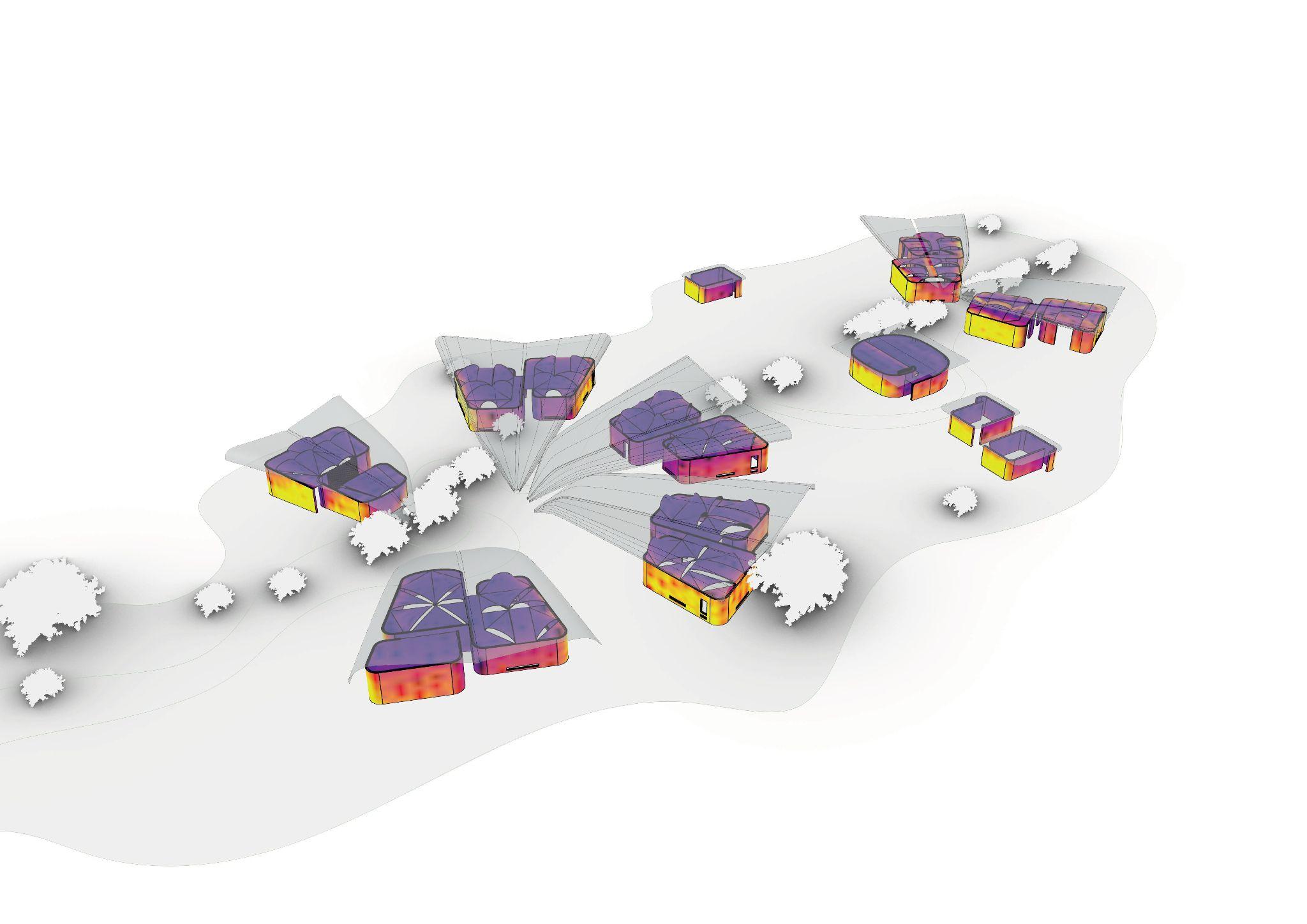
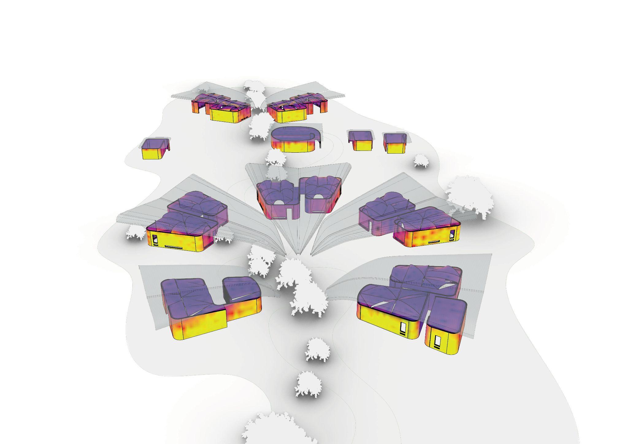
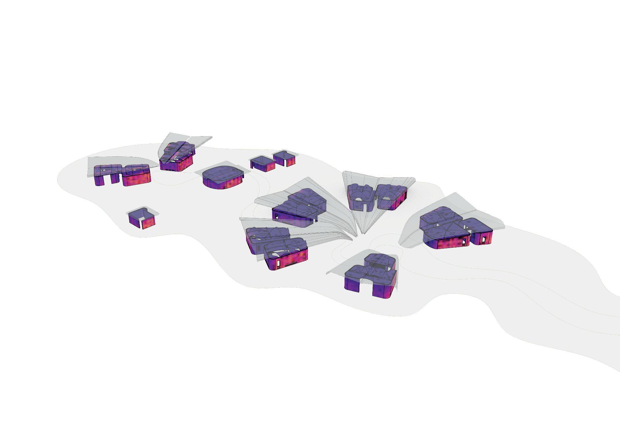
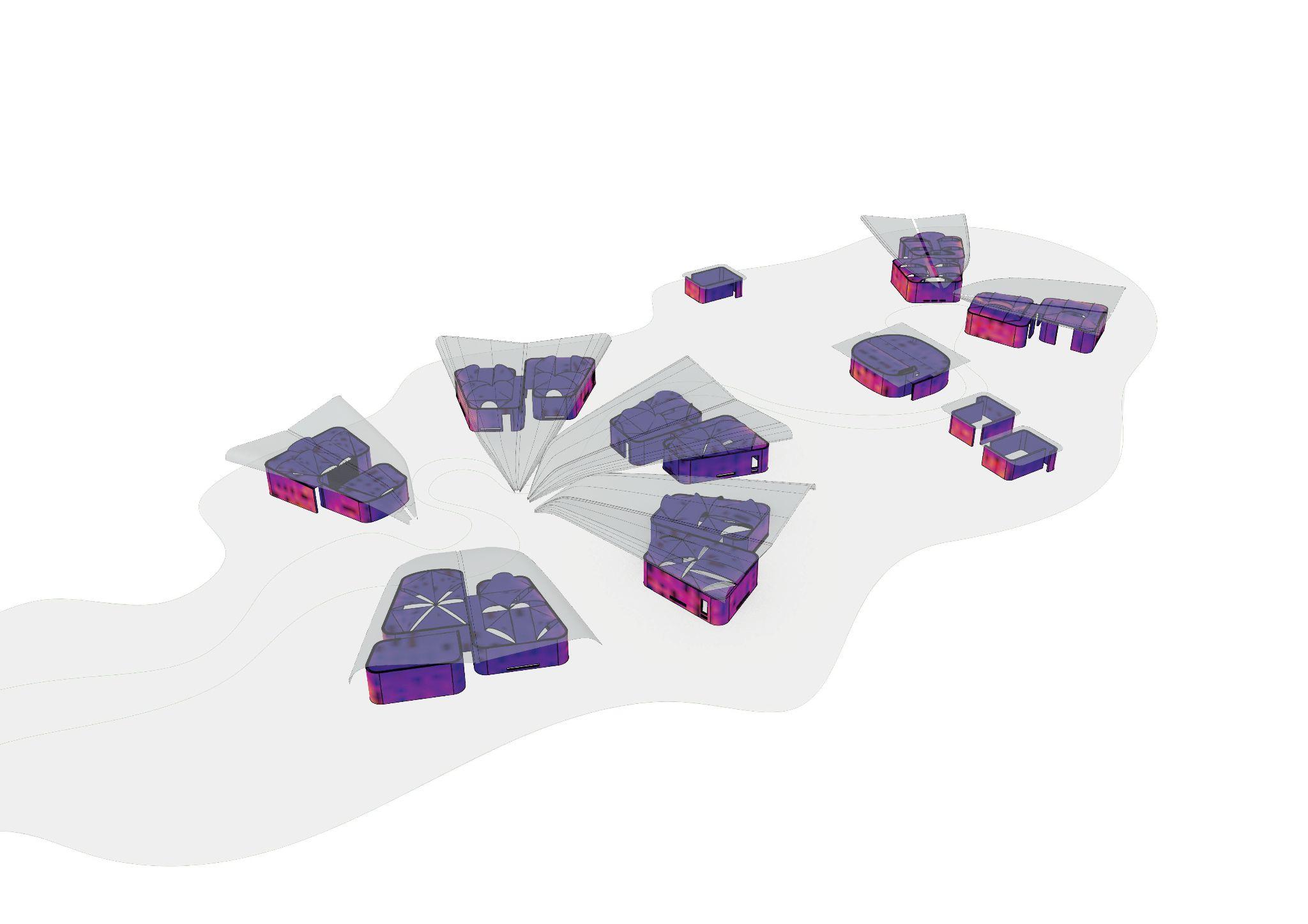
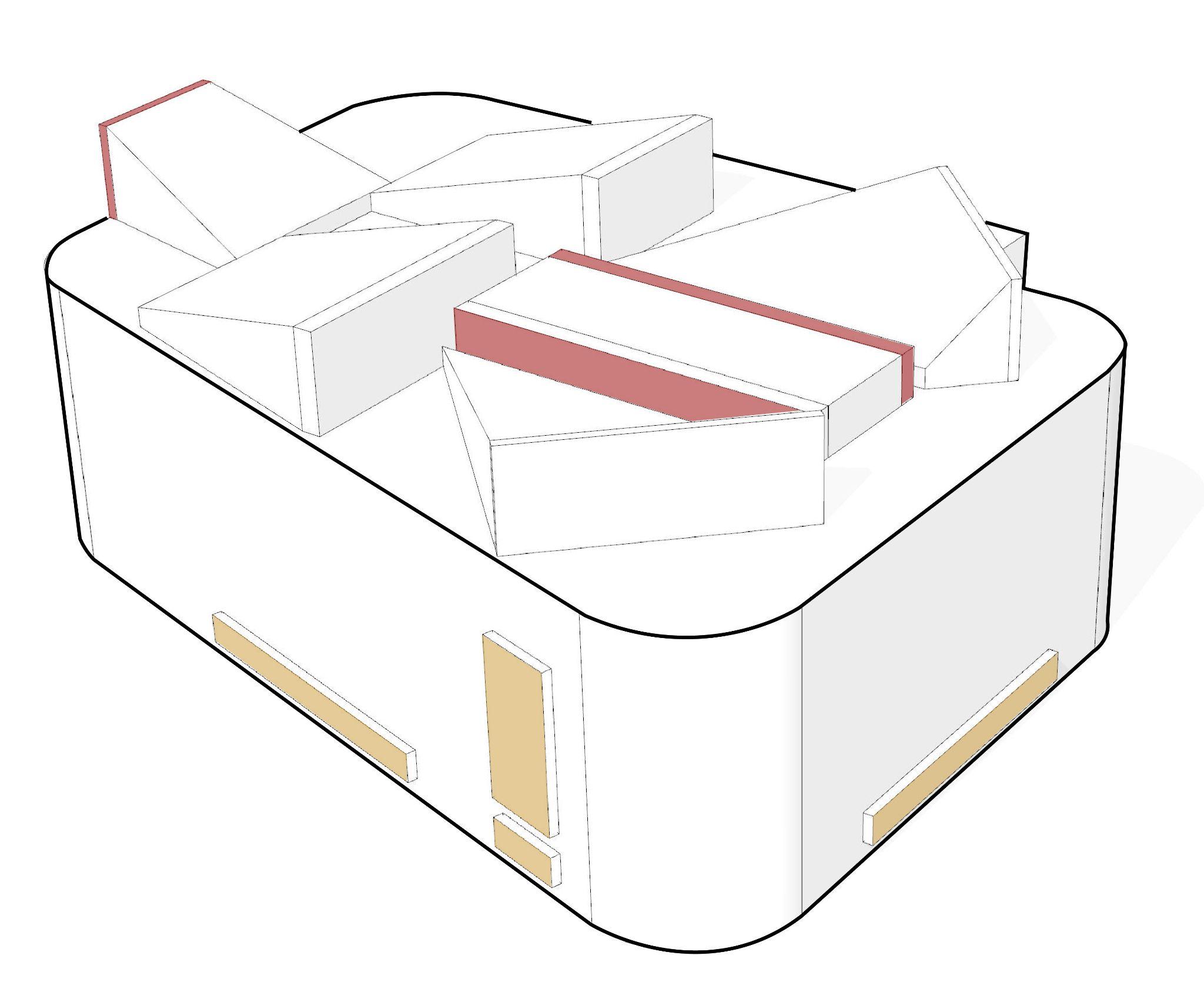
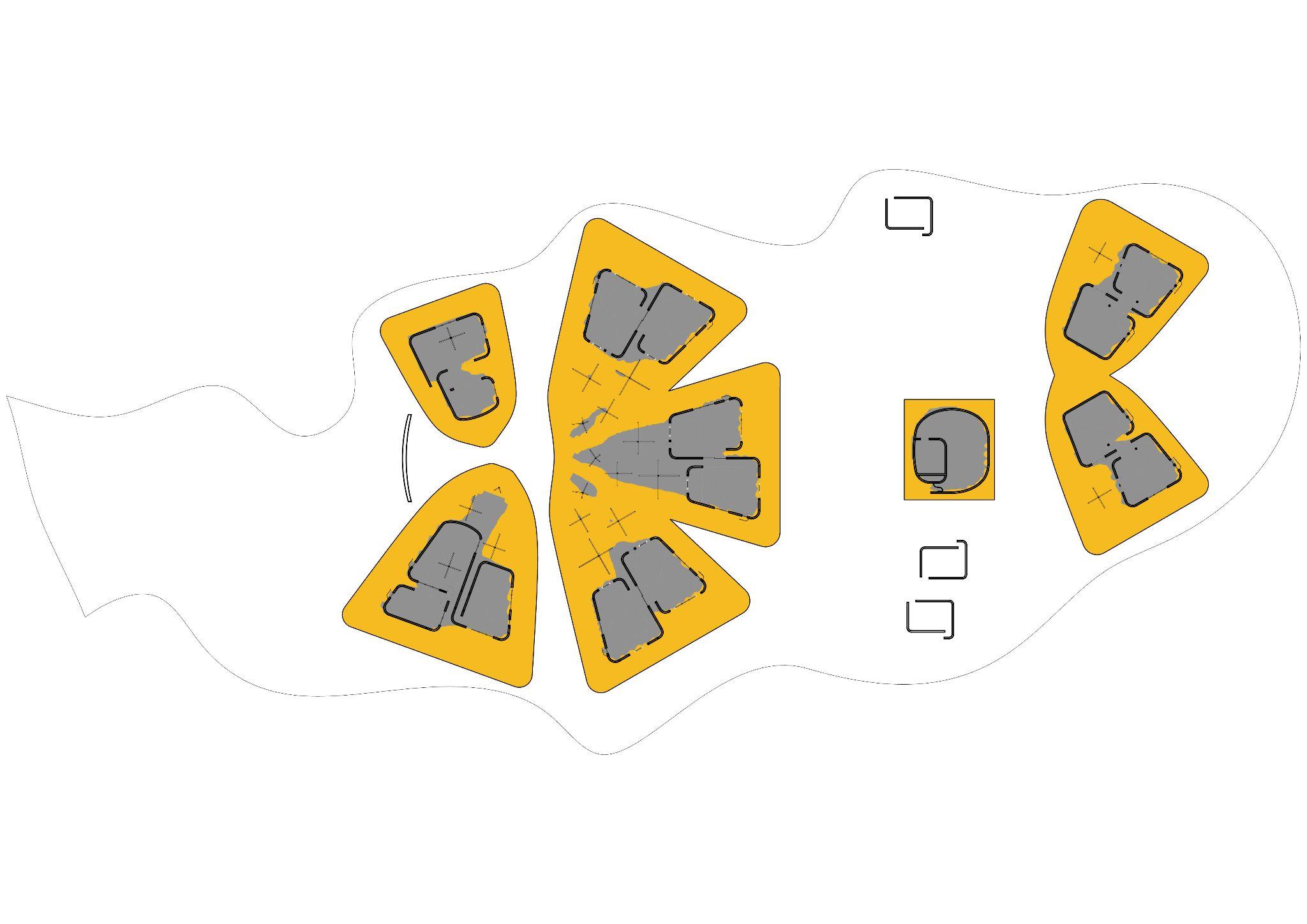
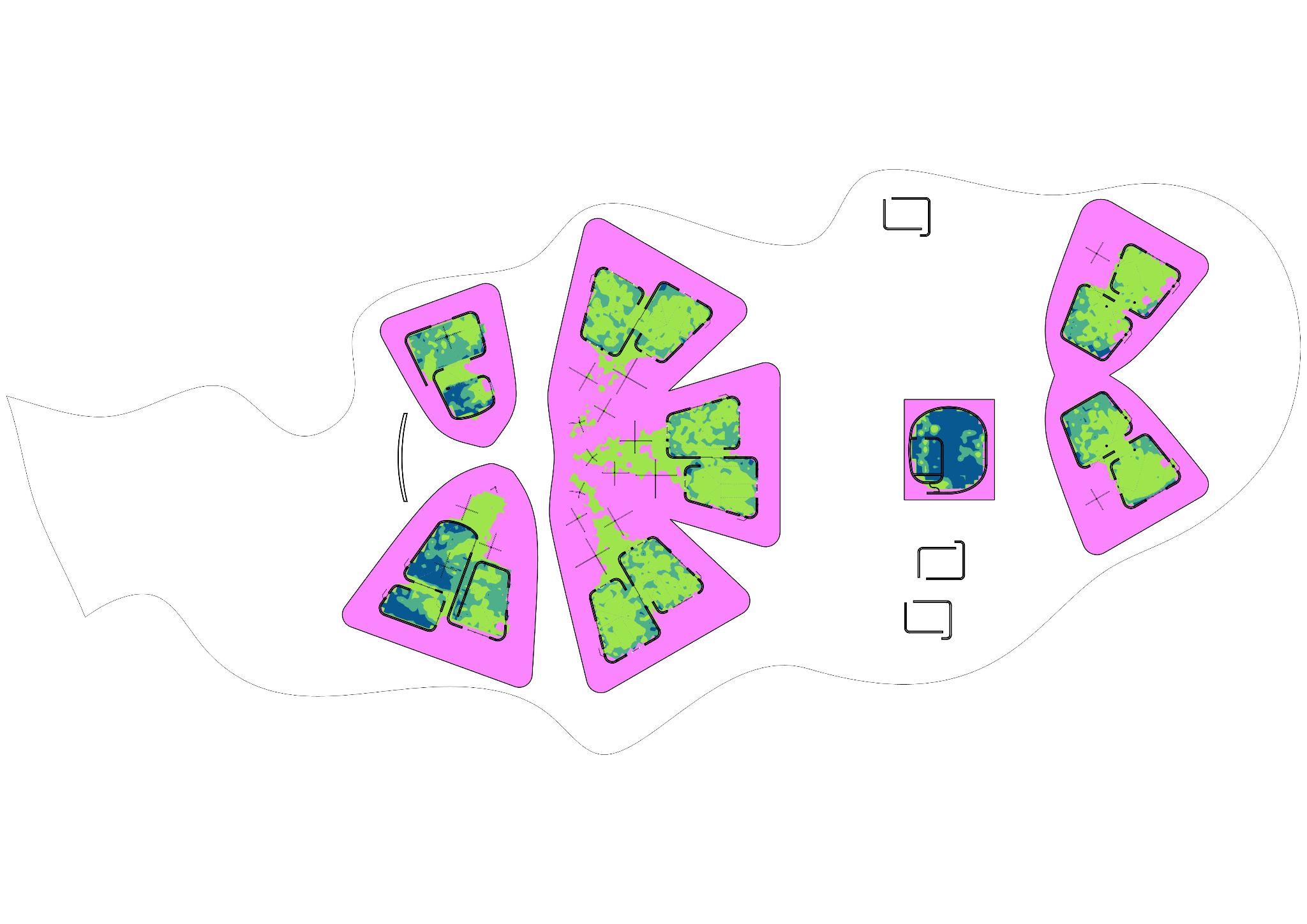
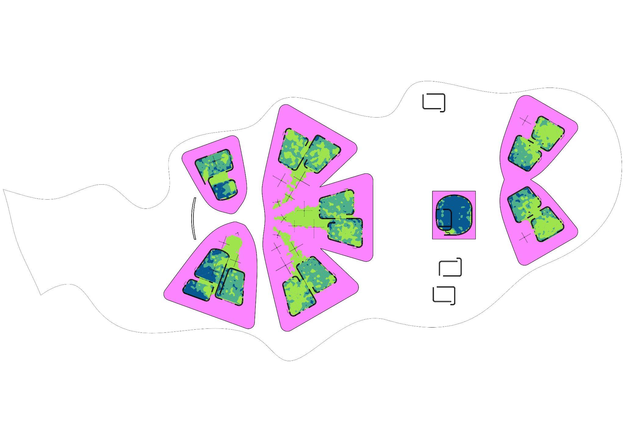
Fig 11.2.8 - Diagram of the various proposed programmes for master plan
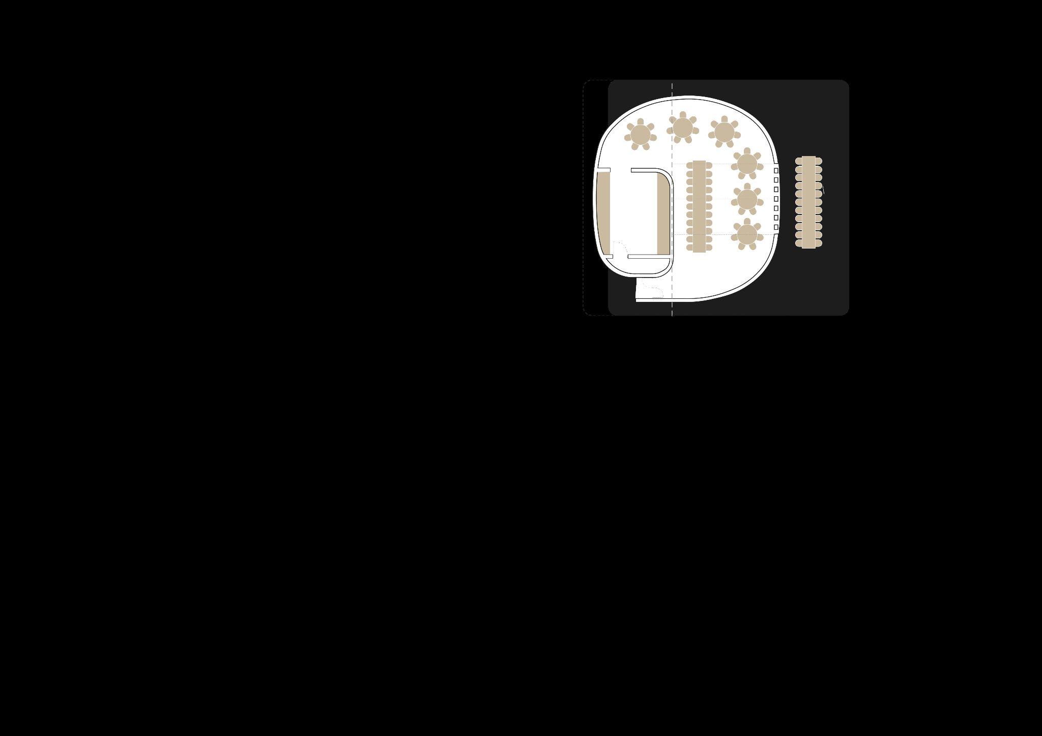
Fig 11.3.1 -Proposed plan for the Maasai hotel villas
Fig 11.3.2 - Proposed plan for the Teacher's accommodation house
Fig 11.3.3 - Proposed plan for the health centre
Fig 11.3.4 - Diagram of the location of the proposed concept plans in the master plan
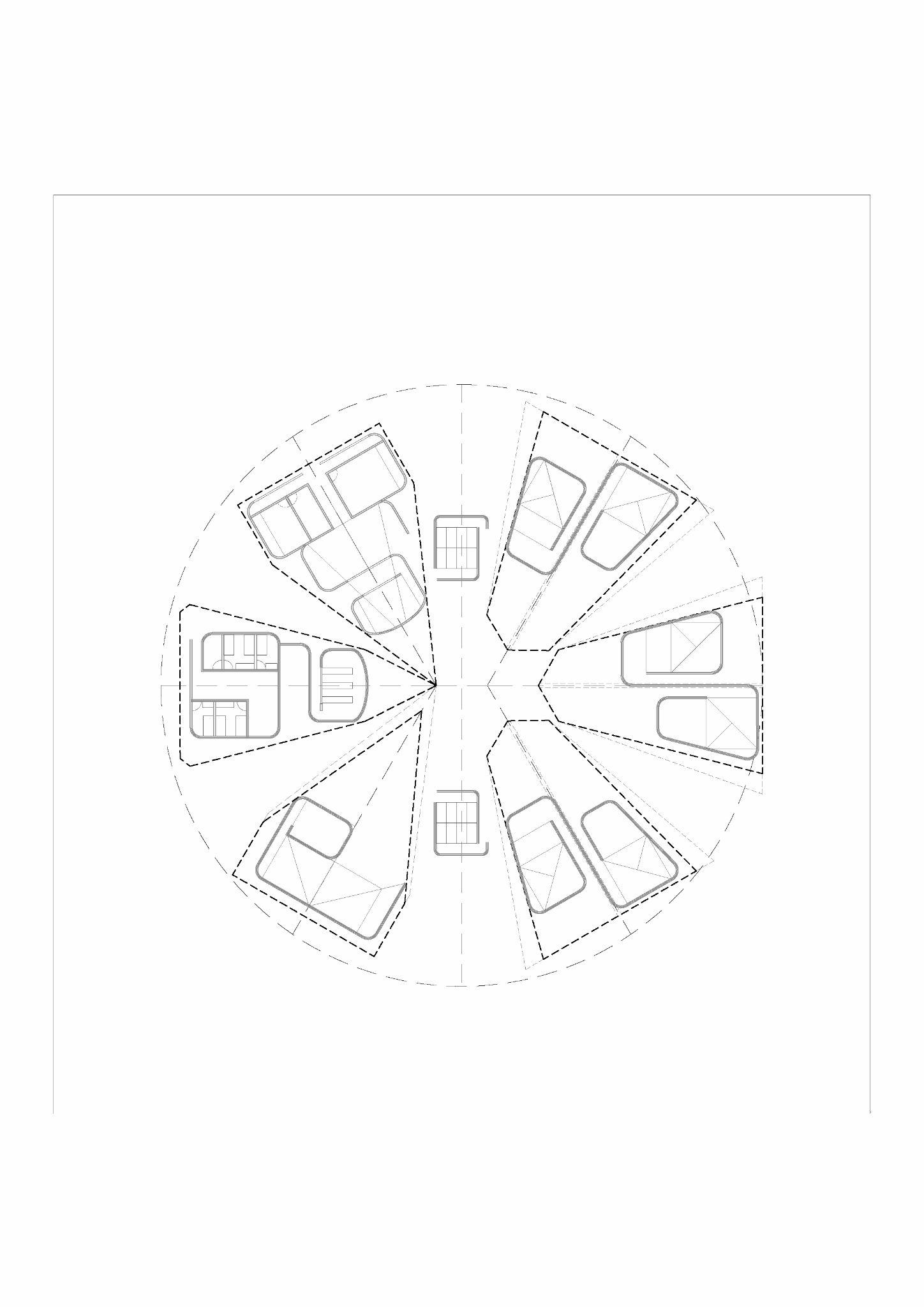
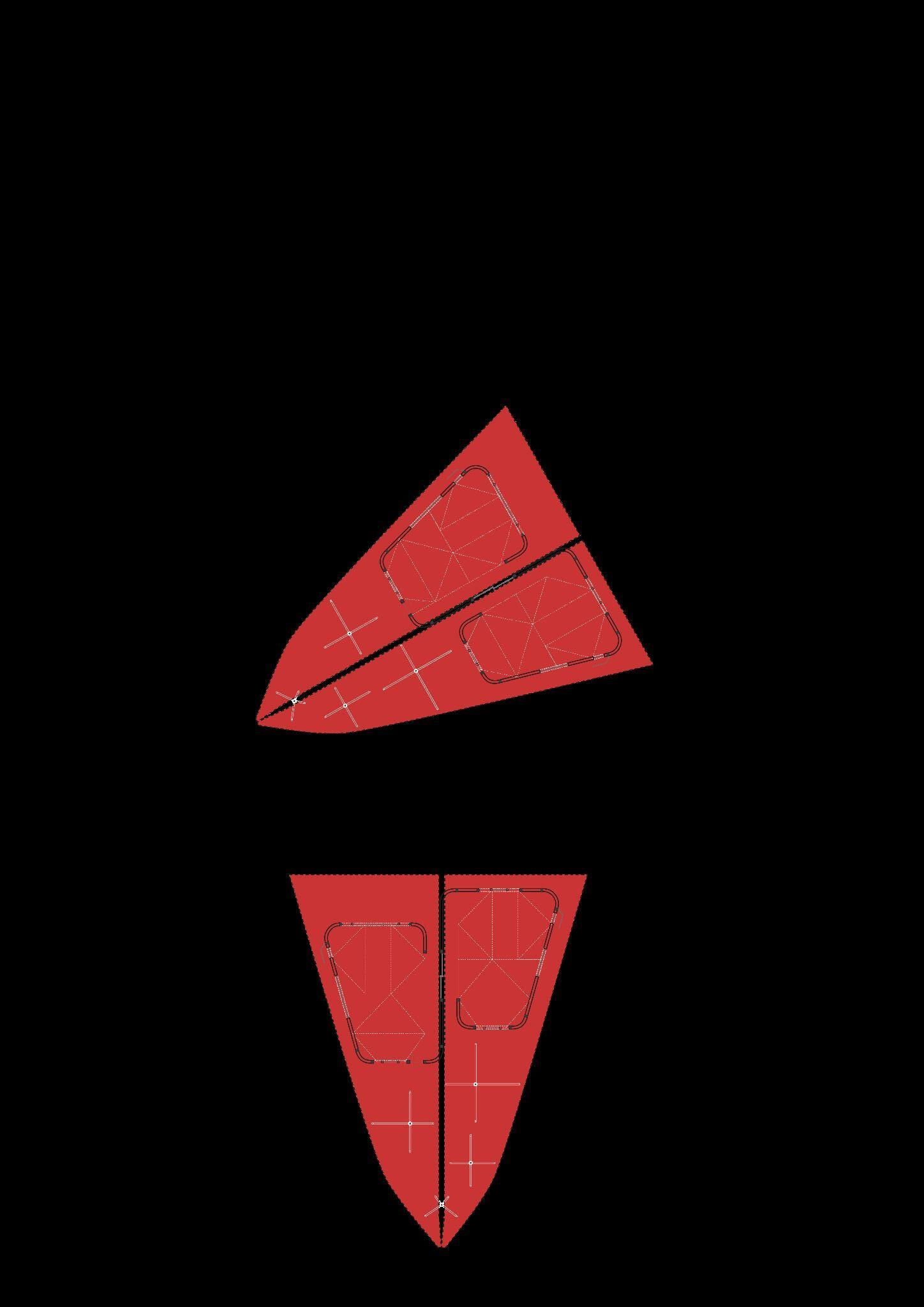
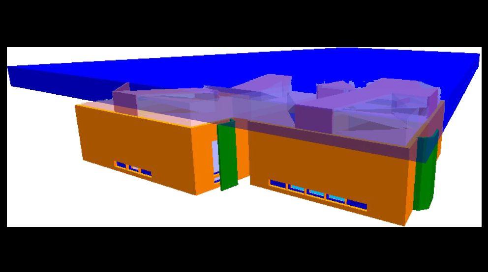
Fig 11.4.1 - Diagram of the location of the school within the overall site
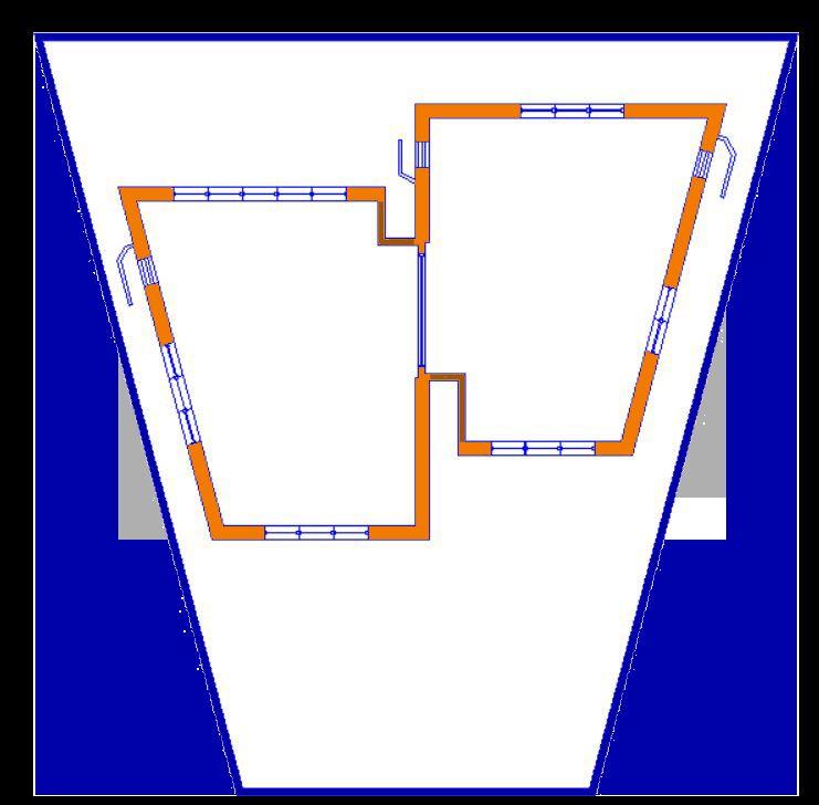
Fig 11.3.4 - Plan of the overall ISOMA´s primary and secondary school
Fig 12.1.1 - Graph of cumulative precipitation per month (mm) in 2022
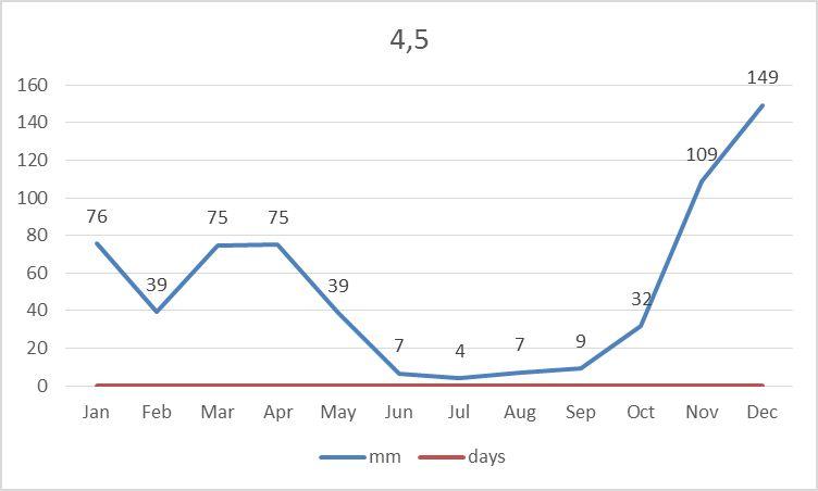
Fig 12.1.2 - Graph of cumulative precipitation per month (mm) in 2100 with RCP 4.5
Fig 12.1.3 - Graph of cumulative precipitation per month (mm) in 2100 with RCP 8.5
Fig 12.1.4 - Diagram of proposed water source
Fig 12.1.5 - Reference of the current recollection of water
Fig 12.1.6 - Diagram of the proposed water recollection results
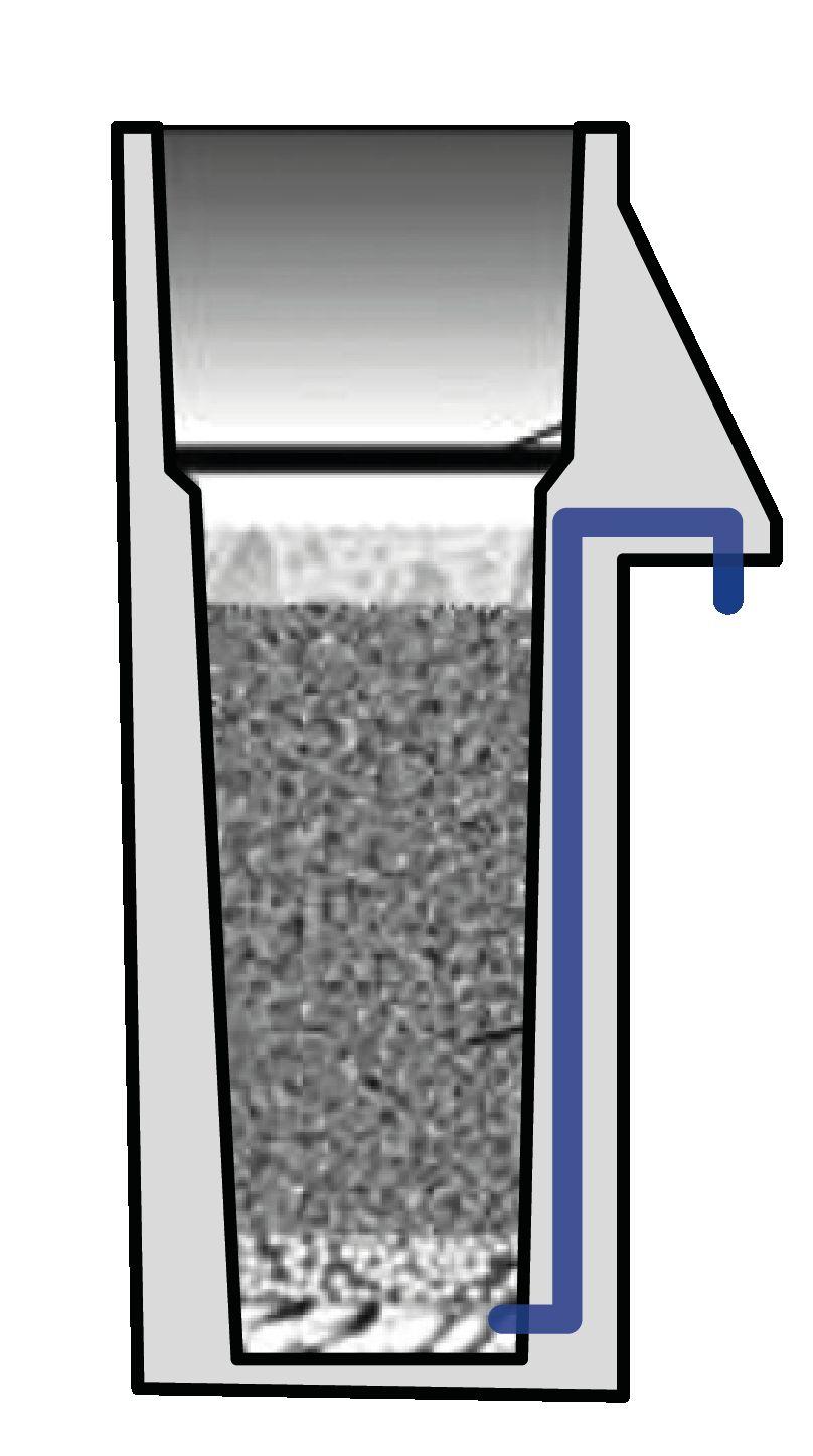
Fig 12.2.1 - Diagram of the proposed rainwater harvesting system
Fig 12.2.2 - Images of examples of filters to filter water
Fig 12.2.3 - Example of water treatment solution (Islas Espinoza, M., 2014)
Fig 12.2.4 - DIagram of first flush systems
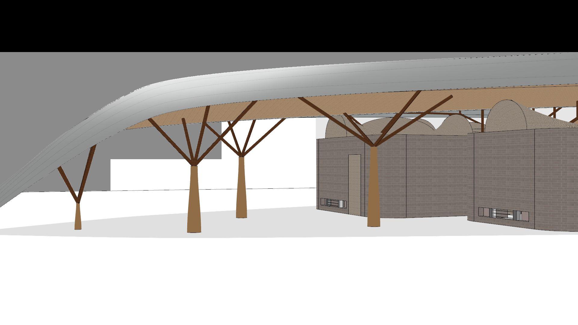
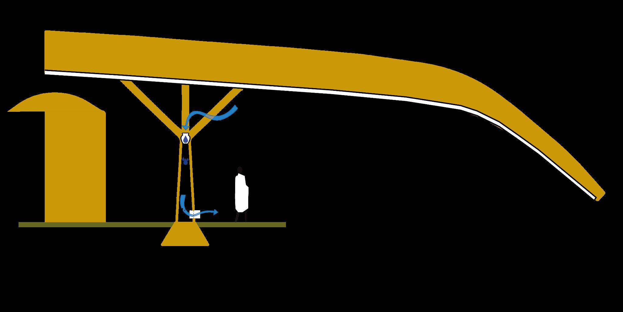
Fig 12.3.1 - Reference of posible location of evaporative cooling system
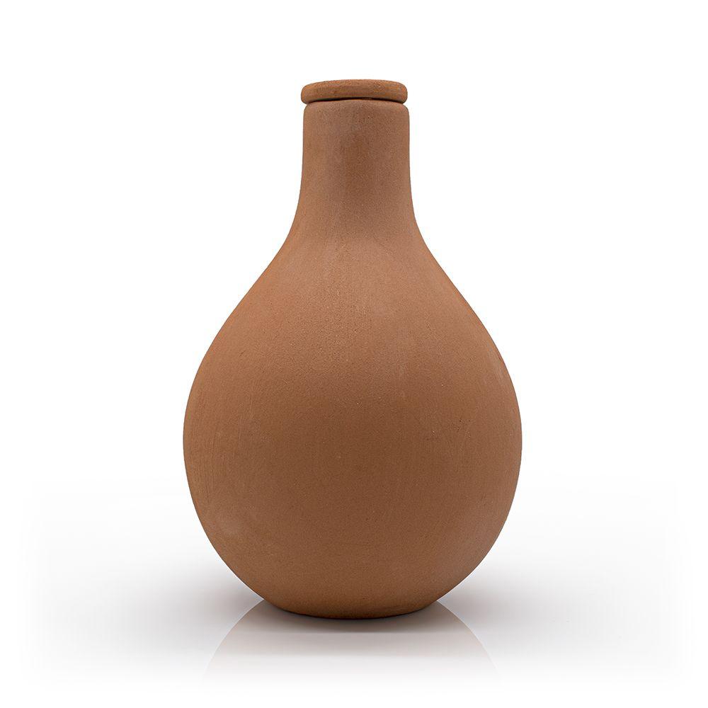
Fig 12.3.2 - Reference of a clay pot (Chimney sheep)
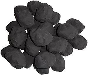
Fig 12.3.3 - Reference charcoal (Amazon)
Fig 12.3.4 - Diagram of evaporative cooling system
Fig 13.0.1 - Diagram of chapter´s overview
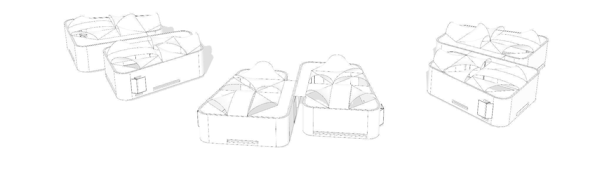
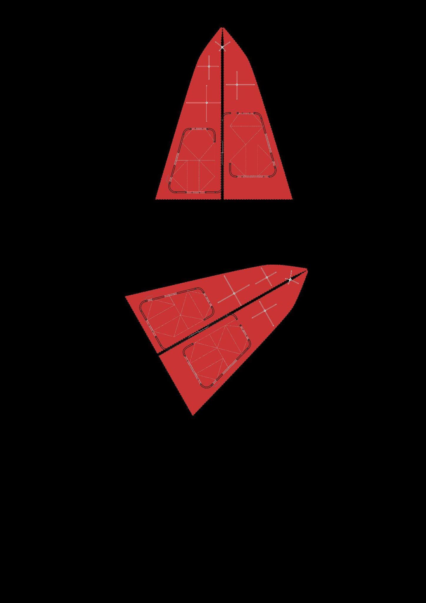
Fig 13.1.1.1 - Elevation and plan of the vernacular Maasai house
Fig 13.1.1.2 - Geometry of the vernacular Maasai house
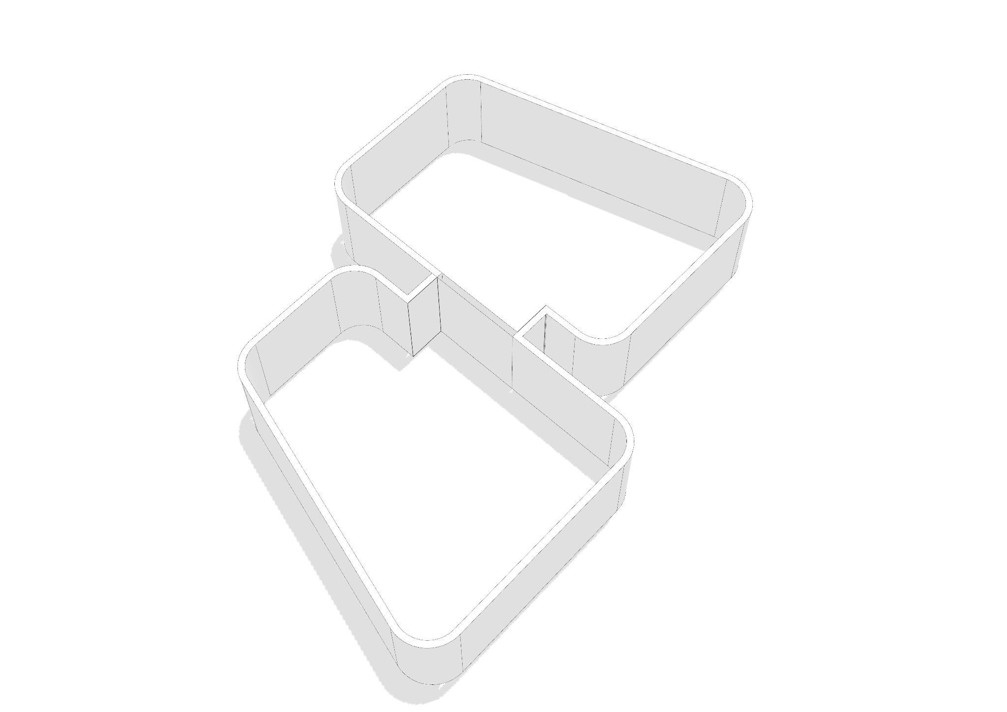
Fig 13.1.1.3 - DImensions and geometry of the proposed classroom
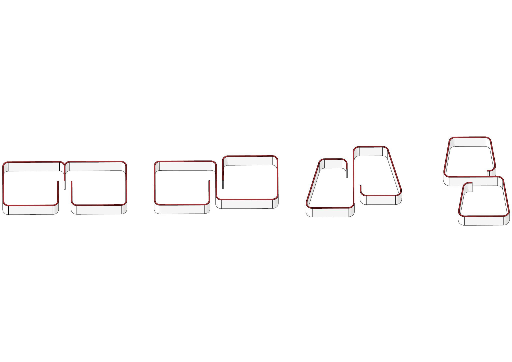
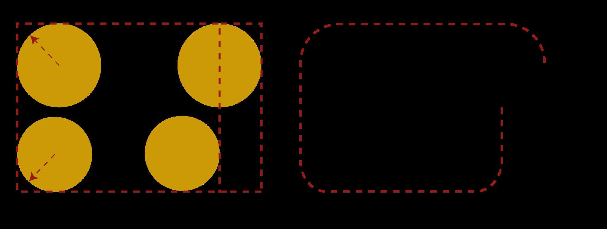
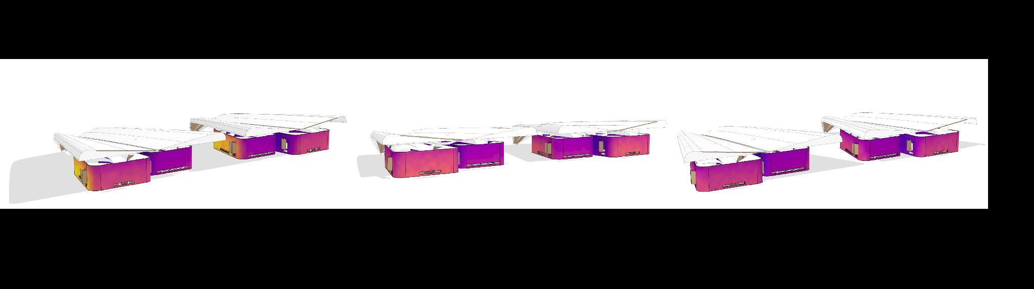
Fig 13.1.1.4 - Sequence of volumetric diagrams exploring connection between units
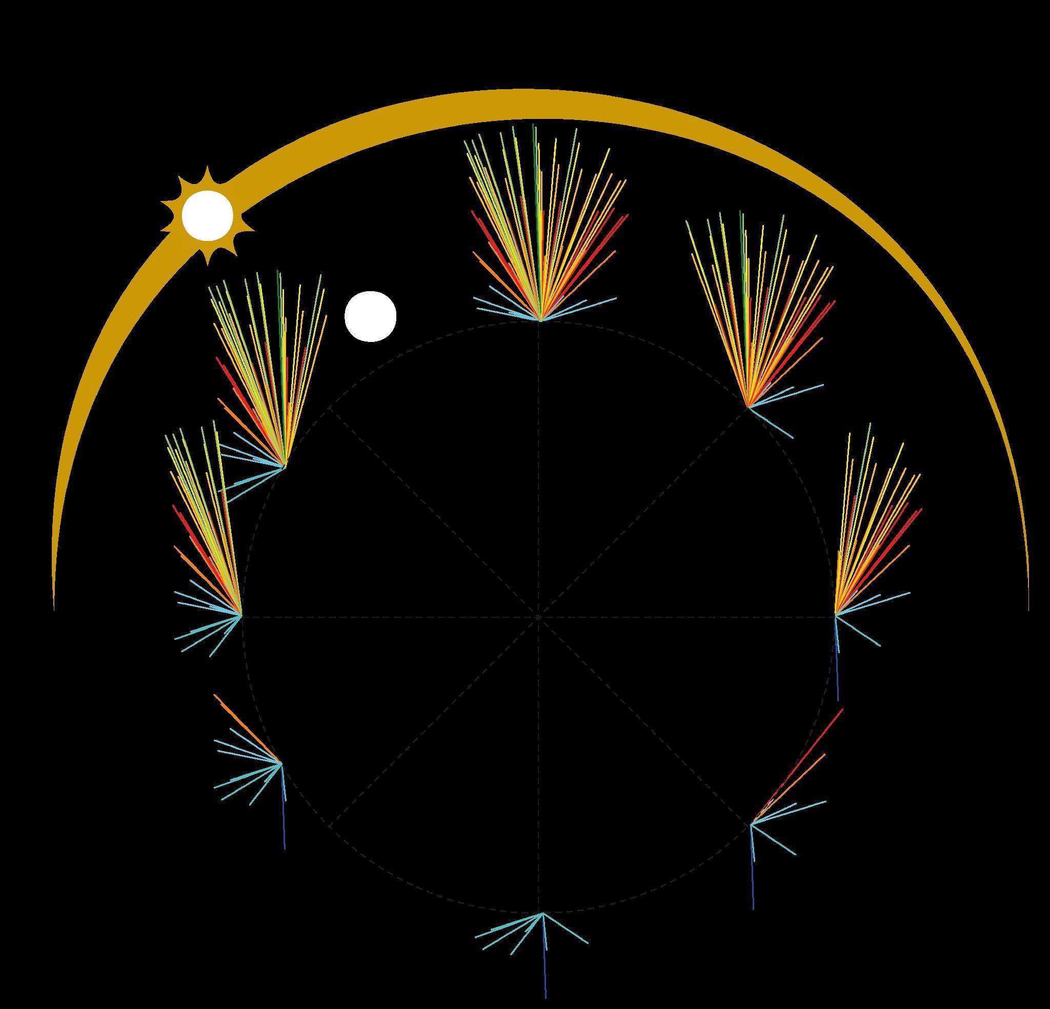
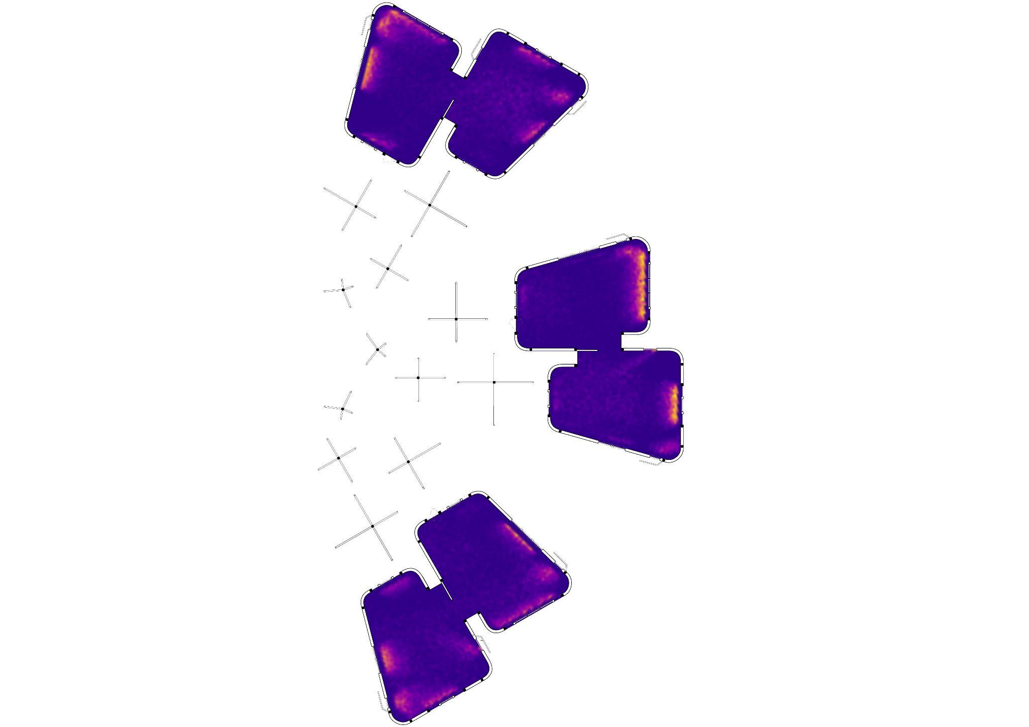
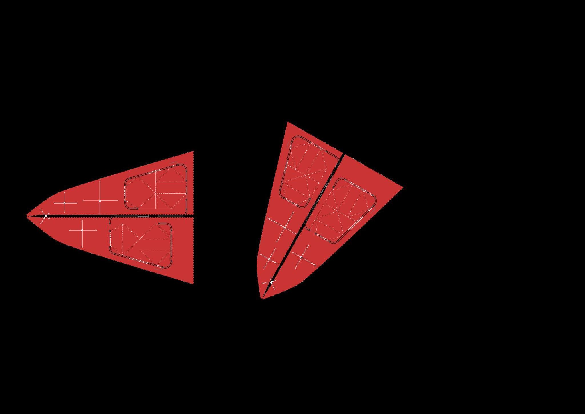
Fig 13.1.2.1 - Diagram of the previous sun ray analysis in a Boma
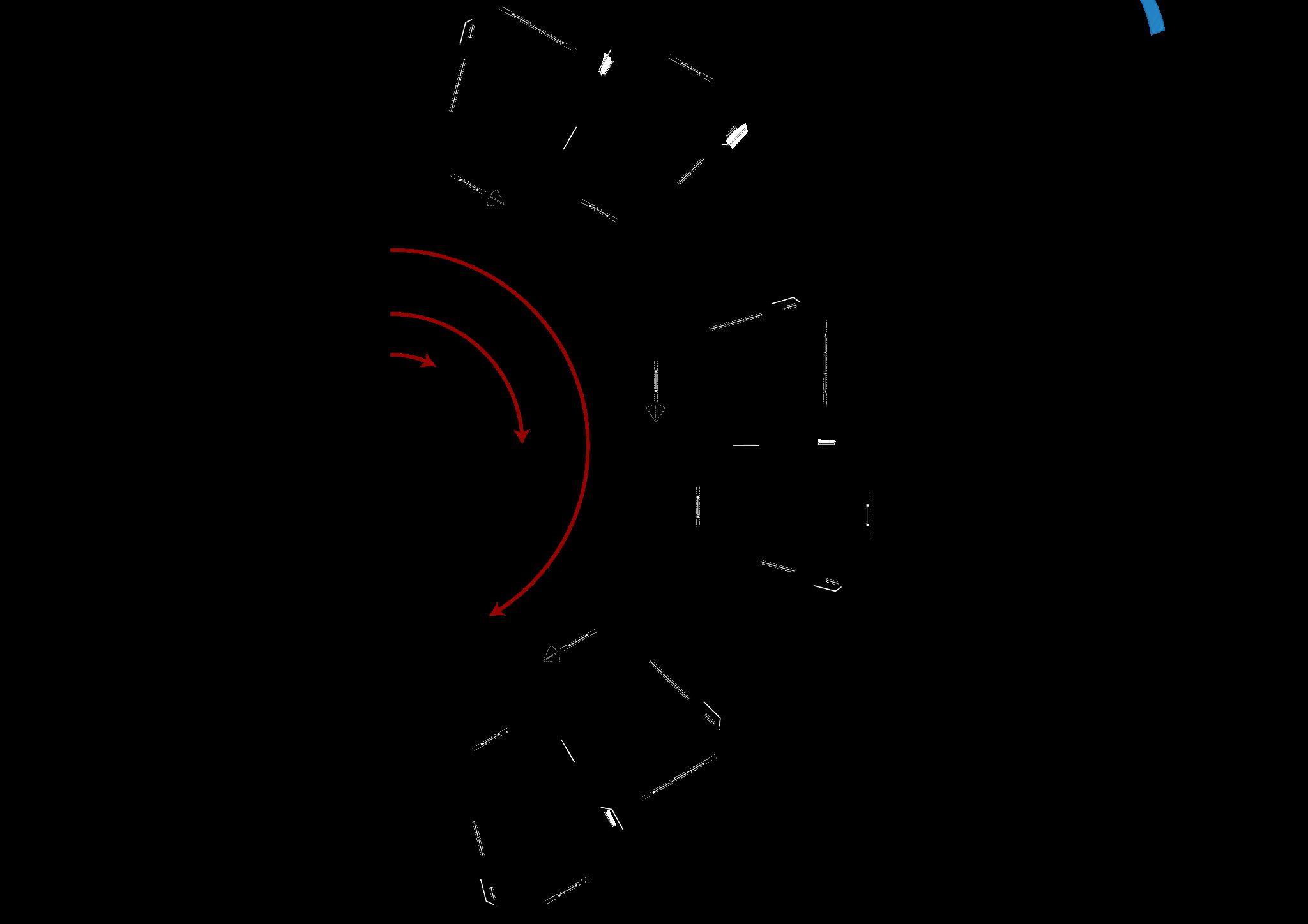
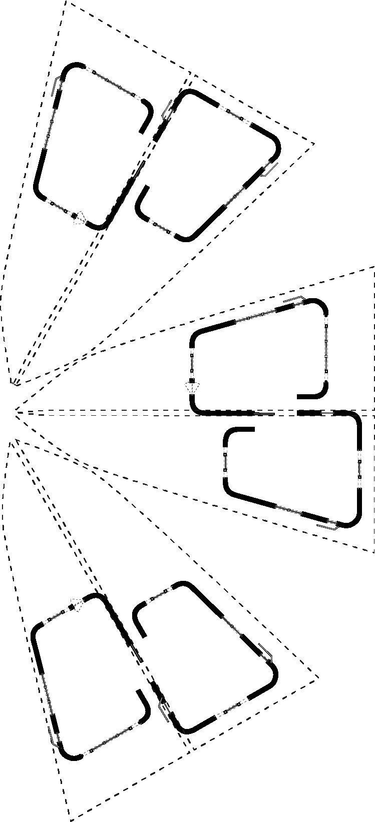
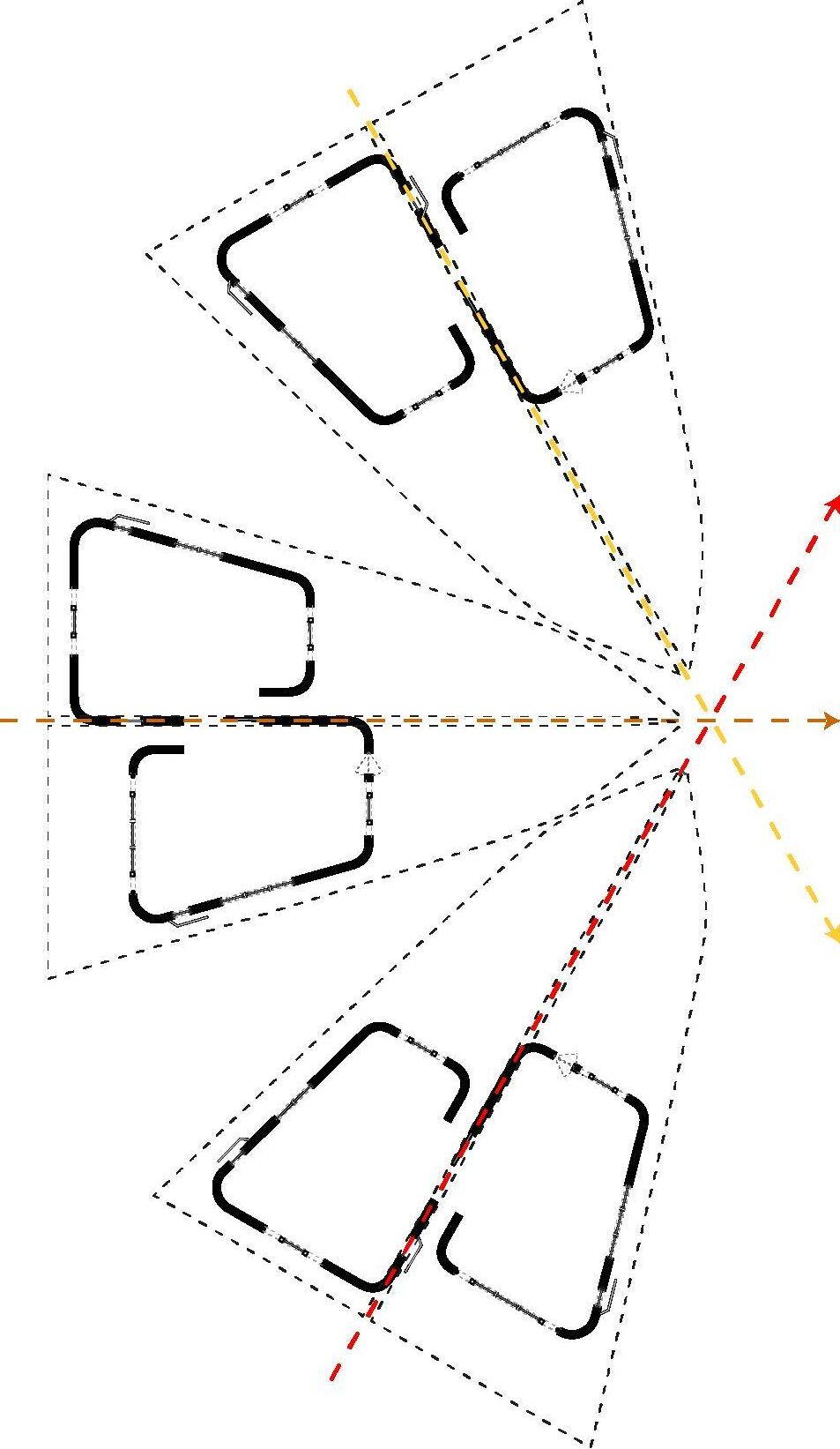
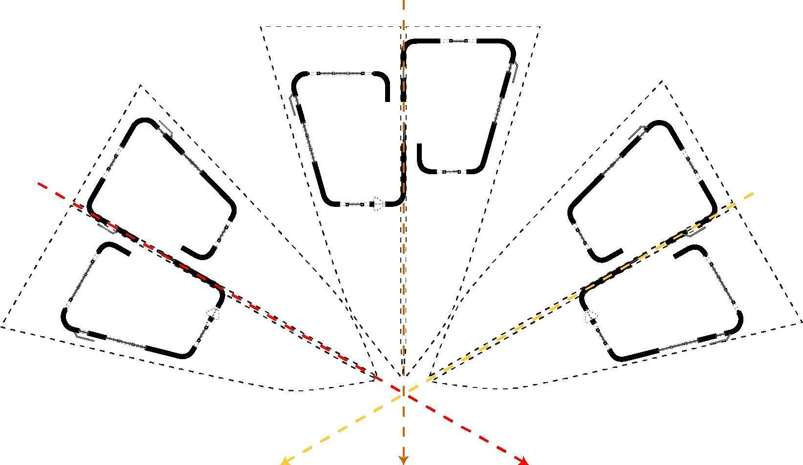
Fig 13.1.2.2 - Diagrams exploring the optimal orientation of the various school programmes
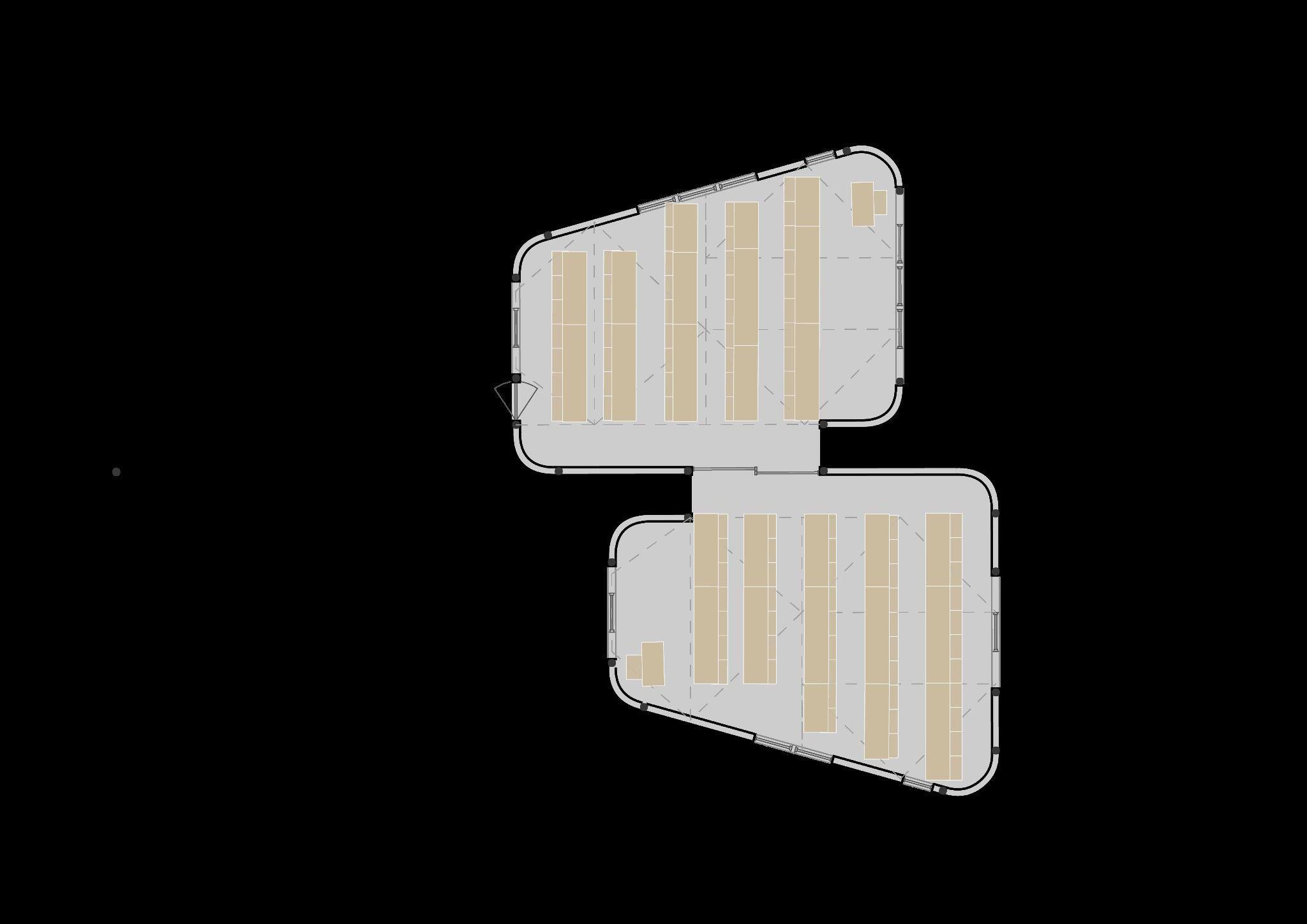
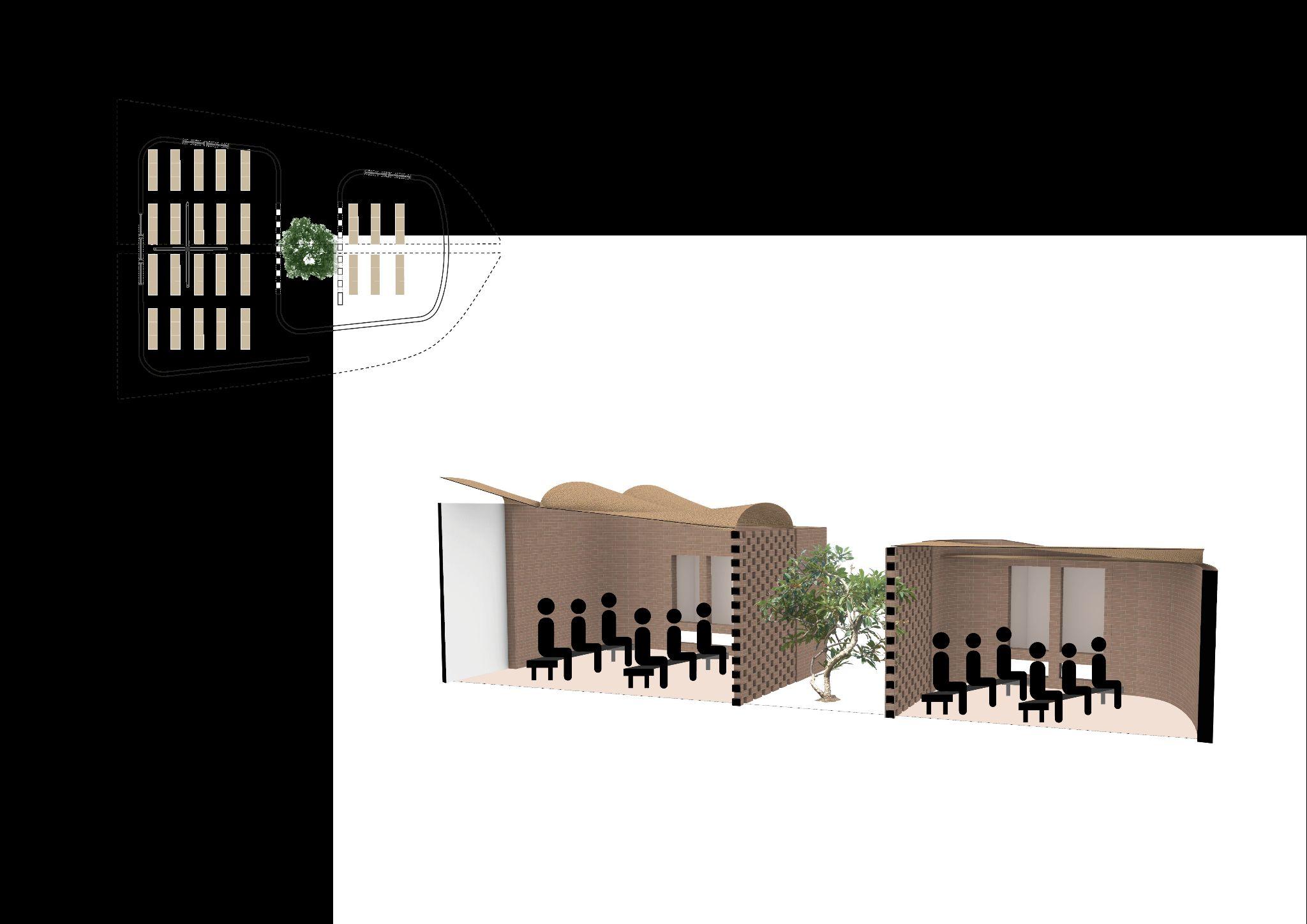
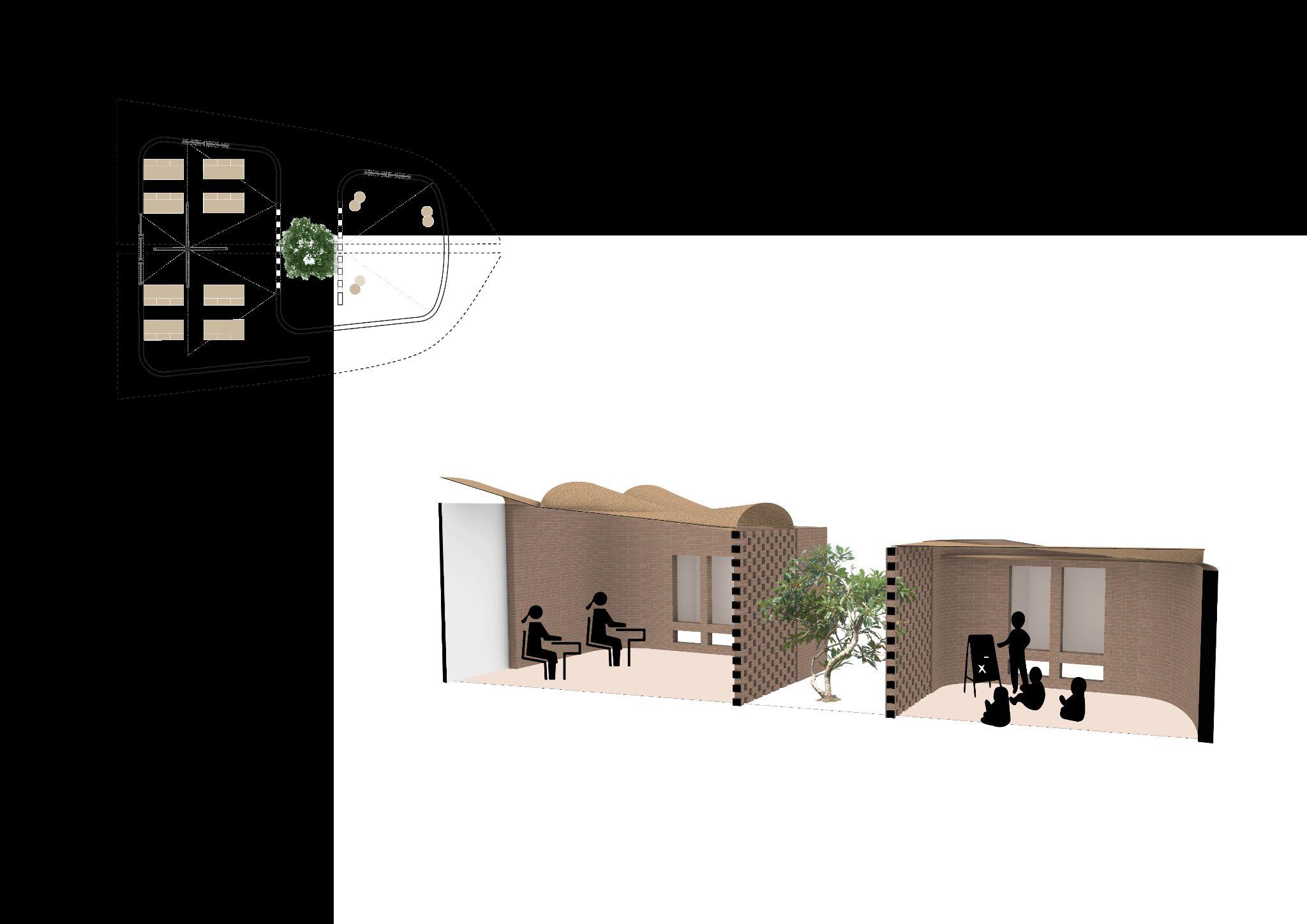
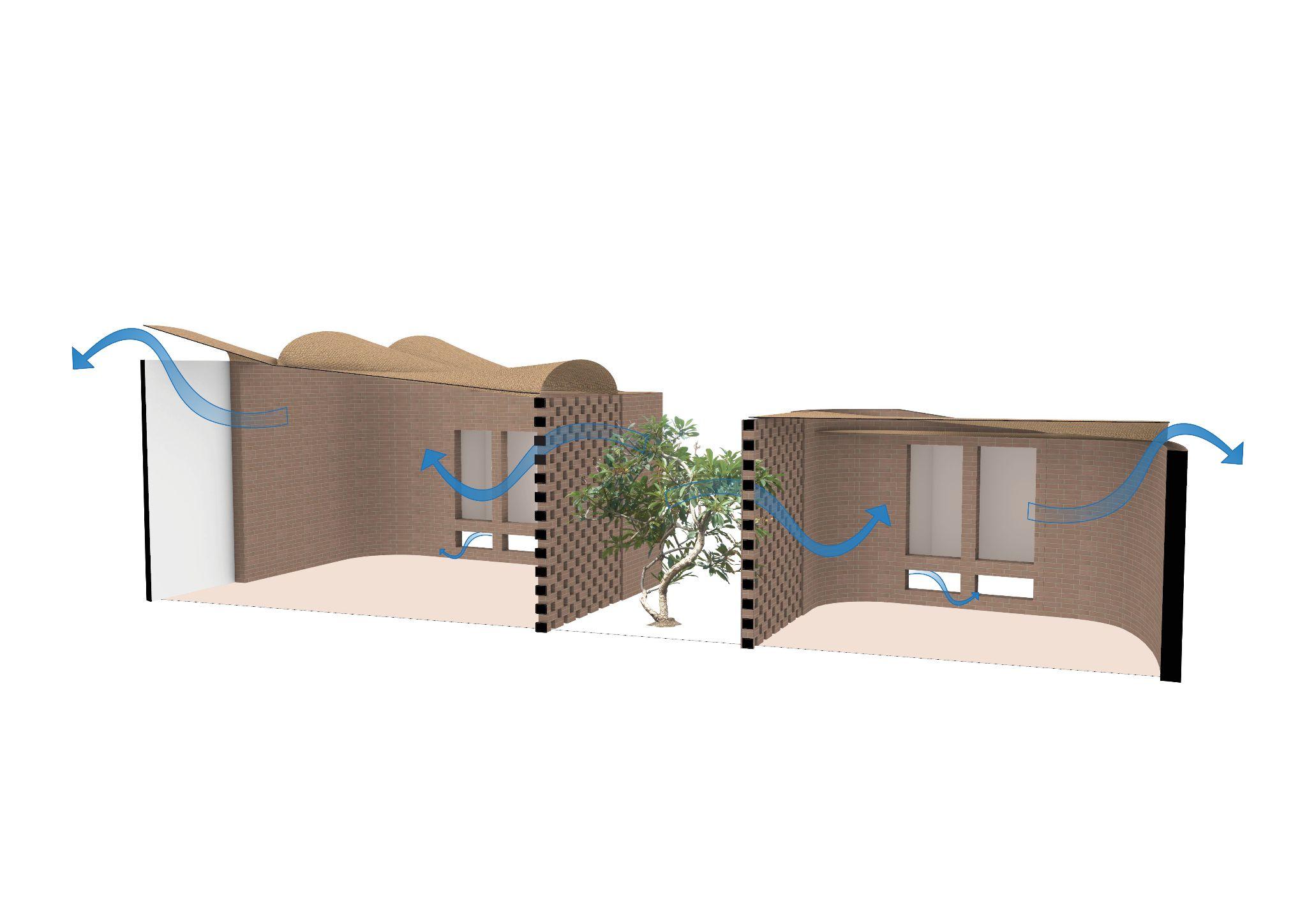
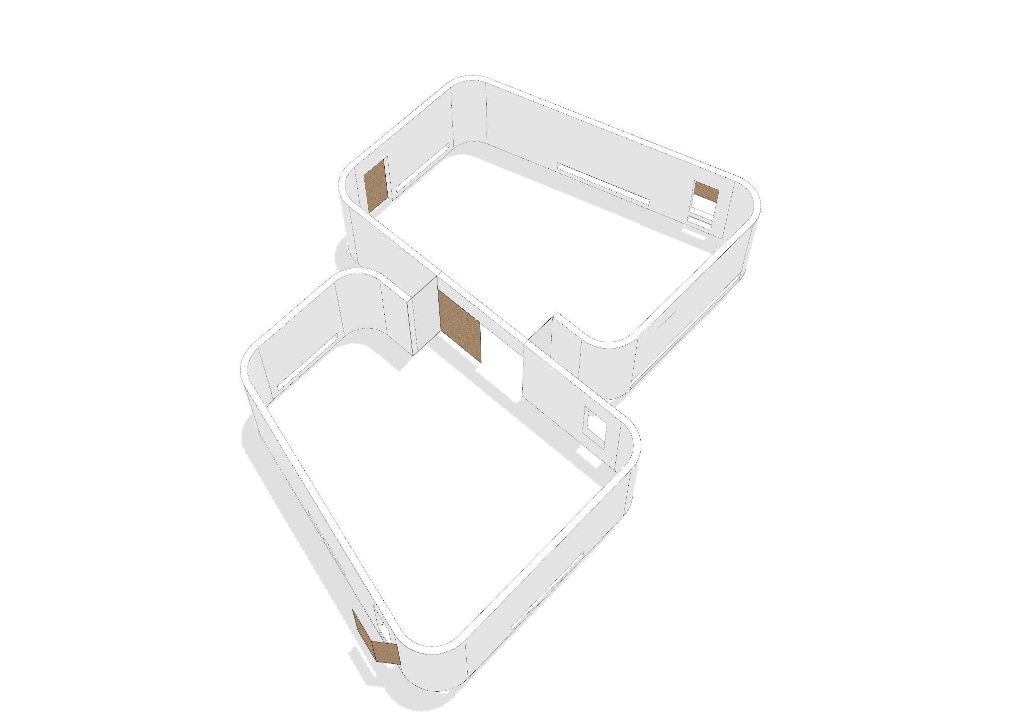
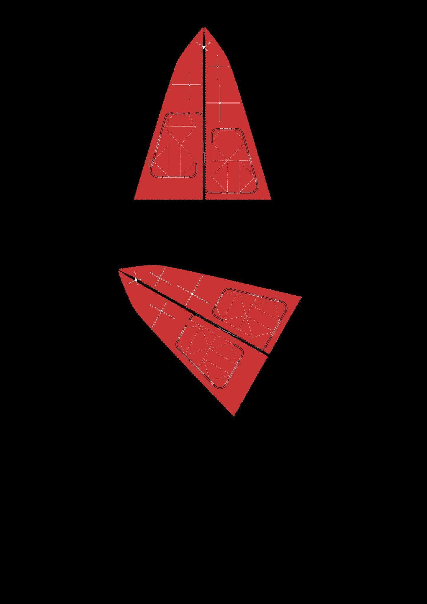
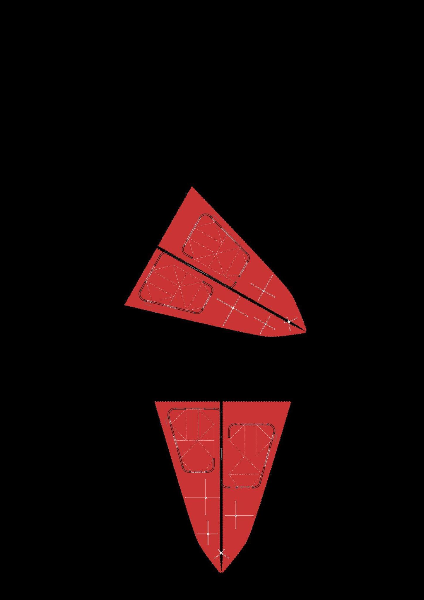
Fig 13.1.3.1 - Plan of classroom cluster with flexibility towards the courtyard
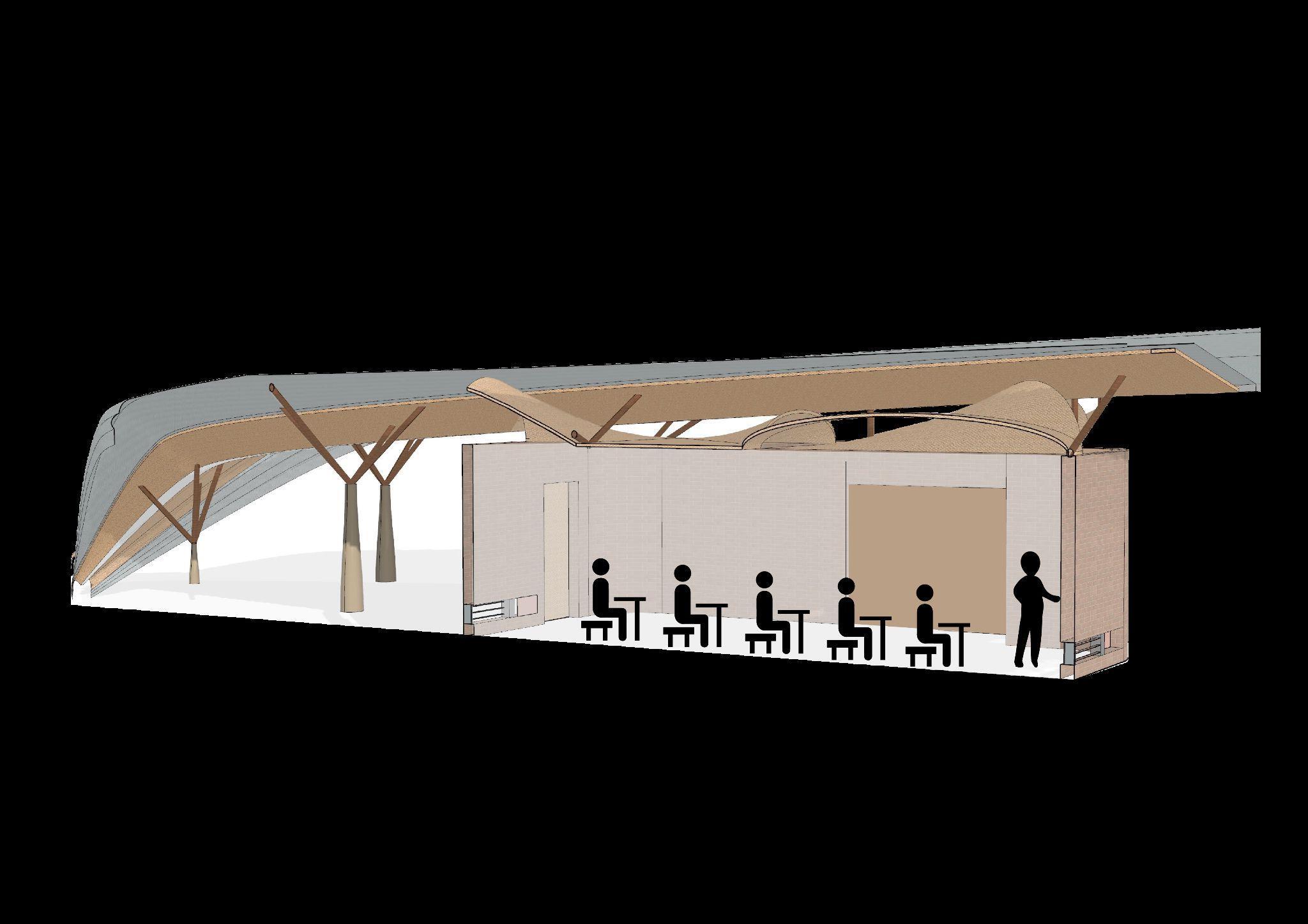
Fig 13.1.3.2 - Section of classroom with traditional desk arrangementFig 13.1.3.3 - Plan of classroom cluster with flexibility between both.
Fig 13.1.3.4 - Section of classroom with versatile desk arrangement
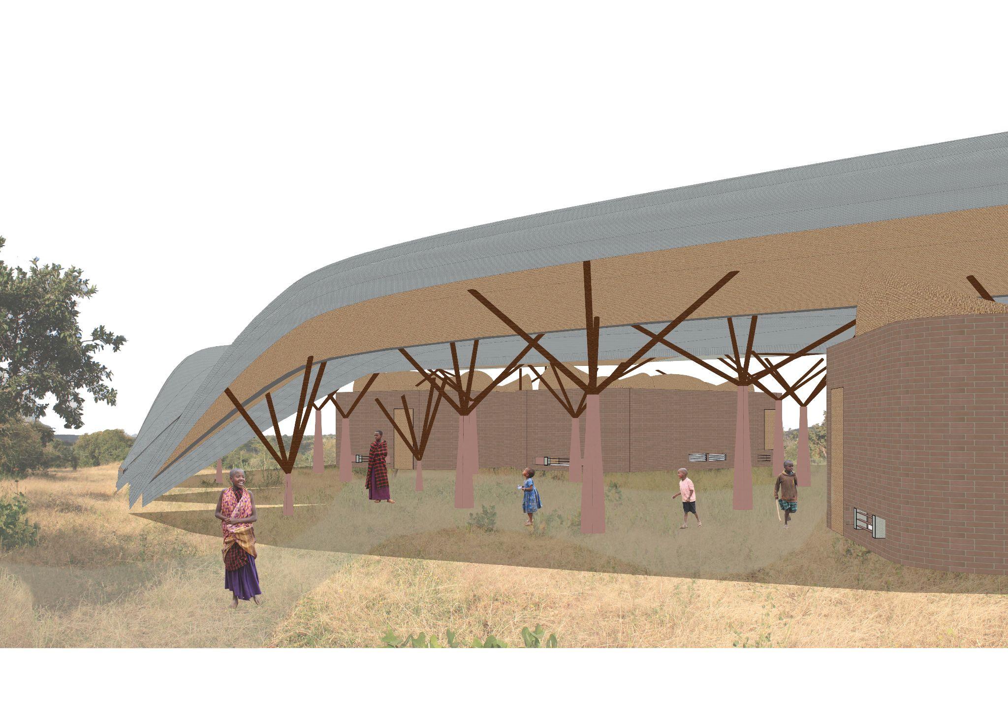
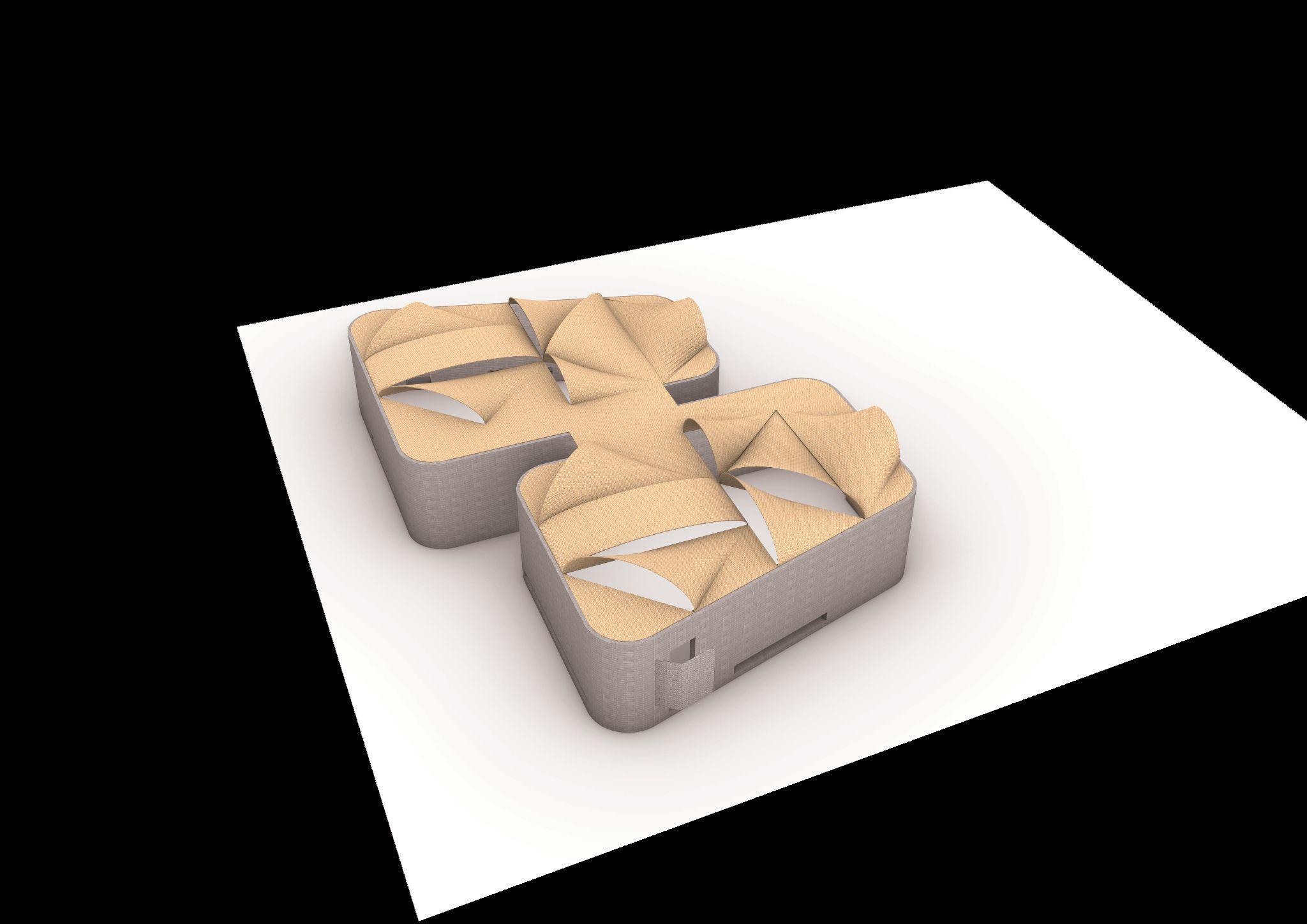
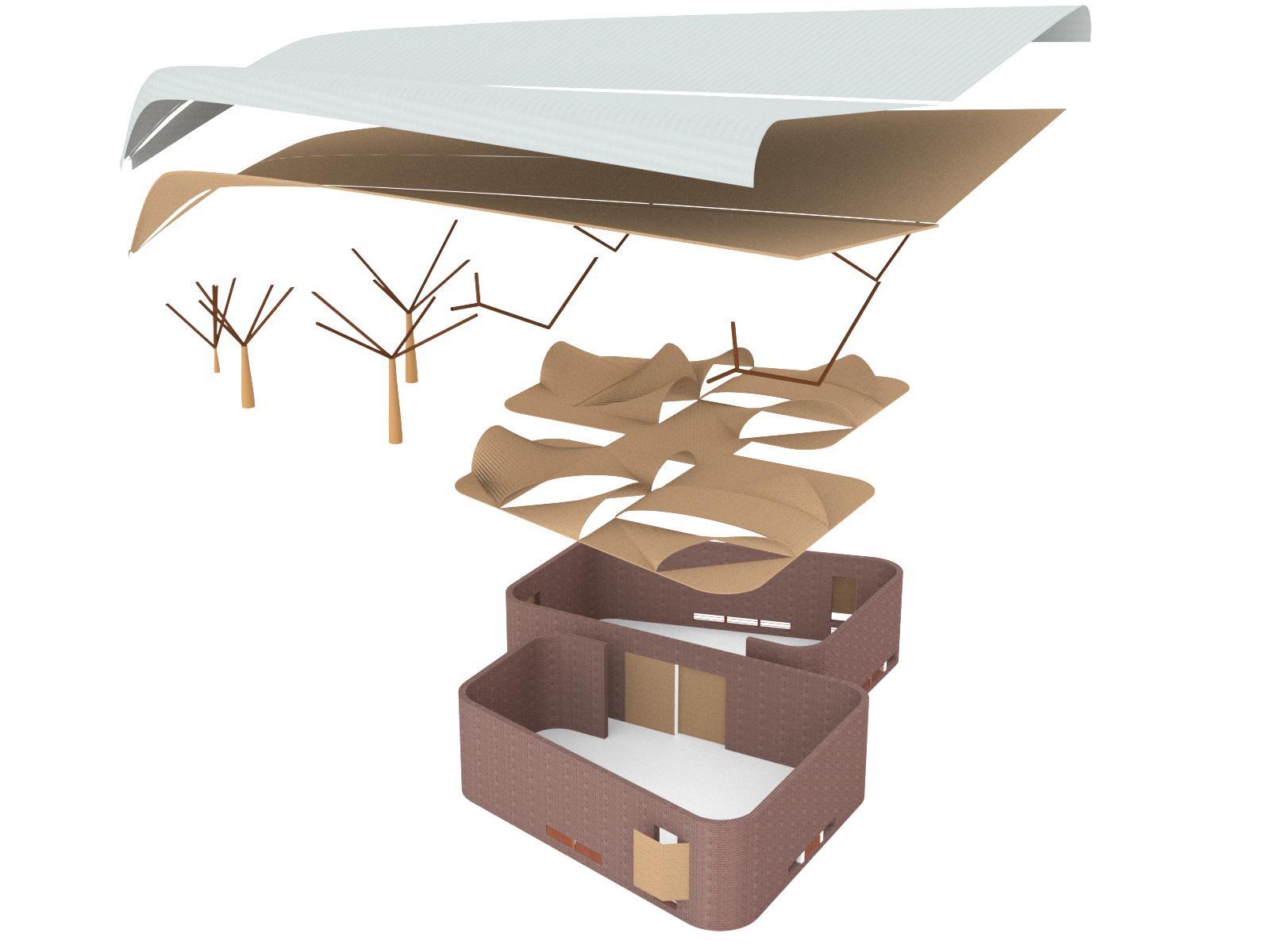
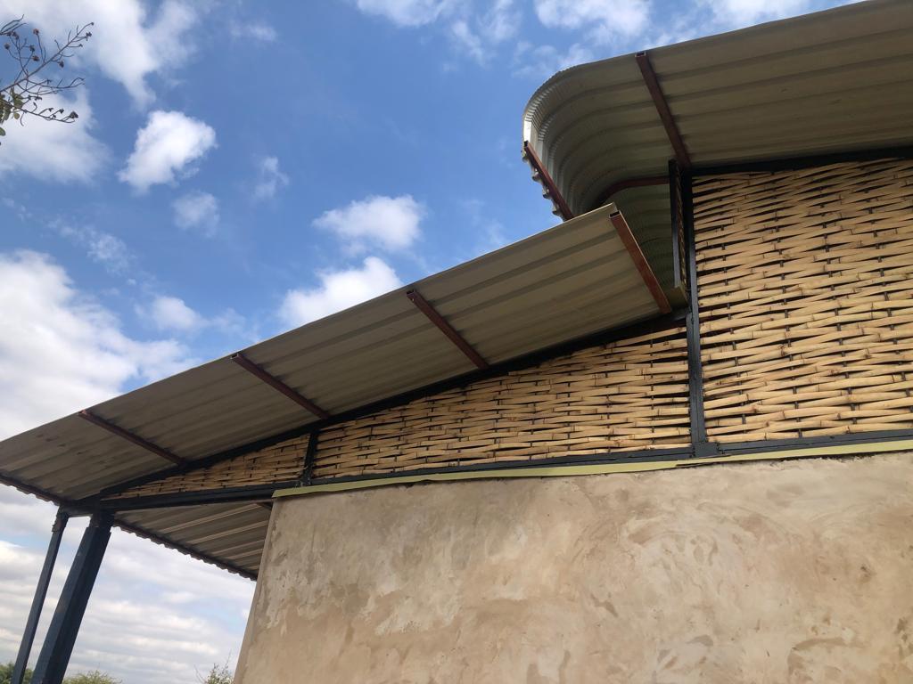
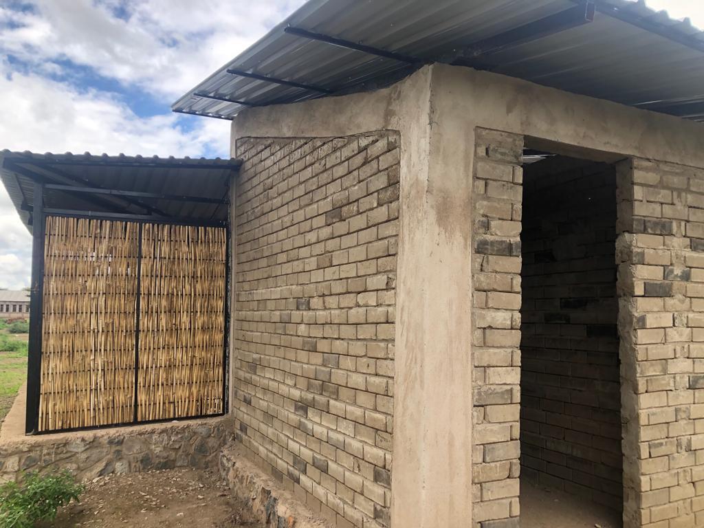
Fig 13.2.1 - Axonometric of continuous CEB wall
Fig 13.2.2 - Axonometric showing openings
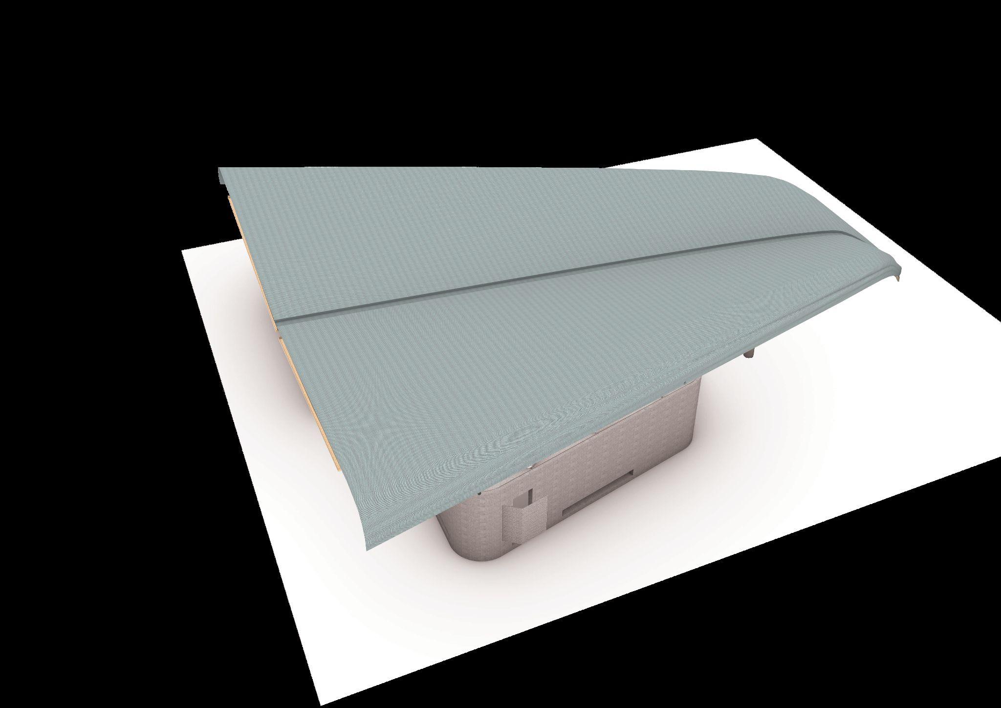
Fig 13.2.3 - Axonometric showing auxiliary roof
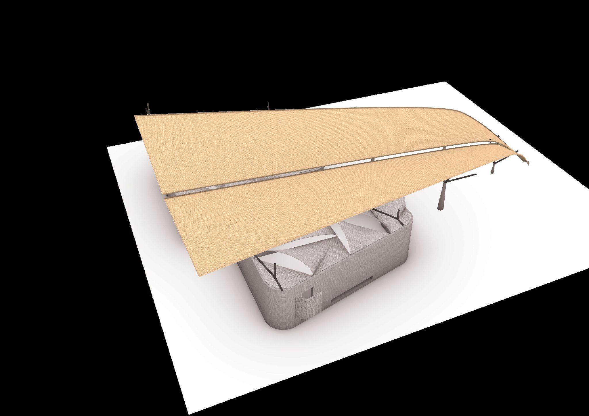
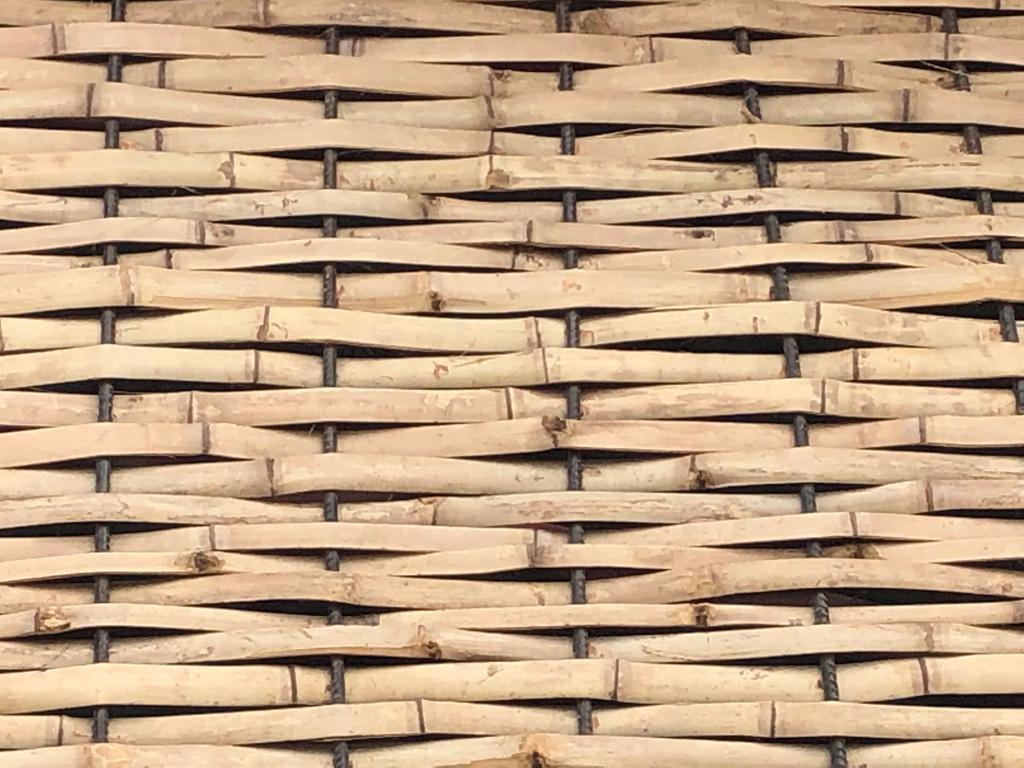
Fig 13.2.4 - Axonometric showing bamboo columns
Fig 13.2.5 - Axonometric showing insulation layer for main roof
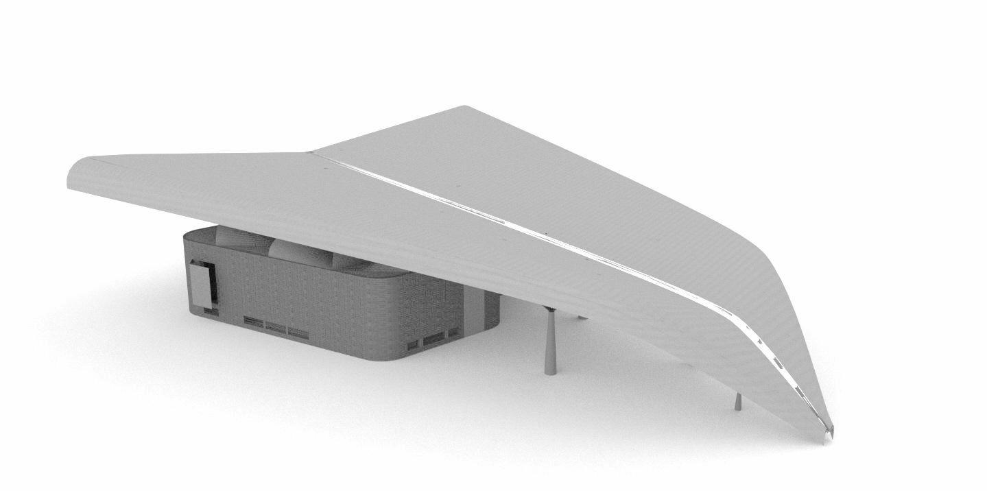
Fig 13.2.6 - Axonometric showing main laminated roof
Fig 13.2.7 - Diagram of axonometric showcasing the different proposed materials and their function
Fig 13.2.8 - Example of similar water harvesting strategy, H2O project (Tamassociati ,2017)
Fig 13.2.9 - Image of of similar materials found on site
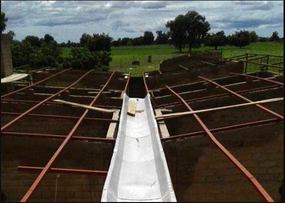
Fig 13.2.10 - Visual reference of intended bamboo columns (Anna Heringer, 2007)and context to be replicated
Fig 13.2.11 - Reference images of material produced locally (images taken on site)
Fig 13.2.12 - Reference images of CEB blocks produced locally (images from local architects) and proposed machine to be bought
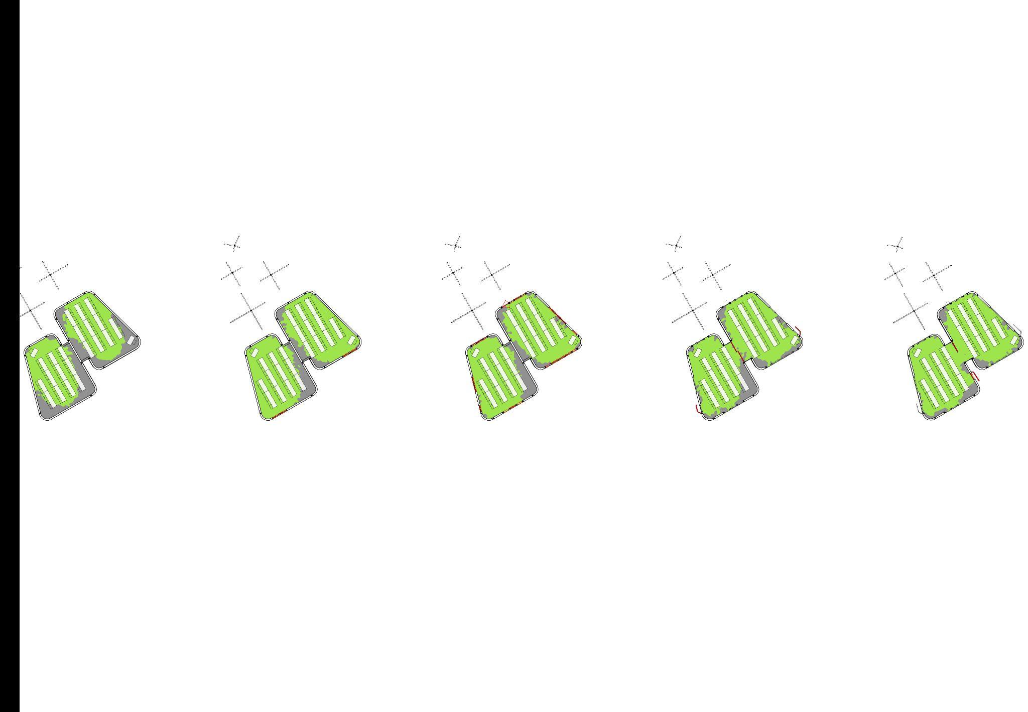
Fig 13.3.1.1 - Total solar exposure on ground surfaces of the school and selected thicker walls
Fig 13.3.1.2 - Total solar exposure on walls and secondary roof
Fig 13.3.1.3 - Total solar exposure walls/secondary roof, south-east view
Fig 13.3.1.4 - Total solar exposure walls/ secondary roof, north-east view
Fig 13.3.1.5 - Direct solar exposure walls/secondary roof, south-east view
Fig 13.3.1.6 - Direct solar exposure walls/secondary roof, north-east view
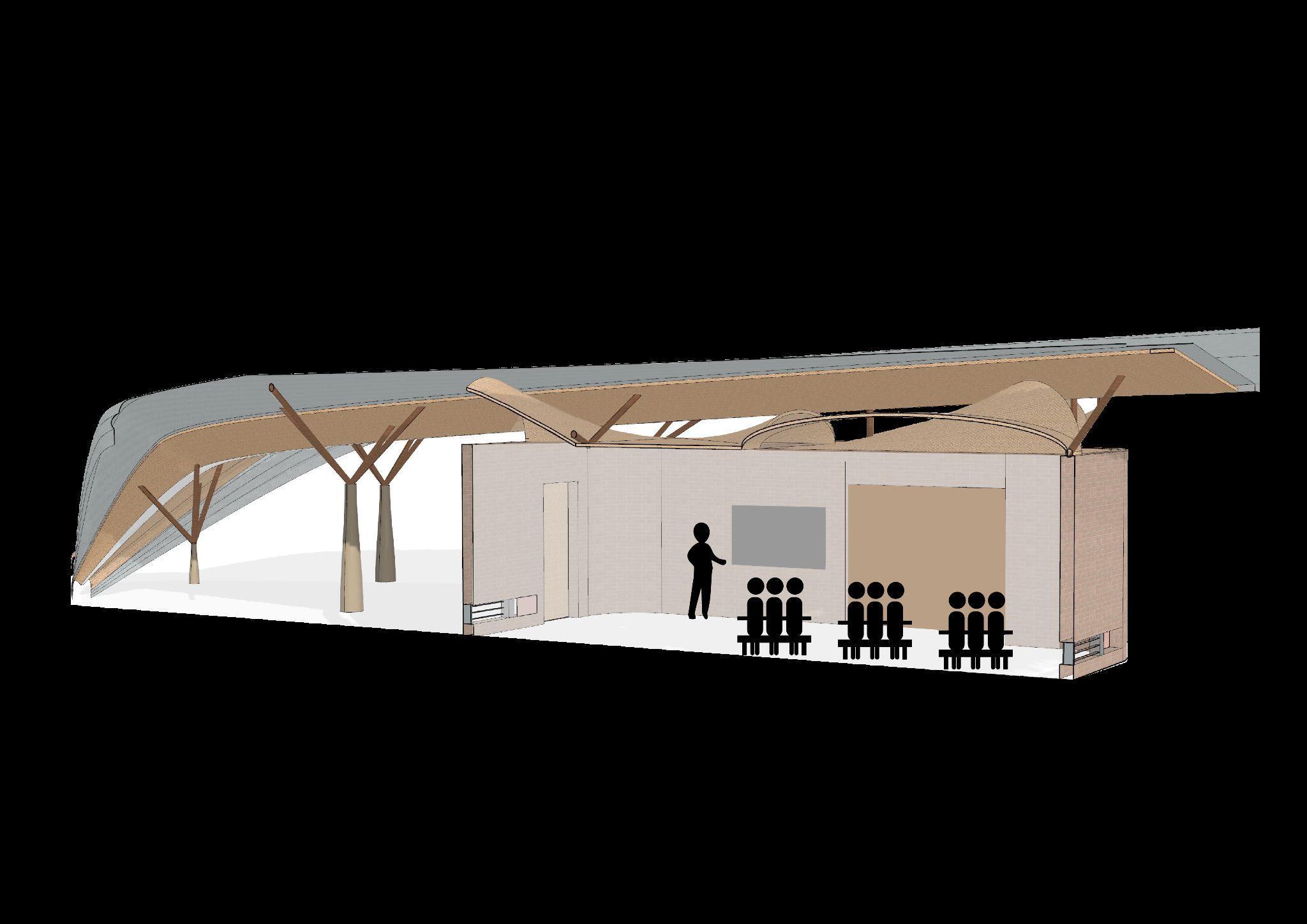
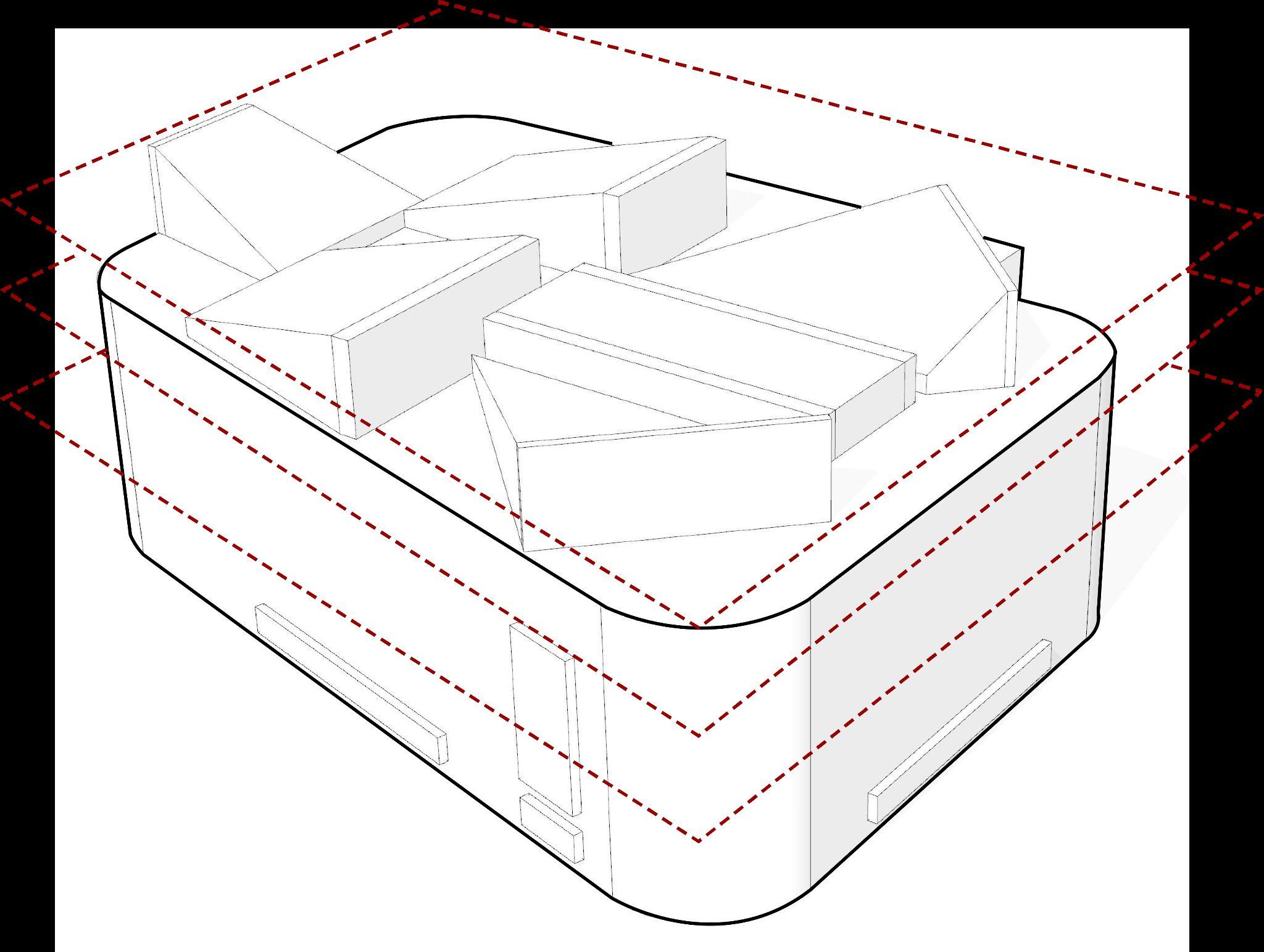
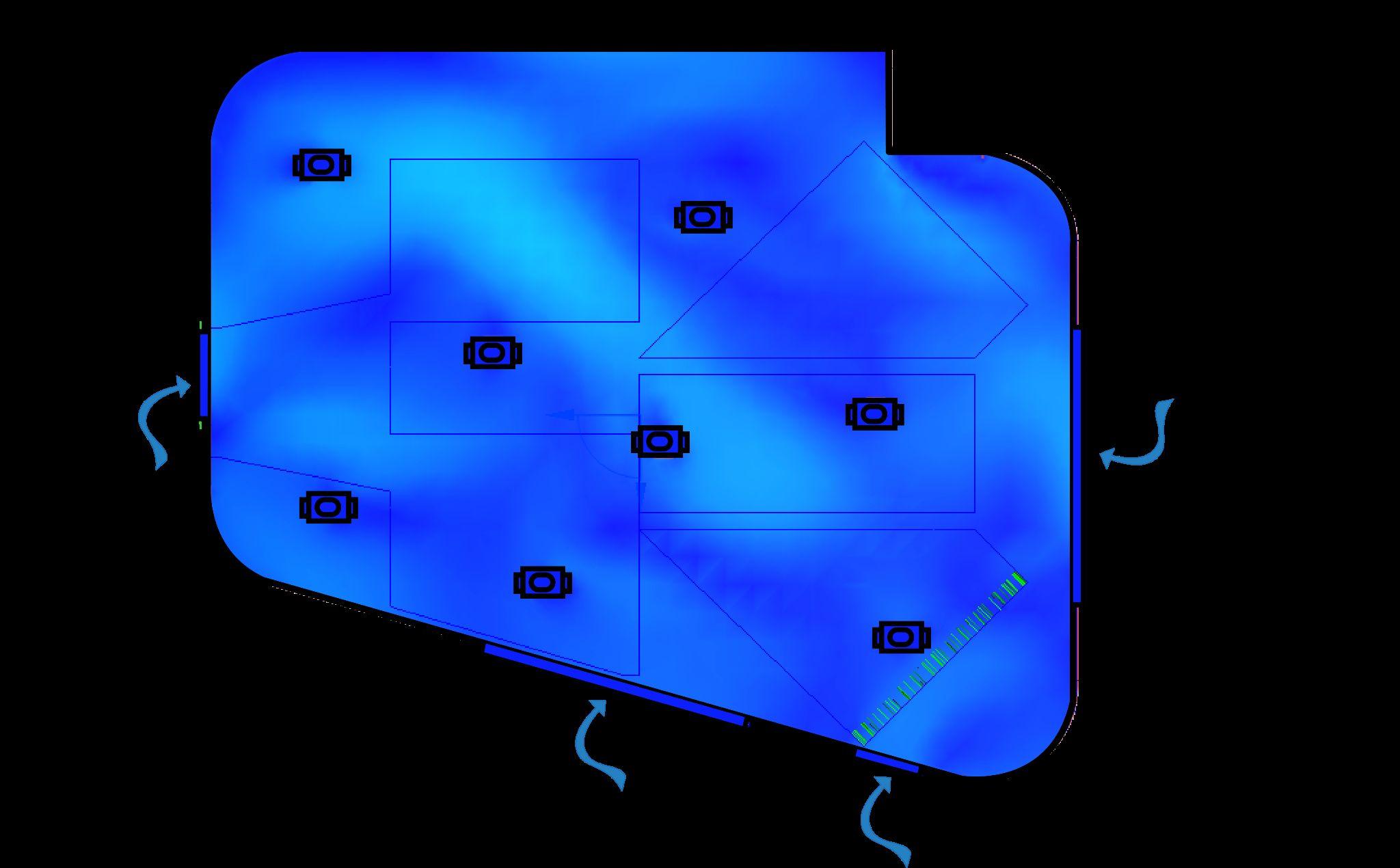
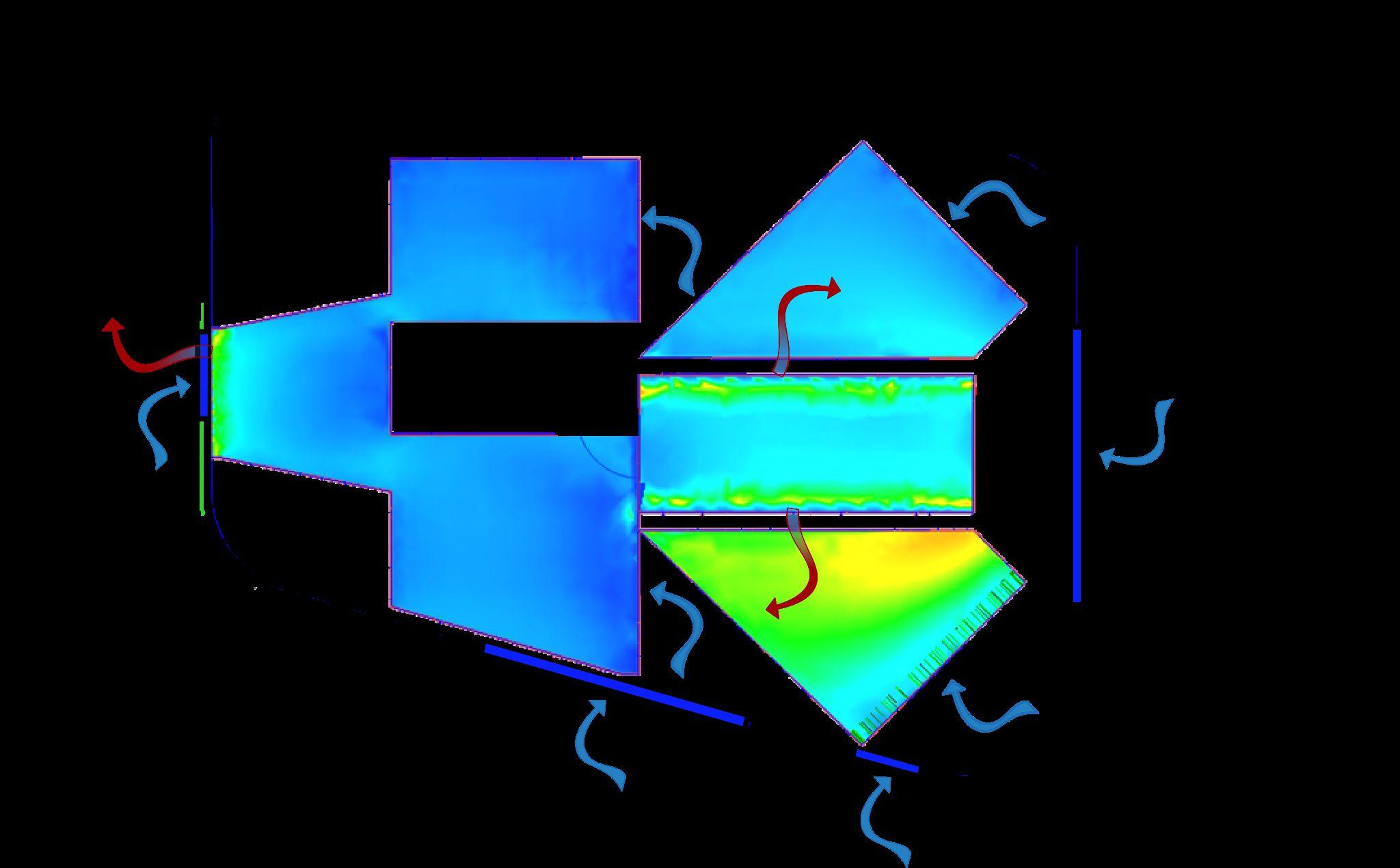
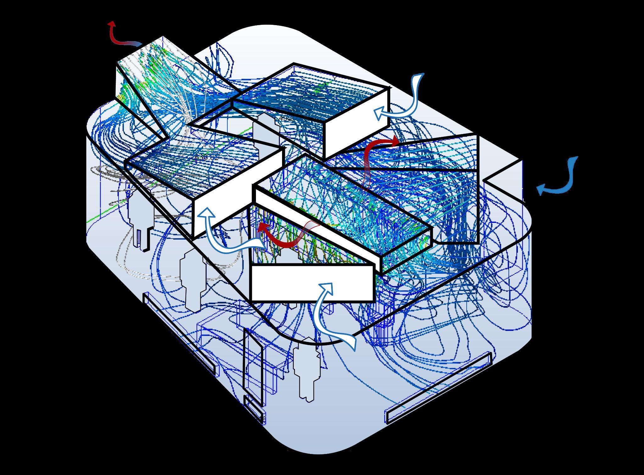
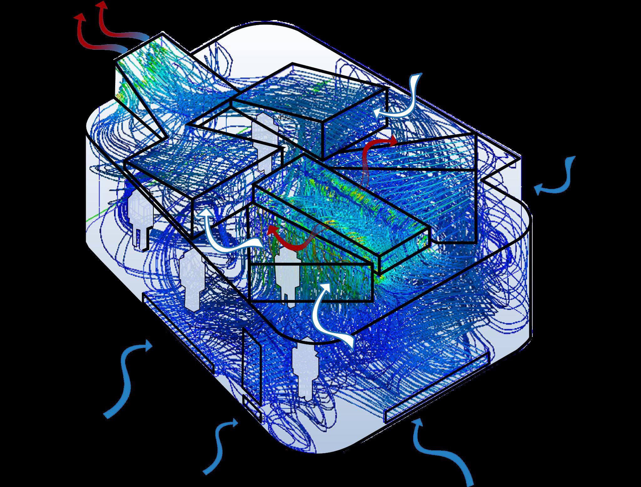
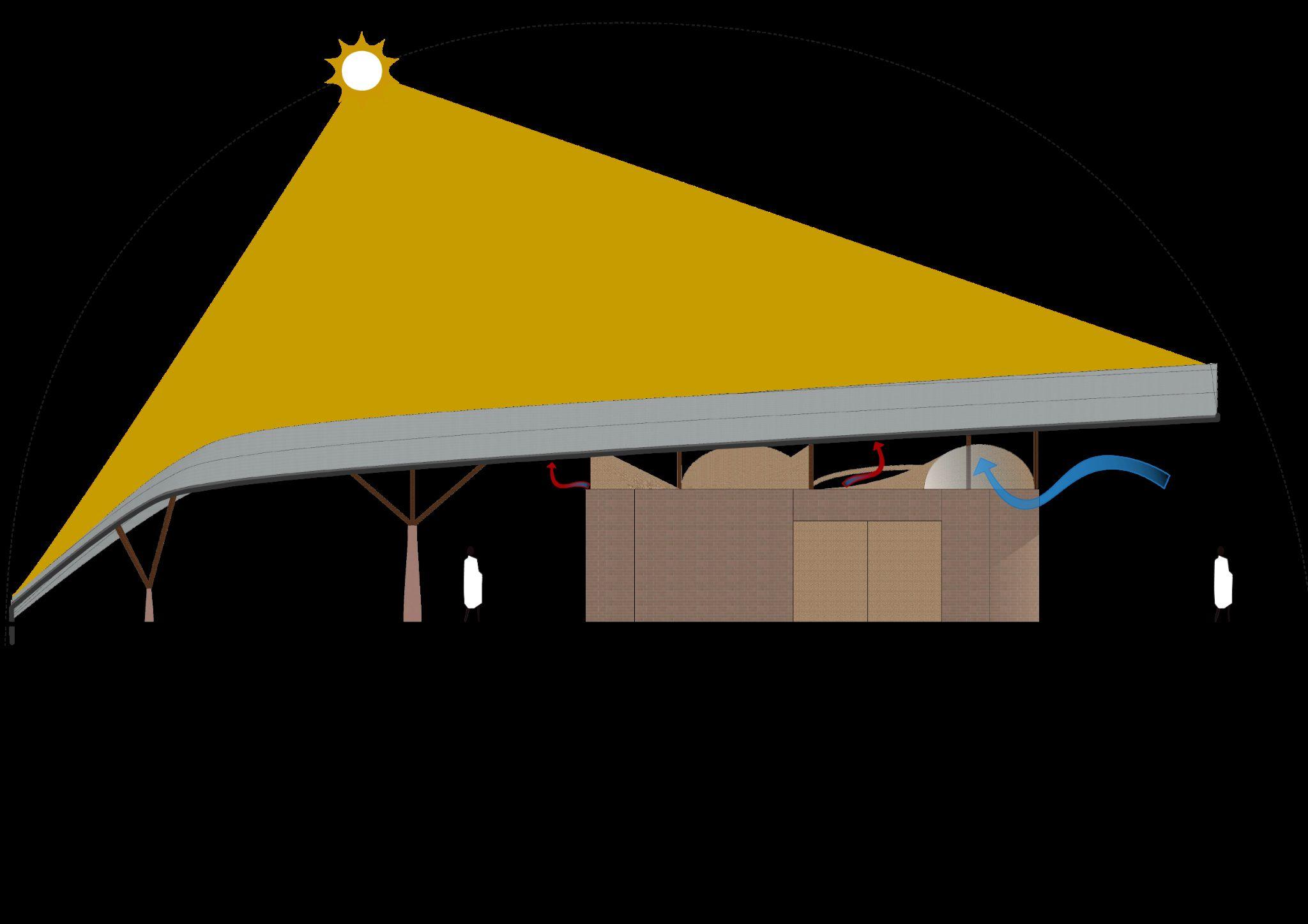
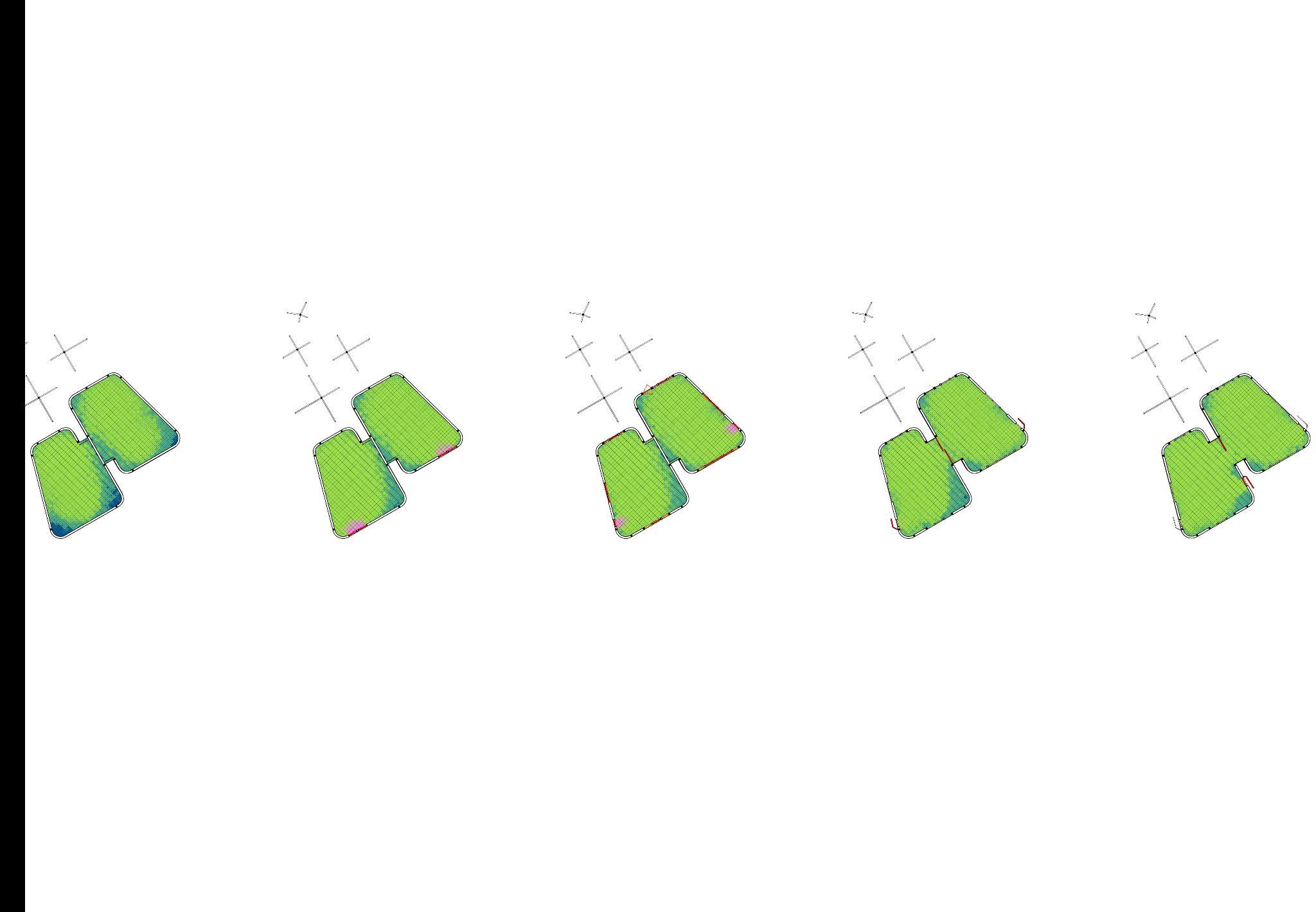
Fig 13.3.2.1 - Key plan of studied building in the master plan
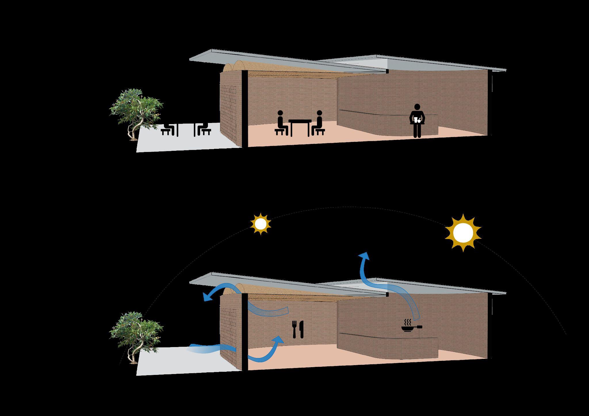
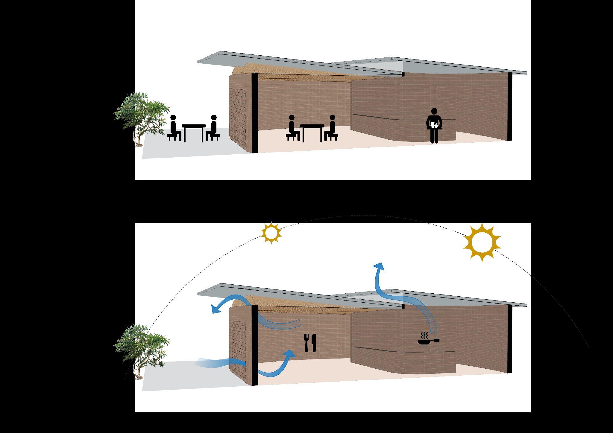
Fig 13.3.2.2 - Cafeteria plan with projected shadow
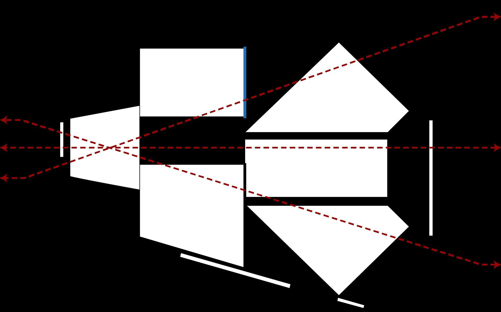
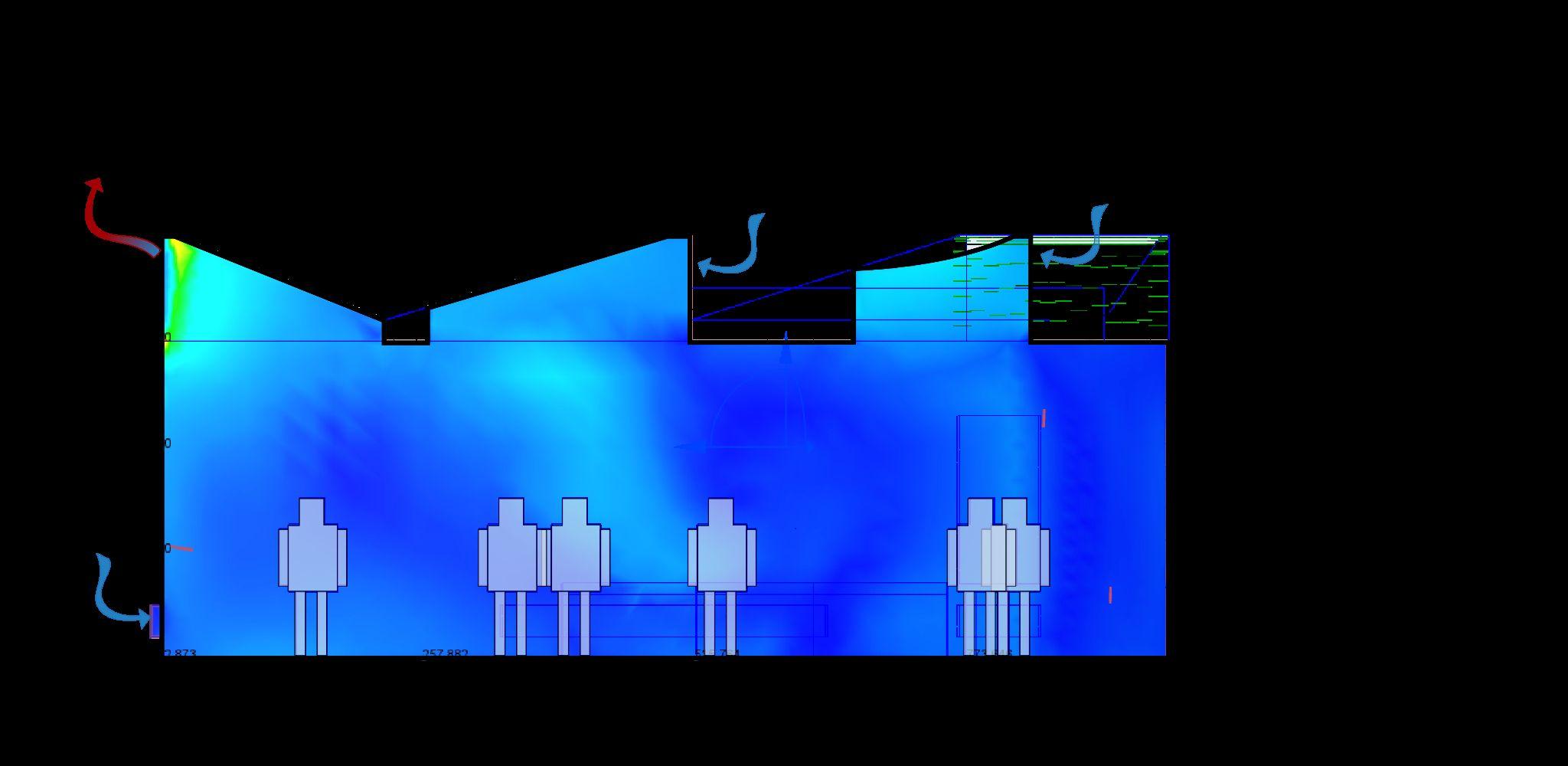
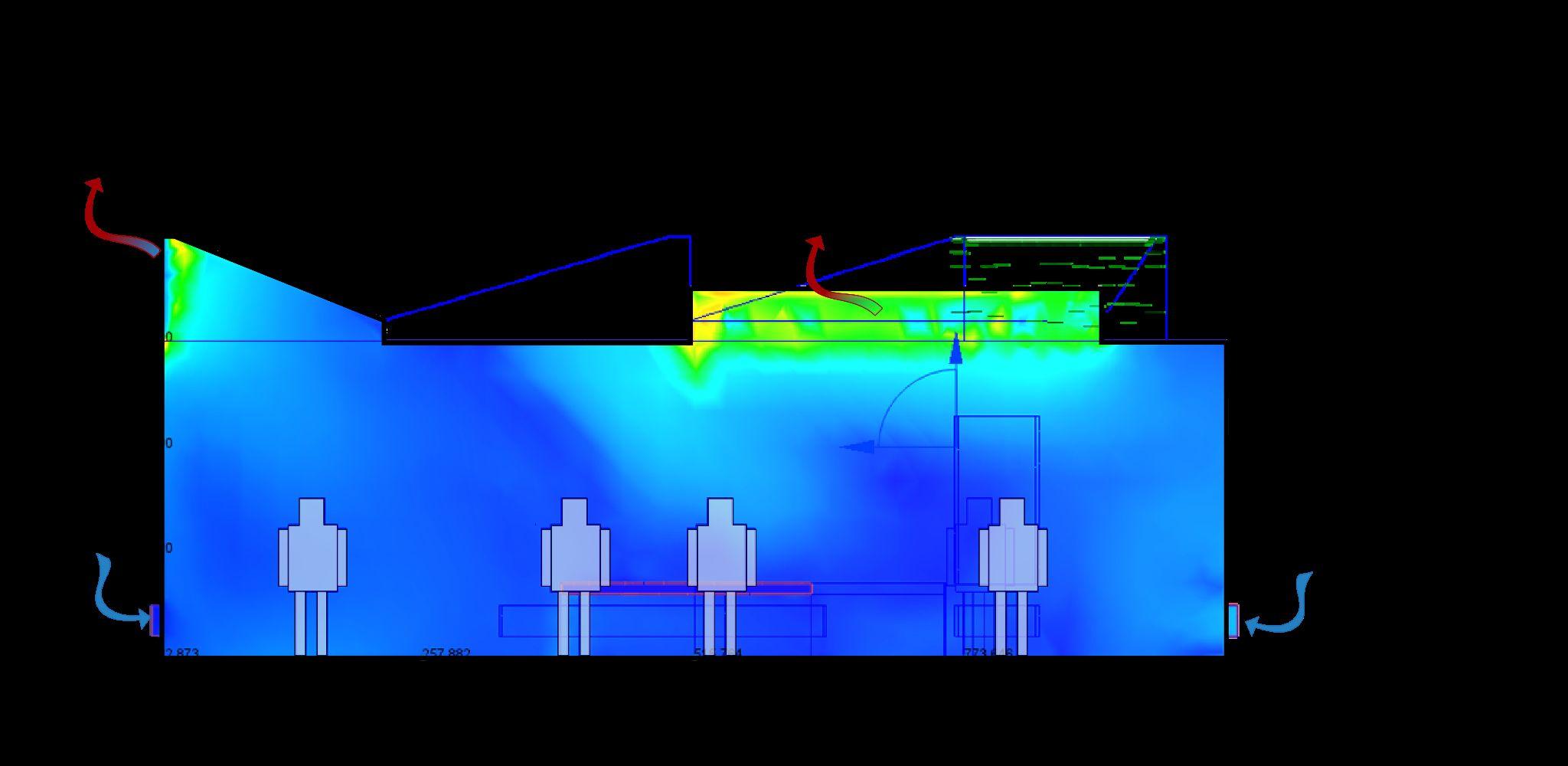
Fig 13.3.2.3 - Bioclimatic section of cafeteria
Fig 13.3.2.4 - Functional section of cafeteria
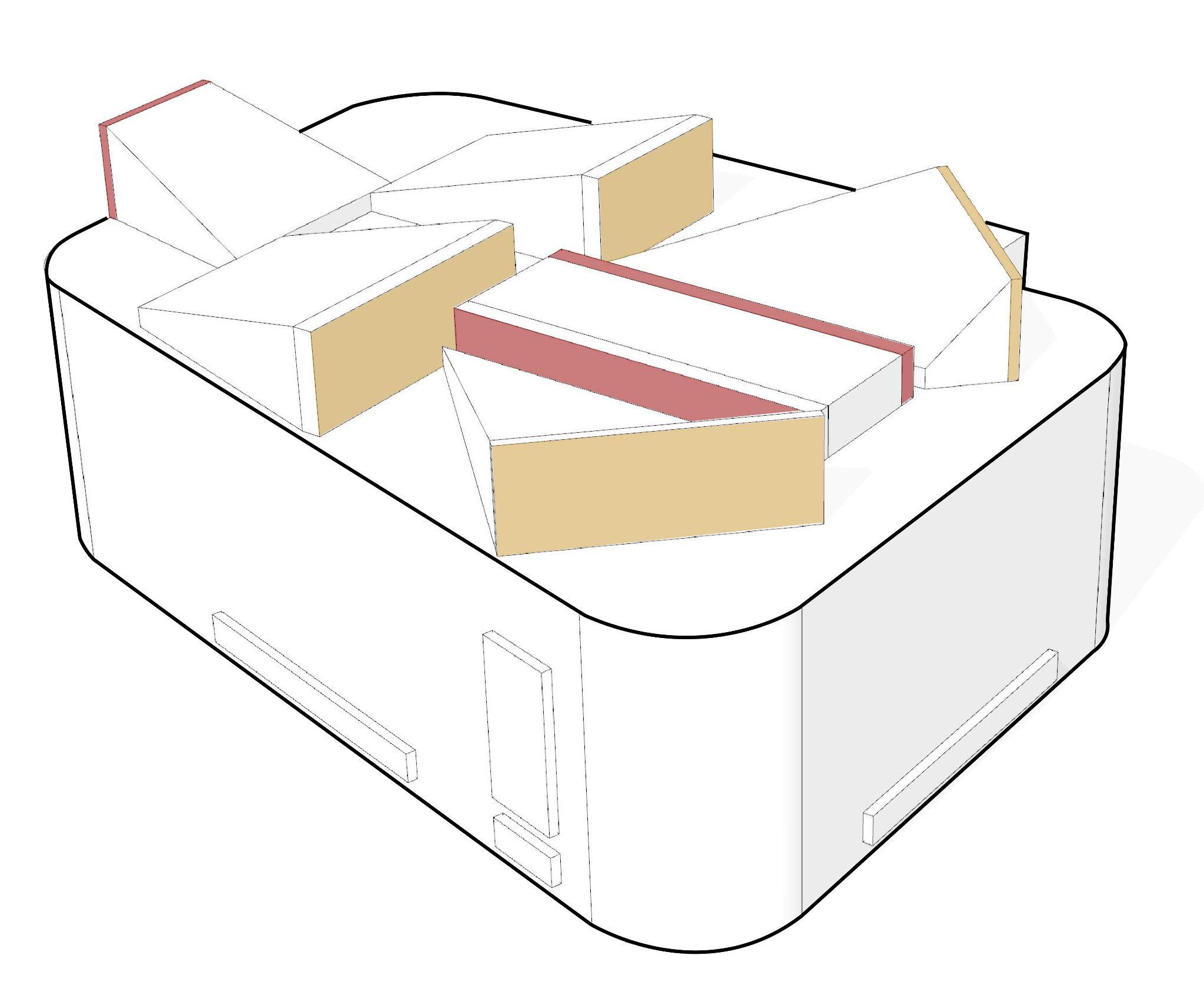
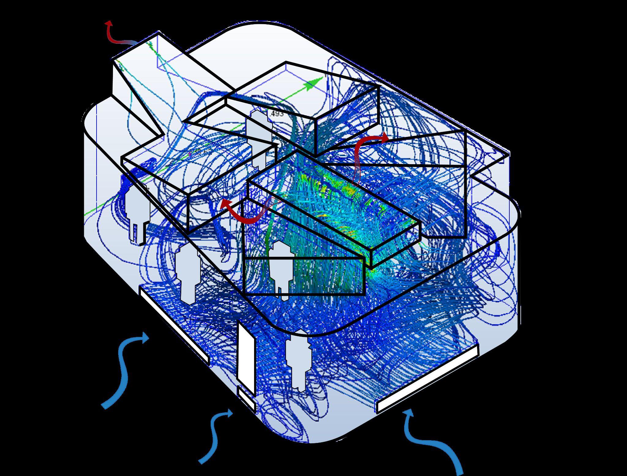
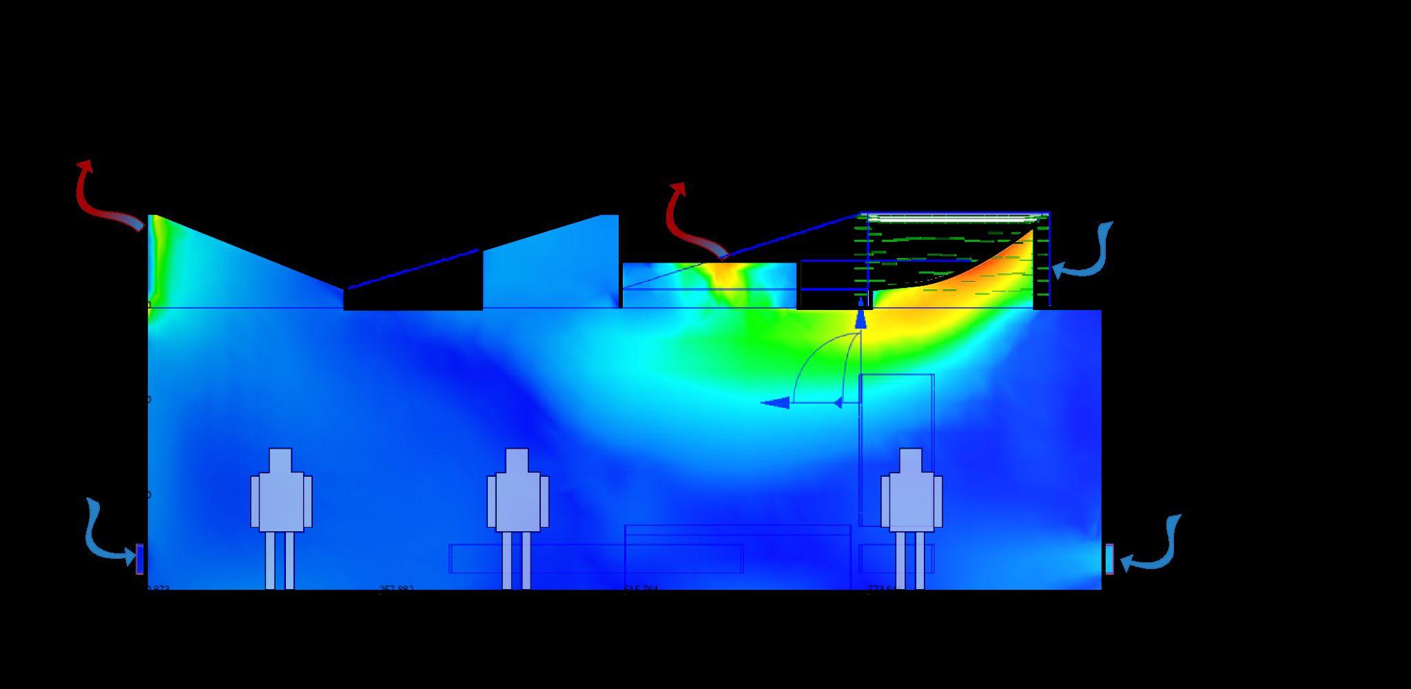
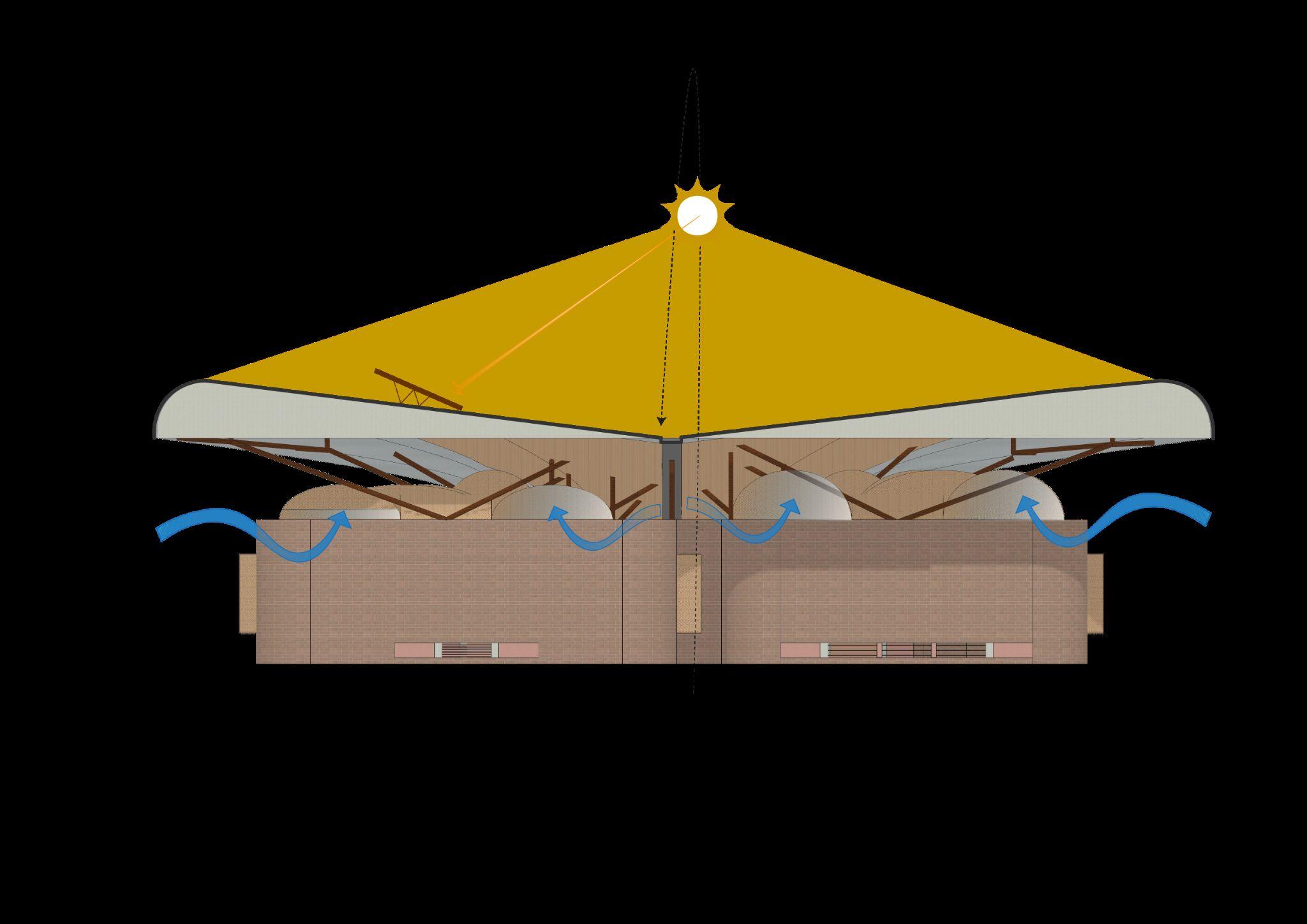
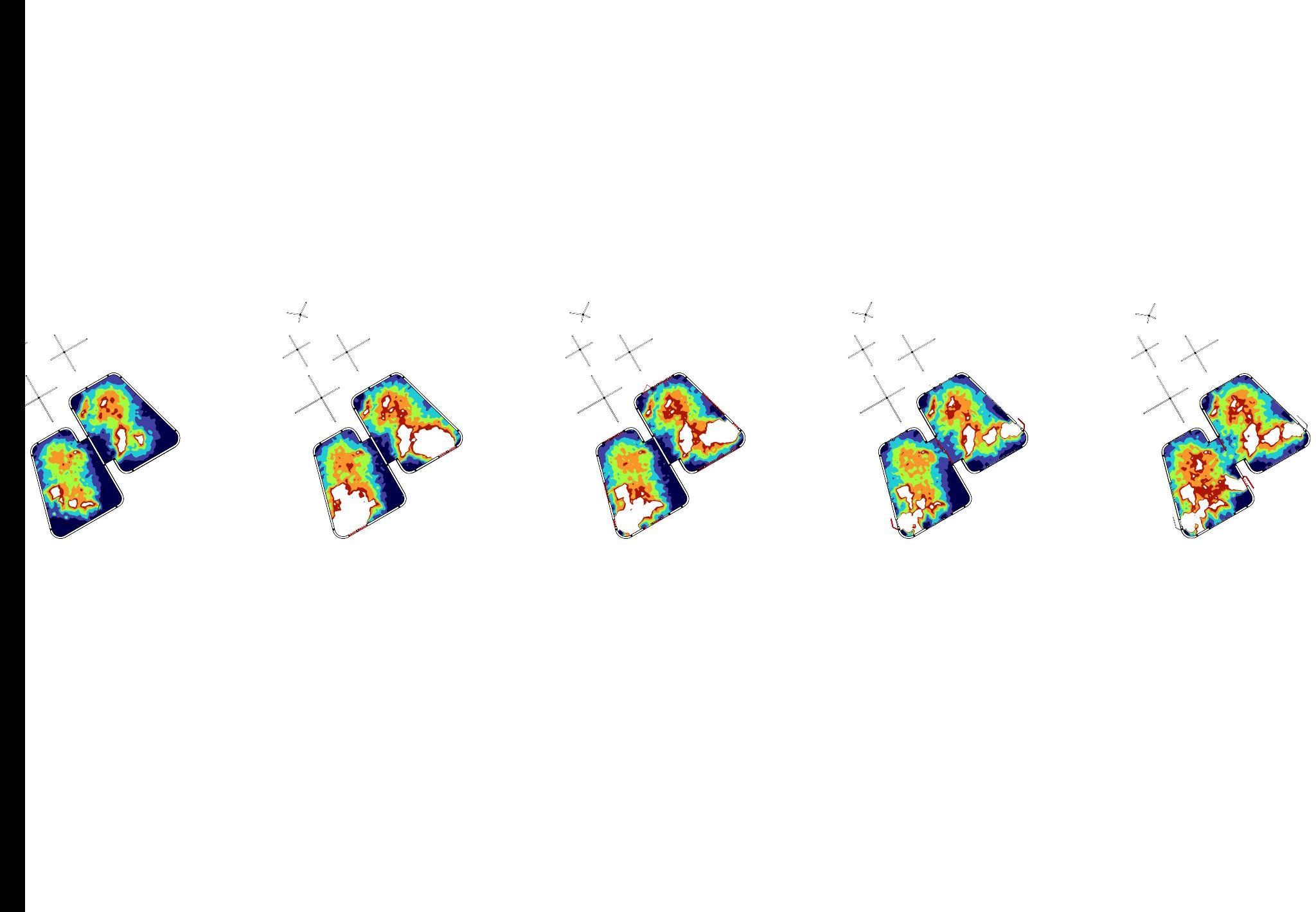
Fig 13.3.3.1 - Model of classroom unit illustrating strategy 1.
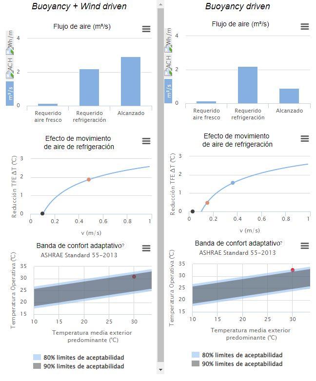
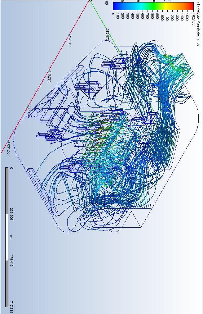
Fig 13.3.3.2 - Air Flow Rate graph for strategy 1.
Fig 13.3.3.3 - Adaptive Comfort Band Graph for strategy 1.
Fig 13.3.3.4 - Model of classroom unit illustrating strategy 2.
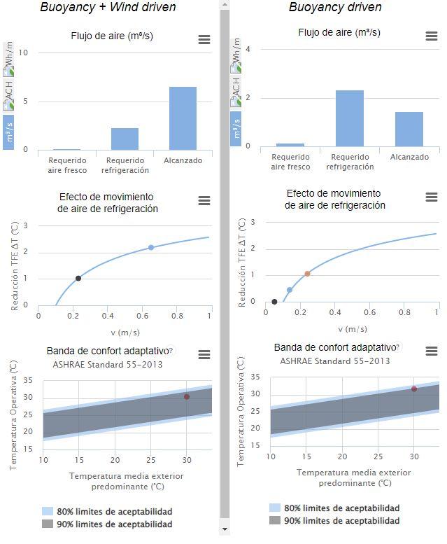
Fig 13.3.3.5 - Air Flow Rate graph for strategy 2.
1.0 Acknowledgement
I am sincerely grateful to all the individuals and institutions who have supported and contributed to the completion of this thesis on MSc Architecture and Environmental Design. Their guidance, encouragement, and assistance have been invaluable inmakingthisresearchpossible.
First and foremost, I would like to express my deepest gratitude to my thesis supervisor, Dr. Paolo Cascone, whose expertise, patience, and insightful feedback have been instrumental in shaping the direction of this study. Through the periodic tutorials, I was very fortunate to count on his insight into similar projects, which helped me bring this projectintoreality.
At the same time, I would like to extend a very sincere appreciation to our course leader, Dr. Rosa Schiano-Phan. Her vast knowledge and experience helped me steer this thesis in the right direction from the very beginning. I would like to thankherforhertime,interest,andsupport,whichhelpedme taketheresearchfurther.
I extend my appreciation to the tutors and members of the University of Westminster for providing me with a stimulating academic environment and a wealth of knowledge. Their commitment to excellence in education has been crucial in honing my research and design skills. Especially, I would like tomentiontheconstantsupportofDr.FilomenaRusso;inevery revision, I could count on her beneficial advice, guidance, and, more importantly, her passion for design and care for the well-beingofthepeopleinvolvedinthisproject.
I am indebted to the vast tutors of the course, and I could not continue without thanking them individually: Juan Vallejo, Mehrdad Borna, Kartikeya Rajput, Amedeo Scofone, and Rofayda Salem. A special thanks for their assistance at every step of the process, for facilitating access to resources and materialsessentialforthisresearch.
I would also like to acknowledge the financial support providedbytheMexicangovernmentthroughouttheyearof my studies. With the help of the grant "Convocatoria CONACYT-SACPC-FiINBA 2022: Creación y conocimiento hacia elfuturo,apoyoaprofesionalesdelaculturayelartepara estudios de maestría o doctorado en el extranjero," I was able to focus on my studies and research without financial constraints. This support allowed me to learn and grow, intendingtobringtheknowledgeandlessonslearnedinthis thesis and course back to Mexico in the future. Also, I would like to thank the support given to me by the "Global Experience Bursary Grant" of the University of Westminster; with their support, the site visit was funded, enrichingthisthesis.
I would like to extend my thanks to my friends and classmates for their unwavering support throughout this journey. Their team spirit and willingness to share ideas have enriched my understanding of architectural and environmentalconcepts.
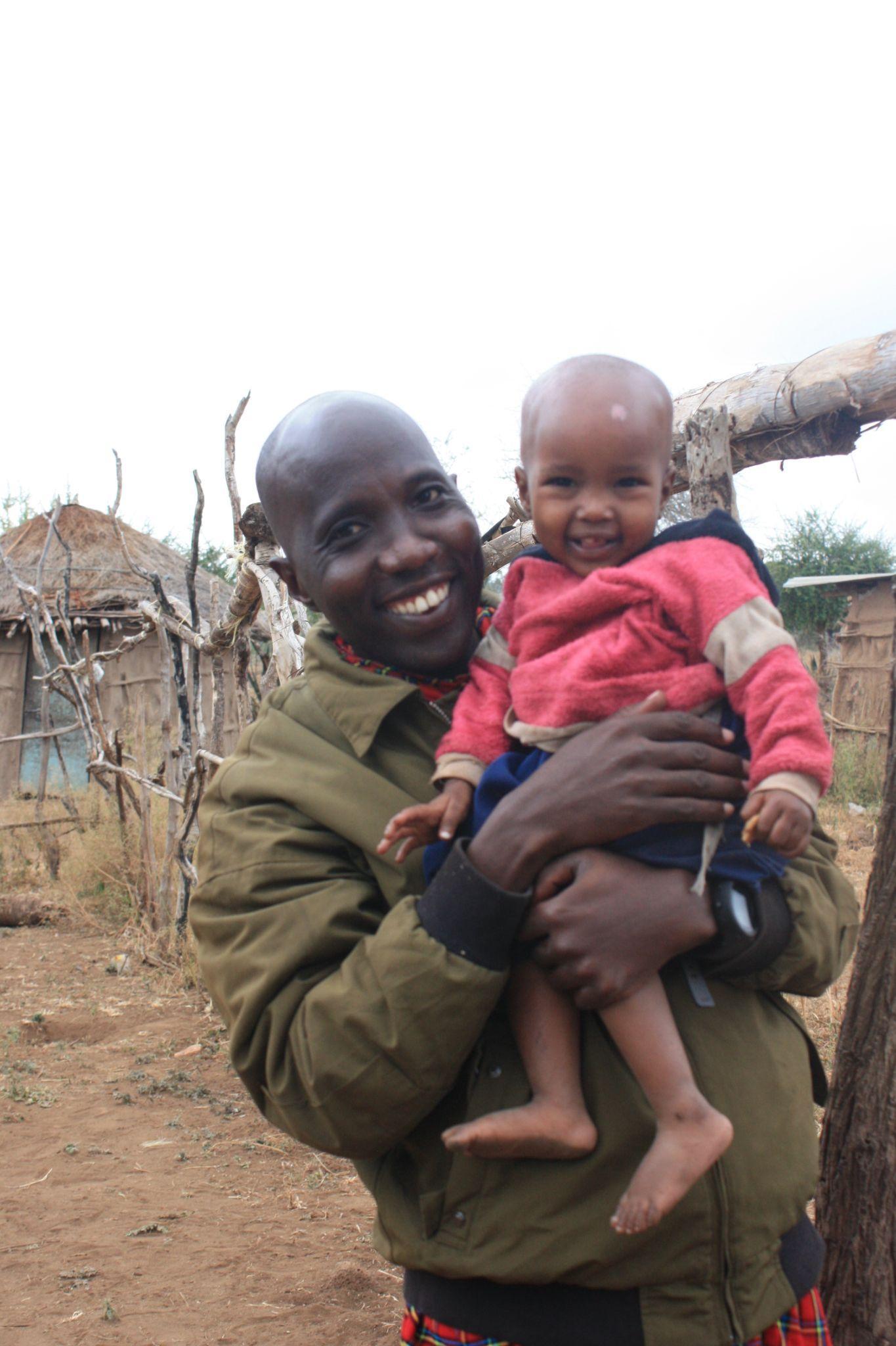
My heartfelt gratitude goes out to the organization "Isoma Children" for giving me the chance to be part of their mission to bring quality education to all the children in the village of Orkisima in Tanzania. I am very grateful to my friend and founder, Alejandra Alonso; her selflessness and commitment to the kids and the families of Orkisima have been very inspiring, pushing every person on the team to giveandachievemore.
I would like to thank especially the Mollel family who very kindly took me into their home when doing the site visit in the village of Orkisima. Their love for their community and traditions and eagerness for their children to have quality education closer to their home were crucial in understandingmanyimportantissuesoftheprojectthatcan now be reflected in the thesis. Thanks to all the families of the Maasai village who generously allowed me to enter their community to take pictures and have interviews to learn moreaboutthem.
Lastly, I am deeply grateful to my parents, fiancé, flatmate, and friends for their love, understanding, and unwaveringbeliefinmyabilities.Theirencouragementand sacrifices have been the cornerstone of my academic journey.
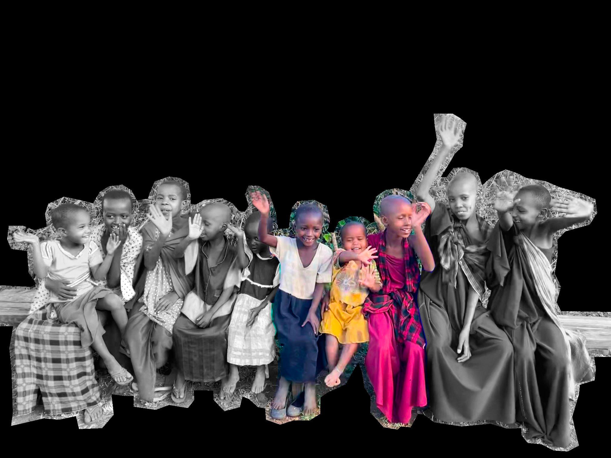
In conclusion, this thesis would not have been possible without the collective support and encouragement of all those mentioned above. Especially, I express my heartfelt appreciation to the kids of Orkisima; thank you for being themotivationbehindthiswork.
2. Introduction
2.2 Executive Summary
As the global population in sub-developed countries continues to grow at an unprecedented pace, the struggle to meet basic human needs like healthcare and education becomes increasingly challenging. This issue demands global attention and recognition, for it is not isolated to a single region or community. The world is witnessing the compounding effects of climate change in sub-developed countries, where years of unmet human needs have given rise to mass migrations, threatening the safety of immigrants and disrupting the balanceofglobalresources.
Throughout history, education has proven to be an invaluable asset capable of empowering communities and transforming entire countries for the better. By extending education to the most isolated and marginalized communities, we provide an opportunity for individuals to thrive independently. Equipping them with the tools and resources to adapt to changing environments, we foster the creation of sustainable infrastructure, encouraging people to take stewardship of theirsurroundingsand,inturn,safeguardtheenvironment.
The consequences of climate change are far-reaching, impacting not only the environment but also the customs and traditional survival roles of communities, often to the detriment of girls and women. This thesis delves into the multifaceted impact of climate change on gender roles, which frequently results in gender inequality, particularly affecting women. Our focus narrows to a specific ethnic community in Northern Tanzania, where the essential elements of water and educationaredeeplyinterconnected.
Tanzania, located in East Africa, is a culturally diverse and scenically breathtaking country known for its stunning landscapes, including the Serengeti plains and Mount Kilimanjaro. With over 120 ethnic groups and Swahili as the official language, Tanzania boasts a population of around 60 million people and gained independence from British colonial rule in 1961. Its economy thrives on agriculture, mining, and tourism, attracting visitors with its abundant wildlife and vibrantculture.
Amongitsdiverseethnicgroups,theMaasaistandoutasoneof Tanzania`s most iconic communities, renowned for their distinctive clothing, beadwork, semi-nomadic pastoral lifestyle,andrichculturaltraditions.
Living in parts of Tanzania and Kenya, the Maasai are historically cattle herders with a unique social structure organized around age sets and rites of passage. Their vibrant warrior culture, known as the Morans, and their oral traditions, including storytelling and dance, contribute to their cultural distinctiveness. Despite modernization, many Maasai communities continue to uphold their traditional ways while actively working to preserve theirculturalheritageandprotecttheenvironment.
(Mtuy,T.B.etal.2022)
The non-governmental organization that is driving the topic of this thesis project is called ISOMA Children. Isoma is a organization founded in 2021, with a primary mission to offer free and high-quality education to children residing in a Maasai village within Tanzania. Specifically, ISOMA Children works in collaboration with the community of Loosimingor village in the Monduli District of Arusha, Tanzania. Their overarching objective is to ensure equitable educational access for all children while also actively promoting and preserving Maasai cultural traditions.
This region is characterized by diverse landscapes and is inhabited by various ethnic groups, including the Maasai people. Like many rural areas in Tanzania, the Monduli District faces challenges related to access to education, healthcare, and infrastructure development. Loosimingor village, like other Maasai villages in the region, may grapple with limited access to essential services. Organizations as ISOMA Children are collaborating in close contact with these communities to provide support and educational opportunities, aiming to address these challengesandfostercommunitydevelopment.
Tanzania's educational system consists of 7 years of compulsory primary education, followed by 4 years of secondary school and an optional 2-year high school program. Although primary and secondary education is mandatory for children aged 7 to 13, there have been challenges,includingdecliningenrollmentinsomeareasand disparities in educational quality. Tanzania has made progress in achieving universal access to primary education, but ongoing efforts are required to improve access, quality, and inclusivity throughout the educational system, especially in addressing rural-urban disparities andteachershortages.
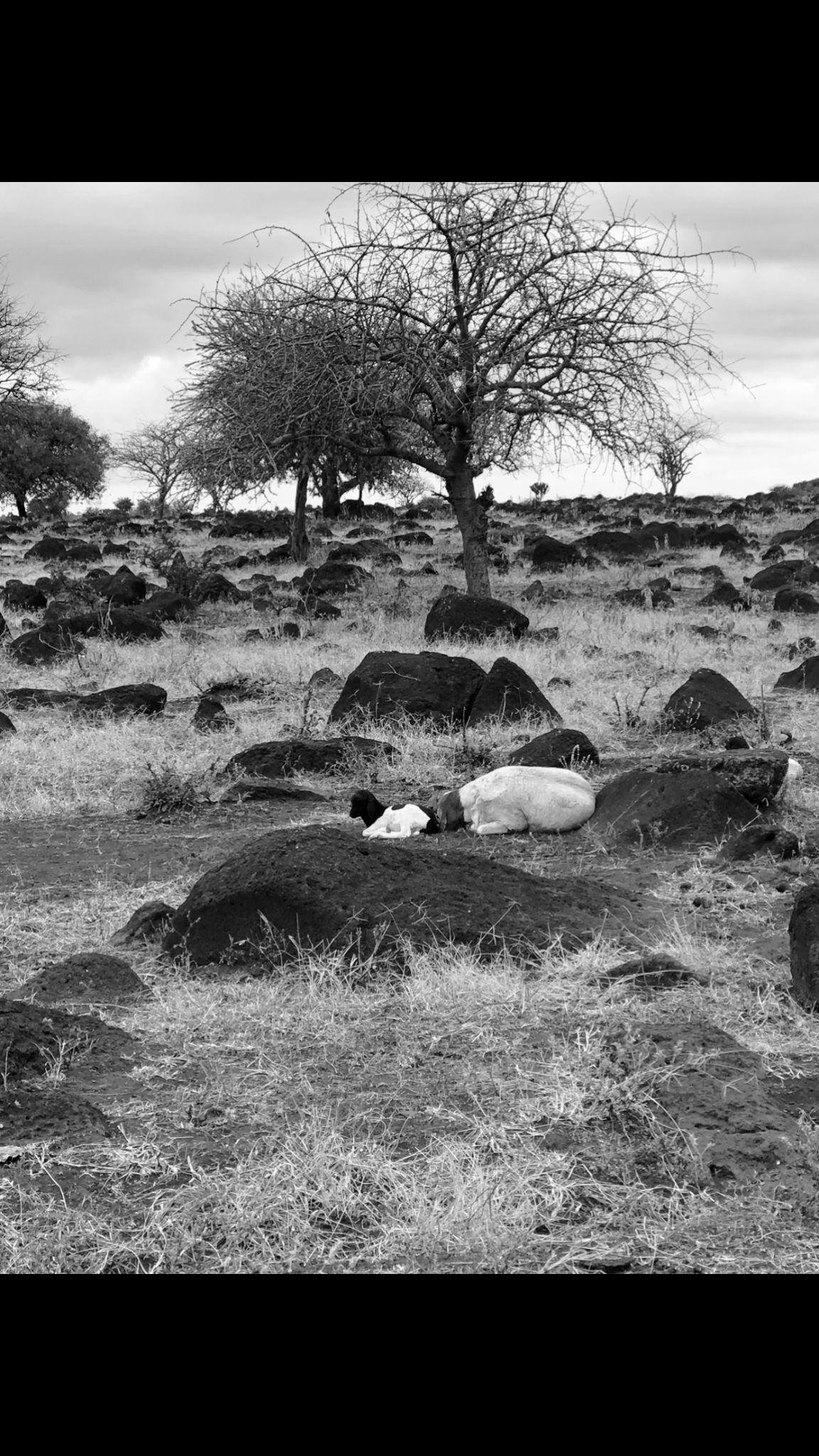
The rural region of Loosimingor faces numerous adversities and challenges that significantly impact the children in these villages, potentially affecting the community's future. Traditionally, the Maasai people place great importance on their cattle, but their sedentary lifestyle has forced them to travel long distances to tend to their herds. Consequently, this has led to young boys dropping out of school, land erosion due to constant cattle movement, andundernourishedlivestockstrugglingtofindfood.
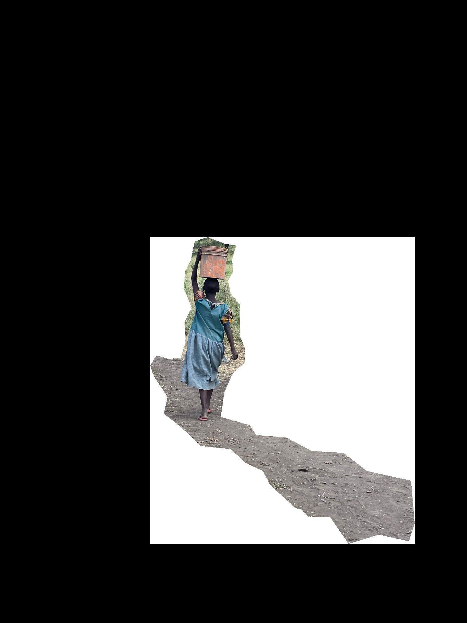
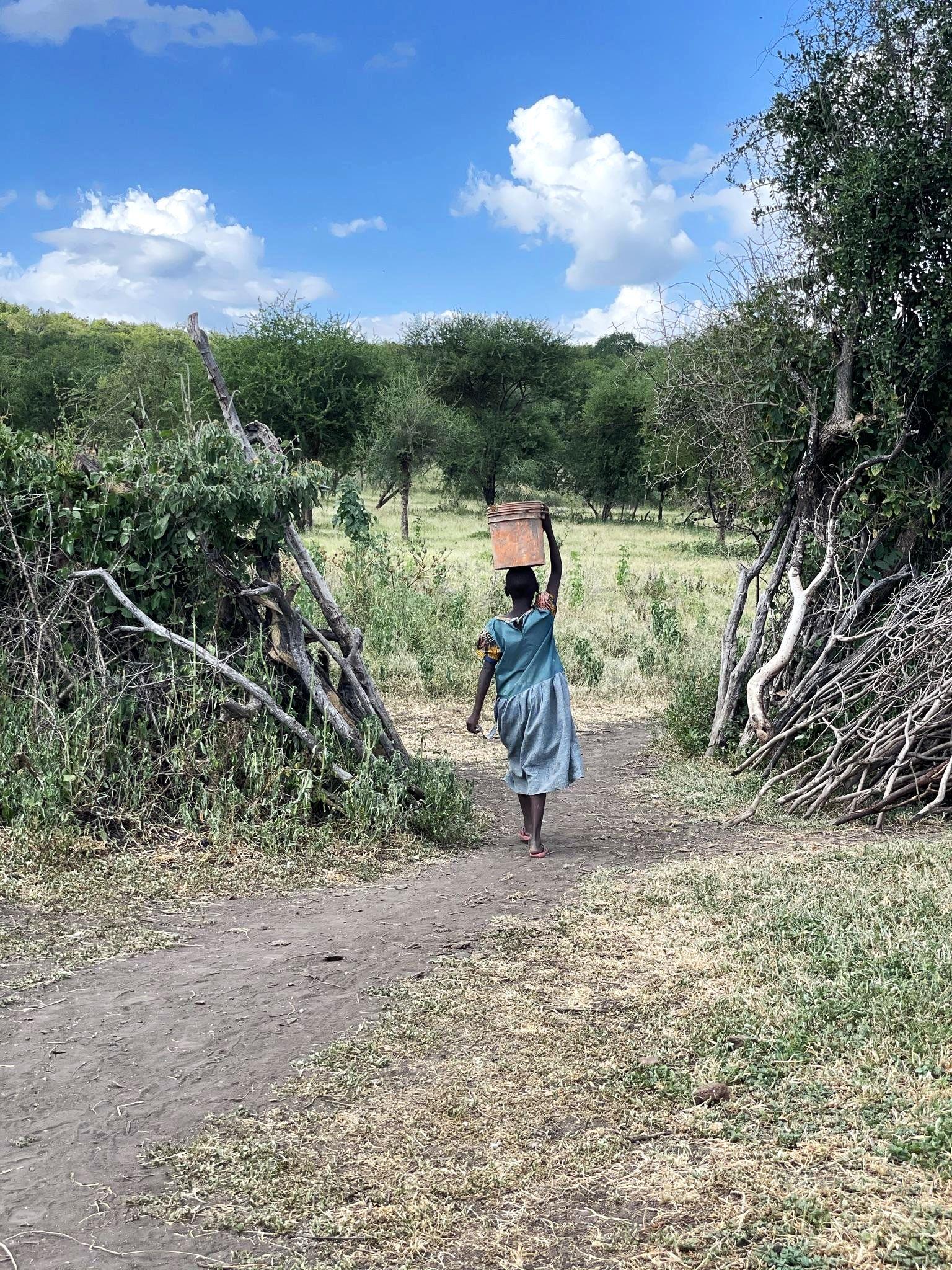
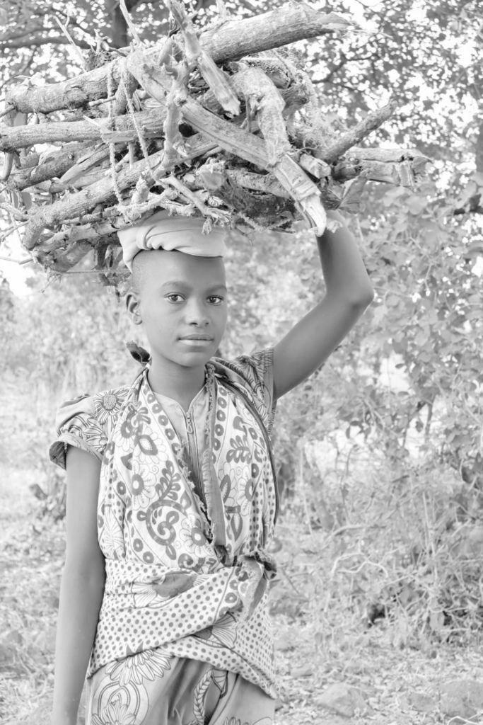
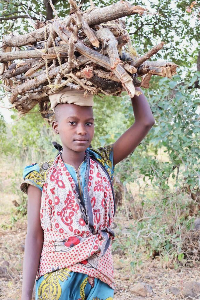
Furthermore,thecommunitygrappleswiththeconsequences ofclimatechange.Womenandgirlstraditionallyresponsible for fetching water, however, water sources are becoming scarcer, drought periods are extending, and water often remains distant. Consequently, women and girls must embark on arduous journeys, sometimes spending hours each day fetching water, which is essential for sustenance and householdchores.
In addition, increased proximity to modern settlements and cities is luring young boys and girls away from their families in pursuit of education and opportunities elsewhere. This migration disrupts families and threatens thepreservationofMaasaitraditionsandlanguage.
To address these pressing challenges, ISOMA Children has made it their mission to bring education to the community. By providing access to free, high-quality education that also reinforces Maasai traditions and language, the organization aims to empower the community to thrive while adapting to the modern world, thereby offering diverse opportunitiesfortheirchildren.
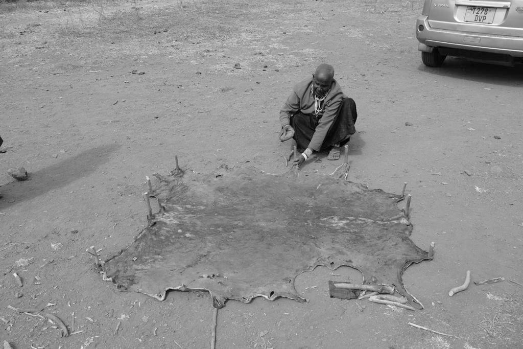
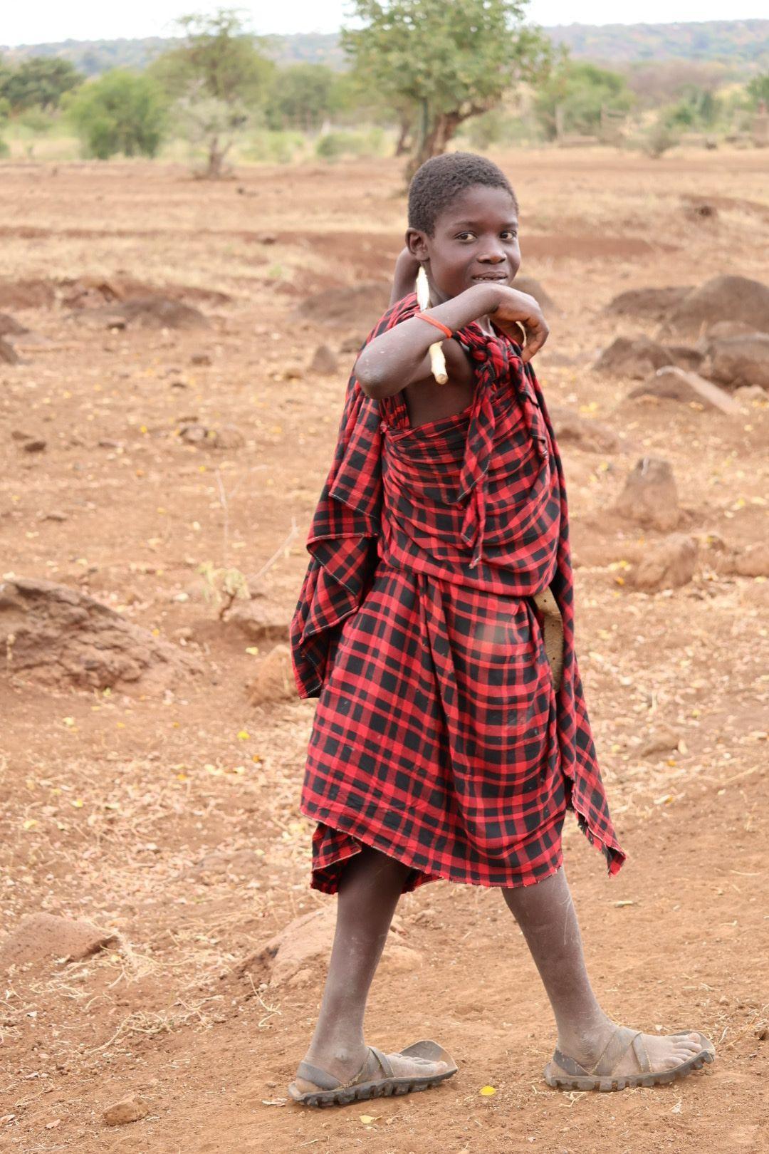
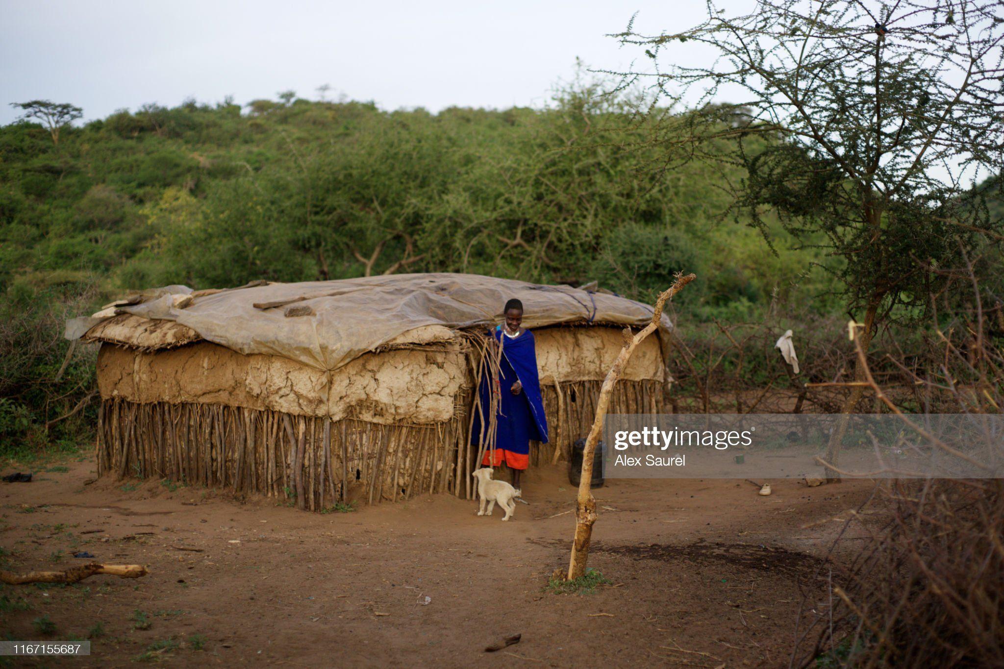
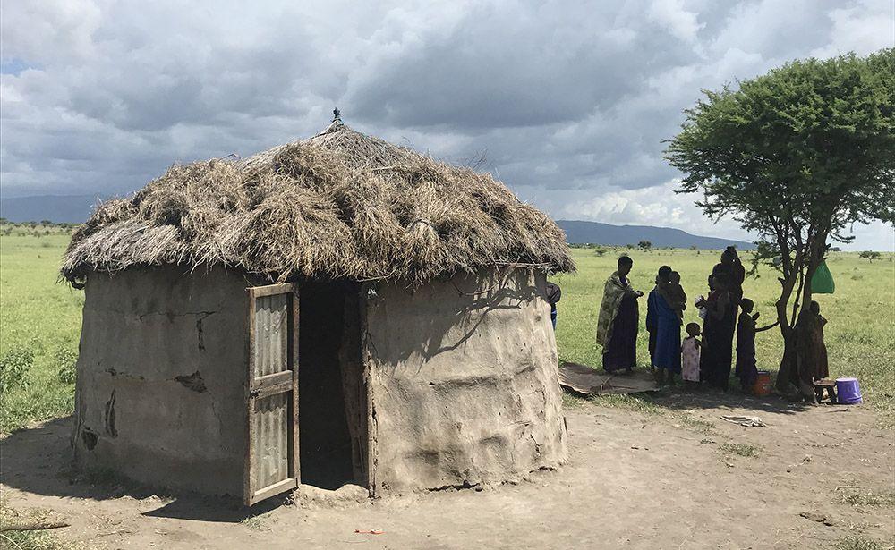
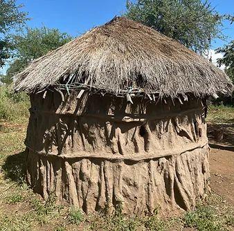
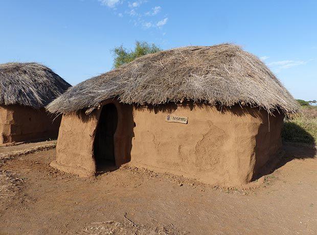
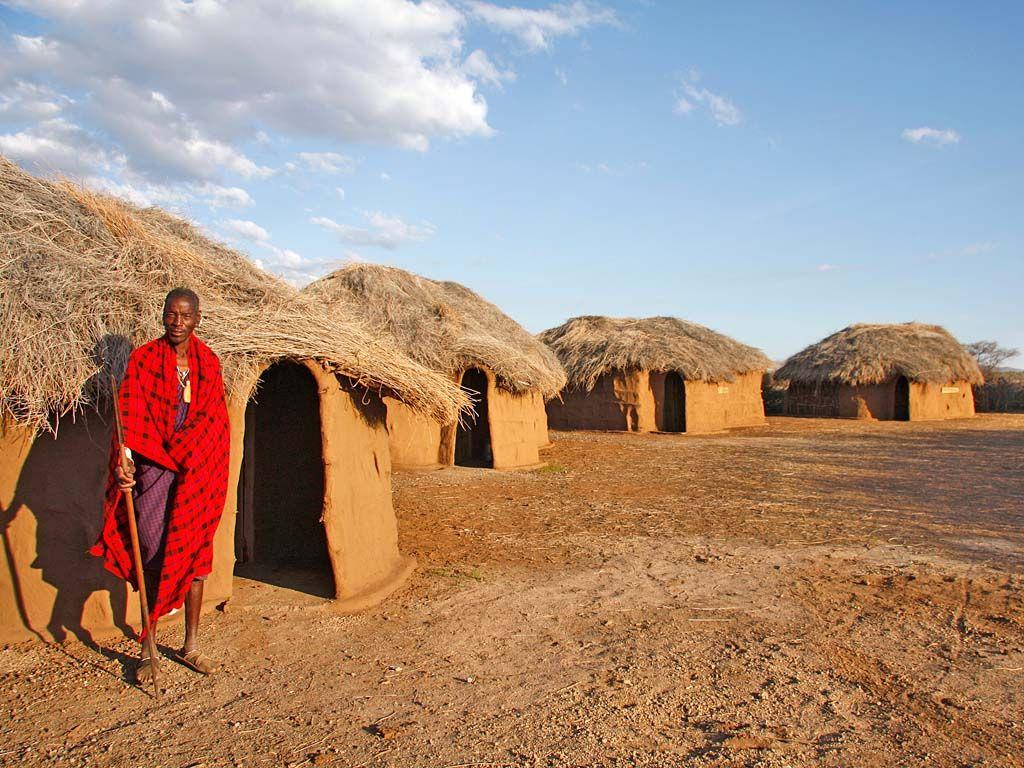
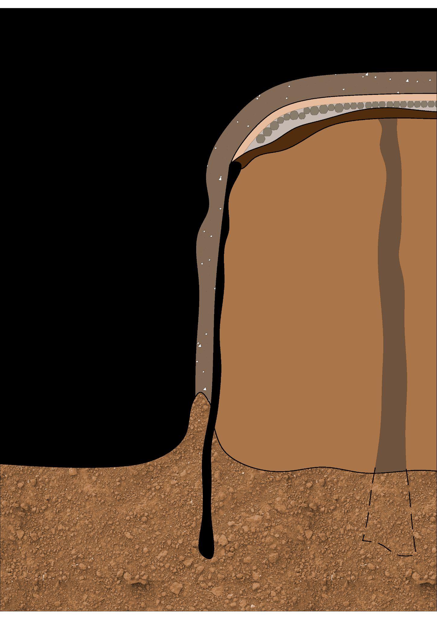
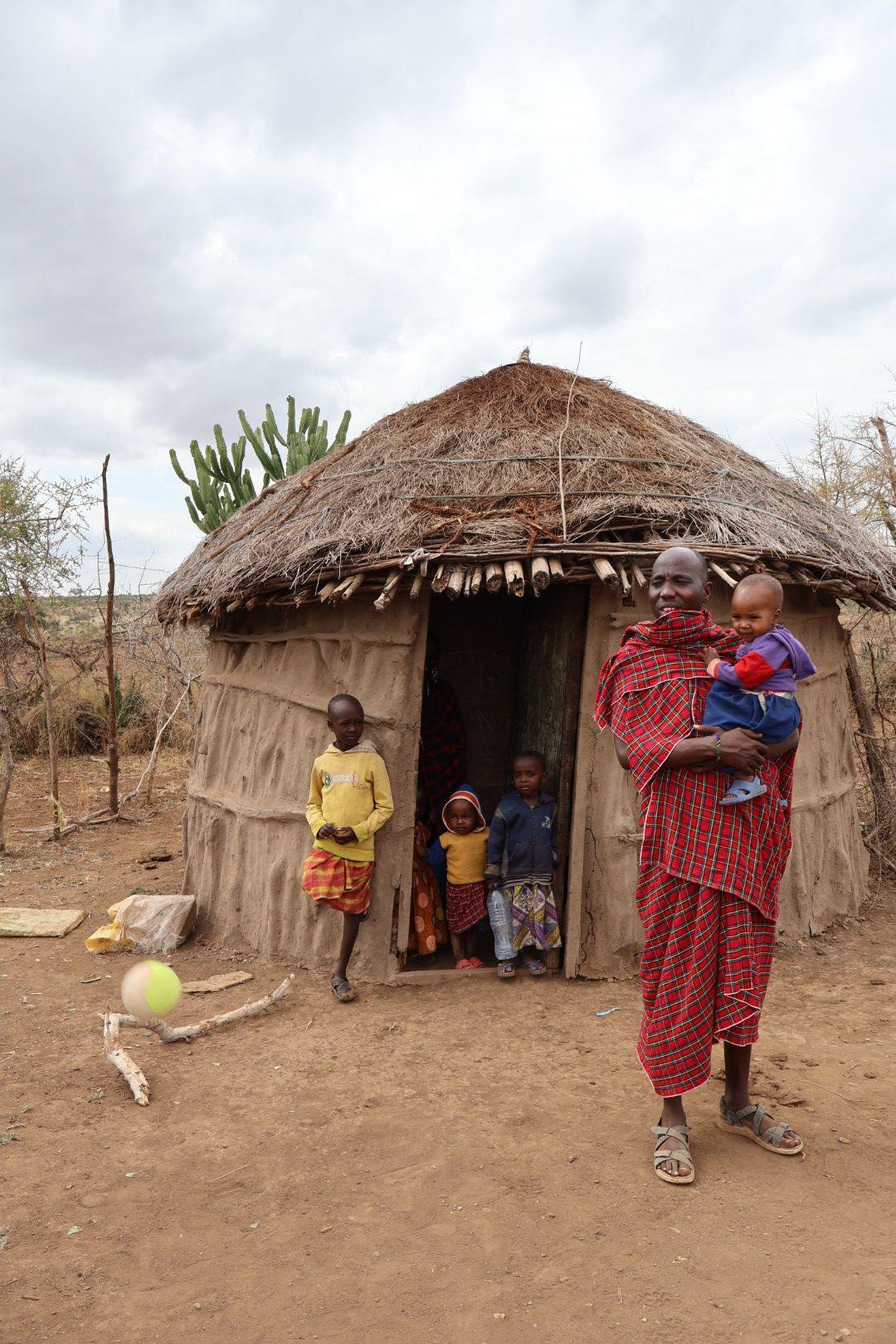
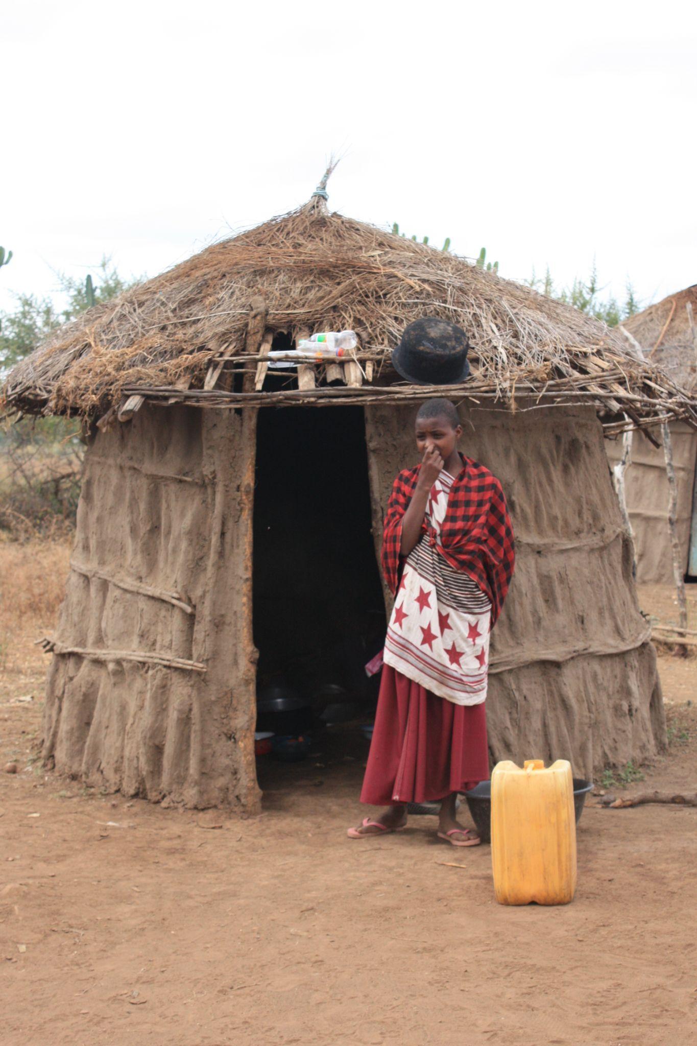
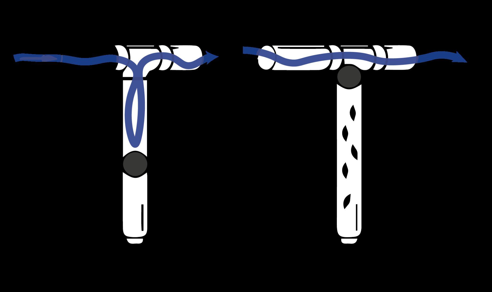
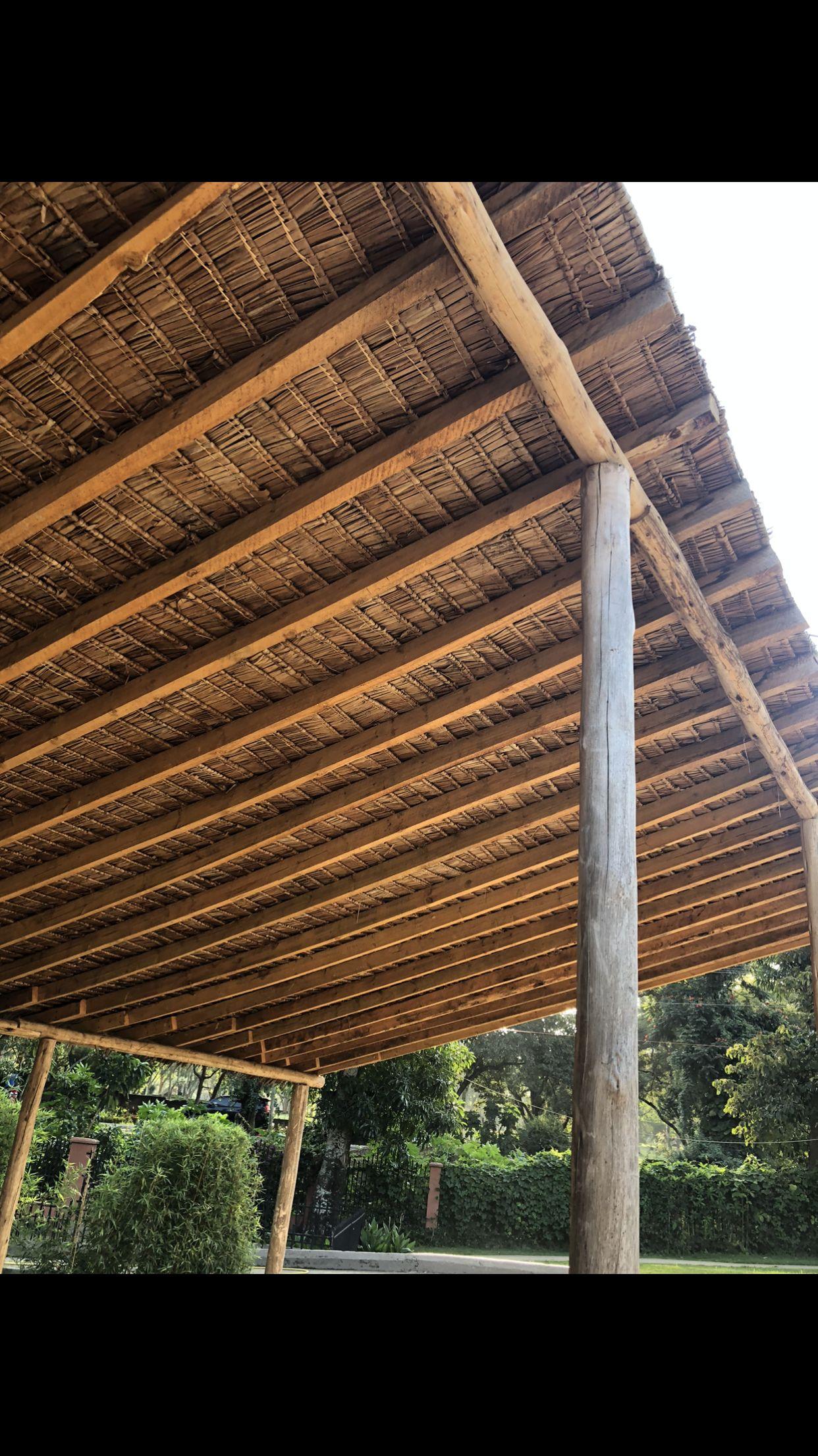
Maasai vernacular buildings, known as bomas, are traditional circular dwellings primarily constructed by women using materials like mud, dung, and thatch. (Lawson,D.W.etal.2014)
These structures serve a dual purpose, offering shelter to both people and livestock, primarily cattle, within a secure and thermally regulated environment. Historically, bomas were designed for mobility, allowing the nomadic Maasai to easily assemble and disassemble them as they moved to new grazing areas. These buildings typically had minimal openings, serving both defensive and climate control purposes. However, in contemporary times, some Maasai houses are adopting modern building techniques like concrete blocks and laminated roofing, which can lead to overheating, contrary to the original design's climate regulationprinciples.
2. Introduction
2.2 Executive Summary
Researchquestions
What strategies can be implemented to ensure that both boys and girls in the village attend school without forsakingtheirtraditionalresponsibilities?
Which locally available materials can facilitate adaptationtolongerandhotterseasons?
What design features and solutions can enhance the thermalperformanceoftraditionalMaasaiconstructions?
Which passive environmental strategies can effectively respondtoseasonalchangestoensureoccupantcomfort?
DesignAimsandObjectives
The primary focus of this thesis is to provide practical solutions that enable the children and the Orkisima village community to access quality education. This design project also prioritizes the integration of passive strategies tailored to the project's location and future weather conditions, all while preserving the rich ethnic culture of the Maasai people in NorthernTanzania.
ExpectedOutcome
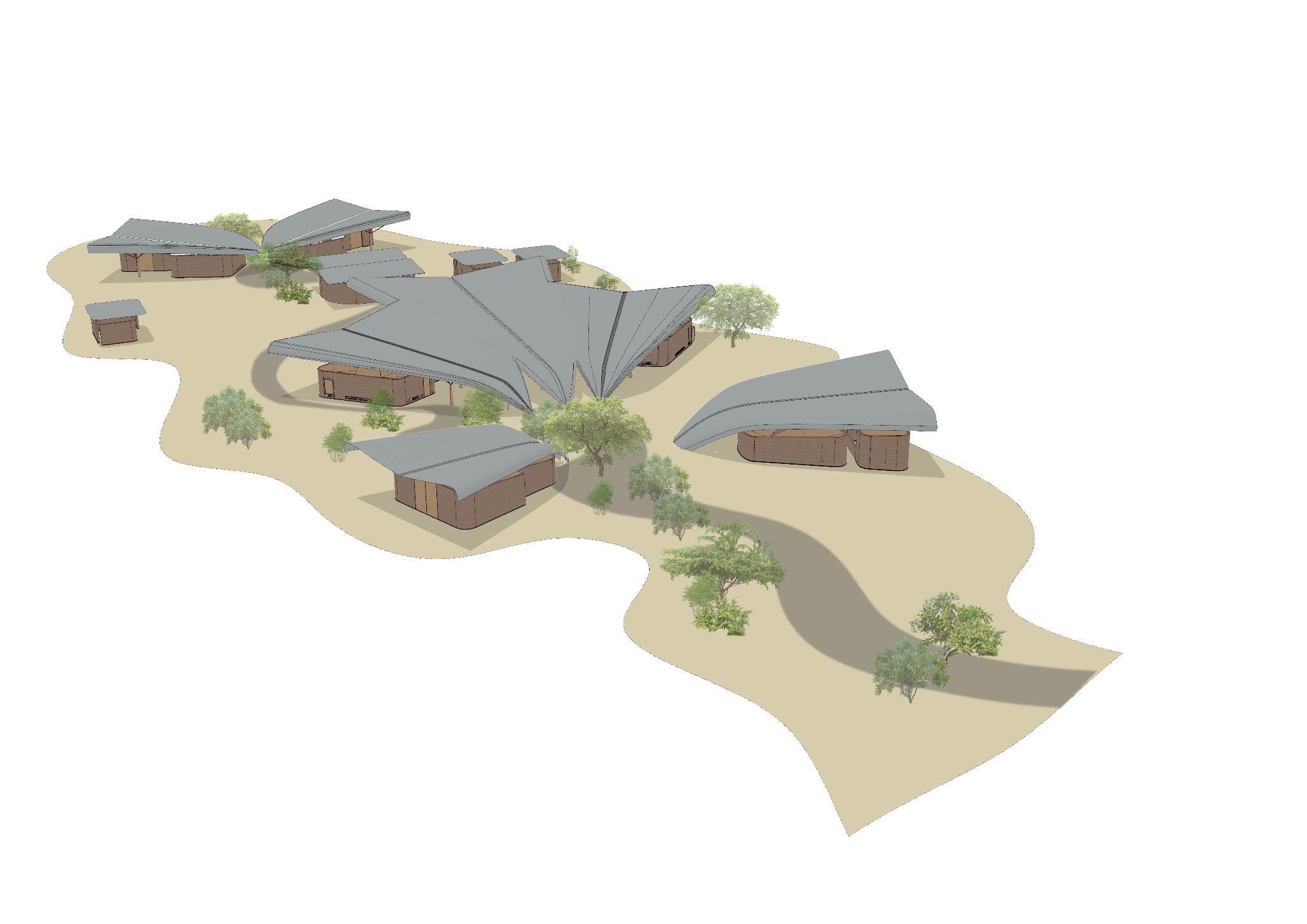
The anticipated outcome of this design project encompasses several key elements. Firstly, it aims to produce a comprehensive master plan that covers the allocation of land by the community, effectively bringing essential services and infrastructure to the village. This master plan will consider a range of factors and programs that enhance and sustain the school'splacement.
Additionally, the project aims to develop a versatile classroom module that can be extrapolated to various other programs and spaces within the master plan. This module, with its environmentalstrategies,isexpectedtoeffectivelyrespondto futureclimateconditionsandadapttoensureusercomfort.
Furthermore, community involvement and engagement will be a central aspect of the project. From the initial design stages through to the construction of the final room, the community's voice and expectations will be taken into account, fostering a collaborative approach that allows for mutual learning and growth.
2. Introduction
2.3 Methodology and Research Methods
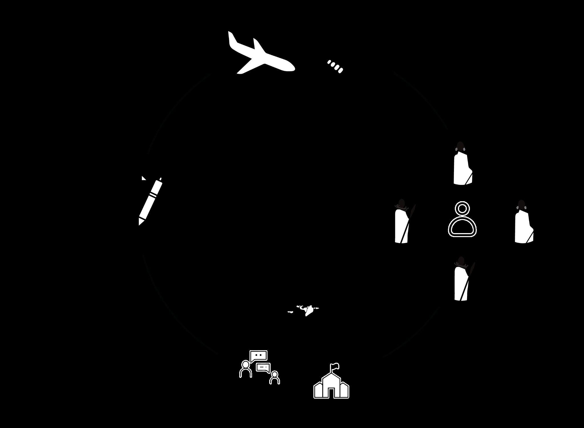
The methodology embraced by this design project is founded upon a multidisciplinary assessment of a proposed educational building's performance within a Maasai settlement in northern Tanzania. The project is delineated into a series of steps, visuallyillustratedinFigure2.3.1.Theforemoststageentails an investigation of the client's background, site-specific challenges, Maasai community dynamics, and the client's objectives harmonized with the analysis. Subsequently, the second phase adopts a methodological framework that encompasses delineating and scrutinizing the site's context, the building itself, pertinent precedents, and noteworthy case studies. This is followed by the integration of fieldwork observations and studies to elucidate identified issues and gain insight into community involvement and interest. These steps coalesce to shape the design proposal, evaluating the efficacyoftheproposedenvironmentalstrategies.
A literature review was then followed, which included several vernacular precedents with the same climate classification in Africa and worldwide. Additionally, other successful projects were presented to compare the environmental strategies used in all of the case studies to replicate them for our advantage. Projects involving rural communitiesandwomen'sempowermentwerealsoresearched toserveasreferencesfortheirmethodologies.
The methodology was then modified to introduce fieldwork analysis that enriched the process and validated the findings of the initial steps. The planning of the fieldwork was detailed to make the most strategic use of time with thecommunityandonthesite.
Consequently, the following methodology was also clearly implemented: firstly, the initial contact was made with the members of the board of the client's NGO and with the local architects who would later build the school. These interactions were conducted face-to-face in an informal settingwherewecouldgettoknoweachother,andselected work was presented to explain the concept and progress of the project. Observations from both the architects and the members of the NGO were recorded in a minute meeting to be addressed later. The next step was to engage with the community in the village of Orkisima. Because it is a large population, this interaction took place in a formal Maasai ceremony, attended by almost all members of the community. This provided us with the opportunity to be seen and to start interacting with the community leaders in a casual environment. This process was documented with observations and photographs. Then, the following step was the actual fieldwork, where various visits to the site allowed for in-depth studies. Technology like satellite GPS and UAS was used to capture images of the current site's conditions and photographs to indicate on a plan what was seen in each location of the site. The objective was to replicatethesiteasclosetorealityaspossibletointegrate its positive characteristics into the design. Regarding the fieldwork that took place with the community, a carefully planned set of interviews took place, during which video andaudiooftheconversationswithselectedmembersofthe villagewererecordedtobetranscribedandanalyzedlater. During this step, it was also important to take notice of existing buildings in the village, classifying the housing construction into two groups. Some observations regarding comfort and temperature were made for each group of buildings.
A more specific survey was done for the existing building that is the present school for the children. Here, measurements of general dimensions and photographs were taken to later replicate the building using the Rhinoceros tool for more in-depth analysis. The meticulous planning of the site visit resulted in a clear and comprehensive site analysisthatsetthegroundworkforthedesignprocess. Theenvironmentalandfunctionalstrategiesoftheproject werethenestablishedtoensurecomfortabletemperatures andaddresstheissueofwaterscarcity,allowingthegirls ofthevillagetoattendschool.Thesestrategiesweredrawn fromthevernacularprecedentsandweretestedinthe analyticalmethodologyofthethesisproject.
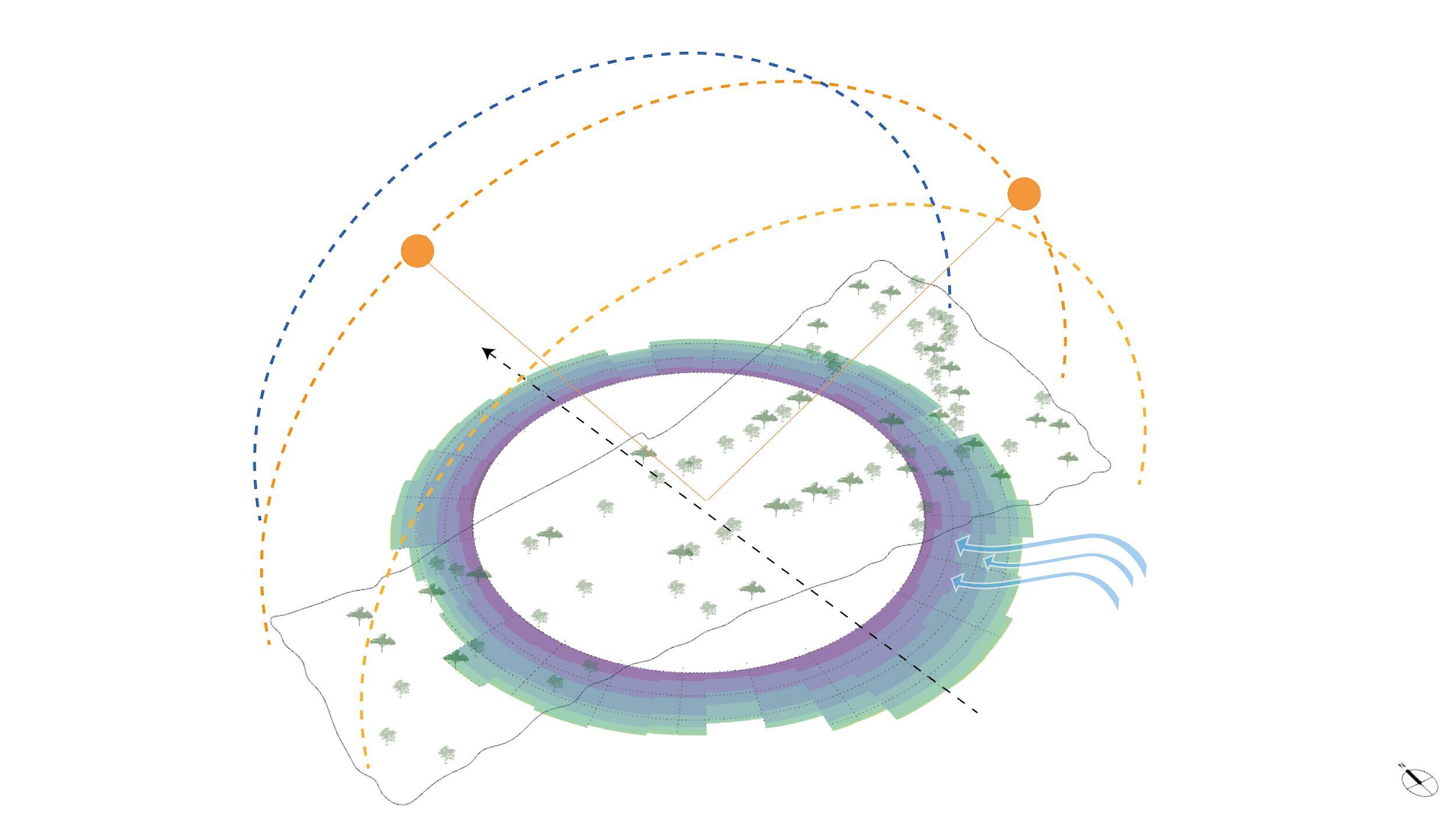
The proposed project is located in the northeastern region of Tanzania, Africa, home to the Maasai, one of Africa's oldest indigenous ethnic groups found primarily in Kenya and northern Tanzania. The Maasai lead a semi-nomadic lifestyle deeply rooted in their rich traditions, with cattle herding and pastoralism at the core of their existence. Their history dates back to the Nile Valley in northwest Kenya, and they began migrating southwards in the 15th century, eventually settling in various parts of Kenya and Tanzania, including Dodoma (Tanzania) and Mount Marsabit (Kenya) during the 19th century (The Maasai tribe, East Africa, 2023).
However, the Maasai population faced significant challenges such as epidemics and droughts. In the early 1900s, British-imposed treaties led to a 60 percent reduction of Maasai lands in Kenya. Simultaneously, in Tanzania, Maasai communities were displaced from their fertile lands around 1940 to create national parks and reserves.
Today, the Maasai have embraced a more modern lifestyle while advocating for their grazing rights in various areas and national parks, adapting some of their traditions to contemporary circumstances (The Maasai tribe, East Africa, 2023).
According to The Maasai Association, the current Maasai population stands at approximately 950,000 individuals spread across a vast area of 160,000 square kilometers.
Client
The client for the project is ISOMA Children, a non-governmental organization registered in Tanzania. Established in 2021, their mission revolves around providing free and high-quality education to children in a Maasai village in Tanzania. The organization collaborates with community members from Loosimingor village in the Monduli District of Arusha, Tanzania. Their core objective is to ensure equal educational opportunities for all children while also preserving and nurturing Maasai traditions.
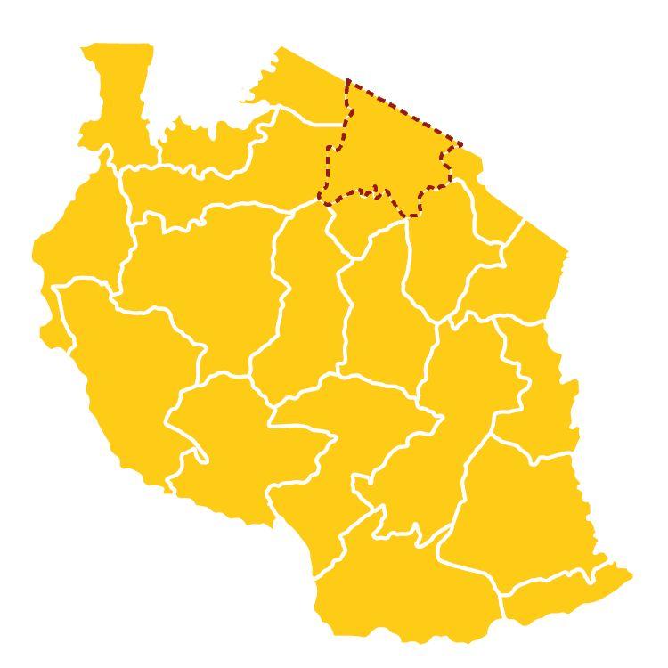
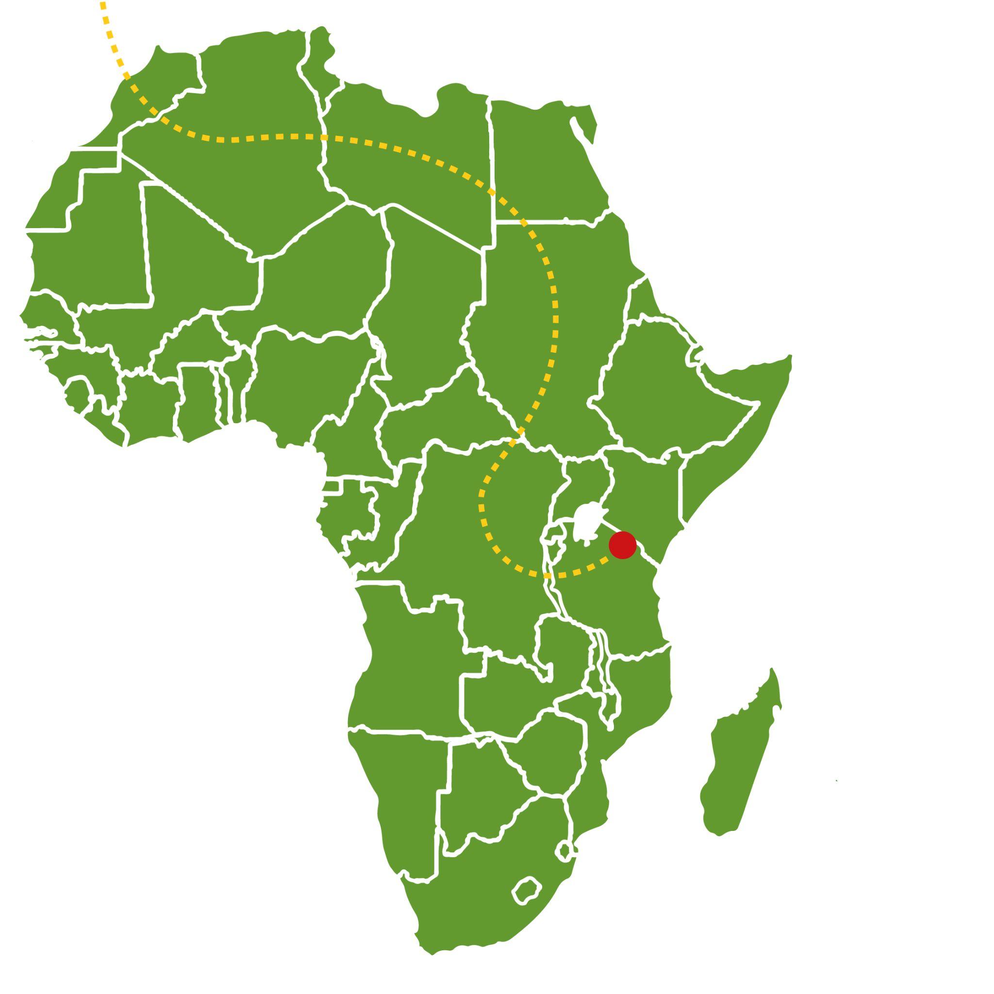
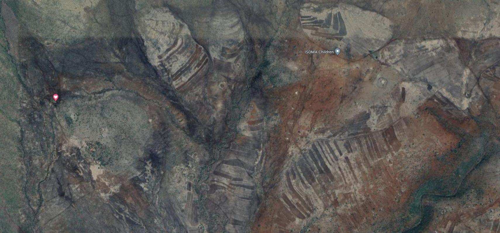
Fig 3.1- Diagram with location of Tanzania and Maasai population
Nairobi
Mt Lengai
Mt Kilimanjaro Arusha Lake Eyasi
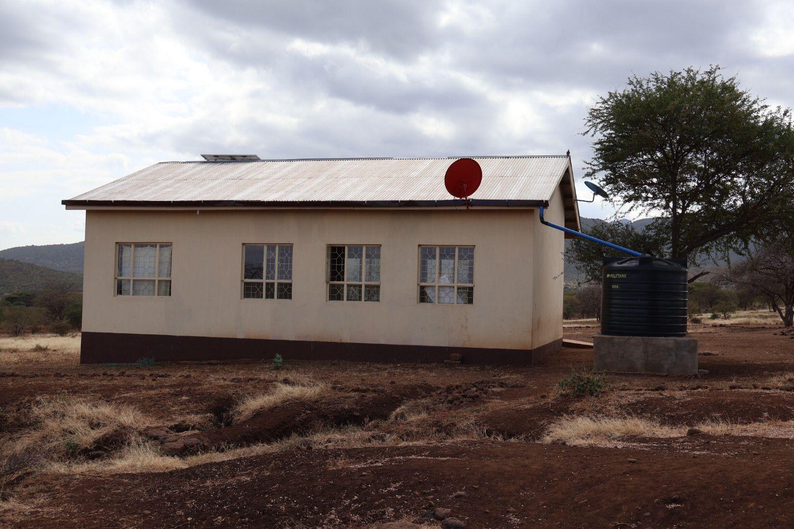
Fig 3.1.2- Image of village property of ISOMA
Fig 3.1.3- Image of people in the village property of ISOMA
3. Overview
3.2 Location and client
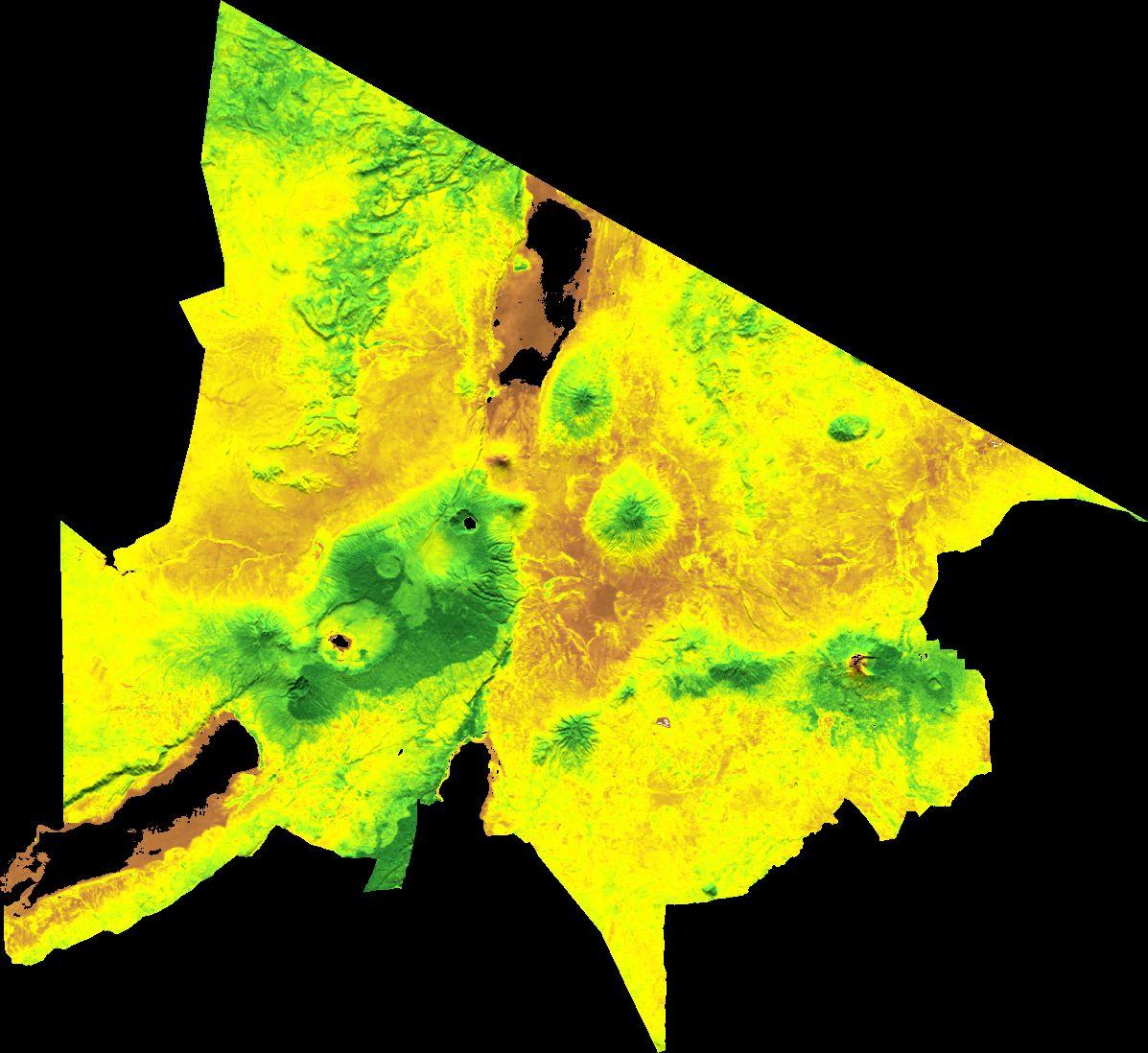
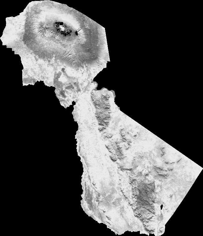
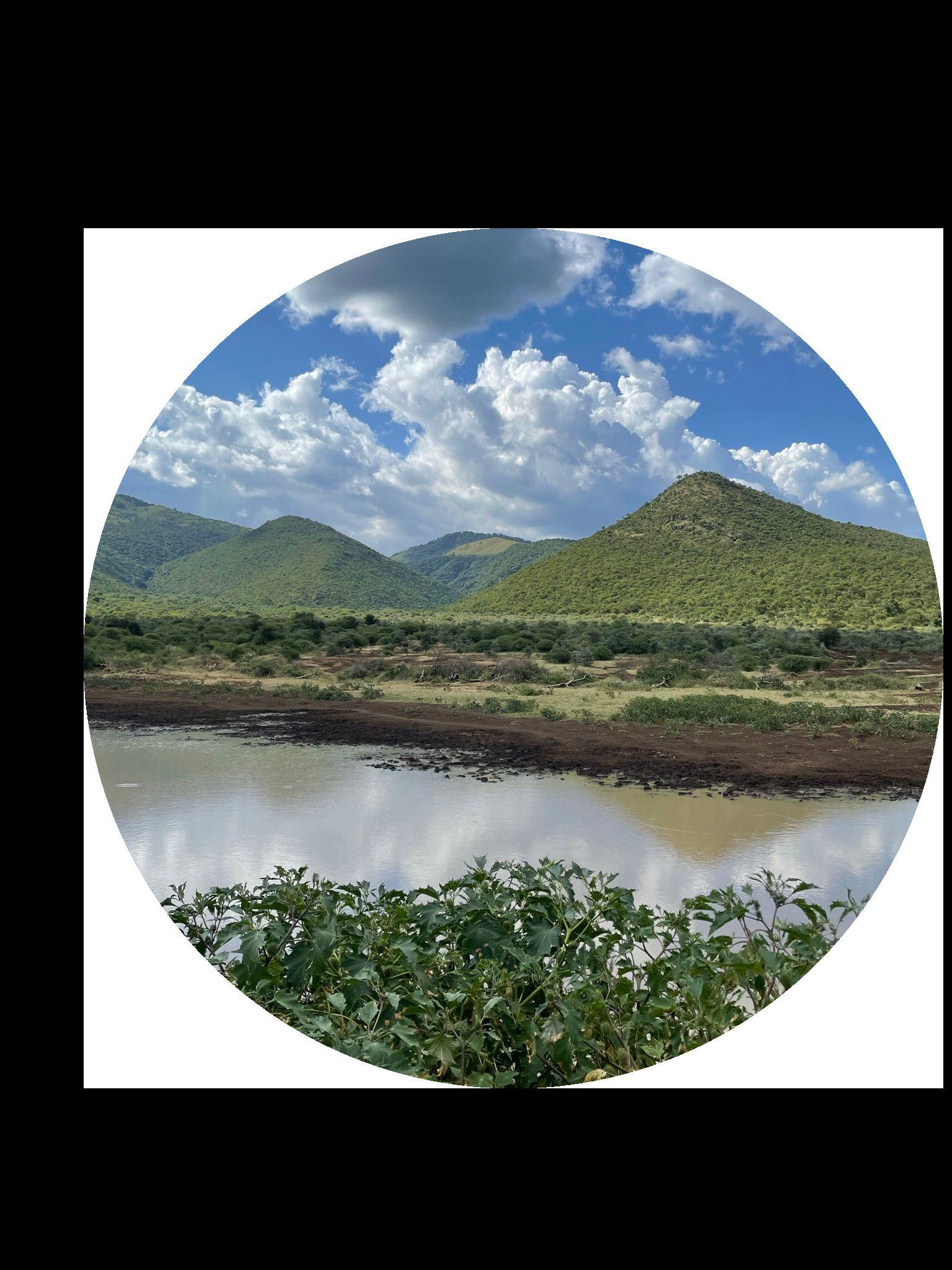
The project site is located in the Maasai region of Arusha, bordered by the Kilimanjaro region to the east and the Manyara Region to the south. This historically fertile area owes its fertility in part to its proximity to Mount Kilimanjaro, the highest peak in Africa and a dormant volcano. Furthermore, the region is blessed with three significant water bodies: Lake Eyasi, Lake Manyara, and Lake Natron.
A notable asset in this region is the Ngorongoro National Park, designated as a UNESCO World Heritage site since 1959. This protected area encompasses vast highlands, savannas, and forests, serving as a habitat where wildlife coexists harmoniously with the Maasai community (Centre, U.W.H., 2023).
Adjacent to this region lies the renowned Serengeti National Park, a vast savanna covering over 14,800 square kilometers. Home to Africa's largest concentration of predators, this park holds global importance for preservation and conservation efforts.
The nearest major city to the project site is Arusha, located in northern Tanzania, with a population of approximately 550,000 residents. Arusha experiences a relatively stable climate, with average temperatures ranging from 15°C to 28°C, reaching their peak between November and February (Climate and Average Weather in Arusha, 2023).
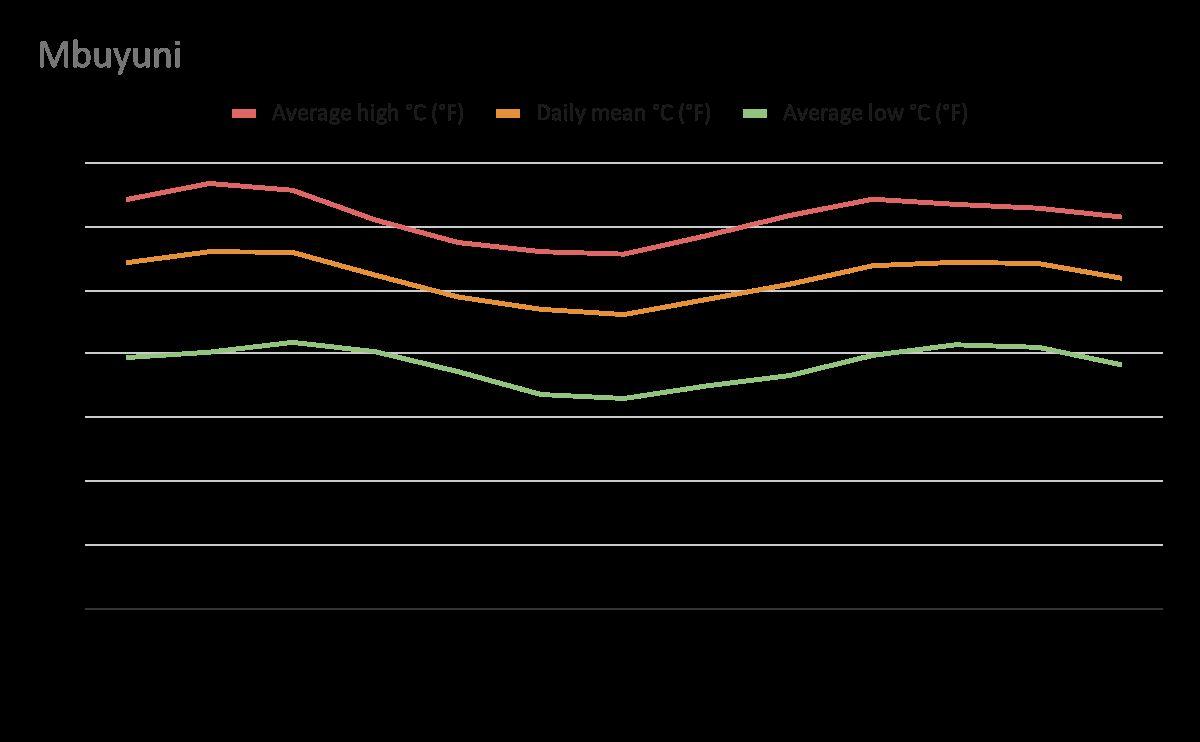
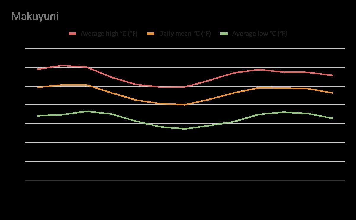
Access to the project site is facilitated by a highway connecting Arusha to Lake Manyara, passing through two nearby towns. Mbuyuni, the closest town, is home to 3,000 residents and is situated in the southern part of the Monduli district. It maintains a consistent average temperature of 22-26°C throughout the year, with peak temperatures occurring from November to March. Makuyuni, the second-closest town, has a population of 12,500 (National Bureau of Statistics Tanzania, 2023).
Population in Orkisima village
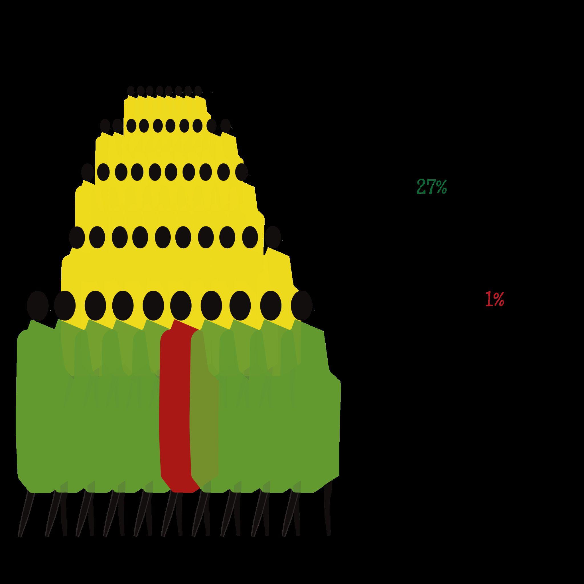
Regarding the population of Orkisima village, data was collected through a census conducted by ISOMA between April 2022 and 2023. Preliminary findings indicate that the village is home to 486 families. Among these families, only 27% of individuals within the specified age range have attended primary or secondary school, with less than 1% pursuing higher education.
Arusha Region
Manyara Region Kenya
Mount
Kilimanjaro L. Manyara
Ngorongoro National Park
Serengeti National Park L.
Natron
Arusha (64 km to site)
Mbuyuni (5 km to site)
Makuyuni (13 km to site)
Less than 27% of the children have attend primary or secondary school
There are 486 families in the village
Less than 1% University
Fig 3.2.1- Diagram with location of Tanzania and Maasai population
Theoretical Background
Tanzania´s educational system
4. Theoretical Background
4.1 Tanzania's educational system
The mission of ISOMA Children is rooted in providing free and high-quality education. To comprehend the significance of implementing this project in the specified location, it is essential to contextualize the broader educational landscape in Tanzania.
In Tanzania, the educational system comprises the ordinary level, encompassing seven years of primary school, followed by four years of secondary school. Subsequently, students advance to the high school level, which consists of two years. Afterward, students can take the Advanced Certificate exam, which qualifies them to attend college for three to four years (Asante Sana, 2014).
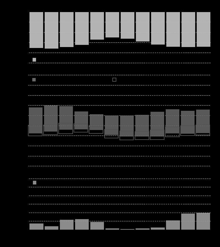
Primary and secondary education is compulsory for all children between the ages of 7 and 13. However, there has been a significant decline in enrollment within this age group over the past decade. According to UNICEF, approximately 2 million children aged 7 to 13 are not attending school in Tanzania (UNICEF, 2021).
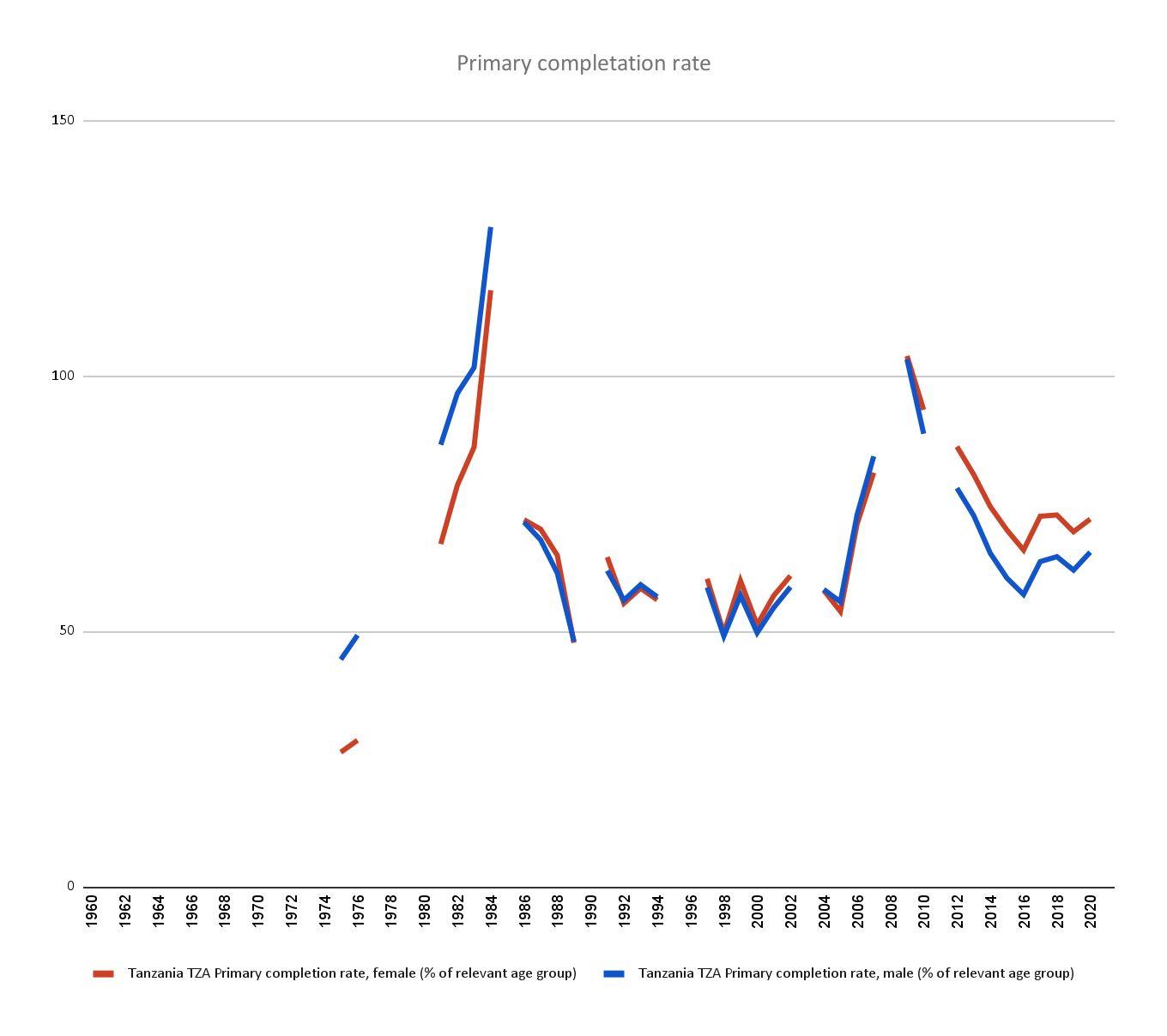
UNICEF reports that Tanzania nearly achieved universal access to primary education in 2007.
As illustrated in Graph 1, the completion rate in Tanzania experienced a decline starting in 2009 but gradually began to rise again in 2016 when the initiatives of the "Basic Education Policy of 2014" began yielding results. This policy aimed to enhance access to and the quality of education by eliminating school fees for all students (UNICEF, 2019).
% of age group
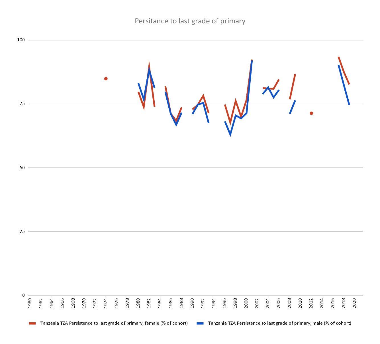
However, despite the introduction of new policies, the student persistence rate in primary education (Graph 2) has steadily decreased over the past eight years. This suggests that even with government financial support, parents and guardians are choosing to withdraw their children from school, highlighting the presence of underlying issues that need addressing.
Fig 4.1.2- Persistence in primary
4. Theoretical Background
4.2 New Pedagogies
As the objective of this thesis is to design for the future taking in consideration future climate patterns, it is also equally important to research the future educational practices.
New pedagogies encompass innovative approaches to teaching and learning that depart from traditional methods. These approaches prioritize student-centered learning, active participation, and the use of technology to create more engaging and personalized educational experiences. In new pedagogies, teachers act as facilitators, guiding students through problem-solving, critical thinking, and collaborative activities. The focus is on adapting education to meet the diverse needs and interests of students, promoting lifelong learning skills, and fostering a deeper understanding of the subject matter. (Keiler, L.S. 2018)
Alongside these pedagogical shifts, the concept of a classroom space has evolved significantly. Traditional classroom setups with rows of desks have given way to flexible learning environments that can be rearranged to support various teaching and learning styles. Blended and flipped learning models incorporate technology and online resources, extending learning beyond the physical classroom. Furthermore, outdoor, informal, and virtual learning spaces have emerged to accommodate diverse educational experiences. This transformation reflects a broader shift in education toward more dynamic and adaptable learning environments that align with the principles of new pedagogies. (Kariippanon, K.E. et al. 2019)
In architecture, these shifts in ways of learning and teaching began to emerge in the early 1950s. In Austin, Texas, a group of teachers developed a program that challenged the existing model of American architectural education. This program recognized the works of Frank Lloyd Wright, Le Corbusier, and Mies van der Rohe.
Meanwhile, in Poland, Oskar Hansen was also developing his own interest in strategies of indeterminacy, flexibility, and collective participation. For Hansen, architecture needed to expose the diversity of events and individuals in a given space. His theory played an important role in the history of Polish art. (Colomina, B. et al. eds. 2022)
These are just examples of how new ways of thinking can inspire new generations of designers and inventors, much like the artists who came before us.
Learning strategies
(Teachthought 2023)
Debate-Based Learning. Unplanned Learning
Hands-On Exploration Physical Engagement in Learning
CrossDisciplinary Learning.
Situational Learning
Spacial outcomes
Flexible learning environments
Informal learning Adaptable environments
Problem Definition
5. Problem Definition
5.1 Education on Site
Even though it is clear that education is the main objective of an educational building, it is important to state why there is a problem in the current education system in Orkisima village.
There are many challenges to guaranteeing the availability of education for the population. Inadequate infrastructure for all abilities, insufficient funding, shortage of teachers and difficult access to schools are some of the main issues. That is why children in rural areas have a higher level of disadvantage and are more likely to dropout of school, or not even enrol.
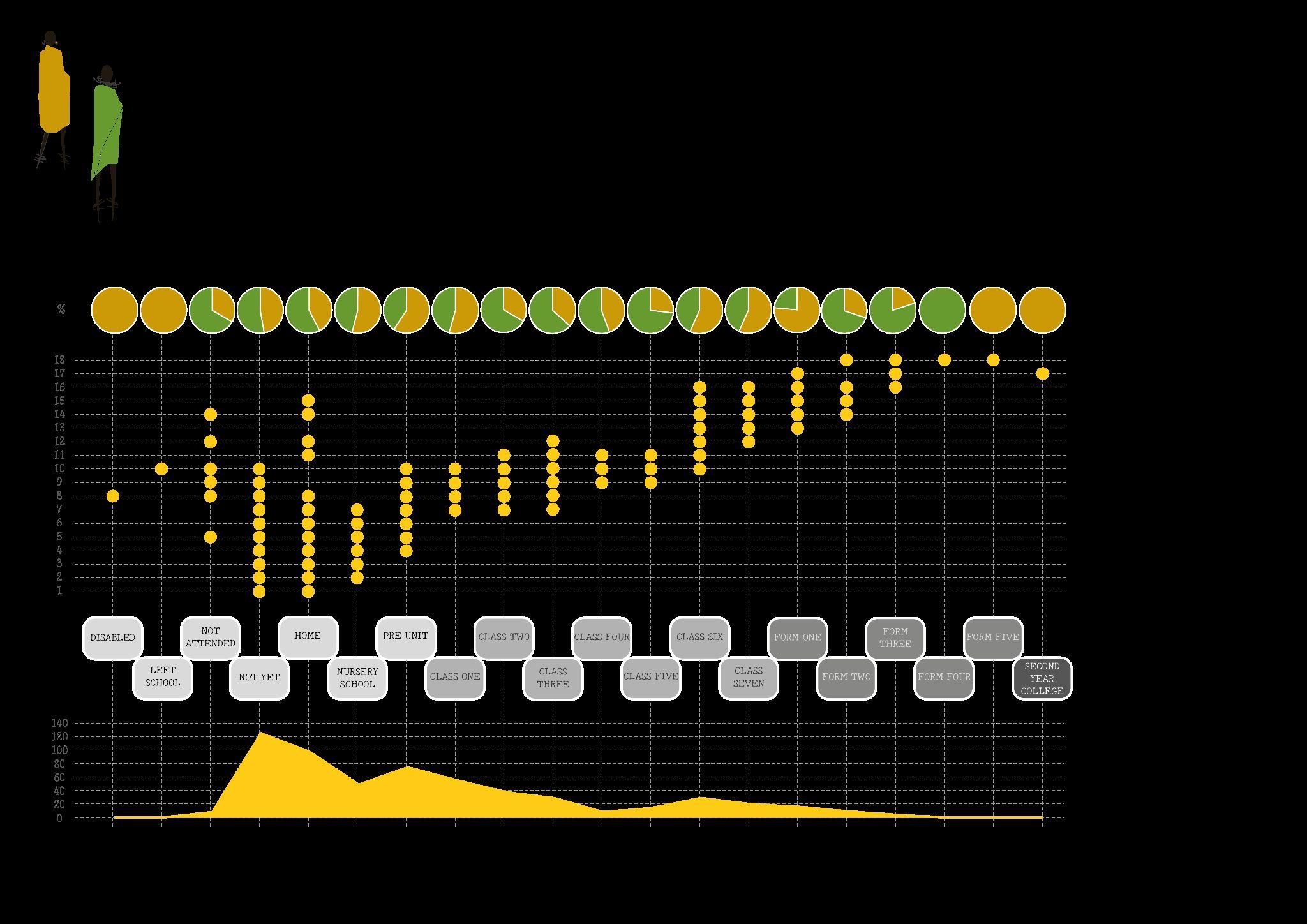
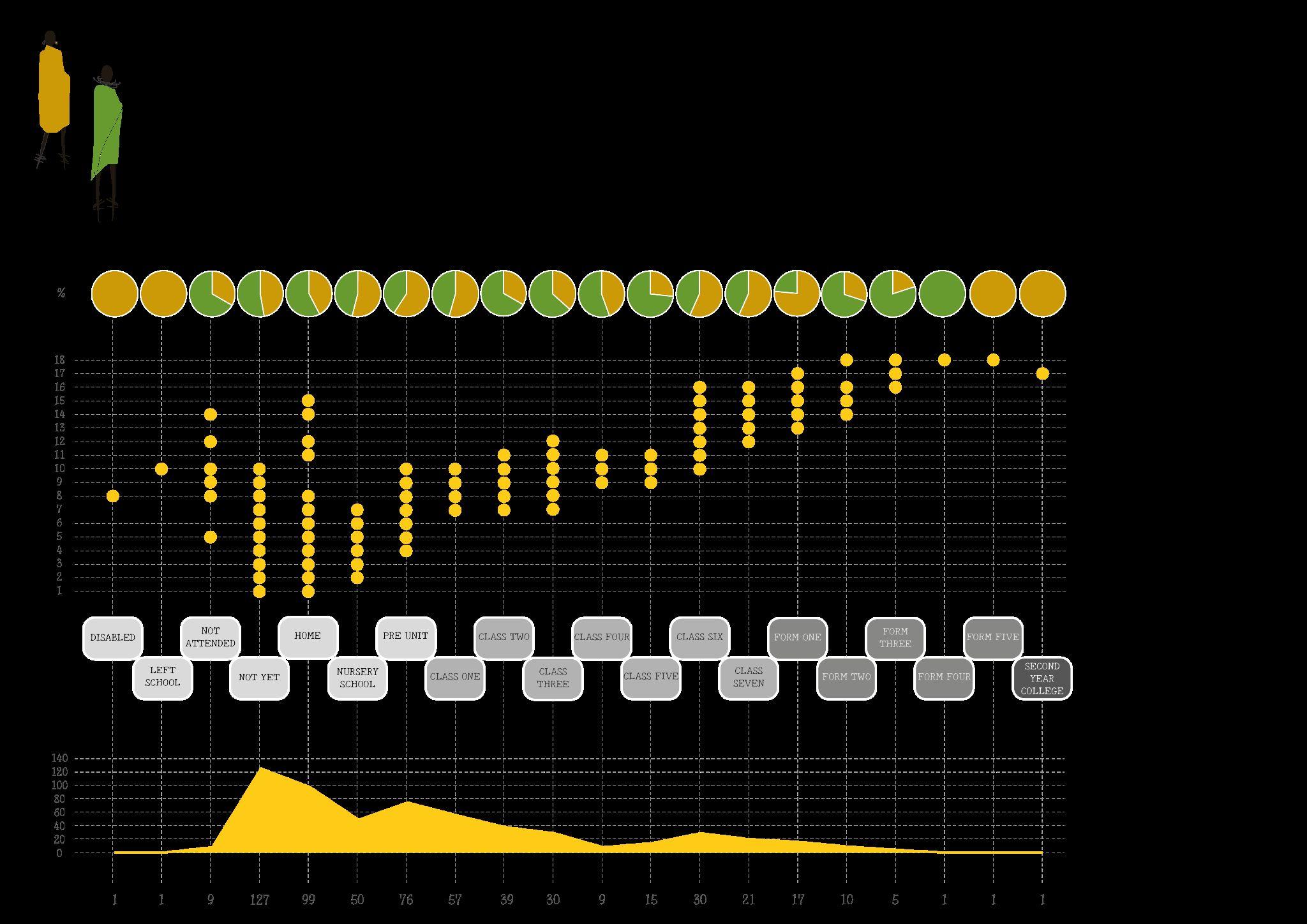
According to a census made by ISOMA in 2021, in the village less than the 27% of the children currently attend school, less than the 25% of the community is literate in Swahili and, less than 3% in English.This porcentages mean that out of 10 kids, only 2.7 are receiving education
Because it was clear that this issue needed to be further analyzed, another more detailed census was commissioned by ISOMA in order to know exactly how many children there are in the village, their age, gender and level of education.
The total number of children registered in the census is 597, from which 39.5% are not in school, 21.1% are still in nursery (from 1 until 10 years of age), 33.6% are attending primary school, while 5.6% are attending secondary school and only 0.3% have proceed to advance level.
The results shown on figure 5.1.2 indicate an important gap in education for kids between 1 and 10 years old. Since the majority of the kids in the village (120 children) between this ages are currently “ Not yet” enrolled in school. Followed by 100 kids that are at “ home” and 50 kids that are in “ nursery” even when their age is very much past nursery grade.
It is clear that a great area of opportunity to still enroll the majority of the children that are currently not attending school. This opportunity can only succeed if the hidden reason behind their absence are resolved.
Fig
5. Problem Definition
5.2 Water Scarcity
While talking about education, it was mentioned that other problems may be arising in the region resulting in the disregard for education. Talking to the local community in Orkisima village and surroundings, ISOMA identified the general issue that is troubling so many families, water scarcity.
Water is a vital resource for life and it's quickly becoming very valuable in Tanzania. Despite being surrounded by three important lakes, water in Tanzania is not available or safe to drink for many people in the country, especially in rural areas.
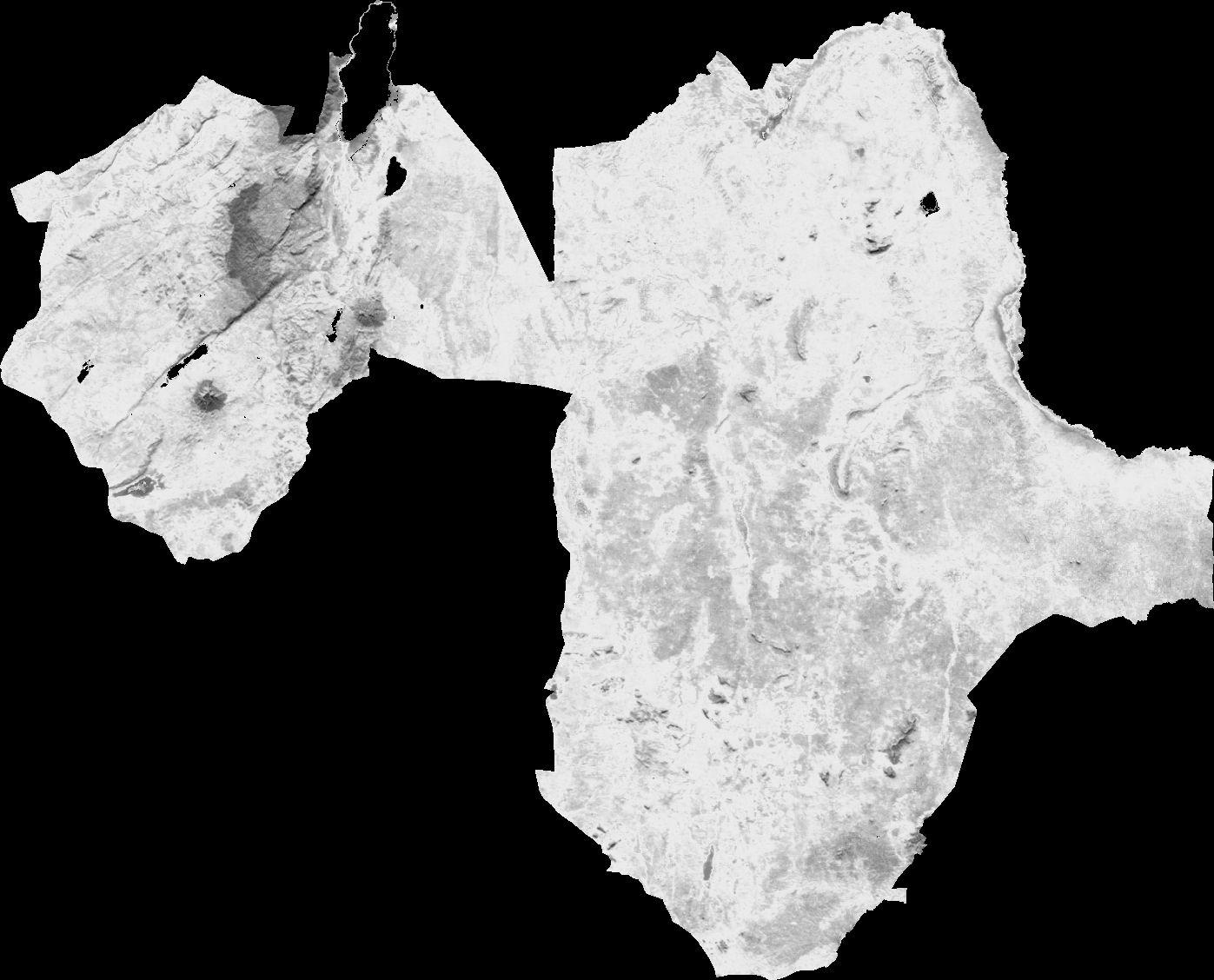
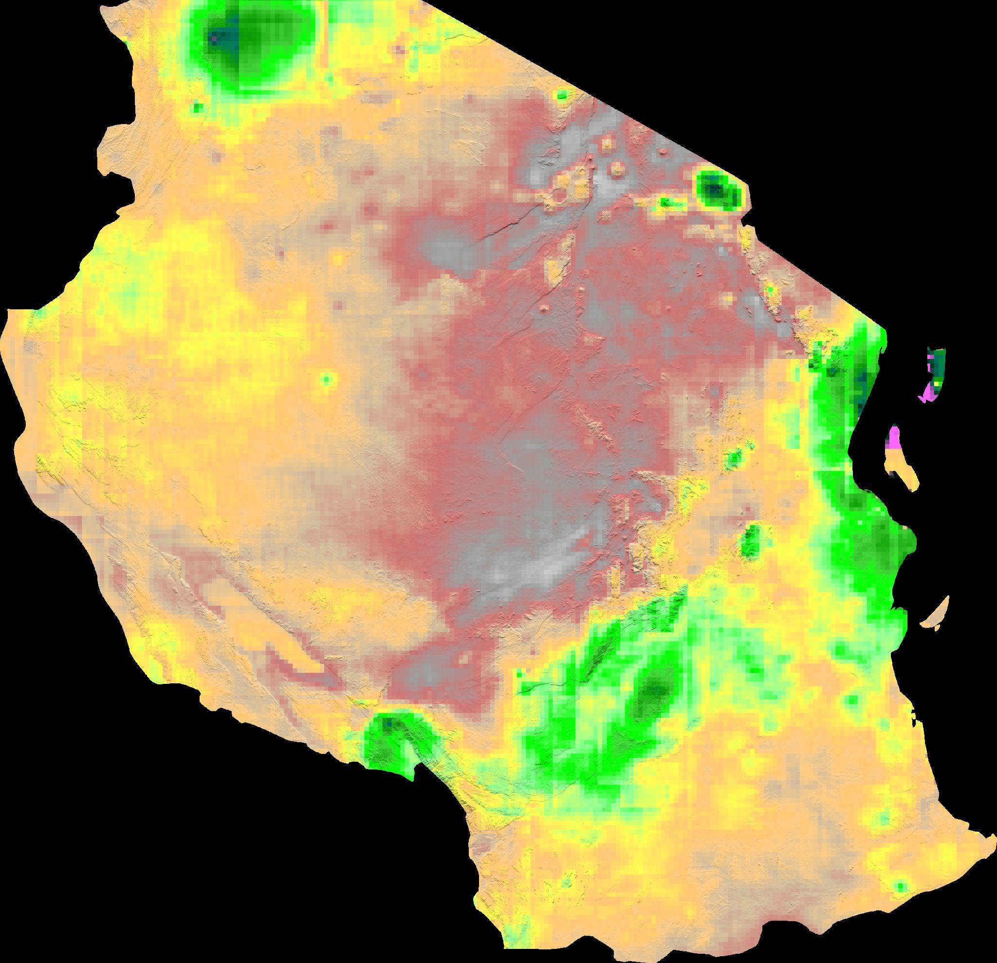
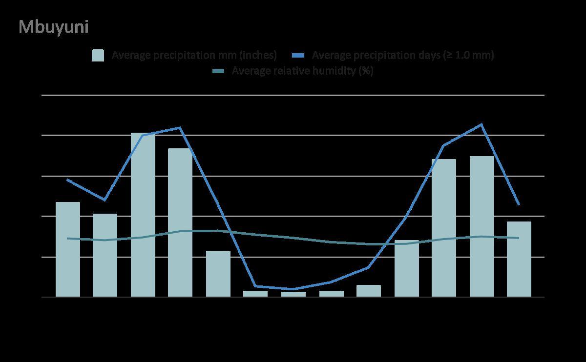
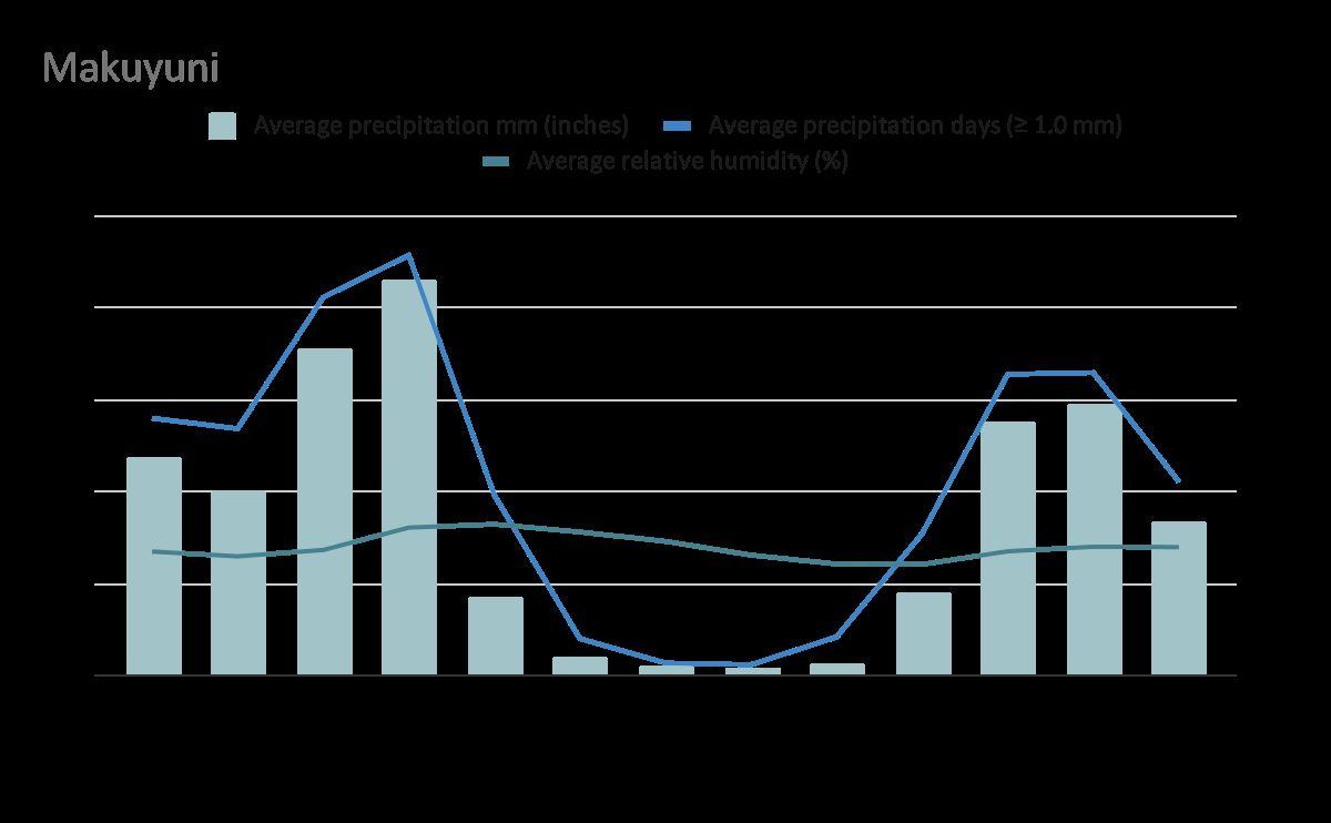
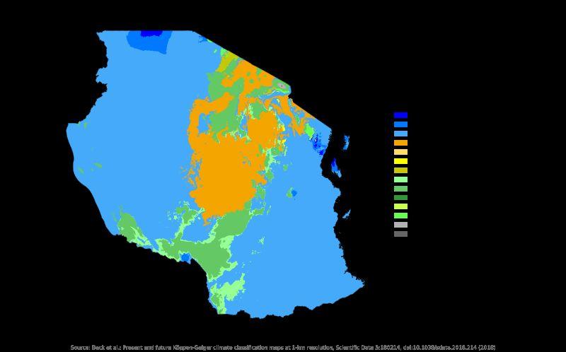
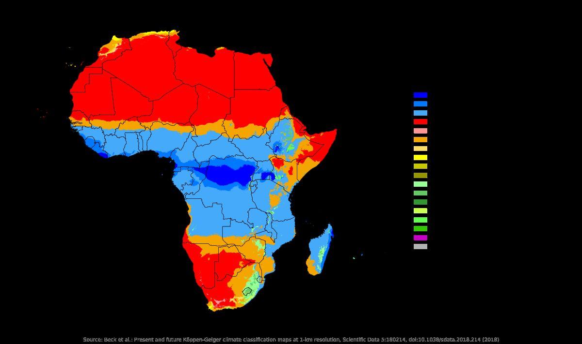
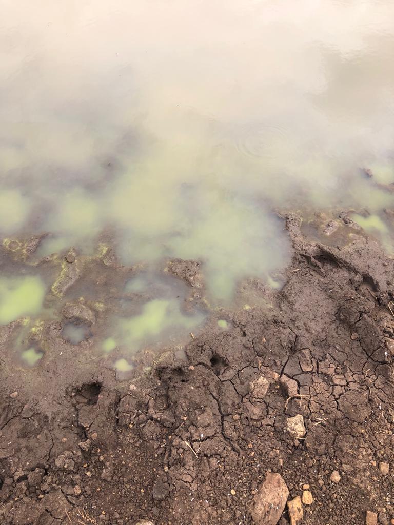
As shown in image 1, precipitation is uneven in the country, while some areas receive an average of 2000 mm of precipitation annually, others receive a short 600 mm. The region close to Orkisima Village receives around 600 mm-800 mm of rain annually.
Also, we can see in image 2, the aridity index of the country. This means that it measures the relationship between rainfall and the potential amount of water that can evaporate from the soil. The majority of Tanzania's territory, as well as our particular site region, is classified as “Semi-arid” meaning that the area is characterized by moderate to low rainfall, with a significant amount of water loss because of the soil properties and evaporation. (ScienceDirect, 2018)
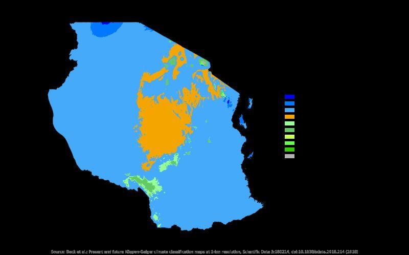
To understand the entire picture of the water scarcity problem in the region, also an overview of the mean maximum temperatures was studied. In image 3, we can see how temperatures in Tanzania range from 24ºC to 32ºC. These characteristics contribute to water's fast evaporation making the search for water even harder.
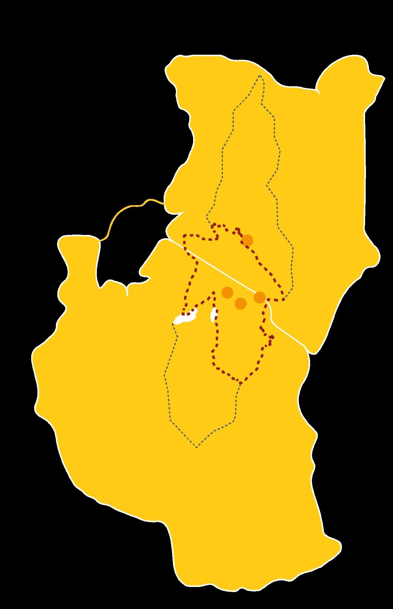
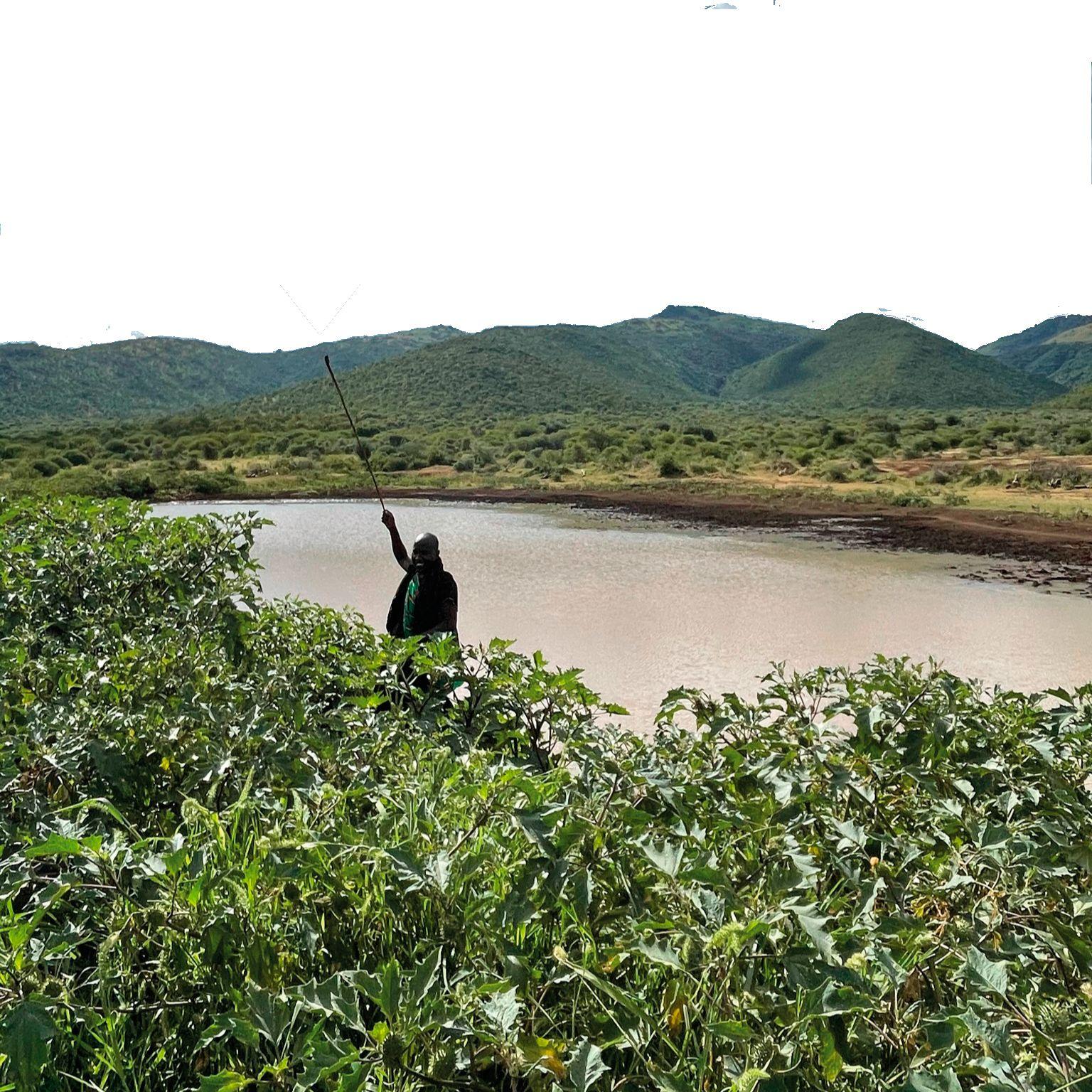
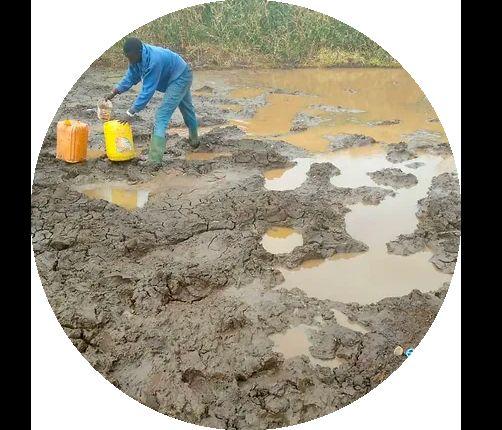
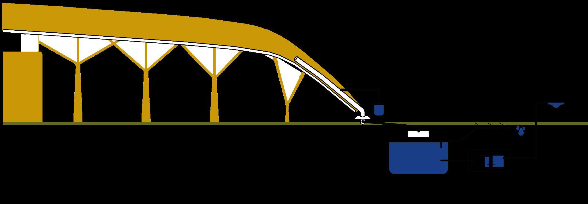
Going more into detail about the site, research was made to find the closest water source in the village. Gathering information from the locals and using the technology available, the nearest source of water was found at 3 km in straight line from the village.
Orkisima Village
Fig 5.2.4- image showing water scarcity consequences
Fig
5. Problem Definition
5.3 Water Source
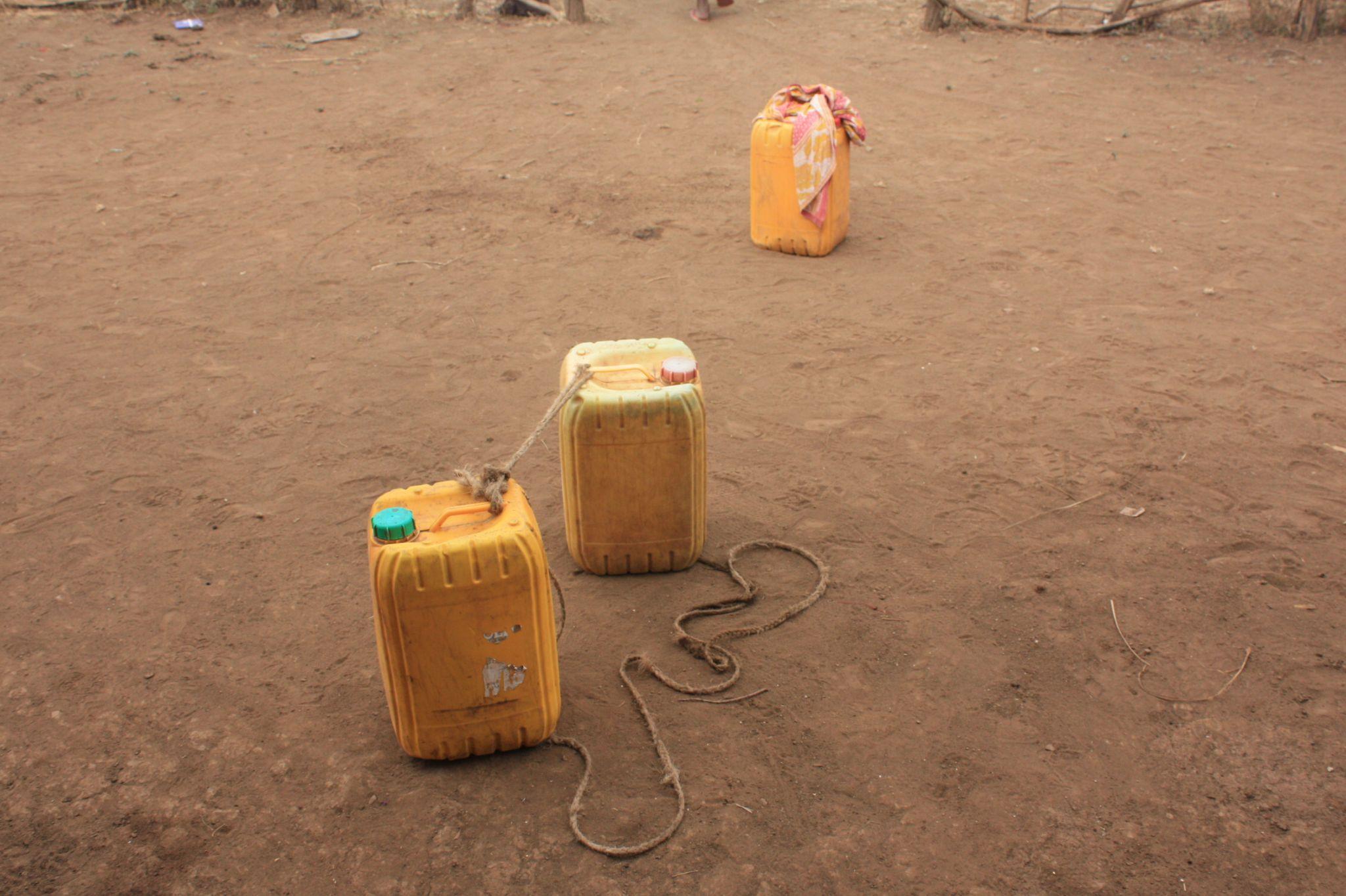
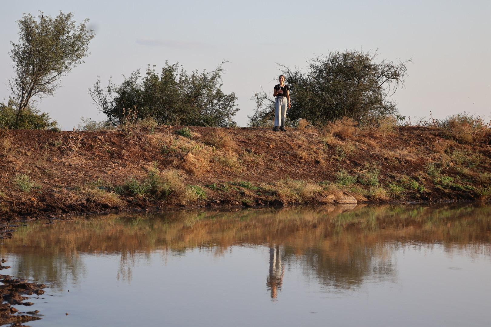
The primary water source for the residents of Orkisima village and the surrounding areas is a "water body" located 3 km west of the site. However, the actual distance people must travel to collect water in buckets or drums is 8 km round trip through wilderness pathways.
An additional challenge arises due to irregular rainfall patterns throughout the year. There are periods when the "water body" does not accumulate a sufficient amount of water to meet the community's needs. Moreover, even when water is collected during such periods, it is often contaminated and unsafe for drinking.
Figure 5.3.1 illustrates the cumulative rainfall, indicating months when the rainwater exceeds 50 mm. During March, April, October, November, and December, the " water body" accumulates an adequate amount of water, making it safer for the villagers to access and consume. Additionally, there is reduced competition with wildlife for this vital resource during these months, as depicted in figure 5.3.2.
Conversely, in figure 5.3.4, the highlighted months represent periods when the cumulative rainfall is less than 50 mm. During these six months of the year, the "water body" contains insufficient water, posing significant risks to people attempting to collect it and rendering it unsafe for drinking, as shown in figure 5.3.3.
Fig 5.3.3- Water source dry season scenario
Orkisima Village
Fig 5.3.4- cumulative rainfall during the dry season
Fig 5.3.1- Cumulative rainfall during the wet season
Fig 5.3.2- Water source wet season scenario
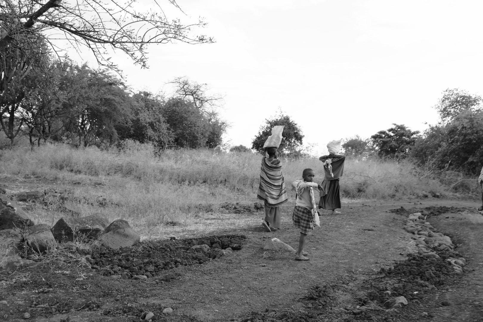
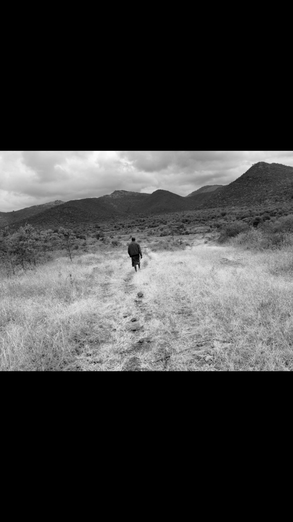
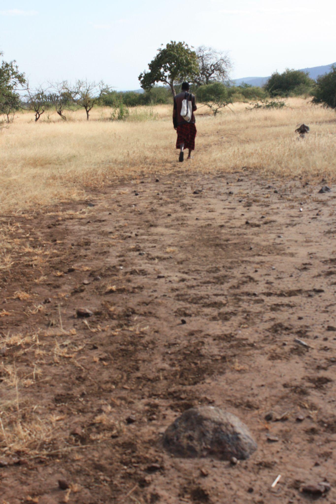
Fig 5.3.5- Image of real path girls take every day for water
5. Problem Definition
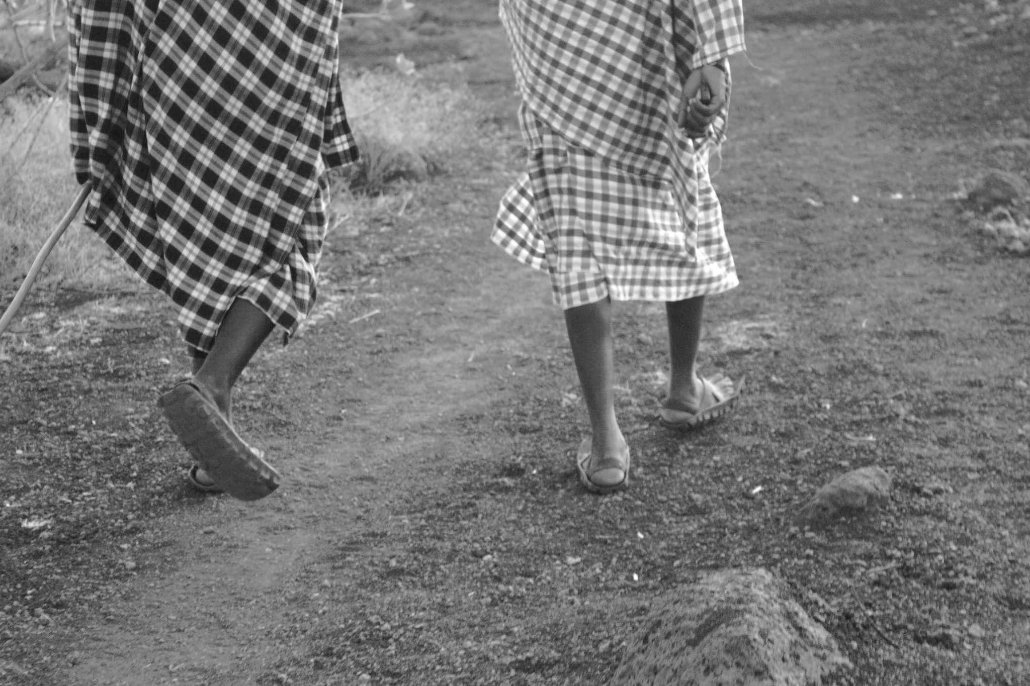
Maasai traditions and their way of life have remained unchanged since the inception of their culture, with gender roles serving as the cornerstone of their community's survival strategy.
Traditionally, men have held the responsibility of herding cattle, a sacred duty crucial for the community's sustenance. They are also tasked with safeguarding the community against wildlife threats, constructing fences, and hunting.
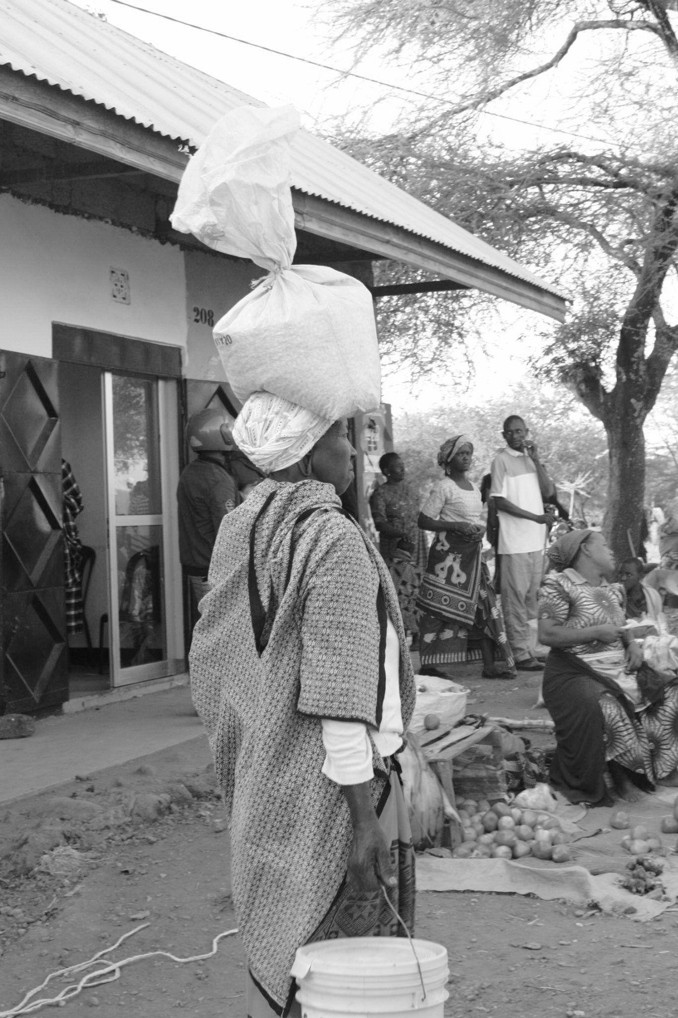
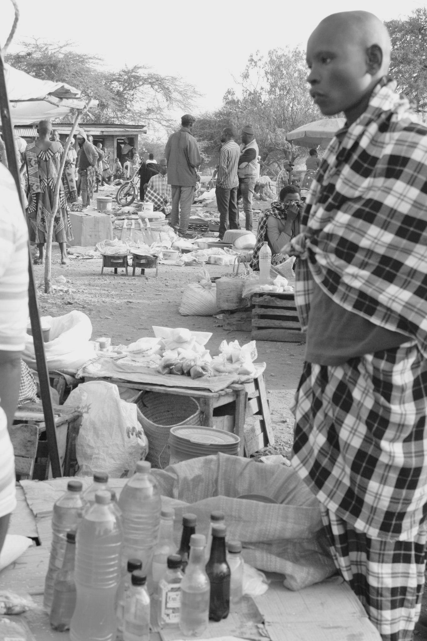
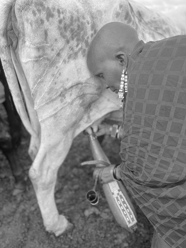
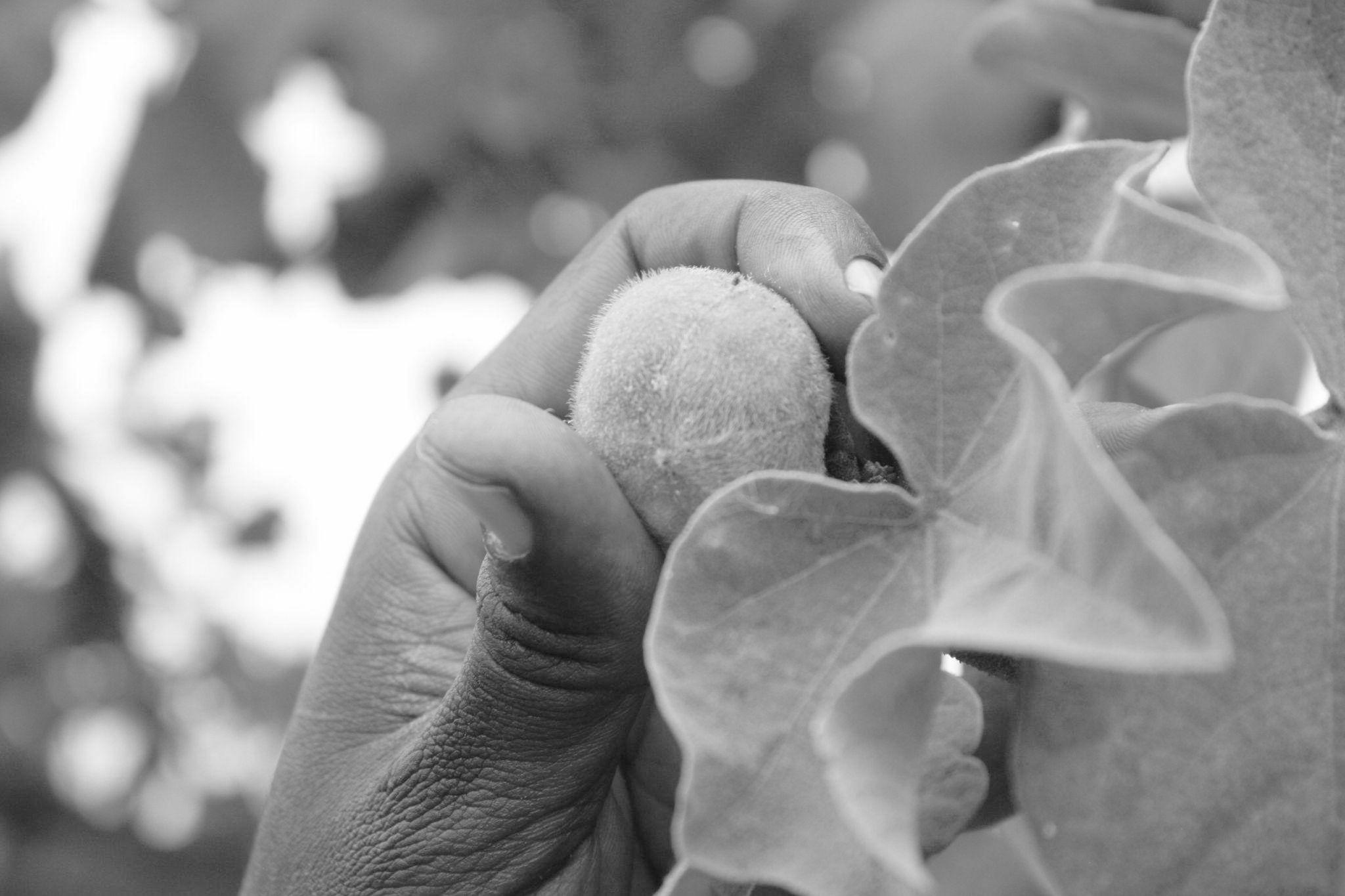
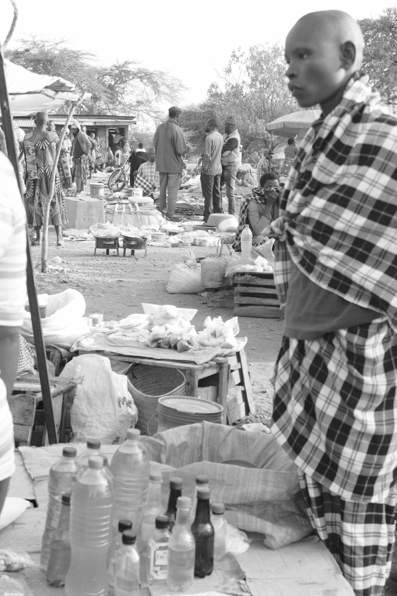
In contrast, women are primarily engaged in domestic chores, including cooking, cleaning, and childcare. Gathering firewood and water are vital survival tasks they undertake. Moreover, women play a pivotal role in trade and commerce, often selling animal products and their traditional beadwork. Typically, a Maasai woman is married off by her father between the ages of 12 and 15, and remarriage or divorce is not permitted. Women are expected to bear as many children as possible, irrespective of the family's circumstances or the mother's health (Maasai Girls Education Fund, 2016).
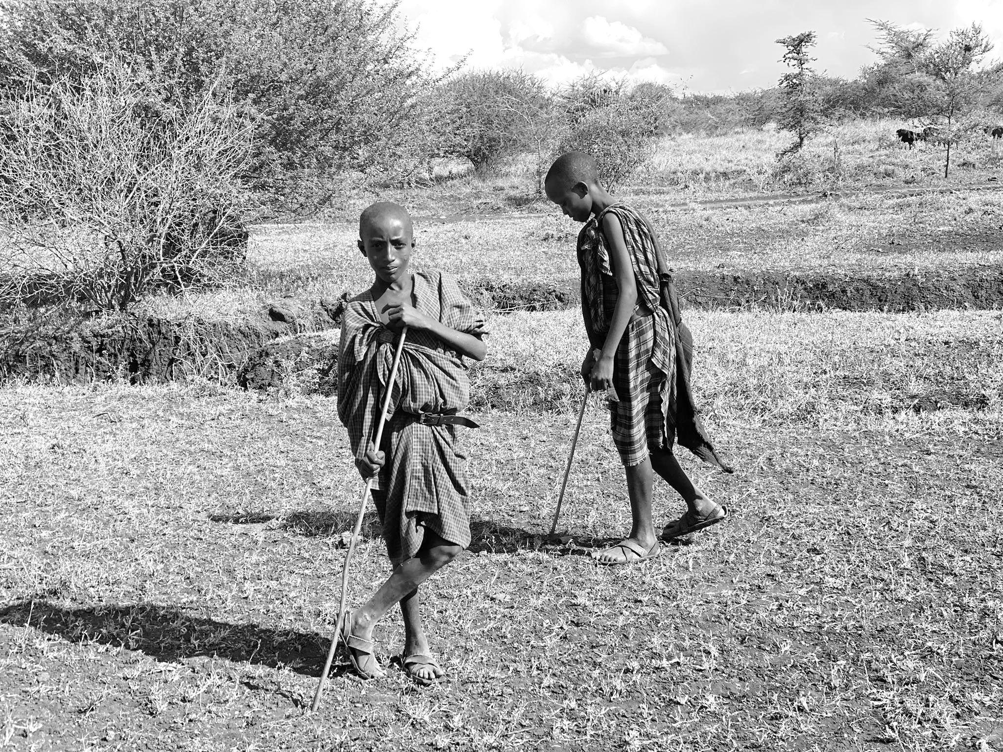
In contemporary times, when protection from wildlife is no longer a daily concern due to technological advancements and modern transportation, Maasai men face a shortage of traditional occupations. The substantial workload that traditionally fell upon men is now shouldered by young boys responsible for herding cattle in search of grazing areas.
Conversely, girls and women continue to manage domestic chores, care for cattle, construct homes, support the family financially through commercial activities, and raise children in accordance with Maasai traditions.
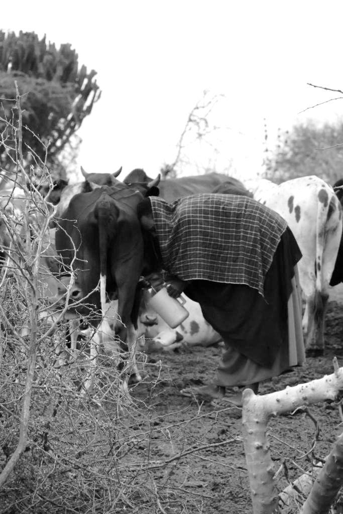
The scarcity of water has placed girls and women in a precarious situation directly impacting their future. The need to travel long distances to fetch water prevents girls from attending school. Education offers women the tools to make informed decisions, understand their rights, and achieve greater independence, providing them with the freedom to choose when and how many children to have based on their capacity to provide for them.
Herd cattle Travel out of village
Current climate and future climate classification
6. Climate
6.1 Current climate and future climate classification
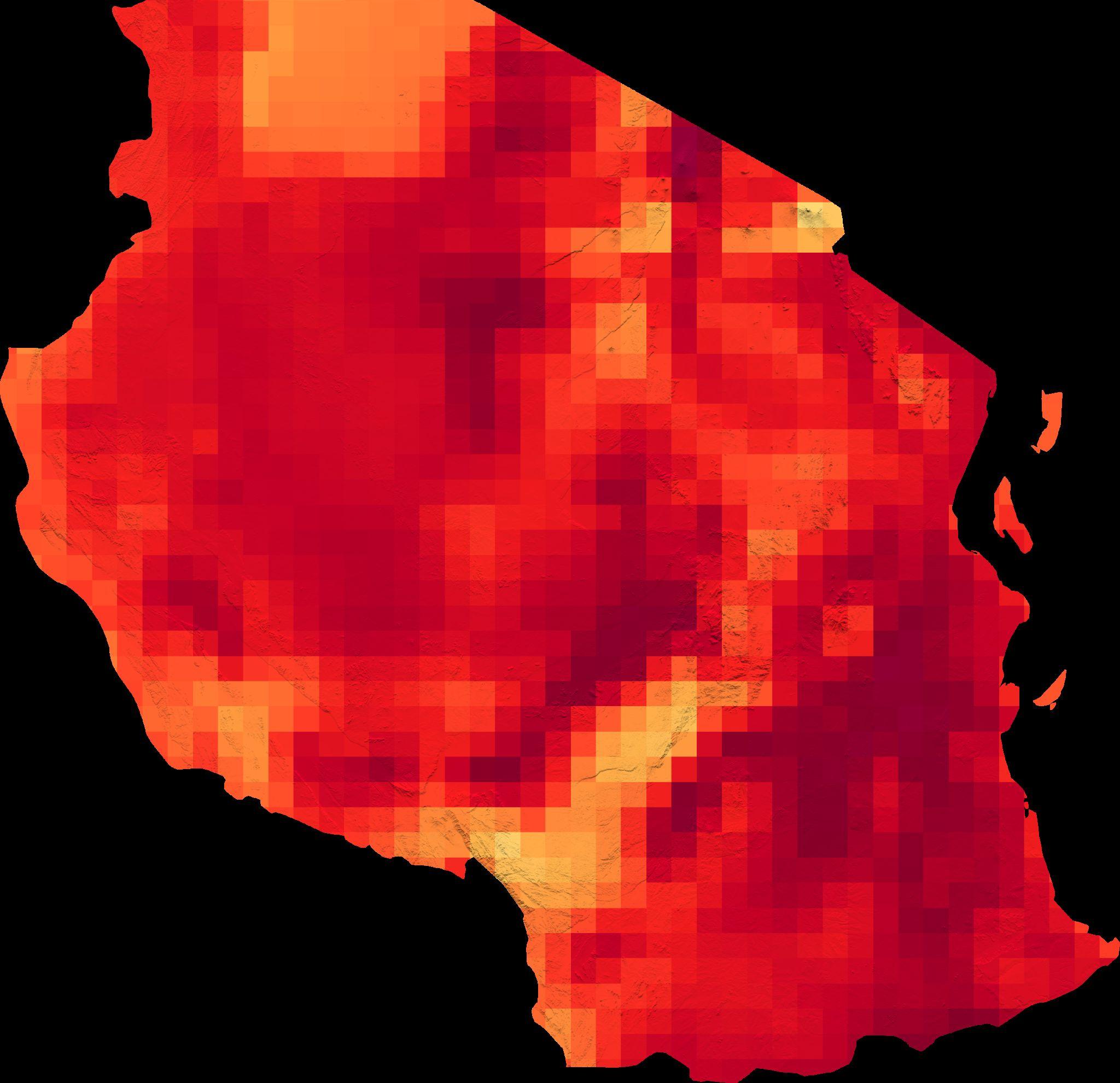
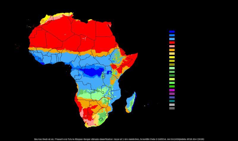
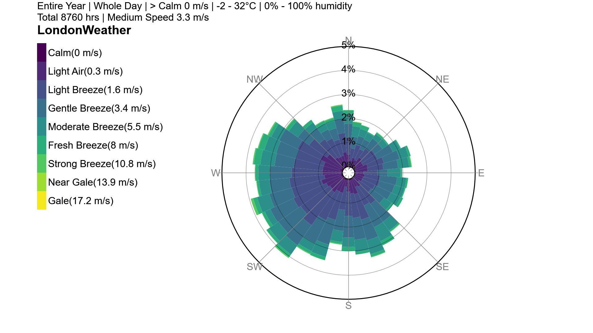
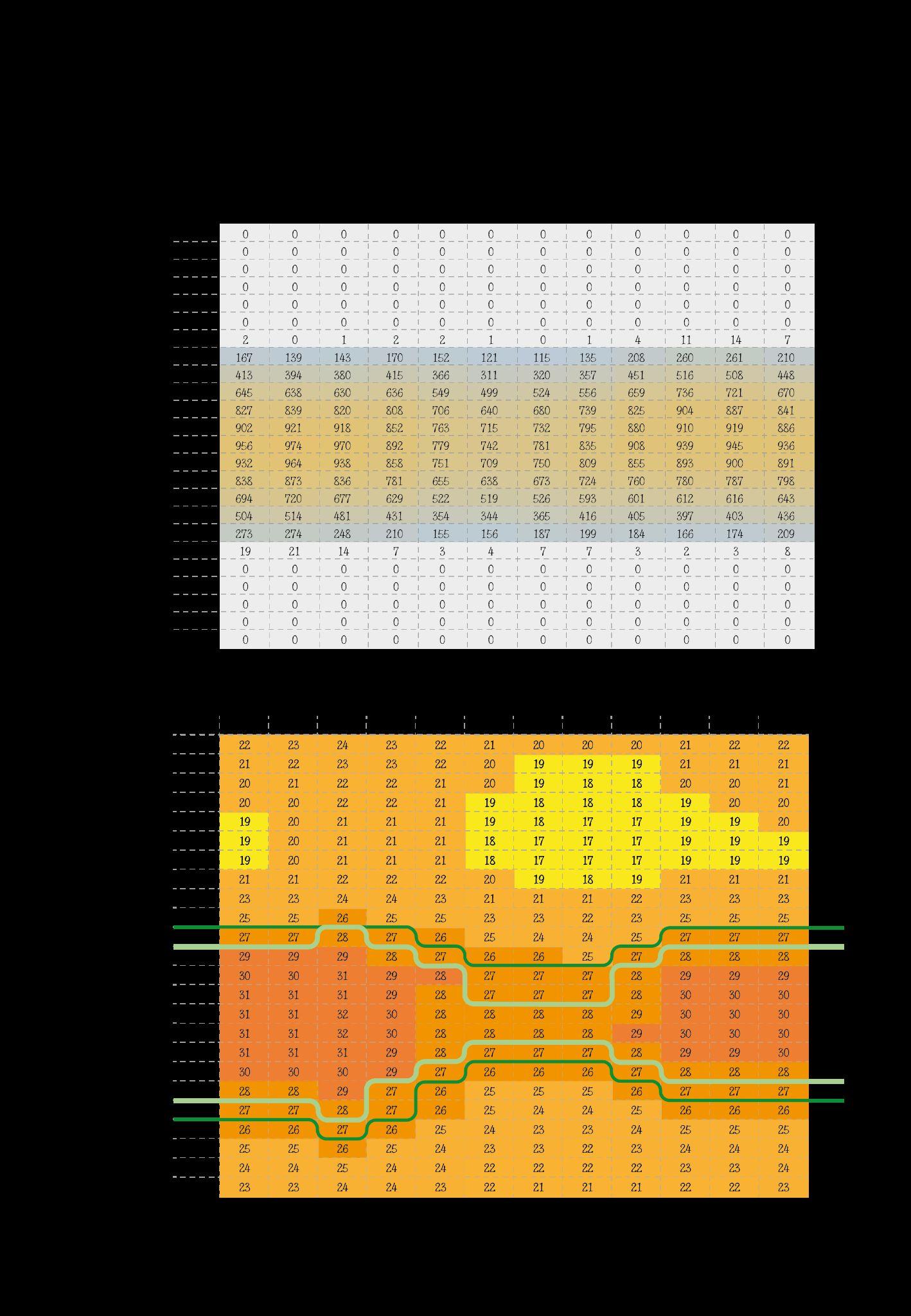
The second methodology employed to comprehend the future climate conditions on the school premises and the challenges facing the village and its environs is the Köppen–Geiger climate classification. This internationally recognized climate classification system was developed by a German botanist-climatologist named Wladimir Köppen in 1900 (Encyclopædia Britannica, 2023).
Before delving into the climate classification categorization, the initial approach involved collecting historical data from nearby weather stations. The information obtained is presented in figures 6.1.2 and 6.1.3. It became evident during the early stages of the thesis process that a broader classification was necessary to establish environmental design strategies for the future.
Arusha Region
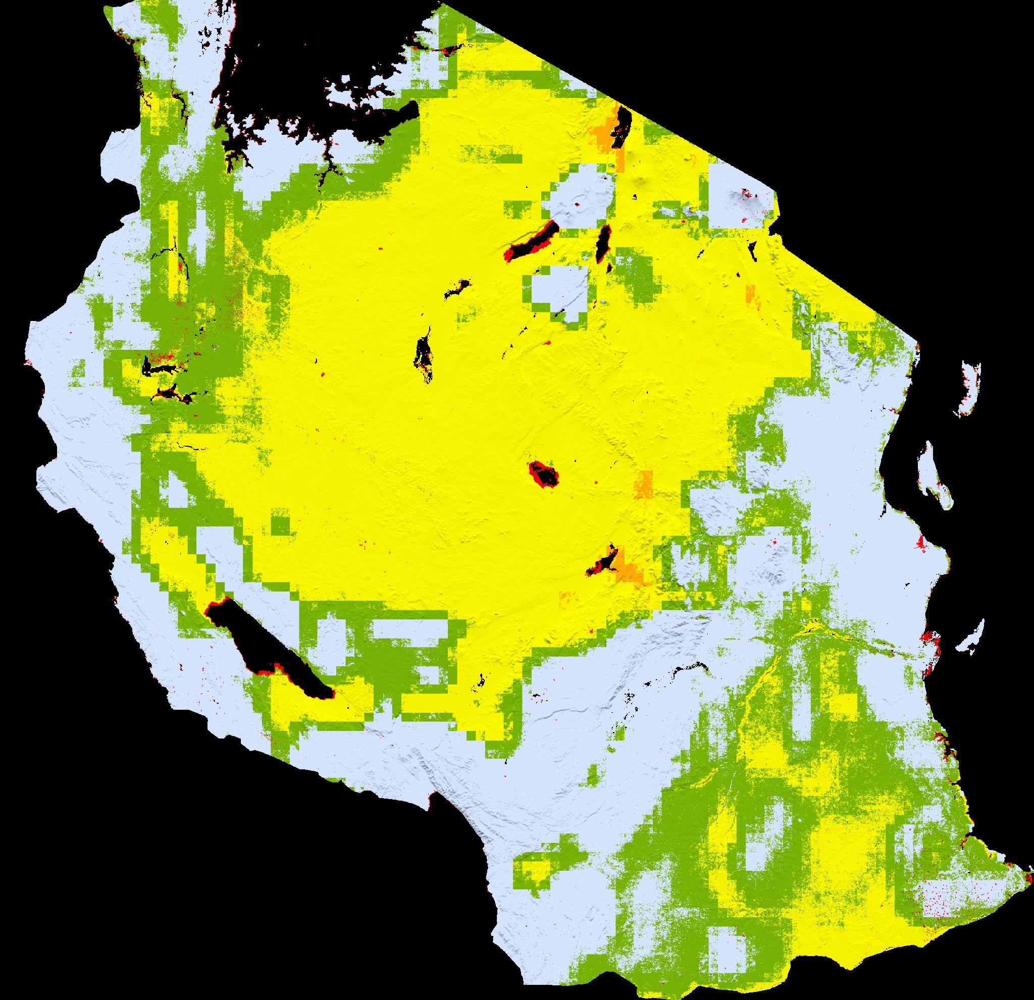
The classification categorizes regions into five major climate types, each defined by factors such as temperature, vegetation, aridity index, and precipitation. Tanzania, due to its proximity to the equator and diverse topography, exhibits several climate types.
The current main climate types in Tanzania are as follows:
○ Aw: Tropical savanna climate with dry winters, predominant in the country, particularly in northwest and southeast Tanzania. This climate features hot temperatures year-round, distinct rainy and dry seasons, and low humidity. Average rainfall ranges from 800 to 1200 mm.
○ BSh: Hot semi-arid climate, found in central and northeast Tanzania. It experiences hot temperatures year-round with distinct dry and wet seasons.
○ Cfa: Humid subtropical climate with hot summers, located in the highlands.
○ Csb: Temperate Mediterranean climate characterized by mild wet winters and hot dry summers.
○ Cwb: Temperate highland tropical climate, prevalent in high-altitude regions. This climate maintains mild temperatures throughout the year, with a relatively dry winter and a wetter summer season (Climate Change Knowledge Portal, 2022).
The Köppen–Geiger classification also provides insights into how these climates will adapt to climate change. Image 2 illustrates the anticipated changes in Tanzania's climate diversity in the future (2070-2100), indicating that the primary climate will shift to Tropical savannah (Aw).
Aw - Tropical, savannah
BSh - Hot semi-arid
Cfa - Humid subtropical
Csb - Temperate mediterranean
Cwb - Temperate highland tropical
Arusha region:
Fig 6.1.1- Image showing Arusha region and studied areas
Fig 6.1.2- Graph of Mbuyuni yearly climate Fig 6.1.3- Graph of Makuyuni yearly climate
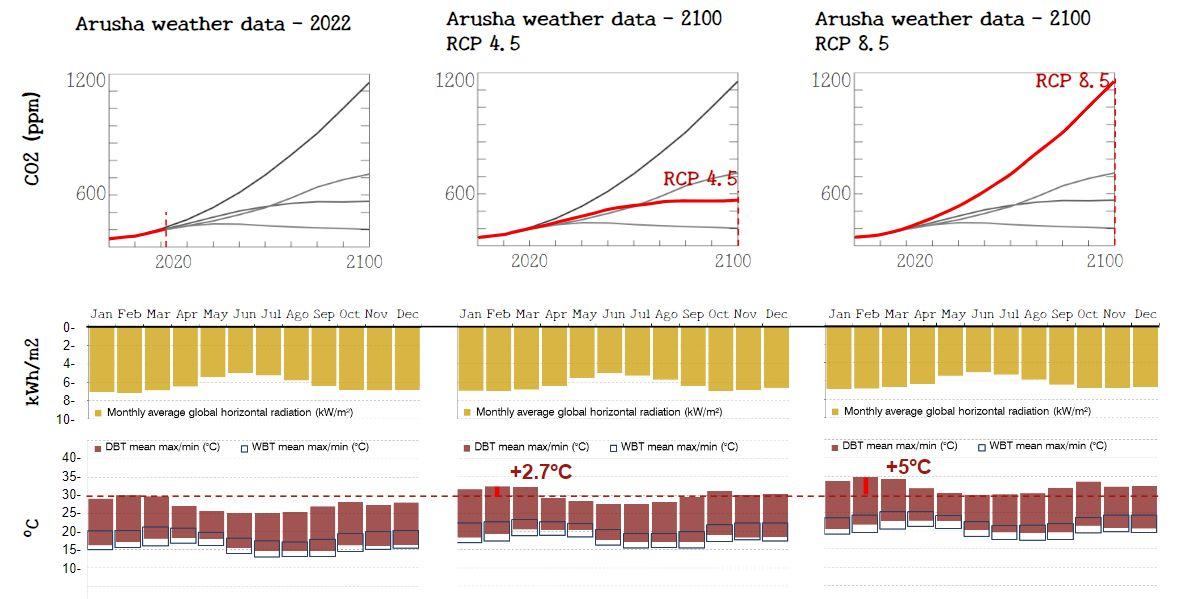
After classifying the sites as a tropical savannah area, it's important to delve deeper into what this classification entails. To achieve this, Meteonorm was employed to predict weather data for various scenarios.
Meteonorm is a software tool that compiles and processes historical weather and climate data from various sources. It provides datasets for specific locations worldwide, offering information on parameters such as solar radiation, temperature, wind speed, and more.
Additionally, Meteonorm can forecast future weather patterns using Representative Concentration Pathways (RCPs). RCPs are scenarios or pathways used in climate science to represent different future trajectories of greenhouse gas (GHG) concentrations in the Earth's atmosphere. There are four RCPs, but for this analysis, we will prioritize the following:
○ RCP4.5: This scenario involves emissions peaking and then stabilizing, resulting in a moderate level of radiative forcing by 2100.
○ RCP8.5: Representing the worst-case scenario, it portrays a future with continued high emissions and no significant climate policies in place, resulting in the highest level of radiative forcing.
(Climate Nexus, 2023)
The results depicted in the following figures provide a clearer understanding of the type of climate we can expect in the future. Focusing on the RCP4.5 scenario, we observe a Dry Bulb Temperature (DBT) increase of 2.7°C in February (the hottest month) compared to the current weather data. In contrast, for the RCP8.5 scenario, the same month of February could see a DBT rise of 5°C.
In general, we can anticipate a rise in temperature throughout the year, which will depend on global efforts to limit this increase. In any case, this study will consider both RCP scenarios as it proceeds with the design, as depicted below.
Literature Review
Tropical savanna precedents - Worldwide
Tropical savanna precedents - Africa
Tropical savanna precedents - Schools worldwide
Case study - METI School
Case study - Francis Kere
Case study - Maasai vernacular
7. Literature Review
Tropical Savanna Precedents
To achieve the objective of designing for the Aw tropical savanna climate classification, it's essential to gain a comprehensive understanding of its characteristics and analyze how people around the world have adapted to this climate.
Examining the global distribution of regions with the Aw climate classification, we find that this climate type is typically concentrated around the equator in regions of Africa, Asia, Central America, and South America.
1. Atacama, Mexico: Vernacular houses constructed with adobe bricks in 1557, utilizing a "U" configuration to create shade in the courtyard.
2. Yucatan, Mexico: Illustrating one of the continent's most ancient typologies, the Mayans began building houses in this style between 1500 B.C. and 250 C.E. These houses feature wooden poles forming an oval shape covered with mud and protected by thatched roofs.
3. North Venezuela: La Churuata was the vernacular housing used before the colonization of Venezuela in 1498. Constructed from wooden sticks joined with vines and covered with palm leaves, it featured a low dome made of thatched roof, resulting in spacious inner dimensions (Bello, A. 2022).
4-5. Central Brazil: Ancient vernacular typology, known as "Pau-a-pique," was constructed from rammed earth. It involved intertwining wood fixed to the ground with horizontal beams, tied together, and gaps filled with clay.
6. Andhra Pradesh, India: Houses known as "chuttillu" are traditionally built with mud, raised on a plinth adorned with paintings, and feature a thick thatched roof extending almost to the ground to protect against rain.
7. Queensland, Australia: Typically made from local wood, these houses incorporate large covered verandas to maximize natural ventilation throughout the house.
8. Central Thailand: Designed for tropical weather, houses have sharply sloping roofs to collect and store rainwater. They also incorporate large verandas to facilitate ventilation.
9. Luang Prabang, Laos: Responding to rainy weather, vernacular houses in Laos feature sloping thatched roofs that overhang to provide shade and allow for ventilation.
3. Scodro,J.,2016
4. Dauden, J., 2019
5. Kowaltowski Doris, Watrin Vannesa, et al., 2007 MapReference:Beck, H.E., Zimmermann, N. E., et al. (2018) Köppen–Geigerclimate
6. Garg, A., 2023
7. Mauricio Lecaro, Benson Lau, et al., 2017
8. Diwerent, 2023
9. Stephen, 2018
7. Literature Review
7.2 Tropical Savanna Precedents
Africa
In order to focus the research further, African vernacular precedents were analyzed. Because of characteristics of the climat. Africa is home to many countries with vast territories classified under the (Aw) tropical savanna climate. These regions are characterized by:
Angola
Burundi
Niger
Chad
Sudan
Ethiopia
Somalia
Madagascar
Central African republic
Democratic Republic of the Congo
Uganda
Mozambique
Republic of the Congo
Cameroon
Ghana
Ivory Coast
Burkina Faso
Kenya
Tanzania
(Beck, H.E., Zimmermann, N. E., et al. 2018)
The vernacular architecture in these territories shares several common features. One prominent element is the extensive roof design, which may vary in style but consistently serves the purpose of providing maximum protection from the sun by covering the building's top.
Extensive roofs, small openings for strategic natural ventilation, which in some cases are also shaded, covered verandas, and small detached construction are the main characteristics of these vernacular precedents.
Environmental strategies found in vernacular precedents:
A. Thermal Mass
1. Thick earth or brick walls
B. Maximize natural ventilation
1. Cross ventilation - small openings in facade to let wind in, big gaps of ventilation in the roof to let hot air and internal gains out.
C. Shading; Systems to block as much solar gains as possible, because of proximity with the equator
MapReference: Beck, H.E., Zimmermann, N. E., et al. (2018) classificationmapforTropical
Fig 7.2.1- Diagram of tropical savannah vernacular precedents in Africa
Fig 7.2.2- Diagram of day and night strategies implemented in vernacular precedents in Africa
7. Literature Review
7.3 Tropical Savanna Precedents Schools Worldwide
Following the study of vernacular precedents in territories with a tropical savanna climate, it was essential to analyze contemporary educational building typologies suitable for this climate. The following case studies were selected for this thesis research:
1. Colombia, Institución educativa Siete Vueltas by Plan B Arquitectos.(Archdaily, 2019)
2. Brazil, Children Village by ED Arquitectura.(ED Arquitectura, 2020)
3. Senegal, Fass School by Toshiko Mori Architect.(Archdaily, 2021)
4. Mozambique, Educational building by Bergen School of Architecture.(Archdaily, 2011)
5. Burundi, Library of Muyinga by BC Architects.(Archdaily, 2020)
6. Kenya, Endana Secondary School by Jane Harrison and David Turnbull.(Lucy, Bullivant, 2015)
7. Bangladesh, Metti School by Anna Heringer.(Anna Heringer,2007)
8. Ghana, Inside Out School by Andrea Tabocchini & Francesca Vittorini.(ArchDaily, 2020)
9. Burkina Faso, Gando School by Francis kere. (Kere Architecture, 20016)
These case studies illustrate that many of the strategies observed in vernacular precedents are still prevalent in modern designs. However, these strategies have been adapted to incorporate modern techniques and technologies. Additionally, some new strategies have been introduced to enhance comfort and functionality within the buildings' interiors.
Environmental strategies found in contemporary educational buildings:
A. Thermal Mass
1. Thick earth or brick walls
B. Maximize natural ventilation
1. Stacked ventilation - use of wind tunnels or difference of height to create wind flows
2. Cross ventilation - small openings in facade to let wind in, big gaps of ventilation in the roof to let hot air and internal gains out.
3. Double layer roof system
C. Shading; Systems to block as much solar gains as possible, because of proximity with the equator
1. Overhang roof
2. External shading
D. Protection from heavy rain
1. Rainwater harvesting
E. Local materials
F. Local manufacturers
7. Literature Review
7.4 Case Study
- METI School
In-depth research was conducted on specific case studies to gather comprehensive information regarding building methods, community engagement, dimensions, and the environmental strategies integrated into the designs.
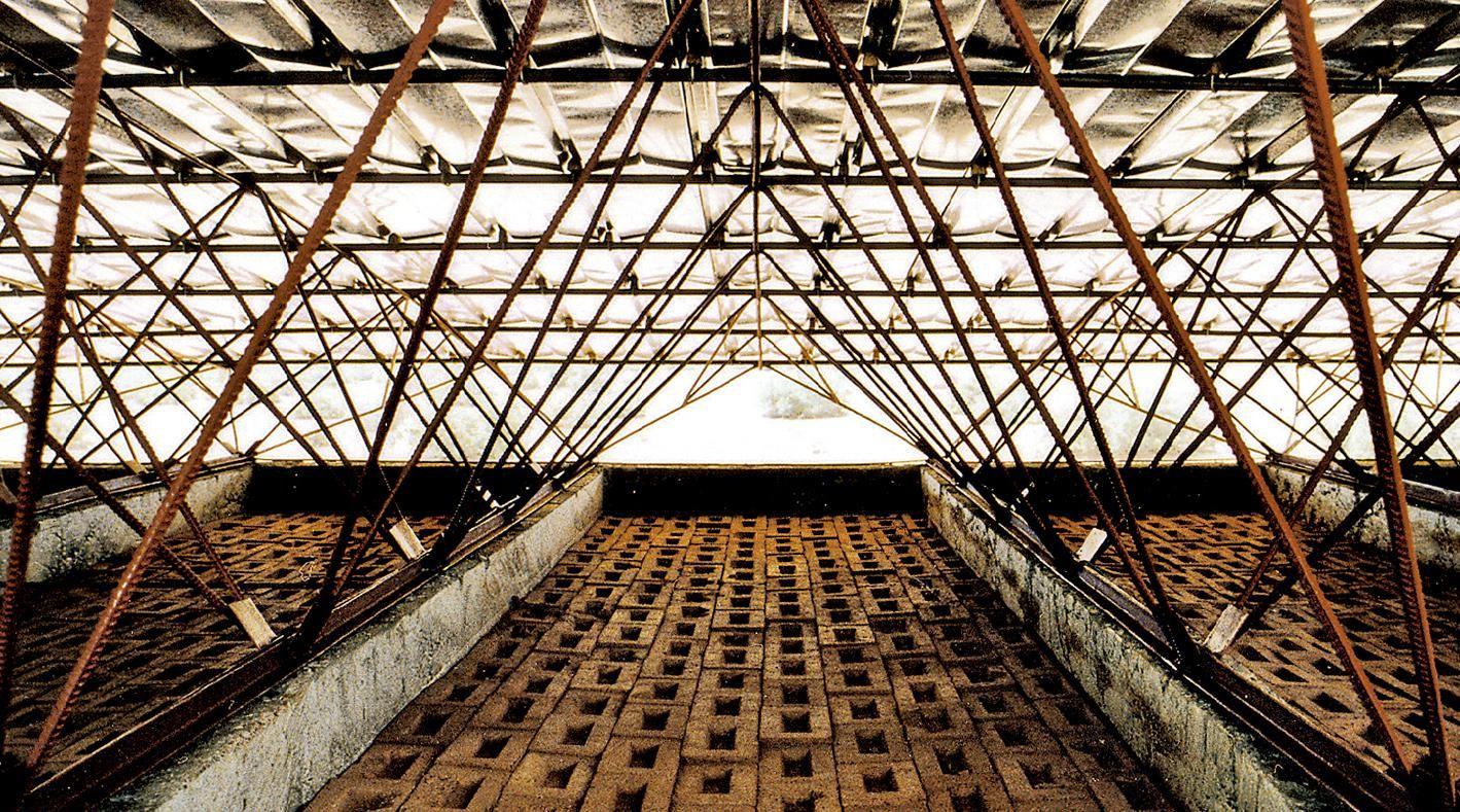
One of the notable projects examined is Anna Heringer's METI School in Bangladesh, designed as an educational tool that promotes free and open learning experiences. The school's layout consists of a series of organically shaped "caves" accommodating various activities.
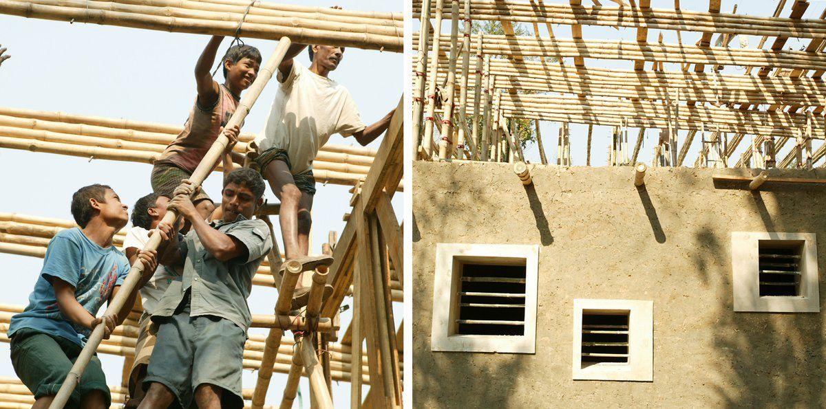
The building's construction relies on thick earth walls, which serve to maintain a cool interior environment due to the thermal properties of earth. Upper floors feature open, well-lit spaces with bamboo walls, while bamboo is also used for interior ceilings and structural elements, utilizing locally sourced materials from Bangladesh. To protect against heavy rains, the building is sheltered by an overhang roof made of corrugated aluminum. Remarkably, all construction materials were procured within the local village, a simple yet impactful action that contributed to the financial stability of the community. Local builders from a nearby village were enlisted as construction workers, and they received training in earth and bamboo construction techniques, enhancing their employability and skills.
In addition, active involvement of the community and village children in the construction process played a vital role in imparting the value of sustainable construction practices. This holistic approach to design not only considers materials and environmental strategies but also emphasizes community engagement, making it a model for sustainable educational architecture.
1. Thick earth walls maximize thermal mass, absorbing heat during the day and radiating it out during the cooler evenings and nights.
2. Combining thermal mass with insulation (bamboo) helps maintain stable indoor temperatures.
3. A stacked ventilation strategy is employed to remove internal heat.
4. The design incorporates light shading to allow natural daylight while minimizing heat gain.
5. Local materials and labor were used to reduce environmental impact and support the local economy.
These strategies demonstrate a holistic approach to sustainable construction, focusing on materials, community involvement, and environmental considerations.
Internal ceiling - 3 layers of bamboo + layer of earth
Environmental Strategies:
Foundation - Brick Masonry
Upper Floor Wallsframework of bamboo
Fig 7.4.1- Diagram showing the building´s technique of METI school
Fig 7.4.2- Images of project (Anna Heringer, 2007)
7. Literature Review
7.5 Case Study - Francis Kere
The case studies designed by Pritzker laureate Francis Kere, a renowned Burkinabé-German architect with extensive experience in designing educational buildings for tropical savanna climates, served as significant inspiration for the current thesis design project.
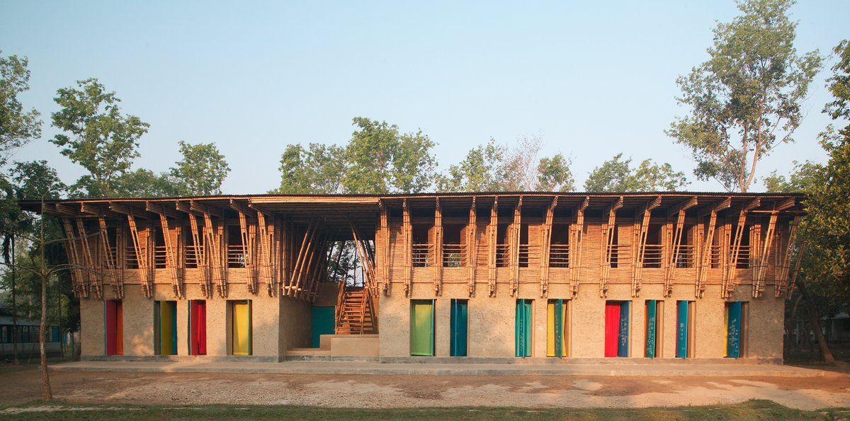
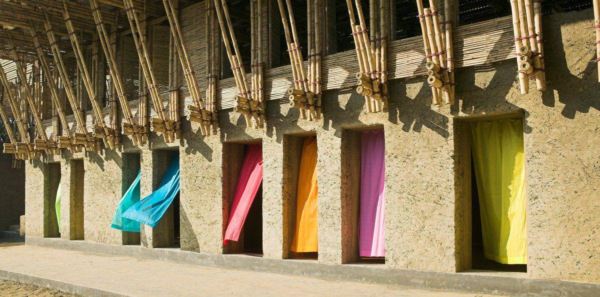
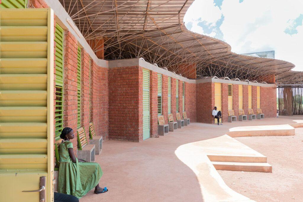
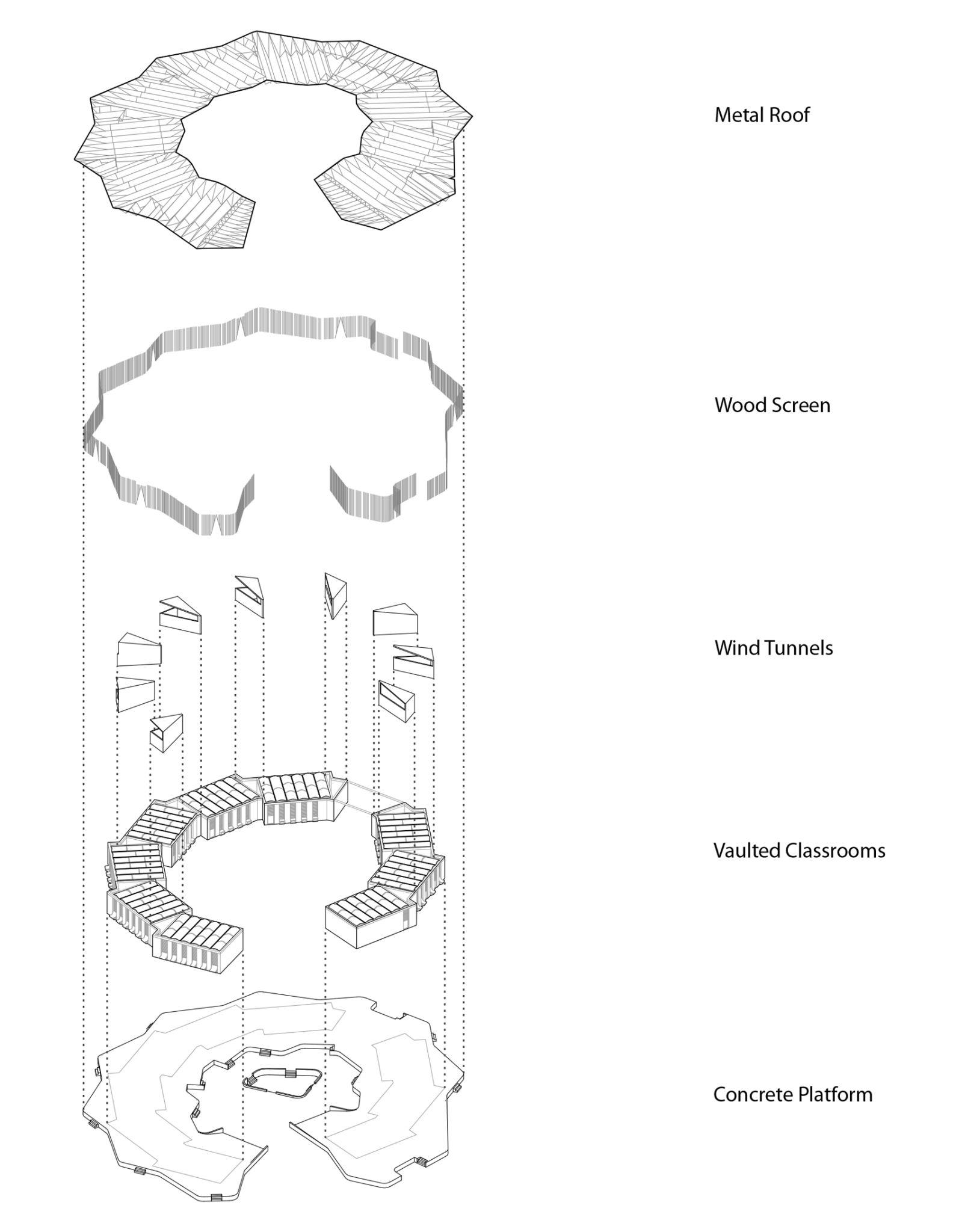
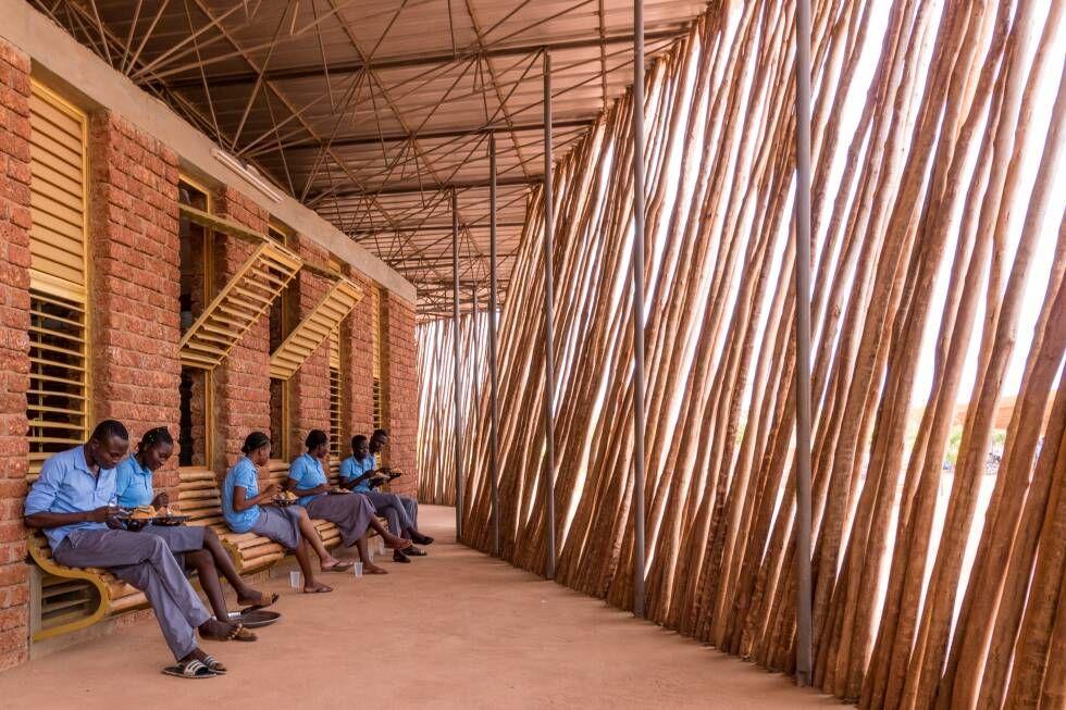
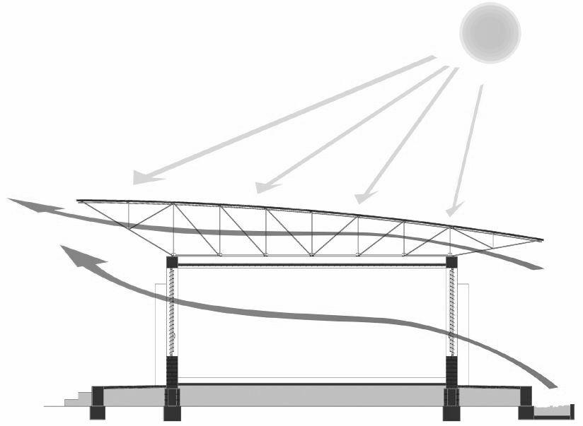
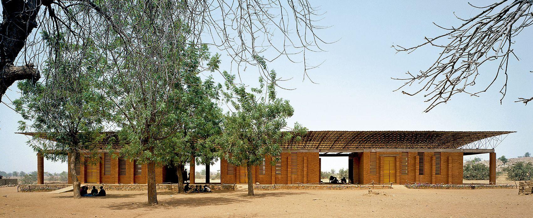
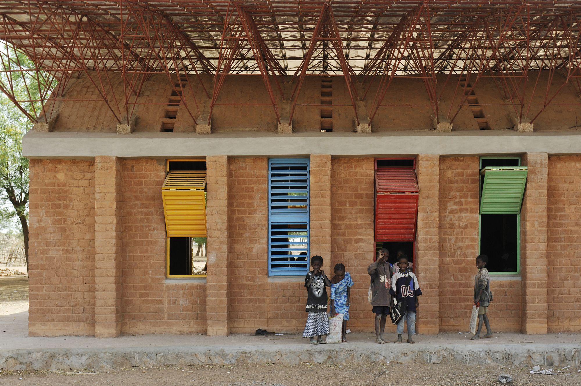
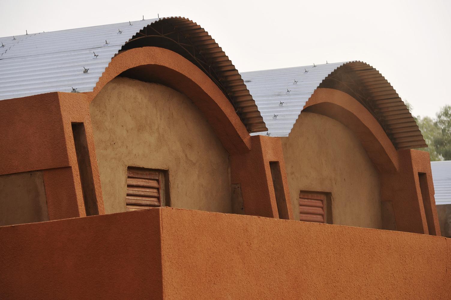
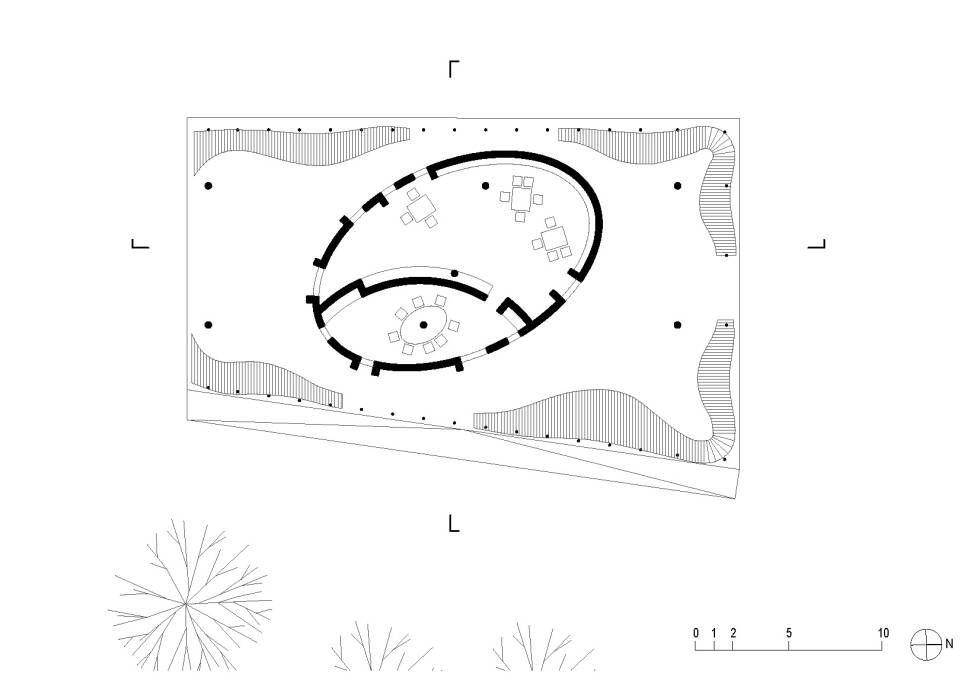
One of his notable works is the Lycée School in Burkina Faso, characterized by a radial configuration that shields the central space from dust and wind. To enhance protection from the elements, a wooden screen encircles the school's external perimeter, serving as both shading and transition space. The classrooms feature vaulted structures constructed from locally sourced bricks, providing excellent thermal mass. The building's roof, separated from the classroom ceiling, facilitates ventilation and is made of metal sheets. Large wind towers are strategically placed to create a stack ventilation effect, ensuring student comfort.
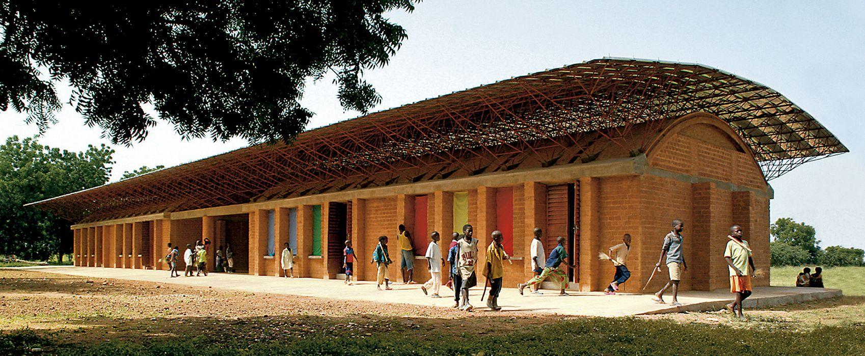
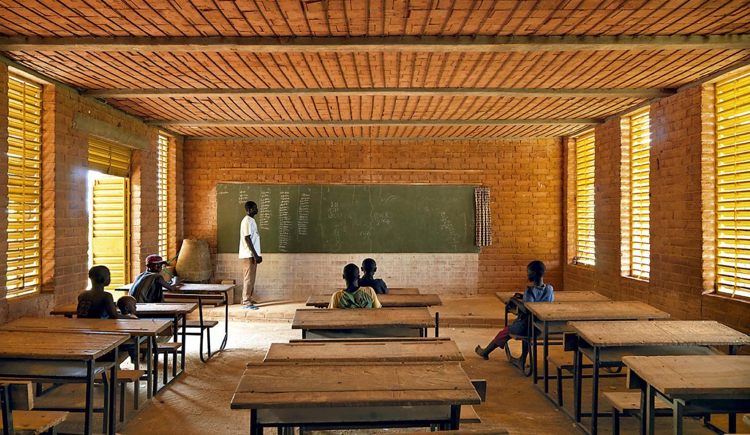
Similarly, the Gando Primary School, also located in Burkina Faso, shares similarities with the aforementioned school. It boasts brick walls and ceilings, enabling cross ventilation in all classrooms. The two-layered roof design reduces direct sun exposure within the classrooms while promoting effective natural ventilation. These architectural strategies showcase Kere's expertise in designing educational spaces that are both climate-responsive and conducive to learning.
Environmental strategies
1. Brick walls for thermal mass, in hot dry climates, it will absorb heat from the sun during the day and then it will radiate it out during the evening and night.
2. Double roof system to allow ventilation without overheating the indoor spaces because of the laminated roof
3. Ventilation strategies, like wind tunnels and cross ventilation
4. External shading facing the south facades, creating covered verandas
5. Use of local materials
A. Lycée School
B. Gando Primary
Double roof system for cross ventilation
Fig 7.5.1- Images of Lycee School (Kere Architecture, 2016)
Fig 7.5.3- Images of Gando School (Kere Architecture, 2001)
Fig 7.5.2- Diagrams showcasing the environmental strategies applied by Francis Kere
7. Literature Review
7.6 Case Study - Maasai Vernacular
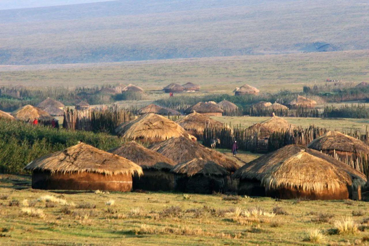
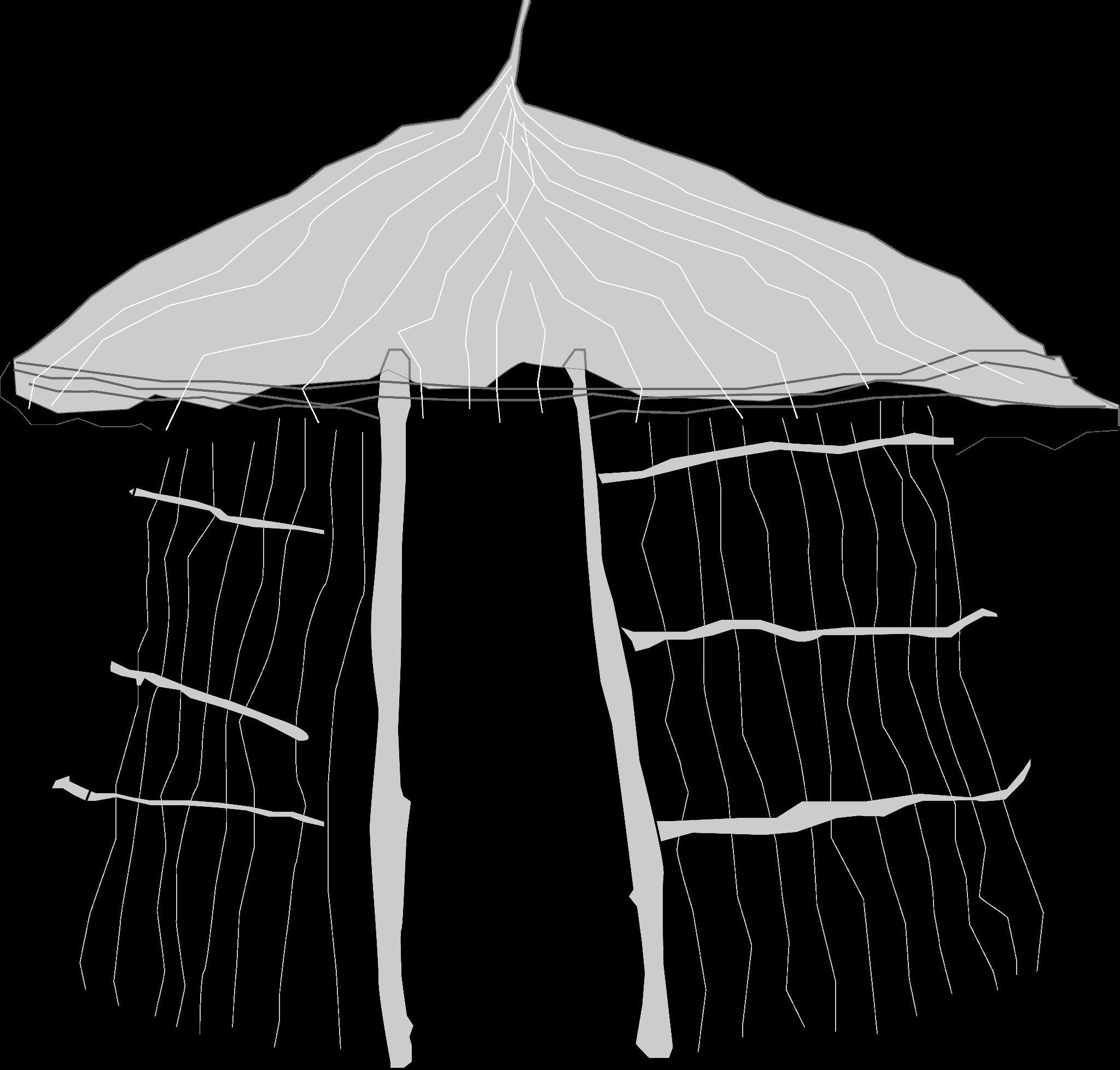
The Maasai exhibit a fascinating vernacular architectural style that has persisted despite globalization, with their houses maintaining the same design principles over generations.
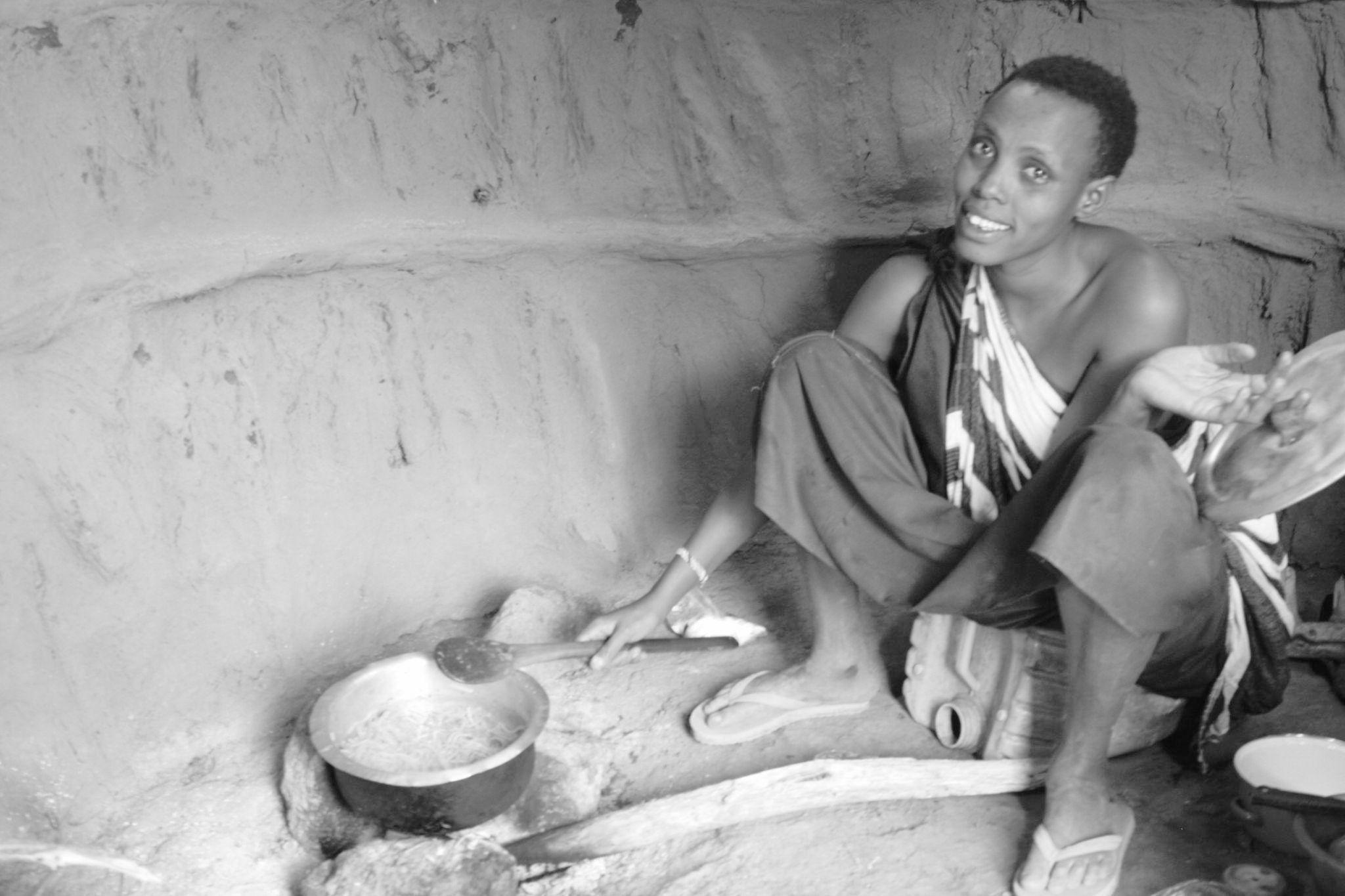
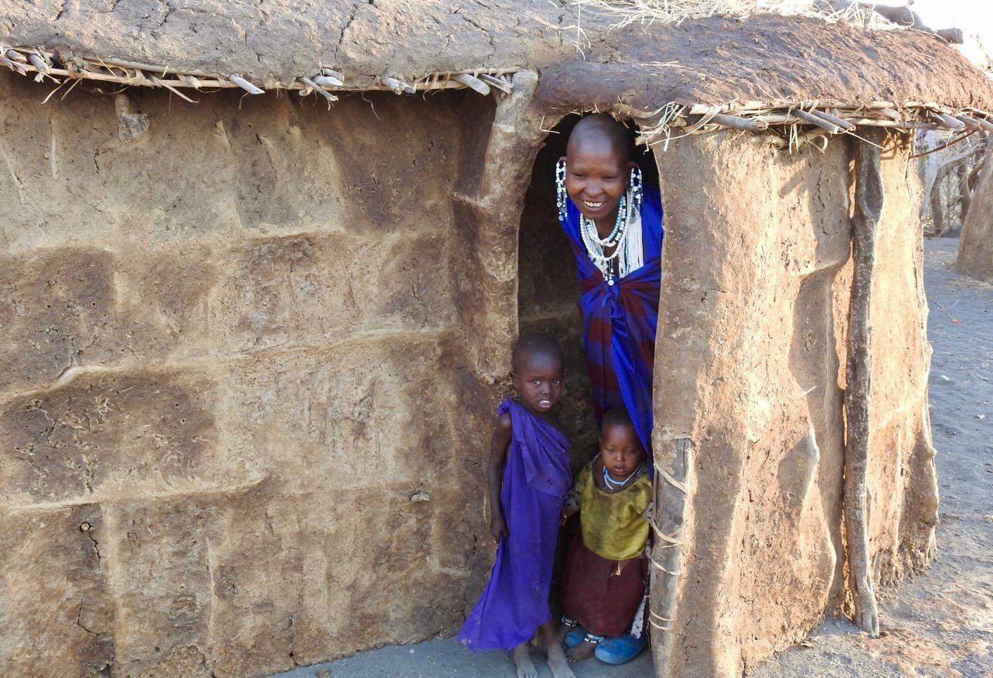
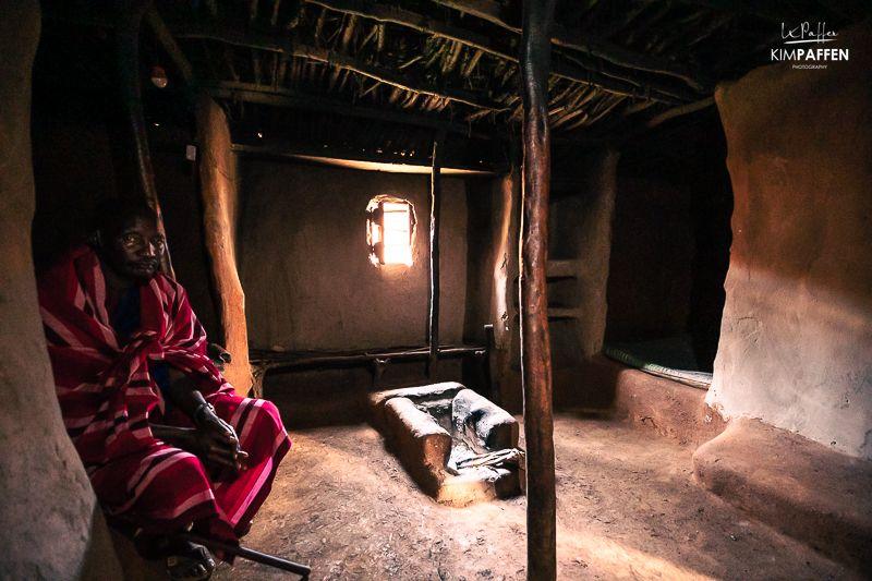
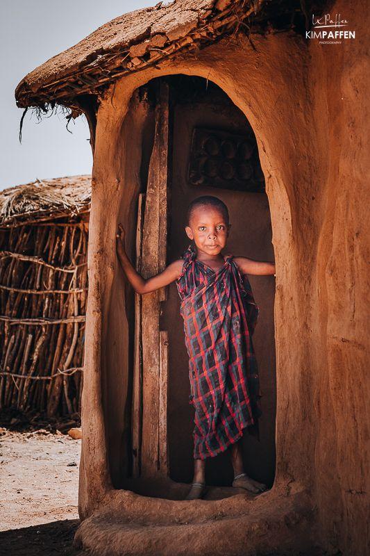
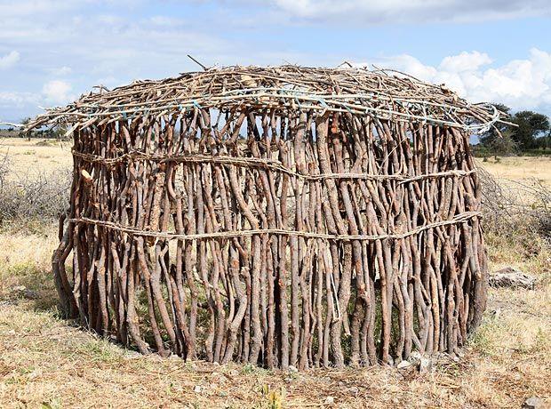
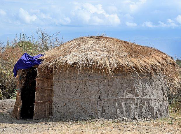
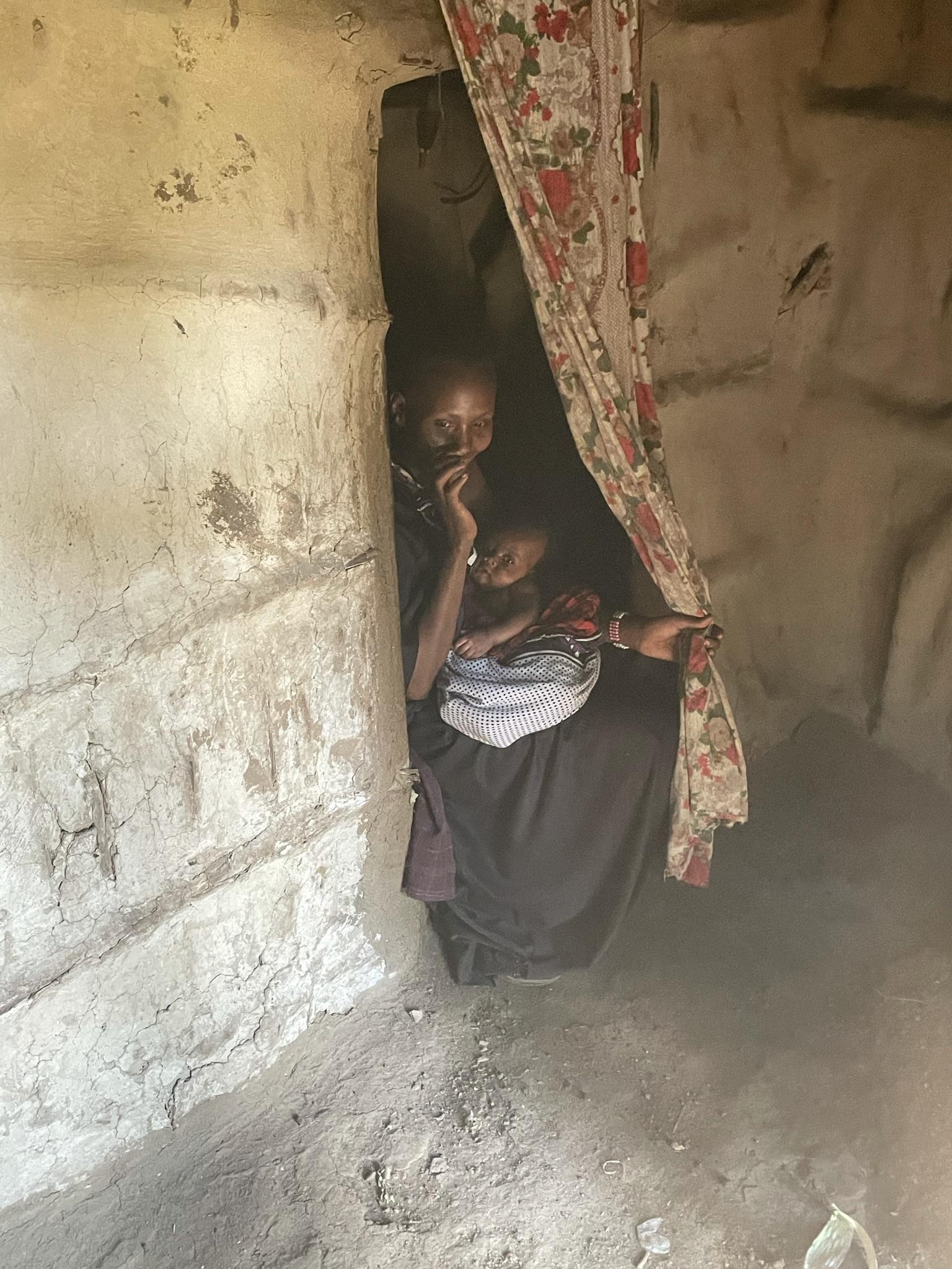
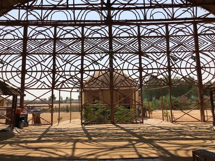
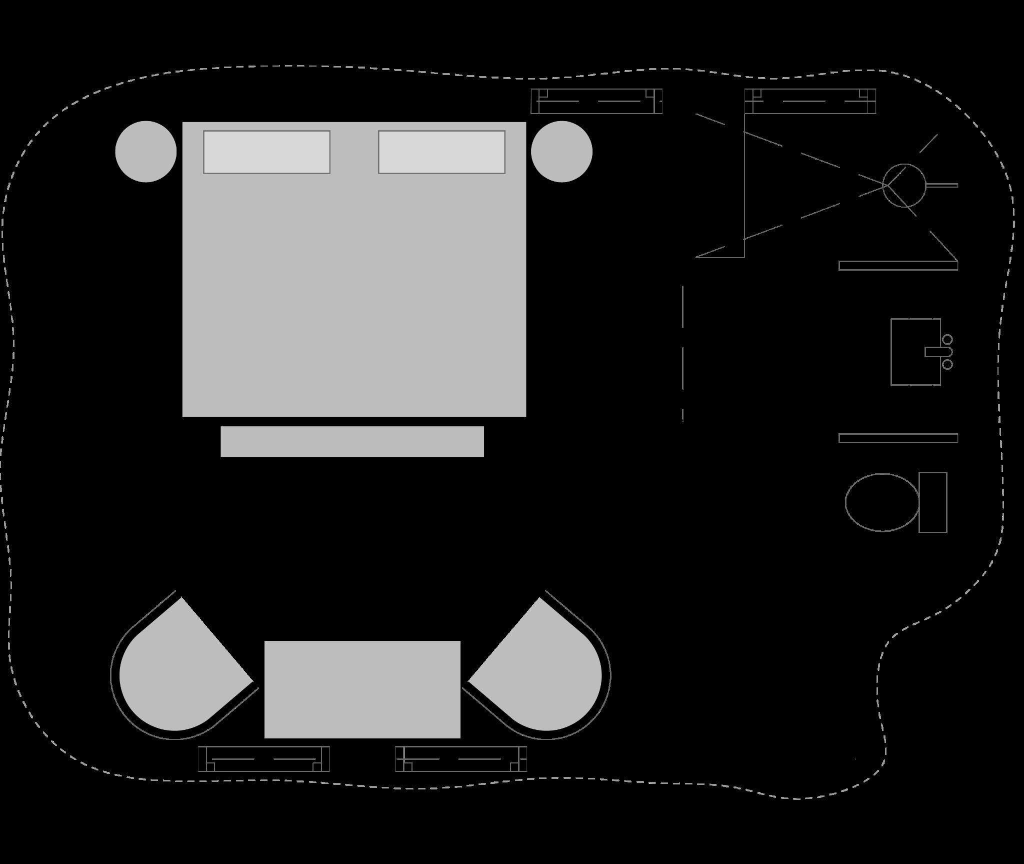
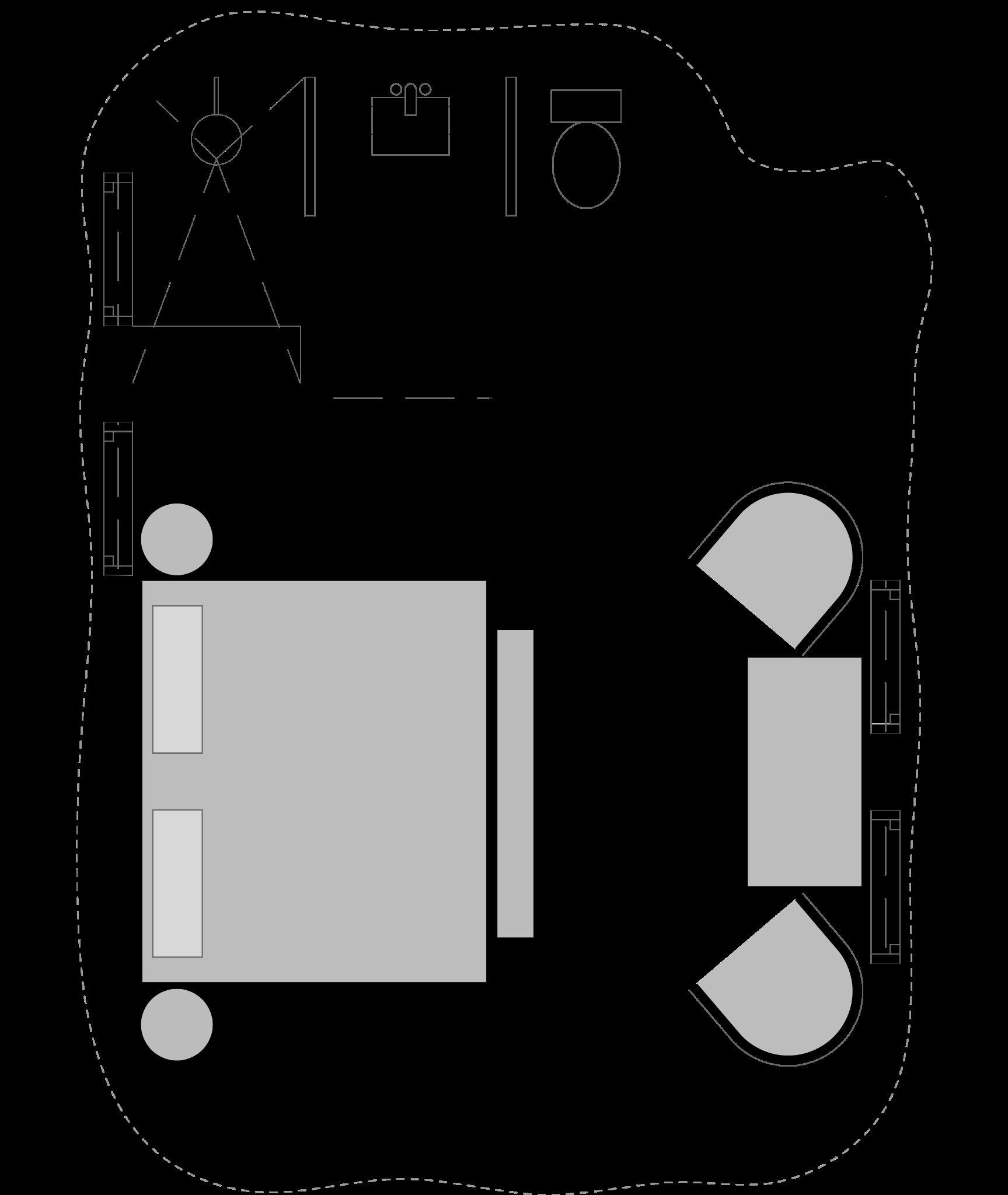
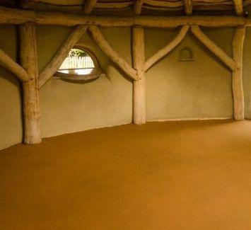
Their private houses, known as "Enkaji" or "Manyata," are constructed using a blend of cow dung, mud, and grass. These materials are used to build small, curved structures typically featuring only one opening at the end of the wall configuration. The interiors of these houses are quite narrow and short, serving as sleeping quarters for families and spaces for women to cook. It's also common to find some domestic animals sharing the living space.
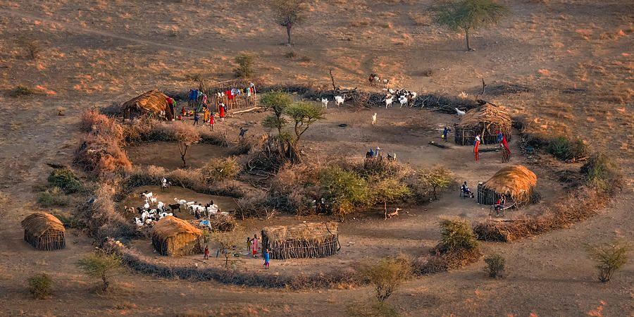
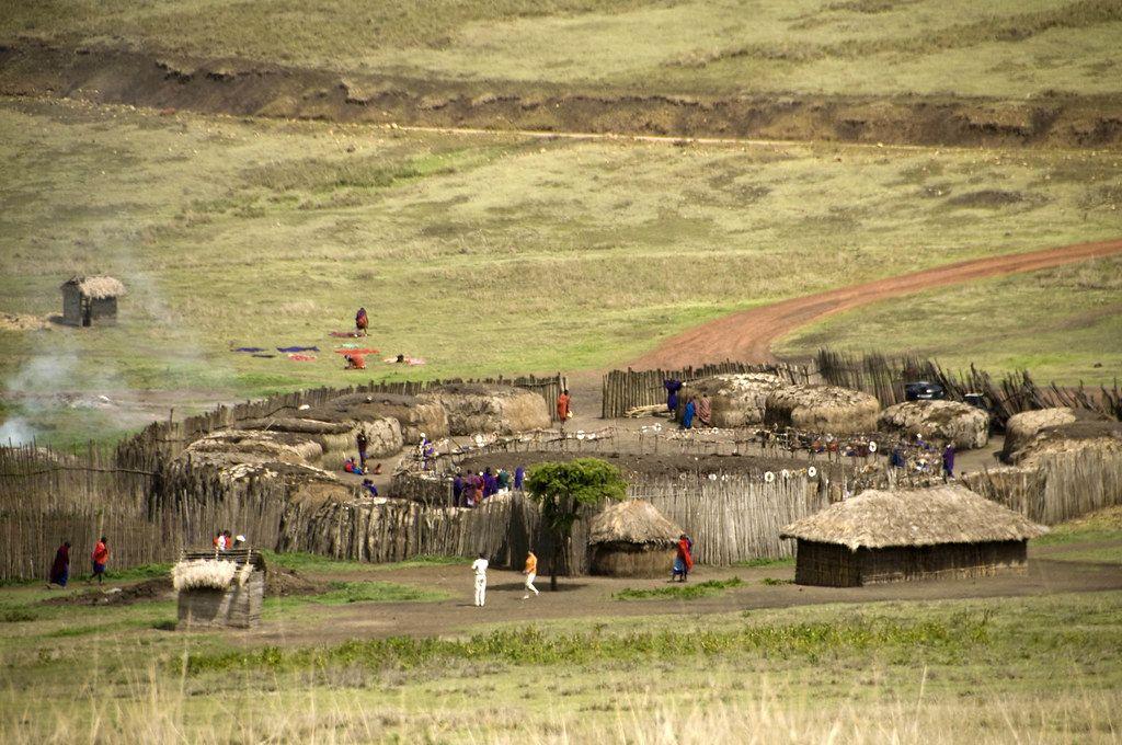
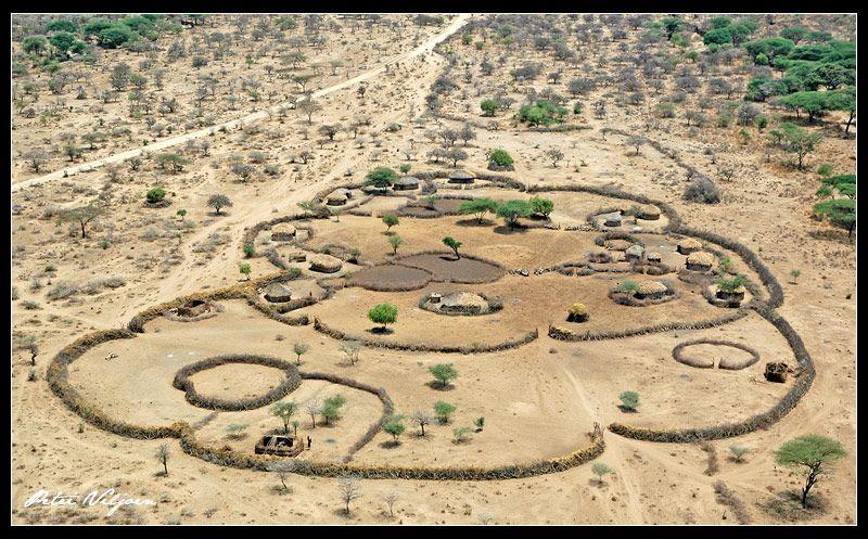
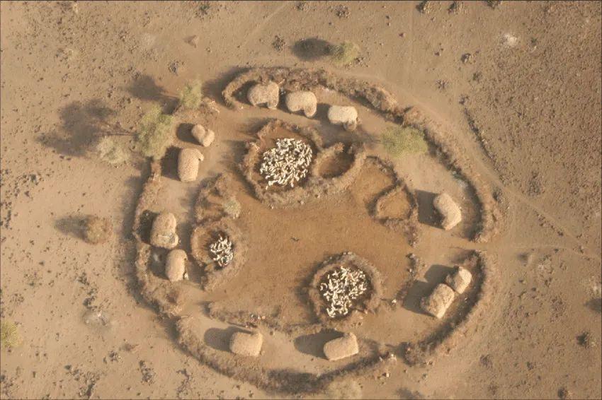
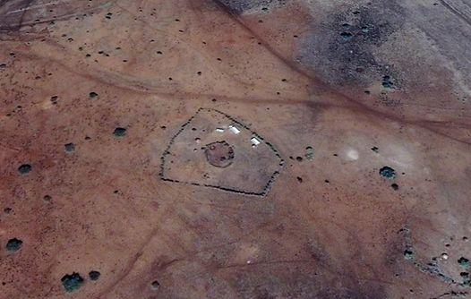
In contrast, the Maasai community layout, referred to as a "bomba," is designed to foster sociability. The Maasai tend to live in close-knit communities with individual houses positioned around the perimeter of the enclosure. To ensure safety and protection, they construct a protective fence made from branches around the houses. Inside the enclosure, smaller fences are erected to keep the animals at the center of the community, where they can be closely monitored and safeguarded. This communal approach to housing reflects the Maasai's strong social bonds and their pragmatic adaptation to their environment.
Environmental strategies
1. Detached dwellings
A.Boma (enclosure)
2. Protected enclosures with fences made from natural sticks and thorns.
3. Sticks,mud and cow dung form an organic thick wall with thermal mass, temperature is notably cooler inside.
4. Traditional use of thatched roof as protection from the sun.
5. No openings in facades, to protect the interior from the sun.
6. Use of local materials
B.
(house)
fence for cattle
Roof - Mud and cow dung or straw /thatched
Int.ceilingSmall branches
Walls -Branches as support
StructureThicker branches
Floor - Soil
FoundationStones or natural cement (mix of mud, cow dung & grass)
Enkaji
Thorn fence
Detached dwelling
Smaller
Fig 7.6.1- Images of Bomas from (Senses Atlas, 2021)
Fig 7.6.2- Images of Enkaji from Site visit and (Senses Atlas, 2021)
Fig 7.6.3- Diagram of a typical Boma
Fig 7.6.4- Diagram section of a Enkaji
Site Visit
Overview
Arrival and contact
Engaging with the community
Engaging with the community - Activities
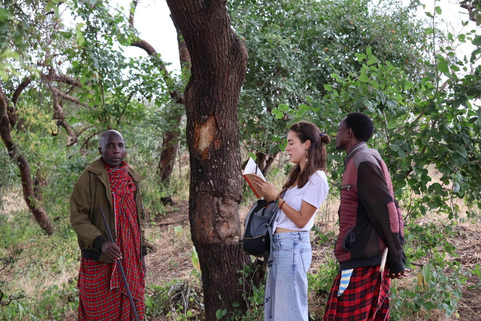
Field work- interviews
Field Work - buildings survey
Field work - land survey & surroundings
Field work - Existent school
Conclusion
8. Site Visit
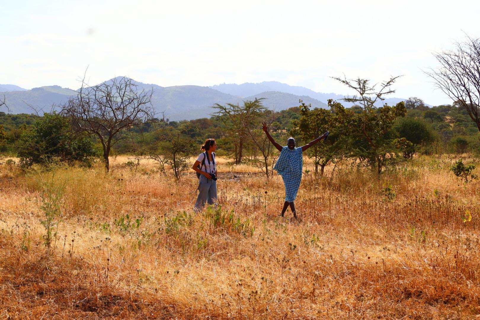
As part of the research methodology, conducting fieldwork studies was a crucial and early priority to gain a deeper understanding of the community, its traditions, and its specific needs.
The fieldwork was funded in part by "Isoma Children" and further supported by the University of Westminster through their generous "Global Experience Bursary Grant." Alejandra Alonso, the founder of the organization, played a vital role in facilitating the site visit. Her existing strong connections with the people of Losimingoore Village greatly contributed to establishing a rapport with the community and easing the introduction process.
The overall visit consisted in four phases;
1. Arrival and contact
○ Meetings with local architects
○ Title deed registration paperwork
○ Meeting with ISOMA Children board
2. Engaging with the community
○ Attending a traditional Maasai celebration
○ Activities with the children and adults in order to make significant relationship and to surpass the significant language barrier.
3. Field work
○ Visit to the land and survey of the ground and vegetation Informal interviews with the people of the community
○ Visit to the existent school, survey of materials and recording of temperatures
○ Survey of surroundings
4. Return and data analysis
Fig 8.1.1- Diagram of methodology of site visit
8. Site Visit
8.2 Arrival and contact
During the initial phase of the site visit, the first week was dedicated to a series of pre-arranged meetings held in the city of Arusha.
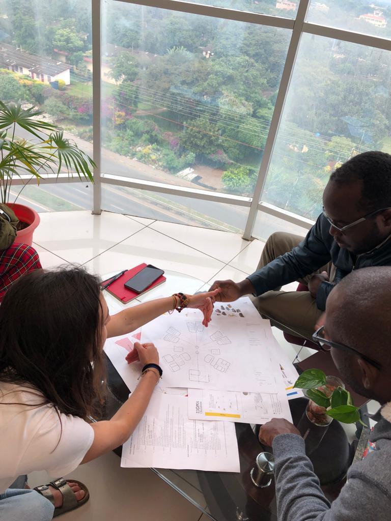
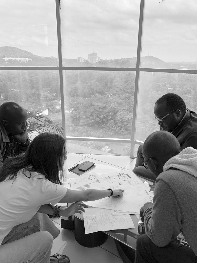
These meetings began with discussions with select members of the "ISOMA Children" board, aimed at establishing connections and presenting the progress of the school's design. Detailed minutes were recorded during these meetings to document the discussions.
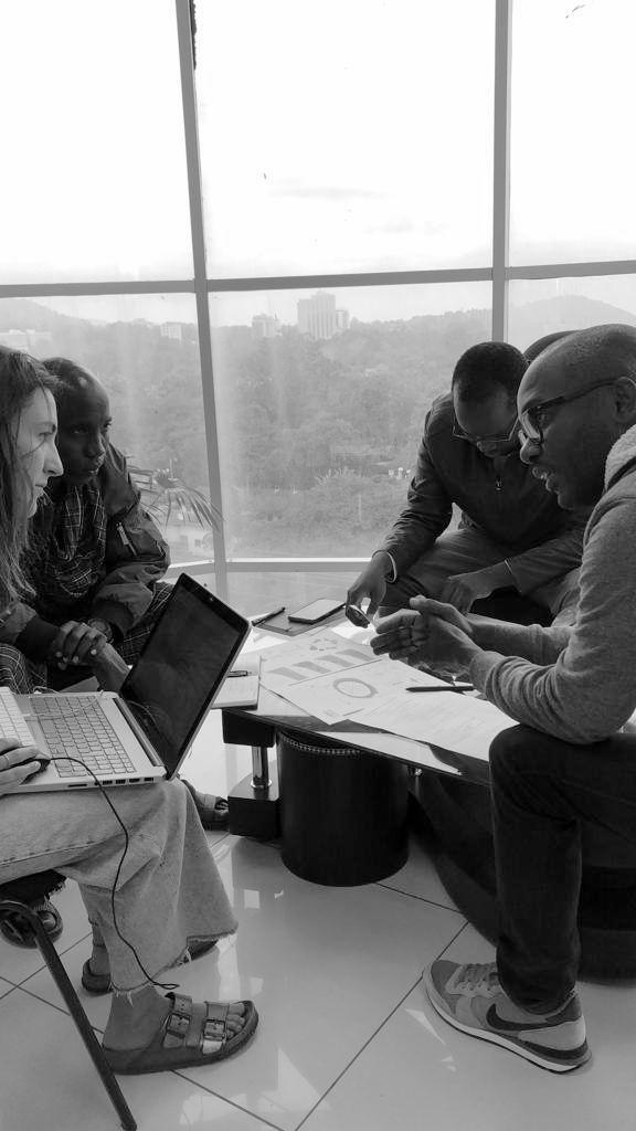
Additionally, there were sessions with local architects responsible for the construction project. These meetings served to gain insights into the technical capabilities available locally, understand the characteristics of the accessible materials, and establish a preliminary budget for consideration.
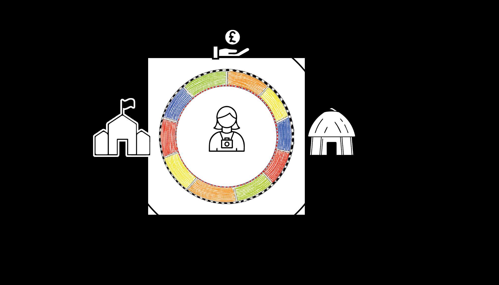
A significant outcome of one of the meetings with the Inter-institutional Relationships & Advisory Officer, Godphrey Elibariki, was the proposal to implement a circular economy strategy. ISOMA, as an NGO, sought to finance its projects through income-generating activities. This approach aimed to reduce dependency on external donations for funding both construction and administration of the school.
Consequently, the concept of "Maasai Eco-villas" was introduced. This involved building a compound of villas within the complex to attract tourists seeking an authentic and traditional Maasai experience. Tourists would have the opportunity to immerse themselves in the Maasai community's way of life and witness firsthand how their expenditures contributed to shaping the future of the children in the community.
Arrival and Contact
Ddddddd
Maasai Eco-villas ddddddd
School
Godphrey Elibariki
Maurine Mollel
Mosses Mollel
Meeting with Tujenge Architects - Harun Guta & Thadeous Kallanga
Tourism
Fig 8.2.1-Pictures of members of the board of ISOMA, property of ISOMA
Fig 8.2.2-Pictures of meeting with local architect
Fig 8.2.3-DIagram of circular economy for the funding of the project
8. Site Visit 8.3 Engaging with the Community
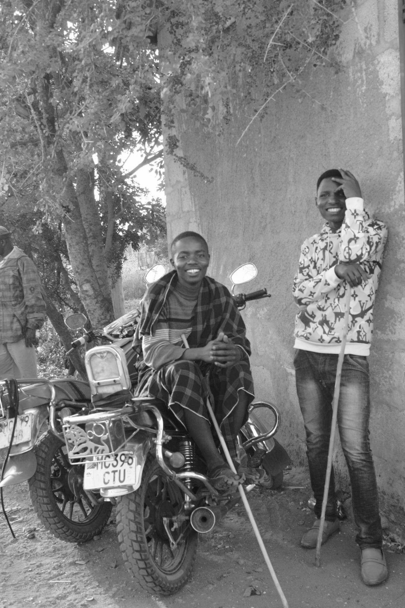
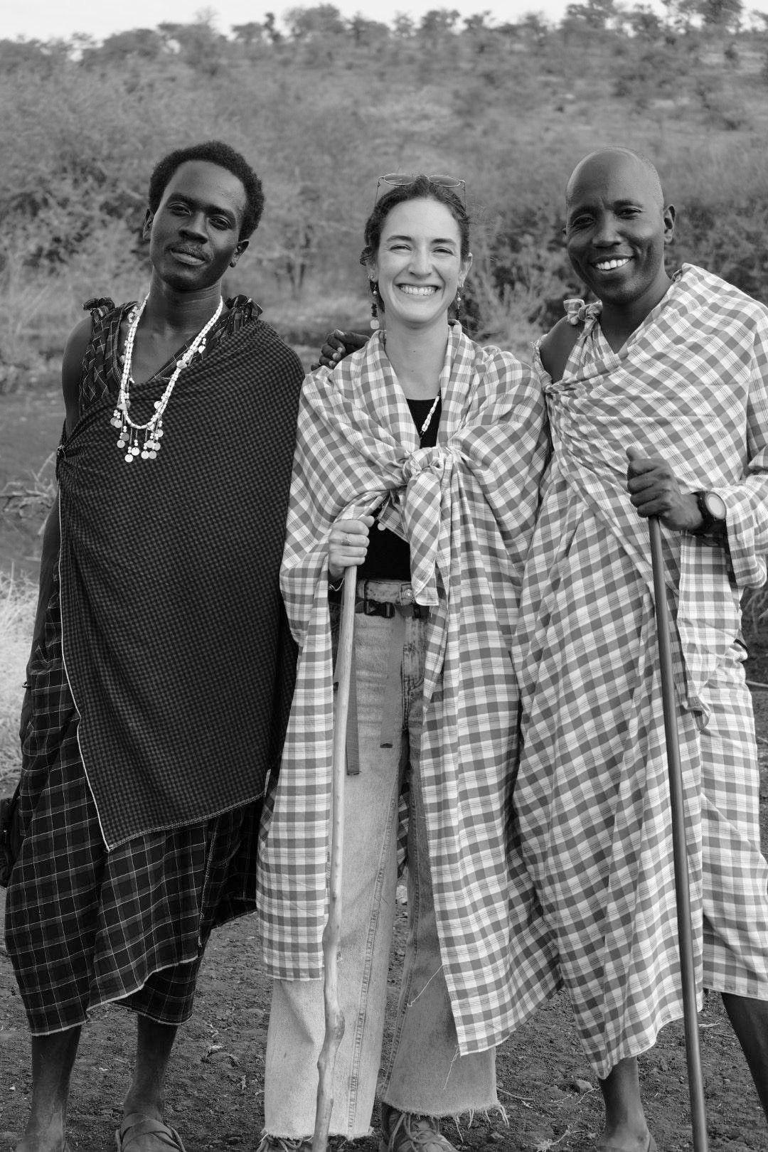
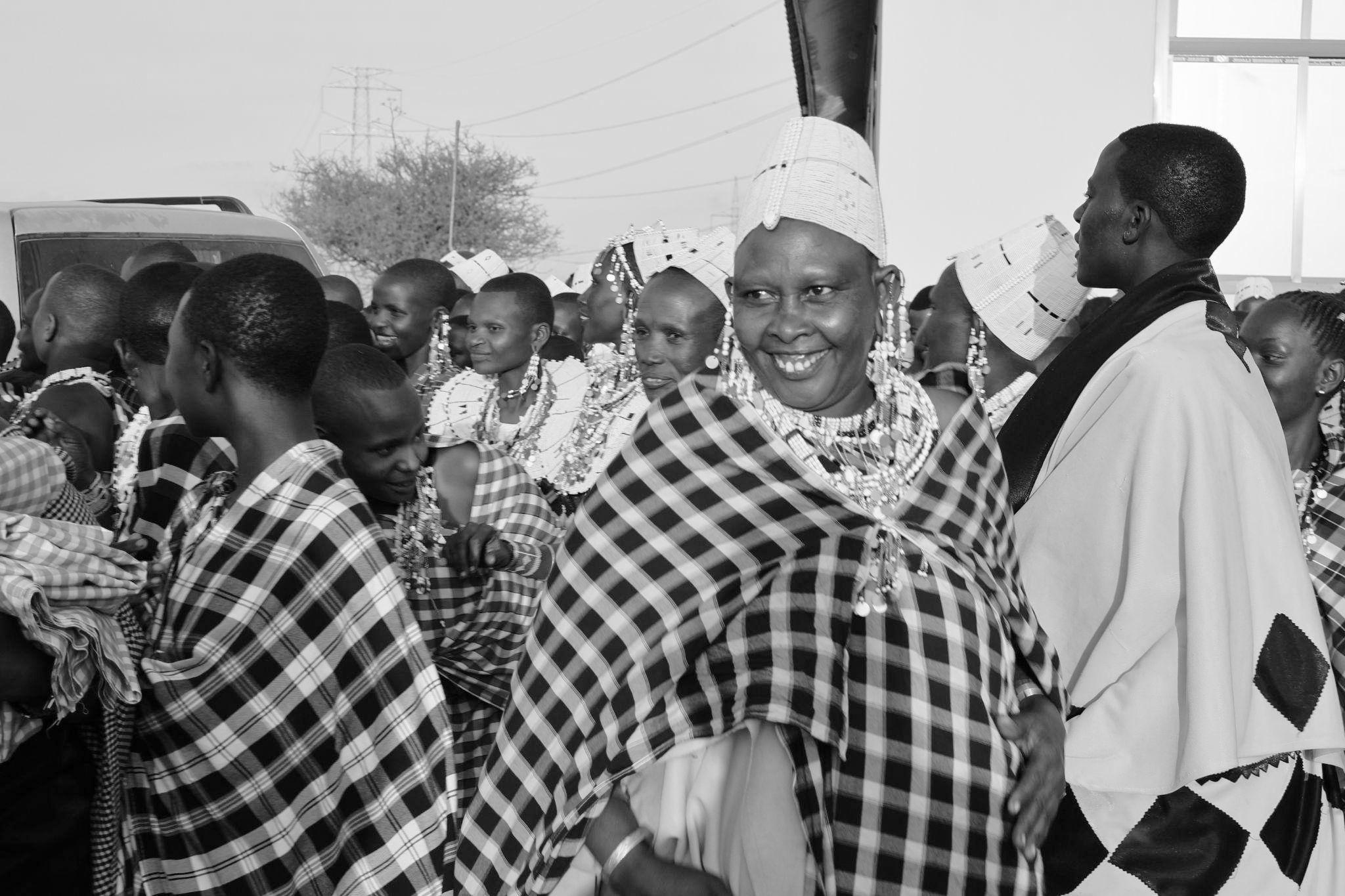
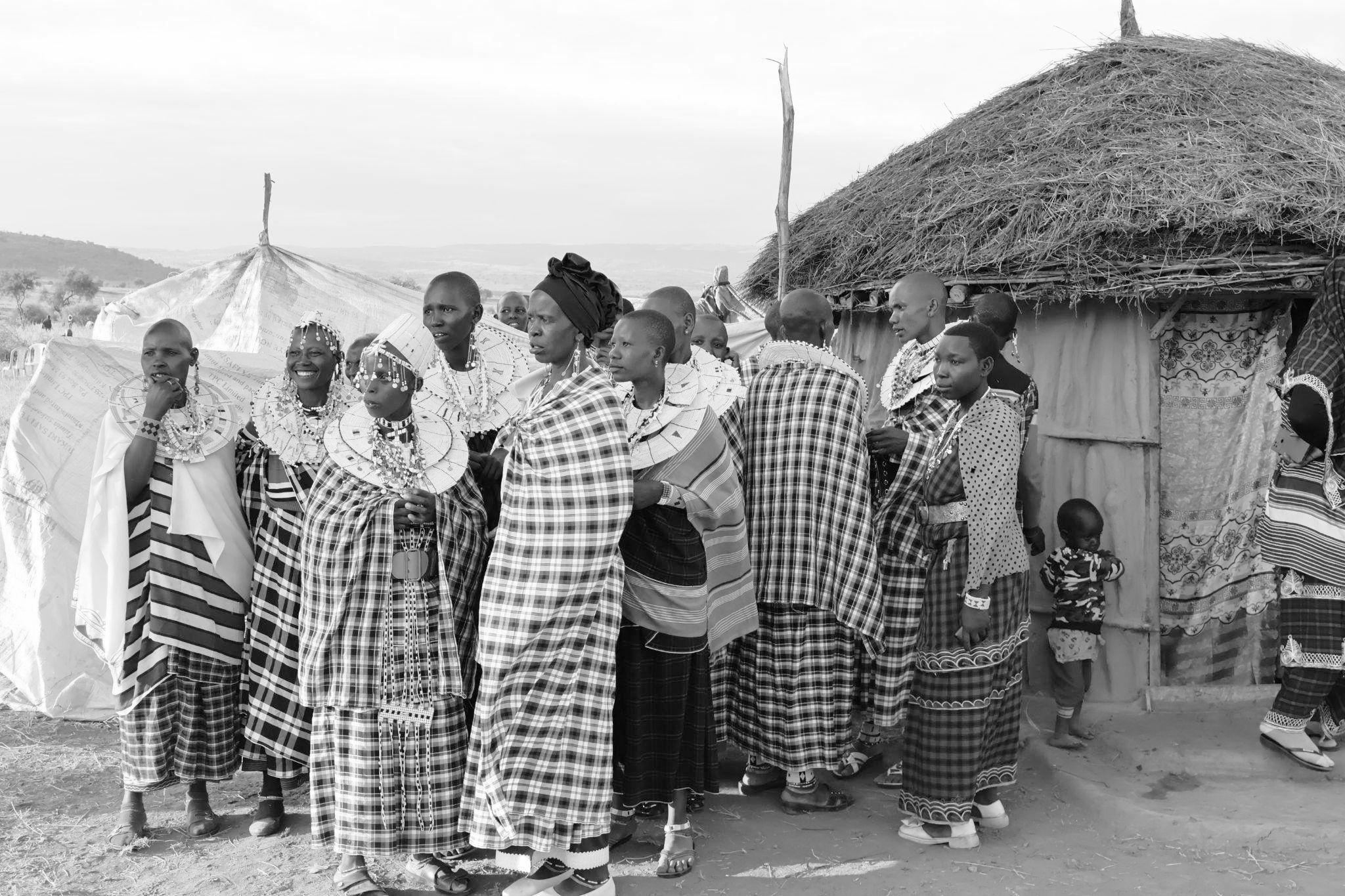
We traveled from the city of Arusha to the village of Losimingoor, where we stayed with the Mollel family within the village.
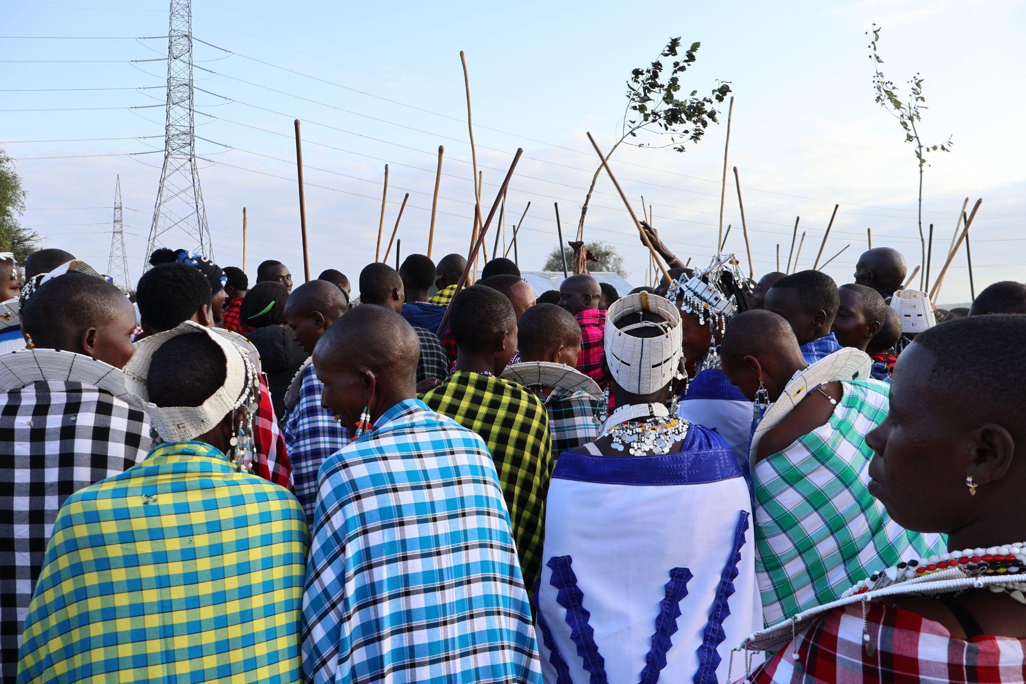
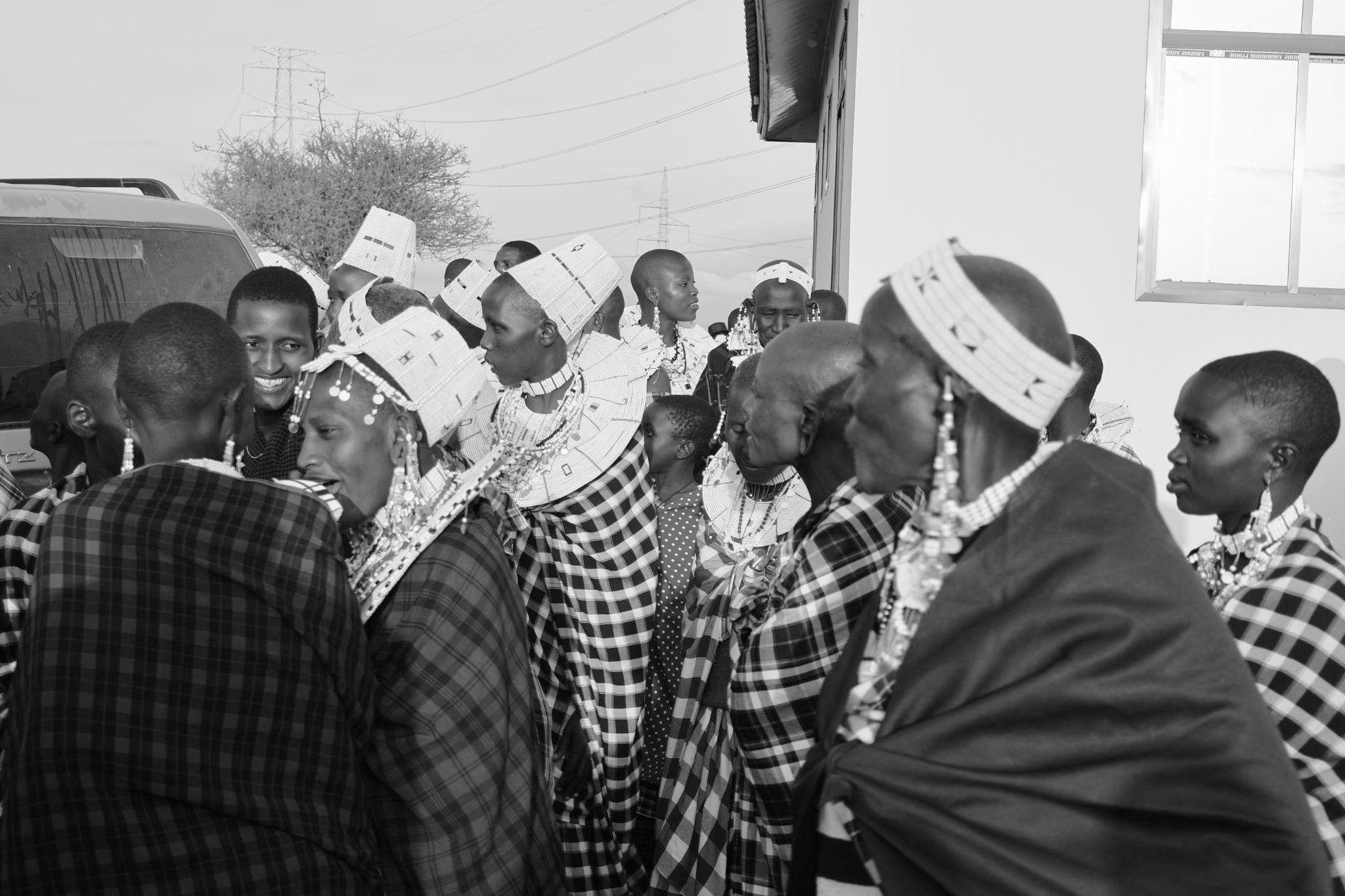
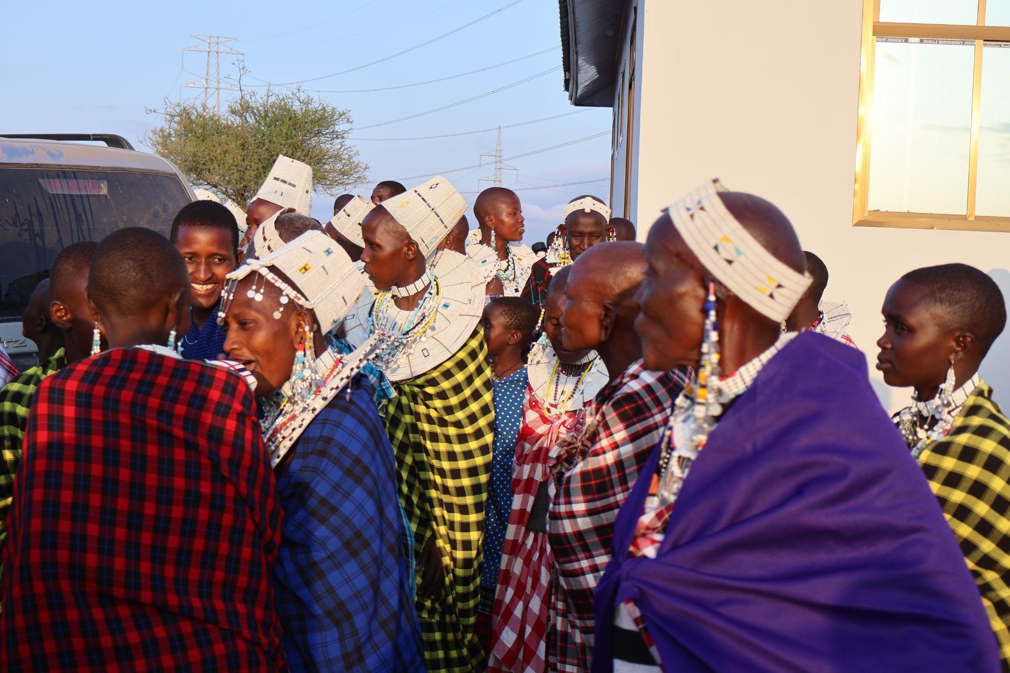
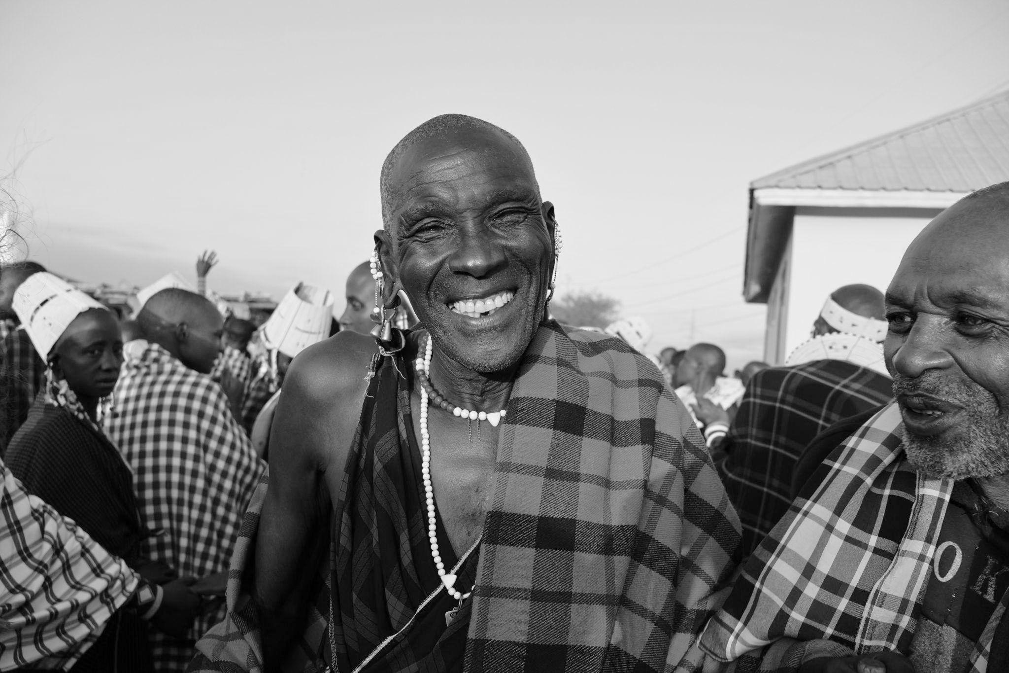
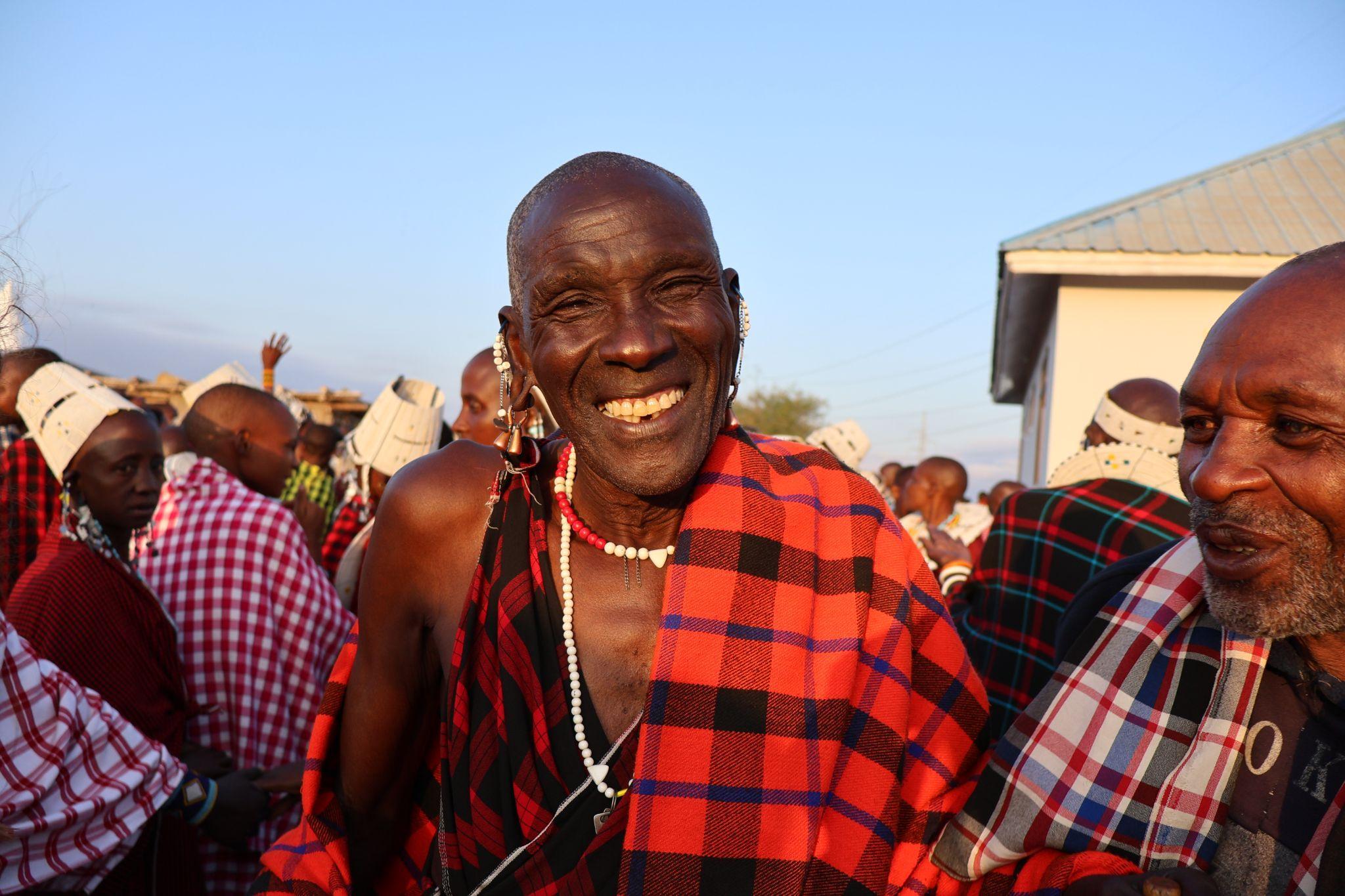
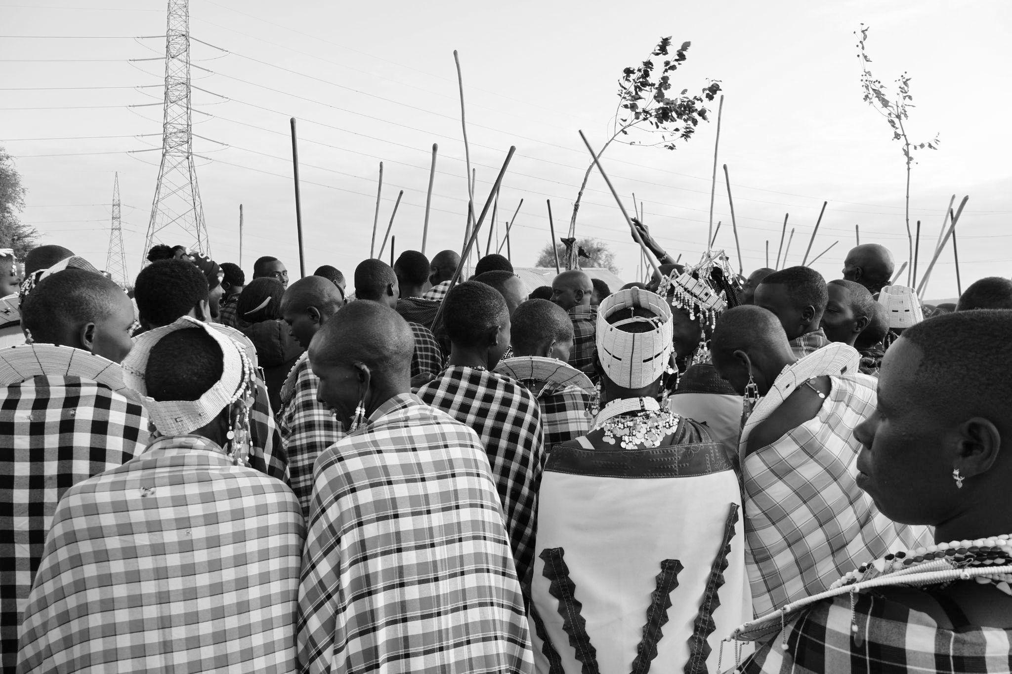
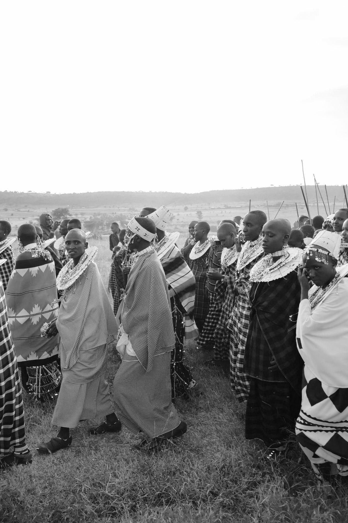
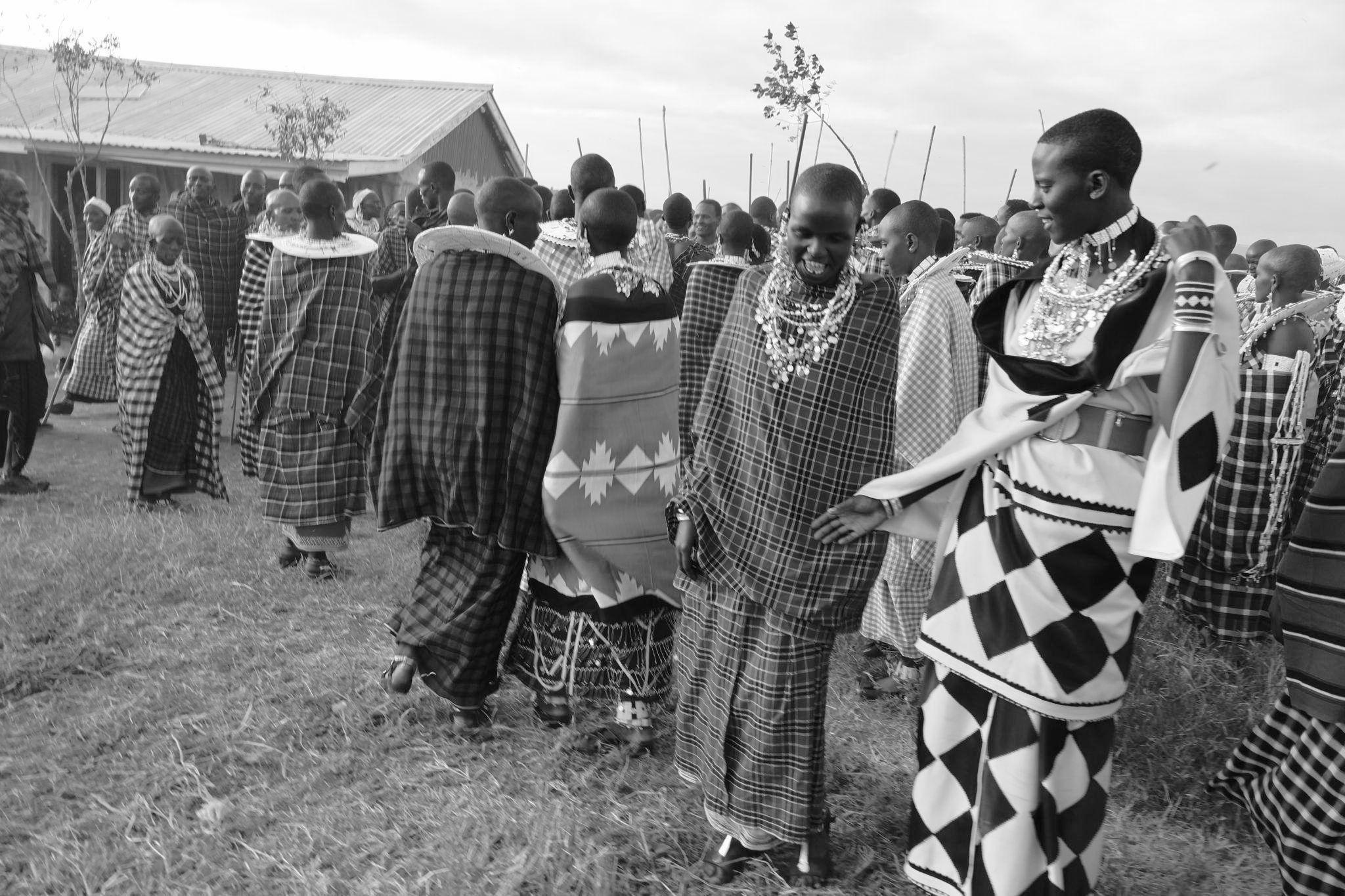
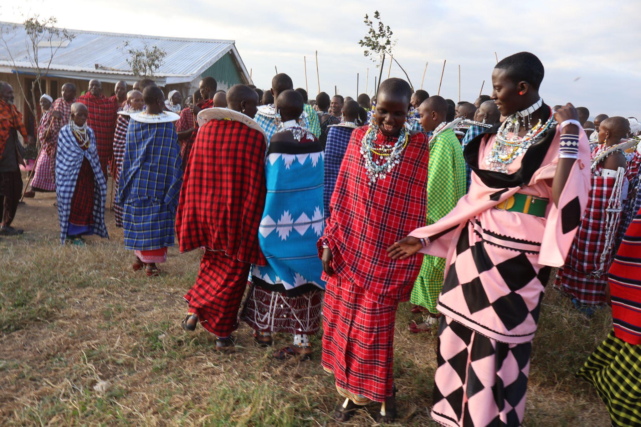
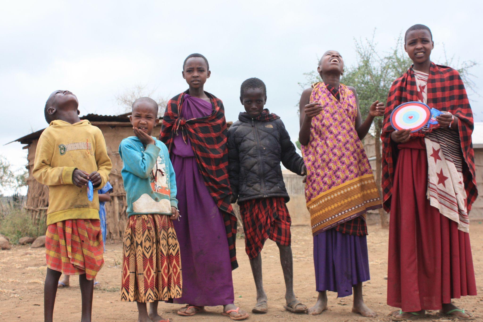
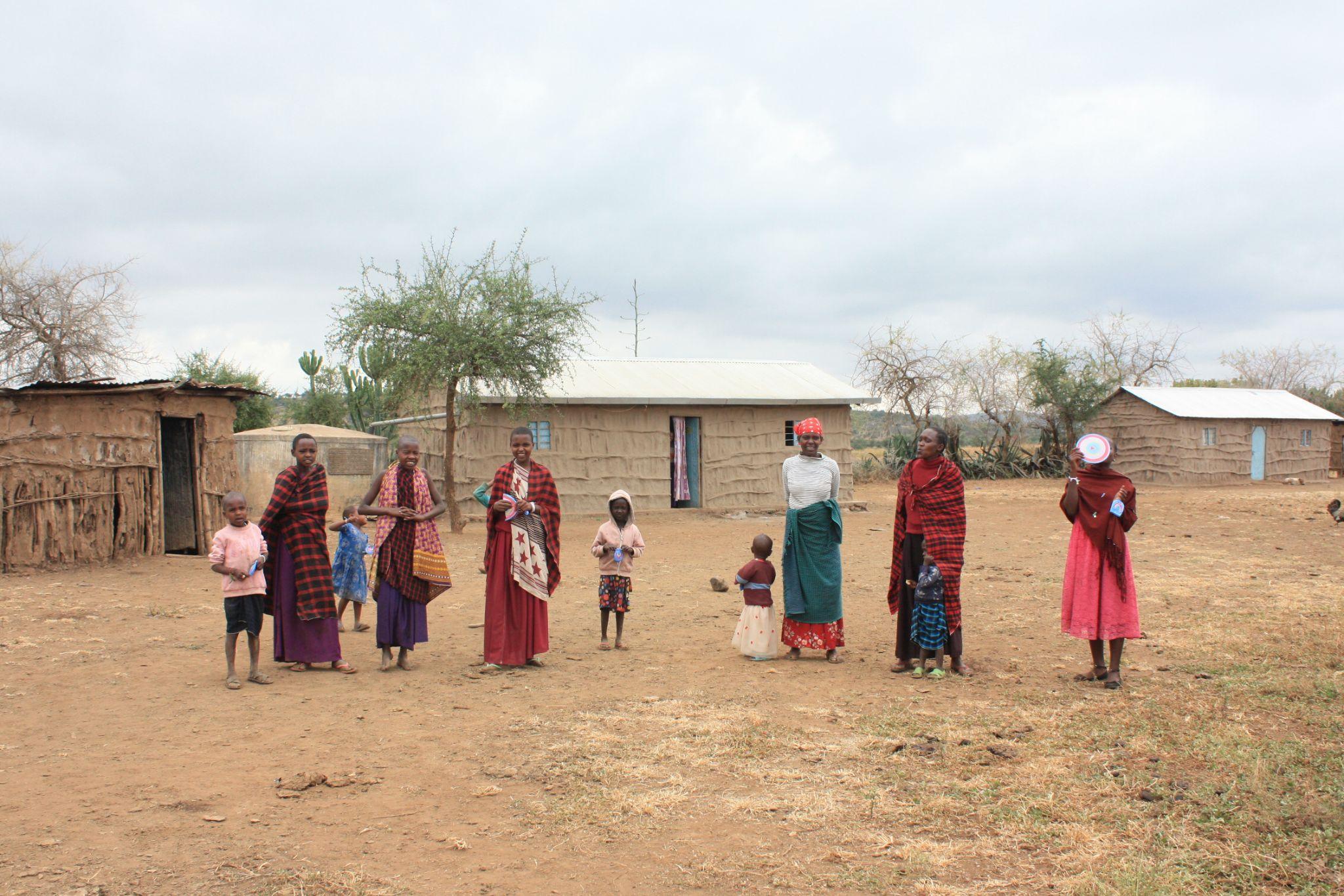
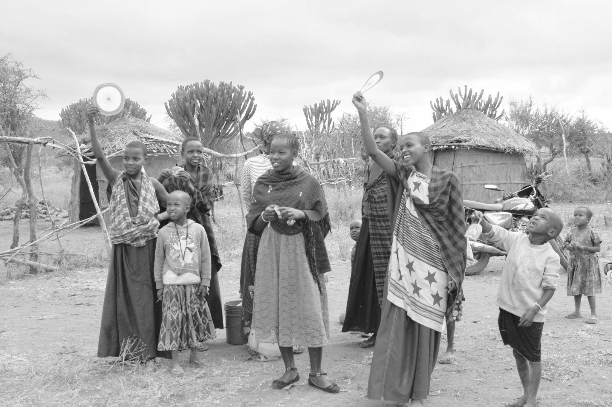
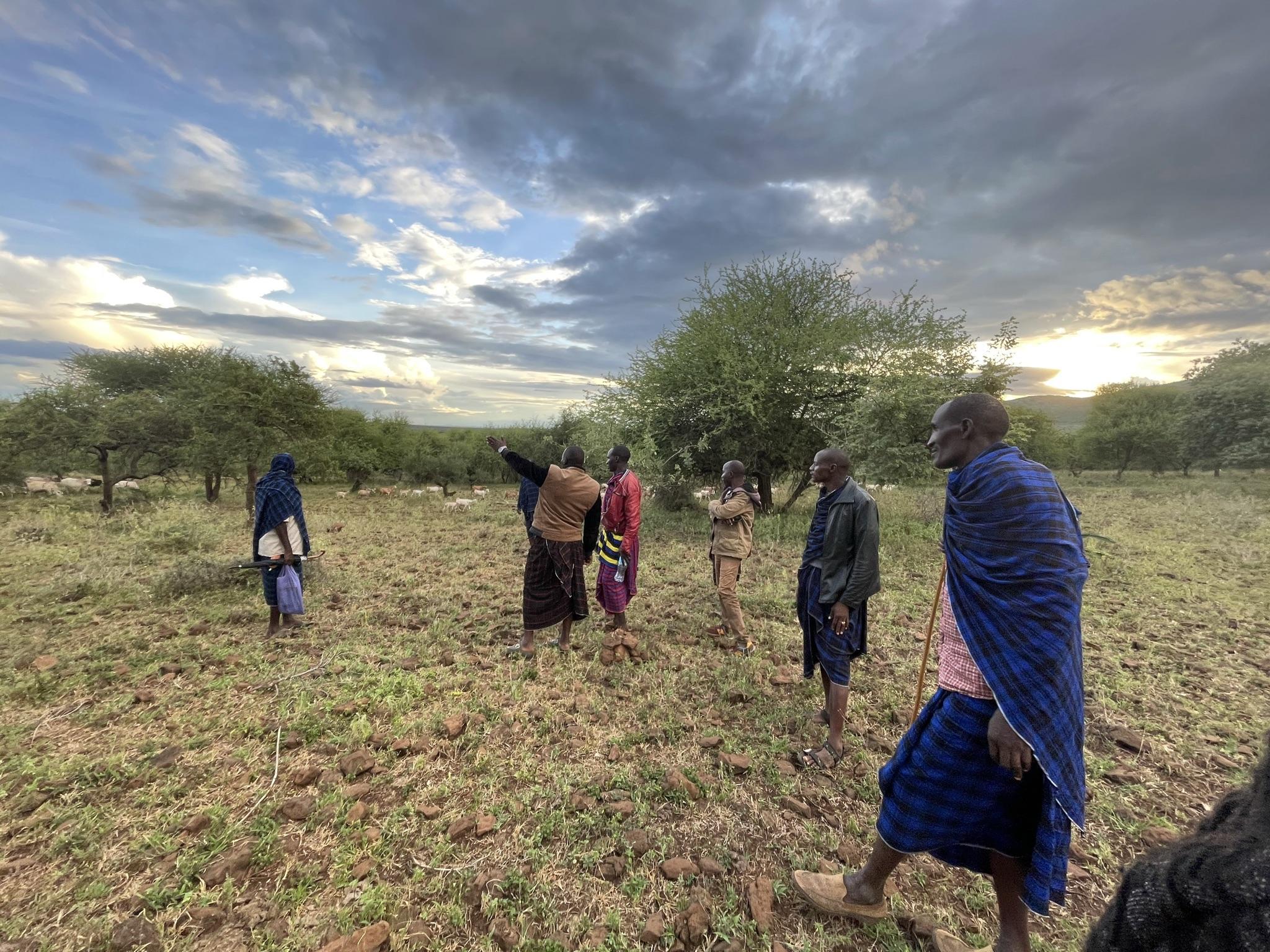
Our first activity in the village was a formal Maasai celebration marking the transition of two boys into warriors. This celebration holds immense significance in Maasai culture as it marks a young man's introduction to the tribe as a protector of the village.
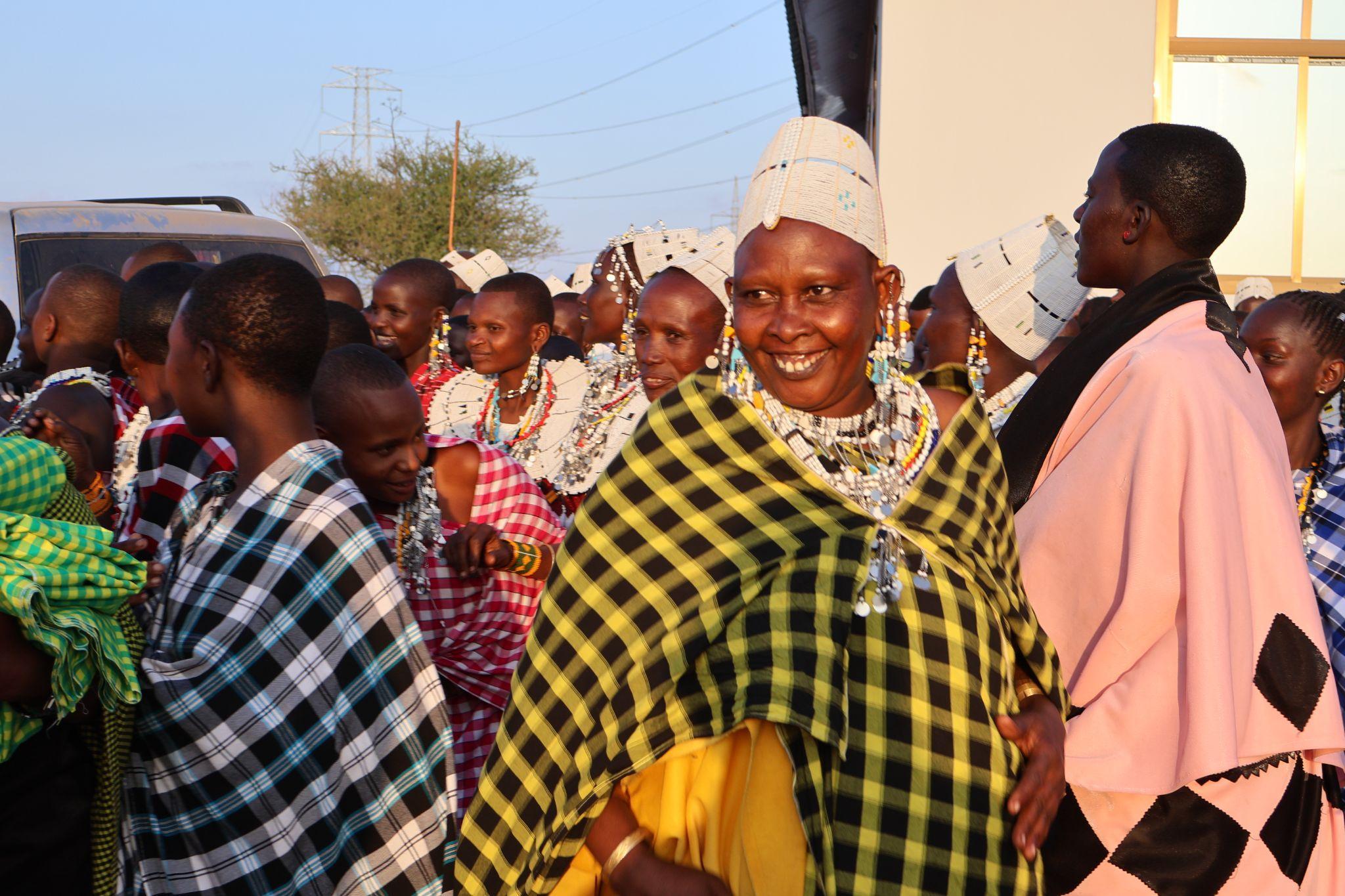
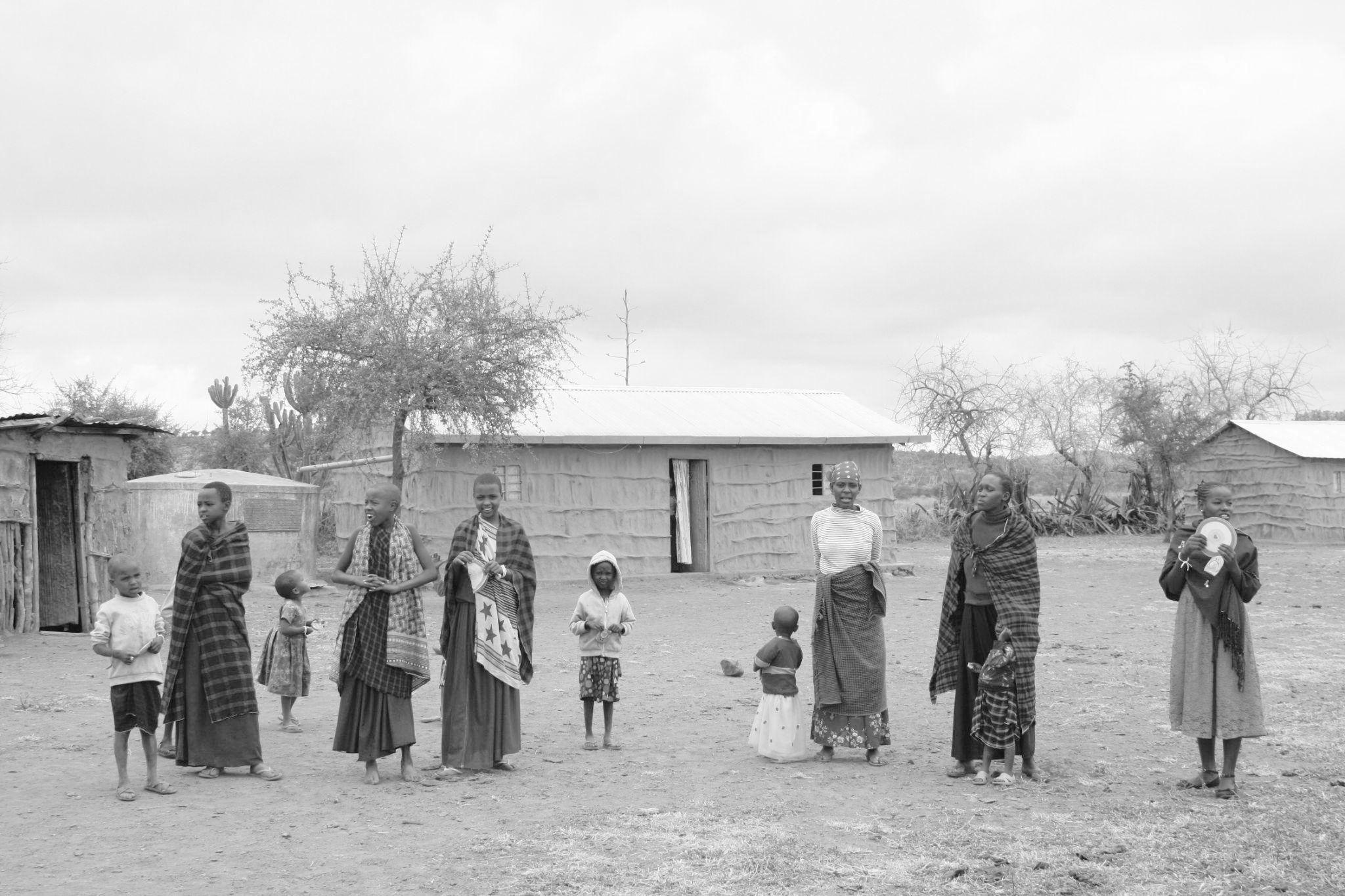
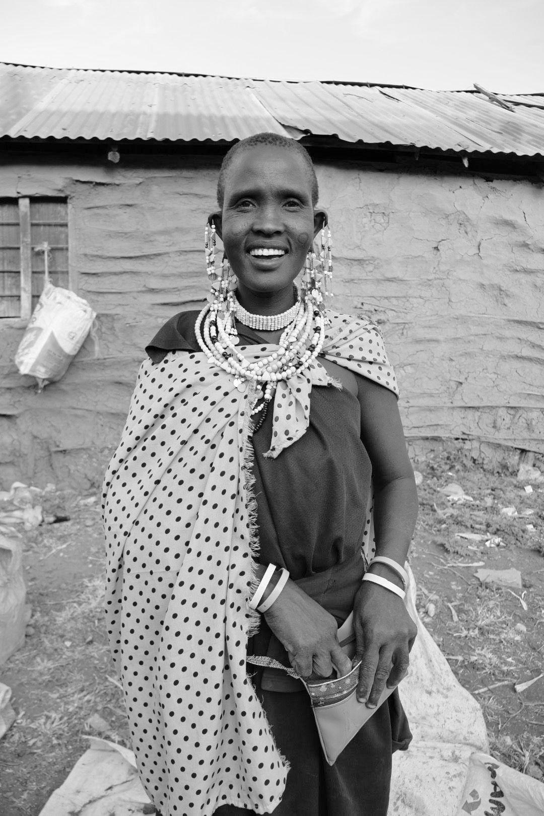
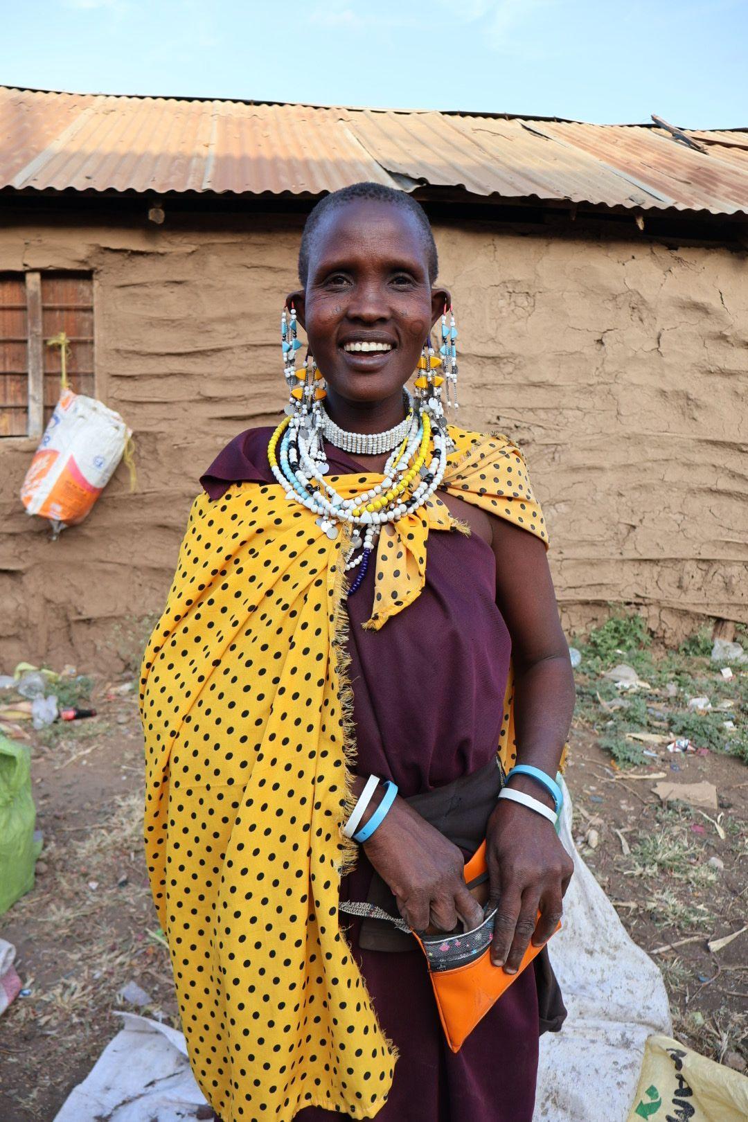
During the celebration, attendees adorned themselves in formal Maasai clothing and accessories. Traditional music, food, and drinks were an integral part of the festivities. The entire village, consisting of approximately 600 people, gathered to partake in the dancing and feasting. This event provided us with a unique opportunity to engage with various groups of people within the community.
From the outset, we observed that men and women were separated during the celebration. However, we were warmly welcomed to interact with both groups, and both men and women were inclusive and hospitable towards us.
Men and women with traditional formal clothing Maasai
Mollel family
Village Arusha Arusha Region
Fig 8.3.2 -Pictures taken on site of the people in a celebration
Fig 8.3.1 -Diagram of the sites that were travelled
8. Site Visit
8.4 Engaging with the Community, Activities
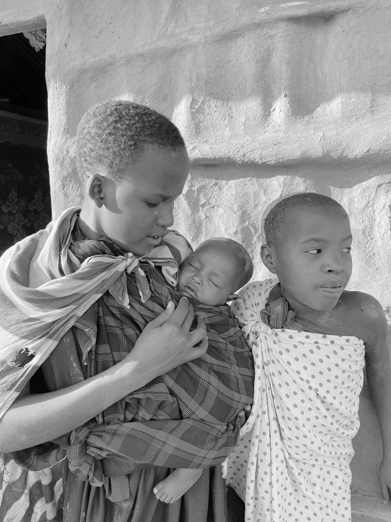
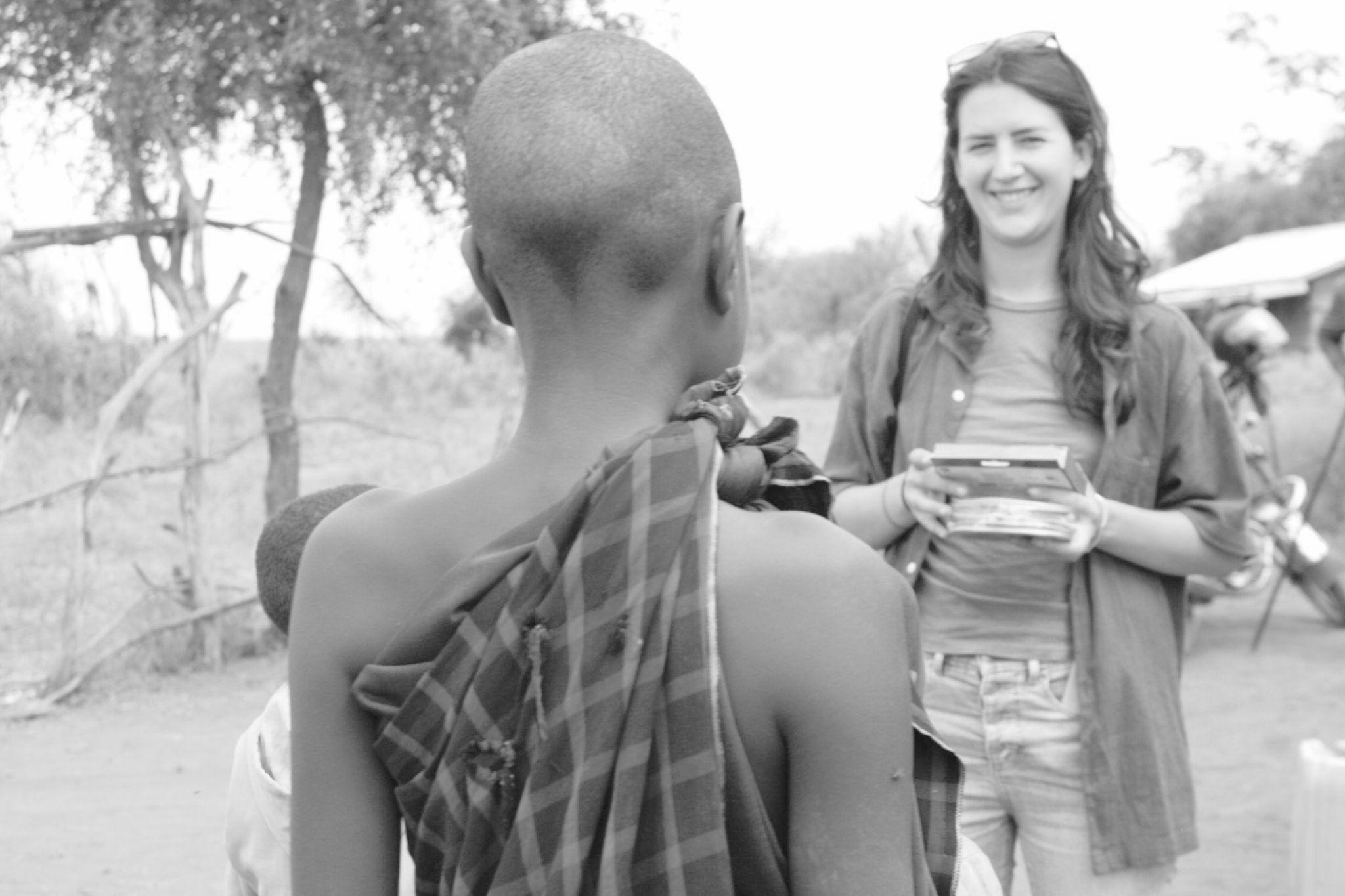
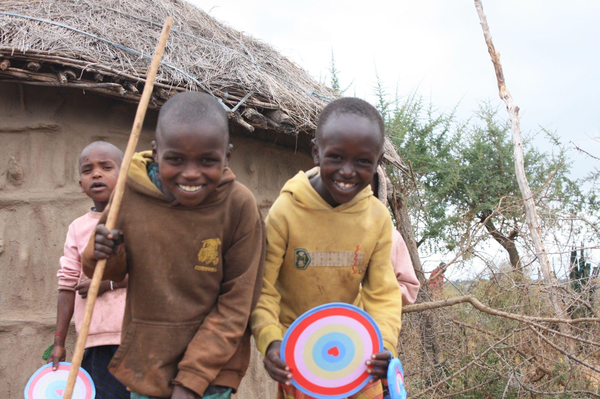
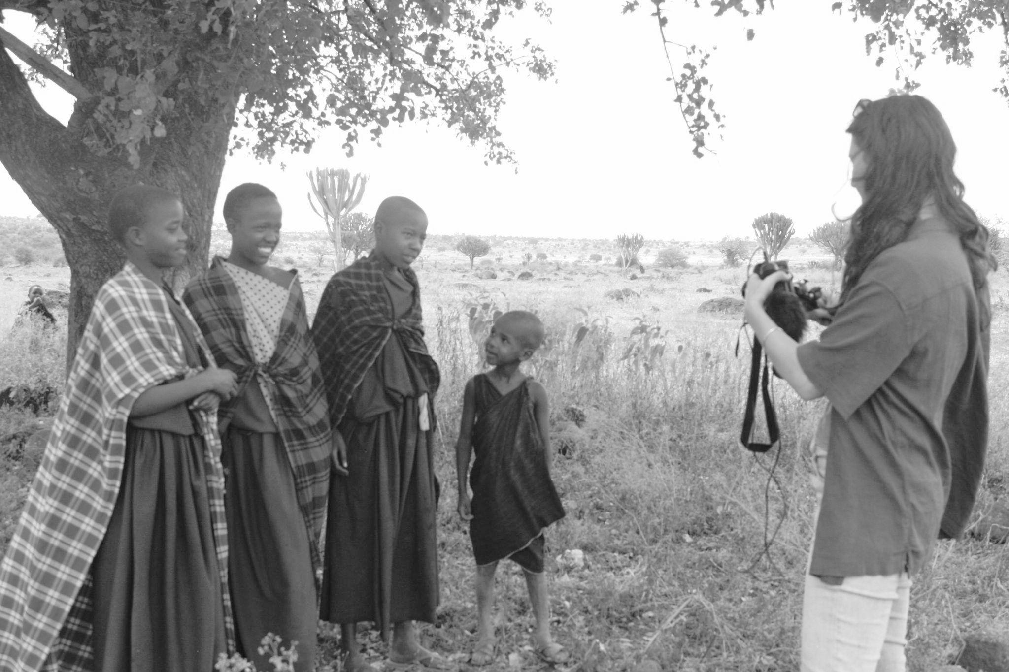
Given that the primary objective was to create a school for the children, it was essential to establish a connection with the kids themselves. To initiate this connection, we planned a series of games and activities.
First, we organized an introductory game to learn the children's names and begin building rapport. Following this, we introduced some games that we had brought with us to break the ice. This led to an energetic game of throwing and catching, which the children thoroughly enjoyed.
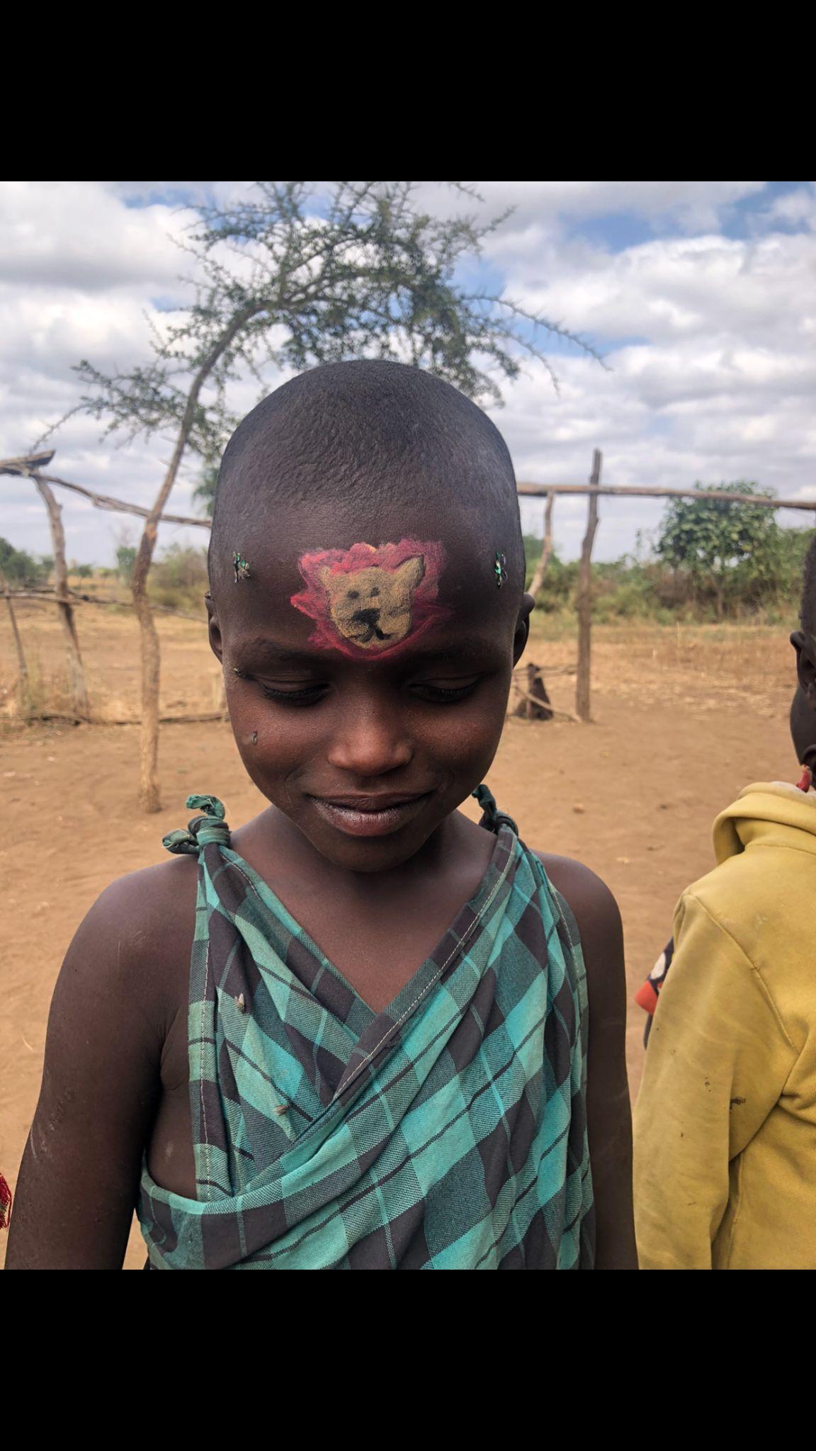
As the energy levels subsided, we engaged the children in face painting, using this as an opportunity to ask them basic questions to get to know them better. For instance:
○ What is your favorite animal?
○ What is your favorite color?
We also made an effort to learn and use basic Swahili phrases to communicate with the children.
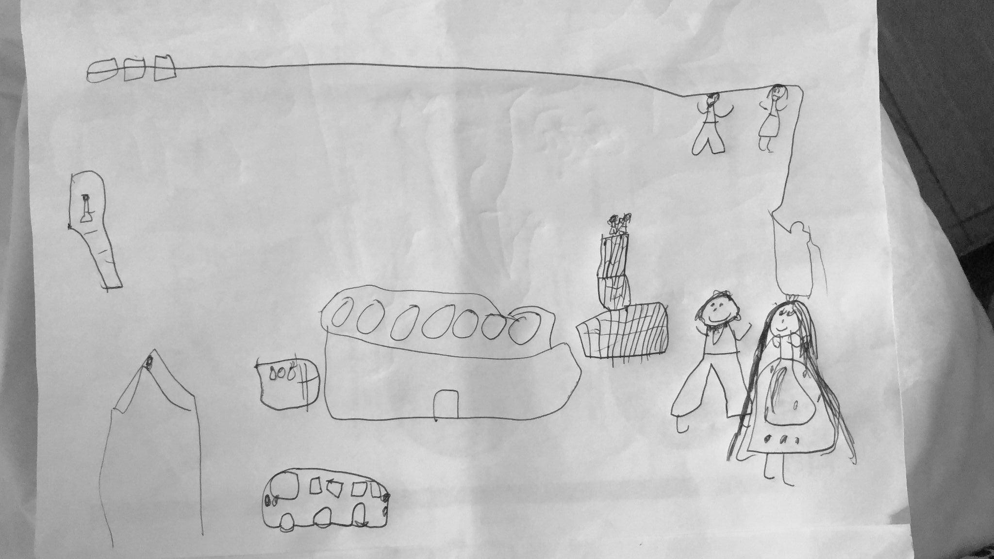
Additionally, there were a few kids who understood English. We asked them to draw their dream school, allowing them to express their ideas creatively.
Painting Activities
These activities played a crucial role in building trust within the community, especially with the children. We hope that the ideas they shared during these interactions will be incorporated into the design of their new school in the future.
Playing Games
Introduction to the community by playing games
Drawings from the kids
Face painting
Fig 8.4.1 - Pictures of the kids of the village during painting activities
Fig 8.4.2 - Pictures taken on site of the activities with the kids
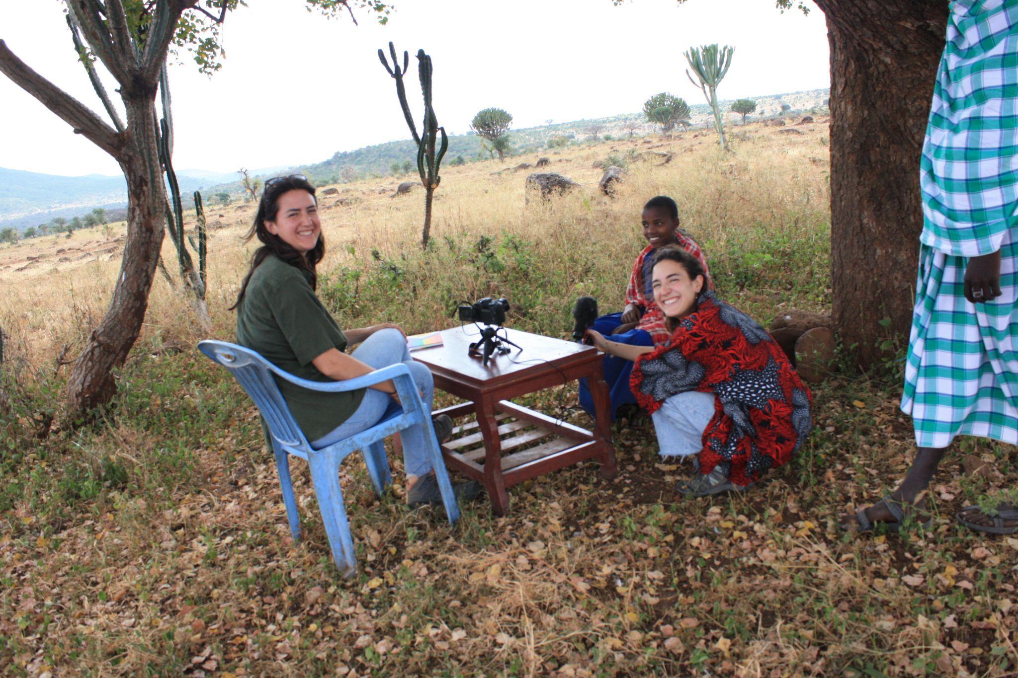
8.5 Field Work- interviews
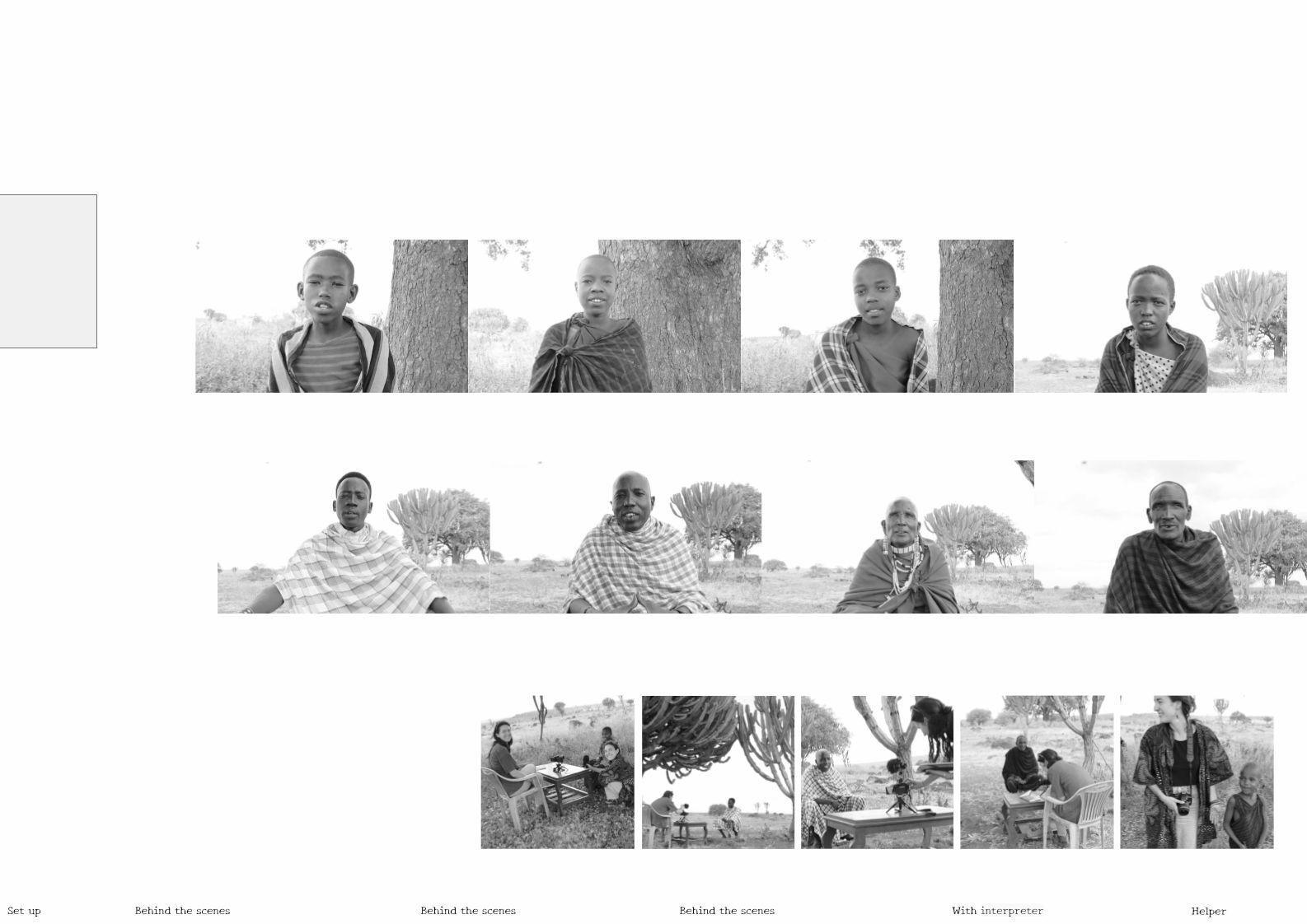
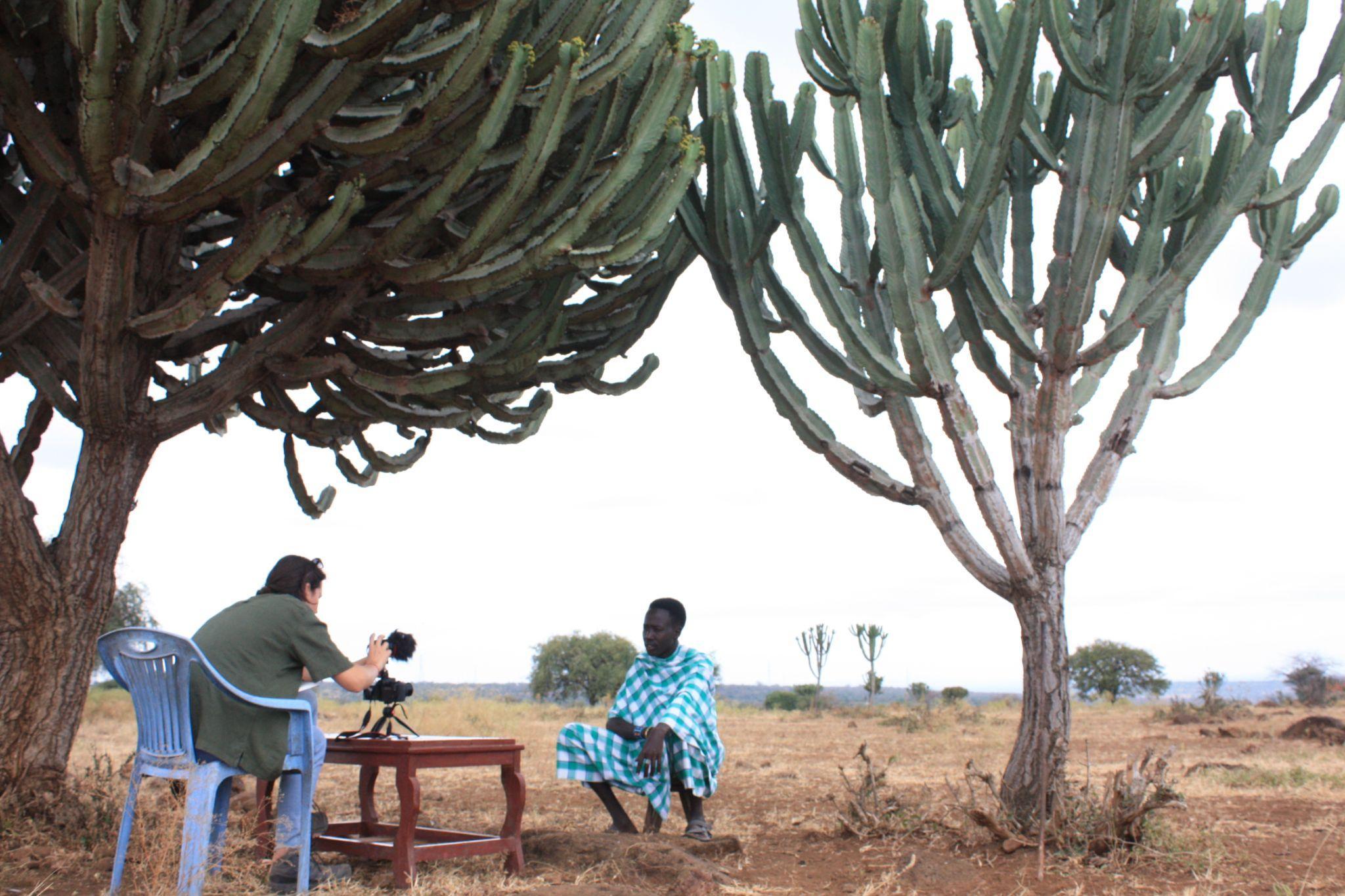
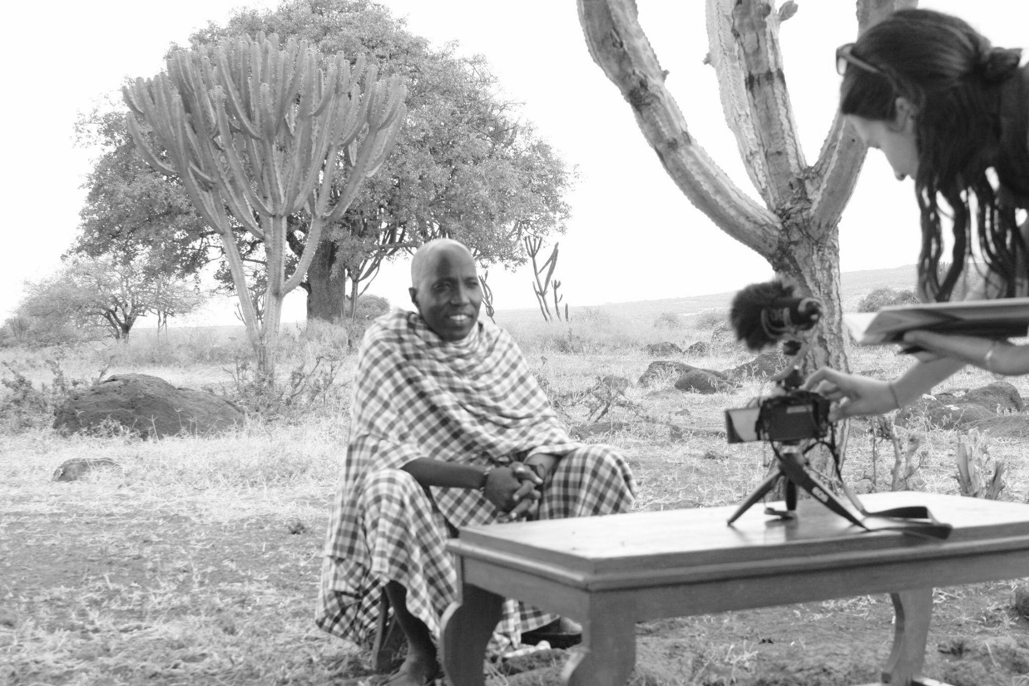
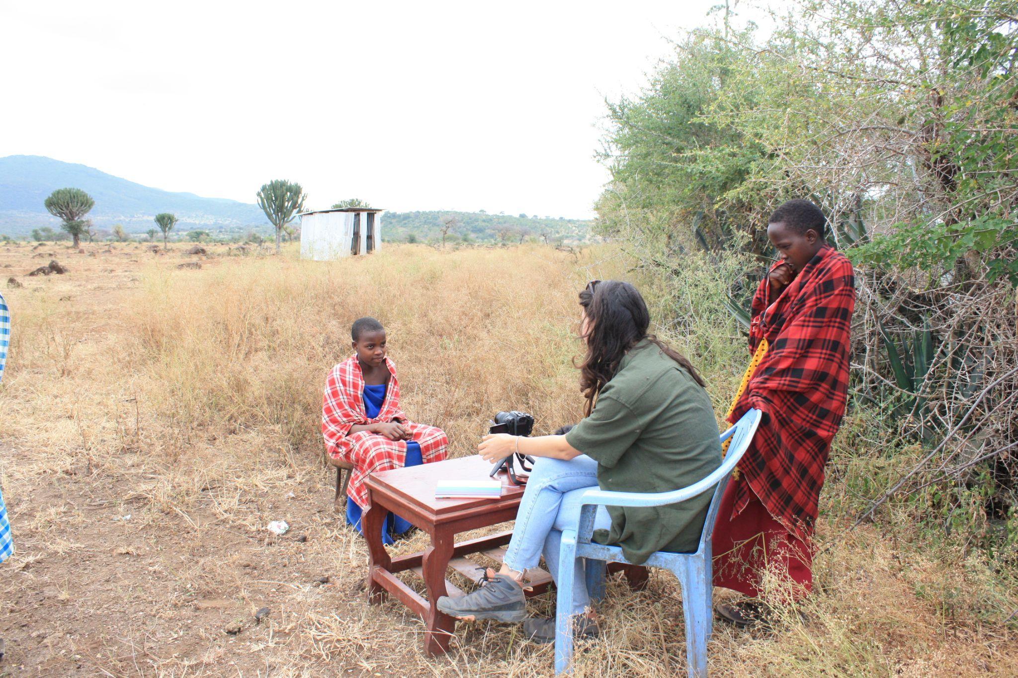
As part of the fieldwork, a series of interviews were conducted, encompassing various age groups and both genders.
The primary objective of these interviews was to gain a more comprehensive understanding of how the residents of the village perceive the proposed school project. To achieve this, we inquired about their backgrounds to discern the role of education in their lives and whether it holds significance due to their personal histories or for other reasons.
With the elder interviewees, it was essential to delve into their upbringing and the aspirations they held during their youth. Conversely, when speaking with the younger generation, we aimed to explore whether their parents' viewpoints had influenced their own perspectives.
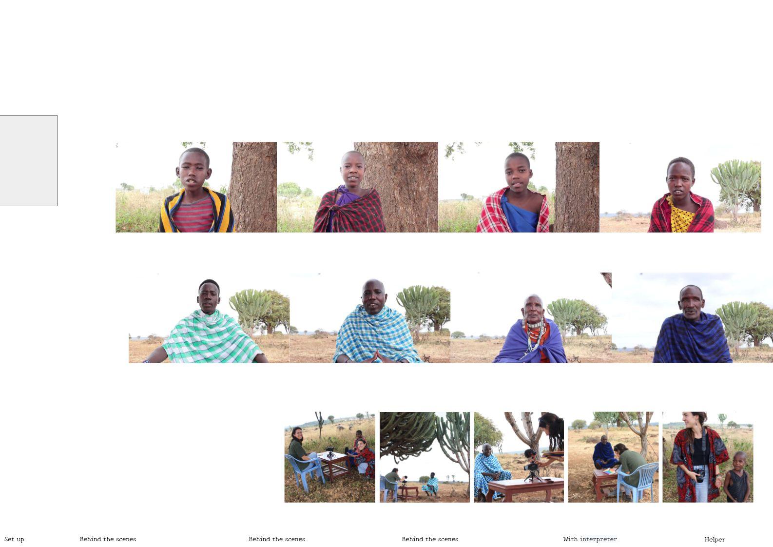
Here is a list of the interviewees:
The interviewees:
○ Tumaini, 9 years old
○ Pilanoi, 11 years old
○ Monica, 13 years old
○ Lasoi, 15 years old
○ Raphael, 24 years old
○ Mosses, 40 years old
○ Paulina, around 60 years old
○ Jeremiah, around 70 years old
It's important to note that these interviews are intended to be compiled to create a short documentary that sheds light on the individuals involved in the project and the educational journeys of the children. The same questioning format was employed for consistency throughout the interviews.
Behind the scenes
With interpreter
Tumaini
Monica Pilanoi Lasoi
Raphael Paulina Mosses
Jeremiah
Fig 8.5.1 - Pictures taken on site of the interview process
8. Site Visit
8.6 Field Work - buildings survey
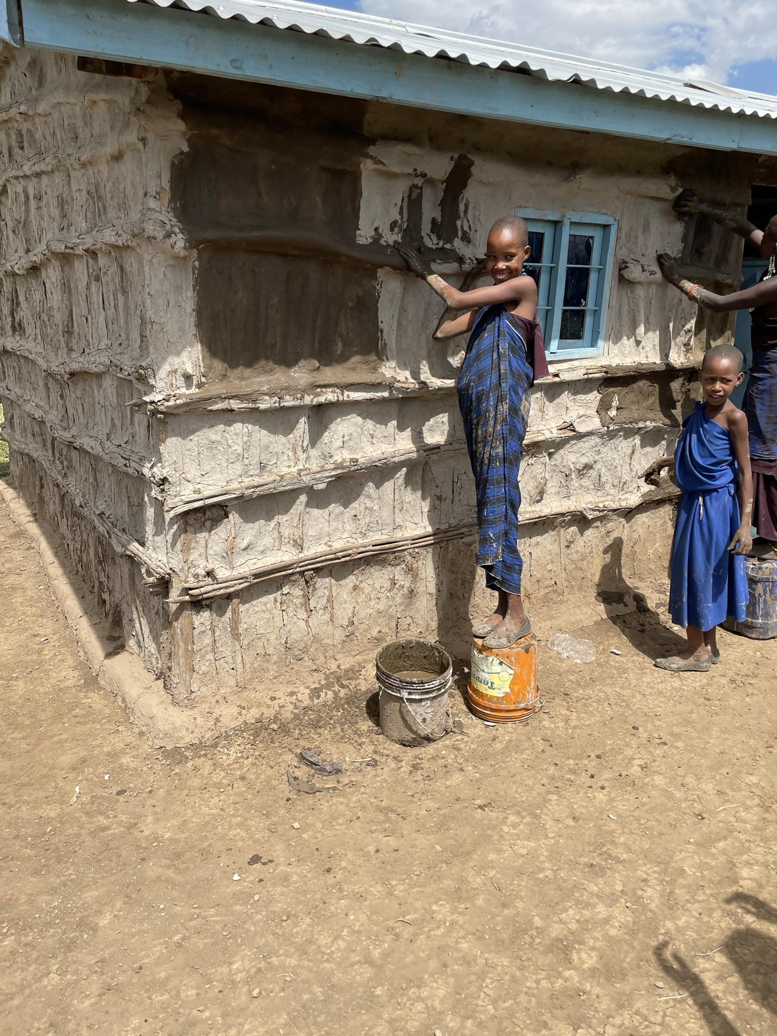
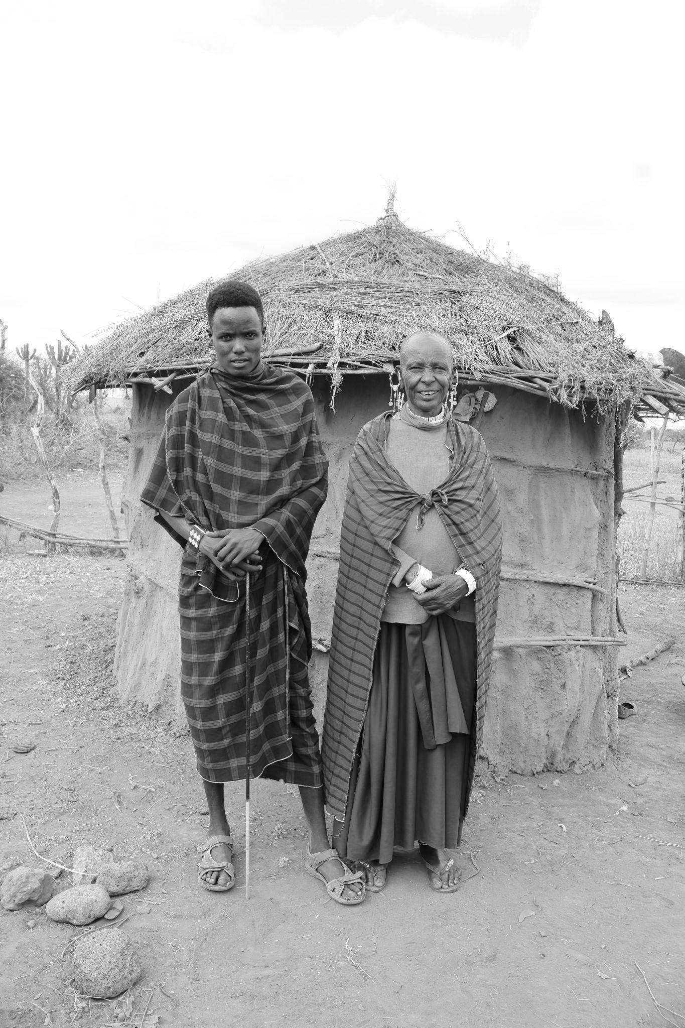
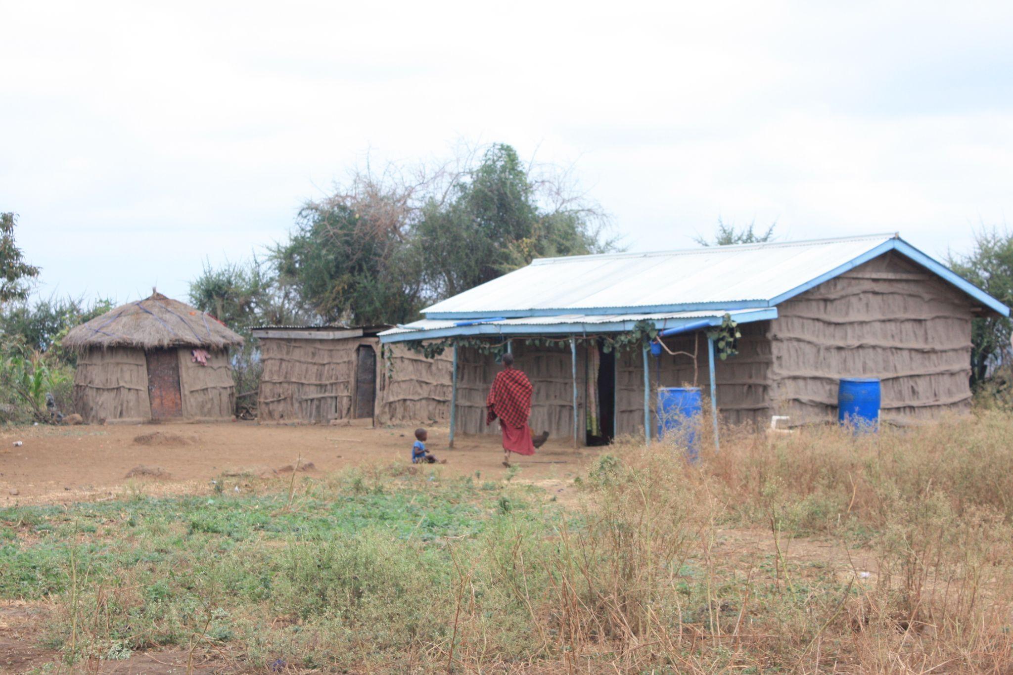
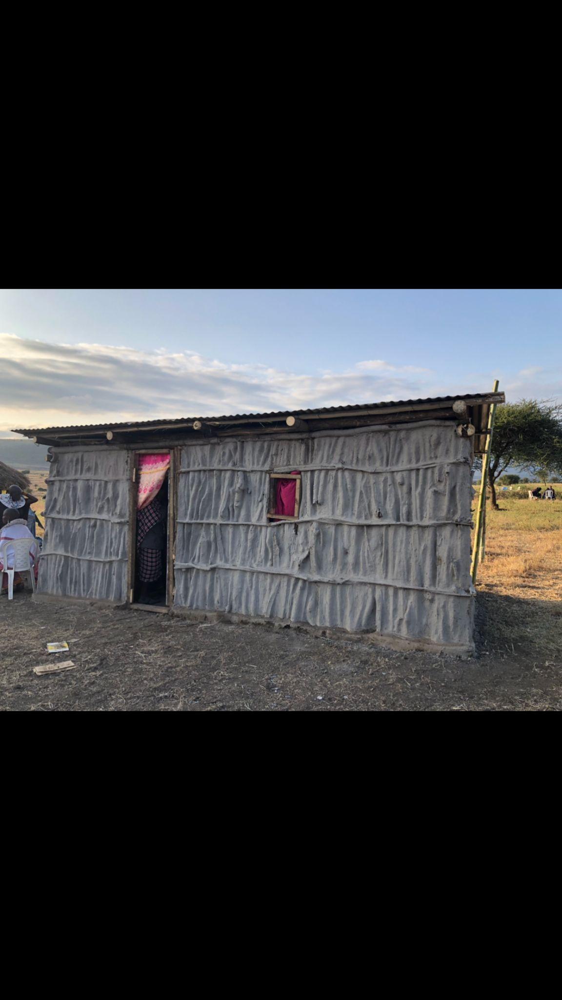
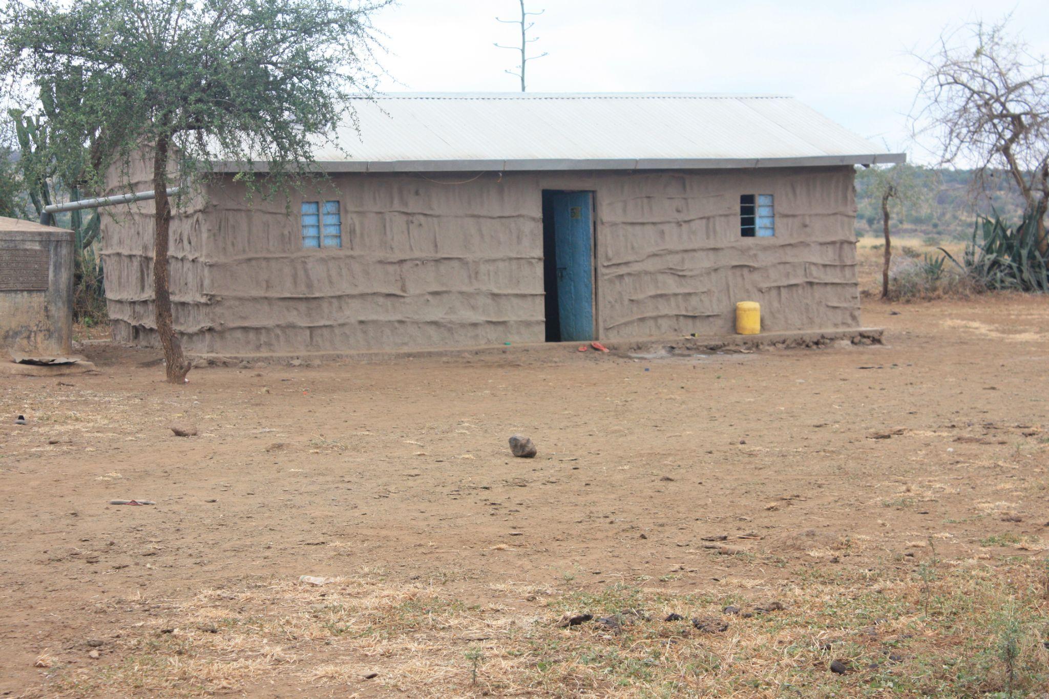
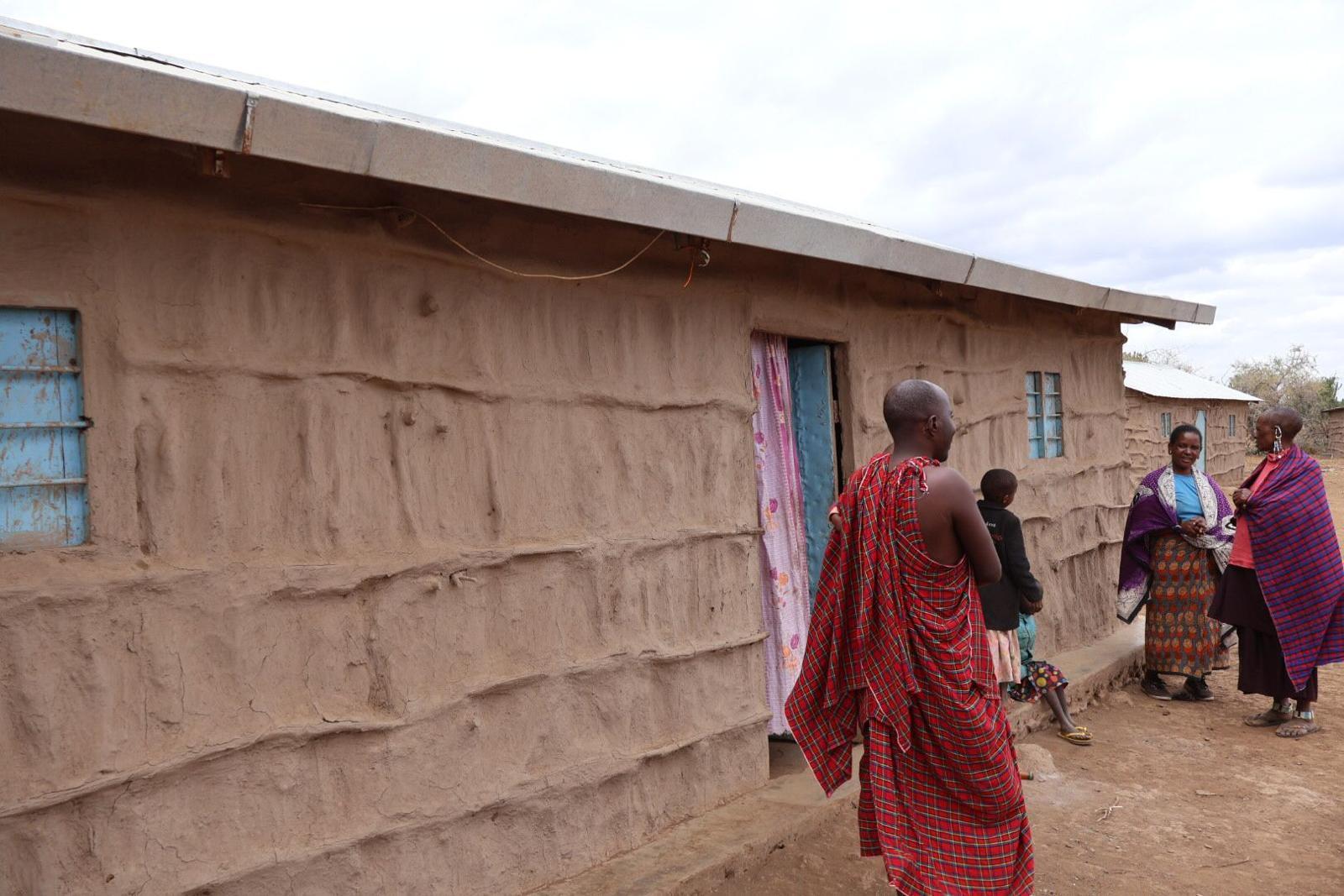
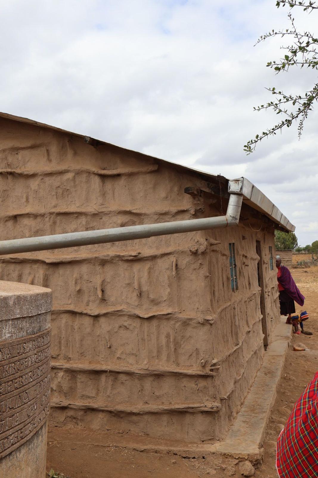
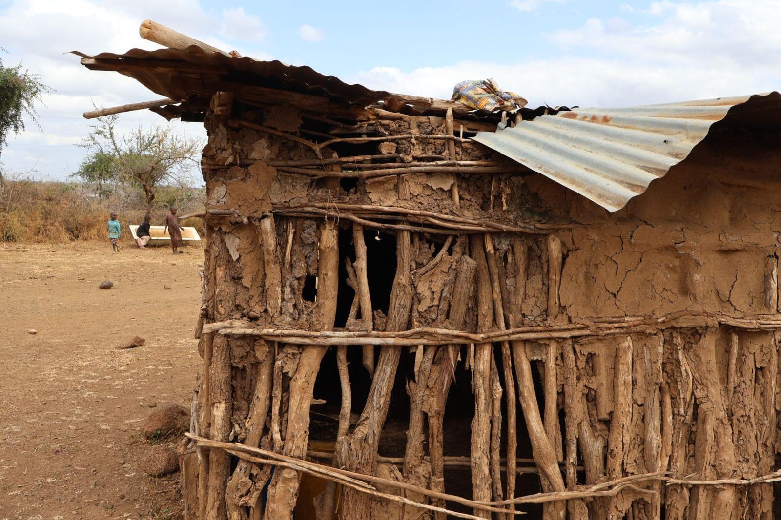
While documenting the buildings in the village, it became evident that there were two prevalent typologies: rectangular and circular structures.
These distinct layouts lead to differing physical constraints and consequently influence the activities that take place within them.
1. Rectangular Layout: Typically, this type of configuration accommodates medium to large families. It features a small communal space and, when possible, private rooms utilized as bedrooms or, in some cases, "dry kitchens."
a. Walls: The materiality of the walls remains consistent with the vernacular Maasai precedent.
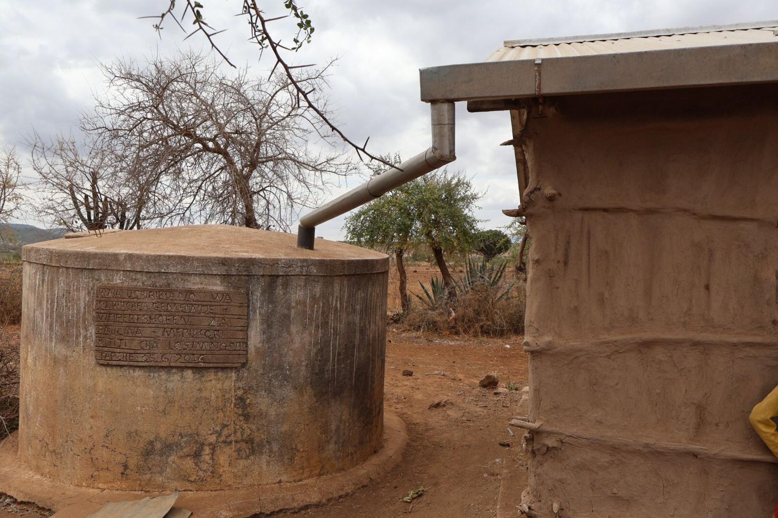
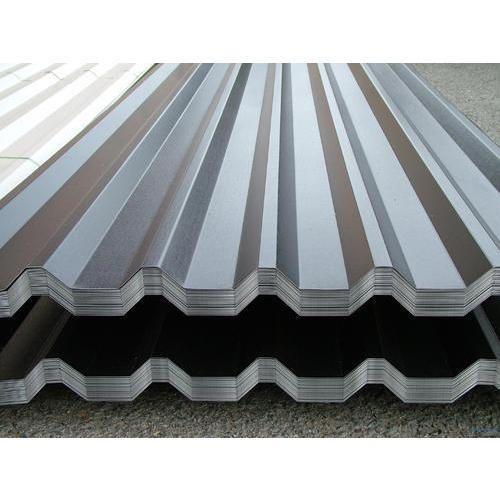
b. Roof: However, the roofing has been replaced with corrugated sheets, and in some instances, gutters are added to collect rainwater.
c. Entrance and Windows: A small steel door serves as the main entrance, and rectangular windows provide limited airflow within the dwelling.
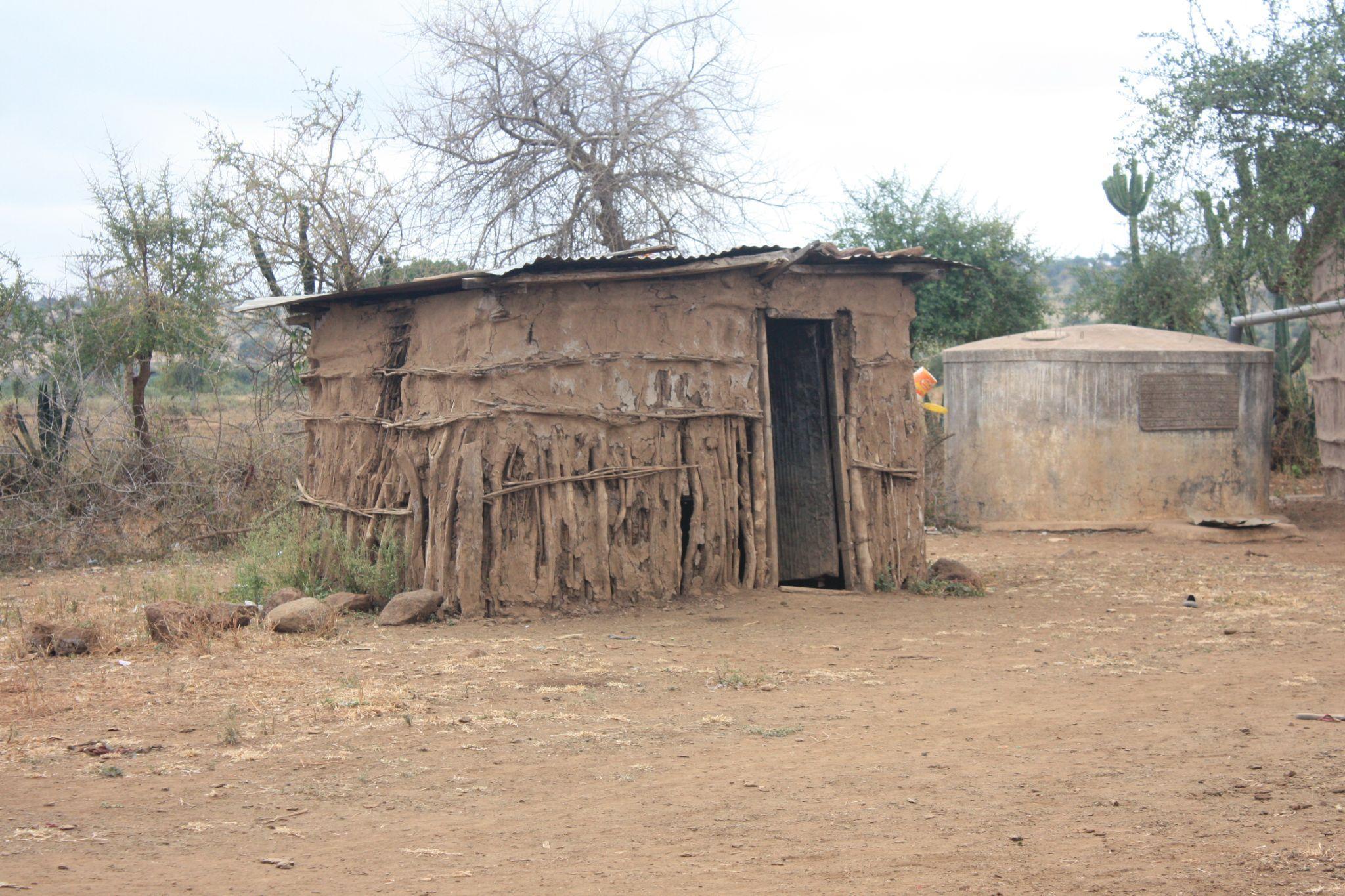
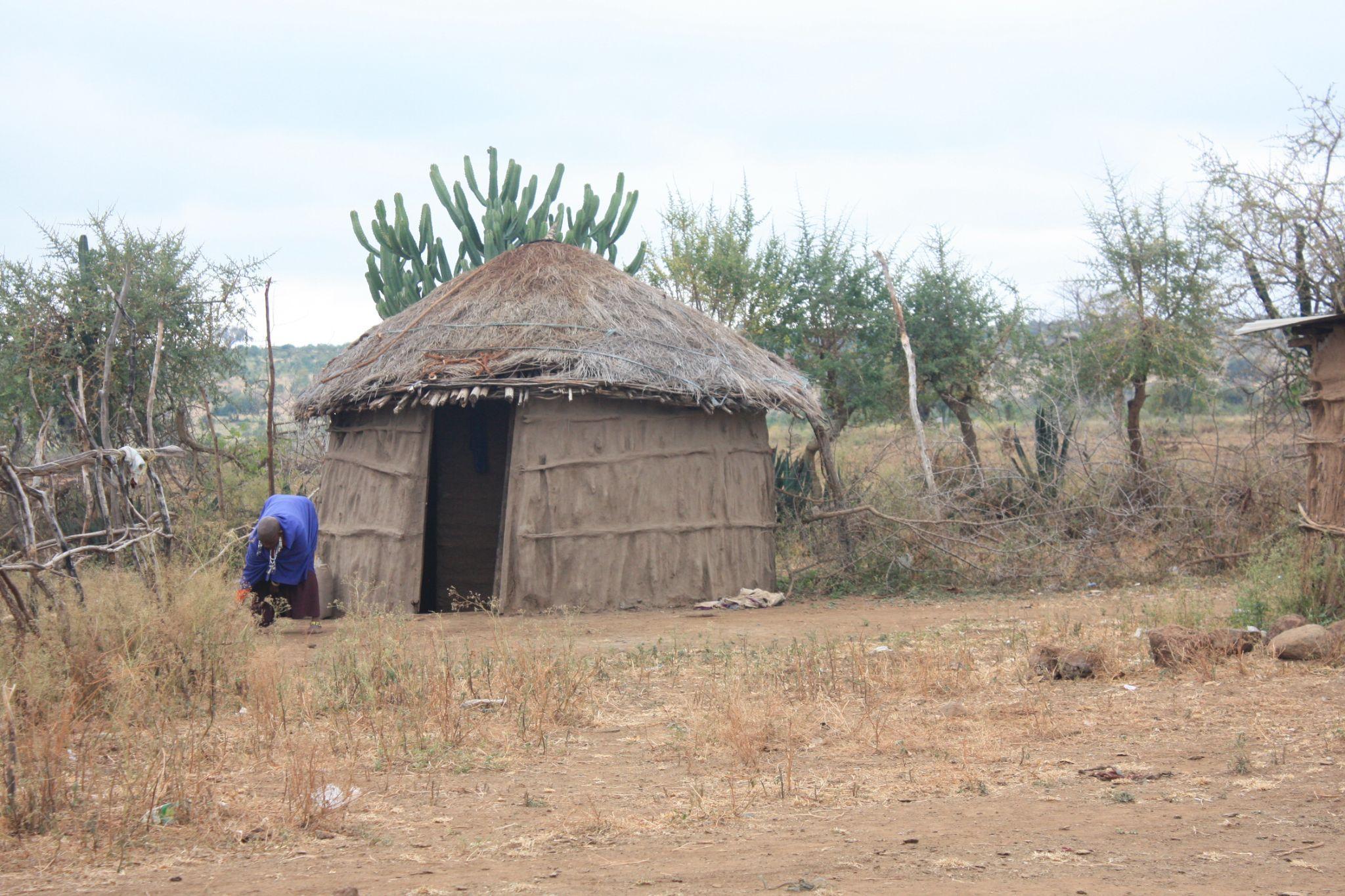
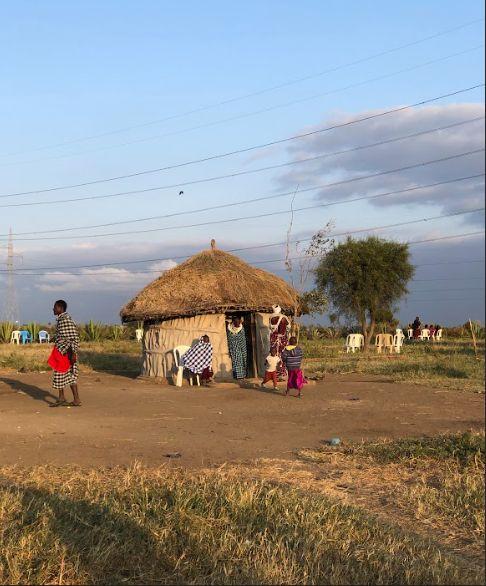
2. Circular Layout: Due to its physical constraints, circular dwellings tend to be smaller than rectangular ones. They often function as annexes to the main household and serve various purposes, such as kitchens or storage spaces for food and domestic animals.
a. Variety in Use: In some cases, the circular layout represents the "typical Maasai house," forming a spiral with a continuous wall where a small family can sleep or cook.
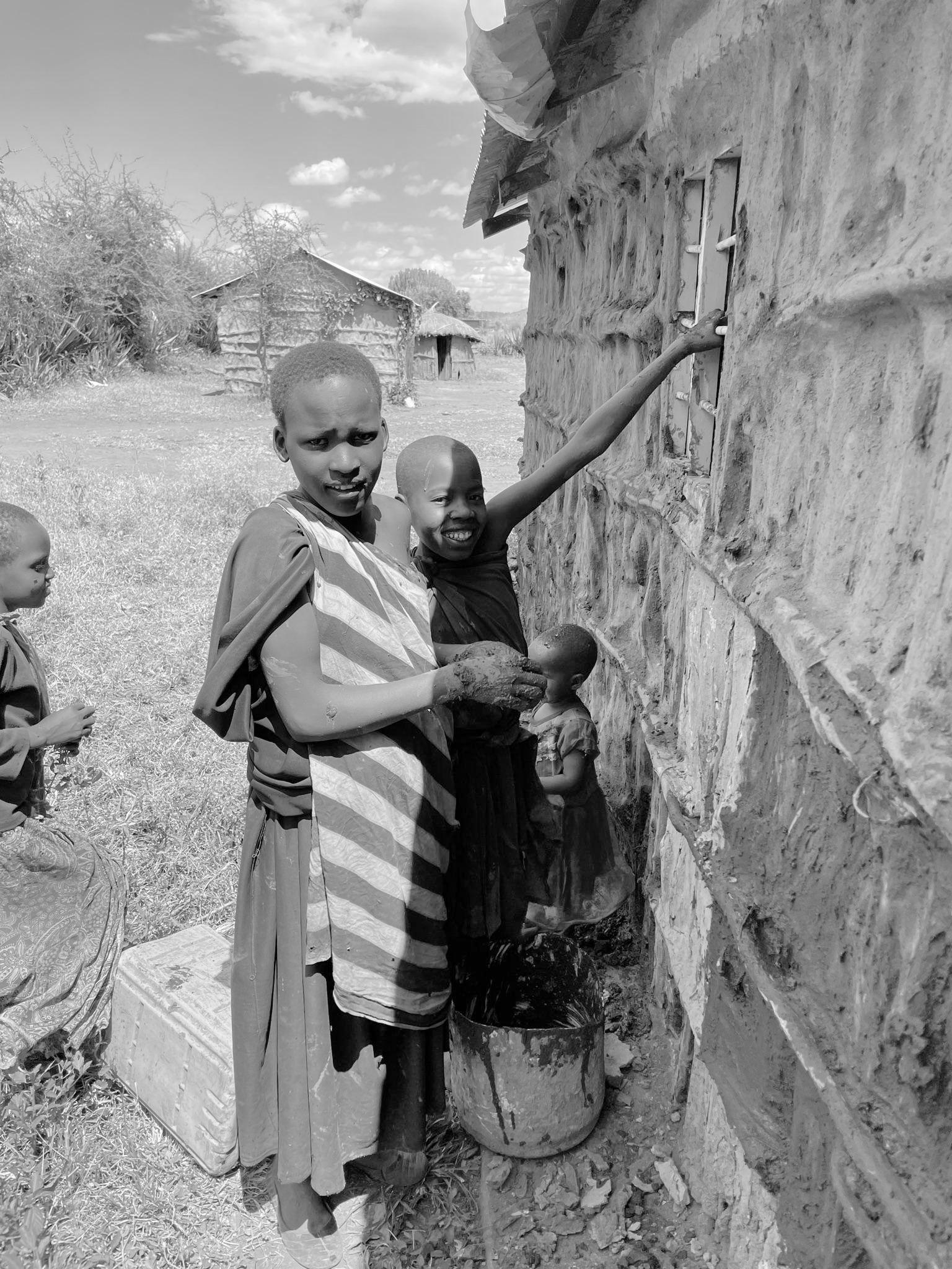
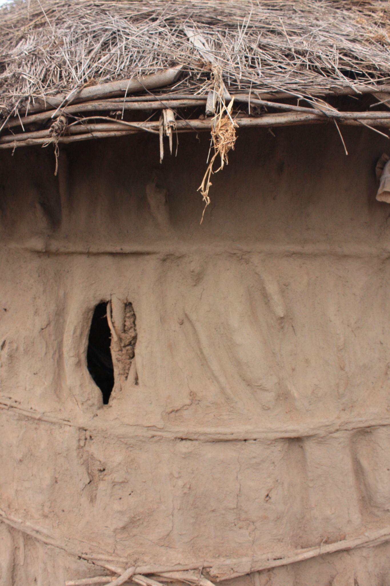
b. Walls and Roof: These structures retain the traditional Maasai construction methods, utilizing sticks and mud for walls and thatch for the roof.
c. Entrance: Only one opening serves as the entrance, resulting in relatively dim interiors with limited airflow.
The diversity in building layouts and materials reflects the adaptability of the Maasai people to their environment and the various functions their structures serve within the community.
Rectangular Layout
Circular Layout
8. Site Visit
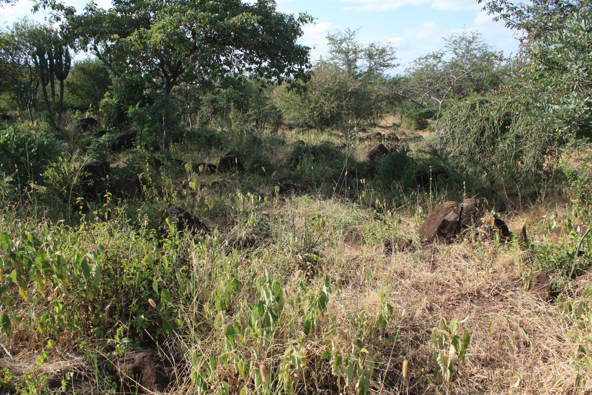
8.7 Field Work - land survey & surroundings
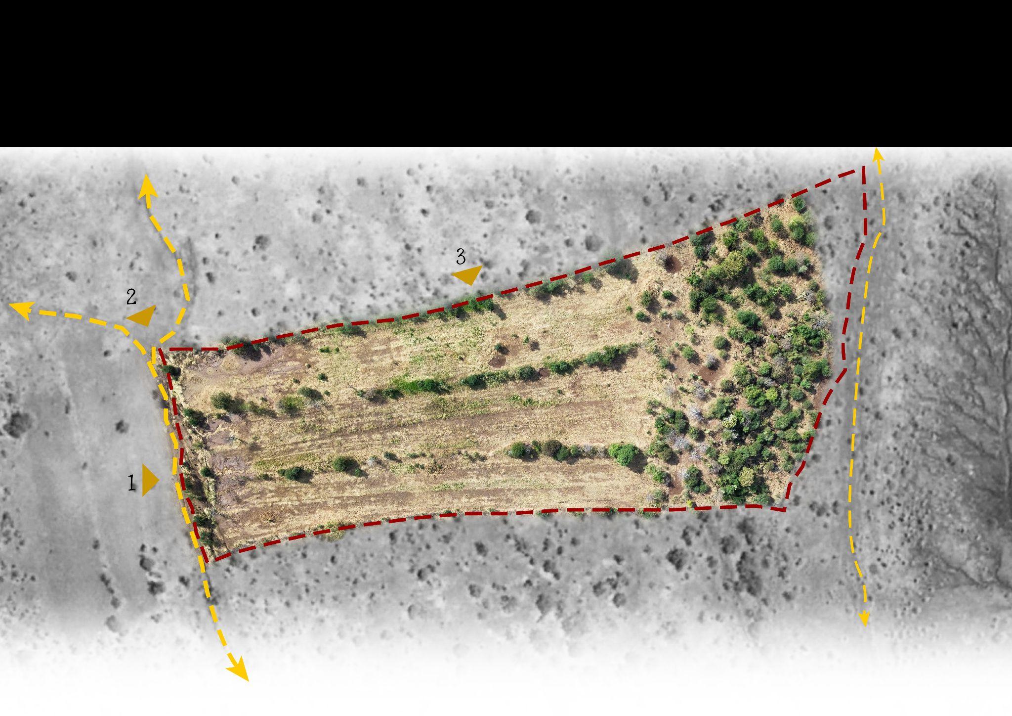
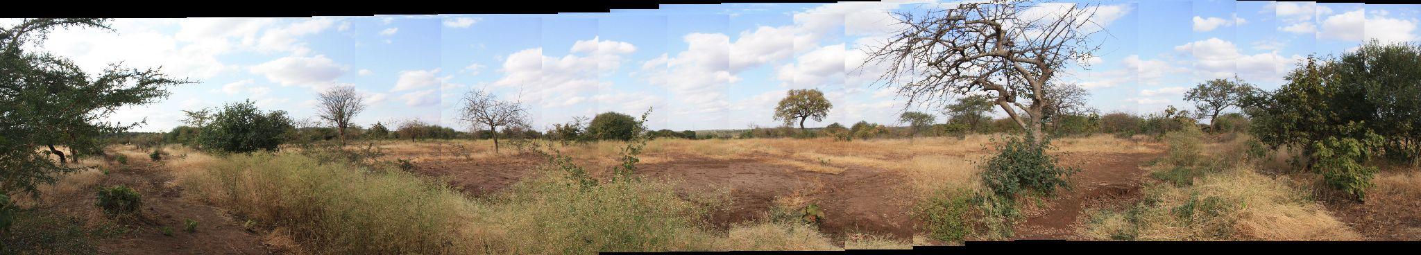
A few days were dedicated to conducting a survey of the land where the school will be constructed.
1. Site Location: The site is situated approximately 1.8 kilometers in a straight line from the A104 highway.
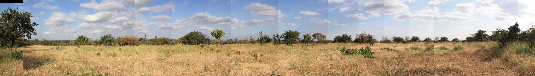
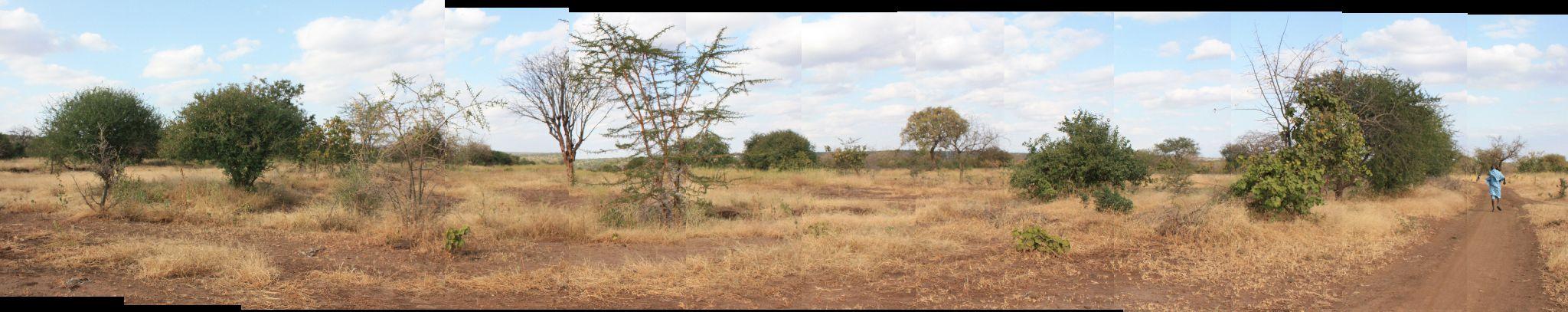
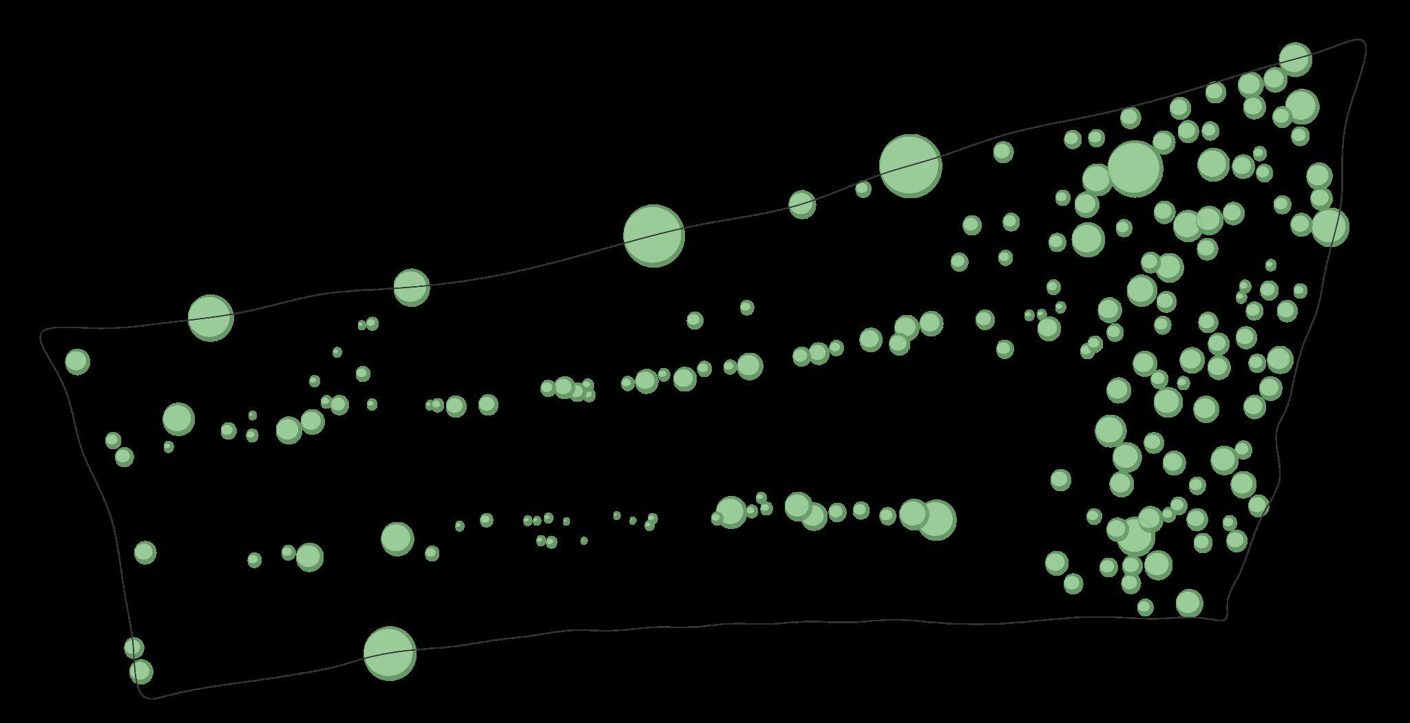
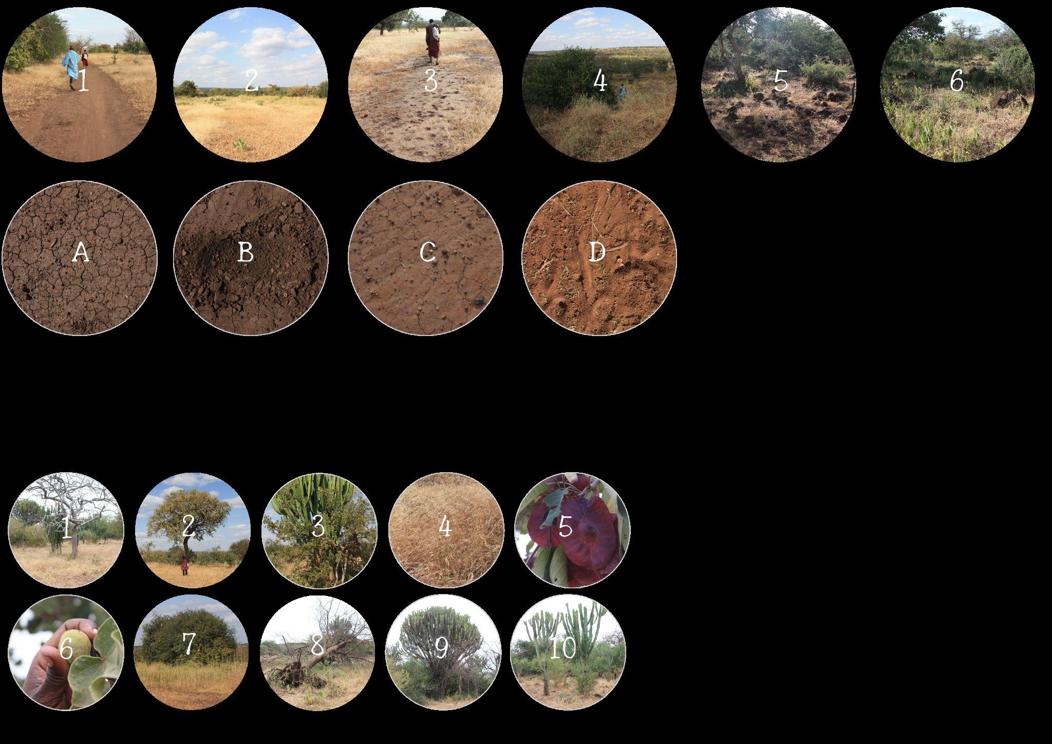
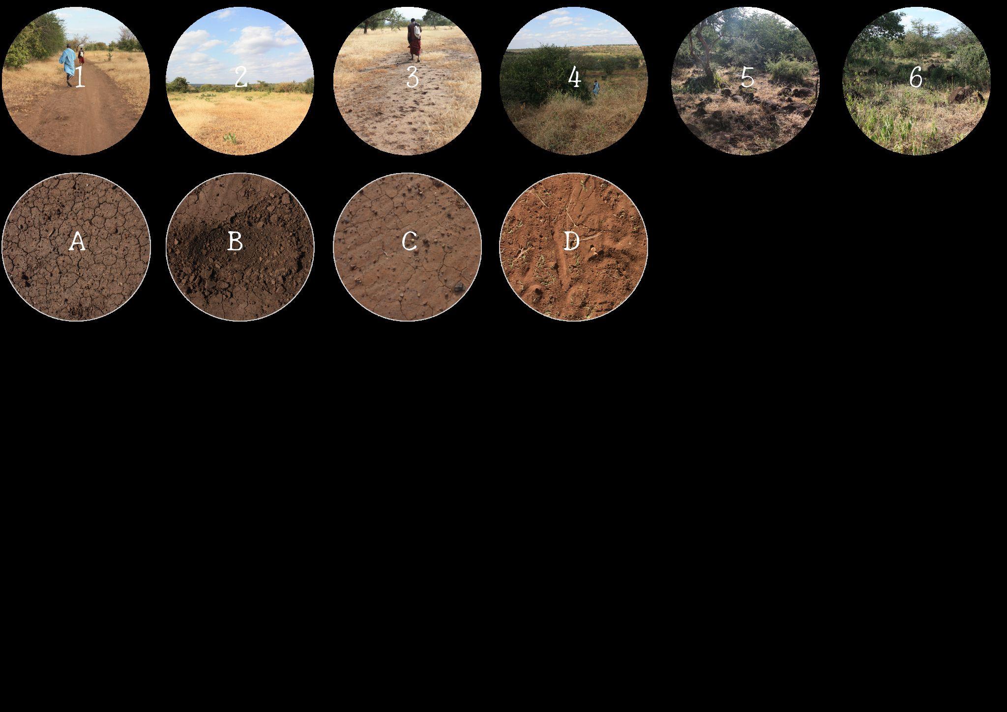
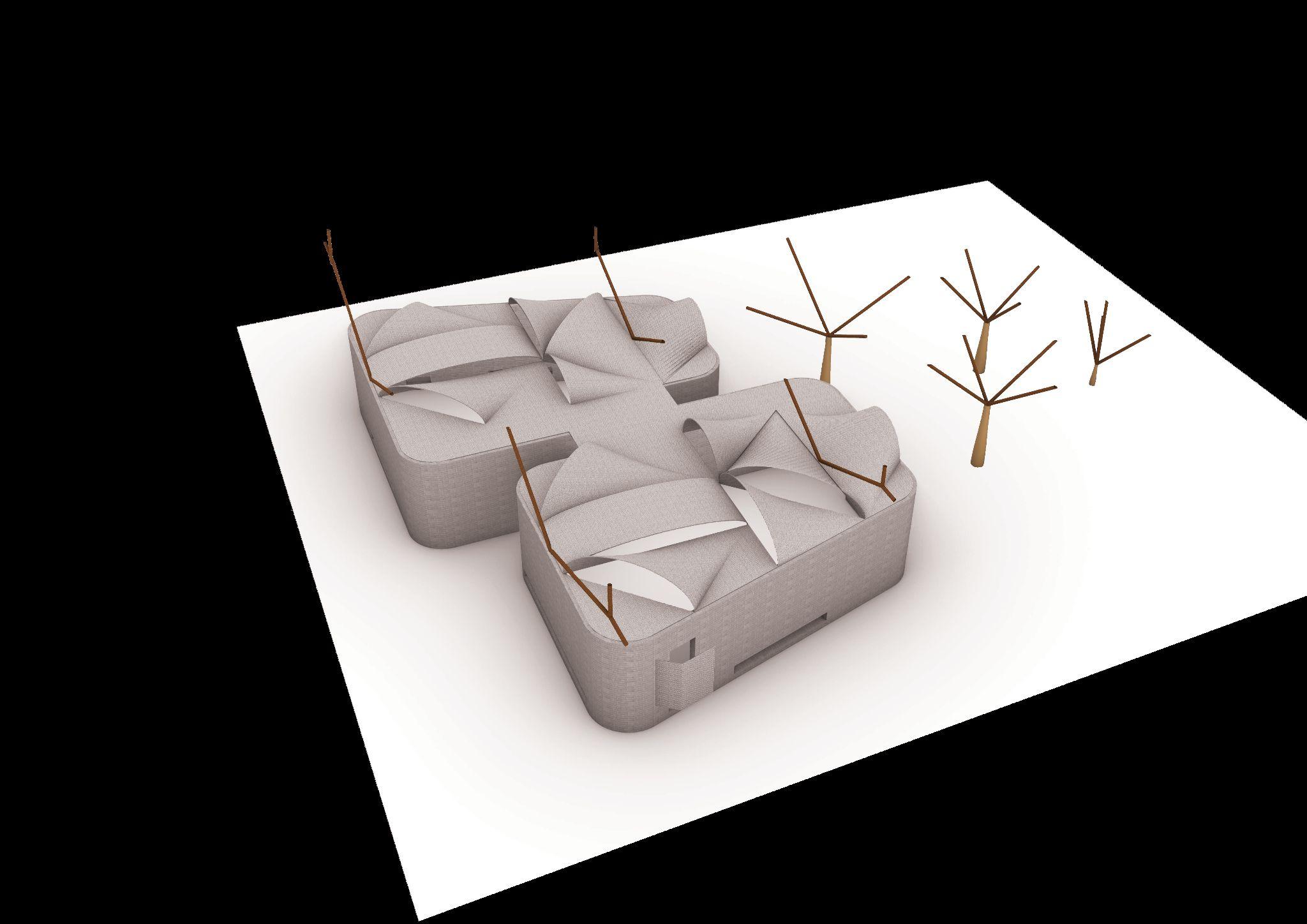
2. Vegetation and Soil Survey: During the initial visit, the primary objective was to gather images of the vegetation and soil. These images would later be utilized to create a plan that integrates various plant species into the school's design, enhancing its environmental sustainability.
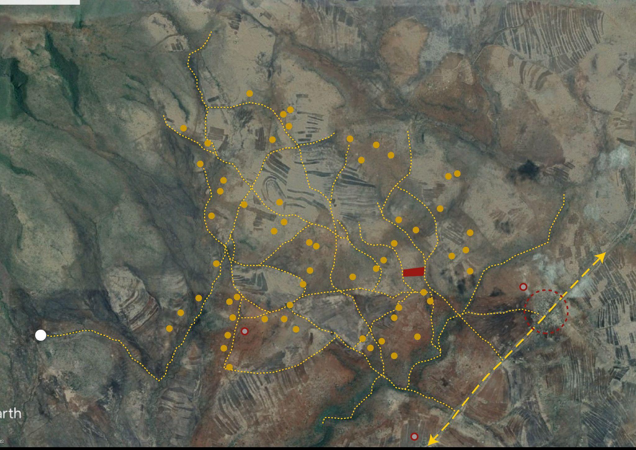
3. Topographic Survey: Local architect Harun Guta provided valuable assistance in conducting a topographic survey. This involved using satellite coordinates and elevation measurements to create a detailed topographic plan of the site.
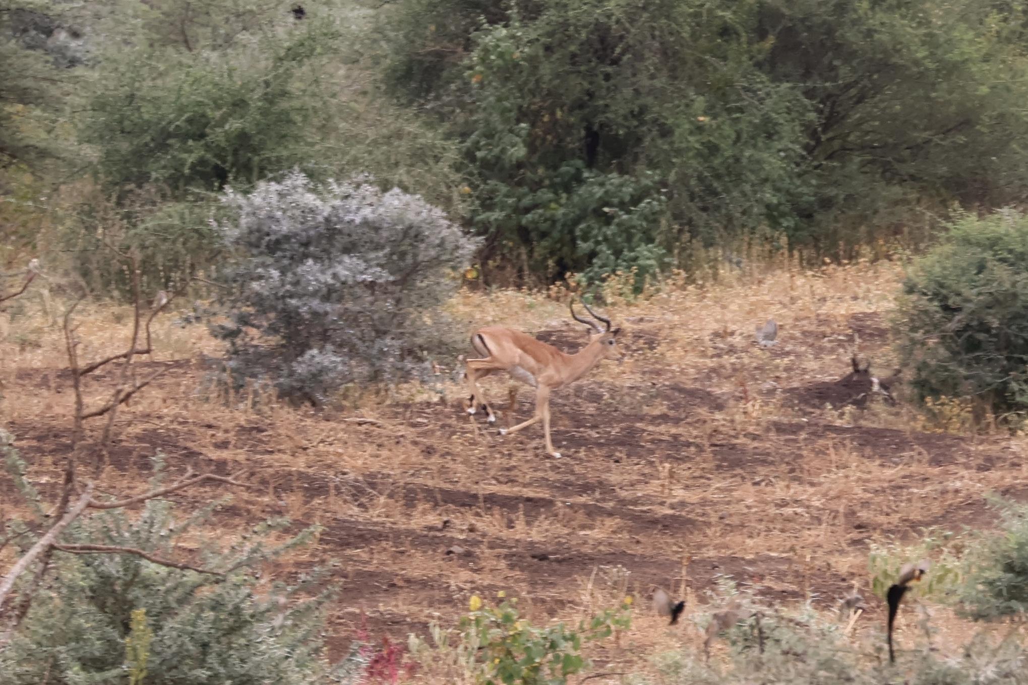
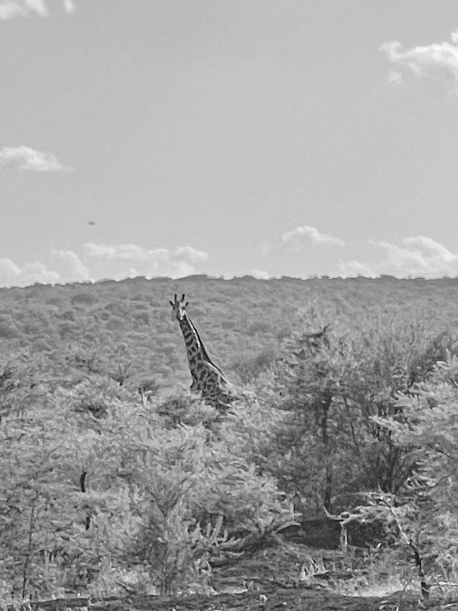
4. Site Exploration: Additionally, time was spent exploring the surroundings of the site. This allowed for a deeper understanding of the local flora, fauna, and the proximity of essential water sources for the village.
This comprehensive survey work laid the foundation for informed design decisions, ensuring that the school would harmonize with its natural surroundings and cater to the needs of the community.
Medicinal tree
Arid land
View Main water source
Antelope found on site
Cattle Water source
Vegetation
Soil Fruit
Steeped terrain
Botanical medicine
Cactus
The team Colors Visit to
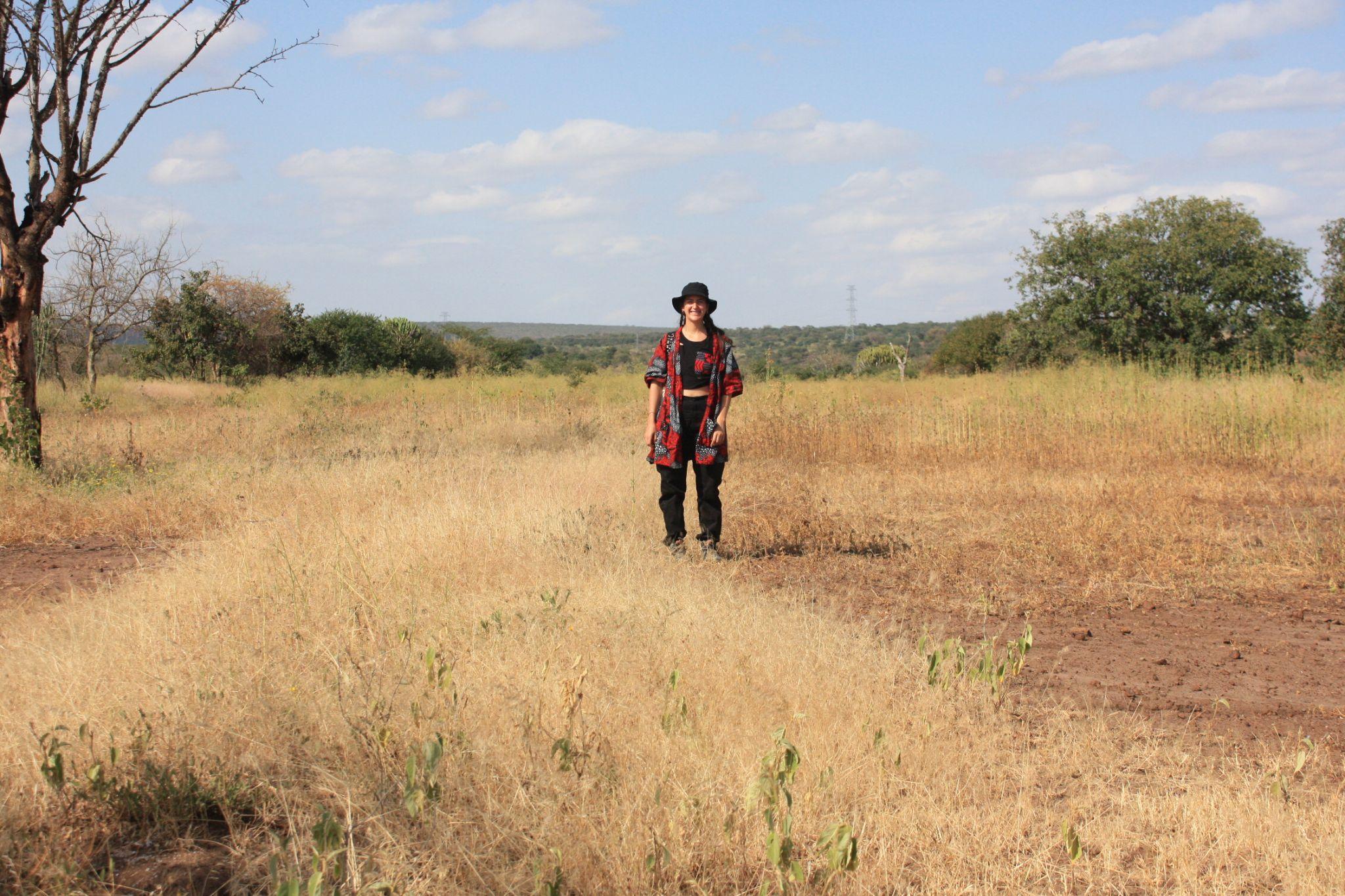
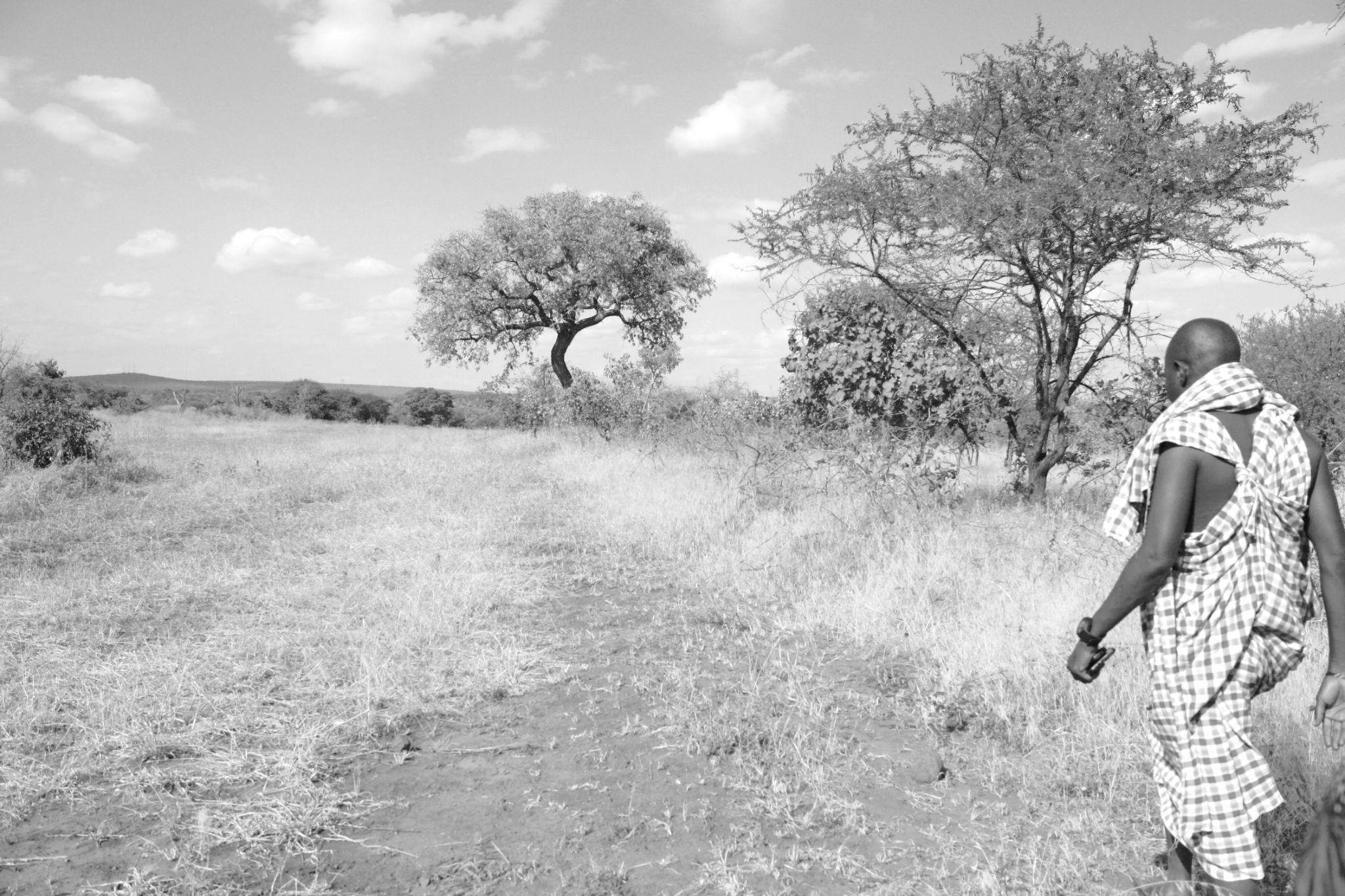
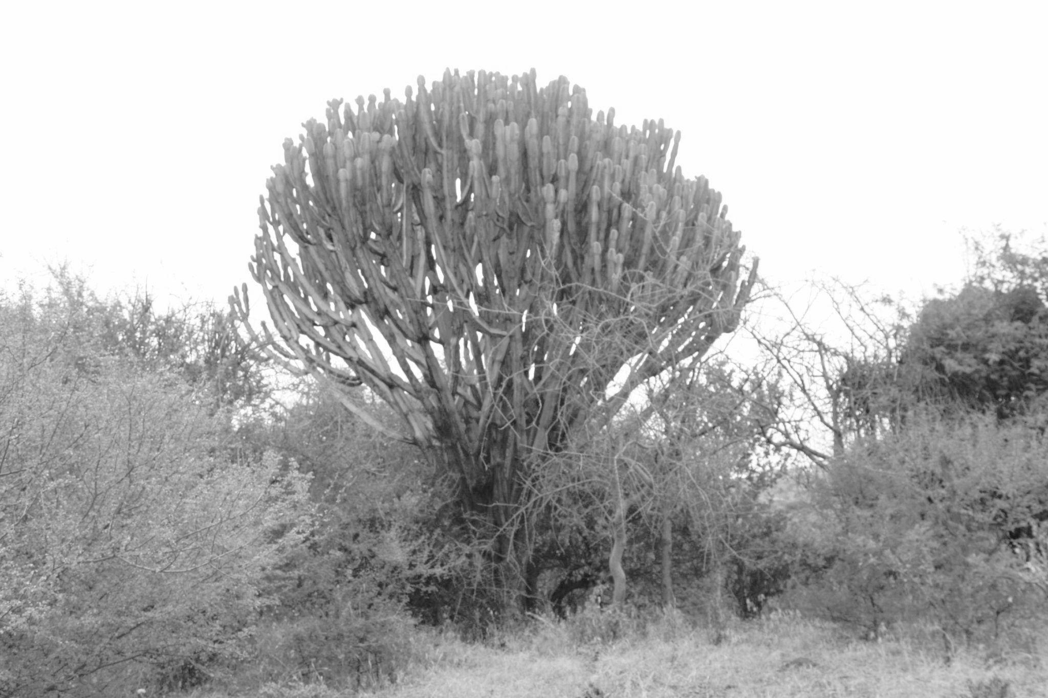
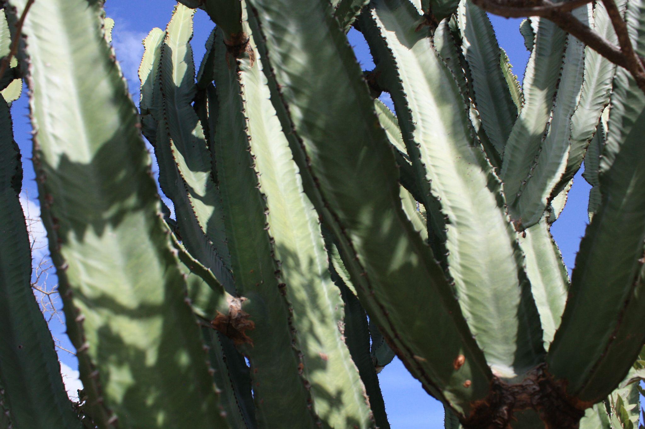
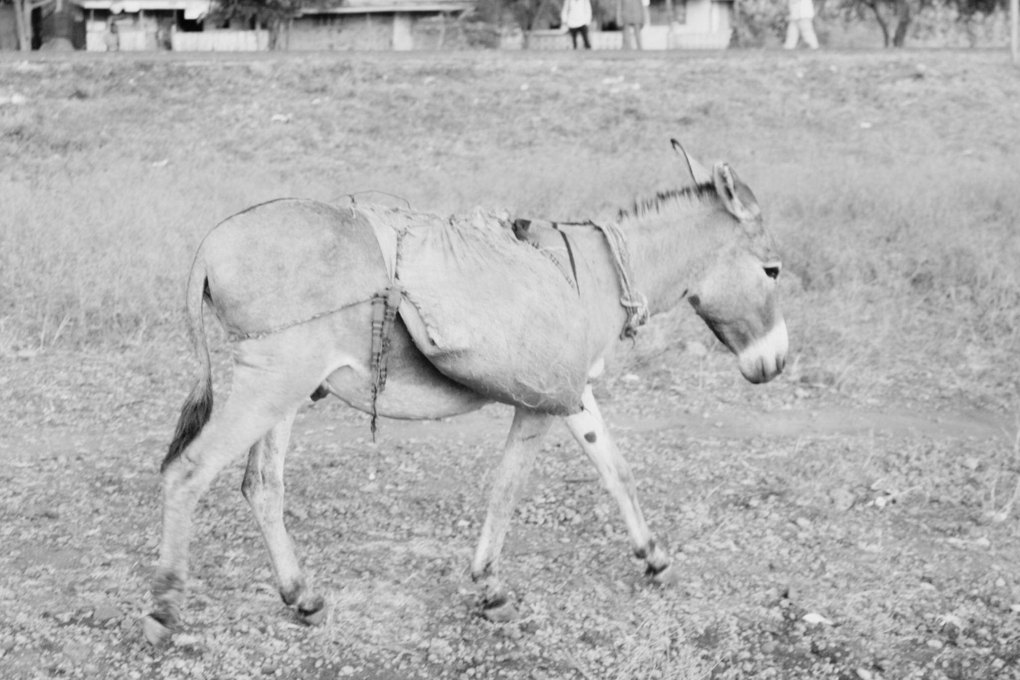
Fig 8.7.1 - Pictures taken on site of observations seen on the land and surroundings
8. Site Visit
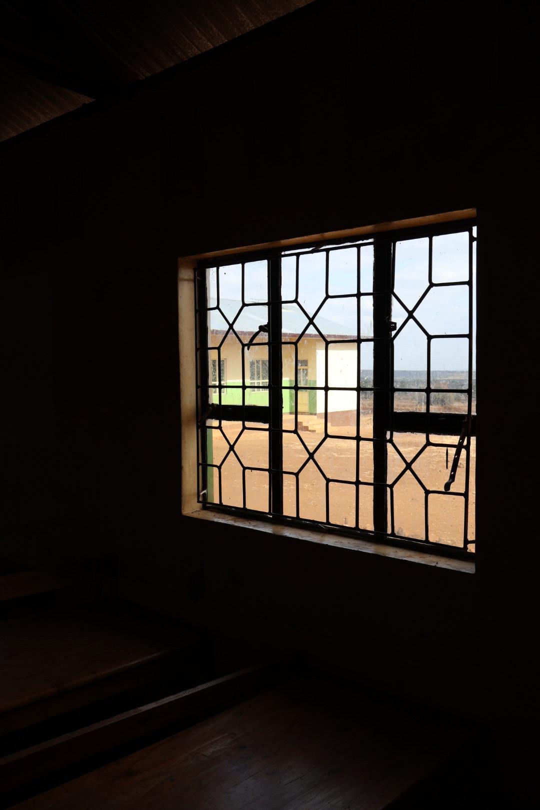
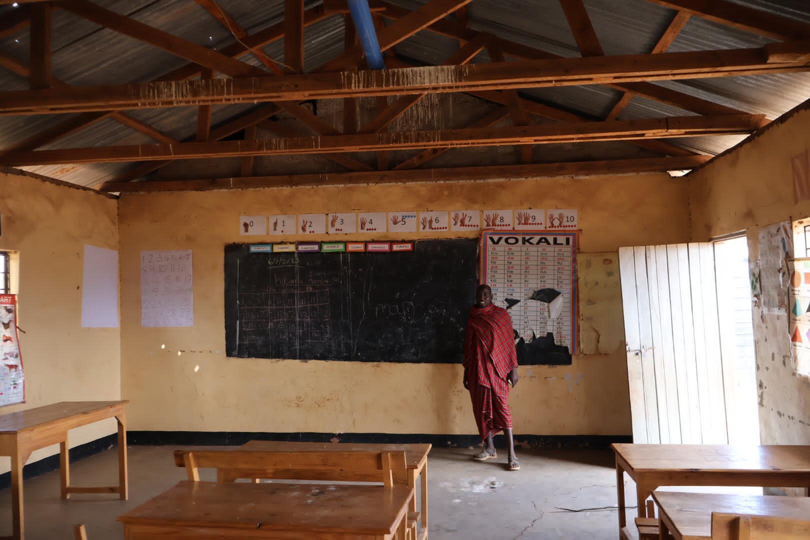
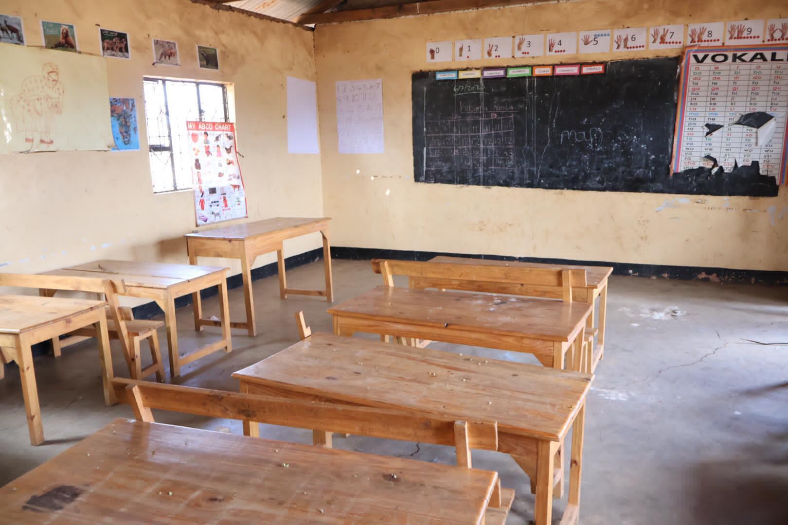
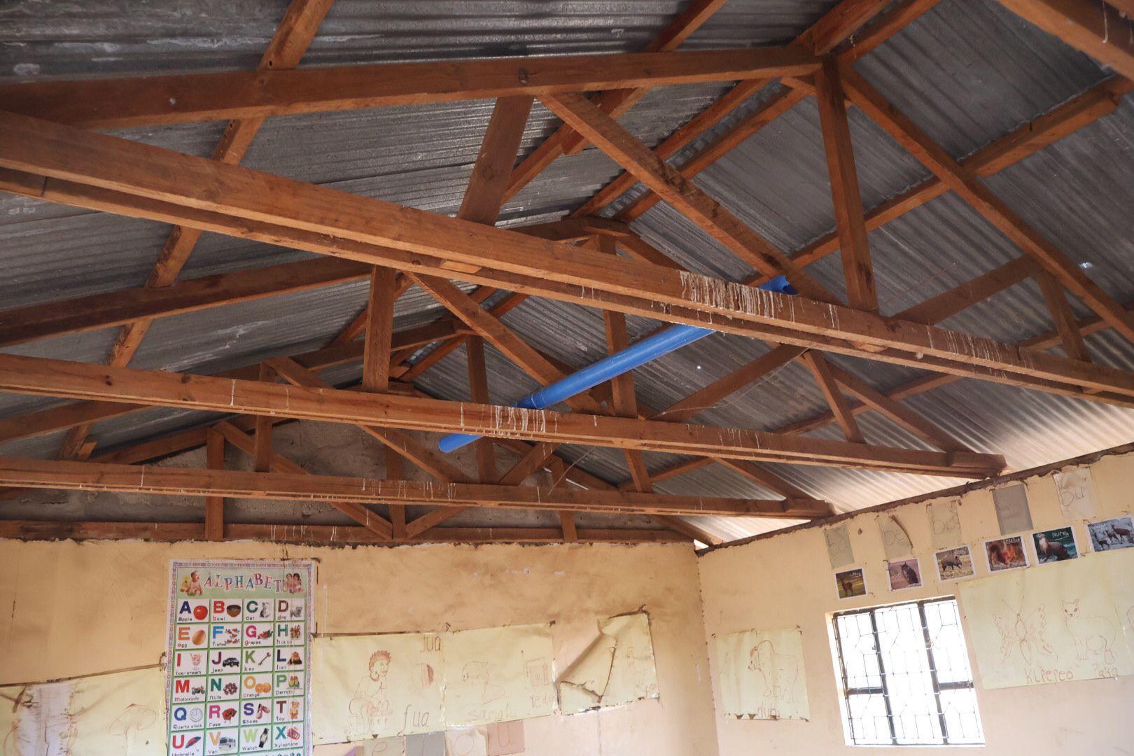
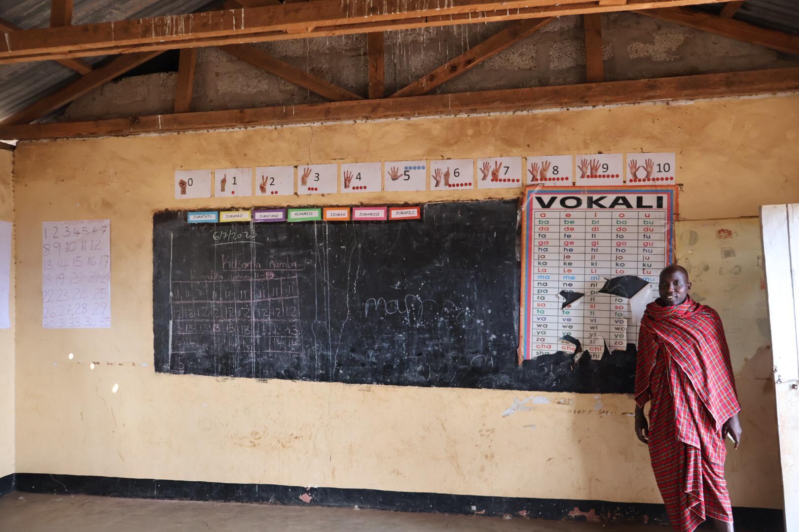
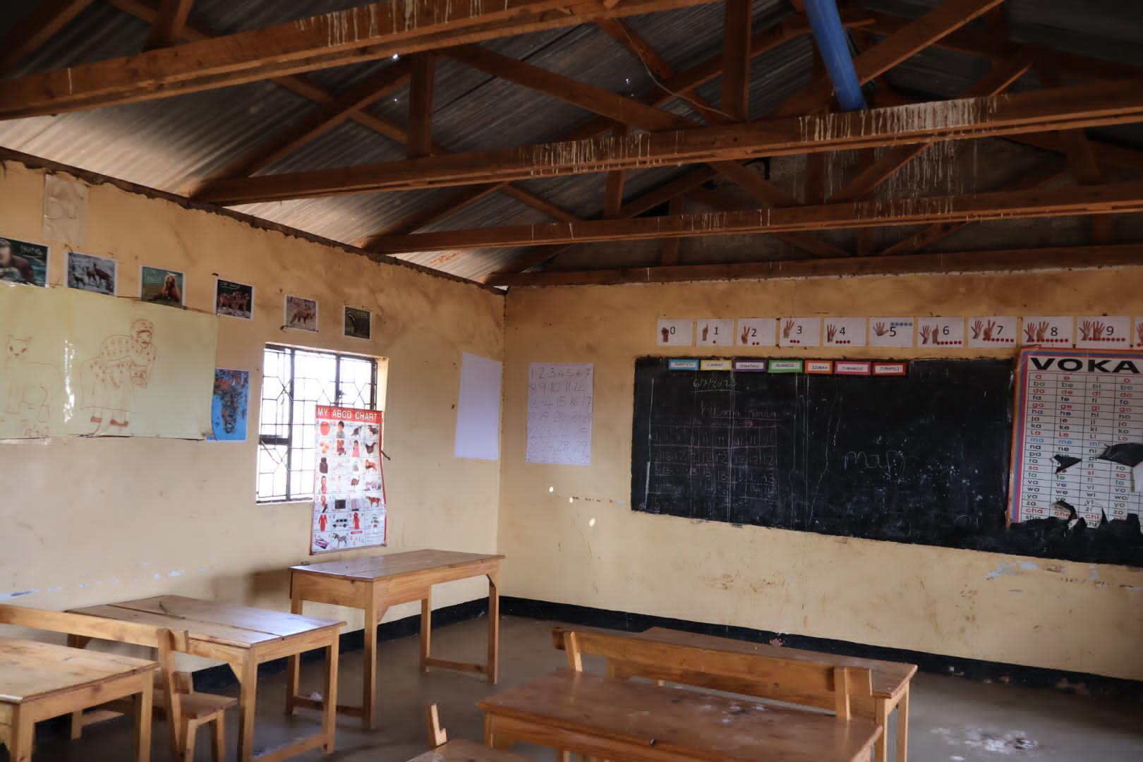
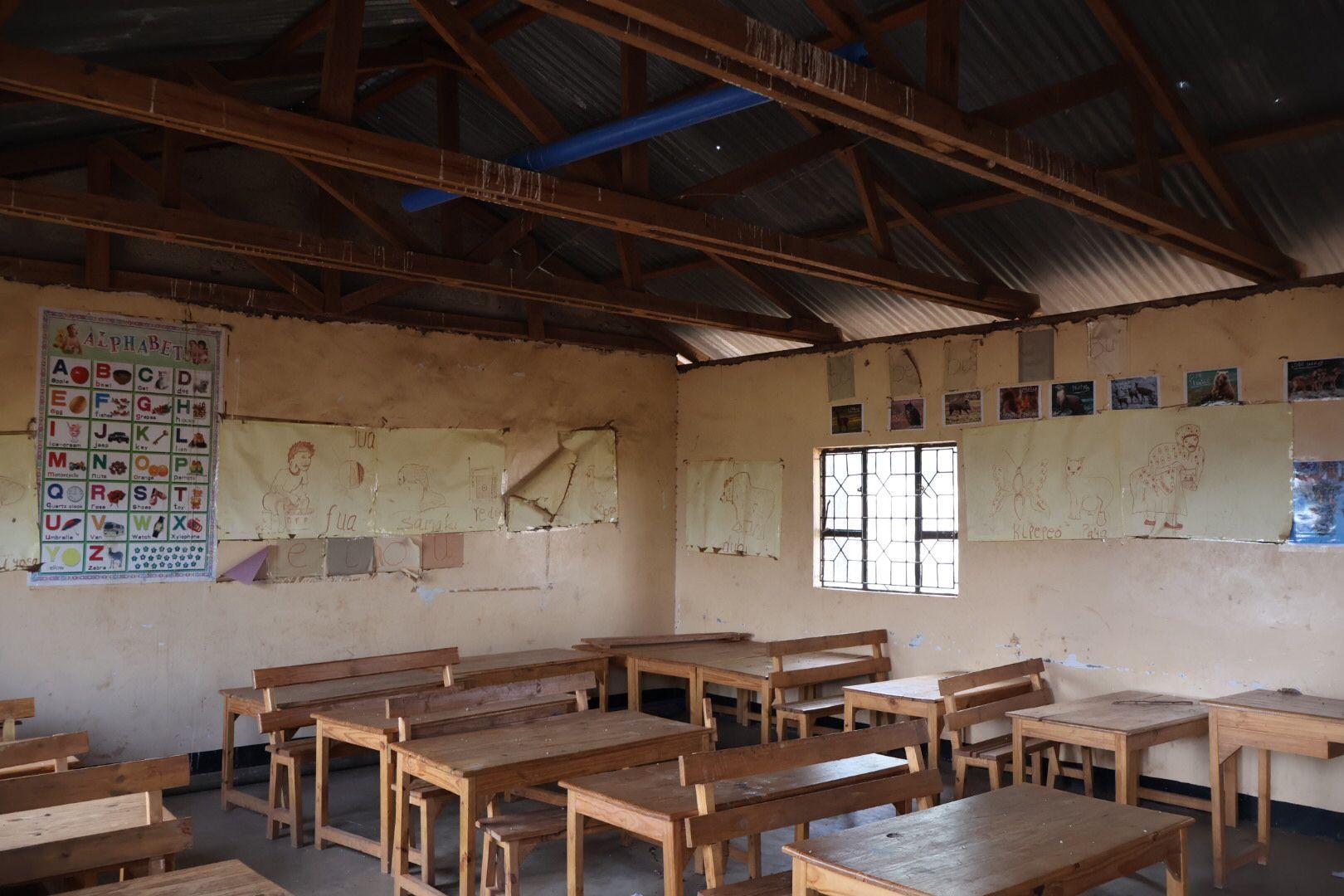
8.8 Field Work - Existent School
An important visit was made to the existing school within Losimingoore village, which is located approximately 3 kilometers in a straight line from the A104 highway.
Key Observations:
1. School Structure: The existing school is a modest structure consisting of two classrooms, each capable of accommodating approximately 50 students.
2. Documentation: During this visit, detailed annotations were made regarding the materials used in construction, the orientation of the school building, and basic measurements. This information would be further analyzed and considered in the design process for the new school.
This visit provided valuable insights into the current educational facilities available in the village and informed the planning and design of the upcoming school project.
8. Site Visit
8.9 Conclusion
In conclusion, the site visit proved to be an invaluable endeavor, enabling meaningful engagement with the community and providing profound insights into the significance of ISOMA's objectives.
Perhaps most significantly, this experience has lent an entirely new dimension to my approach for this thesis. Establishing personal connections with members of the community has substantially influenced the project's design. This transformative process, which I aim to delineate, has infused a heightened sense of reality and commitment into the project.
The extended duration of the visit, coupled with my immersion within the community's rhythm, granted me an authentic perspective on their daily activities. This comprehensive experience has enriched my understanding, contributing to a more genuine and fulfilling encounter.
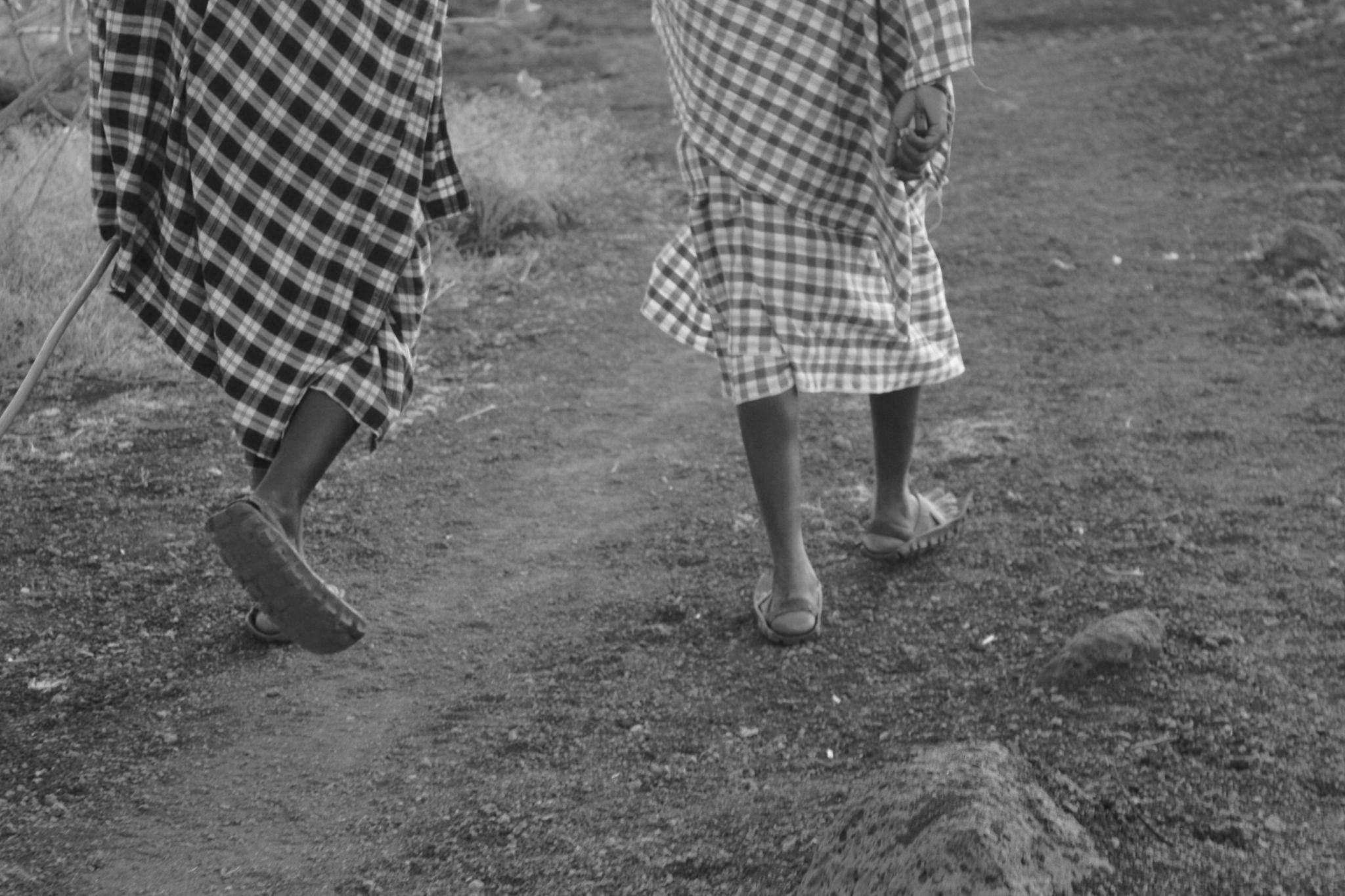
Walking - rubber sandals
Accessories
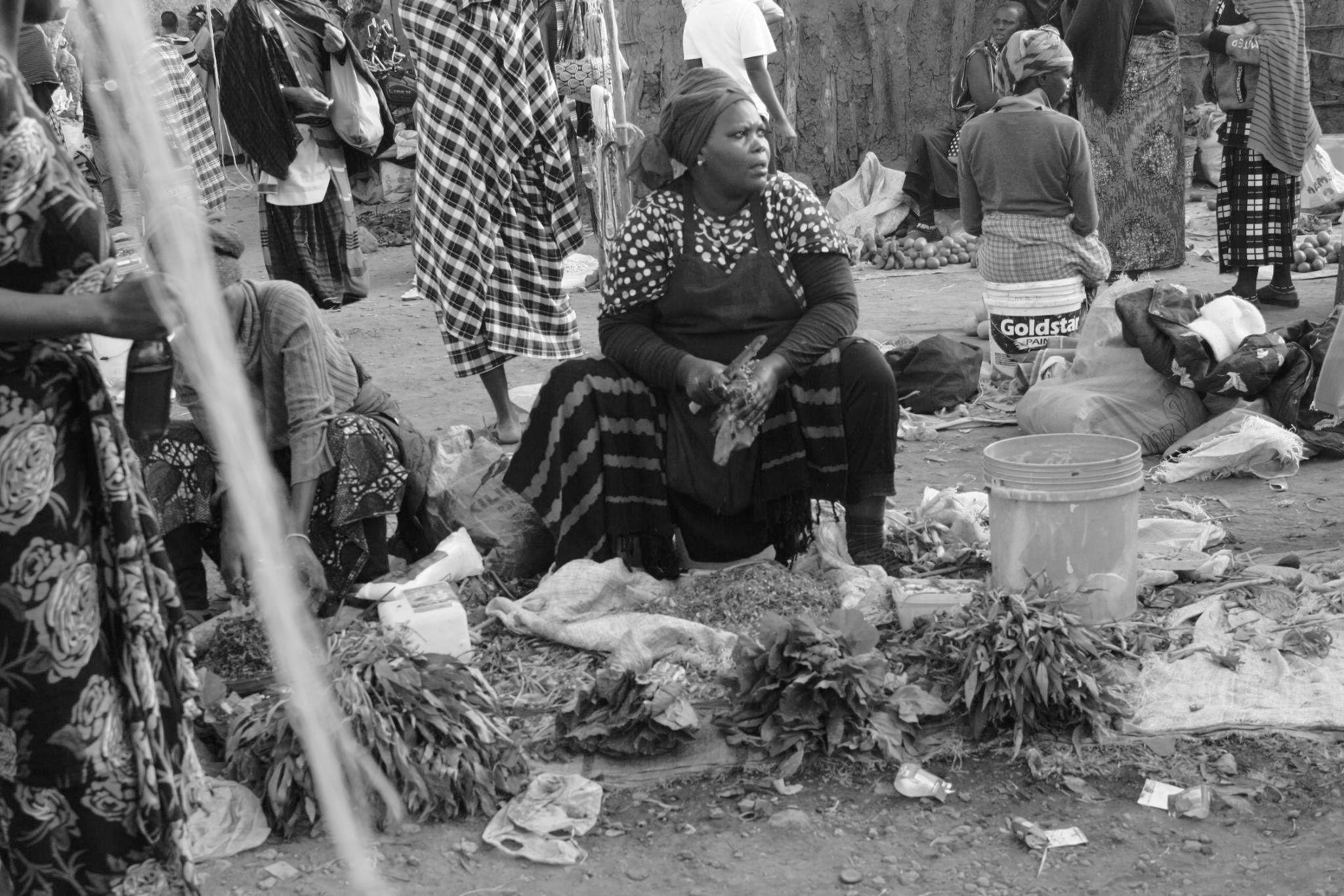
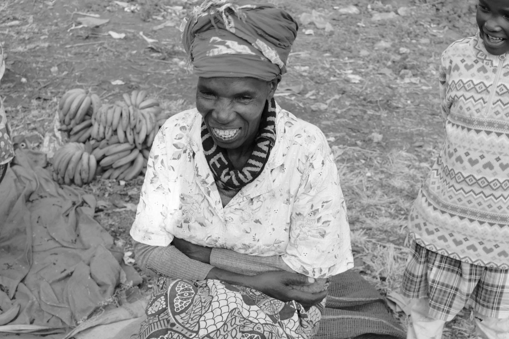
Women sell food
Elder women sell food
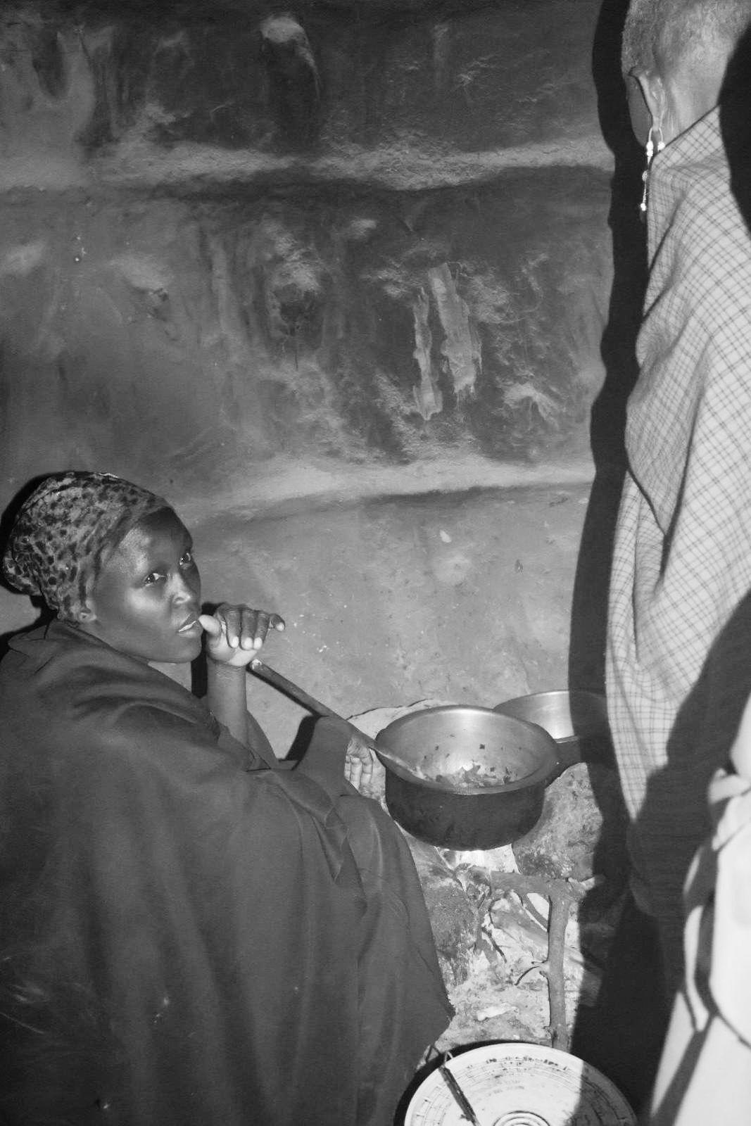
Animals to carry Women cook
Women build houses
Observations in the Village
Cattle
Men in groups Wildlife
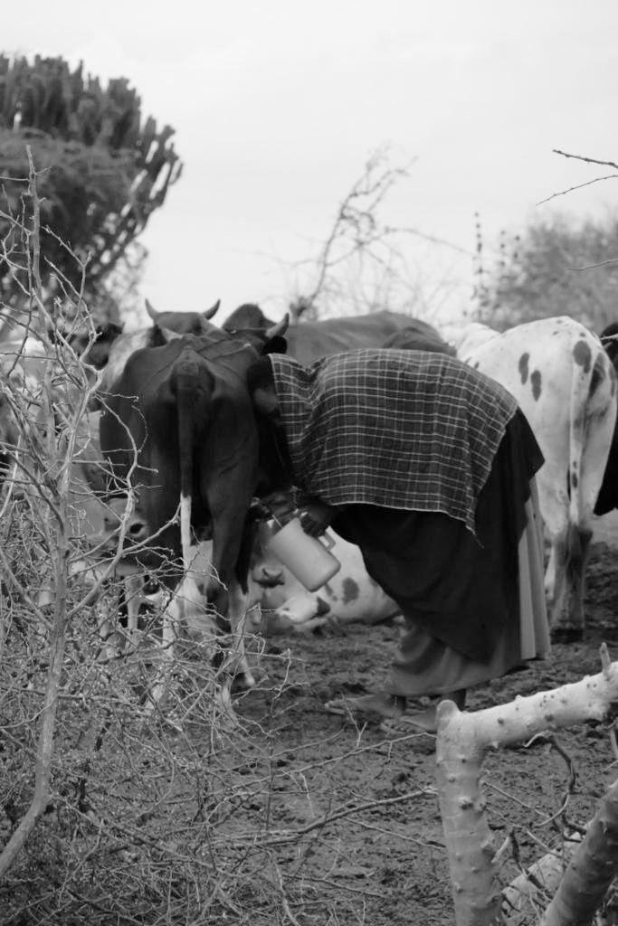
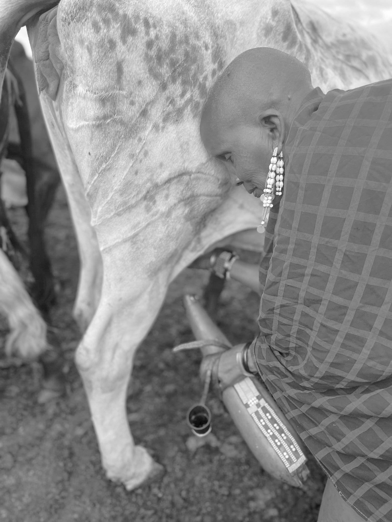
Women milk cows Dark indoor spaces
Scenery
Fig 8.9.1 - Pictures taken on site of observations in the village
Data Processing
Interviews - data recopilation
Interviews - data analysis
Land Survey - Data Recopilation: Views
Land Survey - Data Recopilation: Topography
Land Survey - Data Recopilation: Vegetation
Land Survey - Data Recopilation:Scenarios and soil
Building survey
Existent school survey
Existent school survey - Indoor temperature
Conclusion
9. Data Processing
9.1 Interviews - Data Recopilation
After returning from the site visit, the "data processing" phase commenced, wherein a methodical approach was adopted to organize and analyze the acquired knowledge and information.
This phase involved the transcription of interviews conducted during the fieldwork, aiming to systematically examine the responses.
Consistency was maintained by posing the same set of questions to all interviewees (within reason), including inquiries such as:
○ Lifestory
○ What is your dream?
○ What are your daily activities?
○ What do you like most about being Maasai?
○ What is your parent's dream?
○ Where did you learn Maa (the Maasai language)?
○ How has village life changed over the years?
○ What is it like being a woman in the village?
○ Do you think Maasai traditions are being lost?
Following transcription, a meticulous analysis was undertaken to distill the overarching sentiments of the community into concise sentences. This analysis involved highlighting key terms and phrases to capture the essence of the community's collective voice.
Come back after completing school and help my mother
My mother she has nothing to do just sitting at home. That is why after being a doctor I want to come back and help my mom all day, fetching the water, swiping the house and cleaning
What do you like most about being Maasai?
When I grow up and after being a doctor I want to have many cows and goats
education
What do you like most about being Maasai?
I like to be a Maasai because we have lots of cows and goats that can allow us to have education
because my parents are Maasai, its my culture
What is your parent´s dream?
The dream of our parents is for us to go to school
because our community here in Losimingore most of the kids need a teacher that is why we need to bring education to the village.
What do you like most about being Maasai?
It's our tribe, I was born Maasai, thats is why I need to behave as Maasai That is how I been educated and will bring education to the kids in the future.
Where did you learn Maa?
I didn't learn Maa at school but at home
The language is getting lost with the new generations, because the young go far away
What do you like most about being Maasai?
I love being Maasai, its my lifetime and culture
What is your dream?
Is for my community and children to get education and health, for them to grow, to get different dreams for our kids, that is my dream.
To have a school in our community where we can protect our language and traditions.
activities at home, that is why now we see more children going to school.
What are your daily activities?
Being a woman is to do many activities, like go fetch water, look after the cattle and having kids
What is your dream?
The most important thing for the future of this village is when the community has water, then education will go well
What is like being a women in the village? Only women go fetch water, we milk the cows twice a day and raise the kids in the community
What do you like most about being Maasai?
I love when I have cows and kids in the community
My dream for my children is to attend school so they can depend on themselves.I am trying to find a way to get the kids education
How has the village life changed over the years?
In the village now kids go to school, but many years ago, Maasai were hiding kids to go to school because if you go to school you would get lost .But now we see that education is very important.
Do you think the Maasai tradition is being lost? Yes, when they go they lose the tradition it a little bit.
What do you like most about being Maasai?
I love the respect the Maasai have, also they help one another and kids respect the older and each other. To be Maasai is to respect one another, to love one another, and to help one another.
Fig 9.1.1 - Pictures of the interviewees and their transcript
9. Data Processing
9.2 Interviews - Data Analysis
Desires
When the “ keywords” were extracted from the text, a clear pattern emerged in the responses provided by the interviewees. These keywords were then categorized into groups based on the main topics found in the interview transcripts, resulting in the following classifications:
With these topics identified, the frequency of each topic's repetition among the interviewees was measured, leading to a graphical representation of the key issues expressed by this particular segment of the community.
The data analysis highlights that the most significant concern, indicated by its frequent repetition, revolves around the topic of "desires," encompassing the various improvements and changes they wish to see within their community.
An alternate approach to scrutinize this data is by categorizing it according to age and gender. This perspective reveals how the importance of a topic varies depending on age and gender differences. For instance, the topic of "Obligations" only emerges in discussions with females. The daily tasks and responsibilities undertaken by girls are viewed as obligations. Conversely, males rarely attribute their cultural responsibilities as Maasai to being obligations or chores.
Obligations
Maasai culture
Fig 9.2.1 - Diagram of the interview analysis
9. Data Processing
9.3 Building Survey
After categorizing the building types into two distinct categories, a more detailed description was carried out as part of the data processing methodology. This involved applying the same measurement values to both typologies, including:
○ Type: Classification of the building type.
○ Size: Dimensions and area of the building.
○ Openings: Number and placement of windows and doors.
○ Special features: Notable architectural or functional elements.
○ Programme: Intended purpose and usage of the building.
○ Used by: Users or occupants of the building.
○ Lighting: Assessment of natural and artificial lighting.
○ Temperature: Indoor temperature conditions.
○ Air quality: Evaluation of indoor air quality.
It's important to note that during this process, it was recognized that certain important information was not captured due to limitations of the tools used. To address this, future site visits are planned to record temperature and lux levels for both types of dwellings simultaneously. These additional measurements will provide a more comprehensive understanding of the comfort conditions in these buildings.
The table presented in this thesis outlines the overall comfort perceptions of users across different typologies, offering insights into the occupants' comfort experiences.
9. Data Processing 9.4 Existent School survey
The existing school building consists of two classrooms, one measuring 45 m² and the other 30 m². The main entrances of the classrooms are oriented towards the north-east, a direction that receives the least direct sunlight throughout the year.
The structure of the building is made of cement blocks that are plastered with mortar and finished with paint. The roof's structure is composed of wooden beams covered with corrugated laminated sheets. However, due to the high thermal conductivity of aluminum, the roof tends to heat up quickly when exposed to direct sunlight. Without proper insulation, this heat could transfer to the interior of the classrooms, negatively affecting the students' comfort.
Thermal conductivity of materials used:
○ Corrugated aluminum roof: 5.8 W/m²K
○ Concrete block with plaster: 1.5 W/m²K
○ Wooden beams: 2.8 W/m²K
○ Single glass windows: 2.8 W/m²K
The classrooms benefit from cross ventilation due to the strategic placement of windows, allowing for cooling when windows are open. The existing infrastructure for student use in the school includes two 5,000-liter water tanks, a solar panel on the roof, an internet antenna, and exterior light bulbs.
Notably, there are no interior light bulbs recorded in the classrooms, indicating that artificial lighting is only required at night. The reason is because wild animals, like elephants, tend to walk around the land by night in search of water and the presence of light scares them.
Rain gutter
Water tank
Solar panel
Antenna
Doors with glass
Ventilated windows
Corrugated aluminium roof
9. Data Processing
9.5 Existent School surveyIndoor temperature
During the visit to the existing school, temperature measurements were recorded and are presented in image figure 9.5.1. These measurements were conducted on the 19th of June at 12:00 hours when no children were present inside the school. Notably, a slight temperature difference of 0.4°C was observed between the outdoor and indoor environments.
In line with the established methodology, the registered on-site data was subsequently processed to create a model of the school using the TAS software. The objective of this modeling was to visualize the potential fluctuations in indoor temperature across the course of a year, with the temperature recorded during the site visit serving as a benchmark to approximate realistic values. The outcomes depicted in figure 9.5.4 closely align with the on-site spot measurements, further validating the reliability of the model.
This acquired information played a pivotal role in the design of the new school, offering a fundamental "benchmark" for the indoor temperature comfort levels that the village children are accustomed to. However, it was essential to consider significant improvements in order to enhance their comfort and well-being within the school environment.
Fig 9.5.3 - Graph of DBT existent classroom with windows closed
Fig 9.5.4 - Graph of DBT existent classroom with windows open when temperature > 21°C
Fig 9.5.2 - Tas model of existent school
Fig 9.5.1 - Plan of existent school showing temperatures recorded on site
9. Data Processing
9.6 Conclusion
After the site visit, the creation of a context plan became essential to comprehend the scope of Orkisima Village and its surroundings.
Encompassing an area of approximately 19 km, Orkisima Village comprises more than 60 bomas. Within this village, there exists a single operational school serving the entire population (as described in Chapter 8.8).
As depicted in figure 9.6.1, the town of Mbuyuni stands as the closest settlement to the village. Notably, the pathways connecting the bomas and the town are designed exclusively for pedestrians and motorcycles due to the rugged terrain, rendering them inaccessible for cars. This translates to a minimum 5 km walk for most residents to reach Mbuyuni, with market visits typically reserved for Sundays.
In summary, the concentrated population of Orkisima Village reveals the pressing need for improved and urgent infrastructure. The lack of nearby medical facilities and the depletion of existing water sources due to prolonged periods of drought and wildlife dependence underscore the village's challenges. The presence of steady tourist and commuter traffic along the main road (highway A104) offers an opportunity to attract and cater to tourists, potentially enhancing the village's income.
In this context, the chosen site for ISOMA's school holds strategic significance. Its central location within the village, coupled with proximity to the main road, ensures safe travel distances for children attending the school.
Orkisima Village
Mbuyuni
Fig 9.6.1 - Diagram of Orkisma`s village extent and programmes
Site Analysis
Location and views
Topography and dimensions
Vegetation
Scenarios and soil
Wind and solar analysis
Radiation and Dry Bulb Temperature
Sun path analysis
10. Site Analysis
After concluding the site visit and finalizing the data processing, a thorough analysis of the chosen school site, which was acquired by ISOMA with input from the community, became imperative.
Leveraging tools such as a drone, a comprehensive visual depiction of the entire land was captured. This approach aimed to identify constraints, understand existing vegetation, and gain a comprehensive understanding of the site.
Additionally, on-ground photographs were taken to create an accurate survey of the specific area designated for the school construction. These photographs were intended to provide a close-to-reality representation of the land's characteristics.
The outcome was a compilation of three primary perspectives of the site, contributing to a clearer understanding of its context and topography.
Furthermore, the drone-captured image of the land facilitated the identification of site boundaries and the determination of main and secondary access roads. This road analysis is expected to play a crucial role in the subsequent design process, aiding in the strategic placement of the school based on considerations of importance and hierarchy.
2. North-west view
1. West view
3. North view
Fig 10.1.1Compilation of images taken on site of the land. West and north west views
Fig 10.1.3Compilation of images taken on site of the land. North view
Fig 10.1.2 - Drone generated image of the site viewed from above
10. Site Analysis
10.2 Topography & Dimensions
The following step involved collecting fundamental measurements of the site. Given the observed variations in the land's topography, a more detailed topographic needed to be addressed.
The survey revealed that the terrain slopes gently towards the east, with a more pronounced incline observed when the vegetation becomes denser (as indicated by the dashed line in the elevation profile).
Leveraging with Google Earth and satellite geographical data, the terrain's polyline was traced in CAD, resulting in the representation shown in figure 10.2.2. This representation depicted the vegetation distribution and provided more precise dimensions of the terrain.
Subsequently, the local government conducted a land survey to officially register the land and obtain the title deed. This survey unveiled the actual polygon shape and accurate measurements of the land.
Area: 39,300 m2
Fig 10.2.2 - CAD drawing of the site with existing vegetation
Fig 10.2.1
Government`s survey of the site
Fig 10.2.3
General dimension of the site and indication of topography section Fig 10.2.4
10. Site Analysis
Fig 10.3.3 - Arid with few vegetation
Fig 10.3.4 - Fertile soil, shade from vegetation
10. Site Analysis
10.4 Scenarios & Soil
It became evident that various distinct conditions or scenarios existed within the land, necessitating their identification based on their location and characteristics:
1. Main Access: The wide and flat main road adjacent to the site covers 95 meters of the site's front. The ground is composed of loose soil, prone to dust due to human and vehicular traffic. Vegetation acts as a buffer between the road and the site.
2. Main Plain: Selected as the optimal area due to its nearly flat configuration and the presence of large linear vegetation, characteristic that can allow integrating the design with the existing vegetation. The soil quality is favorable due to the presence of ivy and vegetation, preventing erosion.
3. Secondary Plain: Situated between the main plain and the sloped part of the terrain, this area is also suitable for construction. However, the presence of less low vegetation has led to some erosion and dust accumulation on the ground.
4. Small Ravine: This section highlights a notable topographical difference, featuring a pronounced step between the two sides of the terrain.
5. Shaded and Rocky: Due to the terrain's inclination, this area receives the highest water volume and consequently boasts more vegetation. Large rocks also punctuate this area, potentially complicating construction efforts.
6. Shaded, Less Rocky: Positioned in the northeast corner of the site, this area contains fewer large rocks and enjoys significant shade from diverse vegetation.
Additionally, soil samples were collected whenever distinct differences in color or consistency were observed. These soil samples will be instrumental in identifying suitable sources for extracting materials for producing Compressed Earth Blocks (CEB).
Fig 10.4.2 - Plan indicating the location of the different scenarios and soil samples
Fig 10.4.1 - Images taken on site of the different scenarios
Fig 10.4.3 - Images taken on site of the different soil samples taken
10. Site Analysis
10.5 Wind and solar analysis
The site, as previously analyzed, features a diverse range of vegetation that can be categorized into two groups: small trees reaching a height of 1 meter, and larger ones reaching up to 3 meters in height. The scale and quantity of these trees are crucial factors in determining the amount of shade that can be anticipated on the ground.
Situated on a rural plane, the site benefits from unobstructed airflow, allowing the wind to move freely. The dominant wind direction originates from the south-east, with a magnitude reaching up to 10.8 m/s, as indicated by the wind rose.
The site's orientation holds significant importance, as the positioning of the school will be adapted to this specific orientation, considering the optimal alignment for each function within the school's program.
Summer Solstice (21 Jun)
(Mar 20)
Dec)
Vernal Equinox
Solstice (21
Sun Path
Vegetation
2. Wind Rose
Fig 10.5.1 - Diagram indicating wind and solar preliminary analysis
10. Site Analysis
10.6 Radiation and Dry Bulb Temperature
Following the methodology, a study was conducted involving the daily average global horizontal radiation, followed by an hourly average dry bulb temperature using Meteonorm to extract ISOMA's weather data.
Upon analyzing the initial two graphs, it became evident that March experiences the highest level of global horizontal radiation, consequently resulting in the highest dry bulb temperatures for more extended periods during the day.
The daily average of dry bulb temperature, global and diffuse horizontal radiation for the entire month of March is represented in figure 10.6.4, followed by November, a comparable quantity of global horizontal radiation is registered. This daily average, illustrates on an hourly basis, when the dry bulb temperature surpasses or falls below the comfort band outlined by ASHRAE-55.
In November, comfort is achieved from past 8 am until 1 pm. During this period, the global horizontal radiation reaches its zenith, causing the temperature to exceed the 80% acceptance limit of the comfort band.
Similarly, in March, comfort is also achieved after 8 am, but the dry bulb temperature starts to move beyond the comfort range around 12 pm.
It is important to note that these two months of the year represent the worst case scenario, and therefore they will be tested in the following analysis
ASHRAE-55 Adaptive comfort
ASHRAE-55 Adaptive comfort 90%
Global horizontal radiation
Diffuse horizontal radiation
Dry bulb temperature
10. Site Analysis
10.7 Sun Path Analysis
After grasping the sun's trajectory, it became evident that a more comprehensive analysis was necessary to inform the design of the classroom's openings.
This consideration aligns with the vernacular Maasai house typology, which often lacks openings. Therefore, if the classroom's design intends to incorporate windows for ventilation, it becomes imperative to ascertain how the sun's rays penetrate the building based on its orientation.
The analysis involved sun position modeling, entailing the calculation of azimuth (direction) and elevation (height) on an hourly basis for a specific day across each month of the year.
Additionally, the month of March is highlighted in red, as indicated in figure 10.7.2, due to its higher registered temperatures, warranting special attention.
To visually convey the findings, a color gradient was established to identify periods when the sun is more prone to cause internal overheating, usually occurring between 14-17 hours.A prototypical classroom with realistic dimensions was employed to gauge the extent of sun infiltration indoors.
This knowledge facilitates the design of classrooms to strategically mitigate the impact of sun rays leading to heightened overheating concerns.
Fig 10.7.2 - Diagrams of sun path analysis. Plan and section of respective orientations
Fig 10.7.1 - Diagram illustrating azimuth and elevation with respect of the north.
Brief / Master Plan
Preliminary massing: Evolution after site visit Extracurricular areas
Master plan
Master plan - School
11. Brief / Master Plan
11.1 Preliminary massing:
Evolution after site visit
The project's brief has been under discussion with ISOMA Children since the commencement of the thesis process in 2022. During this period, fundamental data was gathered concerning the child population in Orkisima village. Before the completion of the "Census 2023 by ISOMA," an estimation indicated that there were 2,284 children in the village. This number was estimated by multiplying the number of families by the birth rate per women in Tanzania. (World Bank Open Data, 2023)
The subsequent calculations took into account the percentage of children ISOMA desires to have enroll in the school, the maximum number of students allowed in a classroom (as per local benchmarks), and the recommended minimum square meters per student. Employing this methodology led to the determination of the total square meters required solely for the classrooms. After the site visit, it was possible to verify this information and refine the preliminary brief according to the actual population currently residing in Orkisima village (as per the Census 2023 by ISOMA).
Figures 11.1.2 and 11.1.2 depict the progression of the preliminary massing. From an initial area of 4,070m2 prior to the census, the area was refined to 1,540m2 following the census. This visual representation underscores the significance of a precise project brief within the design process. An inaccurate preliminary massing estimation would subsequently impact all the following steps.
Extracurricular
** % of children estimated by ISOMA to attend school
** Primary and Secondary grades, 11 grades total
2m2 per student ** maximum 50 students per classroom
Extracurricular areas
** data certified by “ Census2023by ISOMA”
** percentage added to take into account nearby villages
** Primary and Secondary grades, 11 grades total
** maximum 50 students per classroom
** 2m2 per student
11. Brief / Master Plan
11.2 Extracurricular areas
To comprehensively address the objectives of ISOMA and effectively tackle the issues outlined in this thesis, the school's program has been expanded to encompass the following essential spaces:
○ Toilets:
Implementing dry toilets is essential to minimize water usage and promote hygienic practices, ensuring safe and separate facilities for both boys and girls.
○ Teacher's Accommodation:
Providing well-equipped accommodation for teachers, allowing them to reside within the school premises for a minimum of 6 months. The comfortable and suitable living space encourages volunteers to dedicate their time to the children's education.
○ Cafeteria:
Furnishing a covered space with cooking and eating facilities to serve as a central gathering point for meals.
○ Arts and Music Room:
Utilizing the same space as the cafeteria but on a different schedule, this room offers facilities for various curricular activities, such as arts and music, fostering well-rounded development among students.
○ Library:
Creating a quiet and cool environment for book storage and usage, equipped with a few computers to integrate technology into the teaching process.
○ Offices:
Designating spaces for administrative staff and teachers to manage school affairs effectively.
○ Flexible Gathering Area:
A versatile space for community gatherings, conferences, and group classes. This area doubles as a classroom for working mothers, enabling them to pursue their education while offering a nearby nursery for their babies' care.
○ Outdoor Space:
Designating covered areas under canopies for children to play in a cooler environment. Additionally, the installation of a football court serves for after-school activities and community use during weekends.
These additional spaces enhance the school's capacity to provide comprehensive education, promote community engagement, and create a conducive learning environment for the children while aligning with ISOMA's overarching goals.
Computers
Fig 11.2.6 - Image of Fass School by Toshiko Mori (Verzbolovskis, S. no date)
Fig 11.2.8 - Diagram of the various proposed programmes for the master plan
Fig 11.2.1 - Illustration of functioning of a dry toilet
Fig 11.2.2 - Image of Francis Kere, Gando Teachers´housing (Ouwerkerk, E.J., 2016)
Fig 11.2.3 - Image of Yasmeen Lari´s Zero Carbon Cultural Centre in Pakistan (The Guardian, 2020)
Fig 11.2.4 - Image of BC Architects, Library of Muyinga (Archdaily, 2020)
Fig 11.2.5 - Plan of Gando Primary School Library by Francis Kere (Kere Architecture, 2010)
Fig 11.2.7 - Image of Lycee School by Francis Kere (Kere Architecture, 2016)
11. Brief / Master Plan
11.3 Master Plan
As a result of the brainstorming sessions involving ISOMA's board members, a decision has been reached regarding the phased construction approach and the associated requirements for other typologies planned for the same plot as the school.
The concept of the circular economy scheme involves an initial investment in constructing villas for tourists, with the generated revenue earmarked for the school's construction and ongoing maintenance.
Consequently, the upcoming developments will be designed with comparable environmental strategies to the studied school's morphology, ensuring their seamless integration and harmonious coexistence.
A. Maasai "Hotel" Villas:
These villas, following a successful business model in Tanzania, will offer tourists a comfortable yet traditional Maasai accommodation experience. Targeted towards tourists seeking a distinctive encounter, these accommodations will allow them to witness firsthand the positive impact of their contributions.
1. Primary School:
The central building in the master plan, this facility will have independent access from the main road.
2. Secondary School:
An integral part of the main school complex, the secondary school will have access to the shared infrastructure.
Considering that upper education is government-provided in remote locations in Tanzania, ISOMA aims to enable teenagers to remain within their community until college.
3. Teacher's Accommodation:
Situated separately from the school premises, this accommodation aims to provide teachers with privacy and independence.
4. Health Centre:
Recognizing the community's need for accessible medical assistance, a health centre is proposed. ISOMA plans to collaborate with partner NGOs on-site to build and establish this health centre, addressing a significant community concern.
A. Maasai “ hotel” villas
3. Teacher's accommodation
Health centre
2. Secondary School 1. Primary School
Maasai hotel villas
11. Brief / Master Plan
11.4 Master Plan School
Regarding the school's premises, the following master plan explains the placement of all the areas and services the school will provide.
The first and closest segment from the main entrance is the primary school. Here, a compilation of buildings arranged in a radial configuration will house the classrooms, the auditorium (also used as classroom space), the nursery room, the library, and office space. Following the covered path through the trees, we find the cafeteria, which serves as a link between the primary and secondary schools.
The secondary school is located at the most private part of the master plan.where a set of canopies create a outdoor gather space for the students.
It's also important to note that the dry toilets are placed away from the main buildings but in the center of the main volumes to provide privacy and prevent odors.
Entrance
Fig 11.3.4
Fig 11.4.1
Diagram of the location of the school within the overall site
Water Strategy
12. Water Harvesting 12.1
Water Calculations
Because water is the most crucial aspect to consider in the school's design, the following calculations were conducted to estimate the potential rainwater collection.
A case study in Iran indicated that the daily average water consumption in rural areas was 121.7 liters per person per day (Keshavarzi et al., 2006), while other sources suggest 20 Lpcd55 Lpcd in rural areas (Mahvi and Norouzi, 2005).
According to the weather data in Chapter 6, figure 12.1.1 illustrates the cumulative monthly precipitation in Arusha. Currently, the rainy months are from March to May and from November to December. Due to climate change, these rain patterns are anticipated to shift, possibly intensifying under the RCP 8.5 scenario as shown in figures 12.1.2 and 12.1.3.
Using the total cumulative current precipitation and averaging RCP 4.5 and 8.5 scenarios, the annual rainfall estimation was calculated.
To calculate if rainwater harvesting is possible in this region we need, see the following.:
This implies that we could collect a total of 76,416 liters annually from a 160m2 roof, equating to 212 liters per day per classroom. Considering the daily average water consumption of 121.7 liters per capita in rural areas, the proposed water harvesting strategy would not entirely meet the benchmark for each student. However, students could still fulfill their hydration needs and even have some to spare.
Efficient water distribution must be a key consideration.
Fig 12.1.1 - Graph of cumulative precipitation per month (mm) in 2022
Fig 12.1.2 - Graph of cumulative precipitation per month (mm) in 2100 with RCP 4.5
Fig 12.1.3 - Graph of cumulative precipitation per month (mm) in 2100 with RCP 8.5
Fig 12.1.4 - Diagram of proposed water source
Fig 12.1.5 - Reference of the current recollection of water
Fig 12.1.6 - Diagram of the proposed water recollection results
12. Water Strategy
Creating a successful rainwater harvesting system in a rural area requires meticulous planning, design, and execution. The following aspects are crucial considerations for the construction of this project:
1. Site Assessment and Planning:Determine the area's average annual rainfall to estimate potential water collection.
2. Collection Surfaces:Choose appropriate collection surfaces, typically rooftops and ensure collection surfaces are clean and devoid of contaminants.
3. Gutters and Downspouts: Install properly sized gutters and downspouts to direct rainwater from collection surfaces to storage tanks.Regularly maintain gutters and downspouts to prevent clogs.
4. First Flush Diverter:Employ a first flush diverter to redirect initial runoff, which may carry debris, away from storage tanks.
5. Filtration:Use filters to remove larger particles and debris from collected rainwater before it enters storage tanks.
6. Storage Tanks:Select appropriate sizing and types of storage tanks to accommodate collected rainwater.
7. Overflow Management:Implement an overflow system to handle excess rainwater during heavy rainfall.
8. Treatment:Consider additional treatment methods such as UV sterilization, chlorination, or sedimentation as needed.
9. Distribution System:Install pipes, valves, and outlets to efficiently deliver harvested rainwater to various points of use.
10. Water Quality Monitoring:Regularly test the quality of the harvested rainwater to ensure it meets safety standards.
11. Maintenance and Cleaning:Perform routine inspections and cleaning of gutters, filters, and water tanks to maintain system efficiency.
12. Education and Training: Provide community education and training on system maintenance and upkeep.
By addressing these aspects comprehensively, the rainwater harvesting system can effectively collect, store, treat, and distribute rainwater for various uses, contributing to sustainable water resource management in the rural area.
Fig 12.2.1 - Diagram of the proposed rainwater harvesting system
Fig
Fig 12.2.3 - Example of water treatment solution (Islas Espinoza, M., 2014)
Fig 12.2.4 - DIagram of first flush systems
12. Evaporative Cooling
12.3 Cooling with Water
As predicted in future weather conditions for the area, the climate is expected to become hot and dry. Consequently, the integration of a passive cooling system has been considered for future implementation.
Inspired by the works of Hassan Fathy in 1958 and later adapted by Oakley in 1961 (Tropical Architecture, p.127-128), the concept of wind catchers with water addition represents a passive cooling strategy suitable for climates demanding both cooling and humidity control (Mahyari, A., 1996). This concept gained prominence after Fathy's integration of charcoal in his traditional school design, subsequently adopted by other authors (Mahyari, A., 1996). In this thesis, we emphasize the benefits of incorporating charcoal along with clay pots, aspiring for its integration into the school's construction.
The advantages of the evaporation cooling strategy with clay pots and charcoal grating are:
○ Cooling through Evaporation: Dry, hot air passing over water-saturated clay pots prompts water evaporation, absorbing heat from the air and cooling it before entering indoor spaces.
○ Thermal Mass: Clay's high heat capacity allows it to absorb heat during the day and release it at night.
○ Humidification: The added moisture enhances comfort and reduces health concerns.
○ Overheating Prevention: The system functions as a heat sink, capable of storing excess heat accumulated during the day.
○ Air Quality: Charcoal contributes to air purification, absorbing odors and pollutants, thereby partially filtering and purifying incoming air.
The strategy is ideally suited for indoor areas requiring cooling and ventilation. To enhance its effectiveness, increasing the column's height could capture more wind and induce a stronger stack effect, optimizing the system's performance.
Porous clay jars with water
Charcoal on grating
Opening with mesh
Fig 12.3.1 - Reference of possible location of evaporative cooling system
Fig 12.3.4 - Diagram of evaporative cooling system
Fig 12.3.2 - Reference of a clay pot (Chimney sheep)
Fig 12.3.3 - Reference charcoal (Amazon)
Design Development
Overview
Overall strategies
Design from Vernacular Precedent Orientation Exploration
Plan Flexibility: Classrooms
Materiality
Building Strategies
Solar Exposure: Wall Thickness
Overshadowing: Wall Height
Openings: Ventilation
Openings: Ventilation - CFD
Ventilation: Lattice Wall
Bioclimatic Section: Roof
Design Development
Overall Strategies
I. Vernacular Precedent
II. Orientation - Rotate each space to the best orientation possible according to its program
III. Flexibility of program and space
I. Locally sourced
II. Locally manufactured
III. Environmental qualities
A. Thermal mass
B. Insulation
C. Evaporative cooling
Building Strategies
A. Lightweight
B. Insulation + Solar exposure
B. Overshadow courtyards and classrooms
C. Water collection
D. Energy generation - solar panels
I. Thickness of walls: Thermal mass
II. Openings: Ventilation
II. Secondary roof
A. Ventilated roof
III. Height; Overshadowing
IV. Rotation walls - ventilation
I. Primary roof
Fig 13.0.1 - Diagram of chapter´s overview
13. Design Development
13.1 Overall Strategies
13.1.1 Design from Vernacular Precedent
To initiate the design process, the primary step was a systematic examination of the vernacular archetype inherent to the traditional Maasai dwelling. By assimilating dimensions and morphological attributes gathered during the site visit, and in conjunction with insights learnt from the literature review, a foundation was laid for approximating measurements in order to later extrapolate its proportion into the classroom.
In accordance with the established Tanzanian classroom arrangements and informed by observations from the on-site appraisal, it is established that a standard classroom accommodates approximately 50 students. Consequently, the dimensions of vernacular precedent were aligned to fit the spatial requisites required for the children.
Subsequently, a series of deliberate reconfigurations were undertaken, as preliminary exercises, to start forming clusters of classrooms. Furthermore, drawing inspiration from the Maasai "Bomas", a radial spatial arrangement inclined classroom walls commenced to materialize.
Fig 13.1.1.1
- Elevation and plan of the vernacular Maasai house
Fig 13.1.1.3 - DImensions and geometry of the proposed classroom
Fig 13.1.1.2 - Geometry of the vernacular Maasai house
Fig 13.1.1.4 - Sequence of volumetric diagrams exploring connection between units
13. Design Development
13.1 Overall Strategies
13.1.2 Orientation Exploration
As previously elucidated, a radial configuration was selected to align with the concept drawn from the indigenous "Boma" architecture.
Given our understanding that varying orientations impact the internal building conditions due to solar positioning and irradiation, it became imperative to strategically address the placement of the diverse school buildings.
First, a comprehensive volumetric design was conceived for each space intended to be constructed within the primary section of the school. Subsequently, based on their significance and anticipated utilization times, the spaces were positioned in alignment with their respective hierarchy.
Preliminary spaces to be considered in the design for the first stage of the school:
Utilizing the solar ray diagram depicted in Figure 13.1.2.1, numerous iterations were conducted, meticulously considering the extent of solar irradiation that each space would receive in accordance with its orientation.
Boma
Fig
Fig 13.1.2.2 - Diagrams exploring the optimal orientation of the various school programmes
13. Design Development
13.1 Overall Strategies
13.1.3 Plan Flexibility: Classrooms
Throughout the classroom design and layout process, the concept of flexibility was consistently at the forefront. Considering our requirement to accommodate a minimum of 50 students per class, we explored various options to create adaptable spaces.
We present two options utilizing a seating module of 60 x 60 cm:
○ Interconnected Classrooms: The concept revolves around the idea that, depending on the day's lecture or the availability of teachers, the doors between adjoining classrooms can open. This arrangement allows students to interact with one another or even attend the same class together, fostering collaborative learning opportunities.
○ Outdoor Extension: In a similar vein, one of the classrooms is designed with an exterior door that opens toward the outdoor covered area beneath the canopy. This unique feature enables the classroom to be extended outdoors when needed, providing an open and versatile learning environment.
These design choices prioritize adaptability and the potential for dynamic interactions among students and teachers, promoting a flexible and engaging educational experience, in line with the strategies encouraged in the new pedagogies chapter and observed in the flexible configurations of modern classrooms.
Fig 13.1.3.1 - Plan of classroom cluster with flexibility towards the courtyard
Fig 13.1.3.3 - Plan of classroom cluster with flexibility between both.
Fig 13.1.3.2 - Section of classroom with traditional desk arrangement in a row
Fig 13.1.3.4 - Section of classroom with versatile desk arrangement
13. Design Development
13.2 Materiality
To address the materiality aspect of the project, the module of a typical classroom cluster was taken to exemplify the overall build up of the school complex.
In the context of a hot and dry climate, the selection of construction materials can significantly influence the building's sustainability. Corrugated sheets for the main roof offer lightweight durability, reflecting solar heat to mitigate heat gain, and supporting rainwater harvesting. Thatched roofs serve as effective insulation, blocking direct sunlight and providing natural thermal barriers, thus promoting a cooler indoor environment. Utilizing bamboo columns not only showcases a rapidly renewable resource but also reduces reliance on energy-intensive materials, with the added benefit of enhancing the building's cultural and natural aesthetics.
Incorporating bamboo fibre screens for external shading provides effective sun protection, encourages natural ventilation, and aligns with local availability and biodegradability. Locally made compressed earth blocks (CEBs) offer sustainable alternatives to conventional building materials, harnessing local soil resources and providing efficient thermal regulation. Lastly, clay ventilation grills act as passive cooling features by promoting cross-ventilation and utilizing natural clay properties to dissipate interior heat.
Collectively, these materials reduce energy consumption, minimize environmental impact through local resourcing, and create an interior environment that is both comfortable and ecologically responsible.
The construction steps and intrinsic strategies are as follows:
1. Continuous CEB wall
2. Creation of strategic openings to allow visual comfort and ventilation, external shade with bamboo fiber and clay grills.
3. Auxiliary roof, with its geometry induces ventilation and allows indirect daylight into the space.
4. Placement of bamboo columns to support the main roof.
5. Thermal and acoustic insulation layer under main roof, made of local bamboo or thatched fiber.
6. Main corrugated aluminium roof to optimize rainwater harvesting.
corrugated sheet to allow maximize water harvesting
Thatched or bamboo fiber finish under laminated roof as insulation
Bamboo columns replicating “ the bush” from context
Bamboo fibre produced locally for insulation and ventilation
CEB for thermal properties, made on site with from local materials
Lower grills to allow stacked ventilation through the classroom
External shading for windows
Fig 13.2.7 - Diagram of axonometric showcasing the different proposed materials and their function
Fig 13.2.8 - Example of similar water harvesting strategy, H2O project (Tamassociati ,2017)
Fig 13.2.9 - Image of of similar materials found on site
Fig 13.2.10
- Visual reference of intended bamboo columns (Anna Heringer, 2007)and reference of context to be replicated
Fig 13.2.11 - Reference images of material produced locally (images taken on site)
Fig 13.2.12
- Reference images of CEB blocks produced locally (images from local architects) and proposed machine to be bought
13. Design Development
13.3 Building Strategies
13.3.1 Solar Exposure: Wall Thickness
As a component of the strategic framework, a comprehensive solar irradiation analysis was conducted both on the external facades of the edifices and the interior roofing components. The primary intent behind this analysis was to ascertain the particular walls that exhibited heightened solar exposure incidence. Illustrated in Figure 13.3.1.2, the assessment illustrates the outcomes of the solar irradiation study, encompassing the walls and the inner ceiling surfaces. The findings from this investigation show that the zenith of solar exposure is prominently manifest on the western facade. Notably, the solar exposure into this specific facade spans a range from 900 to 1,200 kWh/m².
Subsequent to the identification of these solar-exposed wall segments, a strategic trajectory was pursued, involving the increase of wall thickness in the identified areas, as depicted in Figure 13.3.1.1. This augmentation is realized through the addition of supplementary layers of Compressed Earth Blocks (CEB). The incorporation of this additional thermal mass onto the western facade serves as a sensible measure to amplify the building's intrinsic thermal capacitance in a localized manner. By concentrating on this specific region, resource allocation in terms of construction materials and labor is judiciously optimized.
In arid climatic conditions characterized by high temperatures and low humidity levels, the implementation of augmented thermal mass within a building structure confers substantial benefits in terms of passive thermal regulation. This thermal buffer operates by absorbing surplus heat during daytime hours and subsequently releasing it during the cooler night period.
Furthermore, because of this analysis, strategic interventions were executed on the apertures present within the western facades. These interventions entailed the reorientation of openings towards orientations that experience reduced direct solar exposure. With the objective of reducing the ingress of solar-induced heat into the classroom spaces, thereby optimizing internal environmental conditions.
The outside area under the roof canopy provides a comfortable shaded play and transition area. The ground surface under this canopies has a total solar exposure that goes from 0 to 800 kWh/m² throughout the year.
Fig
13. Design Development
13.3.1 Solar Exposure: Wall Thickness
Fig 13.3.1.3
Total solar exposure on walls and secondary roof, south-east view
Fig 13.3.1.4
Total solar exposure on walls and secondary roof, north-east view
Fig 13.3.1.5
- Direct solar exposure on walls and secondary roof, south-east view
Fig 13.3.1.6 - Direct solar exposure on walls and secondary roof, north-east view
13. Design Development
13.3 Building Strategies
13.3.2 Overshadowing: Wall Height
To further illustrate the environmental strategies outlined in the overview of this chapter, the cafeteria building was used as an example to demonstrate how varying wall heights can create beneficial overshadowing within a space.
Designing with diverse wall heights to induce overshadowing offers numerous advantages for creating a comfortable indoor environment in hot and dry climates. These benefits include effective solar shading, temperature moderation, glare reduction, promotion of natural ventilation, optimization of daylighting, enhancement of energy efficiency, architectural aesthetics, cultural sensitivity, tailored user comfort, and versatile design possibilities. By strategically manipulating sunlight, airflow, and visual aesthetics, the interplay of diverse wall heights fosters a harmonious environment that is both pleasant and sustainable, effectively responding to the demands of the climate.
With this strategy, it was possible to control the incidence of solar irradiation at specific times, such as during lunch when the children are present, with the option to expand the floor area into the exterior by opening the space outward. Due to the site's proximity to the Equator, where the sun's trajectory remains relatively consistent throughout the year, this strategy ensures that the sun's rays are blocked during the afternoon when the children are having lunch.
As shown in the section, the ventilation was carefully designed, providing two separate exhaust systems for the two different activities within the space: the kitchen and the eating area. Simultaneously, fresh air intake is facilitated through the lattice wall.
Fig
Fig 13.3.2.1 - Key plan of studied building in the master plan
Fig 13.3.2.3 - Bioclimatic section of cafeteria
13. Design Development
13.3 Building Strategies
13.3.3 Openings: Ventilation - Optivent
As part of the design process, careful consideration was given to the openings in the classrooms. To facilitate this, the Optivent tool was employed in the initial stages of design to gain insights into the proportions and strategies required for achieving comfort within the classrooms.
The design concept for the classroom roofs aimed to maximize ventilation while minimizing direct solar irradiation and heat gain. To achieve this, the openings were planned to be situated on the second roof layer, which is shielded by the primary roof. Additionally, small inlets with shutters would be placed near the ground to create cross ventilation in conjunction with the roof openings.
Two cross ventilation strategies were tested using Optivent:
1. Ground shutters + openings on the secondary roof (arcs): This strategy capitalizes on the 3-meter height difference between the ground-level inlets and the outlets located above the walls, effectively utilizing the stack effect to achieve an airflow rate of 2.9 m³/s inside the space.
2. Combination of openings on the secondary roof (arcs): This strategy takes advantage of the available openable area without exposing the classroom to direct solar radiation. The sizing of the openings was adjusted until a 90% acceptability threshold was reached, resulting in a total airflow of 6.5 m³/s.
Both strategies yielded favorable outcomes, exceeding the required airflow rate for cooling (2.2 m³/s) in the presence of wind buoyancy.
In conclusion, implementing either of these strategies ensures a sufficient inflow of air for cooling and maintaining comfort. Given the variability in airspeed throughout the year, both strategies will be considered to guarantee comfort and cooling are attainable year-round.
13. Design Development
13.3 Building Strategies
13.3.4 Openings: Ventilation - CFD
To further our analysis of natural ventilation, it was essential to develop a Computational Fluid Dynamics (CFD), tool that aids in analyzing the behavior of fluid flow and heat transfer in complex systems.
The classroom under study features multiple openings in its walls and roof, resulting in a complex model that is challenging to assess using other software. To simplify the geometry of the design, its represented as a closed polygon as shown in Figure 13.3.4.2, with four inlets on the roof (1, 2, 3, 4) and four inlets near the ground on the walls (5, 6, 7, 8). Similarly, we simplified the outlets, proposing two on the roof (A, B).
The wind speed chosen for this specific study was obtained from Climate Studio for the entire month of March (considered one of the worst-case scenarios). The following data from CS was input into the CFD specifications:
To better assess the results, three different types of visualizations were generated: plan, section, and axonometric. The objective was to measure the wind velocity inside the classroom.
It's worth noting that people and furniture were introduced into the space to visualize airflow around these obstacles and to account for the heat generated by the students.
From the plans, we observe that there is an adequate air velocity ranging from 1 m/s to 3 m/s at a height of 1.5 meters, an average height for a young person. At a higher level, where we aim for a more accelerated airflow, we notice strong velocities at the center of the space where the outlet is located. The last plane, which only displays the outlets, exhibits the highest flow velocities.
These results are also evident in the sections, providing a clearer depiction of the inlet and outlet locations. In the middle portion of the classroom, an average velocity of 2 m/s is maintained, considered adequate for ventilation.
In the axonometric view, we can trace the tubular trajectory of airflow under different scenarios and combinations of inlets and outlets, reaffirming that the combination of small inlets at the lower part of the space and larger outlets on the roof is an effective strategy to ensure a consistent airflow.
Fig 13.3.4.13 - Wind velocity taken from windrose
13. Design Development
13.3 Building Strategies
13.3.5 Ventilation: Lattice Wall
Fig 13.3.5.1 - Key plan of studied building in the master plan
Fig 13.3.5.1
Flexible plan of Auditorium
Fig 13.3.5.1
Section of Auditorium
Fig 13.3.5.1
Flexible plan of Nursery & mother´s classroom
Fig 13.3.5.1
Section of Nursery & mother´s classroom
Fig
13. Design Development
13.3 Building Strategies
13.3.6 Bioclimatic Section: Roof
The system of roofs is one of the most crucial aspects of the project. Given its role in implementing various environmental strategies, it is essential to delve deeper into its analysis.
The design of a larger canopy, which shields against the intense solar rays that predominantly hit the building's rooftop throughout the day, not only casts shade over the entire structure but also creates outdoor spaces where children and teachers can interact. Leveraging the generous dimensions of this primary roof system, we utilize it as a rainwater collection surface. By carefully designing the roof's inclinations, we can redirect and filter rainwater into underground storage tanks. This ensures a year-round supply of safe drinking water for the school and the local community.
Moreover, the roof's existing inclination provides an ideal setup for the installation of solar panels when required.
On the other hand, the space between the primary roof and the classrooms offers an opportunity to incorporate a secondary roof. This secondary roof can serve as large air inlets, channeling cooler air indoors while shielding it from the sun's intense rays.
panels
Shaded open spaces
Rainwater harvesting Advantageous orientation
Ventilation
Fig 13.3.6.2 - Side view of a typical classroom cluster, showcasing the environmental strategies
Fig 13.3.6.1 - Back view of a typical classroom cluster, showcasing the environmental strategies
Analytical Work
Daylight Studies: Master Plan
Daylight Studies:Classroom Cluster Design Process
Daylight Studies: Design Optimization
Solar Exposure Studies: Orientation Optimization
Thermal Performance: Material Details
Thermal Performance: Modeling Details
Thermal Performance: Overall Results
Thermal Performance: Monthly Results
Thermal Performance: Outcomes
14. Analytical Work
14.1 Daylight Studies: Master Plan
Following the strategy, a daylight study was conducted on every used ground surface, indoor or outdoor space (under the canopies)
To deliver the simulations,Climate Studio plug was used and visualized with Rhinoceros, to evaluate the current weather data retrieved from Meteonorm.
The characteristics of the materials were first assumed as:
○ Outside ground finish - compressed soil, with a assumed reflectance value of V(λ) = 3.2%
○ Walls - compressed earth blocks (CEB)with a assumed reflectance value of V(λ) = 3.2%
○ Inner ceiling - bamboo fiber with 34% reflectance value V(λ).
Spectral reflectance refers (λ) is a measure of how much light at a specific wavelength is reflected by the material.knowing this we can say the given value of 3.2% for the ground and walls is significantly low, and will not reflect the light as others materials could.
All daylight simulations were taken at a distance of 0.90m above ground level, to test the illuminance level at desk height.
Each typology within the complex was tested, first displaying the total annual sunlight exposure. In order to graphically visualize if the concept strategies learnt on chapter xxx were successfully integrated in the preliminary design of the master plan. We can see how the sunlight light penetrates the interior of some spaces but in a controlled manner. Also we can see that under the canopies there is an area that does not receive direct exposure.
Later on, it was tested the useful daylight illuminance annually. Were the goal is to achieve a greater amount of useful daylight (between 300 and 3,000 lux) and to evaluate where on plan area some areas that are not receiving sufficient daylight, and therefore further interventions will need to be made.
It was also tested the hottest day (march 15th) at 10 am and 3 pm, times where the children would be present at the classroom. This was in order to know on the worst case scenario if we would have present excessive levels of luminous intensity.
14. Analytical Work
14.1 Daylight Studies: Master Plan
Continuing in accordance with the previously outlined methodology, identical materials and strategies were applied to the remaining spaces.
Observing the buildings of primary, it becomes evident that the annual solar irradiance exposure engulfs nearly the entirety of the floor area under the canopy ( both the north-eastern and south-eastern modules). Conversely, within the confines of the classroom interiors, solar exposure is minimized and confined solely to proximal regions of the apertures.
On the other hand, the useful daylight illuminance analysis unveiled that the strategy's implementation effectively limits excessive illuminance levels within the classroom spaces.
Notwithstanding, an important observation is that there exists a significant area within the floorplan that experiences a reduction in illuminance levels, spanning from 0 to 100 lux. This pronounced range discrepancy prompts the necessity for a more comprehensive analysis and modification, particularly underscored by the forthcoming simulations for March 15th.
Meaning that a further study needs to be address to secure acceptable lux levels (set at 300 lux) within the educational edifice.
14. Analytical Work
14.2 Daylight Studies:Classroom
Cluster Design Process
The optimization of the classroom design continues as previously stated, with the objective of delivering appropriate levels of lux within the classroom area while maintaining indoor temperature by mitigating high solar exposure.
Furthermore, it is important to explain the process that led to the final design outcome. The vernacular precedent of the Maasai house typology was extrapolated into the modern classroom proposal. Initially, the classroom design lacked windows, prompting the integration of openings on the inner roof to allow daylight entry. Subsequent adjustments and additional openings in the walls were incorporated to achieve a harmonious balance between average lux levels, useful daylight illuminance, and solar exposure.
In accordance with CIBSE's "Lighting Guide 5: Lighting for Education" (LG5), the recommended lux levels for a general classroom area range from 300 lux to 500 lux, while specialized study areas call for up to 750 lux. Guided by these recommendations, the simulation's lux range was established to indicate instances exceeding 750 lux or falling below 300 lux.
The use of metrics like Useful Daylight Illuminance (UDI), average lux levels, and daylight autonomy is essential for optimizing both lighting quality and energy efficiency. UDI goes beyond simple brightness measurements, categorizing illuminance into ranges that suit specific tasks, thereby ensuring the right lighting for various activities throughout the year.
Average lux levels provide a basic quantitative measure of overall brightness within a space over a specified time period, they are obtained by averaging illuminance values at different points within the area.
Daylight autonomy, on the other hand, assesses the potential for natural light to replace artificial lighting, a crucial aspect in this classroom design, as it lacks artificial lighting because of its rural context. That is why the proposed placement of the desks are added to the simulation as location reference.
A couple of iterations were done in order to achieve the final design of the classroom (step 5) where a sensible balance between all the stated values was reached.
An improvement in the lux levels is evident from the initial step, starting at 439 lux, to the final step, reaching 624 lux. This improvement was achieved by carefully managing the orientation of the openings, as seen in step 2, where we achieved a lux level of 779 (surpassing the benchmark recommendations). Subsequently, this increase was gradually controlled through the implementation of external shades.
There exists a thoughtful equilibrium between the various inputs, leading to these positive outcomes.
Fig 14.2.2
14. Analytical Work
14.3 Daylight Studies: Design Optimization
After completing the previous iterations regarding the size and quantity of the openings, as well as their orientations, the optimized version of the classroom was finalized.
Then, according to the methodology, the same simulations were conducted to test the performance of the "finalized module version," but now based on the proposed position and orientation of the master plan.
The same process was followed, making minor changes to each cluster to ensure the best possible performance. The modifications that were made were in the position and amount of external shades, as shown in Figure 14.3.2, and the closure or partial closure of some strategic roof openings (Figure 14.3.3). The objective remained the same: to ensure comfortable levels of illumination throughout the useful hours of the day for the students in the classrooms.
We can observe a similar outcome in the three clusters of classrooms. The solar exposure in all three clusters is the same, at 25 kWh/m². For the parameters of daylight autonomy and useful daylight illuminance, the results are favorable, as all clusters are well above 70%. This indicates sufficient illuminance levels throughout the floor plan.
Regarding lux levels, the three clusters maintain an average lux measurement above 500 but do not exceed 600 lux. According to ASHRAE-55 guidelines, this range of lux levels is appropriate for classroom activities.
14. Analytical Work
14.4 Solar Exposure Studies: Orientation Optimization
To further ensure the best possible outcomes, an additional test was conducted, this time focusing on determining the most efficient arrangement of the classrooms. Given the asymmetrical layout of the classrooms in relation to the external canopy, it's prudent to investigate the optimal positioning of the classrooms with respect to the canopy.
Step 1:
For each cluster, Classroom "A", which is furthest to the edge of the canopy, was tested facing two different orientations for each case. The aim was to calculate the total annual solar exposure on the walls of the classroom in each configuration. The results were then compared to identify the orientation that experiences the least solar exposure throughout the year.
Step 2:
The outcome of the mirroring exercise highlighted the necessity for the cluster situated at 150° relative to the north to adjust the position of Classroom "A" in order to achieve the most optimal outcomes concerning solar exposure.
Step 3:
The original orientations of each cluster of classrooms with respect to the north were identified based on the initial master plan. Starting with the original cluster that faces east, it was rotated to face north, west, and south. The total annual solar exposure of each classroom in these newly oriented configurations was calculated and compared. The goal was to select orientations that minimize solar exposure throughout the year.
Step 4:
Modifications were made to the original layout of the classrooms, to follow the resultant orientations, primarily aimed at optimizing solar exposure and, consequently, enhancing comfort for the students. These modifications were made with the intention of achieving the best possible outcomes in terms of solar exposure levels.
The obtained results regarding the optimal orientations align with the foundational design principles that were established prior to conducting simulations. The solar ray analysis performed in Chapter 10 provided the fundamental groundwork for planning the school layout.
2 Fig 14.4.2 - Back views of solar exposure analysis on the walls of the different iterations. Total exposure highlighted for each classroom
Fig 14.4.3 - Plan of clusters of classrooms in different orientation, showing the total solar exposure for each case.
Fig 14.4.4 - Outcome of best orientations
14. Analytical Work
14.5 Thermal Performance: Material Details
In order to simulate the expected indoor temperatures of the proposed school project's design, the TAS simulator tool was employed. The initial step involved constructing a model that closely resembled reality. Subsequently, the model was refined by adding the proposed materials intended for use in the school, which had been described earlier. The U-value of each material was meticulously analyzed to ensure optimal space performance. This analysis considered the thermodynamics of each material and how it would interact with the environment to effectively lower temperatures in our favor.
The characteristics of the materials are outlined in Figure 14.5.1.
It's also important to recall the analysis conducted in Chapter 9, where the existing village school was simulated to assess the current conditions for the attending children. The material characteristics are likewise detailed in the subsequent table, and the outcomes obtained in Chapter 9 will be juxtaposed with the new results derived from the proposed design
Fig 14.5.1 - Table with the used materials and their specifications
14. Analytical Work
14.6 Thermal Performance: Modeling Details
Following the methodology, a TAS model was created to closely match the intended design. After the model's creation, the next step is to generate the building, incorporating the specifications of the materials as previously explained. Figure 14.6.2 displays the TAS model with various building materials that will be utilized.
Given that a school operates only during specific hours, it's crucial to emphasize the operational hours and the times of sunrise and sunset. Since the proposed materials possess thermal mass properties, it is vital to ascertain when the building will begin releasing the heat absorbed and stored during the day.
After several iterations in the model and adjustments to the material specifications, it was determined that incorporating a double layer of CEB blocks would be necessary to enhance the performance within the classrooms. Consequently, two materials were initially created in the modeling section and subsequently integrated into the building simulator.
Fig
14. Analytical Work
The next step involved obtaining and interpreting the results. The objective was to compare the indoor temperature performance of the proposed design classrooms, named "Classroom A" and "Classroom B," with the existing classroom in the village. This comparison takes into consideration the ASHRAE-55 Adaptive Comfort Band and the external temperature of the site.
Figure 14.7.3 displays the annual Dry Bulb Temperature of the spaces described earlier. Given the richness of this data, a more specific data selection was proposed for clarity.
From the annual DBT graph, it is evident that there are two distinct hot periods during the year. This observation led to the creation of the second graph (Figure 14.7.4). The two hot periods on the studied site occur from January to April and from October to December. These are considered hot periods because, during the majority of the time, the external temperature exceeds 28°C, indicating an 80% acceptability rate.
Even with the more detailed graph, analyzing the results remains challenging. Therefore, the hottest week of the year, from February 17th to the 23rd, was highlighted in Figure 14.7.5. During this week, almost all hours of the day exceeded the adaptive comfort band.
Finally, in Figure 14.7.6, we gain a better understanding of the indoor temperature behavior on the hottest day of the year, February 22nd. A careful analysis reveals that the indoor DBT of both proposed classrooms is slightly higher than the external temperature, even during the night. This suggests that the materials with thermal mass properties area successfully releasing heat during the night.
Then, during the occupied hours of the day, between 8 and 13 hrs, the classrooms quickly start gaining heat because of the metabolic rate of the students which are generating heat. Approximately 50 students can generate between 4,000 to 5,000 watts. But even with this heat gain the classroom behaves according with the environmental strategies, the walls work as a buffer between the exterior and absorb the excess of heat, as we can see that the DBT of both classrooms is below the external temperature during the most critical hours of the day.
On the other hand we can say that the “ benchmark” of the preexisting school is well surpassed, since we can see a difference of almost 4°C between the proposed and existing building.
14. Analytical Work
14. Analytical Work
14.9 Thermal Performance:
Outcomes
The previous monthly analysis was conducted to visually represent a typical day for each month of the year.
Because the operating hours vary between primary and secondary programs, it was essential to utilize the information obtained from the TAS simulation tool to extrapolate the results and assume a similar behavior for the building that will house the secondary year.
The yellow and orange bands indicate the respective hours during the day when the classrooms would be occupied.
To gain a better understanding of the results, the green band signifies the ASHRAE-55 adaptive comfort band. This helps quickly assess when the Dry Bulb Temperature (DBT) in the space exceeds the 28 °C limit, indicating an 80% adaptability threshold.
The results displayed pertain to two classrooms within the primary building cluster, oriented at 90° towards the north. As mentioned earlier, one of them was used to represent the secondary classrooms. Additionally, each graph provides a comparison with the existing school building on-site and the external temperature.
A table is presented for each month, indicating the time when the hottest hour of the day is recorded along with the corresponding DBT. Results exceeding the 28 °C limit are highlighted. It is evident that there is an overheating issue in the months of March, April, September, November, and December. Measures like evaporative cooling, as discussed in Chapter 12, will need to be considered.
Otherwise, it can be stated that the materials chosen and the natural ventilation strategy are effective in reducing internal heat gains from students. A clear improvement can be observed when comparing the proposed results with those of the existing school.
To further elaborate on this topic, the table in Figure 14.9.2 displays the number of hours in a typical day for each month when the DBT exceeds 28°C. It includes external temperatures for both classrooms and the existing school in the village, highlighting that the existing school consistently experiences more hours in a day outside the comfort range.
Figure 14.9.3 illustrates a worst-case scenario on a day in the month of April at 13:00 hours. Utilizing the TAS results viewer, we were able to assess the effectiveness of ventilation inside the building. This assessment is a crucial strategy for reducing heat gains and ensuring comfort throughout the year.