Town of Manteo Comprehensive Plan
Adoption: June 26, 2024
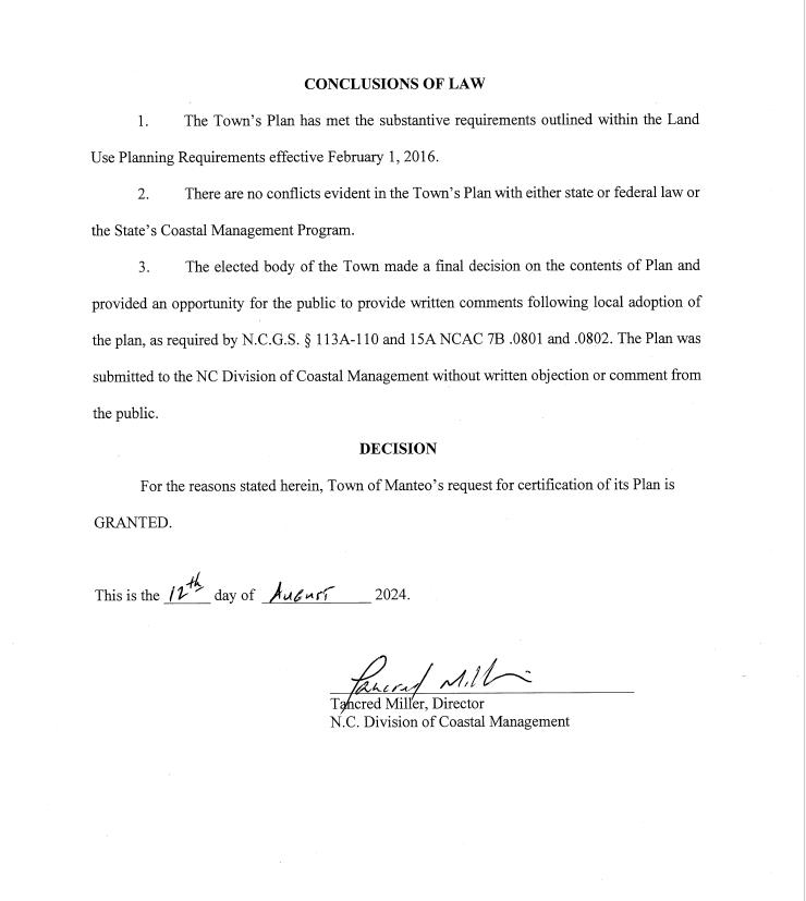
Certified by NC Coastal Resources Commission: August 7, 2024


Adoption: June 26, 2024
Certified by NC Coastal Resources Commission: August 7, 2024
Comprehensive Land Use
Plan Leadership Committee
Nicole Northrup, Chair
Hal Goodman
Dave Stempel
Fields Scarborough
Jamie Daniels
Jason Borland
Board of Commissioners
Bobby Owens, Mayor
Betty Selby, Mayor Pro Tem
Darrell Collins
Jason Borland
Eddie Mann
Sherry Wickstrom
Ruth Stetson
Staff Liaisons
Melissa Dickerson, Town Manager and Town Planner
Michelle Bunce, Program Manager
Jamie Whitley, Town Clerk
James Ayers, Former Town Manager
Plan facilitated by:
Plan adopted by the Town: June 26, 2024
Plan certified by NC Coastal Resources Commission: August 7, 2024
Page intentionally left blank

This Coastal Area Management Act (CAMA)-Certified Comprehensive Land Use Plan, sometimes referred to as a comprehensive plan, incorporates land use and transportation plans previously adopted by the Town of Manteo, while creating policy framework to guide responsible growth and natural resource conservation over a 25-year planning horizon.
It is a document that contains a shared community vision to guide the growth, development, and natural resource conservation for the Town of Manteo. It is a tool to be used by many people with an interest in the Manteo community. First and foremost, it is for the citizens of Manteo, the policy makers who represent them, and the Town’s Staff who support them. It is also for businesses and future citizens, and scholars or students who want to learn more about Manteo. This comprehensive plan considers existing conditions and trends to envision the future community, a community vision created by the people of Manteo. It contains goals that define this vision and implementation strategies to achieve these goals. It provides an analysis of the forces that have shaped the Town of Manteo overtime, as well as the current socioeconomic qualities of the Town of Manteo. Finally, the plan provides implementation strategies to achieve the vital elements that make the Town of Manteo a safe and welcoming, place to live, work, and play.
Planning Board - reviewed the plan regularly and provided direction over the lifespan of the project.
Town Board of Commissioners - reviewed the plan as a part of the formal adoption process.
Town Staff - facilitated meetings and outreach, internal review and coordination, provided perspective and background information.
Members of the public - participated in public meetings, plan review, surveys, and input through various methods.
The Plan also built on the work of 20 Year Plan working group and it’s subcommittees.
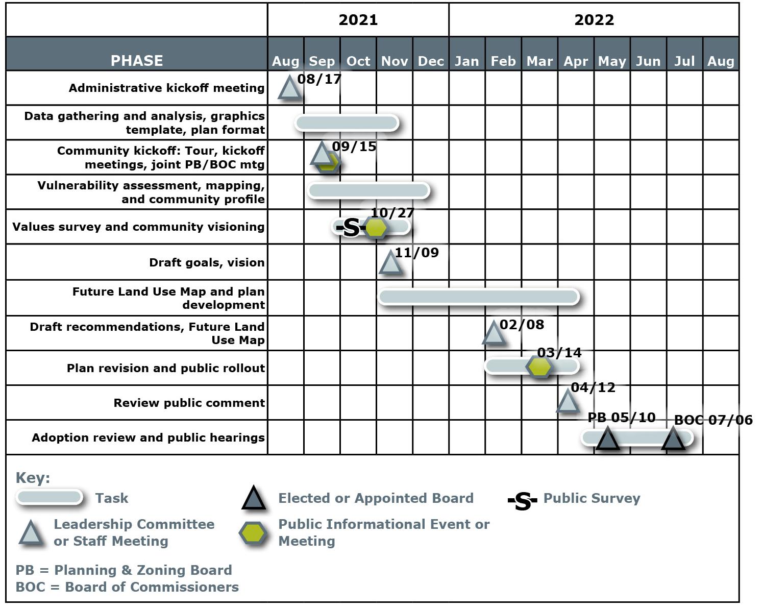
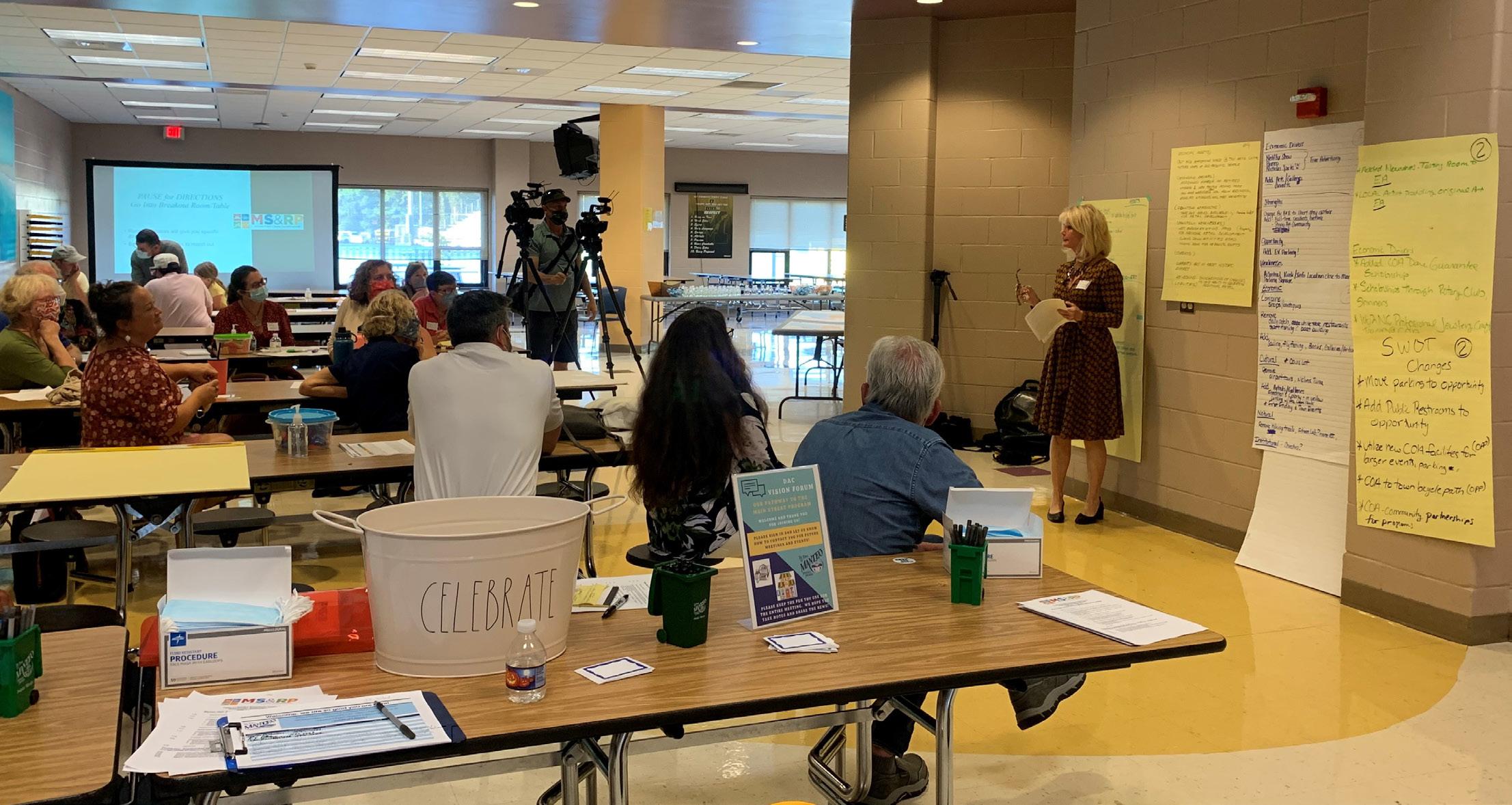
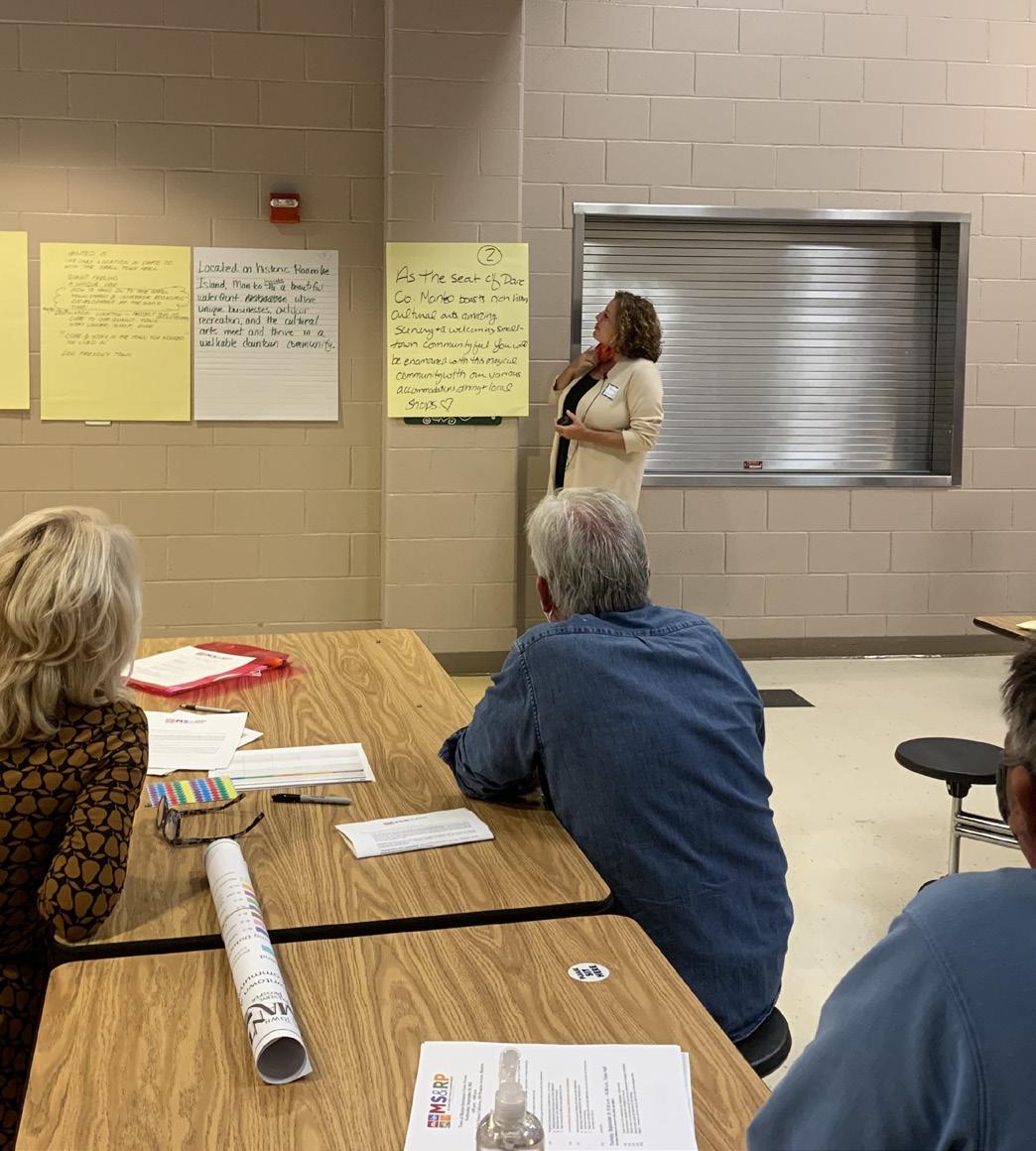
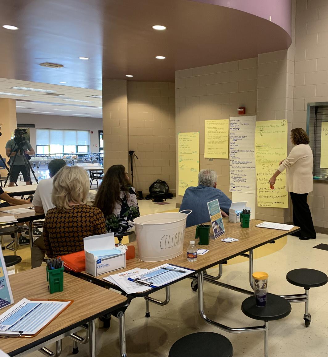
Public engagement included a series of steering committee meetings, a kickoff meeting, three public meetings, and a community survey.
In addition to the Planning Board reviewing and shaping all elements of the plan, the public also weighed in regularly.
Kickoff/Public Meeting #1 September 15, 2021 - introduced the community to the plan development process and reviewed preliminary information that had been collected and analyzed. Gathered community concerns and visions for the plan through feedback activities.
Public Meeting #2: October 27, 2021 - introduced the community to the plan development process, reviewed survey results and gathered community concerns and visions for the plan through feedback activities.
Public Meeting #3: March 14, 2022 - introduced the community to the draft plan document and gathered input and answered questions about the document.
First Survey: September 22 - October 18, 2021 - gathered information on community values and vision.
» The survey was extensively advertised, with a focus on ensuring all segments of Manteo population was reached. Manteo residents demonstrated their typical enthusiasm for their town on the survey, with 326 responses collected, which was almost double what the survey for the Town’s previous plan received. See “Appendix B: Public Survey Results” on page 109
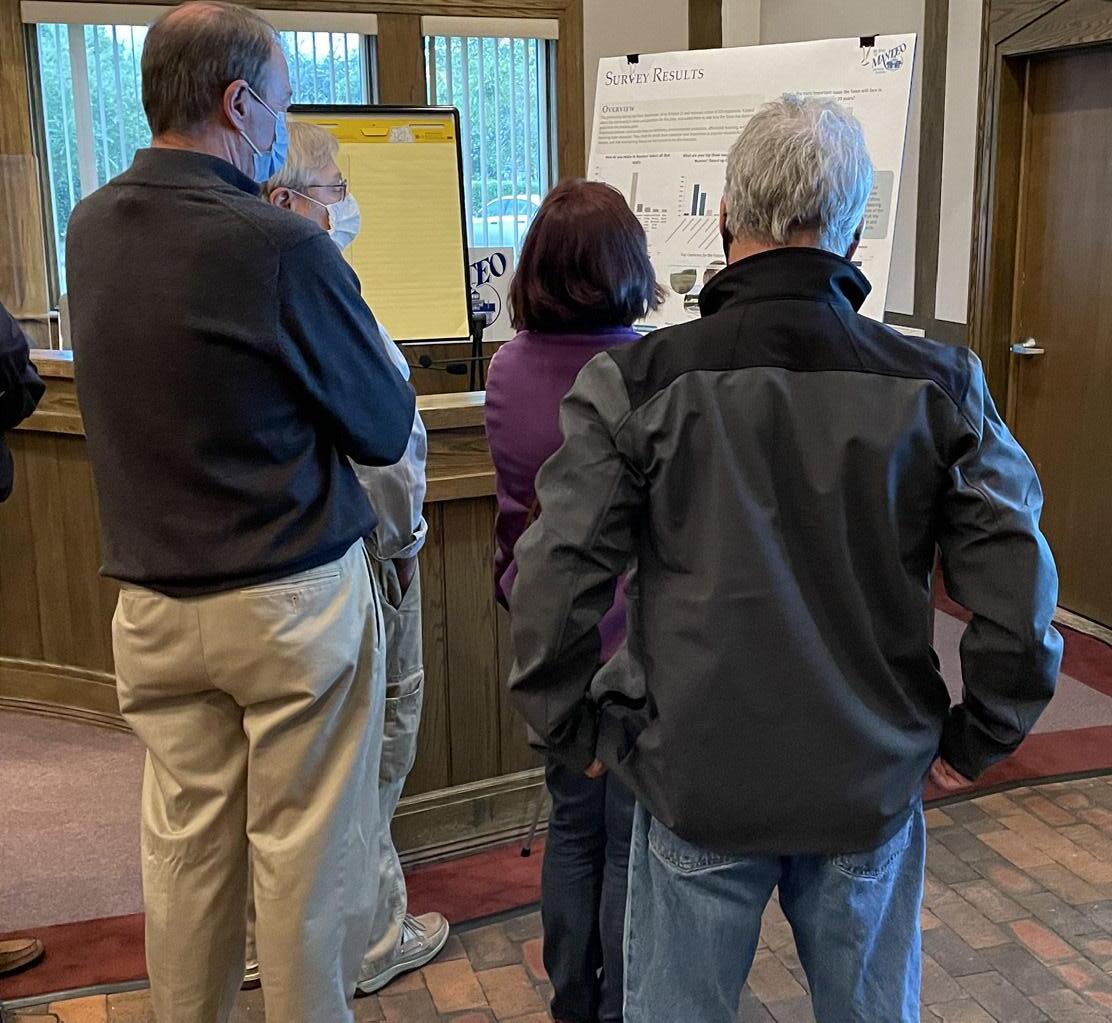
Attendees at the second public meeting view the results of the community survey.
The project kicked off in August 2021 by collecting valuable data from town staff. Next, the Stewart team visited the Town for a community tour and kickoff meeting with Town staff. This led to obtaining valuable insight and local perspectives related to land use and development in the town. Following the community tour, a vulnerability assessment was performed to identify areas of environmental concern, existing land use, transportation, infrastructure, water quality, stormwater, and other environmental concerns. Throughout the process, the project team met with Town staff and the leadership committee to help guide the plan and address required topics by the Coastal Area Management Act. A combination of public meetings and surveys were conducted to gain community insight on future growth, development, preservation, and conservation concerns. Updating the Town’s CAMA-Certified Comprehensive Land Use plan is a year-long process that includes public engagement and analysis, followed by state review of the draft plan, which can take up to 75 days.
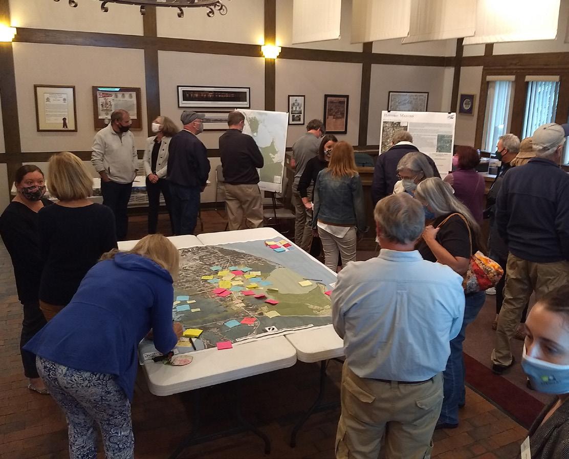
Attendees at the second public meeting comment on the Keep-Toss-Create Map.
The following description of existing and emerging conditions is not exhaustive but does capture the general state of land use and development concerns in the study area of the Town and sets the stage for further discussion in the plan of relevant concerns. A discussion of Coastal Area Management Act (CAMA) related concerns is also included and is based on the information gathered from stakeholders, Town staff, background research, and the community survey.
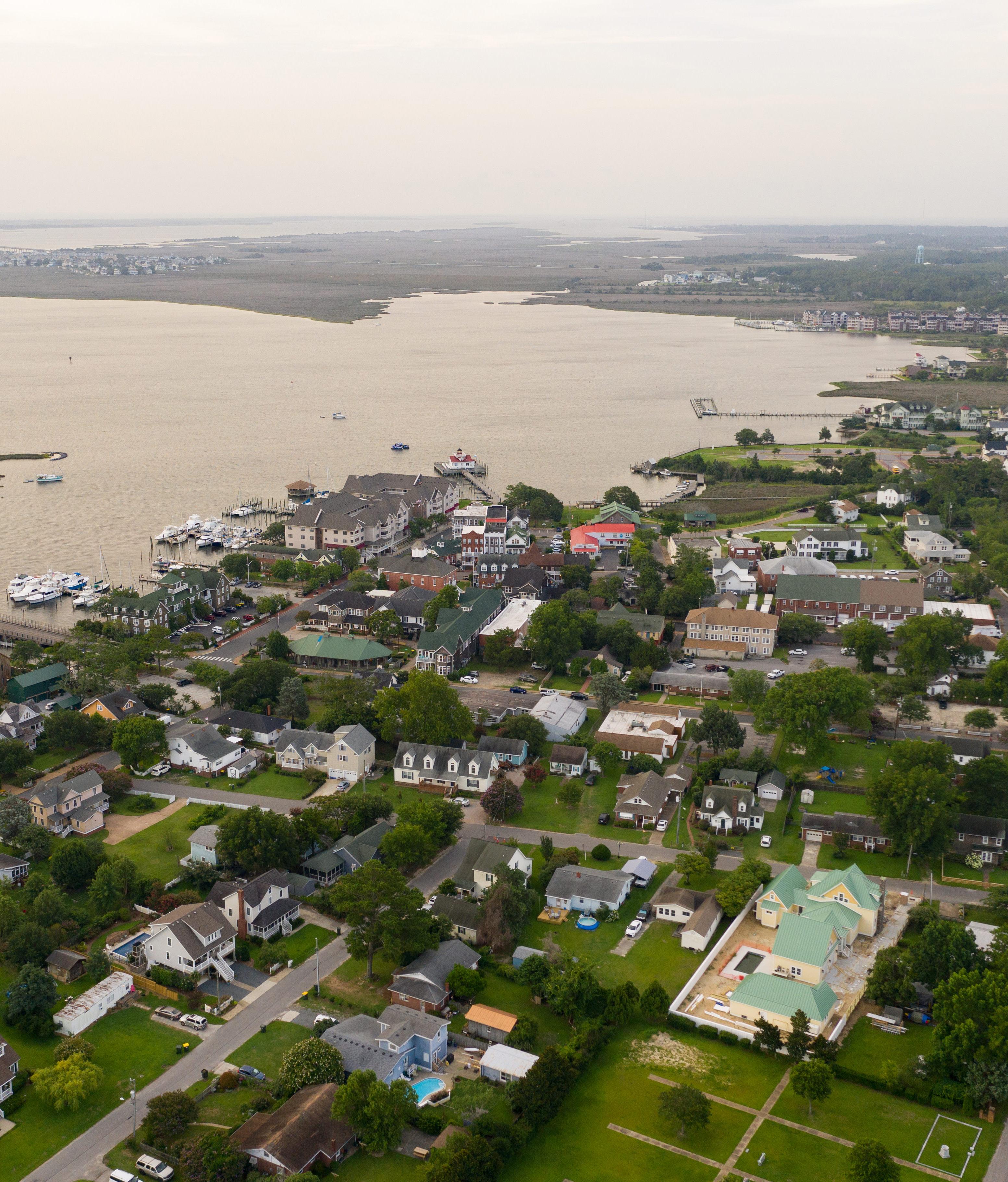
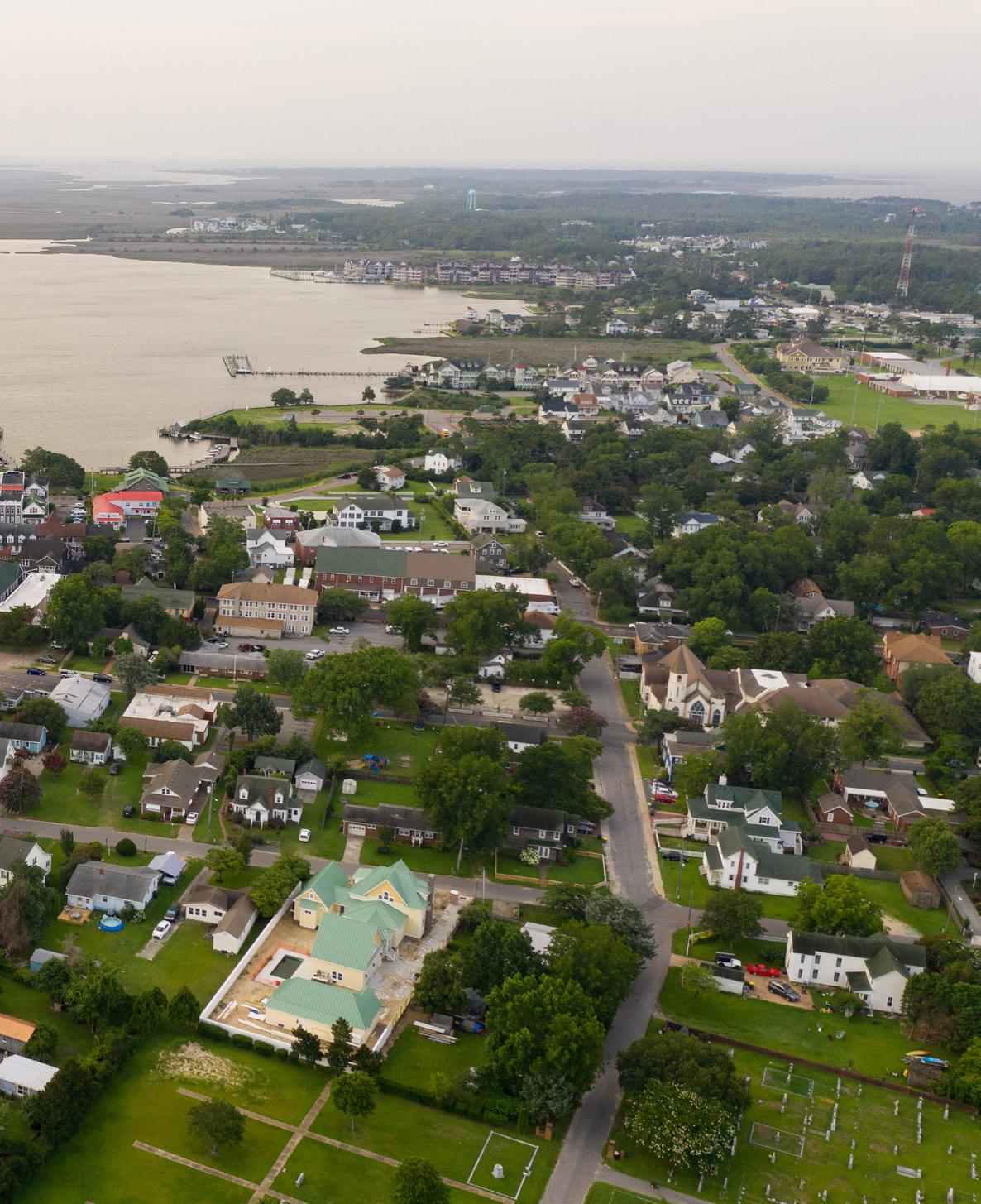
Manteo is the only incorporated area on Roanoke Island, situated between North Carolina’s mainland and the Outer Banks barrier islands. The Town is bordered by Croatan Sound on the west and Roanoke Sound to the east. The Town surrounds Shallowbag Bay in Roanoke Sound. The Town’s corporate limits cover approximately 1,800 acres.
Much of the land within Town limits is devoted to conservation and open space, which makes up more than half of the incorporated land area. However, much of this area is not buildable due to the presence of coastal and noncoastal wetlands (See page 30 and page 52). Institutional uses, including schools, churches, and local and county government facilities, occupy the largest share of the land not designated as conservation and open space. Very little of the Town’s land area is classified as vacant, meaning land not in conservation that has yet to be developed. An existing land use map and further breakdown of the categories is available on page 59
The Town’s 2007 Future Land Use Map classifies the area within corporate limits into the following categories:
County Services and Tourist-Oriented Commercial
Downtown Commercial
Virginia Dare Corridor Commercial
Mixed-Use
Institutional
Single-Family
Single-Family Attached
Multi-family
Conservation and Open Space.
Due to Manteo being mostly built-out, the future land use categories generally align with the existing land use. The largest category is the Conservation and Open Space Category. The Future Land Use component of this plan will build on the data from the 2007 Future Land Use map.
Most of the land within Manteo’s corporate limits is built out, with few significant undeveloped parcels remaining. Most of the development is centered around Downtown and the Roanoke Voyages Corridor along Highway 64, with residential uses radiating outward from those central areas.
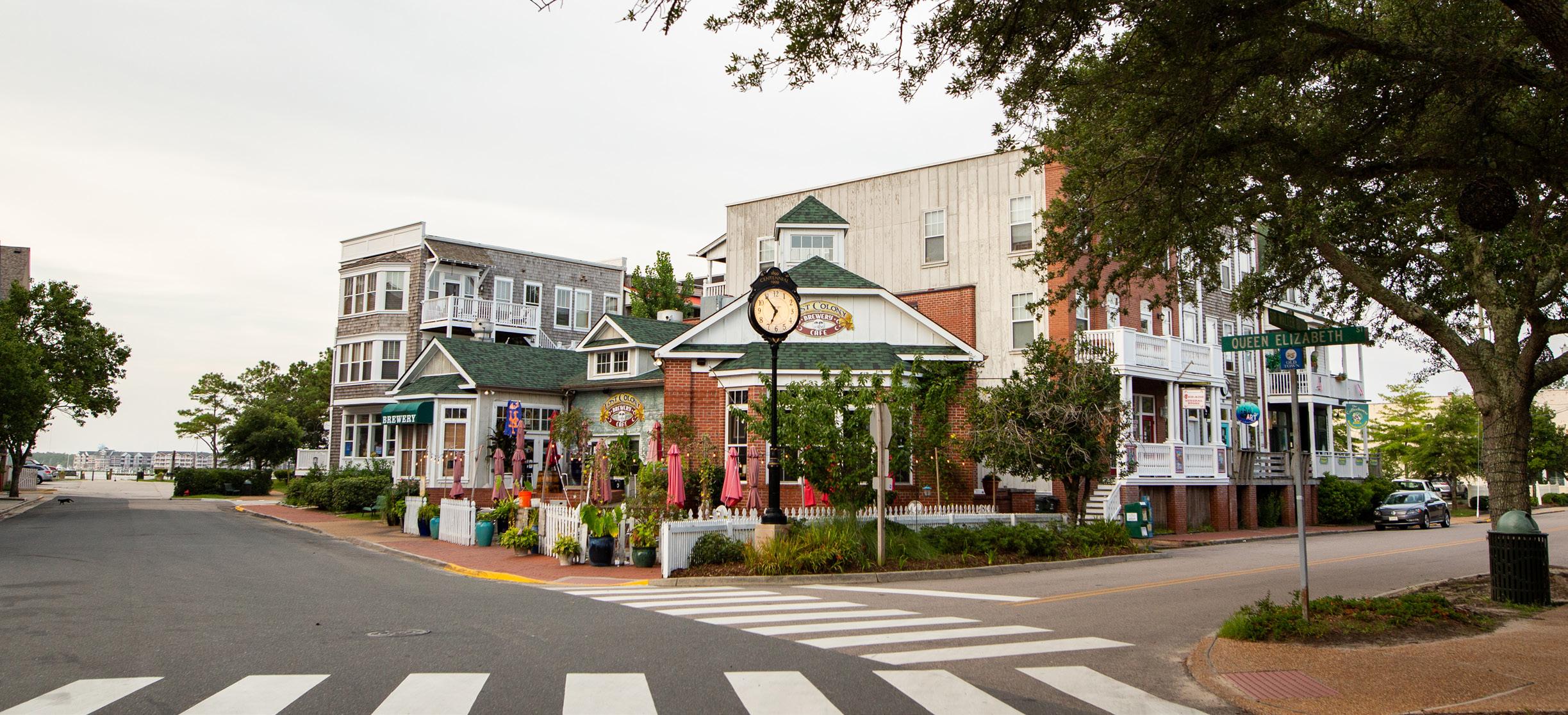
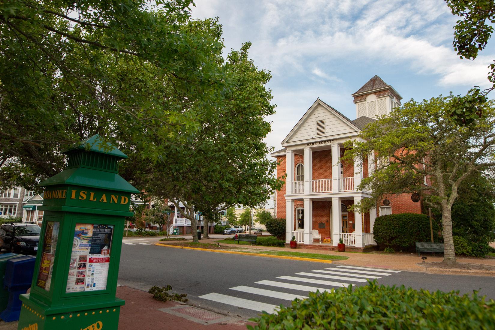
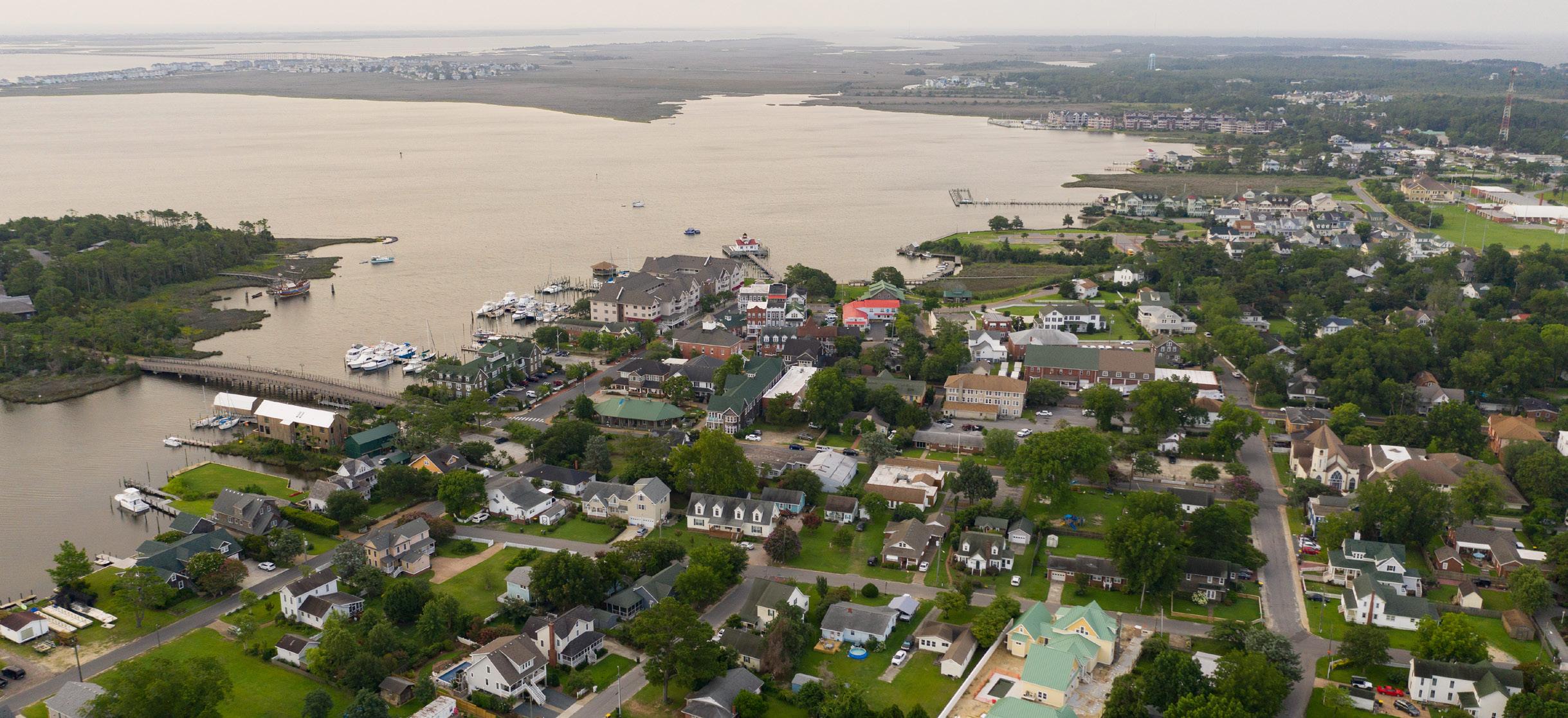
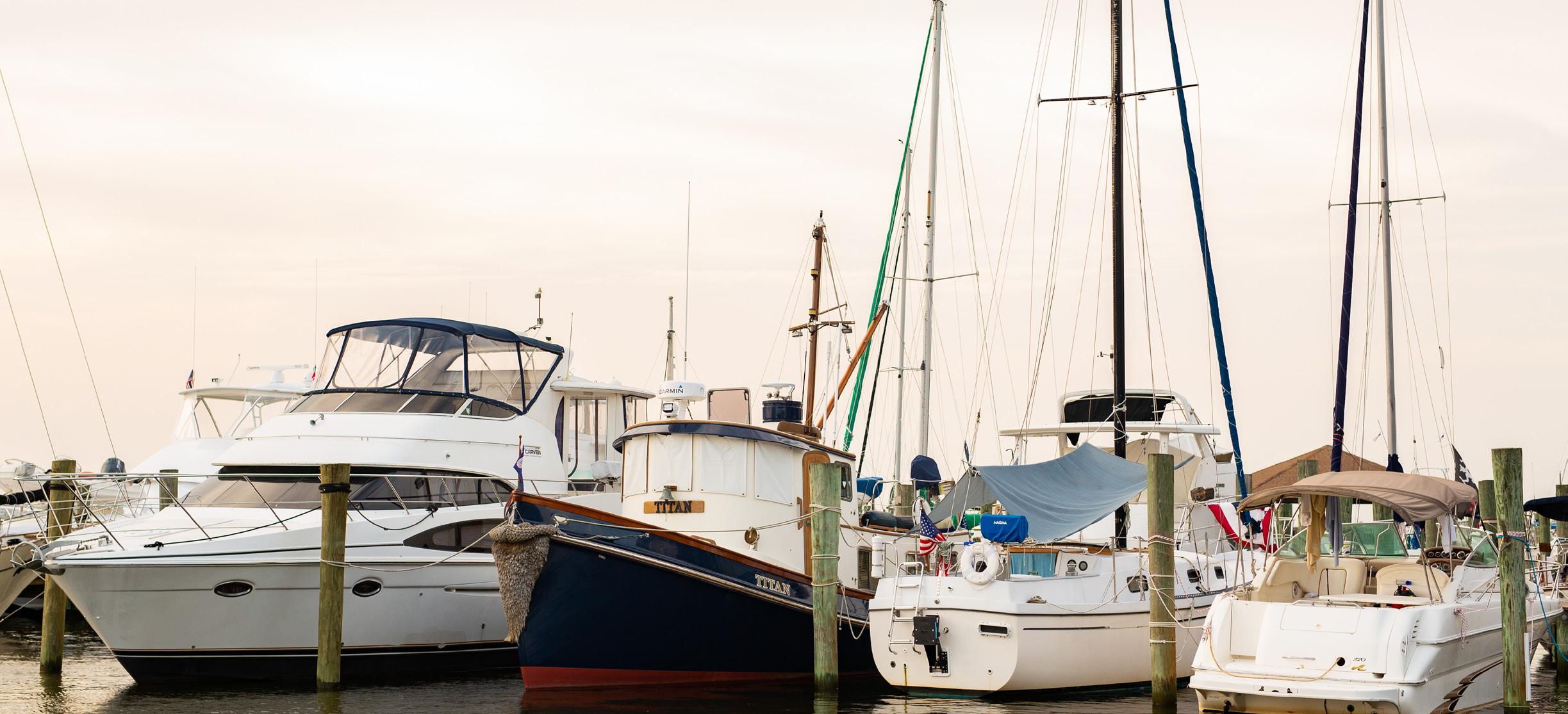
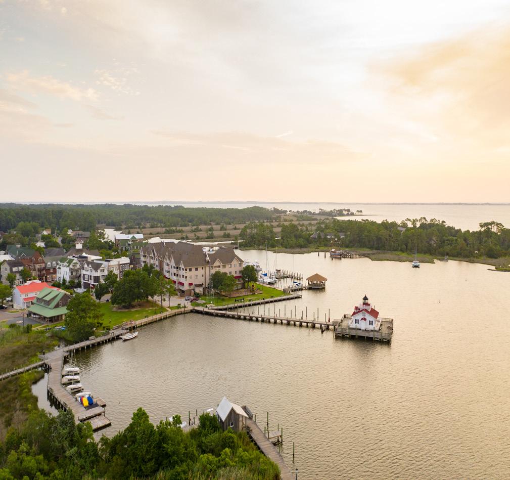
Historic Downtown Manteo is the heart of the Town, with historic buildings lining the Shallowbag Bay waterfront and marinas. Historic structures, dense mix of uses, and street network exemplify historic development patterns. Most buildings feature a vertical mix of uses, with active commercial uses on the ground floor with offices or residential units above. Buildings are typically 2-3 stories in height and are set close to the street. The areas host many tourism-related uses such as restaurants, lodging, and attractions. It is also home to the Town government offices.
Manteo features a variety of older and newer residential neighborhoods which are home to a mix of housing types and styles. Several residential neighborhoods are found in the Northern portion of Town around Downtown. These neighborhoods are typically older, with primarily single-family homes on lots that typically vary between 6,000 and 15,000 square feet.
Pirate’s Cove is a planned community along Ballast Point on the eastern edge of Town. It is centered around the associated marina and features single-family residences, condos, and townhomes.
The Roanoke Voyages Corridor (Highway 64) functions as the spine of Manteo and connects the historic Downtown to Highway 64-bypass. Commercial and tourist-oriented uses line the road, serving the everyday needs of Town residents. Uses typically found along the corridor include retail, services, and the College of Albemarle.
Manteo is also home to the Dare County campus of the College of the Albemarle. The campus in Manteo is separated into two parts covering approximately 18 acres. Many students are local, but the presence of the College does impact housing, services, and transportation demands in Manteo.
Manteo benefits from Highway 64 running perpendicularly through town. The Roanoke Voyages Corridor that runs North to South is the spine of Manteo, featuring many essential uses. The road is primarily one lane each way with a central turn lane. Due to the many disconnected uses along the road, there are many curb cuts, with vehicles exiting and entering the roadway at every parcel.
Downtown Manteo offers a pedestrian friendly network. Most blocks Downtown have sidewalks lining both sides of the street, but sidewalks at times are narrow, in need of repair, or are obstructed by utility structures. Pedestrians can access the public waterfront boardwalk and Festival Park. Sidewalk connectivity becomes more disjointed outside of Downtown. Residents in the neighborhoods close to Downtown do not have sidewalks and bike facilities by which they can reach destinations like Downtown and schools. Increasing non-automobile connectivity between disparate areas has been a theme throughout the Town’s planning efforts since the 2007 Plan.
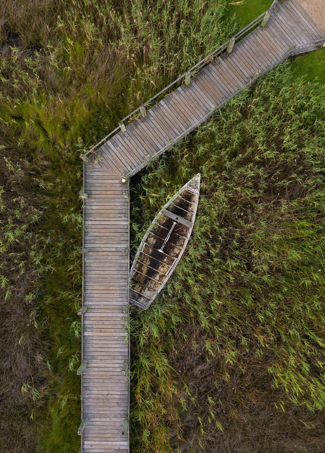
There are small pedestrian routes and shared use paths in Town, most are located in and around the Downtown area. Along the waterfront, there is a public boardwalk where users can cross the bridge to Festival Island Park. Currently the State’s Mountains to Sea bike route runs through Town along Highway 64 but does not have separate facilities.
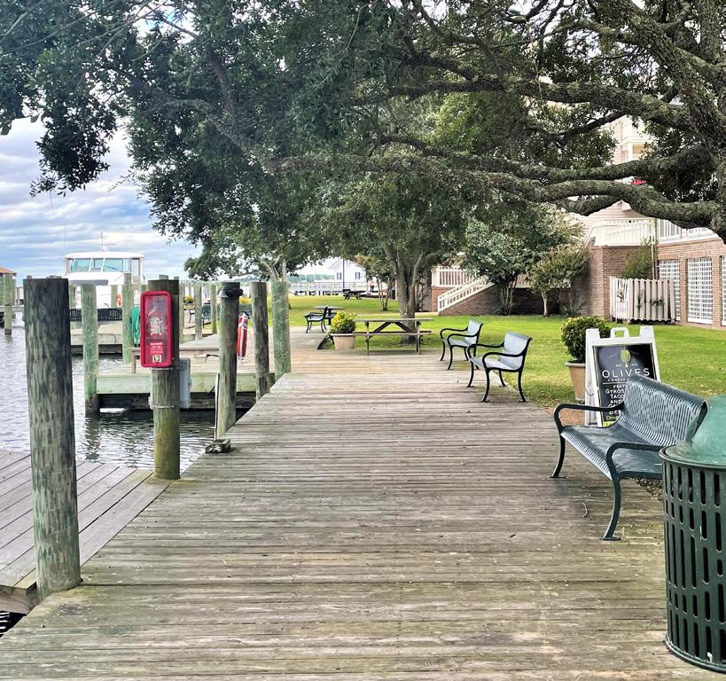
The public boardwalk around Manteo’s Downtown allows for views of Shallowbag Bay.
Signage and wayfinding play a critical role in Manteo, especially for visitors. The Town provides signage directed toward vehicular traffic along major roadways like Highway 64. The Town has expressed the desire to increase pedestrian signage in and around Downtown and signage to assist cyclists throughout the Town’s limits.
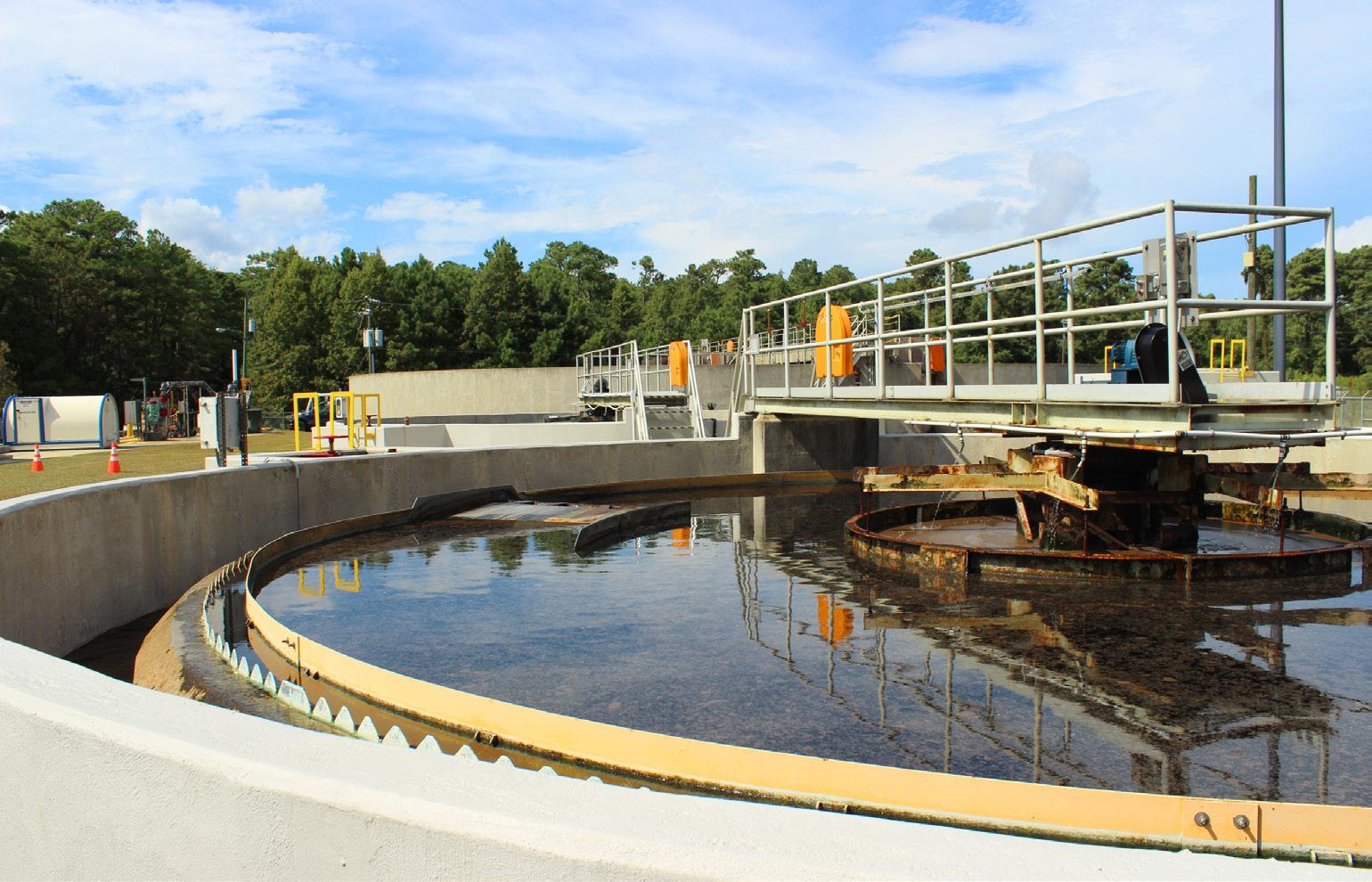
The Town of Manteo purchases its water from the Dare County Water Department, but the Town maintains and monitors the service to residents. The Town currently uses an estimated 0.2104 million gallons per day (MGD), with an available supply of 1 MGD, or an estimated 108 gallons per capita per day (Source: Local Water Supply Plan (LWSP), 2020). There were approximately 1,659 metered connections as of the 2020 LWSP. The Town’s Wastewater Treatment Plant is located on Bowerstown Road and provides wastewater services to the Town. The Water and Sewer Department maintains 11 waste water lift stations throughout the Town. The Town has an average daily discharge of 0.285 MGD daily with a permitted capacity of 0.6 MGD (Source: Local Water Supply Plan, 2020.) According to the Town’s 2020-2021 Wastewater Performance Report, the system is in good conditions and there were no sanitary sewer overflows over 1,000 gallons or any that reached surface waters during the timeframe of the report.
Environmental water quality (not to be confused with drinking water quality) is very important locally, as it supports the economy as well as residents’ quality of life. Recent investments in wastewater and stormwater management have contributed positively to local conditions.
The Town of Manteo’s drainage system consists of a series of pipes and ditches both publicly and privately owned. Most of the system was installed before the Town fully developed and as a result it can be easily overwhelmed during heavy rain events. The Town of Manteo conducts regular maintenance on the system. Town ordinances have been updated since the 2007 CAMA plan to require more rainfall capture on-site for new development.
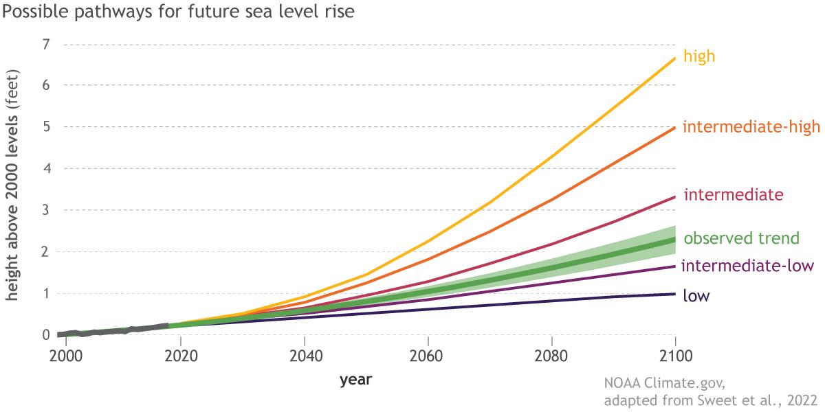
As seas rise globally, the Town of Manteo is also threatened by local land subsidence, which means that the land is submerging even faster than in other locations on the east coast. Understanding and preparing for these threats using the best available data and projections can help the community mitigate the negative impacts of sea level rise.
Unless mitigation actions are taken, The National Oceanic and Atmospheric Administration (NOAA) projects that sea level rise will cause chronic inundation of some properties, with major impacts possibly occurring as early as 2060. Though 2060 is beyond the horizon of this plan, it is still relevant to long-range decision-making. Many of the structures constructed and renovated today have lifespans beyond 50 years.
The best available projections from NOAA indicate the following potential sea level rise scenarios, based on worldwide carbon emissions rates:
The Coastal Area Management Act (CAMA) is particularly concerned with five land use topics. Additional description of issues related to those topic areas is provided below. For the full description of these topic areas and their CAMArelated objectives, please see the full description from state administrative code(15A NCAC 07B. 0702).
The Town’s boardwalk, docks, maritime museum, boat ramp, waterfront parks, and downtown waterfront provide significant access to Shallowbag Bay. Since the majority of the lots along the waterfront are private, opportunities for new parks directly on the water are limited.
The Town has significant protections in place that avoid filling or disturbing wetlands. A good portion of the waterfront shoreline in older parts of town is already modified with rock revetments, bulkheads, docks, or seawalls. The future land use plan for the Town primarily focuses on maintaining the existing land use pattern and respecting natural resources.
Arguably the biggest infrastructure impacts on the surrounding environment comes from wastewater and stormwater management. The Town has made major investments in both systems, which has positively affected the surrounding waters and habitat.
The Town has significant land use and development protections in place to avoid the placement of life and property in harm’s way. Structure elevation standards are beyond the minimum required by the National Flood Insurance Program and the Town has recently increased their Community Rating System ranking, resulting in potentially lower flood insurance premiums for affected properties. The Town will continue to be very susceptible to storm and tidal flooding, storm surge, and other coastal hazards. As seas continue to rise and the climate continues to warm, these impacts will only worsen.
The Town has taken steps to improve water quality through infrastructure improvements, particularly in wastewater and stormwater management. Environmental water quality is a key driver in the local economy and quality of life. The Town has committed in this plan to continuing to prioritize the protection of environmental water quality.
Page intentionally left blank
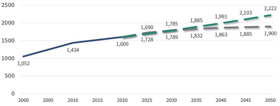
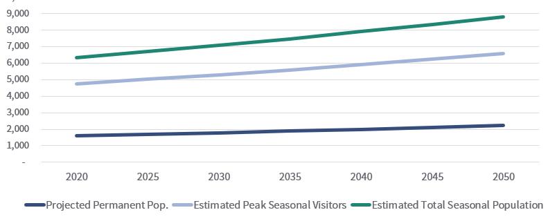
Manteo’s permanent population is estimated at 1,600 within municipal limits, based on the 2020 Census. The Town’s growth has slowed down between 2010 and 2020 as compared to its 52% growth from 2000 and 2010. Projections based on past growth data estimate that the Town may add another 300-622 people by 2050, although this is not a given depending on how the Town manages growth over the same time period. Seasonal visitor population estimates and projections were also created. It should be noted that all population projections are estimates based on known data. Other variables, such as natural disasters or significant annexation, are not accounted for and may influence future population numbers. Further discussion on water and wastewater current and future demands can be found on pages 62-63.
Manteo’s permanent population within Town limits was sourced from the US Decennial Census, and is estimated to be 1,600 permanent residents as of 2020. The Town grew faster between 2000 and 2010 (52% overall, Average Annual Growth Rate (AAGR) of 3.1%) than between 2010 and 2020 (12% overall, AAGR 1.1%).
Two permanent population projections were developed, one based on past growth trends and one based on future projections. These projections are not guaranteed, as growth management related decisions made today will affect whether the Town meets these projections or not.
The first method applies the Annual Average Growth Rate (AAGR) between 2010 and 2020 (1.1%) to current population counts to project the population. This AAGR was chosen because it projects slower growth than using an AAGR from other periods. Due to Manteo’s limited land availability, this was considered more realistic for the Town. This projection estimated an additional 622 residents could be added by 2050.
The second method projected future Town population based on estimates for Dare County growth done by the NC Office of State Budget and Management (OSBM). This method applied the OSBM projected growth rates to the Town population. This method estimated roughly an additional 300 residents by 2050.
1Source: US Decennial Census
The peak seasonal population provides an estimate for how many visitors Manteo likely hosts during the busiest tourist season. It was estimated by calculating the amount of visitors to short-term rentals and seasonally occupied units, guests of year-round residents, and other lodging in Town. The estimated does not include day trippers. A full breakdown of season population methodology is available in the Appendix.
To project the total seasonal population, meaning permanent residents and visitors together, the ratio of current visitor population to permanent population was calculated and applied to the permanent population projections. This assumes a constant ratio of tourists to full-time residents.
Total Population Projections
Permanent Population
Persons who usually reside in the planning area, year-round.
Peak Visitor Population
Persons who are temporary residents in the planning area, such as tourists and vacationers, but who normally reside in another location; does not include day-trippers.
Peak Seasonal Population
Permanent plus visitor population. This is an approximation of the planning area’s population on a “typical” peak day during the high season. Does not include day trippers.
The Town of Manteo has seen a steady increase of residents from 2000 to 2020, growing to over 1,600. Recent projections show this dipping slightly in the past two years, but overall, the annual growth rate since 2000 has been just about 2%.
The growth in total households has been a bit higher at 2.5%. Specifically, non-family households have grown faster than family households. This has resulted in a slight shift of the ratio between family and nonfamily households. In 2000, families made up 66% of Manteo’s households. By 2019, family households were estimated to be 63%, showing a 3% shift in balance towards non-families.


Source: 2000, 2010, 2020 Decennial Census and ACS 5-year estimates 2019.
The community is majority white at 87% (not taking Hispanic ethnicity into account). The Hispanic population, that is people with Hispanic heritage regardless of race, was estimated at 8% for 2019, down from 10% in 2010.
The median age increased by 5 years over the past decade, and is higher than the county average. This is evident in the cohort population changes noted from 2010 to 2019. Adults from the ages of 30 to 49 has decreased by 9% and 15%. Adults in the groups of 20 to 29 and over 70 years of age were estimated to have increased by over half from their 2010 counts.
Age Cohorts - Change 2010 - 2019
Source: ACS 5-year estimates 2019.
Source: ACS 5-year estimates for 2010 and 2019.
Data from the US Census and the NC Department of Commerce show an increase of employees in Manteo, with the majority (93.5%) of the workforce living outside of town limits. Public administration, education and health, and arts and accommodation represented the biggest employment sectors in Manteo. The sectors with the most job growth were Retail Trade and Accommodation and Food Services, while Wholesale Trade and Information saw the most shrinkage.
The majority of the workforce in Manteo are commuting into Town from other parts of Dare County, including parts of the Outer Banks barrier islands, like Kill Devil Hills, Nags Head, Kitty Hawk, and Southern Shores. Commuters are also coming from mainland Dare County and Tyrrell County, as well as parts of Currituck County near Point Harbor. Three quarters of the total workforce are commuting as single occupancy drivers.
The median household income was estimated to be $48,375 in the 2019 American Community Survey. This is below both the median incomes estimated for Dare County and the State of North Carolina, but it has grown by 36% since 2010, more than the 10% and 34% growth seen in the county and state in the same period. In 2010, an estimated 21% of families in Manteo were determined to be below the poverty level, however the 2019 estimates show improvement to 18%.


Source: 2000 Decennial Census, 2010 Decennial Census and ACS 5-year estimates 2019. Source: US Census On The Map, OSBM 2018 and
Housing in Manteo is predominantly single family detached homes. In the 2019 estimates there were 1,471 housing units in the Town of Manteo. Of these, the number of homeowner households, renter households, and vacant seasonal homes were fairly balanced. Median year of construction is 1991 and the median home value is $293,900.
As a coastal town, Manteo has a large amount of homes that are not primary residences, used for vacation rental or seasonal use. Approximately 57% of housing units in town are permanent residences, and 43% are classified as “vacant” (see box on opposite page). This ratio of occupied to vacant housing units grew from a 50-50 split in the past decade based on ACS Estimates. Of the homes that are not primary residences, it is estimated that 83% are for seasonal or recreational use. This is up from 75% in the 2000 Census, while the physical count of units nearly doubled from 308 in 2000 to an estimated 552 in 2019.
The average family size grew from 2.77 in 2010 to a 2019 estimate of 3.01, indicating that larger households have been moving to Manteo in recent years or existing families. The total number of households is estimated at around 800, with an annual growth rate of 3.0%. 2019 Median Home Value1
Housing by Type (2019) Single Family Detached
Own/Rent (2019)
Source:
$293,900 within Town Limits $289,000 within Dare County $180,600 North Carolina
How do we know who lives in Manteo full-time? Using the US Census data definitions of occupied and vacant housing units, we can determine how many homes are primary residences and extrapolate secondary residences.
Occupied Housing Units are defined as those that are the “usual place of residence” for persons or a family. A primary residence.
Vacant Housing Units are defined as units where no one is living, or units owned by people whose “usual place of residence” is elsewhere. In popular tourist locations, “vacant” units are generally second homes or vacation rentals.
83%
Source: 2000 Decennial Census, 2010 Decennial Census and ACS 5-year estimates 2019.
Rented, not occupied For sale only
Sold, not occupied
For seasonal, recreational, or occasional use
Other Vacant
Source: ACS 5-year estimates for 2019.
This plan will not exist in a vacuum, but rather will update the Town’s 2007 CAMA Plan and function alongside its other, more specific existing plans. As a Comprehensive Plan, it will guide land use, programming, policy, and funding decisions for the Town. As a CAMA plan, its CAMA-related policies will guide permitting decisions for projects within the CAMA’s purview.
Maintain small town character, hometown sense of community, and history (173 responses)
Protect upland wetlands and other environmentally fragile areas on the island (140)
Require new development to be in character with the town (127)
Maintain a natural edge of wetlands, forest, and water around town (111)
Improve water quality in Shallowbag Bay to allow shellfishing (101)
Provide adequate public parks and open spaces (90)
Provide affordable housing (87)
Limit growth so it doesn’t exceed the wastewater plant’s current capacity (83)
Make safe places to walk to see neighbors, shop, and go to school (83)
Slow down growth (81)
Public access to the public trust waters, waterfront, and marshes should be preserved, planned, built and maintained.
Open space should serve multiple functions such as stormwater treatment, passive and active recreation, wildlife habitat, and public access points.
New parks and open spaces should be sited and designed to maintain the town’s natural edge, protect fragile areas, improve water quality, preserve views to public trust waters, and be in keeping with Manteo’s historic character.
ADA accessible public access points, boardwalks, parks, and open spaces.
Compact commercial development to increase walkability.
No development should be allowed that negatively impacts the town’s fragile natural resources.
For every 5 or more residential units developed must meet a 20% affordable housing requirement of one affordable unit for every five proposed.
Implement recommendations from the RITP such as
pedestrian and bicycle networks along Highway 64/264, traffic calming measures, and intersection improvements.
In July of 2011, the Transportation Planning Branch of the North Carolina Department of Transportation (NCDOT) and Dare County initiated a study to cooperatively develop the Dare County Comprehensive Transportation Plan (CTP), with Dare County and the incorporated municipalities of Manteo, Nags Head, Kill Devil Hills, Kitty Hawk, Southern Shores and Duck. This is a long-range multi-modal transportation plan that covers transportation needs through 2040. Modes of transportation evaluated as part of this plan include: highway, public transportation and rail, bicycle, and pedestrian.
Highway 64 from Marshall C. Collins Drive to Mother Vineyard Rd on Roanoke Island is currently over capacity. Because of physical constraints, no method of improvement was found to be acceptable to Manteo or Dare County at this time. Storefront developments prevent any additions to the current pavement width.
Bus route to provide service from the intersection of Highway 64, US 158, and NC 12 (Whalebone Junction) in Nags Head to Roanoke Island, serving the town of Manteo and tourist attraction such as Festival Park.
Bicycle routes along the following:
» Wingina Street (SR 1121)/ Budleigh Street (SR 1150)/ Uppowoc Street (SR 1192)/
» Grenville Street, Local ID: DARE006-B: Highway 64 to Highway 64
» Highway 64/264, Local ID: DARE008-B: NC 345 to Pirates Way:
» Wescott Park Road to Wingina Street (SR 1121)
The plan was developed in a joint and cooperative manner by members of a Hazard Mitigation Planning Committee which included representatives from County, City (including Manteo), and Town departments, federal and state agencies, citizens, and other stakeholders. The plan was prepared in compliance with Section 322 of the Robert T Stafford Disaster Relief and Emergency Assistance Act 42 U.S.C. 5165, enacted under Section 104 of the Disaster Mitigation Act of 2000, Public Law 106-390 of October 30, 2000, as implemented at CFR 201.6 and 201.7 dated October 2007. An update to the plan should occur
in 2024- 2025 and the Town of Manteo should continue to participate in the update of this plan.
The plan included 23 “Action Items” for the Town of Manteo:
Continue to stay current with all Community Rating System reporting requirements to ensure continued program participation.
Replace heat strips on *utility lines running under* the Cora Mae Basnight Bridge
Maintain and improve Town wide stormwater system for appropriate performance.
Replace or retrofit critical and high-risk facilities that are located below base flood elevation.
Generator for Town Hall for continued services during disasters. The Town stands up as an Emergency Operations Center at Town Hall during disasters.
Upgrade and improve stormwater and wastewater systems to improve water quality in Shallowbag Bay.
Protect natural wetland areas.
Cora Mae Basnight Bridge-water sewer line repair and replacement
Continue to encourage projects undertaken by Town Departments that will lessen the vulnerability of the Town and its residents to natural hazards.
Phase V stormwater improvements for west side of Highway 64.
Capital Improvement Plan development with resiliency as a priority.
Boardwalk, bulkhead and docks replacement with higher standards/higher quality materials
Floodproofing of East, West Hammock, and Ballast Point, Peninsula lift stations.
Repair and maintain Town Waterfront Gazebo with higher standards/higher quality materials for improved resiliency.
Full replacement of waterfront lift station.
Continue to enhance the Water and Sewer Department’s back-up generator system for all lift stations.
Participate in and conduct Emergency Management training for appropriate Town elected officials and staff.
Develop new Town of Manteo Emergency Operations Plan to supersede Manteo Police Emergency Plan.
Implement essential spare equipment (standby equipment) program for water sewer plant.
Generator for Water and Sewer Plant to power to full operational capacity.
Develop Communications Plan for hazards.
Educate Residents on water saving techniques.
This was Manteo’s second plan, following the 1982 plan. The project began following the elections of November 2002 when the Town entered into a contract with North Carolina State University College of Design. The plan was updated in three parts. The first part was a student studio project in the Department of Landscape Architecture. In the second part Professor Achva Benzinberg Stein, chair of the Department of Landscape Architecture at NC State University and David Stein, planning specialist with the College of Design’s Office of Research, Extension and Engagement used material developed by the students together with additional proposals and generated in discussion with Steering Committee members to prepare the document. Finally, while working jointly with the staff of North Carolina Department of Commerce’s Division of Community Affairs, the plan was converted into a proposed zoning ordinance designed to implement the concepts developed in the plan.
Protect and preservation, and enhancement of the town’s small town character.
Further develop and enhance the attractiveness of Manteo
Integrate the parts of Manteo though appropriate planning and design
Modernize the planning process and its implementation through zoning regulation.
All decisions be consistent with the plan.
Coordinate planning and development on Roanoke Island with Dare County for consistency and compatibility between the respective jurisdictions.
Establish design guidelines for Manteo.
Adopt a new plan and implement zoning regulations.
Identify a number of specific design projects or approaches to development for use as models for projects or for implementation as the town may decide.
Provide a network of pedestrian and bicycle trails allowing access to all parts of the town and the island.
Incorporate the latest environmental standards for stormwater management, on-site waste disposal, and lighting in the town building regulations.
The document is a companion to the 2002 Plan update to provide design guidelines that augment the plan and zoning ordinance by providing more detail for project review. It uses examples from buildings around Manteo to define a style that represents the Town character. It identifies character-defining street grids, building massing, building orientation, and finishings, and encourages new construction to replicate these features.
In 2004, the Roanoke Island Transportation Committee was formed. In collaboration with the Town and the northern end of the Roanoke Island, the development of the plan was initiated. The plan includes the transportation network along US 64 between the Manns Harbor Bridge on the northwest and the Virginia Dare Memorial Bridge/US 64 (Midway) intersection on the south. It also includes the local street network that connects the neighborhoods.
Airport Road Connection
Airport/Aquarium/CSI Connection
Intersection Safety Improvements
Alternative Subdivision Access
Northwest Side Connector
U.S. Highway 64 Operational Improvements
NCDOT Yard Connectors
Uppowoc Avenue Extension
Agona Street Connector
Burnside Connector
West Side Connector
Vista Lake Drive/Bowsertown Rd. Connection
Vicars Lane Extension to California Ln.
Midway Access Realignment
Dare County Government Center Connector A and B
Midway Intersection Improvements
The Town of Manteo applied for the Downtown Associate Community (DAC) program in 2019 and was officially selected as one of six communities to participate in the program in early 2020. The program is the official pathway for the Town of Manteo to gain entrance into the Main Street program. The DAC is a prestigious program administered by the NC Department of Commerce through the NC Main Street & Rural Planning Center. The DAC program is a preservation-based approach to economic development, which balances economic development with historic preservation. The program’s FourPoint approach utilizes the concepts of Design, Economic Vitality, Promotion and Organization to help foster sustainable economic growth. This approach allows the community to find ways to highlight the rich history of the Town while promoting what it has to offer and what truly makes it special. Community members have been encouraged to participate in various community meetings and learn more about this exciting opportunity. A Core Team made up of seven members have played an integral role in helping to educate the community about the DAC and among other various ways, such as the development of an Economic Development Implementation Plan. The final DRAFT of the Economic Development Plan is required to go before the Board of Commissioners for their approval.
Engaging the community has helped the Town to envision ways we can all come together to attract new investment, grow the local business community and therefore create more jobs. The Town earned its designation as a Main Street Community on July 1, 2022. Earning the Main Street designation will only strengthen the Town’s efforts to build upon its unique characteristics and support a vibrant business community that meets today’s needs while preserving our historic fabric!
Areas of environmental concern (AECs) are areas of natural importance designated by the NC Coastal Resources Commission (CRC) and include the estuarine and ocean system, ocean hazard areas, public water supplies, and natural and cultural resource areas. The State Guidelines for Areas of Environmental Concern (15A NCAC 07H) require local land use plans give special attention to the protection of appropriate AECs because of their environmental, social, economic, and aesthetic values.
Due to Manteo’s geographic location on Roanoke Island, areas of environmental concern literally encompass the Town on all its aquatic borders, specifically on the shorelines of Dough’s Creek, Shallowbag Bay, Scarboro Creek, Roanoke Sound and Croatan Sound. Much development in the Town of Manteo requires a CAMA permit.
The following sections include the four categories that make up AECs established by the NC Coastal Resources Commission.
Estuarine waters are defined as waters of the Atlantic Ocean within the boundary of North Carolina and all the waters of the bays, sounds, rivers, and tributaries thereto seaward of the dividing line between coastal fishing waters and inland fishing waters. (15A NCAC 07H 0206)
Estuaries and their surrounding lands are unique places of transition from land to sea. Estuarine environments support unique communities of plants and animals specifically, homes to fish nursery areas, spawning areas, and shellfish beds. Estuarine systems provide habitat for more than 90% of North Carolina’s commercial and recreational seafood species. Estuarine systems perform other valuable services, such as trapping debris filtering pollutants, providing food and nesting materials for waterfowl and other wildlife, and dissipating erosion-causing wave energy. Manteo’s hydrological unit includes Dough’s Creek, Scarboro Creek, and Shallowbag Bay. Due to its location on Roanoke Island, other contributing estuarine waters are the Croatan and Roanoke Sounds, which are part of North Carolina’s 2.2 million acres of estuarine waters.
Public trust areas include waters and submerged lands within the coastal region where the public has rights of use and/ or ownership including rights of navigation and recreation.
(15A NCAC 07H .0207) These coastal waters and submerged lands provide opportunities for boating, swimming, or fishing. This includes Dough’s Creek, Scarboro Creek, (which are Primary Nursery Areas), and Shallowbag Bay in Manteo’s planning jurisdiction, as well as Roanoke Sound, and Croatan Sound just outside of the Town of Manteo. Additionally, the navigable ditches throughout the island are considered public trust waters by the local jurisdiction. These navigable public trust waters are also estuarine waters. Estuarine and public trust shorelines are non-ocean shorelines, extending from the normal high-water level or normal water level along the estuarine waters, estuaries, sounds, bays, fresh and brackish waters and public areas. (15A NCAC 07H .0209)
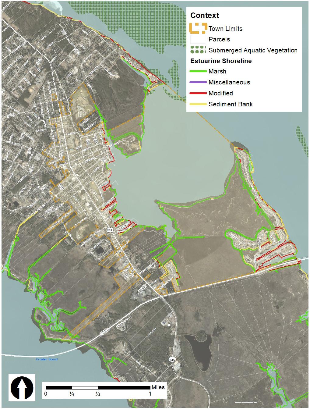
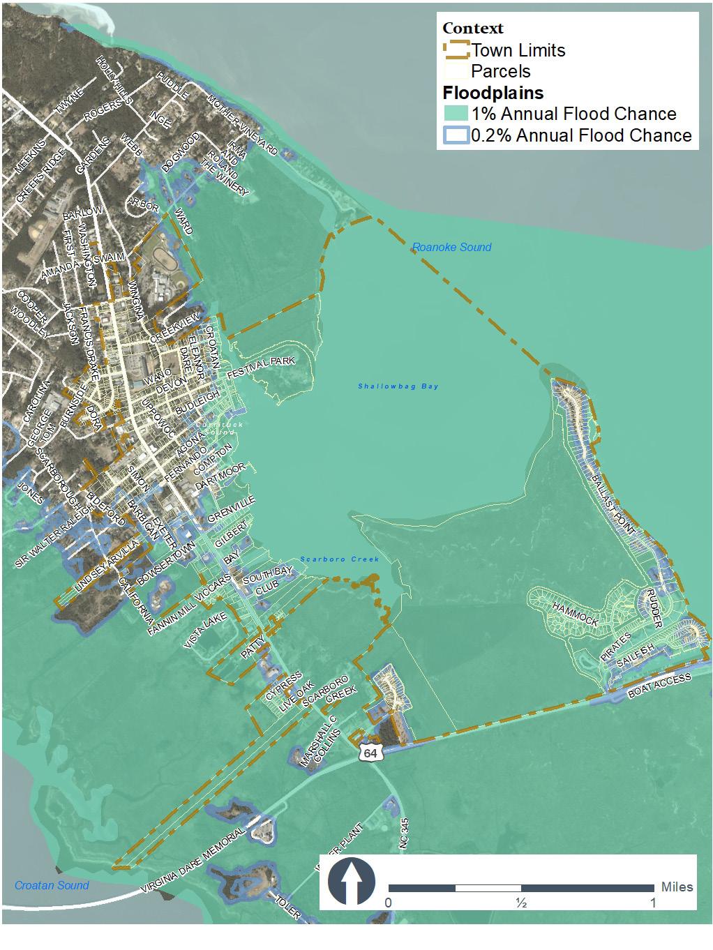
Manteo has 7 miles or 104,397 linear feet of estuarine shoreline that includes all lands within 75 feet of the normal high water level or normal water level of public trust waters located inland of the dividing line between coastal and inland fishing waters. This 75-foot band acts as a buffer between development and the estuarine waters all the way around the island, including along Manteo’s waterfront.
Modified shorelines make up 20% of estuarine shorelines within the Town limits. Modified shorelines include seawalls, bulkheads, and rock revetments; these are often hardened structures that may cause erosion to adjacent properties.
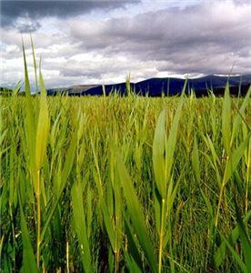
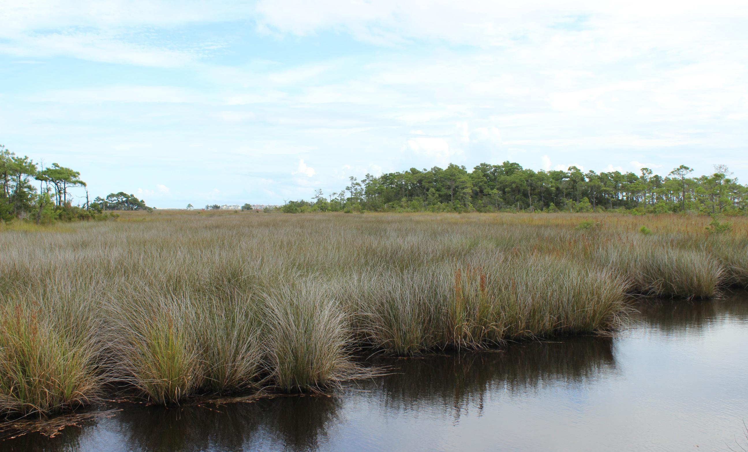
Marshes make up 66% of shorelines within the Town limits. Marshes are a type of wetland that is dominated by herbaceous plants that absorb high tides and water changes due to extreme weather.
The final component of the estuarine ocean system is coastal wetlands. Coastal wetlands are defined as marshes subject to regular or occasional flooding by lunar or wind tides, these tides reach the marshland areas through natural or artificial watercourses. (15A NCAC 07H)
Coastal wetlands are an important part of Manteo’s landscape and are often threatened by storm surges, erosion from wave activity, invasive species, and development. There are over 600 acres of coastal wetlands (salt/brackish marsh and estuarine shrub/scrub) inside the Town limits. Coastal wetlands may contain one of more of the following marsh plant species:
1. Cord Grass (Spartina alterniflora);
2. Black Needlerush (Juncus roemerianus);
3. Glasswort (Salicornia spp.);
4. Salt Grass (Distichlis spicata):
5. Sea Lavender ( Limonium spp.);
6. Bulrush (Scirpus spp);
7. Saw Grass (Cladium jamaicense);
8. Cat-tail (Typha spp.):
9. Salt Meadow Grass (Spartina patens); or
10. Salt Reed Grass ( Spartina cynosuroides).
Not only do coastal wetlands provide complex food chains typically found in estuaries but they serve as barriers against flood damage and control erosion between the estuary and the uplands. Coastal wetlands should be safeguarded to perpetuate their biological, social, economic, and aesthetic values as a natural resource.
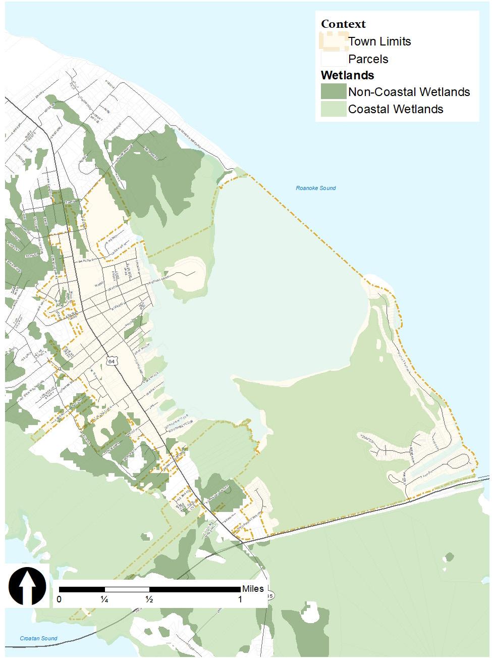
The remaining wetlands are considered non-coastal wetlands. Although non-coastal wetlands have significant value because of their relationship to water quality, habitat, and hydrologic function, they are not considered AECs. Since wetlands are dynamic systems, their boundaries are constantly shifting. This limits the accuracy of regional wetlands mapping.
Manteo has a large salt/brackish marsh at the southeast end of Shallowbag Bay, which contains a primary nursery area. This 506-acre marsh is the largest open space in Manteo. Additional salt/brackish marshes occur in patches along the waterfront, from the Marshes Light development south of downtown to Festival Park, where the North Carolina Coastal Federation completed the restoration project in 2002.
The largest estuarine shrub/shrub area on Roanoke Island is located at the Midway intersection outside of Manteo’s Town limits. It is owned by North Carolina Wildlife Resources Commission. There are less than 20 acres of estuarine shrub/ shrub wetlands in Town limits located at Baum Point and in the portion of Town limits that lies north of Virginia Dare Memorial Highway.
Many wetlands in the Outer Banks, including the marsh at the south end of downtown Manteo, are threatened by an invasive species of reed grass, Phragmites australis. The North Carolina National Estuarine Research Reserve and Coastal Reserve have launched an educational campaign on the removal practices of this species to save native marsh plants and maintain the native diversity for habitat value. Removal projects are in effect across the region. Both salt/brackish and estuarine shrub/scrub marshes receive
an overall wetland rating of “exceptional” in the North Carolina Coastal Region Evaluation of Wetland Significance (CREWS) rating system because they are coastal wetlands.
The CRC has designated three ocean hazard AECs covering North Carolina’s beaches and oceanfront lands: Ocean Erodible, Inlet Hazard, and Unvegetated Beach. Manteo has none of these areas within its jurisdiction, and erosion rates for estuarine shorelines have not yet been mapped by the state yet due to the vast number of estuarine shorelines - North Carolina has over 4,600 miles of estuarine shoreline. Because Manteo is located in an estuarine system, no long-term erosion studies for its shorelines have been completed (see the Natural Hazards section for further discussion of erosion and high flood hazards).
The protection of public water supplies for drinking water, irrigation, and industry is one of CAMA’s main goals. The CRC has designated two AEC categories, small surface water supply watershed and public water supply well fields, that protect designated coastal public water supplies from the negative impacts of development.
The small surface water supply watershed protects coastal drainage basins that contain a public water supply designated for public drinking water and classified as A-II by the NC Environmental Management Commission. This classification does not apply to Manteo or Roanoke Island.
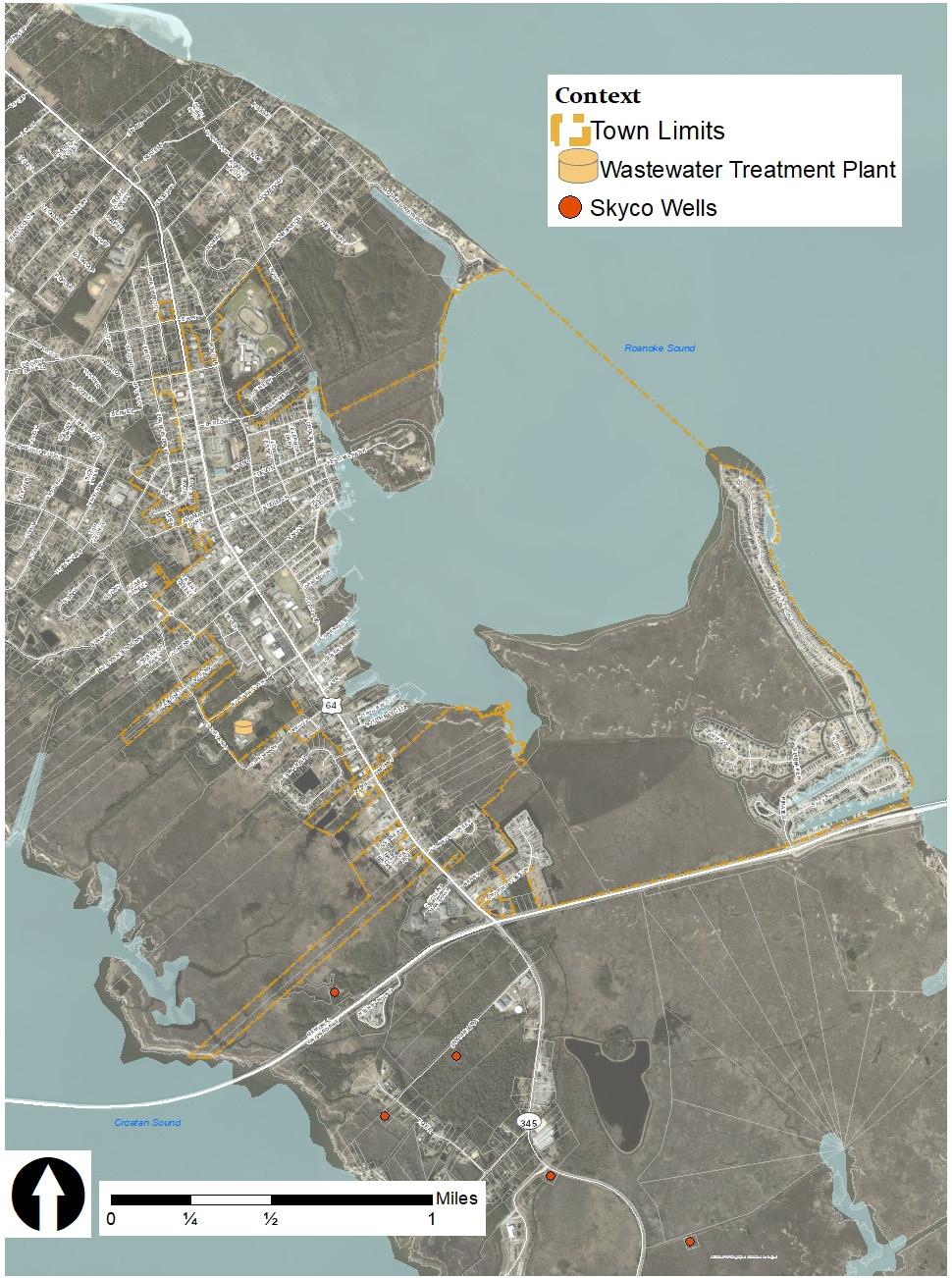
Public water supply well fields are areas of rapidly draining sands extending to a shallow groundwater table that supplies public drinking water. Since the previous 2007 CAMA plan, a wellhead protection plan for Skyco was approved in 2014 to prevent contamination of groundwaters used as public drinking water supplies.
Roanoke Island’s water supply is from three aquifers. The first source is the water table and “unconfined” aquifer. This is the groundwater that is closest to the surface and is used for many domestic and commercial wells on Roanoke Island. The land area that recharges this aquifer is Roanoke Island. The second aquifer is much deeper, beginning at 140 feet below mean sea level at the northern end of Roanoke Island. Below the Town of Manteo this aquifer is between 80 and 90 feet thick. It is the primary source of groundwater withdrawn by the Dare County Regional Water System. It is recharged from areas both on the mainland and on Roanoke Island and possibly from the first aquifer through leaks. The third aquifer is the deepest, beginning at 300 feet below mean sea level; it is not currently used as a water supply.
Water distribution lines throughout the Town are estimated to be a total of 15 miles in length. There are 1,469 residential, 152 commercial, and 38 institutional metered connections. Thirtyfive meters were replaced in 2020 and the oldest meters in the system are 10 years old.
Natural and cultural resource areas are the fourth and final group of the AECs and are defined as areas containing environmental, natural, or cultural resources of more than local significance in which uncontrolled or incompatible development could result in a major or irreversible damage to natural systems or cultural resources, scientific, educational, or associative values, or aesthetic qualities. (15A NCAC 07H .0501) There are no natural and cultural resource areas designated in Manteo.
Note that the Town is currently in the process of updating its water and sewer line asset inventory. That information will be available when the inventory is completed. The Town supplies water and sewer to structures within town limits.
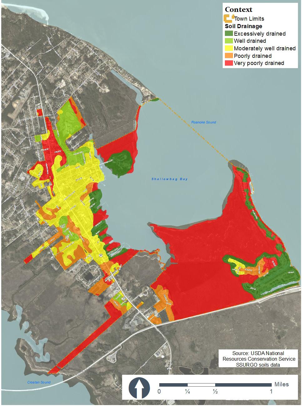
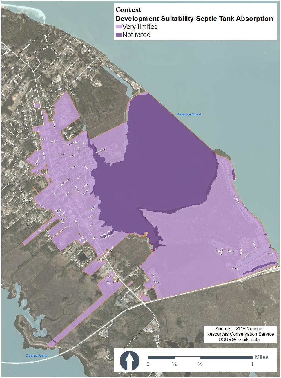
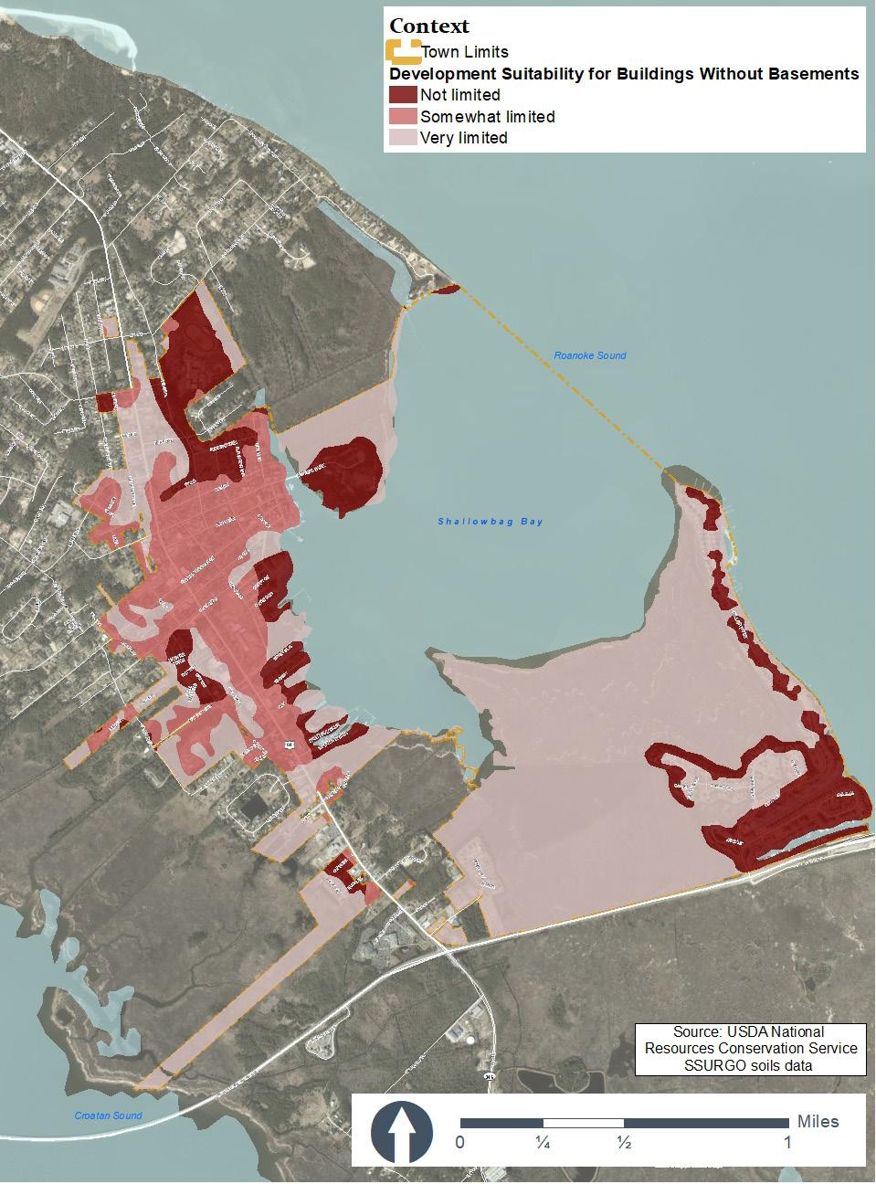
The Town of Manteo is surrounded by wetlands to the south and west, an estuary to the east, and some wooded forests to the north. Soils within the town’s limits consist of John’s loamy sand, Leon fine sand, psamments, Baymeade fine sand, and Hobonny soils. The wooded areas are on typically on Baymeade soils, while wetlands include Hobonny soils. Hobonny soils includes the area’s estuaries and marshes; these soils cover the 34% of land in the Town of Manteo and are classified as soils that are very poorly drained. Other very poor drained soils include coastal plains, depressions, flats, and pocosins; these areas are typically tree covered. Only 12% of soils in the Town of Manteo are considered excessively well drained or well drained. These well drained soils can be found north, east, and a smaller portion to the west. These areas are most suitable for development without a basement. Soils in the downtown and along Highway 64 are moderately well drained; these soils make up 12% of the soils in Town limits. All of the land within the Town’s limits is very limited for a septic tank absorption field. The use of public sewers is required in the Town of Manteo and no permits are issued for private sewage disposal. There are few properties in the Town’s limits that have private sewage disposal systems but as public sewer becomes available they are required to connect to public sewer when private systems fail.
Since the Town of Manteo is located on Roanoke Island, natural resources literally encompass the Town with the waters surrounding Roanoke Island, which are affected by point and non-point sources of pollution. Point sources of pollution enter surface water bodies through “any discernible, confined, and discrete conveyance, such as pipe, ditch, channel, tunnel, conduit discrete fissure, or container” (US EPA, 2019). Point sources are primarily associated with wastewater and stormwater discharges. However, they can also originate from small, domestic wastewater systems. Non-point source (NPS) pollution is defined as “any source water pollution that does not meet legal definition of ‘point source’ in Section 502(14) of the Clean Water Act (CWA)” (US EPA, 2020). Nonpoint source pollution can result from a number of activities, such as, construction and land clearing activities, on-site wastewater treatment systems (septic systems), marinas and boating activities, and pump-out stations. Recognizing that both point and non-point sources of pollution do not stop at jurisdictional boundaries, the inventory and analysis of natural resources occasionally includes water quality, natural hazards, natural resources, areas of environmental concern (AECs) environmentally fragile areas, and wetlands on Roanoke Island.
The Town of Manteo is in the Pasquotank River Basin, one of North Carolina’s 17 major river basins. According to the 2021 Pasquotank River Basinwide Water Quality Plan, the Pasquotank River subbasin 03-01-51 includes the Alligator River, Croatan Sound, part of the Albemarle Sound, and the western portion of Roanoke Sound. Most of the waters in the subbasin are brackish estuarine. Subbasin 03-01-51 is further divided into hydrologic units; the basic unit of analysis for natural systems.
Roanoke Sound, Shallowbag Bay, Dough’s Creek, and Scarboro Creek are the most significant surface waters within and adjacent to Manteo’s Town limits. The majority of surface runoff from downtown Manteo drains to Dough’s Creek. Areas southwest of Highway 64 drain to Croatan Sound, while areas northeast of Highway 64 between Fernando Street and Gilbert Street drain to Shallowbag Bay. Parts of Pirates Cove located between Ballast Point and the Washington Baum Bridge drain to Roanoke Sound, while the rest of the development drains to Shallowbag Bay.
The quality of surface water bodies is directly impacted by the runoff that drains into them, marina uses and effluent discharges from the Manteo Wastewater Treatment Plant, and other discharges. Water body classifications designated
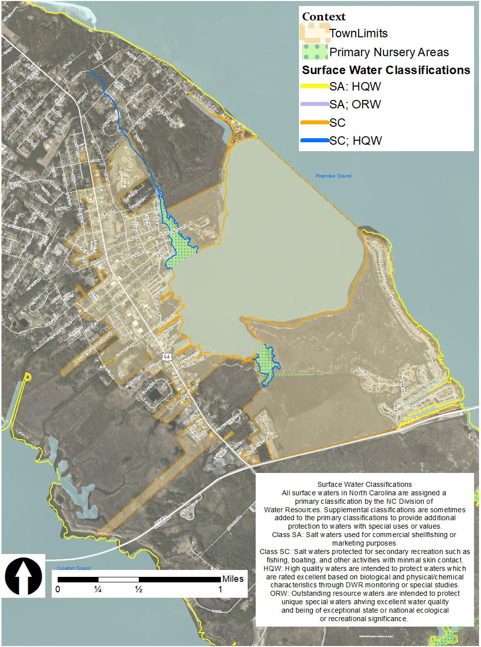
by the State aim to protect surface water bodies and fish and wildlife and are required by Federal Water Pollution Control Act (Clean Water Act). Surface waters in North Carolina are assigned a primary water classification by the North Carolina Division of Water Classifications ranging from SC (lower quality waters that support secondary recreation and wildlife habitat), to SA (higher quality waters that support all SC and SB uses as well as commercial shellfishing and primary recreation). These designations can be modified with other descriptors; in the case of Manteo the most relevant is HQW (High Quality Waters). HQWs are waters considered to have critical habitat, endangered species, or primary nurseries. HQWs are rated through the North Carolina Division of Water Resources through monitoring or special studies. Primary nursery areas are designated by the North Carlina Marine Fisheries Commission. Dough’s Creek and Scarboro Creek are both designated HQWs by the Marine Fisheries Commission due to their value as primary nursery areas. See the map on the right.
Water Body Classification
Croatan Sound SA; HQW
Dough’s Creek SC; HQW
Roanoke Sound SA; HQW
Scarboro Creek SC: HQW
Shallowbag Bay SC
Source: Classifications And Water Quality Standards Applicable To The Surface Waters And Wetlands Of North Carolina, Division Of Water Quality, NCDENR.
Impaired waters are waters that only partially support their designated uses. There are various degrees of impairment; for example, waters that are unsuitable for commercial shellfishing may still be safe for recreation. All of the impaired waters in the Roanoke Island hydrologic unit are listed in the table on page 42 are impaired for shellfishing. The parameter resulting in the impairment of shellfishing for all these waters is fecal coliform bacteria contamination.
Creek
Ditch SA:HQW
Sound
Sand Beach Creek
North Carolina Final 2020 303(D) List, Division of Water Quality, NCDENR.
While some waters are closed for shellfishing due to water quality testing, others are closed simply because of the
presence of a conflicting use, such as a marina or wastewater treatment plant effluent discharge. These uses automatically make areas ineligible for shellfishing because of the discharges that are associated with them. The Table below lists the marinas and their pollution potential. According to the National Pollutant Discharge Elimination System (NPDES), the Town of Manteo WWTP has the only discharge permit in Town limits. The Division of Water Quality considers the Manteo Wastewater Treatment Plant (MWWTP) the only major discharger of the four permits held in the hydrologic unit. According to the Report of Sanitary Survey Area H-2, Croatan Sound Area (2016 Feb. -2021 Apr.), the plant averages 260,000 GPD of flow with peak flows exceeding 400,000 in the summer months. Plant operation and maintenance have improved significantly over the past few years and the facility is in compliance with their operations permit.
Manteo Town Docks
Pirate’s Cove
Marina
Pirate’s Cove Marina
Pirate’s CoveSailfish Drive
Roanoke Sound
Roanoke Sound
Roanoke Sound
Shallowbag Bay Marina 107 Shallowbag Bay
Offers fuels service Marshes Light
Closure
Report of Sanitation Survey, Area H-1, July 2011 through March 2016, Division of Environmental Health, NCDENR.
and Transient Dockage
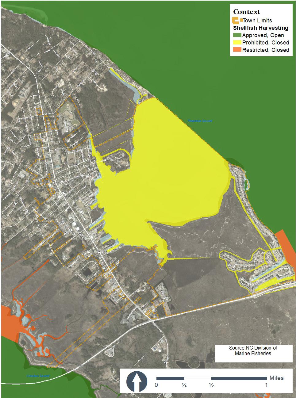
The North Carolina Marine Fisheries assess the bacteriological factors that affect water quality and then classify shellfish growing areas as either approved, conditionally approved, restricted, or prohibited. Approved areas are consistently open for shellfishing, while prohibited areas such as Shallowbag Bay are permanently closed due to conflicting uses such as discharges from the marina and WWTP. According to the 2016 Sanitary Survey, Manteo’s Wastewater Treatment Plant has improved operations and maintenance in recent years with no spills or permit violations noted from 2011-2016. However, these waters will remain permanently closed due to their conflicting uses.
Shellfish growing areas near Manteo are the SA waters of Roanoke Sound (H-1 growing area) and Croatan Sound)H-2 growing area), and there are 58,442 acres surrounding Roanoke Island that are approved and open for shellfishing. There are 48 acres northeast of Pirate’s Cove that are approved and open for shellfishing. However, there are 206 restricted acres that abut or lie just outside of Manteo’s planning jurisdiction that can be used for shellfish harvesting at certain times as long as the shellfish are subjected to further cleansing before they are made available for consumption.
Shellfish are filter feeders, they pump water through gills almost constantly. This pumping action is how shellfish are
able to gather food particles, but this action also allows them to take up any bacteria, viruses, or pollutants that may be present in thew water. If shellfish have high concentrations of bacteria or viruses and are consumed raw or undercooked, they could cause severe illness to the consumer. According to the 2016 Sanitary Survey Report, all sampling stations now meet the criteria for Approved status, but conflicting uses prohibit these waters from being open for shellfishing.
Areas of Roanoke Sound that are closed to shellfishing and abut Manteo’s planning jurisdiction are the waters just east of Pirates Cove, and these waters include 65 restricted acres. Subdivisions are noted as non-point sources of pollution due to stormwater runoff, and pet waste is thought to be a primary source of contamination of shellfishing water.
The Town of Manteo has taken numerous steps to improve the quality of water that drains into adjacent creeks, the Bay, and the sounds. In particular, the Town’s stormwater ordinance and ordinances for final plat approval represent a significant commitment to improve water quality. These ordinances and stormwater improvements are discussed in the Stormwater section of this document. The 2007 CAMA Land Use Plan update mentioned the Town was pursuing a Clean Marina Certification;
Shallowbag Bay is of special significance to the natural setting and character in the Town of Manteo. For this reason, the quality of waters merit further discussion.
Shallowbag Bay is designated as a SC water body, suitable for recreation but not for primary recreation or commercial shellfishing due to the presence of conflicting uses. Since the 2007 CAMA Plan, there have been no violations against the WWTP and no reports of public health problems related to non-point source pollution. The Town has recently upgraded the sewer and conveyance and treatment systems to reduce their impact on water quality. However, due to the presence of a marina and WWTP discharge into the Bay, Shallowbag Bay will not be open for shellfishing.
the Town has since received this certification on October 13, 2010 for its Waterfront Marina. The marina was re-certified on October 19, 2012, November 21, 2014, November 8, 2017 and on November 8, 2020.
Like all coastal North Carolina communities, the town of Manteo faces natural hazards including flooding, hurricane-level winds and storm surges, and shoreline erosion. In addition, these communities will all eventually face hazards associated with sea level rise.
CAMA’s goal in characterizing natural hazards and establishing permitting processes for development in hazardous areas is to ensure human safety and protect property from storm dangers and erosion. Depending on the degree of hazard, towns may choose to protect structures by using specific building practices and limiting development.
North Carolina Example (that first made landfall in North Carolina)
Hurricane Ernesto (2006)
Hurricane Charley (2004)
Hurricane Matthew (2016)
Hurricane Florence (2018)
Hurricane Arthur (2014)
Hurricane Irene (2011)
Hurricane Fran (1996)
Hurricane Floyd (1999)
Hurricane Hazel (1954)
Hurricane Dorian (2019)
Source: National Hurricane Center, National Office of North Carolina.
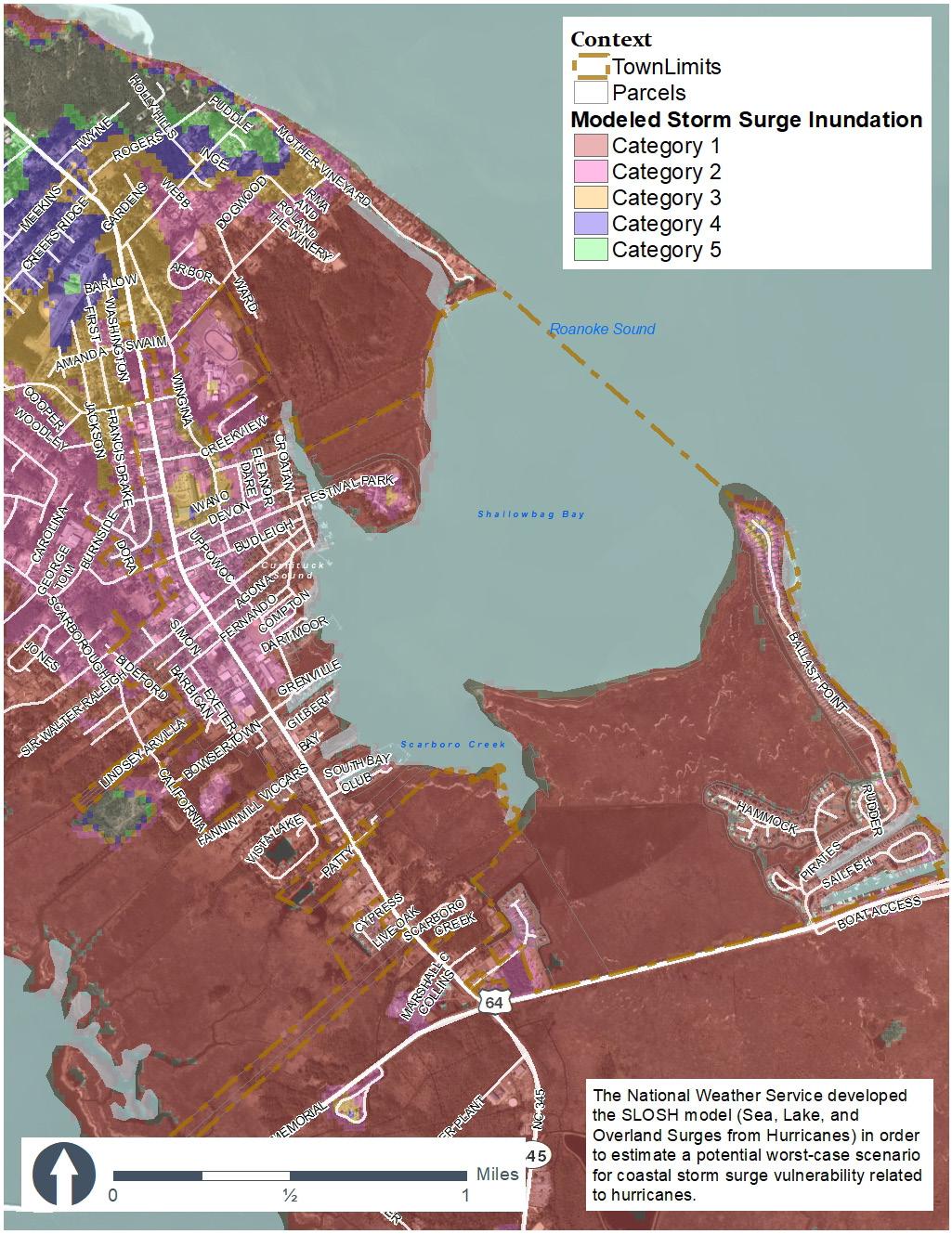
Flooding in Manteo can also be examined from the perspective of hurricane danger as measured by the Saffir- Simpson Hurricane Scale, which categorizes hurricanes on a scale of 1 to 5, 5 being the most intense and most damaging (see above Table). It is used by the National Weather Service to assess potential dangers and communicate with public safety officials. Hurricanes are defined as tropical disturbances with sustained winds of 74 miles per hour or higher. They often cause storm surges, which are high waves driven inland by high winds.
The National Hurricane Center and the North Carolina Center for Geographic Information and Analysis have created a GIS data set called Hurricane Storm Surge Inundation Areas (1993) that shows areas along the North Carolina Coast that are likely to be flooded by hurricanes. The data is based on Sea, Lake, and Overland Surges from Hurricanes (SLOSH) models. Wind speed and storm surge (defined as the abnormal rise in water level caused by wind and pressure from a hurricane or tropical storm) are the two factors that are most important in determining the amount of potential damage. The SLOSH models do not account for rainfall produced by hurricanes. There are many variables that could alter the outcome,
such as whether a hurricane approaches from the south or from the east, and whether it was preceded by heavy rainfall. The SLOSH models create only a generalized picture of lands likely to be inundated by different categories of hurricanes.
The SLOSH model results for Manteo shows that the majority of the town, including all of the downtown and Pirate’s Cove, would be inundated in the event of a Category 1 or 2 or higher hurricane. SLOSH shows that this would be the case regardless of whether the hurricane was categorized as fast (with a forward moving velocity of over 15mph), or slow (with a forward moving velocity of equal to or less than 15mph).
Some of the Town’s existing structures are in the FEMA Special Flood Hazard Area. New development should not be planned for high flood hazard areas or structures should be elevated. The Town of Manteo acknowledges flooding and hurricanes as a way of life in the Outer Banks and uses its Zoning Ordinance to ensure that new development is designed to withstand floodwaters and high winds. The Town of Manteo requires a 3-foot freeboard or an elevation to or above eight feet NAVD 1988 whichever is greater in addition to the National Flood Insurance Program base flood elevation or regulatory flood protection elevation. This means that the lowest floor board and all associated ductwork and equipment that services the structure must be elevated. Elevating structures helps protect businesses and residents’ homes by reducing the risks of flood loss.
Manteo participates in the National Flood Insurance Program (NFIP) Community Rating System. (CRS). NFIP is an agreement between local communities and the federal government for discounted flood insurance rates if a community adopts and enforces a floodplain management ordinance. The extent to which insurance premiums are discounted by the federal government depends upon the extent to which flood risk is reduced by the community. Communities must meet the three goals of the CRS: (1) reduce flood losses; (2) facilitate accurate insurance rating; and (3) promote the awareness of flood insurance. For CRS participating communities, flood insurance premium rates are discounted in increments of 5% based
upon their performance in (i) public information, (ii) mapping and regulations, (iii) flood damage reduction, and (iv) flood preparedness. While lower premiums are the incentive, the goal remains to minimize loss of life and damage to property via good planning.
Manteo has earned enough points to be a class 5 CRS community, meaning that residents may receive a 25% discount on their flood insurance premiums. The Town has improved two levels from its previous classification. According to March 2019 NFIP records, there are 49 repetitive loss properties totaling $3,577,754.98 with an average claim payment of $73,015.41. There were five (5) properties on the list classified as severe repetitive losses. The Town has requested updated repetitive loss data for the current year.
There are no ocean erodible areas in Manteo, but there are many estuarine shoreline areas in the town that are subject to severe erosion due to high winds, storm surges, or wave action from storms or boat wakes. Estuarine shorelines, which are AECs, are any areas up to 75 feet inland from the mean highwater mark of estuarine waters.
The State of North Carolina has mapped erosion rates for coastal shorelines but has yet to map them for estuarine shorelines. Because of this, permits for development along estuarine shorelines are currently governed by flat setbacks instead of varying with erosion rates. Typically, the minimum
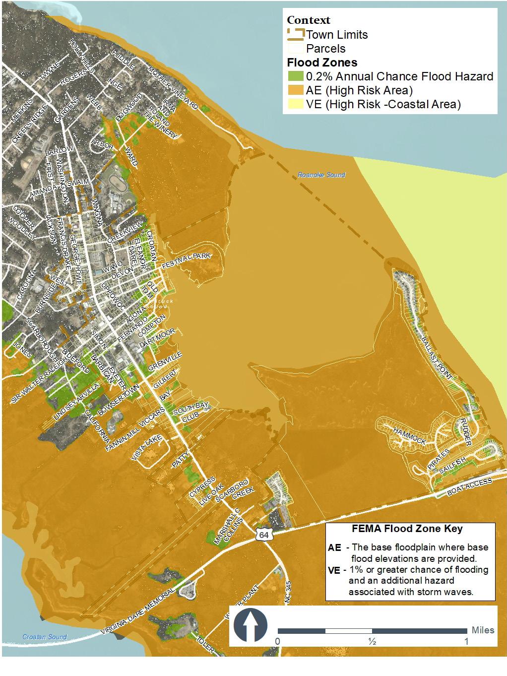
setback is 75 feet (the width of the estuarine shoreline AEC), unless the adjacent water body has a special designation from the Division of Water Quality, which would increase the required setback.
Sea level rise will affect current and future development in the town of Manteo. As sea level rises, the land’s capacity to absorb flooding and storm surges will reduce, making residents more vulnerable to storms, storm surge, and rainfall. Additionally, the storm surge from a hurricane or nor’easter builds upon a higher base water level due to sea level rise, resulting in an increase of the land area subject to flooding.
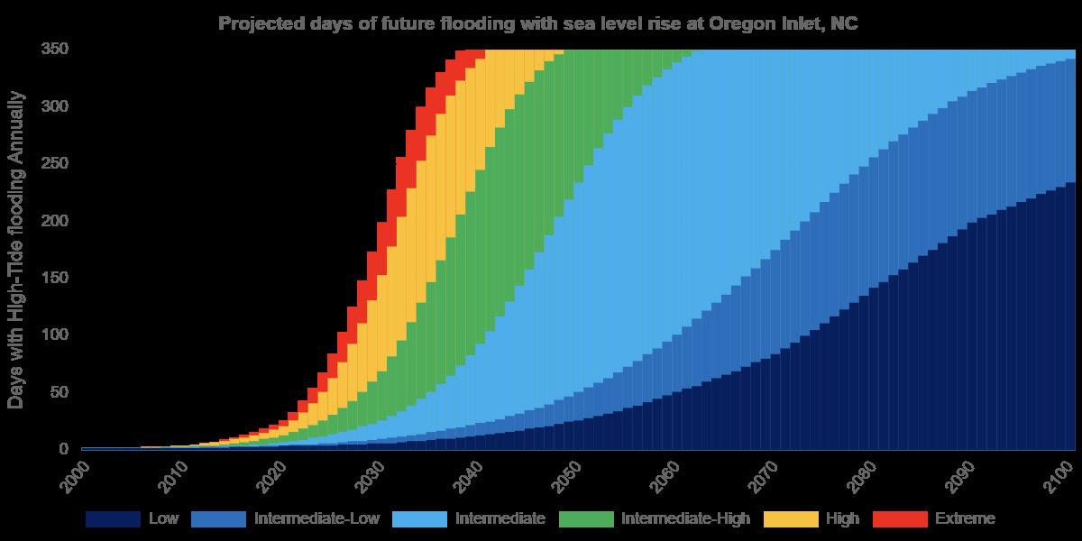
High tide flooding events will also increase as seas rise. NOAA’s Intermediate scenario, using data projected for Oregon Inlet – the closest site available – indicates a likelihood of at least 50 additional days of high tide flooding by the year 2050. Currently, much speculation exists as to how much additional flooding people will endure before relocating or leaving the town altogether. See also “Acknowledging rising seas” on page 78
There are currently no known hazardous waste sites within Manteo’s town limits. Humanmade hazards in or near Manteo are tied to land uses involving hazardous materials. They include the former Solid Waste Transfer Facility on Bowsertown Road, which is now closed and the Dare County Regional Airport northwest of Manteo in the unincorporated lands of Dare County. The contamination from previous use and the existing airport facility could be a danger to human and wildlife health because of their potential to negatively impact soils, surface water, and ground water. However, there are no studies available on the impact that these sites have had on the surrounding area to date.
Natural resources in and around Manteo include public trust waters, coastal and non-coastal wetlands, public water supplies, prime wildlife habitats, fishery nurseries, shellfishing areas, and forests. Survey data from the past two decades and recent community meetings demonstrate residents’ commitment to preserving these resources. This section identifies and discusses Manteo’s natural resources and assesses the threats that future development may pose to them so that their protection can be integrated into planning policy.
Environmentally fragile areas are areas where natural resource functions may be negatively impacted as a result of development. These areas include wetlands, Significant Natural Heritage Areas (SNHA), and areas containing endangered species, prime wildlife habitats, or maritime forests. These natural resources are highly valued by residents (both year-round and seasonal).

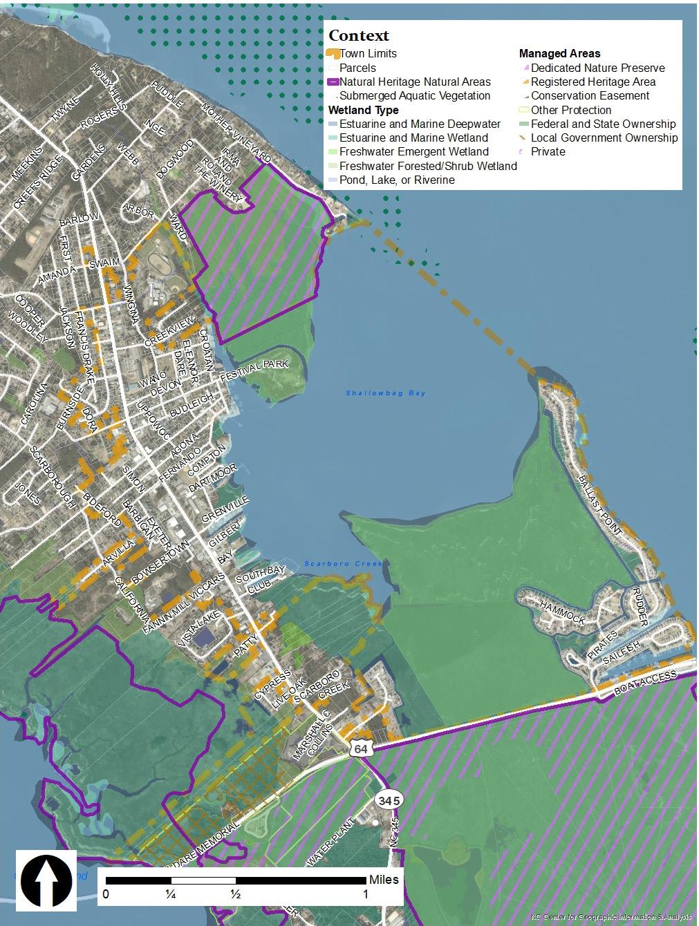
There are no natural areas in the town of Manteo. However, there are several natural areas outside of Town, including State lands, Dedicated Nature Preserves (DNP), and SNHAs. Several of these designations overlap in geographical area. The North Carolina Wildlife Resources Commission (WRC) manages the State-owned lands for conservation and authorized recreation including boat ramp access and walking. Dedicated Nature Preserves are managed by Wildlife Resources Commission for conservation, nature education, wildlife management, hunting, fishing, walking, and other authorized recreational uses. Significant Natural Heritage Areas are planning areas designated by the Natural Heritage Program containing ecologically significant natural communities or rare species. These designations do not have any protective measures, but rather identify resources and provide prescriptive uses based on the natural resources present. These designations are available to allow towns and counties to easily identify fragile areas for management and protection. Roanoke Island Juncus Marsh, a Significant Natural Heritage Area of state significance, is approximately 2,090 acres of salt/brackish marsh south of Manteo’s town boundaries, outside of the Town’s planning jurisdiction. This area includes both State-owned lands and privately owned lands. 76% (1,608 acres) of this area is designated as the Roanoke Island Marshes Gameland Dedicated Nature Preserve (DNP), established in 1994 under the Nature Preserve Act. This land is protected for conservation and prohibits development. The Roanoke Island Marshlands (1,948.3 acres) are state owned and overlap with portions of the Significant Natural Heritage Area and the entire Dedicated Nature Preserve and also includes additional lands. The WRC is currently the law enforcement agency and the NCDENR is the managing agency
An estimated 12 acres of non-coastal wetlands fall within Manteo’s planning jurisdiction. Although non-coastal wetlands are important to fisheries, the economy, stormwater management, and water quality, they are not specifically protected against development. However, non-coastal wetlands are federally protected and requires a permit from the U.S. Army Corps of Engineers (Section 404 of the Clean Water Act).
Non-coastal wetlands are defined by their hydric soils and vegetation. The non-coastal wetlands that occur on Roanoke Island are primarily managed pineland and pine flat with smaller patches of freshwater marsh, pocosin, depressional swamp forest, maritime forest, and human impacted marshes. Managed pineland wetland makes up 10.6% of the wetlands on the island. Large patches are found in the southern and southwestern areas of Manteo. The unincorporated areas west of the Manteo Town limits have patches of managed pineland
and pine flat wetlands, surrounded by salt/brackish marsh. A managed pineland wetland as defined by the Division of Coastal Management is a seasonally saturated, managed pine forest (usually loblolly pine) occurring on hydric soils. This category may also contain non-managed pine forests occurring on hydric soils. Generally these are not shown on National Wetlands Inventory maps and may or may not be jurisdictional wetlands.
Pine flat wetlands make up 4.5% of the non-coastal wetlands on Roanoke Island. There is a large area of pine flat within Festival Park. A small portion of this area falls within the town limits of Manteo. This area received a rating of “exceptional” significance in the overall wetland rating and in all three categories of wetland function.
Non-coastal wetlands are worth protecting as they perform various functions. They help protect and improve water quality, and provide protection from flooding and erosion.
Roanoke Island’s wetlands provide prime habitat for birds and support nesting areas for birds migrating from the mainland to the Outer Banks as well as those migrating seasonally along the coast. There are currently no known endangered species using habitat in Manteo’s planning jurisdiction
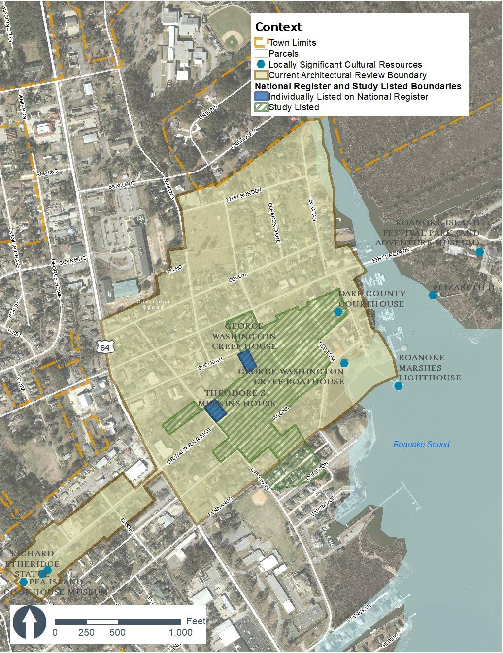
Manteo is the only incorporated area on Roanoke Island covering 1.98 square miles (1,141 acres) It is located in the north central area of Roanoke Island. The Town of Manteo is the County seat for Dare County. The Existing Land Use Map on page 59 represents the land use as of 2021. It includes the following designations residential, commercial, institutional, mixed use, vacant, public and dedicated open space, and conservation. Approximately, 52% of land area is designated as an “active” land use (residential, commercial, service, office, mixed use, and institutional) while 48% is open space.
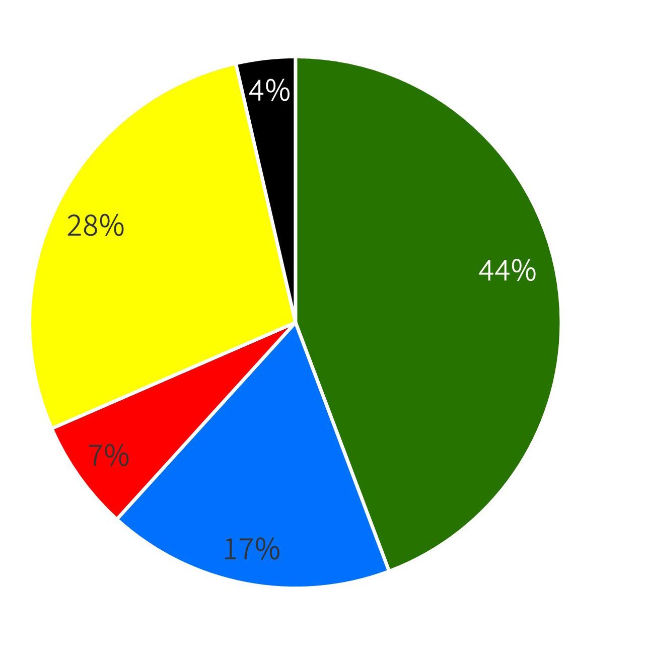
The Residential designation covers 28% of Manteo’s land area and consists of 318.67 acres.
The Commercial, Service, Office, and Mixed Use designation covers 7% of Manteo’s land area and consist of 76.90 acres. The majority of commercial uses lies along Highway 64. Mixed uses lie mostly in the downtown area however, there are some dedicated mixed use spaces along Highway 64.
The Institutional designation covers 17% of Manteo’s land area and consists of 199.24 acres. However, since Manteo is the county seat there are many county owned structures near or adjacent to the town’s limits, including the Dare County Courthouse at the Midway Intersection.
The Conservation, Open Space, and Parks land uses cover 44% of Manteo’s land area and consists of 505.23 acres. A large portion of open space is coastal wetlands that provide a natural defense from flooding and storm surge.
Vacant and undeveloped property make up 4% of Manteo’s land area and consists of 41.13 acres.
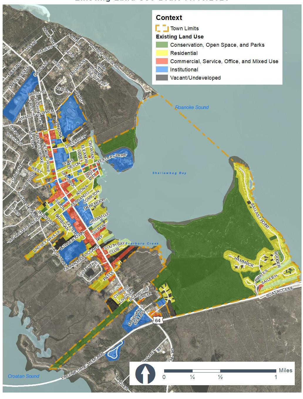
The Residential designation covers 28% of land area in Manteo and consists of 318.67 acres. This designation includes detached, single-family homes, manufactured homes, and modular homes. It includes attached townhomes, condominiums, and apartments. The designation also includes residential marinas. Residential subdivisions in Manteo include Cypress Cove, Pirates Cove, Marshes Light, Cedar Bay, Shallowbag Bay Club, Osprey Point, Salt Meadow Landing, and the Flats. The Flats was the first development permitted under the Inclusionary Zoning Ordinance and includes four affordable housing units.
The Commercial, Service, and Mixed Use designation covers 7% of Manteo’s land area and consists of 76.90 acres. This designation was applied to properties where commerce is the main use, such as retail, service, restaurants, and office uses. This includes inns, hotels, stores, medical offices, and small office buildings. The majority of commercial uses lies along Highway 64 with mixed uses mostly in the downtown area and few along Highway 64.
The Institutional designation covers approximately 17% of land area and consists of 199.24 acres. This designation applies to government facilities and buildings, museums, religious buildings, and schools. Government facilities include town owned properties and the Dare County Courthouse and administrative offices located at the Midway Intersection. Schools include Manteo Elementary School, Manteo Middle School, Manteo High School, and College of Albemarle.
The Conservation, Open Space and Parks designation covers 44% of land area and consists of 505.23 acres. This designation includes a large portion of salt marshes, traditional parks, open space, conservation land, and cemeteries.
The Vacant and Undeveloped designation covers 4% of land area and consists of 41.13 acres. This designation includes vacant and undeveloped land.
The three primary entrances to the town, include a north entrance over the William B. Umstead Bridge, a south entrance over the Virginia Dare Memorial Bridge, and the Washington Baum Bridge from the Outer Banks. and existing commercial development along the Roanoke Voyages Corridor and Midway Intersection becomes heavily congested during the summer months. Pedestrian and bicyclist safety crossing the Roanoke Voyages Corridor or the Midway Intersection remains a concern. The existing land use pattern in Manteo has been influenced by the location of the Roanoke Voyages Corridor (Highway 64/264) and the Highway 64 Bypass. The existing land use along the Roanoke Voyages Corridor consists of mostly of commercial uses with a blend of institutional and residential uses. The Highway 64 Bypass has increased congestion at the Midway Intersection and may influence a potential increase in commercial development outside of Manteo’s planning jurisdiction. Additionally, maritime travel has influenced land uses in downtown and throughout Manteo’s history. This continues today with residential marinas as part of newer subdivisions.
Service, Office, & Mixed Uses
single-family, manufactured, and modular homes, and attached townhomes, multi-family homes, condominiums, and apartments, and residential marinas
office, mixed-use, commercial marinas,retail, restaurants, medical offices, small offices, and personal services.
Cultural, historic, and scenic areas are important to Manteo residents and include public views to the water and wetlands, Manteo’s neighborhoods, historic structures, the Virginia Dare Corridor, and other cultural resources such as museums. The most notable cultural and historic resources are listed below.
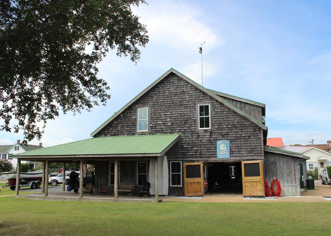
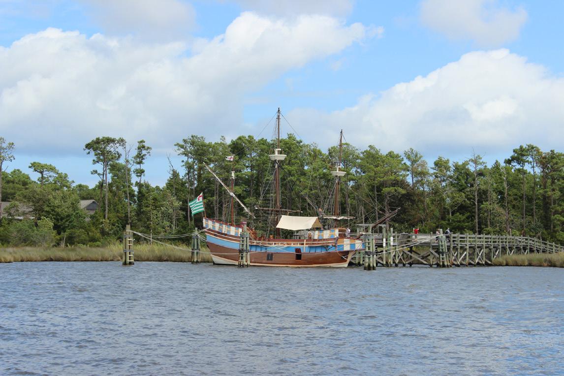
George Washington Creef Boathouse and North Carolina Maritime Museum located in downtown Manteo. These facilities were first opened in 1982. In the summer of 1998, it was designated as a new branch of the North Carolina Maritime Museum and represented a three-way partnership between the Roanoke Island Commission, the Town of Manteo, and the North Carolina Maritime Museum. The historic boathouse is named after George Washington Creef, a local boat builder who developed the Shad boat, now the designated State Boat of North Carolina. The boathouse houses several watercraft, including an original Creef shad boat completed in 1883, sailing skiffs, and a Davis Runabout. It also serves as an educational center and is now owned and operated by the Town.
Roanoke Island Festival Park (and Adventure Museum) is a State-owned property located across Dough’s Creek from downtown Manteo. The park includes interactive exhibits on English colonization, navigation practices, the Native Americans of the Outer Banks region, the Civil War Battle of Roanoke Island, and the Freedmen’s Colony. There is an outdoor amphitheater for live performance and access to the Elizabeth II. The Elizabeth II is a replica of one of the sailing ships that came here in the 1580s.
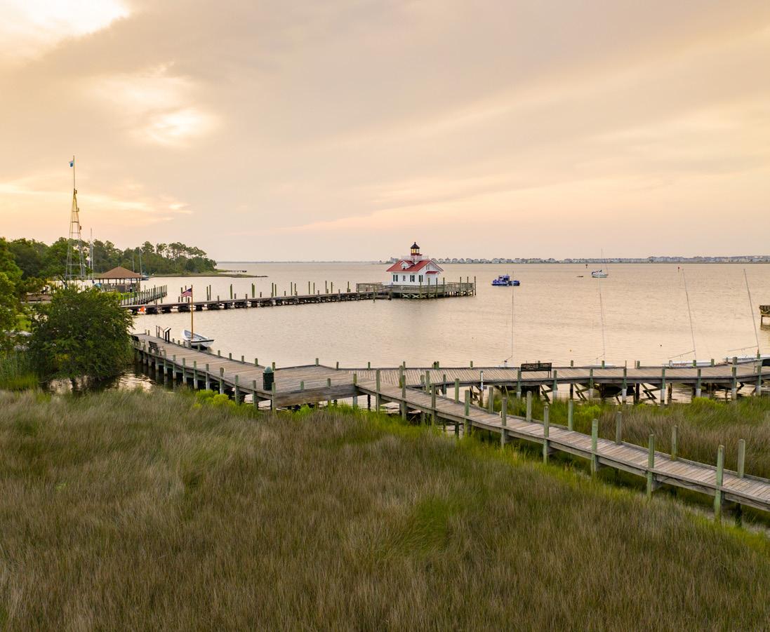
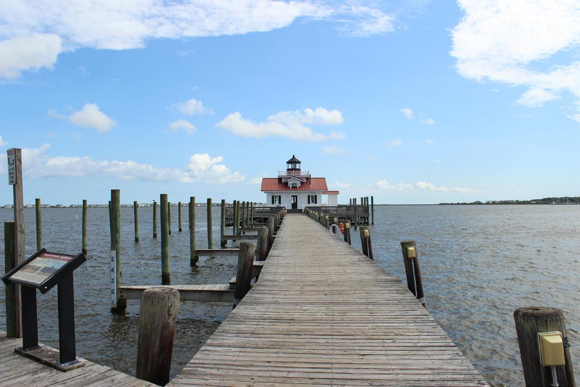
The Roanoke Marshes Lighthouse was dedicated in 2004 and is located on the Manteo waterfront. It houses historical and educational activities. The lighthouse is an active aid in navigation and guides boats into Shallowbag Bay. The lighthouse is a replica of the historic lighthouse.
The former Dare County Courthouse is located in Manteo’s downtown waterfront area and was built in 1904 in the Italianate style. Due to hurricane and fire damage, the courthouse has undergone several renovations over the
years. The Dare County Courthouse currently is home to the Dare County Arts Council.
George Washington Creef House is located on Budleigh Street. The house was built by the Creef family in the late 1890s and is illustrative of boat building practices such as board and batten construction and narrow walls. The George Washington Creef House was individually listed on the National Register of Historic Places in 1982. It is the most accomplished and elaborately decorated of the 19th century houses remaining in the county seat.
Theodore S. Meekins House is a Queen Anne style Victorian home located at 319 Sir Walter Raleigh and was individually listed on the National Register of Historic Places in 1982. It is currently the White Doe Inn Bed and Breakfast.
Manteo Cemetery is 3.7 acres and is located along John Borden Street between Winginia Avenue and Essex Street.
The Waterfront Park area includes the boardwalks, “Jules” Park, and the gazebo. David Farrow Playground equipment includes slides, swings, and an accessible swing was installed adjacent to the Weather Tower and across from the Roanoke Marshes Lighthouse.
The boathouse was opened and dedicated in honor of Lieutenant Herber M. Collins in 2010. The Herbert M. Collins Boathouse is part of the Collins Park project, joining the Pea Island Cookhouse Museum and the Richard Etheridge Statue. The boathouse contains a Monomoy type Surfboat on loan to the Pea Island Cookhouse Museum by the National Park Service.
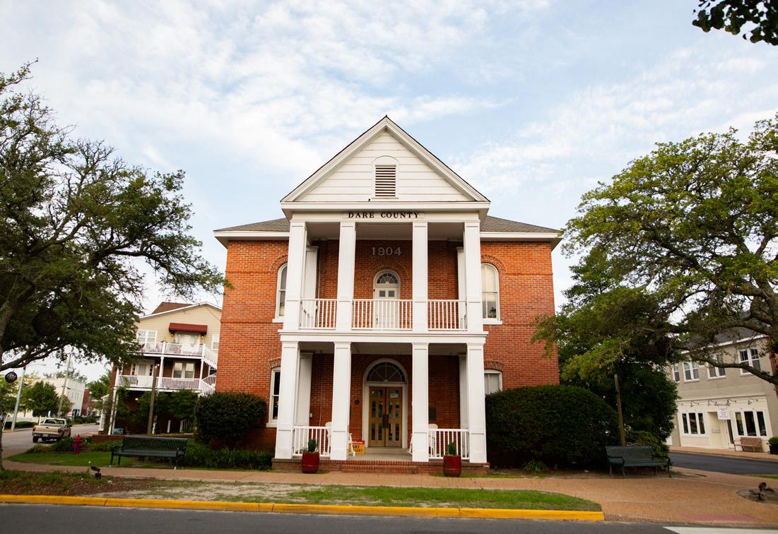
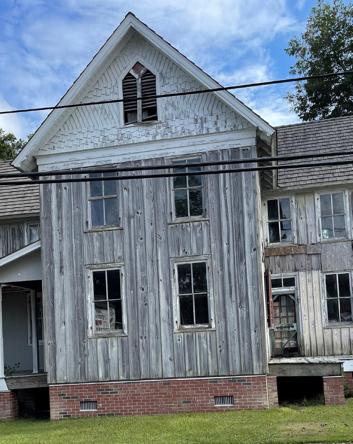
There are other buildings and areas in Manteo that are valued for their cultural and historical significance, many of which are concentrated in downtown Manteo. Because not all of these sites receive a protective designation by the State, it is important for Manteo to identify these features, map them, and include them in land use planning so that future development does not compromise their value.
To that end, the Town has completed an inventory of historic structures, which identified a total of 120 structures. Any new development within the Town’s designated historic district is reviewed by the Preservation and Architectural Review Committee. The Committee uses The Manteo Way of Building Design Guidelines to make recommendations in their defined boundary.
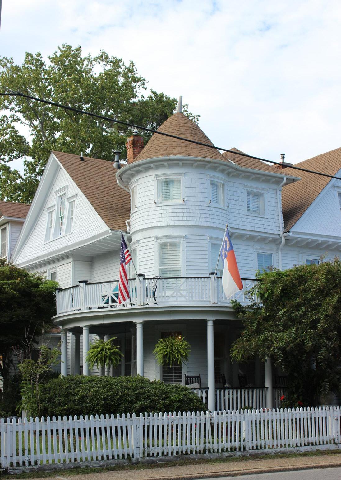
Shallowbag Bay is a semi-circle body of water that is connected to the Roanoke Sound. It gets slightly wider as it gets closer to shore, and branches off into Scarboro Creek and Doughs Creek. Not only does the bay hug downtown, it borders the Roanoke Island Festival Park and is home to the Elizabeth II, a repllica of the ships said to have brought the famous Lost Colony to Roanoke Island.
Shallowbag Bay is of special significance to the natural setting and character in the Town of Manteo. Scenic views of Shallowbag Bay can be seen from multiple areas in Manteo. Today the bay is surrounded by downtown, permanent homes,second homes, vacation rentals, and borders Roanoke Island Festival Park.
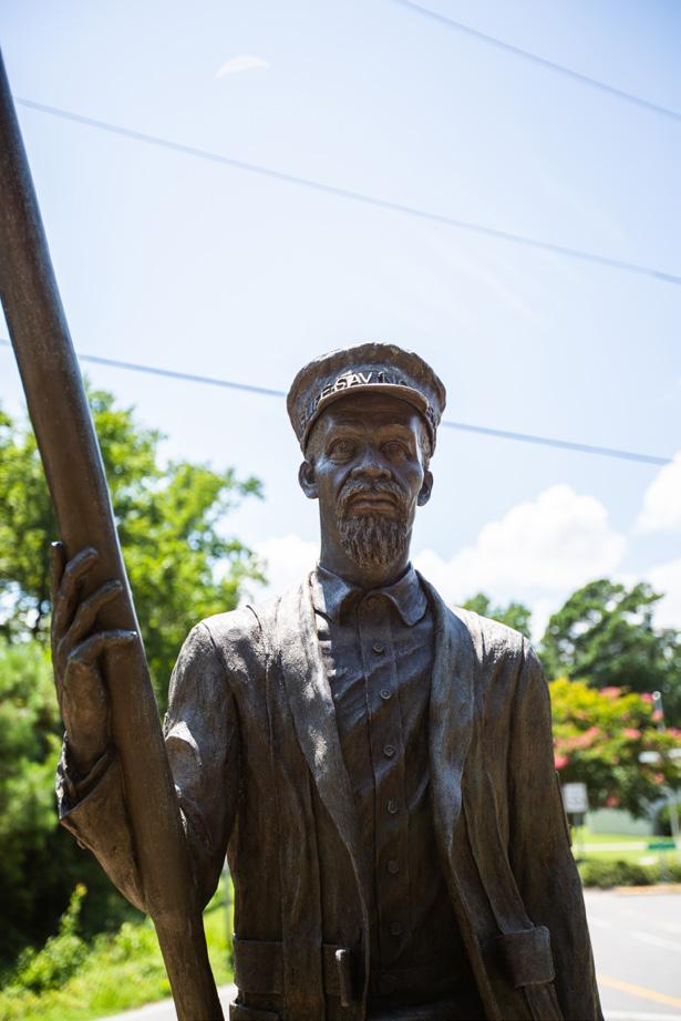
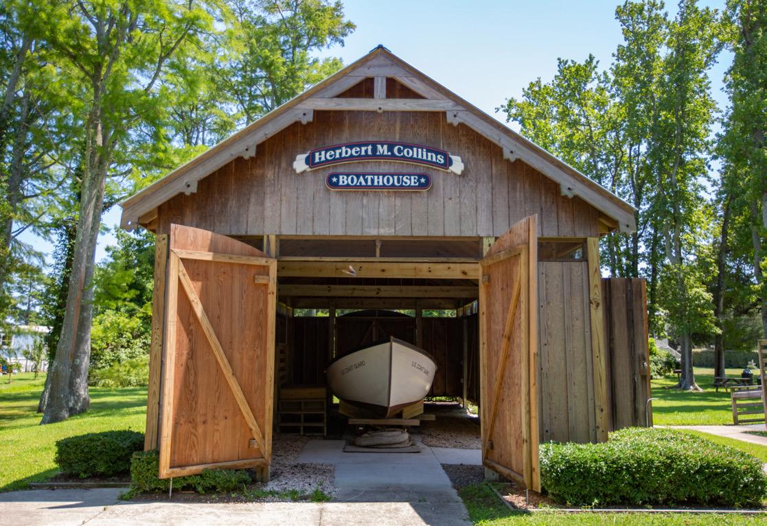
The basic services that Manteo depends upon for daily needs and safety include water supply, wastewater treatment, transportation networks, stormwater systems, schools, police service, and fire protection. Assessing the condition and capacity of these facilities is a fundamental step toward determining how much Manteo can grow, what the needs of its residents will be in the future, and how to meet service needs.
Water supply and sewer systems have been termed “growth shapers” because of their profound effect on the location, form, density, and timing of local and regional development. The CRC’s goal in requiring the examination of infrastructure is to “ensure that public infrastructure systems are appropriately sized, located and managed so that the quality and productivity of AECs and other fragile areas are restored and protected.”
Manteo’s policy is to provide water and sewer to all units within the Town boundaries, and voluntary annexation is typically a conditions for new connections. Private wastewater systems are not allowed in the Town of Manteo; the ordinance requires new development to tie into the current wastewater system. There are three exceptions that are outside the town boundary: Manteo Middle School, the Dare County Courthouse, and the Outer Banks Visitor’s Center. No further expansion beyond Town limits is currently planned.
This section describes the current status of the public water and wastewater systems for the Town, evaluates their existing capacity and future demands, and discusses their implications for development.
The Dare County Regional Water Supply System (DCRWSS) consists of five water treatment facilities. The facility serving Manteo is the Skyco Ion Exchange Plant, which was completed in 1980 and was originally designed to provide 5.0 million gallons per day (mgd). Due to concerns about water quality and production capacity, the Skyco Plant’s daily production has been brought down to 4.3mgd. The Skyco Plant is supplied by 10 wells located on NC345 between Skyco and Wanchese. The wells average from 170 to 220 feet deep and are screened at depths from around 140 feet to 200 feet below the ground surface. They are rated at 500 gallons per minute (GPM), drawing water from the Yorktown Aquifer (also known as the principal aquifer). Some of the water treated at Skyco is sold to the Town of Manteo, while the remainder goes to other consumers within Dare County.
Water supply from the Yorktown Aquifer was once characterized
as limitless, but as growth in the Outer Banks has skyrocketed, the long-term viability of this groundwater supply has come into question. Production declines, increases in salinity, and degradation in water quality have been noted in several of the Skyco wells. In its 2006 Dare Countywide Hydrogeological Study and Groundwater Resource Evaluation Update, the County concludes that Skyco Well Number 12 needs to be plugged and abandoned due to poor water quality. Low yield wells need to be rehabilitated, and aging facilities at Skyco should be replaced, The potential for saltwater intrusion should be further examined.
In 2009 further studies looked into expanding water distribution systems from the Skyco WTP to provide high quality water and fire protection for developed and improved areas on Roanoke Island. The study suggested ways to improve distribution by transferring ownership of the existing 12-inch diameter transmission main from the County to the Town of Manteo and installation of a single meter at the Skyco WTP to meter the Towns water usage.
Dare County reports that it has experienced no shortage of available supply as it continues to develop groundwater supplies to meet growing needs and peak season demand. The County is addressing source water quantity and quality issues through the addition of wells and changes to existing treatment at the Skyco facility. A new elevated tank was identified as needed and has been installed.
The Division of Water Resources requires local communities to provide a Local Water Supply Plan documenting the water use, water supply sources, water supply planning, and future projected needs based on population projections and seasonal population projections. According to the 2020 Local Water Supply Plan, the percentage of demand is not anticipated to exceed 23% by 2050. However, the population in the Local Water Supply Plan is 41% less than the estimated total seasonal population projections on page 19. The Local Water Supply Plan should be updated to reflect the updated projections. Application of higher population projections to the water supply needs result in a 14%-21% increase in demand projections in any given year identified. The demand is not expected to exceed 44% of supply in any given year.
The Town’s Wastewater Treatment Plant is located on Bowerstown Road and provides wastewater services to the Town. The Water and Sewer Department maintains 11 waste water lift stations throughout the Town. Gravity wastewater pipes in this system range from 8 inches in diameter to 15 inches in diameter. The Town has an average daily discharge of 0.285 MGD daily with a permitted capacity of 0.6 MGD (Source: Local Water Supply Plan, 2020.) The wastewater is treated and discharged into Shallowbag Bay. According to the Town’s 2020-
2021 Wastewater Performance Report, the system is in good conditions and there were no sanitary sewer overflows over 1,000 gallons or any that reached surface waters during the time frame of the report.
Currently, the sewer lift station at 100 Queen Elizabeth Avenue is being replaced to address design deficiencies. The project is anticipated to be completed by 2022. In 2021, a grant application was submitted to improve disinfection, chemical feed, and resiliency of the Wastewater Treatment Plant.
In the 2020 Local Water Supply Plan, the peak months for wastewater average daily discharge (MGD) are June and July. Based upon this information and the estimated total seasonal population projections on page 19 of this plan, the town’s wastewater treatment plant is not expected to exceed 44% of its permitted capacity.
Stormwater management has been an increasing issue in the Town of Manteo due to their coastal location, low elevation, shallow slopes, high water table, and poorly draining soils. The Town is subjected to chronic flooding from localized rain, high winds, and high tides.
Annual average rainfall in Manteo is nearly 50 inches per year, with the average precipitation rates increasing in the later summer months. Ground elevations, poorly draining soils, and a low elevation pose challenges to stormwater control especially during the summer and hurricane season.
A curb and gutter system is used for stormwater control in some areas of the Town of Manteo, and several of these discharge pipes drain untreated into the waters of Shallowbag Bay and Dough’s Creek.
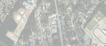
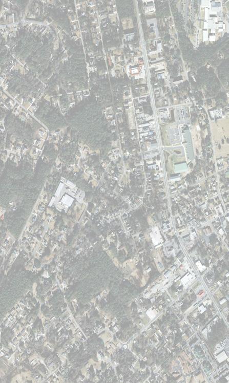
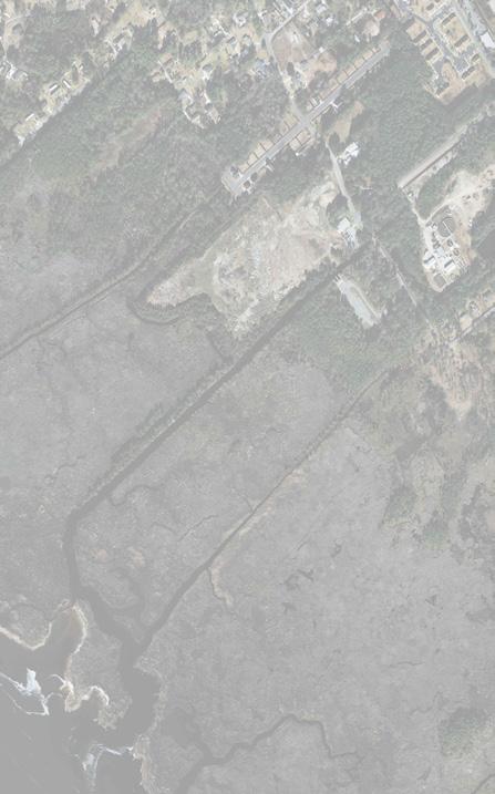


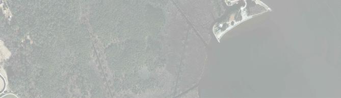

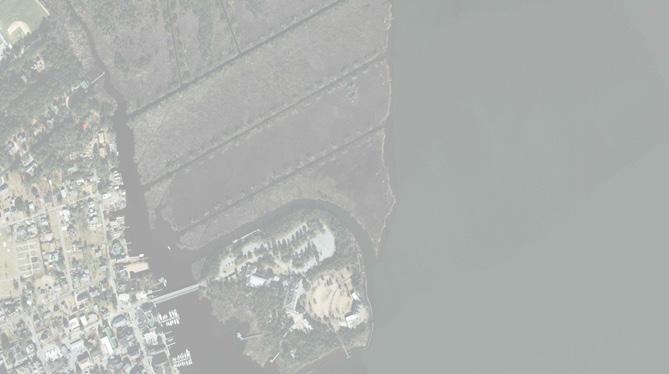

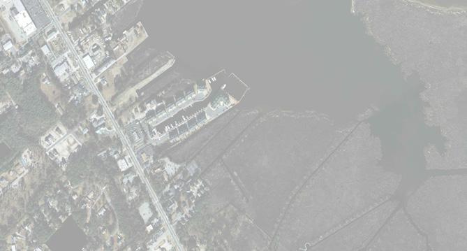
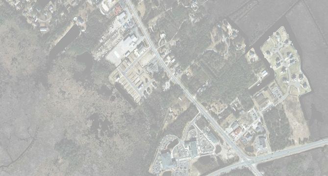
There are currently three ways to access the Town from the Virginia Dare Bridge which was constructed in 2002, the William B. Umstead Bridge, and the Washington Baum Bridge. The Town sees a significant increase in traffic volume during the summer months,with most traffic congestion occurring at Manteo’s primary entrance on Highway 64/264.
There are no airport or port facilities within the planning jurisdiction, although Dare County regional airport is located northwest of town on Roanoke Island. Per the Dare County Comprehensive Transportation Plan, Highway 64 from Marshall C. Collins Drive to Mother Vineyard Rd on Roanoke Island is currently over capacity. Because of physical constraints, no method of improvement was found to be acceptable to Manteo or Dare County at this time. Highway 64 has also been identified as potentially benefiting from a bus route and multiuse path improvements.
The heaviest traffic volumes are on Highway 64/264 and the Virginia Dare Corridor averaging about 16,000 trips per day.
Parking in the downtown during the summer months continues to be an issue. However, the Town has made progress addressing these issues, in the summer of 2021 the Town added approximately 60 parking spaces next to Town Common.
Pedestrian routes in the Town’s limits include the boardwalk along the waterfront from Roanoke Island Festival Park to Marshes Light, sidewalks located throughout the downtown and along Highway 64/264, including the Boathouse to Cookhouse Loop. Bicycle routes lie outside of Manteo’s planning jurisdiction.
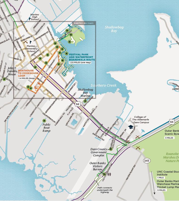
Multimodal facilities in and around Manteo. Source: Alta
Adopted: June 26, 2024 Town of Manteo
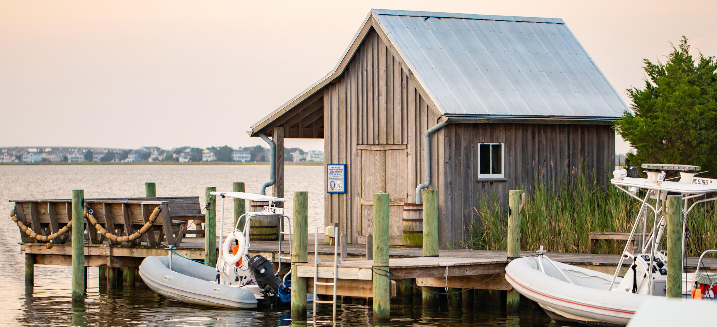
“The Town of Manteo is a coastal town whose identity is intimately tied to its natural resources, history, community, and smalltown charm. We strive to preserve and protect Manteo’s unique character, environment, and tourism-based economy while supporting the local livelihoods and ensuring a high quality of life. The community’s close-knit bonds create a transparent, responsive, and participatory local government.”
Implement policy and design interventions to mitigate the negative impacts of stormwater and flooding.
Protect and maintain a natural edge of wetlands, forests, open water, and other environmentally fragile areas around the town and on the island.
Preserve and protect the town’s unique character by maintaining and celebrating its cultural resources and recreational opportunities.
Continue to implement design standards from The Manteo Way for new development to maintain the town’s character.
Continue to improve water quality in Shallowbag Bay.
Provide adequate public parks and open spaces while continuing to increase opportunities to access the waterfront.
Build and support affordable and workforce housing.
Future anticpated growth and development approval must be based on permitted sewer treatment capacity.
Expand opportunities to safely bike and walk to see neighbors, shop, and go to school.
The Future Land Use Map (FLUM) and character areas represent the community’s vision for the future and are one of the factors that guide decision makers and town staff in future rezoning, land use, or permit issuance decisions. A FLUM also communicates public investment priorities (including possible future extensions of public facilities and services) and vision to private sector investors. The FLUM is descriptive and not prescriptive. It identifies the predominant land use types and character intended for different parts of the study area, but as conditions evolve, other recommendations may be more relevant.
The FLUM will help guide the transition from present day to the desired future state. It is not recommended to immediately rezone properties to reflect the FLUM, but rather to evaluate each rezoning request individually based on a variety of factors, including the request’s individual merits, surrounding context, presence (or absence) of adequate public facilities, potential financial impact (or burden) of the project, vested rights, environmental impact, timing, etc.
The character areas should also be used to further refine the land use vernacular and preserve and enhance the local character. These character areas also provide direction for updates to the Town’s land development regulations to help make the community vision a reality.
An especially important consideration in Manteo is the relationship of the use or structure to the water and environment. Some uses are water- dependent (marinas, commercial fishing operations, etc.) and must be located in these vulnerable areas. In this case, “vulnerable” refers not only to the impact on the natural environment, but also the natural hazards vulnerability that the use or structure might encounter due to storm surge and other water-related hazards. Other uses are not water- dependent, such as general commercial operations, or residential units, and should not be located or allowed in areas where they will have a negative impact on the natural environment. This negative impact can occur both in present day (use of fertilizers leading to nutrient pollution of local water bodies, increased stormwater runoff because of increased impervious surfaces, etc.) or in the future (loss of natural shoreline as sea level rise and erosion prompts owners to convert natural shoreline to altered shoreline which reduces natural habitat, decreases water quality, prevents coastal marshland migration, etc.).
Even elevating a structure “out of” any regulatory floodplain can still have a long-term negative impact on the natural
environment, especially if natural shoreline is converted to an artificial shoreline to prevent erosion from undermining structures. In these instances, a better approach might be to prohibit the location of non-water dependent uses in areas that will likely experience these conditions. Many dwellings in Manteo are already located in these areas and developers will confirm that the premium lots are right on the water.
Some uses, such as wastewater treatment plants or sewer lift stations, are caught between competing priorities. Placing these facilities in low-lying areas is advisable from the perspective of operations, since water flows to the lowest point. However, these low-lying areas are also more prone to flooding and will become increasingly vulnerable as seas continue to rise and storms become more severe. When a wastewater treatment plant or sewer lift station is affected by flooding, it can have significant and severe impacts on the environment and human health. The placement and/or expansion of these uses and structures should be carefully considered in order to ensure operational and financial viability over the lifespan of the infrastructure balanced against current and future environmental vulnerabilities.
This page is intentionally left blank.
The following pages provide an overview of Future Land Use Character Areas. While typical and potential uses are described, these lists are not exhaustive or prohibitive. For instance, some uses may be appropriate in many (or all) future land use character areas. These might include uses such as government maintenance buildings, small utility substations (electric, natural gas, sewer lift stations, water towers, etc.). However, some uses should be carefully considered so that they do not unintentionally create a demand for development in inappropriate areas. For instance, institutional uses such as churches, primary and secondary schools, or clinics might be appropriate in most residential areas, but if located in rural areas would invite inappropriate additional development. The size of operations is also a consideration. For example, a large retail center may be appropriate and desirable in some locations, but not in a historic downtown. It is up to the governing boards at the time of the application to decide what will most accurately promote the goals established in this plan. This updated future land use map provides a more streamlined, yet still sensitive, map to guide Manteo’s future development decisions. The areas have been updated to encourage housing diversity in some areas, and more flexibility in other commercial areas. The Sea Level Rise Overlay is based on an element from the previous plan, and has been updated to reflect a 3 foot, rather and 2 foot, sea level rise.
Conservation and Open Space
Traditional Neighborhood
Mixed Residential
Multifamily Residential
General Commercial
Village Mixed Use
Civic Commercial

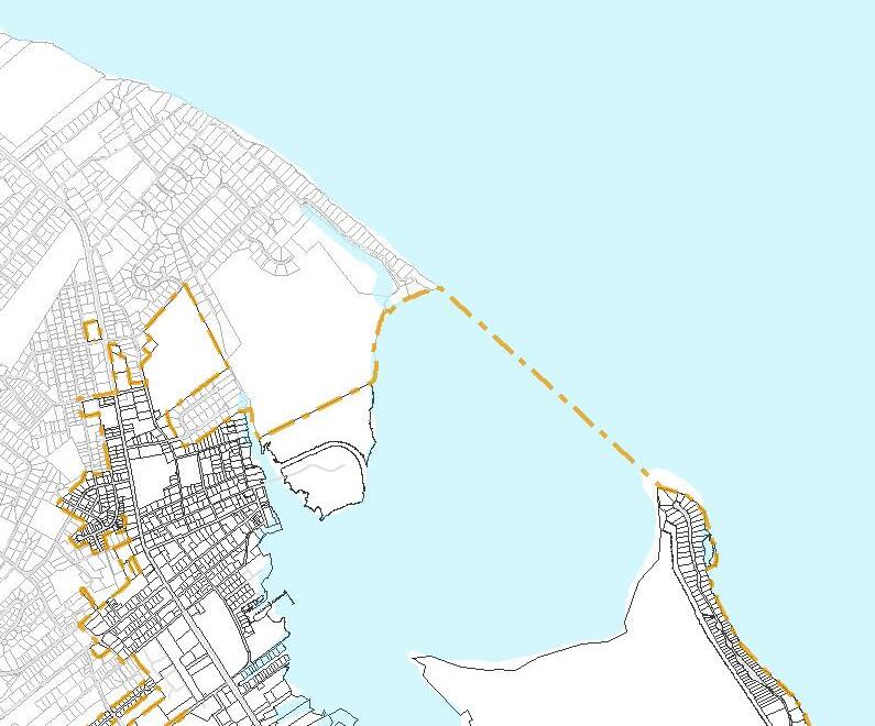
Future Land Use
Civi c Commercial
Conservation
Tradi tional N eighborhood
Mi xed Resi dential
Mul ti-Fami ly
Vil lage Mix ed Use
General Commercial
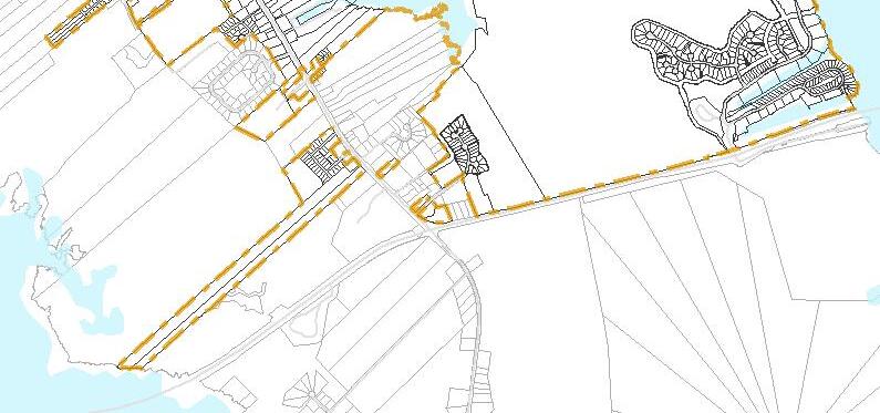
The Town’s previous future land use map was forward-looking enough that it identified lands likely to be inundated and recommended discouraging development in those areas. The old plan used a combination of 24” of sea level rise and associated localized land subsidence to estimate the areas of town that would be inundated by the year 2058, about 50 years into the future. This is relevant because the lifespan of structures and investments in the town is longer than the horizon of the future land use map herein, and so identifying areas where those investments would be unsafe or extremely inconvenienced by inundation in the future can be more forward looking. This insightful precedent is updated in this plan’s future land use map, using updated data from NOAA, looking out another 50 years to about the year 2070. In this instance the estimated sea level rise using NOAA’s Intermediate scenario is about 2.75’. A three-foot rise is used because the spatial data is delivered in one-foot increments.
Excerpted sea level rise guidance from the Town’s previous (2007) CAMA land use plan:
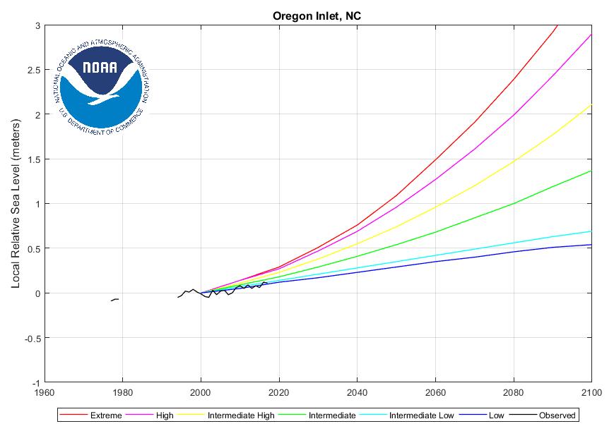
Future Land Use Map with 3' Sea Level Rise
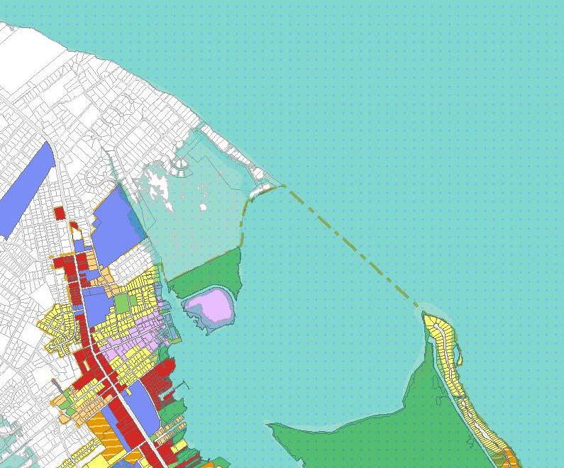
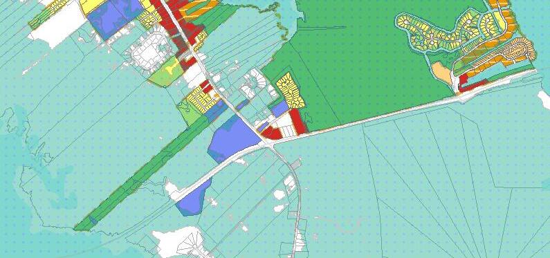
General Description:
The Conservation and Open Space designation is intended for parks and ecologically-valuable areas such as wetlands. These natural areas are some of the town’s top draws, in addition to providing valuable functions such as wildlife habitats, water filtration, and protection against shoreline erosion. In most instances, this land is to be preserved in its natural state unless minimally developed for recreational use. If any development occurs, great care should be taken not to degrade the natural environment.
Primary Uses:
Traditional parks, such as sports fields, playgrounds, public water access points, or recreation facilities, may be appropriate in some locations. Open space might include passive parks, wildlife viewing areas, natural area access, or low-impact walking or bicycling trails. Environmental areas are those sensitive, natural areas that should not be developed in the traditional sense, and if they must be, then development should have as little impact on these sensitive areas as is absolutely necessary. This includes regulatory floodplains, shorelines, and coastal marshes and wetlands, where the highest and best use may be the accommodation of floodwaters and/or natural habitat.
Secondary Uses:
» Water dependent uses (marinas, boat launches, public water access, docks, boat houses, piers or jetties, fishing operations, ferries, etc.)
» Public restrooms or public pavilions.
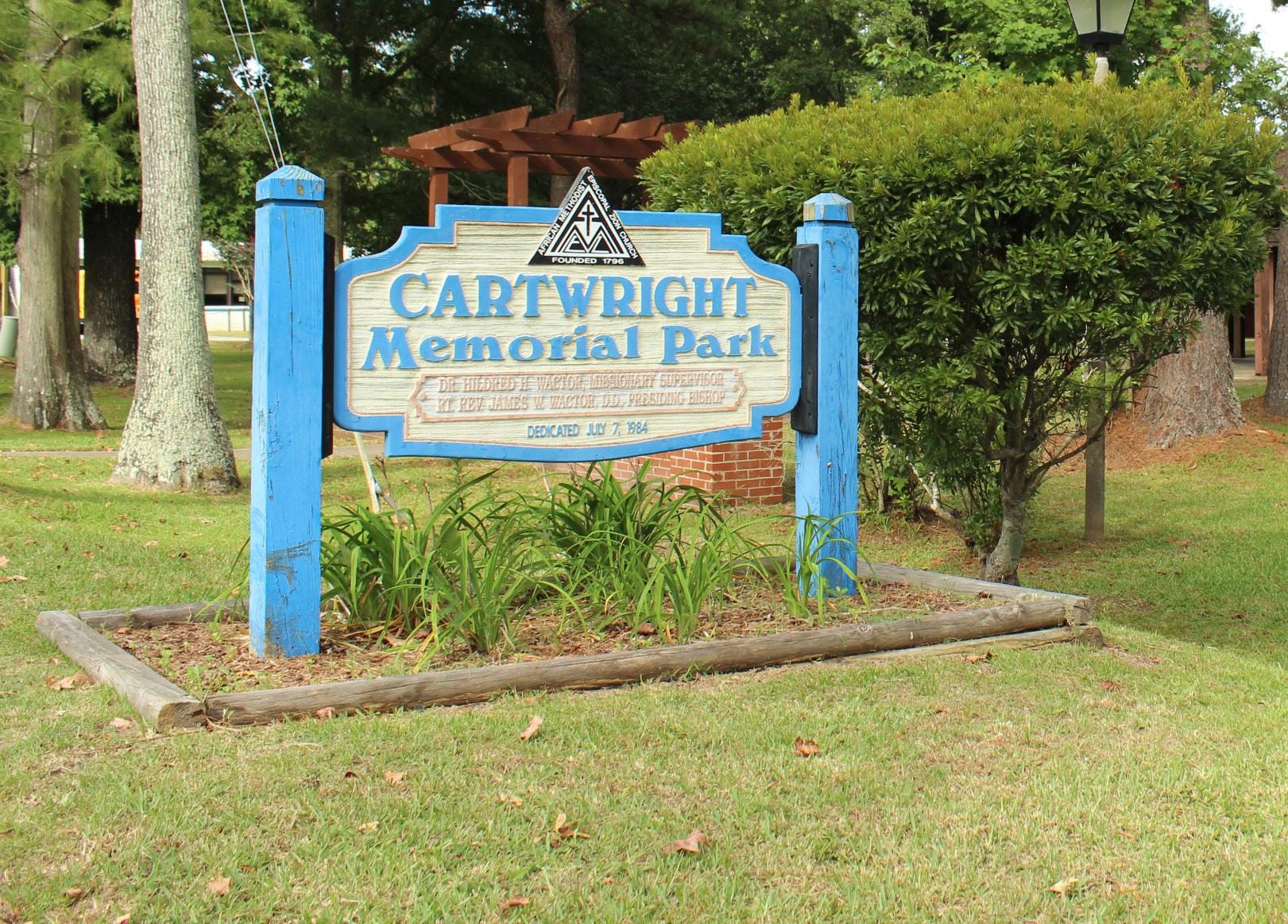
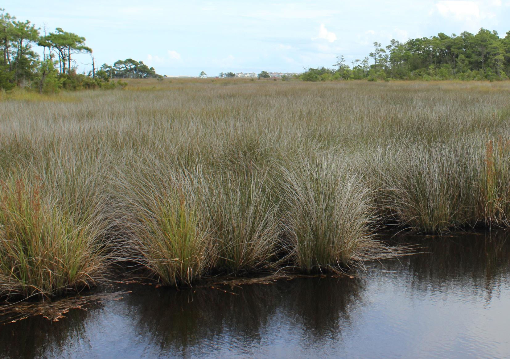
Town parks and wetlands are included in the Conservation and Open Space character area.
The traditional neighborhood designation supports more traditional residential neighborhoods. Parcels are typically in context with the existing single family development in Manteo, with smaller lots supporting residential densities of 4-6 units per acre. House-scale duplexes are permitted to help increase residential density. This character area also allows for accessory dwelling units.
Single-family residential uses, mobile homes, ADUs. Bed and breakfasts with a permit.
Density: 4-6 units/acre
Building height: 12-36’ at top plate
Lot coverage: 30-35%
Lot size: 7,500-15,000 ft2
Building size maximum: 20,000 ft2
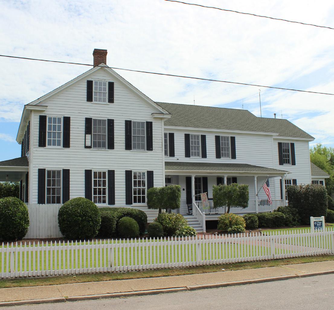
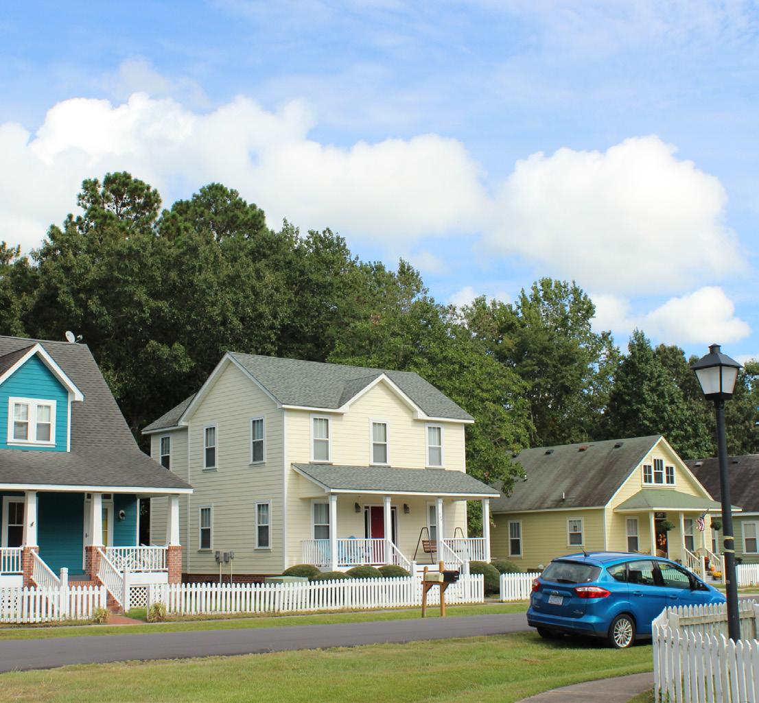
General Description:
The mixed residential designation is intended to provide a transition from more commercial-oriented areas to residential areas, and allows for a diversity of housing types to support the town housing goals. The location of this area adjacent to commercial centers helps encourage a walkable lifestyle for residents. It permits most residential types, with restrictions on scale that make it compatible with neighboring residential uses.
Primary Uses:
Appropriate for single-family residential, duplexes, townhomes, quadplexes, small-scale apartment buildings, and modular and mobile homes.
Density: 6 units/acre for single family, duplexes, or townhomes;
Building height: 24-36’ at top plate
Lot coverage: 35-55%
Lot size: 7,500-15,000 ft2
Building size maximum: 20,000 ft2
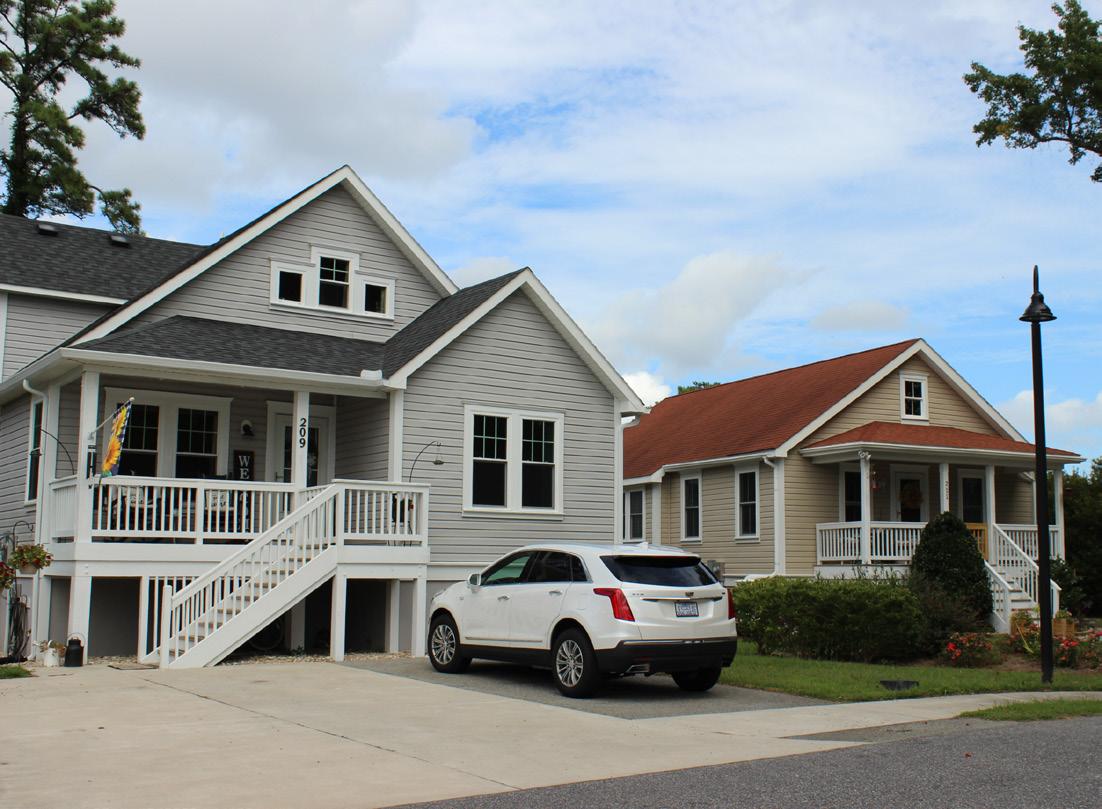
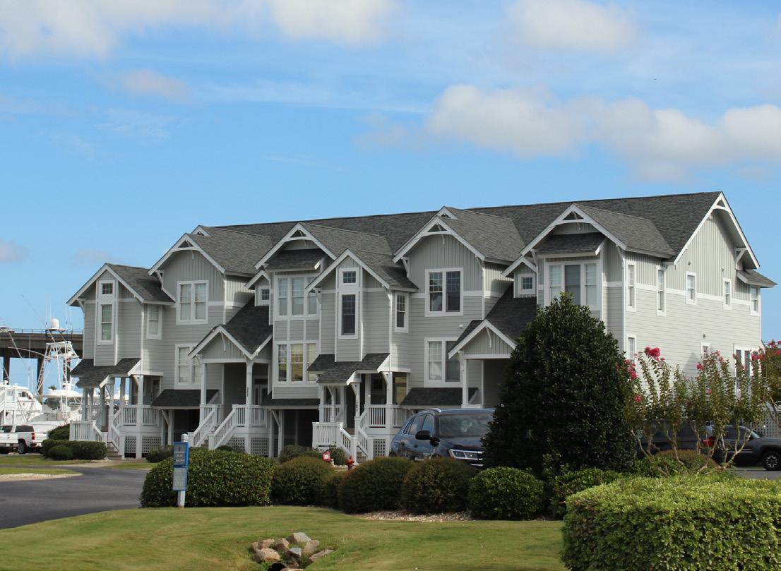
Townhomes and single-family homes on smaller lots are appropriate in the Mixed Residential area.
General Description:
These higher density areas are support larger for multi-family residential dwellings such as apartments, condominiums, and townhome developments. Densities should be higher than all other residential districts and as such will require less land to accommodate more households. These designations are found in areas with larger lot sizes that can accommodate large multifamily construction and impervious surface standards.
Primary Uses:
Multifamily housing such as apartments and townhomes.
Density: 8-12 units/acre for multifamily
Building height: 24-36’ at top plate
Lot Coverage:30-35%
Lot size: 20,000-100,000 ft2
Building size maximum: 20,000 ft2
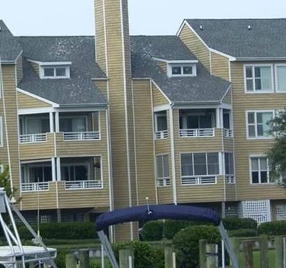
General Description:
This area supports commercial uses that will not compete with the everyday town center. It includes commercial and service uses that are necessary to a functioning town but are too large or otherwise intense for other commercial areas that are close to Downtown or residences. It includes the Virginia Dare Corridor and other similar commercial areas throughout town, particularly along Highway 64. This area is typically vehicle-oriented with parcels connecting on interior roads, but pedestrian facilities are provided. New developments are encouraged to incorporate interior cross-access for vehicles. Driveways along thoroughfares should be coordinated and combined when possible to limit the access points along busier roads. Buildings should be sited along the primary frontage of the site, with surface parking to the side and rear.
Primary Uses:
Appropriate commercial uses include: Lumberyard; Contractor; Professional services; Truck and auto sales and repair; Auto parts store; Restaurant; Hotel; Motel; Title Co.; Flooring, Furniture, Paint, Interior decorating, Appliance stores; Banks; Boat manufacturing; Tanning salon; Computer/technology store; Income tax services; Gas station; Rental yard; Religious institutions; Gym; Assisted living; County buildings; Commercial nursery; Printing companies; NWR offices; Thrift store; Animal care and shelter.
Secondary Uses:
Some limited incidental residential uses may be found here, such as upper story apartments, near other residential areas.
Density: 4-8 units per acre
Building height: 12-36’ at top plate
Lot coverage: 35-55%
Square footage: 1,000-20,000 ft2
Building size maximum: 20,000 ft2

General Description:
The Village Mixed-Use designation supports Manteo’s lively, historic Downtown and similar mixed-use areas. It features mixed-use development that includes retail/residential buildings with active commercial uses on the first floor and residential uses on the upper floors to promote and sustain the critical mass necessary for both economic viability and social vitality. This area should foster heavy pedestrian traffic through dense and easily accessible retail development that serves both locals and tourists. Lodging and multifamily residential uses are also found here.
Primarily higher density (relatively speaking) attached residential uses (apartments, condominiums, townhomes, patio homes, etc.) with duplexes also appropriate as long as they can be provided at high enough densities to be context appropriate. Single family residential and other low density uses should be discouraged as it does not create the density of households to support adjacent commercial areas.
Density: 8-12 units/acre
Building height: 12-36’ at top plate
Lot coverage: 50-70%* (The Town should consider altering lot coverage maximums to better reflect stormwater management priorities)
Square footage: 1,000-20,000 ft2
Building size maximum: 20,000 ft2
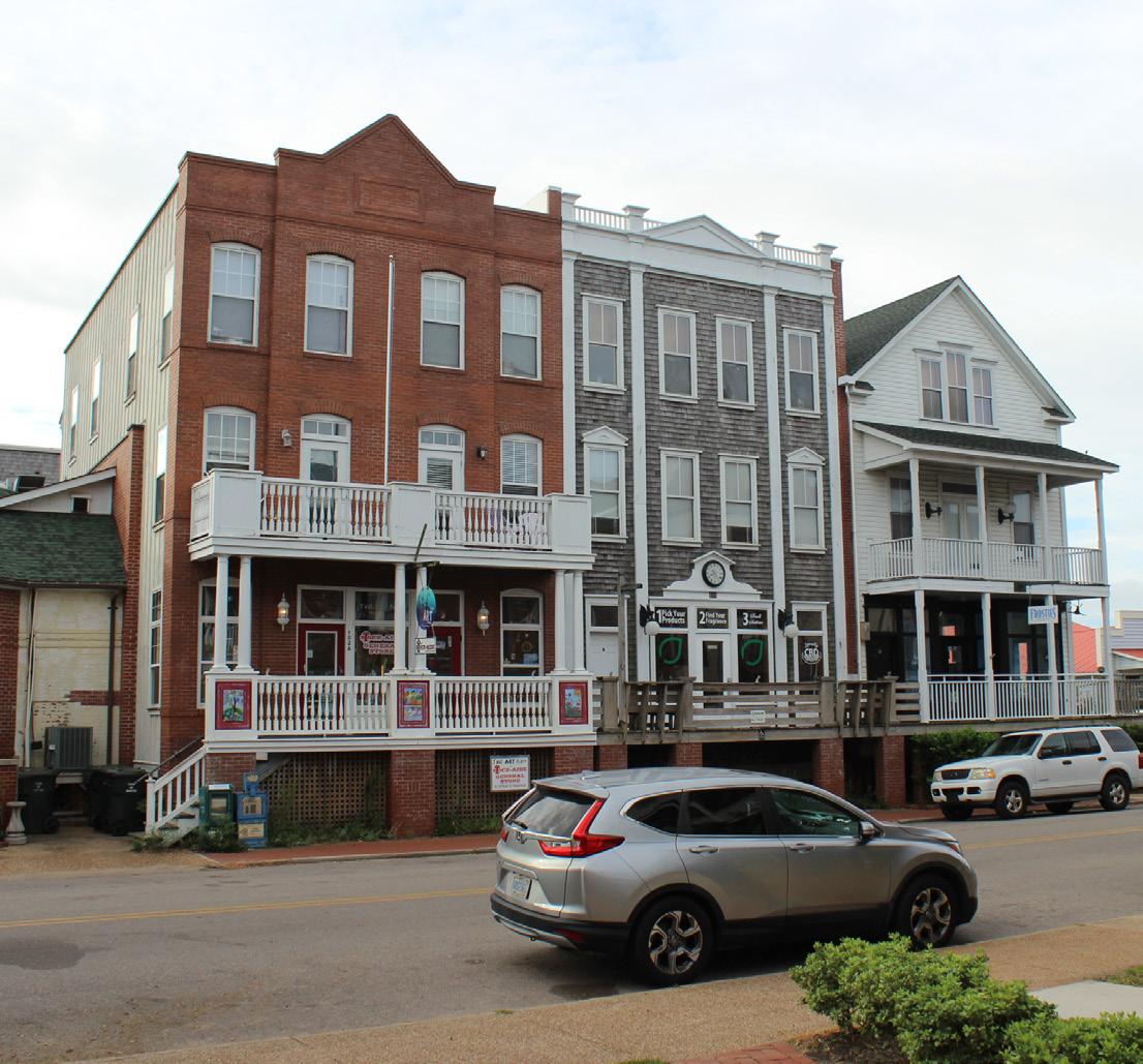
General Description:
This designation applies primarily to institutional uses while allowing for some uses that cater to tourists like the Outer Banks Visitors Bureau. It complements the Village Mixed Use areas, but is intended for larger structures and parcels with less lot coverage. It provides a transition from the Village Mixed Use areas to either General Commercial or residential areas. Appropriate commercial uses include: hotel or inns, college facilities, restaurants, government services and offices, retail, professional services, and other tourism-oriented uses such as rentals. Some limited incidental residential uses may be found here, such as upper story apartments, near other residential areas.
Large sites are encouraged to incorporate interior cross-access for vehicles. Driveways along thoroughfares should be coordinated and combined when possible to limit the access points along busier roads. When larger sites are developed, open space should be included on the property.
Primary Uses:
County and other government services; Hotel or Inns; Drive through ATM; Restaurant(s); Convenience store; Tourist and/ or souvenir shop; Professional services; Vertical mixed-use with residential or professional services above commercial is strongly encouraged.
Secondary Uses:
Some incidental housing is permitted, but not single family units. Single family residential and other low density uses should be discouraged as it does not create the density of households to support adjacent commercial areas.
Density: 4-8 units per acre
Building height: 12-36’
Lot coverage: 55%
Square footage: 2,500-20,000 ft2
Building size maximum: 20,000 ft2
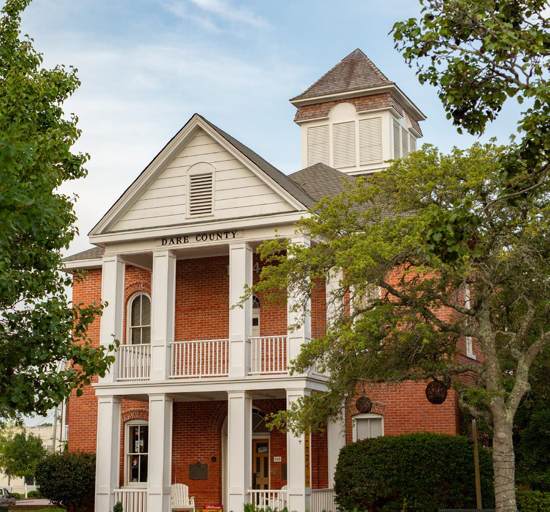
The lands in and near Manteo that are anticipated to be inundated by the year 2070 due to a combination of projected 24 inches of sea level rise and land subsidence should become a delineated zone. New development in this zone should be strongly discouraged within the town’s corporate limits and on lands being considered for annexation. Public infrastructure should not continue to be intensified unless significant mitigation measures are put in place to ensure infrastructure and investments are adapted to probable future conditions. New development in this overlay should be limited to lowintensity uses such as parks, open space, docks, and public access points. Single family residential may be allowed so long as it does not involve extending public infrastructure in to this area. In areas that are already intensely developed and are deemed essential to the identity of the Town, such as the downtown commercial and waterfront areas, it may be appropriate to continue to maintain existing public infrastructure so long as measures are taken to protect such infrastructure against probable future conditions. This may involve elevation of roadways, pipes, and floodproofing of infrastructure.
The financial cost of floodproofing all of the Town’s infrastructure is likely beyond the capability of the Town without significant outside investment, and outside investment is unlikely to occur in areas that are of high flood risk. It may also be necessary or prudent in the future for the Town to abandon public infrastructure and service provision in some of areas, to avoid unsafe conditions or maintenance liabilities that are insurmountable. This type of decision will have significant impacts on private investments as well as public financial interests. However, as private and public entities (Moody’s, FEMA, etc.) continue to better understand and communicate the financial risks associated with sea level rise and future climate conditions, communities that take measurable actions to minimize their liabilities will surely be viewed more favorably that if they had not.
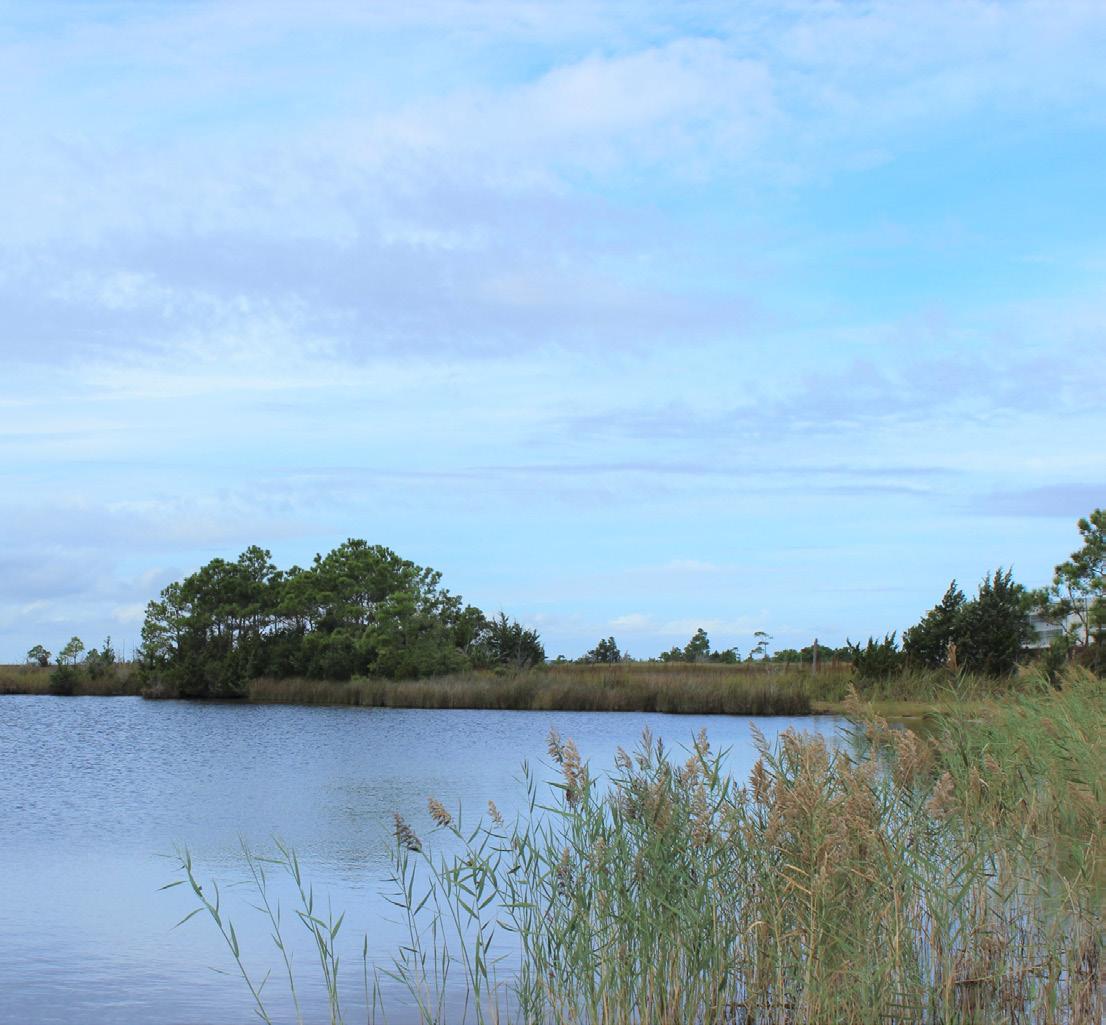
A CAMA land use plan also affords the opportunity for a local government to address areas or issues of local concern, which may be asset-based, programmatic, regulatory, geographic, or otherwise. These issues were identified during the land use plan development process and are included herein. The issues do not necessarily directly align with the CAMA management topic structure, but are locally important nonetheless. These recommendations are not required to have associated timelines for completion or implementation, although in some cases these may be provided.
Not all of the recommendations contain specific action items, but that should not be perceived as any less a call to action. In addition, not all of the recommendations outlined herein are immediately ripe for implementation, and (as with the Future Land Use Map, or FLUM) local discretion and leadership will determine priorities and timelines. Policies that are not able to be implemented immediately will guide future development decisions on the Town-level, so that all future development will bring the reality closer to the vision. While the FLUM and policies are intended to provide guidance during land use decisions, the issuance of CAMA and development permits will be based on adopted standards in the Town’s Code of Ordinances and the CRC’s permitting rules that implement the Coastal Area Management Act. There are some recommendations that exceed the CRC’s use standards and permitting requirements found in Subchapter 07H. The intent for policies exceeding the requirements in Subchapter 07H is for the CRC to deny the CAMA permit.
In the following pages, policies and implementation steps (actions) are identified, with relevant CAMA Topics and implementation year(s) indicated at the end of actions. Some actions will be labeled as “ongoing” and will require constant vigilance. Where no entry is provided, the topic is not considered relevant to the CAMA Land Use Management Topics. Adherence to the established timelines listed herein will be used by the Coastal Resources Commission to track progress toward plan implementation, although it is understood that these timelines may be amended by the local government. The Town will use zoning, work planning, and other local government powers to progress the policies and actions described in this plan.
Key to CAMA Land Use Management Topics:
PA = Public Access
LUC = Land Use Compatibility
ICC = Infrastructure Carrying Capacity
NHA = Natural Hazard Areas
WQ = Water Quality
Management Goal:
Maximize access to the beaches and the public trust waters of the coastal region.
Planning Objectives:
The plan shall include policies that address access needs and opportunities, with strategies to develop public access and provisions for all segments of the community, including persons with disabilities. Oceanfront communities shall establish access policies for beach areas targeted for nourishment.
Management Goal:
Ensure that development and use of resources or preservation of land balance protection of natural resources and fragile areas with economic development, and avoids risks to public health, safety, and welfare.
Planning Objectives:
The plan shall include policies that characterize future land use development patterns and establish mitigation concepts to minimize conflicts.
Management Goal:
Ensure that public infrastructure systems are sized, located, and managed so the quality and productivity of areas of environmental concern (AECs) and other fragile areas are protected or restored.
Planning Objectives:
The plan shall include policies that establish service criteria and ensure improvements minimize impacts to AECs and other fragile areas.
Management Goal:
Conserve and maintain the barrier dune system, beaches, flood plains, and other coastal features for their natural storm protection functions and their natural resources giving recognition to public health, safety, and welfare issues.
Planning Objectives:
The plan shall include policies that establish mitigation and adaptation concepts and criteria for development and redevelopment, including public facilities, and that minimize threats to life, property, and natural resources resulting from erosion, high winds, storm surge, flooding, or other natural hazards.
Management Goal:
Maintain, protect, and where possible enhance water quality in coastal wetlands, oceans, and estuaries.
Planning Objectives:
The plan shall include policies that establish strategies and practices to prevent or control non-point source pollution and maintain or improve water quality.
There are many types of access to public trust waters within and just outside of the Town. The historic working waterfront is primarily developed, altered shoreline, but the boardwalk, marina, waterfront parks, and downtown area have exceptional waterfront access, including a boat ramp and kayak launch. Other boat ramps exist just outside of the town limits on the west side of the island and on the east at Washington Baum Bridge. As in any waterfront, coastal community, private property blocks public access in many locations except for the downtown.
1. Maintain and increase access to public waterways and opportunities to enjoy Manteo’s public waterways and waterfront.
1.A. Public Docks and Boat Launch Access – The public docks and boat ramps within the town limits should be maintained and enhanced for public access. Additional facilities should be provided as demand increases.
1.B. Increase passive recreation space and small craft boat launches (canoes, kayaks) along canals and public waterways.
2. Maintain Manteo’s waterfront boardwalk system and, in partnership with willing partners, expand it if possible.
2.A. All new waterfront development, whether public or private, should be required to provide a publicly accessible boardwalk at the water’s edge, on Shallowbag Bay, the Roanoke Sound, and the Croatan Sound. Such access should not damage or infringe on the natural shoreline or prevent its migration in response to rising seas. Where economically and operationally feasible, access points should be publicly maintained.
2.B. Any boardwalk should tie into the Town’s existing boardwalk system where appropriate and increase public access, including views, to natural resources in the public trust.
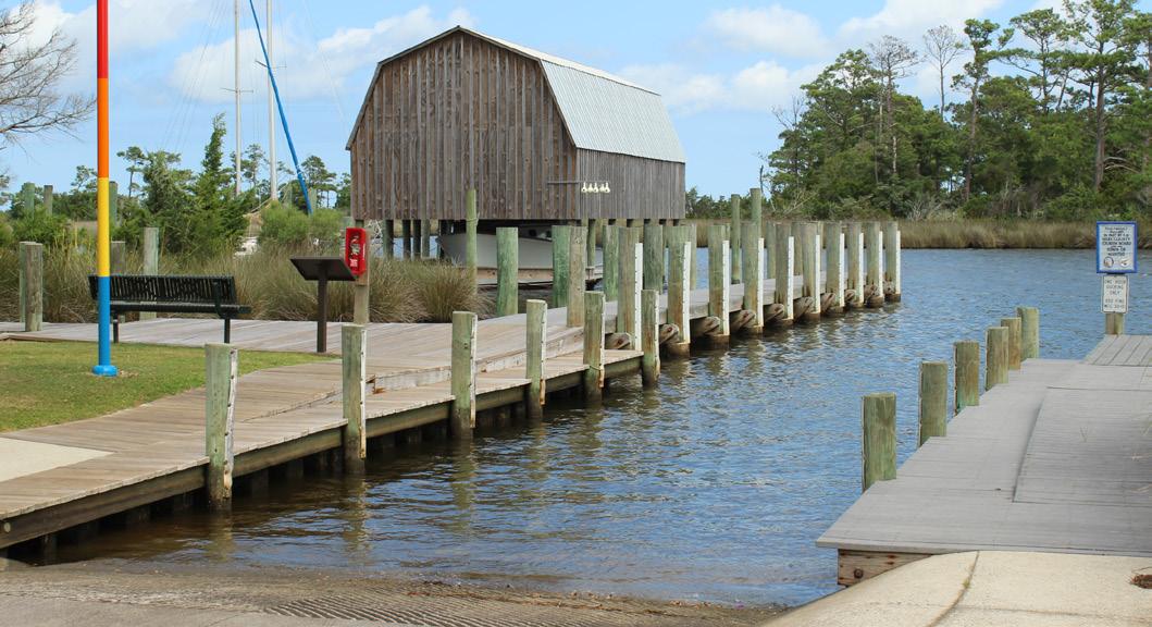
1. Increase ADA accessibility to and along the boardwalk and to waterfront parks and water access locations. Adapt entrance standards to be ADAaccessible. (FY2025-26)
2. Investigate property rights on all street ends (public street rights-of-way that end on the waters edge) and create public access points with signage and furniture (seating, trash can, etc.). If possible incorporate small craft launches (kayak, canoe, etc.) or fishing access points, too. Precedents exist at the weather tower parking lot, Davis Lot, Boat ramp, Christmas tree parking lot. (FY2027-28)
Land availability is limited within the Town and when development occurs it is on the few remaining lots or as redevelopment. Thanks to previous foresight, the Town has prevented the filling or alteration of many wetlands, which helps to preserve unique natural features.
1. Use the Future Land Use Map as a guide when making land use and development permitting decisions. This is especially relevant to rezonings and quasi-judicial development decisions. Development within the horizontal boundaries of the sea level rise overlay should also be generally discouraged unless it is water dependent. However, existing zoning entitlements and rights should be respected or amicably altered.
2. Direct development away from sensitive natural resources, including but not limited to all wetlands.
3. Prevent the extension or expansion of public infrastructure into sensitive or potentially hazardous areas, both now and in the future. Use sea level rise projections and flooding and storm surge modeling as guidance.
4. Encourage locally-appropriate density and vertical mix of uses that avoids creation of excess impervious surfaces and maintains the historic development pattern and character.
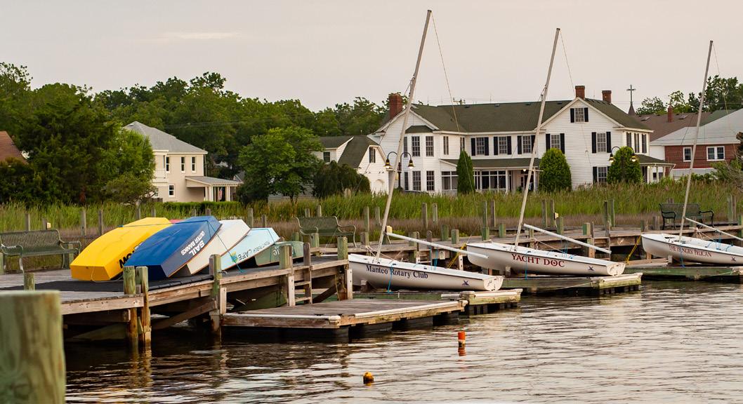
1. Clearly identify areas that are projected to be inundated due to rising seas and communicate that to developers and the community. These areas should not allow substantial development that will result in private or public property being put in harm’s way for the projected lifespan of the structure/infrastructure. Plans should be developed to identify areas where infrastructure and structures will need to be moved or removed in order to preserve shoreline habitat and allow the land to adapt naturally to rising seas. This may require changes to the Town’s ordinances. In particular, the Flood Damage Prevention Ordinance can be strengthened to better protect life and property against future conditions. (FY2028-29)
Residents and visitors prize the natural environment surrounding the Town. These natural assets are scenic and also support the local economy through ecotourism. Through the public engagement in this planning process, stakeholders expressed clearly that they would prefer to see the Town maintain its current, small-town character.
1. Regulate growth so that public services capacities are not exceeded. In particular, new development and redevelopment should consider the limitations of the Town’s wastewater treatment capacity (See page 62-63 for more information related to water and wastewater capacity).
1.A. Do not expand town wastewater treatment capacity without additional planning and coordination related to land use, redevelopment, and town character.
1.B. Do not annex lands or permit more intense development without documented and substantiated wastewater treatment plant capacity for the proposed development based upon the average flows for the peak three months of the year. This also involves ensuring that capacity is reserved for other Town-prioritized development.
2. Restore natural habitat in areas where public infrastructure has been negatively impacted or where armoring has been required to fight erosion. Green infrastructure solutions can help mitigate storm impacts as well as restore coastal habitat that residents value.
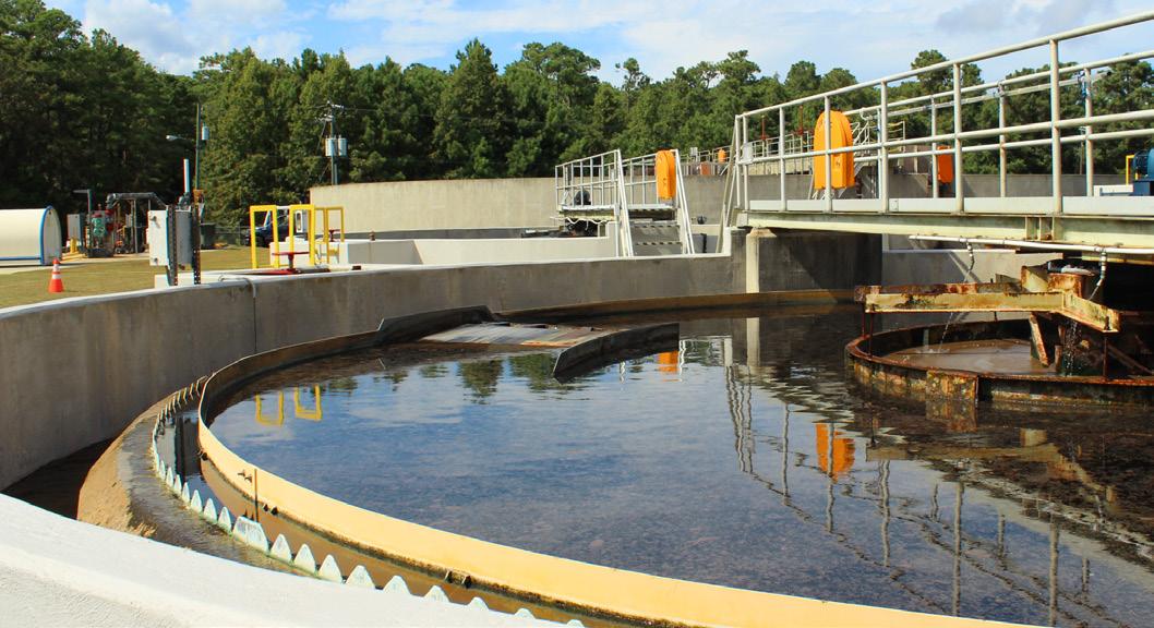
1. Continue to prohibit septic systems within the Town’s limits and ensure all development is served by the Town’s wastewater treatment system. (Ongoing)
2. Periodically delineate wetlands within the Town limits and adjust development standards to accommodate their migration due to rising seas. Priority should be given to preservation of habitat and communal natural resources. (FY2029-30)
This low-lying coastal community already experiences frequent flooding, even without storms. As the climate continues to change, seas will continue to rise and storms will intensify. The Town will have to find ways to adapt and mitigate these and other threats.
1. Use the Future Land Use Map when making land use and development permitting decisions.
2. Consider restricting infrastructure investment in publicly owned areas projected to be inundated before the year 2070.
3. Do not extend public infrastructure into areas projected to be inundated (permanently or periodically) before the year 2070.
4. Maintain a safe, efficient roadway network and evacuation routes.
5. Prepare for the changing climate, particularly as it relates to rising seas, more intense storms, and flooding.
1. Advocate for state transportation projects that will ensure a connection to the mainland. Contribute funding, as available, to these projects to make them more competitive. (FY2026-27)
2. Upsize stormwater infrastructure to accommodate the more intense storms projected for the future and perform regular maintenance of open drainage ditches. (FY2027-28)
3. Carefully consider publicly funded development in areas projected to be inundated by rising seas in the year 2070. (FY2029-30)
4. Develop a plan to adapt public infrastructure in high-risk areas to the conditions they will likely experience in the future to ensure those facilities do not fail or contribute to environmental degradation. (FY2027-28)
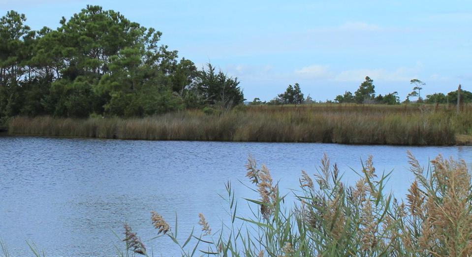
5. Require enhanced building standards that increase resilience to storm events. This may include increased structural requirements, such as additional elevation, enhanced roof construction and attachment standards, better anchoring, etc. (Ongoing)
6. Current regulations should be maintained to ensure that development is restricted beyond land that is going to be inundated. Where development has already been permitted, the agencies should work to help those residents and businesses elevate those structures. All public safety and operational facilities should also be elevated and armored against rising seas and more intense storms, too. (Ongoing)
7. Continue to maintain the existing NFIP Community Rating System score and reduce community flooding vulnerability. (FY2027-28, with next Community Rating System review cycle)
Legacy land use decisions in the Town’s most distinctive waterbody, Shallowbag Bay, will continue to inhibit efforts to improve water quality in that location. Stormwater runoff into surrounding waters will continue to be a negative impact on water quality as well. However, the Town has also shown that it is willing to directly address these issues as it is able, as demonstrated by the unique stormwater solids removal process near the Maritime Museum and the demonstration wetlands project at Grenville Street. Innovative projects like these will continue to be necessary in the future, and will also need to accommodate changing environmental conditions brought on by climate change.
1. Protect and improve water quality.
2. Manage stormwater runoff.
2.A. Continue to implement best stormwater management practices including LID measures, impervious surface limits, stormwater management alternatives, and vegetated buffers.
3. Protect and maintain Manteo’s natural edge of wetlands, forests, and waterways.
3.A. Improve water quality, mitigate storm hazards, and protect resources providing important biological function, by prohibiting development or filling in all wetlands (coastal and non-coastal) within Manteo’s corporate limits.
3.B. Create policies and development standards to allow coastal wetland habitat to migrate as seas rise.
1. Review stormwater management standards in the Town and institute dispersed stormwater management standards and Low Impact Development (LID) requirements on all new development and stormwater retrofits. (Ongoing)
2. Revise the lot fill regulations so that any fill placed on a lot is restricted to within three feet beyond the building footprint. Filling like this should be encouraged as a way to mitigate against flood damage. However, additional stormwater control measures may be necessary in order to avoid diverting excess stormwater to neighboring properties. (FY2024-25)
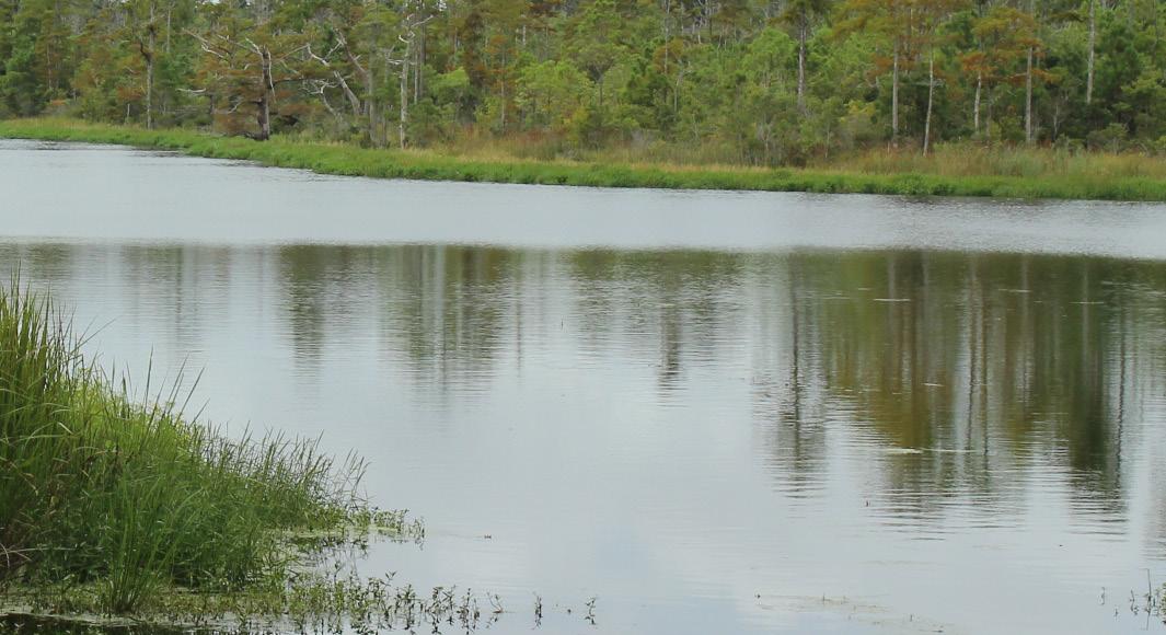
3. To mitigate flooding and improve water quality, new development and redevelopment should be required to capture the rainfall expected from the 1-year 24-hour storm (which is a little over 3”, typically). Where site conditions render this impossible the Town should continue to require that stormwater runoff volume generated by new development or redevelopment shall not exceed the predevelopment site volume for the first 1.5 inches of rainfall. Regional stormwater management retrofits should also be explored as a way to improve overall conditions. (FY2024-25)
4.A. Establish a 75-foot buffer surrounding all coastal wetlands on the west side of town for all non-water dependent structures. Allowable impacts to the buffer are the construction, maintenance and use of public access points, planted parks and open spaces, paved pathways and boardwalks. (FY2024-25)
4.B. No new development or filling should be allowed within coastal wetlands, non-coastal wetlands, or jurisdictional wetlands. If this policy presents a threat to health, safety, or welfare of the community, the Town may make an exception. The following activities should be allowed in non-coastal wetlands: hiking, walking, bird watching, stormwater interventions and educational/research activities. Impacts from the construction and maintenance of public boardwalks and pathways are allowable. (FY2024-25)
Page intentionally left blank
Because this plan serves as the Town’s Comprehensive Plan, these policies are included to guide growth, development, and decision making for Town boards and bodies. They are not intended to be part of CAMA permit review.
1. Maintain small-town Town character while continuing to keep the Town friendly to visitors.
1.A. Utilize The Manteo Way of Building when reviewing all nonresidential, mixed use, and multifamily development.
1.B. Continue to balance tourism needs with those of locals.
2. Prioritize walkability.
2.A. Ensure all new facilities within Town limits (including on NCDOT roads) are ADA compliant and identify and prioritize those upgrades.
3. Foster a connected, accessible system of open spaces throughout Town.
3.A. Enhance connections between open spaces, parks, and waterfront access points.
3.B. Encourage public spaces that serve multiple functions, including recreation, cultural events, and stormwater drainage.
4. Continue to support affordable and workforce housing.
4.A. Encourage affordable and workforce housing.
4.B. Continue to implement and refine Manteo’s inclusionary housing ordinance.
4.C. Continue to encourage incidental residential dwellings such accessory dwelling units and upper story residential uses.
5. Continue Town programming, cultural facilities, and events.
6. Enhance appearance standards and enforcement in the downtown.
7. Maintain high quality and safe housing and
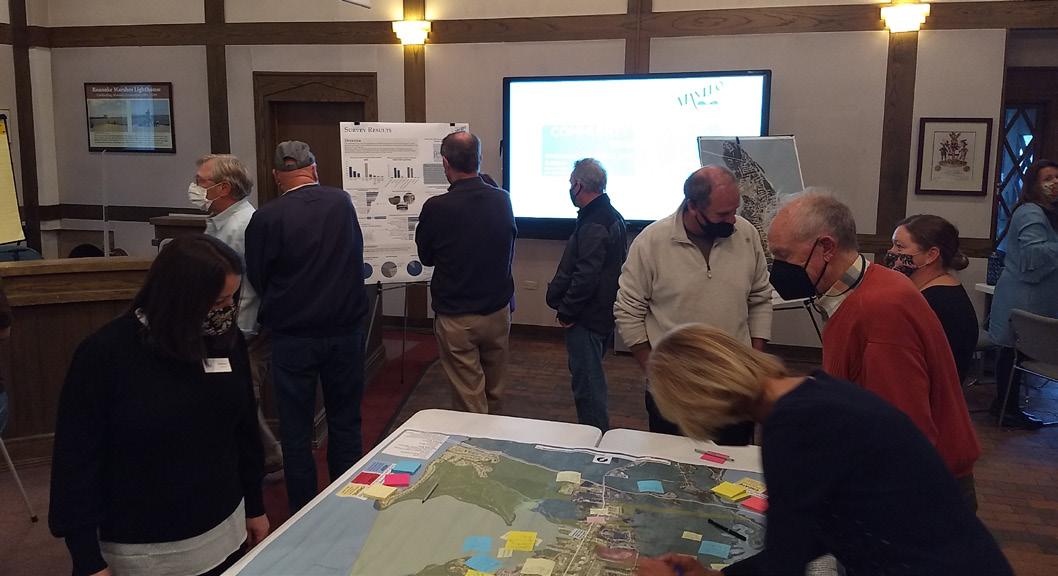
building stock.
8. Support a local economy that balances yearround, full-time employment and the tourism industry.
9. Ensure Town ordinances are current and support the desired goals of this plan.
10. See also “Main Street Program” on page 30
1. Increase pedestrian connectivity between neighborhoods and destinations.
1.A. Create a pedestrian pathway from the new College of the Albemarle campus to downtown.
1.B. Explore potential connections from Highway 64 commercial area to the waterfront.
1.C. Repair or expand sidewalks where possible.
1.D. Add crosswalk buttons along the highway as a way to connect the east and west sides of the highway/town together.
2. Pursue a historic overlay for Downtown to protect its character and preserve its tourism appeal.
2.A. A locally designated historic district must be under the purview of a historic preservation commission.
2.B. Under NCGS § 160D-702, the Town would be able to regulate exterior cladding materials, color, materials of roof structures or porches, architectural ornamentation, styling of windows and doors (including garage doors), and the number and types of rooms and interior layout of one- and two-family dwellings within a local historic or National Register district.
2.C. Establishment of a historic preservation
commission and locally designated historic district would allow the Town to apply for Certified Local Government program and the ability to apply for grants through this program.
2.D. As an urban waterfront, the Town should encourage adaptive reuse and repurposing of existing structures and should work with potential developers in seeking funding opportunities for qualified rehabilitation projects per NCAC 07H.0209.
2.E. The establishment of a local historic district does not mean that property owners can apply for State and Federal tax credits. A commercial structure must be listed on the National Register of Historic Places to be eligible for tax credits. A large portion of Manteo was added to the North Carolina State Historic Preservation Office study list in 1995; this is a preliminary step in the review of potential nominations to the National Register of Historic Places.
3. Create an extended network of safe facilities for walking and biking.
3.A. Identify gaps in current greenway and sidewalk network and budget to fill gaps, introducing lighting where needed, and ensure ADA-accessibility.
3.B. Increase the visibility and physical protection of mid-block crossings on old Highway 64.
4. Create a wayfinding plan for Manteo that creates a cohesive wayfinding system for visitors. It should:
4.A. Provide directions to key cultural, historical, the waterfront, and locally-significant tourism destinations, including pedestrian-oriented dining and shopping downtown.
4.B. Provide directions to parking areas and public restrooms.
5. Plan for improvements and renovations at Magnolia Pavilion. The space is currently underutilized and could become a signature events space. A community charrette is recommended.
6. Promote and support the Roanoke Island Maritime Museum and Boathouse, Festival Park, the Cookhouse Museum, and other cultural destinations.
7. Combat climate change.
7.A. Establish an alternative energy (solar or wind energy) demonstration project on a public
building to educate the community on the value of alternative energy.
7.B. Explore other options to mitigate and adapt to climate change.
7.C. Add public electric car charging stations and consider requiring them in large new development projects.
8. Establish a minimum housing standards enforcement program, per Article 12 of NC G.S. Chapter 160D.
9. Incorporate the recommendations from the Economic Development Implementation Plan when it becomes adopted.
10. Regularly review and update Town ordinances as needed to achieve the goals of this plan.
10.A. Remove the lot coverage bonus for residential-over-commercial development.
11. Create a recreation plan that addresses all or part of parks, recreation, open spaces, and/ or walkability/non-motorized mobility. Sources of funding might include PART-F or NCDOT’s pedestrian/bicycling planning grants.
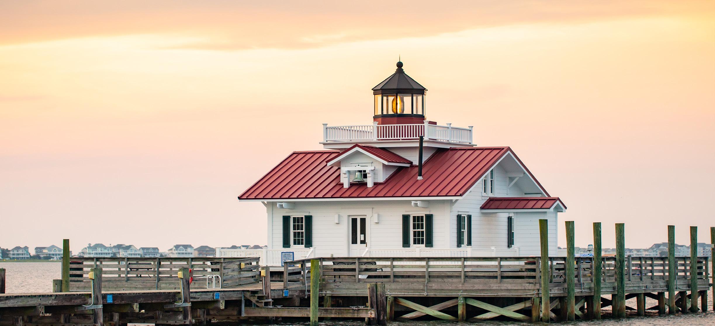
Organization of the Plan
Page Reference(s)
• Matrix that shows the location of the required elements as set forth in this Rule page 102 Community Concerns and Aspirations
• Description of the dominant growth-related conditions that influence land use, development, water quality and other environmental concerns in the planning area
Description of the land use and development topics most important to the future of the planning area, including:
page 14
• Public Access page 18
• Land Use Compatibility page 18
• Infrastructure Carrying Capacity page 18
• Natural Hazard Areas page 18
• Water Quality page 18 Community Vision
• Description of the general physical appearance and form that represents the local government’s plan for the future. It shall include objectives to be achieved by the plan and identify changes that may be needed to achieve the planning vision.
Existing and Emerging Conditions
Population, Housing and Economy
Discussion of the following data and trends:
page 4472
• Permanent population growth trends using data from the two most decennial Censuses page 22
• Current permanent and seasonal population estimates page(s) 23
• Key population characteristics including age and income page(s) 24, 21
• Thirty-year projections of permanent and seasonal population in five-year increments page(s) 23
• Estimate of current housing stock, including permanent and seasonal units, tenure, and types of units (single-family, multifamily, and manufactured) page(s) 26
• Description of employment by major sectors and community economic activity page(s) 25 Natural Systems
Description of natural features in the planning jurisdiction to include:
• Areas of Environmental Concern (AECs) as set forth in Subchapter 15A NCAC 07H page(s) 34
• Soil characteristics, including limitations for septic tanks, erodibility, and other factors related to development page(s) 40, 41, 42, 43
• Environmental Management Commission (EMC) water quality classifications and related use support designations page(s) 44
• Division of Marine Fisheries (DMF) shellfish growing areas and water quality conditions page(s) 44-48
• Flood and other natural hazard areas page(s) 50-53
• Storm surge areas page(s) 49-51
• Non-coastal wetlands, including forested wetlands, shrub-scrub wetlands and freshwater marshes page(s) 52, 56
• Water supply watersheds or wellhead protection areas page(s) 16, 38, 39, 66-67
• Primary nursery areas page(s) 36, 44-45
• Environmentally fragile areas, such as wetlands, natural heritage areas, areas containing endangered species, prime wildlife habitats, or maritime forests page (s) 54-57 Natural Systems, contd.
• Additional natural features or conditions identified by the local government page(s) 48
• Submerged Aquatic Vegetation (SAV) page(s) 34- 35 Environmental Conditions
Discussion of environmental conditions within the planning jurisdiction to include an assessment of the following conditions and features:
• Status and changes of surface water quality; including:
- Impaired streams from the most recent Division of Water Resources (DWR) Basin Planning Branch Reports page 46
- Clean Water Act 303 (d) List page 46
- Other comparable data page 46
• Current situation and trends on permanent and temporary closures of shellfishing waters as determined by the Report of Sanitary Survey by the Shellfish Sanitation and Recreational Water Quality Section of the DMF
page(s) 48
• Areas experiencing chronic wastewater treatment malfunctions page(s) 16, 67
• Areas with water quality or public health problems related to non-point source pollution page(s) 44, 48
• Areas subject to recurrent flooding, storm surges, and high winds page(s) 49
• Areas experiencing significant shoreline erosion as evidenced by the presence of threatened structures or public facilities page 51
• Environmentally fragile areas (as defined in Part (c)(2)(A)(ix) of this Rule) or areas where resources functions are impacted as a result of development page(s) 54, 56
• Natural resource areas that are being impacted or lost as a result of incompatible development. These may include, but are not limited to the following: coastal wetlands, protected open space, and agricultural land.
Existing Land Use and Development
page 36, describes natural area that was restored
page 54, describes sea level rise that will inundate coastal marshes
MAP of existing land use patterns page(s) 59
• Description of the existing land use patterns page(s) 58, 60
• Estimates of the land area allocated to each land use category page 61
• Characteristics of each land use category page 60
MAP of historic, cultural, and scenic areas designated by a state or federal agency or by the local government page 63
• Descriptions of the historic, cultural and scenic areas page(s) 62, 64-65 Community Facilities
Evaluation of existing and planned capacity, location and adequacy of community facilities to include:
MAP of existing and planned public and private water supply service areas page 39
• Description of existing public and private water supply systems to include:
- Existing condition page 66
- Existing capacity page 66
- Documented overflows, bypasses or other problems that may degrade water quality or constitute a threat to public health as documented by the DWR
- Future water supply needs based on population projections page 23
MAP of existing and planned public and private wastewater service areas page 39
• Description of existing public and private wastewater systems to include:
- Existing condition page 66
- Existing capacity page 66
- Documented overflows, bypasses or other problems that may degrade water quality or constitute a threat to public health as documented by the DWR page(s) 16, 66
- Future wastewater system needs based on population projections page 23
MAP of existing and planned multimodal transportation systems and port and airport facilities page 69
• Description of any highway segments deemed by the NC Department of Transportation (NCDOT) as having unacceptable service as documented in the most recent NCDOT Transportation and/or Thoroughfare Plan
Community Facilities, contd.
page 68
• Description of highway facilities on the current thoroughfare plan or current transportation improvement plan page 68
• Description of the impact of existing transportation facilities on land use patterns page 15
• Description of the existing public stormwater management system page 67
• Identification of existing drainage problems and water quality issues related to point-source discharges of stormwater runoff page 46
Policy Citation(s)
Policies
• Policies that exceed the use standards and permitting requirements found in Subchapter 7H, State Guidelines for Areas of Environmental Concern
Policies that address the Coastal Resources Commission’s (CRC’s) management topics: Public Access Management Goal:
Maximize public access to the beaches and the public trust waters of the coastal region.
The planning objectives for public access are local government plan policies that:
Page References(s)
Water Quality Policy 3, Action 4A page 96
• Address access needs and opportunities
• Identify strategies to develop public access
Public Access policies 1-2, Local Policies, Policy 2 page 92, Page 98
Public Access Actions 1-2 page 92
• Address provisions for all segments of the community, including persons with disabilities Local Policies, Policy 2 Page 98
• For oceanfront communities, establish access policies for beach areas targeted for nourishment N/A N/A
Land Use Compatibility Management Goal:
Ensure that development and use of resources or preservation of land balance protection of natural resources and fragile areas with economic development, and avoids risks to public health, safety, and welfare.
The planning objectives for land use compatibility are local government plan policies that:
• Characterize future land use and development patterns
• Establish mitigation criteria and concepts to minimize conflicts
Infrastructure Carrying Capacity Management Goal:
Ensure that public infrastructure systems are sized, located, and managed so the quality and productivity of AECs and other fragile areas are protected or restored.
The planning objectives for infrastructure carrying capacity are local government plan policies that:
• Establish service criteria
• Ensure improvements minimize impacts to AECs and other fragile areas
Natural Hazard Areas Management Goal:
Conserve and maintain barrier dunes, beaches, floodplains, and other coastal features for their natural storm protection functions and their natural resources giving recognition to public health, safety, and welfare issues.
The planning objectives for natural hazard areas are local government plan policies that:
• Establish mitigation and adaptation concepts and criteria for development and redevelopment, including public facilities
• Minimize threats to life, property and natural resources resulting from erosion, high winds, storm surge, flooding, or other natural hazards
Water Quality Management Goal:
Maintain, protect and where possible enhance water quality in all coastal wetlands, rivers, streams, and estuaries.
The planning objectives for water quality are local government plan policies that:
Policies 1-4 page 93
Action 1 page 93
Policies 1-2 page 94
Actions 1-2 page 94
Policies 1-5 page 95
Actions 1-7 page 95
• Establish strategies and practices to prevent or control nonpoint source pollution
• Establish strategies and practices to maintain or improve water quality
Future Land Use Map
MAP of future land uses that depicts the policies for growth and development and the desired future patterns of land use and development with consideration given to natural system constraints and infrastructure
• Descriptions of land uses and development associated with the future land use map designations
• Description of the role of plan policies, including the future land use map, in local decisions regarding land use and development
• Description of the community’s development management program, including local ordinances, codes, and other plans and policies
• Description of actions that will be taken by the local government to implement policies that meet the CRC’s management topic goals and objectives, specifying fiscal year(s) in which each action is anticipated to start and finish
• Identification of specific steps the local government plans to take to implement the policies, including adoption and amendment of local ordinances, other plans, and special projects
WQ Policies 1-3 page 96
WQ Actions 1-5 page 96
Page Reference(s)
page 77
page(s) 80-87
page(s) 74, 76
page(s) 28-30
page(s) 90-91
page 90, page(s) 92-99

Q 1 How do you relat e t o Mant eo? Select all t hat apply.
Ot her (pleas e s pec if y )
al Res pondent s : 326
OTHE R (P LE AS E S P E CI FY )
1 Dev eloping propert y t here 10/ 21/
Liv e here part -t ime
Work here
Go t o s c hool here
Own propert y here
B us ines s owner
Frequent or long-t ime v is it or (Not a res ident )
I don’t liv e here y et , but would in t he f ut ure
Ot her (pleas e s pec if y )
Q 2 Do you live, work, or own propert y in Mant eo? Select all t hat apply. Use t he f ollowing link t o det ermine if you live wit hin t he t own' s corporat e limit s' : Do I live in t he Town of Mant eo?
Q 3 W here do you live, work, or own propert y? Select all t hat apply.
Q 4 How many years have you lived in or near t he Town of Mant eo? Select one.
M anteo Com prehensi ve Pl an Survey
Q 5 To what ext ent do t he goals f rom t he previous plan st ill apply and/ or are st ill relevant ?
A ns wered: 287 S k ipped: 39
Maint ain s mall t own c harac t er, homet own s ens e of c ommunit y, and his t ory
P rot ec t upland wet lands and ot her env ironment ally f ragile areas on t he is land
Require new dev elopment t o be in c harac t er wit h t he t own
Maint ain a nat ural edge of wet lands , f ores t , and wat er around t own
I mprov e wat er qualit y in S hallowbag
B ay t o allow s hellf is hing
(Not e: t he prev ious plan
s t at es t hat t his c annot happen wit hin a c ert ain dis t anc e of was t ewat er dis c harge and/ or marinas )
P rov ide adequat e public park s and open
s pac es
P rov ide af f ordable hous ing
Limit growt h s o it does n’t ex c eed t he was t ewat er plant ’s c urrent c apac it y
Mak e s af e plac es t o walk
t
P rov ide af f ordable hous ing
Limit growt h s o it does n’t ex c eed t he was t ewat er plant ’s c urrent c apac it y
Mak e s af e plac es t o walk t o s ee neighbors ,
s hop, and go t o s c hool S low down growt
6 To what ext ent have t he goals f rom t he previous plan been achieved?
Maint ain s mall t own c harac t er, homet own s ens e of c ommunit y, and his t ory
P rot ec t upland wet lands and ot her env ironment ally f ragile areas on t he is land
Require new dev elopment t o be in c harac t er wit h t he t own
Maint ain a nat ural edge of wet lands , f ores t , and wat er around t own
I mprov e wat er qualit y in S hallowbag B ay t o allow s hellf is hing (Not e: t he prev ious plan s t at es t hat t his c annot happen wit hin a c ert ain dis t anc e of was t ewat er dis c harge and/ or marinas )
P rov ide adequat e public park s and open s pac es
P rov ide af f ordable hous ing
Limit growt h s o it does n’t ex c eed t he was t ewat er plant ’s c urrent c apac it y
Mak e s af e plac es t o walk t o s ee neighbors , s hop, and go t o s c hool
S low down growt h
Q 7 W hat are your t op t hree reasons f or living in Mant eo? (Select up t o t hree)
J ob opport unit ies
Do
Hous ing af f ordabilit y / av ailabilit y
S mall t own liv ing
S af e c ommunit y
I grew up here or my f amily has root s here
J ob opport unit ies
Downt own and t own c harac t er/ ident it y
Nat ural res ourc es and ac c es s t o t he wat er
Qualit y s c hools
Ot her (pleas e s pec if y )
Q 8 W hat are your t op f ive concerns f or t he f ut ure of Mant eo? (Select up t o f ive)
A ns wered: 274 S k ipped: 52
Ho u s in g affo r dabil it
Hous ing af f ordabilit y and av ailabilit
A t t rac t ing jobs and ec onomic growt h
Ho u s in g affo r dabil it
S lowing or managing growt h
A t t r act in g jo bs an d
A t t r act in g jo bs an d
S upport ing t he t ouris m ec onomy
S l o w in g o r man agin g gr o w t h
P res erv ing t he nat ural env ironment
S l o w in g o r man agin g gr o w t h
P res erv ing his t oric , art , and c ult ural res ourc es
S u ppo r t in g t h e t o u r is m eco n o my
Maint aining a v ibrant downt own
Pr es er vin g t h e n at u r al
S u ppo r t in g t h e t o u r is m eco n o my
I mprov ing or ex panding park s , wat er ac c es s , and rec reat ional opport unit ies
Pr es er vin g t h e n at u r al
E nv ironment al v ulnerabilit y, f looding, and s ea l ev el ris e
Pr es er vin g h is t o r ic, ar
Div ers it y, equit y, and inc lus ion
M ain t ain in g a vibr an t
Pr es er vin g h
Cont rolling s hort -t erm rent als (e g , A irB nB , V RB O, HomeA way, et c )
Requiring high-qualit y des ign f or buildings
Impr o vin g o r expan din g...
E x panding, upgrading, or maint aining inf ras t ruc t ure (e g , wat er, s ewer, s t ormwat er, s idewalk s , roads )
Ot her (pleas e s pec if y )
En vir o n men t al vu l n er abil it ...
Tot al Res pondent s : 274
En vir o n men t al vu l n er abil it
Diver s it y, equ it y, an d
OTHE R (P LE AS E S P E CI FY )
1 P rov ide t rans port at ion f or s eniors t o eat lunc hes at t he Dare Cent er
Diver s it y, equ it y, an d
Co n t r o l l in g s h o r t -t er m
2 Too muc h input f rom s mall s elec t group
Co n t r o l l in g s h o r t -t er m
3 Limit growt h s o it does n’t ex c eed t he was t ewat er plant ’s c urrent c apac it y
R equ ir in g h igh -qu al it y
P M 4 Re-dev elop t he 64 ent ranc es t o t he t own I mplement a wat er t ax i s y s t em s o t hat v is it ors c ould park on t he eas t s ide
R equ ir in g h igh -qu al it y
Expan din g, u pgr adin g, o
Expan din g, u pgr adin g, o
Ot h er (pl eas e s pecify)
Ot h er (pl eas e s pecify) M anteo Com prehensi ve Pl an Survey
16 / 50
M anteo Com prehensi ve Pl an Survey
Q 9 Please select a priorit y level f or t he f ollowing it ems.
Des ign guidelines f or c ommerc ial, nonres ident ial, and mult i-f amily res ident ial dev elopment t o improv e appearanc e
S af e mult i-modal t rans port at ion (e g , bic y c le lanes , pedes t rian walk way s )
Wat er qualit y in c reek s , bay, and es t uaries
S t ormwat er management
I mpac t s f rom s ea lev el ris e and c limat e c hange
P ublic art and c ult ure
Mit igat ion of nat ural haz ards
P rot e c t ion of t he mars hes , wet lands , s horeline, and env ironment ally -s ens it iv e nat ural areas
P res erv at ion and prot ec t ion of t he his t oric s it es and buildings
Marine ac c es s (e g , doc k s , boat ramps , mooring f ields )
P edes t rian ac c es s t o t he wat er (e g , k ay ak ing and f is hing)
Charac t er along c ommerc ial US Highway 64 c orridor
P rot ec t ion of es t ablis hed neighborhoods and unders erv ed c ommunit ies
Hous ing af f ordabilit y f or r es ident s and work f orc e
Touris m ec onomy
45 S mall t own at mos phere, maint aining a c lean at t rac t iv e t own, his t ory and c oas t al env ironm ent 10/ 17/ 2021 9: 59 A M
46
His t oric al relev anc e, s mall t own f eel wit h great nat ural res ourc es - les s c rowded t han ot her c oas t al loc at ions
48 S mall t own f eel remains but progres s iv e approac h t o growing t he right way Need more bik e and walk ing pat hs t o c onnec t downt own t o B us ines s 64 t o P irat es Cov e c ommunit y How about a wat er t ax i s erv ic e f rom Town harbor t o t he ot her part s of t he out er bank s ! We need a bet t er c onnec t ion t o t hat bes ides c ar t rav el
16/
10: 36 P M 49 S mall c los e c ommunit y
50 P ublic S af et y, s mall t own f eel
16/ 2021 7:
Nat ural beaut y and s mall t own at
t
15/
1: 09 P M 61 S mall t own f eel; of f t he beat en pat h; his t oric downt own
The c harac t er of t he t own and pres erv ing a s out
c ommit t ed t o prot ec t ing it s f ut ure in all as pec t s We are s o t hank f ul and bles s ed t o be able t o liv e and work here but mos t of all t o rais e a f amily here
160 S mall t own f eel, wat er/ nat ure v alues
161 B us y but beaut if ul s mall t own I t 's a great plac e t o liv e and rais e a f amily Clos e enough t o t he beac h wit hout t he t raf f ic / c raz ines s of liv ing on t he beac h
162 I f eel lik e I already ans wered t his ques t ion S af e c ommunit y, ac c es s t o nat ural res ourc es , walk able/ s mall t own c ommunit y f eel
12/ 2021 10: 54 A M
12/ 2021 10: 22 A M
The t own t o f ollow t here own ordinanc es whic h t hey hav e not in t he las t c ouple of y ears
P M
P M 169 I t 's a s af e plac e t o liv e
170 I NCLUS I V E TO A LL I t ’s s mall t own c harm, being s af e, s omewhere t o want t o rais e f amily, beaut if ul s urroundings not s uburban s prawl
S mall t own v alues and f riendly, c onc erned c it iz
S mall t own, s af e, walk abik it y
The gos s ip s urrounding t he hy poc ris y of t he s elf right eous loc als who prof es s t heir lov e of t he t own while s hameles s ly purs uing a dollar wherev er and whenev er t hey c an regardles s of t he harm it brings t o t he t
4 t ight c ommunit y and s mall t own at mos phere Hidden gem of t he out er bank s t hat loc als des erv e t o k eep
walk abilit y, v illage nat ure, f riendlines s
it ’s beaut y
S mall t
191 I t s nat ural bea ut y, his t ory, walk f
riendlines s of inhabit ant s , c ult ural ac t iv it ies , s af et y
210 S mall t own f eel ac c es t o wat er quiet neighborhoods
S mall
s upport res t aurant s and ot her bus ines s es in t own t o k eep people enjoy ing being t here
3 lac k of af f ordable hous ing, not ev ery one c an buy a hous e, rent al y ear round hous ing f or a s ingle s enior or s ingle f emale wit h c hildren is limit ed P irat es Moor, A part ment s in Mant eo, Canna dy Hous e & Cot t ages -depos it and mont hly rat es out rageous
6 Growt h
7 K eeping c ommunit y v it alit y in t he f oref ront Dare Co af f ordable hous ing is an is s ue on a large s c ale, but I don't believ e t hat Mant eo is t he only s olut ion whic h it of t en
A f f ordable hous ing, addres
33 inf ras t ruc t ure(maint aining and repairing boardwalk s / f ix ing f looding drainage)/ pres erv ing wet lands and not allowing lar ger hot els wit hin t own limit s
35 A well managed budget / f inanc ial management t hat won’t c aus e dramat ic inc reas es in t ax es while inc reas ing f unding f oc us ed on env ironment al is s ues s uc h as s t orm runof f , S hallowbag wat er qualit y et c
36 I t is appropriat e t hat t he not ic e about t he online s urv ey f or t he c omprehens iv e land us e plan was inc luded on our s ewer and wat er bills bec aus e t he mos t import ant is s ue we f ac e is t he goal lis t ed in t he prev ious plan t o " Limit growt h s o it does n’t ex c eed t he was t ewat er plant ’s c urrent c apac it y " I f we f ail t o do t his it will rais e our s ewer and wat er bills --- Comment s on S urv ey B ias --- A f t er reading t hr ough t he lis t of " goals " f rom t he prev ious plan and t hen t he lis t of s urv ey opt ions under " t op f iv e c onc erns " and " priorit y lev els " it is c lear t hat t he s urv ey is bias ed t oward building more af f ordable hous ing and ex panding t he was t e wat er t reat ment plant The goal t o limit growt h t o not ex c eed t he was t ewat er plant 's c urrent c apac it y is obv ious ly in c onf lic t wit h t he goal t o build more af f ordable hous ing, but t hes e c onf lic t ing goals are not t reat ed in a balanc ed way in t he s urv ey The lis t of opt ions under " t op f iv e c onc erns " inc ludes t he opt ion " Hous ing af f ordabilit y and av ailabilit y " and ev en has an inf ras t ruc t ure opt ion t hat inc ludes ex panding t he s ewer s y s t em, but t he lis t of opt ions does not inc lude t he c onf lic t ing goal s pec if ic ally inc luded in t he prev ious plan t o " Limit growt h s o it does n’t ex c eed t he was t ewat er plant ’s c urrent c apac it y " Lik ewis e, t he lis t of it ems under " priorit y lev els " inc ludes " Hous ing af f ordabilit y f or res ident s and work f orc e" but not ic eably ex c ludes t he t he c onf lic t ing goal s pec if ic ally inc luded in t he prev ious plan t o " Limit growt h s o it does n’t ex c eed t he was t ewat er plant ’s c urrent c apac it y " This bias in t he s urv ey will res ult in inac c urat e f indings s ugges t ing t hat building more af f ordable hous ing is more of a " t op f iv e c onc ern" and a higher " priorit y lev el" t han t he c onf lic t ing goal of limit ing growt h t o av oid ex panding t he was t ewat er t reat ment plant
37 af f ordable hous ing
P M 38 Growt h
51 P robably a c ombinat ion of managing env ironment al is s ues and prov iding ec onomic growt h in a way t hat maint ains t he c urrent beaut y and s mall t own f eel
and af f ordable hous ing would hurt our v alues and c hange t he whole f eeling of Mant eo B ut k eeping t he wat erway s c lean and abilit y t o hav e big boat s is a mus t
k eep wat er c lean and av ailable.
How t o manage af f ordable hous ing f or t he work f orc e
global warming - wat er lev el ris e
A f f ordable hous ing
Growt h
136 inc reas ed f looding f rom s ea lev el ris e and more int ens e weat her
137 Ov er t he nex t dec ade, planning f or and implement ing projec t s t hat addres s c limat e c hange and s e a lev el ris e will be es pec ially import ant f or t he t own A s s unny day f looding and s ea lev el ris e bec ome more of a rout ine oc c urrenc e, t he t own, res ident s and bus ines s owners will hav e t o res pond in k ind Dealing wit h t hes e nat ural ev ent s will f orc e c hanges f or our downt own merc hant s and our t ouris m ec onomy - who want s t o wade t hrough pot ent ially pollut ed wat er t o go t o our res t aurant s and s t ores ? Comin g up wit h progres s iv e, nat ure bas ed way s t o manage s t ormwat er and f looding s hould be an import ant f oc us f or t he t own in t he immediat e f ut ure How we manage our wat er will direc t ly impac t t he bay 's wat er qualit y and our t ouris m ec onomy
138 Ris ing wat er lev els
139 S A GA c ook ie c ut t er c rap, Flooding
ex plos iv e growt h and dev elopment pres s ure
144 Lac k of inf ras t ruc t ure will det er high c aliber people f rom mov ing here S pec
161 Ov erbuilding by out s iders who want t o build wit h more dens it y and t hus ruin Mant eo's f eel
162 P ark ing v enues inc luding res t aurant s Us e c urrent v enues Magnolia grille area Fes t iv al park A rt s c ounc il bac k area Marit ime mus eum area
163 E lit is t s t ry ing t o t rans f orm t he t own int o a c ook ie c ut t er c ommunit y wit h t heir Mant eo Way of B uilding c onc ept A c t ually, t he ROM is ripe f or a laws uit ov er t his
164 Get t ing rid of jame s , k eeping up wit h what mak es t his s mall t own and als o k eeping up wit h what t he people t hat c ome s it on our porc h and t ell us t he s t ories we k eep not what ev er t he t own want s t o do , y ou work f or us and t hat has been lac k ing 10/ 11/ 2021 8: 42 P M
165 Cont rolling growt h wit h s t ringent dev elopment guidelines t o maint ain ex is t ing home t own f eeling 10/ 11/
166 Ov er dev elopment , lac k of af f ordable hou s ing, lac k of bus ines s es , lac k of inc lus ion, upk eep and apprec iat ion of t he nat ural areas as bec aus e of t he greed t o dev elop areas f or max growt h and prof it t o t he f ew Los ing t he s mall t own f lav or t hat mos t of us mov ed here t o begin wit h
Growt h
A
170 I nf ras t ruc t ure, maint ain s mall t own c harac t er while s t ay ing ec onomic al s t able
172 S lowing down growt h, mak ing lif e in Mant eo af f ordable, c
You will hav e people wit h a lot of
t o build large homes t hat c ould des t roy t he div ers it y and c harac t er of t his s mall t own The y ellow home on Dev on S t is a prime ex ample of t his
5: 12 P M 174 Unc ont rolled growt h
5: 12 P M 175 I nc reas ed populat ion and dealing wit h t he t raf f ic
176 The " We lov e it here, we're gonna mov e here and c hange it " ef f ec t 10/ 11/ 2021 4: 54
183 A f f ordable Hous ing
ov ergrowt h, c ommerc ialis m, lac k of loc al af f ordable hous
f looding, t oo f oc us ed on new, but not maint aining it s c urrent as s et s , inf ras t ruc t ure ex s idewalk s , t oo f oc us ed on hav ing ev ent s downt own, but not on bus ines s es ' don't hang y our hat only on t he los t c olony play, t he c ommun
A M 189 Climat e c hange
Climat e c hanges
Ov er populat ion
P M 192 Growt h and how t o manage it
193 I f eel t hat t he t own will be pus hed t o ov er-dev elop under t he guis e t hat building bus ines s es and inc reas ing park ing will help bols t er t he loc al ec onomy I worry t hat ins t ead of improv ing ac c es s t o downt own (pedes t rian inf ras t ruc t ure), people will pus h f or more park ing s pac es The t own of Mant eo is s o s mall t hat we s hould be pus hing away f rom dev eloping park ing and ins t ead pus h t owards being walk able and s af e f or loc al res ident s We need s af er s t reet s and inf ras t ruc t ure t hat will enc ourage res ident s t o walk t hro ughout t own bec aus e t his is where s mall t owns t hriv e We hav e an amaz ing opport unit y in f ront of us t o mak e Mant eo t hriv e f or f ull-t ime res ident s A ND t ouris t s - inc reas ed park ing and bus ines s dev elopment will only driv e loc als lik e my s elf away f rom downt own due t o c onges t ion and lik ely abs urd pric es
194 Traf f ic c onges t ion and f ight ing of f Dare Count y Commis s ioners ef f ort t o f orc e Mant e o t o t ak e more t han our s hare of af f ordable hous ing
6/ 2021 2: 00 P M
6/ 2021 1: 38 P M
195 K eeping dev elopment t o a minimum and as s uring t hat s t ruc t ures are in k eeping wit h t he his t oric al c oas t al look and f eel K eeping Mant eo quaint and s mall t own wit h a welc oming f eel f or t ouris t and f or res ident s 10/ 6/ 2021 1:
196 I nf ras t ruc t ure maint enanc e and ef f ec t iv enes s
197 I nf a-s t ruc t ure t o s upport growt h and f looding 10/ 6/ 2021 11: 42 A M
198 Dev eloper pres s ure t hat will c orrupt polit ic al leaders and ruin our t own wit h inappropriat ely des igned buildings t hat do not c omply wit h our arc hit ec t ural guidelines
S low planned growt h in a beaut if ul env ironment
201 P rot ec t ing what ’s lef t of marc h & wat er qualit y ; s ea ris e; af f ordable hous ing f or work f orc e and t he nex t generat ion
5/ 2021 6: 52 P M 202 Dev elopment of mars
Challenge t o not bec oming t he bedroom c ommunit y f or t he out er bank s
205 S lowing growt h, pres erv ing nat ural s horeline, prot ec t ing indigenous and s eas onal plant , animal and aquat ic lif e, k eeping wat erway s as pris t ine as pos s ible
206 G rowt h af f ordable hous e I got - all t owns s hould need t o not jus t mant eo I nc luding nags head k it t y hawk ec t
207 Qualit y of dev elopment (c ommerc ial and res ident ial)
6: 13 P M
5/ 2021 6: 12 P M
P M
19 P M 208 s ea lev el ris e
209 Cont rol public hous ing projec t s and don't let Mant eo's wes t s ide be t he s olut ion f or t his dare c ount y problem c aus ed by all t he rent al hous es on t he beac h
210 Managing growt h and inf ras t ruc t ure t o s upport it
4/ 2021 12: 43 P M
4/ 2021 11: 04 A M
M anteo Com prehensi ve Pl an Survey
211 Remaining land dev elopment and redev elopment 10/ 4/ 2021 7: 34 A M
212 The 2007 CA MA Land Us e P lan lis t ed 4 goals under t he land us e management t opic I nf ras t ruc t ure Carry ing Capac it y I NFRA S TRUCTURE CA RRY I NG CA PA CI TY -- Management Goals 1 Limit growt h s o it does not ex c eed t he was t ewat er plant 's c urrent c apac it y 2 S low down growt h 3 Maint ain s mall t own c harac t er, homet own s ens e of c ommunit y, and his t ory 4 I mprov e wat er qualit y in S hallowbag B ay t o allow s hellf i s hing This s ame is s ue of I nf ras t ruc t ure Carry ing Capac it y, wit h t he s ame 4 goals , is t he highes t priorit y is s ue t hat t he t own f ac es right now and int o t he f ut ure I f we do not limit growt h and are required t o ex pand t he c apac it y of t he was t ewat er t reat ment plant t his will res ult in a larger v olume of was t ewat er ef f luent being dis c harged t o S hallowbag B ay Was t ewat er t reat ment plant ex pans ions are majo r c apit al ex pendit ures and us ually res ult in s ewer s y s t em rat e inc reas es 10/ 2/ 2021
213 Dealing ef f ec t iv ely wit h nat ural dis as t ers
Growt h
215 The mos t import ant is s ue f or Mant eo is t o limit f ut ure dev elopment Mant eo is already ov er dev eloped Traf f ic is s o bad on 64 t hat it is hard t o pull out and it bac k s up all t he way t o CV S S omet imes downt own t raf f ic ge t s t ot ally jammed up The bus ines s owners on t he beac h and t he t ouris m board and t he c ount y are pus hing f or Mant eo t o s olv e t heir work er hous ing problems Mant eo is a s mall t own wit h limit ed res ourc es The bus ines s owners on t he beac h and t he t ouris m board and t he c ount y hav e c reat ed t hes e work er hous ing problems and t hey all got a lot more rev enue and res ourc es t o deal wit h t hes e work er hous ing probl ems t han we do in Mant eo I f we allow t hem t o build a bunc h of high dens it y low inc ome hous ing in Mant eo t hey will hook up t o t he Mant eo s ewage plant and get Mant eo t ras h c ollec t ion and Mant eo polic e prot ec t ion We will need t o s pend lot s of money t o build a bigger s ewage plant and hire more c ops and ev ery t hing els e whic h will mean higher s ewage rat es and higher t ax es f or t he people of Mant eo The las t t hing we need is more t raf f ic and higher s ewer rat es and higher t ax es
218 Maint aining t ouris m
Growt h,
af f ordable hous ing s ea
9/ 23/ 2021 9: 13 P M
226 P eople t ry ing t o put as muc h hous es as pos s ible on any v ac ant land 9/ 23/ 2021 8: 59 P M
227 E c onomic v ibranc y 9/ 23/ 2021
P M 228 Unc ont rolled growt h
I don't k now
P M 230 Our remaining parc els being dev eloped and t he ris e in s ea lev el
231 I nf ras t ruc t ure and s t orm wat er 9/ 23/ 2021 7: 39 P M
232 Climat e c hange and ris ing s ea wat ers A s ec ondary c onc ern is t he pot ent ial f or put t ing prof it ov er t he " liv eable" as pec t of t he t own Mant eo s hould " belong" t o t he res ident s , wit h rec ognit ion t hat v is it ors help t o maint ain t he v iabilit y of t he bus ines s es t hat operat e in t he t own B e inv it ing of t ouris t s , but t he t own c an't be jus t f or t ouris m alone 9/ 23/ 2021 7: 32 P M
233 Lac k of hous ing 9/ 23/ 2021 7: 25 P M
234 A f f ordable hous ing 9/ 23/ 2021 7: 22 P M
235 S ea lev el ris e 9/ 23/ 2021 7: 16 P M 236 Growt h 9/ 23/ 2021 7: 14 P M
237 P res erv ing s mall t own f eel 9/ 23/ 2021 7: 07 P M
238 S ev eral is s ues will bec ome prev alent , all of whic h will pos e t heir own c hallenges 1- f lood planning in regards t o eros ion and wat er lev el ris e 2-af f ort able hous ing I t 's a c urrent is s ue howev er it 's import ant t he c ount y not pres s ure t he t own t o being f orc ed t o dev elop af f ordable hous ing t hat would c aus e a c hain of ev ent s and s t rains on t he t own inc luding was t e wat er impac t s t rain, and ov er dev eloping of land, and loos ing t he s mall t own f eel. Their is plent y of land els e where in t he c ount y t hat c an be us ed f or af f ordable hous ing (ie eas t lak e) 3-S agak eeping s aga and his large s t ruc t ures out of Mant eo in order t o maint ain t he s mall t own f eel 4t ouris m and s upport ing loc al ec onomy 5- wat er qualit y 9/ 23/ 2021 6: 43 P M
239 Wrong t y pe of growt h ie hot els downt own , lac k of adequat e park ing 9/ 23/ 2021 6: 02 P M
der $ 24,5 00 Bet w een $ 24,5 00 an d Bet w een
Under $24, 500
Un der $ 24,5 00
B et ween $24, 500 and $38, 999
Bet w een
$ 24,5 00 an d
B et ween $39, 000 and $58, 999
Bet w een
B et ween $59, 000 and $99, 999
B et ween
$ 39,000 an d
$100, 000 and $150, 000
Ov er $150, 000
Bet w een
$ 5 9,000 an d
Bet w een
$ 1 00,000 an d
Over $ 1 5 0,000