Bachelor's Degree in Landscape Gardening at Beijing Forestry University
CONTENTS
PROJECT 1
ENDANGERED SITE
PROJECT 2
POLLUTED SITE
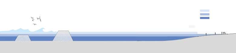
LINE OF WIND TIDE DEFENCE
DATE: 05/2023-07/2023
L Scale
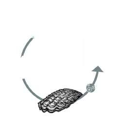
OYSTER ACROSS THE SEA
DATE: 09/2022-11/2022
M Scale
PROJECT 3
ERODED SITE
CONEY ISLAND RESHAPING
DATE: 09/2024-12/2024
M Scale
PROJECT 4
ABANDONDED SITE
BETWEEN THE DRUM TOWERS
DATE: 07/2022-09/2022
S Scale
PROJECT 5 & MORE
OTHER WORKS FROM SCHOOL
DATE: 09/2020-09/2023
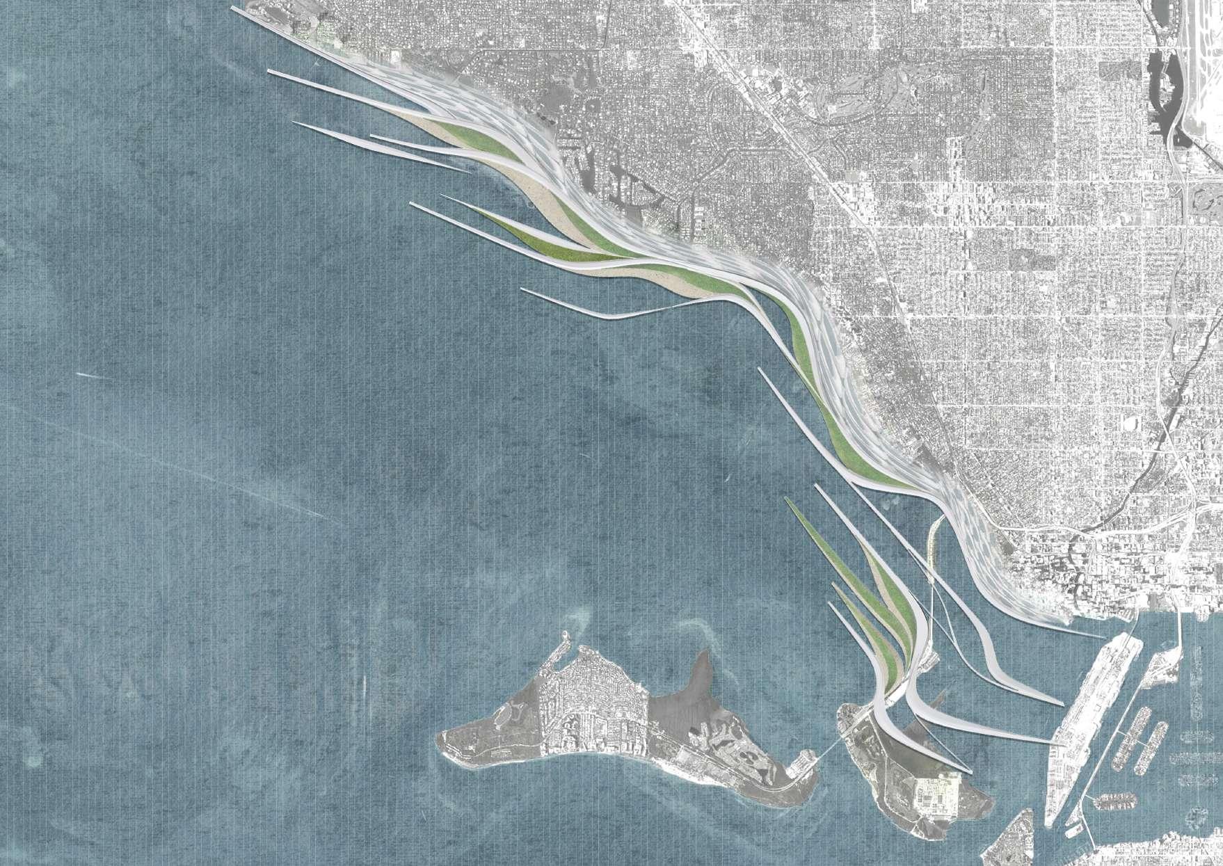
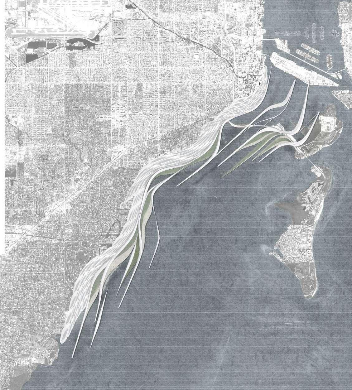
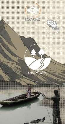
LINE OF WIND TIDE DEFENCE
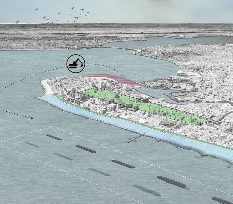
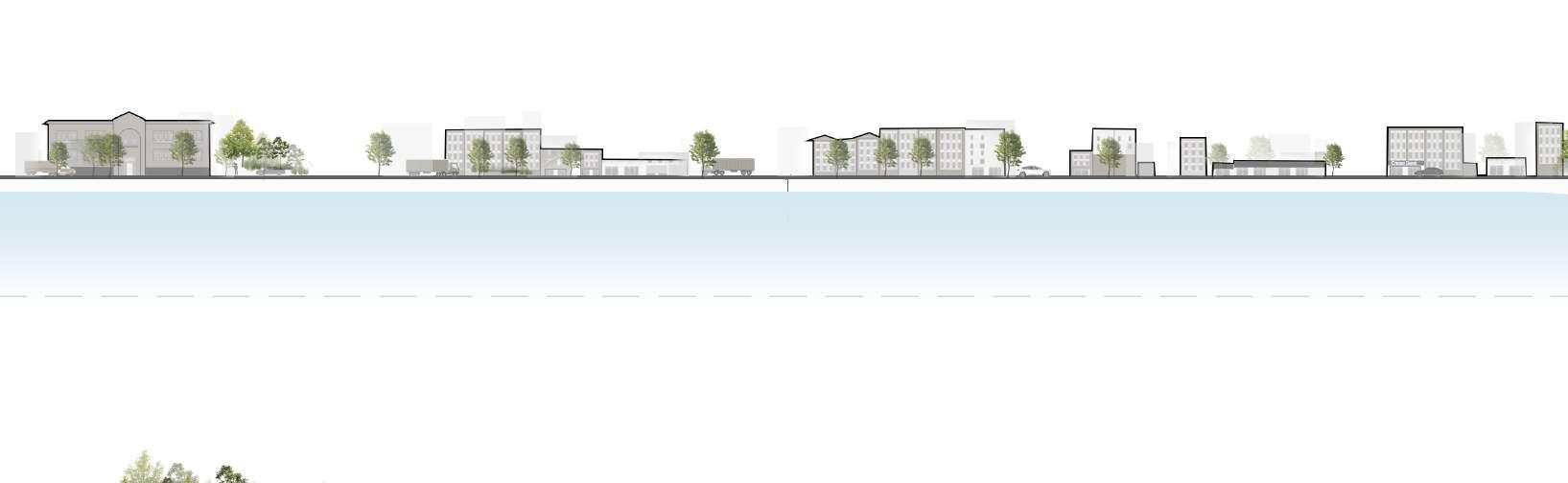
A windbreak landscape along the coast of Miami
"The
relationship between architecture and the environment is not only aesthetic but also an ecological responsibility. Through ecological transformation, we can create architectural landscapes that harmonize with nature."
——Ken Yeang
SEA LEVEL RISING & STORMWATER FLOODING ISSUE IN FLORIDA COAST
Sea level along the U.S. coastline is projected to rise, on average, 10 - 12 inches (0.25 - 0.30 meters) in the next 30 years (2020 - 2050), which will be as much as the rise measured over the last 100 years (1920 - 2020). Sea level rise will vary regionally along U.S. coasts because of changes in both land and ocean height.
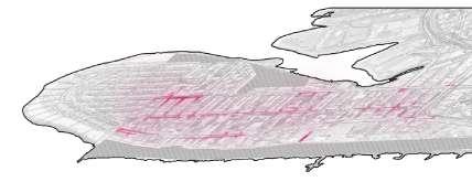
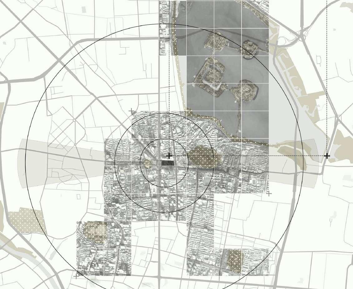
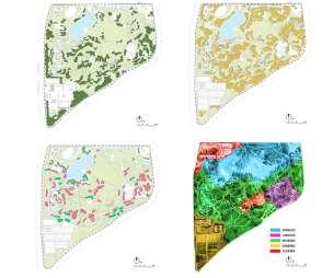
HISTORY AND CURRENT SITUATION ANALYSIS
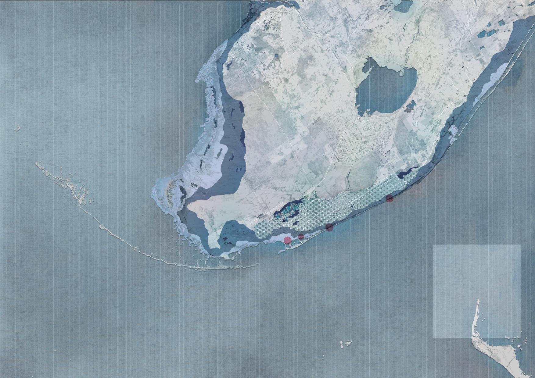
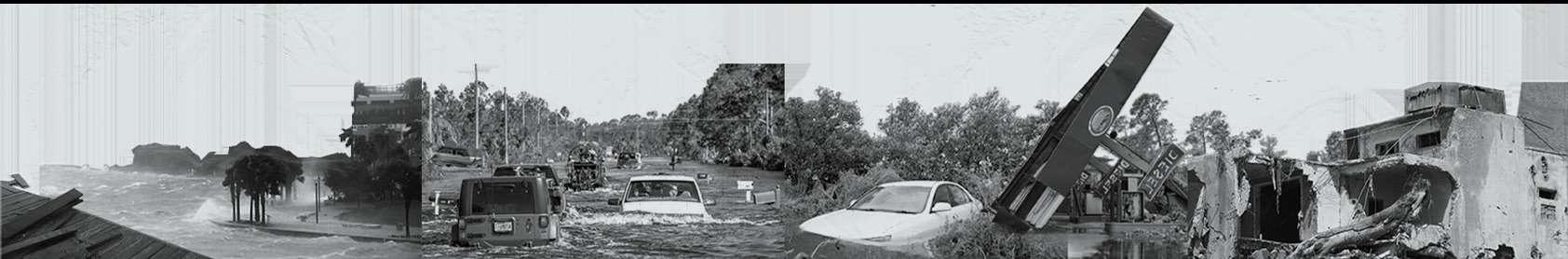
Miami is located on the East coast of Florida and is affected by Atlantic hurricanes throughout the year. As global warming has intensified in recent years, long-term sea level rise has become a crisis that Miami needs to pay attention to.
Extreme weather events such as floods and hurricanes can damage fish farms. In both cool and warm regions, shellfish and salmon farms will be adversely affected by a warming climate, as fish cannot survive blooms and new pathogens brought on by higher temperatures.
Flood Zone
The floodeed areas are mostly farmland, as well as houses and airports.
Irma made landfall in Florida in 2017, bringing strong winds when it made landfall, which has killed at least 50 people and caused several power outages.
Hurricanes bring waves and prolonged rainfall, which can easily cause flooding and damage.
Groundwater infiltration
Beneath Miami is porous limestone, 30 to 40 meters deep, a bit like a sponge, and the sea can easily penetrate.
Rising sea levels and wind waves have made crossing the bridge dangerous for people seeking refuge.
Inundation of urban area
Sediment from farmland and forests Infrastructure damage
House Collapse
Coral Gables Waterway
Great Miami River
Black River +
Hurricane Irma (2017)
William M Powell Bridge
Miami City
Virginia Island
Key Biscayne
Dodge Island
CURRENT POTENTIAL EMERGENCY
WIND TIDE (instantaneous)
SEA LEVEL RISE (Chronic)
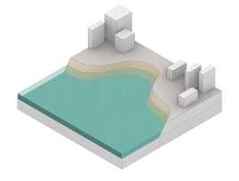
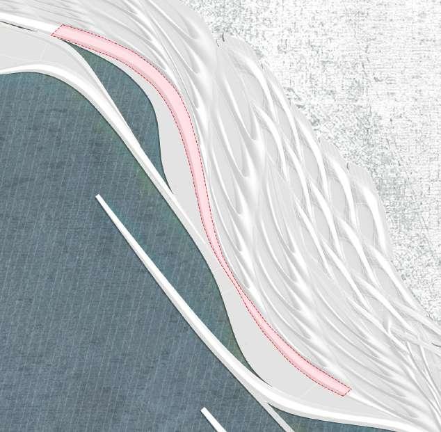
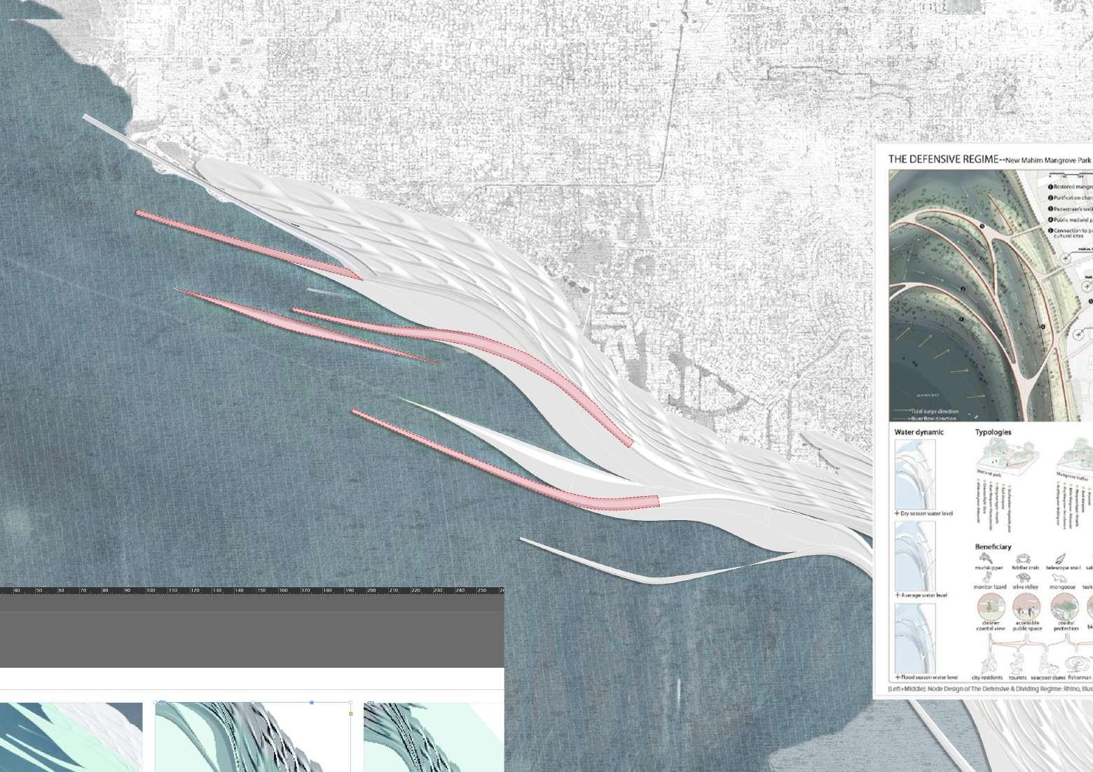
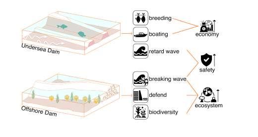
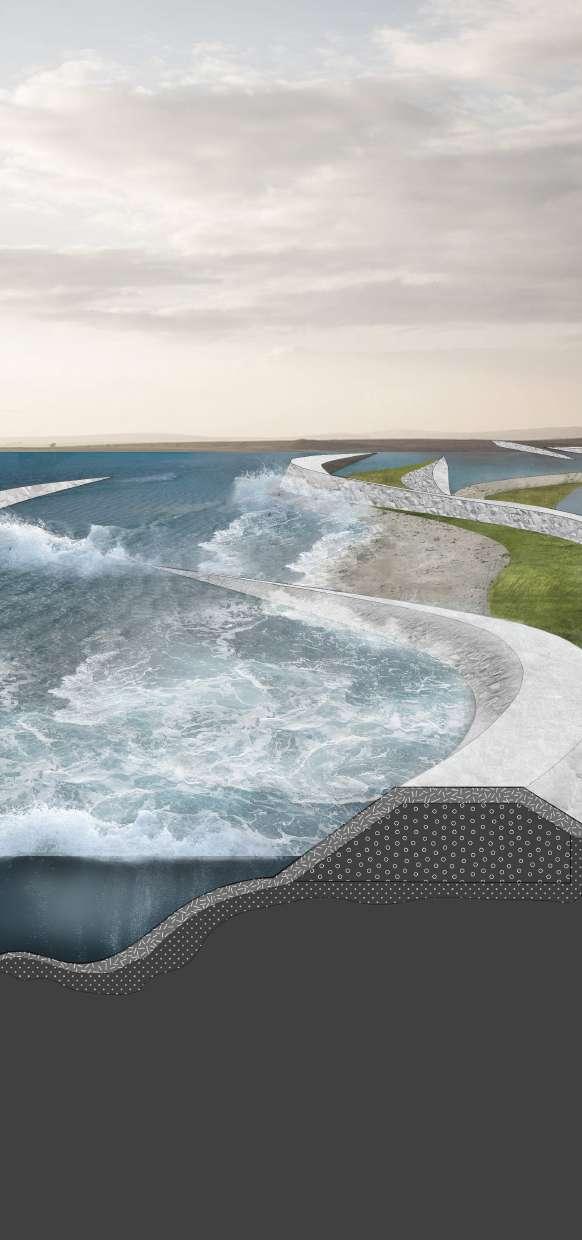
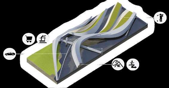
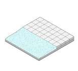
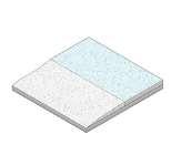
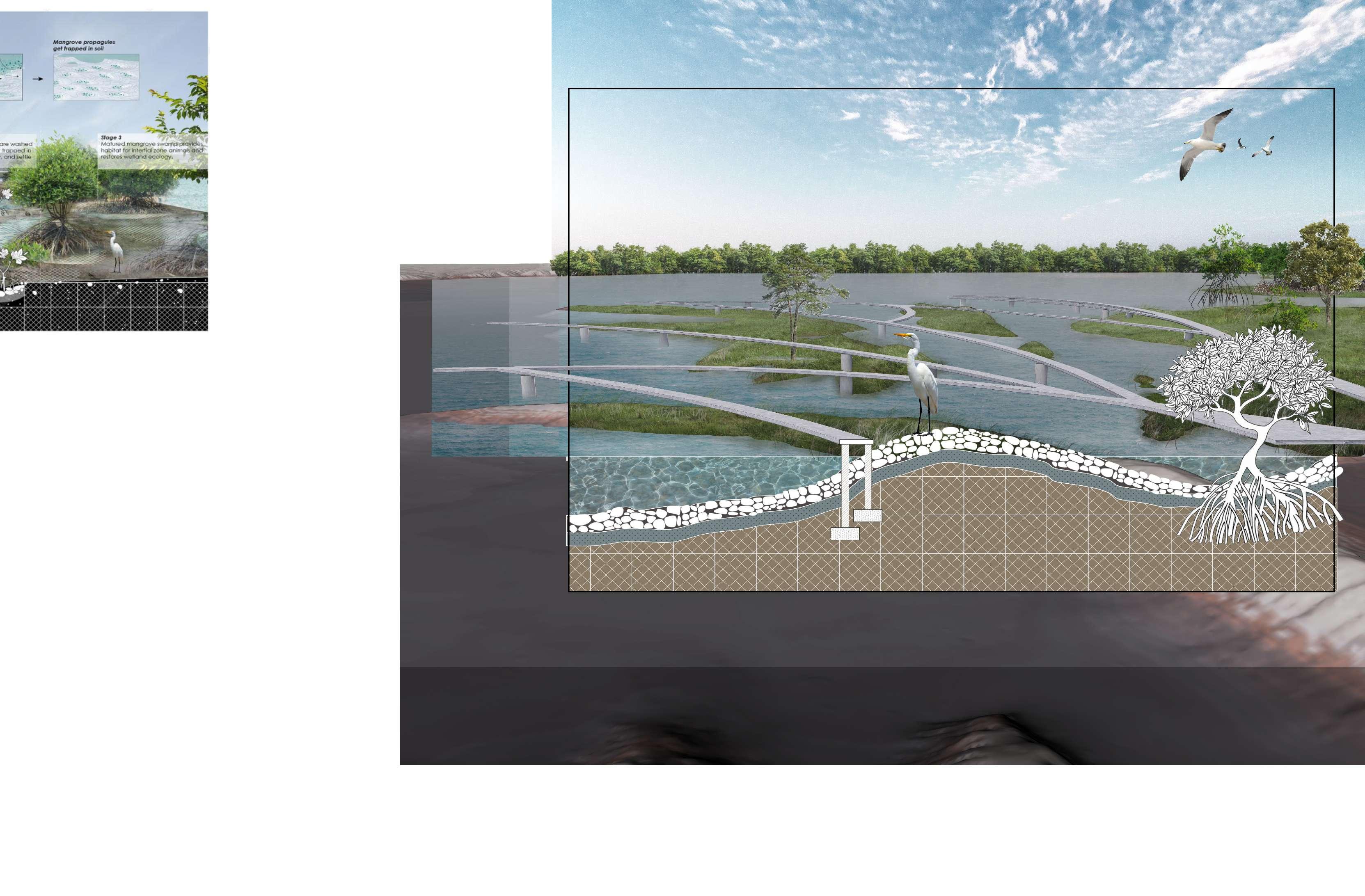
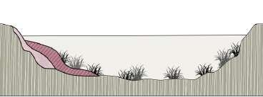
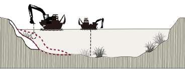
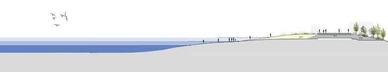
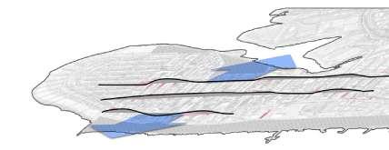
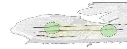
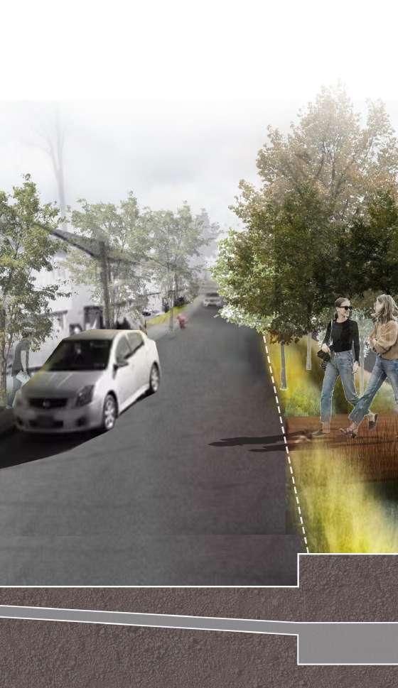
1ST LINE OF DEFENSE
Tidal retaining wall
URBAN WATER POLLUTION (Chronic)
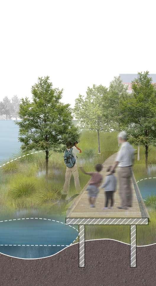
MECHANISM OF PROTECTION
2ST LINE OF DEFENSE
Hydrophobic protected terrain
3ST LINE OF DEFENSE
Ecological water cycle
ORDINARY:The three stages function separately.
SEA LEVEL RISE:Long-term sea level rise depends on coastal wetlands and relief from terrain.
URBAN WATER POLLUTION:The difference in topography is used to pass domestic water through the reservoir section, where it is purified for the first time, and then used to conserve the landscape through the wetland section. Breaking wave
WIND TIDE:Retaining walls above and below the surface can effectively protect against wind waves.
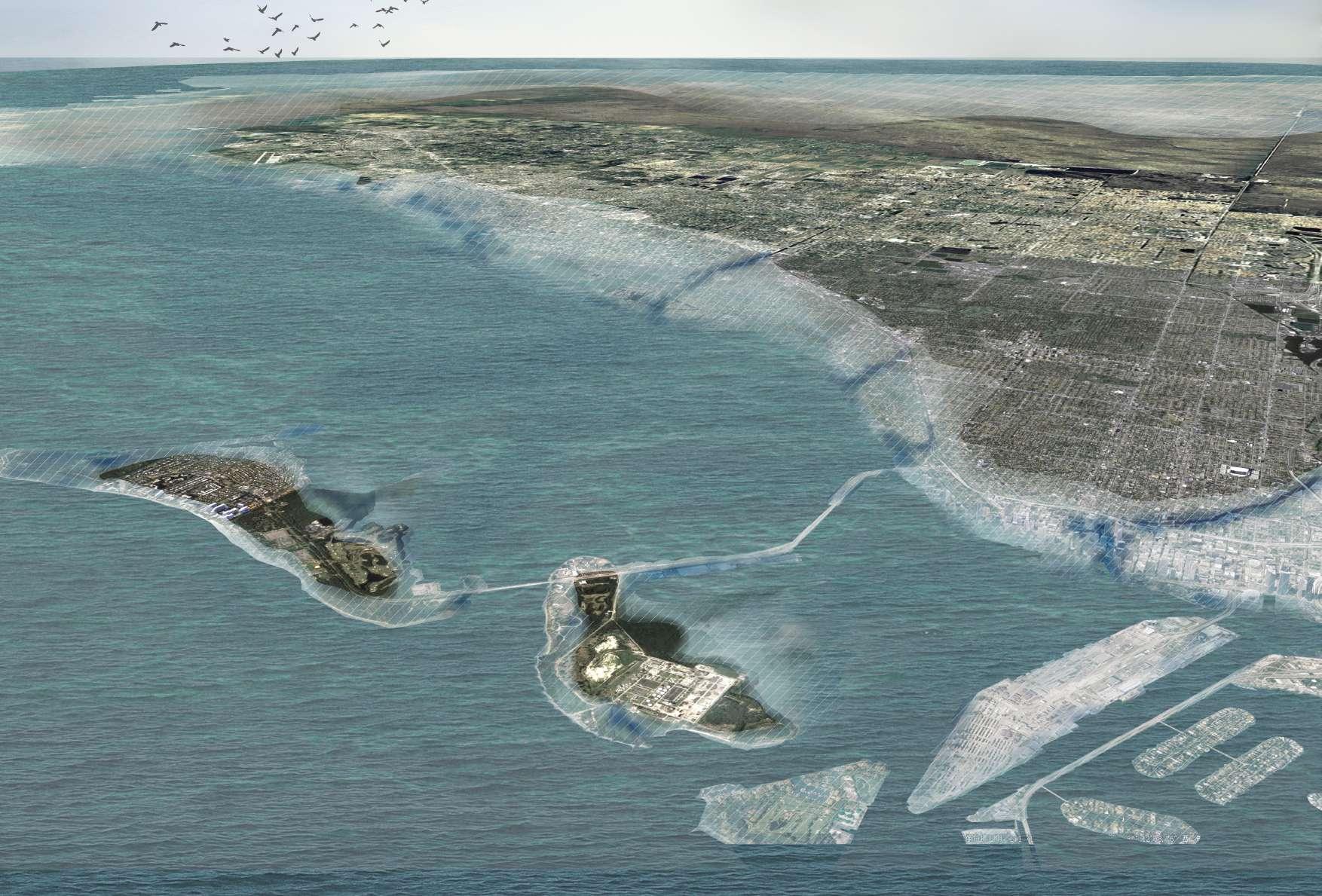
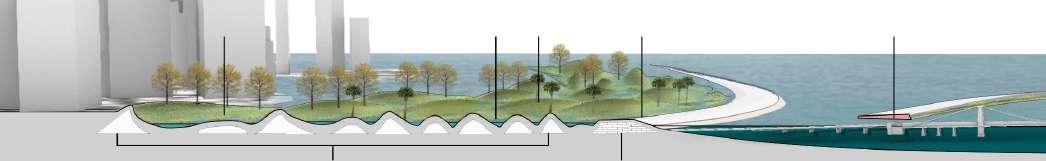
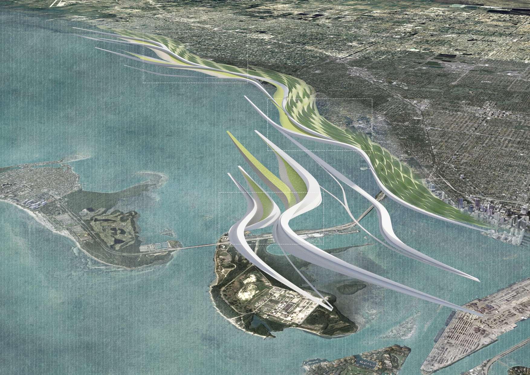
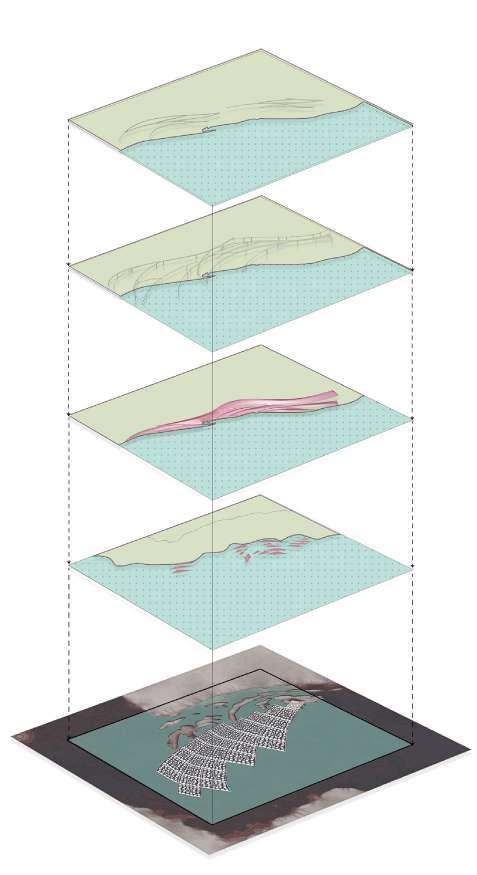
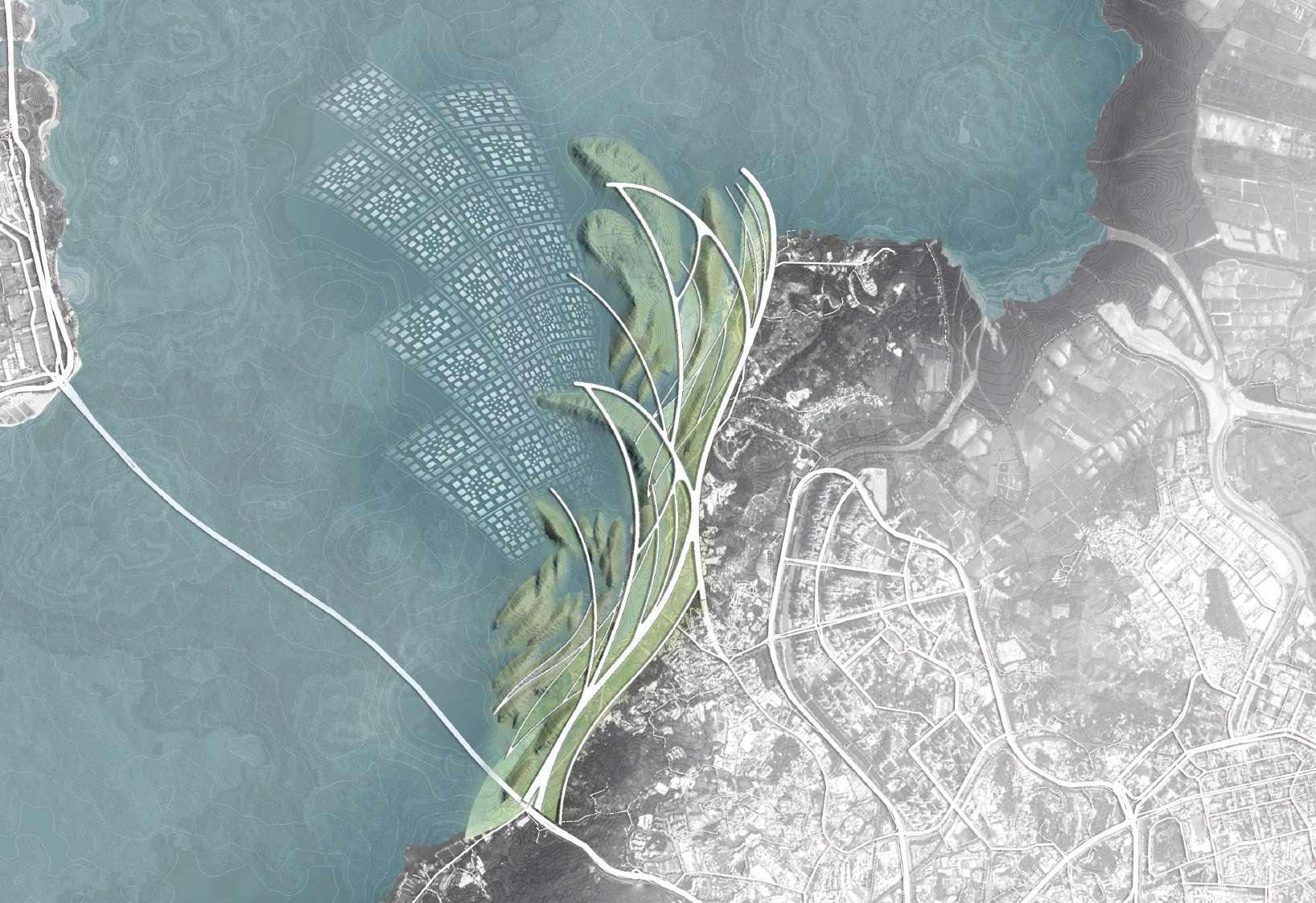
INTRO
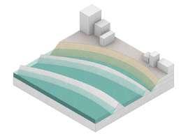
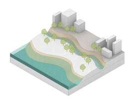
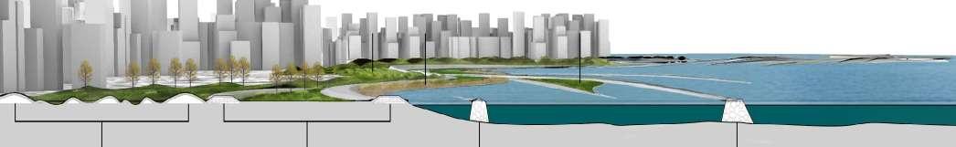
The landscape system along the Miami coast is designed to mitigate the erosion caused by wind waves from the western Atlantic Ocean and to mitigate sea level rise. It enriches the disaster protection system along the coast, and connects three layers of protection devices with the shape of streamline, which has a beautiful effect.
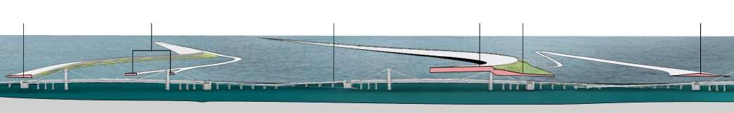
Pedestrians
Car ways
Ship route
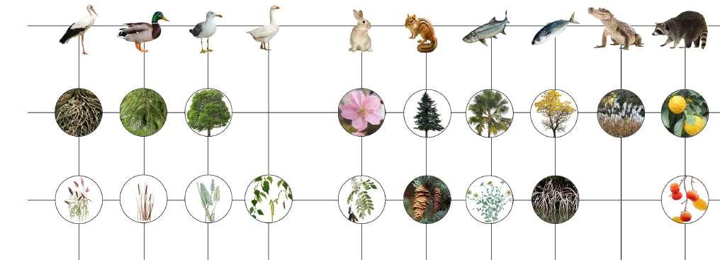
Wildlife
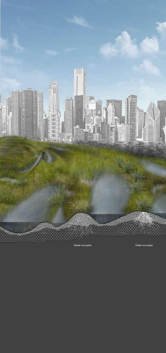
Woodland
Groundcover & Shrub
Gruidae Anas platyrhyncho Larus canus
cygnoides Leporidae Sciuridae Thunnus Perca flavescens
Cortaderia selloana Typha orientalis Nymphaea tetragona Magnolia grandiflora
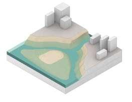
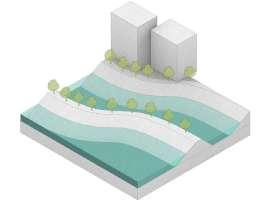
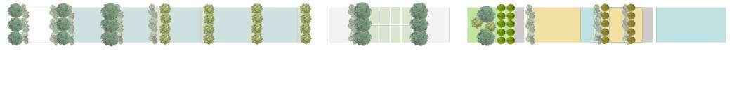
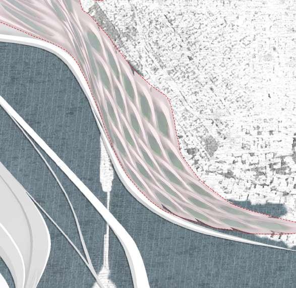
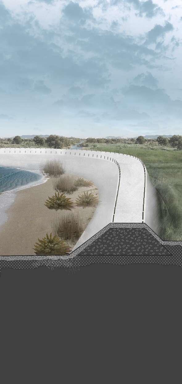
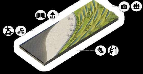
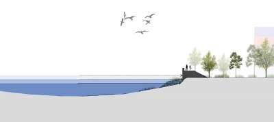
OUTER LAYER
Offshore Dam Against Wind & Wave
MIDDLE LAYER
Coastline maintenance & Sea Level Rise Mitigation
INTERIOR LAYER
Ecological Wetland Protection & Purification
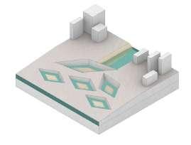
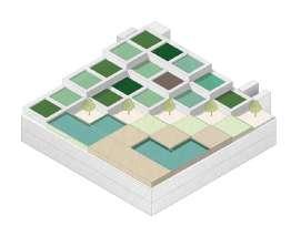
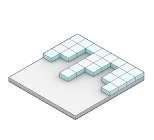
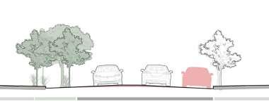
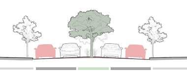
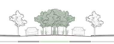
Beach
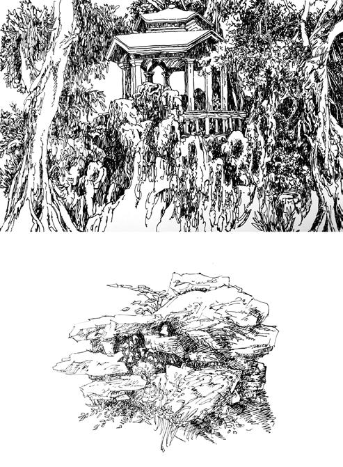
Activity setting
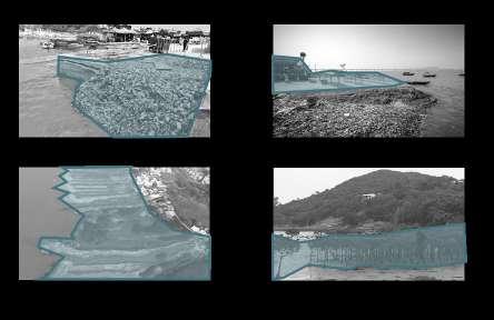
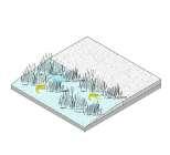
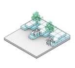
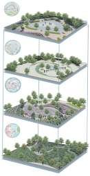
Three bird 's-eye views show the rich activity in the landscape.
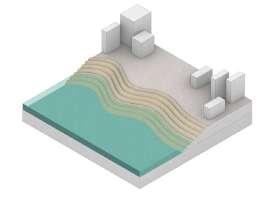
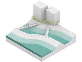
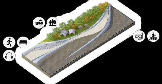
Terrain
Dam
Wind defense
Cross-sea architecture
Bridge
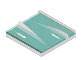
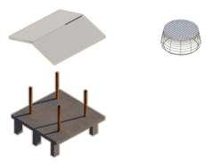
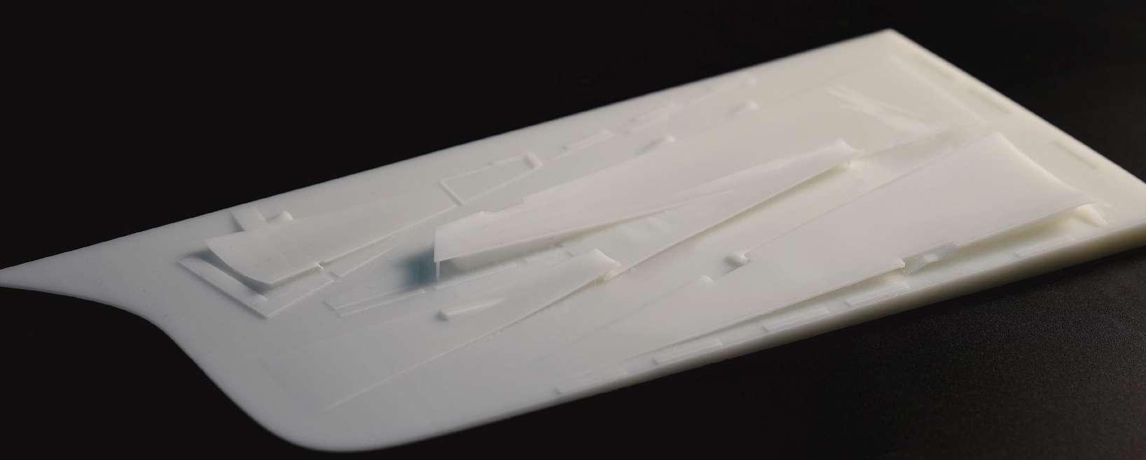
Resin model showing structure
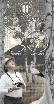
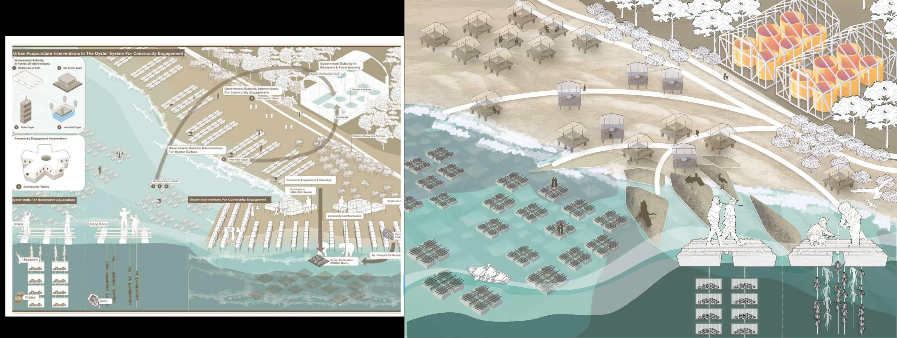
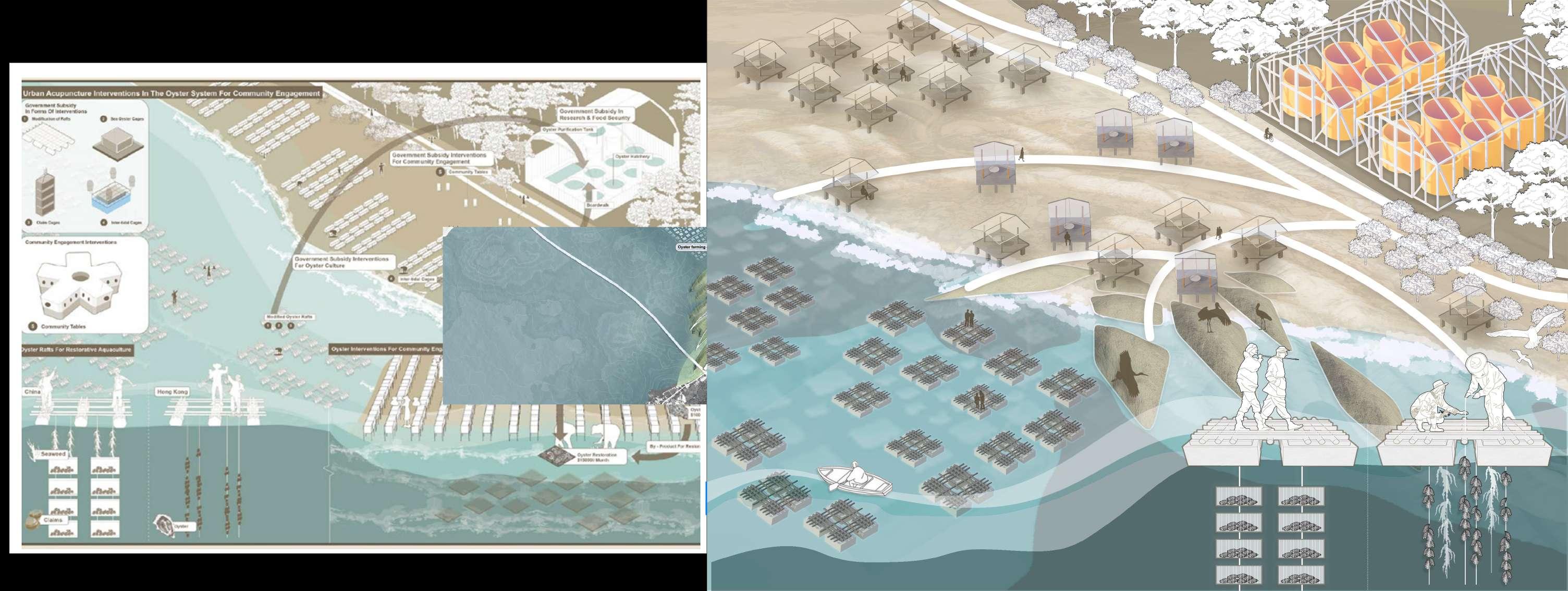
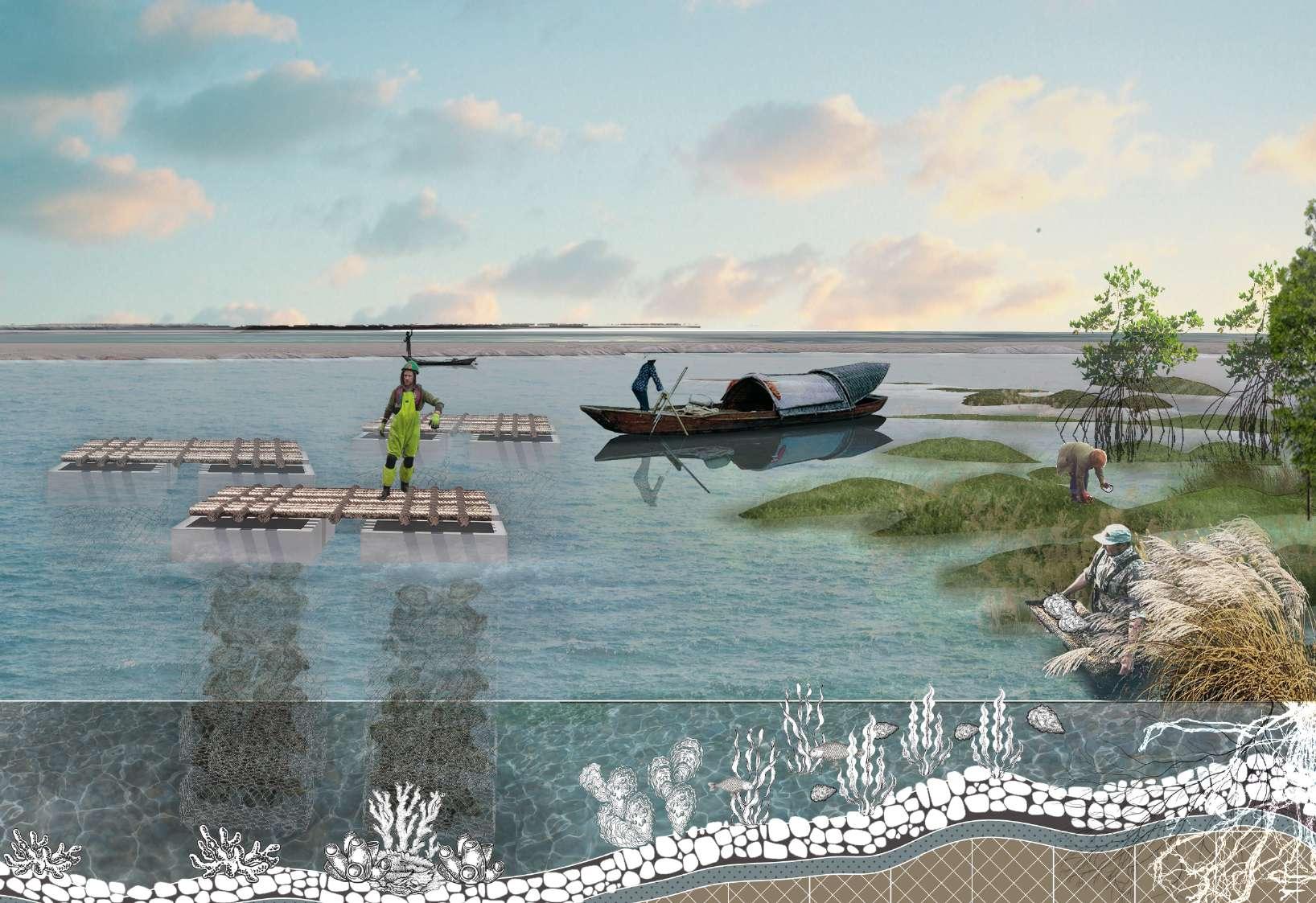
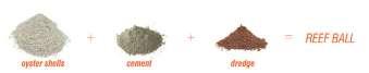
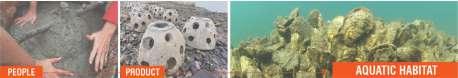
OYSTER ACROSS THE SEA
Ecological restoration project on the border between Shenzhen and Hong Kong
"The beauty of a landscape lies not only in its appearance but in its ecological functionality. Through transformation and preservation of ecosystems, we can create more sustainable and healthier environments."
——Martha Schwartz
Ecological restoration project on the border between Shenzhen and Hong Kong
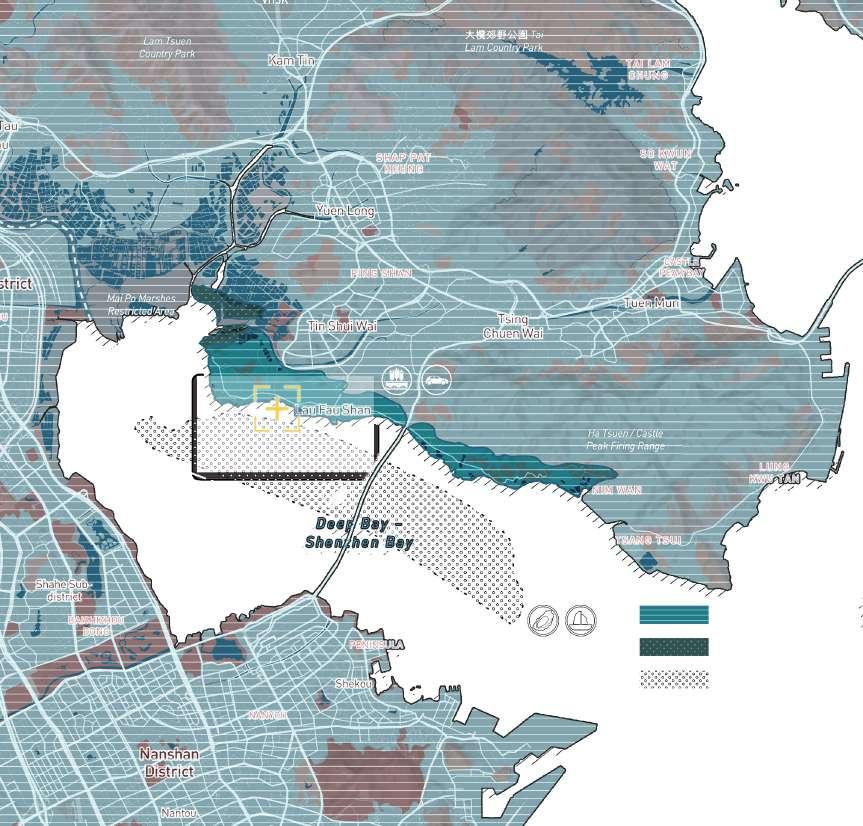
Location: Lau Fau Shan, Hong Kong
Instructor: XiYue Wang, Xi Zheng Time: 09/2022-11/2022
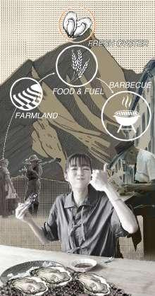
Discription:Facing multiple challenges, the area had been under scrutiny due to severe industrial pollution in the Shenzhen Bay area, decline in oyster farming, a somewhat unkempt community environment, and irregular housing arrangements.
OYSTER INDUSTRY ON THE SHENZHEN-HONG KONG BORDER
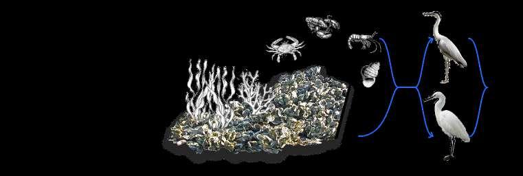
Habitat
I.Oyster shells were
II.Barbecue and other recreational facilities are poor.
Lau Fau Shan Comunnity
III.The shoreline is rudimentary and unorganized, with vast areas of silt.
IV.There are mangrove soil consolidation areas with modest success.
Lau Fau Shan
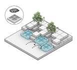
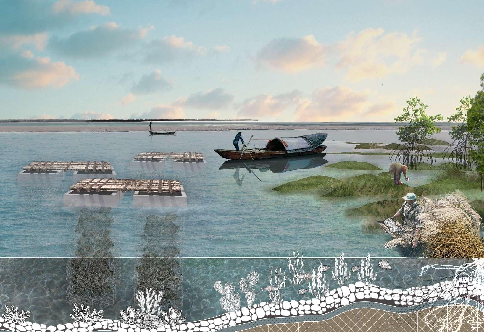
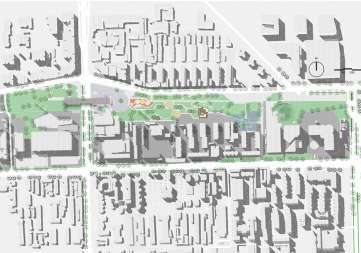
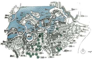
MASTER PLAN
INTRO
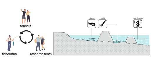
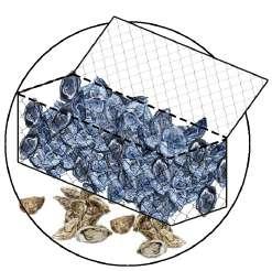
Through investigation and planning, the project rearranges oyster breeding rafts in the bay, and uses discarded oyster shells to construct landscape terrain, which can conserve ecology and the habitat of endangered animals and plants.
Terrain Sections
Oyster farming area
Wetland
Restoration of Oyster Culture area & Improvement of Community Economic Structure
Oyster Rafts
Barbecue House Area
Foam Platform Oyster Breeding Cage
The Construction of Oyster Breeding System
Structural analysis of oyster system
OYSTER FARMING SECTION
Material flow of raw oyster shells to Lau Fau Shan ecological restoration
shells can purify industrial sewage
oyster shells and make ecological gabion nets
stage3:Oyster Farming Rafts
By hanging oyster breeding rafts on the water, the breeding density of oysters can be effectively increased and more growth space can be provided for them. It provides a sustainable resource for local fisheries.
stage2:Natural Oyster Growth
Oyster reefs not only filter seawater and improve water quality, but also attract fish, algae and other organisms, forming an ecologically balanced Marine environment.
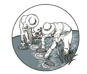
stage1:Oyster Seeding
By placing oyster seeds on the shore or in shallow water areas, they are guided to attach and grow naturally.
Riparian plants +
Coral reef +
Collect
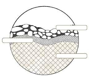
Oyster stone cage buried
Laminaria plexus +
Pebble layer Sand layer
Oyster shell layer
Oyster
Workers collect and recycle oyster shells
ECOLOGICAL WETLAND SECTION
Material circulation and construction process of wetland system
Corals and algae further purify the water
stage3:Infrastructure construction
Paved roads can not only facilitate the entry and exit of tourists and close contact with animals.
stage2:Rare animal habitat
Oyster wetlands provide rich food resources and a safe breeding environment, attracting a variety of wildlife, including birds, fish, amphibians and more.
stage1:Mangrove planting
Planting mangrove saplings on the shore can achieve soil fixation, slow down the speed of water flow, reduce the erosion of sediment, and thus play a role in soil consolidation.
Anatidae +
Chinese Egret +
Mangrove Forest +
Oyster Farming
Crane Egret
Lobster Shrimp Crab Spiral shell
Habitat
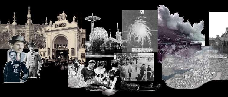
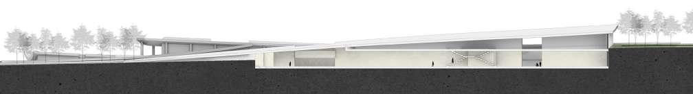
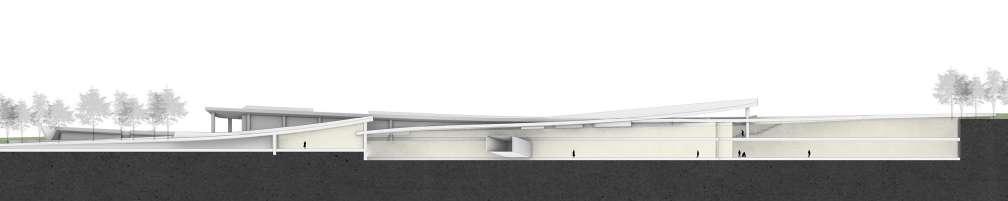
Coney Island: Shaping the Future of Land and Sea
Resilient Landscapes for a Changing Coastline
Due to its location and vulnerability to storm surges and flooding, especially during hurricanes, Coney Island has been designated as Evacuation Zone 1 in New York City's hurricane preparedness plan. This designation highlights its high risk during extreme weather events, requiring immediate evacuation to protect residents and visitors.
"Designing with nature means understanding and working with the forces of the environment, rather than against them."
——— Ian McHarg
Location: New York, United States
Instructor: Maria Goula
Time: 09/2024-12/2024
Discription:This project aims to address the severe environmental and socio-economic challenges faced by Coney Island, including coastline erosion, flooding, and the threat of rising sea levels to community safety. Located in one of New York City's highest-risk evacuation zones, Coney Island's coastline has suffered from prolonged erosion, while sediment accumulation in the creek has caused water flow blockages, further exacerbating flooding issues. These challenges have hindered Coney Island's ecological and economic development, making it difficult to reclaim its historical prosperity as a renowned seaside destination and amusement park.
I hopes to design a sustainable flood and erosion management plan for Coney Island by integrating ecological and engineering approaches, while also creating a safer and more livable environment for local residents. Furthermore, in the future, it aims not only to address the ecological crisis of Coney Island but also to promote the socio-economic revival of the area through these measures, providing replicable solutions for other similar regions in New York.
This project only displays a selection of images due to space limitations.
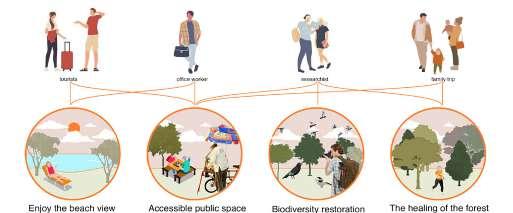
Coney Island, located in the southern part of Brooklyn, is a renowned seaside destination attracting millions of visitors annually. Tourists primarily come from within New York City, nearby states like New Jersey and Connecticut, and international travelers seeking its iconic attractions, such as the boardwalk, amusement parks, and sandy beaches.
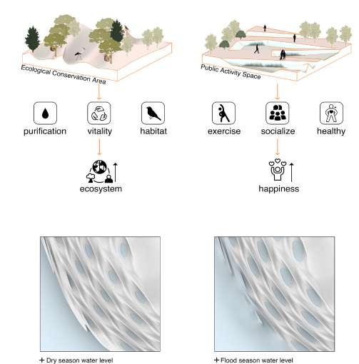
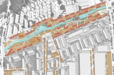
Strategy Overview
Phase1
Processing of dredged material and construction of offshore breakwaters using product reef ball to withstand wind and waves.
Phase2
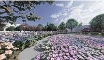
On the south bank, dune elevated by the boardwalk and planting of protective plant species to mitigate sea level rise issue on the south shore.
Phase3 Creek
Construct on-land flood protection system along the creek, leaving a small amount of access for residential access. Closed during flood season.
Try to maximize the use of dredge material.
Boardwalk
Boardwalk
Bio-Swales
Phase4 Street
Street Planting & Drainage
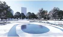
Rendering Expectations for Coney Island
CREEK
STREET
COAST
Beach Grass System
Elevated Boardwalk
"Sight is an intuitive language of architecture, through which buildings engage in a profound dialogue with their surroundings and people's emotions."
——I. M. Pei
04
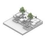
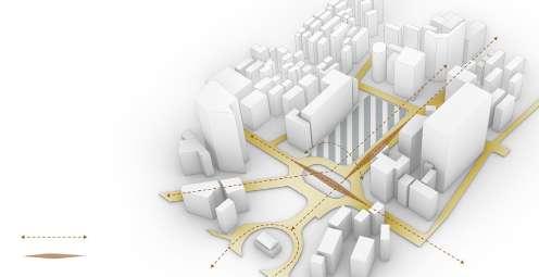
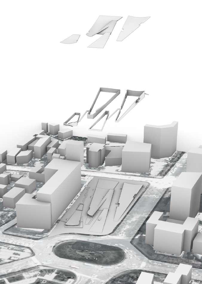
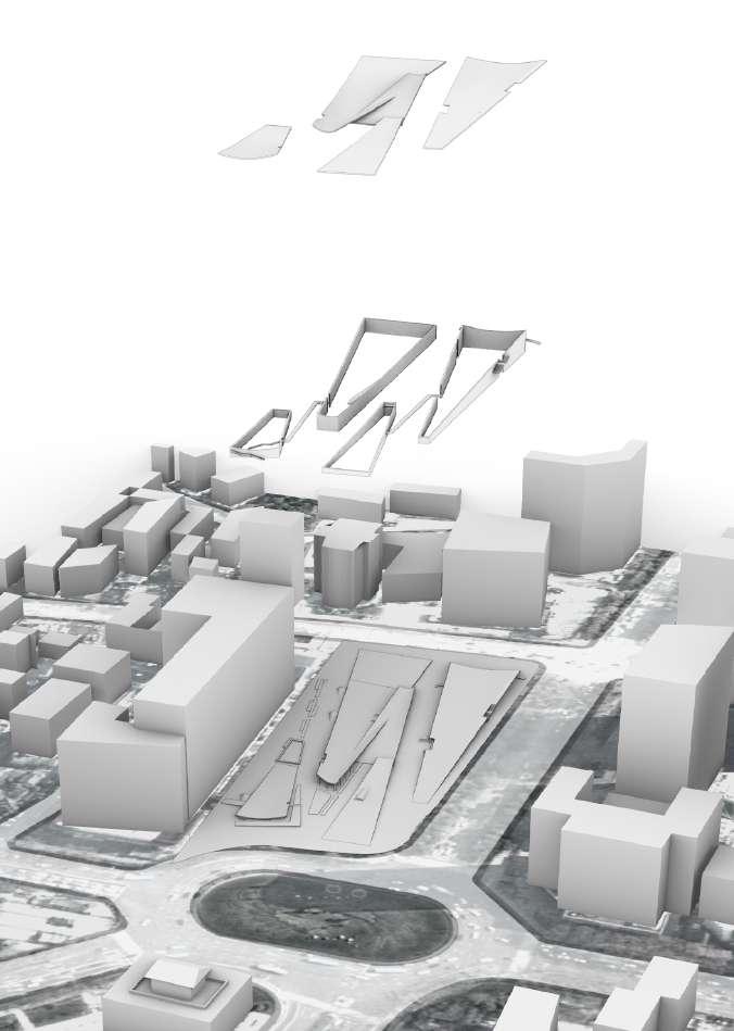
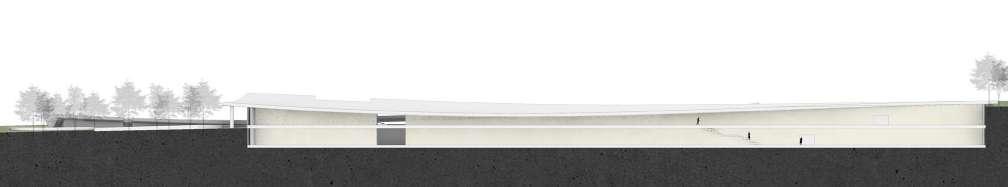
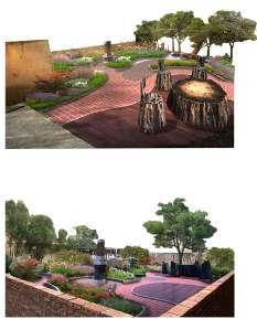
BETWEEN THE DRUM TOWERS
Landscape connects the east to west view
Landscape connects the east to west view
Location: Nanjing, China
Instructor: JinShi Zhang, Liang Li Time: 07/2022-09/2022
Discription:This project analyzed the axis of the Drum Tower in Nanjing and found a concatenated plot in urgent need of renovation. Through the use of the original height difference and geographical advantages of the site transformed into a park green space, used to connect the line of sight.
The initial construction of the oval ring island aims to further improve the traffic safety situation here.
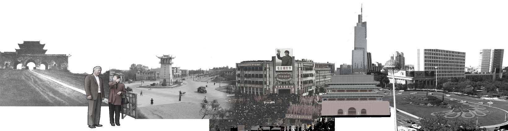
Drum Tower Square was used for the workers' movement.
Nanjing Drum Tower is a building of Ming and Qing Dynasties located in the center of the city of Nanjing, China.
The Zifeng Building landed and became a new landmark in Nanjing in addition to the Drum Tower.
The landscape on the axis of Drum Tower Square is not connected, the line of sight is not good which
recunstruct
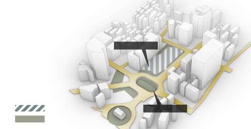
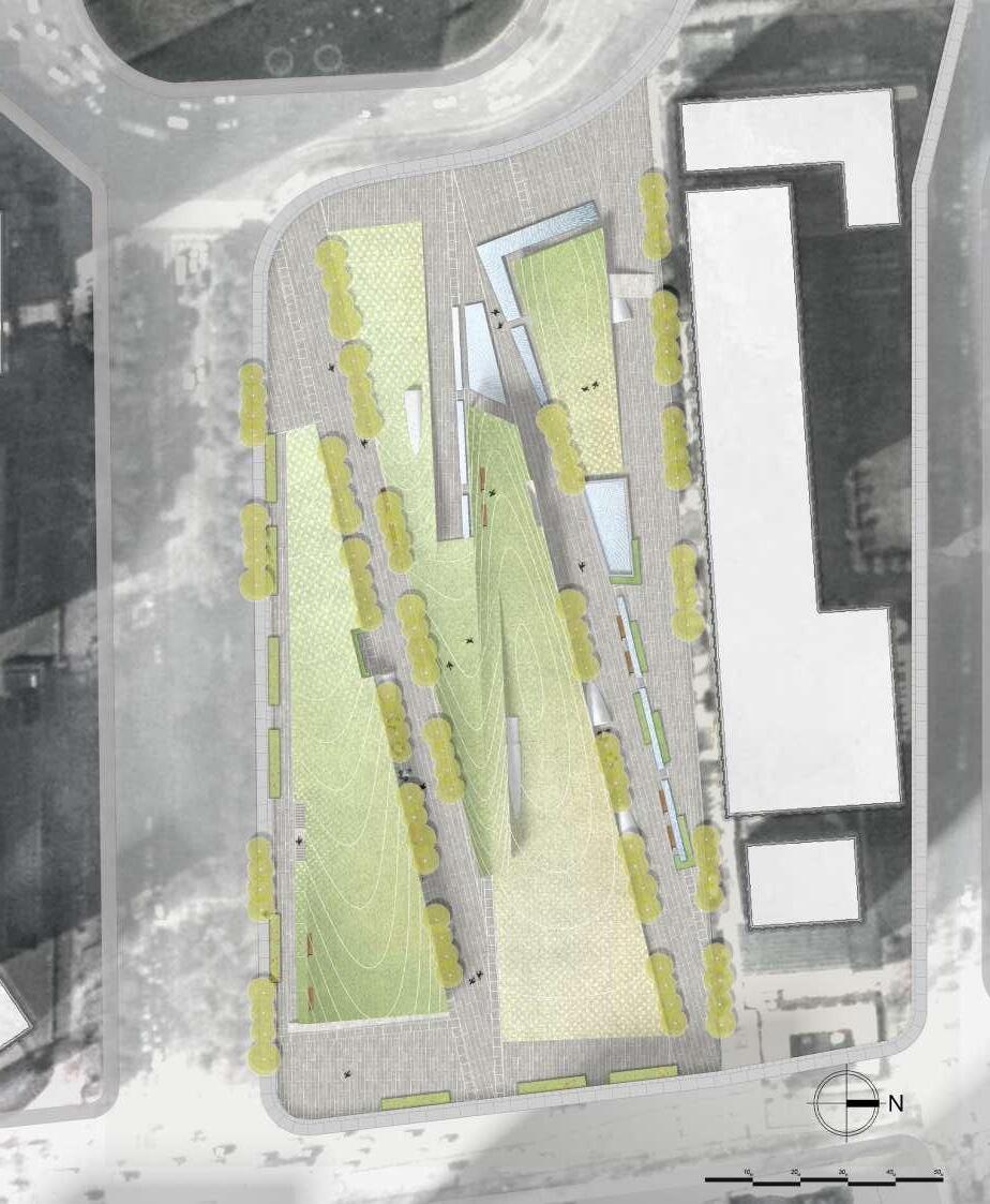
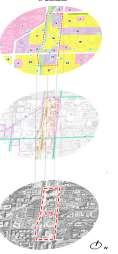
MASTER PLAN
The green space connects the view
The project is located in the center of Nanjing, a city that is changing from old to new. Surrounded by the steel forest, the project has the effect of connecting the east-west view and enhancing the green view of the city center.
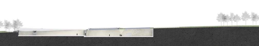
System explosion diagram
Soil covered upper layer
View point
Grassland
Galery
Step corridor
Drum Tower Square
Pedestrian walking system
Different sections of the underground structure have different functions to meet the various needs of office workers.
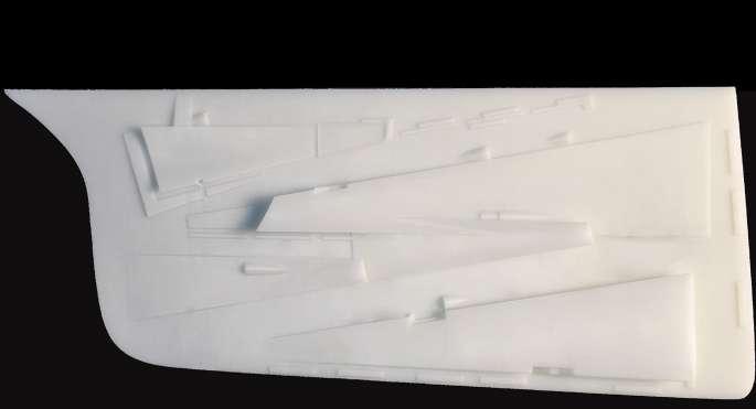
Model:Resin model showing structure
Topographical changes Resin(Terrian)
Aerial View:
Roof space Walkway Under cover space
OTHER WORKS FROM SCHOOL
Time: 09/2020-09/2023
Sections of my coursework Discription: This is part of a university-related coursework that showcases the study of many aspects of landscape, landscape architecture and art.