


FEBRUARY 2019
Thank you to all the groups, residents, students, business owners, and elected officials who participated in the creation of this Plan.
Des Plaines Community and Economic Development Department
Michael McMahon, Director of Community and Economic Development
Patrick Ainsworth, Economic Development Coordinator
Johanna Bye, Senior Planner
Davorka Kirincic, Associate Planner
Lauren Pruss, Economic Development Coordinator (former)
Des Plaines City Council
Mayor Matthew J. Bogusz
Michael Bartholomew, City Manager
Mark A. Lysakowski, Alderman of Ward 1
John Robinson, Alderman of Ward 2
Denise Rodd, Alderman of Ward 3
Dick Sayad, Alderman of Ward 4
Carla Brookman, Alderman of Ward 5
Malcolm Chester, Alderman of Ward 6
Don Smith, Alderman of Ward 7
Mike Charewicz, Alderman of Ward 8
Funding Acknowledgement
This project was supported through the Chicago Metropolitan Agency for Planning’s (CMAP) Local Technical Assistance (LTA) Program, which is funded by the Federal Highway Administration (FHWA), Federal Transit Administration (FTA), U.S. Department of Housing and Urban Development (HUD), Illinois Department of Transportation (IDOT), the Chicago Community Trust, Cook County Community Development Block Grant Disaster Recovery Program (CDBG-DR), and the Illinois Environmental Protection Agency (IEPA). CMAP would like to thank these funders for their support for this project.
Des Plaines Comprehensive Plan Steering Committee Members
Steven Andrews, Community Relations Representative, Pace
Andrea Biwer, Executive Director, Des Plaines Chamber of Commerce
Alderman Mike Charewicz, 8th Ward, Des Plaines City Council
Richard Fisher, Civil Engineer, Metropolitan Water Reclamation District of Greater Chicago
Colette Hands, VP Continuing Education, Training & Workforce
Development, Oakton Community College
Audrey Haugan, Principal, Maine West High School
Ray Imig, Board Member, District 62
Don Miletic, Executive Director, Des Plaines Park District
Wharton Sinkler, Resident and Bike Activist
Holly Sorensen, Director, Des Plaines Public Library
Jim Szabo, Chairman, Des Plaines Planning and Zoning Board
Cynthia Veremis, Vice President, LSG Sky Chefs
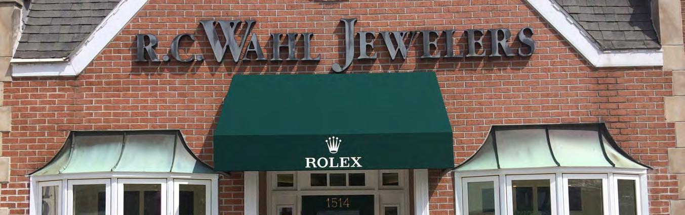
Heather Wahl, Owner, Wahl Jewelers
Project Consultants
Downtown Market Assessment
SB Friedman Development Advisors
Goodman Williams Group
Development Planning Partners
Stormwater Analysis
Christopher Burke Engineering
Homes for a Changing Region Panel
Nancy Firfer, Metropolitan Planning Council
King Harris, Metropolitan Planning Council
Kyle Smith, Metropolitan Mayors Caucus
Zach Lowe, Development Planning Partners
Andrew Field, Illinois Housing Development Authority
Rebecca Ortiz-Macias, Illinois Housing Development Authority
Nora Boyer, Arlington Heights/Northwest Housing Partnership
Unless otherwise specified, all photos are by Des Plaines City Staff or CMAP staff.
A comprehensive plan establishes the 10-year vision of a community’s desired physical environment and outlines the process by which the community can realize that vision. In addition to serving as a framework for future reinvestment and redevelopment in the community, the plan seeks to explore and promote new opportunities that reflect changes in the community and surrounding socioeconomic landscape.
This plan serves as a guide for elected and appointed officials, City staff, community residents, local business owners, and potential investors, allowing each to make informed administrative and implementation choices regarding land use, transportation, infrastructure, and capital improvements throughout the City.
The comprehensive plan is a statement of policy; it is not a regulatory document. This plan should be flexible and able to adapt to change. At any time, this plan can be updated to better match shifting local needs, interests, and opportunities. It is recommended that the plan be reviewed every five years to ensure the document remains relevant.
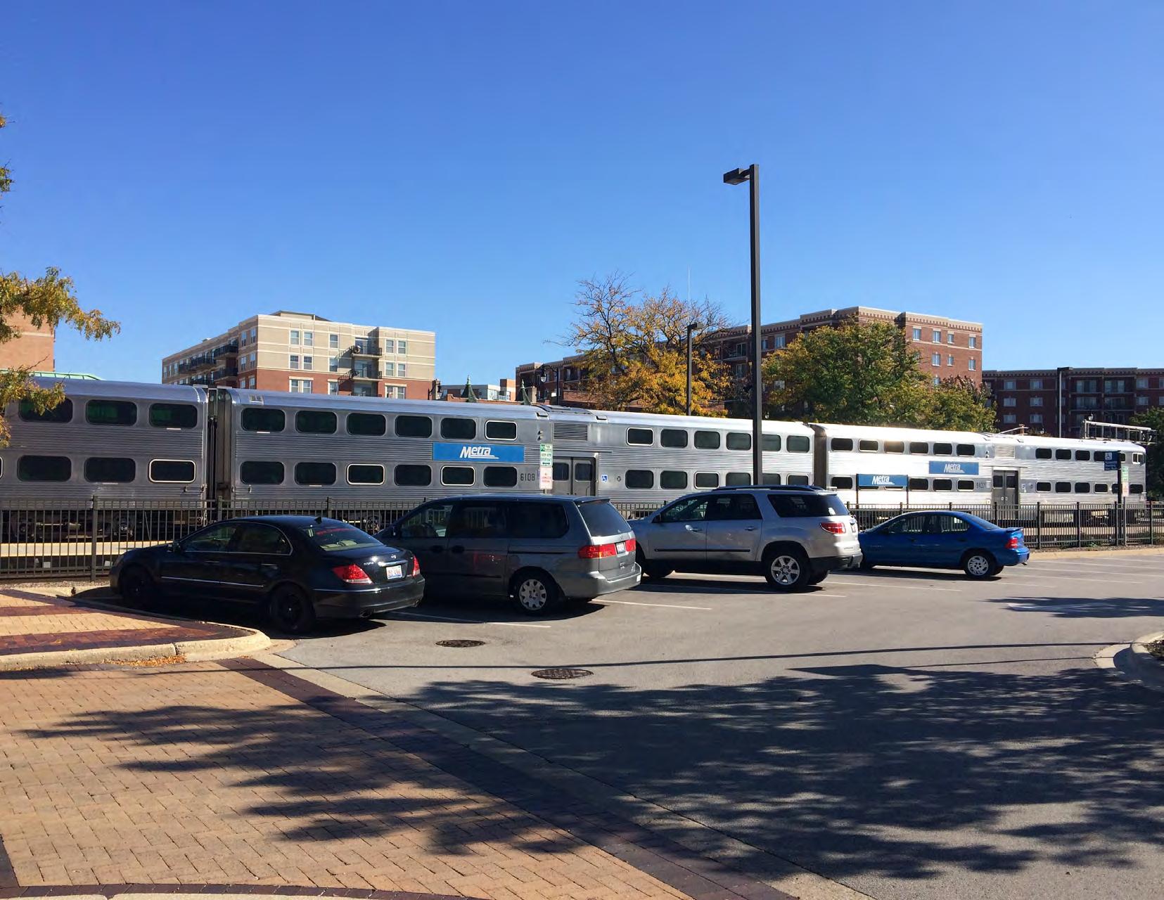
The City of Des Plaines study area ( Figure 1.1 ) is located in Cook County, approximately 19 miles northwest of downtown Chicago. Neighboring communities include Mount Prospect, Park Ridge, Elk Grove Village, and Chicago, as well as unincorporated lands to the northeast in Maine Township and the southwest in Elk Grove Township. O’Hare International Airport borders the City’s southwest boundary. The City is serviced by Interstate 90, Interstate 294, two Metra stations, Pace Bus lines, several major corridors, and the Des Plaines River Trail. The study area spans approximately 9,226 acres and has an estimated population of 58,930.
The City’s most recent comprehensive plan was adopted in 2007 with a number of its recommendations having been successfully completed. The update to that plan will bring together several past planning efforts from the last decade, while reflecting the change in community trends, identifying emerging challenges, and promoting new opportunities.
The comprehensive plan can serve as a marketing tool to highlight Des Plaines’ unique assets and economic advantages within the Chicagoland area. It can also be used to support applications for grants and to demonstrate that future individual projects are supported by a larger effort rather than a stand-alone effort.
The Des Plaines Comprehensive Plan is a result of a multi-stage planning process comprising extensive community outreach, visioning, and drafting of plan recommendations. In October 2016, a scope of work was developed by City and CMAP staff. The work plan established tasks, a timeline, and Steering Committee meetings to review the plan process and deliverables. The 18-month process included opportunities for public engagement including public meetings, interviews, surveys, focus groups, and participation in community events. Community outreach data is summarized in the Appendix (A.1. Outreach Summary).
The Des Plaines Comprehensive Plan is organized into the following chapters:
1. Introduction describes the purpose of the Plan and the process to create it.
2. Land Use and Development identifies future land use and desired character for all parts of the City.
3. Economic Development contains strategies to enhance existing commercial and industrial areas and expand employment opportunities.
4. Housing identifies recommendations to encourage preservation and reinvestment in established Des Plaines neighborhoods, support new housing in strategic locations, and promote a wider range of housing options.
5. Transportation details roadway, transit, and non-motorized transportation strategies to increase safety, connectivity, and access, while detailing diverse mobility options which can support economic growth and improve community image.
6. Diversity and Culture makes recommendations to celebrate, unify, and inform residents of local resources, while building the capacity of local small business owners.
7. Water Management identifies recommendations to minimize impacts of future development in Des Plaines and minimize flood damage, while encouraging responsible future development.
8. Downtown Des Plaines details strategies to retain and attract businesses as well as foster new development to the Downtown, while improving the district’s identity to attract more visitors.
Each chapter concludes with an Implementation Table that summarizes actions to be undertaken by the City and its partners following adoption of the Plan. While the Implementation Table identifies potential partners, the City of Des Plaines remains primarily responsible for all action items. The table lists potential partners, but does not indicate a commitment or responsibility on their behalf.
The City should focus its efforts on expanding mixed-use developments in the Downtown, near the Cumberland Metra Station, and along the Oakton Street Corridor. Mixed-use developments encourage development within compact areas of land, reduce traffic and pollution, and contribute to the creation of a pedestrian-friendly environment.
In addition to mixed-use development, the City should be open to the development of high-quality townhomes and other multiple-unit residences that would provide convenient access to shopping, civic uses, and open space. Downtown Des Plaines and the stretch of Northwest Highway near the Cumberland Metra Station are already home to a variety of housing types; these units provide valuable housing options for the community and allow people to live within close walking distance of several amenities. For the Oakton Street Corridor, it is recommended that the City update its zoning ordinance to permit townhomes, rowhomes, and mixed-use development.
Vacant land is neither abundant nor evenly dispersed in Des Plaines, therefore potential parks and green spaces could be sited where properties become underutilized or vacant, experience repetitive-loss flood damage, or have been dedicated by new developments. The City, in partnership with the Des Plaines Park District, can focus on creating small-scale pocket parks as they become available, or consider creating large-scale open space opportunities in instances where land adds up to more than an acre to achieve recreation and local stormwater management objectives (this type of open space is recommended for the “Lee Street Triangle”, in Chapter 8: Downtown Des Plaines ).
Various stormwater management techniques should continue to be developed and implemented to mitigate flooding issues (riverine and/or urban). Special focus areas have been identified as those around Rand Park and Belleau Lake, Maine West High School, the Cumberland Metra Station and northwest along the rail line, Iroquois Community School, and the Chicago District Campground Association.
In an effort to retain historic character, the City of Des Plaines should seek to preserve and enhance historic buildings in the community. Significant Des Plaines buildings listed under the state’s “Historic Architectural and Archaeology Resources GIS” site include: the First Congregational United Church of Christ (766 Graceland), Willows Academy (1015 Rose Avenue), and the Des Plaines National Bank, now Huntington Bank (678 Lee Street). The City should also continue working with and supporting the efforts of the Chicago District Campground Association, which is listed under the National Registrar of Historic Places (for more on the campground, see Chapter 3: Economic Development ).
Communities that offer access to economic opportunity for residents regardless of the neighborhood they live in, their inherent personal traits like race or ethnicity, and/or their socioeconomic status, enjoy longer, stronger periods of prosperity and fewer, shorter periods of economic stagnation. For a stronger, more equitable future, our region needs to ensure every resident and community has the ability to fully contribute to and benefit from the economy. This framework, known as Inclusive Growth, is one of the principles of CMAP’s regional plan ON TO 2050 .
To promote Inclusive Growth, CMAP identified economically disconnected areas (EDAs) to focus efforts geographically. Within the City of Des Plaines, three areas have been identified as EDAs, meaning census tracts with a concentration of either low-income households (5 percent or more households living below the Chicago MSA median income line) and minority population (47.5 percent or more) or low-income households and limited English proficiency (12.1 percent or more). It is recommended that the City prioritize improvements that may mitigate some of the barriers facing residents living in these areas. Des Plaines EDAs include areas approximately bordered by:
• Mount Prospect Road to the west, Oakton Street to the north, Lee Street to the east, and I-90 to the south;
• Elmhurst Road to the west, Thacker Street to the north, Mount Prospect Road to the east, Algonquin Road to the south; and
• I-294 to the west, Des Plaines City boundary to the north, Potter Road to the east, Ballard Road to the south.
• Goals and strategies within the plan that advance inclusive growth principles, with an added emphasis in those geographic areas, include:
• 3.3.1. Conduct a feasibility study for the creation of a new Oakton Street Metra Station at Lee Street on the North Central Service rail line (Revitalize the Oakton Street Corridor);
• 3.10. Explore new economic development initiatives and partnerships (Promote Industrial Areas);
• 4.1. Ensure the City has several housing options to fit diverse needs (Continue Diversifying the Housing Stock);
• 4.5. Plan for and identify policies and tools that ensure accessibility (Encourage Aging-In-Place Strategies);
• 6.4. Explore different outreach strategies to best reach underrepresented groups (Better Integrate Newly-Arrived Immigrant Families into the Community);
• 6.5. Increase communication and collaborative efforts (Support Local Ethnic Businesses);
• 7.8. Educate homeowners (Promote Stormwater Improvements on Private Property); and
• 8.8. Reorganize the Economic Development Commission (Enhance the Business Climate by Focusing on Economic Development Initiatives and Programming to Encourage Investment).
Des Plaines policymakers and stakeholders will collaborate to foster an amenity-rich community with a diverse mix of residential, commercial, open-space, and other developments that contribute to prosperity and resiliency.
• Des Plaines has a healthy mix of various land uses.
• Des Plaines is mostly built-out with limited opportunities for new open-land development.
• A robust transportation network exists for residents and businesses.
The Land Use Plan identifies future land use and desired character for the City of Des Plaines by translating the community’s vision and City policy onto the city’s landscape. The Land Use Plan provides the foundation for all other recommendations in the Des Plaines Comprehensive Plan.
Given that the City of Des Plaines is largely built-out, the Land Use Plan recommends that the community generally stay within the existing land use framework and target specific redevelopment locations to help realize its vision over the next ten years. Figure 2.1 identifies the location and characteristics of future land uses for Des Plaines to ensure development that is compatible and efficient.
The City of Des Plaines and Comprehensive Plan prioritize the rights of property owners, while communicating long-term policy intended to inform and support decisions by City of Des Plaines staff and officials as redevelopment occurs over time.
The Land Use Plan identifies the following primary uses:
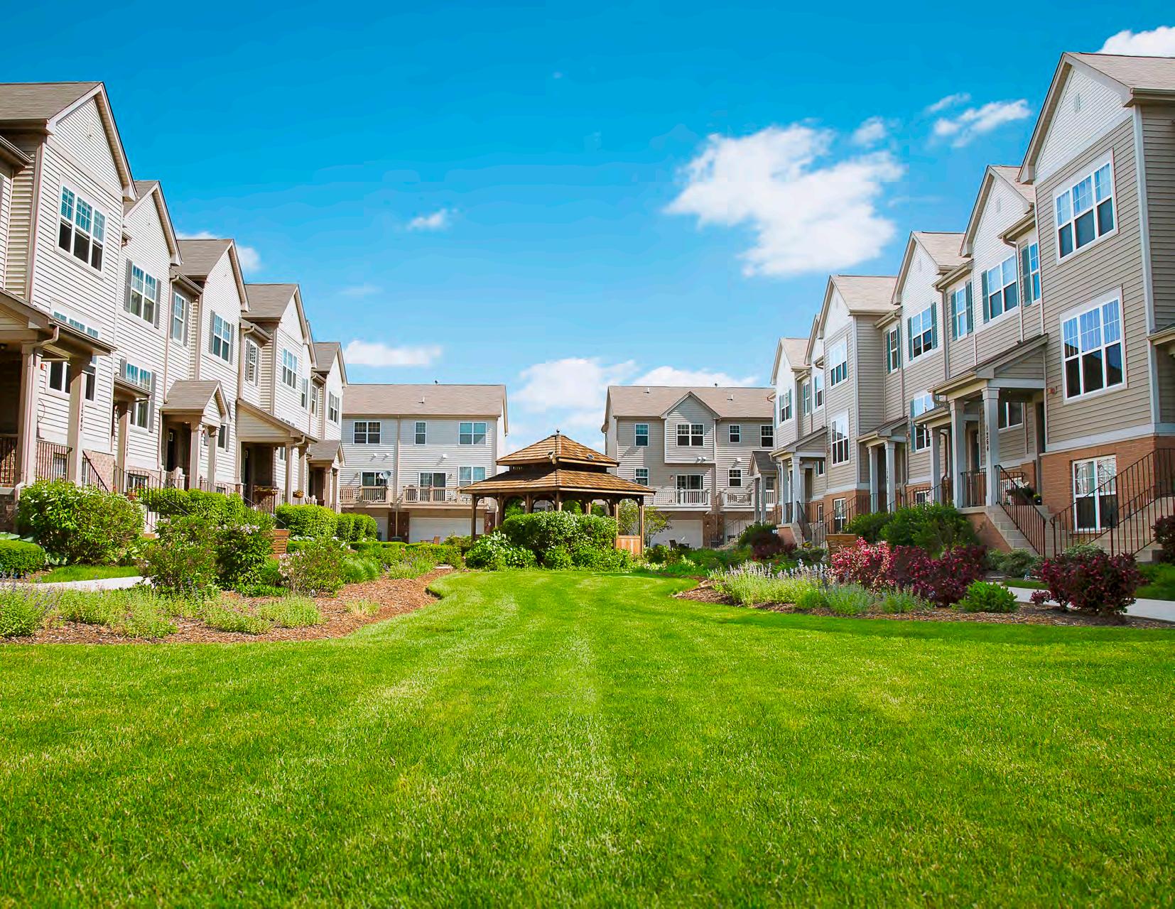
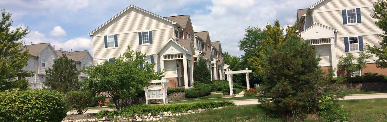
Residential: A primary goal of the Des Plaines Comprehensive Plan is to preserve and enhance established single-family neighborhoods, while expanding denser housing options. To accomplish this, the Land Use Plan underscores the desire for attached Single-Family and multifamily developments in the Downtown, near the Cumberland Metra Station, and along the Oakton Street Corridor. More detailed discussion of residential area policies is located in Chapter 4: Housing .
• Detached Single-Family: Detached Single-Family homes should continue to be the predominant land use within the City of Des Plaines. Single-Family neighborhoods should continue to be served by local institutions and parks.
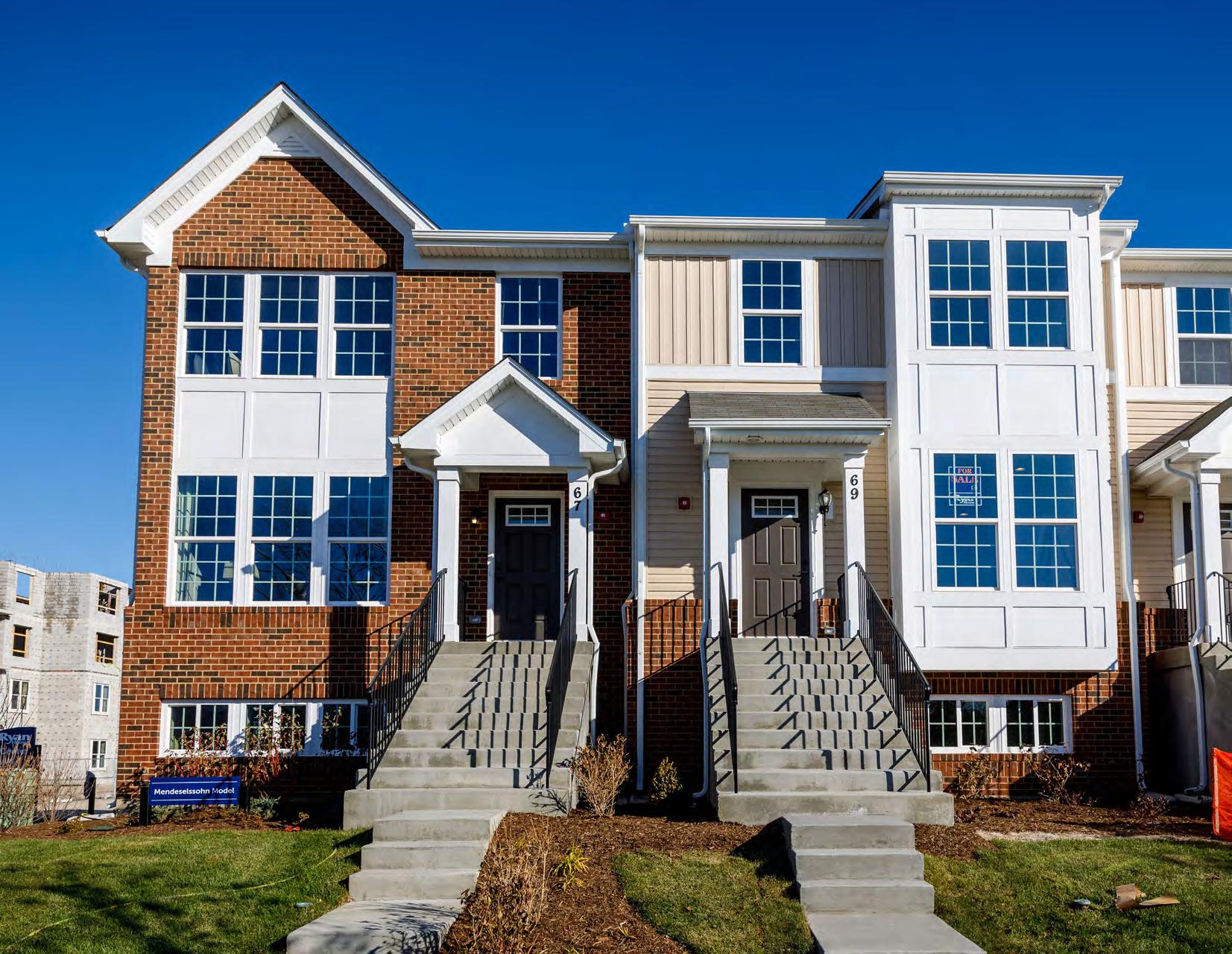
• Attached Single-Family: Attached Single-Family development comprises housing where multiple units occupy the same structure, but are accessed individually such as a townhome or rowhome. Existing attached Single-Family developments are dispersed around the City and located along Northwest Highway near the Cumberland Metra Station, at Harding Avenue and Laurel Avenue, Grove Avenue by the River, near Apache Park, and at East River Road and Golf Road.
• Multifamily: Multifamily housing includes development where multiple units are located within the same structure and are accessible via a shared entrance and common area. The Land Use Plan supports the development of high quality multifamily housing located in denser areas near multi-modal facilities such as the Downtown. New multifamily housing should be encouraged as a complement to desired future commercial development in the area and incorporated as mixed-use buildings when possible.
Commercial: Commercial areas include retail, office, and serviceoriented uses that primarily serve day-to-day needs of local residents. The designation is primarily located in the Downtown and along major corridors: Oakton Street, Elmhurst Road, and Mannheim Road. Commercial structures should be encouraged to locate at or near the property line with parking provided in the rear or to the side, thus prioritizing the pedestrian environment while allowing for convenient access for vehicles traveling along the corridor. More detailed discussion of commercial areas are located in Chapter 3: Economic Development and Chapter 8: Downtown Des Plaines .
Industrial: This land use includes production, warehousing, assembly, and distribution. The City of Des Plaines boasts a successful industrial area that lies adjacent to the O’Hare International Airport, with few vacancies. More detailed discussion of industrial area policies is located in Chapter 3: Economic Development .
land uses include schools, libraries, community organizations, places of worship, and public facilities. More detailed discussion of institutional uses are located in Chapter 5: Transportation and Chapter 6: Diversity and Inclusion .
Open Space: This land use includes the existing public park and recreation areas owned by the Des Plaines Park District, Mount Prospect Park District, or Forest Preserve of Cook County. It also includes private open space areas. More detailed discussion of open space policies is located in Chapter 3: Economic Development, Chapter 7: Stormwater Management , and Chapter 8: Downtown Des Plaines .
Transportation/Utilities/Communications/Right-Of-Ways: This land use is restricted to areas directly in right-of-ways, including freight rail, commuter rail, highways, and energy distribution (electricity and gas). The designation also includes stormwater infrastructure within right-ofways, such as sewers, ditches, and swales. More detailed discussion of transportation/utilities/communications/right-of-ways uses are located in Chapter 5: Transportation and Chapter 7: Stormwater Management.
Water: Encompasses lakes, ponds, rivers, and their undevelopable wetlands, as well as permanent stormwater detention facilities. More detailed discussion of water uses are located in Chapter 7: Stormwater Management.
Institutional: This land use includes a variety of institutions that provide services to Des Plaines residents and the surrounding area. Institutional
The City’s economic strength will be showcased through its vibrant commercial sectors, successful industrial district, impressive recreational opportunities, and high-quality jobs. Residents and visitors will be afforded a variety of retail, dining, and entertainment options, with special focus on major commercial corridors and the Downtown.
• The City of Des Plaines has undertaken several initiatives to expand economic development, but opportunities still exist to attract more retail, entertainment, and dining options.
• Des Plaines is home to one of the strongest industrial markets in the country.
• Unincorporated areas may hold potential for increased tax revenues and development opportunities through annexation.
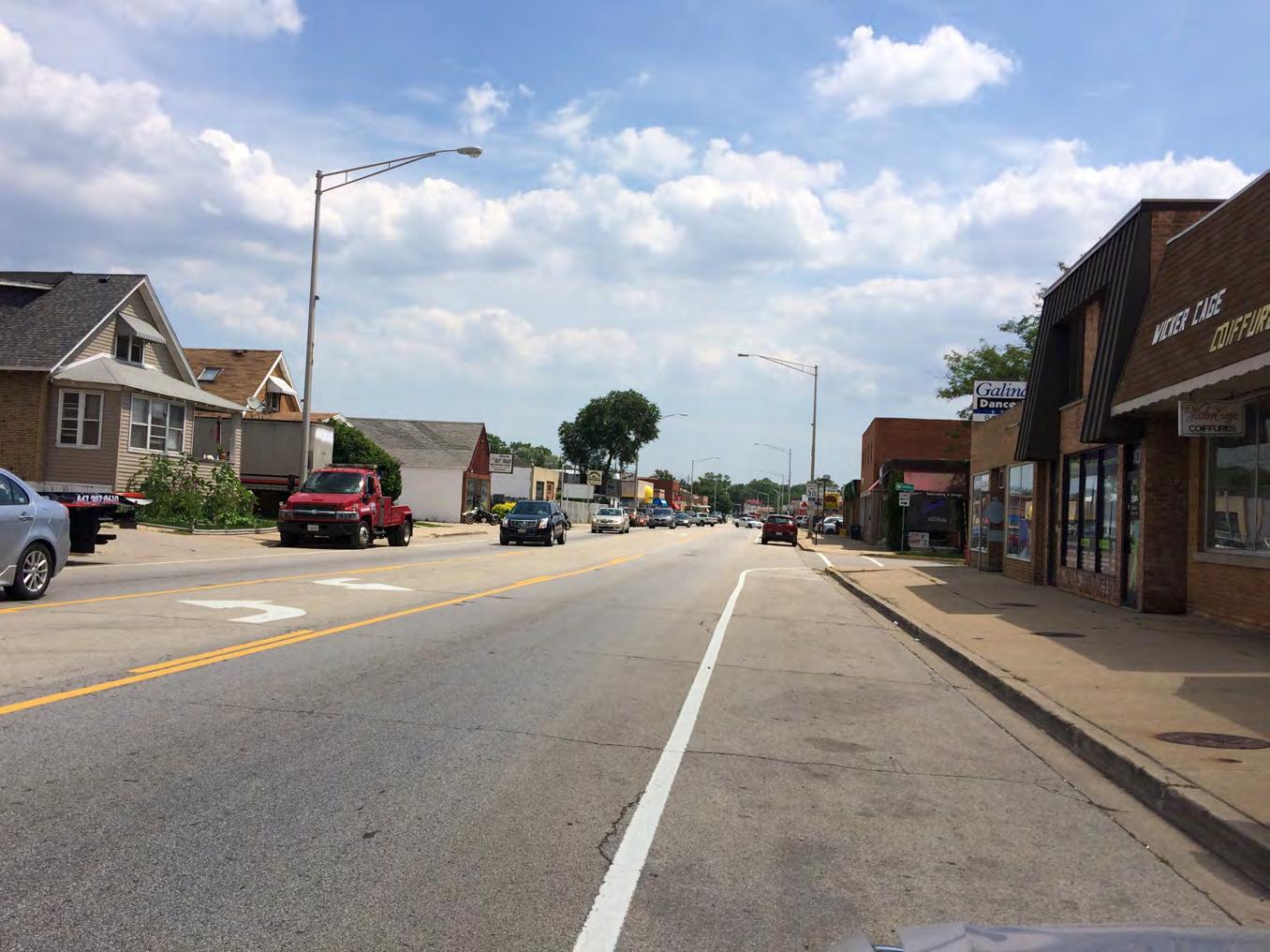
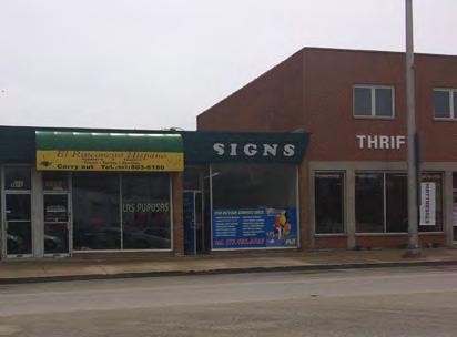
Oakton Street functions as a commercial and industrial corridor that carries more than 20,000 vehicles per day. The stretch between River Road and Lee Street, home to various stores and services, has struggled with vacancies, an outdated appearance, and limited redevelopment potential. Recommendations include ways to improve the appearance of the corridor, support revitalization and redevelopment efforts, and enhance all modes of transportation.
3.1. Pursue beautification efforts that will lead to a stronger corridor identity.
3.1.1. Install streetscaping improvements that enhance the pedestrian/shopper experience and competitiveness of commercial areas between River Road and Wolf Road.
Streetscaping, including the installation of landscaping, street furniture, lighting, and other amenities can be critical to establishing a consistent and attractive shopping environment.
• Street Trees. While Des Plaines maintains Tree City USA certification, several commercial corridors including Oakton Street lack street trees. Sidewalks along Oakton Street are narrow and typically directly abut structures fronting the roadway. The City should work with local property owners to conduct a survey of the corridor and identify locations where street trees could be planted per City Forestry standards. Tree grates or permeable pavers could be used to maximize the width of the navigable sidewalk area adjacent future trees.
• Lighting. Street lights along Oakton Street are widely spaced, catering to vehicular traffic. The City should consider adding to street lights to include pedestrian-scale lighting that complements the roadway lighting and provides for a safer walking experience. Banner sign fixtures and hanging baskets could also be affixed to street light poles to enhance visual appeal and provide corridor branding opportunities, while minimizing impacts to the narrow sidewalk.
• Street Furniture. The City should work with local business owners to provide trash cans, benches, planters, and other street furniture, with a consistent look throughout the corridor, that serve as amenities to pedestrians while also providing for a unified aesthetic.
3.1.2. Install a gateway feature, including signage and landscaping, within the striped median on Oakton Street near Locust Street.
Landscaping and signs strategically located at entry or gateway points can be used to notify visitors that they are entering a unique place within a community. While consistent streetscaping can help brand a corridor, the City should also install a gateway feature within the painted median near Locust Street. Design should be developed in conjunction with input from local businesses and residents, but could include raised planters and provide the space for gateway signage that welcomes motorists and lets them know they are visiting the Oakton Street Corridor in Des Plaines. The neighborhood gateway treatment could also include elements of the City’s broader marketing campaign or municipal logo. Use of solar-powered up lighting and low-maintenance landscaping should be considered to minimize long-term upkeep costs.
3.1.3. Consider establishing special funding mechanisms to assist with corridor revitalization efforts.
Revitalization efforts for the Oakton Street Corridor that include streetscaping, other public realm improvements, and potential business development incentives, will likely require new funds dedicated for economic development. The City should continue to evaluate potential funding mechanisms such as Tax Increment Finance (TIF) and Special Service Areas (SSA) within the Oakton Street Corridor from River Road to Lee Street.
• The City should evaluate the feasibility of a TIF District along Oakton Street. TIF is typically used to pay for larger-scale public infrastructure projects as well as for offsetting the costs of a development. A TIF district essentially freezes property tax revenue within a defined area for up to 23 years and any new property taxes generated within the district above and beyond the base year can be used for approved projects. Provided that the proposed district meets requirements established by State statutes, an Oakton Street TIF District could fund a variety of projects from streetscaping and façade improvements, to property assembly and public parking.
• As investments take hold and more businesses locate along the corridor, the City should also encourage the establishment of a Special Service Area (SSA). In an SSA, business owners within a defined area voluntarily agree to raise property taxes by a small percent to fund services such as sidewalk maintenance, landscaping, security, and economic development programming within that area.
3.2. Pursue redevelopment efforts through land use revisions and parcel configuration.
3.2.1. Be open to small-scale, mixed-use development and multifamily development in the corridor.
Properties along Oakton Street currently consist of a mix of single use properties including single-family homes, commercial, industrial, and office buildings, all of which are one- to two- stories. The City should consider permitting more intense, non-commercial and mixed-use projects along the corridor that can generate activity for existing commercial development and increase demand for services. Currently C-3 zoning permits up to one residential dwelling on the second floor of buildings located along Oakton Street (from the Canadian National Railroad east to the City limits). This restriction on total units limits market viability for mixed-use development and hinders potential for new investment within the corridor other than low-density commercial. Replacing the restriction with minimum floor area per unit requirements similar to those established for the R-4 zoning district, would provide for greater flexibility and could serve to attract new development to the corridor. Permitting multifamily development similar to R-4 zoning could also be appropriate, however, new development should front Oakton Street with parking located in the rear where possible to increase pedestrian activity along the corridor. A parking ration that supports higher density mixed-use should also be considered.
3.2.2. Consider parcel assembly as a key strategy to redevelopment.
Parcel assembly could be beneficial along corridors like Oakton Street where shallow lot depth and small parcel size can impact development potential and limit opportunities for streetscape amenities. Consolidation of small parcels creates larger, more viable development sites and should be considered as a key strategy in facilitating larger-scale redevelopment that can provide a catalyst to future reinvestment. In addition, larger sites will enable proposed development to accommodate high-quality landscaping and screening, well-designed parking and access management, and contemporary development. Parcel assembly would also enable a proposed development to take advantage of the City’s Planned Unit Development process by including enough property to meet the two-acre minimum required in the C-3 zoning district.
3.2.3. Consider revisions to the screening and landscaping standards to enhance the appearance of east Oakton Street as a gateway to the community.
With limited right-of-way available for street trees or other public streetscape elements, private property holds the significant potential to enhance the overall appearance of the corridor. All properties fronting Oakton Street, east of Lee Street, are located within the C-3 General Commercial zoning district. While wholesale enforcement of existing C-3 site improvement standards would be physically impossible for several sites and parking lots along Oakton Street due to their small size, opportunities for additional landscaping and screening improvements exist. The City should consider revising or enforcing development that will result in aesthetic improvements to the corridor as redevelopment occurs. Example standards include:
• Parking lot landscaping is currently only required for parking lots with more than 10 spaces. For smaller lots with angle parking, on-site corner landscaping areas could be introduced to help screen parking areas while
maintaining drive aisle access. However, an emphasis on safe parking lot design should be maintained so that pedestrian and vehicular circulation and emergency response are considered.
• Some larger lots along Oakton Street may not be able to accommodate both a perimeter landscape strip as well as interior islands, but one or the other could be introduced while maintaining access. The landscape code should be updated to build in administrative flexibility so the intent of the landscaping code and the context of each site are considered.
• The perimeter landscaping width could be relaxed to allow for smaller planting areas and hardscape treatments. Currently, the City’s minimum perimeter landscaping width is 7 feet.
• Existing screening standards require an 8-foot opaque fence to buffer commercial uses from adjacent residential properties. Many fences in the area are only 4 to 5 feet tall.
• Existing screening requirements for dumpster and loading areas could be expanded to include outdoor storage and long-term parking areas used by auto-service businesses. Further, screening requirements could be strengthened to prohibit the use of chain link and encourage use of opaque fencing, or decorative fencing with denser vegetation, or a knee wall to limit sight lines.
• Overlay districts or incentives could be considered to target specific sections of Oakton Street.
• The City could consider expanding the business assistance program to include site improvements along Oakton Street, such as landscaping, screening, etc.
3.3. Improve traffic flow, circulation, and parking.
3.3.1. Conduct a feasibility study for the creation of a new Oakton Street Metra Station at Lee Street on the North Central Service rail line.
The City recently authorized funding to study the potential for a new station to be serviced by Metra’s North Central Service (NCS) rail line at Oakton Street. The study will examine the feasibility of constructing and operating a service from an engineering and operations perspective, and examine whether the project is technically viable. A potential future train station would be located between the Prospect Heights and O’Hare International Airport stations on the NCS line. This feasibility study will be paired with a study to determine whether the Oakton Street Corridor would benefit from the establishment of a TIF district to spur development and fund a portion of the station’s construction.
In addition, Pace Bus has identified Oakton Street at Lee Street as a preliminary location for a PULSE Dempster Line station, which will provide service between the Davis Street CTA/Metra Station in Evanston to the O’Hare International Airport Kiss-n-Fly and Metra O’Hare Transfer Station. This would enable PULSE riders to transfer to the future potential Metra Station.
3.3.2. Reevaluate the recommendations of the Oakton Street & Elmhurst Road Corridor Study in light of Metra station feasibility study findings.
While the City hopes that a commuter rail station will help provide a catalyst for reinvestment in the Oakton Street Corridor, alternative economic development strategies should be considered. If development of the Metra station is not supported by feasibility analysis, the City should continue evaluating strategies that may improve the pedestrian and business environment, and address parking and congestion concerns such as increasing live-work spaces to encourage mixed-use development.
Though completed in 2009, many of the recommendations in the City’s Oakton Street & Elmhurst Road Corridor Study still apply to the corridor. The study highlighted several key recommendations including encouraging local-serving services and restaurants located on the corridor, minimizing and repositioning auto-related uses, and encouraging multifamily and mixed-use housing. Following the completion of the Metra station feasibility study, the City should assess the plan to identify which recommendations should be implemented. Absent a future potential Metra station, this assessment should include consideration of the study’s recommendation to create a public plaza flanked by new mixed-use or commercial development to catalyze further reinvestment within the central portion of the corridor.
3.3.3. Undertake a traffic and parking study for the Oakton Street Corridor.
Local business owners have indicated that parking and congestion is problematic along Oakton Street, and that on-street parking should be replaced by an additional travel lane. Input has also highlighted that many of the businesses along the corridor are service-oriented and rely on customers who drive through the area. To address this issue, some business owners have called for the introduction of rush hour lanes where on-street parking spaces turn into travel lanes during high traffic periods, more traffic lights, and addressing left turns on Center Street. Previous community input gathered as part of the Oakton Street & Elmhurst Road Corridor Study highlighted issues with limited parking and poor parking turnover. The corridor study recommended a variety of parking strategies including remote parking lots, reduced on-site parking ratios, and the creation of shared public parking areas located on infill lots between businesses along the corridor.
The contrast between Comprehensive Plan outreach results and those of the previous corridor study highlight a need for further study on traffic patterns and parking demand before substantive transportation recommendations can be made for Oakton Street. The potential future addition of an Oakton Street Metra Station (for which a feasibility study is currently being undertaken) further complicates the situation. The City should undertake a traffic and parking utilization study for the corridor. The study should identify potential roadway changes to accommodate desired future development while improving traffic flow. Moreover, the study should review current and future demand for parking and opportunities for shared parking, as well as evaluation of introducing rush hour lanes and infill public parking lots. A similar parking assessment is recommended for Downtown Des Plaines and could be combined with an east Oakton Street study to minimize total costs.
Outreach to business owners along the Elmhurst Road Corridor (from Oakton Street to Golf Road) highlighted the desire to improve the corridor through traffic circulation and access, walkability, streetscape enhancements, marketing efforts, and the establishment of a significant tenant to attract more customers to the area. Because Elmhurst Road is shared with the Village of Mount Prospect, it is critical that both communities collaborate on future plans and improvements.
3.4. Work with the Village of Mount Prospect to create a vision for the Elmhurst Road Corridor by participating in planning efforts for the “South Mount Prospect Plan.”
The Village of Mount Prospect is currently taking a close look at the future of Elmhurst Road through the “South Mount Prospect Plan” process. It is recommended that the City of Des Plaines regularly participate in any major discussions pertaining to the future of Elmhurst Road. The plan should explore issues and opportunities that overlap with strategies identified by Des Plaines business owners and stakeholders, including: identifying desired streetscaping, similar signage regulations, wayfinding signage, access management, stormwater management infrastructure, and shared marketing and branding.
3.4.1. Refer to the “2009 Oakton Street Corridor Study” for traffic circulation and urban design improvements.
The 2009 Oakton-Elmhurst Corridor Plan identified many of the recommendations that were shared by local business owners on Elmhurst Road. To improve traffic and transportation along the corridor, the plan recommended developing a coordinated streetscape program with the Village of Mount Prospect that would include: decorative street lighting and banners, improvement of overhead utilities (by updating wood utility poles with decorative poles), and the addition of a center landscaped median (to create the illusion of smaller-scale street and effectively control traffic). Urban design improvements could include on-site parking lot landscaping and property edge treatments (which may also provide flooding relief), relieving the corridor of visual clutter (through signage regulation), creating a gateway at major points of entry (with monument signs or other sculptural elements), and enhancing pedestrianism.
With a mix of salvage yards, auto repair shops, light industrial, and two mobile home parks, Five Corners (Golf Road to the north, River Road to the east, Rand Road to the southwest, and north of the railroad tracks) has been described as an eyesore in need of economic development assistance. The area is challenged with environmental contamination, zoning restrictions, and numerous small parcels with diverse ownership. Past efforts to redevelop Five Corners have included a failed TIF District, Master Plan, and zoning district changes.
CMAP’s Fiscal and Economic Impact Analysis of Local Development Decisions (January 2014) report summarizes best practices for local fiscal and development policy in the Chicagoland region. Findings emphasize that retail developments (while normally providing the highest fiscal impact) do not always ensure a positive fiscal outcome for the community and must be supported by sufficient population and employment. Through the 1998 City-wide rezoning, the redevelopment of Five Corners was envisioned to be a retail and commercial node. This concept was never fulfilled due to substantial competition (the Downtown, Mt. Prospect Plaza, and Golf Mill Shopping Center) and insufficient visitors.
The City of Des Plaines should explore the possibility of creating a new small business park at Five Corners. The business park could contribute to a health and tech-focused district with possible partnerships and support from Presence Holy Family Medical Center, the various small health-related facilities abutting the proposed site, the new Advocate Outpatient Center on Rand Road, and Oakton Community College. The addition of data centers (facilities that house computer systems such as telecommunication systems) could also be explored as the area is in such close proximity to railroad lines and the ComEd substation. In addition, several options should be explored that will minimize the displacement of long-standing and successful small businesses, as well as residents currently residing within the City’s boundaries.
3.5. Conduct a market study to determine potential benefits of a small business park.
Firms are drawn to specific geographical spaces in cities for a variety of reasons, but much of the motivation stems from the desire to reduce the cost of transporting goods, people, and ideas. While similar firms locating in one place may produce a benefit, all firms may not benefit from agglomeration equally. Before fully considering the creation of a new business park, the City of Des Plaines should conduct a market study to determine if there is potential for agglomeration benefits in the area.
3.6. Apply a commercial/industrial flex district to begin the establishment of a new business park.
Commercial/industrial flex district parcels contain a combination of commercial, office, and low-intensity industrial uses. Industrial uses in this district may have a retail or office component attached to them, have lower environmental impacts than those associated with heavy industry, and have smaller footprints compared to industrial parcels.
The business park could be implemented through the use of flex zoning, an approach that allows the combination of light industrial, office, and commercial use until the new district is achieved. Flex zoning could help eliminate issues with spot zoning and the need for conditional use permits or variances to facilitate reinvestment. Potential benefits to a new business park could include new jobs, additional employees visiting the Downtown, and support for nearby health facilities.
3.7. Continue strongly enforcing property maintenance codes to enhance the appearance of Five Corners as a gateway to the community.
Until a new use is in place, the City should continue property maintenance code enforcement in the Five Corners area. An overlay district or incentives could be considered to target the outdoor storage and service uses concentrated in the area.
3.8. Evaluate opportunities for annexation and establish boundary agreements with neighboring communities to ensure long-term development benefits to the City.
Areas to the southwest of City limits mostly comprise four mobile home communities or publicly owned land that has been set aside for regional stormwater management. The Oakton Street corridor is the exception where numerous industrial businesses exist, but there is limited vacant land available and several areas within a 500-year floodplain. Cook County retains zoning authority in these unincorporated areas and while piecemeal infill development is not likely to adversely impact the City, large-scale redevelopment could result in an increased burden on local infrastructure in the form of stormwater run-off or transportation demands.
Establishing a jurisdictional boundary agreement around the unincorporated areas would enable the City to obtain subdivision authority and influence large projects that entail redevelopment. A boundary agreement would ensure the City is well-positioned should redevelopment be proposed for any of the mobile home communities scattered throughout areas south and west of the City limits. These properties consist of several large parcels under single ownership and are more susceptible to large-scale redevelopment. The City should engage in boundary agreement discussions with neighboring municipalities to formalize planning jurisdictions for unincorporated areas.
3.9. Evaluate preliminary results of the “Maine-Northfield Unincorporated Area Plan” to inform discussion of annexation of unincorporated areas along the eastern and north borders of the City.
Portions of Cook County located to the northeast of Des Plaines have never incorporated or been annexed by a municipality despite having developed to become home to nearly 37,000 people in more than 15,000 households. A recent study prepared by CMAP for Cook County analyzed estimated costs and benefits for adjacent municipalities if they were to annex adjoining portions of this large unincorporated area. Ultimately, the study concluded that annexation would likely lead to a negative net fiscal impact to local municipalities, including the City of Des Plaines, wherein serving newly annexed residential areas would cost more than the revenues they generate.
The unincorporated areas consist predominantly of built-out residential communities which means there is limited potential for non-residential property tax or retail sales growth to offset costs. It is estimated that Cook County spends approximately $42.9 million annually in expenses related to the delivery of municipal-type services to unincorporated areas. Cook County leadership has expressed interest in eliminating unincorporated areas to reduce taxes and improve services to residents. As such, Cook County may be open to discussing potential for annexation and revenues needed to offset costs to municipalities who annex these areas.
3.10. Explore new economic development initiatives and partnerships.
Feedback from local businesses has indicated that it can be difficult to tap into the local workforce when filling open positions and that many employees come from elsewhere in the region. The City can play a key role in strengthening the connection to the local workforce by facilitating relationships between area businesses and education providers, including Oakton Community College and Maine West High School.
Oakton Community College’s Office of Continuing Education and Workforce Development recently partnered with LSG Sky Chefs in a successful example of workforce development collaboration. OCC provided a six-week “Basic Electronics” course, four-week “Blueprint Reading for Building Trades” course, and a 13-week English as a second language (ESL) course to employees. OCC also provided a two-day, on-site food safety training course to LSG Sky Chefs employees.
The City should also consider joining regional organizations and partnerships, such as Next Level Northwest or the Golden Corridor Advanced Manufacturing Partnership (GCAMP), to enhance the local business environment and connect companies to business development and workforce training opportunities.
3.11. Consider establishing industrial design standards and complementary incentives to encourage the integration of stormwater best practices.
Des Plaines has several industrial areas that were established in the 1960s and 1970s and many of the buildings within those areas are reaching the end of their useful life. However, demand for industrial development remains strong in Des Plaines. Future investment in industrial areas will likely be focused on redeveloping and maximizing the value of underutilized sites within the area.
For example, a pharmaceutical company, Vetter Pharma, recently closed on the purchase of a 17-acre property in the area with the intent to redevelop the site into a 1.2-million square-foot complex.
There is potential to incorporate modern best practices and improve the overall image and character of the City’s industrial areas as redevelopment occurs and outmoded building stock is replaced. As identified in the Oakton Street & Elmhurst Road Corridor Study, numerous standards could be incorporated into industrial design guidelines. Examples include:
• Locating office functions at the front of a property with manufacturing and warehousing located at the rear (away from primary roadways).
• Site access and circulation design that reduces curb cuts on primary roadways, maximizing opportunities for site and parkway landscaping.
• Screening loading areas from public rights-of-way.
• Locating freight parking and outdoor storage at the rear or interior of a site.
• Where industrial properties abut residential areas, using site design and property edge treatments to screen property from view.
• Perimeter and parking lot landscaping to enhance views from roadways.
• Use of attractive fencing where physical barriers are needed for safe business operations.
Innovations in sustainable design also mean that industrial areas can maintain and enhance the City’s green infrastructure. The City should also consider incorporating conservation-based green building and site development practices into industrial design standards.
These might include guidance on a variety of tools such as green roof systems, permeable paving, bioretention, cisterns, naturalized swales and detention areas, wastewater discharge for industrial cooling. In exchange for adherence to conservation design standards, the City could allow proposed projects to increase their building area, making more use of a site for development than would otherwise be permitted using conventional standards.
3.12. Continue coordinating with the transit agencies on major arterials within the industrial area.
Howard Street is the City’s only major roadway that services any significant industrial property. Primary access to all other primary industrial and office areas in Des Plaines is provided by a roadway under the jurisdiction of the Illinois Department of Transportation (IDOT) or Cook County Department of Transportation and Highway (DOTH). As such, maintaining communication with IDOT and Cook County DOTH is essential to the long-term economic health of the community.
City staff should stay abreast of planned improvements and provide local input where appropriate to ensure that regional improvements do not negatively impact the City. This should include building stronger relationships with IDOT and Cook County DOTH, as well as regular monitoring of the IDOT Region 1 website and Cook County DOTH website for announcements regarding upcoming projects and planning initiatives.
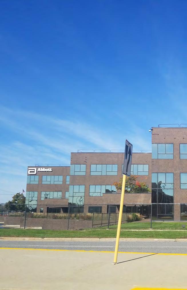
In addition to providing access to employment areas, the variety of regional roadways that pass through Des Plaines carry hundreds of thousands of visitors each day. Recognizing that corridor appearance has a significant influence on the community’s image, there is a desire to enhance key roadways in Des Plaines to make them more attractive and bike- and pedestrian-friendly. The City should work closely with IDOT and Cook County DOTH to investigate streetscape design, connectivity, and traffic flow improvements to improve regional routes such as Touhy Avenue, Mount Prospect Road, and Elmhurst Road. Transportation grants should also be pursued to leverage resources to improve connectivity and safety along these corridors in accordance with the City’s Complete Streets Policy and proposed Bicycle Network. Abbott
3.13. Collaborate closely with the Des Plaines Park District, Mt. Prospect Park District, Chicago District Campground, and Cook County Forest Preserve.
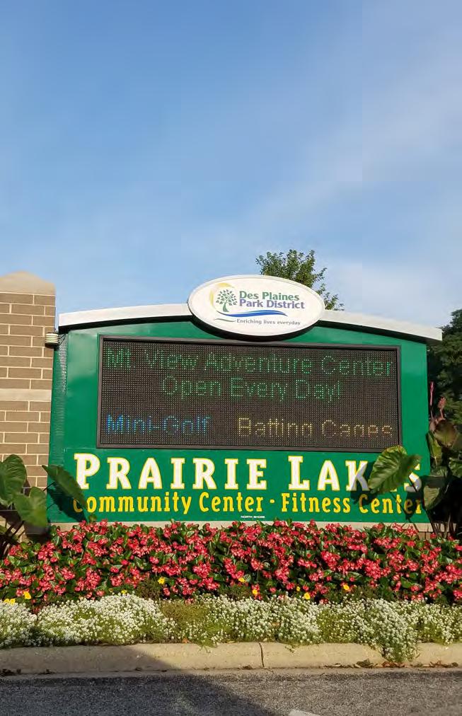
Walkable communities, along with access to recreational opportunities (parks, open space, and other recreational facilities), are believed to generate economic benefits to local governments and nearby private property owners. The City of Des Plaines is home to 9.6 percent acres of open space, mostly in the form of neighborhood parks and county forest preserves. The Des Plaines Park District, Mt. Prospect Park District, Cook County Forest Preserve, and the Chicago District Campground Association (Methodist Campground), maintain and manage the majority of the community’s open space amenities.
The Des Plaines Park District currently encompasses 59 parks, facilities, and highly-visited recreational areas including the Golf Center Des Plaines, Lake Park and Lake Park Golf Course, Mystic Waters Family Aquatic Center, and the new Indoor Aquatic Center at Prairie Lakes Community Center. The Mt. Prospect Park District manages the regionallysignificant baseball facility at Majewski Metro Park. The Chicago District Campground Association is exploring revitalization strategies that will re-establish it as a unique regional amenity featuring educational opportunities for students, community-wide events such as farmer’s markets, and their more traditional summer retreats in the historic cabins.
The City of Des Plaines should collaborate closely with the Des Plaines Park District, the Chicago District Campground Association, Mt. Prospect Park District, and Cook County Forest Preserve to increase the marketing of recreational opportunities and open space, and in turn, attract more residents and visitors potentially boosting the City’s local economic base.
3.1. Pursue beautification efforts that will lead to a stronger corridor identity.
3.2. Pursue redevelopment efforts through land use revisions and parcel configuration.
3.3. Improve traffic flow, circulation, and parking.
3.4. Work with the Village of Mount Prospect to create a shared vision for the Elmhurst Road Corridor by participating in planning efforts for the “South Mount Prospect Plan“.
3.5. Conduct a market study to determine potential benefits of a small business park.
3.6. Apply a commercial/industrial flex district to begin the establishment of a new business park.
3.7. Continue strongly enforcing property maintenance codes to enhance the appearance of Five Corners as a gateway to the community.
3.8. Evaluate opportunities for annexation and establish boundary agreements with neighboring communities to ensure long-term development benefits City.
3.9. Evaluate preliminary results of the “Maine-Northfield Unincorporated Area Plan“ to inform discussion of annexation of unincorporated areas along the eastern and north borders of the City.

Table 3.1. Economic Development Implementation Action (Continued)
3.11. Consider establishing industrial design standards and complementary incentives to encourage the integration of stormwater best practices.
3.12. Continue
3.13. Collaborate closely with the Des Plaines Park District, Mount Prospect Park District, Chicago District Campground, and Cook County Forest Preserve. Des Plaines Park District | Mount Prospect Park District, Chicago District Campground, Cook County Forest Preserve, City of Des Plaines
Incoming or aging residents of Des Plaines will enjoy a wide range of housing options to meet their needs, while established residents can take advantage of programs available to assist with renovation and maintenance of their homes. Local employers will assist workers with convenient options to live and work in Des Plaines.
• The current housing market in Des Plaines is stable with few vacancies, low foreclosure rates, and a rebounding housing sales market.
• 35 percent of homeowners and nearly 50 percent of renters face challenges with affordability (American Community Survey, 2010-14).
• Des Plaines is in need of more diverse housing options to attract younger households and keep long-time residents as they age.
Providing a range of housing options benefits Des Plaines residents of all ages. Currently, the City of Des Plaines boasts a strong and highly-valued single family housing stock, which should be preserved and enhanced as needed to keep the current character of the community. However, many aging residents prefer smaller, multifamily units to continue an independent lifestyle while minimizing the obligations that are associated with owning larger properties. In addition, many millennials prefer compact housing units in higher density areas with proximity to transportation, employment centers, and amenities. Taking proactive steps to ensure the Des Plaines housing stock reflects the diversity of its residents will help attract new families to the area while retaining existing residents as they enter various stages in life.
4.1. Ensure the City has several housing options to fit diverse needs.
An increase in the mix of housing types will help Des Plaines retain residents and appeal to a wider audience while allowing the City to facilitate future population growth and remain competitive through any shift in market conditions.
The location of denser housing stock should be prioritized in the Downtown (see more in Chapter 8: Downtown Des Plaines ), near the Cumberland Metra Station, the Oakton Street Corridor (particularly near the proposed Metra Station), and other areas of the City where denser development conditions (close proximity to public transportation and commercial corridors) already exist.
New single family housing developments should explore various style options that may appeal to different audiences such as the Ranch-style maintenance-free homes (with ground-level entry) in addition to new townhome developments.
4.2. Create mixed-use zoning to attract younger families.
The City of Des Plaines could attract younger professionals and families by striking the right balance between rental properties or starter homes, and a variety of amenities to create a more compact home environment. Opportunities exist for the City to revise its zoning code to provide more opportunities for mixed-use development while preserving existing neighborhoods characterized predominately by Single-Family homes. The City should revisit its current zone classifications and add a new zone exclusively for mixed-use development or amend existing regulations to allow for mixed uses. Focus should be placed on commercial areas zoned C-1, C-2, and C-3, for potential sites for mixed-use development.
4.3: Provide new housing at different price points.
Younger families seek communities that provide starter-home price points, along with walkable neighborhoods, parks, and retail amenities, while existing and future residents may wish to relocate within Des Plaines to a higher-end home.
While over 55 percent of Des Plaines household incomes fall below $75,000, over a quarter earn upwards of $100,000. The range in incomes emphasizes the need for diverse housing preferences that may appeal to different sectors of the community. New housing should include starterhome prices to market-rate housing to serve the changing needs of the community and region.
Des Plaines currently enjoys a stable housing market, but many residents, particularly those in rental units, are experiencing cost burdens. Keeping a sturdy base of housing options for lower- and middle-income families will help alleviate these cost burdens and help grow the local economy.
4.4. Continue to promote homeownership rehabilitation and assistance programs.
Several organizations and agencies within the City, region, and state offer programs that provide homeowners with varying degrees of assistance (see Table 4.1 ). The City of Des Plaines has done a great job providing housing resources and information such as the Handyman Program and marketing Illinois Housing Development Authority (IHDA) housing services. Des Plaines should strengthen existing partnerships with these institutions to offer and better advertise these programs to existing homeowners. A concerted effort should be placed on better advertising the programs to targeted populations, including those with affordability challenges and potential new homeowners.
As of 2015, 40.2 percent of the Des Plaines population was age 50 or older, higher than the regional average of 31.4 percent. The City should be preparing its housing stock to accommodate older adults. By taking steps to help residents to age-in-place, Des Plaines will ensure that their community remains comfortable and safe for residents at all stages of life.
4.5. Plan for and identify policies and tools that ensure accessibility.
The City of Des Plaines should be proactive in identifying practices and policies that ensure the housing stock is accessible for an aging population. This may include revisiting accessibility/visitability requirements, which requires every new residential development to be “visitable” by people in wheelchairs, thereby expanding access to individuals with disabilities. In some instances, this may require enforcing existing codes to older structures that do not provide handicap accessibility.
Through its building code, the City of Des Plaines would be encouraged to outline construction requirements that may ensure physically-challenged individuals the ability to enter and maneuver their homes.
The City should also ensure the permitting process is efficiently allowing for improvements that will contribute to a building’s accessibility. Potential improvements include wheelchair access renovations and energy efficiency retrofits.
Outreach materials are most useful when the information is being received and understood by its intended audience. By creating content that is easily digestible by those with vision or hearing disabilities, the City can ensure resource information has the potential to be used and applied by those who need it most. Suggestions include creating large-print materials, using specific information (clear dates, times, and locations), and providing screen readers. In addition, residents should be directed to the manner to most efficiently file complaints regarding housing discrimination that they may encounter for their age or ability status.
Home modifications and maintenance are fundamental to keeping all residents, and particularly older adults, safe in their homes. City officials should work to promote programs and resources to older residents that help them prepare their homes for the future. Public outreach campaigns, marketing on the City’s website, and presentations at the Frisbie Senior Center are examples of ways to communicate assistance programs to residents who need it most. Table 4.1 details different forms of homeowner assistance programs, many designed specifically to help older adults address different financial challenges, and access and navigate their homes safely.
The Homes for a Changing Region project is a collaboration between CMAP, the Metropolitan Mayors Caucus (MMC) and the Metropolitan Planning Council (MPC) that seeks to help communities in our region plan for their current and future housing needs. The collaborative provides technical assistance and toolkits to communities looking to address agingin-place strategies, housing affordability, and future development, among others.
On December 11, 2017 , the Homes for a Changing Region team convened a panel of professionals, local officials, and community stakeholders to discuss housing in Des Plaines and provide expertise on how to best prepare the community for future needs. Representatives from CMAP, MMC, and MPC facilitated the discussion and moderated the panel. Some of the housing recommendations and strategies in this plan were informed by the discussion and feedback provided at that meeting.
Reverse Mortgage Assistance Program
Minor Repair & Home
Accessibility Program
Home Repair Program
Emergency Repair Program
Neighbors Helping Neighbors Program Committee
Handyman Program
Housing Counseling Program
Senior Housing and Supportive Services Program
Illinois Housing Development Authority
Northwest Housing Partnership
Northwest Housing Partnership
City of Des Plaines
Des Plaines Community Foundation
Northwest Housing Partnership
Northwest Compass
Center of Concern
Homeless Prevention,
Housing Counseling, Resources, & Home Sharing Program
Source: City of Des Plaines
Center of Concern
Assists senior homeowners with FHA reverse mortgages who are delinquent on real estate taxes and possibly facing foreclosure.
Provides single-family homeowner residences forgivable loans to address accessibility and/or minor repair issues.
Provides single-family homeowner residences forgivable loans to correct code violations and perform large-scale home repairs.
Provides grants to eligible low-income Des Plaines residents for emergency repairs.
Coordinates community volunteers to provide services to community members in need, including general home maintenance and accessibility improvements.
For those who are 60+ and in need of minor home repairs.
Offers low and moderate income residents free counseling and assistance on housing-related issues.
Offers counseling, home-sharing, homeless prevention, and housing support services with an emphasis on seniors, but not limited to them.
Offers financial counseling, housing crisis intervention counseling to avoid eviction and foreclosure.
Des Plaines will have a modern and robust active transportation network that is safe and accessible for all users. Bicyclists and pedestrians will have access to key destinations via a network of sidewalks and bicycle facilities. Improvements to existing Pace service and Metra stations will result in increased public transit use.
• The active transportation network is strong but incomplete.
• Older adults face several mobility challenges.
• Public transportation options continue to improve.
5.1. Pursue initiatives that improve the pedestrian network for all users.
A City-wide priority in the coming years should be the elimination of sidewalk gaps to make the pedestrian and bike network safer and more accessible for all users. In addition to building new sidewalks, the City should look to improve existing sidewalks by providing buffers along busy roads, widening sidewalks in areas with high pedestrian traffic, and adding wayfinding signage where appropriate. The City should also investigate manners in which reporting broken sidewalks is made easier for residents, such as developing a mobile app for reporting, or increasing awareness of the 311 Citizen Request Portal.
Elgin O’Hare Western Access: The project will feature 17 miles of new road with 15 new or improved interchanges, including a ring road connecting I-90 in Des Plaines with I-294 in Franklin Park.
Part of this project will involve the straightening of Mt. Prospect Road at Touhy Avenue, as well as the construction of a bridge over the Union Pacific Rail tracks. This project is designed to reduce congestion and allow long-desired access to O’Hare international airport from the west.
O’Hare Expansion:
The Chicago Department of Aviation is constructing a new multimodal transportation facility that will connect passengers to Metra, Pace Pulse, and CTA bus and rail service. The intersection of Mannheim Road and Higgins Road will also be improved.
Bike-Ped Improvements:
• Phase 1 of the Northwest Highway “S-Curve” bicycle and pedestrian sidepath is underway.
• A bicycle path bridge is being planned for the Des Plaines River Trail at the UP Railroad.
• A sidepath along Rand Road (between Central Road and Elk Boulevard) is being designed to accommodate bikes and pedestrians.
• A sidepath is being constructed along Ballard Road to provide residents living east of I-294 safe access to the Des Plaines River Trail.
• The 2011 Active Transportation Plan and Citywide School Travel Plan will continue to be implemented.
• The City is seeking to become a League of American Byciclists designated “Bicycle Friendly Community“.
• The City received CMAQ funding to implement the Mt. Prospect Road Median project which provides a safer connection between segments of the Des Plaines Park District and the Mount Prospect Park District to the High Ridge Knolls Trail across Mt. Prospect Road.
PEDESTRIAN ACCESS AND SAFETY IMPROVEMENTS
IMPROVE CROSSING ON OAKTON STR AT MAINE WEST HIGH SCHOOL
CONSTRUCT PEDESTRIAN AND BIKE BRIDGE OVER WELLER CREEK
IMPROVE PEDESTRIAN CROSSING TO CUMBERLAND METRA STATION
PEDESTRIAN-ORIENTED IMPROVEMENT AT GOLF RD AND WOLF RD INTERSECTION
SIDEWALK IMPROVEMENTS ON WOLF RD SOUTH OF GOLF
CROSSING SAFETY IMPROVEMENTS ON TOUHY AVE
PEDESTRIAN/BIKE CROSSING OF THE WISCONSIN CENTRAL RAIL LINE
SAFE AND COMFORTABLE PEDESTRIAN ACCESS TO THE POTENTIAL PUBLIC OPEN SPACE
¬ « I
REQUEST FOR E-W BIKE/PED SIGNAL ADJUSTMENT
¬ « J WOLF & HOFFMAN PARKWAY REFUGE MEDIAN
¬ « K MT. PROSPECT RD REFUGE MEDIAN
¬ « M ADDRESS CIRCLE ACCESS ISSUES
ALGONQUIN RD FROM DES PLAINES RIVER TRAIL TO PRAIRIE LAKES PATH
OAKTON ST FROM DES PLAINES RIVER TRAIL TO LOCUST ST, RIVERVIEW AVE AND CORA ST DEVON AVE TO DES PLAINES RIVER TRAIL CONNECTOR
¬ 8 POTENTIAL TRAIL CONNECTION BETWEEN DPR TRAIL AND OAKTON COMMUNITY COLLEGE
¬ « L ADDRESS UNSAFE CROSSING ¬ 9 CONSIDER BIKE/PED UNDERPASS AT BROODWAY & NW HWY
Bikeway Status Priority Improvements Existing !!!!!! Programmed Planned Des Plaines River Trail Regional Bikeways/Corridors
While improvements to the pedestrian network should be made across the City, special attention should be paid to areas that are highly frequented by residents and visitors: the Downtown, the Des Plaines Public Library, the Prairie Lakes Recreational Center, Metropolitan Square, and local parks.
A Vision-Zero policy could be established as a way of reaching the Citywide goal of reducing traffic-related fatalities or serious injuries to zero. Site-specific projects that can improve the bike and pedestrian network are shown in Figure 5.1 and detailed below:
A. Implement a wayfinding signage program in Downtown Des Plaines. Despite its close proximity to the Des Plaines River Trail (DPRT), there is currently little signage directing residents from the Downtown to the DPRT. Wayfinding signage should be installed at key points in the Downtown – the Metra station, Des Plaines Public Library, City Hall - to increase visibility to the trail. Signage should also be installed along the DPRT to direct users to the Downtown.
B. Improve pedestrian crossing on Oakton Street at Maine West High School (see more in Chapter 5.7 ).
C. Construct a non-motorized transport bridge over Weller’s Creek. The bridge would connect Cumberland Terrace and Des Plaines Manor Parks, and improve bike access to the Cumberland Metra Station for commuters traveling north to Golf Road. The proposed path and bridge would run from LaSalle Street through the Des Plaines Manor Park, cross Weller’s Creek into Cumberland Terrace Park, and merge to the bikeway on Warrington Road.
D. Upgrade pedestrian crossings to the Cumberland Metra Station. A crosswalk should be added at the State Street and Northwest Highway intersection with synced traffic signals at State and Broadway Streets, and complete sidewalk connections (see more in Chapter 5: Transportation ).
Vision Zero is a multi-national road traffic safety project that aims to achieve a highway system with no fatalities or serious injuries involving road traffic.
“Vision Zero” is based on an underlying principle that “it can never be ethically acceptable that people are killed or seriously injured when moving within the road transport system.” Vision Zero plans put forth clear and measurable strategies to advance the goal of completely eliminating traffic deaths and severe injuries within a set timeframe. These plans also recognize that many factors contribute to roadway accidents, including infrastructure design, driver behavior, law enforcement, and technology. As such, these programs utilize a multidisciplinary approach to preventing traffic deaths, and seek to attack the problem from many angles.
The 2022 Strategic Vision of Des Plaines identifies infrastructure and mobility as priority goals, calling for infrastructure enhancements and the maximization of transportation assets. Some of the strategies suggested to achieve these goals include accelerating street and sidewalk replacement, making walking a viable and popular means of transportation, and redesigning the “S-Curve” to improve traffic safety and connectivity.
E. Golf Road and Wolf Road Improvement. The City should improve the pedestrian signal and mid-block refuge at the intersection of Golf Road and Wolf Road to provide pedestrians with a safe crossing on Golf Road. The sidewalk is currently being reconstructed by IDOT as part of the Bridge Rehab Project and will be ADA accessible.
F. Improve pedestrian crossing at Touhy Avenue. Outreach to various stakeholders identified Touhy Avenue as one of the most dangerous corridors in Des Plaines due to its many pedestrian-related traffic incidents. The busy and congested corridor is also one of the most highly-used Pace Bus routes in the City. The City should continue working with IDOT, the Illinois Tollway, Pace, and private partners to fill sidewalk gaps, improve crosswalks, and install signals and pedestrian refuge islands where appropriate. Improvements should be prioritized near Pace Bus stops and large employment centers, such as the industrial businesses located west of Wolf Road. In addition, Mannheim Road and Touhy Avenue need to be pedestrianized with complete sidewalks and traffic signals.
G. Install a pedestrian and bike crossing at the North Central Service Line to connect Forest Avenue. This crossing would allow pedestrians and cyclists traveling west to access Lee Street’s commercial district. It would also allow students to access Maine West High School without having to bike or walk along Oakton Street, which is often congested during school drop-off and pick-up hours. This will require coordination with the Canadian National Railway, the owner of the railroad.
H. Consider the creation of safe pedestrian access to proposed new open space. The proposed new green space at the intersection of Lee Street, Elk Boulevard and River Road (the location of the former McDonald’s Museum and current McDonald’s restaurant) would provide more green space to the Downtown (see more in Chapter 8: Downtown Des Plaines ). The future concept should be safe and accessible to all bicyclists and pedestrians, including providing safe
passage to and from major institutions such as Oakton Community College, and the Big Bend Drive green space.
5.2. Pursue new projects to improve the biking network.
While the City’s goal is to eventually make all streets accessible, the Recommended Bike and Pedestrian Improvements Map ( Figure 5.1 ) proposes a number of additions to the Des Plaines bike network that will help fill significant gaps and create an interconnected system of accessible on and off-street bikeways.
1. Develop an off-street sidepath to comfortably connect riders from the Downtown to the Des Plaines River Trail. This potential sidepath would run along Miner Street, connecting Pearson Street’s existing on-street bike route to Camp Ground Road where the Des Plaines River Trail (DPRT) becomes bike lanes on both sides of the road. See Chapter 8: Downtown for more.
2. Provide Oakton Community College students and staff safe bike access to the Downtown. While the DPRT serves the Oakton Community College Campus via a bike lane on Central Road, a direct connection to the Downtown would provide easier access to key amenities.
3. Create a bikeway along Wolf Road for better access to Maine West High School and the Cumberland Metra Station. Due to high traffic volumes along Wolf Road, a road diet with bike lanes should be considered. In addition to MWHS students (several of whom currently bike and walk along Wolf Road despite the absence of sidewalks in some locations), this bikeway would also serve Metra commuters traveling to the Cumberland Metra station and employees who work in the industrial area west of Wolf Road.
4. Build an on-street bicycle facility on Busse Highway (Belleau Lake to Miner Street). Given Busse Highway’s relatively low traffic
volume (3,600 ADT) and four lane design, it is the best candidate to accommodate an on-street bikeway facility that connects the Downtown to areas east of the DPRT. An option for improvement includes the use of a “road diet,” which lowers the number of vehicle travel lanes in order to include a buffered- or barrier-protected bike lane. The City should coordinate with the City of Park Ridge (which also recommends a road diet for Busse Highway) to determine the optimal design of the segment between Miner Street and the Dee Road Metra Station.
5. Add a sidepath along the north side of Oakton Street to connect residential areas south of Algonquin Road to the DPRT. The sidepath should extend from the trail to Locust Street. Shared road symbols could then be added to Locust Street and Riverview Avenue to notify motorists of bicyclists. The sidepath and on-street markings would link the DPRT with the existing on-street bike facility on White Street.
6. Add an on-street bike facility along Algonquin Road (Des Plaines River Road to the Prairie Lakes Park Path). Algonquin Road is a low-volume, locally-owned road, making it optimal for an on-street facility. This facility would provide a connection to existing bike lanes on Algonquin Road east of River Road, which connect to a DPRT trailhead.
7. Create a bikeway on Devon Avenue (Higgins Road to the DPRT). Devon Avenue is a good candidate for a road diet due to its low traffic volume of 10,000 ADT. The Village of Rosemont has also identified Devon Avenue as a candidate for a bike network extension. The City of Des Plaines could coordinate with Rosemont to determine a feasible design for bike infrastructure along Devon Avenue. If traffic increases significantly, alternative designs may need to be considered.
8. Support Cook County Forest Preserve (CCFP) in developing a safe Union Pacific Rail Crossing. Currently bicyclists and pedestrians are not allowed to cross the Union Pacific (UP) rail lines located north of
Golf Road. The CCFP is currently conducting a feasibility study with different alternative crossings and will select the most feasible option in the near future with public input.
5.3. Promote Des Plaines as a pedestrian-friendly community.
The City should partner with the Des Plaines Park District to further encourage walking and other recreational uses - such as running and biking - through community events and marketing initiatives. Local organizations already host similar events, such as the Park District’s “Dash through Des Plaines” Annual 5k Run/Walk and the Des Plaines Bike and Pedestrian Advisory Committee’s Annual Bike Ride. Additional events or programs to consider may include:
• “Walk Your City”: Boosts community walkability by linking informational street signs with online campaigns. May be implemented as a pop-up due to its temporary nature and low cost.
• The Walking College: An online educational program for walkable community advocates.
• MB Bike the Drive: A bike ride where roads are closed and only open to cyclists.
• Road Safety Audits: A formal safety performance examination of an existing or future road.
5.4. Work with Pace to offer paratransit services to older residents.
Pace currently works with many suburban communities in the region to provide paratransit service for elderly and disabled citizens. While complimentary ADA service is available in most areas of Des Plaines, it can only be used by individuals who have a disability or health condition which prevents them from accessing a fixed-route service. This excludes many older adults who could still benefit from additional transit options. Therefore, the City should look to supplement existing transportation options with another paratransit model that serves older residents.
Option 1: Des Plaines could work with Pace to initiate a Dial-a-Ride service. The service model varies by community, but pickups are generally reservation-based and may be restricted to seniors or individuals with disabilities. Initiating this type of service would provide older residents with an easy and affordable way to access important destinations and accomplish daily tasks.
This service would operate as a joint partnership between Pace and the City of Des Plaines, meaning the service would rely on Pace or Pacecontracted drivers, but the City would play a significant role in funding and design.
Option 2: Pace’s Community Vehicle Program provides vehicles to the City which would require Des Plaines to secure its own drivers and/or contractors. If this option were to be implemented, it is recommended that the City use the vehicles to run a fixed-route circulator serving destinations that are highly-frequented by older adults: the Frisbie Senior Center, Downtown Des Plaines, Presence Holy Family Medical Center, grocery stores, the library, and local parks.
5.5. Work with Pace to optimize the design and location of future Pulse stations.
Pulse is a new Bus Rapid Transit (BRT) system being designed and constructed by Pace Suburban Bus. Pace is in the process of finalizing designs for a Pulse BRT line along Dempster Road, connecting the Davis CTA and Metra stations in Evanston with O’Hare International Airport. Pulse will be an express line making fewer stops than the existing 250 Route, which will still operate to serve local riders. In addition to improved buses and stations, the Pulse BRT will feature the use of Transit Signal Priority (TSP), allowing buses running behind schedule to send a request to certain traffic signals to either extend green lights or shorten red lights. PACE study recommendations also include moving the downtown stop east of Pearson Street. The Pulse BRT’s Dempster Line will make bus travel a more efficient and convenient option for residents of Des Plaines, and will be a significant addition to the City’s public transportation network.
5.5.1. Ensure adequate pedestrian and bike connectivity to future Pulse Stations.
Pace is planning to include bike and pedestrian amenities at its Pulse stations, such as bike racks, shelters, and raised platforms for easier boarding. The City should ensure that there are adequate bike and pedestrian connections to each station. Bike connections are currently lacking at three of the proposed stops: Mannheim Road/Higgins Street, Lee Street-Mannheim Road/Oakton Street, and the Des Plaines Metra Station. The City should prioritize the construction of the planned bikeway at Lee Street-Mannheim Road/Oakton Street and the programmed sidepath along Busse Highway connecting to the Des Plaines Metra Station. The City should also explore ways to connect the Mannheim Road/Higgins Street Pulse station to the existing bike network. All four planned stops currently have adequate sidewalk connections, but the City should maintain and upgrade these sidewalks.
In addition, the City should look to complete sidewalk gaps at all existing Pace stops. Many Pace stops in Des Plaines are not connected to the sidewalk system, and some can only be reached by crossing multi-lane arterial roads outside of a crosswalk. This puts passengers and motorists alike in danger, while simultaneously discouraging Pace ridership. The City should prioritize sidewalk extensions to existing Pace stops, and add paved waiting areas wherever possible. More heavily trafficked stops should be prioritized for additional amenities, such as shelters, benches, and lighting improvements.
5.6.1. Continue implementing station upgrades.
Metra plans to install a new roof, windows, lighting, and façade improvements at the Cumberland Metra Station (in late Spring 2018). In addition, Metra plans to improve the station’s interior to make it more inviting for commuters. The City should continue to improve the area around the station to complement these renovations, with direction from the 2011 Cumberland TOD Plan and Design Guidelines.
5.6.2. Enhance pedestrian and bike access to the station.
The 2011 Cumberland TOD Plan and Design Guidelines suggest improving the existing crosswalk and adding new crosswalks at the intersection of State Street and Northwest Highway. The plan also suggests syncing traffic signals at Broadway Street and State Street to provide a safe crossing period for pedestrians. To improve bike access to the station, the plan recommends a multi-use trail on the south side of Northwest Highway. Des Plaines should work with IDOT to explore the long-term feasibility of constructing the sidepath. In addition, the DPBPAC is seeking grant opportunities to fund a bicycle-pedestrian bridge over Wellers Creek. This bridge, combined with proposed pedestrian-oriented improvements along Wolf Road and at the intersection of Golf Road, would significantly improve bike and pedestrian access for people living south of the station.
5.7. Investigate ways to improve vehicular traffic circulation around MWHS.
Poor traffic circulation around MWHS is partially due to bottlenecks created by parents dropping their students off at the designated dropoff zone on Oakton Street. Additionally, many students utilize Pace Bus Routes 221, 226, and 230, two of which (221 and 226) drop students off at Wolf Road and Oakton Street. With no traffic signal at the intersection of Oakton Street and Fairmont Court, police officers have to direct traffic around the school each morning. These conditions create conflicts between motorists and pedestrians that can lead to collisions. Recommended improvements include improving student crossing at Oakton Street and Fairmont Court, and relocating the current drop-off zone. The City should consult MWHS staff, parents, and students when implementing any changes to the current traffic flow.
5.8. Enhance bike and pedestrian access to MWHS.
5.8.1. Improve the crossing on Oakton Street at MWHS.
Improvements connecting the Pace Bus stops on the northeast and southwest corners of Oakton Street and Wolf Road should be prioritized. The City should consider the feasibility of installing high-visibility crosswalk markings and signage in addition to a new pedestrian signal on Oakton Street (see Figure 5.2).
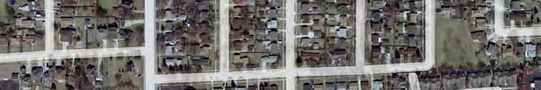
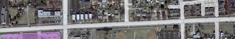
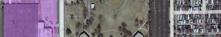

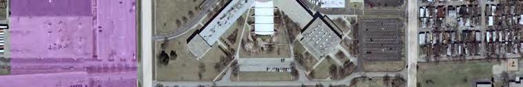
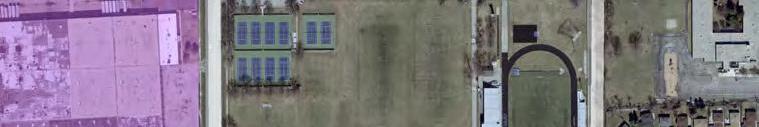
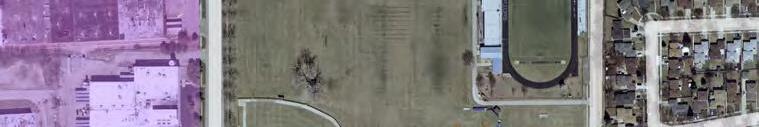

Install crossing improvements (highly visible markings, pedestrian refuge island, etc.)
Consider installing new signal. Install highly visible crossing markings on all intersection's legs.
Improve bus stop to have a paved landing and a shelter. Additional amenities to consider include seating, lighting, real-time service information and heating.
! ! ! ! ! Install sidewalks where missing.
Develop new off-street bikeway along Wolf Road
* Only operates mornings and afternoons during the school days and school year.
** Afternoon From School Route 221 (southbound and northbound) Maine West School passengers board at the intersection of Wolf and Oakton.
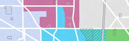
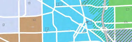
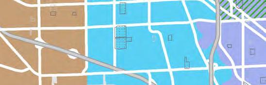

5.8.2. Add bike lanes and improve bike infrastructure around MWHS.
As noted in Recommendation 5.3.1 , a road diet and bike lane on Wolf Road should be considered as a way to enhance biking options as it will provide MWHS students traveling south to Oakton Street a safe and convenient way to bike to school. Bike amenities such as bike racks and storage should be considered to improve the experience. Additional treatments such as adding curb bump-outs could also be considered. The planned Oakton Street bike route (from Elmhurst Road to the Canadian National Rail Line) will provide an added connection from MWHS to the rest of Des Plaines’ bike network, improving the safety and visibility of cyclists along Oakton Street.
5.8.3. Add shelters to Pace bus stops around the school to improve student comfort and safety.
The Pace Bus Stops at Oakton Street and Wolf Road lack shelters and paved waiting areas. During a MWHS Focus Group students reported feeling unsafe due to the lack of a defined waiting area at the stops (with little buffer from the high-speed traffic on Oakton Street). In addition, students waiting in inclement weather are left unprotected from the elements. Adding shelters and paved waiting areas at these stations may improve student safety and comfort when taking the bus.
5.9. Utilize the CMAP O’Hare Subregion Truck Routing and Infrastructure Plan as a guide when considering changes to the truck route network.
The CMAP O’Hare Subregional Freight-Manufacturing Drill-Down Report recommends the coordination of truck routing between communities located near O’Hare International Airport. The City of Des Plaines should utilize the plan as a guide when evaluating potential changes in truck routes. Officials are encouraged to coordinate with surrounding municipalities to ensure continuity in route designation.
Recommendations include evaluating non-essential roads, especially those in residential areas, for added truck restrictions. Enacting restrictions on these roads would make it safer for pedestrians and bicyclists, while reducing noise and pollution.
In addition, the City should look for ways to balance the needs of bicyclists and pedestrians with the needs of truck drivers in high-traffic areas. The Downtown is home to three primary streets (Miner Street, Lee Street, and Graceland Avenue) designated as truck routes. The construction of off-street bikeways (such as the Northwest Highway sidepath) would help improve bike accessibility along these corridors.
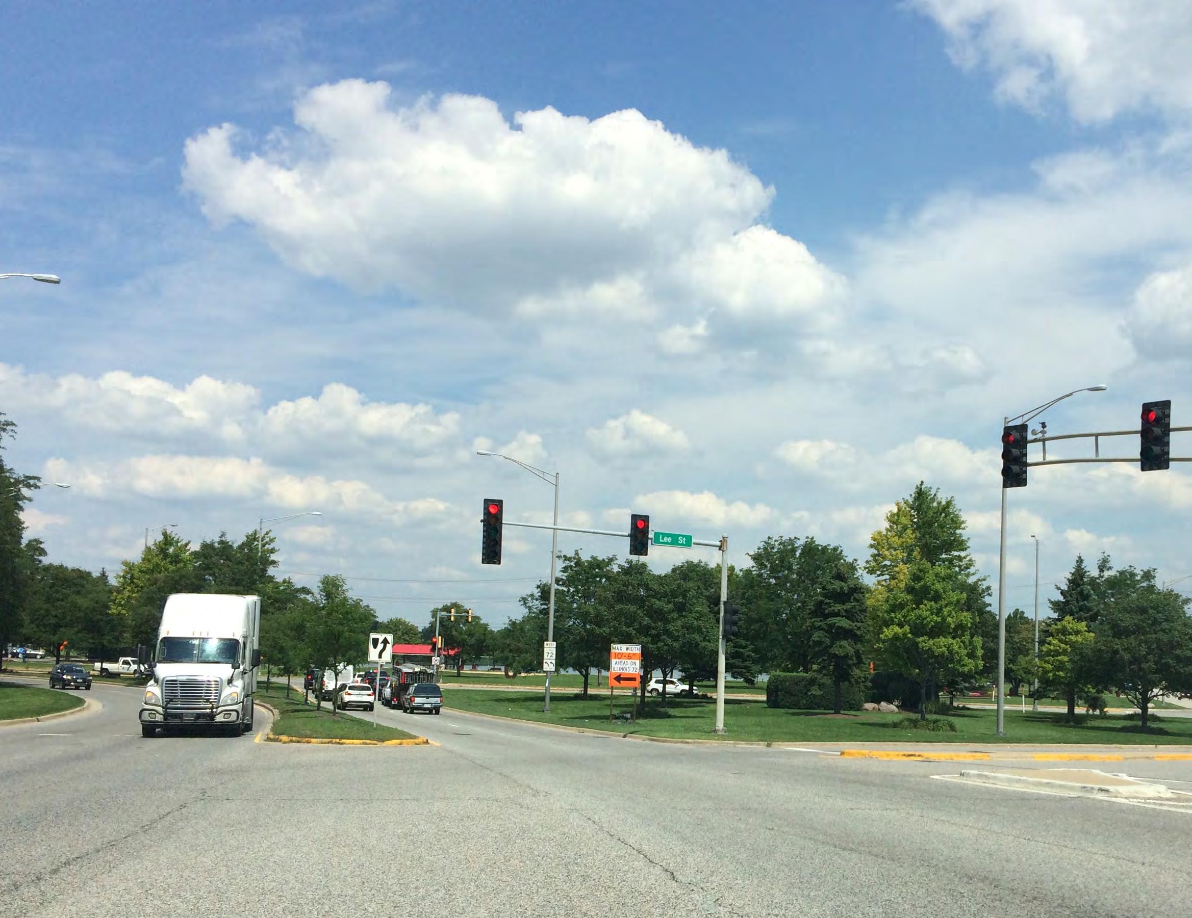
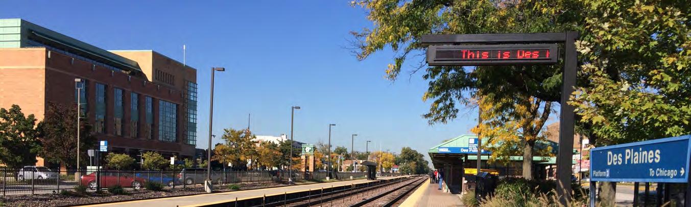
5.1. Transportation Implementation Action
Pedestrian and Bike Network
5.1. Pursue initiatives that improve the pedestrian network for all users.
5.2. Pursue new projects to improve the biking network.
5.3. Promote Des Plaines as a pedestrian-friendly community.
Expand and Improve Transportation Options for Older Adults
5.4. Work with Pace to offer paratransit services to older residents.
Access to Public Transportation
5.5. Work with Pace to optimize the design and location of future Pulse stations. Pace | City of Des Plaines Ongoing
5.6. Improve the Cumberland Metra Station.
Improve Access and Circulation at Maine West High School (MWHS)
5.7. Investigate ways to improve vehicular traffic circulation around MWHS.
5.8. Enhance bike and pedestrian access to MWHS.
Mitigate Truck Traffic
5.9. Utilize the CMAP O’Hare Subregion Truck Routing and Infrastructure Plan as a guide when considering changes to the truck route network.
of Des Plaines | CMAP, Cook County

The City of Des Plaines welcomes and celebrates its rich cultural history, drawing from its legacy as an immigrant-friendly community. By supporting and providing comprehensive resources for immigrant families and minority-owned businesses, Des Plaines will be primed to continue developing as a vibrant and diverse community.
• Des Plaines’ recent increase and continued growth in its Asian and Latino/a population is a strong indicator of its rich cultural diversity.
• While well-established institutions in Des Plaines offer a variety of immigrant services, there are more opportunities to better integrate recently-arrived immigrant families in the social fabric of the City.
• Many immigrant-owned establisments are contributing to the Des Plaines economy, there is an opportunity to better assist diverse small businesses to make a larger economic impact.
Des Plaines should continue to celebrate and incorporate its rich cultural diversity by preserving the very things that makes it special: its people, character, and diversity. By celebrating the different backgrounds of its residents, there is an opportunity to create a stronger sense of community.
6.1. Partner with local institutions to promote diversity.
Celebrating differences, as well as common interests, helps unite and educate community members. Several institutions within the City of Des Plaines have shown a commitment to celebrating the community’s diversity through citywide events. The City should continue to partner with these institutions to encourage and grow existing efforts.
• Des Plaines Parks District: The City of Des Plaines can collaborate with the Park District to build on their existing efforts. The Des Plaines Park District has been programming citywide events such as “Live at the Lake: Sol Azteca Folkloric Ensemble,” a summer celebration with food, live music and performances.
• Des Plaines School District 62 & Maine Township High School District 207: Many local schools have created opportunities to celebrate their diverse student body. District 207 High Schools (Maine East, Maine South and Maine West), host “International Celebration,” a joint annual event celebrating diversity. At the event, students are able to share their cultural backgrounds through activities, entertainment, and food.
• Des Plaines Public Library: The Des Plaines Public Library has contributed to the building of community through their various services and community workshops. “Dia Del Niño/El Dia de los Libros” (Day of the Child/ Day of Books) is an annual community-wide celebration that recognizes children and emphasizes the importance of literacy for children of all linguistic and cultural backgrounds.
• Library services in place to reach their diverse constituency includes providing materials in languages other than English, literacy instruction, computer classes, and English as a Second Language (ESL) courses. The Des Plaines Public Library has partnered with the Alliance for Lifelong Learning and Oakton Community College to provide services such as eligibility for naturalization workshops and review of U.S. history and government.
• City of Des Plaines: The City has numerous staff that speak Spanish and Polish and offers a bonus for those that speak either as a second language.
6.4. Explore different outreach strategies to best reach underrepresented groups.
Many communities struggle with engaging non-traditional participants. Often municipalities lack the staff or resources needed to conduct an effective public participation process. This adds to the challenge of engaging with underrepresented groups. Recommendations below outline different manners in which the City of Des Plaines could better engage with their diverse constituents (outreach strategies may vary by the segment of the population the City wants to reach).
6.2. Seek community volunteers for guidance.
Community volunteers are an important and often untapped resource for municipalities. The City should explore manners to partner with individuals that represent different sectors of the community for their cultural guidance or translation services. A recommended manner to reach potential volunteers is through local faith-based organizations, community organizations, and student groups. In addition, the City could look to engage young people to do the same, allowing them to share their knowledge, experiences, and abilities.
6.3. Create resources to help navigate the City of Des Plaines.
The City can create and promote resources to welcome and better integrate newly-arrived immigrant families. Community Welcome Packets are an effective manner to establish contact with new residents and provide them with important community information. Welcome Packets should be available in the community’s most commonly spoken languages (Spanish, Polish, Gujarati and Tagalog) and answer common questions they may have when they first arrive to the City.
• Meeting promotion: Consider the best mode of communication to reach the target population; in instances, phone calls may be more effective than emails. The City may also need contact radio stations, newspapers, and electronic media outlets that target the specific population they are trying to reach.
• Meeting location: Rather than hold meetings in government/public agency buildings, consider using public schools, the Des Plaines Public Library, local faith-based institutions, or parks amenities. Meeting sites should be welcoming, safe, and accessible.
• Translation: Ensure that meeting materials are available in appropriate languages. Consider providing translation services at an event.
• Agenda: Create an agenda that reflects the target community’s priorities. Ensure that there is a common understanding of the meeting process and goals.
• Incentives: Provide small incentives that may increase participation. Examples include providing food and childcare.
The City of Des Plaines boasts a variety of locally-owned ethnic restaurants, services, and retail shops throughout the City. According to the U.S. Small Business Administration, immigrants have been found to have higher business ownership (roughly one out of ten immigrant workers own a business) than non-immigrants. There is an opportunity to further explore organizations, resources, and best practices to better reach and assist these businesses.
6.5. Increase communication and collaborative efforts.
Chambers of commerce and local government offices provide small business owners with the support and resources needed to navigate the complexities of running a business. General assistance may take the form of façade and awning improvement programs, signage guidance, or marketing assistance, to name a few. For small ethnic businesses owners, particular elements may present unique hurdles for their businesses advancement. Some business owners, particularly those born in another country, may not have mastered the English language, are not familiar with the City’s existing programs, or are hesitant to engage with the government. A manner in which the City of Des Plaines can begin to overcome some of these challenges is through better communicating and collaborating with local and regional partners to reach and understand ethnic business owners.
An ideal manner to increase communication efforts begins with surveying business owner’s unique needs and providing relevant information (in some cases, information may need to be translated to languages other than English). To encourage participation, the City of Des Plaines should seek assistance from knowledgeable community partners. Trusted institutions with strong connections to immigrant groups include faithbased organizations, local schools, social service providers, consulates, and culturally-based nonprofits. Collaborating with these institutions can help establish contact and trust with hesitant business owners, and in turn lead to sharing information that may be valuable in assessing how to best serve their specific interests and needs. See Table 6.1 for a list of possible local and regional partners.
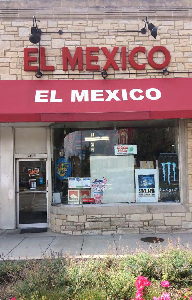
IMMIGRANT SERVICES
Other communities in the region have done more than provide community welcome packets. While the Village of Skokie provides a general electronic New Resident packet, its Human Services Department developed a Directory of Immigrant Services detailing general immigrant services in the area, local schools, and cultural organizations. The City of Des Plaines could also explore added efforts to best reach and inform their new residents.
IMMIGRANT
The Metropolitan Mayors Caucus (MMC) and CMAP developed an Immigrant Integration Toolkit that showcases a variety of techniques municipalities in the region have successfully implemented to achieve integration and inclusion. The toolkit addresses common challenges associated with engaging immigrant populations, such as marginal participation in municipal government, lack of representation on local boards and commissions, caution of government, and language barriers.
ORGANIZATION/ PROGRAM DESCRIPTION
Des Plaines Chamber of Commerce
Northwest Hispanic Chamber of Commerce
Oakton Community College’s Workforce Solutions
A local chamber focused on promoting and supporting the business community.
A regional chamber focused on supporting businesses in northwest Chicagoland area.
Offers training solutions to educate, train, and retain a skilled workforce.
Oakton Community College’s Alliance for Lifeling Learning
Educational Access Creates Hope
Alliance for Immigrant Neighbors
The Catholic Charities; Shrine of Guadalupe; St. Paul Chong Hassang
Maryville’s Casa Esperanza and San Francisco
Provides programs for naturalization eligibility, ESL, and GED prep courses.
Provides support for undocumented and DACA students with admissions and student success pathways.
Offers affordable legal services to immigrants and refugees.
Provides comprehensive immigration services.
Provides temporary shelter care and child welfare services for refugee children.
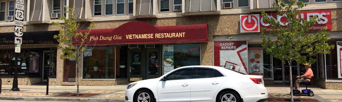
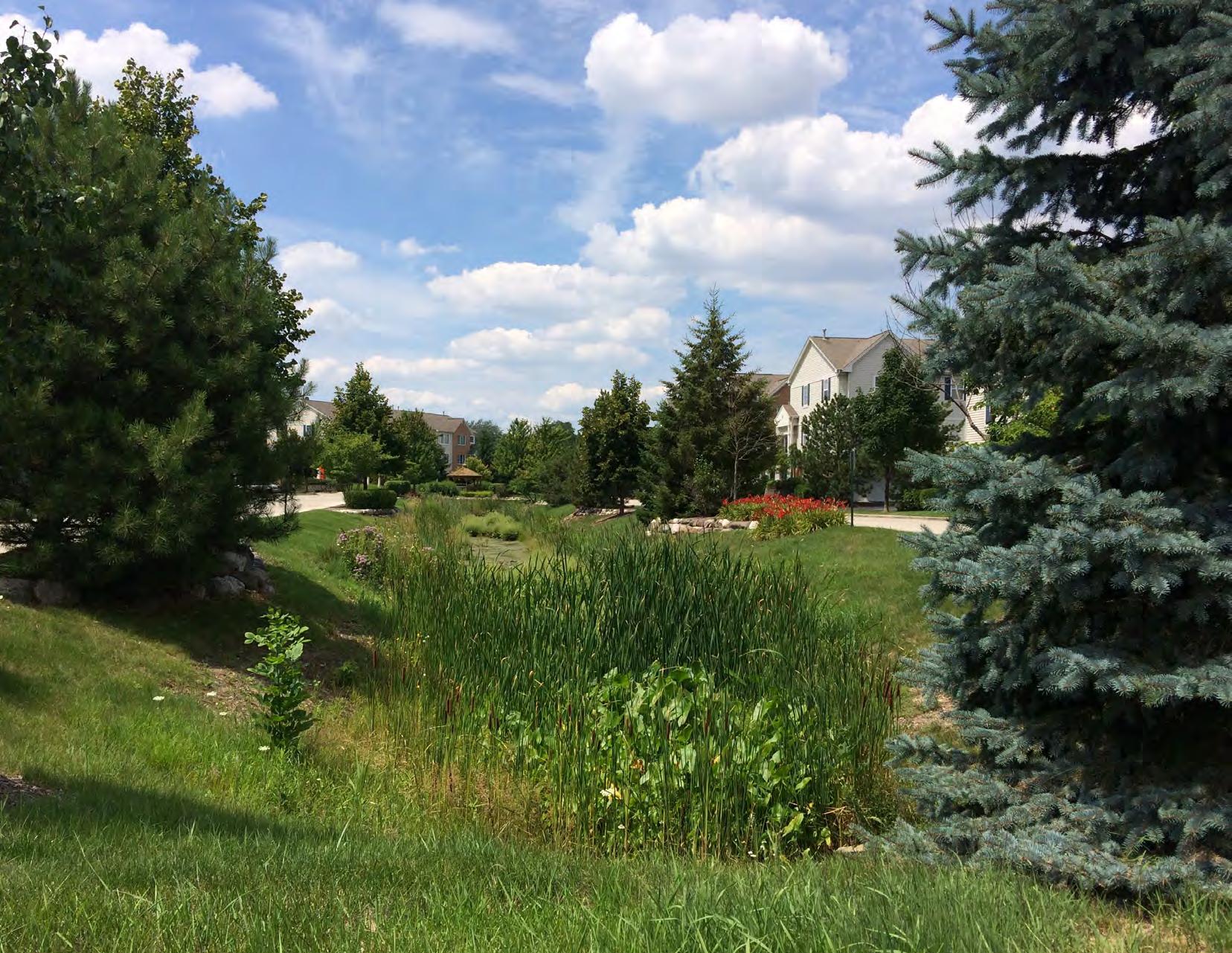
Public agencies and private property owners will invest in a range of solutions to reduce flood damage and more effectively manage stormwater. Strategies outlined within this chapter will ensure the safety of residents, protect buildings and infrastructure, and restore the City’s natural floodplain functions. Recommendations made throughout this chapter should be focused in the priority areas identified in Figures 7.1 and 7.2.
• Des Planes is susceptible to multiple types of flooding.
• The City of Des Plaines has been proactive in addressing flooding concerns and leveraging resources with other governmental agencies to add regional detention facilities.
Regional and watershed-wide capital improvement projects have the potential to provide flood relief to Des Plaines. Major capital improvements are typically expensive public endeavors, however, they can also be effective at reducing flood damage. As these projects are in various stages of planning, engineering and construction, the City should continue to support and coordinate with lead agencies, such as USACE, IDNR, IEMA, and others, to ensure these projects are completed in a timely manner.
7.1. Continue pursuing buyouts in flood-prone areas.
The City should continue implementing the Repetitive Loss Plan and acquire properties through their buyout program. While much of the Des Plaines River floodplain is composed of Cook County Forest Preserve District lands, portions of the floodplain along River and Rand Roads have been developed. The floodplains of Willow Creek and Wellers Creek also contain homes and businesses. The City’s 2013 Hazard Mitigation Plan identified over 2,600 structures in the floodplain and 16 repetitively flooded areas within the City. Property acquisition or buyouts will remove people and property from harm’s way, eliminate repetitive losses, and is less costly than providing protection through large-scale flood control infrastructure. In addition, removing development from the floodplain enhances their natural functions to hold and infiltrate floodwaters and reduce pollutants. Longterm maintenance strategies should be identified to ensure continued flood control benefits the future.
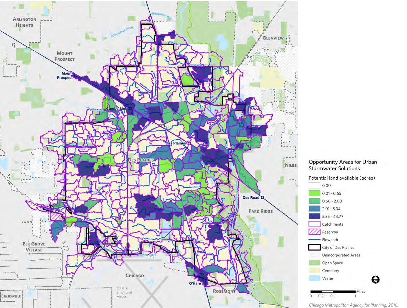
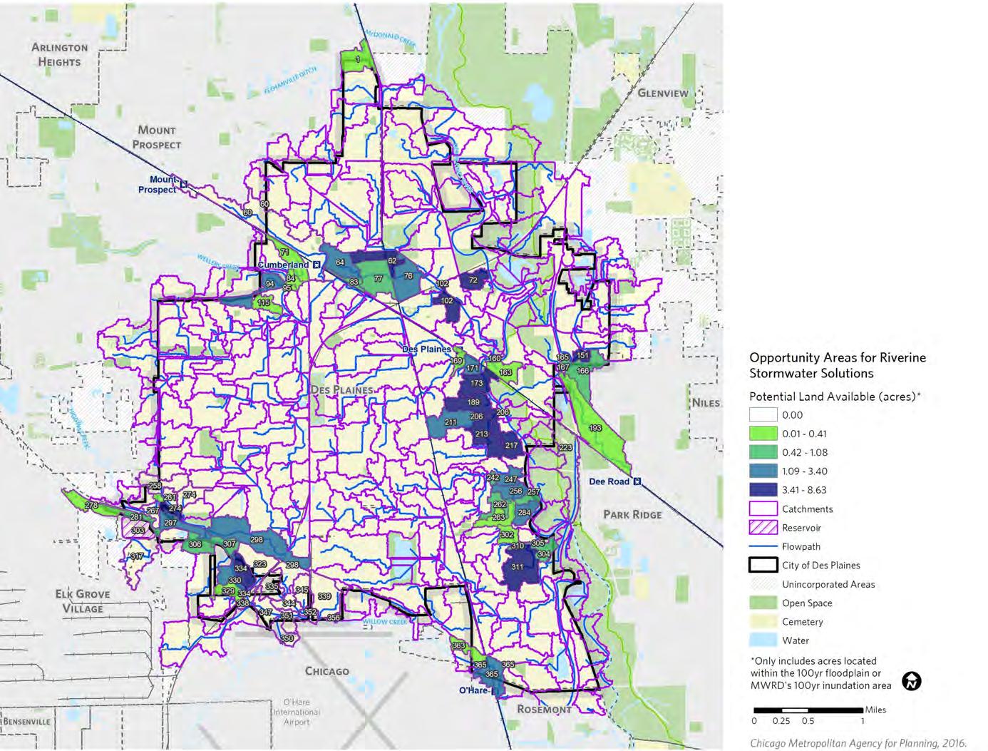
Staff should work closely with government partners IEMA, FEMA, MWRD, IDNR, and USACE, all of whom provide financial or technical assistance through the buyout process, and apply for mitigation grant funding available through IEMA and FEMA for floodplain mitigation and other types of hazards (e.g., severe storms and tornadoes) to ensure buyouts continue beyond the Big Bend area. Alternatively, MWRD is also able to provide direct funding assistance for those project that do not receive IEMA support.
The City’s buyout program aims to acquire 80 structures in the Big Bend area. City staff should continue engaging with residents to better understand their needs and concerns, as well as provide ample education to help homeowners understand the economic and social advantages of participation. Since buyouts are strictly voluntary, the City should encourage property owners who decide not to participate in the program to take risk reduction measures, such as elevating their home and floodproofing their basement.
The construction or repair of streets, alleys, sidewalks, curbs, and storm sewers are prime opportunities for the City to integrate green infrastructure solutions to improve stormwater management practices. These measures can include drainage and storage improvements such as permeable pavements and bioretention basins in parkways (to increase detention capacity, promote infiltration, and reduce exposure to flood waters).
7.2. Continue using Capital Improvement Programs to improve stormwater management.
The most recent Capital Improvement Program (CIP) for Des Plaines outlines an $87 million investment in street, utility, and drainage infrastructure improvements for the years 2014 through 2018. The City should continue to make similar investments in the upcoming CIP (years 2019 through 2023). In recent years, the City began requiring that all alley reconstruction be done with permeable pavement.
Similarly, the City should require the replacement of combined sewers with separate storm sewers when a combined sewer street undergoes construction. Projects in the CIP should focus on urban stormwater management area ( Figure 7.1), such as areas with combined sewer areas or experience basement backups.
7.3. Invest in green and gray infrastructure solutions in public rights-of-way.
Design resources for integrating green infrastructure in streets have expanded in recent years. Delta Institute’s “Green Infrastructure Toolkit” provides downloadable design templates as well as cost and maintenance estimates for right-of-way bioswales, rain gardens, and permeable pavement. National best practices explained in NACTO’s Urban Street Stormwater Guide can help retrofit and reconstruct roadways that promote safety and improved stormwater management. The City should work closely with the CCDOTH and IDOT to coordinate these efforts on county and state roads that extend through the community.
Note:
Source:
Assumes an average sized single residential lot present in Des Plaines with the front half of the lot up to the center of the street would drain to the parkway. Christopher B. Burke Engineering analysis of U.S. EPA’s Spreadsheet Tool for Estimating Pollutant Loads.Flow Through Inlet
Carriage Walk
Rain Garden
Depressed Parkway
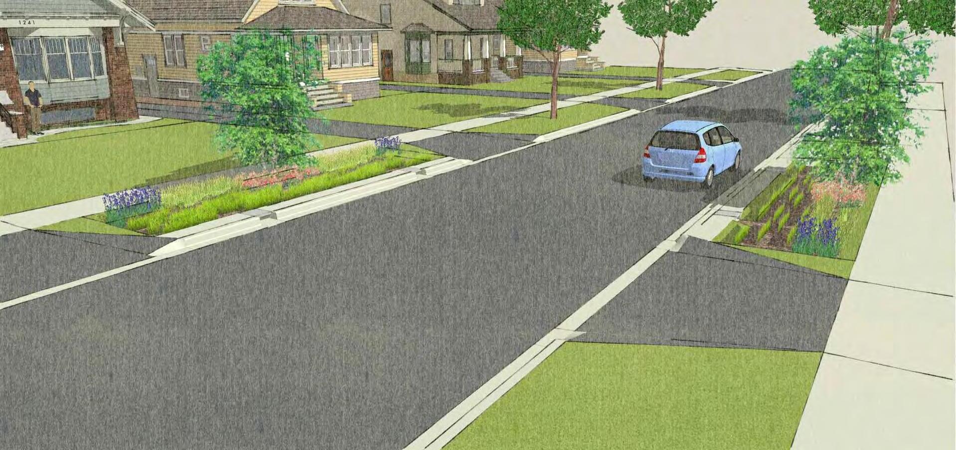
SIDEWALK
Maintain a Rough Interface Between In-Situ Soils & New Soil Medium
Woven Filter Fabric Over Top Trench Only
Ex. Grade
Max Surface Stormwater Storage Level
Street Side Slope Plants
4-6” Cobbles Set At Grade Behind Curb Inlets
Ex. Curb & Gutter
Depressed Curb Inlet
STREET
Soil Medium (60-70% Coarse Sand; 30-40% Compost)
Coarse Aggregate/No Fines Backfill
Perforated Pipe Wrapped in Filter Fabric
Figure 7.5. Stormwater Concept 2: Parkway Rain Garden Lawn Edge Figure 7.4. Stormwater Concept 1: Parkway Rain Garden Source: Christopher Burke.Concept Plans 1 and 2 (Figures 7.4 and 7.5) were developed to explore how possible stormwater improvements can be made to a typical residential street in Des Plaines while enhancing neighborhood character and minimizing costs associated with installing gray infrastructure. The concepts excavate the area between the local street and the sidewalk in order to allow stormwater to collect before being discharged to existing sewer systems or nearby streams and rivers. These concepts augment the current capacity of the sewer system and also improve water quality. Parkway best management practices are most effective at removing nitrogen, phosphorus, and suspended solids from runoff. The estimated cost per average Des Plaines residential lot (50-feet wide) to install the elements shown is less than $15,000, with unit prices assuming multiple lots would be constructed concurrently. A quarter-mile concept pilot could be the best first step to demonstrate the aesthetics and benefit to the community.
The City has either conducted or been engaged with a number of studies in recent years to address flooding concerns. All of these planning efforts identified key capital improvement projects that could address stormwater and flooding issues in the City. Agencies should work together to identify/apply for funding opportunities and prioritize projects that have multi-benefits.
The Stormwater Management Master Plan identifies a dozen areas with flooding and sewer capacity challenges, as well as reported citywide flooding.
Recommendations for flood mitigation projects include the installation of relief storm sewers, underground storage, and stormwater storage basins. As of 2010, projects have been completed for four of the twelve problem areas that were identified.
The City’s Hazard Mitigation Plan, which was updated in 2014, outlines numerous recommendations that would help improve the community’s ability to manage stormwater as well as be more resilient to natural hazards and the effects of climate change. The City of Des Plaines is the only municipality in the Chicago region that has its own, community-specific hazard mitigation plan. Having their own plan also allows for the City to apply directly to the federal government for Hazard Mitigation Grant Program (HMGP) funds, rather than applying through the county. The City should update this plan regularly and continue to pursue recommendations such as:
o Protecting critical facilities, such as the fire station, from the flood hazard areas.
o Designating wetland and floodplains as priorities for acquisition for public parks and recreation areas through CIPs.
o Developing a detailed flood warning and response system based on IDNR’s flood stage forecast map and the Des Plaines River gage flood crest predictions.
o Sustaining compliance with the National Flood Insurance Program and participation in the Community Rating System.
The City and Methodist Campground should collaborate to identify redevelopment strategies that are focused on historic preservation and infrastructure improvements (including elevating all the buildings due to increased flooding). They should also explore how the campground could serve as a model for preserving historic structures in vulnerable areas, such as the floodway, and maintaining resiliency in the face of climate change. These efforts will also help the City implement its 2002 Repetitive Loss Plan since the campground is one of the 11 repetitive loss priority areas.
While upgrading the City’s stormwater infrastructure will be a long-term endeavor, development standards and other regulatory measures should continue being employed to reduce the burden on the existing infrastructure and achieve both water quality and flood reduction goals.
7.4. Update and expand regulatory standards.
The City’s regulatory standards for development in the floodway and floodplain are high relative to minimum FEMA and state requirements, and residents are supportive of them. The City should review its development regulations on a regular basis to ensure they employ the latest provisions for flood mitigation and protection (this may include zoning, subdivision, floodplain management, and stormwater management ordinances). The City may also want to consider protecting existing neighborhoods from urban flooding by mapping problematic low-lying areas, recognizing them in site plan review, and requiring redevelopment to maintain them for stormwater to collect. By providing staff trainings, the Des Plaines can ensure regulations are properly enforced.
The WMO includes several site development and stormwater management standards to minimize the potential for negative impacts on adjacent and downstream properties. These include runoff control, volume control, and storage requirements:
• Runoff control requirements contain design standards and other restrictions on where runoff is allowed to flow.
• Volume control requirements compel developments to capture the first inch of runoff from an impervious surface area. The first inch of runoff contains the most pollutants (e.g. oils, dust, particulates, fertilizer, and organic matter).
• Storage requirements determine how fast the water can be discharged from a development site, called the allowable release rate. Storage facilities, such as a detention pond, control the rate at which water is released from the site under developed conditions. The more impervious surface on the site, the more detention is required to meet the prescribed release rates.
Source: “Watershed Management Ordinance: Short Summary” (2018). MWRD: https://www.mwrd.org/irj/go/km/docs/ documents/MWRD/internet/protecting_the_environment/ Stormwater_Management/htm/WMO/WMO_Summary.htm
Large developed properties that have a significant amount of impervious surface, including parking lots and rooftops, are among the biggest contributors to flooding because runoff flows from them into public sewers and drainage areas. Within Des Plaines, there are multiple opportunities to redevelop commercial, multifamily residential, and industrial properties that exhibit these characteristics. Redevelopment in Cook County is subject to the 2014 Watershed Management Ordinance (WMO), provided that the development size triggers these requirements (which vary by land use). The City should evaluate zoning, subdivision, and landscaping standards to reduce barriers and encourage green infrastructure practices for sites that may not trigger the WMO requirements.
In order to better understand how stormwater management could be improved in industrial areas of the City of Des Plaines, an industrial site at Wolf Road and Touhy Avenue, or Stormwater Concept 3 ( Figure 7.6 ), was selected to explore potential options. If full redevelopment of this particular site was proposed, it would trigger stormwater detention and volume control requirements governed by the WMO. WMO criteria were used as a guideline to prepare a concept plan, in addition to utilizing existing features and opportunities specific to the site. The concept plan includes three main elements:
• Naturalized detention basin: An excavated basin along Touhy Avenue would provide the majority of the site’s stormwater detention volume. Designed as a naturalized basin with natural vegetation, this feature would maximize water quality benefits and also provide greenery on the Touhy Avenue frontage.
• Permeable parking lot: Permeable pavement allows the infiltration of rainwater via the spaces between the pavers. Reconstruction of the parking lot could be done with a permeable paving system, which provides water quality benefits as well as a portion of the required storage volume.
• Bioswales: Bioswales – a long, channeled depression – are proposed along the west side of the property to take advantage of an existing green strip between the adjacent property, and would be used as a stormwater conveyance feature that would convey roof runoff from the redevelopment building footprint into the detention area.
The estimated cost for the stormwater components of this concept redevelopment plan is approximately $1.2 million. However, it should be noted that parking lot upgrades typically occur during a full redevelopment project. Using EPA’s STEPL tool, the potential water quality benefits for the proposed redevelopment plan were evaluated. The analysis predicts that within the project area, nitrogen loading would be reduced by 14 percent, phosphorus loading by 11 percent, and sediment load by 15 percent.
Assumed Building Development Footprint


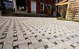
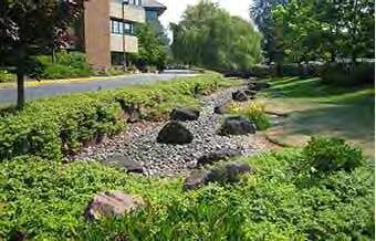
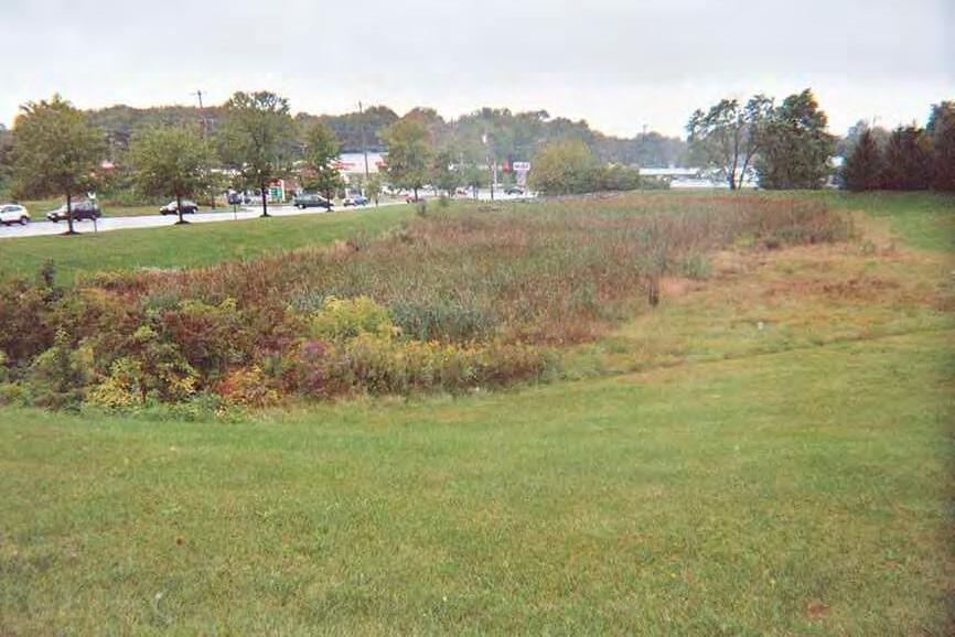
Much of the City was built and designed before the adoption of modern stormwater management standards, and as a result, many residential properties were developed within depressions or on hydric soils (potentially resulting in the pooling of rainwater in backyards and basements). While strengthened development regulations through the WMO and the City’s building codes and regulations can reduce flood damage, additional strategies and investment are needed to combat flooding.
Residents of Des Plaines can play an active role in managing stormwater on their own property. In addition to municipal planning efforts and capital improvement projects, the City administers programs that help residents reduce their risk of flooding damages. The National Flood Insurance Program (NFIP) and the Community Rating System (CRS) provide insurance premium discounts for residents that go beyond the minimum floodplain management requirements. The City also has a rebate program to help finance stormwater management projects that take place on private property. Active participation in these programs can help improve local and City-wide stormwater management.
Voluntary rebate or cost-share programs that provide technical and financial assistance are important to improve drainage and mitigate flooding on private property. The City of Des Plaines has a Flood Rebate Program that helps pay for flood mitigation projects constructed on residential properties. The City should consider expanding this program to private businesses, as well as to cover other stormwater improvements such as rain gardens and permeable pavement. This may encourage more residents to take advantage of the program, and increase stormwater improvements in the Downtown and other major commercial corridors.
Outreach and education activities complement infrastructure improvements and regulation enforcement, while increasing public awareness of flooding risk and garnering support for stormwater management investments. The City may want to invest in a stormwater management campaign to further educate homeowners on best management practices for private property. The City could partner with the Center for Neighborhood Technology (CNT), which has developed educational materials for residents and could also help promote existing programs like the City’s Rain Barrel program. CNT also provides services and incentives—including flood risk assessments and interactive tools—that help educate property owners about the costs and benefits of infrastructure improvements on private property.
7.8. Encourage flood insurance among private property owners.
Des Plaines should encourage all property owners within and near floodprone areas (such as MWRD 100-year inundation area and combined sewer areas) to obtain flood insurance through the National Flood Insurance Program (NFIP). According to the Hazard Mitigation Plan, less than 50 percent of the privately-owned buildings in the City’s floodplains, and 1 percent of the buildings in the rest of the City are covered by flood insurance.
In addition to flooding, stormwater is one of the primary contributors to degraded water quality. As stormwater runoff moves across a landscape, it collects non-point source pollutants (sediment, nutrients, chloride, and fecal coliform) and carries them into nearby waterways. High concentrations of these pollutants can lead to habitat degradation and loss, as well as increase treatment costs for community water suppliers. Wetland and stream restoration, as well as green infrastructure techniques, can help treat and filter out stormwater pollutants prior to entering waterways during storm events.
7.9. Develop a tree preservation ordinance.
Des Plaines should consider developing a tree preservation ordinance that helps protect, increase, and diversify the existing tree canopy and promote native vegetation throughout the City. A city’s urban tree canopy can create habitat for wildlife, improve stormwater management, mitigate urban heat island effects, and clean the air and water. With nearly 50,000 trees within the public right-of-way, a tree preservation ordinance would aid the City’s Public Works and Engineering Department with the operation and implementation of existing efforts: the Emerald Ash Borer Management Plan, the Tree Replacement Program, and Tree City USA membership. A tree preservation ordinance can establish standards and actions for the removal, care, protection, and planting of native trees on public or private property. The Village of Glenview, a neighboring community, has a tree preservation ordinance that could serve as a model for Des Plaines. The Morton Arboretum also offers guidance to communities on the development of tree management plans and volunteer programs on their website: www. mortonarb.org/treetools.
7.10. Pursue Section 319 funding for green infrastructure.
Watershed plans develop strategic recommendations to help restore impaired waters, and protect and maintain the quality of unimpaired waters. Although water quality is a primary focus, other natural resources are of value, and plans seek to contribute to overall habitat improvement and flood mitigation. These plans are also essential to obtain Section 319 funding that could be used toward installing green infrastructure, stream and wetland restoration, or education and outreach efforts.
The Metropolitan Planning Council (MPC) has been overseeing a watershed planning process to develop supplemental water quality materials for the MWRD’s existing Lower Des Plaines River Detailed Watershed Plan. The plan focuses on local and regional flood control, and supplemental materials will make the plan EPA-compliant by addressing all “nine minimum elements” of a successful watershed project. As a result, communities that are within the boundaries of an EPA-compliant watershed plan are eligible for funding via Illinois’ EPA Section 319 Nonpoint Source Management Program. The City, with the Des Plaines Park District, should engage in and monitor this effort. Upon its completion, these entities can apply for Section 319 funding to help achieve their stormwater management, as well as open space and recreation objectives within the watershed. The program requires a local match, so the City should seek support from the County, FPCC, MWRD, and IDOT to realize these efforts.
7.11. Restore the edges of streams and rivers.
Wetlands provide social, economic, and ecological benefits to communities by cleaning polluted runoff before discharging to other bodies of water, and provide temporary storage for rainfall to reduce flooding. At the regional scale, wetlands are an integral part of the City’s green infrastructure. The Des Plaines River and its tributaries, such as Wellers Creek and Higgins Creek, should continue to be restored to enhance their natural floodplain functions. The City should work with the Cook County Forest Preserve to restore wetlands along the Des Plaines River and naturalize the river’s edge. These measures would improve natural flood mitigation functions and expand green infrastructure for stormwater management.
7.12. Continue to implement the Des Plaines Park District’s Strategic Plan.
The Des Plaines Park District recently completed their strategic plan for 2015-2020. Over the course of these five years, the Park District intends to monitor and maintain the urban forest through a proper forestry plan; continue to work on restoration of retention ponds, and identify natural resource management opportunities in the Comprehensive Plan. The City should work with the Park District to identify opportunities to integrate stormwater management techniques and water quality best practices into park and open space improvements. The City and Park District could pursue Section 319 to help implement the Strategic Plan. Both agencies could also explore opportunities to integrate stormwater infrastructure into recreational facilities, such as ball fields and playgrounds. There may be additional prospects to work with local civic groups, schools and other agencies to install rain gardens that can provide education and ecological benefits (rain gardens and other detention basins could support native vegetation and help restore monarch butterfly habitats while improving soil, reducing erosion, and stormwater infiltration). Engaging in this type of partnership can assure residents that existing open spaces and natural areas will be maintained and preserved overtime.

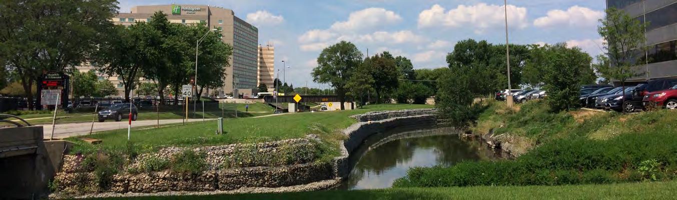
Support the Implementation of Capital Projects for Long-Term Sustainability
7.1. Continue pursuing buyouts in flood-prone areas.
of Des Plaines Ongoing Integrate Stormwater Management Practices into the City’s Capital Improvement Programs and other Public Investments
7.2. Continue using Capital Improvement Programs to improve stormwater management.
7.3. Invest in green and gray infrastructure solutions in public rights-of-way.
Continue to Implement Plans that Address Flooding
Continue Advanced Development Practices to Encourage Stormwater Management
7.4. Update and expand regulatory standards.
7.5. Pursue stormwater retrofits through redevelopment.
Promote Stormwater Improvements on Private Property
7.6. Consider expansion of the Flood Rebate Program.
7.7. Educate homeowners.
7.8. Encourage flood insurance among private property owners.
Improve Habitat and Water Quality
7.9. Develop a tree preservation ordinance.
7.10. Pursue Section 319 funding for green infrastructure.
7.11. Restore the edges of streams and rivers.
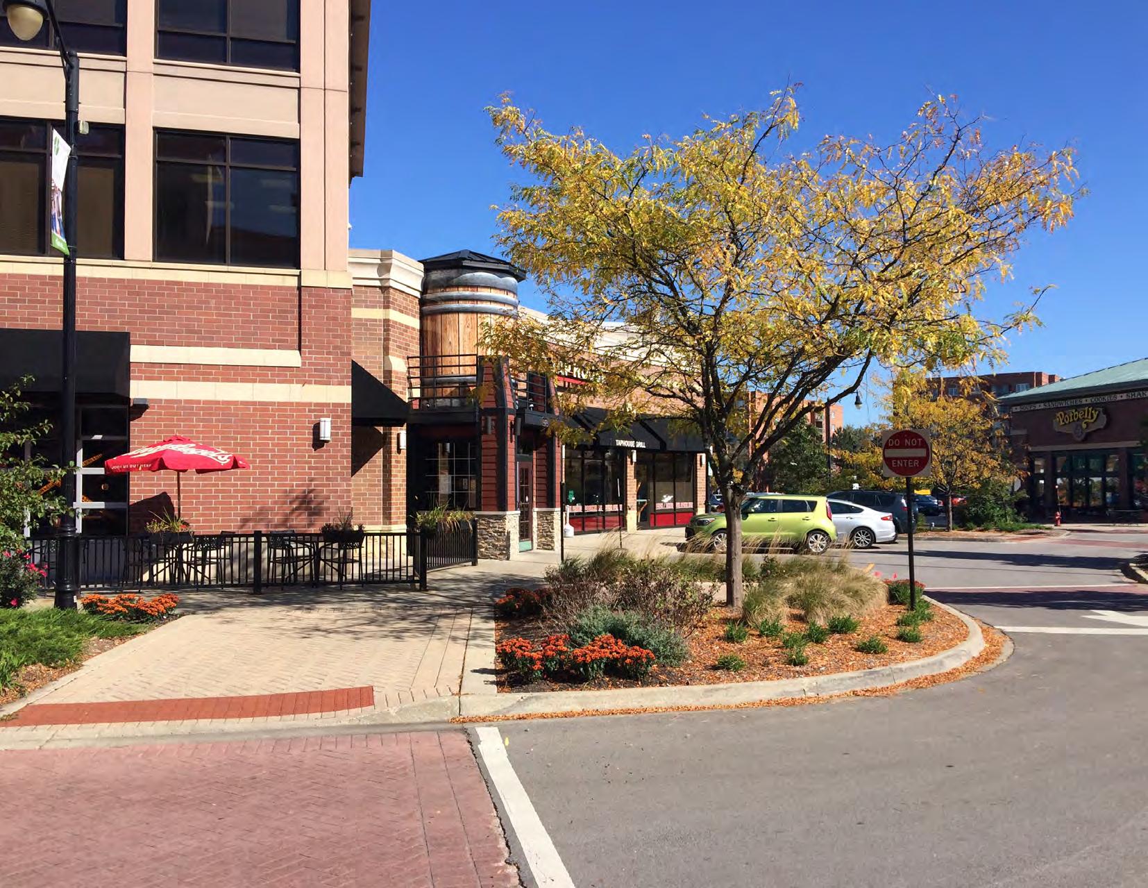
Downtown Des Plaines will be a vibrant destination with a variety of restaurant, entertainment, retail, and housing options. It will be served by a modernized transportation system, walkable for residents and visitors of all ages, and connected to the Des Plaines River and Trail.
• The community desires expanded retail and dining options in Downtown Des Plaines which can be supported by higher housing density for greater purchasing power.
• Parking, Circulation, and Congestion is a primary concern for visitors, existing businesses, and developers, and should be addressed prior to more new developments.
• Metropolitan Square is underutilized.
• The Des Plaines Theatre should be used to generate more activity in the Downtown.
8.1. Establish a downtown wayfinding program and prioritize gateway entrances.
In order to better direct visitors to public spaces and amenities, the City should establish a wayfinding program for the Downtown. Wayfinding signage is an effective way to lengthen the time visitors spend in Des Plaines and will further its sub-regional draw. Additionally, wayfinding signage can help local businesses and institutions market together and benefit from one another.
Metropolitan Square, the Des Plaines Public Library, and the Des Plaines Theater would all benefit from increased visibility. Transportation amenities, such as the Des Plaines Metra Station and Metropolitan Square Garage, could also see an increase in usage with the installation of more wayfinding signage.
Wayfinding signage should be provided at varying sizes and scales to be easily read by pedestrians, cyclists, and motorists. Arterials feeding into the Downtown such as Miner Street, River Road, and Lee Street, should be prioritized as key areas to expand signage, especially with identifying key properties like the Des Plaines Theatre. Installations should also be expanded around the Des Plaines Metra Station to direct those visiting by public transportation.
8.2. Target infrastructure and aesthetic improvements to enhance the streetscape.
Streetscaping can improve the image of Downtown Des Plaines. Amenities such as decorative lighting, pavers, bollards, trashcans, and benches can enhance public spaces to create a cohesive look and feel that makes public spaces more comfortable and increases the amount of time visitors spend there. Landscaping and street trees are also ways to enhance the streetscape by breaking up stretches of pavement and adding vibrancy and color. Opportunities for streetscape improvements along Miner Street and Lee Street should be prioritized.
While actors from the nonprofit and public sectors often spearhead efforts to improve public spaces, the private sector is increasingly playing a significant role in improving the streetscape. Private sector partners should be engaged to evaluate opportunities for involvement in improving shared spaces as well as developing funding mechanisms such as Special Service Areas or matching grants. To provide funding for infrastructural and aesthetic improvements, Des Plaines could also utilize revenues from future redevelopment projects following the expiration of the Tax Increment Financing (TIF) District 1.
8.3. Implement new design of Metropolitan Square.
Metropolitan Square is an underutilized community asset. The City and owners of surrounding businesses could make the space more functional for community events and gatherings by exploring designs that better leverage it as an active public space. Though the square is in a centrally located and desirable location, it is surrounded by parking spaces and traffic lanes, making it difficult to use. Reconfiguring the space to make it more comfortable for pedestrians to access will allow the space to better serve the community.
In 2014, City officials worked with the Lakota Group to develop conceptual designs for reimaging the space. The most useful design for Metropolitan Square is a 4-way intersection complemented by streetscape and paving treatments that enables the use of the square for special events. Design features such as colored pavers, attractive landscaping, and bump-outs with painted crosswalks over roadways should be added to create a more pedestrian-friendly environment. The City should also consider implementing temporary bollards to make the space adaptable for multiple uses. With temporary bollards, the square will be able to accommodate through traffic when not in use, but still allow the space to function as a public plaza during community events such as “Friday Nights Live!”
The Des Plaines Theatre is a historically significant asset to the Downtown. Once redeveloped and restored, the Theatre has the potential to become a sub-regional destination, potentially helping establish a vibrant entertainment and restaurant district in Des Plaines. The theatre could provide a significant economic boost for the City. Along with helping drive support for more dining and entertainment uses in surrounding parcels, a vibrant entertainment district will also help attract more young families looking to move into a downtown core.
City officials should continue to work with the Rivers Casino to undertake a comprehensive public engagement process regarding the future uses of the theatre that may include both, a live theater and movie theater.
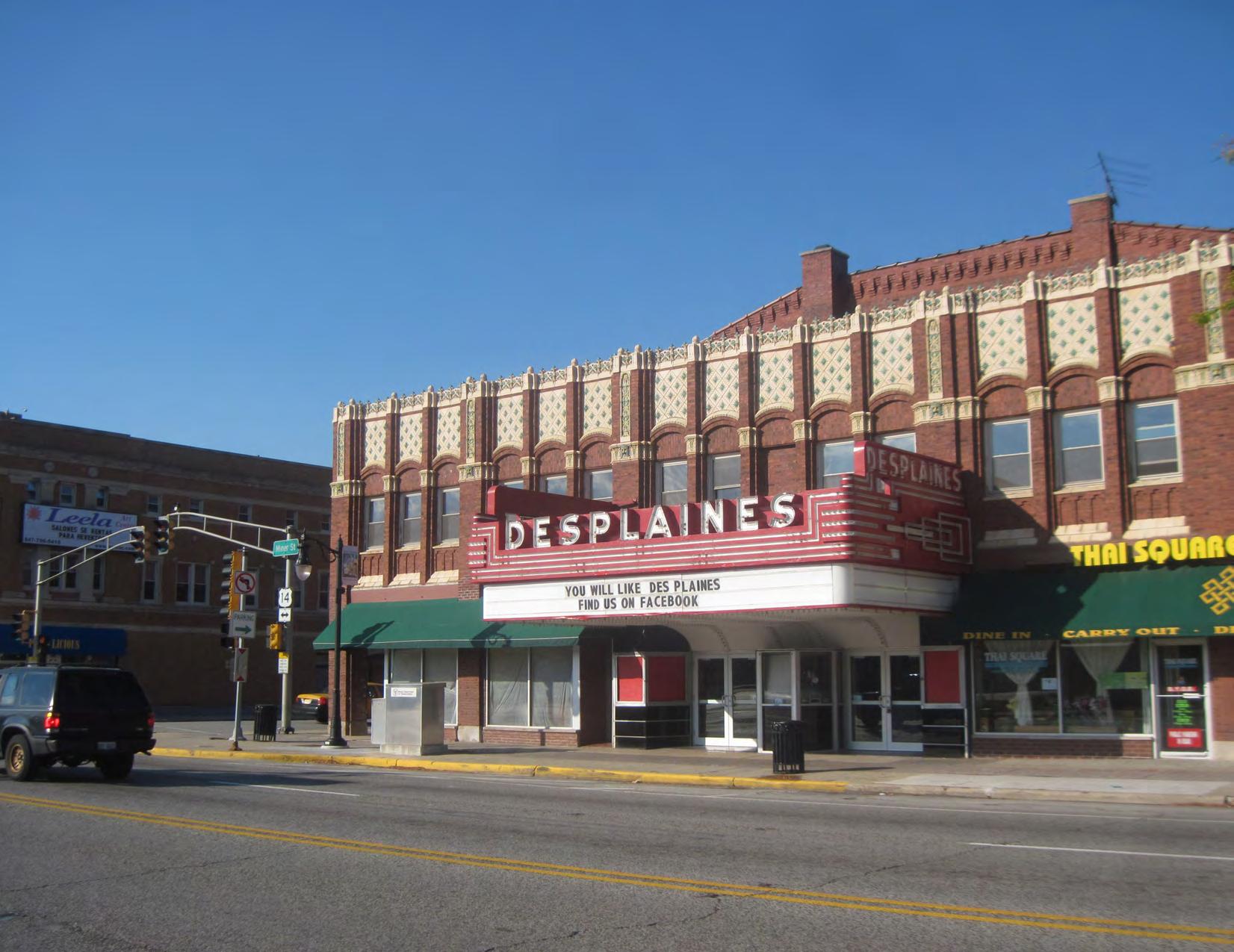
8.5. Create a restaurant cluster on Miner Street next to the Des Plaines Theatre.
Market analysis shows there is high demand for additional restaurants in the Downtown. Currently, more than $15 million in food and drink expenditure potential is being spent by households within the downtown trade area at restaurants located outside of Downtown Des Plaines. When restaurant expenditures from potential future households are considered, the total estimate exceeds $17 million in uncaptured demand for restaurants.
Downtown Des Plaines currently has 18 restaurants, much less than the average 29 seen in restaurant clusters in Arlington Heights, Mount Prospect, and Uptown Park Ridge. Analysis shows that Downtown Des Plaines could accommodate more than 10,000 square feet of new restaurant space in the next 10 years, translating to between 3 and 5 new restaurants. This number is a conservative estimate, and could increase depending on the density of future residential developments.
A restaurant cluster on Miner Street, next to the Des Plaines Theatre, could boost future growth in the Downtown. City officials should prioritize this cluster for the Downtown Restaurant District Program, which provides up to $100,000 in incentives to new restaurants (See Table 8.1 ).
The City of Des Plaines offers a number of incentive programs designed to help businesses make improvements to their establishments. Each grant reimburses business owners for expenditures, and requires any improvements to remain in place for a minimum of five years following installation. The business incentive programs include:
8.1.
PROGRAM
Awning Program
Facade Rehabilitation Program
DESCRIPTION
Provides reimbursement for up to 75% of costs for installation of new awning on commercial buildings, with a maximum of $5,000 per business.
Allows businesses to be reimbursed for up to 50 percent of costs for façade improvement on commercial buildings, with a maximum of $20,000 per business. Improvements included signage, lighting, permanent landscaping, and new storefront construction appropriately scaled with an existing building.
Interior Build-Out Program
Outdoor Dining Areas
Multi-Unit Retail Grant Program
Allows businesses to be reimbursed for up to 50% of costs incurred to locate a business within the City of Des Plaines, with a maximum of $15,000 per business. Improvements include hard costs for tenant build out and physical improvements to the interior of a building.
Reimburses businesses for up to 50% of costs incurred at the installation of outdoor dining areas, with a maximum up $10,000 per business. This includes improvements such as lighting, landscaping, fencing, pathways, and seating, among others.
Allows property owners are reimbursed for up to 50% of costs incurred for rehabilitation of commercial shopping centers or mixed-use retail buildings with two or more tenants, with a maximum of $50,000 per site. Maximum award amounts are allocated based on the size of the shopping center. Includes light, landscaping, signage, and storefront construction, among others.
Downtown Restaurant District Program
Allows businesses to be reimbursed for up to 50% of costs incurred to locate a new business within the Downtown Restaurant District. Maximum program award amount is $100,000. This program will end when TIF 1 expires.
8.6. Activate Downtown Des Plaines through arts and culture initiatives.
While arts and cultural resources are great sources of local pride, they also contribute significantly to a community’s economic health. When done well, arts and culture initiatives draw investment, create employment opportunities, and serve as a magnet for cultural tourism.
In 2013, CMAP released the Arts and Culture Planning Toolkit to help communities identify opportunities for arts and culture initiatives and guide them through implementation. The toolkit identifies preparation, participation and input, assessment, and implementation as key phases in successfully planning arts and culture initiatives.
Following these guidelines, Des Plaines should begin identifying opportunities to expand arts and culture initiatives in the Downtown. Partnerships with the Des Plaines Arts Council and other stakeholders should be strengthened to help implement arts projects to create an active and vibrant place to live and work while showcasing local talent, increasing retail activity, and creating jobs.
8.7. Assess the C-5 zoning district to bring a variety of new uses to the vacant spaces including “experience retail uses”.
Allowing experience retail uses in the C-5 Zoning District (where retailers offer instructional lessons such as pottery making, sip and paint businesses, and group cooking classes) will create more opportunities for the businesses to operate in the City’s commercial areas, specifically the Downtown. To further support artisanal entrepreneurs, the City should consider adding a new business grant to assist in storefront build-outs.
8.8. Continue to provide incentives targeted at specific commercial sectors to complement the vision of Downtown Des Plaines as a retail and entertainment district.
The City of Des Plaines has been very proactive in providing assistance to specific commercial sectors through incentive programs designed help private owners make improvements to their properties. As summarized in Table 8.1, these programs help alleviate costs spent on improvements such as awnings and facades. Des Plaines should continue to fund and promote these incentive programs to support the Downtown retail and entertainment district.
Currently, the Downtown Restaurant District Program allocates funding exclusively towards new, incoming restaurants to the Downtown. To ensure that successful businesses can remain in the Downtown, the City should consider expanding the program to include upgrades to existing restaurants which would incentivize restaurants to grow and expand. A minimum threshold could be set using square feet, or percent increase in square feet, to ensure that only expansions representing a significant commitment on behalf of the business could qualify for the program.
8.9. Reorganize the Economic Development Commission.
As Des Plaines looks to grow the local economy in the Downtown, it should revisit the current structure of its Economic Development Commission to ensure the group is still representative of the businesses it serves.
The goal of the Economic Development Commission should be to mirror the current diversity and range of the many businesses in Downtown Des Plaines. Reorganization would help address the needs of existing business by strengthening retention in the commission, and supporting future expansion of the group. In addition, reorganizing would aid in attracting new businesses from commercial, technological, and industrial sectors.
8.10. Seek out a shared-space facility to help emerging entrepreneurs bring their business concepts to the local economy.
Entrepreneurs play an important role in a community by bringing new ideas, investment, and employment opportunities to changing economies. However, many entrepreneurs find it difficult to develop and cultivate their businesses without substantial startup funding.
To help entrepreneurs grow their business concepts in the local economy, Des Plaines should explore options to introduce a shared-space facility in the Downtown. A membership-based shared work space will allow entrepreneurs to introduce their products to the market while only paying a portion of the costs needed to open their own business. This allows entrepreneurs to pay for use of the facility during certain times each day or week, and eventually relocating to a permanent facility once their brand has grown enough to justify the expense. Shared spaces allow independent businesses to demonstrate proof of concept and demand, ultimately providing incentives for successful entrepreneurs to establish a permanent downtown location.
A recommended first step would be creating a space and facility needs survey to distribute to the Economic Development Commission and interested entrepreneurs. This will help develop the shared-space concept by ensuring business owners find the shared-space facility convenient and useful.
Creating a Higher Density Residential
8.11. Pursue high quality housing for residents in all stages of life, specifically older adults and young families.
The Des Plaines housing stock should reflect the diverse demographics of the City itself. Demographic analysis of the Downtown points to a growing number of senior and empty-nester households and conversely, a relatively low percentage of residents aged 25-34. There is a market opportunity to provide housing for older generations, while simultaneously building housing options to attract young professionals and families to the Downtown.
While their reasons differ, households in both of these age segments are attracted to multi-family and single-family attached housing. Aging Baby Boomers seek additional housing options that include single-level or barrierfree living, low-maintenance units, and options to age-in-place, while younger professionals and families desire a walkable, urban environment with high degree of social connectivity. Des Plaines should continue to promote higher density development in the Downtown that are complemented by design standards and streetscaping elements that contribute to a vibrant, pedestrian-friendly environment.
8.12. Pursue the development of new multifamily buildings, specifically apartments and townhomes.
Market analysis suggests that there is support for an increase in multifamily rental housing and owner-occupied townhomes.
Access to transit, freeway connectivity, walkability, and commercial and recreational amenities are all driving market demands for additional housing in the Downtown. Moreover, increasing employee growth along I-90, in the Chicago Loop, and at O’Hare International Airport will increase demand for additional units.
Within Downtown Des Plaines there is an estimated 15.8 acres of land that is either vacant or underutilized (typically having small building footprints and large surface parking lots) that could be developed over the next 10 years (see A4) . It is estimated that these sites could accommodate between 475 and 625 new residential units if developed at densities similar to recent developments in the Downtown. While additional sites could be identified in the future, the most developable land is currently clustered around the intersection of Lee Street and Prairie Avenue.
The City of Des Plaines should also seek to decrease the parking minimum to 1.5 spaces per unit or fewer to encourage more developers to construct multifamily units in the Downtown. Every developer that has met with City Staff views the current parking code requirement of 2 spaces per unit for multifamily buildings as a major challenge to constructing residential units in Des Plaines. An analysis of comparable rental developments in other downtown suburban locations (built in 2015 or later) revealed parking ratios ranging from 1.2 to 1.9 spaces per residential unit, with an average of 1.5 spaces per unit. This decrease represents a significant cost-savings and incentives for developers.
While the market is prime for new development, the City of Des Plaines should approach new dense housing responsibly to ensure that new developments don’t lose their resale value, are not contributing to further traffic congestion, that the City’s emergency services (particularly fire, ambulance, and police) have the capacity to serve them.
The New Compass Building, located at 1425 Ellinwood, will be a 212-unit apartment building with space on the ground floor for high-end restaurants. The new development boasts world-class amenities and features including an in-ground third floor pool, a dog spa, yoga and cycling studios, and a gym.
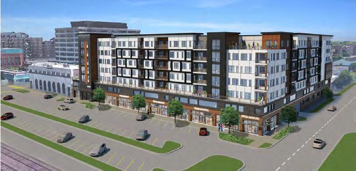
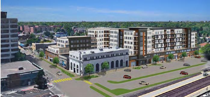
8.13. Revisit and update the parking and circulation study.
During the outreach phase of the plan, residents, business owners, and City officials and staff communicated parking, circulation, and traffic congestion in the Downtown as a primary long-standing transportation concerns. To improve the availability and management of parking spaces in the Downtown, the City should revisit the 2007 Downtown Parking and Traffic Study and update accordingly. This update would help determine parking challenges faced by residents, visitors, and business owners in the Downtown, and provide potential management strategies to improve parking availability. It is anticipated that this update may provide support for lowering parking requirements for new developments in the Downtown, and changing some one-way couplets to two-way streets. The update should also identify bottlenecks in the Downtown, examine the potential impacts of capital improvements, and include wayfinding signage improvements (per the 2002 Downtown Streetscape Master Plan).
8.14. Identify crash hot spots and investigate possible improvements for safe crossings and/or road alignment.
Illinois Department of Transportation (IDOT) data for 2010-2014 indicates that numerous pedestrian crashes occurred along Miner Street (in comparison to other major City arterials), in addition to a fatal accident near River Road and Elk Boulevard (an intersection that lacks a crosswalk and pedestrian signals). To increase pedestrian safety within the Downtown, the City should fully pedestrianize Miner Street and consider making infrastructure enhancements at key intersections along it. Pedestrian crossings along South River Road at Elk Boulevard and Rand Road should be upgraded as well.
Enhancements could include adding curb bump-outs at crosswalks, installing speed bumps or raised crosswalks at appropriate intersections, and adding pavement markings that warn drivers to reduce their speed. Other possible strategies for improving pedestrian safety include lowering speed limits and increasing traffic enforcement, especially on arterials such as Miner Street and Lee Street.
8.15. Improve bike connections to Downtown Des Plaines.
Improving bike access will help make the Downtown a more vibrant and inviting destination. There are several opportunities to add connections to the City’s bike network in and around the Downtown. As illustrated in Figure 8.1 , a bikeway is proposed on Busse Highway, from Belleau Lake to Miner Street. This bikeway (potentially a buffered bike lane) would provide connections from the Downtown to the Dee Road Metra Station, Mystic Water Park, and the recreational area around Belleau Lake. This bikeway would also make the Downtown more accessible to residents of Park Ridge, who in turn may visit Downtown businesses and attractions more frequently.
Proposed bikeways on Miner Street to the Des Plaines River Trail (DPRT), and on South River Road to Oakton Community College, will further enhance the accessibility of the Downtown for residents, visitors, and students.
8.16. Investigate strategies to strike a balance between pedestrian safety and truck traffic.
Miner Street, Graceland Avenue, and Lee Street are Class II Highways that carry significant truck traffic. The presence of trucks on these roads present a challenge to making the Downtown more walkable and accessible. Adding on-street bike facilities to these roads, such as bike lanes or sharrows, could increase the visibility and safety of cyclists.
The City could also improve pedestrian facilities along truck routes by ensuring that sidewalks have sufficient buffers, and crosswalks are properly marked and signalized. In addition, the City should prioritize truck routes when deciding where to implement traffic calming techniques.
8.17. Increase bicycle awareness through a creative bike rack design program.
To enhance the perception of Des Plaines as a bike-friendly community, the City could consider launching a creative bike rack design campaign that solicits designs from local artists. The City should partner with the Des Plaines Art Council and other community groups to design and install bike racks throughout the Downtown. Not only would this campaign increase the visibility of biking as a transportation option, it would also enhance the look and feel of public spaces in the Downtown.
River and Trail
8.18. Improve accessibility and connection to the Des Plaines River Trail.
While the Des Plaines River Trail (DPRT) connects to the Downtown at the intersection of Miner Street and South River Road, it is difficult for cyclists and some pedestrians to access the trail from the Miner Street Bridge. Accessing the trail from the north side of the bridge requires climbing down a set of stairs, while access from the south side requires turning onto Camp Ground Road and either hopping over a barrier, or travelling a significant distance to merge with the trail. The City should examine infrastructure improvements to make the trail more accessible from the Downtown.
One potential solution is the creation of an off-street sidepath on Miner Street, which would run from Pearson Street to Camp Ground Road. This sidepath would link users to the existing bike route on Pearson Street, and would provide a direct connection to the DPRT.
8.19. Continue to implement improvements for the Des Plaines River Trail as identified in the “Des Plaines River Corridor Plan”.
The Northwest Municipal Conference’s (NWMC) “Des Plaines River Corridor Plan” provides key conceptual and technical recommendations for improving access to the DPRT. The plan includes recommendations and trailwide standards for access points, trail and roadway segments, wayfinding and signage, and supporting amenities. The plan also makes a number of site-specific recommendations designed to improve trail crossings and access points, including a specific plan for addressing the Union Pacific Railroad crossing. The City should continue to consult the plan and NWMC officials as it investigates strategies for improving access to the DPRT.
8.20. Improve wayfinding to and from the Des Plaines River Trail.
The City should ensure that directing people to the DPRT is a priority of the Downtown Wayfinding Signage Program. Placing effective wayfinding signage at key points in the Downtown would make the trail more accessible and may help draw more visitors. Similarly, installing wayfinding signage on the trail directing users to the Downtown, may help attract more patrons to local businesses and attractions. Specific design guidelines for bicycle and pedestrian wayfinding signage are contained in the 2009 Manual on Uniform Traffic Control Devices (MUTCD), including information on placement, color-coding, and shape.
As outlined in Chapter 5: Transportation, the City should explore the possibility of initiating a “Dial-a-Ride” or Community Vehicle Program. If the City chooses to pursue the Community Vehicle Program, it should ensure that the service makes stops at key Downtown destinations: Des Plaines Metra Station, Des Plaines Public Library, the Post Office, the Center of Concern, and Metropolitan Square. Service to existing active transportation amenities, such as Pace Bus stops and the Des Plaines River Trail, should also be prioritized.
The area between Lee Street/River Road/Elk Boulevard, referred to as the “Lee Street Triangle” has been the site of severe flooding for various years and is now home to many vacated commercial buildings. This area is below the 10-year flood elevation of the Des Plaines River, these properties have flooded repeatedly over the years. In order to eliminate repetitive flooding, a green infrastructure concept plan ( Figure 8.2 ) was explored for this area. The general goal of the concept plan was to provide green space and stormwater retention. As a nearby open space to downtown, this concept plan could provide a beneficial amenity, accommodate passive and/or recreational uses, and attract more visitors to the Downtown.
The potential new green space will decrease flooding and attract more visitors to the Downtown. The City should partner with the Des Plaines Park District for future management, maintenance, and programming.
The design of the “Lee Street Triangle” could take many forms and should be based on community objectives. Figure 8.2 , or Stormwater Concept 4, depicts a spectrum of options from active to passive recreational space that all include stormwater elements.
With the objectives and design of the “Lee Street Triangle” to be determined, the concept plan assumed a blank slate to provide a baseline design and cost for such a project. Stormwater Concept 4 proposes that the area be excavated to provide flood storage. The excavated area could include the area bordered by River Road on the east, Harding Avenue on the north, Elk Boulevard on the south, and the existing alley west of Lee Street on the west. The depth of excavation, and therefore the volume of flood storage provided, depends on how the site will be used. In the interim, an excavation depth of 2 feet was used, as this would provide significant flood storage and not appear as a deep hole.
Floodwaters would enter the basin in two main ways. Existing storm drainage systems on Lee Street, which are hydraulically connected to the Des Plaines River, would allow the river to back up into those storm sewers. The new flood storage basin would drain into the remaining portion of those Lee Street storm sewers, which would allow backup into the flood storage basin. The second way is though overland inundation. If the surrounding areas become inundated, if the flood storage basin is not already full floodwaters can enter the basin directly through overland flow.
The concept plan shows basic ideas such as a landscaped screening around the perimeter of the site and connection of the sidewalk system through the site. The overall cost for this simplified version would be $1.2 million for the excavation and limited landscaping. This cost estimate assumes all buildings and foundations would be removed prior to construction. Additional amenities were not contemplated at this time.
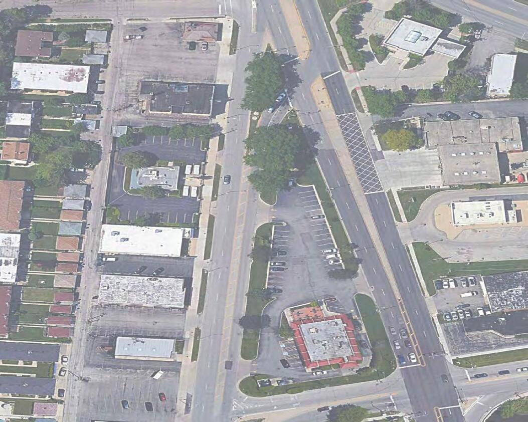

In public engagement activities to City staff, public facilities located in the Downtown were often described as undersized and outdated. In particular, the fire and police stations do not convey a modern, functional feel. The City should conduct a Facility Needs Assessment to explore potential relocation for all municipal facilities (Des Plaines City Hall, Des Plaines Police Department, and Des Plaines Fire Department) located in the Downtown.
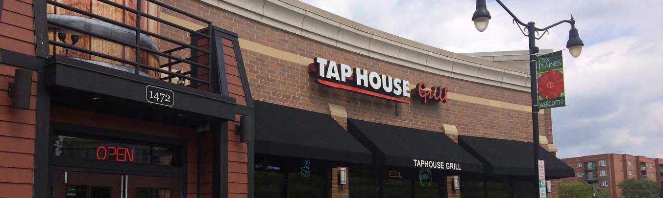
the Environment to Create a Sense of Place
8.1. Establish a Downtown wayfinding program and prioritize gateway entrances.
8.2. Target infrastructure and aesthetic improvements to enhance the streetscape.
8.3. Implement new design of Metropolitan Square.
8.4. Revive and restore the Des Plaines Theatre.
8.5. Create a new restaurant cluster on Miner Street next to the Des Plaines Theatre.
8.6. Activate Downtown Des Plaines through arts and culture initiatives.
8.7. Assess the C-5 zoning district to bring a variety of new uses to the vacant spaces including “experience retail uses“.
8.8.
8.9. Reorganize the Economic Development Commission.
8.10. Seek out a shared-space facility to help emerging entrepreneurs bring their business concepts to the local economy.

HOUSING
Continue Creating a Higher Density Residential District that incorporates Mixed-Use Developments
8.11. Pursue high-quality housing for residents in all stages of life, specifically older adults and young families.
8.12. Pursue the development of new multifamily buildings, particularly townhomes and apartments.
TRANSPORTATION Improve Traffic Network and Parking
8.13. Revisit and update the parking and circulation study.
8.14. Identify crash hot spots and investigate possible improvements for safe crossings and/or road alignment.
Improve the Bike and Pedestrian Network
8.15. Improve bike connections to Downtown Des Plaines.
8.16. Investigate strategies to strike a balance between pedestrian safety and truck traffic.
8.17. Increase bicycle awareness through a creative bike rack design program.
8.18. Improve accessibility and connection to the Des Plaines River and Trail.
8.19. Continue to implement improvements for the Des Plaines River Trail as identified in the “Des Plaines River Corridor Plan“
8.20. Improve wayfinding to and from the Des Plaines River and Trail.
Ensure Paratransit Options Provide Sufficient Access to Downtown Amenities STORMWATER MANAGEMENT
Incorporate Green Infrastructure Strategies to address Flooding at “Lee Street Triangle“ CIVIC USES
Conduct a Needs Analysis for Municipal Facilities
A1: Outreach Summary
A2: Community Profile (linked)
A3: Issues & Opportunities Report (linked)
A4: Downtown Market Assessment (linked)
A5: Vulnerability Assessment (linked)

The City of Des Plaines is one of the most racially, ethnically, and incomediverse communities in the northwest suburbs of Chicago. In order to provide mechanisms for meaningful outreach that reach different segments of the community, several approaches were implemented for the existing conditions phase of the plan. Strategies have thus far included interviews, steering committee meetings, focus groups, surveys, an interactive website, public meetings, and seeking feedback at community events. Various materials and online tools were provided in English, Spanish, and Polish to attempt to reach and engage as many residents as possible.
The Steering Committee, comprised of residents, elected officials, City staff, businesses, and representatives from local community organizations, has met twice since the beginning of the planning process. The first meeting, held November 30, 2016, consisted of reviewing the project scope and timeline, laying-out the Steering Committee’s role, and identifying the City’s most prominent issues and opportunities. The second meeting, held June 6, 2017, consisted of reviewing the Community Profile and participating in a visioning exercise where members described what an ideal Des Plaines would look like in 10 years. The list of membership and affiliations of the project Steering Committee are listed at the start of the plan.
Stakeholder interviews have included meeting with local residents, business owners, elected officials, municipal staff, and local community organizations such as the Frisbie Senior Center, Shrine of Our Lady of Guadalupe, Maryville Academy, the Northwest Municipal Conference, and the Des Plaines Chamber of Commerce. Each of the interviews tackled different topics based on the stakeholder’s primary area of interest, expertise, or jurisdiction. However, common themes still emerged from the conversations: addressing transportation challenges, improving the downtown, strengthening commercial areas (including the Oakton Street Corridor, Elmhurst Road, and 5 Corners), stormwater management, and access to the Des Plaines River and Trail. CMAP will continue to interview additional pertinent stakeholders as interest emerges and as plan recommendations are explored.
Downtown Business Focus Group: The Downtown Business focus group was attended by business owners primarily located in Metropolitan Square and along Miner Street. The meeting consisted of reviewing the Urban Land Institute (ULI) Developer Panel recommendations and addressing key topics that were missing on that list. Participants identified the top 3 issues facing downtown businesses as the business mix (too many of the same), the need for a retail plan to address competition in the surrounding suburbs, and customer attraction (particularly from commuters). Additional challenges raised included addressing homelessness, the lack of a nightlife, bad landscaping, beautification and littering, parking, signage and wayfinding, the need for tax incentives, and pedestrian safety.
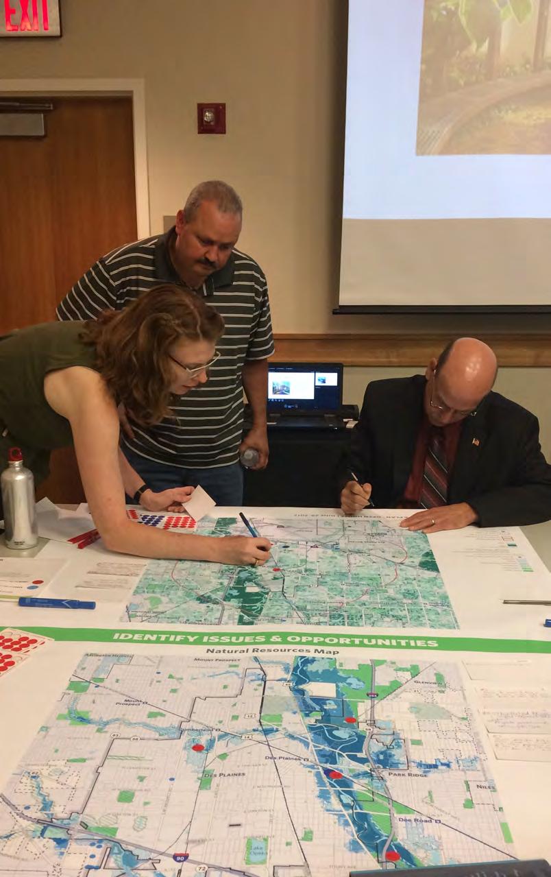
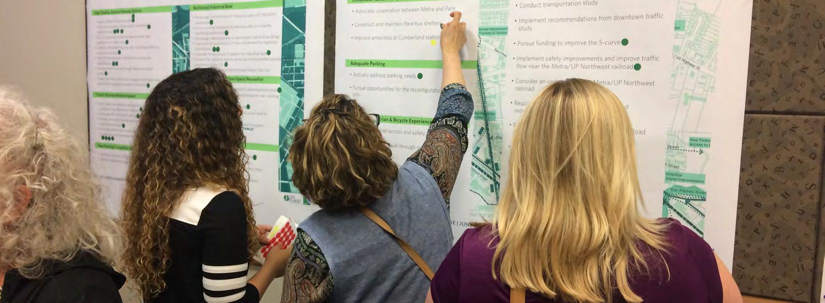
Oakton Street Business Focus Group: The Oakton Street Business focus group was attended by business owners primarily located on the eastern end of the Oakton Street Corridor. The meeting consisted of reviewing the 2009 Oakton Street/ Elmhurst Road Corridor Study and revising key recommendations. Participants felt the 2009 plan did not adequately address the challenges faced by business owners along Oakton Street. Key challenges raised included: insufficient parking, the flow of traffic, signage restrictions, and customer attraction.
Elmhurst Road Business Focus Group: Elmhurst Road business owners, primarily located between Oakton Street and Dempster Street, discussed the unique situation they face along the Elmhurst Corridor. Between Mount Prospect’s Downtown to the north and the Elgin O’Hare Western Access to the south, participants raised opportunities to connect to the growing amenities and strengthen their position with the addition of signage, façade improvements, landscaping improvements, redevelopment,
and a strong anchor tenant. Additional challenges raised included vacancies, barriers to store access, lighting, flooding, high tax rates, and customer attraction.
Industrial Area Business Focus Group: Industrial Area business owners gathered at the LSG Sky Chefs office to share their thoughts involving business growth, transportation, freight movement, and employment. Participants shared a positive working relationship with the City of Des Plaines, describing them as easy to work with and responsive to permitting issues and capital needs. Challenges included the arrangement and negative impacts of incompatible land uses, traffic congestion on Oakton Street and Touhy Avenue, striking a balance between pedestrian safety and busy truck routes on Touhy Avenue, and the desire to employ more residents in close proximity.
West High School Student Focus Group: The Maine West High School (MWHS) Student focus group took place in a Civil Engineering and Architecture class of twenty-five. Students participated by taking a general plan survey to provide feedback on transportation, economic development, and open space challenges in Des Plaines. Key comments provided by students included the desire to see more fast food options, sporting goods stores, and safer crosswalks. Students also engaged in a mapping activity where they identified key transportation challenges around MWHS, and shared recommendations to improve pedestrian safety.
Taste of Des Plaines: The Taste of Des Plaines is a community-wide festival located in Downtown Des Plaines. The festival is a weekend-long family-friendly event that features local cuisine, live entertainment, and family activities. CMAP staff attended the event to distribute surveys and discuss topics of importance to the residents and visitors in attendance. Suggestions to improve Des Plaines included: additional retail and restaurants downtown; recreational opportunities for both, youth and older adults; increased civic programming; enhanced bike routes; and pedestrian safety.
First Public Open House: A public open house was held in the summer of 2017 to vet ideas and better understand community interests. Several residents and stakeholders identified problem and opportunity areas, and shared ideas for future improvements and development. Activities included a visual preference survey for downtown improvements, reviewing the past Comprehensive Plan’s goals, and identifying transportation and natural resources challenges. The Open House also featured a “Kids Corner” in which youth shared their desire to see more amenities in the city, including: more businesses (i.e. bike shops), additional street lighting in residential areas, recreational amenities (laser tag, arcades, paintball, and movie theaters), food trucks, more community festivals (i.e. carnivals), more restaurants, and a revamped Metropolitan Square.

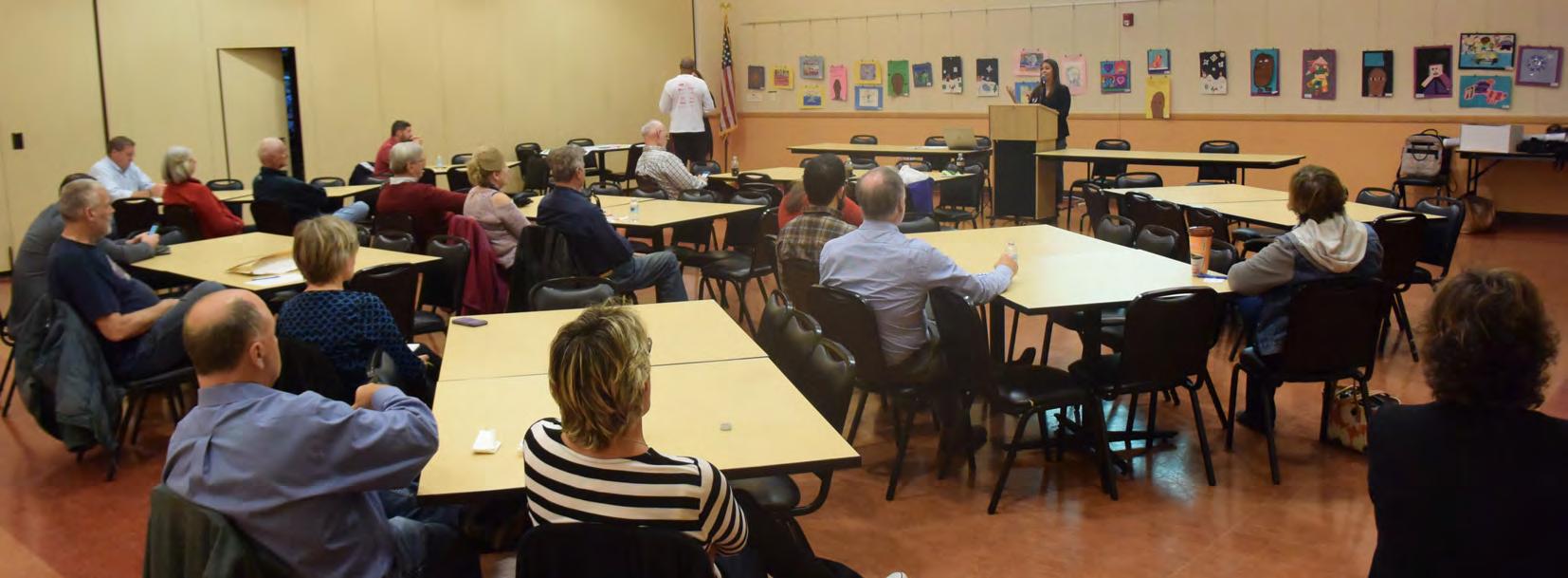
Public Visioning Workshop: A public visioning workshop was held in October 2017 at the Frisbie Senior Center to review key issues and opportunities that had been raised through the outreach process. Residents and stakeholders had the opportunity to provide feedback through a Q&A session, different workshop sessions, and comment cards.
Draft Plan Open House: A Draft Plan Open House was held in October 2018 at City Hall to present draft recommendations to the public. Community members voted on the recommendations they most agreed with and provided comments for elements they felt were missing or should be futther highlighted in the plan.
CMAP Project Webpage: A project page for the plan is located on CMAP’s Local Technical Assistance program (LTA) webpage. The project page introduces the plan, explains the need for a new comprehensive plan, and details the planning process, public engagement, and project partners.
Metroquest (Online & Hardcopy Surveys): An interactive website was created in English and Spanish to encourage residents and other community stakeholders to provide their feedback on topics such as housing, commercial areas, transportation, stormwater management, parks and open space, and community character. Paper surveys were also provided and distributed through local organizations. In total, over 686 surveys were completed.
Respondents identified and rated the following as the most important topics in the community: economic development, stormwater management, and the downtown. The most needed improvements included maintenance of neighborhood properties, repaved roads, safe pedestrian crossings at major intersections, alleviated traffic, safe places for youth/teens to gather, a need for continuous sidewalks, and improving public safety.
233 South Wacker Drive, Suite 800 Chicago, IL
312-454-0400
info@cmap.illinois.gov
www.cmap.illinois.gov
FY19-0036