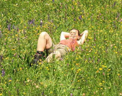
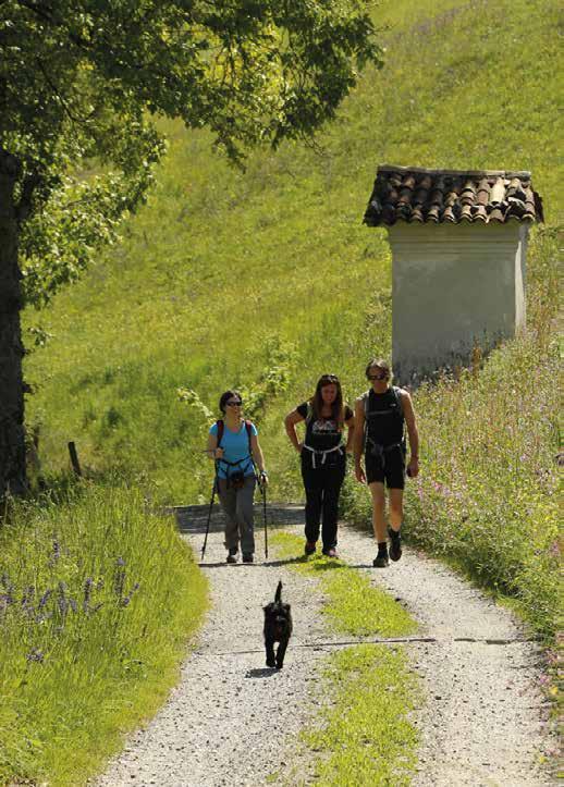
Make sure you take with you all the necessary equipment and clothes for excursions according to the season.
Check the weather forecast the day before your trip and verify that the track is open on the day you choose. During the excursion do not deviate from the signalled path, respect the highway code and the environment, do not leave your waste along the path.
The viability of the routes may not necessarily coincide with the indications, it needs tombe verified permanently and periodically on the ground. The Author declines any responsibility for any accidents or damages that may occur on the proposed routes.
SINGLE EMERGENCY CALL NUMBER
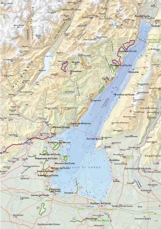
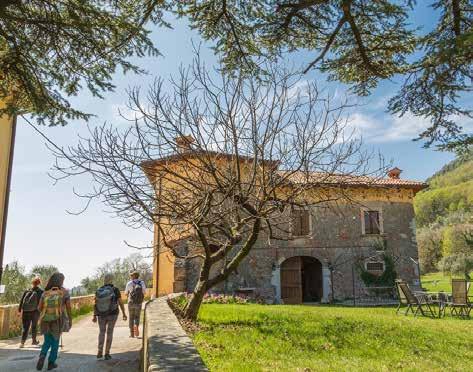
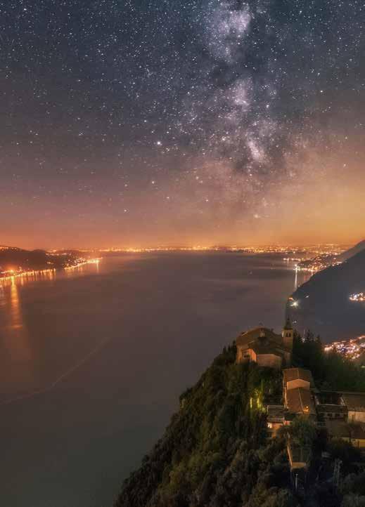
Limone sul Garda
Tremosine sul Garda - Limone sul Garda
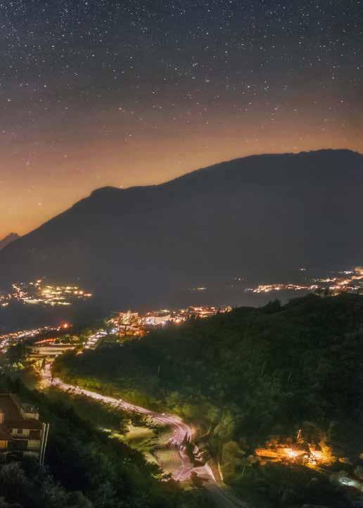
Tremosine sul Garda
Tignale
Valvestino
Magasa
Magasa
Tignale - Gargnano
Gargnano
Toscolano Maderno
Toscolano Maderno
Gardone Riviera
Salò
San Felice del Benaco
Puegnago del Garda
BY CAR
LIMONE SUL GARDA
Limone sul Garda can be easily reached from the south or from the north part of Garda along the Gardesana Occidentale (SS45bis). Parking is available in La Milanesa or in a covered pay car park near the centre of Limone sul Garda.
PUBLIC TRANSPORT
Limone sul Garda can be reached by bus (www.arriva.it) and by boat with Navigazione Lago di Garda (www.navlaghi.it).
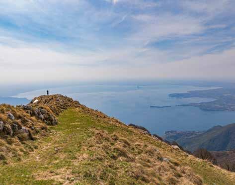
Leaving from the centre of Limone sul Garda, from piazza Garibaldi, continue northwise for over 2 km until you reach the main road. After 100 m, beyond the road, follow the signs to trekking path no. 122, which coincides here with Sentiero del Sole. Walk through pine trees and cypresses, continue on a stony hill where you will reach a panoramic spot with benches (200 m ASL). Here you leave Sentiero del Sole to walk on path no.122, which rises up high on the sides of mount Palaer reaching a very short and flat area, on which you will find a small military cave and another panoramic spot. A short descent will take you to the valley of Larici, then it rapidly goes uphill to Sella dei Larici (880 m ASL), at the crossroads with the forest road from Pregasina, and to Punta dei Larici (905 m ASL), for a spectacular view of mount Baldo and the lake. If you continue on the left toward the forest road heading to Malga Palaer (945 m ASL), where you can find a spring
of freshwater, you will walk up hill on beautiful path no. 422B among beech trees, until you reach Passo della Rocchetta (1158 m ASL). From here, continue left on path no. 130, an old military road that will take you to Cima Mughera (1081 m ASL). Just before this, the road crosses with path no. 101 leading back to Limone sul Garda. The area just below the Mughera peak, overlooking Limone sul Garda village, is a splendid panoramic spot with benches to appreciate the view. Walking downhill, the wood meets the cobbled path of Valle del Singol (730 m ASL) which takes you to La Milanesa village and back to Limone sul Garda.
TECHNICAL DATA
Difficult
Panoramic Of naturalistic/ geological interest Not recommended on hot days Possible snowfall in winter
Altitude difference
Highest point
Distance
Duration
Departure / Arrival
1200 m
1158 m
13,5 km
6 h
Limone sul Garda, Garibaldisquare70mASL
TREMOSINE SUL GARDA - LIMONE SUL GARDA
BY CAR
Pieve di Tremosine sul Garda can be reached from the Gardesana Occidentale (SS45bis) by driving to Limone sul Garda, then taking the SP115 and finally the SP38. Several parking options in via Cavalieri di Vittorio Veneto.
PUBLIC TRANSPORT
Pieve di Tremosine sul Garda can be reached by bus (www.arriva.it).
From the hamlet of Pieve di Tremosine sul Garda (413 m ASL) take via Palazzo towards the north at the intersection with SP38, following path no. 149. Downstream of the village of Priezzo the trail enters the BVG (Bassa Via del Garda) before it reaches Voltino (559 m ASL). Ascend the asphalt road to get to the hotel complexes “Pineta Campi – Le Balze”, next to which take an uphill path (no. 110) which follows the steep ridge to reach, in about 40 minutes, the summit of Monte Bestone (917 m ASL) from which you can enjoy a full panoramic view of the area. Continue downhill along the steep trail reconnecting to the BVG in Fornaci. From here the route stays almost flat, characterized by the green and lush vegetation of the pine forest, then enters a deep, easily accessible rocky gully. Along this stretch you can observe a “calchera”, an oven used for lime production. Crossing the end of the gully, take the next path (no. 110) and after crossing the most gravelly and rocky points the
path levels out. The great diversity of the Garda landscape allows you to pass through different environments, in fact continuing along the route you pass a shaded stretch of Scots pines in the most dry areas and woods of hornbeams and beech trees in the most sheltered and humid areas. Reaching Degà you can cross a botanical park with monumental trees. Continuing along the path indicated, the arboreal environment gives way to a large open space where you will also see the remains of an old hut and a chapel in Dalco (844 m ASL). Along a stretch uphill, in an easterly direction, you reach an impressive viewing point overlooking the lake. Once you have reached the pass, you take the descent along the coast, following the BVG path until you reach the Singol valley and in La Milanesa you enter Limone sul Garda where you can finish the itinerary by visiting the historic centre on the lakeshore. We recommend returning to the starting point by bus or taxi.
TECHNICAL DATA
Altitude difference
Difficult Of naturalistic/ geological interest Of historical/ cultural interest Not recommended on hot days 5 h 15 km 917 m +1100m/ -1400 m
Panoramic
The data refer to the outward journey only.
Highest point
Distance
Duration
Departure / Arrival
TremosinesulGarda,Pieve, 413mASL/Limonesul Garda 65 m ASL
BY CAR
TREMOSINE SUL GARDA
Pieve di Tremosine sul Garda can be reached from the Gardesana Occidentale (SS45bis) by driving to Limone sul Garda, then taking the SP115 and finally the SP38. Several parking options in via Cavalieri di Vittorio Veneto.
PUBLIC TRANSPORT
Pieve di Tremosine sul Garda can be reached by bus (www.arriva.it).
The historic centre of Pieve di Tremosine sul Garda (413 m ASL) has many interesting features including Piazza Cozzaglio, from which you can enjoy an incredible view of the lake and Monte Baldo, and the Church of San Giovanni Battista. After visiting the village, take via Palazzo northward at the intersection with SP38, following path no. 149. When you reach a small shrine, turn left towards the tiny, historic villages of Priezzo, Musio, Sompriezzo, Secastello following the trail of the BVG (Bassa Via del Garda). After the succession of the small hamlets, which are all worth a thorough visit for the beauty of the stone houses and the many small picturesque corners, proceed to Ca’ del Lupo (662 m ASL) where you turn left almost retracing steps, always following the directions of the BVG towards Nevese. Leaving Via delle Valli to continue along Via Polzone which later joins Via Nevese, the road becomes more and more scenic, first reaching Cascina Delaini (706 m ASL) and then Bocca di Nevese (752 m ASL). From this point begins the very pleasant de-
scent through hilly landscape among flourishing cattle and goat farms, with views of Monte Baldo and Lake Garda, until reaching the hamlet of Pregasio (500 m ASL).
Here, at the intersection with the asphalt driveway, leave the BVG signs and proceed slightly uphill in a northerly direction until the village of Mezzema (562 m ASL) along path no. 145. When you reach a crossroad between the houses, take the road to the right that leads back to the hamlet of Pieve.
TECHNICAL DATA
Easy
Of naturalistic/ geological interest Not recommended on hot days
Altitude difference
Highest point
Distance
Panoramic
Of historical/ cultural interest Also recommended by bike
Duration
Departure / Arrival
450 m
752m 10 km 4 h
Tremosine sul Garda, Pieve, 413 m ASL
TIGNALE
BY CAR
Pra dela Fam is easily reachable from Salò or Riva del Garda on the Strada Statale 45bis Gardesana Occidentale. Parking available in “porto di Tignale” or along the roadside. Note that the parking spots are limited over the busy summer period.
PUBLIC TRANSPORT
Tignale can be reached by bus (www.arriva.it).
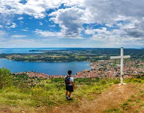
The excursion starts from the lemon greenhouse (Limonaia) Pra de la Fam (67 m ASL), which bears witness to the intense cultivation of lemon trees on lake Garda west bank since the 12th century. Walk under an arch with signs for path no. 260 – Oldesio and there you will see a splendid mule track that will take you beyond the rocky cliff. After a few metres, over a picturesque stone bridge, you go past the Forra del Torrente Baes to continue on a zigzagging path uphill enjoying the expansive panoramic view of lake Garda and mount Baldo. At the end of the mule track (300 m ASL), you will walk through an olive tree plantation on an untarmacked road that, once beyond path no. 265 from Aer, joins the SP38 of Tignale. Cross the road and enter the village of Oldesio (signs for path no. 266). Continue uphill on the narrow village street (with a fountain on your left) until you reach a hairpin bend going left, close by a parking area. The asphalted road (via della Chiesa) reaches the village of Gardola near the Church (555 m ASL).
Walk along via Roma uphill and you will find the beautiful Piazza Umberto I (with a fountain and a bar), turn right onto via XXIV maggio then again onto via Trento. The route continues in viale Europa to join via Monte Baldo going swiftly uphill on the left. Close by the third bend (600 m ASL), where the road is not asphalted, the track goes slightly downhill (path no. 266). Enter a green area full of nut trees, ash and oak trees, and within a few minutes you are back to SP38 (580 m ASL) where you will see mount Cas covered in fir trees and black pines. Continue heading south for 200 m on the road, then turn on the path that heads up to the Sanctuary of Montecastello (683 m ASL). This Sanctuary is worth a visit inside, and offers a large panoramic terrace with a bar, overlooking the southern part of the lake. If you walk on path no. 266, in a few minutes you will find yourself on top of Monte Cas (779 m ASL), going past a picturesque gallery excavated in the rock, with the eastern entrance facing a terrace rising steeply on the lake. On top of the mountain there is a cross built on the remains of a bunker from the Great War, very well preserved. Walking all the way back will take you to the starting point.
TECHNICAL DATA
Middle Of naturalistic/ geological interest Not recommended on hot days Of historical/ cultural interest
Altitude difference
Highest point
Distance
Duration
750m
779 m
10,5 km
4,5 h
Panoramic Tignale, Pra dela Fam, 67 m ASL
Departure / Arrival
VALVESTINO
BY CAR
Persone can be reached both from Gargnano in about 45 minutes, along the Valvestino and from Idro. Parking is possible at the top of the village.
PUBLIC TRANSPORT
Persone can be reached by bus (www.arriva.it).
From the small village of Persone (900 m ASL), which has a few dozen inhabitants, proceed along a short stretch of paved road in the direction of Moerna up to the first bend near a shrine, where you take the path indicated by clear signs. The first part of the itinerary runs between beautiful beech trees, uphill to an open space with a large pool where you can see wild animals in the early hours of the morning. Continue straight, keeping a farmhouse on the left, crossing the carriageway to follow a winding path uphill until you reach a crossroad at 1190 m ASL. Here you take the path to the right that continues between beautiful shady woods to reach Bocca Cocca (1327 m ASL), a narrow pass characterized by the presence of an old hunting blind and military posts with views of Lake Idro and the highest mountains of the Trompia Valley. Now the environment changes completely: bear right along the path to Bocca di Valle, with numerous but short ups and downs, between spires and pinnacles, cenge and cùei (natural shelters or caves against which people people used to build huts of branches and leaves to provide shepherds
with warmth and protection), vast panoramic views of Valvestino, going around the peaks of Bezplel and Cingla. When you reach Bocca di Valle (1392 m ASL), you go back the way you came for a few dozen meters to take path no. 297 on the left, which winds down with several hairpin bends in the shade of a beautiful forest. Afterwards the route passes through the clearings by the small town of Messane until you cross the carriage road (1088 m ASL) that goes downhill to reach the centre of Persone (900 m ASL). It is worth visiting the small cluster of traditional houses and walking along the few streets of thesmall village.
TECHNICAL DATA
Difficult
Possible snowfall in winter
Of naturalistic/ geological interest
Panoramic
Altitude difference
Highest point
Distance
Duration
Departure / Arrival
600 m
Valvestino, Persone, 900 m ASL 5 h 13 km 1392 m
MAGASA
BY CAR
The meadows of Rest can be reached from Gargnano (deviation for Magasa along Strada Statale 45 bis Gardesana Occidentale), but also from Idro (deviation for Capovalle along SS237). Parking available near the little church of the Alpini or opposite the traditional bar-ristorante with the typical thatched roof.
PUBLIC TRANSPORT
Bus service available to Magasa (www.arriva.it), about 40 minutes on foot from the little church of the Alpini of Cima Rest.
The trail begins at Rest, where characteristic Austro-Hungarian barns can be admired. One of these typical thatchedroof structures houses the Valvestino Ethnographic Museum, which recounts the history and traditions that have shaped the area. A few metres before the little church of the Alpini (1210 m ASL), the itinerary follows a concrete road (path no. 299) that unwinds on the fields heading north. This road goes uphill toward the meadows of Rest, and is characterised by the typical barns of Austrian Hungarian origin, and by monumental century-old beech trees. Once you go past Malga Alvezza (1265 m ASL), continue until you reach a sharp turn. Ignore the signs for Bocca di Cablone and Monte Tombea (a longer trail can be done by MTB), and follow path no. 267B. The mule track goes uphill through green fields, a wood made of fir and beech trees, with breathtaking
views of Magasa and the fields of Denai. After wading across a small river, walk on to the end of the wood, over a series of grassy hills and a rivulet before joining an untarmacked road. Follow the path to the crossroads, turn left and walk past Malga Tombea (1820 m ASL) (this short stretch cannot be done by bike). The pride of this area is the Tombea cheese. With its own Slow Food presidium, it is considered one of the finest alpine dairy products. Its distinctive feature is a delicate, pleasant flavour with a vanilla aftertaste. Moving on, on the right an old defensive military mule track will take you in a few minutes to the top of Monte Tombea (1950 m ASL), an amazing panoramic spot ovelooking both Pianura Padana with Lake Garda, and the highest peaks of the Adamello and Dolomiti di Brenta mountain chains. The whole area is of great botanical interest thanks to endemic flora such as Saxifraga tombeanensis. Walk back the way you came to return to the starting point.
TECHNICAL DATA
Of naturalistic/ geological interest Possible snowfall in winter
Panoramic
Middle Of historical/ cultural interest Also recommended by bike
Altitude difference
Highest point
Distance
Duration
Departure / Arrival
700 m
10,6 km 1950 m
4 h
Magasa, Alpine church of Cima Rest, 1210 m ASL
MAGASA
BY CAR
The meadows of Rest can be reached from Gargnano (deviation for Magasa along Strada Statale 45 bis Gardesana Occidentale), but also from Idro (deviation for Capovalle along SS237). Parking is available near the little church of the Alpini or opposite the traditional barristorante with the typical thatched roof.
PUBLIC TRANSPORT
Bus service available reaching Magasa (www.arriva.it), about 40 minutes on foot from Cima Rest.
From the carpark (1205 m ASL) follow the paved road for a few meters coming from Magasa until you reach path n. 268 that, descending to the right, leads to the tiny hamlet of Cadria (918 m ASL) the smallest and most isolated hamlet of Valvestino, an ancient settlement of Celtic people, consisting of a tiny agglomeration of houses originally associated with the church, located in a dominant position towards the end of the winding valley of the Droanello stream. Here, after passing the cluster of houses, it is worth following a short detour for the small but pretty Church of San Lorenzo, which sits on the slope just below the village. Retracing your footsteps along path no. 268, which is almost flat along this stretch, you can reach the isolated barns of Proalio (965 m ASL). At this location the trail begins to climb more decisively along Valle dell’Era
to the crumbling Malga Puria and then to the homonymous pass (1374 m ASL) through a wild and secluded landscape populated by chamois, roe deer and ibex.
At this point in the Termen area continue for a long and pleasant stretch (path no. 299) beneath the steep and imposing ridge of Cima del Costone and Bus de Balì, to cross the Proalio torrent (1298 m ASL) and to reach the village of Grune at the crossroads for Monte Tombea and Magasa. The area is lush with beautiful vegation, from dense woodland to vast meadows and glades. It continues along a pleasant dirt track to Malga Alvezza (1295 m ASL), after which, it continues downhill with nice views of Valvestino and the typical Austro-Hungarian barns with thatched roofs: there are several along the route, all unique but built in the same way. Once on the paved road, after a few dozen meters on the left, you reach the carpark again where the itinerary ends.
TECHNICAL DATA
Middle Of naturalistic/ geological interest Possible snowfall in winter Of historical/ cultural interest
The village of Piovere in the municipality of Tignale is reachable via the Gardesana Occidentale Road (SS45bis). Parking is available near the sports ground or at the entrance of the village (P.le Chiara d’Assisi).
PUBLIC TRANSPORT
Piovere di Tignale is reachable by bus (www.arriva.it). From the bus stop to the village there is a 2 km walk.
We find ourselves in the heart of the Alto Garda Bresciano Park. This protected natural area stretches from Salò to Limone sul Garda and contains a micro ‘alpine system’ of its own, with dramatic environmental contrasts in terms of altitude, climate and vegetation. Tignale, in the hamlet of Prabione, houses the Alto Garda Bresciano Park Museum, which offers interesting insights into the factors that have shaped this area over time, be they socio-cultural or linked to the landscape and environment. From Piovere di Tignale (417 m ASL), take the main road to the old parish church where you can admire a wonderful panorama on the lake and Monte Baldo. Continue along the road below the village following the signs for the BVG (Bassa Via del Garda) and at the junction go right along a flat stretch surrounded by olive groves. Continuing in the same direction, cross a landslide that descends from the rocky ridge of Monte Rocchetta (913 m ASL), beyond which the route ascends slightly along the meadows and the small vineyards
leading to Muslone (461 m ASL) a village in the municipality of Gargnano. After passing through the few streets that make up the small village, retrace your steps for a short distance. Keeping the Church of St. Matthew on the right, continue along the paved road going over the BVG until you reach the first crossroad, where you follow route no. 263 through some fenced fields. When you reach the old mule track that led to Piovere, follow it uphill between the dry stone walls of the terraced olive groves. Along this stretch the route offers a series of glimpses, beautiful sights and panoramic views of the lakeside and mountainous landscape dominated by the presence of Monte Baldo. After about an hour of walking the itinerary ends and you reach the place of departure.
TECHNICAL DATA
Not recommended on hot days
Easy Of naturalistic/ geological interest Of historical/ cultural interest
Panoramic
Altitude difference
Highest point
Distance
Duration
Departure / Arrival
200 m
461 m
6 km
3 h
Tignale, Piovere, 417 m ASL
GARGNANO
BY CAR
Sasso is easily accessible from Gargnano, following the directions to Valvestino, and from lake Idro. Parking is available in the village of Sasso.
PUBLIC TRANSPORT
Sasso di Gargnano can be reached by bus (www.arriva.it).
As you leave the carpark in Sasso (546 m ASL), walk past the charming and well-maintained village along the main road and, once beyond an ancient washhouse, where you can still meet people who wash their clothes there, take the track following the directions to Mount Comer and Eremo di San Valentino (path no. 231). The path, with steep stretches through dense woodland, just beyond a small valley, goes uphill to a viewing point overlooking the lake; the first viewing point, which will leave you breathless. Here, a pause is a must, before continuing on your way. If you walk past this panoramic point, on the right you will see the crossroads leading to Eremo di San Valentino (path no. 230B, 772 m ASL). We recommend, either on the outbound or the return journey, a diversion from the route to see the Eremo (hermitage). In a stunning location atop a steep rock face overlooking the lake, the dazzlingly bright white building perches as through grasping the chalky rocks that support it. At the crossroads further up, if you continue on the path that unwinds through a chestnut wood to a small plateau, you
will find a detour to Briano and the Rifugio degli Alpini di Gargnano, where you could stop on your way back. The uphill path continues on the right and skirts the edge of the mountain affording beautiful glimpses of the lake below through dense woodland, and culminating at the top in a breathtaking and unforgettable view of the lake. As you walk past a repeater you will reach the top of Monte Comer (1279 m ASL) where you can see Monte Baldo, the Prealps and even the Appenines on a cloudless day. Walking back from the top, head northbound along paths 231 and 232, gently descending along the western sides of the mountain toward a beech wood to the Rifugio Alpini di Gargnano (1027 m ASL). From here, once you reach the asphalted road leading to Briano village, turn on to the path on your left (path no. 231A) that descends through the wood before joining an uphill trail. Follow this path back to the starting point. It is also worth visiting the nearby parish church of Sant’Antonio Abate, perched amid the hills not far from the village.
TECHNICAL DATA
Of naturalistic/ geological interest
Of historical/ cultural interest
Middle Panoramic
Altitude difference
Highest point
Distance
Duration
Departure / Arrival
750 m
1279 m
7,5 km
5,5 h
Gargnano, Sasso, 546 m ASL
BY CAR
TOSCOLANO MADERNO
Toscolano Maderno is easily reached from Salò or Riva del Garda by taking the Gardesana Occidentale (SS45bis). Various parking options are available in Toscolano Maderno.
PUBLIC TRANSPORT
Toscolano Maderno can be reached by bus (www.arriva.it) and by boat with Navigazione Lago di Garda (www.navlaghi.it).
The itinerary starts from Piazza San Marco (68 m ASL) in front of the beautiful church of Sant’Andrea. Following the urban route of the Cammino di Sant’Ercolano, continue along its western side on via Benamati. Proceed along via Cavour and via Solino to the ancient bridge over the Toscolano stream. Pass the entrance to the town hall and cross the road to take via Pulciano-Gaino. Here, do not follow the road, but the pedestrian path that cuts through the hairpin bends until we reach the hamlet of Gaino (275 m ASL). After passing through the village along via Andrea del Sarto, follow the signpost for BVG (Bassa Via del Garda) along an asphalt road passing through Folino and Cabiana, including a lovely stretch through olive groves and meadows with great views towards the Veronese shore of Lake Garda. Having passed Scarpera (223 m ASL), keeping Monte Castello di Gaino on the left at all times, a pleasant unpaved road takes you past Cervano to a votive chapel. From here, follow the signs for the Church of Madonna
di Supina (245 m ASL). After taking a break there, enjoy a pleasant descent in the shade and then again through olive trees to Fornico (192 m ASL). From here, take the first road that descends to the right along the street of the same name, leaving the BVG, and then take an immediate right to return southwards, following first via Mornaga and then via Roina. Having passed the hamlet of Roina with its ancient washhouse, turn right onto via Golf and after about 200 m, turn left onto via San Giorgio until you reach the little church of the same name. You are on the ancient Strada Regia (Royal Road) that led from Toscolano to Gargnano, before the Gardesana Occidentale was built. Follow this by turning onto via Marsina until you reach the hamlet of Cecina (123 m ASL), then continue uphill to the square of tiny Cussaga. From here, via Caronte takes you downhill to Pulciano. Proceed left along Via Genova between high stone walls and along via Piè Costa to arrive in Toscolano. Follow via Trieste, first, then via Trento. Cross the SS45bis to reach via Marconi and the beautiful lakeside promenade, which you follow in its entirety until you return to Piazza San Marco.
TECHNICAL DATA
Middle
Of naturalistic/ geological interest
Of historical/ cultural interest
Panoramic
Also recommended by bike
Altitude difference
Highest point
Distance
Duration
Departure / Arrival
400 m
275 m
16 km
4,5 h
San Marco Square, 68 m ASL
BY CAR
TOSCOLANO MADERNO
Bornico is located along the Gardesana Occidentale (SS45Bis) between Gardone Riviera and Toscolano Maderno. Parking is available at the Cemetery.
PUBLIC TRANSPORT
Bornico can be reached by bus (www.arriva.it).
From the Bornico Cemetery carpark (100 m ASL) follow the few metres of paved road to Fasano Sopra until, on the right, you take via Bezzuglio. Until the mid-20th century, the country lane which leads to the village of the same name (206 m ASL) through terraces and olive groves, was the main communication link between the village and the lakeside towns. Here an old washhouse with a fountain appears immediately, and then you discover all the beauty of the small hamlet, continuing between stone walls, old arches supporting the embankments, lemon houses and stone houses, demonstrating how well the place has retained its rural characteristics. Following the dirt track signposted BVG (Bassa Via del Garda) to Pezzuglio (287 m ASL) and Magnico (333 m ASL), in a rural setting planted with vegetable gardens, orchards and olive groves, you arrive at the foot of Monte Pizzocolo, passing a charming waterfall. After a bend and a short climb, stop following the directions for the BVG at Rosei (344 m ASL), characterised by a small hill with a beautiful villa padronale surrounded by cypress trees, and take a right turn
onto the path which, with beautiful uninterrupted views over Lake Garda, first goes down to Vigole (301 m ASL) and then, after crossing the paved road twice, arrives in Maclino (220 m ASL). After passing the small dwelling and the shrine, continue downhill along the path heading south through the damp and shady Bornico Valley, where you will find the stream of the same name, until you arrive at the starting point.
TECHNICAL DATA
Easy
Of naturalistic/ geological interest
Of historical/ cultural interest
Panoramic
Also recommended by bike
Altitude difference
Highest point
Distance
Duration
Departure / Arrival
350 m
360 m
6,7 km
3 h
Toscolano Maderno, Bornico, 100 m ASL
GARDONE RIVIERA
BY CAR
San Michele can be reached from Salò and Gargnano. Parking areas available in Colomber (405 m above sea level) and in Pirello (1030 m above sea level), but to reach the latter you must follow an untarmacked road, at times particularly rough, for about 5 km. Don’t forget: safety first.
PUBLIC TRANSPORT
San Michele can be reached by bus (www.arriva.it), the other villages are not served by public transport lines.
Depart from the village il Pirello (1030 m ASL), going uphill on the asphalted road with the signs to path no. 280 headed to Rifugio Pirlo. After a steep beginning, the path continues on a relatively gentle slope. After a clearing, it almost levels out as it enters the wood, where it continues, with a few gentle inclines, to Passo di Spino (1160 m ASL) between Monte Spino to the North-West and Monte Pizzocolo to the South-East. You will also see some buildings and the crossroads to Rifugio Pirlo on your left. At Passo di Spino, following the old military road going uphill on the right through large beech trees, after some hair- pin bends you will reach Dosso delle Prade (1352 m ASL). From here continue northward along a narrow military road offering a series of views of the lake. After a few curves the lake reappears, then the path continues through large beech trees. Beyond the itinerary that reaches Sanico, you can take the last section of the trail through to Bivacco Due Aceri
(‘Two Maples’ bivouac), always open but not supervised, which takes its name from the two old maple trees near the building, which is a restored version of an old Great War location. From here you reach the top of Monte Pizzocolo (1581 m ASL) from which you can enjoy beautiful views of Monte Baldo, Lake Garda, Valvestino, the Brescian Prealps and, on sunny days, even the Apennines. Near the top, you will also find the church dedicated to the victims of war. Following the same itinerary you will reach the starting point. It is also possible to depart on foot from Colomber: in this case you should callow for an extra hour and a half on the outward journey and an hour on your way back. To reach il Pirello village, go to San Michele then to Colomber. Here, near an old wash house, bear right and follow the directions to Rifugio Pirlo.
TECHNICAL DATA
Middle
Possible snowfall in winter
Of naturalistic/ geological interest
Panoramic
Altitude difference
Highest point
Distance
Duration
Departure / Arrival
550 m
1581 m
12 km
Gardone Riviera, ParkinglocalitàilPirello, 1030 m ASL 4 h
SALÒ
BY CAR
Salò is easy to reach from the upper lake along the Gardesana Occidentale (SS45bis) or from the lower lake along the SP572. Parking available near the starting point.
PUBLIC TRANSPORT
Salò can be reached by bus (www.arriva.it) and by boat with Navigazione Lago di Garda (www. navlaghi.it).
The itinerary begins in the area of the quarter of Carmine, one of the most ancient in Salò, along via San Bartolomeo near the headquarters of the Red Cross, with signs for the BVG trail (Bassa Via del Garda) which you will follow up to Passo La Stacca. After crossing the Strada Statale 45bis, continue to the next fork in the road turning left toward via del Seminario. Near a small carpark, follow the path that enters a picturesque and thick wood of pine trees. Do not deviate from the main path and go past the alternative road to Renzano. You will see on the right la Corna (387 m ASL), a cliff where you must stop to have an amazing view of the gulf of Salò. Back on your track, you exit the wood and come to the 17th century church of San Bartolomeo (465 m ASL). On the main path, follow the signs to Bassa Via del Garda to Passo La Stacca (443 m ASL), where you will see a hunting hut and a fork in the path: here you leave the directions to Bassa Via del Garda to follow trail no. 217B to ward Bagnolo and the Church of Madon-
na di Bagnolo (504 m ASL). Beyond the portico, turn left along path no. 216 to località Milord, full of century-old chestnut trees, on a downhill path which alternates between dirt and asphalt. The itinerary reaches the Church of Madonna del Rio (168 m ASL), behind which you can see a cave with a high waterfall. Continuing on the untarmacked road, go past the charming village of Renzano (176 m ASL) and Strada Statale 45bis, near Salò. Once in Piazza Vittorio Emanuele II, after having visited the historical centre of the village and its beautiful walk along the lake banks, you will reach the starting point.
TECHNICAL DATA
Of naturalistic/ geological interest
Of historical/ cultural interest
Middle Panoramic
Altitude difference
Highest point
Distance
Duration
Departure / Arrival
600 m
505 m
11,7 km
4 h
Salò,viaSanBartolomeo, 60 m ASL
SAN FELICE DEL BENACO
BY CAR
Salò is easy to reach from the upper lake along the Gardesana Occidentale (SS45bis) or from the lower lake along the SP572. Parking is available near the starting point.
PUBLIC TRANSPORT
Salò can be reached by bus (www. arriva.it).
The route begins at the via Zette roundabout in Cunettone di Salò. Immediately take the tarmac cycle path (path no. 823) through pleasant vast meadows overlooking the Valtenesi hills as a scenic backdrop. Arriving at Paradiso (1.45 km), where the road turns into a dirt track, plunge into a landscape dominated by olive trees until you reach the crossroads at Mascontina (2.3 km). Turn right (path no. 822) and proceed to the village of Raffa di Puegnago (3.2 km, 146 m ASL) where the path becomes paved again. First pass through the historic cluster of houses along via XX Settembre (path no. 825), then the residential area of via Mazzini and via Benaco. When you reach the crossroads with via Teodora Bresciani, head north onto via Mascontina where the landscape immediately becomes rural again. Return to a pleasant dirt road at 4.48 km, turning right onto via San Procolo, which heads slightly uphill through olive trees offering, after a short while, incredible views of Lake Garda and the Rocca di Manerba on the horizon. At the end of a short stretch through the woods, watch out for the entrance to
a road with no pavement, and follow it as far as the marvellous Sanctuary of the Madonna del Carmine (5.77 km, 115 m ASL), which is worth a stop and a look inside. Next, take via Monte Croce on the other side of the road and follow it to the same crossroads at Mascontina (6.77 km) that you encountered earlier. Turn right and follow the same road as on the outward journey to the roundabout at via Zette, where the route ends.
TECHNICAL DATA
Easy
Of naturalistic/ geological interest
Of historical/ cultural interest
Panoramic
Also recommended by bike
Altitude difference
Highest point
Distance
Duration
Departure / Arrival
100 m
169 m
9 km
ViaBonomi,roundabout ofviaZette,160mASL 2,5 h
PUEGNAGO DEL GARDA
BY CAR
Puegnago del Garda is easily reached from the SP572, connecting Desenzano del Garda with Salò. You can leave the car in the parking lot next to the town hall.
PUBLIC TRANSPORT
Puegnago del Garda can be reached by bus (www.arriva.it).
In the hamlet Castello di Puegnago del Garda (215 m ASL), near the town hall is the bell tower, surrounded by the castle, and on the other side of the street is the parish church: together with the square they represent the heart of the village and one of the most panoramic points of the Valtenesi, combining both the hills and the lake in one stunning vista. From here proceed along a stretch of the provincial road downhill until you reach the village Palude. Follow via Valle and then via Pauletta, next to vineyards and olive groves, proceeding straight first on via Borgo Alto and then via Monte Tondo. If you want to treat yourself to a local detour, the Sovenigo Lakes are well worth a visit: three stretches of water hidden in the woods that create a beautiful spectacle between July and August, when they flush pink with waterlilies. After the asphalt, at the junction turn left again along via Monte Tondo joining the paved cycle path Salò - Lonato del Garda after about a kilometre. Follow the cycle path in the direction of Lonato del Garda for a kilometre and a half, along which you can admire the lakes, even with small
deviations along paths and side roads. Once at the turning on via Semonte, instead of following the directions for the cycle path towards Lonato del Garda, continue on the via dei Laghi for another 200 m. Here you turn left onto via Pauletta, which in a few minutes leads to the hamlet Palude and allows you to return to the starting point, taking the route back to Castello that you followed made earlier. Puegnago del Garda is associated with the agricultural activity that has characterised this land for centuries and still continues today with several companies producing olive oil, in particular the Casaliva variety, and wineries that produce various wines, including those from the wellknown indigenous Groppello grape variety.
TECHNICAL DATA
Of naturalistic/ geological interest
Of historical/ cultural interest
Easy Panoramic
Also recommended by bike
Altitude difference
Highest point
Distance
Duration
Departure / Arrival
150 m
320 m
5,5 km
2 h
Puegnago del Garda, Town Hall, 215 m ASL
BY CAR
MANERBA DEL GARDA
Manerba del Garda can be easily reached from Salò or Desenzano del Garda via SP572. Parking available nearby the starting point.
PUBLIC TRANSPORT
Manerba del Garda can be reached by bus (www.arriva.it).
Leaving from the centre of Montinelle, from the carpark located on the corner between via Gabriele d’Annunzio and via I° Maggio. After having visited the small village, the centre of which offers a beautiful view of the surrounding hills, continue on via Carducci headed South-East. At the end of the stone wall turn left on via Pralungo, then right on Via Sadat. Here, turning left, you enter the natural reserve and the road is not asphalted any more. Turn onto via Marinello going uphill. Once beyond the hill you will reach a crossroads where you see a table with benches and a map of the reserve. Before entering the path leading you through the olive trees in the fields, stop by the beach located right at the foot of the rocky sides of the promontory. To reach the lake take the downhill path to the beaches below, then go back along the same track.
Continue northbound among the olive trees: at the end of the field you will cross a path which, on the right, will take you along the edge of the promontory with splendid views on the low lake. Walk on the edge beyond the spot marked “Alta Velocità”, which was used in the last century for sea-
plane contests, then stop by the panoramic point. Walk downhill through the wood until you reach a crossroads with four roads, follow the path going uphill and, after ten minutes, you should reach the relics of the cross on top of the Stronghold.
Returning to the crossroads and bearing right, after 150 m through the field on the right you will reach the unmade road and finally the starting point.
TECHNICAL DATA
Easy
Of naturalistic/ geological interest
Of historical/ cultural interest
Panoramic
Altitude difference
Highest point
Distance
Duration
Departure / Arrival
250 m
215 m
6,5 km
Manerba del Garda, Montinelle/viaG.D’Annunzio, 120 m ASL 2,5 h
MONIGA DEL GARDA - SOIANO DEL LAGO
BY CAR
Moniga del Garda is easy to reach from Salò or Desenzano del Garda by taking SP572. Parking is available near the starting point.
PUBLIC TRANSPORT
Moniga del Garda can be reached by bus (www.arriva.it).
The route begins in the centre of Moniga del Garda: from Piazza San Marco, cross the town to reach the castle with the pretty village enclosed within its walls. Continue along via Roma and, having crossed the SP572 and the roundabout to the north, take via Monte Cicogna. After 1.44 km, the road turns into a dirt track through a beautiful rural landscape comprising meadows, vineyards and olive groves. The track becomes asphalted when you cross via Trevisago, which you follow for about 300 metres before turning onto a small road to the right, via XXV Aprile, which takes you through the village of Soiano del Lago towards the beautiful castle (3.6 km, 193 m ASL). Head back along via San Michele and southward along the SP25 road, like on the outward journey, until you reach the roundabout di Casa Cultura.. Follow the road to the right (first via San Carlo Borromeo, then via Roma), then after about 1 km turn right onto via Enrico Fermi. After about 200 m, the road becomes a dirt track until it joins the cycle path, which you then follow faithfully, turning right to reach Castelletto (6.77 km, 239 m ASL), with its beautiful fresh-water fountain. Hav-
ing passed the small hamlet of houses, continue uphill along via Montropero to reach a beautiful plain covered with geometric rows of vines. Follow the red and white signs for path no. 801 through a beautiful hilly landscape dotted with woods, cultivated fields and vineyards, until you cross via Brescia. Along via Levrini, keeping the vineyards on the right and, for a short distance, an industrial area on the left, turn left onto via Fienile where you find signs for the cycle path towards Salò (10.3 km). Follow this until you cross via Brescia again after 2 km. From here, continue in an easterly direction, crossing Soiano del Lago and then the roundabout at SP572. From here, retrace your route to Piazza San Martino in Moniga del Garda.
TECHNICAL DATA
Middle Of naturalistic/ geological interest
Panoramic
Also recommended by bike
Altitude difference
Highest point
Distance
Duration
Departure / Arrival
200 m
278 m
15,6 km
San Martino Square in Moniga del Garda, 120 m ASL 4,5 h
POLPENAZZE DEL GARDA - PADENGHE SUL GARDA
BY CAR
Polpenazze del Garda is easily reached from the SP572, which connects Desenzano del Garda with Salò. Parking is available in the numerous car parks in the village.
PUBLIC TRANSPORT
Polpenazze del Garda can be reached by bus (www.arriva.it).
The starting point is the church of the Nativity of Our Lady, the parish church of Polpenazze del Garda (204 m ASL) from where you can enjoy a magnificent panoramic view of Valtenesi. Head to the nearby Piazzale Roma in front of the town hall and, on the opposite side of the small square, take via della Parola and then proceed along the white and red signs until you reach via Vedrine at the crossroads to the cemetery and St. Peter’s Church in Lucone. Following the directions to the church of San Pietro, it is possible to visit the old Lucone lake, now drained, already a UNESCO site thanks to its prehistoric piledwelling sites. From here on, you will see signs for the Brescia Province which clearly indicate the cycle path that leads to Lonato del Garda and that you will follow to the Castle of Padenghe sul Garda. After leaving the inhabited centre, passing a shrine (249 m ASL) you continue your route on a paved road towards Castelletto. Immediately before reaching the village, take the dirt road left towards Chizzoline. Passing the foot of Mount Valgesca, following the track and the signs for the cycle path
for Lonato del Garda, cross the landscape at the slopes of Monte Gozzolo and Monte Spigone, characterized by fields, olive groves and vineyards. At the end of this road you will find a junction where you turn left to continue southwards until you reach the crossroad with via Monte. Here it seems appropriate to make a detour to the Castle of Padenghe sul Garda (183 m ASL), which offers a beautiful view of the lower lake. In just a few minutes you can reach the centre of Padenghe sul Garda and you can choose whether to return by bus or along the same route. We recommend returning to the starting point by bus or taxi.
TECHNICAL DATA
Easy
Of naturalistic/ geological interest
Of historical/ cultural interest
Panoramic
Also recommended by bike
The data refer to the outward journey only.
Altitude difference
Highest point
Distance
Duration
Departure / Arrival
264 m +120m/ -190 m
3,5 h 11 km
Polpenazze del Garda, 204 m ASL / Padenghe sul Garda, 127 m ASL
DESENZANO DEL GARDA - LONATO DEL GARDA
BY CAR
Desenzano del Garda is well connected to the road network and has its own highway toll booth. Plenty of parking options in the various car parks of the town.
PUBLIC TRANSPORT
Bus service to Desenzano del Garda available (www.arriva.it), also trains (www.trenitalia.com, www.italotreno.it) and by boat with Navigazione Lago di Garda (www.navlaghi.it).
From the Porto Vecchio of Desenzano del Garda (65 m ASL) head to the adjoining Piazza Malvezzi and at the portico, first take Via Annunciata uphill, followed by via Mazzini and then via Murachette to the roundabout. From here there is still a short distance to go before you leave the centre of Desenzano del Garda and enter the Park of Monte Corno. Continuing on Via Rimembranze, along the slopes of the hill where there is also the local hospital, cross the overpass of the freeway on which you can see the white and red marks of 801A path that indicate the path to the final destination: The Abbey of Maguzzano. Leave the paved road and continue straight on the dirt road leaving the hospital on the left, and entering the Park of Monte Corno, which includes a predominantly agricultural area west of the centre of Gardesano and arrives to the lake between the locations Lido and Vò. Pass an abandoned farmhouse close to some high voltage pylons and then another a group of houses before re-
turning to the asphalt road passing under a brick arch. Turn right and follow the road to B&B La Casetta. At the next junction, proceed straight ahead paying attention to the white and red signs, leading up to the slopes of Mount Reciago (127 m ASL). Continue to the left on the road with the same name that, passing the holiday farm and some scattered houses, takes you to the Abbey of Maguzzano (115 m ASL). In this last stretch, which is initially in the woods and then through cultivated fields, path n. 801A also coincides with the Desenzano-Brescia bicycle route. Before you return by the same route, it is worth visiting the Abbey founded by Benedictine monks in the ninth century.
TECHNICAL DATA
Easy
Of naturalistic/ geological interest
Of historical/ cultural interest
Panoramic
Also recommended by bike
Altitude difference
Highest point
Distance
Duration
Departure / Arrival
150m
150 m
12 km
3 h
Desenzano del Garda, PortoVecchio,65mASL
LONATO DEL GARDA
BY CAR
Esenta di Lonato can be reached from the highway exit of Desenzano del Garda, following the directions for Mantova along the SP567. Possibility of parking at the sports ground
PUBLIC TRANSPORT
Esenta can be reached by bus (www.apam.it).
From the sports field carpark of Esenta (125 m ASL) you continue along via San Marco to the north until you cross and follow via Vallone. The road, paved until now, becomes a dirt road and you have to follow it for more than a kilometre when, out of the woods and passing a farm on the right at a junction with a large tree, you have to turn left. The road rises with a large bend surrounding a private park when, just before the villa, you turn left into a wooded area. After about 200 m, you come to a crossroads; take the right by climbing a narrow path that becomes more and more scenic and that runs along the ridge of the monte Nuvolo, an isolated hill in the middle of the plain. After passing some hunting lodges, you will come across a large meadow with the Polecra pond in the centre (215 m ASL), and an adjoining rural structure. Here the view extends from Lake Garda to the Apennines, from Mount Baldo to the city of Brescia and its highest mountains, and it is very charming to wait for the sunset with the sun going down over the distant mountains of Piedmont, when visibility permits. After a break, contin-
ue downhill along the path, now wider, taking the right at a bar and then continue between cultivated fields, before reaching the asphalt road of via San Tommaso, in the homonymous location, where there is also a carpark. Here we turn left walking on the paved road, and when you reach a hill with a crossroads, take the left path down the dirt road via dei Ronchi to the hamlet of San Polo
At the first houses you turn left again in a southerly direction and continue for about a kilometre, ignoring the many crossroads that you meet. The environment is characterized first by the cultivated fields and then by the shade of the forest until, at a clear crossroads, turn left and continue the path to reach the villa you encountered on the way out, and retrace the route back to the starting point. Warning: do not go during the hunting season, generally from mid-September to mid-December, when many hunting lodges will be active.
TECHNICAL DATA
Easy
Of naturalistic/ geological interest
Of historical/ cultural interest
Panoramic
Also recommended by bike
Altitude difference
Highest point
Distance
Duration
Departure / Arrival
200 m
3 h 7,7 km 215 m
Lonato del Garda, Esenta, viaS.Marco,125mASL
SIRMIONE
BY CAR
Sirmione is efficiently connected to the road network and has its own motorway exit. Parking is available near the Sirmione dockyard.
PUBLIC TRANSPORT
Sirmione can be reached by bus (www.arriva.it).
The itinerary starts at Darsena di Sirmione (68 m ASL) where you enter via Bagnera and follow the indications for the historical centre of Sirmione, after a few minutes you reach the little Porto Galeazzi (66 m ASL). After taking in the panorama of the Veneto side of the lake, the walk continues north along a stretch of pavement reserved for pedestrians. Follow the road until you arrive at Piazzale del Porto which ends with the access bridge to the historic centre of Sirmione (68 m ASL). On the right you will find the Scaligero Castle of Sirmione and, after a brief visit inside, the path continues, turning right following the directions for the panoramic walk known as “Passeggiata della Muse”. In a street parallel to Spiaggia delle Muse, via Ansa dei Longobardi, it is possible to see the remains of the ancient Lombard monastery of San Salvatore. Pass the public beach and continue until you reach the Lido delle Bionde after about 20 minutes. From here, following the paths of the Tomelleri Public Park, you rejoin the main road leading to the entrance of the Grotte di Catullo (85 m ASL). The itinerary includes a tour inside the archaeological site (upon payment of
the entrance fee), which consists of the remains of an old Roman villa, which offers a beautiful panoramic view of the entire lower lake. After retracing your steps for a short stretch, following the directions that are found along the road, you reach the Church of San Pietro in Mavino (95 m ASL), dating from the 8th century, during the Longobard presence in the area. From here, proceeding to the left of the main road through the historic centre of Sirmione, you can visit the Church of Santa Maria Maggiore (also known as Santa Maria della Neve), and then return to the Castle. Right before you exit the walls, you will find a small church on the right called Sant’Anna della Rocca. After crossing the bridge, along the same route taken on the way out, you return to the starting point.
TECHNICAL DATA
Easy
Of naturalistic/ geological interest
Of historical/ cultural interest
Panoramic
Altitude difference
Highest point
Distance
Duration
Departure / Arrival
30 m
95 m
9 km
3 h
Sirmione, Darsena, 68 m ASL
POZZOLENGO
BY CAR
Pozzolengo is well connected with the road network and it is only a few kilometres from the highway exit of Sirmione. Parking is available in the village or near the Castle.
PUBLIC TRANSPORT
Pozzolengo is reachable by bus (www.arriva.it).
Pozzolengo is the natural balcony overlooking the undulating moraines; a peaceful area covered in vineyards and meadows, south of Lake Garda. The itinerary starts at Castello (128 m above sea level), a fortified medieval village on the slope of Mount Fluno where the oldest part of the village dominates the surrounding countryside. From the entrance of via del Castello take via Fontanelle that, after a short distance uphill, descends into the countryside under the name of via Morazzo and the asphalt gives way to a dirt road. Continue westward along the road for about a kilometre, along a wide curve in the road and then pass between some houses, leaving the large farm Zanoni Giovanni on the right. From here you climb a little and continue, ignoring the turnings, first to the left and then to the right, always westward for another 500 m. You arrive at a crossroads between two stables; turn left, this time heading south. Cross fossa Redone (it is advisable to wear boots in case of rain) and continue to the asphalt road in the hamlet Rondotto. Turn right onto the asphalt for about 500 m and then
turn left onto the dirt road following the signs for the hamlet Celadina. At the junction, take the left, and at the next junction go right and continue all the way along via Valletta, passing the farm of the same name.
After over 1 km, you come to the asphalt road, via Madonna della Scoperta. From here you turn right and in a few minutes you reach the Madonna della Scoperta Sanctuary (124 m ASL), where in 1859 the battle of San Martino and Solferino took place. To return to the starting point, go back the way you came.
TECHNICAL DATA
Easy
Panoramic Of historical/ cultural interest
Also recommended by bike
Altitude difference
Highest point
Distance
Duration
Departure / Arrival
80 m
128 m
5,7 km
1,5 h
Pozzolengo, Castle, 128 m ASL
FROM GARDA TO BRESCIA
BY CAR
Salò is easy to reach from the upper lake along the Gardesana Occidentale (SS45bis) or from the lower lake along the SP572. Parking is available near the starting point.
PUBLIC TRANSPORT
Salò can be reached by bus (www. arriva.it) and by boat with Navigazione Lago di Garda (www.navlaghi.it).
This magnificent trek from Lake Garda to Brescia, which we recommend completing over two days, traverses a wild landscape that alternates between woodland and farmland, dotted with old farmsteads and offering incredible views across the lake to the Apennines! Start from the Zanardelli lakefront in Salò and continue until you reach the pretty hamlet of Campoverde, where the climb begins through the ridge of moraine separating the lake from Valle Sabbia at Bocca di Croce (4.1 km, 318 m ASL). After a gentle descent, initially hidden among the woods, you reach the cycle path. Follow this to pass Villanuova sul Clisi and the Chiese river (8.6 km, 214 m), along beautiful Via Romana, to reach Sopraponte (10.5 km, 212 m ASL). Here begins the longest and most demanding ascent of the route, along trails 503, 502, 501, which takes you to the wooded peak of Monte Tre Cornelli (15.5 km, 877 m ASL). From here, follow signs 520 and 530 along an undulating track through woodlands dotted with bird-hunting blinds and hides to the Cariadeghe Plateau Natural Monument, whose
extraordinary beauty can be fully appreciated from the top of Monte San Bartolomeo (21 km, 933 m ASL), the highest point of the entire itinerary and an extraordinary viewing point. The area is ideal for an overnight stay if you choose to complete the itinerary in two stages. Still following signpost no. 530, start the long descent past Valpiana (22.3 km) and then Castello di Serle (24 km), before coming to Colle San Vito (26.8 km, 546 m ASL), after passing the little church of the same name. Join the bluewhite 3V path, which takes you all the way to Brescia, first uphill to Monte Salena (28.5 km, 862 m ASL), then on the flat to Monte Maddalena (30.3 km, 870 m ASL) and finally with a long descent along the Via Panoramica to the gates of Brescia. We pass the walls of the Castello del Colle Cidneo (36.8 km) and along Via Brigida Avogadro we enter Via dei Musei and cross, along the Unesco Corridor, the Monastery of Santa Giulia, the Roman Theatre and the imposing Capitolium (route free during museum opening hours). After reaching the fascinating Piazza Paolo VI and Piazza della Loggia, we finally reach Piazza Vittoria (37.5 km), where our itinerary ends.
www.comune.brescia.it
TECHNICAL DATA
Difficult
Possible snowfall in winter
Of naturalistic/ geological interest
Of historical/ cultural interest
The data refer to the outward journey only.
Altitude difference
Highest point
Distance
Duration
Departure / Arrival
933 m +1550m/ -1460 m
37,5 km
LakefrontofSalò,68mASL PiazzaVittoriaaBrescia, 156mASL 12 h
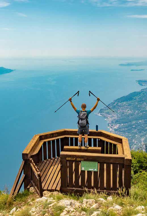
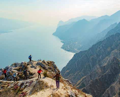
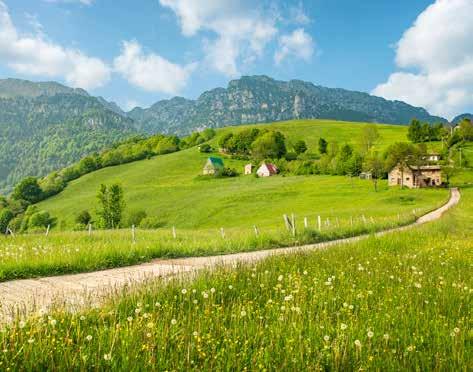
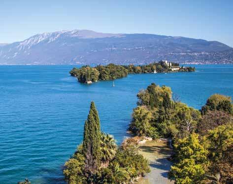
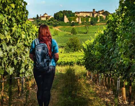
THE BASSA VIA DEL GARDA: FROM GENTLY ROLLING HILLS TO SHEER CLIFF FACES
This route cut into the hillside is divided into five stages and offers a unique opportunity to discover an extremely varied area with extraordinary natural, environmental, historical and architectural features. Starting from the breathtaking bay of Salò, the route takes you through the more rural area of Toscolano Maderno, inviting you to enjoy the citrus gardens of Gargnano and vast panoramic views of Tremosine sul Garda, while continually taking in the colours of the lake and mountains, a delight in every season, before bringing you to the traditional village of Limone sul Garda. A light rucksack, an open mind, white gravel tracks and a desire to discover: the ingredients are simple. What are you waiting for?
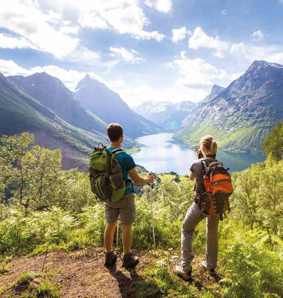
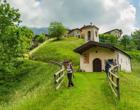
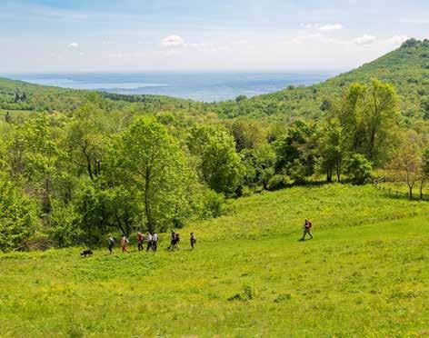
WHEN YOU SLOW DOWN…
You can do hiking as a sport, you can do slow hiking, you can do competitive hiking. But there is also a trail for the mind; one to walk alone with yourself, immersed in nature, away from traffic, noise and pollution. On this trek, the destination is not so much the point of arrival, but the experience of the journey itself. Tour guide associations offer customised itineraries that tailor distance, difficulty level and experiences to your tastes and requirements. The ‘slow walk’ philosophy encourages hikers to enjoy the landscape, history, tastes and rural features of the places they are passing through.
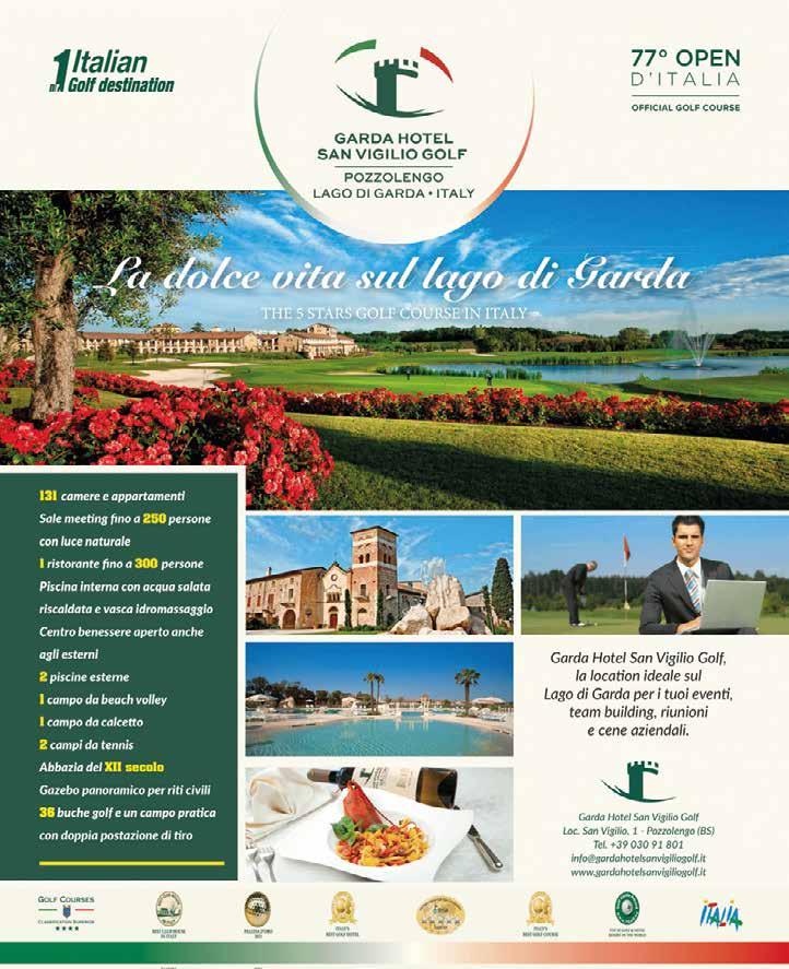
• 131 rooms and suites
• Meeting rooms for up to 250 people with natural light
• 1 restaurant for up to 300 persons
• Indoor heated saltwater swimming pool and with hydro-massage
• Wellness centre also open to the outdoors
• 2 outdoor pools
• 1 beach volleyball court
• 1 five-a-side football pitch
• 2 tennis courts
• 12th-century abbey
• Panoramic gazebo for civil wedding celebrations
• 36 golf holes and a Driving Range with double teeing boxes.
the ideal location on Lake Garda for a relaxing day at theswimming pool and spa. A romantic weekend or a corporate event in our splendid 4-star Resort with 130 rooms and Apartments with garage, wellness area with gym, indoor and outdoor pools, sports centre with five-a-side football pitch, tennis courts, beach
HOW TO GET THERE
Aeroporti Milano Malpensa / Linate Bagolino
MILANO
Valvestino
Limone
BRENNERO
Trento Arco Riva
Rovereto Sud Lago di Garda Nord
Tremosine Magasa Idro
Puegnago
Aeroporto Orio al Serio
Gargnano Tignale
Toscolano Maderno
Gardone Riviera
Salò
San Felice Manerba Garda Torri
Moniga
Sirmione
BERGAMO Torbole
Malcesine
Brenzone
Desenzano Lonato Padenghe Soiano Polpenazze
AFFI
Bardolino
Lazise
SIRMIONE PESCHIERA
Brescia DESENZANO
Montichiari
Aeroporto Montichiari
Verona
A4
Pozzolengo
Aeroporto Villafranca
MODENA
Mantova
Texts and photos: Archivio Consorzio “Lago di Garda - Lombardia”, Stefano Maraggi, MilleMonti, Maurizio Torri.
Map p. 5: Carte escursionistiche di riferimento 4LAND n.111 Parco dell’Alto Garda Bresciano e carta n. 116 Basso Garda Lago di Garda Sud.
Edition 2024.
All Rights Reserved. Reproduction is prohibited, even partial. The images may represent places which differ from those indicated in the suggested routes.
A
VENEZI
E PERIENCE
GARDA LOMBARDIA
DISCOVER
MORE TREKKING TRAILS,TREKKING SERVICES AND GPS TRACKS