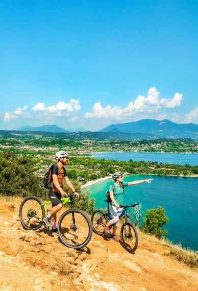
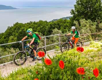
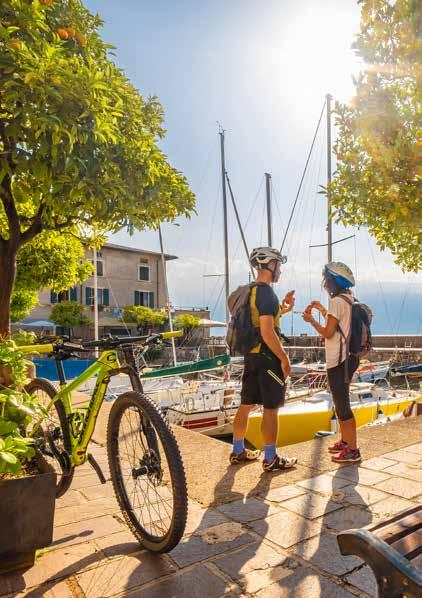
Make sure you take with you all the necessary equipment and clothes for excursions according to the season.
Check the weather forecast the day before your trip and verify that the track is open on the day you choose.
During the excursion do not deviate from the signalled path, respect the highway code and the environment, do not leave your waste along the path.
The viability of the routes may not necessarily coincide with the signposts, it needs to be verified permanently and periodically on the ground. The Author declines any responsibility for any accidents or damages that may occur on the proposed routes. SINGLE EMERGENCY CALL NUMBER
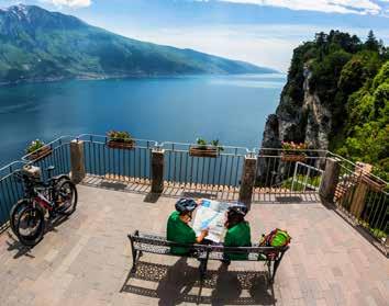
Tremosine sul Garda
Limone sul Garda - Tremosine sul Garda
Tignale
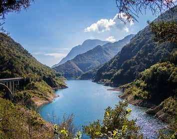
Valvestino
Valvestino - Magasa
Valvestino
Gargnano
Gargnano - Valvestino
Toscolano Maderno - Gargnano
Toscolano Maderno
Salò - Gardone Riviera
Salò - Puegnago del Garda
Salò - San Felice del Benaco
Manerba del Garda - San Felice del Benaco
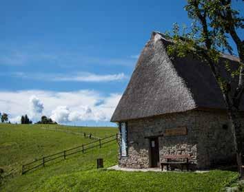
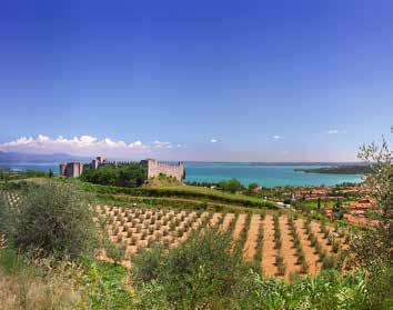
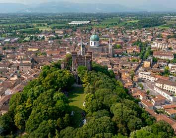
TREMOSINE SUL GARDA
BY CAR
Vesio can be reached from the Tremosine sul Garda plateau or from Limone sul Garda, or from Tignale. Possibility of parking near the starting point.
PUBLIC TRANSPORT
Vesio can be reached by bus (www. arriva.it).
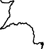
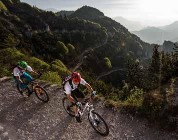
From the car park in the upper part of Vesio (0,0 km), cycle northbound on via Tremalzo along Bondo valley, a place that once hosted and ancient lake. This area of important natural interest, which became an official nature reserve in 1980, is a true hikers’ paradise. The first part of the itinerary is on asphalted road, and up to the 4th kilometre the incline is almost imperceptible. Once you reach the large picnic area with a fountain (4.2 km), the road goes rapidly uphill. The series of hairpin bends that allow to climb the approx. 500 m to reach Passo Nota starts at the 5th kilometre. At 8.5 km the path continues on a cobbled road and, after a few metres, close by the last bend there is a fountain and the crossroads to Rifugio degli Alpini “Fratelli Pedercini”. If you cycle on the road that reaches Rifugio Passo Nota (9.0 km) and the mountain pass bearing the same name (1218 m ASL), the environment is typically mountainous, with calcareous peaks surrounding the pass, and a wood of conifers and beech trees. Cycling back for a few metres beyond Passo Nota, at the crossroads take
the untarmacked road on the left with signposts to Vesio (path no. 106). The rest of the path continues along an old military track and, up to 12.5 Km, there is another increase in altitude of 100 m before cycling downhill afterwards. In the first part, where you will go through several caves built in the rock during the Great War, there are several panoramic spots on a delicately sloping path overlooking Tremosine sul Garda and mount Tremalzo. From 16.5 km the descent begins with a series of steep hairpin bends that will take you back.
TECHNICAL DATA
Possible snowfall in winter
Of naturalistic/ geological interest
Of historical/ cultural interest
Panoramic
Middle Mountain bike
Altitude difference
Highest point
Distance
Duration
Departure / Arrival
750 m
1300 m
20,5 km
3,5 h
TremosinesulGarda,Vesio, ParkinginviaPassoNota, 653 m ASL
LIMONE SUL GARDA - TREMOSINE SUL GARDA
BY CAR
You can reach Limone sul Garda from the south or from the north part of Garda along the Gardesana Occidentale (SS45bis). Parking is available in La Milanesa or in a covered pay car park near the centre of Limone sul Garda.
PUBLIC TRANSPORT
Limone sul Garda is reachable by bus (www.arriva.it), and by boat with Navigazione Lago di Garda (www. navlaghi.it).
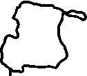
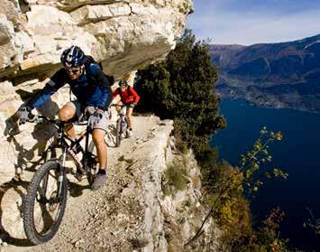
The loop that connects Limone sul Garda to Passo Tremalzo and drops back to the lake along the valley Singol is one of the most famous and aspired to routes of the Garda area, reserved for experienced cyclists because of its length and altitude difference. From the Limone sul Garda lakeside (0,0 km) you climb up to the Western Gardesana Road and turn left. After a few hundred meters you turn right following the sign for Tremosine sul Garda, climbing up an uphill slope with some steep and tiring sections, and with wide views of the lake. It passes from Bassanega and Voltino and goes first to Vesio, and from here in the direction of Tignale. Follow the road into hamlet Polzone (10.7 km) and at the crossroad you turn right onto the road signposted for the Tremalzo Pass. Along the left side of the San Michele valley, descend to cross the stream, beyond which a long climb begins that takes you immediately past the hermitage. It is a very challenging ride but
largely rewarded by the beauty of the surrounding rocky and wooded landscape. Beyond the crossroads for the Malga Lorina (21.8 km) and the waterfall of Prà di Lavino you will reach first the Malga Cà de l’Era and then the Malga Ciapa, beyond which there are three more bends to the Garda refuge on the Tremalzo Pass still have to climb a bit more to reach the Bocca di Val Marza, where a tunnel marks the high- est point of the itinerary (1865 m ASL). The road that follows, which dates back to World War I along with shelters and observation points carved in the rock, is spectacular and fun, and goes down connecting to the one rising from the valley of Bondo. From here you follow the signposts for the Nota pass (38.4 km, 1208 m ASL), the Bestana pass (1274 m ASL) and the Segala hut. Not far from this, near the Guil pass, turn right onto path no. 117, which with a series of technical challenges leads down to the Singol valley, along which we descend returning to the village of Limone sul Garda.
TECHNICAL DATA
Difficult
Possible snowfall in winter
Of naturalistic/ geological interest Of historical/ cultural interest
Panoramic
Mountain bike
Altitude difference
Highest point
Distance
Duration
Departure / Arrival
51,6 km 1865 m 1798 m
7 h
Limone sul Garda, 67 m ALS
TIGNALE
BY CAR
You can reach Tignale from the Gardesana Occidentale (SS45bis), or from Tremosine sul Garda. Parking is available in the Piazzale Arcobaleno.
PUBLIC TRANSPORT
Tignale can be reached by bus (www. arriva.it).
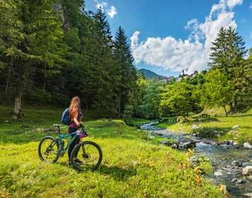
Nestled in the heart of the Alto Garda Bresciano Park, Tignale’s meadows, fields and orchards spread across a plateau, bordered by the woodland’s edge on one side and the shores of the lake on the other. This is the ideal location for walking: set out to discover its charming villages, admiring breathtaking views along the way. In the centre of the village of Gardola, the main village in the municipality of Tignale, you can park the car in Piazzale Arcobaleno. Cycle towards the village of Olzano. After you pass through this small village, continue to ride on the road that leads into the forest until you reach the Alpine hut at Cima Piemp (7 km, 1160 m ASL), a great place to take a break and enjoy the breathtaking panorama, sweeping from Lake Garda and Monte Baldo towards the mountains of Valvestino and Trentino: incredible in every season. After the Cima Piemp hut the road carries on and becomes a dirt track that runs along Cima di Traval and Cima delle Carbonere: this stretch is characterized by a long descent. Straight after this another climb is required in order to reach Passo d’Ere (11.7 km, 1131 m ASL). At this point, carry on riding
along the main track following the trail sign no. 253 for 7 km. You will pass the following locations along the route: Bocca Paolone (947 m) and Passo Fobia (907 m ASL). Stay on path no. 253 and you’ll reach Vione (694 m); here at the junction, keep left and take path no. 251 towards the village of Aer. Following this track for about 2.4 km you will reach the village of Aer. From here, after 1 km, you will be back in Piazzale Arcobaleno, the starting point of the tour.
TECHNICAL DATA
Middle
Possible snowfall in winter
Of naturalistic/ geological interest
Of historical/ cultural interest
Panoramic
Mountain bike
Altitude difference
Highest point
Distance
Duration
Departure / Arrival
1100 m
21,6 km 3 h 530 m
Tignale, Gardola, 555 m ALS
VALVESTINO
BY CAR
Turano in Valvestino can be reached from Gargnano along the SP9 road that runs alongside the Valvestino dam, or alternatively from Idro. Parking available on the road reaching the village centre.
PUBLIC TRANSPORT
Turano can be reached by bus (www. arriva.it).
From Piazza Madonna Pellegrina (0.0 km), in the centre of Turano, after paying a visit to the parish church where you will enjoy a beautiful view of the valley, cycle down the provincial road to the crossroad for Armo (0.6 km), then ride on the steep road on the left. After a few hairpin bends (3.7 km), you will reach the small village of Armo. Its narrow streets will lead you to an ancient fountain and a church on the other side of the village, where the asphalted road turns into an untarmacked road. The trail continues along the valley of Armarolo stream, where, in the first part, you descend as far as the streambed, then cycling uphill you can enjoy the splendid water sprites designed by nature through erosion over the millennia. Once in Ponte Franato village (7.0 km), beyond the bridge, cycle uphill on the road along the western side of the valley, until you reach the highest point of the route (1100 m ASL) close by a clearing called Messane (9.5 km). Here the view includes the mounts surrounding Valvestino area. At the crossroads, where the road is asphalt-
ed, follow the signposts to the village of Persone. Cycling downhill, you will reach the small borough perched on the bend of the main road going to Turano. Through Persone (11,7 km) cycling uphill this time on an asphalted road, you will reach Moerna (14.0 km).
Beyond this village, on the left of the provincial road there is the ancient road from Turano to Moerna (14.5 km) of which only a rough terrain remains, going through the wood and clearings. In 2 km you will arrive back in the main square of Turano (16.5 km).
TECHNICAL DATA
Middle
Of naturalistic/ geological interest
Of historical/ cultural interest
Panoramic
Also recommended on foot
Mountain bike
Altitude difference
Highest point
Distance
Duration
Departure / Arrival
650m
1050 m
16,5 km
3,5 h
Turano, Madonna Pellegrina Square, 658 m ASL
BY CAR
VALVESTINO - MAGASA
Molino di Bollone can be reached from Gargnano along the SP9 road that runs alongside the Valvestino dam, or alternatively from Idro. Parking is available at Molino di Bollone, near the bridge.
PUBLIC TRANSPORT
Molino di Bollone is reachable by bus (www.arriva.it).
At the northern end of the dam of Valvestino you reach Molino di Bollone (0.0 km) where you park near the bridge. For the first few kilometres, the route follows that road for Magasa, which runs alongside the river Toscolano first, and then the Magasino. The slope is initially moderate, then it increases along the curve to the right and the bridge that allows you to bypass the stream Armarolo, but does not require excessive effort. At the village of Magasa (7.8 km) continue on to the plateau of Rest, passing under the rocky outcrop of Rocca Pagana. There are now a couple of miles of more steep climbing, with a wide panorama that opens in the direction of Mount Tombea and Caplone, the highest peak in the Lombardy Garda. The climb ends at the small church of Rest Alpini (1211 m ASL), from which you can admire the vast meadows of Rest that make up a large, peaceful and picturesque landscape. After passing the small cluster of restored barns of Cima Rest (11.5 km), the route goes downhill to Cadria for another kilometre until, just beyond the first bend
to the left, you take a road to the right. The descent continues along path no. 292, a dirt road and then a track alongside the stream. After passing an old boundary stone marking the former border between the Austro-Hungarian Empire and the Kingdom of Italy, the route becomes wilder for a short while, even requiring cyclists to cross the small stream several times (due to its characteristics, this stretch should only be tackled by experienced cyclists). The path no. 292, turns back into an easy dirt road near Droane, continuing until it reaches the bridge of the provincial road (22 km), before turning right to join this road and return to Molino di Bollone.
TECHNICAL DATA
Difficult
Possible snowfall in winter
Of naturalistic/ geological interest
Panoramic
Mountain bike
Altitude difference
Highest point
Distance
Duration
Departure / Arrival
780 m
1211 m
25 km
Valvestino, Molino di Bollone, 510 m ASL 3,5 h
VALVESTINO
BY CAR
Molino di Bollone can be reached from Gargnano along the SP9 road that runs alongside the Valvestino dam, or alternatively from Idro. Parking is available at Molino di Bollone, near the bridge.
PUBLIC TRANSPORT
Molino di Bollone can be reached by bus (www.arriva.it).
Near a small cluster of buildings in Molino di Bollone (0.0 km) you can park the car and set off on your bike. Head north and turn a little further to the left on the road leading up to Capovalle. The first stretch with four bends of the lower part of the wooded Valley of Molini is rather steep, then continues on gentler slopes to the Passo San Rocco (7.4 km, 946 m ASL), a watershed between Valvestino and Valle Sabbia. You descend slightly in the direction of Lago d’Idro for about 600 m, then at the first hairpin bend, turn left in the direction of Passo Cavallino della Fobbia (11.6 km, 1098 m ASL). There are some short, particularly steep ascent sections, both on asphalt and on a dirt road, to Cocca Veglie (follow the signs from the Pass) and then to the Fienile di Los (16.9 km, 1325 m ASL). The views are stunning! Here you can decide whether or not to continue along the pleasant route (path no. 474) which leads you across the top of the Camerelle valley and then to the Casello di Vesta (18.7 km, 1389 m ASL), where you can enjoy the alpine pastures and barns, green meadows
and pleasant views of the Val di Vesta Wilderness area below, isolated and wild, where the Vesta stream meanders, collecting the waters of various side tributaries and creating gorges, waterfalls and the ‘fjord’ of Lake Valvestino. Otherwise, from the Fienile di Los, you can continue along the dirt track that descends into the forest (path no. 470B) leading back to the San Rocco Pass. Here you turn right and follow the beautiful descent all the way down to Molino di Bollone.
TECHNICAL DATA
Difficult
Altitude difference Possible snowfall in winter Of naturalistic/ geological interest Panoramic
* With diversions to Casello di Vesta Mountain bike
Highest point
Distance
Duration
Departure / Arrival
1359m(+ 30m *) 980m (+ 100m*)
Valvestino, Molino di Bollone, 510 m ASL 3 h ( + 30 min. *) 28,9 km (+ 3,6 km *)
GARGNANO
BY CAR
Gargagno can be reached along the Gardesana Occidentale (SS45bis). Parking available at the port of Bogliaco.
PUBLIC TRANSPORT
Gargnano can be reached by bus (www.arriva.it) and by boat with Navigazione Lago di Garda (www.navlaghi.it).
Along the Western Gardesana State Road you reach Bogliaco and park near the private harbor “Marina di Bogliaco” (0.0 km, 68 m). Cycle north and cross the village overlooking the lake from which the prestigious international regatta of Centomiglia starts every year. A little further on you enter the state road, turning right, pass the great Palazzo Bettoni and its lemon houses and then turn right on Via Colletta to reach Villa, with its pretty little harbor. At the exit from Villa, continue to the north for a short distance and then, at the bus station, leave the Gardesana Road on the right following the indication for the centre of Gargnano on Via Roma (2.5 km). Pass the church and the cloister of San Francesco, the nearby town hall and then Palazzo Feltrinelli. The asphalt road that continues under the name of Via Rimembranza and then Via San Giacomo runs near the lake and can be traced until it ends at the electric power station of Enel, offering broad views of the lake, taking in lemon houses, historic buildings and elegant mansions. Return to the Fontanelle beach and in front of this turn right onto Via del Ruc. At the end
of the short climb, bear right onto the Gardesana state road and stay on it for about a kilometre, then turn left for Muslone. On the uphill road that follows there is little traffic, it offers some scenic sections, and passes through the olive groves at the foot of Mount Comer. After a stretch in a tunnel, the route takes you along a small series of close bends, just beyond which you reach the village of Muslone (9.9 km 460 m ASL). To get back to Bogliaco, go along the same route.
TECHNICAL DATA
Middle
Of naturalistic/ geological interest
Panoramic Of historical/ cultural interest
Mountain bike
Altitude difference
Highest point
Distance
Duration
Departure / Arrival
m
m
Gargnano, Harbour of Bogliaco, 68 m ASL 2,5 h 19,4 km
GARGNANO - VALVESTINO
BY CAR
Navazzo di Gargnano can be reached by taking the Gardesana Occidentale (SS45bis) and from there the SP9 to Valvestino. Parking is available in the square at the bar by the junction to Briano.
PUBLIC TRANSPORT
Navazzo of Gargnano can be reached by bus (www.arriva.it).
Take the road from Gargnano to Valvestino until you reach the crossroads (0.0 km) near the village of Navazzo where you can park. Start cycling toward Briano, leaving behind the lake and then reach the village of Formaga (1.5 km), just beyond which the slope becomes more consistent. The road rises up to Montecastello di Gaino and Pizzocolo, back to the lake for some stretches and then reaches Bocchetta del Santo di Liano (750 m ASL) and the crossroads for Briano. The direction to take is the one on the left for Costa. Then take a road with uphill and downhill stretches to Bocca Magno (6.6 km, 788 m ASL), where you can see in the distance the village of Costa. The following section of the itinerary crosses an area of extensive meadows and pastures, and runs along a long descent, and then another undemanding section until the bridge over the Rio della Costa (665 m). From here it inclines steeply to reach the church of San Bartolomeo and the village of Costa (11.4 km). It continues the houses on the road that reaches the nearby small hamlet of Mignone (768 m ASL),
from which on the dirt road it goes into the woods. It passes by a fountain and after a kilometre you reach a junction where you continue straight to Lake Valvestino (indication). Behind the ruin of an old building with a view of the artificial lake in the locality of Casali (699 m), continue for a short section up to a junction staying on the right, keeping parallel to Lake Valvestino as far as the hamlet of Lignago (15.6 km, 550 m ASL). From here turn onto the asphalt road that connects Valvestino to Gargnano: turn left, continuing to skirt the artificial reservoir as far as the dam and then onwards past the village of Navazzo, returning after a few hundred metres to the starting point.
TECHNICAL DATA
Difficult
Possible snowfall in winter Of naturalistic/ geological interest
Panoramic
Mountain bike
Altitude difference
Highest point
Distance
Duration
Departure / Arrival
750 m
788 m
26 km
Gargnano, Crossroads for Costa at Navazzo, 516 m ASL 3,5 h
BY CAR
TOSCOLANO MADERNO - GARGNANO
Toscolano Maderno can be reached from upper Garda or lower Garda by driving along the Gardesana Occidentale (SS45bis). Parking is available near the roundabout between the Gardesana and via Marconi.
PUBLIC TRANSPORT
Toscolano Maderno can be reached by bus (www.arriva.it) and by boat with Navigazione Lago di Garda (www.navlaghi.it).
The ascent from Gargnano to Valvestino is one of the most scenic roads on Lake Garda and, in view of the moderate gradients, is very pleasant to cycle. It can therefore be incorporated into a circular route with departure from Toscolano. From Toscolano, the route starts at the roundabout between the Gardesana and via Marconi (0.0 km), where parking is available. Cycle along the state road in the direction of Limone sul Garda beside the lake to the turnoff for Cecina, which you will reach after an uphill stretch. Then the road flattens out along the golf courses, which you skirt on the left until you pass the pretty hamlet of Villavetro. Take the SS 45bis at Bogliaco to Villa di Gargnano. Here we recommend a diversion to via Colletta to see the pretty little harbour. Rejoin the SS 45Bis and follow it to the junction (7.3 km) signposted Navazzo and for Valvestino. The next stretch runs through olive groves with some very manageable slopes, past well-equipped rest areas inviting you to stop and admire the expansive
views. At the end of a straight stretch past the junction for Musaga, turn left and, just before reaching Navazzo (15.1 km, 477 m SL), turn left again onto via Sostaga. After passing the Church of Santa Maria Assunta and turning onto via del Travaglio, you will reach the highest point of the itinerary (16.2 km, 516 m ASL) and begin your (initially steep) descent to Cabiana, Folino and Gaino (19.6 km, 269 m ASL). After passing the village centre, turn left and continue downhill to arrive in Toscolano after several hairpin bends.
TECHNICAL DATA
Possible snowfall in winter Of naturalistic/ geological interest
Panoramic
Middle Mountain bike
Altitude difference
Highest point
Distance
Duration
Departure / Arrival
580 m
516 m
22,3 km
Toscolano Maderno, BridgeoftheToscolano torrent, 85 m ASL 2,5 h
BY CAR
TOSCOLANO MADERNO
Toscolano Maderno can be reached from upper Garda or lower Garda by driving along the Gardesana Occidentale (SS45bis). Parking is available near the bridge over the Toscolano stream.
PUBLIC TRANSPORT
Toscolano Maderno can be reached by bus (www.arriva.it) and by boat with Navigazione Lago di Garda (www.navlaghi.it).
Monte Pizzocolo is one of the most popular excursion destinations in the Lake Garda area. A rewarding route for fit, experienced cyclists! Park near the bridge (0.0 km) of the Gardesana Occidentale road that passes over the Toscolano stream and immediately start cycling uphill towards Montemaderno, on a pleasant road offering panoramic views. Continue in the direction of San Michele (6.6 km, 400 m ASL) and, having passed the hamlets of Maclino, Bezzuglio and Supiane, turn right out of the village onto via Val di Sur, where you can enjoy your first glimpse of the summit of Monte Pizzocolo. Follow the asphalt road, which turns into a paved road at the signpost (9 km, 430 m ASL) for Pirello (12.7 km, 1030 m ASL), which you reach after a demanding ascent through the forest. The steep slopes continue, however, but with the addition of beautiful views, up to the Passo Spino (14.5 km, 1,184 m ASL), with the Pirlo refuge in view to your left, a short distance away from which refreshments are availa-
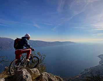
ble. Turning instead to the right, follow the signs for path no. 287 to Monte Pizzocolo (18.5 km, 1584 m), which you reach after another 4 km of uphill track, offering stunning views that make it worthwhile. This brings you to the most incredible vantage point over Lake Garda. A well-deserved rest before tackling the long descent: for the first 2.7 km, you simply go down the road you came up on, then, at the fork in the road at Le Prade (21 km, 1,321 m ASL), follow path no. 223 to Sant’Urbano (23.9 km, 872 m ASL), which you reach shortly afterwards. A long and steep descent (path no. 206) to be taken with caution passes the viewpoint of the Croce di Ortello and leads to the villages of Sanico, Vigole and then Maclino, where a couple of kilometres of descent lead back to the bridge over the Toscolano stream.
TECHNICAL DATA
Difficult
Possible snowfall in winter
Altitude difference
Highest point Of naturalistic/ geological interest
Panoramic
Mountain bike
Distance
Duration
Departure / Arrival
1584 m 1560 m
32,4 km
Toscolano Maderno, Bridge of the Toscolano torrent, 85 m ASL 5 h
SALÒ - GARDONE RIVIERA
BY CAR
Salò is easily reached from the upper lake along the Gardesana Occidentale (SS45bis) or from the lower lake along the SP572. Wide parking possibilities near Landi street.
PUBLIC TRANSPORT
Salò can be reached by bus (www. arriva.it) and by boat with Navigazione Lago di Garda (www.navlaghi.it).
From the eastern part of Salò, continue in the direction of Gardone Riviera and, just before the town of Barbarano you can park in Landi street (0.0 km). The route slowly ascends the Gardesana State Road to a crossroads (0.7 km) where you turn right in the direction of San Bartolomeo and Serniga. The road runs along a tortuous stretch that offers picturesque views between the cypresses; The slope is quite steep mainly during the first kilometre, then it levels off slightly. When you reach the crossroads for San Bartolomeo (3.9 km) you continue straight to Serniga and pedal less strenuously. At Serniga, a bench offers the opportunity to stay and admire the wide panorama that opens onto the Gulf of Salò, the Rocca di Manerba, Sirmione and the lower Garda. From here, with careful attention to the brakes, just pedal for short stretches to pass the Barbarano stream and the village of San Michele. Leave the road on the left which goes up to Rifugio Pirlo and follow a short stretch of via Panoramica to the junction (8.3 km) where you turn left towards Supiane and Maderno. The road is called
via della Calma and is affected by modest traffic flows. It reaches Supiane (280 m ASL) and after a kilometre of steep descent comes to the junction for the nearby elegant Bezzuglio village. The descent continues in the direction of Gardone Sopra to the two successive crossings, and leads shortly to the perimeter of the Vittoriale degli Italiani. After passing through the entrance of the monumental complex, it goes down to the crossroads of the Gardesana State Road, where you turn right. Using the cycle path for Salò that runs parallel to this one, you reach the centre of Gardone Riviera, and a little further on, past palazzo Terzi Martinengo, you turn right down the road that leads back to via Landi.
TECHNICAL DATA
Not recommended on hot days
Panoramic Of historical/ cultural interest
Middle Mountain bike
Altitude difference
Highest point
Distance
Duration
Departure / Arrival
m
m
Salò, Landi street, 72 m ASL
SALÒ - PUEGNAGO DEL GARDA
BY CAR
Salò is easily reached from the upper lake along the Gardesana Occidentale (SS45bis) or from the lower lake along the SP572. There is a large car park in the market of Via Zane close by the starting point. NOTE: Saturday is market day and the car park is busy.
PUBLIC TRANSPORT
Reach Salò by bus (www.arriva.it) or by boat with Navigazione Lago di Garda (www.navlaghi.it).
From the large car park at the market (0.0 km) between the centre of Salò and the sports facilities, cycle to the south along via Zane, then turn right onto via Montessori. At the stop sign (0.9 km) turn left onto via Muro until you reach the small square in the village of Villa (2.1 km), where you can continue along the cycle path headed to Lonato del Garda. Cycling on the steep road on top of the hill, among wood and vineyards, you will reach a road going slightly uphill (5.2 km) where you should turn left to reach the lakes of Sovenigo, three mirrors of water hidden in the woods that flush pink with waterlilies between July and August. Here you leave the cycle path to Lonato del Garda to continue toward via dei Laghi up to the crossroads with SP25 and via Roma. Follow this road for Salò and you will reach the centre of Puegnago del Garda (8.1 km), where there is a castle and the parish church. Here, it is worth stopping at the village square, which is like
a balcony over both the lake and the vineyard-covered Valtenesi hillsides. After the village, turn left towards the village of Palude. Cycle along via XXV Aprile up to SP25, which reaches the village of Cunettone going north (10.5 km). Pay attention on this busy road and continue towards via Zette to turn left on via Panoramica (11.3 km). Here you will find a proper cycle path that takes you back to the starting point (15.5 km). From the market car park, we suggest extending your excursion a little further to the lively town of Salò with its lakeside promenade around the bay and elegant old town.
TECHNICAL DATA
Middle
Altitude difference
Highest point Not recommended on hot days Of naturalistic/ geological interest
Panoramic Of historical/ cultural interest
Mountain bike
Distance
Duration
Departure / Arrival
300 m
305 m
15,5 km
Salò, Parking on the market place in via Zane, 75 m ASL 2 h
BY CAR
SALÒ - SAN FELICE DEL BENACO
Rive of Salò is located in the south of the city and is easily reachable from the upper lake along the Gardesana Occidentale (SS45bis) or from the lower lake along the SP572. There is a large car park at the market on via Zane near the starting point. NB: Saturday is market day.
PUBLIC TRANSPORT
Salò can be reached by bus (www.arriva.it) and by boat with Navigazione Lago di Garda (www.navlaghi.it).
The roads around Salò and the surrounding areas are full of opportunities for cyclists and cycle tourists, for challenging workouts to be carried over long distances as well as for pure fun along the shortest routes. At a short distance from the historic centre of Salò, the route passes the main road Gardesana West. The most experienced cyclists use it to reach Limone sul Garda and Riva del Garda, but there are many intermediate destinations of interest that can be chosen to construct short-distance routes on the western coast. Close to the border between Salò and San Felice del Benaco is the short road “delle Zette”. The four curves that characterize this road allow you to easily overcome the small difference in altitude that separates Monte Santa Caterina from the southern part of the bay, where you can admire splendid views. A circular route of just over ten kilometres is possible starting from the Rive di Salò (0.0 km) where, among other things, you can
enjoy one of Salò’s small, breezy and relaxing free beaches. Cycle alongside the lake past the cypress-lined avenue of the monumental cemetery to the short climb that leads to Cisano, a small cluster of houses overlooking the bay of Salò, and from here you reach Portese and then San Felice del Benaco (5.1 km). Continuing in the direction of the area Cunettone of Salò, you come to the roundabout and exit to the right towards the ‘delle Zette’ descent, offering expansive views in the eastern part of the bay and from there, head left to the starting point.
TECHNICAL DATA
Easy
Panoramic Of historical/ cultural interest
Slow bike
Altitude difference
Highest point
Distance
Duration
Departure / Arrival
60 m
128 m
Salò, località Rive, 68 m ASL 1,5 h 11 km
MANERBA DEL GARDA - SAN FELICE DEL BENACO
BY CAR
Manerba del Garda can be reached from the top and lower lake by driving along the SP572. Parking available near the starting point.
PUBLIC TRANSPORT
Manerba del Garda can be reached by bus (www.arriva.it).
From the ancient church of Santa Maria di Tenesi in Manerba del Garda (0.0 km), take viale Catullo towards the north. Continue on via Fontanamonte (1.6 km) which descends to the right to the lake in the village of Gardiola (2.1 km). Go left to Porto San Felice, then uphill towards the San Fermo peak (detour at 4.3 km), from which you will enjoy a magnificent view of the lake and the splendid island of Garda. Continue on via Benaco and take the untarmacked road via Gere to reach the historic centre of Portese Take via Brescia (7.3 km) towards Cisano, a tiny but picturesque borough (8.7 km). Beyond Cisano, take via Zubino to reach San Felice del Benaco. Once you are in the beautiful central square of the village (10.8 km), where there is the massive presence of the municipality building, turn right towards via Garibaldi, which will take you to the Sanctuary of Madonna del Carmine. If the weather is good, this ancient church deserves to be visited for a series of frescoes that will take you back to the Middle Ages. With the Sanctuary on your left, go uphill on the narrow and steep via Monte Croce. Continue on via Mas-
contina: at the crossroads (12.3 km) follow via Case Sparse and the signposts to the cycle path to Desenzano del Garda that will take you to via della Molaria, a narrow untarmacked road on your left, then back to the starting point (14.0 Km).
TECHNICAL DATA
Easy
Altitude difference
Highest point Not recommended on hot days Of naturalistic/ geological interest
Panoramic Of historical/ cultural interest
Slow bike
Distance
Duration
Departure / Arrival
300 m
160 m
14 km
Manerba del Garda, Pieve di Santa Maria di Tenesi, 77 m ASL 2 h
PUEGNAGO DEL GARDA - POLPENAZZE DEL GARDA
BY CAR
Puegnago del Garda can be easily reached from the top and lower lake by driving along the SP572. Parking available nearby the starting point.
PUBLIC TRANSPORT
Puegnago del Garda can be reached by bus (www.arriva.it).
From the municipality square of Puegnago del Garda take via del Camposanto and continue to the right on via dei Laghi, running along the lakes of Sovenigo, until you reach via Cima Semonte on your left (1.2 km). Here the itinerary joins the provincial cycling path Salò-Lonato; continue to the south towards Lonato del Garda, up to Polpenazze del Garda. Once you enter the village of Basia (3.2 km) you will be cycling near lake Lucone (3.7 km), now completely dry except for a small wet area in the middle of the basin. The environmental characteristics mark the area as a valuable ecological oasis, while the abundance and quality of archaeological finds make it a site of fundamental importance for the study of prehistory in northern Italy, recognised as a UNESCO World Heritage Site. Turn left towards the Romanesque church of San Pietro in Lucone, and cycle down on via San Pietro. At the Stop sign leave the cycle path to Lonato del Garda turning left, then turn right onto via Vedrine to get to the centre of Polpenazze del Garda where you will find the ancient, well-preserved village with its beautiful square in front of the church: here
you can enjoy a unique view of the hills and the lake (5.7 km). From the church square, heading down via Galvani, turn left and cycle towards the village of Picedo, known mainly for its high concentration of vineyards and olive groves. Here enter via Monte Grappa (6.8 km) to reach the area of Mura, with the church of San Giuseppe (7.9 km). The starting point, the castle of Puegnago del Garda, is close by (8.6 km).
TECHNICAL DATA
Easy
Altitude difference
Highest point Of naturalistic/ geological interest
Panoramic Of historical/ cultural interest
Also recommended on foot
Mountain bike
m
m
Distance
Duration
Departure / Arrival
Puegnago del Garda, Town Hall Square, 216 m ASL 1 h
BY CAR
MONIGA DEL G . - SOIANO DEL LAGOPUEGNAGO DEL G. - MANERBA DEL G.
Moniga del Garda can be easily reached from the top and from the bottom of the lake via SP572. Parking available near the starting point.
PUBLIC TRANSPORT
Moniga del Garda can be reached by bus (www.arriva.it).
From via Pergola SP572 (0.0 km) at the roundabout with signposts to Soiano del Lago continue on via Monte Cicogna going slightly uphill on the unmade road via Gherla headed to Soiano del Lago. Bear right on SP25 until you reach the entrance to the historic centre of this small town (2.5 km), with its parish church and castle If you cycle along SP25 to Polpenazze del Garda you will reach the village, then follow the signs to the castle and the viewing point. In the panoramic square of the parish church of Polpenazze del Garda (5.0 km), don’t forget to stop by the castle walls and the well-preserved historic centre. Back on Strada Provinciale towards Puegnago del Garda, just outside the historic centre beyond the roundabout, turn right onto via Rio Bosco going downhill on unmade road through cultivated fields and olive trees. Once on the asphalted road to Puegnago del Garda (6.3 km), continue until you reach the deviation for Mura (7.5 km) on the right, which will take you through this ancient village, cycling on a tiny circular road around the historic centre. Back on via Roma (SP25), in a few minutes you will find yourself
in Puegnago del Garda (8.5 km), with its unique castle. Head down via Aldo Merler, and turn left onto via Fontane and, shortly after, you come to the small village of Raffa (10.5 km). The village unfolds along via XX Settembre going north, and after the church turn right onto via Fosse (11,5 km). After a little while turn right once again onto via Mascontina (12.1 km) and continue to the village of Pieve Vecchia di Manerba del Garda, with the charming church of San Rocco (13.9 km). At the end of via Manzoni (14.5 km) turn right on an unmade road after a small stream (white/red signs). Follow the signs on the cycle path to Desenzano del Garda until you reach Balbiana (16.0 km). At the large roundabout on SP39 take via Noveglie which, after a while, turns into an unmade road. Turn left in via Dugale to rejoin SP39 – via San Martino (17.6 km). Proceed through the centre of Moniga del Garda (19.0 km), with a short detour through the walls of the castle to enjoy the view from the terrace next to the walls, continue along via Roma towards SP572 to complete the itinerary (20.5 km).
TECHNICAL DATA
Middle
Not recommended on hot days Of naturalistic/ geological interest
Panoramic Of historical/ cultural interest
Mountain bike
Altitude difference
Highest point
Distance
Duration
Departure / Arrival
300 m
240m
20,5 km
Moniga del Garda, Roundabout on SP572 for SoianodelLago,127mASL 2,5 h
PADENGHE SUL GARDA - SOIANO DEL LAGO
BY CAR
Padenghe sul Garda can be easily reached from the top and from the bottom of the lake via SP572. Parking available near the starting point.
PUBLIC TRANSPORT
Padenghe sul Garda can be reached by bus (www.arriva.it).
From the roundabout between via Barbieri and via Verdi (0.0 km), near the square and the headquarters of the Municipality, enter via Verdi towards Soiano del Lago and Polpenazze del Garda on the cycle path parallel to the main road. At the next roundabout go right and then turn left onto the unmade road with signs for the cycle path to Salò (1.1 km). After you pass the turning for the Balosse wet zone (1.5 km), turn left following the signs for the cycle path to Salò. At the end of the unmade bear left onto via delle Orchidee (2.9 km) and at the Stop sign continue towards via Monte Cicogna. At the end of this short road continue on the unmade road called via della Gherla (3.4 km), which will take you to Soiano del Lago. At the end of it turn left uphill (4.5 km) and after 300 m turn right and proceed onwards to the village hall. (5.2 km). From here turn right again for the centre of Soiano del Lago along via San Michele, where you will find the castle and the parish church. At the end of your tour in the centre of the village, head back to the village hall and continue towards Padenghe sul Garda (6.9 km) to reach the village of Chizzoline. Through via
Roma and, on the right, via Brescia (7.7 km), the itinerary will take you to the provincial cycle path Salò-Lonato (8.2 km) going towards Lonato del Garda. Cycle beyond the picturesque and secluded village of Pratello to reach the foot of the Castle of Padenghe sul Garda. Once in Santella on the provincial road, turn left on via Gramsci, go through the historic centre to go back to the starting point (12.5 km).
TECHNICAL DATA
Easy
Not recommended on hot days Of naturalistic/ geological interest
Panoramic Of historical/ cultural interest
Mountain bike
Altitude difference
Highest point
Distance
Duration
Departure / Arrival
220 m
210 m
12,5 km
Padenghe sul Garda, Via Verdi, 120 m ASL 1,5 h
LONATO DEL GARDA - PADENGHE SUL GARDA
BY CAR
Lonato del Garda can be easily reached from the top and from the bottom of the lake. Take the A4 motorway Desenzano del Garda exit. Parking available in the village of Lonato del Garda
PUBLIC TRANSPORT
bus service available to Lonato del Garda (www.arriva.it), which can also be reached by train (www.trenitalia.com).
The historical importance of the ancient village of Lonato del Garda is evident in some important buildings: the grandiose dome of the Basilica, the majestic Civic Tower, the monumental Rocca. Strolling through the old centre takes you back in time. On the way up, you can also visit the large park that houses the Fondazione Ugo Da Como museum, rich in art and culture. It is from the very heart of the town that the route starts: from the square of municipio in Lonato del Garda (Piazza Matteotti) cycle northbound to the tower through via Trento e Trieste, via De Gasperi and via San Zeno, one after the other. Once on via XXIV maggio, before the village of Sedena, take via Reparè on your right (2.4 km) heading to via Cuccagna, which turns into an unmade road towards the castle of Drugolo (5.2 km). After having admired the splendid view of the castle and its neighbouring rural village, cycle uphill on via Cappuccini in the wood that covers the surrounding hills headed east. Go beyond the disused stables (6.2 km) and follow the unmade road
going north. Continue through to the cluster of houses and cycle downhill until you cross via Ronchi (7.7 km), then turn right on the cycle path to Lonato del Garda to go back to the starting point, after passing through the villages of Ronchi, S. Anna, and the last part on the cycle path along SP25.
TECHNICAL DATA
Easy
Not recommended on hot days Of naturalistic/ geological interest
Panoramic Of historical/ cultural interest
Mountain bike
Altitude difference
Highest point
Distance
Duration
Departure / Arrival
Lonato del Garda, Town Hall Square, 120 m ASL 2 h 13 km 260 m 220 m
BY CAR
LONATO DEL GARDA
Lonato del Garda can be easily reached from the top and also the bottom of the lake via A4 motorway exit in Desenzano del Garda. Parking available in front of the train station or in the surrounding area.
PUBLIC TRANSPORT
bus service to Lonato del Garda available (www.arriva.it) and also the train (www.trenitalia.com).
From the train station cycle along via IV novembre up to the next crossroads, turn right and, after passing the train station, turn right again onto via Pave. At the following roundabout take via Isonzo and continue on the cycle path to Castiglione delle Stiviere, which you will follow up to the detour for Fornace dei Gorghi. Once you reach the end of the motorway underpass, turn left onto the unmade road via Monte Mario (0.9 km). Continue on the same road going south on the non-asphalted road until you rejoin the asphalted road towards via Molocco Sopra and, later on, via Molocco sotto, which will take you to the village of Esenta. At the sign that marks the beginning of the village (4.9 km), always following the signs for the cycle path to Castiglione delle Stiviere, continue uphill along via San Marco through the village, until you enter via Damiano Chiesa. Turn left onto via Slossaroli and continue to the crossroads with Corte Ferrarini on your left (8.3 km). From here take the detour to the archeological site of Fornace dei Gorghi towards the
large roundabout that will take you to Castiglione on the cycle path, then follow the signs to Fornace. After visiting the archeological site, leave the cycle path to Castiglione and continue cycling through via Corte Ferrarini, along the kartodrome until the end of via Slossaroli. Turn left and proceed to the village of Brodena (12.3 km). Here turn right and continue north along the road bearing the same name, and cycle to the crossroads with viale Marziale Cerutti. Here turn left and continue until you reach the train station flyover, which will lead you to back to the starting point.
TECHNICAL DATA
Easy
Not recommended on hot days
Panoramic Of historical/ cultural interest
Mountain bike
Altitude difference
Highest point
Distance
Duration
Departure / Arrival
150 m
190 m
15,7 km
Lonato del Garda, Stazione ferroviaria, 162 m ASL 2 h
DESENZANO DEL GARDA
BY CAR
Desenzano del Garda is easily reachable from the top and from the bottom of the lake. Take A4 motorway exit at Desenzano del Garda. Parking available at the station, near the starting point.
PUBLIC TRANSPORT
bus service to Desenzano del Garda available (www.arriva.it), also trains (www.trenitalia. com) and by boat with Navigazione Lago di Garda (www.navlaghi.it).
From the train station in Desenzano del Garda (0.0 km) take via Cavour downhill and, after a short while, take via Irta on the left. Beyond the majestic flyover for trains (1.0 km), follow via Mezzocolle towards San Pietro and then via degli Oleandri going through an industrial area (2.5 km). After about a hundred metres follow the road that goes uphill; after a few metres it becomes an unmade road. This way you will avoid cycling on the busy main road. After this non-asphalted track, on a flyover you will also avoid the A4 motorway (3.6 km), to continue among cultivated fields and cattle pasture for 4.5 km, where you can turn left at the sign for “Itinerari del Garda”. At the end of the unmade road you will reach San Pietro village (6.0 km) and on the left, through a narrow road going uphill, turn right after the houses. The trail continues through the villages of Calvata, Montonale Basso and Alto (8.6 km) up to a “T” crossroads (11
km) near the tower of San Martino della Battaglia. Here turn left, and after a few hundred metres you will reach the detour to the Tower (historic monument). The route continues northwards for 500 metres and turns right and then left at the crossroad. Continue the main road to the roundabout with the motorway toll booths, here turn around the roundabout and take Via Colli Storici northwards for 3.7 km. At the roundabout turn left into Via Giovanni XXII and continue to the second roundabout where you take the third exit onto Via Venezia. After passing the small playground on your left, follow the sign for ‘Vaccarolo’ on Via Mattei to pass under the railway line again and turn right following the signs for the cycle path (15.5 km). As you cycle past the cemetery and the church of San Zeno (16.0 km) continue on the cycle path that will take you under the railway bridge (19.9 km), beyond which turn right uphill to the station square (20.5 km).
TECHNICAL DATA
Easy
Not recommended on hot days
Panoramic Of historical/ cultural interest
Slow bike
Altitude difference
Highest point
Distance
Duration
Departure / Arrival
200 m
116 m
23,5 km
Desenzano del Garda, Railwaystation,114mASL 2 h
DESENZANO DEL GARDA - POZZOLENGO
BY CAR
Rivoltella can be easily reached from the top and also from the bottom of the lake. It is located between Desenzano del Garda and Sirmione and you can take any of these two exits on A4 motorway to reach Rivoltella. Parking available near the starting point.
PUBLIC TRANSPORT
Rivoltella can be reached by bus (www.arriva.it).
From Porto Zattera in Rivoltella (0.0 km) take via Colli Storici going south and pass the A4 motorway flyover (4.3 km) to the crossroads for the Tower in San Martino della Battaglia (5.5 km).
From here turn left and, shortly afterwards, you will find yourself in front of the imposing war memorial. The itinerary continues up to a roundabout, go straight towards Preseglie and turn right near Cascina Ceresa (7.7 km) and, once in Cascina Vestona, turn left until you reach the road to Pozzolengo (9.2 km) going south. After about 200 m, on the left, go uphill on the signposted cycle path until you reach the village of Pozzolengo (10.9 km) and immediately after the Municipality building turn right onto via Diaz and again onto via Verdi to come to the square in front of the Castle, where you will enjoy a beautiful view of Lake Garda and the mountains surrounding it. Continue along via Morazzo to exit the village on unmade road until you approach Lago Mantellina (12.6 km), a wetland area typical of moraine environments. Be-
yond the lake, follow the perimeter of a large golf course until you reach the asphalted road (15.0 km), then cycle towards the village of Selva Capuzza following the signs. After a few minutes you will reach the crossroads to the Tower of San Martino (17.0 km), then cycle back the way you came until you reach Porto Zattera (22.5 km).
TECHNICAL DATA
Not recommended on hot days
Panoramic Of historical/ cultural interest
Easy Mountain bike
Altitude difference
Highest point
Distance
Duration
Departure / Arrival
200 m
127 m
22,4 km
Desenzano del Garda, Rivoltella, Porto Zattera, 62 m ASL 2 h
BY CAR
DESENZANO DEL GARDA - SIRMIONE
Desenzano del Garda and Sirmione can be easily reached from the top and from the bottom of the lake, parking available close by the starting point. A4 motorway exit in Desenzano del Garda.
PUBLIC TRANSPORT
Desenzano del Garda can be reached by bus (www.arriva.it), by train (www.trenitalia.com) and by boat with Navigazione Lago di Garda (www.navlaghi.it).
From the old port in Desenzano del Garda (0.0 km), a picturesque corner with a Venetian-style bridge, colourful boats and the arches of the palaces, head east along Cesare Battisti lakeside cycle path towards Rivoltella, which you will reach after about 2 km. Continue on the side of the lake road towards Sirmione and you will come to the roundabout where, on the left, you will enter via Matteotti (5.2 km), which becomes via Salvo d’Acquisto, then stop by the dock. From here turn right going towards an old gate indicating the entrance to the Sirmione peninsula (6.5 km). Continue on via XXV Aprile, where the most interesting part of the itinerary begins: the narrow stretch of land that takes you to Sirmione. Once beyond Lido Galeazzi, enjoy an unusual view of the lake both on the left and on the right, up to the panoramic spot Sandro Pertini (7.0 km), which is worth a short break. In a few minutes you will reach the historic centre of Sirmione, dominated by
Castello Scaligero (8.9 km), one of the most complete and best-preserved castles in Italy. From here go only on foot. Beyond the bridge, enter the walls of the village to reach the pier (9.0 km). You can continue the excursion up to the Grotte di Catullo (Catullus’s caves), where you can admire the imposing remains of a Roman residential villa in an archaeological park of 20,000 square m surrounded by 1,500 or so olive trees, including three different Garda varieties, some of which are centuries old. The location is particularly captivating, offering wonderful views. Walking all the way back will take you to the starting point.
TECHNICAL DATA
Easy
Not recommended on hot days
Panoramic Of historical/ cultural interest
Slow bike
Altitude difference
Highest point
Distance
Duration
Departure / Arrival
100 m
80 m
18 km
Desenzano del Garda, Porto Vecchio, 64 m ASL 2 h
FROM GARDA TO BAGOLINO
BY CAR
You can get to Gargnano by taking the Gardesana Occidentale State Road (SS45bis). Parking is available at the former Magnolini barracks in Bogliaco.
PUBLIC TRANSPORT
Bogliaco can be reached by bus (www.arriva.it).
A route that connects the shores of Lake Garda with the medieval gem of Bagolino. The route features some short but fairly challenging climbs. Starting from Gargnano at the former Caserma Magnolini (0.0 km), you travel along Via Libertà heading south, leaving Villa Bettoni behind until you reach the roundabout where you will take the road to Villavetro. Surrounded by olive trees, continue until the hamlet of Zuino, where there is a rather steep climb. After passing the houses, you continue on Via Alpestre until you reach Via Angelo Feltrinelli, which leads to Navazzo. From here, take the Provincial Road 9 in the direction of Valvestino and, surrounded by lush vegetation, cycle until you reach the dam and the blue waters of Lake Valvestino (12.1 km). When the water level is not particularly high, you can see the remains of the old Austro-Hungarian customs house. At the junction of the SP9 and SP58, take the latter towards Capovalle (17.7 km). In these approximately 5 km, human presence is almost completely absent, and you can hear the sounds of nature. After passing through part of the town up to
the votive chapel of San Rocco, a long descent begins. Past the tunnel (32,7 km), you can start to glimpse Lake Idro through the foliage. After crossing the centre of Idro and the bridge over the Idro-Vobarno Canal, take Via Lungolago Italia, then Via Roberto Bertini until you cross the bridge over the Chiese River. Here, at the next stop, turn right and follow the signs for Trento. Continue for about 2 km until you reach Anfo and stay on the Strada Provinciale BS237 until the large roundabout after the village of Sant’Antonio (46 km), and take the second exit towards Bagolino. Continue on Via San Giorgio until you reach the Parish Church of Bagolino (55.2 km), from which you can enjoy a splendid view of the valley.
Salò is easily reached from the upper lake along the Gardesana Occidentale (SS45bis) or from the lower lake along the SP572. Parking is available near the starting point.
PUBLIC TRANSPORT
Salò can be reached by bus (www.arriva.it) and by boat with Navigazione Lago di Garda (www.navlaghi.it)
A classic itinerary, suitable for everyone, that allows you to join Lake Garda to the city of Brescia. It starts from the Zanardelli lakeside promenade in Salò, a beautiful promenade that runs parallel to the streets of the old town centre, and follows via Garibaldi, via Bossi and via Umberto I until it meets the cycle path at the intersection with via Panoramica (1.6 km). Here begins the only uphill section of the entire route, which ends at Tormini (4.8 km, 225 m ASL), near the old railway bridge, after passing the village of Volciano. From here the route is always almost flat: first, pass Villanuova sul Clisi and the River Chiese (7.1 km, 214 m ASL) at Valverde, then continue along the beautiful via Romana alongside the river enjoying the pastoral views to reach Gavardo (10.4 km, 203 m ASL). This is where the ‘Gavardina’ begins: the cycle path that runs parallel to the Naviglio Grande Bresciano as far as Treponti, on the outskirts of Rezzato (24.2 km, 150 m ASL). Along the cycle route, you can cycle in the shade of rows of poplars, stop at picnic areas and enjoy views of old farmhouses, train stations
and vineyards. From Treponti, heading west, keeping the Naviglio on the right at all times, pass Rezzato and Sant’Eufemia to join the tree-lined viale della Bornata (30 km) and viale Venezia, indicating that you are on the outskirts of the city of Brescia. Pass through Piazza Arnaldo (34 km), today the hub of nightlife, dominated by the statue of the Augustinian monk, and reach the nearby Via dei Musei - the ancient Roman Decumanus - to admire the UNESCO World Heritage monumental complex: the Monastery of Santa Giulia, the imposing Capitolium and the Roman Theatre; after passing through the magnificent Piazza Paolo VI - with its two domes - and Piazza Loggia, a masterpiece of the Renaissance, we reach Piazza della Vittoria, where we end our tour, but we recommend that you spend a few more hours in this city rich in history and culture.
www.comune.brescia.it
TECHNICAL DATA
Easy
Not recommended on hot days
Of historical/ cultural interest
Panoramic
Slow bike
The data refer to the outward journey only
Altitude difference
Highest point
Distance
Duration
Departure / Arrival
225 m + 240m/ -150 m
35,3 km
Lakefront of Salò, 68 m ASL / Vittoria Square in Brescia, 156 m ASL 2 h
BY CAR
FROM GARDA TO MANTUA
Desenzano del Garda is easily accessible from both the upper and lower lake, with parking facilities near the starting point. A4 motorway exit Desenzano del Garda.
PUBLIC TRANSPORT
Desenzano del Garda can be reached by bus (www.arriva.it), by train (www. trenitalia.com) and by boat with Navigazione Lago di Garda (www.navlaghi.it).
A classic itinerary, suitable for everyone, that allows you to connect Lake Garda with the city of Mantua. Start at the Desenzano del Garda lakeside, at the old port, and continue in the direction of Sirmione for 3.35 km. Turn right at the round about onto via Padre Annibale di Francia, then left onto via Giovanni XXIII and right again onto via Colli Storici and via Tese. Here is your first glimpse of the rural landscape that best represents the glacial tills to the south of Lake Garda: having passed under the railway line (5.8 km), keep to the left until the road curves more sharply to the south, passing the A4 motorway (7.5 km). As you tackle the continual upwards and downwards slopes of the route, admire the geometric rows of Lugana grape vines that cloak the land, before reaching the Tower of San Martino della Battaglia (10.3 km, 116 m ASL). Continue past the roundabout towards the villages of Cobue Sotto, Cascina Ceresa and San Giacomo Sotto, still surrounded by beautiful rows of grape vines,
until you come to Pozzolengo (15 km, 115 m ASL). Continue past this, as well as the SP13, along Via Monzambano until you cross Strada San Pietro (16.8 km, 95 m ASL) on the left, which you then follow in its entirety, enjoying the pleasant ups and downs of the route, until you come to Monzambano (21.8 km, 88 m ASL). After crossing the Virgilio Canal and the Mincio River, take the beautiful flat cycle path southwards that leads to Mantua, passing through Valeggio sul Mincio and Borghetto (27.6 km), which are certainly worth stopping for, so that you can enjoy them at a leisurely pace. Keeping the Mincio River on your right, you will come to Pozzolo sul Mincio (35 km) followed by Soave with its Bosco Fontana Nature Reserve (48 km). Here you switch banks, crossing the Mincio Diversivo before leaving the river behind for good (52.3 km) and arriving at the beautiful city of Mantua a little further south.
TECHNICAL DATA
Of historical/ cultural interest Not recommended on hot days
Panoramic
Slow bike
The data refer to the outward journey only
Highest point Altitude difference
Distance
Duration
Departure / Arrival
132 m + 220m/ - 270 m
59 km
3,5 h
Lakefront of Desenzano delGarda,68mASL/ VittorioVenetoSquarein Mantova, 20 m ASL
BY CAR
FROM GARDA TO MONTICHIARI
Desenzano del Garda is easily accessible from both the upper and lower lake, with parking facilities near the starting point. A4 motorway exit Desenzano del Garda.
PUBLIC TRANSPORT
Desenzano del Garda can be reached by bus (www. arriva.it), by train (www.trenitalia.com) and by boat with Navigazione Lago di Garda (www.navlaghi.it).
Touring the hills and rural plains close to Lake Garda, this route begins at the Desenzano del Garda lakefront, at the old harbour, and continues in a northerly direction up to the roundabout, to climb along via Gramsci and via San Benedetto until it crosses the cycle route to Brescia along via Reciago (2.5 km). Cycle to Maguzzano with its beautiful Benedictine abbey (4.4 km) and immediately afterwards tackle the short and only steep section of the entire itinerary, leading to Barcuzzi, the highest point of the hike (6.2 km, 212 m ASL). Continue on a slight and pleasant descent, following the signs for the cycle route to Brescia, through pleasant cultivated fields until you pass Sedena (7.6 km) and reach Salaghetto (13 km) on the outskirts of Bedizzole. Turn south along the cycle route to Montichiari via Campagnola and reach the banks of the River Chiese until you reach and cross Ponte San Marco (16.6 km) followed by the railway line and finally the motorway. At Calcinato (19.0 km), continue
following the signs for the cycle route to Montichiari, amidst beautiful views of the surrounding countryside, which you will come to after faithfully following the course of the River Chiese. Head for the San Pancrazio pass (29.6 km, 129 m ASL), where there is a parish church of the same name and a war memorial. Join via Trieste and head east to via Mantova until you turn left onto via Boschetti Sopra. At the roundabout, at the velodrome, turn right onto the long, straight dirt road that will take you via delle Cocche to Esenta (38.7 km). Go through the small village to take the beautiful dirt road of via Vallone that skirts the foot of the green hill until it meets and follows via Brodena, which will take you to Lonato del Garda (45 km). It is worth taking a short detour to visit the castle. Otherwise, follow the signs for Barcuzzi, where you can make your way back to Desenzano del Garda along the same route, or take a different route along via Breda and via Santa Giulia to Lido di Lonato del Garda (50.7 km) and then along the lakeshore to the Desenzano del Garda lakeside port.
TECHNICAL DATA
Easy
Not recommended on hot days
Altitude difference
Highest point Of historical/ cultural interest Of naturalistic/ geological interest
Slow bike
Distance
Duration
Departure / Arrival
212 m + 390 m
53,8 km
Lakefront of Desenzano del Garda, 68 m ASL 4 h
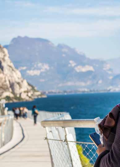
THE CYCLE PATH OF DREAMS
In Limone sul Garda, a breathtaking two kilometre stretch of cycle path, literally suspended between lake and sky, awaits you. Ideal for a lowspeed excursion where you can contemplate inspiring views immersed in nature. The wide track can also be travelled safely at night thanks to efficient LED lighting.
Treat yourself to this magnificent romantic experience!
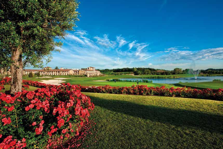
• 131 rooms and suites
• Meeting rooms for up to 250 people with natural light
• 1 restaurant for up to 300 persons
• Indoor heated saltwater swimming pool and with hydro-massage
• Wellness centre also open to the outdoors
• 2 outdoor pools
• 1 beach volleyball court
• 1 five-a-side football pitch
• 2 tennis courts
• 12th-century abbey
• Panoramic gazebo for civil wedding celebrations
• 36 golf holes and a Driving Range with double teeing boxes.
the ideal location on Lake Garda for a relaxing day at theswimming pool and spa. A romantic weekend or a corporate event in our splendid 4-star Resort with 130 rooms and Apartments with garage, wellness area with gym, indoor and outdoor pools, sports centre with five-a-side football pitch, tennis courts, beach
HOW TO GET THERE
Aeroporti Milano Malpensa / Linate Bagolino
Valvestino
Limone
Arco Riva
BRENNERO
Trento
Rovereto Sud Lago di Garda Nord
Malcesine
Brenzone
Gargnano Tignale
Tremosine Magasa Idro
Toscolano Maderno
Gardone Riviera
Salò
Puegnago
Aeroporto Orio al Serio
Torri
San Felice Manerba Garda
Moniga
Sirmione
BERGAMO Torbole
Desenzano Lonato Padenghe Soiano Polpenazze
AFFI
Bardolino
Lazise
A MILANO
SIRMIONE PESCHIERA
Brescia DESENZANO
Montichiari
Aeroporto Montichiari
Verona
A4
Pozzolengo
Aeroporto Villafranca
MODENA
Mantova
Texts and photos: Archivio Consorzio “Lago di Garda - Lombardia”, Carlo Caramatti, Stefano Maraggi, MilleMonti, Visit Brescia.
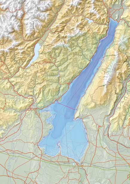
Map p. 5: Carte escursionistiche di riferimento 4LAND n.111 Parco dell’Alto Garda Bresciano e carta n. 116 Basso Garda Lago di Garda Sud Edition 2024.
All Rights Reserved. Reproduction is prohibited, even partial. The images may represent places which differ from those indicated in the suggested routes.
VENEZI
E PERIENCE
GARDA LOMBARDIA
DISCOVER MORE BIKE TRAILS, BIKE SERVICES AND GPS TRACKS