Satisfying the essential needs of health, home, and happiness can feel like a tall order for small municipal governments. But, in this issue, we have lots of ideas that support your community’s well-being in all three categories.
PFAS monitoring requirements proposed in 2024 were partially retracted. We continue to track this critical drinking water legislation, along with deadlines for the US EPA’s Brownfields grants, which address public health impacts from brownfields.
If your community is experiencing increased demand for housing, read on for how municipalities can expand access with housing assessments and rethink regulatory frameworks.
Communities want to play in sustainable, equitable spaces. We explore nature-based design, small-sided sports, and playground innovations—and how they promote safety, inclusivity, and joy.
Why care about this cliché phrase? Because you—a municipal leader—can provide your community steady ground on which to build health, home, and happiness.
With each issue of In Office, we present our experience, our expertise, and our forecasting on the topics and trends that affect municipal projects. Let us know if there’s a topic we can explore for you by contacting us at inoffice@labellapc.com.
In June 2025, the National Association of Development Organizations (NADO) recognized PlanRVA’s Rural Transportation Analysis with a 2025 Excellence in Regional Transportation Award. This award honors notable projects in rural, small metropolitan, and larger areas that help address regional transportation needs.
Initiated on behalf of the Richmond Regional Transportation Planning Organization, the analysis was conducted by PlanRVA with support from LaBella as a subconsultant. The study aimed to identify and evaluate public transportation options tailored to the needs of rural communities across PlanRVA’s region, including Charles City, Goochland, Hanover, New Kent, and Powhatan Counties in Virginia.
Learn more about this project by scanning the QR code below:
By Jennifer Gillen, PG | Director of Environmental
Per- and polyfluoroalkyl substances, commonly referred to as PFAS, are found in everyday products like food packaging, plastics, and cooking utensils— and, more alarmingly, in the environment and in our bodies.
First developed in the early 20th century and used widely from the 1950s until the last decade, these chemicals have become ubiquitous in the environment and have made their way into our bloodstreams via the food we eat, products we use, and even the water we drink. Worse yet, PFAS exposure has been linked to an increased risk of several cancers, and other illnesses.
As we learn more about the family of chemicals known as PFAS, the most harmful of these compounds have been targeted by state and federal governments. As with so many regulations, the methods and degrees to which exposure is being addressed varies from state to state. However, in April 2024, the United States Environmental Protection Agency (US EPA) took an important step by establishing legally enforceable maximum contaminant levels (MCLs) in drinking water for PFOA, PFOS, PFHxS, PFNA, and HFPO-DA (known as GenX), as well as a hazard index for a mixture comprising the last three compounds listed plus PFBS.
The April 2024 ruling requires public water systems (PWS) to add these six substances to their compliance monitoring program by 2027. If exceedances of any of these MCLs are found, PWS have until 2029 to design and implement solutions to meet the MCLs or face enforcement action. Since PWS are passive receivers of PFAS-impacted water, this was a minor but important step toward reducing PFAS levels in our drinking water and ultimately reducing PFAS-related deaths and illnesses.
Most recently, in May 2025, the US EPA backed off the 2024 drinking water protection ruling by announcing plans to limit the monitoring list to PFOA and PFOS and extend the PWS compliance timeline by two years to 2031. The US EPA plans to finalize this proposed rule in 2026; however, it has already generated controversy, and its legality is up for debate. We will continue to monitor the situation and provide updates as new information becomes available.

Parks and Recreation
By Michael Cocquyt, MBA, CPRP | Recreation Development Specialist
As recreational needs evolve alongside shifting community demographics, public health priorities, and space constraints, many municipalities are seeking innovative approaches to maximize existing spaces and support more diverse forms of activity and engagement.
Emerging trends in recreation design focus on increasing participation, inclusivity, safety, and sustainability. This article explores three key trends shaping the future of parks and recreation spaces.
With space at a premium, many municipalities are
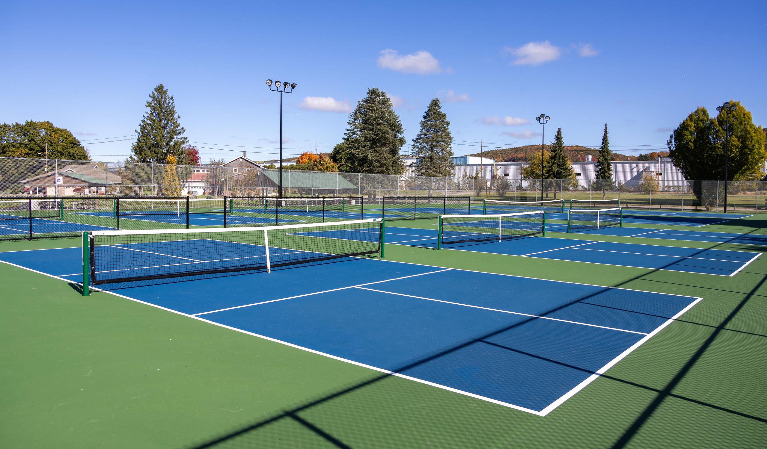
turning to small-sided sports as an adaptable and engaging way to expand recreational opportunities. Also known as small-sided games, this modified format scales down traditional sports games by reducing the number of players or the size of the playing area.
This format is rapidly growing in popularity, with pickleball being one of the most recognizable examples across the United States. A key attraction of pickleball is its smaller court size, which reduces the distance participants need to cover and increases the frequency of contact with the ball. Along with lighter equipment and simpler rules, pickleball is often viewed as
more accessible than other racket sports, such as tennis, which can require more physical activity due to a larger playing area.
The small-sided format encourages increased participation—a benefit that extends beyond pickleball to sports like soccer, lacrosse, field hockey, football, and cricket. According to a 2024 article from the National Recreation and Park Association (NRPA), governing bodies are adopting small-sided play formats to offer more opportunities for player involvement and to reduce the physical demands associated with standard full-sized fields.1
The current rise of smallsided sports fields, training courts, mini soccer pitches, and half-court basketball areas reflects a broader shift toward more accessible and versatile recreational spaces. These compact facilities support diverse programming, accommodate a wide range of age groups and skill levels, and allow municipalities to make efficient use of space and resources—all while strengthening community engagement.
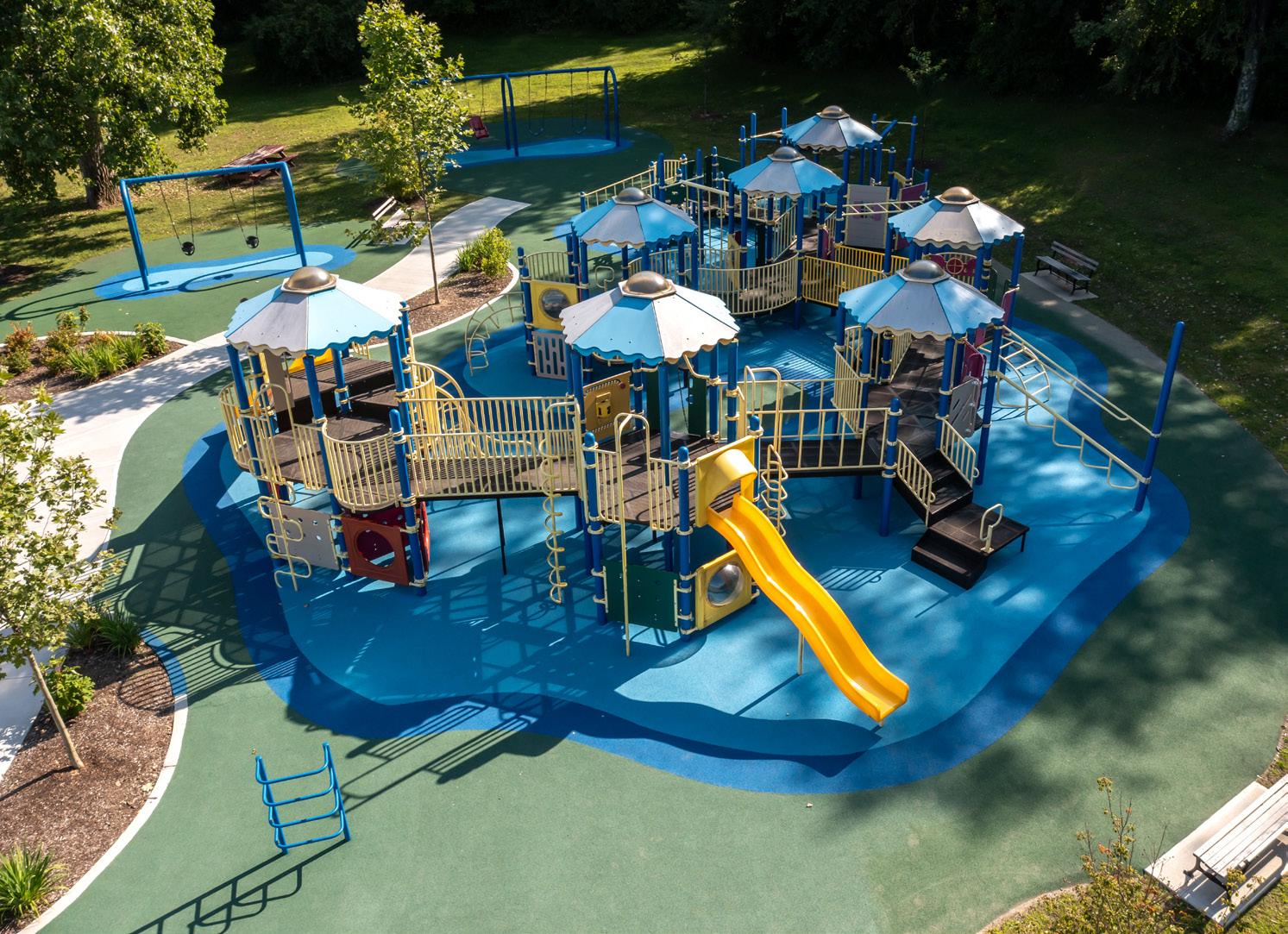
Playground surfacing plays a critical role in ensuring safety, maintaining cleanliness, and enhancing the overall user experience.
Poured-in-place (PIP) rubber has gained popularity as a play surface that is not only easy to maintain but also offers greater accessibility compared to the engineered wood fiber material often used. Typically sourced from recycled materials, PIP rubber is an environmentally friendly option that provides important safety features such as impact absorption and slip resistance while also meeting ADA standards for accessibility.
Synthetic turf is another durable playground surface choice that offers shock absorption, accessibility, and the advantage of year-round use. Both surfaces help create safer, more inclusive play environments for the community.
Reference:
As new surfacing technologies are improving the safety and accessibility of conventional play areas, many municipalities are also embracing the return of natural play environments.
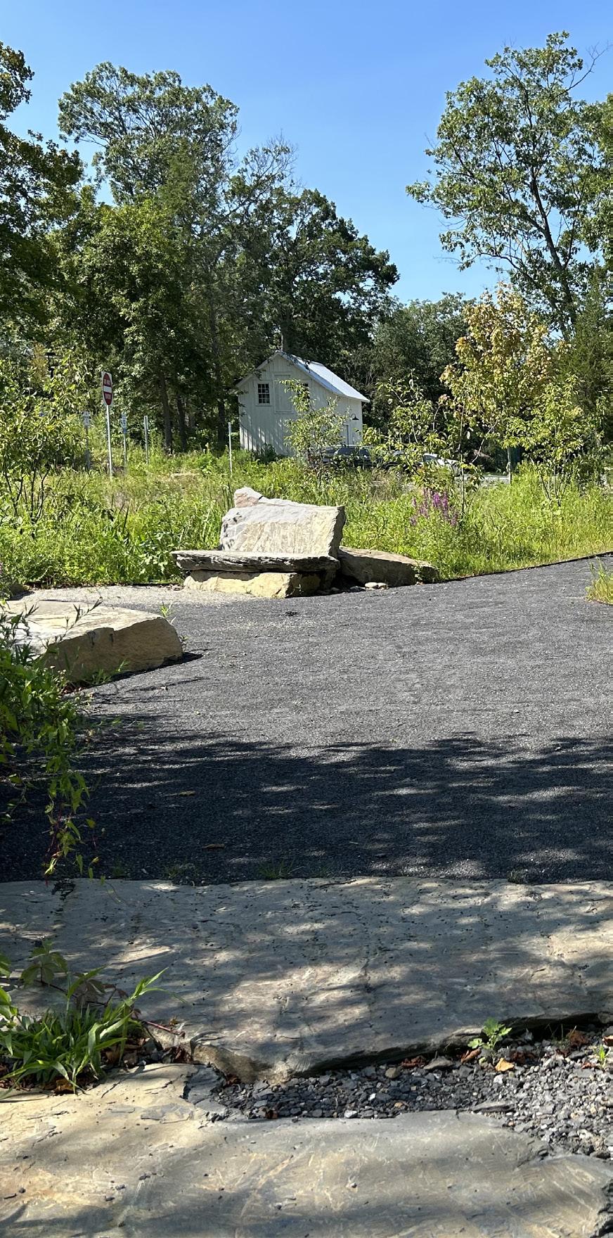
Modern natural play spaces incorporate elements like logs, boulders, and native plantings to encourage imaginative play and environmental stewardship. These features provide sensoryrich experiences while promoting physical activity and mental wellbeing.
When integrated into walkways, bike paths, or trails, natural play areas offer a more immersive and restorative alternative to traditional playgrounds. Moving through these spaces and interacting with natural elements along the way can deepen individuals’ connection to the outdoors and reduce stress.
Natural play spaces also complement organized sports and activities by offering opportunities for open-ended exploration and imaginative, selfdirected play. A balanced mix of both can help communities meet a wider range of recreational needs.
By embracing these trends, municipalities can create dynamic, inclusive, and safe recreational spaces that meet the evolving needs of their communities. Thoughtful planning and investment in these areas will yield long-term benefits, foster community engagement, and enhance quality of life.
By Derik Kane, AICP, CNU-A | Senior Planner
Across the country—whether in urban centers, suburban neighborhoods, or rural towns— municipalities are struggling with a shortage of affordable, suitable, and quality housing. State governments are launching ambitious housing initiatives, while local communities face the challenges of aging housing stock, rising costs, and shifting demand.
Recent investments highlight both the urgency and the opportunity: New York recently announced a five-year, $25 billion plan to create or preserve 100,000 affordable homes; Massachusetts signed a $5.16 billion Affordable Homes Act into law in 2024 to expand resources that support first-time homebuyers and
homeownership; Pennsylvania launched the Whole-Home Repairs Program in 2022 to stabilize and preserve existing housing; and Maryland continues to grow its Rental Housing Works Program to finance affordable rental development. This momentum reflects a growing recognition that housing is essential economic infrastructure, and municipalities must position themselves to capture these investments.
Local governments can respond proactively to address these challenges and take advantage of new opportunities. Communities should strategically assess housing conditions, understand future demand, and prepare projects capable of competing for state and federal support.
Municipalities that proactively assess housing needs are better positioned to:
• Diagnose pressing issues, including affordability gaps, structural disrepair, and mismatched supply.
• Strategize for long-term growth by identifying the housing types and price points needed over the next 10 to 20 years.
• Prioritize investment by pinpointing where public and private dollars will yield the most benefit.
• Access competitive funding through programs such as Pennsylvania’s Whole-Home Repairs Program, New York State’s Pro-Housing Communities Program, and Massachusetts’ HousingWorks Infrastructure Program.
Key Components of a Comprehensive Housing Assessment
1. Site Suitability Analysis
Forward-thinking municipalities across the United States are using Geographic Information Systems (GIS) and custom modeling tools to identify priority development sites. A leading-edge example of this approach was implemented in Herkimer County, New York, where LaBella Associates partnered with the County’s Industrial Development Agency to evaluate potential sites for housing development. The study used advanced GIS modeling and a Python-based scoring tool to assess infrastructure access, zoning compatibility, and environmental constraints.
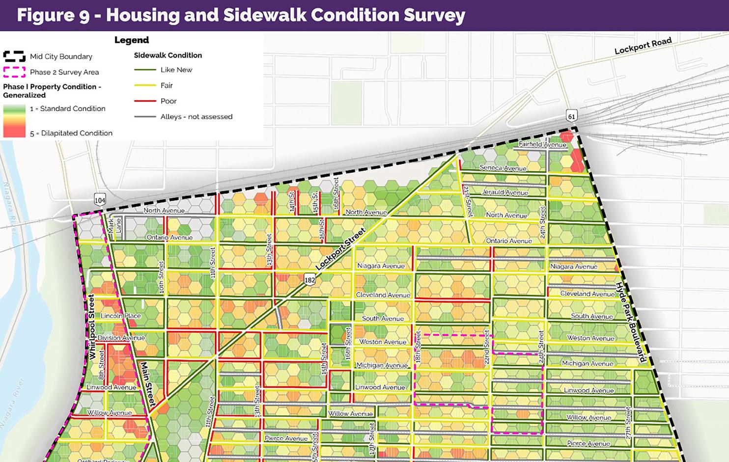
2. Building Condition Surveys
Aging housing stock is a common challenge in older industrial cities. Parcel-level condition surveys that use U.S. Department of Housing and Urban Development-aligned criteria help communities identify substandard and dilapidated homes, prioritize reinvestment, and bolster funding applications. These surveys have supported targeted demolition, rehabilitation, and neighborhood revitalization, while also enabling communities to secure funding— such as Community Development Block Grants—to continue these efforts.
Demand forecasting is one of the most critical and forward-looking components of a comprehensive housing assessment. It goes beyond basic population projections by analyzing how demographic changes, lifestyle preferences, and consumer behavior will shape future housing needs. A key tool used in this analysis is Tapestry Segmentation, a nationally recognized psychographic model developed by Esri.
By using segmentation models, communities can better understand the types of households they currently serve—and anticipate how those household profiles may change over time. When combined with local housing data, this insight allows for more accurate projections of future needs by unit type, size, tenure (rent vs. own), and affordability level.
The result is a strategic and informed approach to planning. Municipalities are better equipped to craft housing strategies that address current conditions while also preparing for long-term shifts in population and demand.
Short-term rentals (STRs), such as Airbnb and Vrbo listings, can significantly impact housing availability, especially in tourismheavy or rural counties. Housing assessments that track investorowned vacation properties help municipalities monitor impacts, craft regulatory responses, and protect local rental markets for residents.
Equity is a cross-cutting issue in housing. Many recent studies now include focused assessments of vulnerable groups such as seniors, people with disabilities, veterans, and cost-burdened households. Rates of costburdened renters are rising across many communities. By mapping these populations, municipalities can develop policies and funding applications that directly address the needs of those most at risk.
continued on page 8
Affordable Housing, continued from page 7
Vacant and abandoned properties pose challenges in communities ranging from Massachusetts mill towns to rural Pennsylvania counties. To measure the extent of the problem and guide reinvestment strategies, many municipalities are using foreclosure and derelict housing assessments.
In Wayne County, New York, the County partnered with LaBella Associates to create a comprehensive Derelict Housing Strategy. The effort began with a countywide inventory of vacant, abandoned, and tax-delinquent properties. From this database, three Strategic Areas were identified—locations where clusters of distressed properties posed significant challenges but also offered meaningful opportunities for revitalization. For each area, detailed existing conditions reports and tailored redevelopment plans were prepared.
At the same time, an economic and market analysis was conducted to uncover the systemic drivers of disinvestment. The final strategy delivered a robust set of policy and program recommendations aimed at addressing current dereliction and preventing future decline.
The housing crisis is not limited to any one state—it is a national challenge that requires local action. By investing in comprehensive housing assessments today, municipalities can prepare for the future while positioning themselves to secure millions in state and federal funding.
To remain competitive and meet local needs, municipalities should:
• Conduct or update a housing needs assessment every five to seven years, including site suitability mapping, condition surveys, and demand modeling.
• Integrate housing planning into zoning reform, capital investment, and infrastructure upgrades.
• Inventory derelict and foreclosed properties, with prioritization criteria for redevelopment.
• Engage residents and stakeholders through surveys, focus groups, and transparent public reporting.
• Align assessments with funding programs such as the Affordable Homes Act in Massachusetts, the Whole-Home Repairs Program in Pennsylvania, the Pro-Housing Communities Program in New York, and the Rental Housing Works Program in Maryland.
Housing is a community’s foundation—and with the right data and strategy, it can be the catalyst for transformation. By


The
walking
tour is just one example of how the Village is turning planning into action—and building lasting momentum for
Herkimer’s downtown revitalization.
The Village of Herkimer, New York, is pursuing a bold, twopronged strategy to revitalize its North Main Street corridor through New York State’s Downtown Revitalization Initiative (DRI) and Brownfield Opportunity Area (BOA) programs. While the DRI supports near-term improvements through a $10 million grant awarded in early 2024, the BOA plan outlines a long-term vision for a 33-acre area in the heart of the Village— once a bustling commercial corridor, now marked by vacant and underutilized parcels primed for strategic investment and redevelopment.
To support the BOA effort, the Village and Herkimer County Industrial Development Agency engaged LaBella Associates to develop a comprehensive plan identifying strategic sites for redevelopment and addressing barriers to investment and growth.
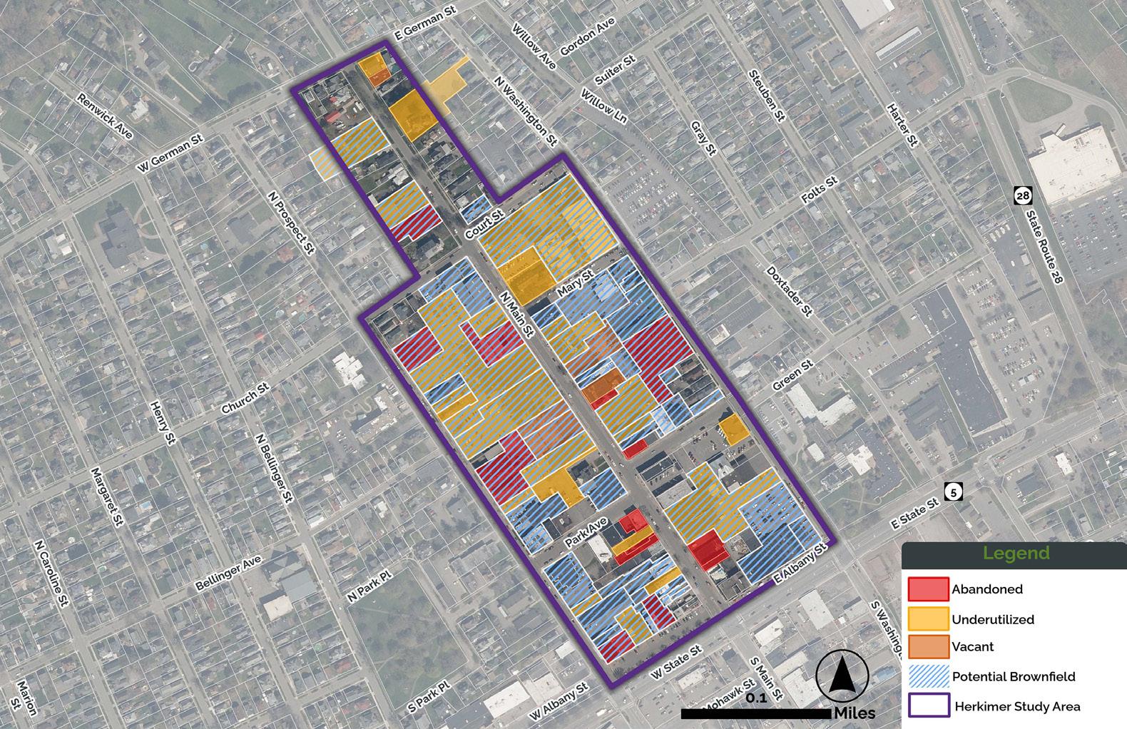
A standout element of the planning process was a unique, community-focused engagement strategy designed to bring planning concepts to life. In April 2025, LaBella led an interactive walking tour of North Main Street, guiding more than 50 participants—including local officials, developers, real estate professionals, and residents— through a series of vibrant storefront installations featuring artwork by Sidekick Creative. These eye-catching displays transformed vacant spaces into showcases of possibility, presenting conceptual reuse ideas, redevelopment strategies, and real estate information. The visuals reflected themes drawn directly from community input—such as small business development, local history, and the arts.
The tour offered a visible, accessible way to reimagine the corridor and sparked immediate interest from potential buyers and tenants. More importantly, it fostered real-time connections among stakeholders, strengthening relationships between the municipality, private sector, and broader community.
Learn more about this one-of-akind walking tour by scanning the QR code below:
Feature
By Jared Pristach, PE | Senior Environmental Engineer
As communities nationwide face increasing risks from sea level rise, storm surges, and flooding, municipalities are rethinking how public spaces—especially those along waterfronts—can play a larger role in protecting people, property, and ecosystems.
Rather than trying to fight nature as we have in centuries past, many municipalities are now adopting climate-adaptive design strategies that work with natural systems—such as wetlands, floodplains, and native vegetation—to manage water, absorb impacts, and enhance the quality and accessibility of parks and recreational spaces.
This approach helps ensure these spaces remain safe, functional, and ecologically beneficial for decades to come.
Wetlands, floodplains, soil types, topography, and community needs have long influenced park and recreational planning. Today, municipal leaders must also consider how climate change will affect conditions over time and plan for public spaces that can adapt accordingly.
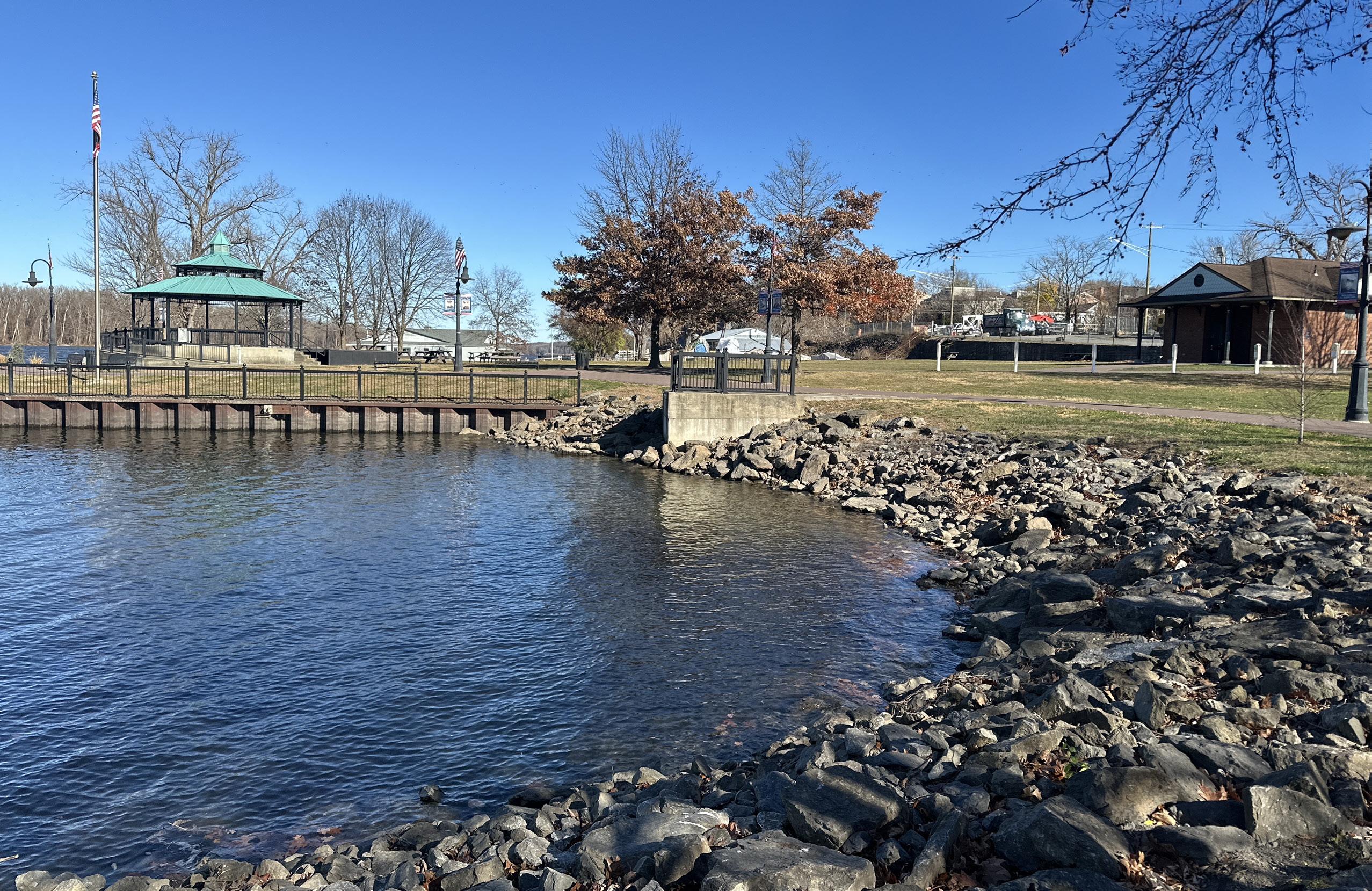
In Hudson, New York, the city is reimagining Henry Hudson Park with future conditions in mind. Located along the Hudson River, the existing seven-acre park is already heavily impacted by flooding—an issue expected to worsen, as sea levels are expected to rise by as much as five feet by the year 2100. This would put a significant portion of the park at risk. The planning process has focused on balancing these projected climate impacts with long-term park goals and public input.
For example, extensive community engagement helped shape the overall design vision, and a previously completed invasive plant species survey informed a removal plan. As part of this planning effort, sea level rise modeling was used to demonstrate projected conditions at the park to the public.
In St. Petersburg, Florida, the city’s resilience master plan emphasizes the need to plan and design for a future where parks and green space can serve as the first line of defense against sea level rise, storm surge, and other climate vulnerabilities. With waterfront parks along Tampa Bay and the Intracoastal Waterway, park officials are restoring wetlands and installing living shorelines—stabilized, vegetated banks that provide a gentler transition to the river and help absorb storm surges and filter runoff.1
Historically, flood-prone areas were often armored with concrete or elevated with imported soil to improve resilience—strategies
that can be effective but are also costly, unsustainable, and disruptive to ecosystems.
Today, more resilient outcomes are being achieved by working with natural features like floodplains, wetlands, and waterways rather than trying to control them. This approach helps ensure parks remain safe, functional, and ecologically beneficial for decades to come.
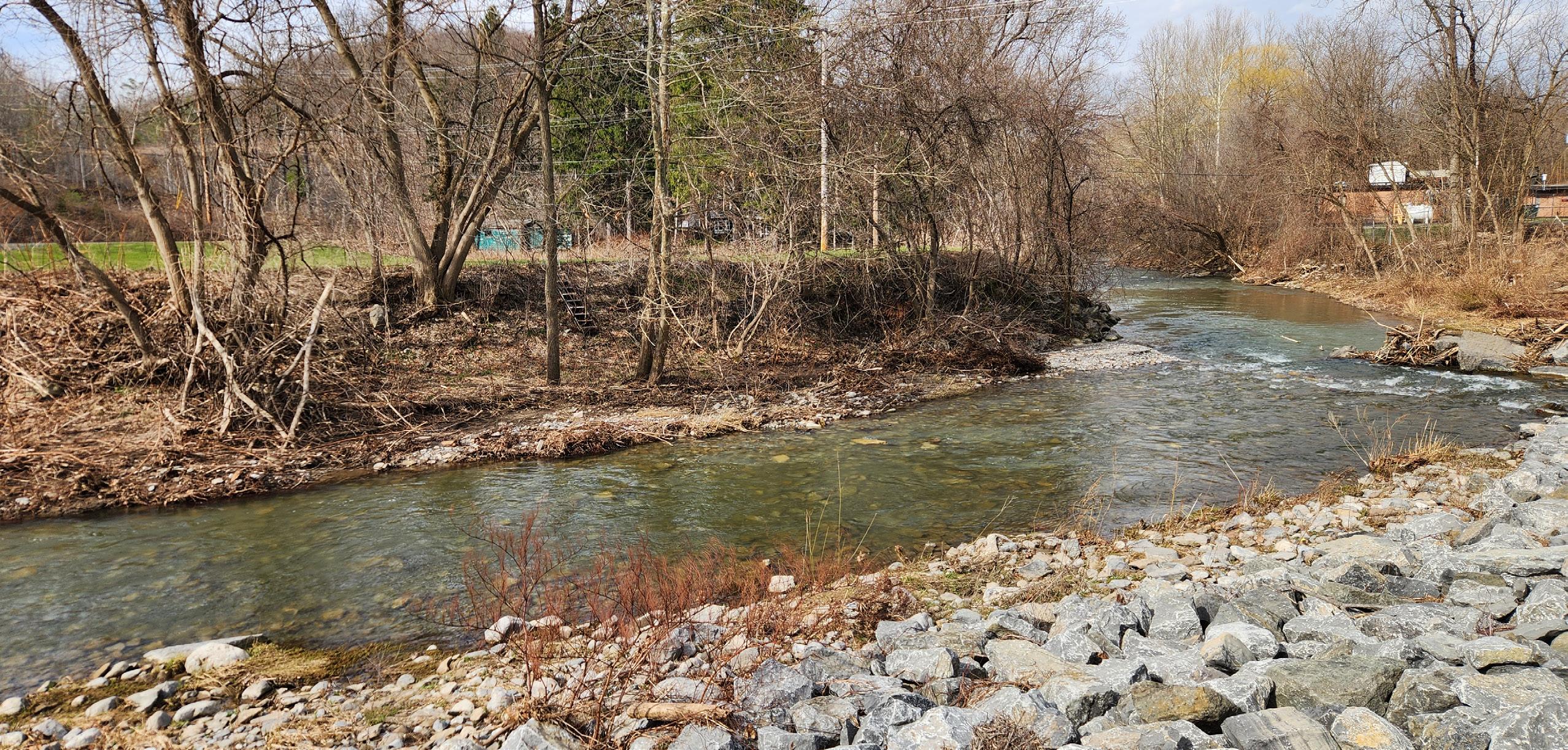
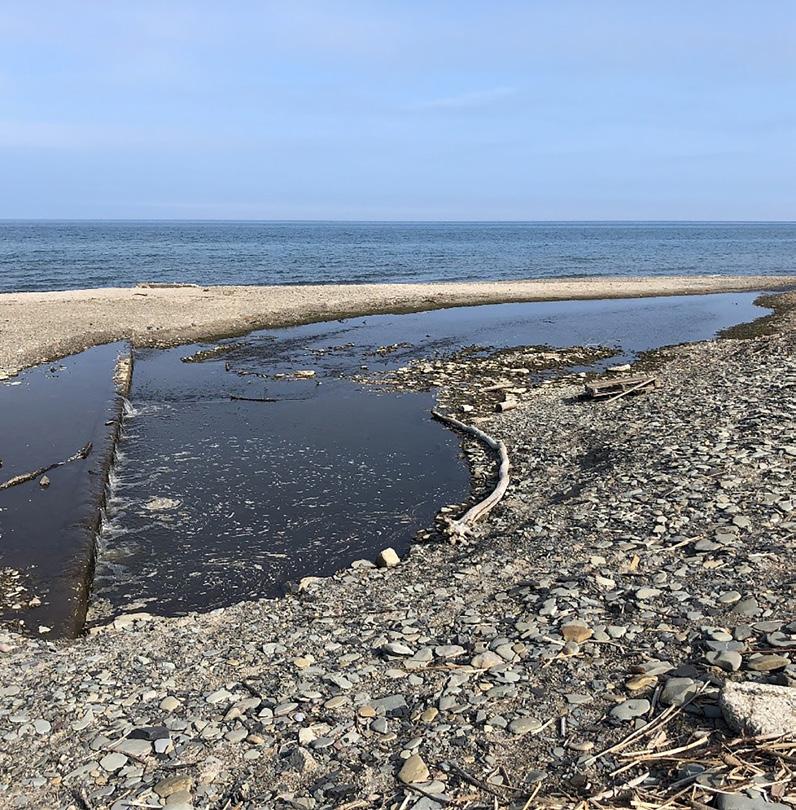
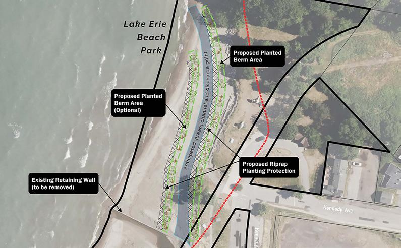
At Lake Erie Beach Park in Evans, New York, a decades-old attempt to reroute Muddy Creek aimed to expand beach access but instead led to increased erosion and flooding. The creek frequently bypasses the redirected outlet and flows along its original path through the park. A new design strategy calls for removing the concrete retaining wall and allowing the creek to follow its natural course, reconfiguring the park’s layout while supporting a larger, more stable beach area. This approach is expected to reduce vulnerability to future storm events, restore the ecological function of the creek corridor, and enhance long-term public access.
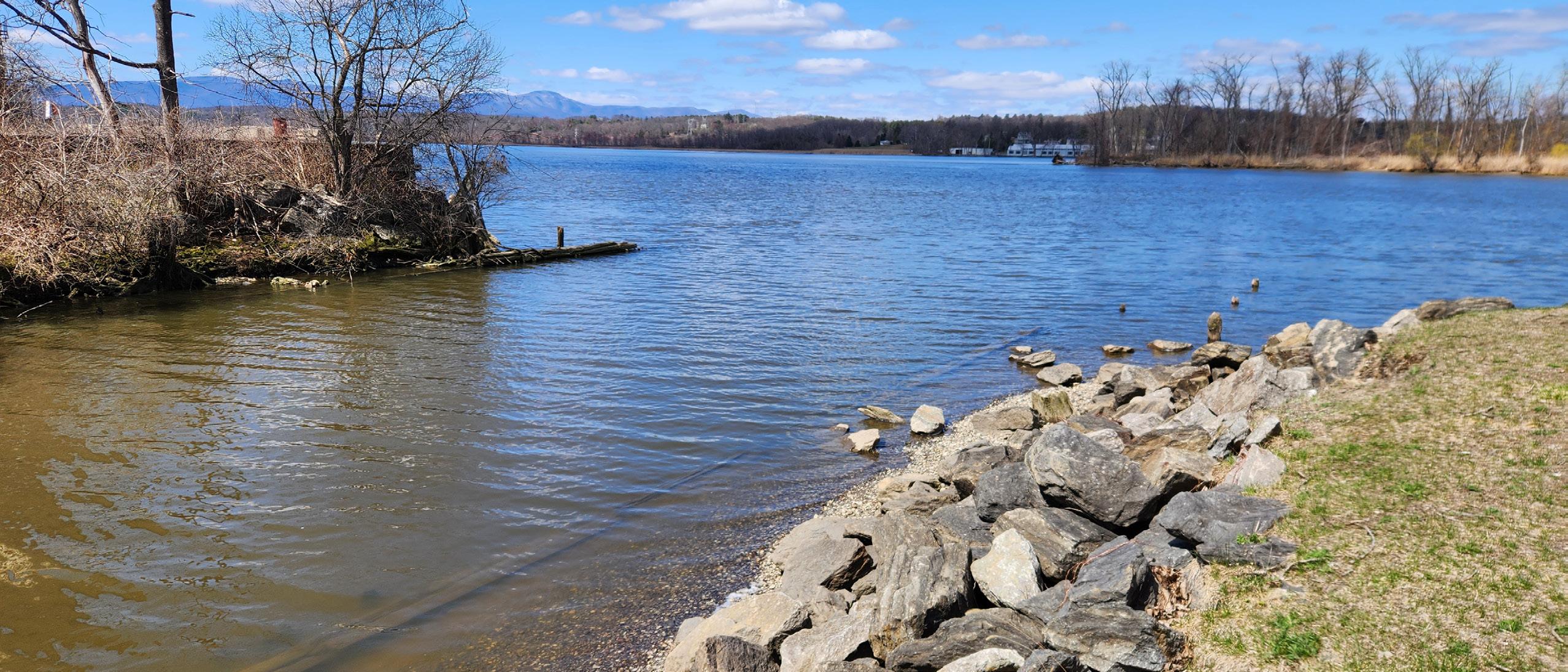
Plans for the reimagined Henry Hudson Park in Hudson, New York, include forming an intertidal wetland area by excavating part of an existing peninsula. As part of this excavation, wooden crib walls that currently block water connectivity will be replaced with planted living shorelines. Soil removed from the peninsula will be used to build up the tip of the landform, which will eventually become a small island used for fishing as sea levels rise. A new pedestrian pier has also been designed to remain usable at elevated water levels but also to withstand temporary submersion during severe flooding.
In Virginia Beach, Virginia, a multi-site restoration project along the eastern branch of the Elizabeth River will transform public parks into climate-resilient spaces. At Woods of Avalon Park, Carolanne Farms Neighborhood Park, and Ferry Point Park, plans include wetland and floodplain restoration, living shorelines, and stabilization of stormwater ditches. Nature-based features like native vegetation, coir logs, and hardwood logs will be used
continued on page 12
Feature, continued from page 11
to reduce erosion, improve water quality, and restore degraded marsh systems. These efforts aim to buffer shorelines, reconnect riparian habitat, and manage flooding in low-lying areas vulnerable to storm surge and tidal flooding.2
These strategies prioritize resilience—the ability of an area to recover following extreme weather events, such as flooding, heat waves, or severe storms— over reliability, which is the ability to maintain continuous use even during such events. By planning for temporary inundation rather than trying to prevent it entirely, municipalities can reduce longterm costs while preserving public access.
Traditional engineering methods still play a key role in park design—but many municipalities
are now combining structural strategies with natural processes to enhance performance and reduce environmental impacts. While this may involve setting aside some land for flood storage or ecological buffers, these areas can often double as recreational and educational opportunities.
At Rodney Cook Sr. Park in Atlanta, Georgia, green infrastructure and engineering work in tandem to manage stormwater and reduce flood risk in Vine City—a neighborhood historically prone to flash floods. Spanning 16 acres, the park includes a two-acre retention pond and a network of green infrastructure features such as native plantings and rain gardens. Together, these elements can manage up to nine million gallons of rainwater during a single storm. The system filters and gradually releases stormwater to help prevent downstream flooding.3
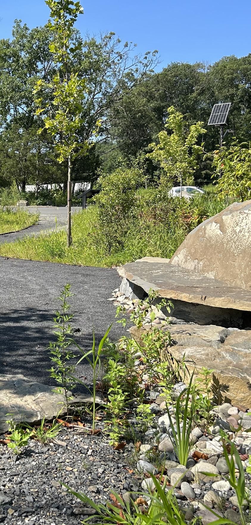
Green infrastructure—such as porous paving, rain gardens, and bioswales—can be integrated into parking areas to manage stormwater and reduce urban heat island effects. These sustainable, lowmaintenance systems require sediment removal only every 20–25 years, minimizing the need for catch basin cleanouts.
Hydrologic modeling along the West Branch Limestone Creek in Manlius, New York, helped identify floodplain storage sites that would reduce the potential for downstream flooding and erosion. Several of these floodplain areas could be used as recreational areas, improving public access to the water while also offering opportunities to educate the public about the importance of floodplain storage in flood mitigation.
Local officials in Evans, New York, are exploring recommendations to purchase frequently flooded
properties along Muddy Creek at Lake Erie Beach Park and convert them into undeveloped floodplains, which could provide natural recreational spaces while improving flood management. The feasibility study also recommended incorporating educational signage in these recreational spaces to help the public understand their purpose and flood management benefits.
The redesign of Henry Hudson Park in Hudson, New York, focuses on diverting floodwaters to create new park features, allowing the park’s aesthetics and uses to change over time. Key elements include rain gardens to capture and treat stormwater, the reuse of trees slated for removal as materials for nature paths and a natural playground, and living shorelines that use plants to stabilize slopes rather than riprap. Once established, these plantings require minimal maintenance and do a better job of preventing shoreline erosion. As part of the design, educational signage is being integrated into the park to educate the public about the importance of native plantings, living shorelines, and sea level rise.
As more towns and cities plan for future climate conditions, several key strategies have emerged:
• Embrace natural transitions: Replacing vertical walls with gently sloped banks and living shorelines can improve flood resilience and enhance ecological value.
• Consider long-term maintenance: Once established, nature-based solutions often require less upkeep than traditional infrastructure and recover more easily after extreme weather.
• Build in flexibility: Features like floating docks and seasonal structures allow parks and waterfronts to adapt as climate conditions change.
• Engage early: Collaborating with local stakeholders, ecological scientists, and regulators from the beginning ensures design feasibility and builds community support.
Climate-adaptive design doesn’t have to come at the expense of public access, aesthetics, or recreational value. In fact, many communities are finding that these approaches offer more lasting benefits—from reduced repair costs to improved ecological health and enhanced public use.
With thoughtful engineering and ecological awareness, municipal leaders can create spaces that not only meet the needs of today’s residents but also safeguard those of future by preparing for rising waters, extreme weather events, and changing conditions.
As more communities adopt this approach, the path forward becomes clearer: don’t resist change—design for it.
References:
1. The Trust for Public Land: https://www.tpl.org/parks-address-climate-change-report
2. City of Virginia Beach Public Works: https://pw.virginiabeach.gov/stormwater/flood-protection-program/stormwater-green-infrastructure/ elizabeth-river
3. The Trust for Public Land: https://www.tpl.org/parks-address-climate-change-report
Planning
By Matthew G. Rogers | Senior Planner
The supply of affordable housing in the United States is struggling to keep pace with demand. While the causes are multifaceted, one key part of the solution can be found in existing housing regulations—and community leaders can help by driving meaningful change. This article explores how rethinking regulatory frameworks can unlock new opportunities to expand affordable housing access.
The United States has a shortage of approximately 7.3 million rental
more than half of their income on monthly housing costs, including utilities.1
This is compounded by rising housing costs. In the U.S., the house price index has risen by over 100% from 2010 to 2023, with New York State seeing a 64% increase, North Carolina 95%, and Tennessee 118%.2 Meanwhile, the inflation adjusted median household income in these three states increased by only 10.7%, 12.6%, and 13.6% in the same time frame, respectively.3,4
To foster truly resilient and equitable communities, planning efforts must align housing supply with demographic realities, embracing a diverse range of housing types. Before examining the key regulatory barriers to housing development, it’s important to distinguish between the types of housing that communities can prioritize, which requires a nuanced understanding of market segments.
• Affordable housing traditionally serves
• Attainable housing targets the middle-income demographic—those priced out of market-rate homes but ineligible for most subsidized options.
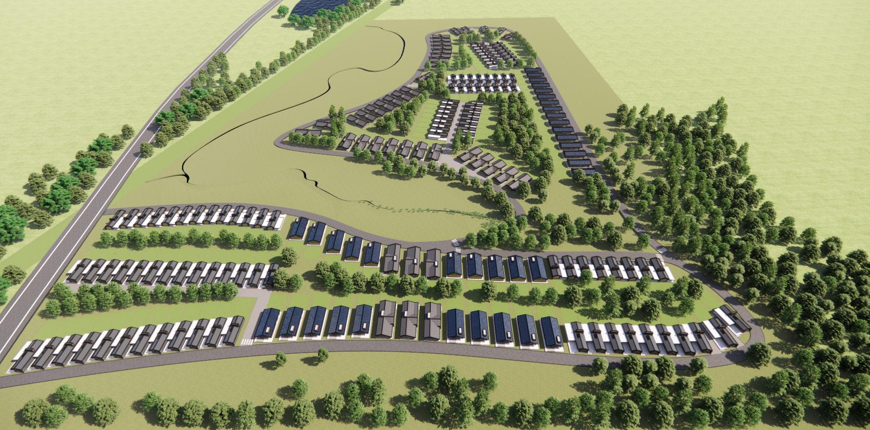
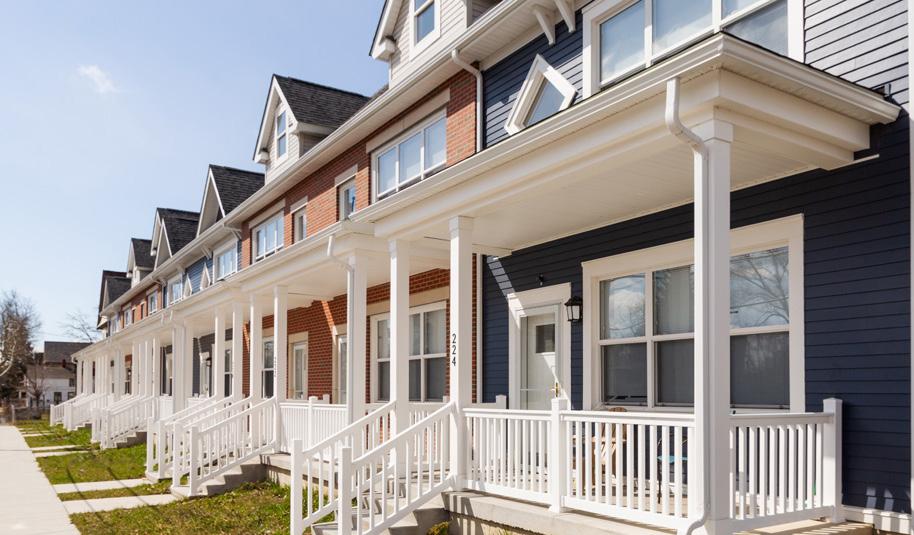
• Missing middle housing—a key focus for many communities—encompasses building forms like duplexes, townhouses, and small-scale apartment buildings that offer greater density and affordability while blending seamlessly into existing single-family or transitional neighborhoods.5
Drawing on our extensive experience in land-use planning, housing analysis, and zoning updates, we have found that local land-use regulations and planning processes often hinder the development of these essential housing types. Deeprooted regulatory frameworks— often designed for different eras—inadvertently create significant barriers to the timely and cost-effective development of new housing.
These regulatory frameworks include:
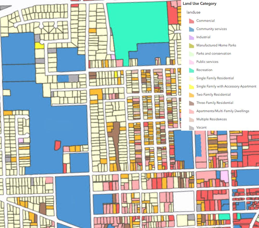
• Restrictive Zoning Practices: These encompass mandates for single-family housing, limitations on residential density, lot size requirements, and height restrictions that collectively constrain the type and scale of housing that can be built, particularly hindering the creation of diverse and denser options.
• Mandatory Parking Minimums: Parking minimums, which require a fixed number of spaces per unit, can increase development costs and limit available land. This can, in turn, make some projects difficult to finance.
• Prohibitions on Certain Housing Types: Bans or severe restrictions on certain housing—such as duplexes, triplexes, fourplexes, tiny homes, single-room occupancy units, and smalllot homes/cottage courts— eliminate affordable options from the market.
• Limitations on Accessory Dwelling Units (ADUs): Strict regulations or outright prohibitions on ADUs— secondary housing units located on the same property as a primary single-family residence—curb the creation of naturally affordable, smaller housing options within existing residential areas.
• Inadequate Infrastructure: A lack of sufficient municipal water and/or sewer infrastructure can prevent new developments or substantially increase project costs, especially in areas ripe for growth.
• Cumbersome Environmental Review Processes: Complex environmental review procedures can add substantial time and expense to projects.
continued on page 16
Planning, continued from page 15
Effectively addressing these barriers necessitates a strategic approach grounded in comprehensive planning and robust public outreach. Communities can begin by strengthening their Comprehensive Plan, which serves as a vital tool for understanding local demographics, assessing the current housing landscape, and identifying existing zoning limitations. This process often involves a “zoning diagnosis”—a detailed analysis to pinpoint specific restrictions hindering new housing and to evaluate current residential development patterns.
Successful implementation hinges on broad participation, including members of planning boards and zoning boards of appeals, alongside meaningful engagement from various stakeholders such as housing advocacy organizations, developers, and the public. The goal of this collaborative effort is to articulate a clear vision, establish achievable goals, and propose concrete recommendations that genuinely meet the community’s housing needs and aspirations.
Opportunities for unlocking affordable housing include:
• Diversifying Residential Typologies: Introduce opportunities for two-family dwellings in single-family
References:
districts; allow three- and four-family dwellings as permitted uses in suitable districts; permit mixed uses; remove barriers to ADUs; and allow smaller residential units (e.g., tiny homes, cottage courts) and manufactured homes.
• Promoting Affordable Housing Through Incentives: Reward the inclusion of affordable units with permitted increases in density and height. An inclusionary approach sets a minimum number of affordable units to be included, while an incentive approach may permit an increase in the number of allowed residential units (density) and/or the height of a structure.
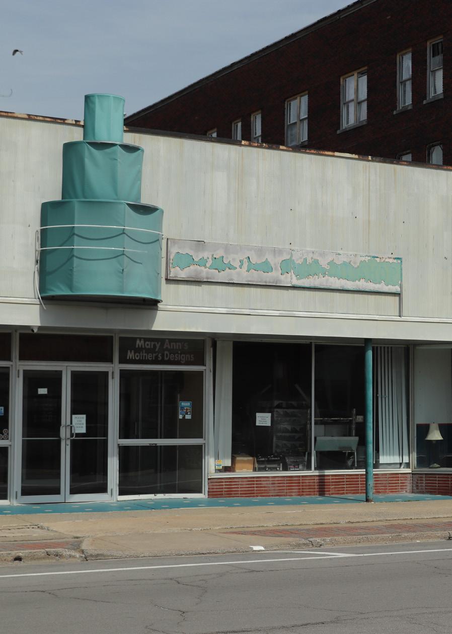
• Applying Adaptive Reuse to Vacant Structures: Facilitate the conversion of vacant institutional (e.g., schools, religious properties, government buildings) and commercial (e.g., offices, retail spaces, malls) properties into housing, often by modifying existing zoning or establishing overlay districts.
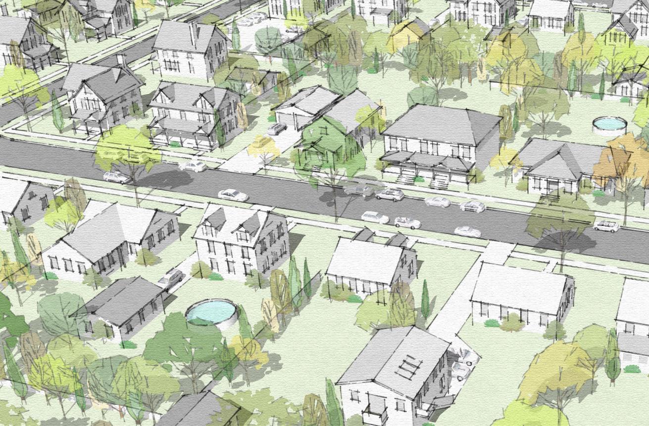
• Considering Gentle Density Strategies: Gentle density involves infill developments where new housing choices are added in a way that is considered “gentle,” having little impact on existing neighborhoods.
Prioritize areas with existing infrastructure and amenities— such as within or on the periphery of neighborhoods, hamlets, villages, and cities— especially those with existing water, sewer, community services, shopping, medical facilities, and transportation resources. When thoughtfully designed, gentle density can introduce new housing choices while respecting the character of existing neighborhoods.
• Expediting Review and Approval: Implement reforms that challenge the need for special use permits, prioritize efficient building and site plan reviews, and establish transparent project requirements and design guidelines.
Rethinking dated regulatory frameworks is critical to unlocking affordable housing opportunities. By embracing diverse housing types like missing middle and gentle density, confronting barriers such as restrictive zoning, and streamlining review processes, communities can build a more equitable and sustainable housing future. Achieving this requires comprehensive planning, robust engagement, and a commitment to implementing these crucial reforms— transforming housing from an elusive dream into a stable reality for all.
1. National Low Income Housing Coalition: https://nlihc.org/explore-issues/why-we-care/problem
2. U.S. Federal Housing Finance Agency, All-Transactions House Price Index [New York, North Carolina, Tennessee]: https://fred.stlouisfed. org/categories/27281
3. U.S. Census Bureau. [New York, North Carolina, Tennessee]: https://www.census.gov/topics/income-poverty/income/data/tables.html
4. U.S. Bureau of Labor Statistics. Consumer Price Index, All Urban Consumers: https://fred.stlouisfed.org/graph/?g=1wmdD
5. Missing Middle Housing: https://missingmiddlehousing.com/
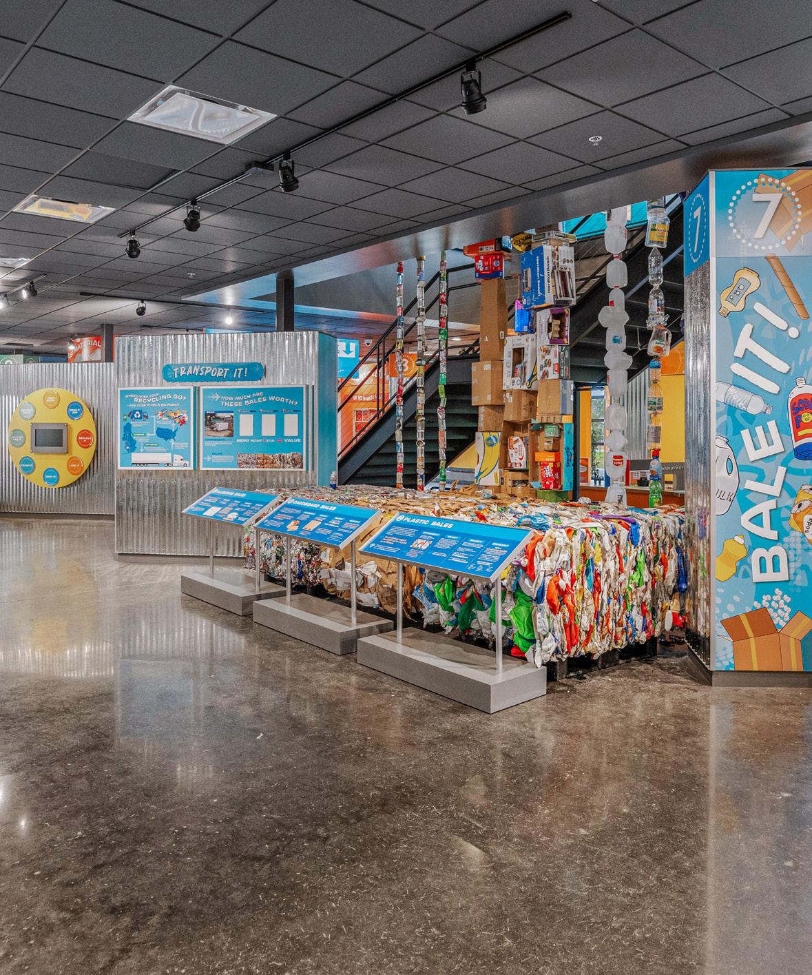
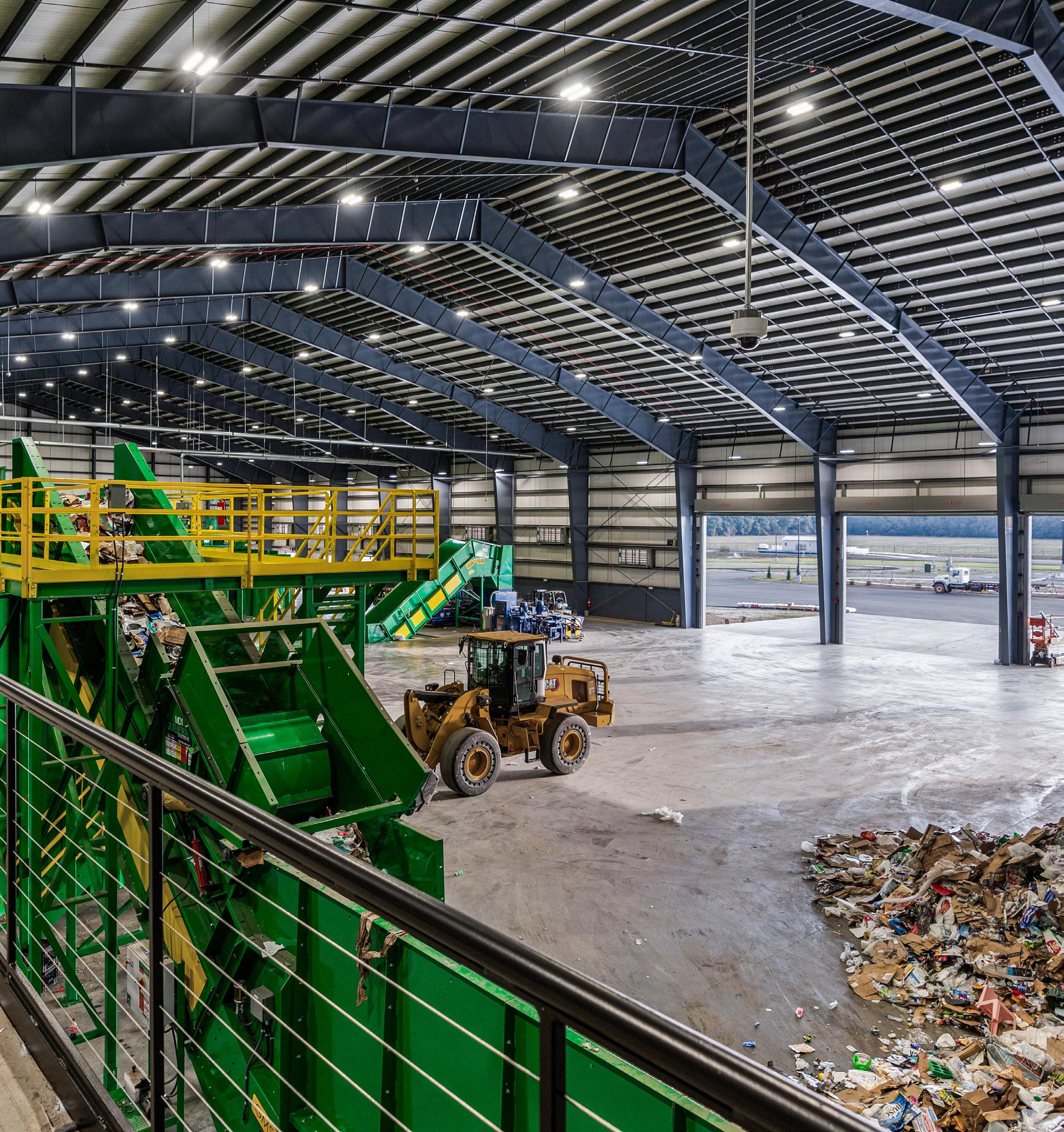
The facility’s Adventure Center offers a hands-on learning experience designed to engage visitors of all ages. Through interactive games, a sorting challenge, and educational exhibits, guests can explore how different types of waste are recycled and learn how landfill gas is converted into energy.
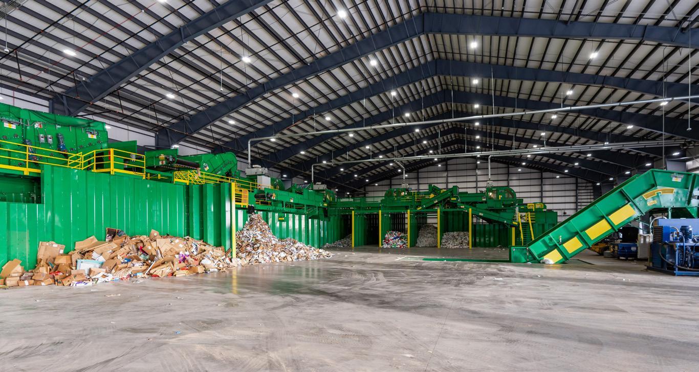
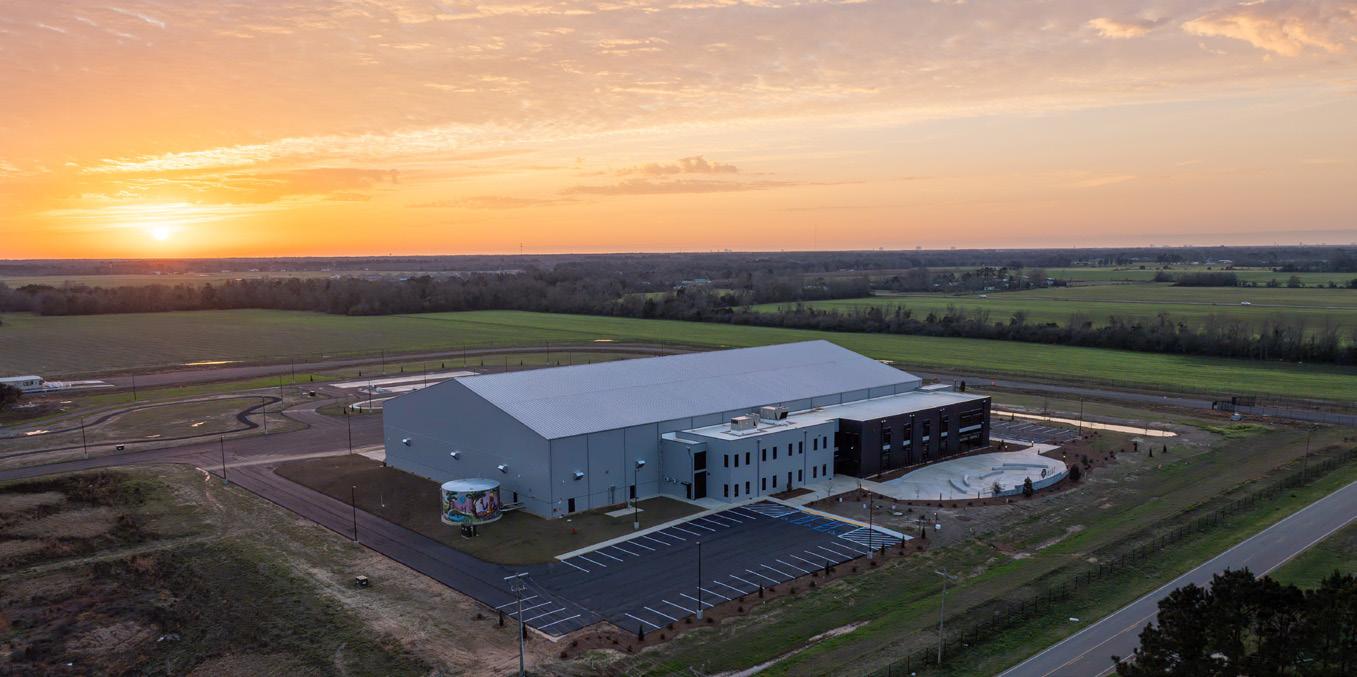
Located in Summerdale, Alabama, the Baldwin County Materials Recovery Facility is a 62,000-square-foot (sq. ft.) facility that sets a new standard for sustainable waste management, education, and public engagement in the Southeast.
This state-of-the-art facility, which opened in March 2025, features:
• A 50,000 sq. ft. recycling material receiving and processing area equipped with cutting-edge sorting technology, including four optical sorters and a full suite of recycling equipment provided by Green Machine.
• A 12,000 sq. ft. office building that houses the Solid Waste Disposal Authority of Baldwin County and a large public outreach and education center.
The Waste & Recycling Adventure Center boasts 20 interactive stations plus a mezzanine viewing platform— bringing the recycling journey to life for the community.
• Sustainable materials, including rubber-modified asphalt made with recycled tires, which boosts pavement performance while reducing landfill waste.
• A future-ready design equipped to scale and adapt to evolving recycling trends, informed by a sixmonth waste-stream analysis targeting a capacity of approximately 40 tons per day.
LaBella’s integrated design services included solid waste, civil, architectural, structural, mechanical, electrical, plumbing, fire suppression, and operational support disciplines.
The design team worked closely with Baldwin County to ensure the facility met current needs and could adapt to future changes in recycling trends, waste stream composition, and commodity markets.
Also completed in August 2025 for the Solid Waste Disposal Authority of Baldwin County was the CHaRM (Center for Hard to Recycle Materials) facility, which provides a convenient drop-off location for recyclables and household hazardous waste items.
Learn more about this exciting project by scanning the QR code below:

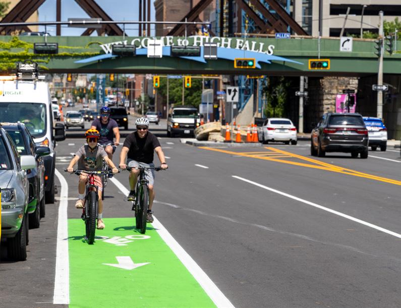

In April 2025, the City of Rochester and the Town of Evans received Engineering Excellence Awards from the American Council of Engineering Companies of New York. These awards honor design achievements that demonstrate superior skill and ingenuity. Projects are judged based on a rigorous set of criteria, including complexity, innovation, and value to society.
The City of Rochester was awarded a Platinum Award in the Transportation category for the State Street Reconstruction project.
The reconstruction of State Street in Rochester, New York—a key arterial road with 18,000 daily vehicles—involved evaluating and upgrading infrastructure originally built in 1894 to improve its pavement structure and enhance Complete Street features. The project introduced modern accommodations for bicyclists, pedestrians, and parking, creating a safer, more accessible environment for all users.
The Town of Evans received a Gold Award in the Studies, Research and Consulting Engineering Services category for the Lake Erie Beach Shoreline Management Solutions project.
Lake Erie Beach Park in Evans, New York, has faced challenges with water quality, erosion, and flooding, worsened by a 2019 storm. LaBella conducted a study of Muddy Creek, its outlet to Lake Erie, and the surrounding park, analyzing historical data and current environmental conditions. The final action plan outlines strategies to reduce flooding and erosion, improve water quality, and restore the creek’s natural flow, with recommendations for monitoring, debris removal, and green infrastructure.
Brownfield funding makes it possible to turn neglected properties into community assets. With financial backing, communities can build an environmental workforce, explore site redevelopment options, and support property cleanup. The United States Environmental Protection Agency’s (US EPA) Brownfields Program offers grants, revolving loan funds, and technical assistance to breathe life back into underutilized or abandoned sites.
If your community prioritizes workforce development and career readiness—and is impacted by a brownfield—the US EPA Brownfield Job Training Grants can provide funding to train residents for careers in environmental fields.
Training and placement can focus on hazardous waste cleanup, environmental health and safety, and related areas. Brownfield Job Training Grants empower communities by supporting the economic resilience and the social wellbeing of their residents. Fiscal Year 2026 applications are due September 26, 2025.
From an underutilized historic downtown corridor to an abandoned mill, communities seeking assistance restoring a site should consider the US EPA’s Multipurpose, Assessment, and Cleanup Grants. Opening in fall 2025 for Fiscal Year 2026, these grants offer crucial support to assess, clean up, and redevelop brownfield sites in ways that promote equity, sustainability, and strategic growth. Applications are typically due 60 days after the grant round opens.
Job Training Grants To provide environmental training for residents of communities affected by brownfield sites.
Multipurpose (MP) Grants To provide funding for assessment, cleanup, and redevelopment planning activities at one or more brownfield sites.
Assessment Grants To inventory, characterize, assess, and conduct planning and community involvement related to brownfield sites.
Cleanup Grants To provide direct funding for the cleanup of brownfield sites.
• Environmental training programs
Scan the QR code below to visit our new Grant Funding Opportunities webpage and subscribe to Grant Alerts to receive timely updates.
Whether your goals include enhancing employment opportunities through workforce development or reshaping an industrial legacy, the US EPA’s Brownfields Program grants can be a powerful tool. While navigating the grant process and engaging stakeholders can be complex, the right strategy—and the right consultant partner—can help your community unlock new opportunities. Connect with us at brownfields@labellapc.com to get started!
• Workforce development and job placement services Training in hazardous waste cleanup, environmental health and safety, and other environmental fields
• Site assessment and cleanup activities
• Community involvement activities Development of plans for site reuse and redevelopment
Site assessment and investigation
• Community outreach and engagement Planning and redevelopment strategies
• Environmental site assessments (Phase I and II)
Cleanup activities at specific brownfield sites
• Hazardous substance and petroleum contamination cleanup
• Activities needed to bring a site to a state where it can be reused
Anticipated Fall 2025
Anticipated Fall 2025
Anticipated Fall 2025