

WINTER WANDERLUST
Kleinwalsertal
Beginner or intermediate?
WANDERLUST

AMIDST MAJESTIC PEAKS LIES THE AUSTRIAN HIGH MOUNTAIN VALLEY "KLEINWALSERTAL", IDYLLICALLY NESTLED ON THE NORTHERN EDGE OF THE ALPS.
Spread over three altitudes with guaranteed snow, between 1,100 m in the valley and the highest peaks such as the Grosser Widderstein, with an altitude of 2,536 m,Kleinwalsertal in the Austrian Vorarlberg offersalpine diversity: A multifaceted landscape where you can find your own personal rhythm to recharge your batteries. Unspoilt snowy landscapes where you can enjoy the stillness of nature. People who remember their roots, dare to try something new and who not only delight with their culinary courage, but also provide inspiration. And of coursethere are also 130 kilometres of pistes, 50 km of cross-country ski trails and over 50 km of prepared winter hiking trails. Simply everything your heart desires for powdering, let off steam, resting or simply taking a break and enjoying the moment.
Kleinwalsertal Tourismus eGen Walserstrasse 264
A 6992 Hirschegg Tel. +43 5517 5114 0
info@kleinwalsertal.com www.kleinwalsertal.com
@kleinwalsertal
@kleinwalsertal
KleinwalsertalTV

The Walser HISTORY

The valley was settled around 1270 by the Walsers, an ethnic group that migrated from the upper Valais (Switzerland). The dialect has been preserved quite well and is clearly different from its neighbours in Vorarlberg and Allgäu.
KLEINWALSERTAL VALLEY
With its approximately 5,000 inhabitants, Kleinwalsertal is divided into the three villages of Riezlern, Hirschegg and Mittelberg with Baad. Kleinwalsertal is a high mountain valley - to the east and southeast it is bordered by the Lechtal Alps, to the north and west it opens up to the Vorarlberg and Allgäu foothills. The Grosse Widderstein closes off the valley to the south towards the Bregenzerwald and Hochtannberg. In total, the valley covers an area of 97 km 2 . It is about 15 km long and about 6.5 km wide.
THE VILLAGES
RIEZLERN
As soon as you cross the Walserschanze, you are in the territory of the political municipality of Mittelberg, which includes the three villages of Riezlern, Hirschegg and Mittelberg. From afar, the Hohe Ifen towers like a flagship at 2232 metres. The centre of Riezlern is three km further on the left side of the valley. Riezlern, with its lively village centre and quiet hamlets such as Schwende and Egg, is an experience at any time of year. Here you will find the Kanzelwandbahn with its cross-border hiking and skiing area. Shops, restaurants, cafés, bars, cosy places to stop for a bite to eat and Casino Austria flank the Walserstrasse.
HIRSCHEGG
In contrast to Riezlern, Hirschegg is a scattered village in the geographical heart of the valley. In the old Walser style, the houses and guesthouses nestle on the slope below the Söller and Heuberg mountains. The mountain backdrop of Elfer, Zwölfer and Widderstein with the parish church of St. Anna make the village a popular photo motif. The Walserhaus event centre is centrally located and houses the Kleinwalsertal Tourism Office.
MITTELBERG WITH BAAD
At the highest point of the village stands the parish church of St. Jodok with the oldest church tower in the Kleinwalser valley. The date 1302 on the foundation wall testifies to the early immigration of the Walser people. Tradition and customs are still particularly tangible here. Surrounded by the magnificent side valleys of Wilden, Gemstel and Bärgunttal, the village offers numerous opportunities for hiking in summer and winter. The romantic mountain village of Baad closes off Kleinwalsertal to the south.
Our tip for you
THE WALSER BUS

The Walser Bus offers more comfort and service for your holiday! Benefit from a high frequency and reach your desired starting points in Kleinwalsertal comfortably and easily. The free ride on the Walser Bus is included in the guest tax.
www.kleinwalsertal.com/bus
The WALSER BUS
Free travel in Kleinwalsertal with the Allgäu Walser Card between Baad and Walserschanze.
Group registration required from 10 persons Tel. +49 (0)152 375 27 993
Dogs are also allowed to travel on the Walser Bus. For the safety of people and animals, dogs of all sizes must be muzzled and kept on a leash on all Walser Bus routes, including route 1 to Oberstdorf.
Klettergarten Pendelbus
Schröflesäge
Außerhirschegg
Außerriezlern
Line 1 Oberstdorf - Baad
Line 2 Schwende - Egg
Line 3 Riezlern - Wäldele
Line 4 Mittelberg - Höfle
Line 5 Riezlern - Ifen
Shuttle bus Fuchsfarm - Ifen
Entry point to the ski room Bus stop
Söllereckbahn
Walser Taxi | Taxi, minibus
Tel. 05517 5460 | info@walsertaxi.at
Elmar Beranek | Taxi Company
Tel. +43 676 955 5995 | taxi-beranek@ gmx.at
Walser Night Taxi
Taxi from 20.00 | 05517 5120

Nature is so much more than the backdrop for unforgettable mountain experiences. It is a habitat for animals and plants and provides us with drinking water, high-quality food and raw materials. Last but not least, it protects against avalanches and mudslides and regulates the climate. We have it in our hands to support nature in all that it does for us. ‘Natur bewusst erleben’ is a movement in Kleinwalsertal to allow each of us to continue enjoying this diversity and uniqueness in the future. Together we are setting the course for the nature-friendly use of the natural and living space Kleinwalsertal, because nature conservation and nature enjoyment go hand in hand.
RESPECT COOPERATION
Find out more about experiencing nature consciously, and about offers and events at www.kleinwalsertal.com/natur-bewusst-erleben
RESPONSIBLY ON THE ROAD
STAY ON PATHS AND MARKED ROUTES
If you follow designated paths, you are sure to find new favourite places. This is how to respect wildlife rest areas & sanctuaries. They offer protection to rare plants and are refuges for sensitive animals and their offspring.
AVOID TWILIGHT HOURS
Wild animals and birds are active in the early morning and late evening hours, e.g. foraging or courting. If they are disturbed, they feel threatened and become stressed. If twilight times cannot be avoided, then do without bright headlamps and immerse yourself in silence.
KEEPING DOGS ON A LEASH
If people and their four-legged companions stay on the paths, they are predictable for wild animals and not a threat. Respect and space for grazing livestock! Unleash the dog if an attack is imminent.
STAY CLEAN & TAKE RUBBISH WITH YOU
It goes without saying: Take rubbish home with you, on the mountain and in the valley. This includes organic waste, as it composts much more slowly at altitude. You can dispose of your rubbish properly at home or at your accommodation - please remember that there are no rubbish bins in public areas in Kleinwalsertal.
ON THE NATURAL TOILET
If you are looking for a quiet place, please stay at least 50 m away from water. Bury excrement or cover it with a large stone. Use leaves or recycled toilet paper and take the paper away with you in the rubbish bag.
SHOW CONSIDERATION FOR OTHER SPORTSMEN AND RECREATIONAL HIKERS
Conscious experience of nature begins with respectful cooperation. Taking your time, clearing the way, helping when someone needs help and always giving a smile - there is enough room for everyone.
APPRECIATION OF THE CULTURAL LANDSCAPE
The beauty of the Alpine space is no coincidence, it is the result of the interplay of the natural and cultural landscapes. Staying on marked trails and enjoying regional products is already a thank you for the work of farmers, alpine & forestry and hunters.
SAFE ON TOUR - FOR YOU AND OTHERS
No matter whether you are on a ski or snowshoe tour in winter or a mountain tour in summer, if you are travelling in alpine terrain, you need to be well prepared. This includes careful gathering of information and tour planning as well as the right equipment. Assessing alpine hazards correctly requires a lot of knowledge and experience. Why not learn from professionals and go on tour with one of the experienced guides?
SAFETY FIRST
Please make sure you wear ankle-high mountain boots with a treaded sole, mountain-appropriate clothing and protection against the sun and cold, as the weather can change quickly in the mountains. Ensure that you use an up-to-date hiking map and stick to the marked trails. Do not overexert yourself and know your physical limits. Inform your host about the destination and time of your return!
Emergency number: 144 | Euronotruf: 112
SPECIAL EXPERIENCES & GUIDED TOURS
Let our professionals whisk you away to the Walser mountain world Information & registration at www.kleinwalsertal.com/travelshop
HIKING MAP
Kleinwalsertal Nature Experience Map M 1:12.000
TRAIL MARKINGS

Prepared winter hiking trails
Walking or hiking route:
Easy to walk on, shoes with a grippy sole recommended
Mountain hiking route: Sure-footedness required
Alpine ascent:
Mountaineering experience, sure-footedness and a head for heights required
Our
recommendations
VALLEY HIKES

YOUR PERSONAL WINTER FAIRY TALE BEGINS RIGHT OUTSIDE THE FRONT DOOR:
The more than 50 kilometres of perfectly groomed winter hiking trails are a pleasure for every generation. There is something for every taste: short walks, hikes along the stream, valley hikes with a particularly beautiful view over winter landscapes covered in deep snow, family hikes and panoramic hikes at medium and high altitudes. The choice is yours - just the way you like it! You can reward yourself with a cosy stop for refreshments.
Key:
Approximate walking time
Altitude difference
Walser bus stop
Walserweg
Huts, Alps and mountain restaurants
BAADER HÖHENWEG
CIRCULAR HIKE BÄRGUNTTAL
START/FINISH: Baad | 1.5-2 h | 187m | approx. 4.7 km
VIA: Baad ' Brunnenweg ' Bärgunthütte ' Talweg ' Baad
FITNESS:
From Baad, the trail leads you southwards into the Bärgunttal valley. On the western flank of the Grosser Widderstein (2,536 m) you can enjoy fantastic views of the high mountain world. On the ascent, choose the Brunnenweg path branching off to the left (restricted winter service) and on the way back, choose the valley path along the Bärguntbach stream (gritted winter hiking trail). Stop for refreshments: Bärgunthütte
WILDENTAL CIRCULAR HIKE
FITNESS LEVEL:
START/FINISH: Mittelberg; Schwendle; Höfle | 3 h | 316m | approx. 6 km
VIA: Mittelberg Music Pavilion ' Bödmen (Aparthotel) ' Wildentalstrasse › Schwendle › Wildental › Höfle › Mittelberg.
From the Mittelberg bandstand, descend to Bödmen, past the Aparthotel zur Breitach and reach the hamlet of Schwendle along the side road. The trail now winds its way up the steep northern flank of the "Zwölfer" through the forest. A wonderful view opens up into the deeply snow-covered Wildental valley and onto the approx. 2,300 m high Schafalpköpfe. Past the two Wiesalpen, the trail leads via Höfle and the Breitach back up to Mittelberg. You can shorten the hike using line 4 of the "Höfle-Bus". The Schwendle and Höfle stops are the starting and finishing points. Stop for refreshments: Inner Wiesalpe
FITNESS LEVEL:
START: Mittelberg | FINISH: Baad | 1.5 h | 130m | approx. 3.5 km
VIA: Mittelberg Stütze ' Erlenboden ' Alpenwald ' Kaltes Bächle source › Baad
From Mittelberg, the trail heads into the valley through tranquil hamlets until the road joins Baader Höhenweg. Halfway up, the easy hike, with its beautiful panoramic views, leads to the mountain village of Baad. Stop for refreshments: Cafe Alpenwald
WÄLDELE
FITNESS:
START: Hirschegg Adler | FINISH: Ifen Auenhütte | 1.5 h | 168m | approx. 3.8 km
VIA: Hirschegg Strasse Am Sonnenbühl ' Windegge ' Brennbodenweg ' Bruder Klaus Chapel ' Wäldelestrasse ' Oberwäldele ' Auenhütte
The trail takes you out of the village to the wildly romantic Schwarzwasserbach stream, through rustic forests, to the Auenhütte hut at the foot of Hoher Ifen. In 1950, on the Feast of St. Stephen, the Brother Klaus Chapel was consecrated in honour of the Swiss national saint "Nicholas of Flüe". Stop for refreshments: Auenhütte, Alpine Inn Küren
NEBENWASSER
FITNESS LEVEL:
START: Community | FINISH: Mittelberg Alpenrose | 2 h | 258m | approx. 5.5 km
VIA: Riezlern church ' Zwerwald ' Letze ' Nebenwasser ' Höfle ' Höfler bridge › Mittelberg
From the church on Walserstrasse into the valley, then left on Zwerwaldstrasse through the settlement of Zwerwald to the hamlet of Letze. Here a high trail branches off to the left to Nebenwasser-Höfle-Wildental. Pass the Schwabenhütte and continue on a level path to the nearby settlement of Höfle. You will be treated to a wonderful view of the Mittelberg, its picturesque church and the Heuberg region. Continue downhill in the "Höfle" to the valley station of the ski lift. After crossing the Breitach, the uphill trail leads to the centre of Mittelberg.
Stop for refreshments: Gasthof Alpenblick, Schwabenhütte
HEUBERGRUNDE
FITNESS:
START: Mittelberg Tobel | FINISH: Ifen Auenhütte | 2 h | 201m | approx. 5 km
VIA: Mittelberg Tobel ' Rohrweg ' Fuchsfarm ' Schröflesäge ' Oberwäldele ' Auenhütte.
On this winter hike you cross the valley ski area around Schlösslelift, Heuberg and Schöntal and hike to the valley station of the Ifenbahn. The breathtaking panorama is always in view. Watch the busy skiing on one side of the Heuberg and then enjoy the silence away from the hustle and bustle on the other side.
Stop for refreshments: Walserblick, Auenhütte
WALDHAUS
START: Riezlern Post | FINISH: | 1.5 h | 201 m | approx. 5.6 km
FITNESS:
VIA: Bus stop Post ' Schwendetobel ' Schwende ' Ausserschwende › Bergblick › Breitach/Waldhaus
From the centre of Riezlern via Fellhornweg to the old Schwende bridge. After crossing it, turn uphill into the Schwende district. At Bergblick, the winter hiking trail leads down along the romantic Breitach river to the Waldhaus inn. From the Waldhaus inn, you can either walk up to the bus stop or continue walking along the Breitach. Stop for refreshments: Sonnenburg, Bellevue, Waldhaus
CIRCULAR HIKE
SCHWENDE
FITNESS:
START/FINISH: Riezlern, Schwende - Bellevue | 2 h | 103m | approx. 5.6 km
VIA: Riezlern/Schwende ' Bergblick ' Winter hiking trail ' Hörnlepass Inn ' border ' same way back ’ Riezlern/Schwende
The path over the Hörnle Pass, which is only 1,283 m high, was the main Kleinwalsertal connection to Bregenz for centuries. Between Sibratsgfäll and Hittisau, however, it was usually in such poor condition that people often preferred to take detours. In contrast, the current hiking trail to the "Hörele", as the Walsers call the pass, is a comfortable and much frequented walking path.
Stop for refreshments: Sonnenburg, Hörnle Pass
SCHENDE STRAUSSBERG
FITNESS:
START: Riezlern Post | FINISH: Waldhaus | 2 h | 208 m | approx. 6 km
VIA: Post Office bus stop ' Schwendetobel ' Schwende ' Ausserschwende › Bergblick › Straussbergweg › Fuchsloch › Waldhaus
From the centre of Riezlern via Fellhornweg to the old Schwende bridge, then turn right uphill to the Schwende district, continue out of the valley towards Ausserschwende and turn right into Straussbergweg after the view of the mountain. From the hamlet of Straussberg, beautiful panoramic views of Kleinwalsertal and the Nebelhorn. We can hike from Straussberg via the individual farms Schmalzloch and Fuchsloch to the Waldhaus inn. Cross the Breitach and climb to the bus stop on the state road.
Stop for refreshments: Sonnenburg, Bellevue, Waldhaus
Our recommendations
HIGH ALTITUDE HIKING TRAILS
from 1,400m

EXCEPTIONAL VIEWS
Winter hikers also enjoy new perspectives in Kleinwalsertal. To reach the starting points for the high-altitude trails and circular hikes, you partly use mountain railways and lifts. One thing is certain, every metre of altitude is worth it.
Key:
Approximate walking time
Altitude difference
Walser bus stop
Walserweg
Huts, Alps and mountain restaurants
OBERER HÖHENWEG
FITNESS:
START: Walserhaus | FINISH: Baad | 2 h | 166m | approx. 5.8 km
VIA: Heuberg › Zaferna › Bühlalpe › Baader Höhenweg › Alpenwald › Baad
Take the Heuberg chairlift to the upper high-level trail, which repeatedly offers views of Mittelberg and the south-eastern Walsertal mountains with their side valleys. Access in Mittelberg is possible via the Zaferna chairlift. From the Bühlalpe, the trail leads down and further into the valley to Baad. Stop for refreshments: Sonna Alp, Bühlalpe, Alpenwald and many more
SCHWARZWASSERTAL
START/FINISH: Ifen, Auenhütte | 4.5 h | 357m | approx. 10.2 km
FITNESS:
VIA: Auenhütte ' Melköde ' Schwarzwasserhütte ' Melköde ' Auenhütte
The hike begins with an only slightly ascending path along the wildly romantic Schwarzwasserbach stream to Melköde (approx. 1 hour). From here, the steeper ascent to the Schwarzwasserhütte follows. Walk for another hour in order to reach 275 metres in altitude. You hike through an unspoilt landscape with magnificent views of the Hohen Ifen in the north, Steinmandl, Grünhorn in the west and the Ochsenhofer Köpfe in the south. The return to the valley follows the same route. A special kind of nature experience.
Stop for refreshments: Schwarzwasserhütte, Auenhütte
ALP HIKING
FITNESS:
START: Söllereck | FINISH: Riezlern Post | 2 h | 340m | approx. 5.3 km
VIA: Söllereckbahn ' Alpe Schrattenwang ' Mittelalp ' Bergstüble ' ‘ Westeggtobel ' Riezlern
After ascending with the Söllereck cable car, the wonderfully laid-out panoramic trail to Riezlern begins. After a few minutes' walk you reach the highest point at the Schrattenwangalpe and cross the national border shortly afterwards. Along the way you have a wonderful view of the imposing summit of the Hohen Ifen (2,230 m) and the Gottesacker plateau. After crossing the Westeggtobel gorge, you reach the village centre of Riezlern with a beautiful view into the valley. Recommended in the afternoon hours when the sun is pleasant. Reduced price for the ascent with the guest card, bus from German territory (Walserschanz) subject to a charge. Stop for refreshments: Schrattenwang, Bergstüble
CIRCULAR HIKE
GOTTESACKER
START/FINISH: Ifen, Auenhütte | 1.5 h | approx. 3 & 5 km
FITNESS:
VIA: Auenhütte ' Ifenbahn I & II ' Mountain station ' Circular trail ' Ifenbahn I & II ' Auenhütte
The circular hiking trail in the snow dunes of the Gottesacker plateau at 2,000 m above sea level is one of the most attractive winter hiking trails in the Alps! Resting benches along the way and a magnificent view of over 400 mountain peaks promise a pleasure hike at its best. From the starting point, the trail also leads up to the Hahnenköpfle (2,080 m), from where you can enjoy a fantastic panoramic view. Reduced price for ascent and descent with a guest card.
Stop for refreshments: Tafel & Zunder
Our recommendations
HIKING BY THE WATER

MAGIC OF ICE AND SNOW
In winter, the winter hiking trails with their many viewing stations are transformed into a fairytale landscape of snow and ice. Glittering icicles, mighty ice curtains, frozen waterfalls and mysterious caves will cast a spell over you.
Experience the silence of a winter world frozen in ice.
Key:
Approximate walking time
Altitude difference
Walser bus stop
Walserweg
Huts, Alps and mountain restaurants
SCHWARZWASSERBACH
FITNESS:
START: Sportplatz Au | Finish: Walserschanze | 3 h | 248m | approx. 9.1 km
VIA: Hirschegg Au ' Natural bridge ' Karolinenweg ' Old Schwende bridge Ausserschwende ' Straussberg ' Schmalzloch ' Fuchsloch ' Walserschanz
On this route you will experience water as the elixir of life with all its temperaments and facets. From Hirschegg Au, the hiking trail leads to the Naturbrücke, via the Karolinenweg down to the old Schwendebrücke and back up to the Ausserschwende. At Bergblick, the trail branches off into the Straussberg and leads via the Schmalz and Fuchsloch to the Breitach. Turn right into the valley to the Waldhaus (path to the main road, Walser bus stop Waldhaus), turn left to the Walserschanz.
Stop for refreshments: Mahdtalhaus, Sonnenburg, Waldhaus
NATURAL WONDER BREITACHKLAMM GORGE
START/FINISH Walserschanze | 2.5 h | 410m | approx. 5.5 km
FITNESS:
VIA: Walserschanze ' Zwingsteg ' Alpe Dornach ' Kasse Tal ' Breitachklamm › Walserschanze
This unique natural monument is considered one of the most beautiful and the deepest rock gorge in Central Europe. In winter, the Breitachklamm gorge is transformed into a fairytale landscape of snow and ice. Glittering icicles, mighty ice curtains, solidified waterfalls and mysterious caves cast their spell over you. From Walserschanz to the entrance in Tiefenbach approx. 1.5 hrs or bus via Oberstdorf. Breitachklamm (one-way) - Zwingsteg - circular hiking trail - Tiefenbach. Details, status updates + online tickets at www.breitachklamm.com
BREITACHWEG
FITNESS:
START: Baad | Finish: Riezlern Kanzelwand | 2.5 h | 38m | approx. 8.7 km
VIA: Walk along the Breitach ' from Baad via Bödmen to Hirschegg and Riezlern.
From the valley town of Baad to Riezlern. There are many boarding or alighting points along the route. So you can shorten and adapt the winter hike as you like. The Breitach trail can also start from Riezlern. During the course, you cross or pass two of the remaining covered wooden bridges in Kleinwalsertal: the Höfler bridge in Mittelberg and the Leidtobel bridge in Hirschegg.
NATURAL EXPERIENCE
NATURAL BRIDGE
FITNESS:
START: Sportplatz Au | Finish: Municipal office | 1.5 h | 124m | approx. 3.3 km
VIA: Hirschegg Au ' Natural bridge ' Kesselschwand ' Mahdtalweg ' Riezlern
The natural bridge is a stone bridge that spans a large pool with a waterfall. The cave-forming and water-permeable Schratten limestone left a bridge arch extending over the stream bed. Then walk through the quiet forest over the Kesselschwand onto the Mahdtalweg. At the Eberlehof, you are often greeted in a friendly manner by the horses. The trail then leads over a suspension bridge to Riezlern.
CULTURAL ROUTES

SIMPLY EXTRAORDINARYTHE KLEINWALSERTAL VALLEY
It is not part of the Allgäu, but can only be reached via Oberstdorf. The dialect and the traditional costume are reminiscent of the Swiss, places have both a German and an Austrian postcode. How is anyone supposed to understand that? Go in search of clues on the cultural trails! Detailed information on Walser culture and a guide to the Walser Culture Trail can be found in the brochure "Originales & Originelles" (€1.50 at the tourist office).
CULTURAL ROUTES
Follow in the footsteps of the Walsers and discover points of cultural and historical significance in Kleinwalsertal. Discover the cultural trail via the audio files with exciting information about the cultural monuments: www.kleinwalsertal.com/Kulturweg
Our tip: Sign up for the "Culture Hike - Agriculture and Building Culture" tour (every Tuesday) with our community chronicler Stefan Heim. Learn interesting details about customs, Walser architecture and the Walser way of life.
LOCAL TOUR OF MITTELBERG
Mittelberg village ' Church ' Moosstrasse ' Stütze ' Baader Höhenweg ' Starzelweg ' Baad ' Breitachweg to Bödmen ' Jörihalde ' Mittelberg village
LOCAL TOUR OF HIRSCHEGG
Hirschegg Church ' Mühleweg ' Leidtobelweg ' Burmiweg ' Walserstrasse ' Am Sonnenbühl ' Evangelical Cross Church ' Hirschegg Church
LOCAL TOUR OF RIEZLERN
Riezlern church ' Westeggweg ' Westeggtobel ' Oberwestegg Söllereckbahn ' Walserschanz, shortcut/variation possible via Unterwestegg
CIRCULAR VALLEY ROUTE
Mittelberg village ' Alte Mühle ' Breitachweg towards Hirschegg ' Tobel ' Rohrweg ' Brennbodenweg ' Innerschwende ' Ausserschwende ' Klausenwald ' Hörnlepass
WALSERWEG KLEINWALSERTAL
approx. 7 hrs | 730 m | approx. 20 km
Valley hike on old path connections through the cultural and natural landscape of the Kleinwalsertal valley.
Mittelberg Church ' Music Pavilion ' Bödmerstrasse ' Helgenweg ' Breitachweg ' Gruaba ' Höflerbrücke ' Haldeweg ' Dürenboden ' Leidtobelbrücke ' Burmiweg ' Zwerwald ' Riezlern ' Westeggweg ' Schlossweg ' Unterwestegg links ' Schmiedebachweg ' Alte Schwendebrücke ' Schwarzwasserbachweg ' Höflebrücke ' Karolinenweg ' Naturbrücke ' Au ' Wäldele ' Brennbodenweg ' Windegge ' Rohrweg ' oberer Höhenweg, Zaferna, Bühlalpe, Mittelberg.
There are several possibilities to shorten the tour with the Walser bus.

PURE ENJOYMENT IN KLEINWALSERTAL
After a wonderful winter hike or a day on the crosscountry trails of Kleinwalsertal, the refreshment stops with their specialities are just right. Kleinwalsertal has numerous excellent restaurants - as confirmed by Fallstaff, Gault Millau, Michelin and Co. Regionality is a top priority: our farmers not only cultivate our wonderful cultural landscape, but also produce high-quality food as important partners for restaurants, huts and farm shops.
IN THE CYCLE OF NATURE
The brochure "In the Cycle of Nature" provides interesting information on agriculture and direct marketing. The free brochure is available at the tourist office in Hirschegg.
In the cycle of nature
PURE ENJOYMENT IN KLEINWALSERTAL

FOR PEDESTRIANS
WALMENDINGERHORN cable car (40 persons) 1,200 - 1,946 m | Tel. +43 5517 52740
ZAFERNA CHAIRLIFT Double chairlift 1,200 - 1,416 m | Tel. +43 5517 323832
HEUBERG CHAIRLIFT 4-seater chairlift
1,122 - 1,380 m | Tel. +43 5517 52740
PARSENN COMBINATION LIFT 8-person cabins & 4-seater chairlift 1,050 - 1,240 m | Tel. +43 5517 52740
IFEN I&II cable car (10-seater) 1,279 - 2,030 m | Tel. +43 5517 52740
KANZELWANDBAHN cable car (6-seater) 1,087 - 1,957 m | Tel. +43 5517 52740
SÖLLERECKBAHN cable car (10-seater) 990 - 1,358 m | Tel. +49 8322 96000
FELLHORNBAHN valley to mountain station: 8-person cabins, top station to summit station: Large cabin 60 persons 927 - 1,975 m | Tel. +49 8322 9600 0
NEBELHORNBAHN valley to mountain station: 10-seater cabins, top station to summit station: Large cabin 30 persons 828 - 2,214 m | Tel. +49 8322 9600 0
www.ok-bergbahnen.com
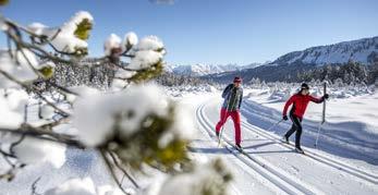
Get moving ON NARROW SKIS

Do your laps on one of the three cross-country trails with a total length of around 50 km, at an altitude of 1,050 m to 1,260 m.
Did you know that cross-country skis take you to places in Kleinwalsertal that are inaccessible on foot? Skating or classic cross-country skiing - both wishes will be fulfilled in the 50 km long trail network.
CROSS-COUNTRY SKIING
Cross-country skiing is in vogue. It is a boon for body and soul. It offers a combination of endurance and strength training and is one of the few sports that use almost all the muscles of the body. In addition, the metabolism is stimulated, the immune system is strengthened and fat
burning is activated. Not to mention that exercise in the fresh air is balm for the soul. Whether activating or regenerating, when cross-country skiing everyone can decide for themselves which impulse they want to listen to.
WHY CROSS-COUNTRY SKIING IS HEALTHY
• Uses about 95% of the muscles in the arms, legs, back and abdomen.
• Promotes circulation
• Revitalising
• Enjoyment of stillness and nature
KÜREN-WÄLDELE-EGG CLASSIC
TRAIL16.9 KM
STEINBOCK TRAIL CLASSIC 16.4 KM
SKATING 10 KM
SCHWENDE TRAIL
CLASSIC 12.1 KM
SKATING 2.5 KM
1. Observe skiing direction
2. If you stop, move out of the lane
3. Overtake on the right or left
4. Give way to the right to oncoming traffic
5. Groups ski behind one another in the right lane
6. Use the right-hand lane where there are double or multiple lanes
7. Dogs are not allowed on the trails
HAVE YOU NEVER STOOD ON THE NARROW SKIS BEFORE?
Don't worry, cross-country skiing is easier than it looks: After a cross-country skiing course, even beginners are guaranteed to quickly master skiing on the track! Individual and group courses are offered by all ski schools in the valley. Cross-country skiing equipment can be rented locally in the sports shops.
Snow sports report Kleinwalsertal/Avalanche Ordinance www.kleinwalsertal.com/schneesportbericht

DIFFICULT TRAIL
Medium-difficulty trail | Distance approx. 12.1 km | Ascent & descent 215 m Classic style one difficult downhill run (difference in altitude 150 m)
Skating trail (2.5 km), practice trails in the Bergblick area
ACCESS POINTS: Sonnenburg | Bergblick | Hörnlepass
Starting in the village of Ausserschwende, you cross a level section using double polling. Soon there is a first ascent, alternating with flatter passages up to the Hörnlepass inn. The effort to get to the Ausserwald is almost not noticed due to the beauty of the snow-covered nature. The descent is fun and makes you forget the effort. The trail winds very rhythmically towards Straussberg. At Bergblick there are spacious practice loops for classic and free running techniques.
STRAUSSBERG - EASY : from Bergblick over the Straussberg and back again, approx. 4.5 km
KEY:
= Bus stop
= Skating trail H P
= Parking space
= Cross-country trail easy
= Cross-country trail medium difficulty
= Difficult trail
HÖRNLEPASS - MEDIUM DIFFICULTY: from Straussberg to Unteres Hörnle and back, approx. 7.5 km
SCHWENDE SKATING TRAIL - EASY : around the Bergblick in the direction of Gatter and back, approx. 2.5 km
KÜREN-WÄLDELE-EGG TRAIL
Medium difficulty trail Distance approx. 16.9 km | Ascent & descent 357 m
Classic style two difficult ascents or descents.

ACCESS POINTS:
Hirschegg-Au | Wäldele & Oberwäldele | Riezlern-Egg
Among the cross-country trails in Kleinwalsertal, the most challenging and divided into three sections. Activate and relax, that's what characterises this trail and guarantees an entertaining, exciting cross-country skiing round. Via the starting point in Au, the trail climbs to Ladstatt and continues to Wäldele with a constant view of the Hohe Ifen. Here the trail makes its tracks past the idyllically situated Bruder Klaus Chapel and icy waterfalls before the descent towards the starting point can begin. Separate loops Küren (5.4 km) and Wäldele (5 km).
Shortly after the starting point in Hirschegg-Au, there is the possibility to extend the trail to a total of 17 km on the Eggloipe trail. Here you first head out of the valley to Riezlern-Egg, then slightly uphill in a south-westerly direction past a settlement and back to the starting point.
KÜREN-WÄLDELE MODERATELY DIFFICULT: from Au to Ladstatt, via Wäldele and Oberwäldele back to Au, approx. 10 km
EGG - MEDIUM DIFFICULTY: from the Sonnegg bus stop to the Eberlehof farm and back, approx. 7 km

KEY:
= Bus stop
KEY:
= Parking space
= Cross-country trail easy
= Bus stop
= Cross-country trail medium difficulty
= Parking space
= Difficult trail
= Classic preparation
= Skating trail
= Skating track
KEY:
H P
= Bus stop
= Parking space
= Cross-country trail easy
= Cross-country trail medium difficulty
= Difficult trail
= Skating trail

STEINBOCK CROSS-COUNTRY SKI TRAIL
Easy to medium difficulty cross-country ski trail | distance approx. 16.4 km | Ascent & descent 296 m Classic style approx. 16 km, two difficult ascents or descents (difference in altitude: 180m)
Skating course approx. 10 km and practice loops with a length of approx. 100 m in Bödmen

ACCESS POINTS:
Mittelberg-Tobel | Unterahorn | Hotel Alpenrose Mittelberg | Birkenwies Weiher car park | Baad
The trail runs below Mittelberg in several loops over the "Gruaba" and the Kirchwald to Bödmen. After crossing the Wildental road, the trail stretches across the Bödmer plain into the tranquil Gemsteltal valley and on to the mountain village of Baad. A small loop leads steadily uphill to the turning point in the Derra Valley. The Ahornschleife (maple loop) stretches approx. 5 km from Bödmen to Tobel (circular tour).
BÖDMEN-BAAD - EASY (CLASSIC AND SKATING): from Bödmer Ebene to Wiesele and Gemstelboden to Baad and back to Bödmen, approx. 8 km
DERRA - DIFFICULT (CLASSIC AND SKATING): from Baad into the Derra valley and back, approx. 1.8 km
AHORN - MEDIUM (CLASSIC):
Bödmen via Gruaba to Mittelberg-Tobel and back to Bödmen, approx. 5 km
BÖDMEN SKATING TRAIL - EASY (SKATING): from Bödmen to Wiesele and back again via Gemstelboden, approx. 5 km.
Tobogganing fun FOR ALL

Unforgettable winter experiences for the whole familyKleinwalsertal makes it possible. The four toboggan runs in Mittelberg and Hirschegg are a popular winter activity for young and old! Next to the piste, the magic carpet takes toboggan kings and their winter sports equipment to the top - and the next downhill run can begin...
Don't miss out on this winter fun!
BURMI TOBOGGAN SLOPE AHORN | Tobel There is a small toboggan run about 150 m long at the entrance to Mittelberg. The toboggan run can be viewed along the entire route.
SCHÜTZABÜAL IN MITTELBERG | Mittelberg Directly behind the church in Mittelberg, a magic carpet leads up to the Schützabüal, where you can ski as well as toboggan or sledge. At the magic carpet there is a toboggan run of approx. 110 m length. The toboggan run is accessible from the Walmendingerhorn cable car and the stairway to the church.
JÖRIHALDE BÖDMEN | Gemse In the hamlet of Bödmen in Mittelberg, shortly after the Edeka shop. This toboggan run of approx. 150 m length can be viewed over the entire route.
WÄLDELE | Sonnblick This toboggan run runs parallel to the Wäldelestrasse, from Haus Sonnblick down to Ferienhof Hammerer over a distance of approx. 1 km.
ALLGÄU COASTER | Söllereckbahn The Söllereck toboggan is also open in the winter season. The 850m-long rapid descent takes place safely on rails and strapped in, after which the toboggans are automatically braked and transported back to the starting point with the mountain lift.
TOBOGGAN RUNS TOBOGGAN HIRE
Sport & Mode Kessler, Riezlern | Sport Hilbrand, Mittelberg Sport Pauli, Hirschegg | Sport Edelweiss, Hirschegg
Love of snow OFF-PISTE

Guaranteed snow and plenty of variety: Kleinwalsertal is also popular with deep-snow fans, ski tourers and snowshoe walkers. Those who travel off marked trails and pistes need to have consideration and respect for nature.

Weather and avalanche situation reports, but also consideration of protected areas and game rest zones are part of tour planning.
Thank you for your consideration!
SKI TOURS, FREERIDING & SNOWSHOE HIKES
Fresh snow is always to be expected in Kleinwalsertal, because the north-south orientation means that there is often a Nordstau weather system. This is a meteorological phenomenon that makes the hearts of snow lovers and winter sports enthusiasts beat faster. All winter long, dreamlike descents through dusty deep snow await you, and in spring, enjoyable gliding in the firn. Despite all the anticipation of untracked slopes and glistening powder snow, knowledge of alpine dangers and consideration for the animal and plant world are required. Especially in winter, any disturbance unnecessarily costs the wild animals the energy they need to survive in the cold season. The best thing is to go on tour with one of the experienced professionals from the ski and mountain schools. They know exactly which runs offer a safe and impressive experience in which snow conditions.
A selection of guided snowshoe tours and beginner courses for ski tourers are also available in the Travelshop at www.kleinwalsertal.com/travelshop.
SAFE ON THE MOVEOUR RECOMMENDATIONS
Learn from the pros - The experienced guides from the valley's mountain and ski schools know the area and the conditions perfectly. www.kleinwalsertal.com/de/Region/Skischulen
Safety equipment - you not only need to have avalanche transceiver (LVS), backpack with shovel, probe and first aid, you also need to know how to use them. It is best to take an avalanche course in advance. www.kleinwalsertal.com/schneesportbericht
Experience nature consciously - show consideration for the natural environment, its flora and fauna and special features. www.kleinwalsertal.com/natur-bewusst-erleben

BURMI'S WINTER PUZZLE
Discover Burmi's adventure land and solve tricky questions along the way. From the Walserhaus in Hirschegg you travel via Dürenboden to Mittelberg. Pass the reservoir and return to the starting point. The Burmi Puzzle is about exploring the surroundings and solving exciting riddles - you can pick up the puzzle at the tourist office in the Walserhaus in Hirschegg. Those who solve all the tasks also get to pick up a little surprise afterwards.

ICE RINK IN THE MIDDLE OF RIEZLERN
Size approx. 10x18 m., skate rental on site.
Well, when was the last time you stood on skates? Why not try your hand at pirouettes or elegantly changing direction? The skates are available for hire.
HIKING PASS
Collect points and "earn" the Kleinwalsertal hiking pins - from the bronze pin for 50 points to the Alpenkaiser for 5,000 points. You can manually enter your points onto the card or you can use the mountain hut stamps. At the end of your holiday, you add up the points and receive the "hiked" pin as an award at the tourist office.
HIRE SERVICE
MOUNTAIN BUGGIES:
Sport & Mode Kessler Riezlern | Sport Pauli Hirschegg
Sport Rief Riezlern and Mittelberg
CHILD CARRIERS:
Sport & Mode Kessler Riezlern | Sport Edelweiss Hirschegg
Sport Pauli Hirschegg | Sport Hilbrand Mittelberg
Ski & Sport (Skistadl) Zunzer Mittelberg
CAREFUL SAFE GENTLE
Kleinwalsertal Safety Concept
Interactive
map
HIKES IN
THE PLAN KLEINWALSERTAL
Looking for fantastic cross-country ski trails or the most beautiful winter hiking trails in Kleinwalsertal? You can get an overview in the tour planner: Easy, medium and difficult cross-country trails, short or extended hikes - plan now and go on tour well prepared!

www.kleinwalsertal.com/tourensuche
www.kleinwalsertal.com/sorgsam-sicher-sanft
We take care of your safety. Measures for a safe holiday in Kleinwalsertal.
LEGAL NOTICE
Publisher:
KLEINWALSERTAL TOURISMUS eGen Walserstrasse 264 A-6992 Hirschegg/Kleinwalsertal
Editing:
KLEINWALSERTAL TOURISMUS eGen Version: October 2021
Design and printing:
WALSERDRUCK | MARKEN + ZEICHEN
Design: Martin Riezler 6991 Riezlern, Kleinwalsertal
Photography:
Marmot@ Anton Brey, Bastian Morell, Dominik Berchtold, Frank Drechsel, Martin Riezler, Oliver Farys
All information has been compiled to the best of our knowledge and is not binding. No claims can be made against any errors.
Kleinwalsertal Tourismus eGen Walserstrasse 264 | A 6992 Hirschegg | Tel. +43 5517 5114 0
info@kleinwalsertal.com | www.kleinwalsertal.com